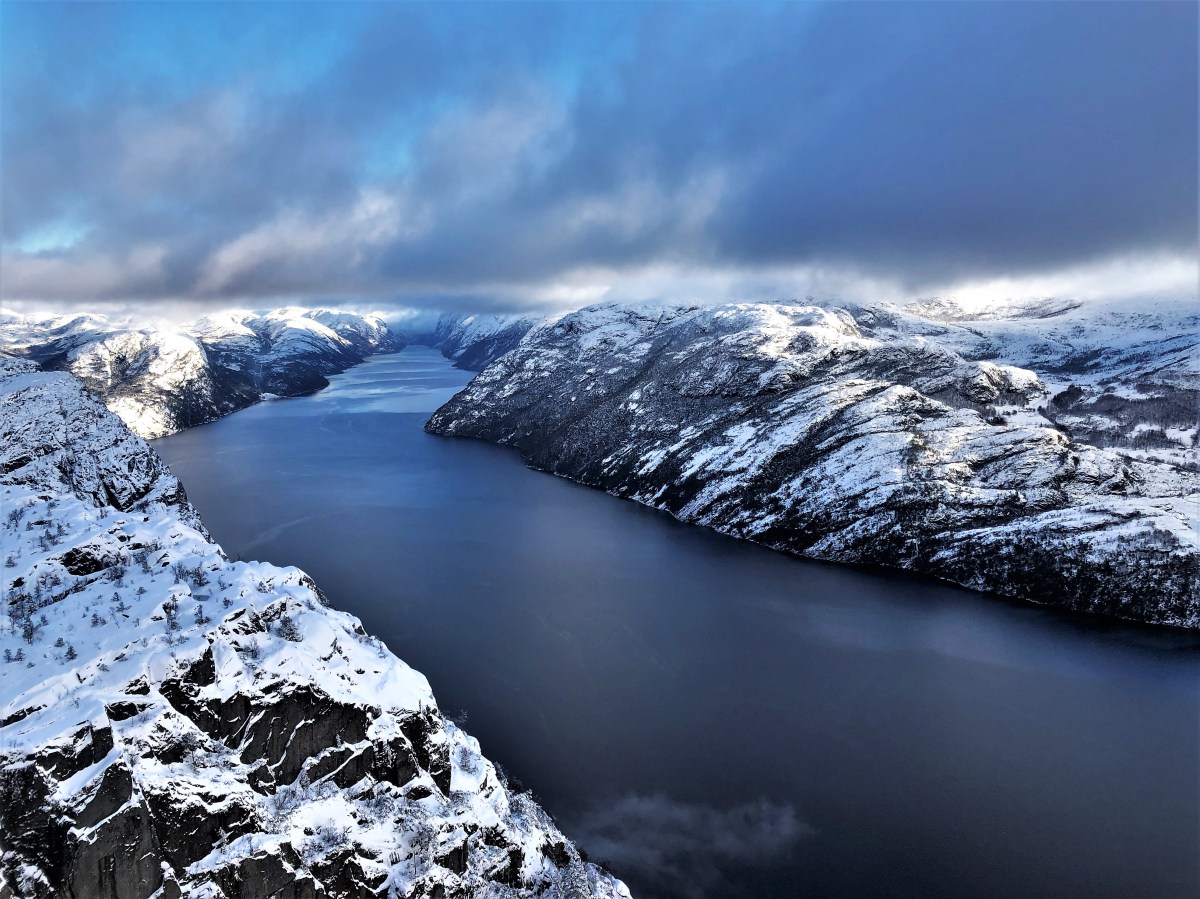
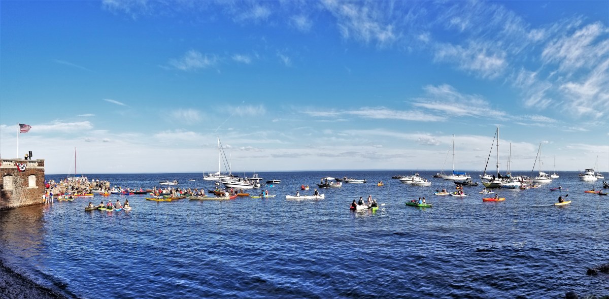
Having pre-booked Rødne’s 3-hour scenic cruise through Lysefjord–Western Norway’s most picturesque passage–
Leah and I were on an impossible mission to view Preikestolen (Pulpit Rock), considering the current gray skies and dismal forecast. Reknown for its views, and famous for its cliffhanger scene in Mission: Impossible–Fallout, we considered Preikestolen a must-see.
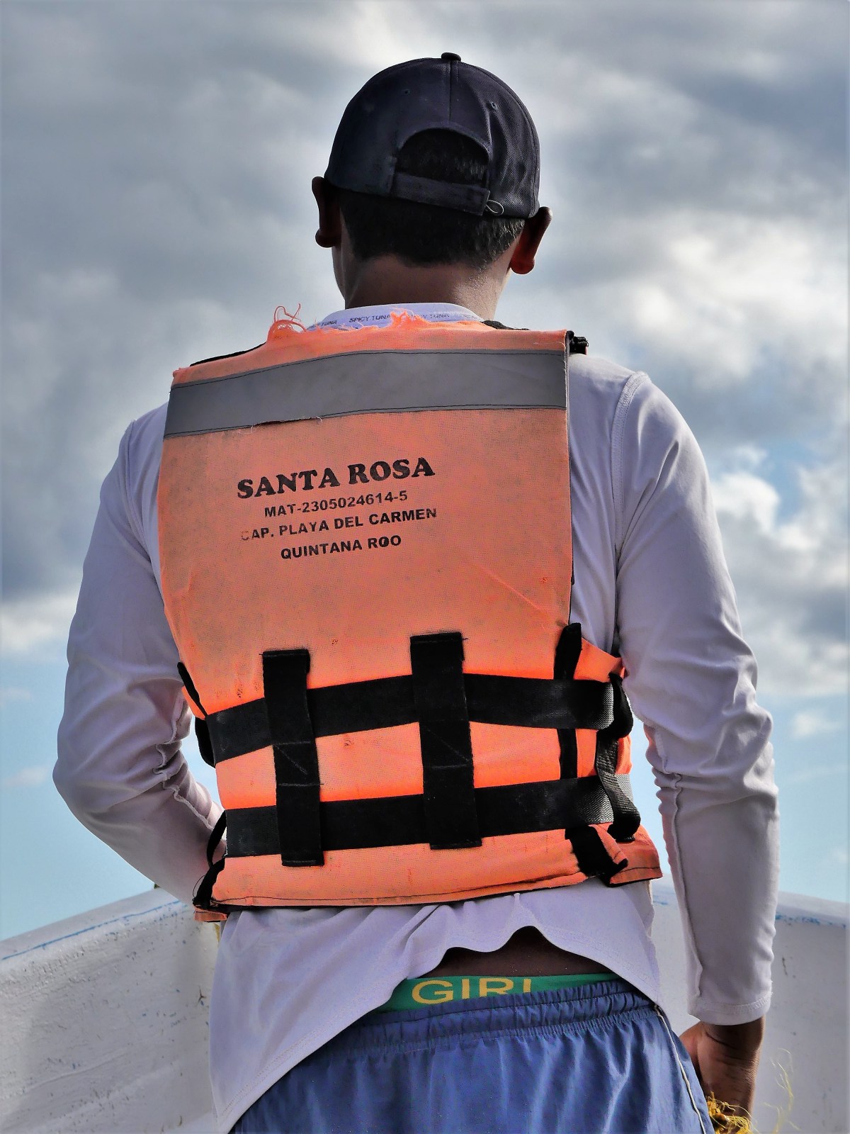
On the bright side, there was plenty of legroom aboard Rødne’sRygerdronningen, a 297-passenger, high-speed catamaran that carried only 24 guests this particular day, many with camera lenses as long as my arm.
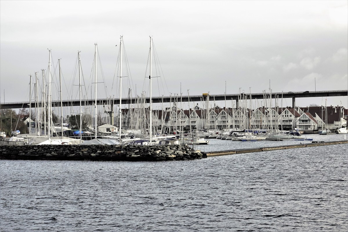
We pushed off at 11:00 am sharp,
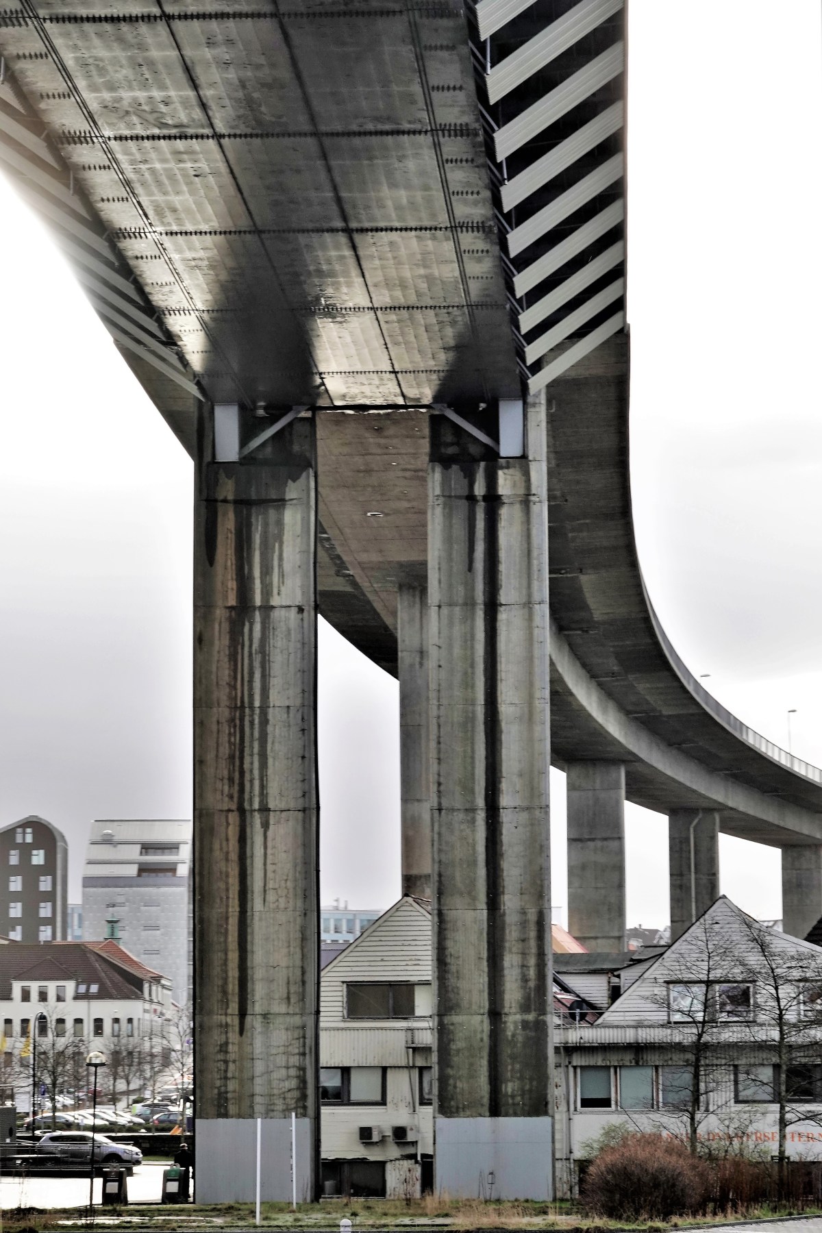
easing out of the harbor’s protected waters,
and beyond the bridge,
where it became perfectly clear to us that this was a perfect day for seabirds,
but less so for Leah–who required a double dose of dramimine to deal with the swells propagating across the horizon.
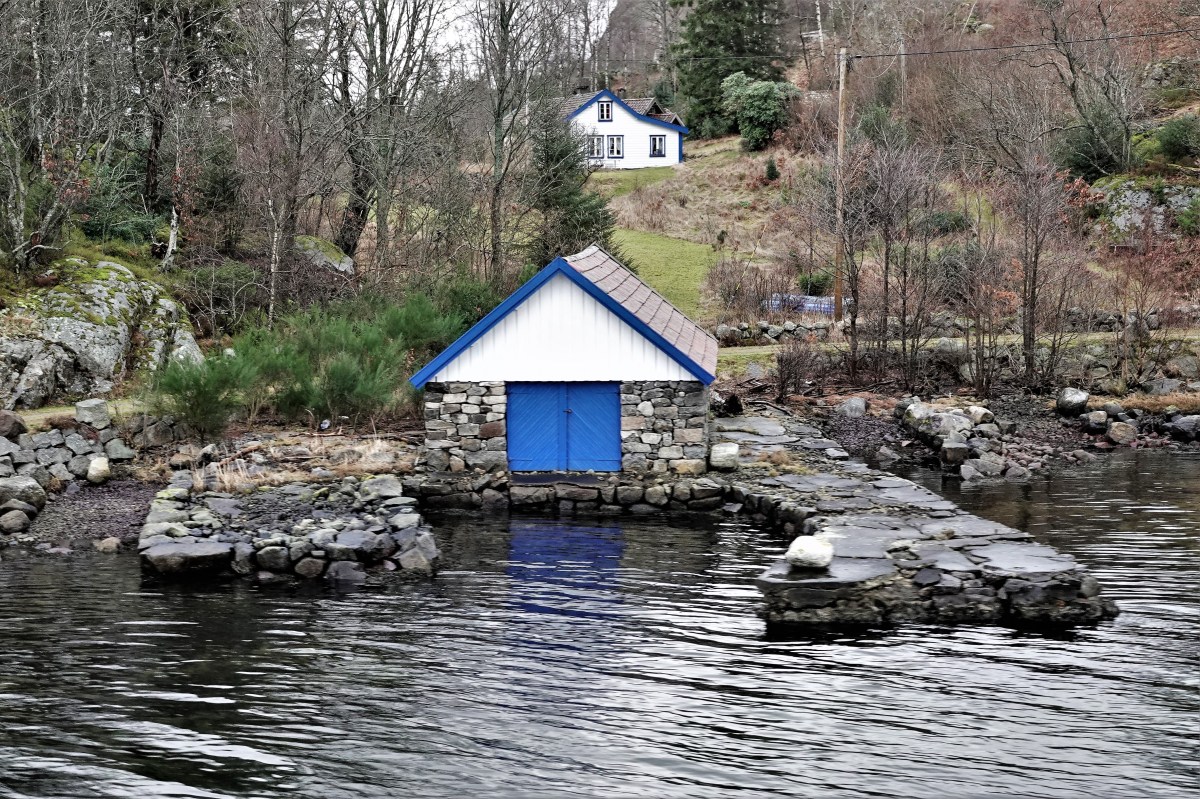
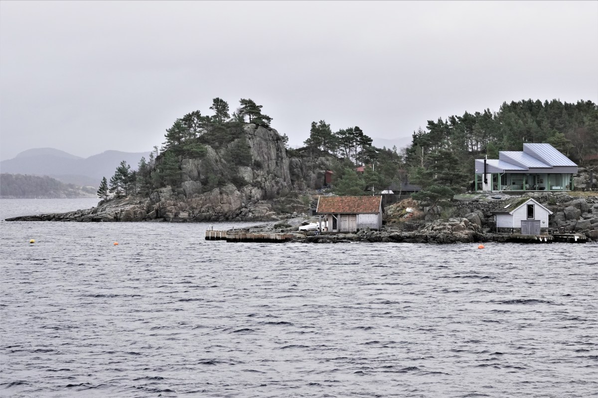
Along the journey, we passed scores of coastline cottages,
whose owners regulary commute to town by boat during the summer months…
unless they have the means to vacation in Rogaland all summer long.
Midway through our voyage we passed under the Lysefjord Bridge–gateway to Lysefjord–
connecting Forsand with Oanes, a small farming village on the coastline,
that’s dwarfed by an imposing edifice.
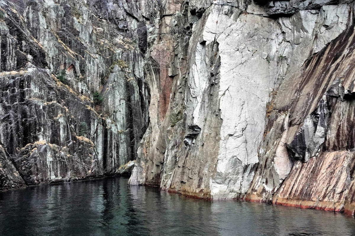
We eased into the fjord,
flanked by looming walls of granite…
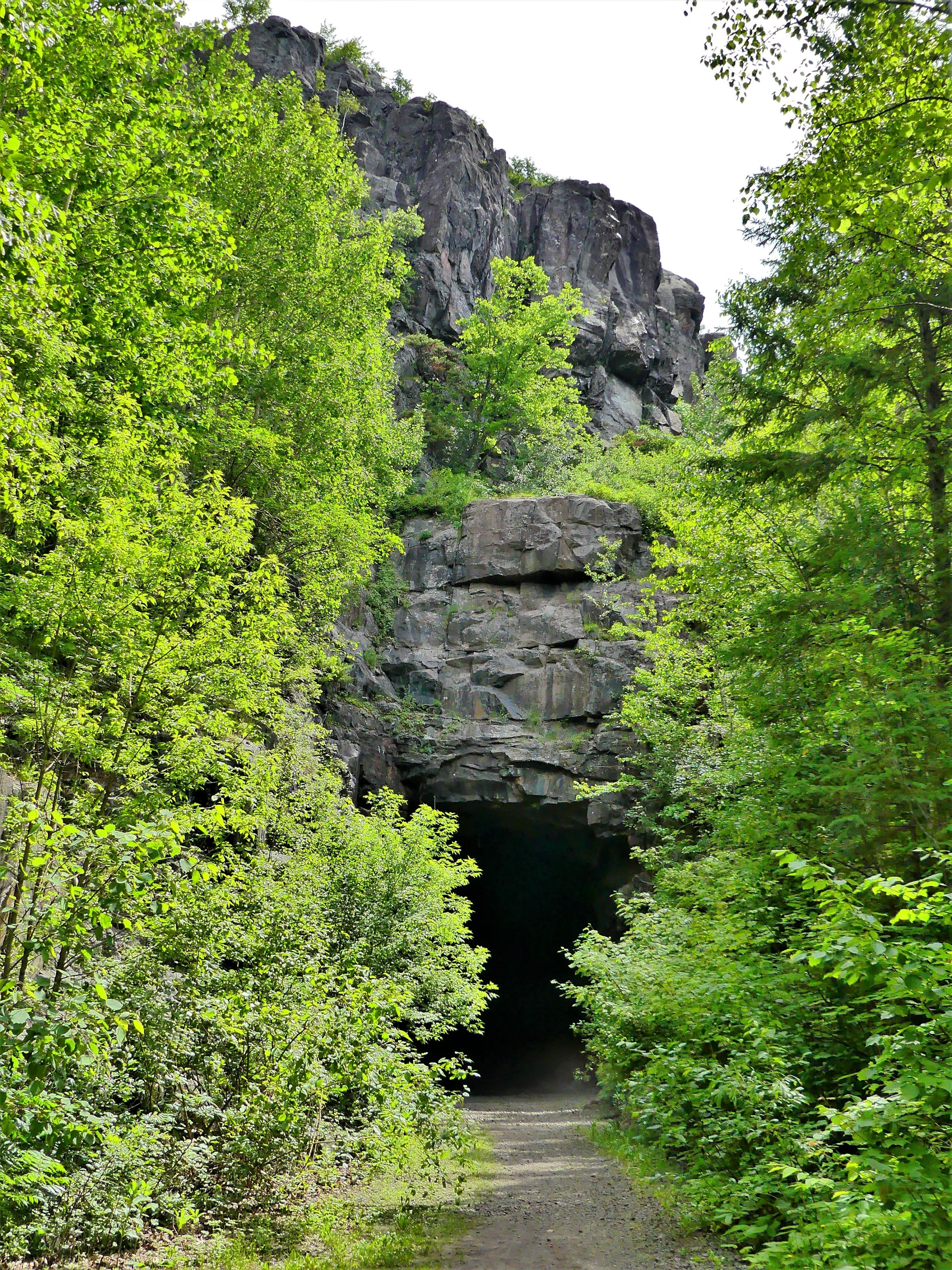
until the captain navigated the bow of the ship within a hair’s breath of the Vagabond’s Cave.
Legend has it that the cave was named after a group of vagabonds who used the shelter as a hideout for months, trying to escape the police.
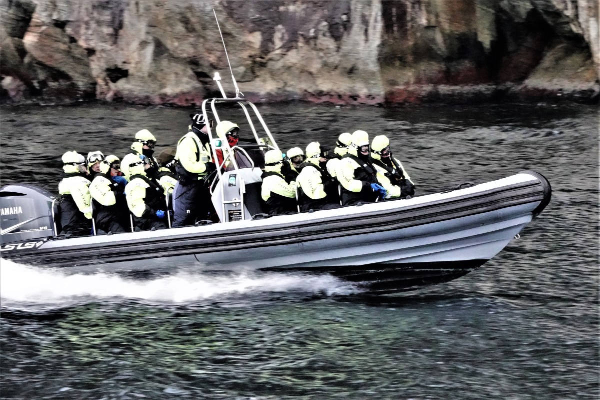
As we backed out of the grotto to pursue a course to Pulpit Rock, the weather turned to sleet and snow, shrouding the cliff’s signature square flat top, 604 meters above the fjord, and driving most of the passengers indoors.
But there were some intrepid sailors who were undeterred, because they had little choice in their RIB (rigid inflatable boat).
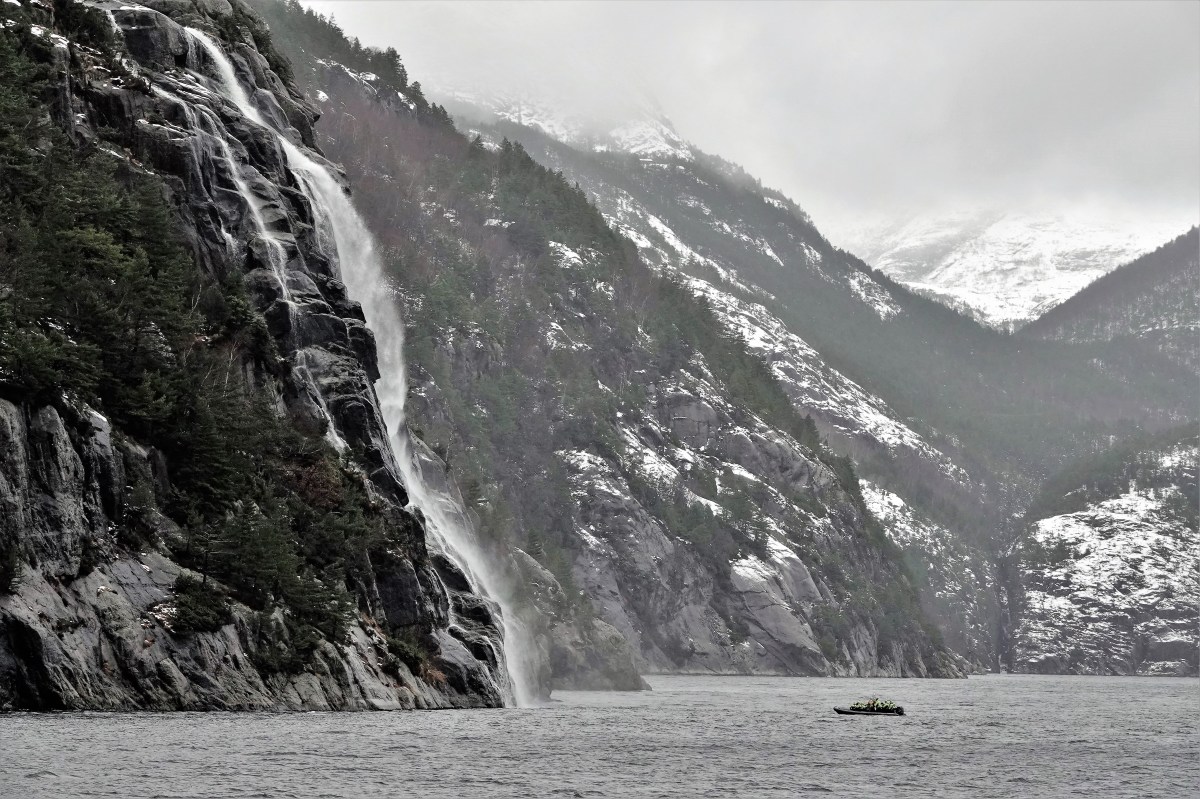
We followed at our own pace…
until we reached Hengjane Waterfall, cascading 400 meters (1312 ft) into the fjord.
Soon after, we U-turned to retrace our wake before returning to Skavanger.
Marie-Charlotte van Kerckhoven was among the few passengers on board. While nursing a hot coffee, Leah and I heard about her hiking expedition to the top of Pulpit Rock the day before. Braving freezing temperatures and two feet of snow, she and her hiking buddy made the ascent to the 25 by 25 meters flat top in 4 hours.
She was happy to share her view,
and even happier to report that here was no trace of Tom Cruise ever being there.
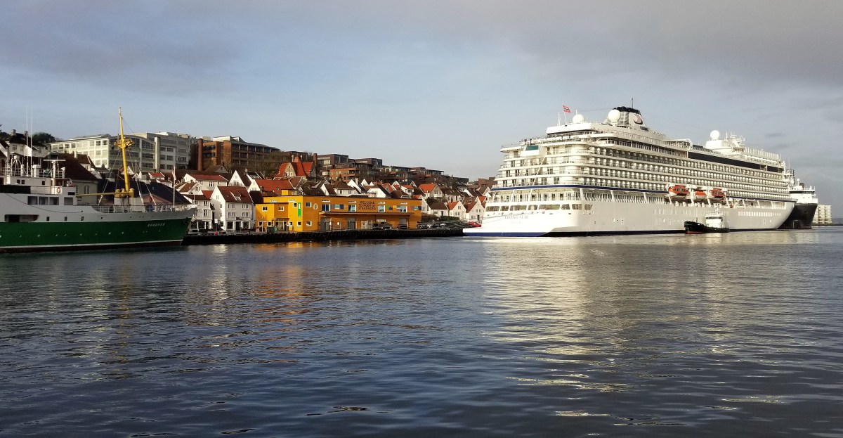
Leah and I crossed a rocky North Sea from Tilbury, England aboard Viking Star (more on this Viking ocean liner later),
and docked at Stavanger Port on an overcast morning.
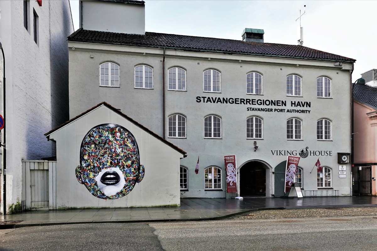
Stavanger is Norway’s third largest region, and best known as the European capital for the oil and gas industry–which explains the town’s Norwegian Petroleum Museum, and its unusual derrick-like design on the city’s waterfront.
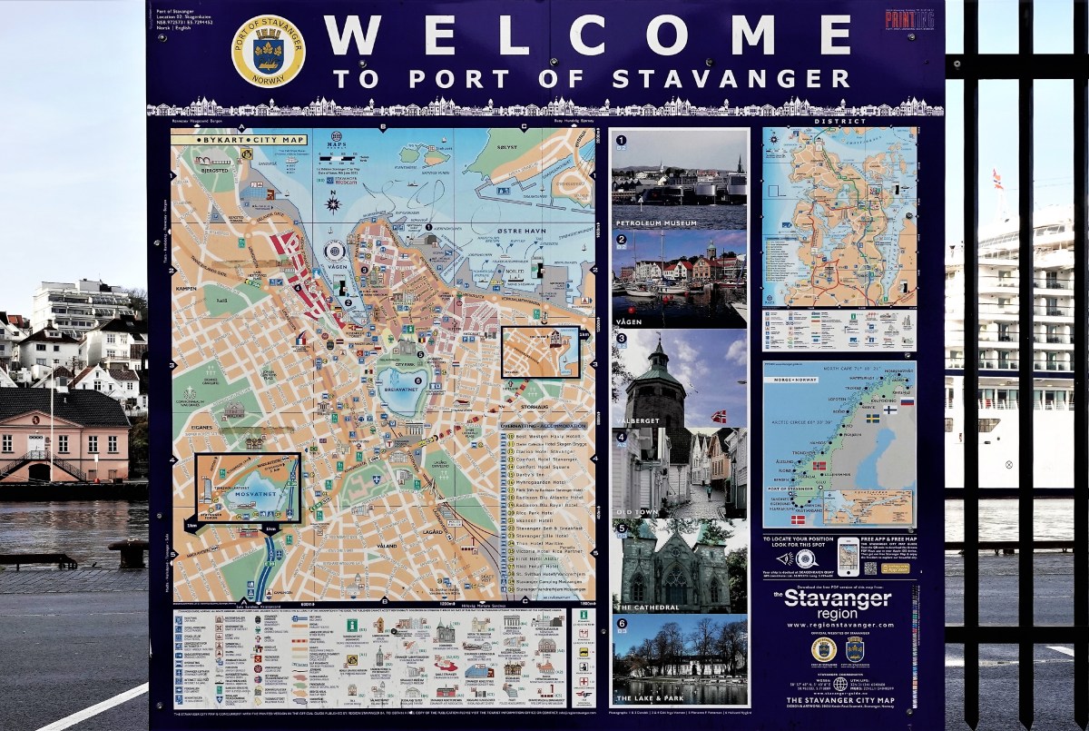
Stavanger is also a popular tourist hub, as it’s the gateway to the fjords. To that end, Leah and I had booked an off-ship excursion to Rogaland to cruise through Lysefjord in search of Preikestolen, better known as Pulpit Rock.
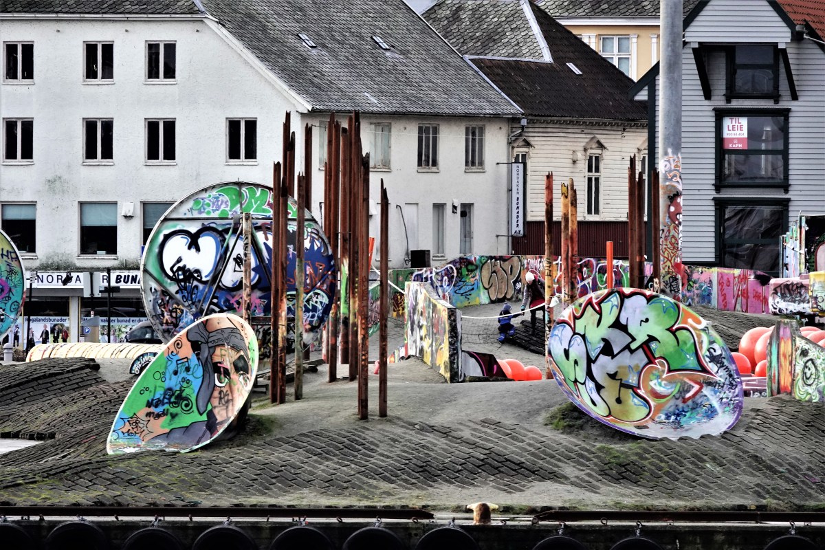
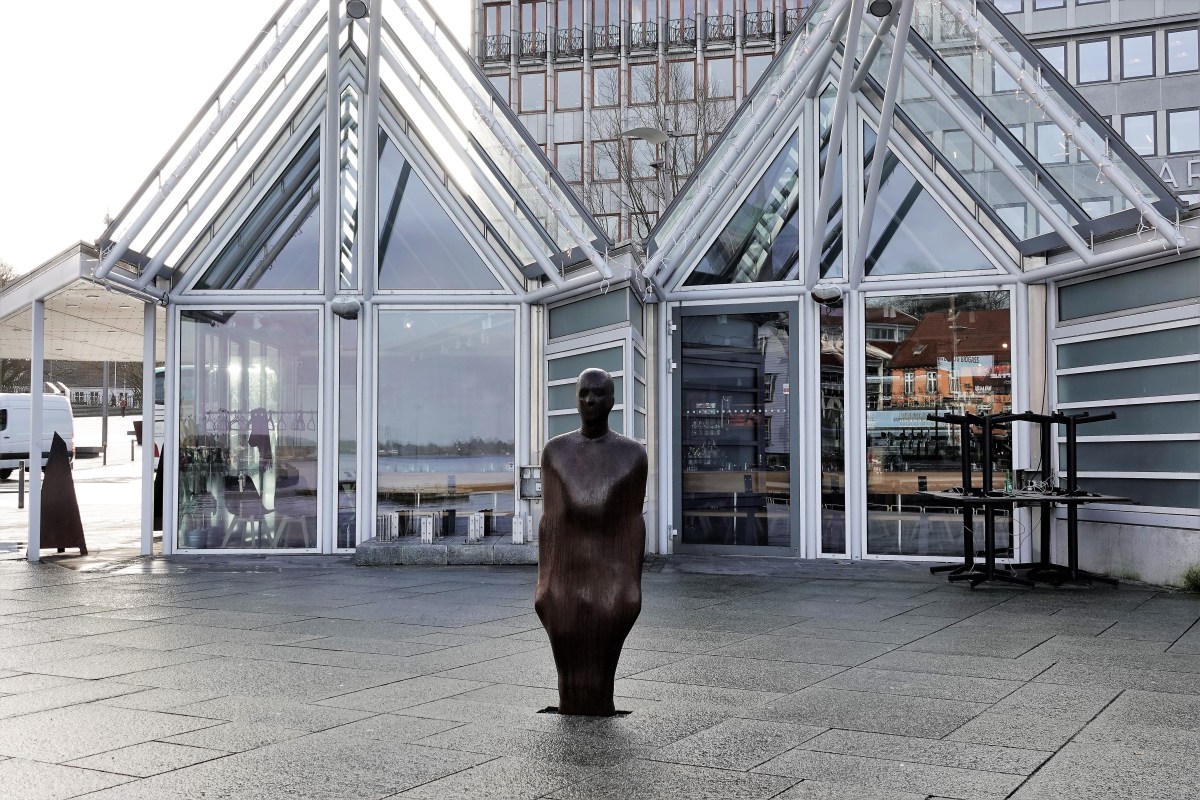
But with some time to kill before our departure, we disembarked early to stroll along the harbor plaza to find our bearings, and regain our sea legs after a day and a half of cruising.
The plaza was sleepy for an early Wednesday morning, but it was refreshing to have the place to ourselves.
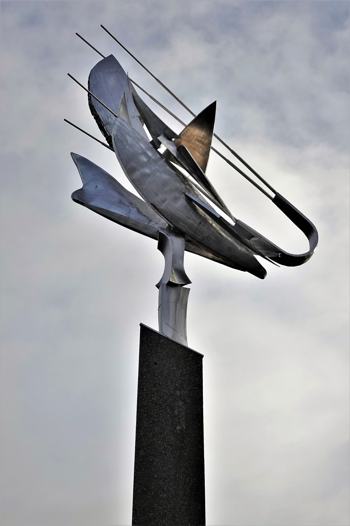
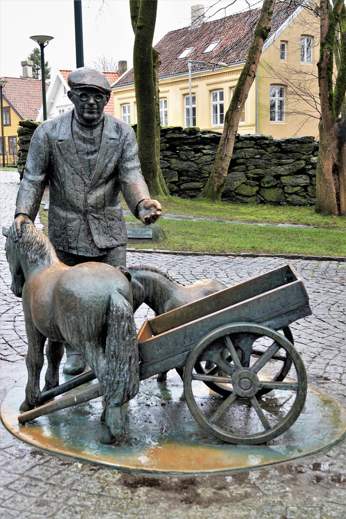
We could enjoy the local art (that celebrates the shrimping industry)…
without concern for another’s footsteps.
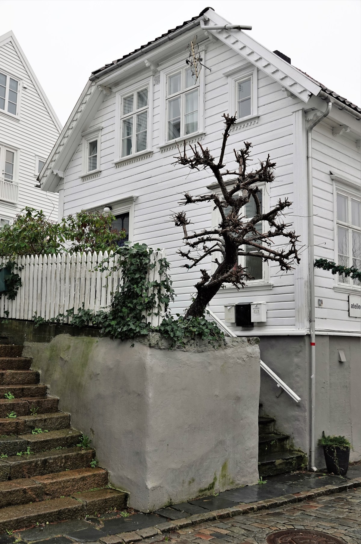
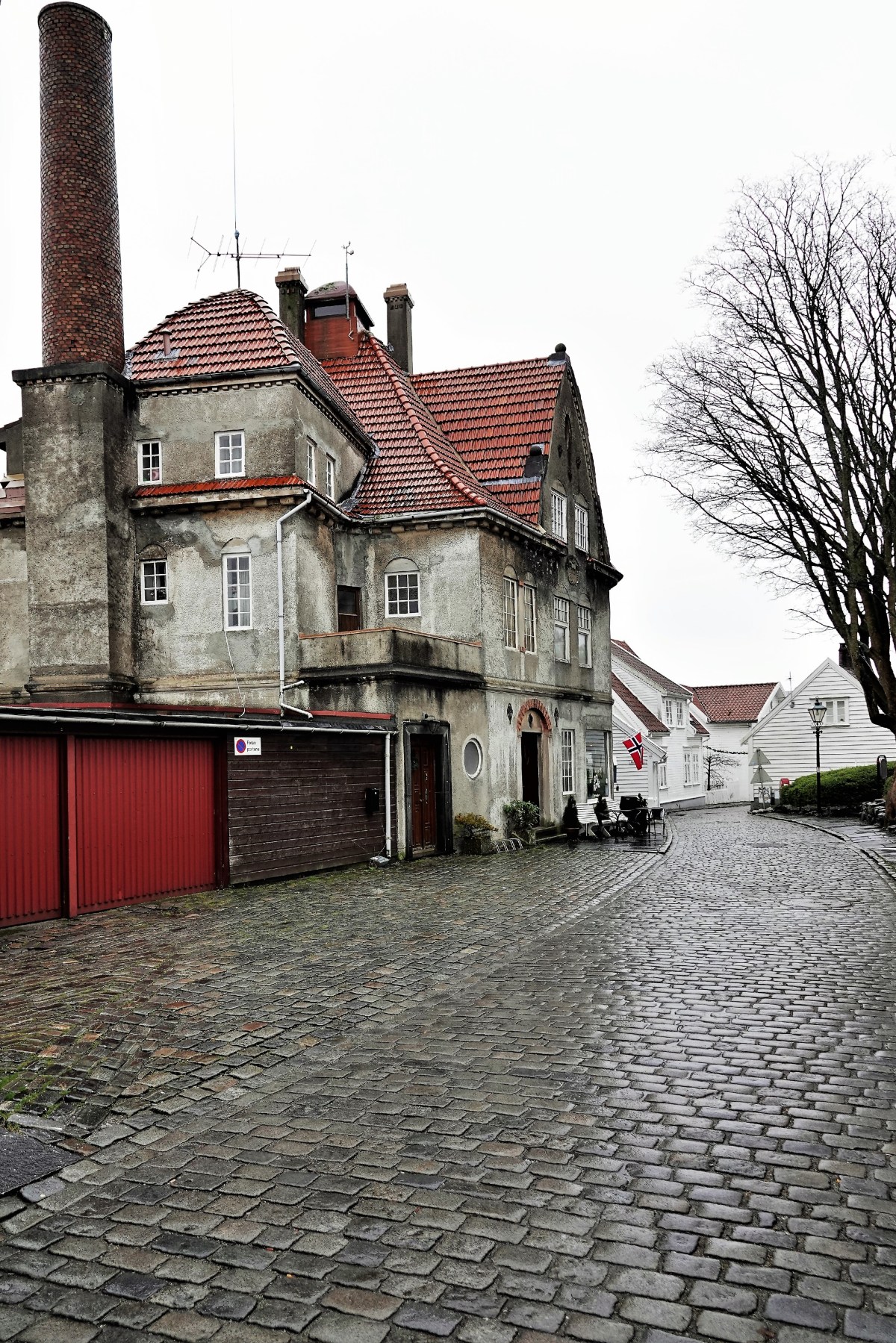
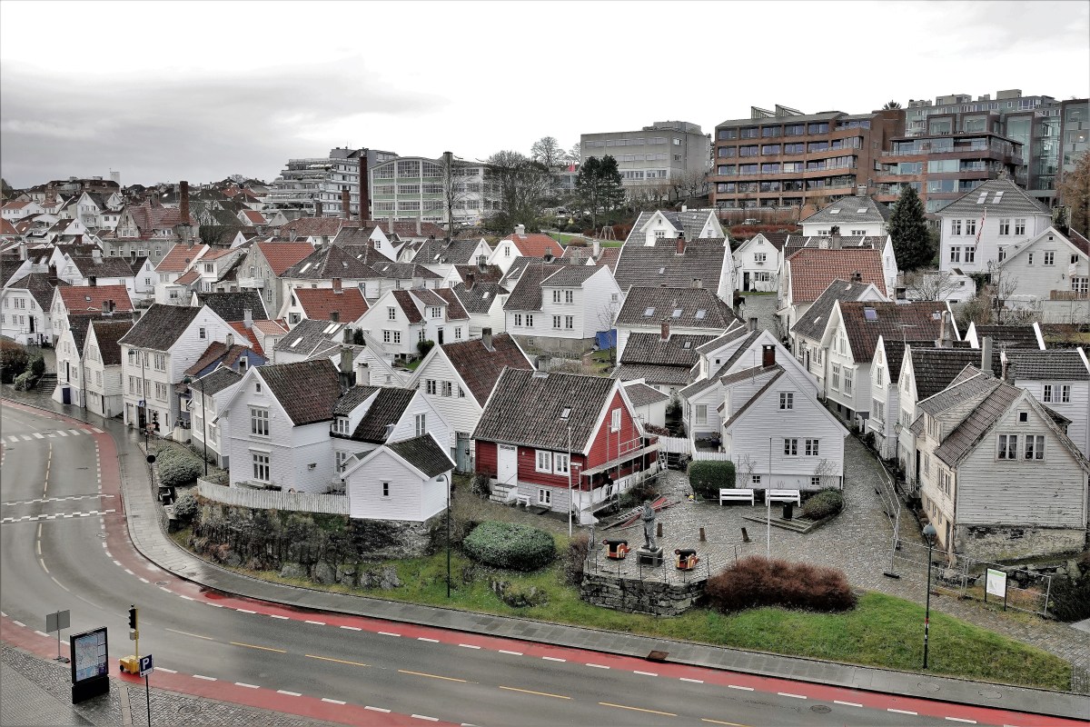
We opted to tour the Gamle Stravanger (Old Town), where 173 wooden buildings from the turn of the 18th century have been preserved…
down to the cast bronze utility plate covers.
A casual walk along Old Town’s winding roads of white cottages…
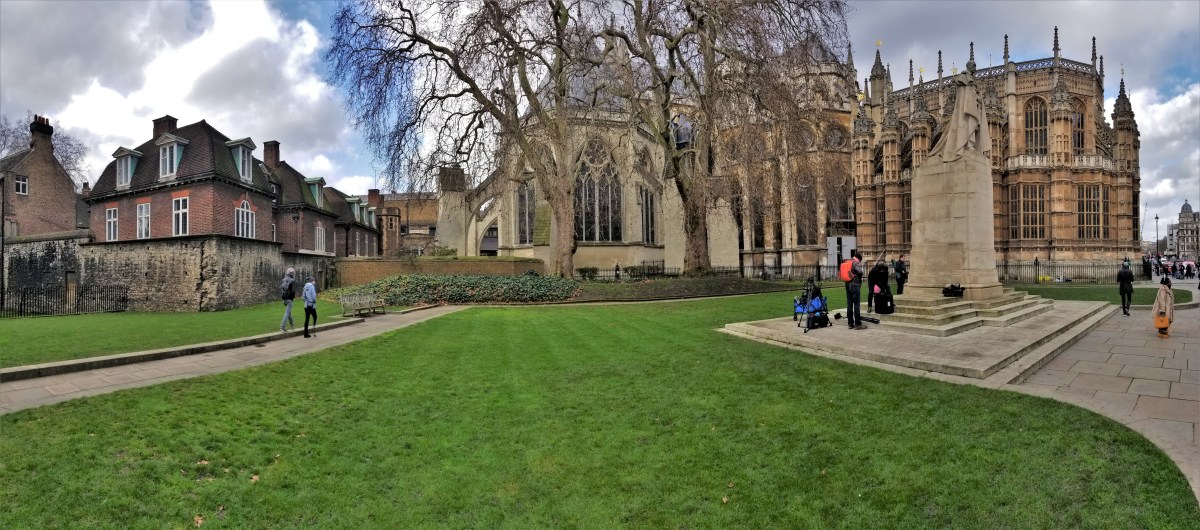
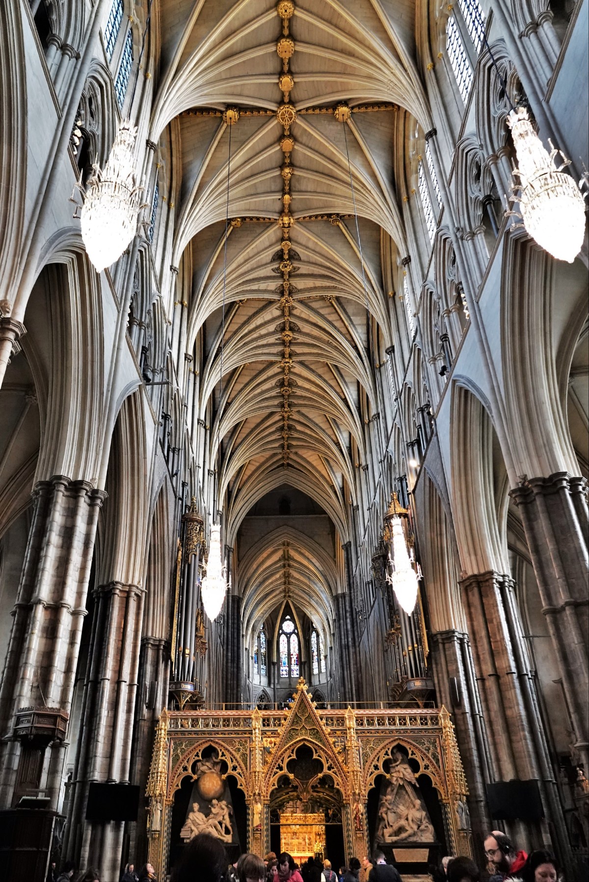
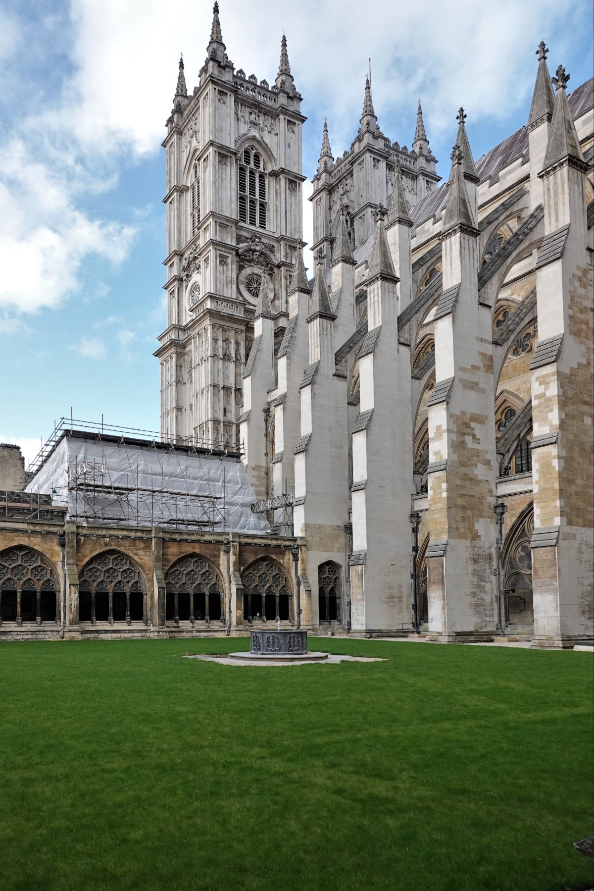
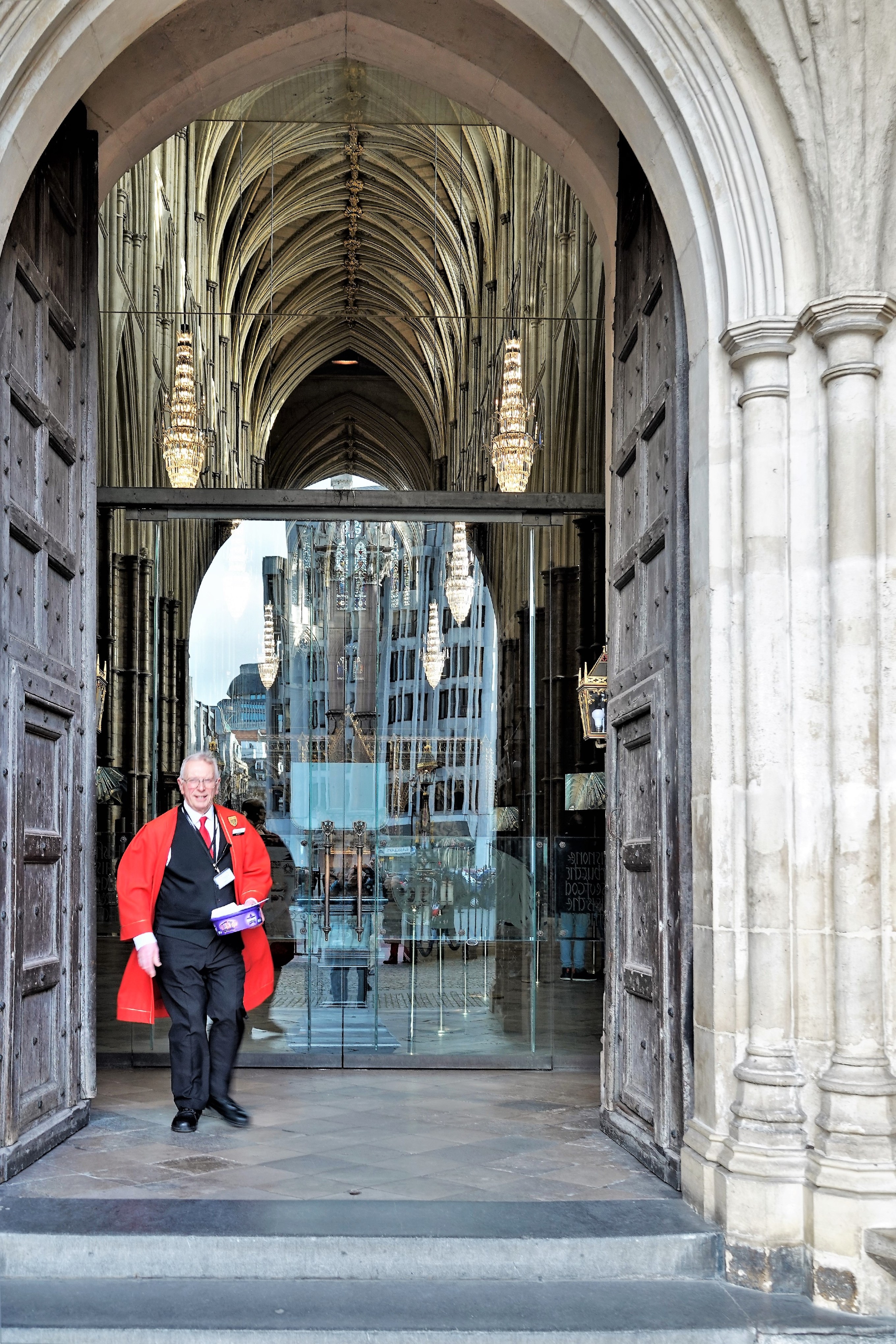
Our time in London was limited–only two days to explore the sights. With so much to see and so little time, Leah and I buckled down for a tour of London’s greatest hits, which easily includes a visit to Westminster Abbey, England’s Gothic royal church, and familiar site for British coronations and weddings, and national celebrations dating back to the 11th century.
We walked around the massive structure until we found the gate entry. Signage informed us that access to this London landmark would set us back 23£ ($30 with current exchange rates), but seniors were entitled to a 3£ discount.
The price seemed steep, but the opportunity to walk through history doesn’t come along every day.
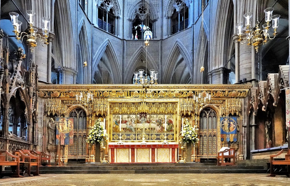
There is a strict NO PHOTOGRAPHY policy inside, which the church keepers will tell you is for the benefit of giving their guests an experience without distraction, and to perserve the solemnity of a working house of worship.
Nevertheless, we walked through the transepts and chapels listening to interactive video recordings while admiring the captivating architecture and memorials, and reflecting on the notion that Charles Darwin and Isaac Newton lie beneath our feet.
But with a newly purchased camera dangling around my neck (Sony RX10 IV), I couldn’t resist the urge.
I had to see what this camera could reproduce in low light…
using advanced stabilization software for hand-held shots…
until I was admonished by an Abbey marshal in Henry VII’s Lady Chapel while capturing an overhead view from a polished mirror.
My bad! He wouldn’t leave my side until I reversed the shade and capped my lens. Even then, I could feel his eyes trained on me as I walked around the royal tombs acting as contrite as I could possibly be.
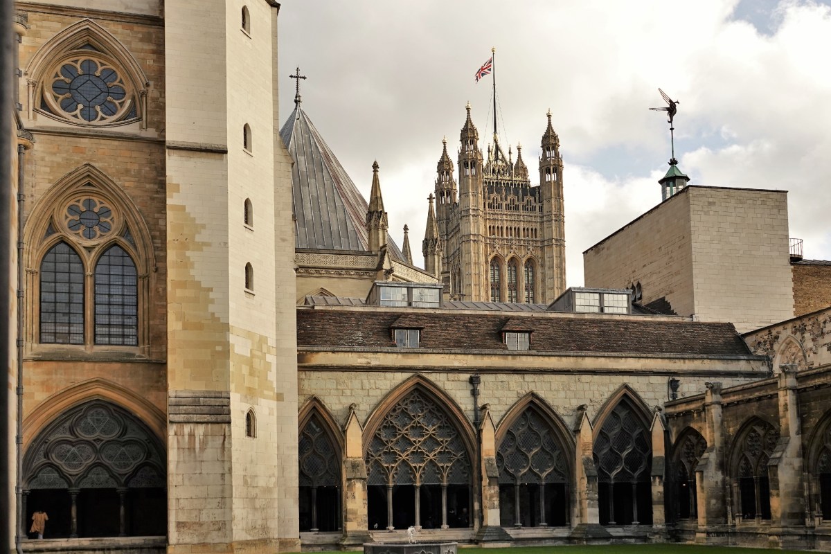
Fortunately, photography IS allowed in the College Garden,
the Cloisters,
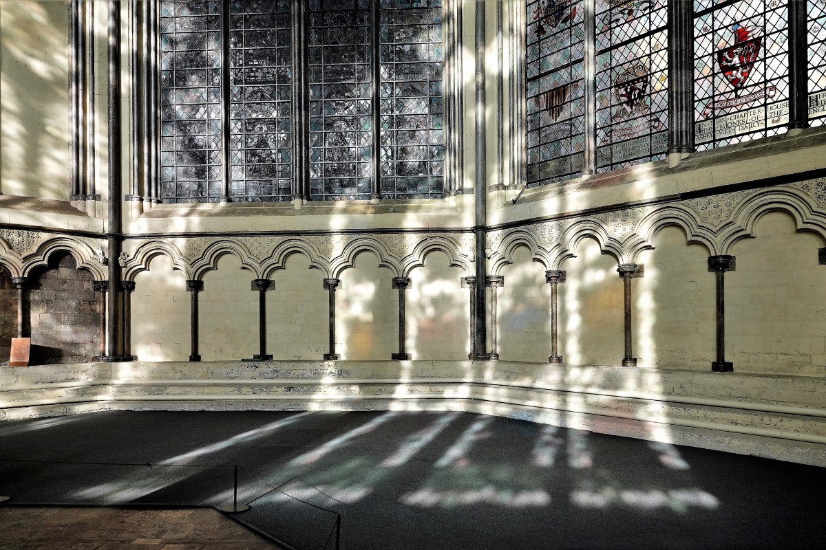
and the Chapter House.
As we prepared to leave through the Great West Door, Leah and I walked past the Grave of the Unknown Warrior toward the Coronation Chair behind glass, I was so tempted to surreptitiously point and shoot…but thought better of it. Lesson learned.
As serendipity would have it, the Marshal and I reunited outside, and all was forgiven.
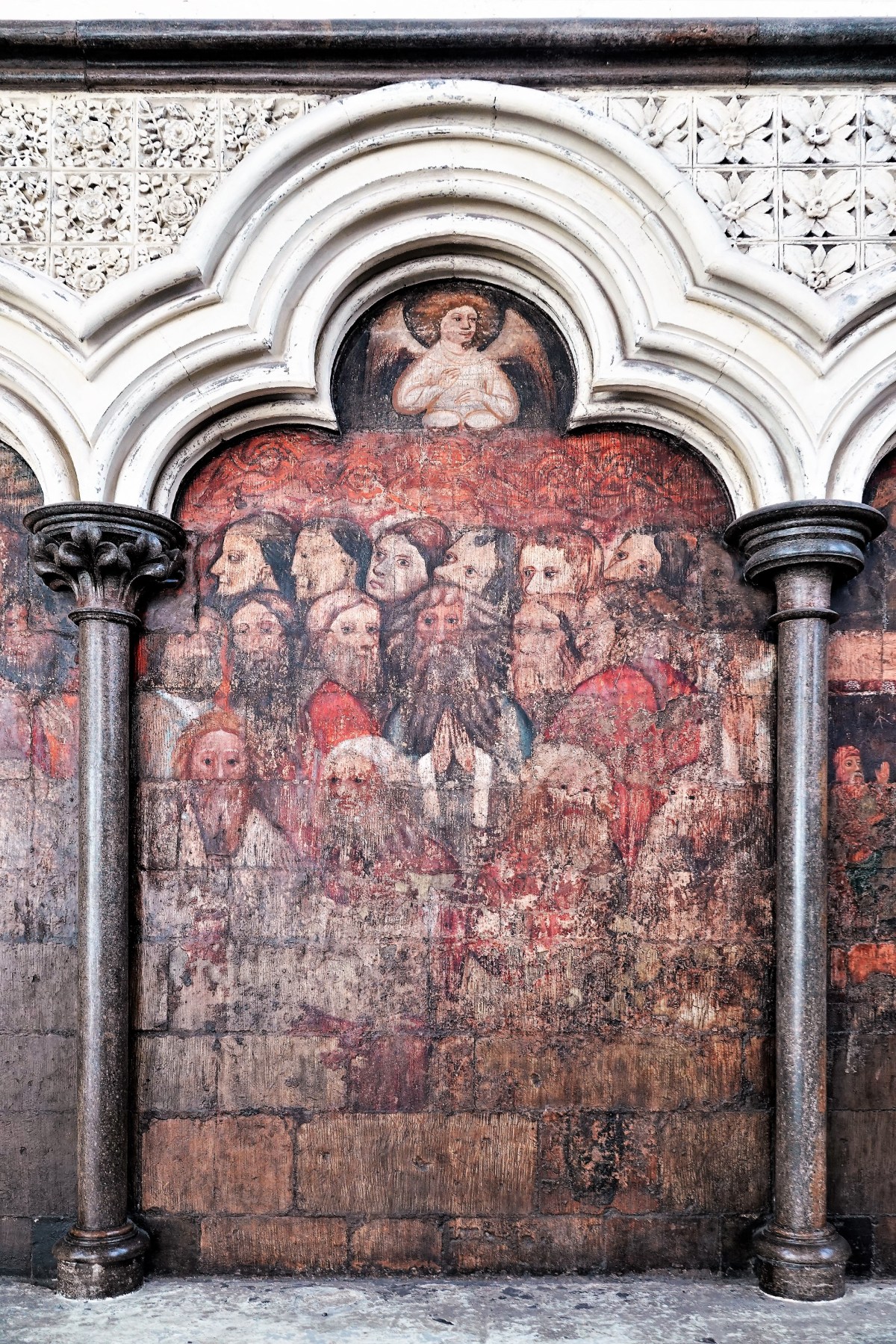
We parted as friends, and I believe I was absolved for my vainglory sin. He used our final moments together to tell us the tale of Grand Duchess Elizabeth Feodorovna, his favorite modern martyr, whose ediface adorns the Abbey’s Great West Door.
According to Marshal John…
Elizabeth of Hesse-Darmstadt was born on 1st November 1864. She was named after Elizabeth of Hungary (1207-1231), a Catholic saint of her own family. Her mother died when she was a child, and she came to England to live under the protection of her grandmother, Queen Victoria. If her childhood was Lutheran, the religious culture of her adolescence was distinctively Anglican. In 1884 Elizabeth married Grand Duke Sergei Alexandrovich, the fifth son of Tsar Alexander II of Russia. Elizabeth found Orthodoxy increasingly absorbing, and in 1891 she adopted the faith.
Although her life had assurance and all the comforts of eminence, it rested on fragile foundations. The Tsarist state maintained its grip over a changing society by repression. Talk of revolution persisted, and grew louder. Acts of terrorism mounted. On 18th February 1905, the Grand Duke Sergei was assassinated.
This marked a turning point in Elizabeth’s life. Now she gave away her jewellery and sold her most luxurious possessions, and with the proceeds she opened the Martha and Mary home in Moscow, to foster the prayer and charity of devout women. Here there arose a new vision of a diaconate for women, one that combined intercession and action in the heart of a disordered world. In April 1909 Elizabeth and seventeen women were dedicated as Sisters of Love and Mercy. Their work flourished: soon they opened a hospital and a variety of other philanthropic ventures arose.
In March 1917 the Tsarist state, fatally damaged by the war with Germany, collapsed. In October, a revolutionary party, the Bolsheviks, seized power. Civil war followed. The Bolshevik party was avowedly atheistic, and it saw in the Orthodox Church a pillar of the old regime. In power, it persecuted the Church with terrible force. In time, hundreds of priests and nuns were imprisoned, taken away to distant labour camps, and killed. Churches were closed or destroyed. On 7th May 1918 Elizabeth was arrested with two sisters from her convent, and transported across country to Perm, then to Ekatarinburg, and finally to Alapaevsk. On 17th July the Tsar and his family were shot dead. During the following night Elizabeth, a sister from SS Mary and Martha named Varvara, and members of the royal family were murdered in a mineshaft.
In the Soviet Union Christianity survived in the face of periodic persecution and sustained oppression. But Elizabeth was remembered. In 1984 she was recognized as a saint by the Russian Orthodox Church Abroad, and then by the Moscow Patriarchate in 1992.
I’m certain that Saint Elizabeth, in her charity, would have pardoned me too.
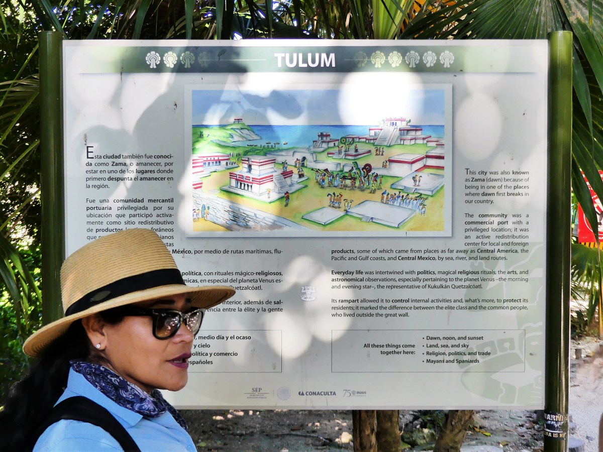
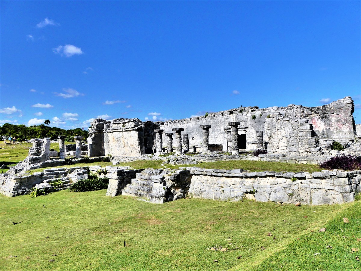
GPS was set to Zona Arqueológica de Tulum, but upon arrival, the crossover was still under construction. Following signs to the next Retorno, I backtracked to a bustling turnoff. This looked nothing like the Tulum I remembered from 5 years back. Heck, Tulum used to be all jungle 20 years ago!
But now, it resembled a spider web of agents in uniformed shirts carrying clipboards and shouting directions in Spanglish. Our rental car was stopped short of the road to the ruins, where we were met by Freddy, a representative for Santa Fe Beach Club, whose job it was to redirect us to his business.
According to Freddy, my choices were limited since cars could no longer advance. Either I could park nearby for $20 and walk 1 km to the ruins, or pay $40 a head, granting us: closer parking; National Park entrance passes; access to the Beach Club–including toilet and shower provisions, one drink (choice of water, soda, or cerveza), and a half-hour water tour, followed by reef snorkeling (all gear provided).
“No way!” everyone voiced emphatically.
All of us were content to walk to the ruins for a fraction of the cost. As I prepared to park in an already overcrowded lot, Freddy offered us a winning alternative: the same all-inclusive package reduced to $27 per person–a 33% discount–traditionally offered to Mexican residents. Score! and lesson learned. Always negogiate the price!
While the ruins piqued their interest, the prospect of snorkeling atop the Mesoamerican Barrier Reef (largest reef system in the Western Hemisphere) sounded especially promising to Noah and Nate. After I revised our initial itinerary–which would have included a stop at Yal-ku in Akumal, with snorkeling in a brackish lagoon surrounded by sculptures–I sensed their enthusiasm to swim in the Caribbean.
I followed Freddy’s directions to Tulum’s Hotel Zone, and turned into a narrow seaside road, offering access to scores of Tulum’s boutique hotels and yoga retreats. Unfortunately, Tulum’s current popularity may prove unsustainable, as it’s recent explosion of tourism and new resort construction have overtaken the town’s current infrastructure capacity, turning it into a eco-nightmare.
Nevertheless, developers continue to exploit the bohemian chic of Tulum. Despite government crackdowns (knowingly rife with corrupt officials), illegal projects continue, laying waste to precious jungle habitats that were once home to endangered jaguars and sea turtles.
We drove to the término, reaching our destination…
and luckily found a coveted parking spot along the mangroves by the beach entrance.
We walked the remaining half mile to the National Park on a rutted lane shared by cyclists, and local vendors selling water and trinkets.
Ordinarily, the surroundings are packed with tour groups and spectators, but we arrived on a calm day, without the usual hubbub.
In fact, the landscape was relatively quiet, and devoid of humanity…
except when I wanted an isolated picture of family.
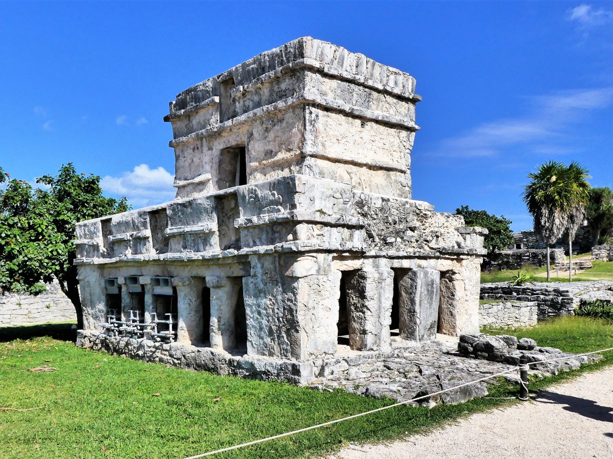
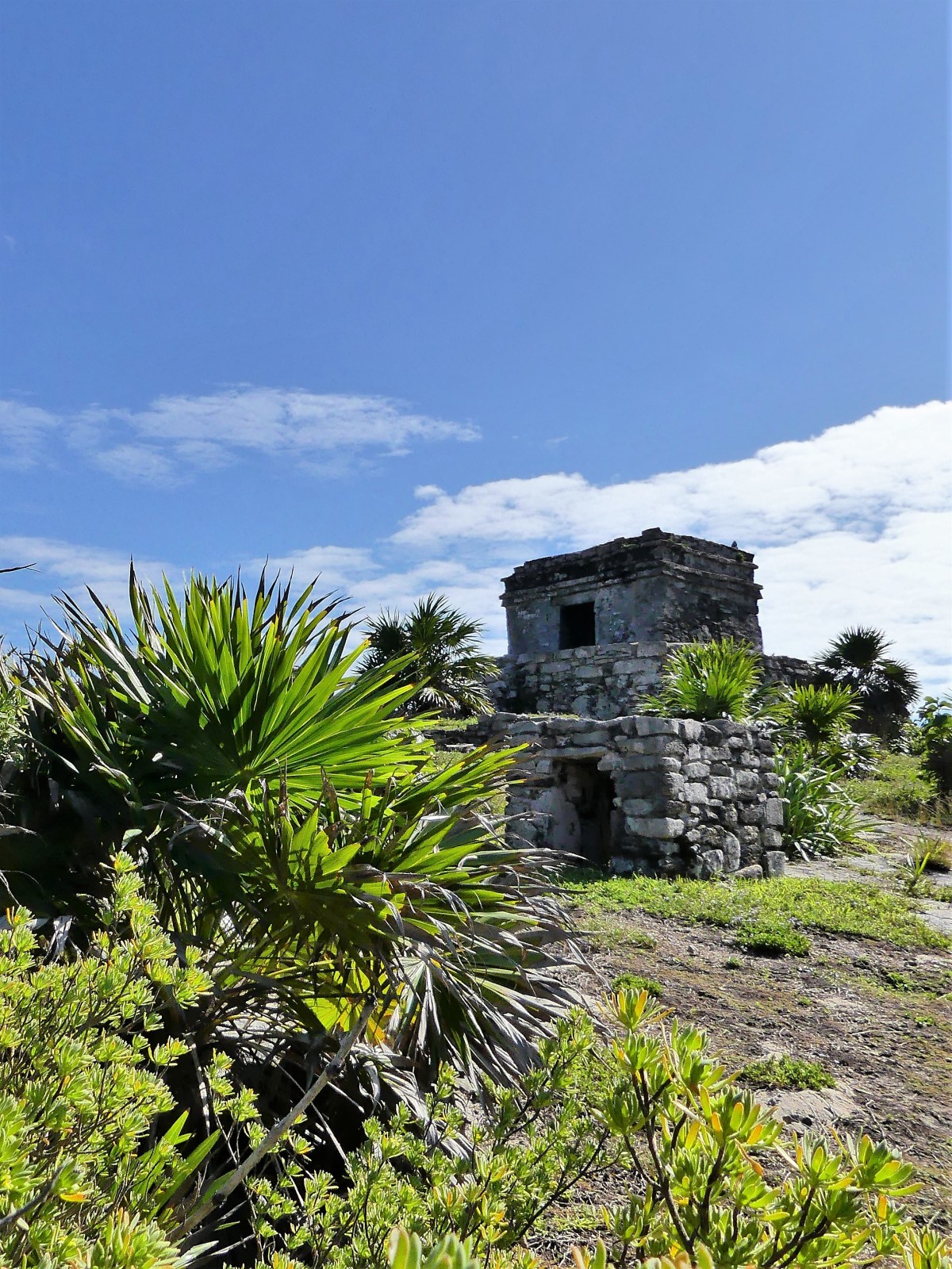
After meandering through 13th century wreckage for more than an hour, we turned our attention to the beach, where the turquoise water looked so inviting.
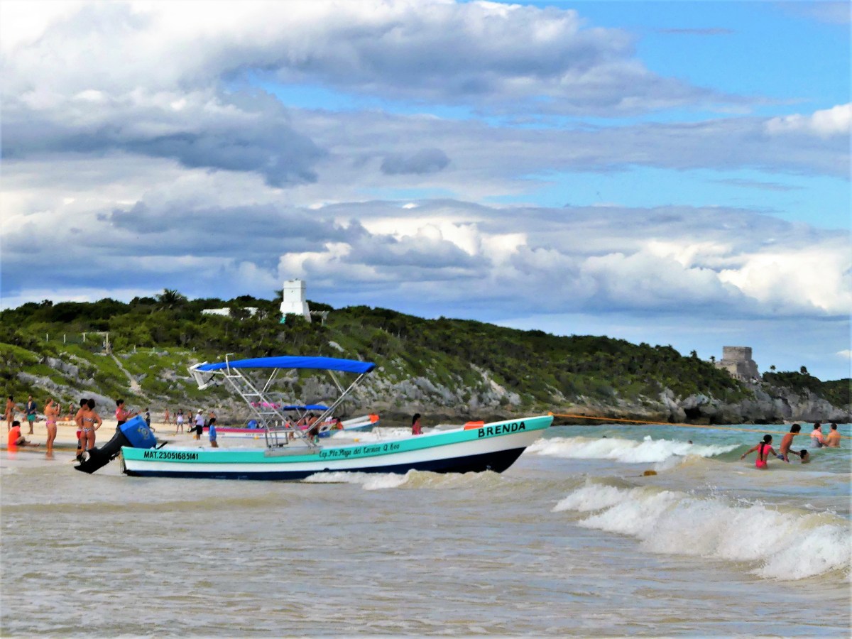
Ruins Beach is accessible from the cliffs above, but 500 meters south, lies Sante Fe Beach, one of Tulum’s original hangout spots before the tourism boom…
and that was our next destination.
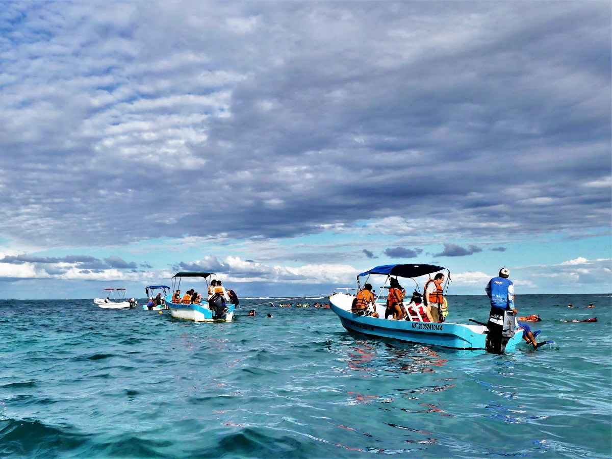
Per Freddy’s instructions, we sought out Captain Harrison, and lounged on PVC beach chairs under a delapidated canopy, waiting for our excursion on Brenda or half a dozen skiffs just like her.
Leah stayed on land after realizing her bonine fix had worn off, but Noah, Nate and I eagerly climbed aboard.
Our captain motored out to open water,
and offered a summarized history of the Mayans, and importance of Tulum…in Spanish.
Soon, we headed for the reef, where others had formed a floatilla of snorkelers.
Noah and Nathan eagerly jumped overboard for an under-the-sea swim…
while I remained on the surface, shooting pelicans…
and keeping track of my sons.
Once ashore, it was time for a beer and a shower. Despite the primitive outdoor plumbing on the beach, we concluded that $27 a head was a better bargain than any of us could have ever imagined for a family vacation adventure.
For some reason, thousands of lights wrapped around sultry-weather palm trees…
don’t suggest Christmas or winter wonderland to me in quite the same way as a traditionally decorated evergreen.
A live oak decorated with oversized ornaments comes close,
but it’s still no match for the festive vibe that envelopes New York City during the holidays,
where everything is bigger…
and brighter.
Not that there’s anything wrong with lit palm trees.
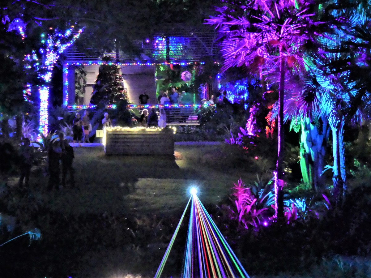
Nevertheless, there is a tradition in Naples, Florida that dates back to 2009, when tiki torches first illuminated the town’s 170-acre botanical gardens.
Since then, the holiday light show has evolved to “to accentuate the plants themselves and their textures, silhouettes and natural beauty,” according to Ralph Klebosis, event productions manager.
While some of the displays were fascinating unto themselves…
photographing the event pulled me in a completely different direction after I noticed a pulsing plant projector.
If this event is about night lights, then why not capture the light source and paint with it, I mused? And so I did. The images are a product of serendipity, and represent a different take on Nights of Light.
All the same, artificial light could never improve on Mother Nature!
Finally, the nasty weather had given way to a brisk and sunny Black Friday, and Bonnie was eager to shed her restlessness. Three weeks had passed since our last outing, and I could tell she needed a proper walk. Her telltale kitchen dance with paws clattering across the hardwood floor made it obvious to Leah and me.
Merely grabbing her leash had Bonnie running in tight circles after her stubby tail, making her difficult to collar. She strained against her leash, pulling me past the front door. She leapt into the cargo space of my SUV, and curled into a ball, completely satisfied with her preparation.
One of Bonnie’s favorite walks takes us through the fancy neighborhood of Mountain Lakes, NJ for a closer look at how all the Blue Buffalo stew-eaters live, so off we went to walk among the Mountain Lake estates.
Fortunately, the local shopping malls had swallowed most of the area’s cars, so the four- mile drive to Boulevard took little time, and parking was a breeze.
The moment Bonnie’s legs hit the pavement, she eagerly sniffed for a place to do her business. Naturally, Leah and I were prepared for this moment, so out came a baggie that’s perfect for scooping.
But carrying a used baggie so early in the walk can be a bit annoying; it spoils my walking rhythm, and besides, it smells!
I believed the durable construction of the Rubbermaid barrel by the side door of the yellow house on our right would provide an ideal resting place for Bonnie’s poop, so off I went to make a deposit. I crossed through a hole between two hedges, and dropped Bonnie’s dirty deed atop a pizza delivery box with a cartoon chef declaring, “We Are Pleased to Serve You.” It seemed so apropos.
I secured the lid and rejoined my girls just as the homeowner cracked the side door, craned his neck and asked, “Can I help you?”
“No thanks,” I answered, “I’m just doing an inspection of garbage cans in the neighborhood, and I’m happy to say that you’ve passed!” I waved good-bye as Leah shot me a look, and we continued our walk.
We turned onto a new block and climbed a steep hill. Just as we were enjoying the fresh air and the scenery, a cream-colored Lexus sedan sped by, and cut us off. The driver’s side door opened, and the burly-looking homeowner emerged holding Bonnie’s holdings, but now sealed within a heavy-duty double-lined zip-locked baggie.
“I think this belongs to you,” he said, extending his arm with a dour look on his face.
And then came his rant. “My wife is seriously allergic to this! Do you realize you could have killed my wife and the baby she’s carrying if she was exposed to this? After eight goddamn years of trying, and spending tens of thousands of dollars on IVF drugs and testing, she finally gets pregnant. So now she’s on bed rest with two months to go, and here you come with your dog shit, and you’re gonna fuck it up for all of us.”
The veins of his forehead were bulging under his DeMarco Sanitation cap. I wondered if he would hit me, so I instinctively felt for the keys in my pocket and gripped them between my fingers as a defensive measure.
“I’m sorry,” I stated in my most solemn voice. “I had no idea that Bonnie’s poop was so treacherous. She’s only a cockapoo, and she really doesn’t mean any harm. I hope you can find it in your heart to forgive us.” I graciously took the bag of shit with my left hand, withdrew my right hand from my pocket and reached to shake his hand. “No harm, no foul,” I offered.
What else could I do?
As if by magic, he immediately relaxed and we chatted for a few minutes, trading personal histories. He introduced himself as Jason, and pointing to his cap, informed me that he owned a local waste management and carting company. I took a half-step back from him, my mind brimming with comparisons of Tony Soprano.
Jason revealed that he recently moved to Mountain Lakes, and hoped to raise a family in a clean and peaceful neighborhood. I wished his family peace and cleanliness, and I reiterated my apology for my fauxpaws.
With Jason assuaged and his forgiveness assured, Leah, Bonnie and I continued our walk, but now with a bigger baggie and a familiar problem.
After reaching the top of the hill, we discovered a new mansion under construction. A large dumpster stood guard in the front yard. I checked around in all directions to make sure we were hidden from view.
“Don’t you dare!” Leah threatened.
But I was already committed. I tossed the baggie into the heart of the steel container, and quick-stepped away from the property. Glancing back, I casually surveyed the new architecture with the over-sized receptacle in the foreground–emblazoned with D-E-M-A-R-C-O in large, white, stenciled letters–and reflected on my full-circle achievement.
The four of us (Doug, Arlene, Leah and I) have been hiking together for nearly 15 years.
We bonded as regulars of Harriman Hikers–a 45 year-old organization of singles from New York and New Jersey who continue to gather every Sunday, year-round, rain or shine at Ramapo College to hike Harriman State Park, along with other trails in Wawayanda State Park, Norvin Green State Forest, Ramapo Reservation and the southern Hudson Valley.
I met the Harriman Hikers through Leah just a few months into our courtship, and accepted an invitation to hike with her group. I felt confident that sufficient time had passed after rehabilitating a broken leg and torn knee caused by a Kamakazi snowboader 6 months earlier.
Big mistake! These were dedicated hikers who had mapped out a grueling 12-mile hike of steep ascents and descents, leaving me noticeably lame at the end of 6 hours in the woods. I thought that Leah might have to carry me out.
As time passed, my stamina improved, as did my personal relationships within the group. Over time, Leah and I strayed from the pack and blazed our own trail, hiking different destinations at our own convenience with Doug and Arlene, who initially met through Harriman Hikers and eventually married.
Since moving from New Jersey to St. Augustine, Leah and I have maintained a long distance relationship with Doug and Arlene, and we were eager to reprise our traditional Thanksgiving hike together…especially after over-eating with family the night before!
It was time to return to Harriman. We arranged to meet at the Lake Skannatati parking lot located off Seven Lakes Drive. Fortunately, the temperature was more conducive to hiking than the prior year (see Becoming My Parents).
As always, it was great catching up with familiar faces in familiar places. We leisurely looped around the mounds of granite…
…traveling 5.66 miles over 3:42:26,
and reached the ridgeline approximately one hour into the hike. The wind was brisk at the clearing, but the view from the top of the hill was worthy of the chill.
And the warmth of our friendship carried us the rest of the way.
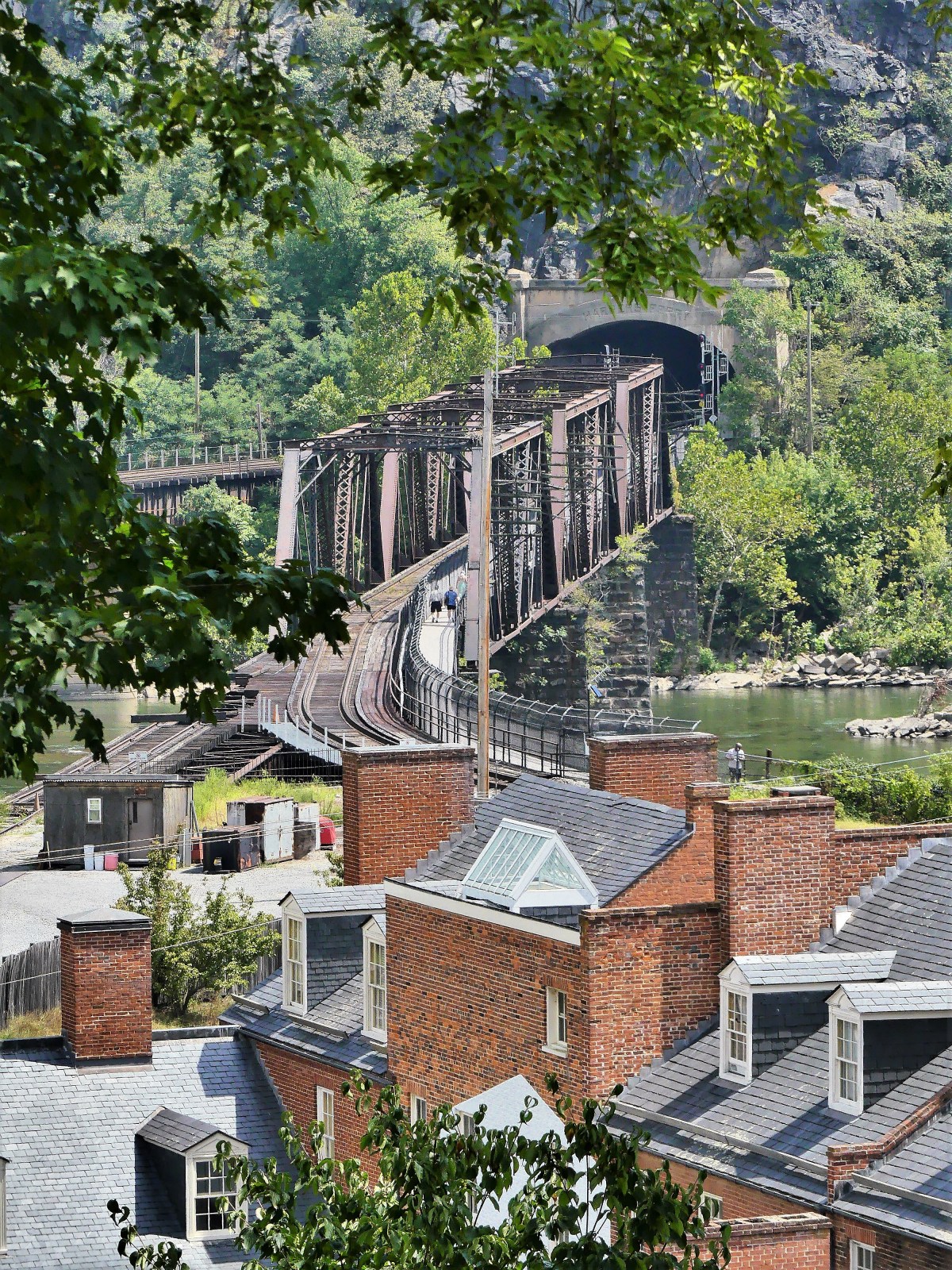
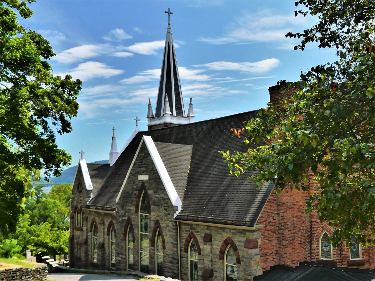
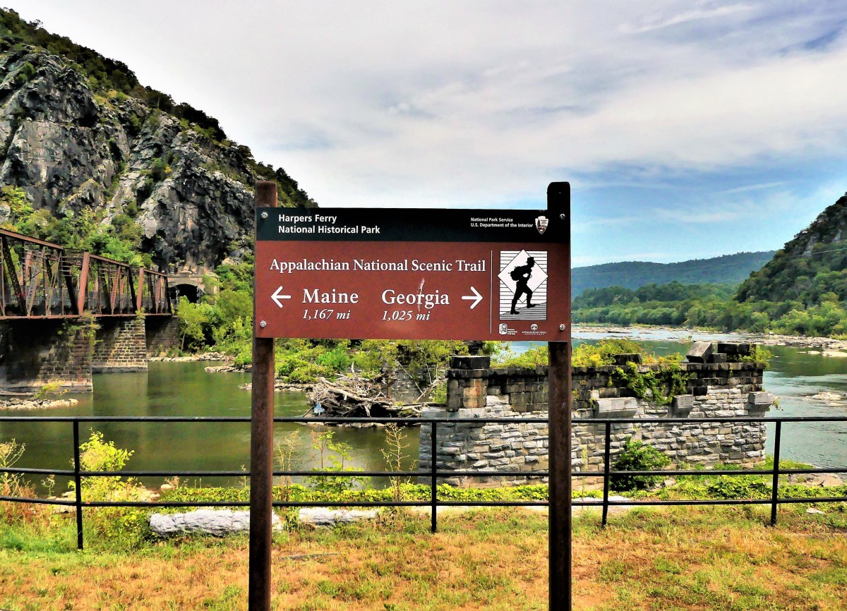
One hundred and sixty years ago, John Brown and his abolitionist brigade played a pivotal role in American history by raiding the South’s largest federal armory in Harpers Ferry with the intention of fueling a rebellion of slaves from Virginia and North Carolina, and envisioning a subsequent society where all people–regardless of color–would be free and equal.
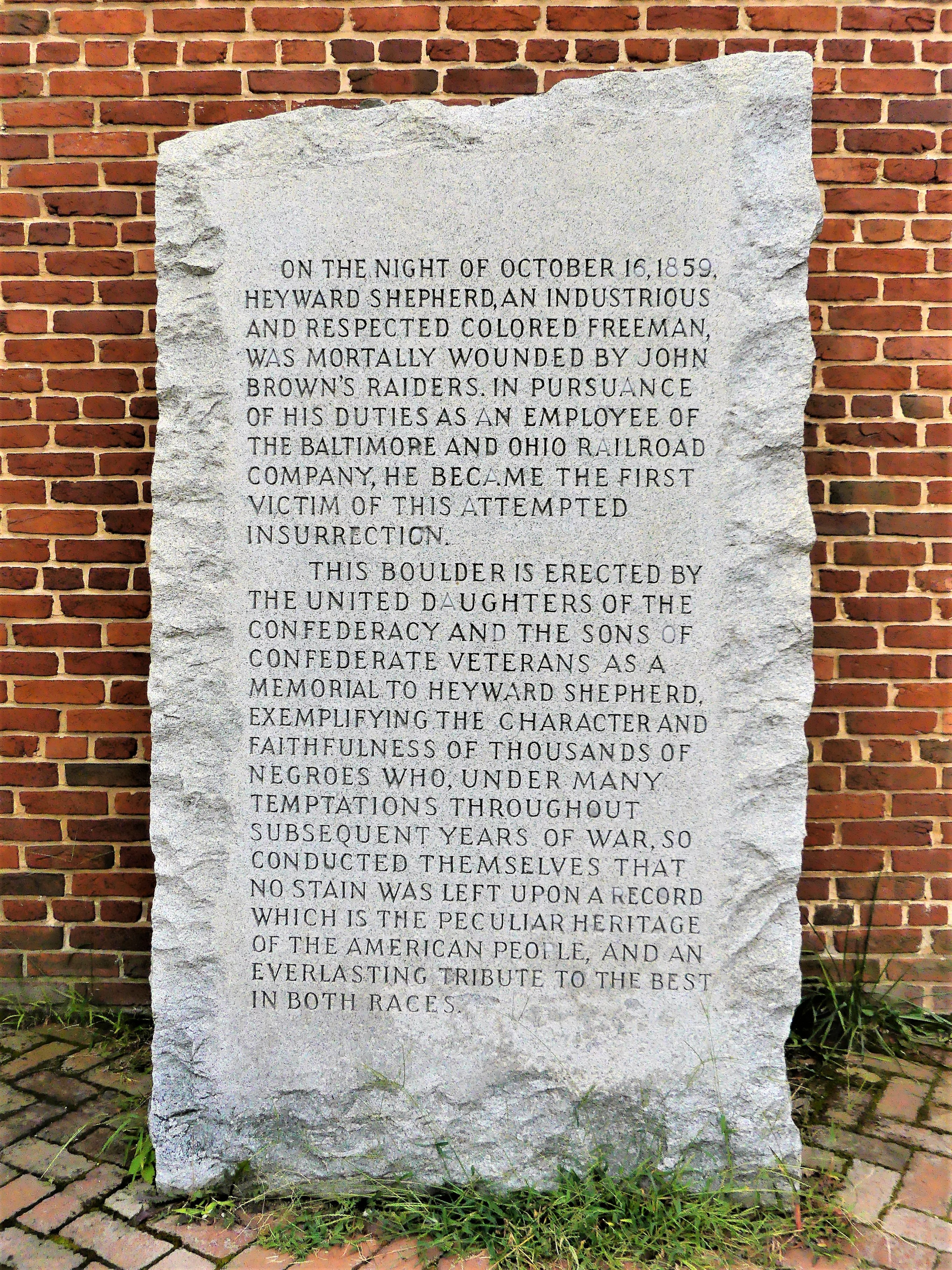
The initial siege caught U.S. soldiers off guard and the armory and munitions plant were captured with little resistance. Brown’s marauders took sixty townsfolk hostage (including the great grandnephew of George Washington), and slashed the telegraph wires in an attempt to isolate the town from outside communication.
However, a B&O passenger train, originally detained at the bridge, was allowed to continue its journey to Baltimore, where employees sounded the alarm and troops were immediately dispatched to quell the insurrection.
In another of Brown’s miscalculations, the local militia pinned down Brown’s insurgents inside the engine house while awaiting reinforcements,
yet newly freed slaves never came to his rescue.
Ninety U.S. Marines under Colonel Robert E. Lee’s command arrived by train the next evening and successfully stormed the stronghold the following day. When the dust had settled, ten of Brown’s raiders were killed (including two of his sons),
five had escaped, and seven were captured, including John Brown.
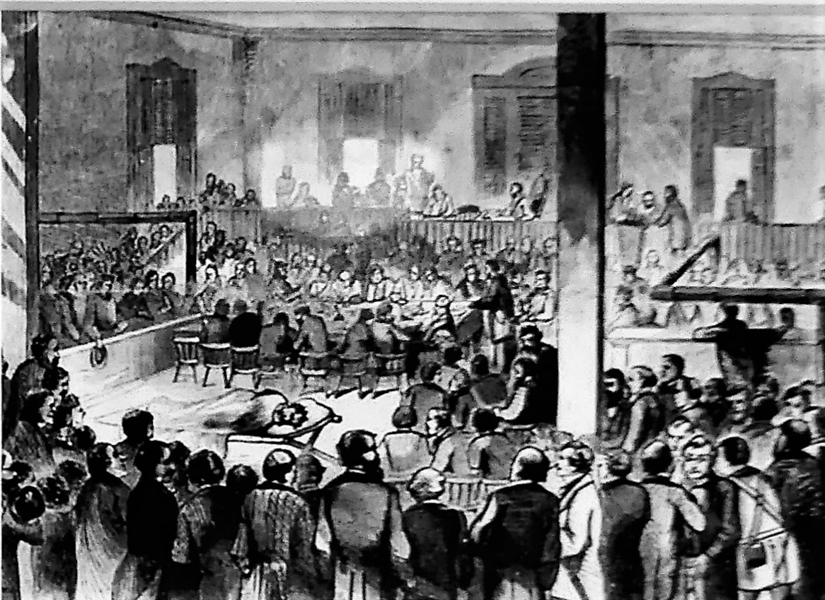
John Brown was quickly tried and convicted of treason against the Commonwealth of Virginia.
Just before his hanging on December 2, 1859, Brown prophesied the coming of civil war: “I, John Brown, am now quite certain that the crimes of this guilty land will never be purged away but with blood.”
How right he was! To the North, Brown was a martyr; to the South, he was a traitor. To a fractured and fragile country, he was the first American to be sentenced and executed for treason.
John Brown’s raid and subsequent trial hardenened the separatism between the country’s abolitionist and pro-slavery factions,
…and advanced the disparate and insurmountable ideologies of the North and the South, until only the Civil War could satisfy the issue and begin healing the nation.
The term treason has been loosely bandied about of late and with tremendous fanfare, albeit little distinction. It’s become a familiar talking point for Donald Trump, whose insulting language and hyperbolic demagoguery continue to rouse his supporters as it diminishes the civility of our national conversation.
Bold and courageous public servants and patriots who are honor bound to defend democracy have been branded as traitors and accused of treasonous behavior because they dare to speak out against corruption and wrongdoing inside the White House.
And the implications are worrisome, for the stakes are high. In a country that values free speech, treason is not about displaced loyalties; it has nothing to do with political dissent; and it has no standing in speaking truth to power. Treason is about pledging allegiance to power and greed instead of American values, like diversity and unity.
As before, politics continues to polarize the nation,
while our Legislative Branch of government seeks a constitutional remedy against the Executive Branch through an impeachment process. And once again, ideological differences have fostered veiled threats of civil war.
If history is to be our guide, then John Brown must be our beacon. During his sentencing he lamented, “…had I so interfered in behalf of the rich, the powerful, the intelligent, the so-called great, or in behalf of any of their friends…and suffered and sacrificed what I have in this interference, it would have been all right; and every man in this court would have deemed it an act worthy of reward rather than punishment.”
Sounds remarkably familiar.
More than ever, we must steer through political currents, and find our way around deception, obfuscation and misdirection if our democracy is to stay afloat.
Leah and I were yearning for a satisfying hike through the mountains of New Mexico that we’d yet to explore. While we were happy hiking the Tecolote Trail in the Sandia Mountains–which offered pleasant panoramas of the desert floor stretching nine miles to South Mountain, and views of Sandia Crest that had us wishing we could stay longer–
…the whipping wind that swept across the overlook killed any notion of lingering along the mesa top to enjoy the spots of fall color that recently dotted the evergreen terrain.
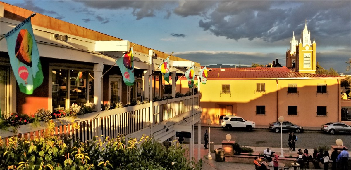
However, the following day, a stroll through Albuquerque’s Old Town…
brought us to a photography gallery that showcased Southwestern landscapes and introduced us to Tent Rocks.
“That place looks cool. We should go there,” I asserted.
“I agree, but how do you know if we can even get there from here?” Leah questioned.
After consulting Google, I learned that Tent Rocks was a National Monument located within the Pueblo of Cochiti, only an hour north of Albuquerque.
The following day, riding north on NM-14 (part of the scenic and historic Turquise Trail National Scenic Byway), we took a left turn onto NM-301, a rutted, dusty road connecting to NM-22.
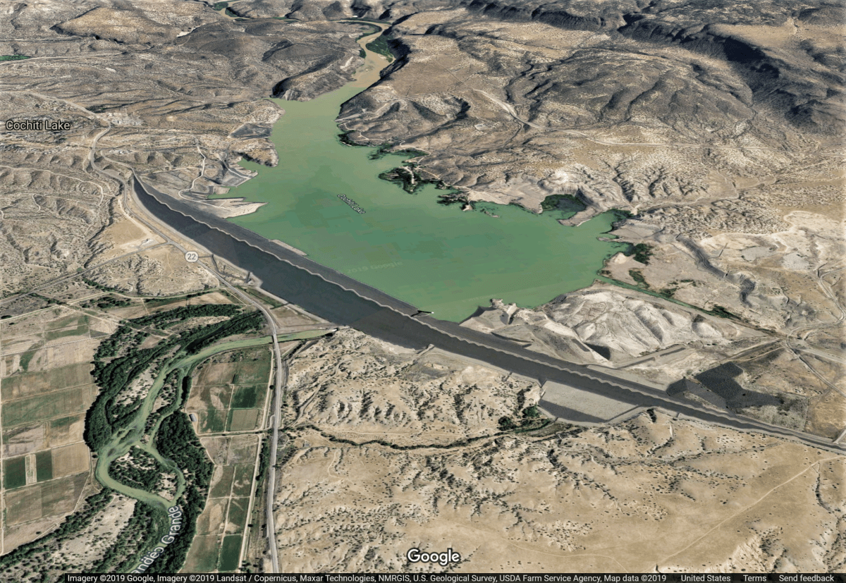
We approached the earthen wall of the Cochiti Dam, a controversial water management project approved by Congress in 1960, and finished in 1975 by the U.S. Army Corps of Engineers.
Stretching 5 miles across the desert, and rising 250 feet above the Rio Grande, the resultant lake flooded sacred lands and fields belonging to local tribes for centuries.
We continued west on NM-22 for two miles before arriving at Kasha-Katuwe Tent Rocks National Monument. We pulled up behind seven parked cars–each one waiting to pay five bucks to the BLM park ranger stretching his legs beside the fee station. Our SUV idled a minute or two, but the line was at a standstill.
The sign post beside us forecasted a 30-minute wait-time from our current position.
“I’m gonna take a walk,” and Leah was out of the car, working her way to the front of the line.
The news arrived in under a minute…offering a Trail Guide.
“All 94 parking spaces are taken,” Leah explains with a hint of exasperation. “They probably arrived when the gates opened at 8am.”
“Okay. So that was two hours ago,” I respond, admitting the obvious. “It says here on the map that the trail is 1.5 miles in and out, so hopefully, a lot of people should be on their way out by now.”
“How long do you think we’ll have to wait here?” asks Leah.
“According to the sign, it’s a 30-minute wait,” I assert.
“Smartass!” she hurls.
After 20 minutes of anticipation, I noticed movement in the ranks! Two cars in front gave up the wait and U-turned, leaving us in sixth place.
Silly people. If only they had waited a few minutes longer. Soon after, a rash of cars passed us on the way out, and we were on our way, cruising through four miles of dip-after-dip, tribal land road, before reaching the parking zone.
While Leah and Carrie (Leah’s daughter) waited in line for the only outhouse in the vicinity, I caught up on my reading at the trailhead.
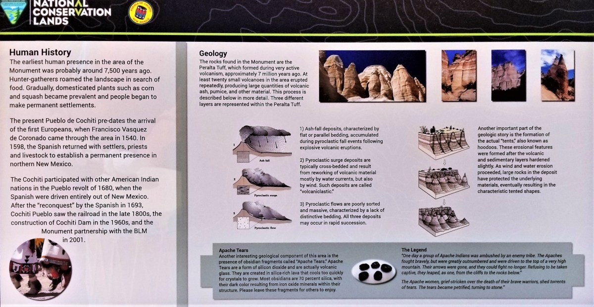
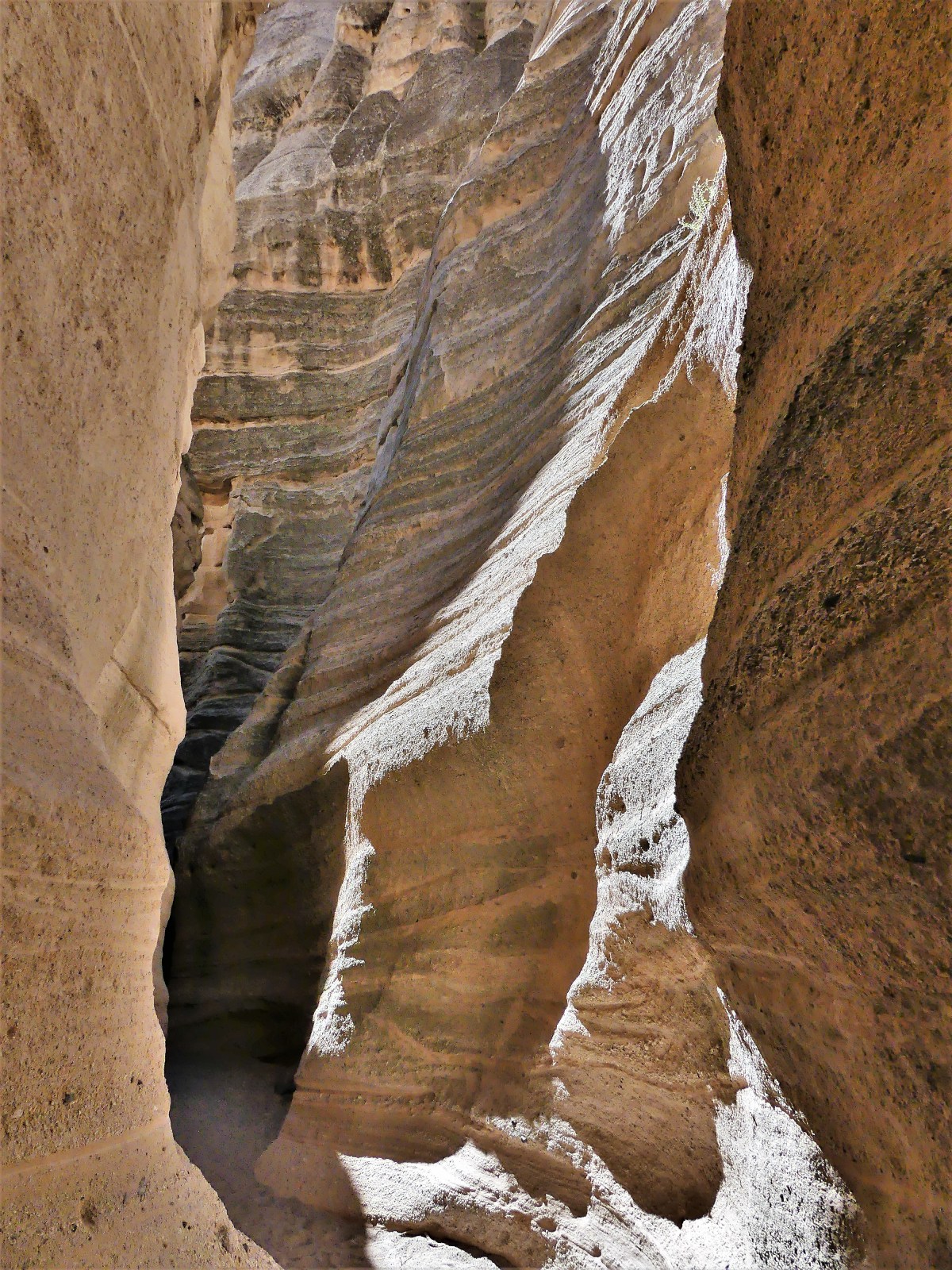
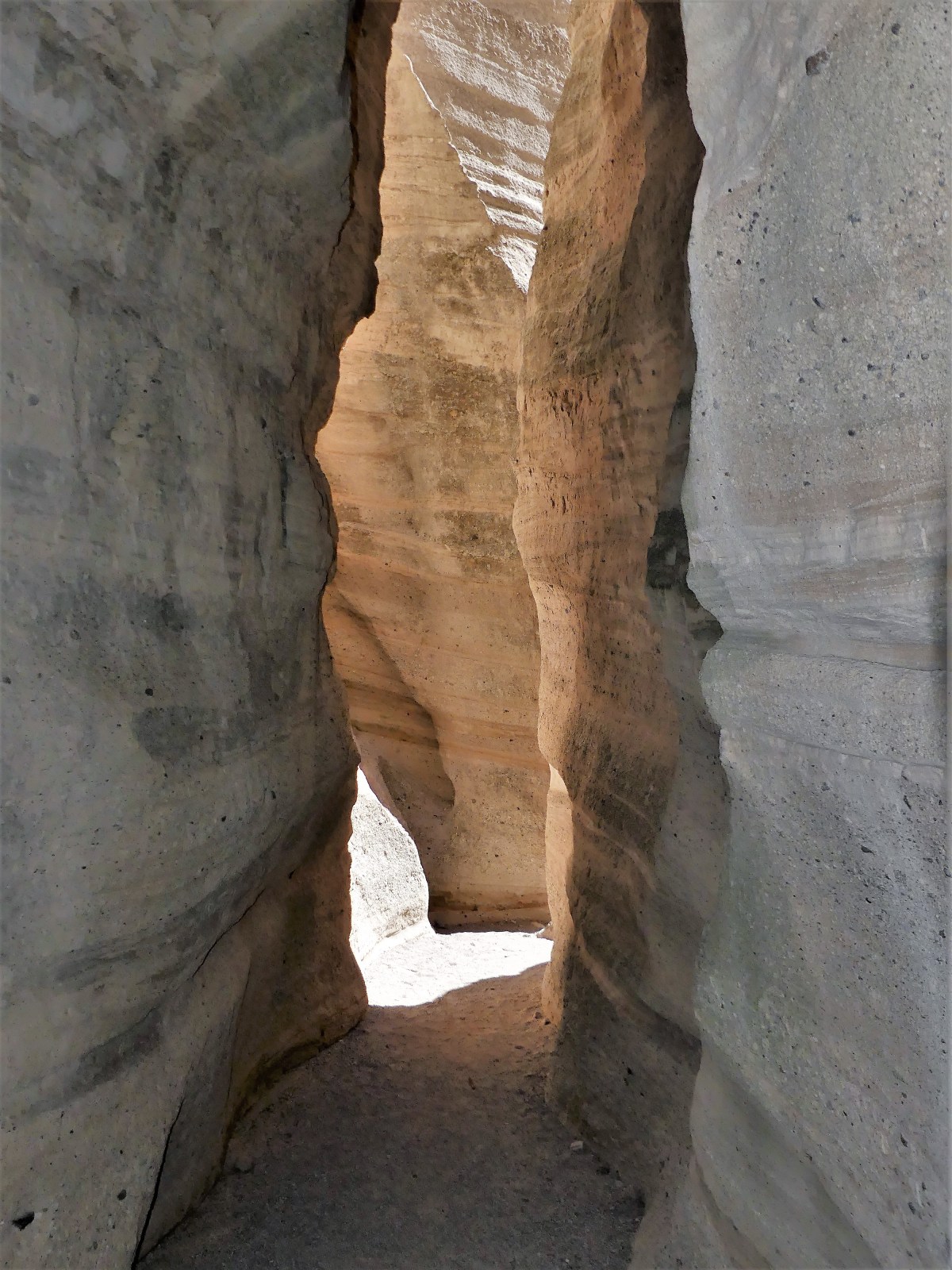
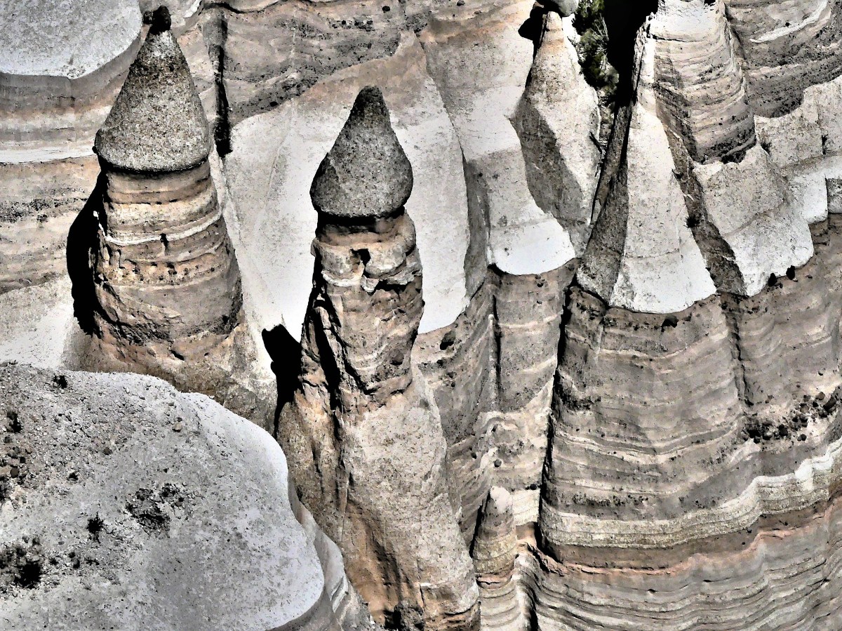
As interested as I was to learn about New Mexico’s volcanic eruptions and its pyroclastic flows, I was itching to get on the trail and weave through the slot canyon.
The canyon walls were so narrow in places, that only one person could navigate the labyrinth at a time.
It reminded me of the way that road crews monitor traffic on a one way road…
…and it was vaguely reminiscent of a similar protocol at the fee station and toilet.
Of course, with so many early hikers already on the trail and now turning back, it made for several occasional stops, and many pleasant exchanges along the way.
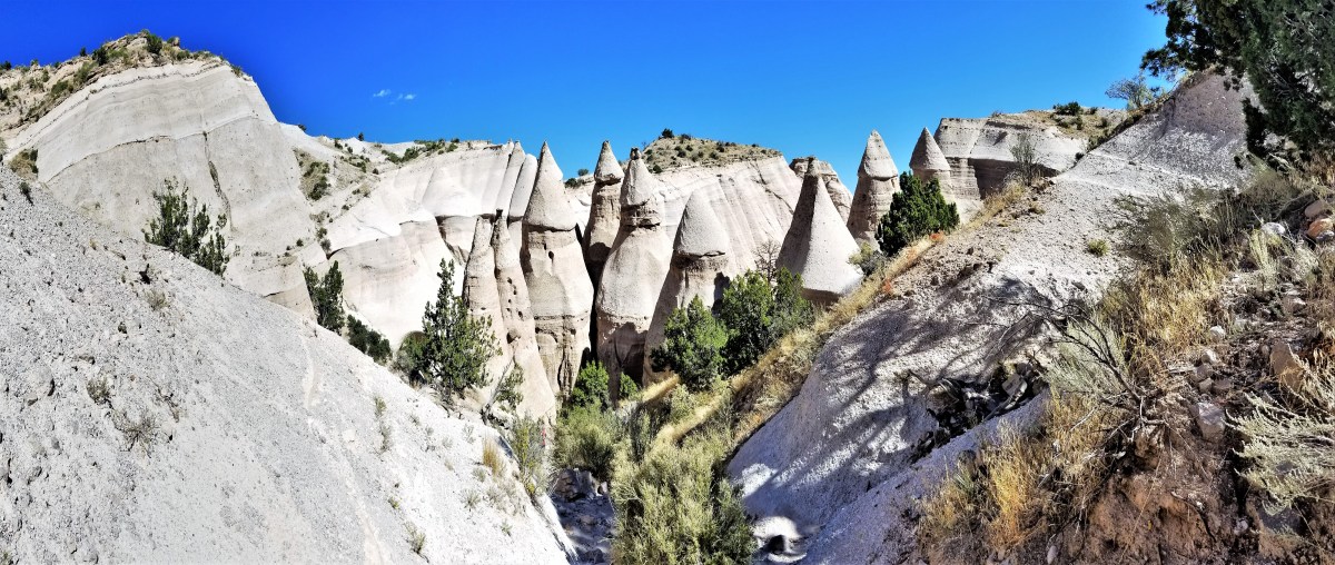
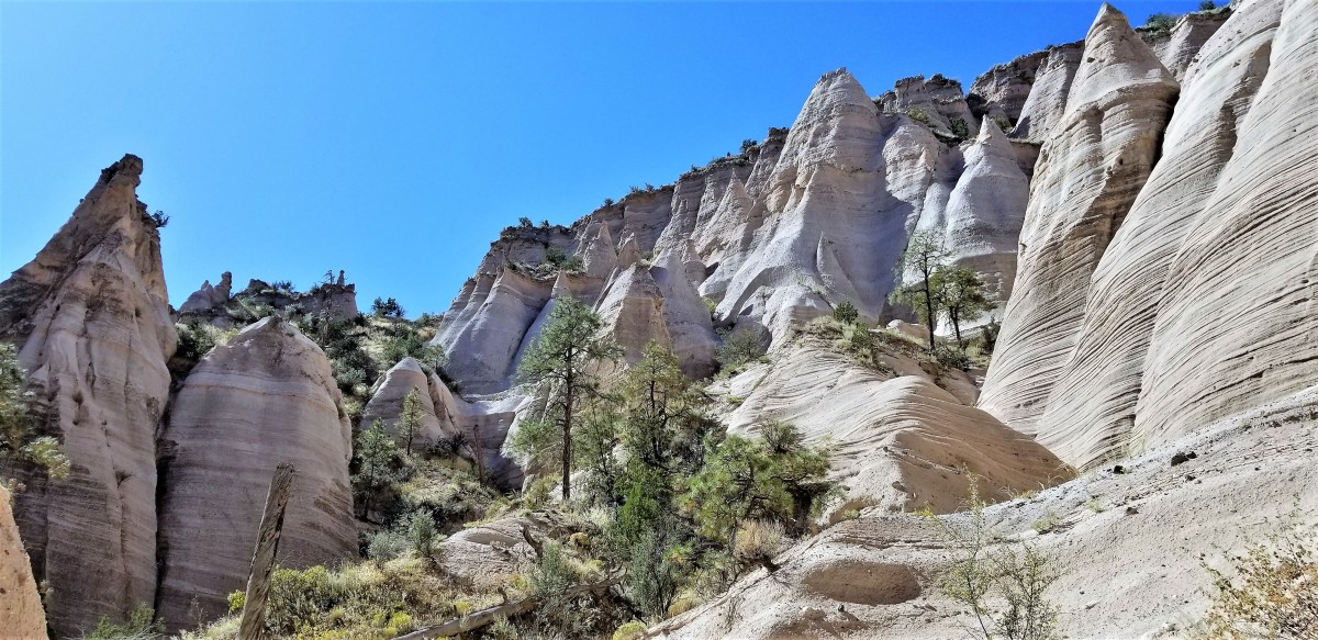
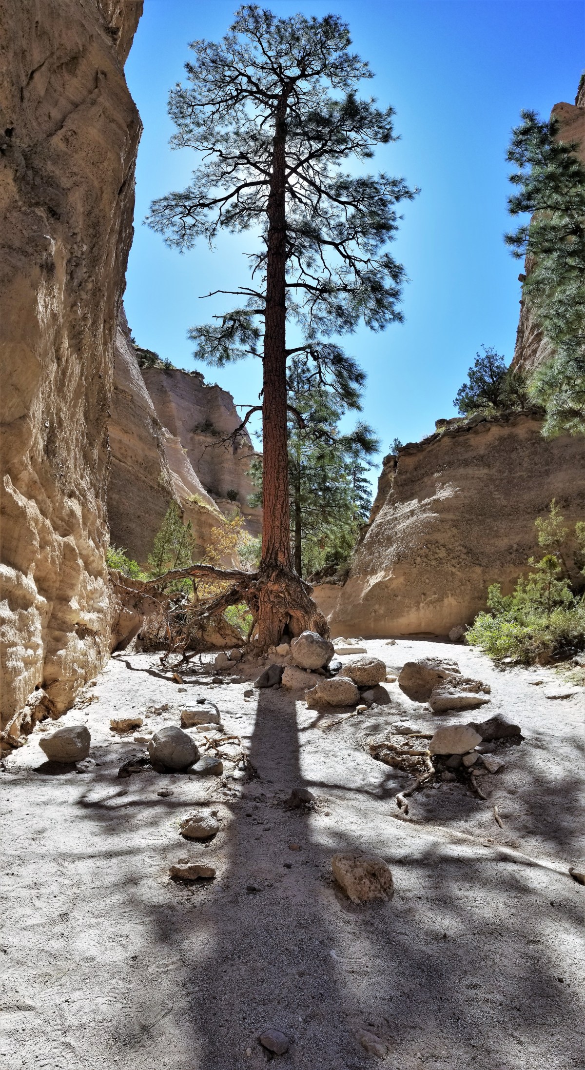
However, when the canyon finally opened up, we were greeted with a greater appreciation of what seven million years had done to the place.
Even the trees seemed magical, managing to stand in the shadow of such uncertain footing.
Once we reached a clearing in the trail, we began our 630-foot ascent to the mesa top, giving us a better perspective of our lair,
and freeing us from all obstructions,
until we could gaze across the Jemez Mountains,
and remind ourselves, once again, why it’s always a good idea to wait one’s turn in line.
While camping alongside the Airstream factory in Jackson Center (seeBuilding Airstreams), Leah and I wondered how we would kill time during our weekend stopover. There wasn’t much to do in town, although we were within walking distance of the Elder Theatre, a one-screen cinema showcasing Dora and the Lost City of Gold and the Heidout Restaurant, serving bar food backed by a roadhouse jukebox.
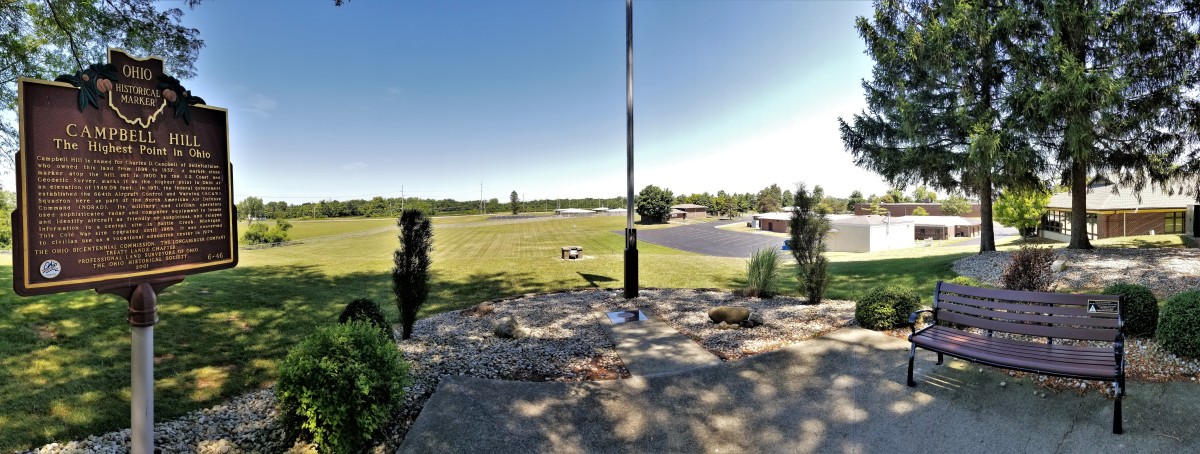
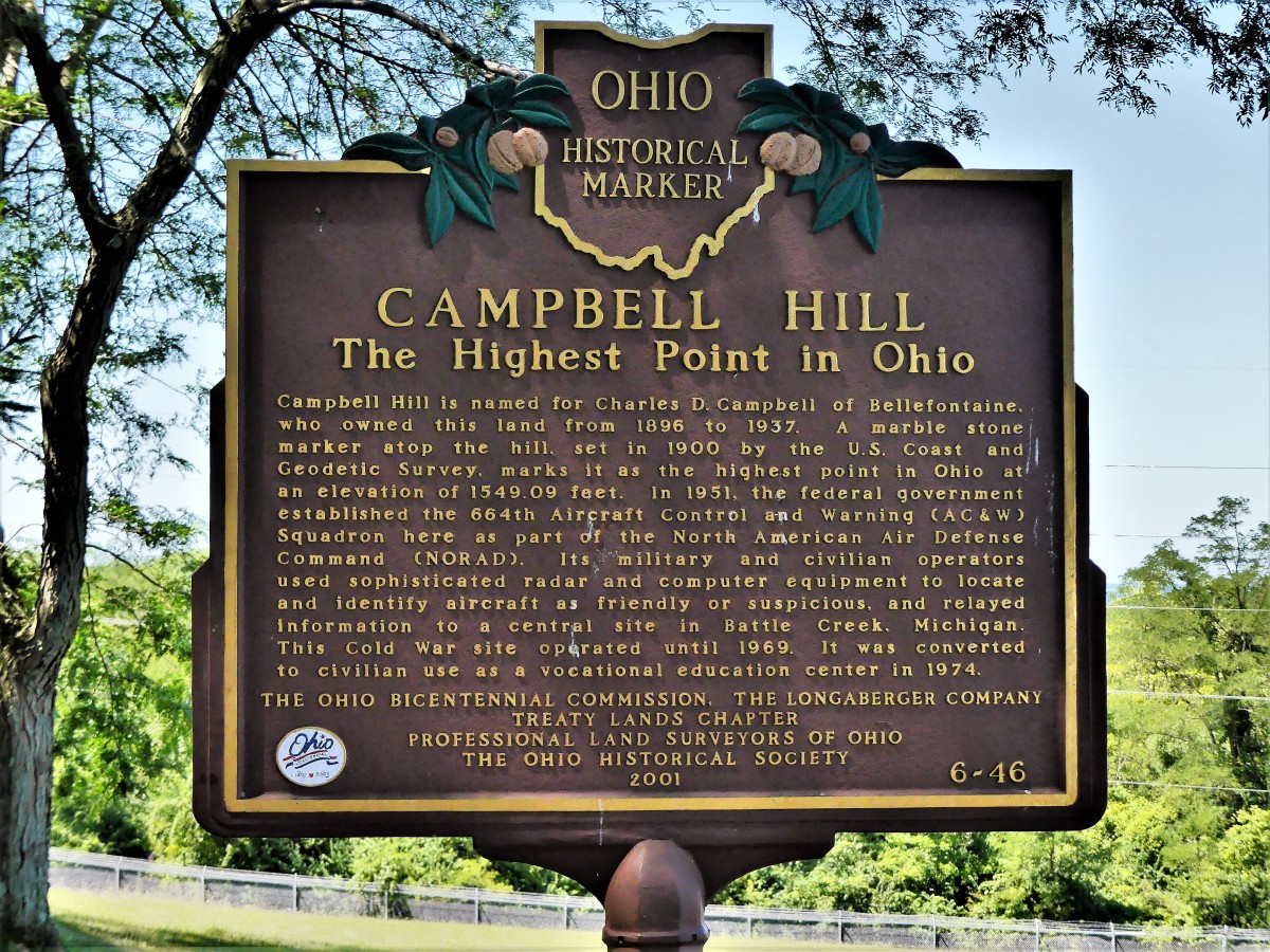
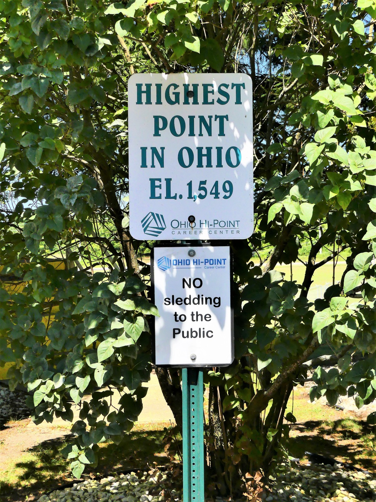
We took a pass on both, and drove to Bellefontaine, 20 miles east of our location. How fortuitous, because high atop Campbell Hill–overlooking a scenic parking lot, and peaks of grasslands beyond, as far as the eye can see–
sits the Ohio Hi-Point Career Center, a two-year career-technical high school campus that also doubles as the highest point in Ohio, at 1549 feet elevation.
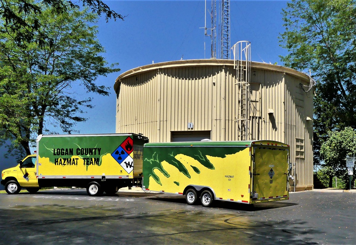
Once upon a Cold War time, this site was home to Bellefontaine Air Force Station, providing radar surveillance to NORAD in the event of a Soviet invasion from the North Pole.
Remnants remain.
Leah and I were giddy with excitement. It could have been the altitude, but the notion that we were standing at the highest point in Ohio nearly took our breath away.
However, we are seasoned travelers who have Airstreamed through most of America (seeTop of the World), and we refused to be intimidated by the height of Campbell Hill.
Admittedly, we were weak-kneed.
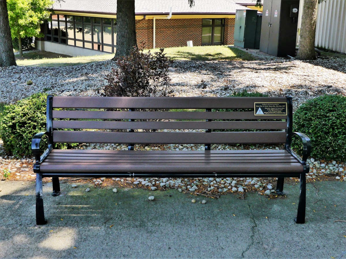
We took a deep breath to clear our heads, and took a seat on a strategically placed bench by the geodetic survey marker.
After a snack to raise our blood sugar, we managed to trek to the parking lot a short distance away. As I regained my composure inside the F-150, I realized that we were brought here for a reason. I figured that given our vantage point and strategic positioning, the military may be interested in recommissioning this location as a secure listening post as we approach the 2020 presidential elections.
Leah and I are winding down our Great Lakes circumnavigation 200 miles south of Lake Erie, where a hundred or more local and distant celebrants have gathered in Ligonier, PA to party with Tiff and Jim on their 25th wedding anniversary.
Appropriately, it was Ligonier and the surrounding Laurel Highlands where Leah and I broke our Airstream cherry. It was the cusp of winter/spring; it was the day after Leah’s 60ish birthday; and it was my first day of retirement.
We dug ourselves out of a major New Jersey snowstorm, and loaded up the Airstream and the F-150 with a year’s worth of gear and courage. Our maiden voyage left us white-knuckled as we precariously cruised the backroads to find Tiff and Jim’s country house in darkness. That was 29 months ago.
Today, we are seasoned road warriors who have grown in confidence, and somehow avoid repeating our original mistakes. Instead, we make new mistakes, which keeps us on our toes.
Circling back to Ligonier after three months of Great Lakes coastal roads has also given me time to reflect on the places I traveled, the things I’ve seen, and the moments I captured.
What follows is a snapshot retrospective along our route:
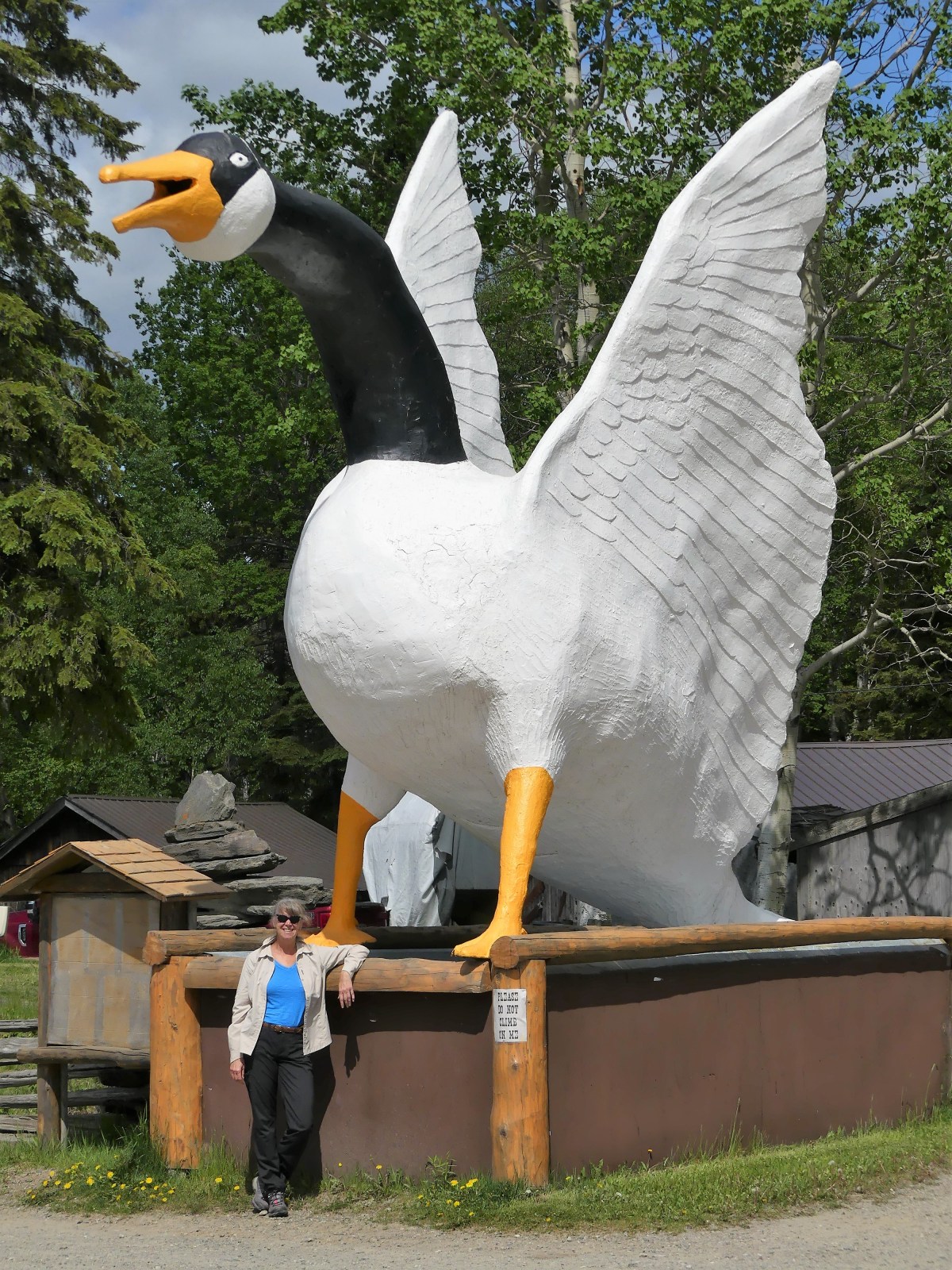
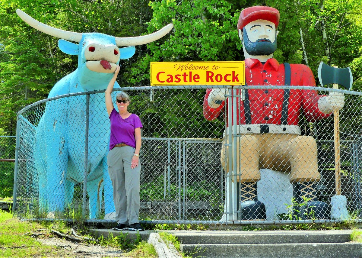
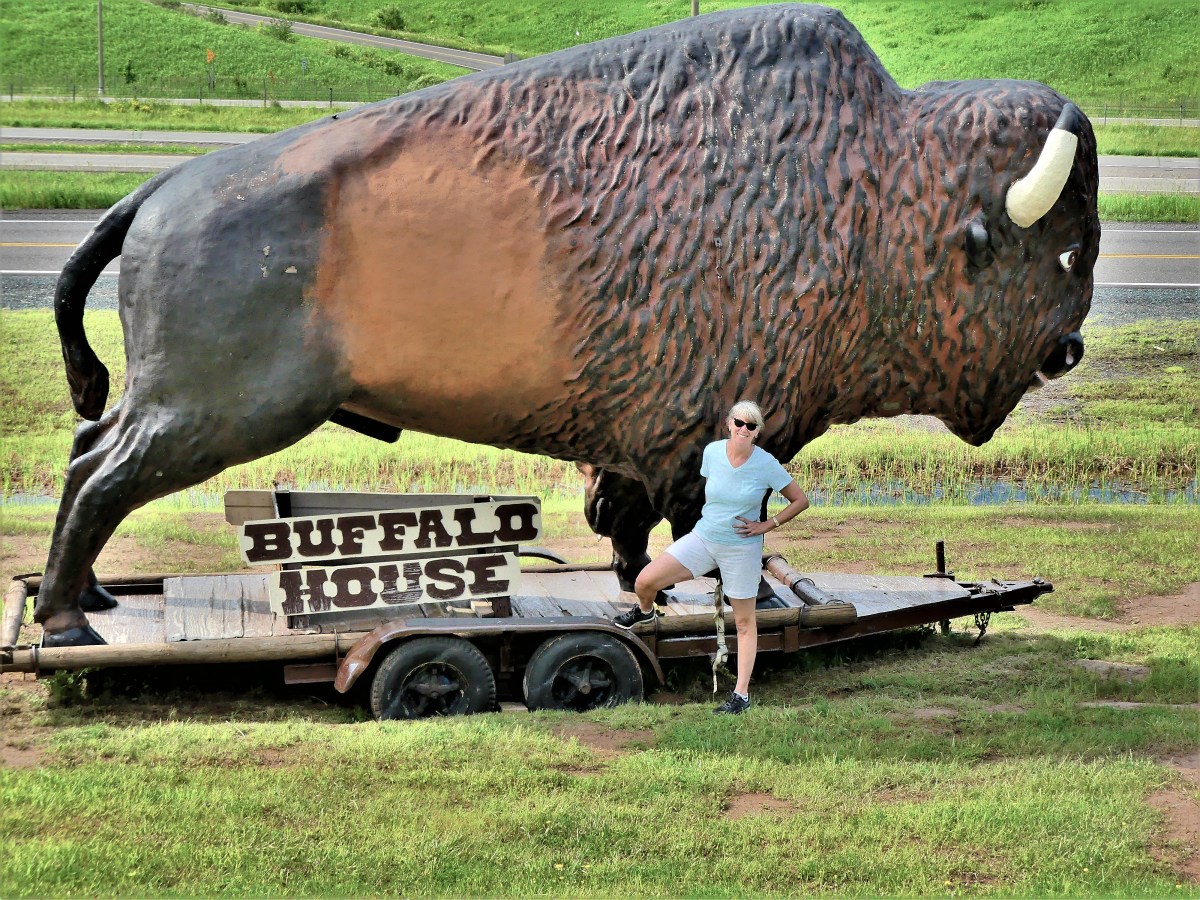
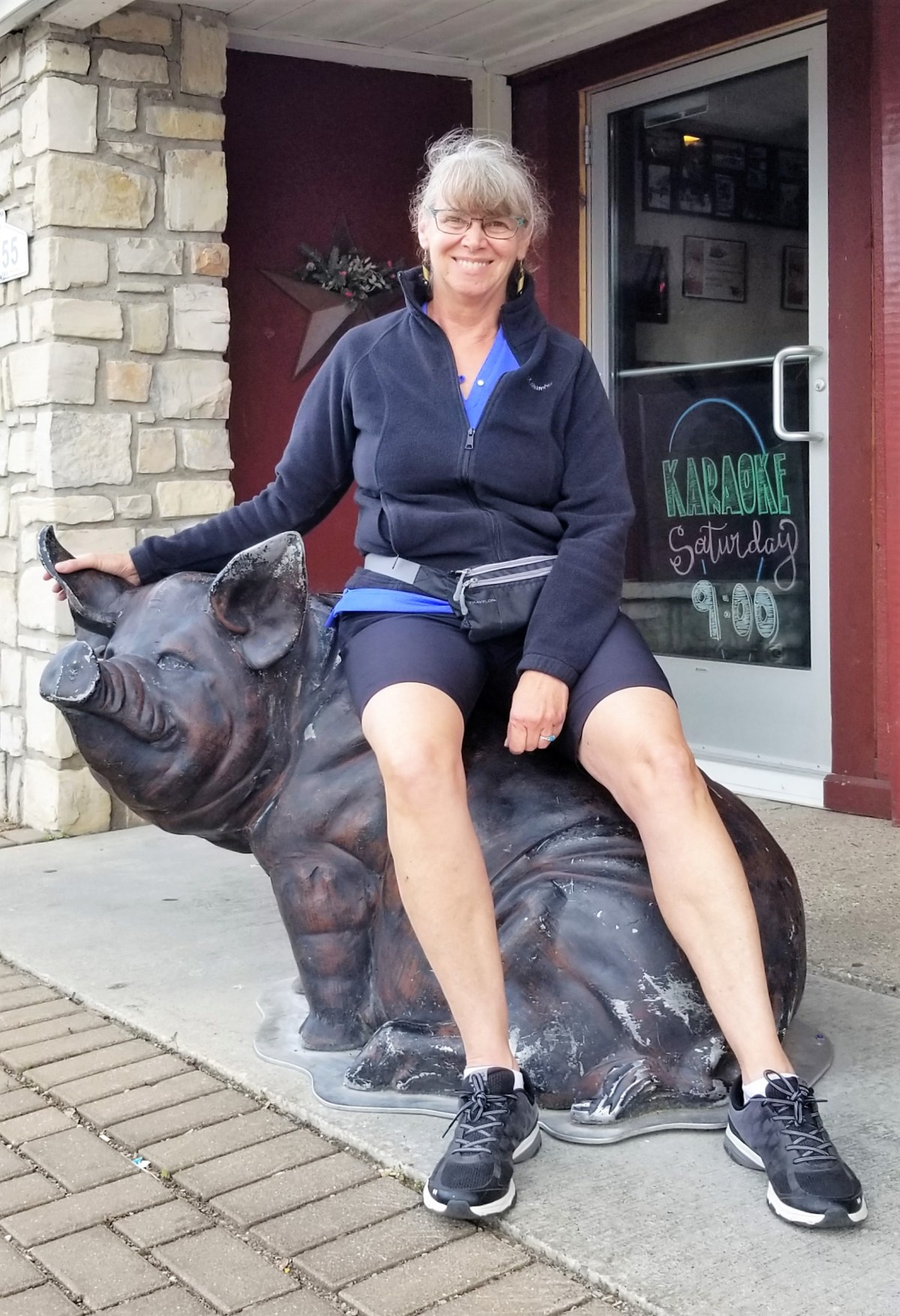
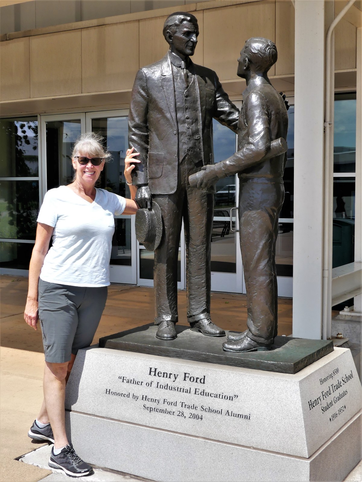
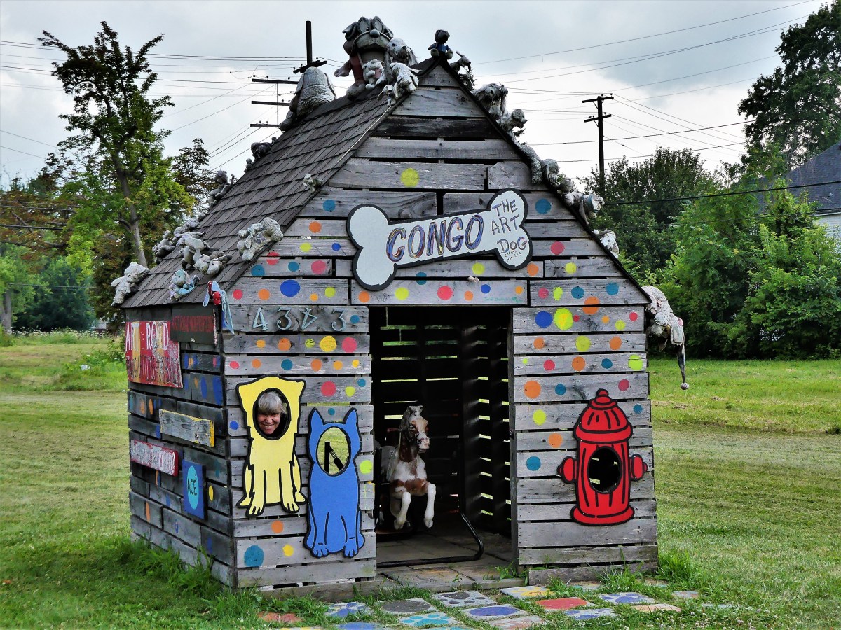
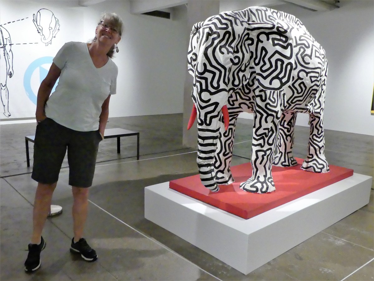
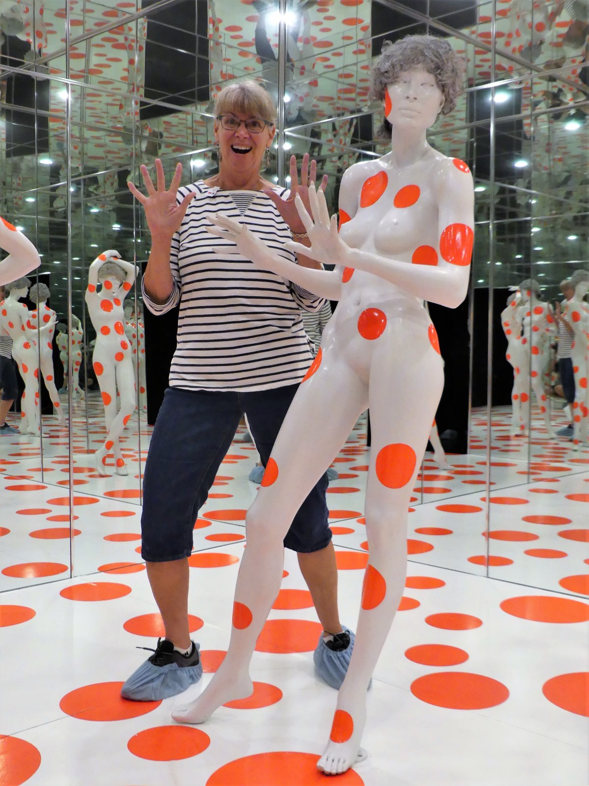
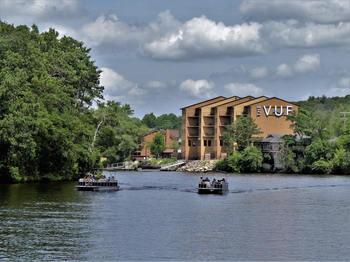
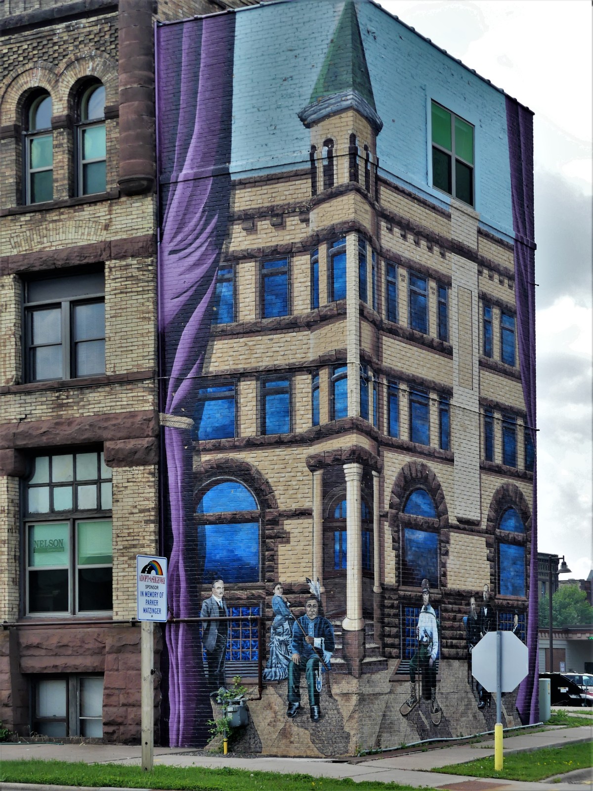
Niagara Falls, Ontario–Victoria AvenueWawa, Ontario–Young’s General StoreSt. Ignace, Michigan–Castle RockFort William, Ontario–Mount McKayDuluth, Minnesota–Canal ParkEldes Corner, Minnesota–Jay Cooke State ParkCarlton, Minnesota–Buffalo Valley RV CampgroundEsko, Minnesota–East Highway 61Bayfield, Wisconsin–Howl Adventure CenterBayfield, Wisconsin–1st StreetMunising, Michigan–The DogpatchSturgeon Bay, Wisconsin–N. 3rd AvenueEllison Bay, Wisconsin–WI-42Egg Harbor, Wisconsin–WI-42Baraboo, Wisconsin–Devil’s Doorway, Devil’s Lake State ParkBaraboo, Wisconsin–Circus WorldWisconsin Dell, Wisconsin–BroadwayPlain, Wisconsin–Ederer Dairy SupplyMilwaukee, Wisconsin–Lakefront BreweryHighland Park, Illinois–Ravinia FestivalNiles, Illinois–Leaning Tower of NilesGrand Rapids, Michigan–Frederik Meijer Gardens and Sculpture ParkTraverse City, Michigan–Warehouse DistrictDearborn, Michigan–Ford Rouge FactoryDetroit, Michigan–Heidelberg ProjectDetroit, Michigan–Comerica ParkCleveland, Ohio–Rock and Roll Hall of FameBellefontaine, Ohio–S. Main StreetPittsburgh, Pennsylvania–Andy Warhol Museum (Keith Haring)Pittsburgh, Pennsylvania–Mattress Factory (Yayoi Kusama)Pittsburgh, Pennsylvania–PNC Park (Willie “Pops” Stargell)Ligonier, PA–Fort Ligonier
This is only the beginning for us. Stay tuned for more travel follies…
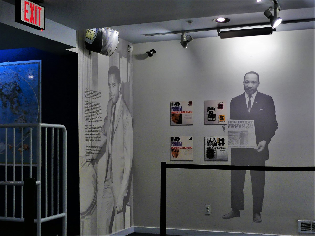
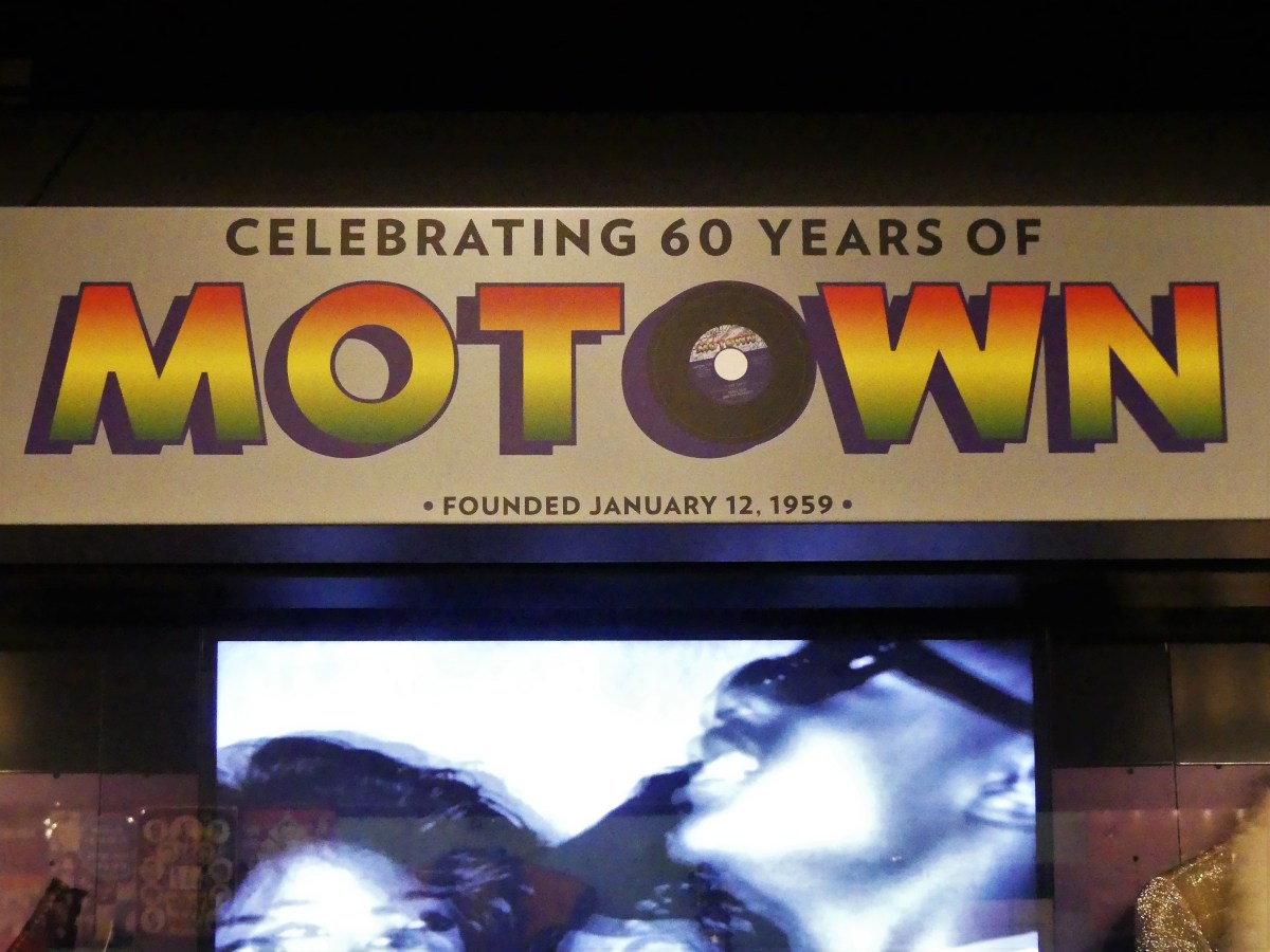
Leah and I were looking forward to touring Hitsville, USA after determining that a visit to Detroit was an essential part of our Great Lakes adventure.
Once we arrived at Motown Studios, I sensed a different kind of energy around me. Almost immediately, I found parking for the F-150 just beyond the funeral parlor’s yellow lines, and saw it as an omen of sorts for something good.
The scene around the house pulsed with enthusiasm and excitement. The crowd was as mixed as a casting call for Felinni’s Amarcord, yet everyone shared a common connection to the music, which made for instant bonding.
A like-minded gentleman of similar age joined me as I read the commemorative plaque, and I turned to him.
“Do you realize that we are the generation of those spider things?” I joked.
“Tell me about it!” he shrugged. “I got memories fitting that thingagmajig into the record hole just so I could stack my 45’s on the record player.”
“Amen!” I replied.
We shook hand and moved on.
Fans from across the country and around the world made the pilgrimage to celebrate the soundtrack to America’s social, political, and cultural consciousness.
Leah took a trip to the box office, while I attempted a portrait of Hitsville Chapel, all the while dodging families posing for selfies on the steps.
Leah returned without tickets. To our disappointment, the 5pm tour was sold out…weeks ago. It never occurred to us to secure tickets beforehand.
“Let’s go inside,” I suggested. “We’ve come this far. Maybe there’s something to see, or something we can do to fix this fiasco.”
The front door opened to an overflowing gift shop doing brisk business, but we weren’t there to buy souvenirs (at least not right away). We were there to relive our childhoods.
I walked around the backside of the shop, where I found the exit to the exhibition.
So close, yet so far…to the Rock and Roll Hall of Fame, 173 miles east of us…
Rock and Roll Hall of Fame display
to catch up on nifty artifacts.
Stevie Wonder costume/Fan magazine (from Rock and Roll Hall of Fame collection)
“I think I can get us in,” Leah announced.
“Really!?” I mused. “And how are you gonnna manage that?”
“I think I can convince the guard to feel sorry for us, and he’ll let us in,” she boasted.
“Just like that!?” I laughed.
“You’ll see,” she insisted.
I think the security guard of 25 years has probably heard every sob story imaginable, except for Leah’s. To be expected, Leah’s story had little impact on his decision, but he must have been moved somewhat.
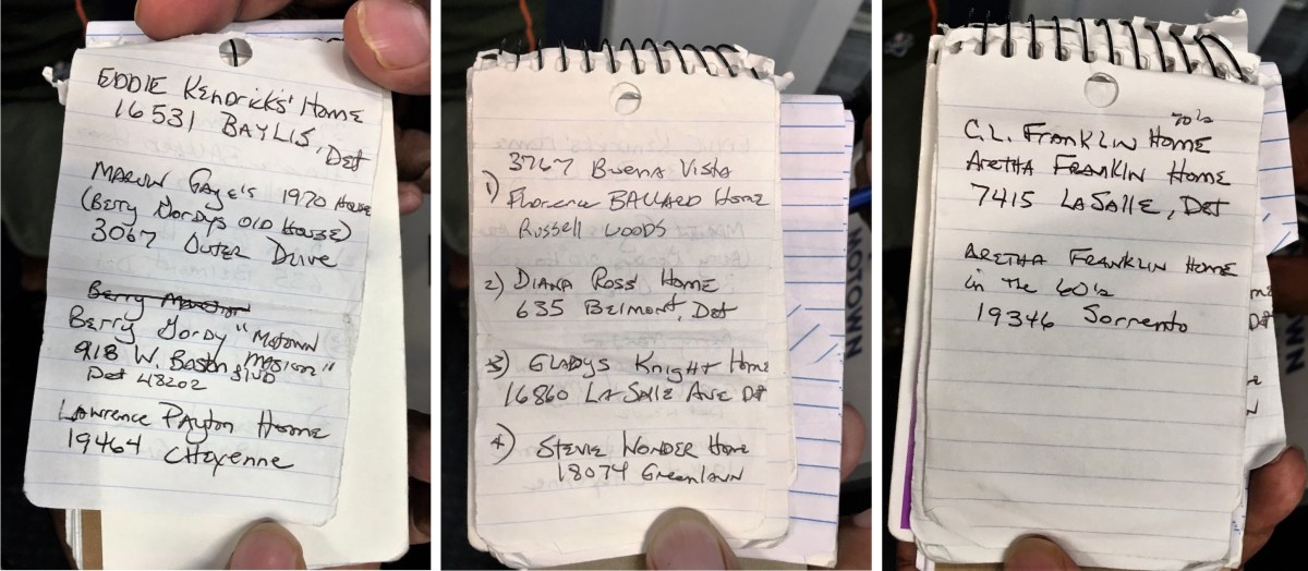
He withdrew a tattered writing pad from his shirt pocket. “Y’know, over the years, I collected the addresses of some Motown legends, and I don’t really show it aroun’, but I’m gonna make an exception in your case, ’cause you came all this way for nothin’.”
“And all these addresses are in Detroit?” I asked.
“Yup!” declared security.
Wanting clarification, “and they’re real?”
“Yup, but do me a favor and keep it on the QT, OK? I don’t want the neighbors hassled and all,” he advised.
Cool! While we had lost the grand prize, it seemed, at the very least, that we were leaving with parting gifts. With addresses in hand, Leah and I decided to regroup and return the following day to play “private investigator.”
When plotting addresses on GPS, it became clear to us that many of the homes were within a ten-mile range of each other, so off we went on our real estate scavanger hunt of once-lived-in homes of America’s greatest rhythm and blues, and soul singers.
We started our tour at Florence Ballard’s home in Detroit’s largest historic district, Russell Woods. Florence was a founding member of the Supremes, who passed in 1976.
In her early years, Diana Ross lived with her family on the top floor of this duplex, just north of Arden Park.
It turns out, it was only five miles away from Berry Gordy, Jr.’s home, until he sold it to Mavin Gaye in the ’70’s…
and moved to a 10,500 sq ft Italianate mansion in Detroit’s Boston-Edison historic district with 10 bedrooms, 7 baths, a 4,000 sq ft pool house, and a 5-car carriage house.
Nearby, Gladys Knight lived in a 4 bedroom, 3.5 bath Tudor in Detroit’s Martin Park neighborhood.
Around the corner, lived Temptation’s co-founder and lead singer, Eddie Kendricks in a 4 bedroom, 2 bath 2,300 sq ft house.
And only a couple of miles away in the Bagley neighborhood lived Stevie Wonder in a 3 bedroom, 2.5 bath gabled house.
By now, I was fading from driving through Detroit traffic; and I was losing interest in photographing the rest of the listings. Additionally, I considered that crawling to a stop in front of someone’s house, double-parking, and positioning a camera through the window probably looked suspicious and creepy to any onlookers.
The following afternoon, the day of our departure, a home in Detroit’s Chandler Park section exploded–14 miles east of our recent real estate sweep.
One firefighter was injured in the blast. The Fire Marshall determined that a gas leak was to blame, but arson investigators are on the scene.
“Y’think this was an omen, too?” Leah mused.
“Nah! Just a coincidence!” I answered.
(Or maybe the beginning of another impossibly flaky, half-baked conspiracy theory!)
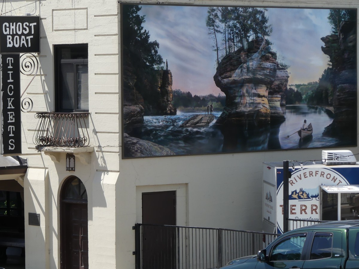
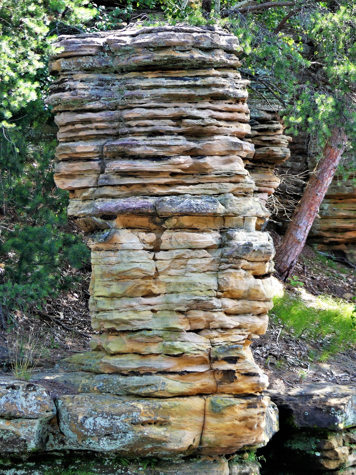
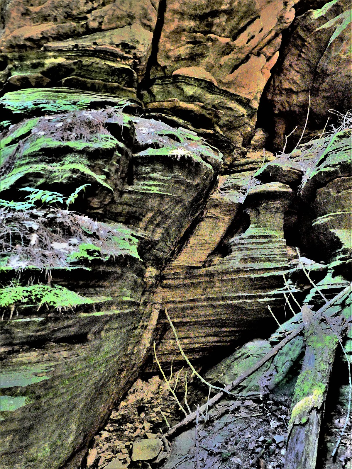
Long before kitsch and water parks ruled the region, visitors from around the world traveled to the Dells to marvel at the iconic sandstone formations carved by a glacier that plowed through Wisconsin approximately 15,000 years ago–leaving behind a 5-mile gorge struck from rock that’s older than anything on earth.
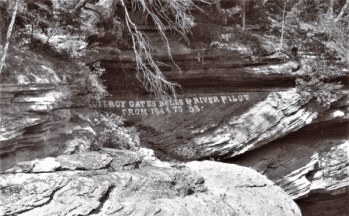
Word of this discovery spread quickly, attracting Leroy Gates, a lumber rafter with a notion that promotion would bring tourism to the river he loved, and earn him a buck or two to boot. In 1856, Gates offered the first guided boat tours of the Dells of Wisconsin, and made sure everyone knew it.
Supposedly, Gates and his associate guides would sit under umbrellas sipping lemonade, while the guests would paddle their boats up river to destined attractions…
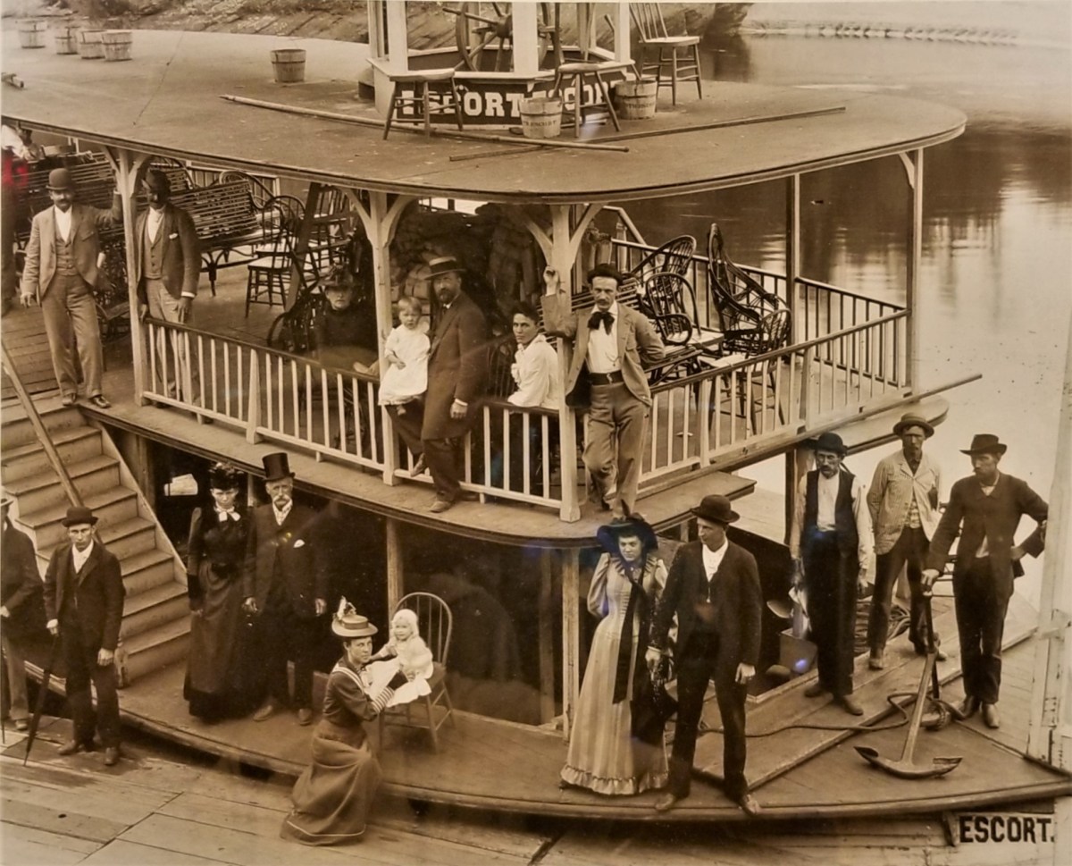
until steamboats took over in 1873.
Fortunately, landscape photographer H.H. Bennett was there to capture it all–taking souvenir photos of the tourists, and landing a place in history as “the man who made the Wisconsin Dells famous.”
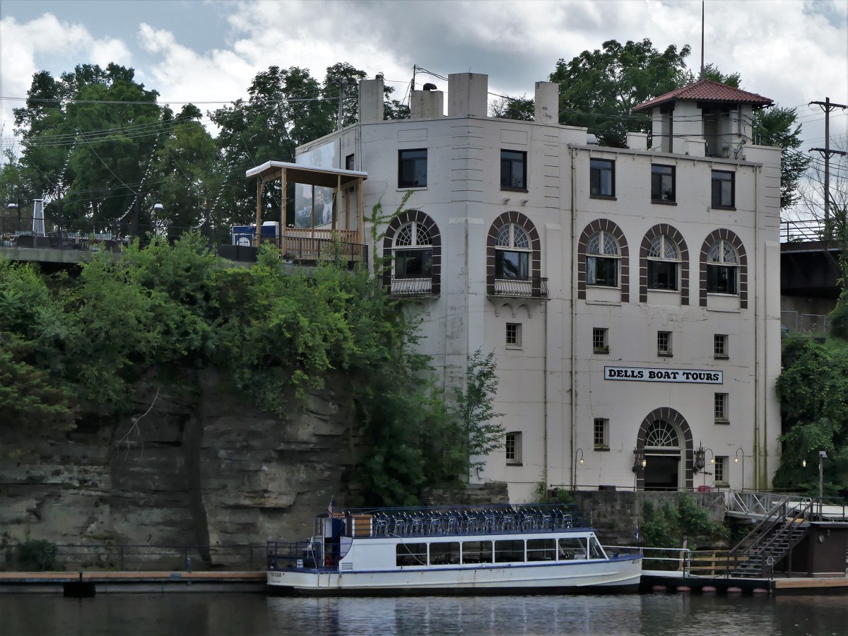
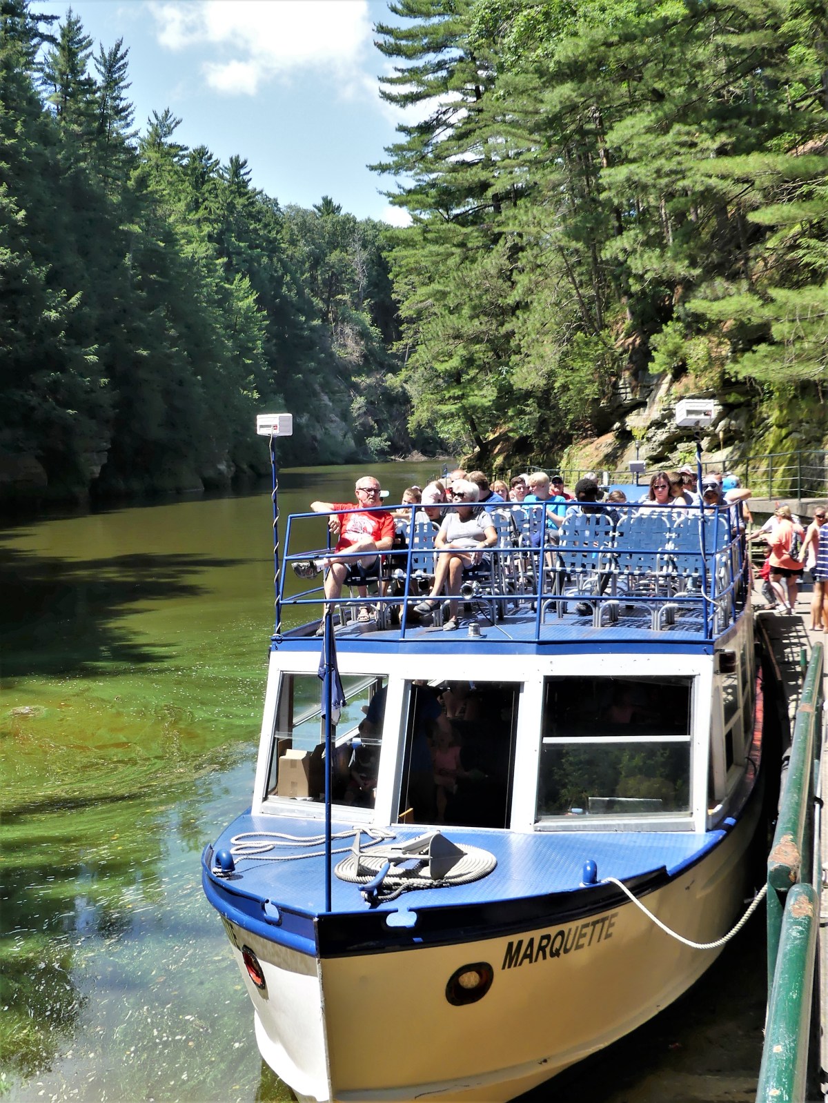
Today, Dells Boat Tours continues the tradition on the river…
with a fleet of 17 vessels that carry half a million passengers year after year.
Captain Bob piloted our riverboat north through the Upper Dells,
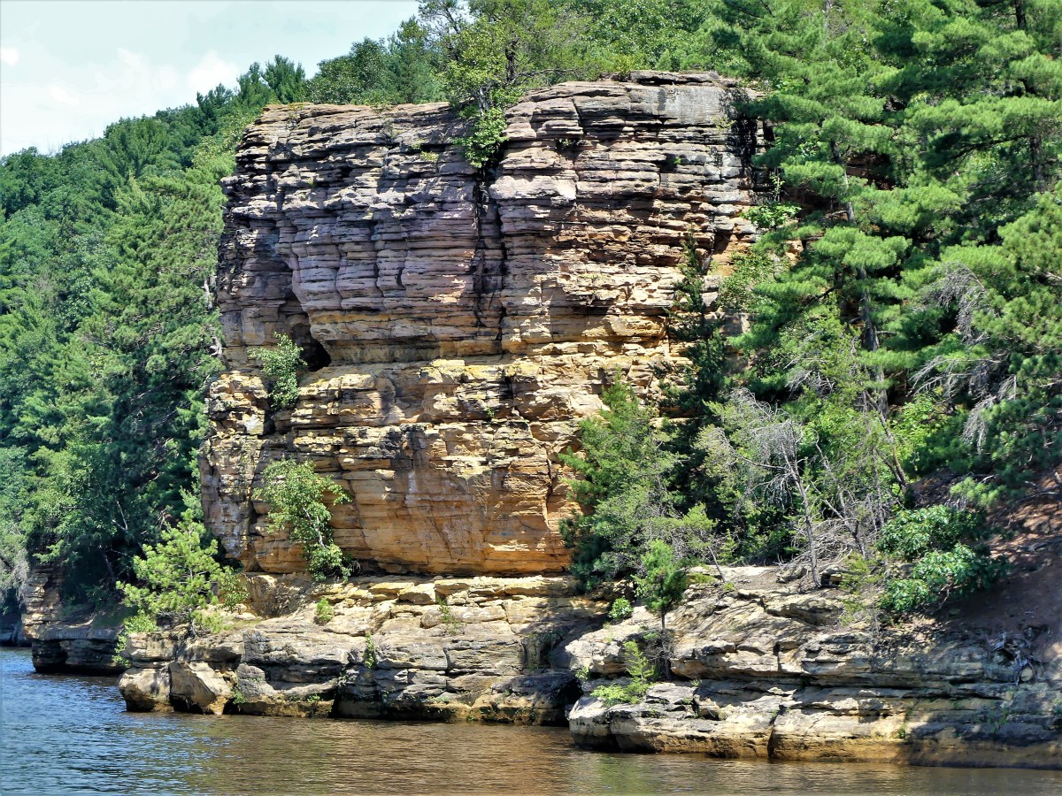
while First Mate Abby called out the names of rock sculptures famously characterized by H. H. Bennett:
Black Rock’s profileChimney RockHigh RockAlligator RocksRomance Cliffs
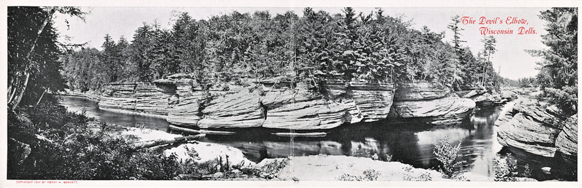
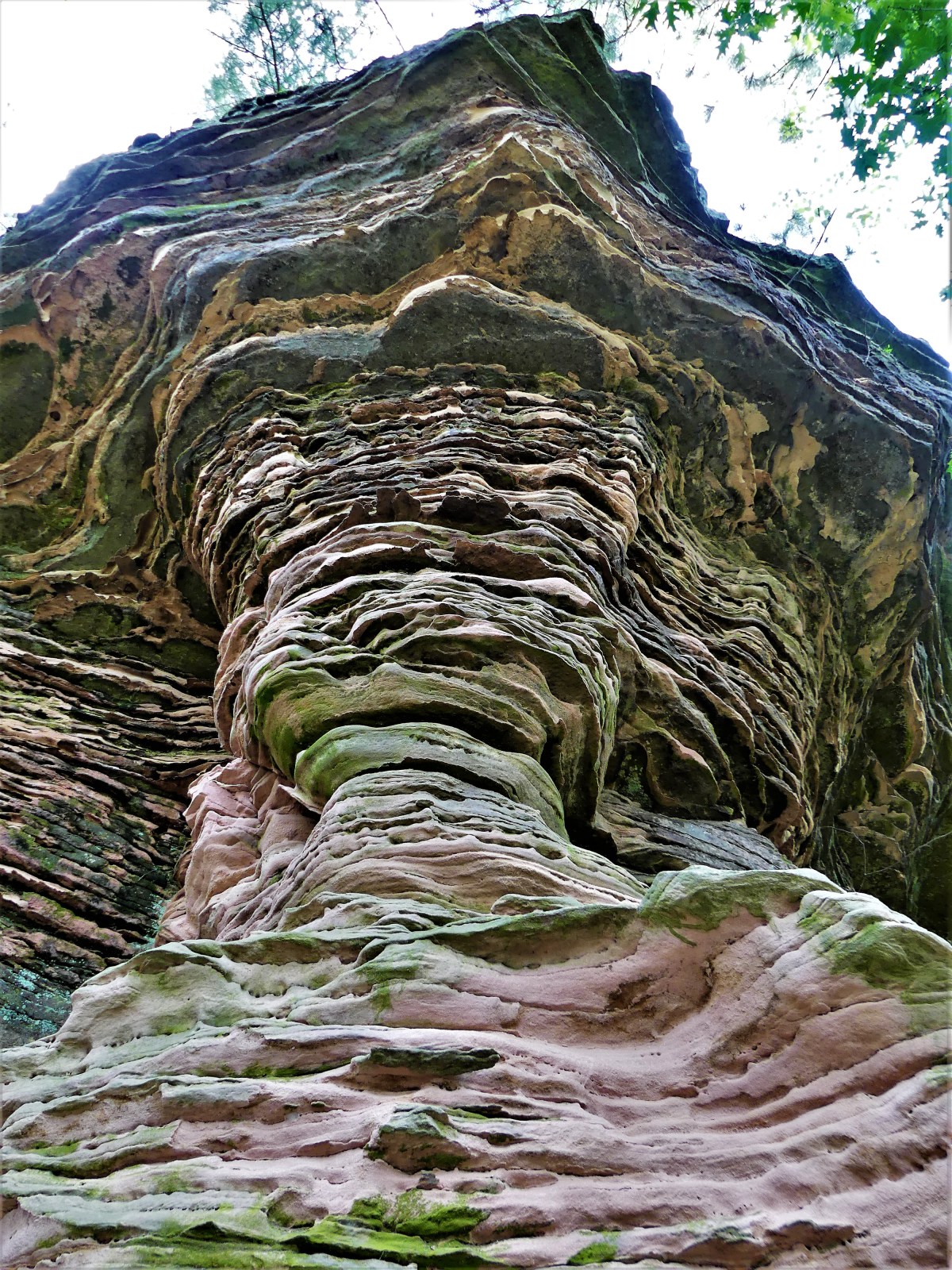
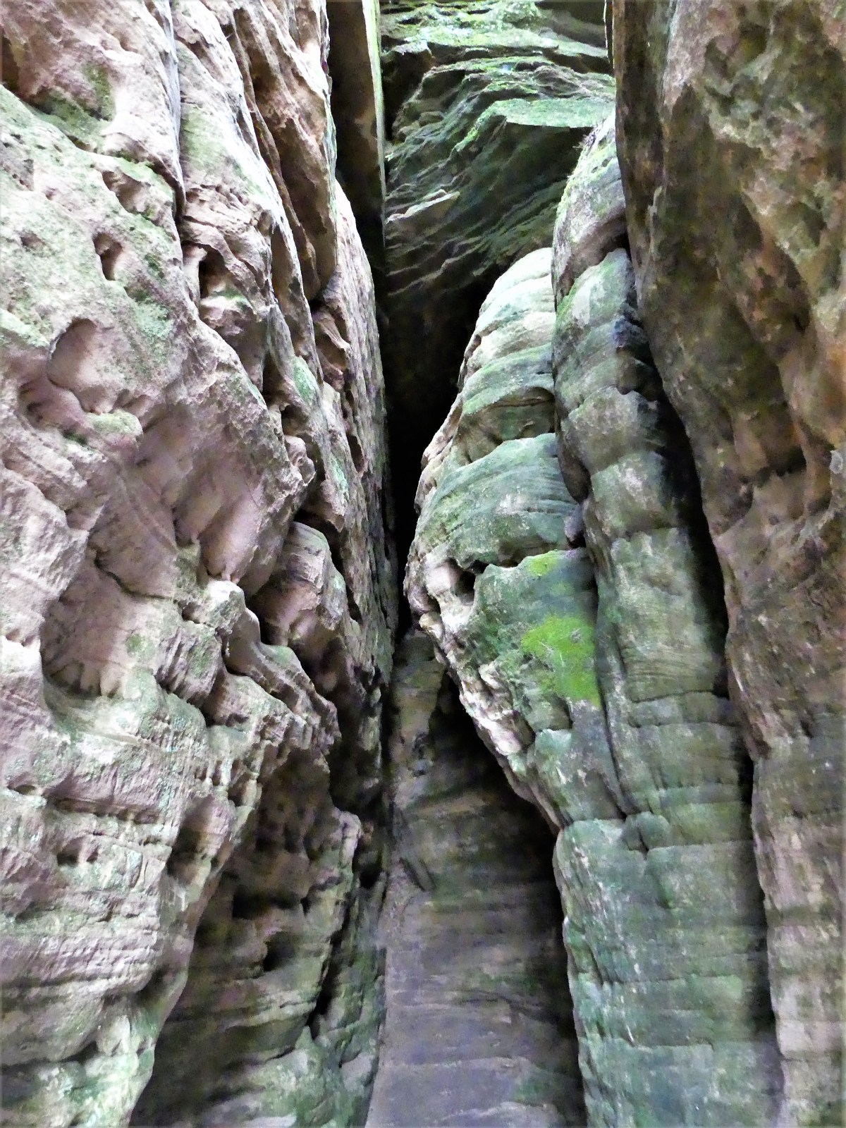
After manuevering through the Devil’s Elbow…
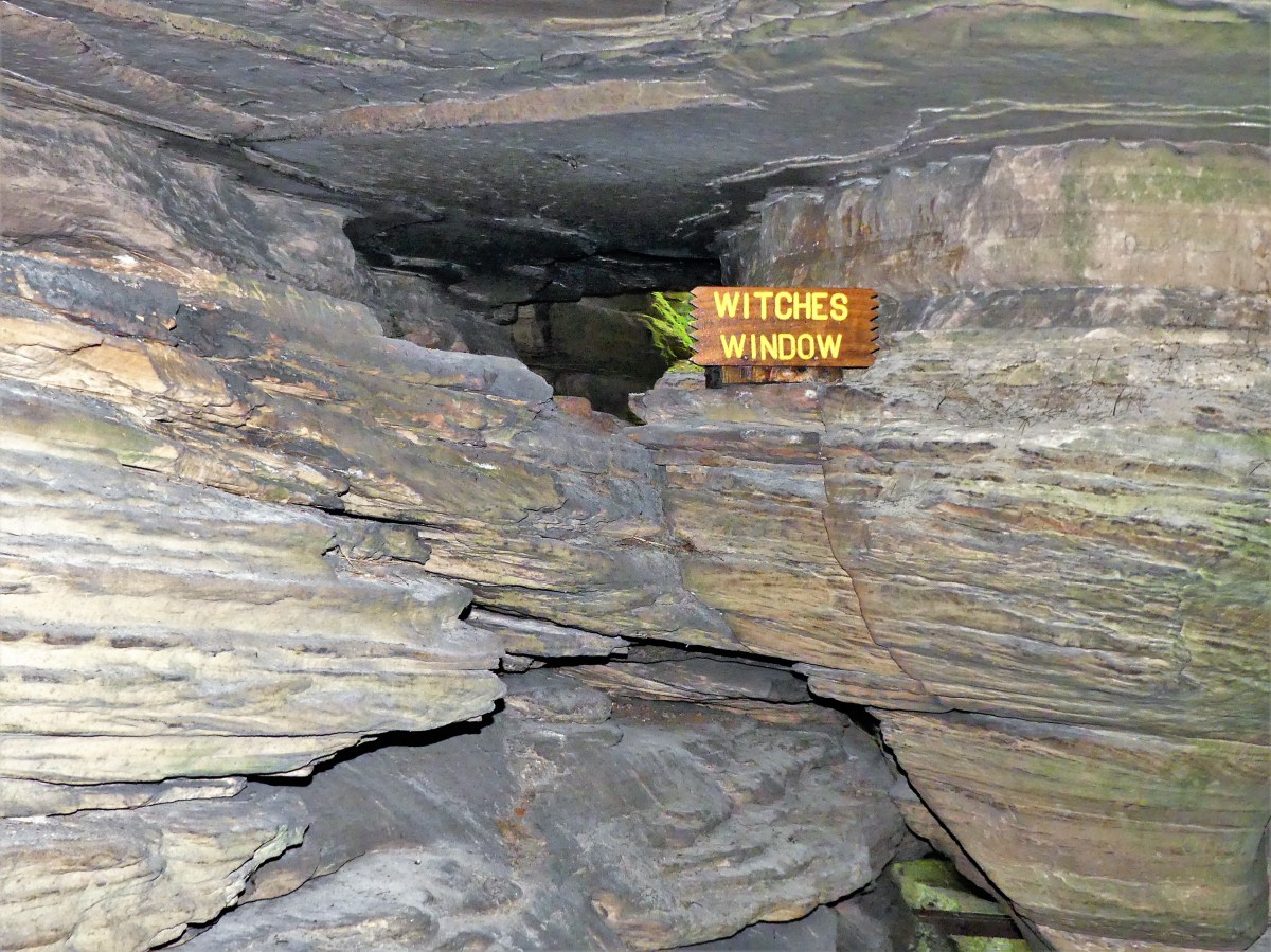
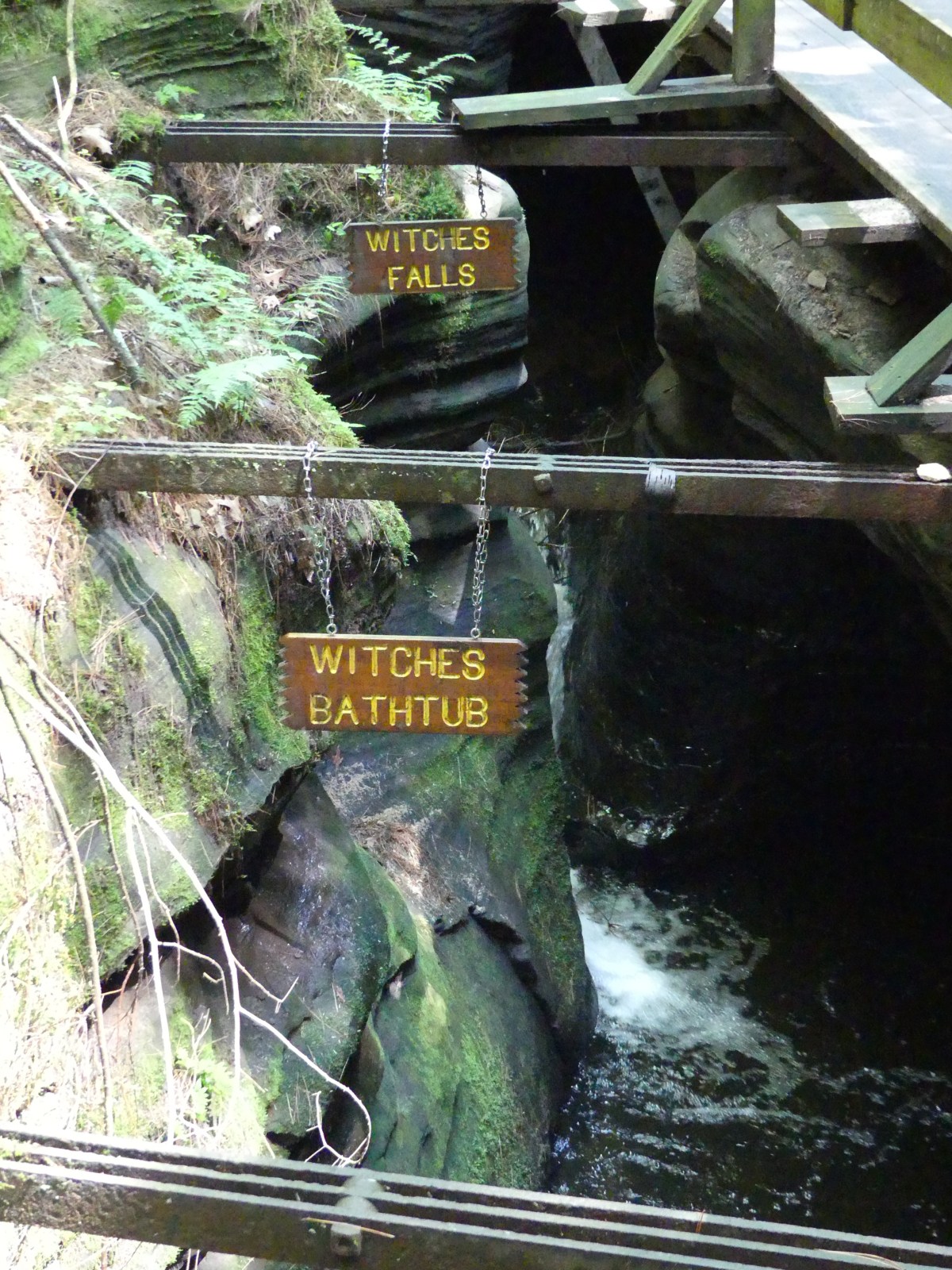
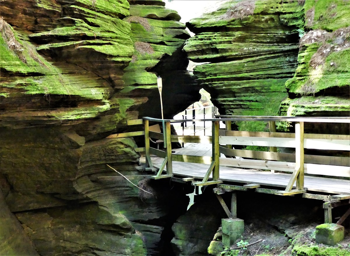
Captain Bob turned into a slot canyon discovered–and affectionately named Witches Gulch by Bennett. Apparently, the name was intended to be sinister and provocative. His strategy was reinforced by similar names inside the canyon, such as:
Whirlpool ChambersWitches WindowWitches Bathtub and Witches Falls
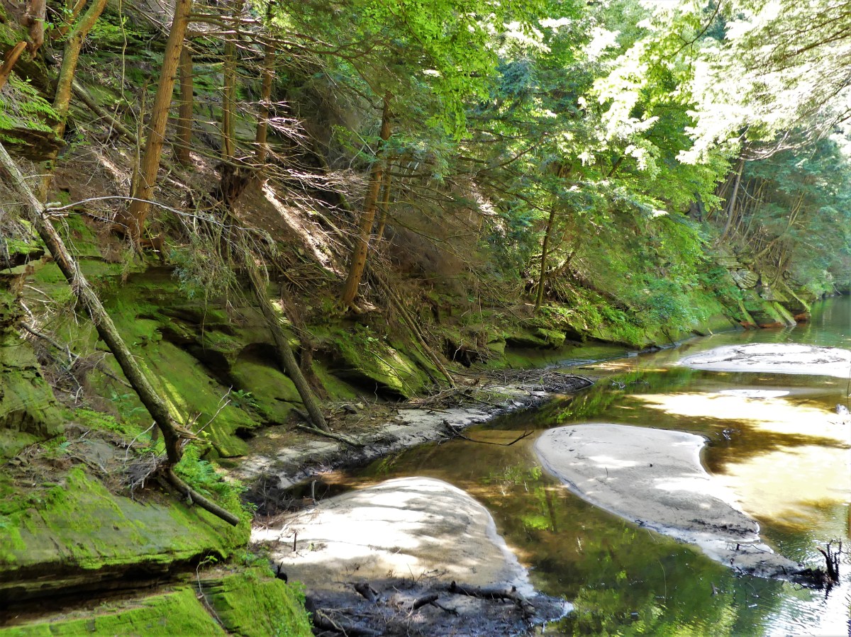
Eventually, Bennett built a tie-up dock, threaded a boardwalk through the canyon walls, and created a photography concession at the terminus. We were about to see why, as Captain Bob eased toward the mooring.
Abby tied up the riverboat,
and we walked the boards,
for a closer look at the beauty of ancient splittered sandstone turned emerald,
and the waves of light and darkness.
The Winnebego Gatekeeper and His Dog
Next, we cruised across the Wisconsin River to the western shoreline to visit the Dells’ most precious formation,
Stand Rock
made famous by H.H. Bennett’s photograph of his 17-year old son, Ashley leaping onto the column from a neighboring cliff in 1886.
Leaping the Chasm
We gathered under the rock for an equally impressive demonstration by a trained German Shepherd from Juneau County…
that jumped the 5-foot gap without hesitation.
We completed the trail back to the boat, passing other impressive formations along the way…
ToadstoolCave LipsThree Tongue Cave
until it was time to reboard the Marquette and return to the tour operator’s dock. As we cruised back under sunny skies, boat traffic on the river had blossomed.
Locals were enjoying the river to beat the heat,
which was way better than any water park would ever be.
Many in the tourism industry descibe Door County as the mid-western equivalent of Cape Cod, and they make a valid point. If Cape Cod is the crooked finger beckoning the Atlantic Ocean, then Door County is Wisconsin’s thumb poking the western side of Lake Michigan. Both peninsulas offer a laid-back vibe, with historic beachtown pearls bordering sandy, rocky beaches.
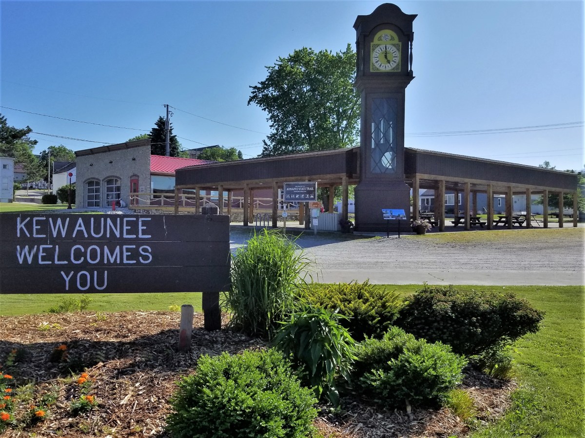
We began our tour by exploring our home base in Kewaunee, a southern border town below the county line.
We knew nothing about the clock, so it took us by surprise. At noon, it chimed over and over again, then played a “bell” rendition of Amazing Grace.
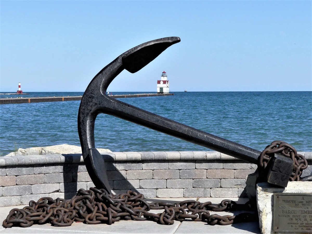
A short walk to the waterfront brought us to the Ludington. Retired in 1998, the tug saw action during the D-Day invasion at Normandy by pushing barges of ammunition across the English Channel, and later as a construction tow for the Army Corps of Engineers.
Like most newcomers, we got our coastal orientation by walking out to Pierhead Light,
but following the path was like a twisted game of minefield hopscotch.
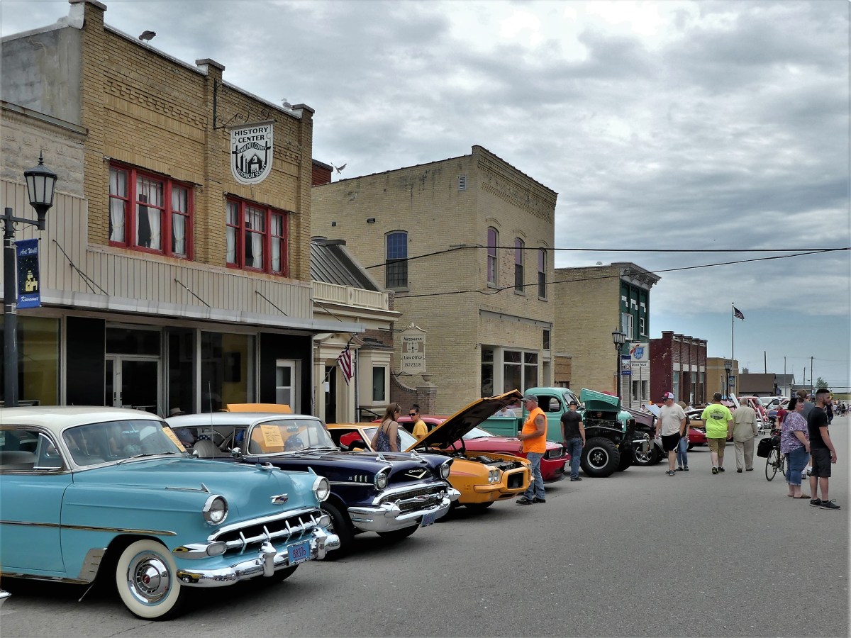
Ellis Street was closed to traffic for a smallish classic car show that appealed to locals, auto enthusiasts from Green Bay, and bloggers…
with plenty of space for antique tractors and snowmobiles in the parking lot.
Further up the coast sits Algoma, a town with a Crescent Beach Boardwalk that parallels an arc of sand and polished stones, and the Algoma Pierhead light that welcomes hundreds of roosting gulls at any time.
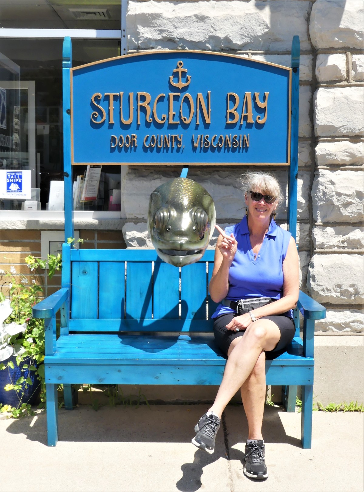
With so much ground to cover and little time to spare, we detoured along the coastal county roads to Sturgeon Bay, a town with a rich ship-building legacy and a lust for shopping. While not my favorite activity, we parked the F-150 and strolled the sidewalks, passing through galleries and home furnishing boutiques.
Local artists brought their imagination and decorating prowess to town, converting plain Adirondack-style chairs (or created a chair/bench of their own) for the inaugural CHAIRies, a public art project on display at most downtown corners, and a nod to the bountiful cherry groves scattered throughout the peninsula.
Continuing north, Jennifer (GPS) directed us to Cave Point County Park, the only county park within a state park (White Dunes State Natural Area).
Diving into Cave Point’s roiling water is a well-known proving ground and badge of courage for daring teenagers…
who are fortunate to clear the cliffs or avoid the crashing waves.
Riding north on WI-57, we cut through the middle of Door County’s thumbnail, and headed for Northport, known for ferry service to Washington Island at the tip of the peninsula. and the gateway to Death’s Door, a legendary passageway with a washing- machine turbulence that has shipwrecked many 19th century schooners.
We rushed along WI-42 from Northport down Green Bay’s sidelines, needing to reach the Airstream end zone after a long day of driving, but deliberately slowing around a bendy stretch of road nearby.
Then we were dodging and weaving our way through a variety of pedestian-rich towns at 10 mph, absorbing the downtown charm of Ellison Bay, Sister Bay, Ephraim, and Fish Creek from the front seat of our truck.
We vowed that we would return the following day for a glorious sunset dinner, as we settled on leftover pizza and samosas under a cloudy sky.
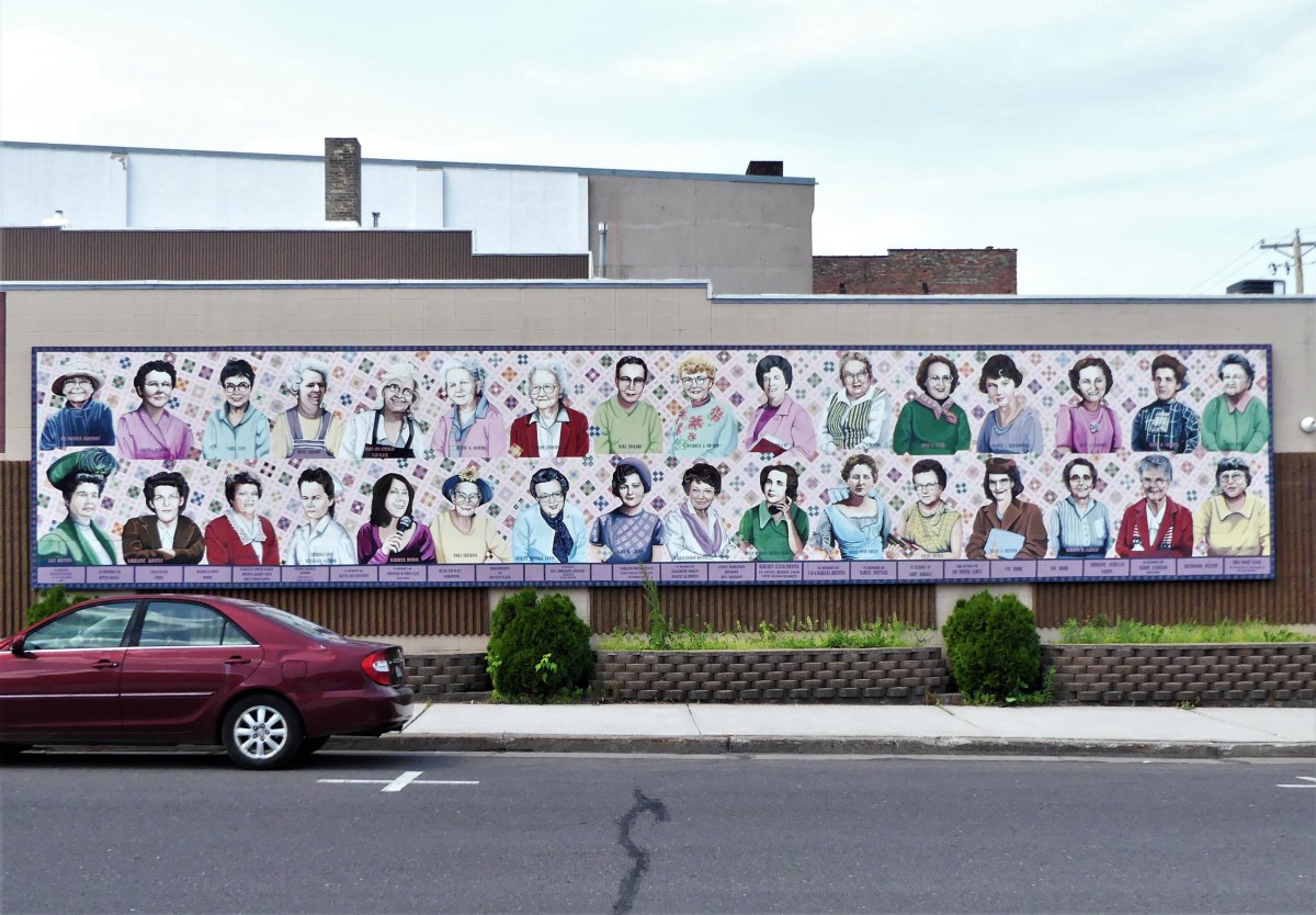
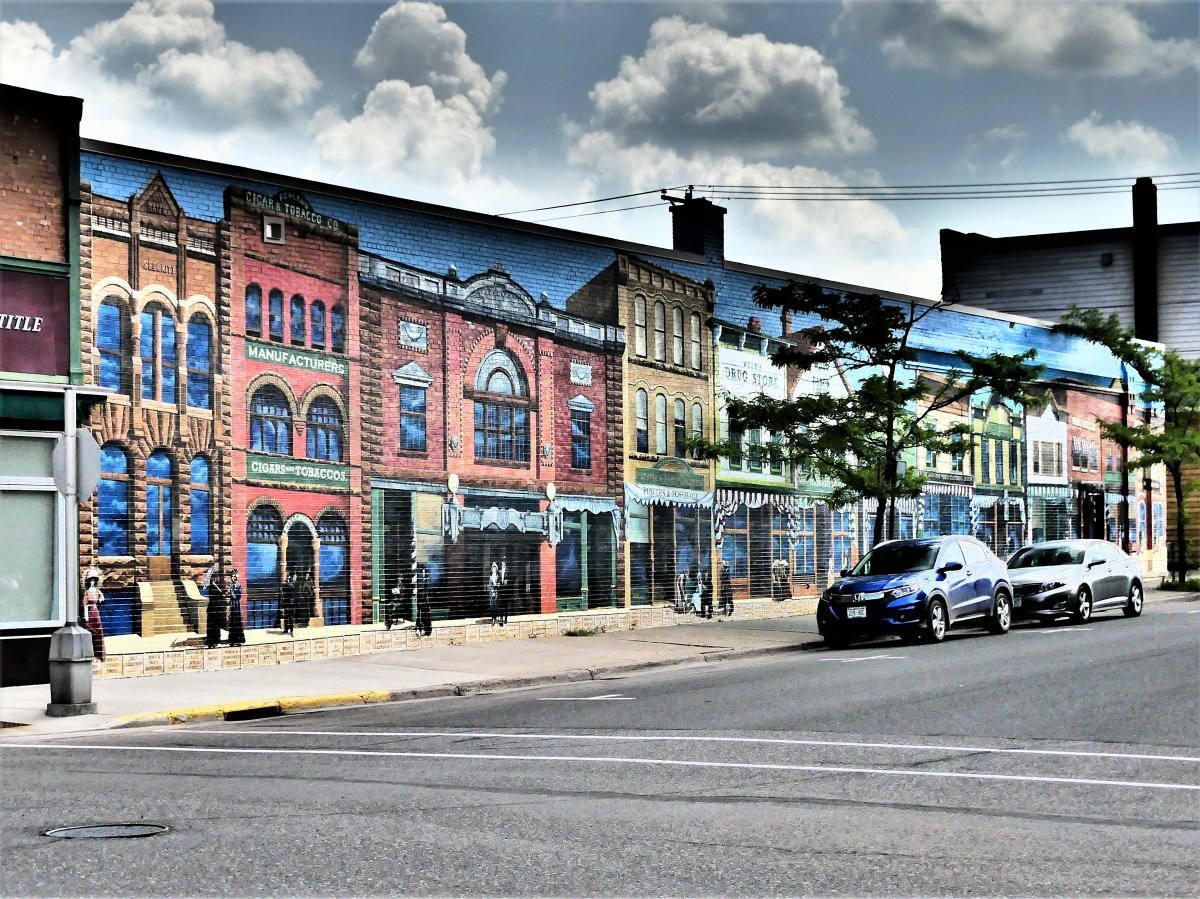
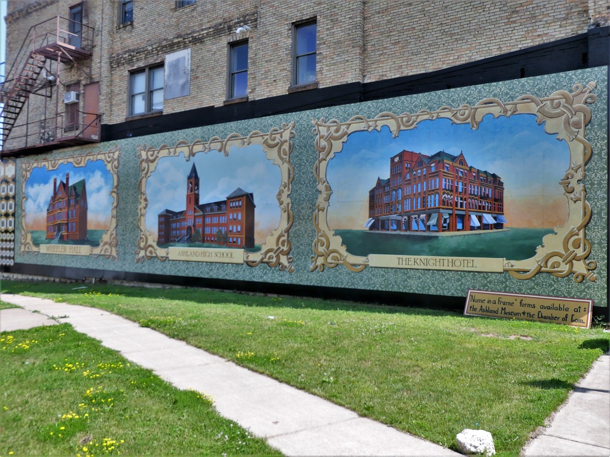
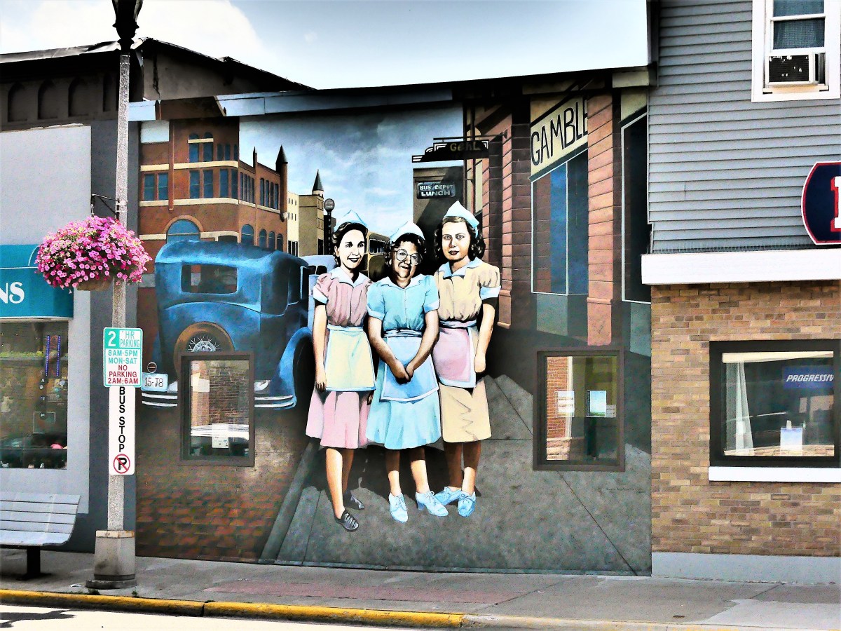
While staying in Bayfield, Leah and I learned of Ashland’s Mural Walk. While only a half-hour from our camp site, we were so preoccupied with three full days of hiking, biking, and kayaking around the Apostle Islands, that time became a factor.
When asking around about the murals’ merits, someone local described the trip as “interesting”, so we decided to make an informed opinion for ourselves. Since Ashland was on our way from Bayfield to Munising, we boarded the Airstream, checked out of Apostle Island Area Campground, and followed GPS to Ashland Mural Walk. An actual POI pinged when I asked Jennifer (our GPS coach) for the route.
We had completed a previous mural walk inPalatka, Florida, also a county seat, and found it odd that their murals were in better shape than the town. We wondered if this was also the case in Ashland.
Ashland’s history dates to 1500, when the Ojibwe stayed on Chequamegon Point. A century later, they were followed by French fur trappers, European traders, and Jesuit missionaries. By mid-1800’s, Ashland’s first settlement was established, and the town prospered as a major quarry and port with rail service to Chicago.
Thanks to mural artists Kelly Meredith and Susan Prentice Martinsen, Ashland’s murals are a pleasant recapitulation of their proud history and their community spirit.
The murals have been beautifying downtown for twenty years. But Ashland wasn’t content to rest on its murals. Since 2017, decorative mosaic containers have been popping up on Main Street, turning trash to treasure.
There are 18 murals located around an 8-block radius of Main Street’s business district.
Leah and I gave ourselves an hour to see as many as we could (we found 12), but a 4-hour drive to Musining still loomed large, so six were left undiscovered.
For additional information on mural titles, descriptions, and locations, or to see what we missed, aMural Walklink is provided.
Seemingly, Duluthians have only two seasons: winter and summer. During the 2018- 2019 weather calendar, city residents shoveled snow from October 10 to May 9, breaking a record dating back to 1884. Temperatures were moderate for the remaining months of the year.
But when the last snow melted, the Northlanders traded their shovels and skis for bicycles and hiking shoes–eager to take advantage of the wealth of recreational resources in the vicinity. Leah and I sampled some of the more popular options during our recent visit.
The 70-mile Hinkley-Duluth segment of the Munger State Trail offers hiking, biking, in-line skating and snowmobiling on a fully paved road, cut through a forested ridge that follows a busy railway.
Leah and I cycled a scenic 8-mile stretch from Buffalo Valley Camping (our temporary home) to the Carlton terminus,
where the trail parallels Forbay Lake…
until it crosses a nearby St. Louis River dam release.
Lunch at Magnolia Cafe in Carlton gave us the energy we needed to pedal back to camp. Kudos on the cold-brewed coffee and gluten-free chocolate chip cookies.
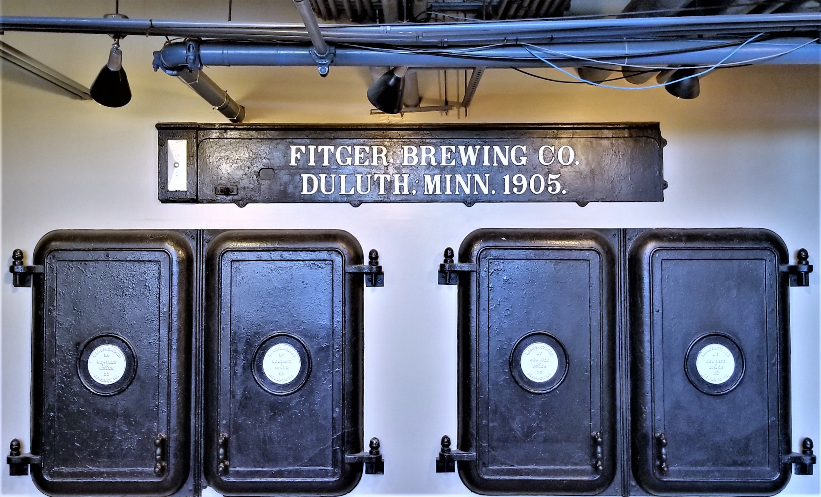
With our energy restored, we drove to Duluth in search of craft beer. Despite a population center under 90,000, Duluth has earned a reputation as Minnesota’s capital of craft beer, boasting more than a dozen production facilities in the area that are eagerly taking advantage of Lake Superior’s pristine waters.
Fitger’s Brewhouse is the oldest and perhaps the most famous active brewery,
dating back to 1881…
with over 100 original recipes…
still brewed at its present location along the Lakewalk.
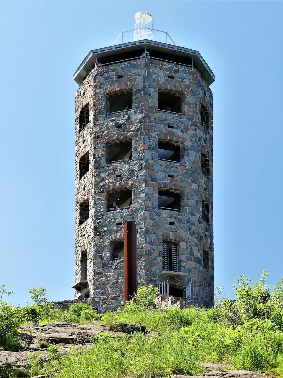
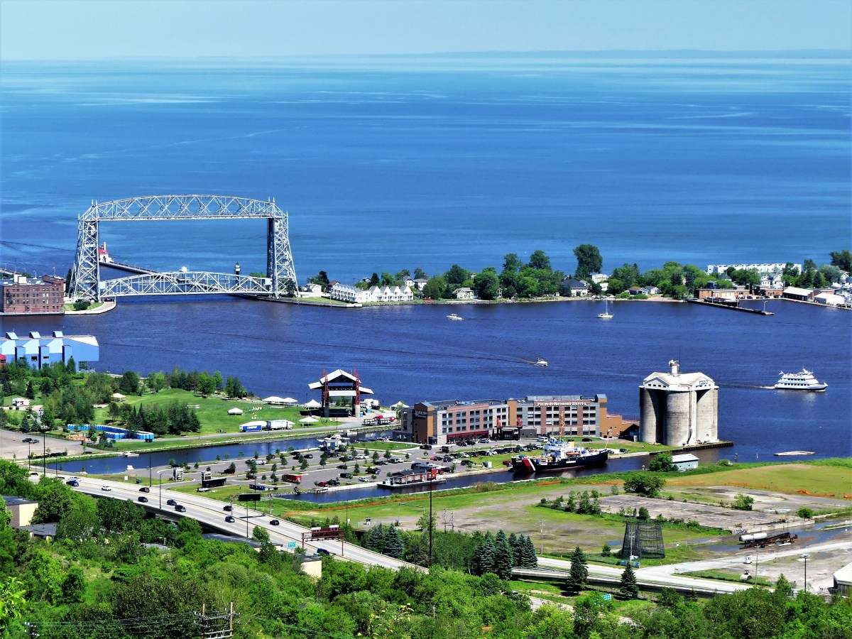
For views of the city, nothing beats Enger Tower, the highest point in Duluth,
and no better place to see where the city opens up to the sea,
while revealing its industrial underbelly.
The following day, we were looking for a short but moderate morning hike. All internet indicators pointed to Ely’s Peak, a popular trail reached by following the abandoned Duluth, Winnipeg, and Pacific (DWP) railroad corridor to the entrance of a 1911 railroad tunnel.
The trail was named after Rev. Edmund Ely of Massachusetts,
whose mission was converting the Fond Du Lac Native Americans during the mid-1800s.
From the tunnel to the top and back is 1.8 miles. The loop takes hikers on a 300 ft. ascent offering far-reaching views of the Fond du Lac Reservation and beyond.
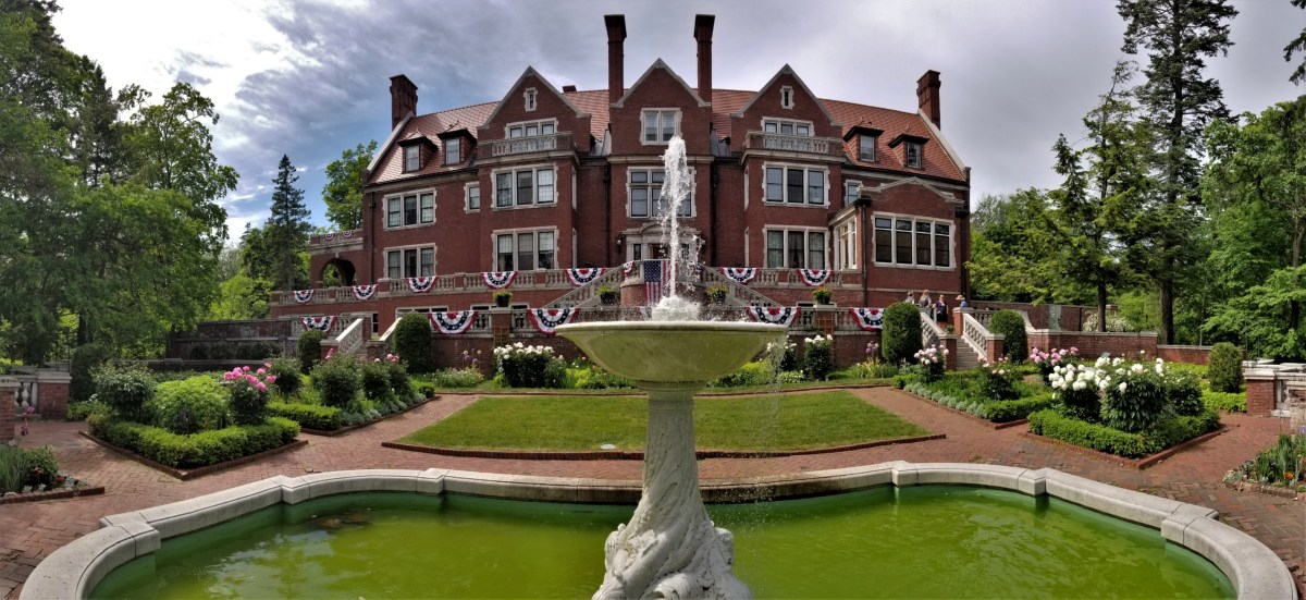
We spent the afternoon touring Glensheen, a 20,000 sq ft. Beaux-Arts-styled mansion surrounded by a 12-acre estate…
built beside Lake Superior between 1905 and 1908 by Clarence Johnston, Sr…
for Chester Adgate Congdon and family.
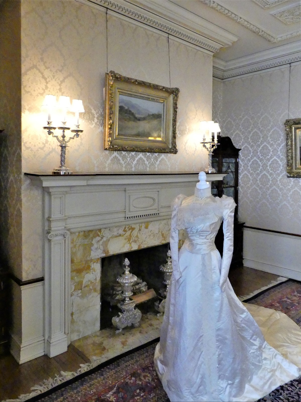
The 39-room historic mansion is reknown for its design and craftmanship of the day…
and that almost nothing from William French’s orginal interior design has changed in 110 years–down to the furniture placement…
and the accessories that adorn the house.
But the most unusual part of the tour was what Nick, our docent would not share with the group when asked about the murders of Elisabeth Congdon and her private nurse, Velma Pietila.
Instead, we were referred to a brochure card with a disclaimer and few details.
It was a brutal crime that was sensationalized by the media, and still remains unsolved.
Leah and I concluded our day sitting in stadium chairs by the Glensheen boathouse pier, noshing on local food truck fare while listening to Charlie Parr, a local folk singer performing an evening of Minnesota moonshine music to kick off the 5th season of Concerts on the Pier.
It was the perfect way to end the day:
enjoying the sunshine and the breeze coming off the lake;
meeting and appreciating new people around us;
watching a mish-mash of vessels manuevering through an ad hoc harbor;
and being interviewed by Ryan Juntti, for WDIO’s 6:00 PM News.
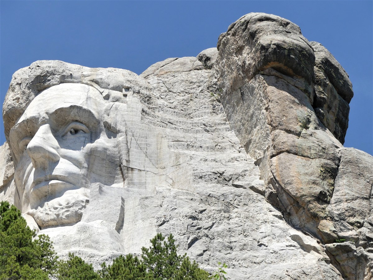
Although it’s been two years since Leah and I visited Mt. Rushmore, what could be more American than re-posting this visit on Independence Day?
There’s no better way to celebrate the 4th of July, than a trip to Mount Rushmore and the Crazy Horse Memorial. Sure, the crowds were large; that was to be expected. But once the cars were garaged, the pedestrian traffic was easy to negotiate. And with everyone looking up at the mountain, the Presidents’ faces and intentions were never obstructed.
It was also a time to celebrate family. There were plenty of kids riding in strollers, hanging from moms in carriers, or balancing on dads’ shoulders. Generations of families–many of them immigrants–had gathered to pay homage to the principles of freedom that make our country a beacon for the oppressed and downtrodden.
Seniors were being escorted through the Avenue of Flags by their grandchildren. Extended families organized group pictures at the Grand View Terrace, unified by their love of democracy and their reunion T-shirts.
All expressed awe at Gutzon Borglum’s grand vision and remarkable achievement–the transformation of a mountain into a national symbol visited by approximately 3 million people every year.
The 14-year process of carving the rock began with dimensionalizing the Presidents’ portraits through Plaster of Paris masks, on view at the sculptor’s studio-turned-museum.
Additional exhibits detail the construction of the memorial, and the tools used by workers, like the original Rand & Waring compressor, which powered the jackhammers for all the finishing work.
A little known fact is that Mt. Rushmore was once intended to be a tribute to the “Five Faces of Freedom,” but funding ran short when the Congressional appropriation approached $1 million during the Great Depression. Hence, the unfinished carving of the Great Ape to the right of Lincoln serves as a reminder that we are never far from our true ancestors.¹
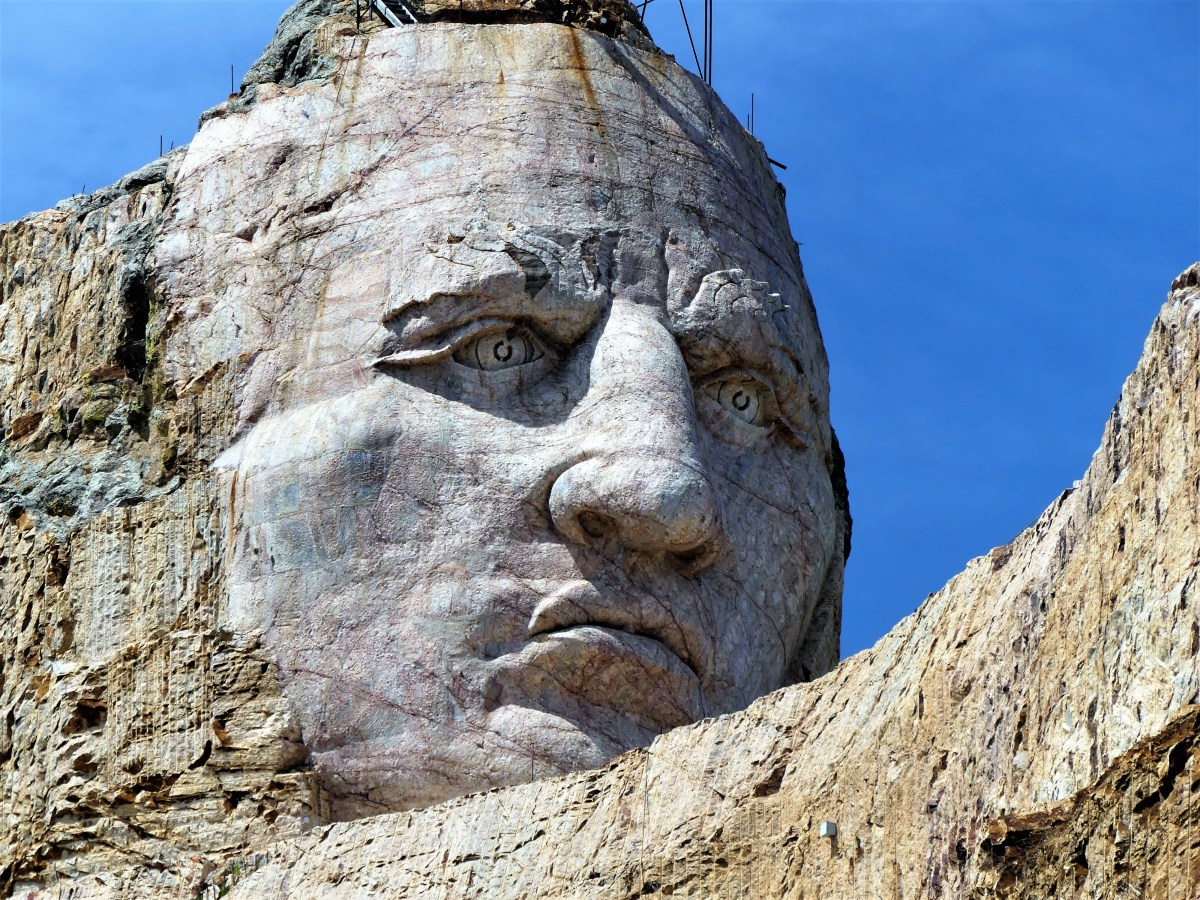
No less ambitious, and equally as impressive, the Crazy Horse Memorial is a work-in-progress located 16 miles away in the heart of the Black Hills–considered sacred land by the Lakota people.
Conceived by Korczak Ziolkowski in early 1940s,
the memorial, when completed will stand 563 ft. by 641 ft. across, and is expected to be the largest sculpture in the world. Already, the completed head of Crazy Horse measures 60 feet tall…
…twice the size of any of the presidents at Mt. Rushmore. While the first blast was conducted on the mountain in 1947, the current prospects for the memorial are to complete the outstretched arm during the next twelve years. There is no completion date available for the finished carving, which has been financed entirely by private funding since its inception.
Mt. Rushmore was created by a Danish American. Crazy Horse was created by a Polish American. And visitors to both destinations manifest the melting pot that has brought us all together as Americans. It’s our diversity that makes us strong, our ambition and determination that makes us great, and our compassion and sacrifice that make us whole.
These are the values reflected from the faces we’ve immortalized in stone. Yet, we would honor them more by living according to these principles.
Happy Birthday, America!
¹ Just kidding, but the photograph is real and has not been retouched.