Keeping an Eye on Zion

The crowds that crammed into Zion National Park over Memorial Day weekend left us frantic and bereft. As our first stop in Utah, we came to Zion to enjoy the trails and distinctive scenery of mountains and water. We planned to hike the Narrows through the Virgin River, and experience the Kolob Arch (the world’s second largest natural free-standing arch), but we never accounted for (and neither did the Park Service) the tens of thousands who would mob the park this particular weekend while we were here.

Staying over in Springdale, just outside the park, gave us easy access to the southern park entrance, only half a mile away. And the convenience of having a free shuttle bus stop outside the RV campground with transfers to trail heads available inside the park, meant we could leave the F-150 behind. Or so we thought…

The one day we had to explore, Sunday, we walked to the bus stop only to find it spilling over with more than fifty people waiting in a discordant line.  According to a bus dispatching authority (a busy body) who had been waiting for over half an hour, “Buses come by every fifteen minutes, but will pass by without stopping if they are full, and so far, two buses filled with standing passengers has already passed.”

When a third bus passed without stopping, Leah and I started for the park gate on foot.

When we beat the shuttle bus to the park entrance due to traffic back-ups at the gate houses, we realized that things were not going according to plan. After checking in with a park ranger at the visitor center, we were directed to the park shuttle buses that would transport us to stop 9. Searching for the end of the line, brought us as far back as the park entrance, where the wait for boarding a shuttle bus would be over two-and-a-half hours!

serpentine

back of line

When asked about the situation, a ranger confessed, “I won’t lie. This park is not equipped to handle these many people. It’s like trying to scoop five pounds of poop into a four pound bag. We’ve never seen it like this before, and I’m embarrassed to say, there’s not too much we can do about it.” Yet the park’s popularity has been steadily evolving, making it surprisingly, the fifth most visited National Park with over 4 million guests last year, just beating out Yellowstone.

The thought of waiting for a bus in direct sun during peak day seemed like a deal breaker. Our planned activities inside the park were scheduled to carry us late into the day, but with bus service being backed up, and the potential of sharing the trail with hundreds if not thousands of hikers, we wondered if the day could still be salvaged.

Another look at the park newspaper revealed a moderate four-mile hike from the visitor center along the Watchman trail with sweeping views of Springdale, and iconic Zion landmarks such as Beehives, Towers of the Virgin, West Temple and the Altar of Sacrifice, ending with a view point of the Watchman, a rocky spire rising to an elevation of 6545 feet. We shrugged and accepted out fate. While not our first choice (and ranked #19 of 49 attractions in the park by Trip Advisor), it would have to satisfy our urge to be a part of the Zion experience.

What most hiking critics reported as a quiet and thinly-populated trail was being exploited today as an overflow option for many other folks with “won’t-wait-in-line-itis”, including several families with small children, small groups of rowdy teens, and an assortment of unprepared novices wearing flip-flops, trudging up occasional steep and narrow switchbacks, and wishing they brought more than a small bottle of water.

Overall, the hike to the top of the ridge line paid off in dramatic and sweeping views from north to south.

zion canyon

1.1

2

Zion range

watchtower

The next day we drove the Zion Canyon Parkway north through a skinny one-mile tunnel cut through Zion rock in the 1930’s, and closed to two-way traffic to accommodate wide rigs like ours.  The switchbacks were hairpin and narrow, but Leah has grown confident in my driving over the past month, and allowed the radio to play with the sun-roof open, while she enjoyed taking iPhone pics of the canyon vista.

rig

sunstreak

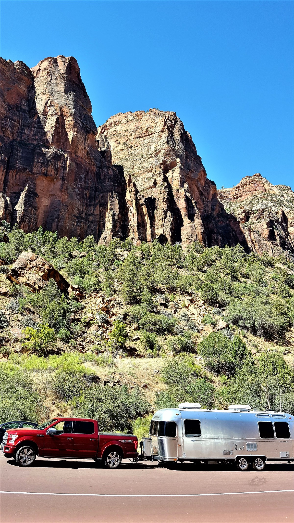
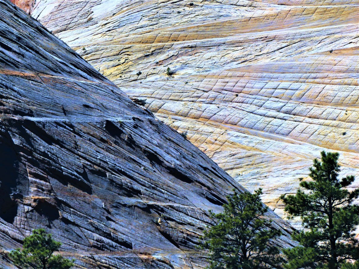
Finally, a scenic turn-out featuring Checkerboard Mesa opened along the roadside, allowing me to pull up to a yellow coach (no joke) filled with scores of yammering Chinese dressed in down jackets, white gloves, and colorful umbrellas.

While most cameras focused on the mesa, I was fascinated by the checker-boarding.

black and white1

Checkerboard mesa

P1040086

We’re on our way to Bryce Canyon National Park, where hopefully, the crowds are thinner and the air is fresher.

Antelope (Can’t Elope) Canyon

Driving past the Desert View entrance of Grand Canyon, we rode with uncertainty to our next destination, watching the last trace of Mount Humphrey’s snow cap dip behind the hilltops like a setting sun. We were driving through Page, AZ on our way to experience Utah’s quinfecta of National Parks, with a hopeful detour to Antelope Canyon.

Two days earlier, a park ranger at the South Rim recommended a drive to the North Rim. It was our first choice for camping inside the park after reading about trailer sites that back up to the canyon rim. But given its popularity and limited availability, we were shut out long before we ever started planning. Consequently, a day trip to the North Rim loomed large until the park ranger laid out a map in front of us.

“As the crow flies, the canyon is 10 miles across,” she explained while tracing the route. “However, by taking Center Road to 64 East, and following the road to 89 North, which then becomes 89A North for a while, and turning onto 67 South for the rest of the way, you should reach your destination in a little over 4 hours.

“Four hours?” questioned Leah, incredulous of the time.

“That’s right,” the ranger explained. “It’s 212 miles around to the other side.”

“And four hours back,” rebutted Leah.

“Well, it is remote,” admitted the ranger, “but it’s really worth it.”

Turning to me, “Remember,” Leah asserted. “You’re the one who’s gonna be driving eight hours. So there’s no way we’re taking that day trip. Not unless you’re willing to get up at four in the morning.”

That immediately put things into perspective. We left the visitor’s center feeling less secure about our plans.

“So, we’ll think of something else,” I suggested. “How about we stop in Page to break up the ride to Zion? Then we can explore Antelope Canyon. It’s part of the Navajo tribal park, and it’s really famous.”

“How do we get in?” Leah wondered, “and do we have to pay?”

A quick Google search brought quick answers. “Of course, we have to pay,” I affirmed. “But it says here that you can’t enter the canyon without a guide, and you definitely need reservations to guarantee a space, especially the week of Memorial Day holiday.”

“How’ya gonna manage that?” asked Leah. “It’s so last minute, and you know what the crowds are gonna be like this week.”

I was up to the challenge, and perseverance rewarded me with a early afternoon reservation with “Ken’s Tours” on our travel day… or so I thought. Unfortunately, closer inspection of the confirmation specified an 8:00 am entrance time–not the 2:00 pm time I bubbled. “No fucking way!” I yelled at the sky.

“I did nothing wrong,” I argued to Leah. “Those fucking bastards switched the time on me.” I was angry, and ready to pick a fight I knew I’d lose, but still I returned to Ken’s website to double-check. Of course, THE CALENDAR WAS FULL! I had psyched myself up for this after being turned away from the North Rim. I wanted this excursion more than anything. I had seen photographs of the canyon, and needed to witness this spectacle for myself.

“Look,” Leah explained. “We’re not gonna make eight o’clock, and you know it. So you may as well cancel our reservation, and we’ll call in the morning to sort it all out.”

The agent on the phone couldn’t get past the cancellation post from the night before. She insisted that by cancelling, we forfeited our reservation. But Leah was not giving up so easily.

“You gave us a time we didn’t order,” she lectured, “just so you could fill up your calendar. Besides, it’s already 7:30 in the morning which makes it completely unreasonable to expect us to be there in half an hour since we’re at the Grand Canyon, and we still have to drive two-and-a-half hours to reach you.

I listened in on the call, and didn’t understand the logic that was going back and forth, but Leah wore the agent down. She relented by agreeing to wait-list us, provided we show up at 2:00 pm to take the place of two no-shows.

Obviously, as can be seen from the banner above the blog, we made it in time, and got to explore the lower canyon. Our guide, Broderick, a full-blooded Navajo who also spoke Hopi and Zuni, escorted us to a sloped overhang, where hundreds of canyon seekers waited patiently for their moment…

Before it would be our turn to take the stairs, Leah and I had an hour’s wait, which gave us plenty of time to get to know our group of nine others and Broderick, who’s been working as a guide for Ken’s Tours for the past six years. We introduced ourselves to a millennial couple from Belgium, a mother/daughter from Japan, a Gen-X couple from Sri Lanka, and three deaf-signing teenagers, of which one could speak.

Broderick filled much of the time feeding us background information on his life. We learned that Kenny Young (of Ken’s Tours) also breeds prize bulls for the professional rodeo circuit, and Broderick who has ridden bulls in the Kenny Young Bull Riding Classic since his late teens was an adoring mentee of Kenny’s, learning how to properly grip the bull rope around his bull-riding hand, and best position his rope handle. It was at the arena that he first met Kenny’s granddaughter, who has been his steady soul-mate ever since. And it was only after Broderick bought her a four-bedroom house as part of a customary Navajo dowry that the deal was sealed.

While they have no immediate plans to marry, Broderick willingly shares his vision of how the wedding will take place–which surprisingly does not include a ceremony within the canyon walls. Instead, he imagines a small invited assembly atop a holy mesa accessible only by helicopter.

Forever the romantic, Broderick remains deeply devoted to his guide duties and the heir of a family business who sees 1,500 plus visitors a day wind their way through Arizona’s most famous slot canyon at $25 a piece.

The waiting time moved quickly, and soon it was our turn to descend into the canyon.

down under (2)

From the moment we twisted into the slot’s sandstone corkscrew, I knew I was in photo-nirvana.

3 (2)

15 (2)

2 (2)

5 (2)

6 (2)

7 (2)

8 (2)

9 (2)

10 (2)

11 (2)

12 (2)

13 (2)

14 (2)

16 shark (2)

17 (2)

20 (2)

And after a walk through nature’s majesty, I acknowledge that it’s the best money any would-be photographer can spend.

Freedom’s Just Another Word

For many, the notion of boondocking in an Airstream trailer might be enough to move the oxymoron needle from sublime to ridiculous. There are those whose purist sensibilities are offended simply because my RV has AC, TV, LP and TP.  To them, my mobile home is an affront to Bear Grylls, surviving in the wilderness with only flint, rope, and a knife. On the other hand, there are Airstream extremists who would argue, “What’s boondocking, and why would you even want to?”

Being caught in the middle of a philosophical referendum on outdoor living has offered few choices when looking for like-minded enthusiasts, since traveling on the road. Mainstream Airstreamers (or Airstream mainstreamers) I’ve met seemingly flock to RV parks that offer a variety of amenities that complement the home-is-wherever-you-are lifestyle. So I have turned to Air Forums—a community resource for all things Airstream—to find adventure seekers who are not opposed to finding a lesser road traveled.

In fact, there is a breed of Airstream aficionados who brag about never paying a camping fee. Of course, many of them belong to the Walmart or Cabela parking lot crowd, for whom I draw an analogy to those who over-extend to buy a house they can’t afford to furnish. But to be fair, there are others who simply want to get away from it all—to be free from campground constraints and rules. I call them “liber-trailer-ians.” (While the idea is enticing, it would also mean giving up cable news, and I don’t think I’m ready for that just yet.)

I met such a person from Prescott, AZ while the Airstream was in dry-dock at Turquoise Trail Campground in Cedar Crest, NM. Leah and I had returned from an East Coast red-eye, and I needed a couple of days to prepare for several anticipated days of camping (“glamping”) without services, as we would be swinging through the western National Park circuit in Arizona, Utah, Colorado, and Wyoming. Our biggest concern was having sufficient self-sufficient power, if shore power (30/50 amp hook-up) should be unavailable. My intention after researching the Air Forum: to replace the two troubled 12-volt OEM deep-cycle batteries, with two 6-volt golf cart batteries.

Without going into the science, I can report that swapping out two 12-volt cells connected in parallel for two 6-volt cells connected in series yields an extra 80 amp hours, or the equivalent of 33% more power, and the ability to re-charge them endlessly. The only hitch would be finding right-sized batteries that are compatible with the pre-existing dimensions of the battery box that’s welded to the A-frame of the Airstream hitch. My gratitude to the internet for guiding me to an online retailer who shipped two Lifeline GPL-4CT batteries in three days at a competitive price. On paper, it was the right choice for the right job. All I had to do was replace, connect, and bask in the accomplishment…or so I thought.

Back at the campground, I was scratching my head, trying to figure how to stuff 10 pounds of shit into a 5-pound bag when Prescott came by with his Boston terrier to satisfy his curiosity. Approaching me was a skinny guy in his mid-50s, with a long hair braid covered by a dirty red “Make America Great Again” cap.

“I was admiring your Airstream. There’s a few others here in the campground, but yours seems to be on the newer side,” he observed. “I like that they kept the fundamental design.”

Prescott’s rig was nothing fancy. He was parked at a site just up the hill from a scratchy patch of red dirt near my location. “I just bought that two weeks ago,” he bragged, pointing to his 30 foot Jayco Eagle. “It’s a 2006. Sold my house. Sold my garage. Got rid of all the shit I was never gonna use, and put the rest of it in the trailer with my two dogs. I figure I don’t need much, ‘cept my tools, my dogs, and my Harley. Got the Harley and the tools in the van.”

“That’s quite a payload over there,” I offered.

“I figure, between the trailer and what’s in the van, I’m probably towin’ close to 10,000 pounds, but I got a V-10 in there, an’ it does the job real nice,” Prescott responded.

“You say you got tools in there?” I inquired. I was thinking about the work in front of me, and wondered if anything inside his van could be useful to my installation job. Specifically, I had two new batteries that fit the box perfectly in length and width. However, the security lid had no way of closing over the assembly with the connections brimming over the lip of the box.

“Somethin’ ya need help with?” he asked earnestly.

“Just adding new batteries to the silver bullet. I thought I’d try to buy a little more flexibility and a little more freedom while criss-crossing the country,” I shared.

“Know watcha mean,” Prescott related. “I mean, I’m not ready to retire an’ all. That’s my living in the back of my van. Any kinda auto body work you need doin’, an’ I can take care of ya. Even got a welding torch back there. But I hear ya loud an’ clear ’bout bein’ free. The way I see it, there’s no reason to go back to the way of life I had before, when all I ever did was keep payin’ the man, an’ never really gettin’ ahead. But this here trailer is a game-changer.”

“What about your hat?” I asked. “Is Trump doing the job you expected him to do?” 

“That asshole!?” Prescott quickly reacts. “This hat is just a reminder that the whole fuckin’ government can go fuck itself!”

Prescott’s admission makes me smile. “Really!?” I’m amused now.

“Damn fuckin’ straight, man! In fact, the best government is no government at all. That’s real freedom. Think back to the Wild West. Everything was just fine until the Sheriff came to town and infected everybody with his corrupt justice, when actually, all those folks ever really needed was a gun an’ a reason to use it if necessary. That’s exactly what we need here today,” Prescott confessed. “All them police can just go fuck themselves.”

“Sounds like anarchy to me,” I responded.

“Fuck yeah!” he asserted. “Just so ya know, there’s this Freedom Rally comin’ up in Arizona later in June… Just in case you’re interested in puttin’ the free back in freedom,” asserted Prescott.

“Sorry, man,” I exhaled. “But we’re heading north through the end of September. I hesitated, “But it sounds like my kind of fun.”

“You ever change your mind, you’re always welcome,” he enthused.

I’m happy to report that the batteries are now in place and making a real difference. With the help of Dan, Leah’s son-in-law, we were able to build up the battery box rim to accept the lid.

Consequently, there’s presently enough power to run the water pump, the lights, and the refrigerator while we simultaneously charge all of our electronics. And equally as important, there’s energy to spare to watch cable TV news.

Here’s hoping that Prescott avoids the news crews.

Petrified

Originally,  the Petrified Forest National Park was intended as a soft layover to break up a six hour drive from Albuquerque, NM to Sedona, AZ, but it quickly became apparent after rounding the first bend of the 28-mile park road, that the vibrant beauty of the painted desert and the pop-color collage of the rainbow forest provided a photographic feast that justified more than a peripheral drive-by. We spent half a day immersed in inspiration.

A “tapestry of time” infuses all the turnouts, loops and trails, dating from: prehistoric remnants of dinosaur fossils, to petroglyphs of Ancestral Americans, to grazing habitats supporting Southwestern settlers, to the crossroads of historic Route 66. Every visitor through the ages has put their visual time-stamp on the landscape, turning our stop-over into a hike through history.

painted desert detail

painted desert
Chinde Point

teepee wide

Teepee
The Teepees

petroglyphs
Hopi calendar? at Newspaper Rock

crow
Raven perched

dinner
Red-tailed hawk picks up a rattler

blue mesa panarama

Blue mesa
Blue Mesa

agate bridge
Agate Bridge

petrified slices

rainbow forest

rainbow log BG
Crystal Forest

red polish

contrast polish
Mineralized wood

Quesions Without Answers

1)  Why do airport terminals have grouted tile floors?

A cacophonous display of roll-away suitcases towed by weary travelers, hiccup along the tiled Albuquerque concourse, sending clickety-clack vibrations through telescoped luggage handles during late evening hours. Each bag resonates with a signature “smooth-bump-smooth-bump” beat against an uneven surface–punctuated by a variety of passenger walking tempos–producing a discordant movement with no beginning or end.

But why not a smooth floor without bumps? Would it be any less durable? Would it be so terrible if towing a suitcase didn’t have to be such a “groovy” experience? Or would pulling a bag along a steady line be too disquieting that passengers would run for their Ativan?

2) Why do airlines spend so much time and money guaranteeing that their fleet flies straight, but they neglect replacing the concave cabin seats that passengers have flattened after millions of ass-miles?

What’s more uncomfortable than saddling into a posterior pancake for hours “on end”, knowing that “cramping quarters” within cramped quarters is cruel and unusual punishment? Shouldn’t airlines be required to pad their seats for the privilege of padding their profits?

3) Why would an airline board a red-eye flight at the last terminal gate, when the airport is all but shut down and all the closest gates are empty?

Stay tuned…there are so many more Qs without As down the road.

What Time Is It?

Camping inside Guadalupe Mountain National Park is notable for the dramatic setting presented to travelers sharing the trail head to Guadalupe Peak, the highest peak in Texas at 8751 feet elevation–fronted by El Capitan, it’s foremost surveyor’s point.

El Capitan

Access to the park is available to limited numbers of tents, trailers and RVs behind the Pine Springs Visitor Center, where the Guadalupe Mountains fan out in a protective panorama. Reservations are unavailable, as it’s first come, first served dry camping that is best described as boondocking in narrowly aligned asphalt stalls, where utility hook-ups and dumping stations are non-existant.

It was a crap shoot, but after a four-hour drive from Marfa, we score one of twenty available RV sites that are quickly filling up around us. An abundance of solar cell arrays dot the parking lot-with thirsty batteries soaking up sun rays needed for later use–while I, in turn, crank up the Honda 2000i generator to attend to our personal energy needs.

Our new neighbor, Mr. and Mrs. Salt and Pepper from the Sunshine State pull up beside us just as I disengage the F-150 from the Airstream, in search of the turn-off from the Guadalupe Pass that services the McKittrick Canyon Trail.

During our late-day hike, our marginal shade is supported by occasional juniper pines and Texas madrone…

Tree of Lifeas we cross several dry river beds…

canyon wall
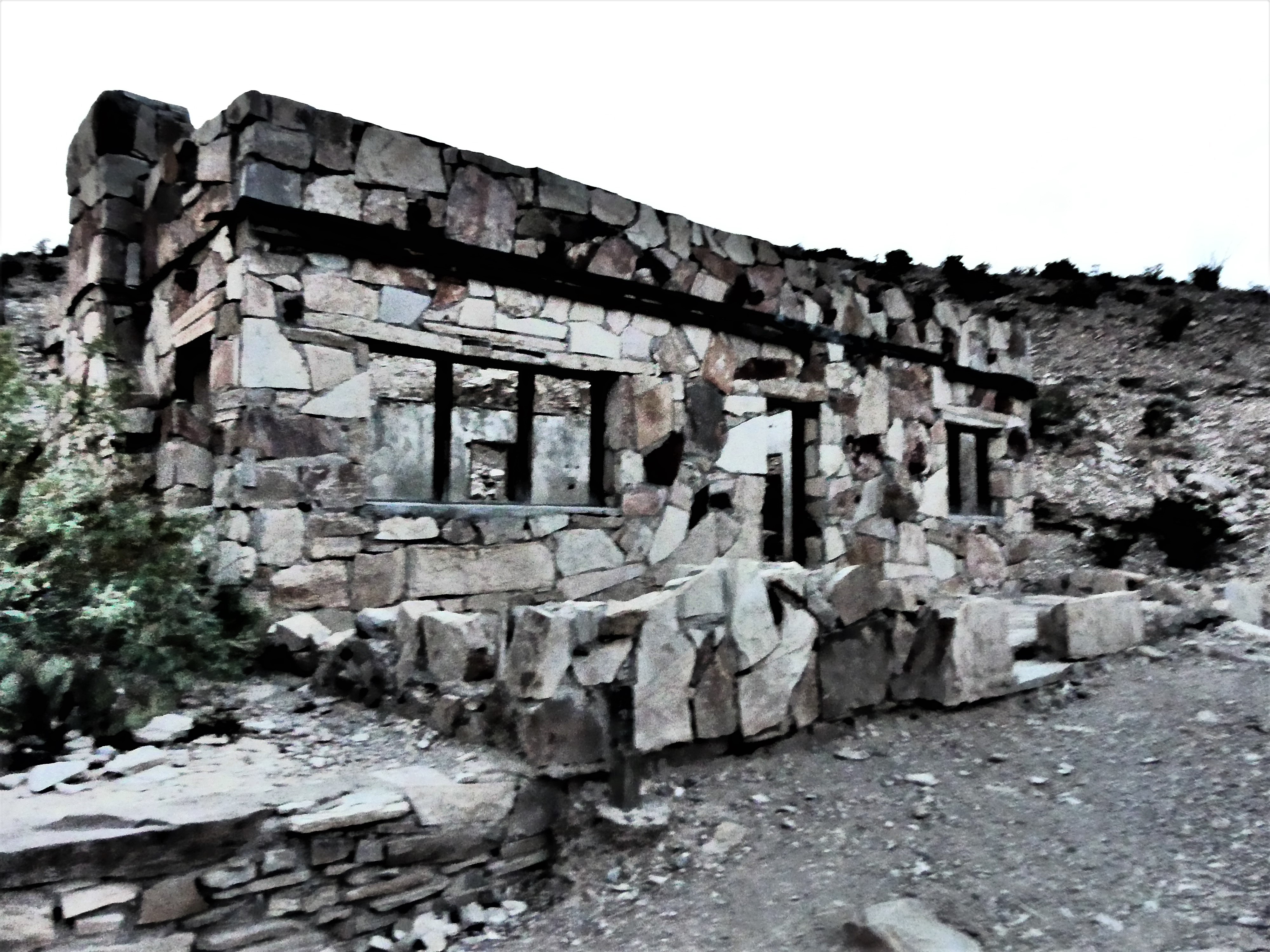
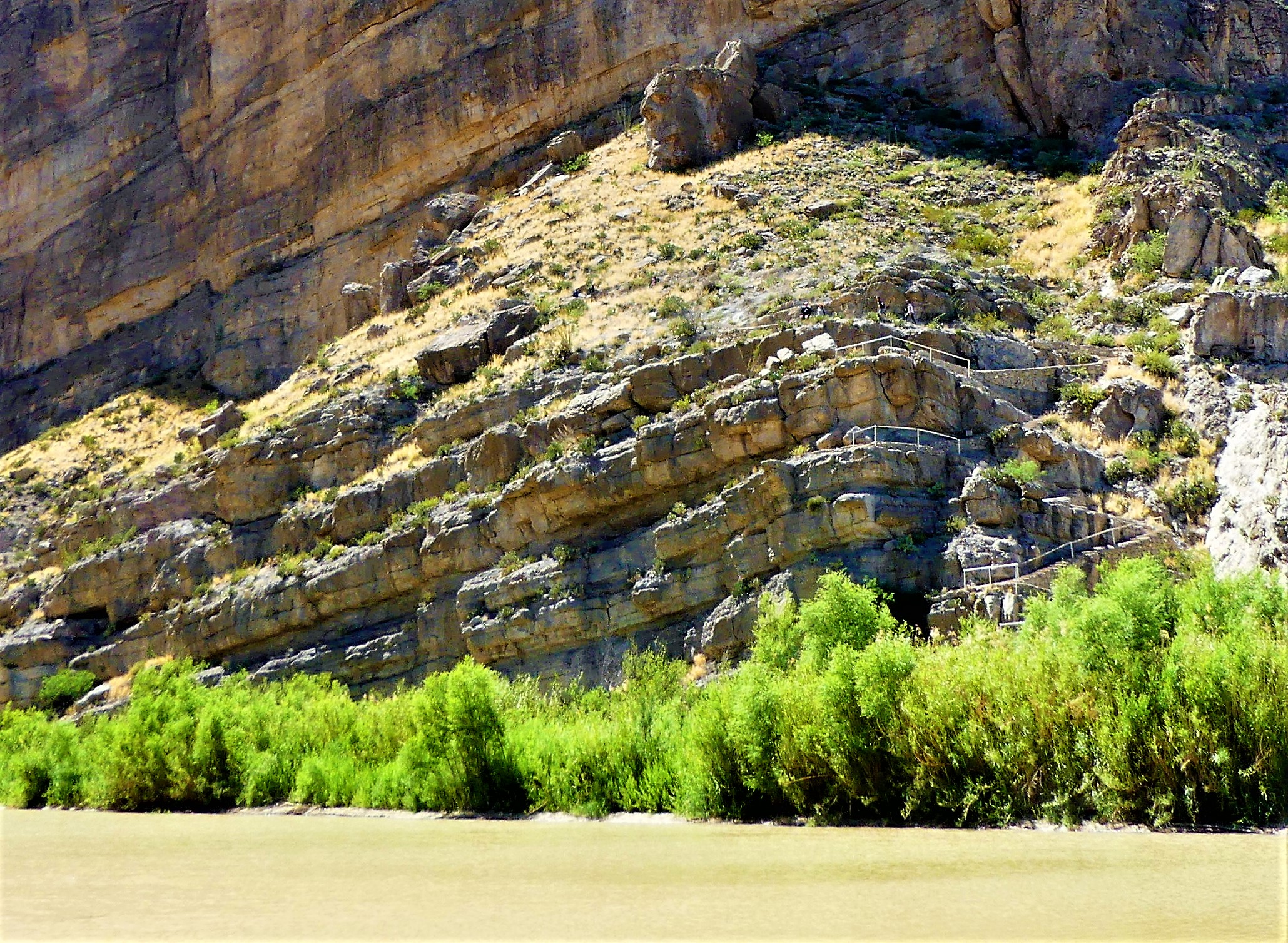
along the arroyo to Pratt Cabin, a Depression-era structure built entirely of stone.

Pratt Cabin
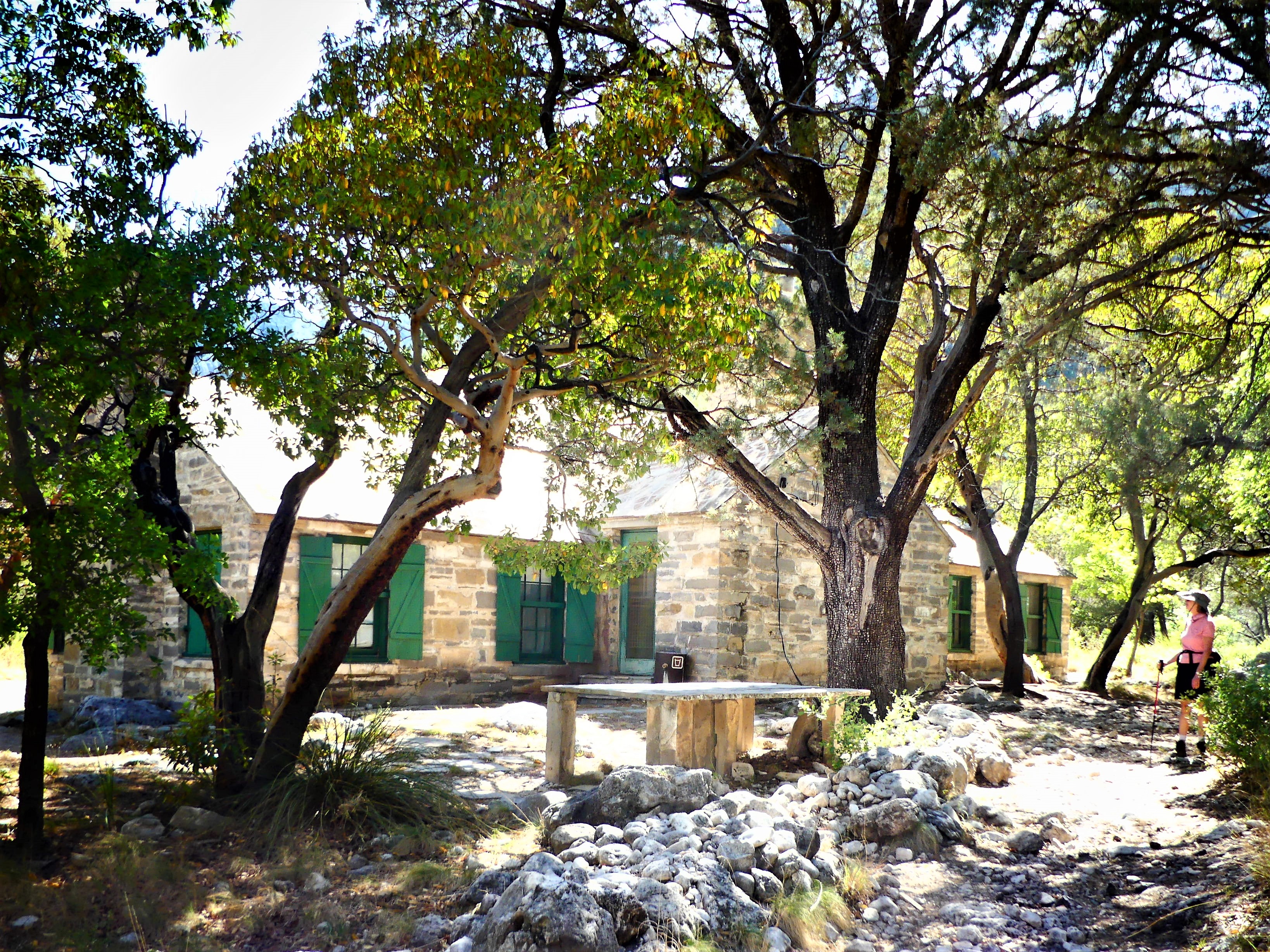
Rocking chairs under a cool porch provide perfect respite from the simmering sun.

porch

Upon returning to the Airstream, we follow parking lot protocol with dinner preparation plans en masse, prompting Mr. S&P to cautiously knock on our screen door.

“Howdy, neighbor,” I announce through the screen with all good intentions. “What’s up?”

Holding back, but clearly annoyed, he addresses me in a veiled voice. “I hope you’re aware of the rules about running your generator,” he reprimands.

Gauging his tone, but uncertain of the point he’s trying to make, I answer, “Okay?”

“So were you planning on turning that thing off anytime soon?” He is more ordering than asking.

“Well, sure,” I try to reassure him, “but it’s only 7:30. I still have half an hour before quiet time.”

“I don’t think so,” he challenges, pointing to his watch.

He’s now flanked by his wife, who’s approached the Airstream to reinforce her husband’s position, and it becomes clear that he’s been put up to the task.

“Did you tell them about the rules?” she intervenes. “Tell them to read the rules by the bathroom.”

“I did, dear. He knows all about it,” her husband relents.

Now looking pointedly at me, she asks, “So why’s that thing still running? It’s 8:30, you know, and you’re out of time.”

“Look,” I start out. “I think you’re mistaken about the time. As I mentioned to your husband, I still have half an hour to go.”

“Not according to my phone,” she insists, waving her iPhone.

Leah joins me at the door to even the playground odds. “Then you must’ve forgotten about the time change,” Leah interjects. “We just crossed the border from Central to Mountain time, and you forgot to turn back your clocks.” Rubbing it in, “Didn’t you get the park memo?” she says smugly.

“Sounds reasonable,” she shrugs. Are you certain?” doubts Mrs. Salt and Pepper.

“You can’t rely on your phone,” Leah tutors her. “For some reason it’s not showing up yet.”

Mrs. S&P nudges her husband, teasing, “I can’t believe you didn’t know that.”

“Shit happens,” I announce, side-stepping the S&P’s on my way down the Airstream stairs. “While time is still on my side, please excuse me while I tend to the chicken on the grill.”

Walking away, Mrs. S&P mutters to her mate, “I feel like such a fucking idiot!” Then, calling out to me, “By the way, that smells sooo goood.”

Returning to their RV box, I overhear Mr. S&P lament, “I told you not to bother them.”

I remain exalted in my vindication. At precisely 8:00 pm, I cut the generator din, restoring tranquility to the campground community where I’m no longer the menace of Guadalupe Mountain.

And I am absolved when the quiet of the thin mountain air carries the collective sigh of my next-door neighbors through their hollow RV wall.

Carlsbadland

If Disney were to design a cave attraction, he couldn’t do any better than Carlsbad Cavern, for deep within the Guadalupe Mountains of southeast New Mexico lies an enchanted forest of mysterious-looking limestone formations.

long ears (2)

The journey begins at the ticket counter, where for the price of admission, a visitor can access the cave from a nearby switchback path, or take a high speed elevator 800 feet down to an exploration crossroads that leads directly to a food concession stand.

elevator

While there are a few adventure hikes below the surface for limited numbers of ardent spelunkers, a majority of the nearly 3,000 visitors a day (on average) are content to follow a one-mile self-guided tour of the Big Room along a narrowly paved walkway, where featured formations are illuminated by hidden spotlights and protected from access by stainless steel handrails.

To the casual observer, the speleothems (e.g. stalactites and stalagmites) look like random thousand-year-old mineral deposits. But to the trained eye, many of the formations–whether disguised within wall recesses…

faces

Groot

or standing straight and tall in plain sight–

Chinese emperor (2)

double as custodial creatures who stand guard by rock castles,

castle on the rock

brocoli

and towers…

double dicks (2)

to protect them against invaders who are so fascinated by their structural beauty, that they must scale their delicate walls.

Like vintage Disney design, the spectacle that is Carlsbad Cavern is overwhelming to the senses. Whether it’s looking up at the lion tails,

lion tail (2)

and the crystal chandelier…

chandelier

or looking at popcorn streams beneath rippled water…

natural stream (2).jpg

…it’s difficult to imagine not being seduced…

shaft (2)

by all the stunning eye candy.

eye candy (2)

Dune Not Disturb

White Sands National Monument can only be described as other-worldly.

yin yang dune

The thrill of scrambling through the dunes,

dog-sled.jpg

and leaving temporary footprints in the soft white sand…

footprints

is humbling in the presence of its vastness.

dunescape

The ethereal gypsum dunes sweep across 275 square miles of the Tularosa Basin,

dune and sun

forming a complex yet delicate ecosystem…

beetle

…that supports the constant shape-shifting caused by precipitation and wind.

texture

But the surrealism that surrounds the spectator…approaching sunset

intensifies when the sun dips below the horizon of the Sacramento Mountains…

mountain silhouette

quickly cooling the sand beneath one’s feet,

desert glow

awakening the magic that ignites the desert glow.

cactus glow

Hiking Hat Trick Completed

Tracking back through Lajitas and Terlingua into the Maverick Junction entrance of Big Bend National Park took us an hour, and put the time at 3:00 pm. Opting for a backcountry tour of the Chihuahuan Desert, we turned south onto Old Maverick Road, and turned up the dust behind our wheels on our way to scenic Santa Elena Canyon.

Two miles into our 13-mile drive, a Chevy 4X4 approached us head on. Rather than play a game of off-road chicken, I pulled over to allow him right-of-way. When the truck stopped parallel to me instead of passing, and the driver, a middle-aged graying male signed his interest in communicating, I lowered my window to satisfy my curiosity.

“I wouldn’t go down there, if I was you,” he advised.

“Is there something wrong with the road?” I asked.

“Well let’s just say that I been on this road for over an hour already, and I can’t wait for it to be over. It gets much worse down there, and I don’t know if you wanna do that to your truck. This here Chevy is for work, so I don’t give a shit what happens to it, but it’s your call,” he said.

“Thanks for the warning,” I said, and he drove away.

After the encounter, Leah and I sat in silence for a brief moment. “Wow,” I exclaimed, “Do you believe that? He thinks we should turn back.”

“I’m not gonna say,” Leah offered. “I’ll do whatever you want to do. At least we know how long it will take”

“Then fuck it! We’re moving forward,” I declared. “I’m not turning around because of him. Let’s see what this truck can do! All I ask is that you turn off the alarm (see: Ouch! and Ahhh!–Part One).”

“I can do that,” Leah promised. “But we’re on a mission and we’re running out of time, so you need to limit your stops.”

I wanted to agree in principle, but it seemed so unreasonable to pass up so many photo opportunities.

peak with cactus

desert

cactus flower

prickley pear blossom

However, Leah had a point. We still had a canyon hike ahead of us.

The road was as pitted and rutted as expected, but not the deterrent we anticipated. The truck suspension was very forgiving, and handled the rocking and swaying without a slip. What took the Chevy over an hour to travel, took the F-150 only 45 minutes to complete. (This testimonial should in no way be considered an endorsement for Ford, unless Ford is willing to pay me. I hope you are reading this, Ford!)

We arrived at Santa Elena Canyon parking when most visitors were leaving.  A slotted boardwalk led us to the river flats where the canyon opened into an expansive arroyo,

Santa Elena Canyon opening

where only a trickle of the Rio Grande diverted around a sandbar merging with the Terlingua Creek.

canyon wall

The hike into the canyon along the northern wall follows an observation path of concrete-slab switchbacks outlined with occasional handrails. The vista at 100 feet is sufficiently rewarding to most visitors who tend to take a few snapshots before returning to their cars.

observation trail

But the true reward awaits the hiker who takes the trail deeper into the canyon for a more immersive experience,

Leah and SEC

and a greater appreciation of the scale of the 1500 feet sheer walls,

cliffs

and the house-size rocks that have tumbled from the clifftops.

fallen rock

We took shade whenever we could, and drank the requisite gallon of water per day to avoid dehydration, yet we always seemed to be thirsty. By the time we reached the trailhead out of the canyon, we had drained our resources, but felt confident that the 13 miles to the store at Castolon Visitor Center—on the way to Ross Maxwell Scenic Drive—would allow us to resupply…or not.

The store was closed more than an hour before we arrived.

Disappointed and thirsty, we climbed into the truck, and drove the 22-mile route around the backside of the Chisos Basin to admire the ever-changing landscape. If we weren’t so parched, we might have lingered longer to take in the views, but I drove as fast as the hairpin turns would permit.

Not that I was completely indifferent to scenery. There were a few occasions that demanded I stop and allow the natural beauty to wash over me.

far view

mules ear

what a butte

Another 13 miles past the junction intersection, and we finally completed the western loop around the park. While Leah napped, I struggled with the final 20 miles from the park gates to Lajitas. It took every last bit of will power to make it home, knowing that a well-deserved ice-cold Dos Equis would be waiting in the fridge, demanding I “Stay Thirsty”.

It was 7:00 pm when we finally opened the Airstream door, only to collapse.

We had completed 10 hours of non-stop activity, gratified by the experience, overwhelmed by the grandeur, and elevated by the notion that two old farts could still last the whole day.

Hiking Hat Trick—2nd Goal

The ride to Closed Canyon Trail, the only slot canyon in Big Bend Ranch State Park, took us past the park picnic area, revered for its iconic teepee overhangs.

picnic tps
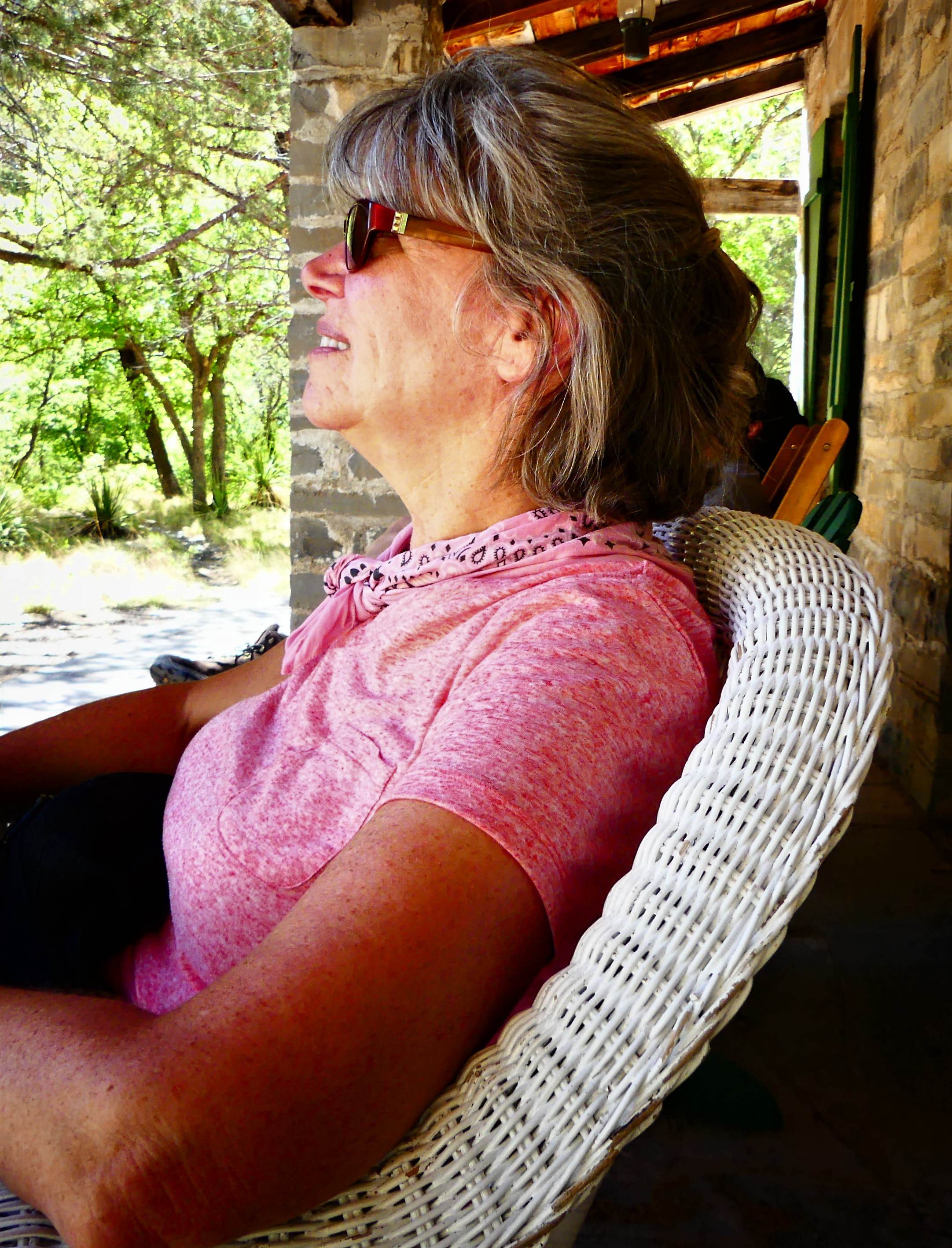
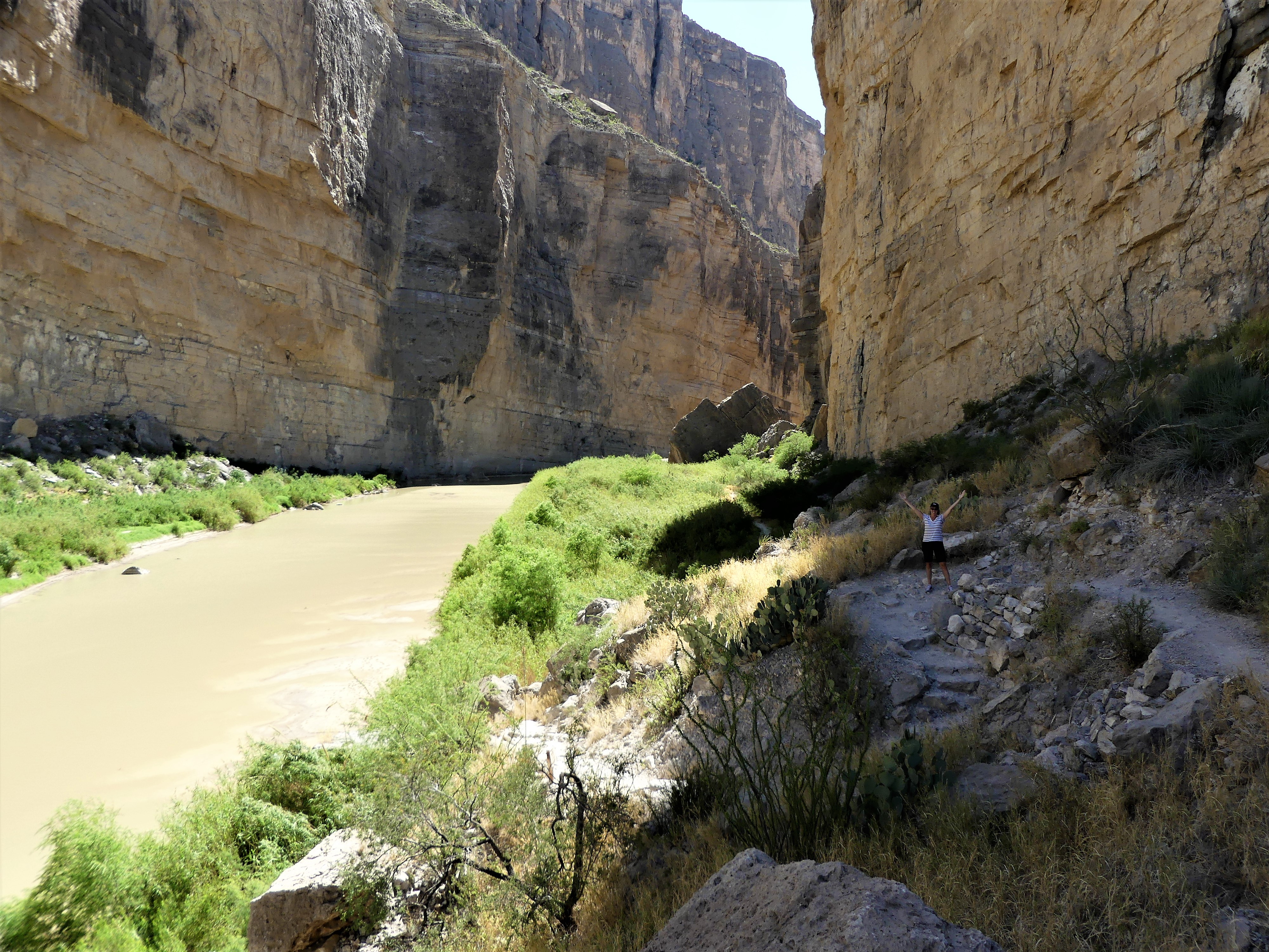
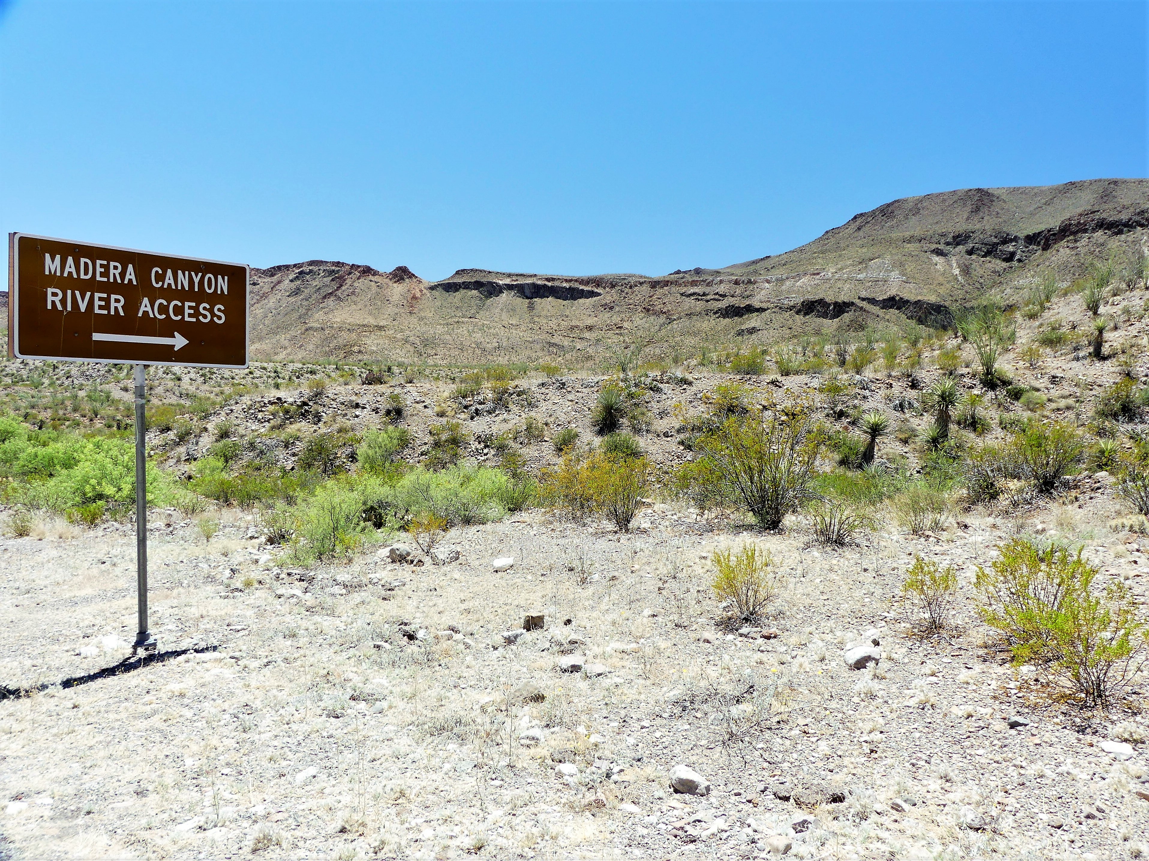
The road continued another 7.5 miles up and down multiple grade changes, curling in and around exposed mountain walls, and mimicking the serpentine lines of the Rio Grande, making it a driver’s delight and a passenger’s revelation. It’s little wonder that El Camino del Rio has consistently ranked as a “ten-best” scenic drive in America.

road view
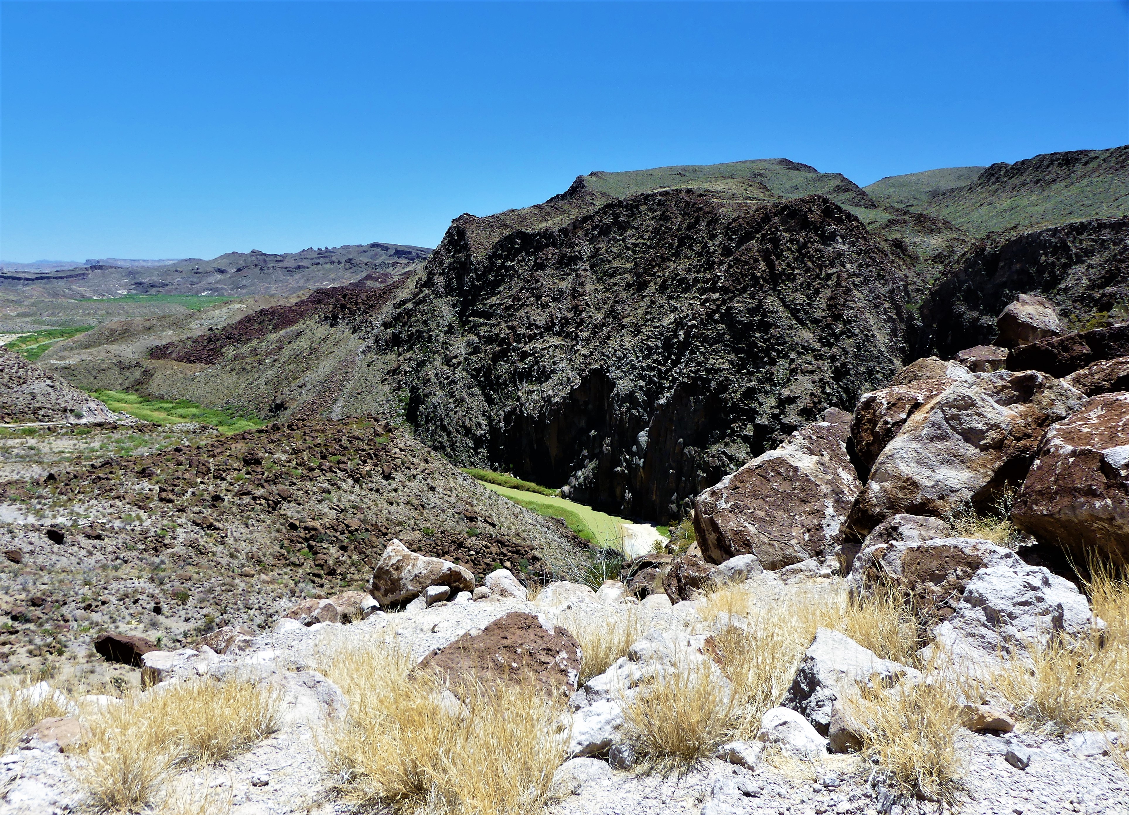
The signage throughout the State Park suffers because of its immensity (300,000 acres) and limited resources, so having Mike as lead proved advantageous, since it would have been so easy to overshoot the trail head in favor of the surrounding vistas and roadside scenery.

The approximate geologic age of the calderas (a collapsed volcano) which formed the Colorado Mesa is 28 million years. The slot canyon evolved from millions of years of water erosion, steadily carving into the Colorado Mesa until it split in half, resulting in a canyon trail that runs 1.5 miles until it drops into the Rio Grande.

“Be careful where you walk,” advised Mike.

High cane grass lined the approach to the trail making us wary of Western diamondback rattlesnakes. We mindfully walked a short distance down a small hill into an arroyo to access the mouth of the canyon. The sandy floor was littered with boulders.canyon mouth
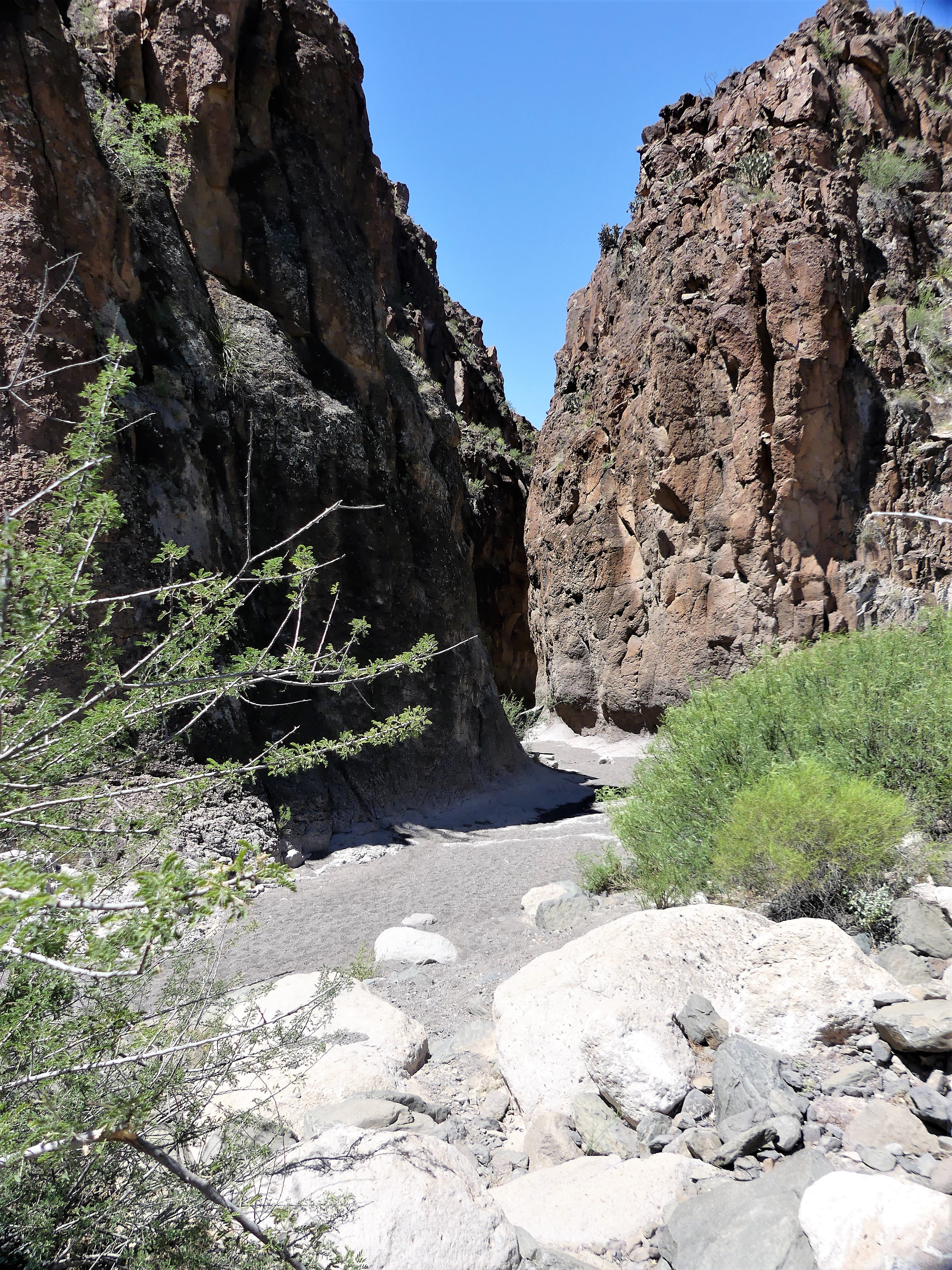
“Anything we should watch for?” I asked.

Mike thought a minute before responding, “It’s doubtful we’ll see a mountain lion, although they hang out in this area, but maybe we’ll get to see some javelina.”

“I doubt we’ll see anything at all,” Leah sighed. “Animals, for some reason, seem to avoid us.”

“Here, gator gator gator!” I jested.

Leah to Mike, “It’s an old joke.” (see Where Have all the Gators Gone? (Long Time Passing…)

But then—as if on cue—our conversation was no doubt overheard by a greater earless lizard, who darted across the canyon bottom and froze, waiting for its close-up.

lizardWhile the wildlife sighting reanimated us, Leah wasn’t sufficiently satisfied.

Thinking it was an omen, Leah roared, “Here, lion lion lion, here lion,” her voice echoing inside the chamber walls.

Mike and LeahUncertain of Mike’s politics, I lobbed him an ICE-breaker. “Any chance,” I subtly inquired, “we’ll have a Mexican sighting?”

“Unlikely,” he started out. “The canyon ends with a vertical drop to the river that requires climbing gear. But during monsoon season, this place flash floods, and all that water shoots out over that ledge into the river.”

“So technically, you could ride through here in a kayak?” I asked.

“It might be cool to do if you’re into danger,” he answered. “In fact, it would be tricky, but I would be into it!”

Mike was still avoiding the premise of my question, so this time I was more blunt. “But do you think building a wall out here would do any good?”

“Are you kidding?” Mike answered. “Obviously, they would have to build it on the Texas side, but that would keep everybody who comes here from enjoying the water. And besides, why would anyone want to spoil this amazing landscape?”

canyon opening

canyon wall 2
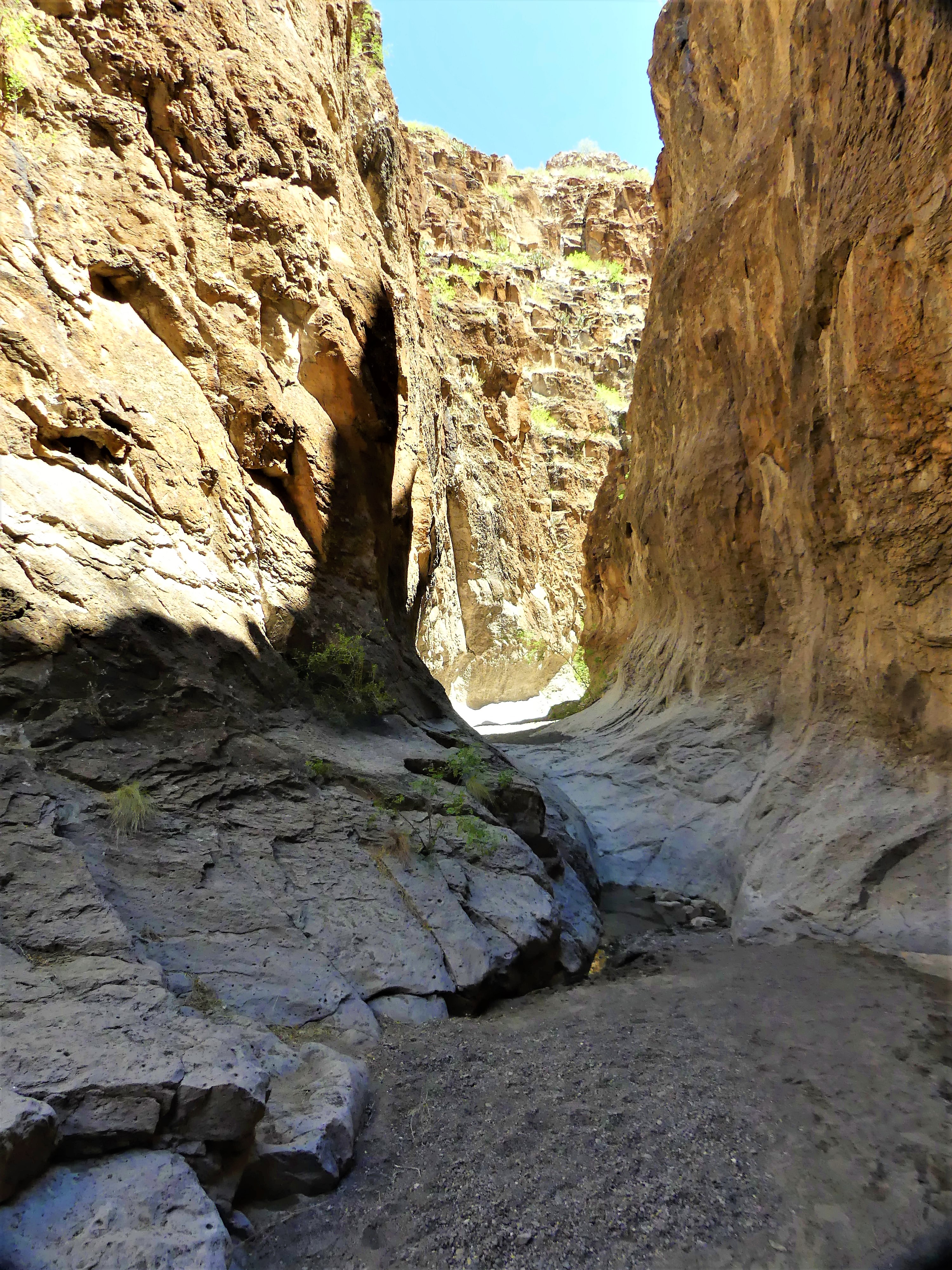
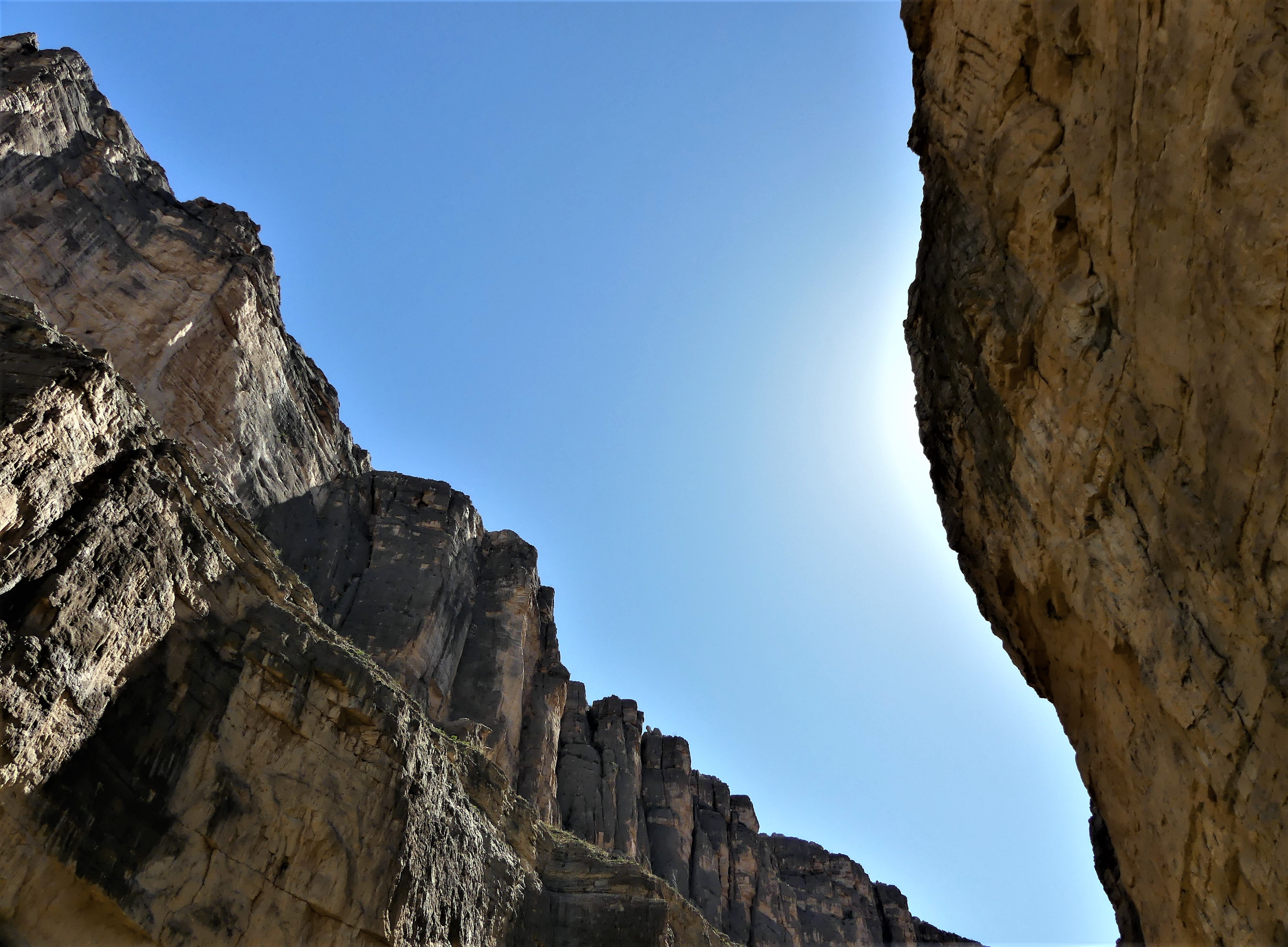
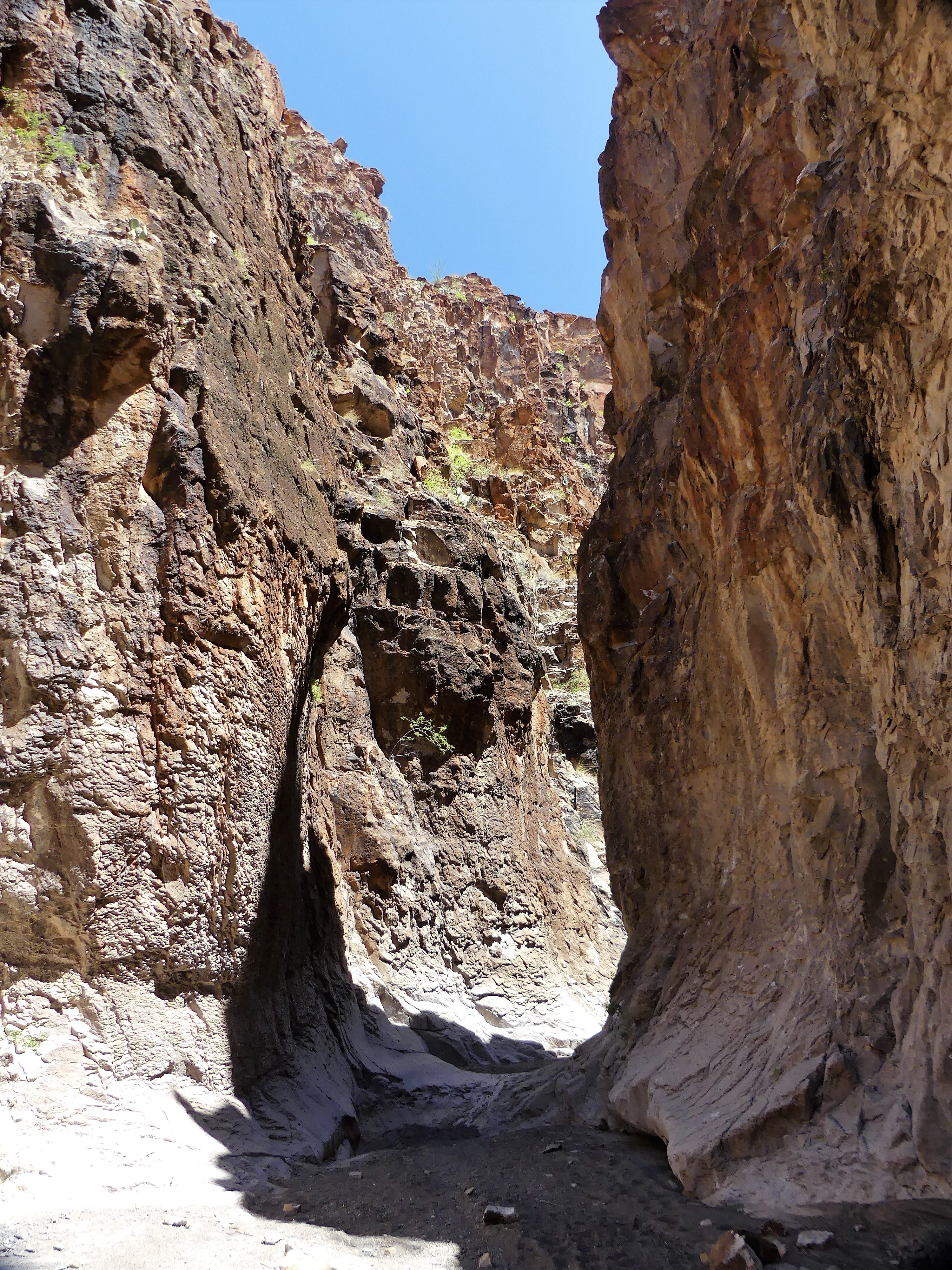
No argument from me. We worked our way further into the slot, scrambling over, around, and down water-polished rock, sometimes stopping to avoid the many tinajas–potholes of jaundiced water of undetermined depths scattered across the canyon bottom.

slot canyon puddleAfter an hour on the trail we reached an impasse. At this point, the canyon walls were narrow enough to touch with both arms extended, but the tinaja before us was too deep to ford, and too wide to bypass. All we could do was turnaround and hike out.

We savored the moment that brought us our second goal, and relished the notion that there was still more to see and do before the day was done.

Hiking Hat Trick–First Goal

At the risk of becoming too comfortable with scheduling only two activities a day during our destination stay, our last full day before moving on from Big Bend presented an opportunity to squeeze in three. That’s right…we were going for the hiking hat-trick!

By rights, we were being overly ambitious—biting off far more than we should ever chew—but as we’ve found since starting out, time is not our friend. Not to be melodramatic, but we may never pass this way again…and if we do (whether in this life or as Shirley MacLaine), it may not be with the same get-up-and-go. So, while we still can, we will continue to fool our bodies into believing we are first-round draft picks.

Typically, before dropping anchor, we’ll have researched most meaningful possibilities in our area. Then we’ll cherry pick around our common interests based on associated cost (we’re on a budget!), reasonability (is it safe and sane?), and time (is there enough of it?). By adopting this strategy, we’ve managed to stay focused and in sync.

But on this particular day, we agreed, “Who cares what it costs! This is totally insane! We’ll never have enough time! So, let’s do it!” On this day, we would canoe down the Rio Grande and hike through Slot Canyon while at Big Bend Ranch State Park, then return next door to Big Bend National Park for a backcountry drive to Santa Elena Canyon, hike the Santa Elena Canyon Trail, and return through the Ross Maxwell Scenic Drive.

Two days earlier, we reserved with Angell Expeditions for a Sunday float. For many, the holy grail is to raft through Santa Elena Canyon in the shadow of its 1500 feet canyon walls while attacking Class IV rapids. However, local outfitters were eschewing the Santa Elena junction put-in due to historically low water levels.

waders vertical

Instead, we agreed on a canoe trip through Dark Canyon in the State Park—not nearly as dramatic as the former—but at least we’d be floating on water, rather than pulling our boat across it.

We put in at Madera Canyon at 10:30 am.

River access

Angell Expeditions
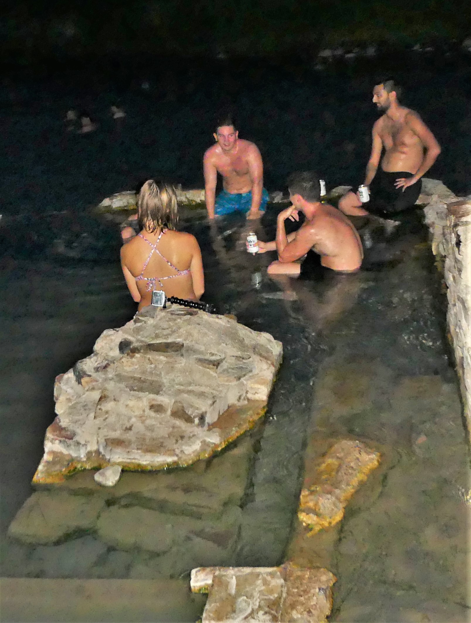
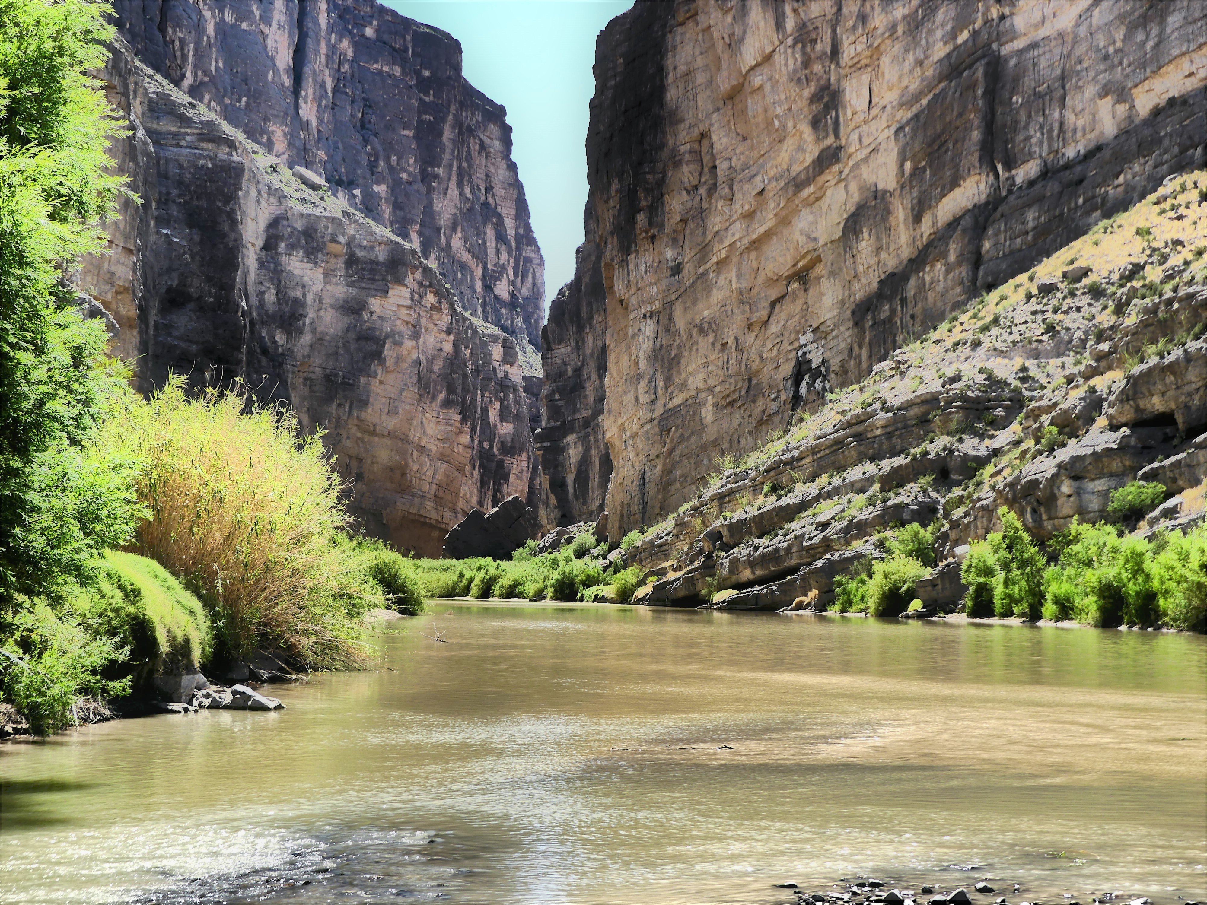
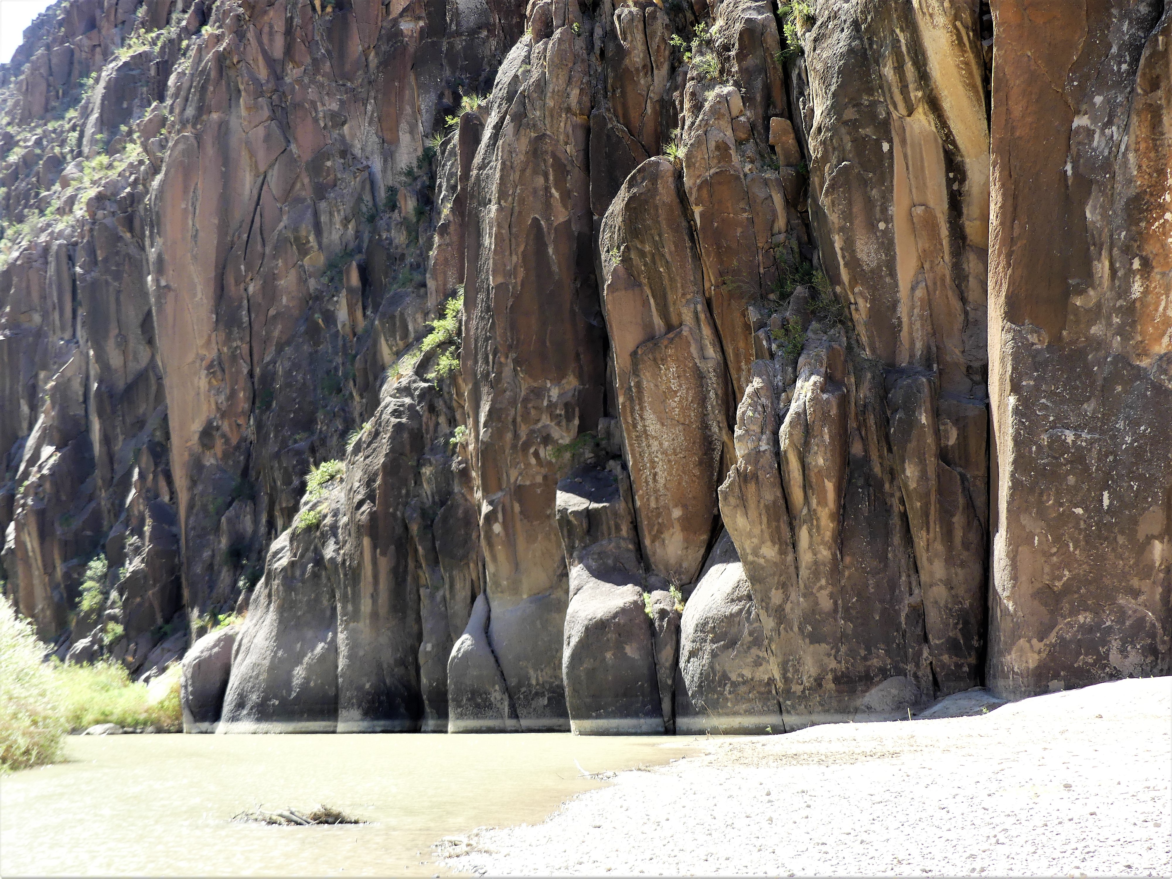
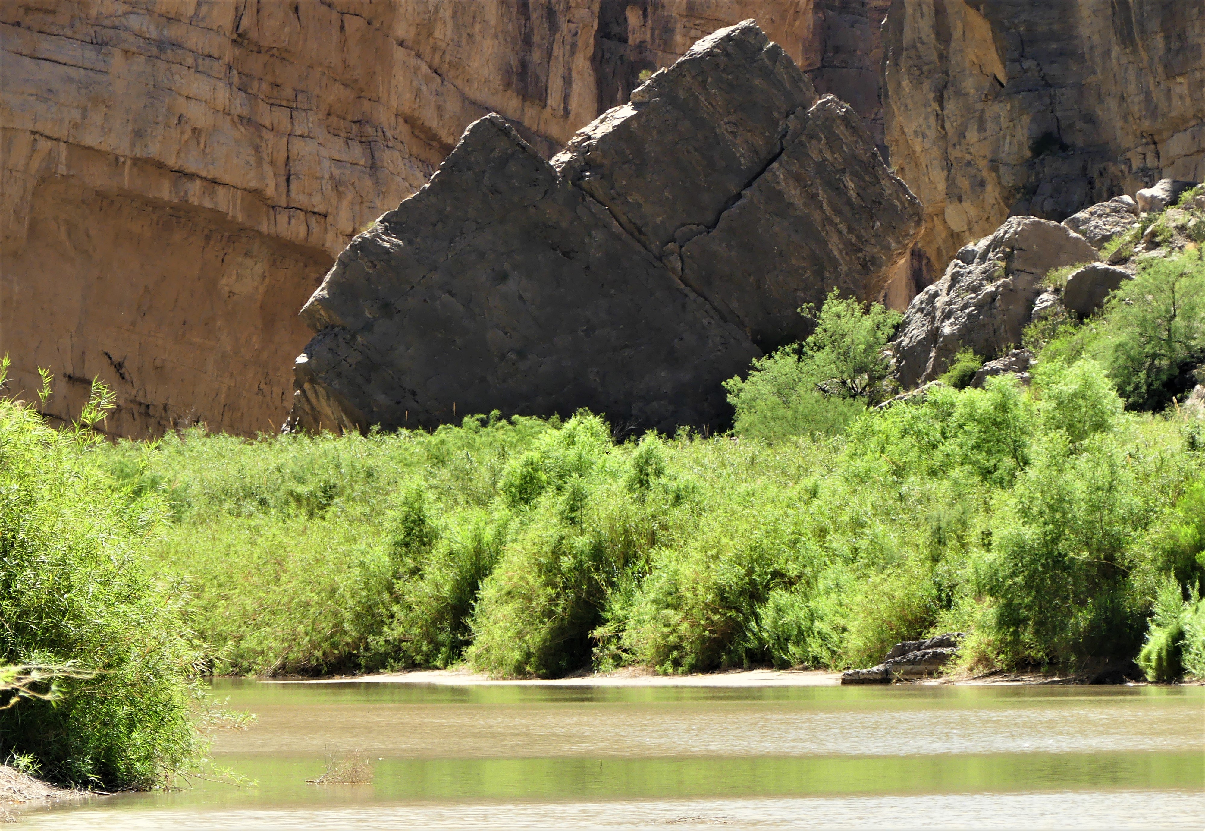
And found we had the whole river to ourselves.

3 tps in the distance w canoeIt was Mike, our river guide in one boat and us—with Leah at the bow and me at the helm—in the other.

Mike on the riverThe air temperature was equal to the water temperature at about 75°, and the wind was at our backs. It could not get any better, or be any easier…until we reached the first of three technical skill zones.

While not exactly Class IV water, the rocks and current still made the run challenging and fun. To avoid tipping the canoe, Mike had us stop each time to survey the water. We walked the shoreline, and watched how the fast-moving water was running in order to plan our route. After easily demonstrating the turns in his own canoe, Mike ceded the river to us to try for ourselves.

First time out, Leah panicked. “I’m not doing that. It’s too soon to go swimming. I’d rather walk it.”

“C’mon, Leah,” trying to encourage her. “It’ll be fun.”

“Not with you steering, it won’t!” she bellowed. “I’m not getting wet. Why don’t you do it with Mike.”

Mike agreed. With me in front, and Mike at the helm, we glided between the rocks, and sailed through the water effortlessly.

“See,” I crowed, “that wasn’t so bad.”

“Sure thing.” Leah was unimpressed. “I’ll do the next one,” she offered with uncertainty.

After 30 minutes of lazy floating, it was show-time yet again. We repeated the same set-up procedure as before, and Mike made it look just as easy as before, but these rapids were faster and rockier, and required more finesse.

fast water
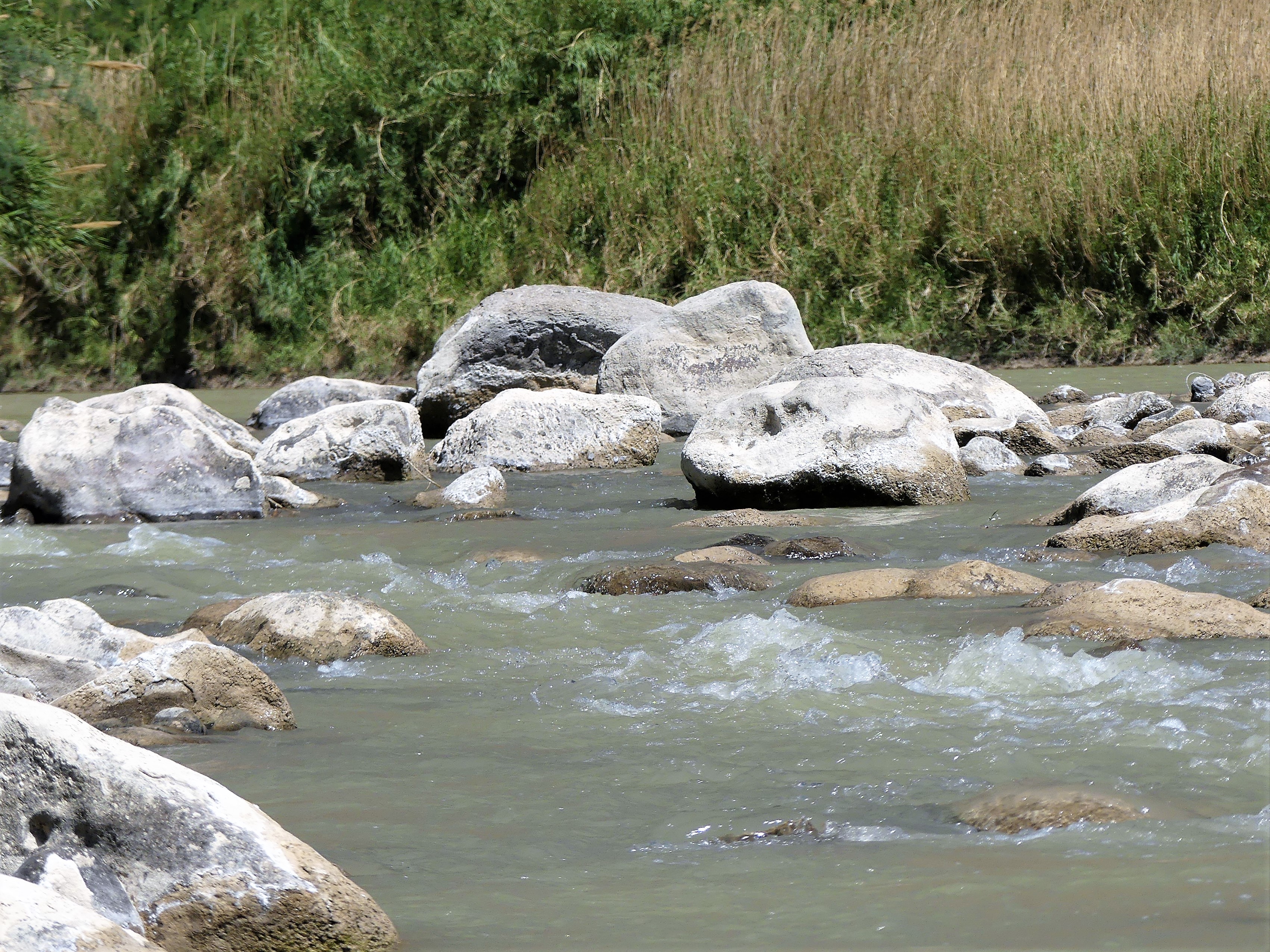
“With this one,” Mike warned, “it’s very easy to capsize, so if you feel the boat tipping, just step out onto the rocks.

“No problem,” I mustered.

“Yeah, right!” Leah mocked.

We valiantly headed into the white water, picking up momentum, and following all of Mike’s directions perfectly.

negotiating fast water“I don’t know about this,” Leah yelled.

“Just keep your paddle out of the water, and I’ll guide us through,” I yelled back.

Neal Leah rapidsI zigged when and where I was meant to zig, and zagged at the appropriate time and place, until…

“LOOK OUT!” Leah screamed.

…a very large boulder suddenly jumped directly in the path of the canoe, spoiling my perfect run. The boat got caught up on the rocks, turning it sideways just as Mike predicted, and the rushing water was forcing the boat over.

“DO SOMETHING!” Leah screamed.

So, I stepped out as instructed—keeping the boat steady—and pushed it through the last turn, while Leah traveled like Cleopatra.

“I’ll have you know that I had nothing to do with that. You told me to keep my oar out of the water, so it’s not my fault.” she gloated.

“It must be nice to be blameless and dry,” I said to myself.

With the wind gusting at 20 mph, we were quickly approaching the take-out area, yet it was only 12:30 pm. The tailwind had cut our expected float time in half.

Fandango location

Basking turtles“Is that it?” asked Leah.

“End of the line,” confirmed Mike. “This is where the truck is parked.”

Feeling badly, Mike added, “I know it seemed like a short trip, but if you’d like, we could head up to Slot Canyon and do a hike. It’s not like it’s out of my way.”

Leah and I exchanged glances. We had intended to hike the canyon on our own anyway.

“Absolutely,” said Leah.

So, we got in the truck and followed Mike over the mountain, on the way to our second goal.


Ouch! and Ahhh!–Part Two

*For those who are reading postaday blogs, please see Part One first to follow the narrative. Sorry for the inconvenience.

Previously on Streaming thru America… (see Ouch! and Ahhh!–Part One, previously published)

Neal and Leah were both feeling the effects of the heat–both inside and outside the F-150. Temperatures had climbed to 103º on the trail, while the mood had turned icy in the truck. Additionally, Neal had aggravated an old knee injury, and Leah was feeling tired and dehydrated.

And now, Streaming thru America is pleased to present…

Part Two: Ahhh

After the hike, it became necessary to regroup at the Airstream. It was our last day in Big Bend and it was only 4 pm. Both of us agreed that we weren’t yet finished for the day. If we could rally after our siesta, then we could pull off one more hike.

But we needed a rejuvenation tonic—a game-changing elixir that would fuel our core and boost our disposition. And given the state of our limited supplies, it had to help us clear our head, yet give us the false sense of security we needed to fool ourselves into thinking that we could endure another adventure. Bottom line—we made frozen strawberry margaritas. Who knew they could be so energizing?

Timing was everything. With the sun expecting to set at 8:30 pm, a light dinner got us out the door and back on the road towards Hot Springs Trail, part of our Big Bend bucket list. Thankfully, not a long drive, it was only ten minutes to the turnoff from Rio Grande Village, and another four miles in to the trail head, but what a drive!

Halfway through the white gypsum track, the road split into two extremely narrow one-way hairpin switchbacks that hugged a striated canyon wall for the balance of the journey.

rock strata

It was a race against time. With the sky expecting to produce a saturated sunset, and the time it would take to traverse this obstacle course, I folded my mirrors in toward the truck, and held my breath as I cautiously moved forward.

It was harrowing yet exciting. The view out my window was nothing but air, while Leah, if so inclined, could reach out her window and file her nails against the cliff. But to her credit, she never said a word about my driving, as she braced herself against the armrest, in anticipation of a catastrophe. Or maybe her silence was driven by my encouraging words as we approached the switchbacks:

“Don’t say another word,” I loosely suggested, not trying to control her.

I successfully negotiated the F-150 into a parking lot occupied by other three cars. Wanting alone time with Leah, it was a bit of a letdown seeing company, but my new objective was to catch the sunset. I sprinted up a small hill with my camera swinging, to gain enough of an advantage over low rising trees just as the sky exploded into colors. I took in the view and my knee didn’t hurt a bit.


sunset

I also had time to capture the ruins of a limestone block cabin, that once served overnight visitors who had come to benefit from the healing properties of the mineral waters that Leah and I were about to experience.

Langford House

“Now the trail to the water will be dark,” Leah lamented, “because you had to take so long taking pictures.”

“I have a remedy for that,” I declared. I switched on the flashlight and lit our way down a lush reed-lined path, half a mile along the river, until we stood at the fallen foundation of a bathhouse spa built by J.O. Langston in 1912.

We eased ourselves into the 105º water currently shared by four other visitors. Everyone present had finished a hike in the blistering sun earlier in the day, and was eager to soak their aches and pains away in a hot oasis of salts and minerals.

Langford Hot Springs1

Langston had reported in his autobiography, “A Homesteader’s Story”, that by bathing in the spring water, and drinking it as prescribed by local Indians, he had completely regained the strength he lost from several debilitating bouts of childhood malaria. Claiming deed to the spring, he eventually moved his family from Alpine, TX and developed the property into a successful health attraction and trading post.

The remains of the bathhouse only adds to the character and allure of the location. While the Rio Grande flows on one side of the foundation wall, a floor vent on the other side is releasing over 200,000 gallons of geothermal water a day, pushing the overflow into the river–perhaps, an early rendition of now-popular infinity pools. Strategically sitting in the cool river while leaning against the hot spillover produces the strangest sensations and the best “Ahhh” results.

A break in the trees along the trail to the parking lot revealed a quarter moon and a black sky accented by millions of stars. Our fellow hot-tubbers neglected to bring a flashlight, so they followed our flashlight beam as we all walked back together. A college coed from the pack identified herself as a Langford, and thought she might be somehow related to the spa patriarch, thinking she could claim the spring for herself.

“But it’s a National Park, dear,” I reminded her. “It belongs to all of us.”

It was a perfect finish to a long day, and I had to admit that my knee never felt better.

*For those who are reading postaday blogs, please see Part One first to follow the narrative. Sorry for the inconvenience.


Ouch! and Ahhh!–Part One

Big Bend kicked my butte today, but it also offered the perfect remedy.

Part One: “Ouch!”

Just beyond the Chisos Basin turnoff, I pulled the F-150 onto Grapevine Road, a rocky and powdery six-mile approach to the trail head of our next adventure: Balanced Rock. Far from smooth, but never boring, the ride to the trail head was a struggle between watching where I was going and watching the ever-changing landscape through the driver-side window.

Grapevine Rd

“Watch where you’re going,” Leah warns. To my ears, it sounds more like an admonition.

Over the past two month, I believe I’ve finally adjusted to driving the F-150–becoming more comfortable with its size; more reliant with its ability to haul and tow; and more familiar with all the technology built in by Ford. However,   unknown to me at the time I bought the truck is a pot-hole alarm that keenly scans the road terrain and sounds off when approaching a rough patch ahead; it’s a cool feature that’s intended as an alert to slow down and avoid the upcoming ditch when needed. While it’s worthwhile and dependable most of the time, the only way to disable it is to tell Leah to close her eyes.

Even through we’ve been off-roading for over a month now, I have hoped that Leah’s anxiety and criticism about my driving would have subsided by now. My defense is always the same.

“You’re welcome to drive anytime you like,” I offer, knowing how intimidated she is of the rig size.

“That’s not my job, that’s your job,” she always counters.

“So why are you complaining? We always manage to make it back alive, and in one piece!” I protest.

And her familiar rejoinder is always ready. “Well, maybe you won’t be so lucky next time!”

“Luck has nothing to do with it,” I say to myself.

Nevertheless, the ride is distinguished by all the outcropping of rocks so close to the road. There is so much to see that is awesome, that awesome becomes the new ordinary.

crazy face

We soon arrive to a smattering of 4 X 4-worthy vehicles parked on a plateau beside the road. Not wanting to crowd the trail, I elect to drive by and continue on Grapevine Road to see where it leads.

“You missed the trail head,” Leah advises. Her tone now borders on admonishment.

“I know, I answer, “I just want to explore to the end of the road. It’s not that far from here.”

“How are you gonna turn around if the road’s too narrow?”

I am completely unaware of the “narrow road alert” feature on the truck until now. “I’m certain there will be a turnaround at the end of the road.”

“But you don’t know that for sure,” Leah continues.

“Just a little bit of trust, please,” I manage, “and a little bit of credit to the civil engineers who built this road.”

When we get to the turnaround at the end of the road, we notice an occupied campsite with a blue pop-up tent and a folding chair. We both agree that this kind of camping is far too remote for the both us, and just like that, we’re on equal footing again.

us

I’m pleased to see that trail head parking has thinned out upon our return. The hike is considered moderate—a mild incline of desert terrain with a steep eighty-foot ascent at the end—but my right knee is acting up from a twelve-year-old skiing accident, and two subsequent arthroscopic interventions. All I can do is keep pushing forward, watching where I step and how I step.

“I thought you were gonna take some Aleve before you left,” Leah offered.

“But that’s not an option now, is it?” I say to myself. I never realized until now that the truck’s warning system comes with a mobile app extension. “I’ll just have to manage,” I reply aloud.

listing rock

We arrive at the uphill finale, which is not as terrible as I had imagined. While rock scrambling is inevitable, the footing is reasonable.

the thinker

Interestingly, the pain seems more tolerable the closer I get to the hike’s payoff, which in this case is spectacular—a distant mountain vista framed by a window of balanced rocks,

balance rock

…and a new twist on an old cliché:  NO GAIN, NO PANE!

Stay tuned for Part Two: “Ahhh!”