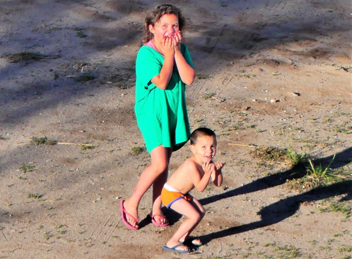
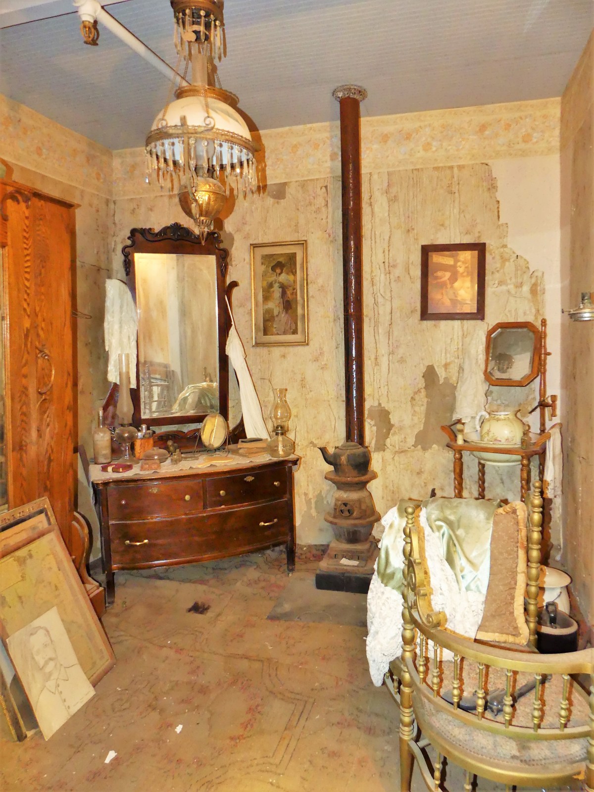
Years ago, Dennis Miller–when he was funny–referred to Branson, Missouri as Las Vegas for people without teeth. Twenty years later, Miller’s revelation still hits the mark, despite the advent of implants and veneers.
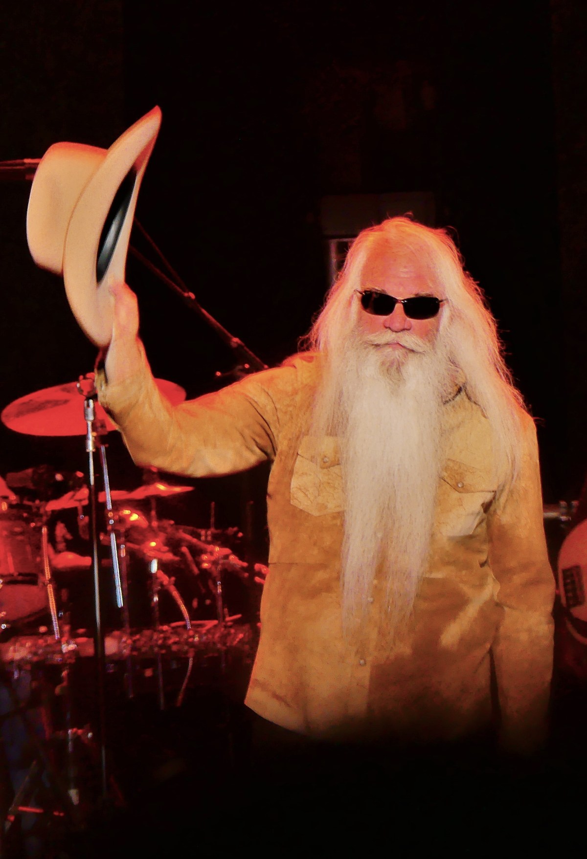
While attending a sold-out concert featuring the Oak Ridge Boys at the Mansion Theater,
it was hard not to notice the adoration of a graying audience. Women wearing shades of autumn-colored hair to complement their leopard print outfits seemed to swoon through an earnest and sincere set of gospel-laced ballads and patriotic country-swing tunes, while their stoic significant others, coiffed in their stiff anywhere/anytime cowboy hats, eventually removed them, perhaps taking a cue from William Lee Golden during his performance.
Upon returning to the parking lot after the show, we noticed how haphazardly most vehicles were parked, with little regard for lane assignments. It could have been a freeze frame from a demolition derby. Few could recall where they parked their trucks or SUVs, so collectively pressing the alarm buttons on their keys produced a cacophony of blaring horns and flashing headlights that continued to frustrate a clueless crowd.
Of course, things are no better on the roads. The yellow, blue and red routes always appear to be congested, because drivers can’t get out of their own way, and nobody knows where they’re going. Unfortunately, turn signals are no more than car decoration.
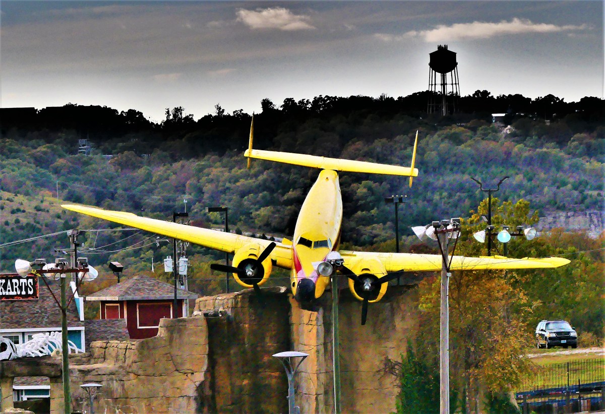
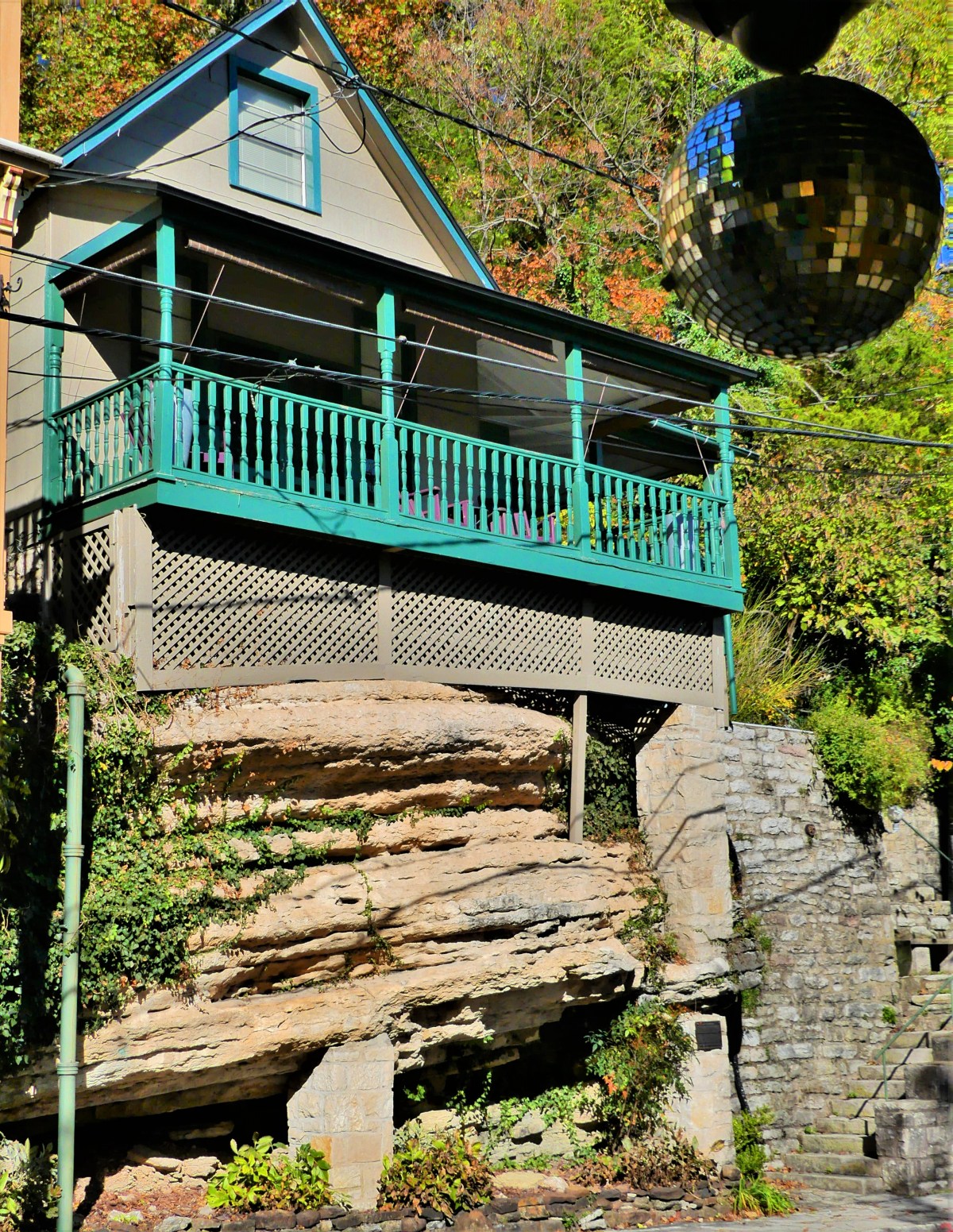
Or maybe the sites on the edge of the road are so compelling that traffic snarls are to be expected.
What follows is a sampling of some of the roadside attractions that caught my attention.
P.S. We found our truck in the Mansion lot, and found our way back to the Airstream, but it took forty minutes to travel four miles.
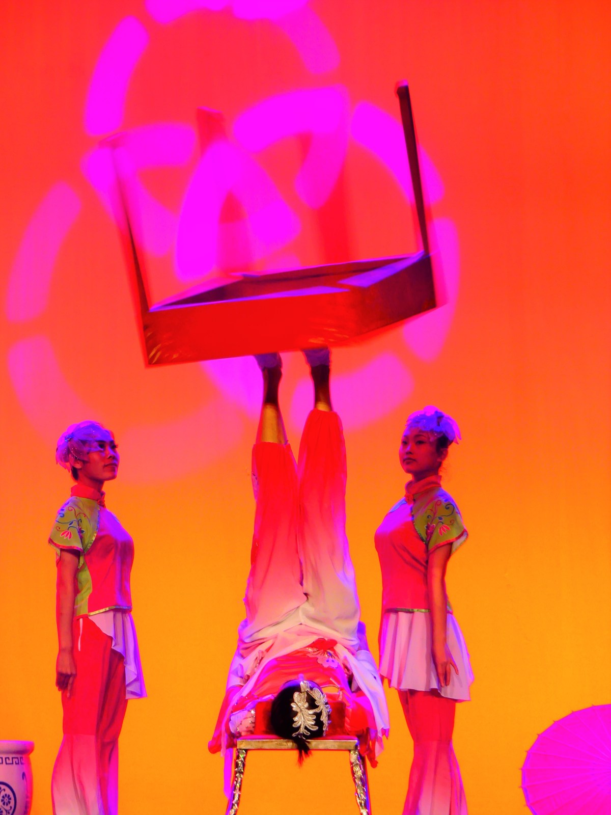
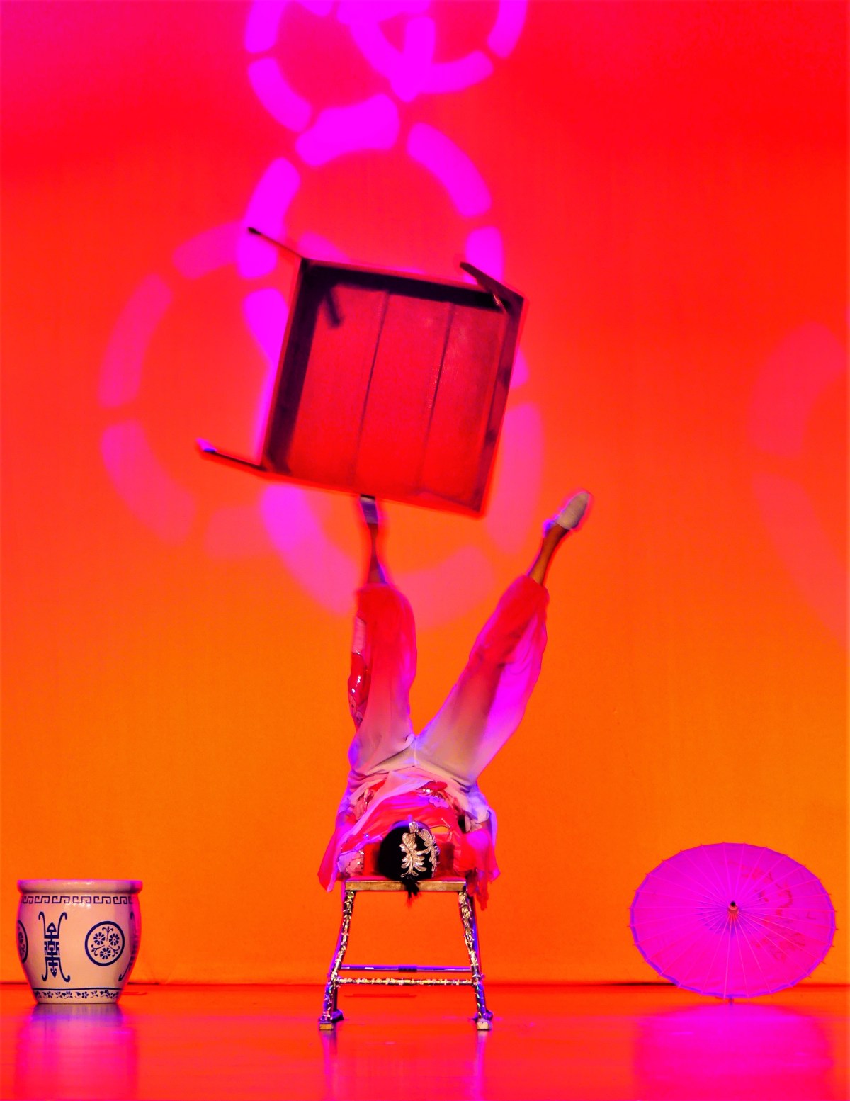
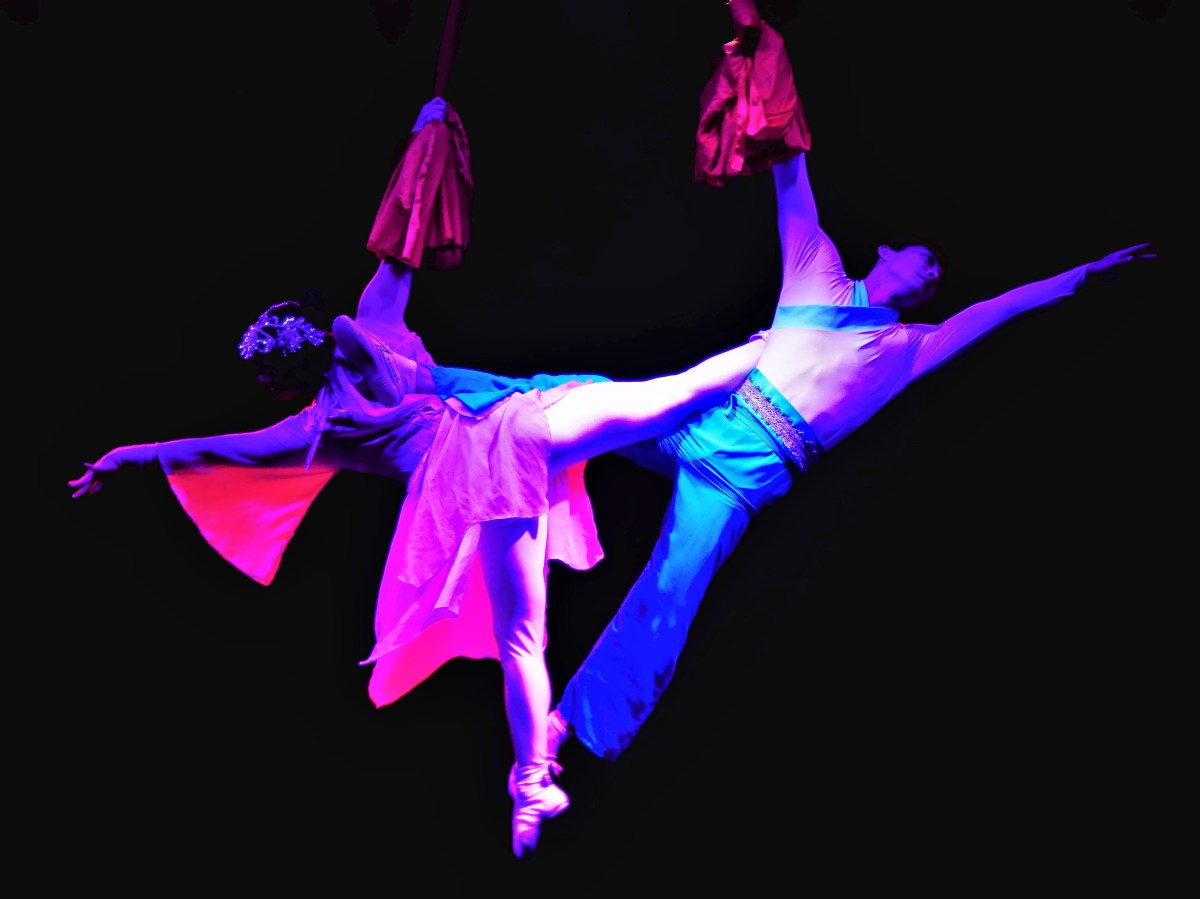
Amazing Acrobats of Shanghai and their rival, Acrobats of China compete daily for the attention of visitors in an already crowded field of Branson venues showcasing music and variety entertainment. The two maintain similar visions–featuring acts displaying power, balance and artistry. But because one theater was closer to the Airstream than the other, and with available seats closer to the stage, and for a few dollars less, Leah and I chose the Shanghai troupe for our evening out on the town.
We arrived during a warm-up act with two costumed chickens made of paper, and a clown blowing a whistle. The sparse crowd was disinterested, generating a smattering of applause.
The theater was dingy and the seat cushions had lost their springs many summers ago. It was the first freeze of the season, and the concrete floor was sending chills through the soles of my shoes. It made me check my watch, and wonder how much longer we would be here.
By the time the lights had dimmed and the curtain pulled, the audience and I were hoping to be amazed.
This was NOT Cirque du Soliel: the set design featured a lit cyclorama and necessary props on a short and shallow stage; the costumes were functional and simple (with the exception of traditional animal puppets); and the music track was borrowed from a Chinese elevator.
But the young acrobats, mostly in their mid-twenties, were enthusiastic performers with towering talents,
and well-rounded abilities–demonstrating precision and grace throughout their respective routines.
Thematically, the acts seemed to showcase a variety of spinning stunts. Around and around went the table, hoops, and vases.
Around and around whirled the ninjas in their karate sequences, and the aerialists in their pas de deux.
Around and around, the contortionist twisted her body into wincing pretzel postures.
When the show ended to rousing applause, Leah and I crossed the lobby to inspect an easel of audience portraits stuffed inside commemorative frames with plenty of room for acrobat autographs…and available for purchase at only $20 a piece.
While we enjoyed the show, we quickly decided against sticking around for the meet and greet, as the acrobats lined up to express their gratitude, but seemed more uncomfortable with both feet firmly planted on the ground.
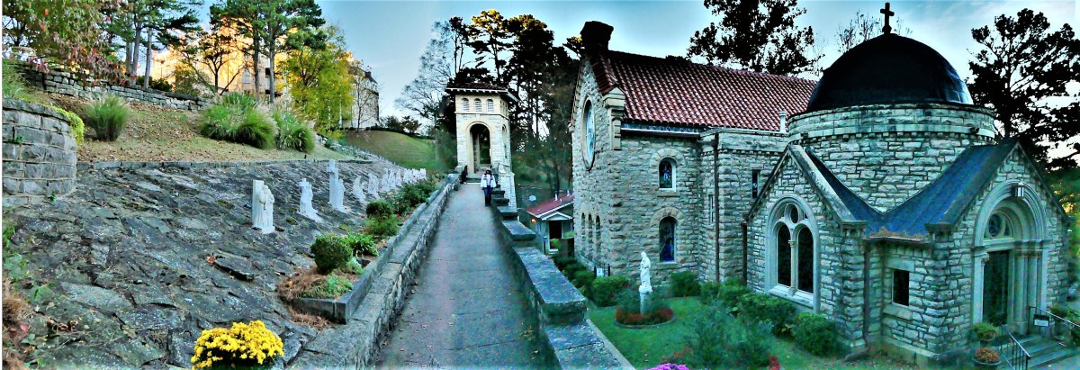
A stopover in Eureka Springs, AR along the way to Branson, MO produced some Eureka! moments and other assorted revelations.
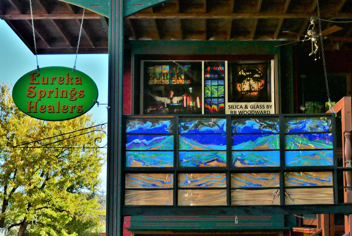
For one, there are seventeen registered churches in Eureka Springs, ministering to two thousand healing hearts and souls around town, plus a Tibetan Buddhist temple and an integrated monastery of celibate brothers and sisters.
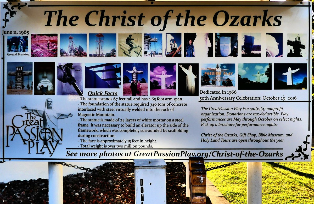
Religious overtones are also pervasive throughout town. Our Airstream was parked along Passion Play Rd., above the hallowed hollow where The Great Passion Play’s dramatic reenactment of the last week of Jesus Christ is the #1 tourist attraction in the area, and The Christ of the Ozarks rises nearby, hovering above the dense woods of Magnetic Mountain.
Also looking down from town, the Crescent Hotel–recently added to the National Register of Historic Places–delivers luxurious living and salon services, in what’s billed as America’s Most Haunted Hotel.
A fourth-floor lookout…
provides familiar views in the distance,
and an overlook of St. Elizabeth Catholic Church of Hungary–listed in Ripley’s Believe It or Not as the only church in America with entry through the bell tower.
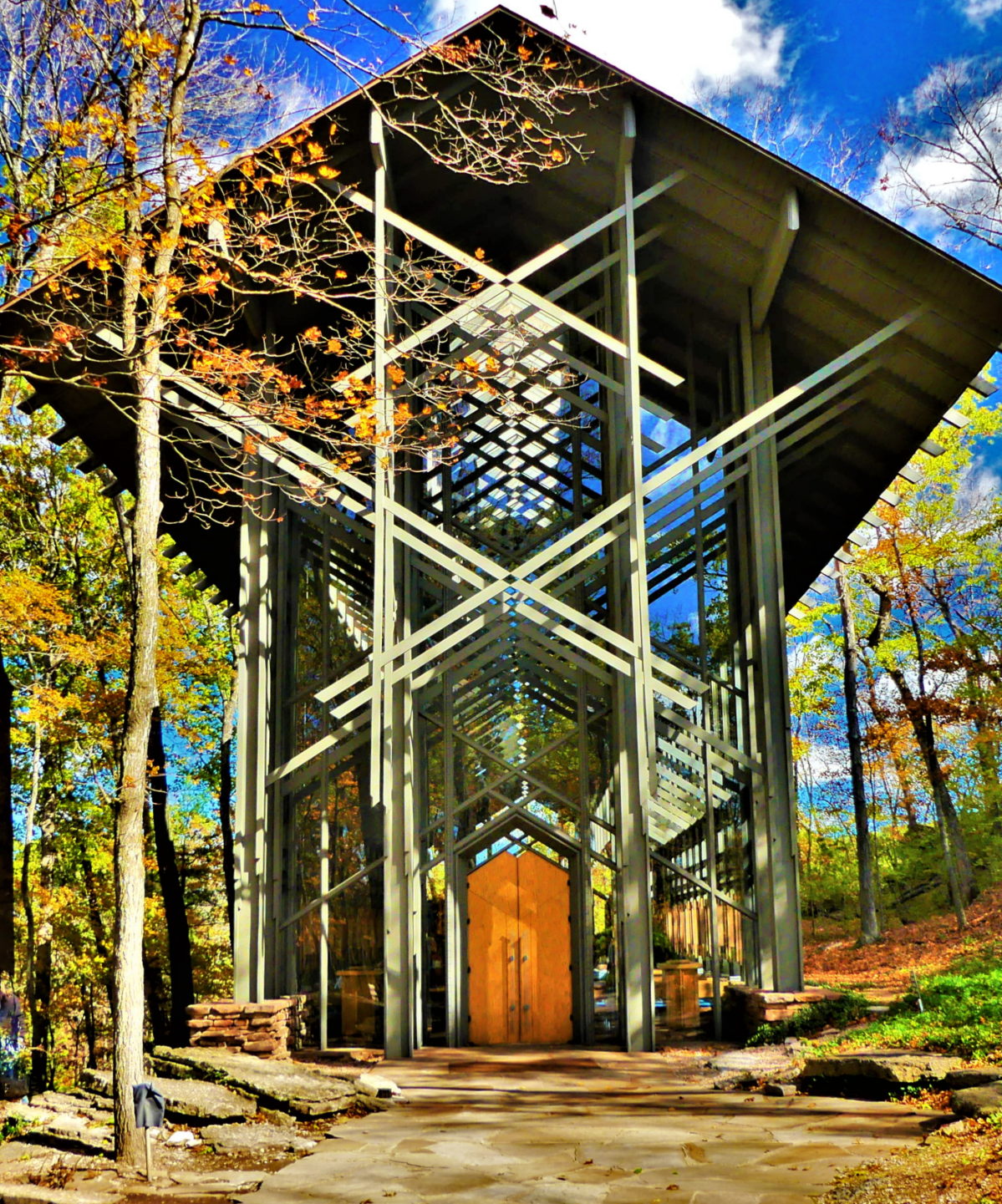
Stunning religious “art-chitecture” can also be found at the Thorncrown Chapel, a jewel of glass and wood tucked into the hillside atop a ledge of flagstone.
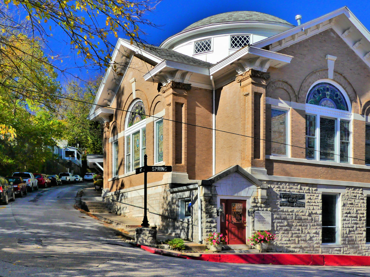
Inside Eureka Springs’ Victorian historical district, the Byzantine-styled First Baptist Church stands at the corner of three intersecting streets with entrances at each of its four levels, giving it four distinct addresses and cause for another Ripley’s entry.
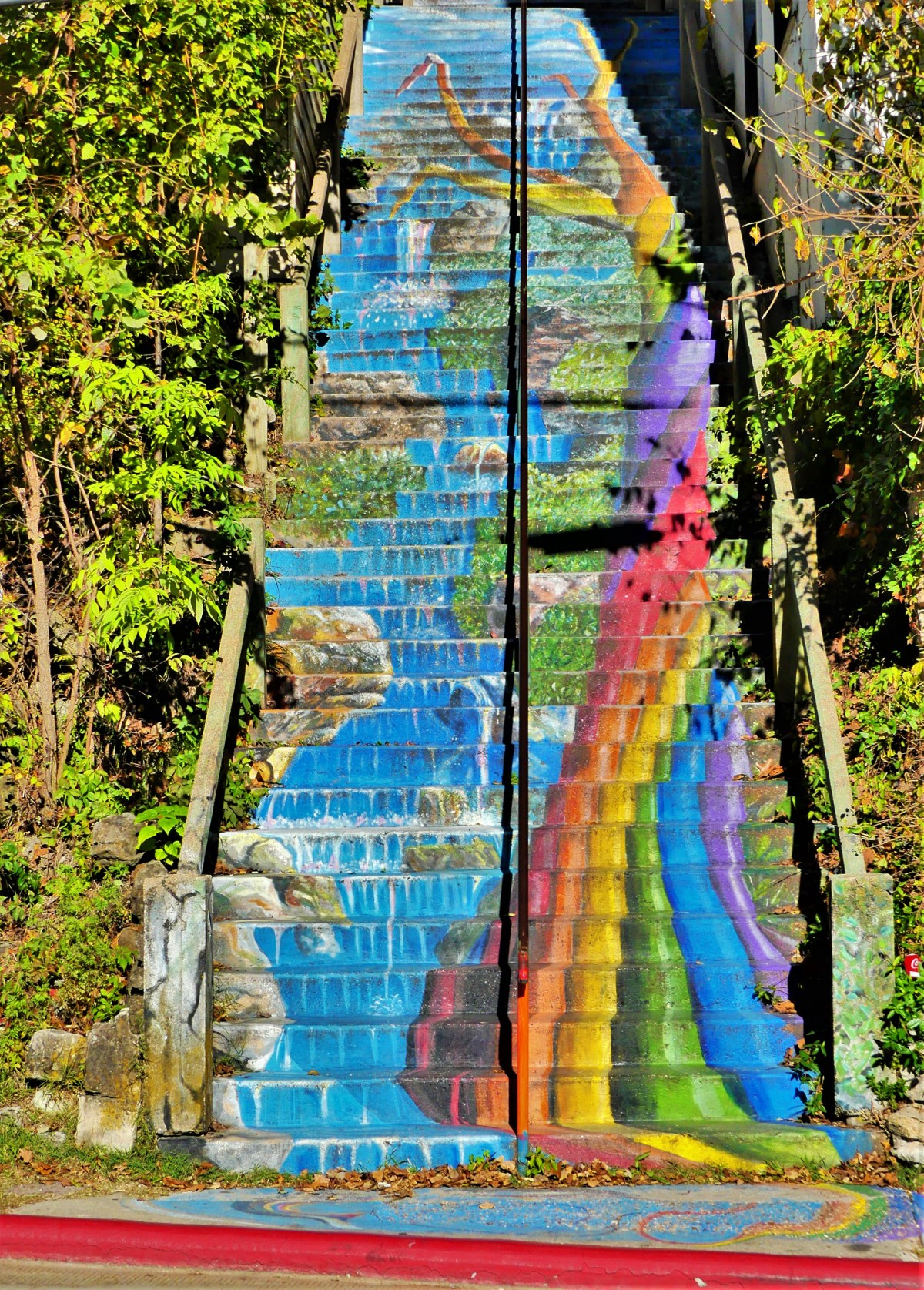
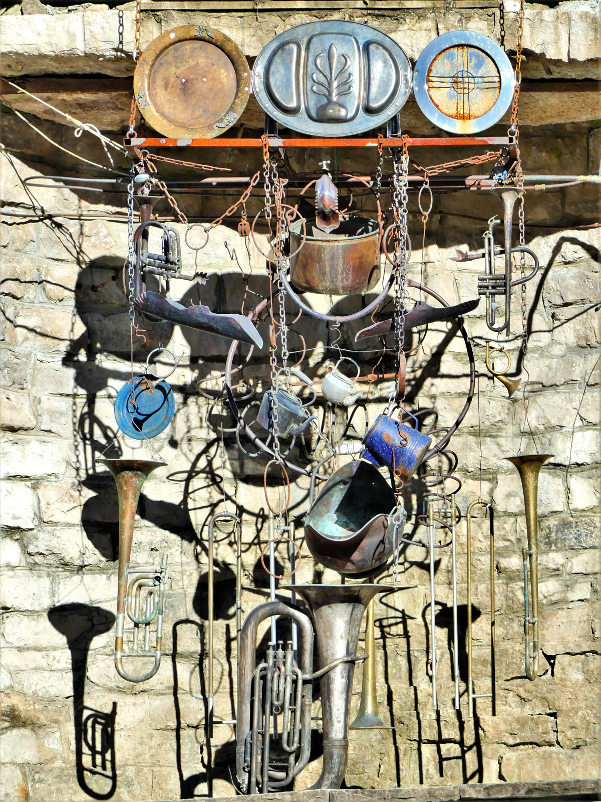
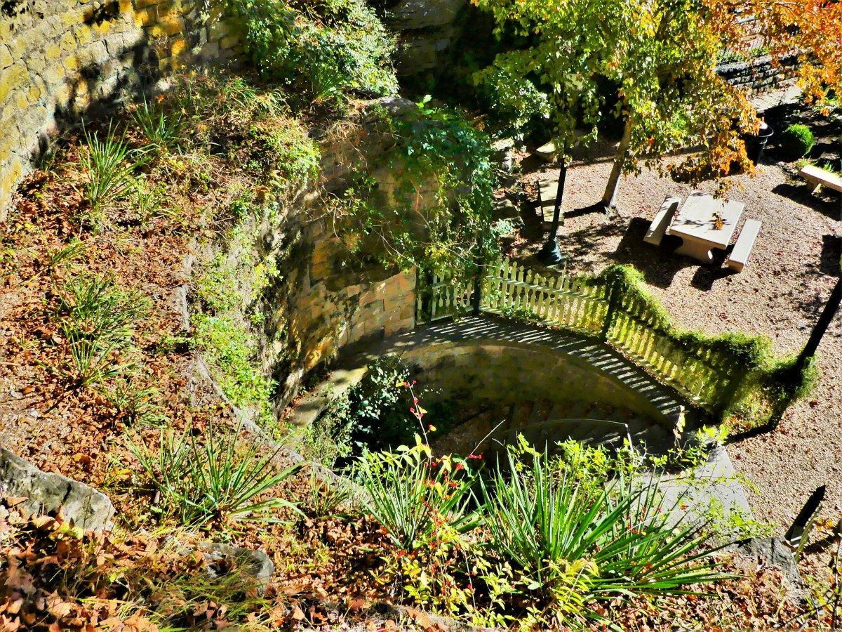
The charm of downtown carries through its narrow winding streets, acute corners, and graded roads of 30% or greater, routinely decorated with accents of fine art…
…and frivolity.
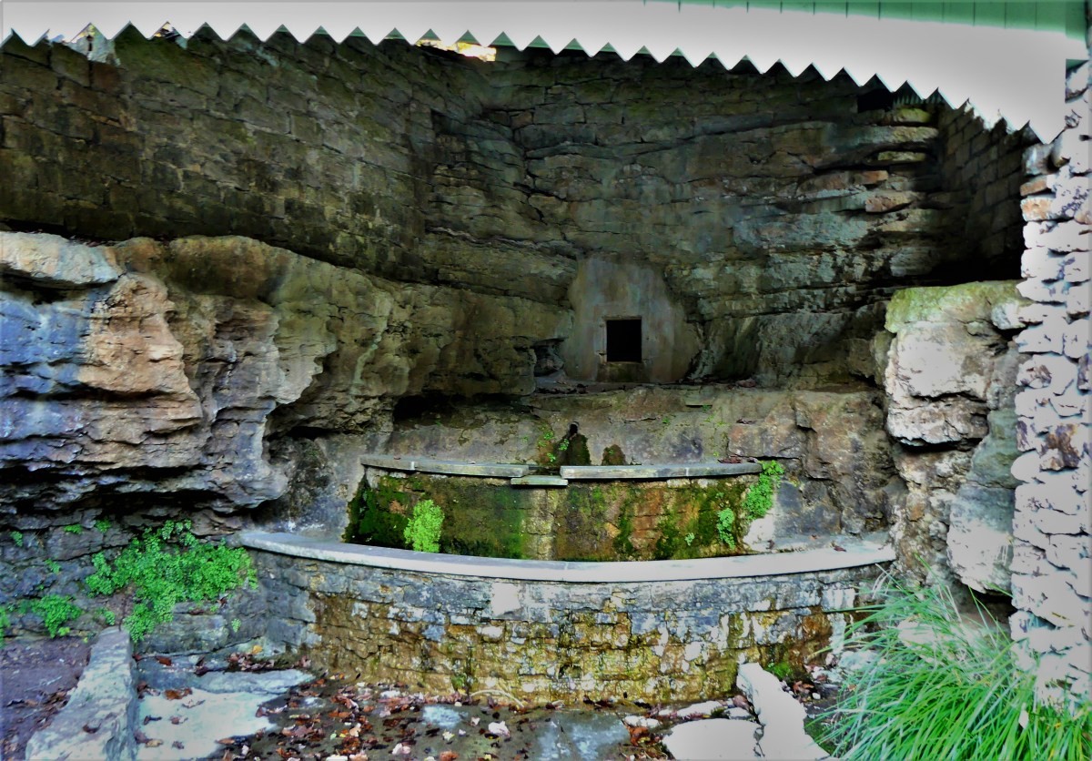
Eureka Springs came by its name naturally, manifesting no less than sixty-two springs that gushed from the mountainside with so-called healing properties. Its establishment as a resort community during the 1870’s prompted visitors from near and far to “take the waters” by drinking up and soaking in its therapeutic juices.
Today, over a dozen springs have been restored to former glory.
And while the water is no longer potable, the park habitats have given the springs a new lease on life,
and have renewed the town’s reputation as a popular healing destination,
with an emphasis on preserved charm.
Perhaps the biggest paradox of Eureka Springs would have to be the town’s united commitment to all things ghosts and Halloween, given its adherence and roots in Christiandom, while billing itself as “the place” for the best Halloween party in America…
…breathing spiritual relevance into Euripides’ quote: Money is the wise man’s religion.
Sanctuary comes in many different forms: as a retreat–a place one goes for guidance and inspiration; as a house of worship–a place to seek spiritual healing and nourishment; and as a refuge–a place to escape misuse or abuse. Within 24 hours, Leah and I managed to come across all three in a small corner of mid-western America.
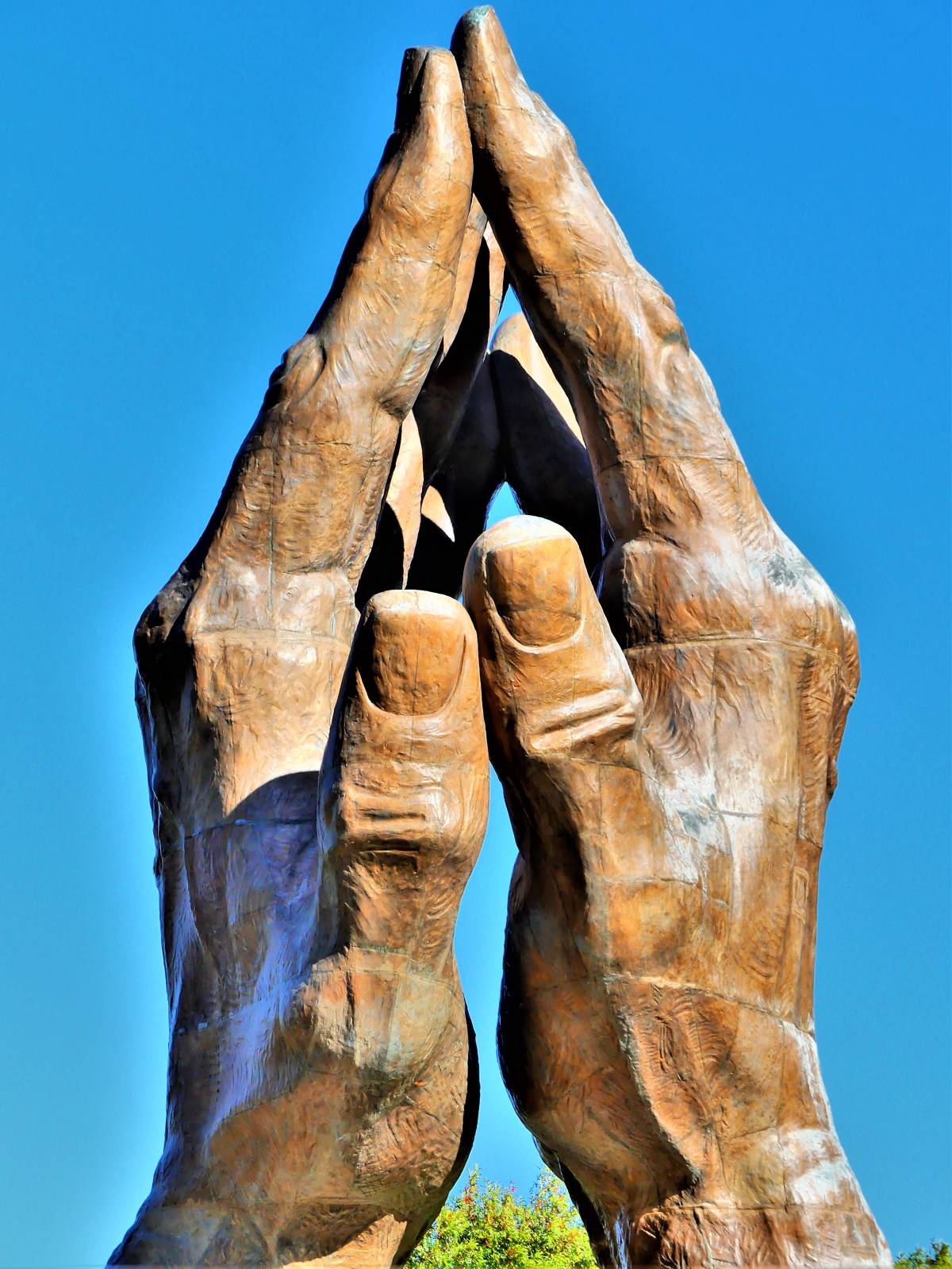
For those searching for faith-based education, Oral Roberts University in Tulsa, OK has a campus fingerprint: Make No Little Plans Here
The university’s holistic approach feeds the spirit, mind, and body.
The university’s futuristic and mid-century modern architecture attributed to Frank Wallace is best appreciated from the flying saucer,
that also passes for an observation deck,
and reflection gallery.
It’s gold-tinted, anti-glare windows colorize the outward views in a peculiar warm bath of Genesis green.
And while folded hands may symbolize a deep connection between God and Christianity,
…any university coed would easily characterize the statue as a student praying to pass.
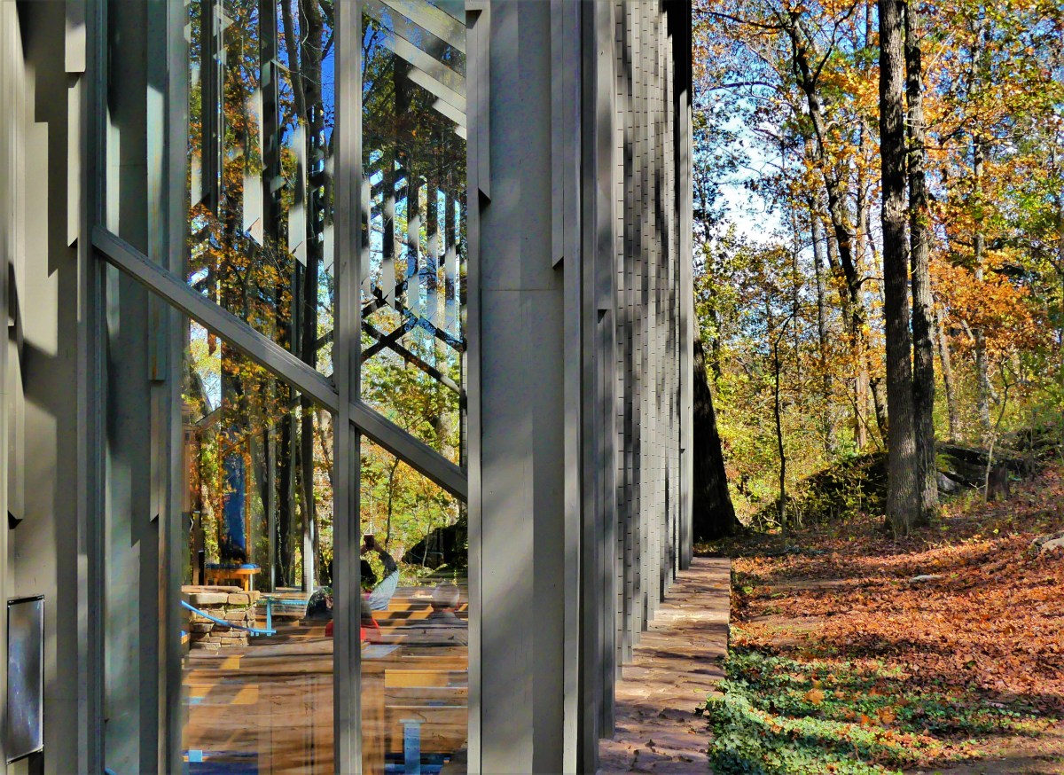
Architecture on a higher plane/plain can be found nearby, in the hills of the Ozarks. While no less spiritual in nature, the Thorncrown Chapel is rooted in nature.
An elaborate composition of wooden trusses embracing 425 windows gives an ethereal nod to a scripture and proverb mash-up of not casting the first stone in glass houses.
From the hillside, the chapel seemingly disappears among the flora,
and when juxtaposed to the outdoors, the chapel’s transparency is flaunted by its six thousand square feet of glass.
However, the chapel’s connection to nature shines brighter from within the polished maplewood doors,
where an arboretum of beams reaching forty-eight feet to the clouds…
can be contemplated and photographed from a distant pew. (Photography is allowed, but only from a sitting position.)
But Thorncrown Chapel is more than a beautiful building. It’s a celebration of Jim Reed’s spirit and vision, and a noble tribute to the glory of his resignation to a higher power.
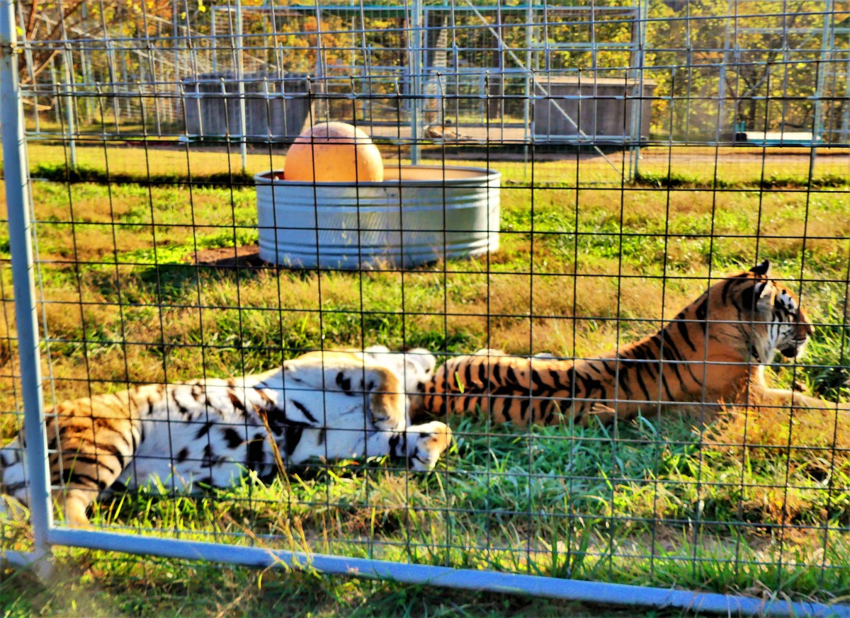
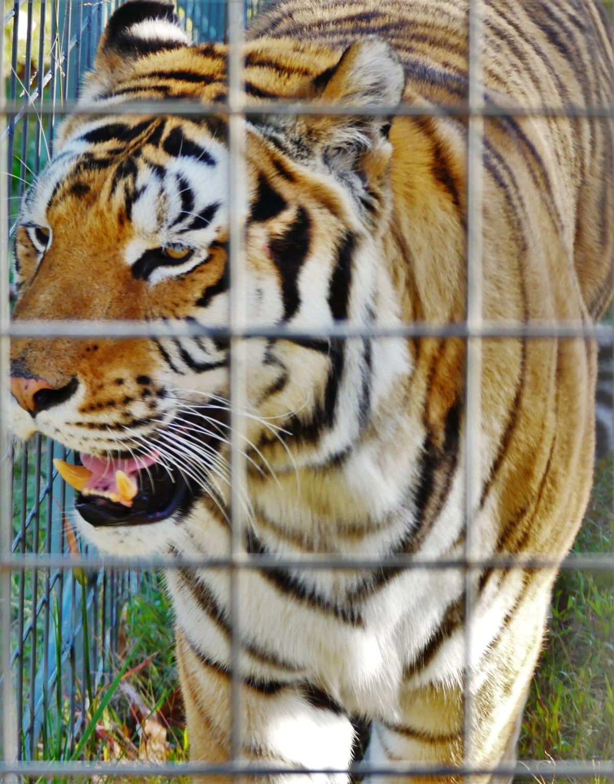
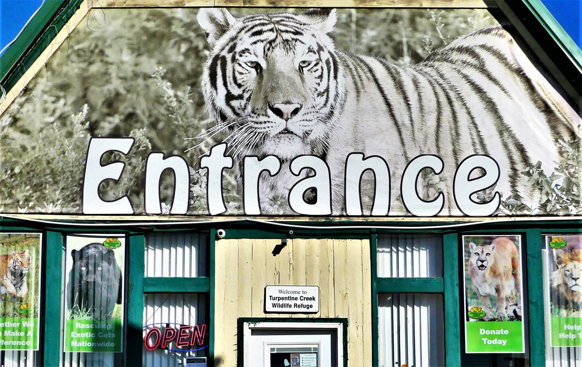
Lastly, eleven miles south, on the edge of Eureka Springs, AK, Turpentine Creek Wildlife Refuge provides shelter and care to abandoned, abused, and neglected wildcats, whose owners have miscalculated the cost and trouble of raising and breeding them in captivity.
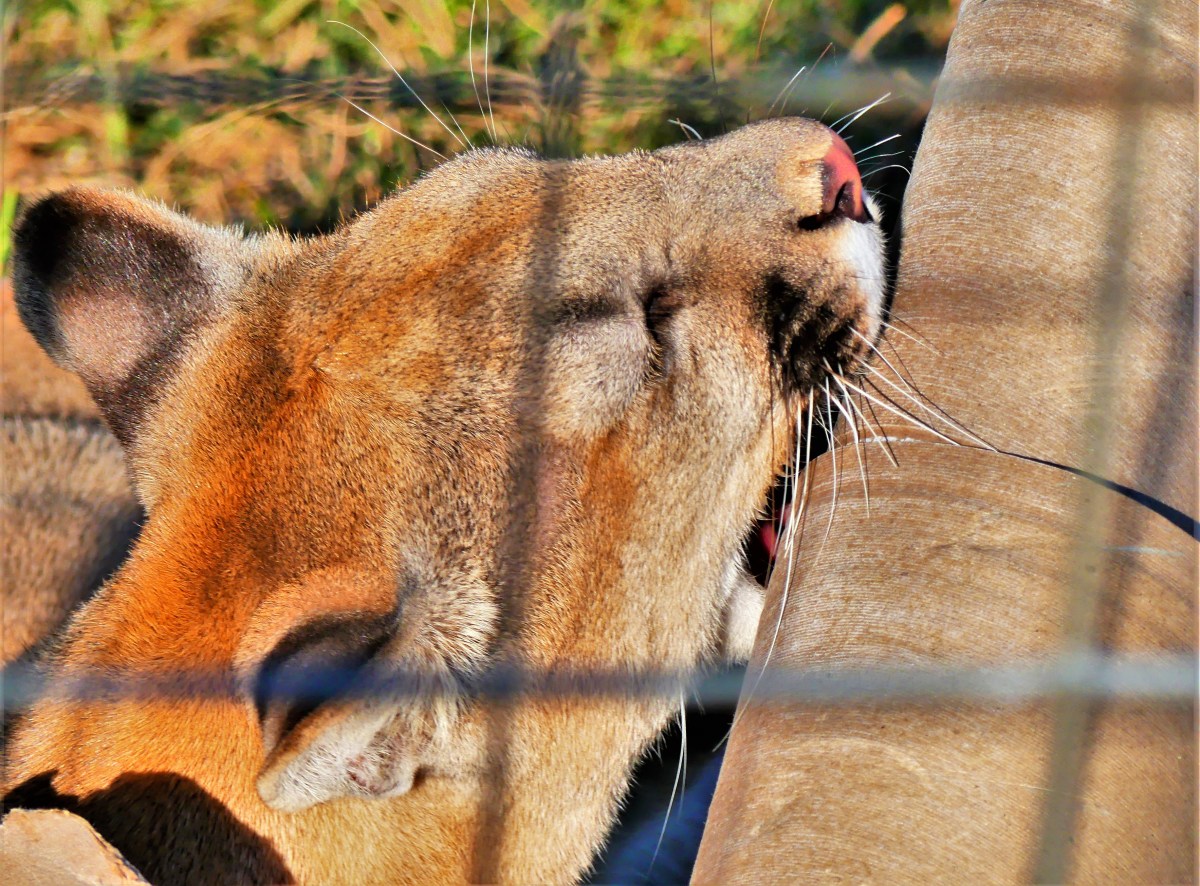
Currently, Turpentine Creek has become a haven to 100 lions, tigers, ligers, and cougars like Nala and Brody.
Natural habitats built with benefactor dollars provide asylum to big cats,
who are now free to live out their lives in a protected environment,
while being offered preventative and emergency medical treatment.
These cats cannot be released into the wild,
as they’ve lost their ability to fend and defend after being declawed by their owners,
who in their ignorance and arrogance wished to make them less dangerous to handle as one-time pets.
Nevertheless, a cadre of volunteers assists a small staff in feeding, cleaning, examining, and behavior-modifying these beasts. Thus, providing each big cat with a humane existence.
Day-to-day operations are assisted through visitor admissions, gift shop sales, and donations by large corporations like Tyson, who feeds the herd 300,000 lbs. of chicken every year.
Sanctuaries of thought, redemption, and protection offer safe places to learn, to reflect, and retire to. Remove anyone of them, and society faces a danger of turning in on itself, further sewing the sleeves of divisiveness.
Better still, offering asylum to the millions of struggling homeless across the country, and persecuted refugees around the world would improve their safety and dignity, and allow more of humanity to participate in their own recovery.
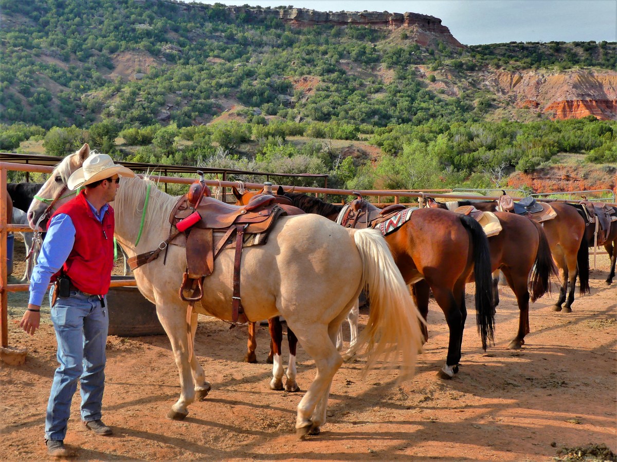
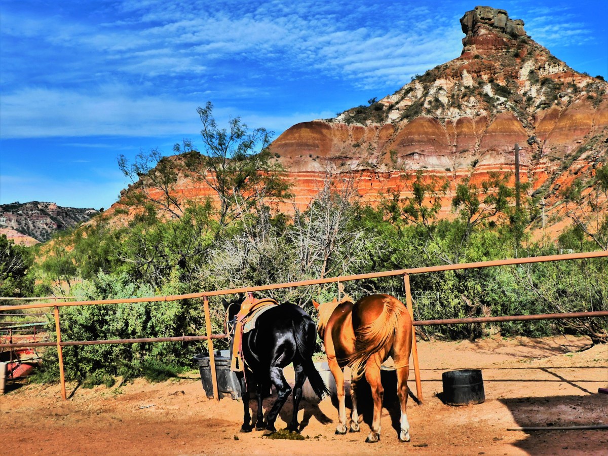
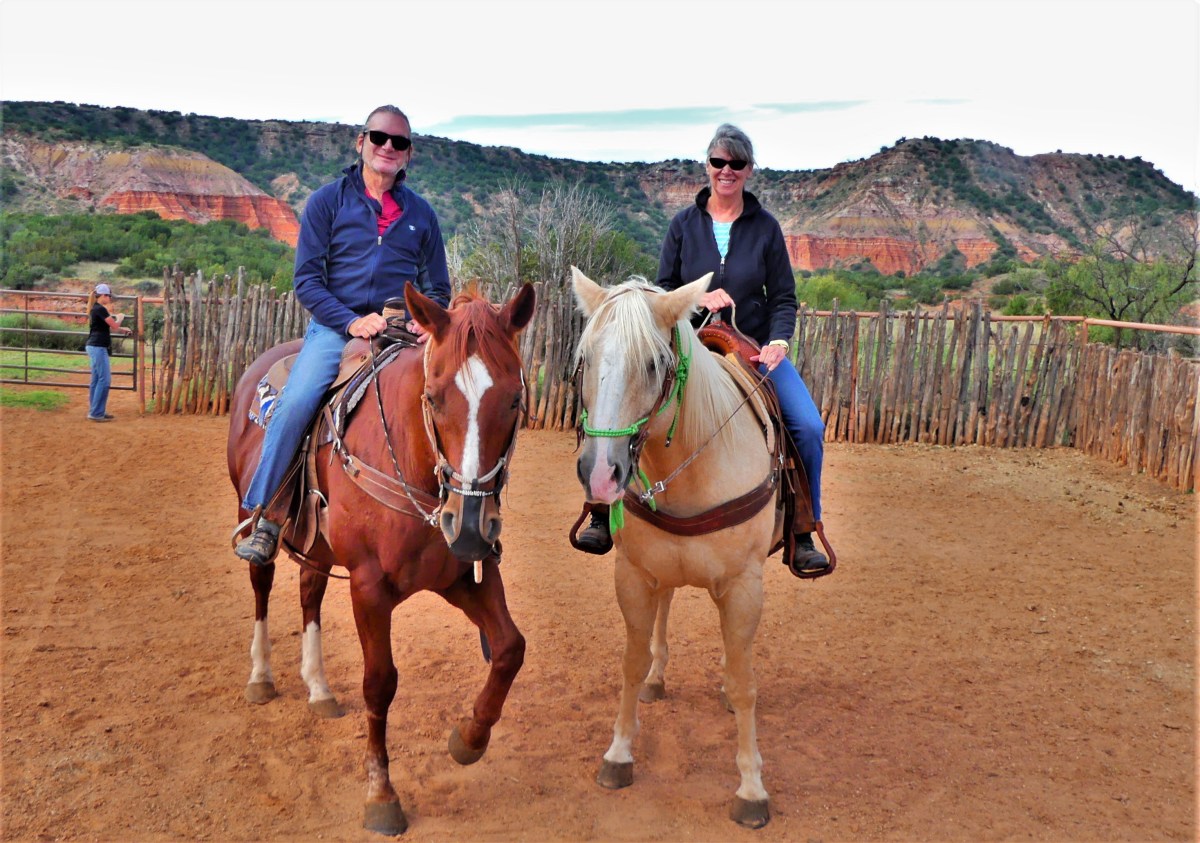
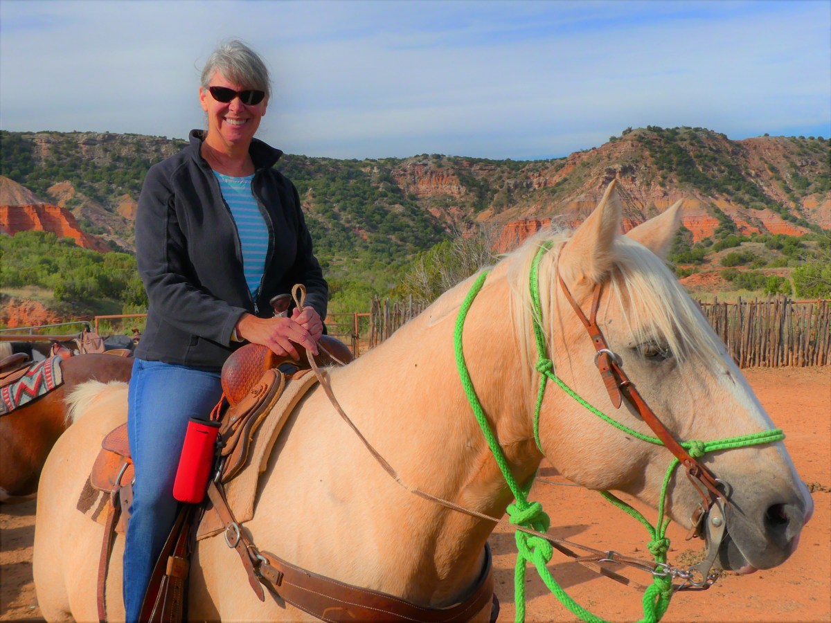
Wouldn’t you know it?! Texas has a Grand Canyon of its own in the middle of its panhandle called Palo Duro. And the best way to see it is from the saddle of a horse while riding at the bottom of the canyon floor.
We’d been wanting to go horseback riding for the past few months, but something always interfered with our plans, or time wouldn’t allow. But Leah was determined.
“If you can ride in a balloon, then I get to ride a horse,” she declared.
And true to her word, reservations made on Thursday got us an early ride time with Jennifer at Old West Stables inside the state park.
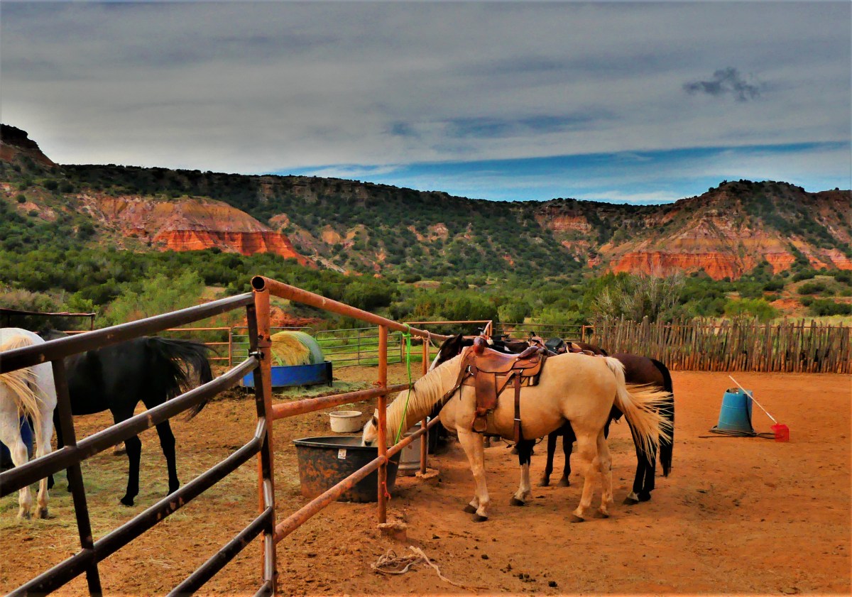
We mounted Buster and Lloyd,
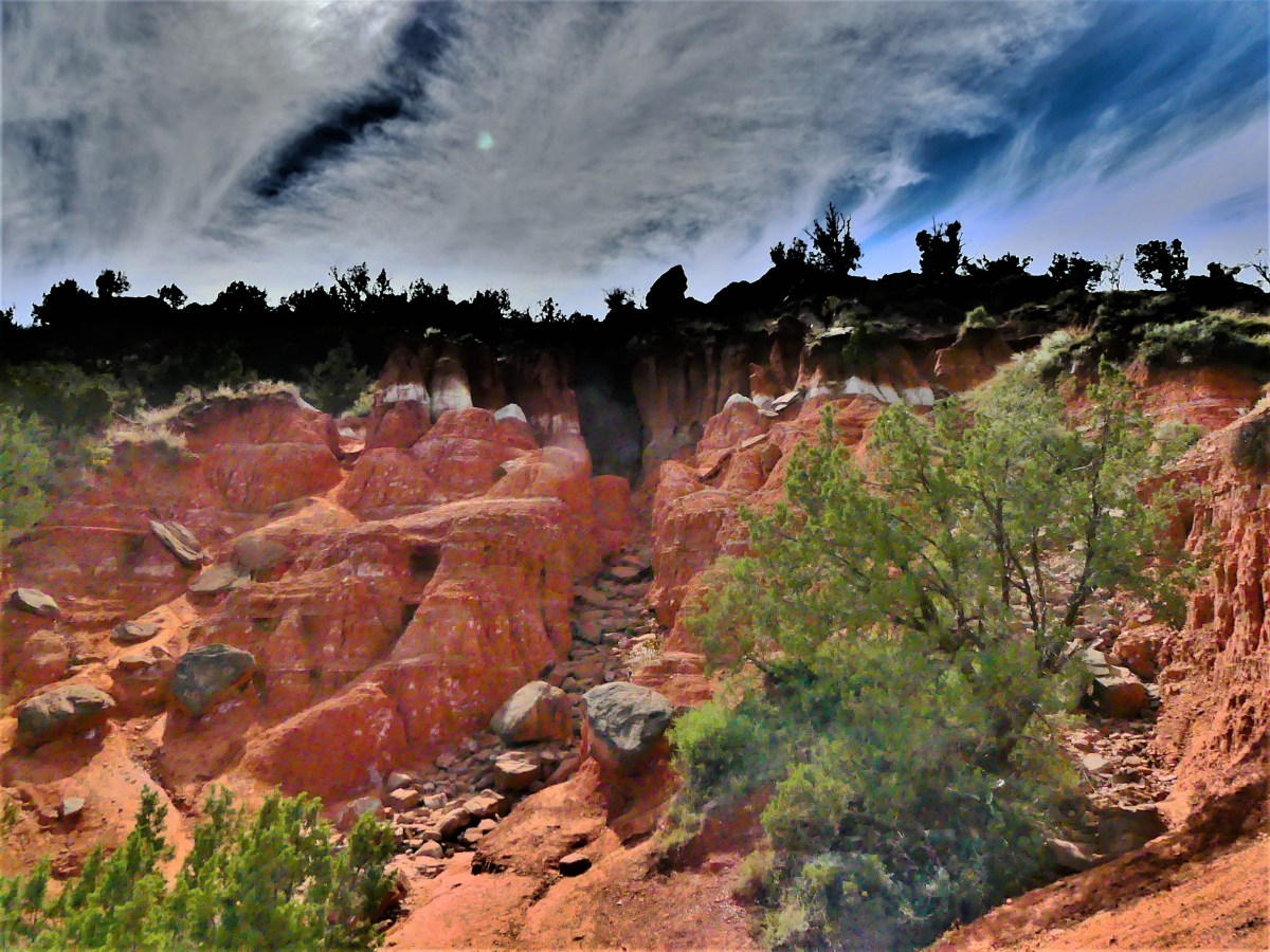
and rode along an unmapped equestrian trail that took us along the foothills of the canyon walls…
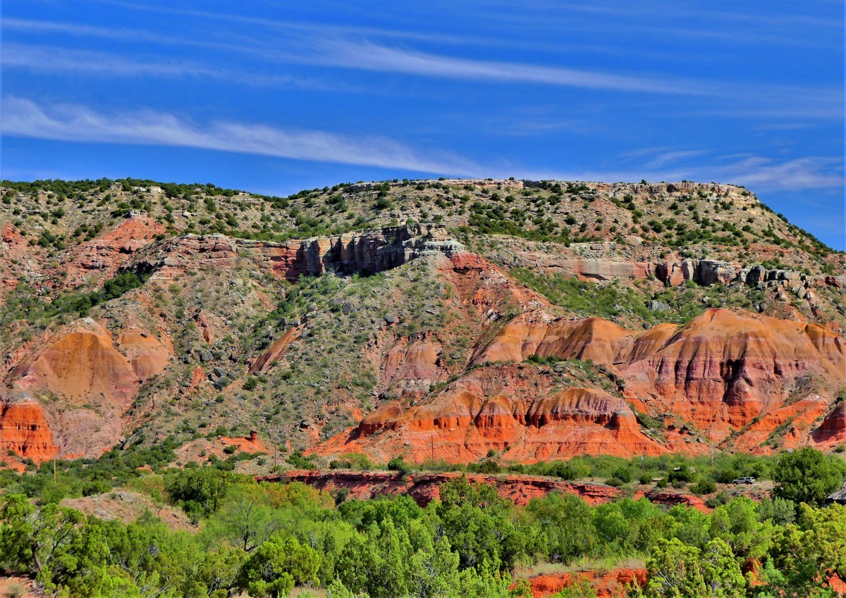
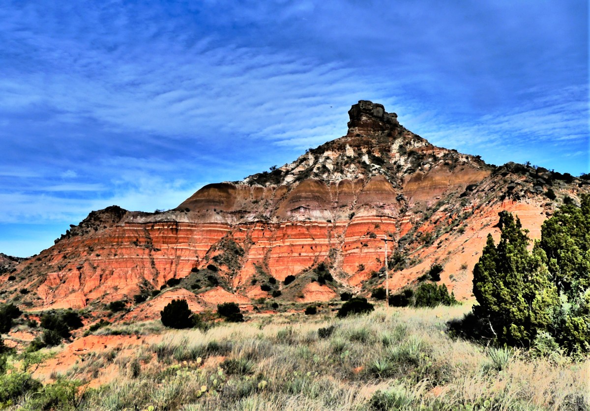
and through the hills and ravines of a basin carved by the Prairie Dog Town Fork of the Red River over one million years ago.
We passed colorful rock formations resulting from a geologic compression of four distinct periods layered over the course of 250 million years.
While I enjoyed the scenery, and the quiet of the canyon,
I had the disadvantage of riding behind Leah’s horse, Lloyd.
Lloyd was a farter who always positioned himself behind the lead horse.
And no matter how many times I tried to hold Buster back…
…we would always find our way back behind Lloyd’s swishing tail,
where Buster was always greeted with a slow and steady current of foul wind, followed by an evacuation.
The hour passed as easily as Lloyd’s breakfast, and we found ourselves back at the stable, in time for Lloyd’s lunch.
Once finished, we took a ride back to the lodge at the top of the canyon for a better perspective of the second largest canyon system in America,
before returning to the basin’s scenic road to explore the Big Cave,
an opening in the red rock that’s not as big as it’s unusual.
The Texas panhandle is as flat as a cowpie, and wide as the open sky.
Thankfully, Palo Duro Canyon provides some variety to a linear landscape, and adds some color to a pale prairie palette.
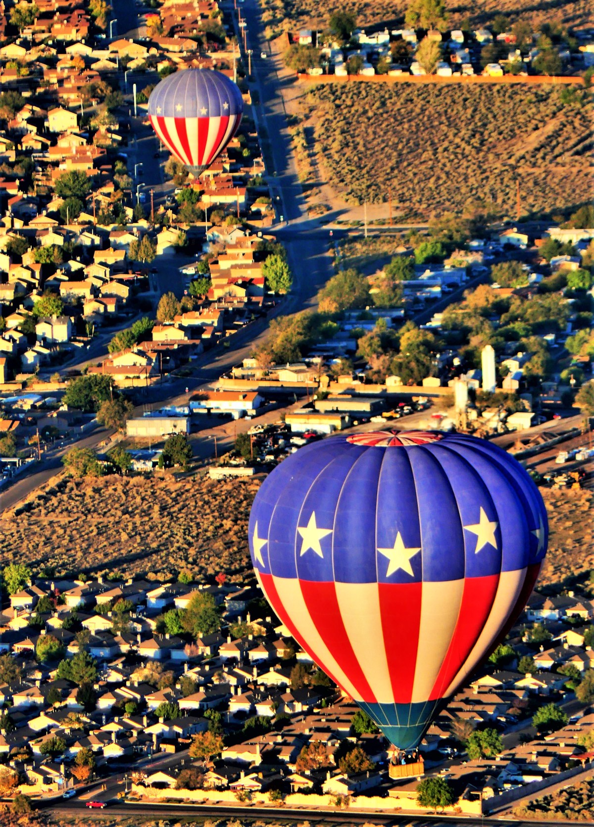
“$450 for a balloon ride?! You’ve got to be kidding” I exclaimed to the Rainbow Ryder rep on the phone.
“That’s the price, sir. We are the exclusive balloon ride provider for Balloon Fiesta, unless you’re willing to fly outside the ‘Albuquerque Box’,”she managed.
“What’s the ‘Albuquerque Box’?“I inquired.
“It’s a weather phenomenon peculiar to Albuquerque,” she pointed out, “where the lowest winds move in one direction, while the higher winds are moving in the opposite direction. That way, our pilots can take advantage of the different air currents, by floating higher or lower, and return you close to your original launch point.
*courtesy of Drumlineramos
“Uh, Ohh-kay,” I shrugged, “and that’s worth $450?”
“That’s the rate for a balloon ride during Balloon Fiesta, sir. And I only have a few openings left for Saturday and Sunday,” she pitched.
“Your price is sky high,” I offered, “so I’m gonna have to think about it.” And this call was over.
I turned to Leah. “Looks like my balloon ride went from bucket list to “fuck-it” list.”
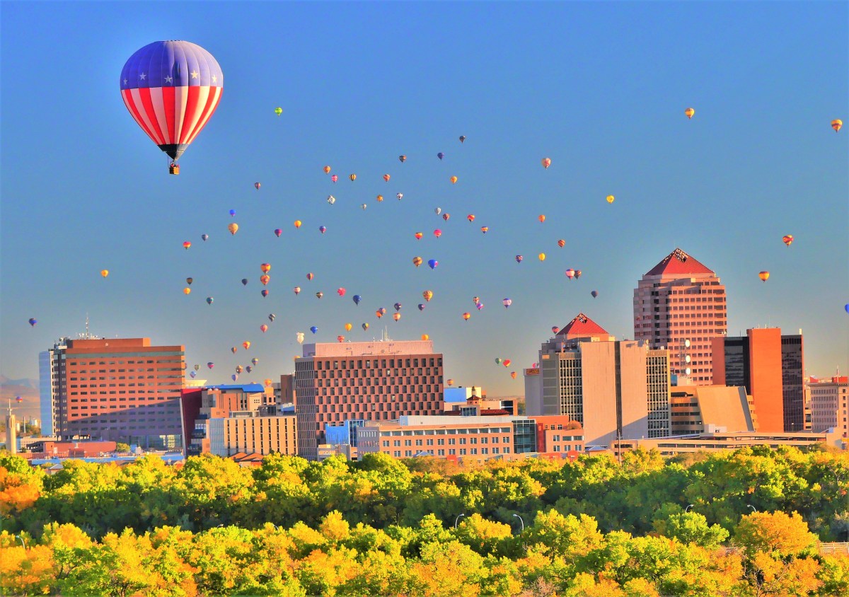
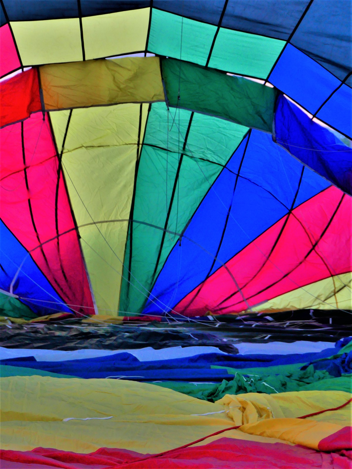
And that was a drag, since Balloon Fiesta is the largest gathering of hot-air balloons in the world, with more balloons lifting off together (mass ascension) than anywhere else.
Leah sensed my disappointment. “Maybe it’s cheaper if you found an outfitter outside the box. Would you still be interested?
“I think I could manage to get excited,” I lamented.
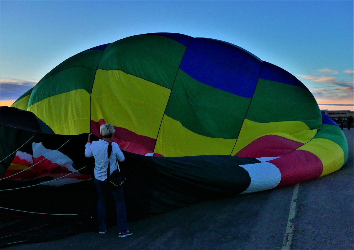
After a flurry of phoning and pricing, I secured a dawn launch on Saturday for $250 with World Balloon, albeit on the northwest side of town, miles away from the Fiesta.
Launch day bears all the markings for a picture-perfect take-off: early air temperature hovers in the mid-40’s; the wind is streaming from the north at 8 mph; and the sky is clear as shimmering water.
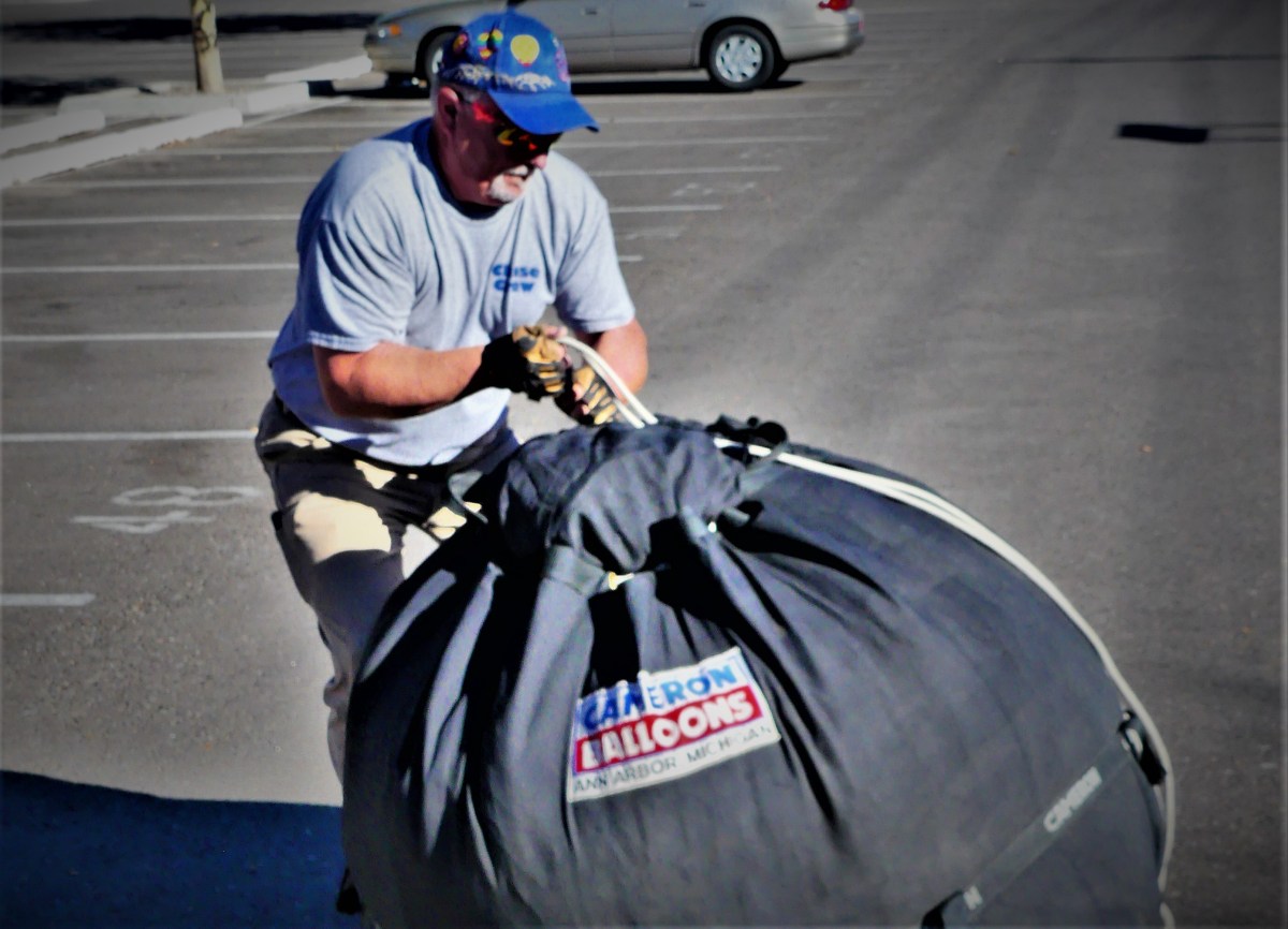
A group of fifty men, women, and children are sub-divided into five, and assigned to a pilot and his balloon crew. Each chase van carries two wranglers, ten passengers, and a trailer packed with gear. We congregate at a barren football-sized lot, and watch as five balloons are prepared for flight.
Baskets are unloaded,
and assembled.
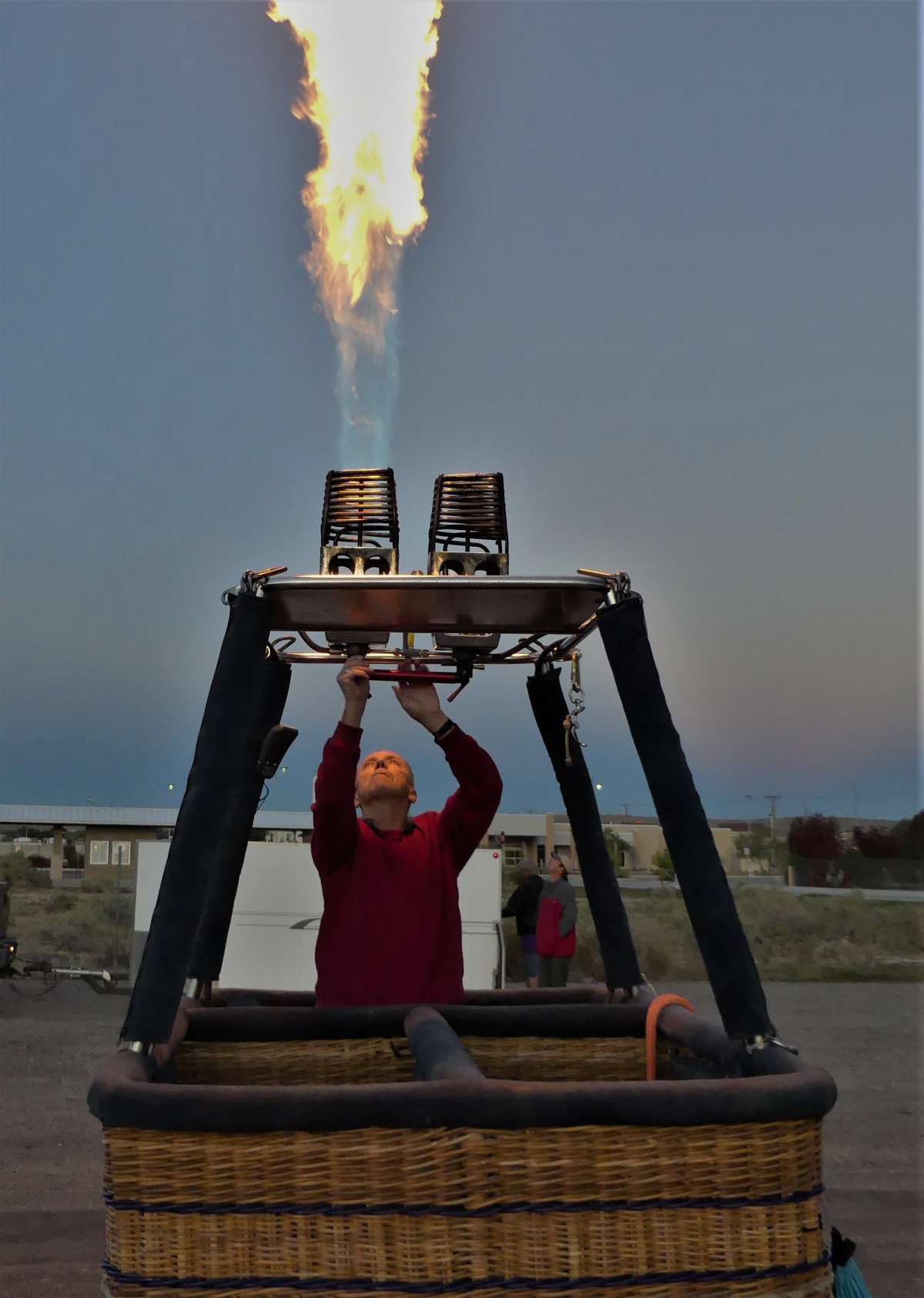
The burners are tested.
With dawn breaking over the horizon, the balloon is unfurled, and rigged to the basket.
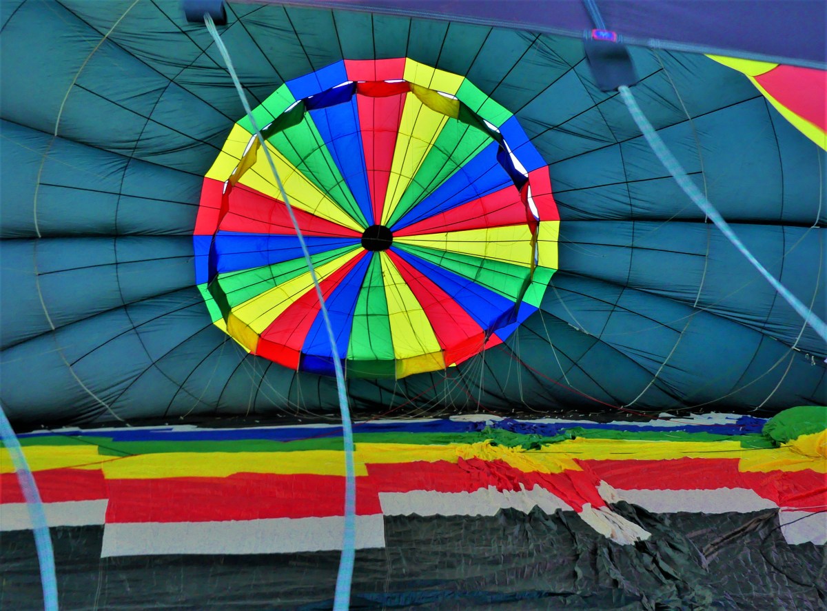
An industrial fan blows cold air into the mouth of limp polyester, and behold, the balloon takes shape.
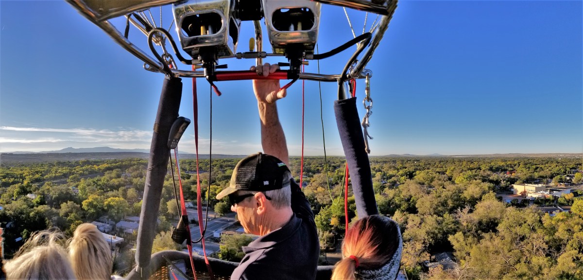
Roy aims the burner flame into the mouth to heat the air,
and eventually expands the envelope to fullness.
The buoyant balloon rights itself,
and the six of us scramble inside to bid adieu to terra firma, and gently float away…
…one step ahead of a second balloon.
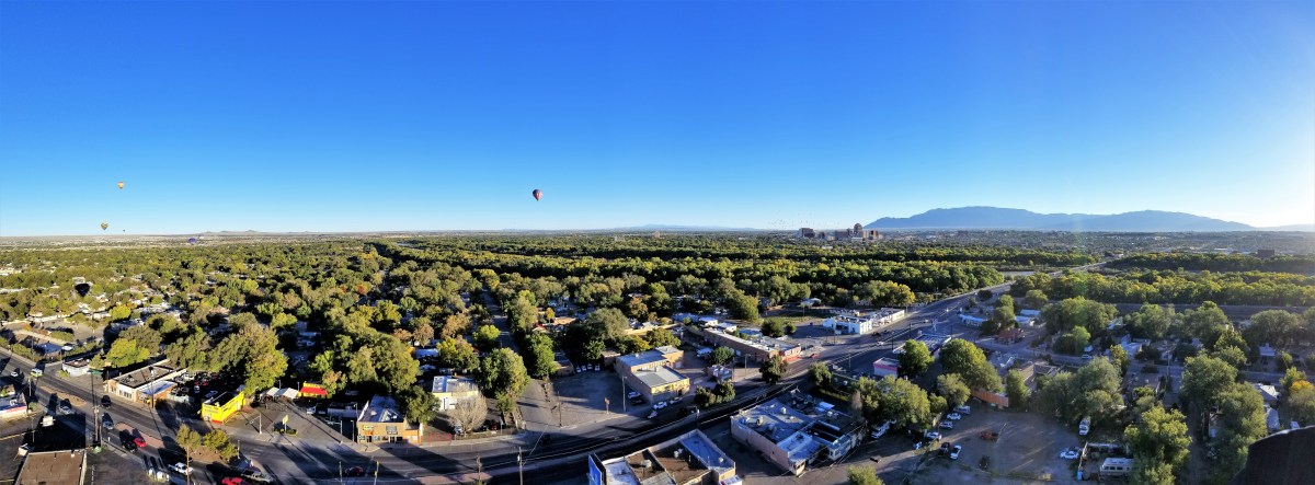
All the while, balloons below…
…are preparing to follow our Airstream (wink wink, nod nod).
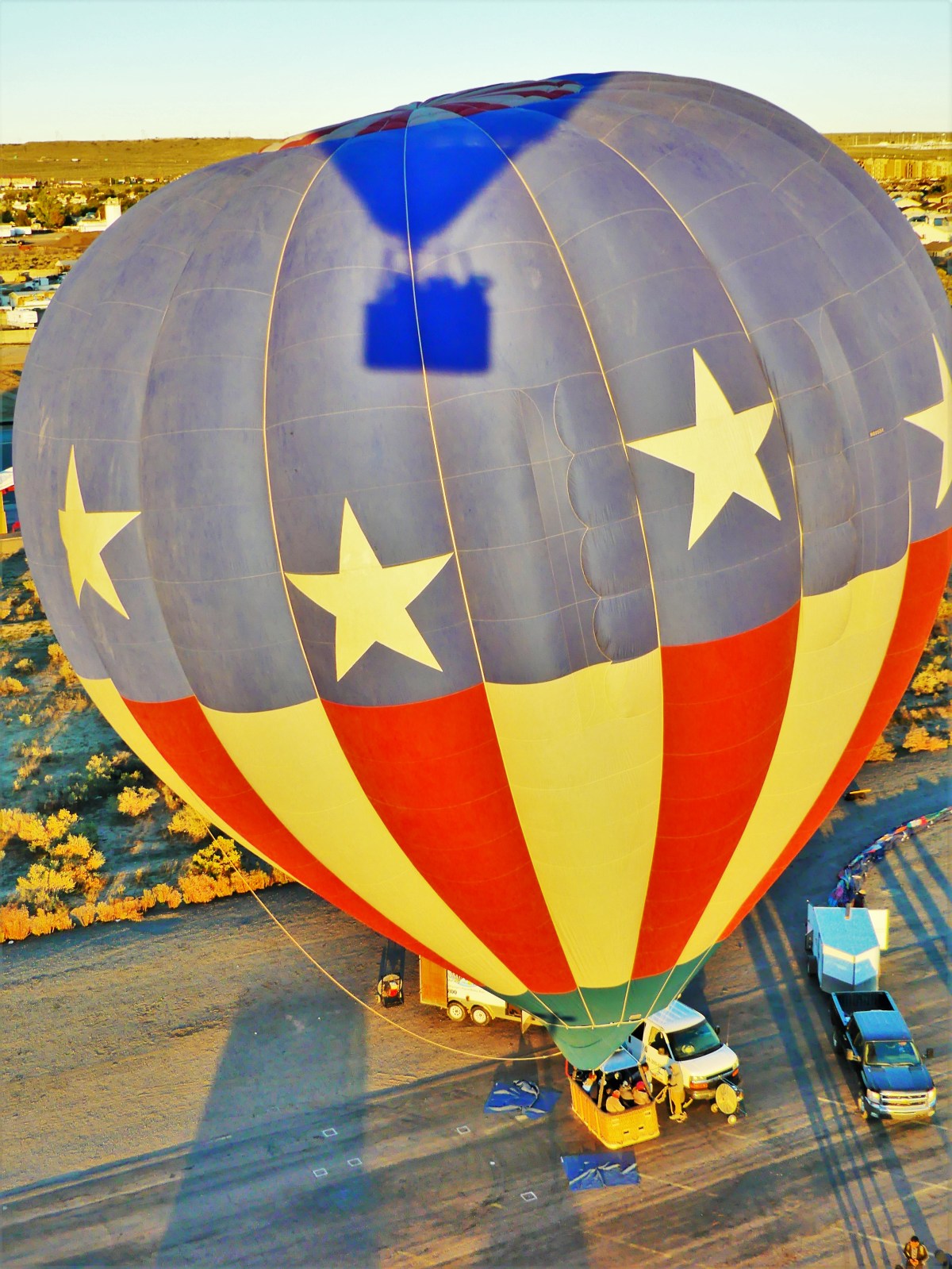
Our pilot, Roy pulls on the burners,
carrying us to 5000 ft. above the treetops,
where a birds-eye view of the valley below,
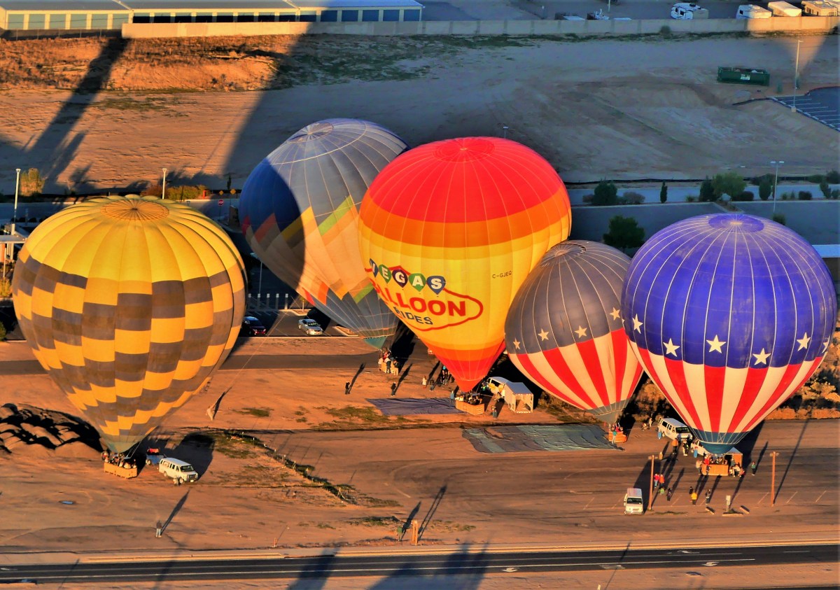
reveals a cityscape punctuated by fantastic dots of floating colors.
Yet closer inspection reveals the full dimension of a multi-colored mushroom gliding through an azure sky.
After forty-five minutes of soaring and dipping through neighborhoods–arousing excitable dogs,
and adoring children–
Roy is tasked with finding a landing site along our flight path–wide open and away from wires–and accessible to the chase team who’s been following us since our launch. After a few false starts, we locate a large house devoid of landscaping, and gently settle back to earth.
However, a chain-link fence lines the perimeter, and a locked gate gives us no way out. A woman from Birmingham, AL vaults over the side of the basket and runs to the front door to alert the owners to unlock the gate, but nobody’s home.
So it’s back in the air, with the van in pursuit, until we mobilize at a strip mall.
After a quick exchange of passengers (six out and four in), our balloon is re-released with its second set of aeronauts,
drifting higher into the blue yonder.
Fifty minutes later, the vacant parking lot beside the church provides the perfect setting for a second re-entry.
Whereupon, the balloon is quickly collapsed,
and folded,
and packed away, until next time.
Back at base camp, it was time for a champagne toast, and a recitation of the balloonist’s prayer:
The winds…
I loved it, and I’d do it again. I guess that makes me a balloonatic.
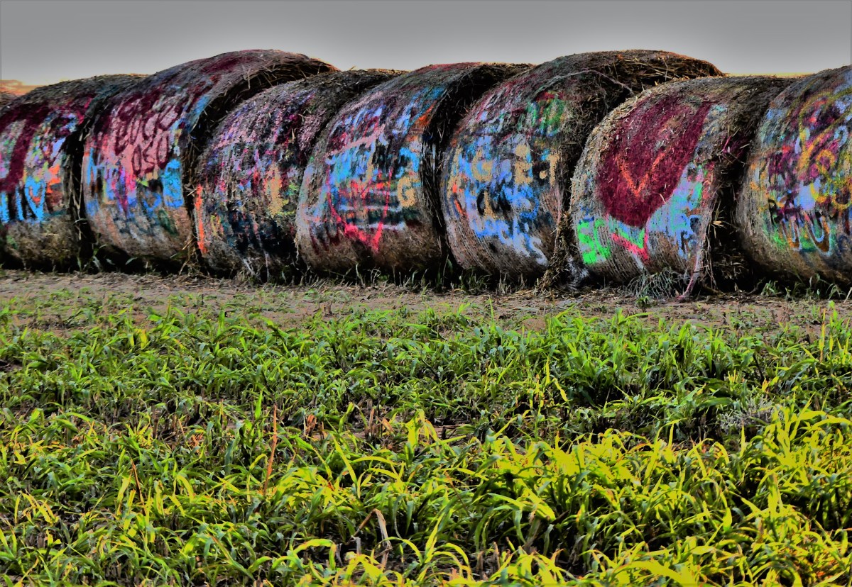
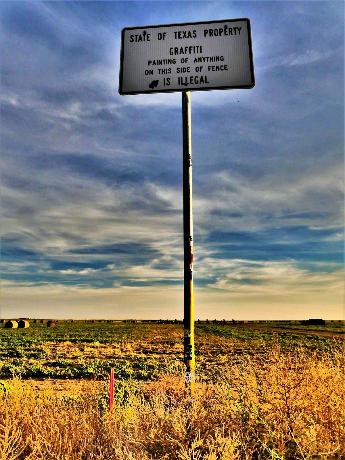
A handful of cars and trucks were pulled onto the shoulder of a road beside a cow pasture along Interstate 40 in Amarillo, TX. A barbed wire perimeter protected entry to the field, but a rainbow-colored cattle gate provided access to an infinite vista of grassland and graffitied hay rolls.
Although road signage made it very clear that all graffiti stay on the other side of the road,
anything on Stanley Marsh’s property was fair game for tagging and tacitly encouraged.
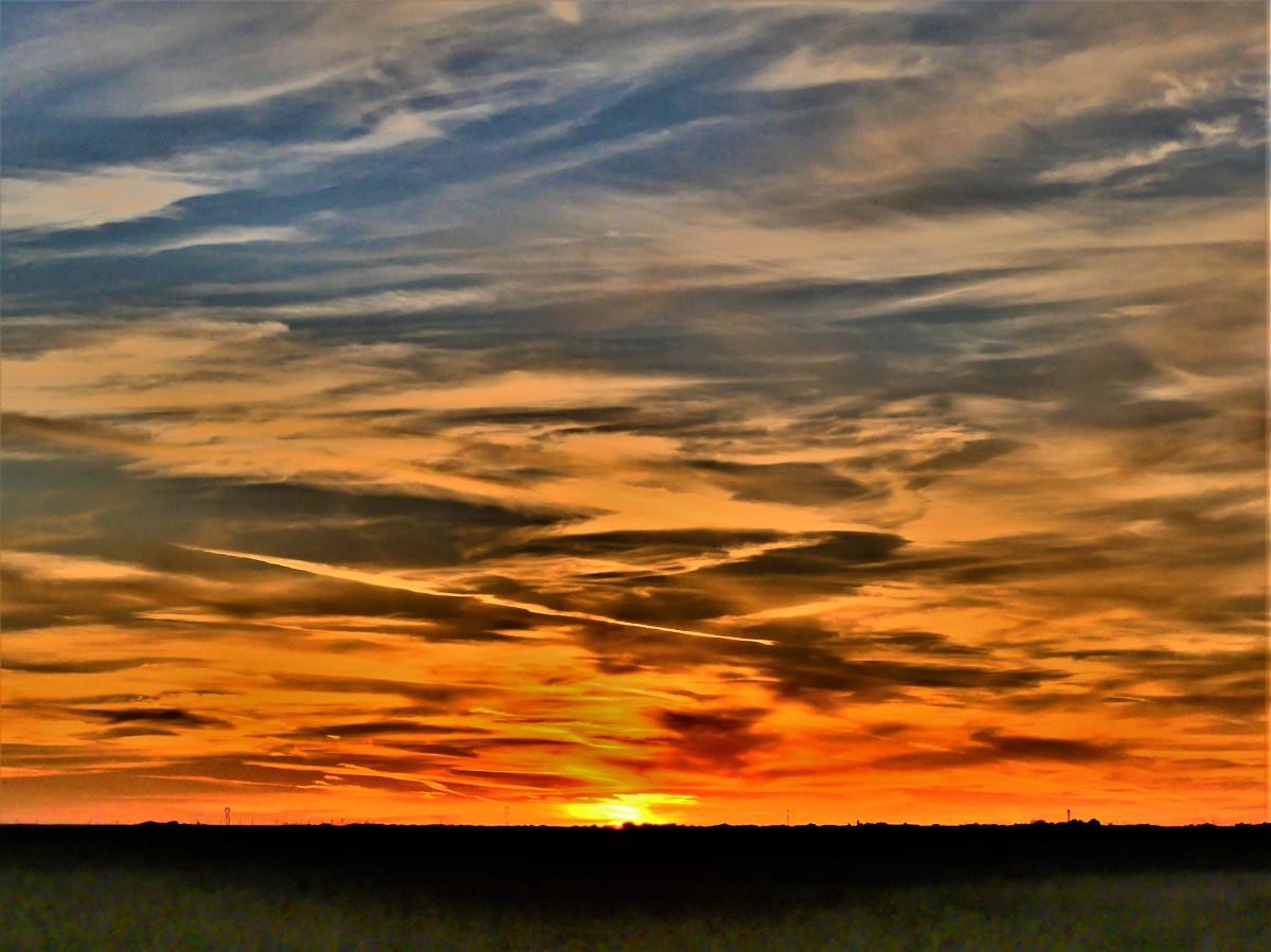
The sun was setting,
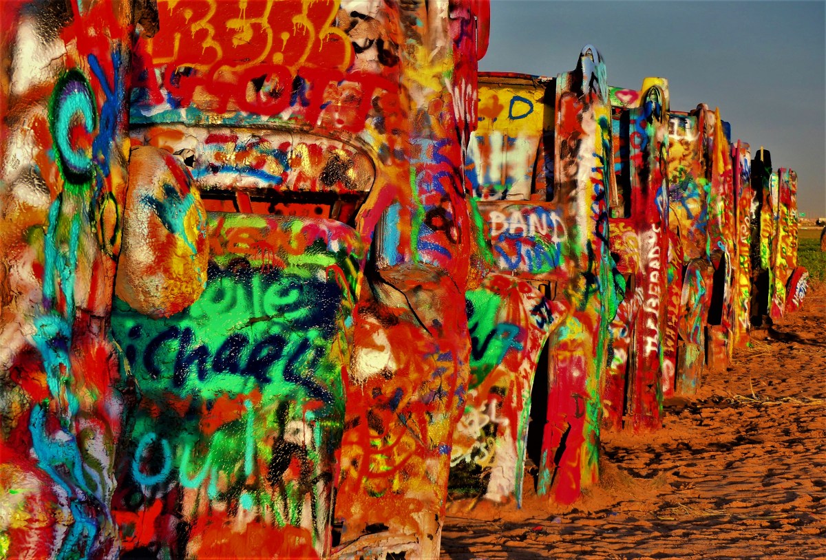
and the mosquito swarm was brutal, as if they saw it as their obligation to annoy anyone curious to walk through a field where ten Cadillacs were partly buried in the ground.
Additionally, with golden hour light fading quickly, I felt my glow time was severely limited.
Nevertheless, working around the tall shadows cast by a low-hanging sun, I managed to capture a spectrum of random and radiant colors that seemingly changes by the hour, courtesy of spray-painters who choose to be anything but anonymous.
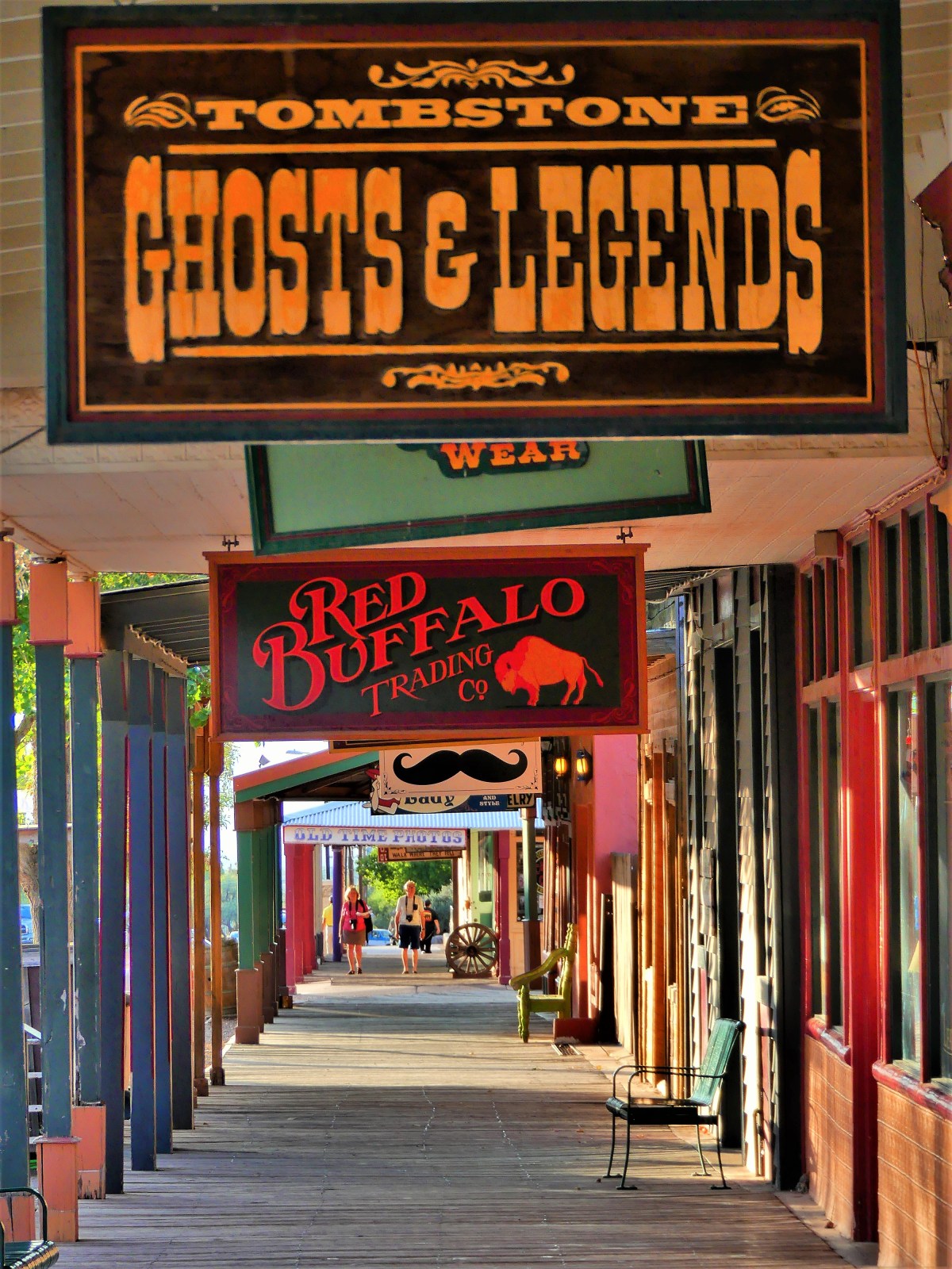
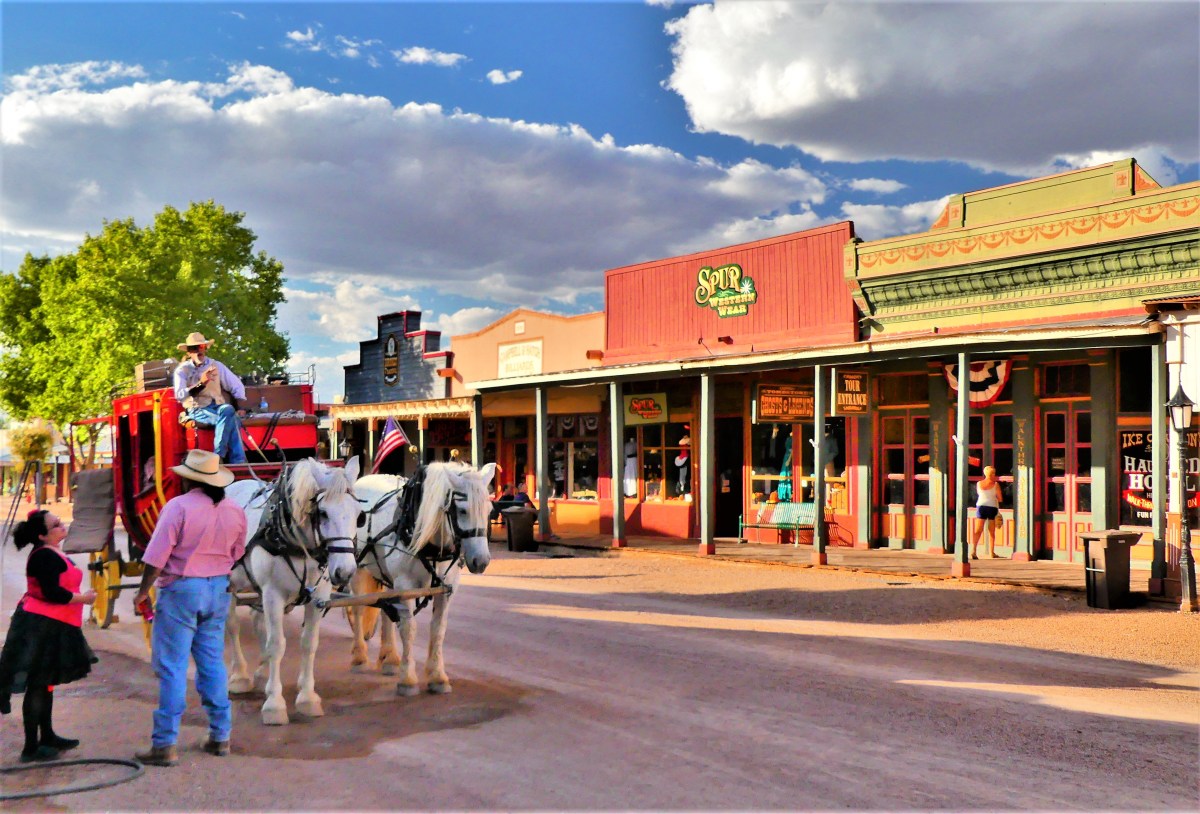
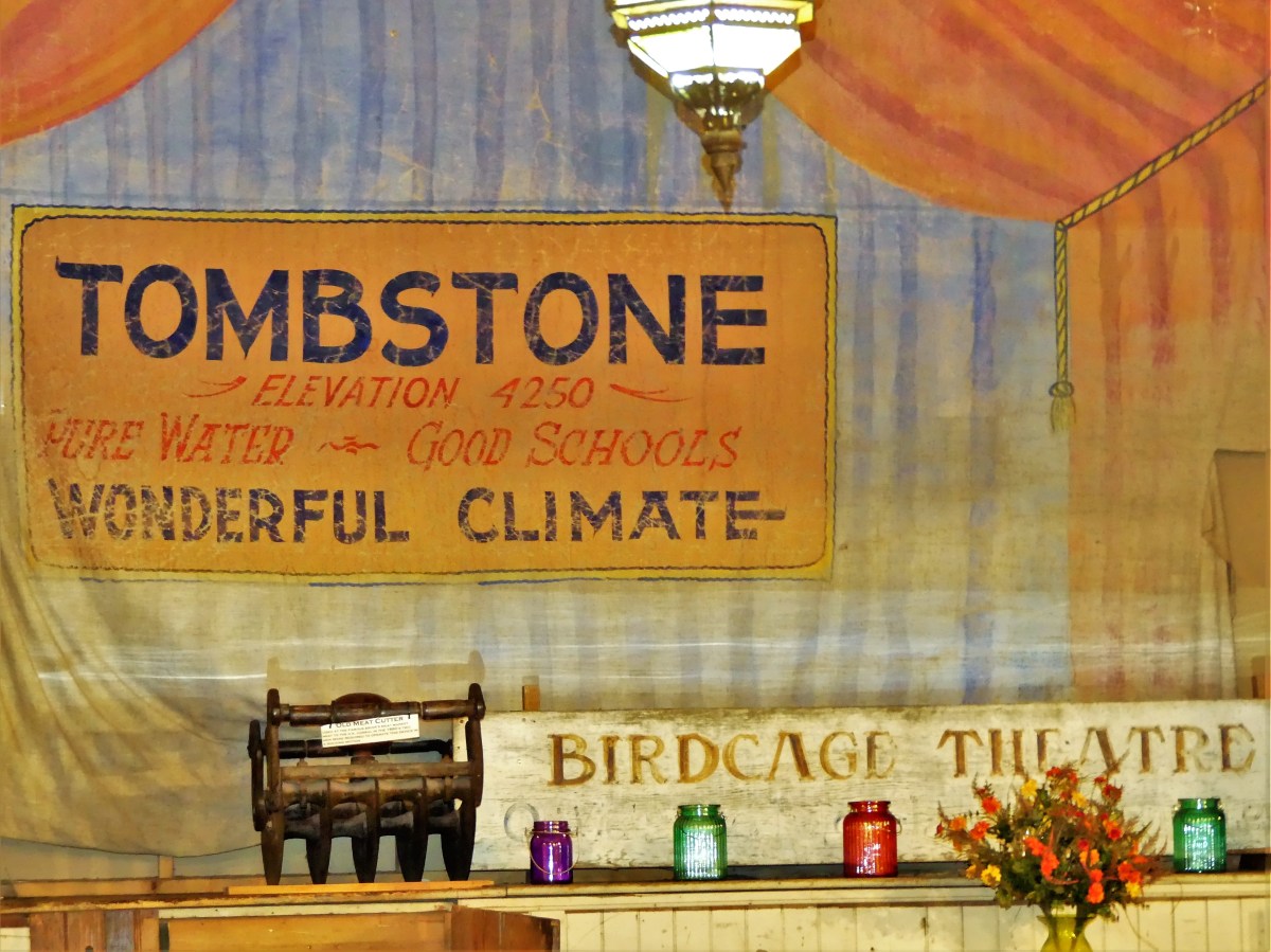
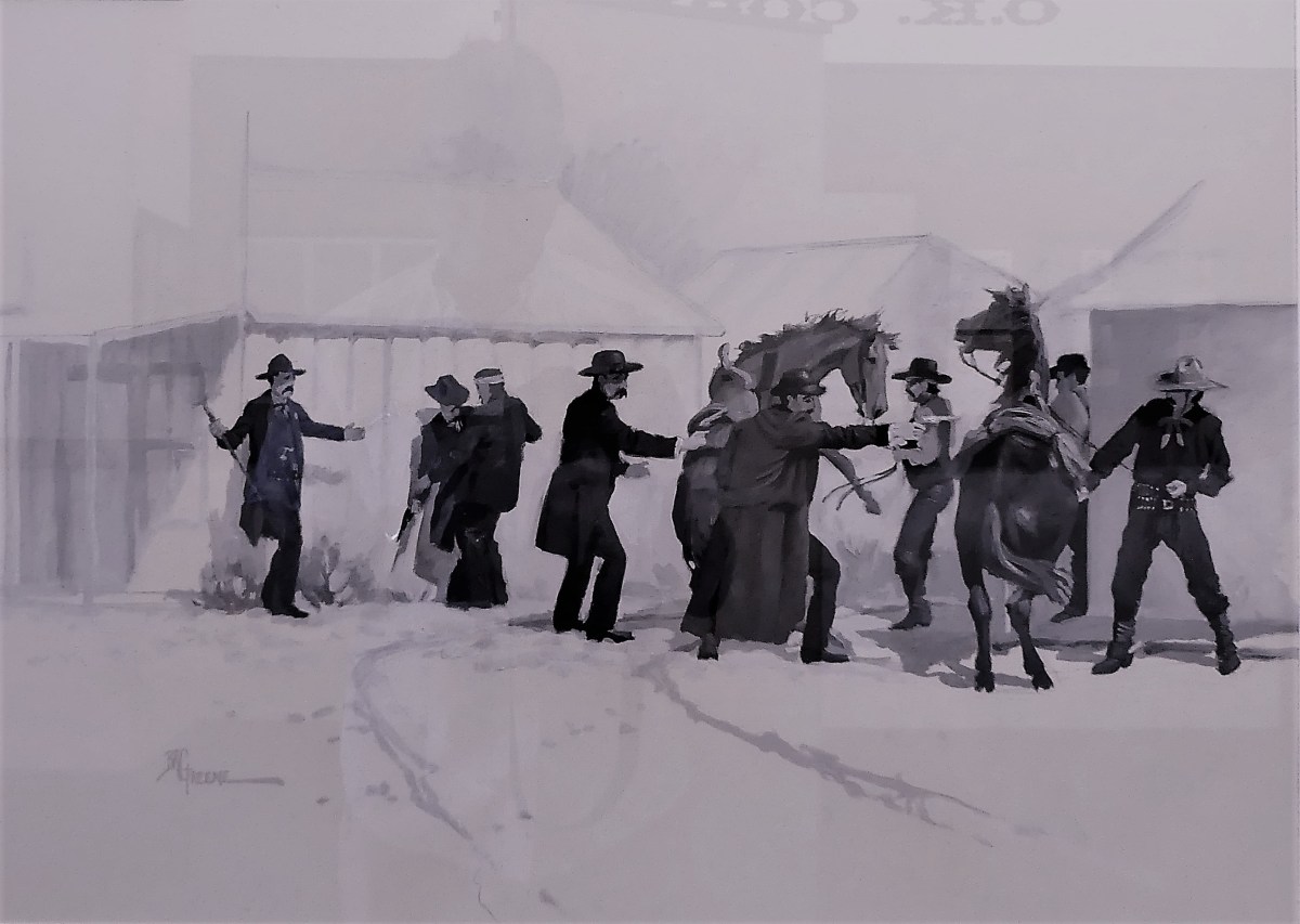
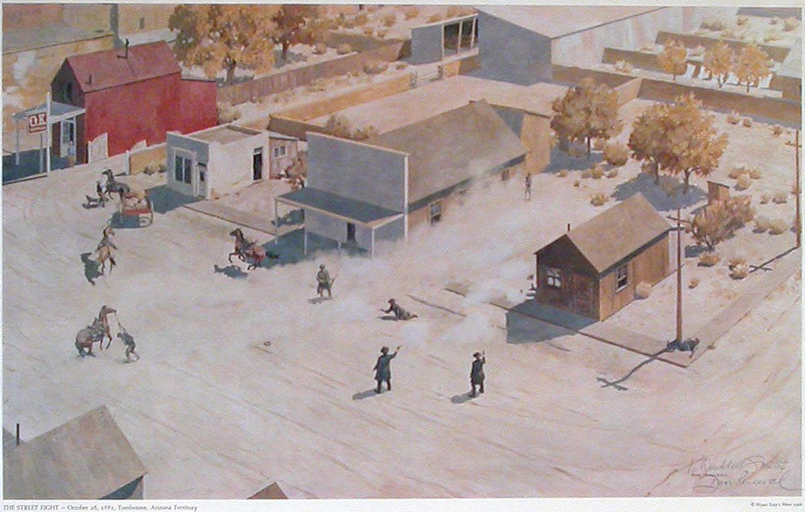
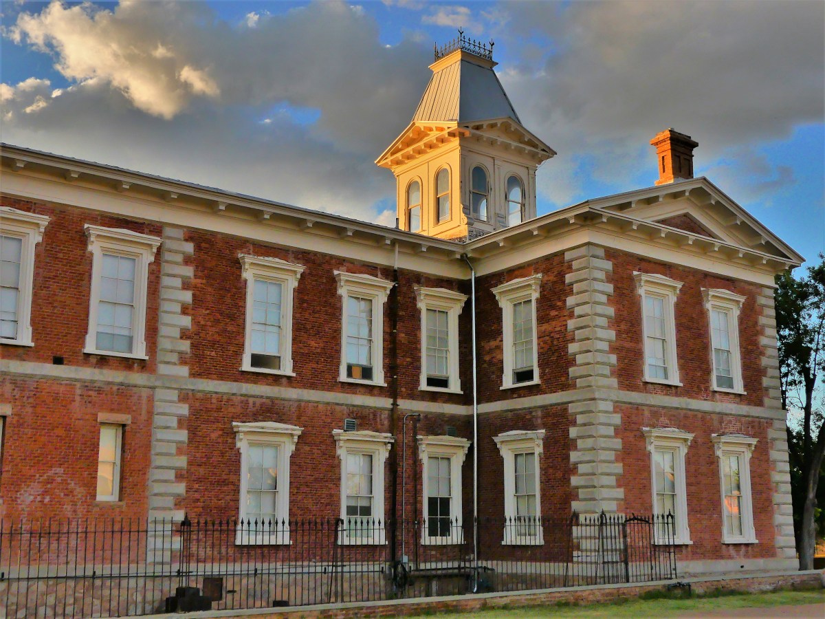
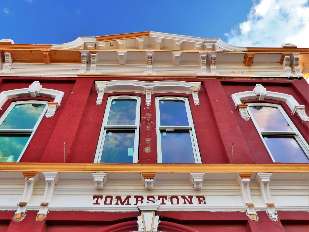
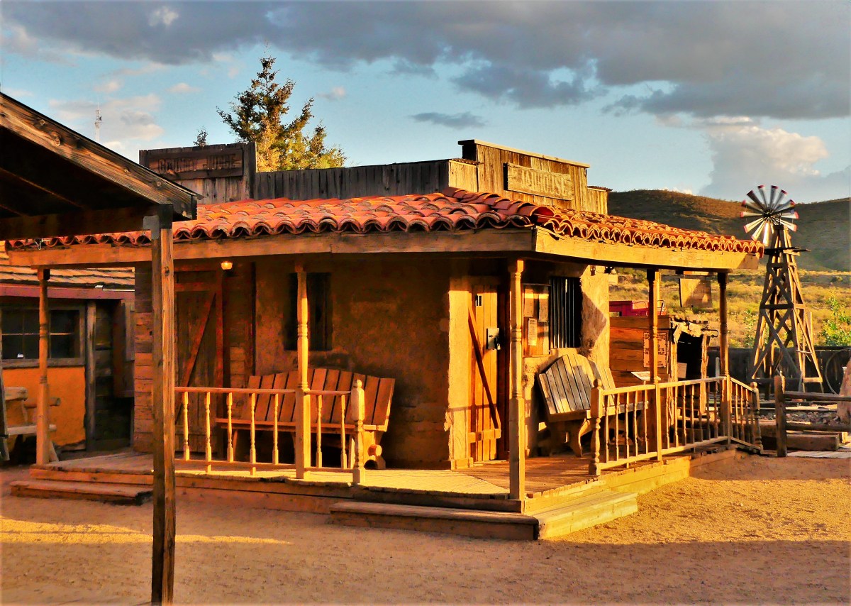
It was late afternoon, golden hour, and the town was aglow. We rolled into Tombstone, AZ with the tumbleweeds, and got out of town by morning, but not before taking a sun-soaked stroll down Allen Street past the O.K. Corral, tracing the footsteps of a by-gone time.
The Old West town was unusually quiet this day,
as if its residents were hiding out, bracing for yet another round of random violence, when claim jumpers, cattle rustlers, horse thieves, prostitutes, and gamblers challenged the moral fiber of a nascent society teetering between greatness and greed.
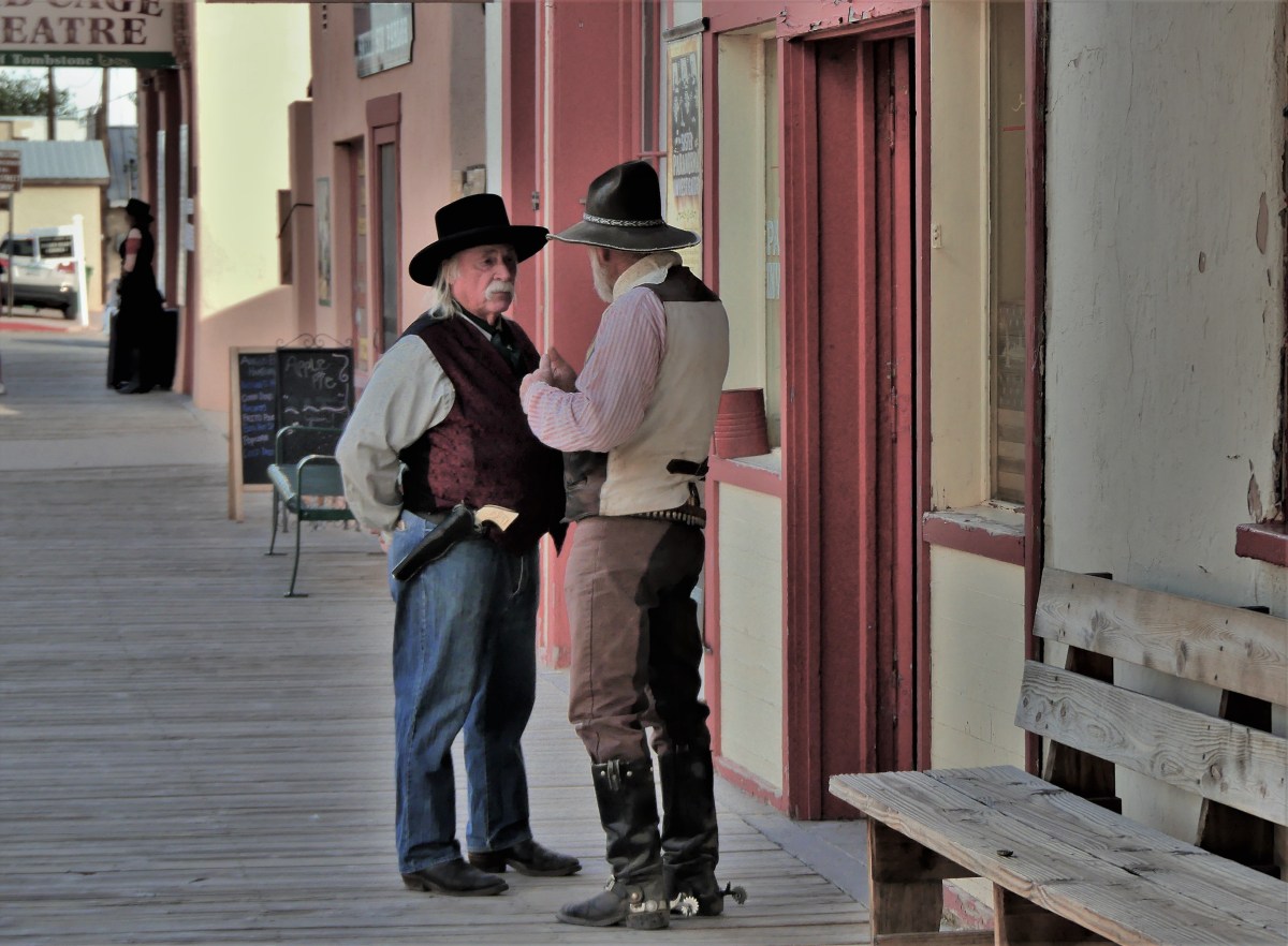
Despite the fear, there were some who dared to venture out…
and walk the dusty planks of a fragile peace, with their trusty sidearms at the ready.
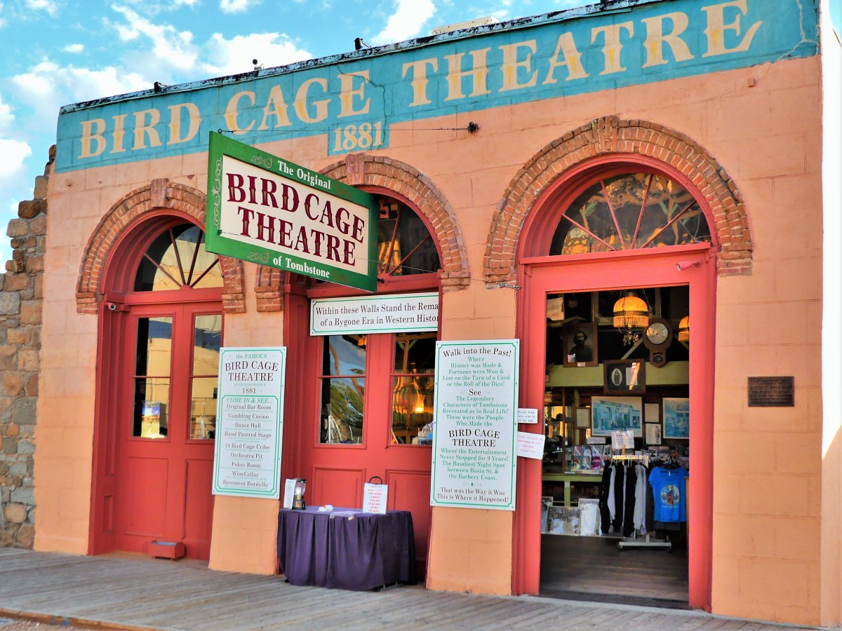
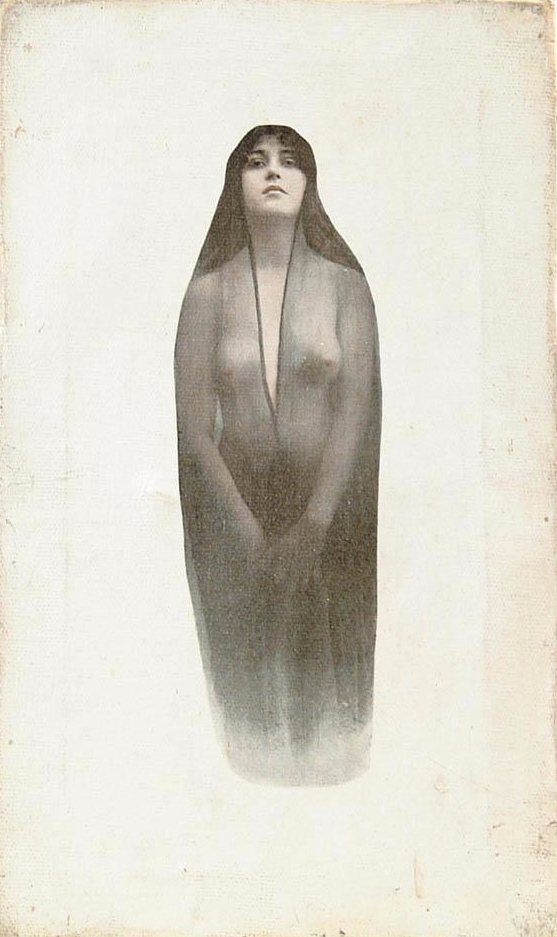
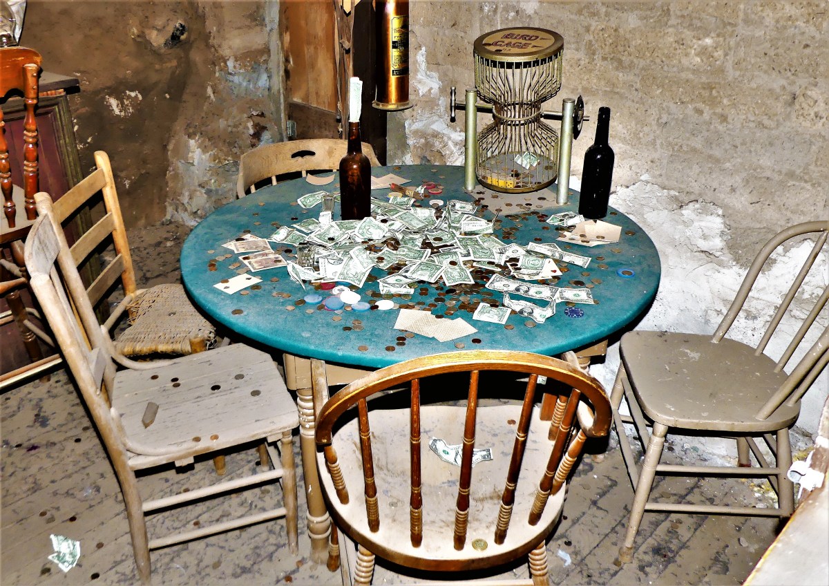
Yet it was business as usual at the Bird Cage Theatre,
where wanton women plied their trade at twenty-three bucks a pop,
in their boudoir quarters…
…beyond the catwalk over the saloon,
while high-stakes poker flourished under the stage,
with a $1000 minimum buy-in.
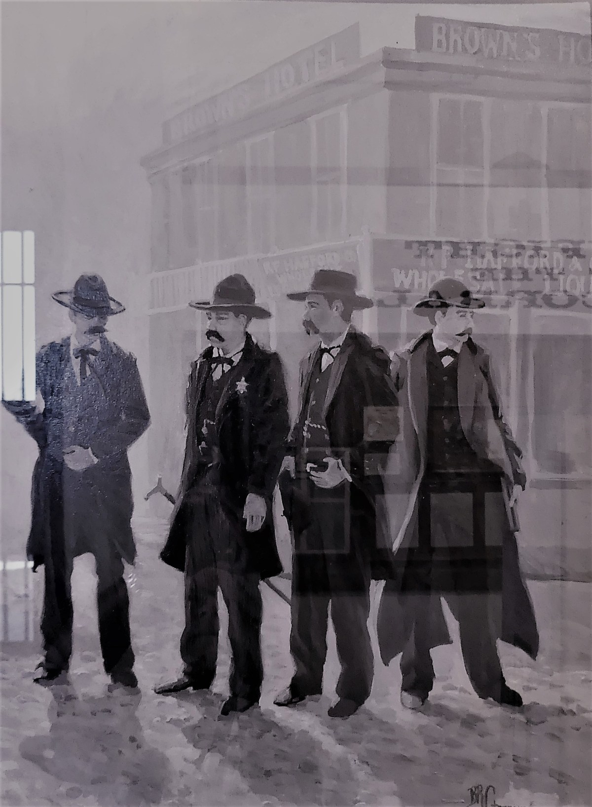
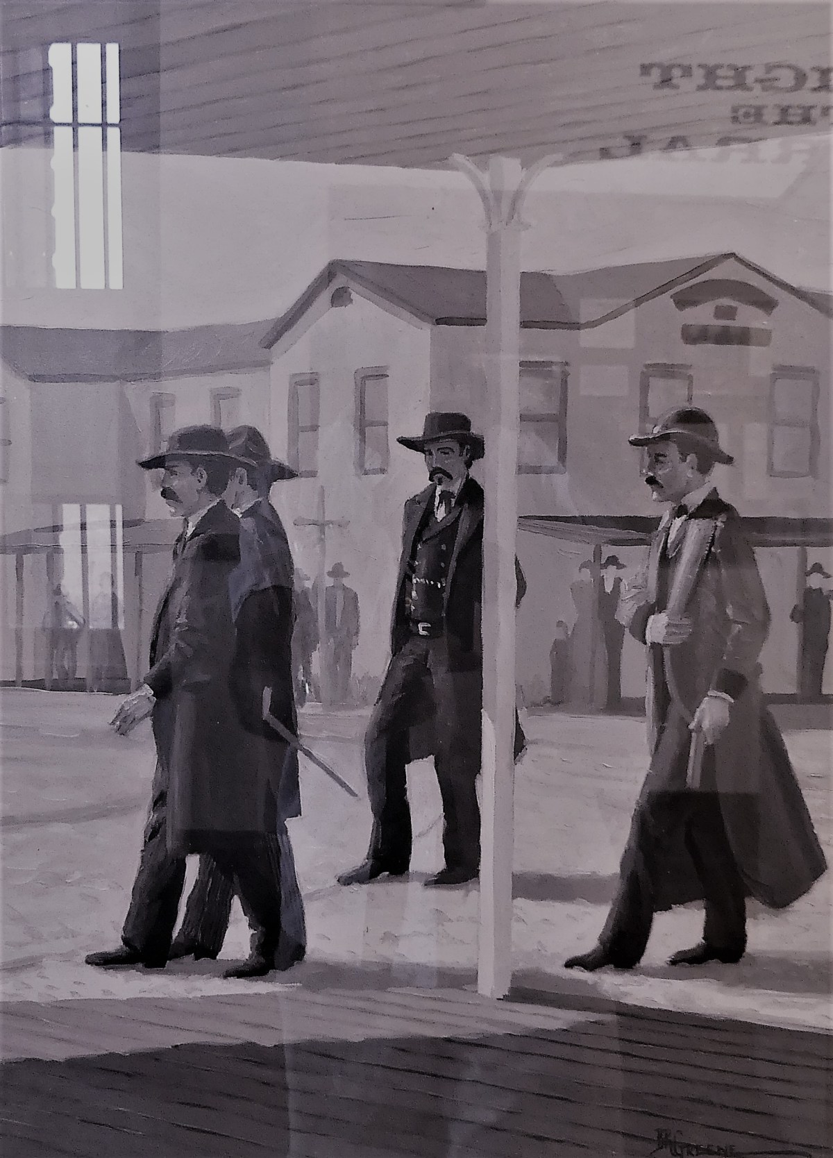
But outside on the street, trouble was brewing.
The Earps had heard that “The Cowboys” were gathering at the O.K. Corral making threats and spoiling for a fight.
Rounding the corner of 4th and Freemont, the Earps headed west to the rear entrance of the O.K. Corral for a date with destiny.
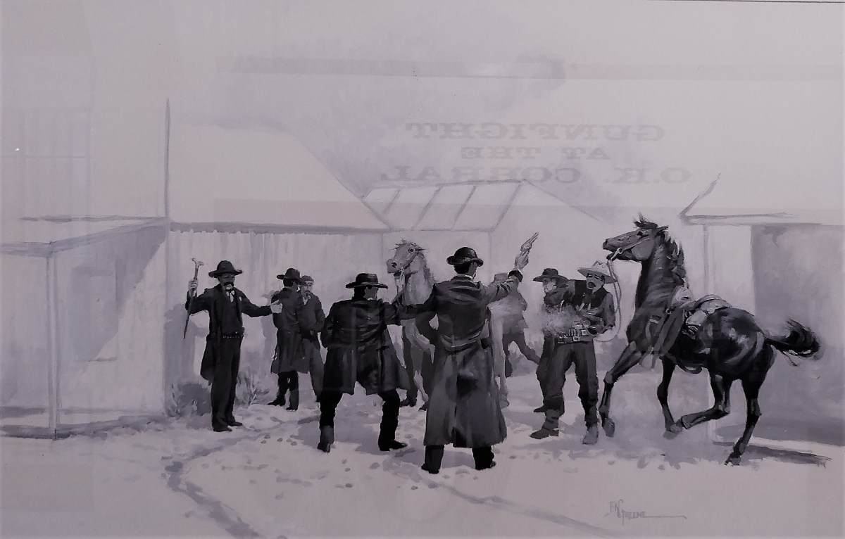
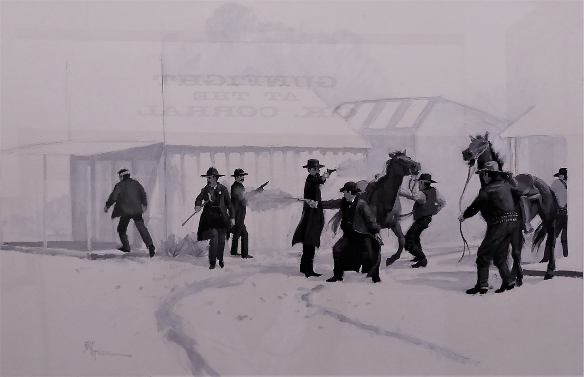
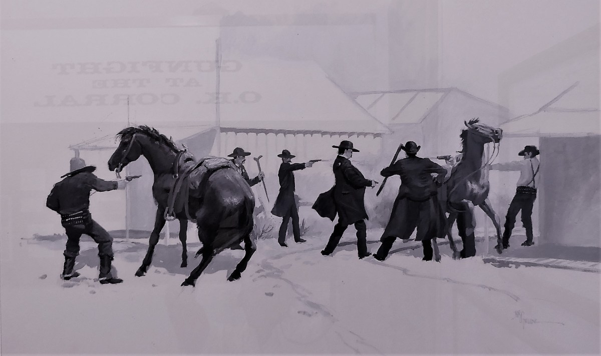
When the fight begins, Town Marshal Virgil Earp (with cane) says “Hold on, we don’t want that,” as Frank McLowery and Billy Clanton take the first bullets from Doc and Morgan.
Billy Clanton (2nd from right) draws his gun and begins to fire back as his brother Ike begs Wyatt Earp not to shoot him. Morgan and Doc are concentrating on Frank McLowery and the game Billy Clanton who, though mortally wounded, continues to shoot. Frank and Tom maneuver their horses as shields.
As Ike Clanton flees, Virgil Earp and Tom McLowery bring their guns into action. Doc Holiday turns to fire at the fleeing Ike, while Morgan continues to fire at the wounded Frank McLowery.
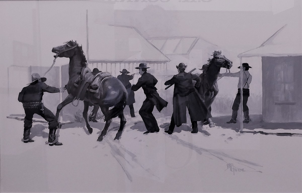
Frank McLowery maneuvers his horse into the street and fires back under the horse’s neck as Holliday pulls a sawed-off shotgun from under his coat. An anonymous shot, possibly from Billy Claiborne is fired from within the O.K. Corral, diverting the Earps’ attention.
Frank McLowery still manages to hang onto his horse for cover as his brother Tom, shooting over his saddle, hits Morgan Earp. Billy Clayton (nearing death) returns fire at Virgil and Wyatt. A shot from Frank hits Marshal Virgil Earp in the right leg.
Thirty bullets are fired in a thirty second outburst. When the smoke clears, Billy Clanton and both McLaury brothers lay dead in the street. Ike Clanton, claiming that he was unarmed has run from the fight, along with Billy Claiborne. Virgil, Morgan, and Doc Holliday are wounded, but Wyatt Earp is unharmed.
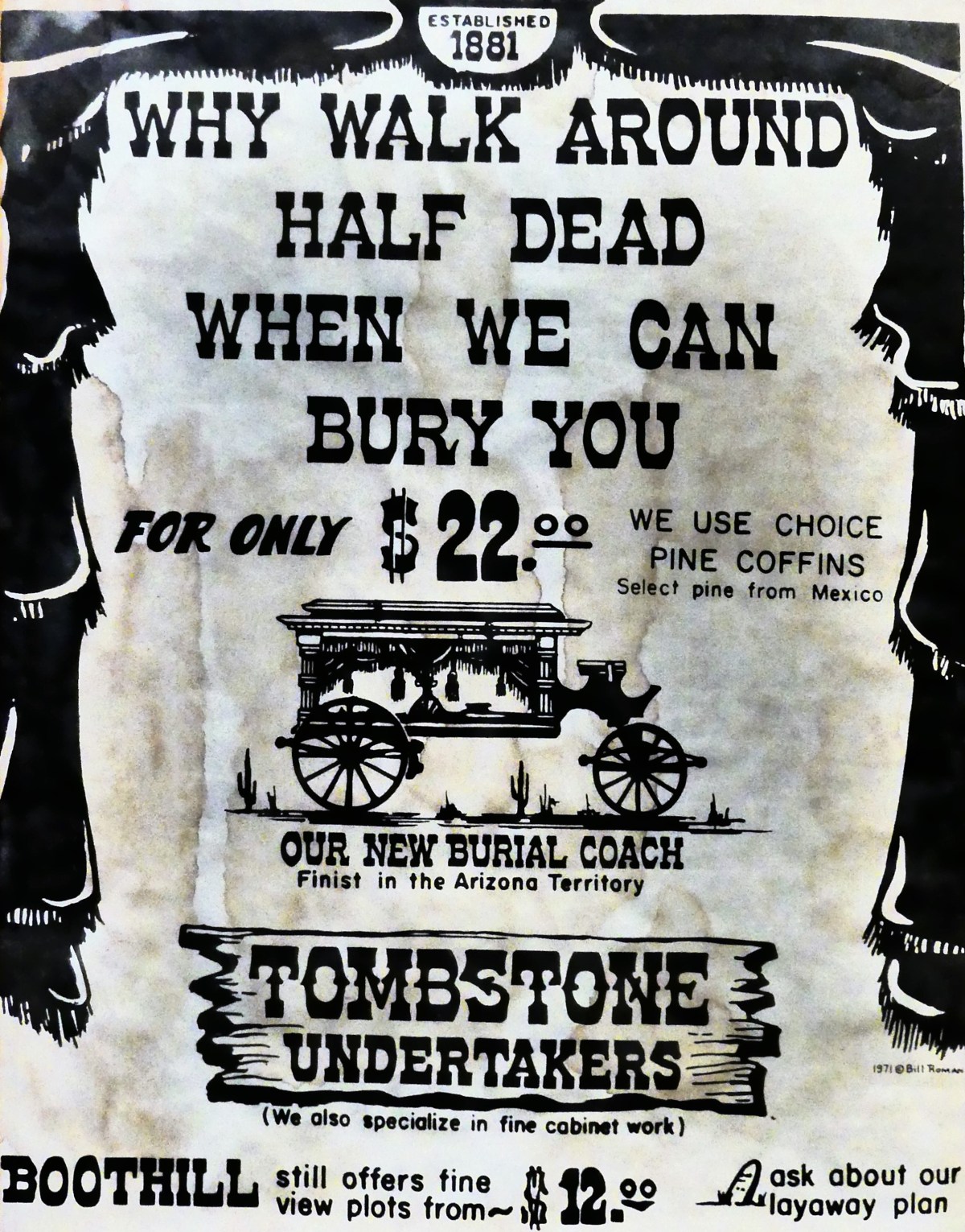
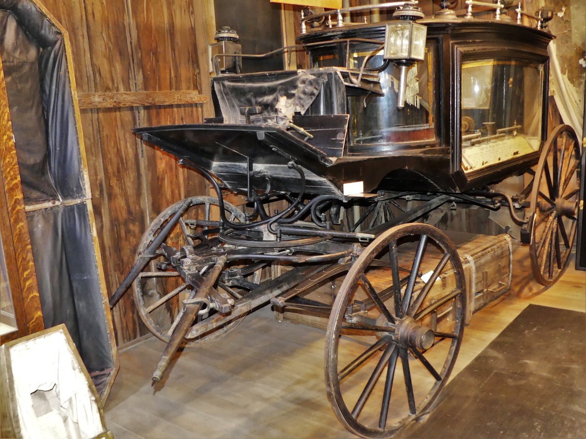
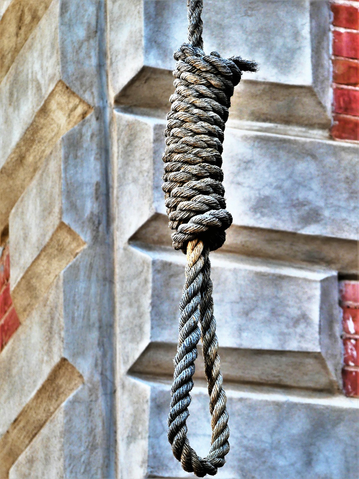
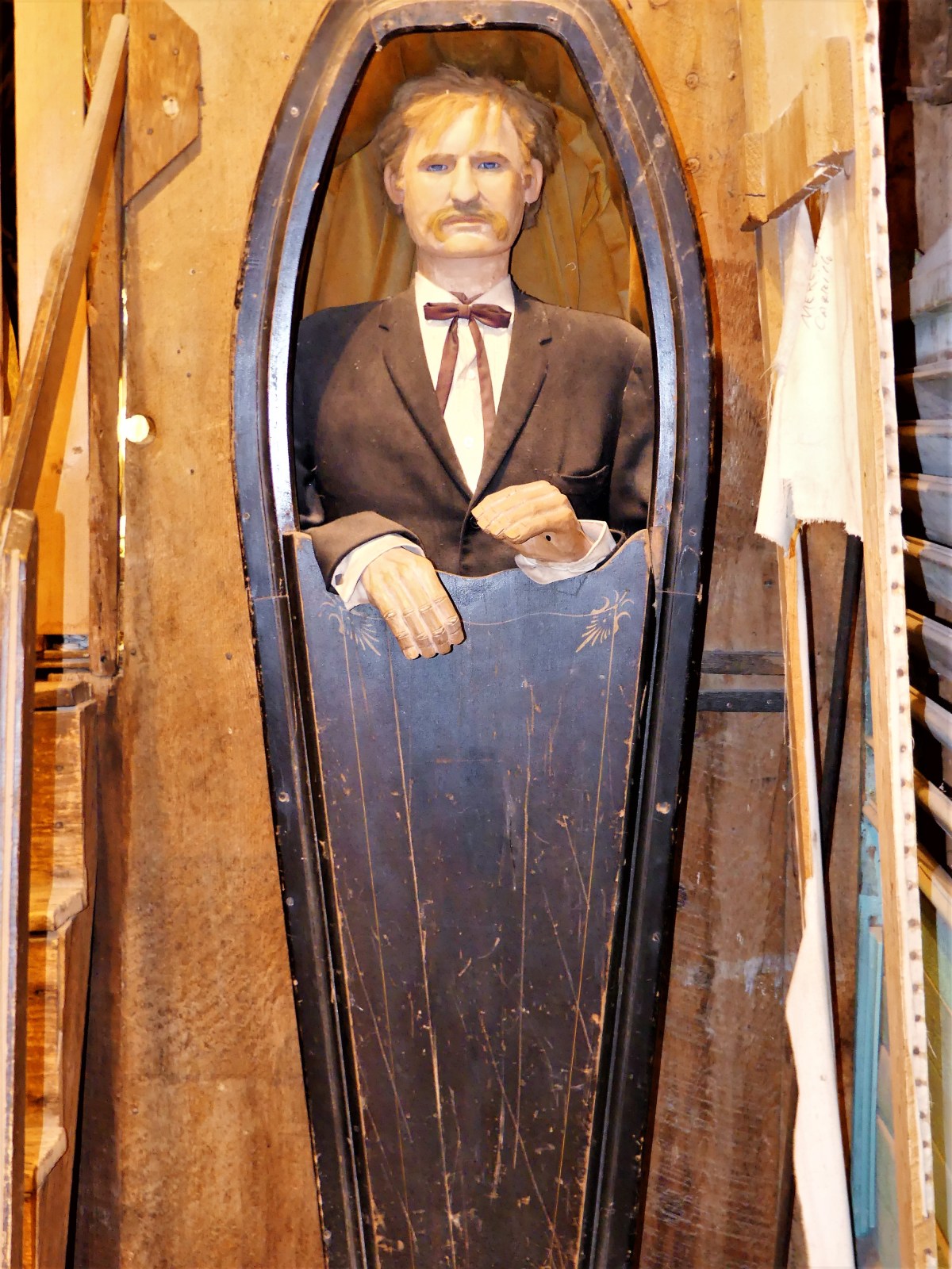
Certainly, death was big business for the Tombstone Undertakers.
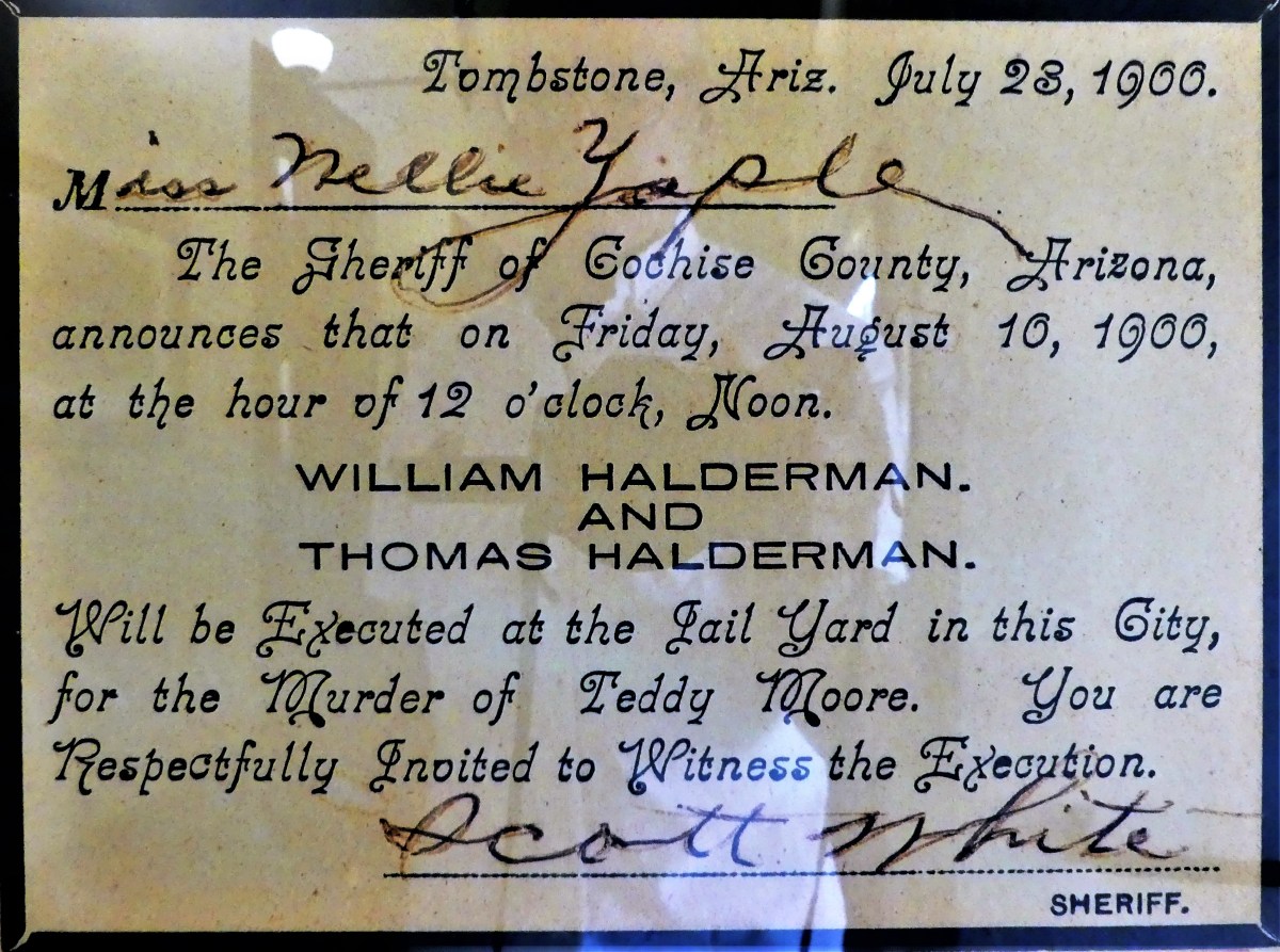
And on occasion, death was high entertainment for the townsfolk.
And as the sun sets on Tombstone…
we remember the lawlessness of the Wild, Wild West,
but we celebrate the triumph of a Town Too Tough to Die…
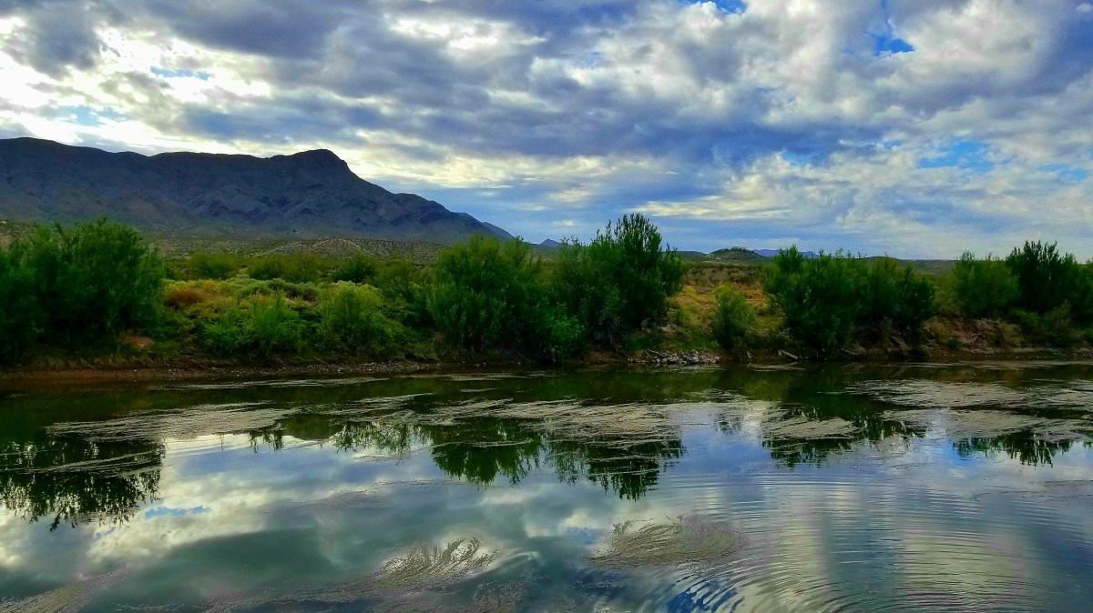
…a worthy consideration while we soaked away the stress in a hot spring along the Rio Grande the following day in Truth or Consequences, NM.
What started out as an intimate blog intended for sharing our cross-country adventures with family and friends has taken on higher meaning and greater dimension. After seven months of 100 posts, 10,000 views, 4000 visitors from over 150 countries, and a new family of nearly 1000 followers, this blog has eclipsed all that I could have imagined.
It has changed how I look through a lens and how I craft a story. It has transformed my posts from informative to entertaining. The discipline has made me a more fluent writer and sharper photographer, for which I am thankful.
Your collective thoughts and comments are a driving force to improve my content, and I am grateful for the feedback and acknowledgement.
I’d like to think that this evolution and subsequent statistics are because of my new and loyal audience, and I thank you dearly.
Additionally, my apologies to Leah, who must now contend with my newest obsession.
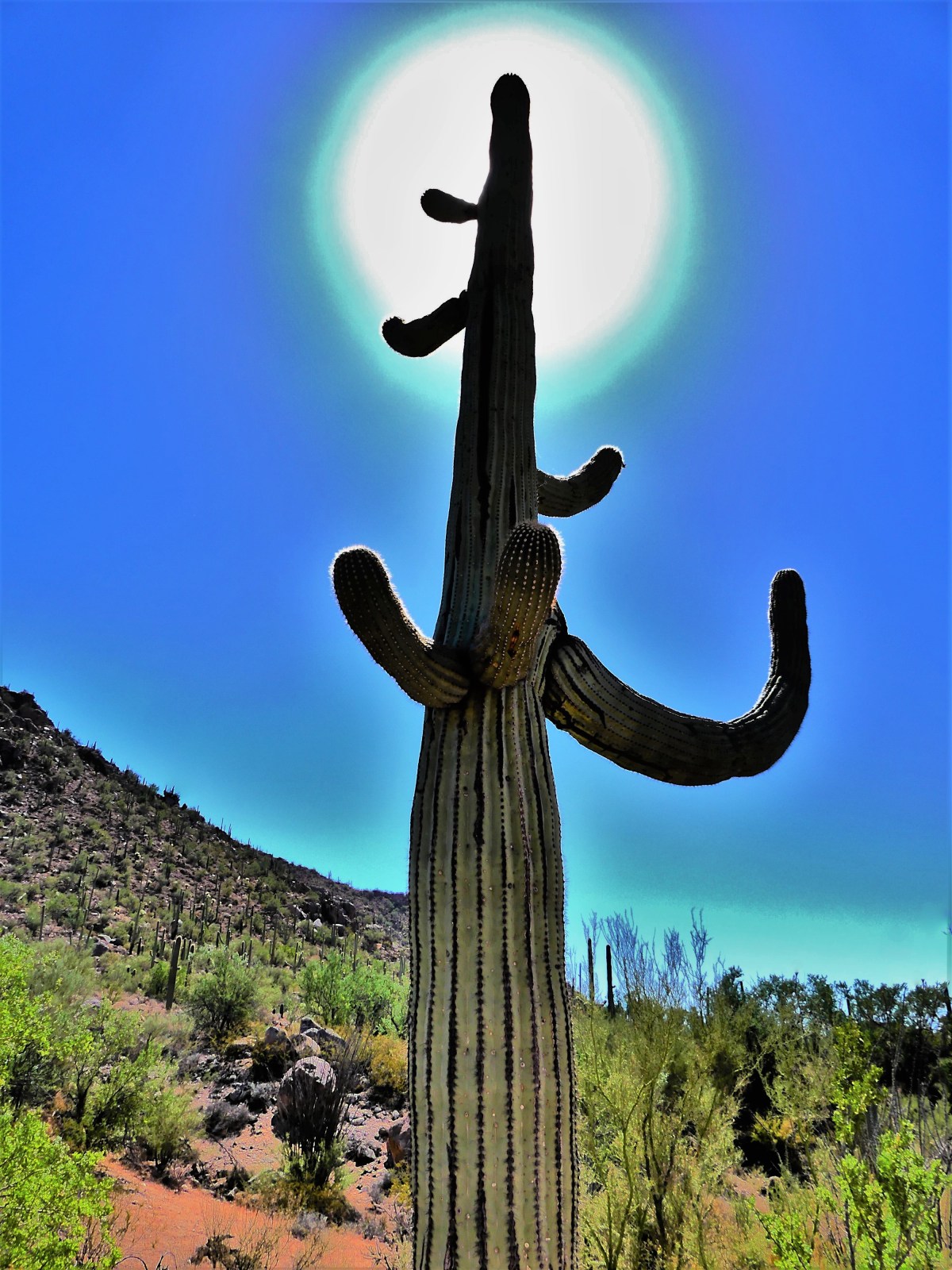
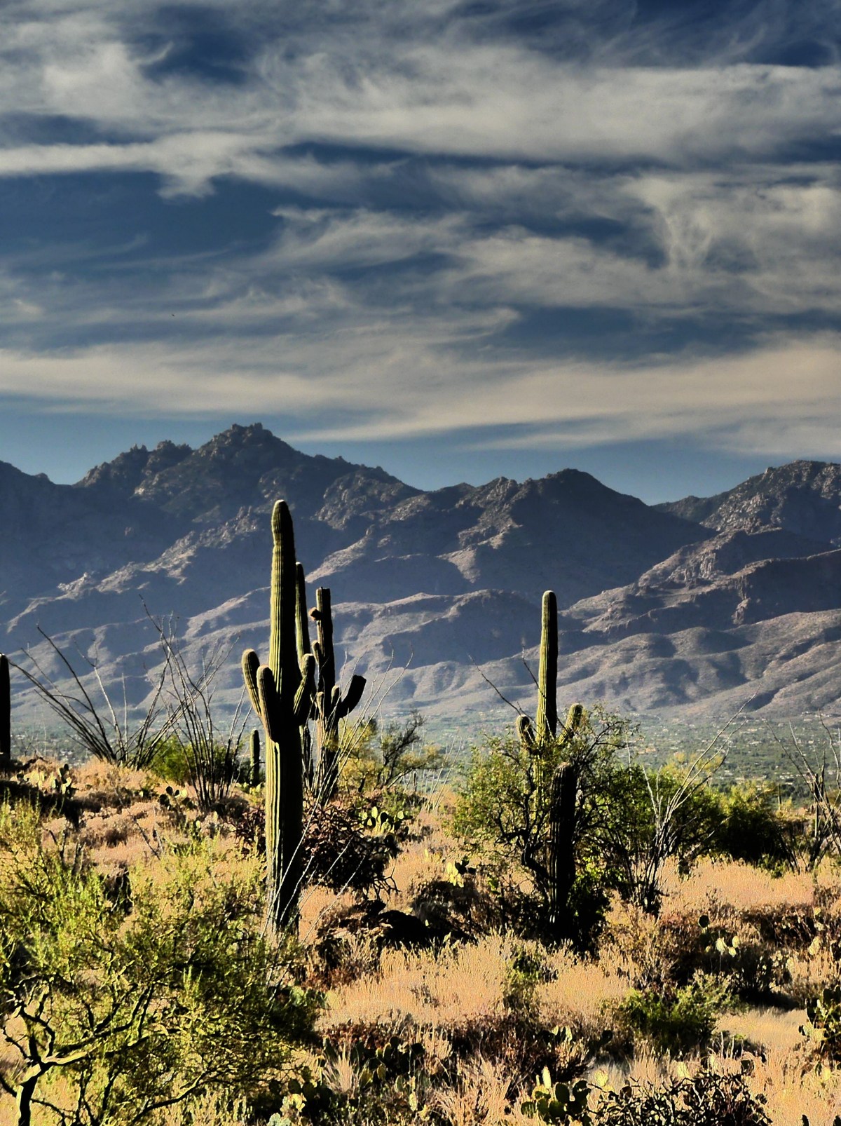
Exploring Tucson, AZ provided two very different opportunities to experience nature–Saguaro National Park and Biosphere 2–with one generating more interest than the other.
We reserved a site at Catalina State Park’s campground…
to be equidistant between the two National Park districts: Rincon Mountain (RMD-east) and Tucson Mountain (TMD-west). Why two districts? In the 1960’s, concern over RMD’s cactus forest showing a decline in new growth, prompted conservationists to acquire a stand of ancient saguaros to the west of Tucson, separating the two districts by an hour’s drive.
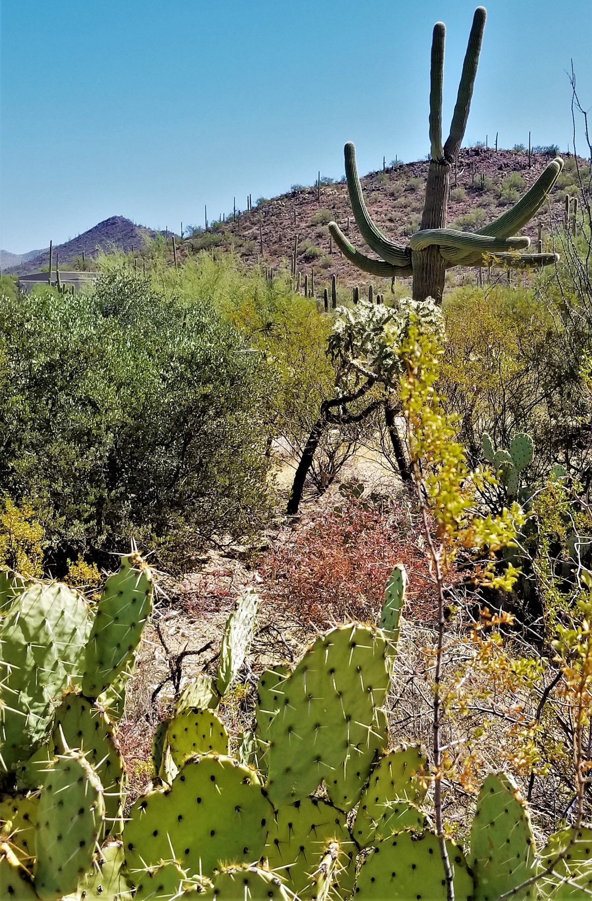
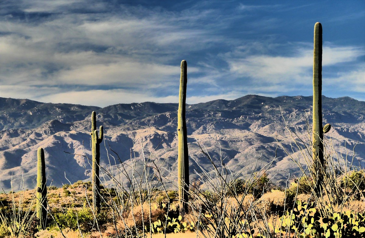
Leah and I began our journey at TMD, at first, through a meandering exurban road that eventually led to an unpaved, rutted, and narrow scenic Bajada loop drive covering five miles of Tuscon Mountain foothills. A stop at the Desert Discovery Trail brought us within no touching distance of magnificent saguaro cacti measuring over thirty feet tall.
Each specimen appears unique, sprouting limbs in different places, and contorting in all directions,
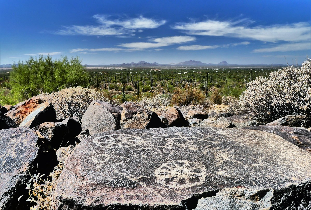
giving relevance to Native American claims that these are people standing among the sand and rocks.
Their petroglyphs across Signal Hill are a testament to their long-standing occupation of the territory more than one thousand years ago.
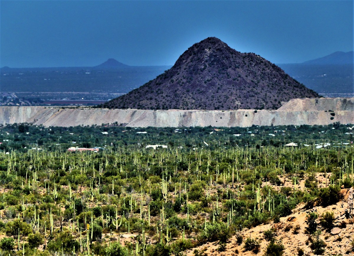
A memorable hike along the Valley View Trail slowly ascends a ridge, offering dramatic views of Avra Valley’s saguaro-sprawl, with Picachu Peak in the distance.
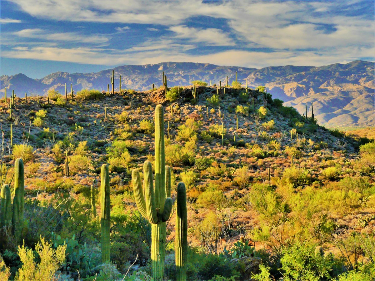
With temperatures reaching into the high 90’s, we avoided all other trails–requiring a minimum of three to four hours of dedicated strain–in favor of cross-town traffic delays that minimized our allotted time to visit RMD.
Once at the eastern park gate, we roamed the paved eight-mile Cactus Forest Drive, switch-backing into higher elevations, with warm western sun casting a golden hue across the desert, turning a forbidding vista…
into an inviting playground,
protected by a standing legion of cactus totems.
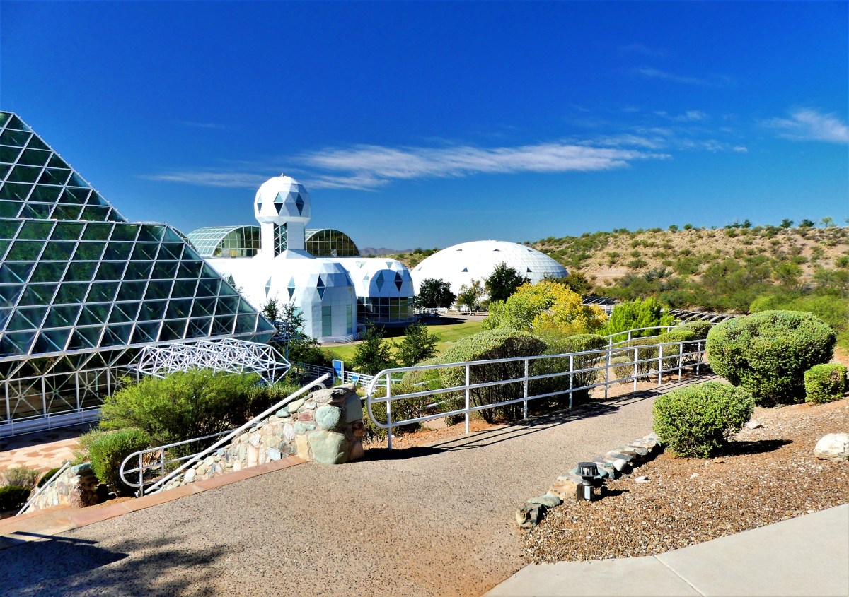
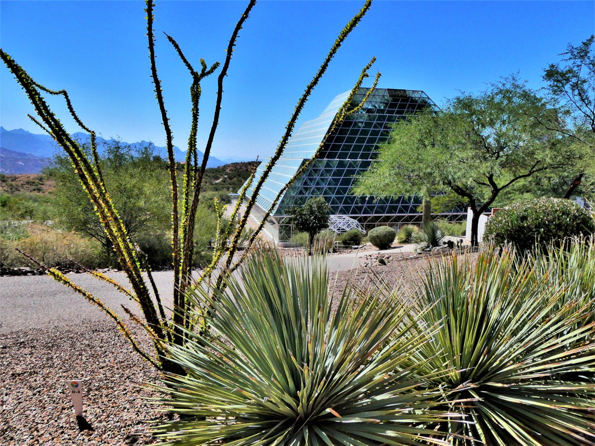
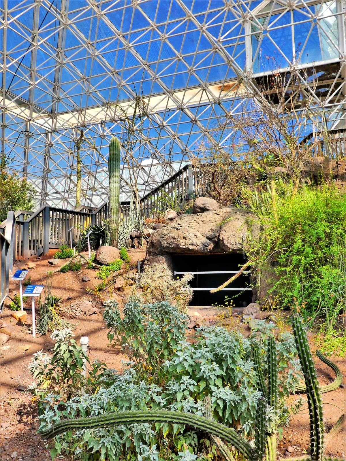
The following day, we turned our attention to an experiment in the remote reaches of the Sonoran Desert,
originally conceived in 1984 to “research and develop self-sustaining space-colonization technology,” and leading to two highly publicized missions between 1991 and 1994–where teams of eight were sealed into a self-sustaining environment for two-year terms and monitored for their “survivability”. Scientists named it Biosphere 2.
Presently, the University of Arizona has assumed stewardship of the facility, turning its focus toward research on climate change–mimicking diverse ecosystems, such as the ocean,
the rainforest,
and coastal fog desert,
all managed under controlled conditions.
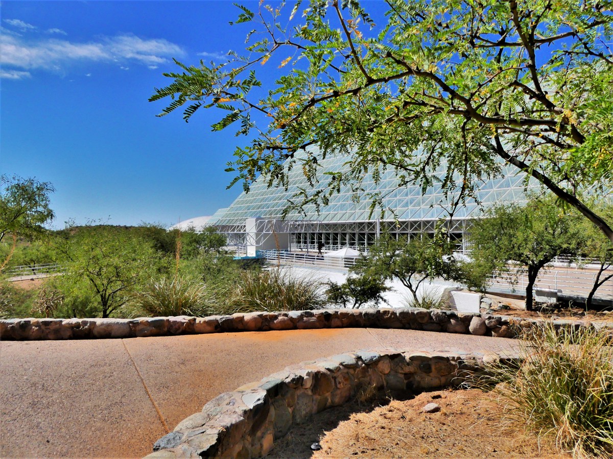
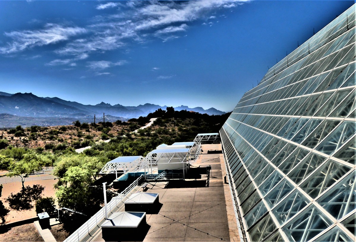
Beneath nature’s museum lies the technosphere, a myriad of pipes and wiring,
channels and ducts, tubes and cables, and other facilities necessary for vital operation.
An ingenious dome-shaped lung…
connected to the glass enclosure by tunnels…
allows for air expansion caused by ever-changing pressures within the sealed structure.
The scope of the facility is a marvel, boasting double redundancy for all power and life support systems.
A common question on the tour, “Why is it called Biosphere 2? Was there another Biosphere before this one?”
The docent is keen to respond, “Yes. Another Biosphere exists, where random, haphazard and uncontrolled experiments called living are carried out on a daily basis, but we commonly refer to it as Earth.”
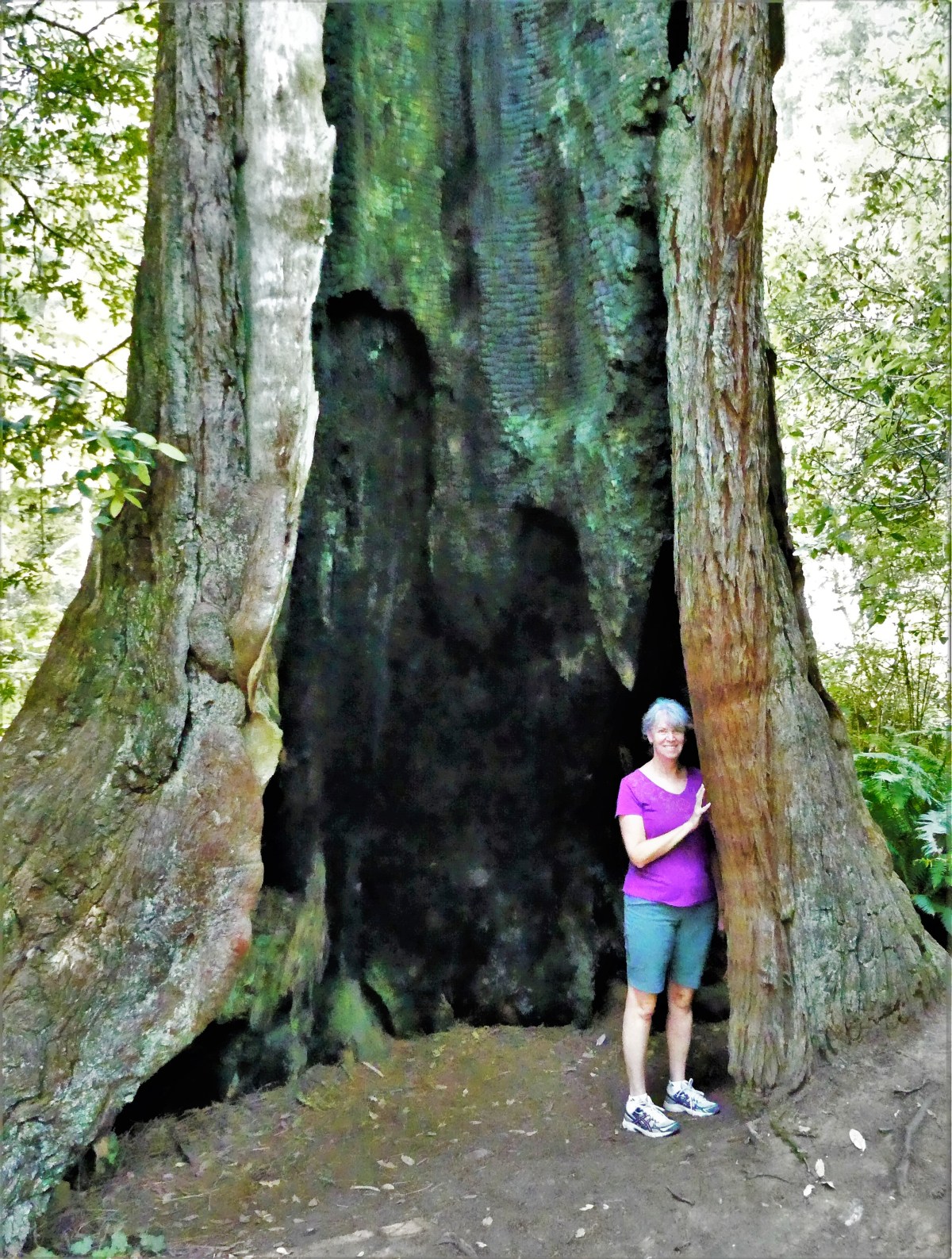
Picasso painted Marie-Thérèse Walter and Dora Maar among others; Dali’s choice was Gala; and Stieglitz extensively photographed Georgia O’Keeffe. The results of these collaborations are legendary. Artists have always depended on models…for inspiration, as subjects, as lovers.
And while I eschew classifying myself as an artist, my reliance on Leah in my landscape photographs is no different than the aforementioned masters…with one exception: scale!
Often times during picture editing, she will lament, “Why am I so small? You can hardly see me!”
But being able to insert Leah into a panoramic scene or long shot helps me establish dimension and grandiosity.
And while there are times when I seemingly wait forever for someone to step outside the frame of my shot before pressing the shutter, there are also times when it becomes vital to locate Leah in my scene to anchor its meaningfulness, and increase its effectiveness.
Sometimes Leah can be an unwilling participant. She may object if she feels she’s not looking her best, or perhaps she becomes annoyed if she’s not the central focus of my photograph when she feels like posing.
But either way, she has always been a good sport, and is usually compliant when taking my directions.
But regardless of how many rocks she leans against per my request, it’s evident to me, photography aside, how much I lean on her.
She is my personal rock, who helps me put things in perspective.
Seldom am I so amazed that I am speechless or at a loss for words…
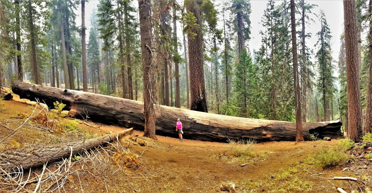
After visiting twenty-nine U.S. National Parks, four Canadian National Parks, a dozen National Monuments, numerous State and Provincial Parks, and driving thousands of miles of scenic byways over the past twenty-nine weeks,
captured on:
Leah and I have yet to discover a place that is so captivating that we didn’t want to leave…until now.
Leah and me
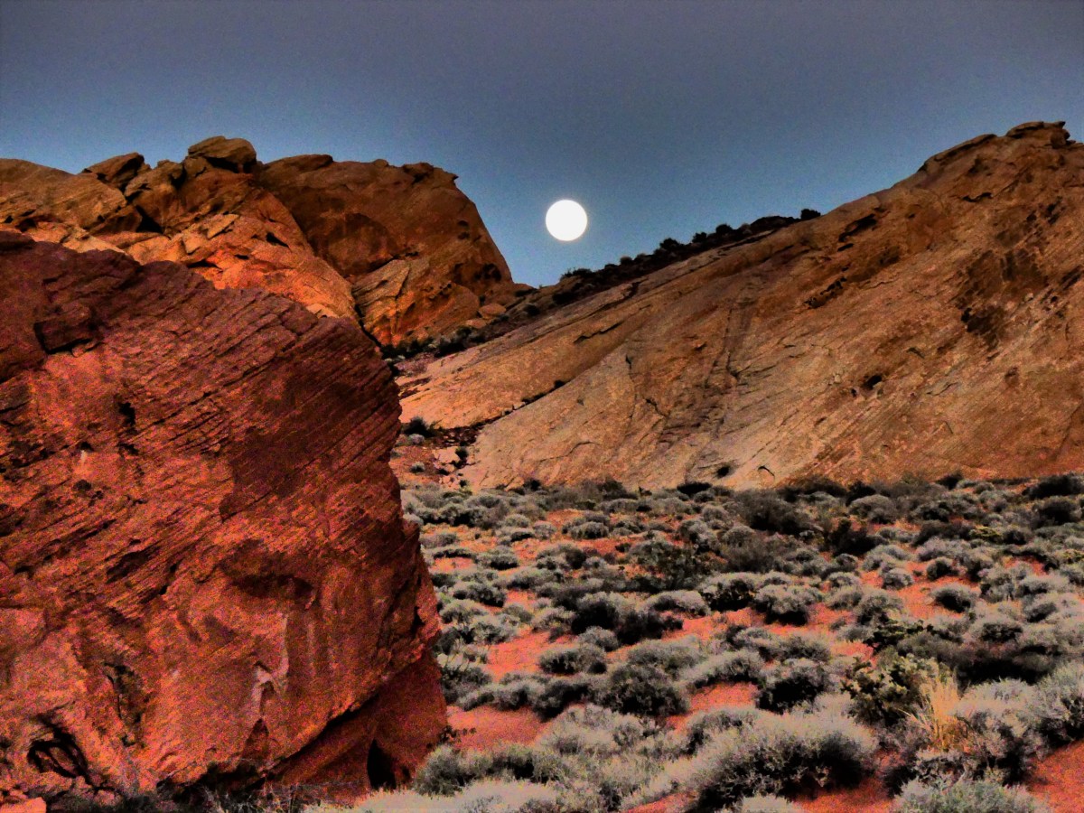
Valley of Fire State Park allowed us the chance to finally exhale, after America held its collective breath trying to make sense of yet another senseless killing spree, when a maniacal sniper opened fire on a crowd of 20,000 innocents a ¼-mile away.
We were 4½ miles out of harm’s way, staying at an RV resort off I-15 at the time, and wondered about the incessant sirens screaming past our open windows after 10 pm that fateful evening..
“I can’t believe how much crime they have here,” Leah exclaimed.
“Wouldn’t want to live here,” I offered.
Switching on the TV, all stations were locked on breaking news of an active shooter at the strip, but details were sketchy with the story developing by the minute. We quickly realized that we were listening to the soundtrack of a massacre: SWAT teams, police, EMT, and ambulances were sprinting past our Airstream–in and out of the danger zone.
Originally, we booked a couple of days in Vegas to decompress, and intended on exploring the strip in search of available show tickets once the Airstream was unhitched. But the prospects of casino crawling quickly faded after an afternoon of relaxation by the pool. Then again, we figured there would always be tomorrow.
Yet by morning, as the tragedy at Mandalay Bay unfolded, the thought of unthinkable loss left us gasping for air.
Leah summed it up: “It doesn’t feel right having fun when we’re surrounded by so much pain and suffering.”
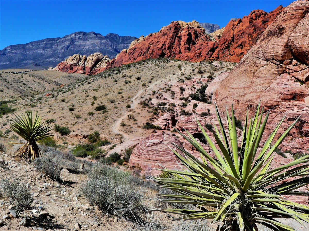
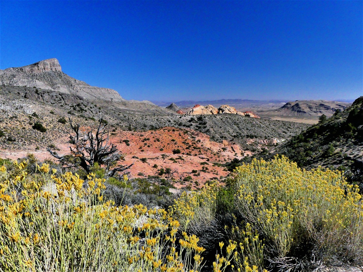
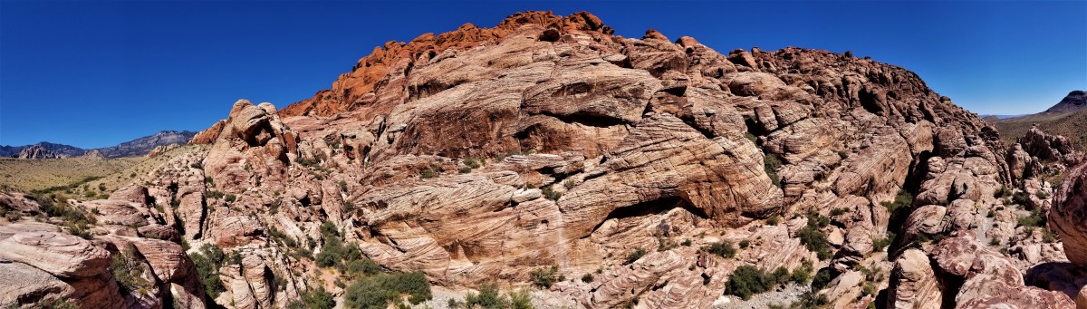
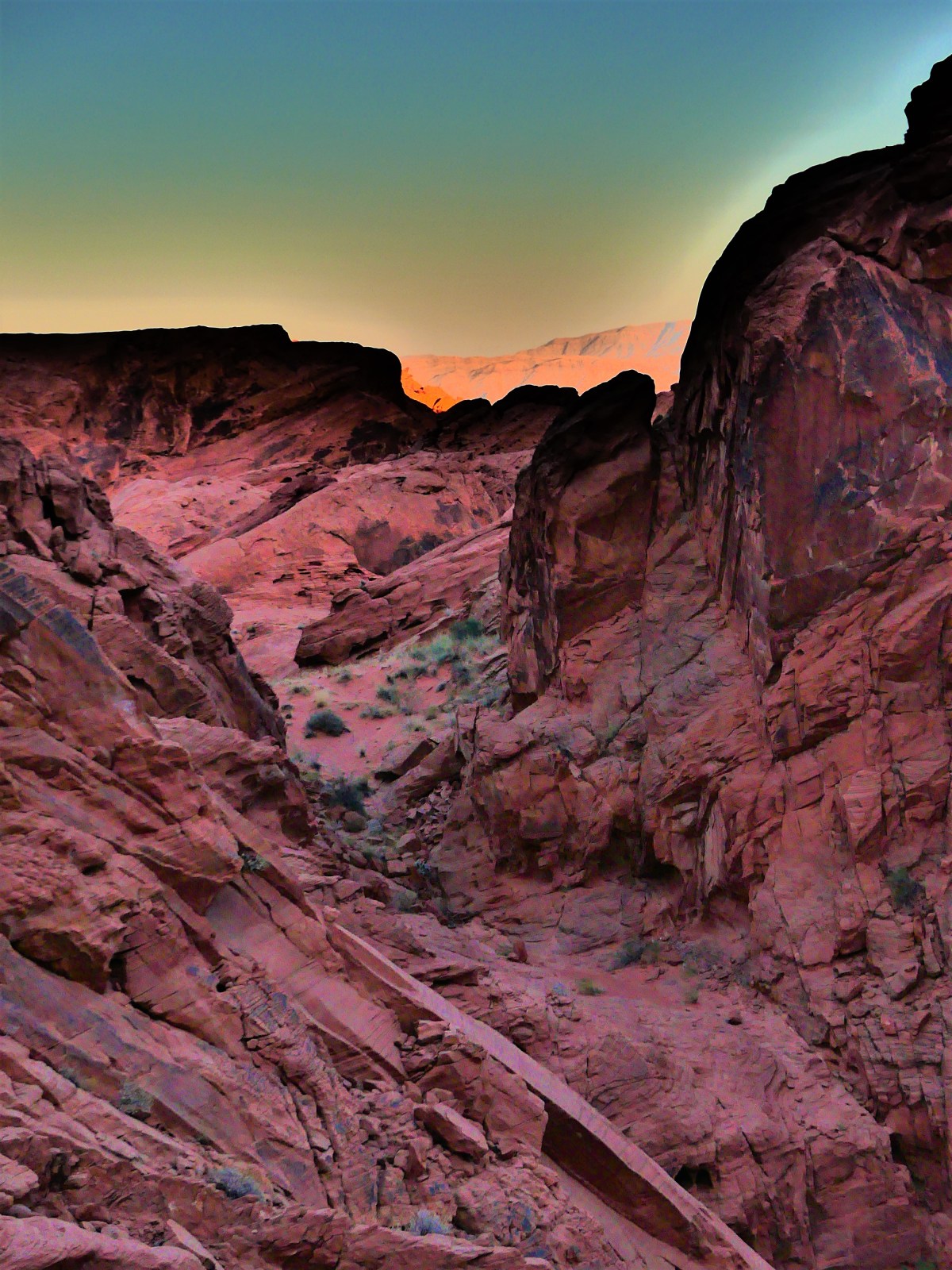
We needed a getaway. We took off for Red Rock Canyon to escape the inhumanity, and clear our heads.
It was a small dose of nature for the day, and helped to heal our heavy hearts.
The following day, we moved our Airstream fifty miles east, to the Valley of Fire, where we found the perfect antidote to murder and madness. We found a place where we could breathe,
and the only sound at night was silence.
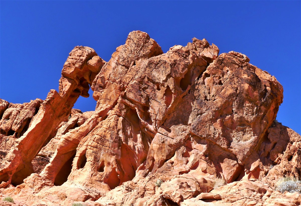
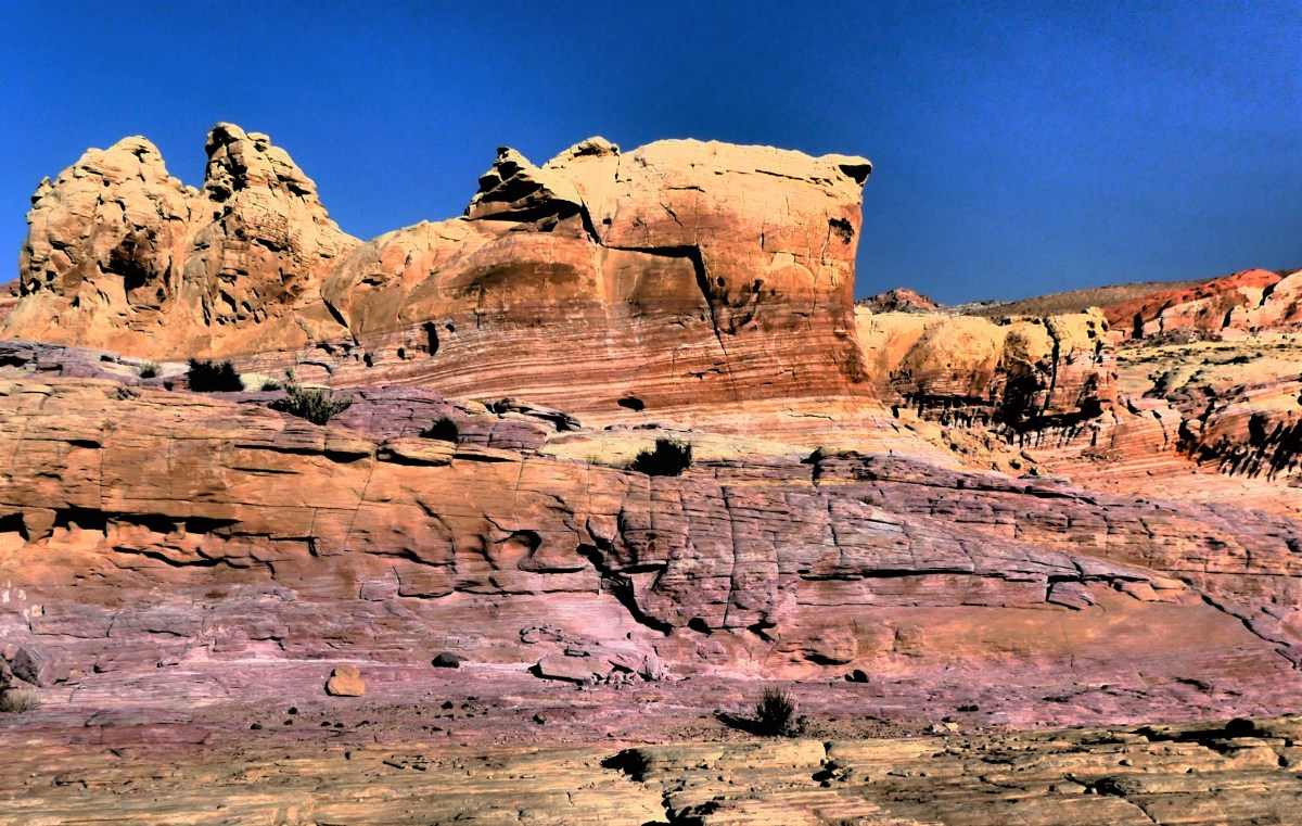
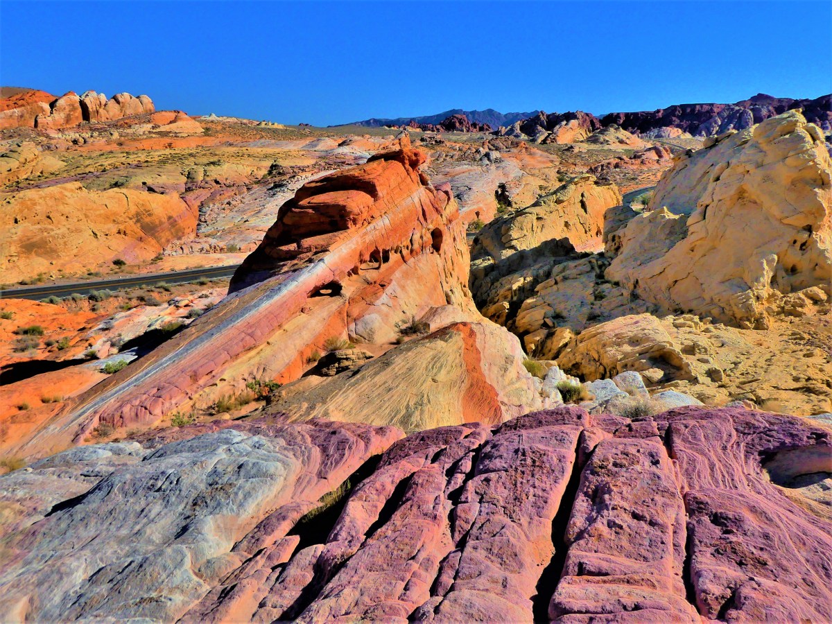
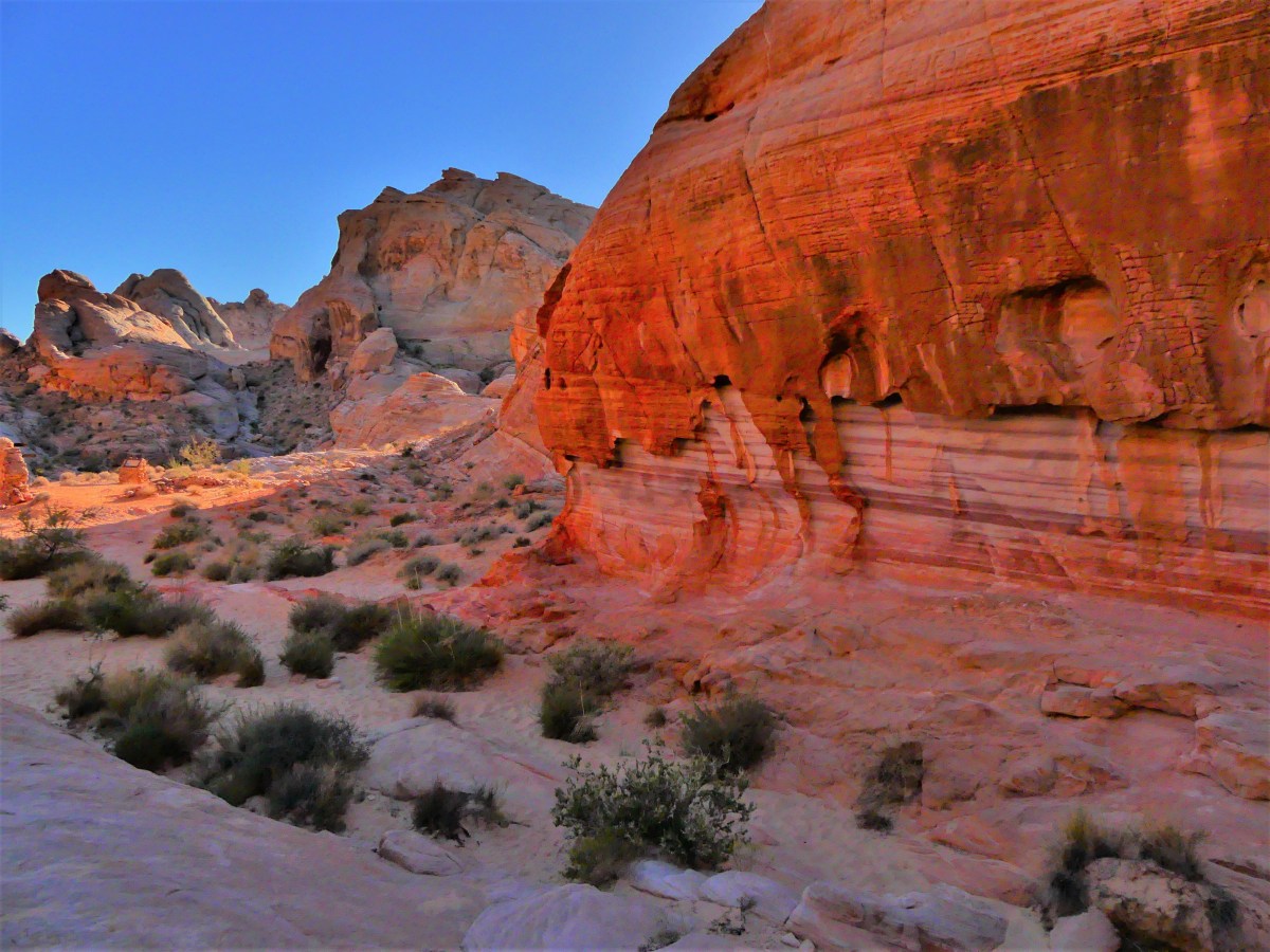
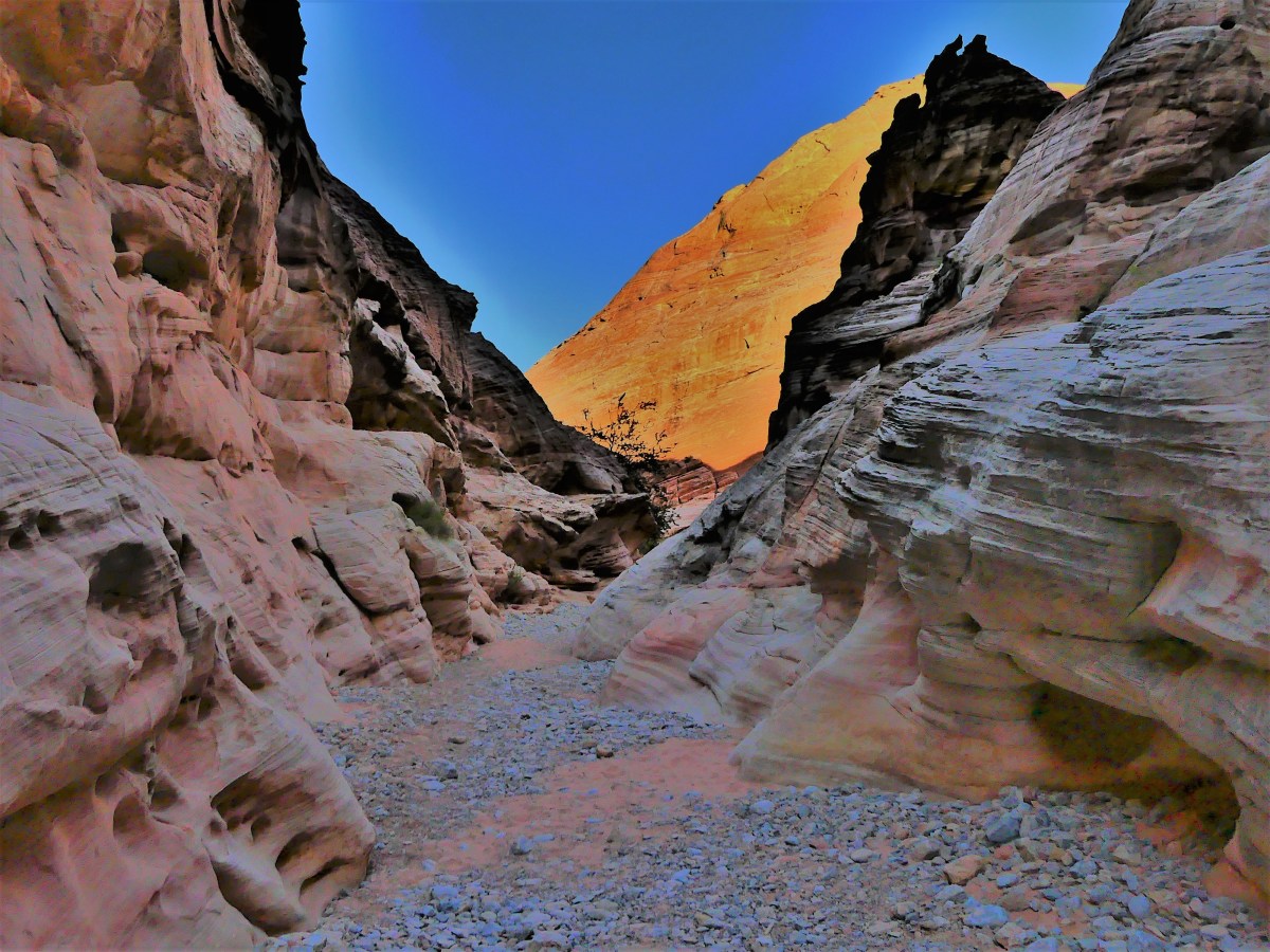
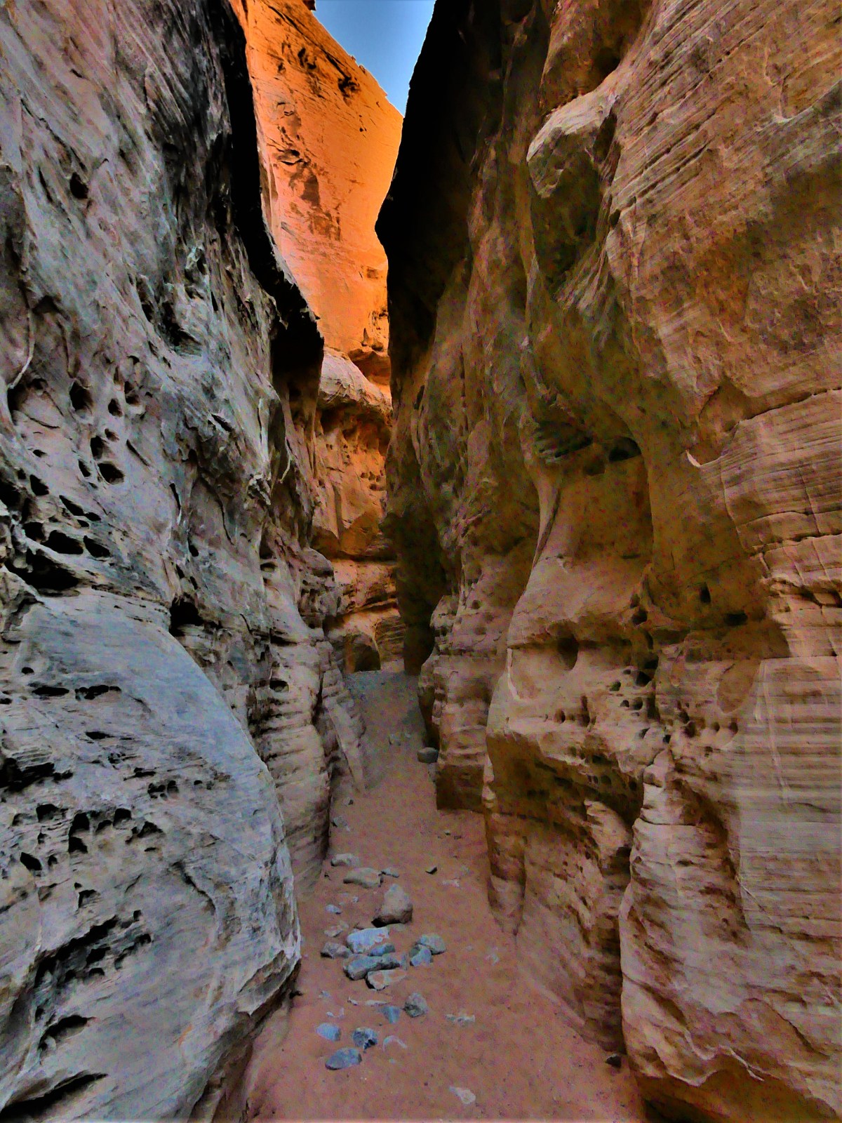
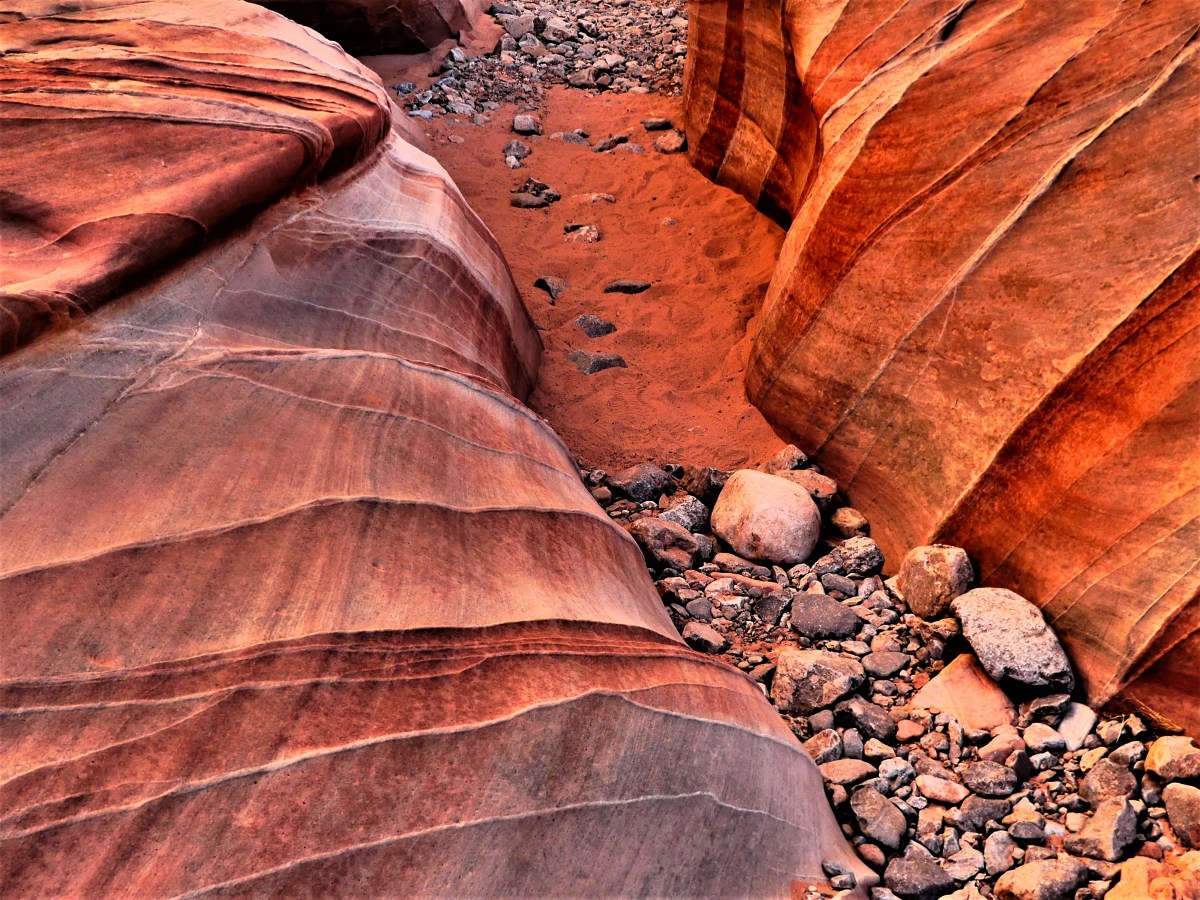
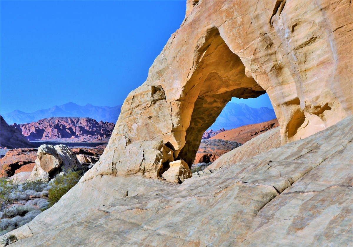
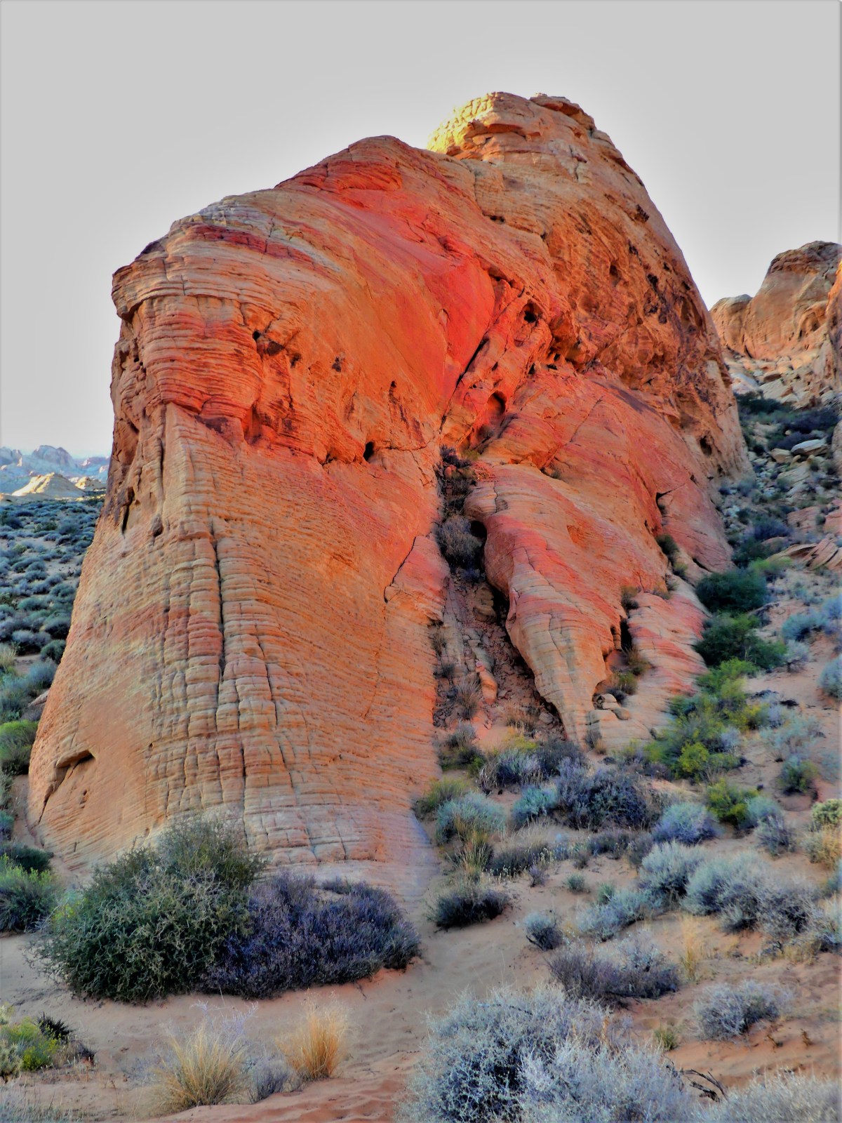
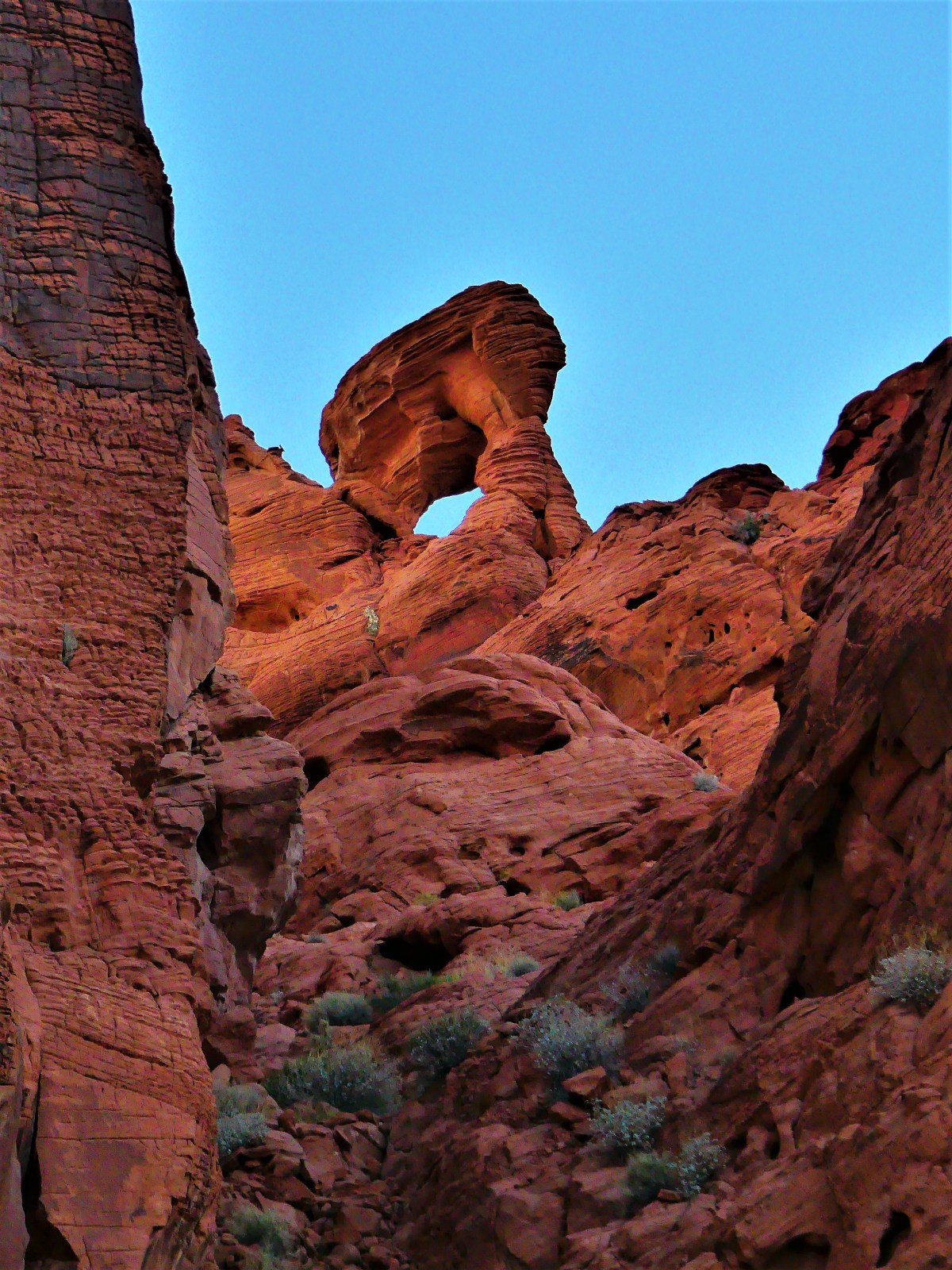
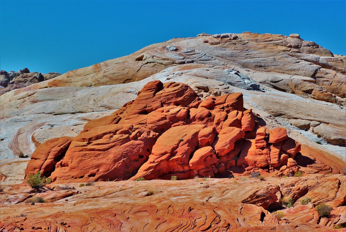
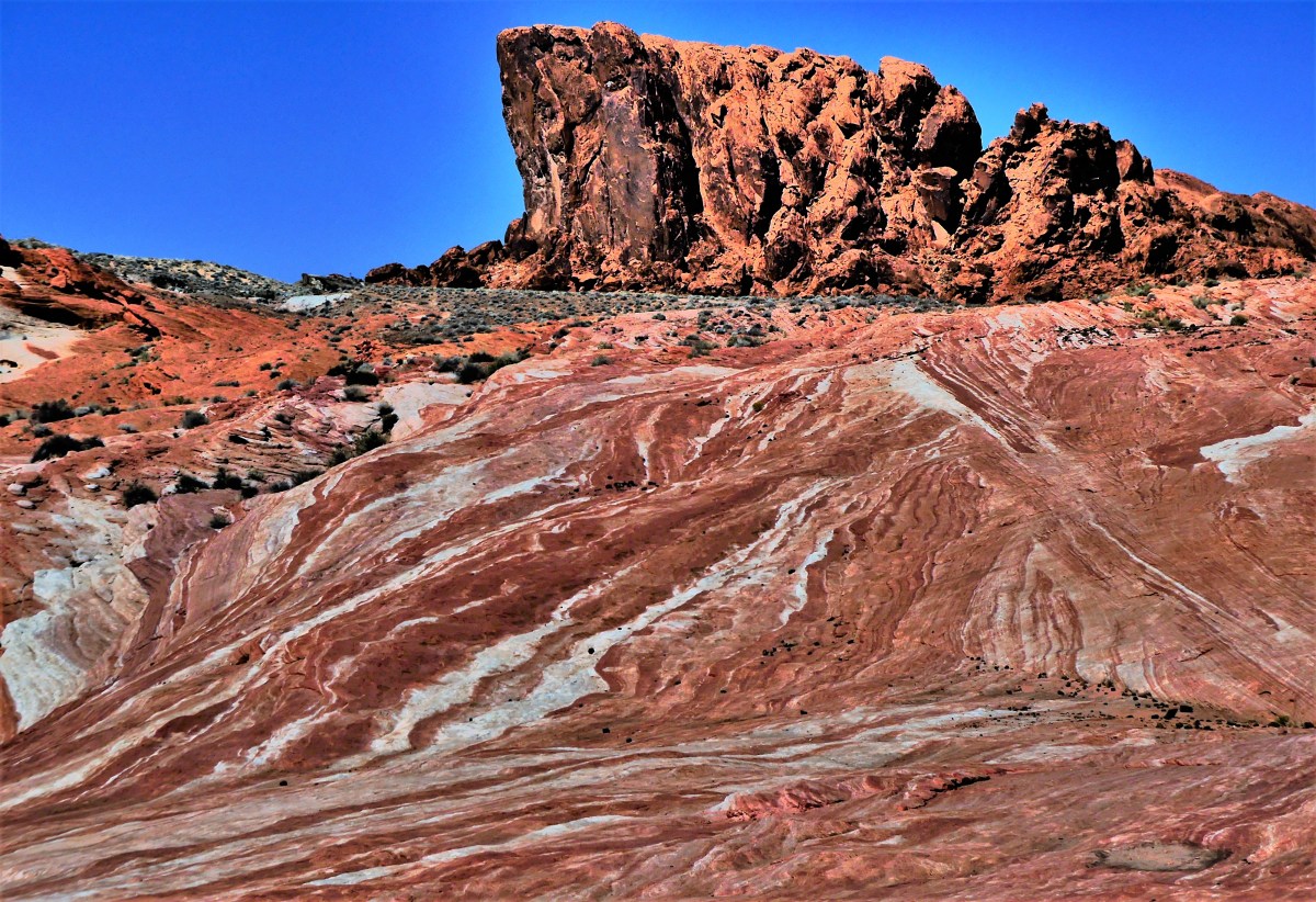
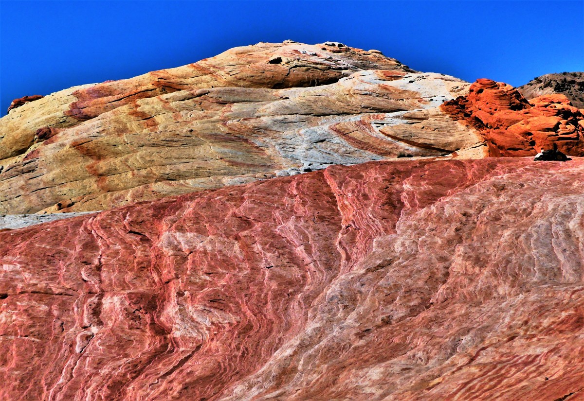
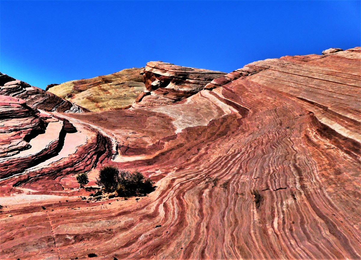
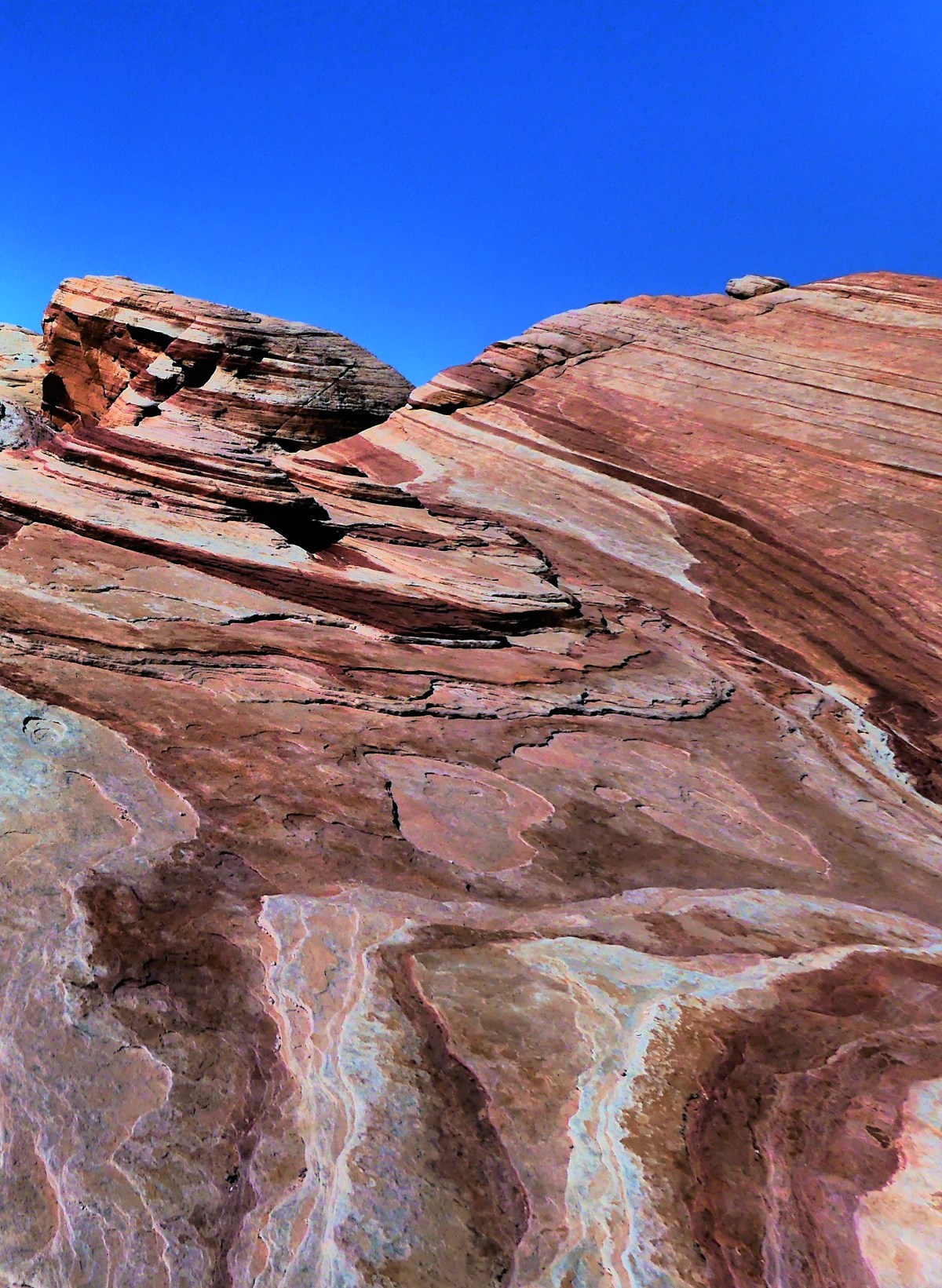
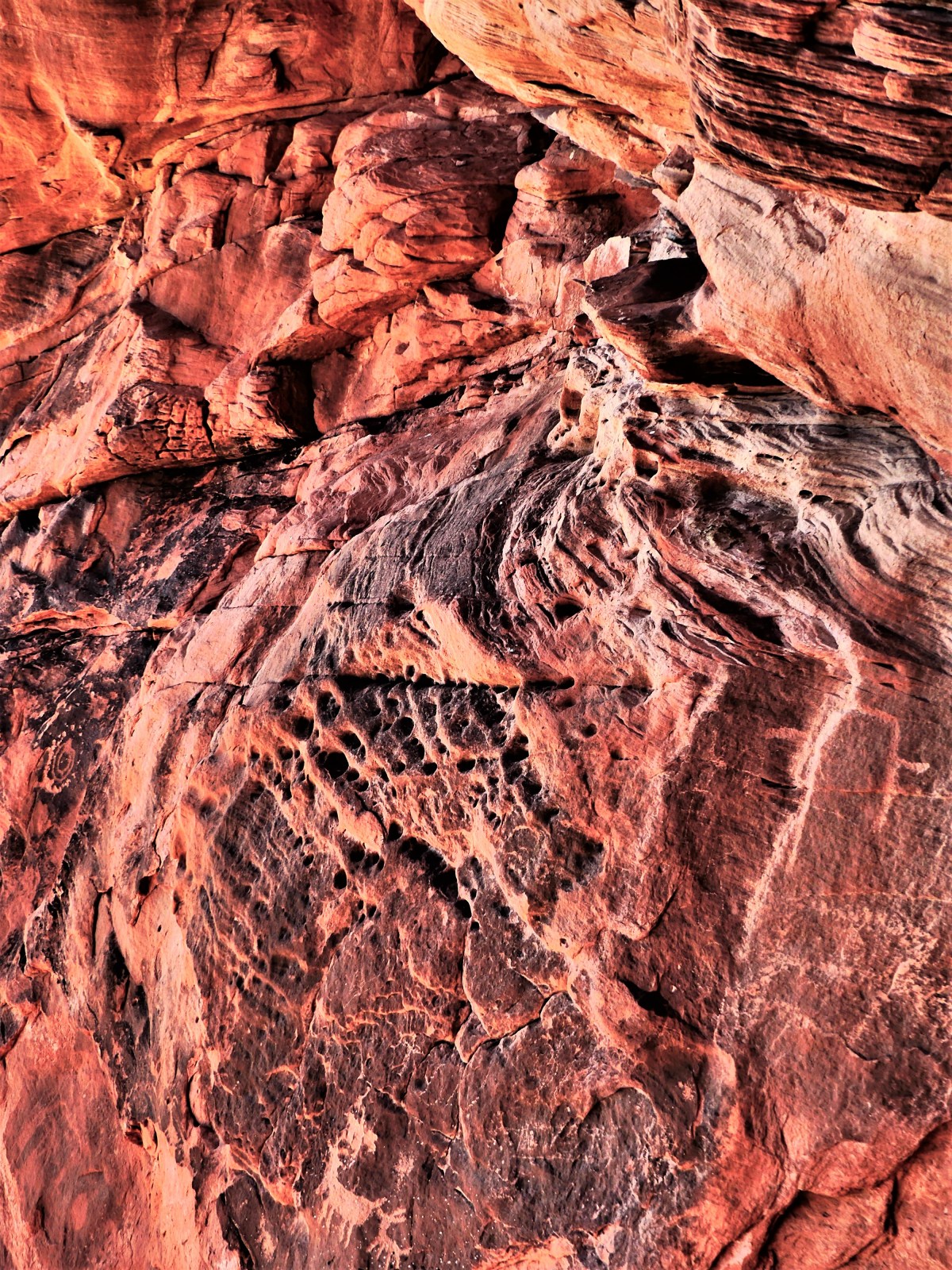
The park has an abundance of features and formations.
BeehivesArch RockElephant RockSilica DomeAtlatl RockMouse’s Tank
But the hiking trails off White Domes Road offer the biggest reward.
Rainbow Vista gave us an opportunity to scramble over rocks with more colors than a box of Crayolas.
A loop through the deep red sands of White Domes transported us to the 23rd century set of Star Trek: Generations.
A stroll through Fire Canyon during late afternoon gave us the impression that each rock radiated from within.
But I was unprepared for the exhilaration I felt after reaching the Fire Wave.
I’ve adopted Valley of Fire as my Muse. Even now, when I close my eyes, I believe I’m living in Candyland–a magical world where the cliffs look like candy, and all the residents of the world are tolerant of each other.
This post represents a milestone of sorts, as its #100 in my series of posts for Streaming Thru America–a blog intended to showcase and celebrate the diversity of beauty throughout the country. I dedicate #100 to all the victims, and their families, and I salute the first responders, the good Samaritans, and the medical personnel, who continue to fight for the living.
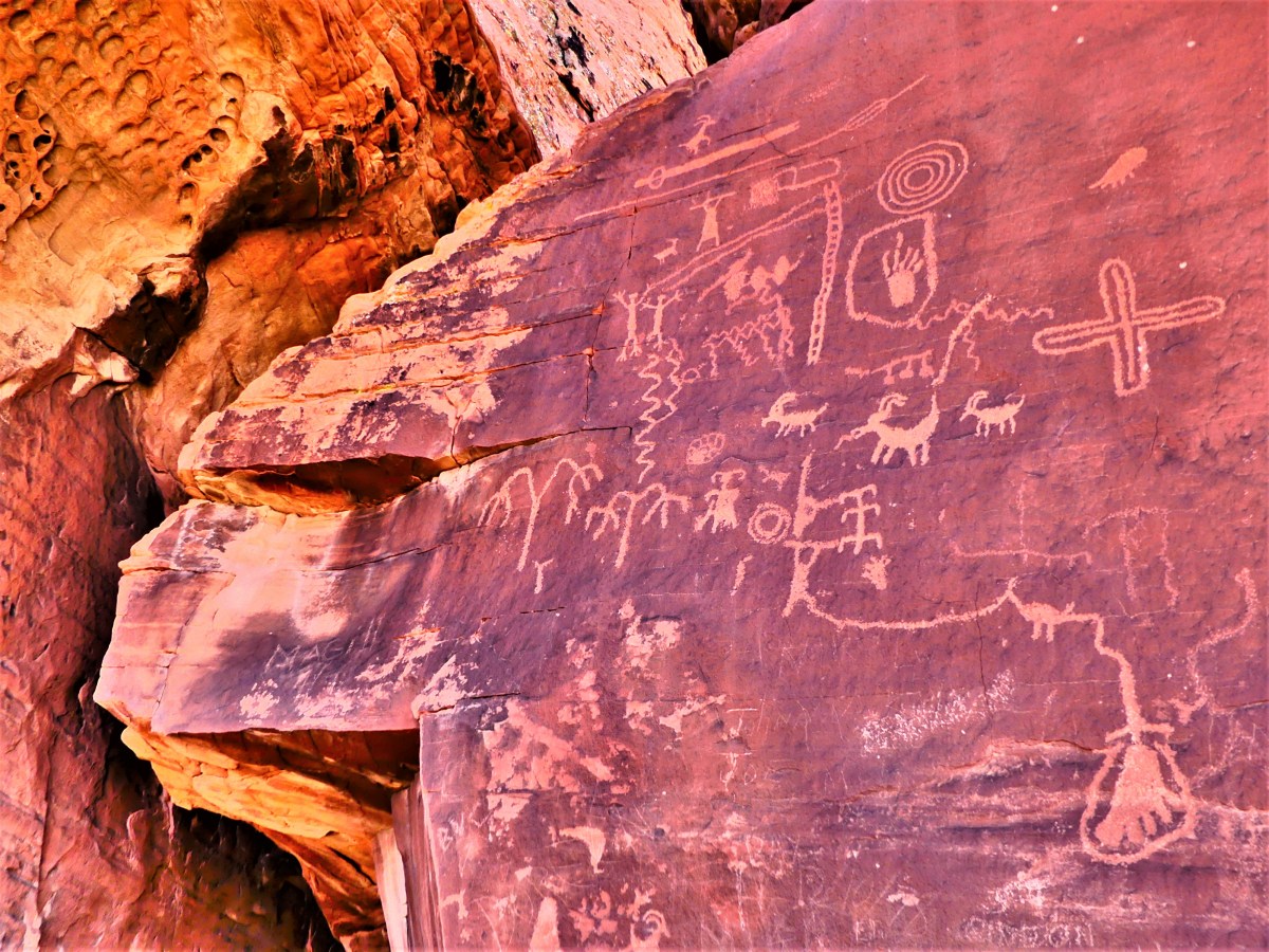
2,500 years before Valley of Fire State Park came into being, the Basketmakers, an ancient American culture migrated across the Nevadan high desert valley to hunt and pray, leaving behind pictographic records of their lives throughout the park’s 42,000 acres.
But Atlatl Rock qualifies as the best preserved and most dynamic petroglyph attracting the greatest number of pedestrians.
Easily reached by climbing eighty-four steps over fragile sandstone,
the symbols etched into the black patina tell an uncertain story, but the symbology clearly features known images–notably an atlatl, which was the “bump stock” of its time. Intended as a spear accessory, the atlatl was a forerunner to the bow and arrow, and used to improve speed and throwing distance when reaching bighorn sheep atop the wildly sculpted cliffs.
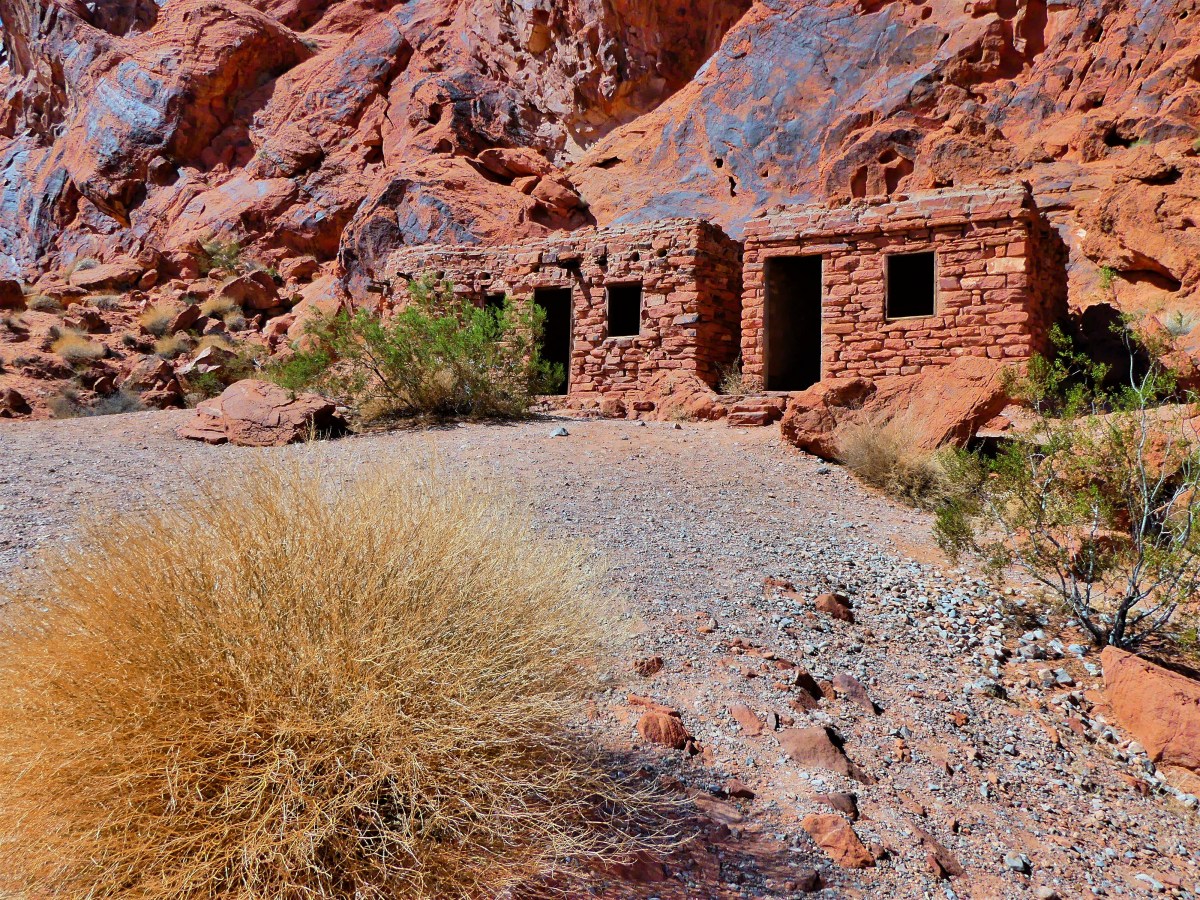
In anticipation of Valley of Fire becoming Nevada’s first state park in 1935, the Civilian Conservation Corps built The Cabins for motorists and pedestrians passing from Salt Lake City to Los Angeles along the Arrowhead Trail.
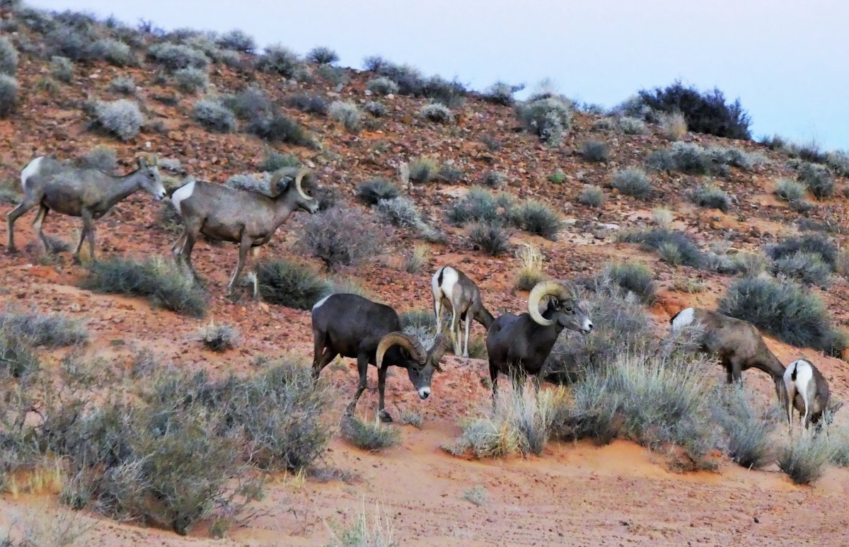
While hiking past Fire Canyon Road in anticipation of a glorious sunset, Leah and I were surprised to encounter a herd of bighorn sheep, perhaps the original inhabitants of the area.
We slowly followed at a safe distance as they’d periodically stop and graze across the hillside while heading for higher ground. Always wary and intently watching,
the leader of the pack stood vigilant.
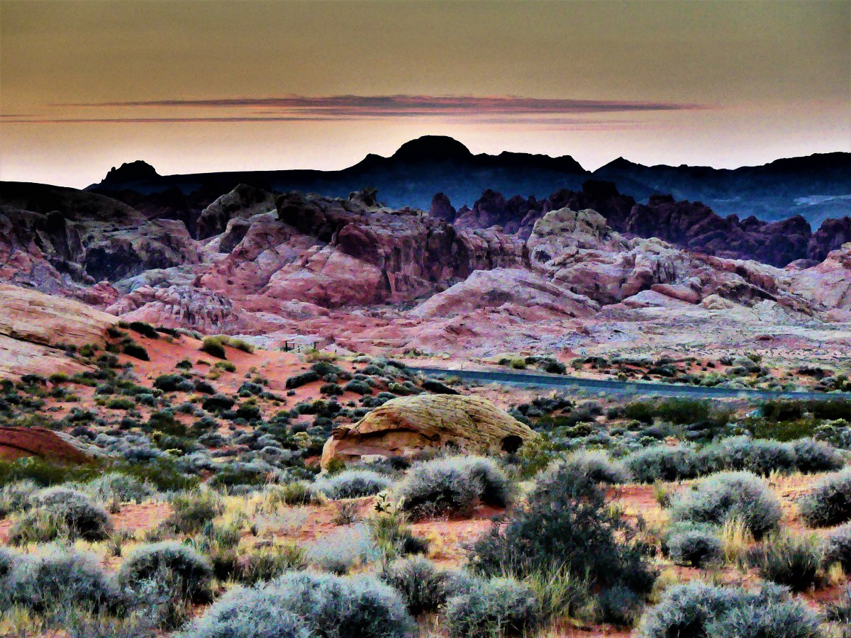
As the sun sank behind the Muddy Mountains,
and yielded to a spectacular moonrise over the Valley of Fire,
the celestial guardians of the park had found a place where no atlatl and spear could harm them.
October’s arrival has ushered in cooler weather, granting a seasonal pardon from the intense summer heat. Today’s forecast for Death Valley is expected to peak at only 101° F, which is still good news for lizards, Steve Bannon, and cockroaches, but less ideal for humans.
We awoke to the sounds of early morning buzz around Stovepipe Wells.
A steady stream of early risers traditionally flood the park before the sun becomes too forbidding. Fortunately for us, they will likely swarm to the iconic hot spots, which only accounts as a pen stroke of Death Valley’s complex signature.
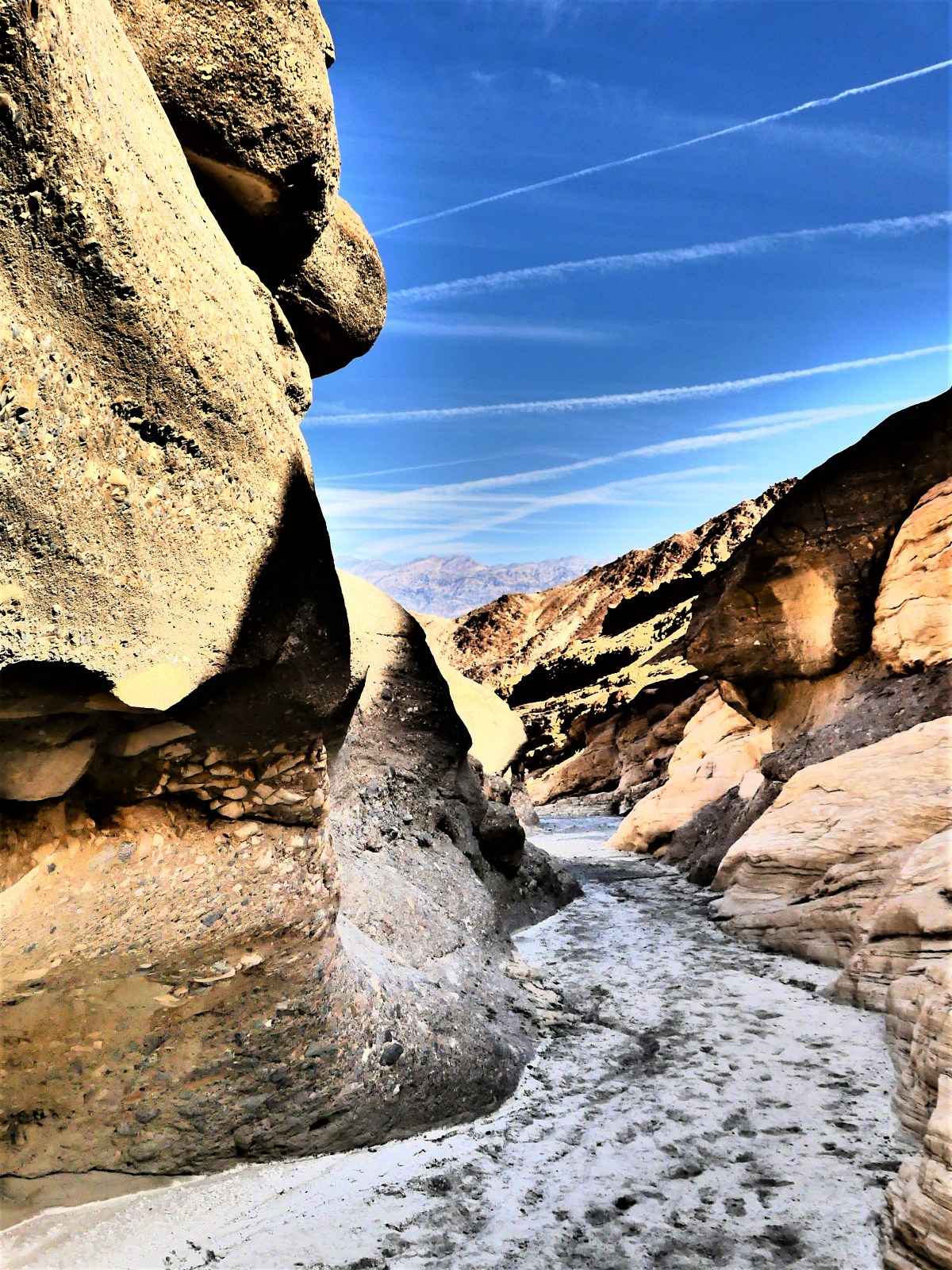
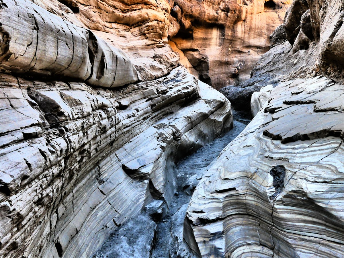
We started the day with an off-road expedition to Mosaic Canyon’s serpentine passage…
…and we hiked until we reached the foothills of the Panamint Range. It was a worthy addition to yesterday’s collection of geologic gems.
From there, we took the historic high road through Emigrant Pass, and back to a time of survival–when pioneers and prospectors competed against all that nature could muster. But nothing could dissuade or discourage the hardscrabble men and women with ardent dispositions, and the promise of a gold strike.
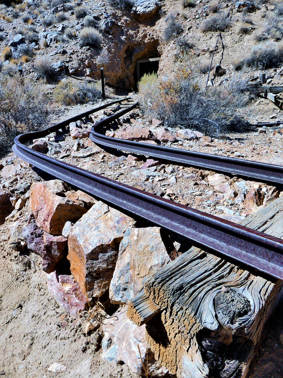
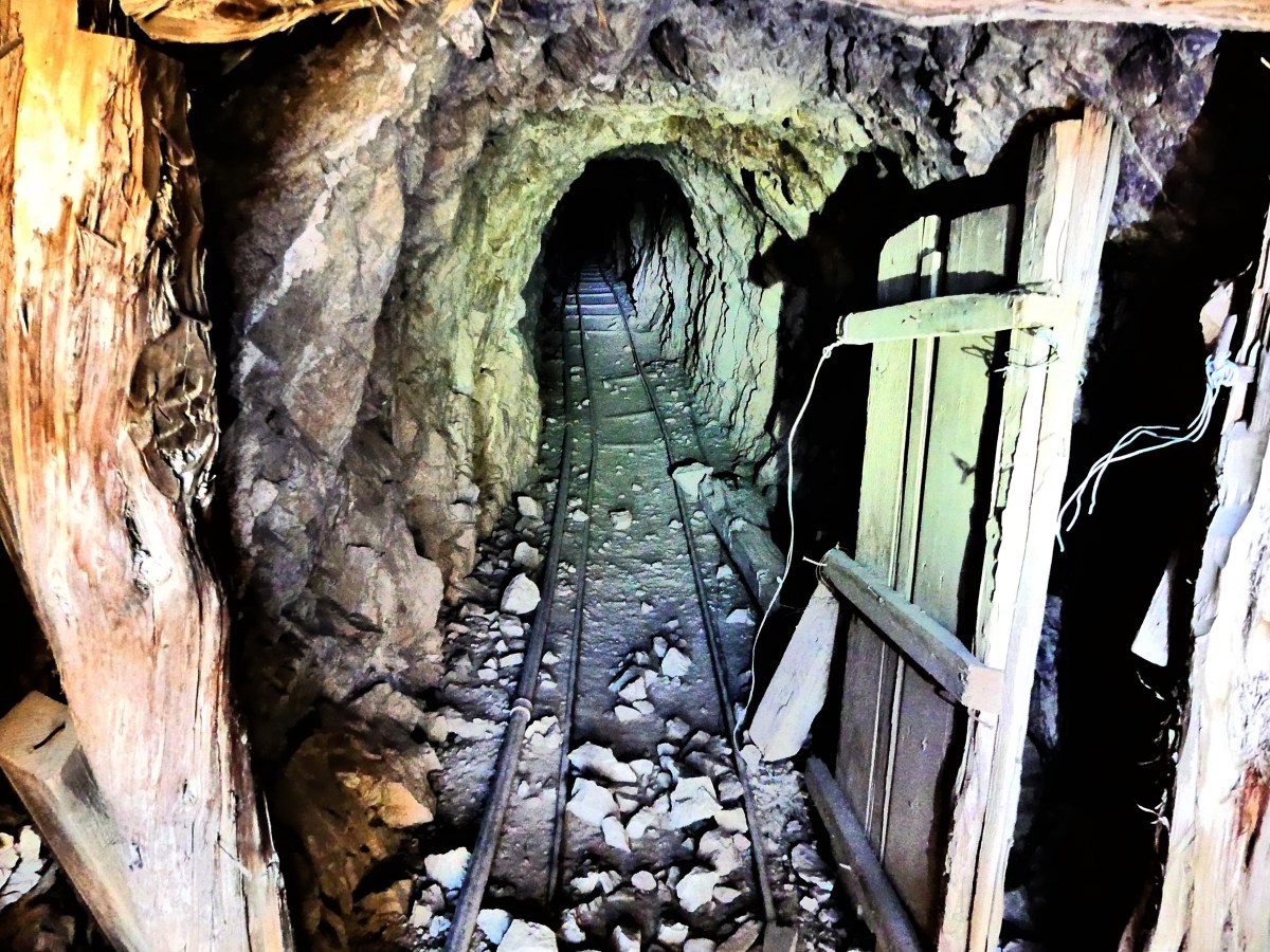
Today, the desert is littered with claims. In fact, there are more abandoned mines in Death Valley than any other national park. But one mine is special, and it belonged to Pete Aquereberry.
He gained control of the claim after winning his 1907 lawsuit against Shorty Harris, an entrepreneur, a raconteur, and bona fide con-artist, who later built a castle at the top of the valley and filled it with museum-worthy art.
When all the other mines and miners faded away, Pete continued to pull gold from the ground for forty years,
and refined it through his cashier mill.
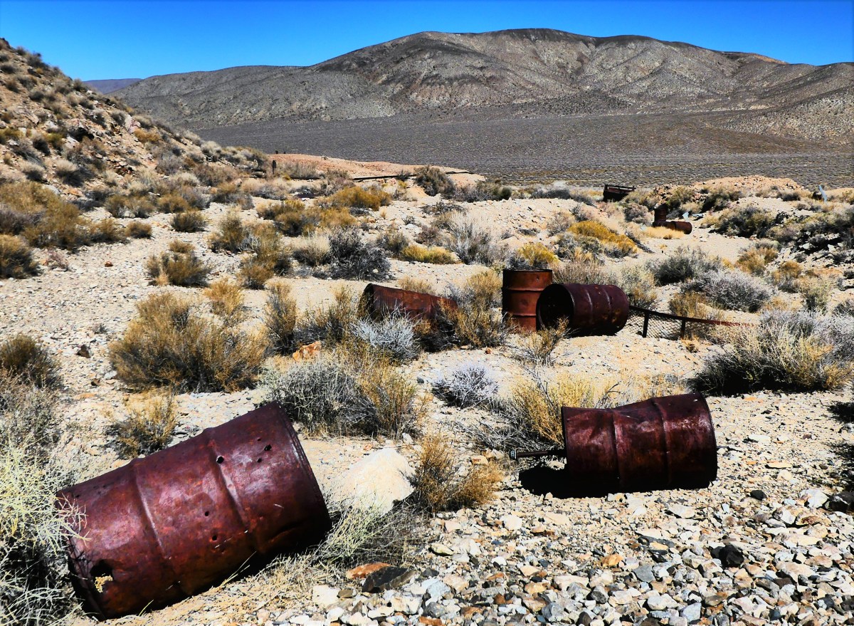
Fortunes were made and lost in turn-of-the-century boomtowns like Skidoo, Ryolite, Leadfield, Ballarat, but Harrisburg was different. Pete continued to live in his ramshackle cabin until his death in 1945.
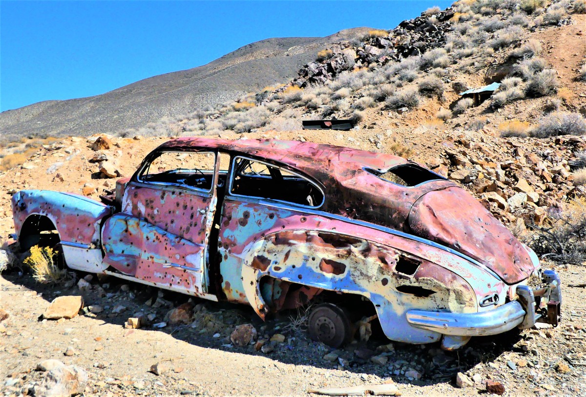
Two-hundred yards up the hill, an overgrown path leads to a graveyard of rusted appliances, oil drums,
and a bullet-riddled 1948 Buick Roadmaster, an elite automobile at the time of post-war production…
…that sits abandoned in the middle of Nowhere, Nevada…
and without a reason or a clue of ownership.
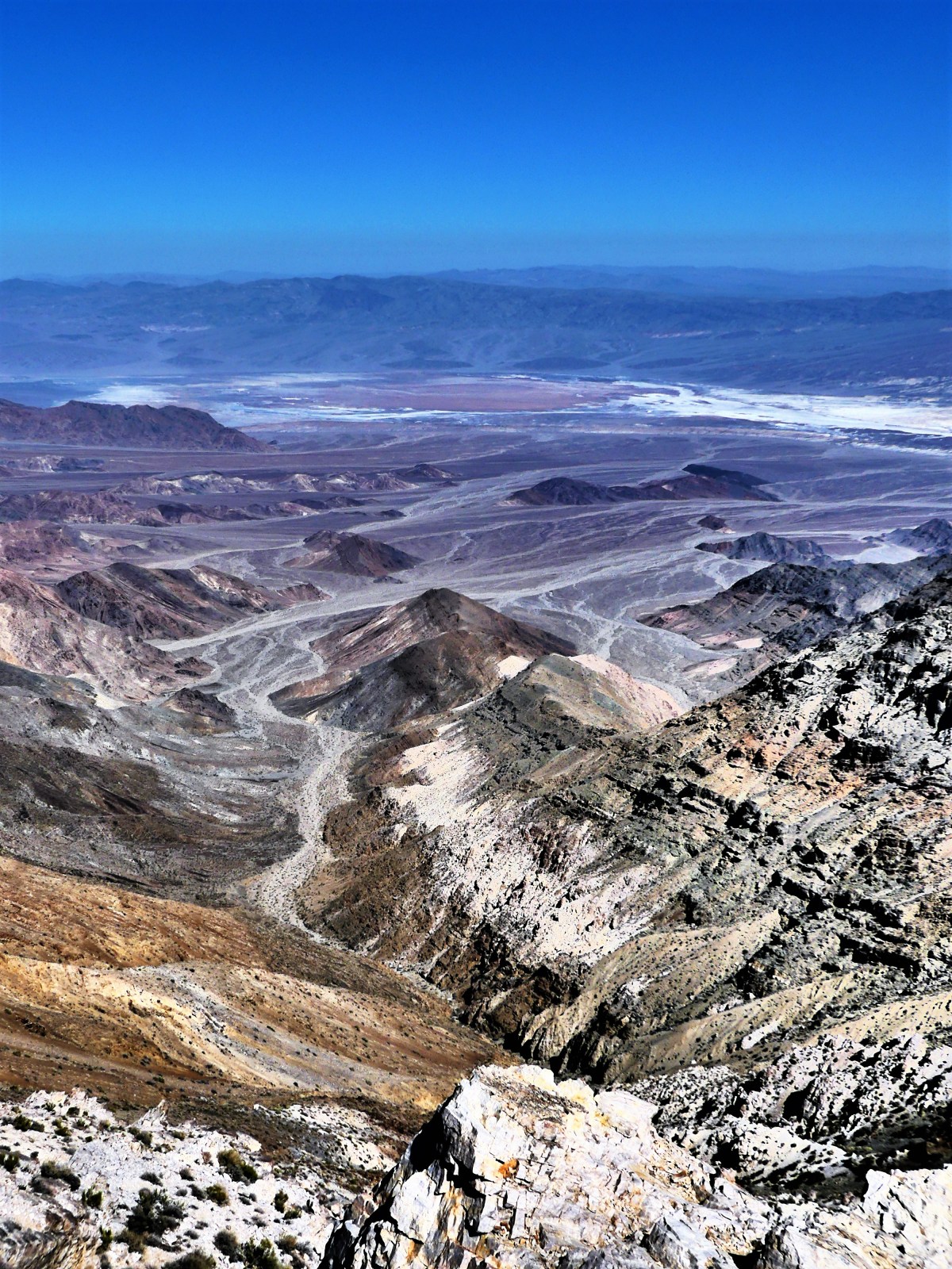
However, beyond the mining camp, and up a primitive road at 6433 ft. above the valley floor lies Aguereberry’s everlasting “Great View”,
better known today as Aguereberry Point, where the air temperature soared to 70° F. Even better was having the mountaintop to ourselves,
until a team of law enforcement rangers unexpectedly crashed our party. After chatting awhile, we took our cue and continued in search of the Charcoal Kilns without really knowing what to look for.
Turning east on Wildrose Canyon Drive, we followed the road until pavement turned to gravel, and eventually narrowed to passable traffic. One moment we were driving through high desert, and when we turned the corner, we found ourselves inside a lush forest of piñon pines, as if we’d been transported to another part of the country.
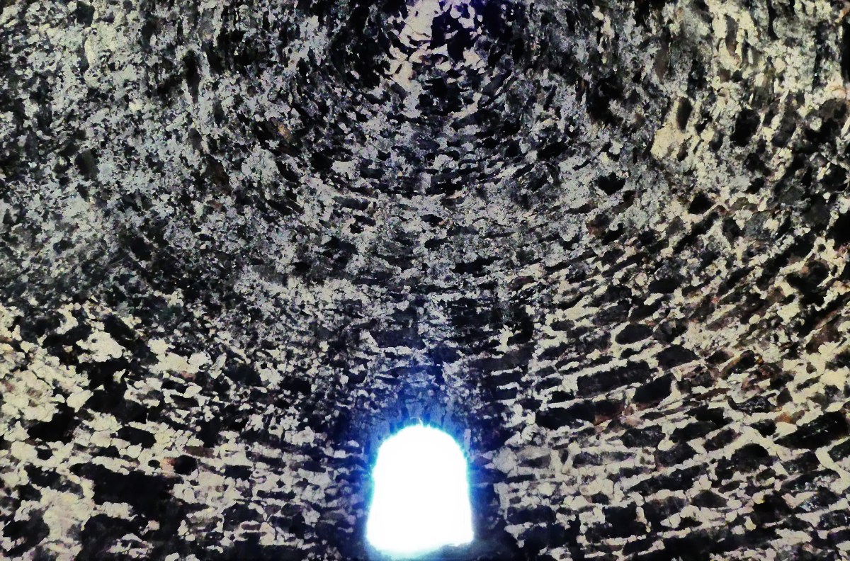
The air was crisp and smelled of sage. Dead ahead was a string of ten identical bee hives–making for a very different kind of Rockettes chorus line.
That’s when Leah and I realized that we’d found the kilns.
Quarried from the mountainside, these imposing structures built in 1877–and used for only three years–still have the stink of creosote permeated within their stone walls. The cones are perfectly symmetrical, and the inside acoustics sound amazing.
Our trip continued past the kilns and up a high-clearance mogul run that was barely one-way-wide. Just then, an Accord barreled down and around a craggy corner faster than anyone should, and came to a skidding stop at the sight of me. It seems we were now engaged in a friendly game of chicken, so I made the first move and crept up the mountain in his direction. Perhaps he presumed that I was pulling off the road to give him a chance to pass, but there was less than no room for him to clear me. He was beaten, and he knew it, as he backed his Honda into a clearing, allowing me to pass. We exchanged fleeting glances, and I realized that winning right-of-way was more of a victory for the truck.
The road topped out at Mahogany Flat, where a lone camper was listening to Ruby Tuesday on his personal speaker, and a middle-aged couple had just completed their hike to Telescope Peak–a fourteen-mile round-trip to the highest peak in the park at 11049 ft.
While our hearts were willing, we were in no condition to start such a big hike so late in the day. But with assurances of great views from two senior hiking superstars, we walked for a mile until we reached the first clearing. While it was good enough for Leah, I wanted more. Leah stayed back while I continued to the second clearing, no more than another ¼-mile ahead.
And that’s when I finally understood the park.
Leah and I had visited Death Valley seven years ago, and had a completely different experience. For one, it was February, and it felt like we had the entire park to ourselves. The other oddity was when it rained; it brought a sudden eruption of wildflowers to the desert, and turned the Basin into briny ponds of unusual colors and strange lifeforms.
This time around, we elected to pass on the Twenty Mule Team Borax exhibit, having seen it years ago, but it came up again in a strange conversation on our way down from Telescope Peak. For several miles, we’d been passing scattered piles of shit along the road, and wondered about its origin.
Until we had to stop the truck.
And then we knew what had become of the Twenty Mule Team.
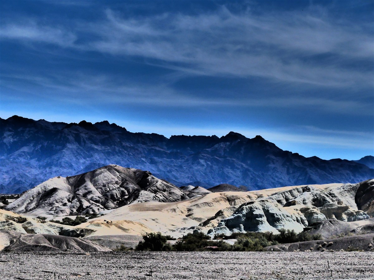
Death Valley is known as a land of extremes. From atop Telescope Peak (the highest point in the park at 11,043′) it’s possible to see the highest point in America (Mt. Whitney at 14,505′) and the lowest point in North America (Badwater Basin at -282′)–all from the same spot. The Panamint towers on the west hold onto snow for three months of the year during winter, while the valley below is the driest place in North America, with annual rainfall under 2 inches. Temperatures have ranged from 134° F to 15° F at Furnace Creek’s weather station.
At 3.4 million acres, Death Valley is the largest National Park outside Alaska. The park is 140 miles long and demands reliable transportation due to its vast and unforgiving character. Nearly 1000 miles of pavement and dirt roads provide access to numerable sights, but the conditions are so punishing, that picking and choosing what to see and do requires reasonability.
With only two days to see the park, Leah and I split our tour around the park’s extremes: on day one, we’d drive the busy low elevation roads–where the weather reigns hotter than anywhere else in the western hemisphere–to explore highlights to the east; and on day two, we’d travel the remote off-road trails to the west, in search of cooler mountain air.
To make it easier on ourselves, we parked the Airstream on an expansive open gravel lot at Stovepipe Wells, where a dozen other trailers and coaches joined us as we listened to early morning howls from a pack of coyotes hunting the birds that frequent the septic pump at the far end of the campground.
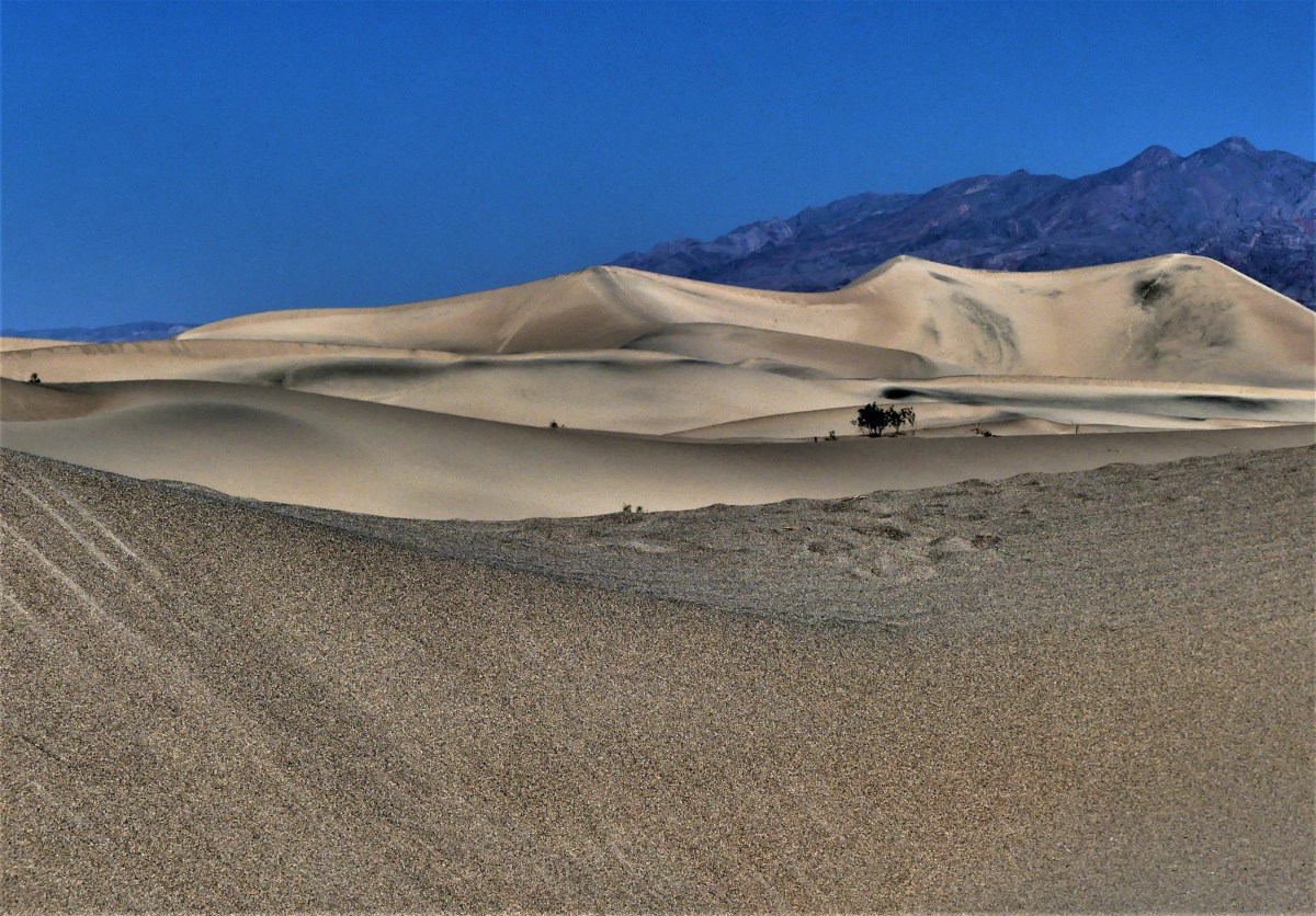
A restless night gave way to a convenient start the following day, with a quick trip (almost unheard of in this National Park) around the bend to Mesquite Flat Sand Dunes.
Wandering out to the highest ridge at 100 ft. can be arduous, as the shifting sand will swallow every step.
However, better traction is available in the dune valleys, where the hard crust anchors the creosote and mesquite shrubs.
We continued past Furnace Creek…
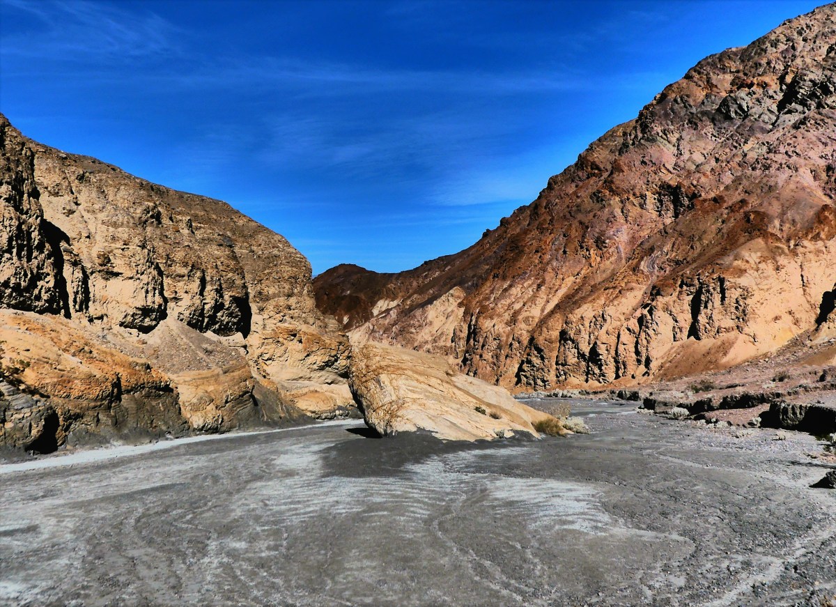
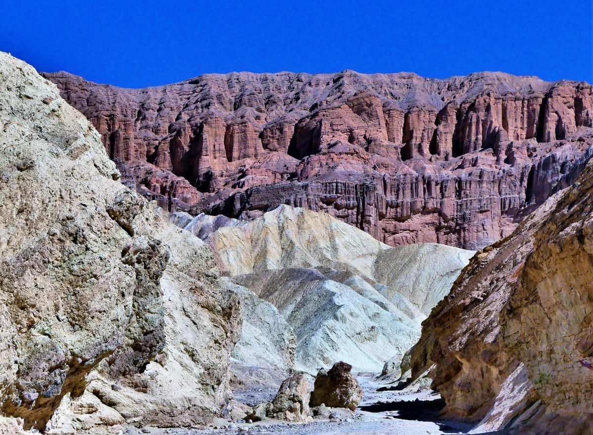
until we reached the Golden Canyon. With the sun arcing across the eastern sky, we wove our way through the passage,
always hugging the canyon walls where we could for a chance at shady salvation.
While the sun was relentless, it was the scenery that left us breathless.
Back in the truck with the air conditioning cranked to recovery mode, we took CA-190 past the Artists Drive detour, and turned onto a last ditch road that resembled the landscape. At the end of the quarter-mile was a large clearing smack in the middle of an alien landscape called Devils Golf Course*, an immense arena of jagged rock salt deposits turned into land mines that makes for hazardous hiking.
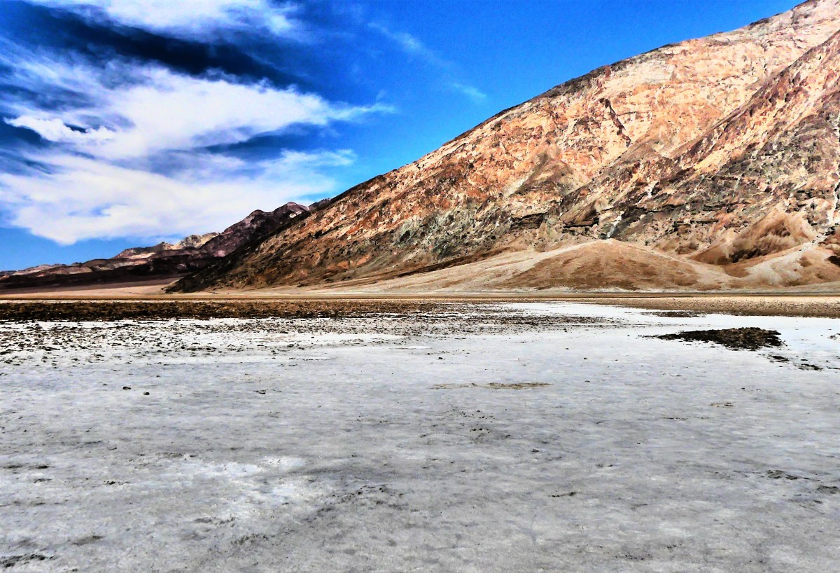
While no one can ever prepare for surviving in extreme heat for extended periods of time (by now it was now 103° F), we were ready to take our chances in Badwater Basin–the hottest and deepest place in America.
Walking onto salt flats that cover 200 sq miles sounds as overwhelming as it should,
…yet the impression of watching people walk out so far they almost disappear, helps put the enormity of Badwater Basin into perspective.
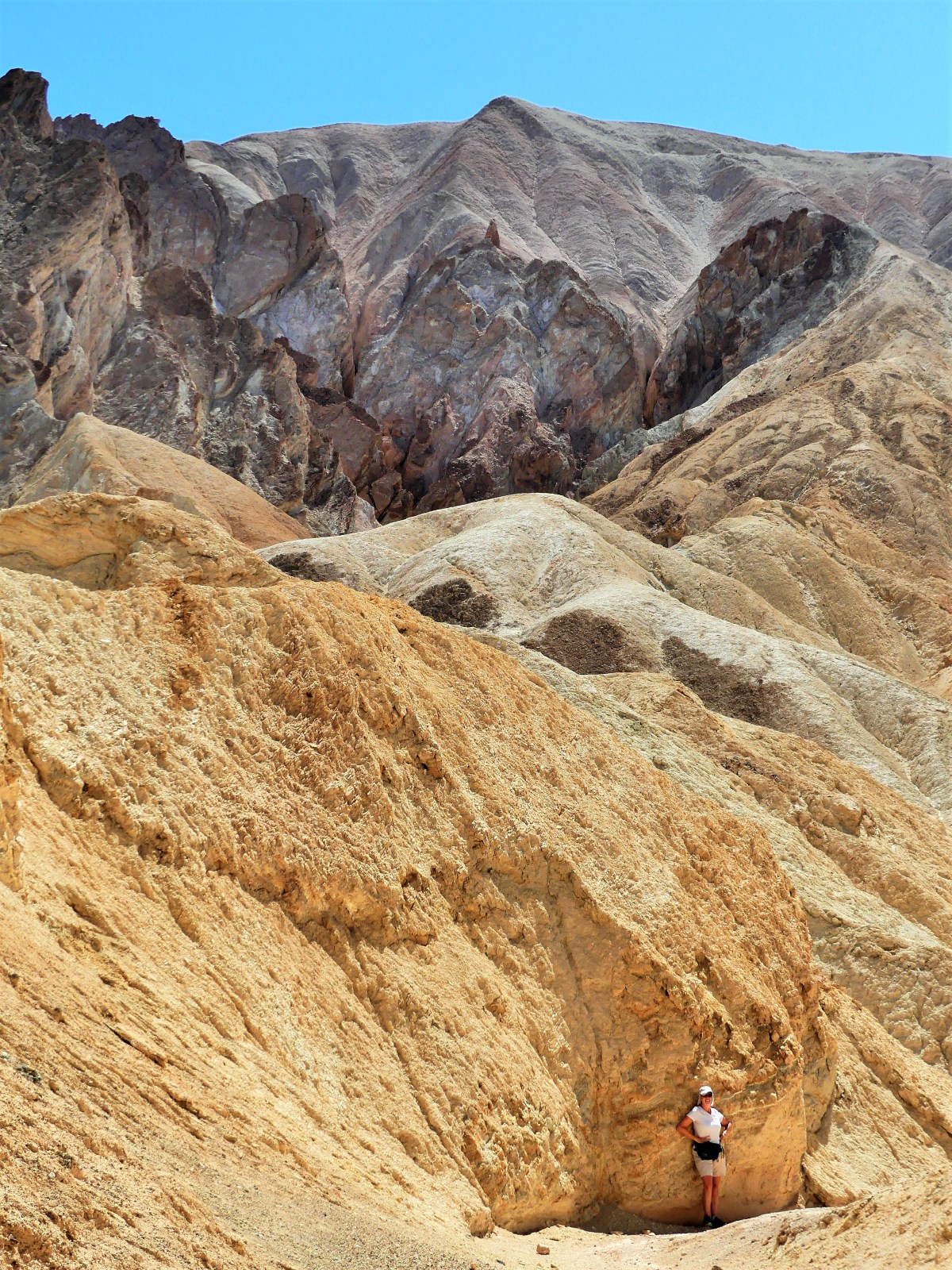
Leah and I u-turned from this point, and back-tracked to Artist Drive–nine miles of looping and dipping black-top that weaves through narrow rock channels until it opens onto a gargantuan portion of Neapolitan ice cream known as Artists Palette.
Five million years of eruptions altered by heat and shaped by wind and water has produced a spectrum of colors across the slopes. On closer inspection, the colors are surreal.
While the truck had enough fuel to carry us another two-hundred miles, Leah and I were running out of gas. As we’d ride from one spot to another, we’d repeat the same refrain throughout the day: “Oh, wow! Did you see that? That was amazing! How is that even possible?” We were living on fumes of inspiration.
We closed the day with a visit to Zabriskie Point,
a magical setting that showcases the harsh beauty that makes Death Valley so unforgettable, and a place that can awaken the hibernating soul within us. Some go so far as to breach the safety of the overlook, and climb closer to the edge to symbolically feel closer to their personaltruth.
One such group of chanting and meditating hippies was seated on plush mats near the cliff edge, their diaphanous silks of many colors flowing in the hot breeze. They were seemingly oblivious to the large number of amateur shutterbugs who were standing on the observation platform and complaining about their compromised view of the Badlands.
Since I believe that we all share the same view equally, I took a narrow path down to where they were sitting to set up my camera shot. I nodded politely as I crossed their viewing angle, and bid them hello.
“I’ll bet their grumbling up there about how we’re spoiling the view for them,” declared the Elder.
“Yeah, there’s a lot of that going on,” I indicated, “but the light won’t be like this forever, so ‘I’m not gonna waste my shot.’”
Elder stated, “Y’know, if they were that bummed out, they’d come down here the same as you”
Setting up my shot, with my back to Elder, I commented, “That’s true, but many aren’t as bold as you, and just as many can’t physically make the climb down here. Figure it out!… While you’re praying for world peace, you’re also ignoring the needs of people right behind you.”
“I guess that’s true,” noted the Eldress.
I took the shot…
and hiked back to where Leah was standing.
“Y’know that group of hippies below us? I think they’re leaving,” I announced.
“That’s gonna make a bunch of people happy,” predicted Leah.
When I saw them rolling up their mats, I figured that like me, they probably had enough heat for one day, or they finally came to their senses before the heat robbed them of their last strand of reasonability.
* Not a Trump® property yet, but the family is working on it!
Everyday for 36 years, Captain Robert Decatur Israel, the lightkeeper of Old Point Loma Lighthouse would ascend the narrow winding staircase to the glass tower at dusk. With an outstretched arm, he’d light the pilot and adjust the flame that lit the passage for sailors returning to San Diego Harbor. On a clear day, the coastal beacon could be seen from 25 miles out.
But there was fatal flaw in the design. On March 23, 1891, the flame went out forever in favor of another lighthouse built closer to the Pacific Ocean–below the frequent fog and cloud levels–and under the original elevation of 422 ft.
The National Park Service has restored the lighthouse to its original 1855 glory, under the purview of the Cabrillo National Monument,
and protects its five foot French fresnel lens in a protective capsule on the ground floor.
A window through the prismatic lens offers a window to the San Diego harbor in the distance, and a second window back in time, where a volunteer in vintage costume brings lighthouse history back to life.


")