
Death Valley is known as a land of extremes. From atop Telescope Peak (the highest point in the park at 11,043′) it’s possible to see the highest point in America (Mt. Whitney at 14,505′) and the lowest point in North America (Badwater Basin at -282′)–all from the same spot. The Panamint towers on the west hold onto snow for three months of the year during winter, while the valley below is the driest place in North America, with annual rainfall under 2 inches. Temperatures have ranged from 134° F to 15° F at Furnace Creek’s weather station.
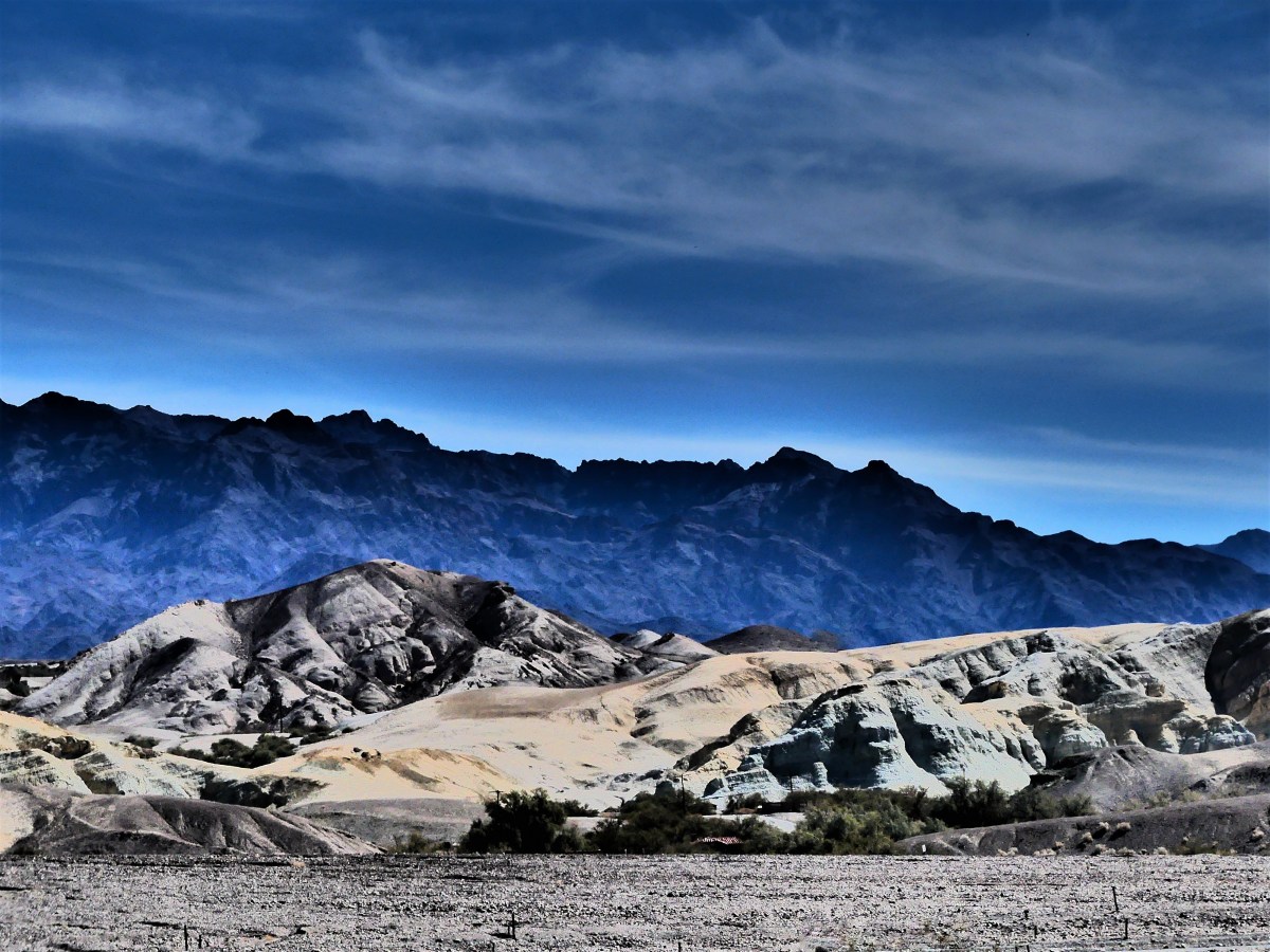
At 3.4 million acres, Death Valley is the largest National Park outside Alaska. The park is 140 miles long and demands reliable transportation due to its vast and unforgiving character. Nearly 1000 miles of pavement and dirt roads provide access to numerable sights, but the conditions are so punishing, that picking and choosing what to see and do requires reasonability.
With only two days to see the park, Leah and I split our tour around the park’s extremes: on day one, we’d drive the busy low elevation roads–where the weather reigns hotter than anywhere else in the western hemisphere–to explore highlights to the east; and on day two, we’d travel the remote off-road trails to the west, in search of cooler mountain air.
To make it easier on ourselves, we parked the Airstream on an expansive open gravel lot at Stovepipe Wells, where a dozen other trailers and coaches joined us as we listened to early morning howls from a pack of coyotes hunting the birds that frequent the septic pump at the far end of the campground.
A restless night gave way to a convenient start the following day, with a quick trip (almost unheard of in this National Park) around the bend to Mesquite Flat Sand Dunes.
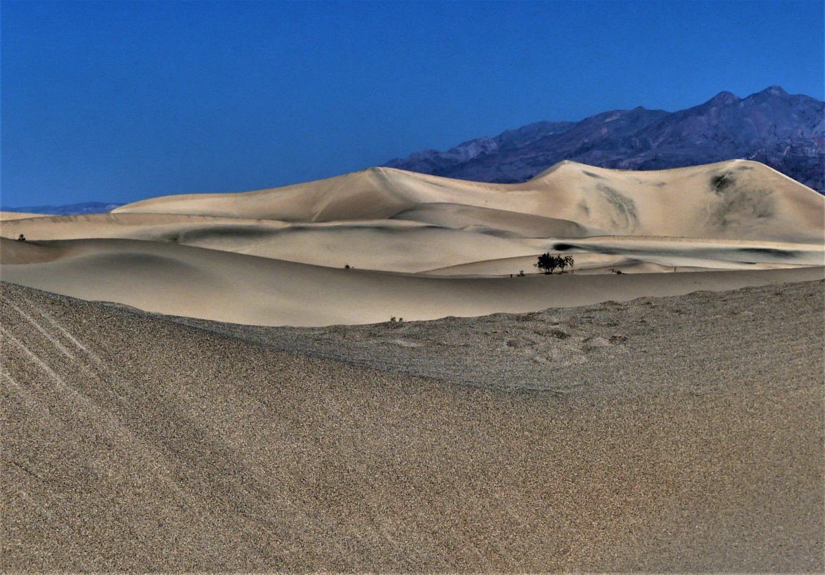
Wandering out to the highest ridge at 100 ft. can be arduous, as the shifting sand will swallow every step.

However, better traction is available in the dune valleys, where the hard crust anchors the creosote and mesquite shrubs.

We continued past Furnace Creek…
until we reached the Golden Canyon. With the sun arcing across the eastern sky, we wove our way through the passage,

always hugging the canyon walls where we could for a chance at shady salvation.
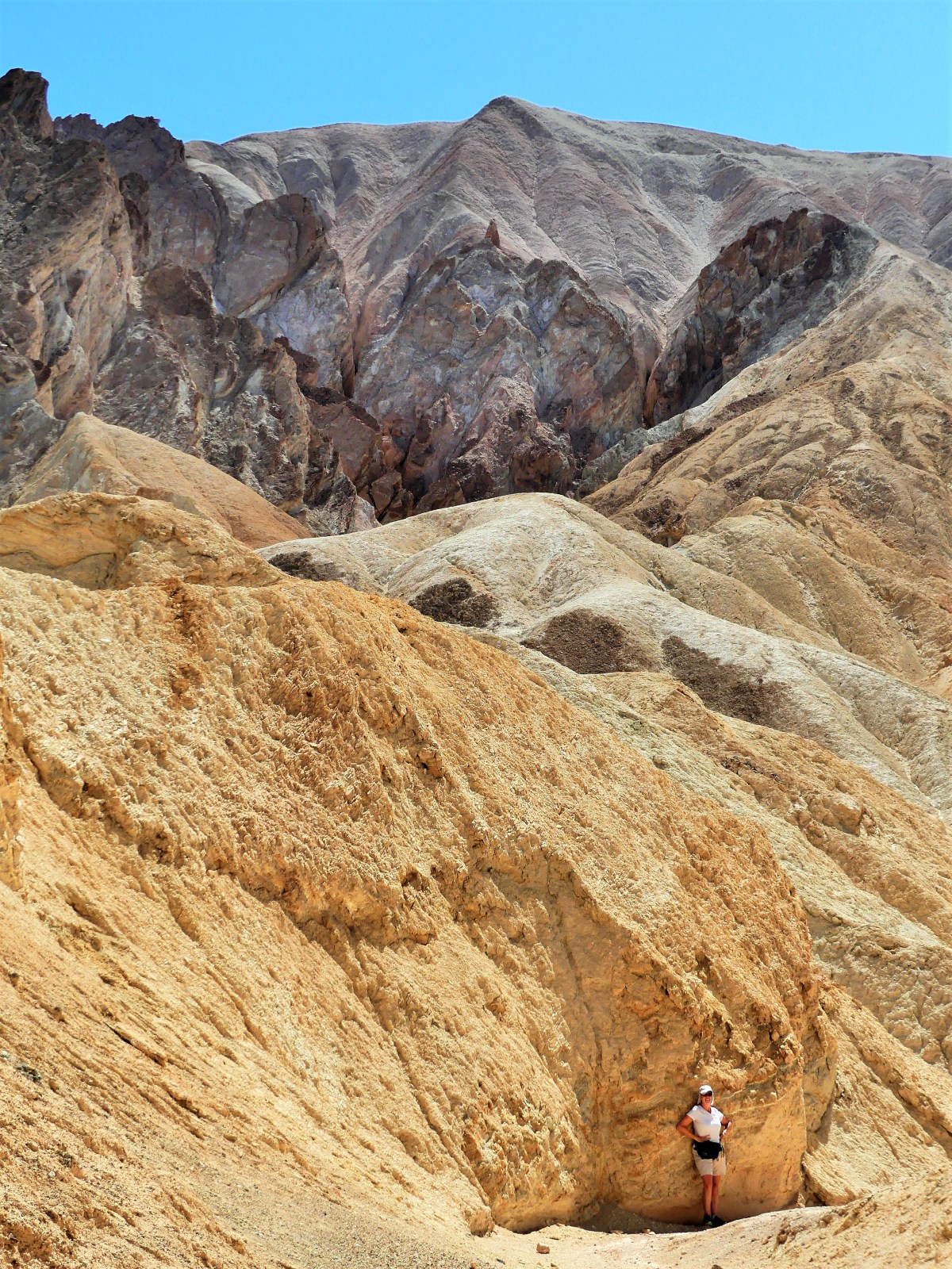
While the sun was relentless, it was the scenery that left us breathless.


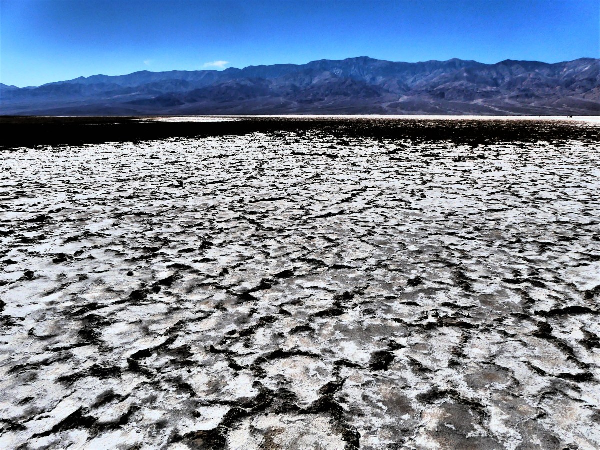
Back in the truck with the air conditioning cranked to recovery mode, we took CA-190 past the Artists Drive detour, and turned onto a last ditch road that resembled the landscape. At the end of the quarter-mile was a large clearing smack in the middle of an alien landscape called Devils Golf Course*, an immense arena of jagged rock salt deposits turned into land mines that makes for hazardous hiking.


While no one can ever prepare for surviving in extreme heat for extended periods of time (by now it was now 103° F), we were ready to take our chances in Badwater Basin–the hottest and deepest place in America.
Walking onto salt flats that cover 200 sq miles sounds as overwhelming as it should,
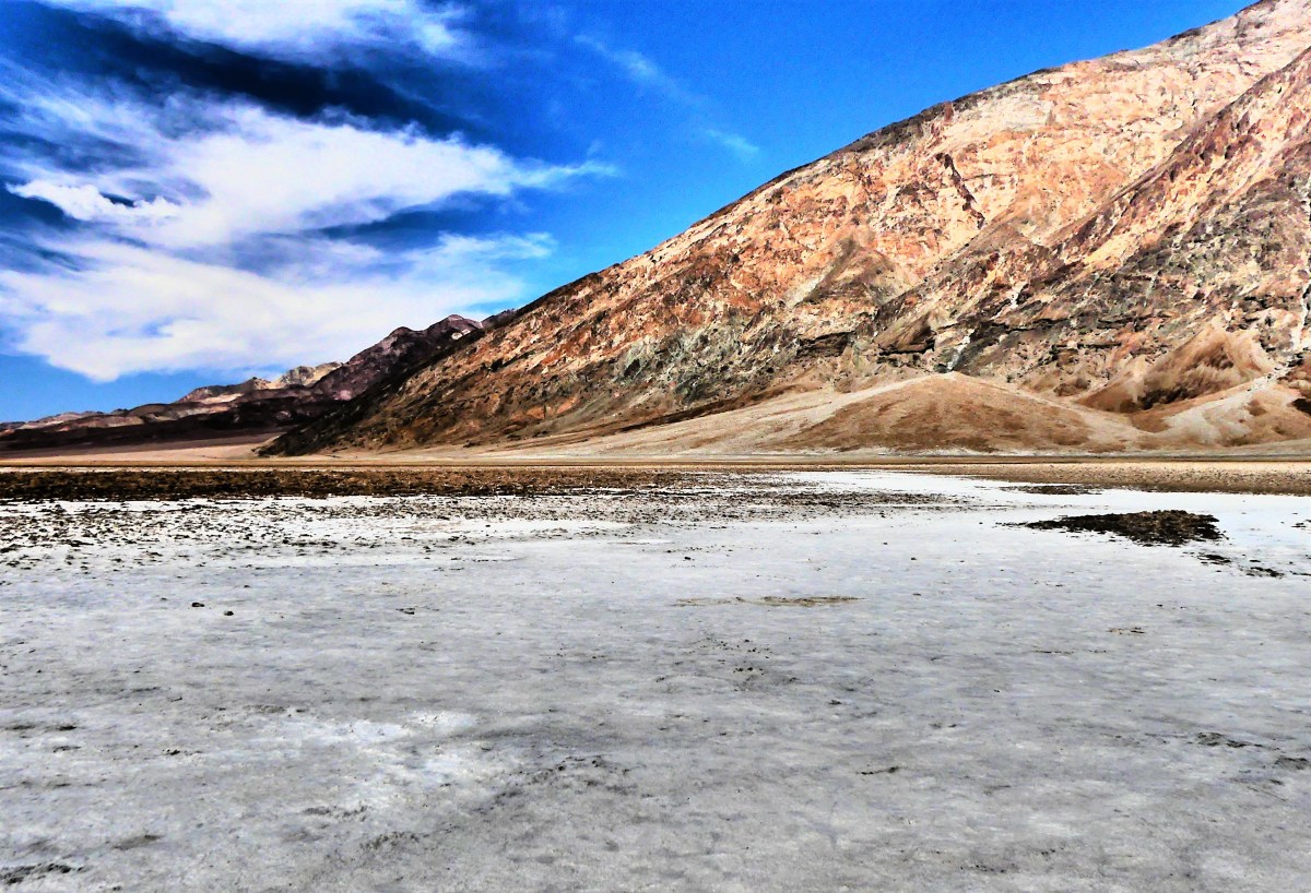
…yet the impression of watching people walk out so far they almost disappear, helps put the enormity of Badwater Basin into perspective.
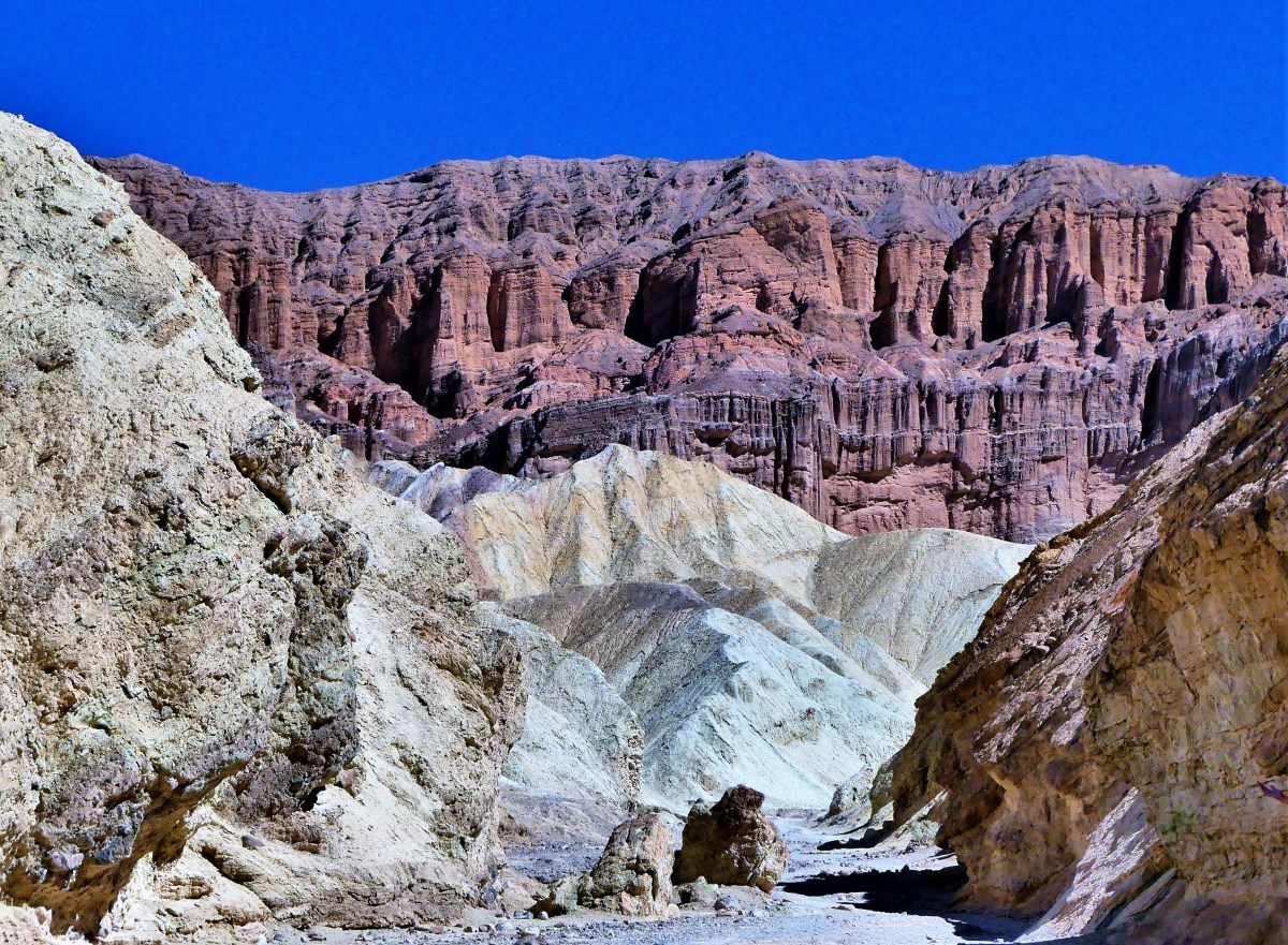
Leah and I u-turned from this point, and back-tracked to Artist Drive–nine miles of looping and dipping black-top that weaves through narrow rock channels until it opens onto a gargantuan portion of Neapolitan ice cream known as Artists Palette.

Five million years of eruptions altered by heat and shaped by wind and water has produced a spectrum of colors across the slopes. On closer inspection, the colors are surreal.


While the truck had enough fuel to carry us another two-hundred miles, Leah and I were running out of gas. As we’d ride from one spot to another, we’d repeat the same refrain throughout the day: “Oh, wow! Did you see that? That was amazing! How is that even possible?” We were living on fumes of inspiration.
We closed the day with a visit to Zabriskie Point,

a magical setting that showcases the harsh beauty that makes Death Valley so unforgettable, and a place that can awaken the hibernating soul within us. Some go so far as to breach the safety of the overlook, and climb closer to the edge to symbolically feel closer to their personal truth.
One such group of chanting and meditating hippies was seated on plush mats near the cliff edge, their diaphanous silks of many colors flowing in the hot breeze. They were seemingly oblivious to the large number of amateur shutterbugs who were standing on the observation platform and complaining about their compromised view of the Badlands.
Since I believe that we all share the same view equally, I took a narrow path down to where they were sitting to set up my camera shot. I nodded politely as I crossed their viewing angle, and bid them hello.
“I’ll bet their grumbling up there about how we’re spoiling the view for them,” declared the Elder.
“Yeah, there’s a lot of that going on,” I indicated, “but the light won’t be like this forever, so ‘I’m not gonna waste my shot.’”

Elder stated, “Y’know, if they were that bummed out, they’d come down here the same as you”
Setting up my shot, with my back to Elder, I commented, “That’s true, but many aren’t as bold as you, and just as many can’t physically make the climb down here. Figure it out!… While you’re praying for world peace, you’re also ignoring the needs of people right behind you.”
“I guess that’s true,” noted the Eldress.
I took the shot…

and hiked back to where Leah was standing.
“Y’know that group of hippies below us? I think they’re leaving,” I announced.
“That’s gonna make a bunch of people happy,” predicted Leah.
When I saw them rolling up their mats, I figured that like me, they probably had enough heat for one day, or they finally came to their senses before the heat robbed them of their last strand of reasonability.
* Not a Trump® property yet, but the family is working on it!


Beautiful. Amazing.
LikeLiked by 1 person
Thanks, David. Additional features of Death Valley coming soon.
LikeLike
Death Valley, my favorite place I’ve traveled so far. Thanks for taking me back there again with your words and your photos.
LikeLiked by 2 people
Allow me to be your virtual tour guide.
LikeLiked by 1 person
Incredible pictures! I feel like you just took me there. Wonderful recap.
LikeLiked by 2 people
Then mission accomplished. But stay tuned; there’s more to come on the west side of Death Valley!
LikeLike
Amazing pics, but I suspect they don’t do it any justice.
LikeLiked by 2 people
So true. It’s mind-bending how spacious this landscape is. Thanks for the follow.
LikeLike