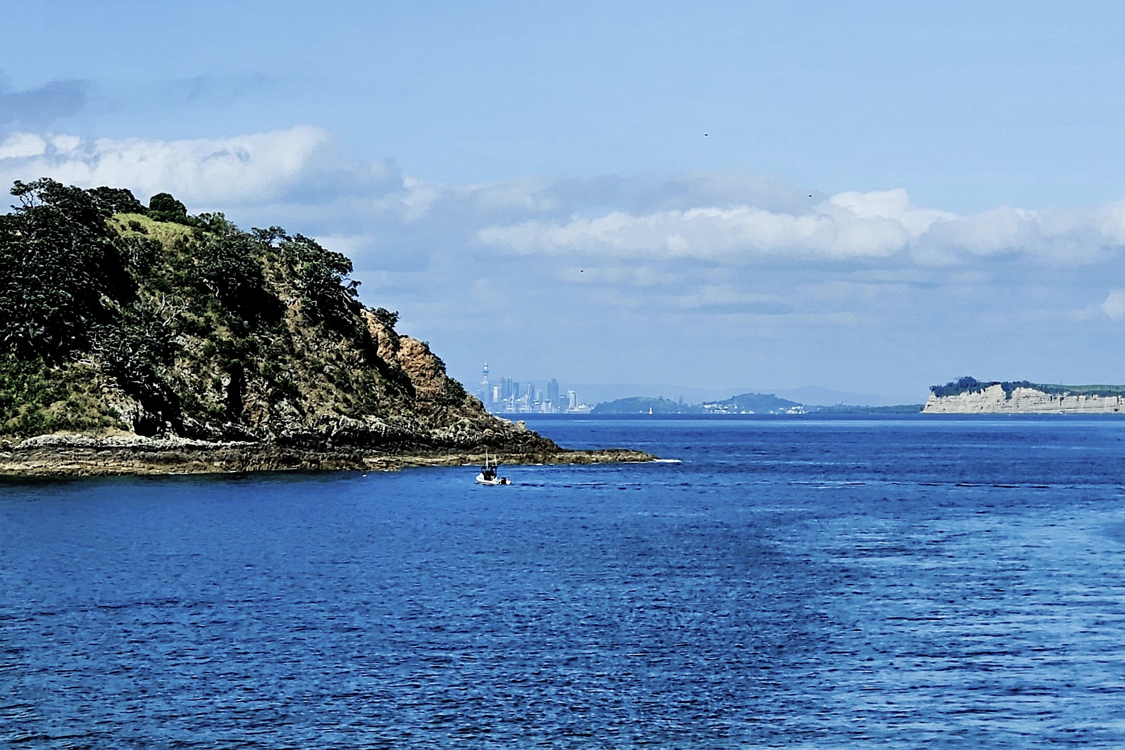
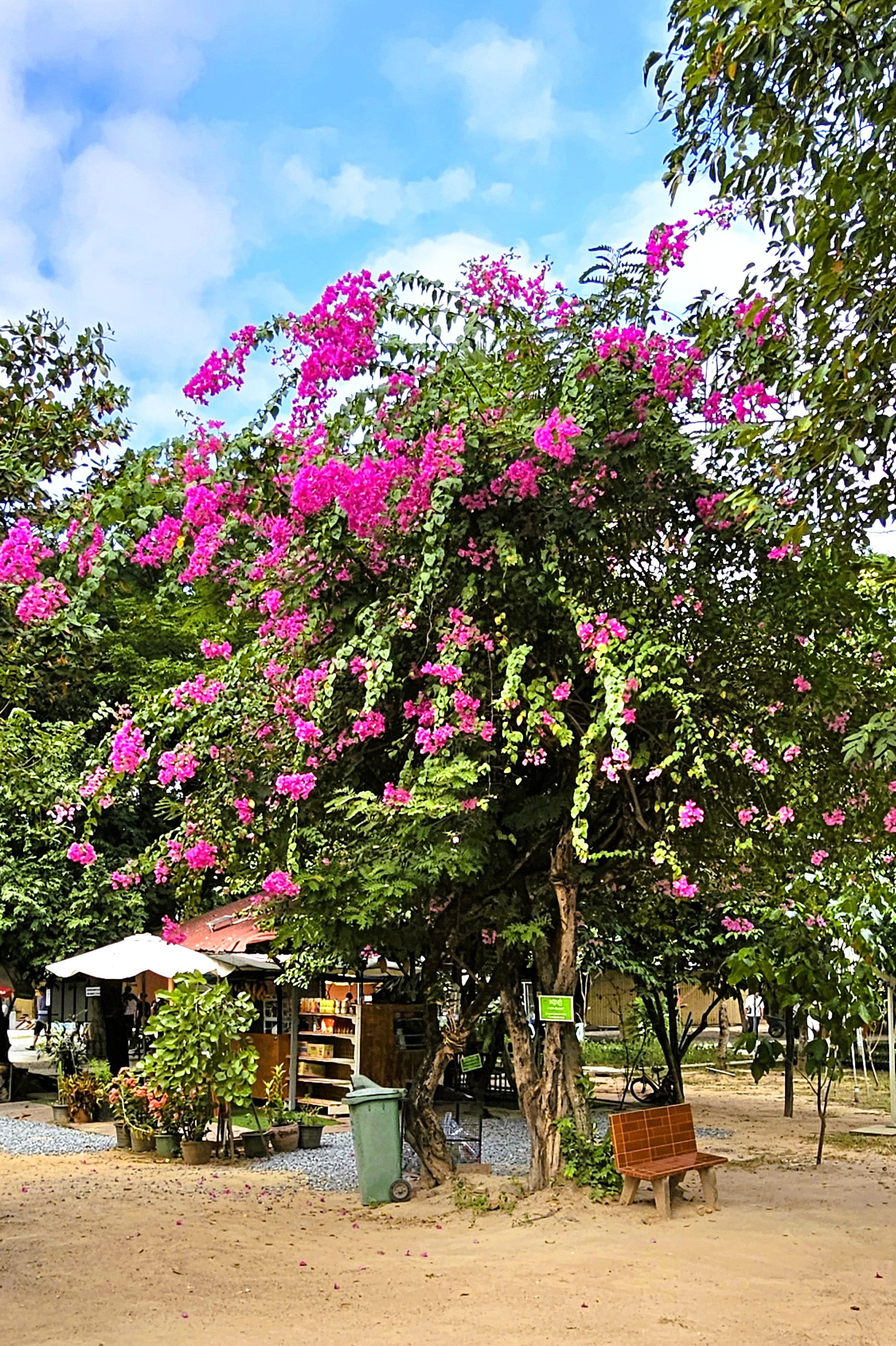
For the curious and familiar with deep pockets who yearn for the Hamptons of New Zealand, a 40-minute ferry ride from Auckland across Hauraki Bay will whisk them to Waiheke Island, where weekend cottages with water views easily appraise at $3 million and more.
Waiheke Island’s wedding rituals are commonplace, as there is no shortage of scenic vineyards, lush gardens, beautiful beaches, sunset cruises, spas and luxurious accommodations to make every wish come true.
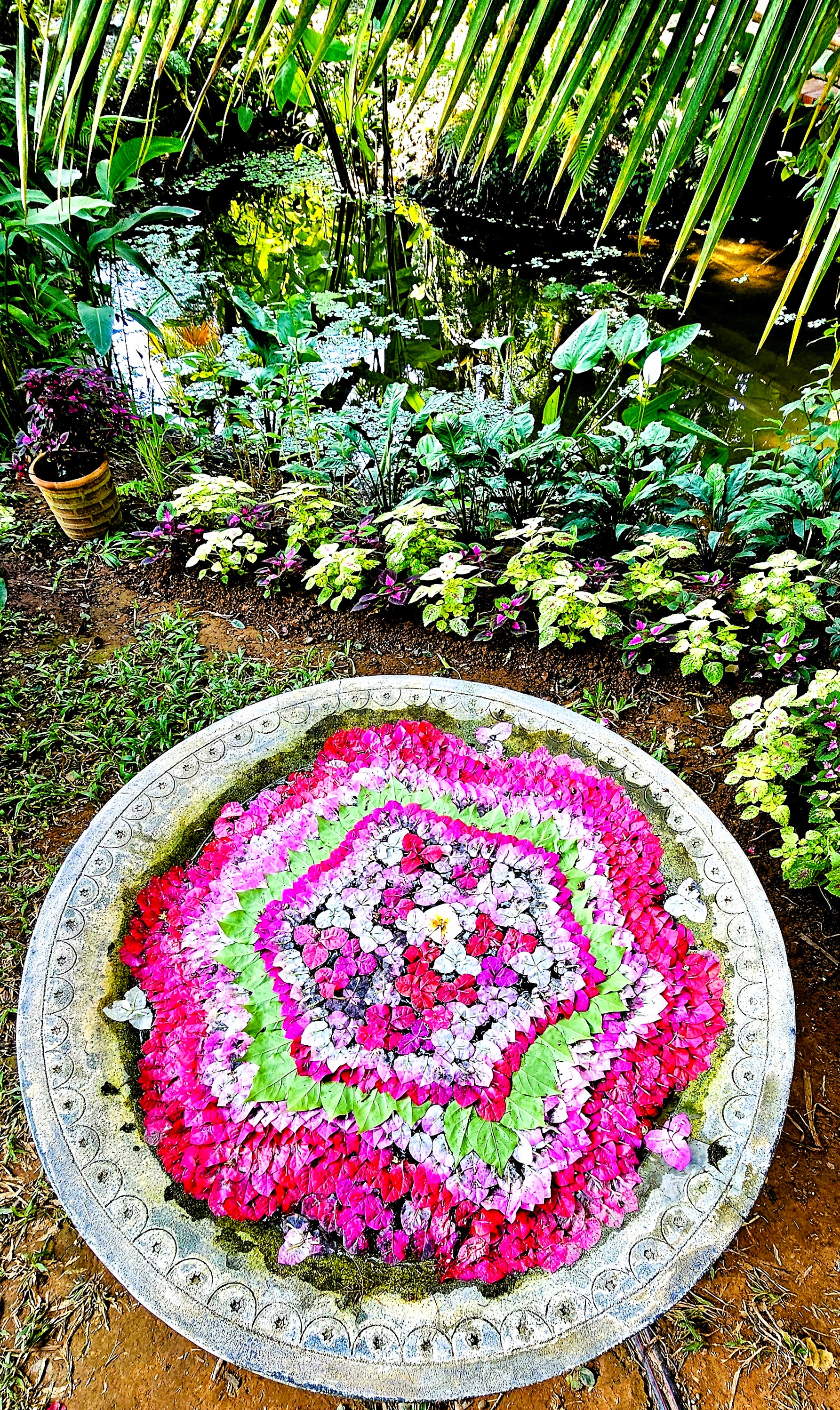
But Leah and I were not there for real estate or romance. We docked at Matiatia Wharf in pursuit of New Zealand’s epicurian trifecta: wine-tasting, olive-pressing and honey-making.
A stroll through Oneroa Village yielded no sightings of A-listers, although the likes of Madonna, Lady Gaga, Beyonce and Taylor Swift with their entourage are sure to turn heads from time to time.
We window-shopped at an appealing array of boutiques, bistros, and galleries, where I found the perfect pair of Ray-bans at the local chemist’s shop in the hopes of improving my detection skills.
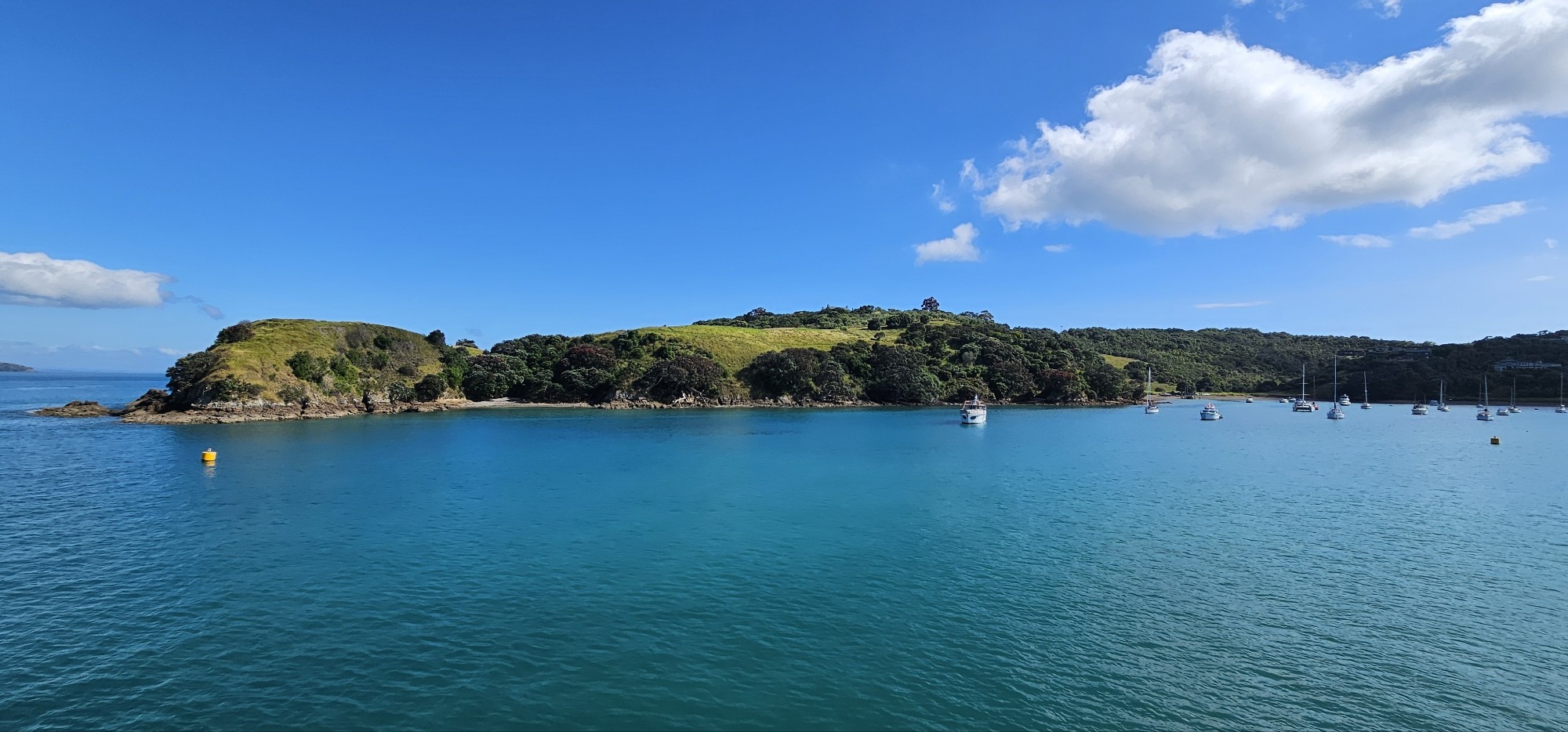
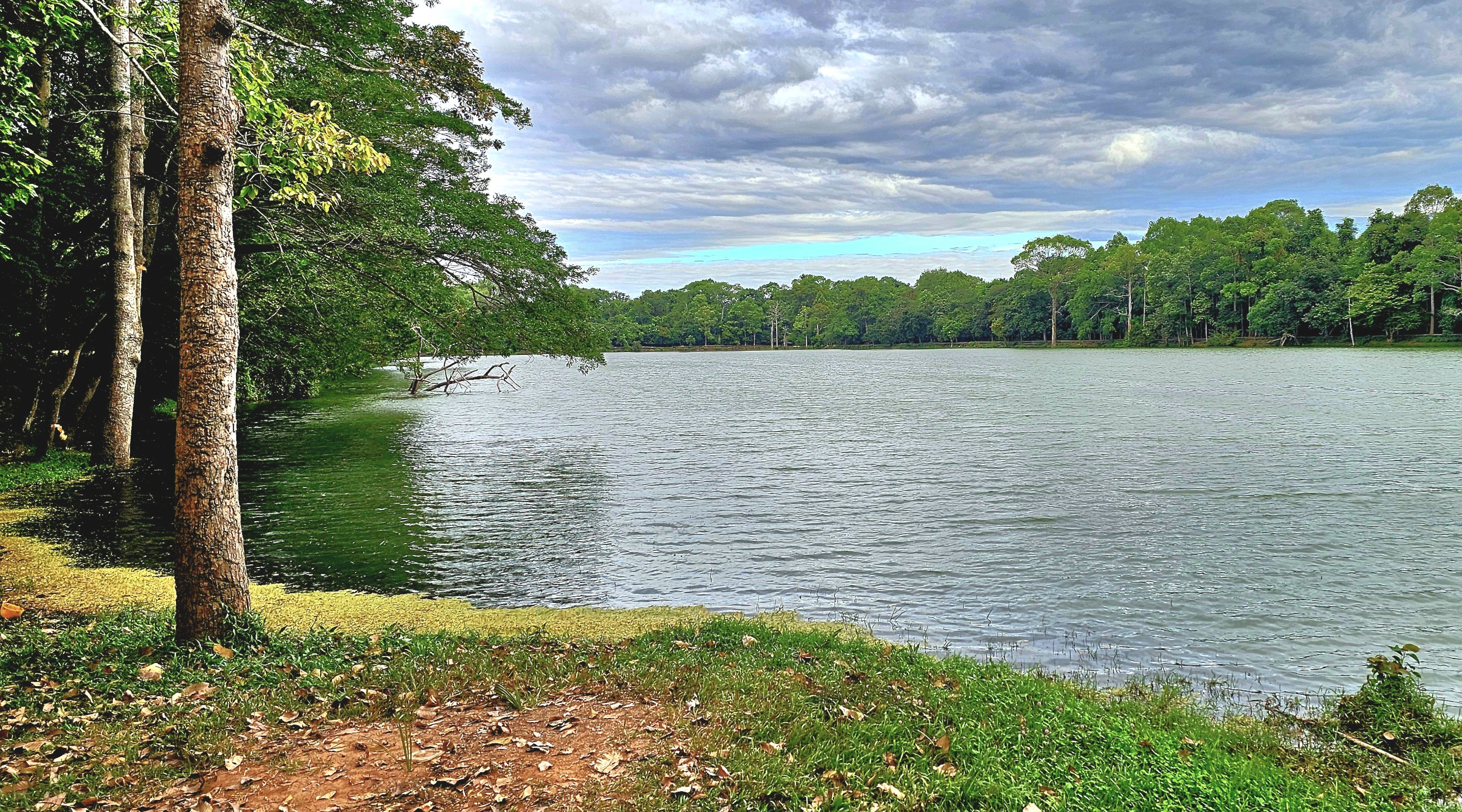
We discovered the town trail that curled through a densely forested dune, leading us to the panoramic cove of Oneroa Bay.
Although the water looked calm and inviting,
we were pressed for time, as it was time for olive pressing.
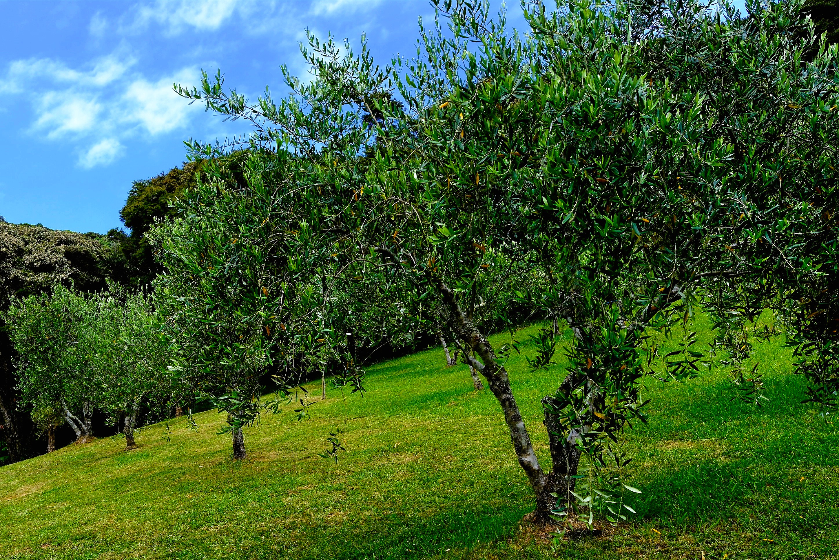
Our stop at Allpress Olive Oil Groves offered tastings of extra virgin olive oil varietals (frantoio, verdale, ascolano, picual and koroneiki) and blends, with herbaceous, grassy and peppery flavor notes. Superb!
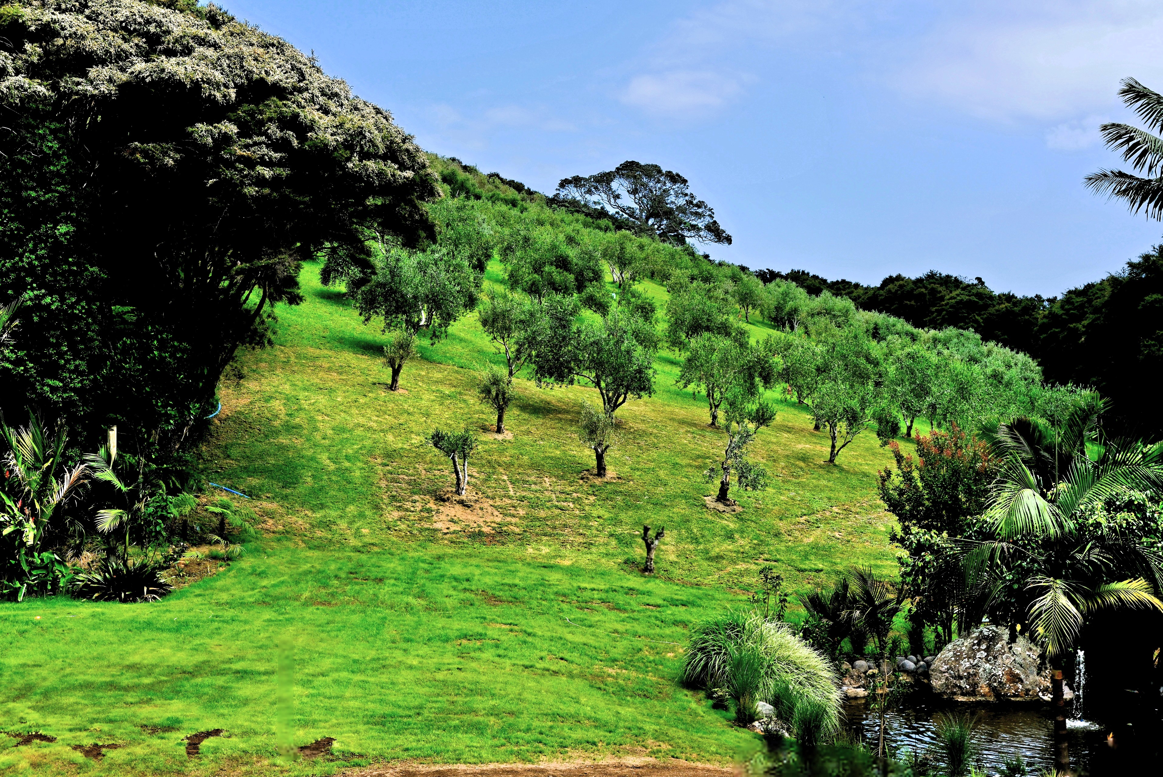
From the terrain, and weather–a mild maritime climate with sunny days and salty breeze–Waiheke’s rolling hills could easily pass for Italy, Spain, or Greece, with its volcanic soil and microclimate making it ideal for growing olives.
Waiheke’s first olive trees were planted in 1997 by Michael Allpress, who pivoted from coffee roasting to pressing olives for oil–quickly achieving world-class recognition with award-winning results.
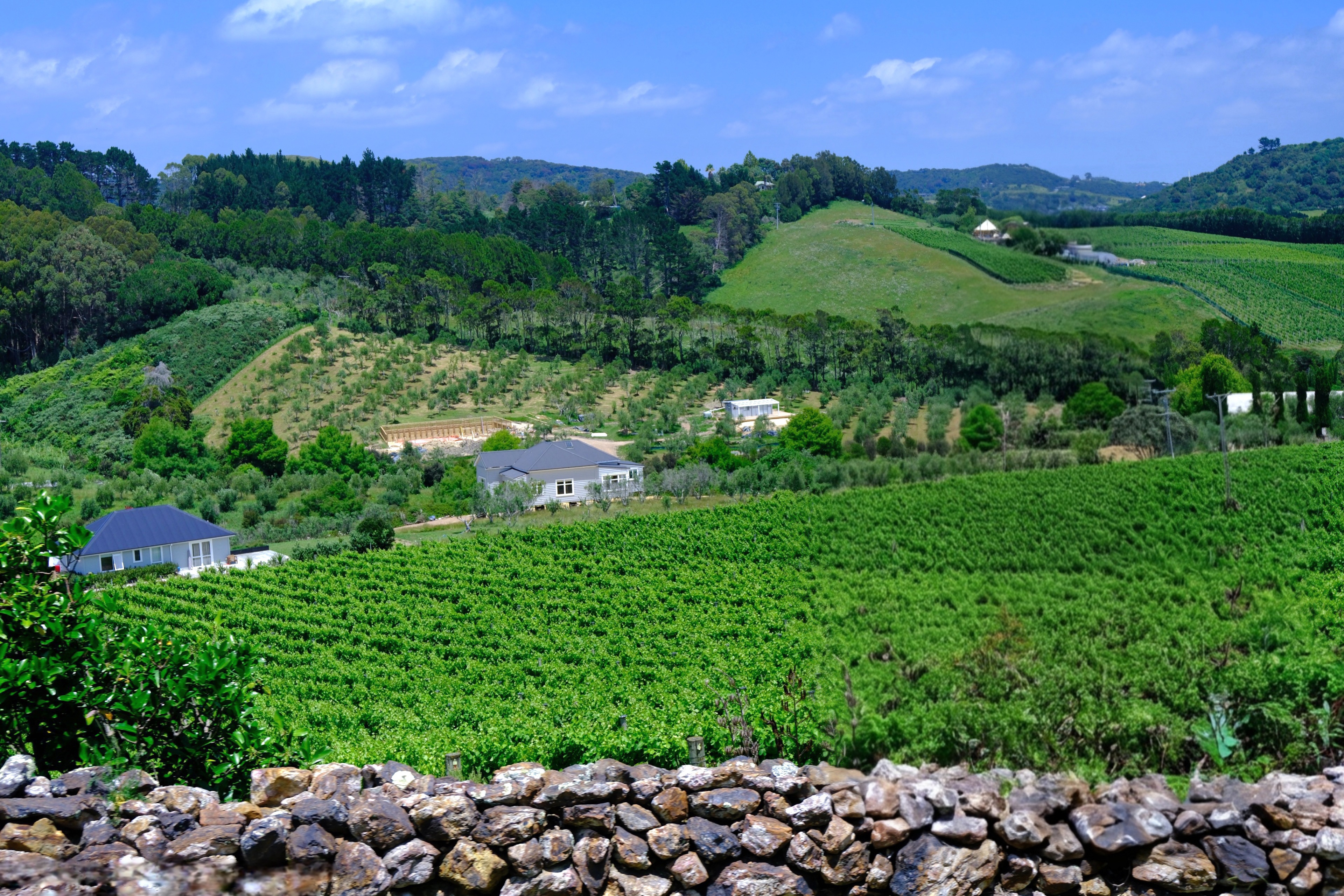
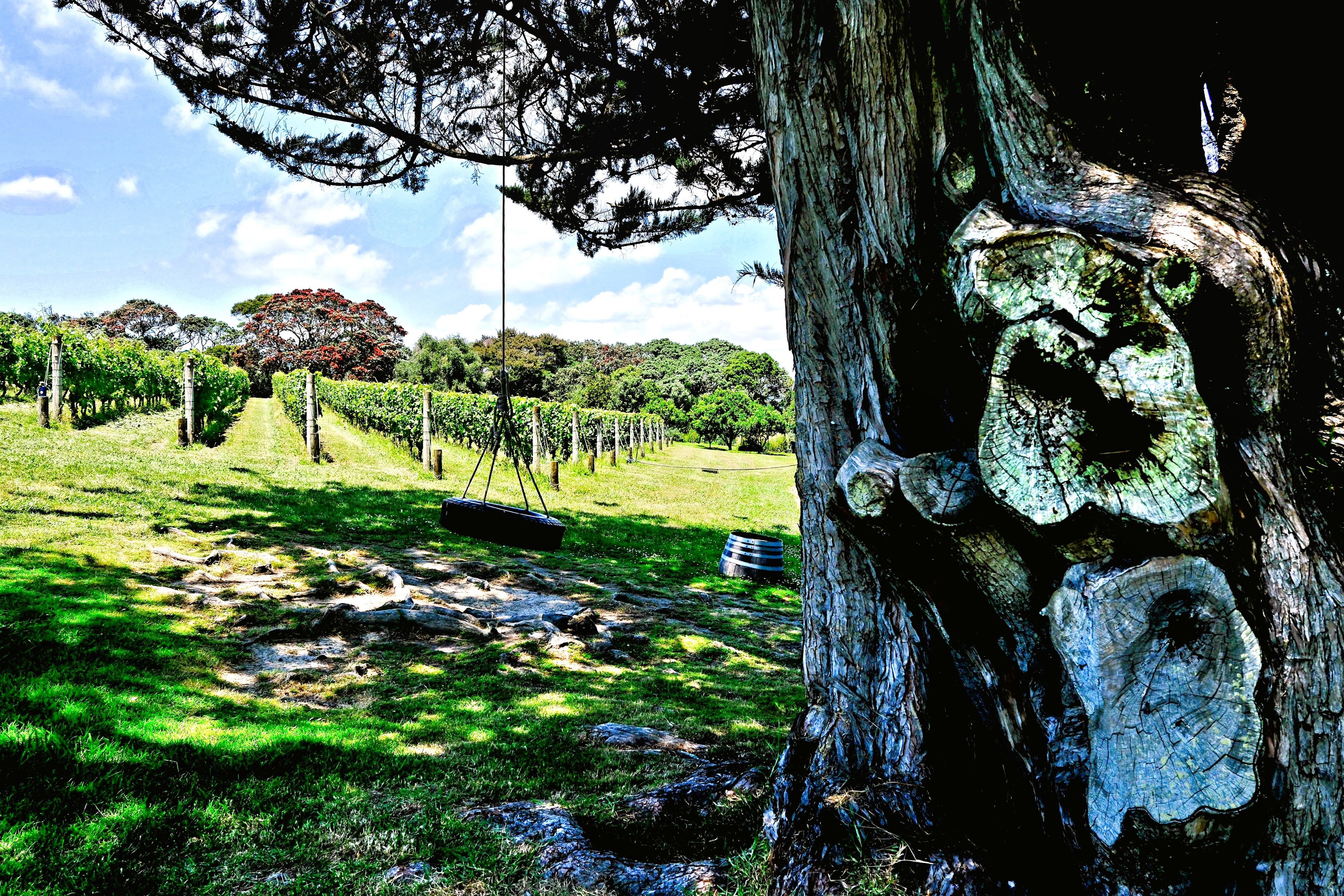
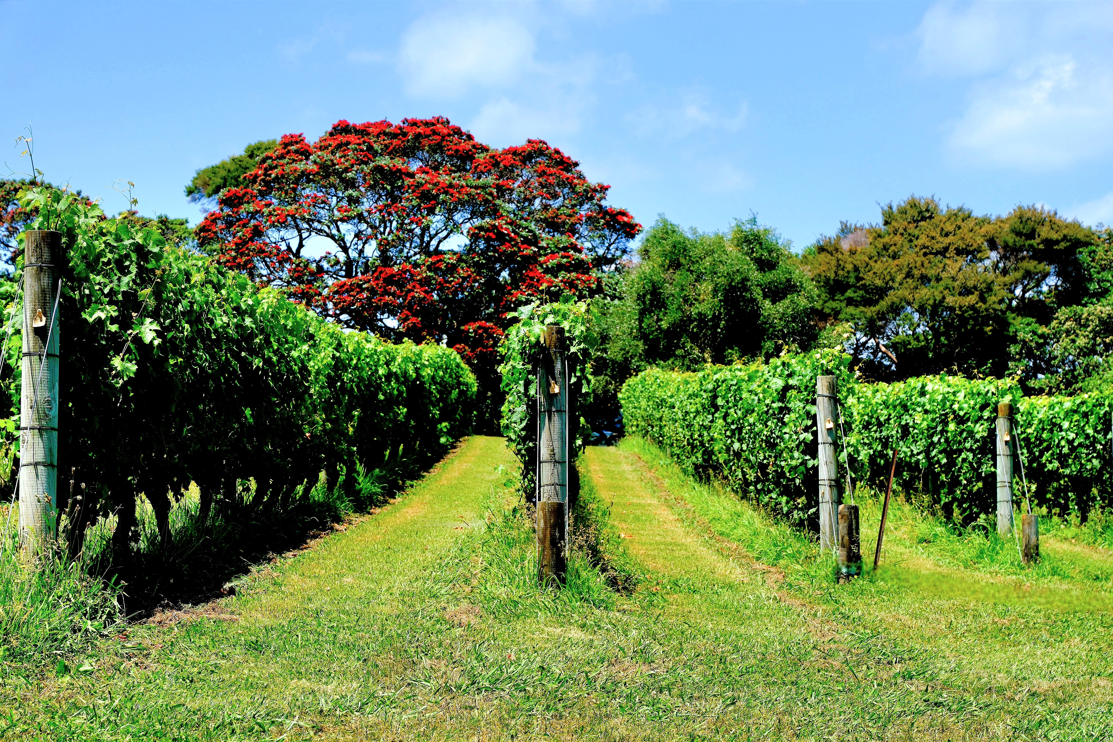
Next, we ventured to Goldie Estate, overlooking Putiki Bay for a tasting at Waiheke’s first commercial winery dedicated to premium reds.
The Goldwaters pioneered winegrowing on Waiheke in 1978, and became successful producers of Cabernet Sauvignon, Merlot, Cabernet Franc, Syrah, Chardonnay and Viognier varieties.
Goldie Estate is also home to University of Auckland’s Wine Science Centre, where students live, study, and work towards a graduate degree in oenology.
Shortly after, we crossed to the eastern side of the island where a buffet lunch was waiting for us at Passage Rock–the most awarded winery in Waiheke–
with reserve-level wines taking international gold medals, including a critically acclaimed 2021 Reserve Syrah that improved with every sip.
Waiheke Island is also home to Mānuka honey, an elixir so rich in levels of antibacterial methylglyoxal (MGO) that it benefits the body inside and out. Therapeutic properties support a balanced immune system, regular gut health, and topical applications for wounds and burns.
The unprocessed flavor is earthy and bittersweet with caramel notes.
But it doesn’t come cheap. A 250g jar of highest-potency (2150+ MGO) creamy, silky honey from Manuka South can cost over $1500!
How can ANY honey justify this exorbitant cost?
While this is the most extreme example, consider that Mānuka flowering season lasts a few weeks per year, with trees often blooming in remote locations. Beekeepers have only five days to transport their hives around the tree’s open blossoms to capture the nectar.
Ultimately, bees will tap thousands of blossoms, with each pollinator producing 1/12th of a teaspoon of honey in its lifetime. That’s equivalent to 11,500 bee visits per 250g jar, and a testament to their work ethic.
It was a tasty day on Waiheke. While we left the island with fuller bellies than expected…
Three months of rigorous physical therapy during a summer of exhausting humidity, sweltering heat, and heavy downpours was a poor substitute for the summer adventure that Leah and I originally plotted together at the kitchen counter one year ago.
We imagined Airstreaming up to Quebec to play in Saguenay Fjord National Park and be entertained by French Canadians for a month or so.
Of course, nothing went as planned. My shoulder surgery and subsequent physical therapy replaced our summer trip to the North Country.
But putting in the hard work also guaranteed us a summer redo Down Under, with a chance to celebrate Hanukkah in New Zealand and Christmas Day in Melbourne.
It was also a good excuse for a new camera… system, unlike last year’s trip to Southeast Asia, where I relied exclusively on my Samsung Galaxy S23 Ultra for images and video.
But for a trip to my 7th recorded continent, I yearned to compose through a viewfinder again. Ultimately, I thought a mirrorless compact camera’s flexibility and versatility could empower me to take bigger chances and create better photographs.
So, I bought a Fujifilm X-E5.
It may have been a bit impulsive, buying before trying, but Fuji’s model was brand new, very popular and not widely available. Camera exchanges were quickly selling out limited inventory across the globe, despite the high price, plus the tariff surcharge. (Yes, the tariff/tax is passed on to consumers!) I was betting on the buzz and positive reviews, and went all-in.
Outfitted with Fuji XF 16-50mm f/2.8-4.8 and Fuji XF 70-300mm f/4-5.6., I now had a wide and long zoom for a variety of coverage.
It was also a light-weight travel kit designed to reduce the camera strap impression across my newly, reassembled rotator cuff.
It would be a glorious second-chance summer.
Leah and I figured on an extra day in Aukland to cover our cancellation-du-jour asses from airline exposure, and to bolster our recovery from a lost day and a 20-hour trip…
Although our business class cocoons…
offered legitimate restorative properties.
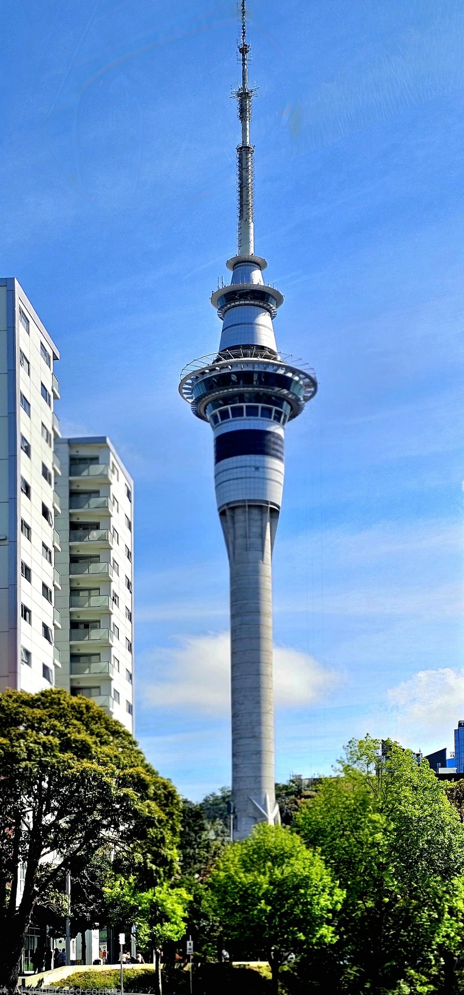
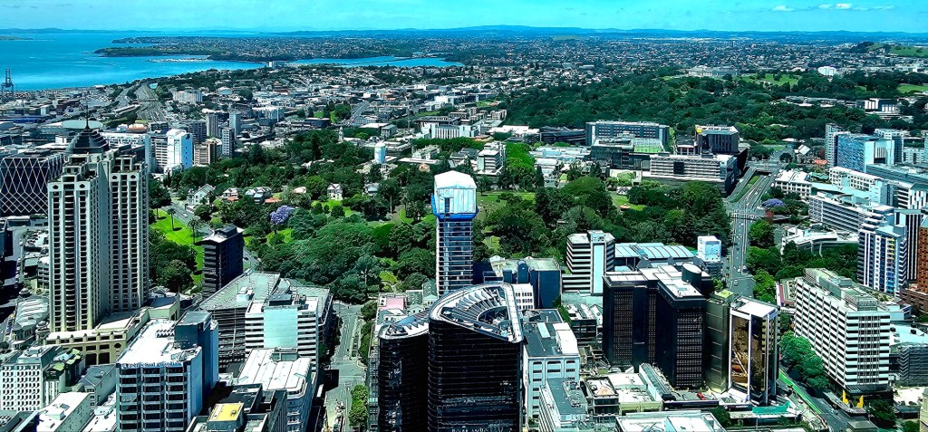
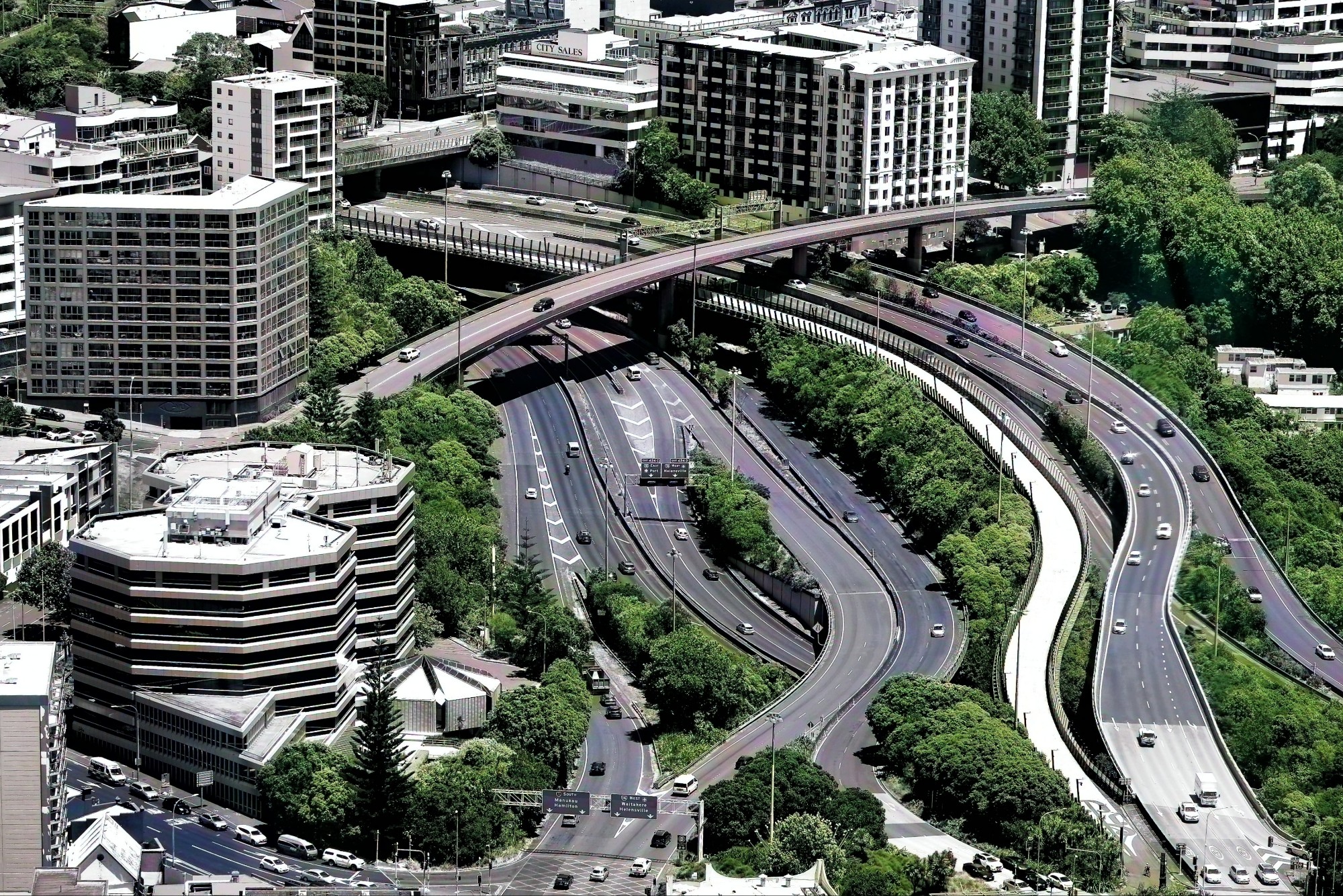
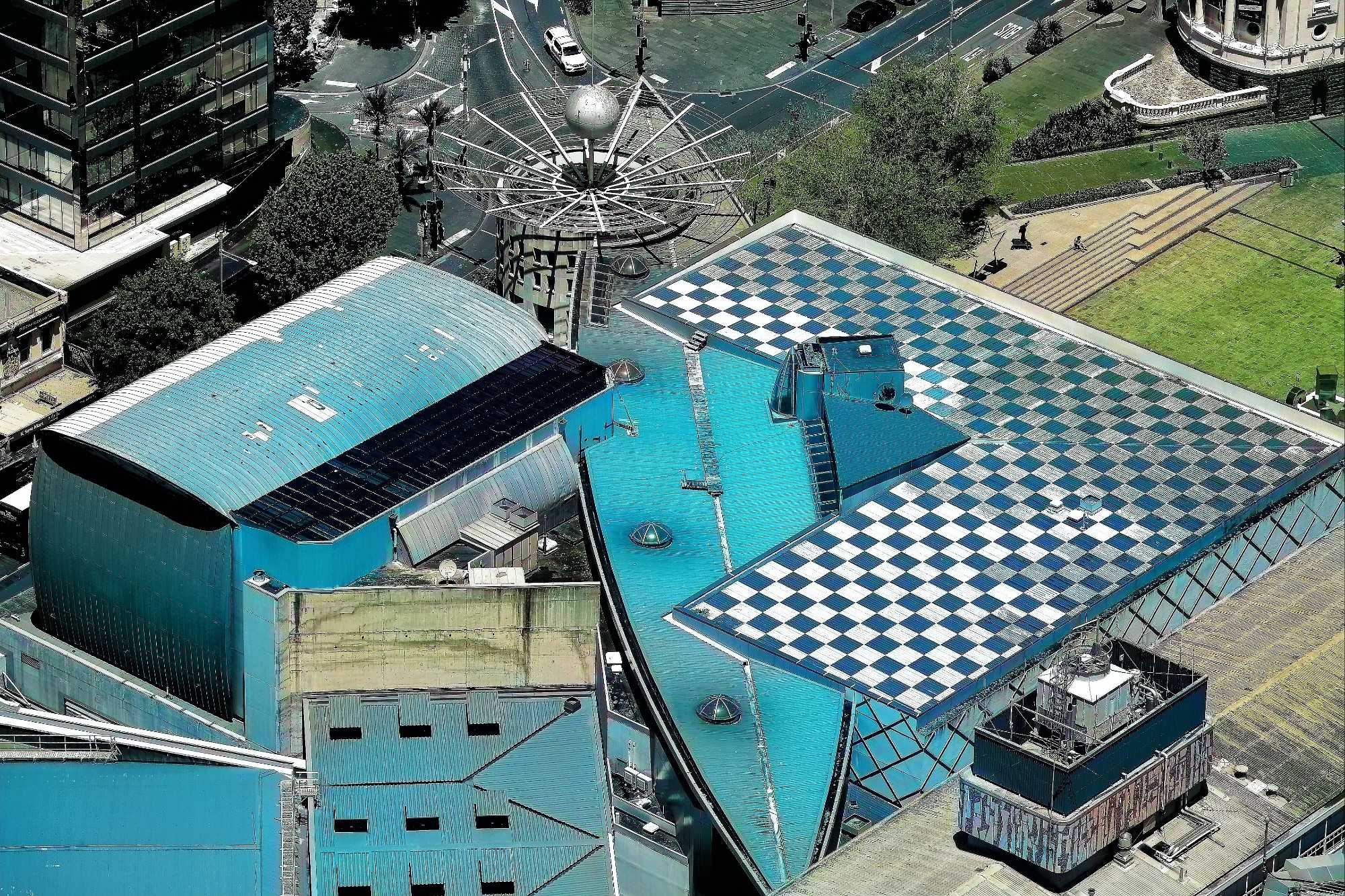
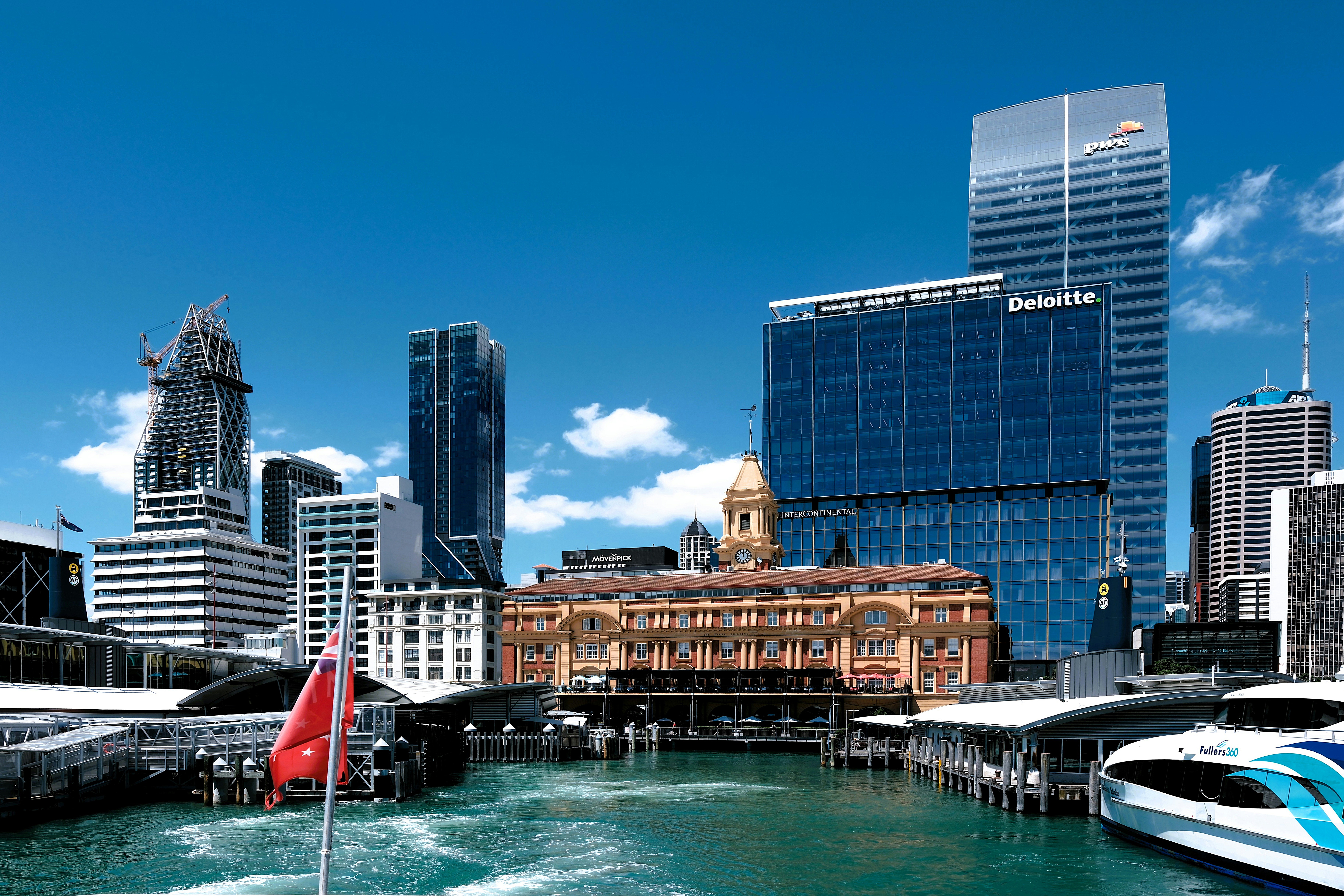
Checking into the Grand by SkyCity put us smack dab in the center of Auckland’s bustling entertainment and casino complex, where the Sky Tower’s the limit.
Our 220-meter ascent to the 60th floor observation deck gave us distant perspective…
and telephoto detail with my new Fuji kit…
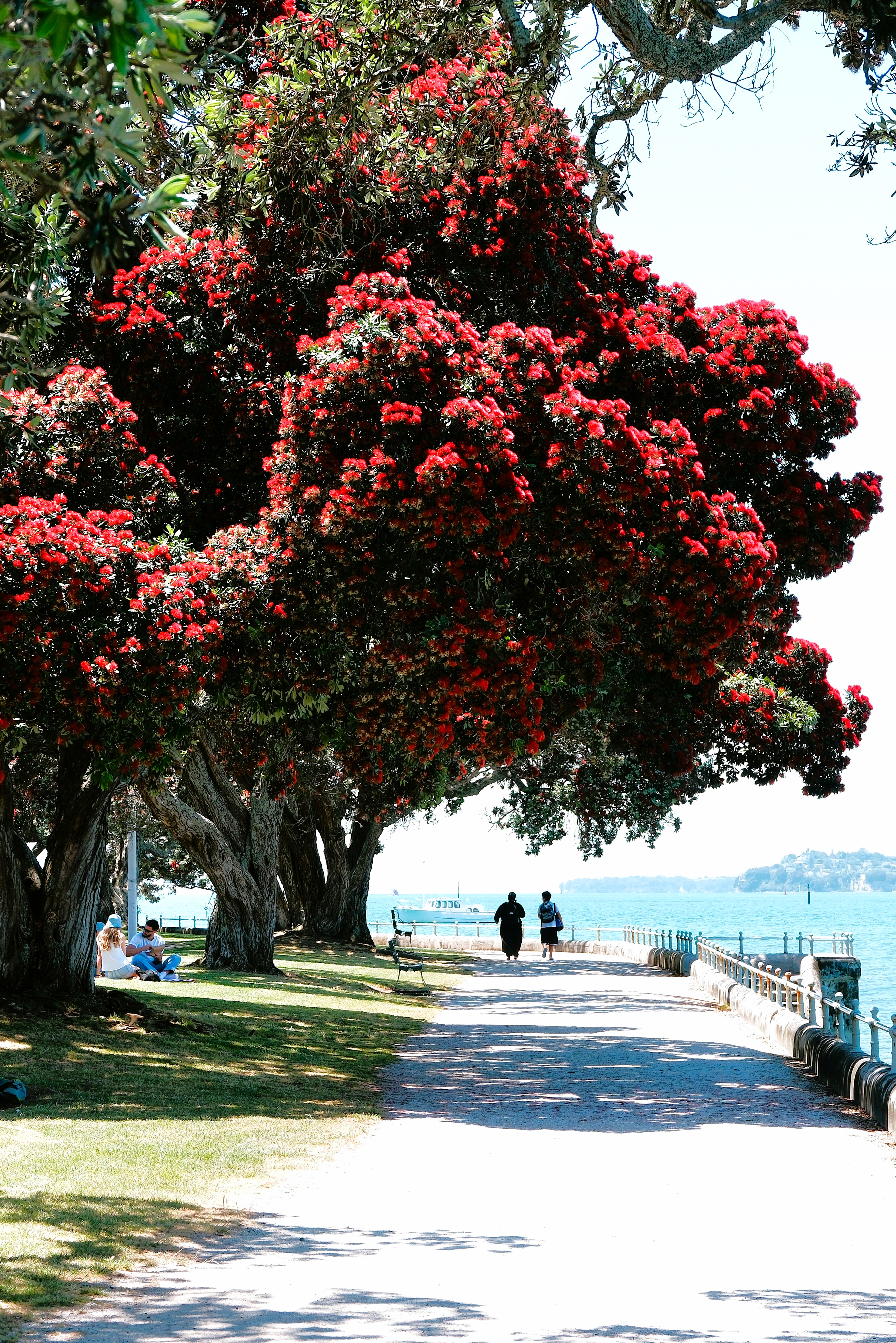
With time to burn, we set our sights on the quaint town of Devonport, one of 53 dormant volcanic centers surrounding Auckland.
Christmas was on full display in the city plazas…
as we strolled to Queens Wharf to catch our ferry across Stanley Bay.
However, the crimson blossoms from the Pōhutukawa trees (aka New Zealand Christmas tree) along Devonport’s park path easily enhanced the holiday vibe.
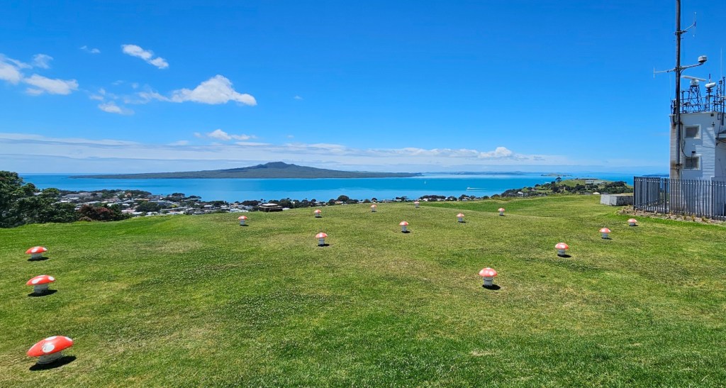
We hiked to Mount Victoria (Takarunga), Devonport’s highest point atop a WWII bunker–currently the local folk music center–that breathes through its field of mushroom ventilation caps,
where our climb was rewarded with an exquisite view of the city.
Tomorrow, our Viking cruise extension starts in earnest, with a trip to Waiheke Island.
I was dreaming deeply of my adventurous summer tour of Quebec’s picturesque National Parks and charming cobblestone cities. Cascading waterfalls and crystalline alpine lakes contrasted with town square pageantry and marketplace mayhem… that was my vision for an upcoming Nat Geo essay.
Instantly, I was transported to my studio, meticulously sorting and arranging my gear — mindful of the bulk of a tripod and a view camera supported by a case of prime lenses — and dreading the uneven hiking terrain across the Laurentian foothills.
The stream was running fast, occasionally lapping the fallen spruce log that was still the best chance for crossing to the other side. I climbed the rooted abutment and planted both feet on the trunk’s wet scaly bark. I scanned the other side and plotted a course of least resistance. I centered my pack and cinched both shoulder straps, but the right side was stuck and wouldn’t budge regardless of how hard I pulled.
With my frustration mounting, I refocused my energy on the stretch of spruce I still had to cross, only to realize that the distance to the other side had magically doubled. It had to be an illusion.
I closed my eyes, counted to 5, and woke up in a redwood forest, standing on a fallen Goliath tree with no end in sight.
Suddenly, a bolt of lightning hits the tree in the distance, launching a glowing ember that creeps closer and closer, getting brighter and brighter. I try to shield my eyes, but I can’t raise my arm no matter how hard I try; and the light is closing in and getting brighter…
That’s when the Propofol wore off and I discovered that my arm was numb and firmly strapped to my chest. The doc gushed over his handiwork in a drop-by that I have no memory of, although I have a slim recollection of “Everything went great”.
Not so great was an arm too limp to lift a camera and complicated by a summer recovery of triple-digit heat and humidity. In a drug-induced wash of anxiety, I had an unusual moment of clarity — to use my downtime as an opportunity to time-travel through 25 years of digital archives in search of hidden gems.
Photography could still be an outlet, albeit a passive one. Perhaps I would “shape” them if I couldn’t “take” them.
Photographers long for exposure. To satisfy their snap decisions, they’ve focused on a collection of photography contests to share their vision with others, and maybe even capture a prize of sorts should a jury of peers and/or experts deem their efforts worthy of recognition.
With so many shutterbugs passionate for recognition, it’s little wonder that photography contests seem to be omnipresent. Whether a beginner, hobbyist, or professional, there’s bound to be a competition that’s suitable for almost any level, style or subject. Entry requirements also vary, with prestigious contests demanding hefty fees, while other casual contests are available for a small fee or free.
I chose free! It allowed me to leverage dozens of individualized contests for free as I considered all my submission options.
Luckily, I discovered a popular photography app that offered hours of distraction. Software engineers at PULSEpx designed an elaborate platform for shutterbugs of all skill levels who climb the ranks of content-specific “Quests” by competing in a series of image duels against photographers with compatible talents and skills.
Peers decide between dueling photographs delivered by an online interface and determines whether a submission’s popularity rises or falls in the rankings over the course of the Quest. Voting is required for revealing the rankings.
When addressing the fairness of community voting, critics have expressed distrust and cited suspicions of cheating or voting manipulation. Without sounding judgmental, it was obvious to me that low-quality or irrelevant images were periodically overrated, while strong images were sometimes mistakenly underrated. While a community-driven platform can attract a variety of serious players, not everyone is committed to the same standards of excellence.
But on October 11, it all went awry after I attempted to log in to the app and discovered a surprising notification:
NOT OK! STEALING? REALLY?
I promptly penned an email to PULSEpx support team to address my “crime.”
Hi Y’all,
I woke up to the announcement of my account being permanently banned, and I demand to know why!
Your accusation has no merit, so if there is proof, then I demand to see it immediately.
Their response was nearly instantaneous:
Hi there,
We regret to inform you that your account has been banned due to multiple instances of copyright infringement. Our records indicate that several photos submitted from your account were found to be in violation of our content guidelines.
PULSEpx maintains a strict policy against copyright infringement to ensure the integrity and fairness of our community. We are committed to protecting the rights of all creators and maintaining a space where original content is respected and valued.
If you believe all photos were indeed taken by you, please provide the RAW files for verification.
Thank you for your understanding.
Best,
The PULSEpx Team
My head was spinning, and I could feel my blood beginning to boil. I was accused of being a cheat! There was no way I was going to allow them to discredit me and my work. These were my photos, and I was determined to protect my good name.
Over the past few months, I entered dozens of competitive Quests across all categories (landscapes, portraits, animals, architecture, street scenes, macro, minimalism, abstract, etc.) and enjoyed a fair measure of success pitting my photos against other seasoned photographers with similar A Class and Master rankings.
But which of my “suspicious” photos crossed the line? I inquired for clarification:
Please provide the image(s) that you deem “unworthy” and in violation, and I will respond with the appropriate files to defend ownership.
It turns out they were questioning the authorship of the following 5 images from 5 separate Quest submissions:
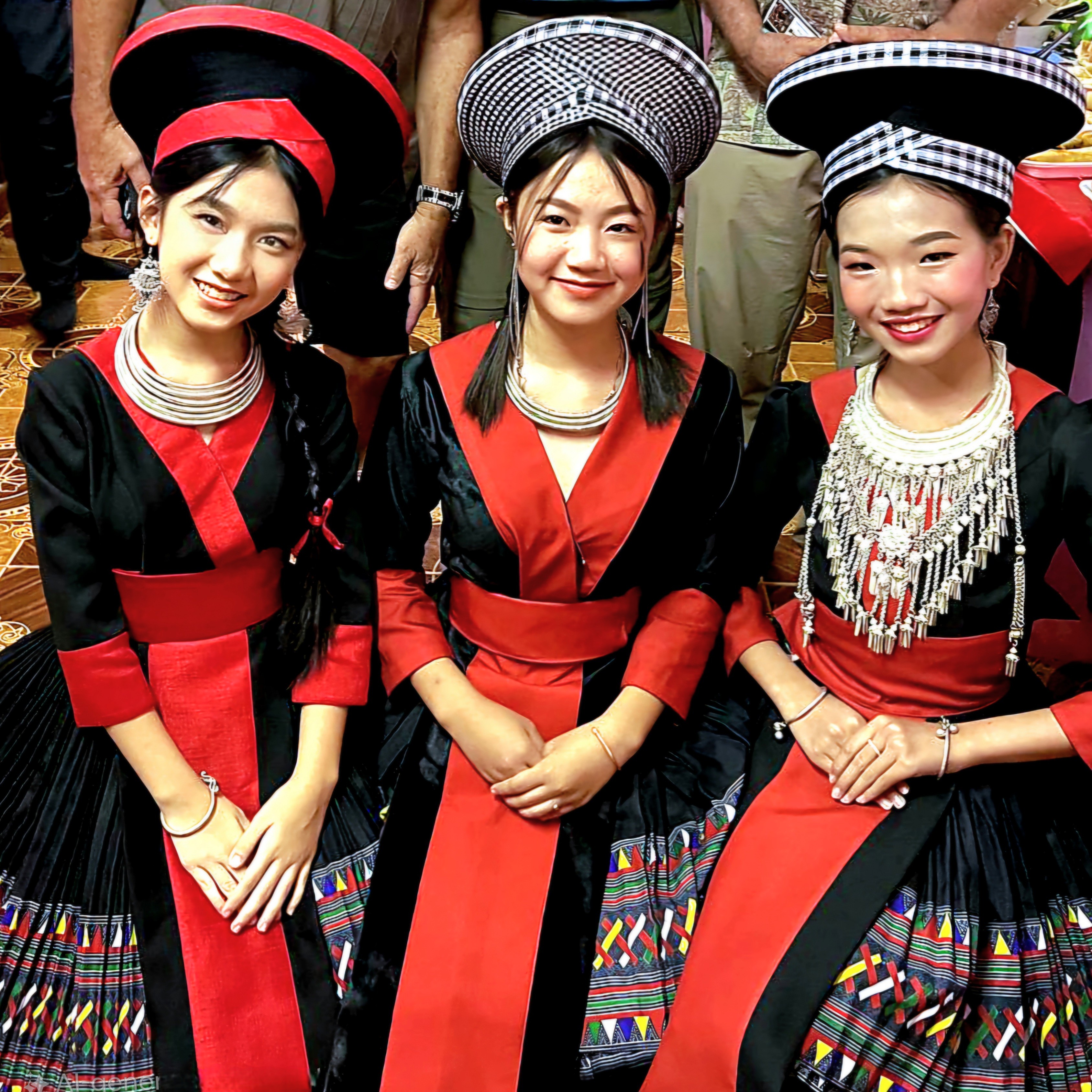
Theodore Roosevelt National Park, North DakotaSitting on Hubert Glacier, AlaskaMountain Sheep under a Full Moon, Valley of Fire State ParkUpper Antelope Canyon, ArizonaHmong Girls in Costume, Vientiane
Their selection of photos spanned the better part of a decade, with 4 of the 5 appearing in my travel blog, StreamingThruAmerica.com with appropriate copyright attribution.
To comply with PULSEpx, and hopefully expedite their investigation, I emailed StreamingThruAmerica.com hyperlinks featuring the “infringed content,” and invited their team to consider an AI check of my submissions against an internet that would certify my claim and provide useful provenance. (Often times, authenticity can be judged by the photographic reel — shots taken before and after the image in question.)
But the support team was tone deaf and unimpressed. Any notion I had of being reinstated was quickly slipping away.
Hi there,
Could you please provide the original RAW files (including full EXIF data) for the 5 images we previously requested? The links you provided are not the original files.
Thank you for your understanding and cooperation.
Best regards,
The PULSEpx Team
That got me thinking about their nagging demand for RAW files.
Photographers know that releasing raw files means risking control over how their final image is used and that it can be sold to others, which can impact future revenue. I revisited PULSEpx Terms and Conditions for clarification and the ramifications for submitting my original files.
Copyright, Submitting Content to PULSEpx & Grant of Rights
By submitting your Content and/or participating in Quests on PULSEpx, you retain all ownership and copyright in your Content (including any Content uploaded or transferred from your 500px library), but grant us a fully paid, non-exclusive, irrevocable, royalty-free, sub-licensable and transferable license:
1. to display your Content to other Users and visitors to our Services;
2. to use, distribute, reproduce, modify, adapt, publicly perform and publicly display your Content on our Services, third-party websites and social media and other applications and/or platforms for the purposes of promoting and/or providing our Services; and
3. to use your Content in a commercial manner in our sole discretion (collectively, the “User License”).
This User License allows us to use all submitted Content for promotional and other purposes at our sole discretion, without compensation.
After reading the rules more carefully, PULSEpx policy seemed more and more one-sided. While I retain full rights over my images, PULSEpx has wrung out the value of everything else. And by surrendering my original files, I’ve handed over the keys to my images with little else to gain except a demonstration of innocence.
I hesitated to send the original files. Instead, I decided to send screenshots of the original files supported by the EXIF data. Surely, their support personnel would be understanding enough to concede that these images belong to me.
The following is a representative sample of one of my submissions with an emailed intro:
Hi There;
Per your evidentiary request, I’m providing you with metadata corresponding to the alleged “stolen” files. Since these images were captured in JPEG, I hope this satisfies your inquiry:
Also, you never answered questions from my last correspondence: 1. Why did you flag these images? 2. What sets them apart from my other submissions? 3. What’s your true impression of these images?
BTW, thank you for your vigilance in protecting creative expression, and thank you for recognizing when you got the wrong guy! Apologies are always appreciated.
No apology was forthcoming — just more of the same, except for a tiny glimmer of their endgame — disguised as an inquiry — and possibly the rationale behind for request.
Hi there,
Thank you for your response.
However, the files you provided are screenshots, not original files. Screenshots cannot be used to verify the authenticity of the images. Regarding the suspicion of your work’s authenticity, this is based on our routine checks, including system and manual detection.
Additionally, please provide the original file for the image with the moon and antelope so we can continue with the review process.
Thank you for your cooperation.
Best regards,
The PULSEpx Team
We were running in circles. I became increasingly suspicious of their true motive after identifying an image of mine that they covet!
It became clear that nothing was going to interfere with their pursuit of my original files… except me!
Hey PULSEpx Support;
Your request for RAW files has been denied. After careful consideration of your exigent demands for metadata — which I supplied in my last correspondence with corresponding screenshots of the original JPEG files — I have determined that your ask for RAW files is nothing more than overreach.
Your allegations of cheating and stealing are unfounded and have been addressed by my subsequent denials and offerings of evidence, which you have deemed insufficient.
However, if verification is your true concern and motivator, then consider that each contested image has already been published within my blog, which on its own merits has already been protected by copyright law.
Also, consider that a review of your site’s Terms and Conditions details that RAW files can be requested for verification of “Quest-winning” imagery, with NO provisions for suspected infringed content short of account termination.
I have continually asked for clarification on this matter of infringed content, yet my questions have gone unanswered, which calls into question your negligent level of cooperation.
If your mission is to protect photographers’ creativity and ownership, you have failed me miserably. Your insistence on procuring my original work (with no real explanation or compensation) flies in the face of your hypocritical concern for the protection of your followers.
If sharing my RAW files is conditioned upon restoring my account, then I surrender my account under protest, knowing my work is safe from your greedy hands and predilections.
Thanks for nothing.
After emailing my correspondence, I waited a couple of days for a telling response, but I knew in my heart that nothing was coming. I weighed my disappointment against knowing that my images were safe from being poached and monetized by PULSEpx.
While I stop short of calling it a scam, perhaps PULSEpx is more about photographers authenticating their work to benefit an app’s business modeandless about a competition for prizes and bragging rights.
Update: I am now 4 months post-op, and after completing rigorous PT, full range-of-motion has returned to my right shoulder, making it possible to capture new memories with my newly purchased Fujifilm X-E5 mirrorless camera.
Ordinarily, I’d be blogging about my summer road trip to Quebec’s National Parks, with occasional lookbacks to our winter adventures in Vietnam. But circumstances have changed, and future long-distance travel has been placed on hold until October.
Instead, I’ll be introducing a new cycle of posts reflecting my road to recovery after emergency rotator cuff surgery on my right shoulder. And, I’m using a photo of a famous location in Door County taken 6 summers ago, which may seem like a metaphorical cliche, but it still rings true in consideration of my latest debacle.
Let me explain.
About 35 years ago, I joined a neighborhood softball league as a catcher. During a particularly fateful game near the end of our schedule, a batter hit a routine flyball to shallow left field with a runner on third and one out. The outfielder made the routine catch, setting up the showdown at home plate.
The runner on third sprinted home with “Pete Rose” intentions. The throw came in hard and accurate. I covered the plate in anticipation of the play–waiting for the ball while preparing for impact–and ready for the tag.
But the runner arrived just before the ball. He came in fast and hard, battering the right side of my body.
Safe!
But not for me!
My shoulder ached for the next few months and eventually healed itself without medical intervention… or so, I thought.
What I didn’t know was that the torn labrum and the eventual arthritis in my right shoulder would become my personal weather barometer for the next three decades.
But I lived with it. I found that my old injury rarely interfered with daily life or staying active. Cycling, hiking, and paddling had little effect… until I took up pickleball.
Yes, Leah and I got caught up in the sensation–3 times a week. Because we both played tennis in a past life, we quickly improved our self-assessed ranking from 2.5 to 3.0 during our first year of play.
Over time, increased ability and better competition provided a better workout, but also contributed to greater wear and tear on my right arm. It began aching and now required a visit to an orthopod.
After an x-ray, the doc’s preliminary diagnosis of bursitis warranted a steroid injection which provided relief for only a couple of days. That’s when I knew it was time for an MRI and a follow-up with the orthopod.
But not before another Monday of morning matches… which was my ultimate undoing. While playing a doubles match, I reached for an overhead slam. Upon contact, I immediately felt and heard a pop in my shoulder accompanied by a stabbing pain. I shook it off and resumed play for the next hour.
Big mistake!
The following day, I was incapacitated and in constant pain, requiring another trip to the orthopod and a second MRI.
My radiology report revealed a much more serious injury than earlier: a torn rotator cuff, bone spurs, and extreme inflammation surrounding the joint and capsule. Only arthroscopic surgery could save me now!
But not before a brief visit to northern New Jersey to witness Lucy, Leah’s granddaughter,
accept her diploma from Pascack Valley High School.
In addition to celebrating with family,
there was also a hike around Rockland Lake,
and a visit to the Intrepid Museum…
in NYC.
After a disastrous flight home on United (a 5-hr delay AND lost luggage), surgery was performed early next morning.
According to the surgical center, the procedure was unremarkable. My doctor repaired the rotator cuff and addressed the biceps tendinosis; he shaved the outer end of my collarbone and vacuumed the bone spurs from the AC joint; and finally, he eased the impingement by performing a subacromial decompression with acromioplasty.
After an hour in recovery, I was released to Leah, wearing a shoulder immobilizer that would soon become my arch nemesis.
Interestingly, Leah insists that despite my stupor, I was largely responsible for composing this photo.
The first couple of days were a blur–existing in and out of a drugged sleep–thanks to an oxy-cocktail and a nerve block that slowly wore off after 36 hours.
However, Hour-37 became a painful reminder that my road to recovery would be a litmus test for controlling my anxiety, because at this moment, my life feels like I’m trying to get comfortable in an economy airline seat for a 6-week flight to Normaltown.
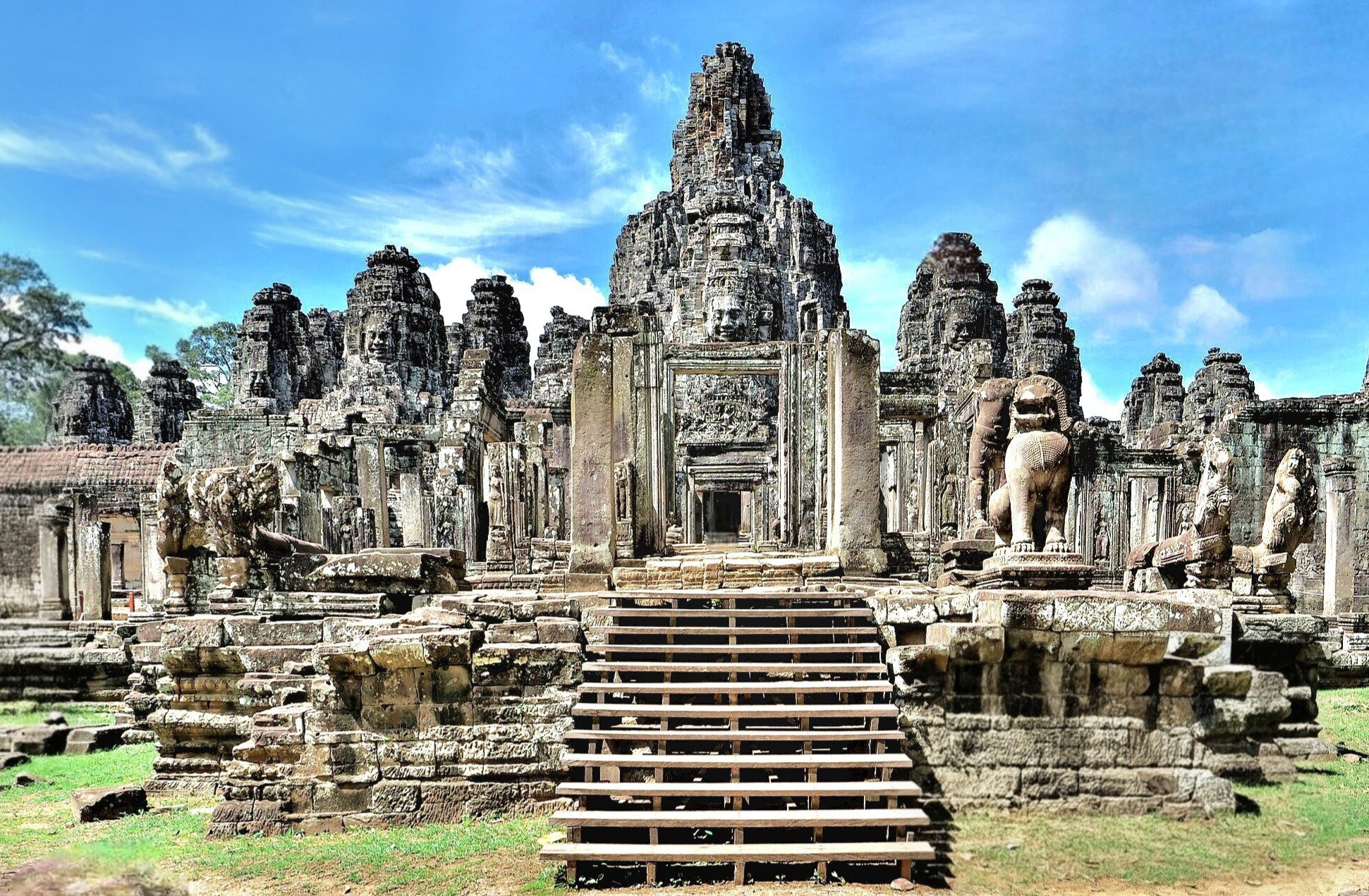
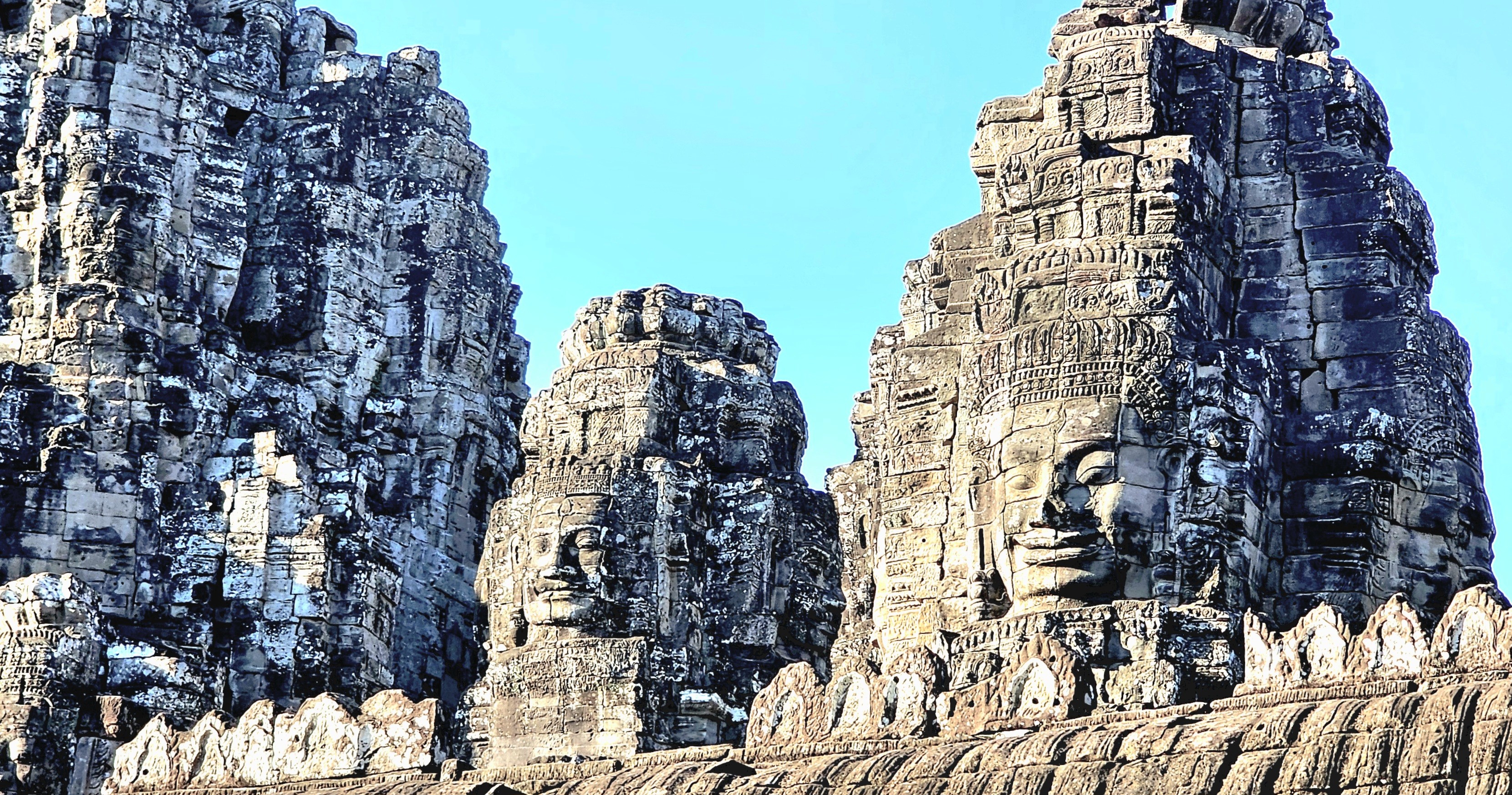
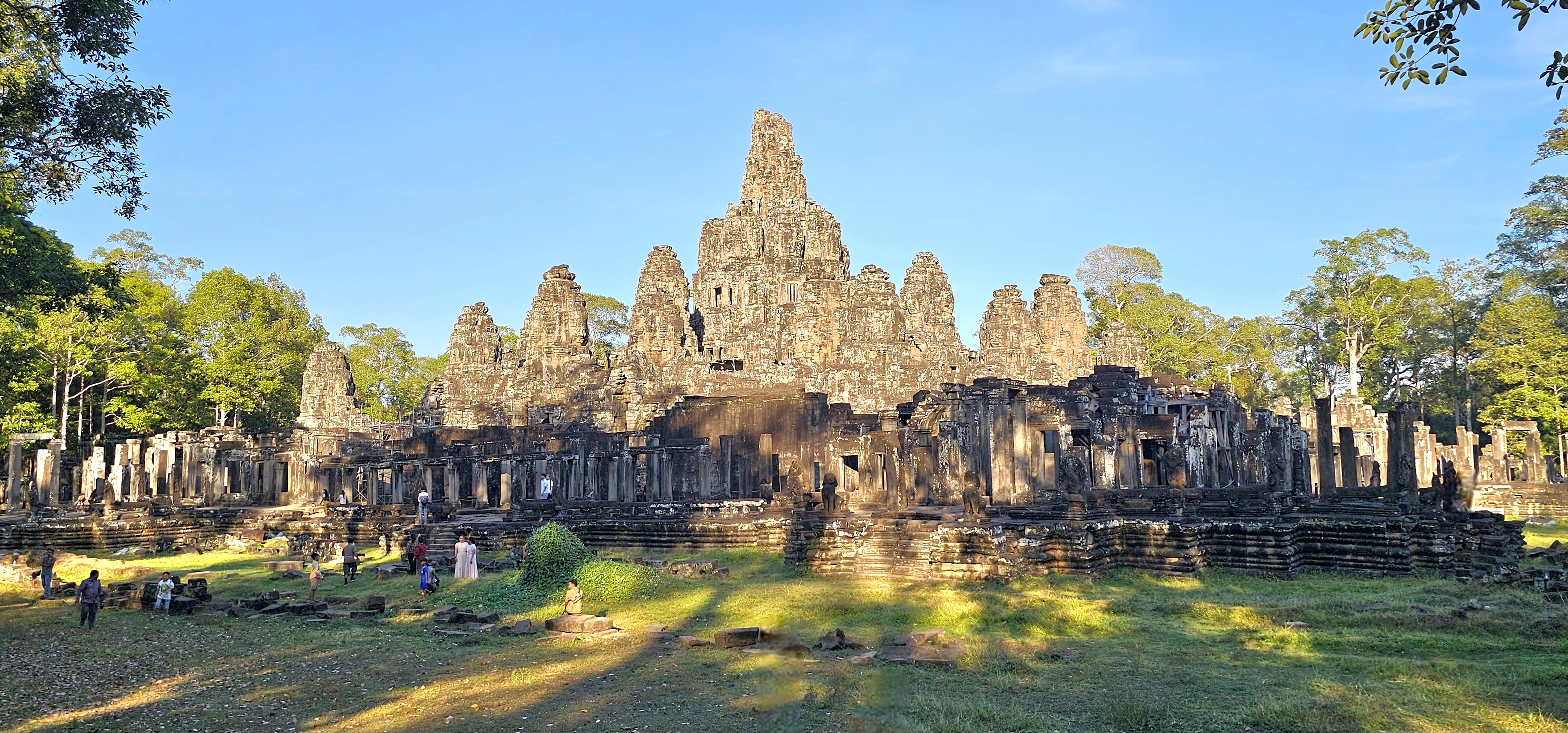
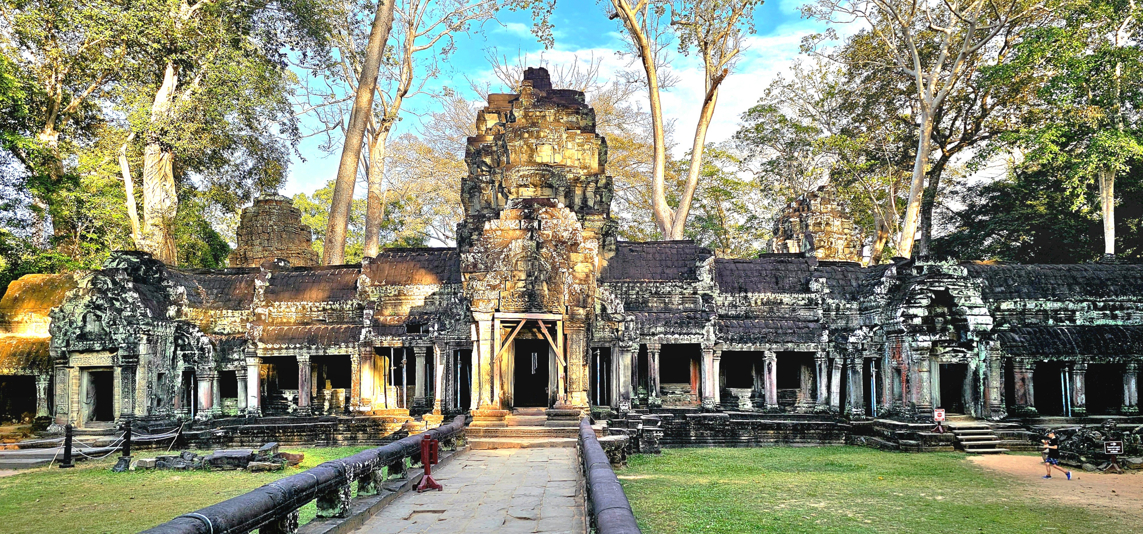
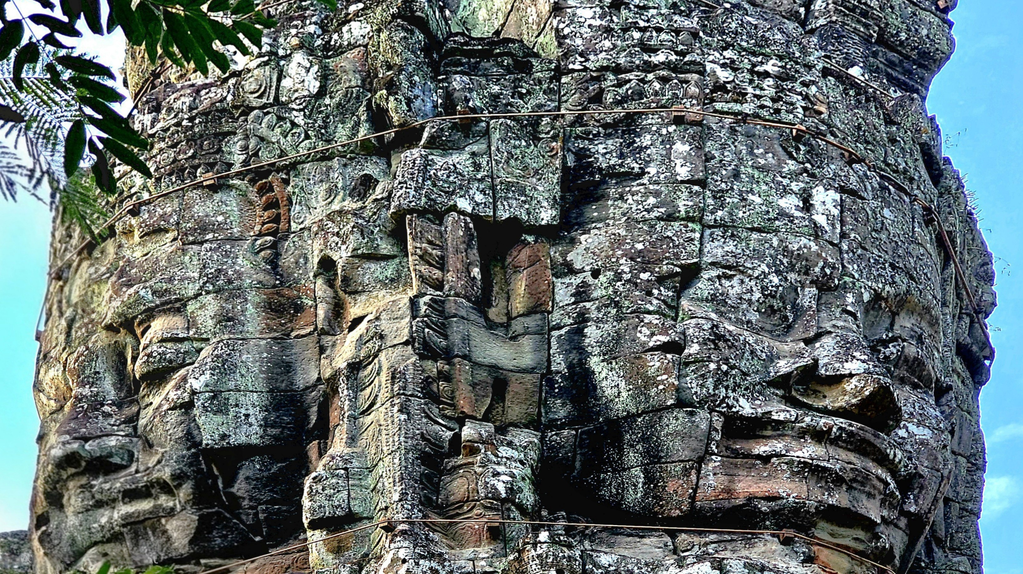
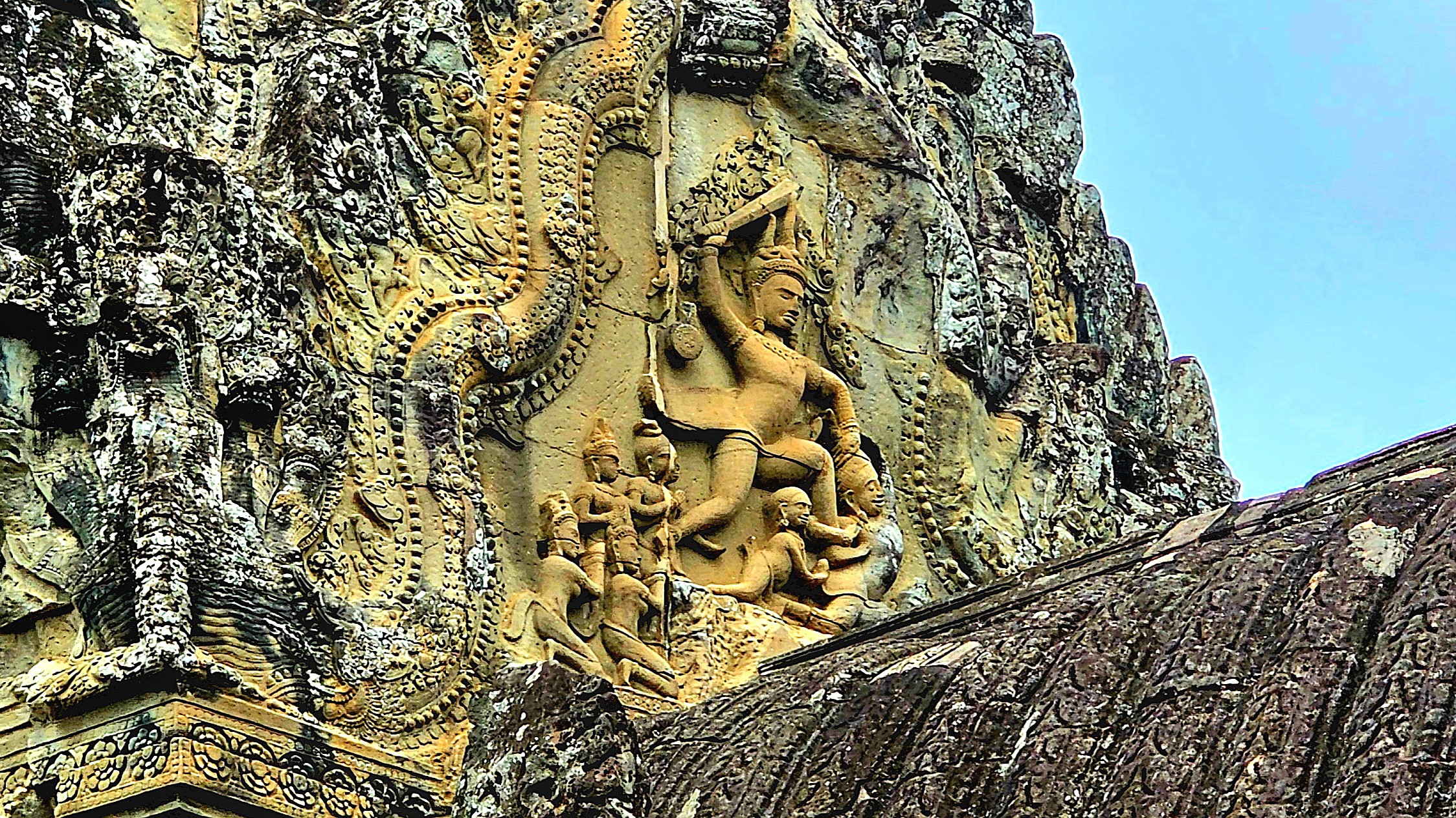
Of the 70 plus major temples within Angkor Archaeological Park, and hundreds more smaller shrines, ceremonial buildings, and symbolic ruins scattered throughout the broader Angkor region, none is more enigmatic than Bayon Temple.
It stands at the center of Angkor Thom, the Khmer capital, as Khmer Empire’s only Buddhist state temple, and last temple constructed during the reign of King Jayavarman VII.
While hiking among the remaining 37 towers (originally 54) preserved throughout the temple’s 5.5 acres,
it becomes increasingly apparent that only the most talented artisans were chosen to sculpt Jayavarman’s likeness to resemble Buddha.
Or perhaps Buddha’s representation was intended to commemorate Jayavarman.
Either way, I found the serene and smiling faces profoundly impactful–creating an encouraging atmosphere to contemplate the spiritual energy infused in our surroundings,
and making us feel a part of something greater.
The enlightened expressions also served as a gentle reminder of the beauty unlocked from local sandstone and laterite stone–
inspiring us to embrace positivity and carry it with us beyond our stay.
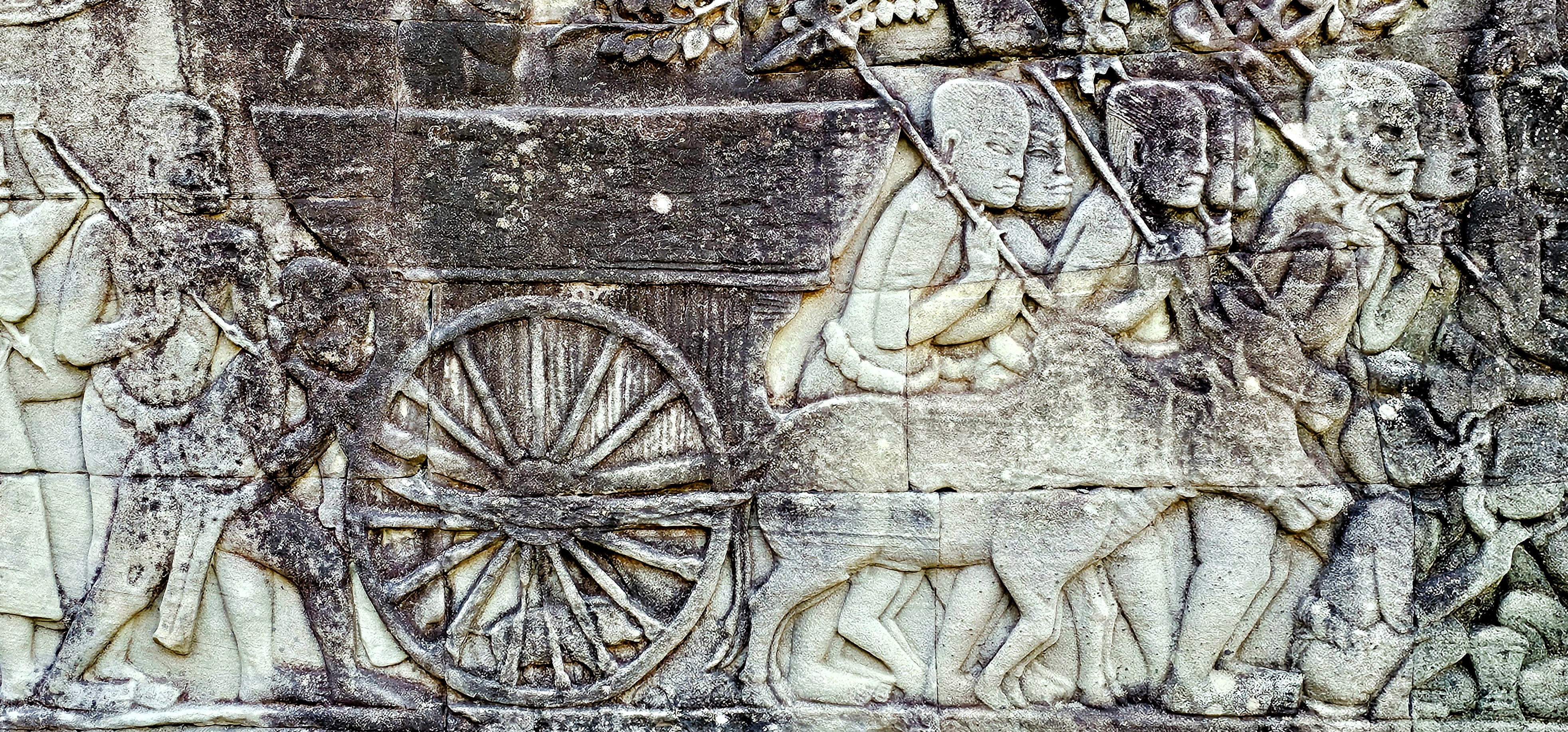
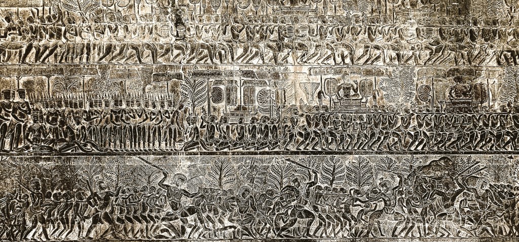
Khmer sculptors have also created a remarkable tableau of battle history, religious mythology, and random scenes from everyday life recorded on gallery walls throughout the complex.
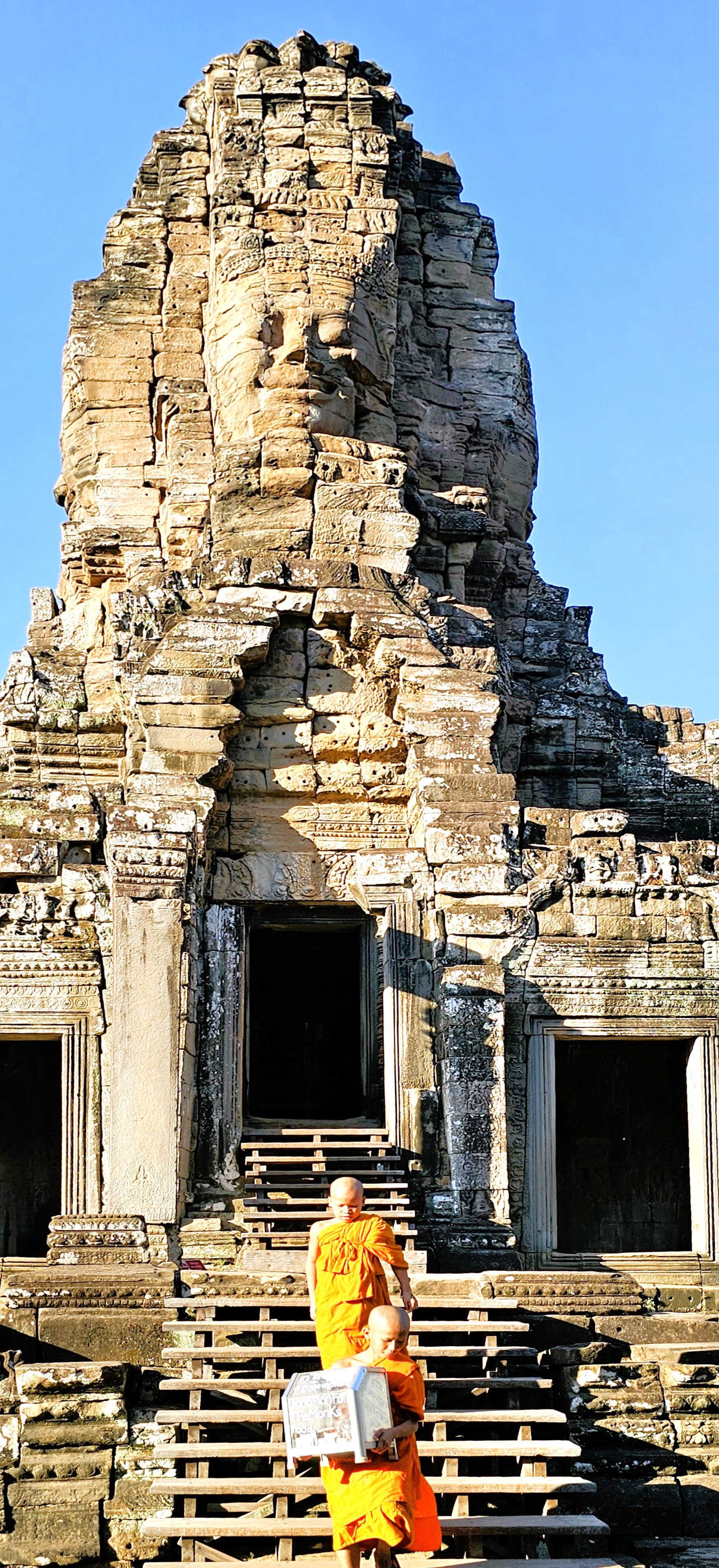
Aside from its historical significance and its testament to architectual genius, Bayon Temple continues to serve as a vibrant center of spiritual life. Local communities gather regularly to participate in rituals and ceremonies, reflecting their enduring faith and cultural heritage.
The presence of monks who play a vital role in guiding the spiritual practices of the community reinforces the temple’s significance beyond just a tourist attraction.
Their ongoing devotion helps preserve the temple’s sanctity, making it a living testament to the blend of history and contemporary spirituality in Cambodia.
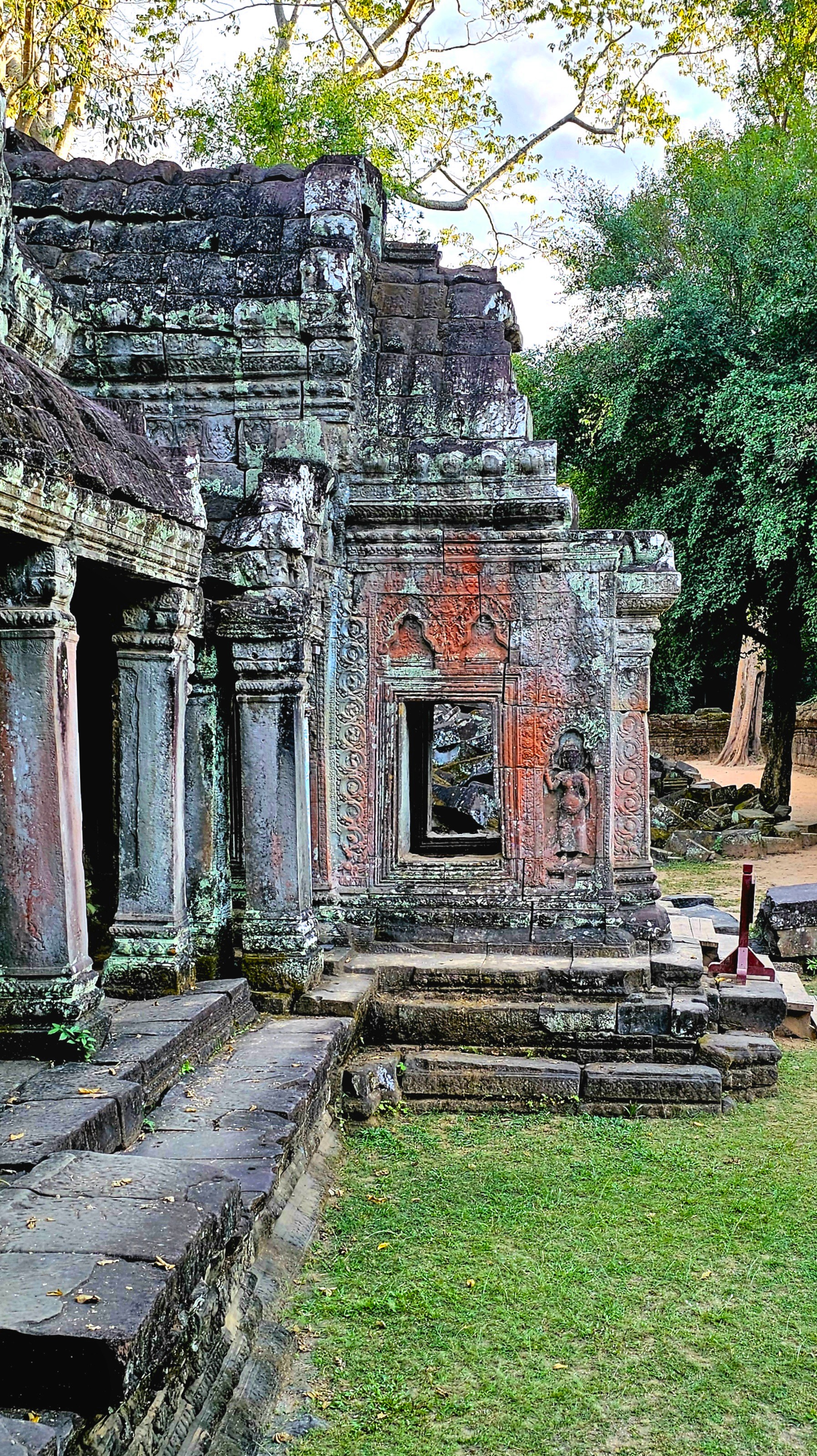
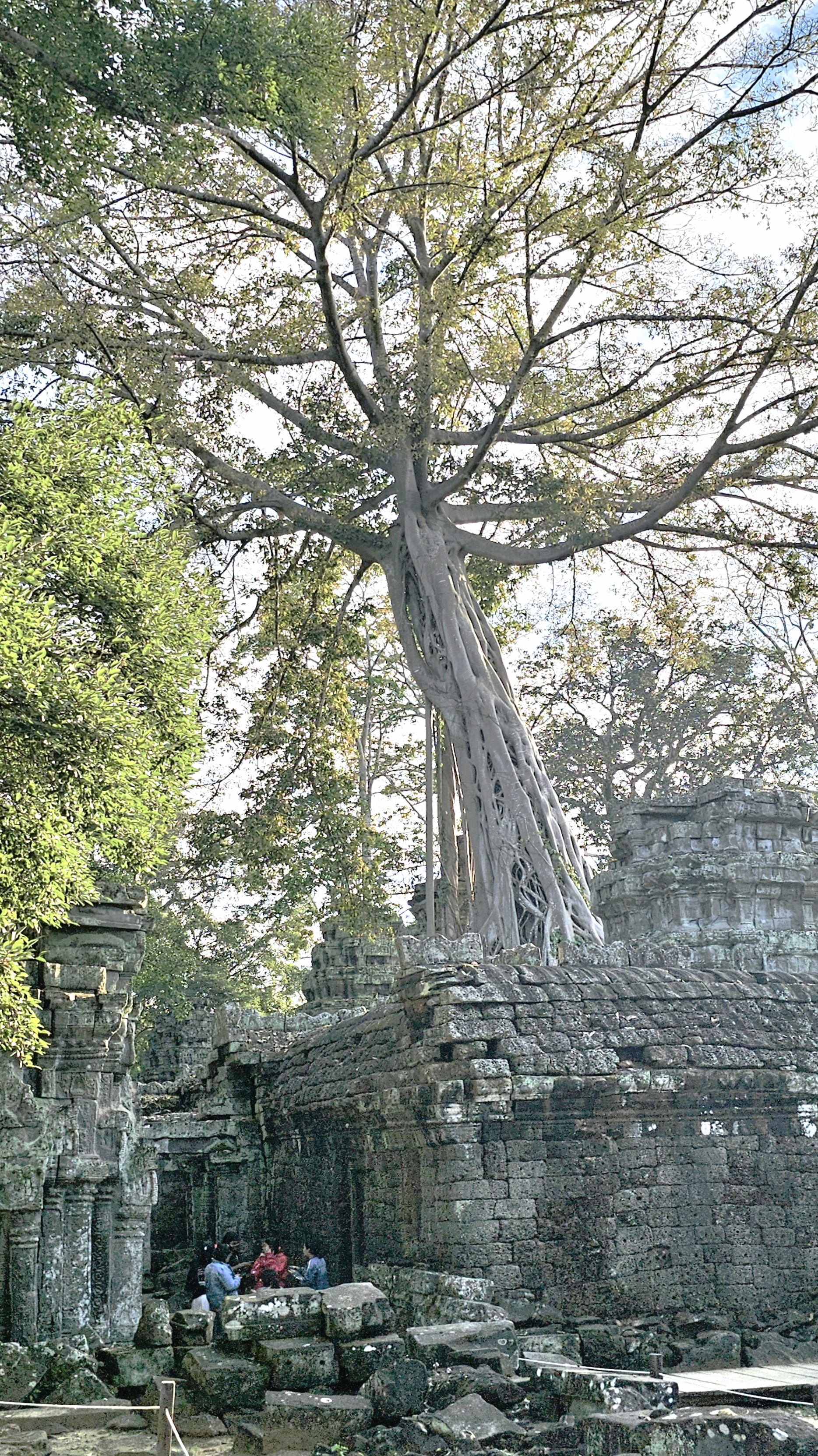
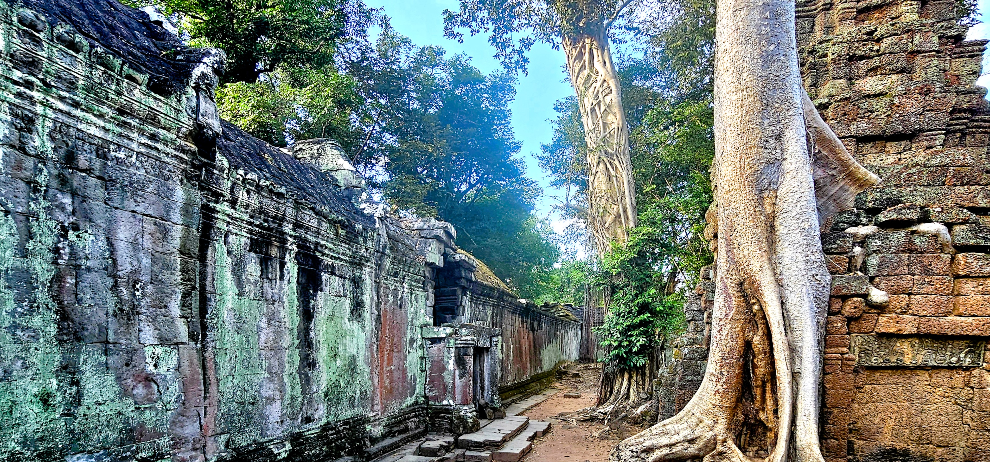
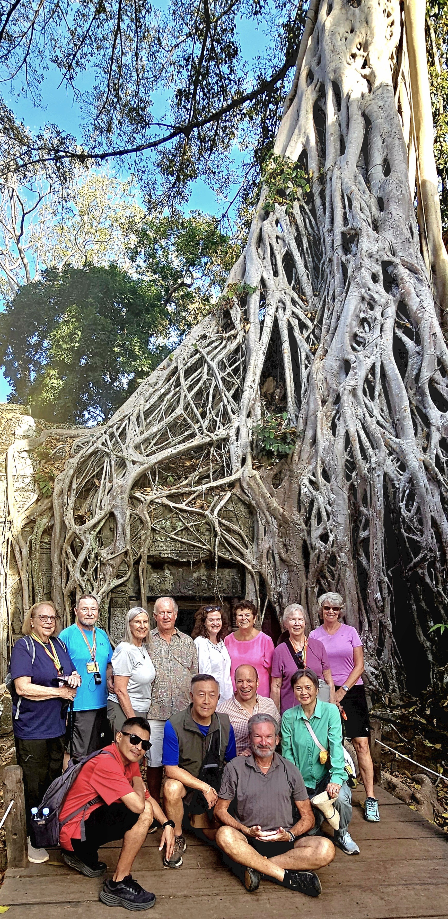
Of all the temples in Cambodia—somewhere between 4,000 and 6,600, depending on the cultural authority—Ta Prohm, located within Angkor Archaeological Park, remains a must-see because of its striking temple remains and captivating narrative.
At the ruinous site of Ta Prohm,
I encountered an otherworldly standoff between human ingenuity and nature’s relentless advance. It’s not merely a structure; it’s a testament to history, where the surrounding jungle advances, progressively reclaiming the landscape.
Here, a vast root system appears to strangle the West Gopura–a vivid illustration of nature’s power interwoven with human craftsmanship.
Myth and stone intertwine, as a patina of multi-colored lichen cloaks the bas-relief stonework depicting meditating monks and temple guardians in serene poses.
The gigantic roots of the silk-cotton, gold apple, and strangler fig trees invade the ancient walls and terraces to create a visually stunning tableau.
The trees seemingly communicate with the stone, highlighting both the beauty and fragility of the monument’s existence.
Constructed during the late 12th and early 13th centuries in the local Bayon style—an intricately decorated form of Khmer architecture—Ta Prohm served as a monastery and university for Mahayana Buddhists, offering spiritual guidance and education in a time where knowledge was deeply intertwined with faith.
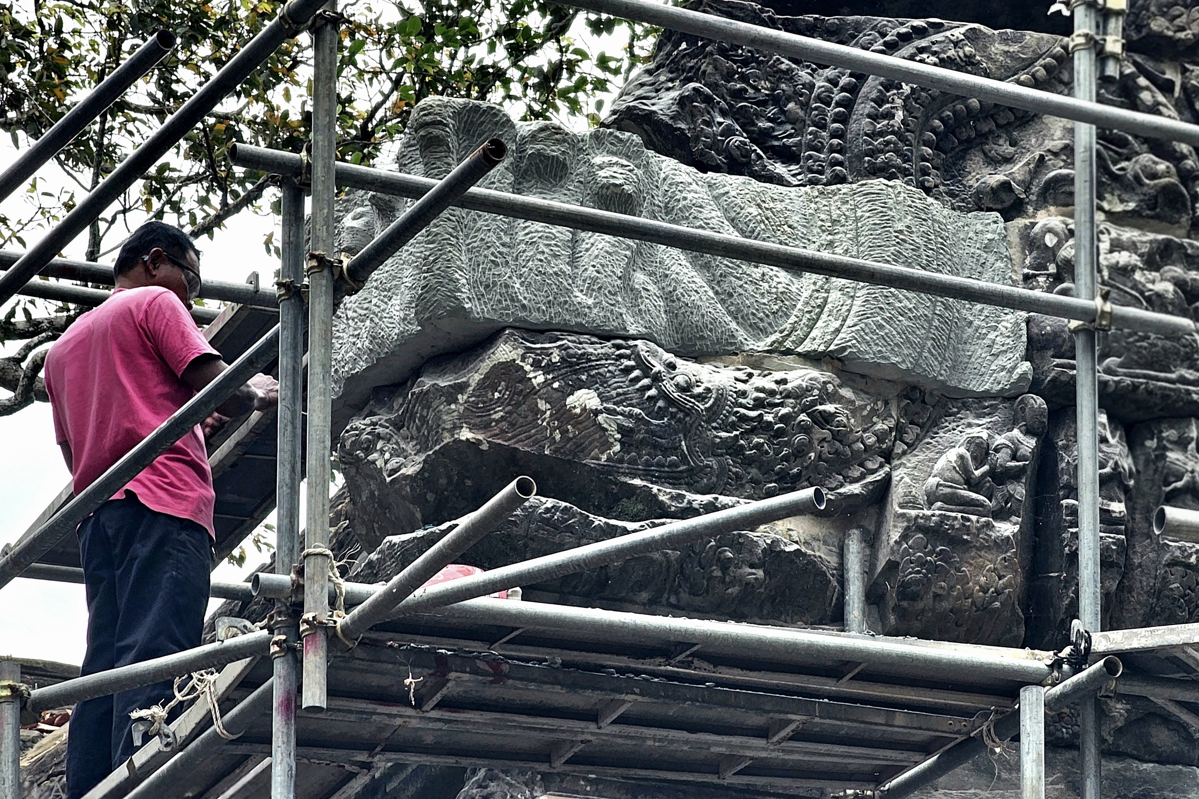
Following the fall of the Khmer Empire in the 15th century, the complex fell into neglect and was eventually abandoned, allowing the encroaching jungle to seize control, transforming the area into a site of haunting beauty.
Today, various restoration attempts have stabilized the environment, courtesy of the Archaeological Survey of India (ASI),
which has been collaborating on the temple’s restoration with Cambodia’s APSARA National Authority since 2003.
Restoration efforts to preserve the temple’s original structure include replacing damaged stones, supporting entries, and strengthening foundations to withstand natural elements like heavy rains.
While archaeologists and craftsmen work to protect the temple from potential damages, they are also aware that Ta Prohm’s‘condition of apparent neglect’contributes to its global reputation, as evidenced in the action film, Laura Croft: Tomb Raider.
This balance creates an enchanting duality: the remarkable presence of both human history and the natural world,
coexisting in a state of beautiful decay.
Ta Prohm stands as a poignant reminder of the passage of time, notwithstanding the scrollwork of a stegosaurus carving on a terrace wall that has confounded scholars for centuries.
Together with Angkor Wat, Ta Prohm represents an enduring symbol of the Khmer Empire’s remarkable cultural and architectural grandeur. The site is among Cambodia’s most visited destinations, preserved for tourists who come to witness and contemplate the relentless power of nature in its interplay with human achievement.
Siem Reap Province, located in northwestern Cambodia, possesses significant cultural, religious, and symbolic value, and is also renowned for its architectural, archaeological, and artistic importance. Furthermore, Siem Reap is home to Angkor Archaeological Park, the world’s largest religious monument complex and the cornerstone of Cambodia’s tourism sector.
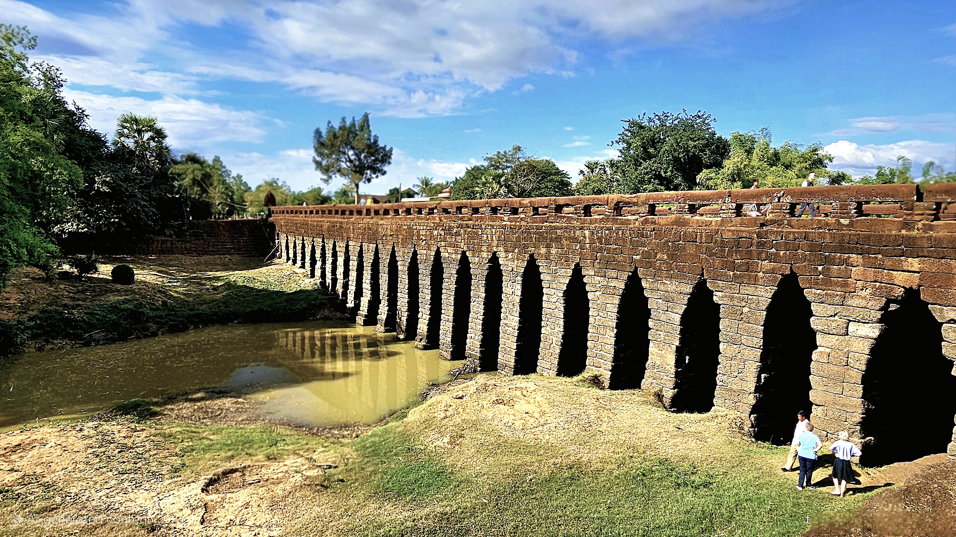
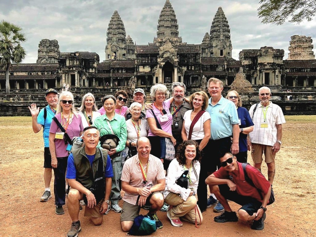
Our O.A.T. group overlanded from Phnom Penh to Siem Reap with a stopover at the ancient Kampong Kdei Bridge, constructed in the 12th century during the reign of King Jayavarman VII.
The bridge is a testament to the engineers who designed the 87m river span with 21 corbelled arches of laterite, making it the longest structure of its kind in the world.
Nine-headed nagas–whose bodies form a continuous balustrade alongside the roadbed–welcome only pedestrians and cycles on the bridge because of weight restrictions.
While admiring the scenery, I paused a moment to consider that Leah and I were walking the same trail as the Chinese merchants who traded along the Maritime Silk Road nearly a millennium ago. Back then, it was a 2-day trek through the lowlands to reach Angkor Wat.
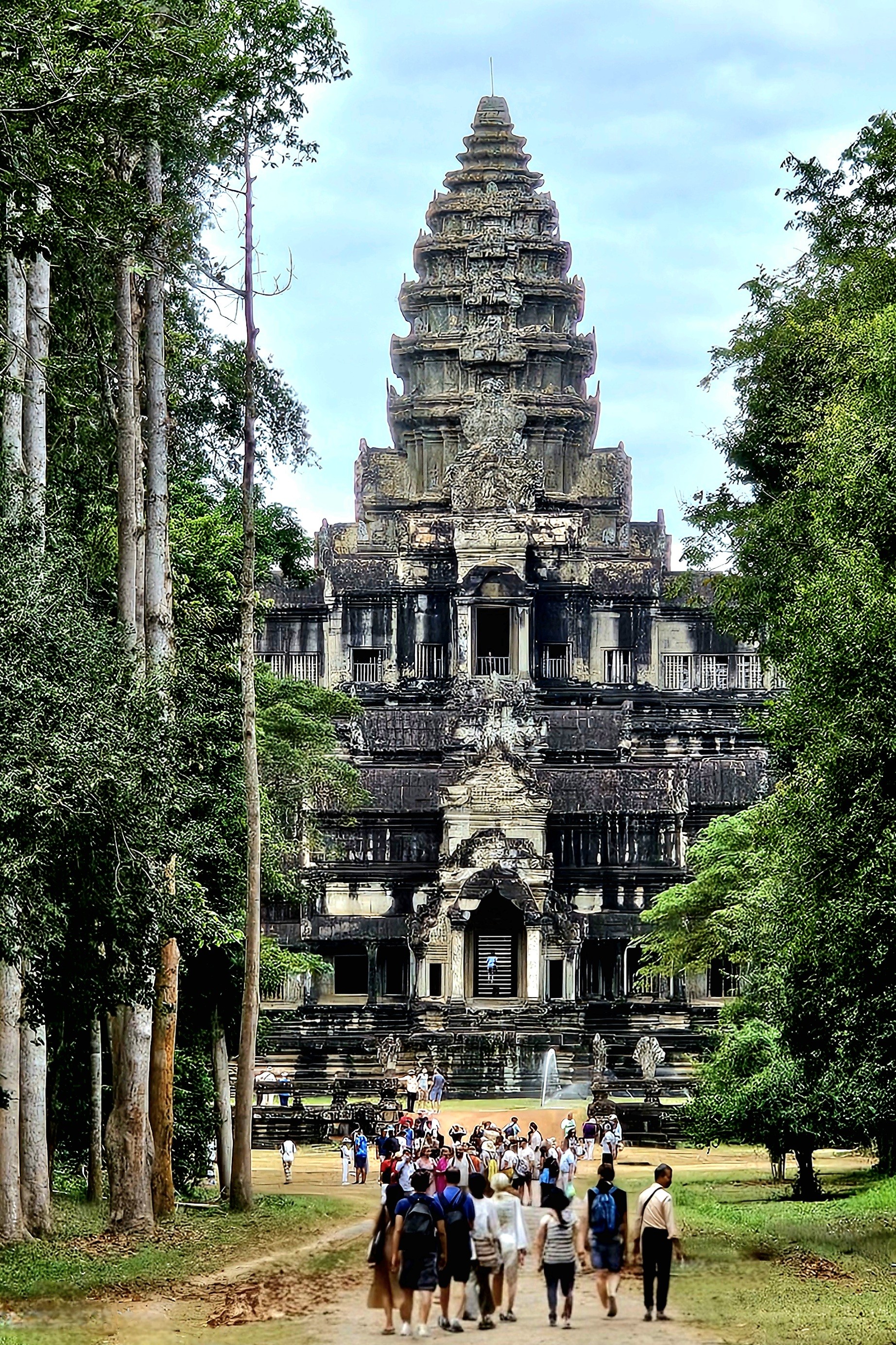
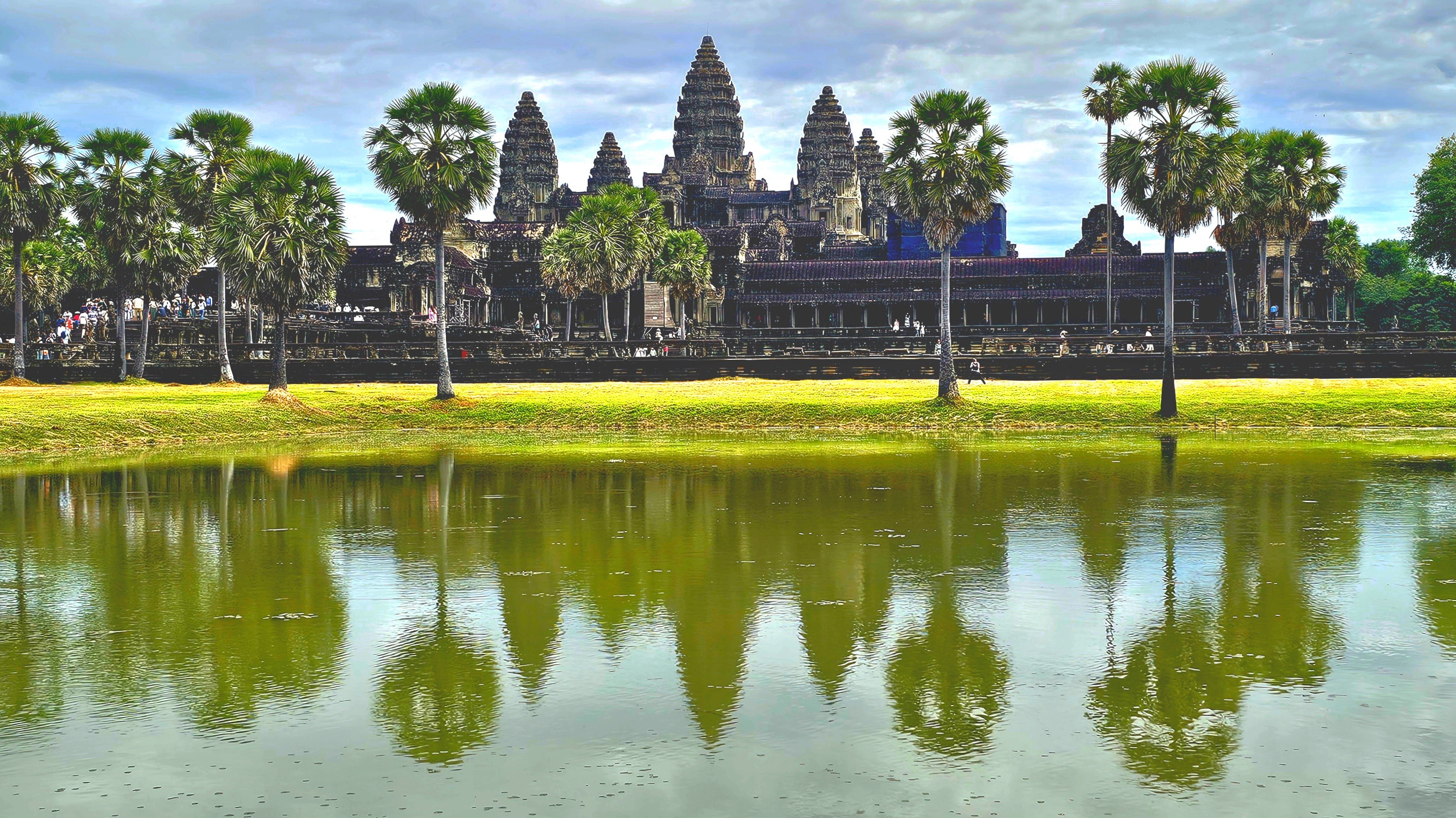
But not for us; we stepped out of our air-conditioned coach the following morning, well before the crowds, to cross a moat symbolizing the cosmic ocean in Hindu cosmology.
While getting our bearings, our guide Seong, a native of Siem Reap revealed Cambodia’s worst kept secret: by arriving at Angkor Wat’s Death Gopura (East Gate), we were avoiding the popular western gateway with five times the tourists.
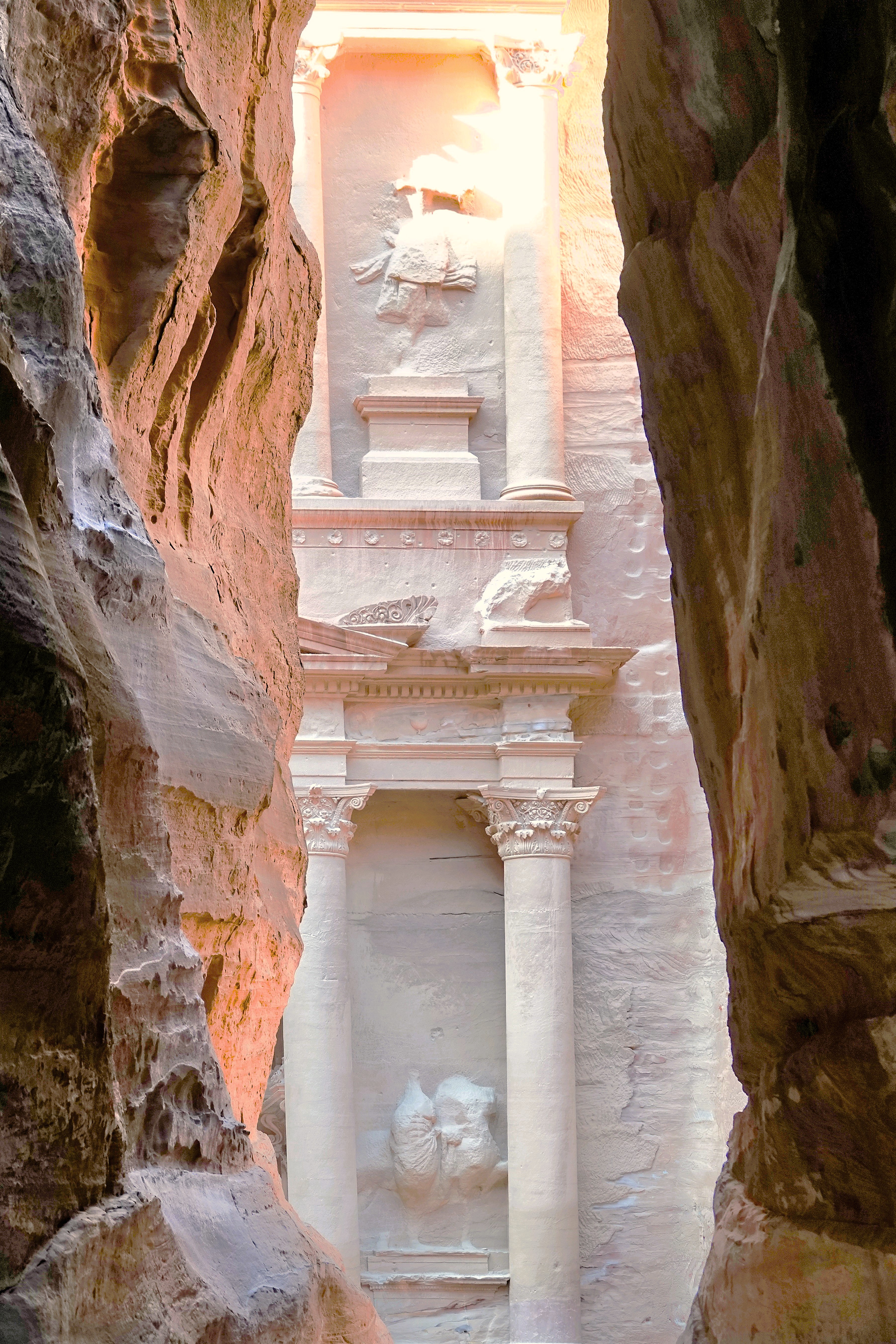
The cloud cover flattened the morning light on our approach down the expansive causeway. It was the best time for photographing Angkor. Eventually, we reached a break in the trees, perfectly framing the famed lotus tower of this Khmer masterpiece. It was reminiscent of the thrill I felt after emerging from the slot canyon in Jordan and peeking at Petra for the first time at first light.
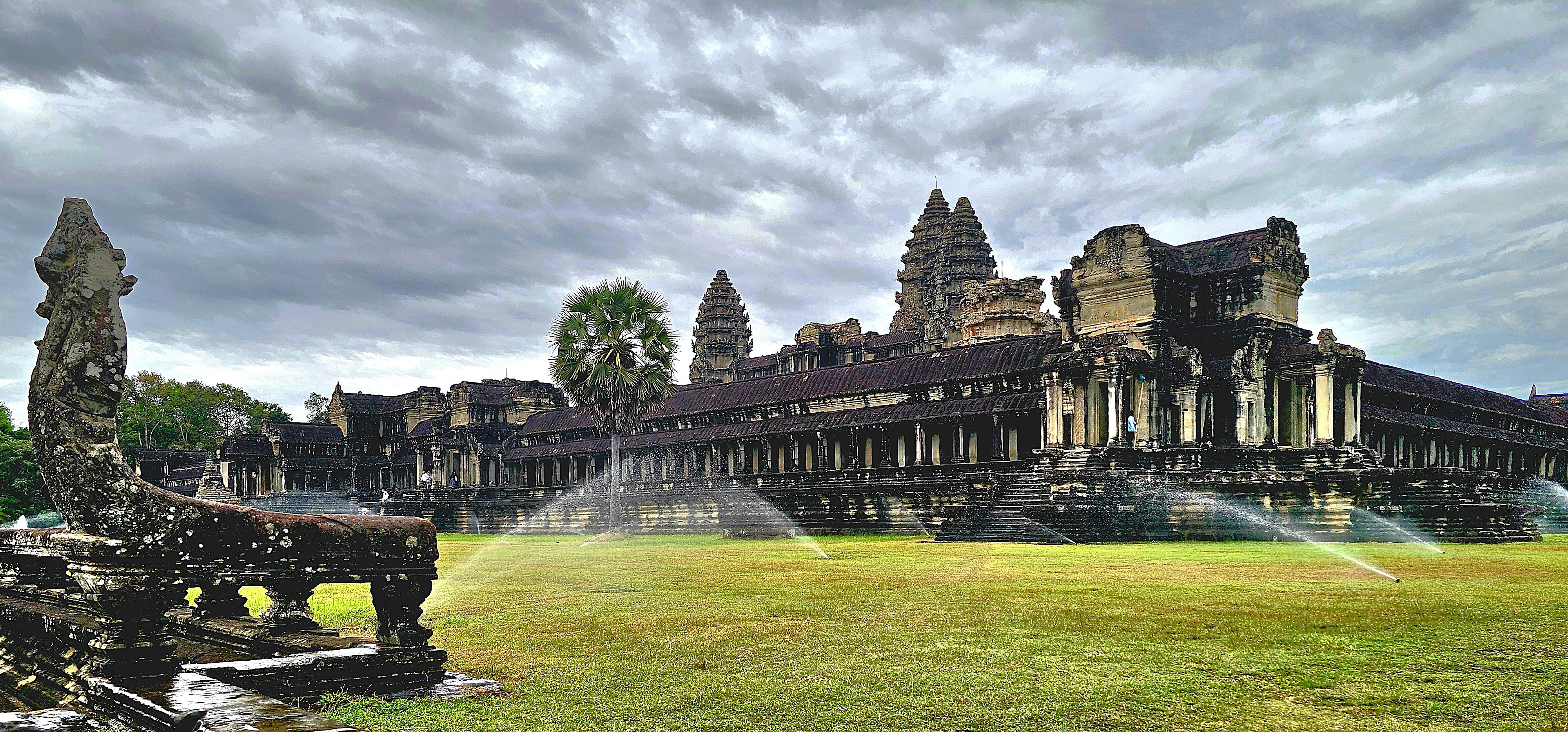
Much has been written about Angkor Wat:
About its monumental size,
spanning 402 acres,
or 4 times the size of Vatican City;
It’s intricate bas-relief carvings throughout the temples and galleries;
Its historical significance, showcasing Khmer mythology and history etched into laterite stone;
Churning of the Sea of Milk
Heaven and Hell
Military Parade of Kink Suryavarman II
Its religious significance–originally constructed in the 12th century as a Hindu temple dedicated to Vishnu but converted to a Theravadin Buddhist temple during the 15tth century to reflect the shift in Cambodia’s spiritual landscape;
Hindu GoddessBuddha seated on Mucilinda, King of the Serpents
And its architectural accomplishment–a profound reflection of Hindu cosmology, particularly the concept of Mount Meru, regarded as the mythical abode of the deities. The central tower of Angkor Wat epitomizes the summit of Mount Meru, while the adjacent smaller towers signify the mountain’s subordinate peaks. The moat and the rectangular outer wall delineate the oceans and the boundaries of the world, respectively.
Restoration and maintenance have become routine endeavors in Angkor, which fell into neglect following the capital’s relocation to Phnom Penh in 1434. The site garnered renewed attention after being rediscovered by French naturalist Henri Mouhot in 1858.
An international task force supported by Japan, India, France, South Korea, and other contributing nations have collaborated with APSARA National Authority, the Cambodian government agency responsible for Angkor’s ongoing preservation and management, to address the extensive neglect and restore the temple to World Heritage status.
Ceiling before repairCeiling after repair
Recently, new risers have been completed by the Korea Heritage Agency…
giving access to the Bakan (central sanctuary),
which supports the amazing quincunx of towers,
offering amazing views,
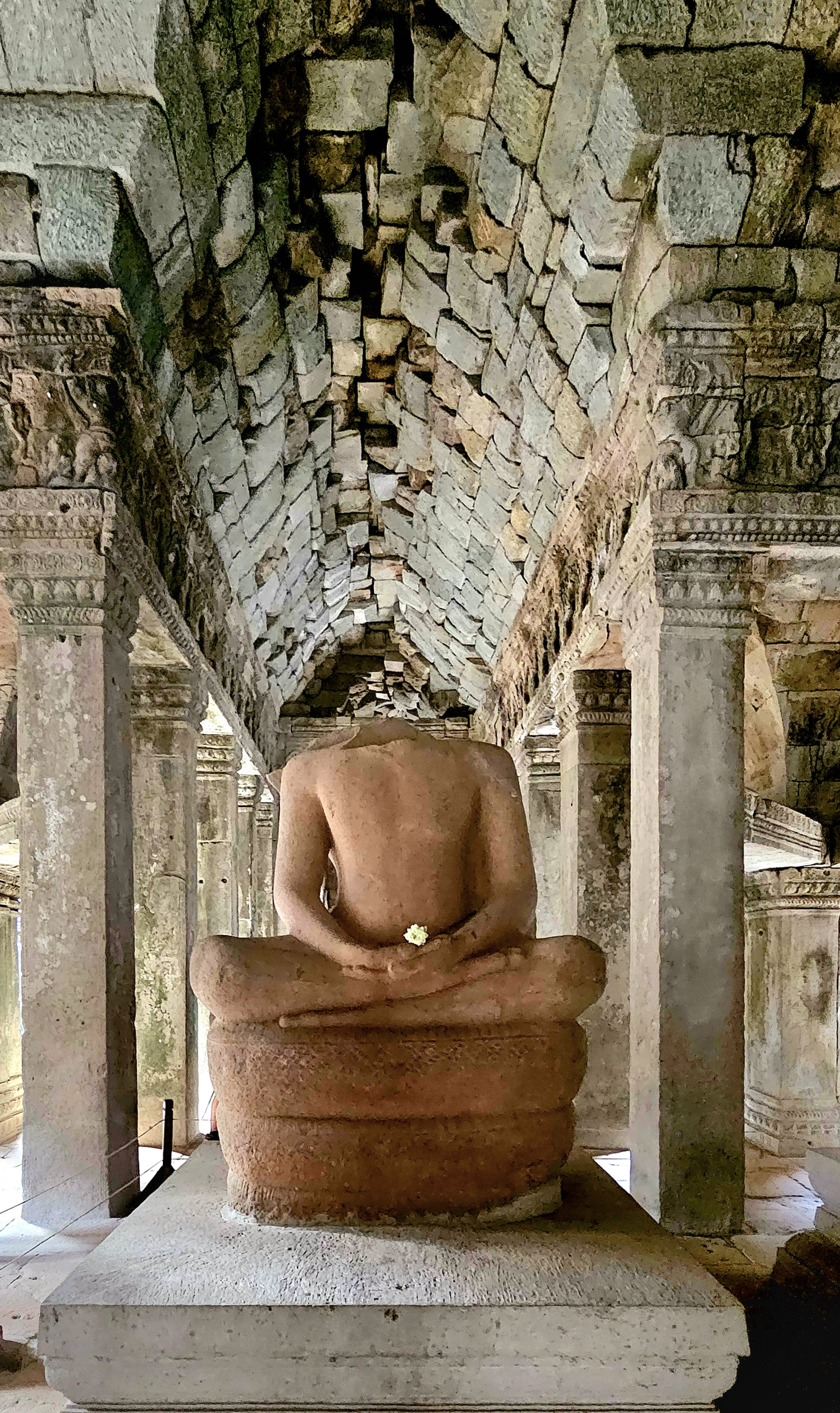
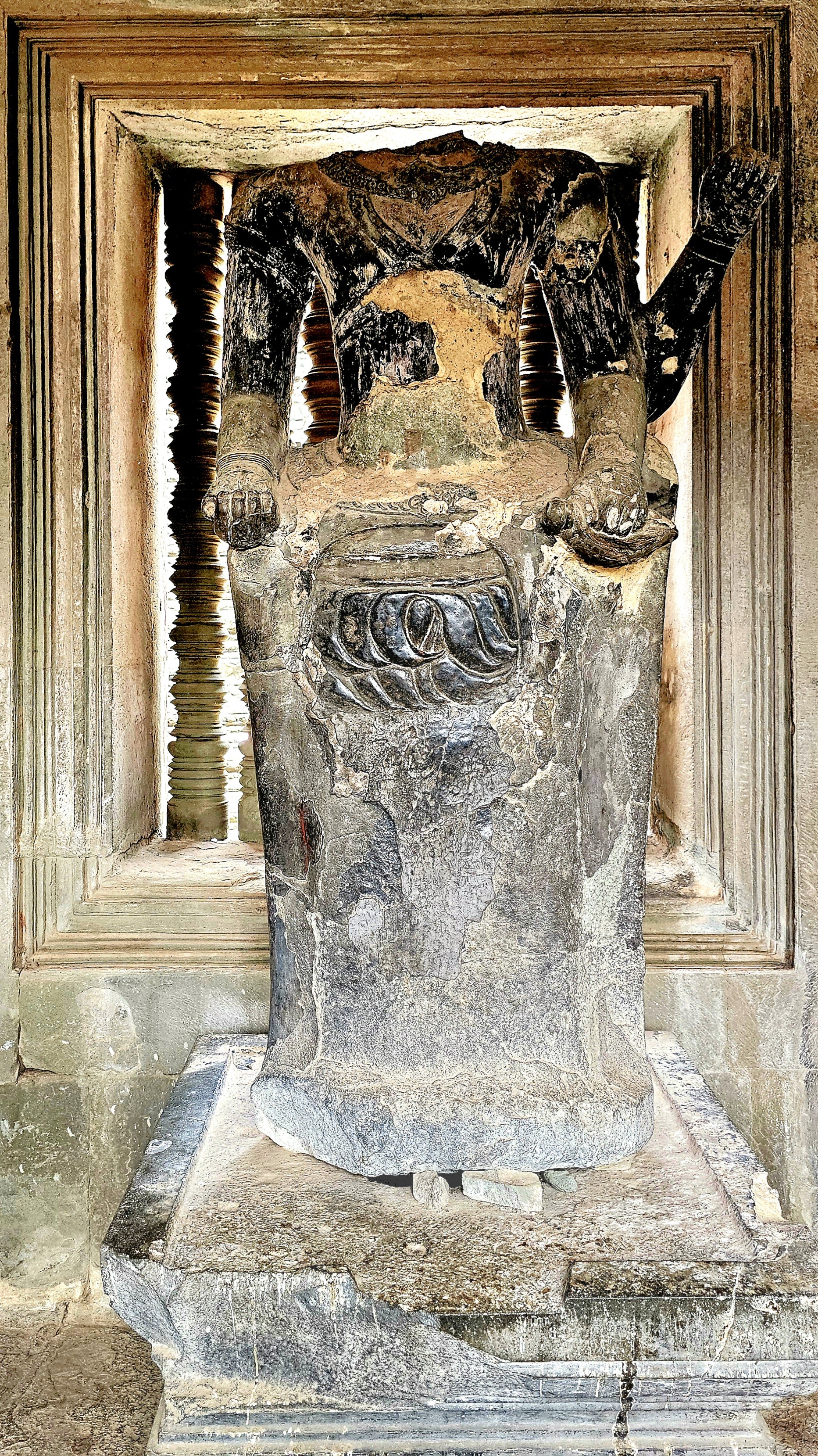
and providing sanctuary for a rare wooden Buddha sculpture whose head remains intact,
unlike most of the other Buddhas who fell victim to so many marauders over the centuries.
But amidst the vastness and splendor surrounding us, it was the people donning their Sunday best who truly captured my attention with their warmth and spirit.
often posing by the Reflecting Pool for the quintessential photograph, or so I thought.
Unfortunately, the wind kicked up, causing the pool to ripple ever so slightly and affect my mirrored imagery.
However, by returning the following day for a sunset farewell to Angkor, I believe I captured the iconic shot that characterizes Cambodia’s cultural landscape.
The experience not only fulfilled a bucket-listed destination but deepened my appreciation for the rich heritage of Cambodia, reminding me that some locations leave an indelible mark on our souls.
Random snaps of landmarks, skylines, and curiosities captured while cruising around town. There is no particular theme or connection, but these images caught my eye, nonetheless!
Flyer beware!
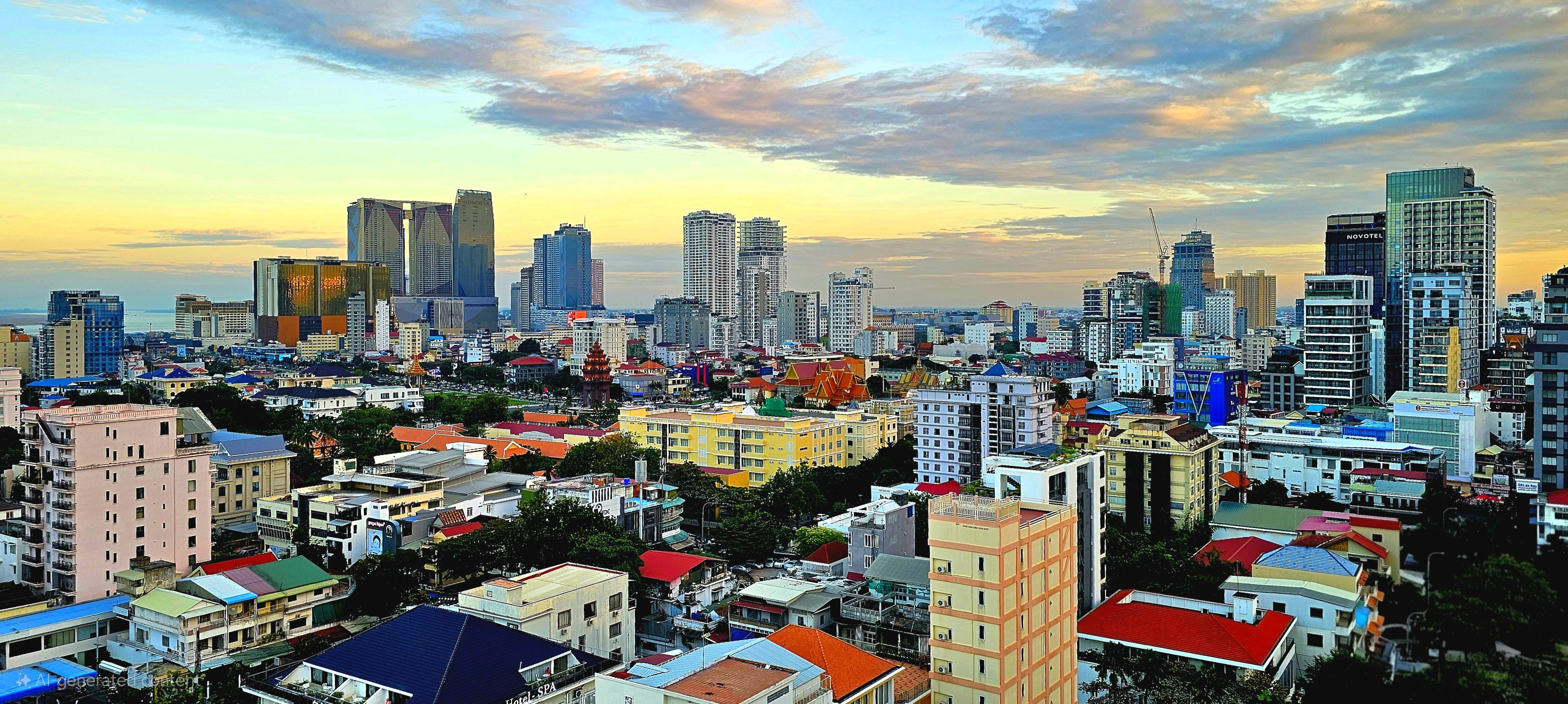
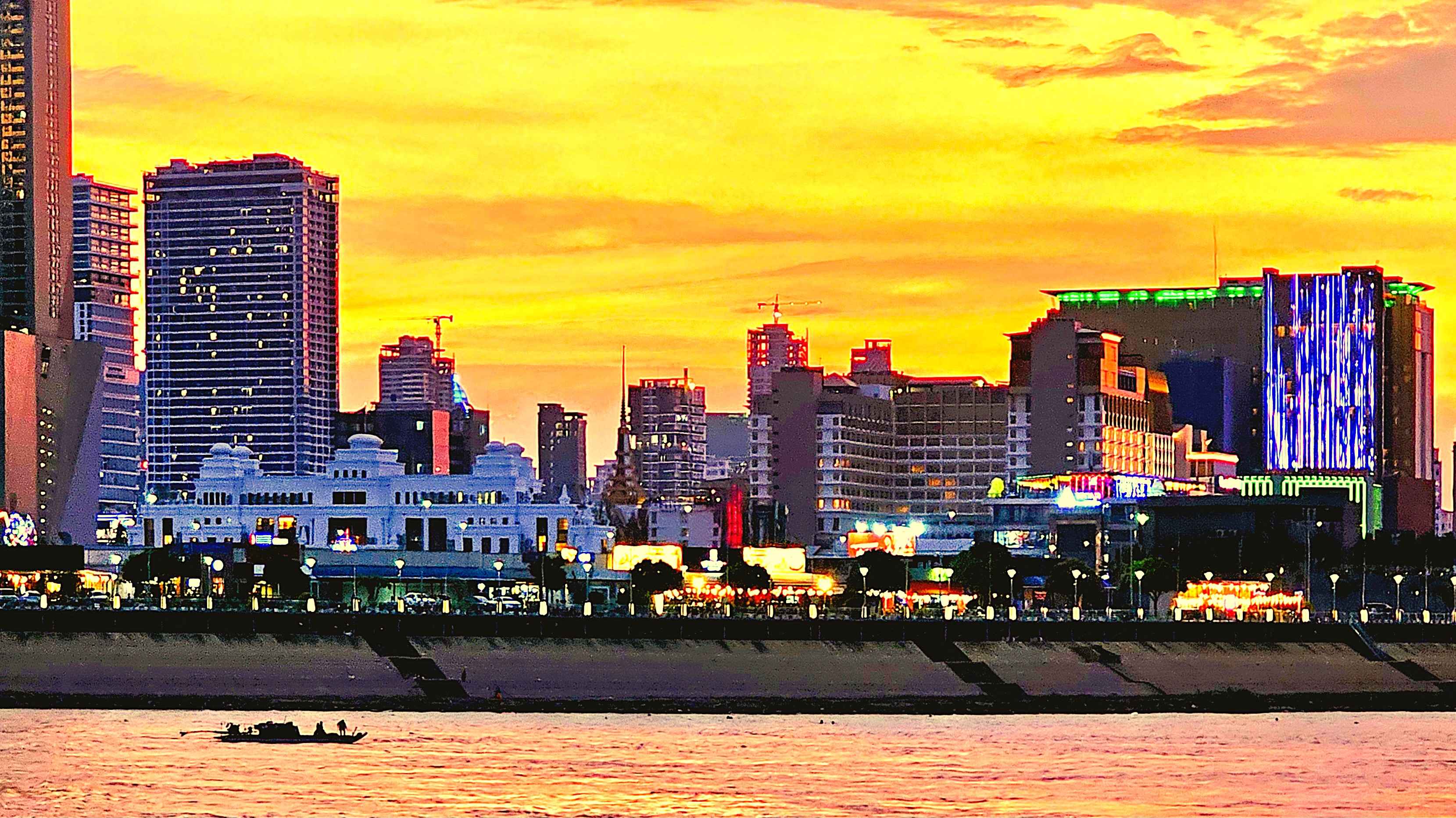
A modern skyline reshapes Center City
Areiksart Ferry Port
Krong Ta Khmau–Phnom Penh suburbia
Anatomical door handles
Independence Monument
King Norodom Sihanouk Memorial
King Norodom Sihamoni portrait from Sisowath Riverside Park
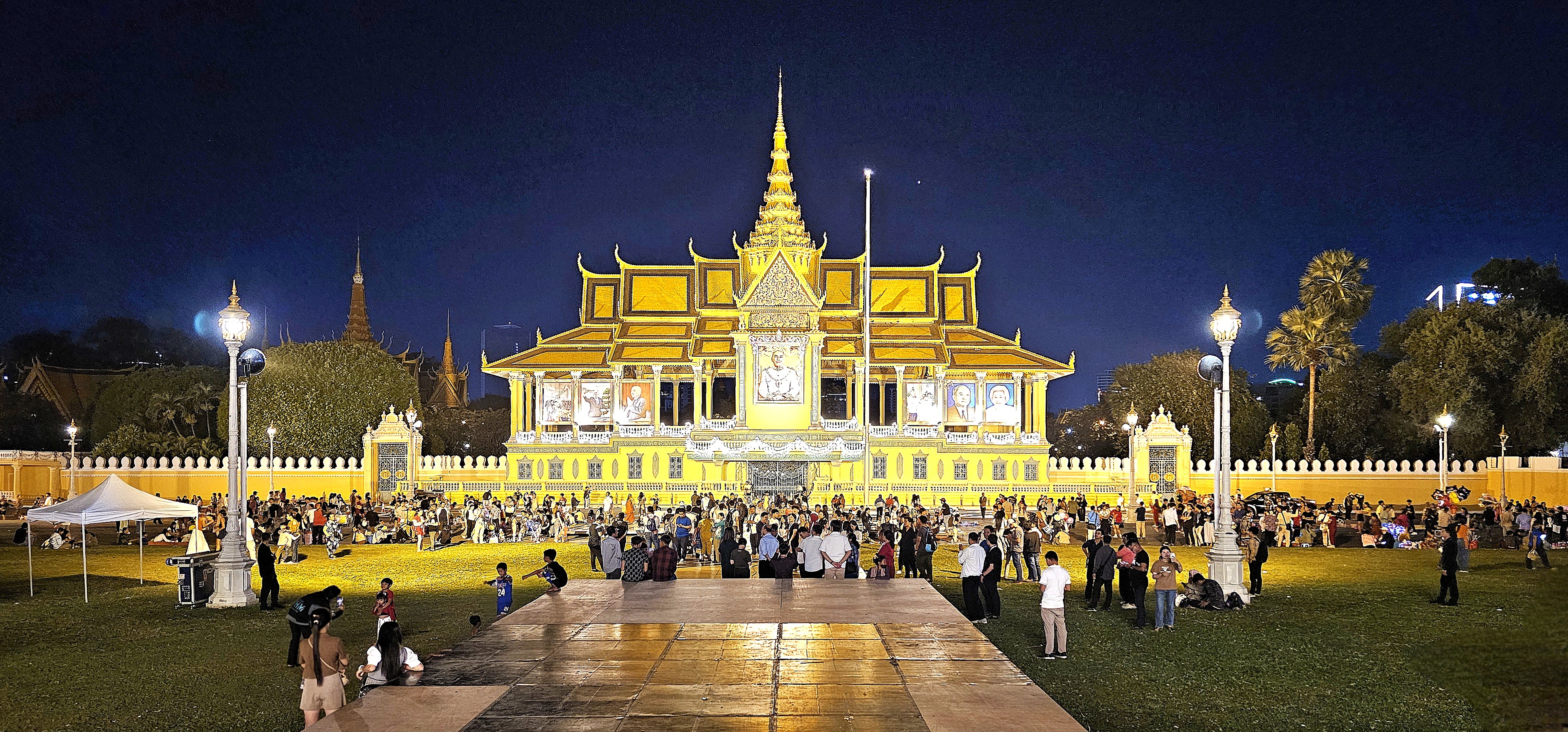
Royal Palace of Cambodia
Meat market beef parts
Protecting lives by improving sanitation–one flush at a time
Toilet protocol
Street art
Sangkat Chakto Mukh–upscale community
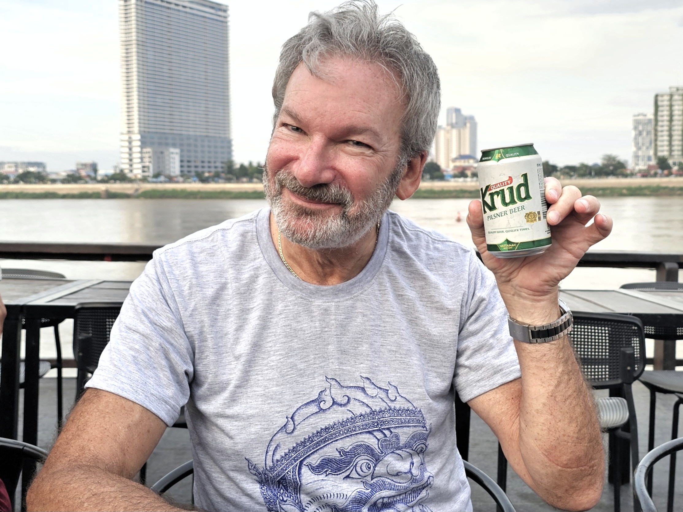
“Good time for a Krud,” 2023 World Beer Gold medal winner
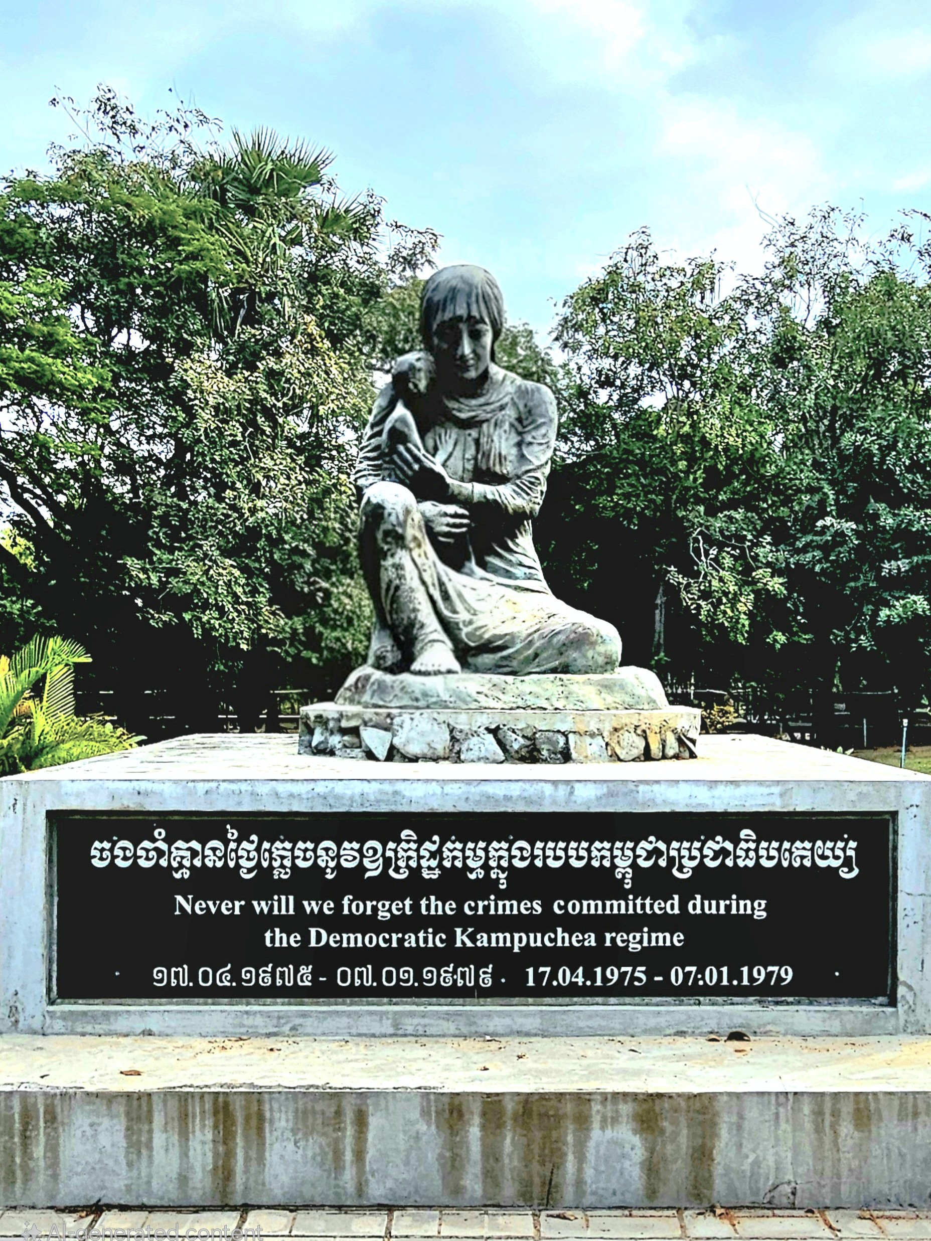
Phnom Penh and the Khmer Republic fell to the Khmer Rouge on April 17, 1975.
For the Communists, it was Liberation Day and cause for celebration.
While it marked the end of civil war, it was the beginning of one of history’s darkest chapters. Almost immediately, the Khmer Rouge ordered the exodus of the city’s 2 million inhabitants.
from Agence Khmere de Press archive
Khmer Rouge strongman, Pol Pot declared 1975 “Year Zero,” in his quest to build a classless agrarian utopia patterned after Maoist China, but it also marked the start of a genocide that would devastate the country, claiming over 25% of the population through forced labor, starvation and slaughter.
It started with a civil servant purge that eliminated tens of thousands of military loyalists, local police, and anyone associated with the previous government. Additional targets included academics, professionals, and “impure” ethnic minorities.
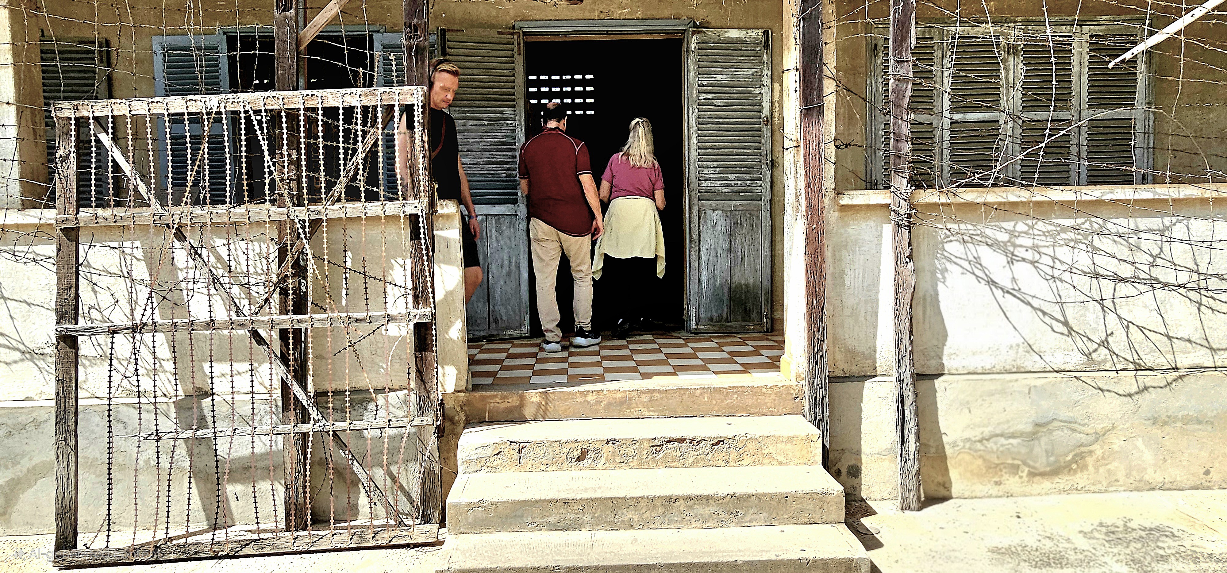
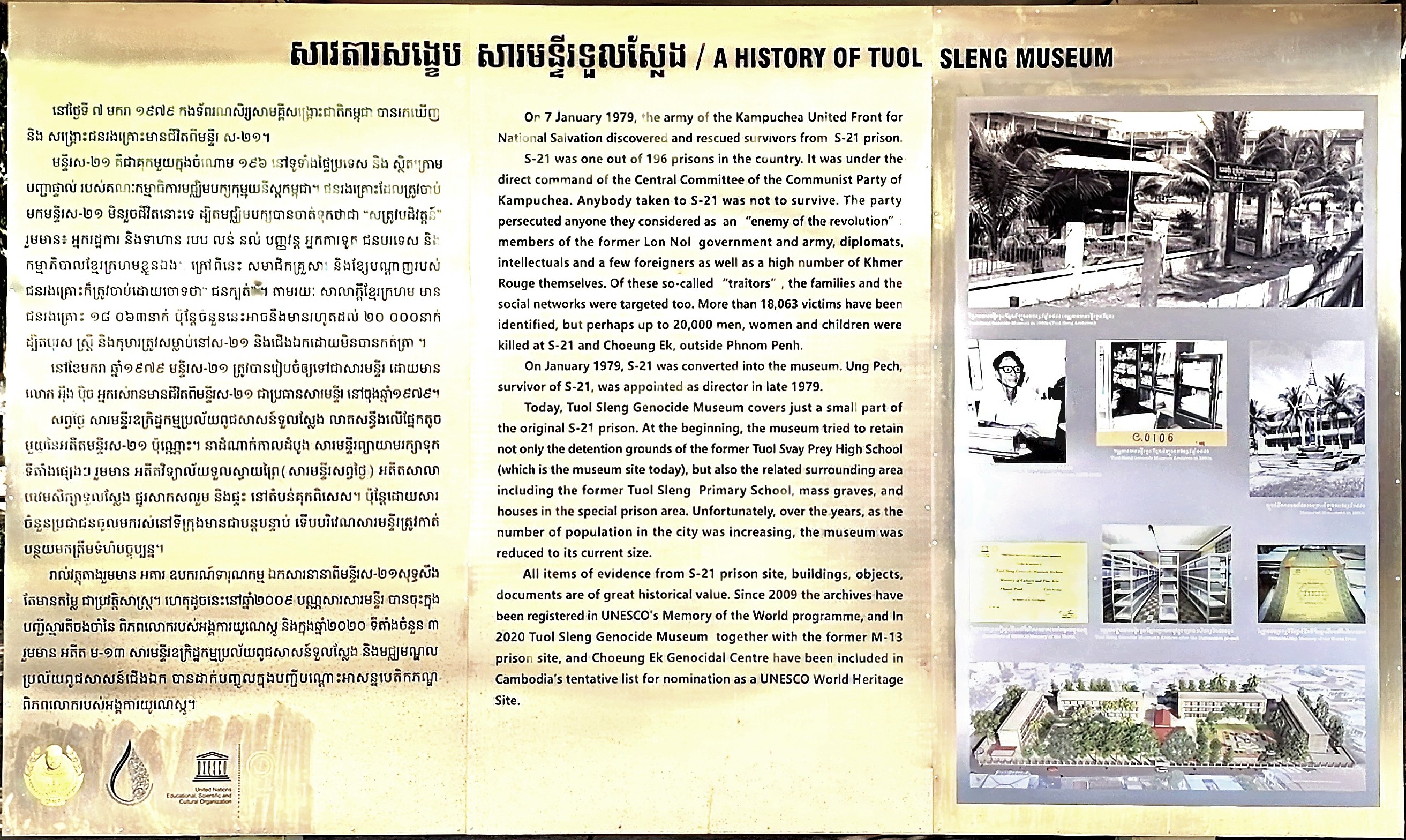
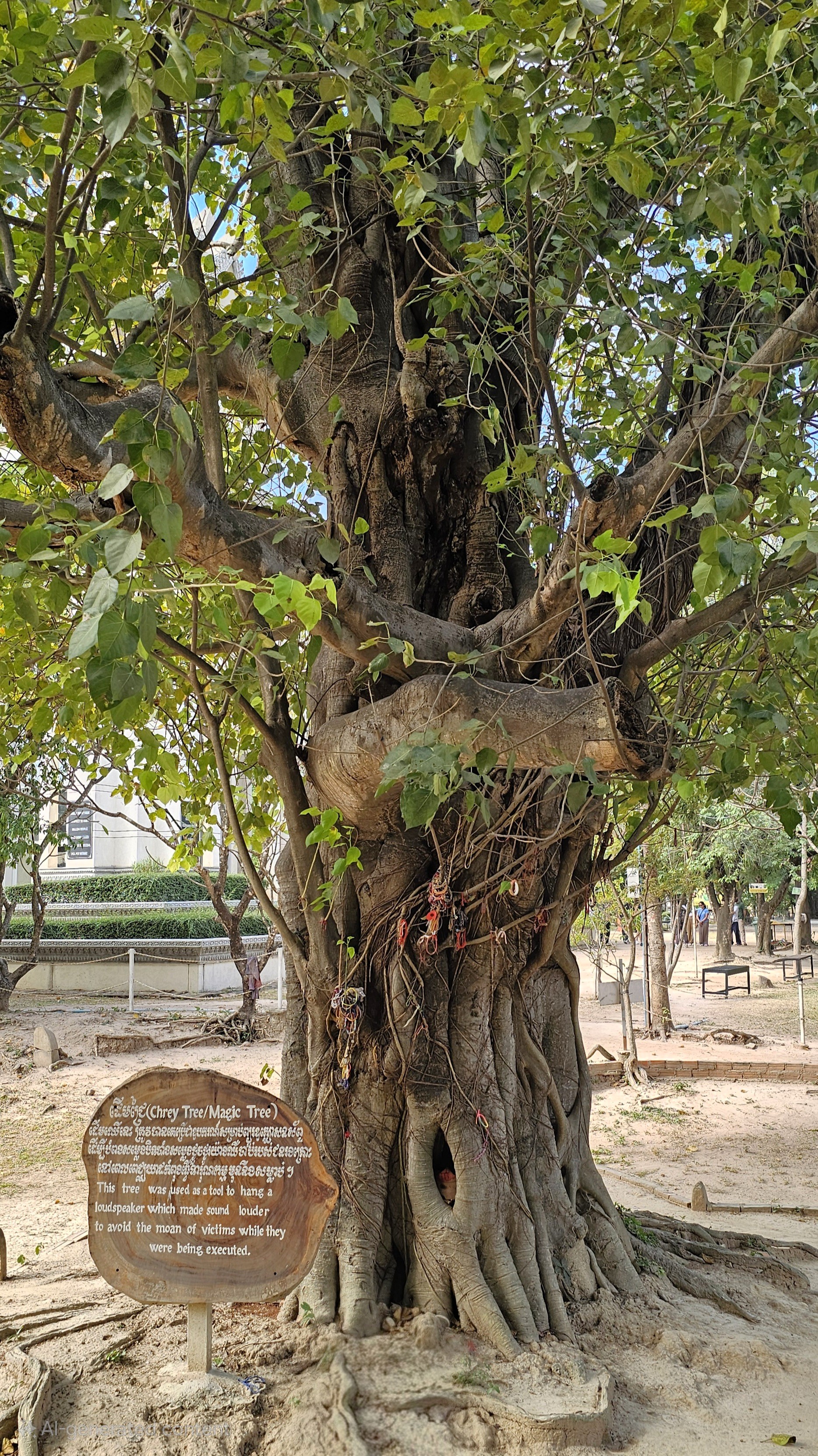
To facilitate the Khmer Rouge agenda, an education campus in Phnom Penh that housed Tuol Svay Prey High School and Tuol Sleng Primary School was commandeered and codenamed “S-21”–the nerve center of the Khmer Rouge secret police.
The survivors remember that day as the day when hope turned to horror, changing their lives forever.
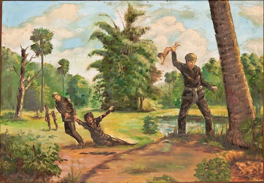
For Vann Nath (tall man in the middle), the unexpected journey to Tuol Sleng began with his arrest in 1978 while working in a rice field. Before 1975, he led a normal life as a commercial artist in Battambang. The Khmer Rouge first detained him at Wat Kandal–a temple turned detention center– and accused him of violating the regime’s moral code before moving him to S-21.
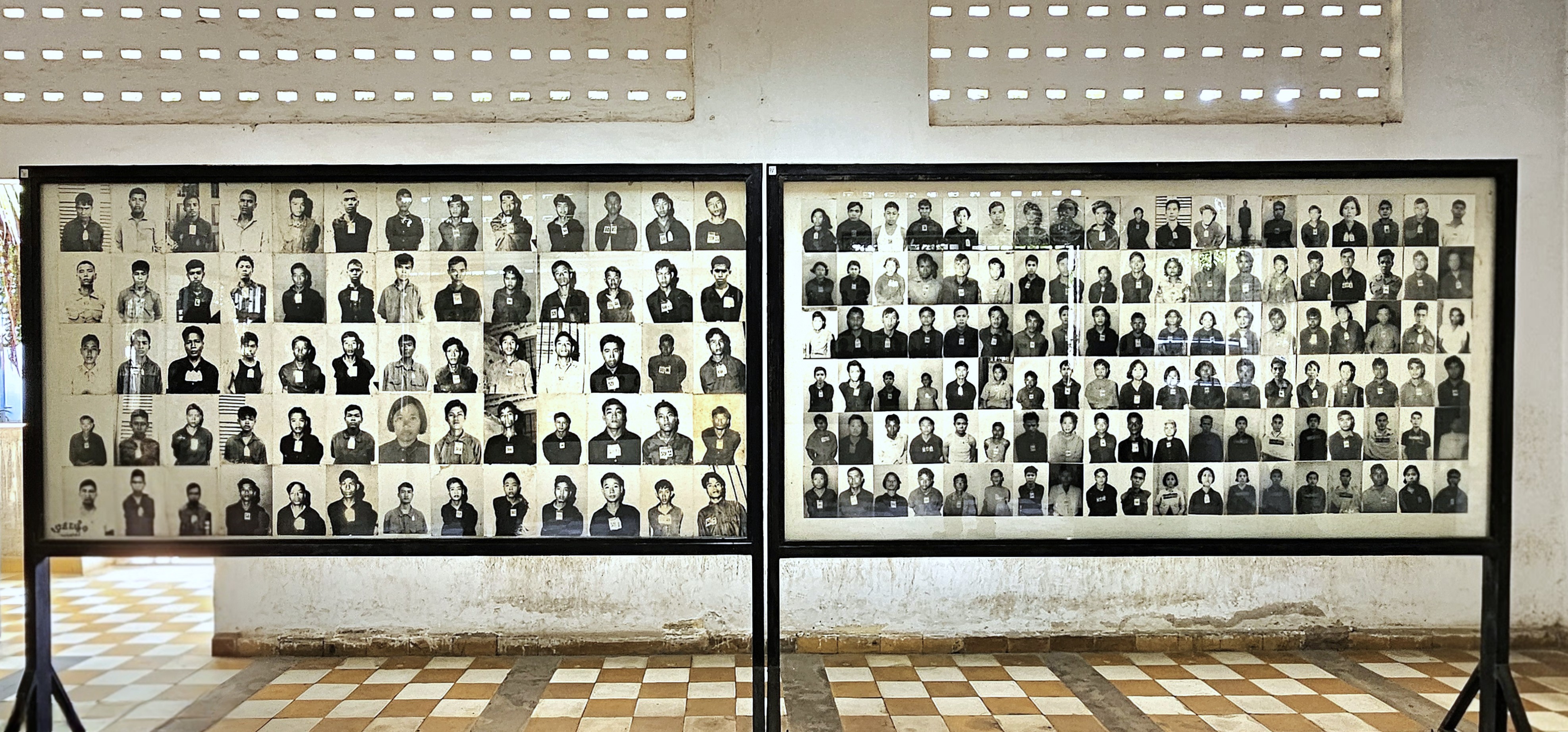
Detainees arrived in handcuffs and were immediately photographed. Today, their images hang on bulletin boards as a numbing reminder of their journey into hell.
Following intake and registration, they were showered.
High-ranking cadres were imprisoned and interrogated in larger cells,
while the masses were confined to bricked-in cubbies the size of shower stalls, with ammunition boxes for toilets.
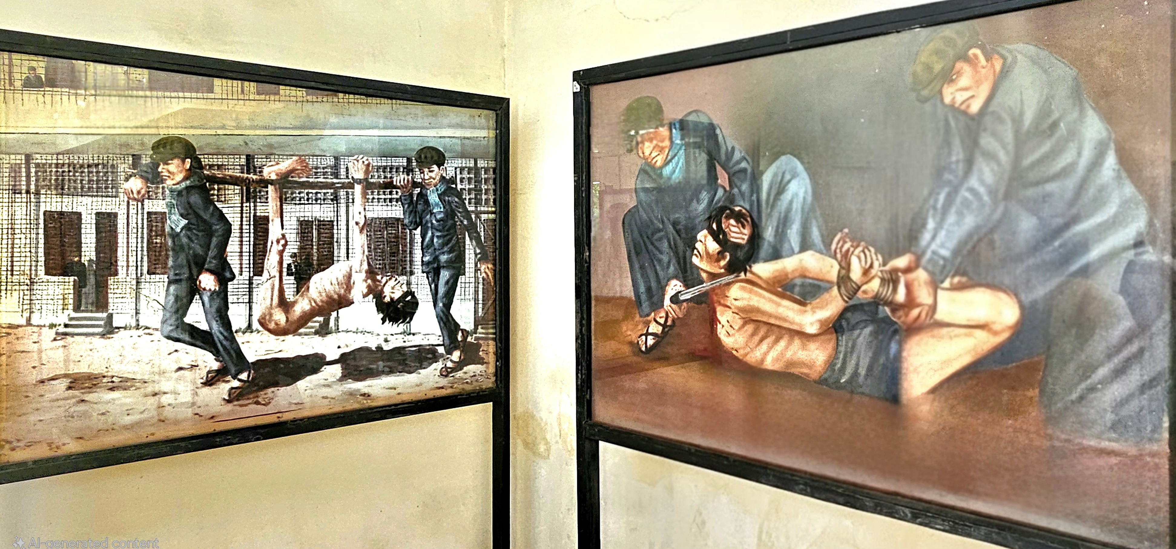
Of course, Vann was interrogated…
and tortured to extract a confession,
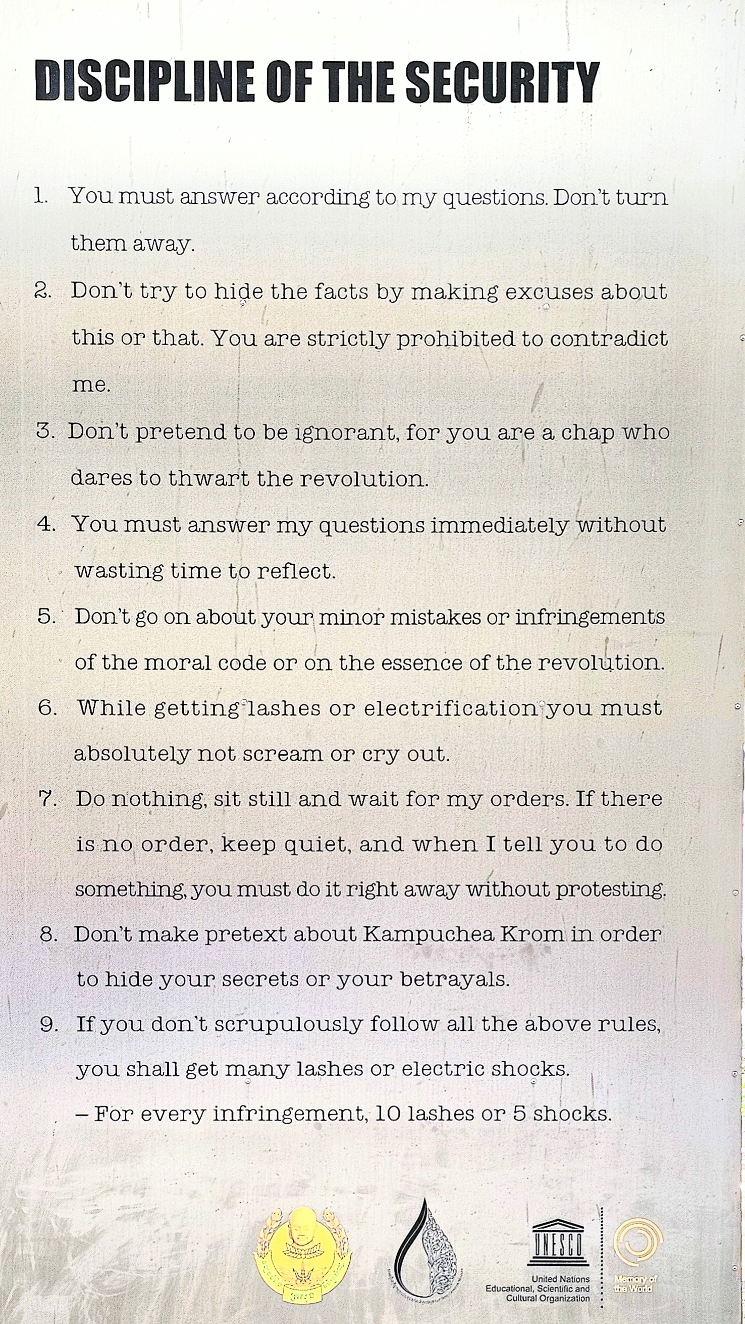
according to a strict code of conduct.
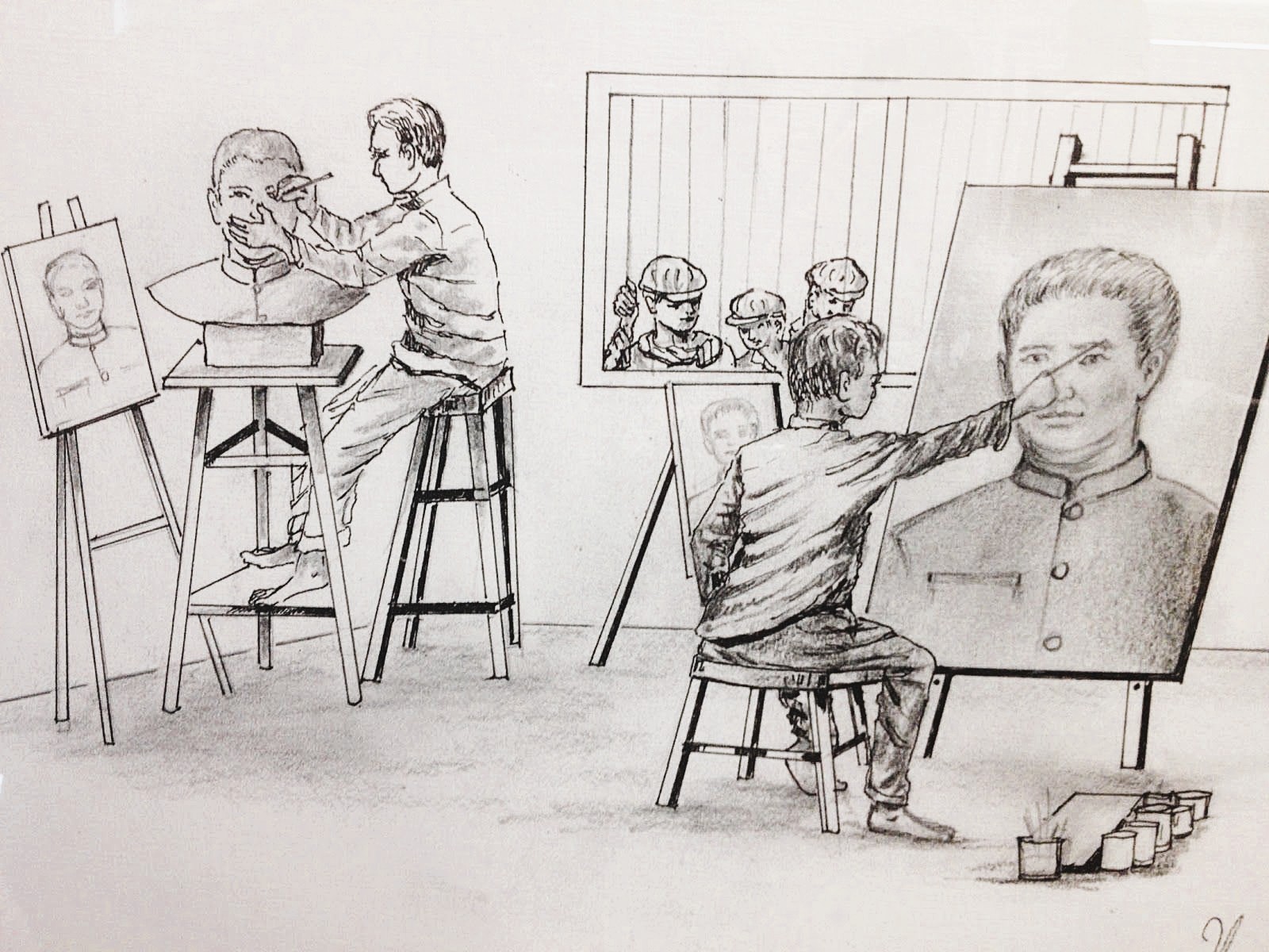
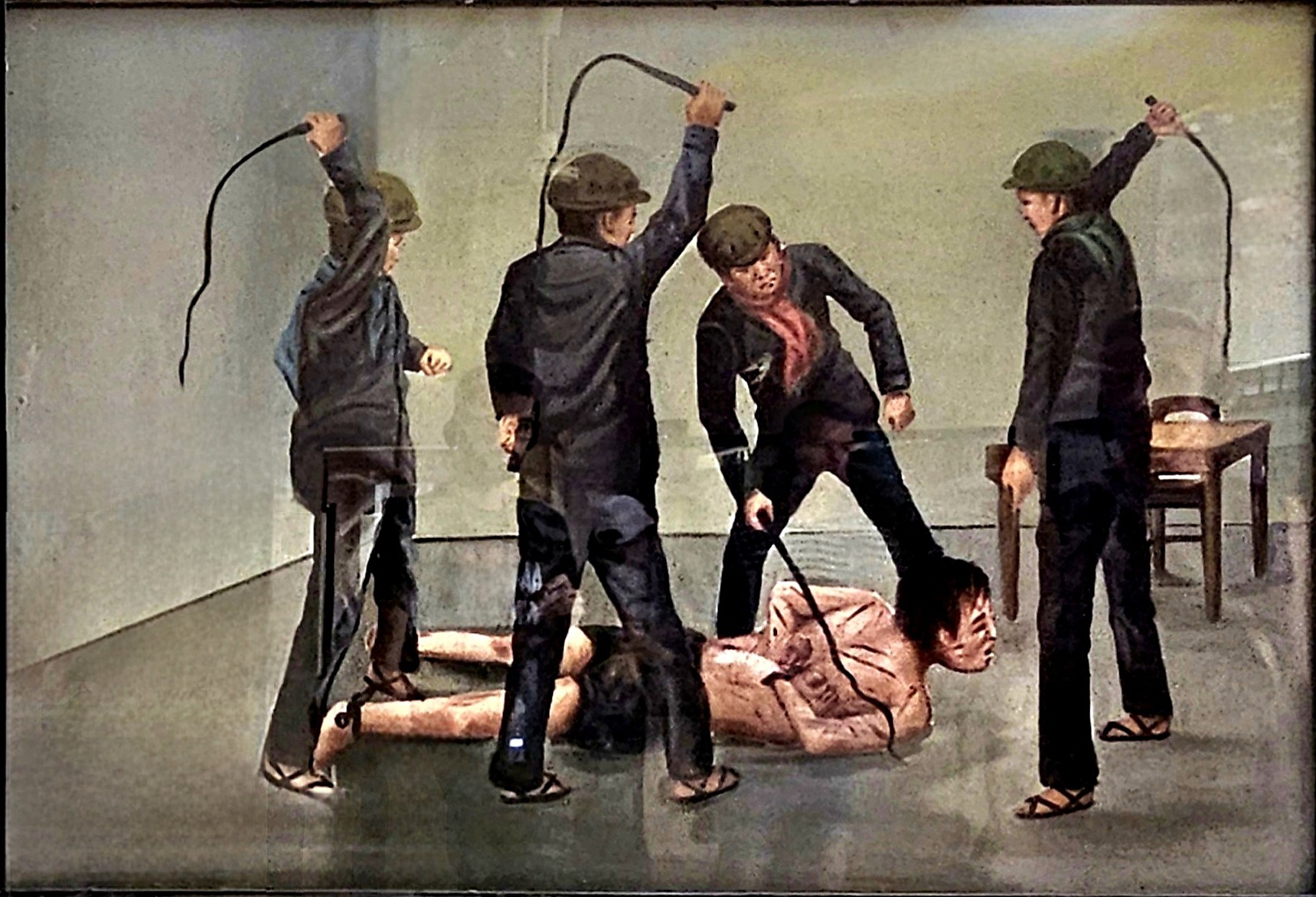
Archives from S-21 reveal that initially, Vann was to be executed, but the commandant spared him in exchange for the portraits he later painted of their supreme leader, Pol Pot.
Vann was among the handful of prisoners who narrowly escaped death by virtue of their special skills and usefulness to the regime.
Vann’s first-person account of his misfortune was interpreted years later after his release through a series of colorful graphic depictions–on permanent display throughout the museum–that ironically brings life to the drab surroundings of prison buildings.
These vibrant illustrations vividly capture the stark contrast between the bleak memories of confinement and the essence of freedom, allowing us to connect emotionally with Vann’s experiences.
The cracked walls reflect the forgotten whispers of hope and despair, transforming the narrative into an immersive journey that transcends time and pain.
The art not only serves as a commentary on the injustices faced but also inspires conversations about redemption, resilience, and the profound impact of creativity in the face of adversity.
Chum Mey is another survivor who’s grateful for his mechanical skills. By fixing the typewriters used to record the forced confessions of fellow prisoners, Chum Mey managed to escape a death sentence, but not the torture. He sits at the edge of the museum courtyard, eager to recount his story in horrific detail. “I come every day to tell the world the truth about the Tuol Sleng prison… so that none of these crimes are ever repeated anywhere in the world.”
Our group was also moved by our off-site exchange with Norng Chan Phal, who delivered his oral history through an interpreter. He was 9-years old in 1978, when his world was turned upside down. His father was arrested and executed at Tuol Sleng. Months later, the Khmer Rouge returned for the rest of his family. He recalled his mother’s torture and disappearance, and how he and his brother hid under piles of dirty laundry to escape retreating guards after S-21 was liberated.
Even now, the burden of remembering brings on sudden sadness.
All three survivors later testified against senior leadership before the UN-backed Khmer Rouge genocide tribunal, which led to their convictions.
Tuol Sleng was liberated by the Vietnamese Army in January 1979, and reopened the following year as a museum.
Cambodia’s willingness to confront its past is only one part of the healing process. Youk Chhang, director of the Documentation Center of Cambodia (DC-Cam) states, “Post-conflict nations must redefine themselves and actively commit to a future without violence, atrocity crimes and genocide.”
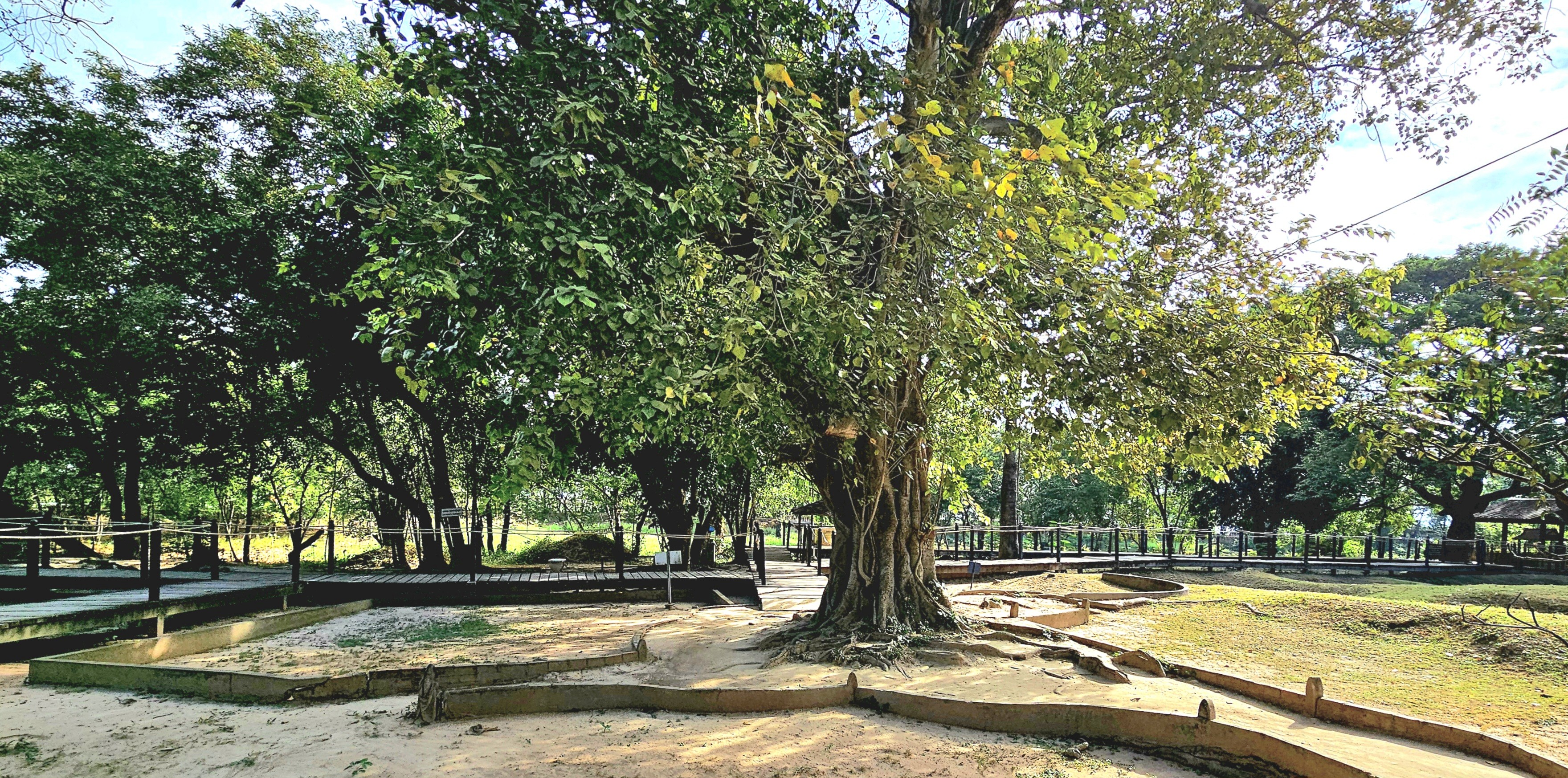
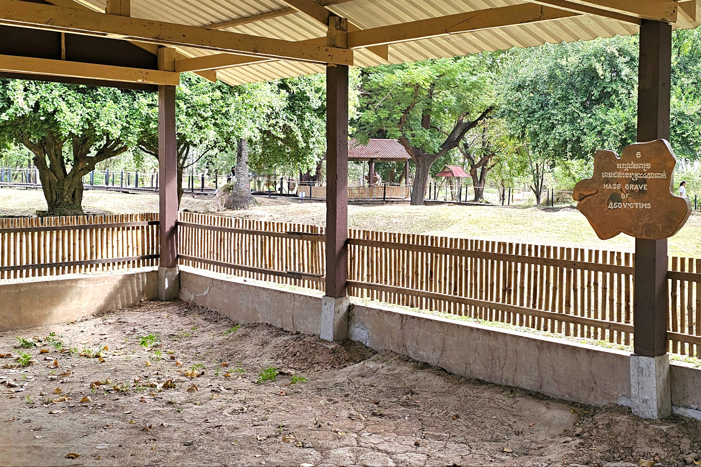
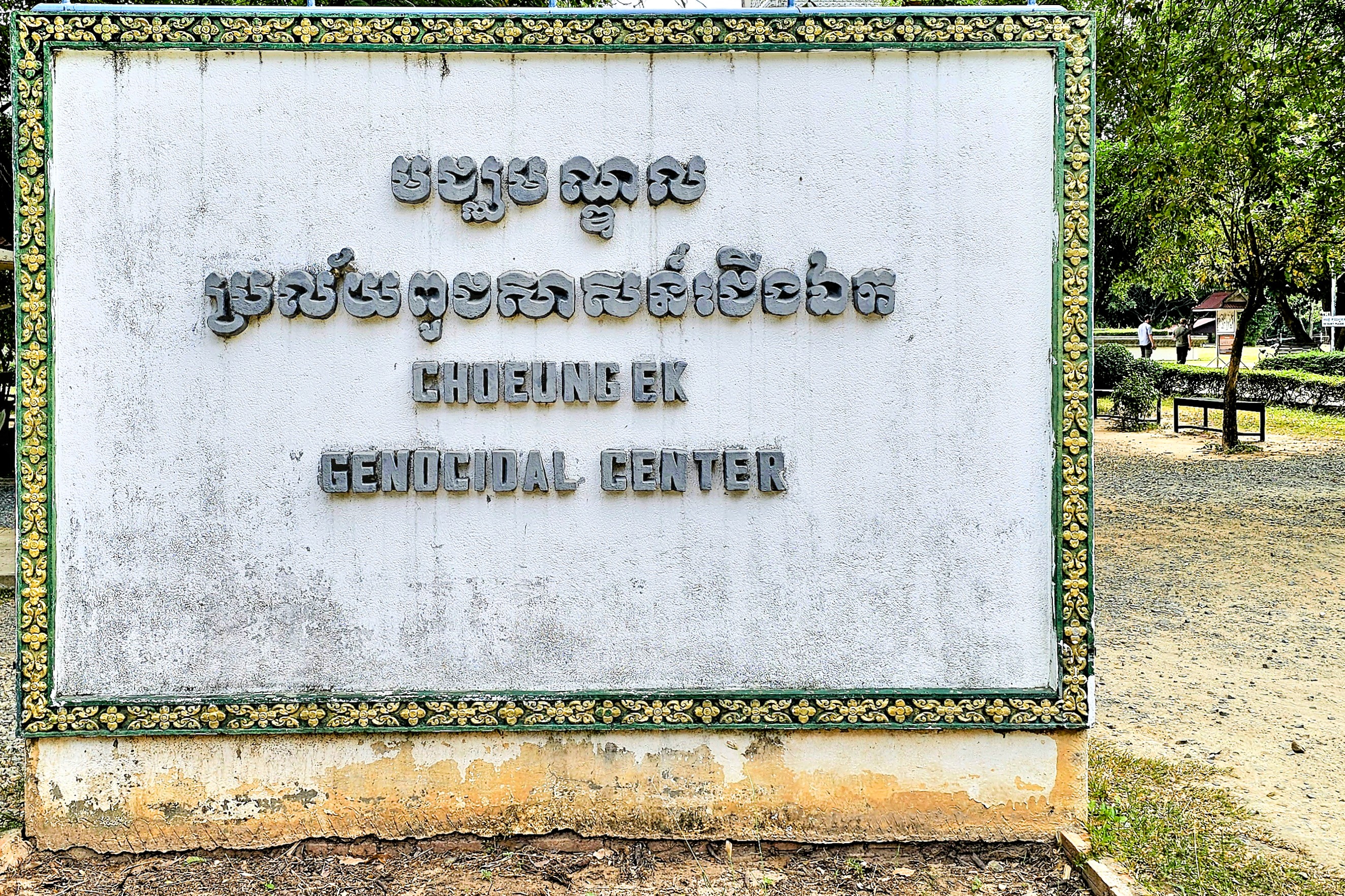
At first glance, Choeung EK is an inviting greenspace on the edge of Phnom Penh,
with flowering trees,
and a peaceful lotus pond stocked with ancient koi.
Located 12 km from City Center, it’s conveniently adjacent to AEON Mean Chey, the city’s trendiest and largest all-purpose shopping center and fashion mall targeting Cambodia’s rising middle class.
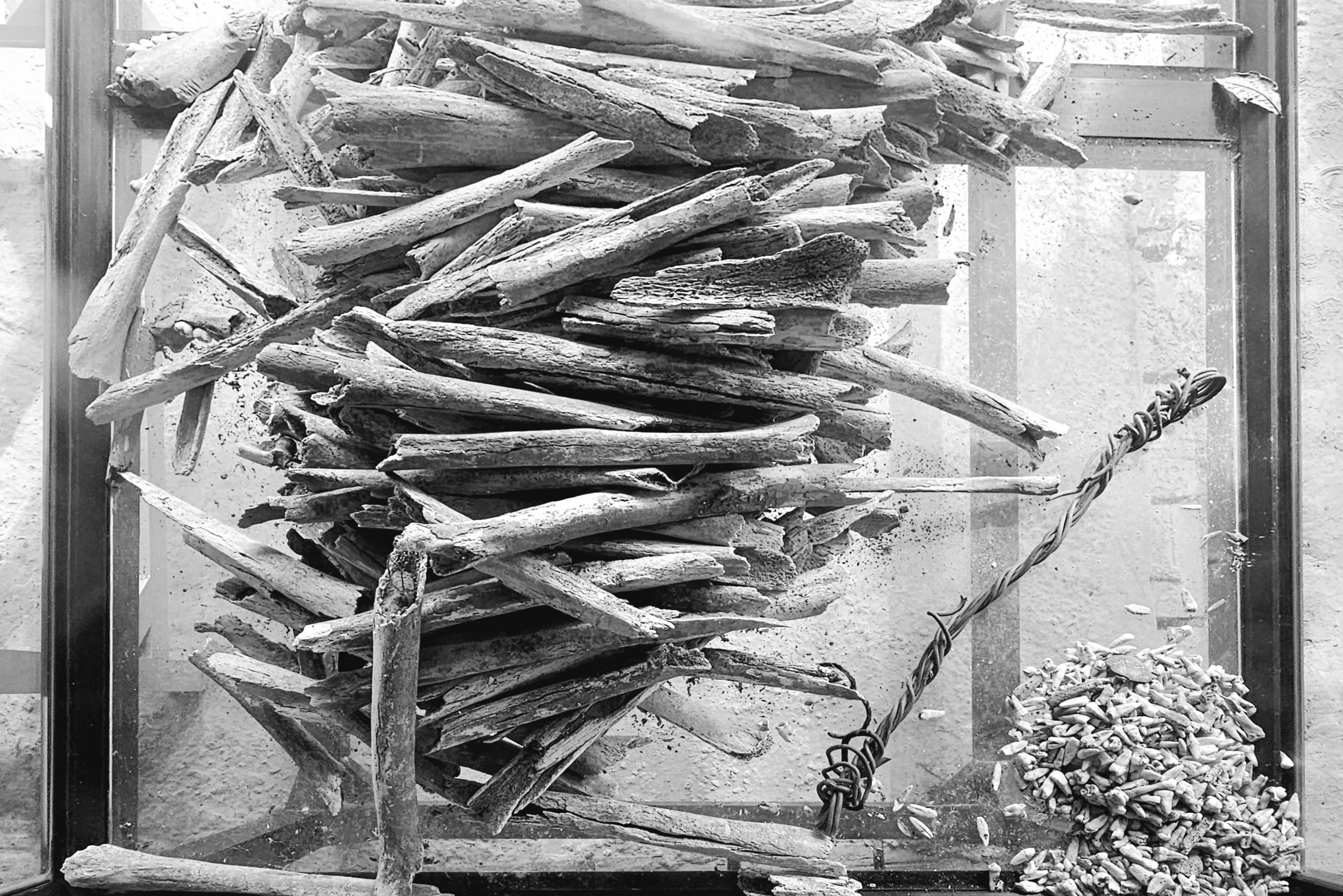
Although, from my perspective, the only fashion that’s display-worthy is a collection of fabric remnants protected in a glass box…
once worn by 20,000 prisoners whose remains continue to float to the surface during every rainy season.
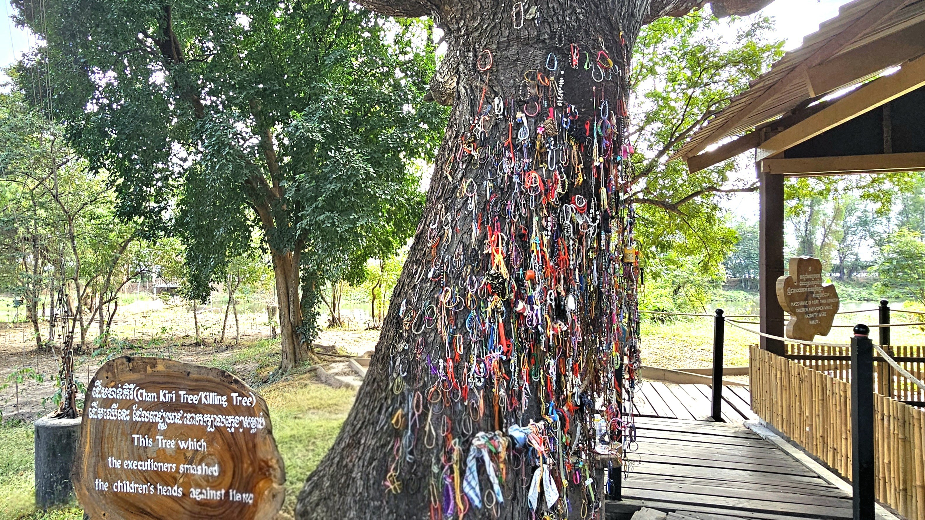
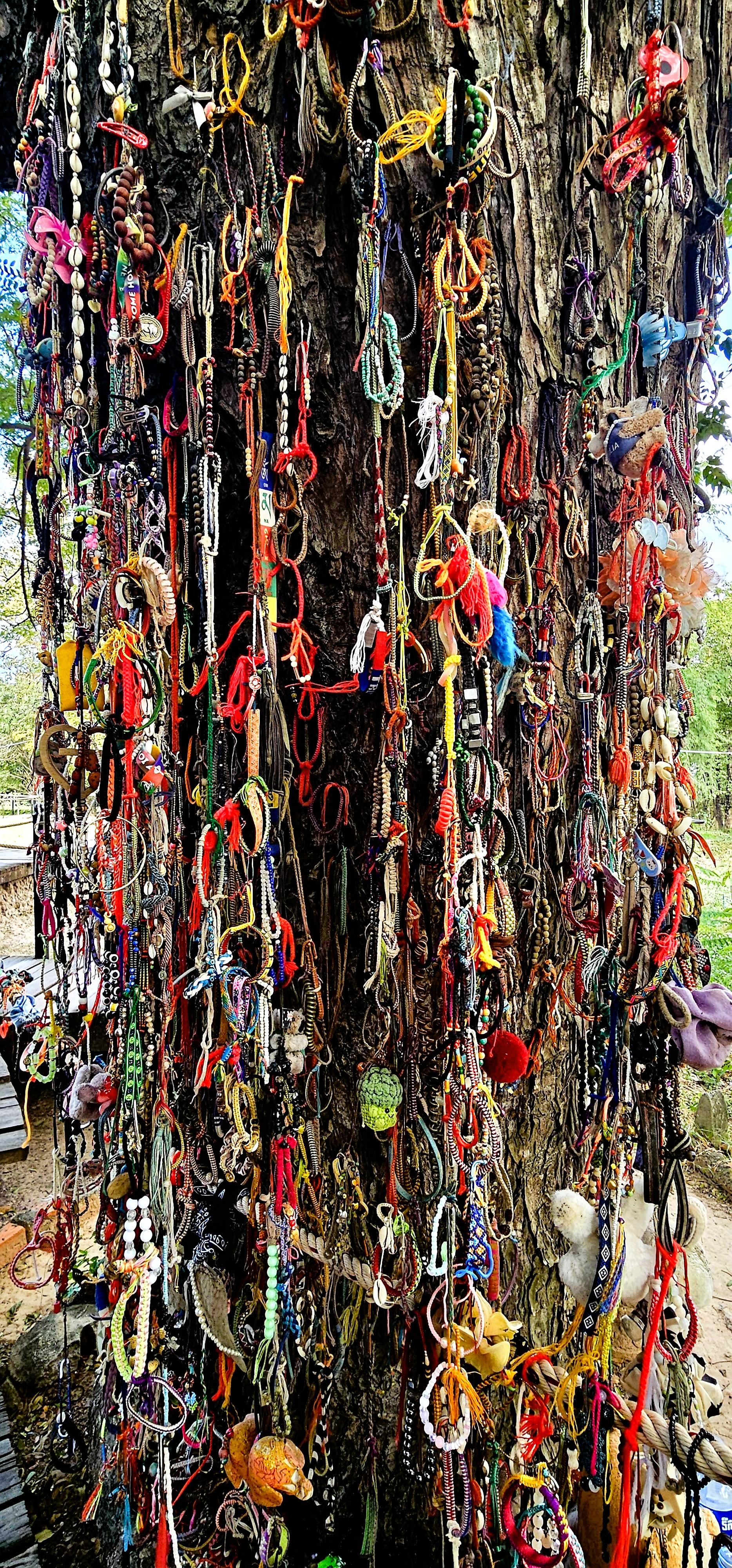
On closer inspection, the heritage trees throughout the grounds were once used as tools of brutality by agents of Khmer Rouge: from towers of dissonance,
to hardwood battering pillars.
Over the years, visitors to Choeung EK Genocidal Center have rebranded this tree as an ad hoc totem to memorialize the fate of thousands of children whose skulls were bashed against it.
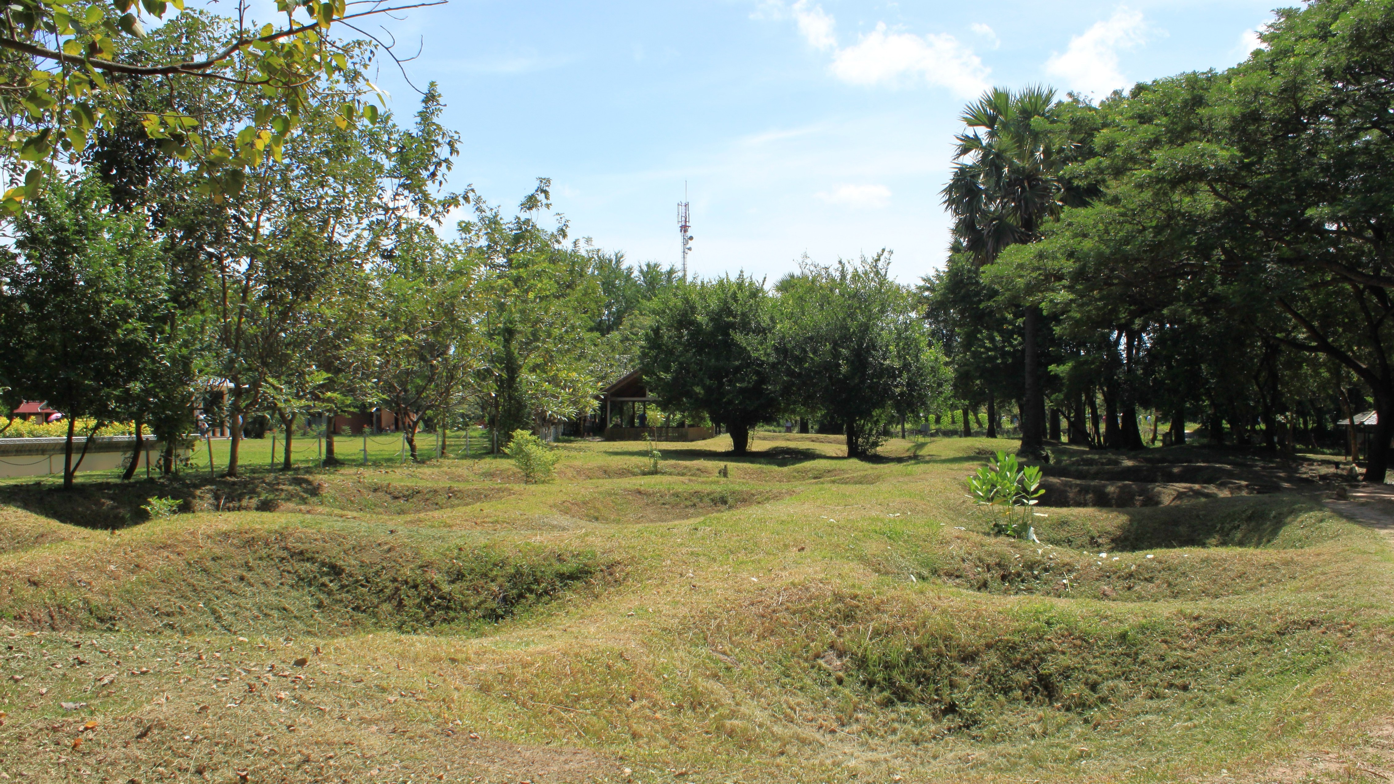
Nearby, a stunning Buddhist stupa rises from the epicenter of the killing field…
housing thousands of adult skulls recovered during a site excavation in the 1980’s.
Between 1995 and 2007, the Documentation Center of Cambodia undertook the most challenging and disheartening task of mapping and documenting Cambodia’s killing fields. Through thousands of interviews and field investigations, DC-Cam identified 19,733 mass graves and 196 prisons that operated during the Democratic Kampuchea (DK) regime.
Choeung EK’s conversion from orchard to reeducation center…
served as a lethal gateway for every soul imprisoned at the notorious Tuol Sleng Detention Center.
All day long, trucks rolled into S-21, herding political enemies into primitive barracks,
where they ultimately met their untimely fate through horrific violence.
In 5 years, an estimated 2 million Cambodians (men, women, children, and infants) were murdered by Khmer Rouge,
accounting for 25% of the nation’s population.
Choeung EK reopened as a historical museum and learning center on January 7, 1989, with a mission to acknowledge the historical atrocities that occurred, and to remind us that violence against each other can have devastating consequences.
Its exhibits, memorials, and curated educational programs engage visitors in meaningful conversations about human rights and reconciliation.
Cambodians will soon commemorate their loss with a National Day of Remembrance. Every May 20th, students take part in an annual ritual–reenacting the crimes of Khmer Rouge guerillas–that still haunt Cambodian people deep to the bone.
On that day and every day, we pray for healing and understanding, and the realization that confronting past acts of inhumanity will inform and guide the well-being of future generations.
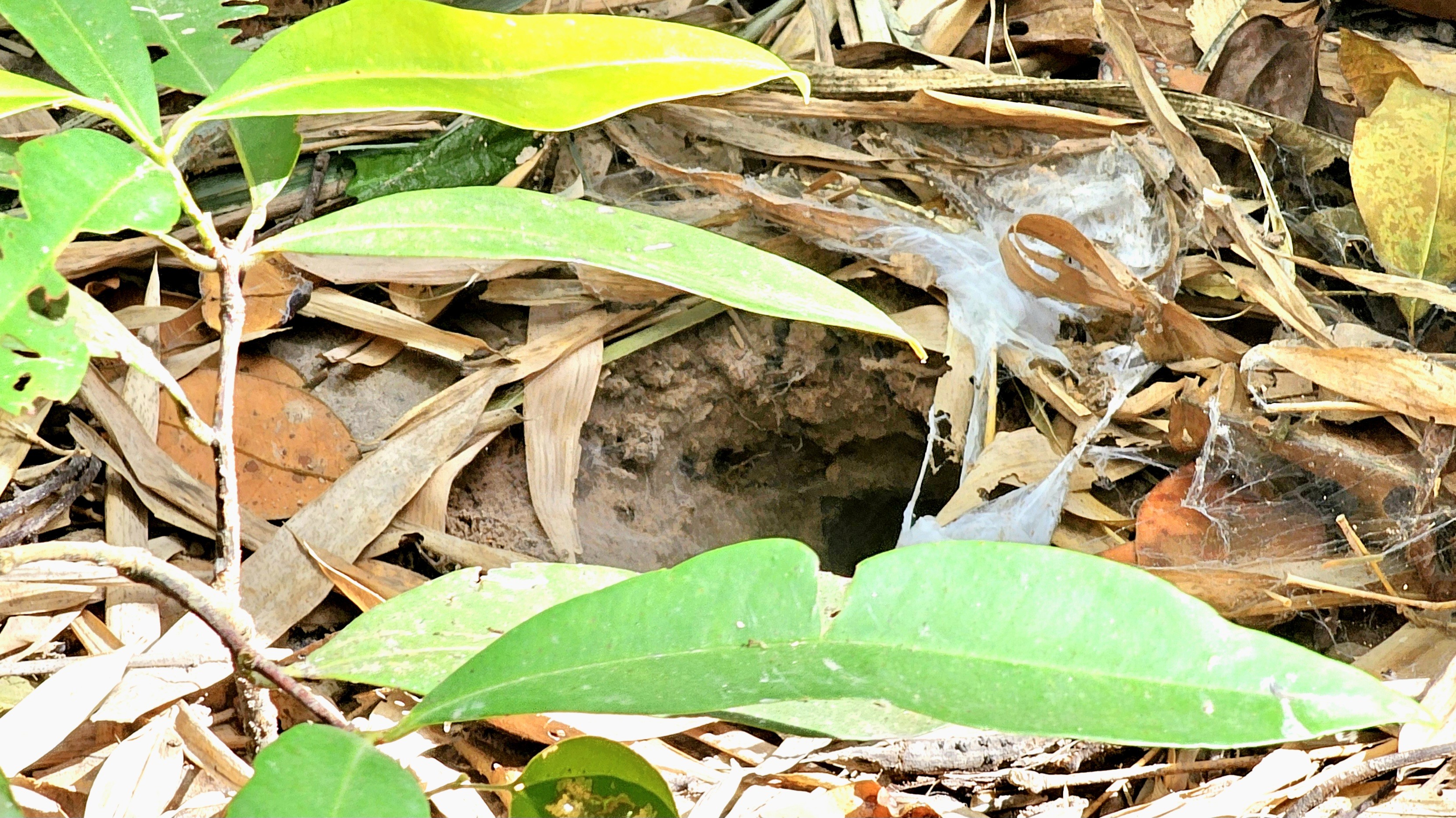
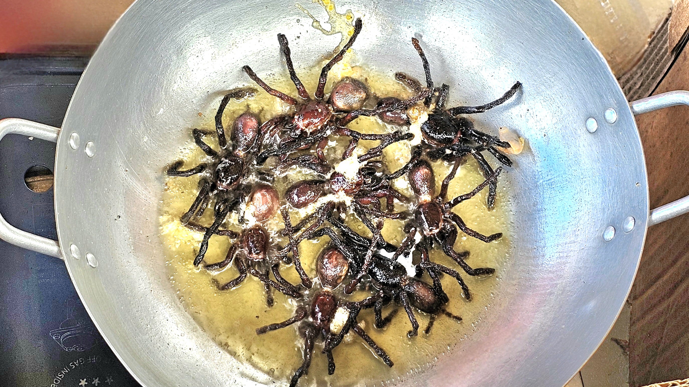
We were only 50 miles into a 200-mile road trip when our driver pulled up to a roadside shack on Natl Hwy 6 in Skón. It was our first potty break on the way to Siem Reap from Phnom Penh, but Seong, our guide had a different motive for stopping. We were standing on the edge of the jungle in Kampong Thom province to meet the “Spider Woman” of the town locals refer to as “Spiderville.”
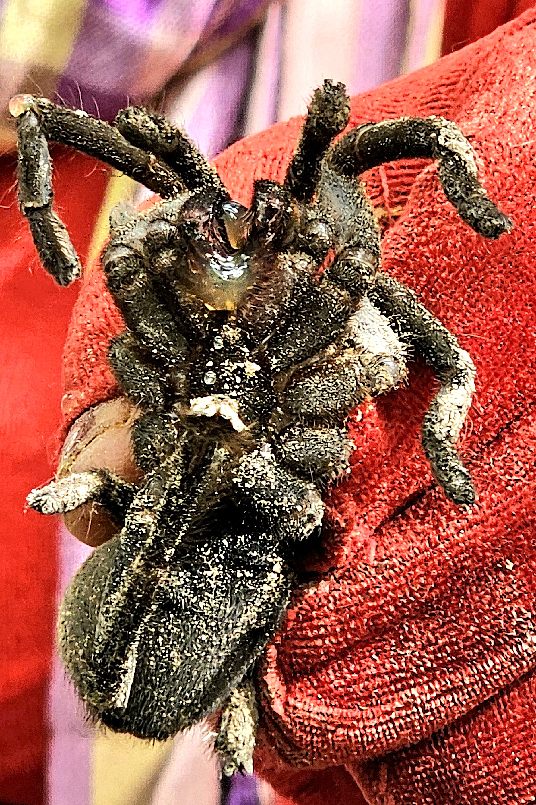
She and her young daughter manage a thriving tourist trade of hunting and preparing Thai zebra leg tarantulas for snacking.
Historically, eating bugs, or entomophagy is nothing new for Cambodians. The practice is embedded in Cambodian culture, as shamans believe in its healing powers for heart, lung and throat ailments, as well as its potent aphrodisiac properties.
All the same, I can’t imagine why anyone would ever consider eating a tarantula, but during the Khmer Rouge regime from 1975-1979, eating eight-legged creatures became the new normal, thanks to the great food scarcity. Estimates from The U.S. Holocaust Memorial Museum suggest between 500,000 and 1.5 million Cambodians perished from Khmer Rouge–induced famine, causing a desperate populace to hunt for anything that wriggled or crawled as dinner.
Decidedly, Cambodia’s appetite for tarantulas has evolved from the venomous (Pol) Pot stirrer on the countryside menu, to where it has become culinary currency. A skilled spider hunter/vendor can unearth up to 200 of these creatures (known locally as A-ping) in a couple of hours and fry them up for $1 each, reaping big profits.
All it takes is a small shovel, a stick, and locating their hidden, silk-laden lair–
something Spider Woman knows all too well.
Once captured, A-ping was defanged to protect us from its venom, making it safer to handle without being bitten.
Without hesitation, they were very curious to explore new territory as they “tiptoed” across my arm on their hairy legs, dragging their velvety abdomens. It was truly a weird sensation.
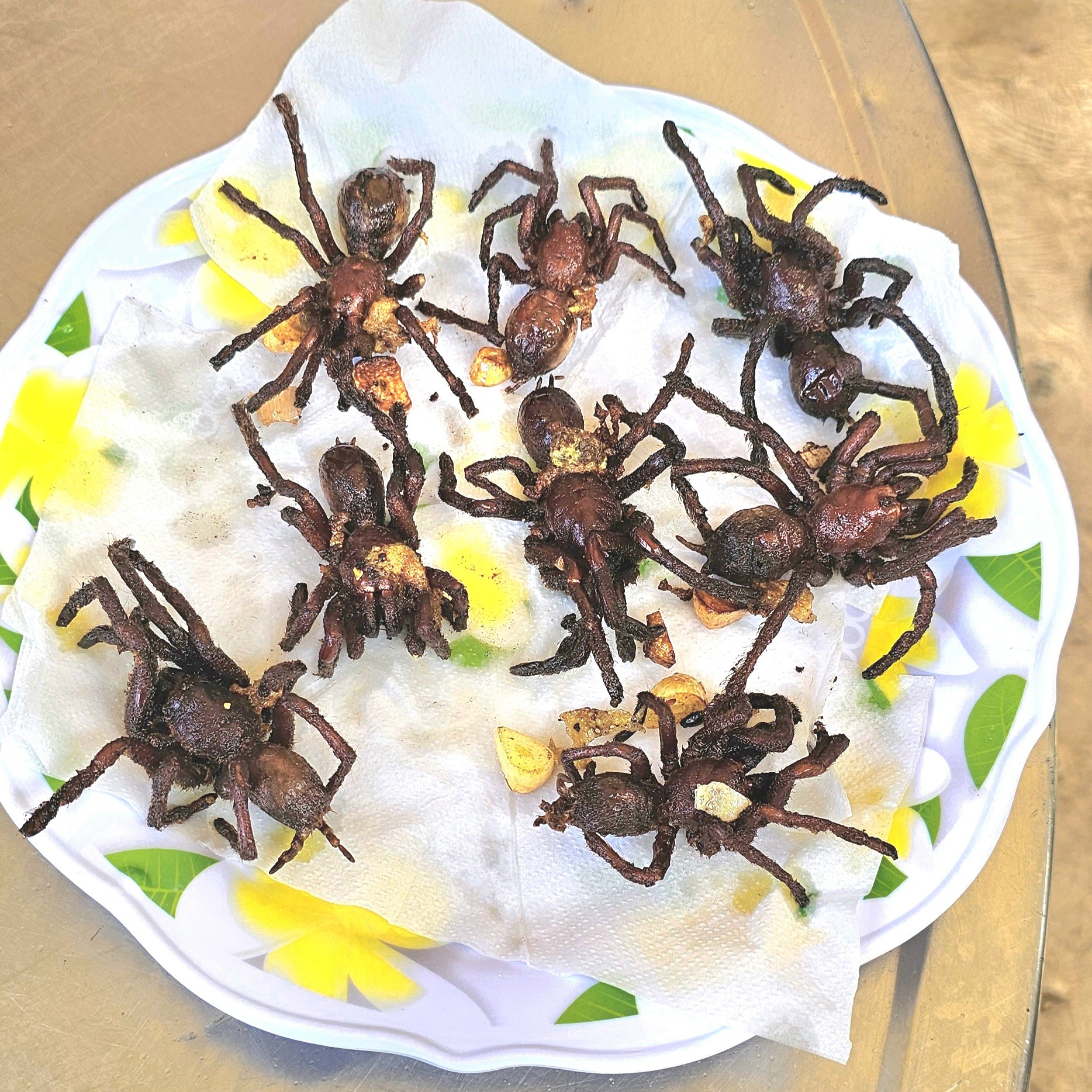
As for tasting A-ping, the recipe is simple and straightforward. Saute chopped garlic and grated ginger in a wok of hot palm oil until golden. Add a dozen tarantulas and coat evenly with oil until their bellies explode into a yokey paste.
Season with salt and pepper to taste and blot the excess oil on a paper towel before enjoying.
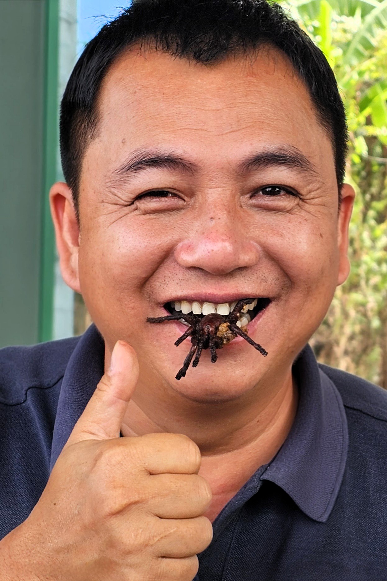
Not everyone in our group was hungry for arachnids, although there were a few intrepid souls. The faint-hearted mused that it would spoil their lunch, while Leah was sick at just the thought of putting it in her mouth. But before anyone of us would commit, we demanded a demonstration. Our guide was eager to oblige, touting it as a valuable source of protein, folic acid, zinc, and iron.
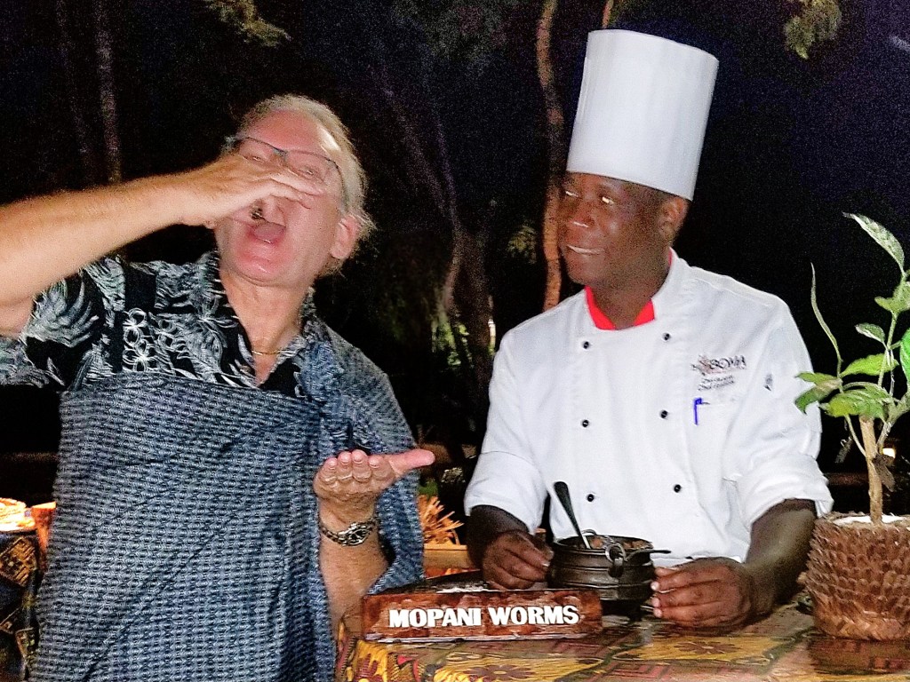
“What does it taste like?” we asked. But Seong was silent on the matter. He was too busy chewing. While I’ve “enjoyed” crickets in Sumatra, and mopane worms in Zimbabwe, I’ve never experienced tarantula on any menu …
until now!
So, what does deep-fried tarantula taste like? It was crunchy on the outside, and gooey on the inside, not unlike soft-shelled crab–with a similar taste and texture. However, the large round, hairy abdomen–the source of all the spider organs–tastes a bit gamey.
While there currently seems to be an inexhaustible supply of tarantulas in Cambodia, systematic deforestation throughout the kingdom may be a nail in the coffin for this delicacy and could even lead to a decline in their numbers, say some experts. But for now, the demand for munching on A-ping continues to creep up.
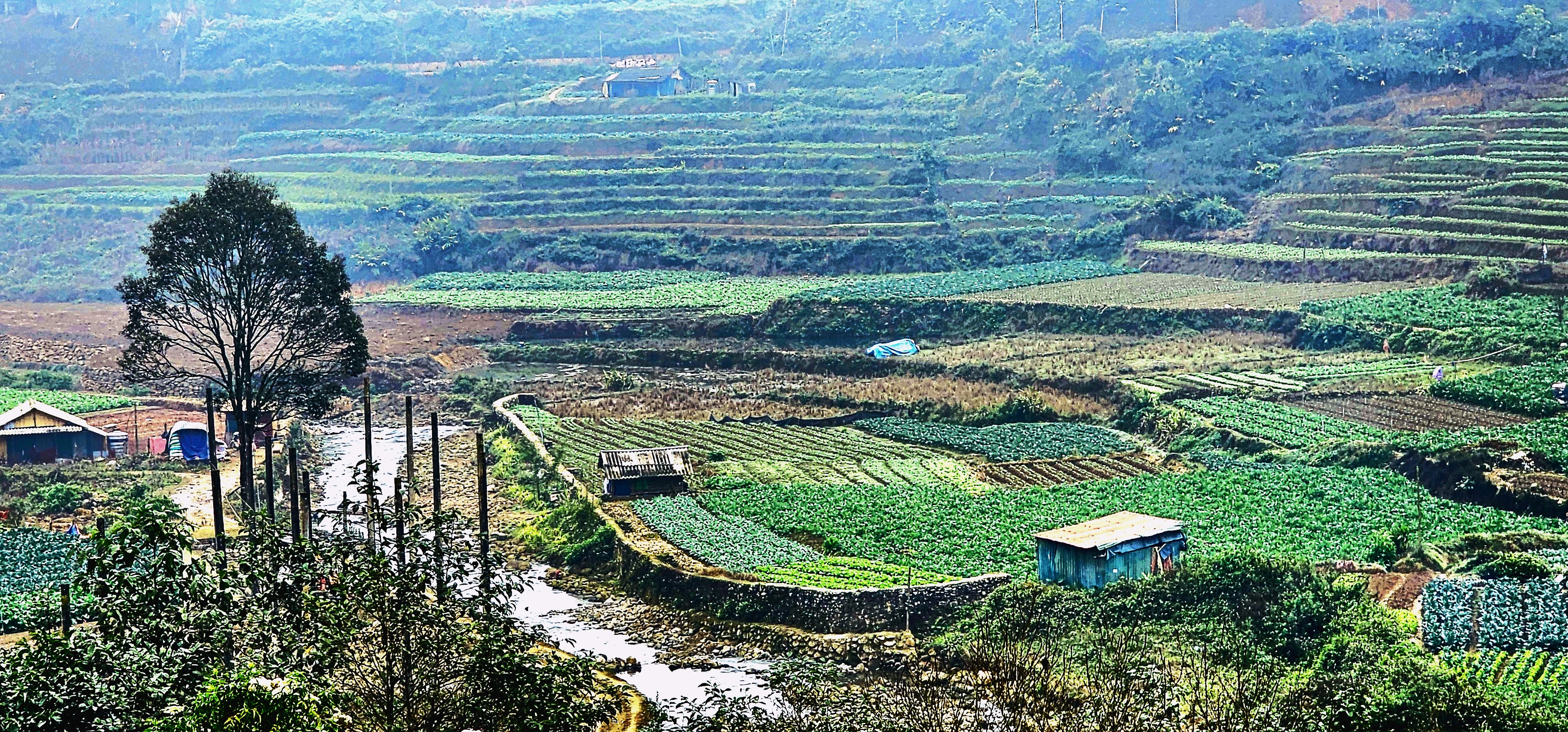
Lao People’s Democratic Republic is a poor country by any measure. According to the International Monetary Fund, Laos ranks eighth among 11 ASEAN nations in GDP per capita, with an annual income of $2,000. That’s a $1 per hour!
There are many contributing factors to Laotian poverty:
As the only landlocked country in Southeast Asia, Laos experiences significant logistical challenges due to its lack of direct sea access, which raises transportation costs and hampers trade competitiveness. Additionally, the mountainous terrain and dense forests hinder infrastructure development and access to rural areas, exacerbating poverty rates.
Laos could benefit from a more robust power grid, a reliable communication network, and improved sanitation system to bolster economic activity and improve the quality of life.
Inadequate infrastructure is a major barrier to economic development in Laos. The country’s transportation system is poorly developed, with few roads, no national railway, and a heavy reliance on unreliable river transport. This lack of connectivity restricts the movement of goods, people, and services, particularly in rural areas.
However, China saw an opportunity to elevate its status as top trading partner in 2024, surpassing Thailand with bilateral trade totaling $8.23 billion USD. Also notable, Chinese investment in Laos has expanded steadily since the Lao government introduced policies to promote trade and investment. Since 1989, China has funded 927 projects worth more than $18 billion USD, making it the largest investor in Laos out of 53 countries and regions.
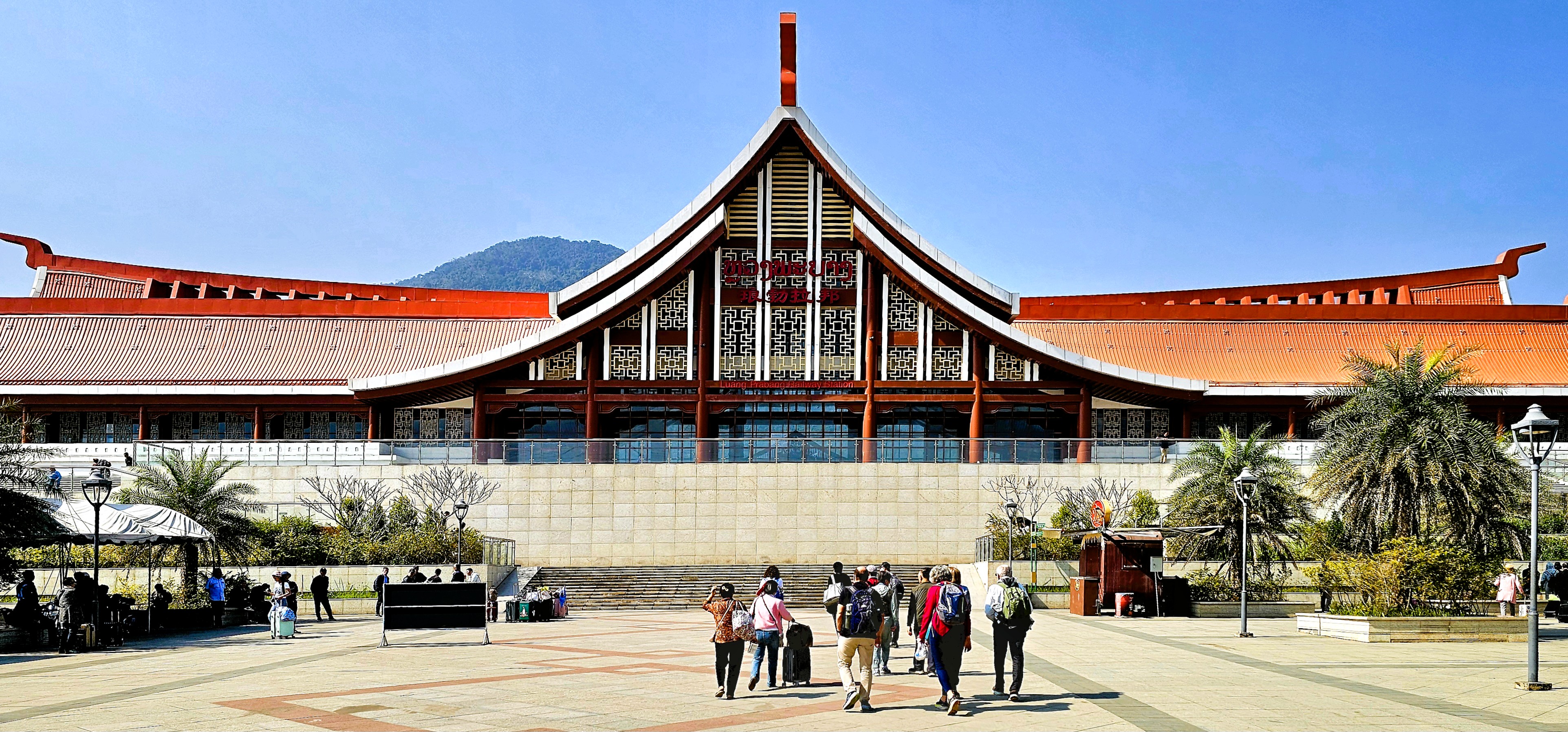
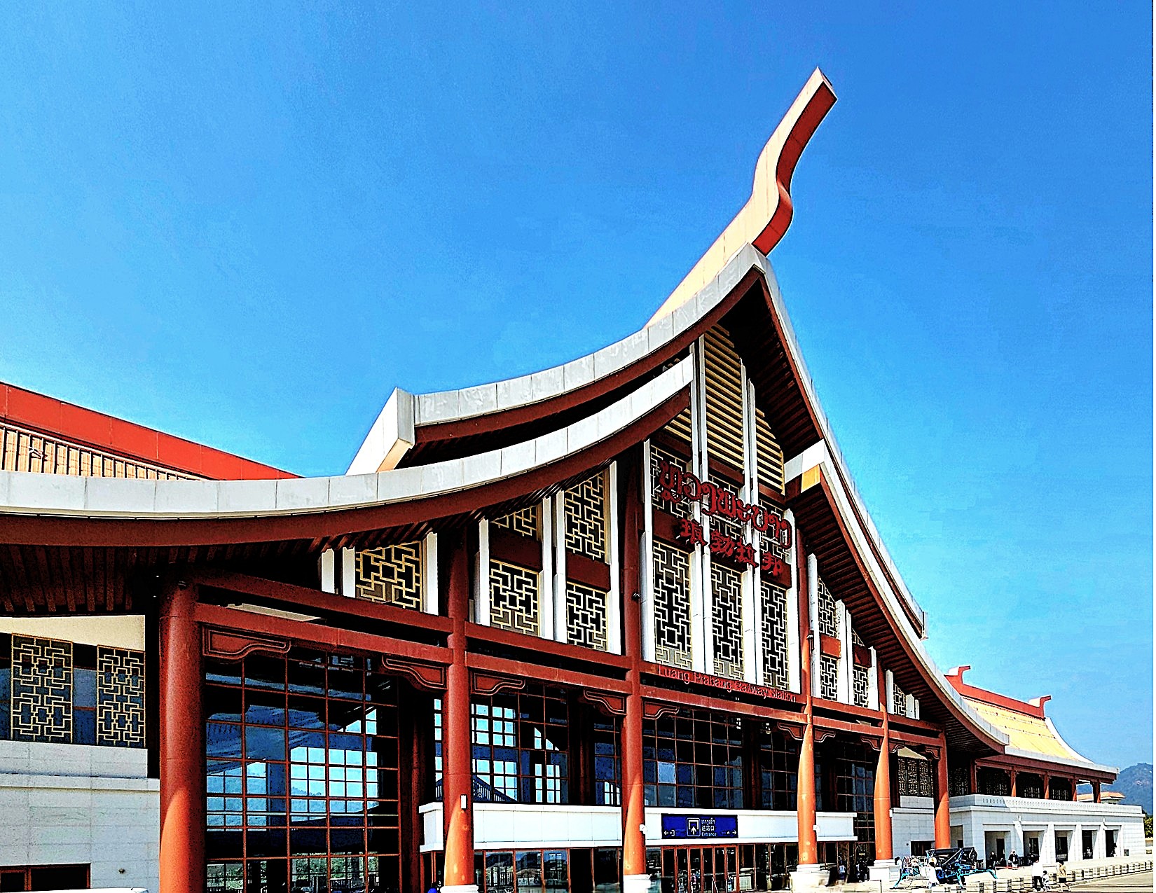
At a cost of $6 billion USD, the Laos–China railway is one investment that’s poised to yield future benefits as a key developmental project in Laos’s national goal to become a “land-linked” economy.
Opened in December 2021, the new high-speed railway snipped 6 hours off the traditional 8-hour journey from Luang Prabang to Vientiane.
Designed with a fusion of traditional Lao stylings and modern flourishes,
the station hall in Luang Prabang can accommodate 1,200 travelers, although the station was relatively empty while we waited for our departure to Vientiane, the capital and largest city of Laos, and the country’s economic nerve center.
Two hours later, we are admiring lush palaces,
ornate Buddhist temples that bear witness to Laos’s rich cultural heritage,
and imposing government landmarks,
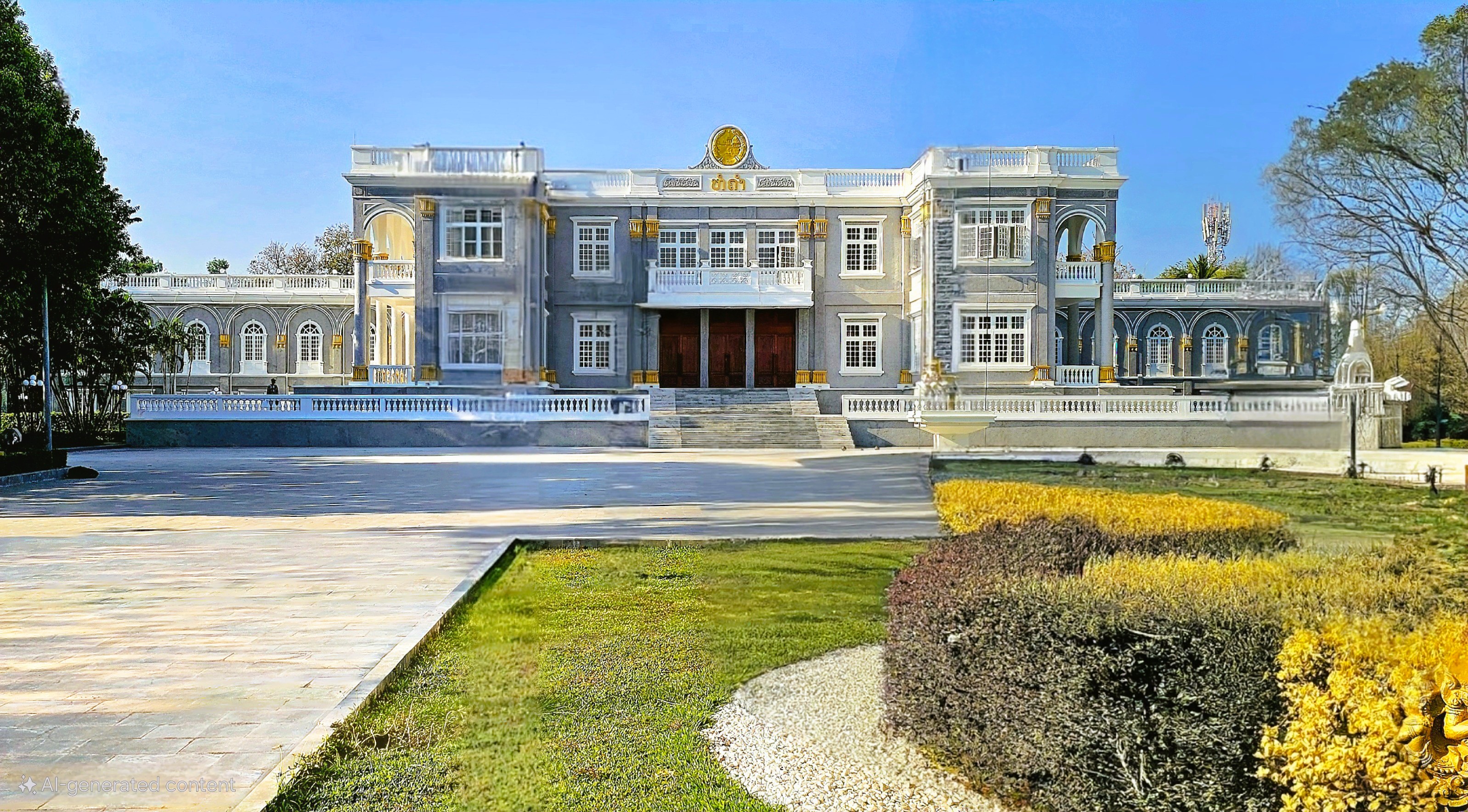
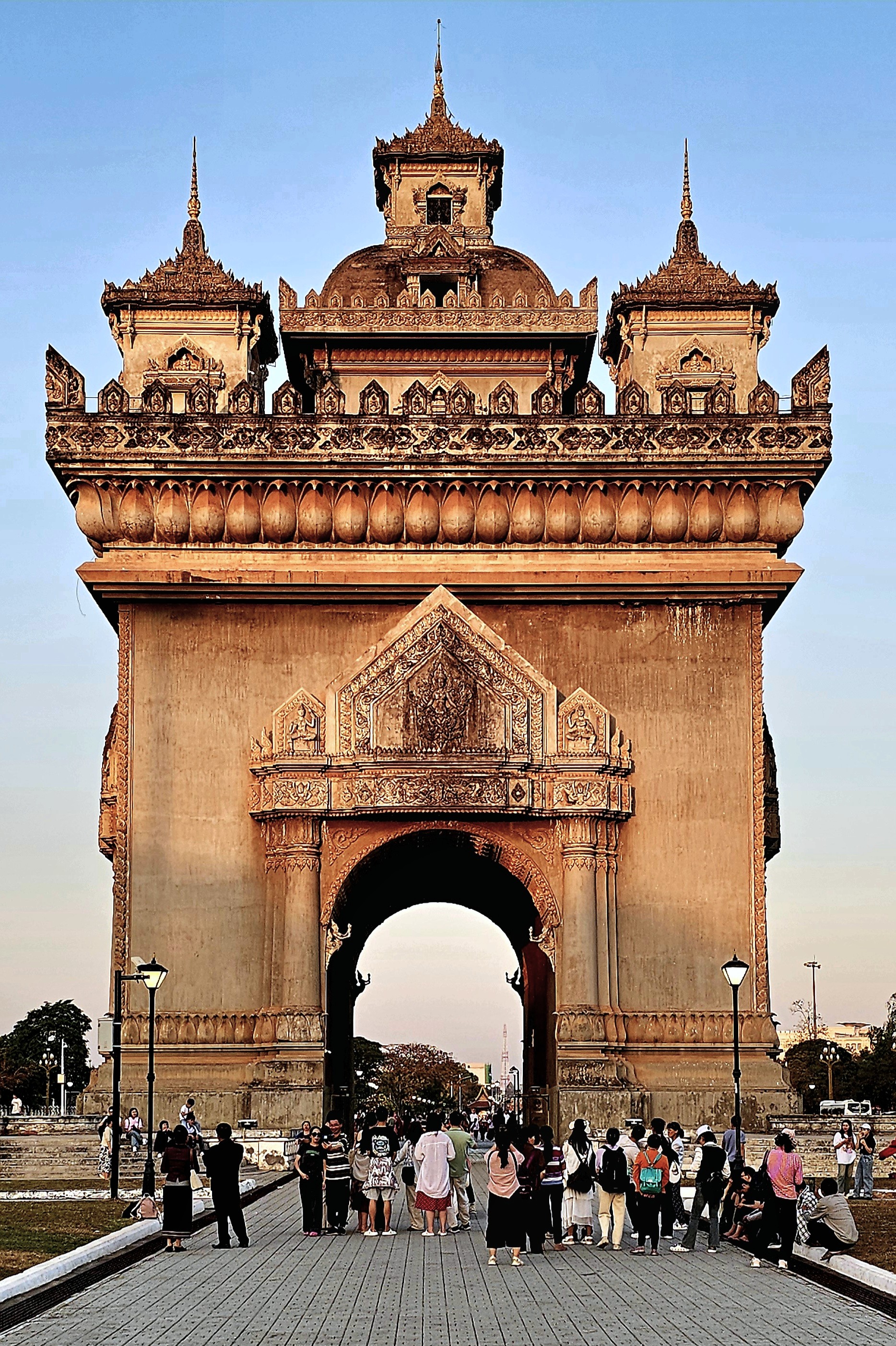
including the Patuxay (Victory Monument), a downtown landmark built between 1957 and 1968 to honor the brave Laotian soldiers who fought against French colonialism, ultimately paving the way for the nation’s full independence in 1953.
With a wink and a nod toward French colonial architecture, the monument is patterned after the Arc de Triomphe in Paris, and features distinctive, mythological creatures such as the kinnari–part human, part bird–inside the arch.
And the adjacent Patuxay Fountain with dancing water becomes the perfect nighttime complement.
But the jury is still out on the local impact of Chinese investments in Laos and whether the bolstered economy has trickled down to its 7.87 million inhabitants. By the numbers, it’s far from a quick fix, as Laos’s predominant unskilled labor market has limited ability to productively absorb China’s investment, creating a debt crisis that appears insoluble.
According to the United Nations, most of the wealth is concentrated in the Vientiane region, where only about 10 percent of the population lives. This disparity is striking, as the top fifth of population possesses 44% of the country’s wealth, while those at the bottom fifth possess only 8%. Vientiane presents a stark divergence from the economic hardships prevalent in the rest of the country. While urbanites may enjoy satellite TV and lavish meals at fancy restaurants, peasants in rural parts can go hungry, particularly if climate affects their crops or fishing prospects.
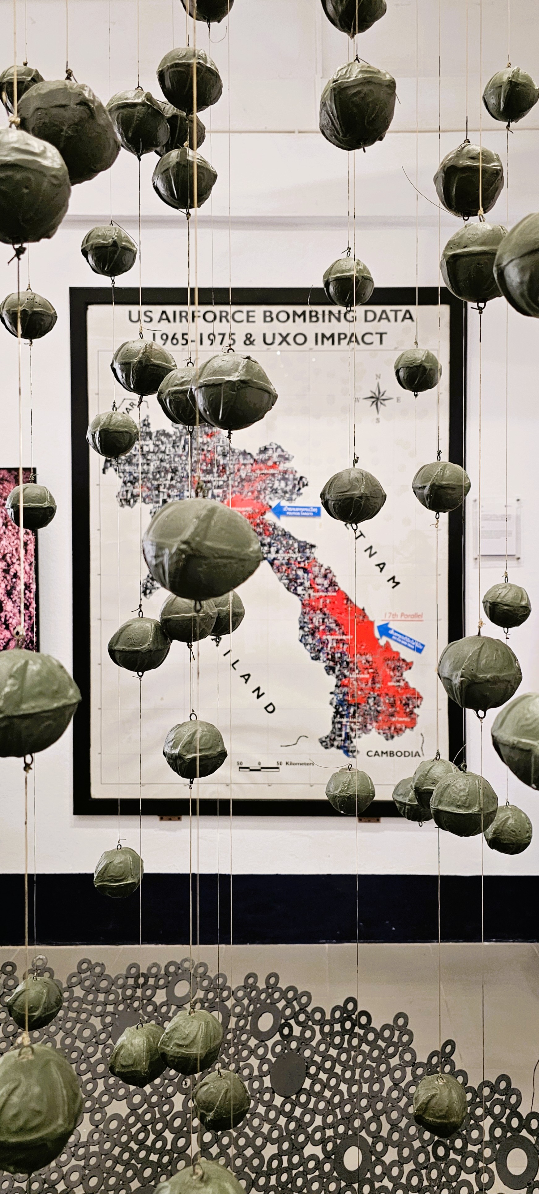
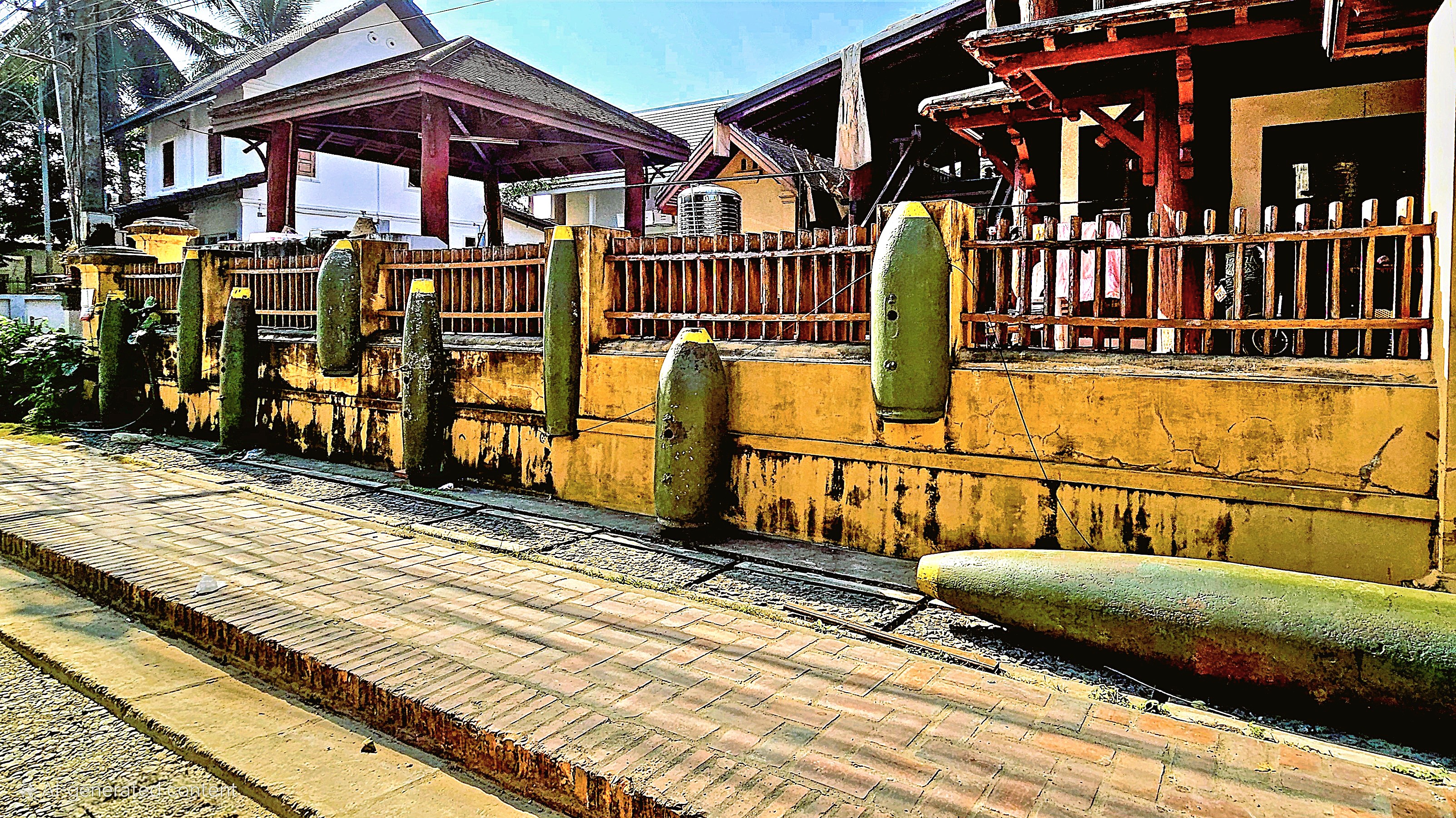
To exacerbate the situation, Laos holds the tragic distinction of being the most bombed nation in history due to the 2nd Indochina War (Vietnam War). Between 1964 and 1973, the United States dropped over 2 million tons of munitions (270 million cluster bombs) across Laos during 580,000 bombing missions–much of it focused on the Ho Chi Minh Trail that paralleled the Vietnamese border.
According to the National Regulatory Authority for UXO/Mine Action Sector, an estimated 80 million unexploded devices still litter the country, threatening lives and livelihoods. Since 1964, nearly 51,000 people have been killed or injured, with an average of 100 victims losing their lives each year.
Children often mistake remnant cluster bombs for playthings, leading to 40% of bomb-related fatalities involving minors. Consequently, with 80% of Laotians relying on their land for sustenance, individuals face the dire choice of risking their lives so they may tend fields dangerously littered with unexploded ordnance.
The LAO PDR government has set a bold target to remove all unexploded ordnance by 2030, recognizing the significant threat these remnants of conflict pose to the safety and development of its communities.
To help fulfill this pressing ambition, the government has received invaluable support from numerous countries (South Korea, United Kingdom, Japan, Russia, Norway, and United States) and international organizations–all committed to providing the necessary resources, expertise, and technology to ensure a comprehensive and effective clearance operation …until now!
In 2016, President Obama committed $90 million USD on clearing its UXO in Laos, in addition to the $100 million the United States had spent in the previous 20 years, citing a “moral obligation to help Laos heal.” Funding for the effort also continued under President Biden’s watch. All told, the U.S. Bureau of Political-Military Affairs reported a $391 million investment since 1995, working with The Halo Trust, and Mines Advisory Group (MAG).
The U.S. Bureau states:
This life-saving work is making more land safe for agriculture, infrastructure, and tourism, and driving critical economic development across Laos. From FY 2021 through FY 2023, United States support to the UXO program in Laos has achieved the following results:
Cleared UXO from more than 108 million square meters of land (26,700 acres) across Laos;
Removed and destroyed more than 155,600 pieces of UXO and 116 landmines;
Educated over 270,000 Lao PDR citizens about the risk of explosive hazards in their communities; and
Provided medical assistance to 90 citizens who were victims of UXO accidents.
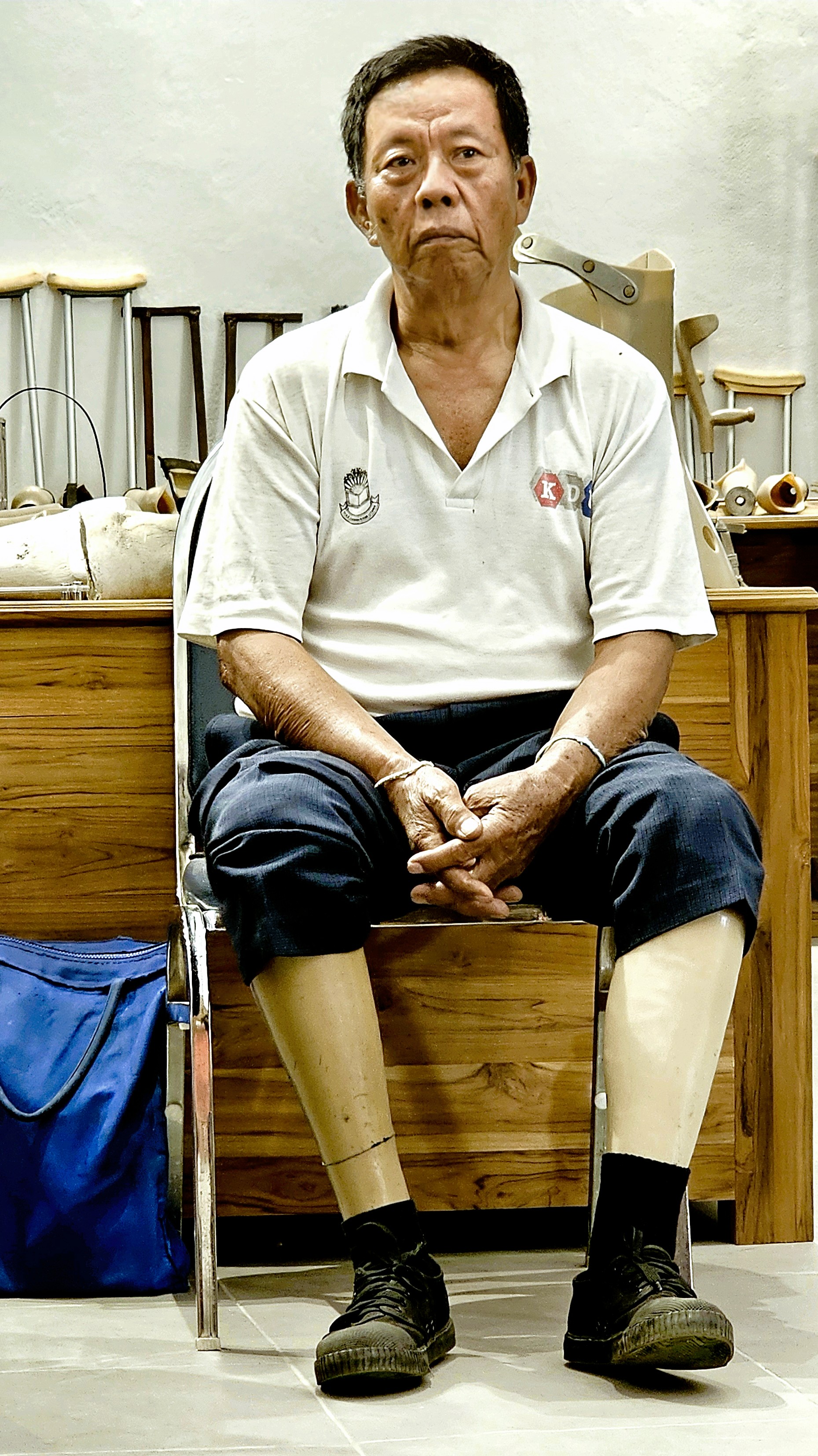
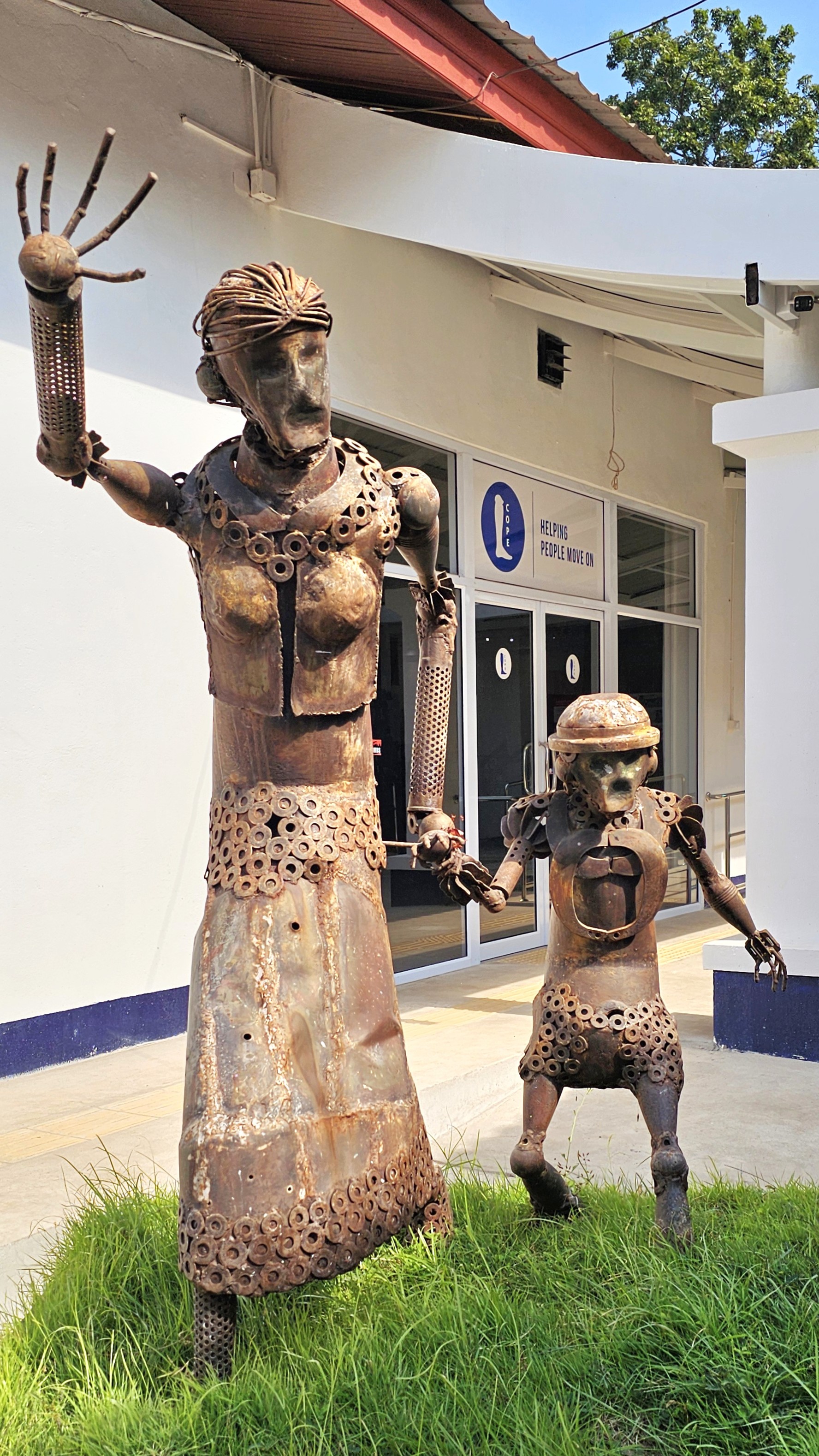
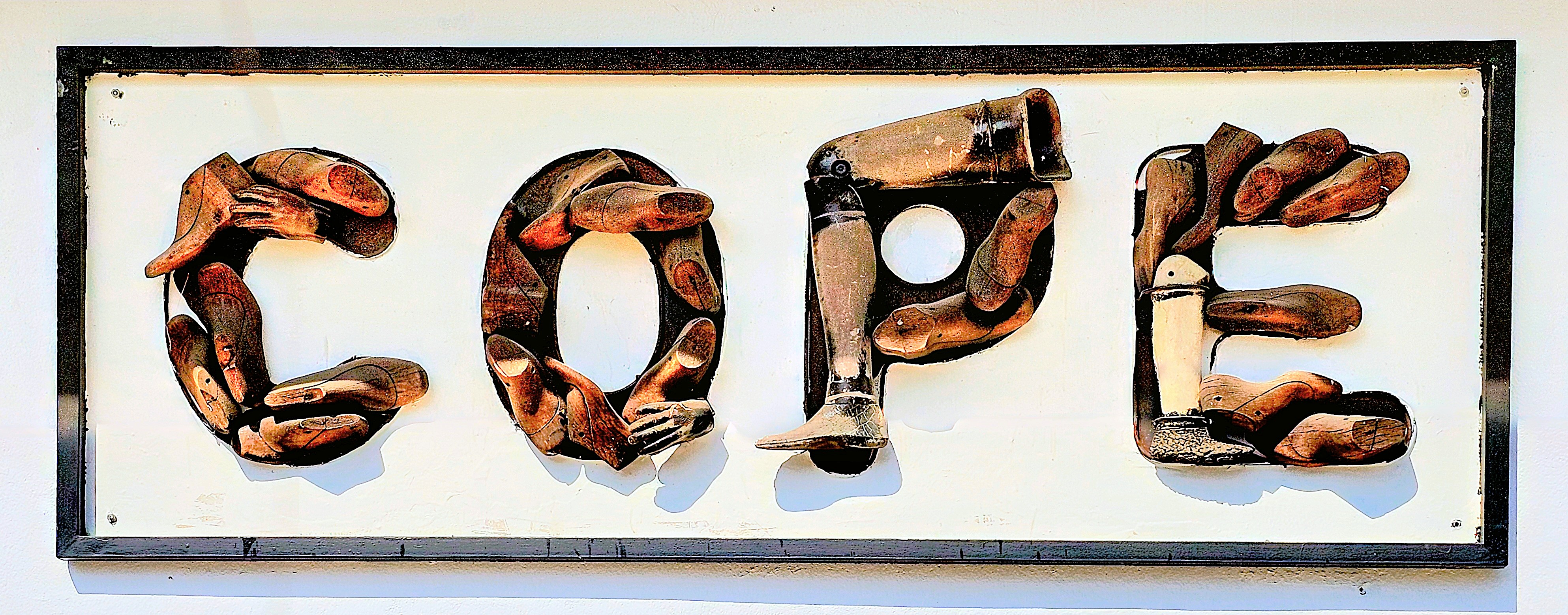
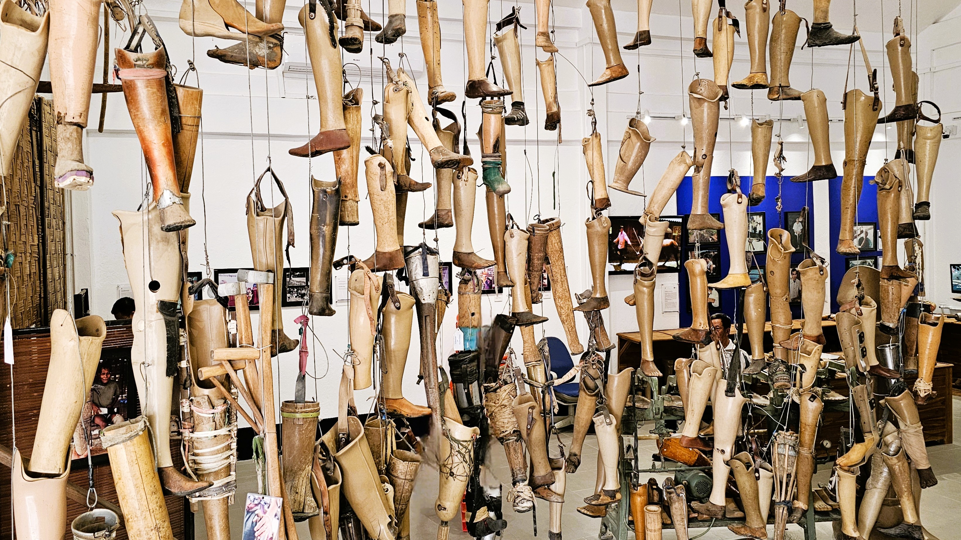
Additionally, the Cooperative Orthotic and Prosthetic Enterprise (COPE), a locally run, non-profit organization supports injured civilians by providing prostheses and physical rehabilitation at no cost.
However, the commendable efforts of The Halo Trust, MAG, and COPE have been unceremoniously halted by President Trump, who has recklessly axed all funding to USAID (United States Agency for International Development) programs. This betrayal has robbed UXO survivors, war victims, and individuals with disabilities of crucial support they desperately need to reclaim their lives and dignity.
USAID once played a crucial role in U.S. foreign policy, using soft power to promote global development, democracy, and diplomacy. Its closure marks a significant shift, raising concerns about America’s reduced influence, as China and Russia expand their aid programs to fill the vacuum.
It’s crystal clear that funding to USAID must be restored. These collaborative efforts highlight the importance of international solidarity in addressing such a critical humanitarian issue, paving the way for a more peaceful future in Laos.
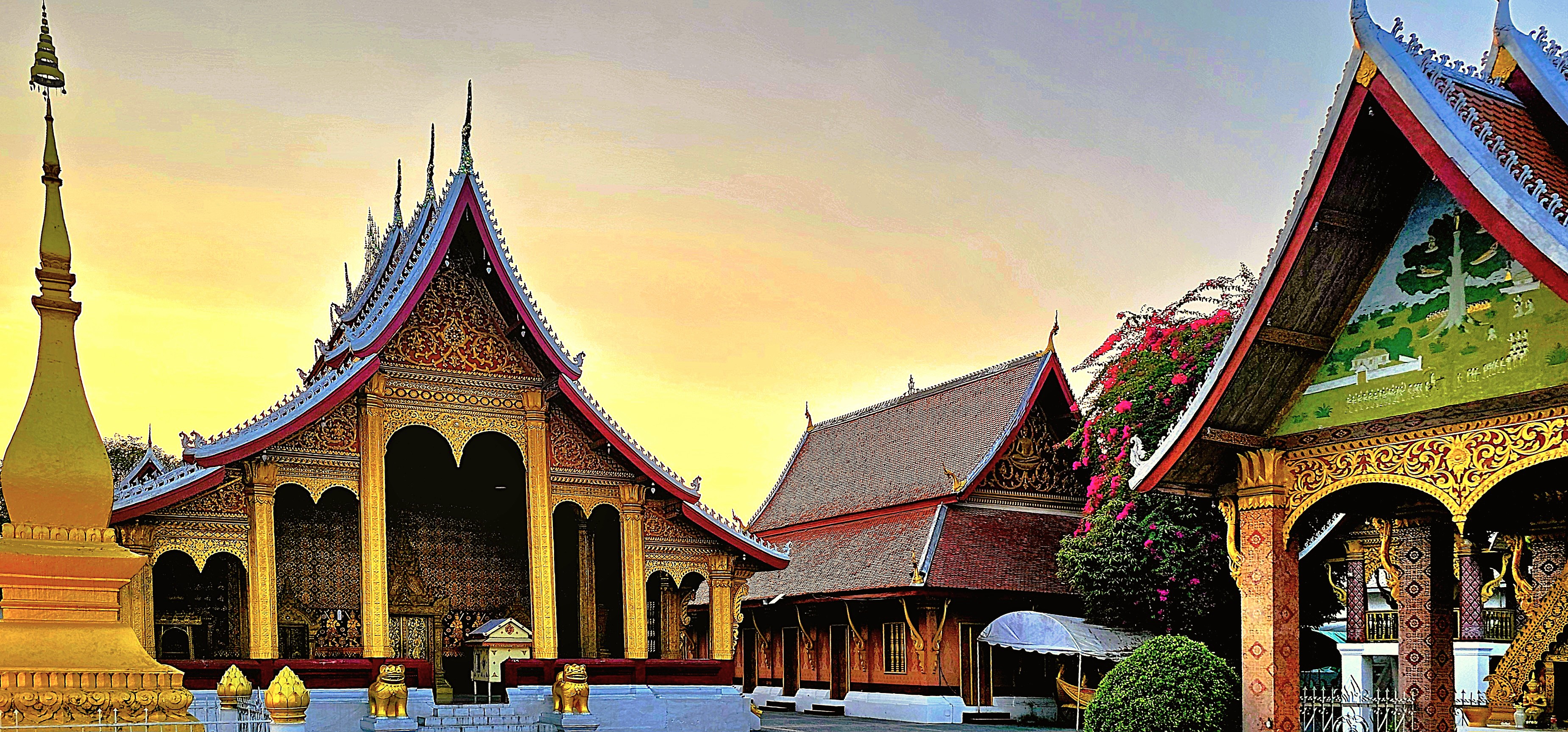
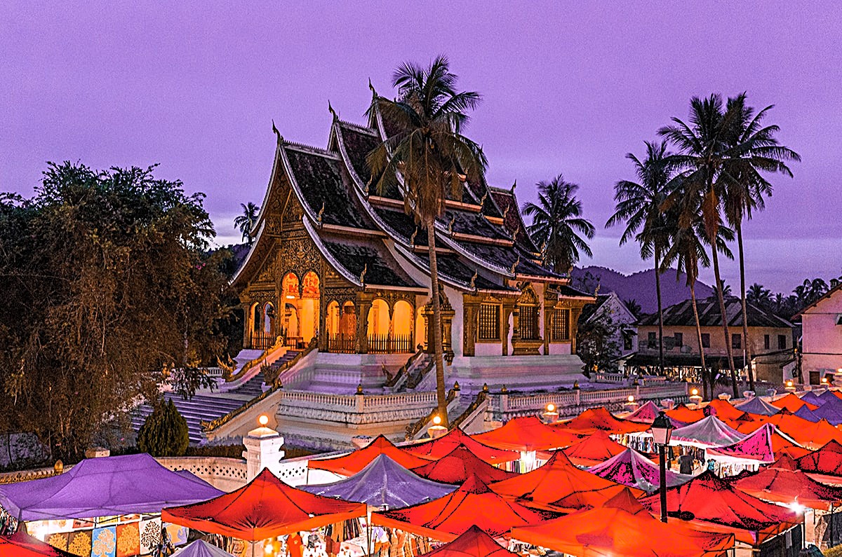
Visiting the World Heritage city of Luang Prabang was an enlightening adventure, given its rich history, its cultural gems, and its natural wonders that draw travelers from around the globe. The vibrant blend of ancient temples and French colonial architecture creates a stunning backdrop for exploration, inviting visitors to wander through its charming streets. With so much to explore, from the serene banks of the Mekong River to the bustling local markets filled with handmade crafts, it’s little wonder why our three days went by so quickly, while only scratching the surface of so many not-to-be-missed activities.
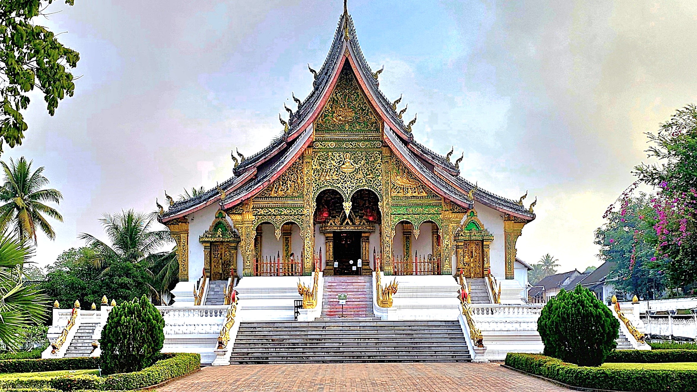
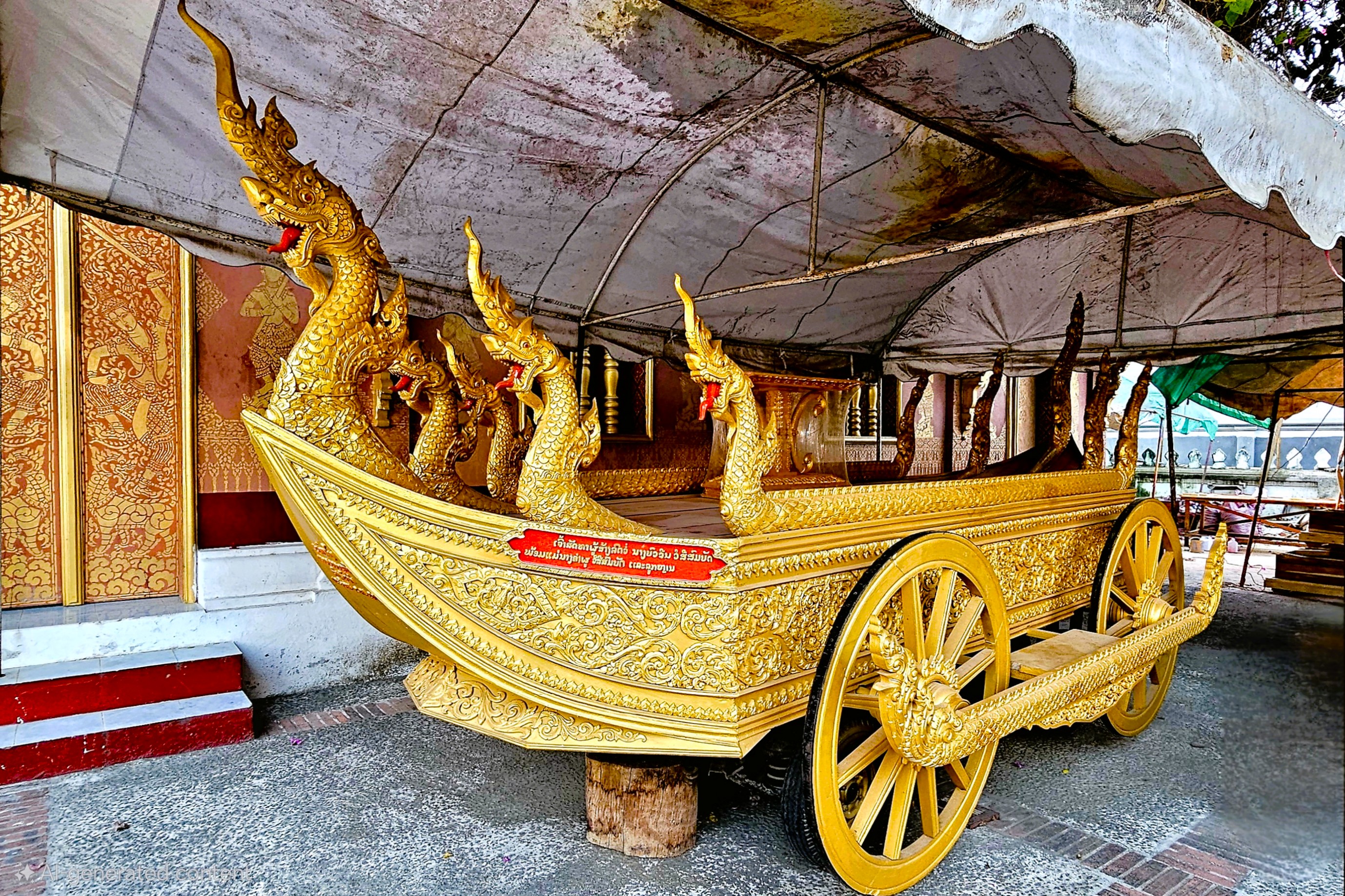
We toured the ancient capital’s Royal Palace-turned-museum …
with its purpose-built shrine housing the golden Phra Bang (translates to “delicate Buddha”), created in Sri Lanka between the 1st and 9th century, and worshipped in Luang Prabang since 1359 as the nation’s most sacred symbol.
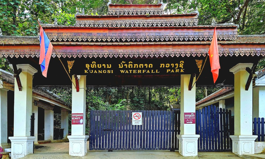
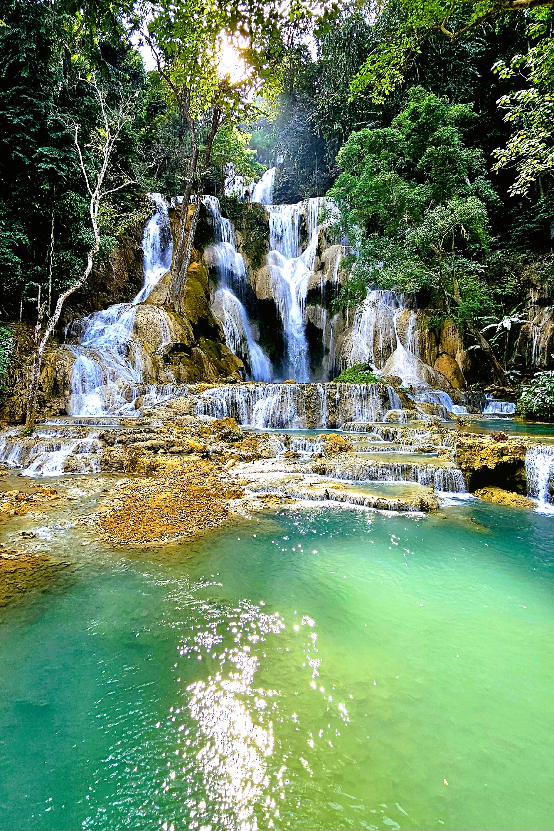
We trekked through Kuang Si Waterfall Park,
featuring a 165 ft drop …
feeding terraced plunge pools of milky green water,
and a rescue sanctuary for black Moon bears and Malayan Sun bears.
After a full day of sightseeing, many in our tour group sought respite at our hotel, the Muang Thong.
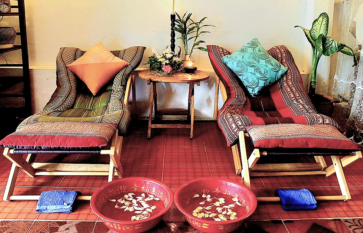
However, Leah and I enjoyed a 60-minute, aromatherapeutic couples massage for $34 at M.K. Wellness Centre only steps from our hotel,
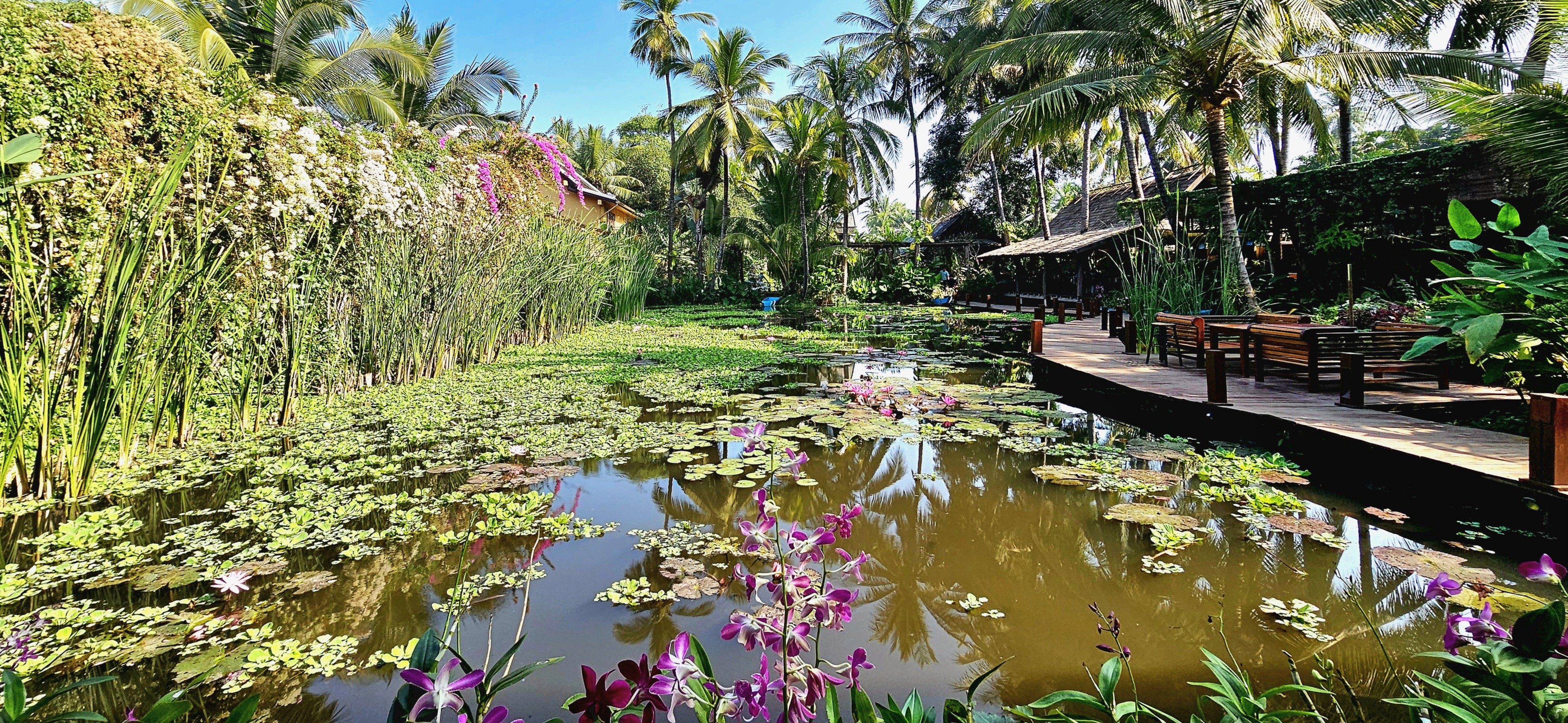
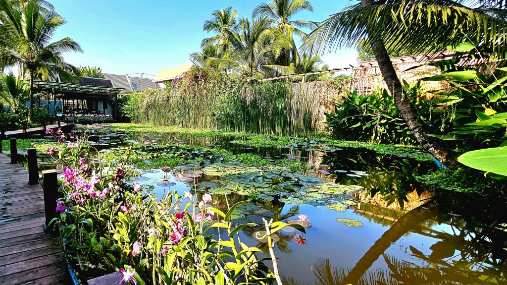
followed by a stroll to a nearby hotel …
where an acre of tropical gardens is thoroughly hidden from the street,
protecting three UNESCO-classified lily ponds …
amid an oasis of orchids …
along a mahogany-clad boardwalk.
Lush flora surrounds the property and covers nearly every surface,
including the living walls.
It was the perfect location to share a special dinner with fellow OATers at the hotel’s on-site restaurant, Manda de Laos,
featuring traditional Lao flavors that had us grinning ear to ear,
and energized to continue our journey to Vientiane the following day.
Overseas Adventure Travel, a familiar name in international group tourism, has a recognized history of offering an array of immersive tours that not only prioritize cultural engagement but also emphasize sustainability while remaining affordable for travelers. Their unique approach allows adventurers to connect deeply with diverse populations and local traditions, fostering genuine interactions.
In alignment with this mission, their charitable partner, Grand Circle Foundation has made a profound commitment to uplift and support the communities they visit around the world. This includes providing essential services in areas such as education, access to clean water, and leadership training, ensuring that the benefits of tourism extend far beyond the travelers themselves.
Since 1992, O.A.T.’s active participation in conservation initiatives aimed at protecting natural ecosystems and preserving cultural traditions has created a positive and lasting impact in every location they’ve ventured into, thereby enriching visitors and communities alike.
We were about to experience this, first-hand.
Our Ancient Kingdom itinerary carved out a few days to explore the ancient capital and UNESCO World Heritage site of Luang Prabang and its ethnic surroundings.
Leah and I got our bearings during our group’s late-day orientation walk through the historic district, where we admired Wat Sensoukharam,
built in 1718 during the reign of King Kitsarath, and restored to its current state in 1957.
Also known as Wat Sen, the temple is believed to have been built using 100,000 stones from the Mekong River, giving the temple its name, roughly translating to Temple of 100,000 Treasures.
With the sun setting on the Mekong,
and commuter traffic saturating Sakkaline Street,
the sidewalk eateries busily prepped for dinnertime crowds.
Down the road, merchants appointed their stalls with purses, pottery and paintings before the weekend procession to the night market, where family and friends flocked for a social evening.
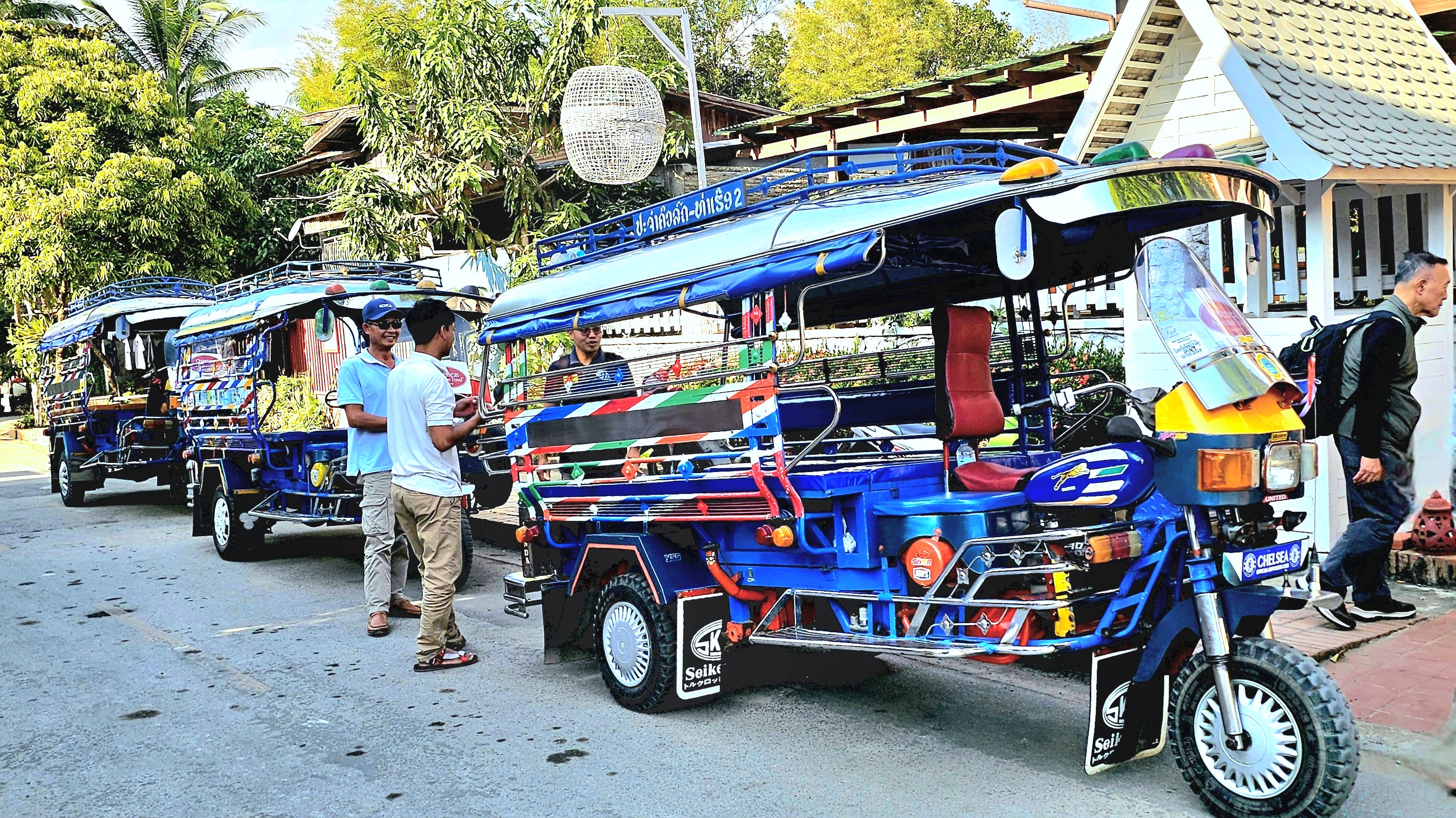
The following morning, we scrambled into jumbos,
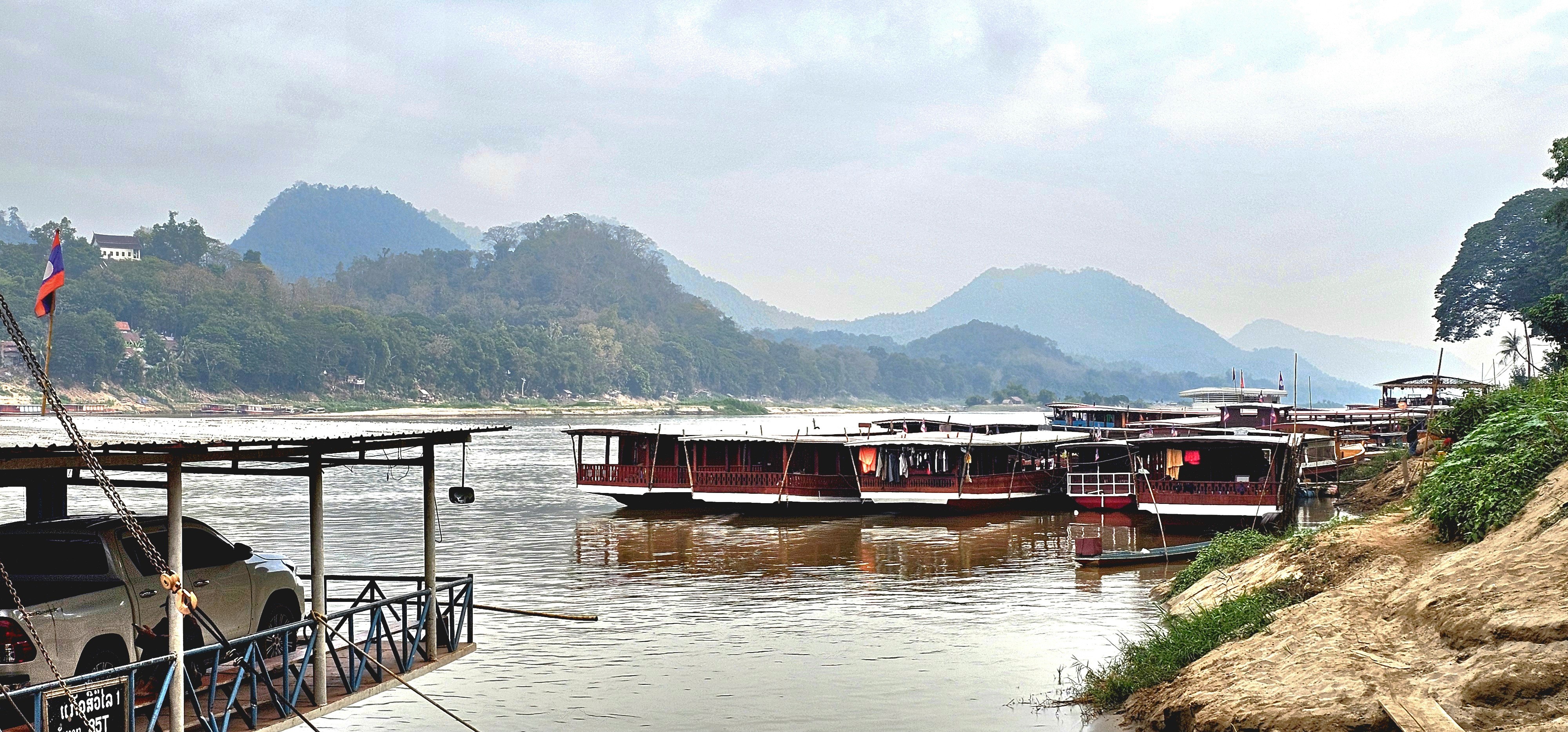
and rode to the Royal Pier,
where we boarded a traditional wooden boat that transported us upriver to a nearby Buddhist temple on the western bank.
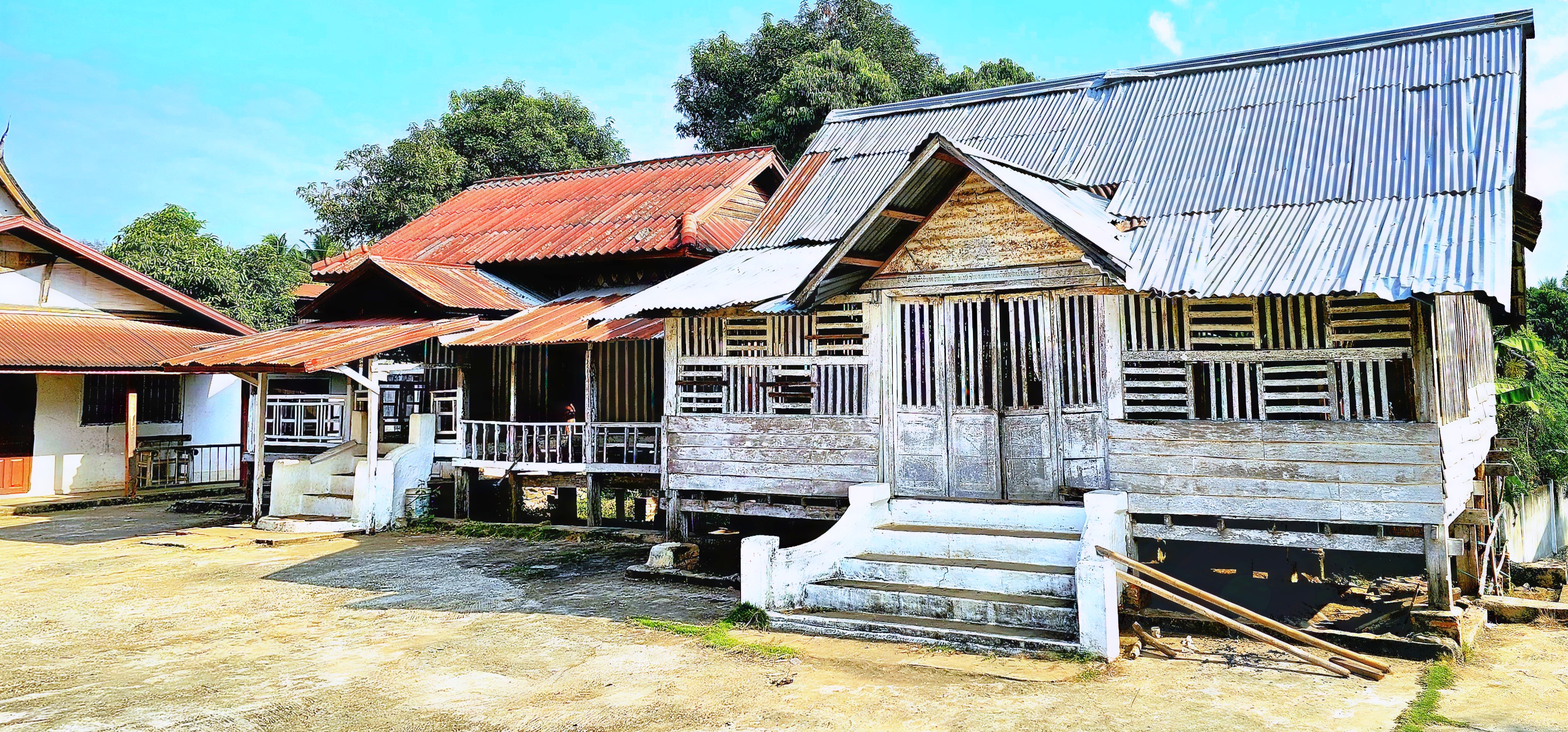
We roamed the modest temple grounds, surrounded by ramshackle monastery dorms,
and temple buildings that had long forsaken its gold leaf …
for peeling paint.
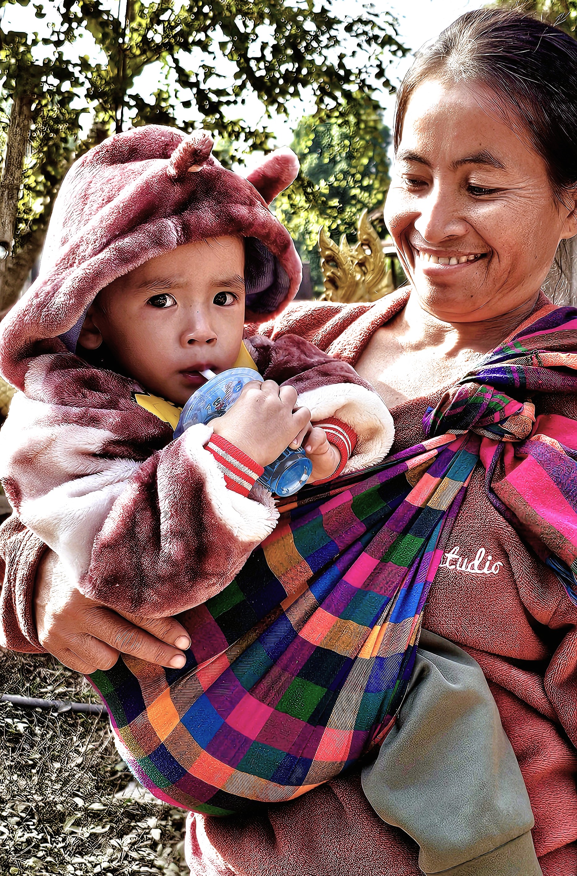
Just beyond the temple walls, a steady show of curious children received us,
acting as welcome ambassadors to Mouangkham Village,
an O.A.T.-supported community that was eager to share its hospitality.
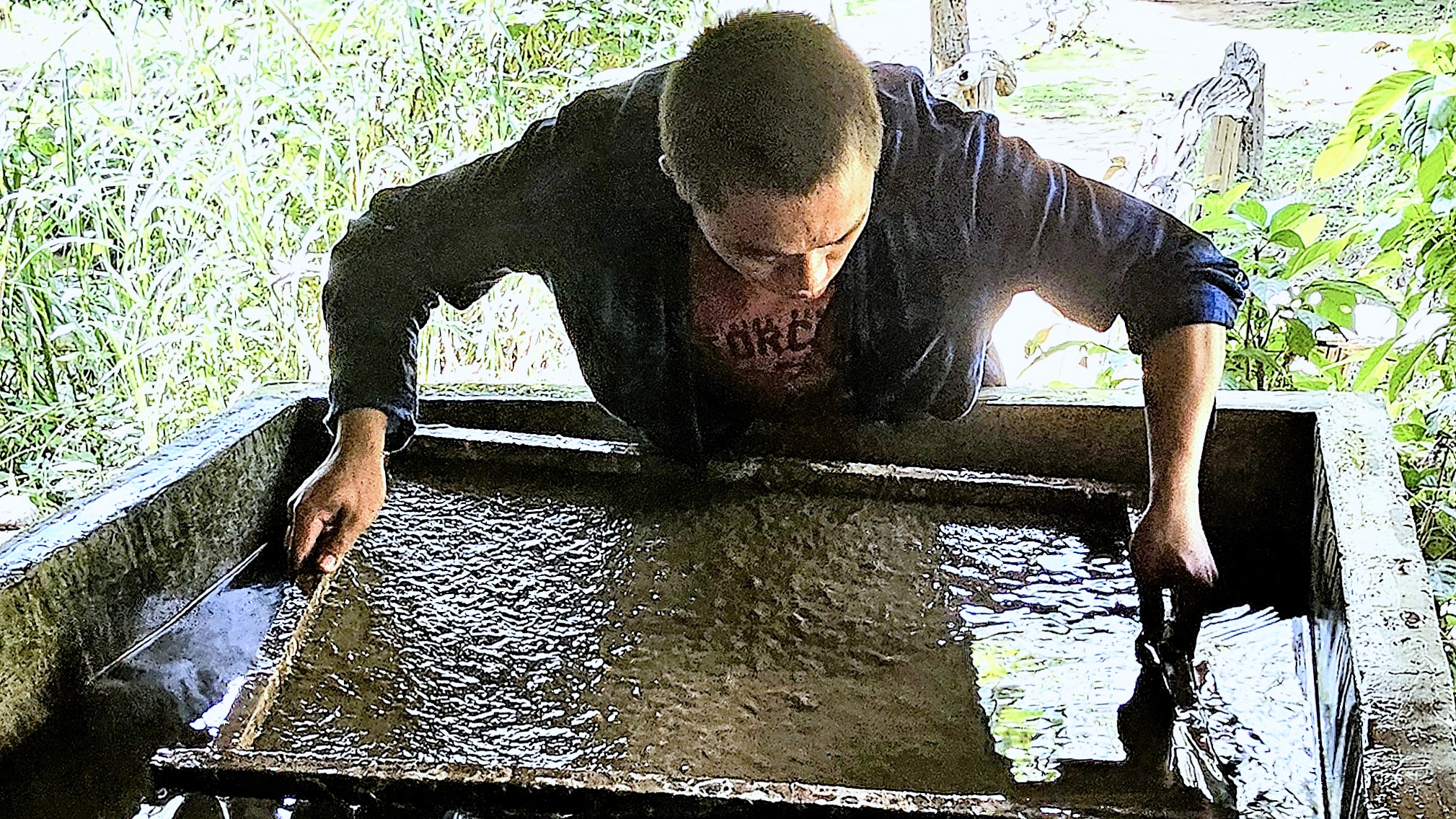
The villagers have banded together to literally sustain themselves in a grass roots business by producing khai paen, a dried, river weed delicacy for wholesale food markets.
We observed a demonstration: from washing and rinsing,
to beating the weed into submission, until it’s been reduced to a fine green veneer of fiber.
It didn’t look overly complicated, requiring just enough finesse to master the battering. Only a scattering of thinly sliced tomatoes, shredded garlic and a sprinkle of sesame seeds was needed to complete the process.
My best effort was donated to the local economy.
As a cottage industry, it may not seem like much, but it’s enough to provide for toddler high-tech.
The following day, we boarded a bus to Mouang Khai Village for A Day in the Life experience among Lao, Khmu and Hmong people, who share humble homesteads,
but celebrate a rich cultural heritage, like playing the qeej (a reeded bamboo instrument) during a teenage courtship dance.
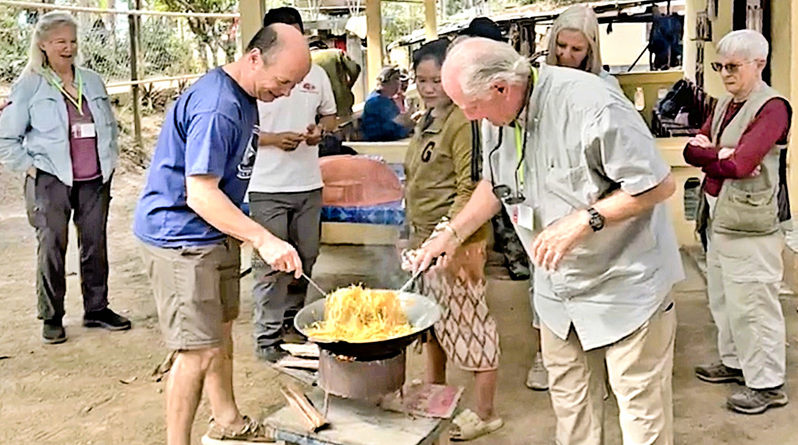
The village chief hosted a traditional Lao lunch, cooked by us with appropriate guidance…
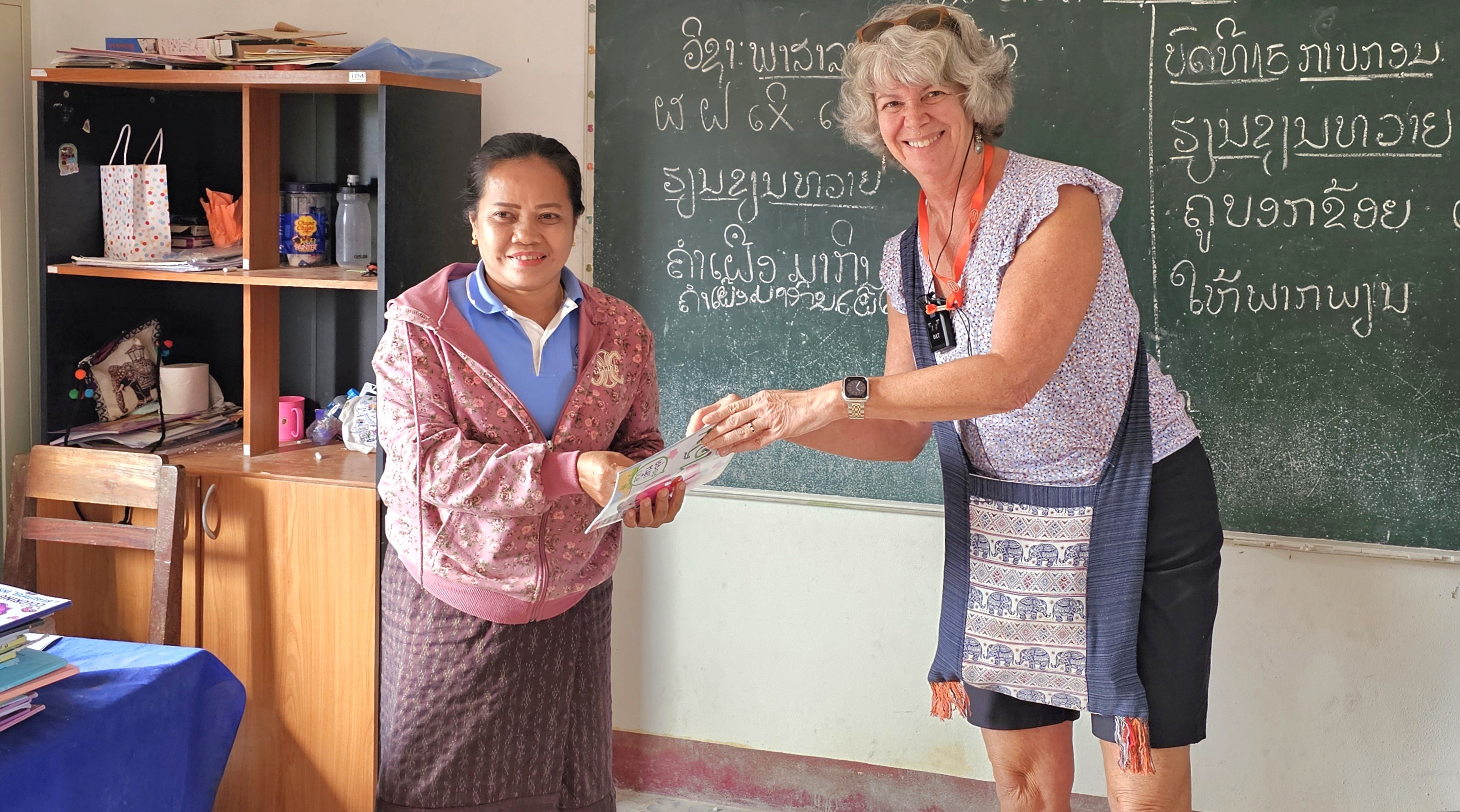
but the highlight of the day was attending primary school with a dozen youngsters at their Grand Circle Foundation-funded, one-room schoolhouse, where we were exuberantly serenaded,
while the older children…
looked after the younger children.
After a special presentation to the village teacher of 15 years,
we were escorted back to our bus.
It was a special day-in-the-life.
By reaching out and connecting with communities around the world, we learn to appreciate firsthand, not only our diversity, but our commonality — and the understanding we gain can be life-changing.
While sifting through hundreds of photographs taken during a recent tour of Southeast Asia (see past posts), I weeded out a wave of watercraft shots, and thought a maritime montage of nautical notions would make the perfect post.
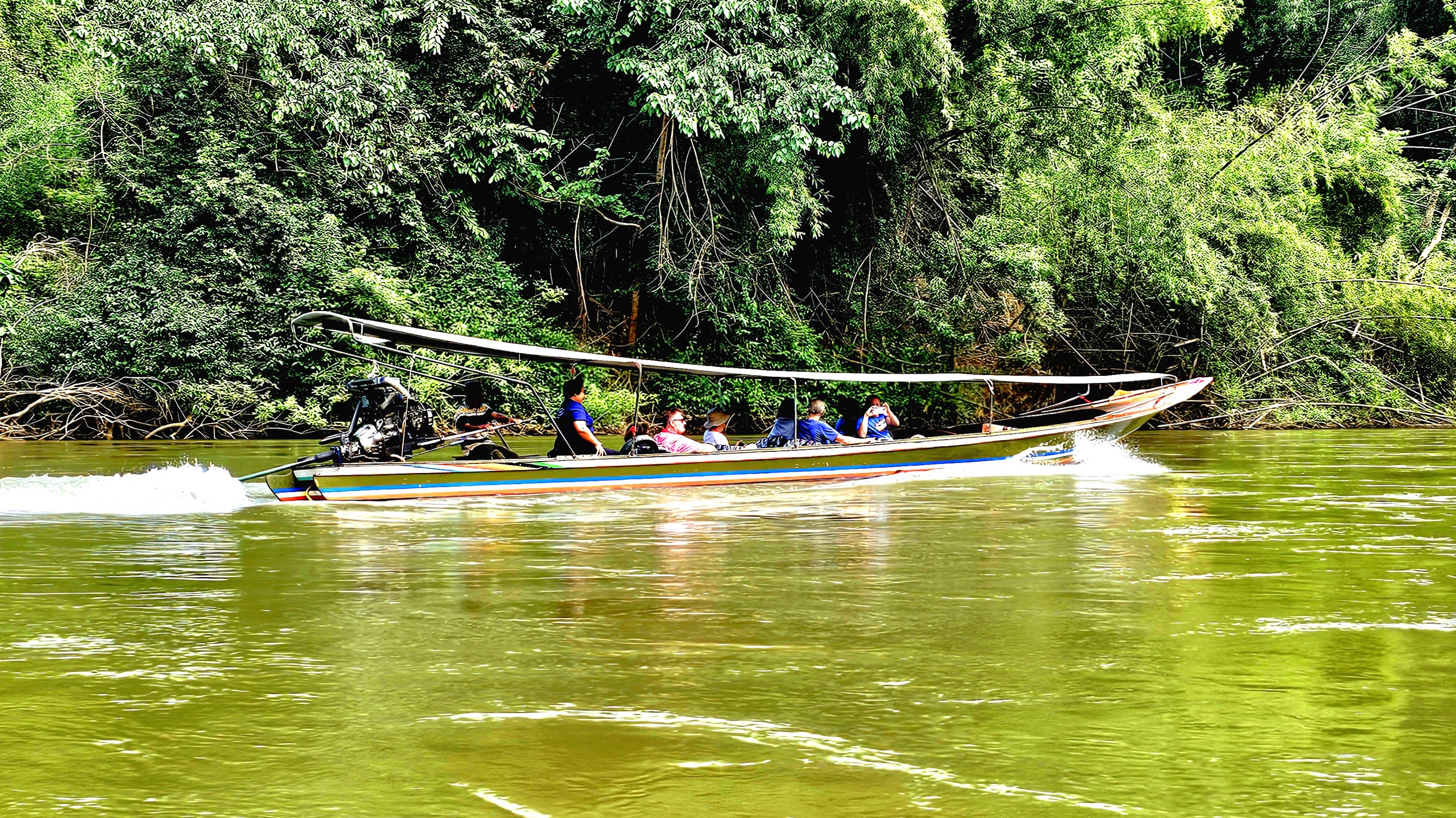
During our visit to Kanchanaburi, Leah and I enjoyed time on the River Kwai in a traditional long-boat…
giving us splendid views along the water,
and a glimpse of river-lounging for well-heeled tourists:
But it wasn’t until we returned to Bangkok’s Chao Phraya that we gained a greater appreciation of the river’s transportation network:
of river buses, cross-river ferries, water taxis, and sunset party boats.
On another occasion, we boarded a long tail to cruise upriver on the Chao Phraya,
taking in the sites of the ancient capital of Ayutthaya…
along the waterfront.
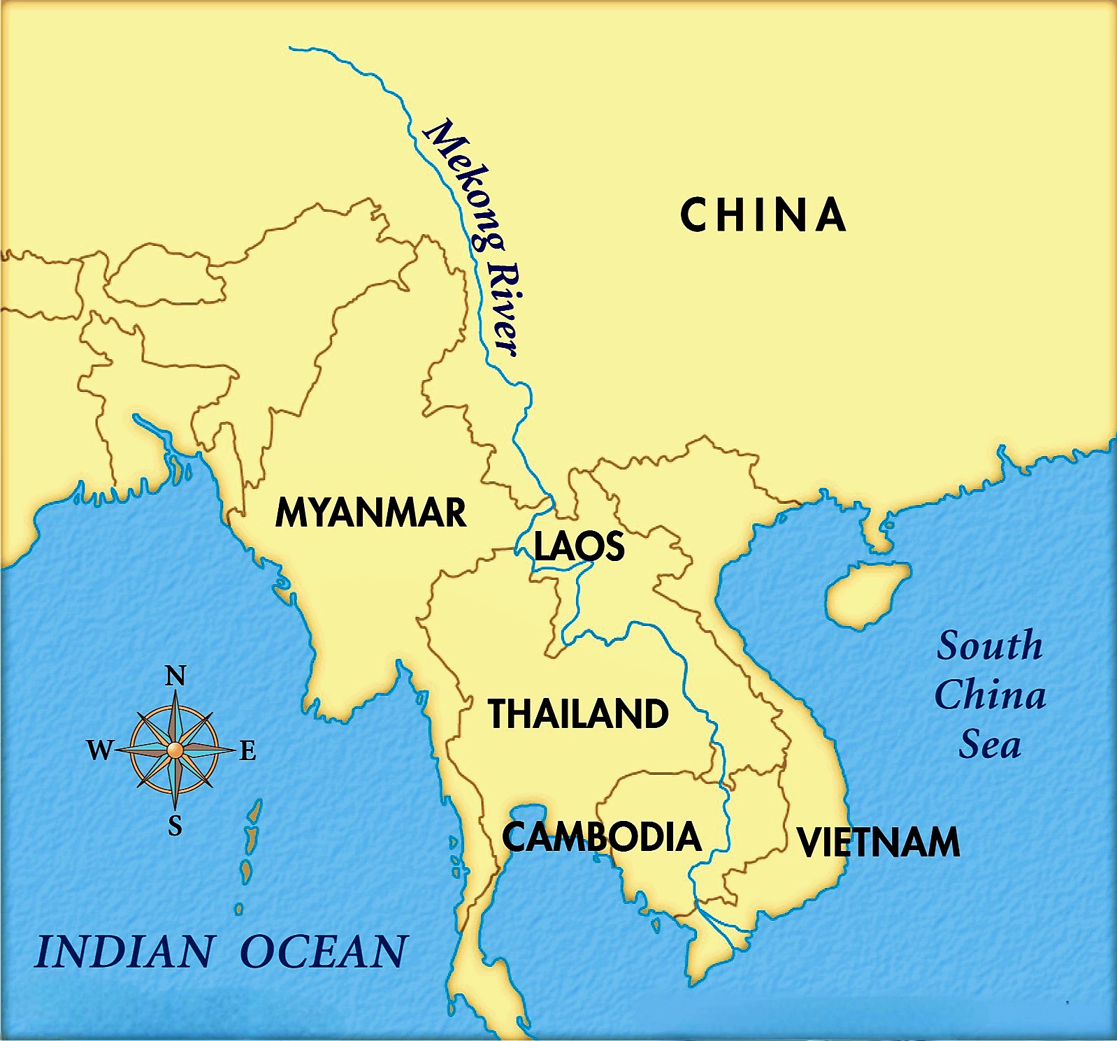
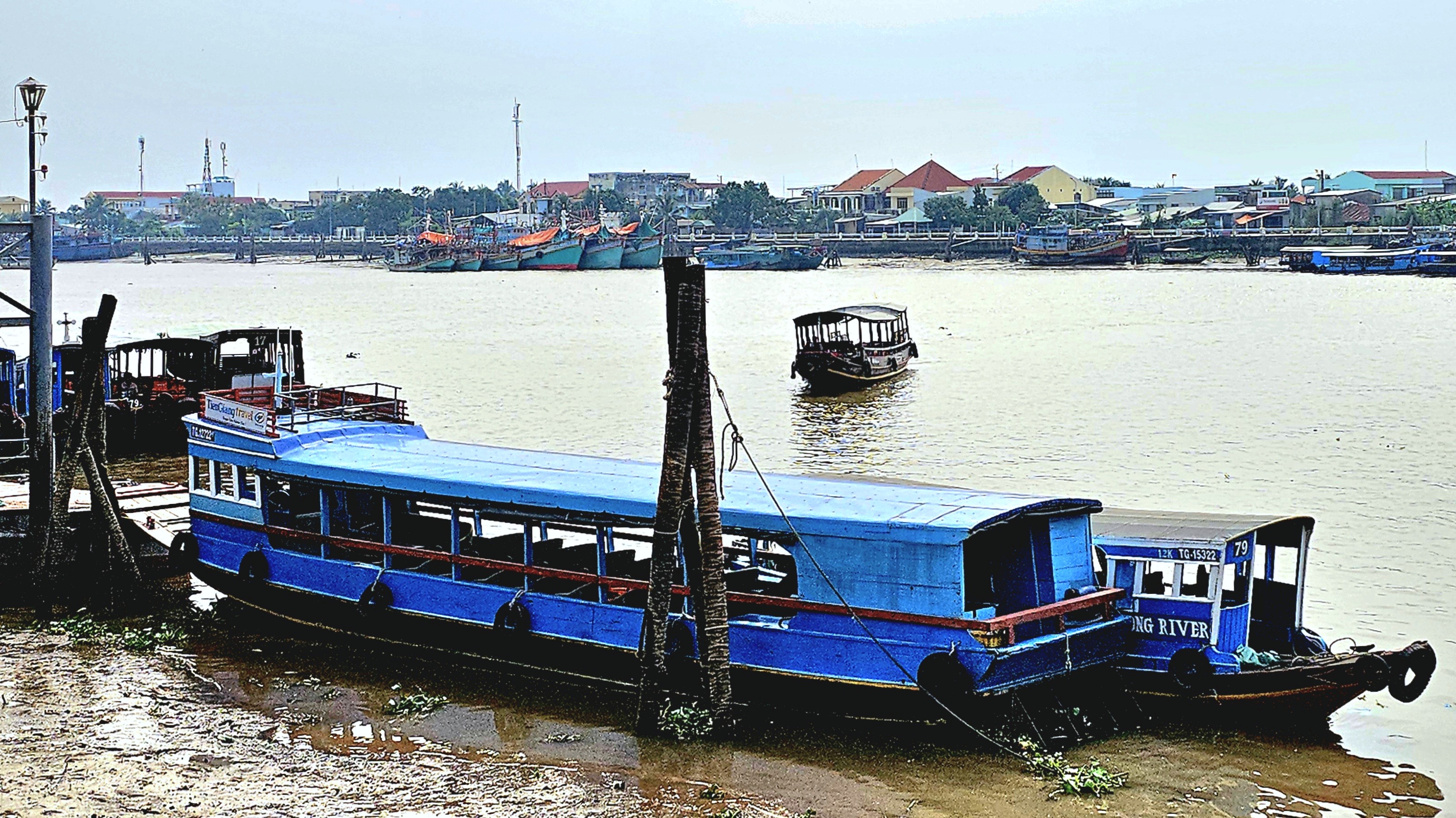
But the mighty Mekong is Southeast Asia’s “Mother of all Rivers” and most significant waterway. It winds its way from the Tibetan Plains to the South China Sea, running through Myanmar, Laos, Thailand, Cambodia, and Vietnam, making it the region’s longest river at nearly 3,000 miles.
The Mekong is also the most productive river on the planet–boasting the world’s largest inland fishery–
which accounts for up to 25% of the global freshwater catch while providing livelihoods for 90 million people,
and supporting 54,000 sq mi of rice crops.
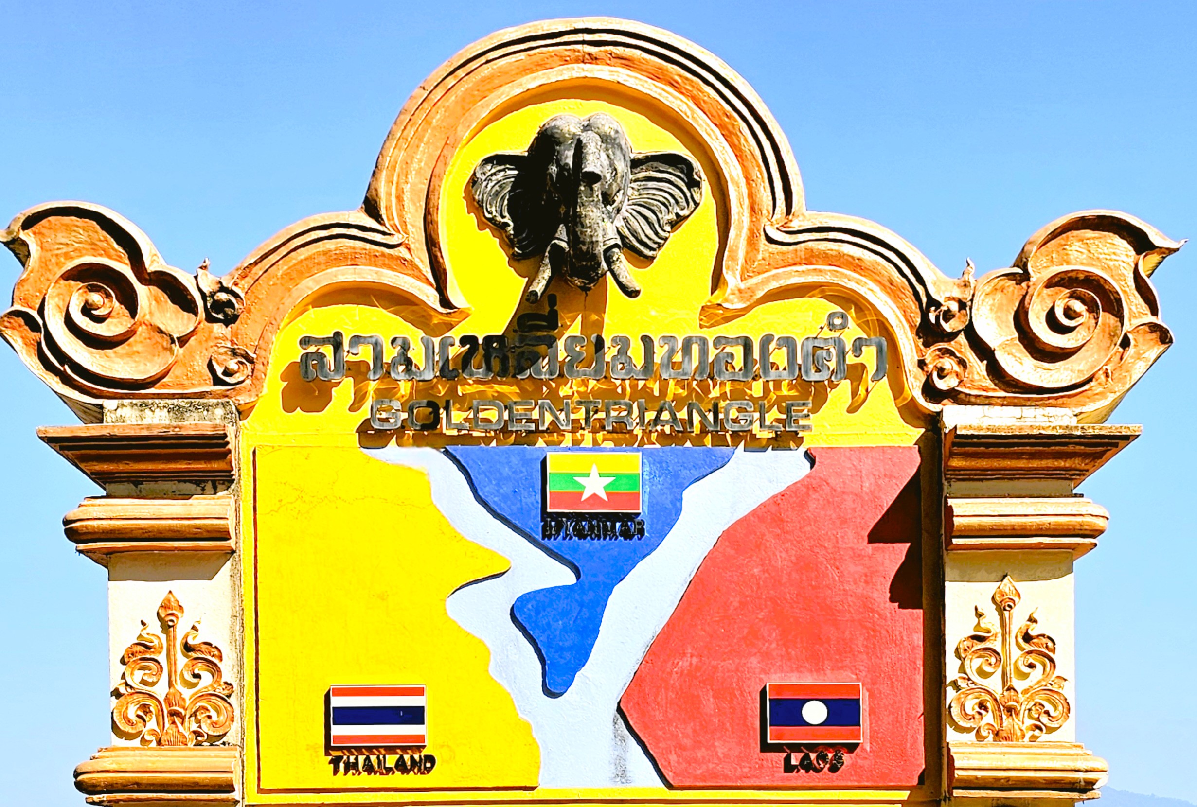
While touring upper Chiang Rai, Leah and I were hypnotized watching the confluence of Myanmar’s Roak River flowing into the Mekong–
separating Thailand and Laos to form the Golden Triangle.
But it wasn’t until our visit to Luang Prabang, Laos that we caught a second look at the Mekong–this time during golden hour–
which set the stage for our cruise the following day on a traditional wooden boat.
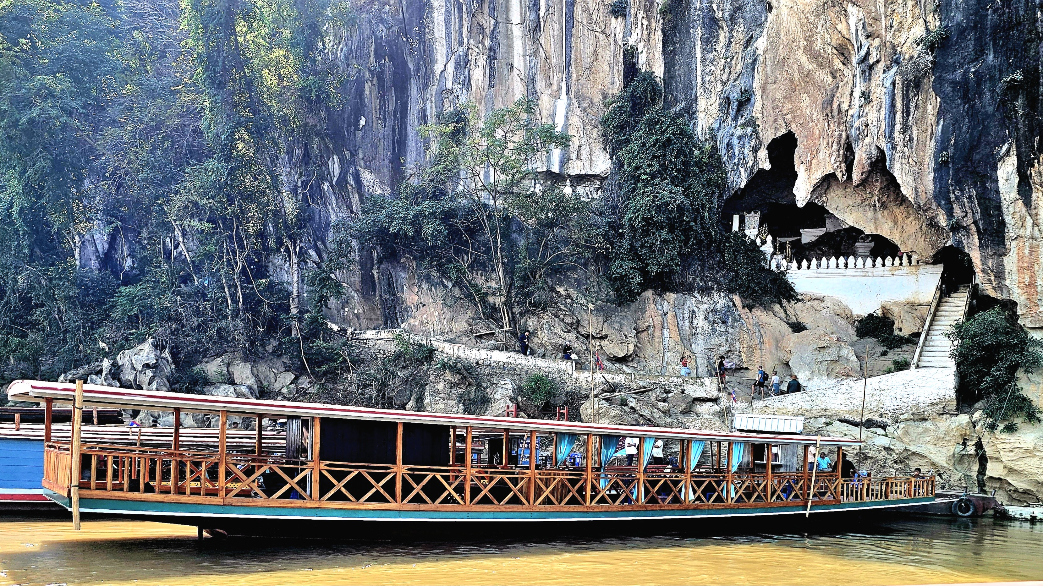
We motored slowly upriver to where the Mekong meets the Nam Ou River at Ban Pak Ou,
and disembarked directly across from the village…
to explore the Pak Ou Caves–Tham Ting and Tham Theung–located on the west bank of the Mekong River.
The first Lao people arrived at Ban Pak Ou from South China during the 8th century. They brought a strong belief in spirits and a profound respect for all things nature. It was an animistic religion known as Ban Phi.
The villagers believed that the caves were enchanted with river spirits, and they performed periodic blood sacrifices for prosperity and protection, but by the 16th century, Buddhism had been adopted by the royal families of Lao, who offered their patronage until the last days of the monarchy in 1975.
While Buddhism remains a unifying feature of Lao culture, animistic rituals continue to thrive and have been seamlessly integrated into Buddhist ceremonies, allowing Shamans and monks to symbiotically tend to the spiritual needs of their worshippers.
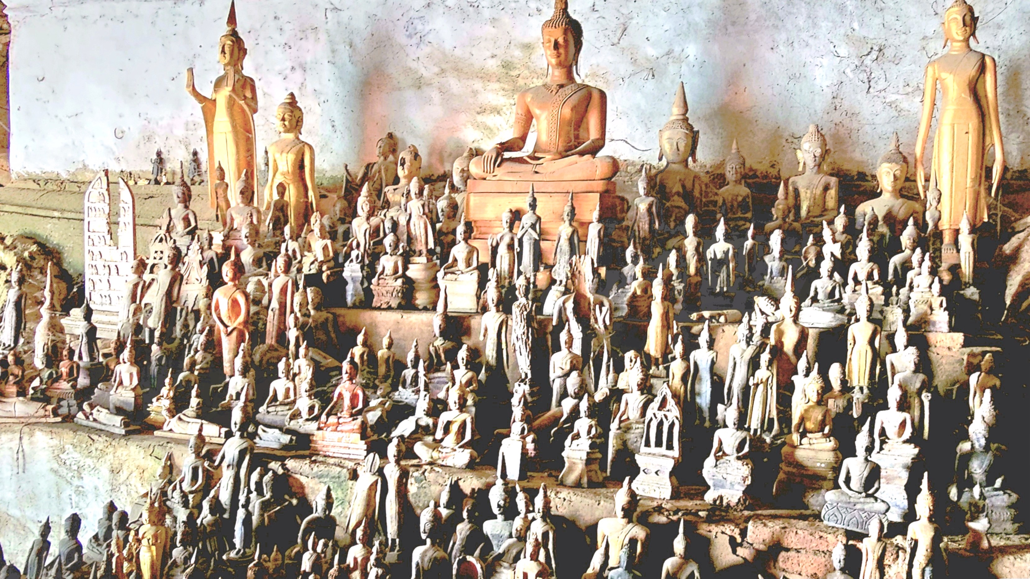
These days, the caves are a well-known repository for over 4,000 miniature Buddha sculptures, mostly old or disfigured impressions dating from the 18th century.
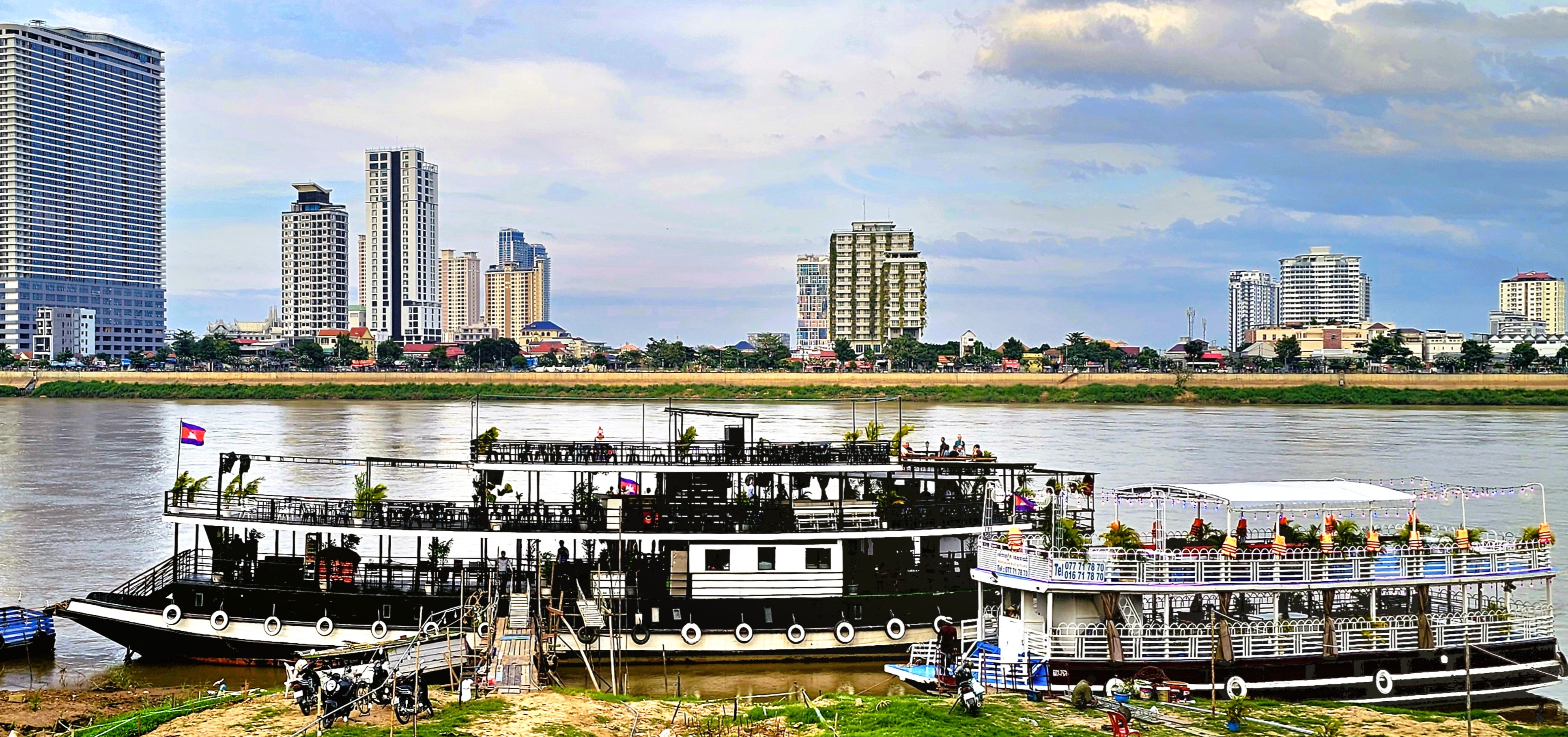
We were reacquainted with the Mekong during our stay in Phnom Penh, where we enjoyed a delightful sunset cruise on the river,
with all the beer we wanted!
The ever-shifting city skyline…
stands in stark contrast with Akreiy Ksatr Village on the opposite bank.
But a new ferry station supports continued growth along the river in every sector,
making Cambodia an emerging economic engine among ASEAN nations.
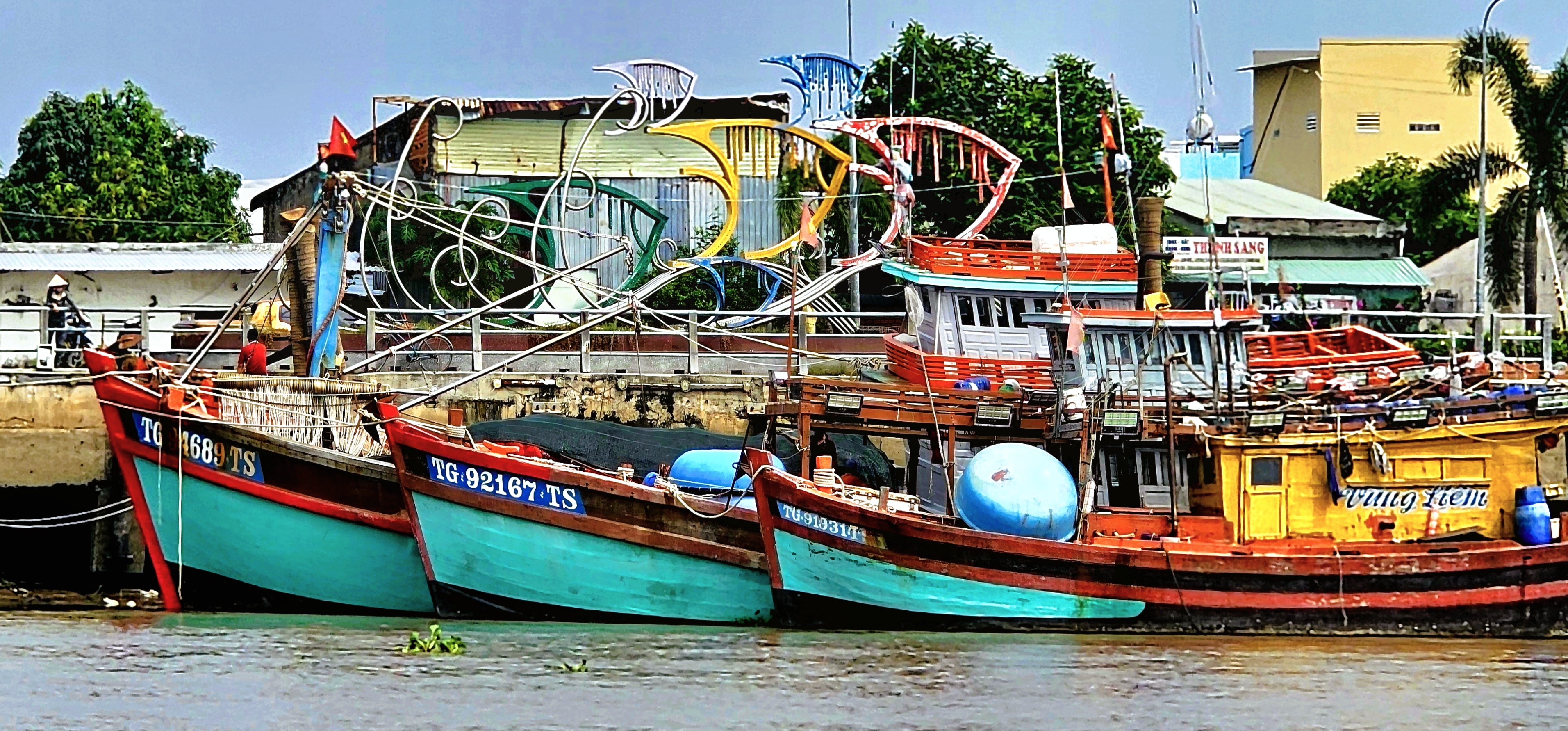
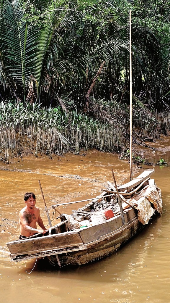
Lastly, during our visit to Vietnam, Leah and I traversed the Mekong Delta on a chartered riverboat.
As we navigated inside a shallow tributary, my mind quickly turned to Conrad’s “Heart of Darkness,” with haunting visions of Marlow’s journey on the Congo River.
Initially, our captain wondered if the incoming tide would lift our boat over the mud, unlike other sidelined sailors,
as we managed to crawl through the middle of the passage at low tide.
Eventually, we exchanged our boat for an excursion by sampan,
until we reached our next location,
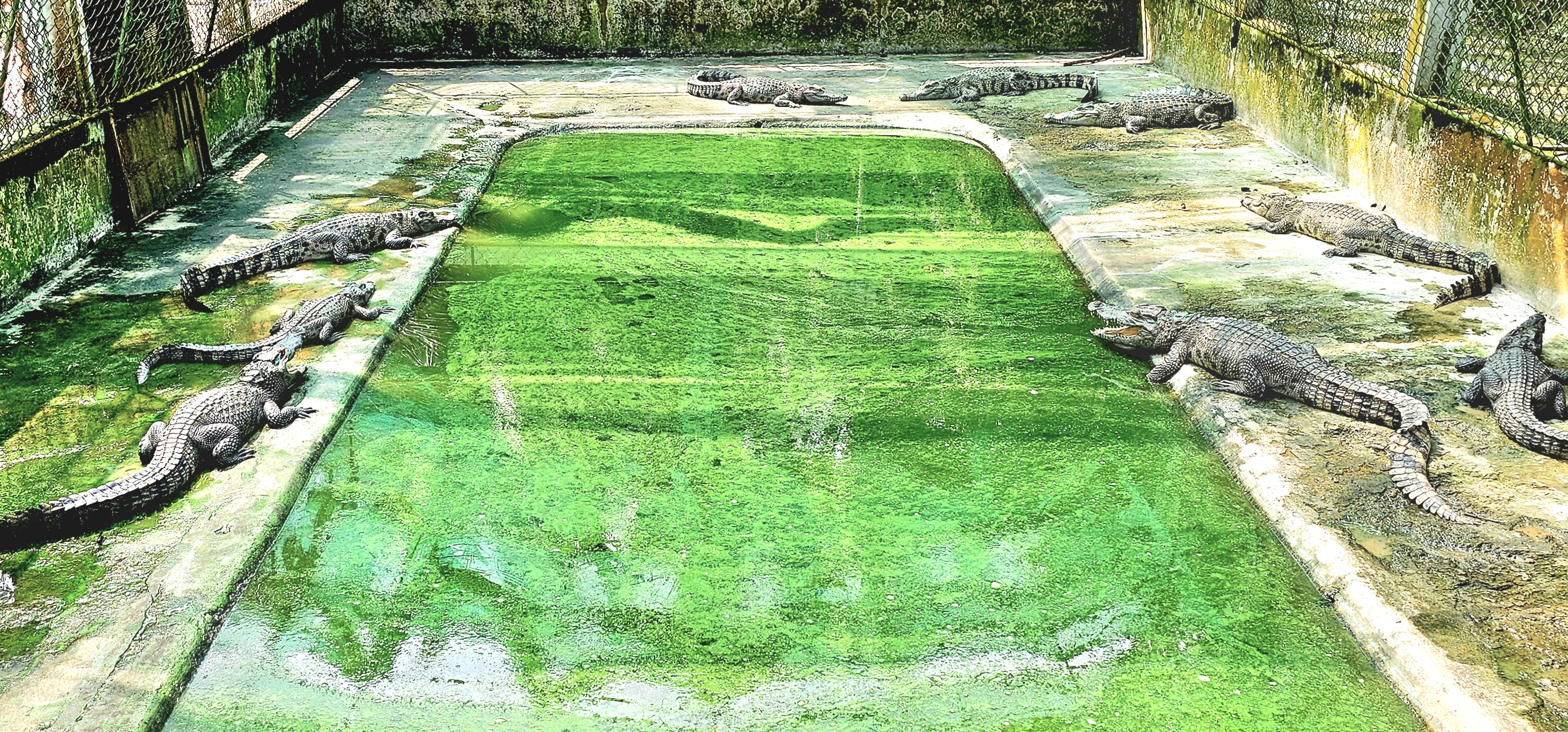
where Siamese crocodiles are on the menu and not on the Mekong, thankfully!
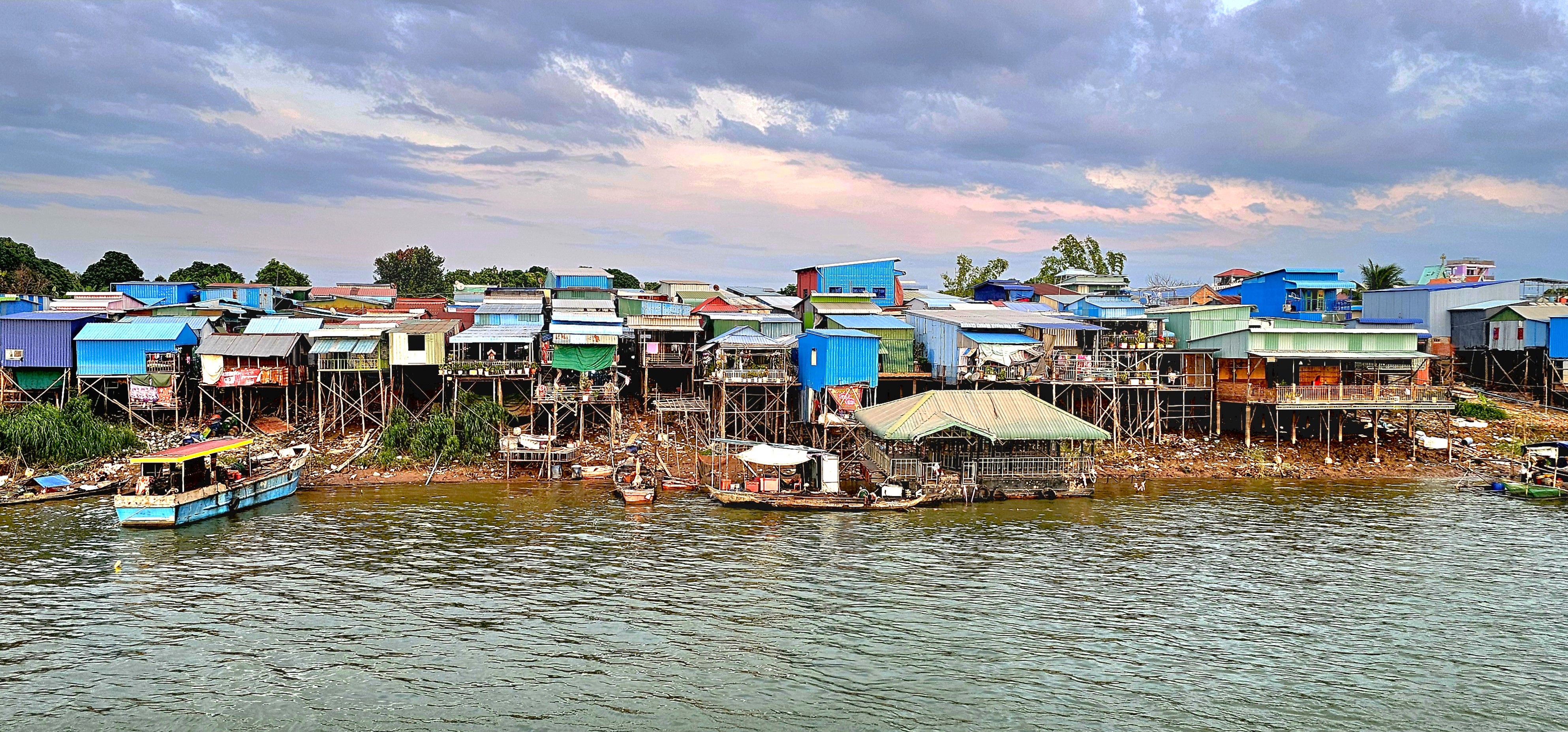
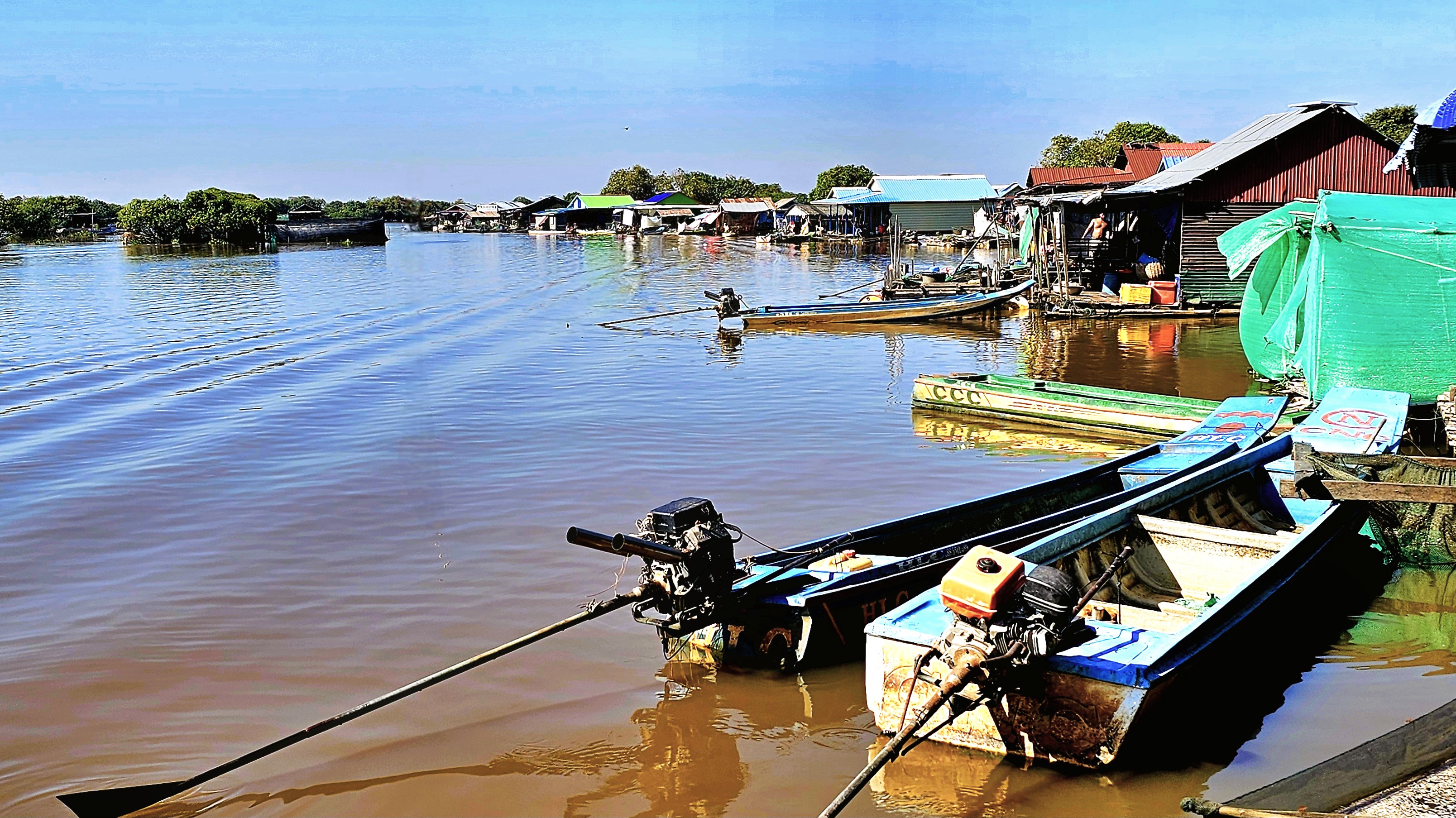
There were many other water activities throughout our tour, yet nothing prepared us for a day on Tonlé Sap, where we observed Cambodians living on the water, full-time.
After Japan entered the 2nd World War at the end of 1941, their forces quickly overran most of Southeast Asia. However, by summer 1942, supply lines to Burma and Thailand were faltering after Japanese naval strength was compromised in the Battles of the Coral Sea and Midway.
To ensure a secure distribution channel in the region, the Japanese military built a single line railway to link existing railheads between Burma (now Myanmar) and Thailand.
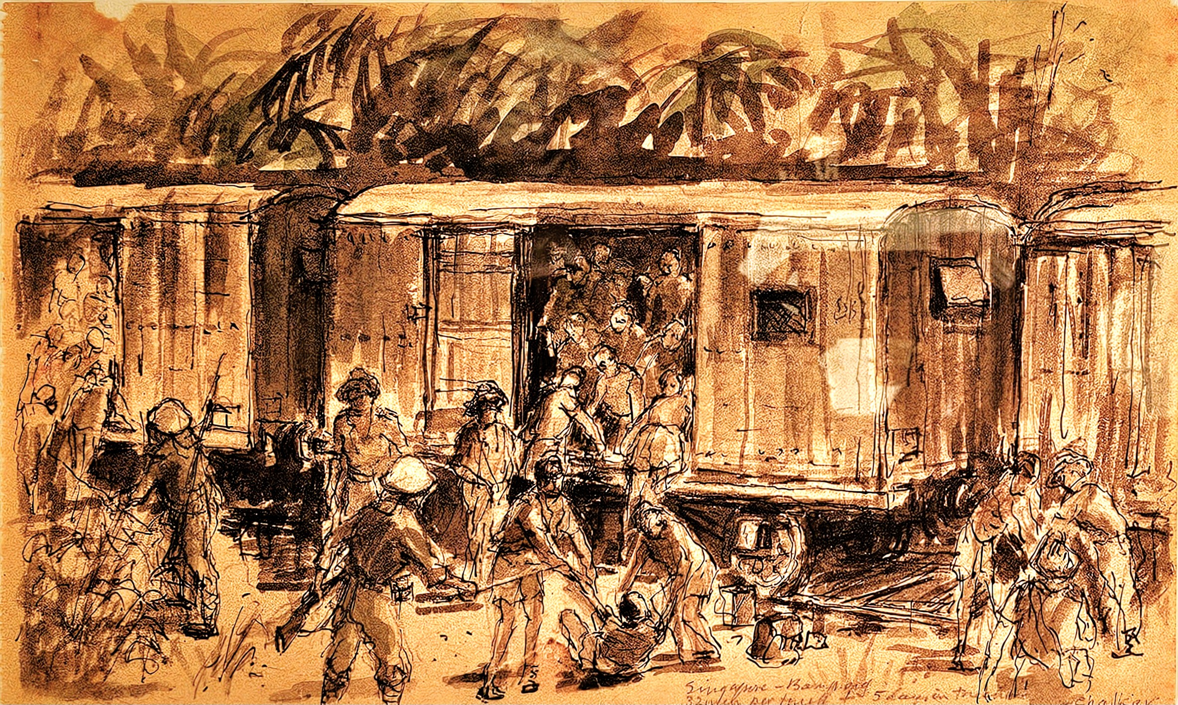
By commanding a forced-labor construction brigade of 60,000 Allied POWs and 200,000 Burmese, Malayan and Thai civilians (Romusha) who toiled along the route (from Thanbyuzayat in the west to Nong Pladuk in the east), Japanese military eventually completed the 415 km rail line in October 1943, but not without considerable neglect and harm to their captors and conscripts.
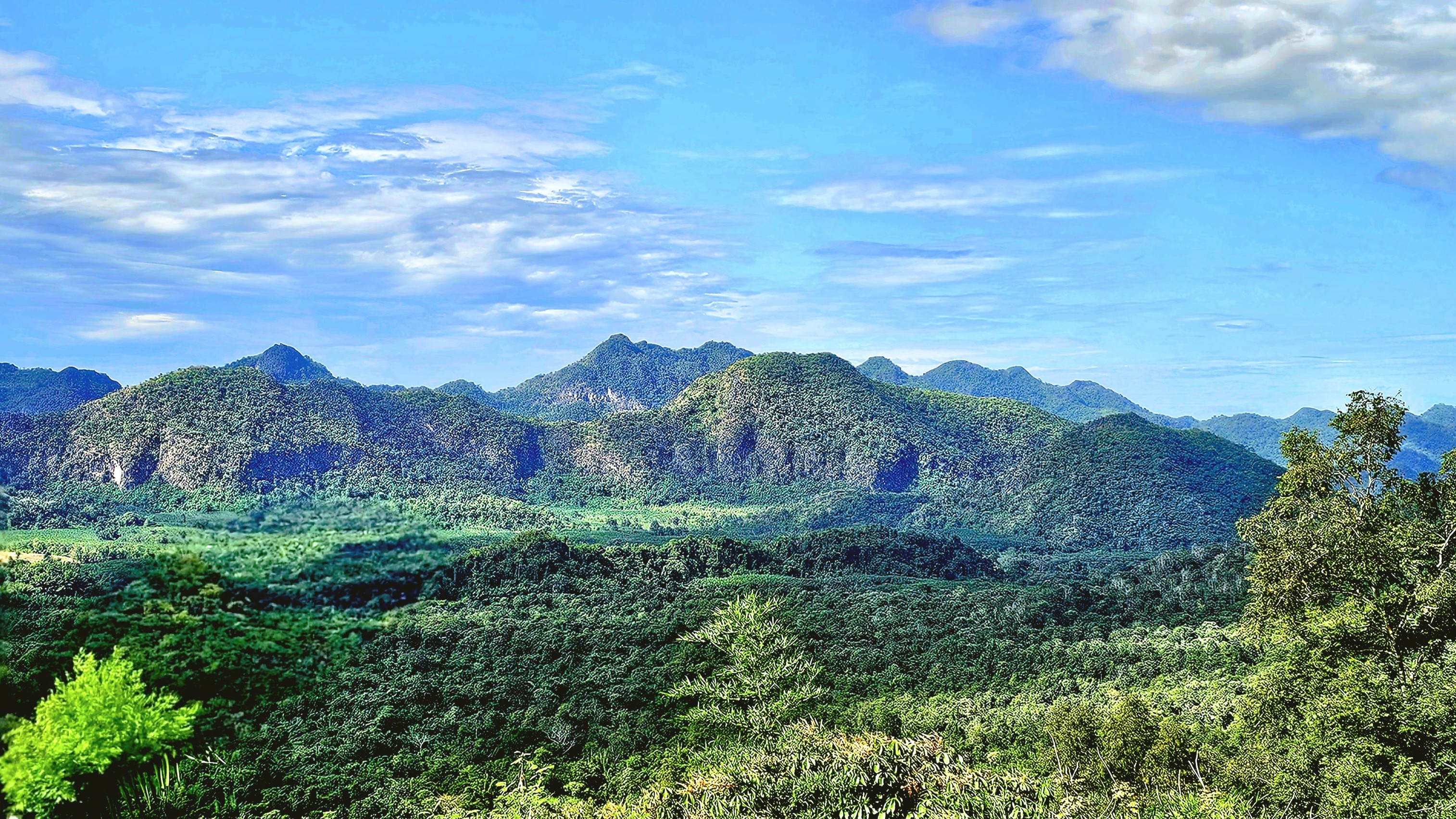
At first, work at the termini progressed quickly across flat, lightly vegetated land. But as terrain turned to rocky jungle, and monsoons turned the ground to mud, the work became difficult, causing the project to stall multiple times–which intensified Japan’s desperation to finish the line with little regard for human life.
One of the most challenging excavations required the construction of many large embankments, as the railway crossed the relatively flat high ground towards the steep valley wall to the north.
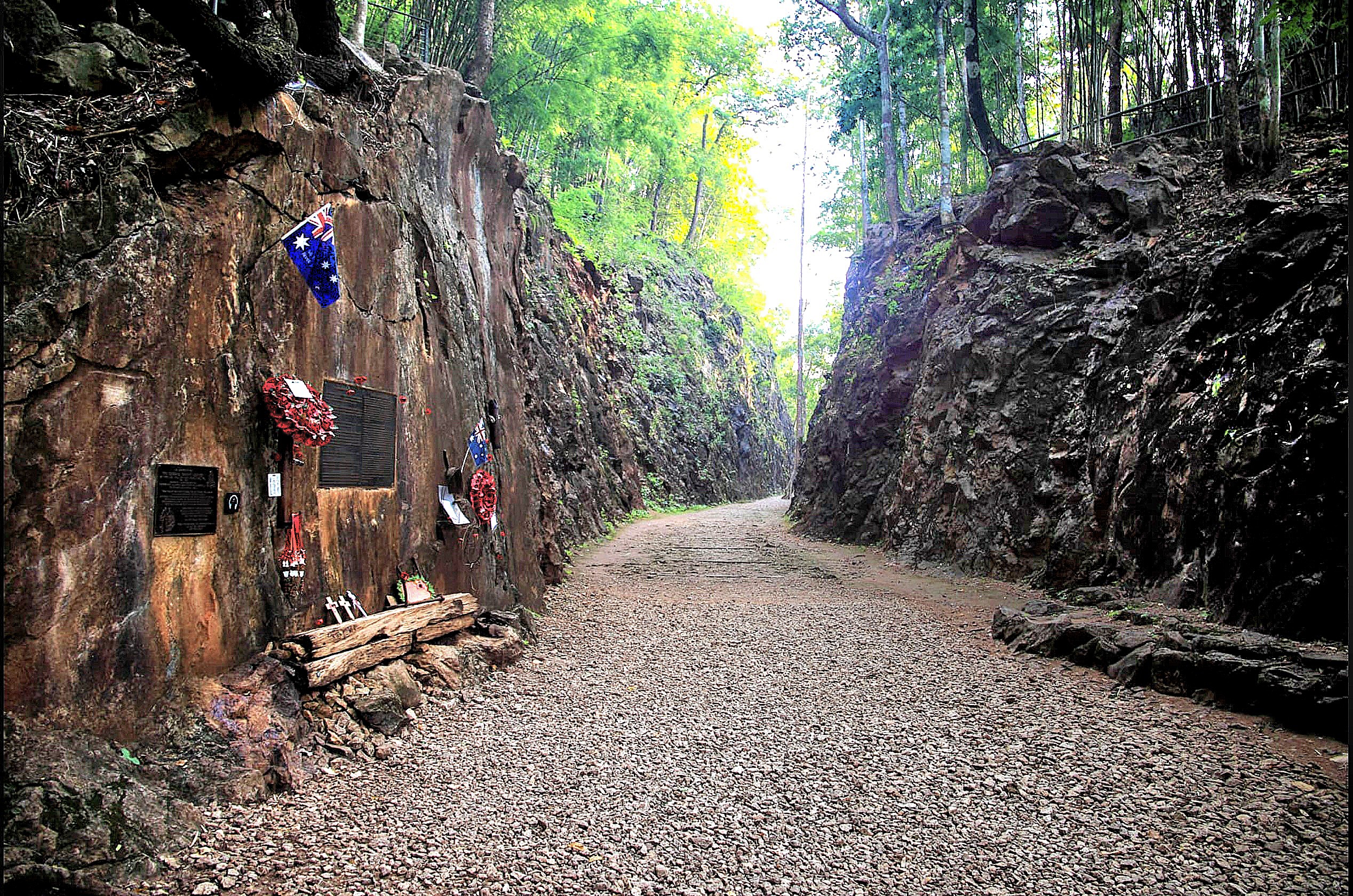
Crew survivors called it Hellfire Pass (Konyu), recalling the horrid conditions of the cutting and how much the work scene resembled a living hell when illuminated by fire.
All of the grueling work was done without the aid of reliable mechanical equipment. Instead, the most primitive of hand tools were used to drill holes for the explosives used in blasting the rock and removing the debris.
It took 12 weeks of round-the-clock shifts to complete this section of the roadbed, which resulted in a great loss of life. Sixty-nine men were beaten to death by Japanese guards, and countless others died from cholera, dysentery, starvation, and exhaustion–all of which is well documented at the Interpretive Center’s exhibition hall,
and memorial trail built and managed by the Australian government.
Construction brigades completed the 415 km railroad in October 1943. Unfortunately, the project cost the lives of approximately 15,000 POWs and 100,000 Romusha from disease, starvation, exhaustion and mistreatment. Their sacrifice was commemorated by a granite block placed at the track.
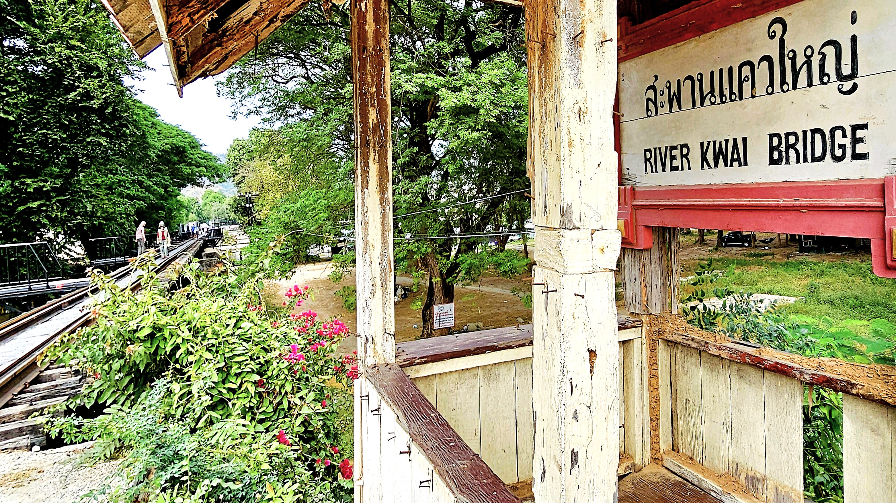
Eighty km south of Hellfire Pass, the railroad crosses the River Kwai in the town of Kanchanaburi–site of the work camp where all prisoners and laborers were processed.
The bridge is primarily remembered because of its portrayal in the 1957 film The Bridge on the River Kwai, which depicts the harsh conditions and forced labor endured by Allied POWs, making it a powerful symbol of the brutality of war and the sacrifices made by captives.
Nowadays, the bridge can be crossed on foot or with a small tourist train that runs back and forth.
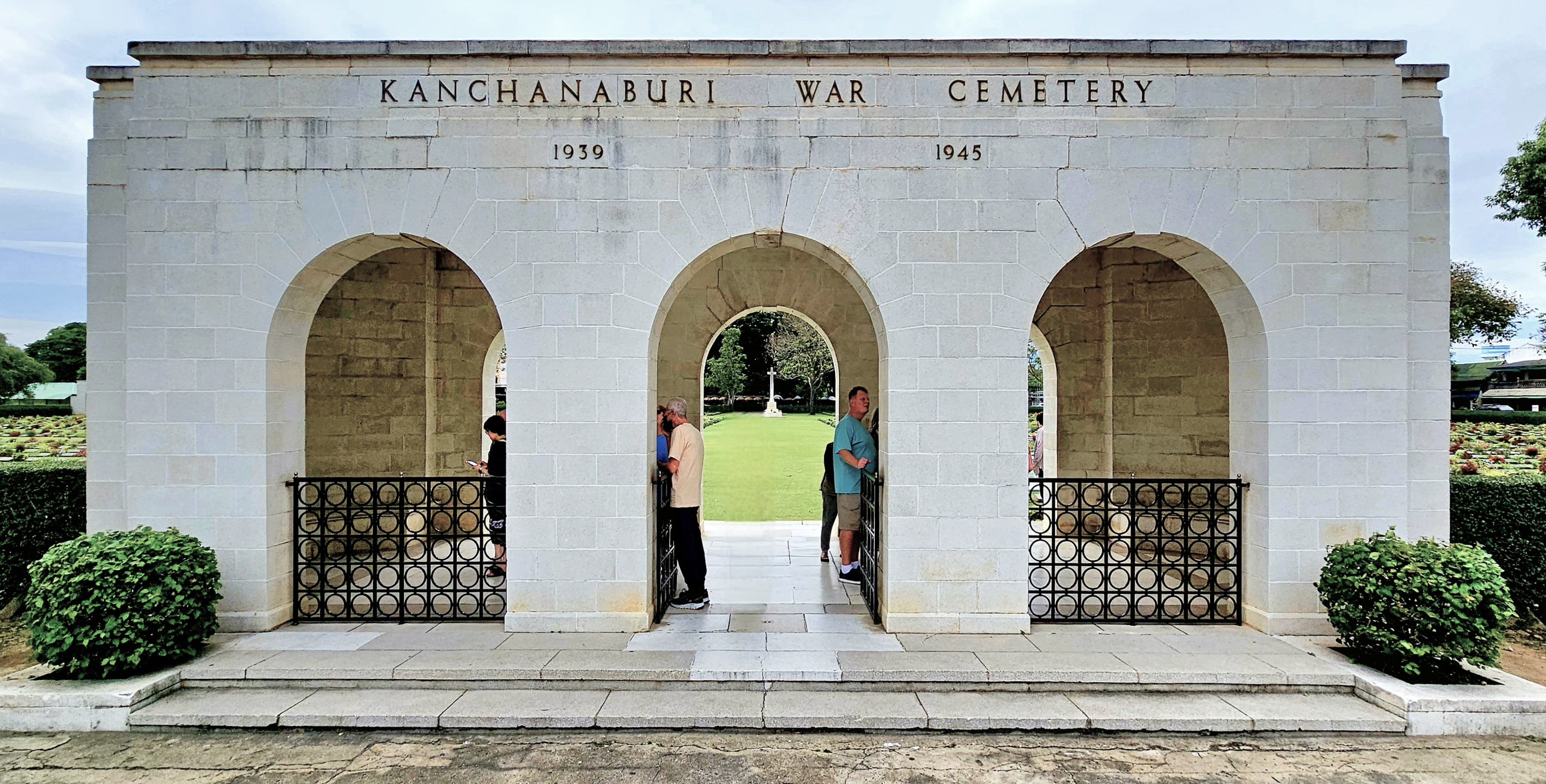
The Kanchanaburi War Cemetary, just down the road, is the final resting place of nearly 7,000 Commonwealth soldiers who participated in building the Burma-Thailand Railway.
Their mission is commemorated across a manicured lawn of gravestones,
and memorials.
It was a solemn day of remembrance in Kanchanaburi, which also came with a telling lunchtime reminder of WWII’s Hellfire experience…
Rivalry serves as a profound motivator, compelling individuals to elevate their performance. It fuels our ambition and stimulates our creative capacities. Additionally, it sharpens our concentration and tests our boundaries.
At its most constructive, rivalry fosters a form of competition that can lead to significant achievements.
For example, had it not been for Gutzom Borglum’s monumental conversion of Tunkasila Sakpe Paha into Mt. Rushmore(1927-1941), there might never have been a Crazy Horse Memorial located 16 miles from Borglum’s masterpiece.
Afterall, it was Korczak Ziolkowski, Borglum’s assistant at Mt. Rushmore who imagined the Lakota mountainside transformed into the world’s largest sculpture of a 19th century Sioux chief on a horse.
As a work-in-progress since 1948, the completed head of Crazy Horse stands at 60 feet, matching the measure of George Washington’s image.
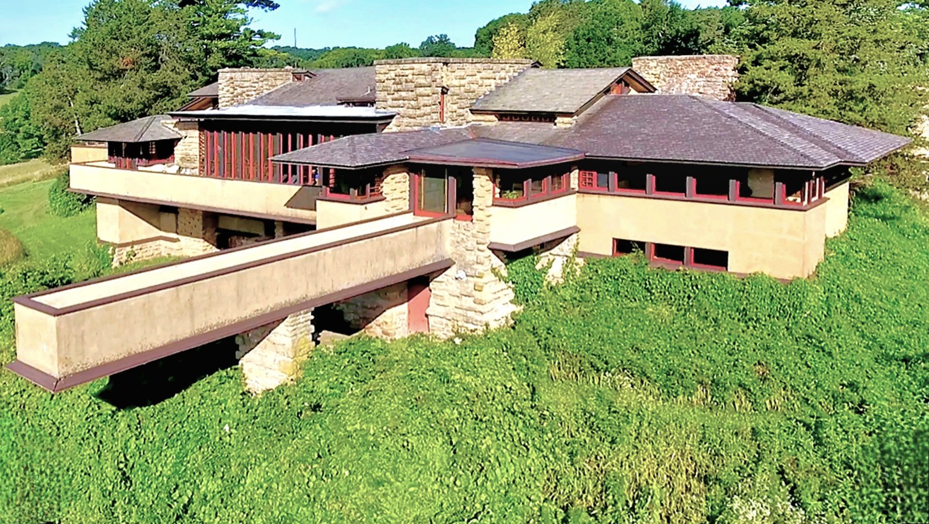
Similarly, visionary architect Frank Lloyd Wright designed Taliesin as his estate-studio outside Spring Green, Wisconsin. Wright’s organic design followed his affinity for infusing natural elements into his habitats (Prairie Stylings).
Forty-eight years later, Alex Jordan–although not professionally trained as an architect–drew inspiration from Wright’s Taliesin, and began construction on his own homestead, the iconic and certainly eccentric House on a Rock–only 6 miles down the same road, on WI-23.
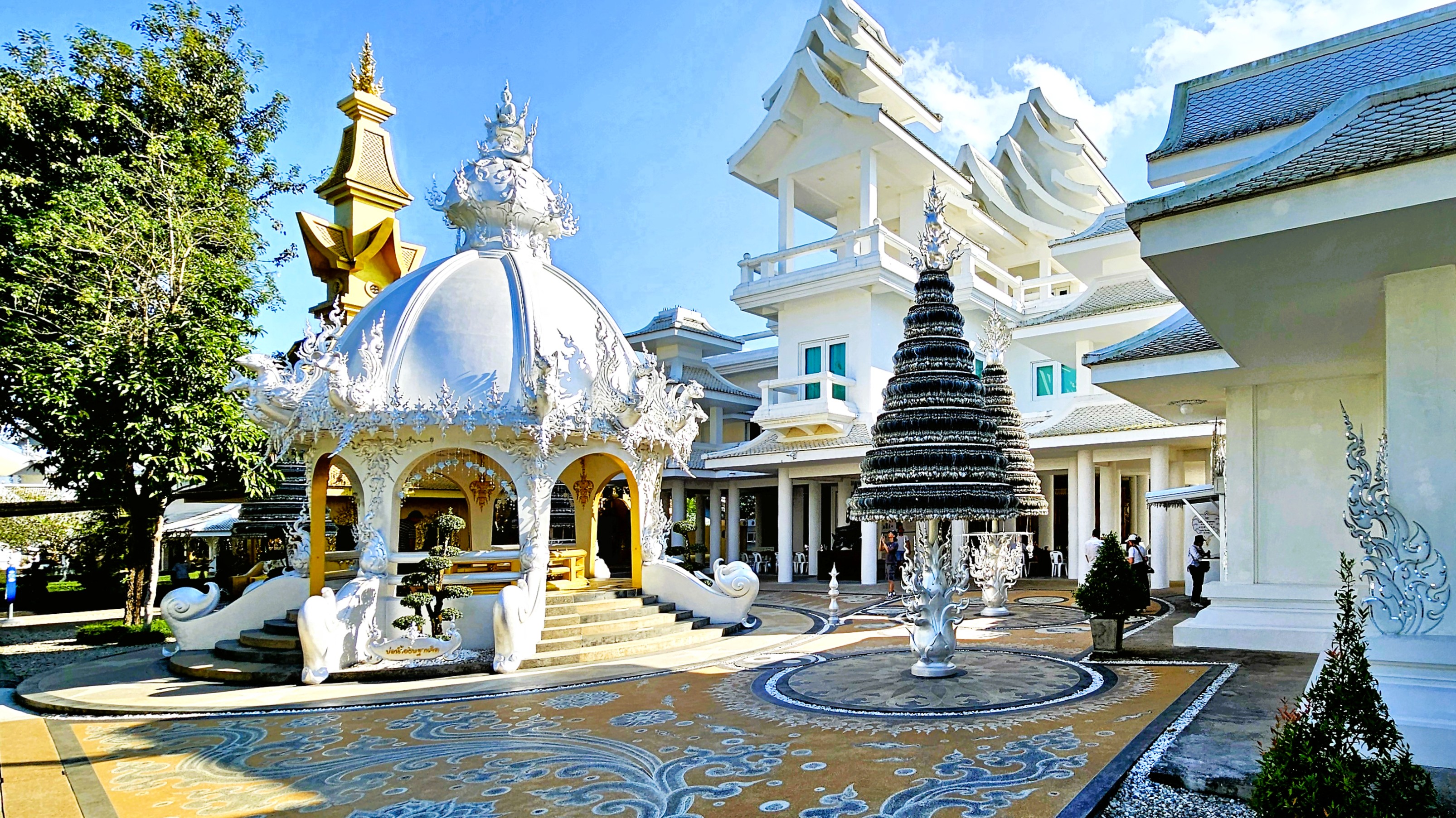
In the hills of Chiang Rai, Thailand a similar rivalry exists between teacher and student, with their competing visions of divinity and righteousness expressed through different, symbolic colors: Chalermchai Kositpipat’s gleaming, ornate White Temple…
versus Puttha Kabkaew’s psychedelic Blue Temple, which borrowed heavily from his mentor’s neo-traditional style of Buddhist art. And we got to explore both of them!
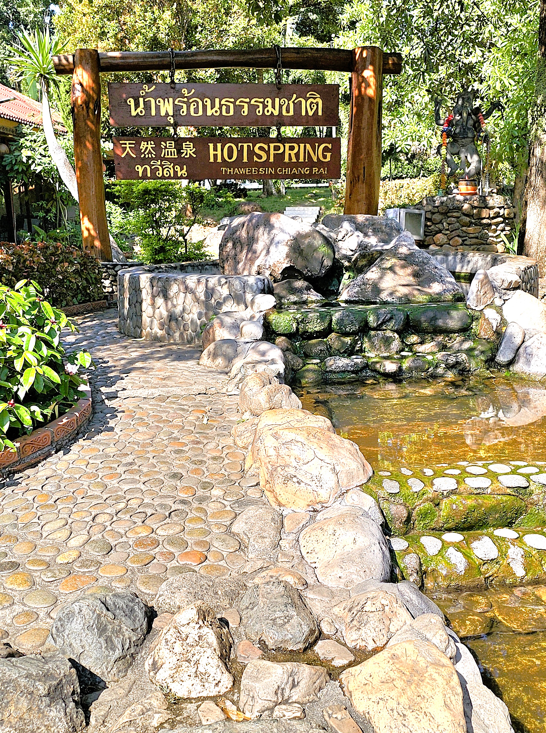
We departed Chiang Mai for Chaing Rai, first passing through Thaweesin Hot Springs, our timely rest stop, and Thailand’s highest elevation thermal waters–where we stretched our legs, soaked our feet,
and where a Happy Room attendant eagerly pointed us in the right direction.
After arriving at the White Temple (Wat Rong Khun), we were greeted by a Transformer,
who seemed to reflect the otherworldly characteristics of the temple grounds.
The details behind Chalermchai’s bid to rebuild the crumbling temple in the village of Rong Khun are legendary.
In 1997, Chalermchai committed to self-fund the project as an offering to Buddha after a national economic downturn threatened its reconstruction. He did so for love of country, love of Buddha, and his love for the King.
He cast the chapel, the Sukavadee Bridge, the crematorium, and other prayer halls in white as a symbol of purity and spiritual enlightenment.
The mirrored tiles represent Buddha’s wisdom, which shines across the mortal world and the universe.
Silver Bodhi trees in public squares and walkways hold the wishes of thousands of visitors who pray for guidance and enlightenment.
Other buildings have been designed in gold–deliberately chosen to represent attachment to material wealth, and worldly distractions. The ornate Happy Room building is one such preoccupation,
while the golden bridge, ironically carries visitors to the golden gallery and gift shop.
At the White Temple, nothing is truly as it seems. Even the monk who adorns the chapel alter has been cast in wax.
The striking artistry and rich cultural symbolism elevate the experience and compel introspection at every moment. Within the Ubosot—where photography is prohibited—captivating murals that blend contemporary references and historical motifs vividly portray the eternal struggle between good and evil. Colorful representations of political figures, Star Wars characters, and Disney icons convey a compelling truth: rebirth, karma, and the cosmic balance of the universe stand as the ultimate rewards.
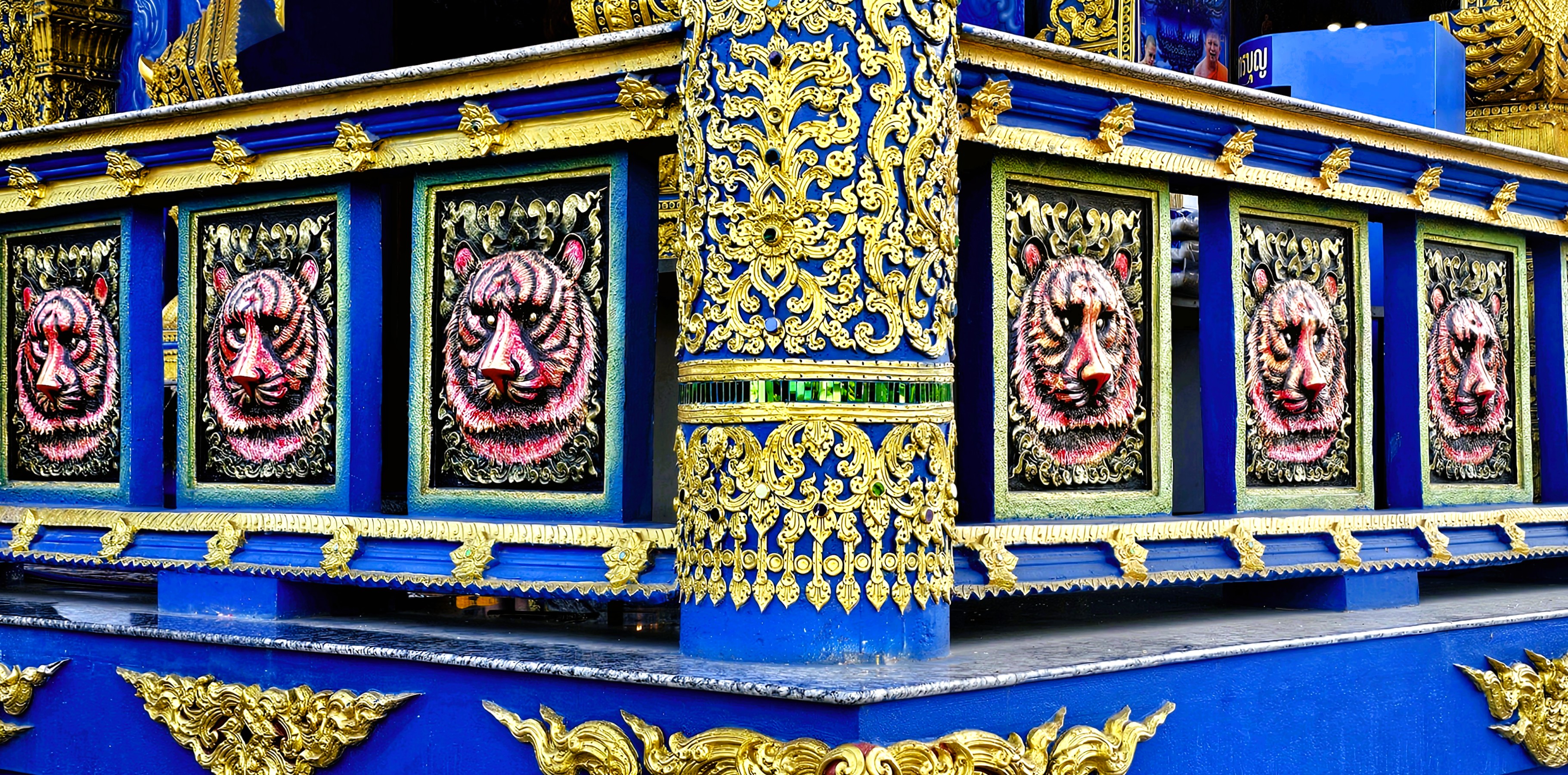
Puttha Kabkaew’s philosophical and spiritual manifesto clearly aligns with his mentor’s, Chalermchai Kositpipat, and it’s on full display–less than 10 miles away–at the Blue Temple (Wat Rong Suea Ten).
The temple’s name translates to House of the Dancing Tiger as a testament to the wildlife that once roamed freely over temple grounds a century ago.
Puttha’s cerulean-blue facade symbolizes the importance of meditation and inner peace, while gold accents represent enlightenment and emphasize the architecture.
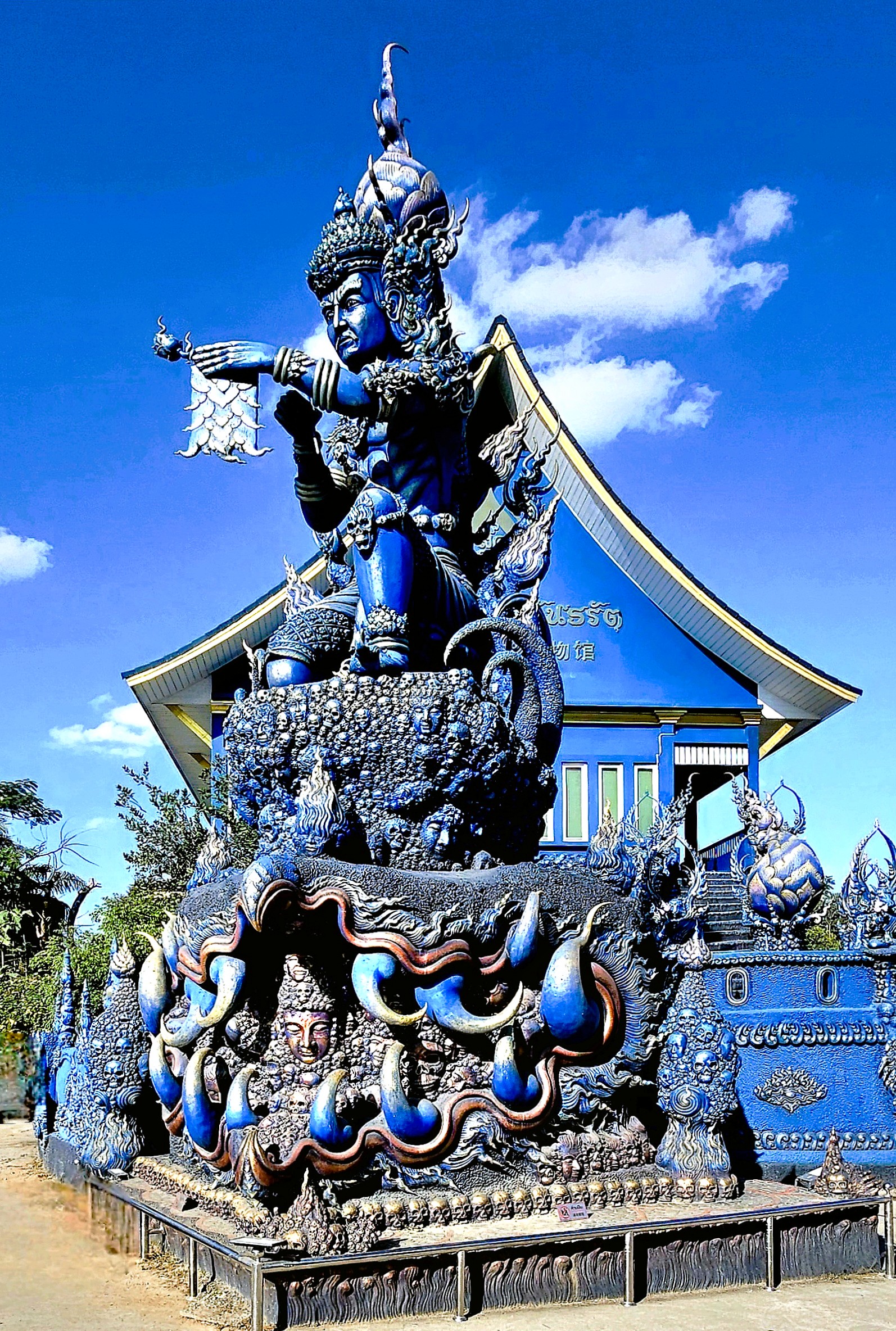
The temple’s interior features a large statue of a white porcelin Buddha…
surrounded by surreal, contemporary Buddhist art.
The Blue Temple is protected by fantastical, celestial creatures: like imposing Nagas,
fountain-loving Garudas.
and an Erawan.
Since 2016, the Guardian of Wat Rong Suea Ten has been intent on heralding the word of Buddhism…
But the road to enlightenment is a bit like trying to assemble IKEA furniture—it’s an eternal struggle! Buddhist imagery often showcases the bewildered faces of those in misery, serving as a nagging reminder of the struggles one must overcome to achieve enlightenment.
And one day, with the help of my fellow mortals, I hope to get there!
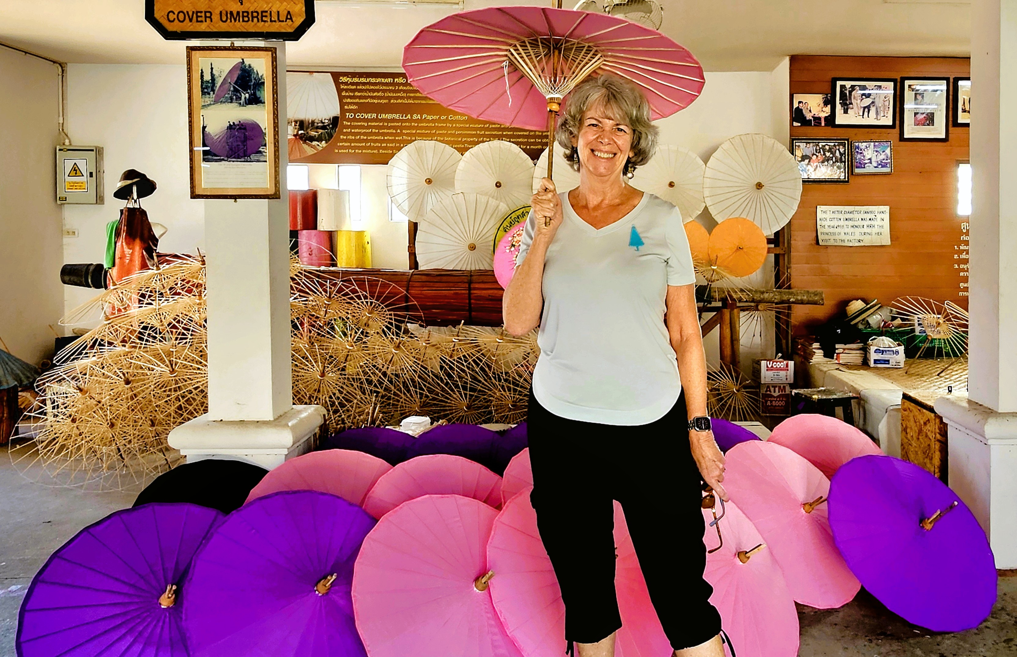
Bo Sang Village, of Chiang Mai Province, has a 200-year history of producing traditional umbrellas made by and with local resources. But it took a curious and enterprising monk to bring this industry to Bo Sang.
Legend has it that local monk, Phra Intha was gifted a beautifully crafted hand-made paper umbrella by a Burmese worshipper during morning offerings while on a pilgrimage to a Burmese monastery. It was a very thoughtful gift to shield him from the sun.
Impressed by the umbrella’s detailed design and durability, Phra Intha ventured to the worshipper’s Burmese village to discover that the umbrellas were made entirely of sa (mulberry bark) paper over a bamboo frame, and suffused with oil to also help repel rain.
Realizing that the same natural resources were available at his home, the monk saw a golden opportunity for the farmers of Bo Sang to re-create similar umbrellas to enhance their incomes during the post-harvest season.
Phra Intha dedicated himself to mastering the intricate techniques and skills required for umbrella-making. Upon returning to Bo Sang with his newfound knowledge, he eagerly shared it with the local community, igniting a collaborative spirit that led to the establishment of a vibrant village co-operative, with each community creating a component and playing a vital role in the umbrella-making process.
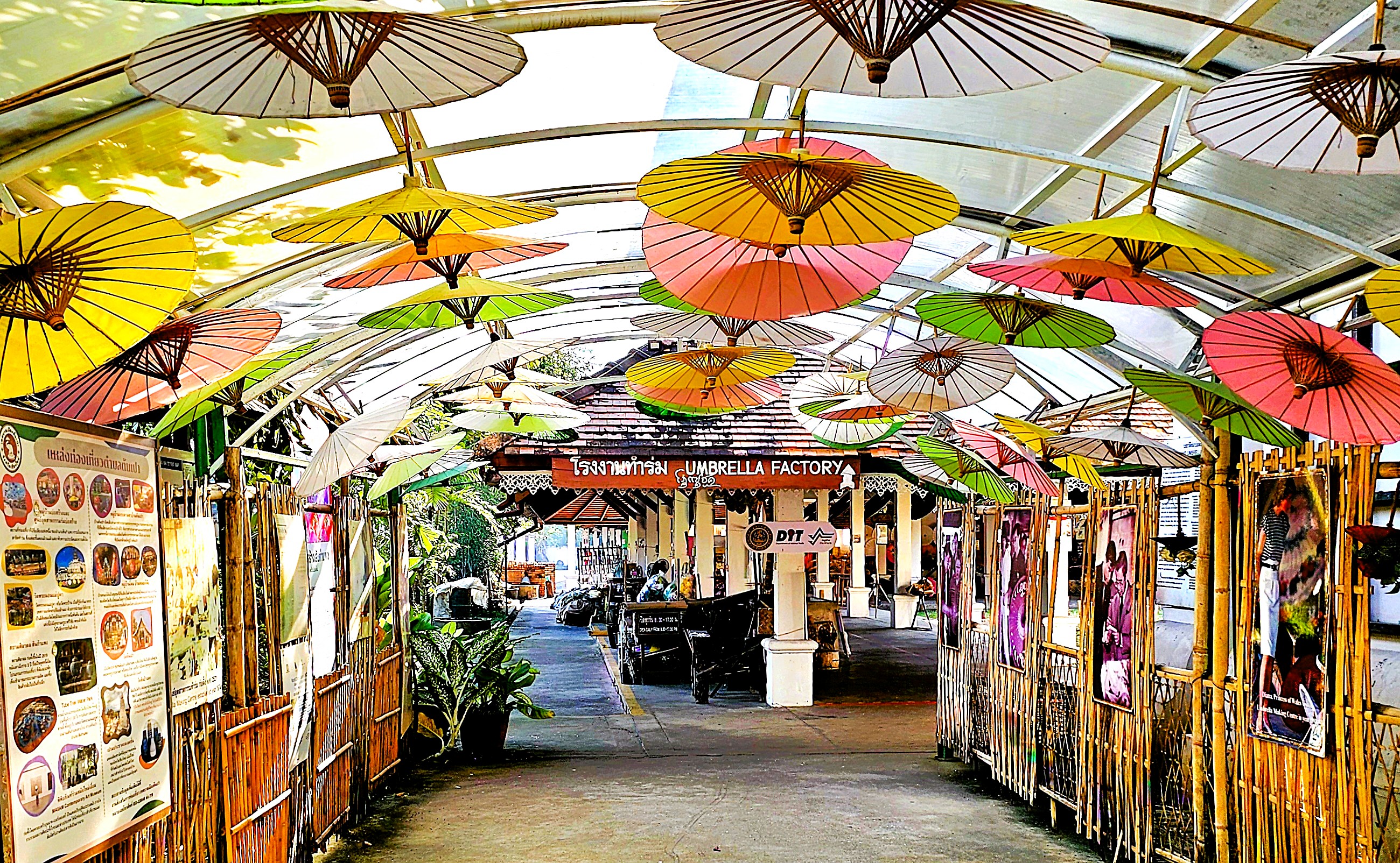
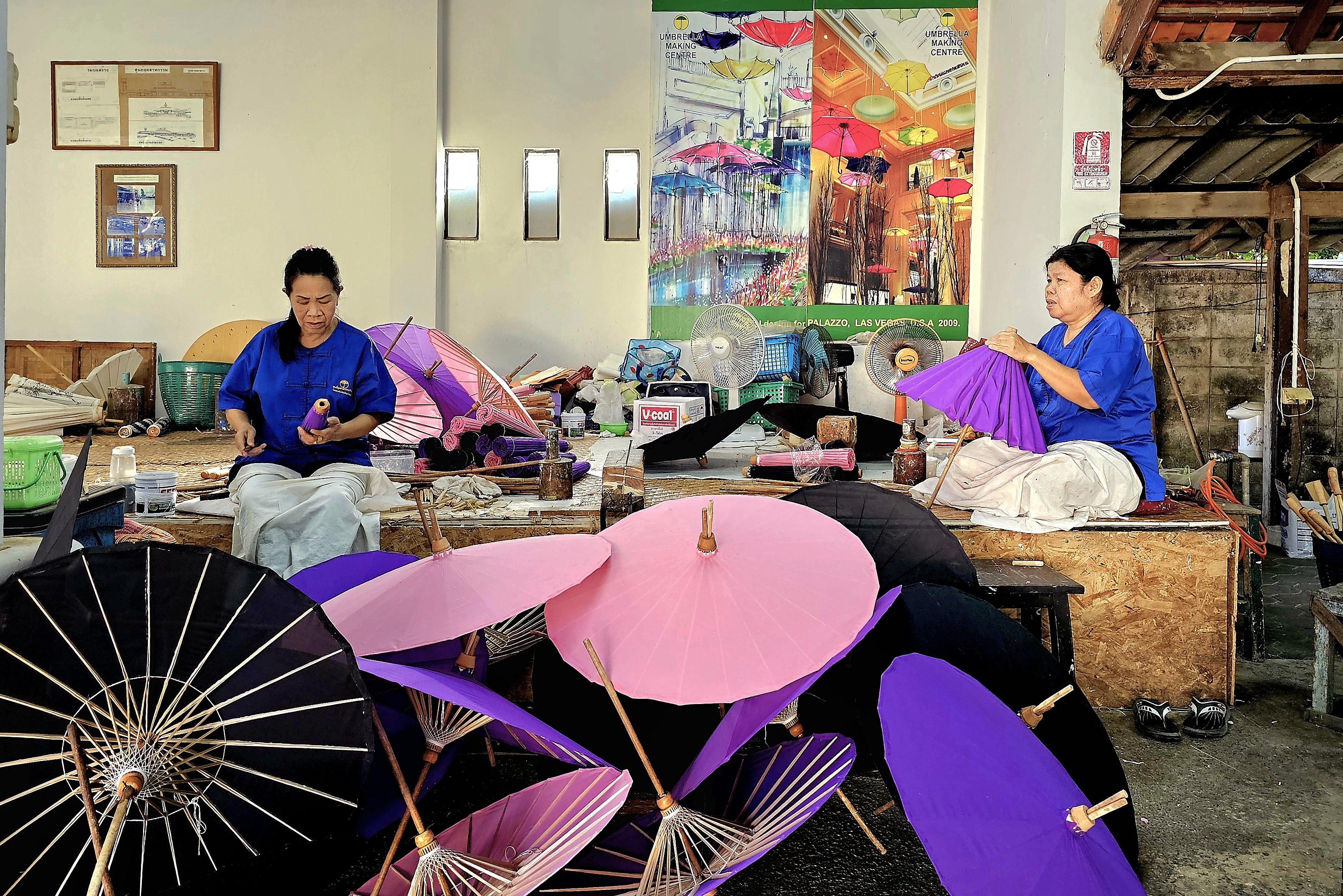
In 1978, the Umbrella Making Center was established by Thavil Buajeen, where every step of the process of hand-crafting stylish umbrellas has been consolidated under one decorative roof in Bo Sang, and where these parasols continue to draw favor from around the world.
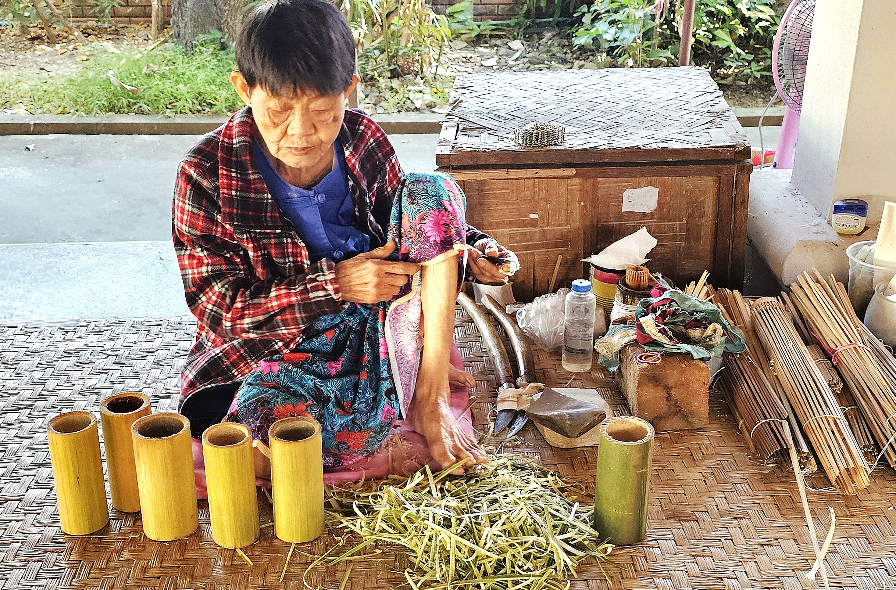
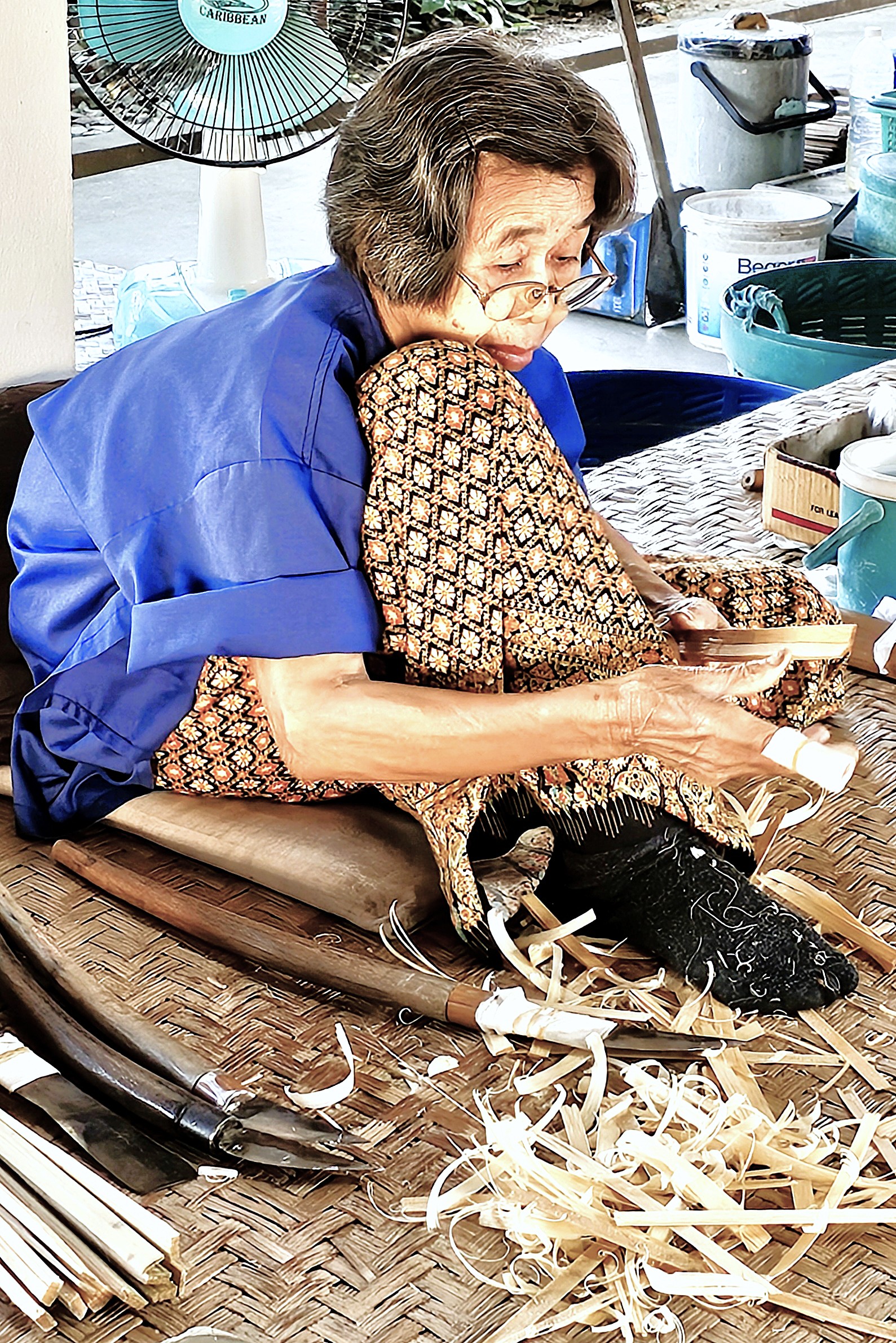
Locals from Sa Bong report daily to the Umbrella Center to demonstrate their artisanship. They are mostly elderly women, by appearance. They squat on grass mats, grasping sharp blades with gnarled fingers, but they work so nimbly, so effortlessly, almost blindly at splitting and shaving bamboo rods into precision-sized spokes for the pulley apparatus.
They perform their tasks at individual workstations atop raised platforms that wrap around an open garden which is anchored by a retail outlet. It’s like walking through a living diorama.
It all starts with papermaking. Bark is first harvested from the mulberry tree and soaked for 24 hours. Then it’s boiled with several kinds of ashes for about 3 hours and clean rinsed with water. Next, the pulp is hand-beaten with mallets until fibrous. Thereafter, the fibers are places in a water-filled tank and stirred with a paddle until the fibers are suspended in the water. The fibers are then sifted through a screen and placed in the sun for about 20 minutes, forming sheets of paper that easily peel when dry.
Bamboo framing is prepared according to the umbrella radius.
Each stem is split into 36 spokes for the lower frame,
and precision-shaved for uniformity.
An equivalent number of bamboo ribs are produced for the canopy.
The spokes are assembled and strung between the upper and lower knobs to create the open/close mechanism.
Once the skeleton has been completed,
the paper canopy is applied and trimmed.
The finished product is now ready for detailing,
or indoor use, only.
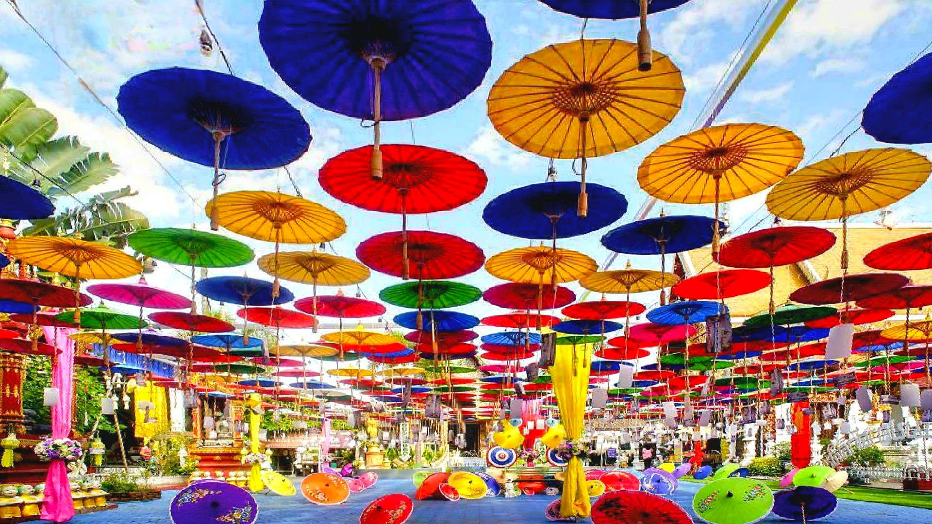
Leah’s now ready for the 3-day Bo Sang Umbrella Festival which occurs every 3rd week in January.
On January 3, 2025, Blanca Ojanguren Garcia, a 22-year-old Spanish tourist and law student, sustained a life-ending head injury after being shoved by an elephant during a bathing ritual at Koh Yao Elephant Care in Thailand. The mahout (keeper, trainer, companion) in charge of the elephant was charged with “negligence causing death.” Authorities suggested the elephant may have been stressed. (https://www.bbc.com/news/articles/c9wlzz9179do).
Ms. Garcia’s tragedy marked the first fatality of a new year that saw 39 deaths in 2024. In fact, last December 11, a 49-year-old Thai woman was killed by a wild elephant that charged her at Phu Kradueng National Park. (https://www.nationthailand.com/news/general/40044052). She was one of 240 victims of elephant violence over the past 12 years. Consequently, animal rights advocates have renewed efforts to re-examine the ethics behind elephant management in Thailand.
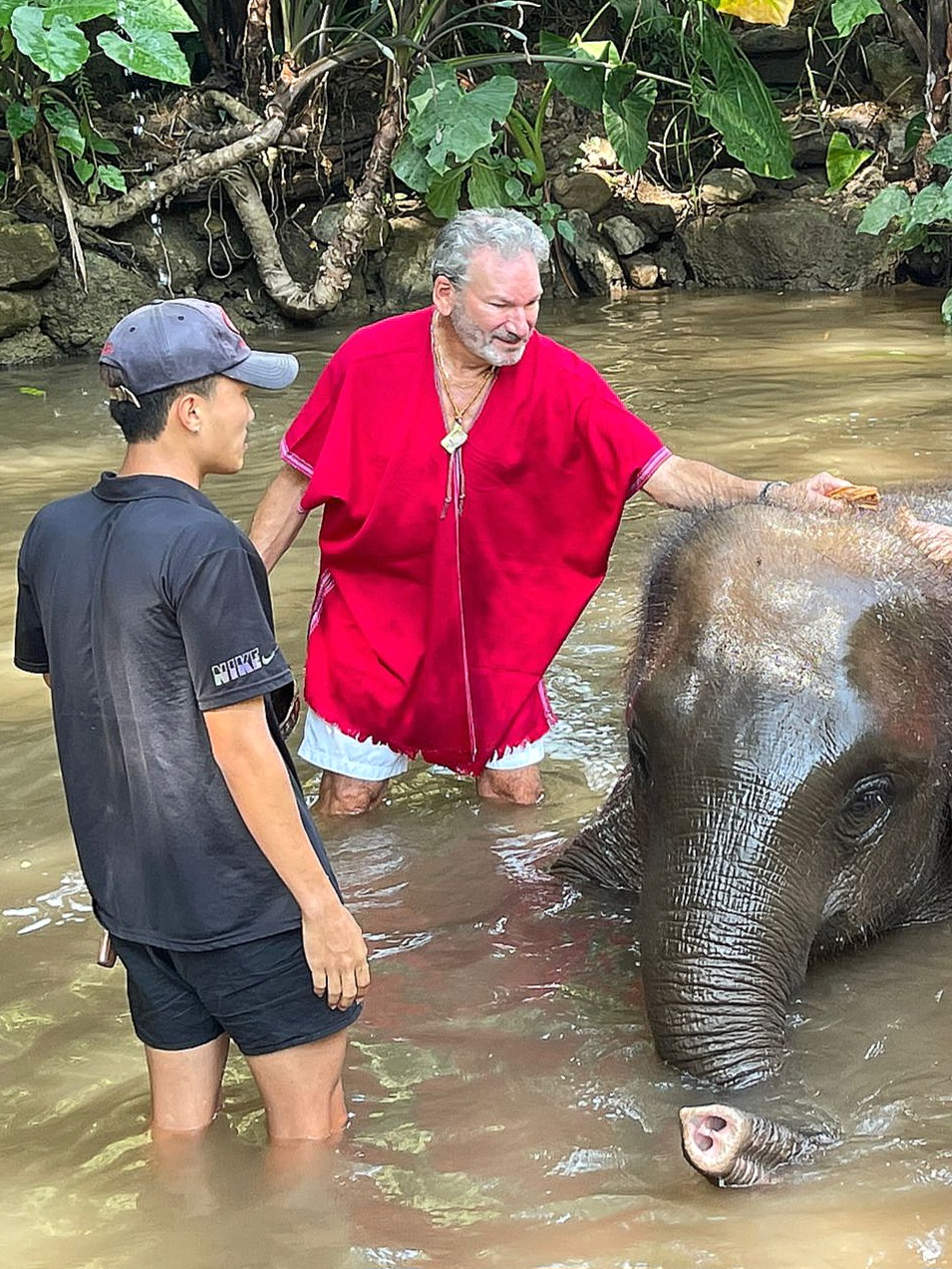
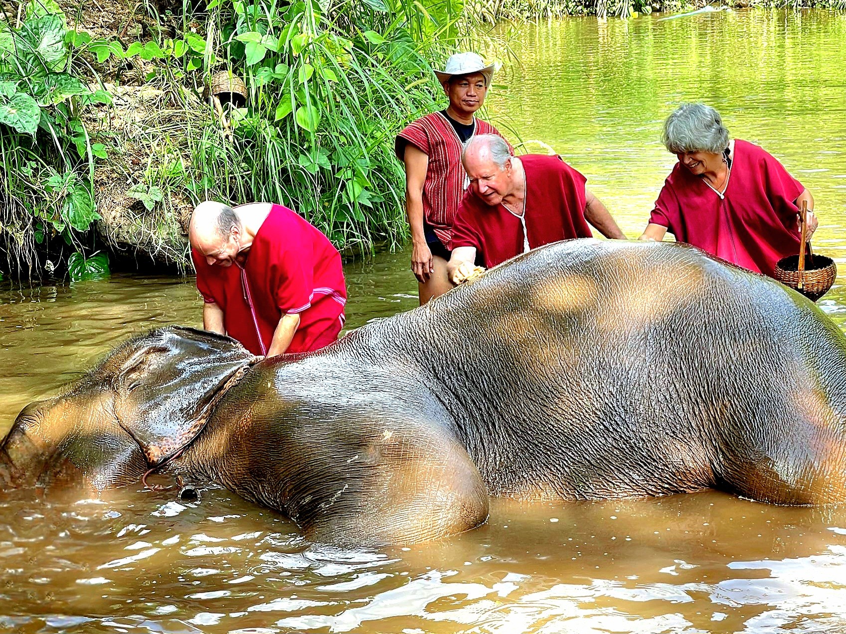
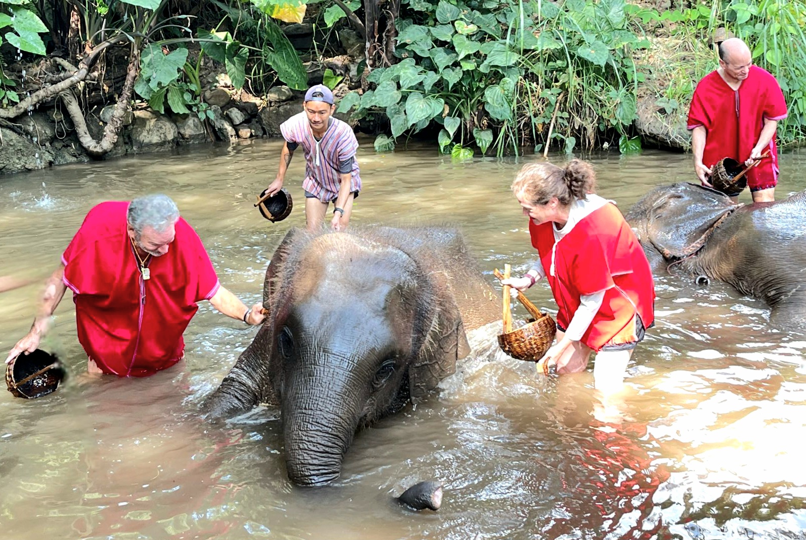
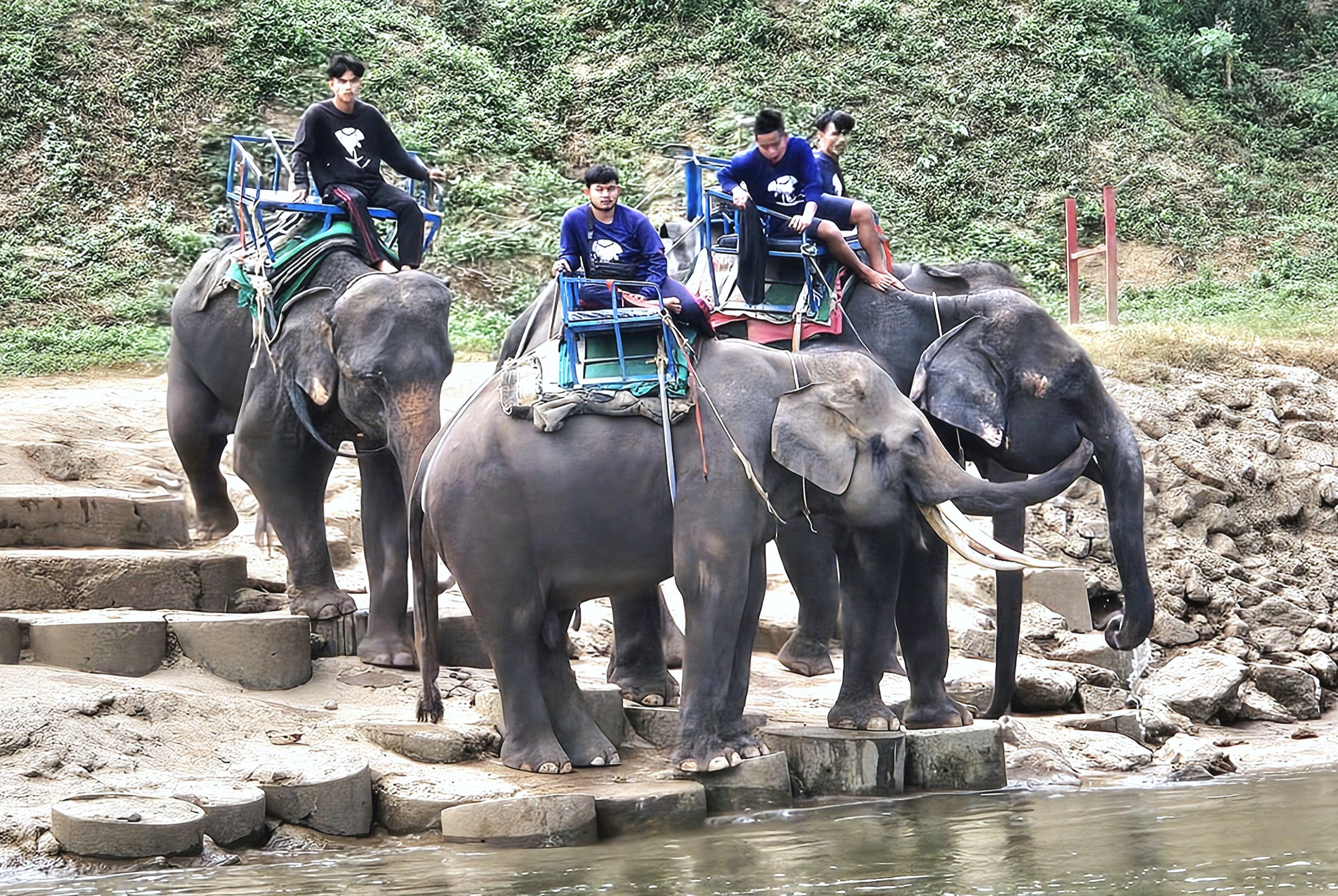
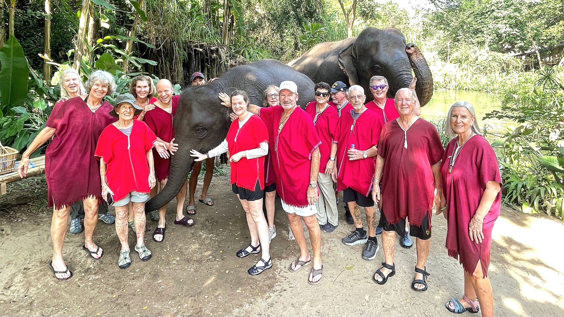
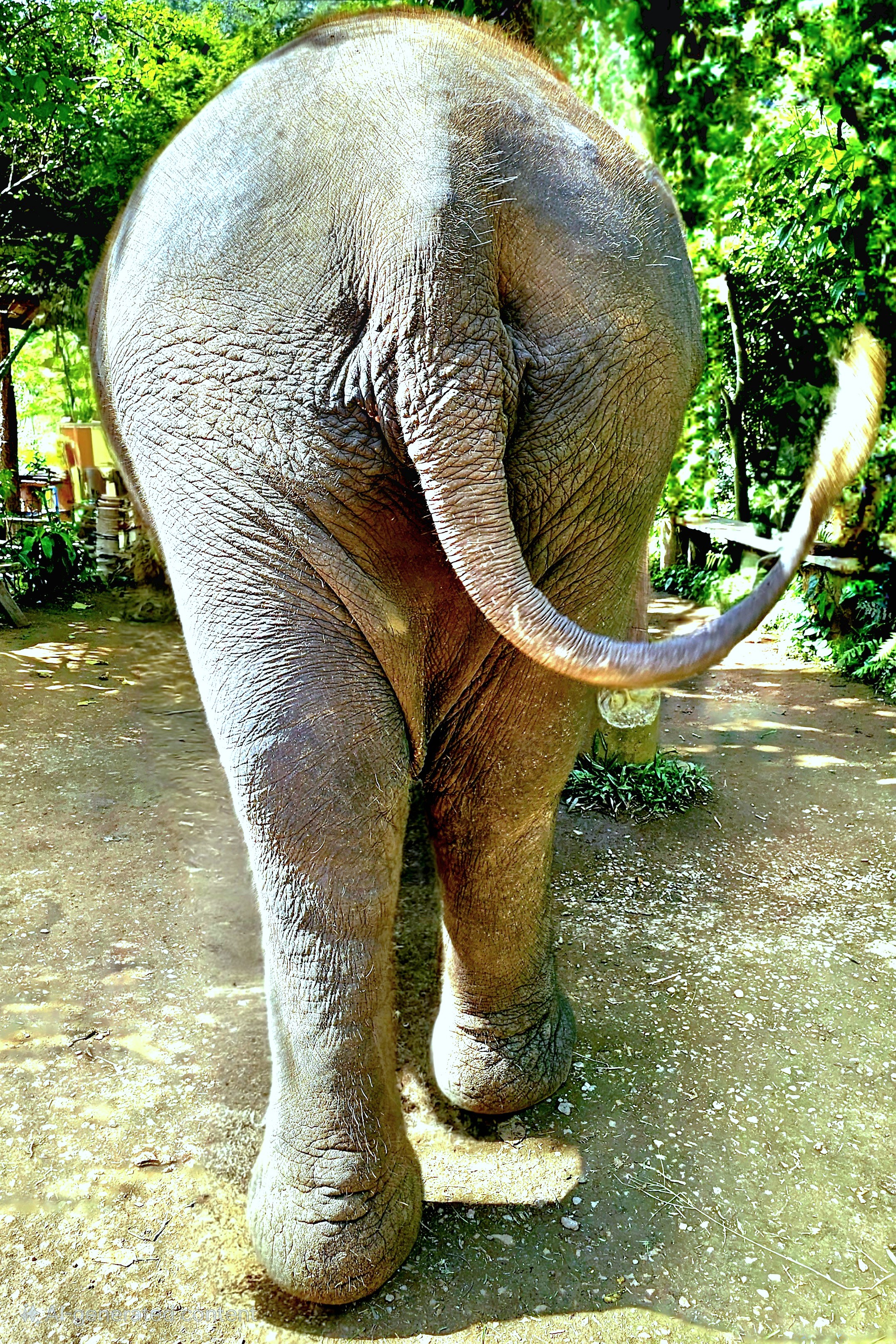
Leah and I were in Hanoi at the time when I first read the headlines, and it immediately carried me back 3 weeks earlier when we were bathing elephants at Elephant EcoVillage–a prearranged activity at an elephant spa selected by Overseas Adventure Travel (OAT)–and it was a glorious time.
We were totally unaware of any danger during our interaction. Our menagerie was docile and compliant.
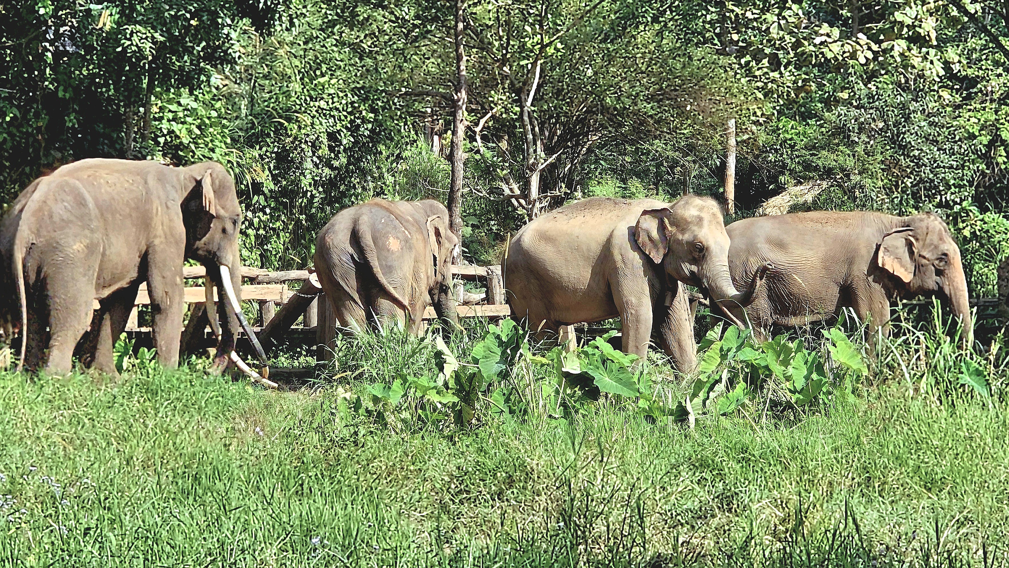
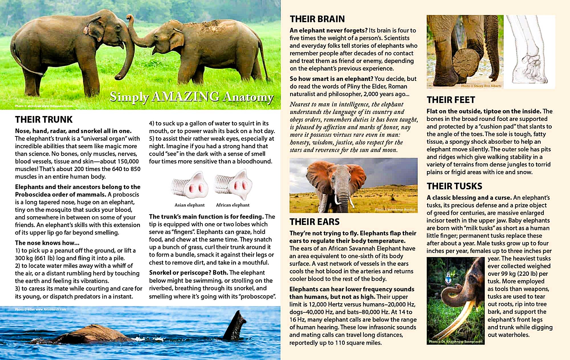
Nevertheless, humans have a troublesome history with elephants…
The first evidence of elephant domestication was discovered along the Indus River Valley in 2000 BCE–at a time when as many as 20 million elephants roamed the forests of Africa and Asia.
By 700 BCE, Indian elephants were instruments of warfare and combat.
Two centuries later, elephants were dying for sport and entertainment in Roman amphitheaters.
After 1600, warrior elephants lost their advantage on the battlefield as the Gunpowder Revolution gave rise to new military weapons and tactics. Elephants transitioned to beasts of burden.
The 1800s saw the first elephants exploited in circuses.
In 1989, the Convention on International Trade in Endangered Species (CITES) banned international trade on elephant ivory, citing poaching as the biggest threat to their very existence.
A 2024 census identified that elephant populations had dwindled to around 450,000 globally, of which only 10% were counted as Asian elephants.
As of 2020, Thailand has tracked 7,300 elephants within its borders,
with up to 3,500 wild elephants occupying 69 forested sanctuaries.
That leaves 3,800 captive elephants who rely on tourism to pay for their continuing support and welfare. Conservation organizations range anywhere from “observation-only” shelters…
to “rescue centers” that promote elephant riding as a VIP amenity.
Asian Captive Elephant Working Group (ACEWG), a group of regional elephant specialists, veterinarians, researchers, and conservationists acknowledge that:
Closing all elephant tourism venues is unrealistic if there are no alternative livelihoods for mahouts with elephants.
Suitable habitats for reintroducing elephants to the wild have been marginalized by a loss of forest from over-logging.
Elephants are intelligent and mobile animals with a highly developed social structure. Their complex needs require professional management and care protocols.
Elephants–captive or wild–pose a safety risk to humans and must be managed accordingly.
While there are no easy explanations surrounding Human-Elephant Conflict, our half-day experience at Elephant EcoValley was designed to: “…share the elephants’ history, their culture, their current environment, and their relationship with the human species—compassionately and scientifically. “
Ben, our guide, introduced us to Tata, a 40-year-old female, and her mahout for the past 12 years, who has tirelessly devoted himself to Tata’s daily care, as a parent would care for a child.
Leah and I became fast friends with Tata,
but so did everyone else in our group, as she obediently posed with each of us.
There was also an educational component to our visit. We spent some time in their museum loading up on facts and understanding about elephant evolution, anatomy, behavior and welfare.
After a satisfying lunch of regional specialties,
we focused our attention on the prodigious appetite and eating habits of these magnificent beasts who typically spend 16 to 18 hours a day foraging for an array of grass, plants, bushes, fruit, twigs, leaves, roots, and tree bark–each vital for providing a mix of essential minerals and nutrients.
But captive elephants don’t always get the nutrition they need that’s necessary for good health. They also require a multi-vitamin to supplement their daily nutritional intake, and it was our job to produce them from a variety of ingredients.
The recipe called for crushing salt and aloe vera together in a mortar. Then cooked rice, tamarind, and bananas were added to the stump. Finally, we combined moonseed, Lasia, sugarcane, sedge, schefflera, Bermuda grass, and fresh pineapple to the mix and mashed it all until gooey and sticky enough to form pills the size of baseballs.
At last, it was time to feed our new friends,
and they couldn’t get enough!
Depending on their size, an Asian elephant can consume up to 300 kilos per day (660 lbs.) or about 18% of their body weight. And that creates a lot of poo. Elephants can defecate between 10-20 times a day, producing 100-150 kilos (220-330 lbs.) of dung per day. But the people at Elephant EcoValley have an answer for that:
Much of the dung is collected every day;
washed to remove the debris;
sent through a thrasher to separate the fibers from the pulp;
and screened through the slurry…
until finally drying into a sheet of poo paper that doesn’t stink!
Our time at Elephant EcoVillage was a delight, and none of us ever felt threatened or considered that we were exploiting the elephants. On the contrary, these were pampered pachyderms.
It’s uncertain if authorities and activists can agree on balancing eco-tourism with elephant protection, but with education and resources, ethical and sustainable practices can be achieved to benefit both elephants and the community in the End.
In Thailand, you won’t hear anyone saying they need to use the bathroom. It’s not the WC, the loo, or the potty either. Nope, people are heading to the Happy Room, where the vibe can be a bit cheeky (all puns totally intended)!
By no means is this intended as a definitive and exhaustive chronicle of Happy Rooms we have witnessed, or in some cases, survived. It’s just that some Happy Rooms are more surprising/unusual/gross/etc. than others and are therefore more worthy of notice.
Some Happy Rooms are grand because the surroundings are grand.
Such is the case with the Grand Royal Palace–making for a more elevated experience.
Some Happy Rooms are thematic, such as the blue Happy Room of the Blue Temple, formally known as Wat Rong Suea Ten, or “Temple of the Dancing Tiger.” Planting trees between the urinals is an interesting touch. They give new meaning to pee pee trees.
For those looking for the ultimate bang for their buck, there’s the White Temple’s Happy Room, which assures all users a quintessential gilt trip.
Sometimes Happy Room directions can be explicit for good reasons,
while there are times when directions are self-explanatory.
Nearly all Happy Rooms with commodes have an external hose with sprayer attached to the flush mechanism of the toilet. Is it for use as a functioning bidet…
or is it for general cleanup when directions are ignored, and misses are inevitable? Because in Thailand, sometimes the availability of tissue squares can be a crap shoot!
Some Happy Rooms are whimsical; they come with voyeurs…
while others come with Peeking [sic] ducks.
Most times, all we need are the bare necessities…
because sometimes there are so many rules, that it makes more sense to sit like a lady, rather than standing on ceremony.
(Yes, the sign is from Hanoi, but it’s still worthy of consideration regardless of the location or the urge!)