Way Back in the Day

On the recommendation of a film school buddy who’s been Canadian all his life, we doubled back east of Calgary to tour the Red Deer River Valley, hitting many of the Badlands hot-spots before immersing ourselves in Drumheller dino-madness.

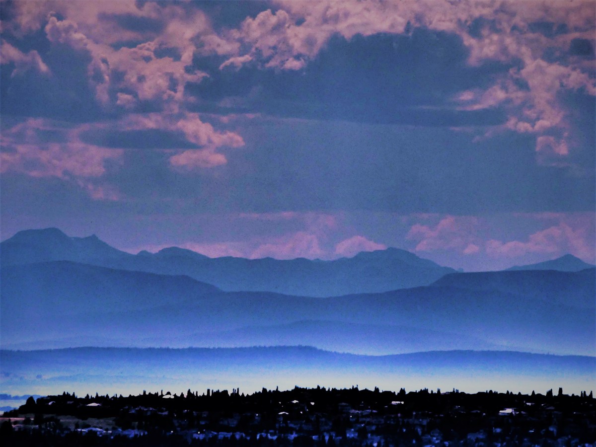
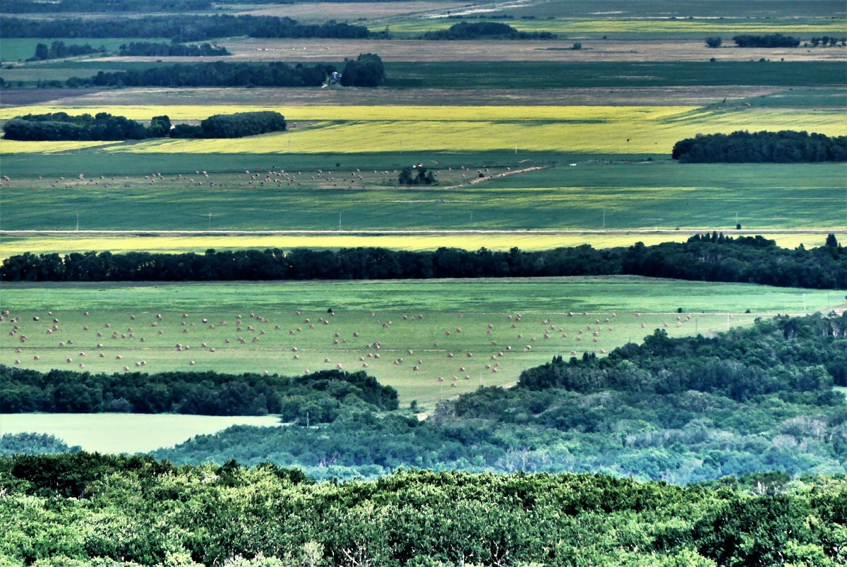
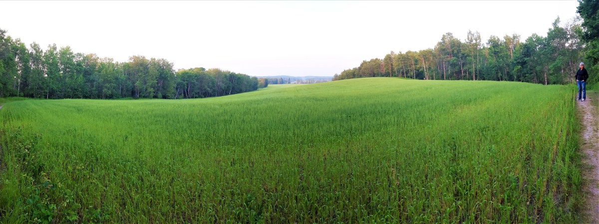
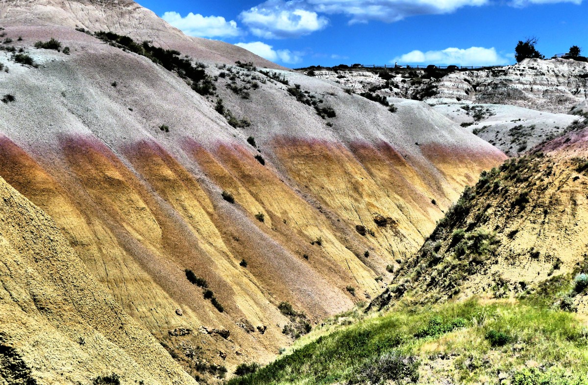
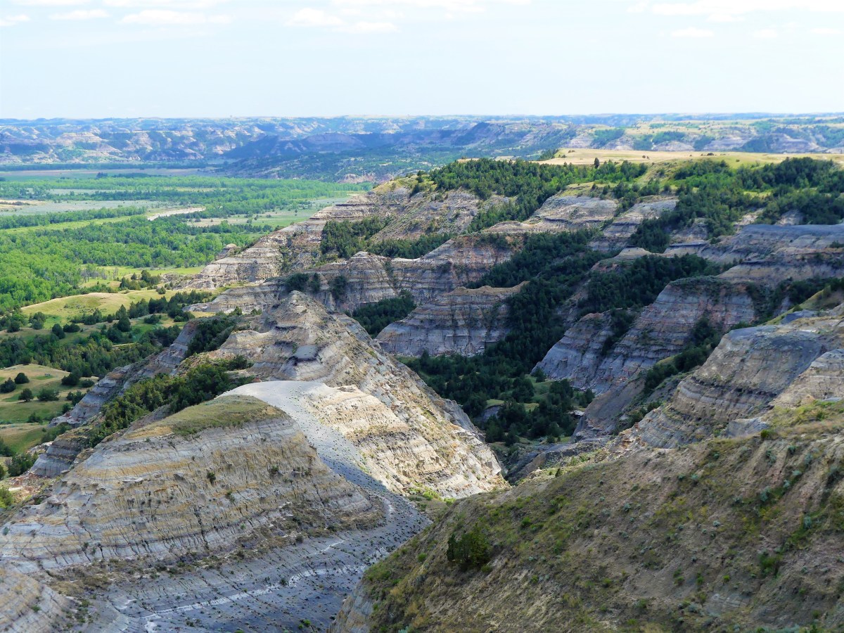
We drove for nearly two hours along prairie roads, wondering when the landscape would eventually change from grasslands and rolling hills of yellow flax to familiar slopes of striated colors separated by narrow gullies and ravines.

It wasn’t long before we descended into Drumheller Valley and celebrated a welcome change of scenery.

horseshoe canyon

Badlands mounds

Badlands swirl

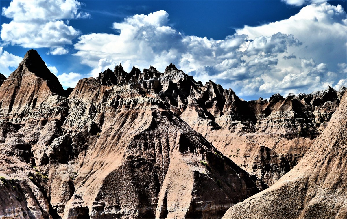
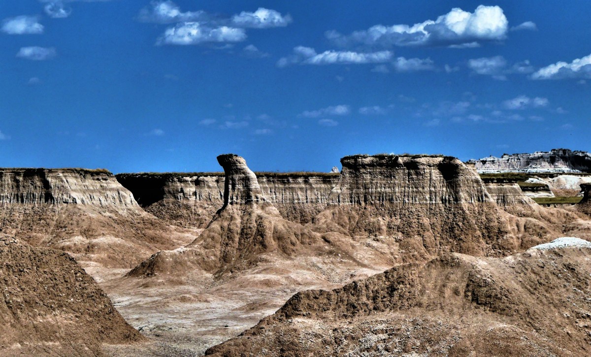
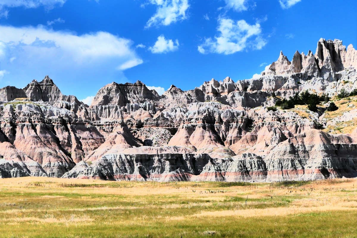
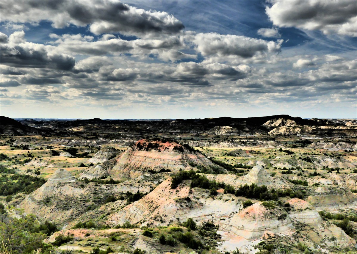
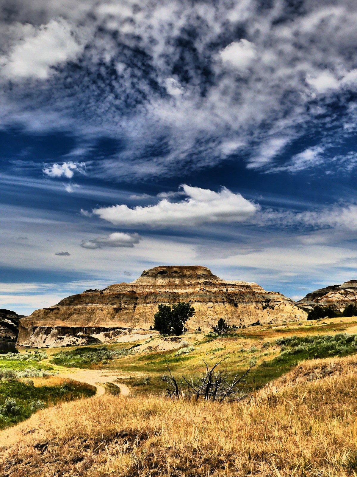
“I’m guessing that this would seem amazing if you’ve never seen the Badlands of North and South Dakota,” opined Leah. It’s true that while it didn’t quite measure up to our recent experiences at Theodore Roosevelt National Park (see Oddities—North Unit) or Badlands National Park (see Battle Lands), it was still an improvement over miles upon miles of farms and ranches.

All of which brings up an interesting question about Badlands semantics: When comparing two Badlands, is the substandard Badlands better or worse than it’s counterpart, or are we just spiraling down an oxymoronic rabbit hole?

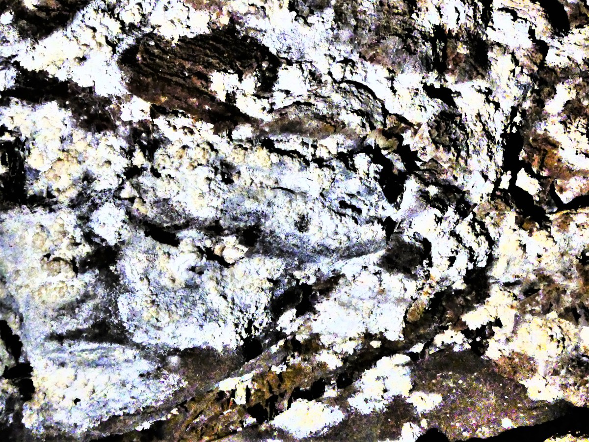
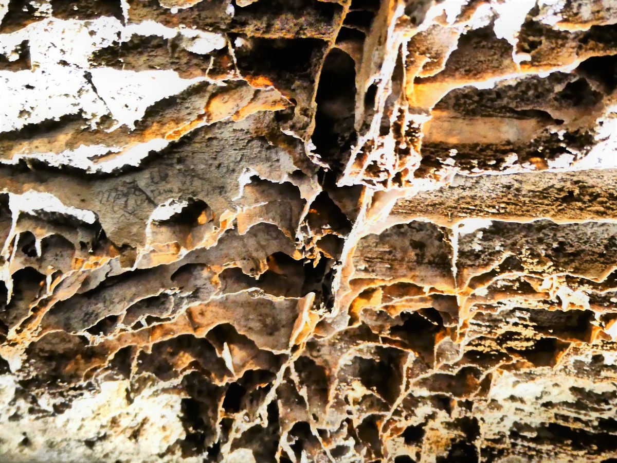
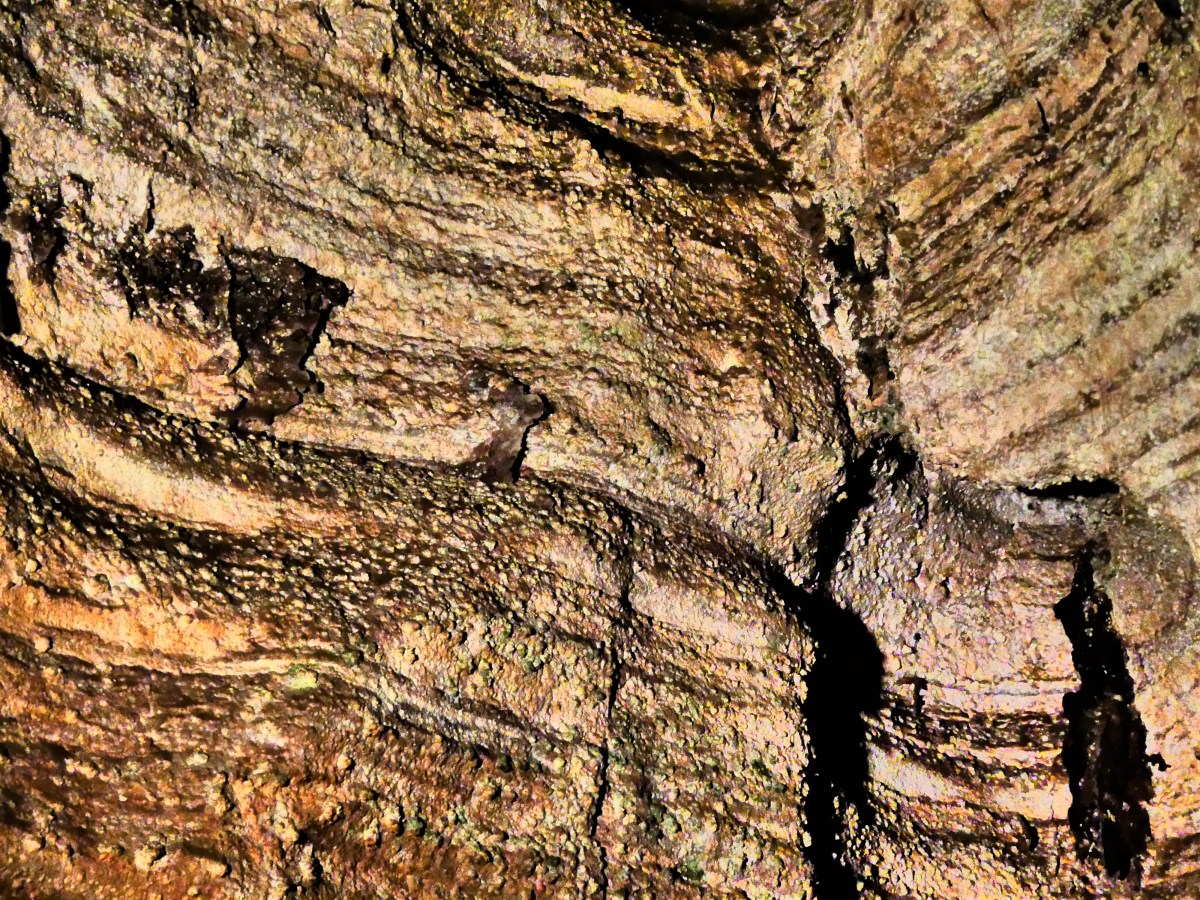
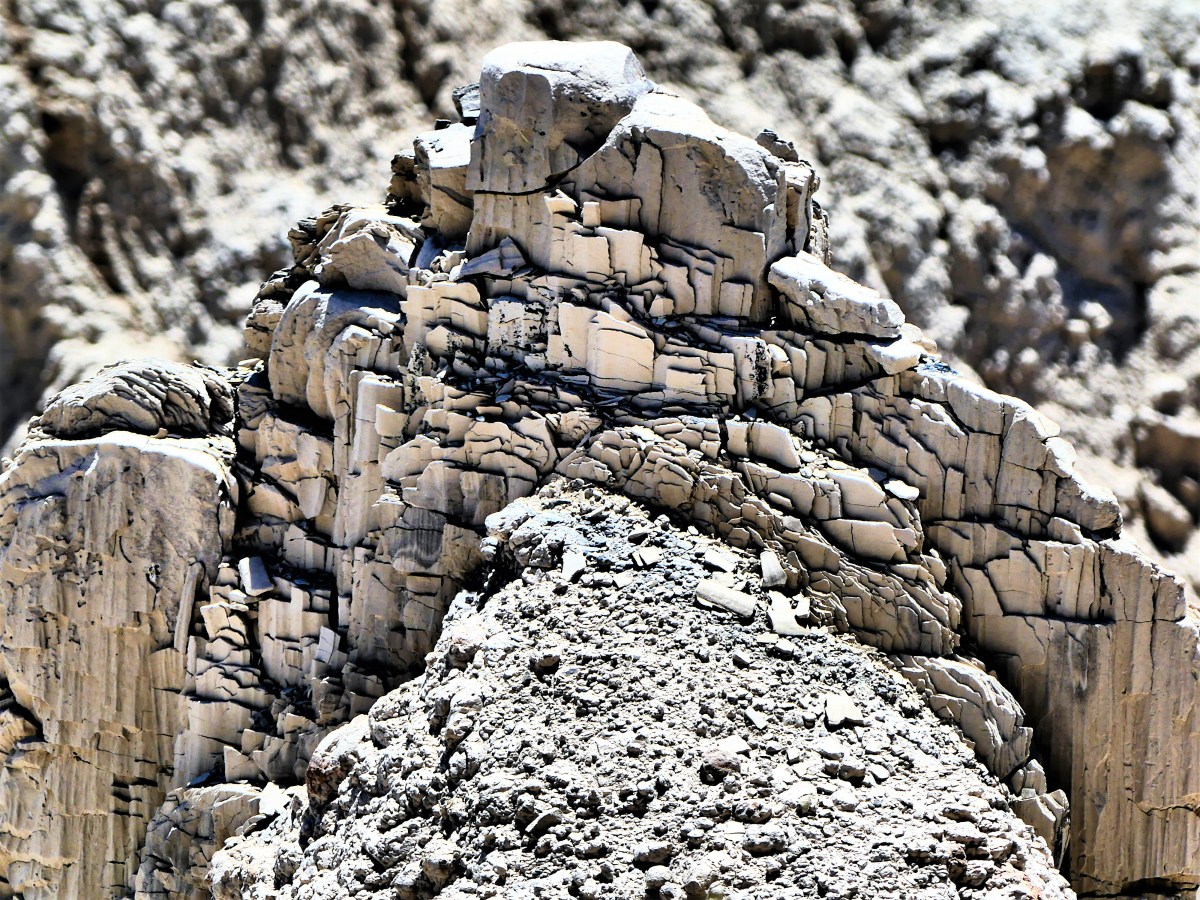
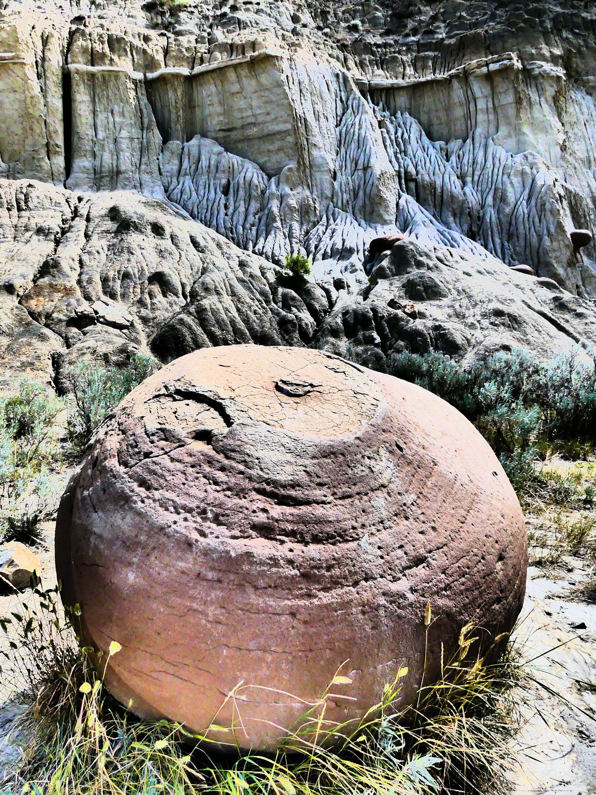
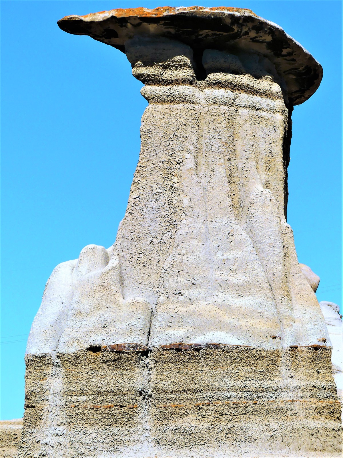
Anyway, we picked up the Hoodoo Trail toward East Coulee and pulled into a busy parking lot across the road from a “protected area” where interpretive signs and steel railing surrounded what was left of a few limestone columns.

hoodoo group

hoodoos

A forty-something mom was telling her pre-teen son and adolescent daughter that this site was one of her favorites to visit when she was their age, but it was her recollection that there were many more hoodoos at the time.

“What happened to them?” asked Sonny Boy.

“Well,” Mom began, “the weather wore them away, and I guess people vandalized them by too much climbing around, so don’t wander off.” With that, the kids broke free and ambled up the steep slopes with the finesse of bighorn sheep. “Don’t go too far up,” Mom yelled after them, but the kids would not be denied.

Most of the visitors were content to stand on the viewing platform looking up, but I was keen on a closer look.

hoodoo

And while the hoodoos appeared drab in color, the possibility of getting close enough to feel the flaking texture was enough of a reward.

Hoodoo texture

It was while I was working my way back to the viewing deck that I heard a distant cry from the top of the mesa.

mesa top

“MY KNEE LOCKED UP, AND BARRY SAYS HE’S GONNA BE SICK,” yelled the daughter to her mom, “AND I DON’T THINK I’M ABLE TO GET DOWN!”

Mom wondered aloud to herself, “Now what am I supposed to do?”

“Maybe you should call 9-1-1,” Leah offered.

Not wanting to stick around to watch the drama unfold, we headed to a nearby historic site just pass East Coulee on the other side of the Red Deer River.

Atlas Coal Mine

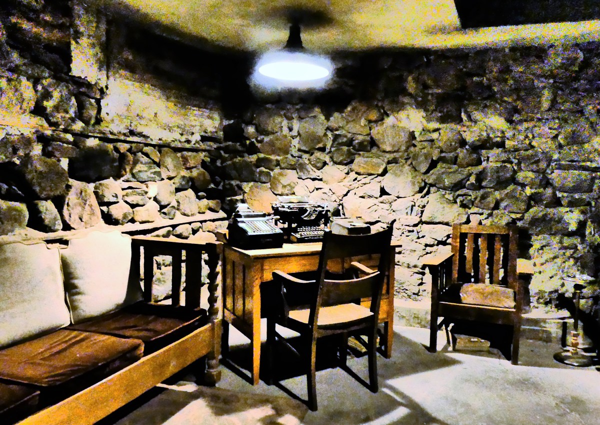
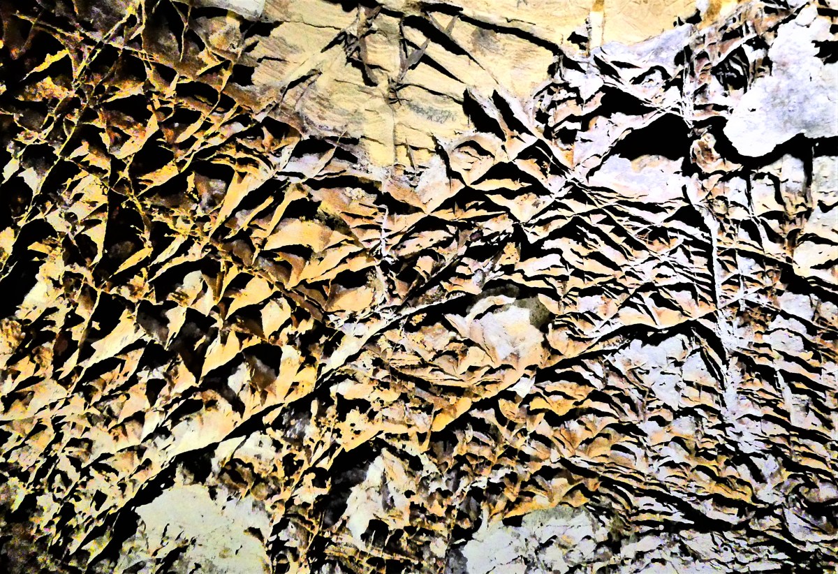
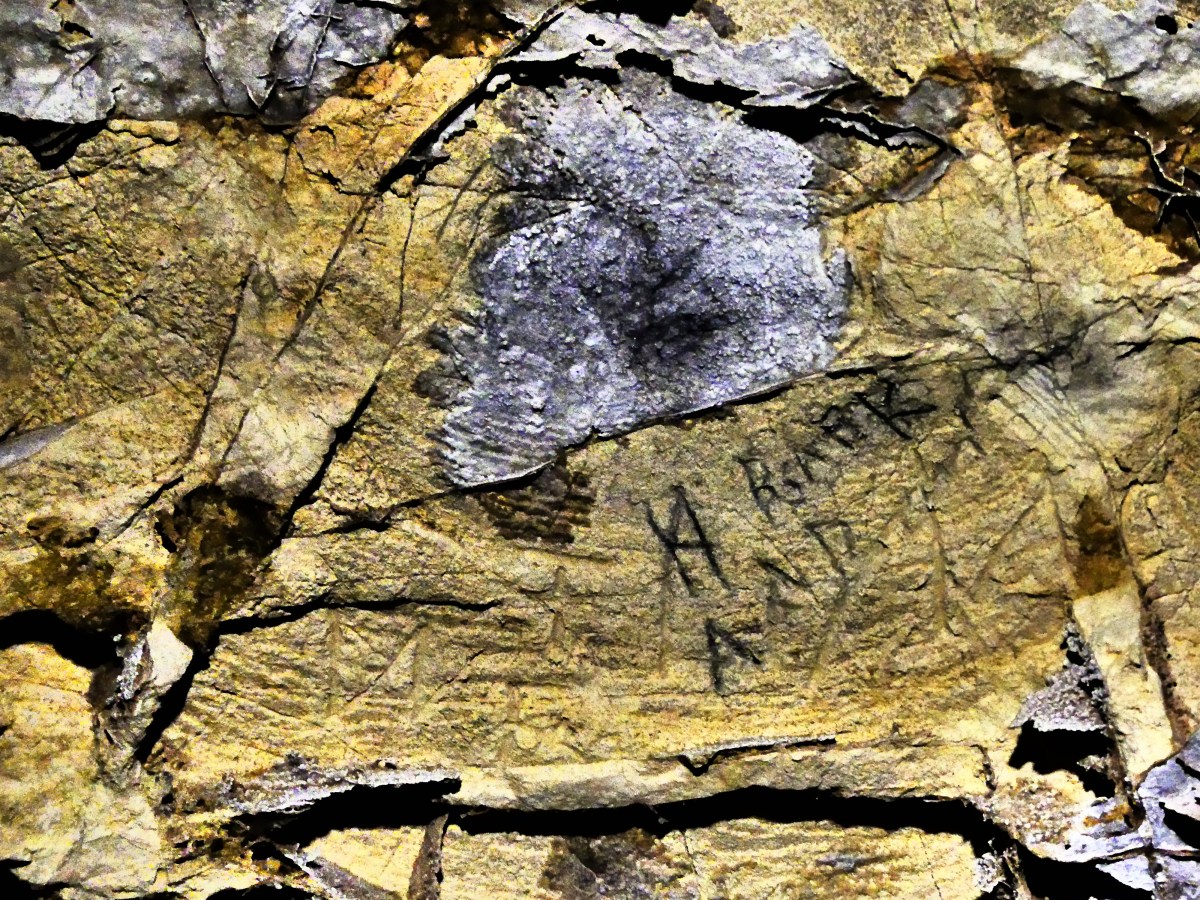
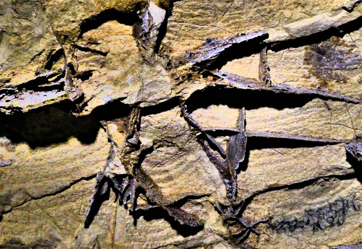
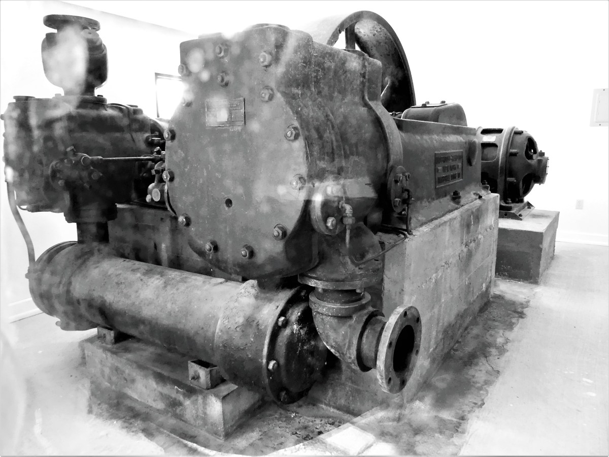
Atlas Coal Mine now serves as a stark reminder of the energy heyday of the early 1900’s, up until the last lump of coal was quarried in 1979. Atlas is also home to the last wooden tipple in Canada,

tipple profile

Atlas Mine tippet

Mine chute

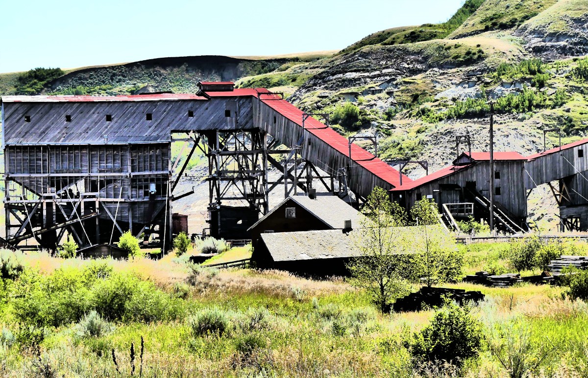
and the source of several recorded unexplained occurrences that have led visitors and paranormalists to conclude that apparitions and voices are as much a part of the physical space as the graveyard of discarded machines that line the entrance to the museum.

On our way back, we passed the hoodoos in time to see an ambulance pull away with who we suspect were the stranded kids on the mesa.

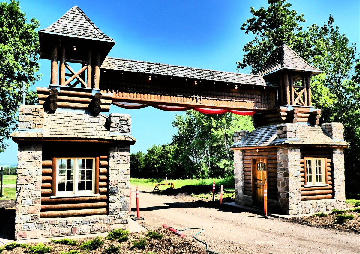
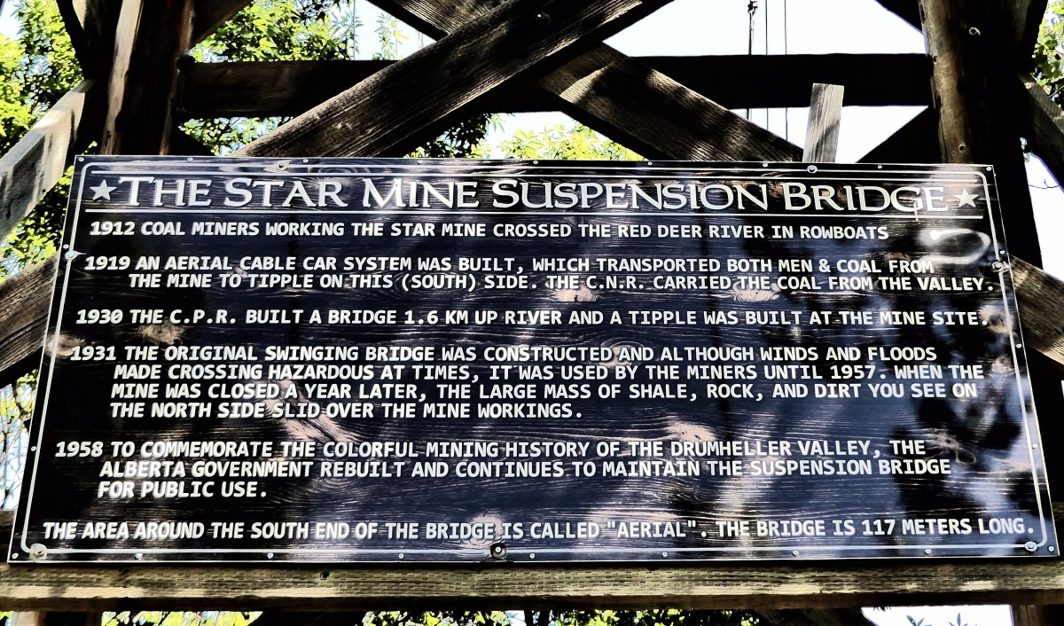
After enjoying lunch nearby at Star Mine Suspension Bridge,

bridge sign

suspension

bridge cable

we stepped into the F-150 way-back machine, set the controls for the Cretaceous Period, and transported 67 million years back in time when being a vegetarian got you killed if you were a dinosaur.

carnivores

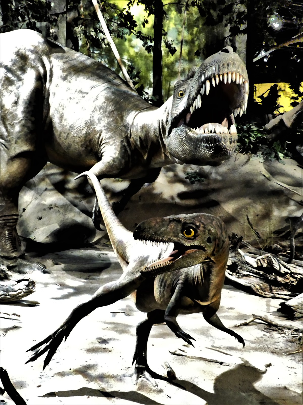
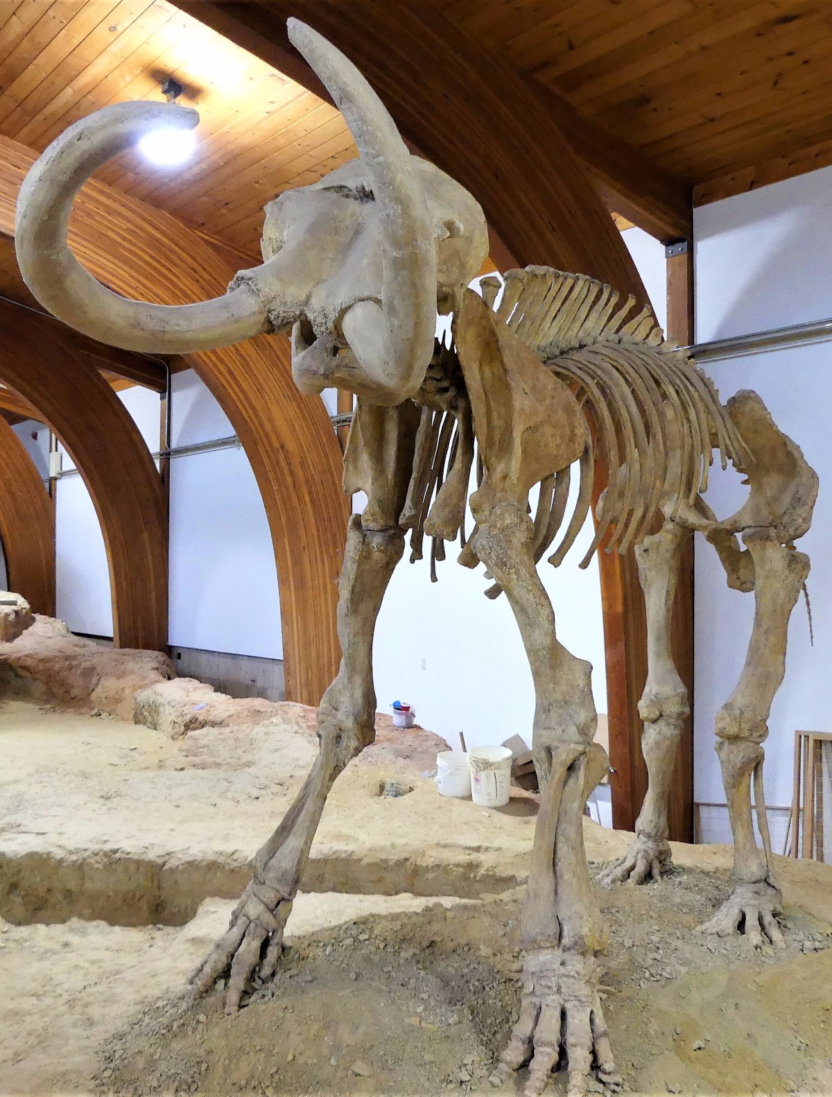
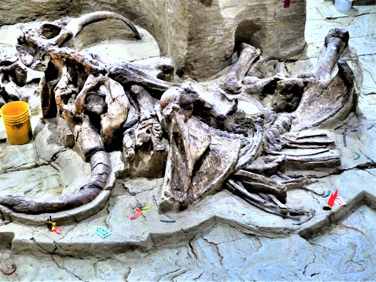
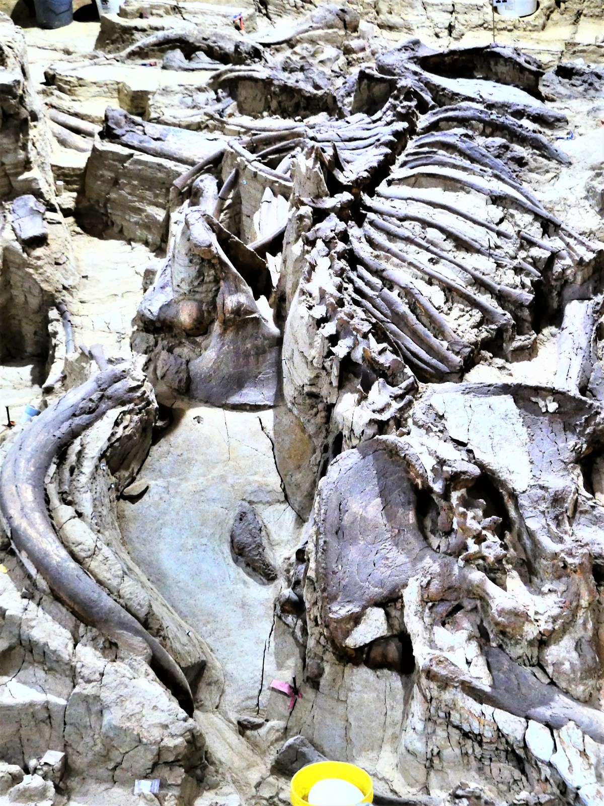
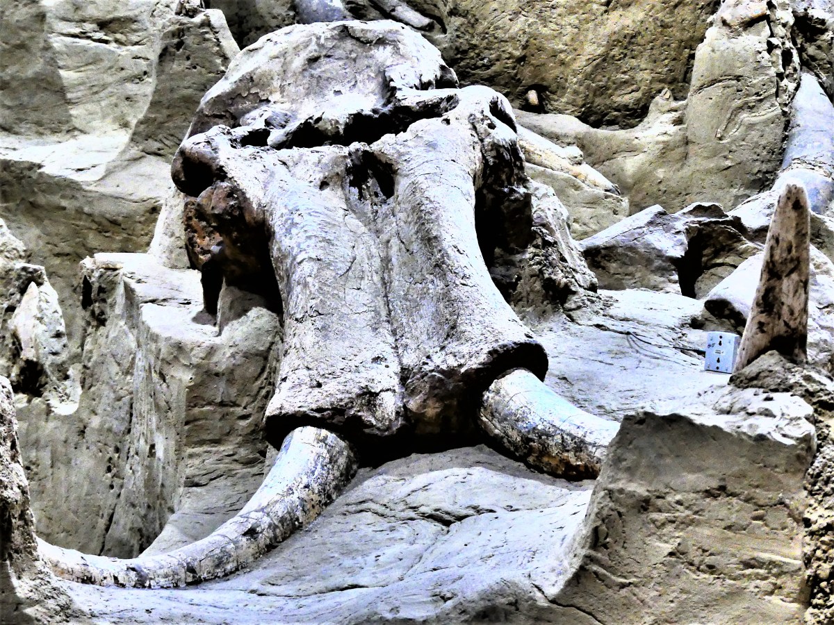
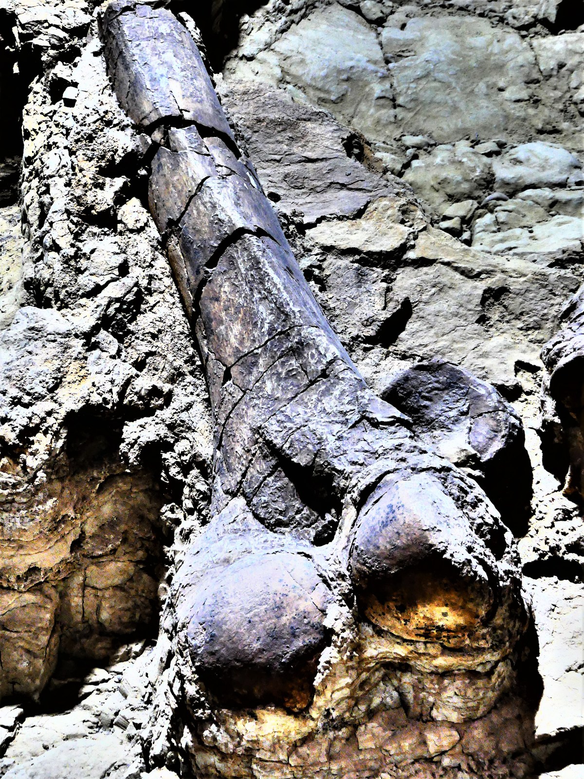
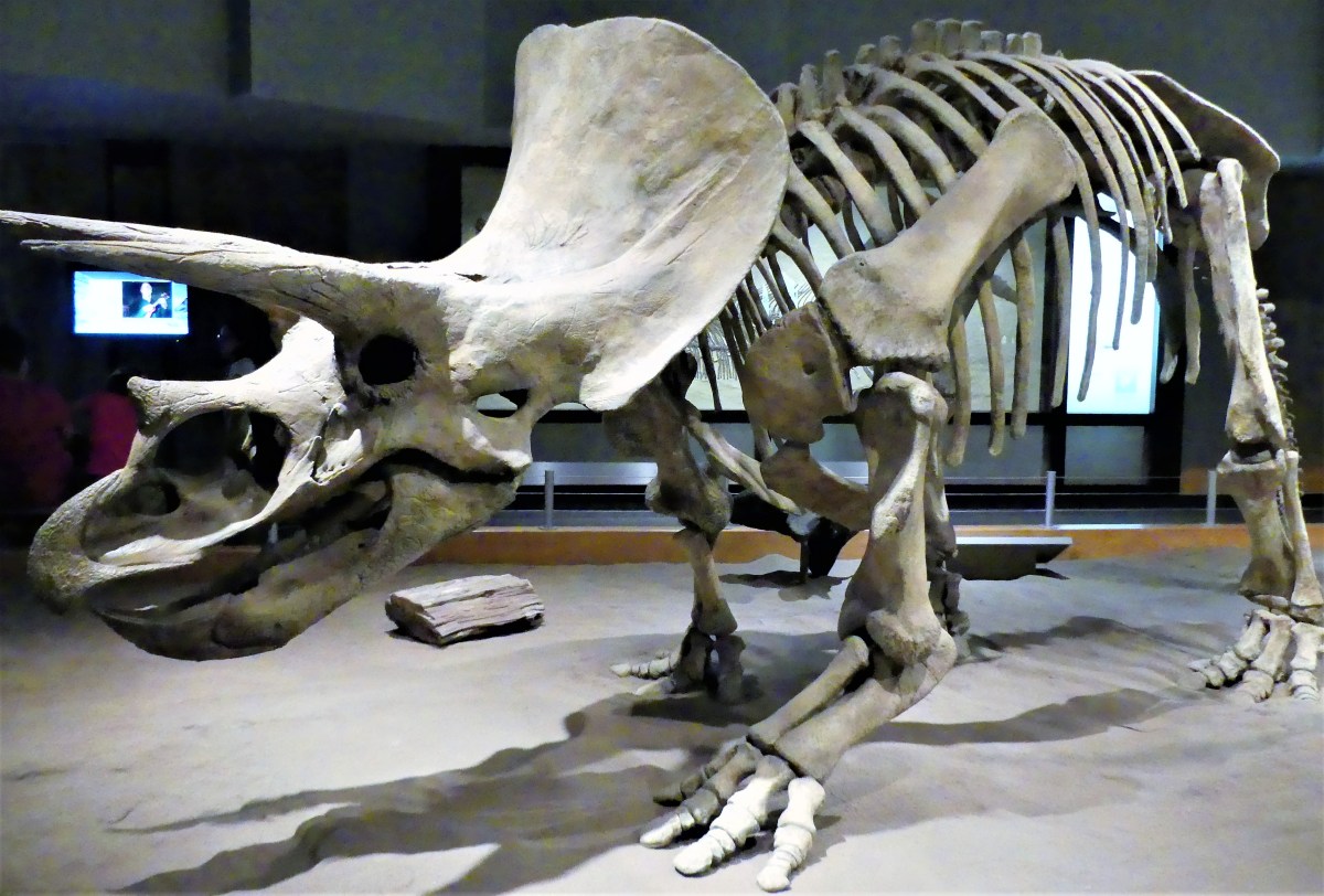
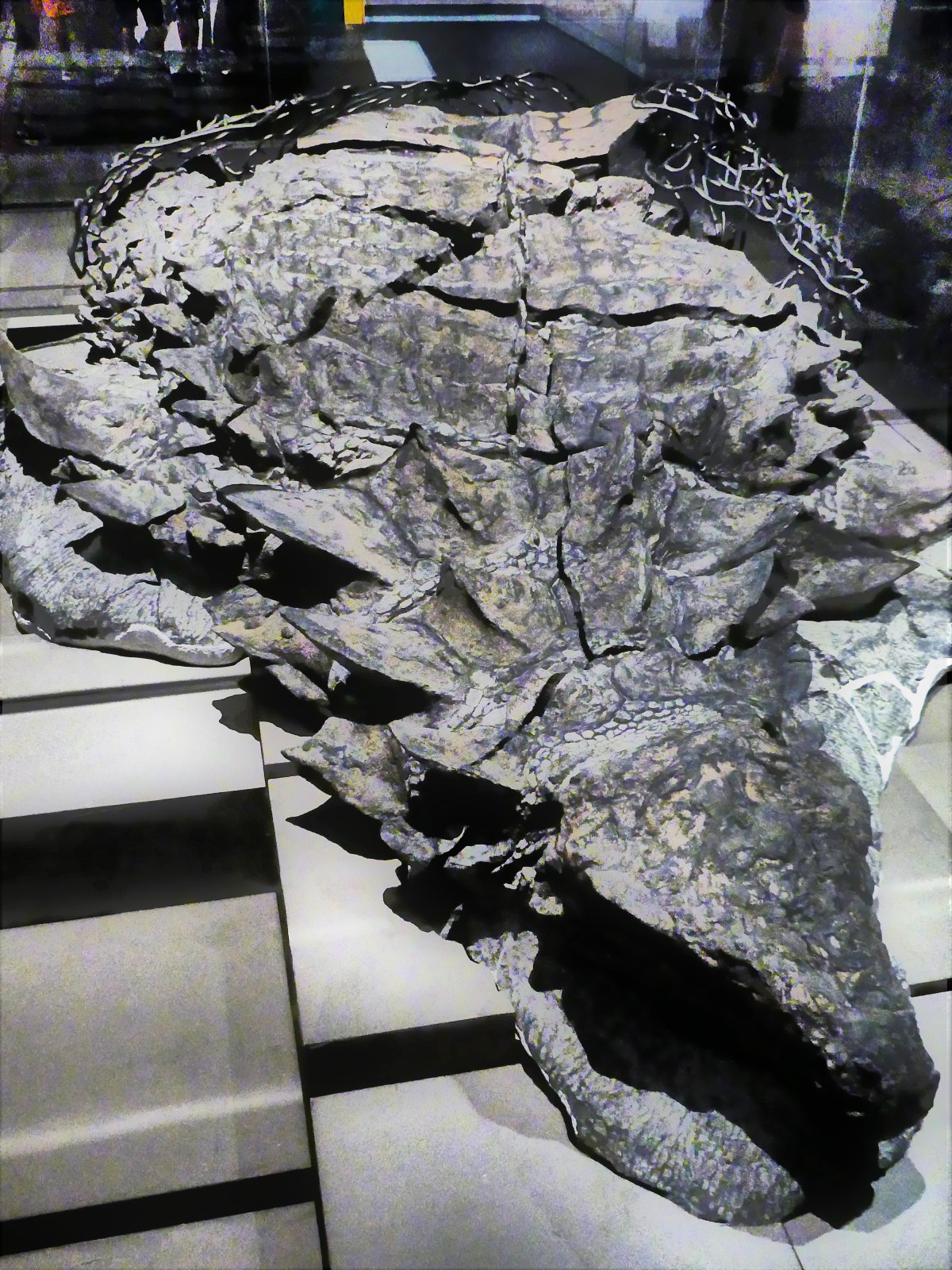
We were overwhelmed at the rich assortment of skeletons…

attack

and fossils…

raptor

on display at the world reknown Royal Tyrrell Museum of Paleontology.

Apparently, Southern Alberta boasts some of the richest bone-beds in the world for which experts give two simple reasons: it was a good place to live and a better place to die!

The museum goes on to explain that large herbivorous dinosaurs thrived on the abundance of lush vegetation available to them,

triceratops

which in turn supported the carnivorous dinosaurs’ huge appetite.

T-Rex

And so many dinosaurs during the Cretaceous Period were preserved intact, since the region’s floodplains provided the perfect burial grounds, only to be revealed by Ice Age erosion, and later exhumed by the hard-working staff at the museum.

prep lab

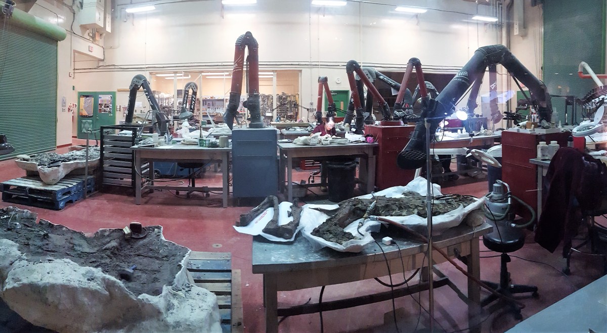
At times, taking five years to prepare an exhibit of a prehistoric crocodile.

ancient crocodile

But despite all the serious science to be found at the Royal Tyrrell, dinosaurs can also support the town economy of Drumheller, and dinosaurs can be fun!

world's biggest dinosaur

Back in the Day

Taming the Canadian Wild West required spirit, courage and resolve. Throw in the railroad, the missionaries, and the Mounted Police, and Calgary soon took shape along the banks of the Bow River.

A visit to Heritage Park in Calgary…

heritage park signage (2)

retells the history through a fully recreated settlement of restored buildings occupied by staff members dressed in period costumes,

day is done

with each attendant recounting a personal story of a life ruled by harsh weather and frontier justice, but a life that nonetheless fueled the promise of freedom for so many.

Locomotive 2024 chugged around the park, pulling cars of passengers toward a variety of thematic destinations throughout the village.

train ride

We passed the grain elevator,

pass the grain elevator

where we disembarked for a “taste” of ranch living.

hay is for horses

mom and twins

pink pig

dairy and boxes

Next stop…

skytrain

engineers

…Main Street,

Main Street

for a game of snooker, and a shave…

barbershop

…so I could look my best for Leah and the ladies who lived over Drew’s Saloon.

Drew's Saloon

Another station away…

steam engine

and we were reminded how fragile society was, with the First Nations’ Encampment looming outside the walls of the Hudson Bay Trading Fort,

encampment

while the decision-makers enjoyed the creature comforts of luxury living in what seemed to be another world away.

luxury living

moose dining

bedroom comfort

white sidewalls

Famous Five

It was easy to “escape” to another time, but not-so-subtle clues kept pulling us back to the present,

general store

where a modern city beckoned in the distance,

downtown

and pulled us closer to familiar ground…

Calgary Tower

tower top

until the ground gave way beneath our feet.

bottom

and we were floating!

don't look down

Pioneers of Alberta had to be equally uncertain of their footing after colonizing in a hostile and (at times) unforgiving land. Yet they were ambitious with lofty goals, which paid off handsomely, when Calgary, Alberta hosted the 1988 Winter Olympics, and brought the distant mountains within reach.

mountains (2)

Satisfaction

Bridal Veil Falls in Spearfish Canyon, SD was special not just because the cold mountain water rushing down the mountainside provided a welcome relief from the summer heatwave, or because of the occasional bursts of rainbows sparked by the resultant spray, but from the satisfaction of being able to share it with my niece and her significant other who were able to synchronize their vacation to meet us, and experience the falls together. This photo is dedicated to them.

Bridal Veil Falls Spearfish Canyon

Moose Jaw

After weeks of diligently searching for a moose, we finally bagged one in Moose Jaw. Never mind that it also happened to be the largest statue of a moose, anywhere. Rising thirty-two feet from his wrought iron pen, it’s hard to miss Mac the Moose while cruising the Trans Canada Highway through Saskatchewan.

Mac CU

Travelers will also have little trouble spotting the adjacent art deco-styled Visitor Center, inspired by the city’s famed Temple Garden Dance Hall of 1921.

information center

Temple-Gardens (2)

Moose Jaw has invested heavily in the nostalgia business, and it seems to have paid off. Today, its fortunes rest on the folklore surrounding Al Capone’s involvement in Prohibition bootlegging, and the town’s willingness to capitalize on a network of underground tunnels used in 1908 to shelter Chinese railway workers from racial persecution, and years later, to enable a black market of whiskey and women.

Downtown Moose Jaw showcases its notorious history on the exterior of it vintage buildings,

and through its fascination of all things Scarface.

Capone's Hideaway

The Tunnels of Moose Jaw opened in 2000, and remains a top pick of Moose Jaw tourist attractions. Naturally, Leah and I had to check it out for ourselves.

At first, we thought we’d be exploring the catacombs under the city streets, but soon learned after arriving at the Tunnels storefront that we’d be participating in a theatrical presentation of The Chicago Connection, featuring guns, gals, and gangsters.

Actors in period costumes encouraged us to turn back the clock to 1927 by exploring the collection of memorabilia from a by-gone era of Victorian virtues, political corruption, and criminal greed. This was the story of Al Capone’s alleged underground bootlegging connection to Moose Jaw, and everyone in our group was assigned to play a part in the bootleg operations of America’s richest man, and Public Enemy Number One.

Capone mug shot

We crossed the street to a bakery cafe where heaven-scented cinnamon buns mingled with the essence of caffeine. We reassembled one flight up, waiting for Miss Fanny, a floozy who ran the town’s most popular speakeasy. Acting as history teacher and social commentator, Fanny chaperoned us through a variety of theatrical sets to give us a taste of the Twenties. We followed her through recreations of Capone’s office and bedroom, eventually taking stairs hidden behind his clothes closet to a tunnel beneath the street.

Role-play continued with Gus, Capone’s second-in-command, who led us through the bookkeeper’s office,

Capone's lair

the keg storage, the gun room, and the game room–always one step ahead of the police blitz and machine gun sound effects.  After 50 minutes of mayhem, we evacuated through the storefront basement and we transported back to 2017.

Fahgettaboudit!! It was silly fun for the audience, and good training for our thespian plebes.


The following day, we took a 30-minute ride north to Buffalo Pound Provincial Park with every intention of seeing bison, even though we’d been spoiled by close encounters in other parks (see Cavfefe). With “Buffalo” taking first billing in the park name, how could there not be a bison sighting?

Although the park is so much more than a paddock of tagged bison, the herd was not playing hard to get.

bison herd

bison cud

They were very accommodating–lounging in a pasture along the road within sight of their future breakfast, lunch, and dinner.

hay bales

We bid them goodbye, and moseyed to the marsh flats…

nicolle-flats.jpg

where we wandered down a pontoon boardwalk that cut through wetlands of cattails and reeds.

Marsh grass relection

duck

The prairie was peaceful, and we had it all to ourselves. The hillside of the Qu’Appelle Valley was aglow with golden grass shimmering in the gentle breeze.

Lake and Flats

Afterwards, the calm cool waters of Buffalo Pound Lake provided the perfect relief from a searing summer sun.

Buffalo Pound Lake

Moose Jaw reminds us of a time when lawlessness and corruption was the new order of the day. Yet, sometimes it’s hard to judge how far we’ve come from Wild West ways, when it’s still troublesome telling the good guys apart from the bad guys.

Fortunately, Buffalo Pound reminds us of what we can accomplishment–by rescuing the bison from near extinction–and that we can always count on nature to give us perspective.

A Park Where Nothing Happens

Riding Mountain threw us off our game from the very start. We were eager to visit our first Canadian National Park–as the whole country and its visitors from outside are celebrating Canada 150 with free admission to Parks Canada–but we really didn’t know what to expect. Our experience with National Parks in America allows us to anticipate the awe inspired by iconic landmarks. For instance: Arches has Delicate Arch; Bryce has the Amphitheater; Yellowstone has Prismatic Lake and Old Faithful; and Grand Canyon has, well, a grand canyon. How would Canada’s parks hold up by comparison?

I knew we were in trouble the moment we arrived at Sportsman Park in Onanole, Manitoba, a self-proclaimed RV Park located minutes from the Riding Mountain entrance. We were looking for a spacious and grassy pull-through to match the website picture that lured me into making a reservation. What we found was a cramped and worn neighborhood of crusty campers settled onto dirt patches where a blade of grass struggles to be green. It reminded me of an internment camp for refugee trailers.

A misfit on a motorcross cycle guided us to a site that challenged the laws of physics. To start with, making a wide turn onto the designated lane required a full-timer to deconstruct a portable basketball hoop struggling to stand on the corner lot. Once clear, we continued to Row B/Site 14, where our ambassador coached me around a parked car and a sprawling tree, through a raised curb, and beyond a floating wood deck that prevented the Airstream door steps from fully extending. Somehow, I managed to inch between two trailers with extended slide-outs.

Ian, my new next-door-neighbor, commented, “Didn’t think you were gonna make it, eh?”

“How do people usually manage to get into this spot?” I wondered.

“Nobody ever does,” Ian responded. “This spot’s gone vacant for more than a year.”

“You been here that long?” I doubted.

“Goin’ on five years, now that I have a son an’ all,” Ian beamed.

Ian was gracious and full of information. “Be careful at night, eh” he warned. “There’s a bear been pokin’ around here last couple nights, ever since the guy across the way spilled some grease. So it’s a good idea to always have a flashlight handy, eh.”

Note to self, “Stay inside the Airstream after dark.”

The following day, we headed for the Interpretive Center for a customary face-to-face with a ranger. He explained that Riding Mountain is at the confluence of three distinct ecosystems: prairie, boreal forest and hardwood forest. It’s divided into Front Country and Back Country with over 400 km of trails, and home to elk, moose, coyotes, wolves, lynx, beaver, bison, and the largest black bear population in North America.

“You know what to do if you encounter a bear, don’t-cha?” asked Ranger Scott.

“What do you recommend?” Leah asked.

Ranger Scott explained, “When you go into the woods, you need to smell like a human. That means you skip deodorant for the day! And make sure your clothes don’t smell like what you had for dinner. Don’t carry unwrapped food with you, and don’t forget to make some noise on the trail while you’re moving. Should you meet a bear, DON’T RUN! Just step back, never looking directly at the bear.

“What about bear spray?” I was curious.

“Never use the stuff,” Scott boasted. “But I always wear an extra shirt when I’m hiking, no matter how hot it is. So if necessary, I spread open the shirt with my arms out like this [demonstrating], and right away that bear is now lookin’ at someone who’s doubled in size. Saved my bacon on a couple occasions using that technique.”

We left Scott with a decent idea of how we’d spend the next couple of days. For starters, we took a perimeter trail around Clear Lake in the village of Wasagaming, with the lake to our left,

Clear Lake

and an array of charming cottages and cabins on our right. In a unique arrangement with Park Canada, home owners lease their property in perpetuity from the government. When title to a home is transferred to another family member, or is sold outright to a buyer, the lease always becomes a part of the deal. But if government regulations are ever broken, the tenant can be evicted and dispossessed.

Curious about the value of  Wasagaming lakefront property, we did a little digging…

and found a newly remodeled 3 bedroom/2 bath 1700 sq. ft. bungalow listed for $800,000 CAD, but we weren’t ready to move to Canada just yet.

We continued our day with an off-road ride to the top of the Manitoba Escarpment, with hazy views from the overlook,

Manitoba Escarpment view

and followed the road to the park’s east boundary, where the distinctive East Gate Entrance Building (the only surviving gate structure at Riding Mountain) gave us a glimpse of traditional 1930’s “parchitecture”, and reminded us of a time when motorcars were first gaining in popularity.

East Gate West Sun

That evening we took a sunset walk on the Onanole Trail beside the RV Park. The trail began at the gnomes’ house…

Troll House

continued through a pine forest, and opened onto an expansive field of prairie grass, taking us around to a wooded opening on the other side of the field.

Prairie grass and Leah

We would have continued along had it not been for the volume of bear scat littering the trail.

That night, Ian’s campfire went well beyond the midnight quiet-time curfew, causing Leah to lose sleep while I stayed up to write.

“Isn’t there something you can do?” she complained.

But before I could offer my ugly American alibi, one of the party people yelled out, “BEAR!”

The commotion was over in a flash and so was the party. “Well, that was effective,” I mused.

The next day, we elected to hike around Moon Lake,

Moon Lake

taking a 9 km loop trail through high, hearty shrubs and poison ivy. It was not what we expected; the lake had disappeared from view. The trail was heavily overgrown and still wet from a flash thunderstorm the night before, making the moose prints more imposing.

moose track

With Leah in front, calling off bears and moose, and me in the rear, swatting away voracious mosquitoes, we wondered if this hike would ever end. Midway through the hike we encountered another couple taking the loop from the other direction.

“See any bears or moose?” Leah questioned.

“Lots of tracks, but no animals,” he answered. “Yet I sense we’re being watched.” she volunteered. “Anyway,” she continued, “there’s a lovely clearing ahead. Enjoy.” And they were gone.

The flat trail turned steep as we climbed into a grove of firs, and we caught our first glimpse of the lake we were circling.

Moon Lake Overlook

Soon we were bordering the banks, stepping over freshly broken plant stalks that only a moose could manage. Suddenly, Leah stepped into an uncertain spot that swallowed her boot whole, and caused her to lose balance, plunging the other foot into even deeper mud. I might have taken her picture, if I wasn’t so busy pulling her free, and I was certain that she’d forgive me later.

We emerged tired, muddy and grateful to have put this hike behind us, but still curious about the bison enclosure at Lake Audy one hour away. We’d made it our mission to see at least one wild animal in this park–even if it meant watching a small herd of bison roaming through the prairie…again.

But there were no bison grazing, or roaming, or rolling in the dust, anywhere. The viewing deck that overlooks the grasslands held no surprises, and was devoid of beasts of any kind.

Yet, it was hard to ignore the swooping passes of several starlings that darted in and out of the gallery. A closer look around the rafters, gave us the gratification we were searching for.

Heads and tail

Feed me (2)

Yum

Half a million visitors arrive each year to Riding Mountain to enjoy the crystalline water of Clear Lake, or stroll through the charming town of Wasagaming, or angle for trout and walleye in the streams and lakes, or hike and bike through biodiverse ecosystems, but mostly people come to witness the wide assortment of wildlife.

Unfortunately, Leah and I found no animals present, although we’re certain they were around us–which is why we believe that Riding Mountain National Park is for the birds.

Facing the Future of Awareness

The van in front finally pulled away, making it my turn to methodically approach the gatehouse window with the Airstream in tow. But nobody was home. Leah noticed an outstretched arm extended from a raised window a dozen feet forward, and it was waving me closer. I inched parallel to the higher window, and awkwardly offered our documents.

“You realize you’re in the wrong line?” he criticized.

“There was no sign,” I responded sheepishly.

“Take off your sunglasses,” he ordered. “Where are you going and what’s your purpose?”

“We’re on our way to Winnipeg to celebrate Bastille Day,” I announced.

“Bastille Day, huh! So you’re up for a couple of days?” he barked.

“Actually longer, about four weeks,” I offered. “We’re here to tour your beautiful country… drive across to Calgary and visit Banff and Jasper before returning to the States.”

“You carrying any drugs, alcohol, guns, ammunition?”

“No.”

“You ever visit Canada before?”

“Yes.”

“When last?”

“We were in Alaska last summer and crossed over to Yukon.”

“How much money you carrying?”

“About a thousand dollars.”

“Enjoy your stay,” he stated dryly, handing back our passports.

We were immediately reminded of driving in a foreign country when the road signs posted maximum speed limits in km, and the bi-lingual billboards promoted it products in French.

“How do you know how fast you’re going,” Leah posed?

“I have a button on the steering wheel,” I bragged, pushing the button. “And it automatically makes the adjustment on the display. Voila!”

“So cool,” Leah deadpanned.

The Bastille Day ritual was being held au petit jardin de sculptures beside the old City Hall-turned tourism center/art gallery in the Franco-friendly Winnipeg ward of St. Boniface. Children with painted faces played with balloons, while parents drank wine and ate smelly cheese poured over stale-crusted bread. A trio played behind a chanteuse doing an Edith Piaf impression, and the mood was festive. We left early, thinking the celebration was anti-climactic.

The ride home took us across the Red River, where we previewed a hulking structure that is Canada’s newest national museum, and Winnipeg’s newest tourist attraction and controversy.

bdlg rear

The Canadian Museum for Human Rights, completed in 2014, sits atop the Forks–long considered sacred ancestral soil by the Aboriginals, and part of Treaty One Territory. Instantly, the site selection sparked passionate criticism from Aboriginal elders, who argued for more time after 400,000-plus artifacts were discovered during initial ground-breaking and subsequent archaeological excavation.

Protests continued throughout construction by advocacy groups who perceived that inadequate exhibition space would never address the scope of one group’s suffering, while other advocates claimed that another group whose misery was elevated to a higher status was granted more square footage than deserved.

And to complete the spectrum, there were activists who were bitter that some atrocities were being ignored, and consequently delegitimized. One group felt disrespected after learning that their group’s exhibition space was adjacent to the rest rooms.

Then there were critics who had ideologically opposed the architecture design, likening it to a modern Tower of Babel. But veteran planner Antoine Predock defended the symbolism behind his vision:

The Canadian Museum for Human Rights is rooted in humanity, making visible in the architecture the fundamental commonality of humankind-a symbolic apparition of ice, clouds and stone set in a field of sweet grass. Carved into the earth and dissolving into the sky on the Winnipeg horizon, the abstract ephemeral wings of a white dove embrace a mythic stone mountain of 450 million year old Tyndall limestone in the creation of a unifying and timeless landmark for all nations and cultures of the world.

museum entrance

A dozen galleries stretch between alabaster ramps acting as spears of light connecting the void of black-washed canyon walls.

ramps and roads

The alabaster bridges provide needed tranquility time to survive the intensity of the previous gallery and avoid potential human-condition overload.

The galleries are immense shadow boxes for interpretive technology…

1st nation basket

meaningful art installations…

ceramic tapestry Bistro sculpture

red dresses

animated graphics…

queer wedding cake

Human rights time line

and traditional prose…

Quotes from Weisel and Frank

Primo Levi

All human beings are...

In hindsight, I would start the “trek of travesty” at the top, and wind my way down the “ramps of reflection”–much like the Guggenheim Museum in NYC…

ramp

until reaching the Garden of Contemplation on level 3, where hexagonal rocks of basalt buttress placid pools of water,

Garden

catching surreal reflections,

Garden of Contemplation

under a towering canopy of limestone, steel, and glass.

roof structure

elevator towers

On the other hand, by cruising the museum “upside down”, visitors may lose sight of the painful journey endured by the many who struggled for acceptance and equality. And skipping the Tower of Hope is a missed opportunity to circle the observation deck, with its expansive view of Riel Esplanade and more.

Riel Esplanade

Winnipeg is a city in transition seeking to compete on a national stage, while coming to terms with disaffected Aboriginal people who represent 10% of the local population. Fortunately, the Canadian Museum for Human Rights can be called upon to remind us of the importance of awareness, critical thinking, and reconciliation.

Turning Points for Humanity


A Day of Beauty

With so many spectacular parks checked off our bucket list thus far, Leah and I needed a time out for reflection. Seemingly, the constant shifts of locations, coupled with maximizing our time at each stop has blended our experiences and threatened our recall.

We have been so immersed in the natural beauty that soothes the soul, that we’ve neglected the urban essence that nourishes the spirit. So we came to Minneapolis for a culture fix.

The pulse of Minneapolis is defined by its abundant museums and galleries, its renown theater district, its avant garde food scene, and celebrated sports franchises. There’s a lot to cheer about in Minneapolis… at least, during three seasons of the year.

We only had three days to explore, so it required a binge-worthy effort. We exchanged our hiking boots for walking shoes, and set a course for the newly reopened Sculpture Garden to swoon over the Spoonbridge and Cherry, and tap into the energy of the Walker Art Center.

My photographic impressions are interpretive at best, drawing from the power of the work, and serving as an inspirational palette and easel.

Blue Rooster

bell bunny

wooden horse

Mark di Suvero

windows

metal on rock

love

sisters

gospel (2)

George Segal and me

We marveled at the magic motion produced by Merce Cunnningham against a backdrop of post-modernist sensibility.

mylar reflection

mylar pillows

Leah's passage

costumes

lights

And we were amused by Jimmie Durham’s life-size assemblage sculptures.

sittting figure (2)

artist and Leah

We sped across town in time to catch the shimmer emanating from the convoluted skin of Frank Gehry’s Weisman Museum of Art at the University of Minnesota, but we were too late to tour the galleries.

Weisman Museum aluminum skin

However, we finished the day with a stunning performance of Sunday in the Park with George at the Guthrie Theater.

Sunday in the Park with George

How appropriate that we should celebrate art celebrating art. We left the theater revitalized by the message, and enlightened by the notion that we are ready to take our next walk in the woods.


The Temple of Conspicuous Consumption

A photo essay…

In honor of the 25th birthday of Mall of America®, here are 25 incredible facts + figures about the nation’s largest retail and entertainment destination (as reported by Mall of America).

  • 1.15 MILES: Walking distance around one level of Mall of America
  • 8 ACRES OF SKYLIGHTS: What allows about 70% of the natural light to enter the Mall
  • 4 OUT OF 10: Visitors to Mall of America who are tourists
  • 9: Yankee Stadiums that can fit inside the Mall
  • 27: Rides and attractions in Nickelodeon Universe®
  • 43: Boeing 747s that could fit inside the Mall
  • 65: How many semi-trucks were needed to transport trees to the theme park to create the outdoor feel of an indoor park
  • 70 DEGREES: Temperature inside Mall of America whether its spring, summer, winter or fall
  • 100+ POUNDS: Amount of food fed daily to animals at SEA LIFE® Minnesota Aquarium — plus 90 extra pounds on the days the sharks are fed
  • 347: Statues of Liberty that could lie inside the Mall
  • 400+: Events held at Mall of America each year
  • 520+: Stores located in Mall of America
  • 8,700+: Weddings that have been performed at Mall of America
  • 11,000: Year-round employees at Mall of America (13,000 during peak periods)
  • 12,750: On-site parking spaces at Mall of America in two ramps
  • 30,000+: Live plants in Nickelodeon Universe® — plus 400 live trees climbing as high as 35 feet tall
  • 32,000+: Tons of trash recycled each year
  • 170,000+: Legos that have been lost in the LEGO® play area
  • 1.3 MILLION-GALLONS: Size of the aquarium at SEA LIFE Minnesota Aquarium
  • 5.6 MILLION: Square feet of gross building area
  • 40 MILLION: Visitors annually which is more than the combined populations of North Dakota, South Dakota, Iowa…and Canada
  • 174+ MILLION: Number of rides ridden in the park since opening
  • $650+ MILLION: Cost to build Mall of America
  • NEARLY $2 BILLION: How much Mall of America generates in economic activity annually for the state of Minnesota
  • 0: Sales tax on clothing in Minnesota

amusement park

rides

Dora

legos

drone race

flying

towards Nordstroms1towards Macysskylightskylight cloudfashionshoppers


The Saga of Sinbad

  • There once was a mammoth named Sinbad
  • who was widely known as a windbag.
  • He was long in the tusk
  • and considered quite brusque
  • when teased ’bout his grandiose chin sag.

model

  • So, he kept to himself on the prairie
  • to guess why his jaw was so hairy.
  • “Was it something I ate
  • that led to my fate?
  • ‘Cause it seems I’m allergic to dairy.”

tusks

  • A doctor along with his daughter
  • advised him to drink lots of water.
  • But Sinbad resisted.
  • His logic was twisted.
  • He thought that it wasn’t their matter.

Napoleon

  • Yet, he’d heard of a new place to drink.
  • T’was a cave that had started to sink.
  • The stone from the ceiling
  • gave way, soon revealing
  • a wellspring laid out at the brink.

Mary Antoinette

  • The water’s not easily reached.
  • A gap in the rock caused a breach.
  • With footing uneven,
  • it stands to good reason
  • why Sinbad dove onto the beach.

head

  • His body got stuck in the sand.
  • How he struggled to gain back command.
  • But the water was rising,
  • And not unsurprising
  • why Sinbad could no longer stand.

femor

  • Then 26,000 years pass,
  • making way for some homes with green grass.
  • But the fossil-rich soil
  • caused business to spoil,
  • when bones were discovered en masse.

Mary Antoinette

  • A paleontologist named Wade,
  • was using the tools of the trade.
  • He dug at the spot
  • that time had forgot,
  • unearthing where Sinbad had laid.

archeologist at worktool box

  • Wade carefully brushed away dirt.
  • so brittle bones wouldn’t get hurt.
  • For lo and behold,
  • he found something old.
  • And now Sinbad lives on a T-shirt.

tshirt (2)

Feature photograph is a fossilized mammoth footprint.


Cavfefe

What better way to escape the summer heatwave than to explore a cave. But Leah and I were literally at a subterranean crossroad of epic proportions. South Dakota’s Black Hills boasts two of the most highly respected holes in the ground anywhere in the world, and we only had time to explore one of them. Would it be Jewel Cave National Monument or Wind Cave National Park? Which cave deserved our business?

The driving distance didn’t matter since only 30 miles separated both locations. But there were other factors to consider when evaluating which cave is the better cave. When it comes to status, Wind Cave wins hands down, since it’s a National Park, and everyone knows that a National Park can’t be Trumped. On the other hand, Jewel Cave is only a National Monument, and monuments can be Zinked at any time.

We had to consider how Jewel Cave’s grand viewing rooms are endowed with a stunning collection of traditional stalactites and stalagmites, while Wind Cave holds 95% of the world’s rare boxwork formations.

As for whether size matters, Jewel Cave ranks third worldwide–four places ahead of Wind Cave at number seven in the world. However, Wind Cave has the most complicated and concentrated matrix of any cave system in the world, with new veins still being tapped.

And then there’s temperature. Jewel’s thermostat is set at 47°F, whereas Wind turns up the dial to 53°F, registering “six degrees of separation”.

And both caves offer an extremely popular assortment of tours that always sell out early on a first come first serve basis.  Such a dilemma!

What’s an amateur spelunker to do?

Social media was consulted in deciding the matter, but there was no clear winner. While Jewel seemed to win the popular vote, Wind was preferred by the experts for its unique characteristics and wall structure. Yet, neither side could come together to form a coalition of consensus or compromise. And whose to say if there was voter tampering, or how many were fake views?

If travel maven and cave cognoscenti couldn’t figure it out, then how were Leah and I going to manage.  We gave consideration to caves previously visited since starting out on our trip: Mammoth Cave in KY, Kickapoo Cave in TX, and Carlsbad Cavern in NM. But in the end, we settled it by tossing a buffalo head nickel. We figured, either way, we couldn’t go wrong, as long as we got there early!

And the winner was tails…

tails

no passing zone

We were on our way to Wind Cave, and time was of the essence, but try explaining that to the road hogs (bison) blocking the road.

As expected, the Visitor Center parking lot was filled to capacity. I dropped Leah at the entrance crosswalk where she made a beeline for the ticket counter–beating out a Medicare couple, an escort pushing a wheelchair, and a busload of boy scouts.

And it paid off. We scooped up the 11:20 am Natural Entrance Tour (shown in red),

map

which officially started at a marked clearing, featuring a hole in the ground the size of a ranger hat. Ranger Lisa demonstrated the barometric possibilities with a yellow ribbon: if pressure rose inside the cave, the ribbon would blow outward from the hole; but if cave pressure was low, the ribbon would be sucked inward–making this a cave that “breathes”.

Ranger Lisa punched her secret code into the keypad, and the steel door buzzed open, like a scene from “Get Smart”. We followed a dimly lit channel of steep stairs that snaked through a claustrophobic passage of popcorn-coated walls,

popcorn.jpg

until we reached the Post Office. I can only surmise that its name comes from the butterfly of boxes stretched across the ceiling…

Room 2 ceiling

with the names of past generations of visitors posted inside the boxes

artifact

ceiling graffiti

wall

We followed Ranger Lisa down another set of meandering stairs along a poured concrete walkway that took Civilian Conservation Corpsmen eight years to complete, hauling inner tubes filled with sixty pounds of wet cement around their necks. We reassembled as a group at Devil’s Lookout to examine a ceiling dominated by intricate boxwork and delicate needle-like growths of calcite called frostwork.

looking up

That’s when Lisa cut power to the lights and the cave went dark. We were instructed in advance to turn off all phones and shutter all cameras. Children with glow shoes were warned to stand still or risk an extra minute of darkness away from mom or dad.

The darkness brought giggles and Halloween howls from some of the kids, but for many it was a minute to imagine what it was like to be led by Alvin McDonald on a candlelight tour during the 1890’s, when it only cost a $1.00 to crawl through the dirt.

The tour concluded in the assembly room with a brief discussion about the geologic timeline–when the cave was born between 40 to 50 million years ago as determined by sedimentary layers of rock pressurized in the cave walls.

collapse

Finally, the fastest elevator in all of South Dakota whisked us to the surface, and the tour was history.

elevator

Dear Trip Adviser, I believe that going to Wind Cave National Park was a good call, ’cause there was lots of really neat stuff on the walls and ceiling, and especially ’cause I got to pinch Leah’s ass when the lights went out.

Battle Lands

It was 103 degrees outside and we were melting. “Where are the trees? There aren’t any trees here,” moaned Leah. There were no shadows to hide from the relentless sun. Even the clouds had forsaken us. Fortunately, they had drifted into the distance, providing the coveted contrast that landscape photography almost always requires.

Cedar Pass peaks

With the mercury steadily rising over the Black Hills of South Dakota the past few days, and the forecast not cutting us any slack from the heat, we bit the bullet we dodged in Belle Fourche, and decided to leave early the next day for Badlands National Park.

Except it was almost noon by the time we got underway. We really did try to get leave on time, but life got in the way, and in a small way it was a small blessing. We mapped a route to our destination with a way-point to Walmart, since we needed an assortment of groceries and dry goods, and I needed a new camera chip, having filled the last chip with nearly 4000 shots–half of them from StreamingThruAmerica locations.

“Make sure when you format this chip, that it’s compatible with your camera,” the associate advised. “Otherwise, you have three days to return it.”

“When are you planning on doing that?” Leah asked.

“As soon as we get back to the truck,” I answered, “I’ll insert it into the memory card slot, and I’ll know right away if it’s working.”

That’s when I discovered that I left the camera battery charging in the Airstream.

So we rode back to Rapid City to retrieve the battery and stow the groceries. “But if I hadn’t bought the chip in the first place,” I rationalized, “then we would have driven all the way to Badlands, and realized that the camera was useless. No battery, no camera; no camera, no photos; no photos, no blog.”

“Right! Meanwhile, it’s cooking outside! And we’re going to get there, and not be able to do anything. Why don’t you put that in your blog?” Leah announced with a healthy dose of sarcasm. The heat had definitely taken a toll on human relations. From that moment, neither one of us felt like making the trip, but we also couldn’t imagine missing a National Park, so we d(r)ove into the fire, hoping to adapt to our inhospitable surroundings, much like Badland’s earliest pioneers.

We drove across a 45-mile stretch of I-90 East, counting 60 Wall Drug billboards and road signs along the way.

“We should go there,” Leah informed.

“It looks like another South of the Border,” I hedged.

“But it looks like fun,” she tempted.

“We’ll see,” I relented.

We arrived at Badlands National Park during the hottest part of the day. Even the bugs were in hiding. Crossing into the park at the Pinnacle Entrance, we took an early side-road to Sage Creek Basin Overlook in the hopes of spotting wildlife along the prairie. But the animals had better ideas other than baking in the blistering sun.

Instead, we admired the scarred lunar landscape of Pinnacles Overlook,

Hay Butte Overlook

and claws of vulcan mounds crawling across the Hay Butte Overlook. It resembled a box of burnt streudel.

fields on fire

We backtracked through Roberts Prairie Dog Town–mindful not to pet a varmint potentially infected with bubonic plaque–and continued along Badlands Loop Road to Ancient Hunters Overlook, trying to imagine early tribes scouting the lowlands for buffalo,

Ancient Hunters Overlook

much the way I was location-scouting for worthy photographs of black Pierre Shale.

rock brittle

We continued our air-conditioned trek to Yellow Mounds Overlook, where the surrealism was so profound, we had to leave the comfort of the cab to explore by foot…

yellow mounds

receding yellow mounds

leaving us to wonder how 35 million-year-old fossilized soil could weather into something so beautiful, yet other-worldly.

Burns Basin Overlook, while stunning in its desolate vastness, was beginning to look like every other overlook. I feared we were becoming “geo-jaded”.

Burns Basin Overlook

But that feeling quickly faded after we sighted a bighorn sheep lounging on a breezy slope, surveying the best way to Wall Drug.

bighorn sheep look out

I stealthily walked around the cliff edge as far as I could to score the best possible angle without falling into the abyss.

bighorn profile

It was a standoff–both of us locked into position. She remained frozen as a statue, but I held my crouch under the blazing sun until my subject finally cooperated.

Bighorn CU

Leah was waiting in the truck with the air conditioner running. “I can’t take much more of this,” she vented. “It’s just too hot out there, and I can’t even bother to get excited about any of this. You’re out there taking pictures while I’m stuck in the truck, and it’s not fun for me.”

“Tell you what,” I negotiated, “We’re at the point of no return, so we have to finish the park drive. But I’ll make it quick, and I’ll buy you an ice cream at Wall Drug on the way home.”

Fortunately, the road opened up to grasslands on both sides, and a 45 MPH speed limit. We made good time until we arrived at Panorama Point, and the light was perfect.

“Go ahead,” she conceded, “we’re already here.” I tight-roped across a knife-edge ridge as far as I dared…

striped-cliffs.jpg

to capture the enormity of the jagged peaks.

Panorama Point

Just around the bend, I discovered the Big Foot Pass Overlook, on the right side of us,

Big Foot Pass Overlook

followed by the White River Pass Overlook on the left side of us.

White River Valley Overlook

Cedar Pass Fossil Area (2)

It was overwhelming.

We ended our tour at the Ben Reifel Visitors Center, where Leah enjoyed the film presentation, while I strode across the prairie grass for a closer look at The Wall.

The Wall detail

I kept my promise to Leah, driving to Wall just as the weather was quickly changing.

Wall Drug silos

The silos at the end of town re-created an ironic juxtaposition to the Badlands scenery.

Rain clouds gathered against gray skies, and the temperature dropped enough to cool rising tempers. But after a diet of Badlands drama under theatrical settings, I found it nearly impossible to buy into the Wall Drug über-kitsch experience.

Wall Drug Frontier Town

Occupying 76,000 sq. ft. of retail space in downtown Wall, it’s a fascinating rags-to-riches story from the Great Depression, and it stands as a titanic testament to American consumerism.

But it’s really a shit show, with “wall-to-wall” tourists.

Still…the donuts were fresh, and the 5⊄ coffee was hot,

…and most importantly, it brought a smile to Leah’s face.

Ride ’em, Cowboy!

We drove into the storm until it surrounded us. Lightning was brewing in the distance and then it was beside us. “Do you think they’re gonna cancel if it’s raining?” inquired Leah.

I really didn’t have an answer. “I’m certain that rain or shine is pretty much the rule here. This event is sold out, and there are no rain-checks for this sort of thing,” I hoped.

As we were approaching Belle Fourche (known as the geographical center of America), the rain abated. We dodged a bullet, but the evening was early. We navigated our way through town by following the crowd.

Townsfolk were homesteading on their claim of sidewalk with folding chairs and coolers in an effort to capture the best view, hours before the fireworks. Leah and I were on our way to our first rodeo in the “official” middle of nowhere.

We picked up tickets at will call, and continued through a cowboy arcade of beer, buckles and bows, mixed with the sweet smell of manure. We were shown to our seats by an usher in his sixties. Wiping them dry, the usher cautioned, “I hope I only need to do this once.”

“How much did it rain here?” Leah wanted to know.

“Not so bad. Couldn’t tell ya if it’s gonna start up again, and I used to do weather forecasting for a living,” the usher confessed. “But you know what they say about South Dakota weather?… ‘If you don’t like the weather, wait fifteen minutes and it will change.'” I looked up from my seat. We were sitting in Row C, and the overhang eave was positioned perfectly over our heads.

“Could that explain why you’re an usher today?” I jested.

The usher turned back without hesitation. “That’s what my wife asks!”

The evening opened with a salute to America. Retired Sgt. 1st Class Dana Bowman, Special Forces maneuvered through a dark and gloomy sky, dangling from his Coca-Cola-sponsored parachute.

skydive salute

Bowman streamed into the arena amid cheers, proving to naysayers that the first double-amputee ever to reenlist in the military has the audacity to demonstrate that disability is only a state of mind.

skydive complete

The 98th Annual Black Hills Roundup attracted cowpokes from near and far,

chew and spit

each one competing for a share of $170,000 in prize money with a daring-do skill set that defies sanity. It’s risky business, but the guys on the rodeo circuit take a beating for eight seconds of work–often times coming up lame and short on funds.

thrown

Yet, if they don’t remount, there’ll be no payday. So riding injured is a way of life. The roundup was filled with traditional rodeo events:

flying cowboy
Bareback Riding
The cowboys ride one handed and cannot touch themselves or the horse with their free hand. The cowboys spur the horse from shoulder to rigging, trying to make a qualified ride of 8 seconds. Cowboys are judged on their control and spurring technique, and the horses are judged on their power, speed, and agility. A good score in the bareback riding is in the mid 80’s.
steer wrestler
Steer Wrestling
Steer wrestling is a timed event, and cowboys compete against each other and the clock. Bulldoggers start out in the box just like the tie-down and team ropers. The barrier is placed across the box and the steer is loaded into the roping chute. As soon as the cowboy nods his head the steer is released and he charges after it on his horse. The steer wrestler catches up to the steer as quickly as possible and then leans over, jumps off of his horse and grabs the steer by its head. A winning time is usually between 3 to 4 seconds, but these big boys keep getting faster and faster. Breaking the barrier in the steer wrestling results in a 10 second penalty which effectively puts you out of the money. The bulldogger then plants his feet and tosses the steer onto its side, thereby stopping the clock.
saddle bronc
Saddle Bronc Riding
As with bareback riding, the mark out rule is in effect. The cowboy spurs from the front of the horse, back to the skirt of the saddle in an arcing motion. The cowboy must constantly lift on the hack rein to keep his seat in the saddle. Scoring is the same as in all the roughstock events with 1-25 points given to the cowboy and 1-25 points for the animal by each of the two judges. Cowboys are judged on control, spur motion, and timing. Saddle broncs are judged on their bucking ability. A good score in the saddle bronc riding is in the high 80’s.
bull rider before
Bull Riding
As with bareback riding, and saddle bronc, bull riders ride with one hand and cannot touch themselves or their bull with the free hand. Doing so results in a no score. Two judges give 1-25 points for the cowboys performance and 1-25 points for the animals performance. 100 points being the maximum, and is considered a perfect ride. Cowboys can spur for extra points, but just staying on the bull for 8 seconds is the main priority. A good score in the bull riding is in the 90’s. There has been one perfect score of 100 in the PRCA.
bull rider after
 Thrown Bullrider
roping
Team Roping
Team roping is the only team event in rodeo. The two cowboys involved in team roping have unique goals. The first, known as the header, does just what the name implies and ropes the head of the cattle. The other cowboy, known as the heeler, ropes the heels or legs. The header is the first out trying to rope the head as quickly as possible without breaking the barrier. Once the catch is made the header dallies and turns the steer left. This opens up the way for the heeler to work his magic and rope the legs. The clock is stopped when there is no slack in both ropes and the horses face each other. If the barrier is broken a 10 second penalty is added to the time. Also, if the heeler manages to catch only one leg, then a 5 second penalty is added. In addition to these penalties there are only 3 legal catches that the header can make. These are: both horns – one horn and the head – the neck.

Barrelman Dennis Halstead provided slapstick shtick between events, while concessions provided corn dogs, cookies, and coffee.

clown

Not to be outdone, Cowboy Kenny Bartram and his protege performed X-Game stunts on their steel horses after all the real horses had been stabled for the night.

flying cycle

And if that wasn’t enough, the night finished with a flurry of fireworks.

fireworks1fieworks3fireworks2fireworks4

It rained for much of the drive back to the Airstream in Rapid City, making the trip longer than necessary, but a time for reflection. The America I witnessed tonight was spirited and inspiring.

It was cathartic for the cowboys to chew tobacco, drink beer and raise hell, while young families dressed their kids in patriotic onesies, and showed off their newest Western boots. It was an evening dedicated to perpetual promotion–from the ads, the banners, the announcements, the props, to the flag-waving riders.

Banner girl

And it was a chance to see how important rodeo is to the qualifiers, and applaud how they risk their futures to compete and entertain the crowd.

But more than anything, I was grateful that I would wake up tomorrow feeling better than the cowboys.

* Description and Rules provided by PRCA.


Wise Guys

What better way to celebrate the 4th of July, than a trip to Mt. Rushmore and the Crazy Horse Memorial. Sure, the crowds were large; that was to be expected. But once the cars were garaged, the pedestrian traffic was easy to negotiate. And with everyone looking up at the mountain, the president’s faces and intentions were never obstructed.

GW

Jefferson

Roosevelt

Lincoln

It was also a time to celebrate family. There were plenty of kids riding in strollers, hanging from moms in carriers, or balancing on dads’ shoulders. Generations of families had gathered to pay homage to the principles of freedom. Seniors were being escorted through the Avenue of Flags by their grandchildren. Extended families organized group pictures at the Grand View Terrace, unified by their love of democracy and their reunion T-shirts.

All expressed awe at Gutzon Borglum’s grand vision and remarkable achievement–the transformation of a mountain into a national symbol visited by approximately 3 million people every year.

long shot

The 14-year process of carving the rock began with dimensionalizing the Presidents’ portraits through Plaster of Paris masks, on view at the sculptor’s studio-turned-museum.

Sculptor's Studio

Additional exhibits detail the construction of the memorial, and the tools used by workers, like the original Rand & Waring compressor, which powered the jackhammers for all the finishing work.

compressor

A little known fact is that Mt. Rushmore was once intended to be a tribute to “Five Faces of Freedom”, but the funds ran out when the original budget approached $1 million during the Great Depression. Hence, the unfinished carving of the Great Ape to the right of Lincoln serves as a reminder that we are never far from our true ancestors.¹

Planet of the Apes

No less ambitious, and equally as impressive, the Crazy Horse Memorial is a work-in-progress located 16 miles away in the heart of the Black Hills–considered sacred land by the Lakota people.

Crazy Horse LS

Conceived by Korczak Ziolkowski in early 1940s,

crazy horse model (2)

the memorial, when completed will stand 563 ft. by 641 ft. across, and is expected to be the largest sculpture in the world. Already, the completed head of Crazy Horse measures 60 feet tall…

Crazy Horse CU

…twice the size of any of the Presidents at Mt. Rushmore. While the first blast was conducted on the mountain in 1947, the current prospects for the memorial are to complete the outstretched arm during the next twelve years. There is no completion date available for the finished carving, which has been financed entirely by private funding since its inception.

Mt. Rushmore was created by a Danish American. Crazy Horse was created by a Polish American. And visitors to both destinations manifest the melting pot that has brought us all together as Americans. It’s our diversity that makes us strong, our ambition and determination that makes us great, and our compassion and sacrifice that make us whole.

These are the values reflected from the faces we’ve immortalized in stone. Yet, we would honor them more by living according to these principles.

Happy Birthday, America!

¹ Just kidding, but the photograph is real and has not been retouched.

Oddities—North Unit

Sixty-eight miles north of Medora lies the North Unit of Theodore Roosevelt National Park. Leah and I had agreed that we would visit the North Unit on our second day. Although not nearly as inconvenient as reaching the North rim of the Grand Canyon–getting to the north from the south was an easy drive.

We wondered whether the North Unit of the park could possibly compete with the equine event experienced earlier within the South Unit. Many say the North Unit is more beautiful than its southern counterpart, but that’s too subjective for my tastes. And ranger consensus says there are more animals in these parts, but that’s arguable. And typically, the North Unit sees fewer visitors because its more remote, but today nothing seemed normal. In fact, the day was filled with oddity and  irregularity.

First of all, it’s odd that the two units of the park are disconnected. There’s plenty of fertile land between Medora and Watford City, ND. An infinite carpet of crops and pasture land is periodically punctuated by scattered herds of grazing cattle. But it’s what’s below the surface that really matters.

The Bakken Formation sits between the two park units, and is considered one of the most important sources of oil in the country, having already exceeded 1M barrels a day, and primarily responsible for the 2nd lowest seasonally adjusted unemployment rate across America at 2.5%. Oddly enough, oil derricks are actively pumping at the edge of the park, reaching two miles down and then across two to three miles to tap and sweep through the shale layer that holds the oil.

Active-Wells-in-ND-optimized
Green area represents TRNP and National Grasslands

It’s also odd that five miles from the South Unit along I-94 East, the park service operates the Painted Canyon Visitor Center, which also doubles as an interstate rest stop with grazing bison. Weary truckers and families can stretch their legs along a log fence with protected views that will keep them from returning to their rigs.

Painted Canyon Overlook

The saturated red hue atop the butte comes from bentonite clay having caught fire from a remote lightning strike. It burned for years, fueled by the coal vein within, eventually turning the clay to brick.

PC butte

Another oddity: the two park units are in two different time zones! After driving north for half an hour, we lost an hour moving from Mountain time to Central time. Thanks to the transcontinental railroad, the southwest corner of North Dakota is caught in Mountain time, while the rest of the state operates one hour later. Nowhere is this more apparent (and confusing) than inside the park, and it’s weird.

Once at the North Unit, we came upon twin trailers taking the place of the regular visitor center. Ranger Jeff explained that “Badlands soil unpredictably shifted from drainage, and caused the foundation to slip and crack.” Consequently, the building was condemned and demolished in 2015, only to be replaced by a double-wide until new construction has been completed. Not exactly inspiring parkitecture.

Jeff and us

Unlike the South Unit’s scenic drive, which loops around for 36 miles, the North Unit road terminates after 14 miles with fewer turnouts. The first half of the road traces the Buckhorn Trail and intersects with Battleship Butte…

battleship butte vertical

…where round concretions (compact aggregates of minerals leached from Little Missouri groundwater) called “cannonballs” have eroded out of the mountainside and accumulated at the base of the cliffs. I think they’re oddballs and wildly out of place, but nature put them there to be admired.

Concretion

cannonballs

2 cannonballs

However, the oddest part of the journey was driving 1800 miles from home, only to run into our ex-neighbors at the River Bend Overlook.

Riverbend Overlook

Marjorie and Bruce, who lived just a few doors down the street from us in New Jersey had come to visit her sister Patricia and husband, who live in northeast Montana most of the year, but winter in Delray Beach, FL, around the corner from my dad’s residence–making this the smallest of small-world stories.

Upon completing the scenic drive to Oxbow Overlook…

Oxbow Overlook

we saw no animals–only traces of what gets left behind. A demonstration herd of Longhorn steer was nowhere to be found; a band of bighorn sheep went missing; there were no elk; and not a single bison was sighted.

From Oxbow, we hiked along a very narrow trail to Sperati Point, avoiding bison poop every step of the way, yet thinking that a photo of bison on a cliff against a blue sky would make a perfect National Geographic cover. But when we arrived, it was only the distant hills before us…

Sperati Point

And that would have to be enough, as we contemplated what’s been normal about our trip up until now.