Boquillas Crossing

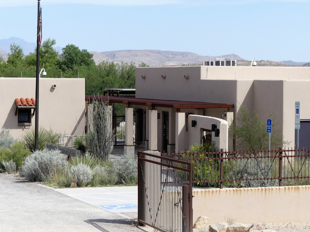
Today I met a national park service ranger by the name of A.L. Weimer who wore a bulletproof vest and carried a police-issue sidearm. While there are daily sightings of mountain lions and black bears throughout Big Bend National Park, I think his handgun has less to do with keeping the animals in line, and is more intended as a show of force in case any renegade Mexicans or Islamic terrorists get any big ideas about invading the U.S. through Mexico.

If so, Ranger Weimer, who manages the Boquillas Crossing, then becomes our first line of defense. Of course, thanks to our 2nd Amendment, I’m certain that many park visitors would rally in defense of our great nation, and arm themselves with the requisite arsenal of spatulas and Swiss army knives, or whatever else they could muster from their tents and RVs to hold off a foreign attack on American soil.

regulation sign

Leah and I decided that a reconnaissance mission was in order. To get to the other side, documents are first presented to Ranger Weimer, a dour-faced, no-nonsense bulldog, who makes sure there is no misunderstanding about the prohibition of alcohol or tobacco from abroad.

Walking through the customs house gate to the waterfront along a garden trail takes only five minutes.

Custom houseThe trail ends at a sandbar where eager Mexicans negotiate with Gringos to ferry them across the river by rowboat. Five dollars is generally the agreed upon price.

ferryHowever, with the Rio Grande water levels so low, Leah and I found it cheaper to wade across fifty feet of knee-deep water to the other side.

Leah crossingLand transportation comes from Uber burros, charging five dollar fares to cover the dusty and shit-laden ¾-mile trip…

burro ride…to a white trailer check-point surrounded by cyclone fencing on the edge of the village. It was a treat to sit in Boquillas’s only air conditioning for a few minutes to escape the 100◦ heat, while our identities were checked against a drug cartel database.

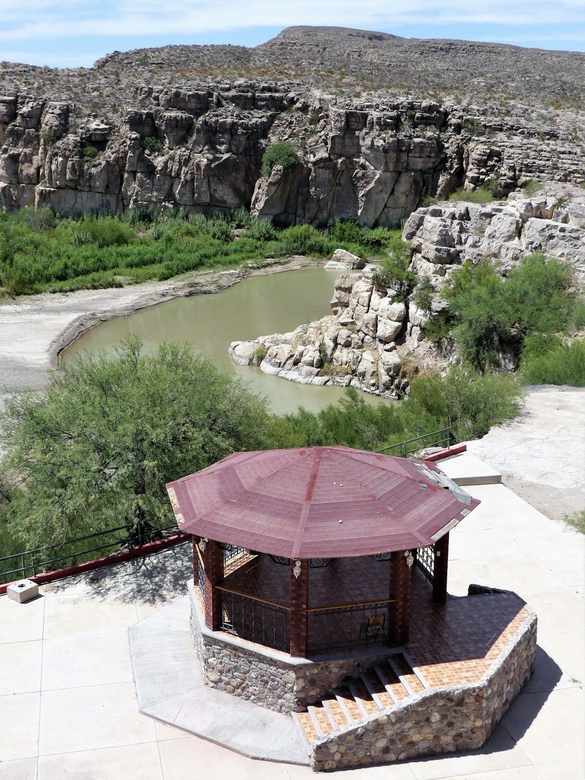
Once Leah and I were cleared as respectable American citizens, we opted to lunch at the Original José Falcone’s Restaurant and Bar, the largest of two eateries in town…

Jose Falcon's…with an overlook of the Boquillas Canyon.

Bouquillas canyonMama Falcone was sitting on the patio in her kitchen apron working on a future needlepoint tapestry that would soon display in the family curio shop next door, while her nephew Renaldo brought us menus and took our order—chicken quesadilla for Leah, and beef burrito for me. Meanwhile, a family of three from South Carolina sat at a nearby table chatting it up with Mama’s daughter, Lillia.

Lillia was explaining that her father opened the restaurant in 1973 after a pickup truck accident put him in a wheelchair for the rest of his life. The restaurant was a big hit among locals and tourists, with Mama serving bean tacos and burritos, and Papa schmoozing the guests. Thanks to the unofficial crossing, villagers were accustomed to serving up to 200 Big Bend visitors a day—mostly tourists looking to enhance their park experience by buying food and souvenirs.

After Papa died in 2000, Mama and Lillia continued the business until the U.S. closed the border in May, 2002 in response to 9-11. Consequently, the town’s tourist trade dried up, and businesses failed without customers.

red bar
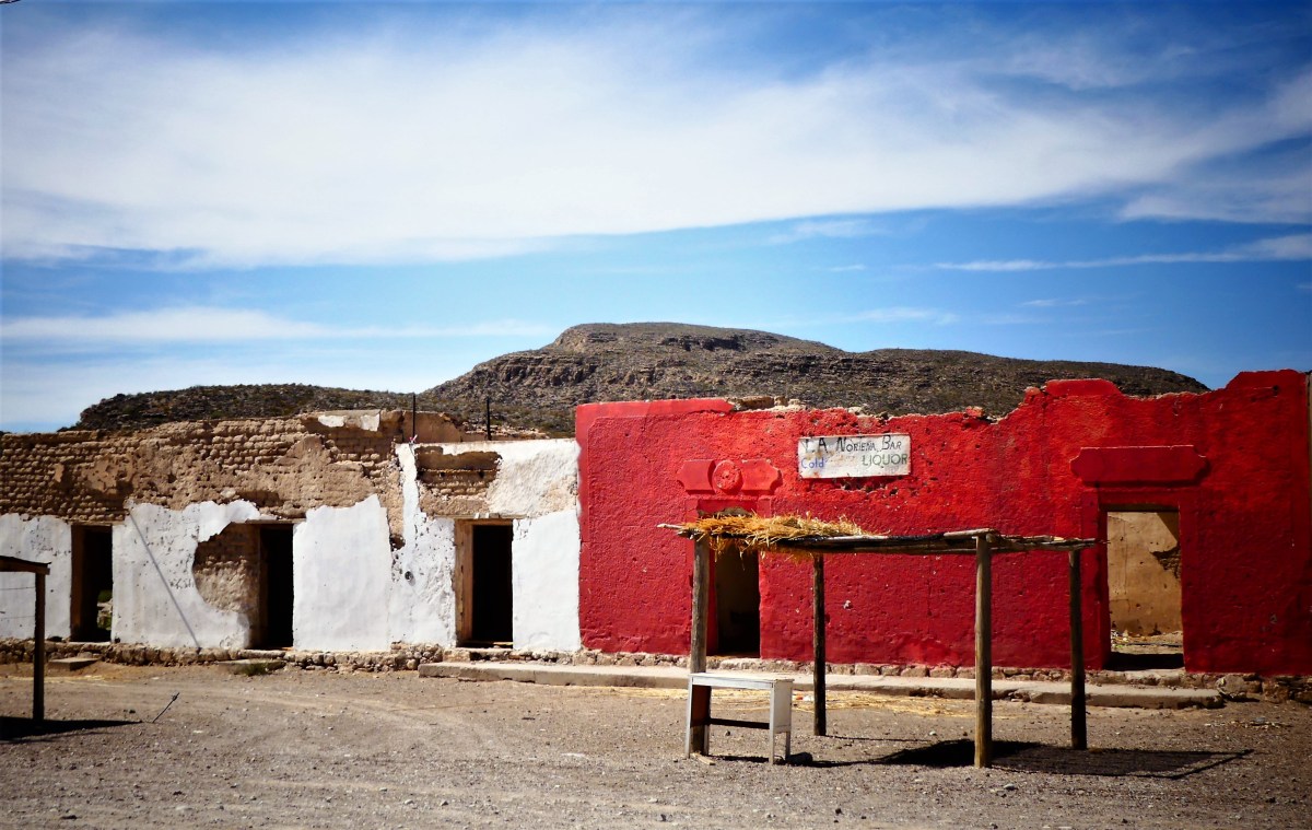
The town population shrank from three hundred to one hundred adults and children, with many leaving for Muzquiz—the nearest Mexican city, and a seven-hour bus ride away. Eventually, Mama and Lillia found work in the States, but returned home to the restaurant after the crossing officially reopened in April 2013.

townThey are hopeful for an economic recovery, but the town is in shambles, and it will take many more Americans to salvage Boquillas’s economy.

gift stand

burned out hut


After lunch, Lillia volunteered Chico to drive us back to the landing in his beat-up Chevy Silverado. Chico was born and raised in Boquillas, and although his two brothers have moved on, he has never left.

“I like it here,” he admits. “It’s very quiet.”

When Chico isn’t shuttling visitors between the restaurant and the water, he bartends for the only bar in town, usually serving up beer to the locals. “Cervezza is cheap, but gas,” he explains, “is very expensive and hard to come by since Boquillas has no gas station. However, American friends are willing to fill five gallon containers from the park store, and send it over by boat.”

It occurred to me that Chico was giving us good intelligence about his situation, which would be useful should tensions ever flare between the U.S. and Mexico. And I believe that given the chance, Carrie Masterson and I could turn Chico into a valued asset. We tipped Chico five dollars for the ride and the invaluable information.

Leah and I crossed back the way we came—by wading through the Rio Grande. We acknowledged Ranger Weimer upon our return, who ushered us to a virtual customs station, where we submitted our credentials electronically and spoke by phone to an invisible agent who scanned us by remote camera.

“Take off your hat, remove your sunglasses, and stand behind the yellow line,” barked the long-distance voice.

After answering a few routine questions, like “Are you bringing any raw fruits or vegetables into the country?”, we were safely readmitted to America.

Turning to Ranger Weimer, I asked casually, “So how do you feel about Trump building a Wall down here?

He looked at me sternly, and answered in a stoic voice, “Sir, we’re not allowed to express an opinion about that matter.”

But I wasn’t done yet. “But do you think these people are dangerous?”

He was becoming annoyed, answering more emphatically, “Like I said, sir; I have no opinion on the matter!”

I left Boquillas Crossing completely satisfied by our cultural exchange, and reassured that we would be safe from bad hombres from the other side. Fortunately for us, the citizens of Boquillas del Carmen are hard-working people. They are a small and subdued militia of struggling entrepreneurs who depend on us, and are more interested in fighting for their livelihood than picking a fight with their neighbor.

museumI have met the enemy face to face and I do not fear them. Their rowboats and mules would be no match against our ships and tanks.


“We’re on the Road to Nowhere”

After spending the day roaming through wide-open spaces at Big Bend National Park, we returned to our relic of an RV park at Stillwell Ranch–just outside the Persimmon Gap Visitor Center–to cool off under a revitalizing blast of AC running inside the Airstream.

The glaring sun and punishing heat of the day had taken its toll on us, although we were grateful for sustained winds of 20 mph, which seemed to make the temperature more tolerable. By 7:26 pm, temperatures had cooled down to 91◦, and we were ready to explore the road less traveled.

Navigation screen
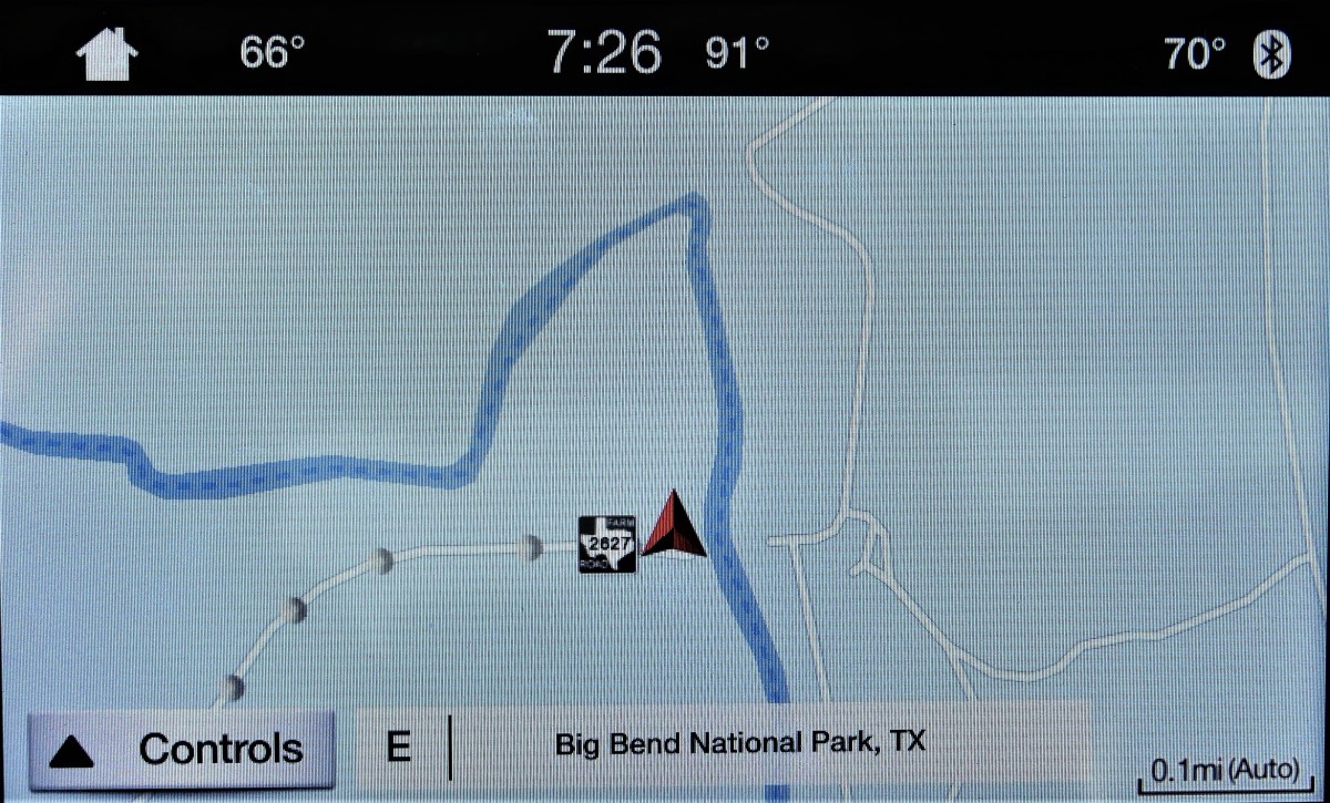
Earlier in the day, border patrol had sped past our campsite from the southern border, causing us to speculate whether an ICE officer had just interdicted an illegal border crosser. And so, with the sun at our backs, and our batteries recharged, I fired up the F-150, turned right on Texas FM (farm-to-market road) 2627, and headed due south in search of bad hombres. The radio god immediately synchronized his playlist with our mission, and delivered David Byrne belting out the lyrics to “We’re on the Road to Nowhere”.

From Stillwell Store, the 22-mile trip to the Rio Grande passes through Black Gap WMA (Wildlife Management Area), a 100,000-plus acre expanse of back-country wilderness—desolate and barren to the eye, but home to wandering black bears, mountain lions, white-tailed and mule deer, and javelina (think desert pig). The dusty two-lane road dips and pivots like a rickety roller coaster as it hugs the rugged foothills of the Sierra Larga range across the vast Chihuahuan Desert, until the DEAD-END sign appears.

Just around the corner lies an impassable single-lane border crossing known as the La Linda International Bridge, doomed and defunct for the past 20 years. Broken pieces of barricade and rubbish line the roadbed, with a reinforced batting cage wrapped around the guard rails. It looks like a free-standing prison door resting on a concrete pile.

bridge detail
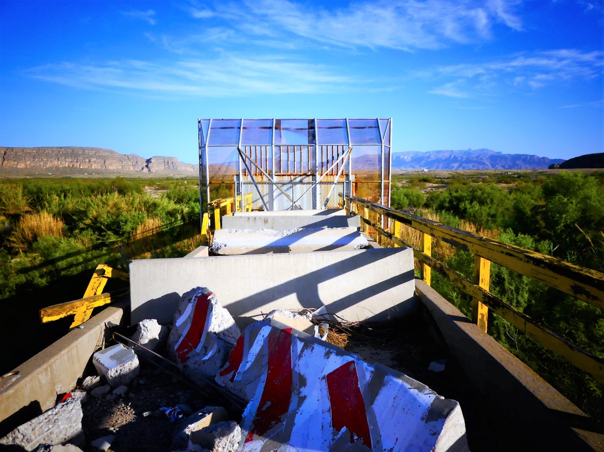
Historically, the bridge was constructed by Dow Chemical in 1964 to transport fluorite from Coahuilan mines across Heath Canyon to America. But U.S. and Mexican authorities shuttered the bridge in 1997, suspecting drug smuggling. Other reports cite the murder of a Mexican customs official as the reason behind the bridge closure.

The setting surrounding the bridge is eerily reminiscent of any post-apocalyptic scene from “The Hunger Games”. Except for a few pesky flies, the area is lifeless, and the quiet is disturbing.

bridge overview.jpg
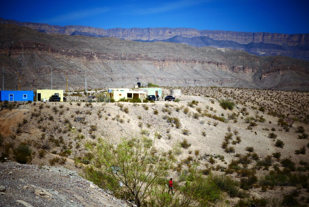
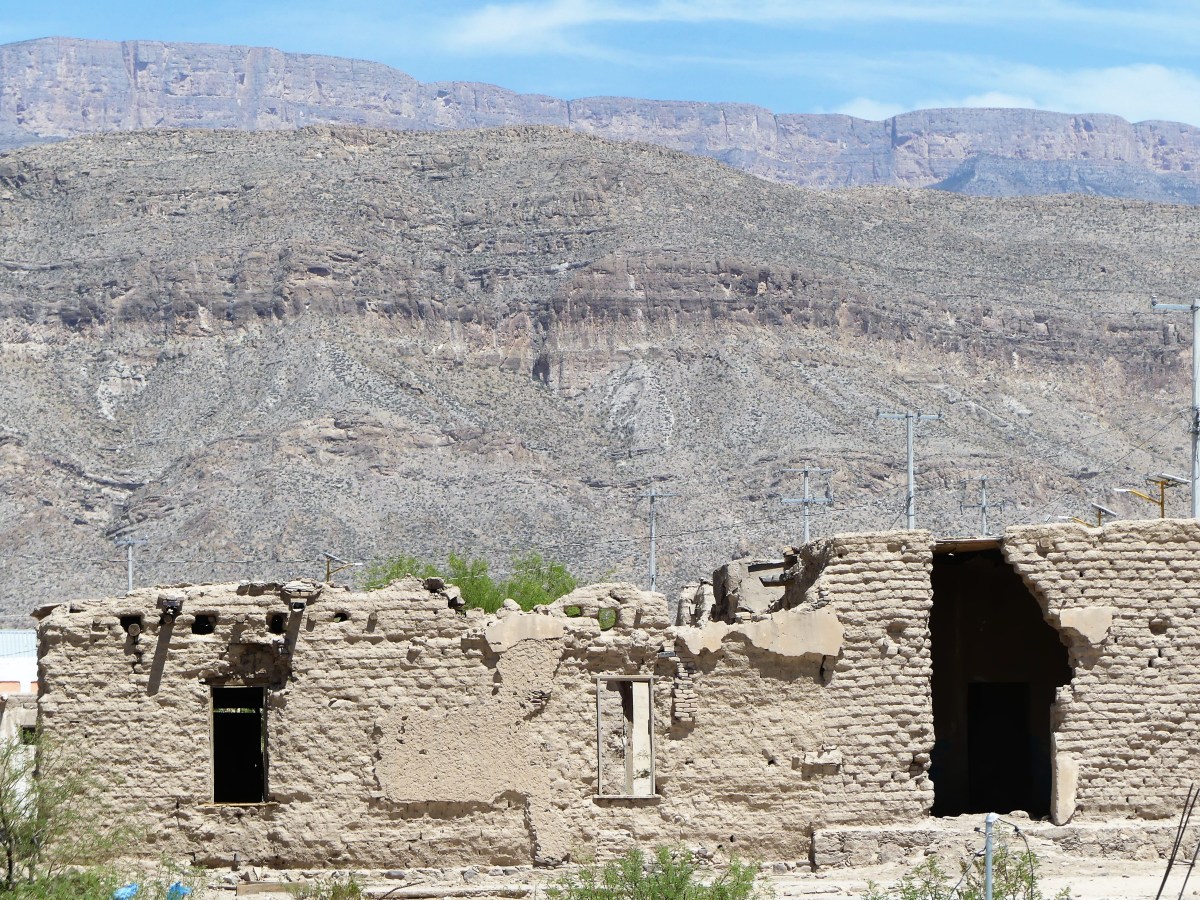
Across the border stand the remnants of a faded factory.

Mine
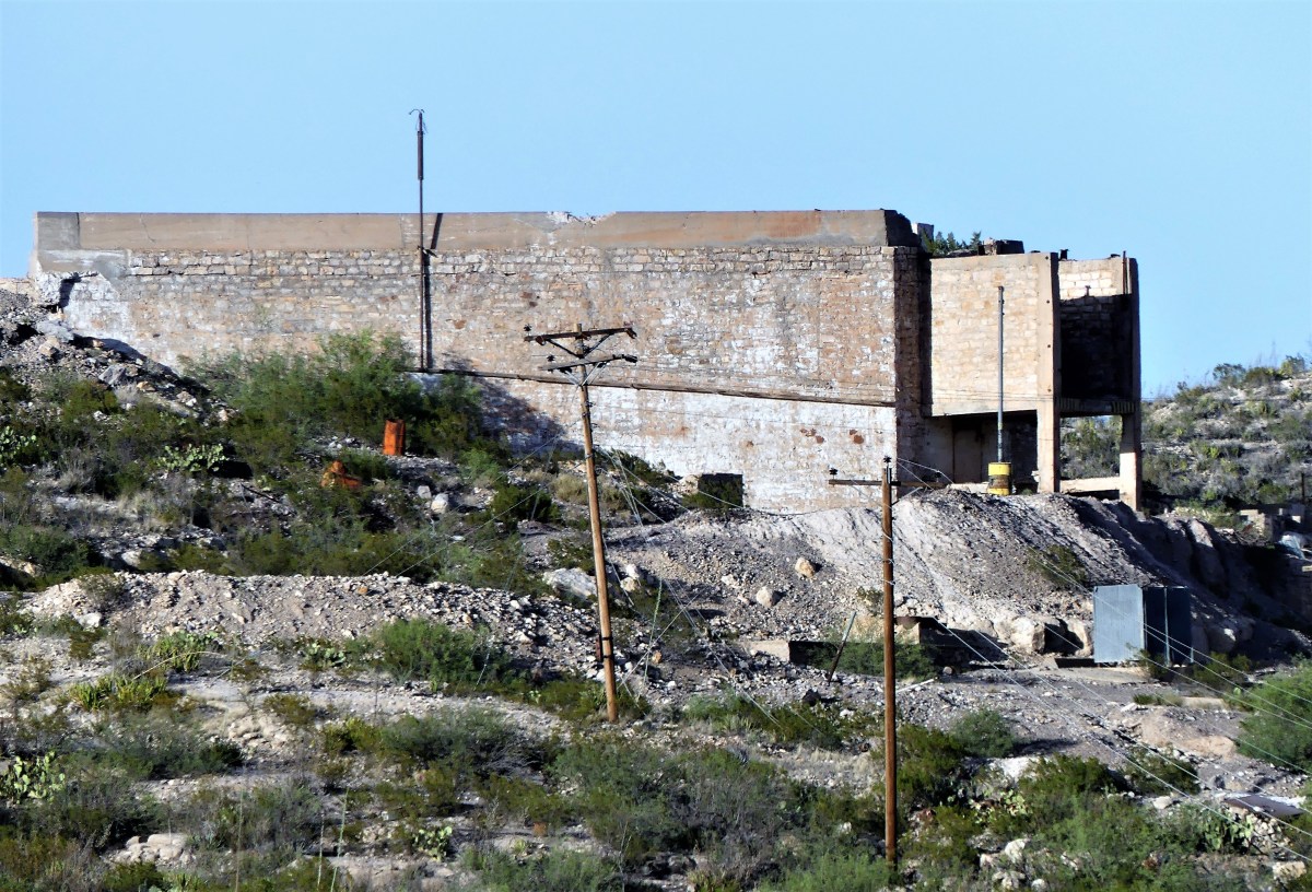
Broken buildings and slanted warehouses survive in silence against a brown mountain backdrop.

Safety and Security
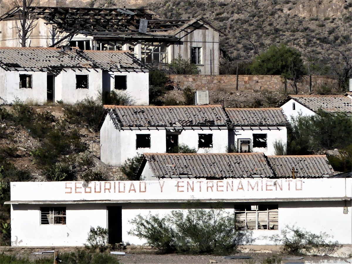
Yet in the distance to the right of the river, La Linda mission stands alone—its double towers dwarfed by nature’s majesty, and its church doors removed for a purpose higher than God.

La Linda Mission
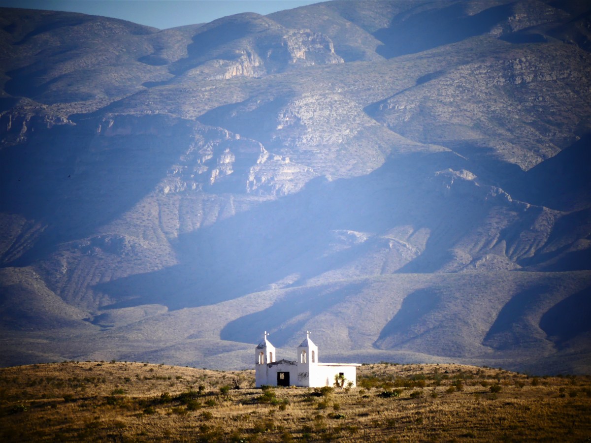
There are those who would welcome a return to the border crossing.

border obliskCommittee meetings and feasibility studies on both sides of the river argue the benefits of potential tourism and ease of crossing without traveling to either Del Rio or Presidio. Currently, a legal crossing to La Linda would take nearly 10 hours by car versus 10 minutes by illegal foot path. But there are no travelers today, or at any other times. It’s just too remote.

canyon CU
U.S. on the left, Mexico on the right

The thought of running a wall through the middle of La Linda International Bridge brings a smile to my face, knowing that in securing our border, we would be protecting and defending America against Mexican solitude and desolation.

David Byrne’s prophetic words still echo with irony:

“They can tell you what to do
But they’ll make a fool of you
And it’s all right, baby, it’s all right.”

Here T(w)oday, Guano T(w)omorrow–the Sequel

If you love the smell of ammonia (and who doesn’t), then Stuart Bat Cave in Kickapoo Cavern State Park should be on your bucket list. When approaching the entrance, the acrid smell of guano is omnipresent, and for good reason, since Stuart Bat Cave is home to 1 million Mexican free-tailed bats from spring through fall.

Each day at dusk, a stream of bats can be seen circling the mouth of the cave– approximately 25 feet across–around and around and around, accelerating to speeds of 60 mph until they explode from the darkness…

co4.jpgbat hole (2).jpg

best bat2.jpg
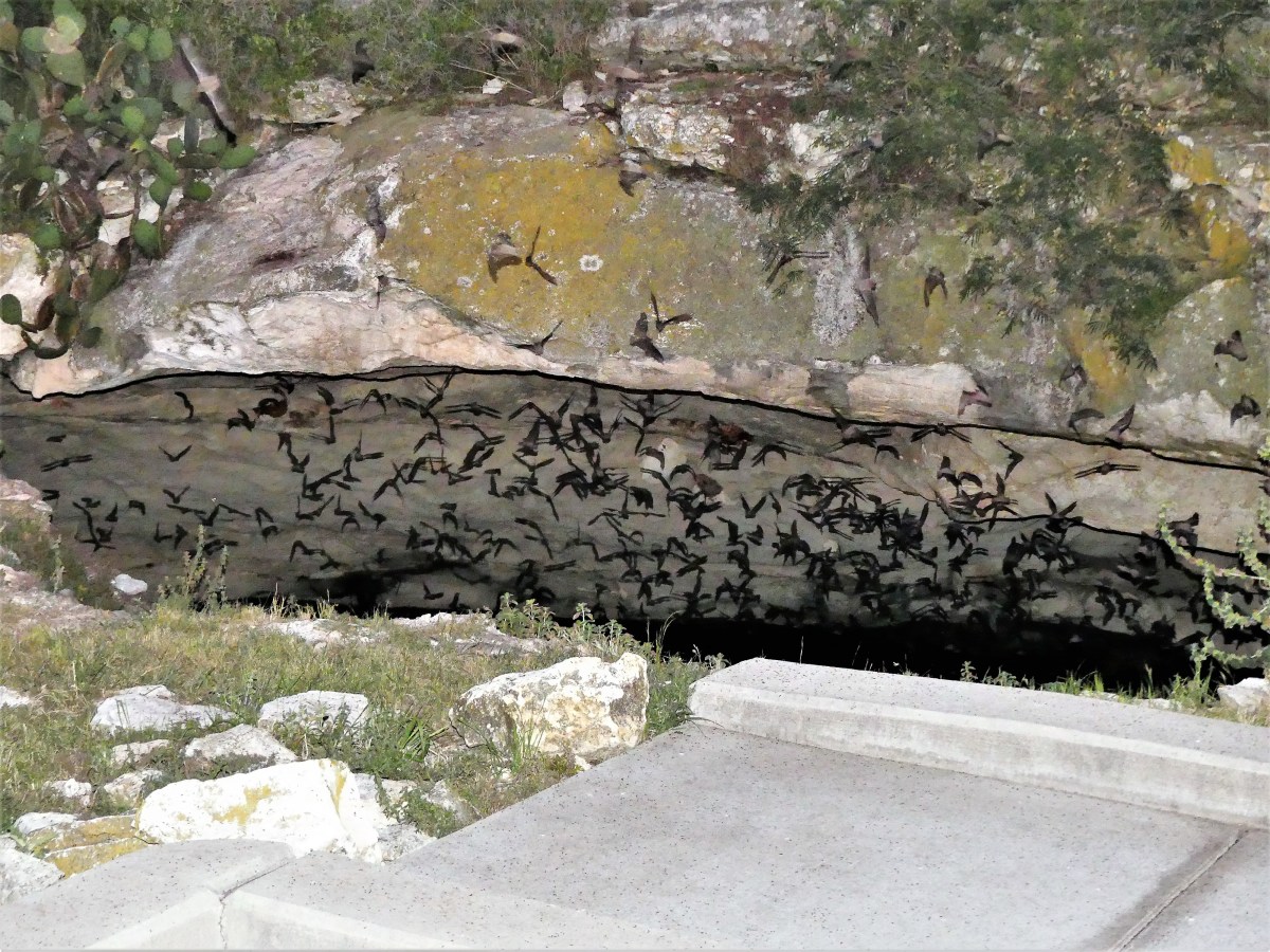
and into the twilight, fluttering en masse, up and over the trees.

Bat sky wide.jpgA continuous and frenzied swarm pours from the cave in a procession that could last up to two hours.

Bat silhouette.jpgWith the exception of some rogue bats that fly off in scattered directions, the mother lode hooks right and follows a path 50 miles due east to Uvalde in search of mosquitoes and corn earworms, a tasty moth that wreaks havoc on a number of Southern crops.

By the time they return at dawn, each bat will have eaten up to three-quarters of its body weight, which is collectively equivalent to 10 tons of insects, and easily explains the pungent odor by the cave.

Best 3.jpg
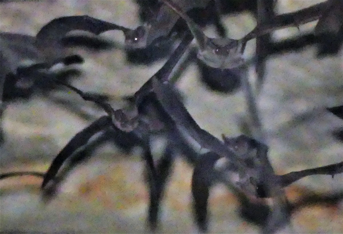
Historically, the Sergeant family, who farmed this property from the early 1900’s, protected the cave entrance with fencing in order to mine the accumulated guano, which provided important income to the ranchers until 1957 when sold as premium fertilizer and an explosive constituent.

bat sky.jpg
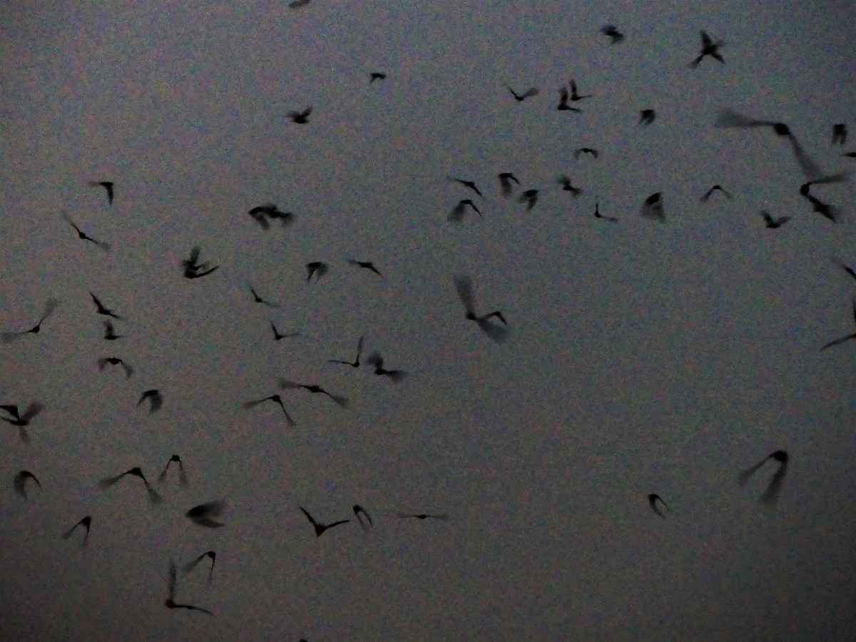
Having over-nighted for three days in the park, I can testify that there is no shortage of annoying bugs here. Not to be selfish, but I’d like to propose that some of the bats stay behind and clean up inside the park’s perimeter. If the bats only knew that they could dine closer to home–forsaking the 100-mile round-trip–then I could better enjoy my outdoor dinner plans as well.

flash bat (2).jpg

Peekaboo, Kickapoo!

With a name like Kickapoo Cavern, you would think that a regional Texas Indian tribe named Kickapoo would have discovered this cavern, thus elevating the cavern’s official name with a rich historical context and record. But you would be wrong.

Geologists and archaeologists who have mapped the cave have yet to find any artifacts or any other evidence to prove that prehistoric Native Americans used this cave for daily living or ceremonial business. However, a large mound of burned rock and chipped stone nearby suggests that Native Americans were familiar visitors to the area.

poster1poster2
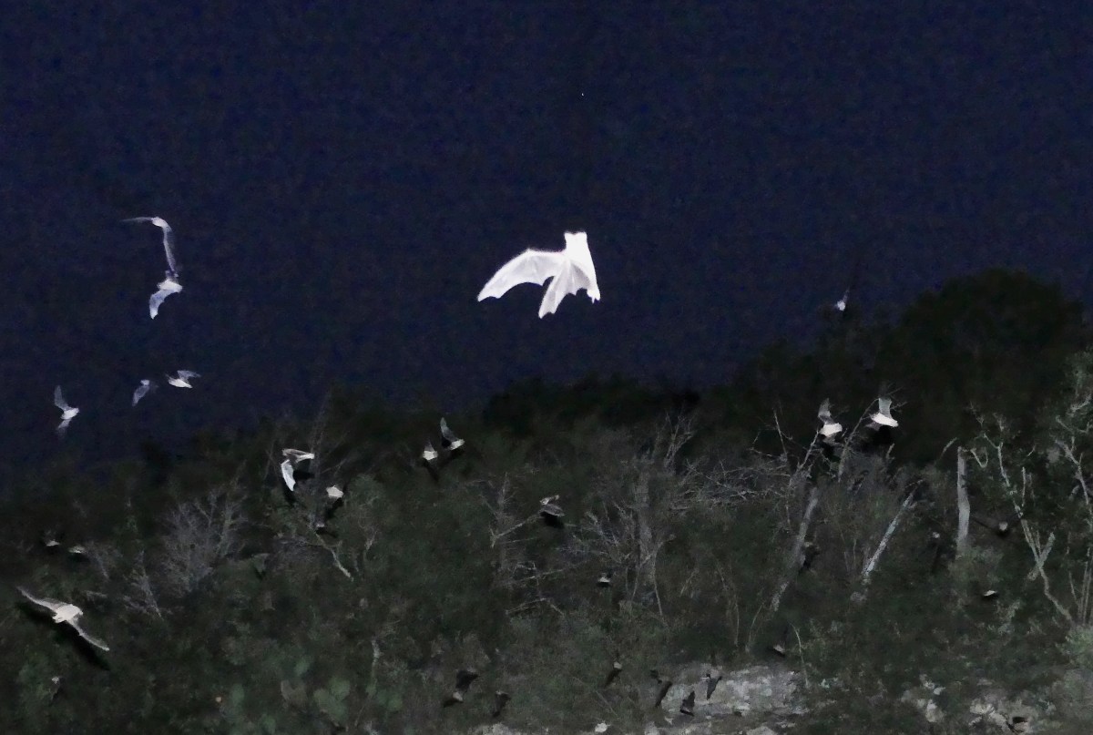
After listening to Ranger Matt’s presentation, I have a personal theory why natives might have avoided the cave. It seems that during the cold winter months, the cave acts as a warm weather haven for Indiana Jones’ worst nightmare. Only until the weather heats up outside, and all the good snakes wind their way out of their cozy cave den is it safe for humans to explore the inner depths, and that’s where master spelunker Ranger Matt was taking us.

Leah and I boarded a dirty white pint-sized school bus named Bertha with nine perfectly-mannered teenage girls and their two chaperones. The bus, created in 1986 had seen better days. Leah and I were commenting on the duct tape upholstery when Matt mentioned that we were riding in a retired Kinney County prison bus.

Bus int.2“That explains the bullet hole in the windshield,” I presumed.

Bus int..jpg
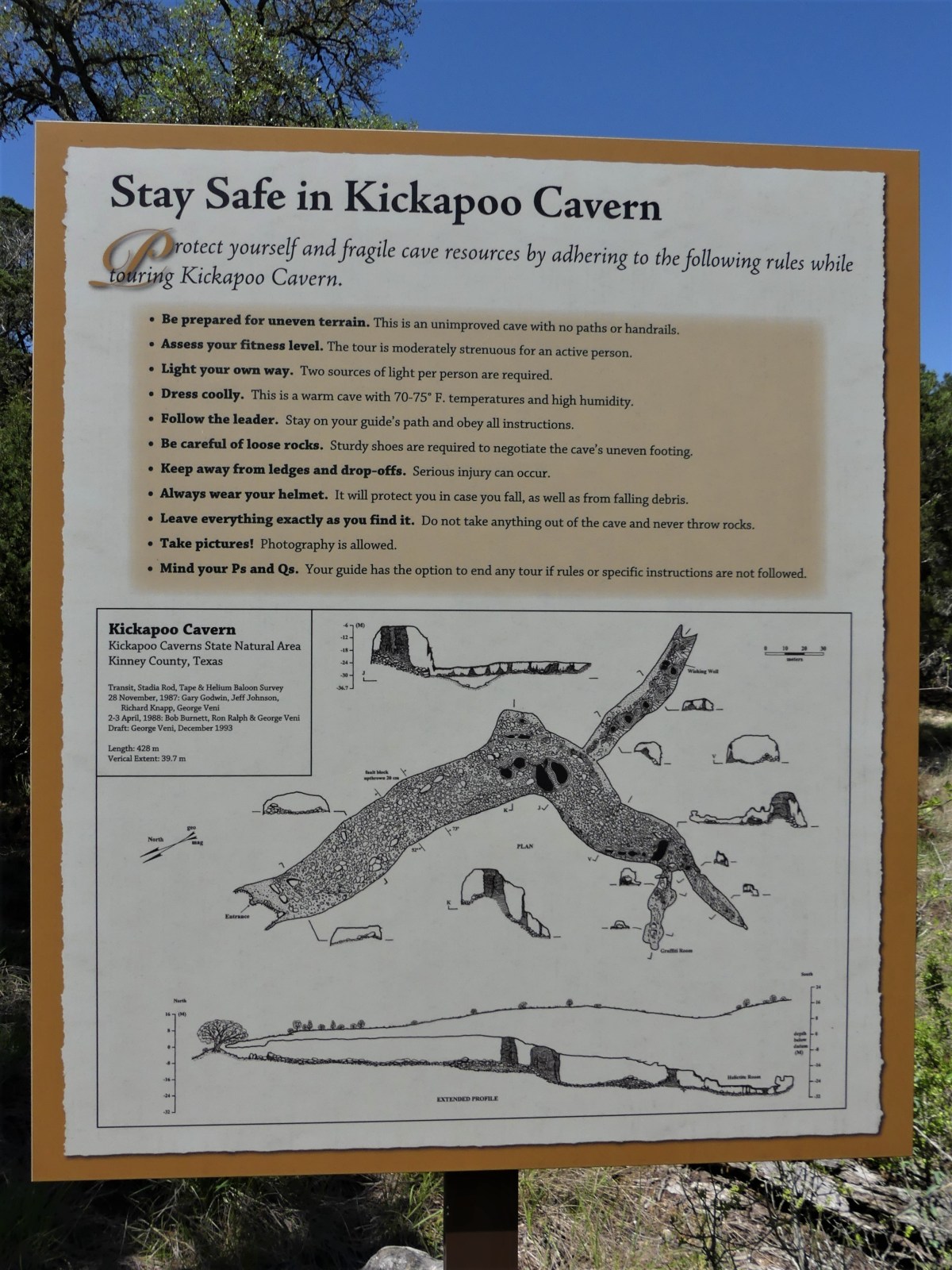
Bertha had been given a pardon, only to be reincarnated as a park bus. For some reason, I was reminded of a road sign I spied on the way to Kickapoo that read: DO NOT PICK UP HITCHHIKERS. THEY MAY BE PRISON ESCAPEES.

Our driver returned us to the park entrance where she steered Bertha onto a poorly-marked, tipsy-turvey, hippity-dippity dirt path that severely challenged her suspension, prompting memories of “The Little Engine That Could”. And so could Bertha!

After donning colorful hardhats and checking flashlights for brightness, Matt led the way to the cave entrance…

matt 1st
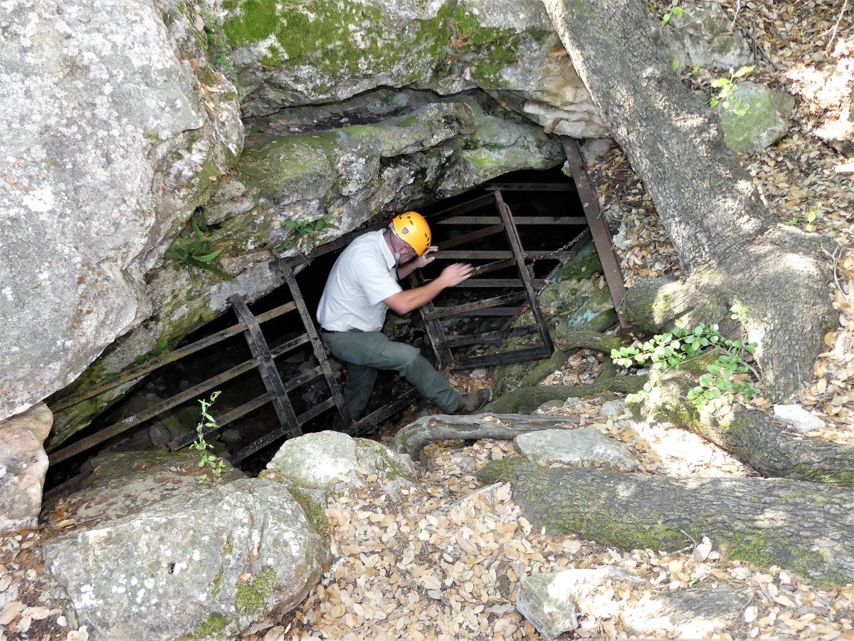
checking for varmints before allowing us to climb through a small crack in the ground,

girls enteringwhere we found ourselves standing on the collapsed ceiling of a limestone rock pile measuring 130 feet thick. The mouth of the room was big enough to park a Cessna if you could figure a way to get it inside.

Matt explained that according to carbon dating, we were standing where Devils River once flowed 105 million years ago. He directed his flashlight 40 feet overhead to reveal an embedded fossil of a nautilus–common during the Paleozoic Era–embedded in the ceiling…

nautilus fish fossiland more recent remains of an unfortunate sheep or goat littering the floor

animal bones
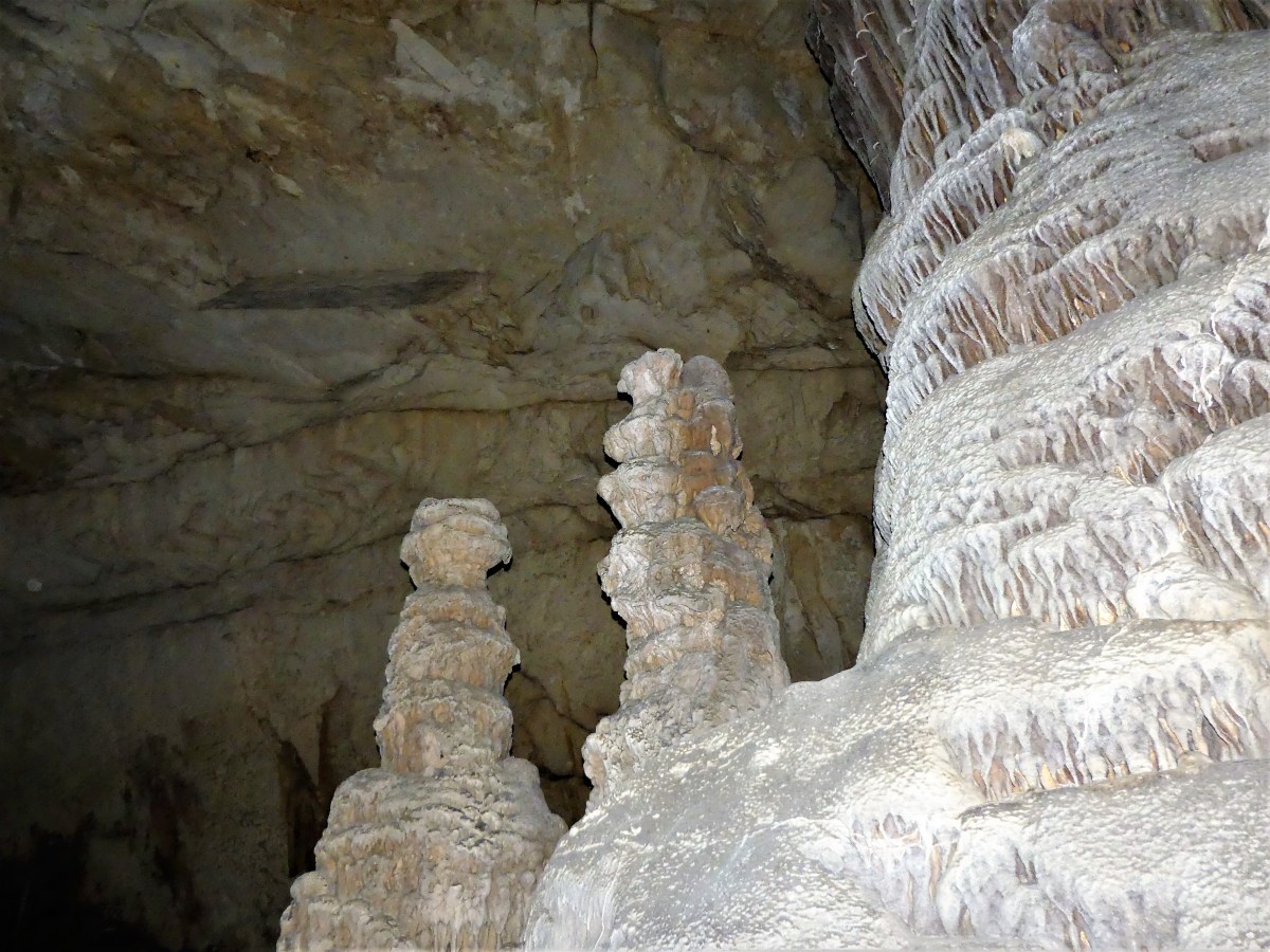
From there we dropped approximately 40 feet, scrambling over ledges of flat rock and boulders, on our way to survey the three largest columns (when a stalactite meets a stalagmite) in Texas. How apropos that along the way, we would pass a formation of stalactites that managed to aggregate into the shape of the Lone Star state.

Texas shaped stalactites
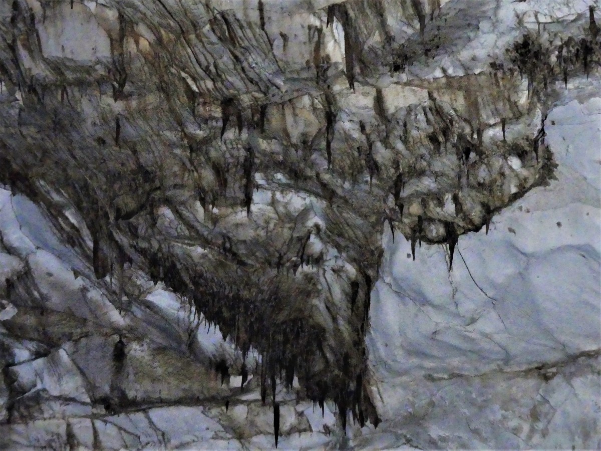
There was no meaningful trail. Every step was a floating rock, see-sawing under our weight. That’s when I heard Leah go down hard behind me. I swung around to see her flat on her back, saved by her fanny pack.

leah downAnd Matt was there in an instant.

Leah gets help
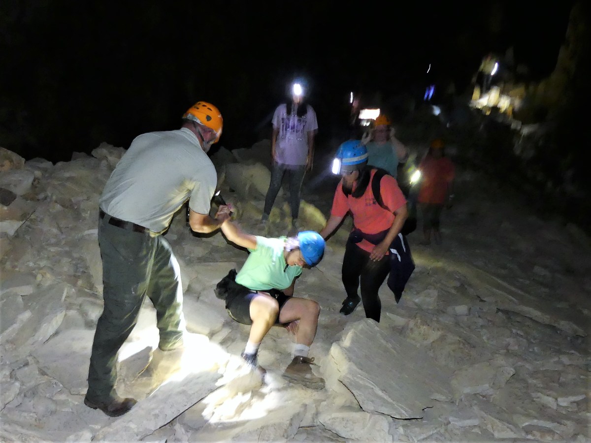
“I’m alright,” she declared. “I just lost my balance on the rocks.” It was good news to my ears. For some reason, Leah and caves are not on equal footing, and rarely without incident (see “A Hole in the Head” post),

She brushed herself off and we continued along, safely negotiating the terrain while admiring scenery the likes of Yogi and Boo Boo, immortalized in stone.

Yogi and Booboo

Yogi and Booboo2We turned the corner and the room opened up. The ceiling vaulted higher to accomodate the caves’s largest column.

snow on rocks
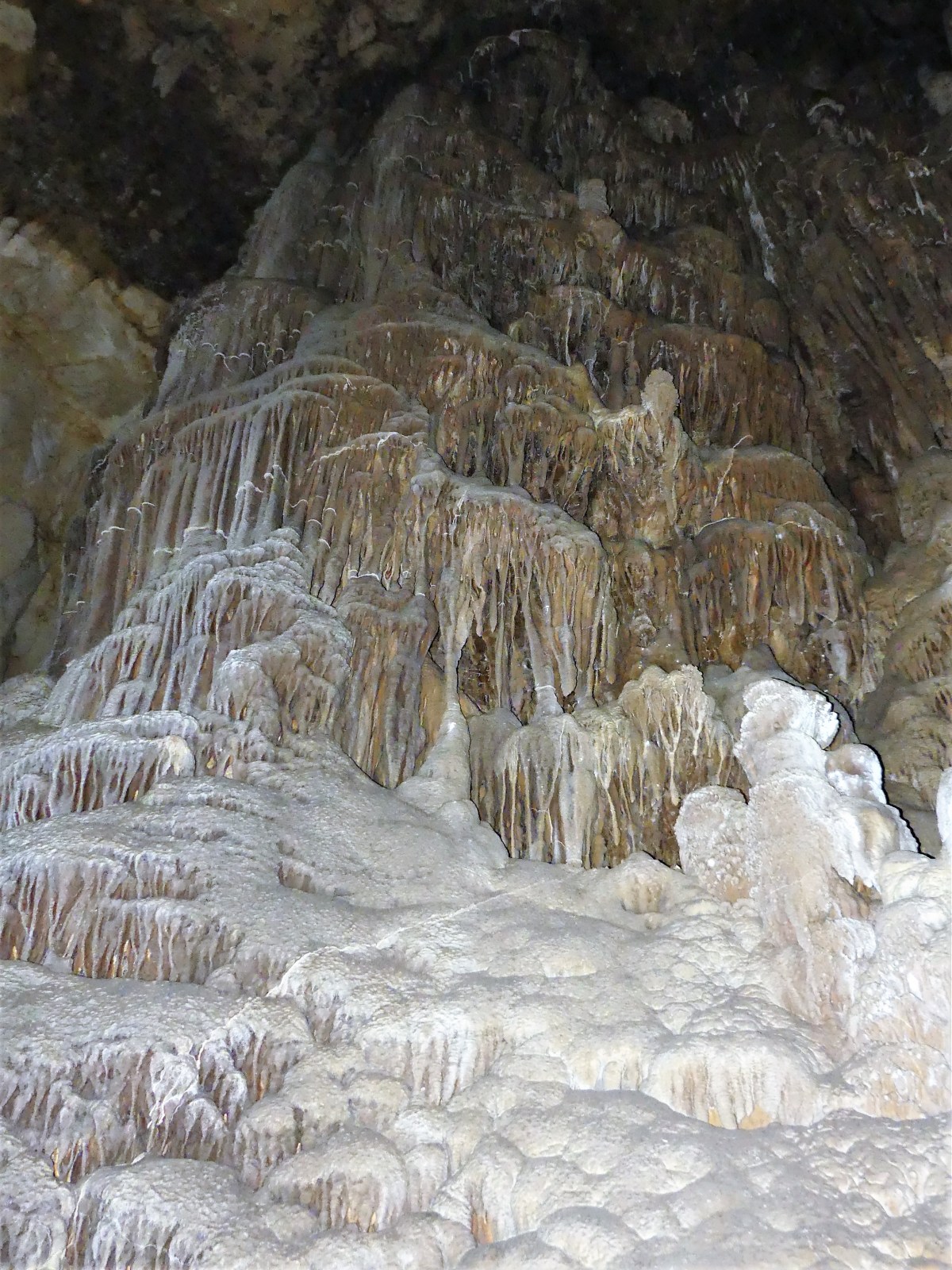
“Don’t be afraid to touch anything,” announced Ranger Matt. “We’re not like most of those other parks that have guard rails and ropes, and psychedelic lights with church music playing.” He was preaching to my choir.

“Just don’t carve your name on anything unless you’re willing to pay for the crime. We have little patience for graffiti here.”

glowing column with graffiti
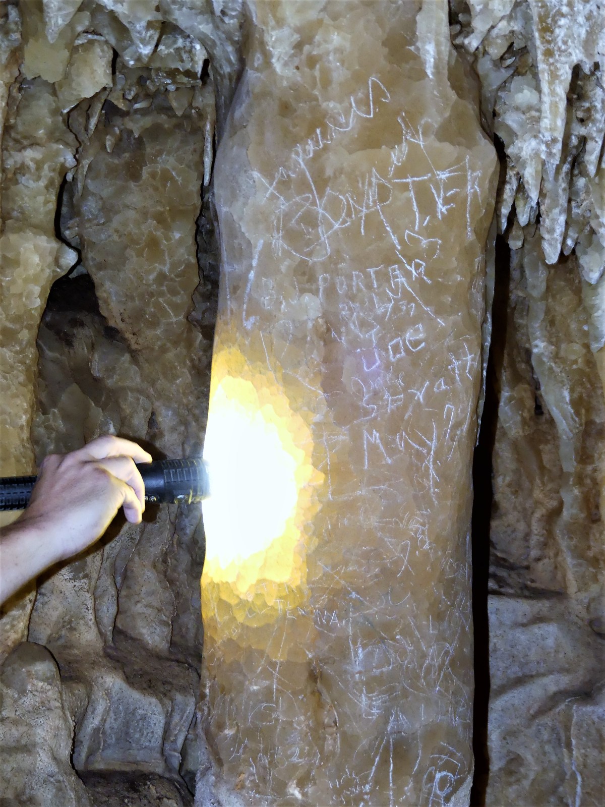
“Like this one over here?” suggested a blond coed, pointing to a name scratched into the calcite that dated back to 1887.

Robinson graffiti“Ah, good ol’ C. Robinson,” Ranger Matt explained, “He was one of the early ones. But there’s older graffiti in this cave that predates Mr. Robinson–written with torch soot–but that’s in a room that’s off limits because it’s still developing.”

He was referring to parts of the cave that continue to evolve, thanks to rhythmic water droplets falling from ceiling tendrils onto budding mounds below.

“Are you sure we can’t see it,” I asked?  The tour was exceeding the pre-determined time limit, but I was eager to explore more.

Ranger Matt agreed to take us further in and 40 feet deeper to give us a peek, but only if we were willing. Half the group was ready to call it a day, but the other half of us who pledged our lives to Jules Verne was ready for anything, so we descended deeper still.

“Just remember,” Matt forewarned as he led, “the deeper we go, the longer the climb out.” There were no objections and no complaints. Each of us found our own way down. When we reassembled at a flat area, we were given a new set of instructions: NO TOUCHING, and STAND AWAY FROM THE RIDGE which plunged another 120 ft. below.

wishing wellWe solemnly wove our way around the space, beholding the nascent natural beauty that will one day become a future column.

water drop

Indebted to the Internet

BREAKING NEWS: Three days at Kickapoo Cavern State Park in Brackettville, TX without cell service or WiFi signal…

“Really?”, I asked the ranger upon check-in, afraid of her confirmation.

“That’s right,” she responded. “Who’s your carrier?”

“Does it make a difference?” I didn’t want to belabor the point. “Verizon?”

“Then you’re screwed,” she said emphatically. “The only reason I asked,” she continued, “is if by chance you had AT&T, then maybe there’s a slight chance that if you hike to the ridge, you might get a weak signal.

“Great!” I conceded with resignation. I noticed a “FREE WiFi” sign by a monitor playing video of the park’s activities, and I think I felt a bit of a rush.

“What about WiFi?” I asked eagerly.

“Well, yeah, there’s WiFi here during the day when the ranger station is open and it’s not raining. Otherwise, you can probably pick up the signal at the bathhouse, and nowhere else,” she proclaimed.

My heart sank. The purpose behind this trip was to enjoy the outdoors when the weather allowed. But after learning that the park’s internet connection would be available at precisely the same time when I should be out experiencing nature, I am left to choose between which of the two necessaries is more meaningful. While not as devastating as “Sophie’s Choice”, I know I must surrender one for the benefit of the other.

I had psychologically prepared myself for this situation; it was inevitable. I knew that once we headed into wide-open spaces of rural Western states, there would be limited or no service. And where we are now certainly feels remote. After 40 miles on a winding road without traffic, we reached the park’s welcome sign. Another four miles in and we reached our true destination. This place is a rolling bust-line of shrub and sagebrush-covered hills. But best of all–for the first time in a month there is ABSOLUTELY NO SOUND OF TRAFFIC!

As I type this on my laptop on a picnic bench in view of the Airstream, I glance at the WiFi icon sitting on the left side of the task bar. As a lark, I position the cursor over the icon, and up pops the message, “WiFi connections available”. Incredulous, I click on it and sure enough, I have the option of opening a channel called “TPWD—PUBLIC”.

I waste little time activating the signal. I am immediately redirected to the Texas Parks and Wildlife Wireless Acceptable Use Policy (Effective date: December 15, 2005). I am ordered to read the entire policy before proceeding.

Accordingly, in order to utilize wireless services, I must hit the “I Agree” button at the bottom. Criteria to consider before agreeing are: Content Prohibitions, Content Harmful or Offensive to Third-Parties, Unlawful Content, Infringing Content Impersonation, Content Interference, Deceptive Content or Spam, Unapproved Promotions or Advertising of Goods or Services, Off-Topic Content, Content Harmful to Other Systems, Network Usage.

After perusing all the “CYA” jargon that Texan lawyers are obliged to disclose, I hold my breath and push the “I Agree” button. I figure if Trump can get elected, then surely I can get a connection to internet. By the way, wasn’t that part of his platform–improving infrastructure across America?

Behold! The clouds part, the planets align, the angels sing, and a faint and intermittent internet connection is born! Hallelujah!!

So what’s the point of this post if I no longer have to measure the merits of being cut-off from the main-streaming world?

A lot! I NOW HAVE CONTENT TO PUBLISH!!

Remembering the à la Mode

April 20 represented a milestone in my life. It was officially the first day of my retirement. It also coincided with a counter-culture connection to cannabis consumption (known in hippie parlance as “420”), and it was the carnival kick-off for Fiesta San Antonio. Of course, it wouldn’t have been a celebration without participation in both events, all topped off by fireworks.

I have worked at many jobs spanning many different careers and found all of them gratifying in one way or another. Each job seemed to prepare me for the next one, even though the steps in-between were uneven and varied, or complete leaps of faith. I suppose I attribute my jack-of-all-trades mentality to a restlessness that overcame me by travelling throughout Europe the summer after my sophomore year in college.

When I returned to school, I abruptly changed my major from political science to sociology and photography, hoping that an understanding of people and pictures would carry me to different places.

My last job/career as a special education teacher in New York City’s high schools for the past eleven years came close to realizing that dream, as I taught inner city teenagers about the world around them through words and images. But the time was right to put it all behind me, and resume my quest for some kind of redemption by reducing my footprint and refining my senses. It was time to travel again… although this time, in style.

At precisely 4:20 pm, the ceremonial lighting of a glazed metallic iguana pipe set the mood for what was to become an epic evening in downtown San Antonio, made easy via a VIA bus shelter conveniently located directly across the street from Traveler’s World RV Resort. (The bus runs every half-hour, and costs just $1.30 a piece to carry us to the party zone.)

Once there and navigating through the thick stew of resident revelers, it becomes apparent that three things matter most to fiesta folk: medals, eggs and hats. Sashes, vests and tallis-like scarves provide opportunities for collecting even more medals and pins on an already crowded chest. Bragging rights belong to the San Antonians who would collapse under the weight if wasn’t for the support of others to hold them up.

royalty.jpg
King Antonio and his Court

Equally as important are confetti-filled eggs (drained and decorated cascarones) available by the dozen for the sole purpose of smashing them over the heads of adoring neighbors, and showering them with good luck. Even the cops showed signs of confetti dandruff, making police assault okay for the day.

egg smash.jpg

Lastly, thematic hats of all shapes and colors are easily the most conspicuous sign of extroverted behavior at the Fiesta with a special nod to “size matters”. This is a post-Easter parade gone sideways, where the most ridiculous rule. Carmen Miranda awards for the day go to the following:

3 some hat.jpg

butterfly hat.jpg

flower hat.jpg

potato head hat.jpg

spurs hat.jpg

beer hat.jpg

phone man .jpg

Food is also an important part of any fair. Vendors with tents and trucks tempted the hungry with long lines for tacos, tamales and turkey legs.

turkey lady.jpg

taco man.jpg

Yet somehow, Leah and I managed to circumvent the lines by inadvertently crashing the Taste of Texas, a VIP event for those willing to shell out $100 per ticket for tasty tapas.

taste of texas.jpg

We noticed a sophisticated crowd of people in a courtyard behind a hedge who were enjoying themselves, and thought to check it out, unaware–until we crossed over an ivy walkway–that wristband entry was required. It was easy pretending that we belonged with our hands in our pockets.

T of T ariel.jpg

We even got the chance to mingle with Fiesta royalty.

king.jpg

The evening ended with a fireworks display in the presence of the Tower of Americas, San Antonio’s tallest lookout, which dates back to the 1968 World’s Fair. It was definitely the icing on the cake, and the cherry on the sundae.

FW 1.jpg

FW2.jpg

FW3.jpg

It was Alamo à la mode!

Deep in the Heart of Taxes

I have a confession… I got a little bit stressed today. Some call it bringing “tsuris” on yourself. I should have seen it coming, but I was caught off guard. It was more than a senior moment. It was like getting your senior period.

I admit to becoming distracted, because Leah and I were busy enjoying our road trip. We were transitioning from Austin to San Antonio–when out of the blue, I was abruptly reminded that the deadline for filing federal tax returns was approaching.

My personal returns were finished long ago. I wasn’t taking that headache on the road with me. Yet, somehow that didn’t matter.

My conniption started with a late evening call from someone who should have known better, but nevertheless, waited until the last minutes to file returns regardless of repeated reminders to get it done earlier. And now I was supposed to fix everything and have all the answers.

I could have handled it better; I should have anticipated the call. Then I wouldn’t have felt like I was being yanked back to my old reality when I answered the phone.

The notion that somehow there was enough emotional distance between New Jersey and Texas was only a distraction, because there is no escaping the intersection of government and personal responsibilities.

Of course, I provided whatever answers I could muster for my delinquent taxpayer, attempting to put out a long-distance fire through a chain of emails. But after a cold beer and a swim in a quiet pool under a hot San Antonio sun, I came to my senses, and the stress lifted from my body like a hot air balloon.

My journey continues uninterrupted… until the next call.

Lady Bird! Lady Bird! Fly Away Home

A photo essay with pops of colors under gray skies at Lady Bird Johnson Wildflower Center…

bdlg exterior.jpg
Observation tower
Mission statement
LBJ mission statement
fountain.jpg
Serenity Fountain
Bluebonnet.jpg
Purple Bluebonnet
Antelope horns
Antelope horns
lace cactus.jpg
Lace cacti
winecups.jpg
Winecups with African daisy
butterfly.jpg
Gregg’s mistflower
cactus flower.jpg
Prickly pear
cactus bee.jpg
Prickly pear blossom and honey bee
Texas bluebell.jpg
Texas bluebell

Here Today, Guano Tomorrow

Hundreds of people are standing on or below the South Congress Bridge in Austin, TX and waiting for sunset, which is expected at 8:20pm tonight. Most are tourists with cell phones or bulky cameras, eagerly anticipating the torrent of bats soon to emerge from their roost under the bridge.

The atmosphere is circus-like. Everyone is talking excitedly about the upcoming attraction. Young and old stand shoulder to shoulder;

people on bridge.jpgor find a blanket-sized parcel of grass to relax and watch the sun go down;

Lawn for bats (3).jpgor pull up in a boat to wait for showtime.

kayak.jpgOne fellow standing behind me seems to be mystified by the whole experience. “Are they gonna fly outta that sewer hole over there?” he wonders out loud.

P1010402.JPGHis misconception is immediately corrected by a 10-year old standing nearby. “Hey mister, this isn’t Batman, y’know! They come out from under the bridge where they live,” says Einstein boy.

“I hope they don’t come around me…that shit is poison,” says sewer man.

bat warnings.jpgI too am excited to catch the bats in flight, but I’m also interested in doing something different with my Lumix, which I’m still learning to use. I’m determined to capture the bats in motion!

As twilight approaches, the throng fills the empty spaces of lawn and becomes more animated.throng.jpgThe moment arrives when the first bats emerge, and the crowd gets giddy.

bat flight1.jpgAnd moments later, the floodgates open, and the bats streak across the night sky by the thousands–

bat flight2.jpga migration wave of epic proportions that approaches a feeding frenzy.

bat flight3.jpgI confess that the photos are experimental. However, I understand that there are traditionalists who need to see things as they are, versus my interpretation of the event. So, in fairness to those whose vision is less oblique than mine, I’ve increased the camera’s shutter speed to give a more accurate representation of the bats’ flight path…

Blue Angels.jpgsuch that even Meat Loaf would be impressed.

Road Toad

Driving across vast terrain of boring interstate highway can easily give rise to a semi-serious anxiety disorder called scenery-itis. It can make a person wistful and cranky after extended exposure, and at worst, it can turn other drivers into road toads–a chronic condition of a different sort, where motorists believe they can leap and fly.

Researchers have been studying this condition for as long as Sears & Roebucks have been offering driving licenses to the blind, yet they have very limited data to advance the science. Nonetheless, there are some fascinating behaviors they have chronicled to date.

For instance, three tell-tale signs commonly associated with scenery-itis that can trigger an onset are: disinterested animals grazing on roadside pastures; personal injury lawyers predominating the signscape with same-number telephone numbers (call me at 666-6666); and pecan pie outlets competing with beef jerky huts as the only available proteins.

Symptomatic drivers should pull off the road immediately after experiencing bouts of excessive yawning, blurry vision, and an inclination to count the bugs that kamikaze into their windshield.

There are two known variations of the disorder. One is called Buc-ee’s-osis, which is a knee-jerkey fixation with gas station mascots when your vehicle needs fuel.

buc ee's.jpgThe other condition is a more common affliction commonly known as drifting-into-ditch-itis.

Unfortunately, the only known cure is driving through Utah, which does little good for a driver in Texas.

Donations are now being accepted at this blog to get me to Utah as soon as possible.

Where Have all the Gators Gone? (Long Time Passing…)

Traveling the Gulf coastline across Alabama, Mississippi, and Louisiana during the past week has brought us closer to Creole and Cajun cuisine, crawfish, casinos and country music, but alas, no crocodilia. Having driven nearly five hundred miles of state and county highways, and cruising endless back roads and bayou causeways, we have yet to see an alligator, which begs the question: Where have all the gators gone?

Not that we haven’t come close to spotting one. Mind you, there have been several vicarious sightings so far. For instance, yesterday we were driving/walking through Jungle Gardens, a 170-acre habitat on Avery Island with exotic palms, sculpted lagoons,

algae.jpg

scores of majestic oaks with gnarled and expansive limbs draped in Spanish moss,

Leah pose.jpg

a 10th century Buddha housed in a glass-walled pagoda,

Buddha.jpg

a bird sanctuary that hosts thousands of snowy egrets,

egret.jpg

and purportedly a family of alligators that have bred on the property since Ned McIlhenny introduced them almost 100 years ago. By the time Leah and I reached Bird City on the tour, we were lucky to meet a woman who had already come across six alligators in two separate locations. It warmed our hearts to be basking in her reptilian aura.

Then there was the time we stayed at Davis Bayou National Seashore in Ocean Spring, MS. We walked a half-mile-long nature trail that meanders around a leg of swamp fed by the Mississippi Bayou. Posted at the trail head is an easy-to-read sign that prohibits all alligator snacks.

no feeding gators (2).jpgSurely, there must be gators here. Why else would they post a sign, we wondered. Yet we saw no alligators. However, another hiker told us that she was told by a park ranger who had heard from another ranger that a resident gator was spotted earlier in the day crossing the road in front of our campground–the very same road where we towed our Airstream, so that should count, right?

The next day, we pedaled to the boat launch where the same warning signs were posted, and Leah claimed to have seen a stick in the water that when hit by the sun at a certain angle during a specific time of the day closely resembled an alligator’s head.

We wondered if there was an art or a science to attracting alligators, so we created an alligator call just in case they were listening. It went something like, “Heeere, gator gator gator; heeere, gator!” Once, our calling was overheard by an older couple who gave us a strange look, but that’s because they probably didn’t understand English. Regardless, the gators never came; either they weren’t listening, or they were avoiding us.

We joked about going to an alligator petting zoo. It wouldn’t be too far out of our way, since we could easily see it from the road. But then we realized that it would be a waste of our time, surmising that it would be hard to decide who has fewer teeth–the alligator or the proprietor.

I know that alligators exist because I’ve seen them on TV and in zoos. And I can still recall that little boy who tragically lost his life near a Disneyworld lagoon while his father looked on in horror.

Yet the anecdotal evidence is overwhelming and doesn’t lie: there seems to be a serious shortage of alligators interested in meeting us–making it painfully obvious to any amateur herpetologist–that gators are playing hard-to-get… or maybe they’re just shopping around for a better agent.


Some Like It Hot

Down on Avery Island–in the thick of Cajun country, just up some from the Atchafalaya Delta–is a place where mosquitoes explode if they bite you. At least, that’s what they tell you on the company tour.

tabasco museum.jpg

It’s where the McIlhenney family has been making Tabasco Sauce the same way since 1868.

early years.jpg

It’s an interesting process that has much in common with fine wine or Kentucky bourbon, but doesn’t require an ID to buy it or try it. Although, some common sense should dictate how much you pour to invigorate your étouffée or gumbo.

The sauce begins with a special strain of tabasco pepper seed that sprouts in a greenhouse nursery before it’s transplanted into rich and fertile alluvial soil.

pepper plant.jpg

A graduated color stick determines the precise shade of the ripened red pepper before it’s properly picked by Peter, and crushed into a mash mixed with salt mined from the family property.

salt mine.jpg

Company coopers prepare and sanitize 60-gallon white oak barrels reinforced with forged iron bands…

barrels.jpg

where the mash is stored and sealed with crusted salt, and left to age for up to three years for the traditional heat, and between eight and ten years for the “reserve” collection. It was dizzying, just standing by the storage shed to take a photograph and inhaling the pungent aroma of fermenting peppers.

wall to wall barrels.jpg

When the mash is “ready”, it’s sent to the production floor free of peel and seeds. then combined with pure white vinegar, and monitored for three weeks before quality control personnel determine that it’s ready for the bottling plant.

add vinegar.jpg

Automation will carry out the packaging under watchful eyes at a rate of approximately 220,000 bottles per day to keep up with world-wide demand,

bottling1.jpg

and a very demanding clientele.

queen crest.jpg

It’s been 150 years since Edmund McIlhenny poured his potent pepper sauce into recycled cologne bottles, but the five generations that followed have been loyal to the original recipe, and have grown accustomed to the savory taste of success.

Mad Mad Money

Stepping through the warehouse doors of Blaine Kern’s Mardi Gras World is like stepping into a “Roger Rabbit” movie, where out-of-towners are dwarfed by larger-than-life “Toons” sculpted from layers upon layers of paper machéd Styrofoam, and painted in comic book colors.Bart.jpg

With 400,000 square feet of working and storage space on the port side of the Mississippi,

MGW exterior.jpg

a treasure trove of floats waits to be recycled in preparation for next year’s Mardi Gras parade just moments after masked marauders have tossed the last strand of beads.

Cat and heads.jpg
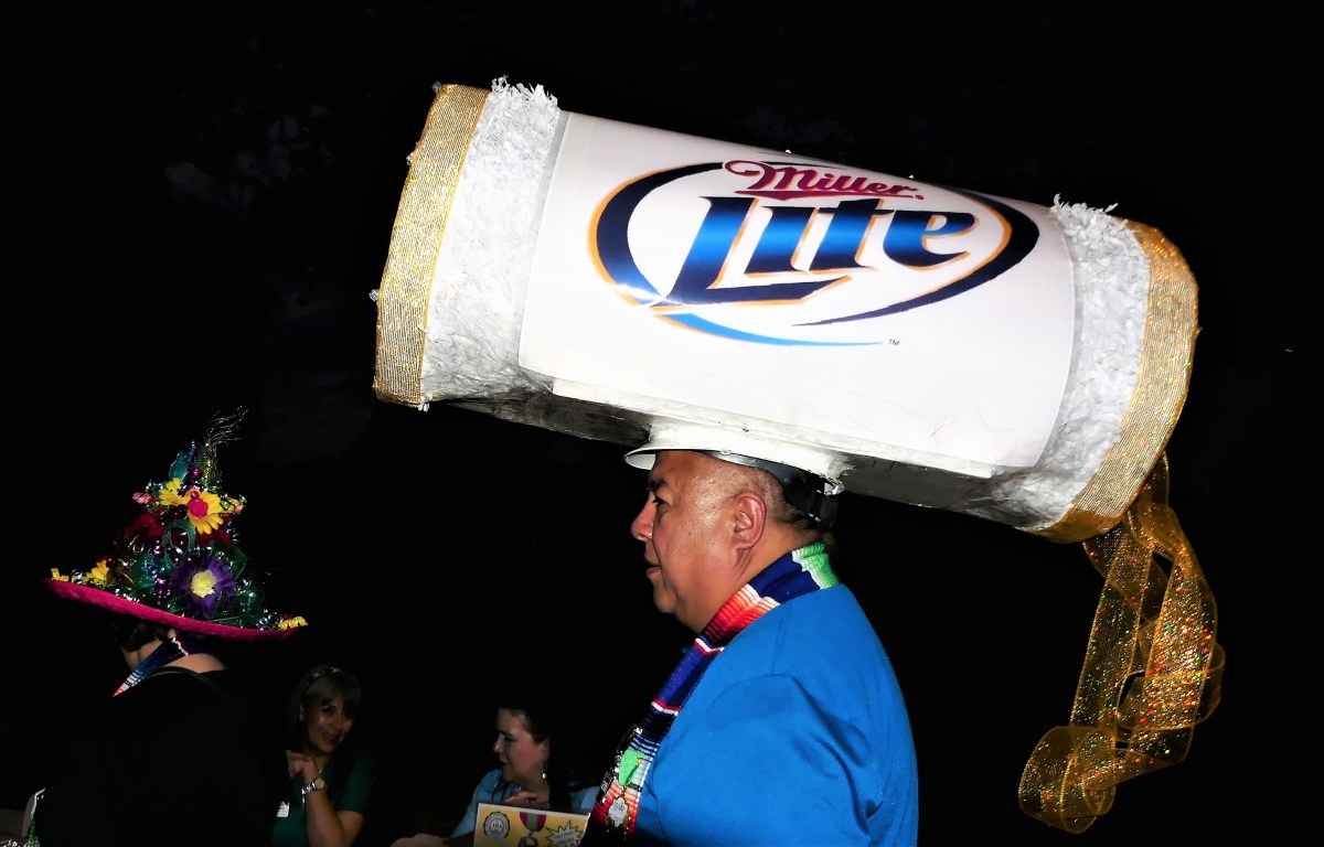
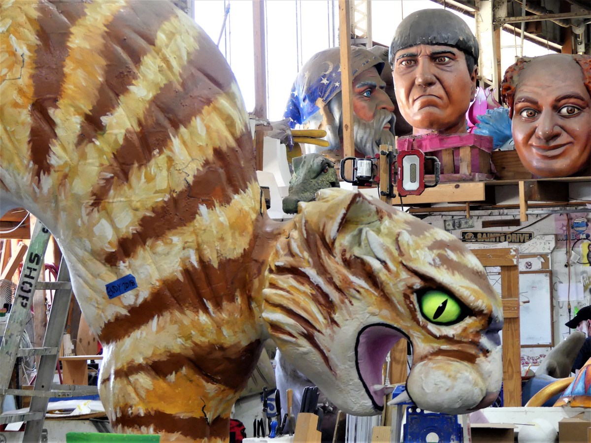
Since 1934, four generations of Kerns have been perfecting the art and business of celebrating Carnival, always managing year after year to surprise the public with fresh ideas infused with craftsmanship and technology.

Kiss.jpgKern Studios works with dozens of carnival organizations (known as krewes) who finance their own parades through member dues and fund-raising to offset expenses for:

Chicken and man.jpgfloat warehousing, designing, sculpting, construction, decorating, tractor pulling, audio, lighting, and parade route security–all routinely costing $100,000 or more for each 28 foot display on wheels.

Queen.jpgBut what’s a krewe to do if they eschew the usual bayou reissue? The Krewe of Bacchus commissioned Blaire to produce extravagant figures and floats on a more grandiose scale. He obliged them with 18 feet replicas of King Kong in 1972, and Queen Kong in 1973.
King Kong.jpg

Mrs Kong.jpg

In later years, a Bacchus signature float extended to 105 feet, accommodating 86 riders.

Muses and Leah.jpg

This year, the Krewe of Rex, Mardi Gras’ longest-standing parade organization (since 1872) launched 27 floats for their 134th parade. And with 70 different parades running this season, Kern produced over 450 floats for them and others…

witch.jpg
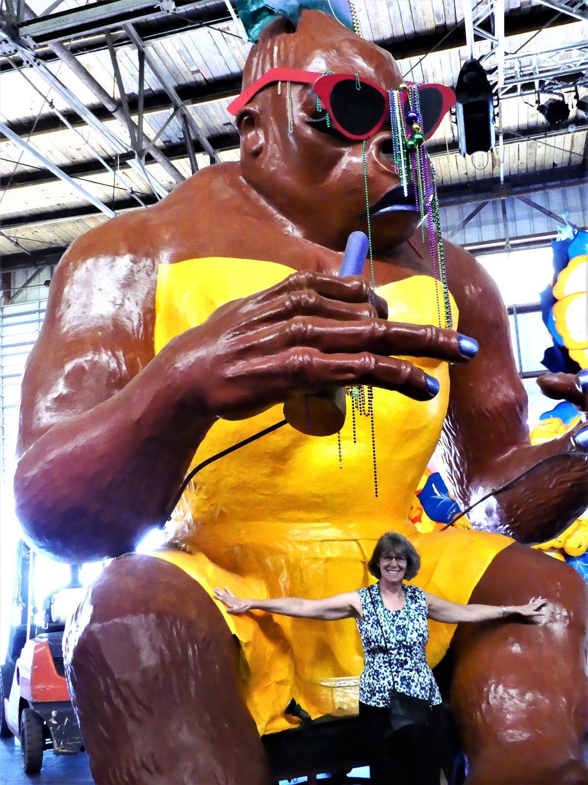
…which makes it (big) easy to see why Mardi Gras is such a cash cow for New Orleans, and Blaire Kern,

General Budha.jpgunless you’re a Buddhist.

Biloxi Bounty

“It will be forty minutes before I can seat you,” announced the hostess.

“So what was the point of making a 7 pm reservation?” I protested.

An entitled-looking woman strode up to the seating station, interrupting my conversation.

“Any idea how much longer?” she fumed. Residual cigarette smoke left a trail after her words.

The hostess was poised and ready with an answer. “I promise to text you as soon as your party’s table opens up.”

Emphatically, “Nevermind. We’re going to the Hard Rock location across the street,” she huffed, and strode away.

The hostess, not missing a beat, returned to me. “So your wait time has now been cut to thirty minutes. If I could just have your phone number?”

“Is it always this busy?” I asked, already anticipating the answer.

“Everyday and all the time,” she shrugged.

Leah and I are waiting to be seated at the Half Shell Oyster House in Biloxi, MS, the second of seven locations spread throughout the Gulf coast, and everyone says it’s well worth the wait. The shucker at the raw bar claims that on average, he will prepare eight sacks of a dozen dozen oysters for weekday diners.

When I briefly taught English at the New York Harbor School, I learned about the Billion Oyster Project launched on Governors Island, whose 20-year mission is to reclaim the New York Harbor habitat by seeding new oyster beds around the island in hopes of restoring a vibrant aquaculture to the area–a dream only made possible after passage of the Clean Water Act of 1972, which prohibited dumping raw sewage and toxic waste into the Harbor.

Since many Project volunteers are high school interns from the Harbor School on Governors Island, faculty staged an end-of-semester celebration where hundreds of oysters were opened for hundreds of curious inner city students, many who have never seen, touched, or smelled, let alone tasted an oyster. Watching the kids’ faces was priceless. For those who dared to try one, it was a warm and naked oyster. If they only knew there was a better way to enjoy a bivalve.

On the other hand, the Oyster House does it with culinary correctness. The half dozen half shells that arrived to the table were so plump, they were pushing each other off the icy plate. Each one was swimming in its briny soup, and glistening with freshness.

oysters.jpg

“C’mon, Leah,” I advertised, “you’ve got to try this. These are amazing,”

Neal and oyster.jpg
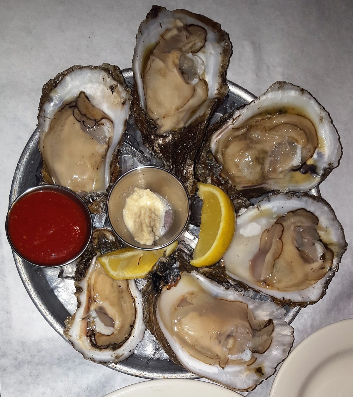
Leah was horrified. “Eww, no! I don’t know how you can eat that,” she objected. “It looks like it’s still living.”

“And that’s why it tastes so good,” I slurped.

The entrees were equally as tasty. We both had royal red shrimp different ways; Leah enjoyed a 1/2 lb. of peel and eat shrimp…

peel shrimp.jpg

while my shrimp were prepared Orleans style–in a hot Cajun butter sauce–with jalapeno hush puppies on the side. The beverage du jour was iced cold vodka and ginger beer. Wow!!

Shrimp Orleans.jpg

Afterwards, we walked across the road to the Hard Rock Casino,

Hard Rock.jpgbut that’s another story.

For the whole enchilada on half shell info, check out:

http://www.inahalfshell.com/bivalve-curious/

and for more on the Billion Oyster Project, see:

https://www.billionoysterproject.org/


Living with Less

As an outgrowth of downsizing, I have routinely reflected on the virtues of the  mimimalist mantra of less is more.

Robert Browning is credited with creating the phrase, which was later mainstreamed by architect Mies van der Rohe to explain his philosophy of design. It appears to be a contradiction of quantitative terms, and as such, represents an apparent oxymoron. But the quote also has a number of practical as well as esotetic applications.

Less is more is a cause and effect–an itch that requires a scratch, but in an opposite kind of way. So, if less is more, then what is it more than, or more of?

For instance, if less is a number, like income, then what logically follows is more frugality or poverty. And if the number relates to temperature, then less heat requires more clothing or blankets, and lower temperatures may certainly create conditions for greater risk of frostbite.

Insurance actuaries will tell you that less risk assures more surety.

Musically, less noise produces more clarity. Conversely, less clarity produces more confusion.

For dieters, less food intake results in more weight loss. Additionally, doctors will tell you that less exercise results in more illness.

Donald Trump would benefit from considering that less diplomacy promotes more hostility; that less suspicion builds more trust; and less insight produces more ignorance.

Personally, traveling in a road home has taught us certain restraints. The less water we use, the more space we conserve in our disposal tanks. Limited storage between the truck and trailor means making do with less clothes, and consequently, more laundry time. Most importantly, the less Leah argues, the more peaceful things are.

And so I open up the discussion to the blogosphere. How many examples can my readers come up with. Record your thoughts in the comments box for all to share.

After all, it was never my intention to create an exhaustive list, since less is more.

Two Tales of One City

As the cradle of the confederacy and the birthplace of the civil rights movement, Montgomery, Alabama has embraced its nascent roots, and is ready to exploit its role in two historic struggles: one, a political secession that was hastily formed to preserve the rights of whites; and the other, a social revolution to protect the rights of blacks. Both have come up short, which makes Montgomery, arguably, a municipal work in progress.

A visit to the Rosa Parks Museum, integrated into a corner wing of Troy University’s urban campus, takes the visitor through an interactive display of film, story-telling, life-size dioramas, documents and artifacts that frame the Montgomery Bus Boycott and its aftermath as ground zero for racial equality.

P1010276.JPG

P1010277.JPG

P1010280.JPG

P1010281.JPG

P1010282.JPG
Rosa Parks has been embraced as a national hero, the face of moral courage, and Mother of the modern Civil Rights Movement.

For her troubles and heroics, Rosa Parks received the Presidential Medal of Freedom in 1996, and the Congressional Gold Medal in 1999.

File:RosaParks-BillClinton.jpg

A 10-minute walk along Washington Ave. to the Civil Rights Memorial Center, across the street from the Southern Poverty Law Center was eerily reminiscent of the calm before the storm. As the second largest city in Alabama, it seemed unusually quiet. The breezy and balmy climate had uncharacteristically produced few cars, and even fewer pedestrians. Shops were closed, and construction areas were still–as if the city was under lock-down or quarantine.

The entrance to the memorial behind Maya Lin’s sculptural tribute was roped off.

P1010284.JPG

We caught the attention of an armed guard patrolling the area who asked if he could help.

“Isn’t this the entrance to the memorial center? Shouldn’t it be open?” I asked, pointing to the hours of operation.

Visitors to the Civil Rights Memorial Center have the opportunity to take the pledge and add their names to the Wall of Tolerance during their visit, and I had come to take the pledge:

By placing my name on the Wall of Tolerance, I pledge to take a stand against hate, injustice and intolerance. I will work in my daily life for justice, equality and human rights – the ideals for which the Civil Rights martyrs died.”

The guard shrugged. “Everything is shut down today, sir, because of the weather. Yes sir, they closed the schools an’ all, in anticipation of the storm that come through here early this morn’. So the memorial is closed as well, sir.”

“But it’s gorgeous outside,” Leah offered.

The guard nodded, “I know ma’am, but the storm is suppose to loop aroun’, an’ this kinda weather is completely unpredictable. Best you come by tomorrow for another look, okay? In the meantime, have you seen the state capital and the White House, just up the road?”

“Sounds like a plan,” I acknowledged.

The stately-looking capital sits alone on a green and projected a ghost house allure, devoid of any activity. I imagined Alabama governor Robert Bentley hiding under his desk–weathering his own personal storm of sexual misconduct, awaiting word from the State Ethics Committee who holds his legal fate in their sweaty fingers.

P1010287.JPG

Directly across the street is the transplanted Confederate White House, home of Jefferson Davis, the first and only President of eleven southern breakaway states, whose doctrine upheld slavery as a states’ right along with political liberty for whites. Inside the house, an affable guide exchanged greetings and historical trivia in down-home Southern hospitality fashion.

“Make sure you buy plenty of cotton clothes before you leave town,” he drawled, alluding to the area’s cash crop, “an’ help our local farmers.”

P1010288.JPG

Civil War telegram sign.jpg

Montgomery capital view.jpg

The town could use some help as well. About a quarter of the population lives close to the poverty line, and it shows in large chunks of the business community, where abandoned storefronts are less the exception than the rule. Nevertheless, there are pockets of revitalization, such as the Riverfront,

which features a minor league baseball park and amphitheater,

and the novelty of an old-fashioned steamboat cruise down the Alabama River.

Montgomery is not hiding from its past. It chooses to become a relevant city that tells it’s story from colliding perspectives, while dealing with hate and tempering with tolerance.

P.S. Four days after publishing this post, Governor Bentley is now an admitted felon who resigned to avoid prosecution–all because of chasing tail. Perhaps, the blog title be changed to “Three Tales/Tails of One City”?

Tightening My Bible Belt

If the idiom “raining cats and dogs” refers to heavy rain, then we drove through a storm front this morning on our way to Montgomery, AL that must qualify as “cougars and dingoes”.

So violent was the weather–bringing bouts of apocalyptic lightening and cataclysmic road floods–that I celebrated the opportunity to pull into a rest stop for 10 minutes just to catch my breath and clear my head. Texted news reports of tornadoes across Alabama border states kept us on high alert. Continuing south, the punishing winds played havoc with the Airstream, despite its aerodynamics. Keeping it centered between the lane lines had to be as challenging as today’s Supreme Court confirmation of Neil Gorsuch.

This is not the game plan we had prepared for yesterday. The Airstream was all hooked up and ready to roll from the night before. Our easy and early departure from Talladega was intended to give us a head start in advance of the storm, so that our arrival at Gunter Hill Park would coincide with the worst of the weather. But as my late Grandma Straws was so fond of saying in her heavy Slavic accent, “You kenen nit makhn a contract miten de veter.”¹

What a relief it was when the squall finally weakened as we exited the highway and turned onto Old Selma Rd. in search of our campground that I may have muttered a “Hallelujah”. If we were grateful to God for arriving without incident, there was no shortage of venues to Praise the Lord. It turns out that eight different churches lined the five-mile route–all of them captured below.Church2.jpgchurch3.jpgchurch4.jpgchurch5.jpgchurch6.jpgchurch7.jpgchurch8.jpgchurch1.jpg
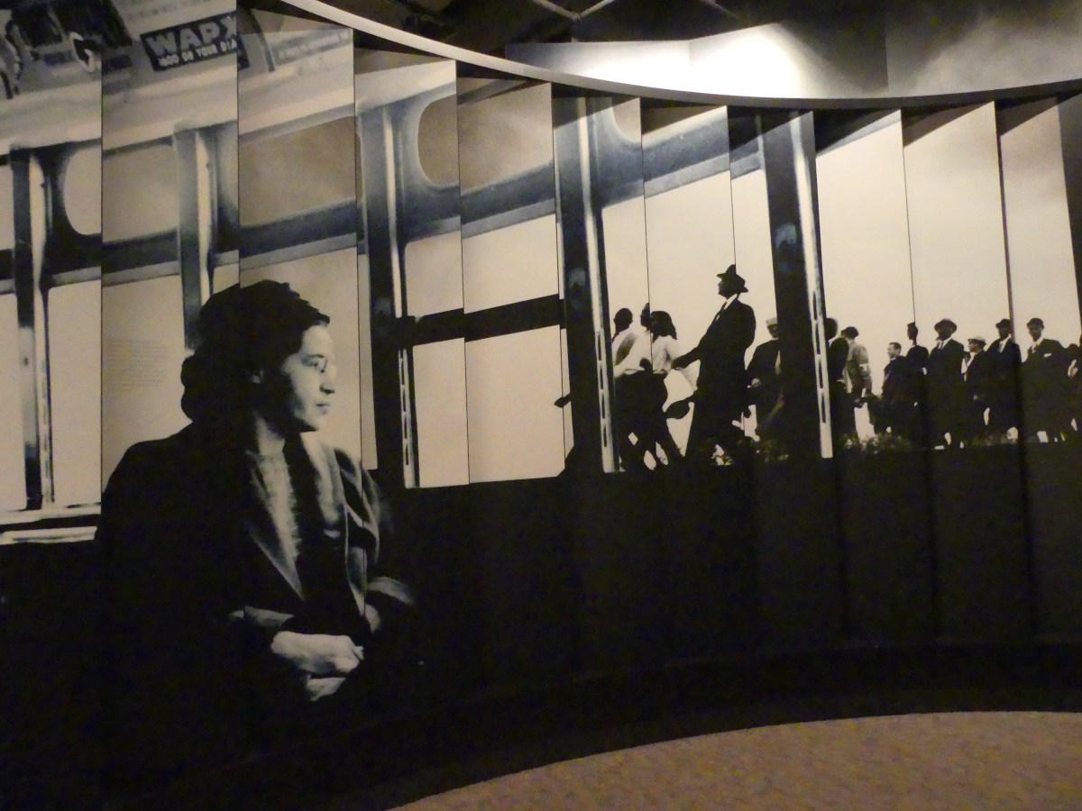
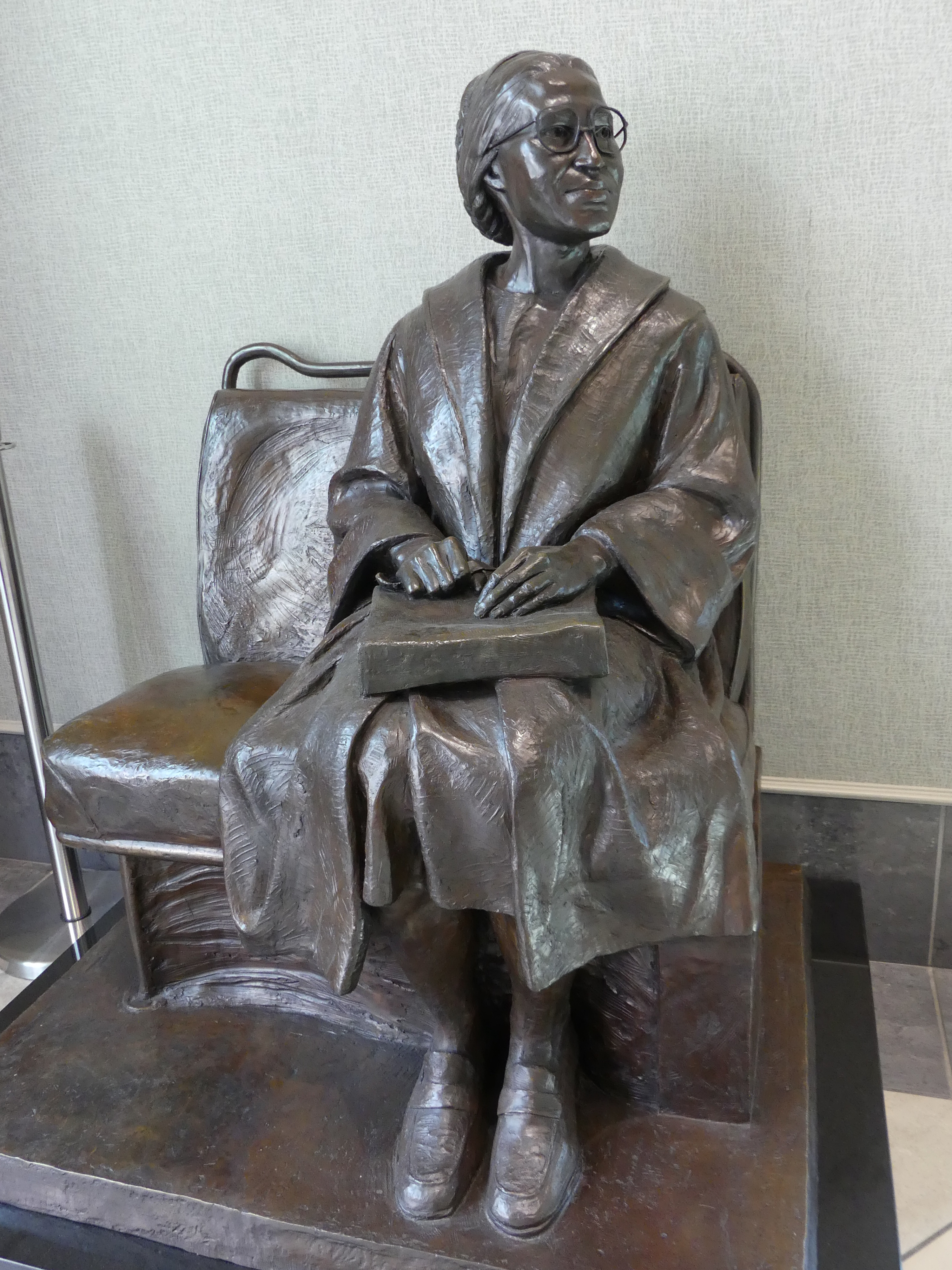
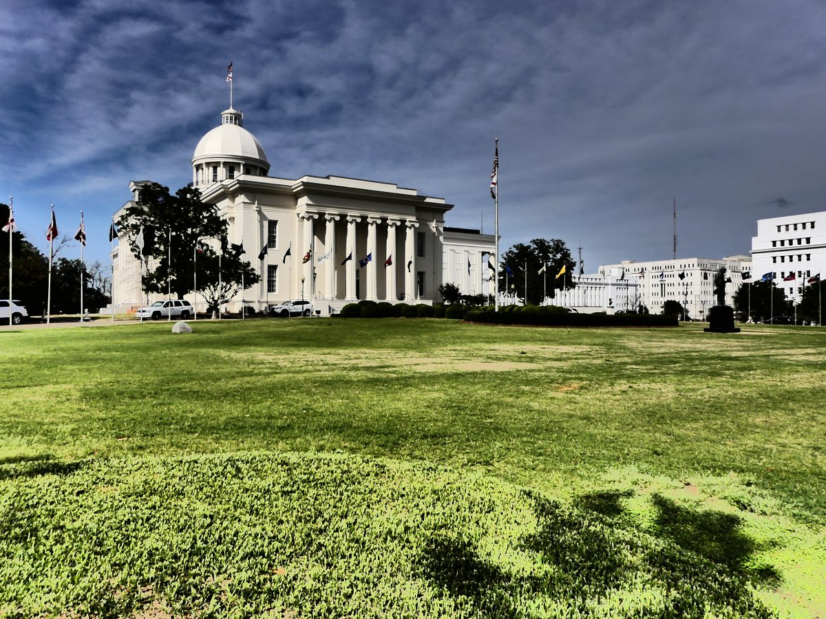
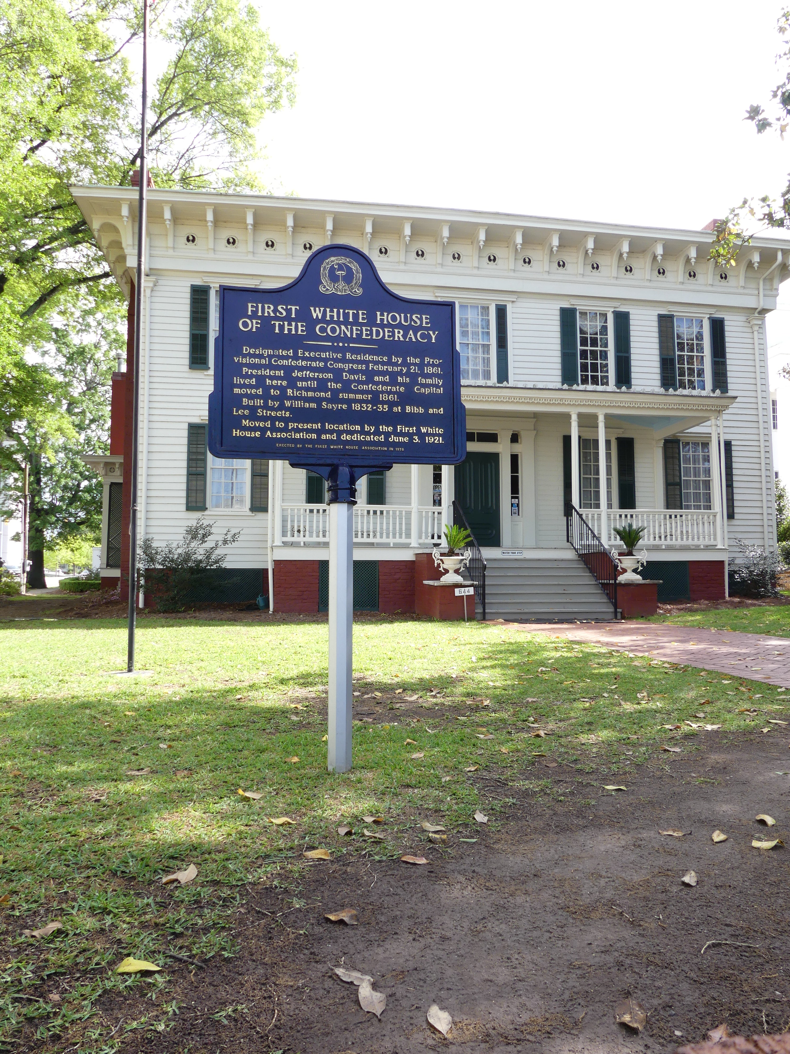
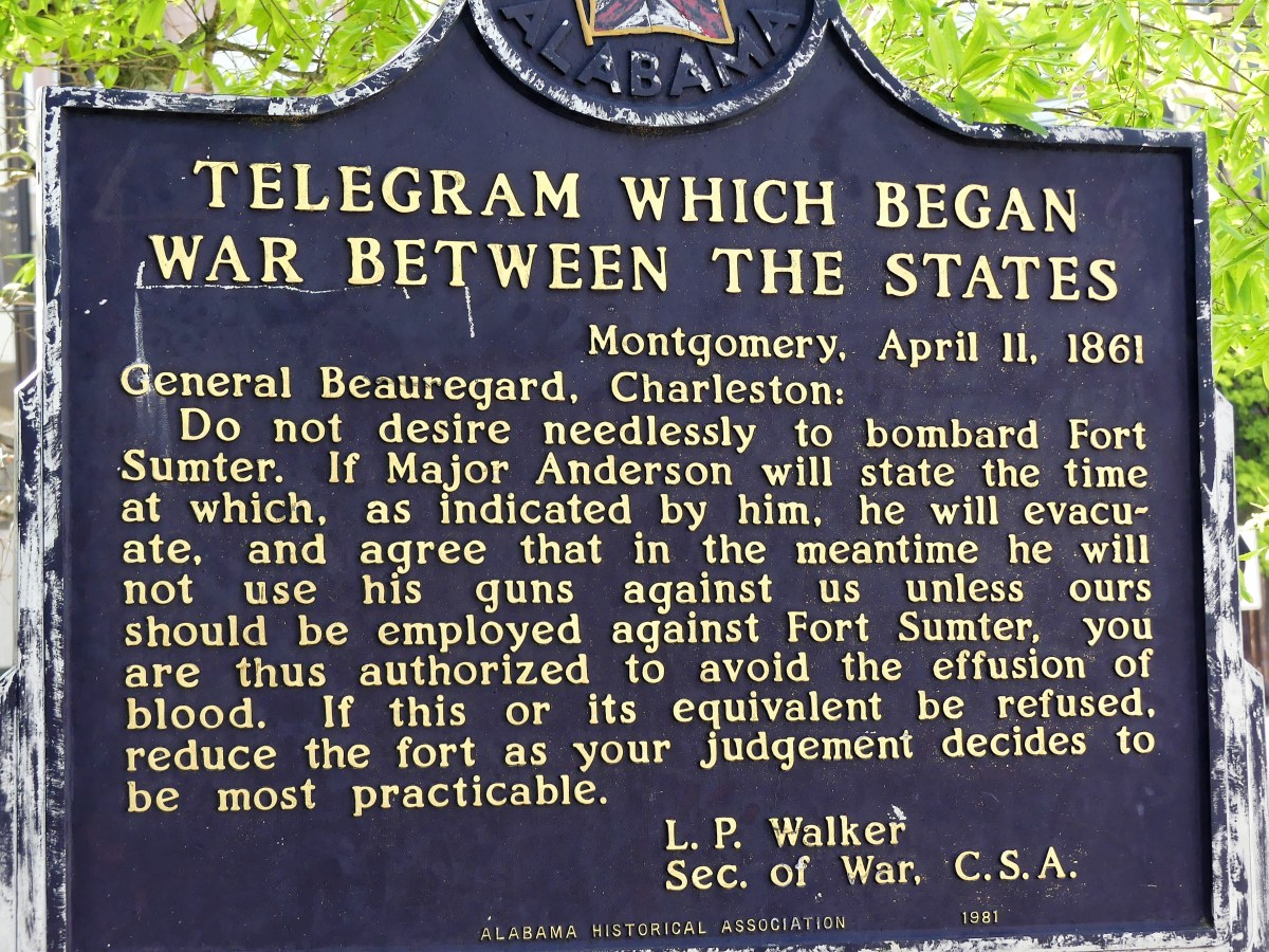
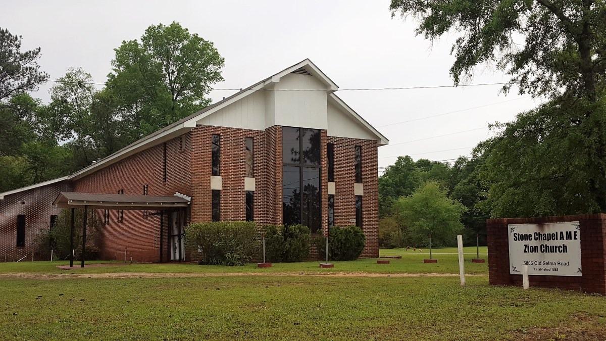
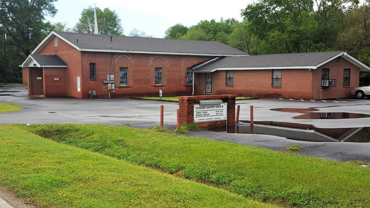
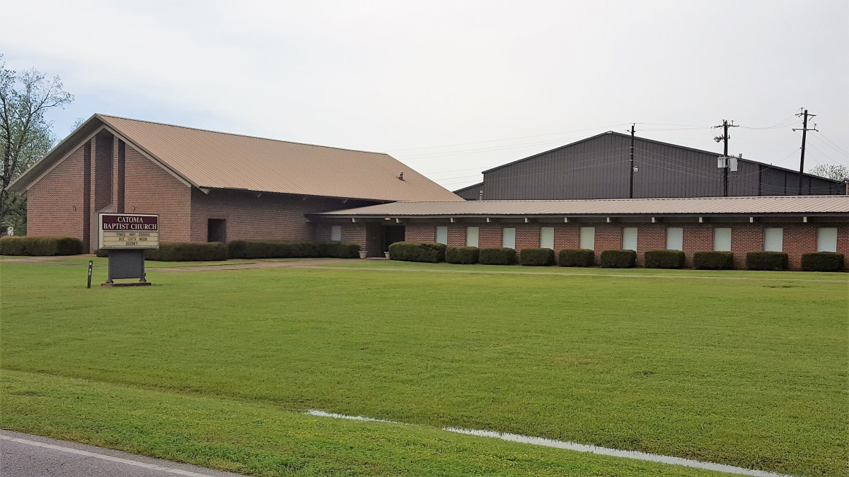
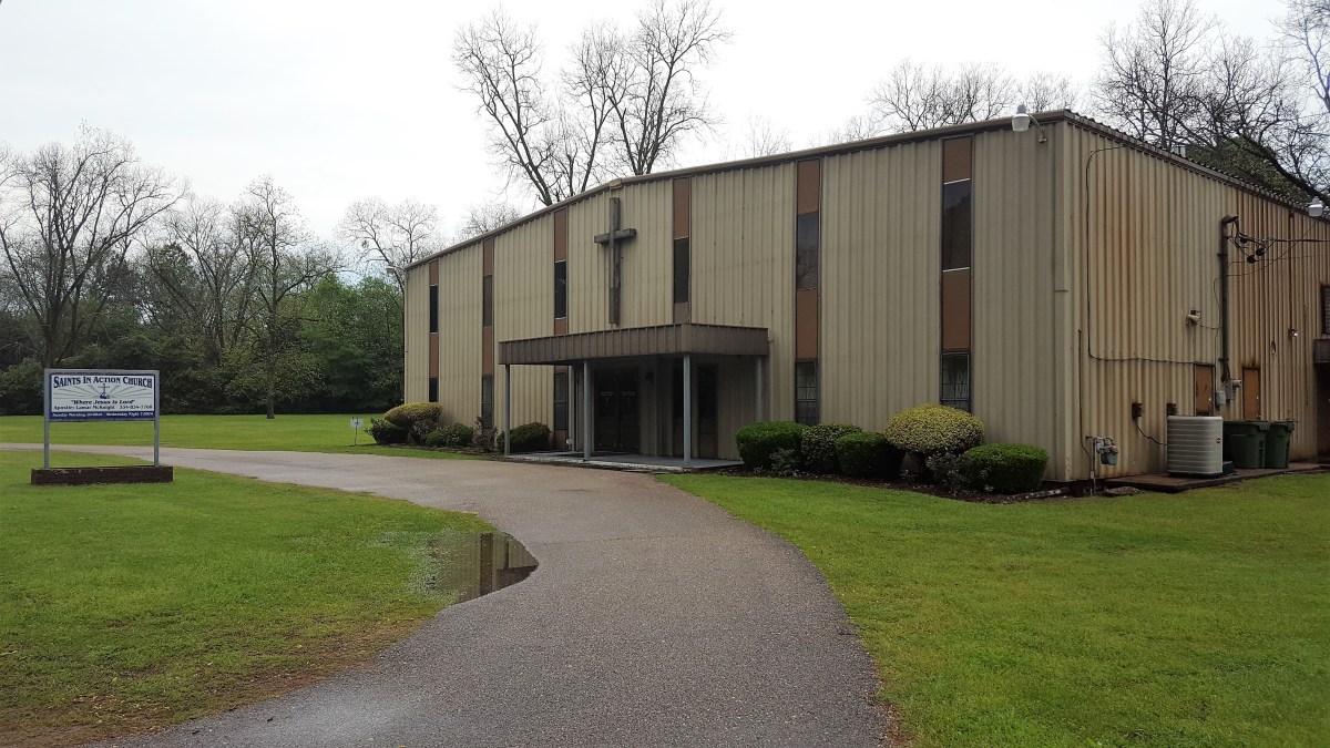
If salvation is part of your endgame, it seems that Old Selma Rd. is one of the most God-fearing stretches of asphalt in all of Montgomery, and the place I know where you should go, to save lives lost at any cost.

Or at the very least, buy a bag of boiled peanuts and shelled pecans from the roadside vender who looks as old as Moses.

¹Translation: “You can’t make a contract with the weather.”

Redneck Nation

Today I washed my truck. What worries me most is that tomorrow’s forecast calls for rain. Not that I’m worried about it raining–it’s that I knew it might rain tomorrow, and I washed my truck anyway.

And then there was Leah reminding me, “Why would you wash your truck when it’s only going to rain tomorrow?”

“I’m aware,” I confessed, “but it really needs cleaning. Y’know, I think I might be turning into a redneck.”

Just earlier in the day, my newest neighbor, a pipe welder from Checotah, OK and I had a serious conversation about truck engines and air brakes. I mean, I would never have had a conversation about truck engines and air brakes ever with anyone in my past life, and yet it seemed so natural today.

From the looks of things, I had a valued opinion on the benefit of driving a V-8 with a greater payload capacity, versus Ford’s highly touted twin turbo-charged V-6 that promises 10% more torque–a specification I was willing to sacrifice in favor of schlepping more junk in the trunk. And the pipe welder listened with interest, giving me that “I-know-whatcha-mean” nod.

It’s true that the truck was filthy. Yesterday, we were off-roading on a ridiculously narrow ridge road along Cheaha Mountain, Alabama’s highest peak at 2411 ft., and it was dirty fun.

“SLOW DOWN!!,” Leah reiterated a dozen times, gesturing wildly.

In my defense, I was only doing 25 mph, but maybe it felt faster to her given the road was badly rutted and had no guardrails to protect against the hairpin switchbacks. Each turn was met with “Oh, God!” by Leah.

When we returned to the Airstream, I noticed that a fine silt had infiltrated the closed bed of the truck through its weep holes, and coated everything with an asthma-inducing dust.

So today, everything had to come out of the back of the truck and be wiped down. Then, I took a hose to the sandy-colored Alabama particulate that coated the floor, and washed it all away. That’s when I got the itch to finish the job, and wash the exterior too. The weather couldn’t have been better–cloudless blue skies and 82 degrees, and it was refreshing working in a tank top and shorts. Surprisingly, Leah got swept up in the activity, and the two of us made short work of the task.

The pipe welder looked out from across the lawn. He was studying for a 100-question re-certification exam on April 20 between occasional tobacco chew spits.

“She sure looks purdy when she’s clean,” he gushed.

I realized I was becoming the person who I referenced in an earlier post (Rig or Mortis), and I was showing off my truck’s shine.

After writing this post, I stopped inside to freshen up, and I couldn’t help but notice my reflection in the overhead vanity mirror. Sho’nuff, my shoulders and neck had gotten plenty of color.

Transitioning to Home

You’ve entered a place between time and space, where time slows down and place takes hold.

What was familiar and old no longer competes against the news of the day, or the sound of early morning commutes.

Peace and quiet can be found between voices listening for what comes next–

Stopping for a moment to find context in a world that embraces meaning, but defies reason;

To connect with basic needs, where less is required, and more is inspired;

And giving up the drive, only to arrive at a point where you are already there.

As such, much more may come from wanderlust.

Sweet Home Alabama

Leaving Memphis at 9:30 am for a 285 mile jaunt to Coleman Lake in Talladega National Forest, AL was expected to take 5 1/2 hrs. That was the only thing certain about this leg of our trip. Where we would set up residence for the next three days was the biggest question mark.

Our design was to camp at the lake, and take advantage of the Department of Agriculture’s generous $10 site fee with electric and water hook-up provided. We monitored the vacancy prospects from the road, since there is no reservation system, unlike the Park Service, which operates through the Interior Department.

From the time we started out, we knew from Louise, a central office clerk that we were competing for seven coveted slices of real estate. Midway through our trip, a phone call confirmed that only five sites remained. And by the time we reached Birmingham–which was one hour away from our piece of Eden–the odds started working against us, when we learned that only 3 spots remained. It was time to consider contigency plans.

A quick scan of the internet was less than promising, considering we were looking to escape to an area that was off the grid with limited availability. Fortunately, we wandered across an obscure RV park with decent reviews just outside the forest within Heflin city limits that according to Lawrence still had three sites available for $30 a night.

We proceeded as planned, moving closer to staking our claim as we pulled into a Shell station off Exit 199 on I-20. A phone call to Louise produced a small panic attack; there was only one site left, and we were within striking distance. Could we, would we make it there in time? Gassing up the truck would put us behind by 15 minutes, but with 12 miles to empty, there was no doubt that this was time we needed to allow.

Once we started rolling again we were committed to the bitter end, now that cell service was interrupted by the beautiful forest scenery. The trees were filling in with seasonal green, and the switchbacks and narrow roads were becoming more challenging. We held our breath (not literally) during the last 10 miles of our journey up the mountain. We exhaled (literally) turning the corner into the campground; we had arrived to uncertain news. The campground steward met us at the truck.

“Are we in time?,” Leah blurted out.

“Are you the one’s been callin’?,” he wondered, “Cause last time I checked, I got one space left, B-37 I think, and you’re welcome to follow the road around ’til you come to it, and we’ll settle up after you get settled.”

Leah and I exchanged “we-just-won-the-lottery” grins, and chugged out in search of B-37. The site was almost a full circle around the ring road, up a steep embankment on the left with enough room to hold two trucks, a trailer, a pop-up tent, three bicycles, and seven interlopers. Gramps was busy hand-cranking the camper to a level position, while Granny was herding the kids.

“Are you shitting me?,” I asked nobody in particular.

We immediately resorted to Plan B, driving back down the mountain road while struggling with inputting a new GPS address. We got Lawrence on the phone when we were free and clear of our traitorous natural surroundings, and returned to 3-bar civilization.

“I got three spaces left,” he offered.

“We’ll take it,” Leah yelled. “We’ll be there in half an hour.”

An hour later, after setting up and rewarding myself with a cold beer while sitting in my burnt orange-colored travel chair atop a woven Navajo-patterned polyester mat, two massive 5th wheels with slide-outs pull in close on both sides of our Airstream, threatening to swallow us. While setting up on my right, Mr. Proximity turns to me.

“Hey, didn’t I see you at Tom Sawyer’s earlier today?”

As a matter of fact he did. We spent the last three nights trailering at Tom Sawyer’s Mississippi River RV Park in West Memphis, AR. But the only people we spoke to were a retired couple from Ringwood who saw my truck plates, and that led us to playing Jersey geography. It turns out their son, Jeff and Leah’s daughter, Carrie are Facebook friends who graduated from Lakeland Regional High School together. Other than that, I had no connection to the people moving in beside me.

“Wow, I’m impressed you remembered my Airstream. I hope you’re not stalking us,” I kidded. “We were on our way to Coleman Lake, but got turned away last minute, so now we’re here.”

“Us too,” he said. “Can’t beat the $10 fee up there. We was passin’ through Talladega last Monday. Pretty sites an’ all, but between the highway traffic an’ the train whistles, I’d just as soon stay here where it’s quiet. Besides, we’ll be gone by morning.”

I liked the sound of that.