Hiking Hat Trick Completed

Tracking back through Lajitas and Terlingua into the Maverick Junction entrance of Big Bend National Park took us an hour, and put the time at 3:00 pm. Opting for a backcountry tour of the Chihuahuan Desert, we turned south onto Old Maverick Road, and turned up the dust behind our wheels on our way to scenic Santa Elena Canyon.

Two miles into our 13-mile drive, a Chevy 4X4 approached us head on. Rather than play a game of off-road chicken, I pulled over to allow him right-of-way. When the truck stopped parallel to me instead of passing, and the driver, a middle-aged graying male signed his interest in communicating, I lowered my window to satisfy my curiosity.

“I wouldn’t go down there, if I was you,” he advised.

“Is there something wrong with the road?” I asked.

“Well let’s just say that I been on this road for over an hour already, and I can’t wait for it to be over. It gets much worse down there, and I don’t know if you wanna do that to your truck. This here Chevy is for work, so I don’t give a shit what happens to it, but it’s your call,” he said.

“Thanks for the warning,” I said, and he drove away.

After the encounter, Leah and I sat in silence for a brief moment. “Wow,” I exclaimed, “Do you believe that? He thinks we should turn back.”

“I’m not gonna say,” Leah offered. “I’ll do whatever you want to do. At least we know how long it will take”

“Then fuck it! We’re moving forward,” I declared. “I’m not turning around because of him. Let’s see what this truck can do! All I ask is that you turn off the alarm (see: Ouch! and Ahhh!–Part One).”

“I can do that,” Leah promised. “But we’re on a mission and we’re running out of time, so you need to limit your stops.”

I wanted to agree in principle, but it seemed so unreasonable to pass up so many photo opportunities.

peak with cactus

desert

cactus flower

prickley pear blossom

However, Leah had a point. We still had a canyon hike ahead of us.

The road was as pitted and rutted as expected, but not the deterrent we anticipated. The truck suspension was very forgiving, and handled the rocking and swaying without a slip. What took the Chevy over an hour to travel, took the F-150 only 45 minutes to complete. (This testimonial should in no way be considered an endorsement for Ford, unless Ford is willing to pay me. I hope you are reading this, Ford!)

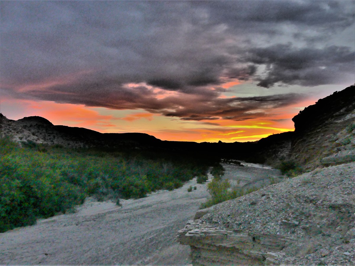
We arrived at Santa Elena Canyon parking when most visitors were leaving.  A slotted boardwalk led us to the river flats where the canyon opened into an expansive arroyo,

Santa Elena Canyon opening

where only a trickle of the Rio Grande diverted around a sandbar merging with the Terlingua Creek.

canyon wall

The hike into the canyon along the northern wall follows an observation path of concrete-slab switchbacks outlined with occasional handrails. The vista at 100 feet is sufficiently rewarding to most visitors who tend to take a few snapshots before returning to their cars.

observation trail

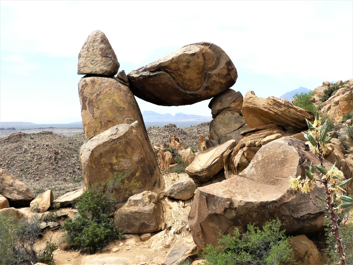
But the true reward awaits the hiker who takes the trail deeper into the canyon for a more immersive experience,

Leah and SEC

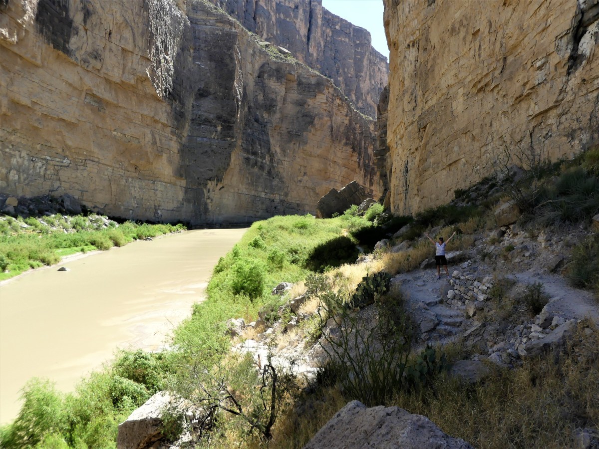
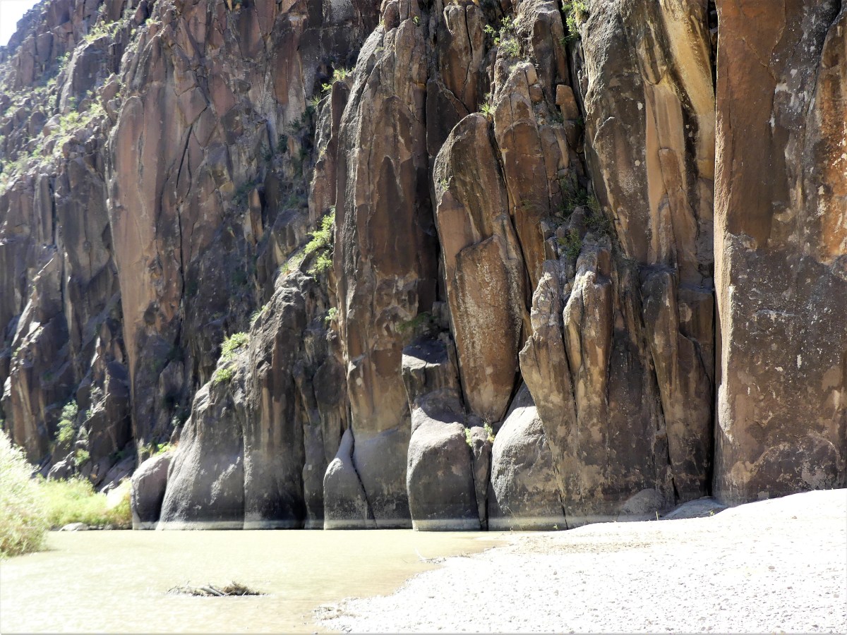
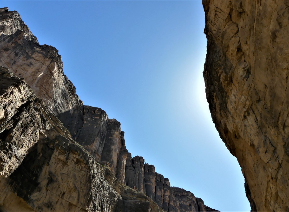
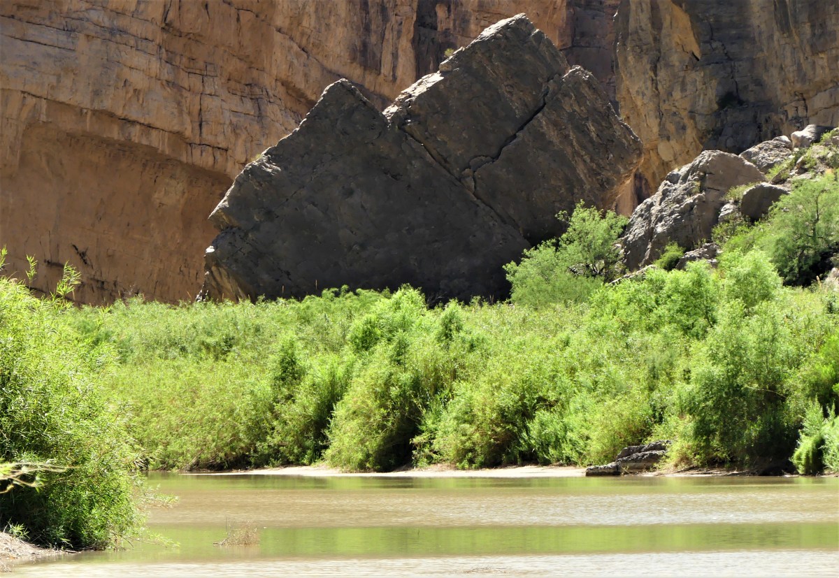
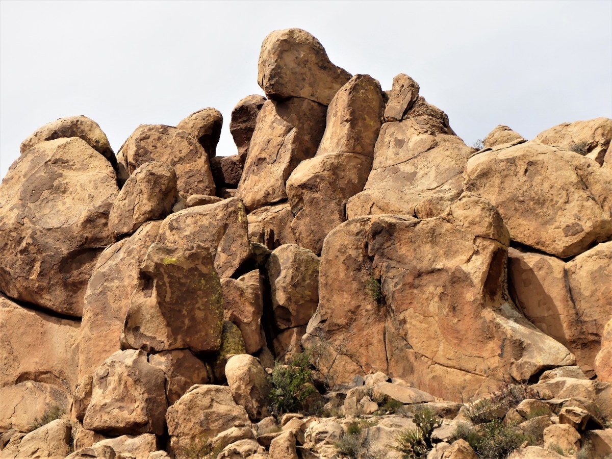
and a greater appreciation of the scale of the 1500 feet sheer walls,

cliffs

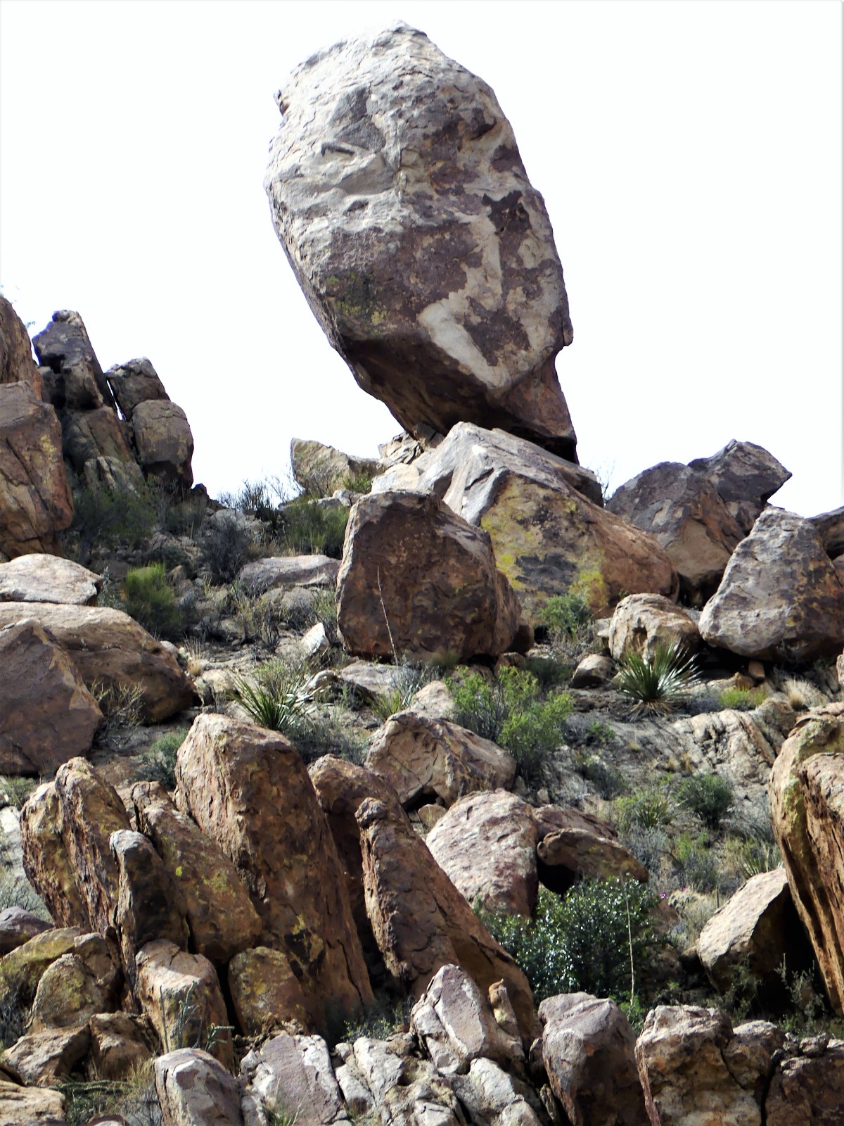
and the house-size rocks that have tumbled from the clifftops.

fallen rock

We took shade whenever we could, and drank the requisite gallon of water per day to avoid dehydration, yet we always seemed to be thirsty. By the time we reached the trailhead out of the canyon, we had drained our resources, but felt confident that the 13 miles to the store at Castolon Visitor Center—on the way to Ross Maxwell Scenic Drive—would allow us to resupply…or not.

The store was closed more than an hour before we arrived.

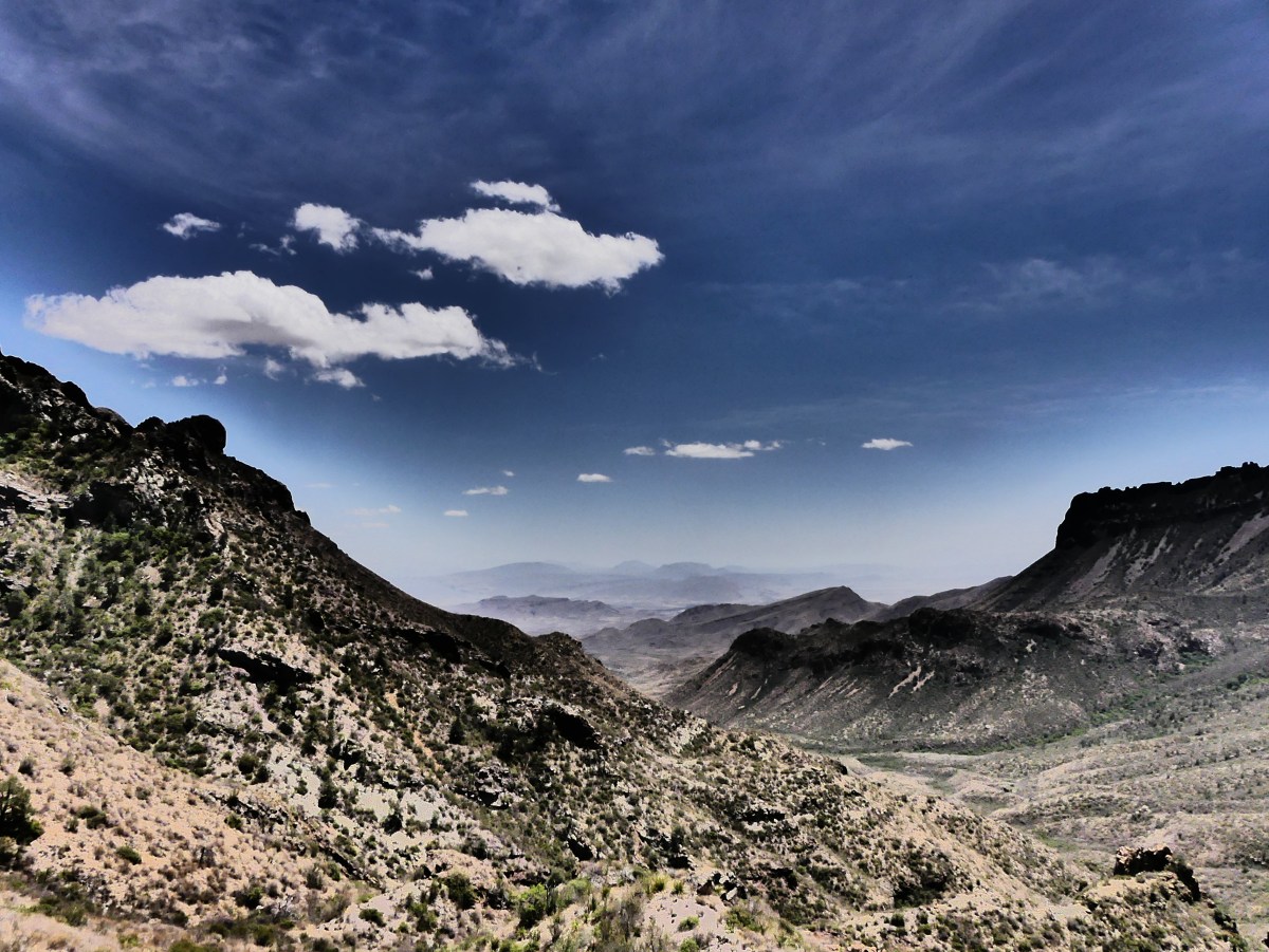
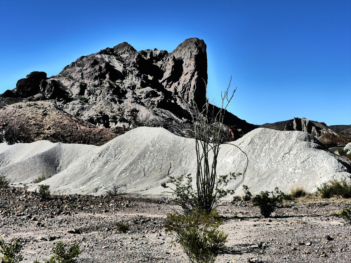
Disappointed and thirsty, we climbed into the truck, and drove the 22-mile route around the backside of the Chisos Basin to admire the ever-changing landscape. If we weren’t so parched, we might have lingered longer to take in the views, but I drove as fast as the hairpin turns would permit.

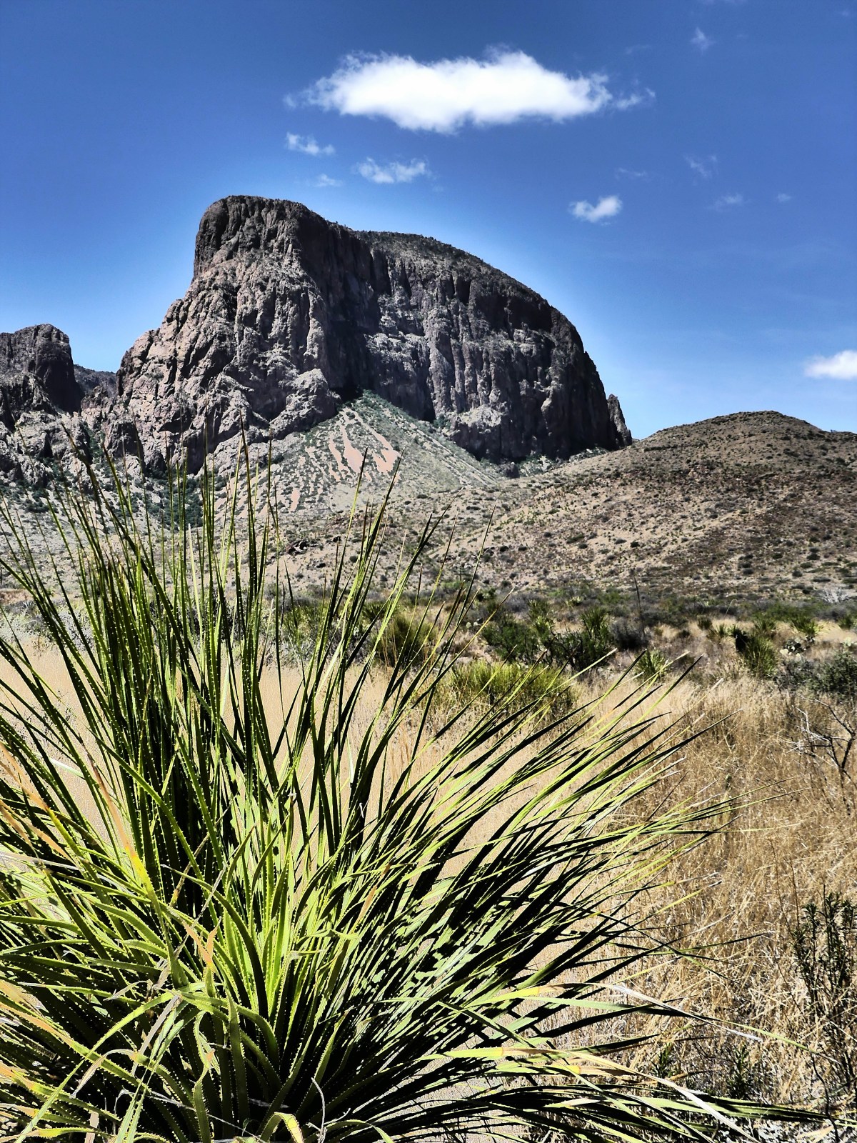
Not that I was completely indifferent to scenery. There were a few occasions that demanded I stop and allow the natural beauty to wash over me.

far view

mules ear

what a butte

Another 13 miles past the junction intersection, and we finally completed the western loop around the park. While Leah napped, I struggled with the final 20 miles from the park gates to Lajitas. It took every last bit of will power to make it home, knowing that a well-deserved ice-cold Dos Equis would be waiting in the fridge, demanding I “Stay Thirsty”.

It was 7:00 pm when we finally opened the Airstream door, only to collapse.

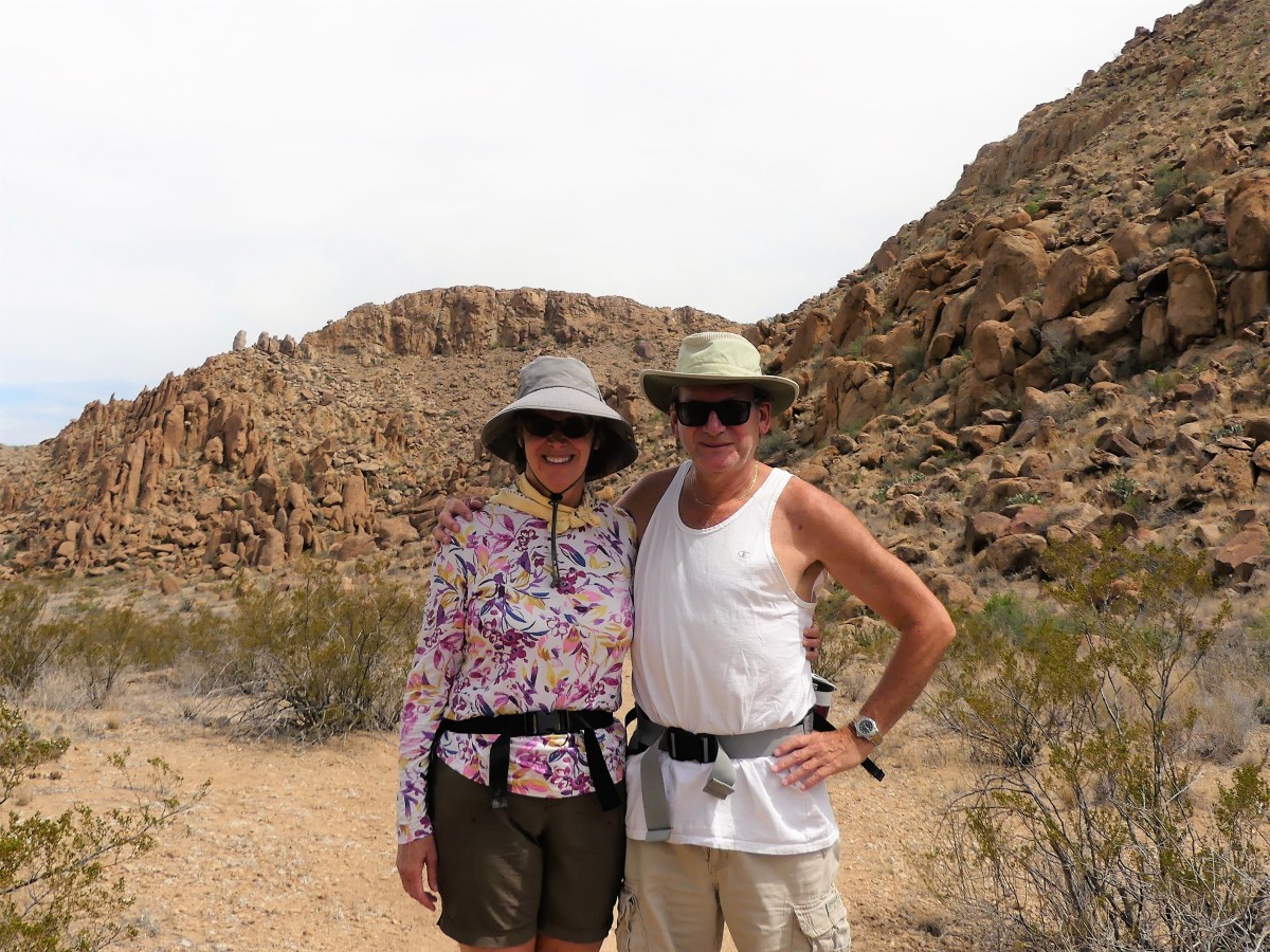
We had completed 10 hours of non-stop activity, gratified by the experience, overwhelmed by the grandeur, and elevated by the notion that two old farts could still last the whole day.

Hiking Hat Trick–First Goal

At the risk of becoming too comfortable with scheduling only two activities a day during our destination stay, our last full day before moving on from Big Bend presented an opportunity to squeeze in three. That’s right…we were going for the hiking hat-trick!

By rights, we were being overly ambitious—biting off far more than we should ever chew—but as we’ve found since starting out, time is not our friend. Not to be melodramatic, but we may never pass this way again…and if we do (whether in this life or as Shirley MacLaine), it may not be with the same get-up-and-go. So, while we still can, we will continue to fool our bodies into believing we are first-round draft picks.

Typically, before dropping anchor, we’ll have researched most meaningful possibilities in our area. Then we’ll cherry pick around our common interests based on associated cost (we’re on a budget!), reasonability (is it safe and sane?), and time (is there enough of it?). By adopting this strategy, we’ve managed to stay focused and in sync.

But on this particular day, we agreed, “Who cares what it costs! This is totally insane! We’ll never have enough time! So, let’s do it!” On this day, we would canoe down the Rio Grande and hike through Slot Canyon while at Big Bend Ranch State Park, then return next door to Big Bend National Park for a backcountry drive to Santa Elena Canyon, hike the Santa Elena Canyon Trail, and return through the Ross Maxwell Scenic Drive.

Two days earlier, we reserved with Angell Expeditions for a Sunday float. For many, the holy grail is to raft through Santa Elena Canyon in the shadow of its 1500 feet canyon walls while attacking Class IV rapids. However, local outfitters were eschewing the Santa Elena junction put-in due to historically low water levels.

waders vertical

Instead, we agreed on a canoe trip through Dark Canyon in the State Park—not nearly as dramatic as the former—but at least we’d be floating on water, rather than pulling our boat across it.

We put in at Madera Canyon at 10:30 am.

River access

Angell ExpeditionsAnd found we had the whole river to ourselves.

3 tps in the distance w canoe
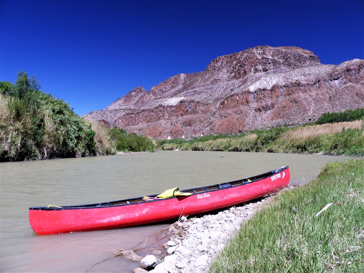
It was Mike, our river guide in one boat and us—with Leah at the bow and me at the helm—in the other.

Mike on the river
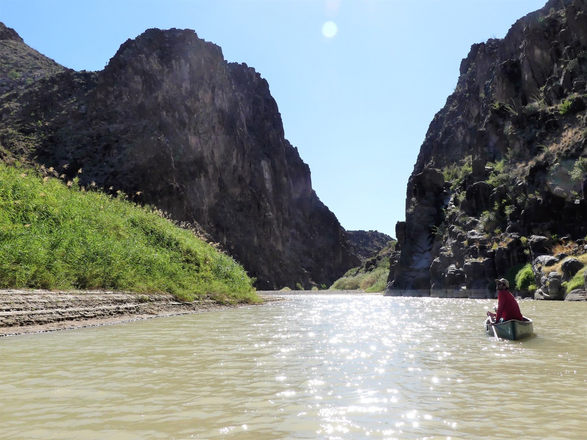
The air temperature was equal to the water temperature at about 75°, and the wind was at our backs. It could not get any better, or be any easier…until we reached the first of three technical skill zones.

While not exactly Class IV water, the rocks and current still made the run challenging and fun. To avoid tipping the canoe, Mike had us stop each time to survey the water. We walked the shoreline, and watched how the fast-moving water was running in order to plan our route. After easily demonstrating the turns in his own canoe, Mike ceded the river to us to try for ourselves.

First time out, Leah panicked. “I’m not doing that. It’s too soon to go swimming. I’d rather walk it.”

“C’mon, Leah,” trying to encourage her. “It’ll be fun.”

“Not with you steering, it won’t!” she bellowed. “I’m not getting wet. Why don’t you do it with Mike.”

Mike agreed. With me in front, and Mike at the helm, we glided between the rocks, and sailed through the water effortlessly.

“See,” I crowed, “that wasn’t so bad.”

“Sure thing.” Leah was unimpressed. “I’ll do the next one,” she offered with uncertainty.

After 30 minutes of lazy floating, it was show-time yet again. We repeated the same set-up procedure as before, and Mike made it look just as easy as before, but these rapids were faster and rockier, and required more finesse.

fast water
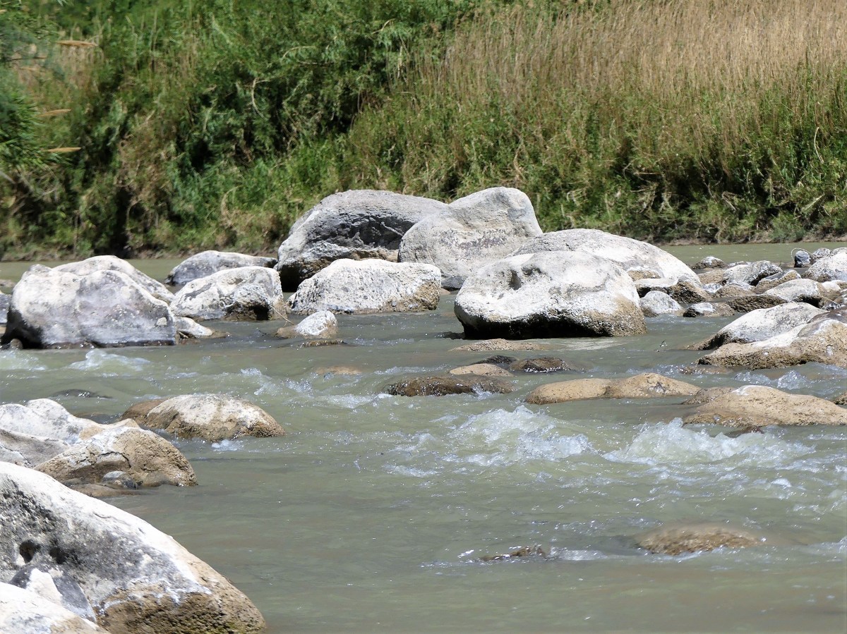
“With this one,” Mike warned, “it’s very easy to capsize, so if you feel the boat tipping, just step out onto the rocks.

“No problem,” I mustered.

“Yeah, right!” Leah mocked.

We valiantly headed into the white water, picking up momentum, and following all of Mike’s directions perfectly.

negotiating fast water
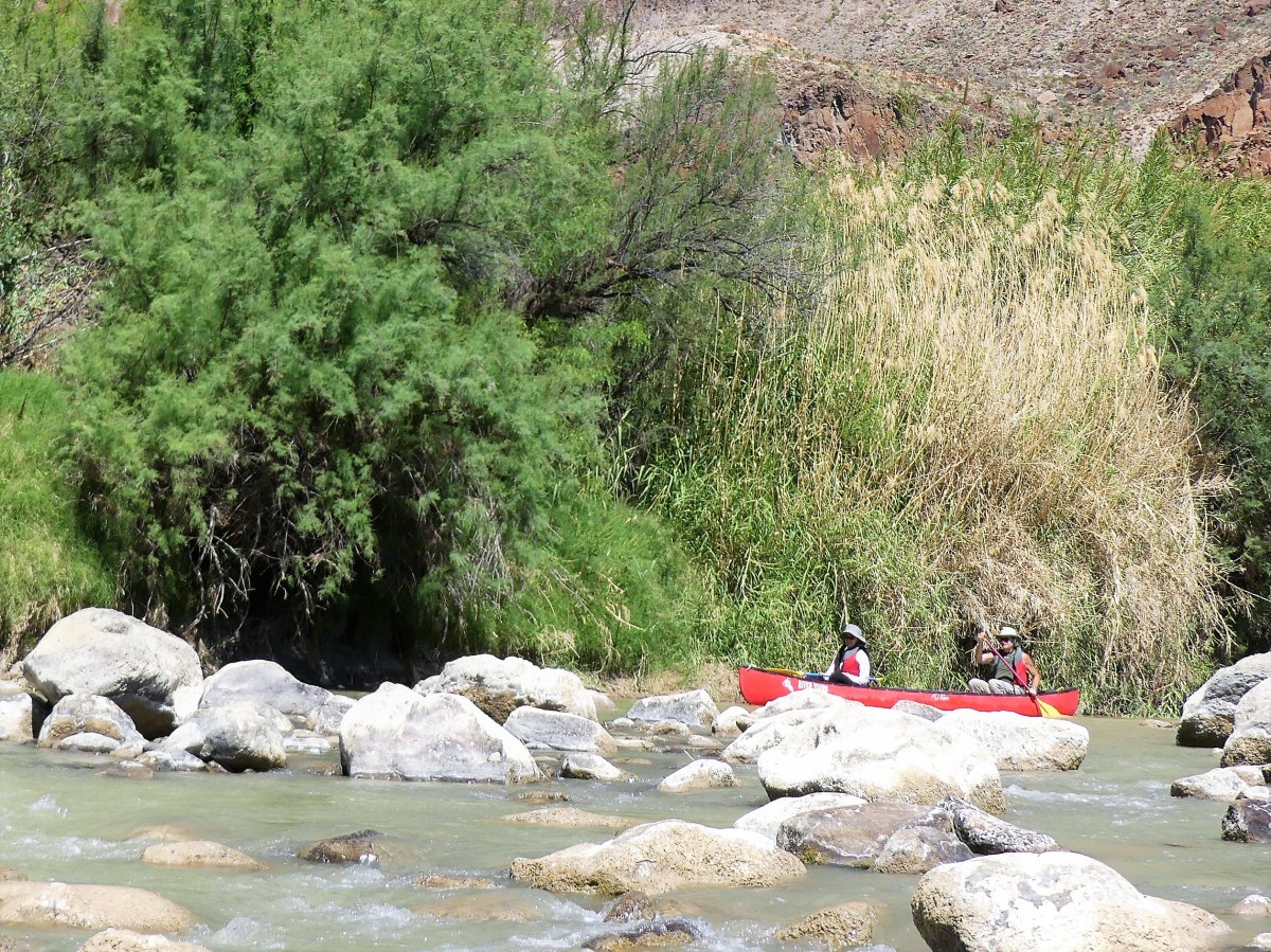
“I don’t know about this,” Leah yelled.

“Just keep your paddle out of the water, and I’ll guide us through,” I yelled back.

Neal Leah rapidsI zigged when and where I was meant to zig, and zagged at the appropriate time and place, until…

“LOOK OUT!” Leah screamed.

…a very large boulder suddenly jumped directly in the path of the canoe, spoiling my perfect run. The boat got caught up on the rocks, turning it sideways just as Mike predicted, and the rushing water was forcing the boat over.

“DO SOMETHING!” Leah screamed.

So, I stepped out as instructed—keeping the boat steady—and pushed it through the last turn, while Leah traveled like Cleopatra.

“I’ll have you know that I had nothing to do with that. You told me to keep my oar out of the water, so it’s not my fault.” she gloated.

“It must be nice to be blameless and dry,” I said to myself.

With the wind gusting at 20 mph, we were quickly approaching the take-out area, yet it was only 12:30 pm. The tailwind had cut our expected float time in half.

Fandango location

Basking turtles“Is that it?” asked Leah.

“End of the line,” confirmed Mike. “This is where the truck is parked.”

Feeling badly, Mike added, “I know it seemed like a short trip, but if you’d like, we could head up to Slot Canyon and do a hike. It’s not like it’s out of my way.”

Leah and I exchanged glances. We had intended to hike the canyon on our own anyway.

“Absolutely,” said Leah.

So, we got in the truck and followed Mike over the mountain, on the way to our second goal.


Ouch! and Ahhh!–Part Two

*For those who are reading postaday blogs, please see Part One first to follow the narrative. Sorry for the inconvenience.

Previously on Streaming thru America… (see Ouch! and Ahhh!–Part One, previously published)

Neal and Leah were both feeling the effects of the heat–both inside and outside the F-150. Temperatures had climbed to 103º on the trail, while the mood had turned icy in the truck. Additionally, Neal had aggravated an old knee injury, and Leah was feeling tired and dehydrated.

And now, Streaming thru America is pleased to present…

Part Two: Ahhh

After the hike, it became necessary to regroup at the Airstream. It was our last day in Big Bend and it was only 4 pm. Both of us agreed that we weren’t yet finished for the day. If we could rally after our siesta, then we could pull off one more hike.

But we needed a rejuvenation tonic—a game-changing elixir that would fuel our core and boost our disposition. And given the state of our limited supplies, it had to help us clear our head, yet give us the false sense of security we needed to fool ourselves into thinking that we could endure another adventure. Bottom line—we made frozen strawberry margaritas. Who knew they could be so energizing?

Timing was everything. With the sun expecting to set at 8:30 pm, a light dinner got us out the door and back on the road towards Hot Springs Trail, part of our Big Bend bucket list. Thankfully, not a long drive, it was only ten minutes to the turnoff from Rio Grande Village, and another four miles in to the trail head, but what a drive!

Halfway through the white gypsum track, the road split into two extremely narrow one-way hairpin switchbacks that hugged a striated canyon wall for the balance of the journey.

rock strata

It was a race against time. With the sky expecting to produce a saturated sunset, and the time it would take to traverse this obstacle course, I folded my mirrors in toward the truck, and held my breath as I cautiously moved forward.

It was harrowing yet exciting. The view out my window was nothing but air, while Leah, if so inclined, could reach out her window and file her nails against the cliff. But to her credit, she never said a word about my driving, as she braced herself against the armrest, in anticipation of a catastrophe. Or maybe her silence was driven by my encouraging words as we approached the switchbacks:

“Don’t say another word,” I loosely suggested, not trying to control her.

I successfully negotiated the F-150 into a parking lot occupied by other three cars. Wanting alone time with Leah, it was a bit of a letdown seeing company, but my new objective was to catch the sunset. I sprinted up a small hill with my camera swinging, to gain enough of an advantage over low rising trees just as the sky exploded into colors. I took in the view and my knee didn’t hurt a bit.


sunset

I also had time to capture the ruins of a limestone block cabin, that once served overnight visitors who had come to benefit from the healing properties of the mineral waters that Leah and I were about to experience.

Langford House

“Now the trail to the water will be dark,” Leah lamented, “because you had to take so long taking pictures.”

“I have a remedy for that,” I declared. I switched on the flashlight and lit our way down a lush reed-lined path, half a mile along the river, until we stood at the fallen foundation of a bathhouse spa built by J.O. Langston in 1912.

We eased ourselves into the 105º water currently shared by four other visitors. Everyone present had finished a hike in the blistering sun earlier in the day, and was eager to soak their aches and pains away in a hot oasis of salts and minerals.

Langford Hot Springs1

Langston had reported in his autobiography, “A Homesteader’s Story”, that by bathing in the spring water, and drinking it as prescribed by local Indians, he had completely regained the strength he lost from several debilitating bouts of childhood malaria. Claiming deed to the spring, he eventually moved his family from Alpine, TX and developed the property into a successful health attraction and trading post.

The remains of the bathhouse only adds to the character and allure of the location. While the Rio Grande flows on one side of the foundation wall, a floor vent on the other side is releasing over 200,000 gallons of geothermal water a day, pushing the overflow into the river–perhaps, an early rendition of now-popular infinity pools. Strategically sitting in the cool river while leaning against the hot spillover produces the strangest sensations and the best “Ahhh” results.

A break in the trees along the trail to the parking lot revealed a quarter moon and a black sky accented by millions of stars. Our fellow hot-tubbers neglected to bring a flashlight, so they followed our flashlight beam as we all walked back together. A college coed from the pack identified herself as a Langford, and thought she might be somehow related to the spa patriarch, thinking she could claim the spring for herself.

“But it’s a National Park, dear,” I reminded her. “It belongs to all of us.”

It was a perfect finish to a long day, and I had to admit that my knee never felt better.

*For those who are reading postaday blogs, please see Part One first to follow the narrative. Sorry for the inconvenience.


Ouch! and Ahhh!–Part One

Big Bend kicked my butte today, but it also offered the perfect remedy.

Part One: “Ouch!”

Just beyond the Chisos Basin turnoff, I pulled the F-150 onto Grapevine Road, a rocky and powdery six-mile approach to the trail head of our next adventure: Balanced Rock. Far from smooth, but never boring, the ride to the trail head was a struggle between watching where I was going and watching the ever-changing landscape through the driver-side window.

Grapevine Rd

“Watch where you’re going,” Leah warns. To my ears, it sounds more like an admonition.

Over the past two month, I believe I’ve finally adjusted to driving the F-150–becoming more comfortable with its size; more reliant with its ability to haul and tow; and more familiar with all the technology built in by Ford. However,   unknown to me at the time I bought the truck is a pot-hole alarm that keenly scans the road terrain and sounds off when approaching a rough patch ahead; it’s a cool feature that’s intended as an alert to slow down and avoid the upcoming ditch when needed. While it’s worthwhile and dependable most of the time, the only way to disable it is to tell Leah to close her eyes.

Even through we’ve been off-roading for over a month now, I have hoped that Leah’s anxiety and criticism about my driving would have subsided by now. My defense is always the same.

“You’re welcome to drive anytime you like,” I offer, knowing how intimidated she is of the rig size.

“That’s not my job, that’s your job,” she always counters.

“So why are you complaining? We always manage to make it back alive, and in one piece!” I protest.

And her familiar rejoinder is always ready. “Well, maybe you won’t be so lucky next time!”

“Luck has nothing to do with it,” I say to myself.

Nevertheless, the ride is distinguished by all the outcropping of rocks so close to the road. There is so much to see that is awesome, that awesome becomes the new ordinary.

crazy face

We soon arrive to a smattering of 4 X 4-worthy vehicles parked on a plateau beside the road. Not wanting to crowd the trail, I elect to drive by and continue on Grapevine Road to see where it leads.

“You missed the trail head,” Leah advises. Her tone now borders on admonishment.

“I know, I answer, “I just want to explore to the end of the road. It’s not that far from here.”

“How are you gonna turn around if the road’s too narrow?”

I am completely unaware of the “narrow road alert” feature on the truck until now. “I’m certain there will be a turnaround at the end of the road.”

“But you don’t know that for sure,” Leah continues.

“Just a little bit of trust, please,” I manage, “and a little bit of credit to the civil engineers who built this road.”

When we get to the turnaround at the end of the road, we notice an occupied campsite with a blue pop-up tent and a folding chair. We both agree that this kind of camping is far too remote for the both us, and just like that, we’re on equal footing again.

us

I’m pleased to see that trail head parking has thinned out upon our return. The hike is considered moderate—a mild incline of desert terrain with a steep eighty-foot ascent at the end—but my right knee is acting up from a twelve-year-old skiing accident, and two subsequent arthroscopic interventions. All I can do is keep pushing forward, watching where I step and how I step.

“I thought you were gonna take some Aleve before you left,” Leah offered.

“But that’s not an option now, is it?” I say to myself. I never realized until now that the truck’s warning system comes with a mobile app extension. “I’ll just have to manage,” I reply aloud.

listing rock

We arrive at the uphill finale, which is not as terrible as I had imagined. While rock scrambling is inevitable, the footing is reasonable.

the thinker

Interestingly, the pain seems more tolerable the closer I get to the hike’s payoff, which in this case is spectacular—a distant mountain vista framed by a window of balanced rocks,

balance rock

…and a new twist on an old cliché:  NO GAIN, NO PANE!

Stay tuned for Part Two: “Ahhh!”


Boquillas Crossing

Today I met a national park service ranger by the name of A.L. Weimer who wore a bulletproof vest and carried a police-issue sidearm. While there are daily sightings of mountain lions and black bears throughout Big Bend National Park, I think his handgun has less to do with keeping the animals in line, and is more intended as a show of force in case any renegade Mexicans or Islamic terrorists get any big ideas about invading the U.S. through Mexico.

If so, Ranger Weimer, who manages the Boquillas Crossing, then becomes our first line of defense. Of course, thanks to our 2nd Amendment, I’m certain that many park visitors would rally in defense of our great nation, and arm themselves with the requisite arsenal of spatulas and Swiss army knives, or whatever else they could muster from their tents and RVs to hold off a foreign attack on American soil.

regulation sign

Leah and I decided that a reconnaissance mission was in order. To get to the other side, documents are first presented to Ranger Weimer, a dour-faced, no-nonsense bulldog, who makes sure there is no misunderstanding about the prohibition of alcohol or tobacco from abroad.

Walking through the customs house gate to the waterfront along a garden trail takes only five minutes.

Custom houseThe trail ends at a sandbar where eager Mexicans negotiate with Gringos to ferry them across the river by rowboat. Five dollars is generally the agreed upon price.

ferryHowever, with the Rio Grande water levels so low, Leah and I found it cheaper to wade across fifty feet of knee-deep water to the other side.

Leah crossingLand transportation comes from Uber burros, charging five dollar fares to cover the dusty and shit-laden ¾-mile trip…

burro ride
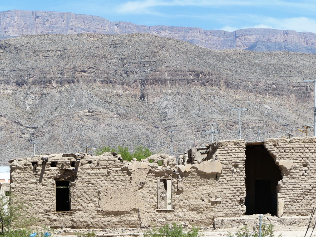
…to a white trailer check-point surrounded by cyclone fencing on the edge of the village. It was a treat to sit in Boquillas’s only air conditioning for a few minutes to escape the 100◦ heat, while our identities were checked against a drug cartel database.

Once Leah and I were cleared as respectable American citizens, we opted to lunch at the Original José Falcone’s Restaurant and Bar, the largest of two eateries in town…

Jose Falcon's…with an overlook of the Boquillas Canyon.

Bouquillas canyon
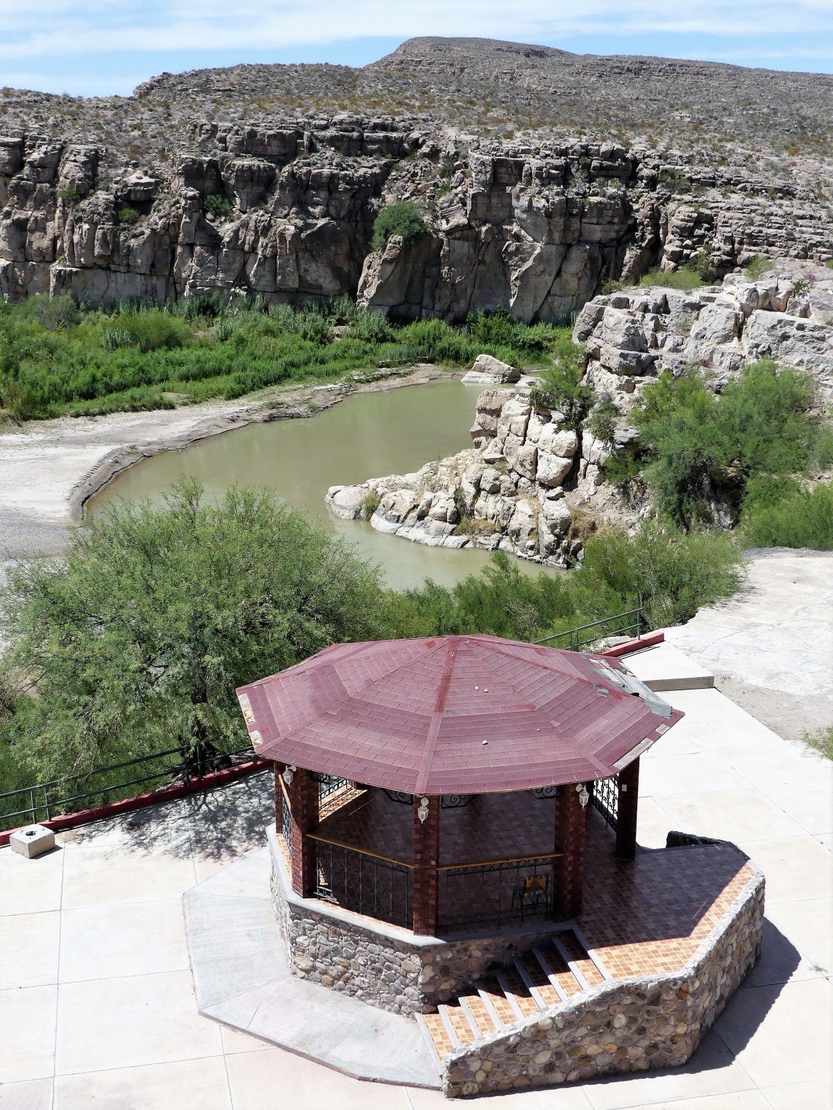
Mama Falcone was sitting on the patio in her kitchen apron working on a future needlepoint tapestry that would soon display in the family curio shop next door, while her nephew Renaldo brought us menus and took our order—chicken quesadilla for Leah, and beef burrito for me. Meanwhile, a family of three from South Carolina sat at a nearby table chatting it up with Mama’s daughter, Lillia.

Lillia was explaining that her father opened the restaurant in 1973 after a pickup truck accident put him in a wheelchair for the rest of his life. The restaurant was a big hit among locals and tourists, with Mama serving bean tacos and burritos, and Papa schmoozing the guests. Thanks to the unofficial crossing, villagers were accustomed to serving up to 200 Big Bend visitors a day—mostly tourists looking to enhance their park experience by buying food and souvenirs.

After Papa died in 2000, Mama and Lillia continued the business until the U.S. closed the border in May, 2002 in response to 9-11. Consequently, the town’s tourist trade dried up, and businesses failed without customers.

red bar
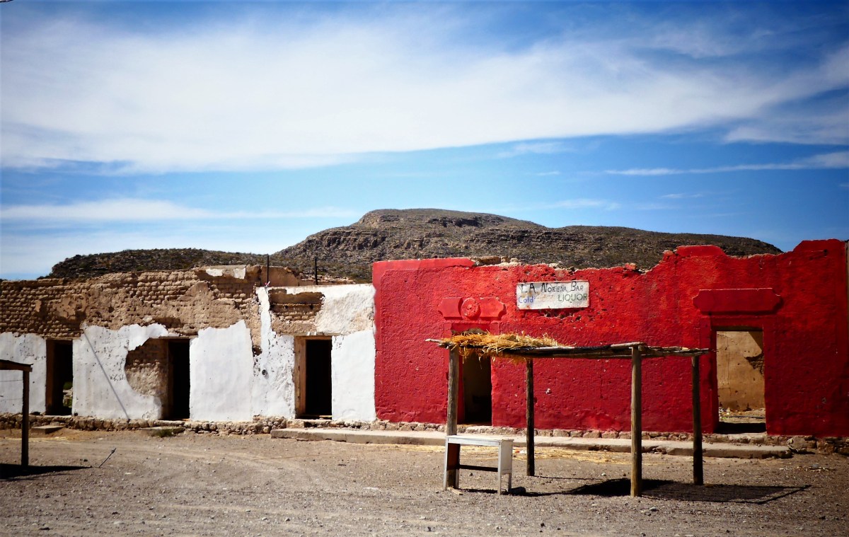
The town population shrank from three hundred to one hundred adults and children, with many leaving for Muzquiz—the nearest Mexican city, and a seven-hour bus ride away. Eventually, Mama and Lillia found work in the States, but returned home to the restaurant after the crossing officially reopened in April 2013.

town
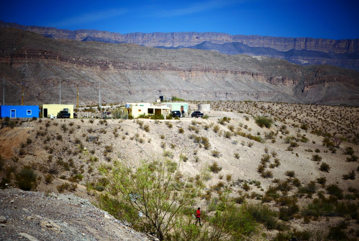
They are hopeful for an economic recovery, but the town is in shambles, and it will take many more Americans to salvage Boquillas’s economy.

gift stand

burned out hut


After lunch, Lillia volunteered Chico to drive us back to the landing in his beat-up Chevy Silverado. Chico was born and raised in Boquillas, and although his two brothers have moved on, he has never left.

“I like it here,” he admits. “It’s very quiet.”

When Chico isn’t shuttling visitors between the restaurant and the water, he bartends for the only bar in town, usually serving up beer to the locals. “Cervezza is cheap, but gas,” he explains, “is very expensive and hard to come by since Boquillas has no gas station. However, American friends are willing to fill five gallon containers from the park store, and send it over by boat.”

It occurred to me that Chico was giving us good intelligence about his situation, which would be useful should tensions ever flare between the U.S. and Mexico. And I believe that given the chance, Carrie Masterson and I could turn Chico into a valued asset. We tipped Chico five dollars for the ride and the invaluable information.

Leah and I crossed back the way we came—by wading through the Rio Grande. We acknowledged Ranger Weimer upon our return, who ushered us to a virtual customs station, where we submitted our credentials electronically and spoke by phone to an invisible agent who scanned us by remote camera.

“Take off your hat, remove your sunglasses, and stand behind the yellow line,” barked the long-distance voice.

After answering a few routine questions, like “Are you bringing any raw fruits or vegetables into the country?”, we were safely readmitted to America.

Turning to Ranger Weimer, I asked casually, “So how do you feel about Trump building a Wall down here?

He looked at me sternly, and answered in a stoic voice, “Sir, we’re not allowed to express an opinion about that matter.”

But I wasn’t done yet. “But do you think these people are dangerous?”

He was becoming annoyed, answering more emphatically, “Like I said, sir; I have no opinion on the matter!”

I left Boquillas Crossing completely satisfied by our cultural exchange, and reassured that we would be safe from bad hombres from the other side. Fortunately for us, the citizens of Boquillas del Carmen are hard-working people. They are a small and subdued militia of struggling entrepreneurs who depend on us, and are more interested in fighting for their livelihood than picking a fight with their neighbor.

museum
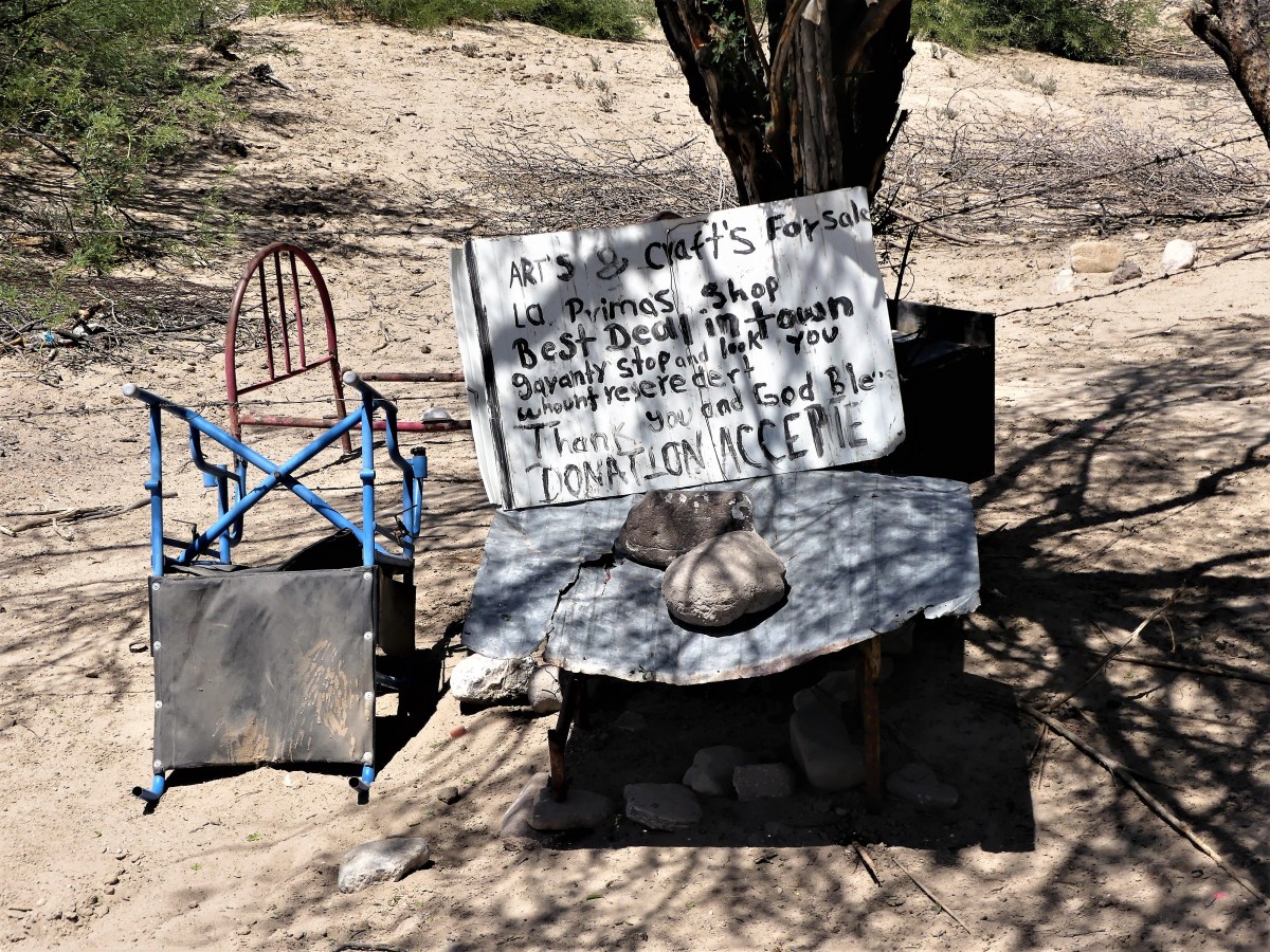
I have met the enemy face to face and I do not fear them. Their rowboats and mules would be no match against our ships and tanks.