The short answer is,”Not so great; it used to be greater.” But then there are those who prefer baldness to a full head of hair. Allow me to explain:
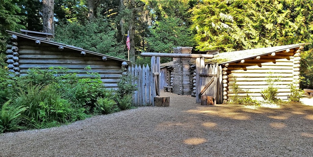
To be fair, my perception of Great Falls is not how it originally presented to Meriwether Lewis and William Clark,
while they mapped the mighty Missouri on their epic expedition from Pittsburgh to Fort Clatsop, at the mouth of the Columbia River.
Lewis’s impression of Great Falls was, according to Paul Russell Cutright, in his book Lewis & Clark, Pioneering Naturalists, “the grandest sight he had ever beheld, the water of the Missouri here dropping over a precipice more than 80 feet high. He stood motionless for a long time, completely enchanted by the beauty of the scene.”
Photographed by F. Jay Haynes, Summer, 1880–Montana Historical Society
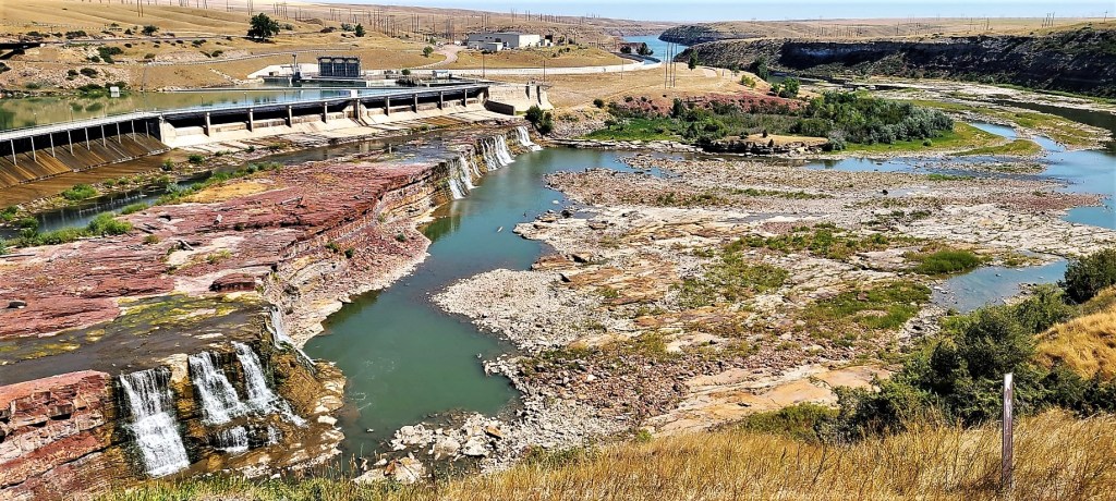
In fact, as Lewis slowly portaged the Great Falls in June 1805 (his greatest challenge to date), he was amazed to find not just one “great falls,” but a series of five falls of varying sizes that dropped the river level a total of 612 feet over a 10-mile stretch.
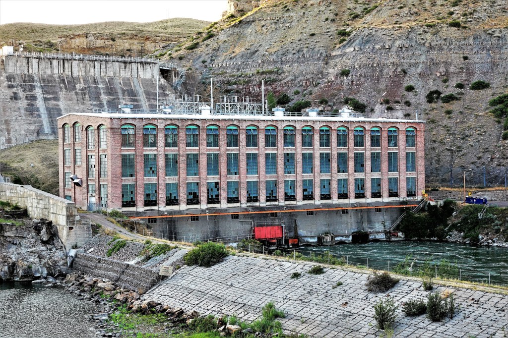
Then came the dams. By harnessing the power of five falls with five 20th century hydro-power plants, the industrial age awakened the West, and “The Electric City” became an important crossroad for future settlement, forsaking the beauty long admired by the Blackfeet and other tribes.
Leah and I set out to discover the “falls”, by racing to Ryan Dam before the last light of day.
The gorge was aglow,
while the sinking sun was offering up a shadowless palette of pastels.
I imagined the falls as it once was and what it’s become…
and wrestled with my first impression informed by mountain and machine.
There is no denying that nature has carved out something very special…
but the landscape has been inalterably changed.
Big skies are forever interrupted,
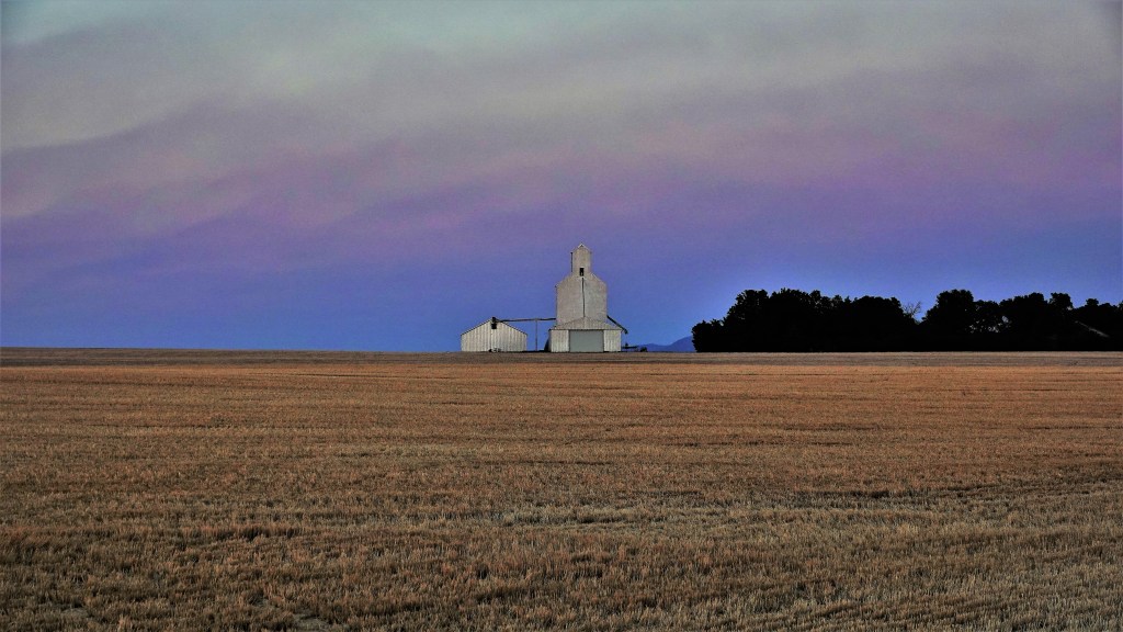
and prairies yield to bounty over beauty.
The following day, we set out by bicycle on the River’s Edge Trail to “find” the other falls.
Nearly 60 miles of paved and single-track trail along the Missouri River provided panoramic views of scenic river valleys;
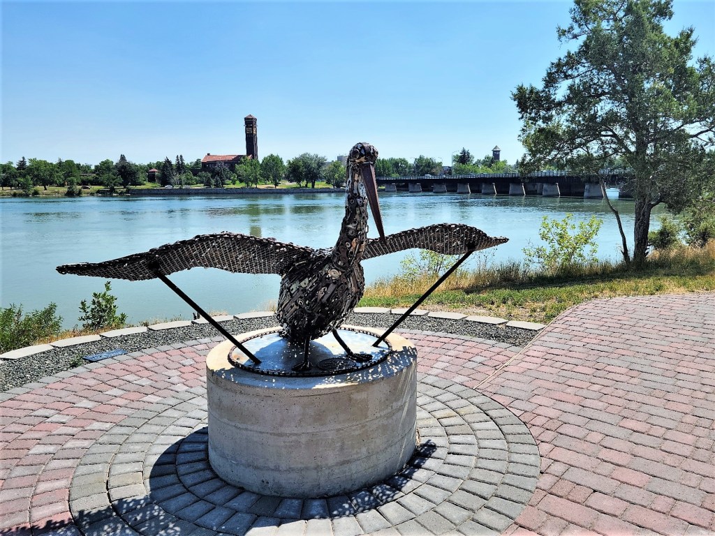
engaged us with public art created by local artists…
as we rode through neighborhood parks.
The trail carried us to cliffside lookouts of Black Eagle Falls and Dam…
Rainbow Falls and Dam…
and Crooked Falls (still untouched by a dam);
while also connecting us to historic downtown, filled with numerous casino options and burgers to die for…
at the celebrated Roadhouse Diner.
Unfortunately, our search for Colter Falls (the final of five falls) would remain unfulfilled, as the reservoir created by the Rainbow Dam has permanently submerged Colter Falls (making this the perfect metaphor for Great Falls) to the extent that we are left to debate if commerce is a compromise or a sacrifice.
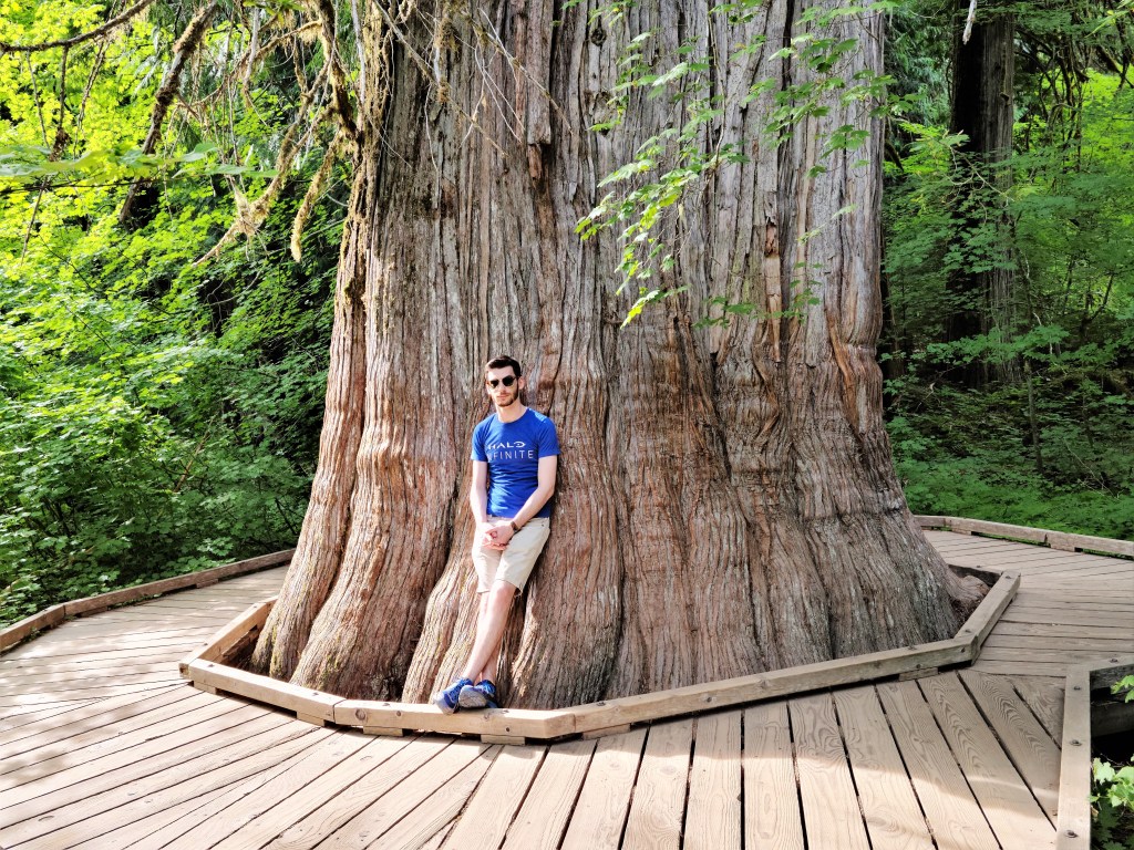
This post originally celebrates the enormity of the General Sherman sequoia as I observed it 4 years ago. However, today it’s a reminder of the fragility of this ancient forest–currently facing a ravishing fire–where the largest living organisms on our planet are in peril. General Sherman has survived over 100 burns in its 2,200 years of existence, but the scale and intensity of today’s wildfires have become more commonplace, and threaten the world around us. I pray the fire can be contained and the forest survives, so future generations can appreciate nature’s miracle.
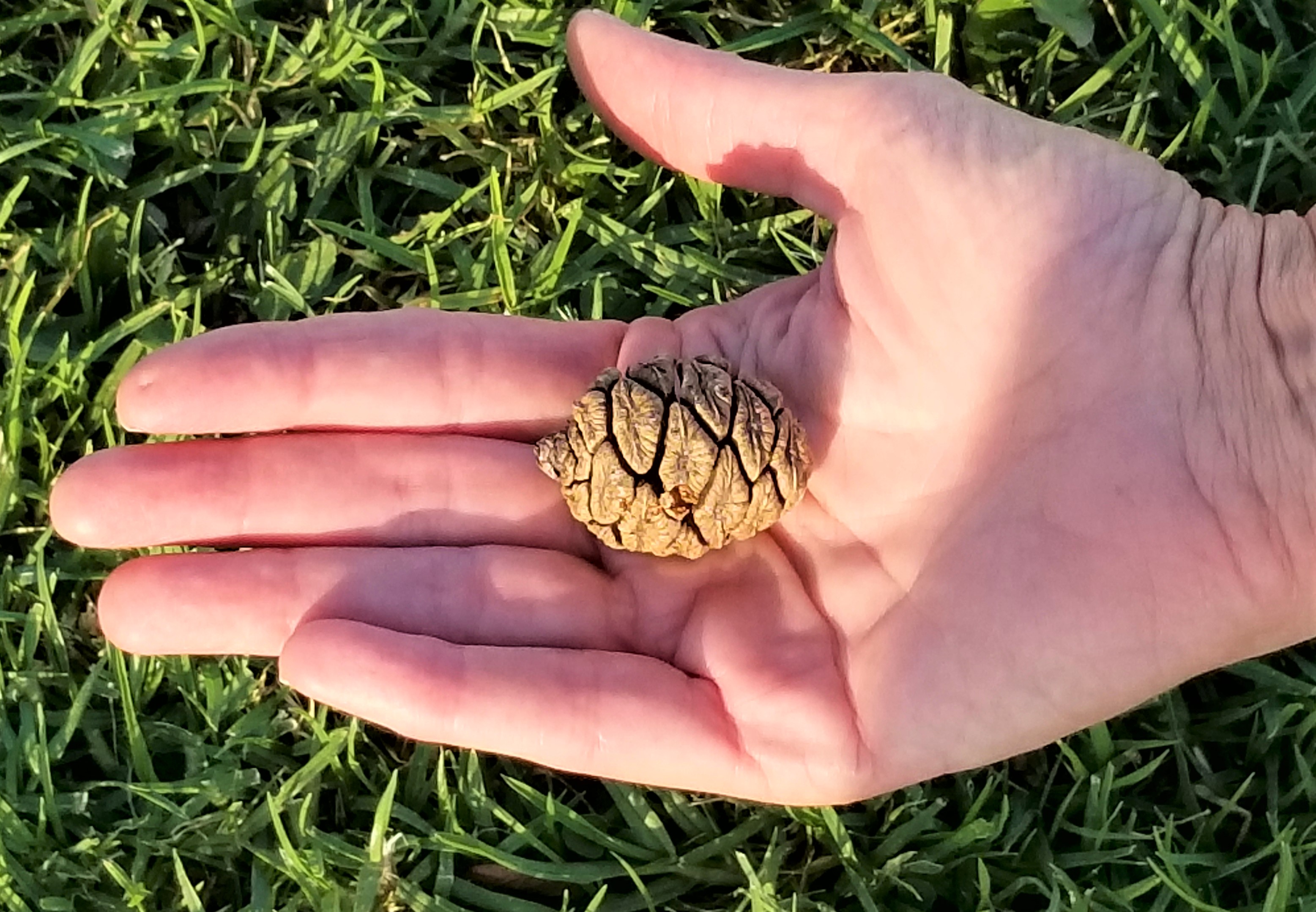
“Size matters!” has long been considered a hard fact among those who measure the enormity of things, and eagerly justify the value of their preponderance. Yet all things big begin from most things small, and that’s the long and short of it. While this may come as a relief to many who seem challenged by the limited extension of their personality, it comes as no surprise to sequoias that have sensed this for millions of years.
Giant sequoia trees are native to the western slopes of the Sierra Nevadas, where they grow exclusively in protected groves. Every tree starts from a firm cone no larger than a chicken’s egg–
–each one releasing thousands of seeds resembling oat flakes, hoping to take advantage of a litter-free forest floor made fertile by fire.
Flash forward 2400 years, and if the then-seedling hasn’t been logged…
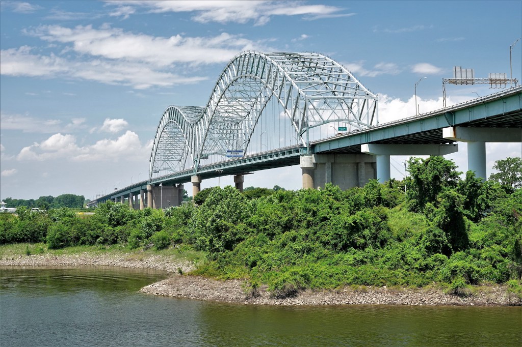
Leah and I crossed the great Mississippi on our way from Memphis, TN to Hot Springs, AK by-way-of I-55 after Tennessee DOT inspectors closed the I-40 Hernando DeSoto Bridge 16 days earlier, blaming a crack in one-of-two 900-ft structural beams.
It was a major traffic snafu, but I also remember thinking at the time that this was a bad omen of sorts, yet so apropos, given our divided nation debating whether a critical investment in infrastructure is necessary for our survival.
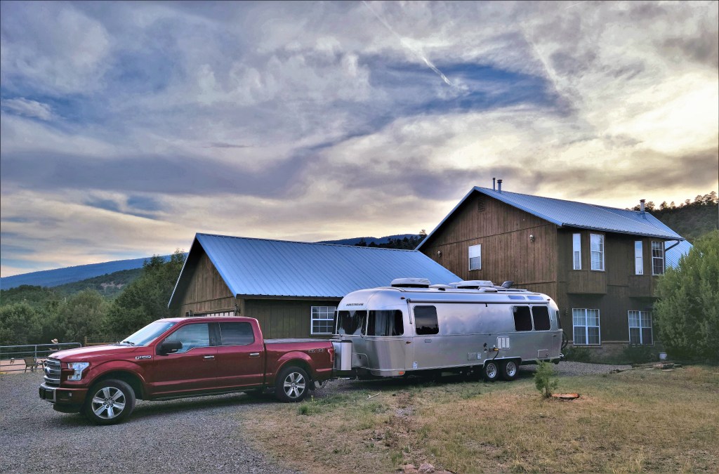
Things had gone smoothly during our first month on the road, until we hit this speedbump traveling from the eastern states to the western states. Absent a few nagging issues on the shape of Lay-Dee! (our newest-used Globetrotter), this was a minor inconvenience.
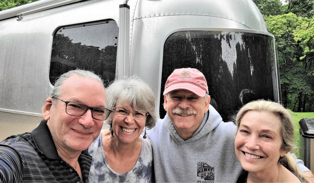
But any concern about its impact on our Memorial Day holiday quickly vanished after a hug from a nursery school buddy I haven’t seen in 50 years. And it was great reunion.
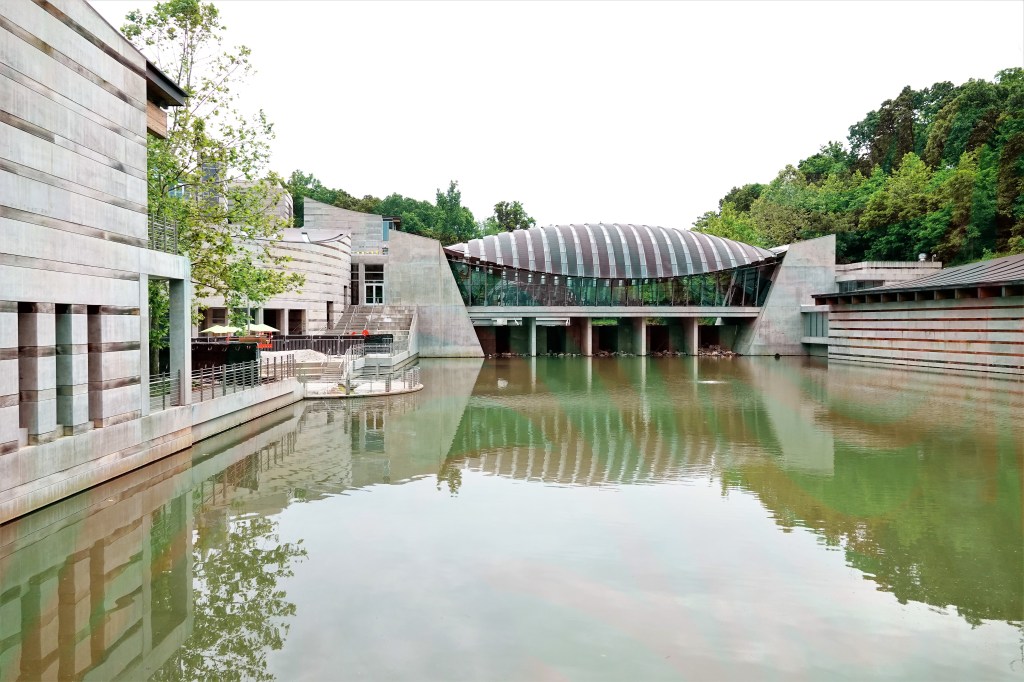
Lee and Debra’s hospitality extended to a tour of Crystal Bridges Art Museum,
and an overnight at their home near Wally World.
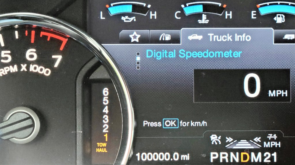
When we left our friends for OKC, our F-150 hit a new milestone which we mistook for a good omen.
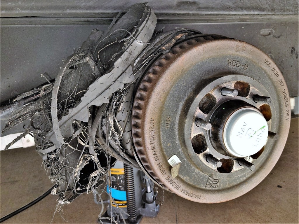
However, the following family reunion with Carrie and grandchildren was temporarily delayed by an Airstream blowout the moment we crossed into New Mexico from Texas. Bad juju, right?
Once we were back on the road,
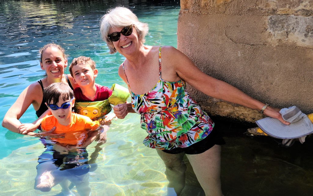
our visit with Carrie and the kids began in Santa Rosa, where we cooled off (62°F ) at the Blue Hole,
and continued at Dan’s house in Cedar Crest, where Lay-dee! dropped anchor.
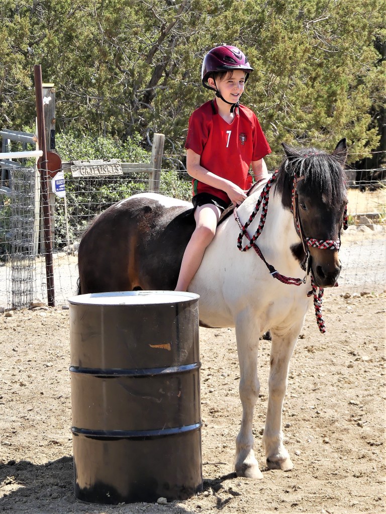
Soon after, Carrie surprised Gabe and Devon with Lucy–from erstwhile riding pony to Aiken family adoptee.
It was a brief and bittersweet visit…
but we had to move on to Loveland, Colorado, where our African safari mates, Linda and Heather were expecting us for dinner.
We left Lay-dee! behind in Dirk and Heather’s hayfield,
While keeping company at Linda’s house with her goofy Newfie, Angus…
and Forrest the gentle giant, who passed away 2 months after our visit.
From Loveland, it was short drive to Cheyenne, WY to reconnect with NJ hiking buddies George and Tere, and meet their uni-corny granddaughter, Val.
Leah and I boondocked behind their house at night…
and enjoyed the local parks…
and museums by day.
Eventually, Leah and I worked our way to the Pacific coast, where African safari mates Michael and Brenda were holding a table for us at a popular Newport, OR fish house…
on the historic wharf.
At last, Leah and I arrived in metropolitan Seattle, where my son Nate has settled for the past three years, and we were there to pop his National Park cherry.
Despite being only two hours away from Mt. Rainier, Nate has never had the opportunity to get any closer, and we were determined to fix that.
Finally, we arrived in Spokane, where cousin Lisa, her son David, and partner Bob hosted and fed us for three days…
preparing us for the long trip back home…with plenty of new adventures and miles along the way.
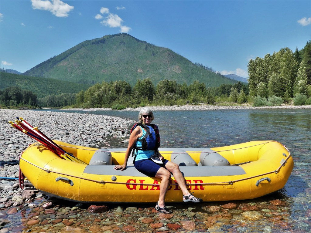
Each and every time Leah and I applied online for an entry pass to Glacier NP we were too late, and we fretted that maybe we made the trip to Glacier for nothing.
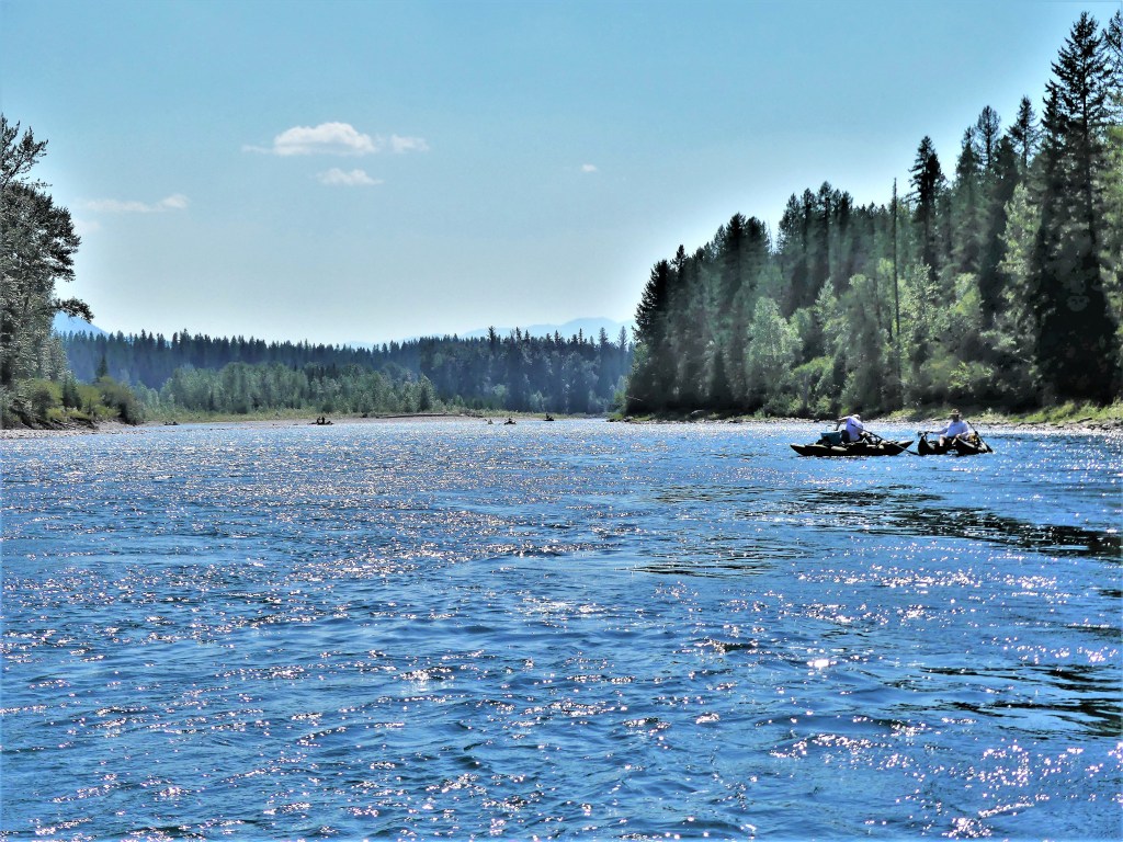
Then I learned that if we make a reservation for an activity inside the park, that would guarantee our entry through the gate. So I booked a scenic rafting trip through the Middle Fork of the Flathead River with a third party vendor.
Problem solved…or so I thought.
It turns out our rafting outfitter operated in the village just outside the park gates, and our park entry was still in jeopardy. We could have canceled with sufficient notice, but we were still up for a float,
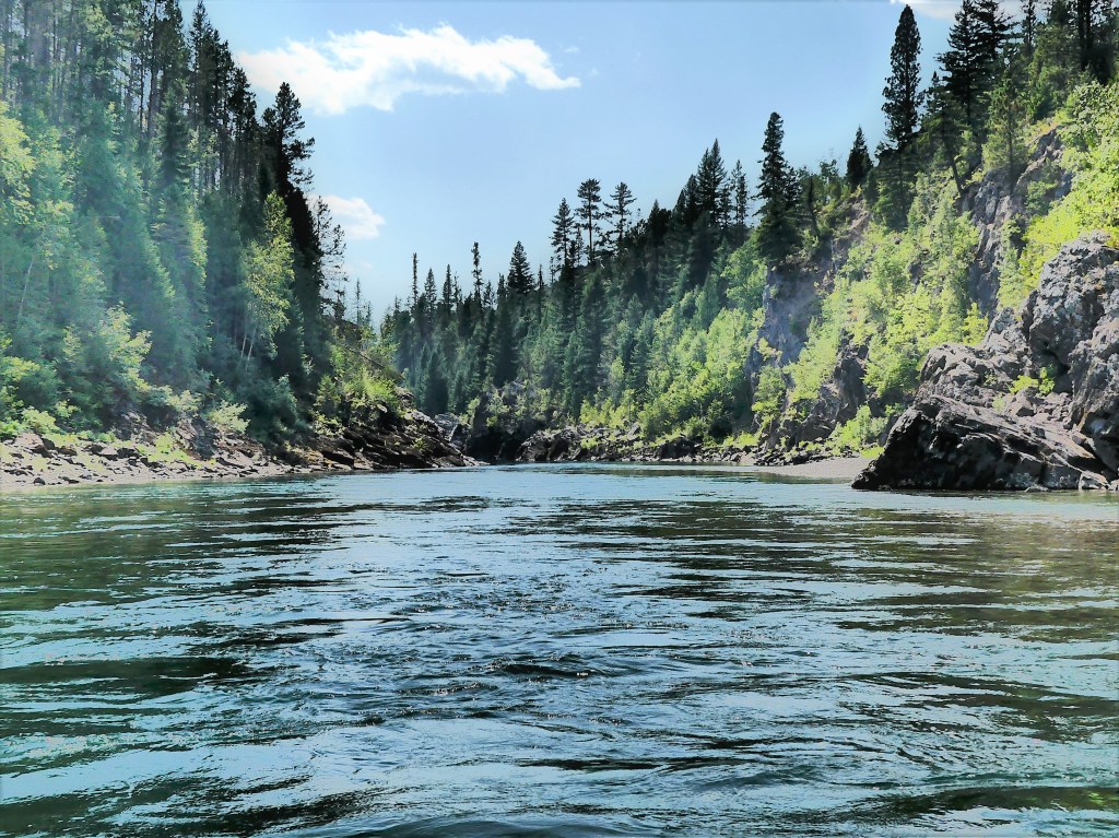
and decided to go with the flow…
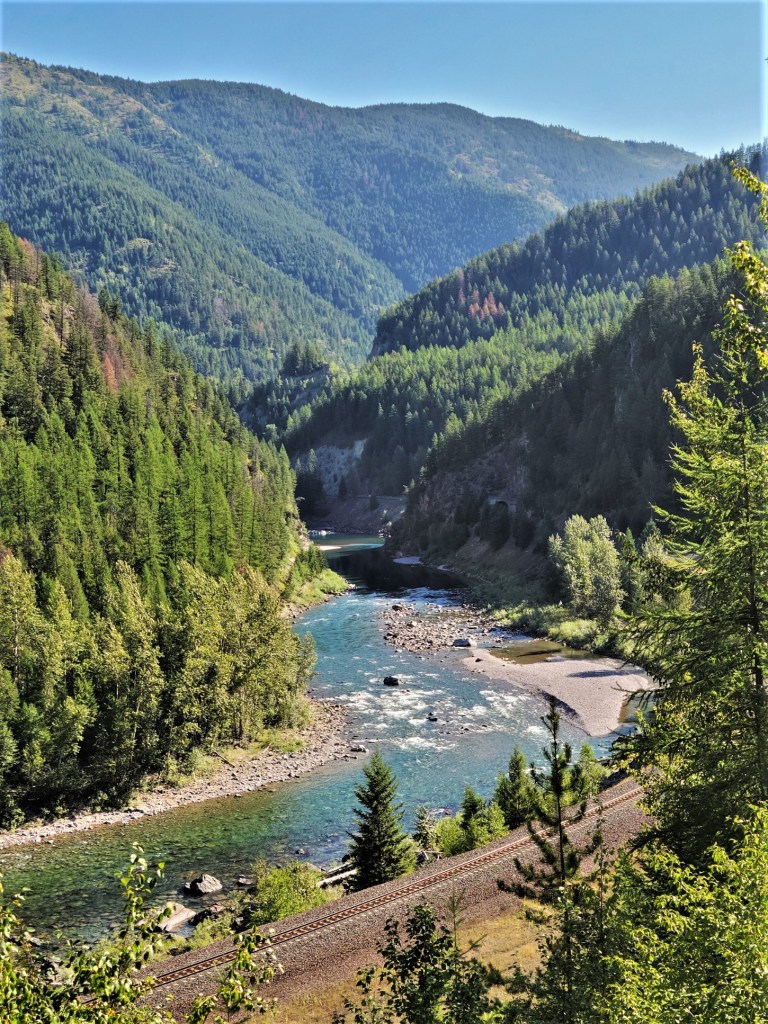
through glacially carved flats,
and formidable canyons walls…
that were ideal for jumping into crystal-clear waters.
But there is another way in, and it’s not really a secret. Just get to the park anytime before the gate attendants arrive at 6AM, or visit the park anytime after the gate attendants leave for the day at 5PM.
We did both, and left tired each day…but satisfied!
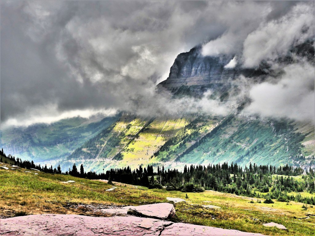
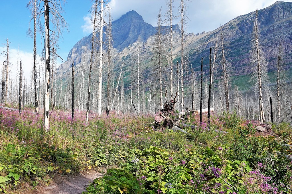
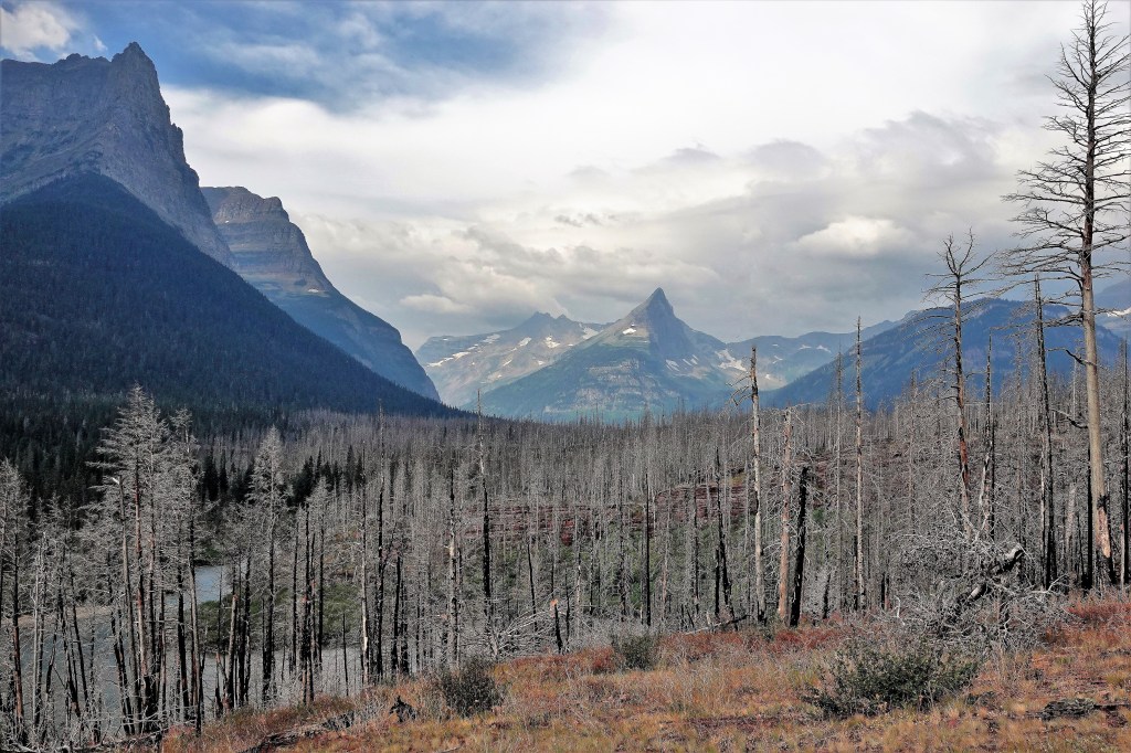
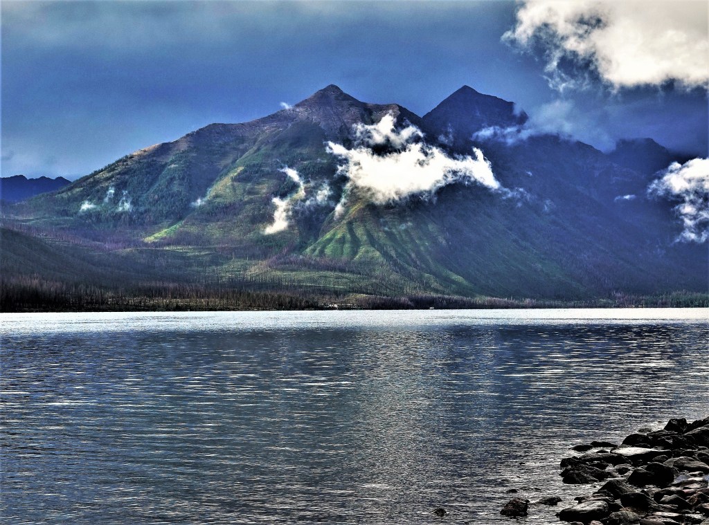
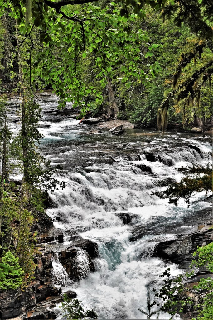
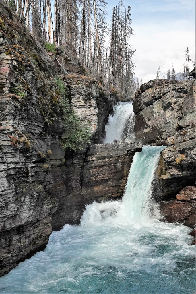
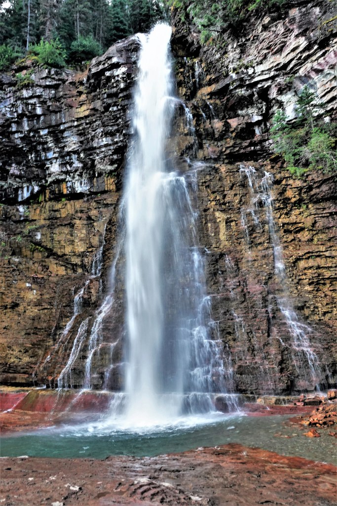
There’s very little to say about Glacier National Park that hasn’t already been said. It’s acknowledged by many as one of the crown jewels of the National Park Service since its inception in 1910.
If there was a beauty pageant for National Parks, Glacier would win the crown, and wear it with authority:
There are more than enough peaks to pique a mountaineer’s interest;
plenty of waterfalls to satisfy a photographer’s wet dream,
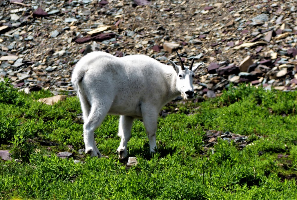
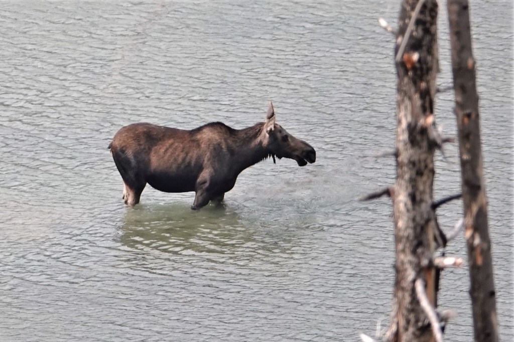
and a fair share of elusive critters to make one’s heart beat fast.
Sadly, no bears wanted their portrait captured by me, despite ample park activity reported at the time of our stay.
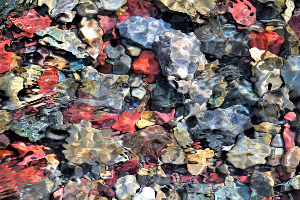
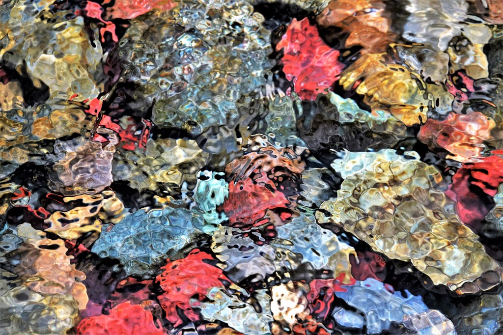
While much of the park’s majesty is projected through its mountains, lakes, canyons and waterfalls, its easy to overlook the shimmering river rocks beneath our feet,
So much about North Cascades National Park reminds me that I’m at a very remote place in America. For starters, there’s limited phone service here which makes GPS plotting a nightmare, and probably explains the frequent mile markers that line North Cascades Highway (State Route 20). It’s the only road that winds its way through the park, and connects all the entities that encompass Stephen Mather Wilderness.
Of the 684,000 acres that Lyndon Johnson and Congress set aside in 1968, 94% of the land has been designated as wilderness. Of the remaining 6%, there is no formal camping and only a handful of designated trails, which may help to explain why the park hosts an average of 30,000 visitors per year compared to 2 million visitors per year at Mt. Rainier National Park.
By the time Leah and I reached the Pacific coast, we learned that the Cedar Creek Fire was burning out of control within the Okanogan-Wenatchee National Forest–threatening the eastern entrance to North Cascades NP, and compromising Winthrop’s air quality, nearby. To make matters worse, North Cascades Highway had been barricaded between mile marker 170 and 185, which meant that if we managed to visit the park–which was always part of our original itinerary–we had no way out.
SR-20 road closures are not breaking news to the people living east of the North Cascades. They’re used to it. In fact, every year from late fall to early spring, SR-20 is closed because of drifting snow across the road (measuring 12 feet) and the high risk of avalanches in areas of steep terrain. Anybody wishing to travel to Seattle must settle on traveling I-90 through the dreaded Snoqualmie Pass.
One week before our anticipated arrival, we phoned a park ranger to voice our concern about likely dangers, and help us determine if our plans were realistic. In return, she gave us a website address to track the daily conditions of the fire, and she reassured us that, “Every day in the park is unpredictable. It all depends on which way the wind blows.”
By the time we were scheduled to visit the park, the Cedar Creek Fire had merged with Cub Creek 2 Fire to become America’s largest forest fire with over 100,000 scorched acres and still burning wildly. Leah and I had an important decision to make: either we risk a visit, or we make alternate plans. There really wasn’t much debate. We were determined to stick to our plans, while well aware of the ranger’s mantra.
We camped outside the park in Rockport at an unusual location dotted with dated, theme cabins, a shuttered restaurant, a wine-tasting room, and a smattering of weedy RV sites overrun by rabbits.
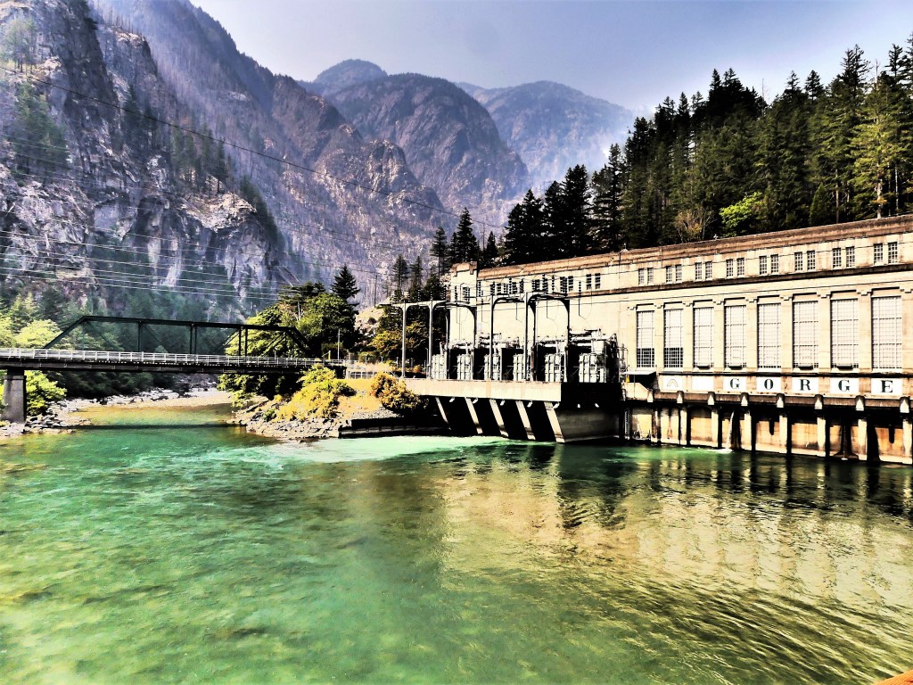
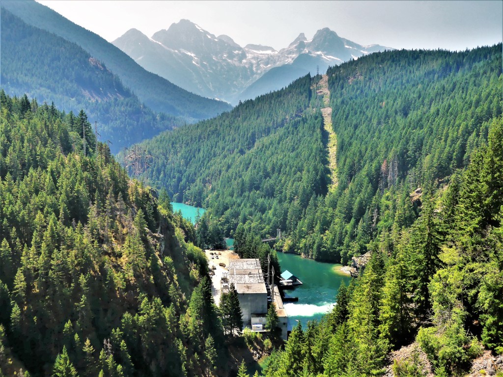
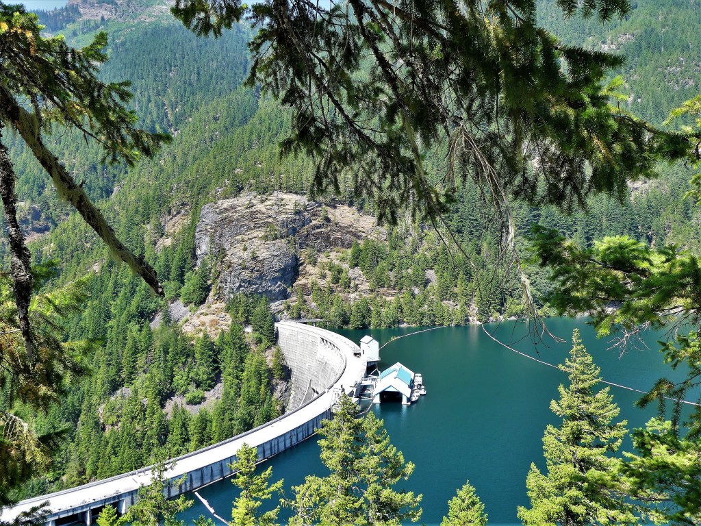
After unhitching, we drove a half-hour to Newhalem, the site of a company town owned by Seattle City Light and the residence of employees working on the Skagit River Hydroelectric Project–a series of three dams and power stations along the Skagit River–
Gorge Power Station
Diablo Dam
Ross Power Station
providing electricity to Seattle since Calvin Coolidge ceremoniously started the first generators in 1924.
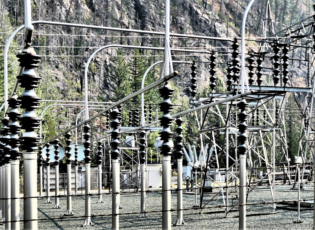
As of this summer, the Upper Skagit Indian Tribe has petitioned Seattle City Light to remove the Gorge Dam in order to restore treaty-protected fishing rights to sacred grounds known as The Valley of the Spirits–a 3-mile stretch of the Skagit River area that has dewatered since the dam’s creation–causing the disappearance of bull trout, chinook salmon and steelhead, and consequently threatening the existence of killer whales in the Puget Sound that depend on the fish to survive.
If Seattle City Light hopes to win a new 50-year license to operate the dams, they must demonstrate that the dams cause no harm to the environment. However, regulatory agencies have noted that the dams limit fish passage, affect the water temperature, and prevent much-needed, mineral-rich sediment from reaching the river beds where salmon once spawned.
The following day, our excursion took us deeper into the park, where a faint scent of smoke was in the air. It wasn’t bad enough to impact a full day of activity, but it still managed to drop a smoke bomb on our vistas, turning the “American Alps” into an American disappointment.
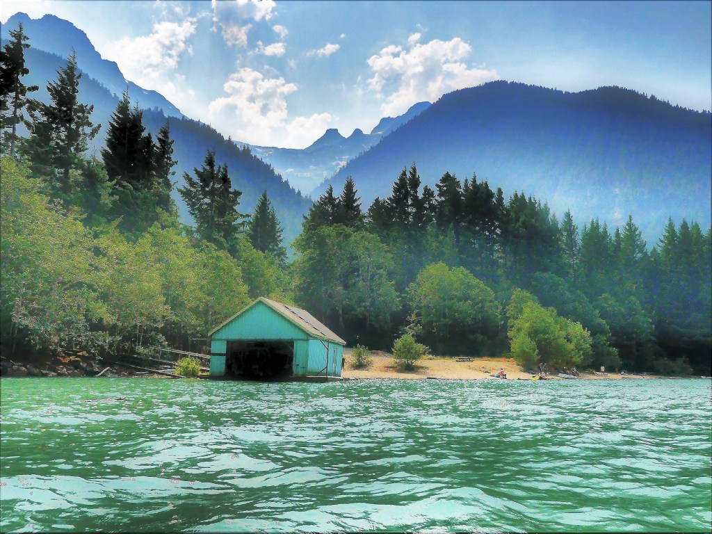
We started our exploration at Diablo Lake, created by the Diablo Dam finished in 1930. While the smoke offered an impressionistic vision of the mountain, water and sky,
I much preferred clearer conditions the following day.
Nevertheless, we took advantage of calm waters,
and beautiful scenery.
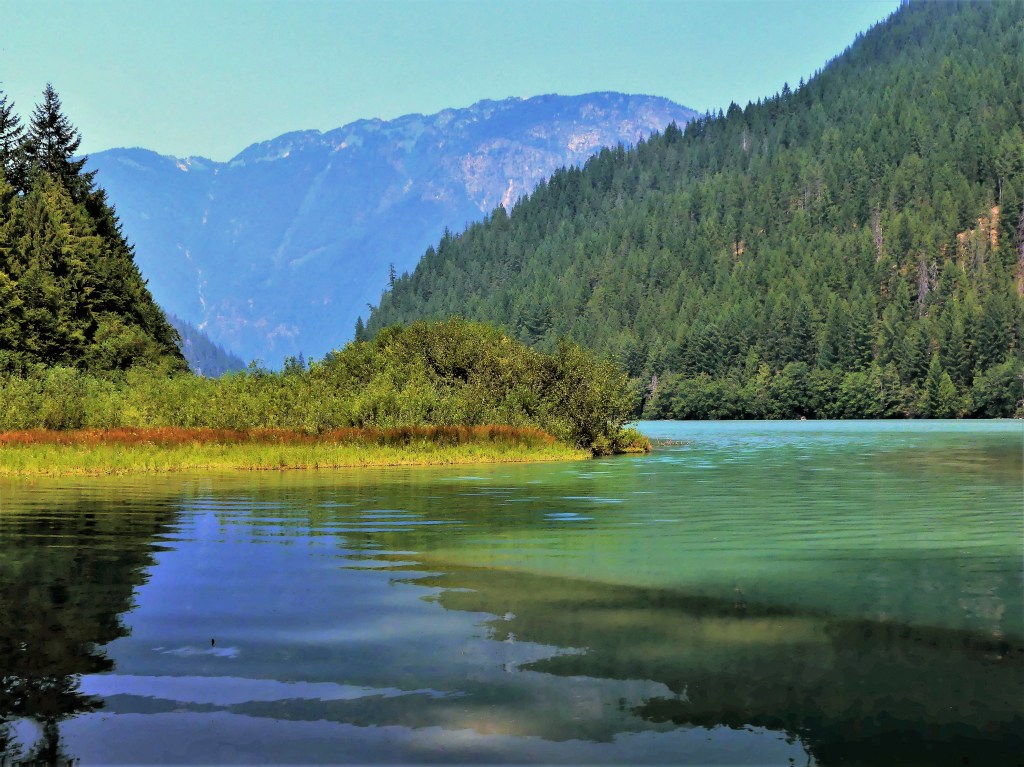
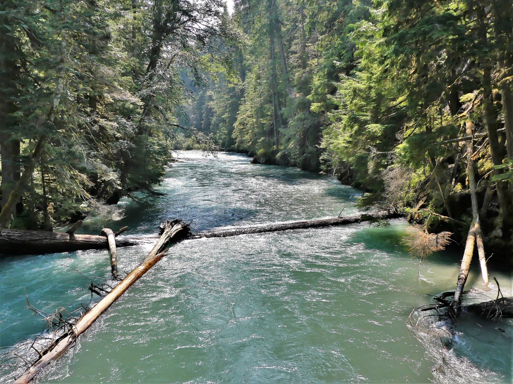
Feeling like a hike nearby, we followed a trail that followed Thunder Creek,
providing the following views:
until we reached our turn-around point at the suspension bridge…
and reflected on flowing riverscapes north,
and south of the span.
The latest news on the Cedar Creek Fire brought tears to my eyes. Officials proposed closing North Cascades Highway for the remainder of the year. I immediately recalled the time four years to this day when we crossed the Continental Divide at the Vermilion Pass–outrunning the BC wildfires on Kootenay Highway–with the mountains ablaze on both sides of us (see Smoke and Mirrors).
While I had no interest in repeating history, I wasn’t looking forward to the two-hour detour that would return us to I-5 in order to reach Spokane to the east. But if that was to be our only way out, I was determined to travel the North Cascades Highway the next day for as far as the law allowed.
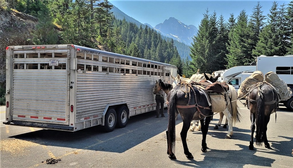
Of course there were stops to make along the way. When we reached Ross Lake at milepost 134, we took the opportunity to stretch our legs along the Ross Dam Trail. With so little traffic on the road, we were not expecting the parking lot at the trailhead to be a challenge. But then we weren’t anticipating a mule train either.
They were preparing to cross the dam to perform trail maintenance further up the Pacific Northwest Trail.
We crossed a dense forest…
to the edge of Ross Lake and across the dam road,
where we were soon joined by the pack leader and company…
for views of Snowfield Peak and distant glaciers.
Of course, we had to dance around the mule poo on our return to the parking lot before continuing our quest.
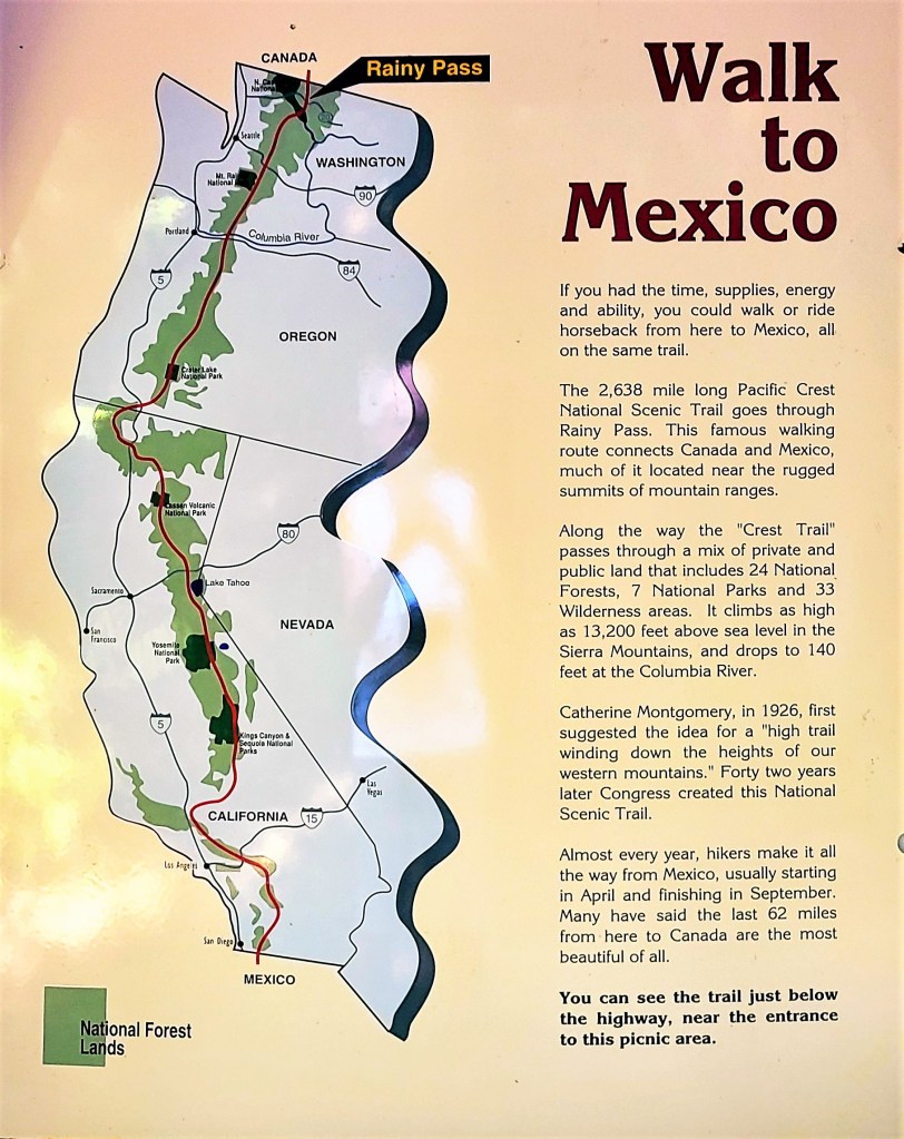
Our next destination took us to milepost 158, where we intersected the Pacific Crest National Scenic Trail at Rainy Pass on our way to Rainy Lake for an easy, 1-mile, wheelchair-accessible hike, until we encountered a tree across the trail within 500 yards of the trail’s end.
Unfortunately, physically disadvantaged people could not appreciate the crystal clear water of this alpine beauty,
or enjoy a distant look at Rainy Lake Falls cascading 850 feet into its namesake lake.
Shame on the NPS!
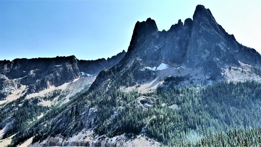
We reached Washington Pass Overlook–our final destination at milepost 162– to ogle the Liberty Bell Group,
and Kangaroo Ridge–
the defining point between Western Washington and Eastern Washington.
And that’s when I saw it! In the distance, midway along the stretch of highway, 8 miles away was the end of the road. I steadied myself for the shot.
We had completed our mission. There was nothing more for us to see before returning west to resume our journey east on August 5th.
By August 10th, the road closure was lifted, and low-speed, one-way traffic resumed in both directions. But I was unconcerned and didn’t mind. I had already arrived at Glacier National Park.
It was our last day on the Olympic Peninsula, and we intended to visit the San Juan Islands, but time and weather never allowed it. Getting an early start in the rain seemed risky given the distance we’d need to travel, and the ferry reservation was an added hurdle and inconvenience.
Instead, we hoped and patiently waited for the early morning weather to abate. There was news of improving conditions by mid-morning, so we chanced a trip to Whidbey Island, where we were rewarded with thick, dismal skies, (yuck), and no rain in sight (yay)!
We drove to Mukilteo, where we just missed the 10 o’clock ferry to Clinton by 6 cars (damn!), but we were poised at the front of the boat for the half-hour ride to Whidbey Island at 10:30 AM (yay!).
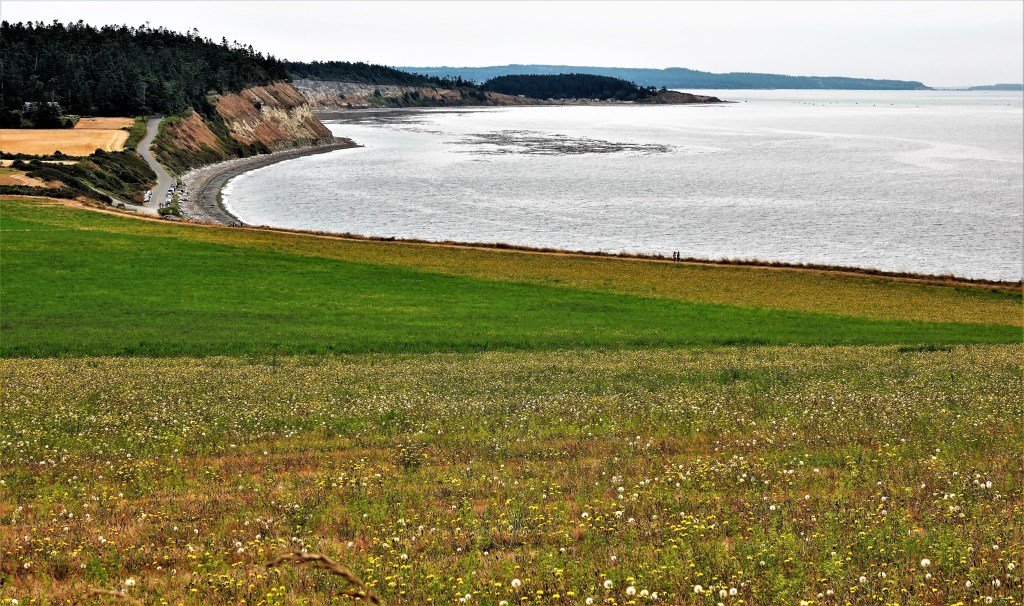
After docking, we completed the half-hour ride to Ebey’s Landing, site of the Nation’s first National Historical Reserve (1978),
and a stunning landscape that befits the gateway to Puget Sound (wow!).
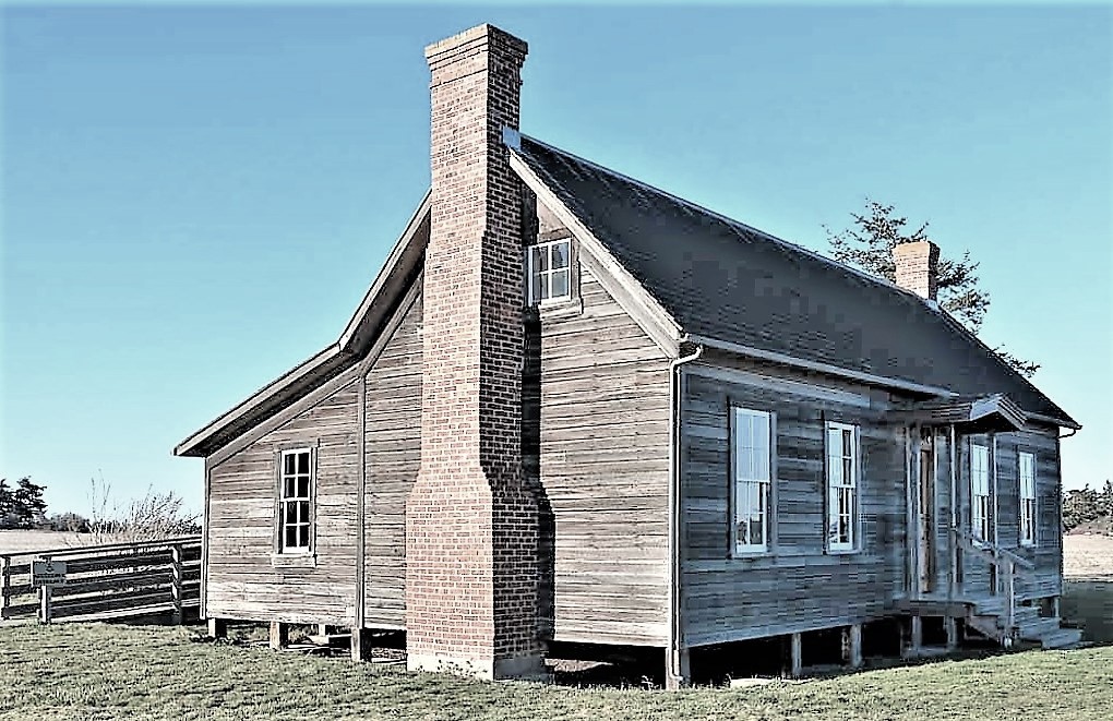
Just outside the Jacob Ebey homestead (now the Visitor’s Center) in Pratt’s Preserve…
stands a reconstructed blockhouse, originally built in 1854, and one of four still standing (who knew?). The blockhouse was built by Colonel Isaac Ebey to defend his claim against insurgent Skagit natives, who naturally resisted the pioneer settlement. Unfortunately, Isaac’s father, Jacob was beheaded in the cabin by a Skagit warrior in retaliation for the murder of one of their own chieftains (hmm…).
On the edge of the prairie, tangent to the Sherman-Bishop Farm…
is the trailhead that follows the bluffs along Admiralty Inlet.
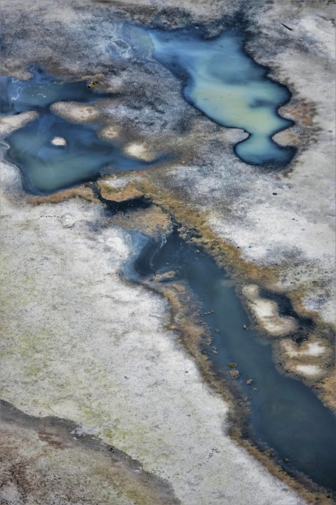
We steadily climbed the bluff which gave us a birds eye view of Perego’s Lagoon–half wet, half dry–(huh?)
with a salt residue that could have resembled the surface of a different planet (odd)…
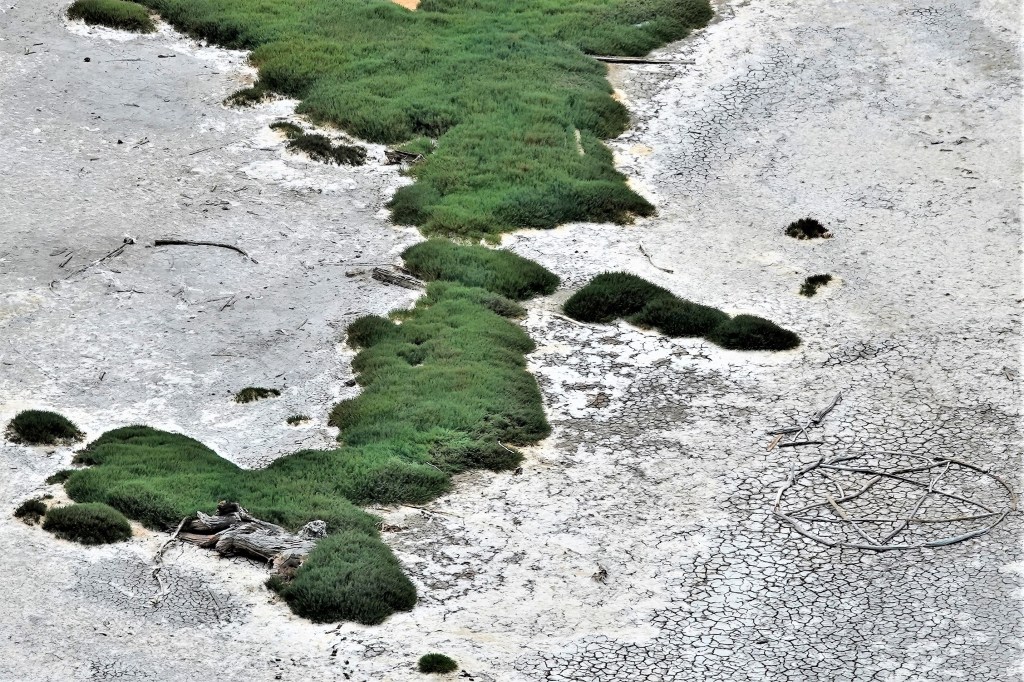
until I spotted the pentagram that an ambitious soul had designed from driftwood logs (very odd!).
While the landscape was certainly impressive, something was still missing (huh?).
Where were the picture postcard views of Port Townsend and the Olympic Mountains across the water that were hiding behind overcast skies?(right?)
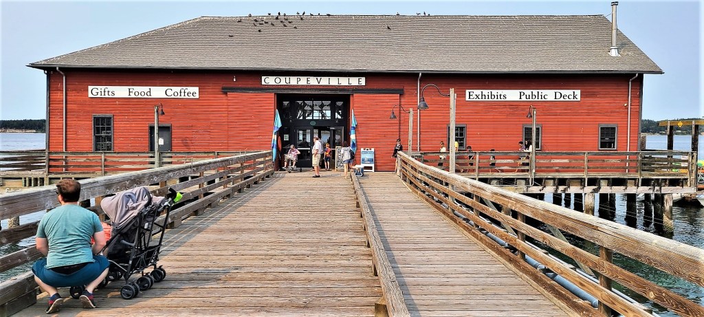
Nevertheless, our spirits were undiminished. We finished the Bluff Trail (phew!), and continued by F-150 to the historic waterfront of Coupeville, Washington State’s second oldest community, and it’s teaming with century-old buildings (nice!).
Our stroll down Front Street, once a beehive of maritime commerce,
brought us to a gentrified collection of bookstores, wine tasting rooms, gift shops, ice cream shops and coffee shops (sad).
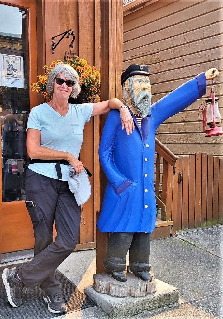
Discovering the birthplace of Seattle’s Best Coffee was of particular interest to me, as I served this coffee exclusively when I operated my boil-and-bake-from-scratch, bagel bakery in Denville, New Jersey (really?). Their company and my franchisor later became symbiotic partners when both companies were acquired by AFC Enterprises in 1998.
All of which has contributed greatly to my being able to gracefully retire and follow my whim in pursuit of images, impressions, and memories.