
So much about North Cascades National Park reminds me that I’m at a very remote place in America. For starters, there’s limited phone service here which makes GPS plotting a nightmare, and probably explains the frequent mile markers that line North Cascades Highway (State Route 20). It’s the only road that winds its way through the park, and connects all the entities that encompass Stephen Mather Wilderness.

Of the 684,000 acres that Lyndon Johnson and Congress set aside in 1968, 94% of the land has been designated as wilderness. Of the remaining 6%, there is no formal camping and only a handful of designated trails, which may help to explain why the park hosts an average of 30,000 visitors per year compared to 2 million visitors per year at Mt. Rainier National Park.
By the time Leah and I reached the Pacific coast, we learned that the Cedar Creek Fire was burning out of control within the Okanogan-Wenatchee National Forest–threatening the eastern entrance to North Cascades NP, and compromising Winthrop’s air quality, nearby. To make matters worse, North Cascades Highway had been barricaded between mile marker 170 and 185, which meant that if we managed to visit the park–which was always part of our original itinerary–we had no way out.

SR-20 road closures are not breaking news to the people living east of the North Cascades. They’re used to it. In fact, every year from late fall to early spring, SR-20 is closed because of drifting snow across the road (measuring 12 feet) and the high risk of avalanches in areas of steep terrain. Anybody wishing to travel to Seattle must settle on traveling I-90 through the dreaded Snoqualmie Pass.
One week before our anticipated arrival, we phoned a park ranger to voice our concern about likely dangers, and help us determine if our plans were realistic. In return, she gave us a website address to track the daily conditions of the fire, and she reassured us that, “Every day in the park is unpredictable. It all depends on which way the wind blows.”
By the time we were scheduled to visit the park, the Cedar Creek Fire had merged with Cub Creek 2 Fire to become America’s largest forest fire with over 100,000 scorched acres and still burning wildly. Leah and I had an important decision to make: either we risk a visit, or we make alternate plans. There really wasn’t much debate. We were determined to stick to our plans, while well aware of the ranger’s mantra.
We camped outside the park in Rockport at an unusual location dotted with dated, theme cabins, a shuttered restaurant, a wine-tasting room, and a smattering of weedy RV sites overrun by rabbits.

After unhitching, we drove a half-hour to Newhalem, the site of a company town owned by Seattle City Light and the residence of employees working on the Skagit River Hydroelectric Project–a series of three dams and power stations along the Skagit River–
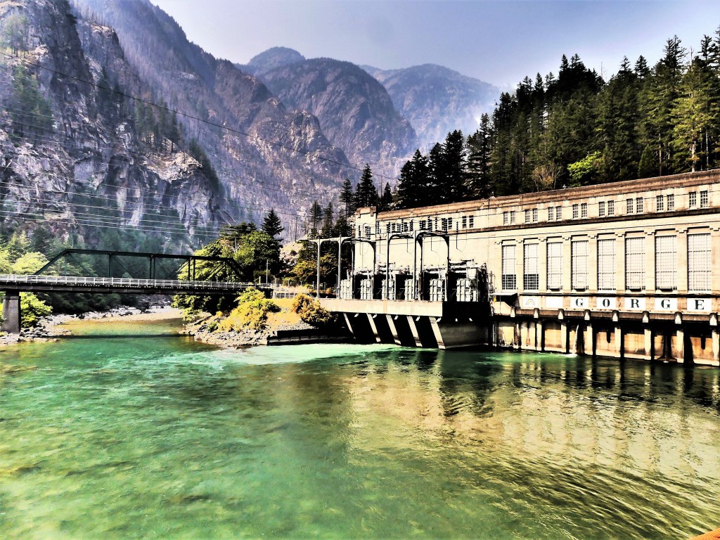

providing electricity to Seattle since Calvin Coolidge ceremoniously started the first generators in 1924.
As of this summer, the Upper Skagit Indian Tribe has petitioned Seattle City Light to remove the Gorge Dam in order to restore treaty-protected fishing rights to sacred grounds known as The Valley of the Spirits–a 3-mile stretch of the Skagit River area that has dewatered since the dam’s creation–causing the disappearance of bull trout, chinook salmon and steelhead, and consequently threatening the existence of killer whales in the Puget Sound that depend on the fish to survive.
If Seattle City Light hopes to win a new 50-year license to operate the dams, they must demonstrate that the dams cause no harm to the environment. However, regulatory agencies have noted that the dams limit fish passage, affect the water temperature, and prevent much-needed, mineral-rich sediment from reaching the river beds where salmon once spawned.
The following day, our excursion took us deeper into the park, where a faint scent of smoke was in the air. It wasn’t bad enough to impact a full day of activity, but it still managed to drop a smoke bomb on our vistas, turning the “American Alps” into an American disappointment.
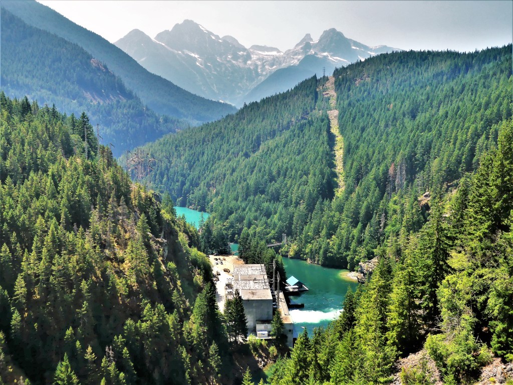
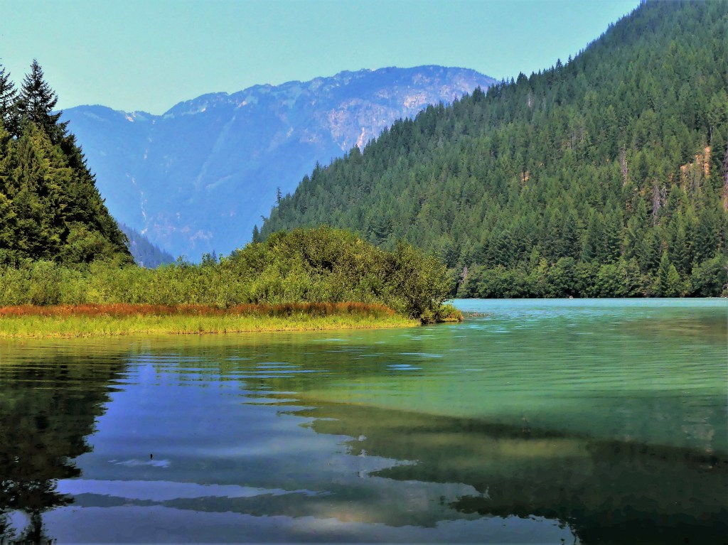
We started our exploration at Diablo Lake, created by the Diablo Dam finished in 1930. While the smoke offered an impressionistic vision of the mountain, water and sky,

I much preferred clearer conditions the following day.
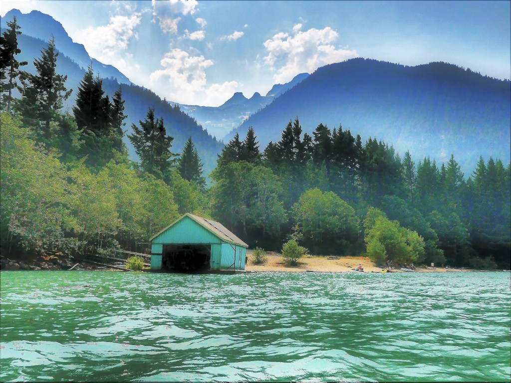
Nevertheless, we took advantage of calm waters,

and beautiful scenery.

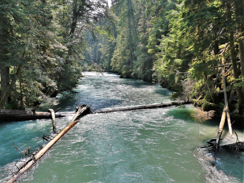
Feeling like a hike nearby, we followed a trail that followed Thunder Creek,

providing the following views:


until we reached our turn-around point at the suspension bridge…

and reflected on flowing riverscapes north,

and south of the span.
The latest news on the Cedar Creek Fire brought tears to my eyes. Officials proposed closing North Cascades Highway for the remainder of the year. I immediately recalled the time four years to this day when we crossed the Continental Divide at the Vermilion Pass–outrunning the BC wildfires on Kootenay Highway–with the mountains ablaze on both sides of us (see Smoke and Mirrors).
While I had no interest in repeating history, I wasn’t looking forward to the two-hour detour that would return us to I-5 in order to reach Spokane to the east. But if that was to be our only way out, I was determined to travel the North Cascades Highway the next day for as far as the law allowed.
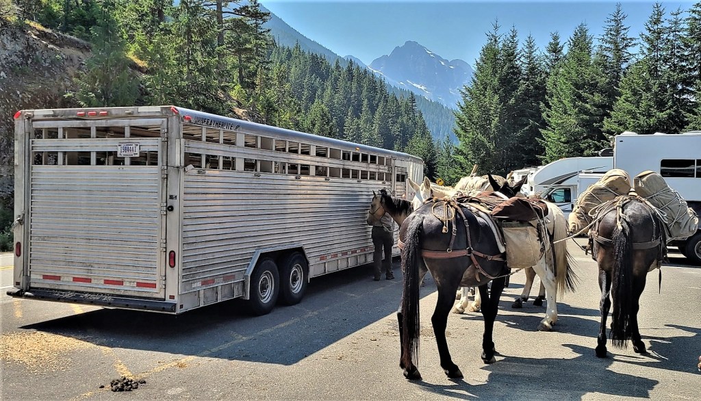
Of course there were stops to make along the way. When we reached Ross Lake at milepost 134, we took the opportunity to stretch our legs along the Ross Dam Trail. With so little traffic on the road, we were not expecting the parking lot at the trailhead to be a challenge. But then we weren’t anticipating a mule train either.

They were preparing to cross the dam to perform trail maintenance further up the Pacific Northwest Trail.
We crossed a dense forest…
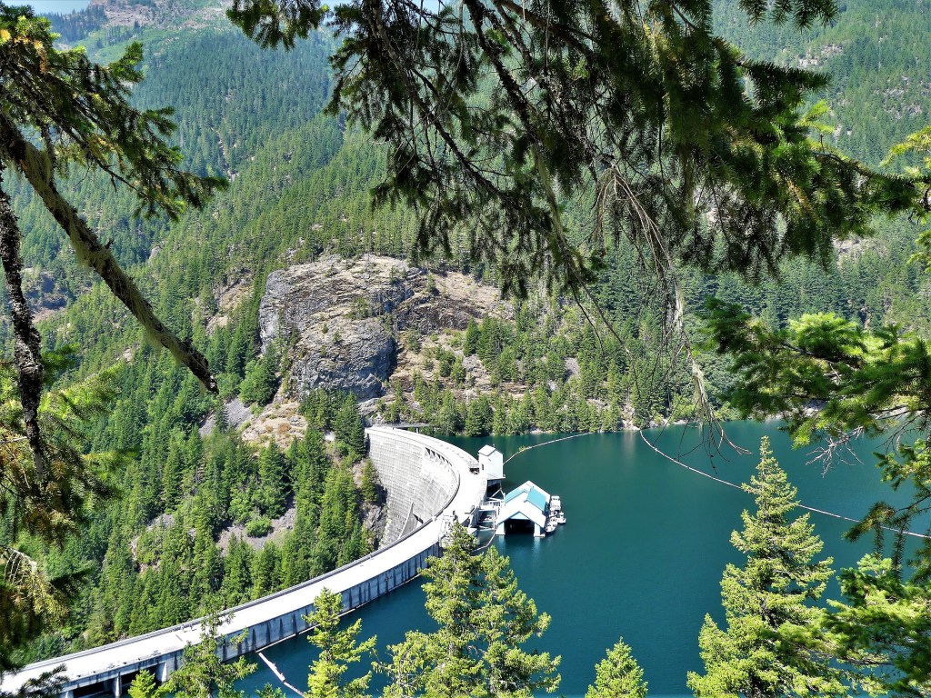
to the edge of Ross Lake and across the dam road,

where we were soon joined by the pack leader and company…

for views of Snowfield Peak and distant glaciers.

Of course, we had to dance around the mule poo on our return to the parking lot before continuing our quest.
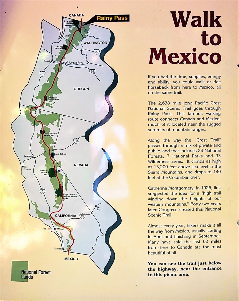
Our next destination took us to milepost 158, where we intersected the Pacific Crest National Scenic Trail at Rainy Pass on our way to Rainy Lake for an easy, 1-mile, wheelchair-accessible hike, until we encountered a tree across the trail within 500 yards of the trail’s end.
Unfortunately, physically disadvantaged people could not appreciate the crystal clear water of this alpine beauty,

or enjoy a distant look at Rainy Lake Falls cascading 850 feet into its namesake lake.

Shame on the NPS!
We reached Washington Pass Overlook–our final destination at milepost 162– to ogle the Liberty Bell Group,

and Kangaroo Ridge–
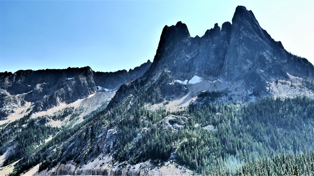
the defining point between Western Washington and Eastern Washington.

And that’s when I saw it! In the distance, midway along the stretch of highway, 8 miles away was the end of the road. I steadied myself for the shot.

We had completed our mission. There was nothing more for us to see before returning west to resume our journey east on August 5th.
By August 10th, the road closure was lifted, and low-speed, one-way traffic resumed in both directions. But I was unconcerned and didn’t mind. I had already arrived at Glacier National Park.


