Visiting the World Heritage city of Luang Prabang was an enlightening adventure, given its rich history, its cultural gems, and its natural wonders that draw travelers from around the globe. The vibrant blend of ancient temples and French colonial architecture creates a stunning backdrop for exploration, inviting visitors to wander through its charming streets. With so much to explore, from the serene banks of the Mekong River to the bustling local markets filled with handmade crafts, it’s little wonder why our three days went by so quickly, while only scratching the surface of so many not-to-be-missed activities.
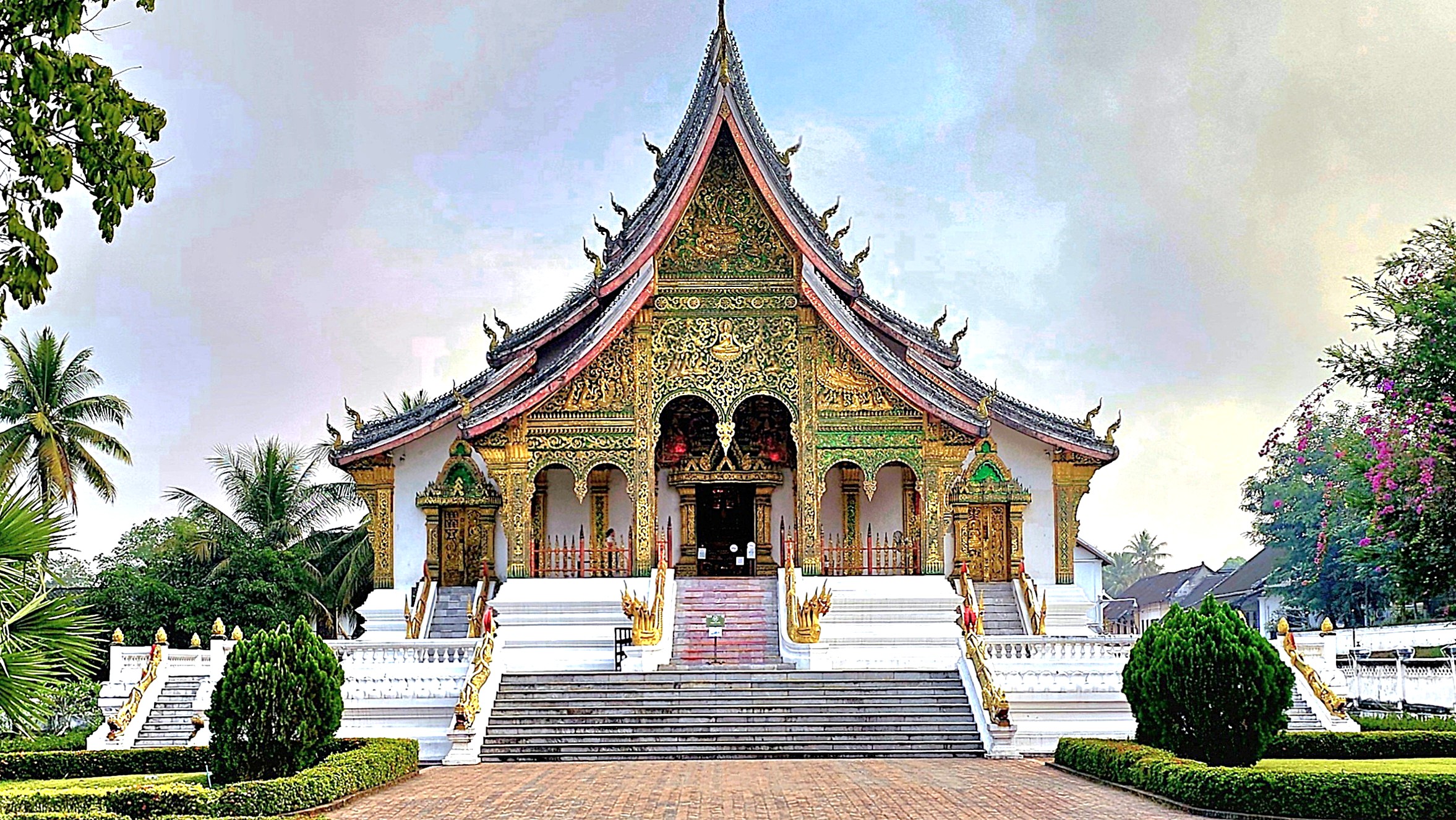
We toured the ancient capital’s Royal Palace-turned-museum …
with its purpose-built shrine housing the golden Phra Bang (translates to “delicate Buddha”), created in Sri Lanka between the 1st and 9th century, and worshipped in Luang Prabang since 1359 as the nation’s most sacred symbol.
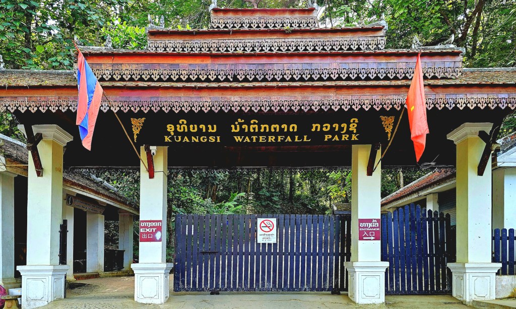
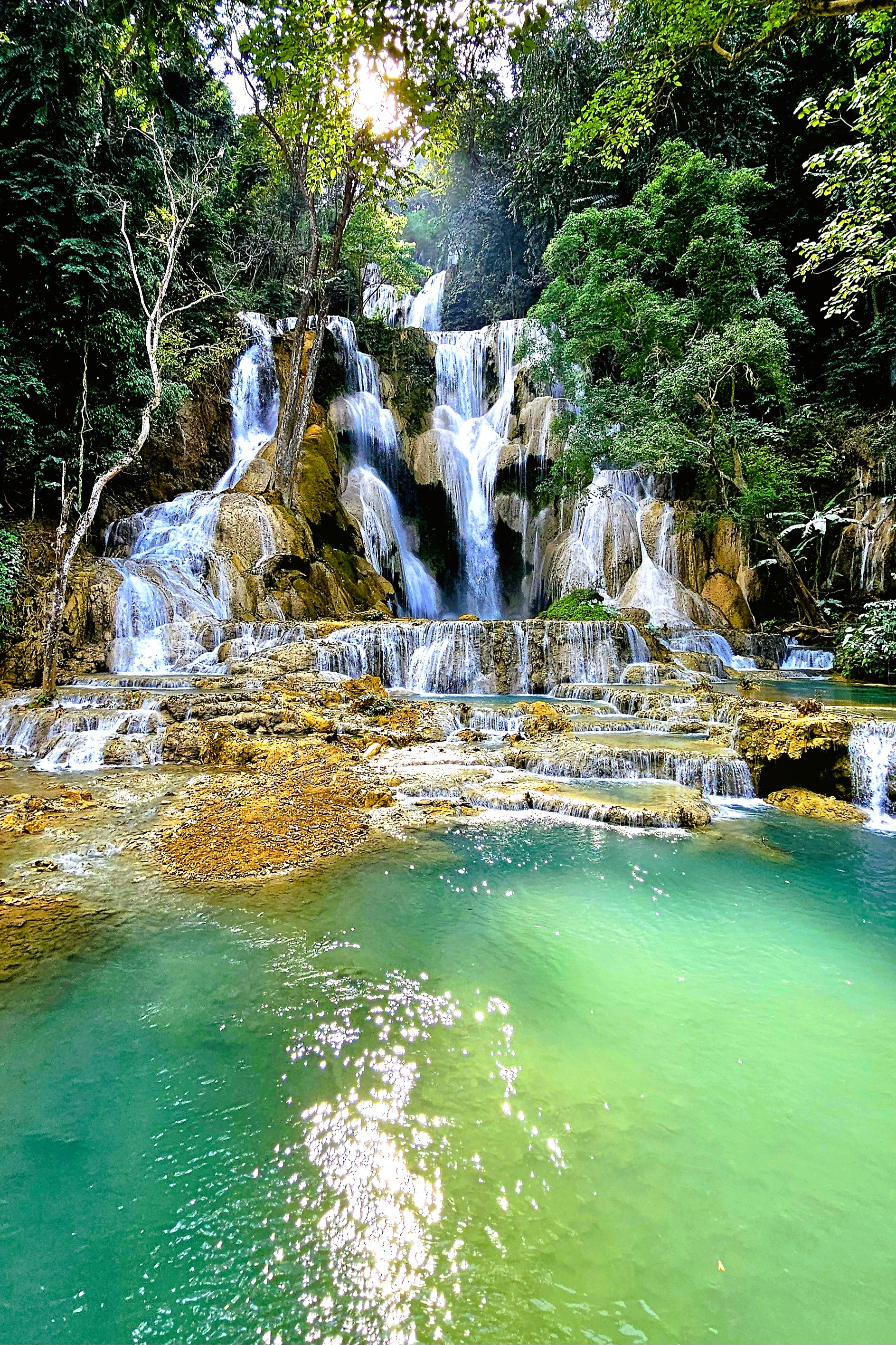
We trekked through Kuang Si Waterfall Park,
featuring a 165 ft drop …
feeding terraced plunge pools of milky green water,
and a rescue sanctuary for black Moon bears and Malayan Sun bears.
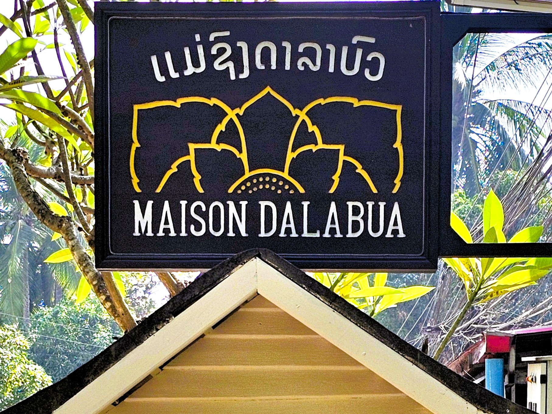
After a full day of sightseeing, many in our tour group sought respite at our hotel, the Muang Thong.
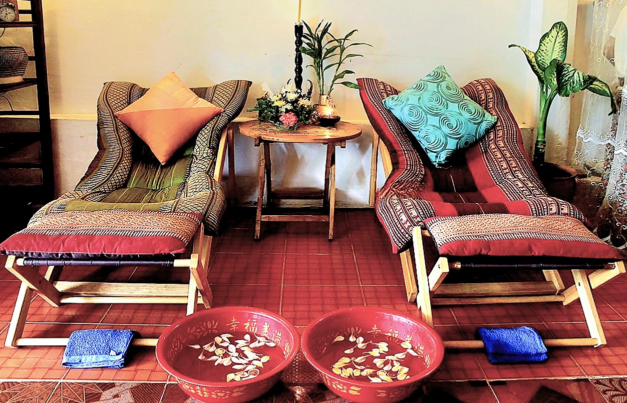
However, Leah and I enjoyed a 60-minute, aromatherapeutic couples massage for $34 at M.K. Wellness Centre only steps from our hotel,
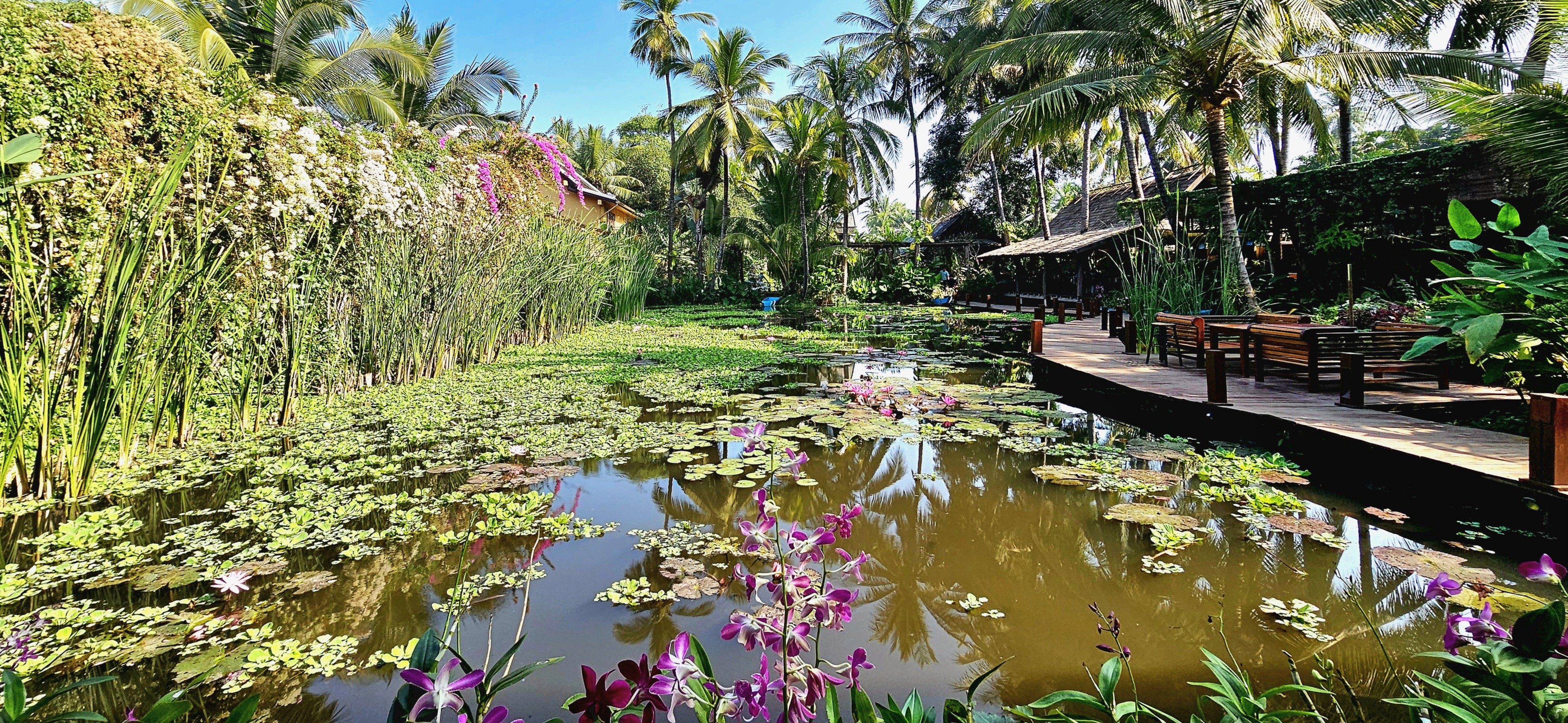
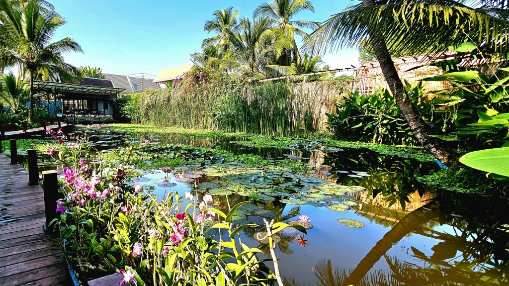
followed by a stroll to a nearby hotel …
where an acre of tropical gardens is thoroughly hidden from the street,
protecting three UNESCO-classified lily ponds …
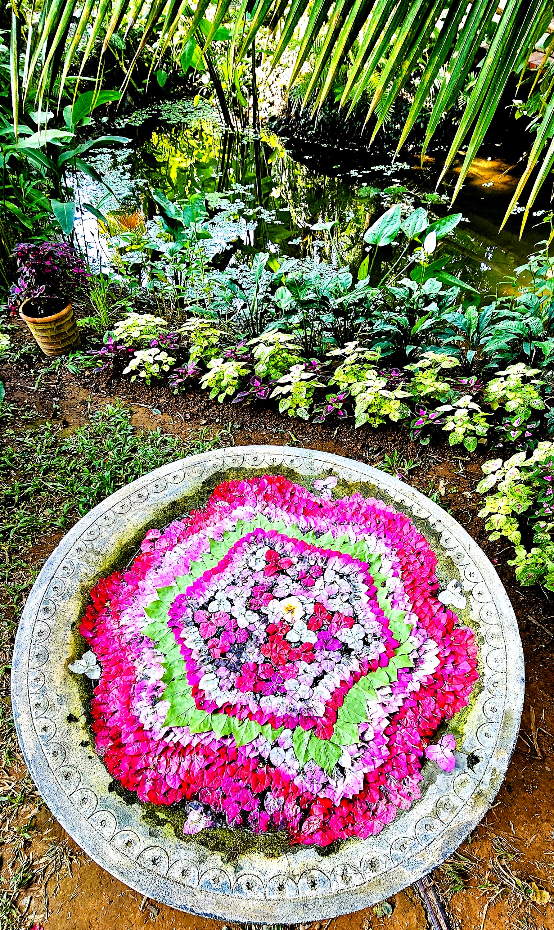
amid an oasis of orchids …
along a mahogany-clad boardwalk.
Lush flora surrounds the property and covers nearly every surface,
including the living walls.
It was the perfect location to share a special dinner with fellow OATers at the hotel’s on-site restaurant, Manda de Laos,
featuring traditional Lao flavors that had us grinning ear to ear,
and energized to continue our journey to Vientiane the following day.
Rivalry serves as a profound motivator, compelling individuals to elevate their performance. It fuels our ambition and stimulates our creative capacities. Additionally, it sharpens our concentration and tests our boundaries.
At its most constructive, rivalry fosters a form of competition that can lead to significant achievements.
For example, had it not been for Gutzom Borglum’s monumental conversion of Tunkasila Sakpe Paha into Mt. Rushmore(1927-1941), there might never have been a Crazy Horse Memorial located 16 miles from Borglum’s masterpiece.
Afterall, it was Korczak Ziolkowski, Borglum’s assistant at Mt. Rushmore who imagined the Lakota mountainside transformed into the world’s largest sculpture of a 19th century Sioux chief on a horse.
As a work-in-progress since 1948, the completed head of Crazy Horse stands at 60 feet, matching the measure of George Washington’s image.
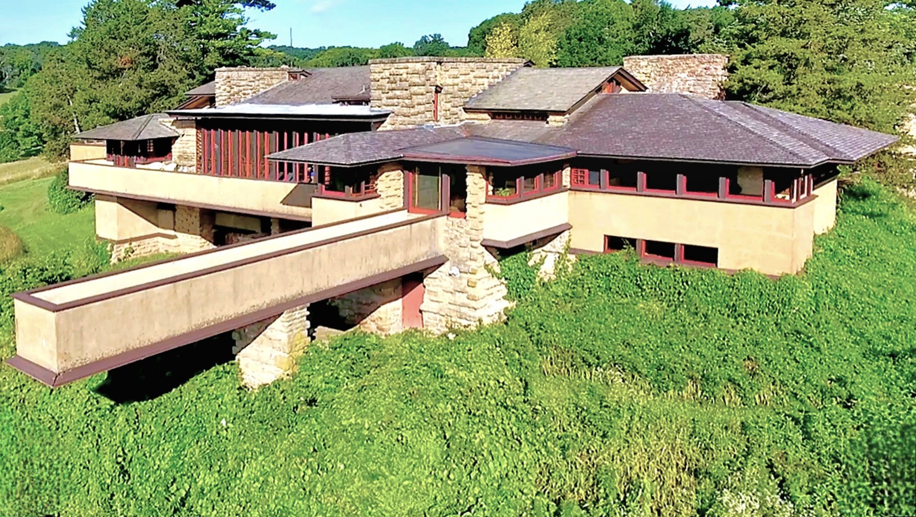
Similarly, visionary architect Frank Lloyd Wright designed Taliesin as his estate-studio outside Spring Green, Wisconsin. Wright’s organic design followed his affinity for infusing natural elements into his habitats (Prairie Stylings).
Forty-eight years later, Alex Jordan–although not professionally trained as an architect–drew inspiration from Wright’s Taliesin, and began construction on his own homestead, the iconic and certainly eccentric House on a Rock–only 6 miles down the same road, on WI-23.
In the hills of Chiang Rai, Thailand a similar rivalry exists between teacher and student, with their competing visions of divinity and righteousness expressed through different, symbolic colors: Chalermchai Kositpipat’s gleaming, ornate White Temple…
versus Puttha Kabkaew’s psychedelic Blue Temple, which borrowed heavily from his mentor’s neo-traditional style of Buddhist art. And we got to explore both of them!
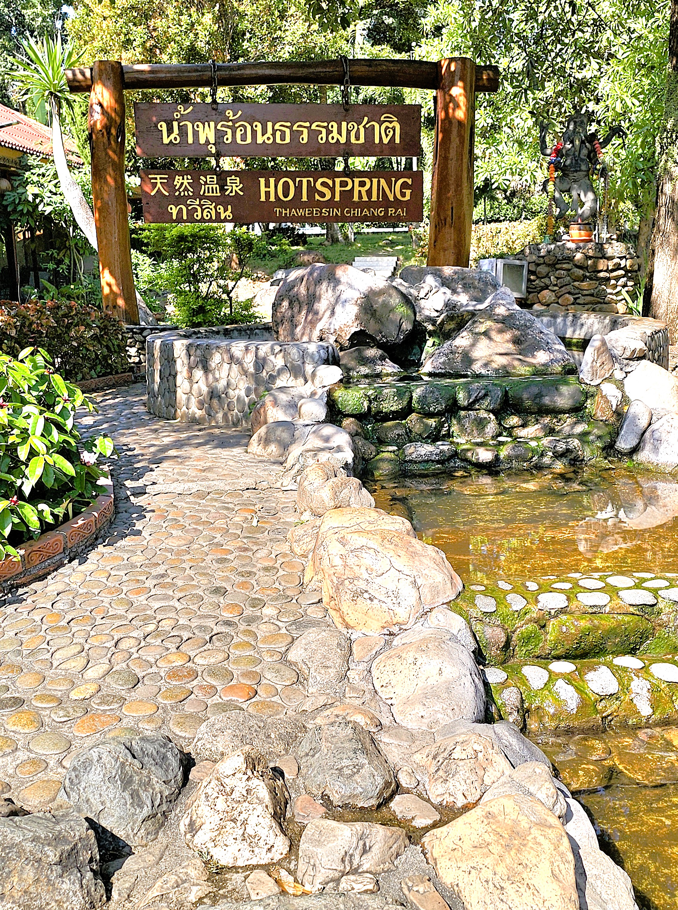
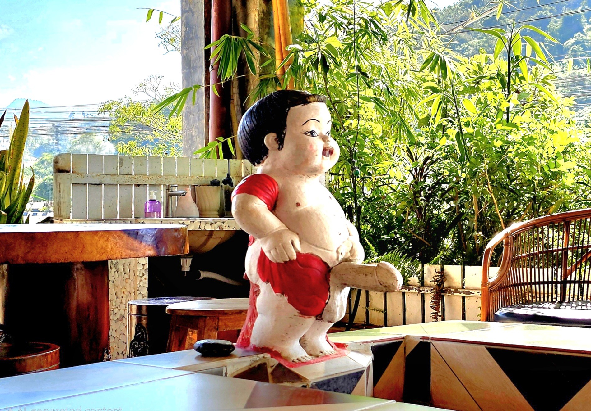
We departed Chiang Mai for Chaing Rai, first passing through Thaweesin Hot Springs, our timely rest stop, and Thailand’s highest elevation thermal waters–where we stretched our legs, soaked our feet,
and where a Happy Room attendant eagerly pointed us in the right direction.
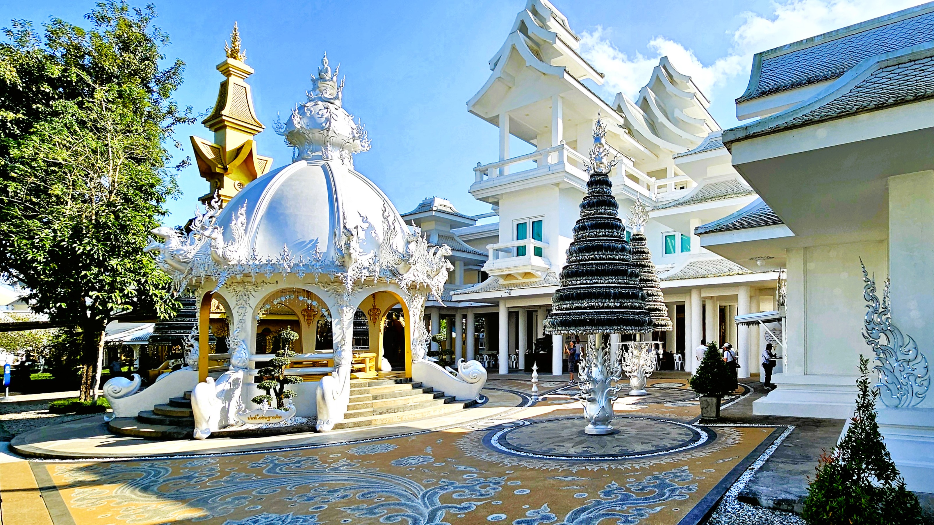
After arriving at the White Temple (Wat Rong Khun), we were greeted by a Transformer,
who seemed to reflect the otherworldly characteristics of the temple grounds.
The details behind Chalermchai’s bid to rebuild the crumbling temple in the village of Rong Khun are legendary.
In 1997, Chalermchai committed to self-fund the project as an offering to Buddha after a national economic downturn threatened its reconstruction. He did so for love of country, love of Buddha, and his love for the King.
He cast the chapel, the Sukavadee Bridge, the crematorium, and other prayer halls in white as a symbol of purity and spiritual enlightenment.
The mirrored tiles represent Buddha’s wisdom, which shines across the mortal world and the universe.
Silver Bodhi trees in public squares and walkways hold the wishes of thousands of visitors who pray for guidance and enlightenment.
Other buildings have been designed in gold–deliberately chosen to represent attachment to material wealth, and worldly distractions. The ornate Happy Room building is one such preoccupation,
while the golden bridge, ironically carries visitors to the golden gallery and gift shop.
At the White Temple, nothing is truly as it seems. Even the monk who adorns the chapel alter has been cast in wax.
The striking artistry and rich cultural symbolism elevate the experience and compel introspection at every moment. Within the Ubosot—where photography is prohibited—captivating murals that blend contemporary references and historical motifs vividly portray the eternal struggle between good and evil. Colorful representations of political figures, Star Wars characters, and Disney icons convey a compelling truth: rebirth, karma, and the cosmic balance of the universe stand as the ultimate rewards.
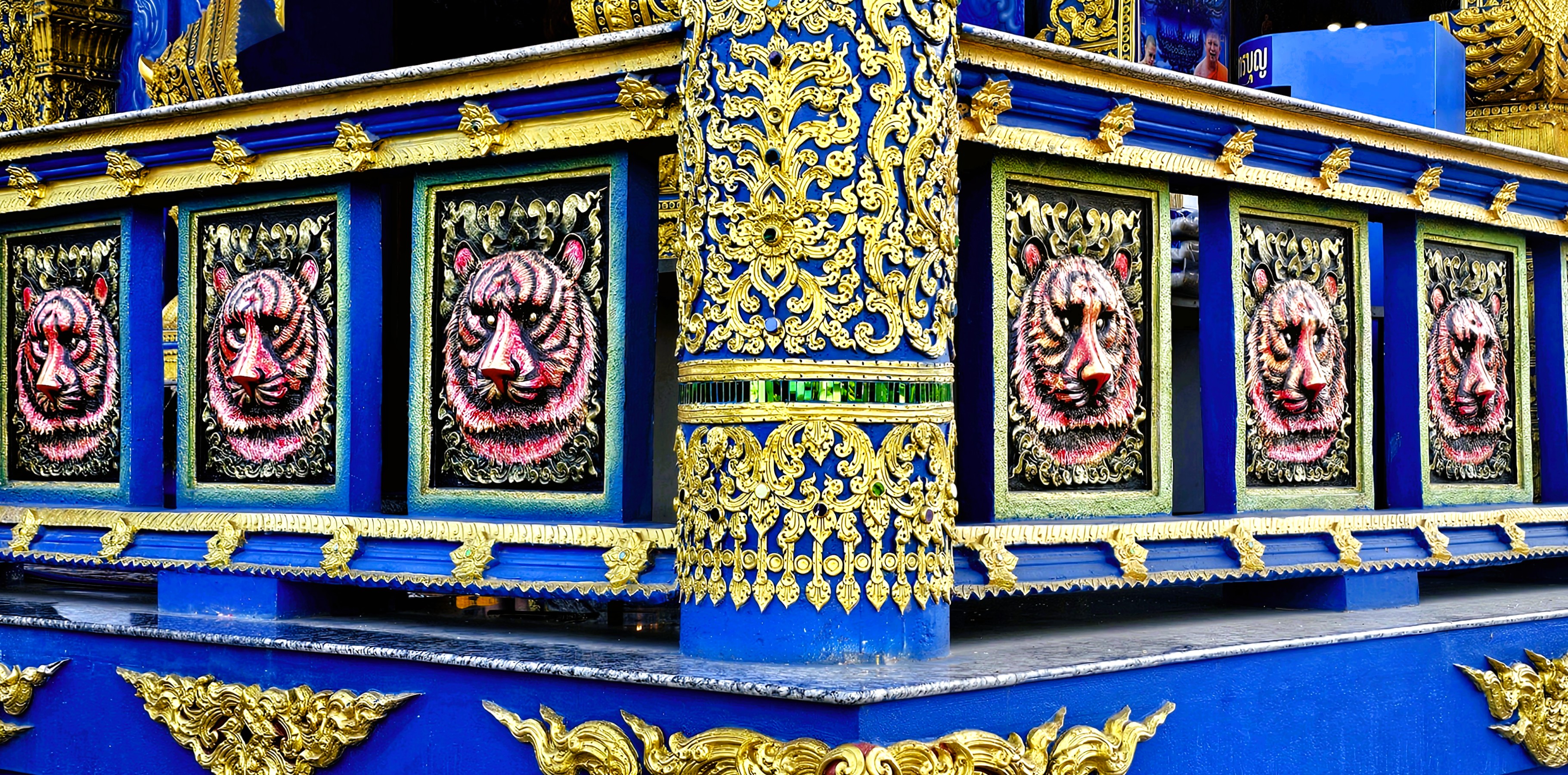
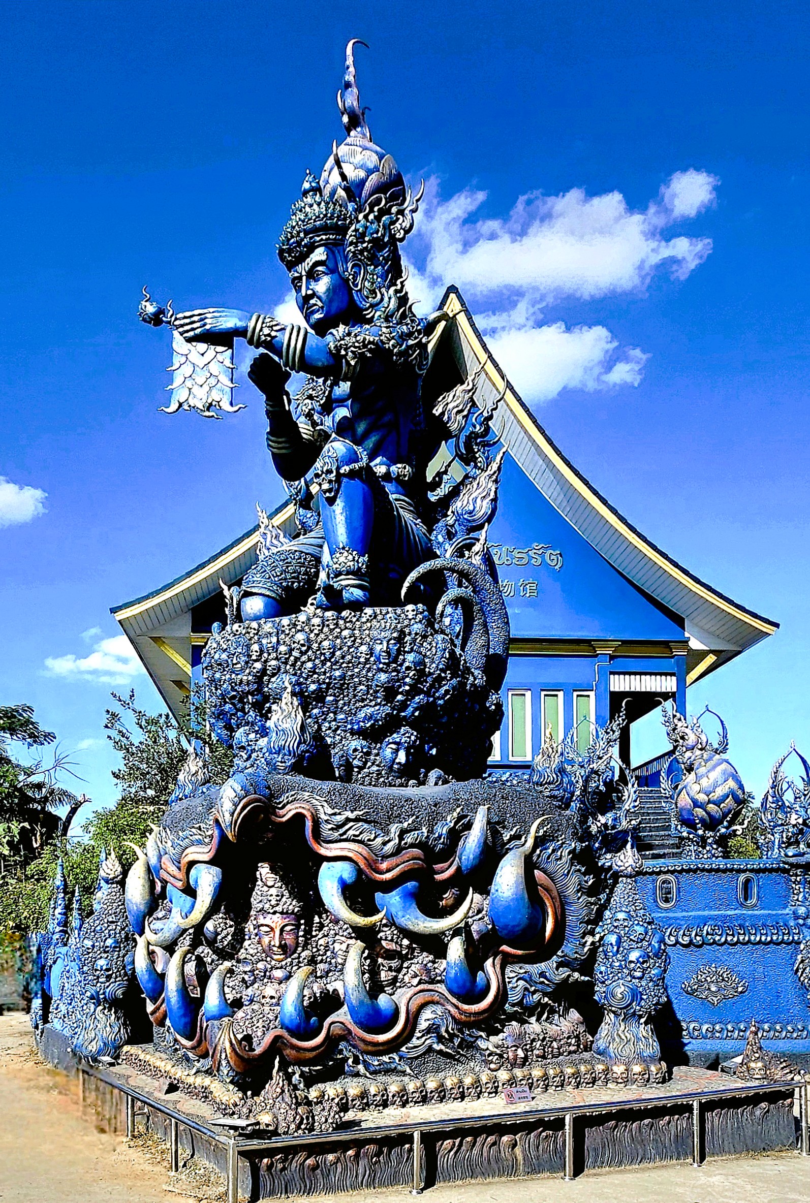
Puttha Kabkaew’s philosophical and spiritual manifesto clearly aligns with his mentor’s, Chalermchai Kositpipat, and it’s on full display–less than 10 miles away–at the Blue Temple (Wat Rong Suea Ten).
The temple’s name translates to House of the Dancing Tiger as a testament to the wildlife that once roamed freely over temple grounds a century ago.
Puttha’s cerulean-blue facade symbolizes the importance of meditation and inner peace, while gold accents represent enlightenment and emphasize the architecture.
The temple’s interior features a large statue of a white porcelin Buddha…
surrounded by surreal, contemporary Buddhist art.
The Blue Temple is protected by fantastical, celestial creatures: like imposing Nagas,
fountain-loving Garudas.
and an Erawan.
Since 2016, the Guardian of Wat Rong Suea Ten has been intent on heralding the word of Buddhism…
But the road to enlightenment is a bit like trying to assemble IKEA furniture—it’s an eternal struggle! Buddhist imagery often showcases the bewildered faces of those in misery, serving as a nagging reminder of the struggles one must overcome to achieve enlightenment.
And one day, with the help of my fellow mortals, I hope to get there!
Resetting the Wayback Machine to Dateline: August 3, 2023
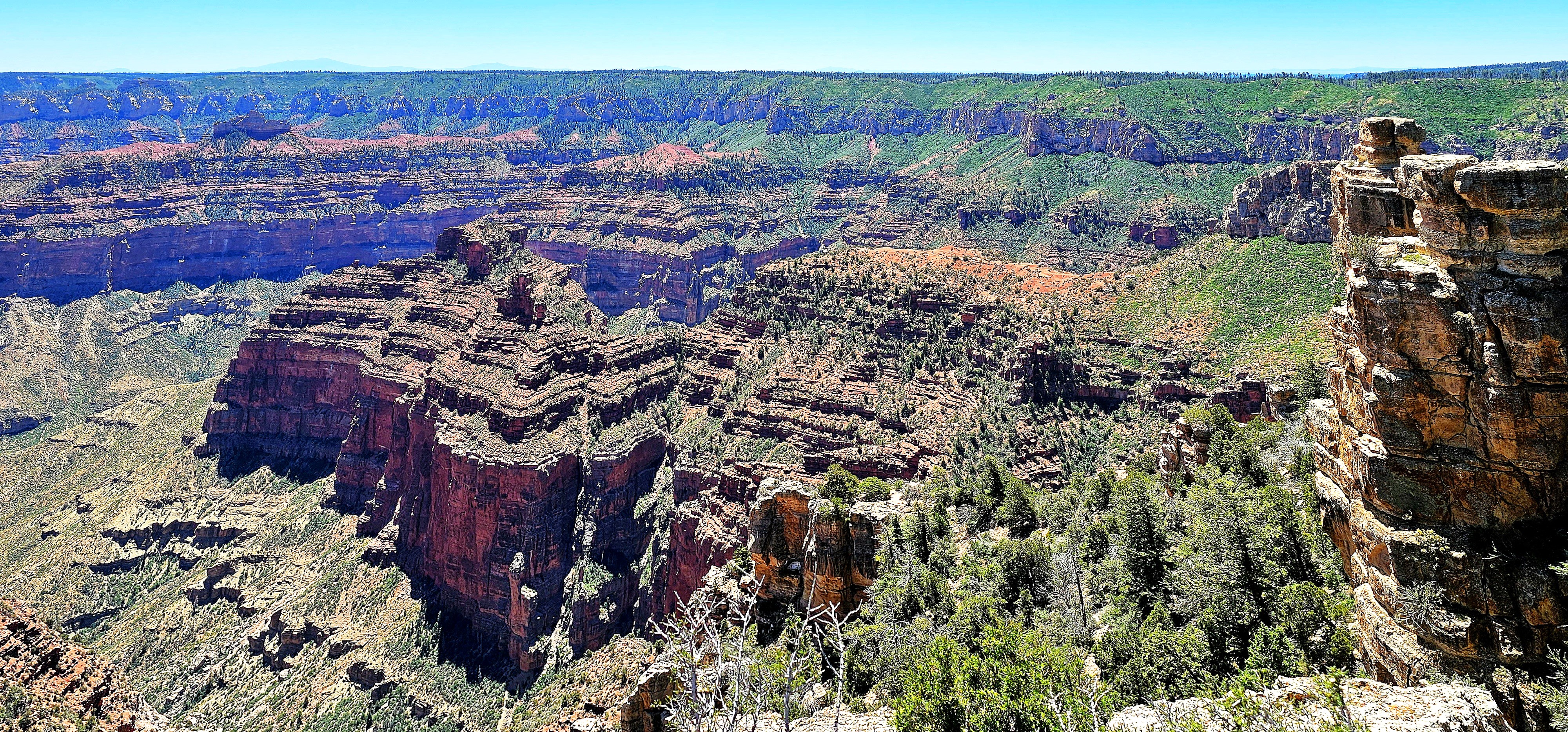
After three days of admiring Grand Canyon’s North Rim–from Point Sublime…
to Point Imperial…
to Angel’s Window,
Leah and I were already anticipating our next physical and photographic challenge–hiking through the Coyote Buttes North in search of The Wave.
But we were at the mercy of Bureau of Land Management, who awards permits to no more than 64 visitors per day through a complicated online lottery process.
We scored dinner reservations at the Grand Canyon Lodge Dining Room…
during sunset to discuss our future travel plans.
Regrettably, our meal was more consolation than celebration. Despite our application for permits months in advance, and again, the day before our departure, our high hopes were dashed by impossible odds.
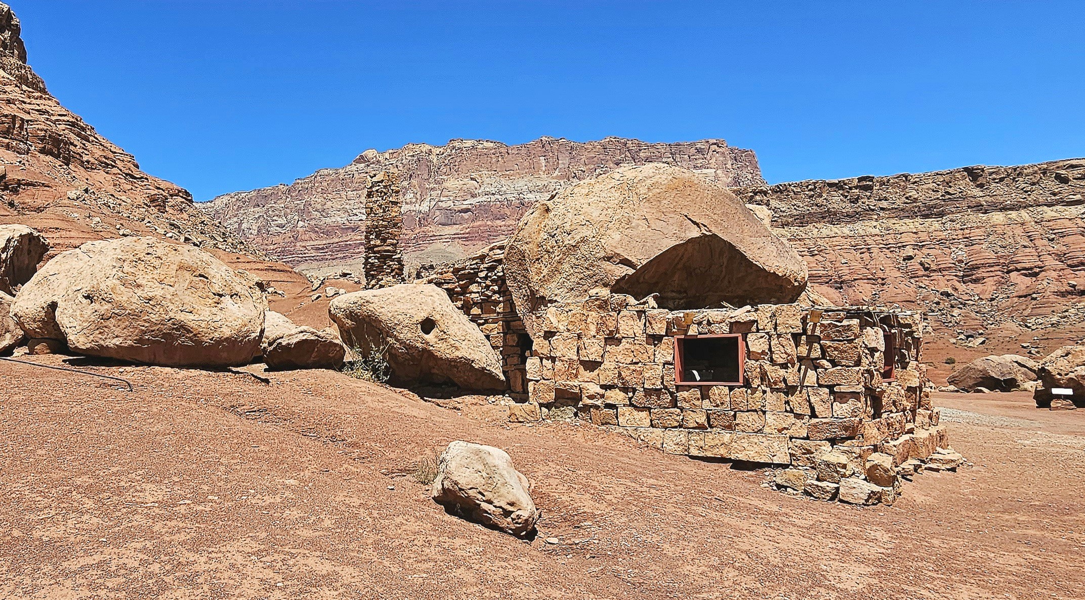
Ultimately, we followed our contingency plan, which, like an old friend, was familiar yet still full of surprises. The following day, we drove through Marble Canyon–flanked by Vermillion Cliffs–with a brief stop along Highway 89A to marvel at a Cliff Dwellers Stone House,
a crumbling roadside curiosity that was constructed from rock debris and local timber by Ziegfeld Follies dancer Blanche Russell and her husband Bill, whose car had broken down at this location in 1927.
According to the tale, the beauty of their surroundings was so captivating that they established a homestead on the site during the Great Depression, extending hospitality to Mormon travelers journeying along the adjacent Honeymoon Trail to the temple in St. George, Utah, for the sanctification of their marriages.
Meanwhile, we continued north on a pilgrimage of our own to Page, Arizona for a few days of essential sightseeing.
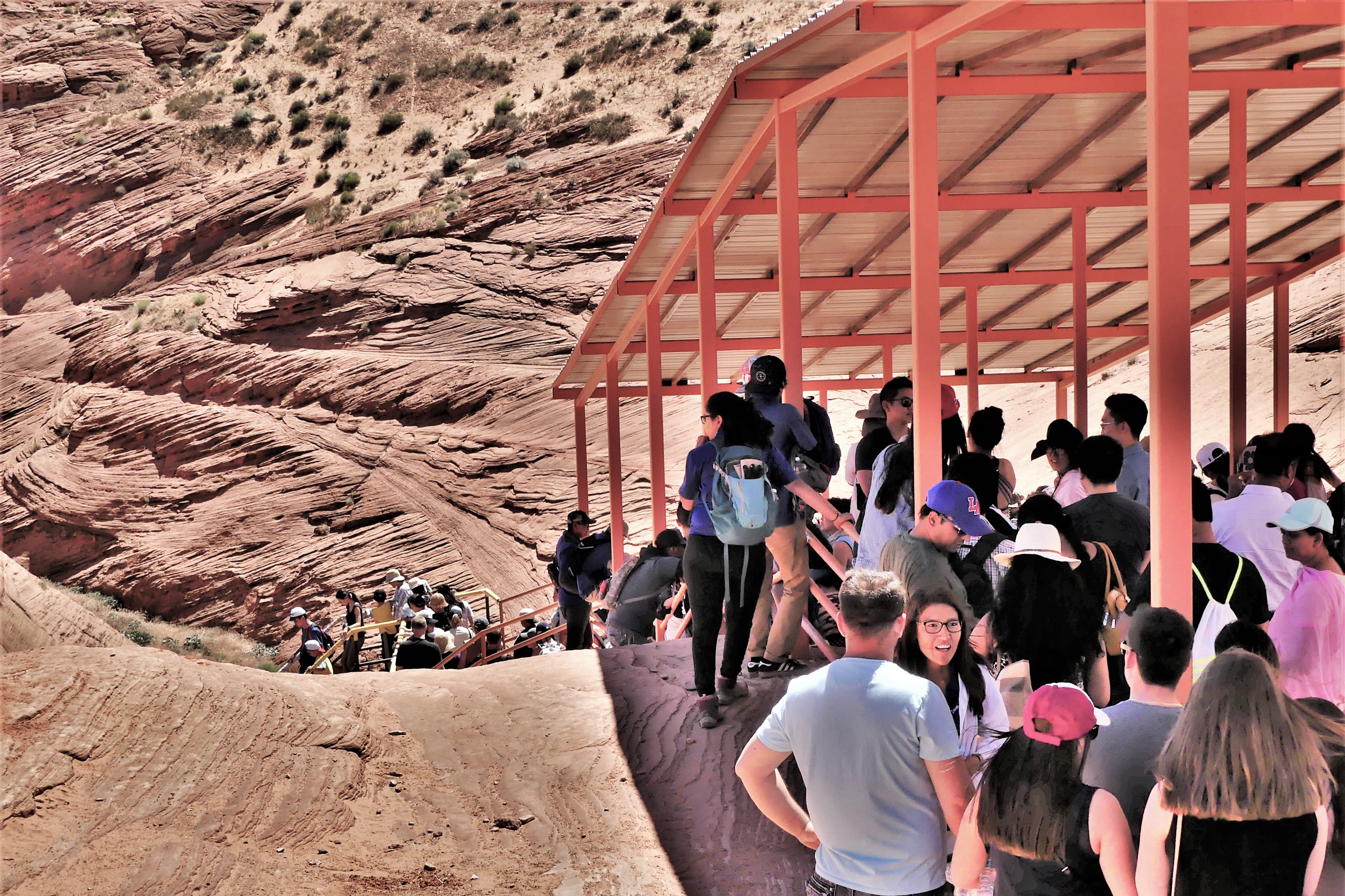
The following day, we arrived at a strip mall to claim a coveted noon reservation for a guided tour of Upper Antelope Canyon tour with an accredited Navajo tour operator. Having toured Lower Antelope Canyon 6 years ago (see Can’t Elope Canyon), we elected to hike the upper canyon this time around.
Upper Antelope Canyon, often referred to as “The Crack,” features a flat entrance and a level path throughout, offering a seamless stroll with no elevation shifts. This easy access, devoid of any stairs, renders it more welcoming than its counterpart, Lower Antelope Canyon, where stairs and ladders are part of the experience.
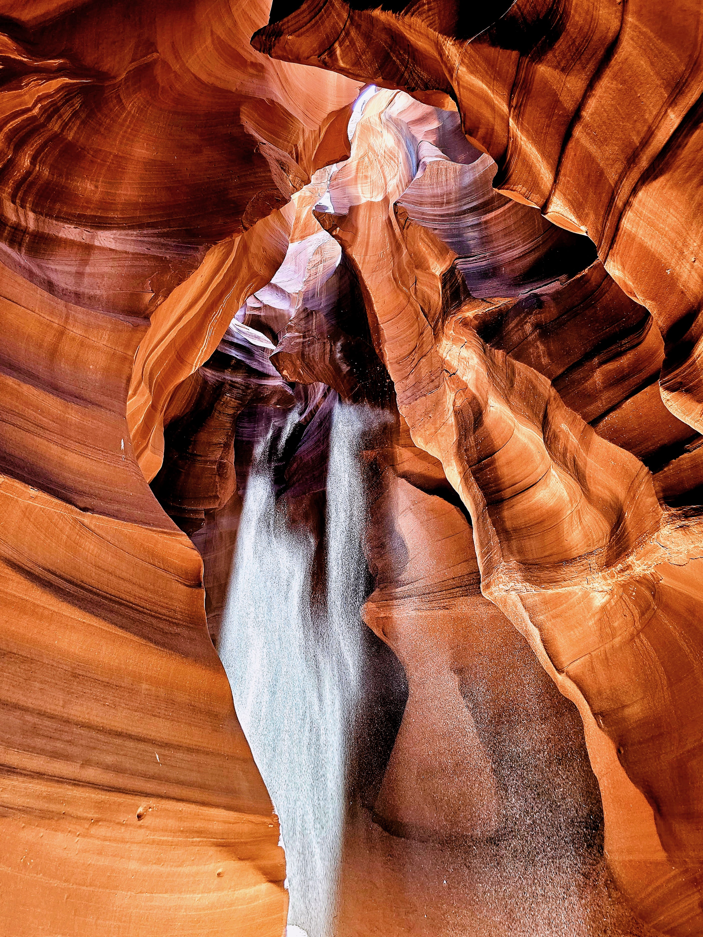
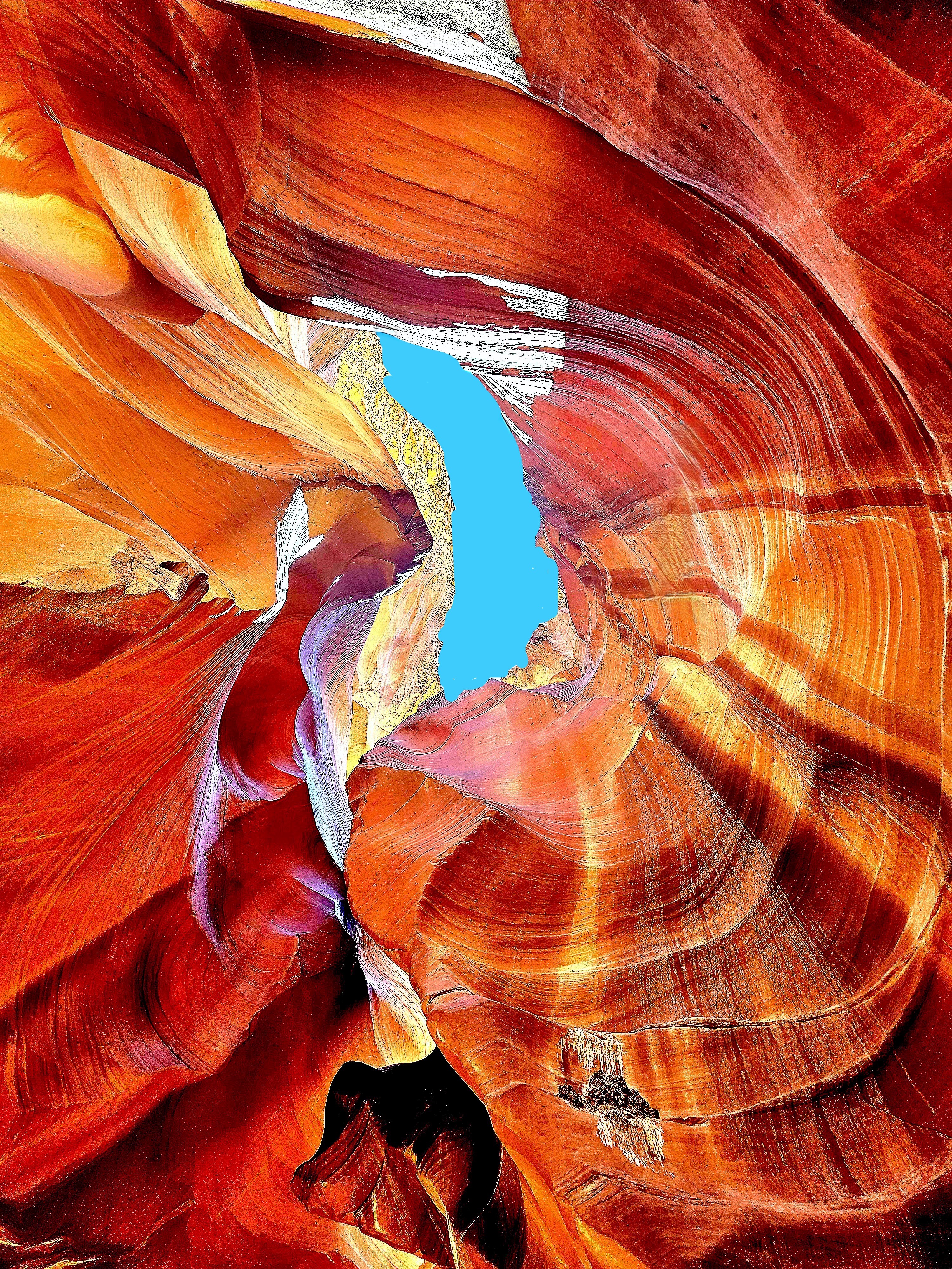
In my quest for photographic redemption, I was determined to infuse some mystery into the majesty of these sculpted canyon walls by focusing on the details of the form, while framing an energy of twists, curves and color.
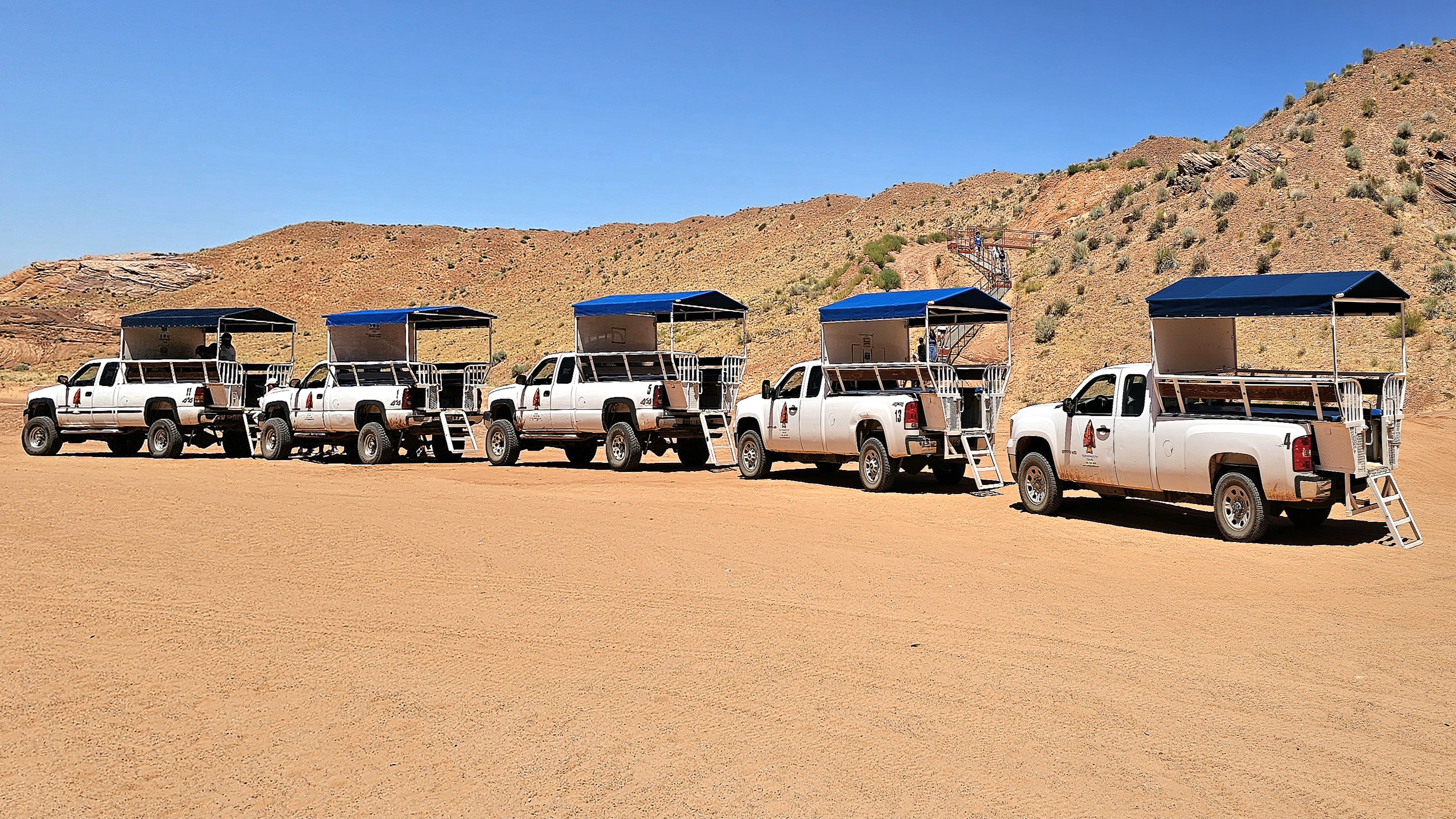
We jostled and bounced across a dusty desert plain from the back of a dusty pickup truck, enduring temperatures of 100°F. The grab bars were so hot, I could only handle them through my hat. After arriving at the canyon’s entrance, our guide offered us a brief geology lecture and valuable photography tips.
Rather than lug around my SLRs, I relied on my Samsung Galaxy 23S Ultra phone for its reputed low-light sensitivity and high-resolution capabilities.
From the onset, our guide pointed out shapes created by negative space, such as the “Lady of the Canyon,” which seemed intriguing to many, but irrelevant to my mission.
Additionally, there was plenty of highlight and shadow play in the formations that was easily personified, such as the “Open-Mouth Man.”
Many photographers were there to capture the “sunbeam effect” that appears from April 1st to September 30th with a helping handful of tossed sand.
There was also equal opportunity to document the canyon wall formations as realistically as possible.
or using the undulating walls as an interesting backdrop.
But I was there to capture the abstract potential!
The canyon’s walls rise up to 660 feet above the streambed, and the trailhead sits at an elevation of 4,377 feet.
Geologists say the walls are shrinking and the elevation is increasing, as sand continues to rise from continuing erosion from wind and water.
The 0.3-mile one-way trail is mostly hard-packed with red sand and silt.
The Navajo Nation calls Upper Antelope Canyon “Tsé’bighanilini,” meaning “the place where water runs through rocks.” I call it amazing!
One hour later, we emerged from “The Crack.”
Antelope Canyon’s allure was so magnetic that I felt myself being drawn into repeating our adventure. However, time would not allow, and no slots were available!
Certainly, its beauty would have revealed itself in a new light, with a new twist!
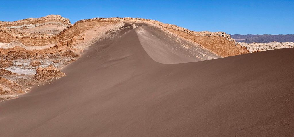
Despite the monochromatic omnipresence of shifting sand and salt across the Atacama Desert (observed from previous post, “Atacama Desert”)–
aside from the occasional splash of flamingo pink–
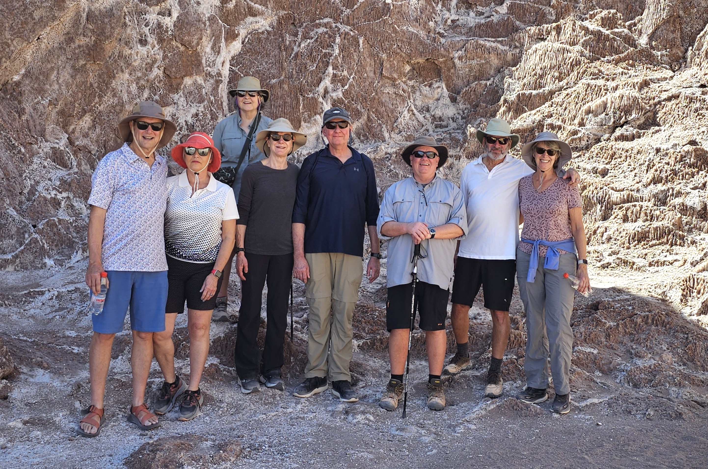
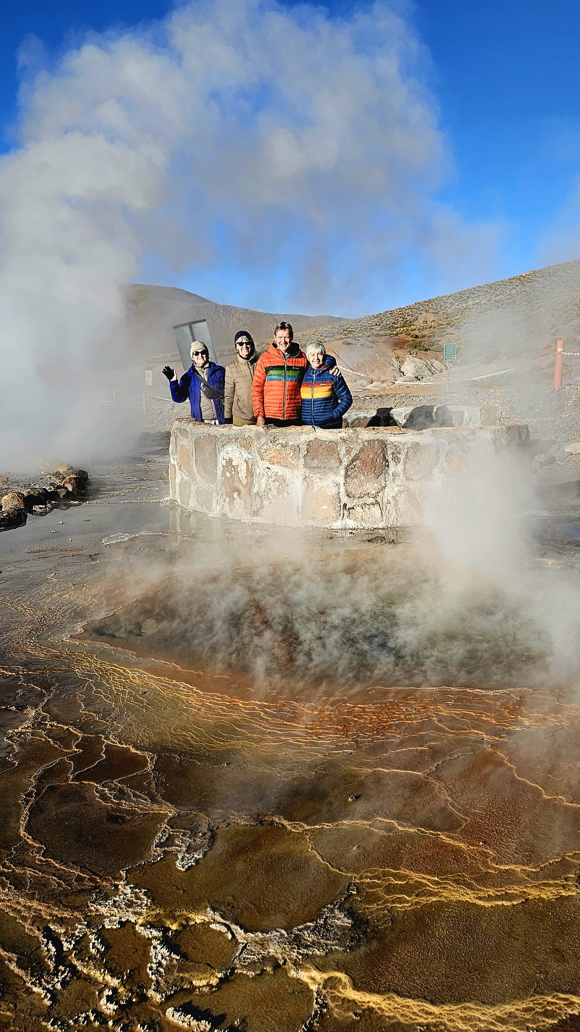
there is an abundance of color to behold in other regions of Antofagasta. Leah and I joined our expedition colleagues…
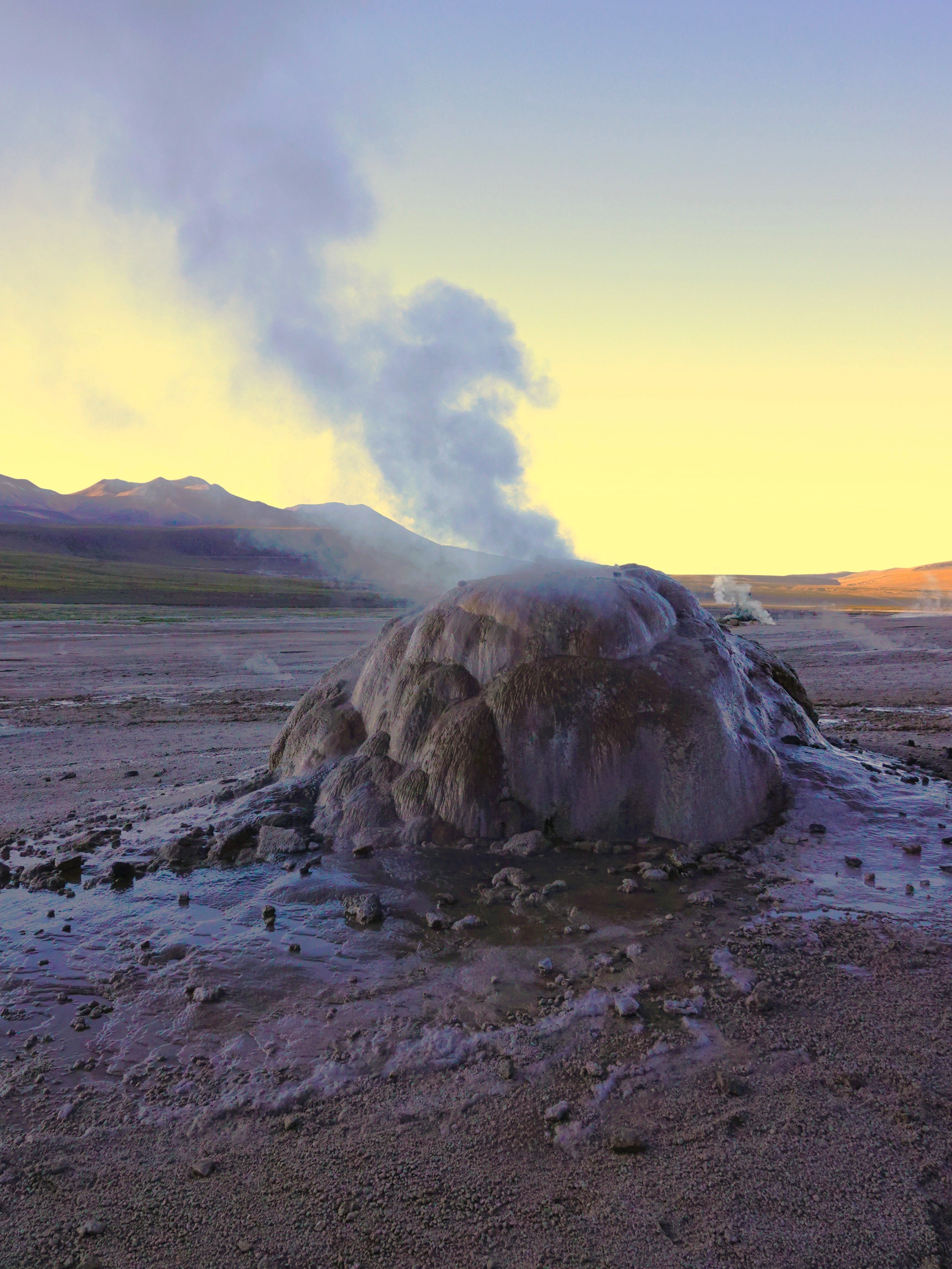
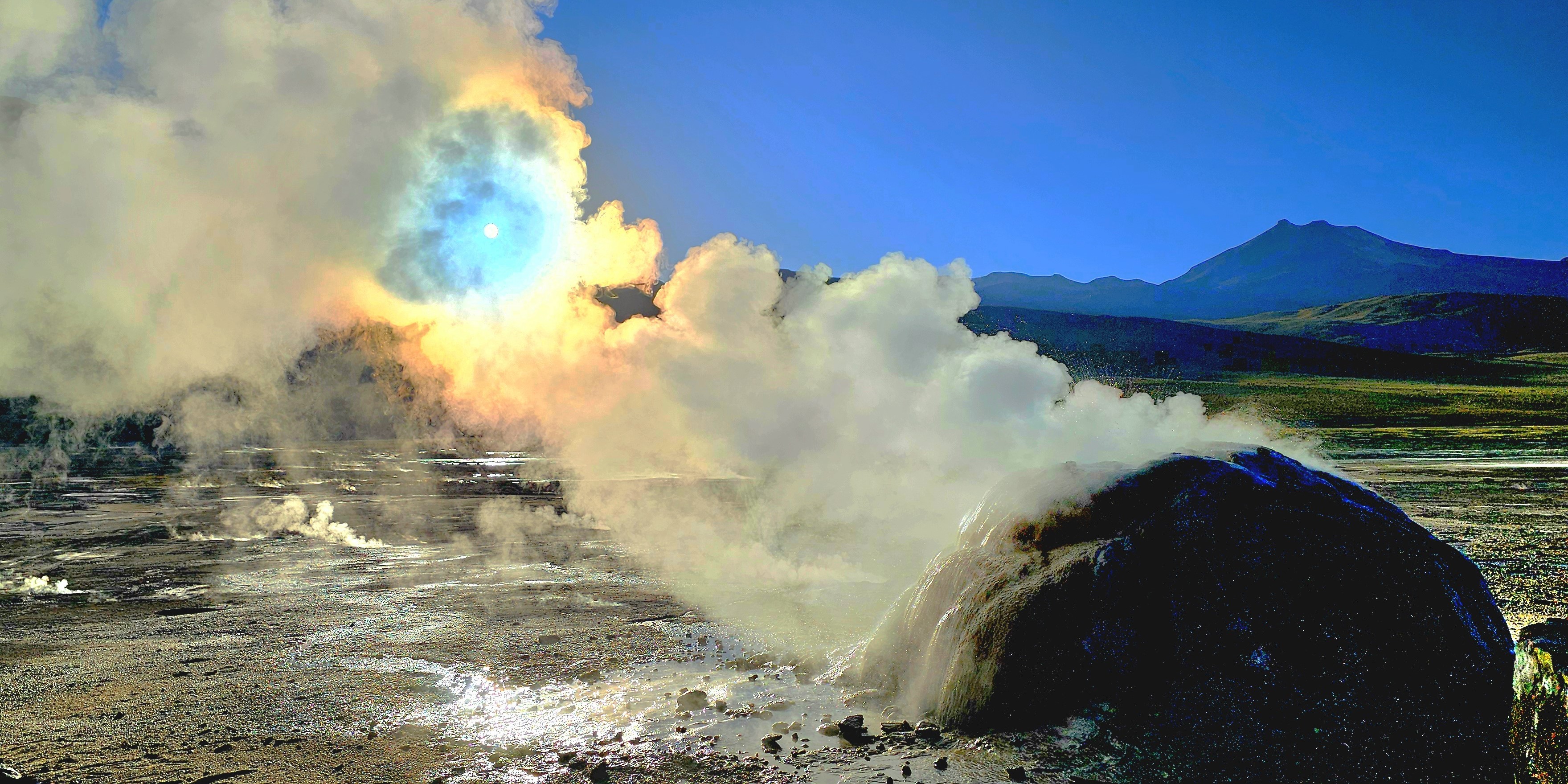
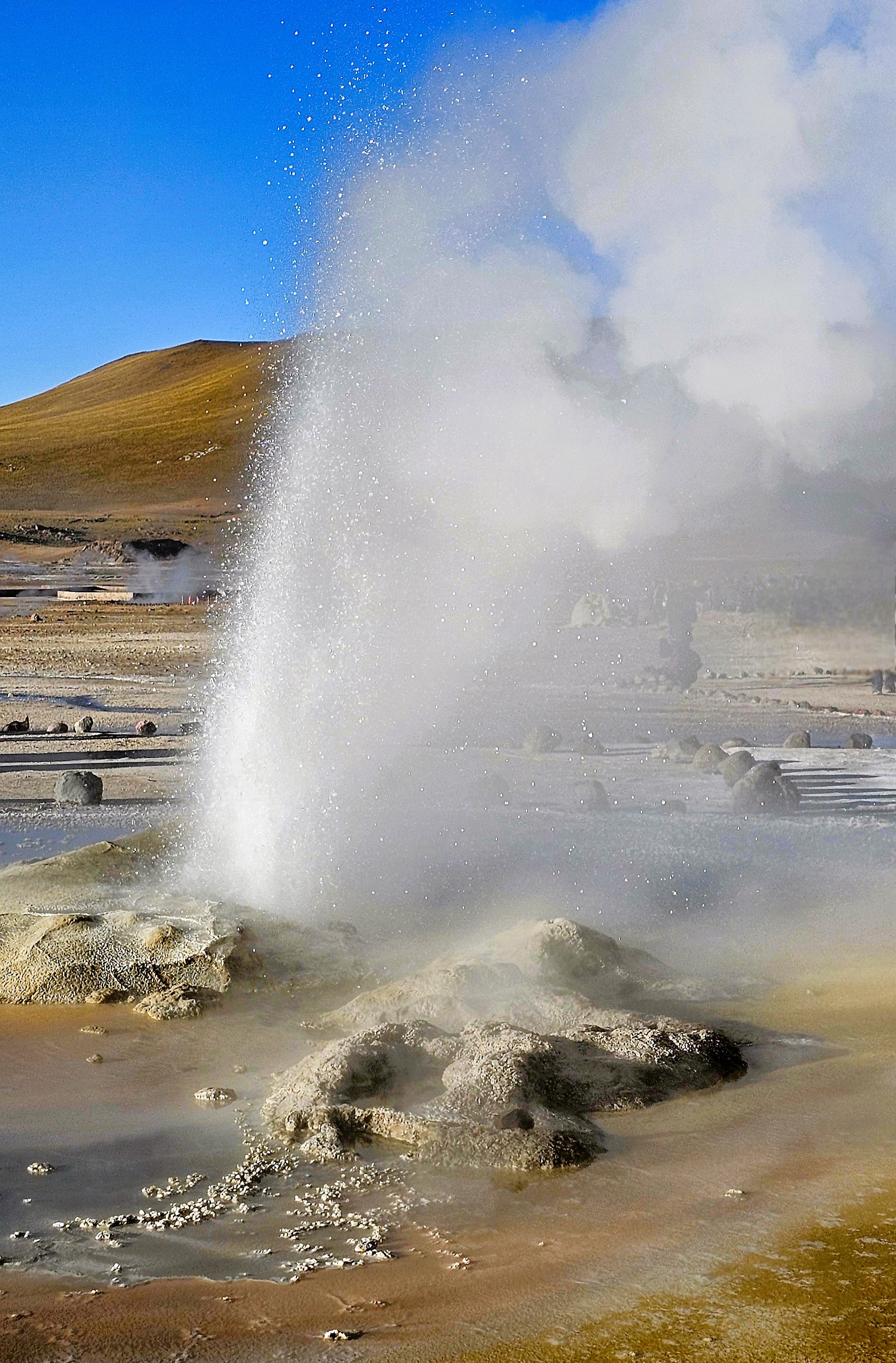
for a 90-minute drive north through remote, rugged terrain and narrow switchbacks, to catch a 7am sunrise over El Tatio Geysers, the highest, albeit 3rd largest geothermal field in the world, and certainly, the most active in the southern hemisphere.
At an altitude of 14,170 ft, the -6oC desert temperature was biting at our faces, but it was a temporary inconvenience. The backlit, pre-dawn sky and cold air benefitted the playful plumes that vented from 80 steaming geysers and fumaroles amid 12 sq miles of Andean volcanoes.
Like so many others, I was poised for the first sun to creep over the horizon,
not only to return the feeling to my fingers, but to reveal the chromatic clouds playing across the landscape.
Soon enough, the rising sun would turn the blackest of hot springs into a glorious reflecting pool.
It was worthy of a celebration.
Because El Tatio is community-owned and administered, there were several local rangers scattered throughout the vicinity to patrol, advise, and admonish any foolishness similar to Pierce Brosnan’s trespassing at Yellowstone National Park (although he entered a “not guilty” plea during his recent arraignment).
One can only hope that discretion and common sense would prevail in this fragile and volatile environment.
El Tatio Geyser
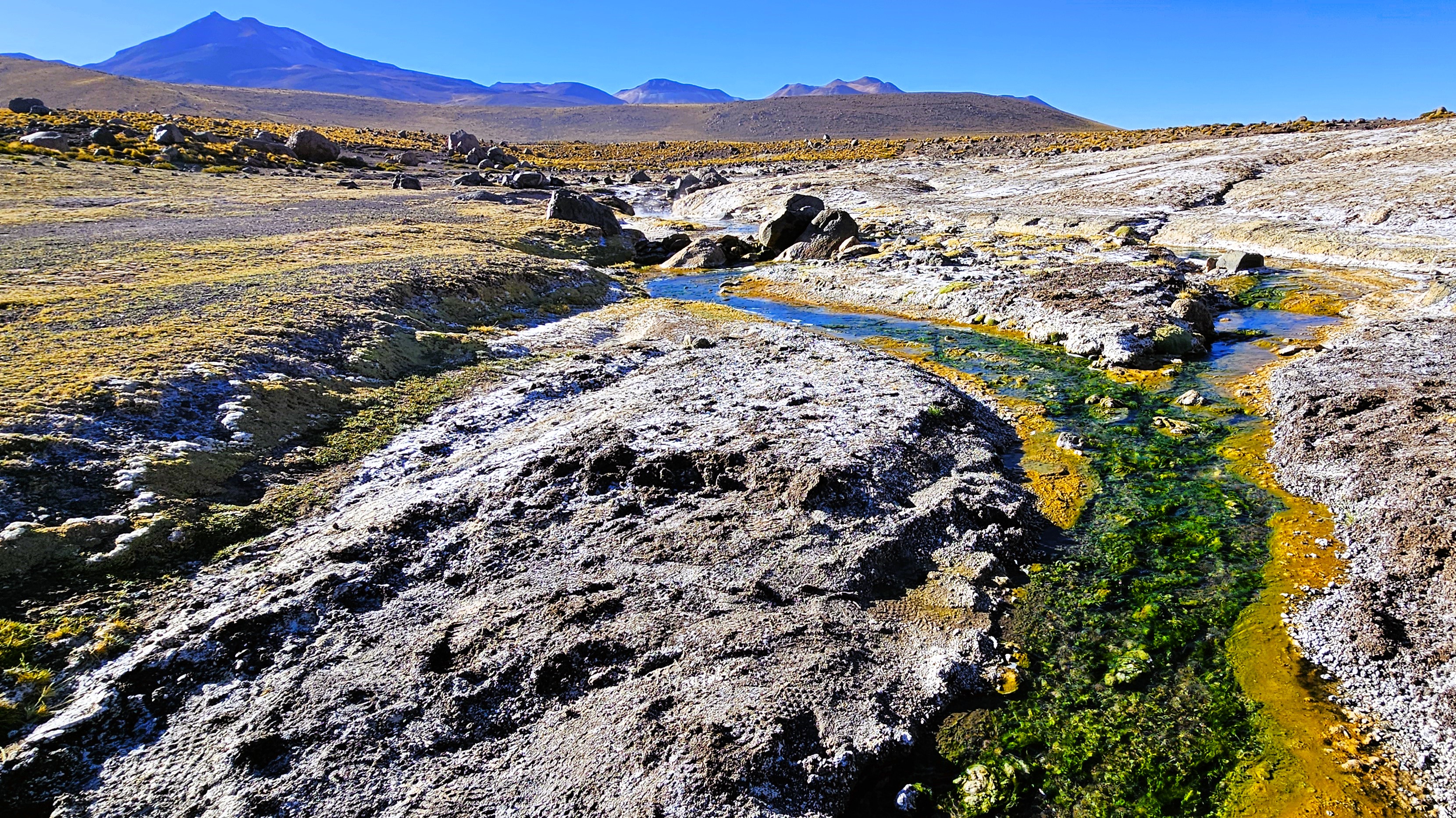
A stroll through the field revealed a kaleidoscope of algae-induced minerals and salts,
that stretched into the distance.
El Tatio didn’t appear as daunting as Old Faithful and its surroundings, but it was impressive, nonetheless, with nowhere near the number of onlookers!
From our position–only 100 miles to Ollagüe Volcano, bordering Chile and Bolivia–
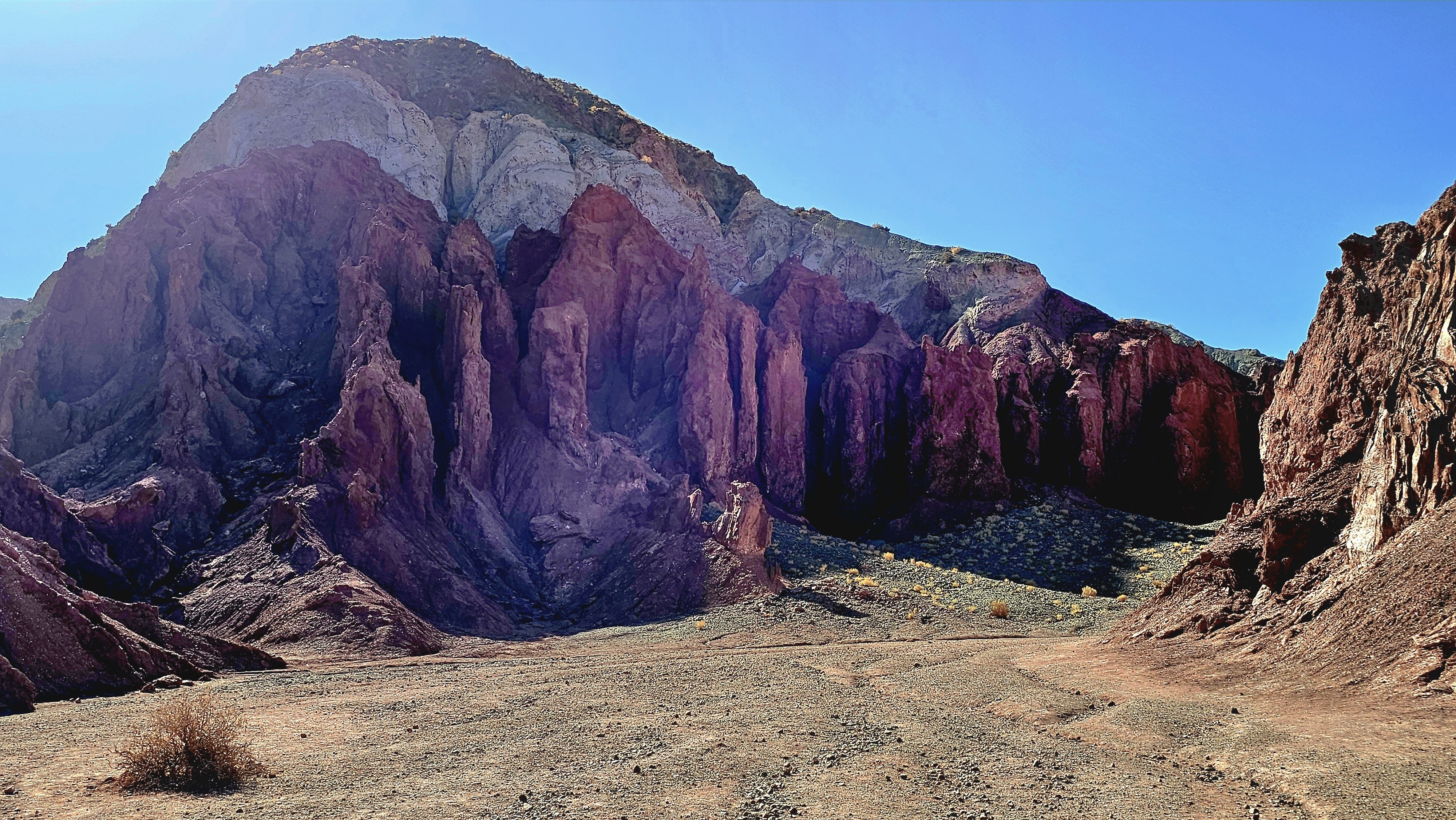
we continued to Valle del Arcoiris, another community-based natural wonder,
where “purple mountains majesty”…
become a befitting backdrop to roaming, grazing llamas.
The valley was as wide and rich with the scent of riki riki…
as it was awash with colors created by a primordial stew of Sulphur, gypsum, crushed shells, and clay.
When the Pliocene Epoch carved out the valley,
all traces of copper and lithium were swept away–
which is a silver-lining for a spectacular landscape that would otherwise have been ravaged by mining companies.
Île-Aux-Foins Park–Neguac, NBHopewell Rocks–Hopewell Cape, NB
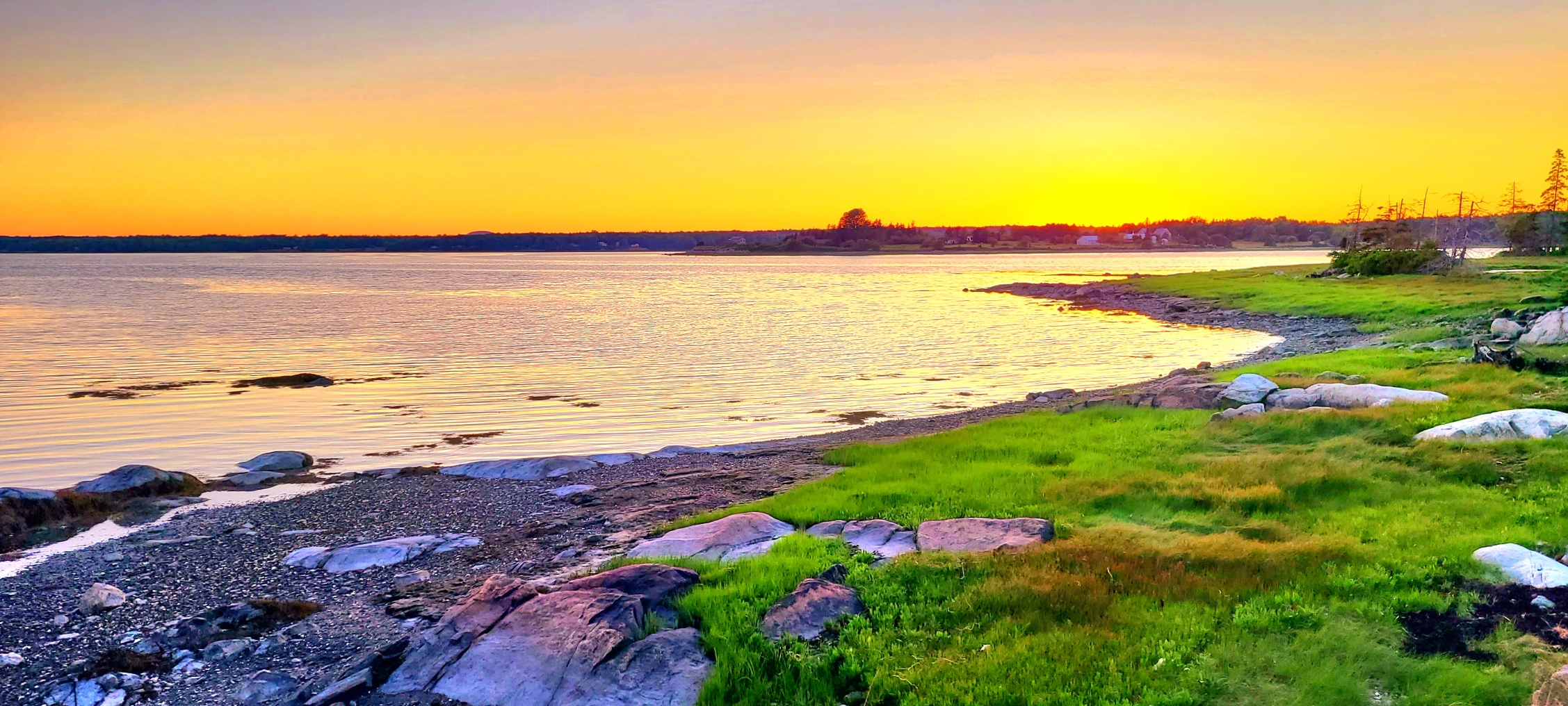
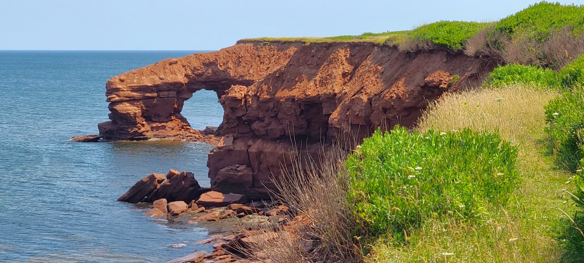
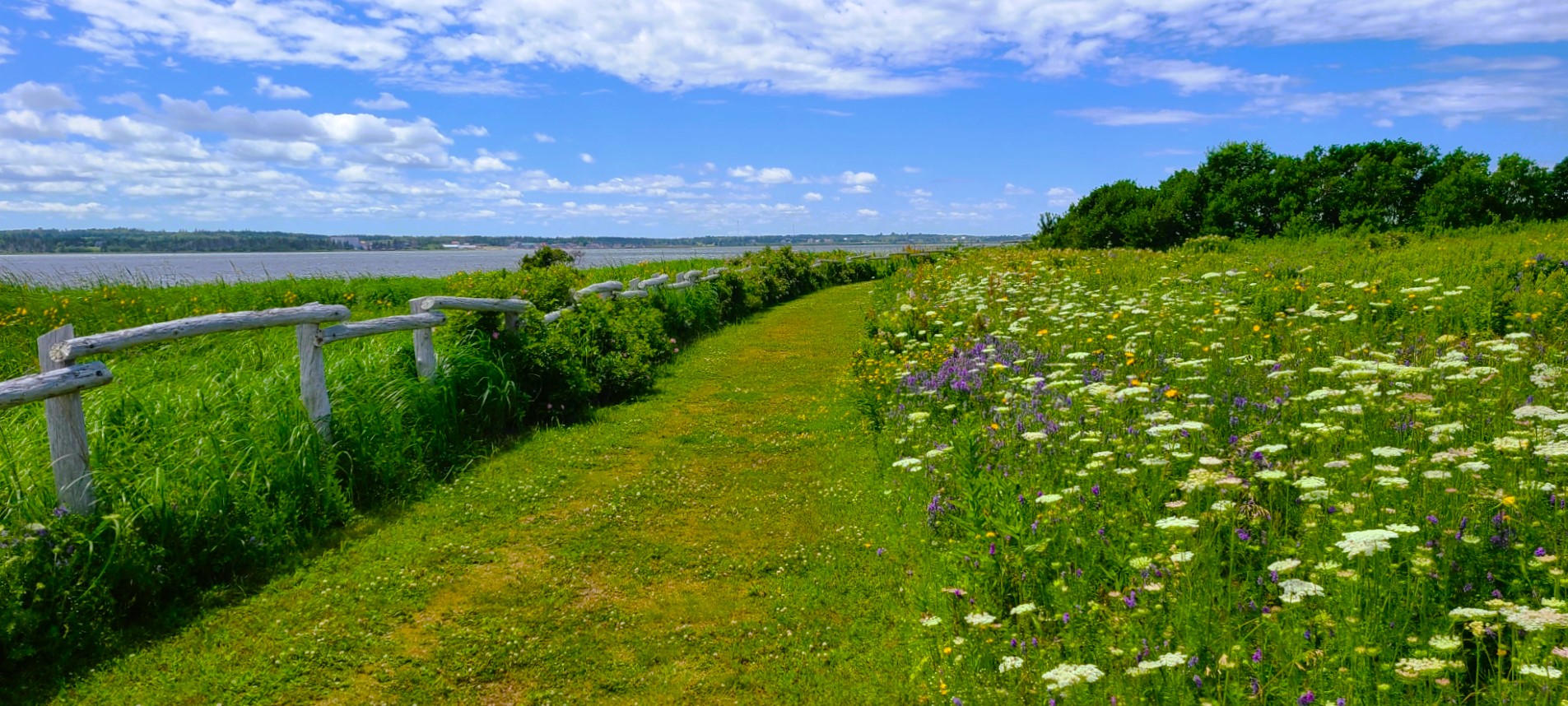
and Prince Edward Island…
MacKenzies Brook–Cavendish Beach, PEIGreenwich Trailhead–Saint Peters Bay, PEI
in our Airstream Globetrotter,
Beach Rose RV Park–Salisbury, MA
with a stopover in Grand Falls, NB…
Grand Falls Gorge–Grand Falls, NBGrand Falls Gorge Trail–Grand Falls, NB
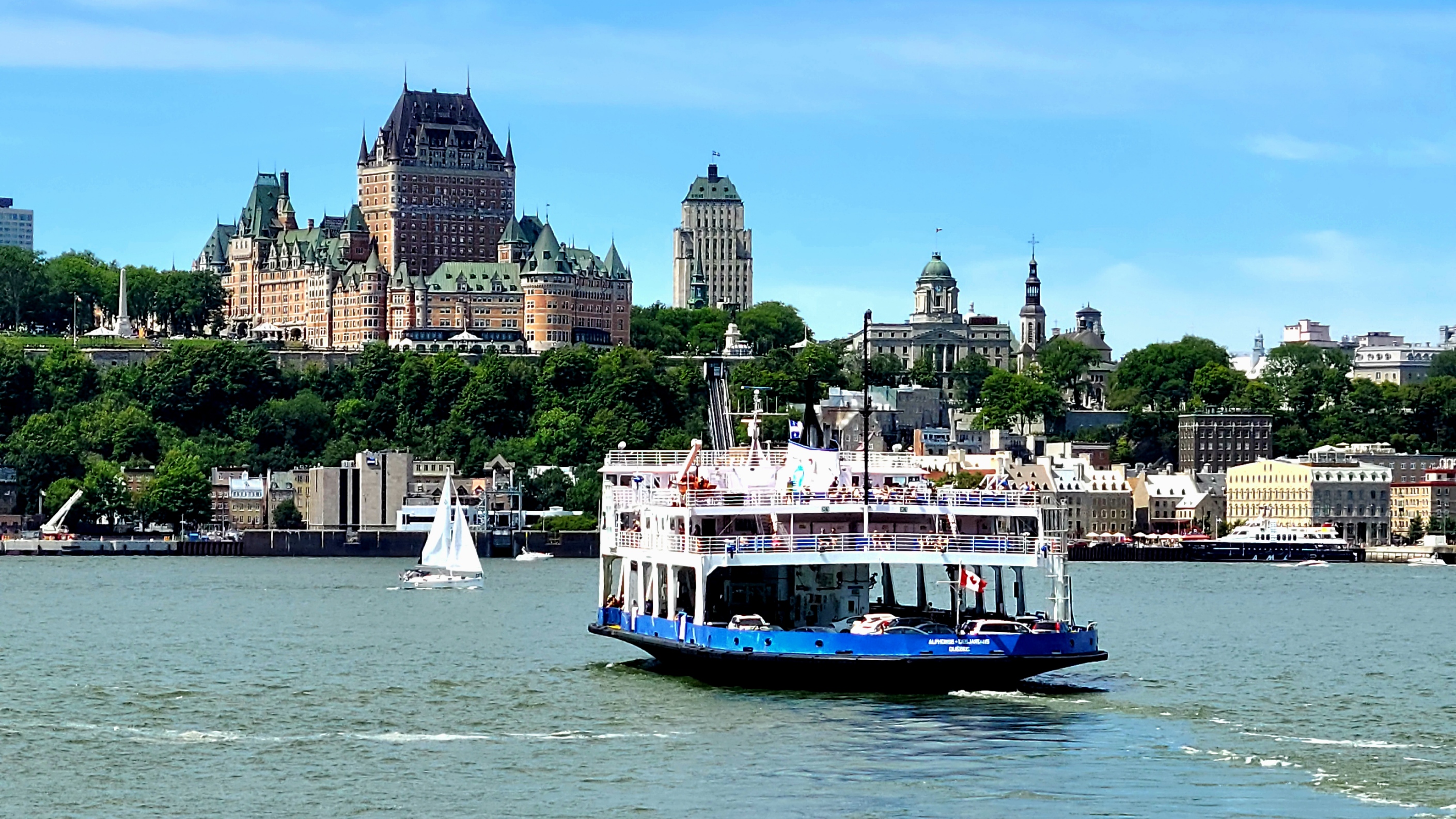
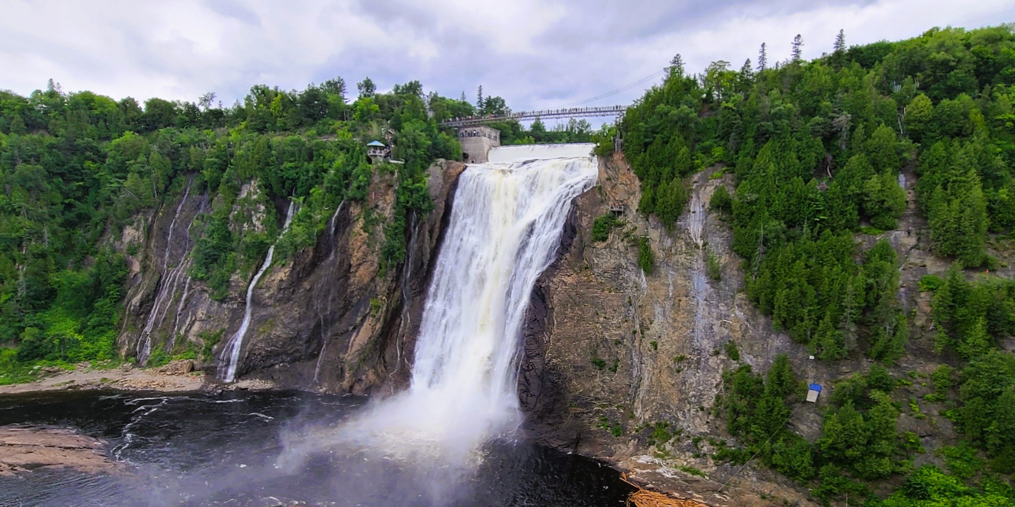
before following the St. Lawrence River from Quebec City…
Saint Lawrence River–Quebec City, QCMontmorency Falls–Quebec City, QC
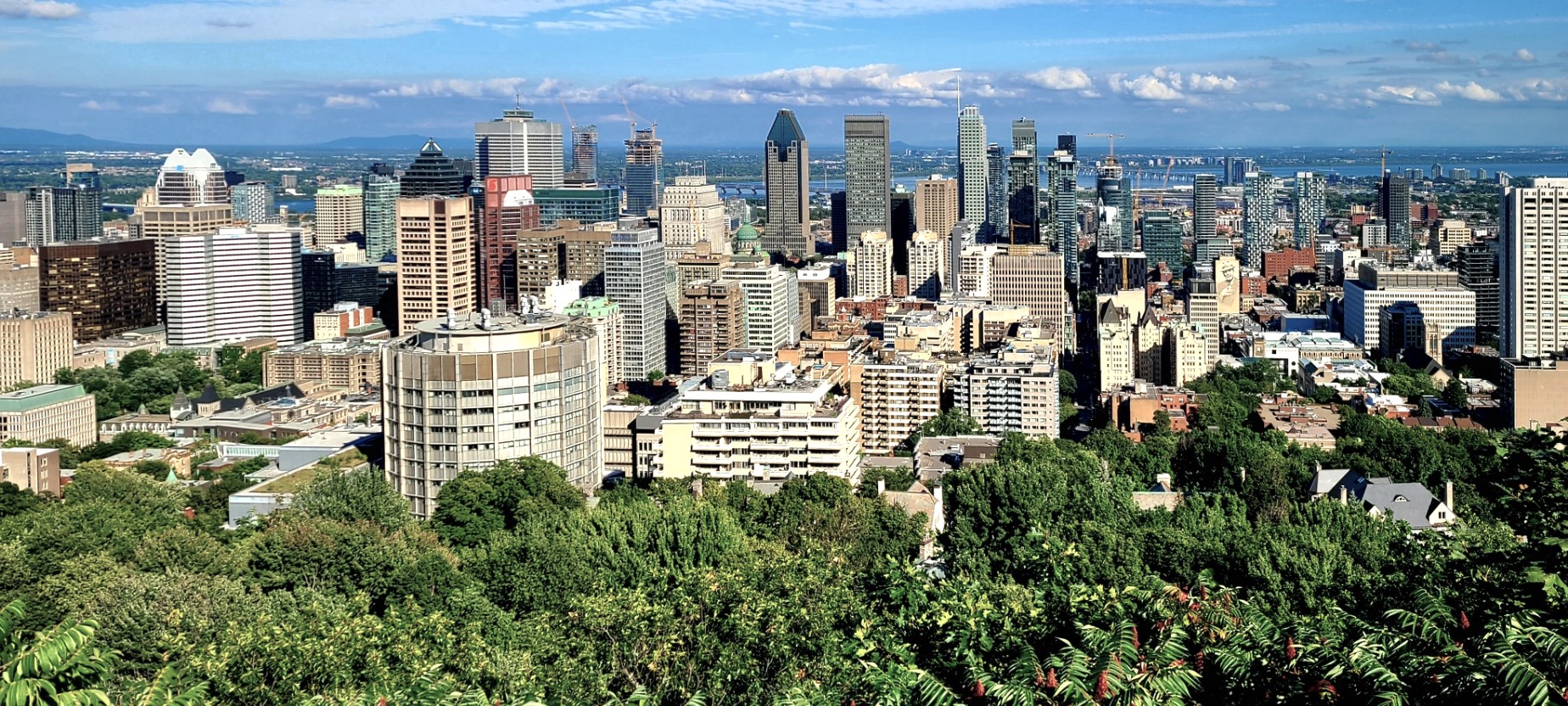
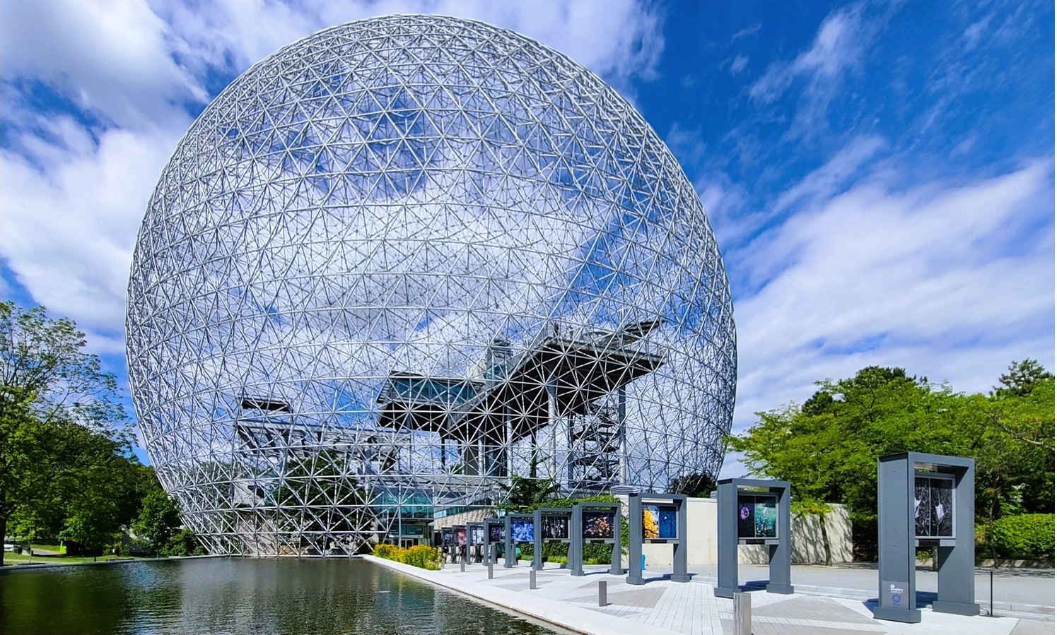
to Montreal.
Mont Royal Park–Montreal, QCBiosphere, Parc Jean-Drapeau–Montreal, QC
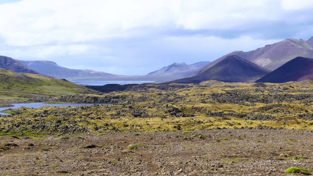
Yet all the while, I’ve been reporting on our epic, 2-week adventure in Iceland. Needless to say, it’s been a bit disorienting with my body in Canada and my mind’s eye in Iceland.
Dynjandi–Arnarfjörður, Iceland
And to further complicate the blog timeline, Leah and I recently bid ‘adieu‘ to Canada, without posting from our Canadian exploits.
Currently, we are spending the week in Lake Placid,
Lake Placid from Whiteface Mountain summit,–Wilmington, NYAuSable Chasm–Wilmington, NY
where once again, I find myself struggling to regain my geographical balance within the space-time continuum.
Which presents a new dilemma: do I recreate my travel chronology (starting with Acadia National Park) and continue reliving the past, or do I write about where I am, here and now?
I’ve given it lots of thought, and have come to the conclusion that writing about faraway places is far easier when I’m not so far away–in space and time.
Of course, I reserve the right to blog about past Canadian adventures, but only from a distance.
*All photography taken with my Samsung GS20 Plus 5G smartphone.
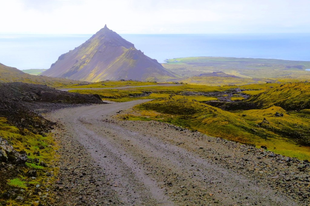
Leah and I overnighted in Arnarstapi, a tiny fishing village perched on a lava cliff in West Iceland, where Mt. Snapafell looms large across the horizon.
Icelanders believe the village still pulses with a healing energy that emanates from chieftain, Bárður Snæfellsás, half ogre/ half human and sorcerer from the first settlement.
as imagined by sculptor Ragnar Kjartansson in 1985
Legend suggests that Bárður was swallowed by Snæfellsjökull glacier. Perhaps it was his penance for killing his nephews, who admitted to pushing his daughter out to sea on an ice floe.
Consequently, Bárður was forever frozen in time and eternally committed to protecting the people of SnæfellsnesPeninsula,
and preserving its unspoiled natural beauty…
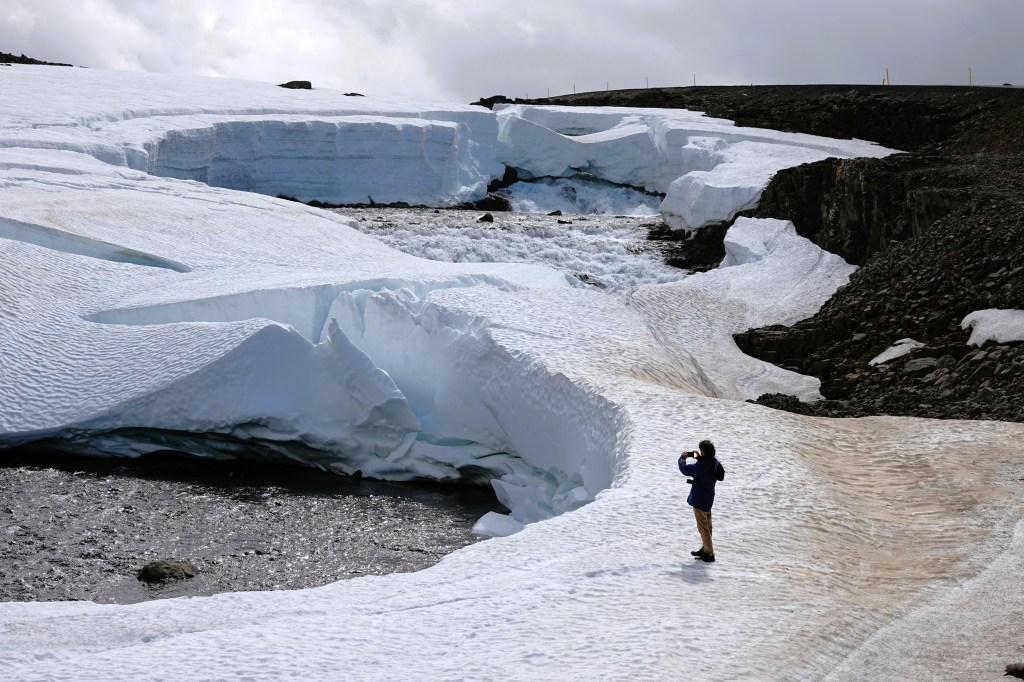
Another storm was brewing the day of our drive to Snæfellsjökull National Park. We mapped a route in search of the mysterious Snæfellsjökull Volcano, and took the high road as directed by GPS…
until we ran out of road and visibility halfway up the pass.
It was snowing on the other side of the mountain, and road crews had already conceded to Mother Nature.
So back down the mountain we went, where the weather was more predictable, and the roads were more reliable.
Unfortunately, we sacrificed a critical hour to correct our course, which translated into less time exploring Snæfellsjökull glacier at Snæfellsjökull National Park.
Instead, we continued to our next destination and penultimate excursion–
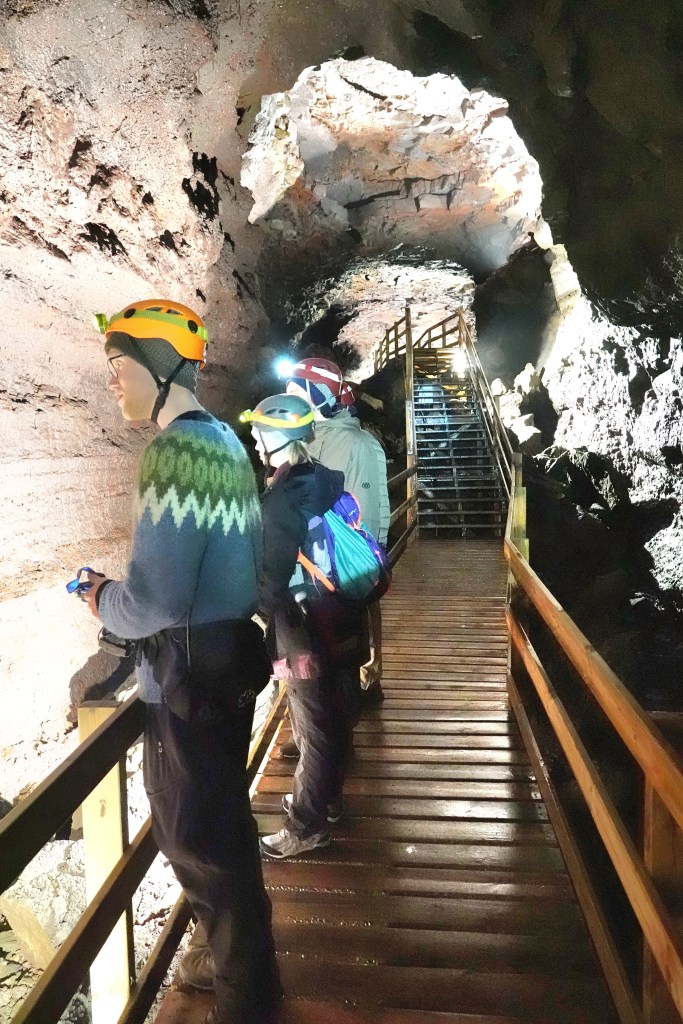
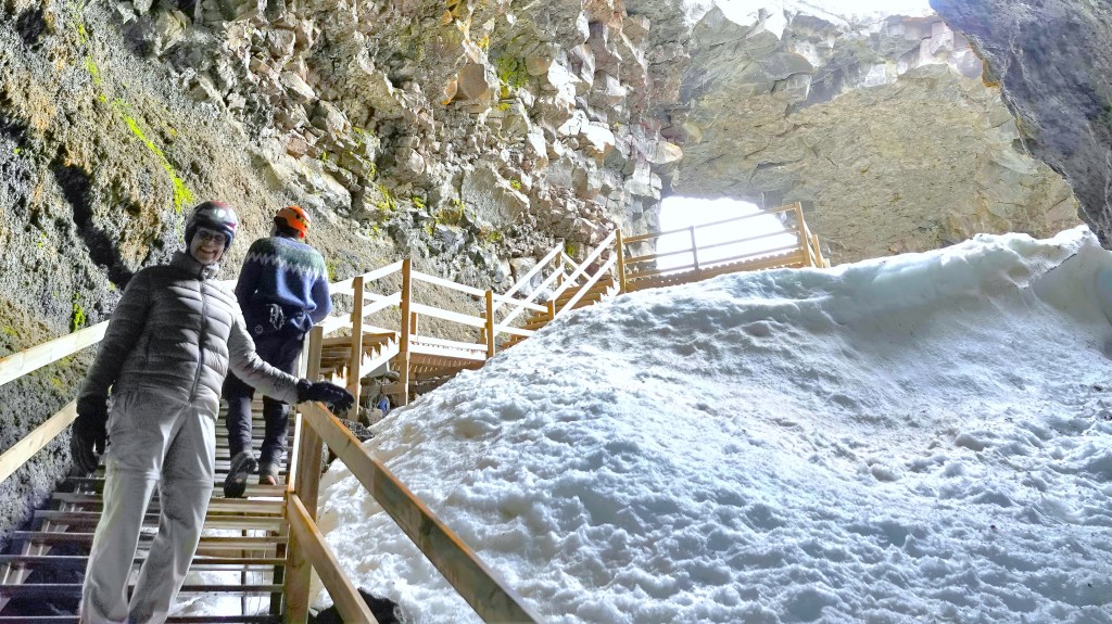
Our pre-paid guided tour of Iceland’s largest cave was originally scheduled for 1pm, but with rain clouds rolling in and a cold drizzle spoiling any chance of sightseeing or picture-taking, we expedited our drive to Borgarfjörður, with prospects of joining the noon tour if allowed.
We arrived at 12:05pm, but Sigurður (Siggy) agreed to include us, since he was already waiting for another late arrival with reservations. Hallelujah!
With our tour party now complete, each of us received a hardhat and headlamp, and Siggy (our only true-born Icelandic guide during our trip) led us 100m across a lava field called Hallmundarhraun to a twin opening in the earth where the roof of Víðgelmir had collapsed, revealing the cave’s only entrance.
We were dressed for winter inside the cave, where temperatures usually rise to 4oC, but Siggy was comfortable in a traditional Icelandic wool sweater knitted by his mom that he wore this day to celebrate Iceland’s Independence Day.
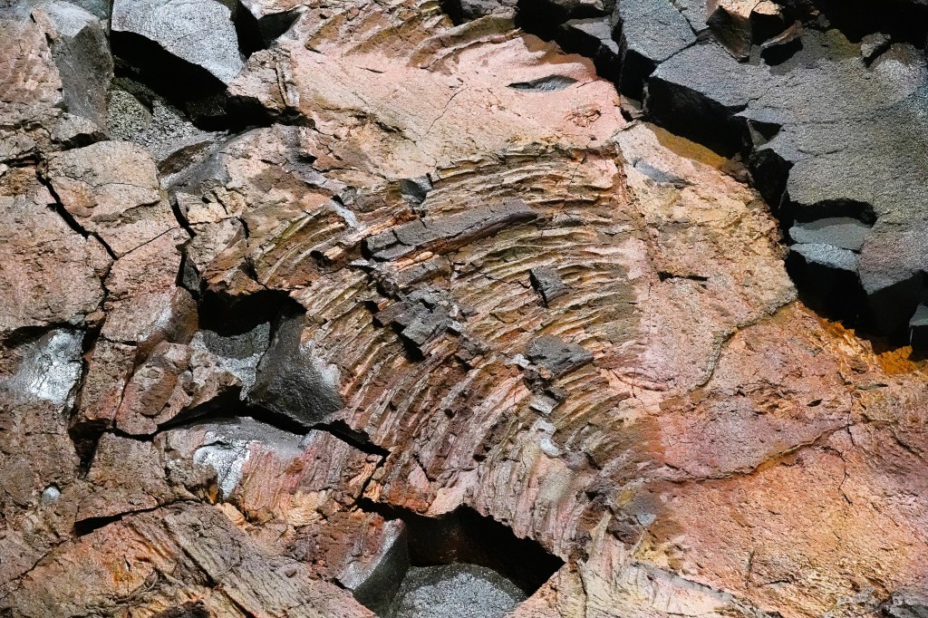
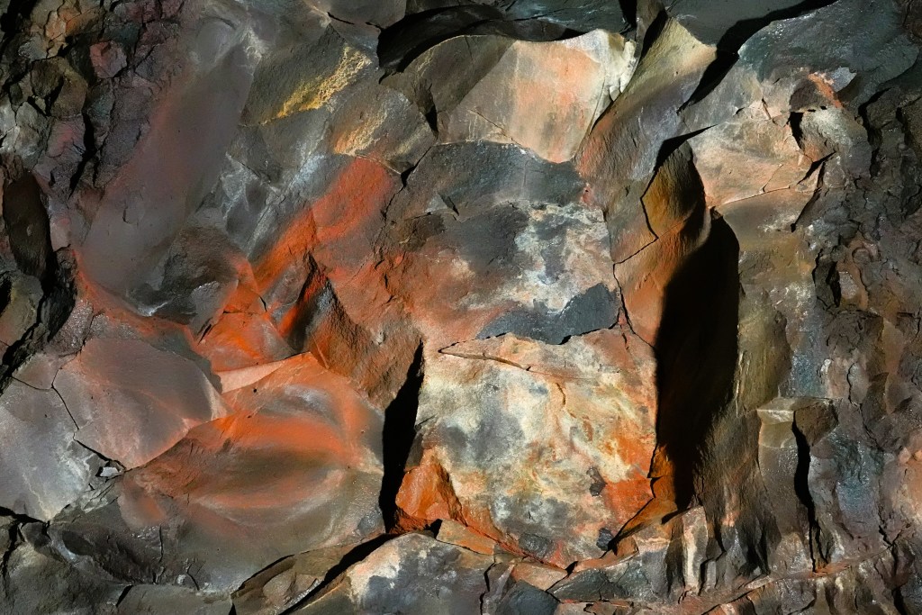
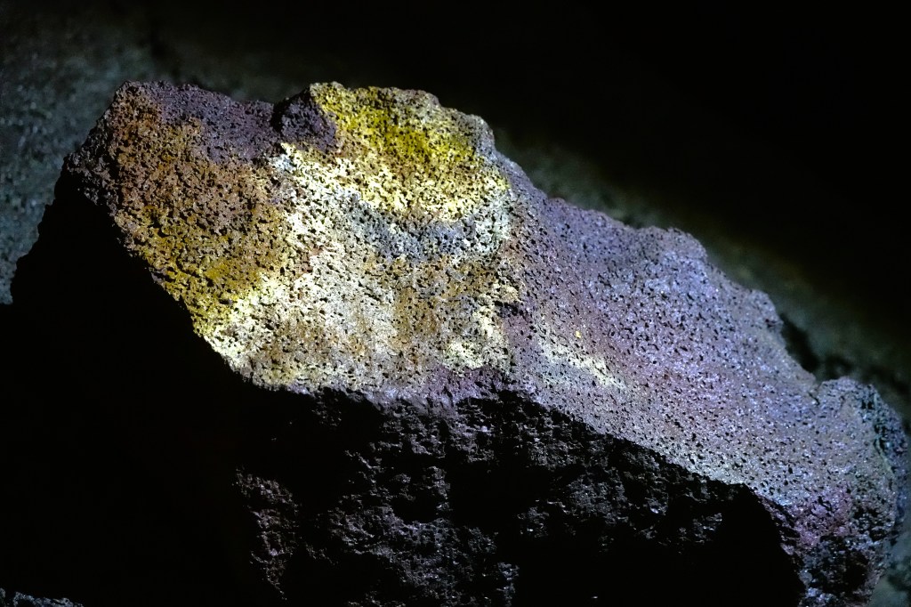
While traditional wet caves boast an array of stalactites and stalagmites, Víðgelmir cave gave us icicle formations,
and colorful mineral deposits imbedded in the walls,
and ceiling.
After an hour, we reached the end of the boardwalk where the tube narrowed,
and it was time to resurface.
With a 2-hour drive to Reykjavik ahead of us, we may yet reach the Penis Museum before closing time.
Iceland’s oral and written history is steeped in mythology and folklore, and rooted in the country’s natural wonders. From the time Garðar Svavarsson, a Swedish Viking first settled in Húsavík in 870 AD, Icelanders have imagined a world where phenomena is best interpreted through their sagas of mysticism.
Iceland’s first settlement succeeded in the second half of the ninth century because of adventurous Vikings from Denmark and Norway who were looking for a fresh start in a new world that offered opportunity, security, and stability. A parliamentary assembly of regional chieftains gathered in Thingvellir in 930 to form the Althing (assembly of free men), and ruled as the unifying body of this “free state” until 1264.
Originally, the Althing accepted Northern Germanic religion or Goðatrú (Truth of Gods) which resembled the religion of their homelands. Sacrifices were overseen by landowners/priests in temples and shrines to appease the gods and spirits, of which Thor and Odin were most popular.
By 1000, the Althing rejected paganism and enacted Christianity as the religion of the land under pressure from Norwegian king, Olaf Tryggvason, who embargoed all trade between Icelanders and Norway and held the sons of chieftains as hostages unless Icelanders accepted baptism.
Yet, despite the introduction of Christianity, pagan influence was not easily erased, and still informed how settlers reacted to their old surroundings, and their new spiritual allegiance.
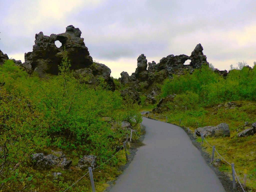
For instance, when Leah and I discovered Dimmuborgir, a dramatic expanse of lava fields east of Myvatn,
we learned that the pillars were the creation of emptied lava lakes from an immense volcanic eruption about 2300 years ago.
But legend tells us that Dimmuborgir (or “Dark Castles”) was created by Satan after he was cast from heaven, and Dimmuborgir was the gateway to the devil’s “Catacombs of Hell.”
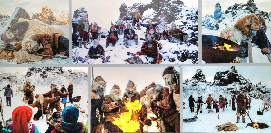
Also seeking refuge at Dimmborgir are the Yule Lads–13 offspring of Grýla and Leppalúði–who are regarded as trollish pranksters who eat misbehaving children before Christmas.
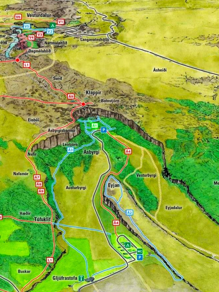
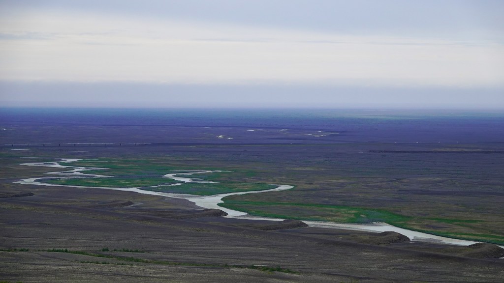
Jökulsárgljúfur National Park is another popular destination we visited that invoked the spirits and captured the imagination of pagan worshippers.
Jökulsárgljúfur, Iceland’s largest canyon, stretching 25 km long and 500 m across is the result of endless catastrophic flooding caused by an Ice Age eruption so fierce that its glacial ice cap exploded.
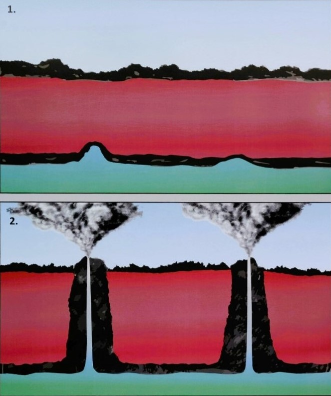
However, the Norsemen believed that Sleipnir, Odin’s eight-legged steed created this natural wonder by touching earth on a jaunt across the sky, leaving behind the impression of a massive hoofprint that became the canyon Ásbyrgi,
with a rock island spur named Eyjan.
To the west of Ásbyrgi, lie the cliffs of Hljóðaklettar and its inhabitants, the mythical Huldufólk (Hidden People), who cautiously avoid sunlight, or risk the same fate of the elves and trolls who have turned into stone pillars from sun exposure.
Another example of trolls behaving badly can be found along the black sand shoreline of Vatnsnes peninsula in northwest Iceland. From a geological perspective, Hvitserkur is a 15-meter tall basalt monolith that’s been shaped by severe North Atlantic storms and constant temperature changes.
Although Hvitsekur resembles a drinking dragon, Icelandic folklore refers to the stack as an evil troll who raided a local church to silence its bell tower, but turned to stone after being caught by the sun’s early rays. The petrified troll is home to hundreds of nesting birds who forever punish him with a thick layer of guano, and Icelanders who mock him with the name “White Shirt.”
Of all the stories, historians consider Goðafoss a landmark in North Iceland culture, for its here that regional chiefs met with pagan lawmaker, Thorgeir Ljósvetningagoði to determine whether to continue their old ways or embrace Christ as their spiritual guide.
The saga tells us that as a gesture of Iceland’s newly adopted religion, Thorgeir Ljósvetningagoði stood at the brink of the falls to cast a collection of Norse idols into the abyss, marking an end to paganism. Thus, the waterfall was christened Goðafoss, the “Waterfall of the Gods.”
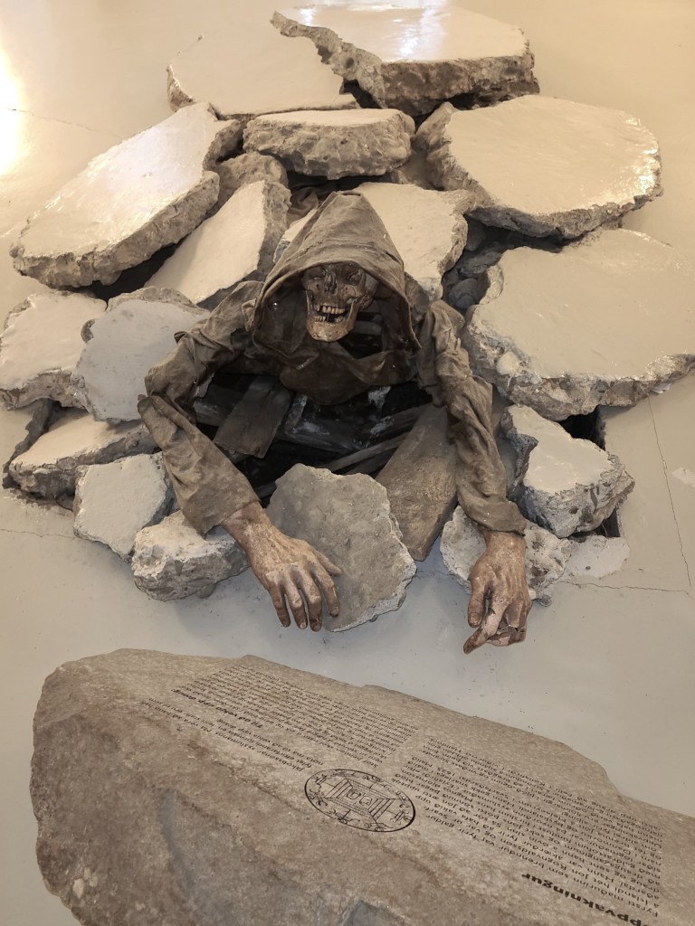
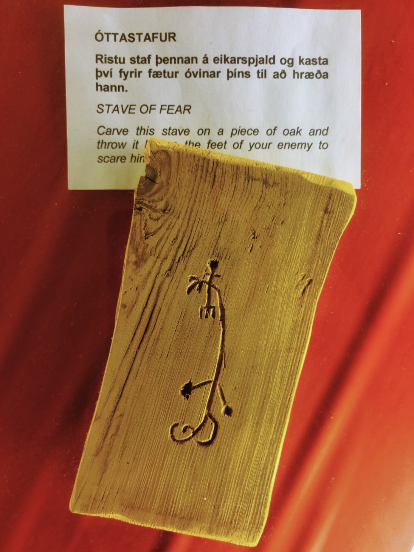
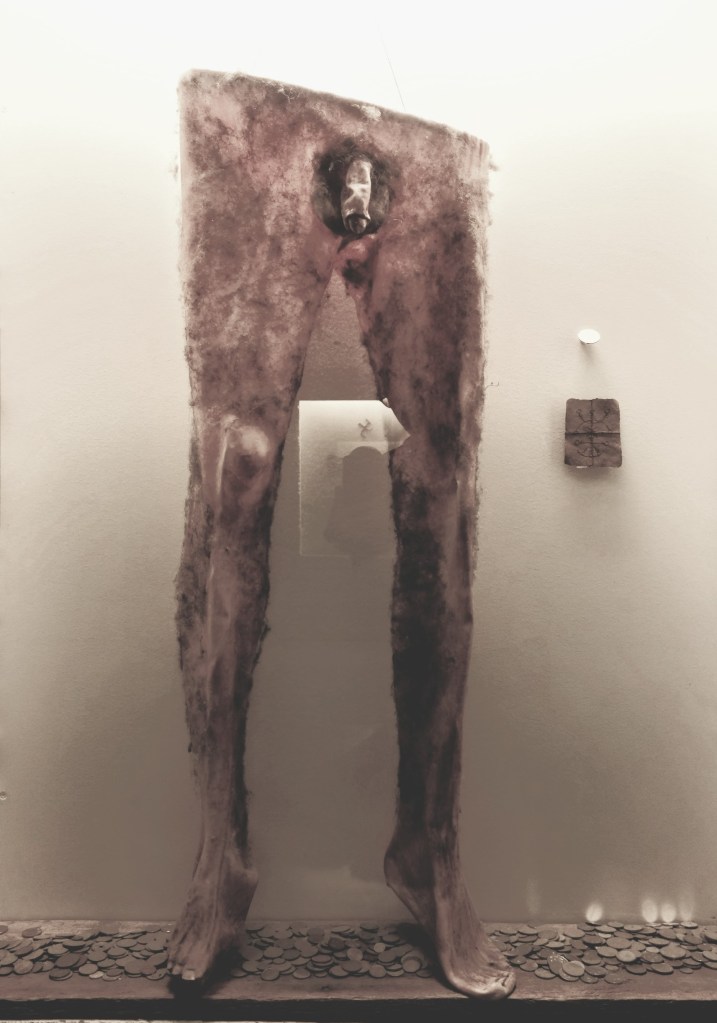
It was the beginning of conversion, and Iceland eventually capitulated to convention. Nevertheless, the notion of magic and sorcery continued to flourish in Iceland, well into the 17th century. A museum located in Hólmavík is devoted to the subject.
It tells the story of 25 or so victims who were executed on charges of witchcraft between 1625 and 1685.
The museum also exhibits some unusual artifacts,
ranging from the sublime…
to the ridiculous.
Superstitions began to fade during the last decades of the 17th century, and the Reformation came as a shock to Icelanders. But consider a 2007 study by the University of Iceland that found an estimated 62% of the nation still believes in the existence of elves, and 40% of the population is irreligious.
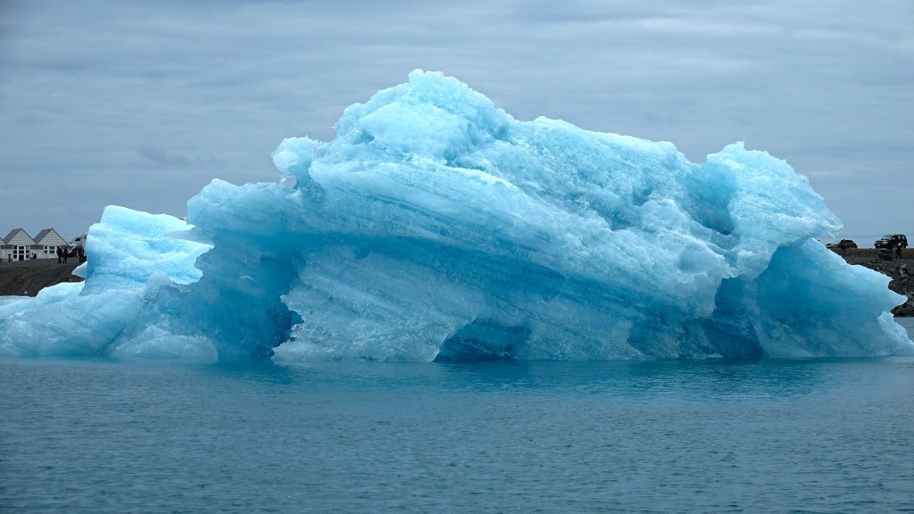
Imagine an aquatic gallery of ephemeral ice sculptures in varying shapes, sizes and shades of blue, dancing around a glacial lagoon before floating out to sea or washing upon a black, sandy beach.
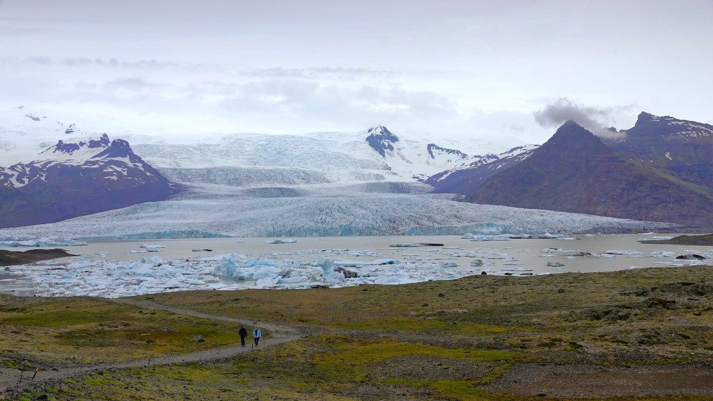
After our hike at Skaftafell, Leah and I were expected at Jökulsárlón for a late afternoon amphibian boat tour of the glacial lagoon, but not before a required stopover at Fjallsárlón for a dramatic view of an outlier glacier…
receding into a volcanic valley,
with chunks of ice fighting for a place to thaw.
I could have spent hours at the shoreline photographing the amorphous shapes, but our boat excursion across the road at Jökulsárlón was soon boarding.
We rolled off the moraine in fat tires, and effortlessly glided onto the lagoon for a chilly boat ride surrounded by orange vests and hulking ice.
Our captain cautiously piloted the amphibian as close to the bergs as allowed, to limit the wake of curious kayakers,
and knowing that hidden ice is usually more voluminous than exposed ice.
Also present in the lagoon was a resident colony of surreptitious seals,
anxiously awaiting high tide to feast on herring and cod swept into the icy inlet.
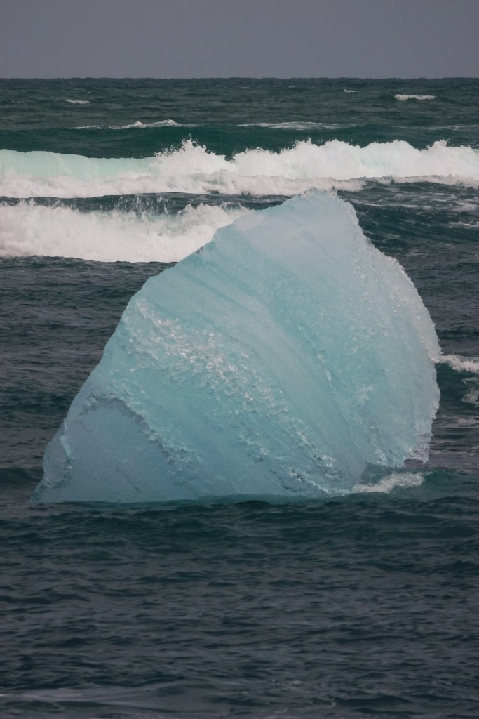
After disembarking, we crossed to the Atlantic, where jewels of ice wash ashore,
and decorate the beach,
a fitting terminus that would gain Banksy’s approval and mine.
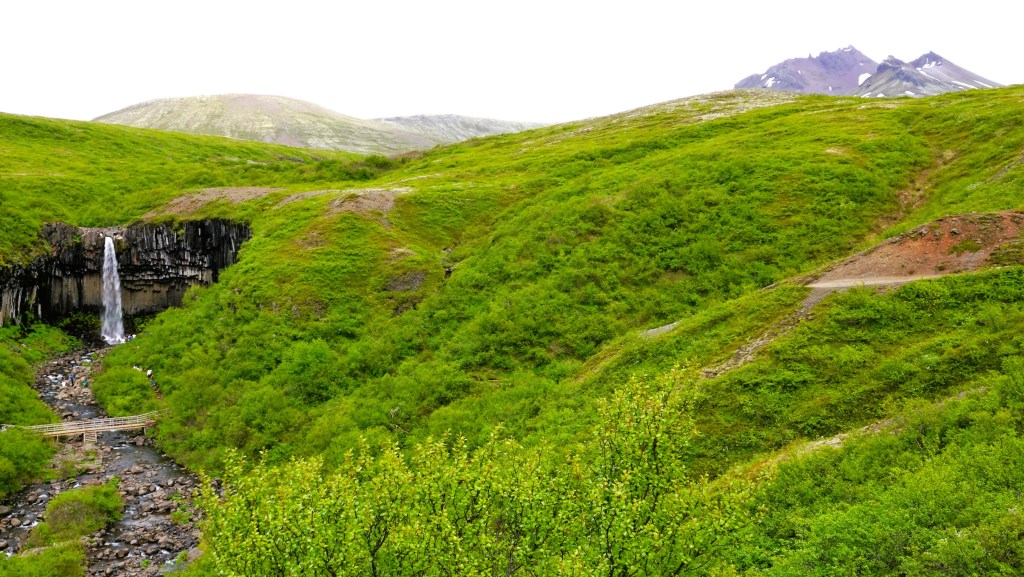
Imagine an amphitheater of “organ pipes” carved out of a grass-topped lava field with a 20-metre waterfall plunging down its center into a roiling pool of green water.
It sounds impressive, but seeing is believing, so Leah and I navigated to Skaftafell, a nature preserve in southeast Iceland that belongs to Vatnajökull National Park, Iceland’s largest park with 18% of the island’s land mass, where Svartifoss is one of the featured attractions.
We arrived at the Visitor Center parking, and cursed the ATMs for making paying for parking so difficult. We hiked through the campground before arriving at the Visitor’s Center.
I was literally speechless. Vatnajökulsþjóðgarður? Really!? How could there possibly be a word with a V, a K, two Js, and a letter that’s stuck between a b and a p? And how about the pronunciation? And what does it even mean?
But there was no time for questions. We were there to hike, and there was a waterfall to explore.
We caught the trailhead past the same campground and began our ascent. The trail was wide and steep at the start. So much so, that metal mats filled with crushed stone lined the path to keep erosion at a minimum. We caught our first view looking east when we cleared the trees.
We continued above Gomlutun, across Estragil gulley on a footbridge, past two waterfalls (Hundafoss and Magnusarfoss),
until we reached the approach to Svartifoss.
My pulse quickened. I sensed this waterfall was special. I zoomed in until the falls filled my frame, and I lingered before I pressed the shutter.
I raced around the side of the canyon for another perspective…from the bottom.
Svartifoss translates to “Black Falls” and it lives up to its name,
as it showcases a splendid backdrop of charred columns of basalt.
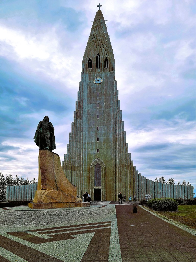
Svartifoss was the inspiration behind Gudjon Samuelsson’s design of Hallgrimskirkja, Iceland’s celebrated cathedral in Reykjavik.
We were down the mountain and at the Land Cruiser after 2.0 hrs. in Skaftafell, which included our lunch at the overlook and a potty break.
It was time for more sightseeing down the road, and we were on a schedule!
But first, some unanswered questions:
Apparently, Vatnajökulsþjóðgarður is a real Icelandic word,
Feeling exhilarated after our Silfra snorkeling adventure, Leah and I said goodbye to Thingvellir, and set out to complete the remaining natural wonders of the Golden Circle trifecta.
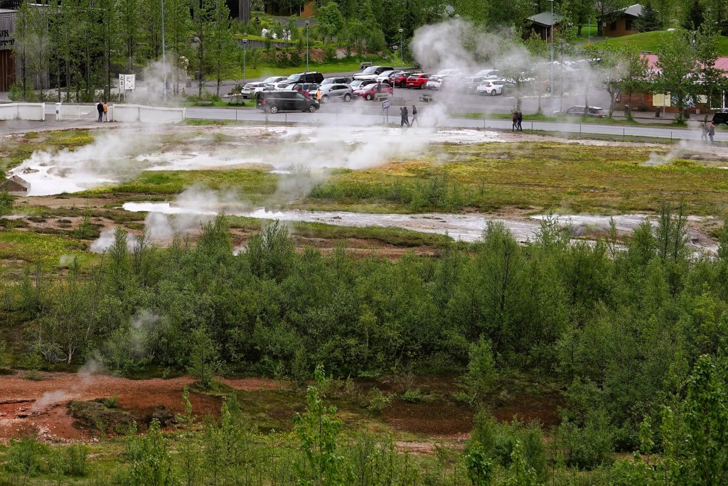
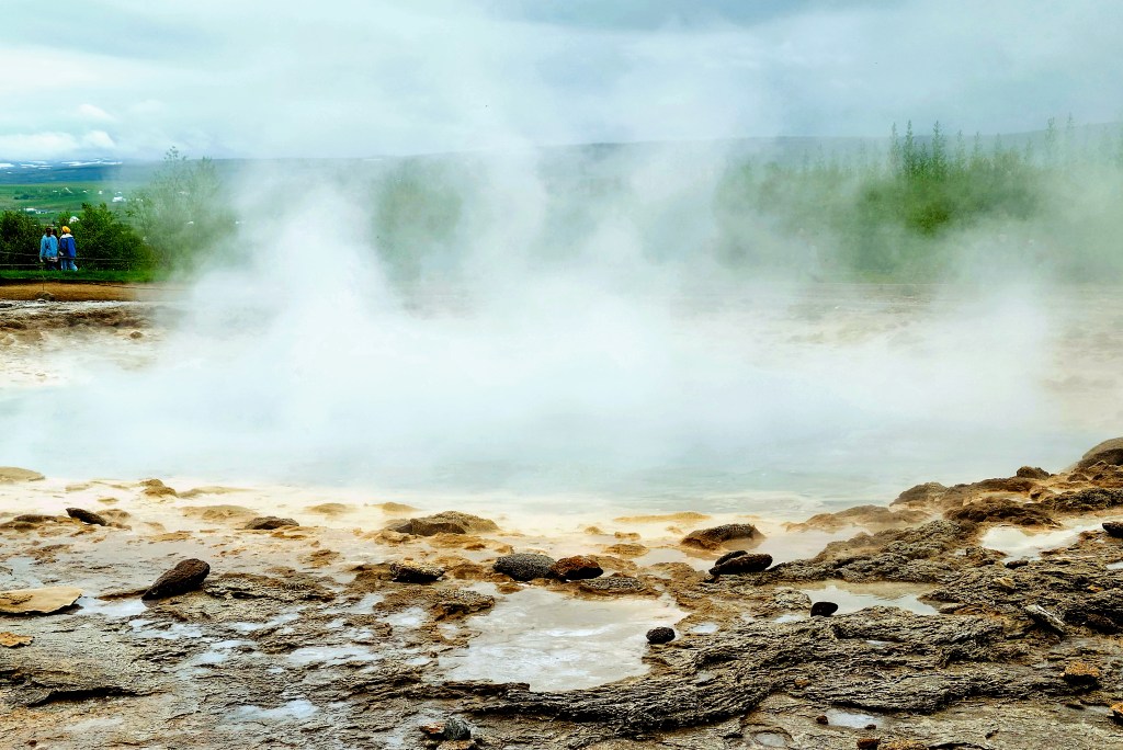
We continued to Haukadalur, a geothermal valley in South Iceland that boasts a plethora of fumaroles and geysers,
including the powerful and predictable Strokkur, Iceland’s most active geyser that regularly erupts every 5 to 10 minutes like clockwork,
sending boiling water skyward, 20 to 40 metres beyond its mineral-stained crust.
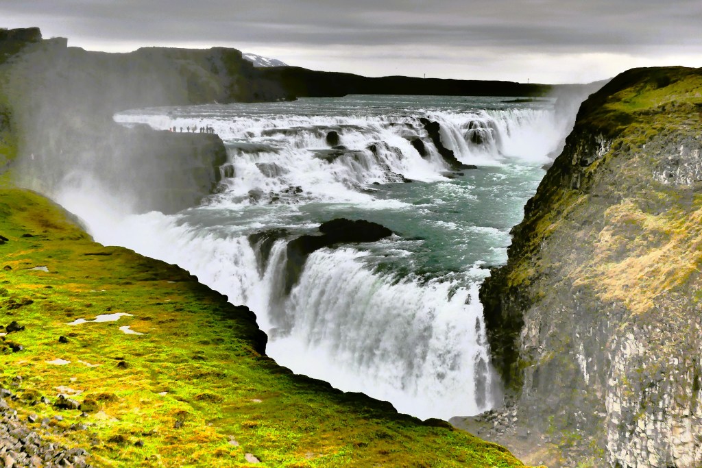
Afterwards, we traveled to Hvítá river canyon to visit Iceland’s beloved falls, Gullfoss. The water in Hvítá river travels from the glacier Langjökull, Iceland’s second largest ice cap, before cascading 32 meters (105 feet) down Gullfoss’ double drops in dramatic display.
We arrived in time for one of Iceland’s typical daily weather changes as we hiked to the closest observation deck. The blustery gales had driven the cold drizzle and falls spray sideways. While we were dressed appropriately in warm parkas and rain pants, Leah was miserable and could only manage a walk to one of many overlooks of Gullfoss.
I tried to ignore the weather, but the poor visibility and annoying spritz was affecting my ability to keep the camera lens dry while trying to capture the “perfect shot.”
Leah retired to the comfort of the Land Cruiser, while I climbed above the canyon wall in search of a different perspective, thinking that if I distanced myself from the water, I could keep my camera dry.
The best that I could manage, given the circumstances was adequate…
However, to my chagrin, I found the perfect shot at the base of the foothills, but it belonged to a park graphic with information about Gullfoss…
However, looking southeast, I also discovered a telling view of Thingvellir’s distant topography just beyond the Visitor Center.
Of course, being a national park, certain rules apply; and understandably, drone photography is a no no. But Gullfoss is so expansive that it would surely benefit from an aerial approach, so the Park Service sanctioned a third party to capture the awe and splendor that only a drone can see.
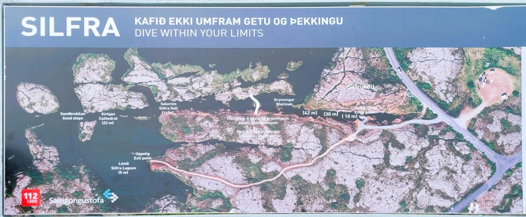
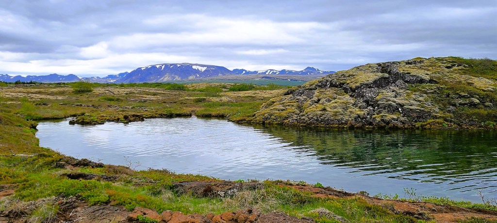
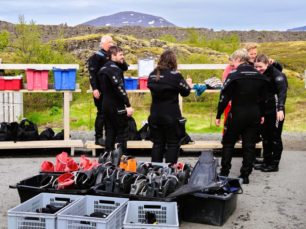
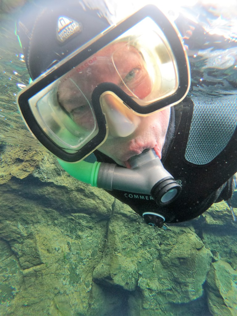
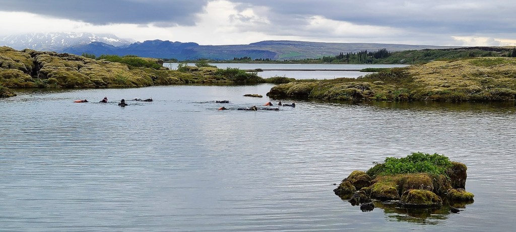
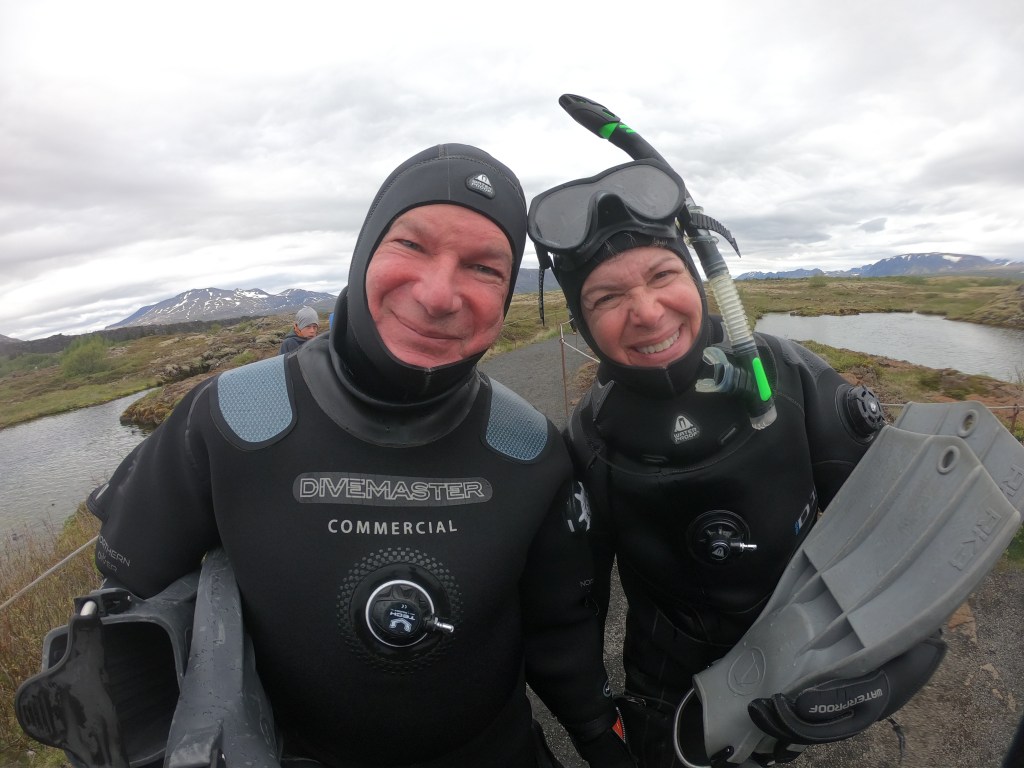
There is one place on earth–Silfra–where it’s possible to “touch” two different continents underwater and it’s located within the Golden Circle of Iceland. Leah and I were up for the challenge, but it required some preparation.
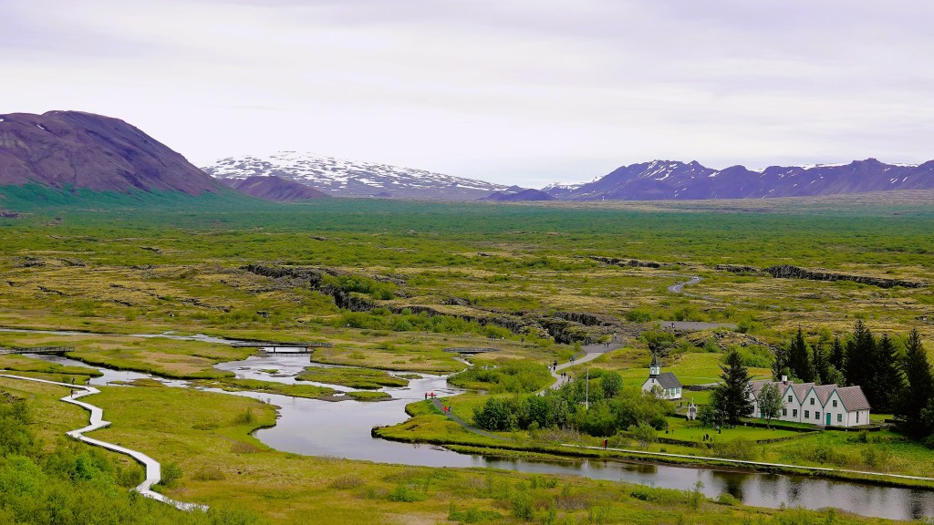
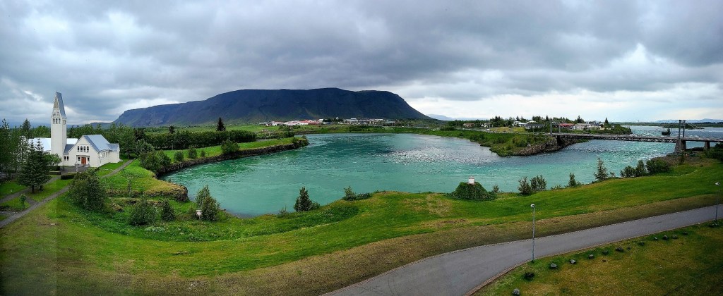
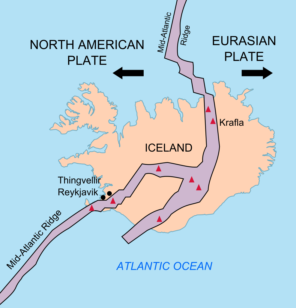
First, we traveled southeast of Reykjavik to Thingvellir National Park, the birthplace of parliamentary government (Althing, 930 AD), and the zone where volcanic activity has played a heavy hand in shaping our planet.
Not to get too bogged down in earth science, but a rift occurred through the middle of Iceland where two tectonic plates are pulling away from each other 2.5 centimeters every year as a result of volcanic activity in the region since the beginning of time,
and much of it vents under Lake Thingvallavatn, Iceland’s largest lake.
Above sea-level, lava fields at Thingvellir have been torn apart by tectonic forces, leaving gorges and fissures to admire between two continents.
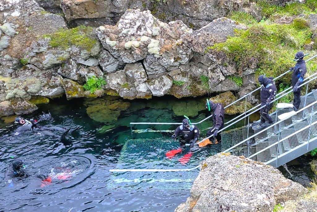
However, inside the rift valley created by daily earthquakes throughout time, there is one ravine, Silfra that allows snorkelers and divers to experience the tectonic plates underwater, but it requires a dry suit to tolerate the water temperature (2o C) and a certified outfitter to guide thru the underwater fissure.
Leah and I had booked an excursion through Arctic Adventures, who supplied all of our underwater gear and a guide to assist with dressing, and underwater photography.
We dressed in a parking lot by the roadside where various outfitters have set up shop.
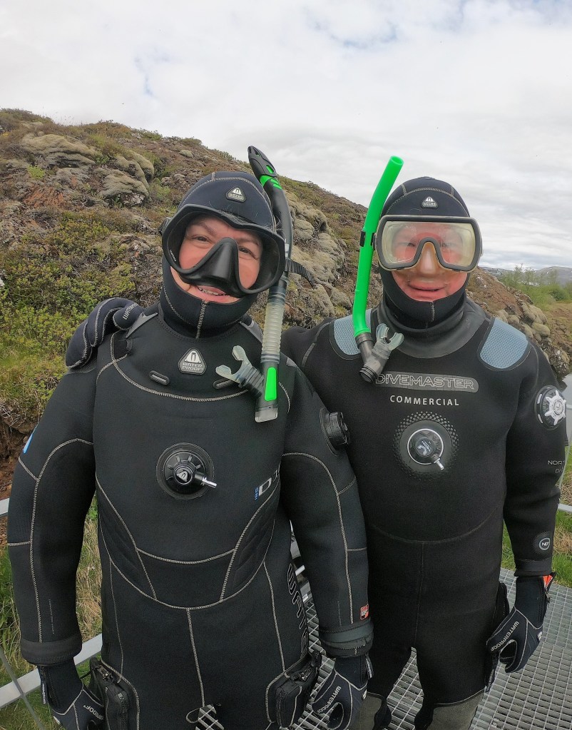
Over the thermals and wool socks we supplied, we stepped into fully insulated jumpsuits to wear under incredibly bulky dry suits with fixed booties, snug rubber sleeve guards around our wrists, lashed with rubber bands, and a snug rubber seal around our neck with a rubber band choker. An industrial zipper across our deltoids sealed us in.
Then came a rubberized neoprene hood over our heads. Imagine forcing your head through your neck. After accessorizing our fashionable outfits with neoprene lobster gloves, we were ready for the apocalypse.
We were a group of twelve…
under the supervision of Chris (from Hungary) and Marcelo (from Sao Paulo). We split into 2 groups of 6,
and waited our turn to enter the water.
Immediately, the suit constricted around my lower body as I stepped deeper and deeper into frigid water…but I stayed dry! Without hesitation, I glided in and immersed my face. Only the small area around my facemask was exposed and the sensation around my lips felt like a cold scalding until they turned numb after 10 seconds.
We flopped onto our backs, and let the current carry us slowly through the gorge while watching the arctic terns doing aerial maneuvers overhead.
As we floated past Grynningar Shallows, I was awed by the clarity of the water, with visibility beyond 100 meters (300 ft).
We were in the water approximately 40 minutes. Once we reached the Silfra Lagoon, the stiff current required strong frog kicks for us to reach the exit point.
As promised by Marcelo, each of us emerged from the lake with “Angelina Jolie lips.”
Overall, the experience was sublime. However, my biggest complaint had to be cold hands. Most of the time, my hands stayed clasped behind my back, out of water, but the weak stitching around the seals of the gloves made them porous. Marcelo quipped that the gloves leaked because they were made in Sweden.
Lest we be judged for our adventurous antics, consider this unassuming mother of three from Germany, who stripped down to her swimsuit, and took the polar plunge, albeit for only 30 seconds.
I don’t think she’ll be doing that again, anytime soon, but for me, it could become an addiction.
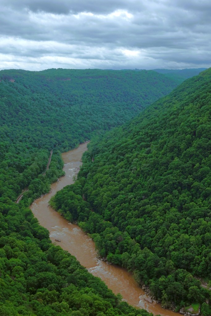
The New River has been carving the Appalachian Valley for the past 10 to 360 million years–depending on who you ask–which makes it an ancient river–ranked behind the Finke and Meuse as the world’s third oldest river. Of course, there is the obvious non sequitur, given the river’s moniker and apparent age.
One story claims that its name comes from a translation from Indian dialect meaning “new waters.” Another explanation tells of Captain Byrd who had been employed to open a road from the James River to Abingdon in 1764. Byrd used the Jefferson-Fry Map published in 1755. However, this map did not show the river, so Byrd noted it as the “New River.”
Originating in North Carolina, the New River flows 360 miles north until it meets the Gauley River in southern West Virginia, providing some of the best whitewater (Class IV rapids and above) on the planet, and the main reason for our visit.
Our first look came from an overlook behind the Canyon Rim Visitor Center,
treating us to canopied canyon walls as far as we could see, soaring 876 feet above the water.
and a profile of the New River Gorge Bridge (the Rusted Rainbow).
When the New River Gorge Bridge opened in 1977, it was the world’s longest single-span arch bridge for 26 years. With an arch 1,700 feet (518 m) long, it is now relegated to the fifth longest.
While I appreciate the engineering feat of a half-mile span that saves travelers 45 minutes of detouring,
it’s the river I’ve come to conquer.
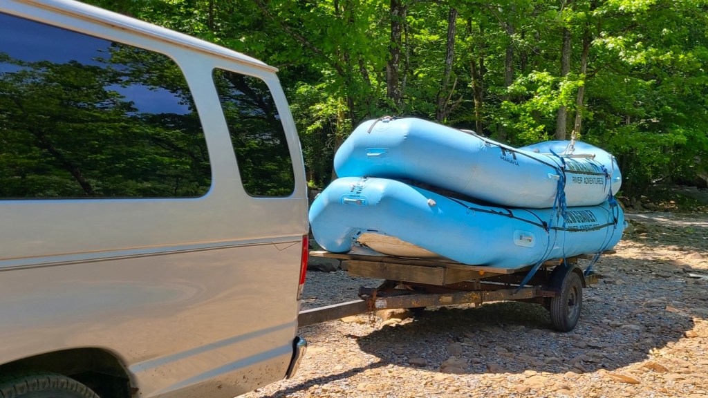
New and Gauley River Adventures shoved off from Stone Cliff at 10am–14 miles downriver from the bridge–with six eager adrenalin junkies and our guide, Costa Rica Scott in one raft, and a support raft to tag along. Leah refused to float with us, despite my gentle coaxing.
Once we were properly outfitted with life jackets and helmets…
off we went…
While the first half of the trip was relatively lazy, with fountains of 60oF spray coming from occasional haystacks and laterals, the spring run-off and torrents of rain before our arrival had turned the second half into a fast-moving, turbulent churn, filled with hydraulic traps, and 7 foot waves.
which had us threading our way through Keeneys, Dudleys Dip, Double Z, Greyhound, and Millers Folly Rapids with increased caution.
Miraculously, we never flipped and everyone remained in the boat throughout the ride. However, the soul behind me spent most of the time stretched across the raft with his head pinned over the gunwale, retching. Fortunately, whenever our pilot commanded us to “dig in” (paddle like our lives depended on it), I avoided smacking him across the face.
After 4 hours on the river, our take-out was just shy of the bridge, beyond Fayette Station.
What a blast! If only there was time to run back and do it again, but that would have left little time for hiking to Diamond Point;
visiting Cathedral Falls in Ansted;
investigating abandoned beehive coke ovens in Nuttallburg;
strolling through a mining ghost town (pop. 5) in Thurmond;
or just chilling at The Outpost, “Where Wild Meets Wonderful.”
It’s been a while… nearly 5 months since my last post…
I could blame coronavirus for the lapse, but that would be cheating,
Truth is…
I took a vacation from writing just as Covid-19 was rolling out a fresh variant.
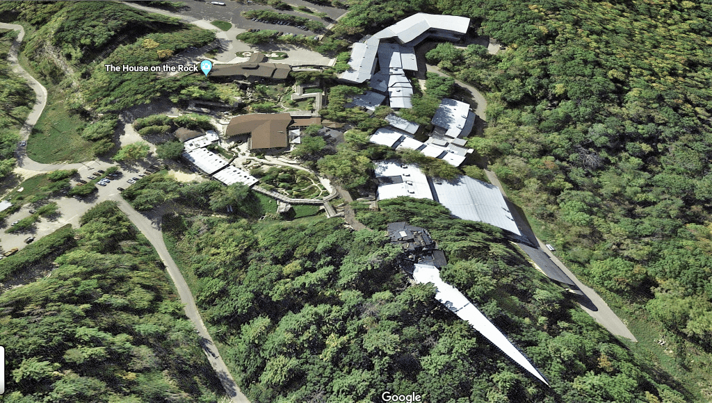
I was gathering details about Alex Jordan’s sprawling House on the Rock for a future photographic commentary on excessiveness,
when I folded my laptop and put my writing away… until it felt like less of a job.
I always intended on working my way back to it…
But then I got married…
to Leah, after 17 years of togetherness…
in front of friends and family!
We partied long into the night….
with historic St. Augustine as our magical backdrop.
And we’ve planned a super summer honeymoon. We’ve loaded up the Airstream and we’re heading for New River Gorge National Park in West Virginia. There’s a week stopover in NY/NJ, and then we’re off to Iceland for 2 weeks.
When we return, we’ll camp at Acadia National Park before crossing into Canada for a drive around the Bay of Fundy, the Cape Breton Highlands, Prince Edward Island, and down the St. Lawrence Seaway, with stops in Quebec City and Montreal.
Our southern route home includes time in Lake Placid, Lake Luzerne, the Jersey Shore, and northern Georgia.
I hope to share the highlights as soon as we make them.
Long stretches of telephone totems tethered as far as the eye can see…
Free-ranging livestock sprinkled across the flatlands…
Barbed wire perimeters surrounded by pastureland and littered with cow pies…
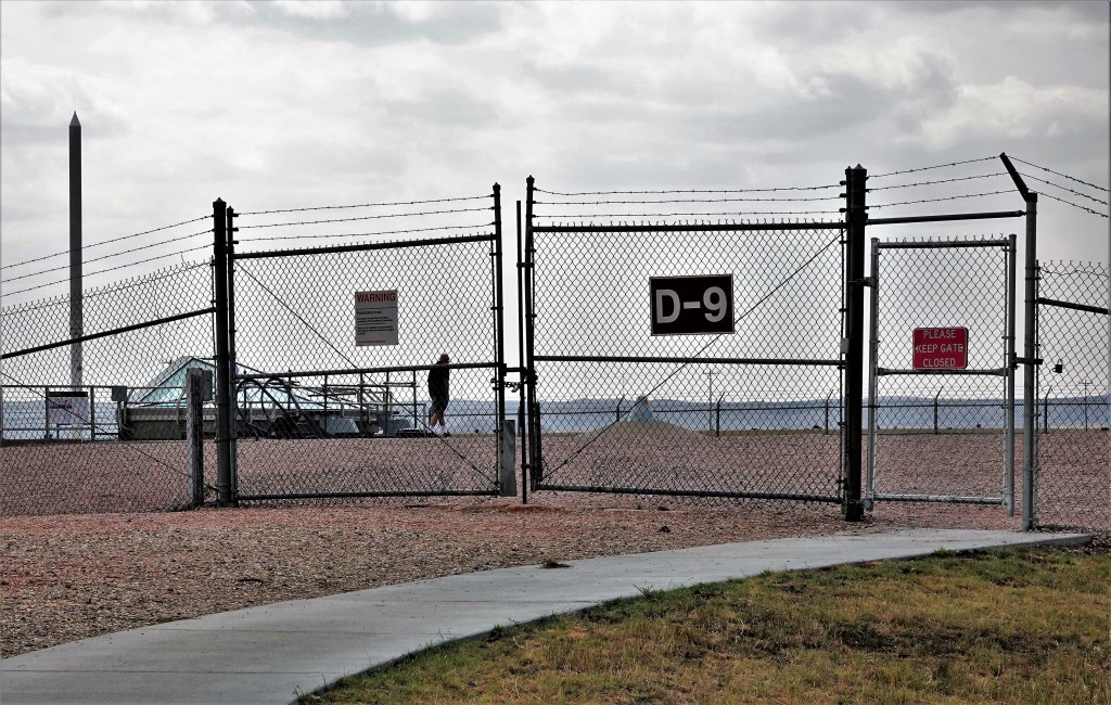
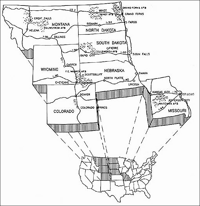
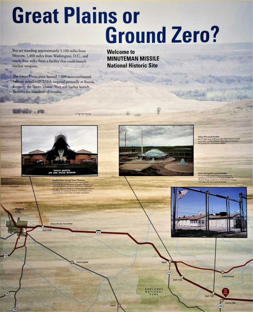
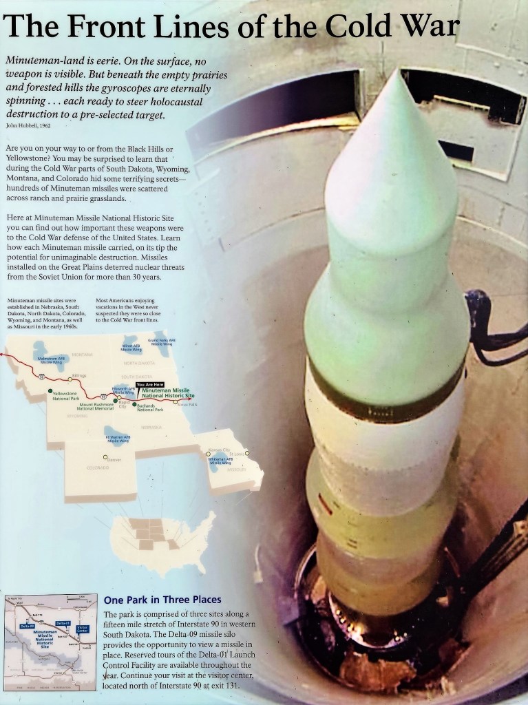
From 1963 to 1993, one thousand Minuteman II missiles (ICBMs) capable of delivering a 1.2 megaton nuclear warhead to a Soviet target in 30 minutes were housed in underground silos like Delta-09 that stretched across the Great Plains,
(Library of Congress)
with 150 launch sites dispersed throughout South Dakota, transforming the serenity of the prairie into a hibernating military zone.
(Library of Congress)
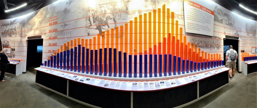
The Minuteman Missile National Historic Site commemorates a period in America’s history when “Mutually Assured Destruction” (MAD) imperiled the world, and delves into the birth of the Cold War, the nuclear arms race, and development of ICBMs.
At the height of the Cold War between Soviet Union and United States there were more than enough nuclear missiles in both arsenals to destroy the planet 5 times over.
As I walked through a maze of interactive exhibits, childhood memories came flooding back.
While growing up in an era of “duck and cover” mindfulness, we were acutely aware of the danger outside our global window.
With the school claxon sounding in 3-clang intervals, my classmates and I responded by hunching under our desks in silence until the principal gave us the “all clear” over the PA. It was our way of showing the Commies that we were prepared and doing our part in the recurring struggle to keep ourselves safe from a political bogeyman.
Of course, as we got older (these drills lasted through middle school), we doubted that “duck and cover” would ever protect us from a nuclear firestorm or subsequent fall-out.
Because of the Cuban Missile Crisis, and the realization that Pittsburgh’s steel mills were a likely military target, my father’s master plan in the event of a nuclear attack was to convert our basement closet filled with dusty canvas awnings and rusted paint cans. We painted the concrete blocks a putrid shade of green under the glare of a single dangling light bulb swinging from the ceiling, and filled the 6 x 6 closet with mattress slabs, jugs of water, and a box of batteries for our flashlights. I always wondered how our family of four (at the time) would survive inside this moldy space.
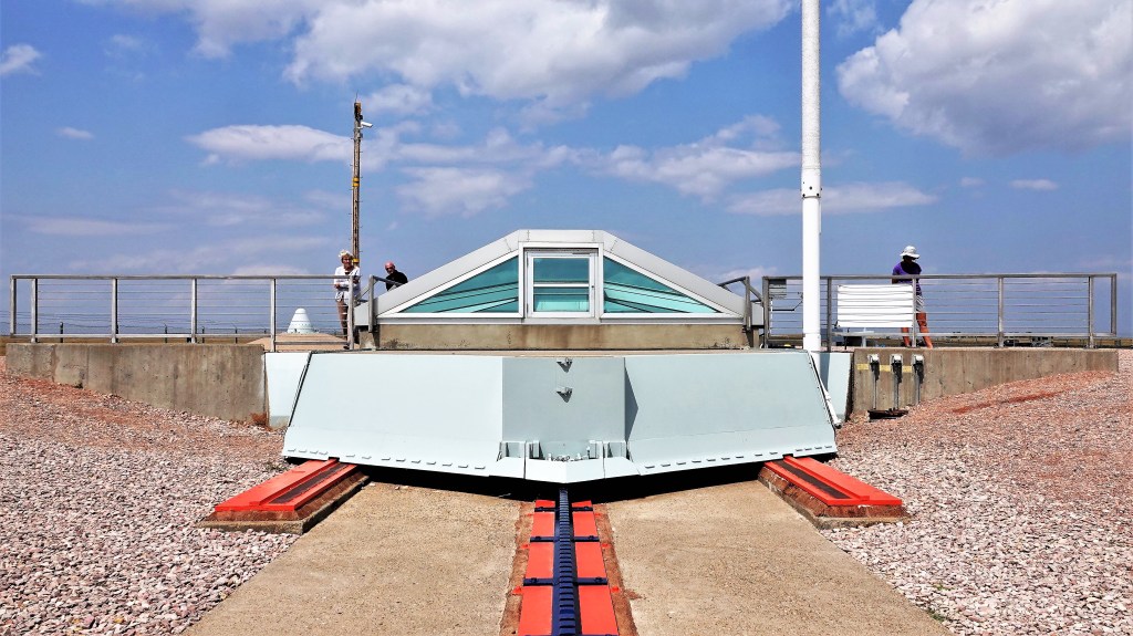
After touring the Visitor Center, we rode 15 minutes on I-90 West to a decommissioned missile silo roughly the size of a football field, and the feeling was ominous.
Locked beneath a sliding 9-ton hatch…
was a vertical rocket in-waiting. I pressed against the tinted, transparent armor and peered into a hole 185 feet deep for a first look and a photograph.
Despite being disarmed,
it was no less unsettling to consider that humanity holds the power of mass destruction, and the Badlands backdrop–75 million years in the making–could vanish in an instant.
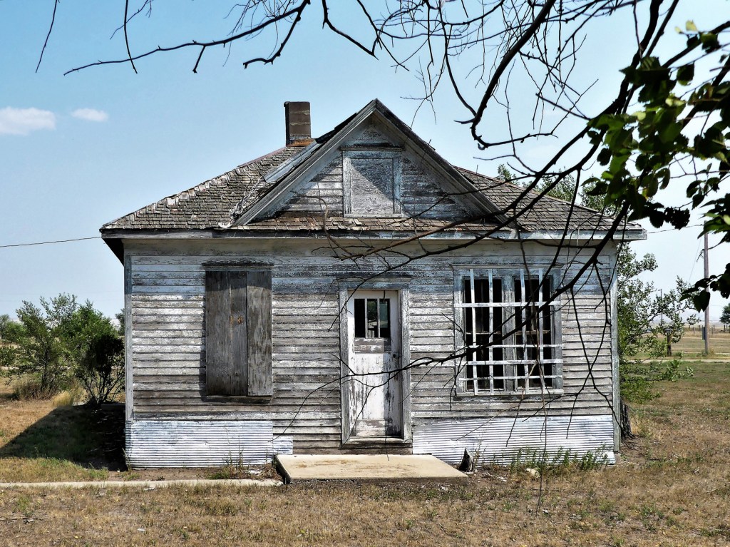
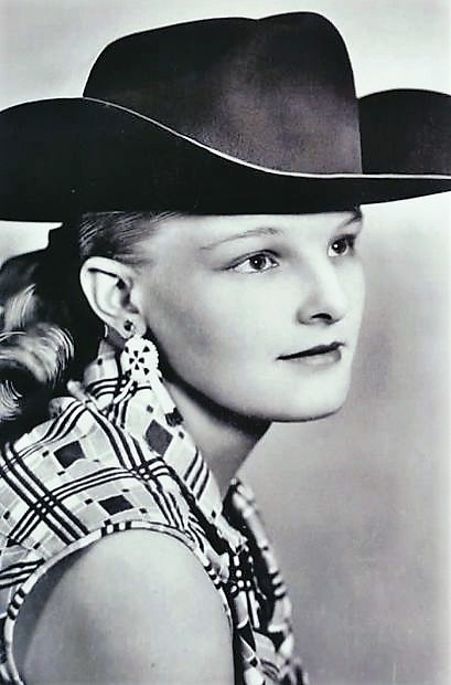
There was a time 10 years ago, when Scenic, South Dakota was for sale–yes, all 10 acres of the town and 36 acres of the not-so-scenic, surrounding property.
It was originally offered up for $3M by Twila Merrill, local rodeo legend who earned a tough-as-nails reputation for never being thrown from a bucking bronc from 1956 to 1963, but with her health fading, it was time to sell.
She eventually sold the whole kit and caboodle to a Filipino church group for just shy of $800,000 in August, 2011.
Ten years later, Scenic looks unchanged. There is scant evidence that parishioners ofIglesia ni Cristo (Church of Christ) are welcome at this ghost town, although the pastel-colored Adirondack chairs on the porch suggest that a resurrection of activity is possible.
Back in the day, Scenic was a thriving hive of entertainment, with a full-scale rodeo arena, a racetrack, a manicured baseball diamond, a theatre and a dancehall.
Main Street was home to a General Store,
and a requisite saloon which was thoughtfully annexed to the town hoosegow.
It should be noted that Indians were allowed inside Longhorn Saloon, but only after Twila bought the joint and painted over “NO” on the marquis.
Meanwhile, the culture crowd would gather at Sam 2 Bulls.
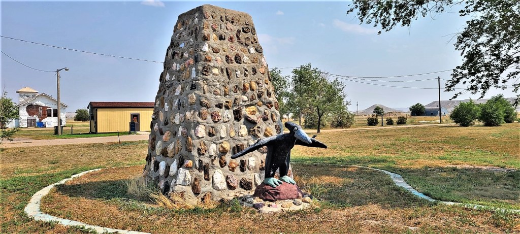
Off the main drag, there’s an assortment of incongruous buildings: a couple of standing churches, a few warehouses and barns, a defunct gas station, and a post office behind a dedicated monument featuring a pterodactyl that defies logic or explanation.
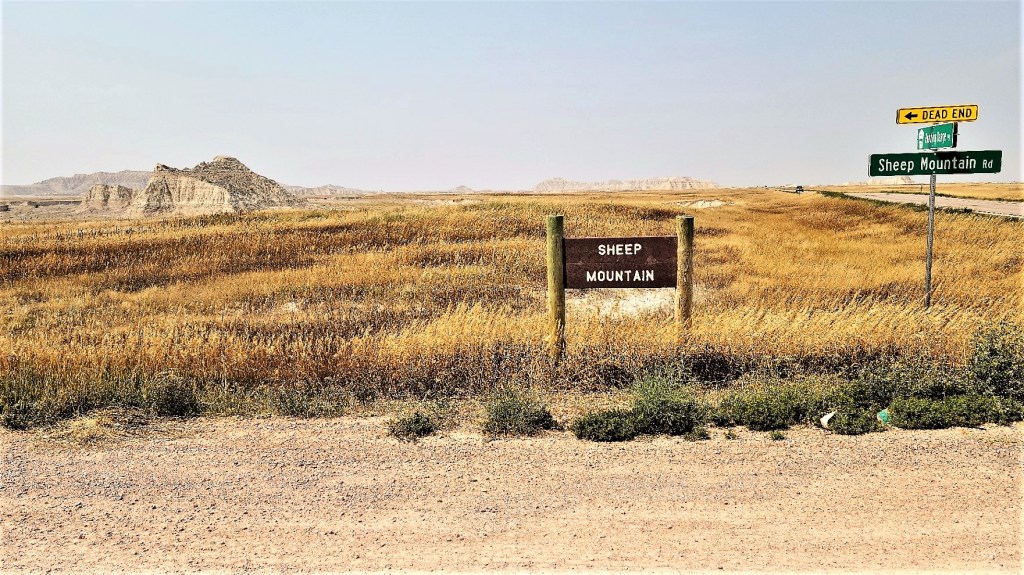
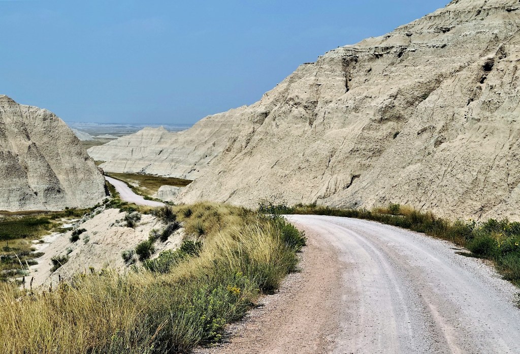
Leah and I rolled through Scenic, on our way to an outpost of Badlands National Park known as Sheep Mountain Table, located in the Stronghold Unit within the Pine Ridge Indian Reservation.
At 3,300 ft. elevation, Sheep Mountain Table is the highest point in the park.
The good news is that we could drive to the top.
The 6.5 mile road was hard-packed and serviceable all the way to the top of the table, albeit a single lane and a handful of hairpins. Once we arrived, there wasn’t much to see on the surface except tall grass, road tracks and traces of spent and unexploded ordinance scattered throughout this one-time gunnery range used by the USAF and South Dakota National Guard. The wind was blowing furiously,
which kept us anchored a careful distance from the ledge overlooking the Cheyenne River Valley.
But there was much more to explore on the other side of the table, which we could reach by hiking 2 miles or driving the rutted terrain…
so I drove…pitching and rolling along…
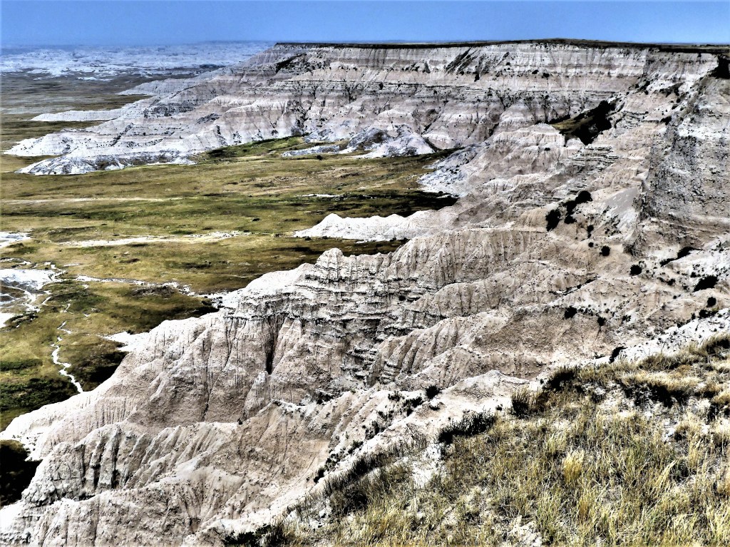
until we arrived at an open plateau with dramatic vistas to the west…
and the White River Valley to the east.
These Badlands were once considered sacred to young Sioux braves who would trek to the tables for prayer and self-reflection as they approached manhood.
That’s when it occurred to me that Scenic, South Dakota was rightfully named, not because of the town’s location, but because of the Badlands omnipresence and its omnificent landscape. And that may also explain why the Filipinos invested in Scenic.
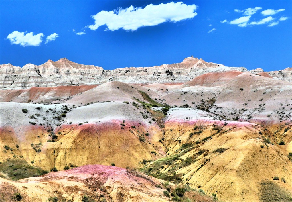
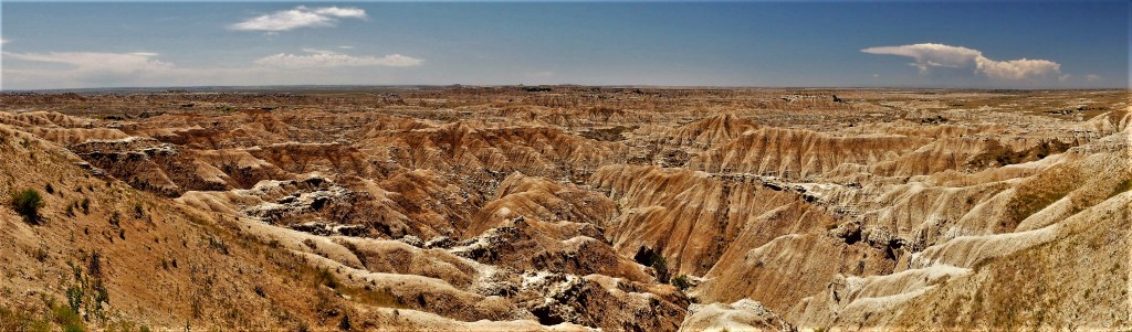
Pillars and spires, pinnacles and hoodoos, canyons and gorges, ridges and ravines, bands of colors and beds of fossils, mixed-grass prairies and resilient wildlife…the Badlands of South Dakota are a scenic recipe so fantastic that I sometimes wondered if my camera could adequately capture the range of strangeness that surrounded me.
But I was up for the challenge!
What follows is a visual diary of Badlands National Park…told in 3 parts.
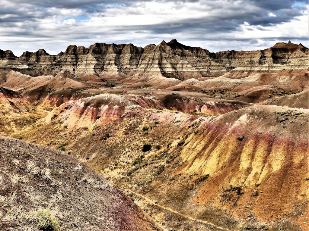
The Yellow Mounds of Dillon Pass
From a distance, this mustard-colored landscape qualifies as the perfect location for a film shoot on an alien planet.
Leah and I were casually driving along the Badlands Loop Road near Dillon Pass,
when the Yellow Mounds popped into view…
and I knew that I had to explore this phenomena more thoroughly.
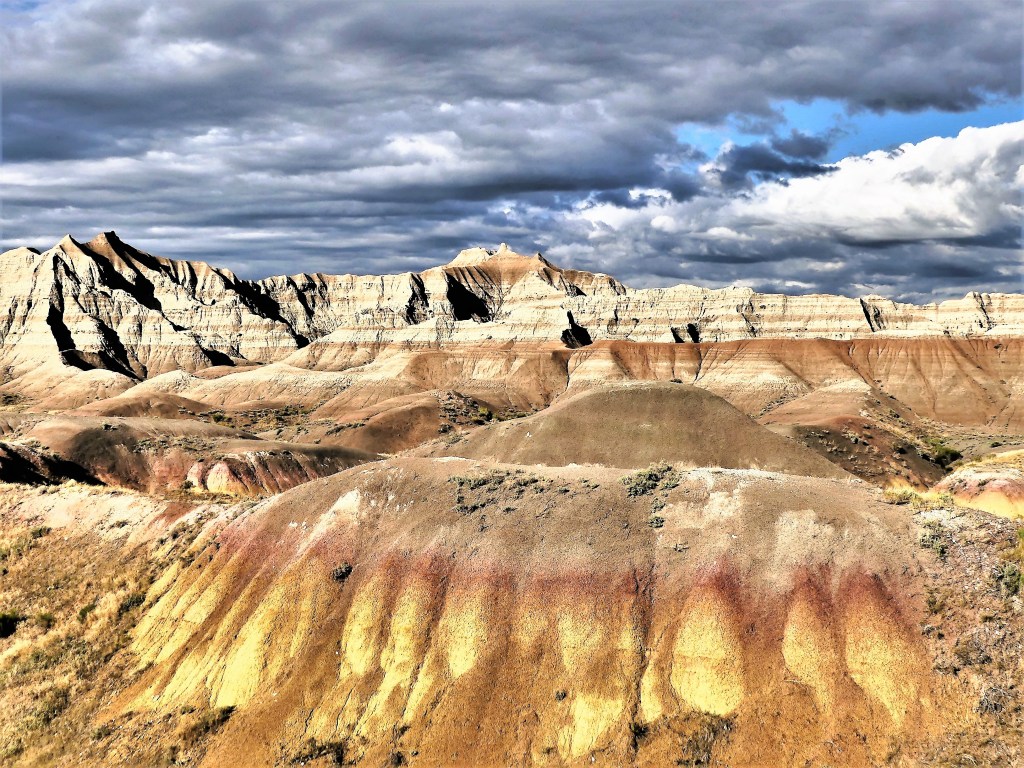
I climbed atop one of the mounds…
which overlooked a network of foot paths…
to the Pinnacles on one side of the hill,
and offered an outstanding overlook of the Conata Basin to the southwest…
and beyond.
And as I surveyed the scene below,
I realized that the scope of South Dakota’s Badlands defies framing.
The Badlands cannot be contained, and the sheer beauty and colors transcend any exposure.
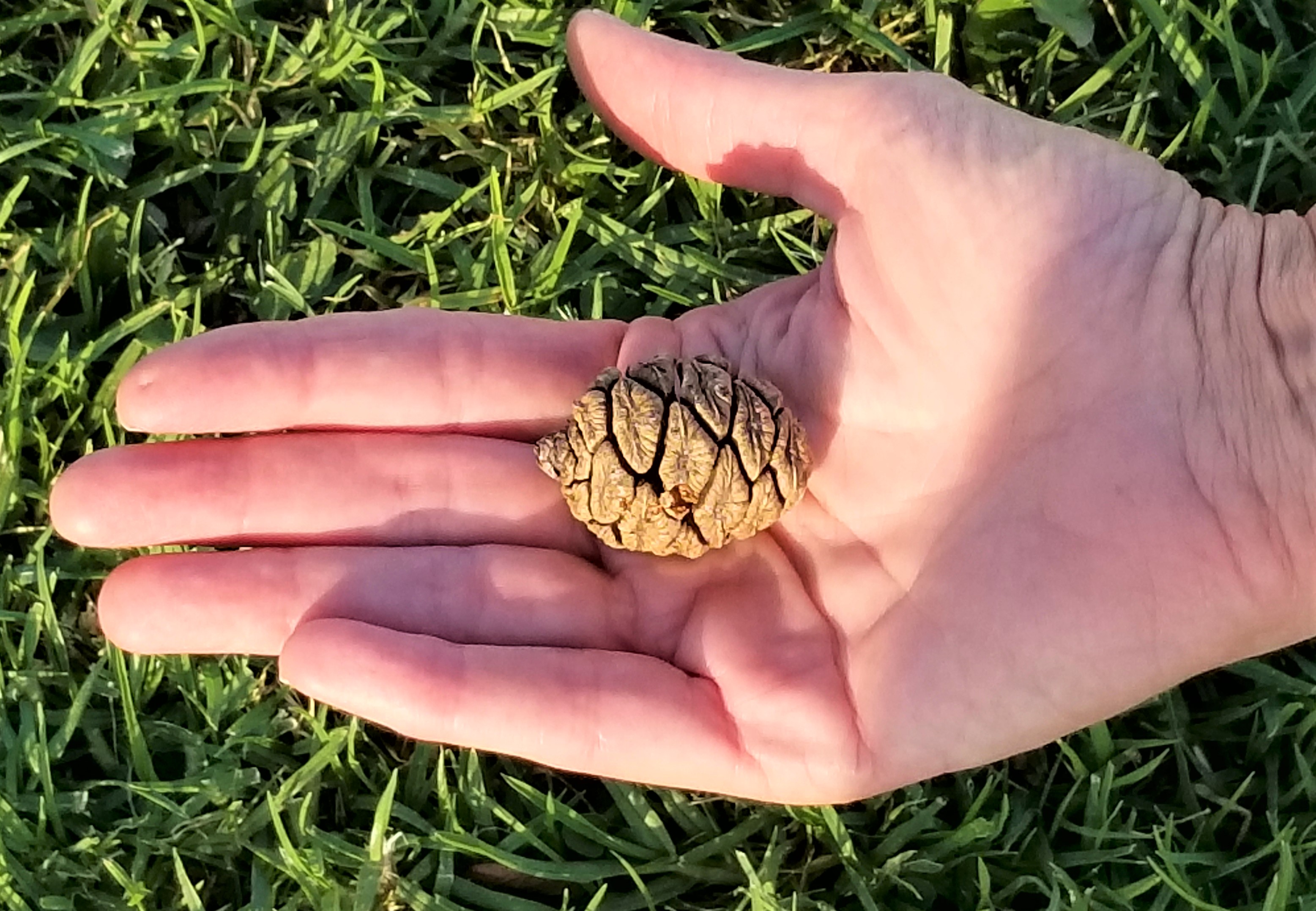
This post originally celebrates the enormity of the General Sherman sequoia as I observed it 4 years ago. However, today it’s a reminder of the fragility of this ancient forest–currently facing a ravishing fire–where the largest living organisms on our planet are in peril. General Sherman has survived over 100 burns in its 2,200 years of existence, but the scale and intensity of today’s wildfires have become more commonplace, and threaten the world around us. I pray the fire can be contained and the forest survives, so future generations can appreciate nature’s miracle.
“Size matters!” has long been considered a hard fact among those who measure the enormity of things, and eagerly justify the value of their preponderance. Yet all things big begin from most things small, and that’s the long and short of it. While this may come as a relief to many who seem challenged by the limited extension of their personality, it comes as no surprise to sequoias that have sensed this for millions of years.
Giant sequoia trees are native to the western slopes of the Sierra Nevadas, where they grow exclusively in protected groves. Every tree starts from a firm cone no larger than a chicken’s egg–
–each one releasing thousands of seeds resembling oat flakes, hoping to take advantage of a litter-free forest floor made fertile by fire.
Flash forward 2400 years, and if the then-seedling hasn’t been logged…
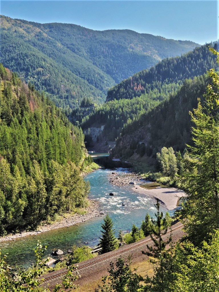
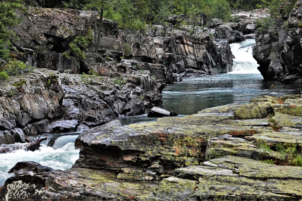
Each and every time Leah and I applied online for an entry pass to Glacier NP we were too late, and we fretted that maybe we made the trip to Glacier for nothing.
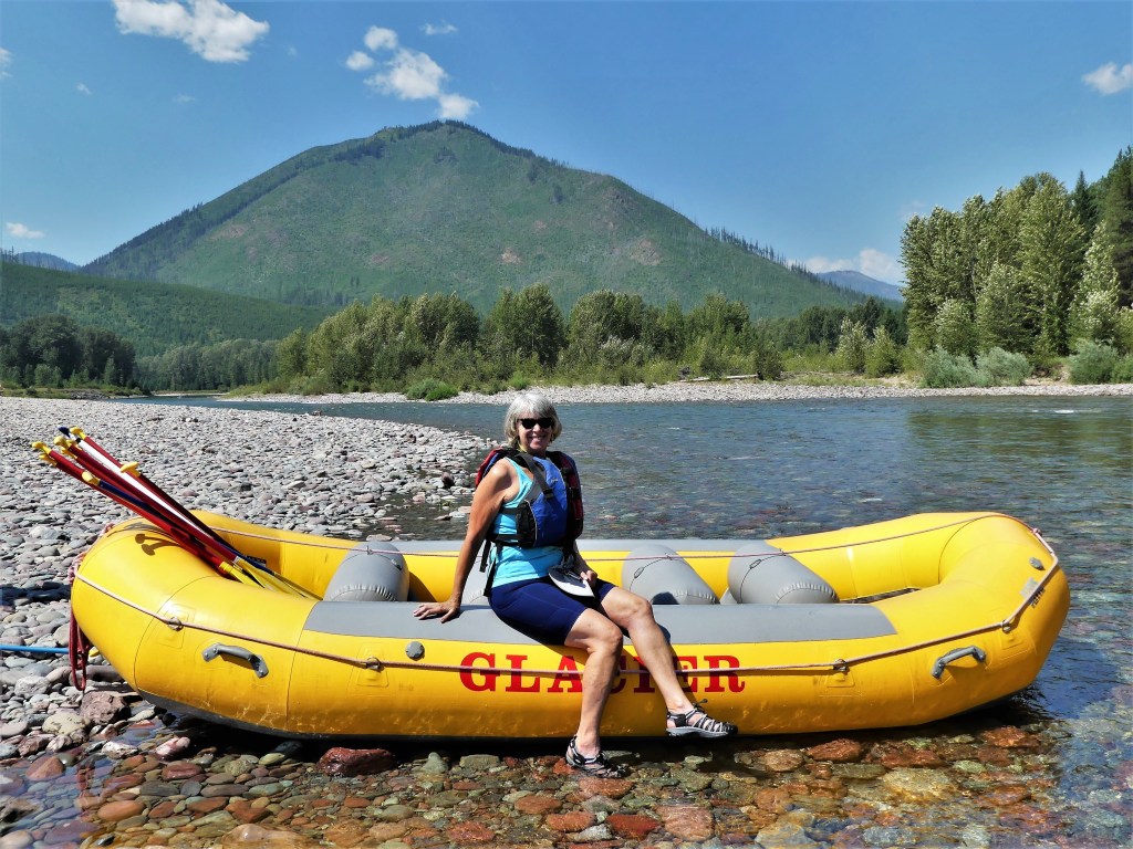
Then I learned that if we make a reservation for an activity inside the park, that would guarantee our entry through the gate. So I booked a scenic rafting trip through the Middle Fork of the Flathead River with a third party vendor.
Problem solved…or so I thought.
It turns out our rafting outfitter operated in the village just outside the park gates, and our park entry was still in jeopardy. We could have canceled with sufficient notice, but we were still up for a float,
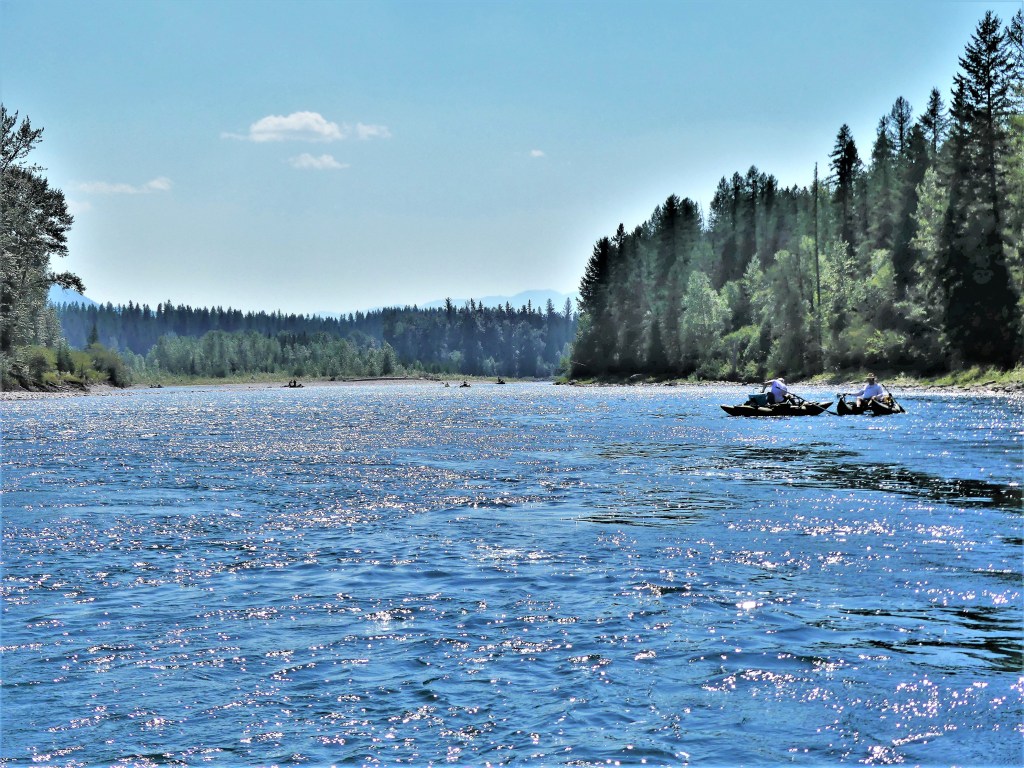
and decided to go with the flow…
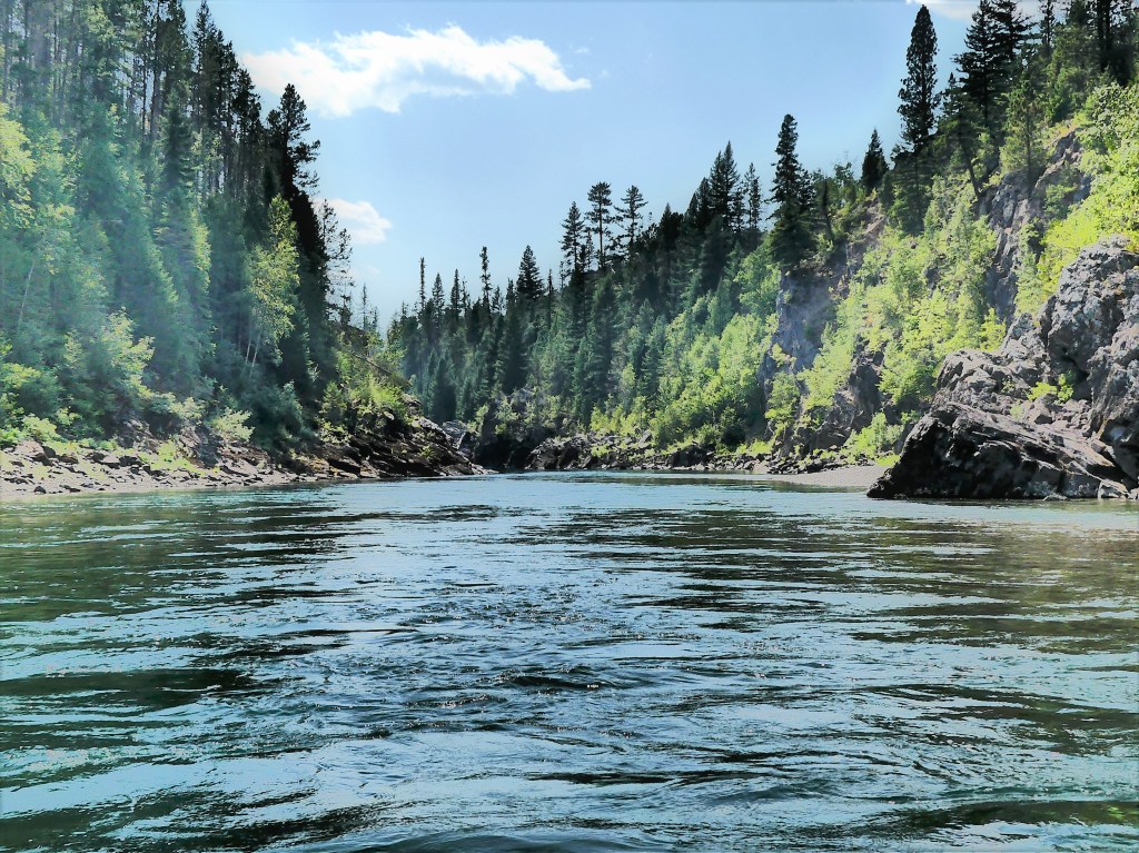
through glacially carved flats,
and formidable canyons walls…
that were ideal for jumping into crystal-clear waters.
But there is another way in, and it’s not really a secret. Just get to the park anytime before the gate attendants arrive at 6AM, or visit the park anytime after the gate attendants leave for the day at 5PM.
We did both, and left tired each day…but satisfied!
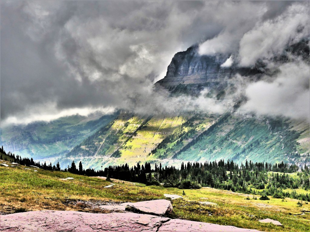
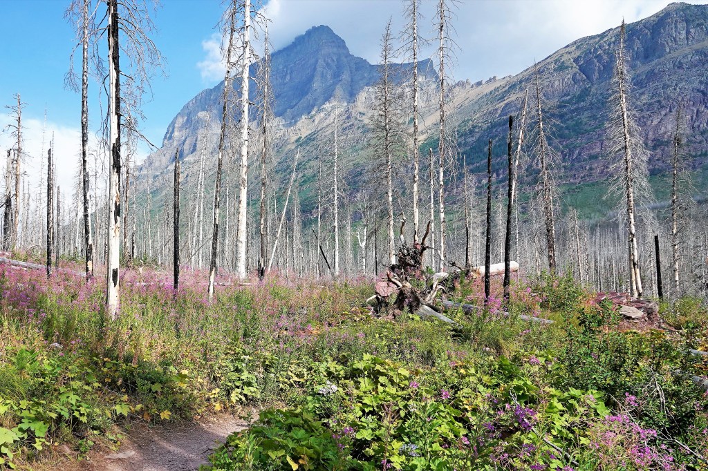
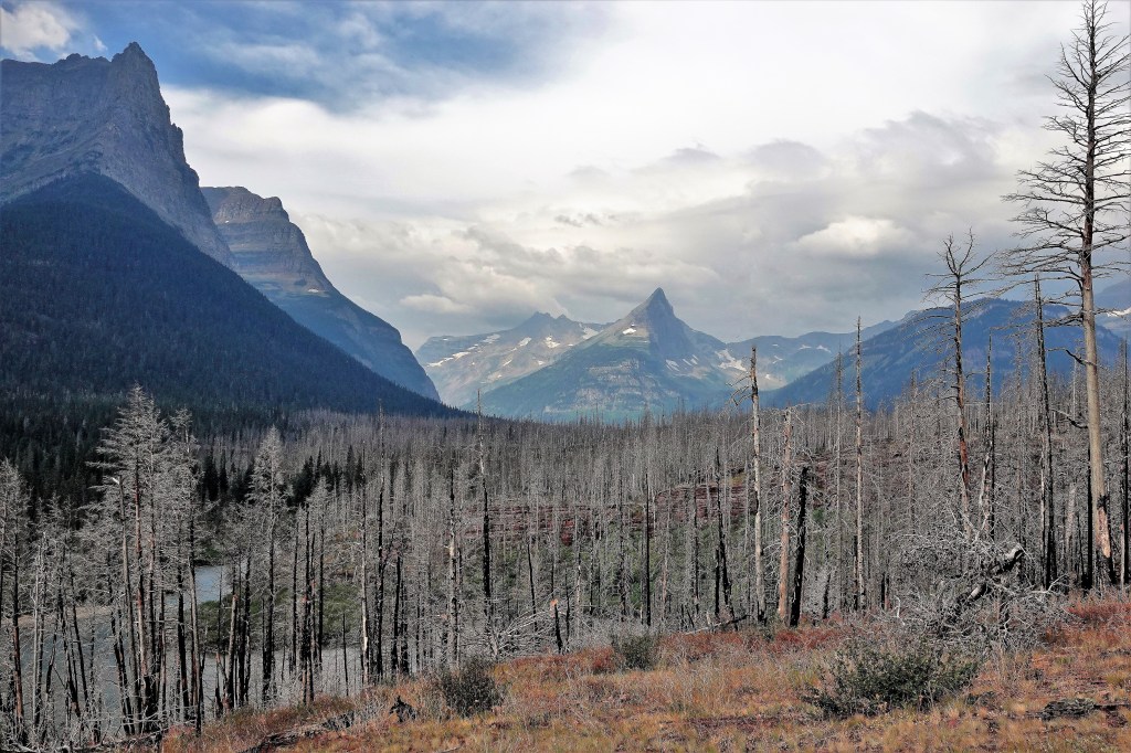
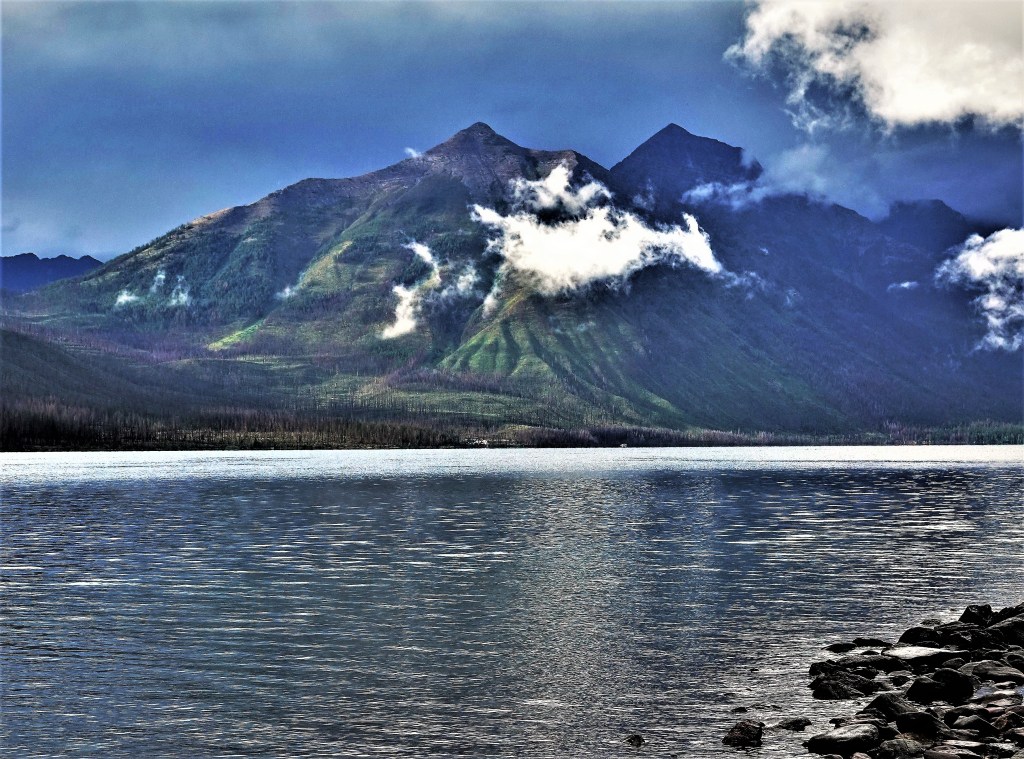
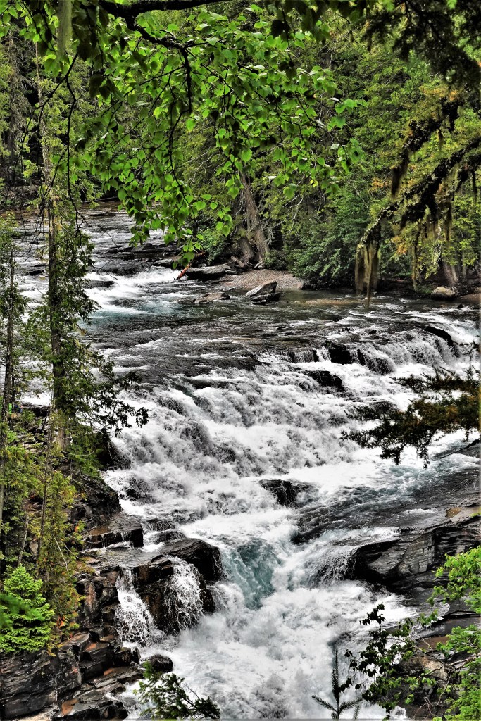
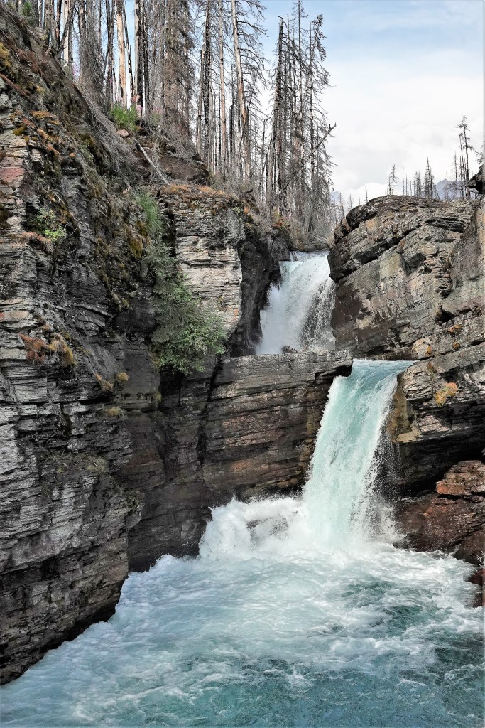
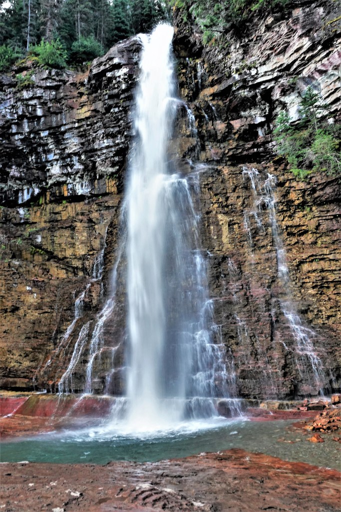
There’s very little to say about Glacier National Park that hasn’t already been said. It’s acknowledged by many as one of the crown jewels of the National Park Service since its inception in 1910.
If there was a beauty pageant for National Parks, Glacier would win the crown, and wear it with authority:
There are more than enough peaks to pique a mountaineer’s interest;
plenty of waterfalls to satisfy a photographer’s wet dream,
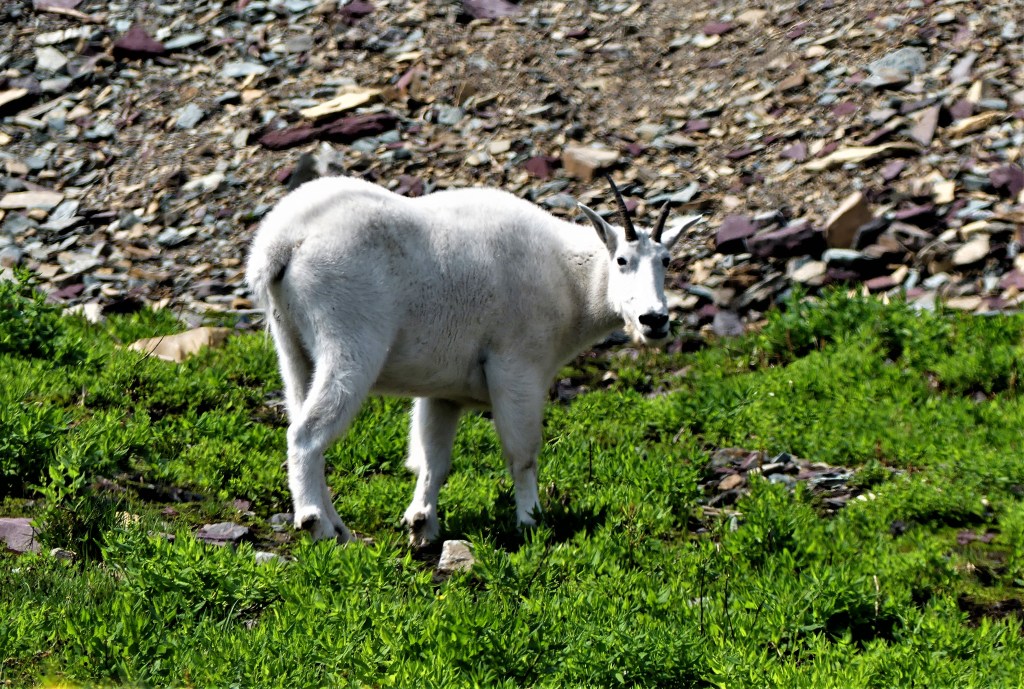
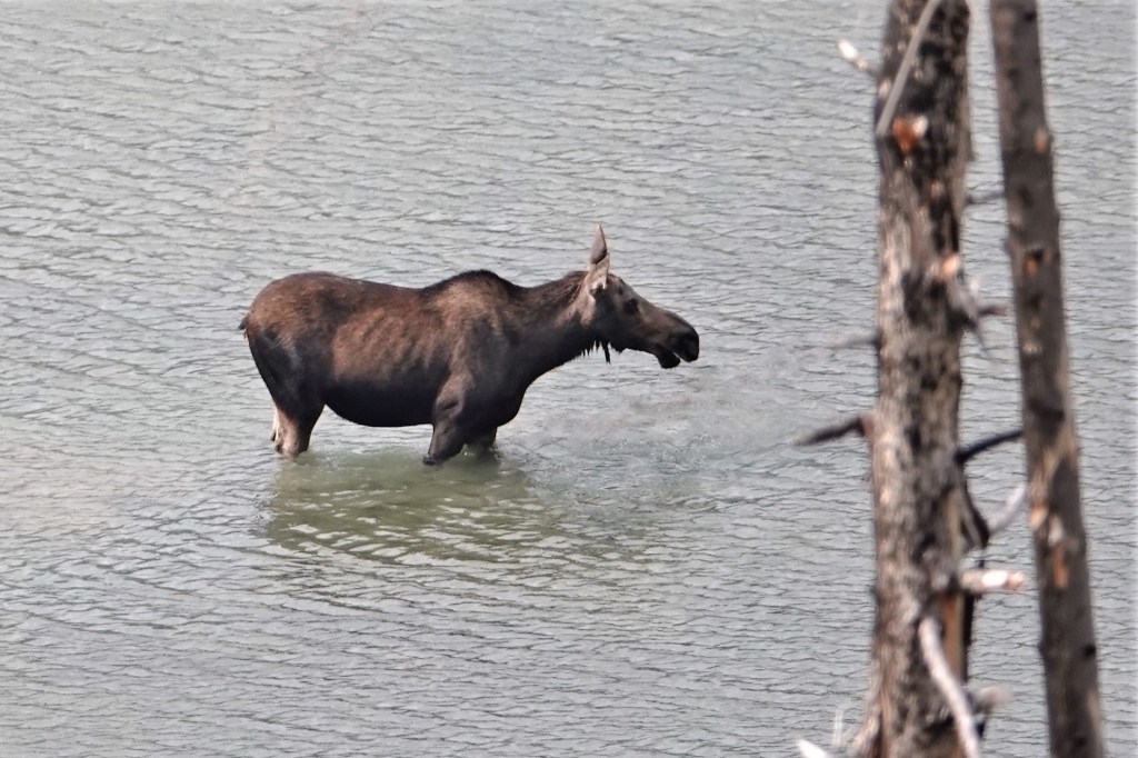
and a fair share of elusive critters to make one’s heart beat fast.
Sadly, no bears wanted their portrait captured by me, despite ample park activity reported at the time of our stay.
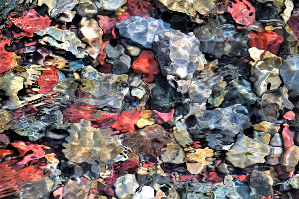
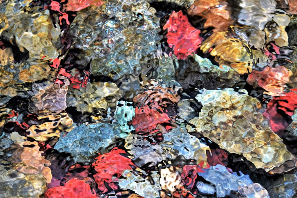
While much of the park’s majesty is projected through its mountains, lakes, canyons and waterfalls, its easy to overlook the shimmering river rocks beneath our feet,
So much about North Cascades National Park reminds me that I’m at a very remote place in America. For starters, there’s limited phone service here which makes GPS plotting a nightmare, and probably explains the frequent mile markers that line North Cascades Highway (State Route 20). It’s the only road that winds its way through the park, and connects all the entities that encompass Stephen Mather Wilderness.
Of the 684,000 acres that Lyndon Johnson and Congress set aside in 1968, 94% of the land has been designated as wilderness. Of the remaining 6%, there is no formal camping and only a handful of designated trails, which may help to explain why the park hosts an average of 30,000 visitors per year compared to 2 million visitors per year at Mt. Rainier National Park.
By the time Leah and I reached the Pacific coast, we learned that the Cedar Creek Fire was burning out of control within the Okanogan-Wenatchee National Forest–threatening the eastern entrance to North Cascades NP, and compromising Winthrop’s air quality, nearby. To make matters worse, North Cascades Highway had been barricaded between mile marker 170 and 185, which meant that if we managed to visit the park–which was always part of our original itinerary–we had no way out.
SR-20 road closures are not breaking news to the people living east of the North Cascades. They’re used to it. In fact, every year from late fall to early spring, SR-20 is closed because of drifting snow across the road (measuring 12 feet) and the high risk of avalanches in areas of steep terrain. Anybody wishing to travel to Seattle must settle on traveling I-90 through the dreaded Snoqualmie Pass.
One week before our anticipated arrival, we phoned a park ranger to voice our concern about likely dangers, and help us determine if our plans were realistic. In return, she gave us a website address to track the daily conditions of the fire, and she reassured us that, “Every day in the park is unpredictable. It all depends on which way the wind blows.”
By the time we were scheduled to visit the park, the Cedar Creek Fire had merged with Cub Creek 2 Fire to become America’s largest forest fire with over 100,000 scorched acres and still burning wildly. Leah and I had an important decision to make: either we risk a visit, or we make alternate plans. There really wasn’t much debate. We were determined to stick to our plans, while well aware of the ranger’s mantra.
We camped outside the park in Rockport at an unusual location dotted with dated, theme cabins, a shuttered restaurant, a wine-tasting room, and a smattering of weedy RV sites overrun by rabbits.
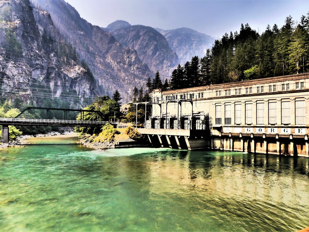
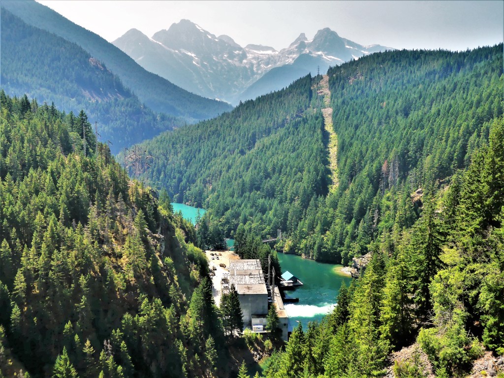
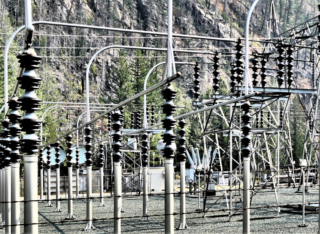
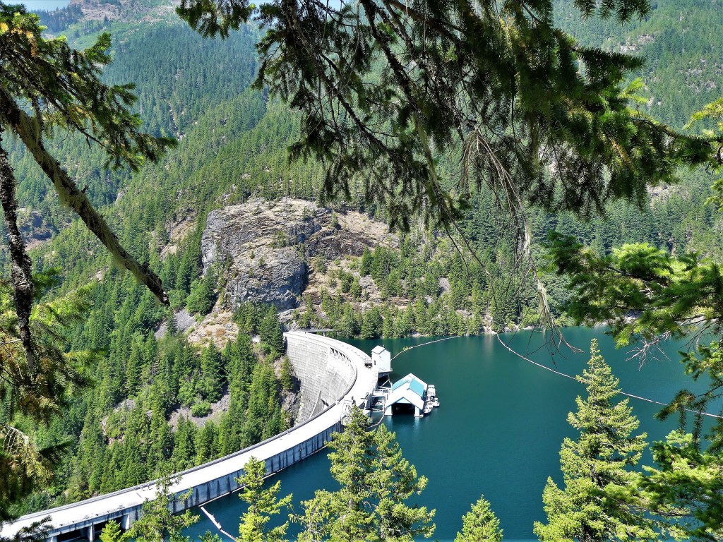
After unhitching, we drove a half-hour to Newhalem, the site of a company town owned by Seattle City Light and the residence of employees working on the Skagit River Hydroelectric Project–a series of three dams and power stations along the Skagit River–
Gorge Power Station
Diablo Dam
Ross Power Station
providing electricity to Seattle since Calvin Coolidge ceremoniously started the first generators in 1924.
As of this summer, the Upper Skagit Indian Tribe has petitioned Seattle City Light to remove the Gorge Dam in order to restore treaty-protected fishing rights to sacred grounds known as The Valley of the Spirits–a 3-mile stretch of the Skagit River area that has dewatered since the dam’s creation–causing the disappearance of bull trout, chinook salmon and steelhead, and consequently threatening the existence of killer whales in the Puget Sound that depend on the fish to survive.
If Seattle City Light hopes to win a new 50-year license to operate the dams, they must demonstrate that the dams cause no harm to the environment. However, regulatory agencies have noted that the dams limit fish passage, affect the water temperature, and prevent much-needed, mineral-rich sediment from reaching the river beds where salmon once spawned.
The following day, our excursion took us deeper into the park, where a faint scent of smoke was in the air. It wasn’t bad enough to impact a full day of activity, but it still managed to drop a smoke bomb on our vistas, turning the “American Alps” into an American disappointment.
We started our exploration at Diablo Lake, created by the Diablo Dam finished in 1930. While the smoke offered an impressionistic vision of the mountain, water and sky,
I much preferred clearer conditions the following day.
Nevertheless, we took advantage of calm waters,
and beautiful scenery.
Feeling like a hike nearby, we followed a trail that followed Thunder Creek,
providing the following views:
until we reached our turn-around point at the suspension bridge…
and reflected on flowing riverscapes north,
and south of the span.
The latest news on the Cedar Creek Fire brought tears to my eyes. Officials proposed closing North Cascades Highway for the remainder of the year. I immediately recalled the time four years to this day when we crossed the Continental Divide at the Vermilion Pass–outrunning the BC wildfires on Kootenay Highway–with the mountains ablaze on both sides of us (see Smoke and Mirrors).
While I had no interest in repeating history, I wasn’t looking forward to the two-hour detour that would return us to I-5 in order to reach Spokane to the east. But if that was to be our only way out, I was determined to travel the North Cascades Highway the next day for as far as the law allowed.
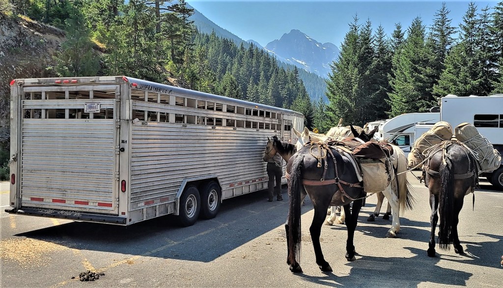
Of course there were stops to make along the way. When we reached Ross Lake at milepost 134, we took the opportunity to stretch our legs along the Ross Dam Trail. With so little traffic on the road, we were not expecting the parking lot at the trailhead to be a challenge. But then we weren’t anticipating a mule train either.
They were preparing to cross the dam to perform trail maintenance further up the Pacific Northwest Trail.
We crossed a dense forest…
to the edge of Ross Lake and across the dam road,
where we were soon joined by the pack leader and company…
for views of Snowfield Peak and distant glaciers.
Of course, we had to dance around the mule poo on our return to the parking lot before continuing our quest.
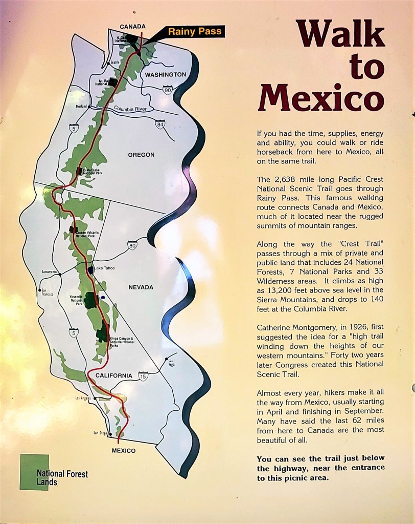
Our next destination took us to milepost 158, where we intersected the Pacific Crest National Scenic Trail at Rainy Pass on our way to Rainy Lake for an easy, 1-mile, wheelchair-accessible hike, until we encountered a tree across the trail within 500 yards of the trail’s end.
Unfortunately, physically disadvantaged people could not appreciate the crystal clear water of this alpine beauty,
or enjoy a distant look at Rainy Lake Falls cascading 850 feet into its namesake lake.
Shame on the NPS!
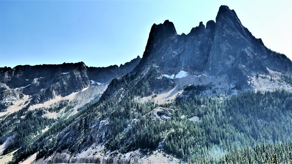
We reached Washington Pass Overlook–our final destination at milepost 162– to ogle the Liberty Bell Group,
and Kangaroo Ridge–
the defining point between Western Washington and Eastern Washington.
And that’s when I saw it! In the distance, midway along the stretch of highway, 8 miles away was the end of the road. I steadied myself for the shot.
We had completed our mission. There was nothing more for us to see before returning west to resume our journey east on August 5th.
By August 10th, the road closure was lifted, and low-speed, one-way traffic resumed in both directions. But I was unconcerned and didn’t mind. I had already arrived at Glacier National Park.
It was our last day on the Olympic Peninsula, and we intended to visit the San Juan Islands, but time and weather never allowed it. Getting an early start in the rain seemed risky given the distance we’d need to travel, and the ferry reservation was an added hurdle and inconvenience.
Instead, we hoped and patiently waited for the early morning weather to abate. There was news of improving conditions by mid-morning, so we chanced a trip to Whidbey Island, where we were rewarded with thick, dismal skies, (yuck), and no rain in sight (yay)!
We drove to Mukilteo, where we just missed the 10 o’clock ferry to Clinton by 6 cars (damn!), but we were poised at the front of the boat for the half-hour ride to Whidbey Island at 10:30 AM (yay!).
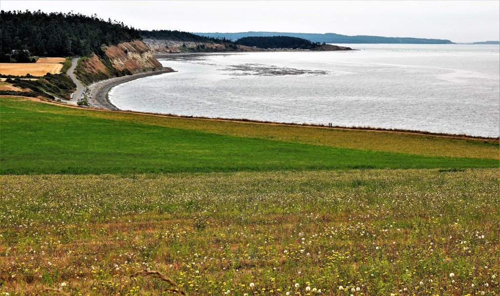
After docking, we completed the half-hour ride to Ebey’s Landing, site of the Nation’s first National Historical Reserve (1978),
and a stunning landscape that befits the gateway to Puget Sound (wow!).
Just outside the Jacob Ebey homestead (now the Visitor’s Center) in Pratt’s Preserve…
stands a reconstructed blockhouse, originally built in 1854, and one of four still standing (who knew?). The blockhouse was built by Colonel Isaac Ebey to defend his claim against insurgent Skagit natives, who naturally resisted the pioneer settlement. Unfortunately, Isaac’s father, Jacob was beheaded in the cabin by a Skagit warrior in retaliation for the murder of one of their own chieftains (hmm…).
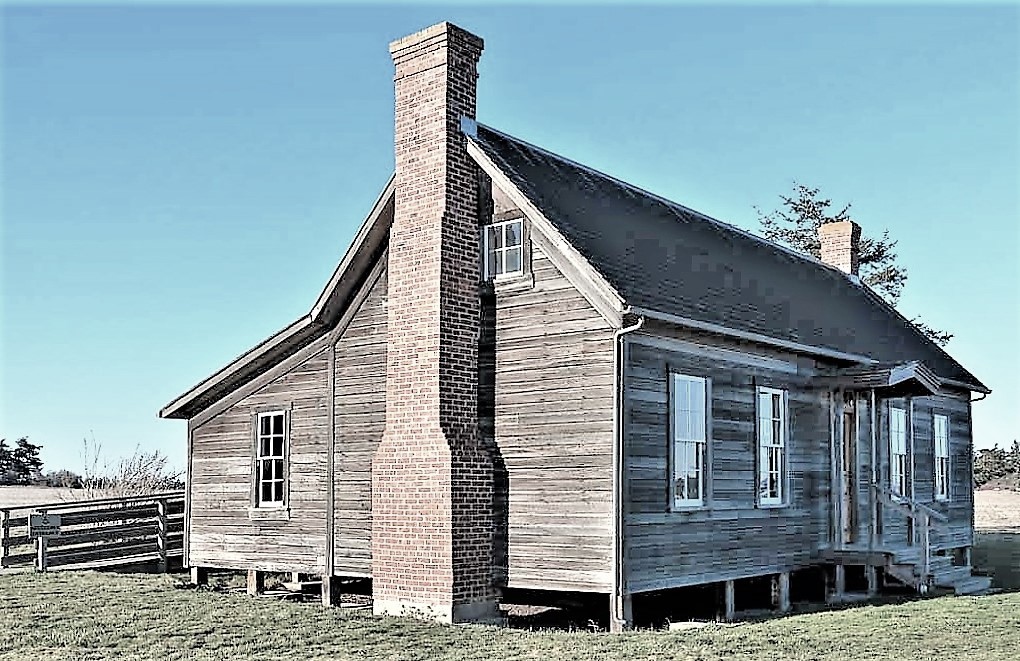
On the edge of the prairie, tangent to the Sherman-Bishop Farm…
is the trailhead that follows the bluffs along Admiralty Inlet.
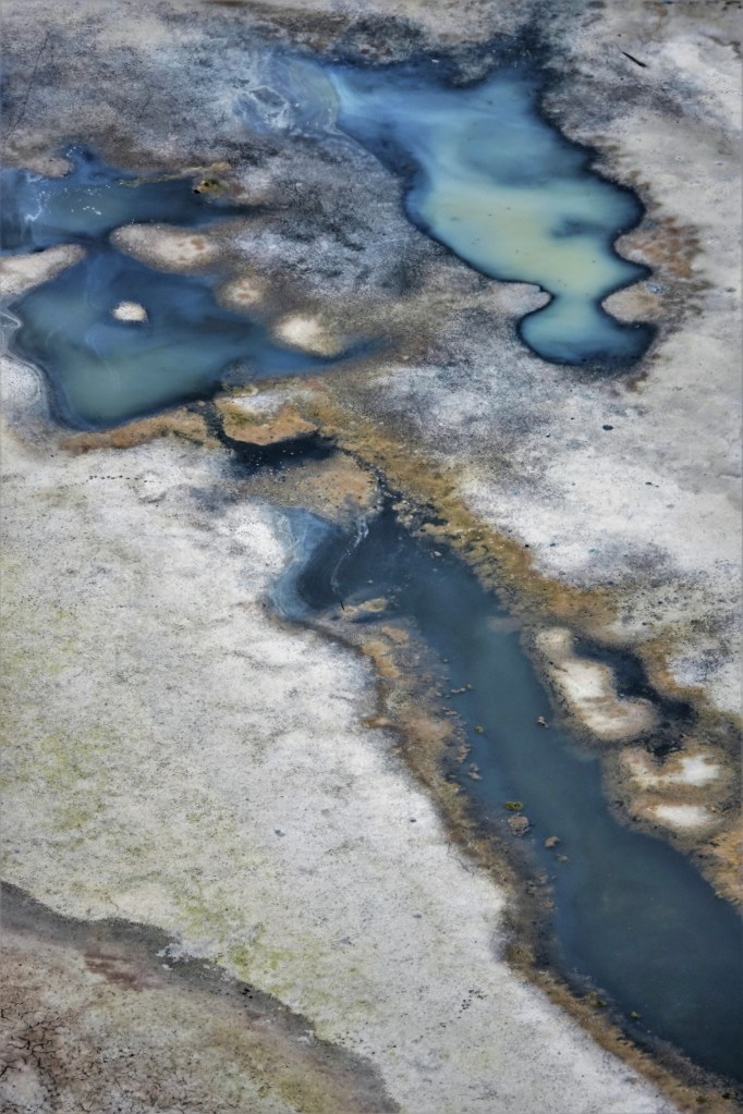
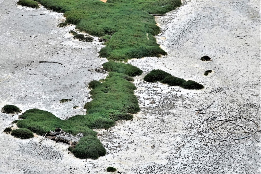
We steadily climbed the bluff which gave us a birds eye view of Perego’s Lagoon–half wet, half dry–(huh?)
with a salt residue that could have resembled the surface of a different planet (odd)…
until I spotted the pentagram that an ambitious soul had designed from driftwood logs (very odd!).
While the landscape was certainly impressive, something was still missing (huh?).
Where were the picture postcard views of Port Townsend and the Olympic Mountains across the water that were hiding behind overcast skies?(right?)
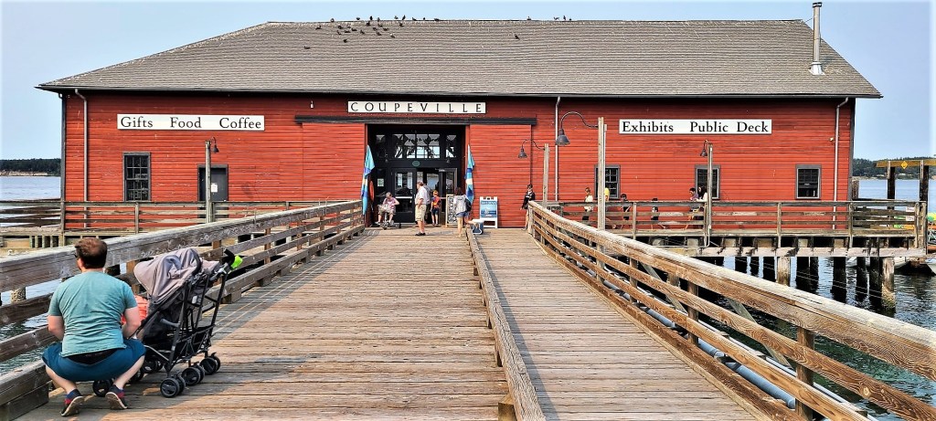
Nevertheless, our spirits were undiminished. We finished the Bluff Trail (phew!), and continued by F-150 to the historic waterfront of Coupeville, Washington State’s second oldest community, and it’s teaming with century-old buildings (nice!).
Our stroll down Front Street, once a beehive of maritime commerce,
brought us to a gentrified collection of bookstores, wine tasting rooms, gift shops, ice cream shops and coffee shops (sad).
Discovering the birthplace of Seattle’s Best Coffee was of particular interest to me, as I served this coffee exclusively when I operated my boil-and-bake-from-scratch, bagel bakery in Denville, New Jersey (really?). Their company and my franchisor later became symbiotic partners when both companies were acquired by AFC Enterprises in 1998.
All of which has contributed greatly to my being able to gracefully retire and follow my whim in pursuit of images, impressions, and memories.