How Great is Great Falls, MT?

The short answer is,”Not so great; it used to be greater.” But then there are those who prefer baldness to a full head of hair. Allow me to explain:

To be fair, my perception of Great Falls is not how it originally presented to Meriwether Lewis and William Clark,

while they mapped the mighty Missouri on their epic expedition from Pittsburgh to Fort Clatsop, at the mouth of the Columbia River.

Lewis’s impression of Great Falls was, according to Paul Russell Cutright, in his book Lewis & Clark, Pioneering Naturalists, “the grandest sight he had ever beheld, the water of the Missouri here dropping over a precipice more than 80 feet high. He stood motionless for a long time, completely enchanted by the beauty of the scene.”

Photographed by F. Jay Haynes, Summer, 1880–Montana Historical Society

In fact, as Lewis slowly portaged the Great Falls in June 1805 (his greatest challenge to date), he was amazed to find not just one “great falls,” but a series of five falls of varying sizes that dropped the river level a total of 612 feet over a 10-mile stretch.

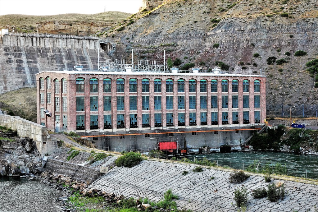
Then came the dams. By harnessing the power of five falls with five 20th century hydro-power plants, the industrial age awakened the West, and “The Electric City” became an important crossroad for future settlement, forsaking the beauty long admired by the Blackfeet and other tribes.

Leah and I set out to discover the “falls”, by racing to Ryan Dam before the last light of day.

The gorge was aglow,

while the sinking sun was offering up a shadowless palette of pastels.

I imagined the falls as it once was and what it’s become…

and wrestled with my first impression informed by mountain and machine.

There is no denying that nature has carved out something very special…

but the landscape has been inalterably changed.

Big skies are forever interrupted,

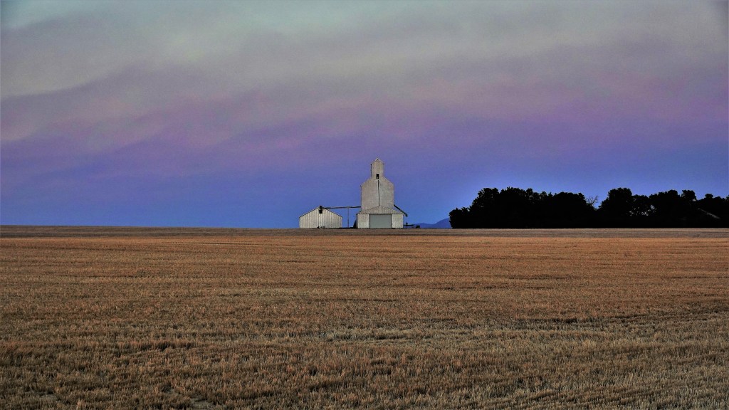
and prairies yield to bounty over beauty.

The following day, we set out by bicycle on the River’s Edge Trail to “find” the other falls.

Nearly 60 miles of paved and single-track trail along the Missouri River provided panoramic views of scenic river valleys;

engaged us with public art created by local artists…

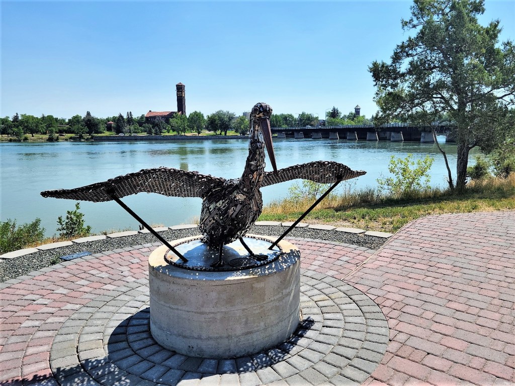
as we rode through neighborhood parks.

The trail carried us to cliffside lookouts of Black Eagle Falls and Dam…

Rainbow Falls and Dam…

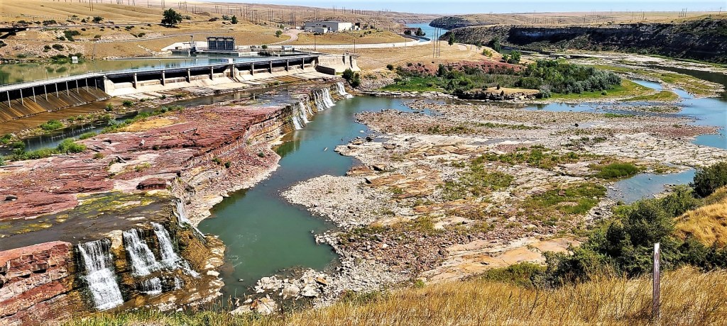
and Crooked Falls (still untouched by a dam);

while also connecting us to historic downtown, filled with numerous casino options and burgers to die for…

at the celebrated Roadhouse Diner.

Unfortunately, our search for Colter Falls (the final of five falls) would remain unfulfilled, as the reservoir created by the Rainbow Dam has permanently submerged Colter Falls (making this the perfect metaphor for Great Falls) to the extent that we are left to debate if commerce is a compromise or a sacrifice.

Oregon Potpourri

Leah and I had a lot of ground to cover during our brief visit to the Oregon Coast. With so much to see and do before we moved on, there was little time to waste. We immersed ourselves in seaside activities until we were Ore-goners.

We set up our first camp site at South Beach State Park, and made a beeline to the beach. After 10 weeks and 9,000 miles on the road, we were finally celebrating “sea to shining sea.”

The following morning, we visited Yaquina Head to play in the tidepools;

observe the seabirds,

study the sealions;

and visit Oregon’s tallest lighthouse (93 feet), projecting its light beam 19 miles out to sea since 1873.

And then we were off to Newport’s Historic Bayfront,

where we lunched with our safari buddies Brenda and Michael, who drove from Portland to join us for the afternoon.

On our last full day at South Beach, we played nature tourist. We gawked at Devil’s Punchbowl;

the Seal Rock;

and Cook’s Chasm.

We combed the black sand beaches, searching for sea glass gems;

and we were entertained by surfers braving frigid waters along Beverly Beach to round out our day.

Typically on moving day, it’s clean-up, hitch-up and safety check before moving on to our next destination. Once in a while we’ll break up the drive by stopping for lunch at a roadside dive, but mostly we’ll snack in the pickup. However on this particular day, on our way up the Oregon Coast Highway to Cannon Beach, we were eager to stop at Tillamook Creamery.

And we were not alone. Hundreds were passing through the overhead exhibition windows with us…

before earning a taste of Oregon’s finest ice cream.

Once situated at camp site #2, we were free to roam the shore to explore a different kind of scoop, but still a rocky road…

along Ecola State Park.

Our evening was reserved for clam chowder at Dooger’s in Seaside, and then a walk along their lively beach at dusk.

The area is also filled with history. Leah and I spent the next day time climbing through the gunnery emplacements at Fort Stevens,

intended to protect the mouth of the Columbia River.

We also discovered the Peter Iredale, or what was left of the four-masted steel barque sailing vessel that ran aground in 1906 en route to the Columbia River.

Nearby, the Lewis and Clark Historical Park offered a replica of Fort Clatsup,

and a glimpse of early 19th century housing for Capt. Meriwether Lewis and Lieut. William Clark,

and their guide Sacagawea and son, Baptiste.

Finally, a day of walking through Astoria gave us wonderful examples of coastal living…

and coastal culture,

But a hike up 164 steps to the tower of the hand-painted Astoria Column…

offered us a scenic perspective…

that prepared us…

for our crossing to Washington’s Olympic National Park.

to be continued…