Tent Rocks

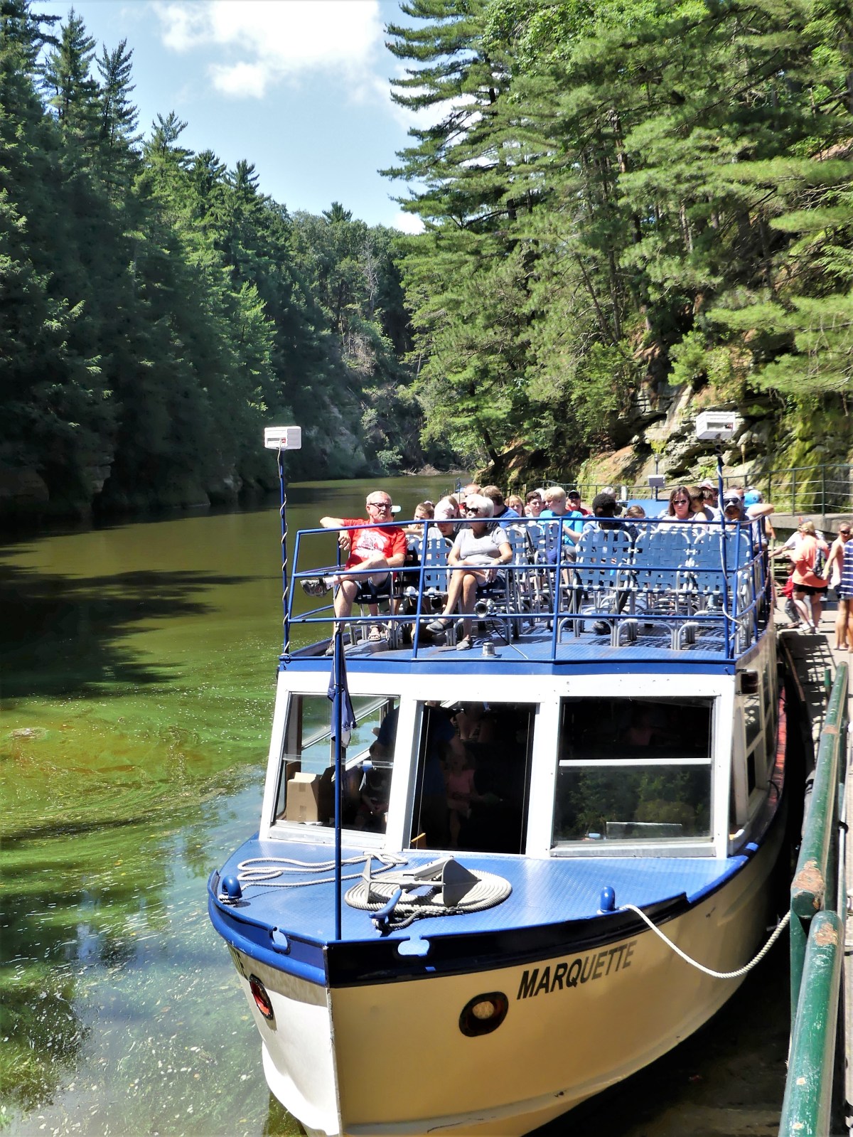
Leah and I were yearning for a satisfying hike through the mountains of New Mexico that we’d yet to explore. While we were happy hiking the Tecolote Trail in the Sandia Mountains–which offered pleasant panoramas of the desert floor stretching nine miles to South Mountain, and views of Sandia Crest that had us wishing we could stay longer–

Sandia overlook (3)

…the whipping wind that swept across the overlook killed any notion of lingering along the mesa top to enjoy the spots of fall color that recently dotted the evergreen terrain.

Sandia overlook4 (3)

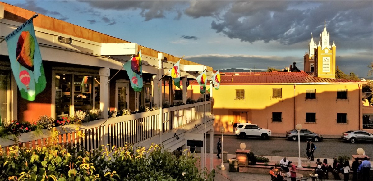
However, the following day, a stroll through Albuquerque’s Old Town…

San Felipe de Neri

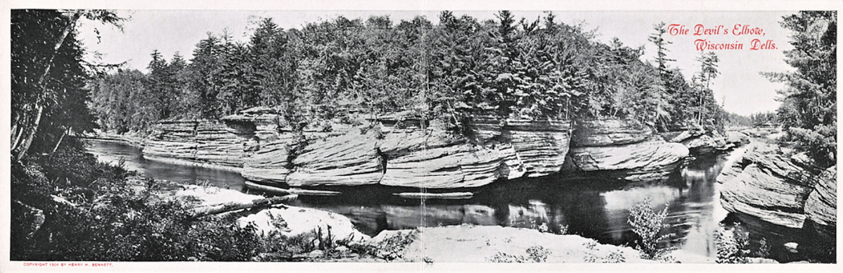
brought us to a photography gallery that showcased Southwestern landscapes and introduced us to Tent Rocks.

Old Town

“That place looks cool. We should go there,” I asserted.

“I agree, but how do you know if we can even get there from here?” Leah questioned.

After consulting Google, I learned that Tent Rocks was a National Monument located within the Pueblo of Cochiti, only an hour north of Albuquerque.

The following day, riding north on NM-14 (part of the scenic and historic Turquise Trail National Scenic Byway), we took a left turn onto NM-301, a rutted, dusty road connecting to NM-22.

We approached the earthen wall of the Cochiti Dam, a controversial water management project approved by Congress in 1960, and finished in 1975 by the U.S. Army Corps of Engineers.

Cochiti Lake.png

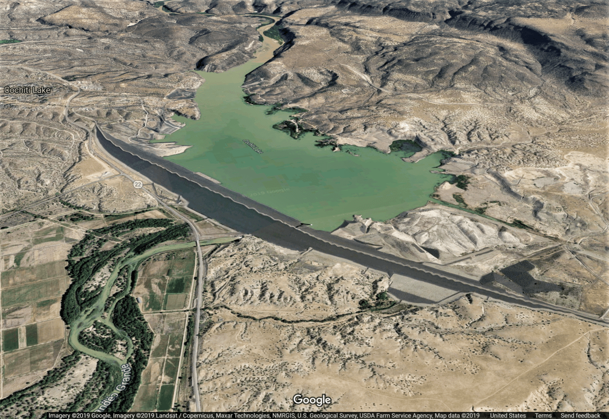
Stretching 5 miles across the desert, and rising 250 feet above the Rio Grande, the resultant lake flooded sacred lands and fields belonging to local tribes for centuries.

We continued west on NM-22 for two miles before arriving at Kasha-Katuwe Tent Rocks National Monument. We pulled up behind seven parked cars–each one waiting to pay five bucks to the BLM park ranger stretching his legs beside the fee station. Our SUV idled a minute or two, but the line was at a standstill.

The sign post beside us forecasted a 30-minute wait-time from our current position.

“I’m gonna take a walk,” and Leah was out of the car, working her way to the front of the line.

The news arrived in under a minute…offering a Trail Guide.

“All 94 parking spaces are taken,” Leah explains with a hint of exasperation. “They probably arrived when the gates opened at 8am.”

“Okay. So that was two hours ago,” I respond, admitting the obvious. “It says here on the map that the trail is 1.5 miles in and out, so hopefully, a lot of people should be on their way out by now.”

“How long do you think we’ll have to wait here?” asks Leah.

“According to the sign, it’s a 30-minute wait,” I assert.

“Smartass!” she hurls.

After 20 minutes of anticipation, I noticed movement in the ranks! Two cars in front gave up the wait and U-turned, leaving us in sixth place. 

Silly people. If only they had waited a few minutes longer. Soon after, a rash of cars passed us on the way out, and we were on our way, cruising through four miles of dip-after-dip, tribal land road, before reaching the parking zone.

While Leah and Carrie (Leah’s daughter) waited in line for the only outhouse in the vicinity, I caught up on my reading at the trailhead.

slot canyon info

History and Geology

Geologic treasure

volcanic activity

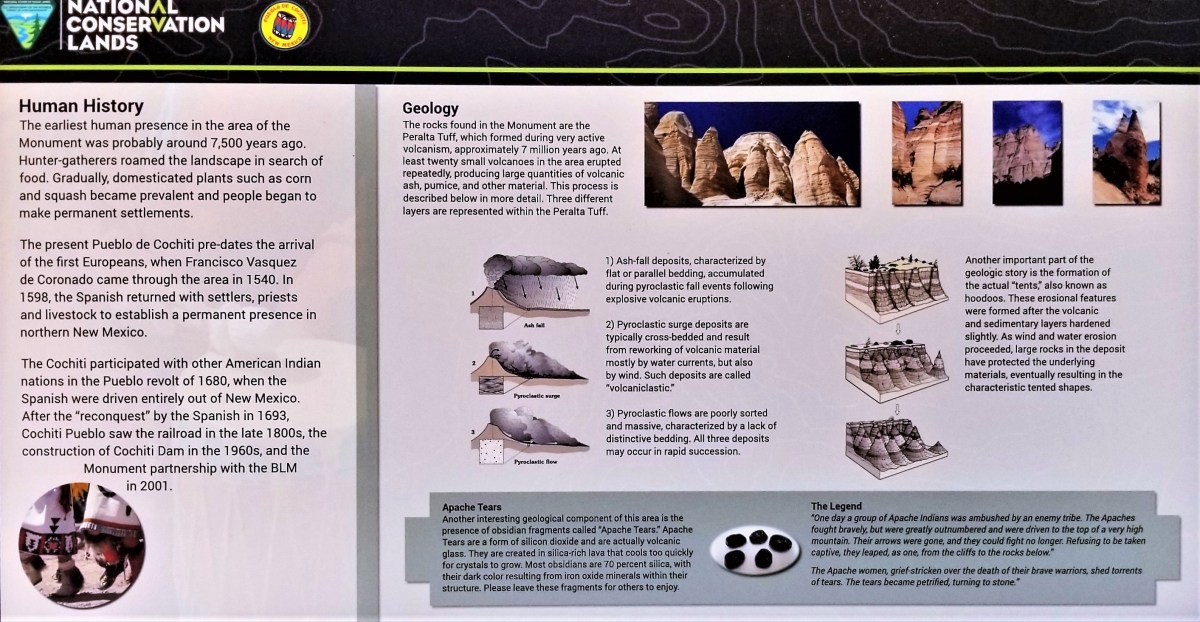
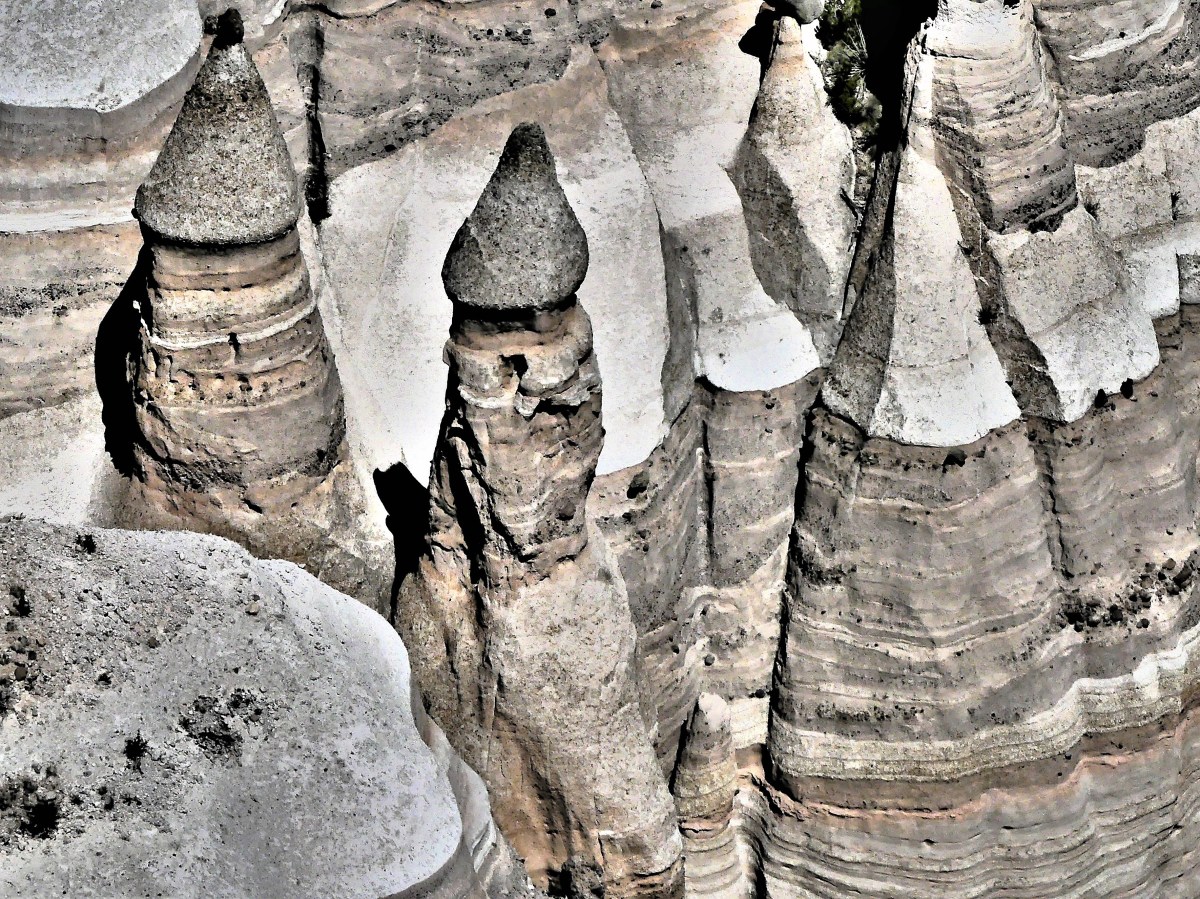
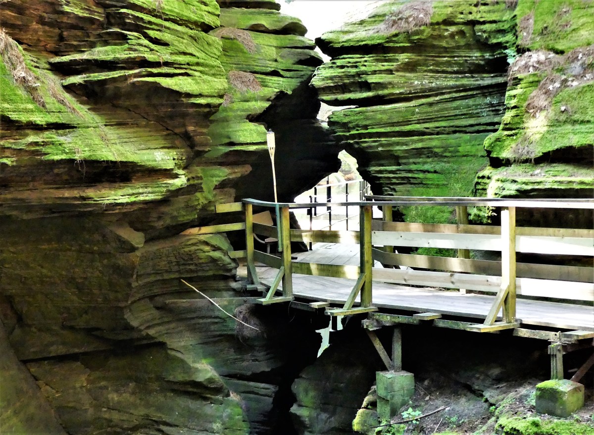
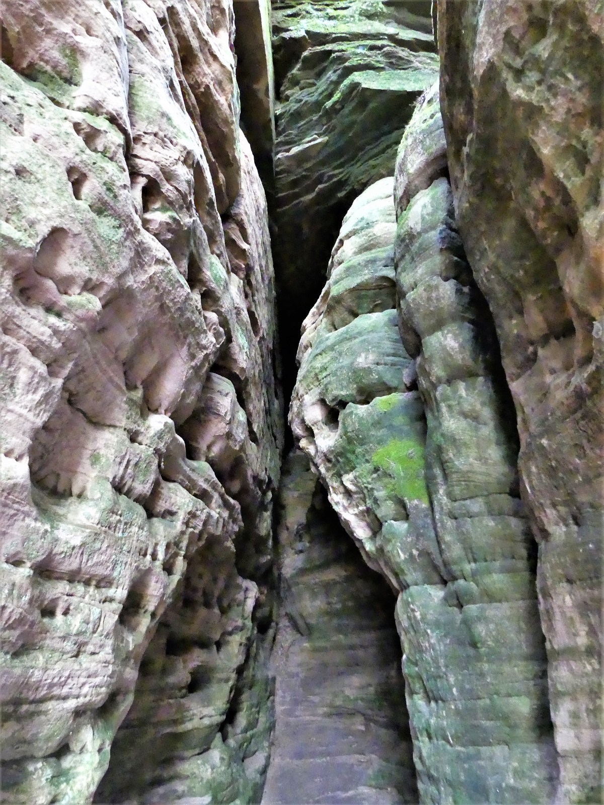
As interested as I was to learn about New Mexico’s volcanic eruptions and its pyroclastic flows, I was itching to get on the trail and weave through the slot canyon.

slot canyon

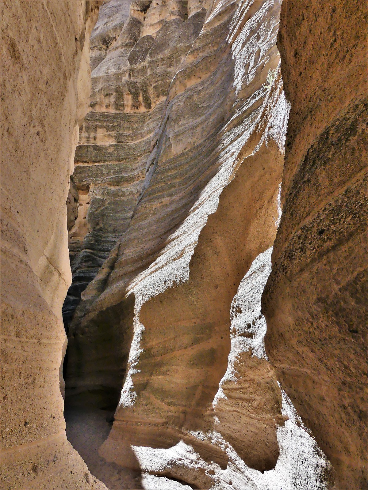
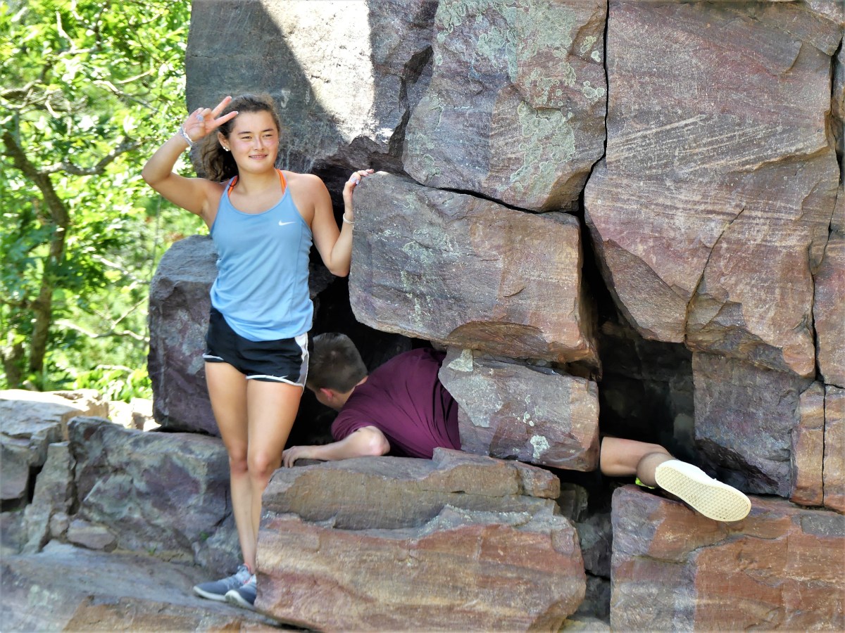
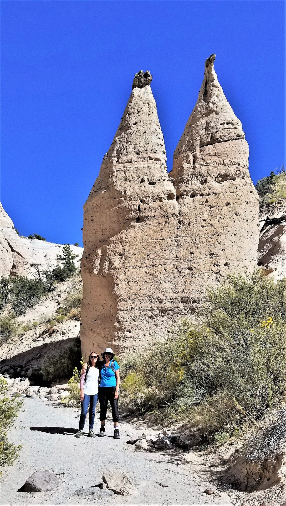
The canyon walls were so narrow in places, that only one person could navigate the labyrinth at a time.

slot canyon trail

It reminded me of the way that road crews monitor traffic on a one way road…

slot and boulder

…and it was vaguely reminiscent of a similar protocol at the fee station and toilet.

canyon walls

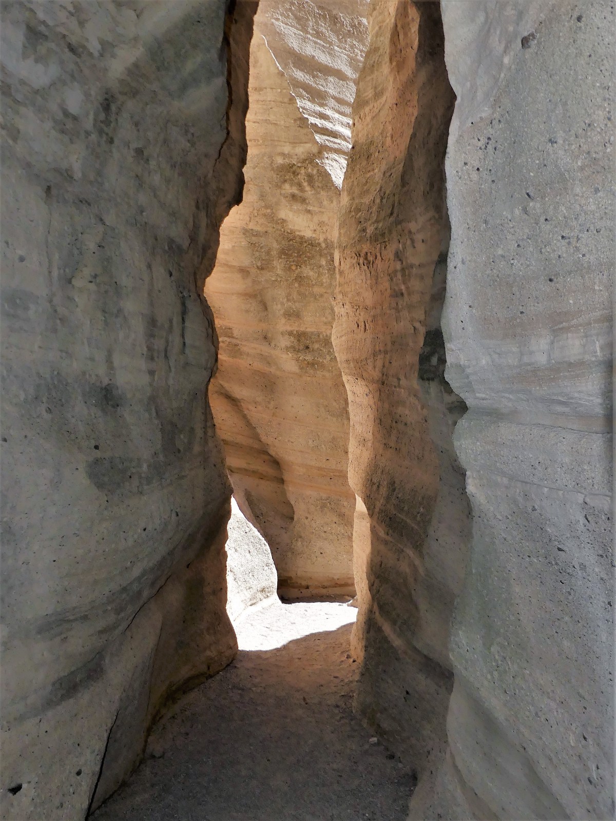
Of course, with so many early hikers already on the trail and now turning back, it made for several occasional stops, and many pleasant exchanges along the way.

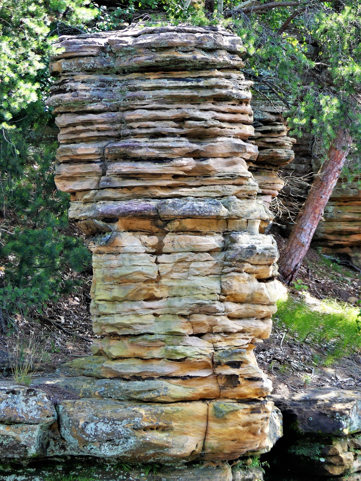
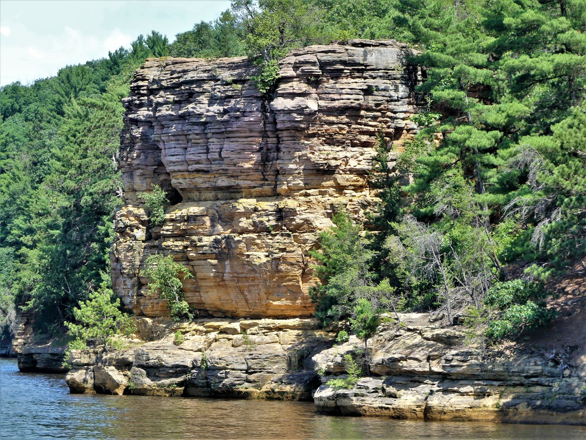
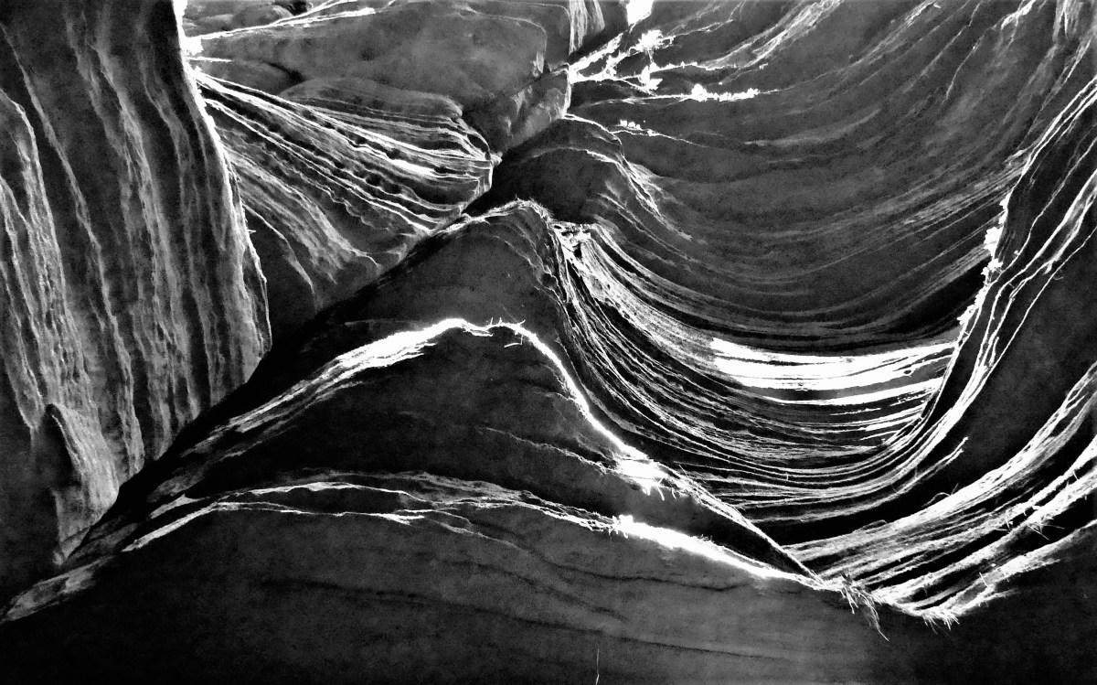
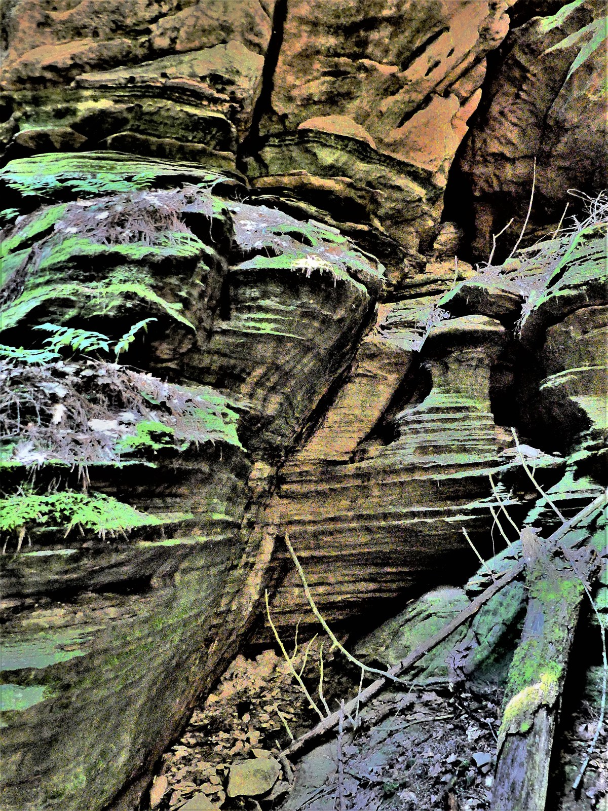
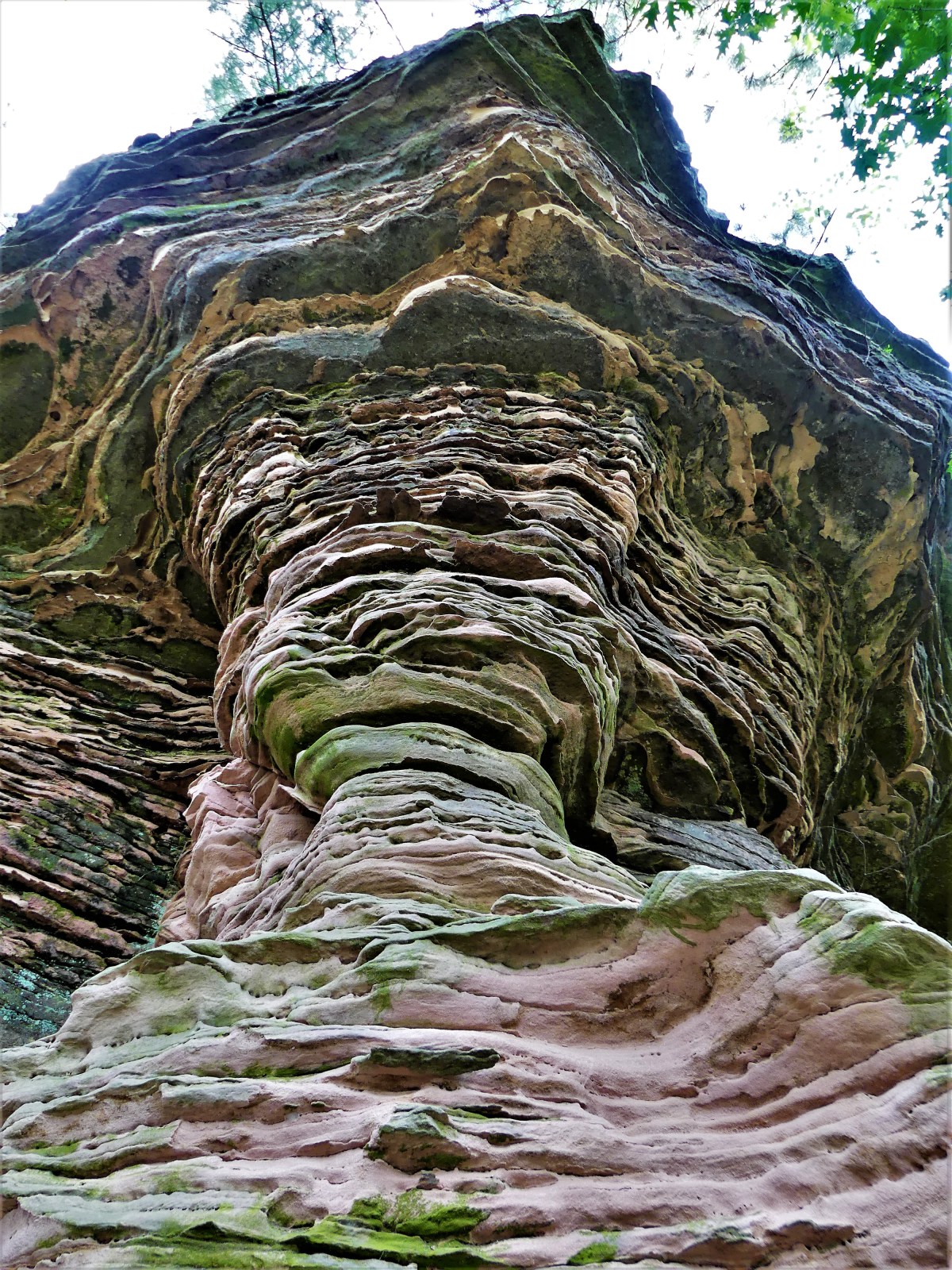
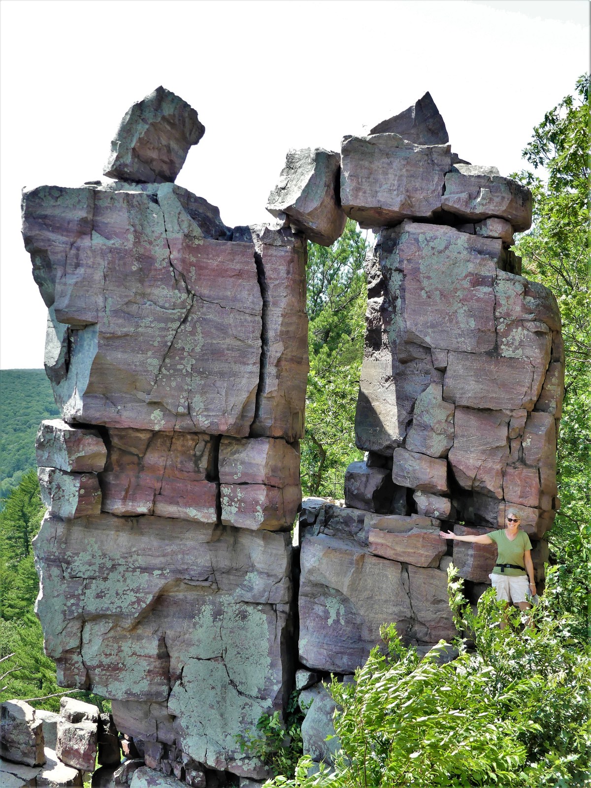
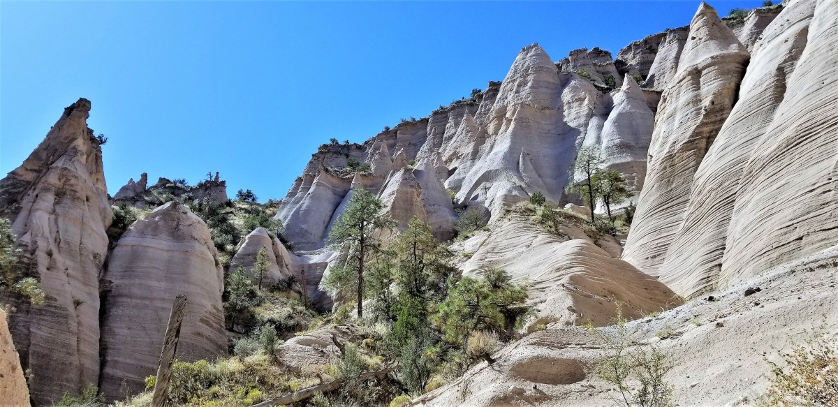
However, when the canyon finally opened up, we were greeted with a greater appreciation of what seven million years had done to the place.

canyon trail

hoodoo cliff

hoodoo peaks

Leah and Carrie (2)

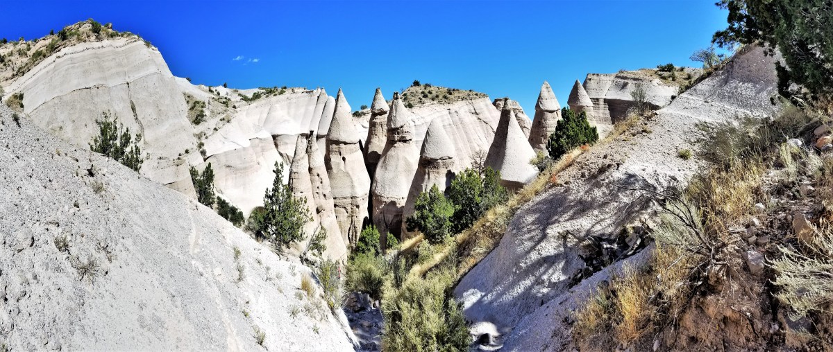
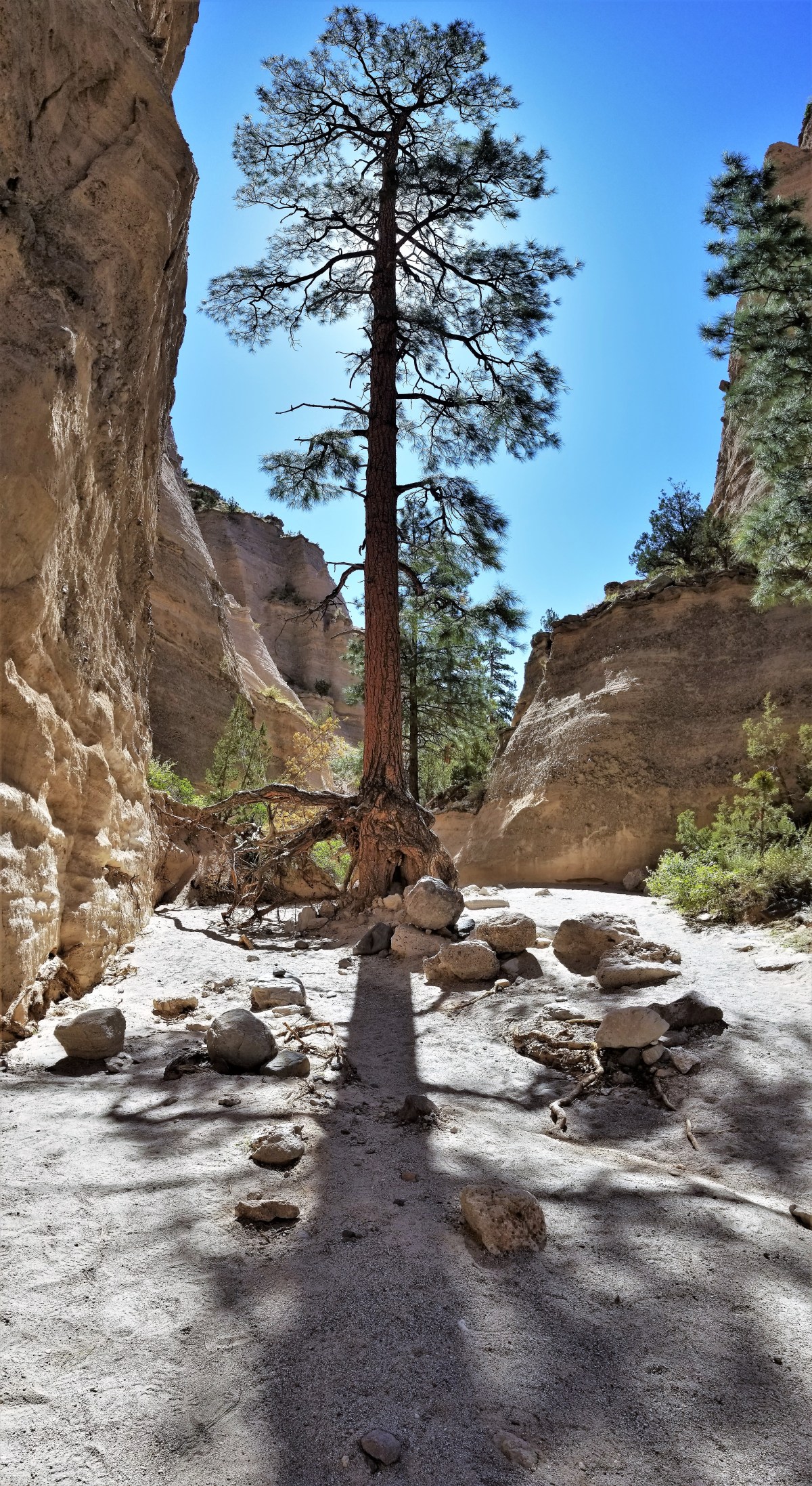
Even the trees seemed magical, managing to stand in the shadow of such uncertain footing. 

pine shadow

long root (2).jpg

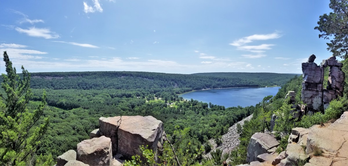
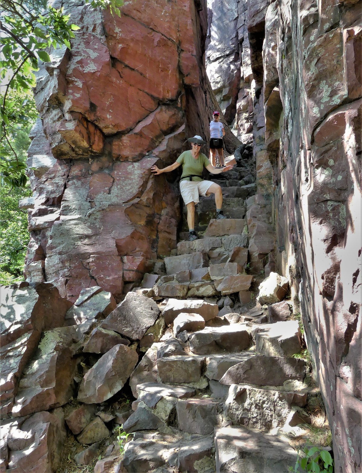
Once we reached a clearing in the trail, we began our 630-foot ascent to the mesa top, giving us a better perspective of our lair,

peak towers

and freeing us from all obstructions,

canyon pan

until we could gaze across the Jemez Mountains,

Jemez Mountains (3)

and remind ourselves, once again, why it’s always a good idea to wait one’s turn in line.

Tent Rocks

Wisconsin Dells

Long before kitsch and water parks ruled the region, visitors from around the world traveled to the Dells to marvel at the iconic sandstone formations carved by a glacier that plowed through Wisconsin approximately 15,000 years ago–leaving behind a 5-mile gorge struck from rock that’s older than anything on earth.

Cambrian Rock

Word of this discovery spread quickly, attracting Leroy Gates, a lumber rafter with a notion that promotion would bring tourism to the river he loved, and earn him a buck or two to boot. In 1856, Gates offered the first guided boat tours of the Dells of Wisconsin, and made sure everyone knew it.

Gates carving (2)

Supposedly, Gates and his associate guides would sit under umbrellas sipping lemonade, while the guests would paddle their boats up river to destined attractions…

Dells rowboat HH Bennett

until steamboats took over in 1873.

Escort 1892

Fortunately, landscape photographer H.H. Bennett was there to capture it all–taking souvenir photos of the tourists, and landing a place in history as “the man who made the Wisconsin Dells famous.”

HH Bennett plaque

Today, Dells Boat Tours continues the tradition on the river…

boat ride HQ

with a fleet of 17 vessels that carry half a million passengers year after year.

Dells Boat Tours

Captain Bob piloted our riverboat north through the Upper Dells,

Wisconsin River

while First Mate Abby called out the names of rock sculptures famously characterized by H. H. Bennett:

Blackhawk
Black Rock’s profile
Chimney rock
Chimney Rock
Lovers' Leap
High Rock
stacked rocks
Alligator Rocks
cliff
Romance Cliffs

After manuevering through the Devil’s Elbow…

Devil's Elbow (4)

Captain Bob turned into a slot canyon discovered–and affectionately named Witches Gulch by Bennett. Apparently, the name was intended to be sinister and provocative. His strategy was reinforced by similar names inside the canyon, such as:

Whirlpool Chambers
Whirlpool Chambers
Witches Window
Witches Window
Witches Bathtub and
Witches Bathtub and Witches Falls

Eventually, Bennett built a tie-up dock, threaded a boardwalk through the canyon walls, and created a photography concession at the terminus.  We were about to see why, as Captain Bob eased toward the mooring.

shallow river

Abby tied up the riverboat,

Wittches Gulch boat dock

and we walked the boards,

Witches Gulch

for a closer look at the beauty of ancient splittered sandstone turned emerald,

boardwalk

and the waves of light and darkness.

sculpted rock layers1

gradiant ridges

gatekeeper
The Winnebego Gatekeeper and His Dog

sedimentary formation (2)

Next, we cruised across the Wisconsin River to the western shoreline to visit the Dells’ most precious formation,

standing rock
Stand Rock

made famous by H.H. Bennett’s photograph of his 17-year old son, Ashley leaping onto the column from a neighboring cliff in 1886.

bennet-leap-2-e1563677024968.jpg
Leaping the Chasm

We gathered under the rock for an equally impressive demonstration by a trained German Shepherd from Juneau County…

5 ft 3 in

that jumped the 5-foot gap without hesitation.

leaping shepherd

We completed the trail back to the boat, passing other impressive formations along the way…

tower slices
Toadstool
vertical lips
Cave Lips
arch and cave
Three Tongue Cave

until it was time to reboard the Marquette and return to the tour operator’s dock. As we cruised back under sunny skies, boat traffic on the river had blossomed.

river activity

Locals were enjoying the river to beat the heat,

cooling off

which was way better than any water park would ever be.

The Trial of Devil’s Lake Trail

After searching for an escape from the plethora of water parks and souvenir shops in Wisconsin Dells, we settled on a hike around the quartzite cliffs overlooking Devil’s Lake. With temperatures climbing through the 90s amid an epic upper midwest heat wave, the lake was a winning getaway for hundreds of families cooling off in the water, but not for us. Reports of swimmers itch concerned us, and we scratched it off our list.

Devil's Beach

We sought hiking guidance from the Visitor’s Center, and learned of a steep trek up the southern end of the east bluff that would lead us to a flat ridge loop. The hike was demanding, stepping up and over a talus field of rock-hewn steps cut from car-sized boulders that crumbled in the wake of a glacier that shaped Wisconsin 30,000 years ago.

talus field

Miraculously, the moraine was raked and solidified by the Civilian Conservation Corps in the 1930s, and a trail was born.

The heat and humidity was taking its toll on us, and we were feeling our age. It was disconcerting to see millenials ambling up the bluff at twice our pace, but we perservered with patience and caution. Halfway up, our first reward was Balanced Rock…

Me and Balanced Rock

which offered spendid views of the beach.

crescent beach.jpg

Continuing our climb to 500 ft above the lake, we reached a forested plateau with trails running in multiple directions. We carried on toward Devil’s Doorway, the park’s signature rock formation…

thru Devil's Door

forged from Cambrian sandstone as old as 1.6 billion years,

Devil's Door

and today, an irresistable climb for teens with mountain goat skills.

poser

It was a mad scramble during the descent, and the perfect place for forgotten walking sticks.

grotto trail

Although the loop was under 2 miles, terra firma never felt better under our weary legs.


Well Done!

Long before we established Florida residency, our water bills were ridiculously high, averaging $500 per month. Leah and I immediately suspected that during our three-month absence–between closing and occupancy–the irrigation system zoned around our yard was bleeding us dry. Was this truly to be the continuing cost of keeping our flower beds wet and our lawn green? And if so, was this property threatening to become our Waterloo?

No doubt, our water usage was worthy of an investigation, but the city water department was dismissive–offering precise and up-to-date historical data of our consumption–so we turned to our long-distance neighbors for perspective and to the builder for relief, while wondering which direction to go.

A plea for answers and advice via social media prompted a measured response from Lisa and Greg, new community Facebook pals, who offered to monitor the irrigation interface over a time for evidence of any irregularities or abnormalities.

Greg’s systems check of our Rain Bird controller soon revealed a broken drip head now gushing water, and a twice-a-week watering cycle (as planned) irresponsibly programmed to repeat twice a day by the original landscapers.

Rain Bird

Greg recommended shutting down the timer, and offered to manually manage the irrigation zones in accordance with the forecasted rainfall.

We were indebted to Greg and Lisa for their vigilance, and dutifully took over on water watch for the month of June and thereafter. A new appeal to the utility office revealed a literal disconnect between our residential meter and parallel irrigation meter, resulting in unnecessary sewer charges every time we watered our lawn. Yet despite our conservation efforts, our newest utility bill was only reduced by 10%. It was time for a new strategy; we would dig an artesian well, and feed our grass and plants with our own well water.

Of course, the process demanded that we file a permit with the city; petition the architecture committee of our Home Owners Association for permission; find a reputable well digger; wait for the job to be scheduled (weather permitting)…and continue to pay exorbitant water bills in the meantime.

Finally, three months from our earliest consideration, the drilling equipment appeared one late morning in our yard without warning.

preparation

Using the Eenie Meenie Miney Moe method, Robbie determined where to place the wellhead…

drilling site

without benefit of knowing how deep or how difficult the drilling would get, although the placement of other artesian wells within our community (a retired golf course from the 1950s) informed that 250 feet was a worthy depth to plumb before groundwater made its way to the surface.

Once Eric deployed the truck jacks,

about to raise the drilling mast

the drill mast was ready to raise.

raising the drilling mast

Eric and Robbie assembled the debris pump…

evacuation pump

and the mud tub (for lubricating the drill head) was aligned over the designated wellhead…

setting the mud tub

well ahead of tomorrow.

The generator started cranking at 9am. By 11am the drill rod had blazed through 95 feet of clay and sand.

sifting the clay

By the end of the day, the drill had chewed through 14 feet of shell and shale (and probably some shark teeth and fossils) to a depth of 195 feet…

drilling thru cap rock

eventually reaching a ledge of limestone cap rock at 225 feet.

drill rigging

The boring rods were replaced with PVC pipe, and anchored in place with cement.

The next day saw slow but steady progress, as a slimmer rod and bit sank into the hole to chip away at the more resistant stone.

While Eric sat on a 5-gallon bucket monitoring the levels with a cigarette balanced on his lower lip,

setting up the pump.jpg

Robbie pre-wired the pump, and cut off power to the panel at 11:15am to make the connection. I was stepping out of the shower at the time when the lights went dark, the AC had paused, and Agent Strzok’s House Inquisitors were no longer embarrassing themselves on my bedroom TV. It was eerily quiet except for the growl from a nearby generator.

It took me a moment to figure out that this was not part of a rolling blackout to cool down an overloaded town grid. Nor was it the drill guys in the yard, who would have been lit up after accidentally severing my buried power cable.

It would take three additional hours to grind through another 15 feet of compacted limestone until fresh groundwater eventually flowed to the surface. Robbie dug a trench to the pump, and tied into the irrigation backflow, protecting us against future contamination and eliminating our dependence on costly city irrigation water.

ready to pump

All that was left to do was pay the well digger, and put the water to good use.

Although we’ve recently received June’s water bill crediting the city’s bogus charge for superfluous sewer usage, we will anxiously await the next billing cycle, already knowing that the grass is always greener on the other side.