Looking Back in Pictures

Leah and I are winding down our Great Lakes circumnavigation 200 miles south of Lake Erie, where a hundred or more local and distant celebrants have gathered in Ligonier, PA to party with Tiff and Jim on their 25th wedding anniversary.

Appropriately, it was Ligonier and the surrounding Laurel Highlands where Leah and I broke our Airstream cherry. It was the cusp of winter/spring; it was the day after Leah’s 60ish birthday; and it was my first day of retirement.

We dug ourselves out of a major New Jersey snowstorm, and loaded up the Airstream and the F-150 with a year’s worth of gear and courage. Our maiden voyage left us white-knuckled as we precariously cruised the backroads to find Tiff and Jim’s country house in darkness. That was 29 months ago.

Today, we are seasoned road warriors who have grown in confidence, and somehow avoid repeating our original mistakes. Instead, we make new mistakes, which keeps us on our toes.

Circling back to Ligonier after three months of Great Lakes coastal roads has also given me time to reflect on the places I traveled, the things I’ve seen, and the moments I captured.

What follows is a snapshot retrospective along our route:

Niagara Falls ON
Niagara Falls, Ontario–Victoria Avenue
Wawa ON
Wawa, Ontario–Young’s General Store
St. Ignace MI
St. Ignace, Michigan–Castle Rock
Ft. Williams, ON
Fort William, Ontario–Mount McKay
Duluth MN
Duluth, Minnesota–Canal Park
Duluth MN (2)
Eldes Corner, Minnesota–Jay Cooke State Park
Carlton MN
Carlton, Minnesota–Buffalo Valley RV Campground
Cloquet MN
Esko, Minnesota–East Highway 61
Bayfield WI
Bayfield, Wisconsin–Howl Adventure Center
LaPointe WI
Bayfield, Wisconsin–1st Street
Musining MI
Munising, Michigan–The Dogpatch
Sturgeon Bay WI
Sturgeon Bay, Wisconsin–N. 3rd Avenue
Ellison Bay WI
Ellison Bay, Wisconsin–WI-42
Egg Harbor WI
Egg Harbor, Wisconsin–WI-42
Devil's Doorway, WI.jpg
Baraboo, Wisconsin–Devil’s Doorway, Devil’s Lake State Park
Baraboo, WI
Baraboo, Wisconsin–Circus World
Wisconsin Dells, WI
Wisconsin Dell, Wisconsin–Broadway
Plain, WI
Plain, Wisconsin–Ederer Dairy Supply
Milwaukee WI
Milwaukee, Wisconsin–Lakefront Brewery
Stay Puft
Highland Park, Illinois–Ravinia Festival
Niles IL
Niles, Illinois–Leaning Tower of Niles
Grand Rapids MI
Grand Rapids, Michigan–Frederik Meijer Gardens and Sculpture Park
Traverse City, MI
Traverse City, Michigan–Warehouse District
Dearborn, MI
Dearborn, Michigan–Ford Rouge Factory
Detroit, MI
Detroit, Michigan–Heidelberg Project
Detroit, MI1
Detroit, Michigan–Comerica Park
Long Live Rock Leah
Cleveland, Ohio–Rock and Roll Hall of Fame
Bellefountaine, OH
Bellefontaine, Ohio–S. Main Street
Pittsburgh, PA 1
Pittsburgh, Pennsylvania–Andy Warhol Museum (Keith Haring)
Pittsburgh, PA
Pittsburgh, Pennsylvania–Mattress Factory (Yayoi Kusama)
Willie and Leah
Pittsburgh, Pennsylvania–PNC Park (Willie “Pops” Stargell)
Ligonier PA
Ligonier, PA–Fort Ligonier

This is only the beginning for us. Stay tuned for more travel follies…

Sunset over Agawa Bay

When the sun’s last rays warm Agawa Bay,

sun over the hill

the bugs attack without delay.

Agawa Bay

They make their way, prepared to stay

breaking at sunset

on a patch of skin, where they can win

lake and sky

to my chagrin, a forearm or a shin.

Stones and surf

Mosquitoes take top billing, and black flies are willing

colored pines

to make a killing from their drilling.

trees and sky

But I remain to snap a frame, and find it’s still fulfilling.


Thunder Mountain

From a distance, Mt McKay is imposing, rising 1200 ft over Lake Superior and making it the largest of the Nor’Wester mountains. It gets its name from William Mackay, a Scottish fur trader from the mid-1800s, who lived for a time in the Fort William vicinity.

However, the Fort William First Nation, descendents of the Chippewa tribe, call the mountain Anemki Wajiw (ah-NIM-ih-key waw-JOO), meaning Thunder Mountain,

Thunder Mountain

and consider it sacred land.

In Honor of Our Ojibwa Elders

Mt McKay is a prominent landmark of the Fort Williams First Nation reserve, and offers sweeping views of Thunder Bay…

plane landing

from its boardwalk overlook on the eastern plateau…

boardwalk to overlook (2)

and beyond…

Fort William First Nation

Leah and I drove up Mission Road to a toll house, where a First Nation member collected $5.00. She advised us to hike the western trail to the flat cap for more commanding views, and encouraged us to return in 3 days to witness a powwow of the Lake Superior chapters. She also offered a menu and invited us to visit her lunch counter in town.

The trail was narrow, steep and challenging with shards of shale scattered over rocky formations. We took our time.

After a weary climb of 40 minutes, we welcomed the cooler air around us as we crossed onto a plate of volcanic rock formed over 1,100 million years ago.

Leah and me

The bright sun promised a crisp and dazzling vista,

Thunder Bay overlook

but it also seemed to energize the horse flies that soon regarded me as bait.

harbor view

That’s when I knew it was time to retreat to the bottom of the hill, oh-so-gingerly over long drops onto loose shale.

Once we landed at the trail head, I had decided (after checking with Leah) that we should attend the powwow on Satuday.


On the day of the powwow, we looked for news on the internet. and it was everywhere. The council was expecting over 5,000 attendees over two days with plenty of drumming and dancing. Food tents and crafts stalls would round out the affair. The rules were simple: No Alcohol. No Drugs. No hiking. Have a Safe Time.

We drove to Fort Williams First Nation ice arena, where we met a yellow school bus that shuttled us the rest of the way. Only three days ago, the area was empty and quiet, but today, it looked like a parking lot next to a fairground with fringe tents and trailer camping.

Participants were gathering inside the spirit circle and adjusting their costumes, while spectators were filling the grandstands, and the royalty was assembling in anticipation of the welcoming ceremony.

Welcome ceremony

It was a colorful and festive affair. A steady drum beat managed by eight drummers, accompanied a caterwauling chant of guttural highs and lows and occasional shrieks.

drum circle

After a prolonged opening procession and invocation, Chiefs and Elders presented flags,

Chiefs

and then it was time to drum and sing and dance again. Grass dancers followed Elders…

grass dancers

who were followed by family members…

procession

who also danced several times around the pavillion with their children…

father and son

tiny dancer

showing off their feathers,

eagle feathers

their elaborate ceremonial costumes…

teal man

red costume

blue costume

and their elaborate moves…

Little Bear 2

Little Bear

Little Bear 1

After a couple of hours, Leah and I returned to the boardwalk for a stroll to the memorial,

WW1 Indian memorial

where we discovered a trail to the right that hugged the cliff around the plateau. We hiked further along, scouting for poison ivy as we walked, and came to a clearing where three girls in training bras were sneaking cigarettes around a slab of concrete.

It was an amusing irony and signaled our time to return to the ice arena. The school bus that brought us circled the field–collecting passengers–and momentarily paused at a graphic display of Ojibwe insight and life lessons:

Ojibwe Code

They are good words to live by!

Neys Provincial Park

Dear Diary,

Today was unsettling, as nothing went as planned.

A high probability of intermittent rain had been forecasted throughout the day, which gave us very few options. Although we were snug in our pull-through campsite overlooking the northern boundary of Lake Superior from Neys Provincial Park in Ontario, Canada, we were looking forward to exploring the stark coastal beauty of an area once known from 1941 to 1946 as Neys Camp 100–an internment facility for German POWs and Japanese Canadians.

detention sign

Prisoners arriving (2)
Kreigsmarine and Luftwaffe prisoners of war arriving at Neys, ca. 1941

Prevailing wind from the west had whipped up whitecaps across the water, and threatening skies promised to restrict our outdoor time, but we were determined to make the most of current conditions: buggy, chilly, yet dry.

Terrace Bay

A short walk to the Visitor’s Centre for sight-seeing suggestions proved useless since the door was locked–maybe from campground inactivity, I surmised. There was, however, an interesting park bench design overlooking the lake by Sean Randell. 

Trout bench Neys PP

With 144 sites covering 4 areas, Leah and I spotted less than a dozen occupied sites. Many of the seasonal campers left their trailer set-ups behind for greater comforts nearby. With electricity only provided at less than half the sites, we had the showers practically to ourselves.

We were determined to get a hike in, so we selected the 1 km Dune Trail loop for its brevity (in case of sudden rain), and our fascination with sand dunes by the lake. We followed each other single file through a skinny path snaking through a plantation of red pines and a forest floor of lichens, mosses, and herbs. But we never found the dunes–only rolling mounds of sand over soil. We began the hike with an interpretive trail guide corresponding to 7 markers, but mosquitoes quickly put an end to that. We found ourselves marching through the forest just to complete the loop. The roundtrip walk to the trailhead proved to be longer than the entire trail.

With a faint drizzle falling, we planned a 35-mile drive to Terrace Bay, following TransCanada Highway 17 west around the top of Lake Superior, but the truck refused to start. Earlier in the week, I was stuck in a parking lot under similar circumstances, but Leah located a Samaritan willing to give me a battery boost. Today, however, was a different mater. After shlepping a spare battery around America for tens of thousands of miles, I finally got a chance to use it.

The battery installation set us back half an hour. And then the sky opened up the moment I dropped the hood and climbed inside the cab. It was an auspicious moment in my life!

We finally arrived at Terrace Bay (pop. 1100) and descended an elaborate boardwalk to a high viewing platform that distanced us from Aquasabon Fall’s 100-ft. drop,

Aquasabon Falls

and the granite gorge that carries the spill water to Lake Superior.

Aquasabon Falls and Gorge

Back at the boardwalk entrance, I stood alongside a millennial male. We were studying an oversized graphic together about the geological properties and commercial significance of the Falls.

Falls and Gorge graphic

My neighbor had a cat perched on his shoulder wearing a harness with a leash. Suddenly, a light rain began to fall, spooking the cat. It leapt to the ground, surprising the host. He had control for a moment, but it squirmed out of his arms, and wriggled free of its harness. He dove for the hind legs, but the cat was too fast. It bolted 50 yards to the trees, and disappeared in the brush with his girlfriend chasing after it and screaming its name. We briefly watched in amusement, wondering if the cat would reconnect with its owners, but we had our doubts.

While in town, we filled the truck with $130 Canadian of gas, and searched for a lunch spot, but ended up at a Chinese Canadian restaurant in a strip mall just to use the internet. I had fried chicken balls (no joke), and Leah ordered dry-rubbed spare ribs. The food was as disappointing as a dead car battery and tasteless as a lost cat in the woods.

spare ribs

A stubby white lighthouse planted in front of the strip mall parking lot offered a view of Lake Superior. To Leah’s amazement, I passed on a picture of the tower and a view from the bridge. 

The ride back to Neys was rainswept and uninteresting except for a cow moose that galloped across TransCanada Highway 17, followed closely by two calves. They hurdled the guard rail and instantly disappeared into the forest. Maybe they’ll discover the cat.


Agawa Rock Pictographs

The trail was advertised as 0.5 km.

“It’s probably very steep,” Leah figures.

“How hard can it be?” I wonder, still a skeptic.

“It says so in the brochure,” she states. “I quote, ‘Caution is advised when venturing onto this rock ledge due to its slope and the unpredictable nature of Lake Superior and its wave action.'”

“Sounds like fun. We should see it,” I suggest. “This is ancient historical shit!”

“It sounds a lot like the petroglyphs that we saw in Nevada,” she offers.

“You mean the Atlatl Rock in Valley of Fire State Park,” I acknowledge.

“Exactly!” she states.

“But this one’s on the water, and not the desert,” I tease.

“I know that, smart ass, and it’s also harder to get to, so you need to be careful!” Leah lectures.

“Like I said, how hard can it be?” I reiterate.

We park the truck only minutes from our campsite at Agawa Bay, and enter the trailhead where we are met with a screaming red sign:

warning (2)

“Like I said…” drops Leah.

I deflect the dig. “Check it out.” I direct Leah’s attention to a different sign to our right–a red diamond hammered to a tree with a white arrow and 400 km on it.

“That’s where the trail begins. And according to that sign, we’ve already walked 20% of the trail!”

It’s true the trail is rugged and a scramble. The descent runs through a narrow chasm, over sharp boulders and bulging roots. But it’s only treacherous if wearing flip flops, which a student rangerette at the visitor’s center admits can be a problem with some hikers.

Halfway to our destination, a gash in the cliff exposes a 10 ft granite chunk mysteriously wedged between darkness and daylight.

split rock (2)

In 15 minutes we arrive at a clearing of flat rock where the sky opens up to the water. A colorful cliff 15 stories high looms above us, grabbing my attention.

Painted Rock

Leah is content holding onto a pipe rail that separates the adventurous from the cautious.

“Are you coming?” I ask.

“Down there? Not a chance!” Leah answers instinctively.

A short drop onto a wet ledge of granite sloping into Lake Superior takes added time, but planting my feet with measured steps is the best method for staying safe.

on a ledge
courtesy of Leah

Knotted ropes threaded through embedded pipes are there to assist the daredevils who spill into 50° F water.

from Picturegraph ledge

Once I get my footing, I can sidle across the ledge for a better look at the cliff face.

painted rockface

Venturing further out on the ledge, I meet Mishipeshu, the Great Lynx, who was empowered by the ancient Ojibways to control Lake Superior.

Mishibizhiw Great Lynx, who controlled Lake Superior

There are dozens of sacred drawings set in stone, dating back to the 17th century, but most are faded and nearly unrecognizable from eons of sun, water, ice and wind. Their message remains unknown, but experts reason that the pictographs depict historical events, and could signify manitous from shamanistic ceremonies.

I carefully manuever onto terra firma,

Agawa Rock Lake Superior (3)

and we hike back to the parking lot.

“That was amazing, down there,” I exclaim.

“It was alright,” notes Leah.

“But you never got to see the pictographs,” I mention.

“That’s OK. You did all the hard work for me. I’ll just have a look at your photographs,” she laughs.


Great Lakes Hyperbole

Of course, the Great Lakes are great; they constitute the world’s largest above-ground freshwater system in the world, containing about 18 percent of the world’s supply.

However, beyond its scale (larger than all the Eastern seaboard states combined), what about all the other awesome attractions that border its shorelines? Are they equally as great, or big, or best, or exclusive?

Let’s take a look:

Given the many possibilities for food around the Great Lakes, the area’s largest hamburger rests atop Burger King in Niagara Falls, ON.

Burger King

And the largest hotdog can be found in Mackinaw City at Wienerlicious.

Wienerlicious (2)

Both can be purchased with the world’s largest nickel…

biggest nickel

the brainchild of Dr. Ted Szilva,

Dr. Rred Szilva (2)

and on display at Sudbury’s Dynamic Earth.

Dynamic Earth

Only one mile away, Inco’s superstack–the tallest chimney in the western hemisphere–rises 1250 feet atop Vale Inco’s Copper Cliff processing facility–the largest nickel smelting operation in the world.

INCO Superstack

Nowhere as tall, Castle Rock (commonly referred to as Pontiac’s Lookout) is a natural 200-foot limestone sea chimney…

Castle Rock

overlooking Lake Huron and Interstate 75,

I-75

and considered the oldest lookout in St. Ignace, Michigan…until the Mackinac Bridge was built in 1957.

Mackinaw Suspension Bridge

Spanning the Straits of Mackinac, and connecting the Upper and Lower Peninsulas of Michigan, the Mackinac Bridge is hailed as the longest suspension bridge in the western hemisphere.

Building the bridge

Although less of an engineering feat, the upside-down house, built in Niagara Falls, measures up to 1200 square feet of topsy-turvy, making it Canada’s most unusual landmark.

upside down house

Nearby, at Niagara on the Lake, locals can tee up at Niagara Golf Club, the oldest existing golf course (albeit, nine holes) in North America.

Niagara Golf

In Midland, Ontario, a grain elevator looms over a Georgian Bay harbor, featuring North America’s largest historic outdoor mural created by Fred Lenz.

Midland mural

mural history

History also abounds at Colonial Michilimackinac–

Fort Michilimackinac

a reconstructed 18th century frontier fortress originally garrisoned by the French during 1715, and later controlled by the British.

3 British Stooges

After 60 years of excavation, valuable relics from fort living continue to be unearthed, making it the longest ongoing archeological dig in North America.

digger

One of the many buildings discovered and recreated inside the fort belonged to Ezekiel Solomon, a fur trader who has been celebrated as Michigan’s first Jewish settler.

Solomon House

Solomon plaque (2)

And then there’s Niagara Falls, a natural wonder that needs little hyperbole.

While not the highest, or the widest falls, its combined falls (Horseshoe Falls, American Falls, and Bridal Veil Falls) qualify Niagara Falls as the most powerful, forming the highest flow rate of any waterfall in North America.

Niagara Falls horseshoe

While this “Great” list may not represent the best of all gilded attractions in the Great Lakes area to date, it’s the only list I’m likely to compile

…until the next one.

Rain or Shine…or Snow

It’s been two weeks since crossing over into Canada, and it’s been mostly cloudy and wet so far. I don’t know if this is a cause and effect circumstance, but locals are approaching me with snorkels and flippers.

The weather has put a damper on our outdoor time while extending our Airstream time. The mosquitoes have been hungry and swarming around the clock, turning mosquito swatting into a cabin past-time.

Nevertheless, it hasn’t been completely bleak and dismal. We had agreeable weather during a brief stay at Six Mile Lake Provincial Park, where we visited Georgian Bay National Park on an unusually clear day, and took a 15-minute ride on a Daytripper ferry…

daytripper.jpg

to explore the network of trails on Beausoleil Island, guiding us to Honeymoon Bay,

30,000 islands

Fairy Lake,

Fairy Lake

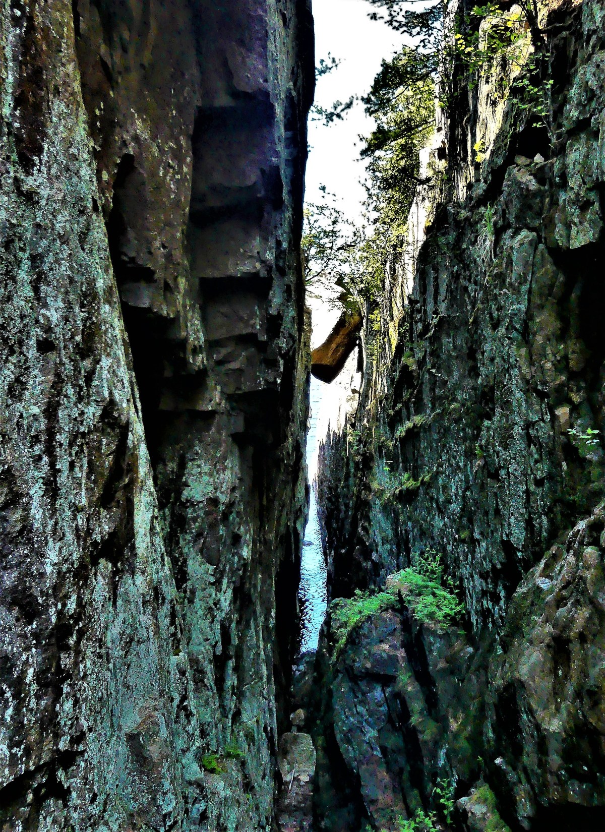
and a keyhole to the many island cottages that dot Chimney Bay.

island cottage

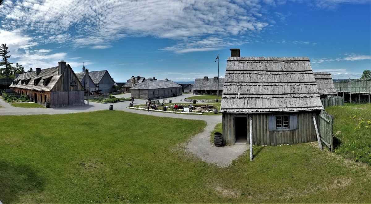
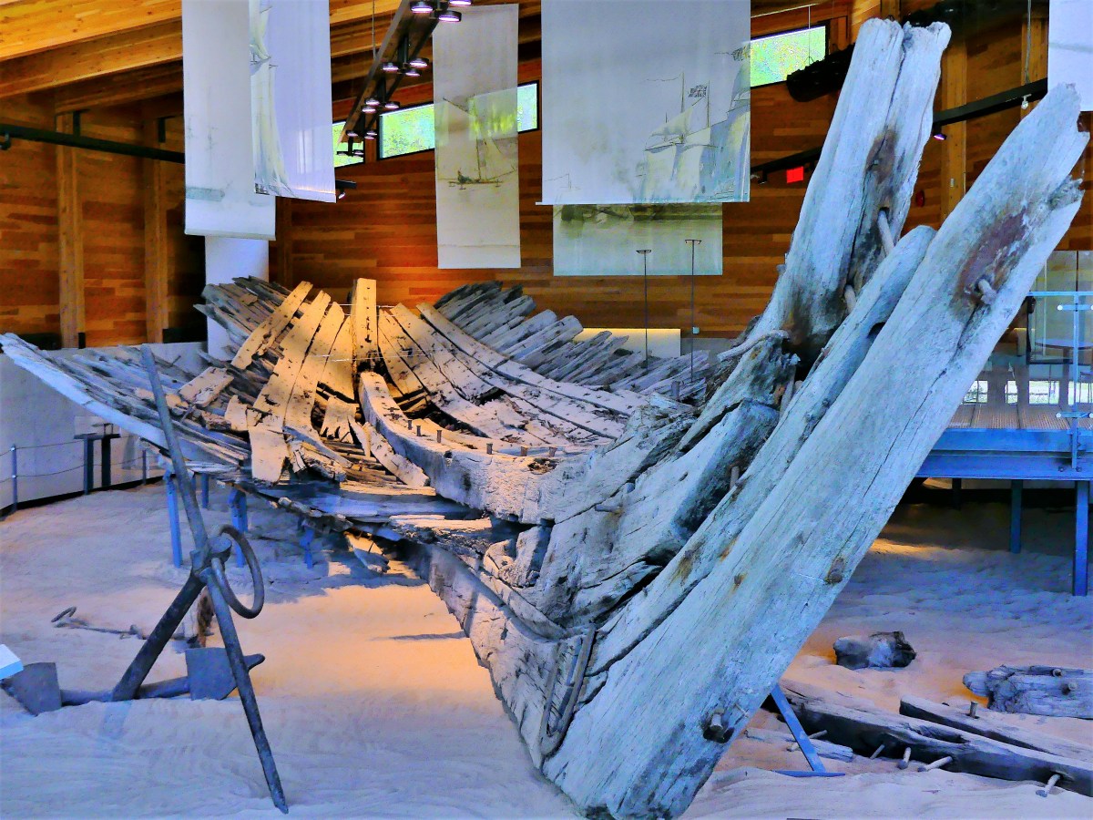
The weather also cooperated during a recent visit to Discovery Harbour, once a British naval and military base in Penetanguishene commissioned to secure back door access to Upper Canada after the War of 1812.

nautical history.jpg

Of the two warships safeguarding the King’s Wharf at the time,

skiff and Tecumeth

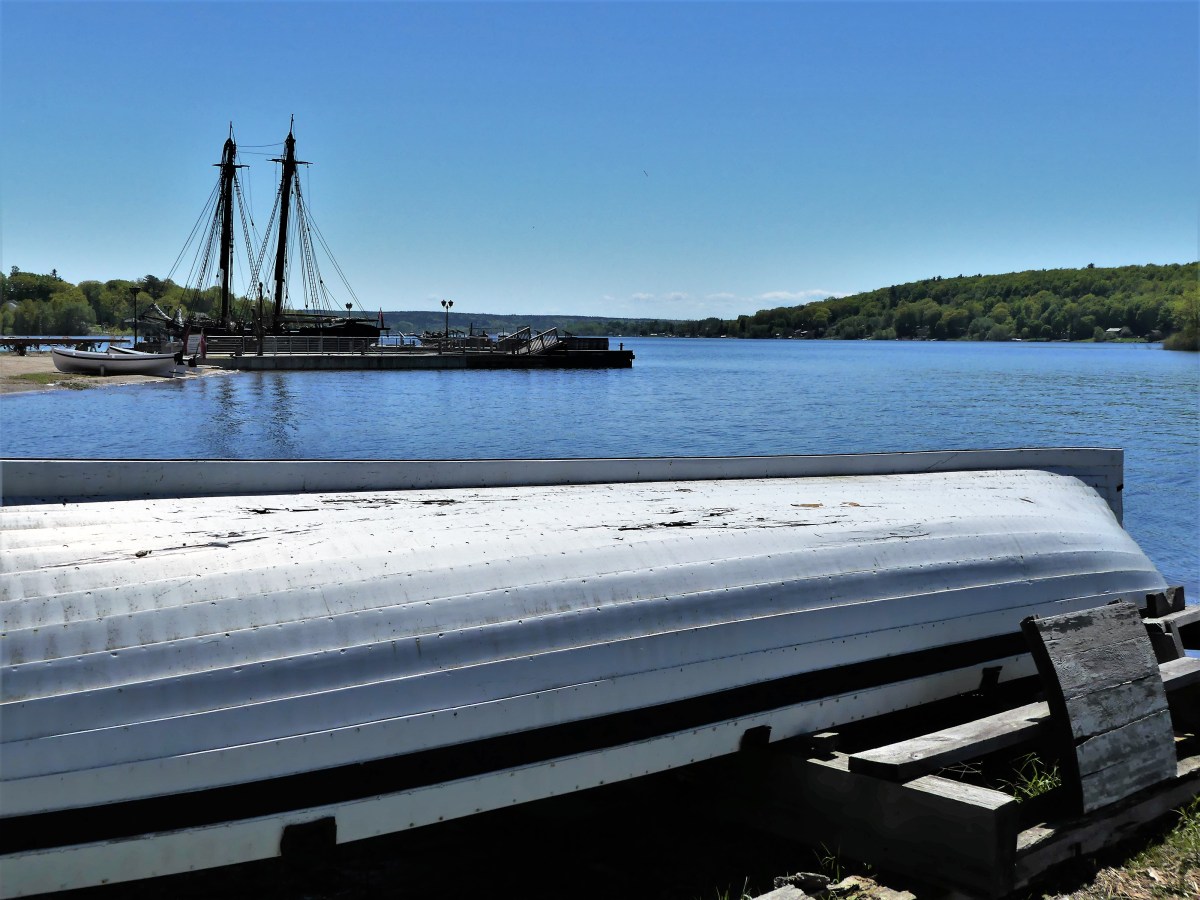
the H.M.S Tecumseth has been replicated to stand guard once again,

skiff hull.jpg

Yet the schooner has been deemed unseaworthy by authorities, and is destined to be a floating exhibit, much like the original.

Tecumseth replica

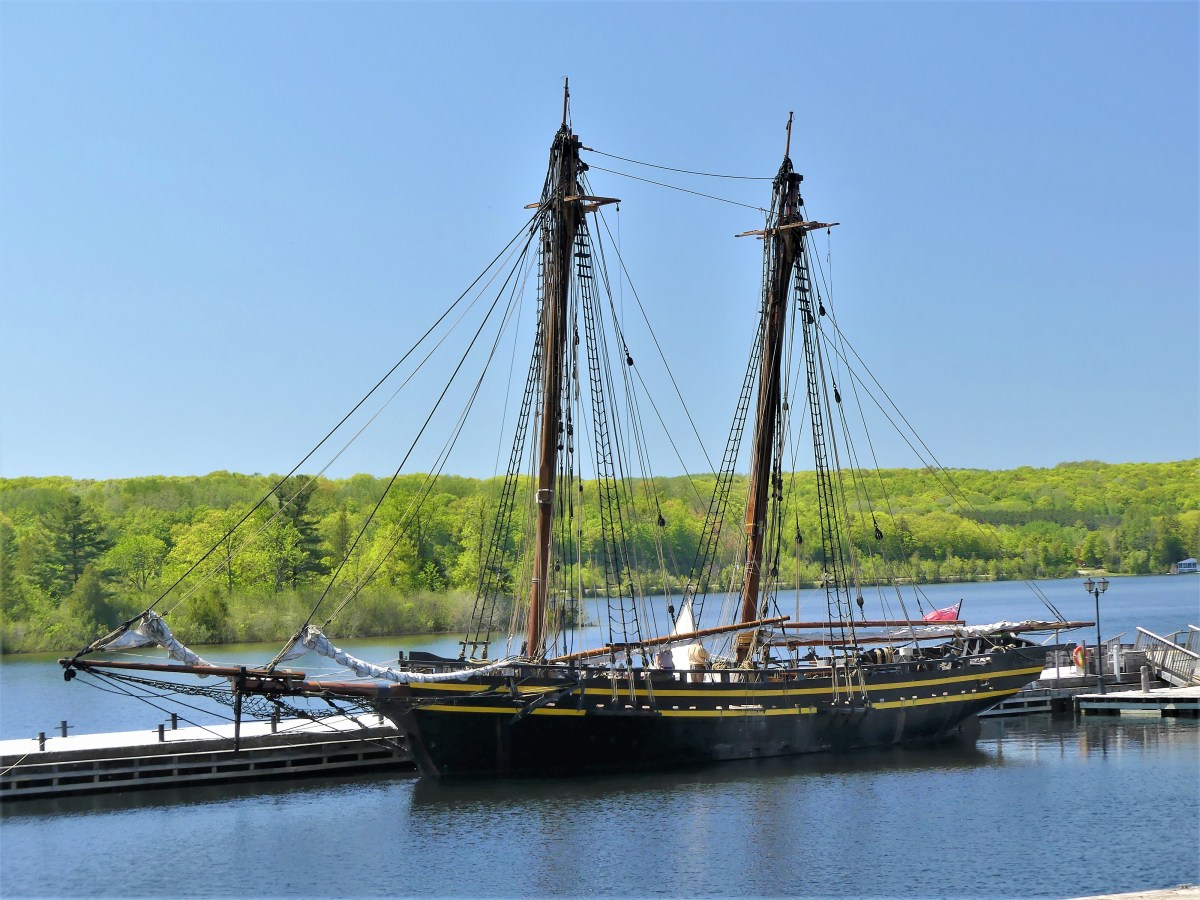
Because the Rush-Bagot agreement between Britain and the United States restricted the number of active warships on the Great Lakes, the H.M.S. Tecomseth was decommissioned in 1817, and kept in a state of readiness until it eventually rotted and was reportedly scuttled in 1828.

However, its 1815 hull was raised from Penetanguishene Bay in 1953, and placed in a climate-controlled museum inaugurated in 2014.

1815 hull.jpg

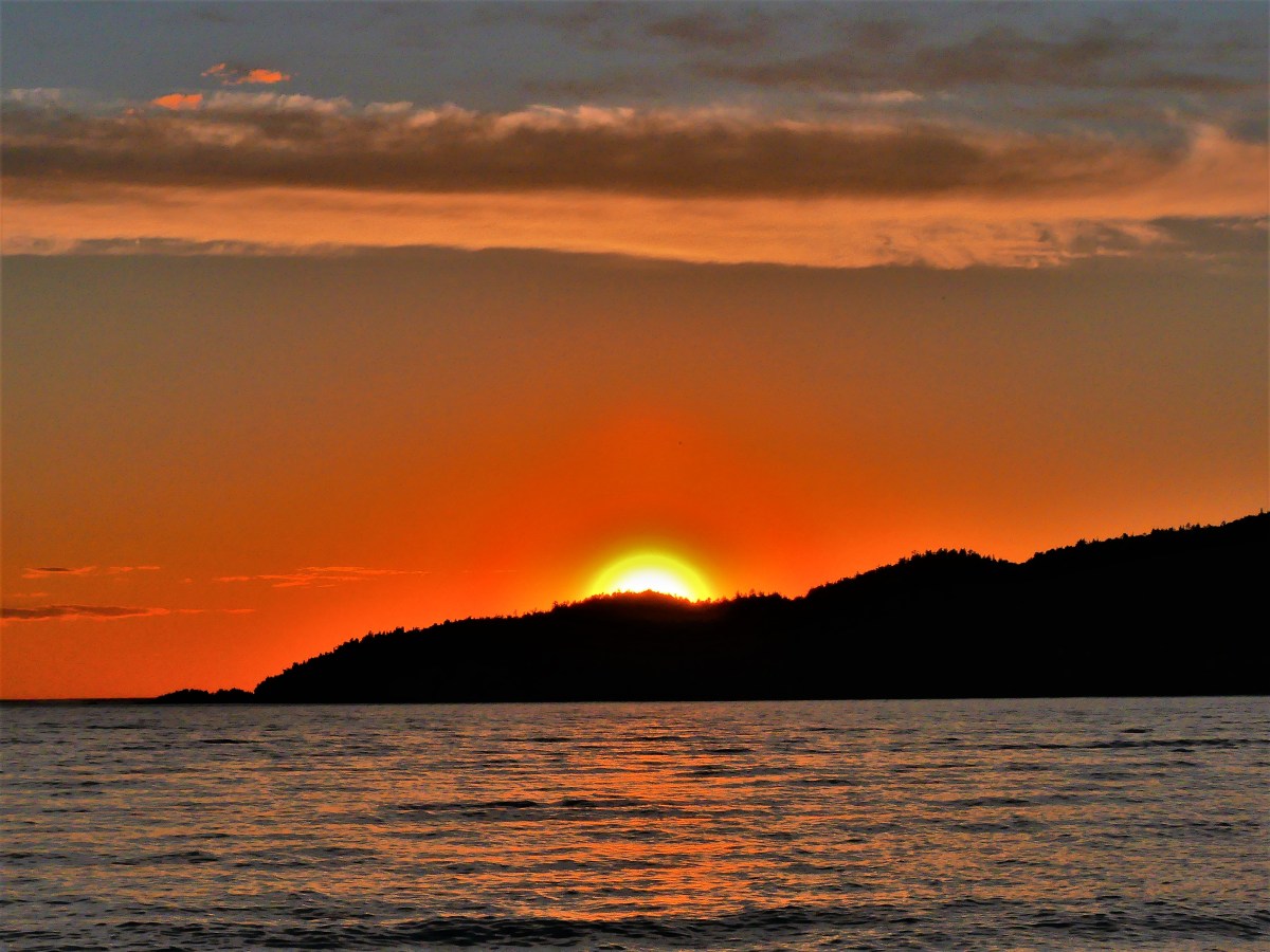
As day turned to twilight, the clouds began to thicken,

tree silhouette.jpg

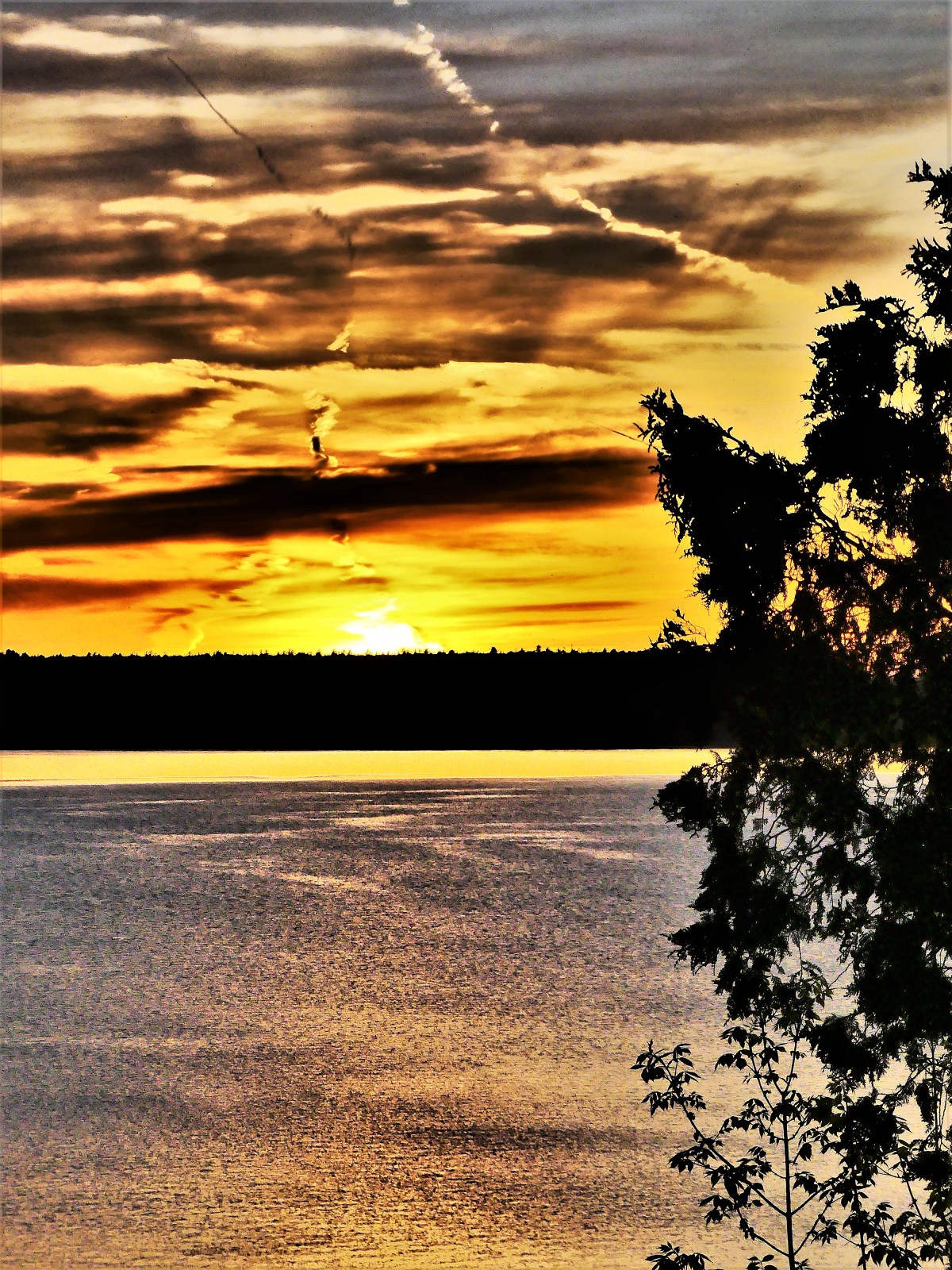
providing a curtain call that few campers had seen in weeks.

Sunset over Lake Mindemoya

Moving our location to Manitoulin Island did little to change a now-familiar weather pattern. We pondered whether sandbagging the Airstream might become necessary, but that thought slipped our minds soon after being preoccupied with scratching our mosquito bites.

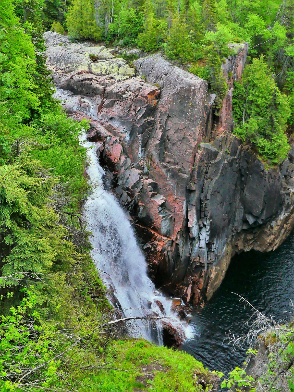
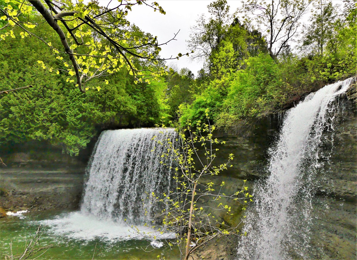
Working around the rain was challenging. Under cloudy skies, we hiked the trail leading to Bridal Veil Falls’ 35-foot drop near the town of Kagawong.

Bridal Veil Falls.jpg

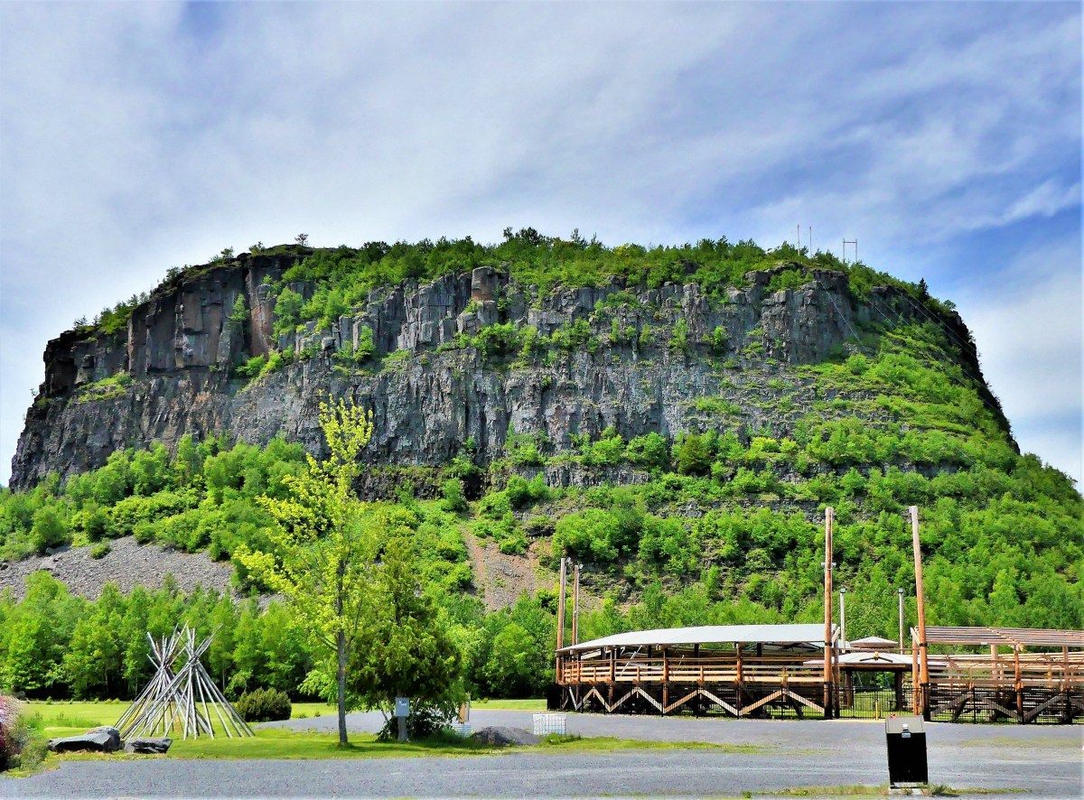
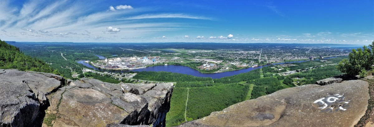
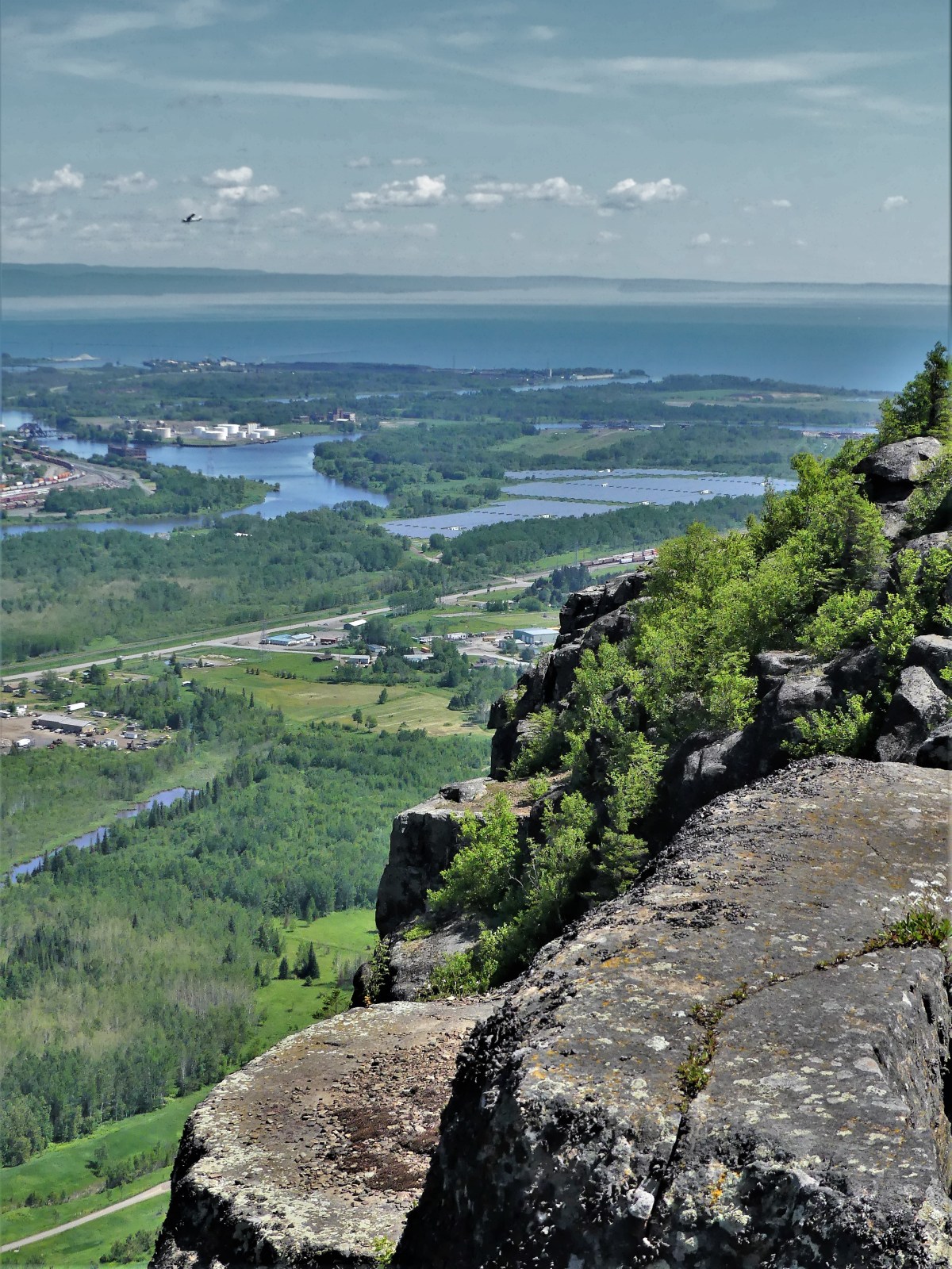
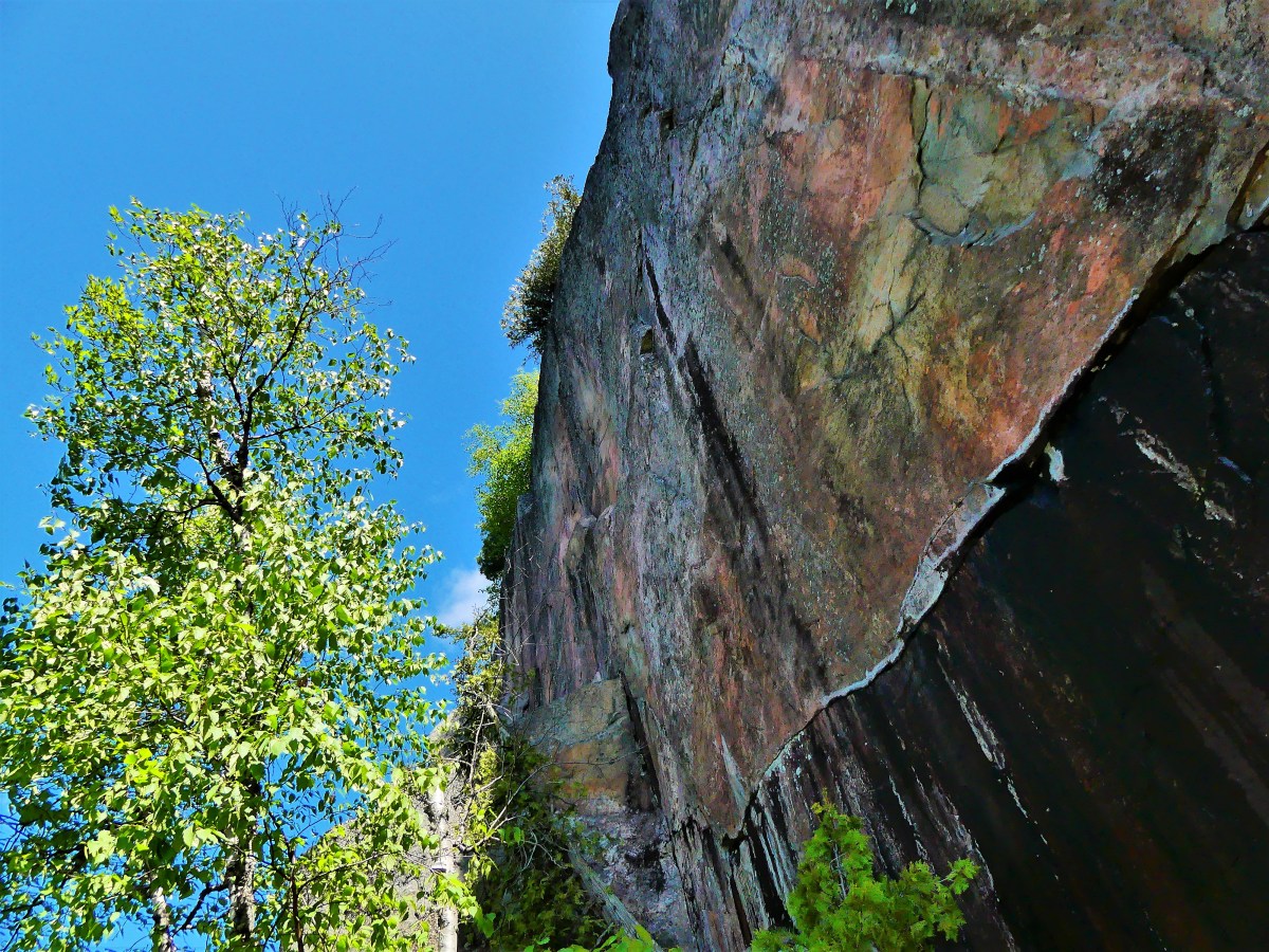
And despite the threat of rain, we continued on, climbing the cliffs of M’Chigeeng on the Cup and Saucer Trail,

The Cup and Saucer Trail.jpg

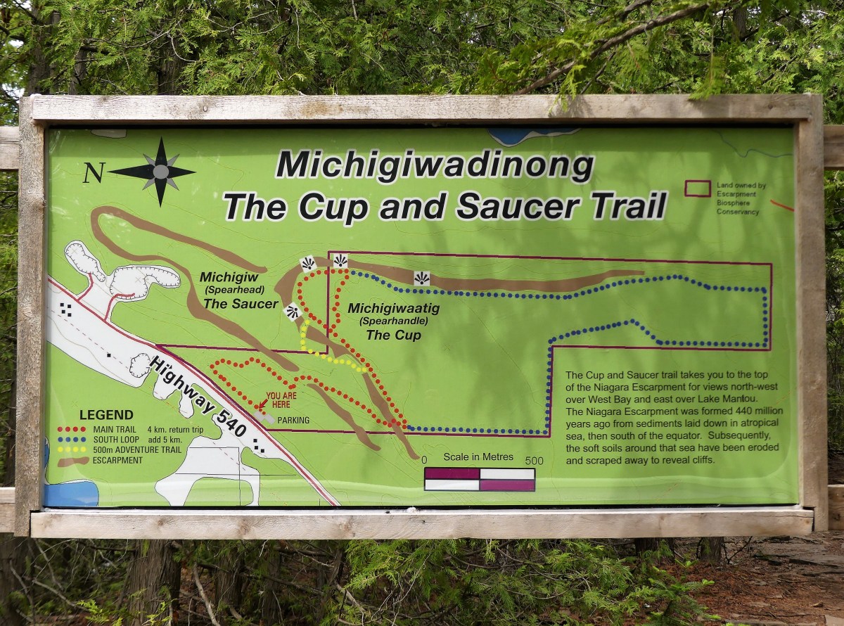
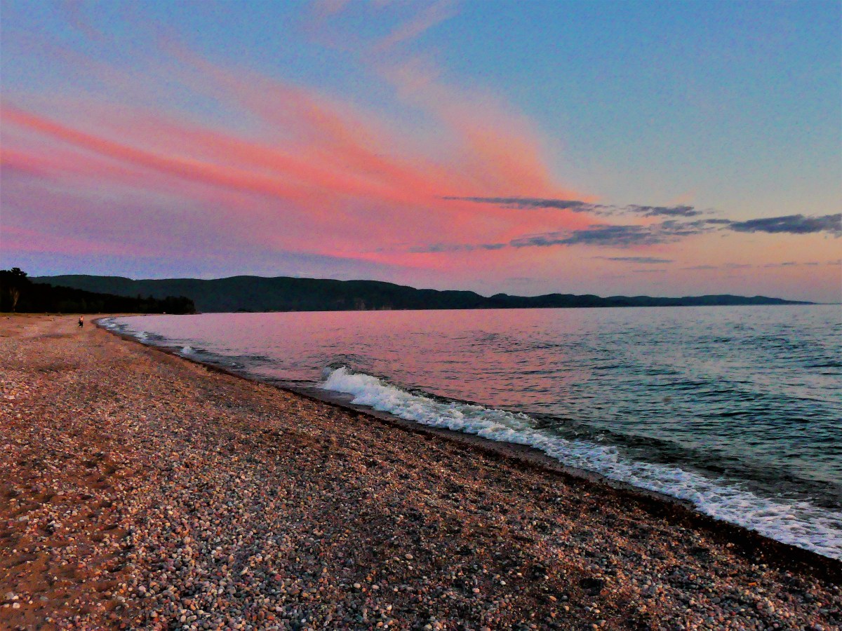
for splendid views of the North Channel.

Cliffside overlook.jpg

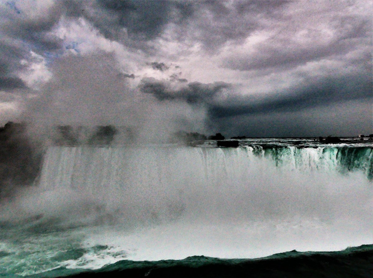
But our luck ran out as we drove to Ten Mile Point for a stormy lookout of Georgian Bay…

10 Mile Point

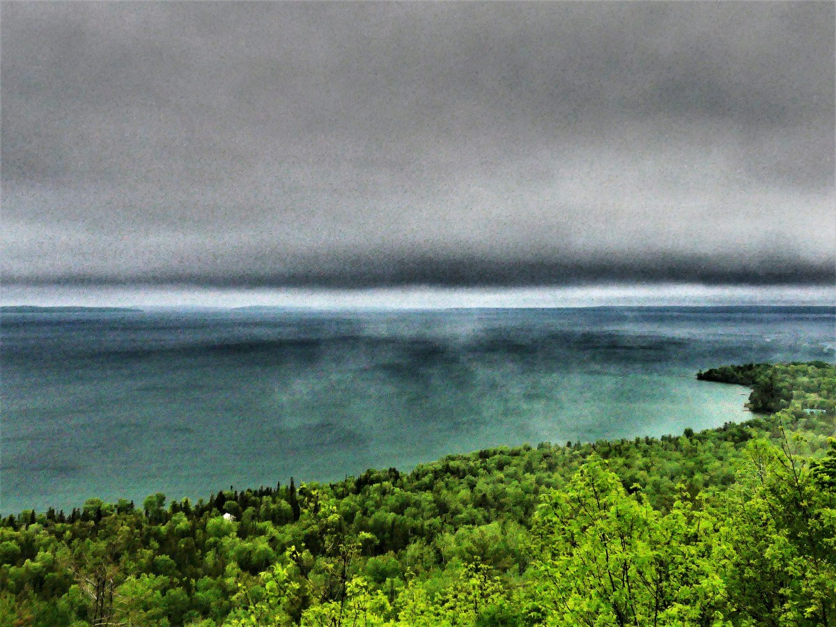
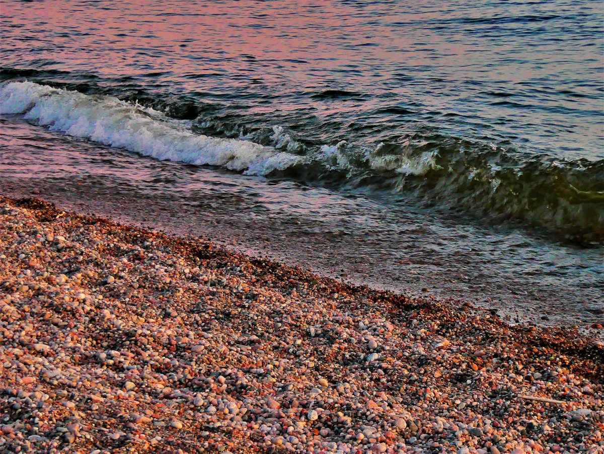
and found similar blustery conditions at Providence Bay, on the edge of Lake Huron,

Lake Huron surf

before returning to the sanctuary of our Airstream.

The following day, our four-hour travel time to Sault Ste. Marie was compromised by a tire mishap (see Blowout!). And then it rained…a lot!

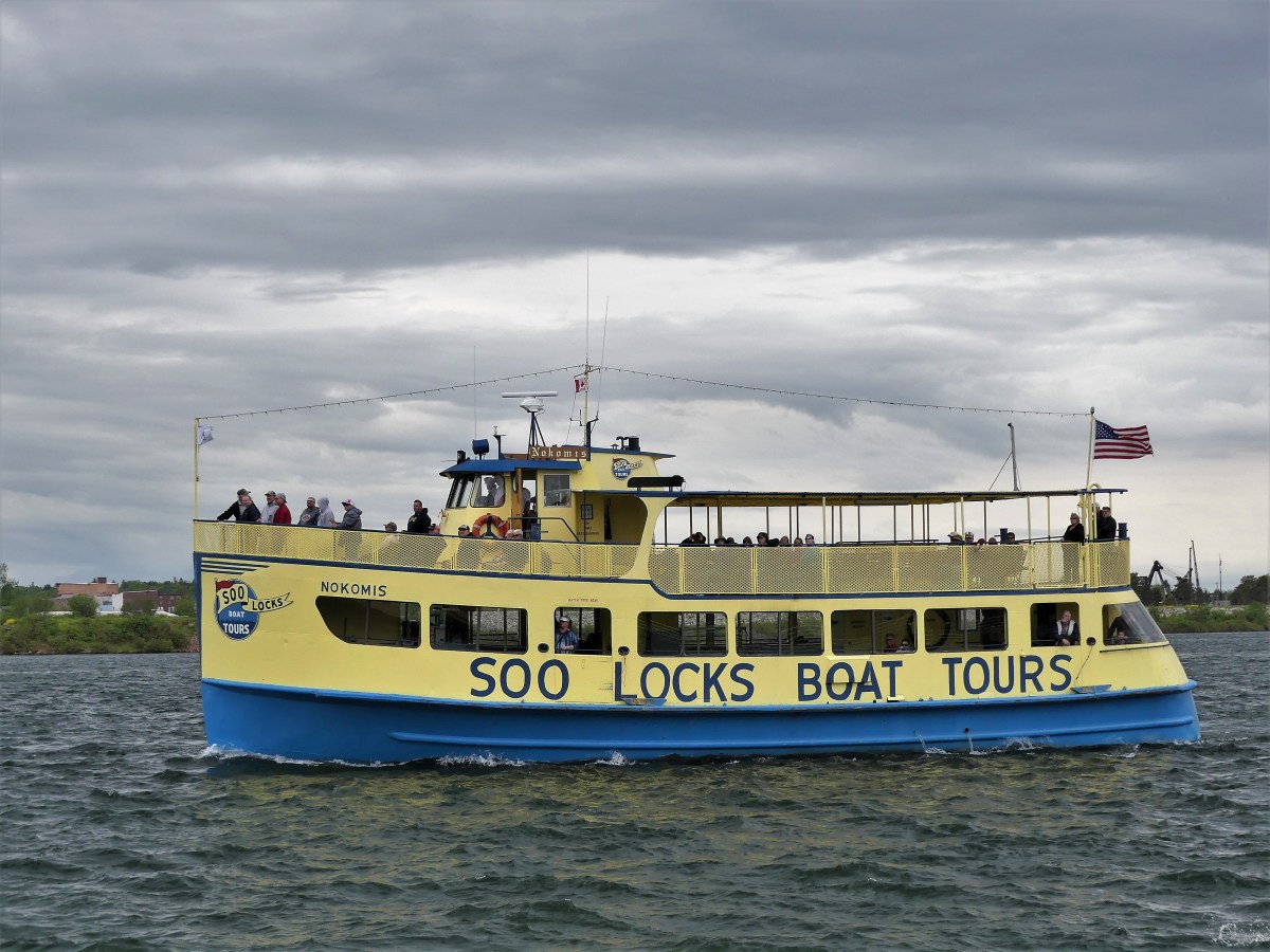
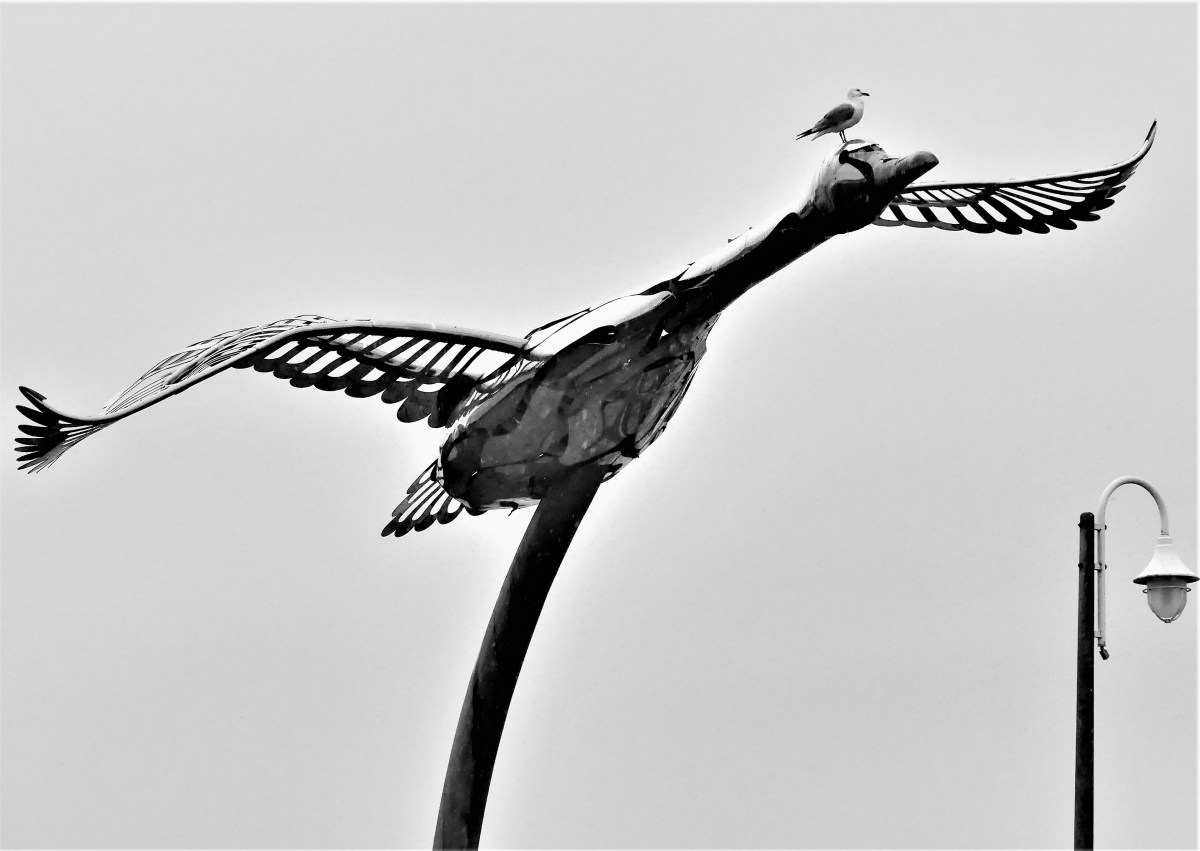
By now, mosquito bashing had turned into a bloodsport. There were a few brief intermissions that allowed us to explore Sault Ste Marie’s famed boardwalk, which carried us past a whimsical sculpture in Roberta Bondar Park,

Three Bears

on our way along St. Mary’s River…

Soo Locks Boat Tours

to Sault Ste. Marie Canal–transitioning between Lake Huron…

Sault Ste. Marie Canal (2)

and Lake Superior…

Lake locks

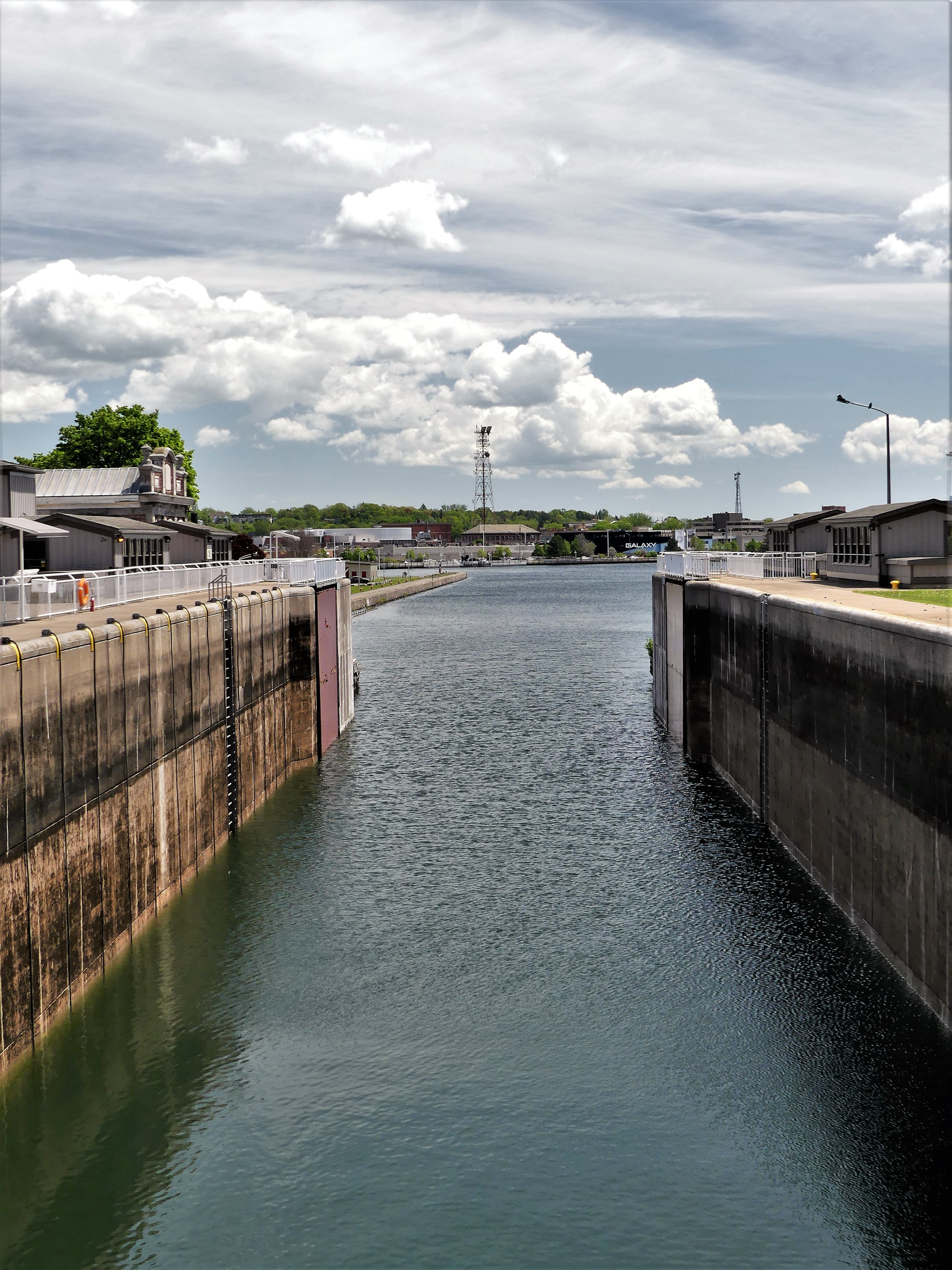
before continuing across to Whitefish Island, where the convergence of Lake Huron and Lake Superior forms St. Mary’s rapids.

St. Mary's Rapids

And then a ride through downtown Queen St. produced a completely different climate,

Queen St.

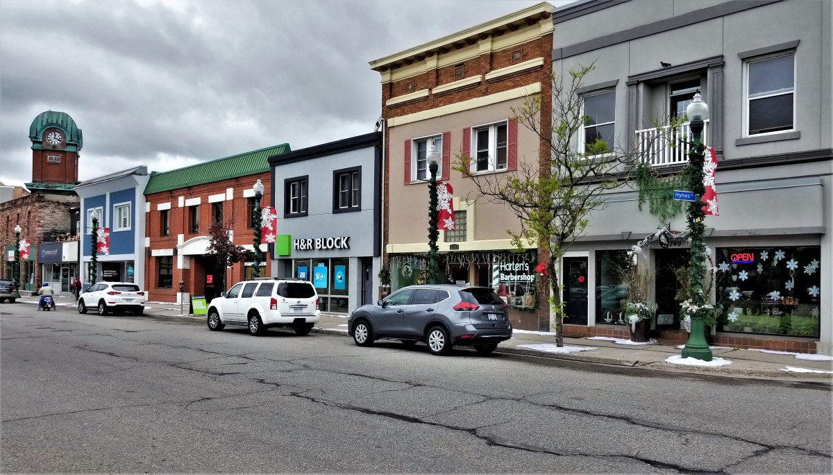
where traces of snow formed around a movie set,

Christman in June

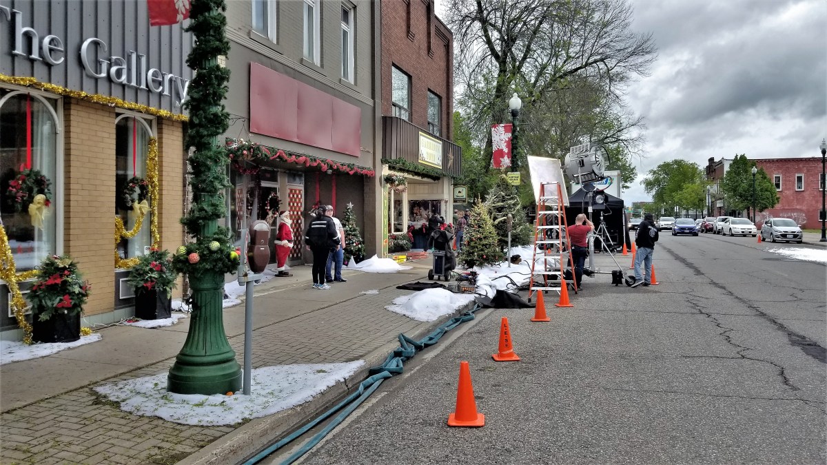
looking much like fire foam…

Fire foam (2)

to create a wintery look…

Fire Foam

for a Hallmark Christmas production adapted from Kevin Major’s The House of Wooden Santas.

Lamp pole and steeple

The weather always sets the tone for the trip. At the moment, rain amounts are up 30% over past years, and lake levels continue to rise above one meter.

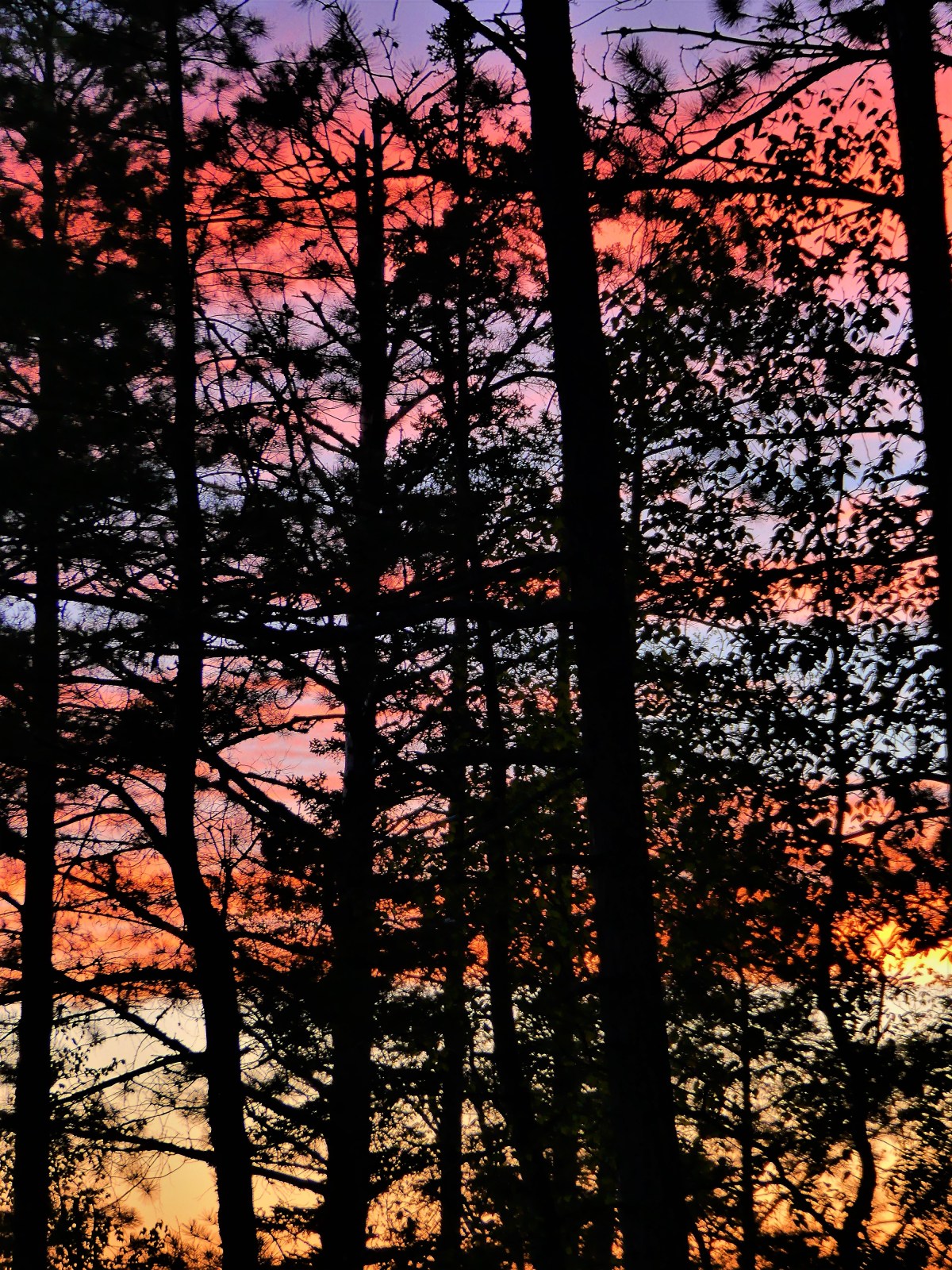
This is a time for the birds…

bird on bird

the mosquitoes, and black flies.

And while there’s little we can do to control or avoid the weather, at least we are now prepared.

netting