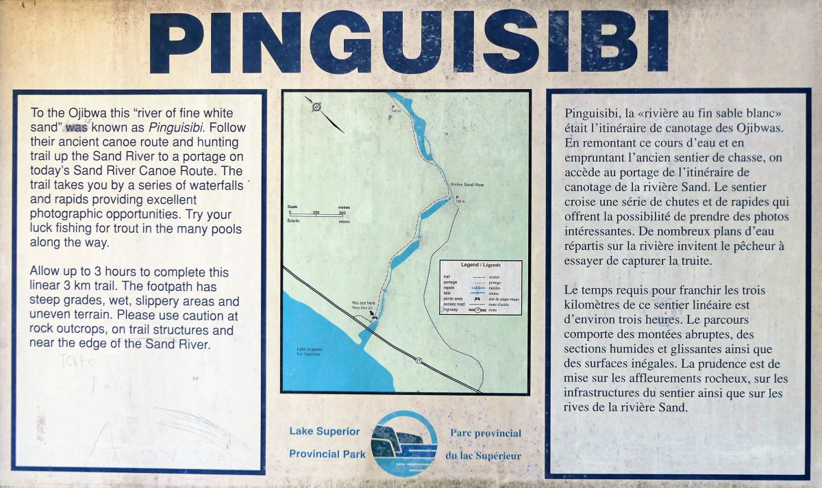
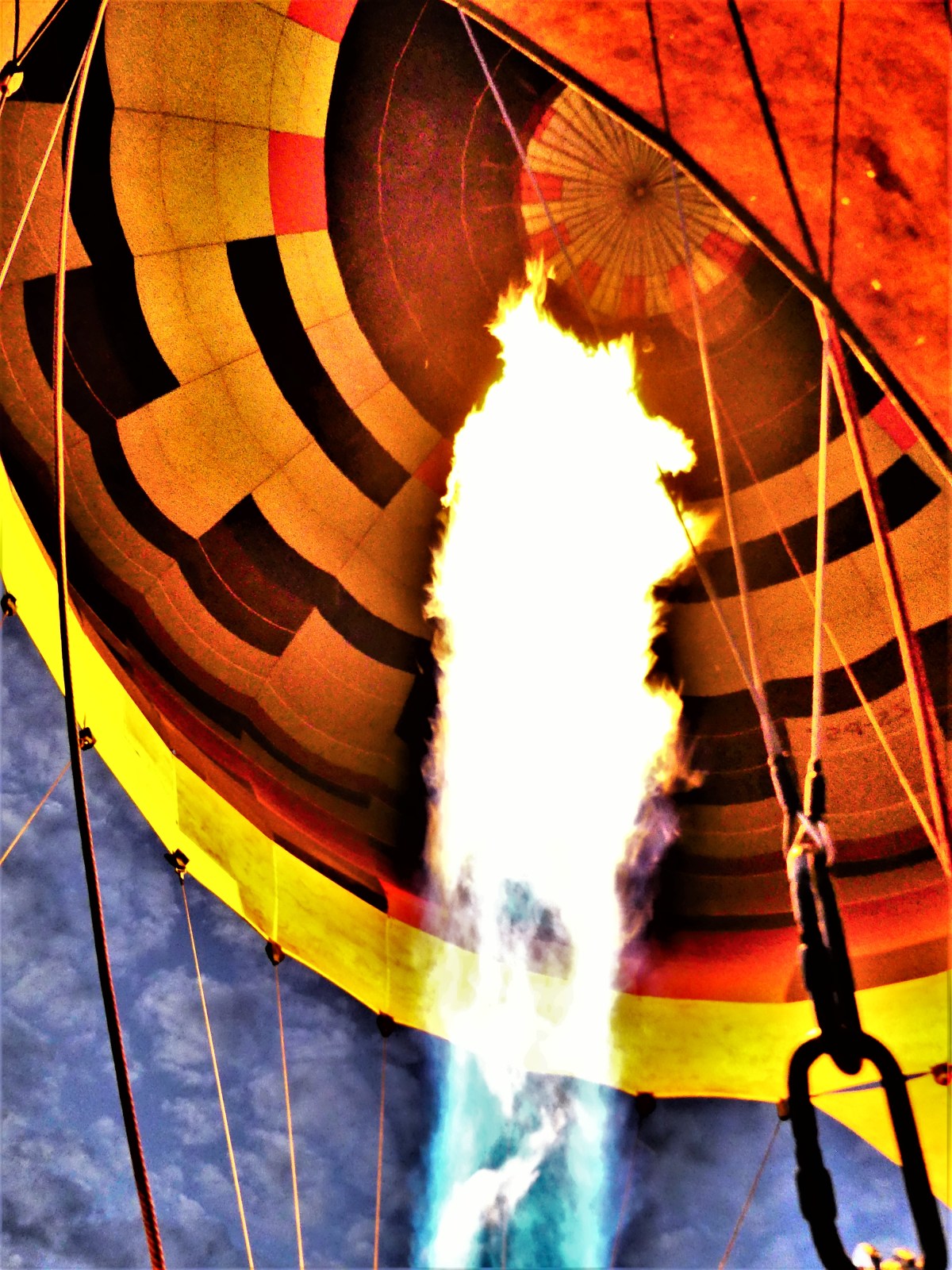
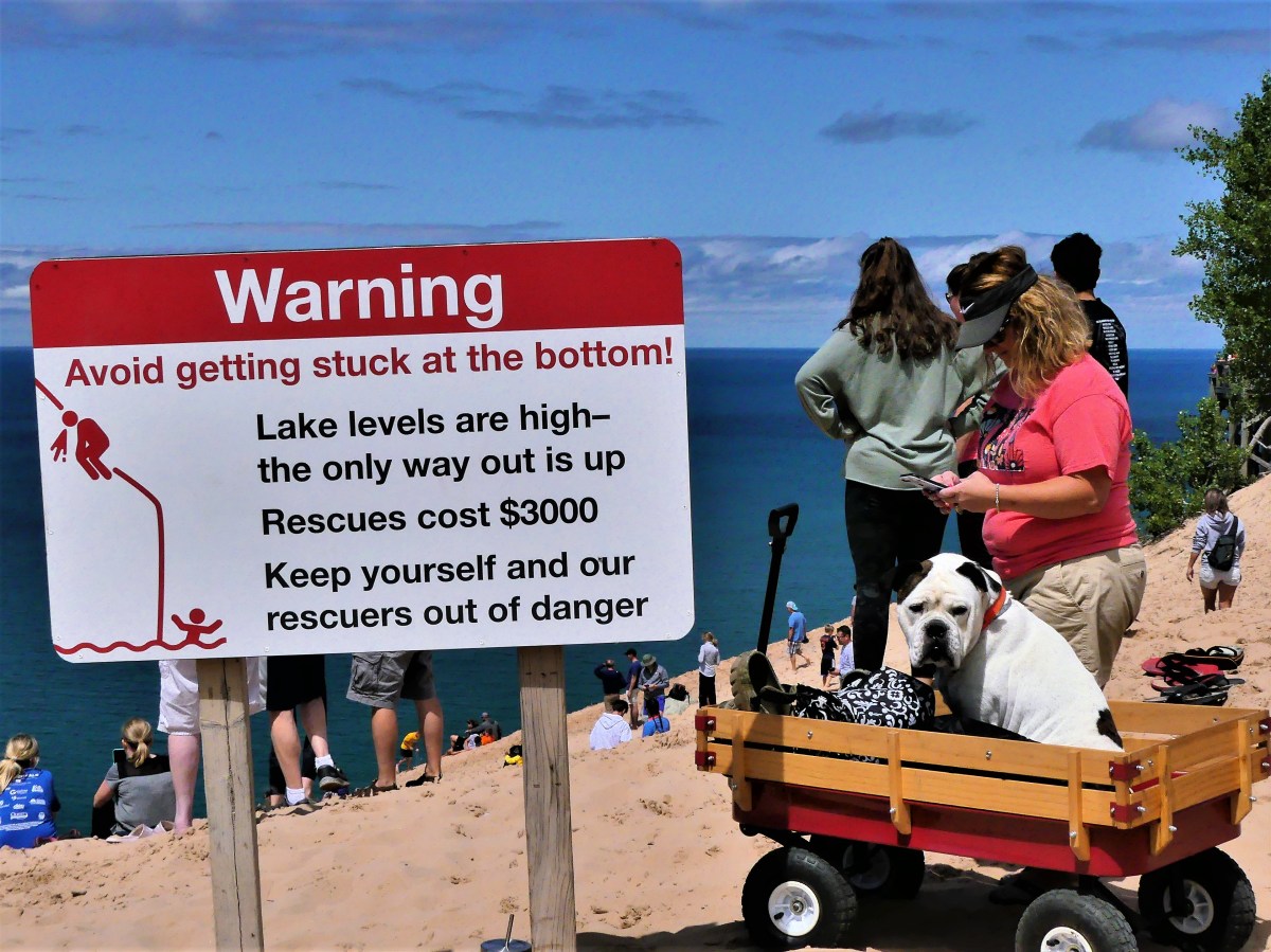
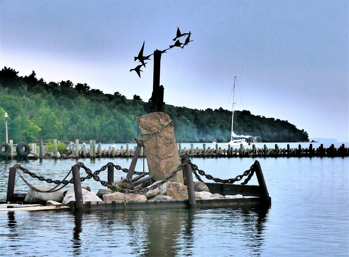
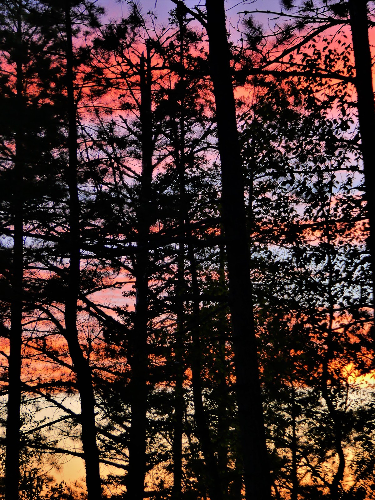
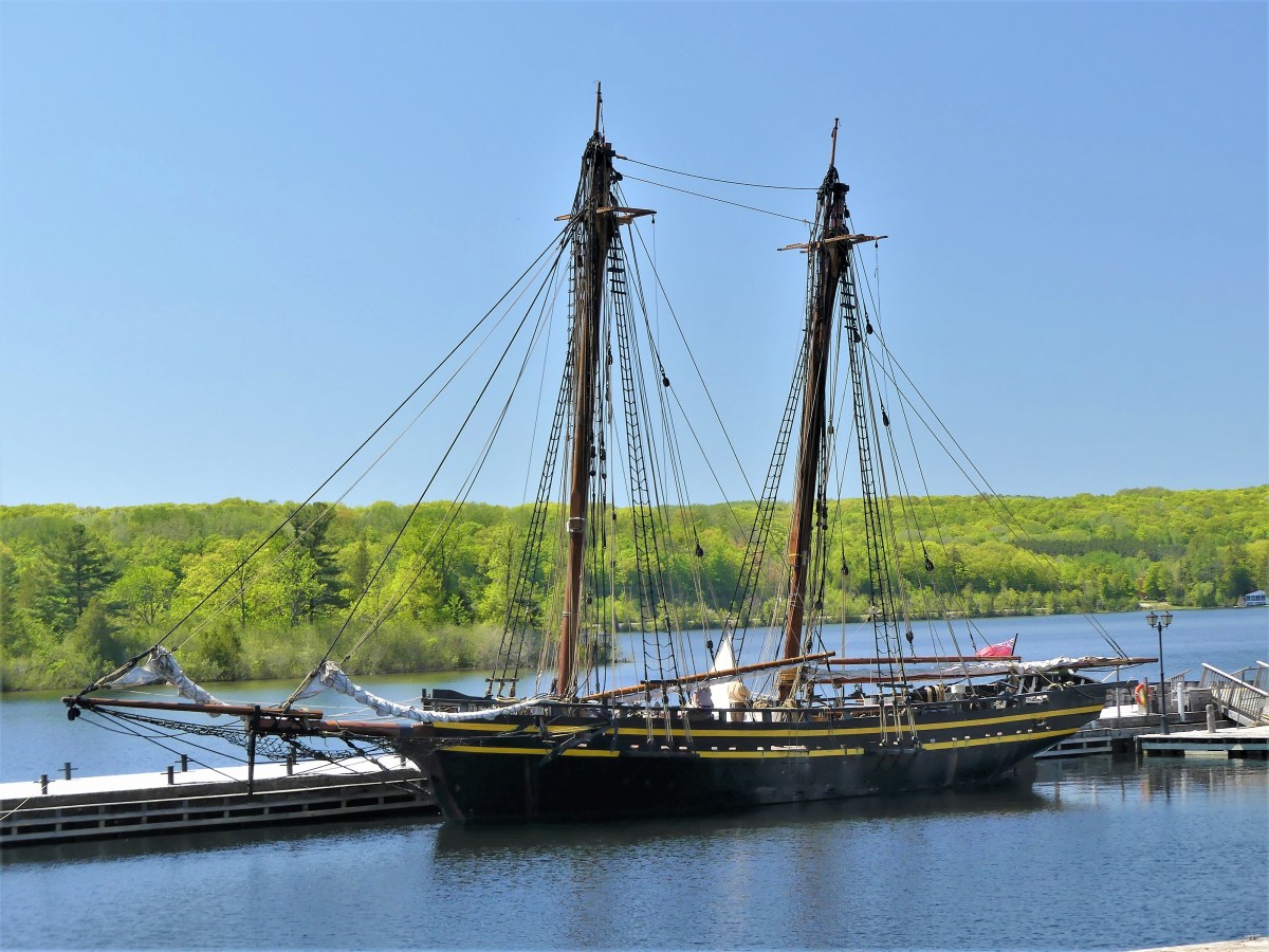
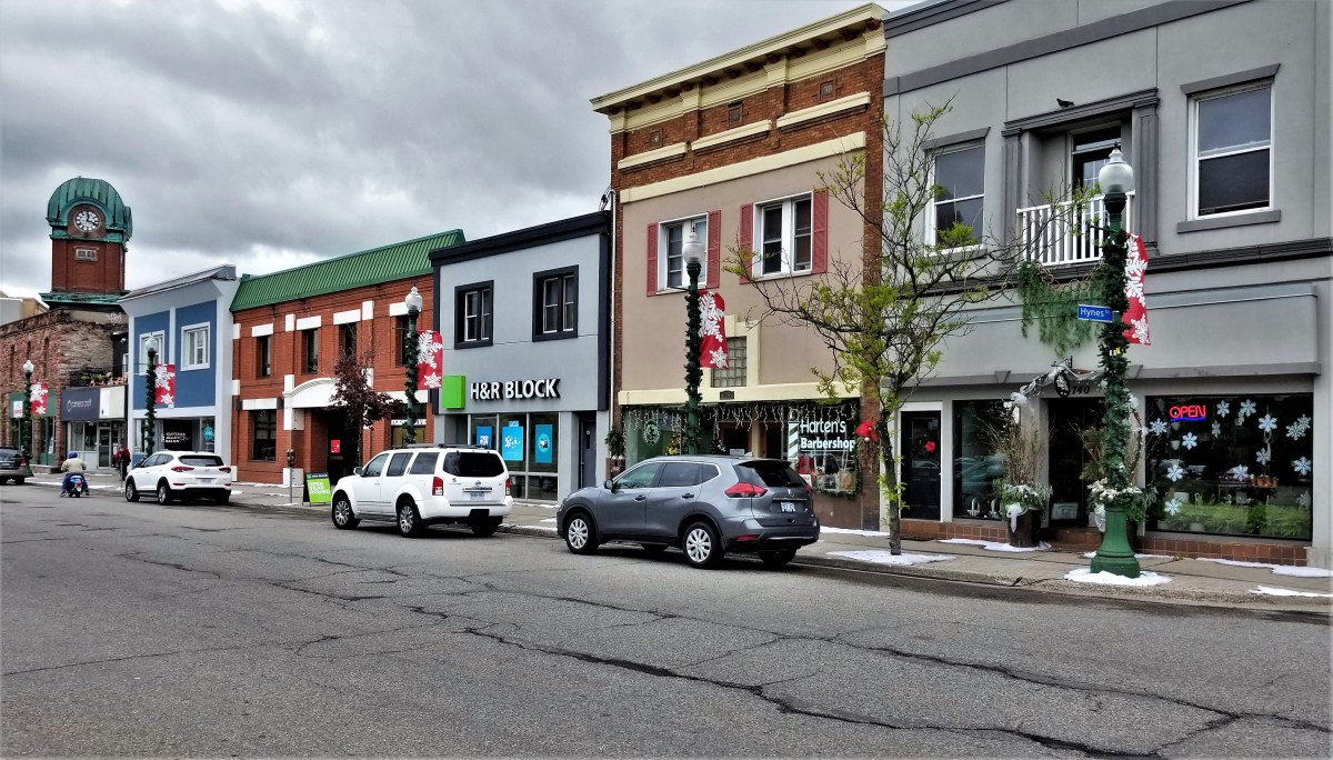
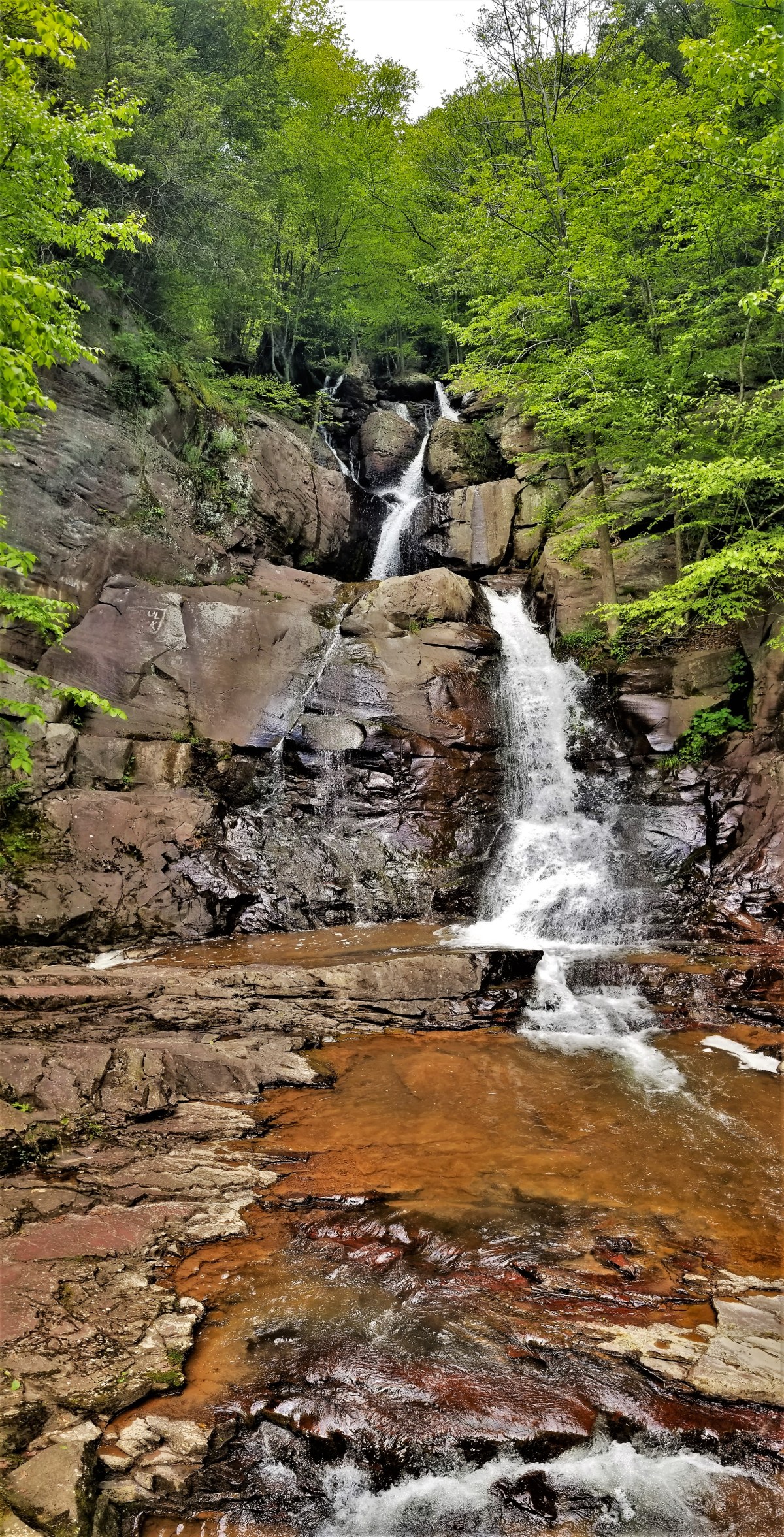
Do not descend the dune.
A thousand feet of uphill sand could easily be your ruin.

The Sleeping Bear will soon awake.

He’ll cause your arms and legs to ache.
You’ll wish you never saw the lake,

for now you sing a sorry tune.
Finding and reporting what's special across America

Do not descend the dune.
A thousand feet of uphill sand could easily be your ruin.
The Sleeping Bear will soon awake.
He’ll cause your arms and legs to ache.
You’ll wish you never saw the lake,
for now you sing a sorry tune.

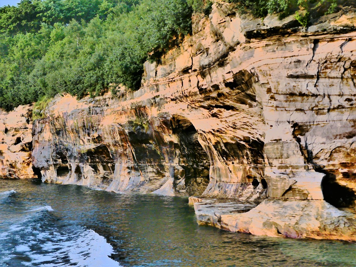
Father Time’s chisel
and Mother Nature’s palette
create monuments.
Father Time sculptures…

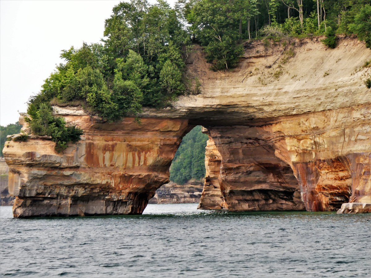


Mother Nature murals…

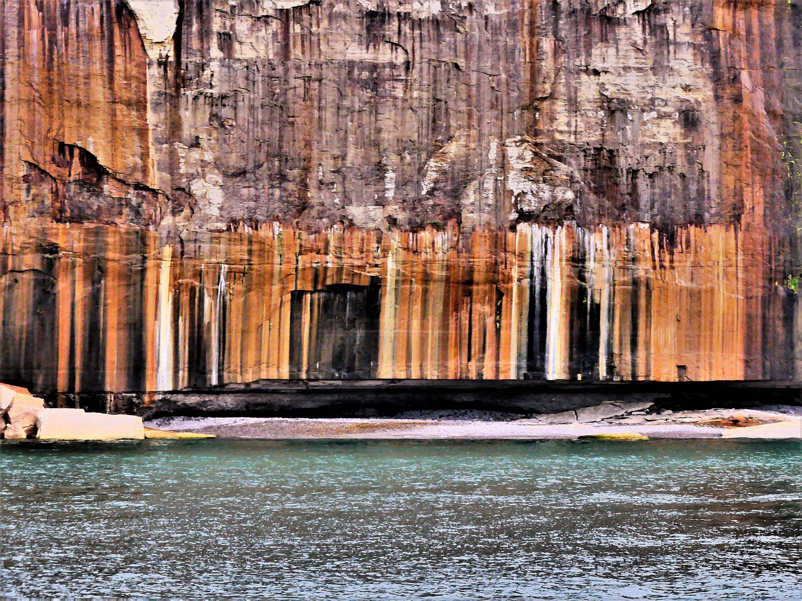
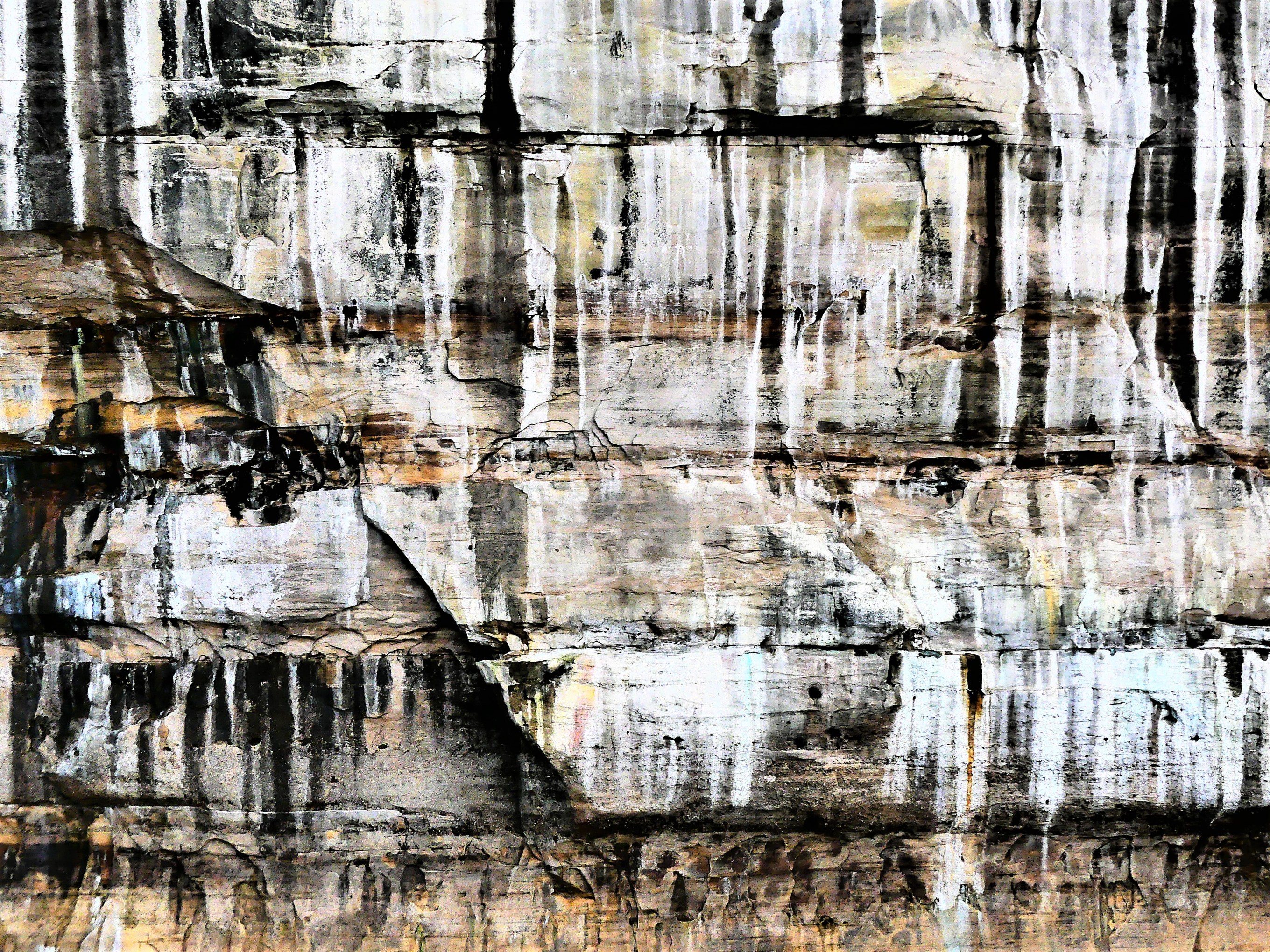


Their collaborations…


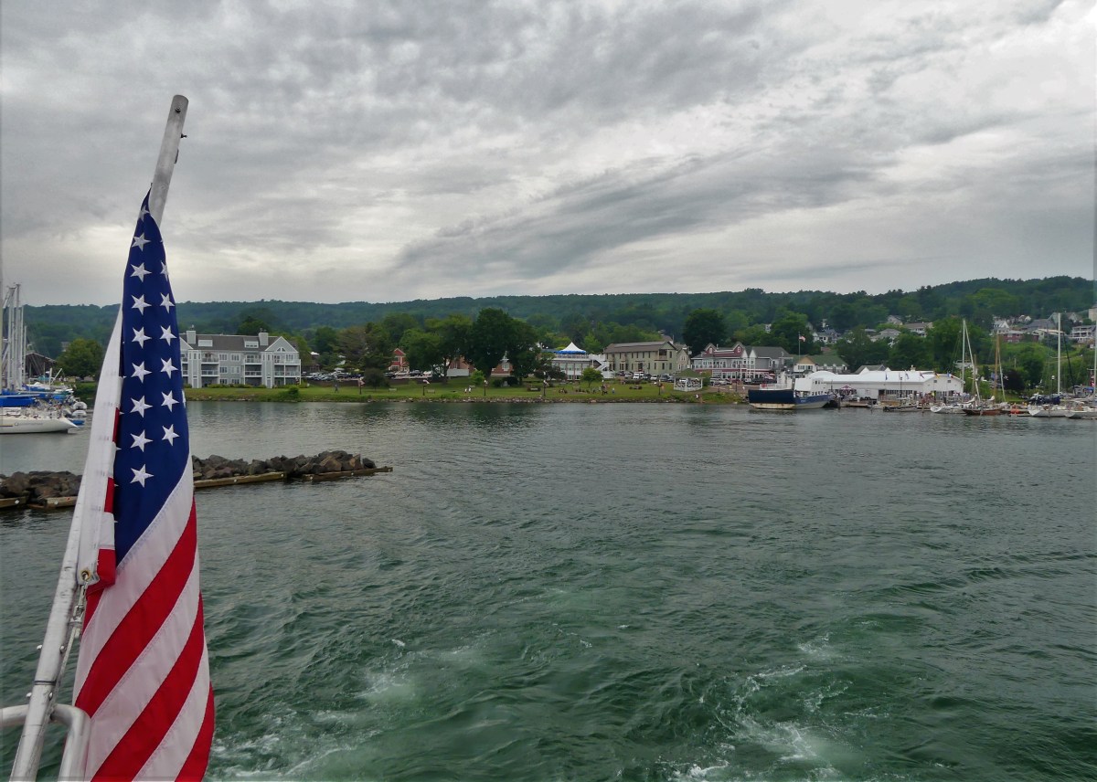
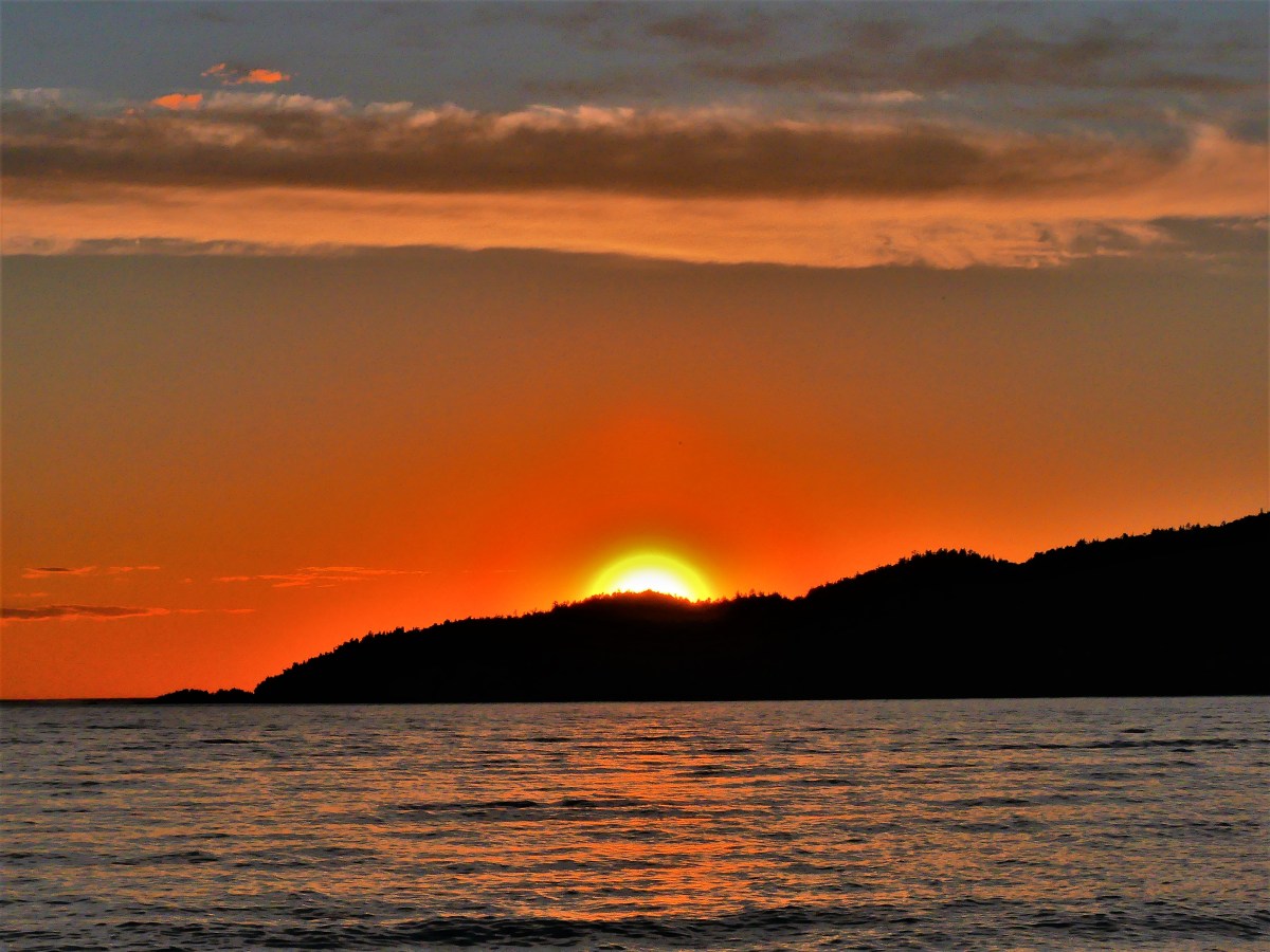
We arrived at Bayfield Harbor for a sunset cruise across Apostle Islands National Lakeshore.
The skies were flat with soft, diffused light, virtually eliminating all late afternoon shadows.

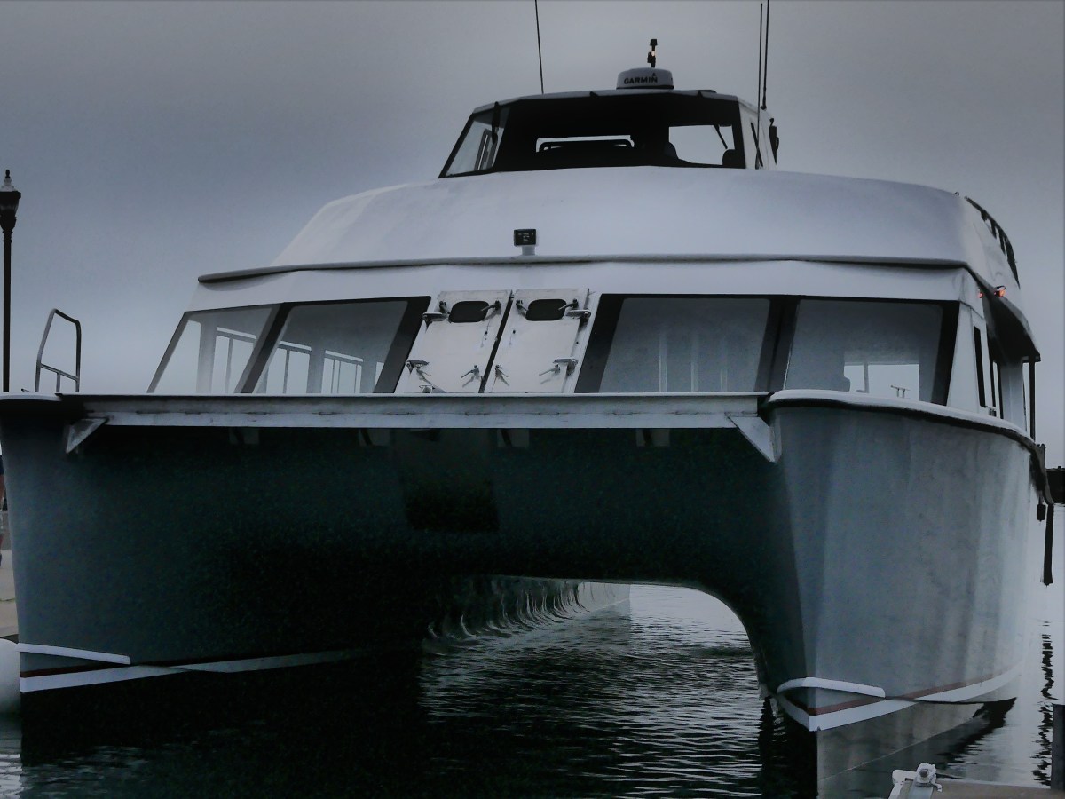
I had my doubts about a sunset, but at least the water was calm. We boarded the Archipelago, Apostle Island Cruises’ newest vessel–a 65-foot, 150-passenger catamaran,
and soon got underway on our 2½ hour-cruise.
There are 22 Apostle Islands grouped within the archipelago,

and according to Captain Mike, we would be running by half of them on the way to Devils Island, the furthest outpost and the geological jewel of the Apostle Islands archipelago.
Just starting out, we passed Basswood Island, the site of Bass Island Brownstone Company Quarry, operational from 1868 to 1893. The bulk of the cut stone was shipped across the Great Lakes, destined for Chicago residences, but the stone stacked by the shoreline never made it off the island. It’s a reminder of a time when buildings seldom exceeded seven stories.
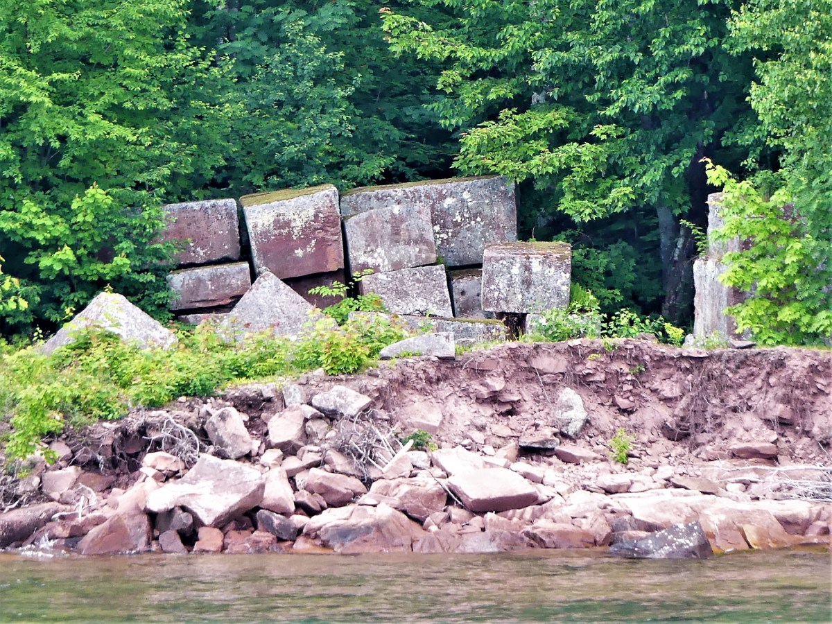
The quarry company went bankrupt after demand for brownstone was replaced by concrete and steel.
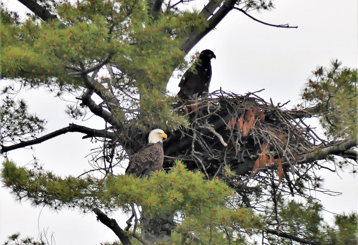
Continuing along, a pair of eagles nesting high in the pines was an unexpected thrill. Last year, 20 eagles were counted within park territory. This year the count has risen to 42.
Before leaving Basswood Island, Honeymoon Rock figured prominently off the northeast shore.

One of the greatest concentrations of black bears in North America is found on Stockton Island. Sadly, we found only trees and a rocky shoal.

When passing Manitou Island, we were lectured by Captain Mike about several of the fishing camps that originated in the late 1800’s.
Cabins and sheds are still standing at the southwest corner of the island.

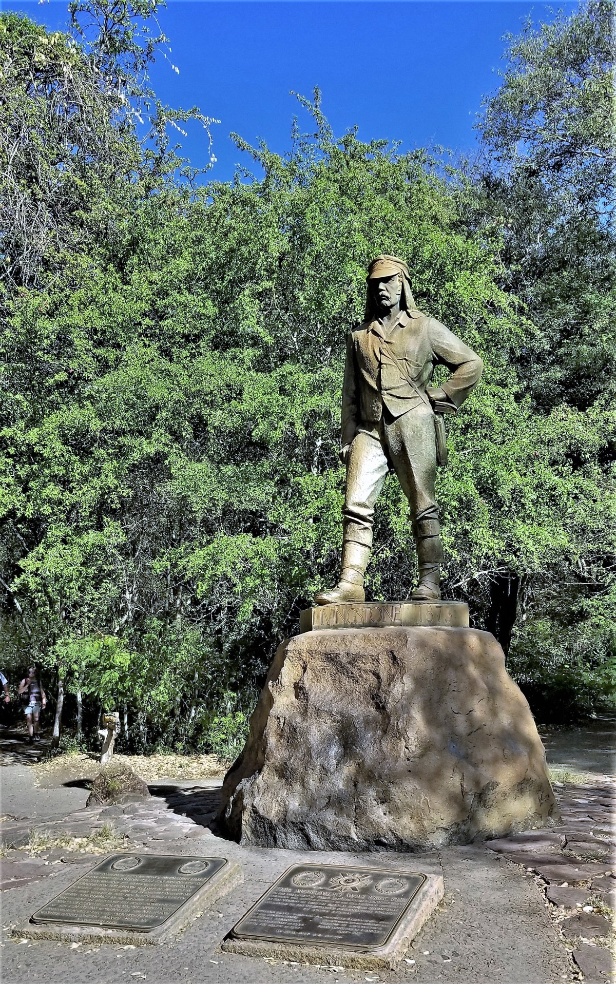
After cruising through the channel for a half-hour, we arrived at Devils Island, the northernmost point of land in Wisconsin, and notable for the sea caves which undercut the shoreline.

We idled twelve feet from the rock formations for a closer look at the honeycombing…

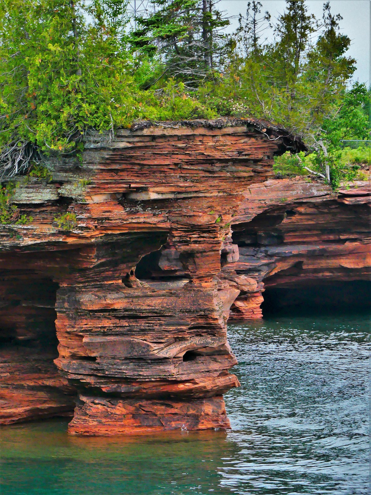


While the overcast skies precluded any possibility of brightening the scenery, the balanced light offered views into the caves that otherwise would have been defeated by sunlight and resultant higher contrast.


Captain Mike promised one last photo opportunity before returning the Archipelago to Bayfield Harbor. He was referring to Raspberry Island’s lighthouse, once known as the Showplace of the Apostle Islands.

As we trolled along the stone wall, we were greeted by the lightkeeper.

The National Park Service completed renovations of the 1906 structure in 2006.

On the return trip, Captain Mike asked passengers if they knew the origin story of Apostle Islands’ name. A few volunteers tossed out some theories. One guest suggested that there was something religious about the naming. Another guest offered that the area was first mapped by the Jesuits, so that explains why they gave it a holy name.
I thought the insight was interesting but unreliable, since there were 12 Apostles, for 22 islands. Could it be that the Jesuits had been drinking too much Lake Superior moonshine and seeing double?
Nobody knows!
But photographing Devil’s Island sea caves was a fleeting, yet near-religious experience… with ironic overtones.

Although it’s been two years since Leah and I visited Mt. Rushmore, what could be more American than re-posting this visit on Independence Day?
There’s no better way to celebrate the 4th of July, than a trip to Mount Rushmore and the Crazy Horse Memorial. Sure, the crowds were large; that was to be expected. But once the cars were garaged, the pedestrian traffic was easy to negotiate. And with everyone looking up at the mountain, the Presidents’ faces and intentions were never obstructed.


It was also a time to celebrate family. There were plenty of kids riding in strollers, hanging from moms in carriers, or balancing on dads’ shoulders. Generations of families–many of them immigrants–had gathered to pay homage to the principles of freedom that make our country a beacon for the oppressed and downtrodden.
Seniors were being escorted through the Avenue of Flags by their grandchildren. Extended families organized group pictures at the Grand View Terrace, unified by their love of democracy and their reunion T-shirts.
All expressed awe at Gutzon Borglum’s grand vision and remarkable achievement–the transformation of a mountain into a national symbol visited by approximately 3 million people every year.

The 14-year process of carving the rock began with dimensionalizing the Presidents’ portraits through Plaster of Paris masks, on view at the sculptor’s studio-turned-museum.

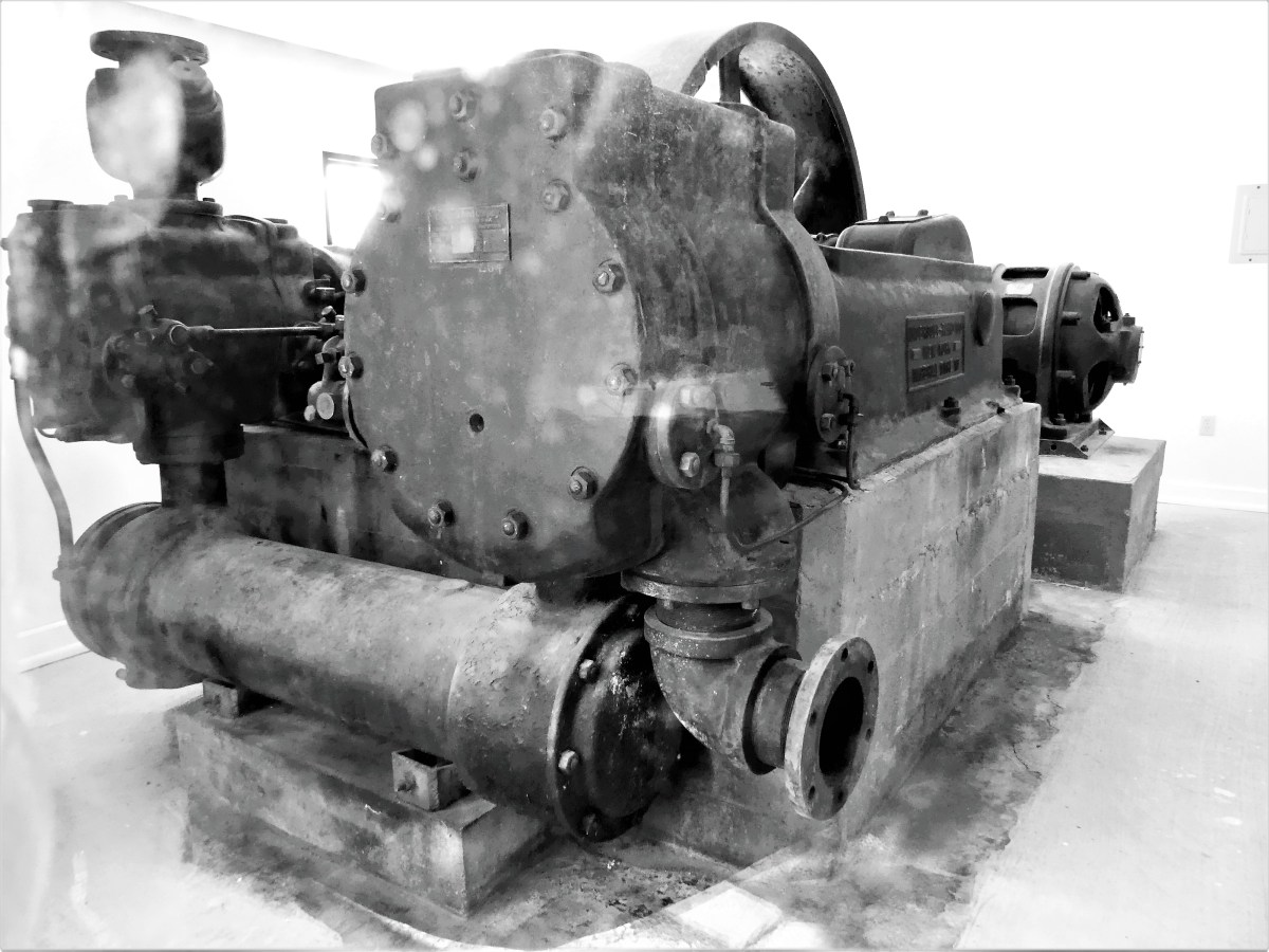
Additional exhibits detail the construction of the memorial, and the tools used by workers, like the original Rand & Waring compressor, which powered the jackhammers for all the finishing work.
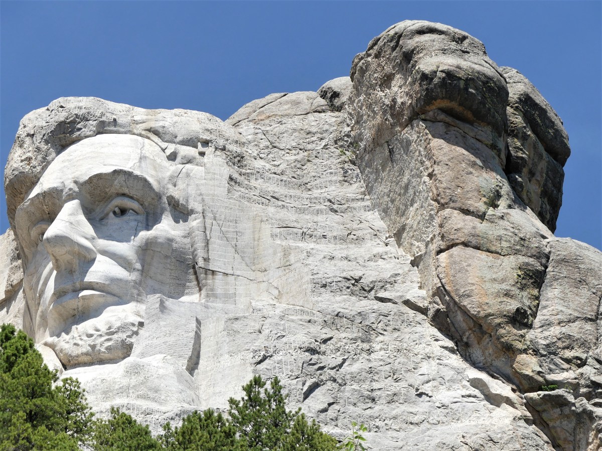
A little known fact is that Mt. Rushmore was once intended to be a tribute to the “Five Faces of Freedom,” but funding ran short when the Congressional appropriation approached $1 million during the Great Depression. Hence, the unfinished carving of the Great Ape to the right of Lincoln serves as a reminder that we are never far from our true ancestors.¹
No less ambitious, and equally as impressive, the Crazy Horse Memorial is a work-in-progress located 16 miles away in the heart of the Black Hills–considered sacred land by the Lakota people.

Conceived by Korczak Ziolkowski in early 1940s,

the memorial, when completed will stand 563 ft. by 641 ft. across, and is expected to be the largest sculpture in the world. Already, the completed head of Crazy Horse measures 60 feet tall…
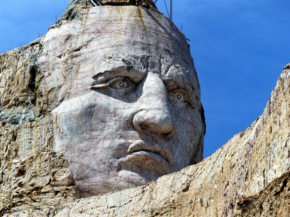
…twice the size of any of the presidents at Mt. Rushmore. While the first blast was conducted on the mountain in 1947, the current prospects for the memorial are to complete the outstretched arm during the next twelve years. There is no completion date available for the finished carving, which has been financed entirely by private funding since its inception.
Mt. Rushmore was created by a Danish American. Crazy Horse was created by a Polish American. And visitors to both destinations manifest the melting pot that has brought us all together as Americans. It’s our diversity that makes us strong, our ambition and determination that makes us great, and our compassion and sacrifice that make us whole.
These are the values reflected from the faces we’ve immortalized in stone. Yet, we would honor them more by living according to these principles.
Happy Birthday, America!

¹ Just kidding, but the photograph is real and has not been retouched.

When the sun’s last rays warm Agawa Bay,
the bugs attack without delay.

They make their way, prepared to stay

on a patch of skin, where they can win
to my chagrin, a forearm or a shin.
Mosquitoes take top billing, and black flies are willing
to make a killing from their drilling.

But I remain to snap a frame, and find it’s still fulfilling.


Dear Diary,
Today was unsettling, as nothing went as planned.
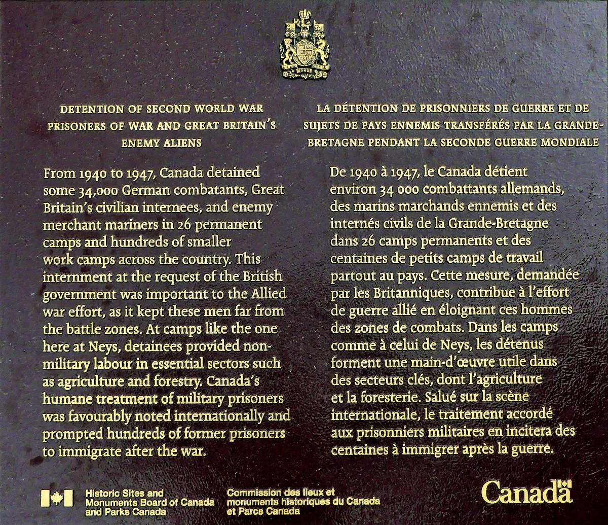
A high probability of intermittent rain had been forecasted throughout the day, which gave us very few options. Although we were snug in our pull-through campsite overlooking the northern boundary of Lake Superior from Neys Provincial Park in Ontario, Canada, we were looking forward to exploring the stark coastal beauty of an area once known from 1941 to 1946 as Neys Camp 100–an internment facility for German POWs and Japanese Canadians.

Prevailing wind from the west had whipped up whitecaps across the water, and threatening skies promised to restrict our outdoor time, but we were determined to make the most of current conditions: buggy, chilly, yet dry.

A short walk to the Visitor’s Centre for sight-seeing suggestions proved useless since the door was locked–maybe from campground inactivity, I surmised. There was, however, an interesting park bench design overlooking the lake by Sean Randell.

With 144 sites covering 4 areas, Leah and I spotted less than a dozen occupied sites. Many of the seasonal campers left their trailer set-ups behind for greater comforts nearby. With electricity only provided at less than half the sites, we had the showers practically to ourselves.
We were determined to get a hike in, so we selected the 1 km Dune Trail loop for its brevity (in case of sudden rain), and our fascination with sand dunes by the lake. We followed each other single file through a skinny path snaking through a plantation of red pines and a forest floor of lichens, mosses, and herbs. But we never found the dunes–only rolling mounds of sand over soil. We began the hike with an interpretive trail guide corresponding to 7 markers, but mosquitoes quickly put an end to that. We found ourselves marching through the forest just to complete the loop. The roundtrip walk to the trailhead proved to be longer than the entire trail.
With a faint drizzle falling, we planned a 35-mile drive to Terrace Bay, following TransCanada Highway 17 west around the top of Lake Superior, but the truck refused to start. Earlier in the week, I was stuck in a parking lot under similar circumstances, but Leah located a Samaritan willing to give me a battery boost. Today, however, was a different mater. After shlepping a spare battery around America for tens of thousands of miles, I finally got a chance to use it.
The battery installation set us back half an hour. And then the sky opened up the moment I dropped the hood and climbed inside the cab. It was an auspicious moment in my life!
We finally arrived at Terrace Bay (pop. 1100) and descended an elaborate boardwalk to a high viewing platform that distanced us from Aquasabon Fall’s 100-ft. drop,
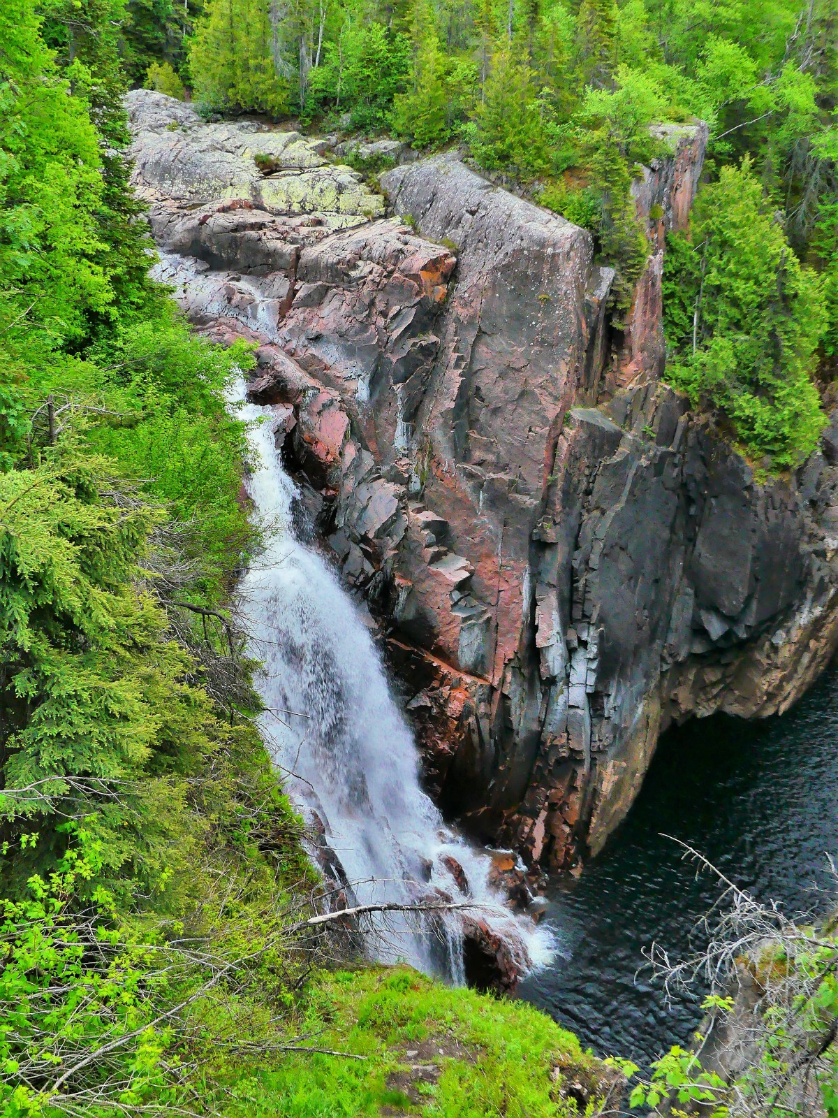
and the granite gorge that carries the spill water to Lake Superior.

Back at the boardwalk entrance, I stood alongside a millennial male. We were studying an oversized graphic together about the geological properties and commercial significance of the Falls.

My neighbor had a cat perched on his shoulder wearing a harness with a leash. Suddenly, a light rain began to fall, spooking the cat. It leapt to the ground, surprising the host. He had control for a moment, but it squirmed out of his arms, and wriggled free of its harness. He dove for the hind legs, but the cat was too fast. It bolted 50 yards to the trees, and disappeared in the brush with his girlfriend chasing after it and screaming its name. We briefly watched in amusement, wondering if the cat would reconnect with its owners, but we had our doubts.
While in town, we filled the truck with $130 Canadian of gas, and searched for a lunch spot, but ended up at a Chinese Canadian restaurant in a strip mall just to use the internet. I had fried chicken balls (no joke), and Leah ordered dry-rubbed spare ribs. The food was as disappointing as a dead car battery and tasteless as a lost cat in the woods.

A stubby white lighthouse planted in front of the strip mall parking lot offered a view of Lake Superior. To Leah’s amazement, I passed on a picture of the tower and a view from the bridge.
The ride back to Neys was rainswept and uninteresting except for a cow moose that galloped across TransCanada Highway 17, followed closely by two calves. They hurdled the guard rail and instantly disappeared into the forest. Maybe they’ll discover the cat.

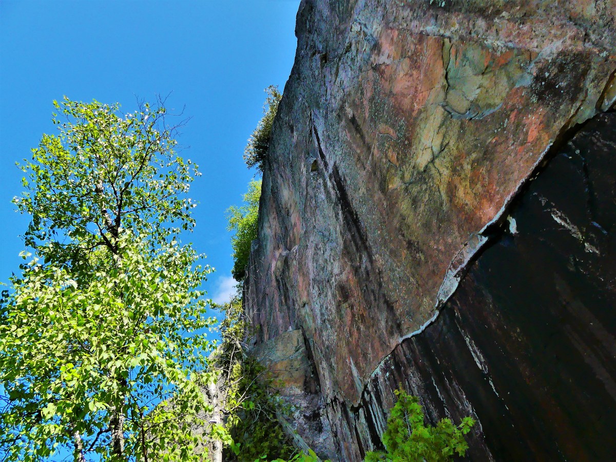
The trail was advertised as 0.5 km.
“It’s probably very steep,” Leah figures.
“How hard can it be?” I wonder, still a skeptic.
“It says so in the brochure,” she states. “I quote, ‘Caution is advised when venturing onto this rock ledge due to its slope and the unpredictable nature of Lake Superior and its wave action.'”
“Sounds like fun. We should see it,” I suggest. “This is ancient historical shit!”
“It sounds a lot like the petroglyphs that we saw in Nevada,” she offers.
“You mean the Atlatl Rock in Valley of Fire State Park,” I acknowledge.
“Exactly!” she states.
“But this one’s on the water, and not the desert,” I tease.
“I know that, smart ass, and it’s also harder to get to, so you need to be careful!” Leah lectures.
“Like I said, how hard can it be?” I reiterate.
We park the truck only minutes from our campsite at Agawa Bay, and enter the trailhead where we are met with a screaming red sign:

“Like I said…” drops Leah.
I deflect the dig. “Check it out.” I direct Leah’s attention to a different sign to our right–a red diamond hammered to a tree with a white arrow and 400 km on it.
“That’s where the trail begins. And according to that sign, we’ve already walked 20% of the trail!”
It’s true the trail is rugged and a scramble. The descent runs through a narrow chasm, over sharp boulders and bulging roots. But it’s only treacherous if wearing flip flops, which a student rangerette at the visitor’s center admits can be a problem with some hikers.
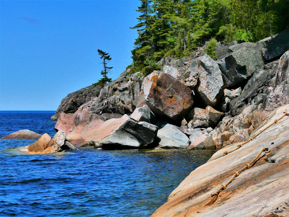
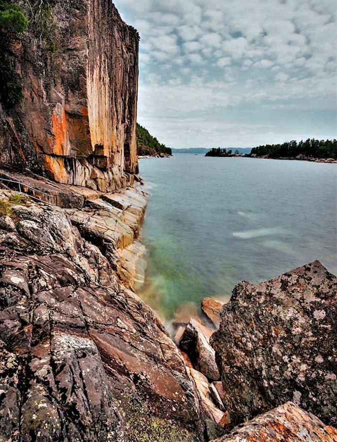
Halfway to our destination, a gash in the cliff exposes a 10 ft granite chunk mysteriously wedged between darkness and daylight.
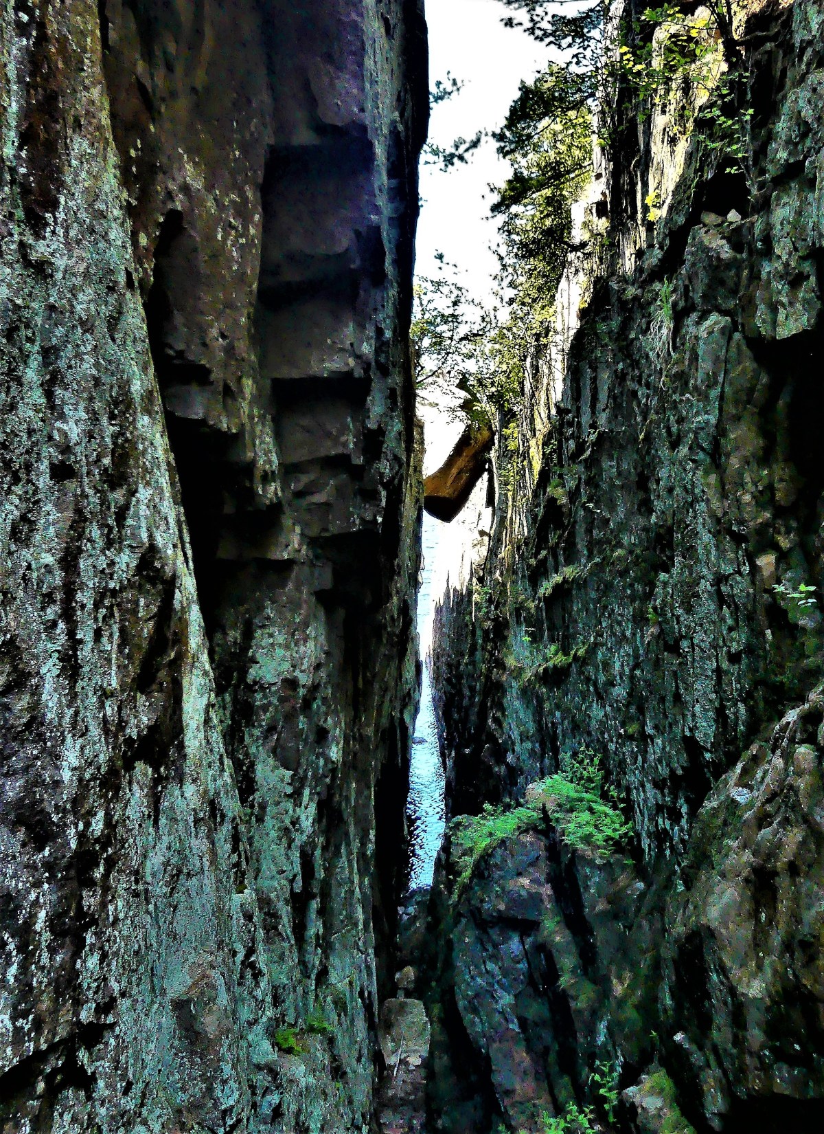
In 15 minutes we arrive at a clearing of flat rock where the sky opens up to the water. A colorful cliff 15 stories high looms above us, grabbing my attention.
Leah is content holding onto a pipe rail that separates the adventurous from the cautious.
“Are you coming?” I ask.
“Down there? Not a chance!” Leah answers instinctively.
A short drop onto a wet ledge of granite sloping into Lake Superior takes added time, but planting my feet with measured steps is the best method for staying safe.
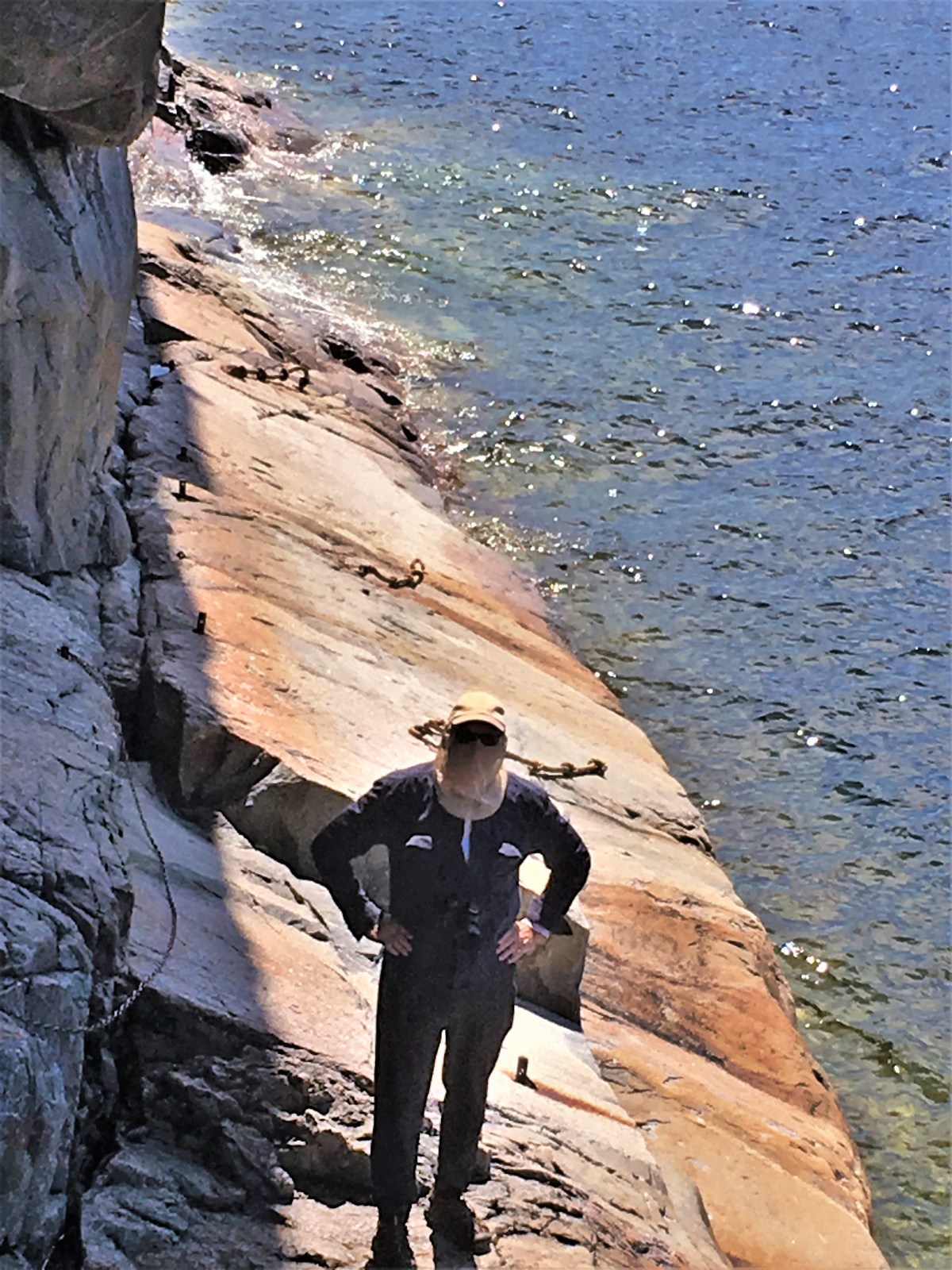
Knotted ropes threaded through embedded pipes are there to assist the daredevils who spill into 50° F water.
Once I get my footing, I can sidle across the ledge for a better look at the cliff face.
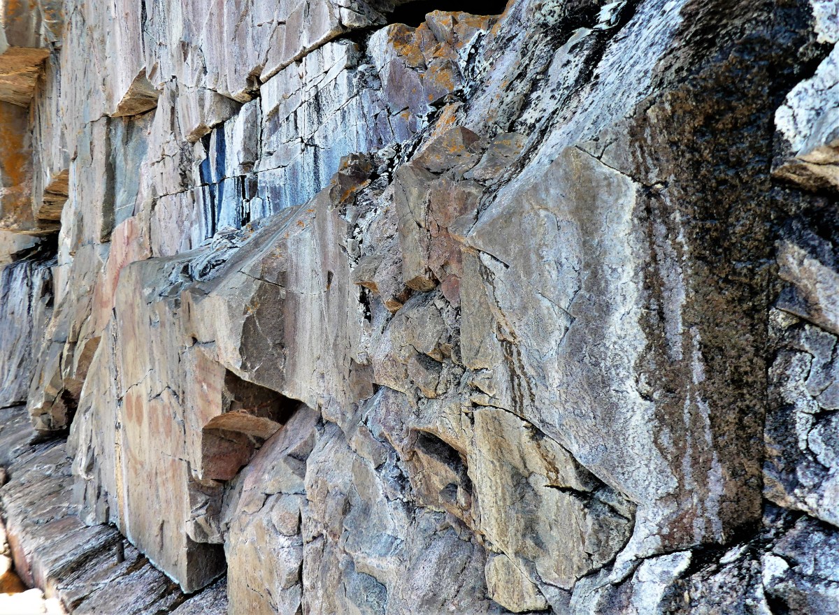
Venturing further out on the ledge, I meet Mishipeshu, the Great Lynx, who was empowered by the ancient Ojibways to control Lake Superior.
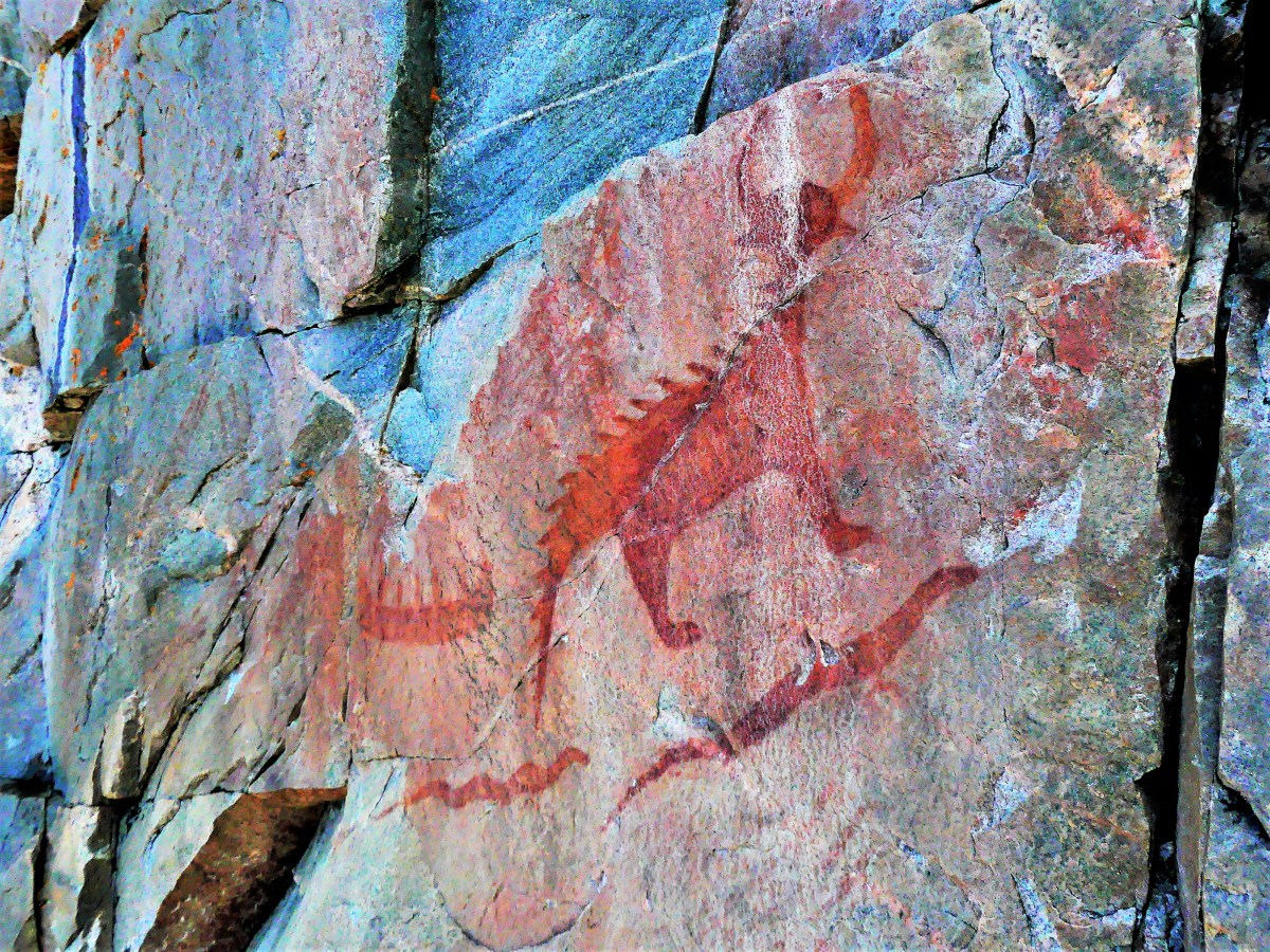
There are dozens of sacred drawings set in stone, dating back to the 17th century, but most are faded and nearly unrecognizable from eons of sun, water, ice and wind. Their message remains unknown, but experts reason that the pictographs depict historical events, and could signify manitous from shamanistic ceremonies.
I carefully manuever onto terra firma,
and we hike back to the parking lot.
“That was amazing, down there,” I exclaim.
“It was alright,” notes Leah.
“But you never got to see the pictographs,” I mention.
“That’s OK. You did all the hard work for me. I’ll just have a look at your photographs,” she laughs.

Of course, the Great Lakes are great; they constitute the world’s largest above-ground freshwater system in the world, containing about 18 percent of the world’s supply.
However, beyond its scale (larger than all the Eastern seaboard states combined), what about all the other awesome attractions that border its shorelines? Are they equally as great, or big, or best, or exclusive?
Let’s take a look:
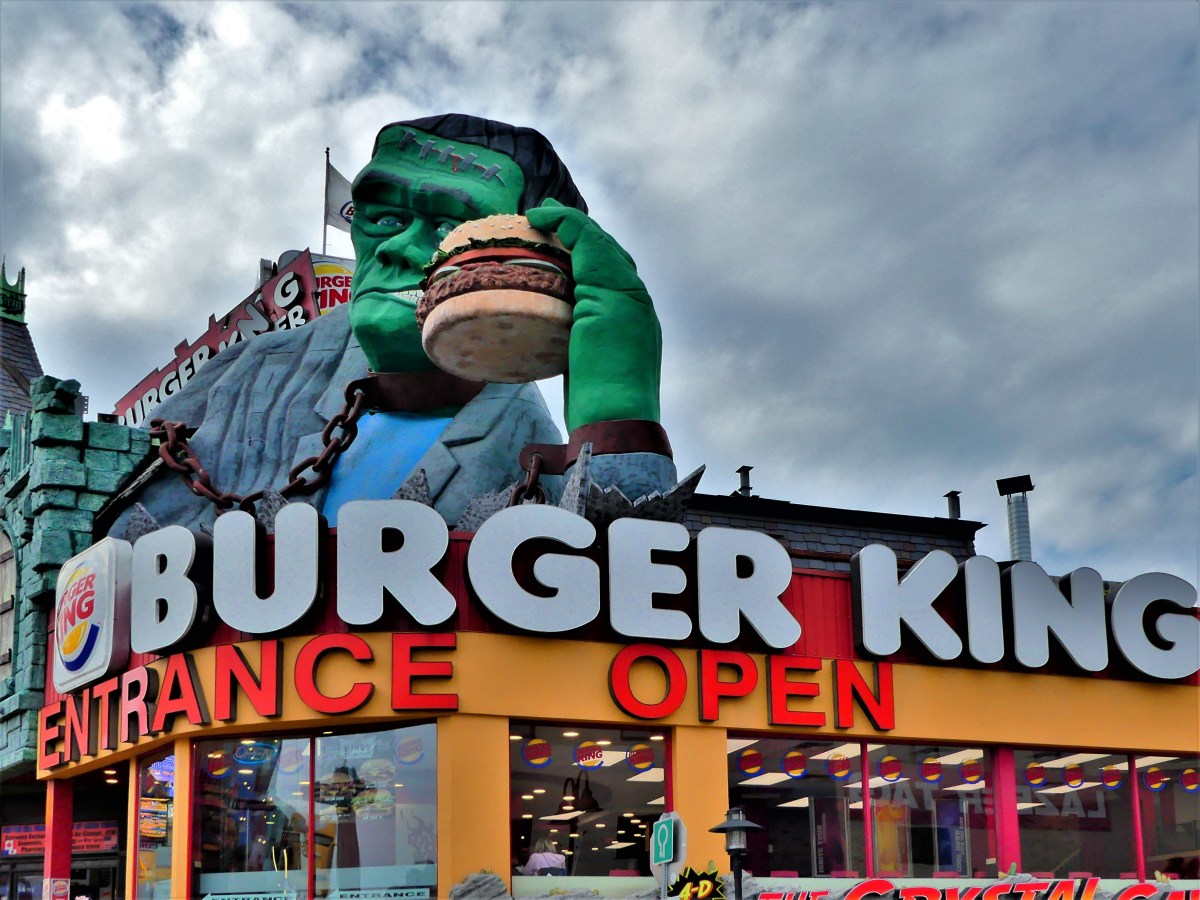
Given the many possibilities for food around the Great Lakes, the area’s largest hamburger rests atop Burger King in Niagara Falls, ON.
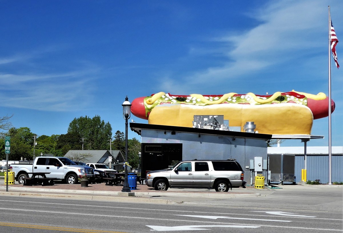
And the largest hotdog can be found in Mackinaw City at Wienerlicious.
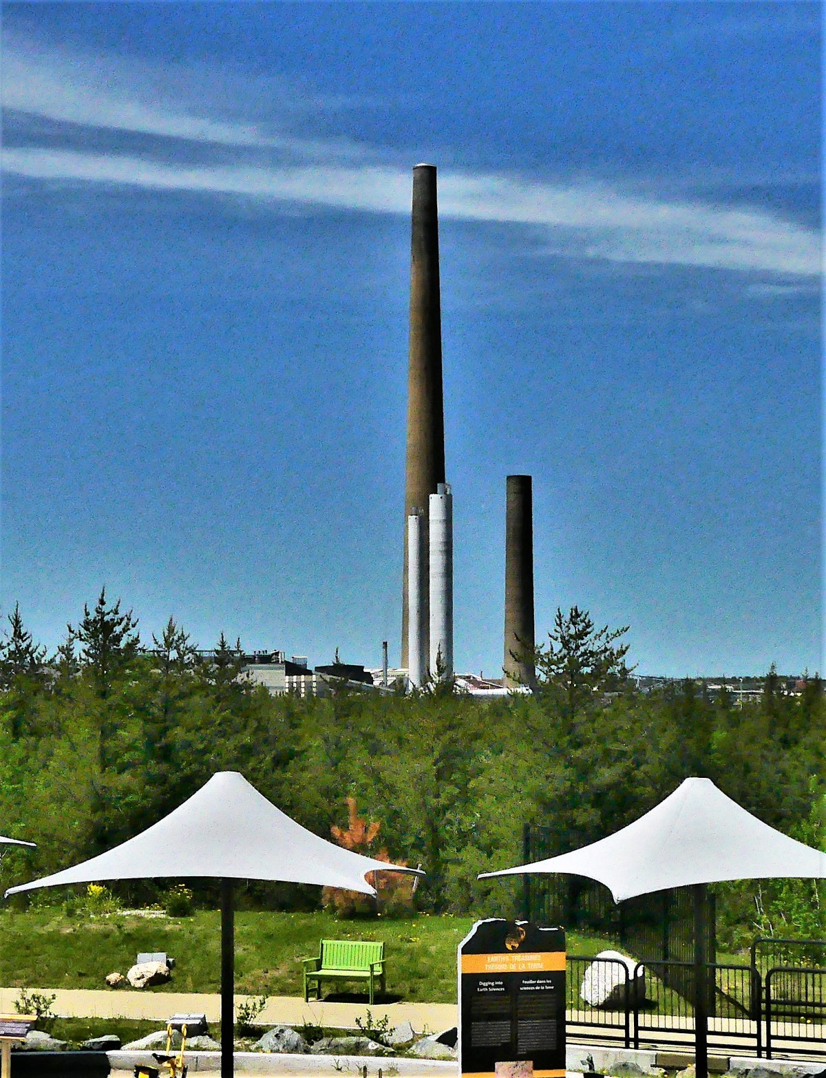
Both can be purchased with the world’s largest nickel…

the brainchild of Dr. Ted Szilva,

and on display at Sudbury’s Dynamic Earth.

Only one mile away, Inco’s superstack–the tallest chimney in the western hemisphere–rises 1250 feet atop Vale Inco’s Copper Cliff processing facility–the largest nickel smelting operation in the world.
Nowhere as tall, Castle Rock (commonly referred to as Pontiac’s Lookout) is a natural 200-foot limestone sea chimney…

overlooking Lake Huron and Interstate 75,
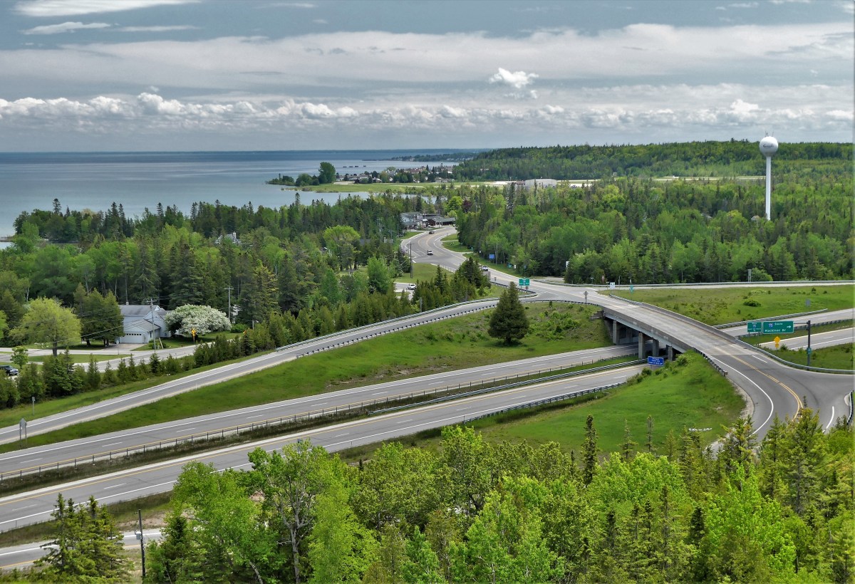
and considered the oldest lookout in St. Ignace, Michigan…until the Mackinac Bridge was built in 1957.
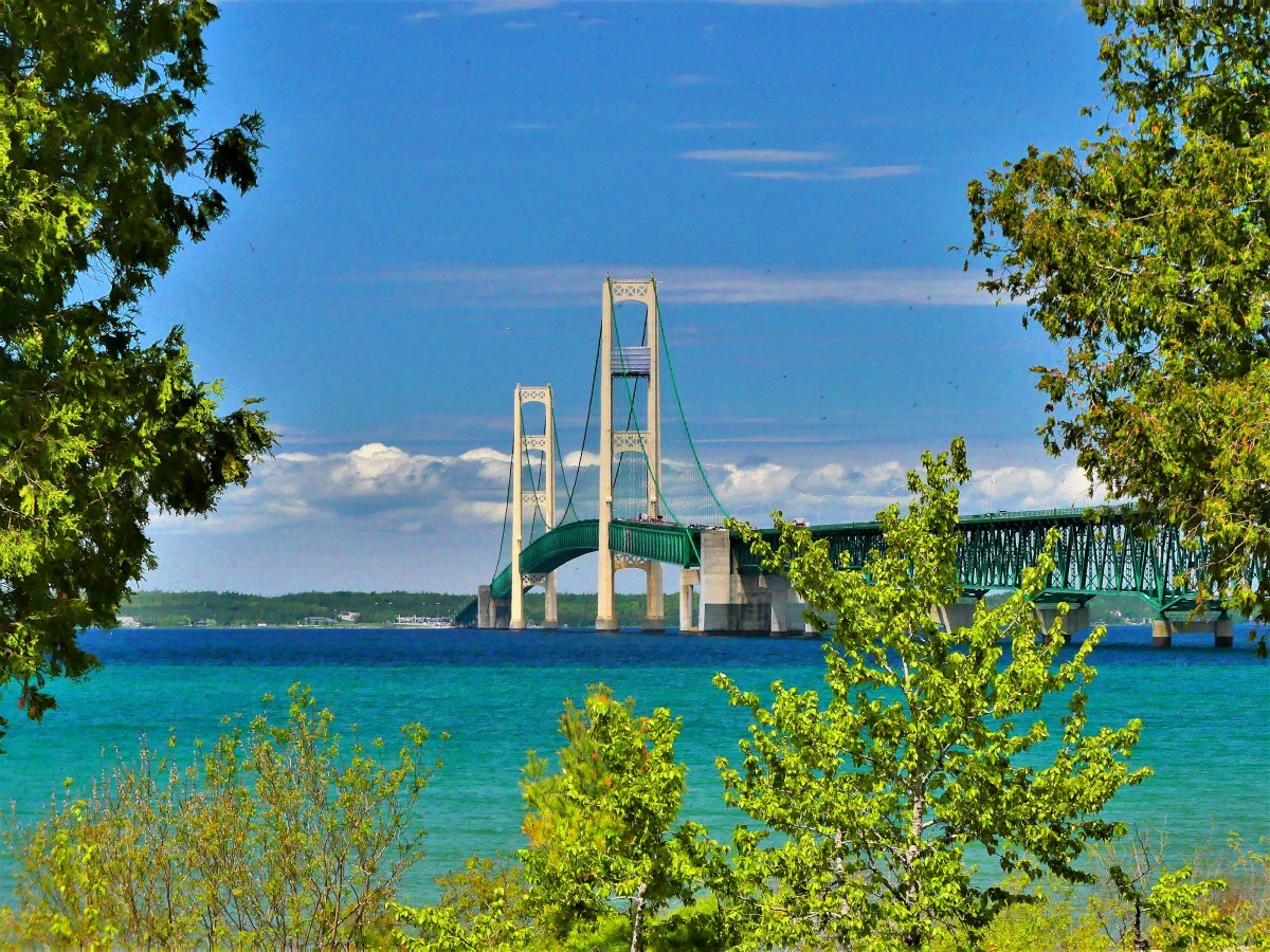
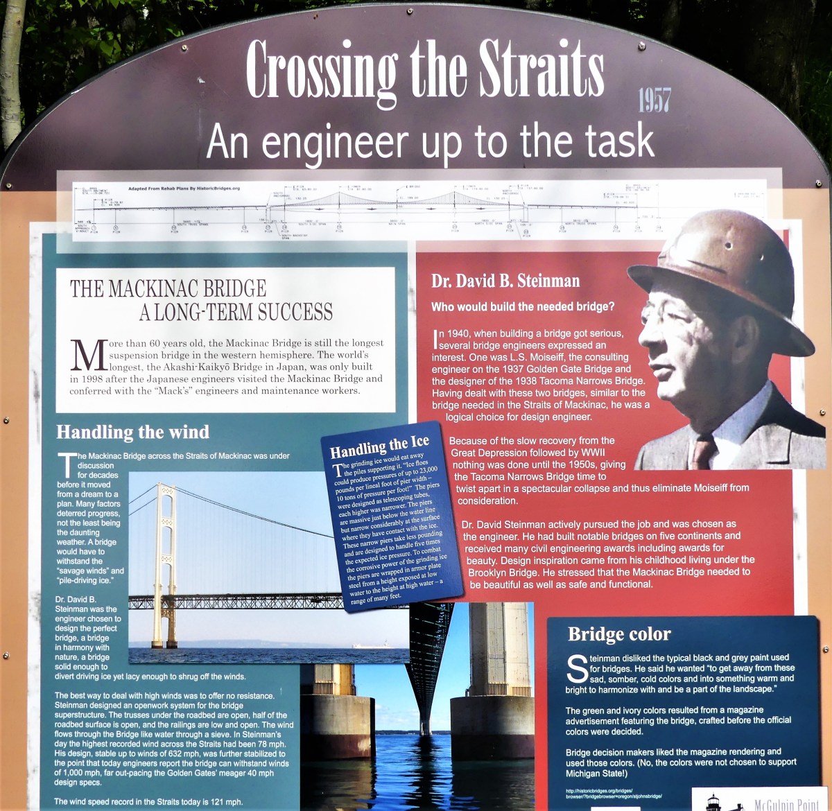
Spanning the Straits of Mackinac, and connecting the Upper and Lower Peninsulas of Michigan, the Mackinac Bridge is hailed as the longest suspension bridge in the western hemisphere.
Although less of an engineering feat, the upside-down house, built in Niagara Falls, measures up to 1200 square feet of topsy-turvy, making it Canada’s most unusual landmark.

Nearby, at Niagara on the Lake, locals can tee up at Niagara Golf Club, the oldest existing golf course (albeit, nine holes) in North America.

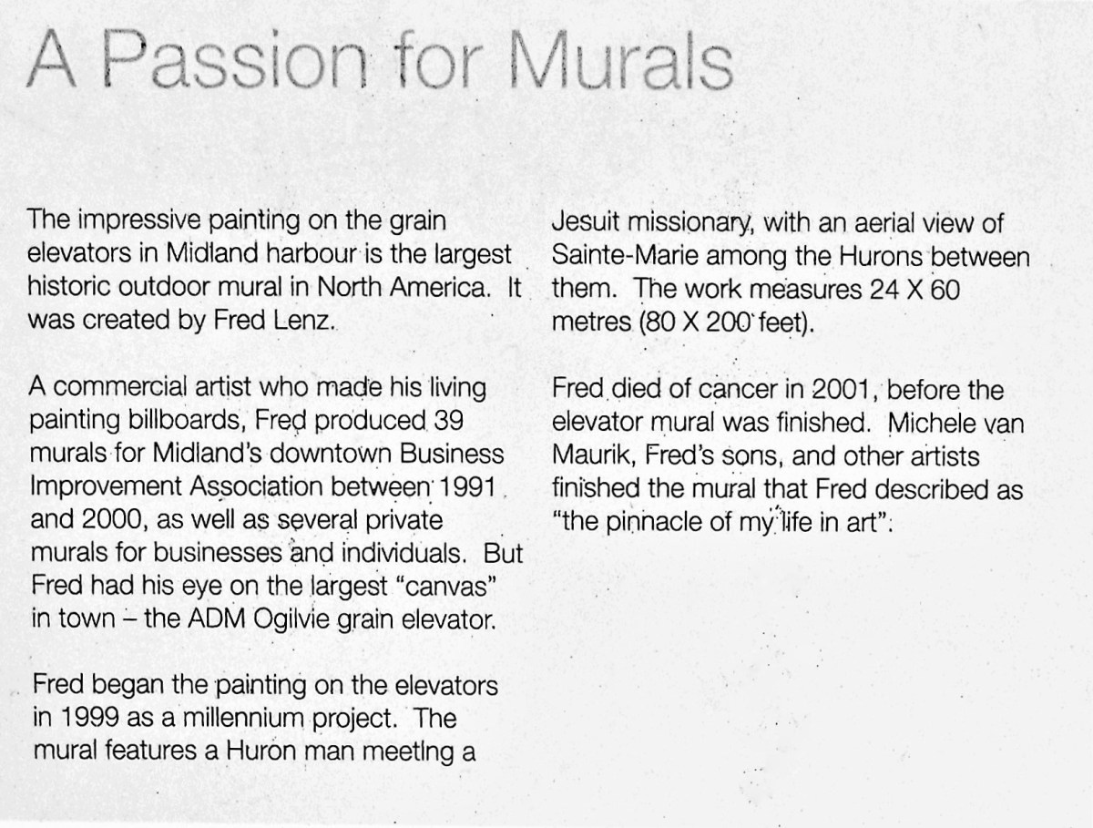
In Midland, Ontario, a grain elevator looms over a Georgian Bay harbor, featuring North America’s largest historic outdoor mural created by Fred Lenz.

History also abounds at Colonial Michilimackinac–
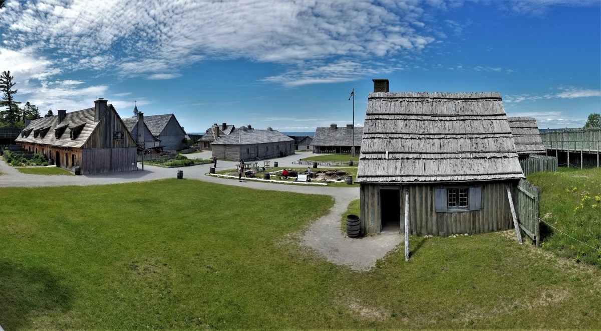
a reconstructed 18th century frontier fortress originally garrisoned by the French during 1715, and later controlled by the British.

After 60 years of excavation, valuable relics from fort living continue to be unearthed, making it the longest ongoing archeological dig in North America.

One of the many buildings discovered and recreated inside the fort belonged to Ezekiel Solomon, a fur trader who has been celebrated as Michigan’s first Jewish settler.


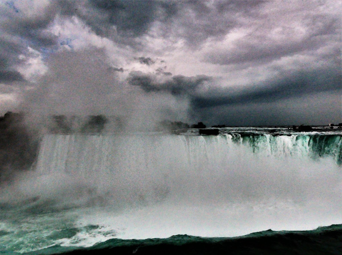
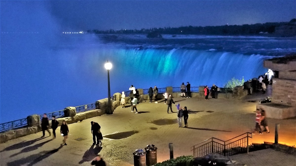
And then there’s Niagara Falls, a natural wonder that needs little hyperbole.
While not the highest, or the widest falls, its combined falls (Horseshoe Falls, American Falls, and Bridal Veil Falls) qualify Niagara Falls as the most powerful, forming the highest flow rate of any waterfall in North America.
While this “Great” list may not represent the best of all gilded attractions in the Great Lakes area to date, it’s the only list I’m likely to compile
…until the next one.

It’s been two weeks since crossing over into Canada, and it’s been mostly cloudy and wet so far. I don’t know if this is a cause and effect circumstance, but locals are approaching me with snorkels and flippers.
The weather has put a damper on our outdoor time while extending our Airstream time. The mosquitoes have been hungry and swarming around the clock, turning mosquito swatting into a cabin past-time.
Nevertheless, it hasn’t been completely bleak and dismal. We had agreeable weather during a brief stay at Six Mile Lake Provincial Park, where we visited Georgian Bay National Park on an unusually clear day, and took a 15-minute ride on a Daytripper ferry…

to explore the network of trails on Beausoleil Island, guiding us to Honeymoon Bay,

Fairy Lake,

and a keyhole to the many island cottages that dot Chimney Bay.

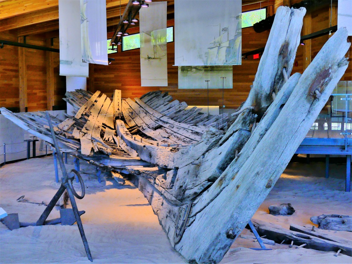
The weather also cooperated during a recent visit to Discovery Harbour, once a British naval and military base in Penetanguishene commissioned to secure back door access to Upper Canada after the War of 1812.

Of the two warships safeguarding the King’s Wharf at the time,
the H.M.S Tecumseth has been replicated to stand guard once again,

Yet the schooner has been deemed unseaworthy by authorities, and is destined to be a floating exhibit, much like the original.
Because the Rush-Bagot agreement between Britain and the United States restricted the number of active warships on the Great Lakes, the H.M.S. Tecomseth was decommissioned in 1817, and kept in a state of readiness until it eventually rotted and was reportedly scuttled in 1828.
However, its 1815 hull was raised from Penetanguishene Bay in 1953, and placed in a climate-controlled museum inaugurated in 2014.
As day turned to twilight, the clouds began to thicken,
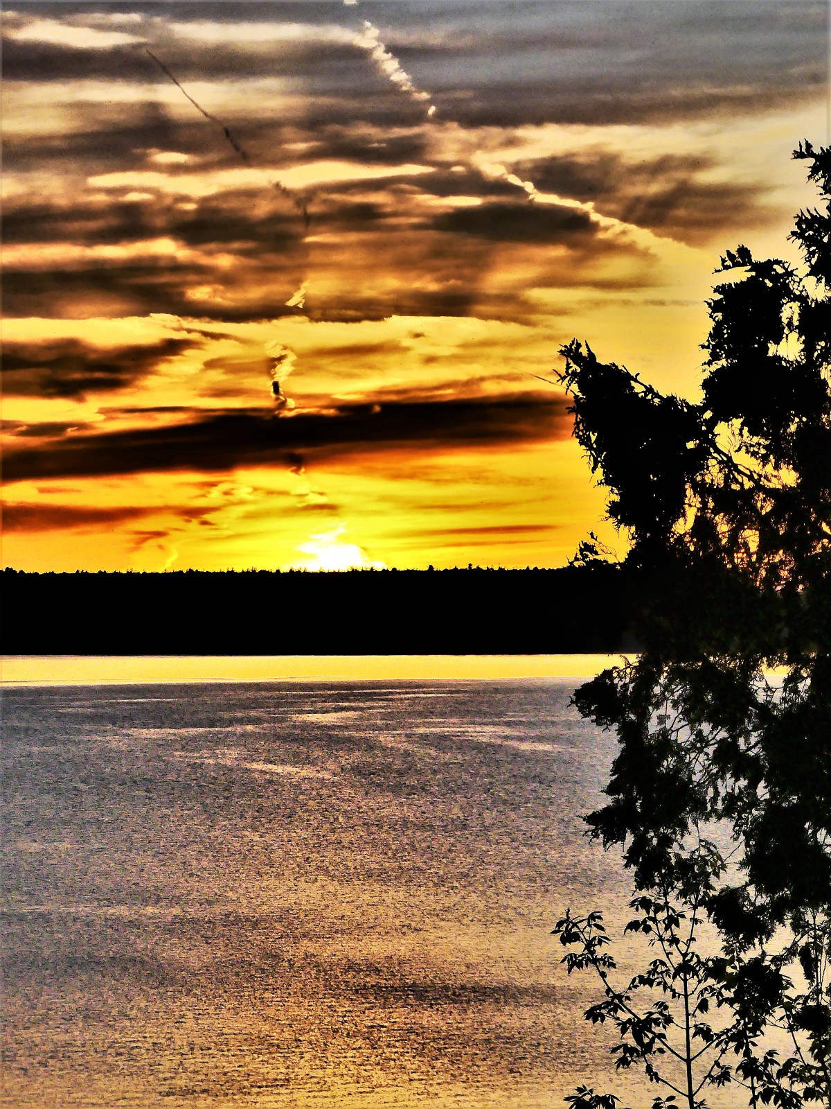
providing a curtain call that few campers had seen in weeks.

Moving our location to Manitoulin Island did little to change a now-familiar weather pattern. We pondered whether sandbagging the Airstream might become necessary, but that thought slipped our minds soon after being preoccupied with scratching our mosquito bites.
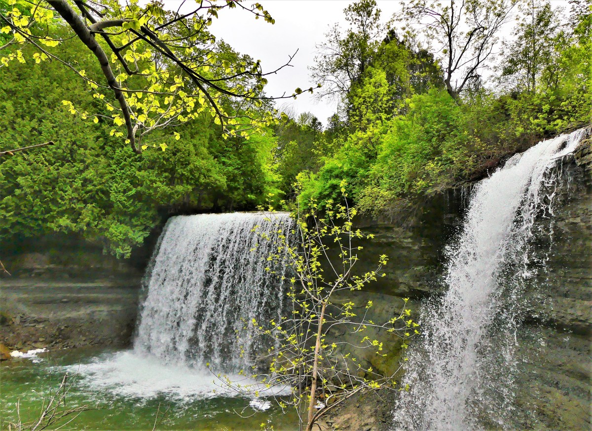
Working around the rain was challenging. Under cloudy skies, we hiked the trail leading to Bridal Veil Falls’ 35-foot drop near the town of Kagawong.
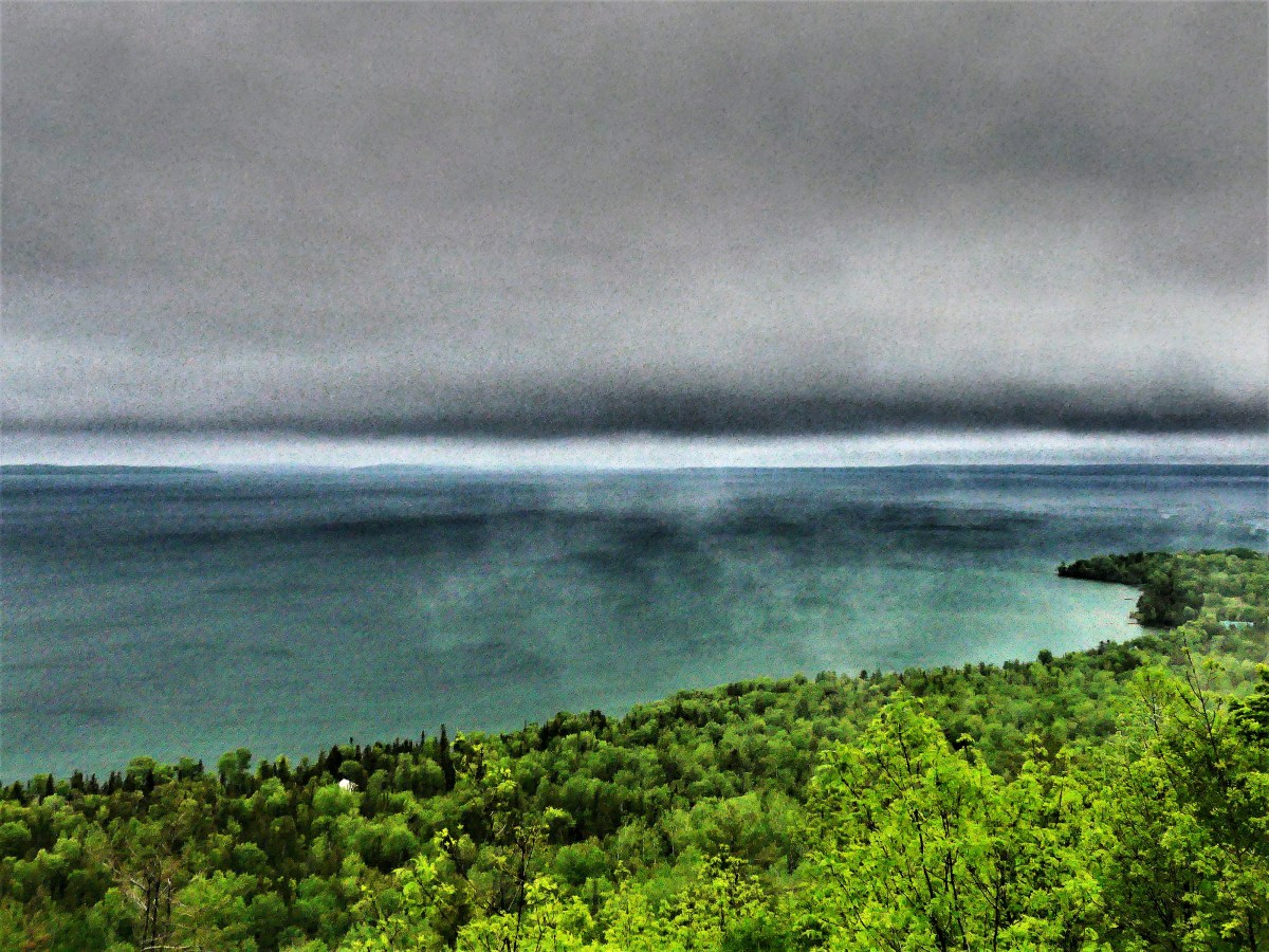
And despite the threat of rain, we continued on, climbing the cliffs of M’Chigeeng on the Cup and Saucer Trail,
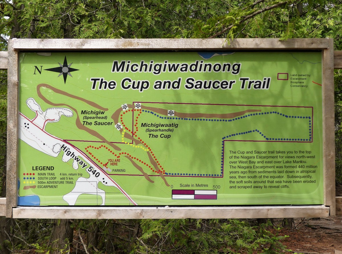
for splendid views of the North Channel.

But our luck ran out as we drove to Ten Mile Point for a stormy lookout of Georgian Bay…
and found similar blustery conditions at Providence Bay, on the edge of Lake Huron,

before returning to the sanctuary of our Airstream.
The following day, our four-hour travel time to Sault Ste. Marie was compromised by a tire mishap (see Blowout!). And then it rained…a lot!
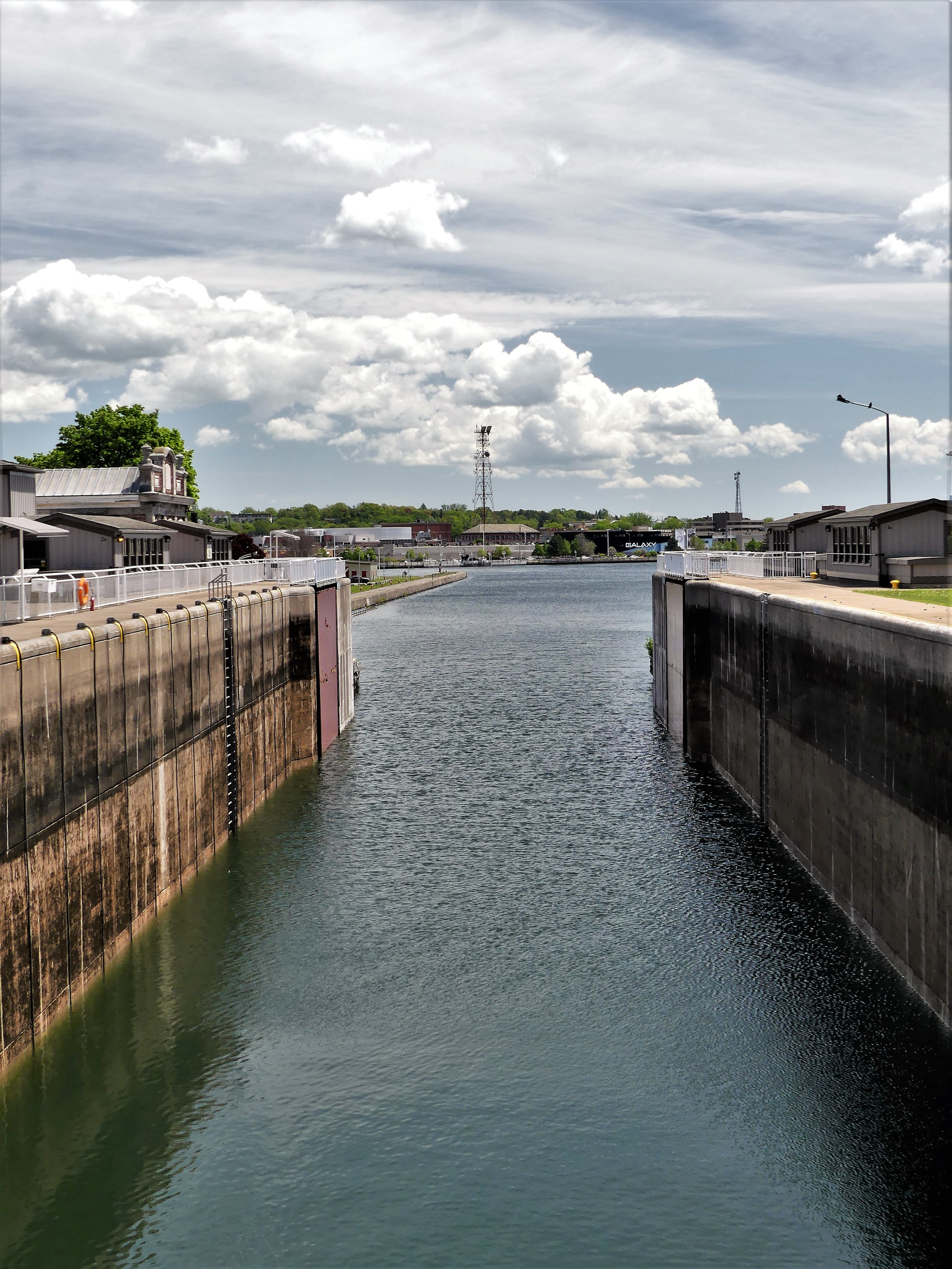
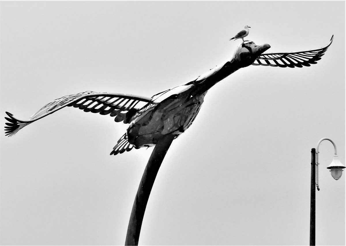
By now, mosquito bashing had turned into a bloodsport. There were a few brief intermissions that allowed us to explore Sault Ste Marie’s famed boardwalk, which carried us past a whimsical sculpture in Roberta Bondar Park,

on our way along St. Mary’s River…
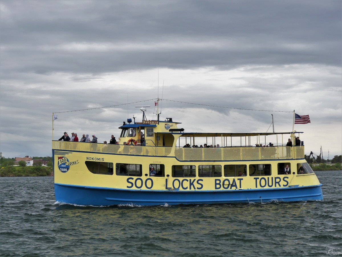
to Sault Ste. Marie Canal–transitioning between Lake Huron…

and Lake Superior…
before continuing across to Whitefish Island, where the convergence of Lake Huron and Lake Superior forms St. Mary’s rapids.

And then a ride through downtown Queen St. produced a completely different climate,
where traces of snow formed around a movie set,
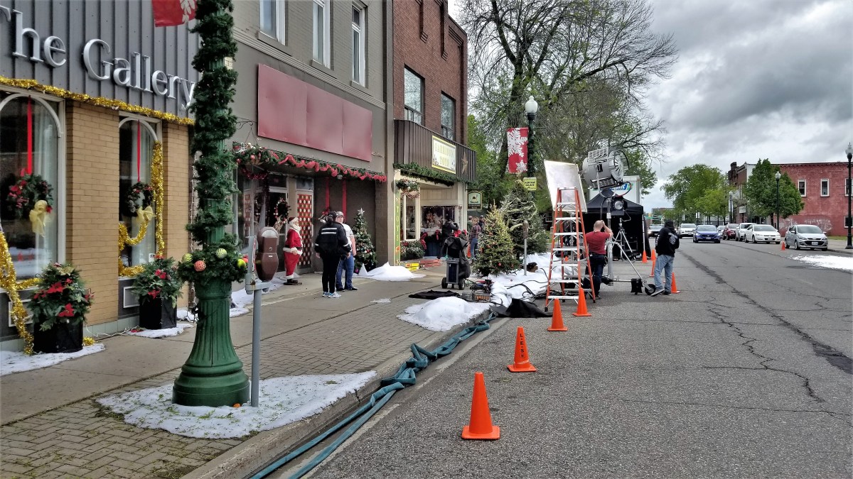
looking much like fire foam…

to create a wintery look…

for a Hallmark Christmas production adapted from Kevin Major’s The House of Wooden Santas.

The weather always sets the tone for the trip. At the moment, rain amounts are up 30% over past years, and lake levels continue to rise above one meter.
This is a time for the birds…
the mosquitoes, and black flies.
And while there’s little we can do to control or avoid the weather, at least we are now prepared.


Leah and I are back on the road again, touring in our Airstream and excited to explore and record our impressions.
Before mothballing the trailer in North Carolina for the past 11 months, we had traveled 44,000 miles, crossing 33 states, 4 Canadian Provinces, and 2 Mexican States in one-year’s time (see Epilogue).
Unfortunately, there were glaring omissions in our route that never took us through the Rust-Belt, so for our second act, we are circumnavigating the Great Lakes–visiting 8 States and 1 Province.
Our summer journey begins with a visit to historic Jim Thorpe, PA in the Pocono Mountains–

a famed destination for winter sports and whitewater rafting.
With water levels high, and water running fast, it was shoring up to be a high-water adventure.

Class II and III rapids would be the perfect way to jump-start this trip.
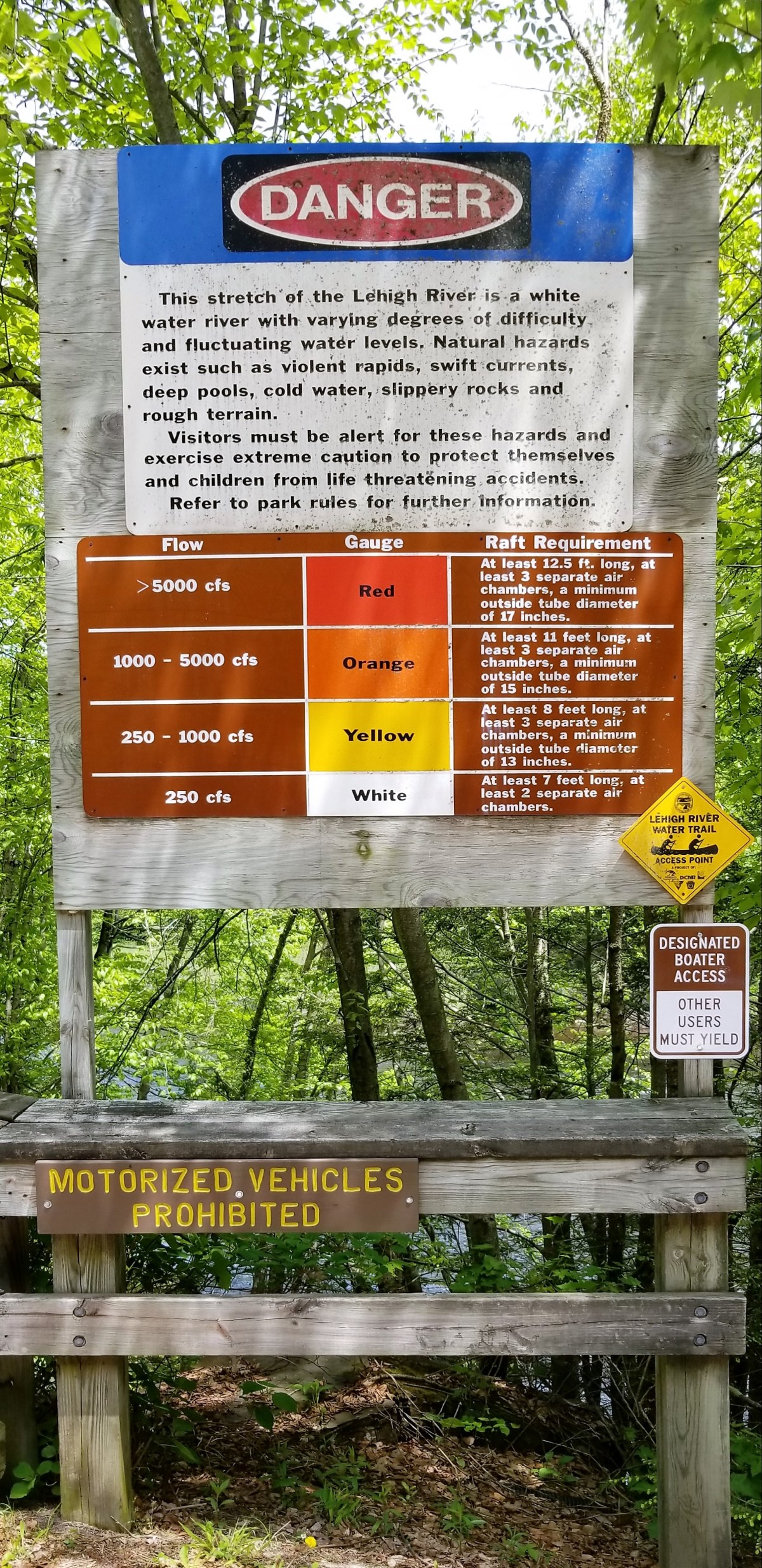
However, I scratched the raft ride after learning that only family floats were running the Lehigh River,
with the earliest dam release scheduled for the following weekend.

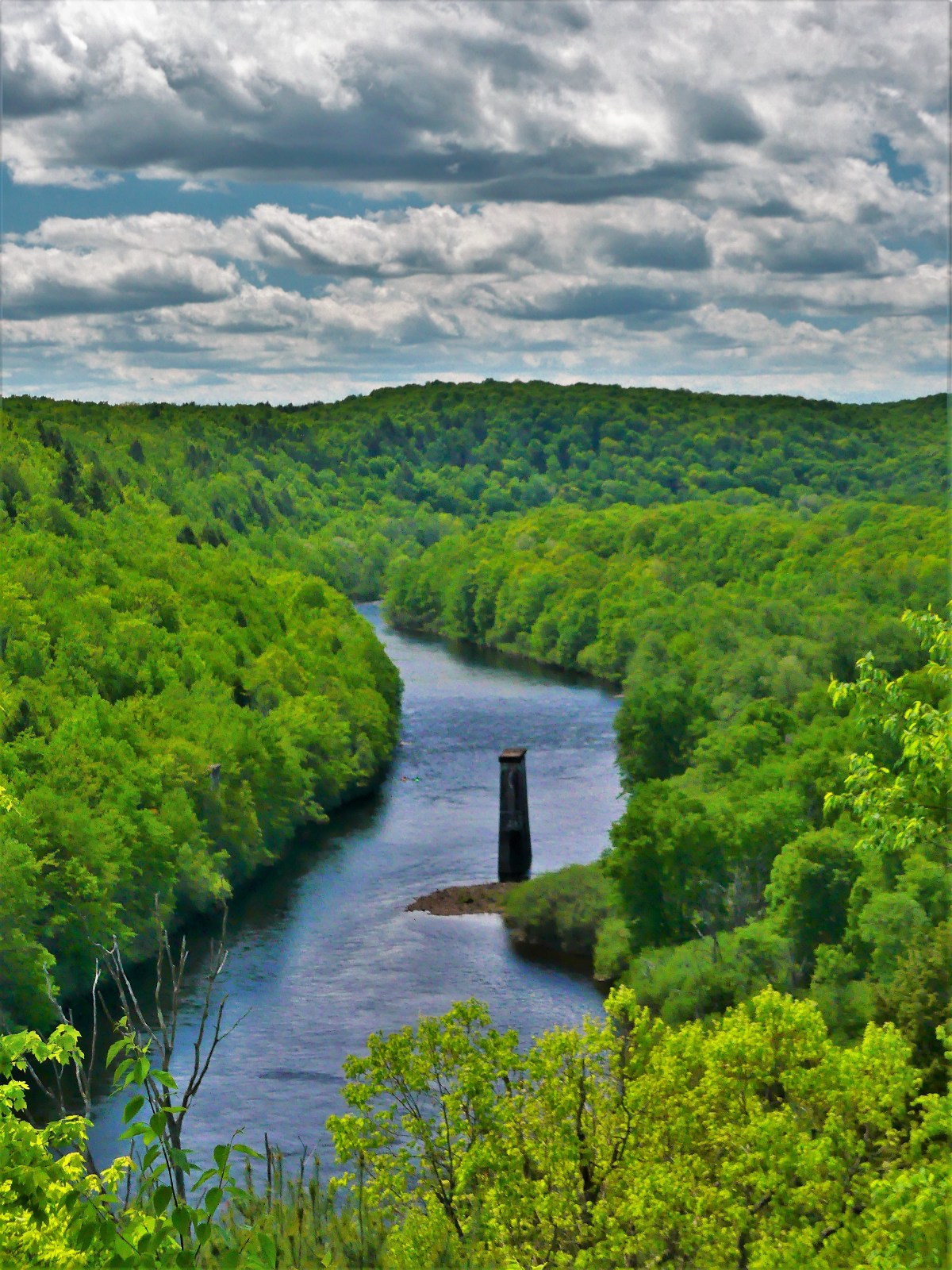
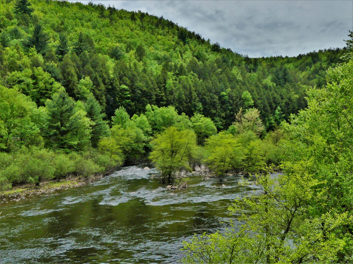
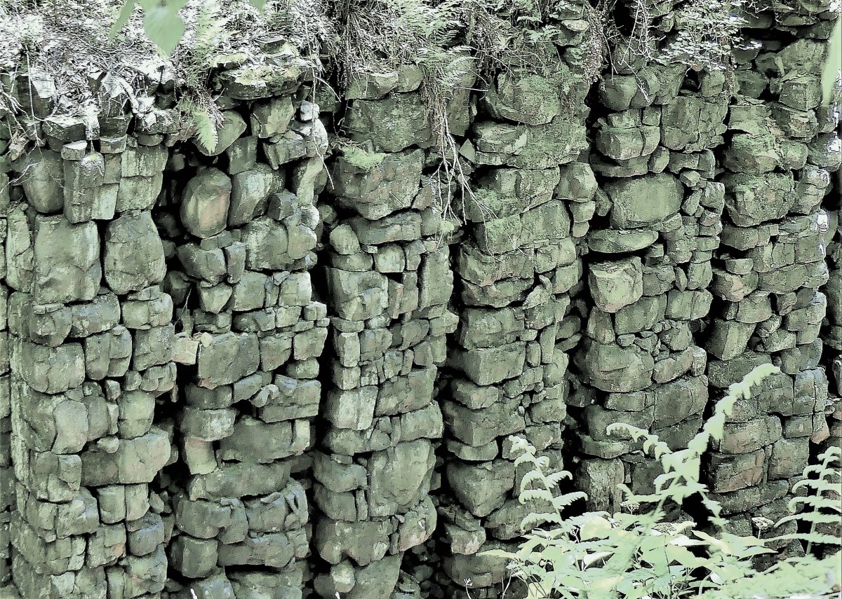
Nevertheless, Leah and I were content to take a leisurely, 26-mile cycling tour down the Lehigh Gorge Trail, where we followed an abandoned railroad grade-turned-trail, offering river view…
copulating snakes…

canal lock relics…
and several hillside trickles…

culminating in captivating waterfalls by the Rockport Access, with fast water cascading 50 feet over flat rock and flora at Buttermilk Falls;
and Luke’s Falls, featuring 50-foot water flowing over mossy ledges;

and occasional Lehigh spillovers on the side of the trail.

While in the White Haven neighborhood, we ventured to the Park Office at Lehigh Gorge State Park for information on hiking the fabled Glen Onoko Falls Trail, but were informed that effective May 1, the Game Commission had closed the trail indefinitely until all safety issues have been addressed.

Apparently, the risky behavior of many irresponsible and inexperienced hikers ended with far too many serious consequences, necessitating aggressive action. It was disappointing being unable to experience the Niagara of Pennsylvania, on a hike dubbed by Outdoor Magazine as “one of the 10 best waterfall hikes in the Northeast.”
Instead, the rangers diverted us to Hickory Run State Park, where we walked upstream along the Shades of Death Trail…

to Stametz Dam, culminating in a 25-foot splash.

While not a disappointing hike, it was anti-climatic and not what we came for, requiring some forward thinking.
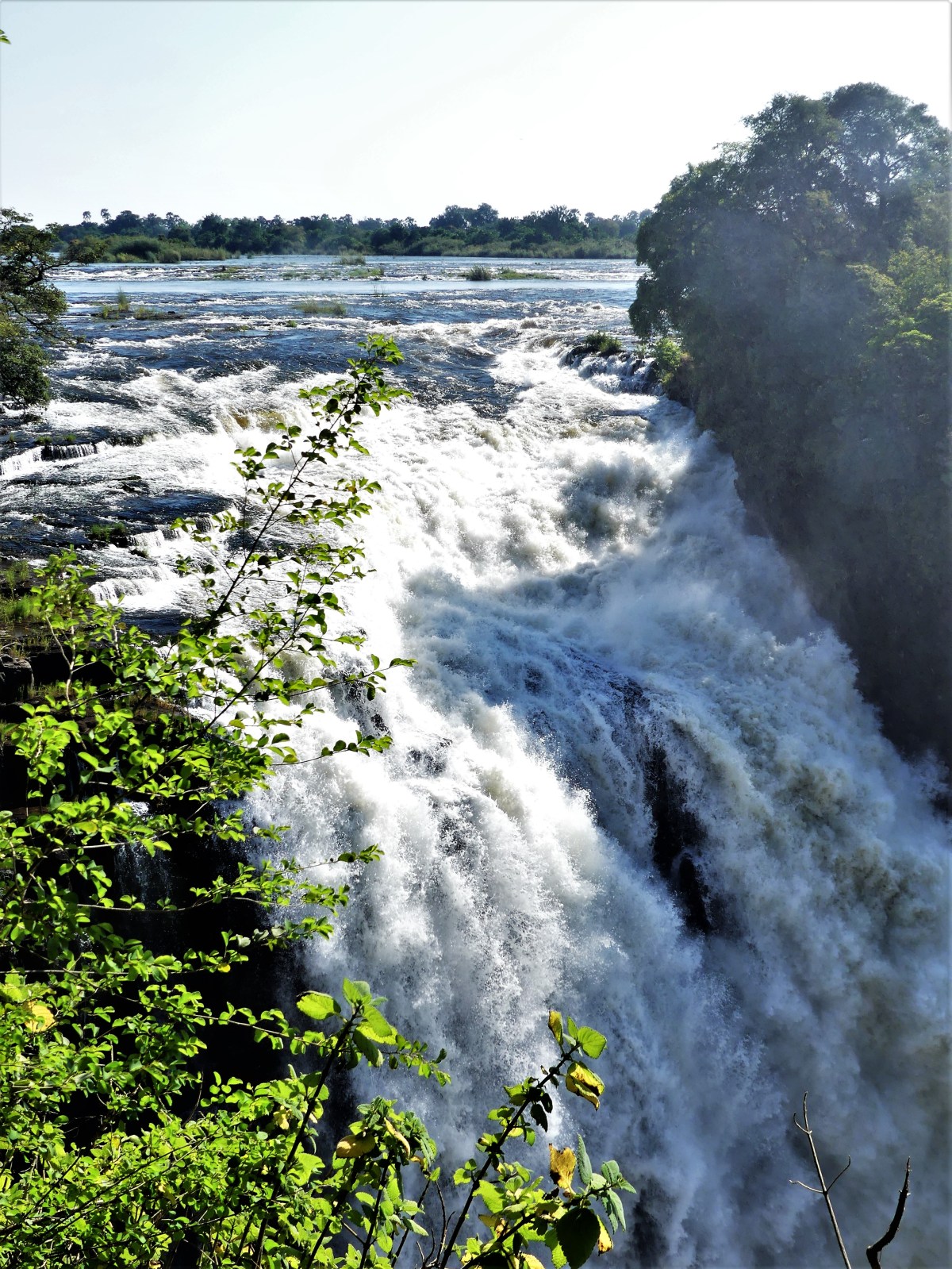
When we eventually crossed into Canada at Niagara Falls, we were ready for sweeping views of gushing water…and we were not disappointed!

As a basis of comparison, we observed the falls from multiple vantage points…
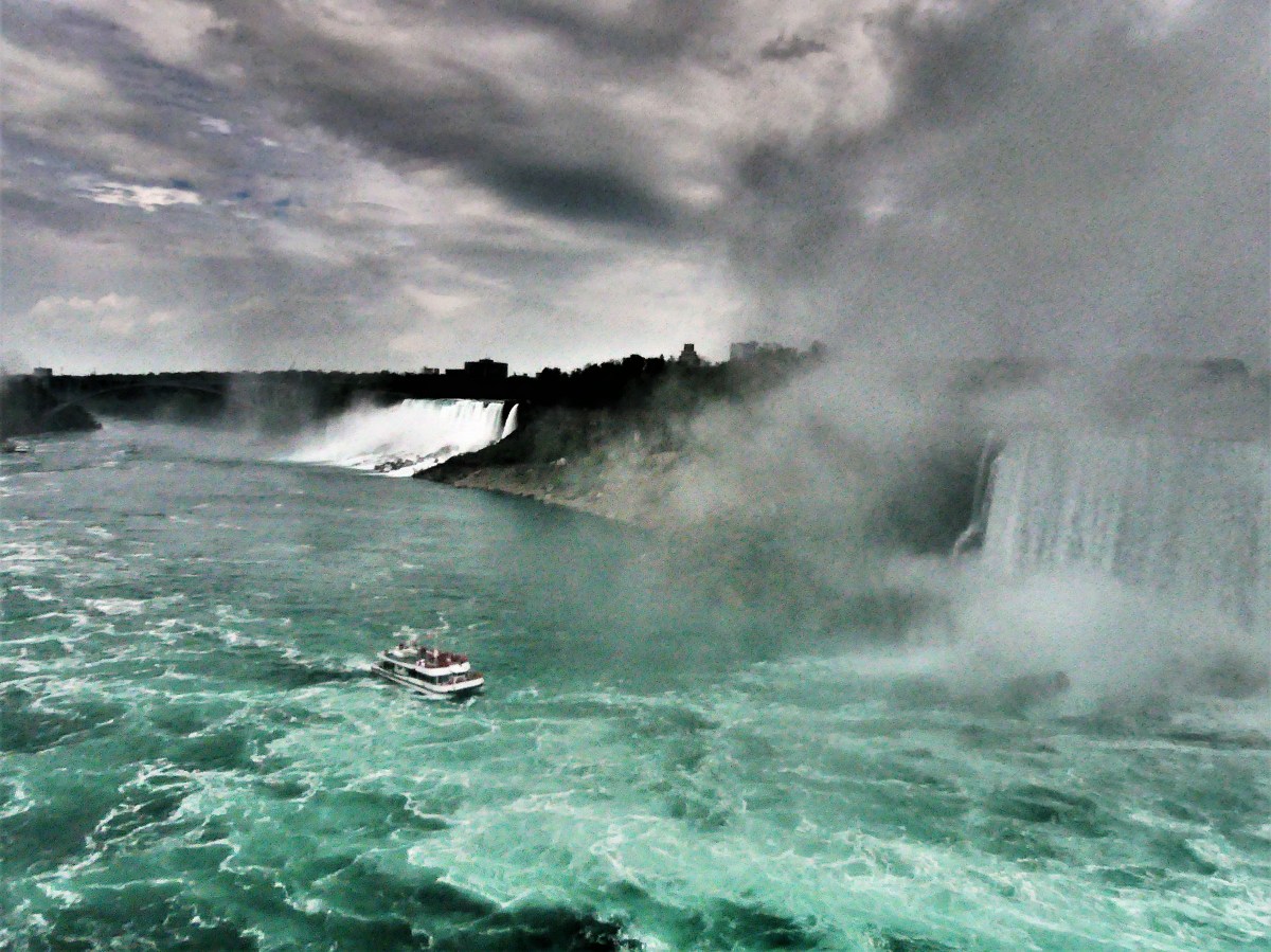
multiple perspectives…

changing light…

varying focal lengths…

and different dayparts.
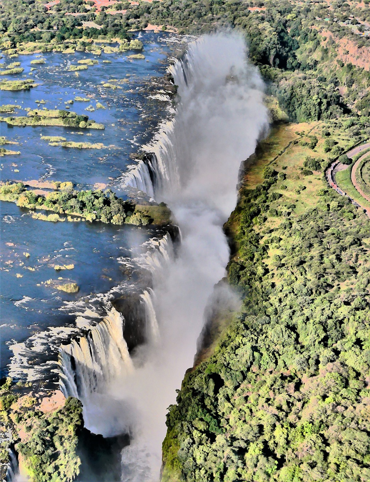
And we both came to the same conclusion: that Victoria Falls was more spectacular than all other waterfalls combined.
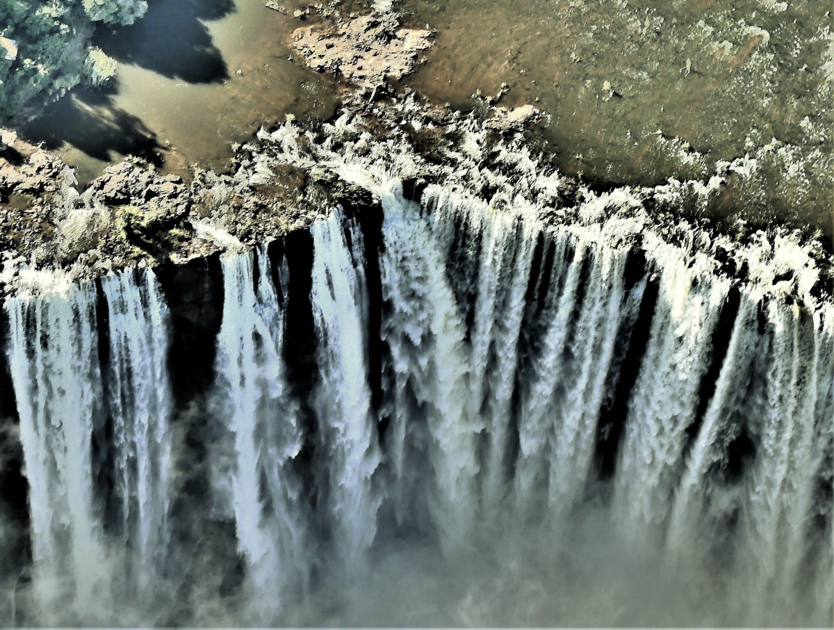
Now I fear that seeing the Holy Grail of waterfalls has tainted my impression of all other falls to come, and that’s okay for now.

Eventually, I will come around, and perhaps by that time the Glen Onoko Falls Trail will welcome us back in earnest.

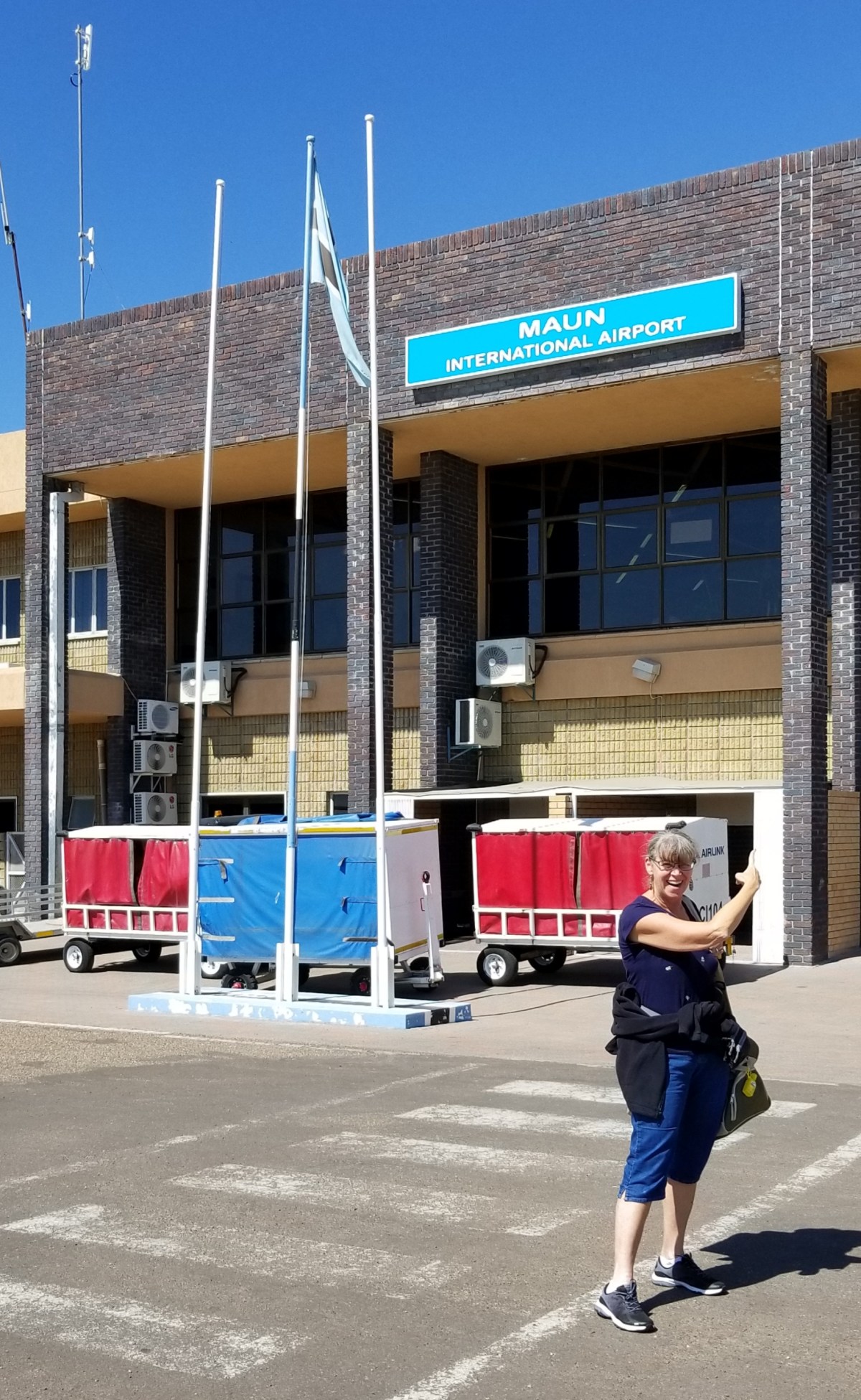
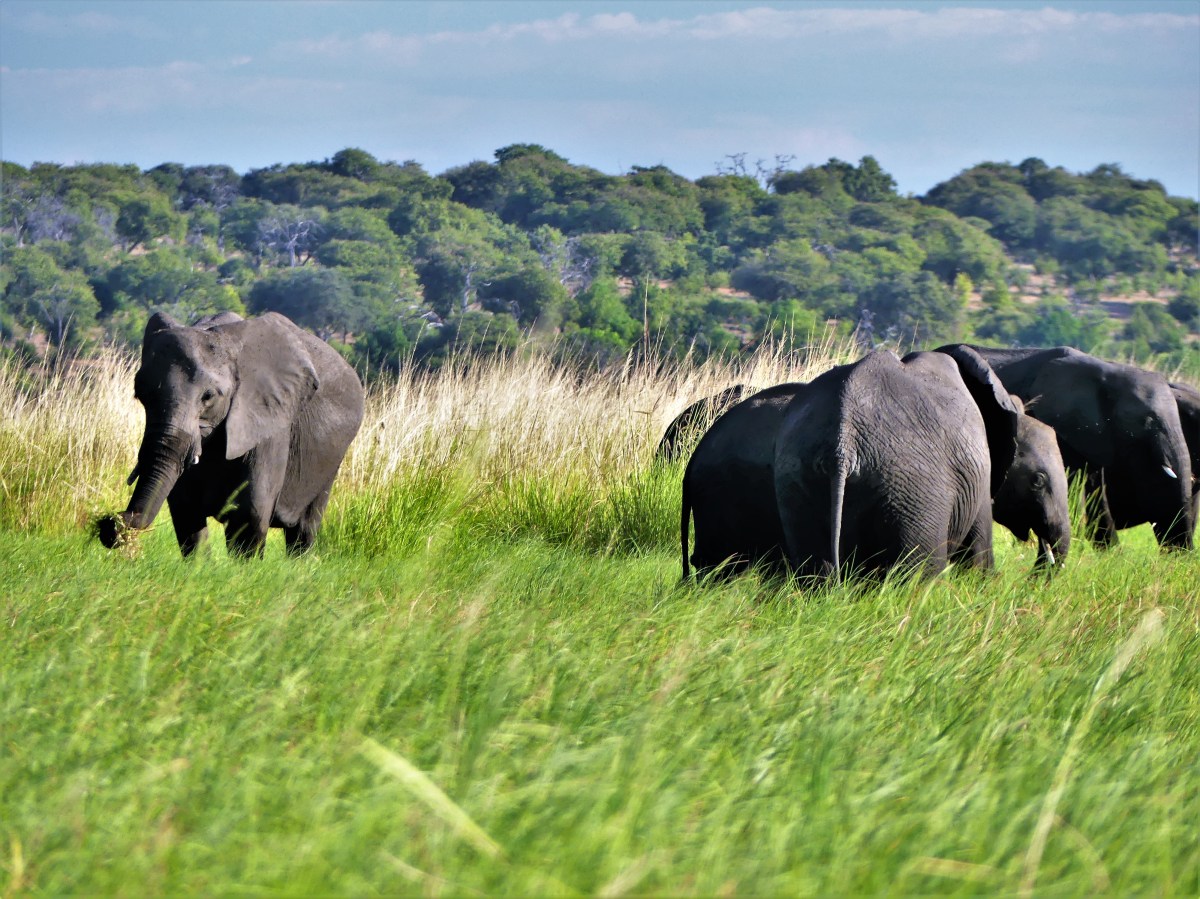
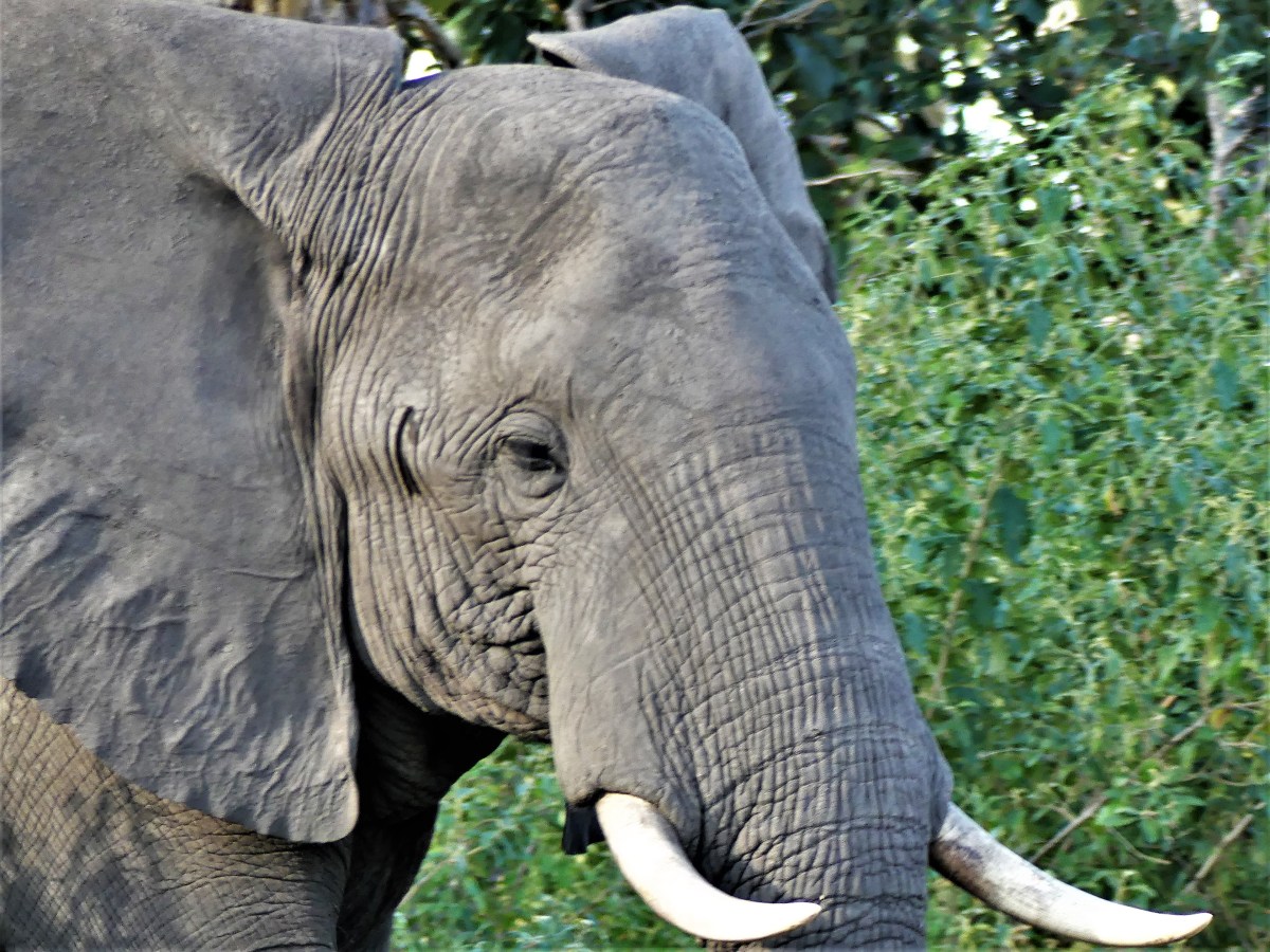
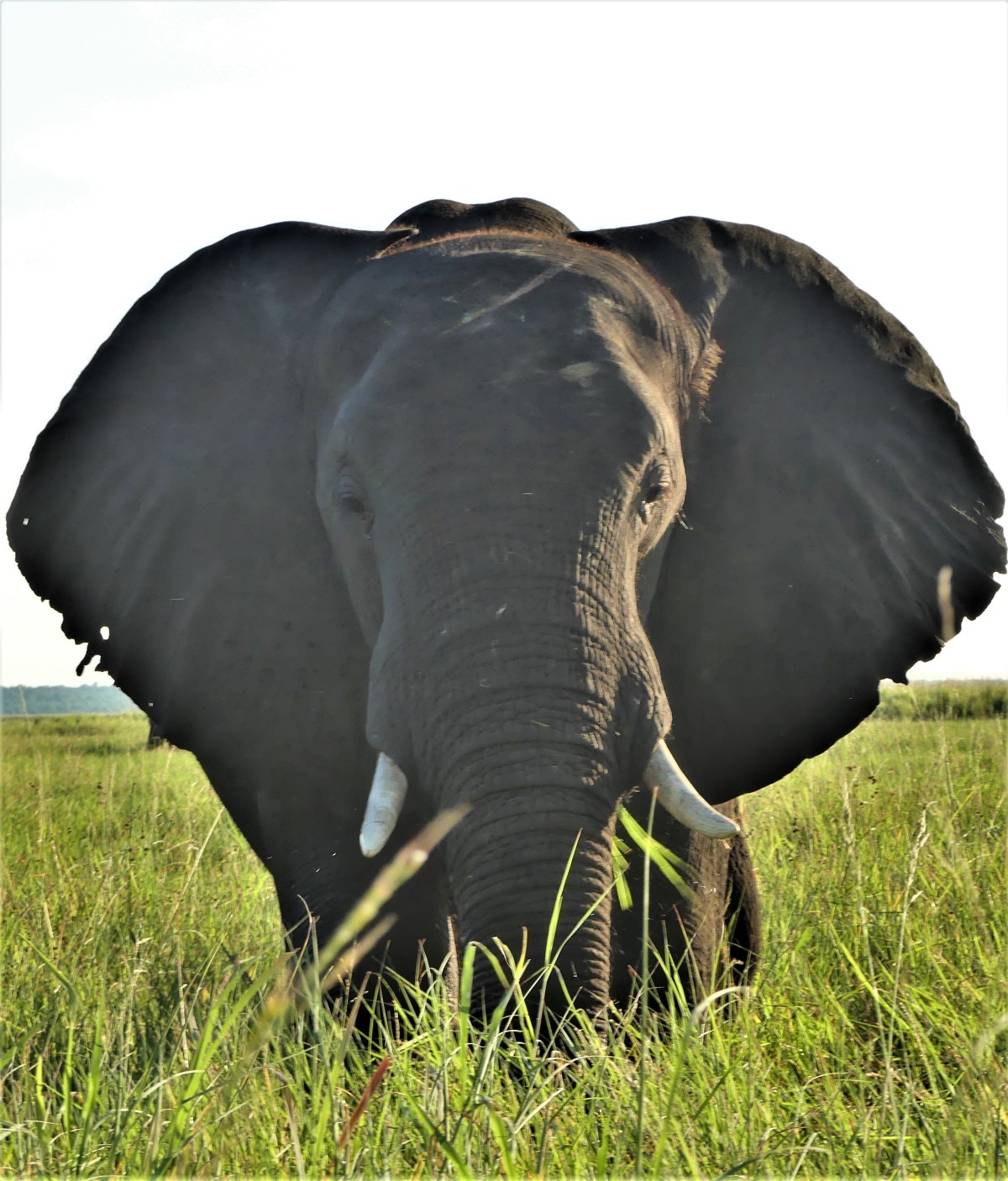
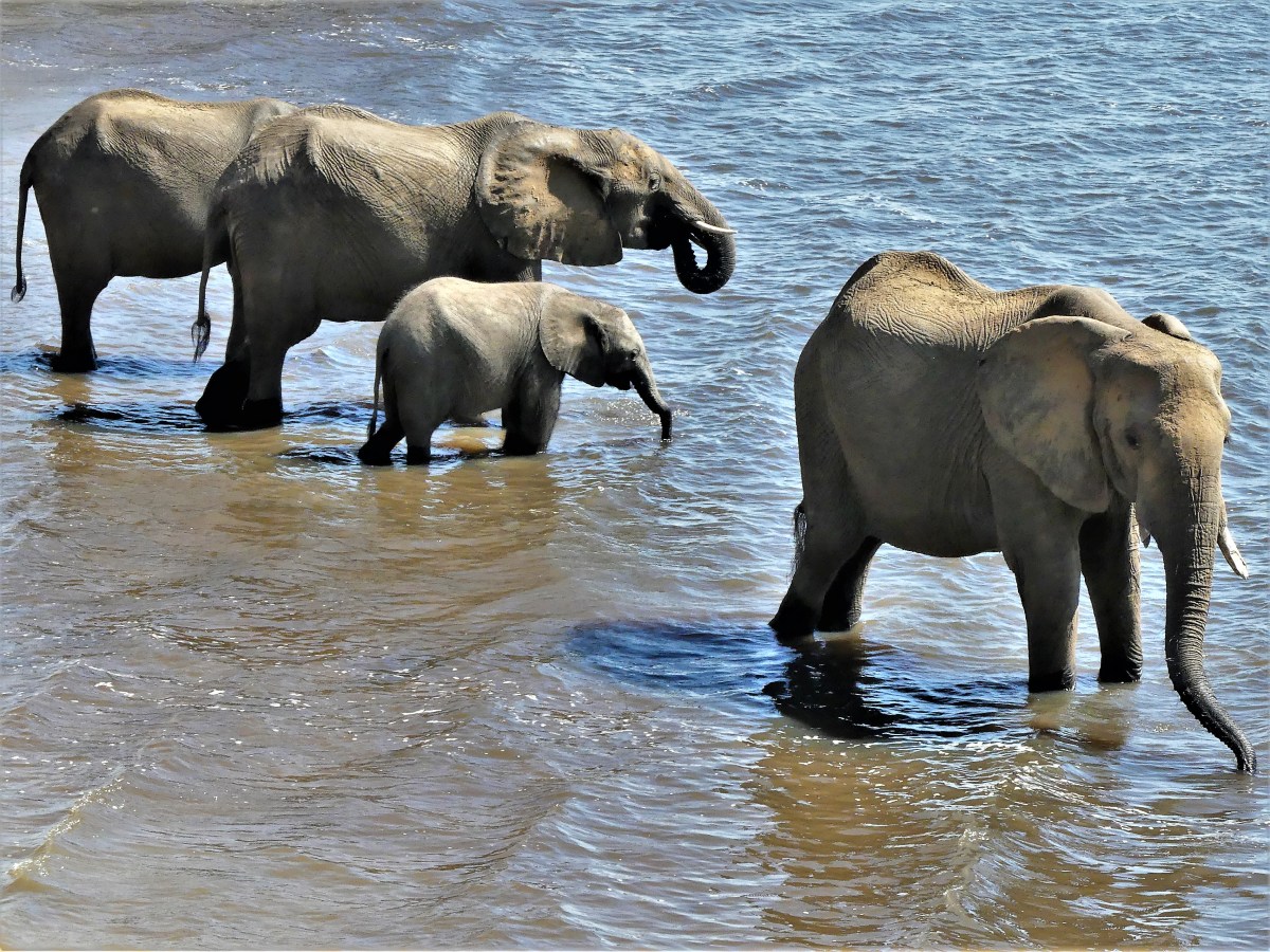
The Republic of Botswana alarmed conservation watchdogs and environmentalists around the world when the government announced the end of a five-year prohibition on elephant trophy hunting.
The ban was implemented in 2014 under then-President Ian Khama, an ardent conservationist, whose goal was to preserve the elephant population to increase Botswana’s eco-tourism industry, while conserving the species.
The Great Elephant Census of 2016 concluded that Africa now has 352,271 savanna elephants –130,000 of which roam freely through Botswana. Of the 12 African nations surveyed, the elephant population dropped by at least 30 percent between 2007 and 2014, with approximately 8% of the herds now being lost every year to poaching. That’s equivalent to 27,000 elephants being slaughtered for ivory and other body parts.
Khama implemented a ban on elephant hunting, and enacted an unwritten shoot-to-kill, anti-poaching policy, giving rangers and soldiers the right to shoot first, and ask questions later. As a result, during his term as president from 2008 to 2018, the elephant population stabilized.

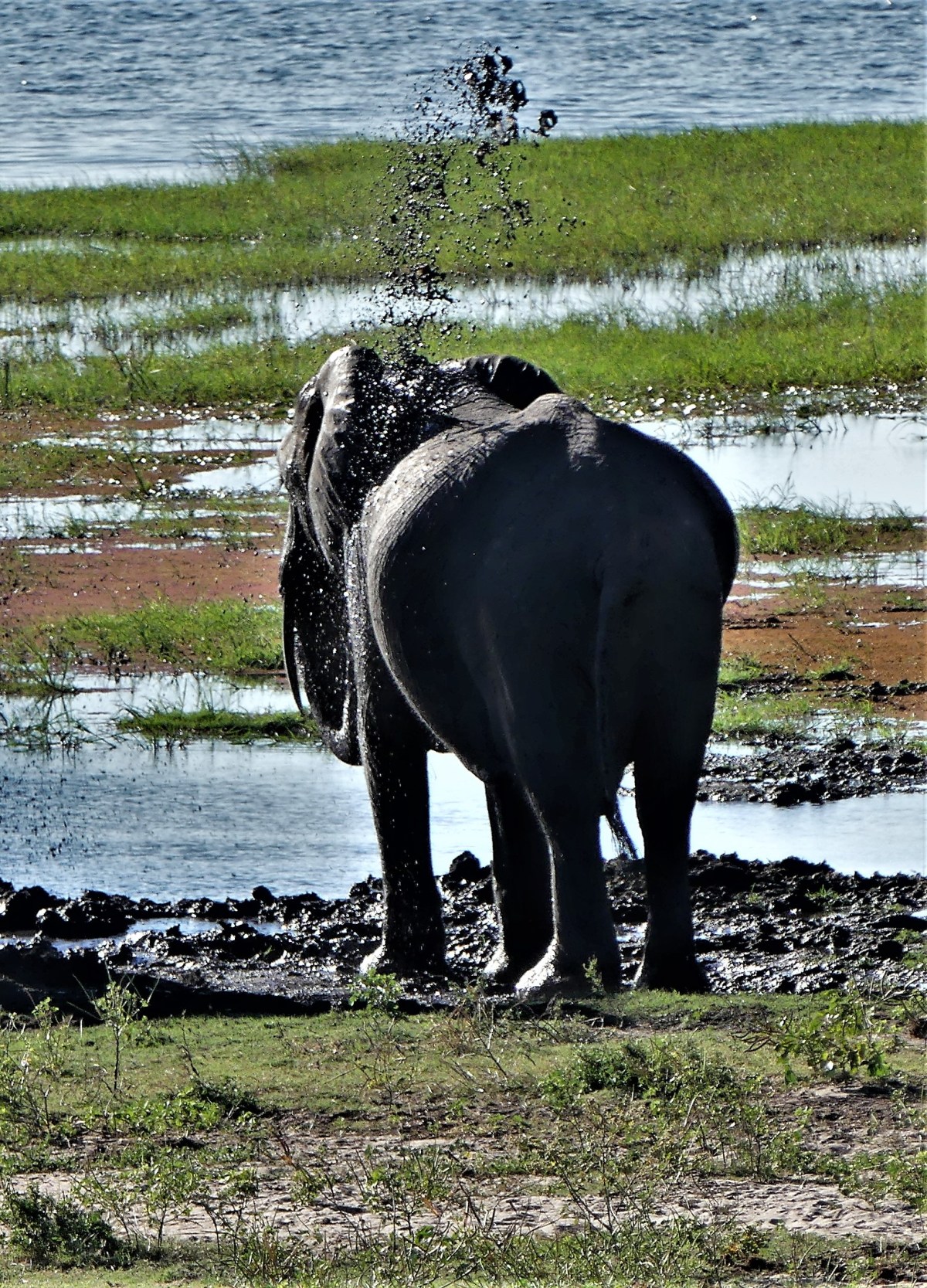
But elephants are nomadic, and know no borders. They routinely migrate between Angola, Botswana, Namibia, Zambia and Zimbabwe, making it difficult to consider them residents from one specific country.

The 2-year drought has expanded the elephants range considerably, driving them further south in search of fresh grass and water, while also bringing them closer to humans already occupying the territory.
Consequently, human-elephant encounters have increased significantly, causing villagers to complain about elephants marauding through their fields, and destroying a season’s worth of crops in one night.
Lawmakers and The Ministry of Environment, Natural Resource Conservation and Tourism acknowledged that local community reaction to wildlife conservation was shifting away from the ban, with farmer’s acting more concerned about their loss of income.

Current president, Mokgweetsi Masisi immediately repealed the shoot-to-kill policy, and disarmed the rangers of their military-grade weapons. He tasked a coalition of national and local stakeholders to review the ban, and the committee returned in February with a recommendation to lift the ban.
Outrage against Botswana’s decision has been swift and universal. Conservationists have expressed regret, concerned that targeting elephants will open the door for increased trading of illegal ivory.

Additionally, experts say the move would be counterproductive, as hunting elephants will make them fearful of humans and provoke them, increasing the conflict with local communities.
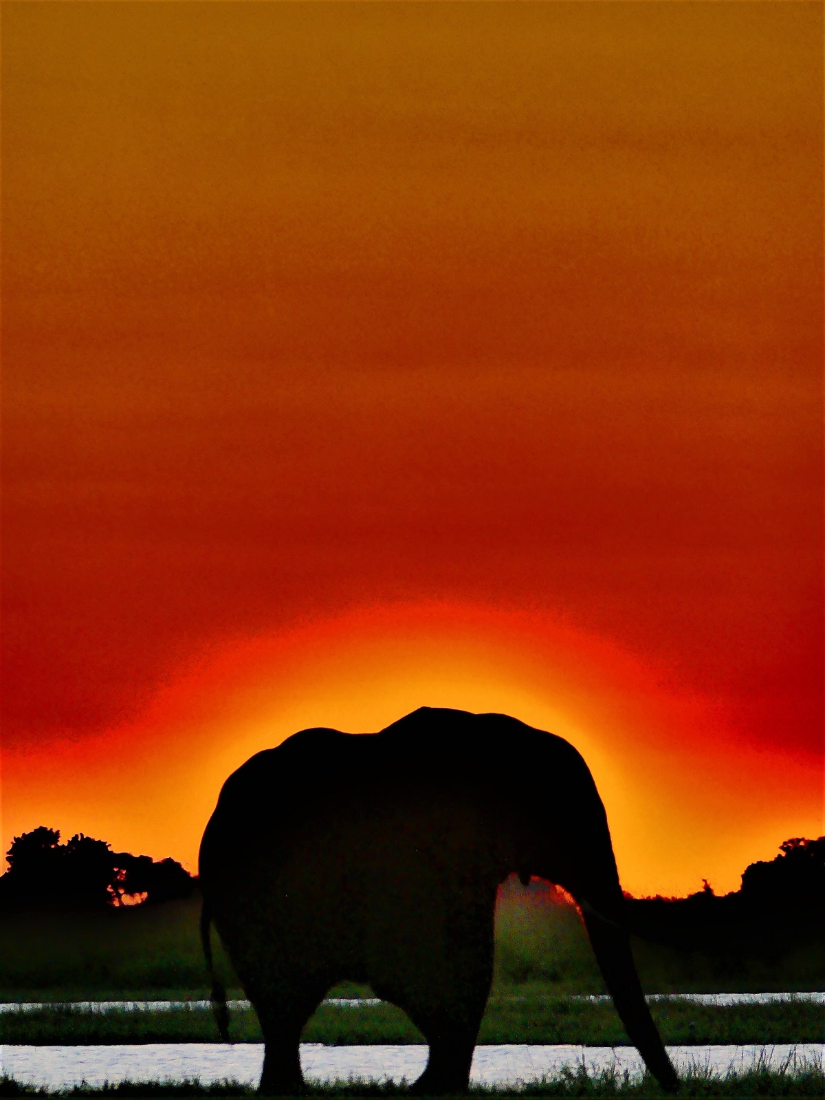
Ex-president Khama says that lifting the ban is both unwise and ineffectual. “Resorting to killing is a blood policy that should not be supported. This will not have an impact on human animal incidents. It is a political move.”
As legal controversy rages between humane versus economic interests, African elephants will continue to fight for their own survival, provided they still have a leg to stand on.

Watch a primer on the elephant problem for added information…

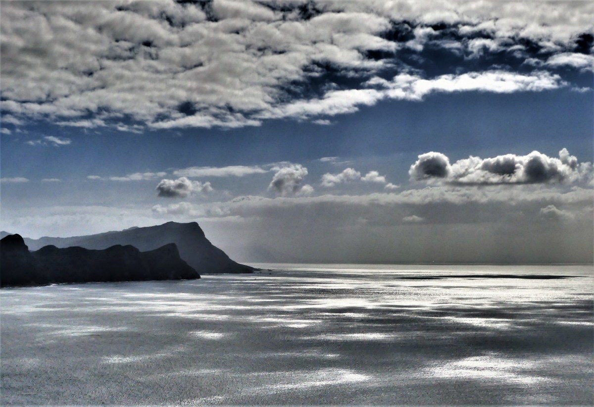
It was a beautiful day for a drive. We boarded a van for a tour around the Cape Peninsula of South Africa, and Michael, our driver was eager to show us the sights.

Our first stop was Maiden’s Cove. The sun had just broken through a veil of ground fog and scattered clouds looming over the 12 Apostles…

causing the breakers to sparkle from a beam of direct light.

Idle tide pools glimmered against a foaming sea in the company of sleeping rocks.

Later, at Hout Bay, a seal was starved for attention…
but easily satisfied by tuna bites…

and a few strokes from Leah.

We continued along Chapman’s Peak Drive, following the contour of Noordhoek Beach,

until we reached a pee-pee stop that also doubled as a sculpture park filled with wild animals…
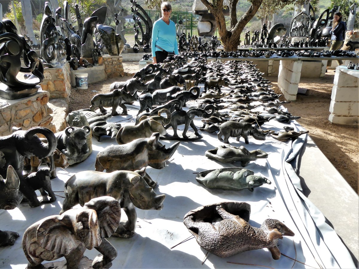
and African villagers expertly carved from stone, and available for shipping anywhere in the world.

We resumed our tour at the gates of Table Mountain National Park in search of special geography.

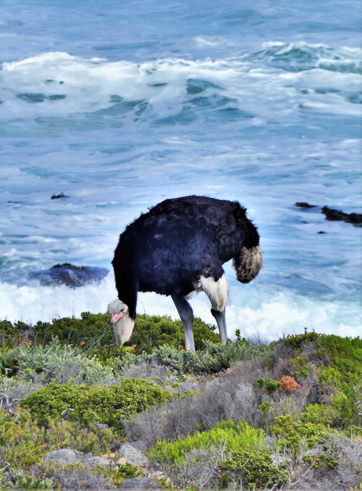
But not before stopping to study an ostrich by the sea, because an animal sighting always takes precedence over a landmark.
Once we arrived, we patiently waited our turn in the drizzle so Michael could record our proud penultimate achievement.

Because 200 km across False Bay…
lies L’Agulhas, the most southern point of Africa, where the Atlantic Ocean meets the Indian Ocean…
But we settled on Cape Point because we were already there…

and hiked to a decommissioned lighthouse…
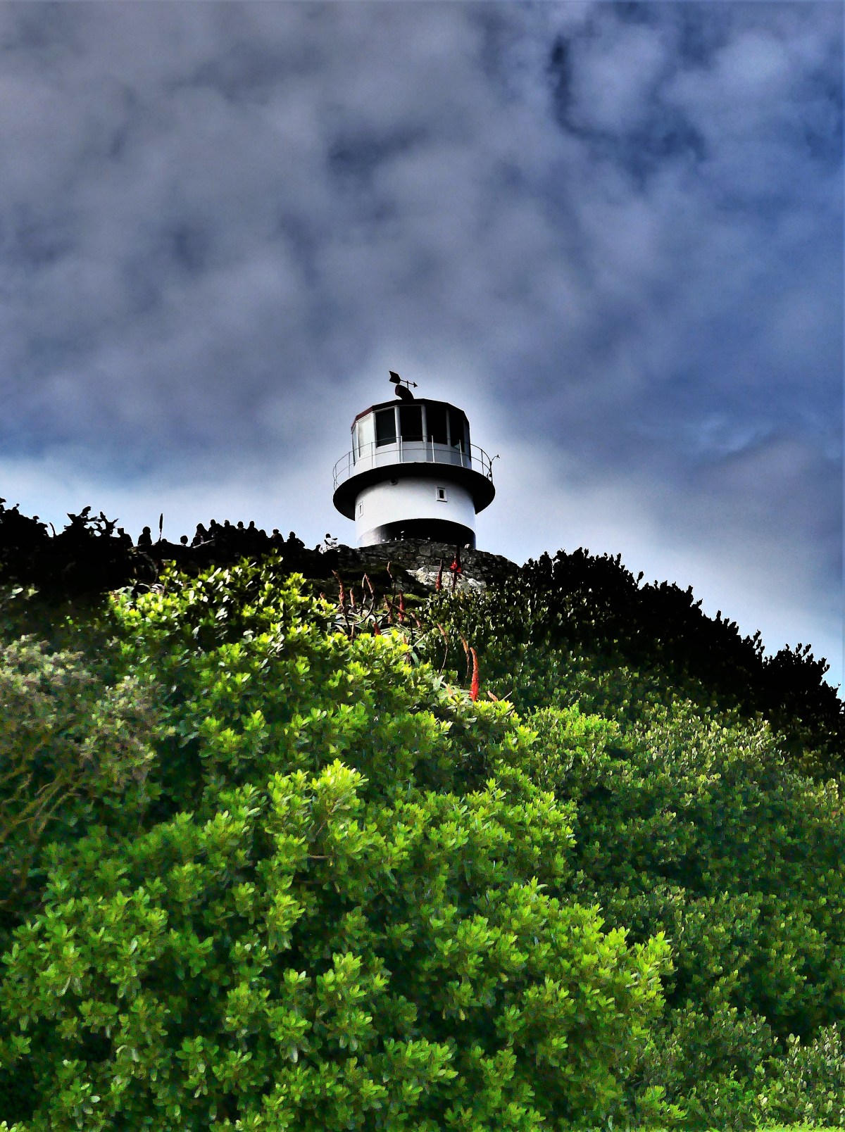
and remote guesthouse that offers views…

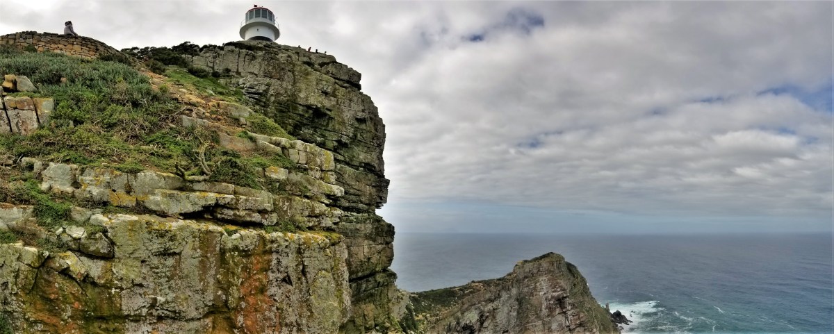
…in all directions,

and a special place where heaven touches earth.
The tour concluded at Boulders Beach in Simon’s Town,

where we enjoyed a late lunch of seafood, before returning to follow the antics of eager African penguins preparing for an afternoon swim.


“Prepare to get soaked,” warned Reason, our guide and driver for the day. In anticipation of the “rain”, Reason handed out rain parkas to each of us.
Leah rocked hers!

“These will come in handy. You’ll see. The rain will come from all directions,” he said.
We were in for a soaker. According to a park poster, May is considered one of the heaviest high water months.

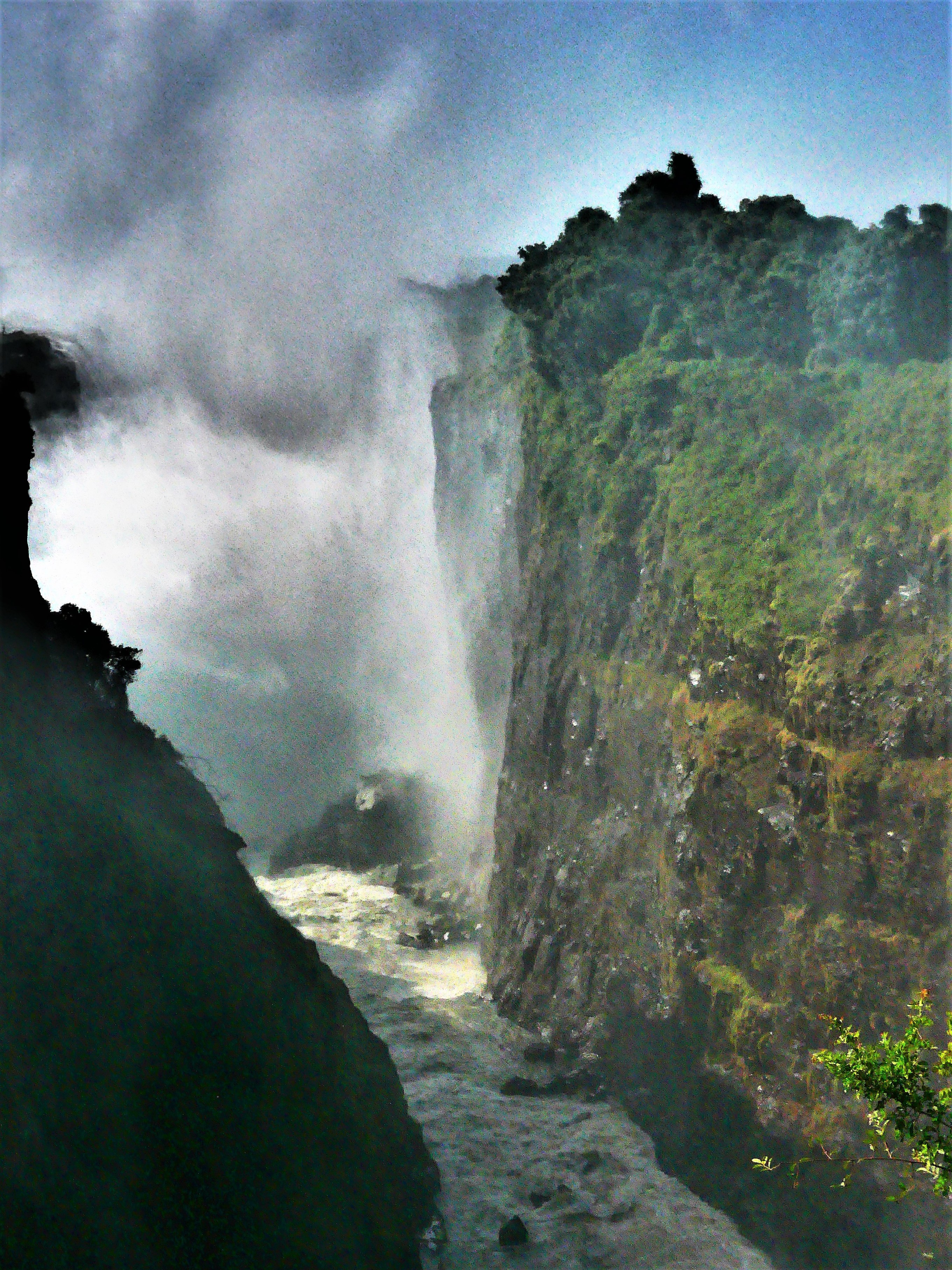
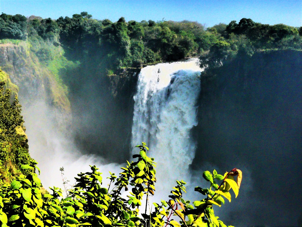
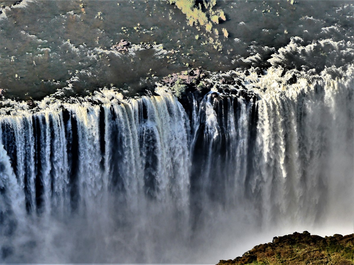
All the rushing water will be amazing to see, if we can actually see it at all through the spray and mist, which can rise over 400 meters…

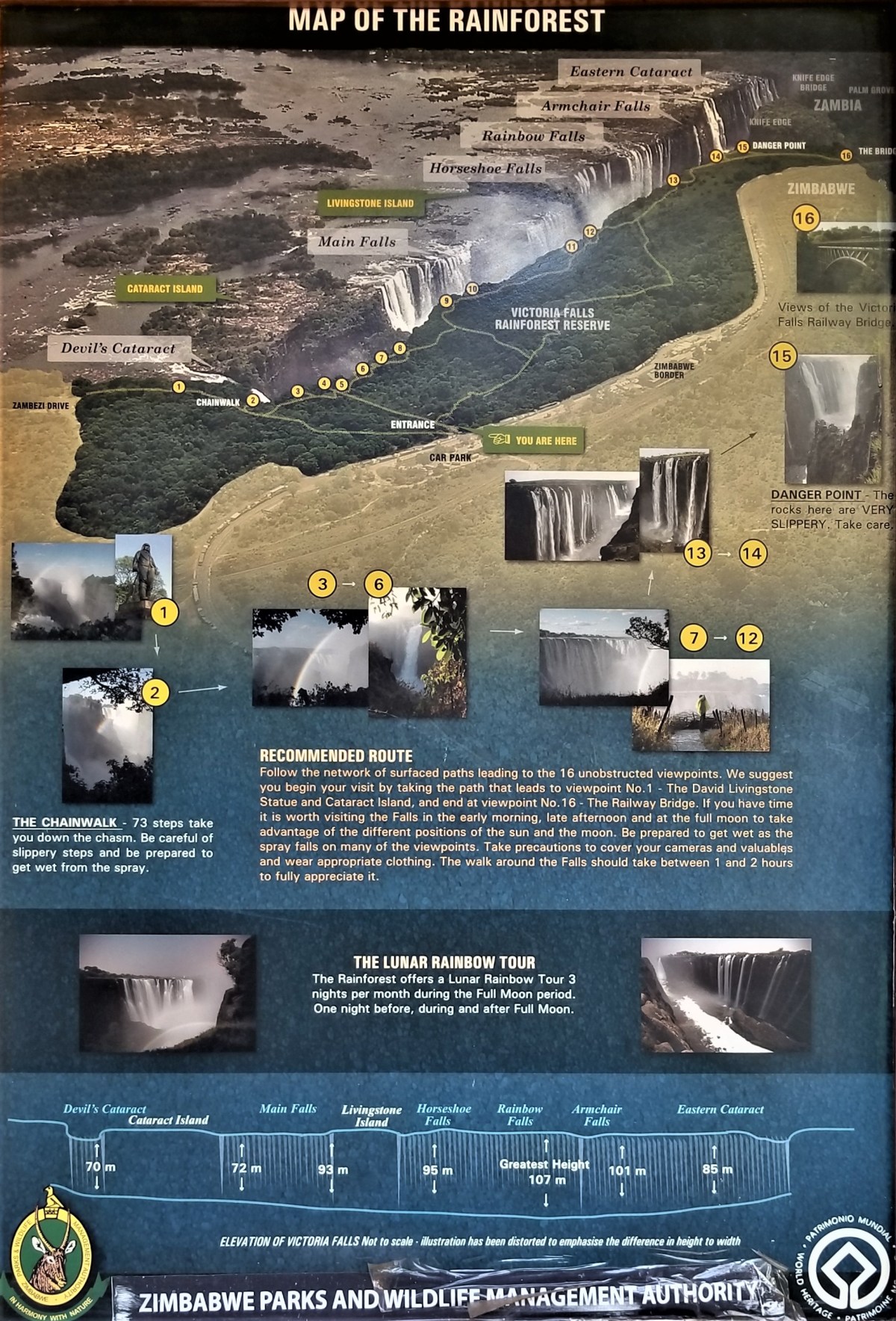
and be seen from a distance of 50 kilometers. Reason explained that the best viewing along the eastern rim was from numbers 1 through 8 on the path.

“From 8 to 15, you will get drenched. But if the water gets too much for you, there is a detour between 8 and 9, where you can walk inland and dry off.
“What about Niagra Falls? Isn’t that the largest?” asked one of the Canadians traveling with us.
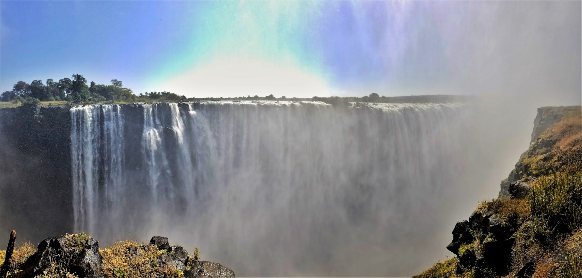
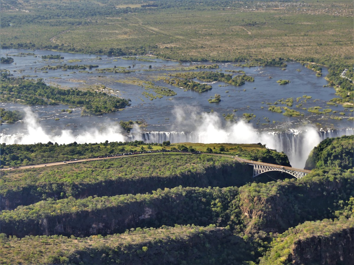
“Sorry. Not even close. Victoria Falls is double the size of Niagra Falls. While it’s not the highest falls–that stat belongs to Angel Falls in Venezuela, dropping 985 meters; and it’s not the widest falls–that record belongs to Iguazu Falls, measuring 2700 meters across, and defining the borders of Brazil, Argentina and Parguay,” Reason clarified, “it’s the volume of falling water, and a combination of everything else that makes it number one…but you will see for yourself. The path is one mile from end to end, and you guys have two hours to experience it, so let’s get wet!”
Those panchos looked fine for keeping clothes dry, but my biggest concern was keeping my photo gear dry, so I opted out, and wore my own rain jacket, which was roomy enough to protect my camera from moisture…or so I thought.
From Points 1 through 5 on the walk, the wetness factor–on a scale from 1 to 10–was manageable at 3 for damp. Having a chamois helped to eliminate the mist from the lens hood and camera body between shots, so my shots were still sharp.

But things got dicey after Point 5. By now, water was dripping from the lens filter, and focusing became nearly impossible with water constantly blowing across my frame. That’s when I switched gears and opted for a more visceral interpretation of the falls, leaning towards a painterly impression.


The falls was a dynamic spectacle, that soon became a photographic nightmare. Weather conditions had pinned the needle on the wetness scale, guaranteeing that nothing about me was dry any longer: the plastic shopping bag protecting my camera had filled with water; the monsoon had penetrated my waterproof rain jacket, soaking my clothes from within; and my chamois was useless.
That’s when I turned to my Samsung Galaxy S8, almost too slippery to hold, and captured a few panoramas…

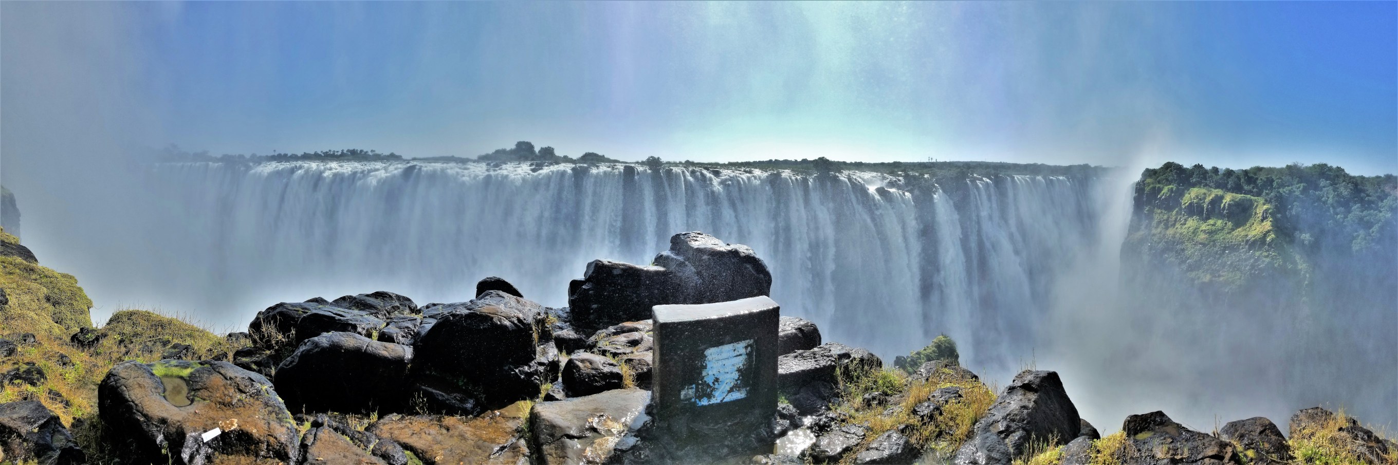
The rain had abated by the time I reached the Victoria Falls Bridge at the end of the trail.

The bridge spans the Second Gorge and connects Zimbabwe to Zambia.
Built in 1903, it was originally conceived as a railway bridge by Cecil Rhodes, an English industrialist, who left his name and colonized imprint on a country (Rhodesia, until 1979) rich in natural resources, and easily exploited for the benefit of the British Commonwealth.
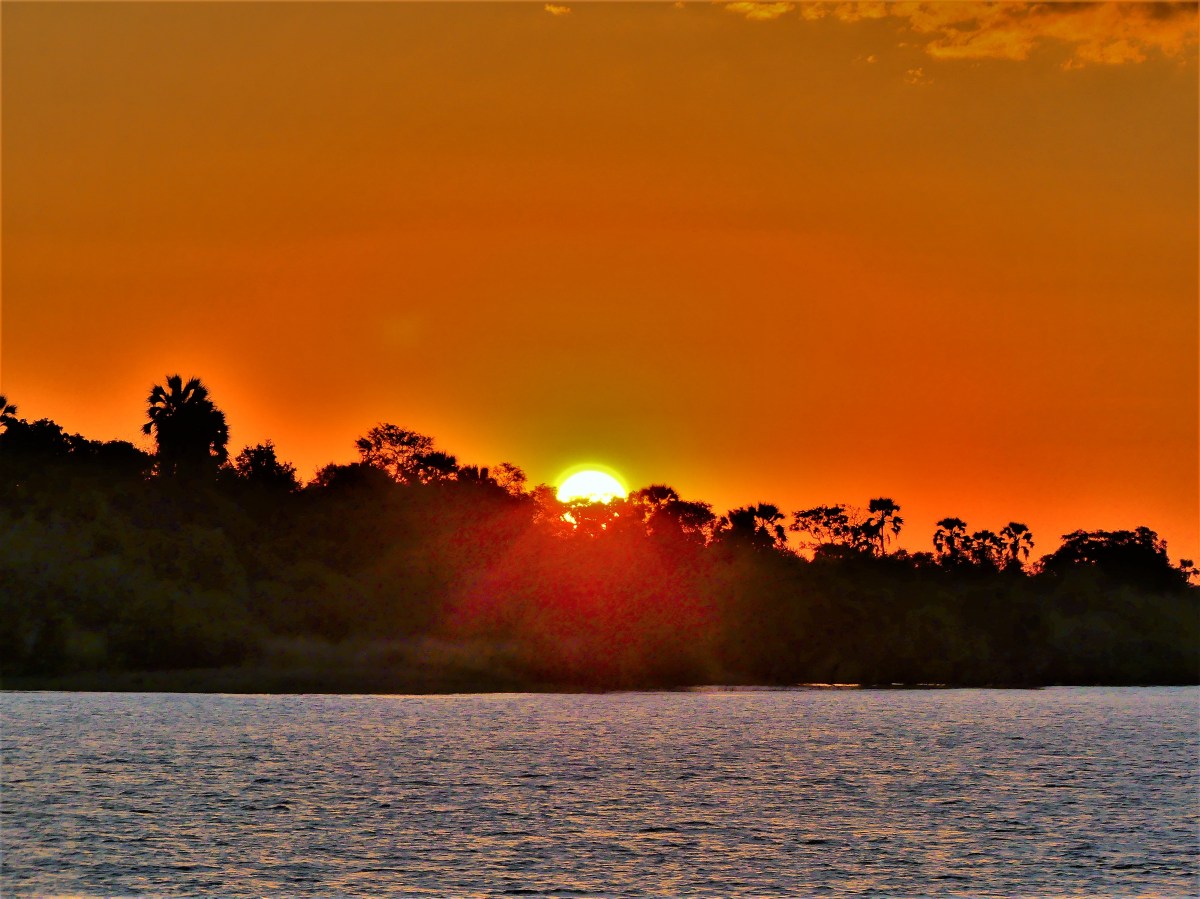
The afternoon was reserved for a sunset river cruise on the Zambezi.

Cruising gently down the river, we drank, we ate, we partied. The captain rounded a bend in the river…

and behold, the omnipresent falls spray was there to greet us.


With the day losing light, the night lillies have unfolded…
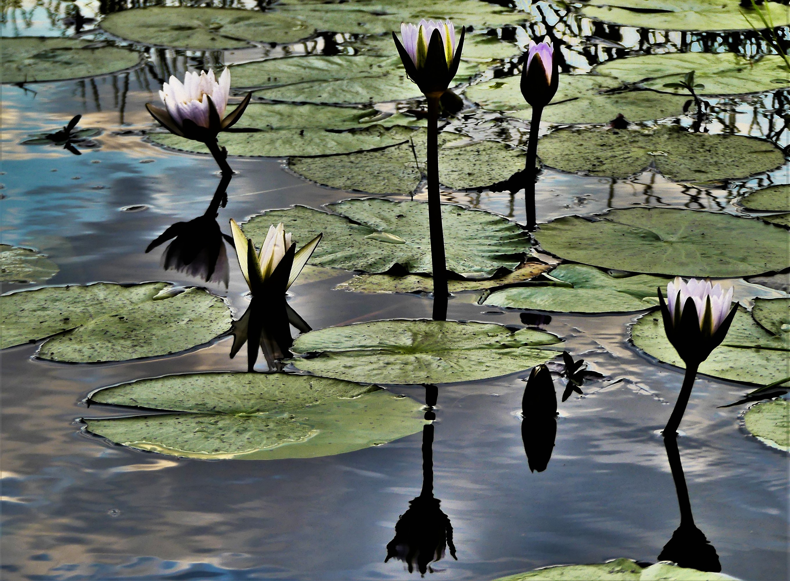
and the hippos have gathered…
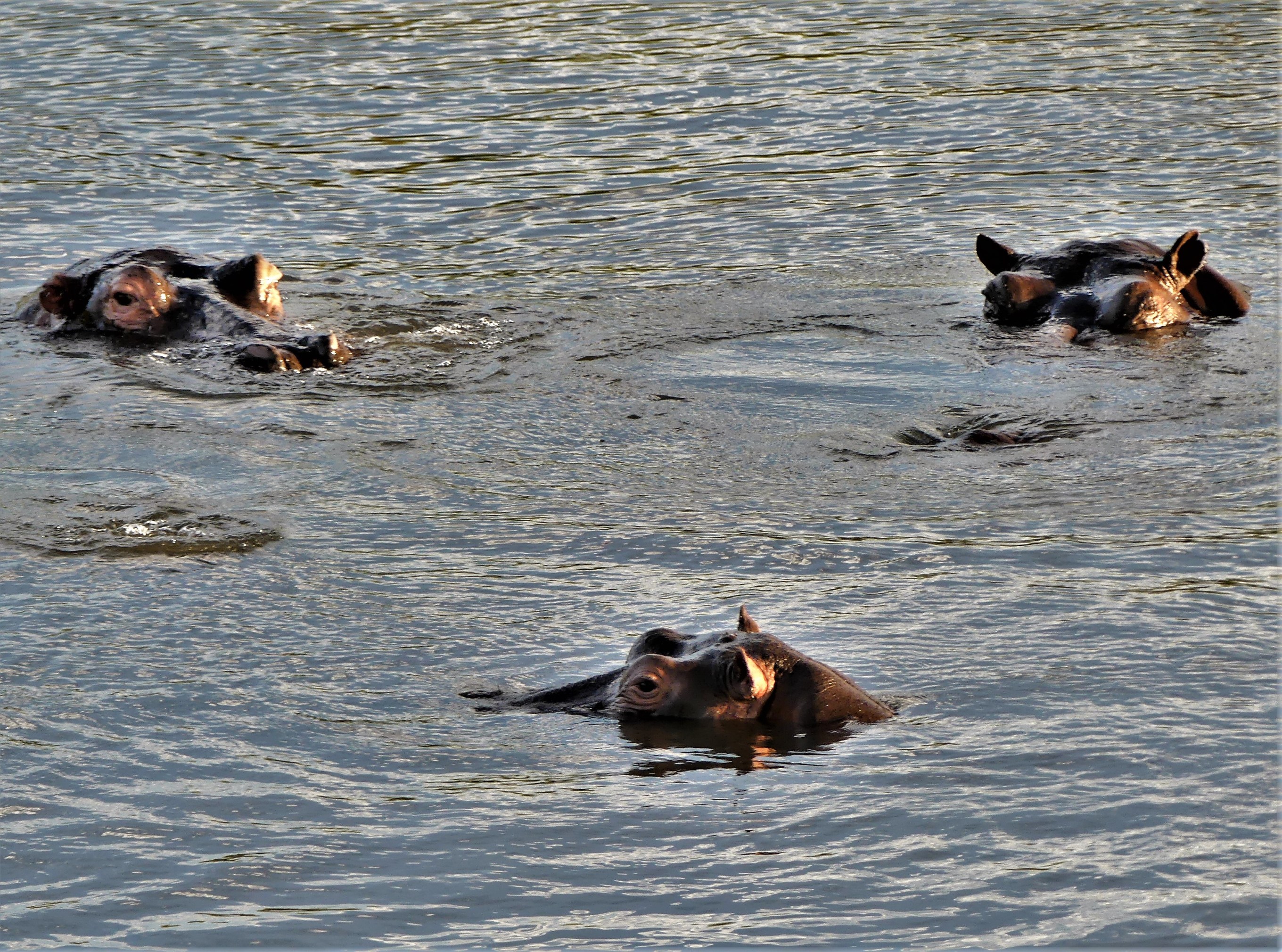
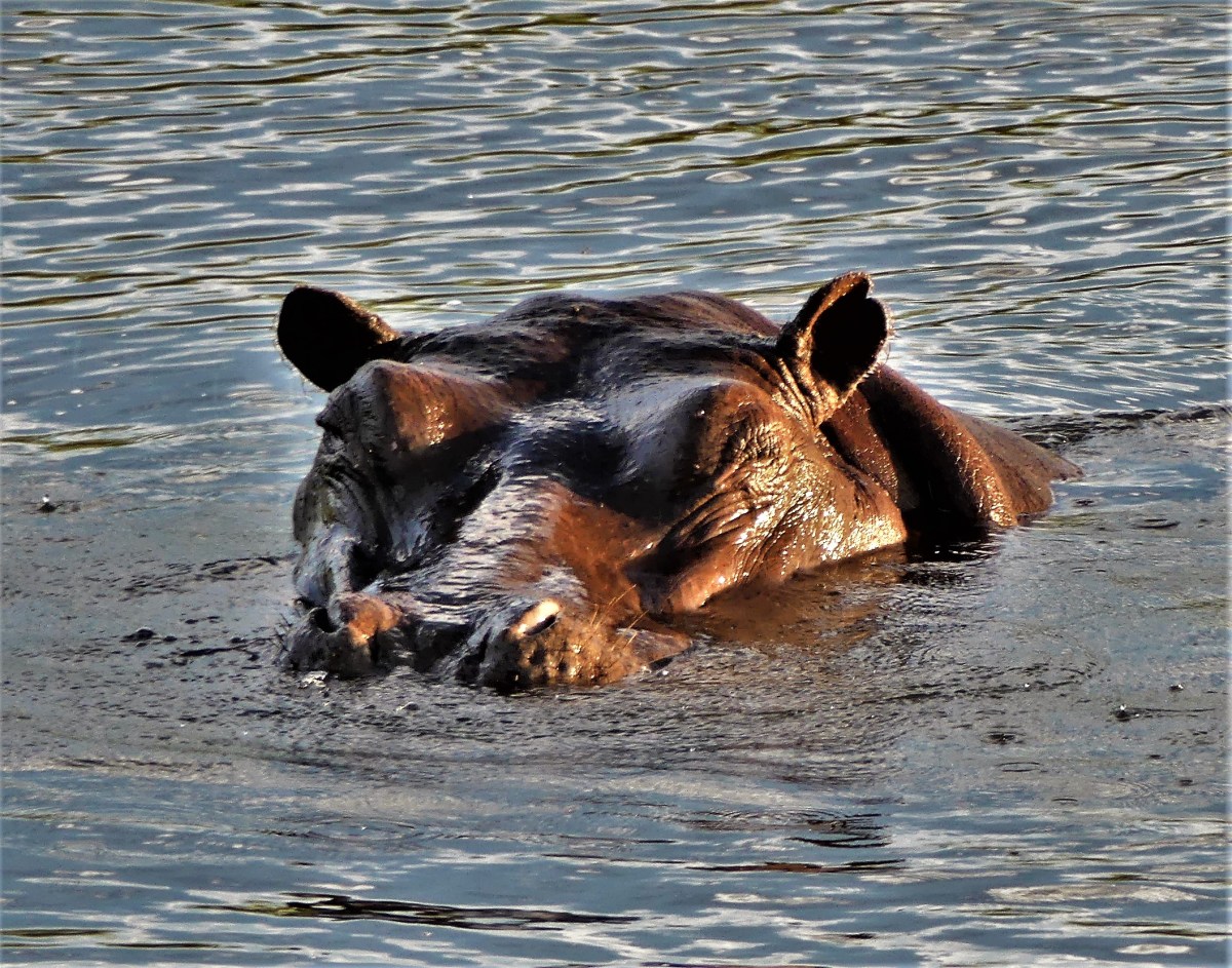
with all the celebrants aboard our neighboring vessels…

to toast the sunset one last time.

Our African safari vacation to South Africa and Botswana came with an elective, 2-day excursion to Victoria Falls. Traveling half-way around the planet and being this close to one of the seven natural wonders of the world, it seemed foolish to pass on the offer–the same thinking held by the other 10 in our party.
After a brief bus ride from Kasane (our last stop in Botswana)…

to the border of Zimbabwe (where we acquired our $50 visa stamp),

we continued the 1-hr drive to Victoria Falls, where we checked into The Kingdom Hotel.
The rest of the day belonged to us–to shop, to rest, to sightsee.
Some of us considered a helicoptor ride over Victoria Falls, but also had to reconcile whether a 22-minute flyover was worth the $250 expense.

“It’s a lot of money,” Leah addressed.
“It is, but I’m all for it. When else will we ever get the chance to do this in our lifetime…unless we’re coming back here, because I would come back here in a heartbeat,” I asserted.
“We’re in,” stated Linda and Heather from Colorado.
“I guess I’ll do it too,” commited Nathan.
Five of us took the heli-tour, while others walked to Zambia to view the falls from the other side. Although $250 for the loop seemed overpriced, I was eager to see the falls by air, regardless of the price. Afterall, when would I ever see it again?
After our briefing at the Boisair Heliport, we boarded our helicopter, and we were aloft,
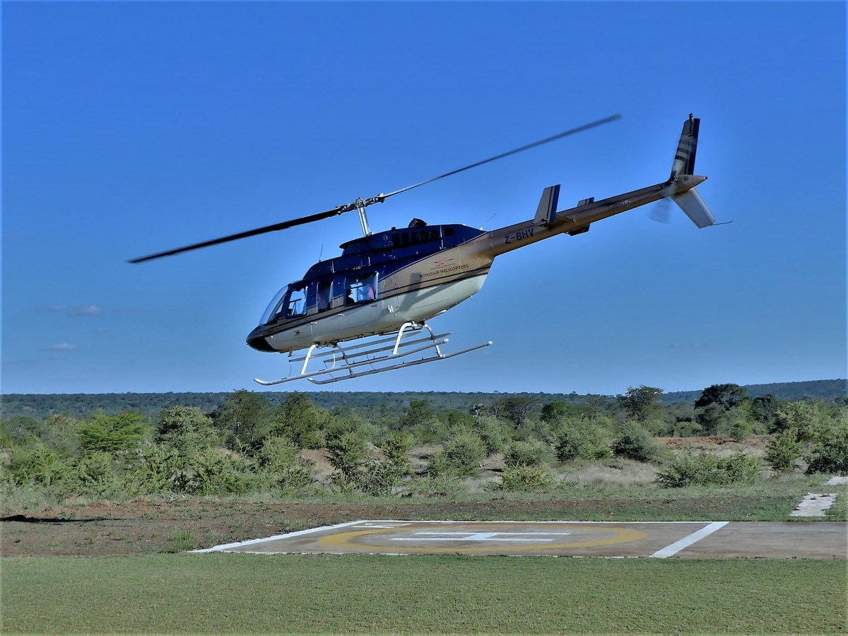
doing a couple of figure eights over the falls,

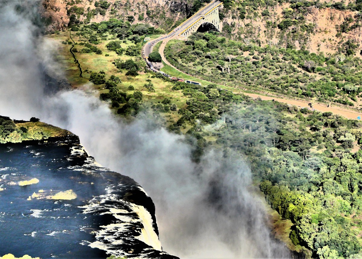

a circle around the Bakota Gorge,

and a turn up the Zambezi River…


before returning to the helipad.
“How was it, Leah? Do you regret spending the money now?” I asked.

“Worth every penny!” she exclaimed.
The vastness and grandeur of the falls is best appreciated by clicking on the video!
To be continued with “Victoria Falls by Land and Water“

In the Animal Kingdom, animal magnetism has evolved over time–shifting between monogamy and polygamy, to cheating and outright promiscuity–something humans have been wrestling with since walking erect.
Every animal species is wired to adapt, survive, and pass along the blood line, no matter what, and the behavior dynamics are fascinating to observe.
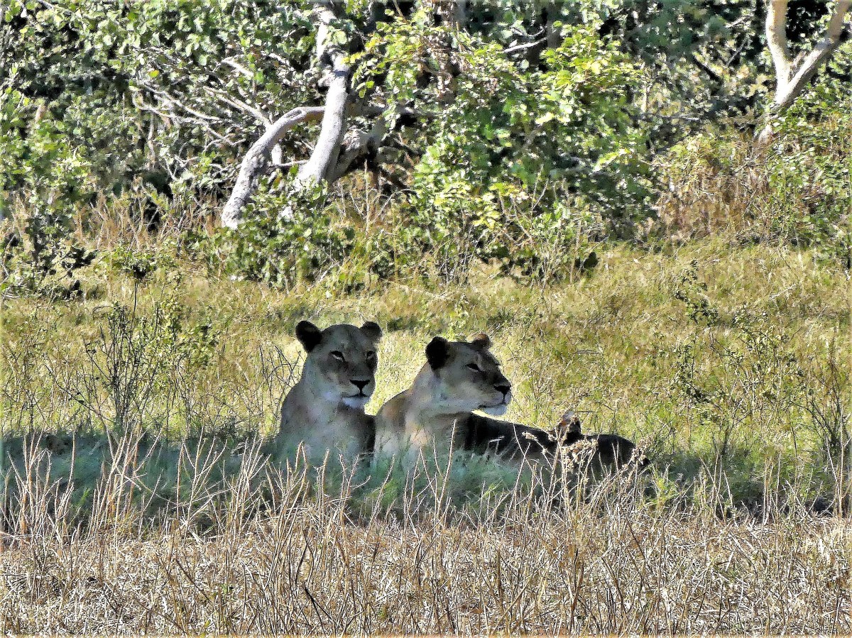
For instance, the primary male lion roams with a harem of ladies in his pride, but will momentarily pledge himself to the lioness who bears his cubs.

However, a rival male to the pride will kill his predecessor’s offspring to force the pride’s females into ovulation.
Male and female Grevy’s zebras live apart until food and water are plentiful. Female Grevy’s zebras are polyandrous and will breed with many different males in succession.
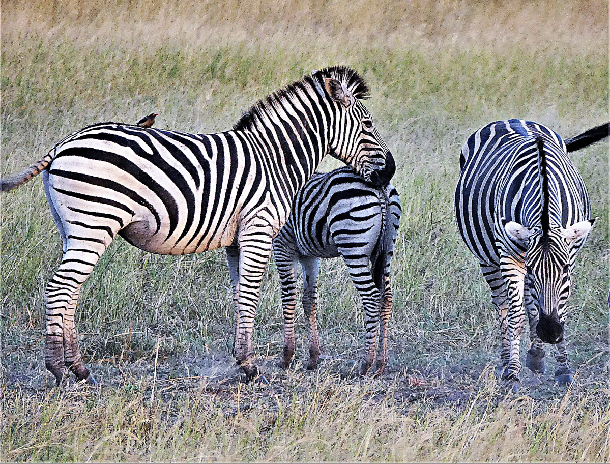
Male Grevy’s zebras establish territories that lie along paths to water, often intercepting an ovulating female while passing through. And then it’s on to the next.

African wild dogs live as a monogamous breeding pair supported by a small pack.

The litter of pups is first cared for by the alpha female and guarded by the alpha male…

who doles out hunting and caretaking responsibilities to subserviant wild dogs within the pack.

A dominant impala ram will manage a harem of 10 ewes and their lambs, keeping them in line with his constant braying, biting and boasting. Young bucks continually challenge the ram in charge, insuring ewes will always deliver the strongest gene pool…

thus providing a defense perimeter of plebes to discover danger from every direction.

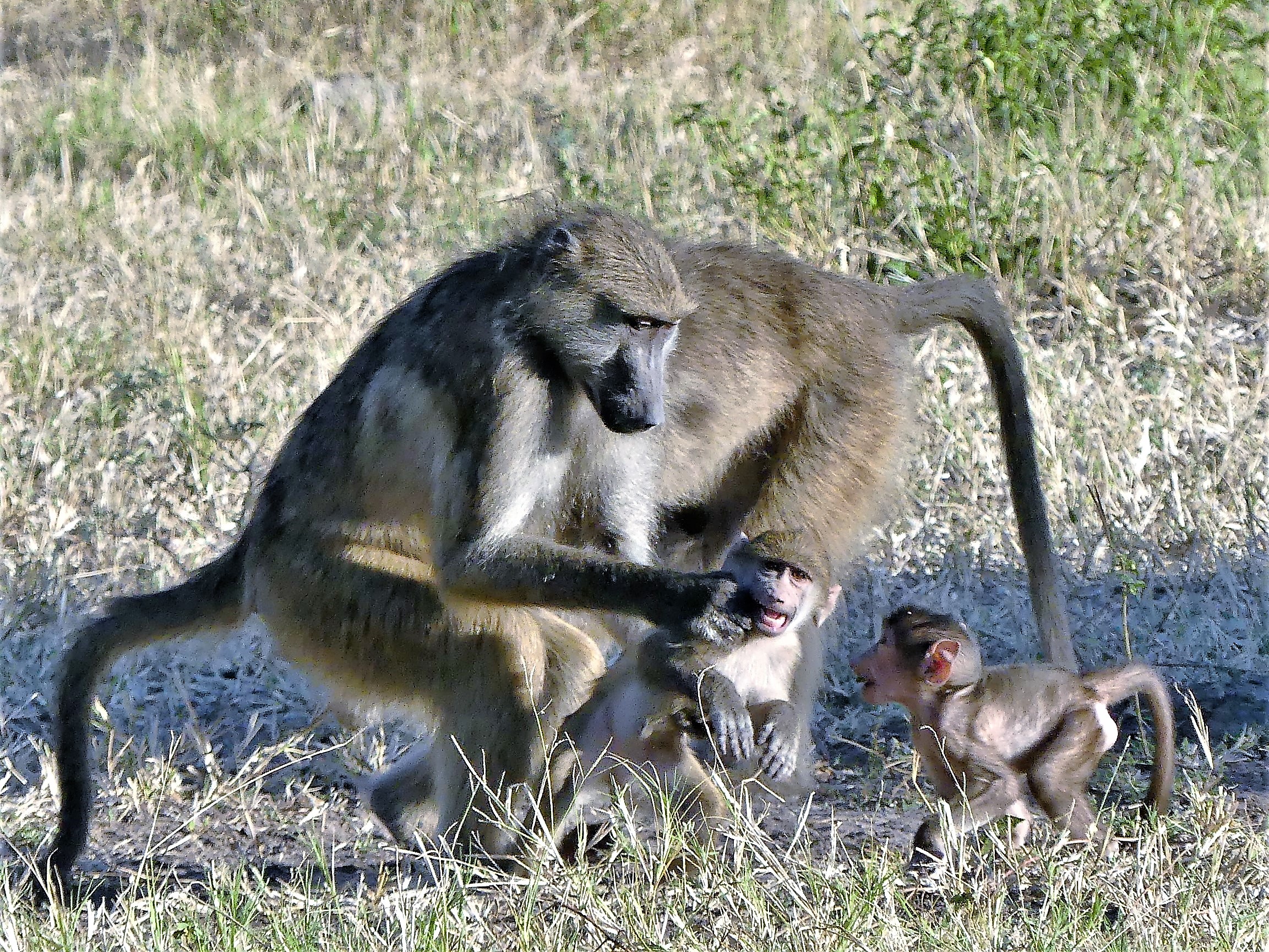
Baboons run in troops ruled by social dominance. When it comes to mating, any male of the troop will accept any female’s offer should she present her swollen rump to his face; however, the social rankings between males will often lead to aggressive fighting.
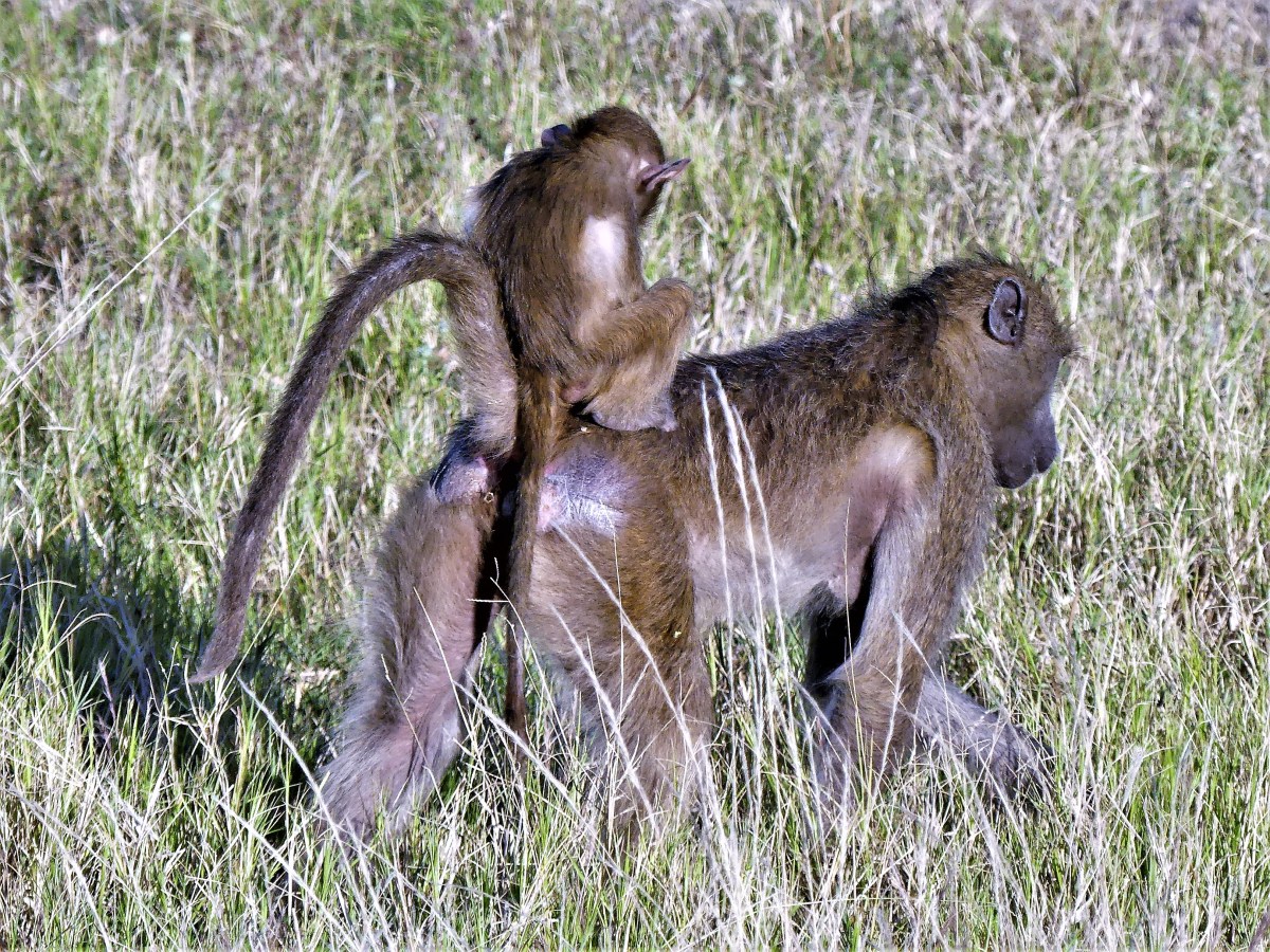
Females are the primary caretakers of the young, although males on occasion will babysit to win a female’s affection.
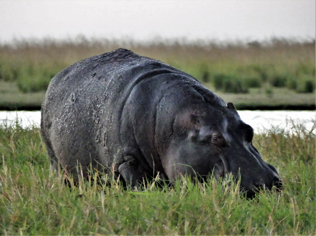
Hippo bulls are polygamous by nature and insecure creatures by design. When the cows of the pod are fertile, the bull whips up a piss and dung cocktail that he atomizes with his propeller-like tail to capture their attention.

He will repeat this process until all the cows have been serviced. Should any of the offspring be male, the cow will protect it by hiding it near the fringe of the herd, lest it be killed by the bull.

Consequently, the bull fears his mature son will someday challenge him for control of the pod, and mate with his mother, creating a Freudian nightmare of hippo proportions.
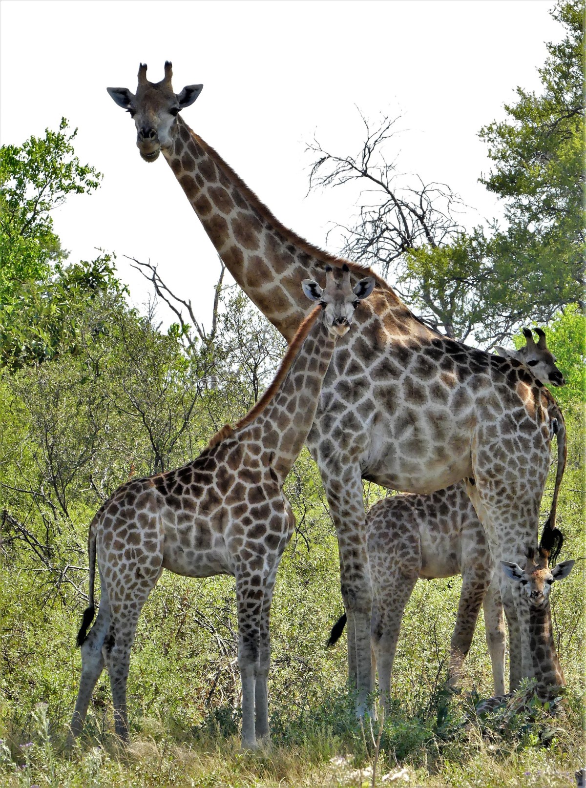
Rival bulls that follow a female tower of giraffes will often “neck” together (spar with their necks) for the attention of a fertile cow.

The victor will smell her urine to determine her readiness, and court her by resting his chin on her back.

The females and their calves remain loyal to the tower, while the males move on, in search of long legs and firm hind quarters.
Ostriches have seemingly taken their cue from the Mormons, where the dominant and polygamous cock will mate with many hens, while the hens remain monogamous.
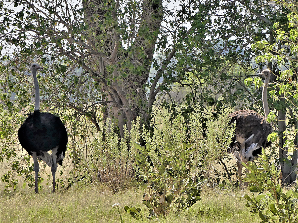
The flock of hens have their own pecking order. As one female emerges as the dominant majority hen, she uses the minority females’ eggs to ring around her eggs as an extra layer of protection.
Dominant kudu rams will keep company with three to five kudu ewes within a herd of females and their calves.
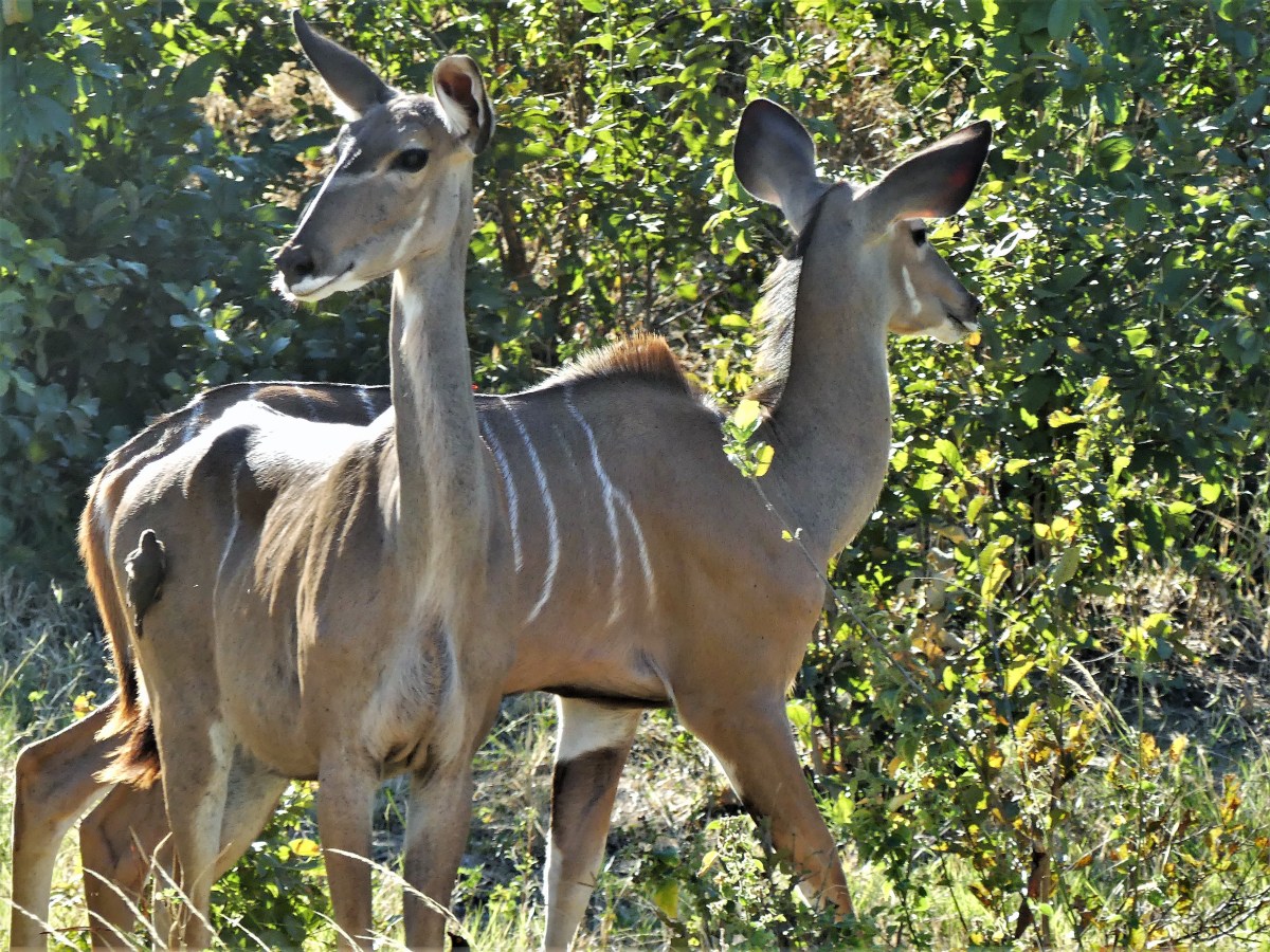
Usually the ram comes a-knocking when it’s time to mate. Otherwise, the ram is a solitary creature that enjoys alone time.

Male warthogs are not very selective. They will mate with any of their female counterparts wherever and whenever they may be found.

Maybe that’s why they are considered pigs.

Several cow crocs may reside within the dominant bull croc’s territory, and each one is fair game for mating. The bull courts his cow in an elaborate and sensual dance that is certain to win her scales and tail.
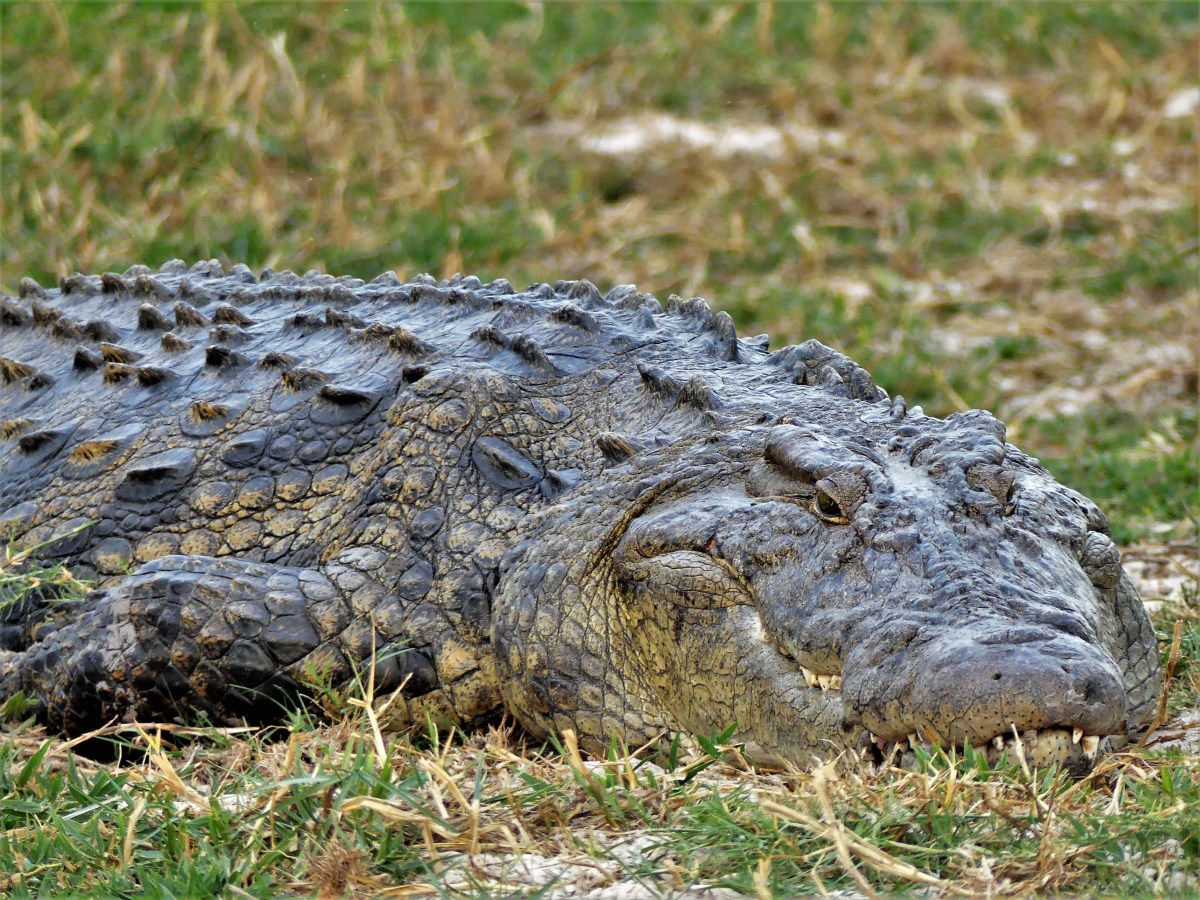
It so happens that bull crocodiles are always ready! They keep their ever-erect penis tucked inside their body waiting for the right moment when both bodies are properly aligned under water.

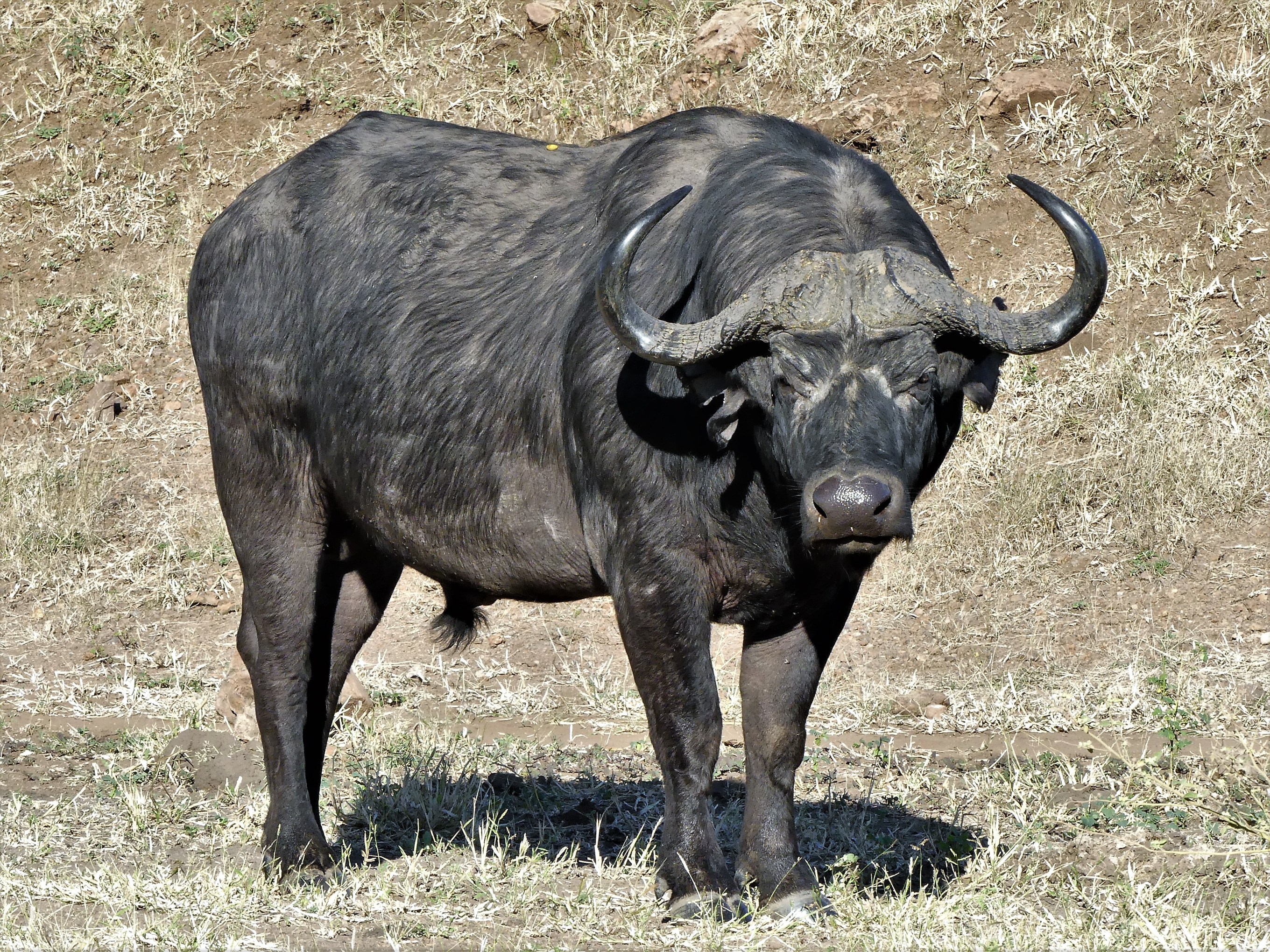
Dominant cape buffalo are distinguished by the thickness of their horns. They set the rules of their herd–

deciding whether to tolerate an overt act of copulation by a defiant subordinate bull, or keeping the cows in heat to himself by staving off all rival advances.
According to Kimberly Yavorski in “How do Elephants Mate?”:
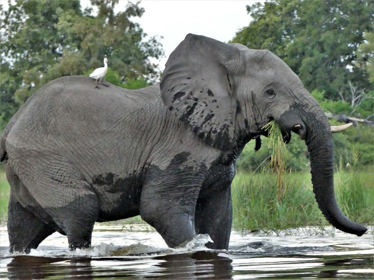
“Elephants are social creatures and live in complex hierarchical communities. Each herd has one female that is the matriarch. She dictates where the herd goes and helps to teach the younger elephants proper behavior. Female elephants, or cows, live in multigenerational family groups with other females. Males stay with the family until they reach 12 to 15 years of age, when they leave the herd and live alone or join up with other bulls. Male and female elephants live separately with bulls only visiting when some of the females are in their mating season, known as estrus.”

“Elephants mature later than many other animals. Females reach sexual maturity at 10 to 12 years of age, males at around 25. A male doesn’t generally start breeding until age 30, when it has reached a sufficient weight and size to compete with other breeding males. At that point, it will start to seek out females in estrus.”

“Bulls enter a state called musth once a year, and older bulls tend to stay in musth longer than younger bulls, up to six months. During this period, they have increased levels of testosterone. They secrete a fluid from their temporal gland between the eye and ear and will actively seek a mate. Dominant males, which are older, tend to come into musth when a large number of females are in estrus, and the males exhibit physical behaviors, such as flapping their ears and rubbing their head on trees and bushes to disperse the musth scent. They also have a particular rumble, a low frequency vocal call, used to attract females who are also ready to mate. Females sometimes respond with their own call, indicating interest. While a cow can mate with any male, those in musth may be more attractive to females in estrus.”
“When a male approaches, a female in estrus may at first show wariness, but if she is interested, she will then leave the family group, walking with her head up and turned sideways to watch the male as he follows behind. The male may chase the female if she retreats and will chase off any other males. Elephants may stroke each other with their trunks before the male mounts the female from behind, standing almost vertically as they mate. Elephant sex lasts for up to two minutes and afterward, he will stay near the female and guard her from other males. Females may mate with more than one bull in each estrus cycle, which lasts up to 18 weeks. While elephants do not mate for life, a female may repeatedly choose to mate with the same bull, and bulls are sometimes seen being protective of females.”
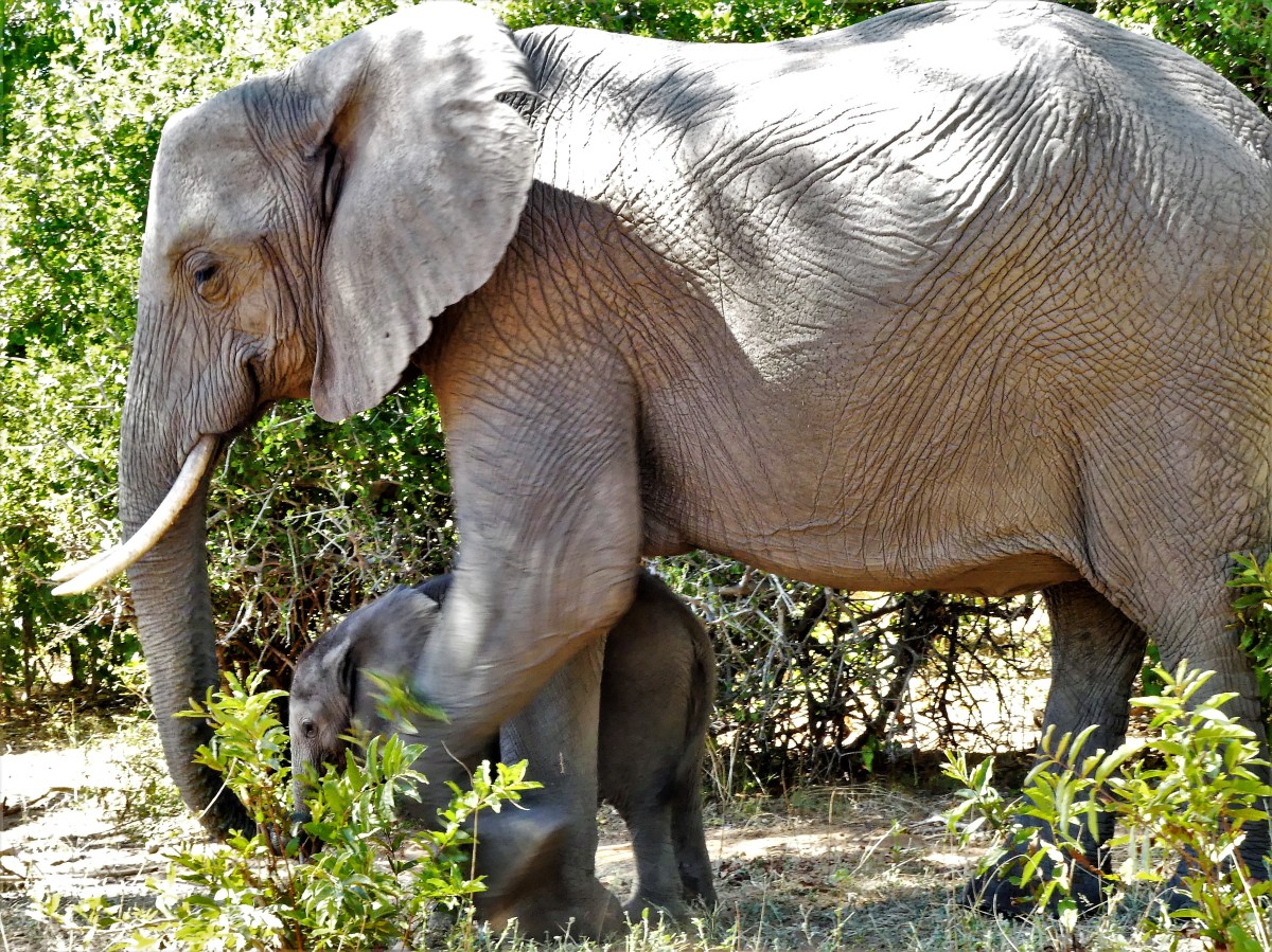
“At 22 months, elephants have the distinction of having the longest gestation period of all animals and give birth to live young. Pregnancy almost always results in a single birth; twins are rare. When it is time to give birth, female elephants move away from the herd and then return to introduce the new member, who is inspected by each other member of the family. At birth, babies weigh 90 to 120 kg (198 to 265 pounds) and are typically around 3 feet tall. Baby elephants tend to be hairy, with a long tail and a short trunk that grows as its diet changes. Offspring are weaned at two years, though some may continue to nurse up to age six and a half. Because of this long gestation and nursing period, estrus cycles are between four and six years apart. On average, a female elephant will give birth to seven offspring in her lifetime.”


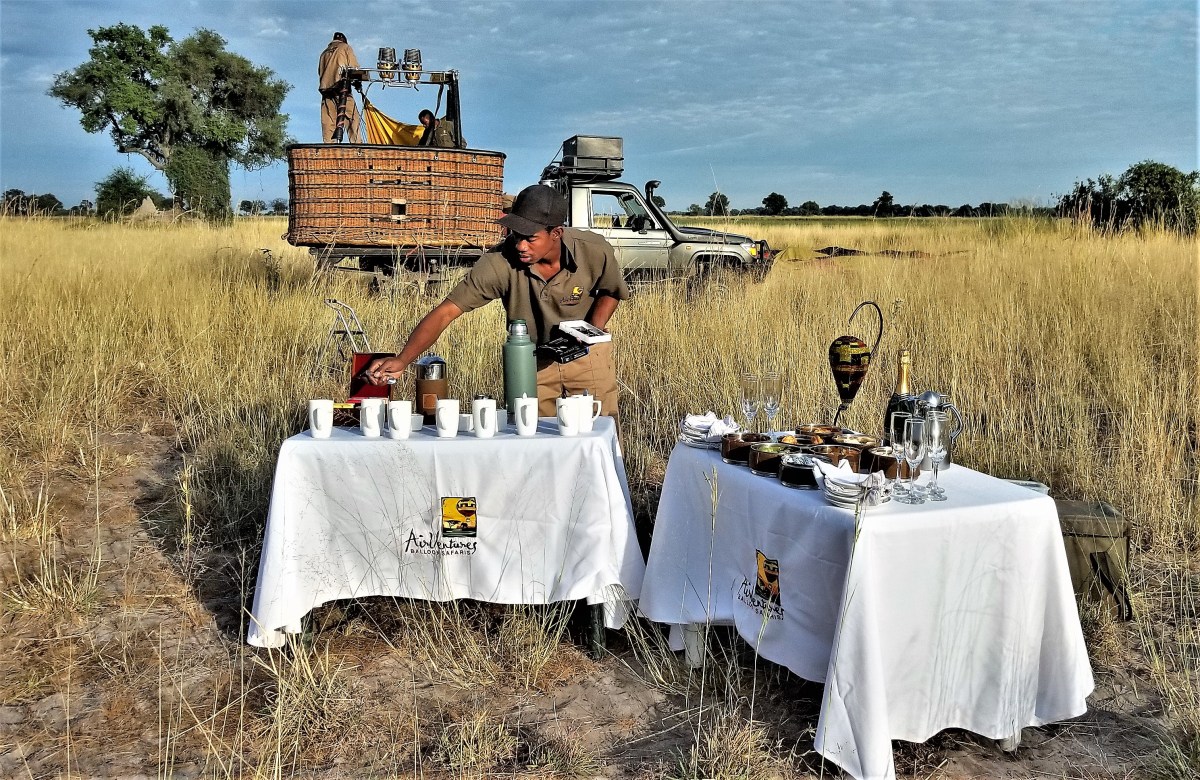
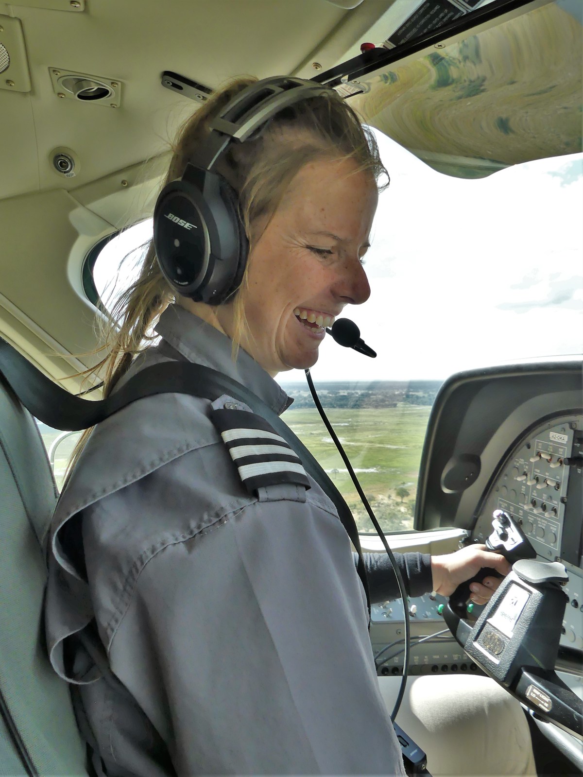
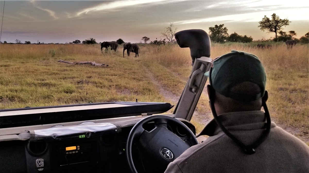
KT, our guide at Kadizora Camp gently rapped on our tent door at 6:30 am to accompany us to the dining tent for a continental breakfast. It was still dark, hence the escort. We were following a verbal command from camp personnel requiring us to stay put during darkness due to a heightened risk of encountering wildlife in our area.
Only last night at 11:20 pm, an elephant known to the camp as Franklin startled me awake by rubbing against the outside of our tent.

“Do you hear that?” I whispered to Leah.
“What is it?” she yawned, seemingly annoyed that I had interrupted her sleep.
“I think it’s an elephant.”
“What?!” she snapped awake.
“Whatever it is, it’s right outside our tent,” I said in my softest library voice.


As if on cue, Franklin’s massive silhouette lumbered along our raised deck, grabbing and tearing tree leaves with his snaking trunk as he filled the zipped screening with his immensity, leaving us paralyzed in awe until he was gone.
Damn! Where was my camera?
Grabbing my arm, “Oh my God!” Leah gasped, “Did you see that?”
It was thrilling yet alarming to watch. Adrenalin pumped through our weary bodies, wiring every nerve and depriving us of much-needed sleep. Eventually, the continuing soft grunts of snoring warthogs under our tent provided the white noise we needed to lull us back to a peaceful slumber until our 6:00 am wake-up.
“Are you ready to see big cats today?” asked KT, his flashlight in hand.
“Absolutely,” I answered eagerly, as we followed him down the illuminated path to the safety of common ground.
“Did you have a visitor last night?” he wondered, already knowing the answer.
“We did,” I shared. “How’d you know?”
“An elephant bull-dozed the contractor’s tent last night. Turned it into a heap of broken sticks and canvas,” he said.
Once out in the bush…
cruising along rutted ribbons of sand separated by tall grass,
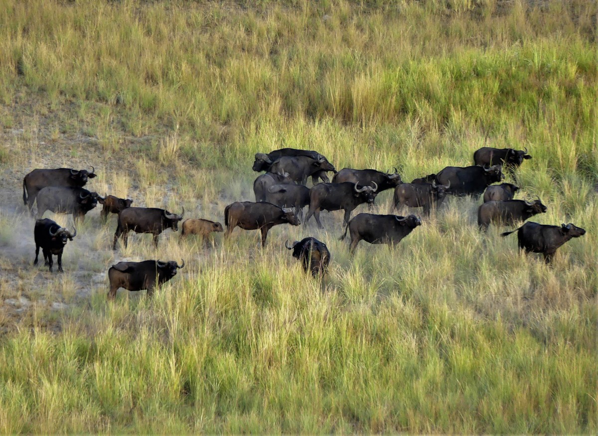
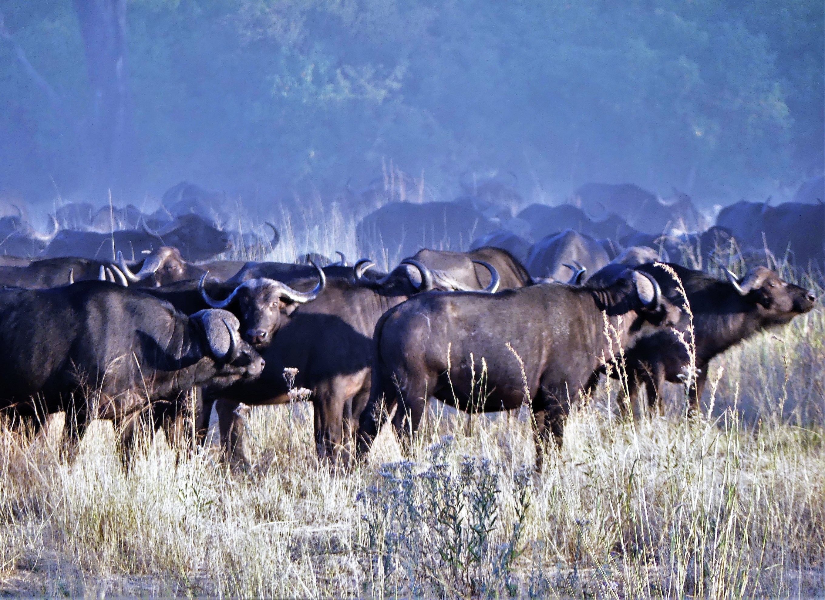
we came across a small herd of Cape buffalo grazing…

that appeared to be pulling closer together, adopting a defensive posture.
“Those buffalo are nervous,” asserted KT. “Do you see how they all stare in the same direction? Most likely, they have picked up the scent of a lion or leopard, and they are closing ranks for protection.”
“I think something may happen here, so we should stay for a bit and see what develops.”
KT repositioned the Toyota in the shade of a large ebony tree, and we patiently watched the herd from a distance, scanning the perimeter for predators in the hopes of encoutering a potential kill.
“There!” he exclaimed.
A young male had emerged from the bush to the right of the herd, and just as quickly disappeared into the thicket for a closer look at the buffalo and to assess the situation.
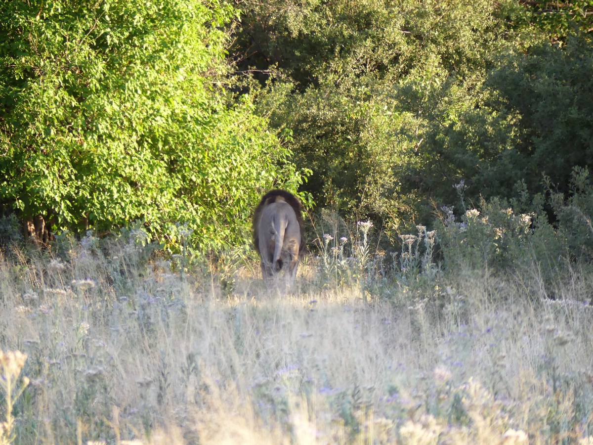
Wow! This was exactly what we came for, but it was a fleeting moment which left us somewhat deflated.
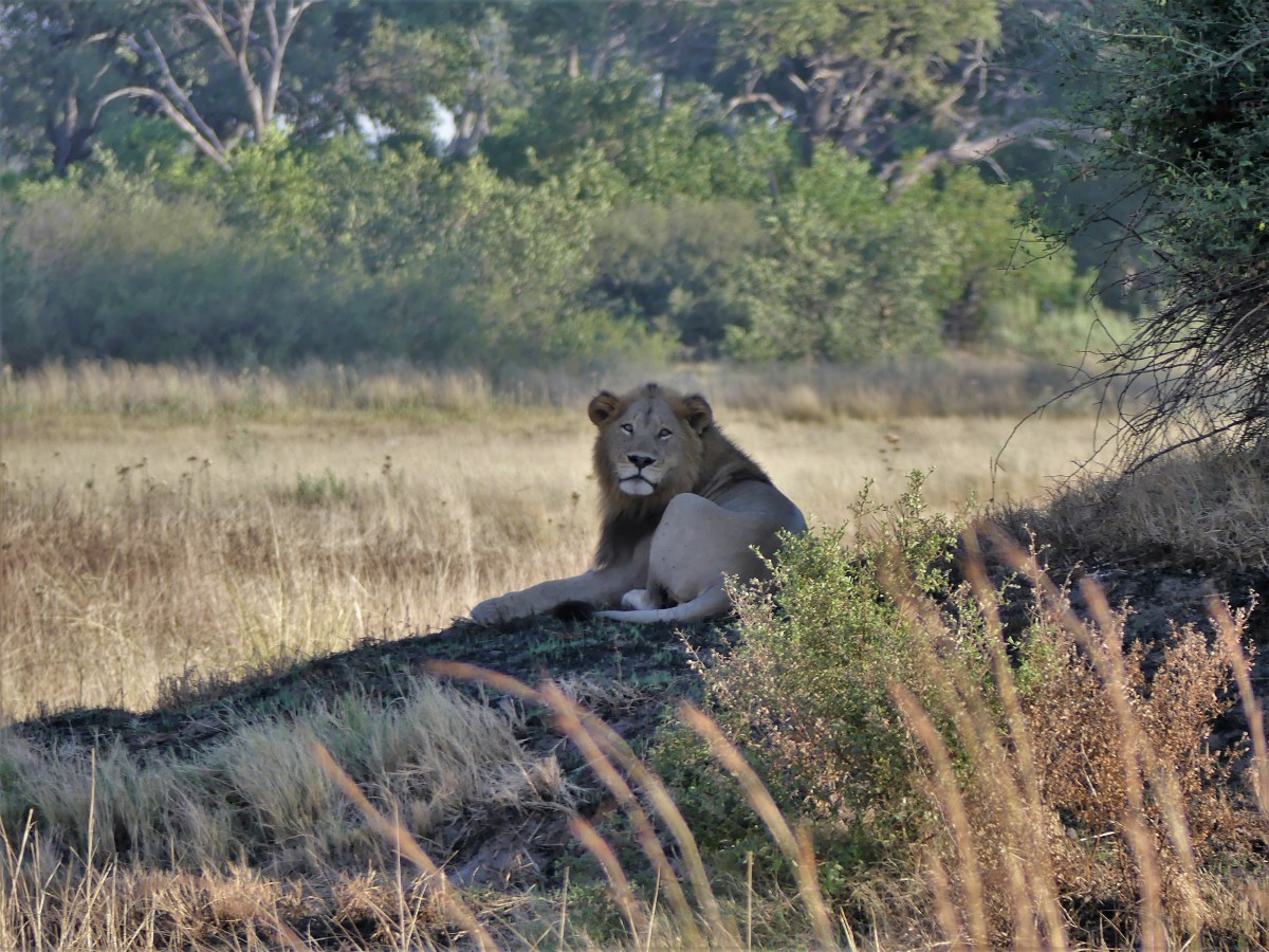
Undeterred, KT started up the Land Cruiser and cautiously followed the lion, who reemerged on the other side, and relocated on a shady slope upwind of the herd.
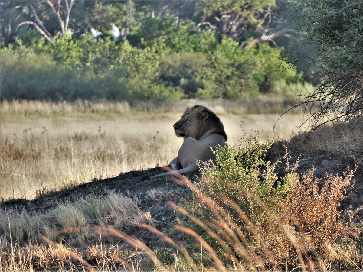
“This is where it will happen,” asserted KT, as he drove even closer to the resting young male.
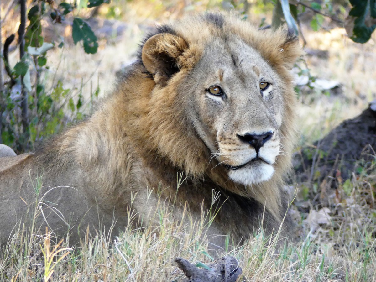
No doubt, the lion was fully aware of us, as it turned in our direction.
“He knows we are here. Aren’t we intruding by being this close?” I asked KT.
“The lions really don’t see us; they only see this truck–not the people inside,” he replied. “They don’t sense the truck as threatening, and it doesn’t smell like food. From the time they were cubs they have grown up knowing this vehicle, and they have become desensitized to its presence in the savanna. So as long as we respect them and do not interfere in their business, we can get very close to them. However, you must always remain seated, and for obvious reasons keep your arms and legs inside the vehicle at all times.”
“Why can’t we stand?” I asked.
“The moment you stand, you change the dynamics and the lion no longer sees the truck as a familiar object, which may make him uncomfortable and put you at risk,” explained KT.
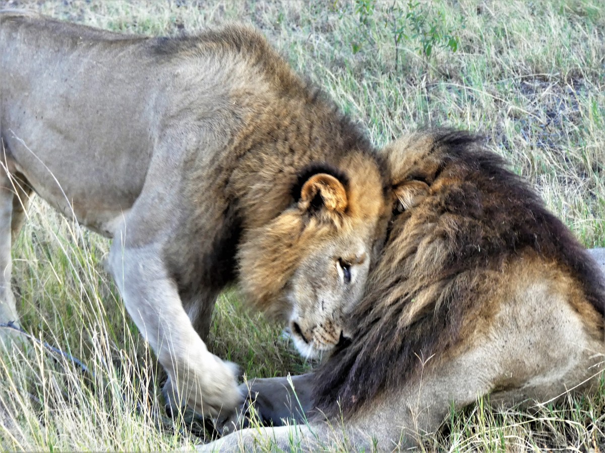
And then another lion materialized from the brush.

“Ahh…this makes complete sense to me now,” KT surmised. “They may be brothers, and they are working together to isolate one buffalo from the herd before the herd disappears into the brush.”
KT restarted the Toyota and pulled closer yet, thinking the timing was right and the attack was imminent. We pulled within a few feet of the new male, who made himself very comfortable beside us…

while the first lion remained vigilant on the mound.
By this time, the herd had keenly sensed the pair of lions around them, and moved into the protective thicket nearby, preempting the attack.
Realizing the chase was over, one beckoned the other…

to a family reunion.
OMG!!! We held our breath, wondering what was next for the brothers. It had been an exhausting morning of hunting without a victory.
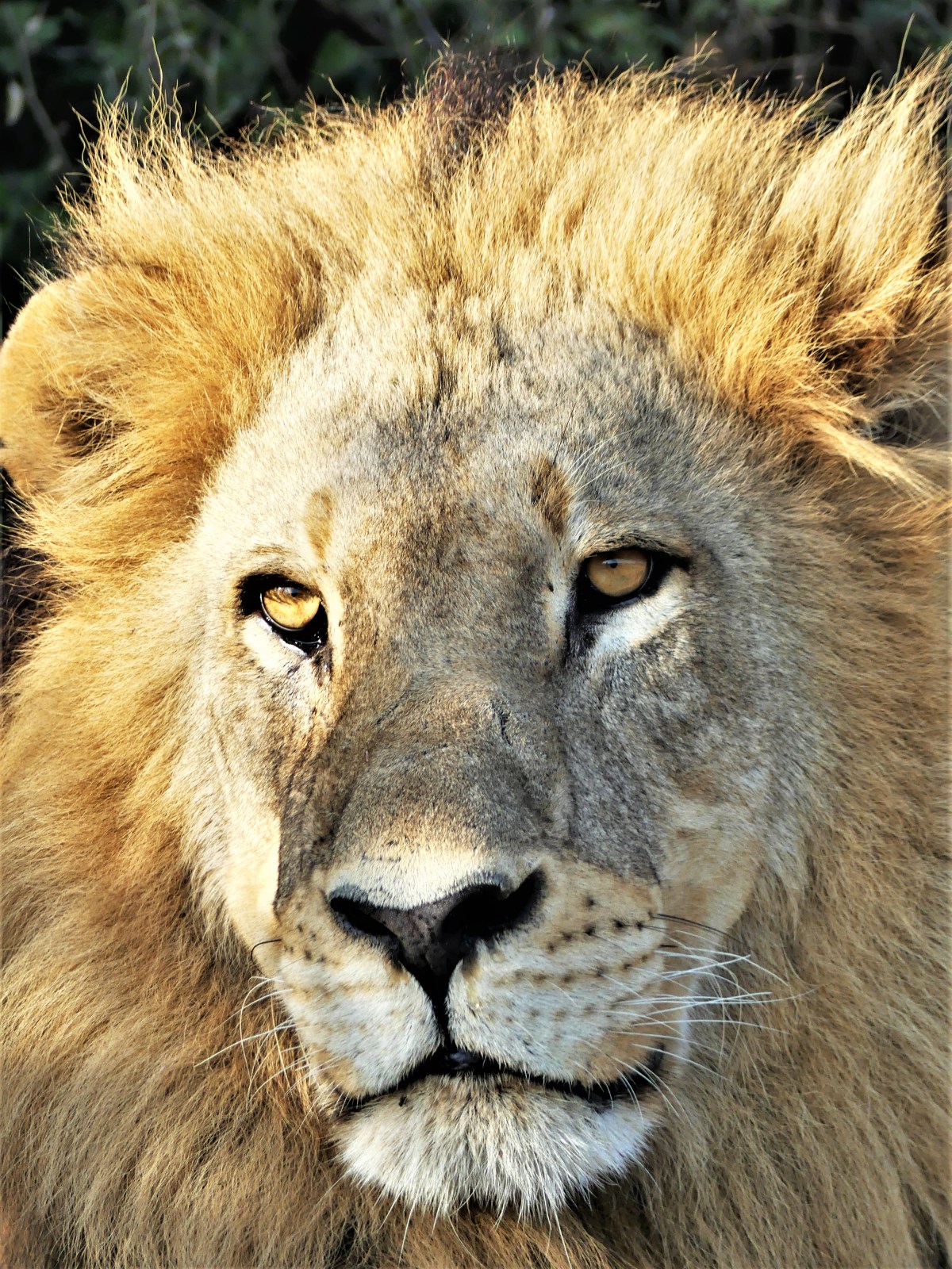
Hence, it was time for a nap!

Just then, KT answered a dispatched call on the radio alerting him that a colleague had spotted fresh leopard tracks a few klicks away, so off we went in search of another adventure.
To be continued…

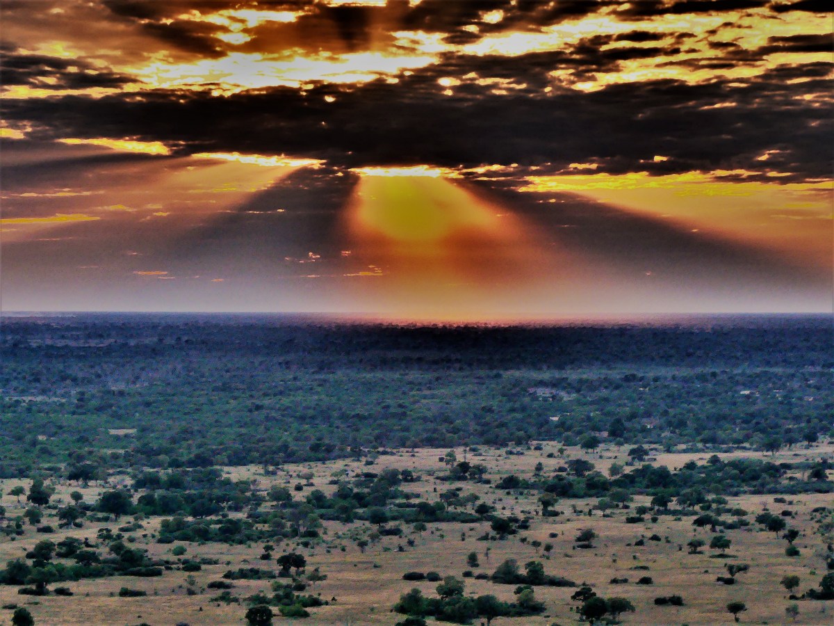
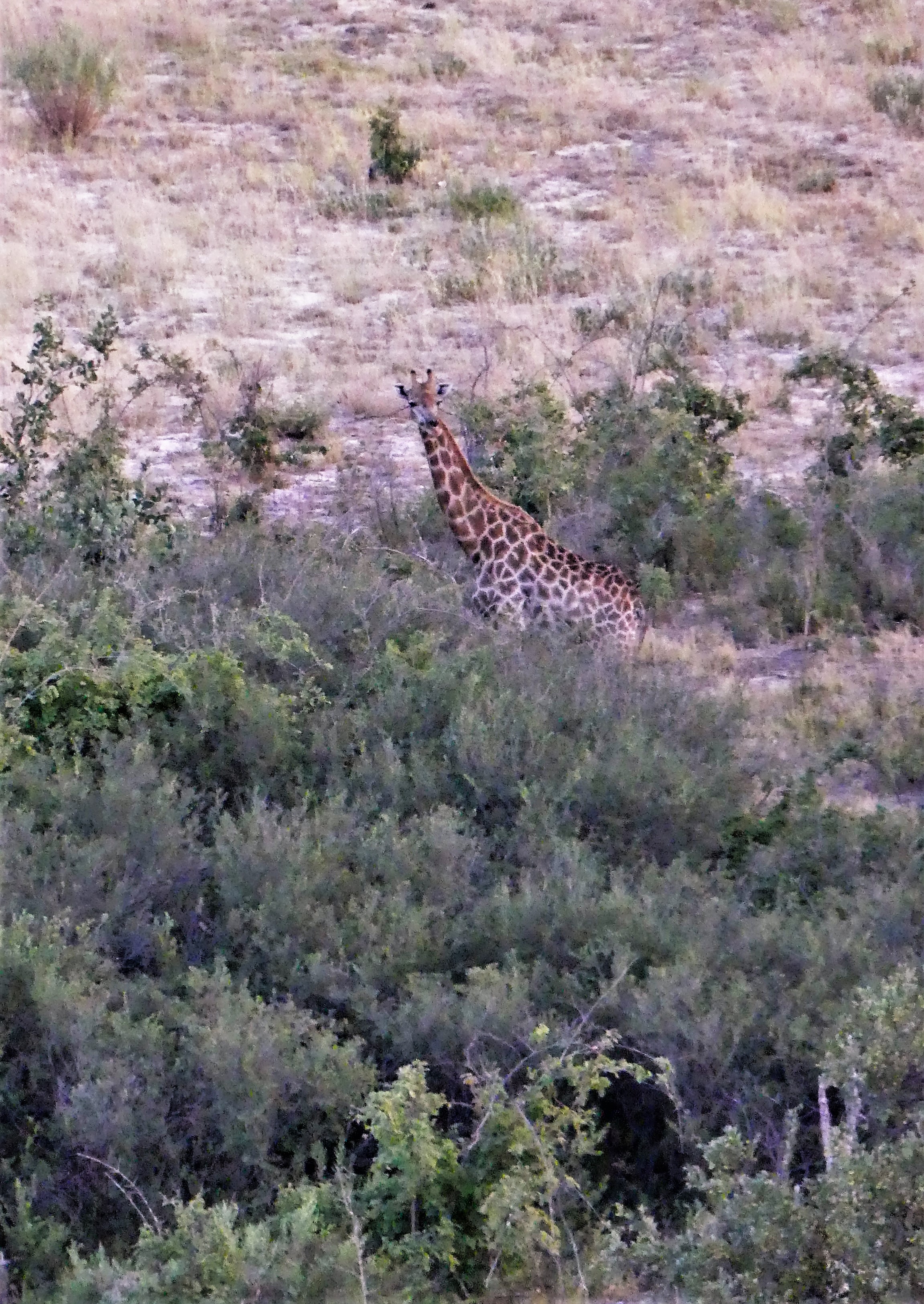
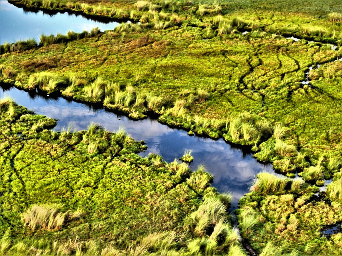
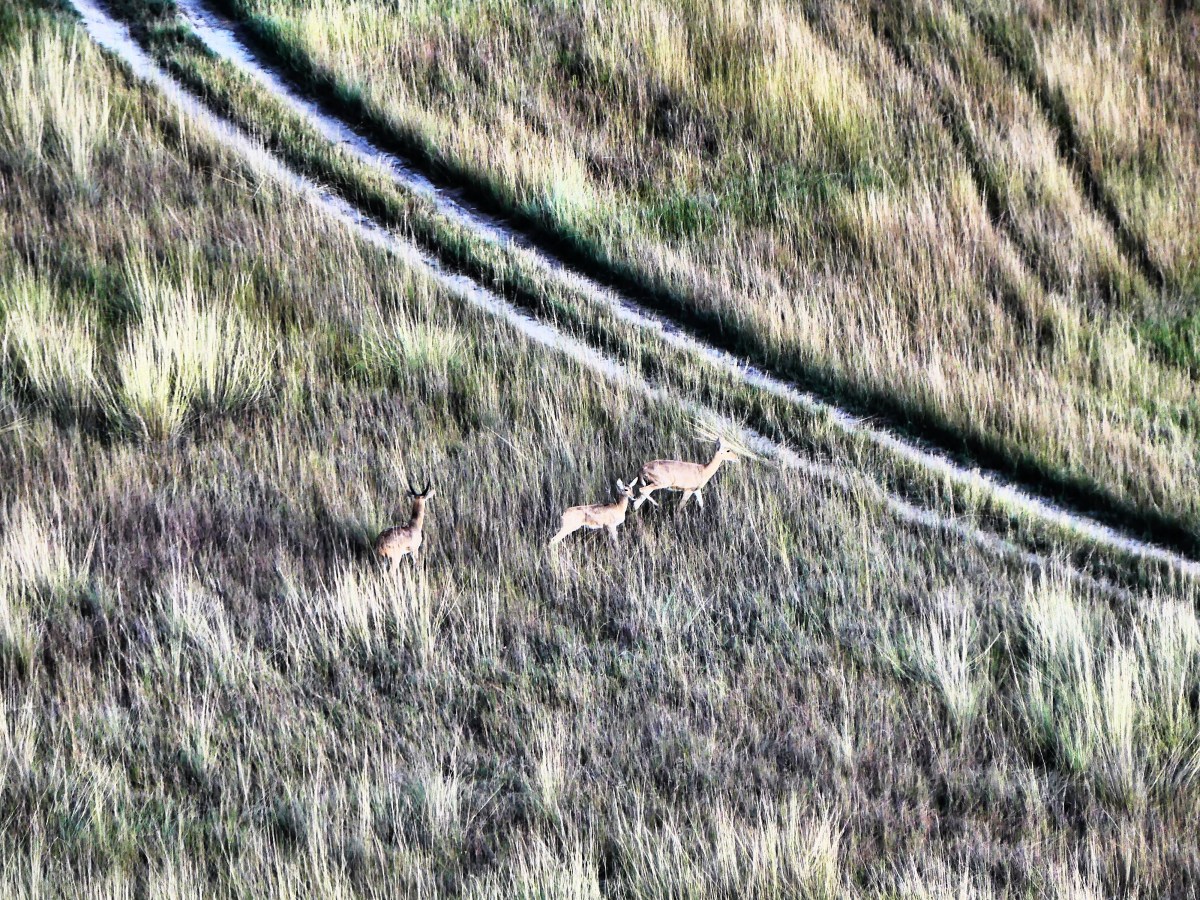
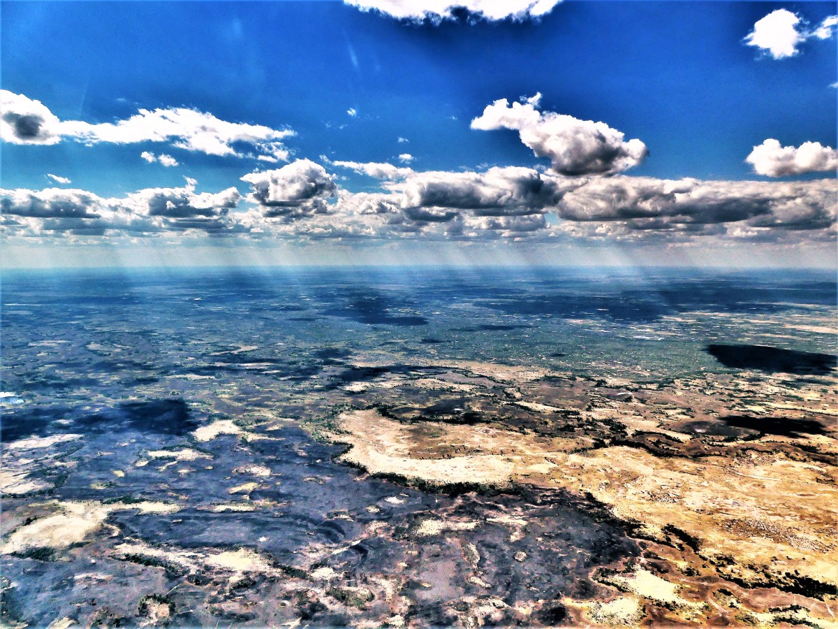
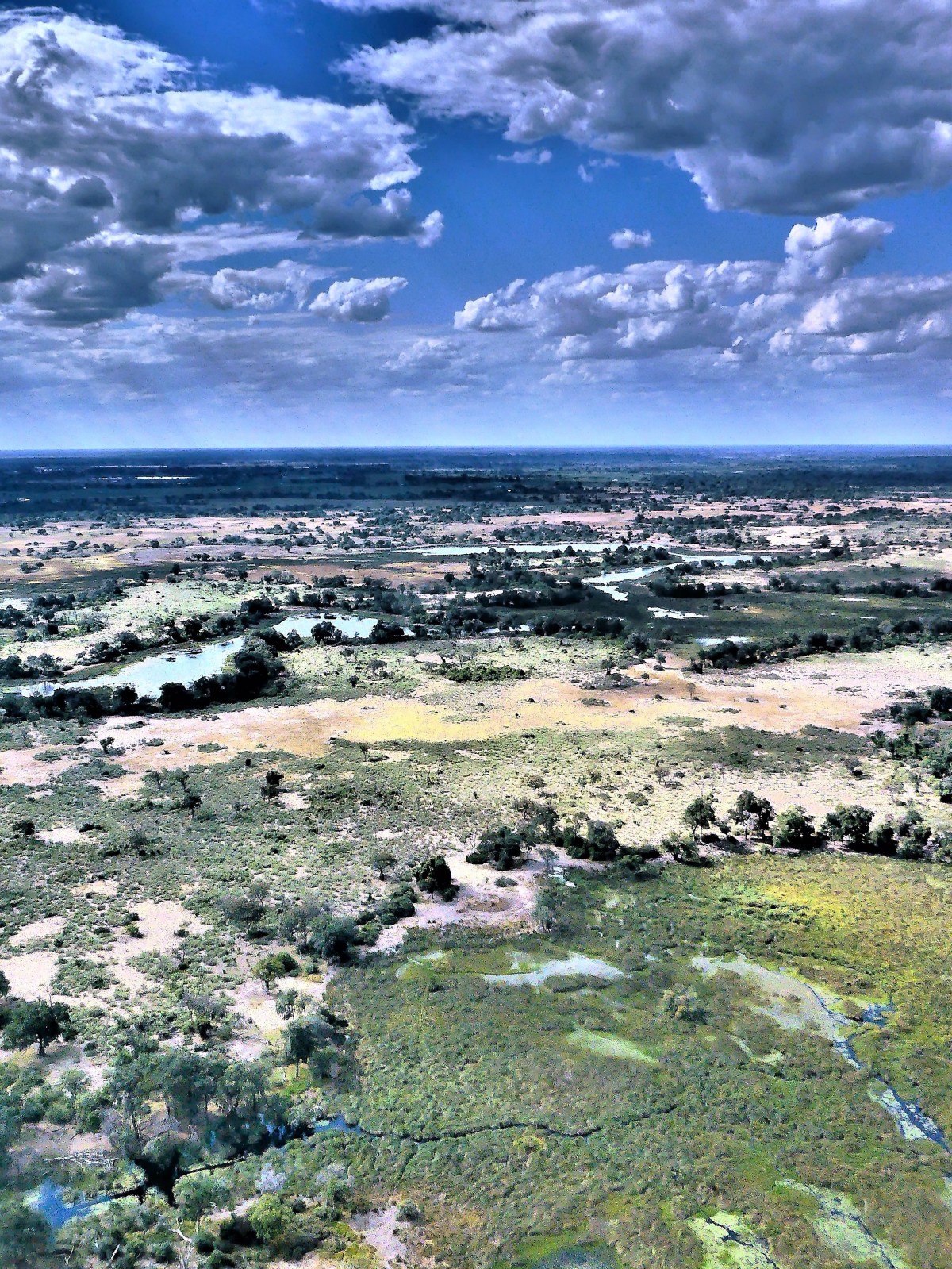
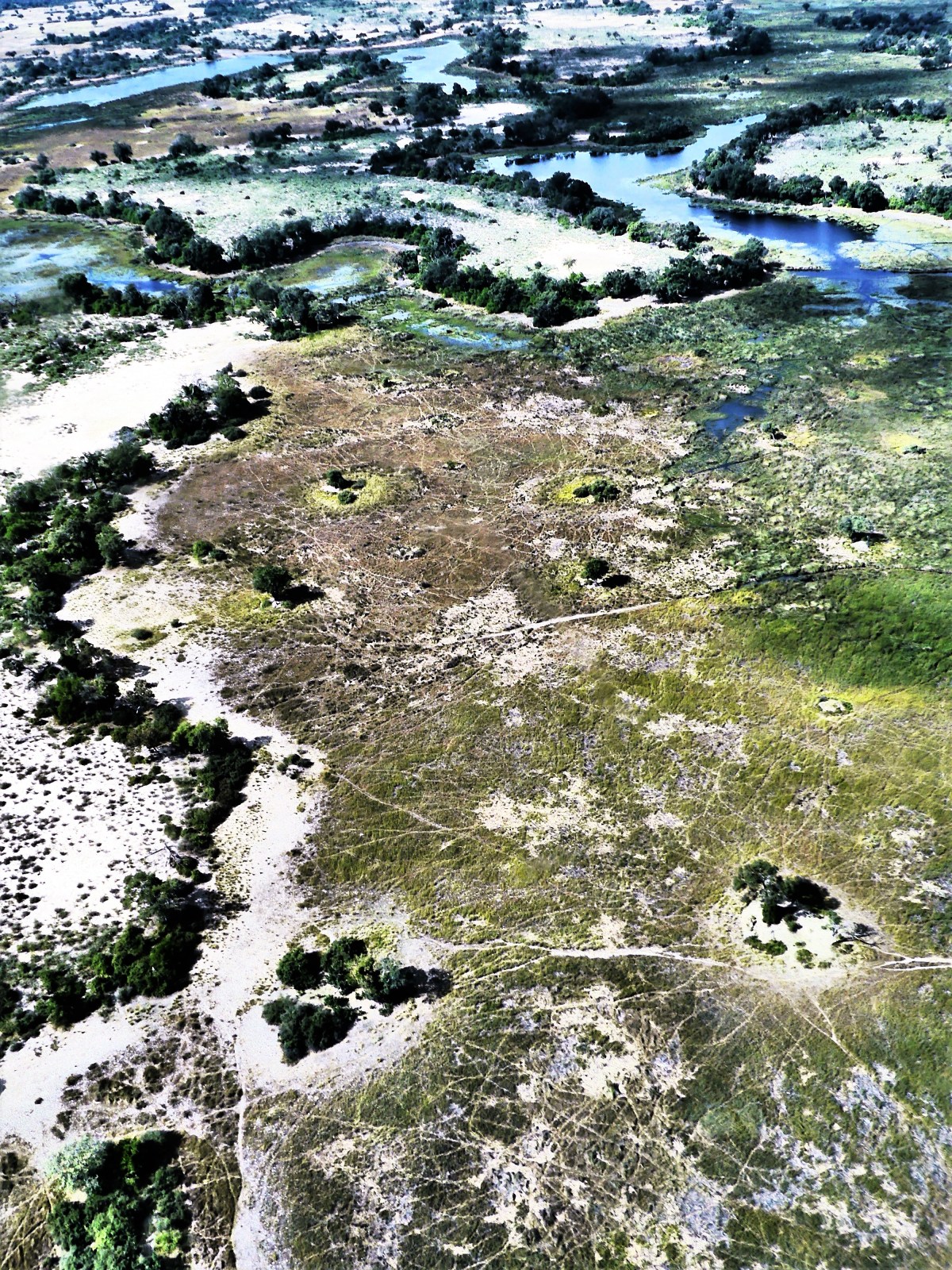
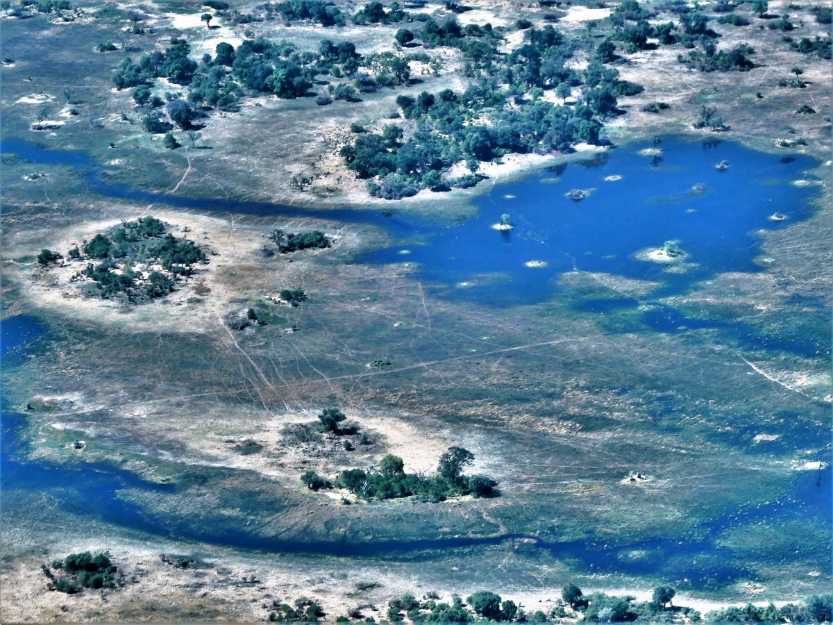
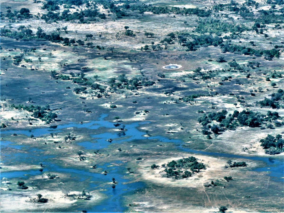
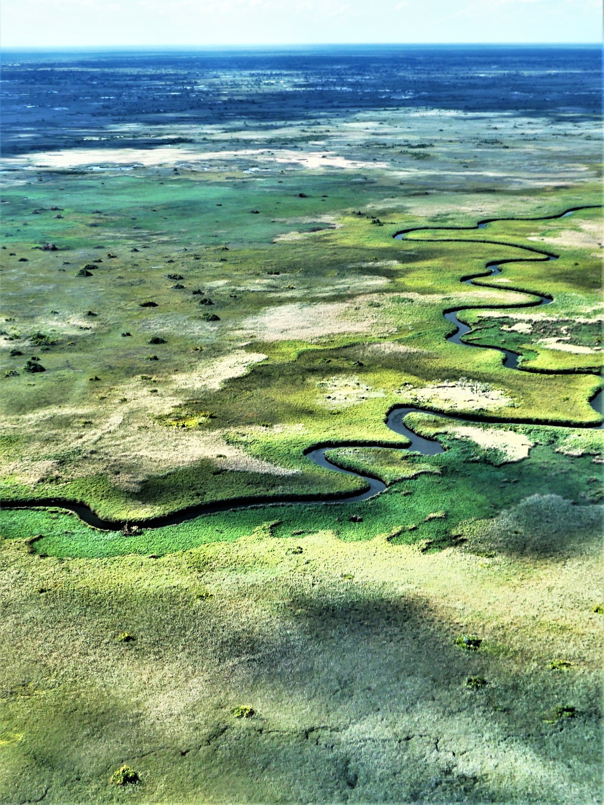
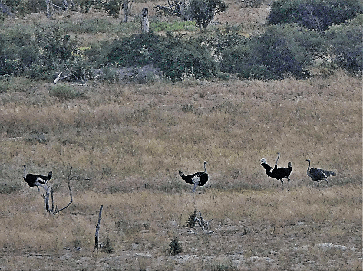
No words, just a glimpse of beauty that is Okavango Delta in the center of Botswana.