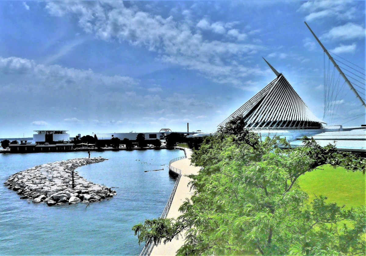
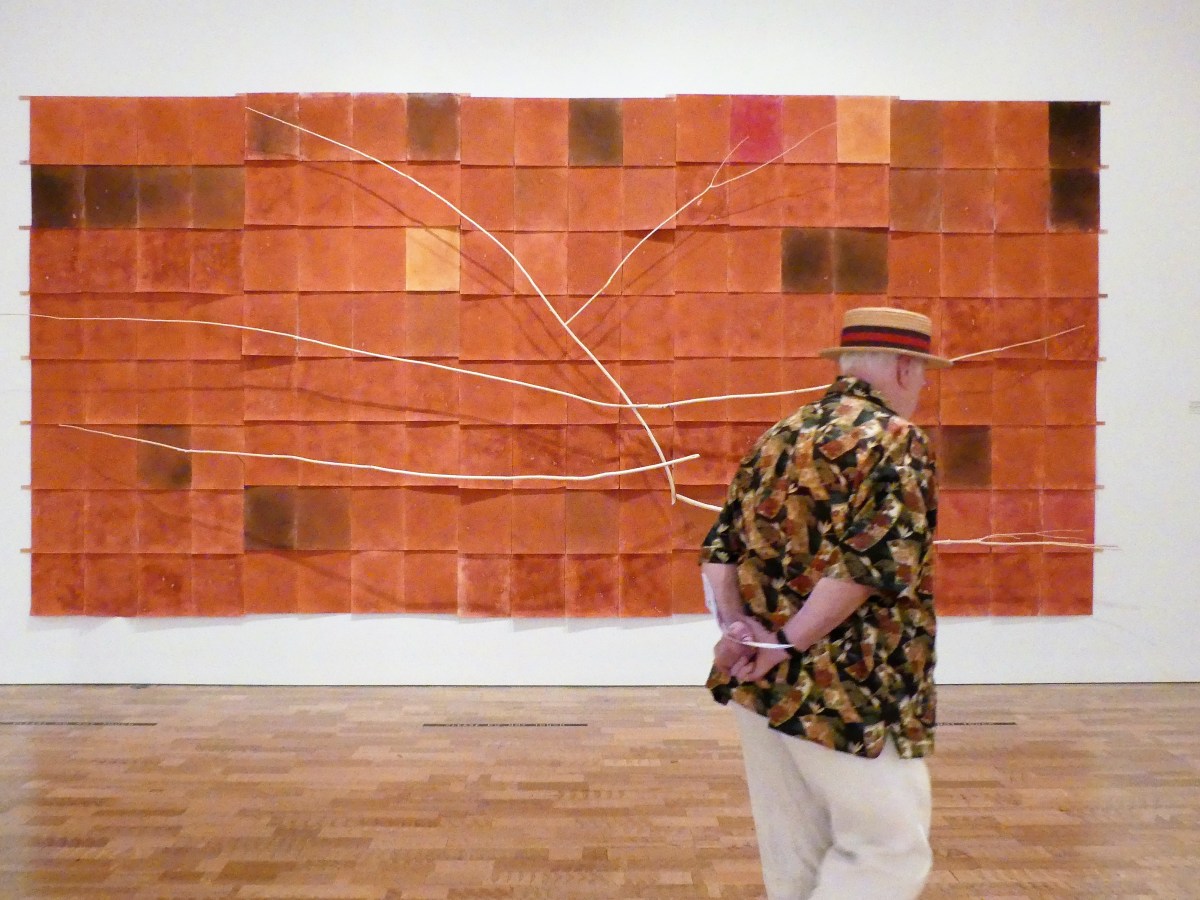
Our appetite for fine art took us to Milwaukee Art Museum with its collection of 25,000 works on display–making it one of the nation’s largest galleries. While I was curious about the collection, I was most interested in the Quadracci Pavilion, built by Spanish architect Santiago Calatrava in 2001.
The iconic winged structure has demonstrably changed the city skyline by Lake Michigan’s waterfront…
to the point that Milkwaukee now incorporates Calatrava’s brise soleil in it logo.
Parallels to Calatrava’s Oculus at NYC–Gound Zero are unmistakable;
comparisons are inevitable.
The wings are extended most days until sunset, but stay retracted during nasty weather or high winds.
Sadly, Leah and I were greeted with high winds, but we were fortunate to tour the museum with so few visitors.
With the exception of a group of mini-pals,
and isolated cases…
here and there…
we felt like we had the space to ourselves–
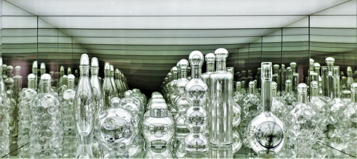
which gave us more time to study some of the special artwork in greater detail without distraction or interruption:
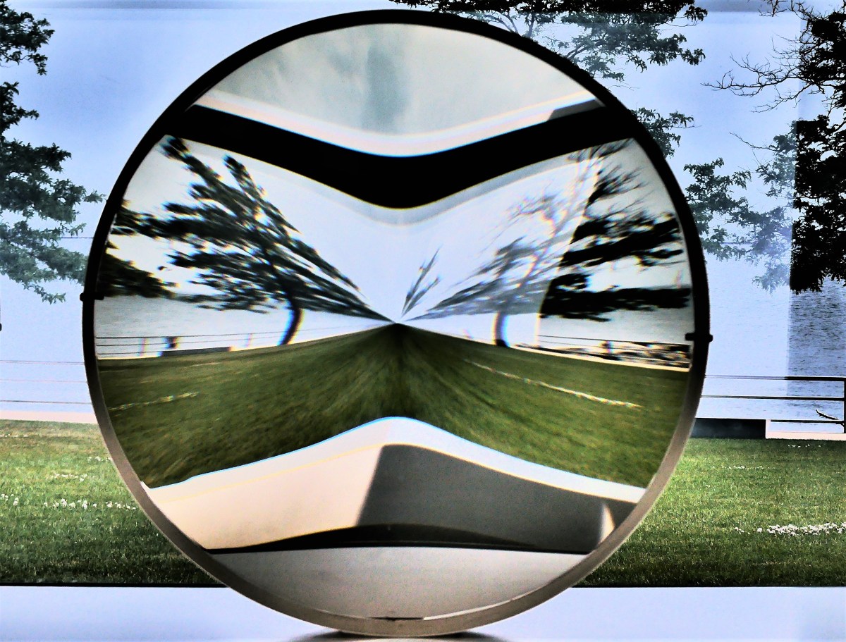
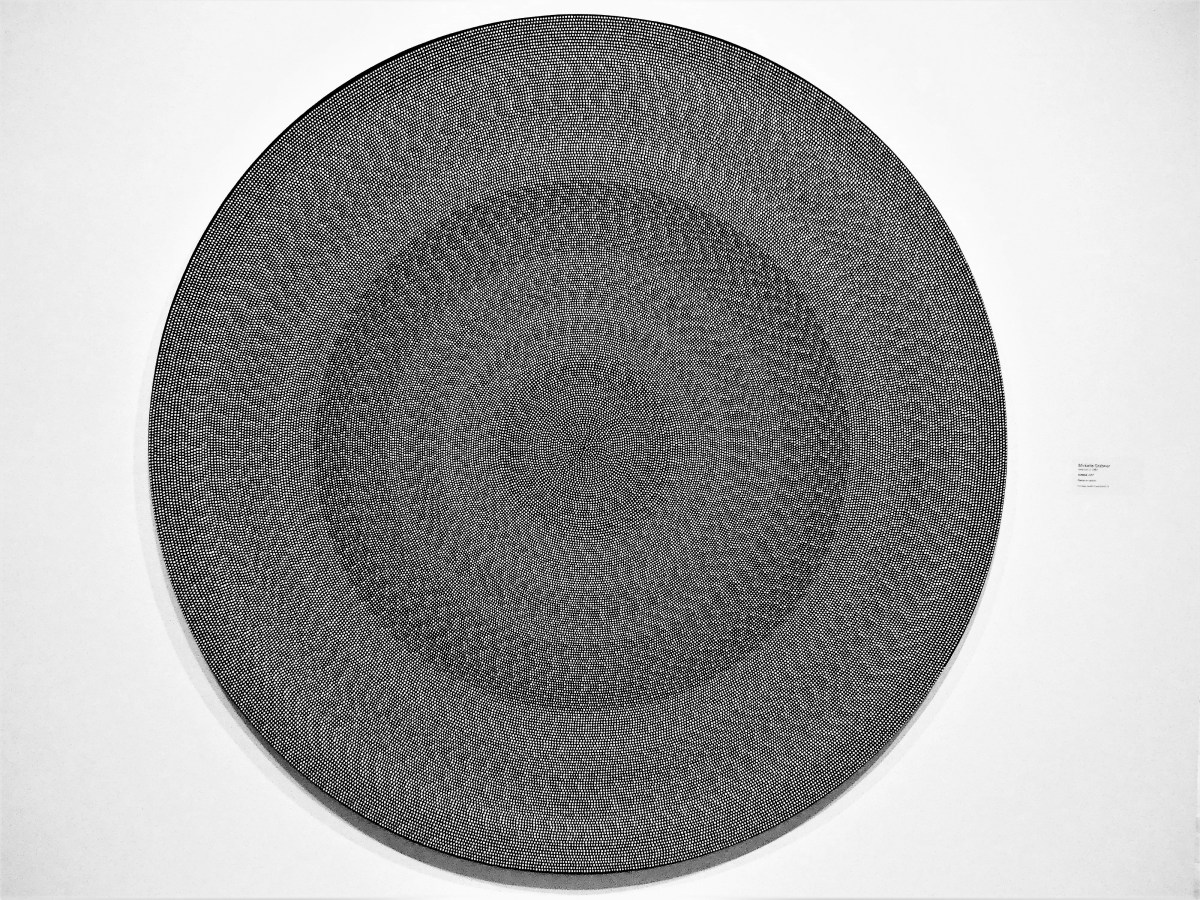
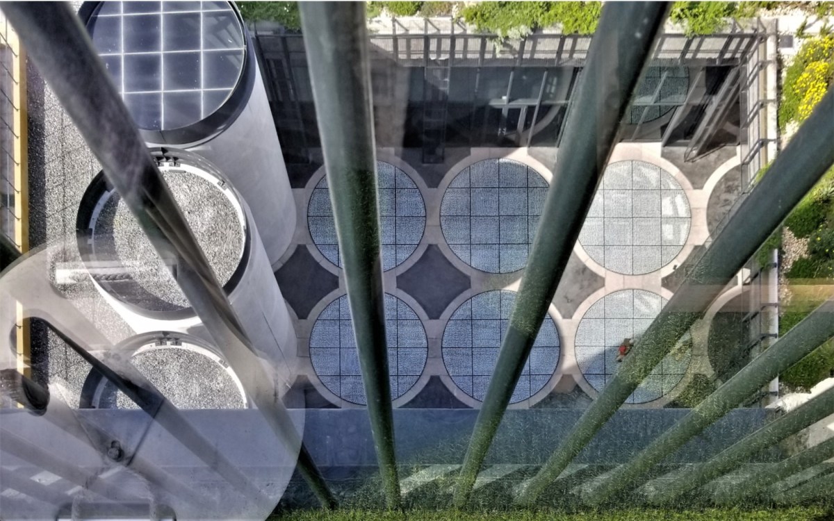
(quickly scroll up and down for cool moiré effect)
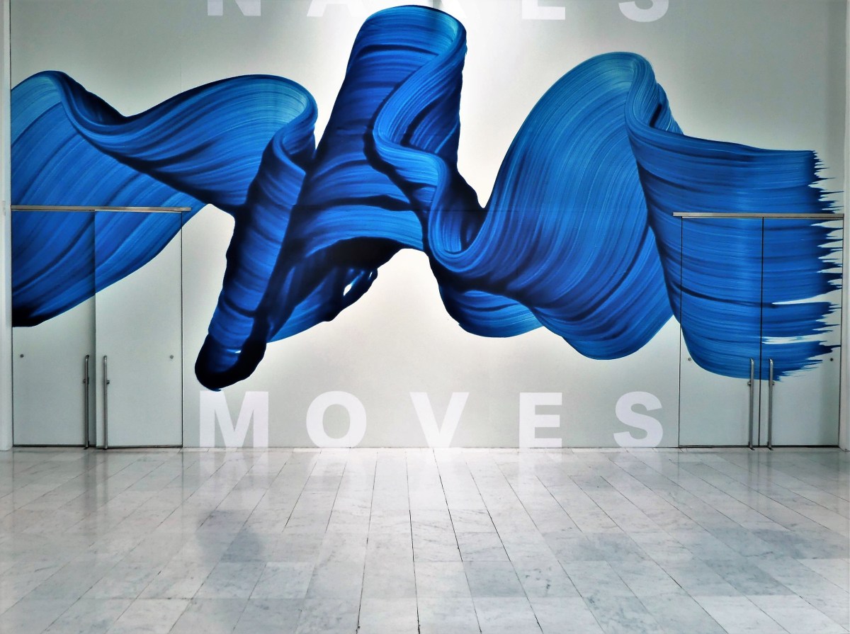
While I never considered that the building was competing with the exhibitions, I was always eager to return to Calatrava’s public spaces…
to cleanse my palette before indulging in another bite of brain food!
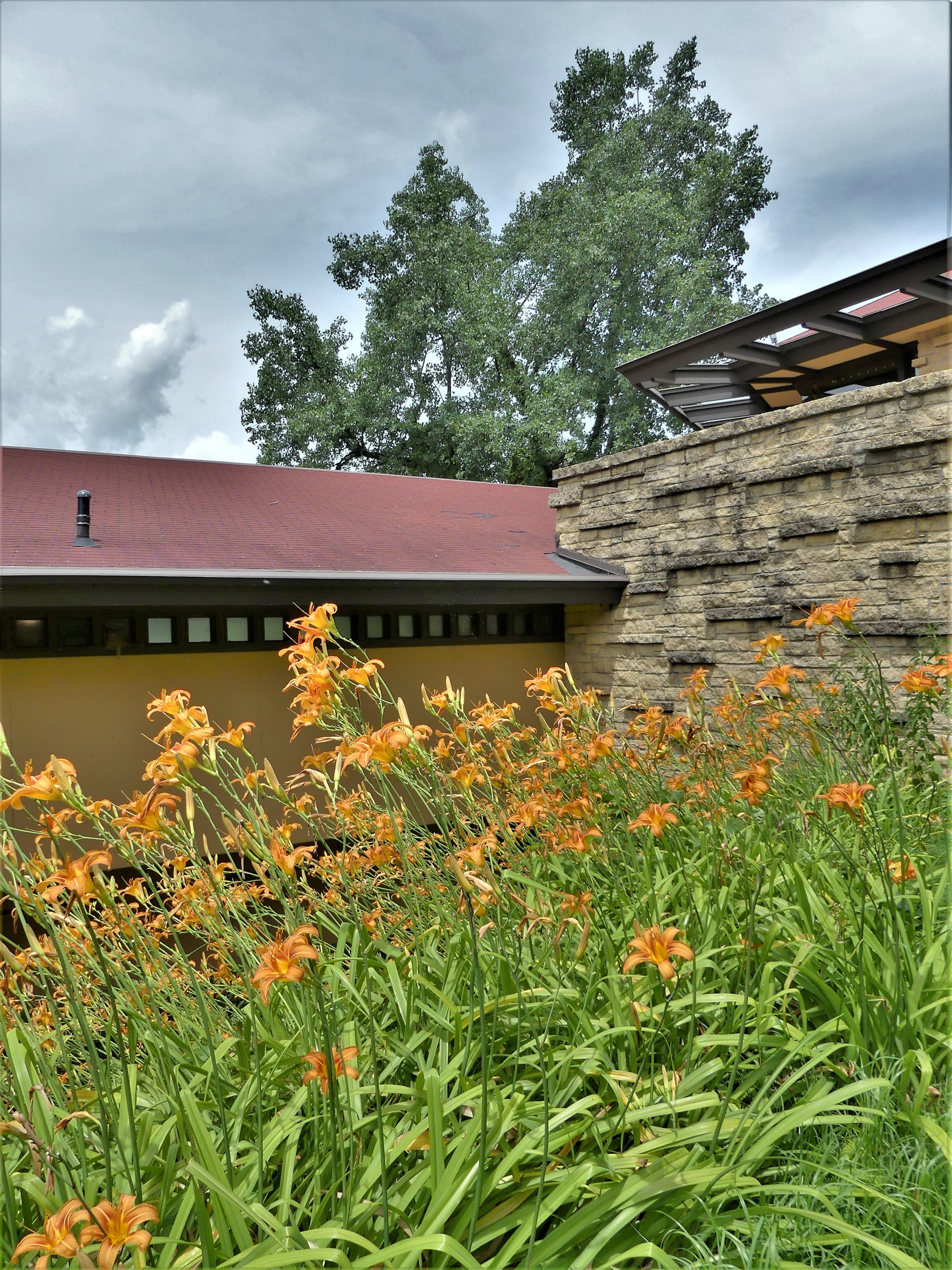
There’s very little to write about Frank Lloyd Wright that scholars haven’t already written.
His affinty for nature, his indefatigable energy, his genius for design, his eagerness to experiment, his immense ego, his appetite for women, his dedication to family–it’s all been revealed and discussed in numerous books and lectures. But it’s also apparent from walking through his Taliesin estate in Spring Green, Wisconsin.
Leah and I would have preferred the immersive, 4-hr Estate Tour, but when I checked on-line for tickets, only one ticket was available when I needed two. It seems that no tour exceeds 21 people, matching the number of seats on the shuttle. Instead, we opted for the 2-hr Highlights Tour.
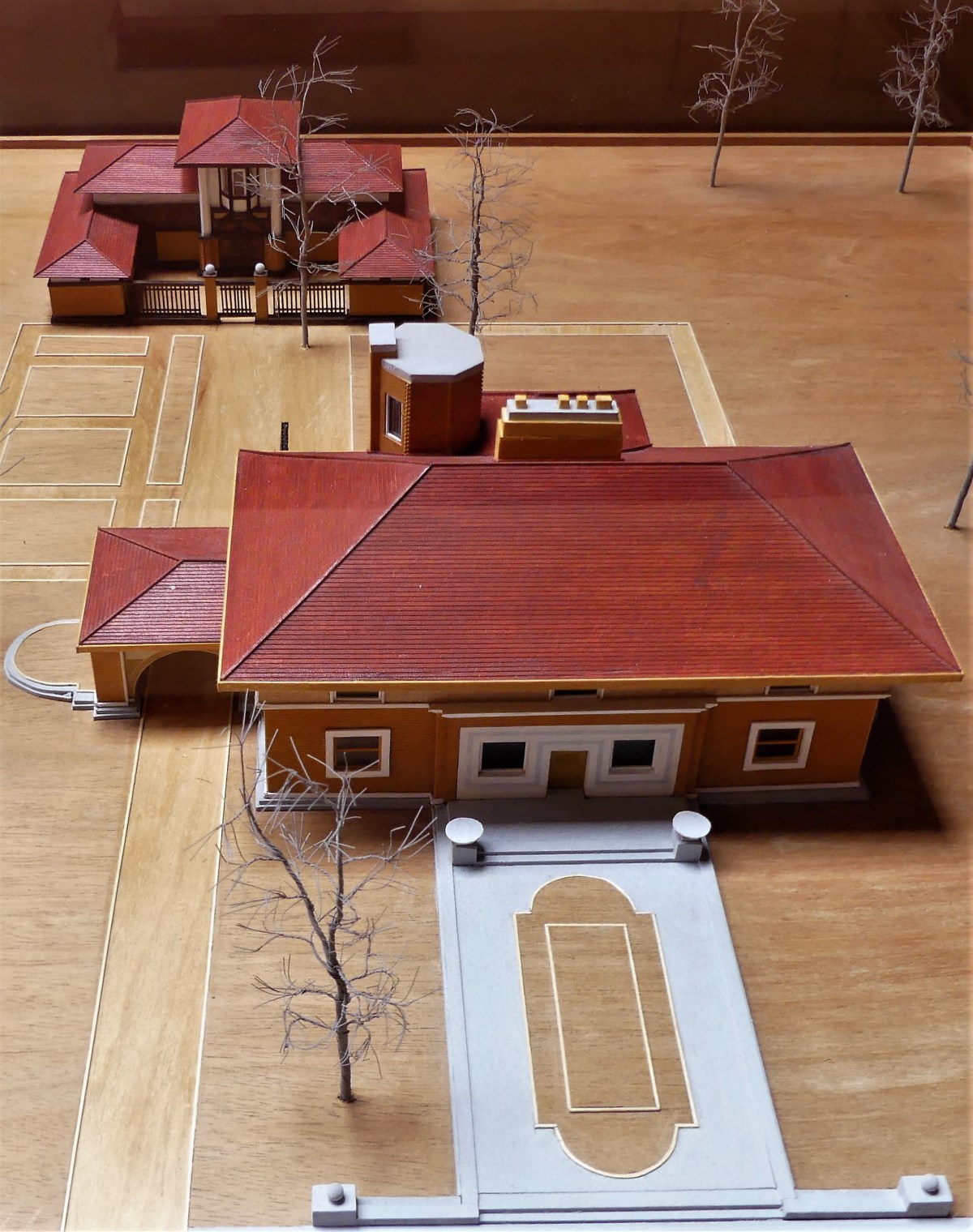
We boarded the bus at the Visitor Center–
orginally designed by Wright in 1953 as a restaurant and “gateway” to Taliesin, but Wright’s death in 1959 stalled any further construction until his former apprentices completed the building in 1967.
The ride took us past Midway Barn, Uncle John’s farming complex,
on the way to Hillside, the site of the home school he built for his Aunts Jane and Ellen Lloyd Jones.
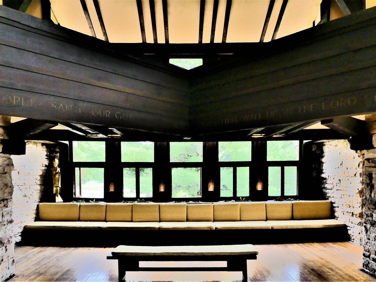
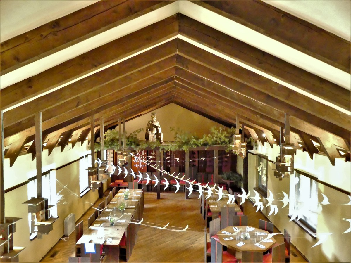
Currently, the building is occupied by a time-shared architecture “Fellowship”–funded by the Taliesin Foundation–that occaisionally gathers in the Assembly Hall,
and takes meals in the Fellowship Dining Room,
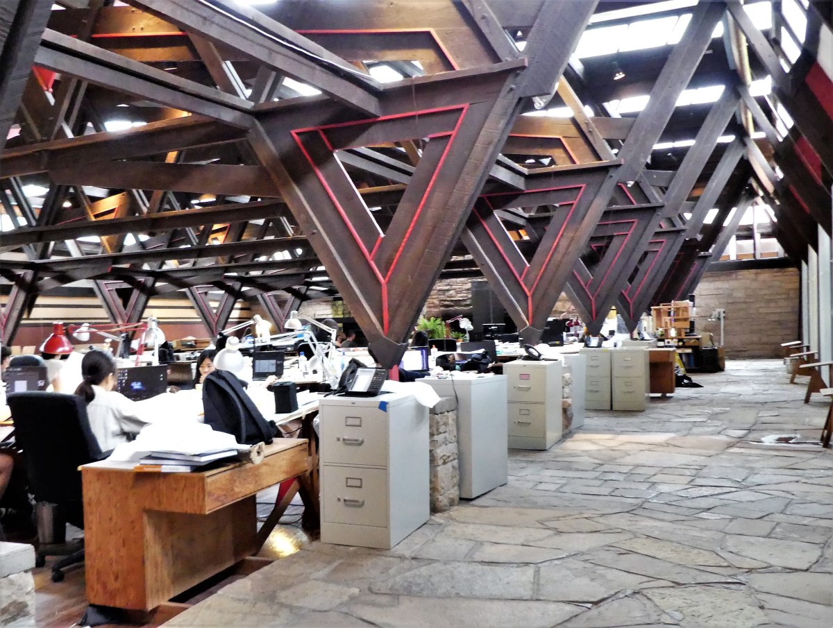
before returning to the 5,000 sq. ft. “abstract forest” Drafting Studio.
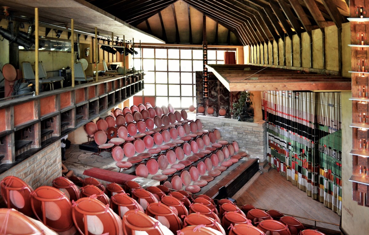
We finished up at Wright’s intimate, 120-seat Hillside Theater–originally intended as a gymnasium, but converted by Wright to a cultural space after determining that the arts were more important than sports–
and reboarded the bus for a brief blast of air conditioning and quick trip to Wright’s home studio,
where we browsed through a drafting room filled with “Usonian” models, like the Willey House from 1934,
and assorted personal artifacts.
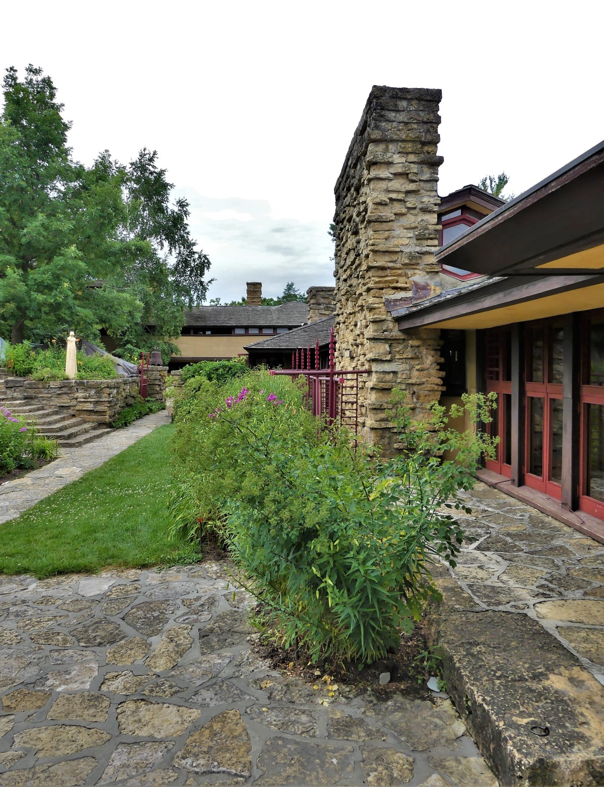
The house was noticably cooler, thanks to geothermal plumbing installed during the third re-build. We rounded the studio from the outside,
walked across a mound with views of the restored Romeo and Juliet windmill,
and traversed the gardens,
before re-entering the house through the expansive living room,
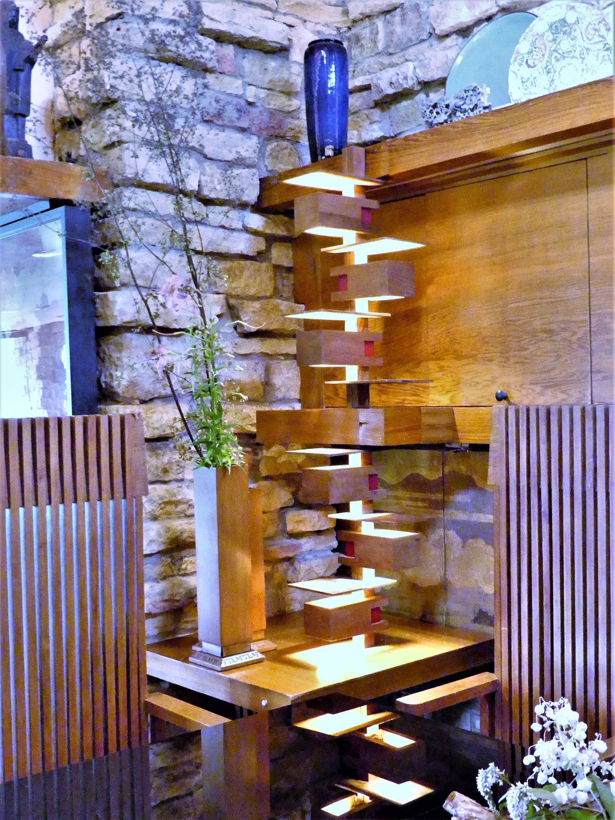
filled with wonderful flourishes, like glass-cornered windows (which Wright would ultimately perfect at Fallingwater)…
built-in table lamps,
and integration of sculptures that survived the previous two house fires.
Roaming through Wright’s personal bedroom (because he was an insomniac), we discovered no door, a wall of windows without window treatments, and original electric- blue shag carpeting.
The terrace offered glorious views of the Wisconsin River and Tower Hill State Park,
and Unity Chapel in the distance–
the site of Wright’s maternal family’s burial plots, his stone marker, and his empty grave.
As our driver passed Wright’s man-made falls,
our docent passed along a local story of intrigue and scandal:
During March 25, 1985, under cover of darkness, Frank Lloyd Wright’s body was exhumed from his Unity Chapel resting place by his oldest granddaughter, Elizabeth Wright Ingraham, and moved to a burial site at Taliesin West, in Scottsdale, Arizona.
She claimed to be fulfilling the dying wishes of her grandmother and Wright’s widow, Olgivanna Lloyd Wright, whose ashes were united with her husband’s within a memorial wall overlooking Paradise Valley. The event sparked outrage around the globe from associates and friends who argued that the architect would have desired to spend eternity at Unity Church with his family.
Even now, Spring Green residents hope that one day their favorite son will get his ash back to Wisconsin.
Many in the tourism industry descibe Door County as the mid-western equivalent of Cape Cod, and they make a valid point. If Cape Cod is the crooked finger beckoning the Atlantic Ocean, then Door County is Wisconsin’s thumb poking the western side of Lake Michigan. Both peninsulas offer a laid-back vibe, with historic beachtown pearls bordering sandy, rocky beaches.
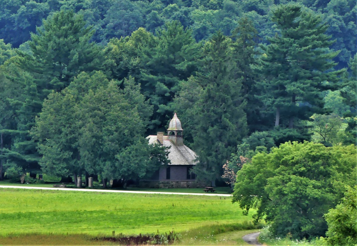
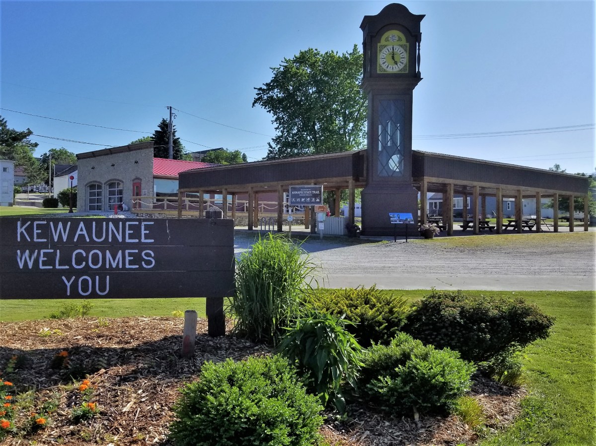
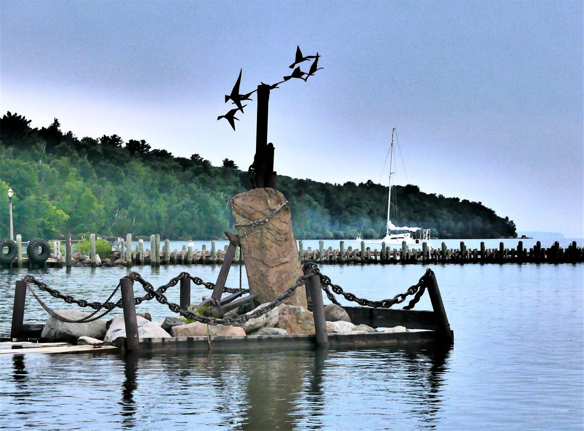
We began our tour by exploring our home base in Kewaunee, a southern border town below the county line.
We knew nothing about the clock, so it took us by surprise. At noon, it chimed over and over again, then played a “bell” rendition of Amazing Grace.
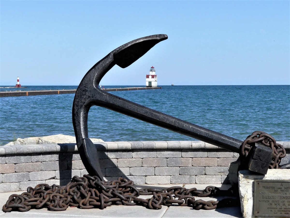
A short walk to the waterfront brought us to the Ludington. Retired in 1998, the tug saw action during the D-Day invasion at Normandy by pushing barges of ammunition across the English Channel, and later as a construction tow for the Army Corps of Engineers.
Like most newcomers, we got our coastal orientation by walking out to Pierhead Light,
but following the path was like a twisted game of minefield hopscotch.
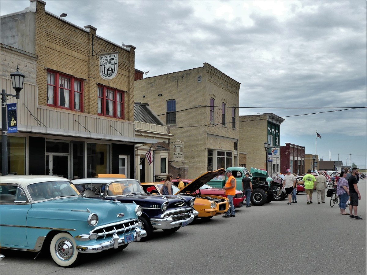
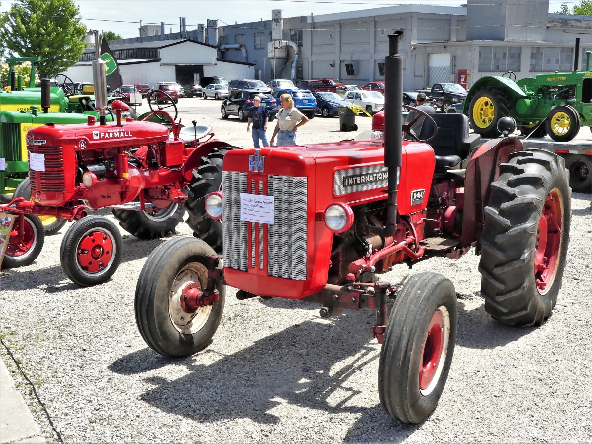
Ellis Street was closed to traffic for a smallish classic car show that appealed to locals, auto enthusiasts from Green Bay, and bloggers…
with plenty of space for antique tractors and snowmobiles in the parking lot.
Further up the coast sits Algoma, a town with a Crescent Beach Boardwalk that parallels an arc of sand and polished stones, and the Algoma Pierhead light that welcomes hundreds of roosting gulls at any time.
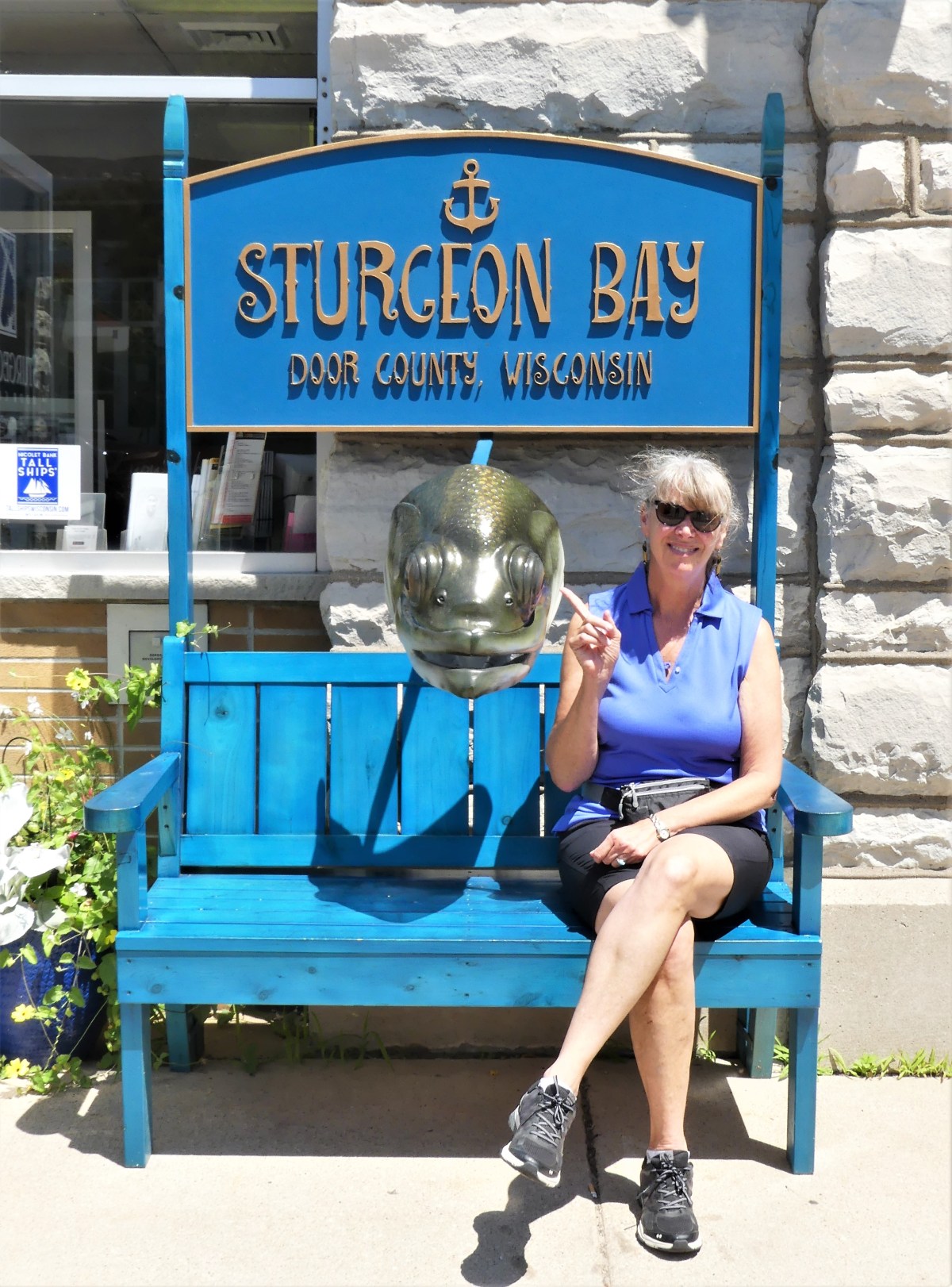
With so much ground to cover and little time to spare, we detoured along the coastal county roads to Sturgeon Bay, a town with a rich ship-building legacy and a lust for shopping. While not my favorite activity, we parked the F-150 and strolled the sidewalks, passing through galleries and home furnishing boutiques.
Local artists brought their imagination and decorating prowess to town, converting plain Adirondack-style chairs (or created a chair/bench of their own) for the inaugural CHAIRies, a public art project on display at most downtown corners, and a nod to the bountiful cherry groves scattered throughout the peninsula.
Continuing north, Jennifer (GPS) directed us to Cave Point County Park, the only county park within a state park (White Dunes State Natural Area).
Diving into Cave Point’s roiling water is a well-known proving ground and badge of courage for daring teenagers…
who are fortunate to clear the cliffs or avoid the crashing waves.
Riding north on WI-57, we cut through the middle of Door County’s thumbnail, and headed for Northport, known for ferry service to Washington Island at the tip of the peninsula. and the gateway to Death’s Door, a legendary passageway with a washing- machine turbulence that has shipwrecked many 19th century schooners.
We rushed along WI-42 from Northport down Green Bay’s sidelines, needing to reach the Airstream end zone after a long day of driving, but deliberately slowing around a bendy stretch of road nearby.
Then we were dodging and weaving our way through a variety of pedestian-rich towns at 10 mph, absorbing the downtown charm of Ellison Bay, Sister Bay, Ephraim, and Fish Creek from the front seat of our truck.
We vowed that we would return the following day for a glorious sunset dinner, as we settled on leftover pizza and samosas under a cloudy sky.
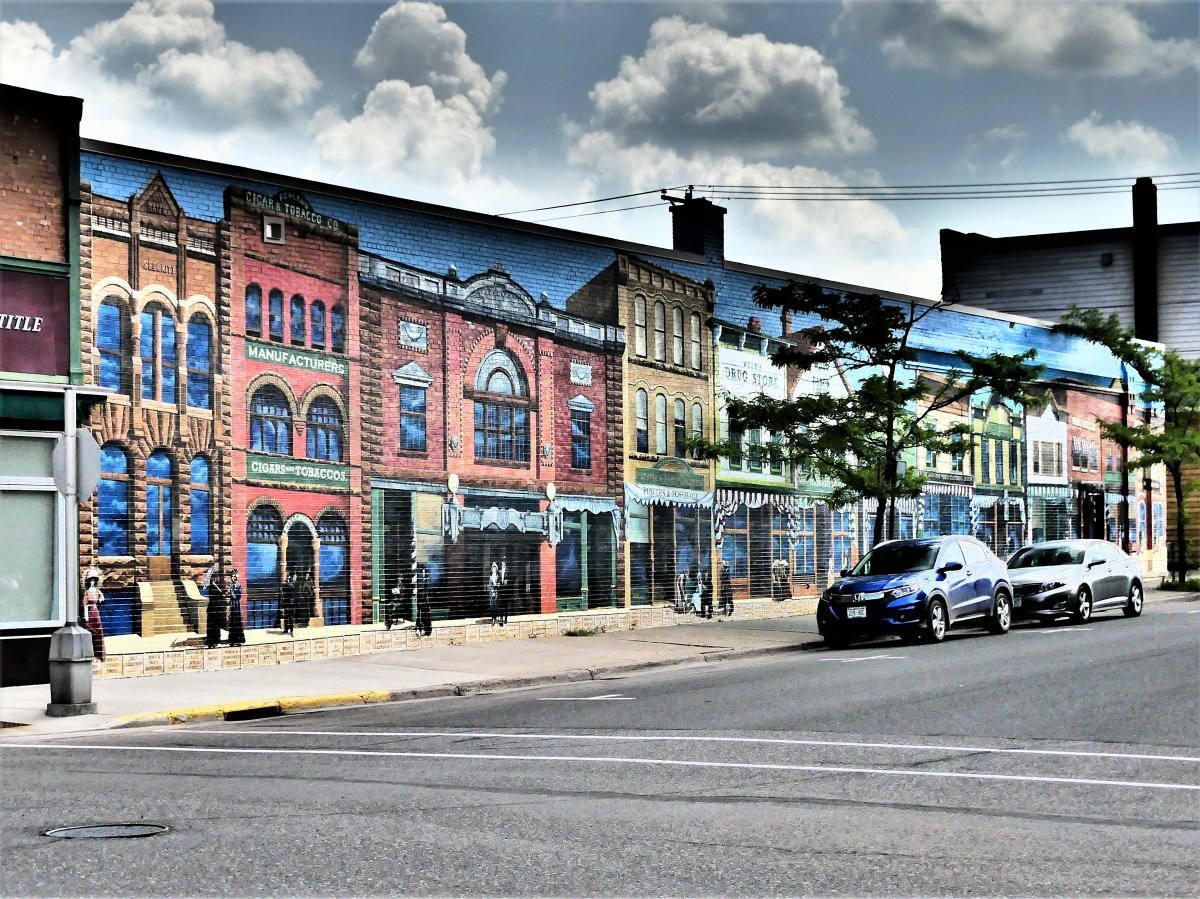
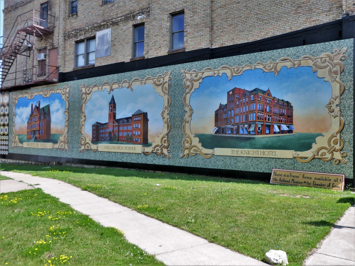
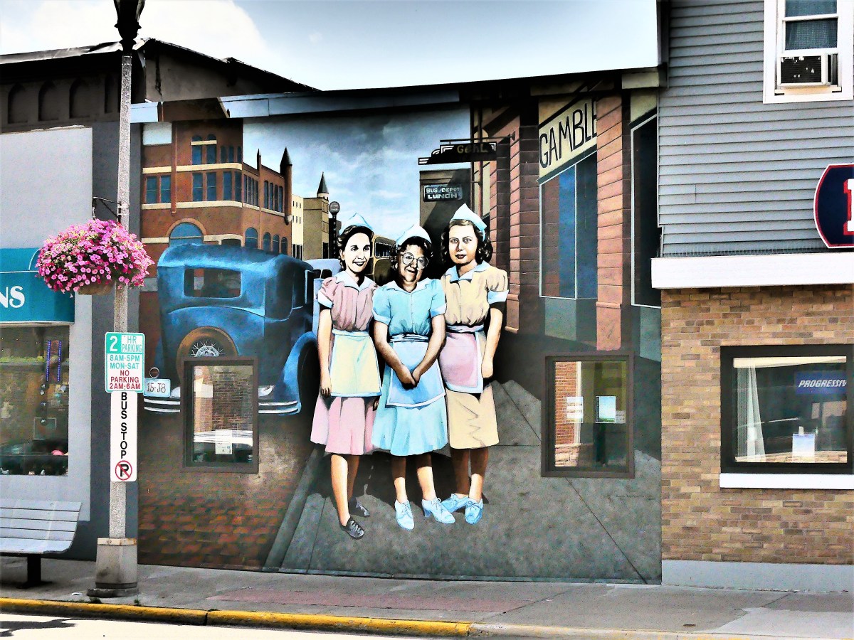
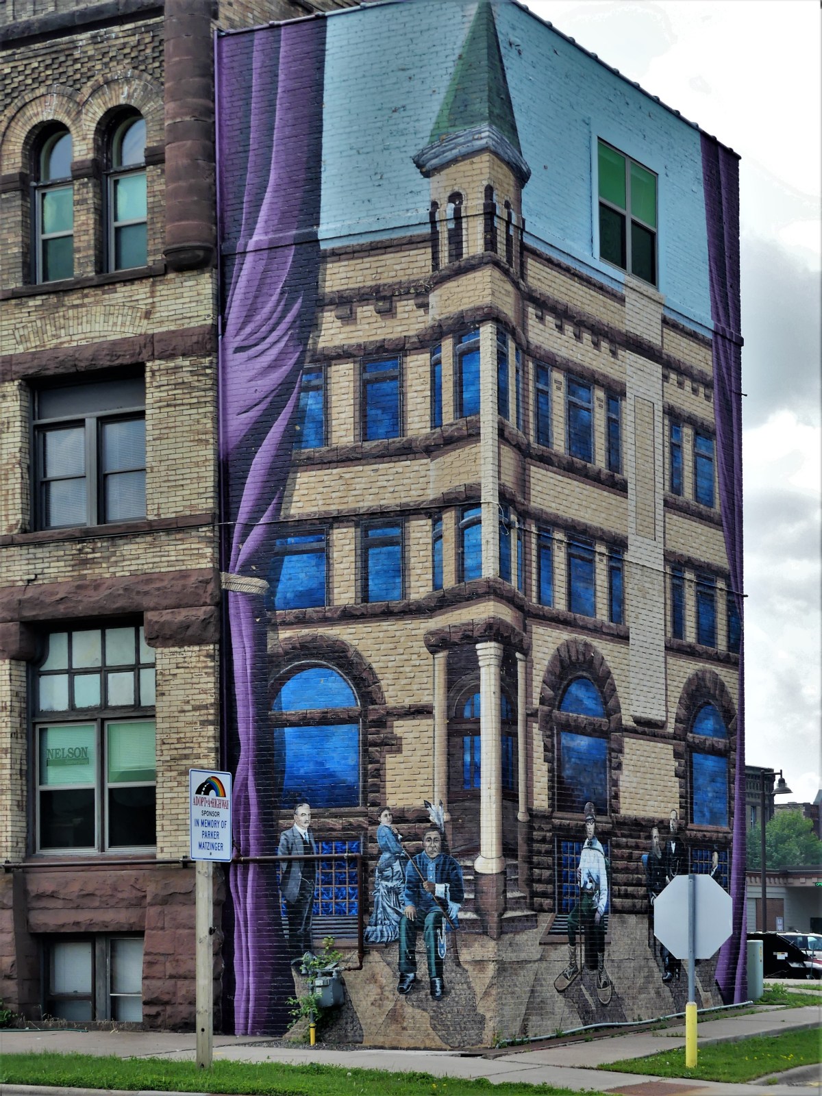
While staying in Bayfield, Leah and I learned of Ashland’s Mural Walk. While only a half-hour from our camp site, we were so preoccupied with three full days of hiking, biking, and kayaking around the Apostle Islands, that time became a factor.
When asking around about the murals’ merits, someone local described the trip as “interesting”, so we decided to make an informed opinion for ourselves. Since Ashland was on our way from Bayfield to Munising, we boarded the Airstream, checked out of Apostle Island Area Campground, and followed GPS to Ashland Mural Walk. An actual POI pinged when I asked Jennifer (our GPS coach) for the route.
We had completed a previous mural walk inPalatka, Florida, also a county seat, and found it odd that their murals were in better shape than the town. We wondered if this was also the case in Ashland.
Ashland’s history dates to 1500, when the Ojibwe stayed on Chequamegon Point. A century later, they were followed by French fur trappers, European traders, and Jesuit missionaries. By mid-1800’s, Ashland’s first settlement was established, and the town prospered as a major quarry and port with rail service to Chicago.
Thanks to mural artists Kelly Meredith and Susan Prentice Martinsen, Ashland’s murals are a pleasant recapitulation of their proud history and their community spirit.
The murals have been beautifying downtown for twenty years. But Ashland wasn’t content to rest on its murals. Since 2017, decorative mosaic containers have been popping up on Main Street, turning trash to treasure.
There are 18 murals located around an 8-block radius of Main Street’s business district.
Leah and I gave ourselves an hour to see as many as we could (we found 12), but a 4-hour drive to Musining still loomed large, so six were left undiscovered.
For additional information on mural titles, descriptions, and locations, or to see what we missed, aMural Walklink is provided.
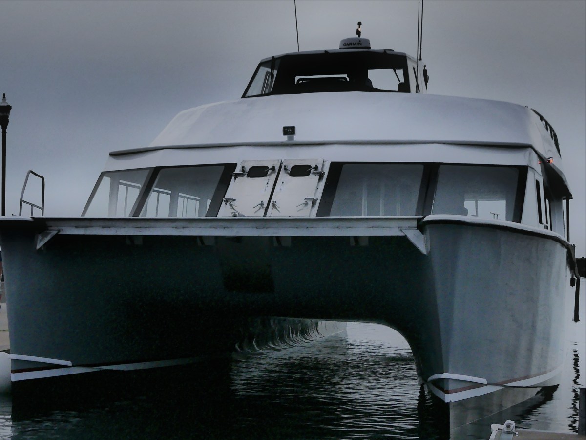
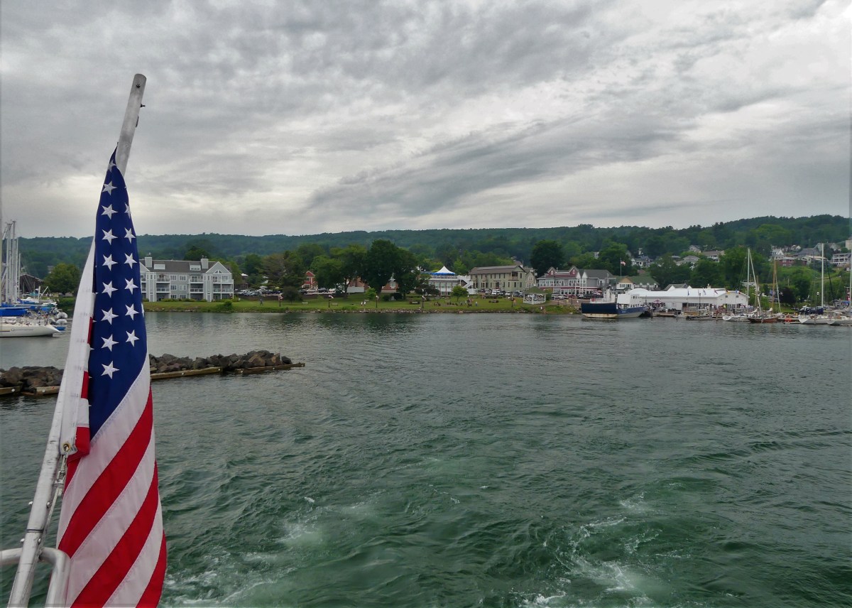
We arrived at Bayfield Harbor for a sunset cruise across Apostle Islands National Lakeshore.
The skies were flat with soft, diffused light, virtually eliminating all late afternoon shadows.
I had my doubts about a sunset, but at least the water was calm. We boarded the Archipelago, Apostle Island Cruises’ newest vessel–a 65-foot, 150-passenger catamaran,
and soon got underway on our 2½ hour-cruise.
There are 22 Apostle Islands grouped within the archipelago,
and according to Captain Mike, we would be running by half of them on the way to Devils Island, the furthest outpost and the geological jewel of the Apostle Islands archipelago.
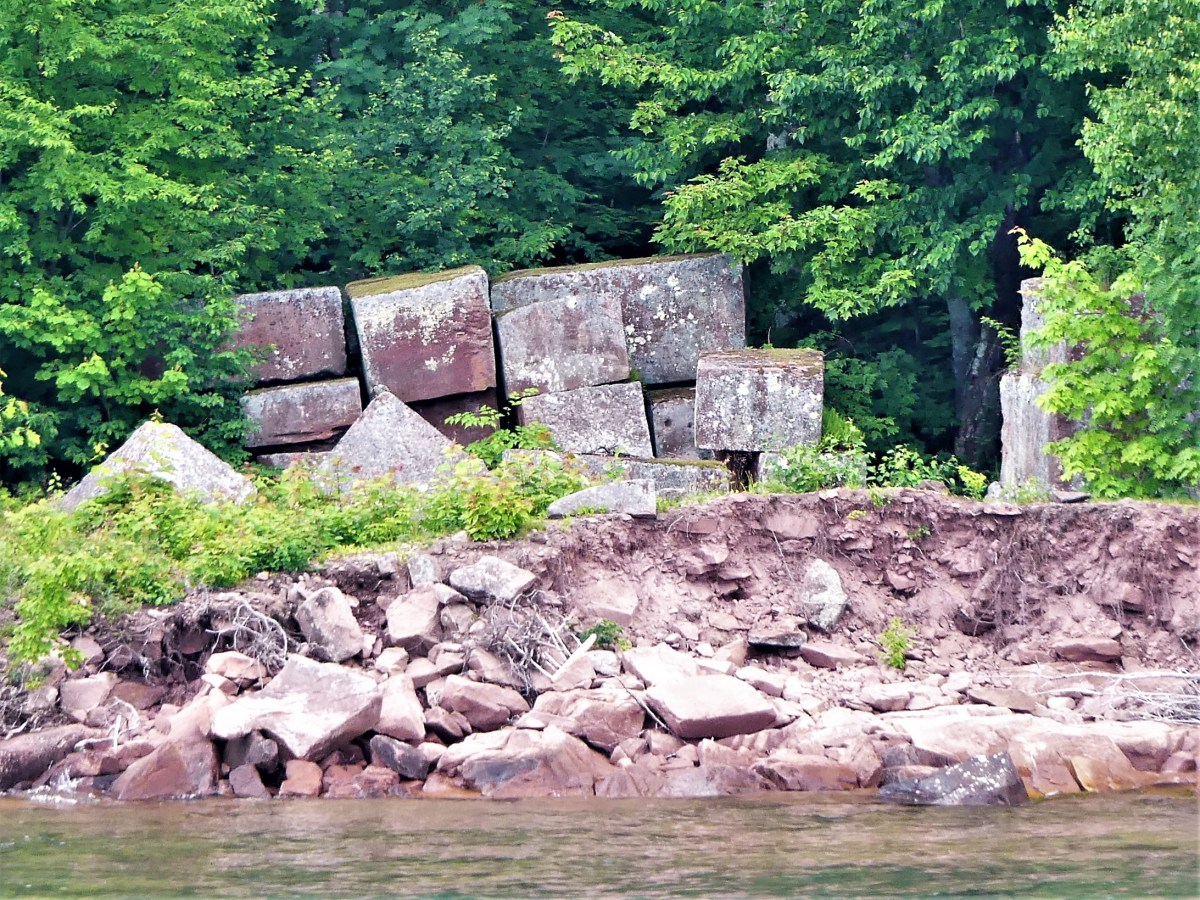
Just starting out, we passed Basswood Island, the site of Bass Island Brownstone Company Quarry, operational from 1868 to 1893. The bulk of the cut stone was shipped across the Great Lakes, destined for Chicago residences, but the stone stacked by the shoreline never made it off the island. It’s a reminder of a time when buildings seldom exceeded seven stories.
The quarry company went bankrupt after demand for brownstone was replaced by concrete and steel.
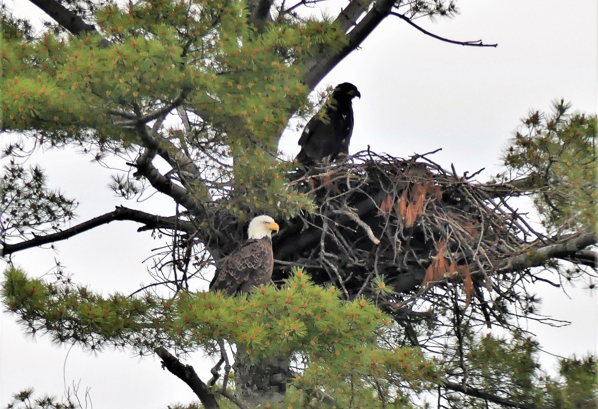
Continuing along, a pair of eagles nesting high in the pines was an unexpected thrill. Last year, 20 eagles were counted within park territory. This year the count has risen to 42.
Before leaving Basswood Island, Honeymoon Rock figured prominently off the northeast shore.
One of the greatest concentrations of black bears in North America is found on Stockton Island. Sadly, we found only trees and a rocky shoal.
When passing Manitou Island, we were lectured by Captain Mike about several of the fishing camps that originated in the late 1800’s.
Cabins and sheds are still standing at the southwest corner of the island.
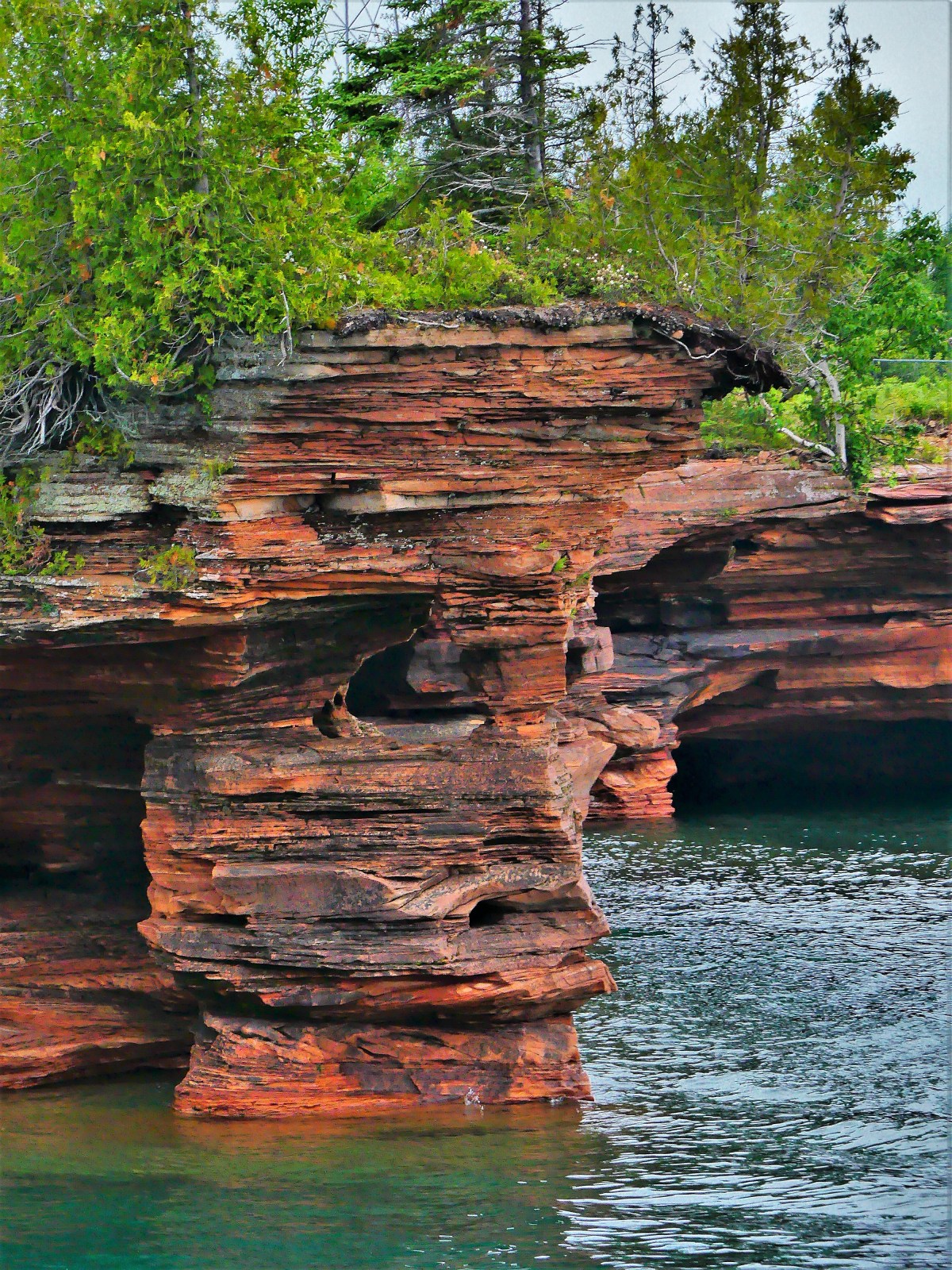
After cruising through the channel for a half-hour, we arrived at Devils Island, the northernmost point of land in Wisconsin, and notable for the sea caves which undercut the shoreline.
We idled twelve feet from the rock formations for a closer look at the honeycombing…
While the overcast skies precluded any possibility of brightening the scenery, the balanced light offered views into the caves that otherwise would have been defeated by sunlight and resultant higher contrast.
Captain Mike promised one last photo opportunity before returning the Archipelago to Bayfield Harbor. He was referring to Raspberry Island’s lighthouse, once known as the Showplace of the Apostle Islands.
As we trolled along the stone wall, we were greeted by the lightkeeper.
The National Park Service completed renovations of the 1906 structure in 2006.
On the return trip, Captain Mike asked passengers if they knew the origin story of Apostle Islands’ name. A few volunteers tossed out some theories. One guest suggested that there was something religious about the naming. Another guest offered that the area was first mapped by the Jesuits, so that explains why they gave it a holy name.
I thought the insight was interesting but unreliable, since there were 12 Apostles, for 22 islands. Could it be that the Jesuits had been drinking too much Lake Superior moonshine and seeing double?
Nobody knows!
But photographing Devil’s Island sea caves was a fleeting, yet near-religious experience… with ironic overtones.
Seemingly, Duluthians have only two seasons: winter and summer. During the 2018- 2019 weather calendar, city residents shoveled snow from October 10 to May 9, breaking a record dating back to 1884. Temperatures were moderate for the remaining months of the year.
But when the last snow melted, the Northlanders traded their shovels and skis for bicycles and hiking shoes–eager to take advantage of the wealth of recreational resources in the vicinity. Leah and I sampled some of the more popular options during our recent visit.
The 70-mile Hinkley-Duluth segment of the Munger State Trail offers hiking, biking, in-line skating and snowmobiling on a fully paved road, cut through a forested ridge that follows a busy railway.
Leah and I cycled a scenic 8-mile stretch from Buffalo Valley Camping (our temporary home) to the Carlton terminus,
where the trail parallels Forbay Lake…
until it crosses a nearby St. Louis River dam release.
Lunch at Magnolia Cafe in Carlton gave us the energy we needed to pedal back to camp. Kudos on the cold-brewed coffee and gluten-free chocolate chip cookies.
With our energy restored, we drove to Duluth in search of craft beer. Despite a population center under 90,000, Duluth has earned a reputation as Minnesota’s capital of craft beer, boasting more than a dozen production facilities in the area that are eagerly taking advantage of Lake Superior’s pristine waters.
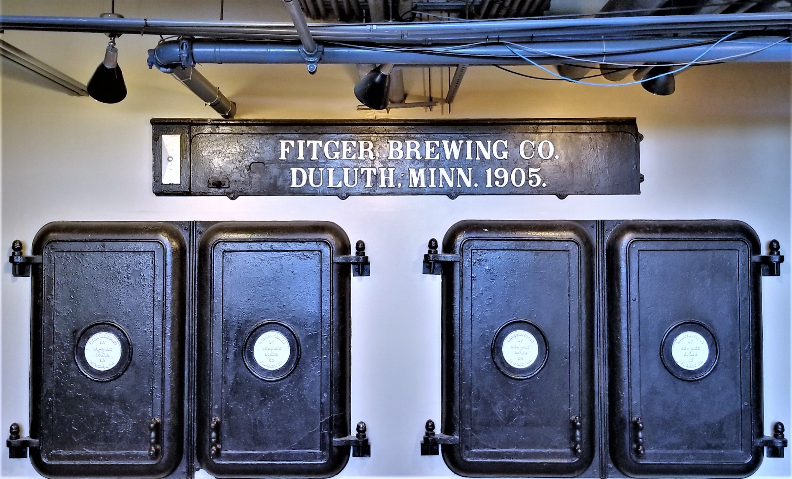
Fitger’s Brewhouse is the oldest and perhaps the most famous active brewery,
dating back to 1881…
with over 100 original recipes…
still brewed at its present location along the Lakewalk.
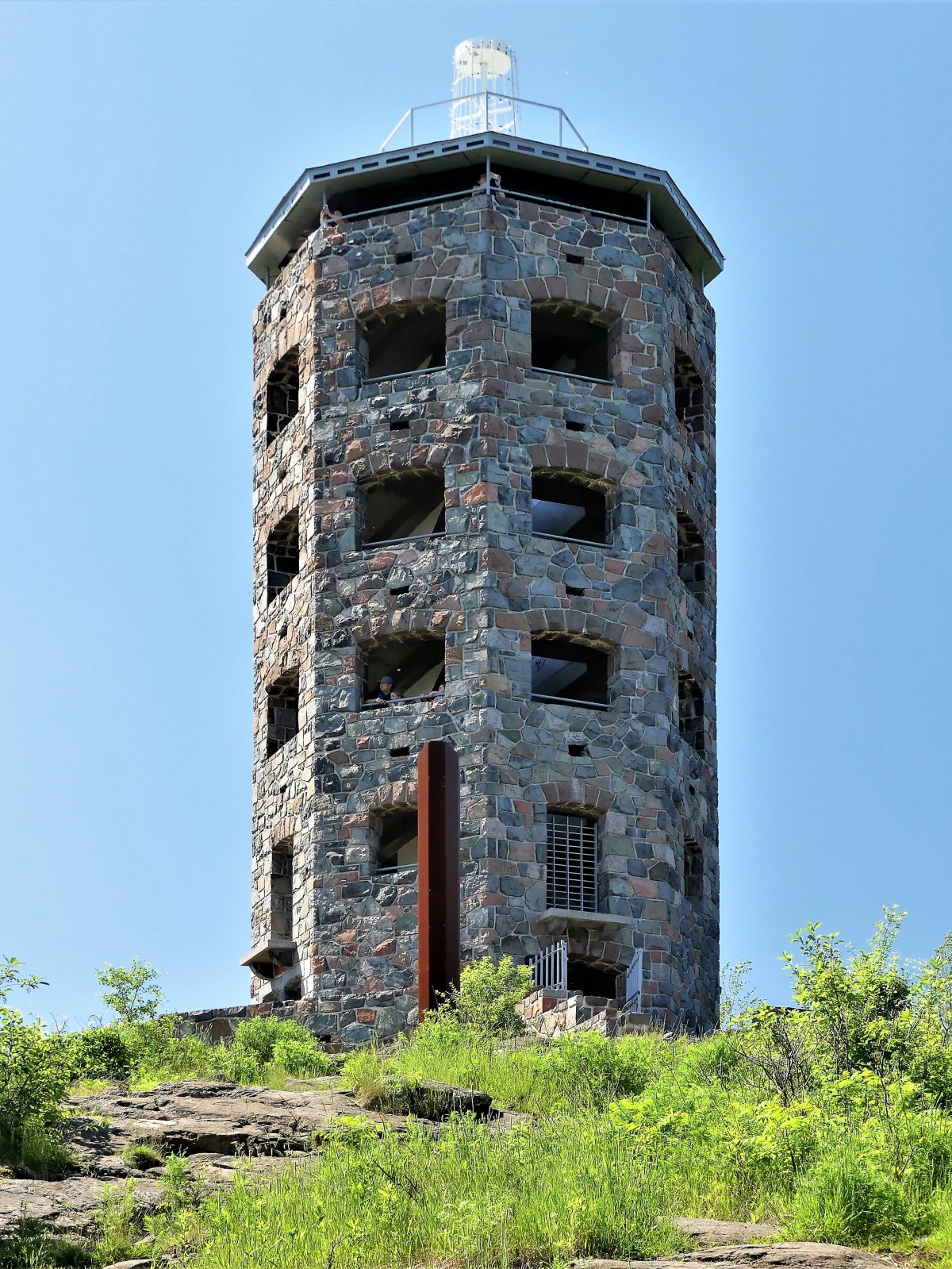
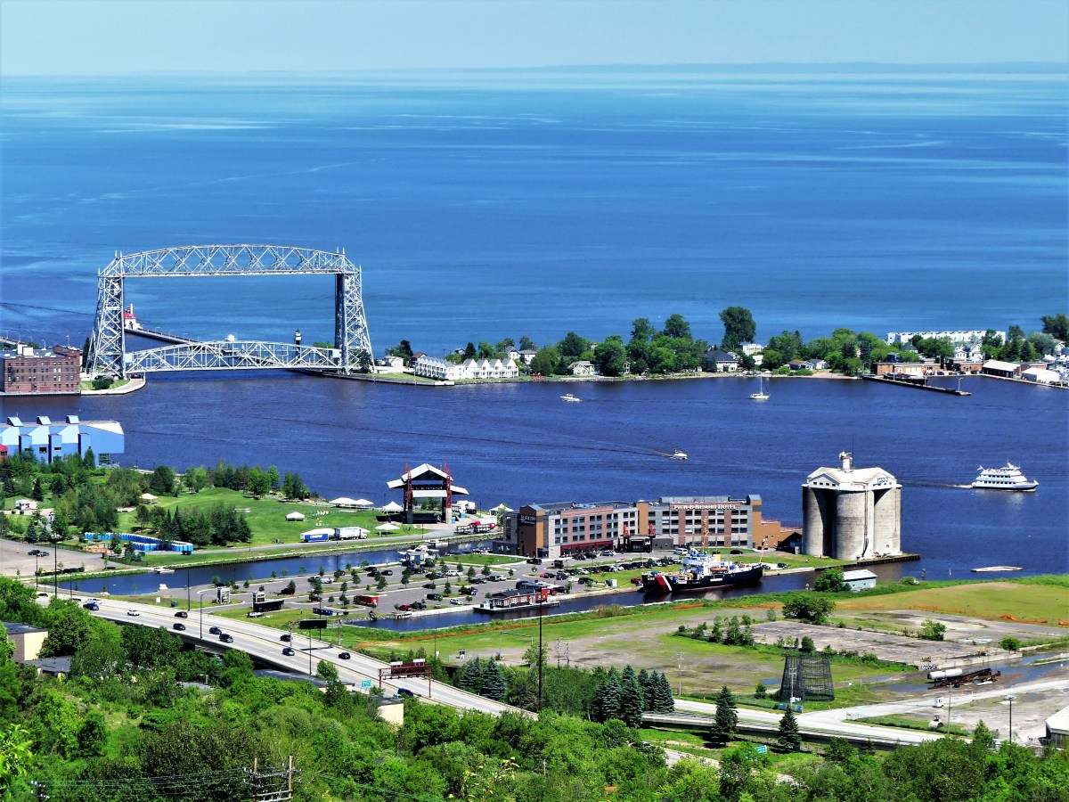
For views of the city, nothing beats Enger Tower, the highest point in Duluth,
and no better place to see where the city opens up to the sea,
while revealing its industrial underbelly.
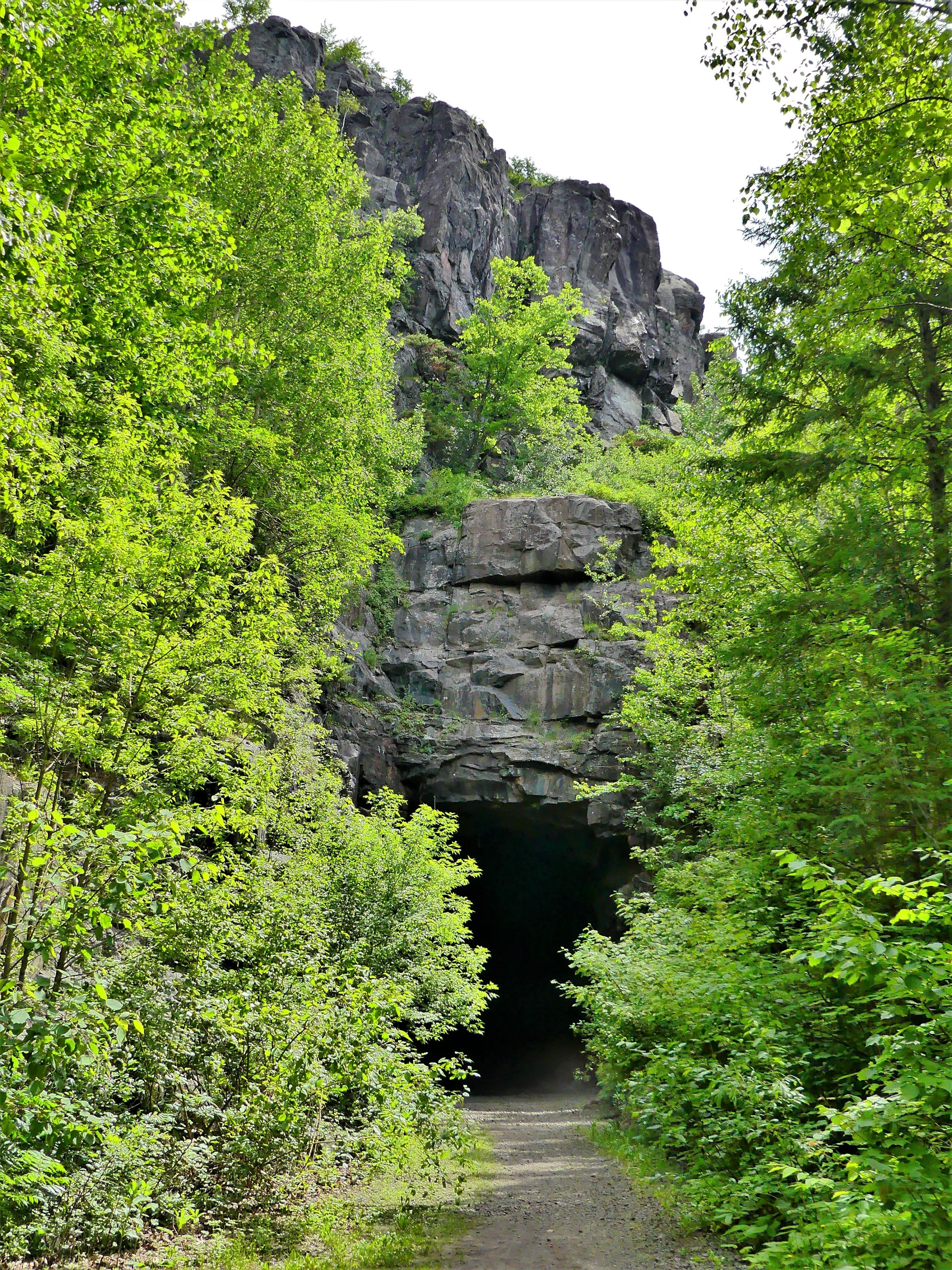
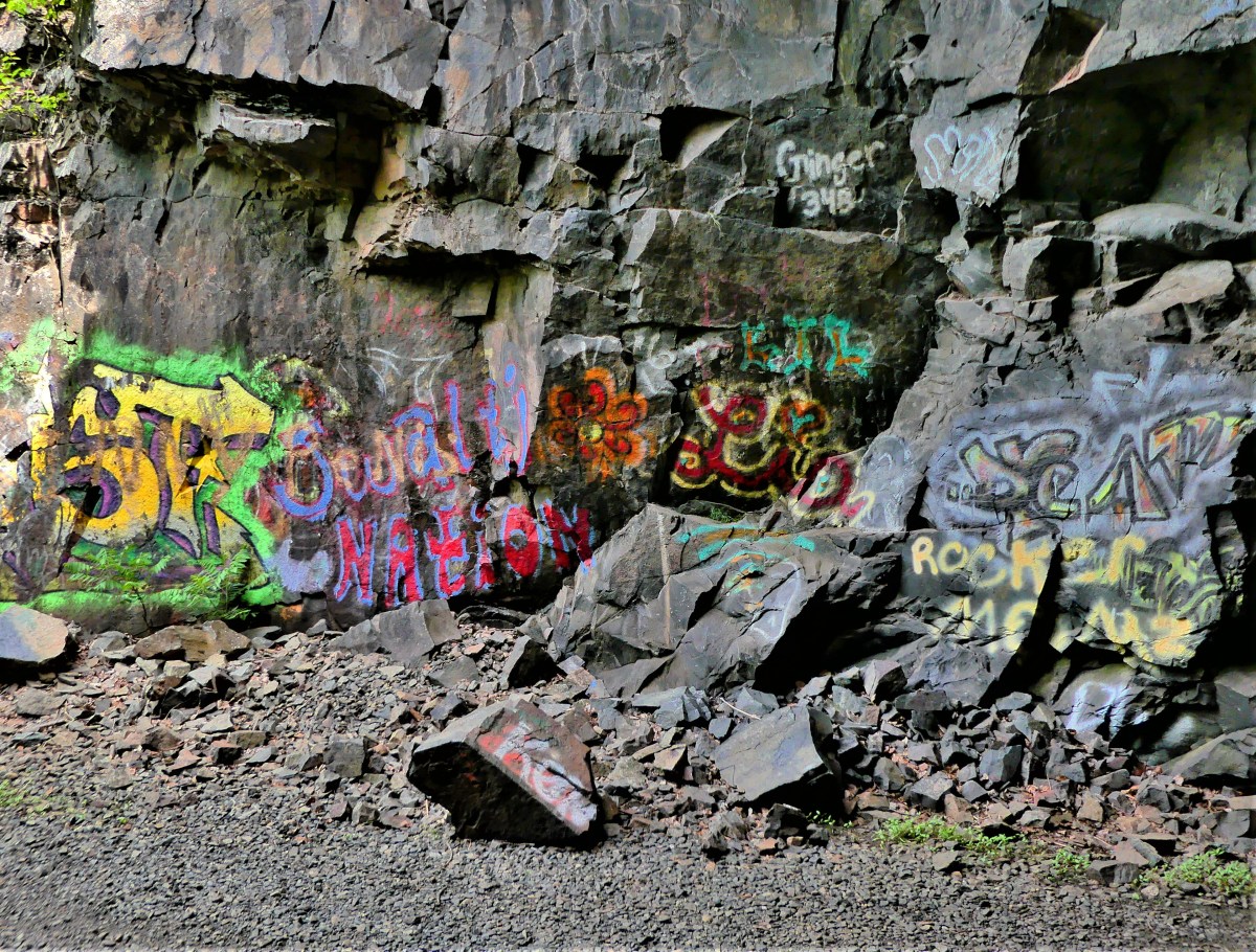
The following day, we were looking for a short but moderate morning hike. All internet indicators pointed to Ely’s Peak, a popular trail reached by following the abandoned Duluth, Winnipeg, and Pacific (DWP) railroad corridor to the entrance of a 1911 railroad tunnel.
The trail was named after Rev. Edmund Ely of Massachusetts,
whose mission was converting the Fond Du Lac Native Americans during the mid-1800s.
From the tunnel to the top and back is 1.8 miles. The loop takes hikers on a 300 ft. ascent offering far-reaching views of the Fond du Lac Reservation and beyond.
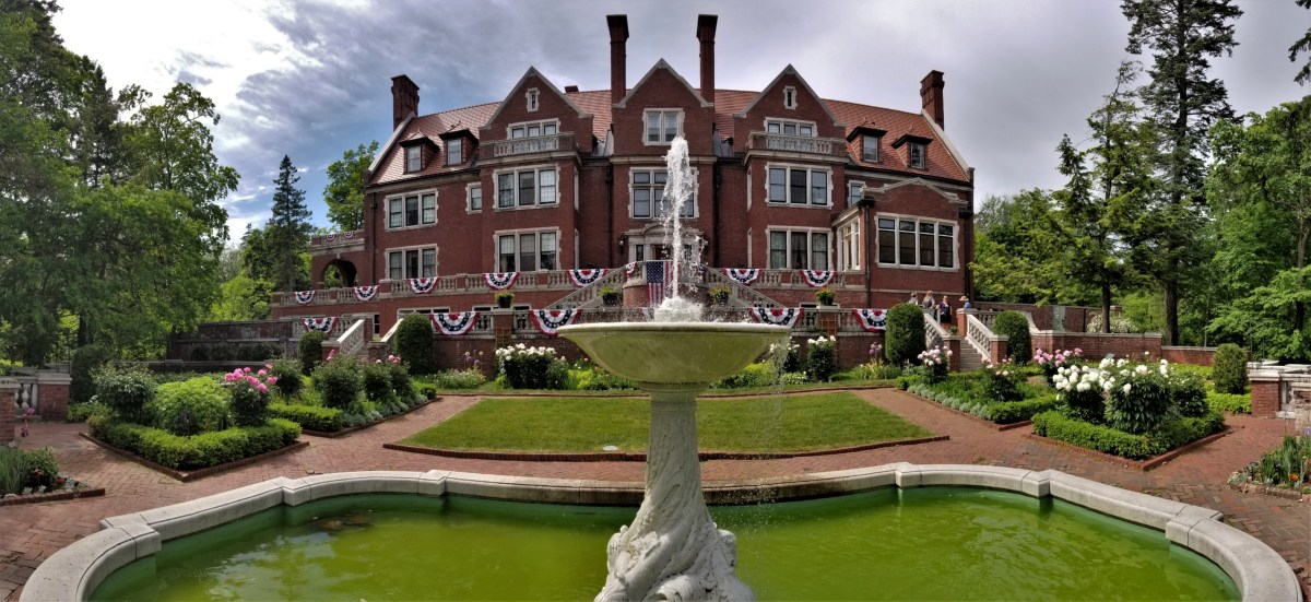
We spent the afternoon touring Glensheen, a 20,000 sq ft. Beaux-Arts-styled mansion surrounded by a 12-acre estate…
built beside Lake Superior between 1905 and 1908 by Clarence Johnston, Sr…
for Chester Adgate Congdon and family.
The 39-room historic mansion is reknown for its design and craftmanship of the day…
and that almost nothing from William French’s orginal interior design has changed in 110 years–down to the furniture placement…
and the accessories that adorn the house.
But the most unusual part of the tour was what Nick, our docent would not share with the group when asked about the murders of Elisabeth Congdon and her private nurse, Velma Pietila.
Instead, we were referred to a brochure card with a disclaimer and few details.
It was a brutal crime that was sensationalized by the media, and still remains unsolved.
Leah and I concluded our day sitting in stadium chairs by the Glensheen boathouse pier, noshing on local food truck fare while listening to Charlie Parr, a local folk singer performing an evening of Minnesota moonshine music to kick off the 5th season of Concerts on the Pier.
It was the perfect way to end the day:
enjoying the sunshine and the breeze coming off the lake;
meeting and appreciating new people around us;
watching a mish-mash of vessels manuevering through an ad hoc harbor;
and being interviewed by Ryan Juntti, for WDIO’s 6:00 PM News.
Although it’s been two years since Leah and I visited Mt. Rushmore, what could be more American than re-posting this visit on Independence Day?
There’s no better way to celebrate the 4th of July, than a trip to Mount Rushmore and the Crazy Horse Memorial. Sure, the crowds were large; that was to be expected. But once the cars were garaged, the pedestrian traffic was easy to negotiate. And with everyone looking up at the mountain, the Presidents’ faces and intentions were never obstructed.
It was also a time to celebrate family. There were plenty of kids riding in strollers, hanging from moms in carriers, or balancing on dads’ shoulders. Generations of families–many of them immigrants–had gathered to pay homage to the principles of freedom that make our country a beacon for the oppressed and downtrodden.
Seniors were being escorted through the Avenue of Flags by their grandchildren. Extended families organized group pictures at the Grand View Terrace, unified by their love of democracy and their reunion T-shirts.
All expressed awe at Gutzon Borglum’s grand vision and remarkable achievement–the transformation of a mountain into a national symbol visited by approximately 3 million people every year.
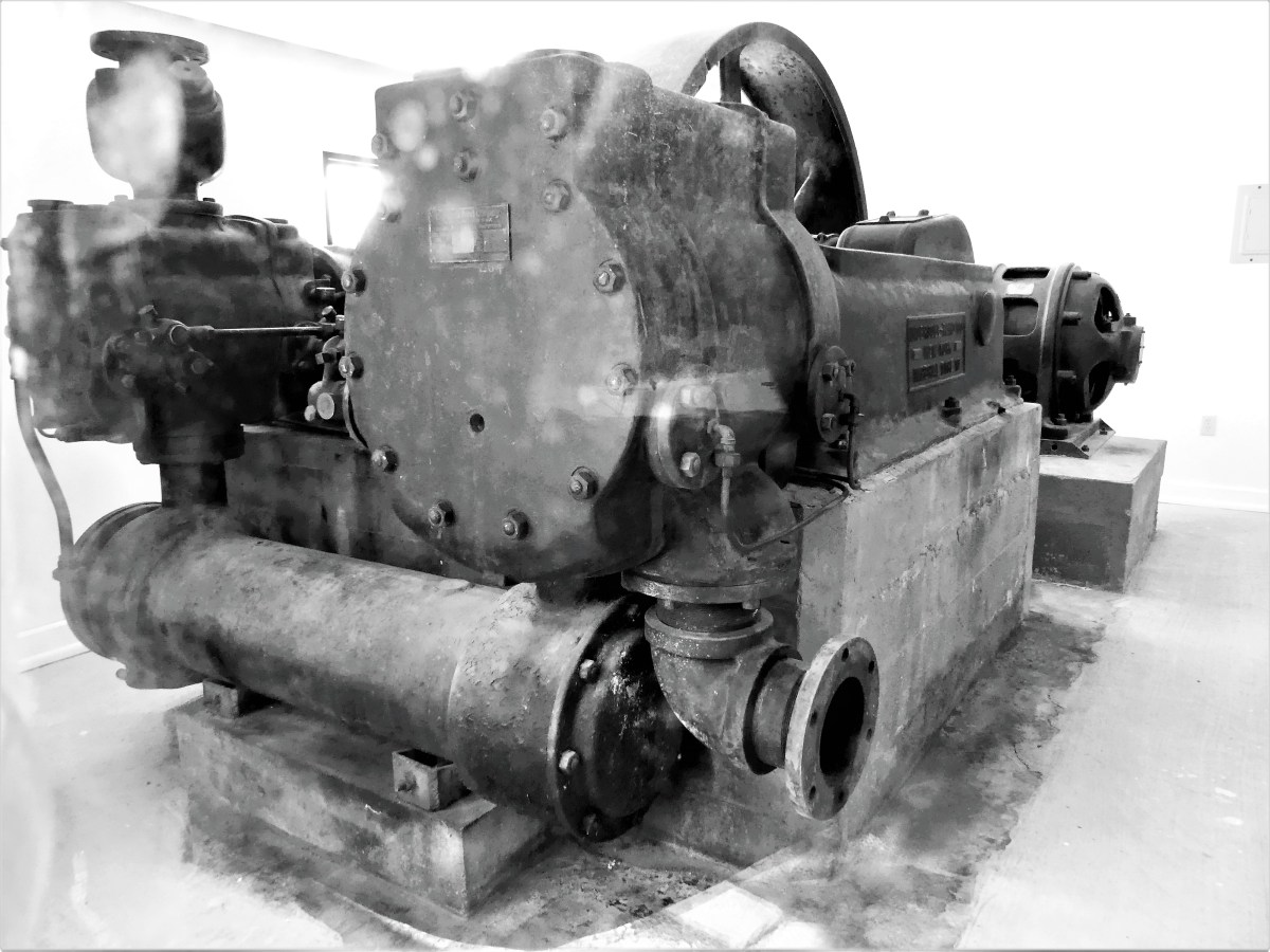
The 14-year process of carving the rock began with dimensionalizing the Presidents’ portraits through Plaster of Paris masks, on view at the sculptor’s studio-turned-museum.
Additional exhibits detail the construction of the memorial, and the tools used by workers, like the original Rand & Waring compressor, which powered the jackhammers for all the finishing work.
A little known fact is that Mt. Rushmore was once intended to be a tribute to the “Five Faces of Freedom,” but funding ran short when the Congressional appropriation approached $1 million during the Great Depression. Hence, the unfinished carving of the Great Ape to the right of Lincoln serves as a reminder that we are never far from our true ancestors.¹
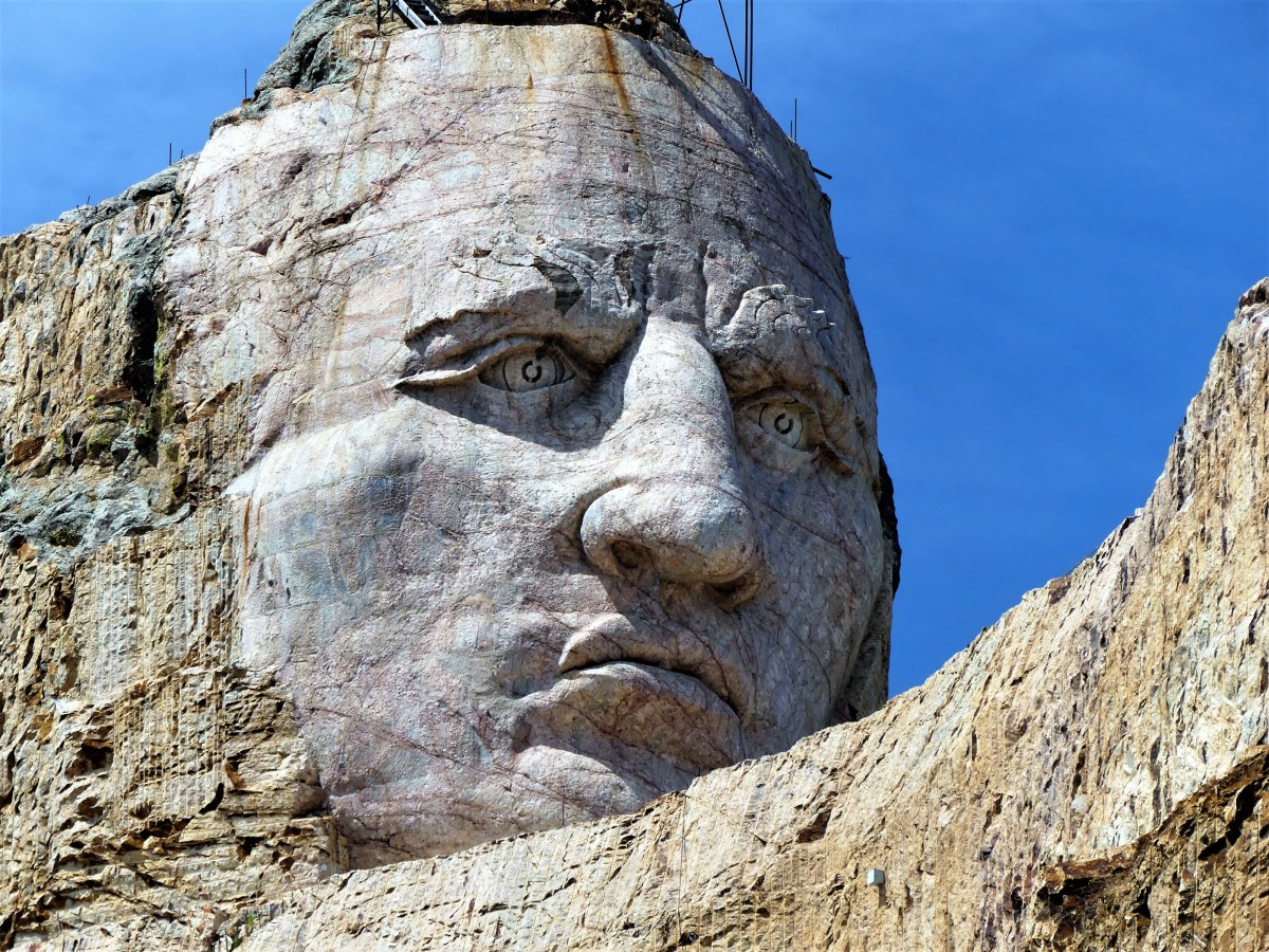
No less ambitious, and equally as impressive, the Crazy Horse Memorial is a work-in-progress located 16 miles away in the heart of the Black Hills–considered sacred land by the Lakota people.
Conceived by Korczak Ziolkowski in early 1940s,
the memorial, when completed will stand 563 ft. by 641 ft. across, and is expected to be the largest sculpture in the world. Already, the completed head of Crazy Horse measures 60 feet tall…
…twice the size of any of the presidents at Mt. Rushmore. While the first blast was conducted on the mountain in 1947, the current prospects for the memorial are to complete the outstretched arm during the next twelve years. There is no completion date available for the finished carving, which has been financed entirely by private funding since its inception.
Mt. Rushmore was created by a Danish American. Crazy Horse was created by a Polish American. And visitors to both destinations manifest the melting pot that has brought us all together as Americans. It’s our diversity that makes us strong, our ambition and determination that makes us great, and our compassion and sacrifice that make us whole.
These are the values reflected from the faces we’ve immortalized in stone. Yet, we would honor them more by living according to these principles.
Happy Birthday, America!
¹ Just kidding, but the photograph is real and has not been retouched.
After one month of travelling along Lake Ontario, Lake Huron, and Lake Superior in Canada, we crossed the border into Grand Portage, Minnesota to continue our Great Lakes circumnavigation through the States. We made Duluth our first stop.
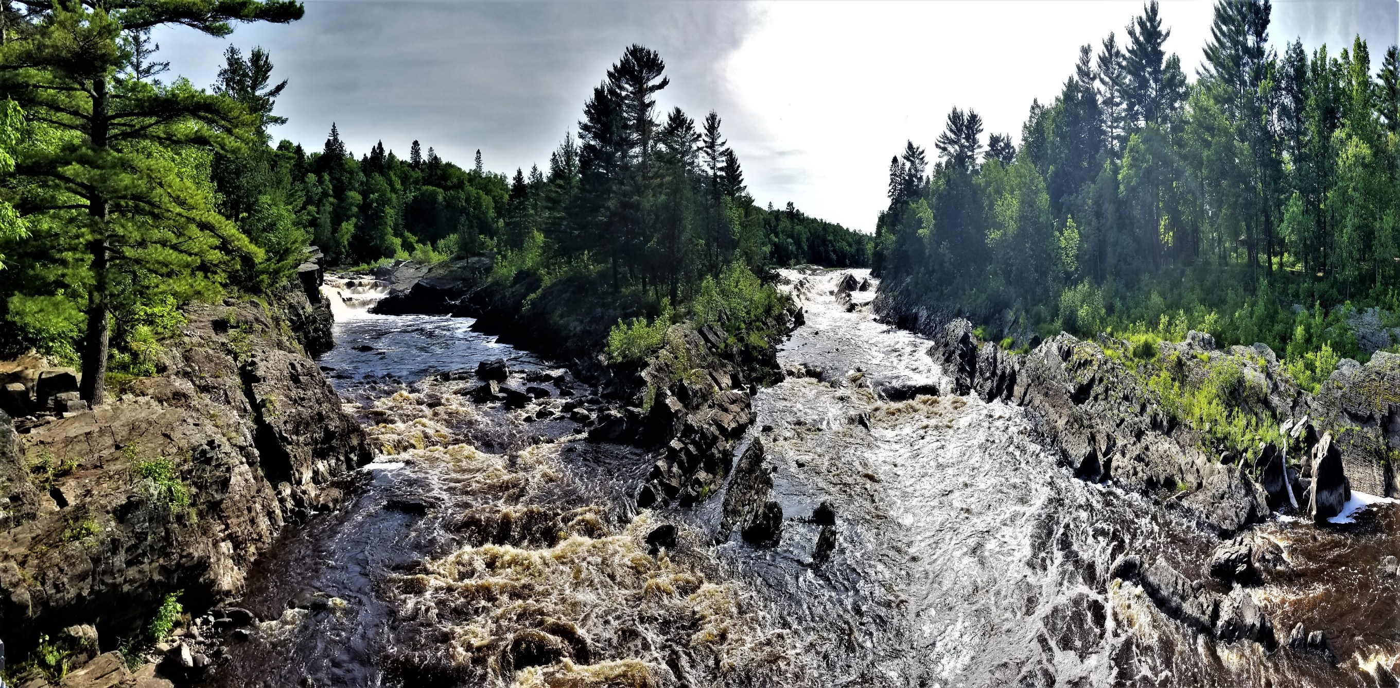
Our reservations, made months ago, took us to Jay Cooke State Park–about 10 miles south of Duluth– where we planned to camp five nights through July 4th, but not without sacrifices.
RV enthuthiasts would agree that a level pull-through site with electric, water, and sewer is the norm for comfortability. But a site that also offers cable TV service with highspeed internet is the Holy Grail. Sadly, Jay Cooke was offering us a back-in site with 30 amp service only…for three nights. The other two nights, we were assigned to a primitive site inside the park with no amenities. This was the best Jay Cooke State Park could offer, considering the popularity of the park and high demand for the holiday week.
Originally, we called around to other area campgrounds and RV parks hoping for better accomodations, but found no availability anywhere else. By default, we accepted our fate and placement at Jay Cooke, and considered ourselves fortunate to find any place at all to park our Airstream during Independence Day festivities.
We crossed the border into Central Time, and surrendered an extra hour of daylight in exchange for arriving at the park office during operating hours, and giving Leah one last chance to modify our reservation.
Not a chance; the park was completely booked! We were directed to site 38 for three nights, and redirected to site 66 for the balance of our time.
After 40 minutes of queueing to fill our tank with fresh water, we eventually found site 38 down a very narrow access road lined with crowded spruce trees. No matter how many times I tried, and I tried, I couldn’t swing 28 feet of Airstream plus bicycles into a shallow site without sacrificing my truck to the evergreens. Simple physics wouldn’t allow it.
Leah sought a refund, while I investigated last-hope possibilities, nearby.
As if by magic, I called Darren at Buffalo Valley RV Camping, only a few miles away, who minutes ago received news of a cancellation. And just like that, we had a new address…with electricity AND water.
The following day, Leah and I strolled along the first two miles of Duluth’s 7.5 mile Lakewalk, stretching from Canal Park through Leif Erikson Park to Lester Park.
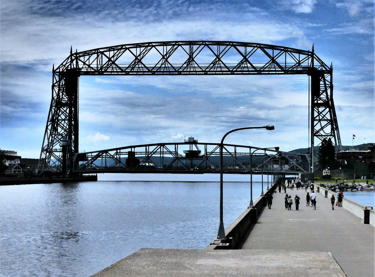
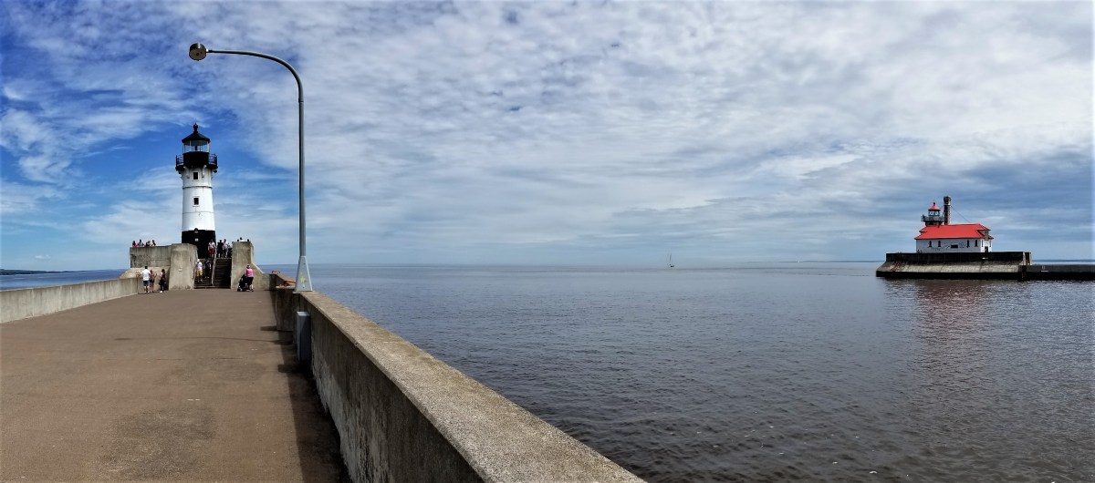
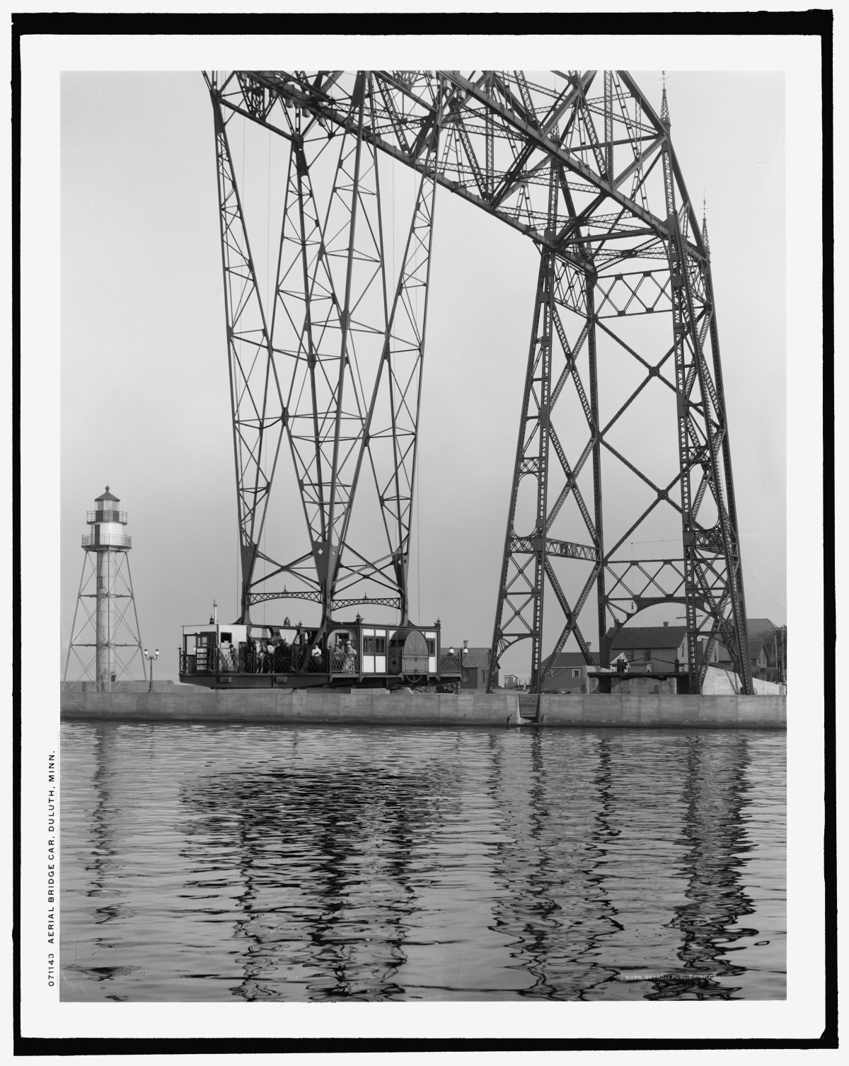
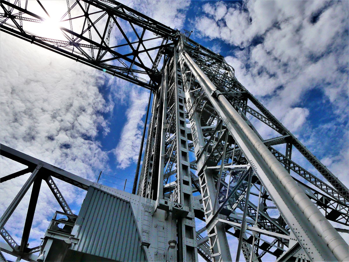
Starting out at Canal Park, I was drawn to Duluth’s iconic Aerial Lift Bridge that guards the entrance to Superior Bay,
supported by two sentry lighthouses that jet out to meet Lake Superior.
Originally conceived as America’s first transporter bridge in 1905, passengers and freight were ferried across in a large gondola.
In 1930, the bridge was reimagined with a vertical lift,
and continues to operate much the same way to date.
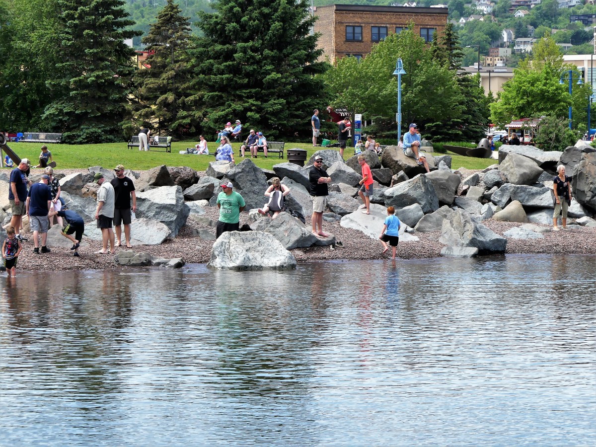
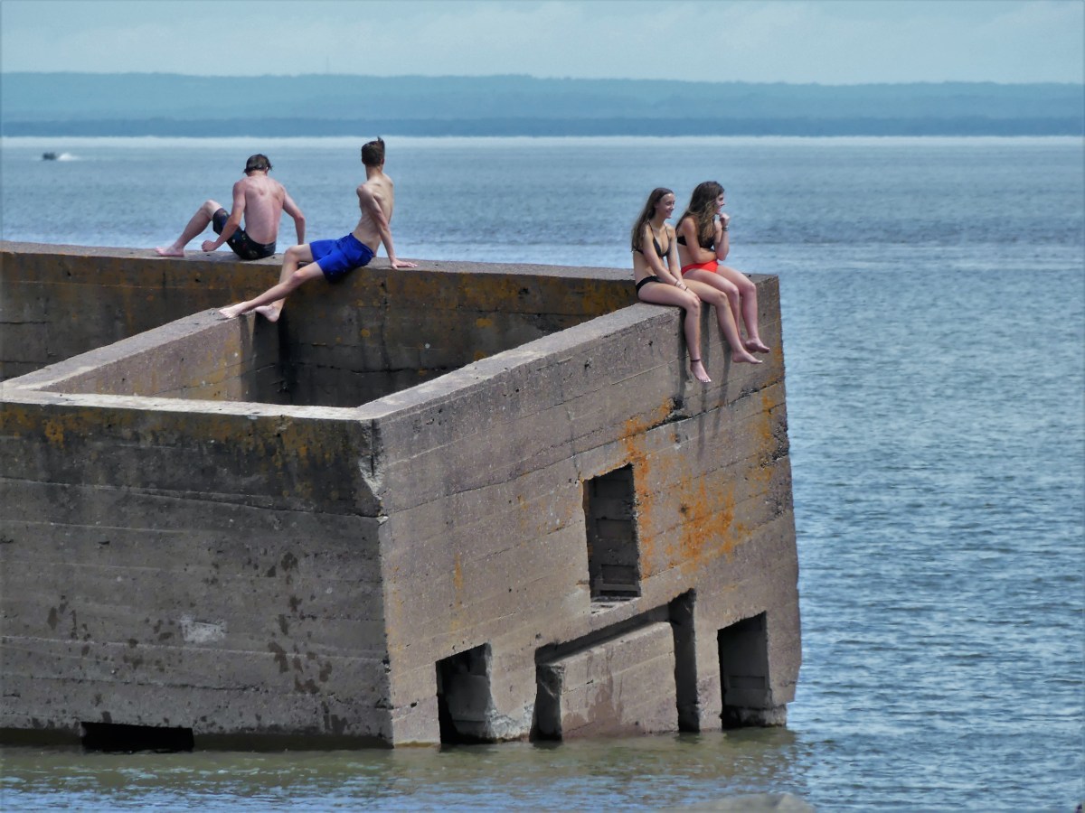
The warm air prompted scores of beachcombers to scramble across the rocks in search of beach glass,
while a few brave souls channeled their inner polar bear by swimming out to “the cribs” in frigid water.
We followed the Lakewalk to Fitgers with a few notable detours along the way.
Free samples were irresistable at Rocky Mountain Chocolate Factory, and star-gazing at Duluth Trading Company…
Of course, the Great Lakes are great; they constitute the world’s largest above-ground freshwater system in the world, containing about 18 percent of the world’s supply.
However, beyond its scale (larger than all the Eastern seaboard states combined), what about all the other awesome attractions that border its shorelines? Are they equally as great, or big, or best, or exclusive?
Let’s take a look:
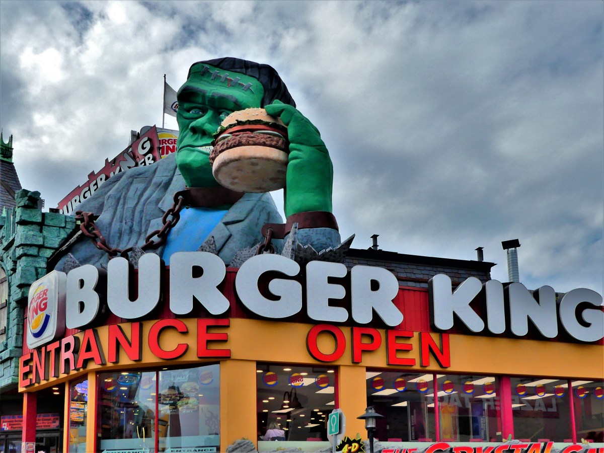
Given the many possibilities for food around the Great Lakes, the area’s largest hamburger rests atop Burger King in Niagara Falls, ON.
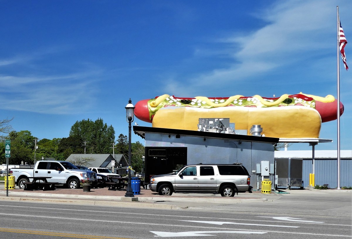
And the largest hotdog can be found in Mackinaw City at Wienerlicious.
Both can be purchased with the world’s largest nickel…
the brainchild of Dr. Ted Szilva,
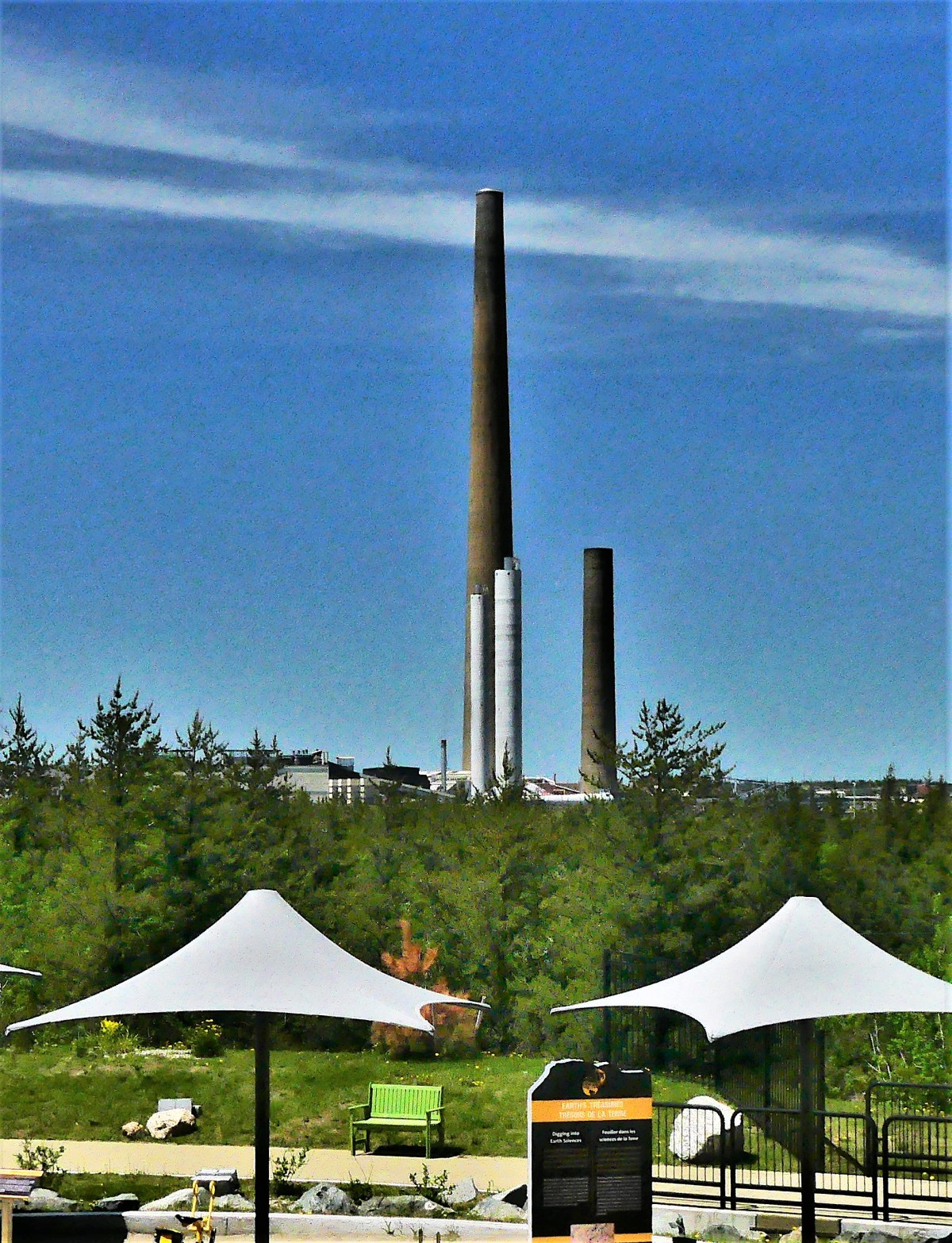
and on display at Sudbury’s Dynamic Earth.
Only one mile away, Inco’s superstack–the tallest chimney in the western hemisphere–rises 1250 feet atop Vale Inco’s Copper Cliff processing facility–the largest nickel smelting operation in the world.
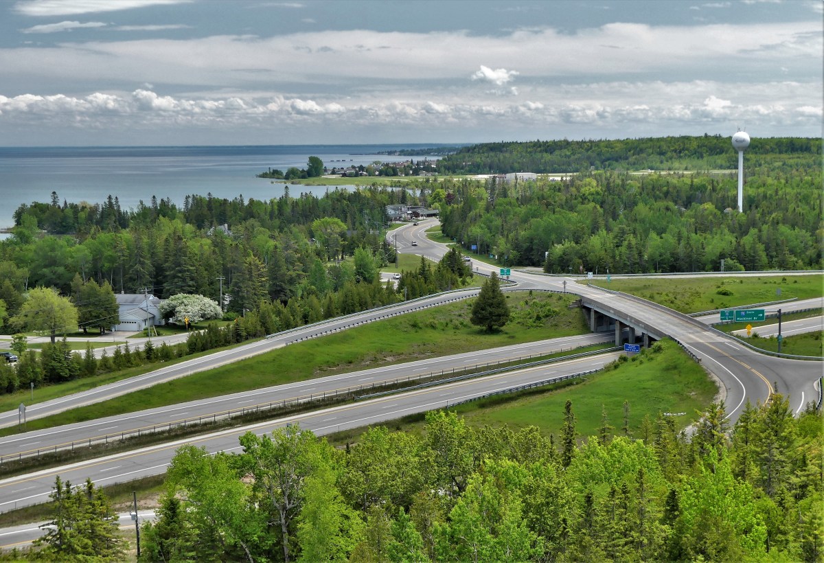
Nowhere as tall, Castle Rock (commonly referred to as Pontiac’s Lookout) is a natural 200-foot limestone sea chimney…
overlooking Lake Huron and Interstate 75,
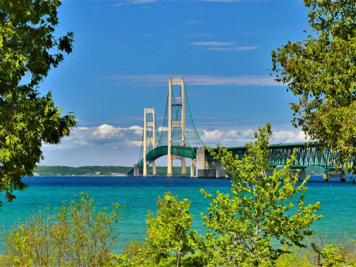
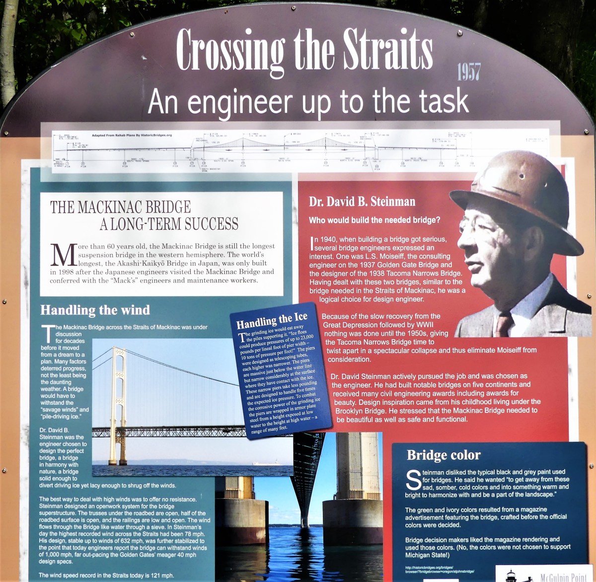
and considered the oldest lookout in St. Ignace, Michigan…until the Mackinac Bridge was built in 1957.
Spanning the Straits of Mackinac, and connecting the Upper and Lower Peninsulas of Michigan, the Mackinac Bridge is hailed as the longest suspension bridge in the western hemisphere.
Although less of an engineering feat, the upside-down house, built in Niagara Falls, measures up to 1200 square feet of topsy-turvy, making it Canada’s most unusual landmark.
Nearby, at Niagara on the Lake, locals can tee up at Niagara Golf Club, the oldest existing golf course (albeit, nine holes) in North America.
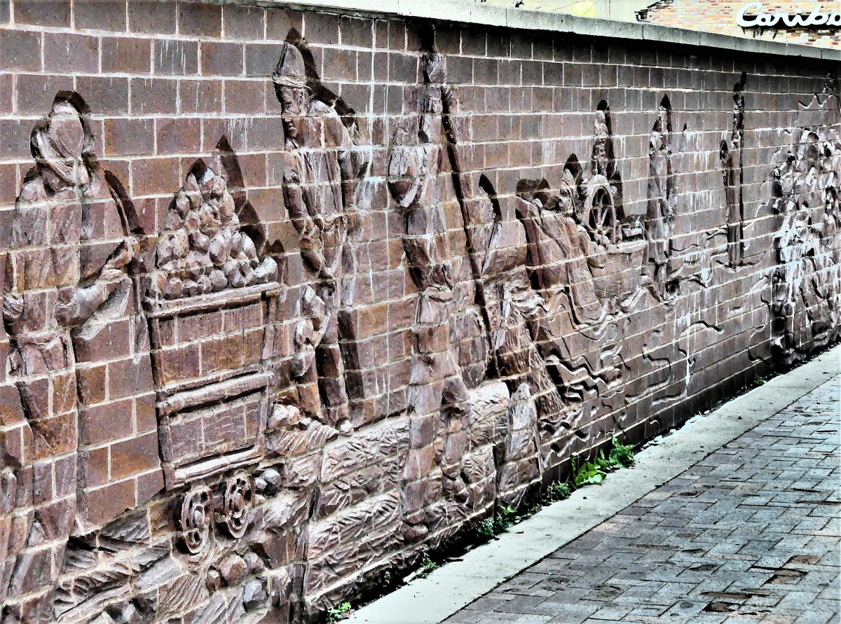
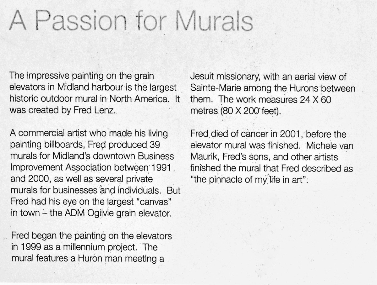
In Midland, Ontario, a grain elevator looms over a Georgian Bay harbor, featuring North America’s largest historic outdoor mural created by Fred Lenz.
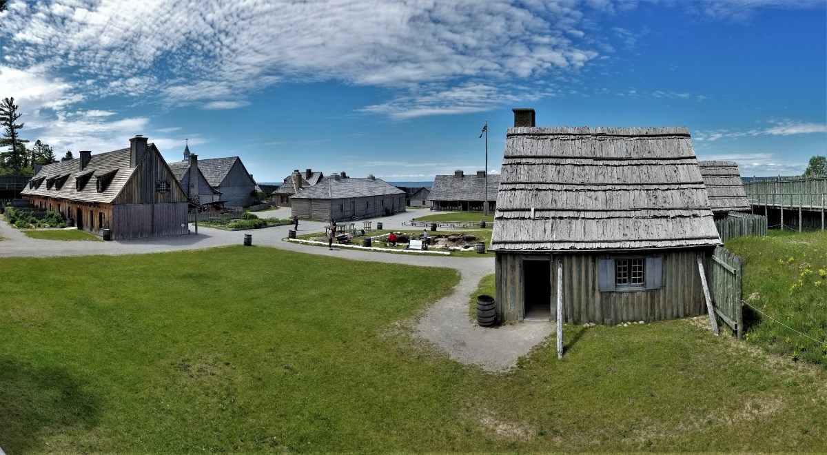
History also abounds at Colonial Michilimackinac–
a reconstructed 18th century frontier fortress originally garrisoned by the French during 1715, and later controlled by the British.
After 60 years of excavation, valuable relics from fort living continue to be unearthed, making it the longest ongoing archeological dig in North America.
One of the many buildings discovered and recreated inside the fort belonged to Ezekiel Solomon, a fur trader who has been celebrated as Michigan’s first Jewish settler.
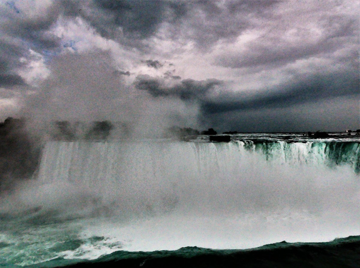
And then there’s Niagara Falls, a natural wonder that needs little hyperbole.
While not the highest, or the widest falls, its combined falls (Horseshoe Falls, American Falls, and Bridal Veil Falls) qualify Niagara Falls as the most powerful, forming the highest flow rate of any waterfall in North America.
While this “Great” list may not represent the best of all gilded attractions in the Great Lakes area to date, it’s the only list I’m likely to compile
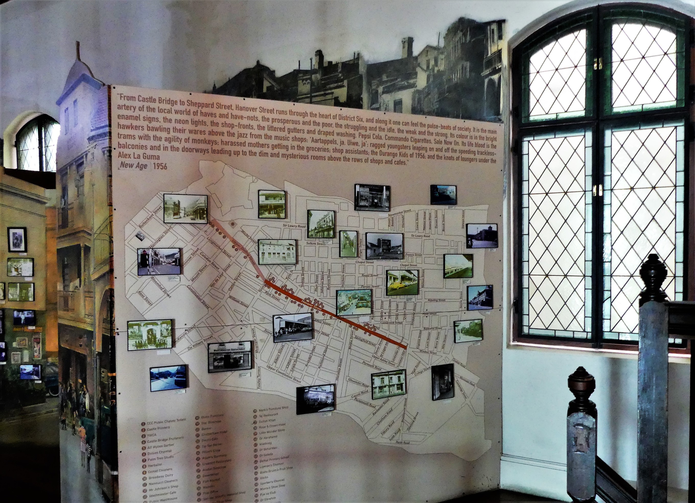
District Six was known as the soul of Cape Town, and home to nearly 10% of Cape Town’s population. It was a restless melting pot of freed slaves, persecuted Malays, and opportunistic Asians stewing as community artisans, musicians, merchants, immigrants, and laborers in a broth of grit, sweat, determination and talent. The vitality of the district inspired a body of poetry, prose, music and theater infused with swagger.
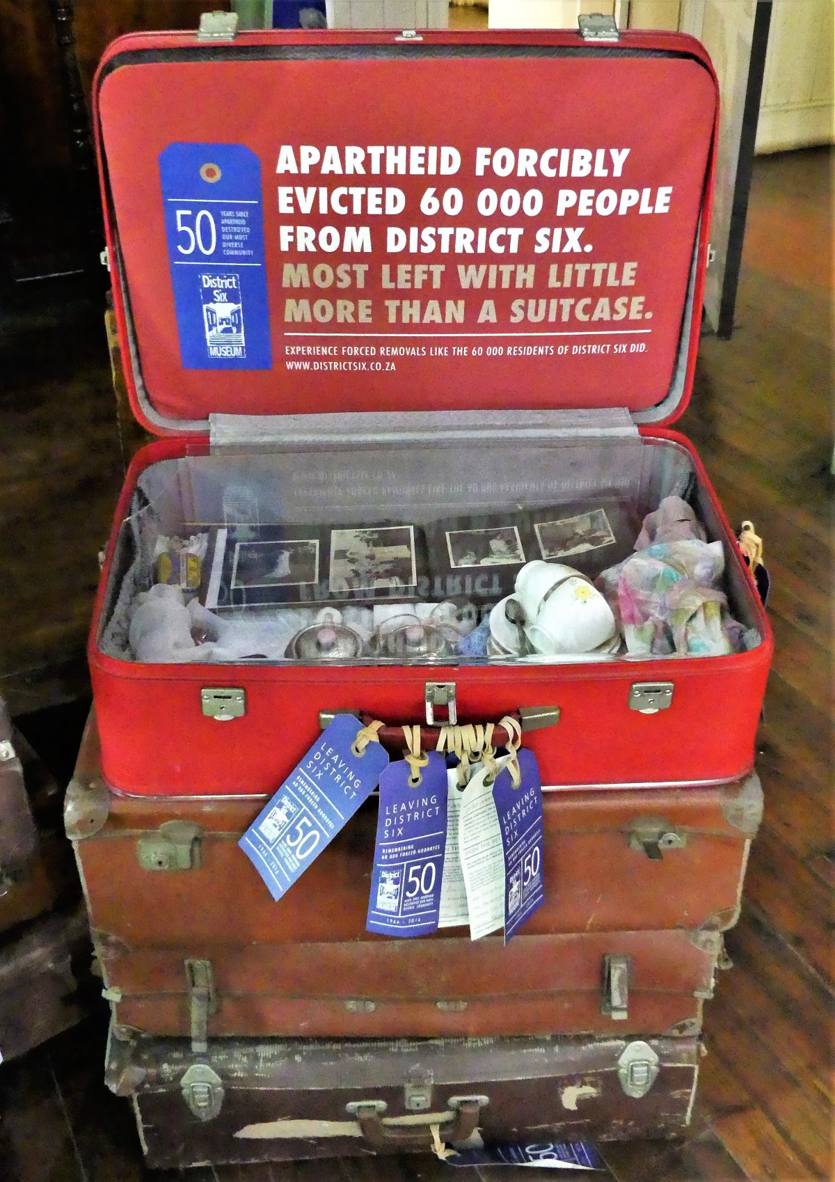
However, during the 1960’s, a generation of District Six residents lived in fear because of the color of their skin. The Afrikaner-centric government looked to apartheid as a means to squash opposition among the rank and file majority, prompting an official decree to rezone the district as a “whites-only” area, displacing more than 93% of the 60,000 residents.
Government officials offered several reasons in defense of their policy. They regarded the district as a slum; it was crime-ridden and dangerous–overwhelmed by immoral activities like gambling, drinking, and prostitution. They claimed interracial interaction inside District 6 bred conflict, necessitating the separation of the races.
By 1982, the government was relocating the “colored.” They were sent to dusty Cape Flat townships with insufficient infrastructure, while 25 km away, their old homes and businesses were bulldozed, leaving only the houses of worship behind.
Despite government claims, most residents believed that the government sought the land because of its proximity to the city center, Table Mountain, and the harbor.
By 1991, apartheid was repealed, and on December 10, 1994 the District Six Museum was launched in a historic Methodist Church building at 25A Buitenkant Street.
The museum serves as a remembrance to the events of the apartheid era as well as the culture and history of the area before the removals.
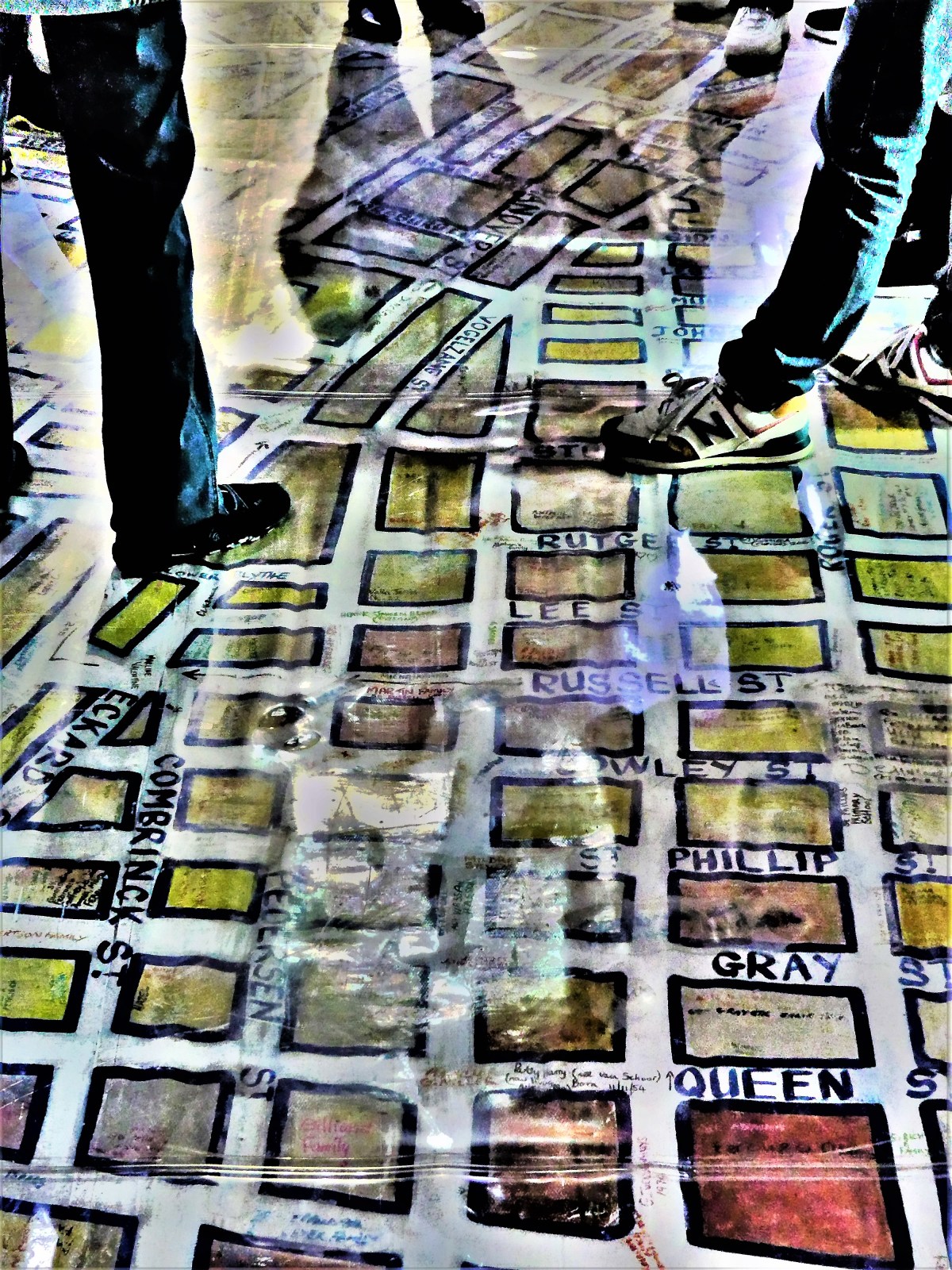
The ground floor is covered by a large street map of District Six, with handwritten notes from former residents indicating where their homes once stood.
Other features of the museum include street signs from the old district,
displays of the histories and lives of District Six families,
and historical explanations of the life of the District and its destruction.
In addition to its function as a museum, it also serves as a memorial to a decimated community, and a meeting place and community center for the residents of Cape Town who identify with its history.
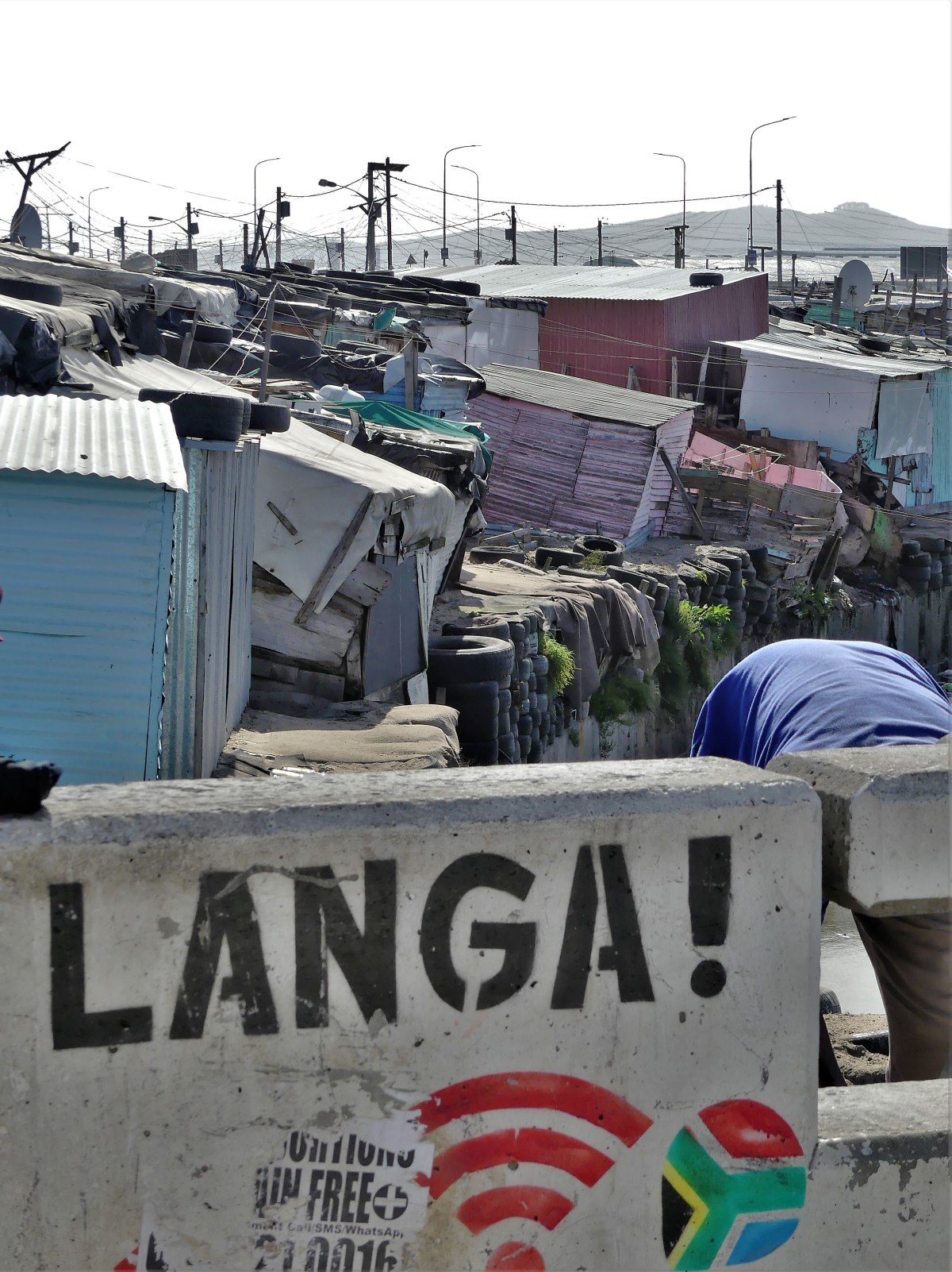
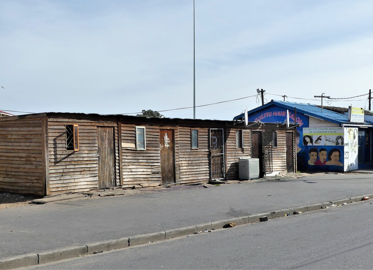
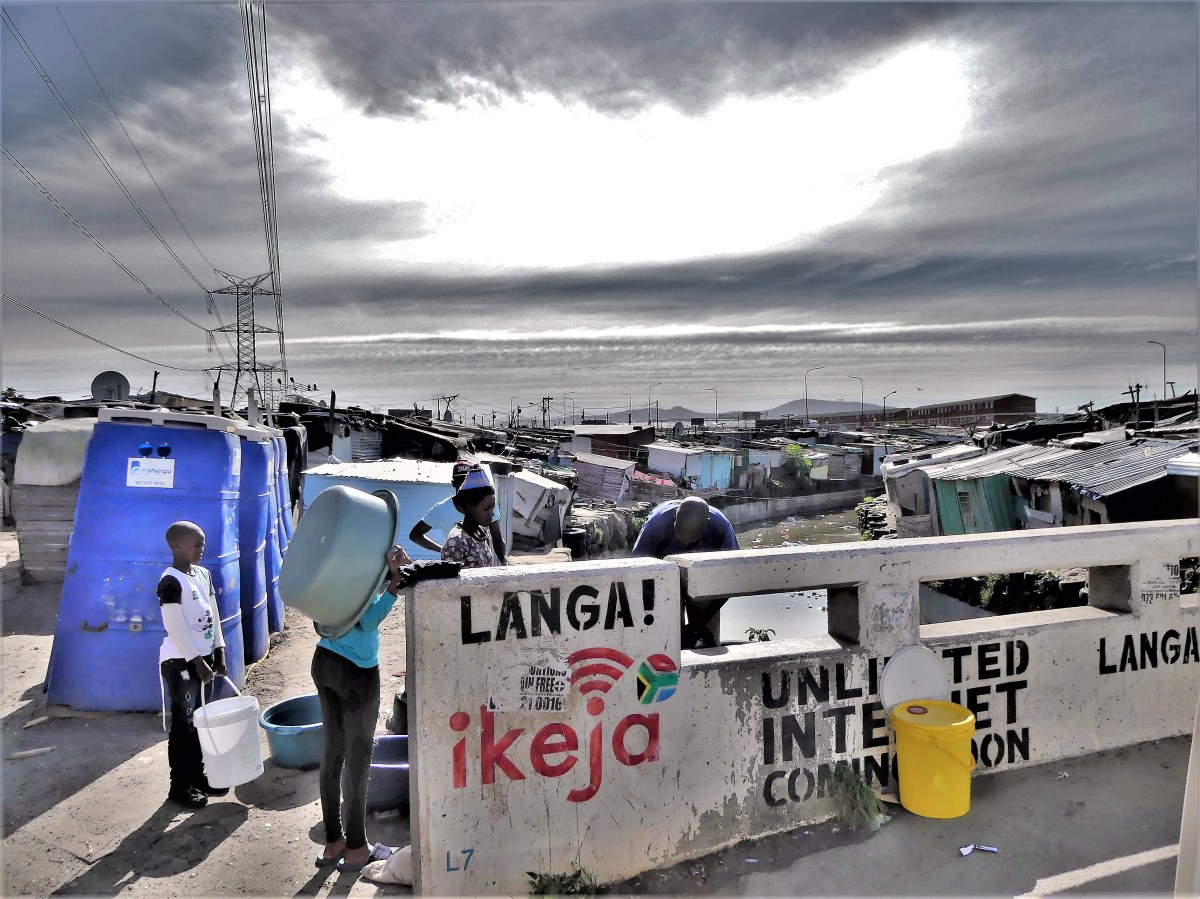
Our tour of Cape Town’s darker side continued with a trip to Langa, Cape Town’s oldest township in Western Cape with a population of over 50,000.
Originally conceived in the 1920’s as a company residence for shipyard workers from surrounding villages, the existing barracks are home to multiple families occupying a two-room unit.
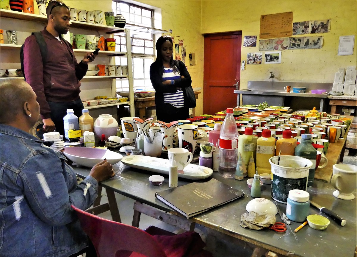
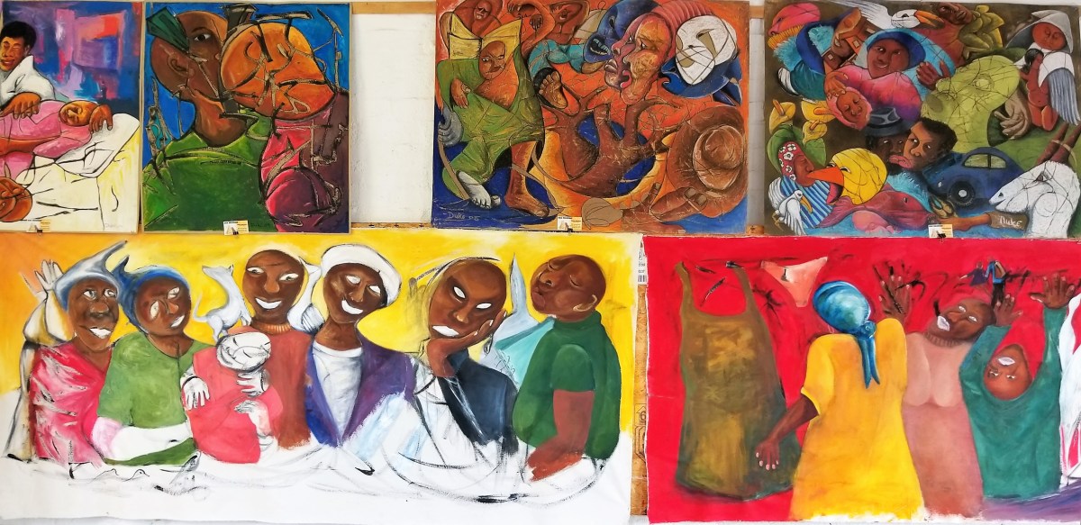
Our tour began optimistically with a walk through the Cultural Centre on the edge of the township that has partnered with local artists to rehabilitate the neighborhood…
and reinforce arts education as a means of promoting self-esteem and securing a successful career path for talented residents through ceramics,
paper maché,
mosaics,
and painting.
We continued our visit with a guided street walk through the neighborhoods…
Over and over, we asked ourselves, “How can people live this way?”
Realizing that we were a half-hour away from our luxury hotel made us uncomfortable and acutely aware of the abject poverty and abysmal living conditions surrounding us.
Unemployment stands at 40%,
and sanitation is an afterthought.
After negotiating with the house matriarch, our guide ushered us into a dank hovel fit for a family of four families. Several small children were playing on the floor, while adults went about their business of doing laundry,
preparing dinner,
or relaxing in front of a pirated broadcast on a vintage TV.
It was an awkward moment that may have been intended to shock us or educate us; I’m not sure which. But the people inside were nonplussed by our appearance, as if our intrusion was a routine occurrence.
If only we had been forewarned of this encounter, it would have given us an opportunity to gift them some wholesome food and clean water.
The citizens of Langa and the 2.5 million living in other townships on the edge of Cape Town struggle daily. Even now, as before, they rely on each other to survive, while the government offers little more than lip service in exchange for votes.
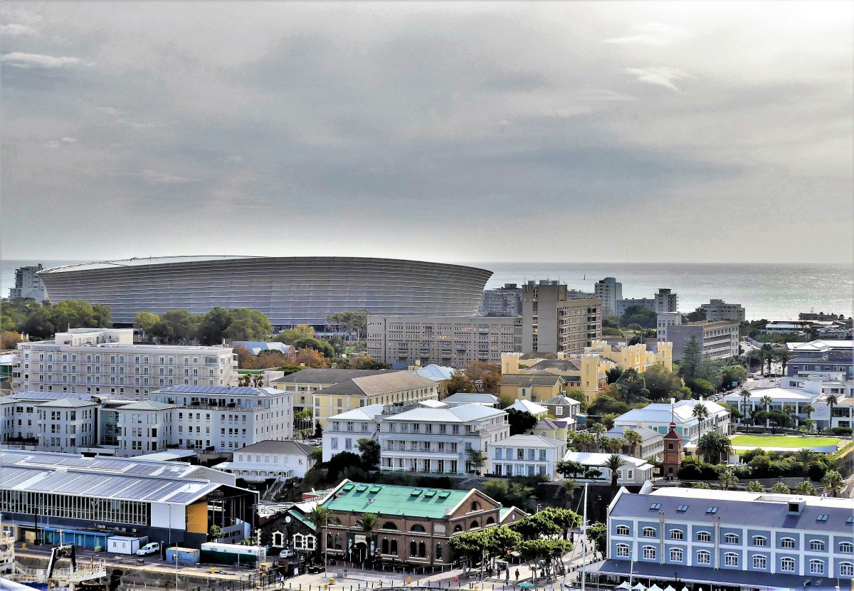
Much of Cape Town radiates with modern appeal, brandishing its abundance of fashionable and trendy shops, galleries, cafes, restaurants, and hotels throughout the city. However, the crossroads where residents and tourists travel to find it all is Cape Town’s waterfront.
Leah and I took a walk through the waterfront district to see for ourselves, and found that one day was not enough to cover it all.
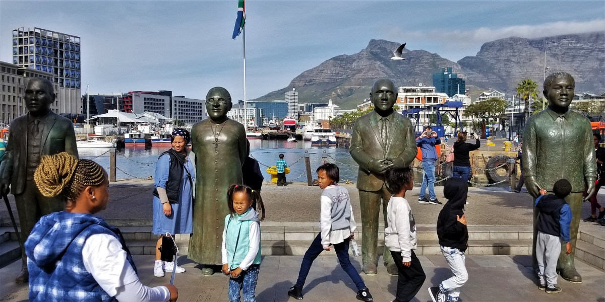
The heartbeat of the waterfront is the Victoria and Albert Wharf, where the city meets the sea.
Grounded by a two-story mall, the Victoria Wharf Shopping Centre bustles with 450 retail stores, and over 80 restaurants and eateries.
Beyond a swinging bridge and a capsule of specialty malls stands the Clock Tower, where a ferry (calm seas and weather permittting) awaits to shuttle intrepid visitors to Robben Island…
the one-time prison of Nelson Mandela from 1964 to 1982, but now a museum and World Heritage site. Unfortunately, high swells prevented us from visiting.
His importance to the city and country cannot be underestimated, as his name and face is omnipresent throughout the region.
Visible from all points of the city, and looming over the wharf is Table Mountain,
accessible by cable car, with commanding views of the city below. Unfortunately, Leah and I never made it to the top because of gusting winds at the time.
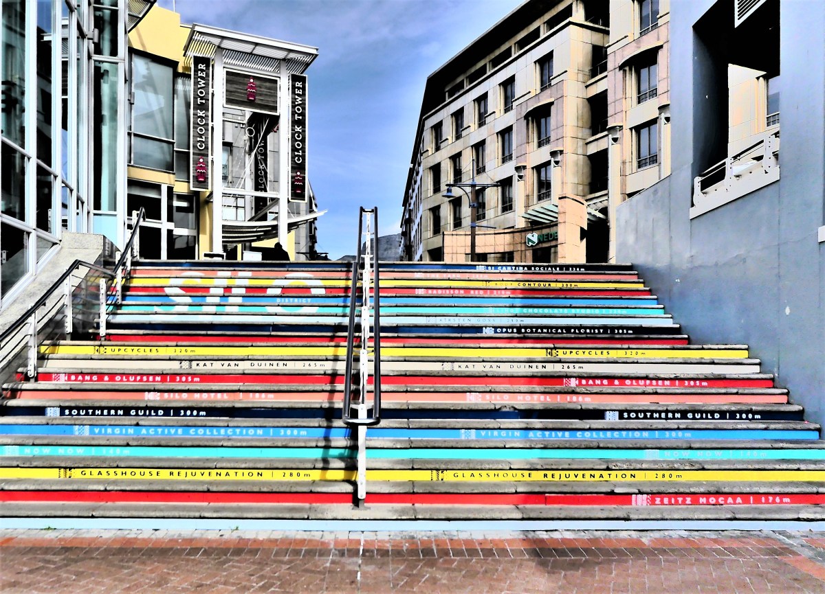
Continuing south, we mounted a set of stairs…
directing us to the Silo District, where a 1920s grain silo…
has been repurposed into the Zeitz Museum of Contemporary African Art,
having opened on September 2017, and boasting the world’s largest collection of African art.
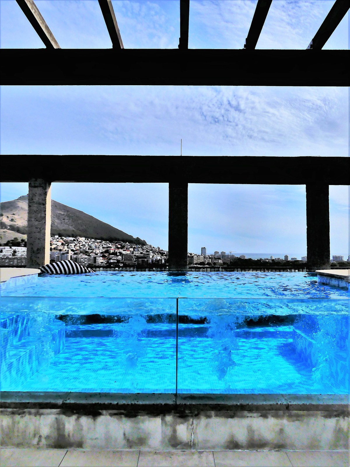
The building also houses the Silo Hotel, occupying the top six floors within the one-time grain elevator. Daily rates during low season range from $900 for a luxury room to $5000 for a 1-Bedroom Penthouse. Leah and I thought we’d have a look around.
The elevator carried us to reception on the sixth floor, where we spoke to an attendant who eagerly escorted us to the eleventh floor open-air restaurant, lounge and pool.
Having missed out on a Table Mountain overlook because of weather, our surrounding views of the stadium,
the wharf,
the ship terminal,
and the courtyard below were spectacular, and made up for our disappointment.
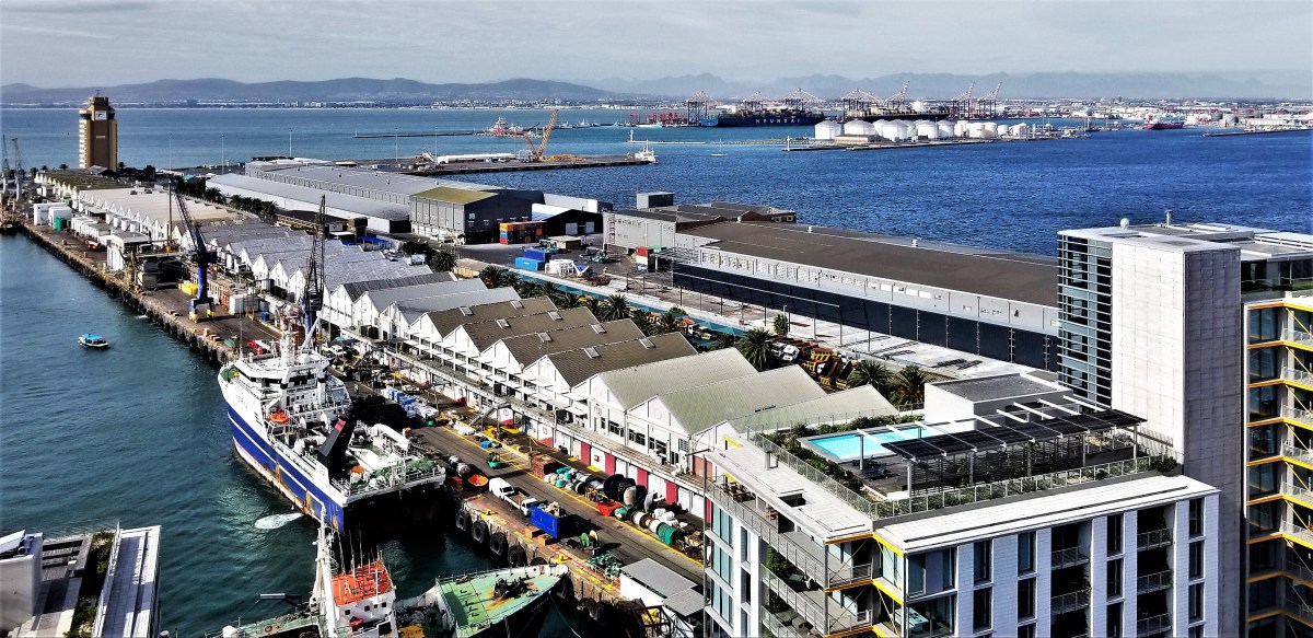
Once back on earth, we headed past the shipyards…
and along the canal…
to Battery Park, a greenspace where families gather to skate and picnic.
After reaching City Hall in the distance, we doubled back to the waterfront, eager to continue the next part of our journey in search of wild animals.
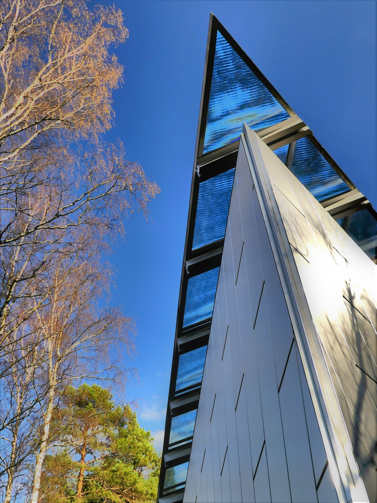
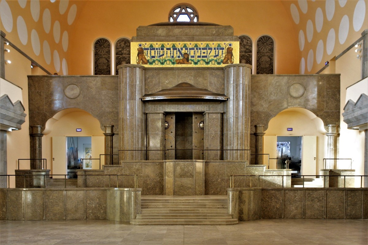
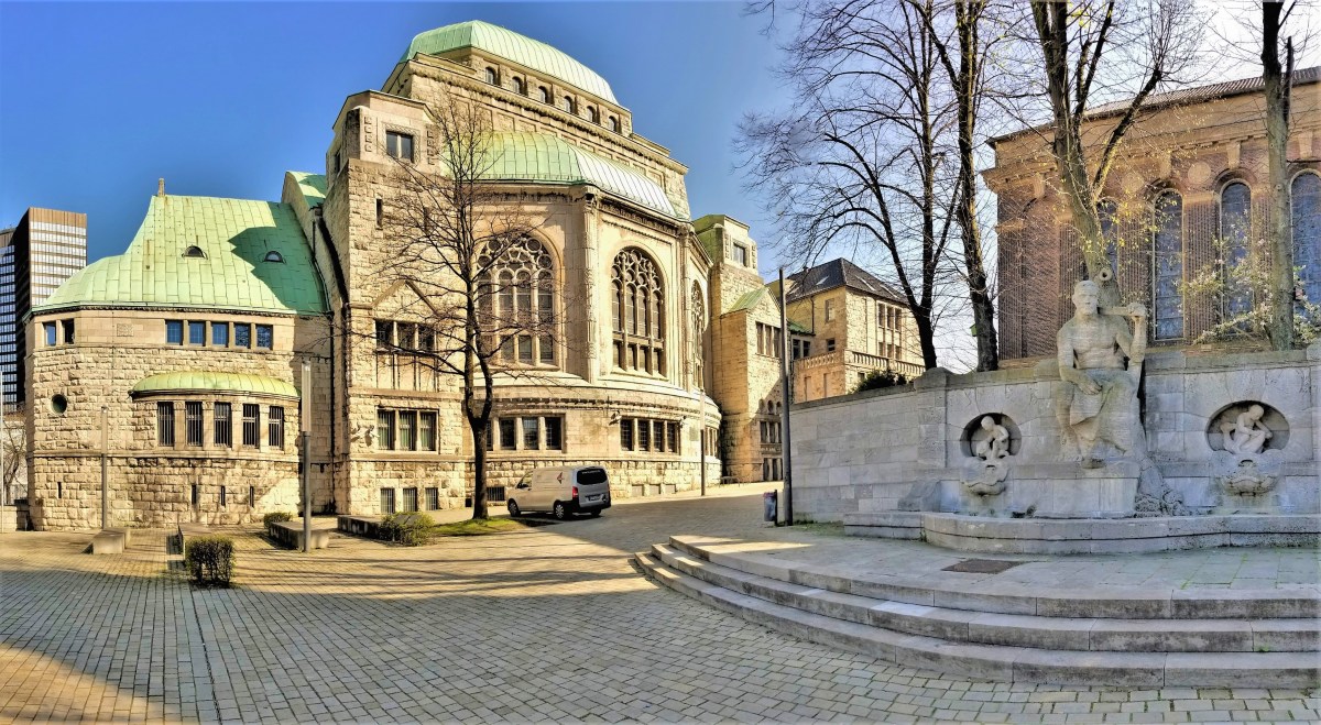
The Neue Synagogue of Stalerstrasse was consecrated in 1913 from Edmund Körner’s designs, and was Essen’s cultural and social epicenter for the 4500 Jews around town. With its four striking copper cupolas,
it was considered one of Europe’s largest and architecturally significant synagogues of all time.
Twenty-five years later, the synagogue burned at the hands of Nazis on the eve of Kristallnacht, while onlookers could only watch in horror and dismay.
Neue Synagogue burning, Photo Archive Ruhr Museum (photographer unknown)
Fire engines stood guard as a precaution in case adjacent buildings should accidentally catch fire while the synagogue continued to burn.
Although the synagogue’s interior was plundered, vandalized and badly scarred by fire,
and intense Allied bombing scored direct hits on the Krupp artillery and munitions factory nearby,
Repairing Tracks at Krupps Plant, Essen, Germany, 1945. Photographer Margaret Bourke-White.
the exterior of the synagogue miraculously survived against a backdrop of rubble.
My mother’s family worshipped at the Neue Synagogue from the time her parents settled in Essen in 1919. One of her earliest memories was sitting in the chapel listening to her father chant the Sabbath prayers from the bimah.
By 1988, the synagogue had been restored to its original splendor, and to the world, represented a shining memorial of the German resistance.
In August, 1999, despite my mother’s solemn vow to never return to Germany, her views were softened by Essen City Council’s olive branch of restitution, and she accepted their invitation to once again visit the synagogue she loved, and reflect on her upbringing. Twenty years later, Essen City Council officially decreed the Alte Synagogue as a “House of Jewish Culture.” Following my visit to Bergen-Belsen, I met with Martina Strehlen, the Deputy Head of Research Collections of the Old Synagogue to experience this cultural landmark, the origin of my mother’s Jewish roots, and to review specific archival materials. Martina clearly recalled my mother’s visit 20 years ago, and eagerly shared copies of artifacts she had donated to the research center’s collection.
Rose Straws, my grandmotherProof of Registration for Menil Strawzinski
Afterwards, I stood in the warm sun for a time and marveled at the significance of the Old Synagogue sharing a courtyard with the Church of Peace.
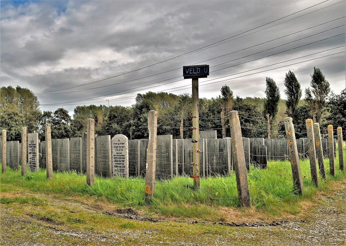
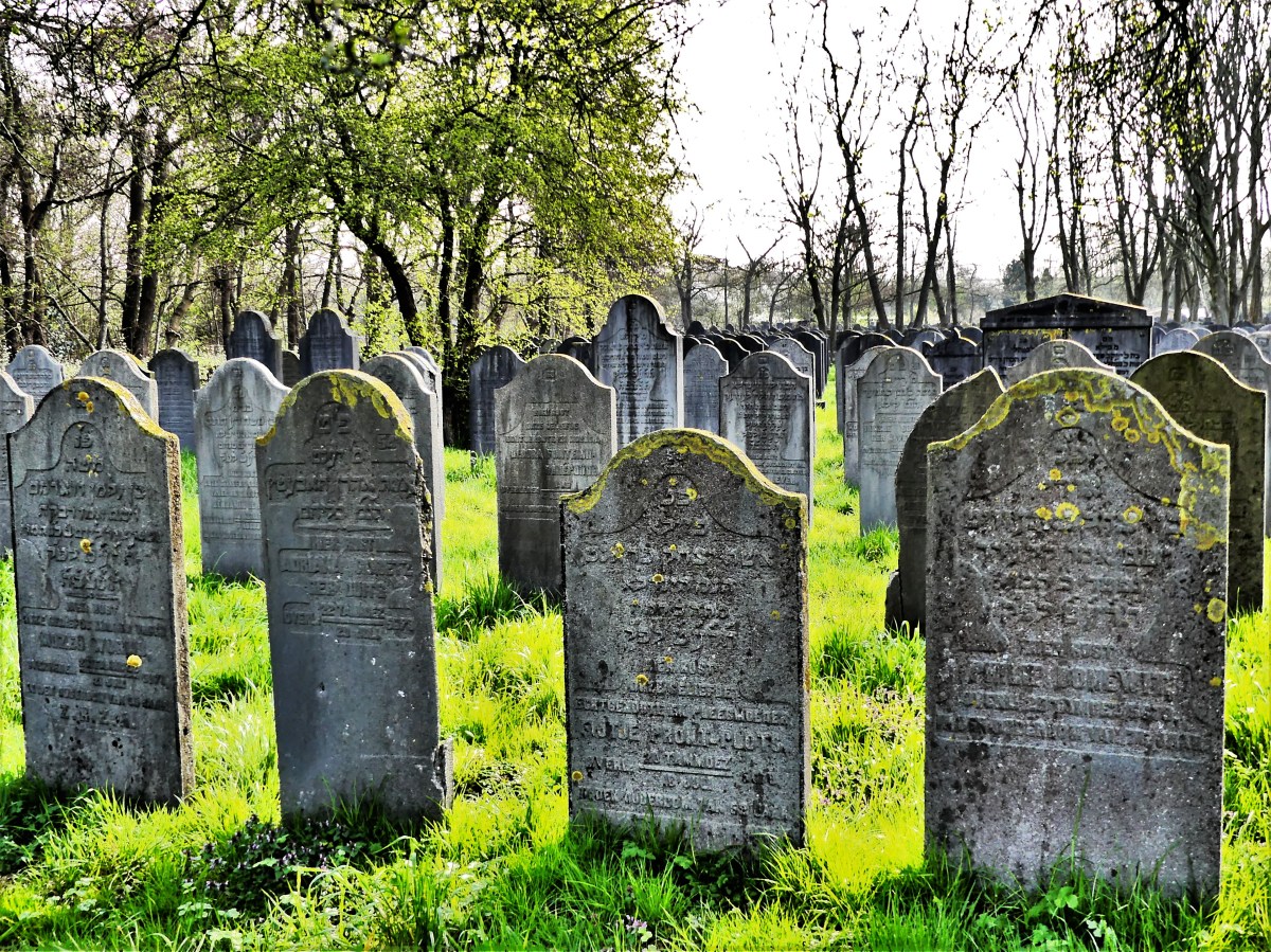
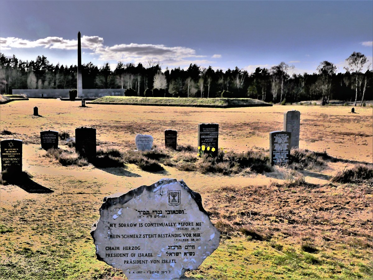
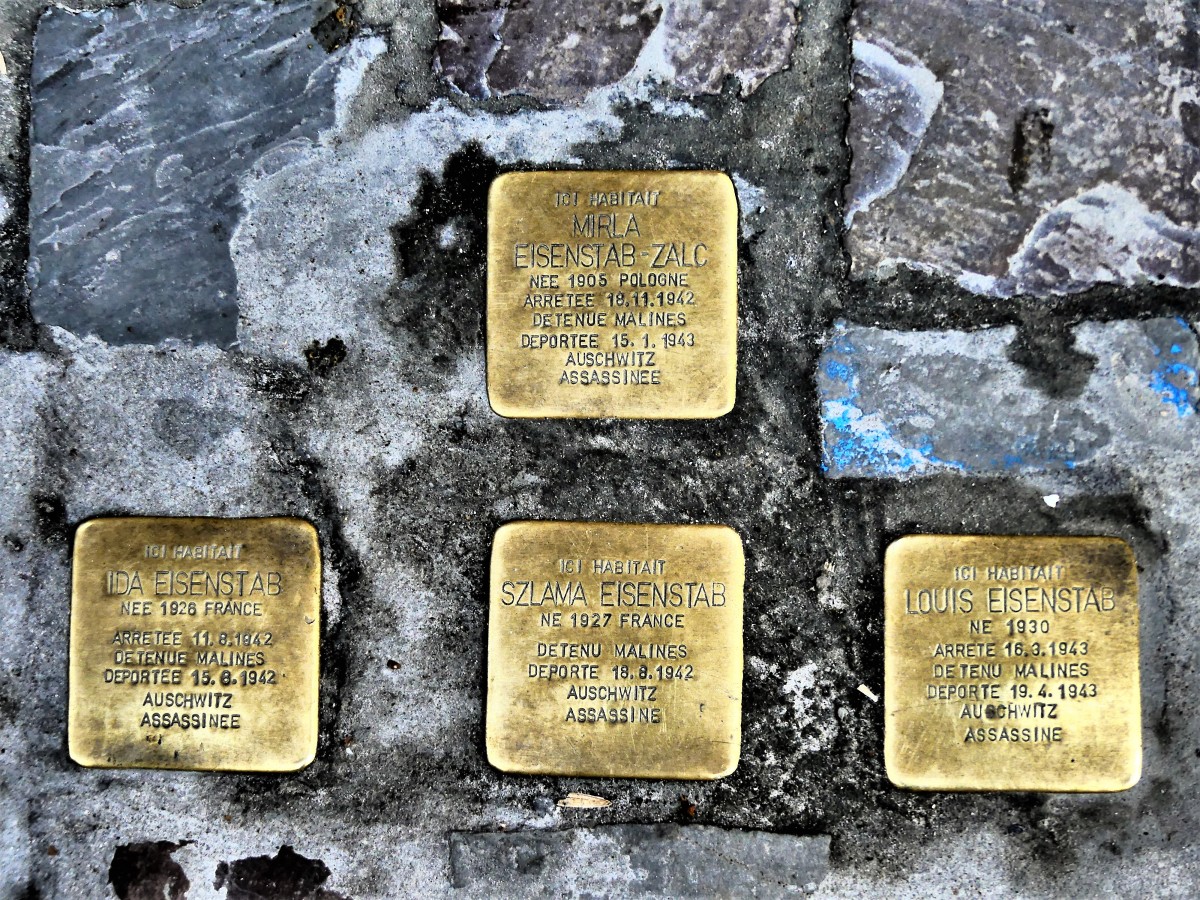
I was nearing the end of my journey, but there was one last deed to fulfill. Before returning my rental car to Amsterdam, I would first stop at the Jewish Cemetery of Diemen, located just outside Amsterdam’s city limits, and search for my grandfather’s grave.
Records indicate that Mnil Strawczynski was cremated on September 5, 1943, and his remains were transferred to Field U–a remote and overgrown plot of closely stacked headstones memorializing the 400 urns from Westerbork Transit Camp during Nazi occupation.
Walking the cemetary alone against a gray souless sky, I felt a odd closeness to someone I had never met, but had come to know through scattered remnants of research.
But I was no closer to the closure I was seeking.
With each stone unturned, a mountain of questions have been unearthed,
yet the answers are as obscure as the inscriptions on these markers.
I wanted more time in Amsterdam, but time wouldn’t allow it. I still had to reckon with Germany, and Bergen-Belsen was my first test. Google Maps predicted a 4.5 hour drive time, but then again, Google never consulted me about driving on the Autobahn. I rented a SEAT Leon–a car I knew nothing about–but was assured by the agent that, “SEAT Leon is a useful car to get from point A to point B.” “Never heard of it before. What kind of car is it…compared to more popular carmakers?” I asked. “Think of it as a sportier Spanish version of a VW Golf,” he informed. OK, I thought. That ought to do, and it seemed so appropriate considering how close the concentration camp is to Wolfsburg, home of the VW factory and largest automobile plant in the world. For a third of the way, I had to watch my speed, before crossing the country border into Germany. But once A1 turned into A 30, I was off to the races.
Ordinarily, 130 kph (81 mph) is the top-posted speed limit on highways, but for many high performance vehicles, that’s akin to standing still. When clear of frequent road repairs, much of the Autobahn carries three lanes of traffic: trucks and turtles in the right lane; quasi-regulation speed in the middle lane; and Mach 1, bat-outta-hell speed in the left lane. I waited patiently until I reached De Poppe, where I overtook a BMW 3, and throttled the accelerator as I pushed the transmission into top gear. This was life in the fast lane. When the speedometer crossed 170, I set my sights on the next middle-lane creeper, a Fiat 500. My cruising speed topped 190 and flattened.
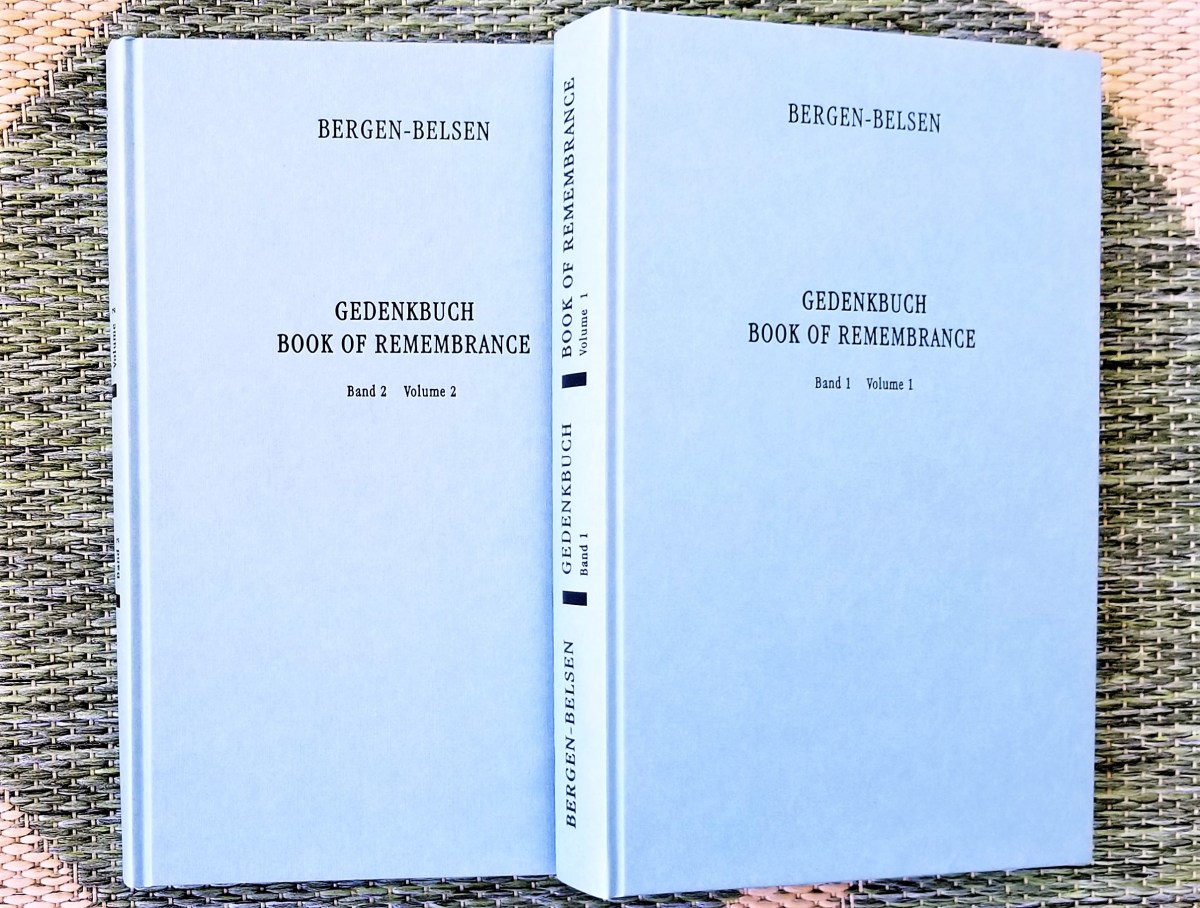
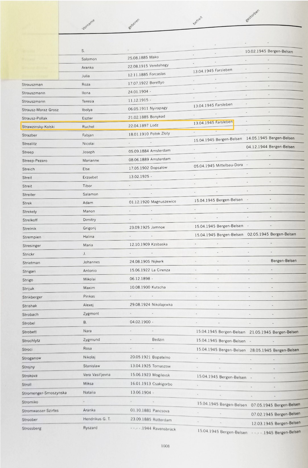
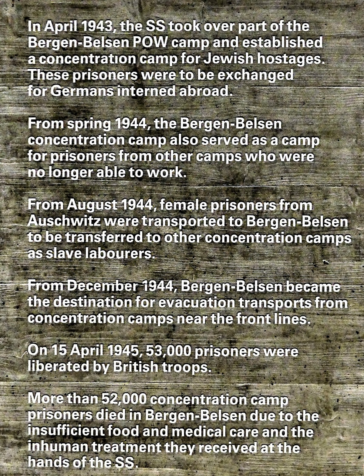
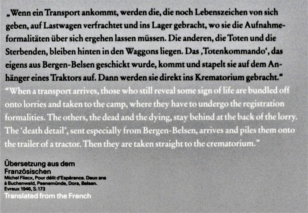
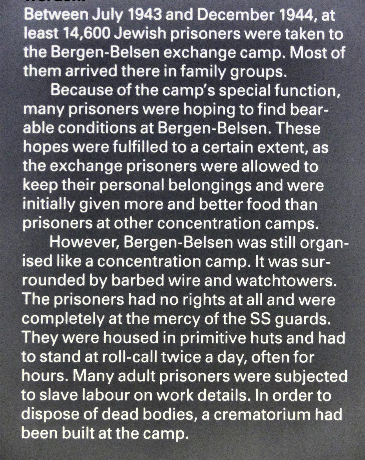
The Fiat was coming up fast on my right. I checked my mirrors, and suddenly discovered the front end of a Mercedes-AMG GT filling my rearview and flashing its headlights. Seriously?! Within seconds of passing the Fiat?! I stood my ground–I was committed to passing the Fiat–it was my right! Of course, my tailgater thought the same. The roadster was so close, I could have been towing him. And now its syncopated horn was blaring. In my fantasy, it probably resembled a Grand Prix pas de deux, but in reality, it was German intimidation. I sped past the Fiat and quickly crossed back to the middle. The Mercedes effortlessly blew by me doing no less than 240, and in a blink of an eye, my nemesis was beyond my driving horizon. Thereafter, I occasionally found my way back to the rocket lane, but I was content to run, where others were meant to fly. Nevertheless, I managed to shave a half-hour off my run time as I took my exit. The scenery turned verdant green as I shot down the lonely country lane. Trees were filling in, crops were sprouting, and accents of color from wild flowers popped against a cloudless sky. I was racing to Bergen-Belsen–not knowing what to expect–but once I sensed the immediacy of my arrival, I purposely down-shifted my anxiety to regain control of my emotions. I sat in the parking lot for a minute with the engine idling, thinking about the history of this place and its connection to my family, and the untold suffering and misery caused to so many others, that I wept. It wasn’t a long cry, but long enough to strengthen my resolve. I entered the facility, where I met Simone, who sat behind the desk of the documentation center… and I restated my purpose. She took my grandmother’s name and cross-checked it against the memorial registry. It’s estimated that more than 50,000 people died of starvation, disease, brutality and medical sadism while interned at Bergen-Belsen. When British Allies liberated the camp on April, 15, 1945, they discovered over 60,000 prisoners, most of them sick or dying. “You are very fortunate. Just before the Liberation, the Nazis destroyed most of their records to hide their crimes. We have records for only half the prisoners held here, but lucky for you, your grandmother’s name is on the list,” she said with excitement. And then she presented me with twin volumes… and flagged the most significant page in Volume Two, which caused my heart to race. Simone offered a map of the museum, and I got started on my quest.
My time was limited and I was feeling overwhelmed by the site of so many artifacts–laid out like a trail of evidence–to narrate a place in time when human beings behaved at their worst.
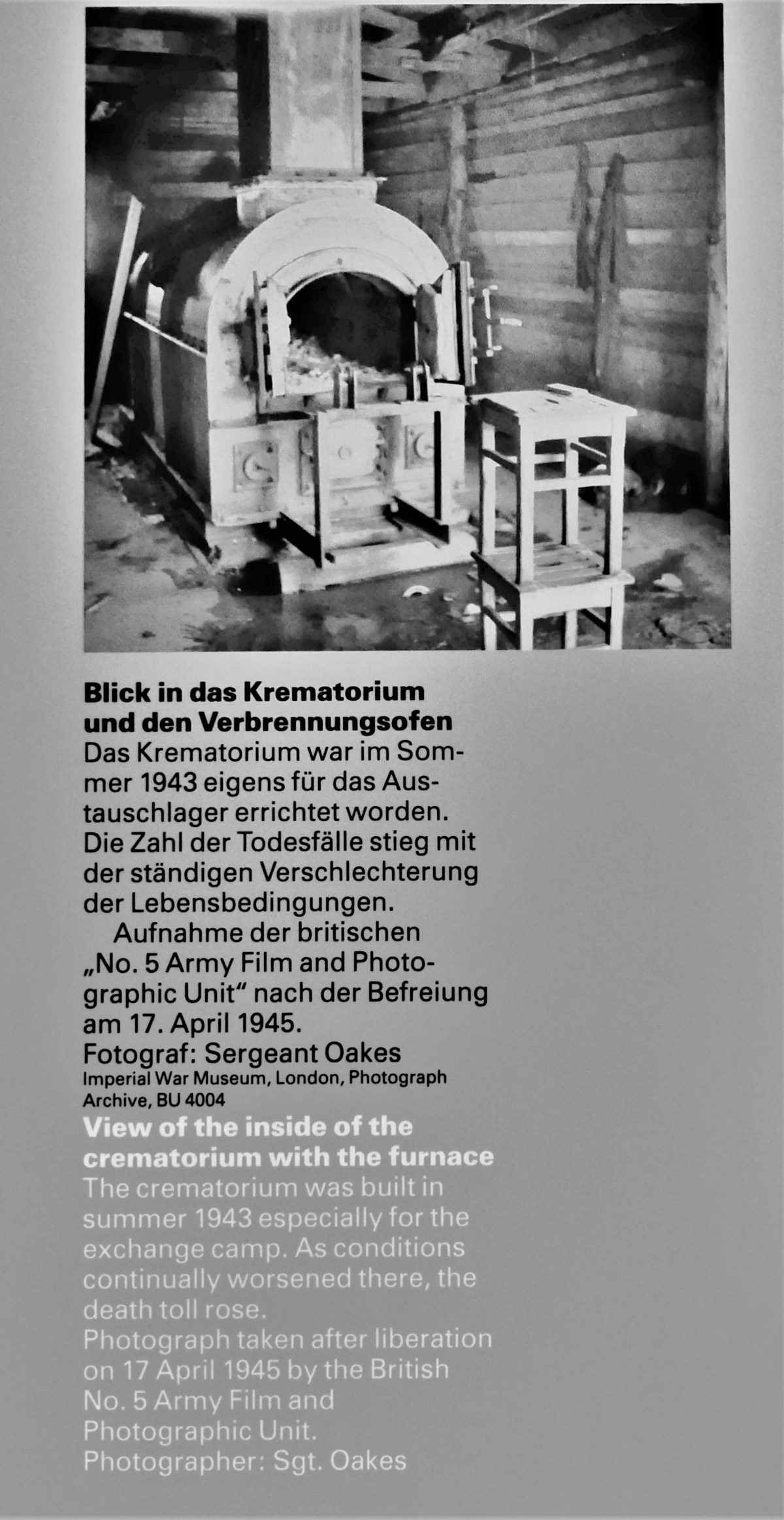
Standing there, I was seeing the truth stripped bare, and this sensation was getting in my way of collecting clues of my family. Square window boxes have been dropped into the cement floor, representing the found objects that archealogists have unearthed…
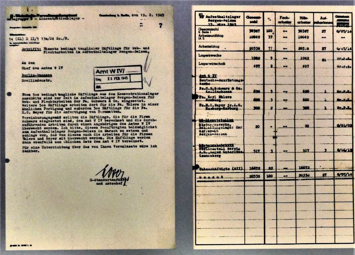
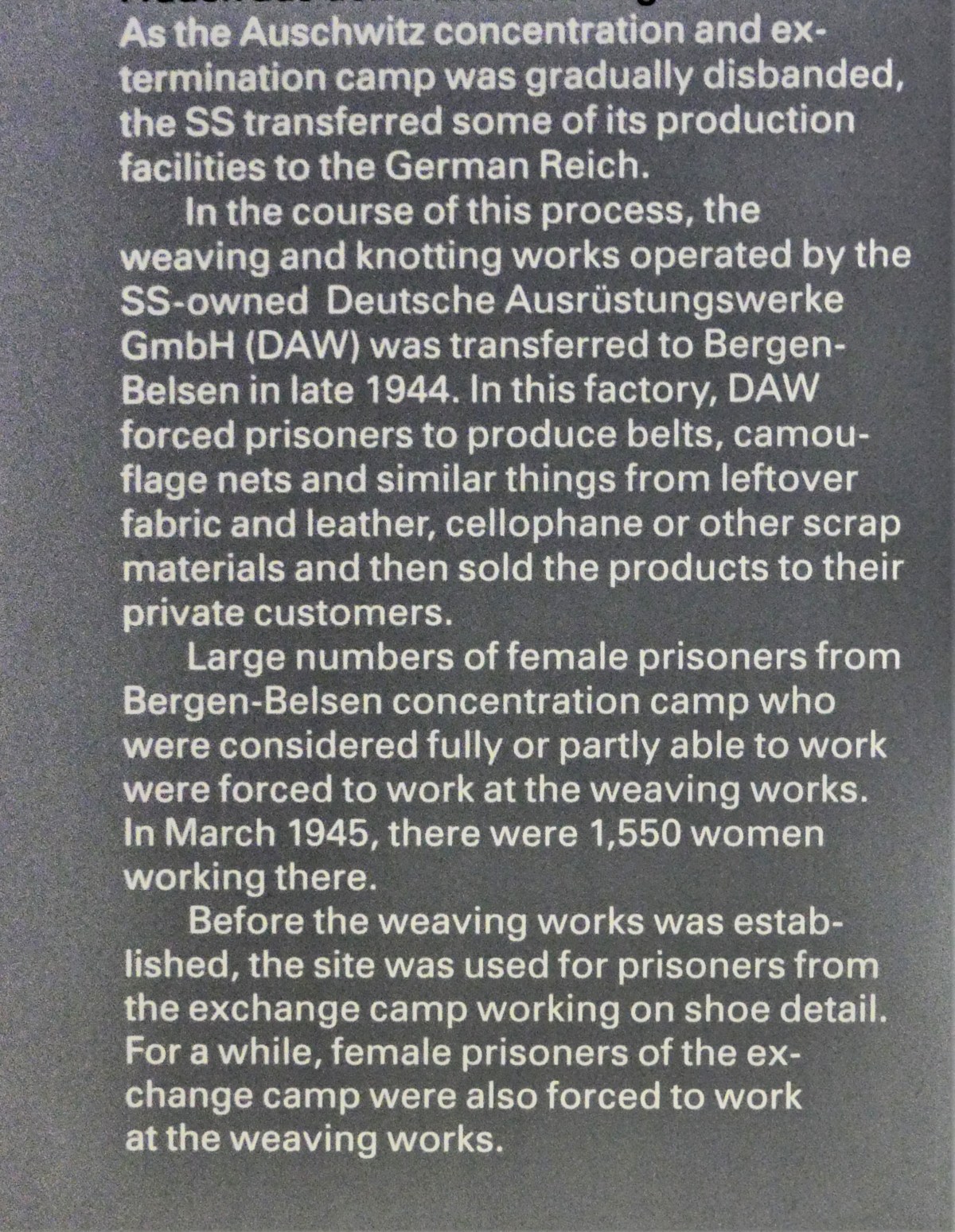
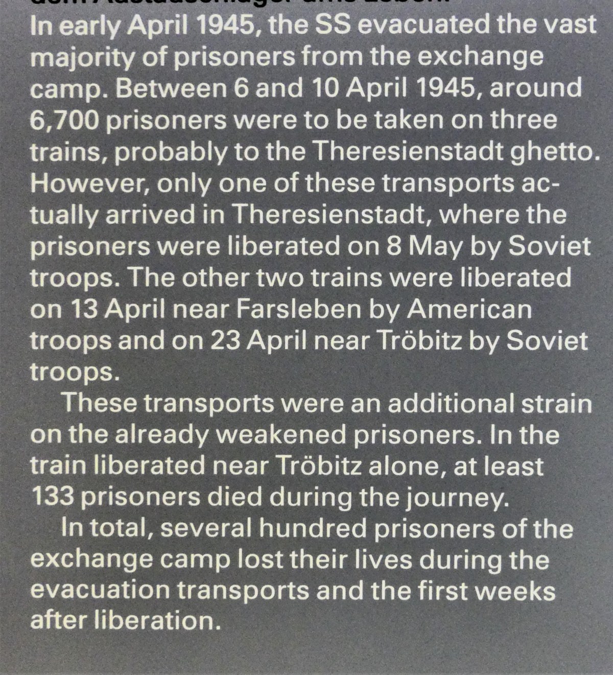
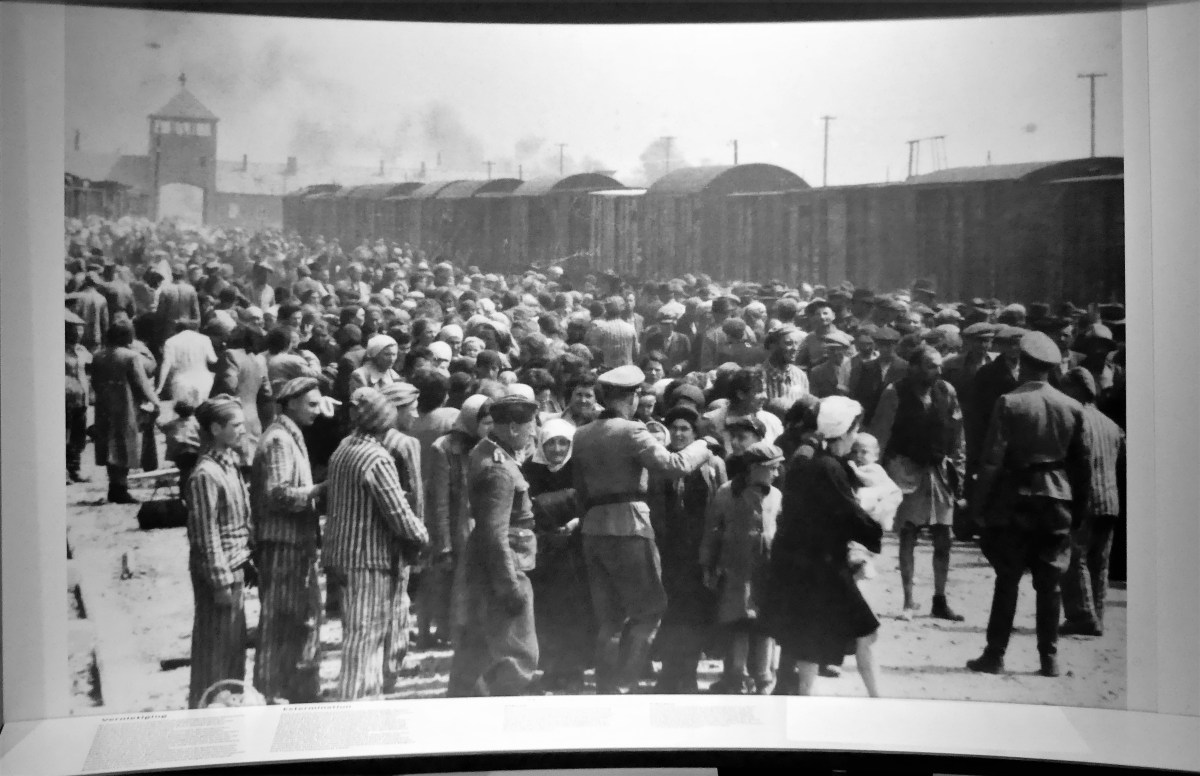
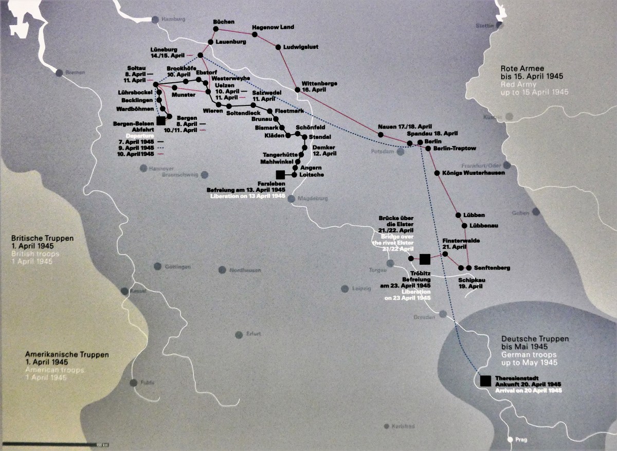
after the camp was incinerated by the Brits to control the spread of typhus. Walls of displays detail the story of the horrors within… Because of my correspondence with Bernd Horstmann, curator of the museum’s Register of Names, I learned that Grandma Rose arrived at Bergen-Belsen from Westerbork on January 12, 1944 with 1,024 other Jews, and was detained at the Star Camp, a subsection of the Exchange Camp… Because Grandma Rose had value to the Nazis as a seamstress, she was most likely deployed to the SS-owned Weaving Works, which forced women to produce items from scrap materials, in addition to repairing inmate uniforms. Although living conditions at the Star Camp were considered better than other blocks within Bergen-Belsen… the indignity and torture was more than enough to drive many of the prisoners mad. Nonetheless, a code of conduct ruled inside the huts, in sharp contrast to the chaos and barbarism that reigned on the outside. Having been relegated to Block 20, Grandma Rose was beholden to Jewish Elder, Joseph Weiss. In time, as surrounding concentration camps closed, Bergen-Belsen saw a dramatic increase in inmates. Originally intended as a Soviet POW camp for 20,000 prisoners, the camp population swelled beyond imagination and sustainability. By April, 1945, the Third Reich learned that the Allies had broken German defenses from the west and the south as the Soviets were advancing from the east. On April 7, 1945, Grandma Rose was among the first to be loaded onto a cattle car initially bound for Thereisenstadt, but destined for the gas chambers. Of course, none of the transportees knew where they were going or what to expect on the other side of their living hell, except continuing sickness and certain death. After six days of unimaginable terror on the rails, Grandma Rose’s train was liberated near the German village of Farsleben on April 15, 1945 by American soldiers from the 743rd Tank Battalion of the 30th Infantry Division.Still-unidentified women, moments after liberation, April 13, 1945.Courtesy of the Gross family
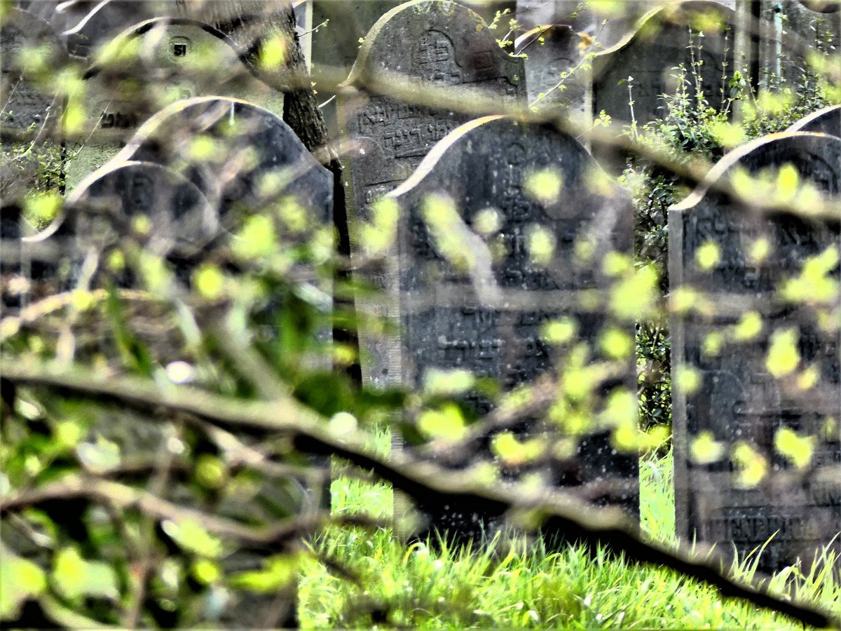
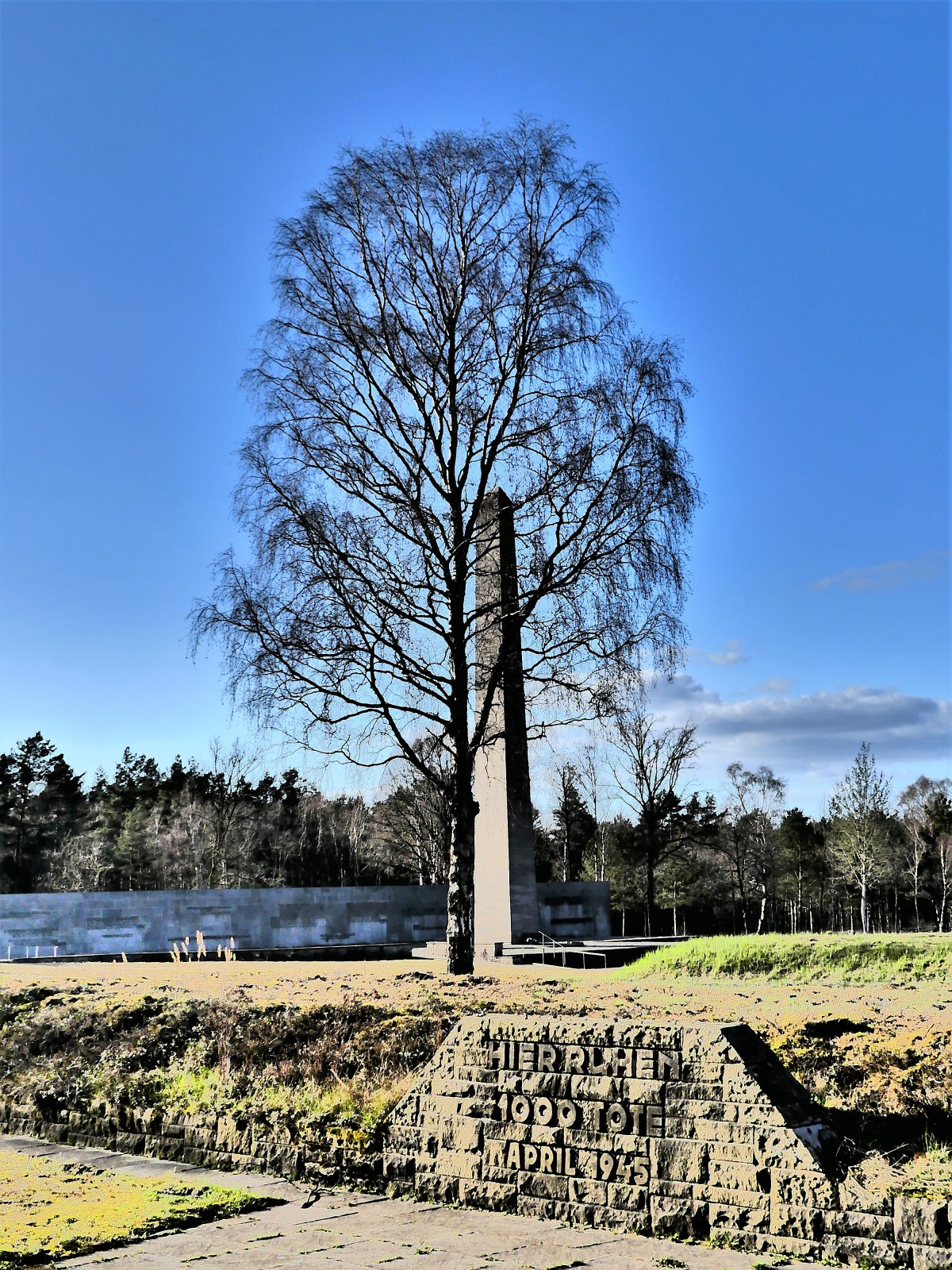
Maj. Frank Towers, who also took part in the liberation, organized the transfer of Grandma Rose and the other 2,500 freed prisoners to a nearby town, Hillersleben, where they received medical treatment from Allied troops. Grandma Rose weighed 90 pounds when she admitted to the field hospital. I felt I had reached my capacity for absorbing the inhumanity justified by the Nazis in their quest for the “Final Solution”. I didn’t know if I could process any more of it, but there was one last exhibit inside the Film Tower that was impossible to ignore, no matter how difficult to endure. Eventually, the museum was cleared at 5pm. As many as 10 other patrons filed through the exit and into their cars, leaving me with another couple to roam the cemetery grounds on a beautiful Spring afternoon. There are no tombstones on the grounds, but there are government memorials… and government tributes… and personal markers. scattered among a cluster of memorial mounds… where the unknown remains of tens of thousands of victims share a mass grave beneath the berm.
(please be advised of extremely graphic content)
I found solace inside the House of Silence, an outlying metal and glass edifice on the edge of camp, in the midst of a grove of birch trees… where a soaring meditation room offers space for personal reflection, and an altar for hundreds of tokens of healing and prayer. Bergen-Belsen is a sad place that offers little redemption beyond the nagging reminder that people have the capacity for immeasurable cruelty toward each other–as if it’s in our DNA–and this is our scar for future reference.Surely, a solemn oath from each of us to “never forget,” brings us one step closer to “never again.” But this memorial also challenges us to check our speed. We need to slow down and be mindful of the world around us in order to listen closely for the pulse of hatred that still beats among us, lest we drive down this familiar road again, ignoring the vital signs of tolerance, freedom, and understanding. A “Search for Closure” concludes with Part 3.
A recent two-week trip abroad was much more than a European romp through a handful of city centers. My mission was ambitious: to gather relevant data on my mother’s ancestry that has thus far proved elusive, and reconnect with family across the Atlantic whom I haven’t seen in nearly 48 years.
My itinerary took me through the highlands of Scotland, to the canals of Holland, to the Rhineland of Germany,
with travel hubs in Edinburgh,
Amsterdam,
and Essen,
before taking a breath, and finishing strong as a tourist in Brussels,
and Paris.
Each stop was consequential in my quest to uncover vital research of my mother’s epic escape from Nazi Germany, and the endless road taken to reunite her broken family.
This was not an easy trip, but I could sense that during the planning stage. Yet, preparing myself for the inevitable and predictable emotional turmoil was balanced by the prospect of discovery–knowing that every step was taking me closer to connecting the dots.
Starting in the UK, I then worked my way back in time to The Netherlands, and eventually Germany–where it all began–but it was Amsterdam that proved most pivotal in my discovery and the epicenter of my travels, because it was Amsterdam that first offered safe harbor and hope for two young sisters, who until then, only had each other.
It was in Amsterdam that my long-distance cousin Jude and I began to fill in the missing pieces.
It so happened that a landmark exhibit of rare photographs at Amsterdam’s National Holocaust Museum coincided with our visit, and immediately became a must-see.
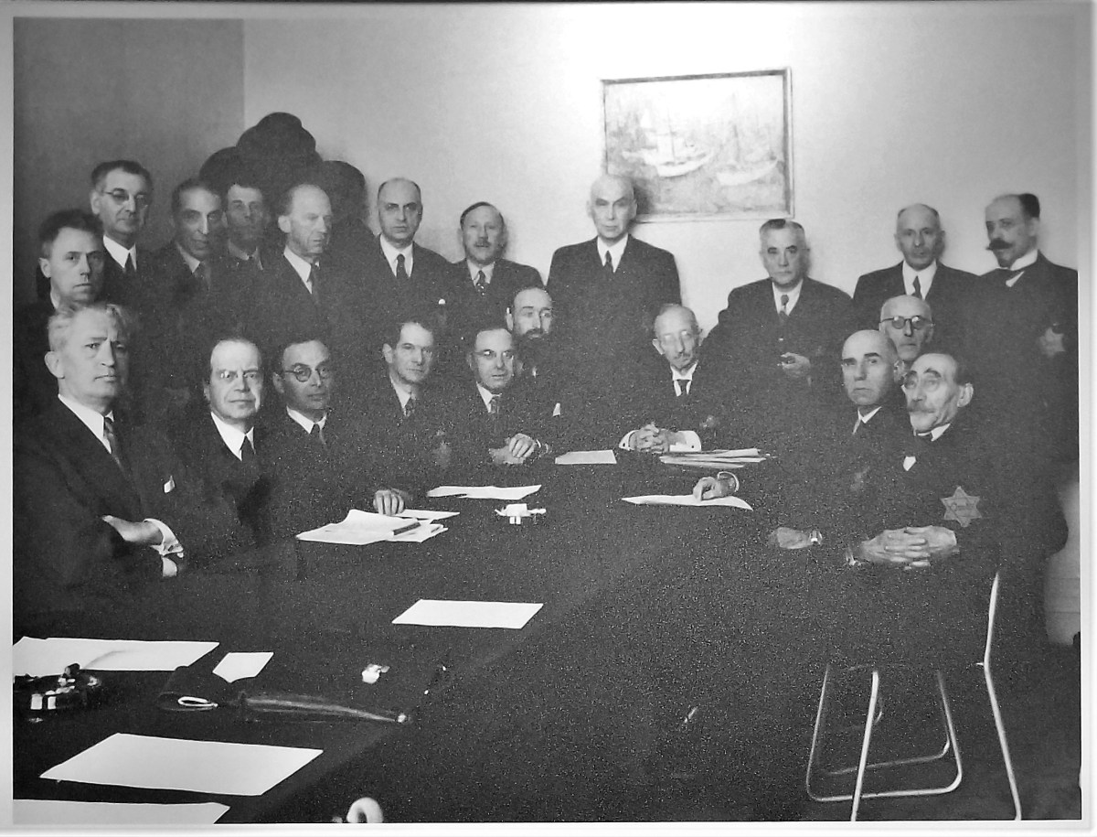
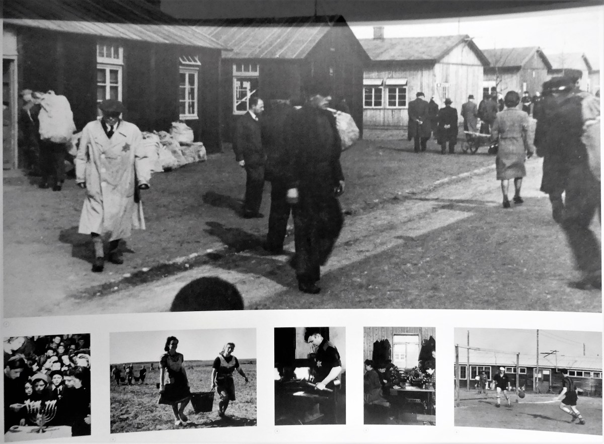
A large number of photos were taken by professional photographers, mostly commissioned by German authorities for use as propaganda.In addition, there were also countless amateurs who photographed the persecution and deportation of the Jews.The NIOD (Institute for War, Holocaust and Genocide Studies) manages by far the largest photo collection on this theme and conducted extensive research into the visual history of the persecution of the Jews in the Netherlands.Countless archives at home and abroad were consulted;this has led to the discovery of many still unknown photos. The exhibition shows a large and representative overview of the photographic recording of the persecution of the Jews.The images show in a penetrating and confronting way, the consequences of the anti-Jewish measures in the occupied Netherlands.They bear witness to the merciless behavior of the German occupiers, the cooperation of the Dutch in the deportations, but also the help to people in hiding and to the daily Jewish life during the occupation.In addition, attention is paid to the post-war reception of the few survivors from the camps and those who returned from hiding.
First greeted with a timeline of events,
we proceeded through an open-air corridor and into a subdued chamber, where mostly elderly patrons followed a photographic progression of Holland’s involvement in the war, and its impact on the Jewish population:
Experiencing the exhibit was numbing to my core, but still my senses were on high alert. What were my chances, I wondered, that of the 140,000 remaining Jews in Holland from 1940-1945, I might find a photograph of my grandmother stitching an article of clothing…
for the Jewish Council,
to match up with one of the few yarns she used to tell me when I was so much younger and unappreciative of her travails?
Perhaps, she could be the proper woman in the gray coat with the straight back walking the lane between barracks in Westerbork.
Or might I recognize her in a crowd of 2,500 faces that was awaiting one of three “death trains” to Theresienstadt after the Nazi command realized that the Allies were only days away from liberating Bergen-Belson on April 15, 1945.
At times, I used my camera as a shield to protect me from the full impact of the horror behind the photographs, thinking that if I could position myself as someone who is solely documenting the documents, than I could better insulate myself from the madness that she and so many others must have experienced.
An interactive Remembrance Wall occupied a room by the Museum foyer, encouraging patrons to search its ever-evolving database for the names and dates of Jewish victims who perished in Holland.
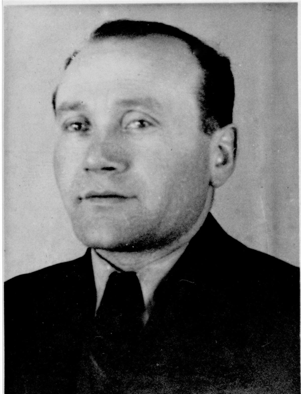
As a tribute to my unknown maternal grandfather Mnil…
I entered his name into the query window. He never survived Westerbork, and I had a quiet moment of reflection and gratitude for his courage to save his family before himself.
A two-hour drive to Kamp Westerbork with Jude did nothing to assuage my feelings of emptiness and sadness, but the site was ironically enlightening and beautifully serene.
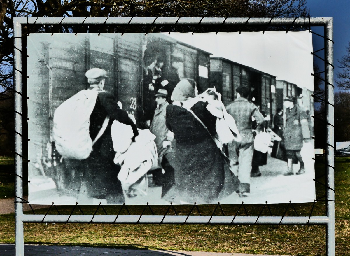
Once at the memorial museum, we were greeted by a train of suitcases, representing the cycle of detainees that the Dutch pushed through Westerbork over the years,
with an emphasis on the plight of 102,000 Jews who sacrified their lives, all for the sake of a twisted manifesto of hatred.
Jude and I met Guido, the senior conservator of the museum at the museum cafe,
where he eagerly shared news and theories of our grandfather’s demise and our grandmother’s salvation through a collection of registration documents.
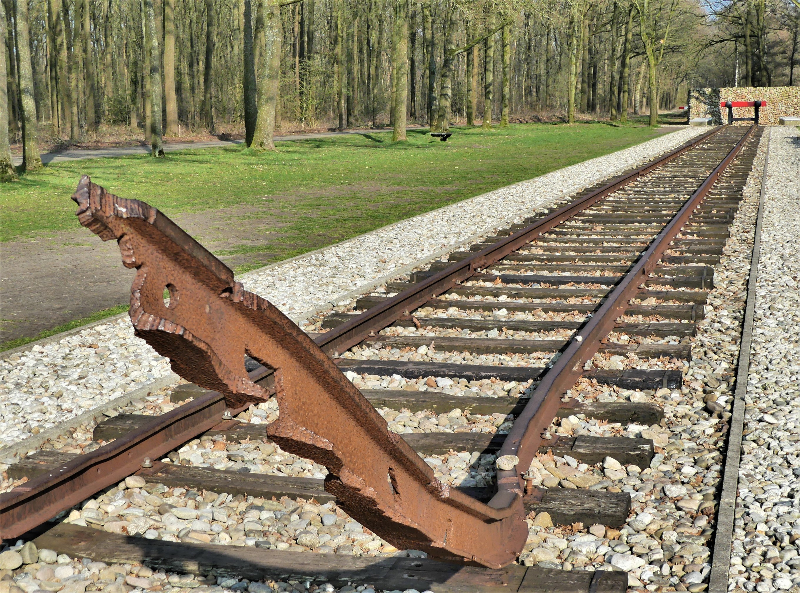
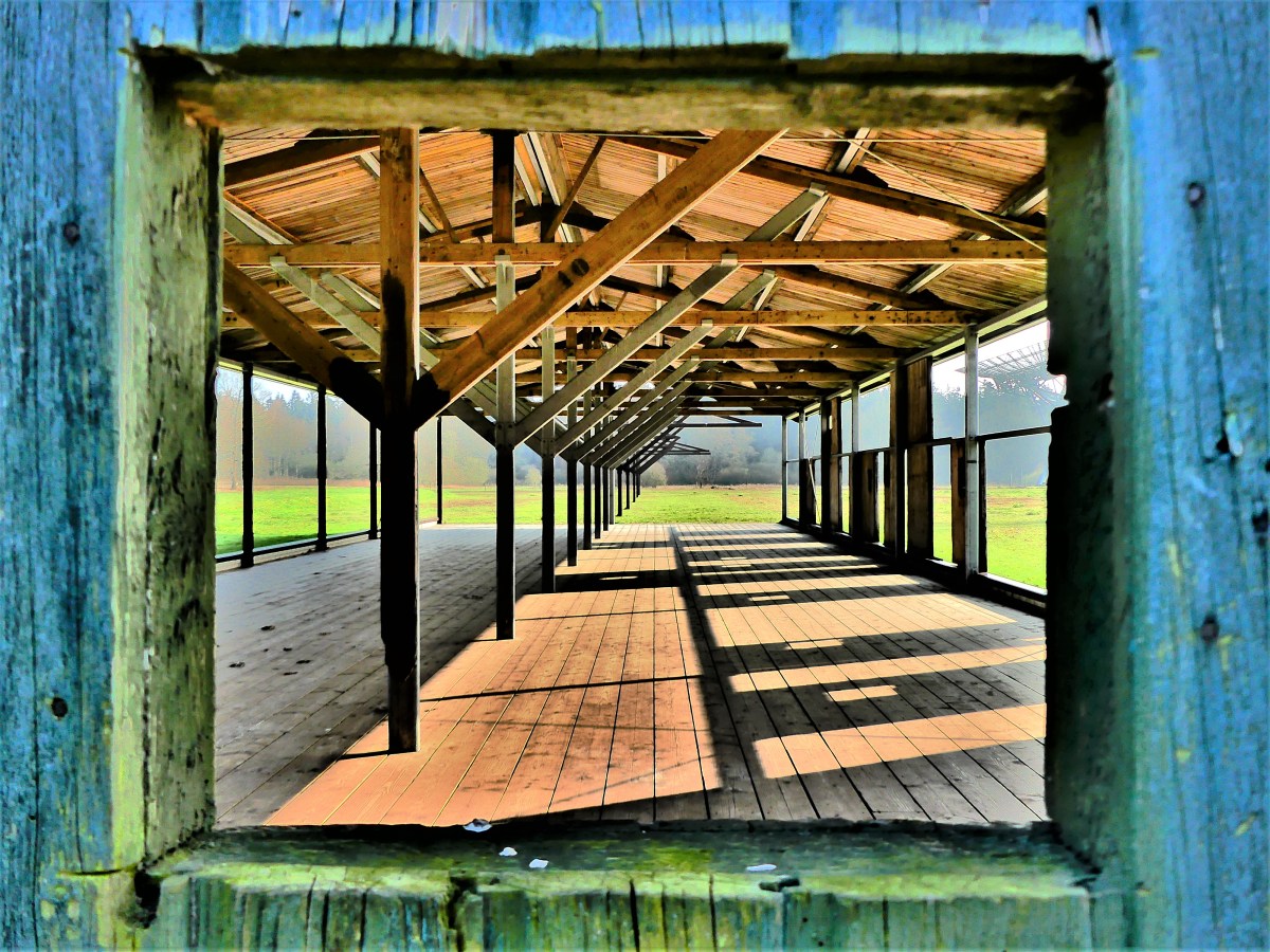
Two miles away, the hallowed grounds of the memorial can be reached on foot or by bus. Mostly empty space and green fields for an array of radio telescopes,
it nevertheless showcases a collection of iconic relics from the war that survived the Dutch government’s demolition of the camp in the 1960s.
There is a glass enclosure protecting the Commandant’s quarters;
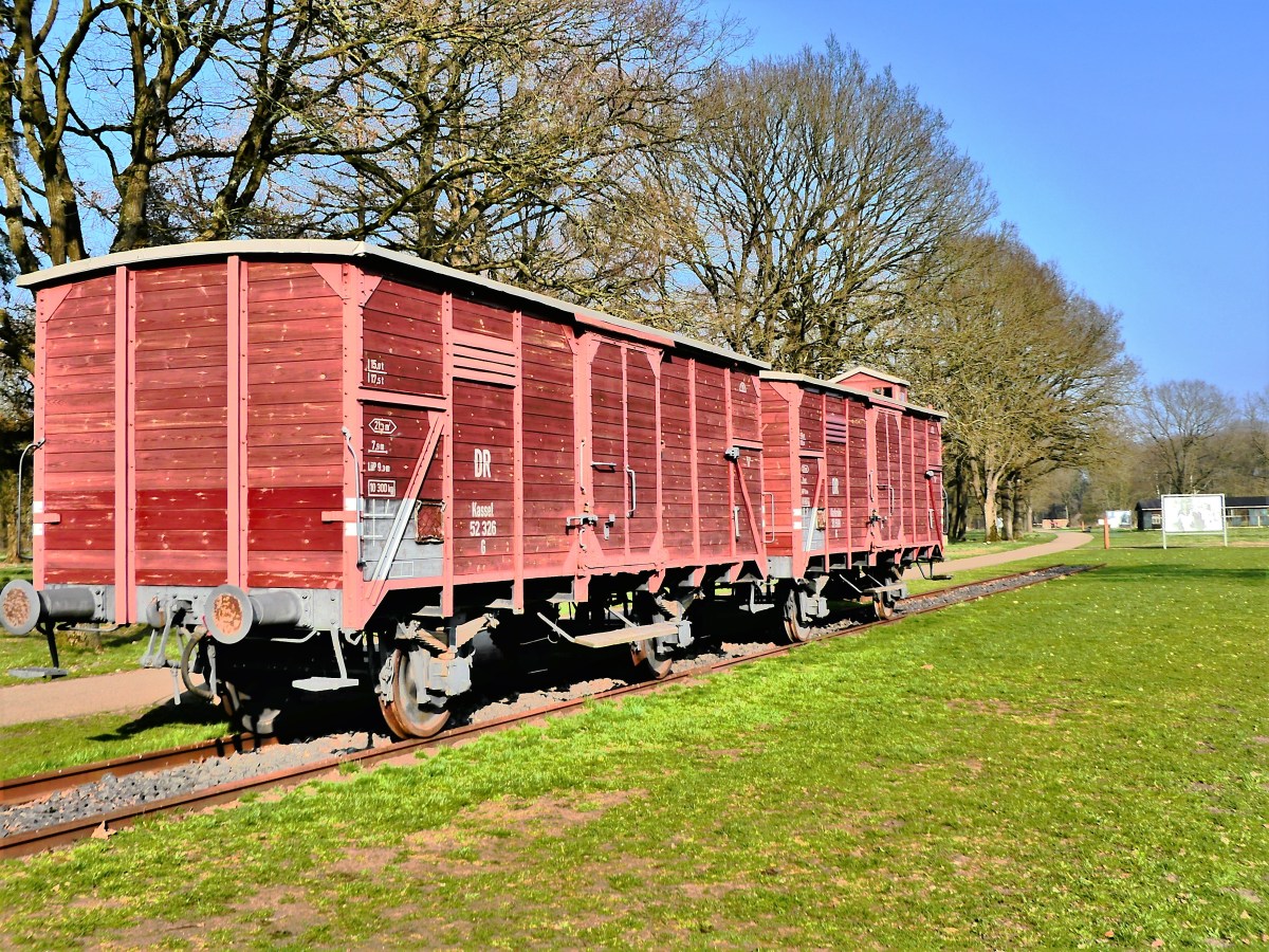
an original boxcar that stands as a testament to the 84 trains that transported Jews to Auschwitz and Sobibor,
where nearly all of the 94,643 persons deported were killed on arrival;
a monument to the 102,000 Jews of The Netherlands who passed through Westerbork…
and lost their lives;
the remnants of a barrack;
and a guard tower standing beside a metaphoric railbed.
I drifted from display to display, as if being involuntarily directed like a Ouija board peg–believing that I was somehow being programmed to walk in the footsteps of my grandparents.
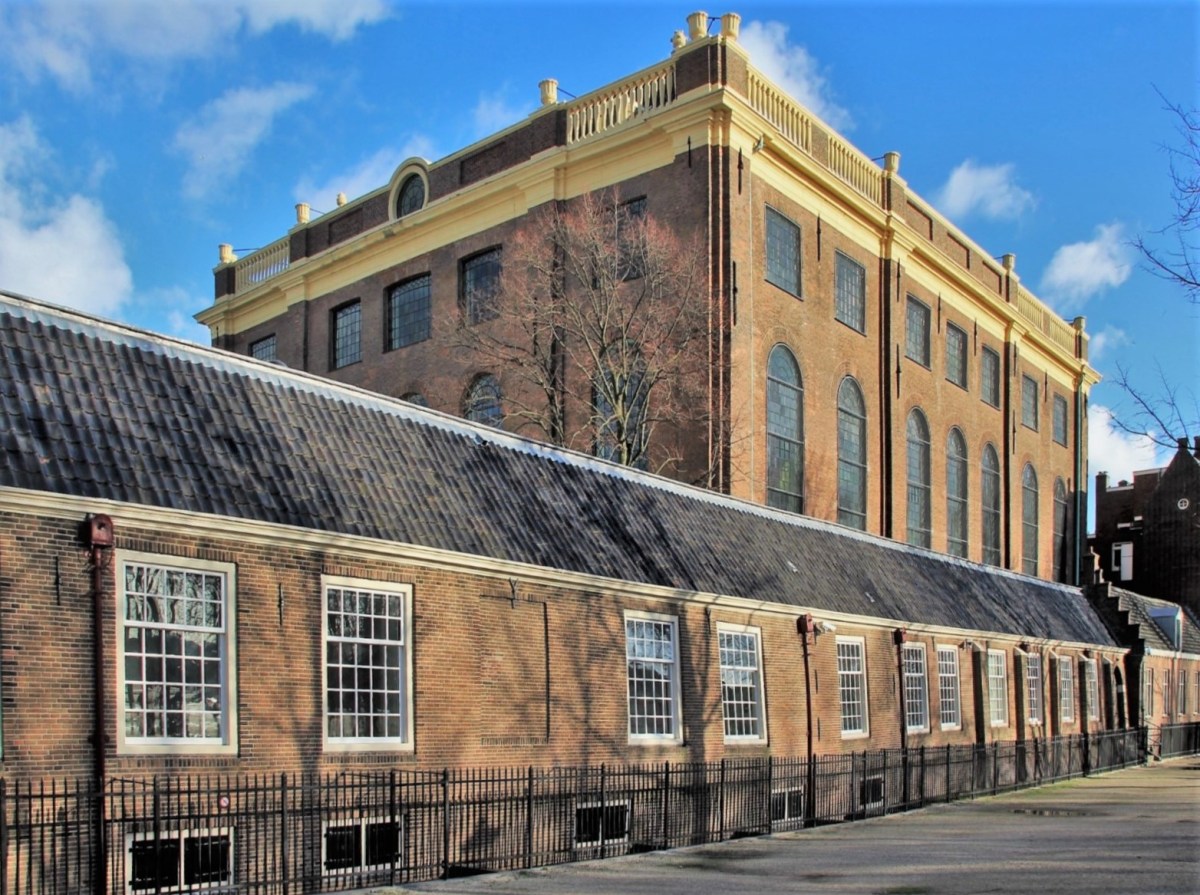
Upon return to Amsterdam, Jude and I strolled through the Jewish District, walking past the Portuguese Synagogue, an imposing Baroque structure completed in 1675, where most certainly, our family would have prayed, but sadly, never as a family;
and along Weesperstraat, past the Monument of Jewish Gratitude,
where a controversial limestone edifice will soon be replaced by Daniel Libeskind’s Shoah Memorial.
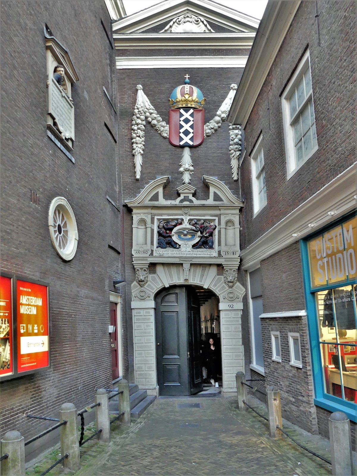
From there, we strolled in search of the Burgerweeshius,
once the landmark orphanage that sheltered our moms after they were transported from Soesterberg…
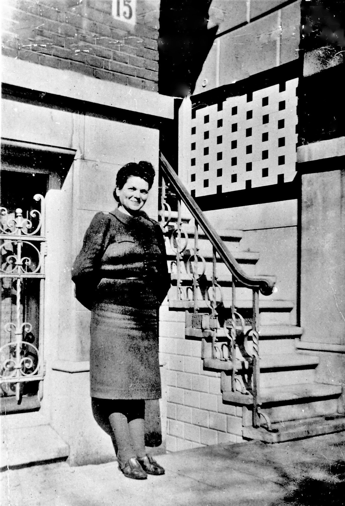
Bertie stands in the back row in front of the tree; Eva sits in the second row, third from the right
and now home to the Amsterdam Museum.
For one moment, I thought I could hear the faint and familiar sound of children playing in the courtyard–playing tag around the tree, and playing soccer across the herringbone pavers.
Amsterdam had much to offer. Walking through the city, I felt an eerie sense of belonging–not because of the dissonance of grief–past or present–but the resonance of a shared understanding brought about by reconnecting with my cousin, Jude and the revelation that Amsterdam’s secrets have become an open book of acknowledgement and remembrance.
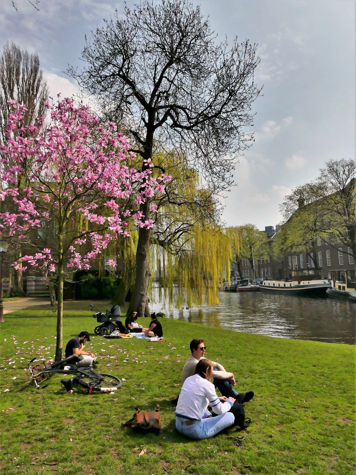
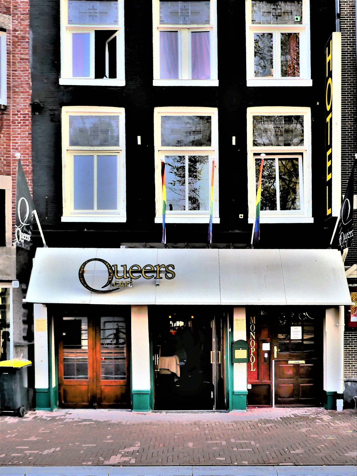
Peering into shop windows along the streets and canals of Amsterdam…
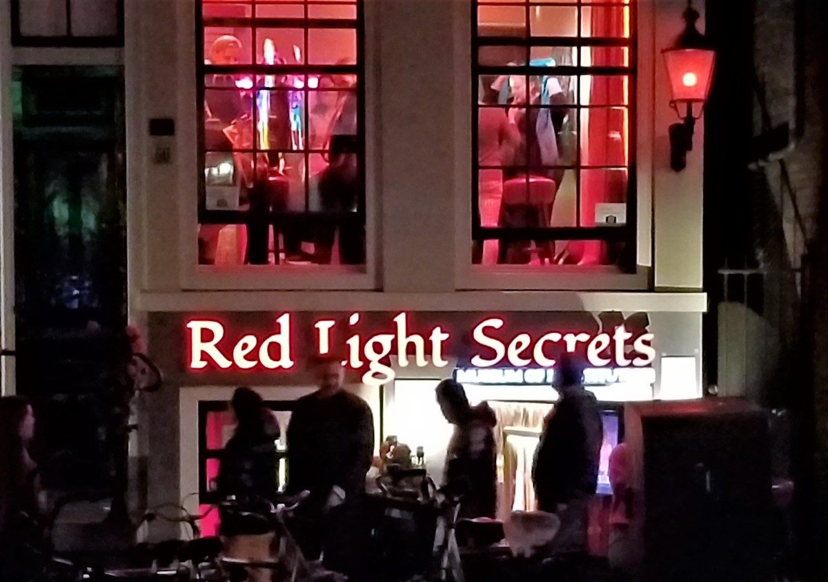
…presents many an oddity that will surely arouse the senses. Although, considering Amsterdam’s predilection and distinction for legal marijuana and prostitution, it would seem unlikely that there could be any room for other surprises.
Yet oddly enough, despite the merchandising overload of everything cannabis,
and the city’s penchant for 24-hr flesh peddling,
there is more to Amsterdam than just kink and circumstance.
There are also plenty of museums,
and enough al fresco cafés and frites stores to support a cultural and gastronomical battalion.
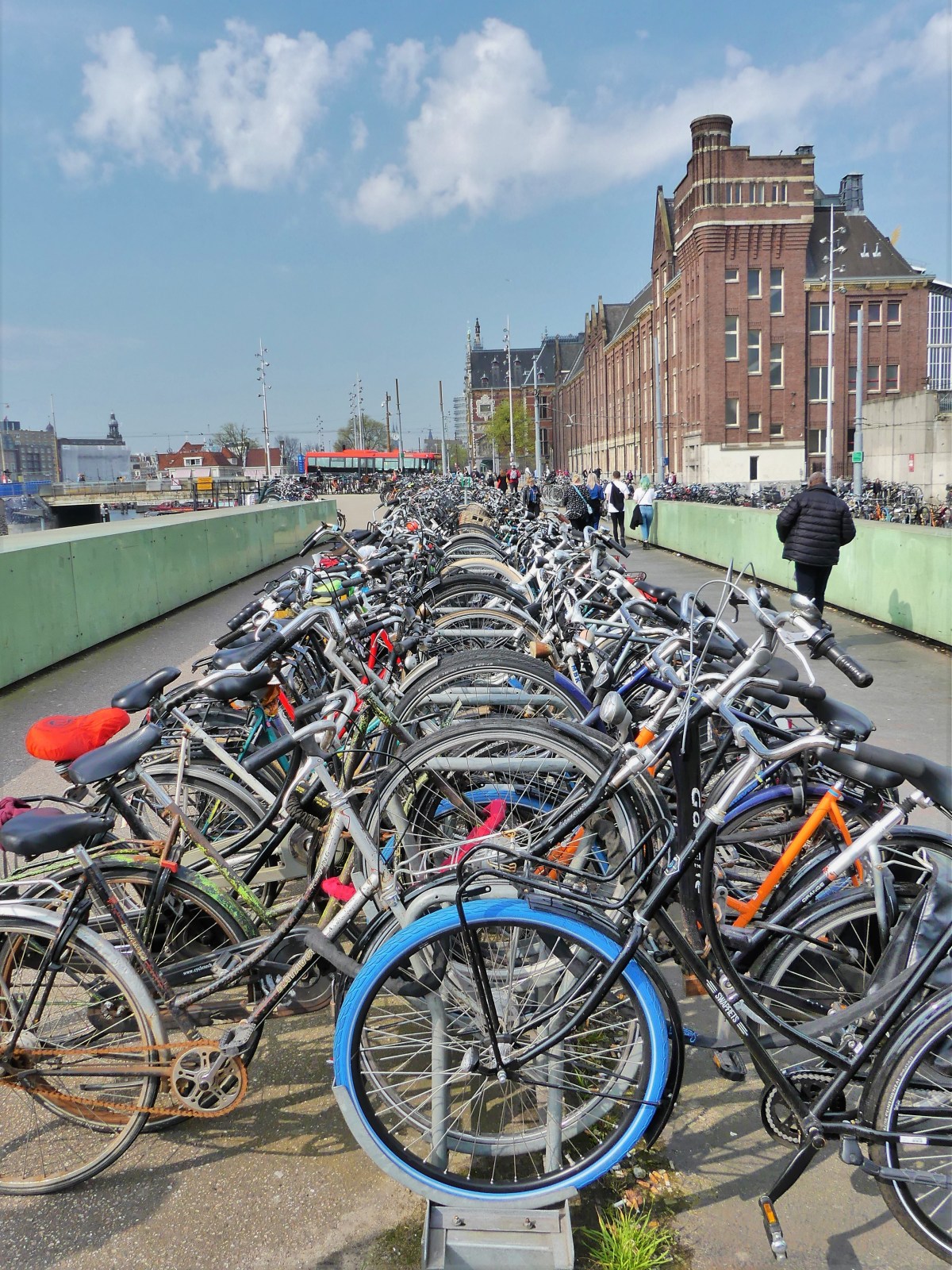
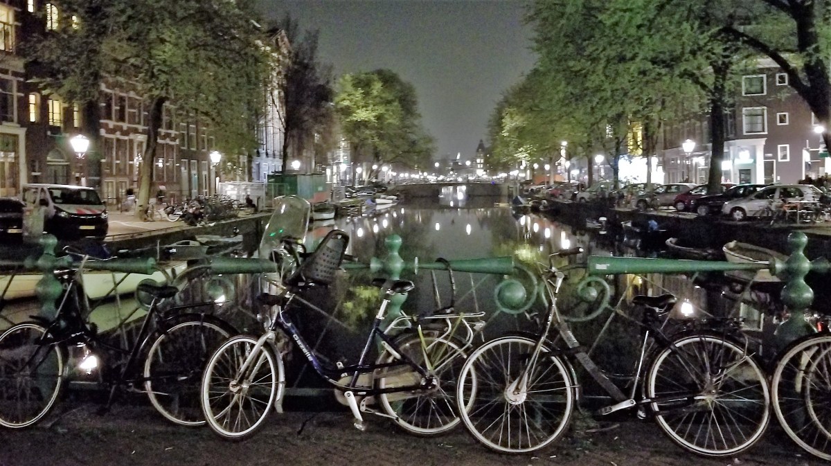
Amsterdam is a place for eyes behind your head, because two eyes in front is not enough to sidestep all the oncoming cyclists coming from every direction,
but also to catch all the head-turning outrageousness of an unrepentant town that still embraces Easter.
Amsterdam is a place to relax. Heck, half the population is already stoned, and the pungent waft of weed is a strong reminder to kick back and enjoy the scenery.
Amsterdam is a tolerant town, where all kinds of people gather and co-exist without judgement or little reservation. Citizens are proud and expressive, at times aggressive, but mostly helpful–although they smoke entirely too much, and regard the street as their personal ashtray.
As a laissez-faire society by practice and design, it appears to work. Quite simply, Amsterdam is a libertarian’s delight!
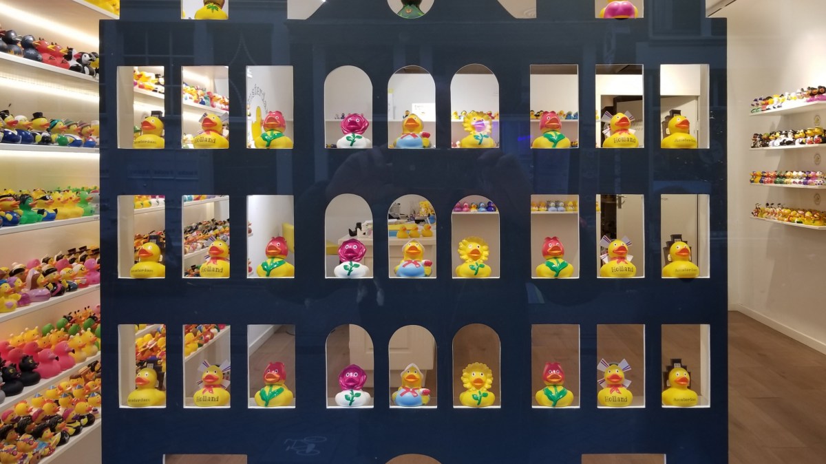
And that leaves plenty of room for rubber duckies and vaginas, and everything between.
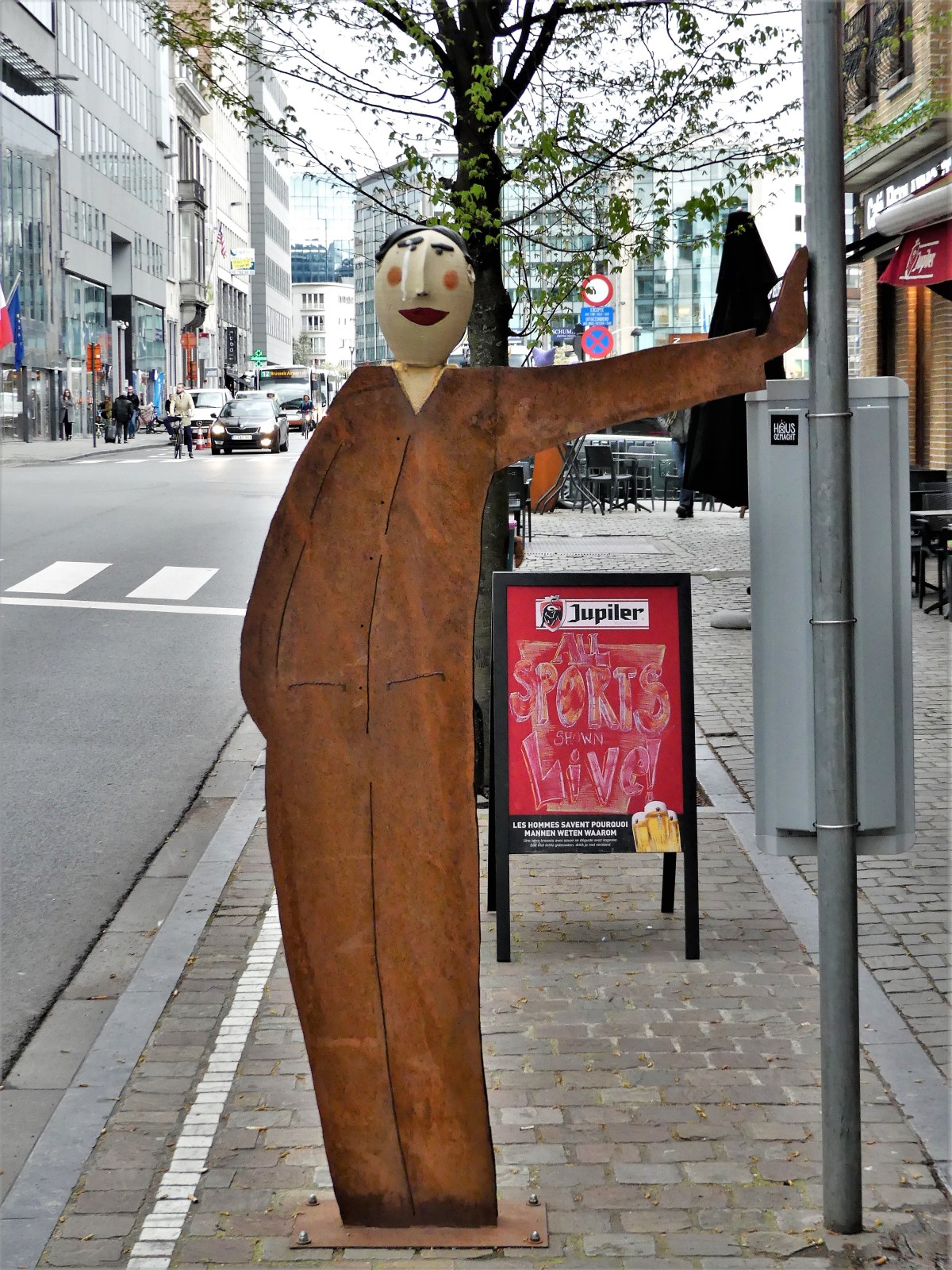
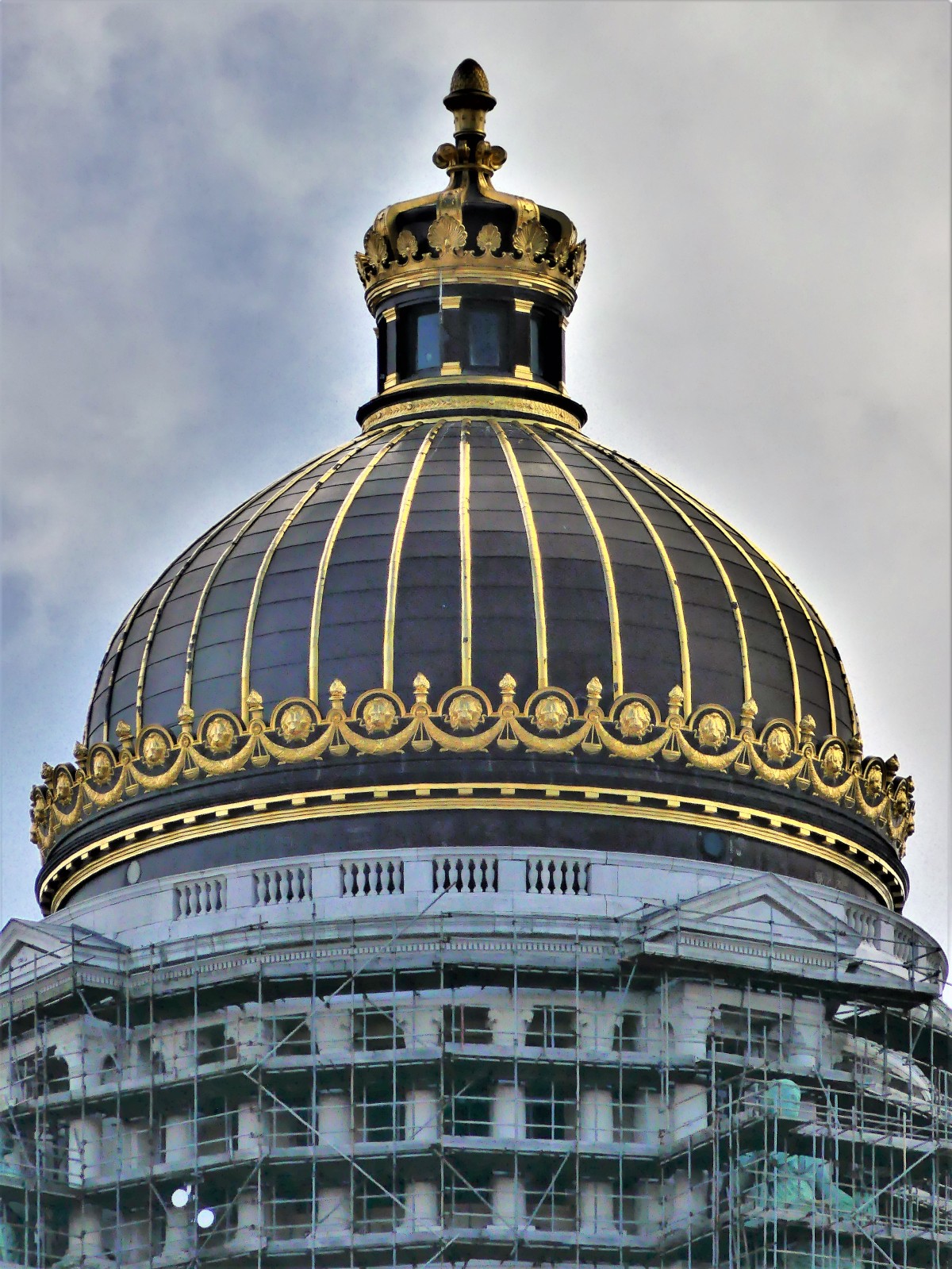
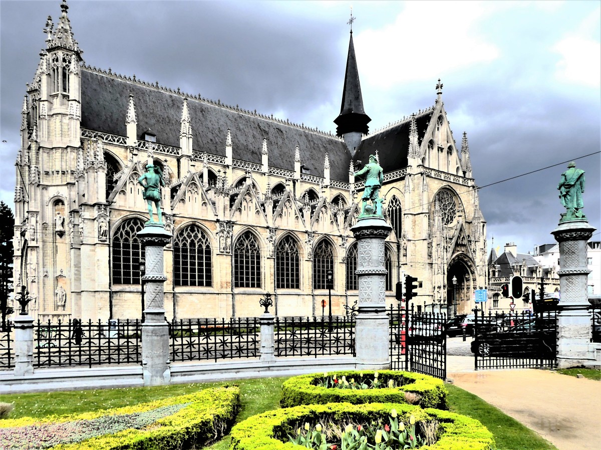
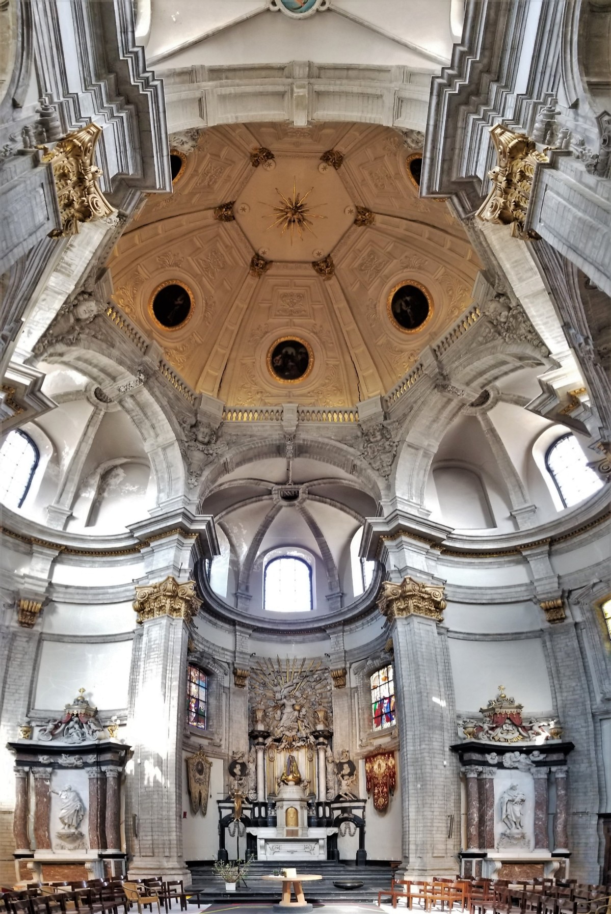
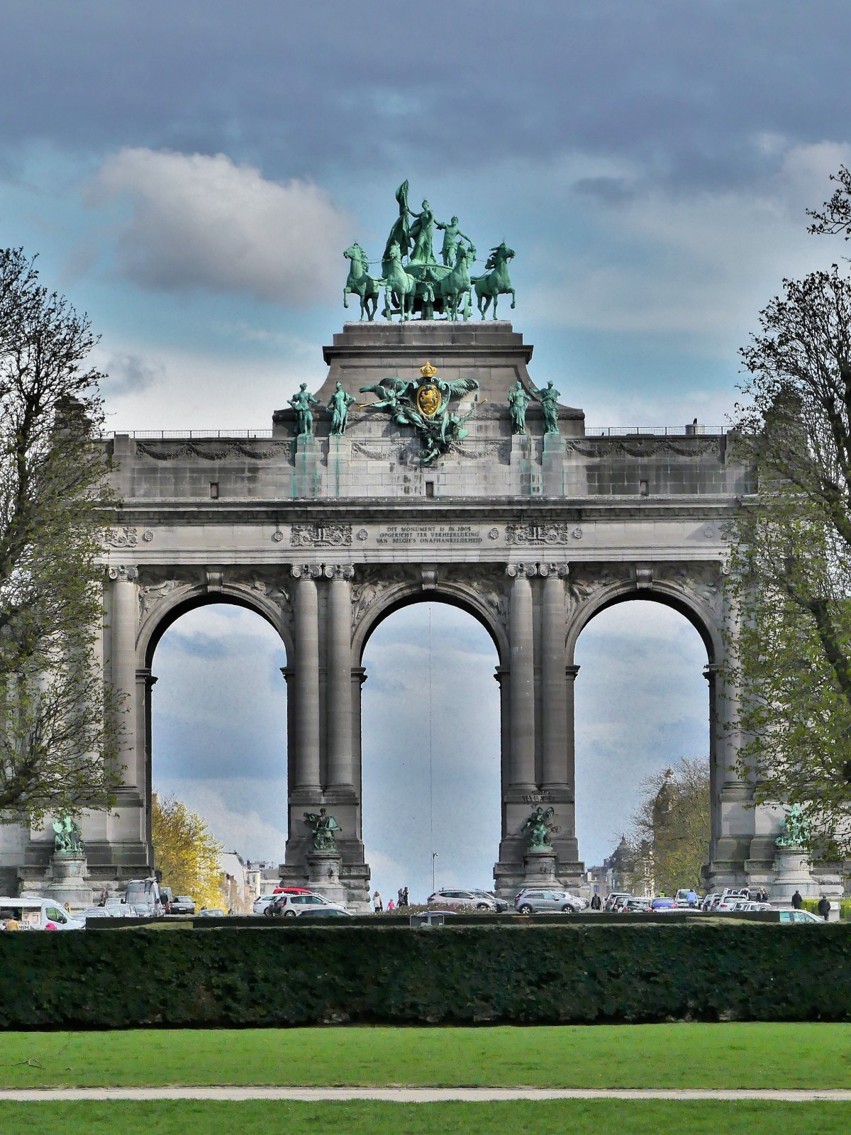
Brussels loves its folklore. And its citizens are unabashed about it. They show it off around town, and celebrate it with a flourish.
Belgians are world renown chocolatiers, and proud of their invention. Case in point–Jean Neuhaus…
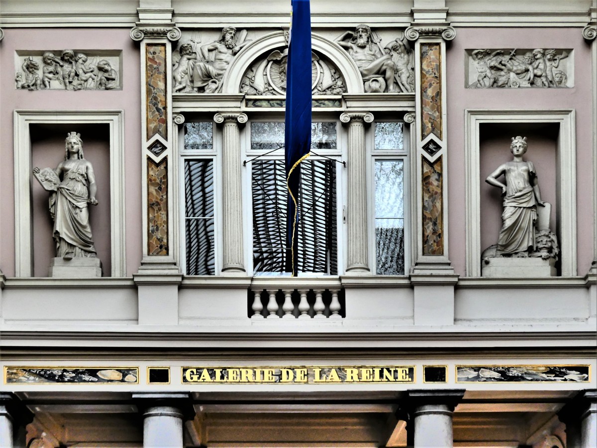
…a one-time chemist who realized that a chocolate coating around a pill helps the medicine go down. His pharmacy in Galerie de la Reine…
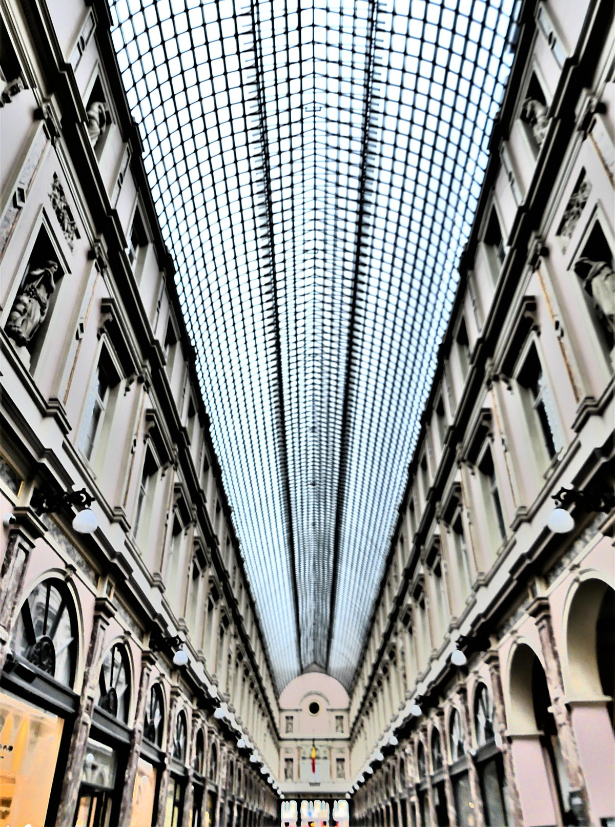
located in a glass-covered mall of pilasters, arches, and windows…
was converted into a chocolate shop in 1912, when he replaced his pills with praline, giving rise to an international addiction, and no doubt, a tooth decay epidemic.
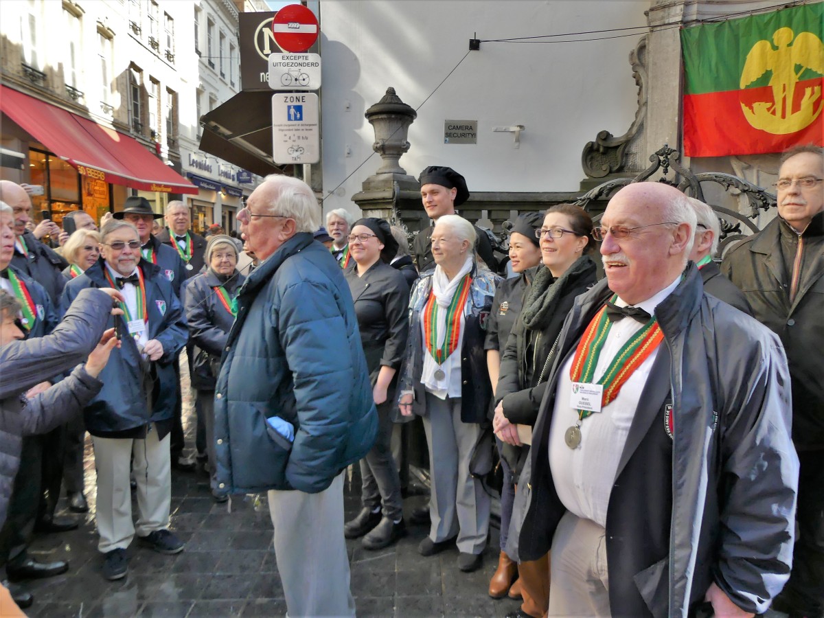
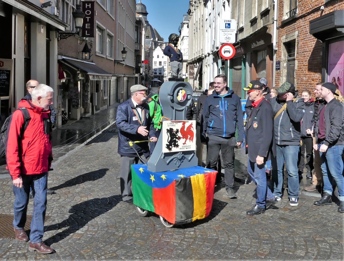
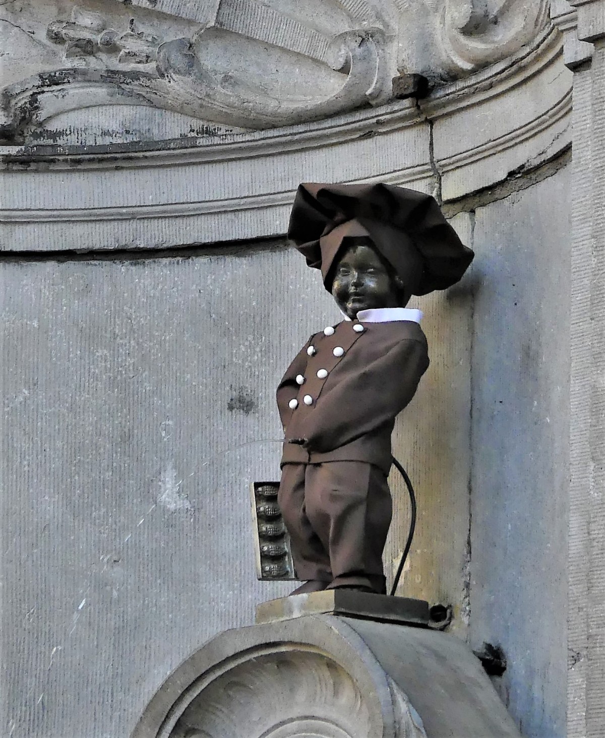
On this particular day, the theme of chocolate carried over to Brussel’s most famous fountain–a 17th century pisser known as Manneken Pis–who was undergoing a celebrated makeover with yet another costume.
The pomp and circumstance surrounding the event was palpable. A singing society of Manneken Pis enthusiasts had crowded the corner of the Incubator and Oak Street,
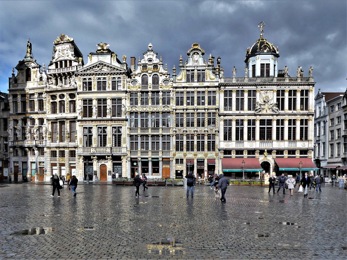
just south of Grand Place…
in anticipation of the grand reveal.
Outside the circle of importance, a fringe show delighted the onlookers.
Eventually, the Nation’s colors were pulled away to expose the little exhibitionist dressed as a chocolatier–one of 1000 different costumes he has worn throughout the ages.
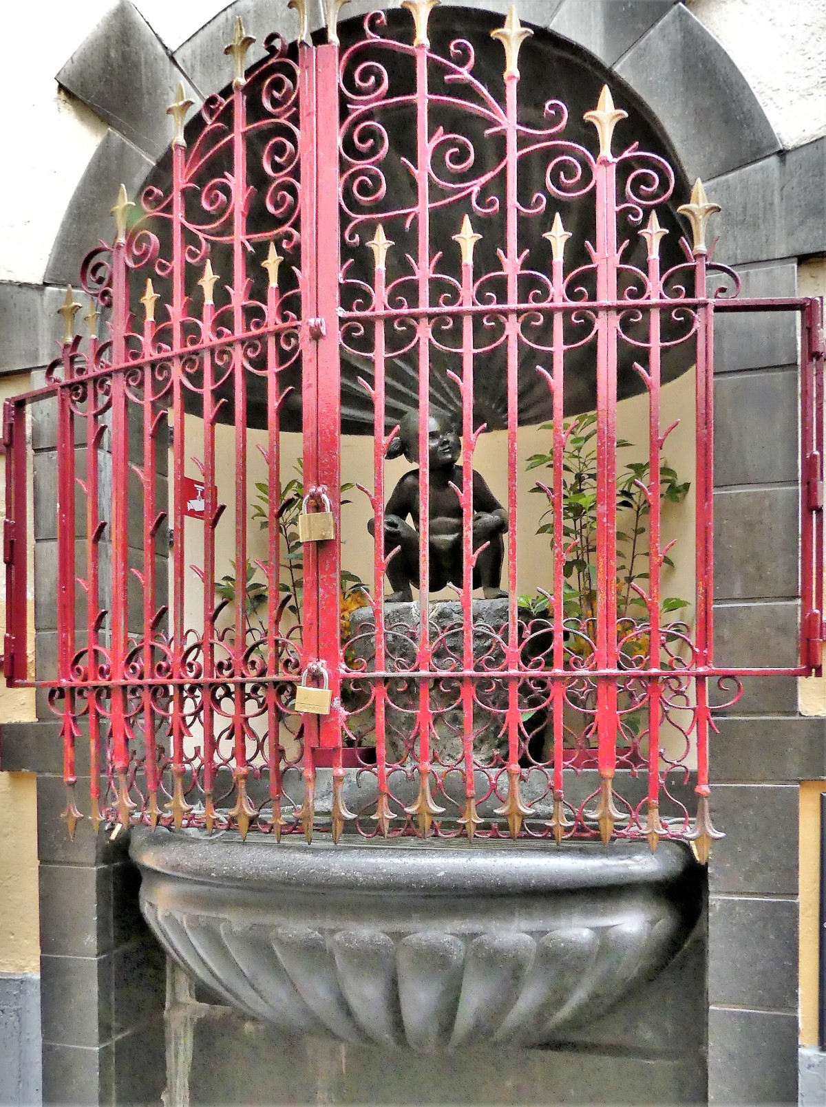
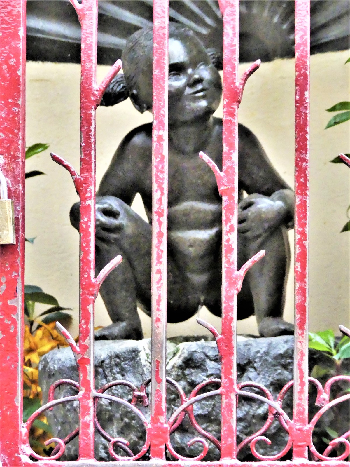
But Manneken Pis has some able-bodied company. Located a short distance away, his counterpart, Jeanneke Pis is a fine squating specimen.
It is believed by Belgians that the fountain was built in honor of loyalty. An old custom states that a coin tossed into the basin will bring good luck and is an expression of fidelity.
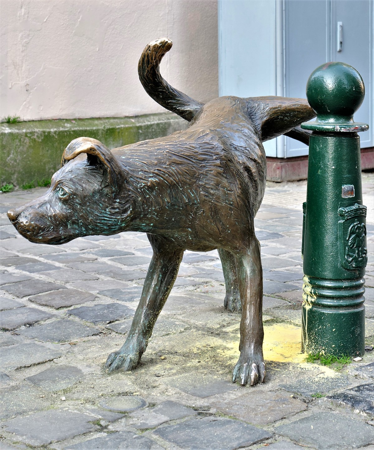
Of course, what could be more loyal than man’s best friend, symbolized by Zinneke Pis…
…thus completing the pee pee trilogy.
Dogs are a common site and symbol around Brussels, and represented throughout history, whether at the foot of Everard t’Serclaes, a 14th century legend, embodied in thestatue of his reclining corpse–
which is believed by locals to bring luck to all passers-by who rub it.
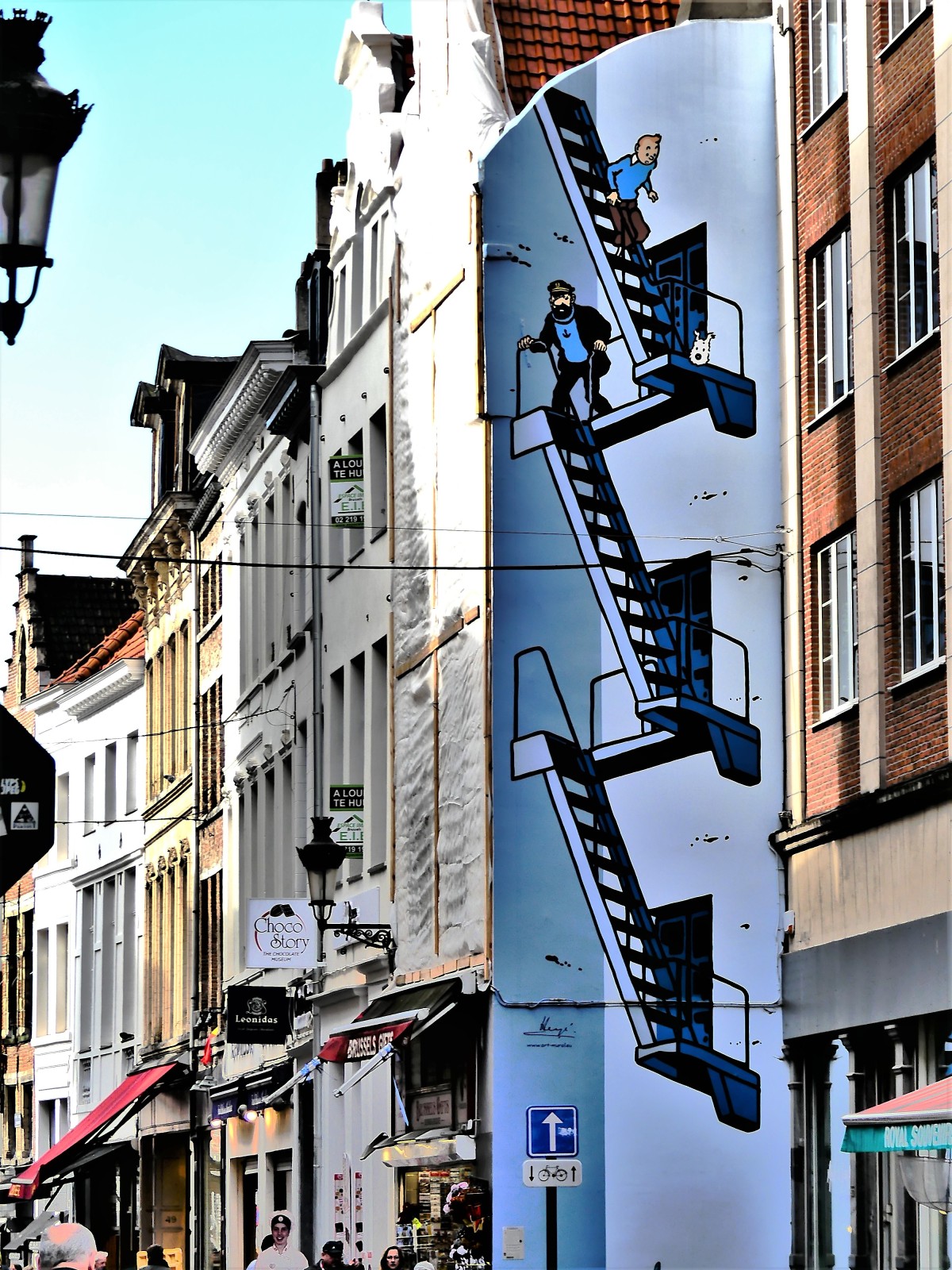
And then there’s Tintin’s dog, Snowy,
a comic sensation created by Belgian cartoonist Hergé (aka George Remi).
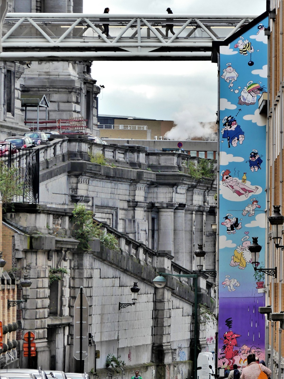
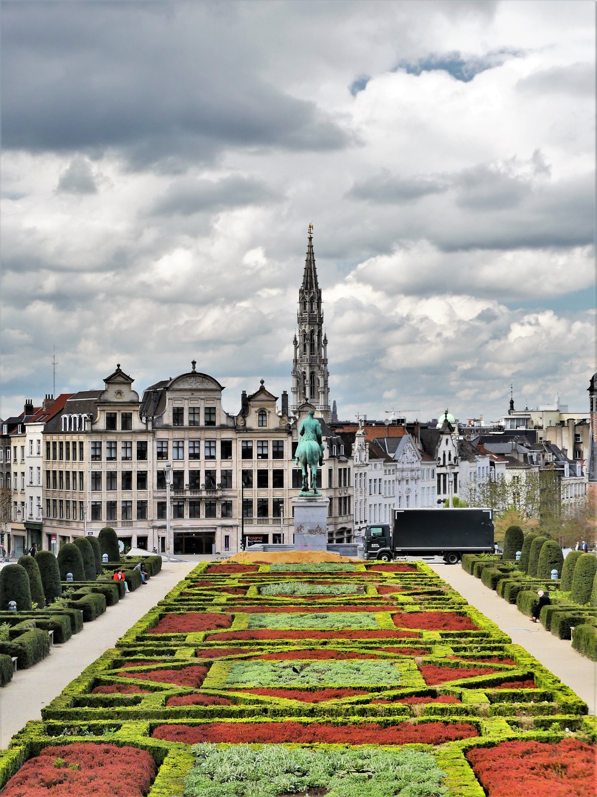
There is a framed beauty and whimsy about the city of Brussels.
While it never takes itself too seriously,
there is just enough richness…
regalness,
righteousness,
and Old World charm…
…to compete with any of the other great European capitals, while never forgetting its role as de facto capital of the European Union,
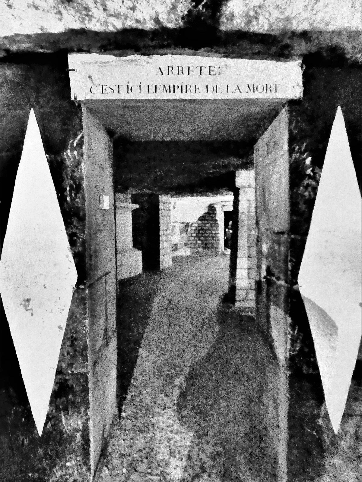
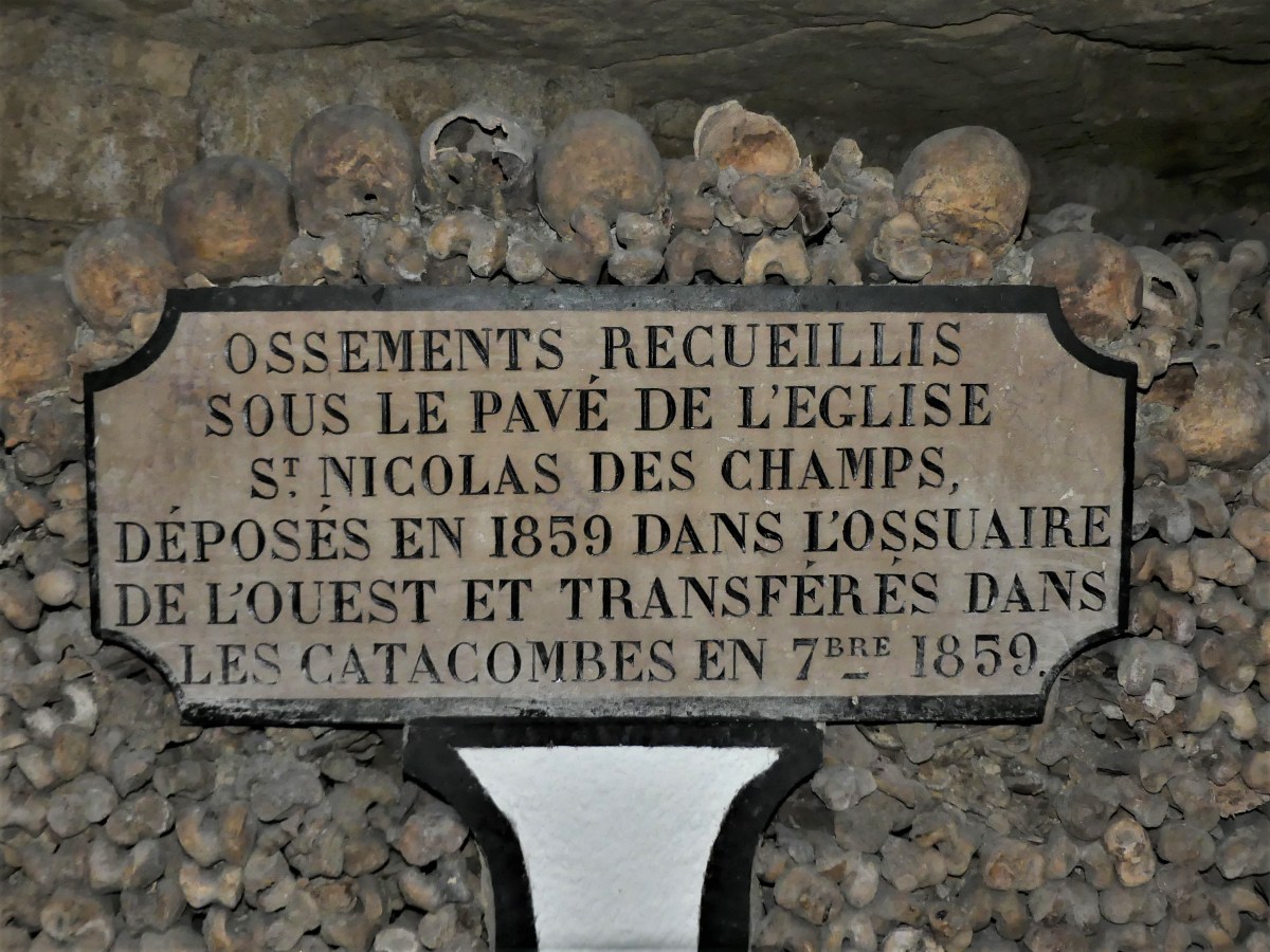
Everyday is Halloween at Les Catacombes de Paris. But, it’s not about dressing up in outrageous costumes, or wearing outlandish make-up. It’s about visiting a subterranean ossuary that radiates miles in all directions beyond the 14th Arrondissement of Paris.
Taking 130 steps into the bowels of time…
…and following a long and winding stoney path…
…through weeping ceilings heavy with humidity,
and sobering humility,
one reaches an imposing gateway, warning: STOP! THIS IS THE EMPIRE OF DEATH!
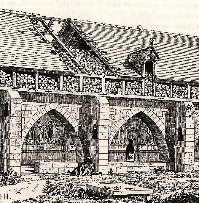
Beyond the entrance exists a daunting surreality that 6 million human remains reside here, integrated into the walls of 8000 year-old limestone tunnels once quarried to build Paris into one of Europe’s brightest beacons–bringing an eerie normalization to the horror and beauty of this place, for the skulls and bones are often arranged in an unnatural state of decoration.
With Parisian cemeteries overflowing their boundaries, Louis XV and Louis XVI crusaded for a ban on future burials within city limits when the insufferable stench of rotting corpses began overwhelming the community. But the Church pushed back, citing that the dominion of God’s holy spirits should never be disturbed.
However, in 1780, a rush of Spring rain caused a wall to collapse between a house cellar and the Holy Innocents Cemetery, causing the unsanitary contents of its burial pit to flood the house.
Thereafter, all Parisian cemeteries were exhumed,
and the bones were transferred into the catacombs–
a practice that continued until 1859.
Yet, it’s the skullpture, first imagined by Hericart de Thury, the inspector of the quarries during 1810 that resonates most among the catacomb’s 300,000 visitors each year.
Although there is a bone to pick: roving security discourages tourists from touching sacred ruins or leaving graffiti behind,
while a final bag check at the conclusion of the one-hour tour prevents tourists from poaching remnants.
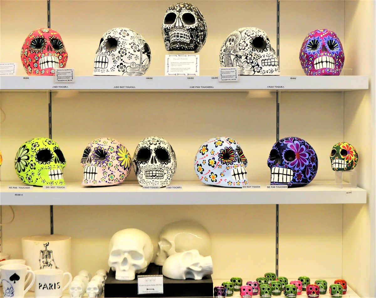
But if souvenirs are a must (and who doesn’t enjoy a small memento of their visit), the gift shop at the museum exit does a brisk business–
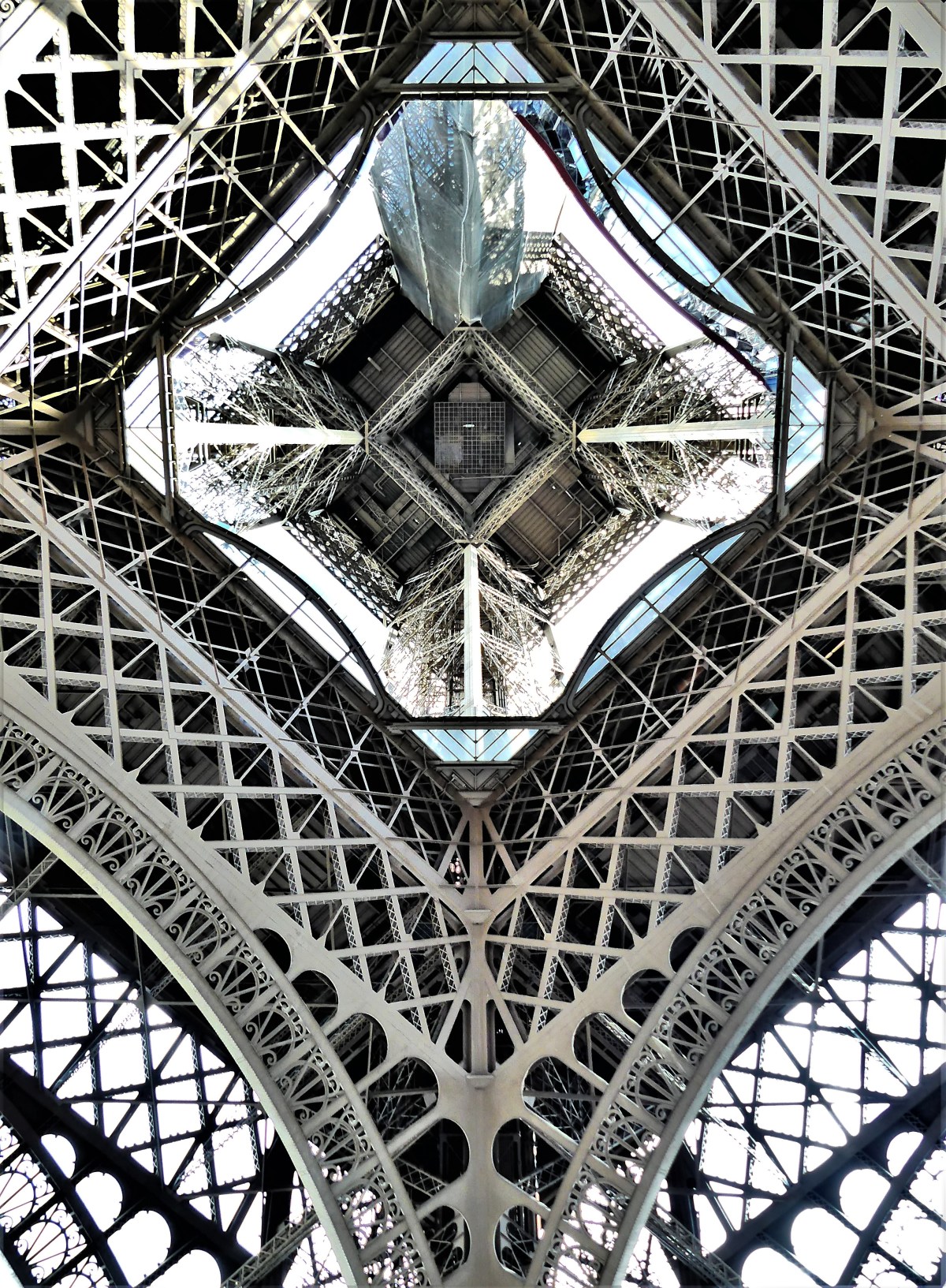
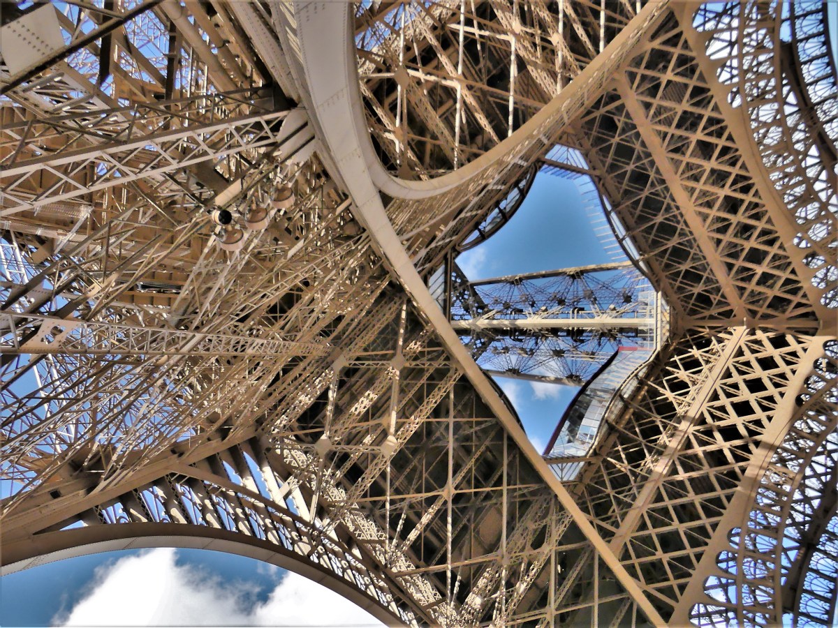
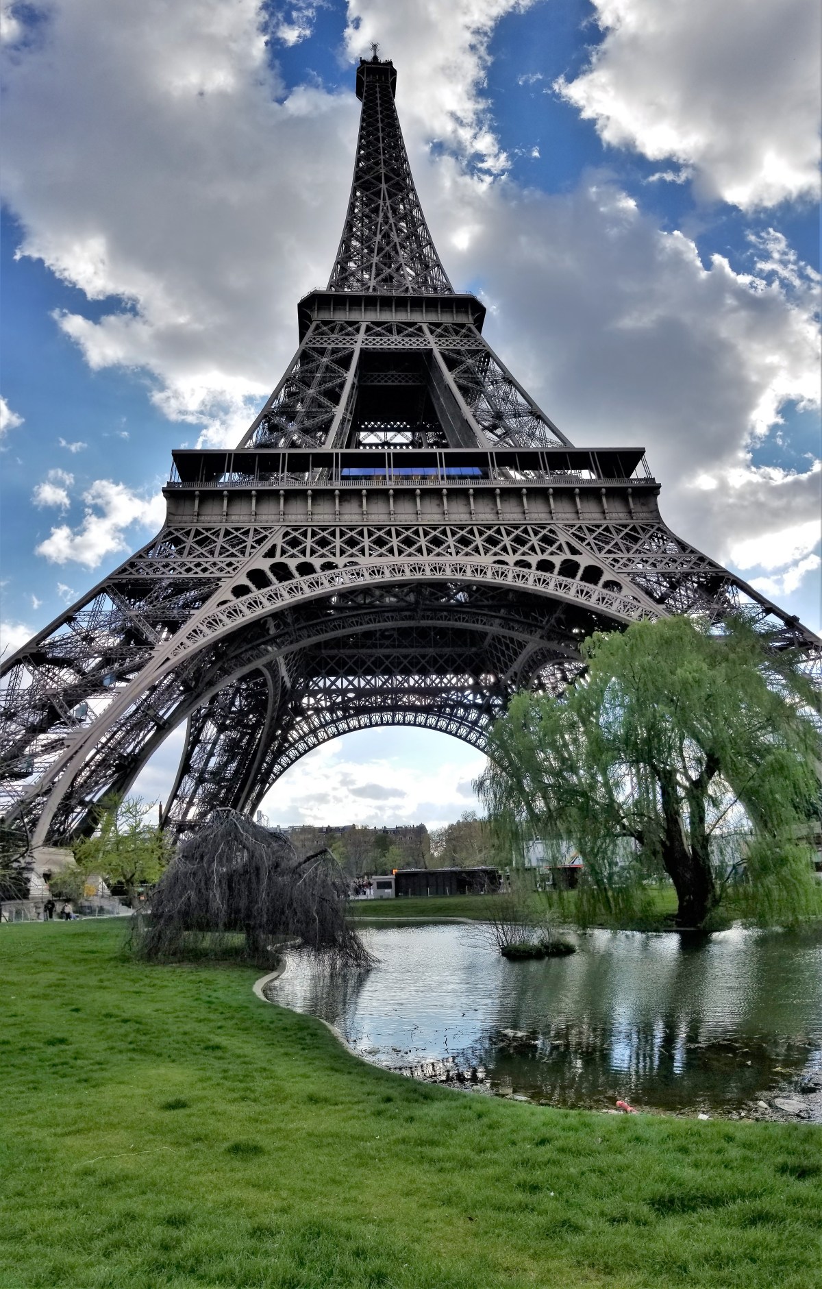
Let’s face it! The Eiffel Tower is one of the most photographed structures in the world. Since celebrating the 130th anniversary of its opening last week, more than 7 million people a year now flock to gawk at it’s imposing presence along the Champ-de-Mars.
I’m certain that it’s been photographed from every imaginable angle, in all sorts of light–day and night–and in all sorts of weather conditions.
But not by me! After arriving in Paris and settling in my hotel in Montparnasse, the first thing I wanted to visit was the Eiffel Tower. To me, it meant that I was in Paris!
There’s security now. Since July 2018, a 3-meter high wall of bullet-proof glass (2.5 inches thick) protects the “Iron Lady” and visitors from vehicle-ramming attacks, while two sentried openings scan personal property. But the inconvenience is minimal compared to the lines that form for stairs and elevators to the top.
Once inside the enclave, the enormity of the tower is that much more imposing, stretching the length of one football field in all directions from the center to its foundation footings.
Examining the intricacy of the lattice can be hypnotizing,
when studying the symmetry of shapes,
or it may seem random and haphazard by a clash of metal girders.
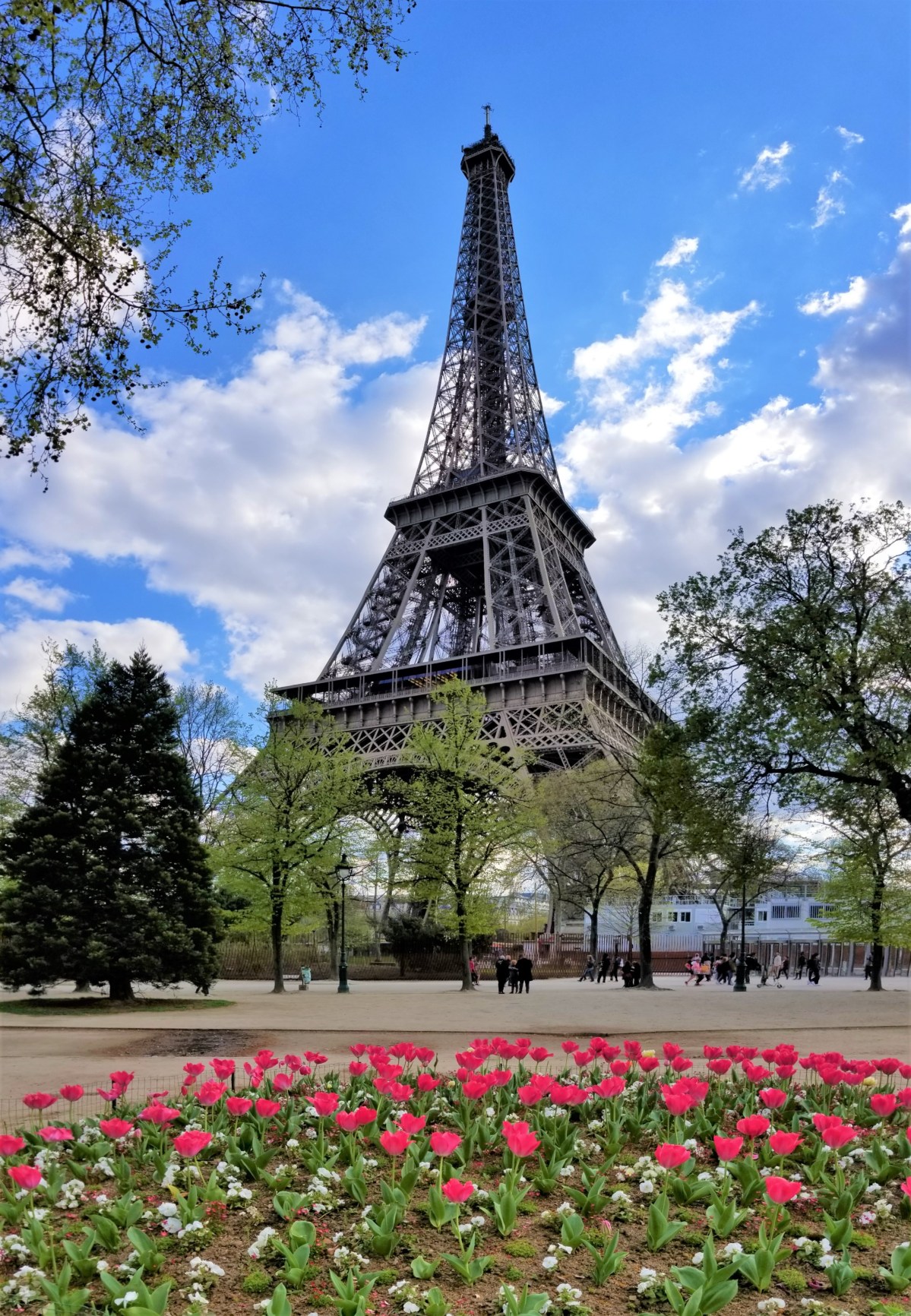
But if abstracting the Eiffel Tower appears upsetting or unsettling, a postcard version of this Parisian landmark can always please the senses…
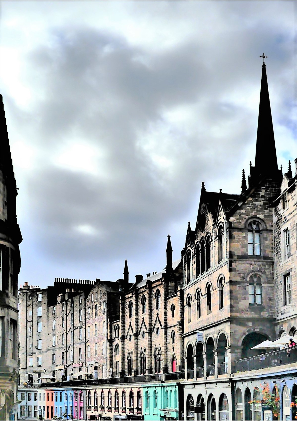
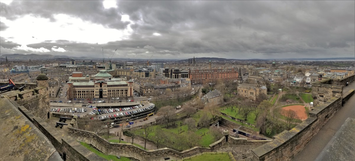
There’s no need searching for fabulous viewpoints in Edinburgh, because the city is chock full of them. And each one delivers the most splendid views of a town steeped in Scottish lore and history. All that’s required is an ability to scale any of the neighboring hills, and the payoff is heavenly.
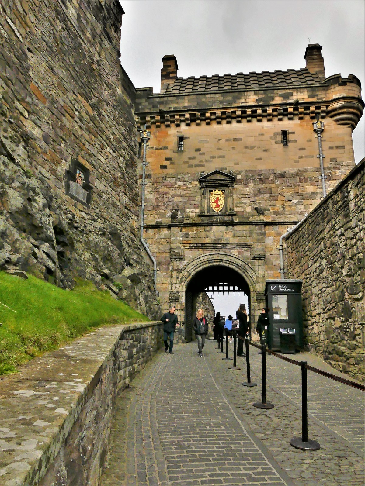
For instance, a hike up to Castle Rock…
to access the gate to Edinburgh Castle…
provides a fantastic overlook to the south end.
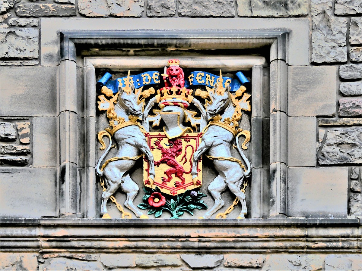
But the bigger reward becomes more apparent after buying an access ticket to the castle for £18,
and stepping back through time to follow in the footsteps of Scottish royals who traversed the cobblestone roads since the 12th century.
Once inside Foog’s Gate, one discovers St Margaret’s Chapel–the oldest surviving building in Edinburgh–built around 1130 by David I, and dedicated to his mother Queen Margaret, who was later canonized in 1250 by Pope Innocent IV.
The chapel was designed in a Romanesque style with small, irregular stones fashioned in a simple rectangle, and underwent major reconstruction in 1851 by Queen Victoria,
and was updated with Douglas Strachan’s stained glass windows in 1922.
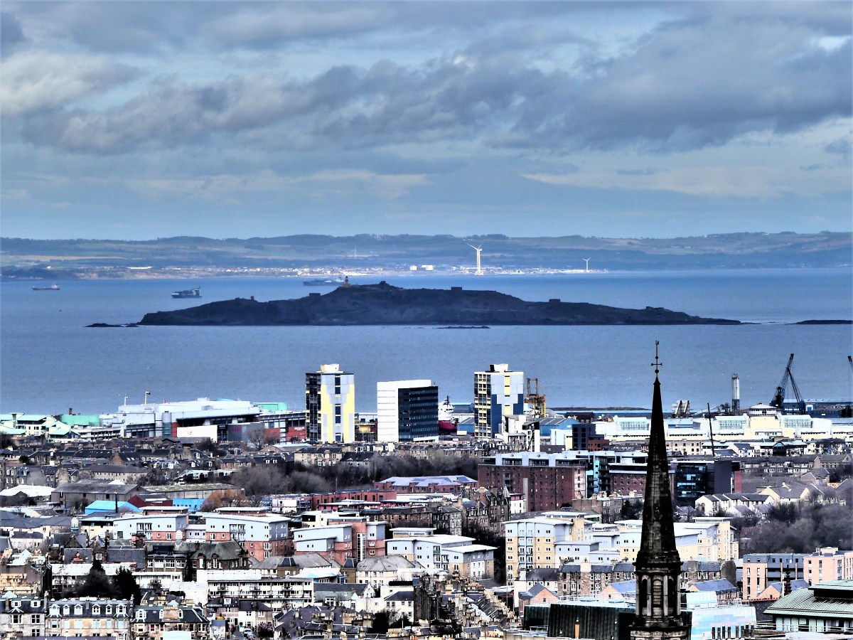
St Margaret’s Chapel commands a view of north Edinburgh,
looking to Leith.
In addition to the best westerly views in the city…
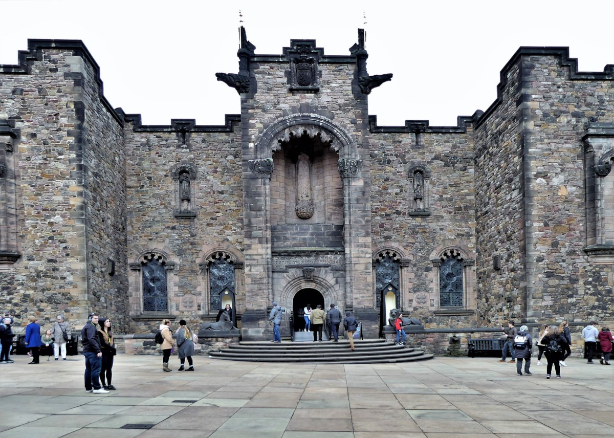
the Castle’s royal palace…
offers a glimpse of the elaborate decoration of the birth chamber of James VI, son of Mary Queen of Scots.
A visit to the Great Hall is also in order…
boasting an interior ceiling constructed without nails–looking much like an upside down hull of a boat–
and housing a variety of vintage weapons displays.
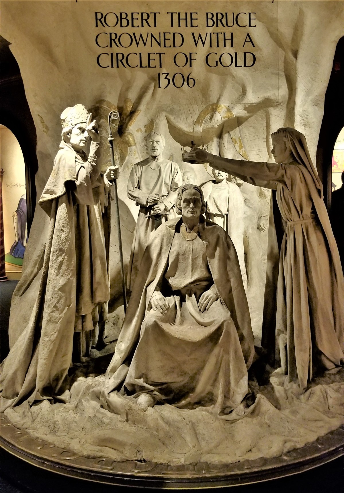
Several exhibits on the mount recount the many coronations of its kings and queens,
the fighting character of the Scots…
and an active tribute memorial to all of those who have fallen in battle throughout the ages.
Once outside the castle entrance, a walk down the Royal Mile…
past The Hub (where the famed Fringe Festival headquarters resides)…
will likely lead to an encounter with a bagpipe player…
standing by one of the many Closes of Edinburgh which look out to the north and south.
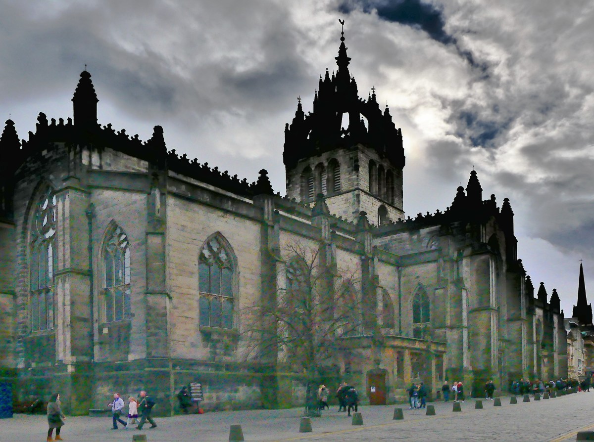
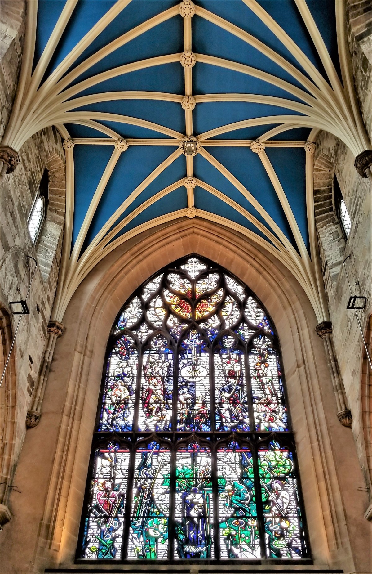
Continuing further east is St. Giles Cathedral, founded in 1124, and the focal point of the Scottish Reformation in the 16th century.
Inside the church are an array of small knaves and chapels enhanced by extraordinary examples of intricately detailed stained glass.
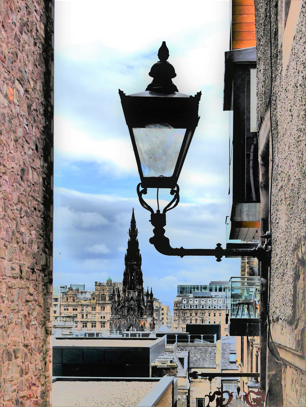
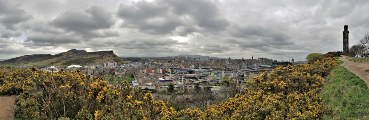
Views of Edinburgh also abound from Calton Hill,
where several monuments dot the landscape, whether it’s to honor Horatio Nelson,
Dugard Stewart,
or the war veterans who lost their lives in the Napoleonic Wars.
Once the site of medieval tournaments and festivities during the 1400s, Calton Hill was also the best place to catch public executions in the 1600s.
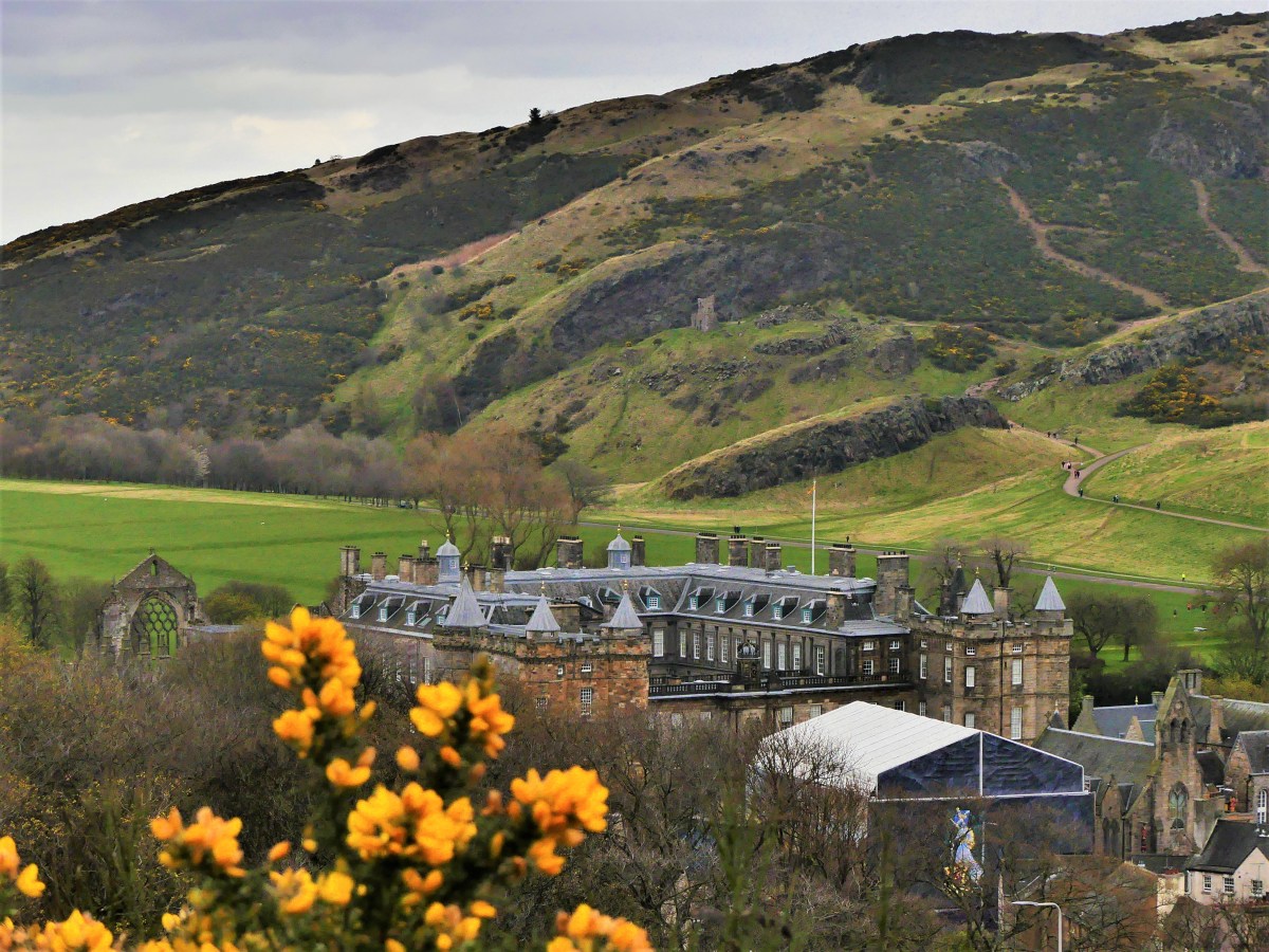
But today, it’s best known for it’s iconic views of the royal residence, Hollyrood Palace positioned beneath Arthur’s Seat,
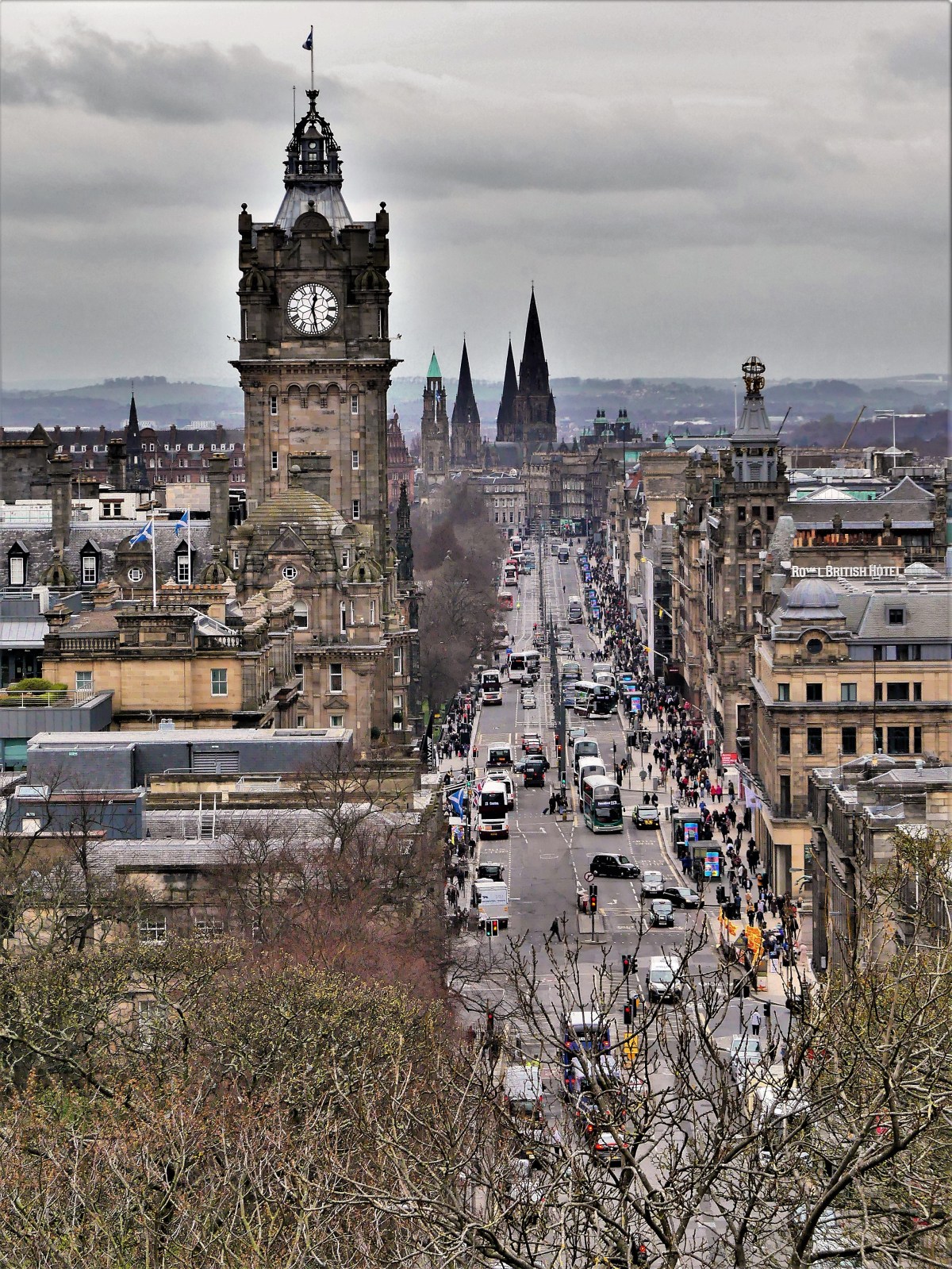
and a look down Princes Street.
Views notwithstanding,
the real appeal of Edinburgh lies in its streetside presence, where it’s never too early (or late) to duck inside a pub or a whiskey bar on Grassmarket…
for a pint or a single malt to really put a different spin on the city views.


 (quickly scroll up and down for cool moiré effect)
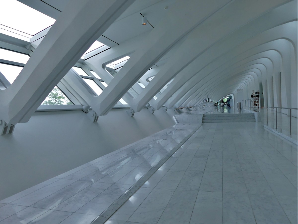


")


")


")


/https://public-media.si-cdn.com/filer/6a/45/6a45ef20-4391-4525-9093-76dc205f0ad7/plan_cata_paris_1857_jms.jpg)


![weapons display[2151].jpg](https://streamingthruamerica.com/wp-content/uploads/2019/04/weapons-display2151.jpg?w=1200)