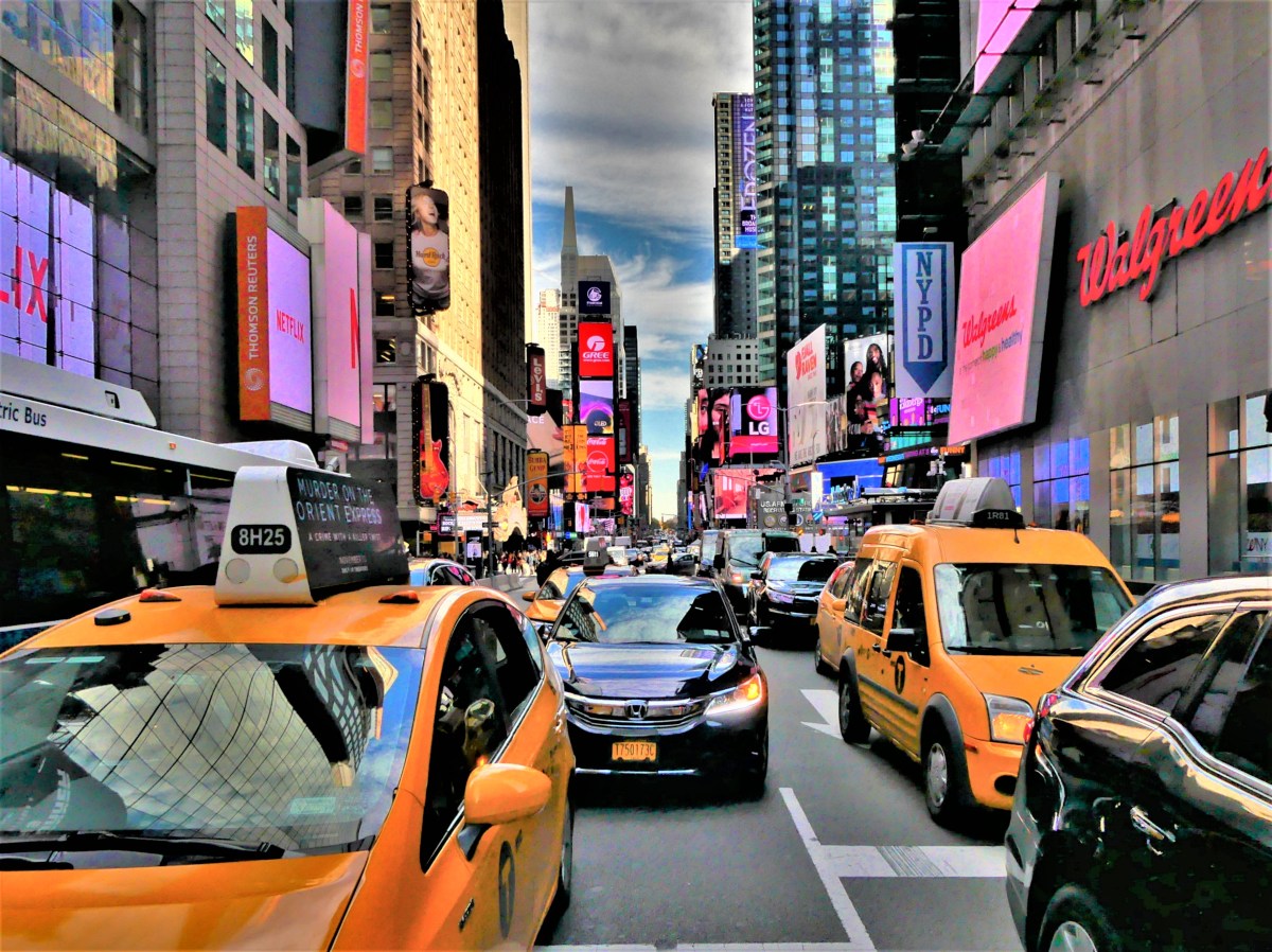
The Frontier flight was 15 minutes early, arriving from Jacksonville to Philadelphia in under 1½ hours–
just ahead of the Nor’easter that would ultimately drop 6 inches of snow and ice on the region, creating a classic commuting catastrophe.
Yet despite the nail-biting adventure of driving through icy lanes of traffic moving sideways, and the total disregard of STOP sign awareness, there was a calmness to the city that I had never noticed before, giving the illusion of Walking Dead abandonment.
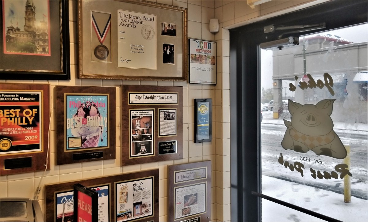
First order of business was food. Move over Pat’s and Geno’s, because there is a rival cheesesteak to adore at John’s Roast Pork in South Philly. Fortunately, the lousy weather short-circuited the out-the-door line that is almost always guaranteed during lunchtime.
My son, Noah ordered two 12-inch sandwiches with mushrooms and onions that could easily feed a family of four, but proved worthy of two consecutive lunches for each of us.
Then, we were off to his apartment in Fishtown, an up-and-coming gentrification project that is locked between empty lots boasting scattered mattresses, and hastily-erected, fresh-bricked row buildings that contradict the broken sidewalks–all within viewing distance of Ben Franklin bridge…
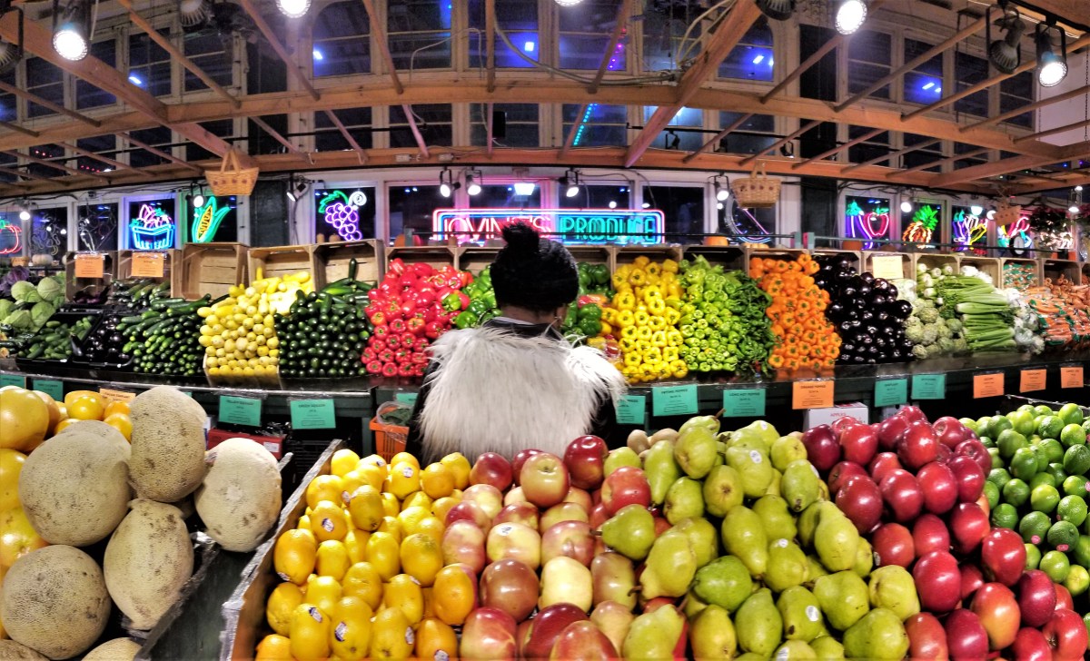
and walking distance to Reading Market.
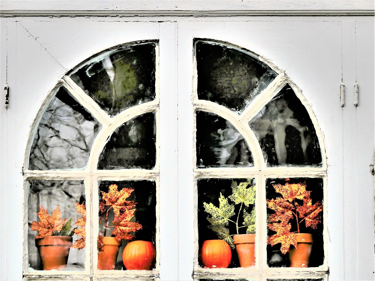
After an overnight stay in Germantown, a walk around the neighborhood revealed only remnants of the shot of winter that overwhelmed the area during the past 48 hours.
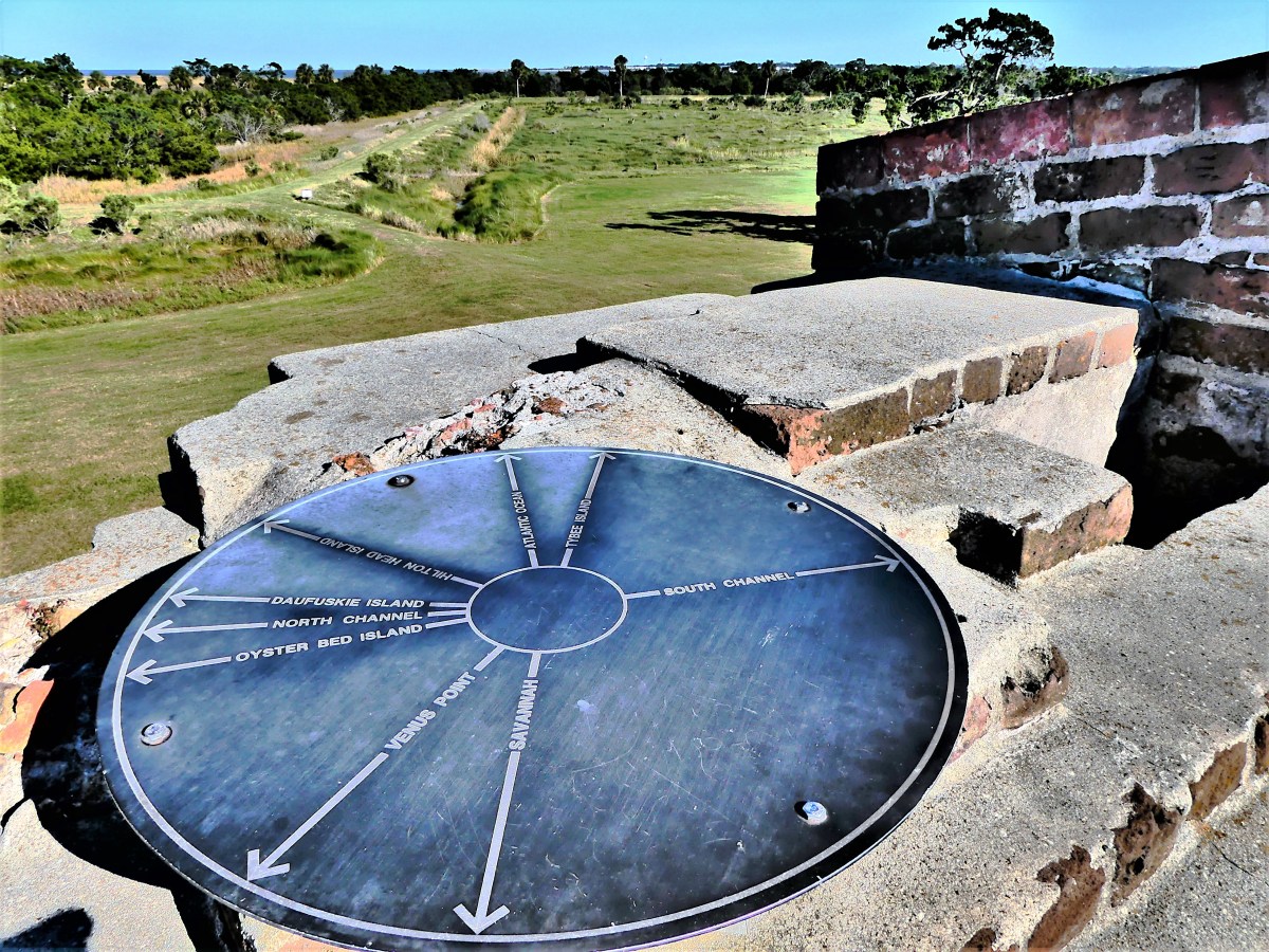
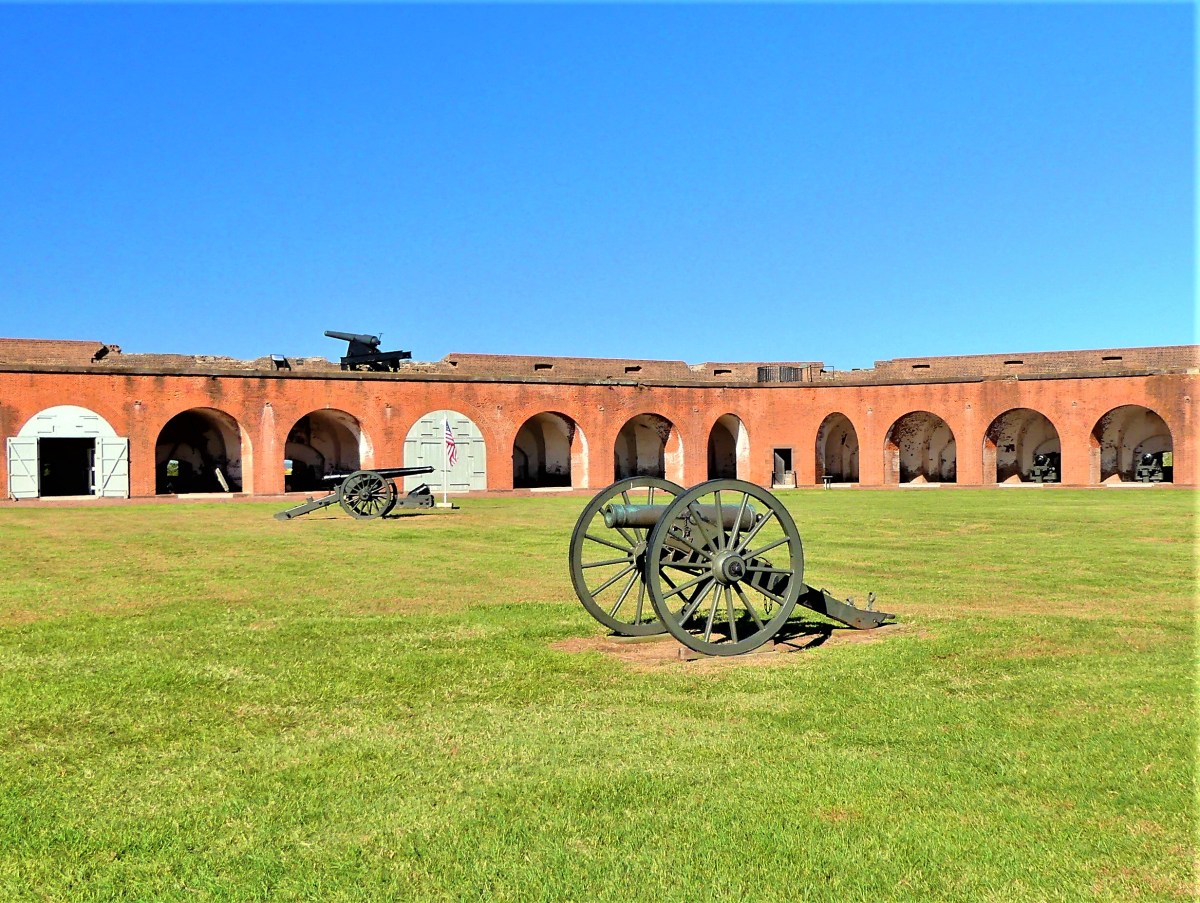
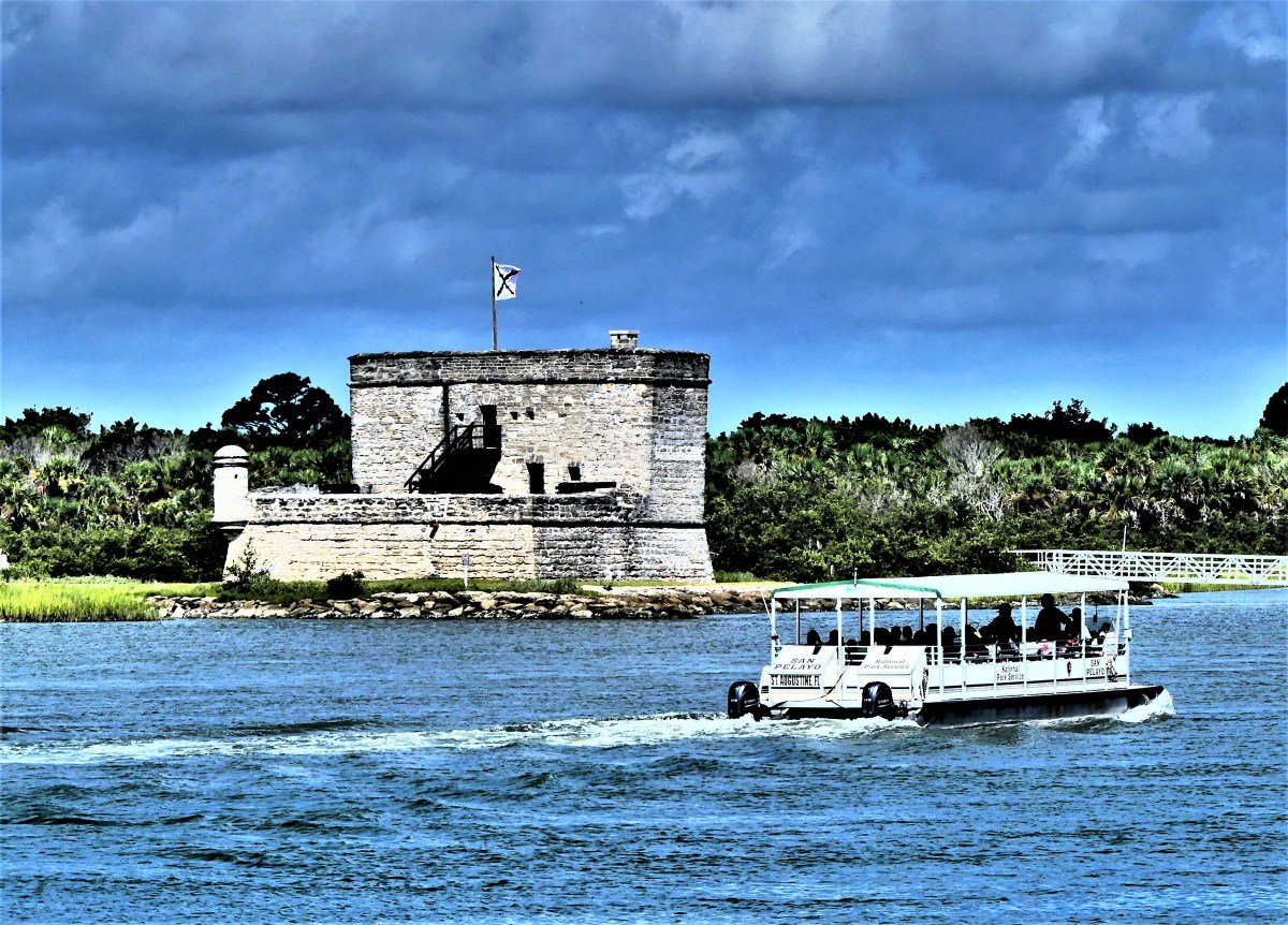
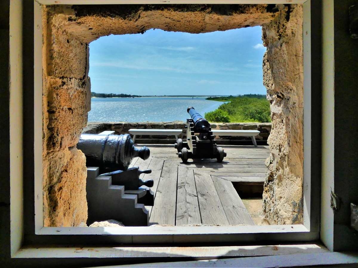
It was a bad day for Col. Charles Olmstead and the Confederate Army on April 10, 1862, when Capt. Quincy Gillmore’s Union artillery attacked Fort Pulaski from the northwest beachhead of Tybee Island, forcing its surrender thirty hours later,
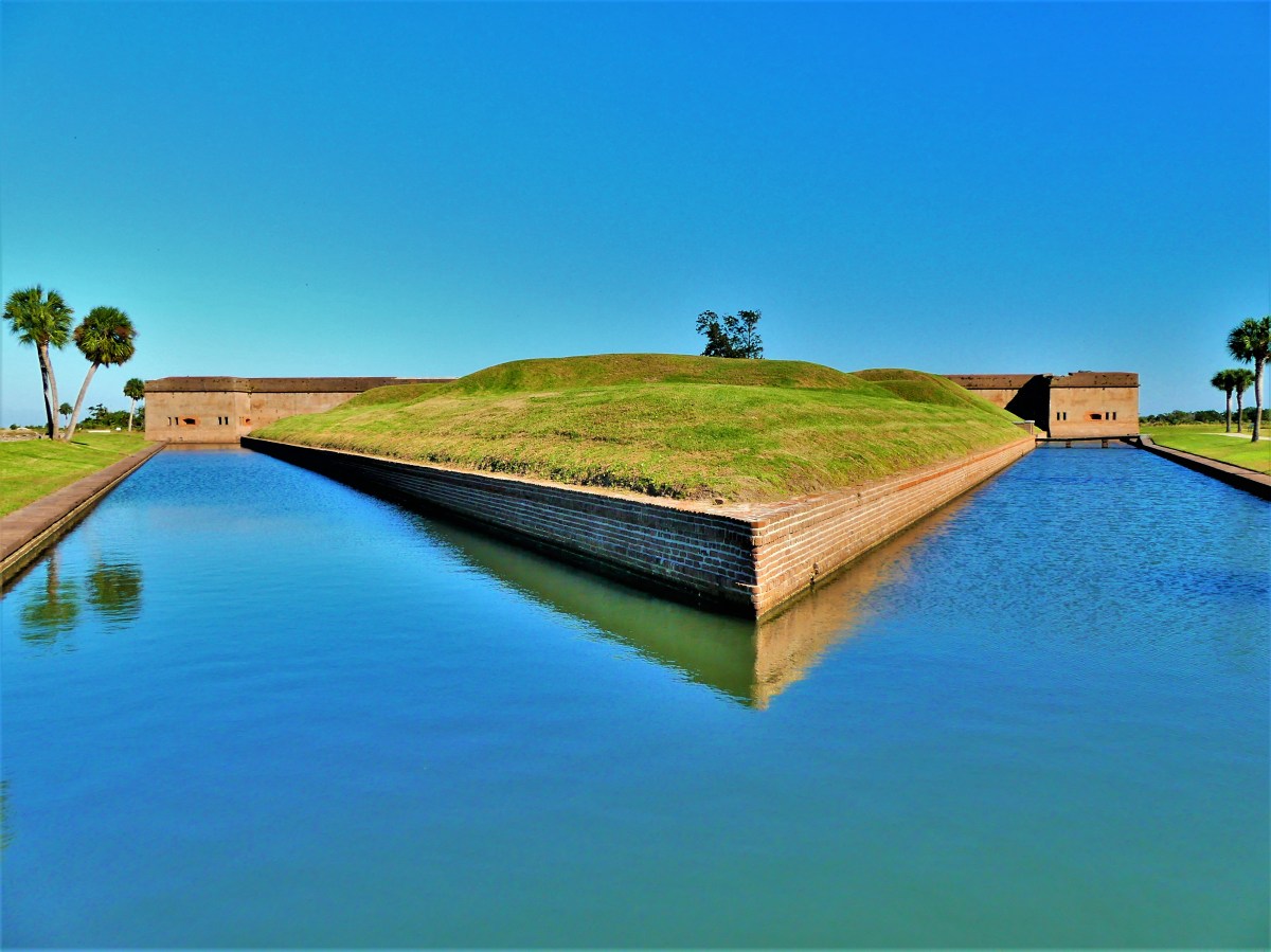
and proving that a seemingly invincible coastal fortification that required 25 million bricks, 18 years, and $1 million to build could never catch up to evolving weapons technology.
Even 7½-inch-thick mortar walls were insufficient to protect the Fort’s garrison from the explosive bombardment of Gillmore’s experimental rifled cannon fire from one mile away.
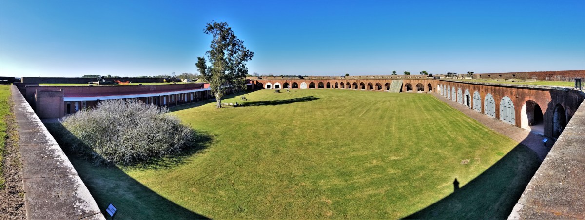
Construction on Fort Pulaski began in 1829 as part of the Third System–in defense of Savannah’s 20,000 citizens and dynamic seaport–adopted by President Madison in response to the War of 1812.
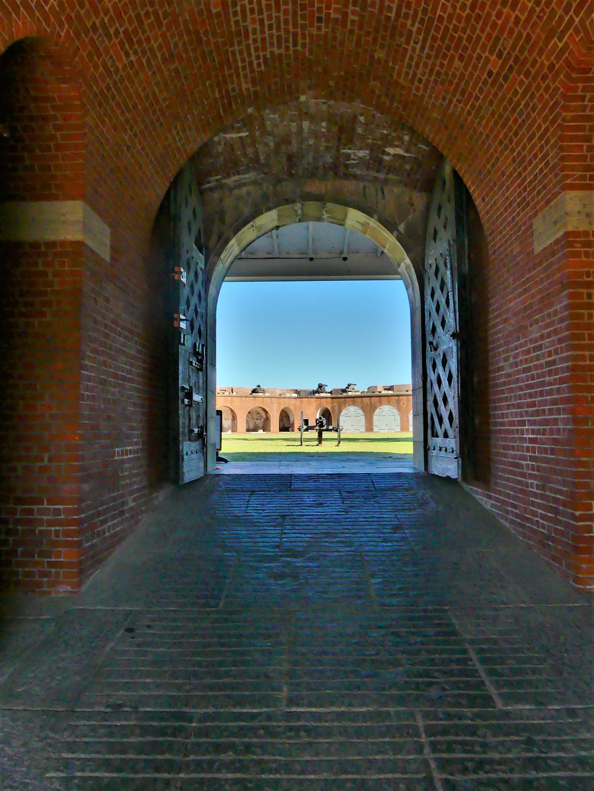
With Fort Sumter under Confederate control by Christmas, 1860, Gov. Joseph Brown ordered state militia to seize Fort Pulaski–still unoccupied by Federal troops–on January 3, 1861…
…and transferred ownership to the Confederacy following Georgia’s succession on January 19, 1861.
It was a controversial gambit that ultimately escalated into eleven States joining the Confederacy–spiraling the South into Civil War by April 12, 1861.
When the fog lifts
and the sand rifts
have been left behind
by a vanishing tide,
the water fowl will feast–
at the very least–
on a diet they find
which can no longer hide.
The wagon wheels traced two perfect lines in the snow as we rolled along the country road. Once the flurries had stopped, and the wind had died down, the crisp air had lost its bite, and riding in the back of the wagon with Eva became more enjoyable. Nevertheless, I was ever so grateful for the double clothes under my coat.
I thought for a minute about what Abba and Eema had sewn behind the buttons of our coats, and massaged one of them through my mittens, but felt nothing out of the ordinary, which made me wonder if anything was even there.
“How’s everyone doing back there,” Onkel Max called out.
“Alles gut1,” I answered back.
“I have to pishn2, Onkel Max,” shouted Eva.
“Really Pony? We haven’t been on the road for more than fifteen minutes,” I asserted.
“But the ride is bumpy and my insides are nervous, Bertie.”
“Is it an emergency?” I asked.
“That’s a silly question,” she shot back.
“We have to stop for a minute, Onkel Max,” I yelled.
“Perfekt3!” he responded. I detected the resignation in his voice.
If anybody had passed us on the road, they would have noticed a middle-aged woman standing beside a horse and wagon, holding Shaina Maidel’s red blanket in stretched out arms. But on the other side of the blanket there was Eva and me, creating two yellow circles in the snow.
All things considered, we were back on the road in no time at all, and with plenty of time before our 10:00 a.m. departure, provided we didn’t have to stop again for Eva.
“We are approaching the town road, so it’s time to cover up,” instructed Onkel Max.
I pulled the red blanket over our bodies which magically made us invisible to the rest of the world. Occasionally, a burst of sunlight would bounce around inside our igloo world, washing Eva’s face with streaks of red light, and then she’d turn invisible again.
“Are you nervous, Bertie?” asked Eva.
“About what, Pony?” I considered.
“About taking care of me,” she answered. I thought I saw a glint of her sly smile.
“Should I be?” I was getting nervous.
“Well, Abba thinks I’m a handful,” she boasted.
“For me, it all depends on what’s inside your hand,” I suggested. “For instance, if your hand is filled with dirt and worms, then I guess I’m a bissel nervous. But if your hand is filled with shokolad4 and raisins, then there’s nothing to be nervous about.”
“What if my hand was filled with shokolad worms?”
“That’s a silly example. Who doesn’t like shokolad worms?”
Eva cracked up and so did I. I think that being outdoors for the first time in a month probably made us a bit giddy.
“I can hear you from out here,” shouted Tante Ilse. “You will need to keep your voices down since we’re approaching der platz5 in eine Minute6.“
“Okay, Tante Ilse!” shouted Eva.
I shook her leg to get her attention. “Remember. You’re a handful of shokolad.”
“And now it’s all melted and gooey,” she claimed, and mimed a hand smear on my coat.
“Not another word!” I hissed with an edge.
“Okay. I’ll stop.” she said abruptly.
After another flash of light under the blanket, I caught a flash of Eva zipping her lips.
1All good, just fine 2pee 3perfect 4chocolate 5square 6one minute
Long before we established Florida residency, our water bills were ridiculously high, averaging $500 per month. Leah and I immediately suspected that during our three-month absence–between closing and occupancy–the irrigation system zoned around our yard was bleeding us dry. Was this truly to be the continuing cost of keeping our flower beds wet and our lawn green? And if so, was this property threatening to become our Waterloo?
No doubt, our water usage was worthy of an investigation, but the city water department was dismissive–offering precise and up-to-date historical data of our consumption–so we turned to our long-distance neighbors for perspective and to the builder for relief, while wondering which direction to go.
A plea for answers and advice via social media prompted a measured response from Lisa and Greg, new community Facebook pals, who offered to monitor the irrigation interface over a time for evidence of any irregularities or abnormalities.
Greg’s systems check of our Rain Bird controller soon revealed a broken drip head now gushing water, and a twice-a-week watering cycle (as planned) irresponsibly programmed to repeat twice a day by the original landscapers.
Greg recommended shutting down the timer, and offered to manually manage the irrigation zones in accordance with the forecasted rainfall.
We were indebted to Greg and Lisa for their vigilance, and dutifully took over on water watch for the month of June and thereafter. A new appeal to the utility office revealed a literal disconnect between our residential meter and parallel irrigation meter, resulting in unnecessary sewer charges every time we watered our lawn. Yet despite our conservation efforts, our newest utility bill was only reduced by 10%. It was time for a new strategy; we would dig an artesian well, and feed our grass and plants with our own well water.
Of course, the process demanded that we file a permit with the city; petition the architecture committee of our Home Owners Association for permission; find a reputable well digger; wait for the job to be scheduled (weather permitting)…and continue to pay exorbitant water bills in the meantime.
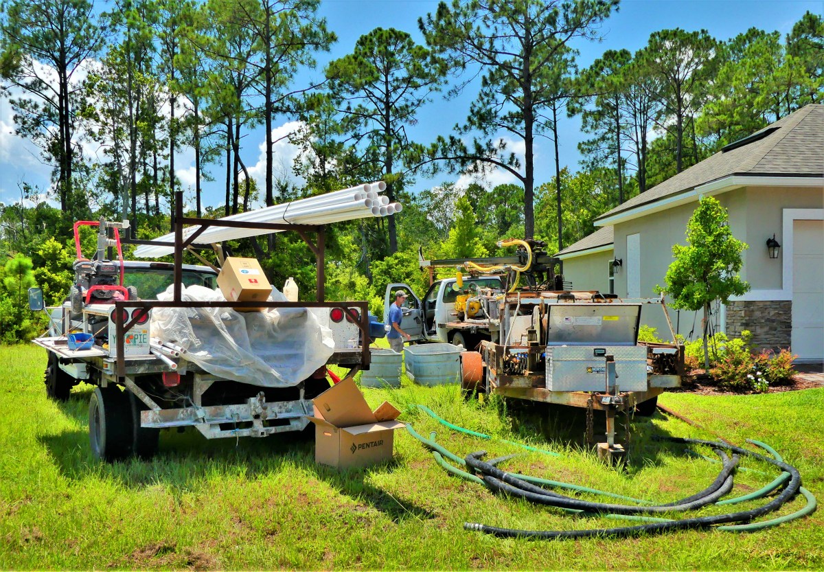
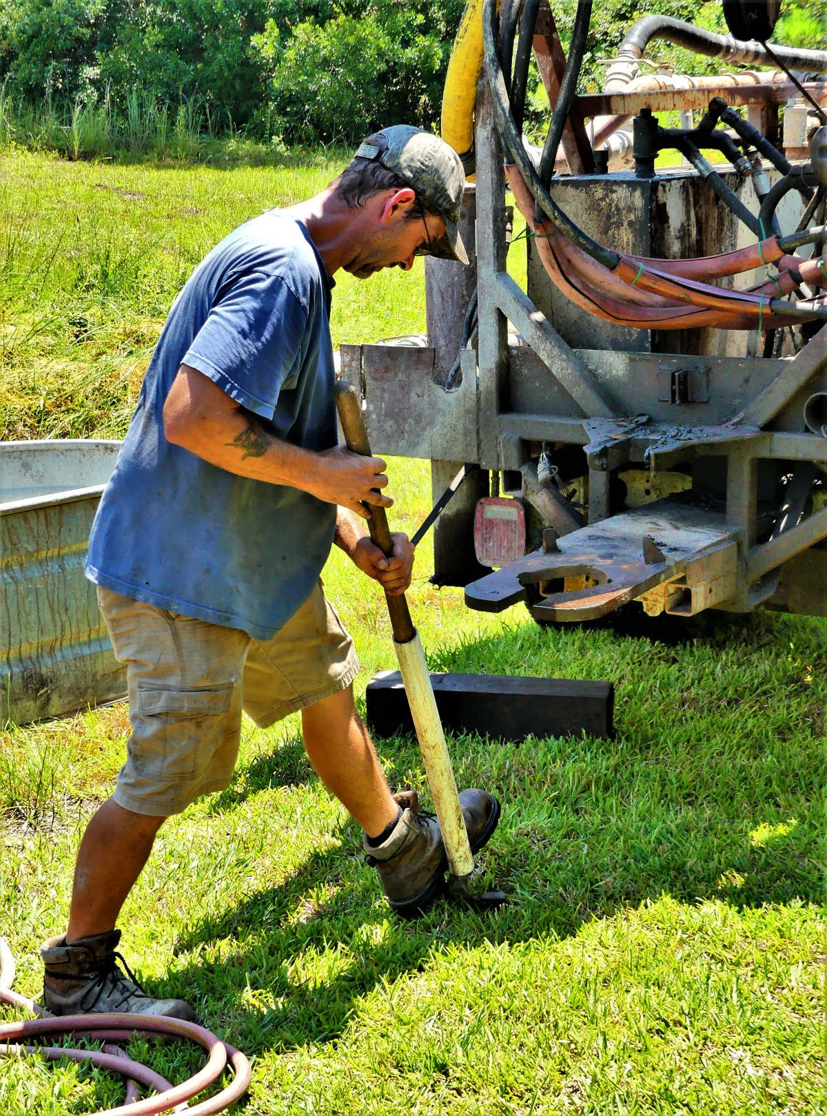
Finally, three months from our earliest consideration, the drilling equipment appeared one late morning in our yard without warning.
Using the Eenie Meenie Miney Moe method, Robbie determined where to place the wellhead…
without benefit of knowing how deep or how difficult the drilling would get, although the placement of other artesian wells within our community (a retired golf course from the 1950s) informed that 250 feet was a worthy depth to plumb before groundwater made its way to the surface.
Once Eric deployed the truck jacks,
the drill mast was ready to raise.
Eric and Robbie assembled the debris pump…
and the mud tub (for lubricating the drill head) was aligned over the designated wellhead…
well ahead of tomorrow.
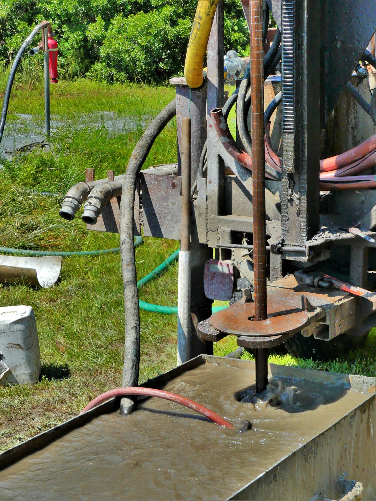
The generator started cranking at 9am. By 11am the drill rod had blazed through 95 feet of clay and sand.
By the end of the day, the drill had chewed through 14 feet of shell and shale (and probably some shark teeth and fossils) to a depth of 195 feet…
eventually reaching a ledge of limestone cap rock at 225 feet.
The boring rods were replaced with PVC pipe, and anchored in place with cement.
The next day saw slow but steady progress, as a slimmer rod and bit sank into the hole to chip away at the more resistant stone.
While Eric sat on a 5-gallon bucket monitoring the levels with a cigarette balanced on his lower lip,
Robbie pre-wired the pump, and cut off power to the panel at 11:15am to make the connection. I was stepping out of the shower at the time when the lights went dark, the AC had paused, and Agent Strzok’s House Inquisitors were no longer embarrassing themselves on my bedroom TV. It was eerily quiet except for the growl from a nearby generator.
It took me a moment to figure out that this was not part of a rolling blackout to cool down an overloaded town grid. Nor was it the drill guys in the yard, who would have been lit up after accidentally severing my buried power cable.
It would take three additional hours to grind through another 15 feet of compacted limestone until fresh groundwater eventually flowed to the surface. Robbie dug a trench to the pump, and tied into the irrigation backflow, protecting us against future contamination and eliminating our dependence on costly city irrigation water.
All that was left to do was pay the well digger, and put the water to good use.
Although we’ve recently received June’s water bill crediting the city’s bogus charge for superfluous sewer usage, we will anxiously await the next billing cycle, already knowing that the grass is always greener on the other side.
It’s been one year since our visit to Mt. Rushmore, and what could be more American than re-posting this episode on Independence Day…
There’s no better way to celebrate the 4th of July, than a trip to Mount Rushmore and the Crazy Horse Memorial. Sure, the crowds were large; that was to be expected. But once the cars were garaged, the pedestrian traffic was easy to negotiate. And with everyone looking up at the mountain, the Presidents’ faces and intentions were never obstructed.
It was also a time to celebrate family. There were plenty of kids riding in strollers, hanging from moms in carriers, or balancing on dads’ shoulders. Generations of families–many of them immigrants–had gathered to pay homage to the principles of freedom that make our country a beacon for the oppressed and downtrodden.
Seniors were being escorted through the Avenue of Flags by their grandchildren. Extended families organized group pictures at the Grand View Terrace, unified by their love of democracy and their reunion T-shirts.
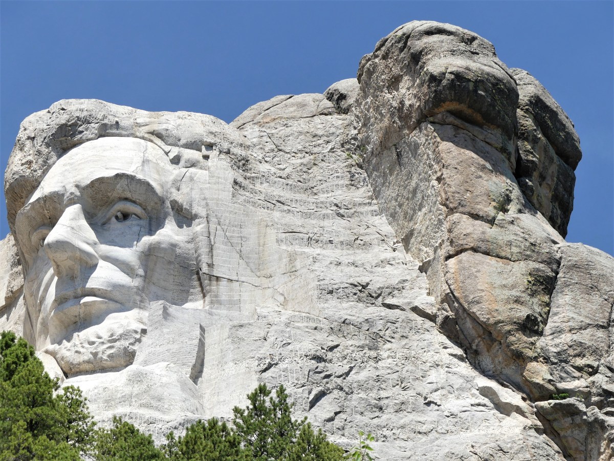
All expressed awe at Gutzon Borglum’s grand vision and remarkable achievement–the transformation of a mountain into a national symbol visited by approximately 3 million people every year.
The 14-year process of carving the rock began with dimensionalizing the Presidents’ portraits through Plaster of Paris masks, on view at the sculptor’s studio-turned-museum.
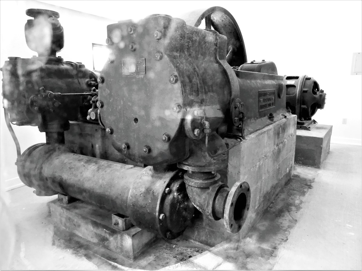
Additional exhibits detail the construction of the memorial, and the tools used by workers, like the original Rand & Waring compressor, which powered the jackhammers for all the finishing work.
A little known fact is that Mt. Rushmore was once intended to be a tribute to the “Five Faces of Freedom,” but funding ran short when the Congressional appropriation approached $1 million during the Great Depression. Hence, the unfinished carving of the Great Ape to the right of Lincoln serves as a reminder that we are never far from our true ancestors.¹
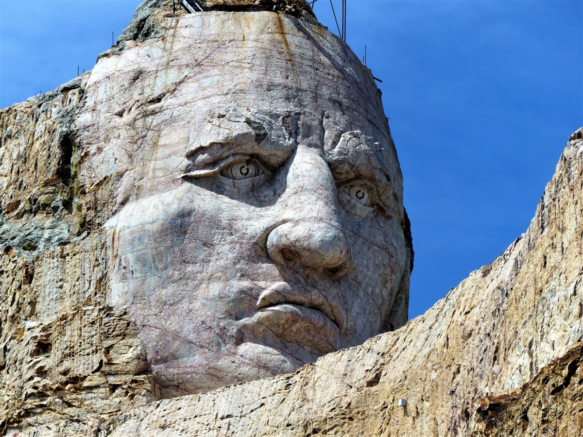
No less ambitious, and equally as impressive, the Crazy Horse Memorial is a work-in-progress located 16 miles away in the heart of the Black Hills–considered sacred land by the Lakota people.
Conceived by Korczak Ziolkowski in early 1940s,
the memorial, when completed will stand 563 ft. by 641 ft. across, and is expected to be the largest sculpture in the world. Already, the completed head of Crazy Horse measures 60 feet tall…
…twice the size of any of the presidents at Mt. Rushmore. While the first blast was conducted on the mountain in 1947, the current prospects for the memorial are to complete the outstretched arm during the next twelve years. There is no completion date available for the finished carving, which has been financed entirely by private funding since its inception.
Mt. Rushmore was created by a Danish American. Crazy Horse was created by a Polish American. And visitors to both destinations manifest the melting pot that has brought us all together as Americans. It’s our diversity that makes us strong, our ambition and determination that makes us great, and our compassion and sacrifice that make us whole.
These are the values reflected from the faces we’ve immortalized in stone. Yet, we would honor them more by living according to these principles.
Happy Birthday, America!
¹ Just kidding, but the photograph is real and has not been retouched.
Every so often, when visiting many of the iconic vistas across America, I’d struggle to capture the overwhelming awesomeness of the landscape around me.
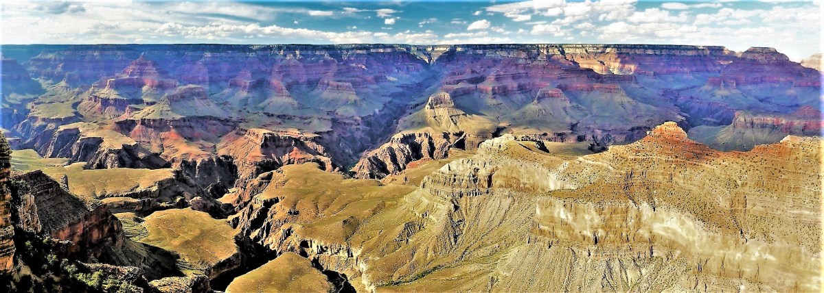
South Rim, Grand Canyon National Park
Framing the image through my viewfinder frequently posed a tremendous challenge to adequately represent the expansive angle of the surrounding landscape.
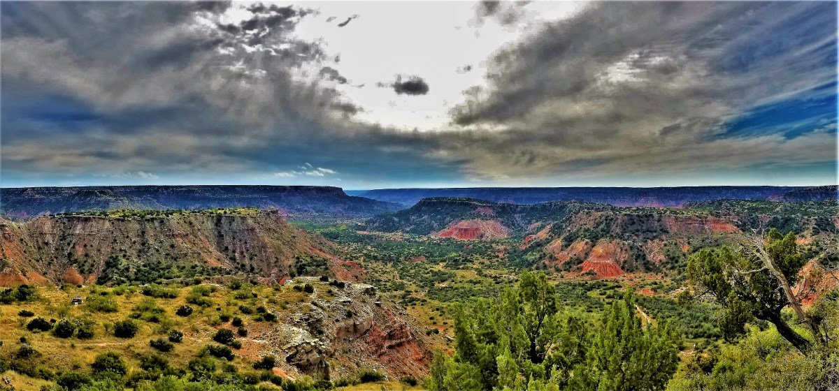
Palo Duro Canyon, TX
That’s when I knew it was time to put down my Lumix and pick up my phone.
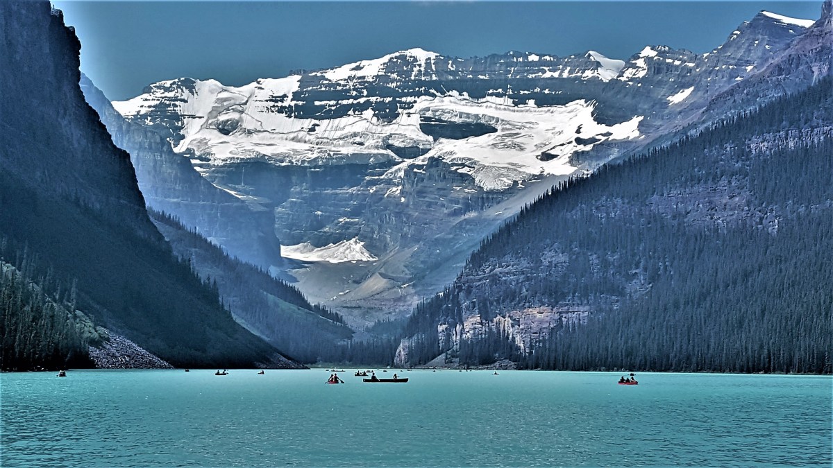
Lake Louise, Banff National Park
By turning to the panorama feature of my Samsung Galaxy S8,
Johnson Ridge, Mt. St. Helens National Monument
I found a tool that brought me closer to recording longer distances.
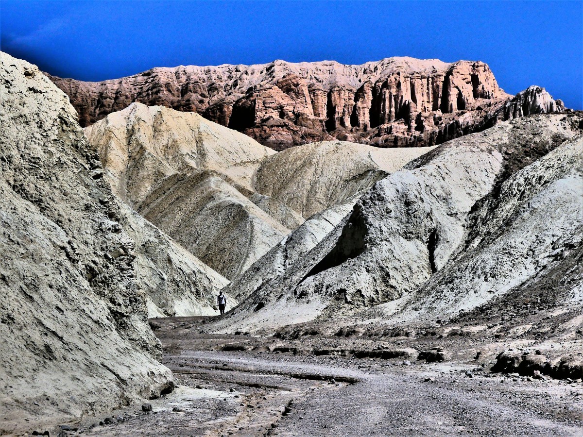
Zabriskie Point, Death Valley National Park
By instantly and seamlessly stitching successive shots with integrated photo-manipulation software,
Iceberg Pass, Rocky Mountain National Park
I found another way to express the world around me.
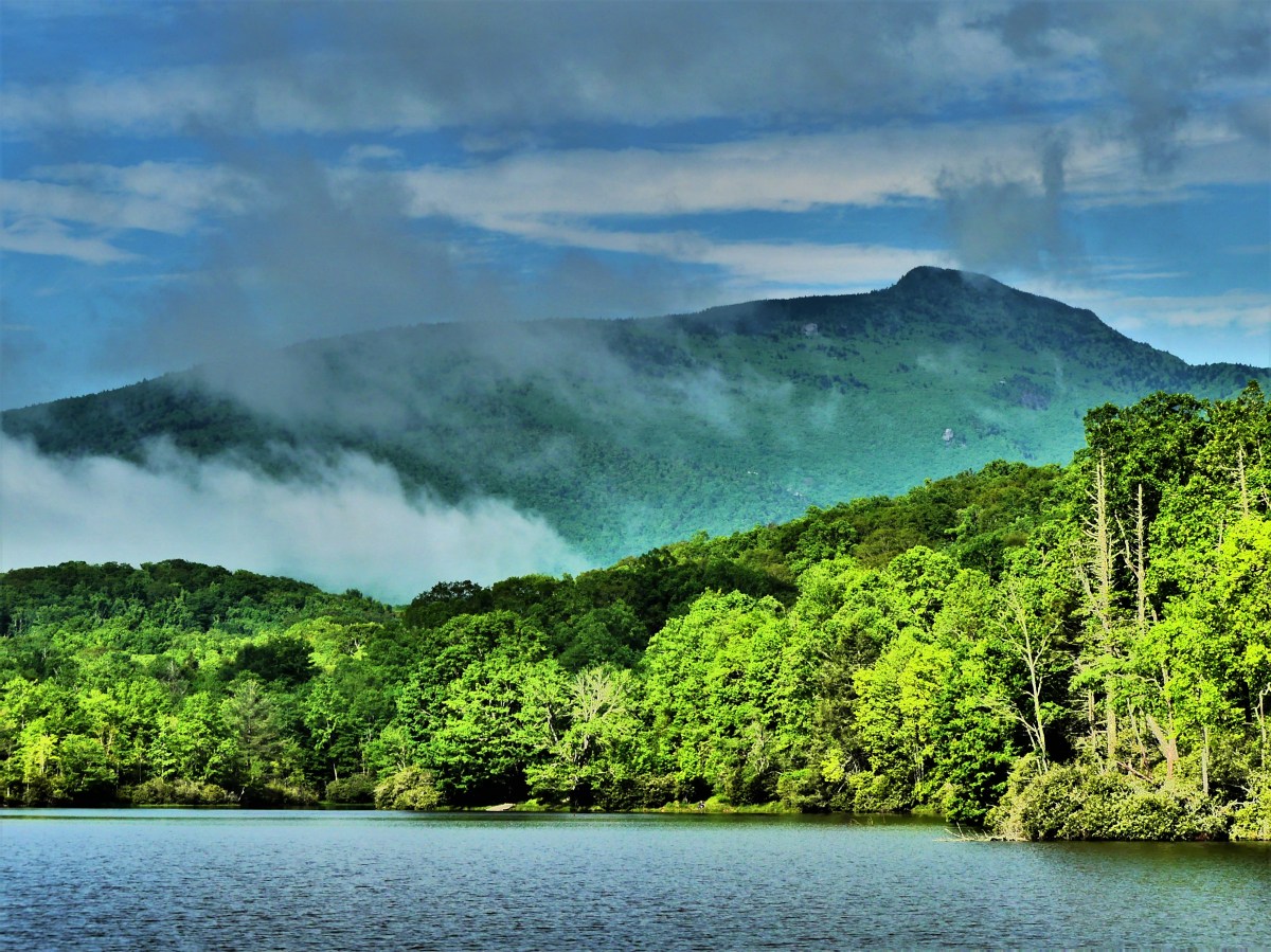
Blue Ridge Mountains, NC
Panoramas provide an opportunity to share multiple perspectives simultaneously,
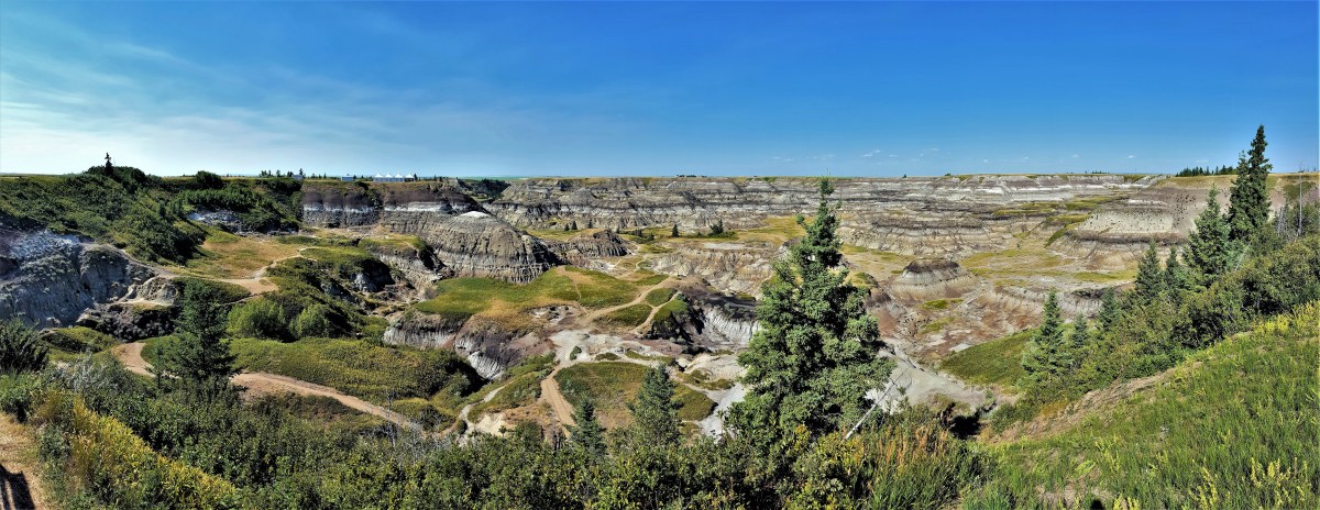
Horseshoe Canyon, Drumheller, Alberta
gathering as wide an angle as the scene allows–
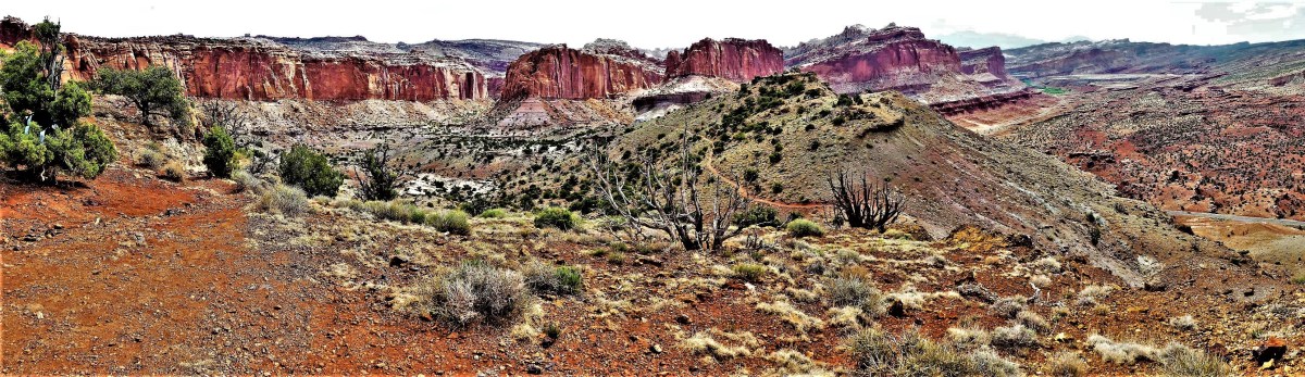
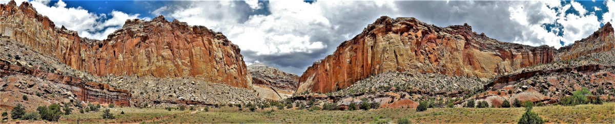
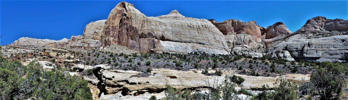
Watermark Vista, Capital Reef National Park
–eliminating the frame lines and expanding the aspect ratio to maximum effect.
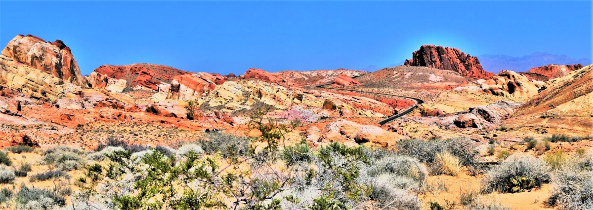
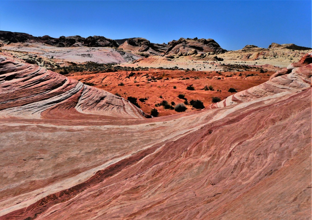
Rainbow Trail, Valley of Fire, NV
When used appropriately,
High Bluff, Redwoods National Park
whether in color…
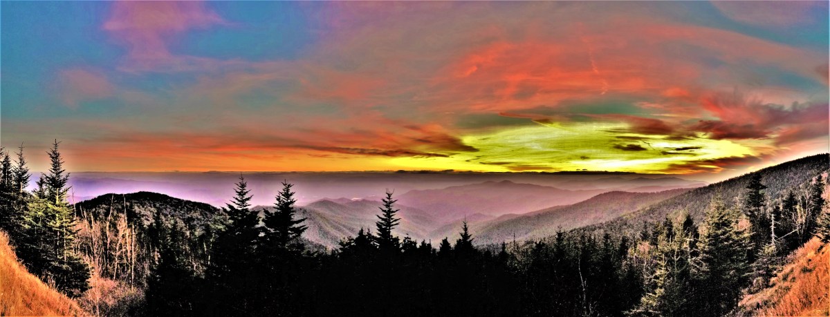
atop Clingmans Dome, Great Smoky Mountains National Park
or black and white…
Mt. Rushmore National Monument
there is no better way to establish a field of infinite view without sacrificing the integrity of the image.
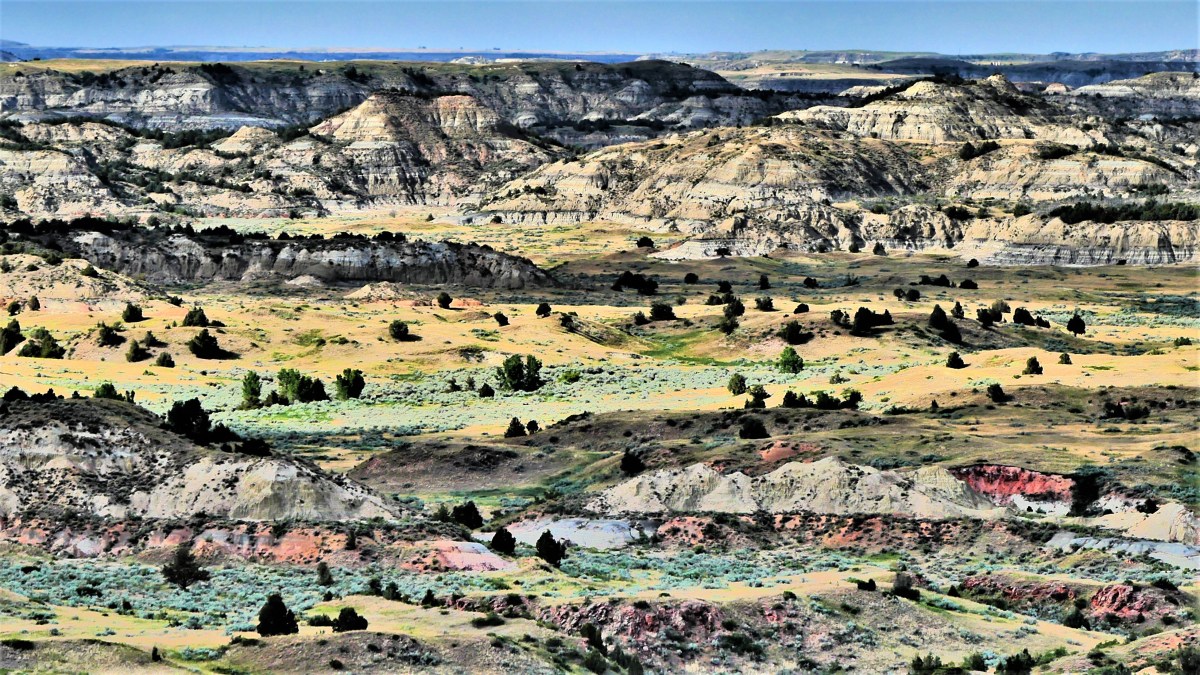
Badlands National Park
Conversely,
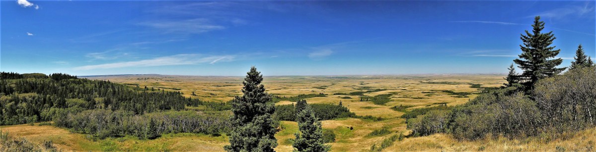
Bald Butte, Cypress Hills Provincial Park, Saskatchewan
a case can be made for showcasing the apparent aberrations and distortions that can arise from difficulty interpolating the multiple parallax points across a scene,
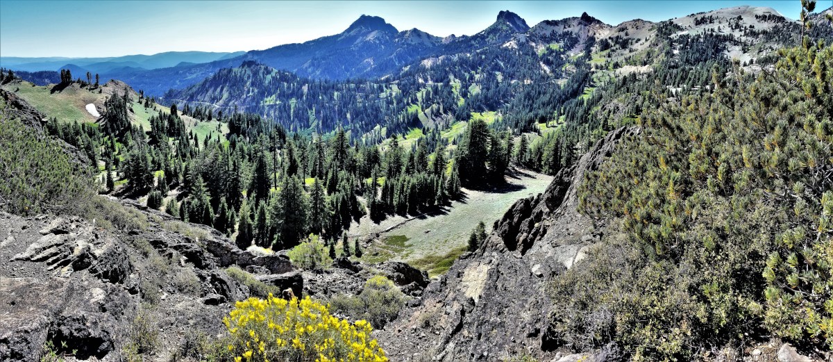
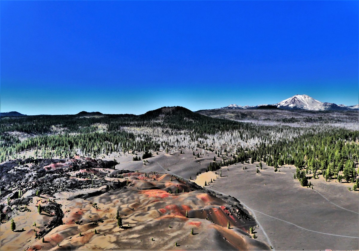
Cinder Cone Crater, Lassen Volcanic National Park
thus creating something unique and/or imaginary.
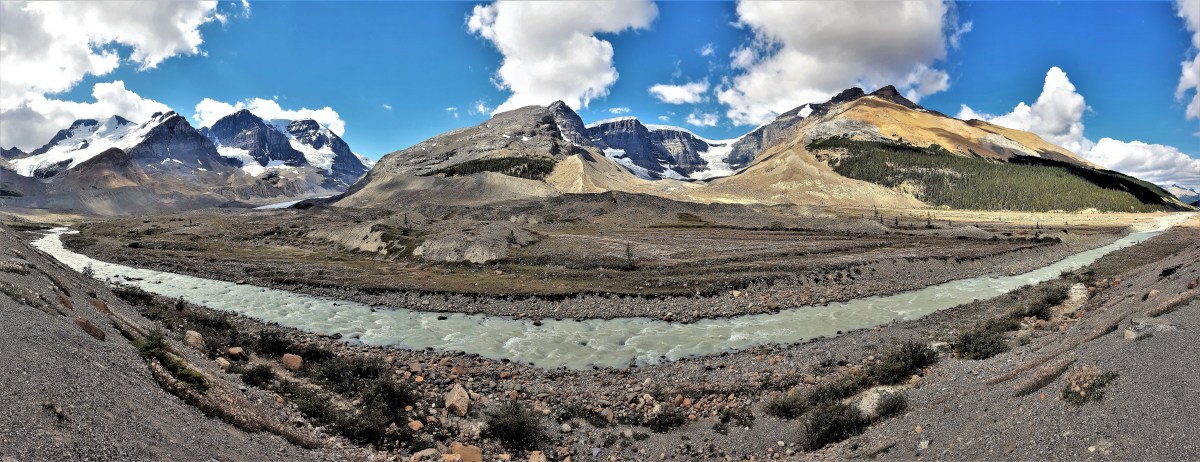
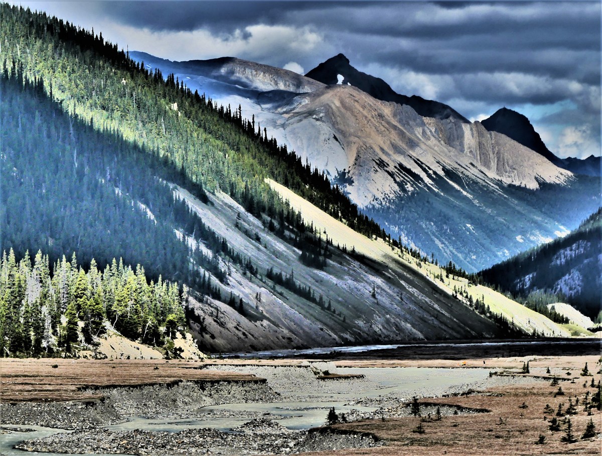
Athabasca River, Jasper National Park
For instance, flattening a circular garden path…
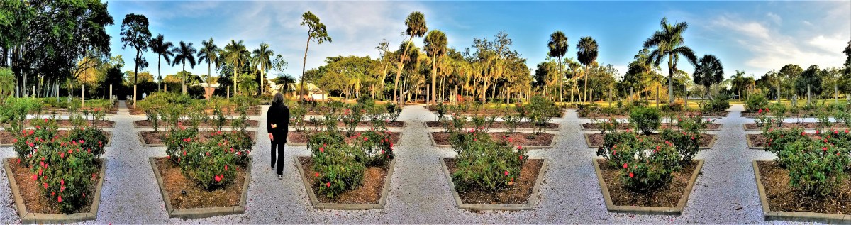
Mable’s Rose Garden of Ca’d’Zan, Sarasota, FL
or warping a linear edifice.
Crescent Hotel, Eureka Springs, AR
Additionally,
Cedar Pass, Badlands National Park
by stepping away from the camera,
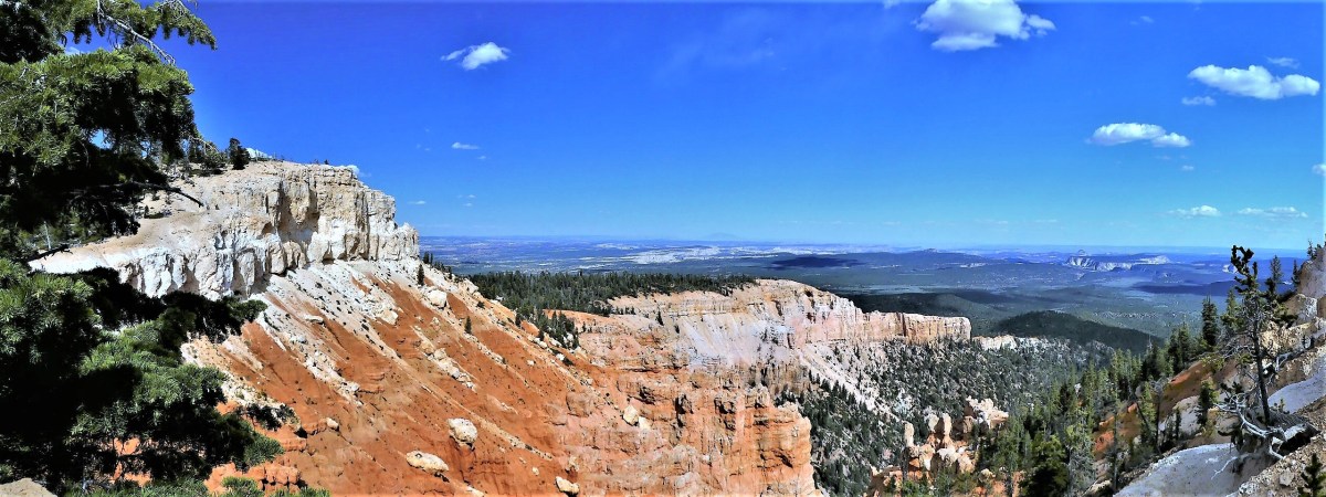
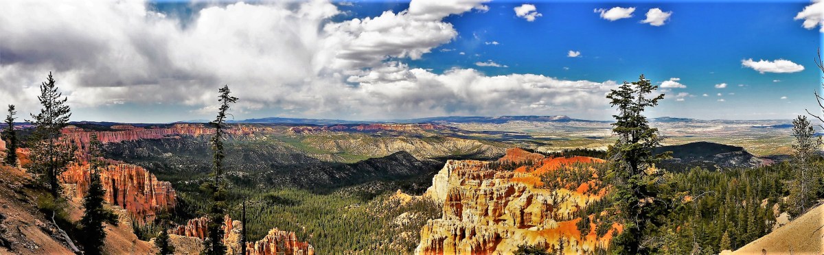
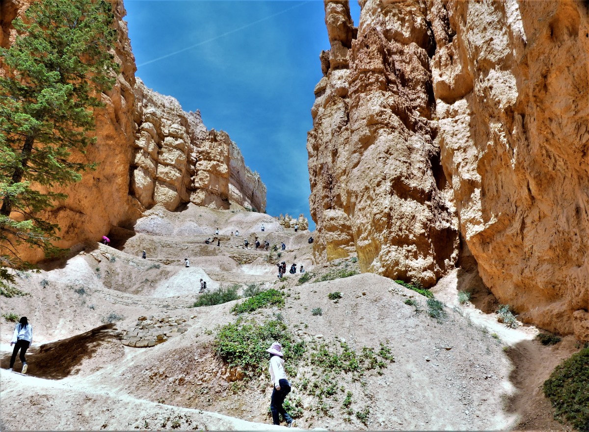
Amphitheater, Bryce Canyon National Park
and freeing oneself from the single-mindedness of staring,
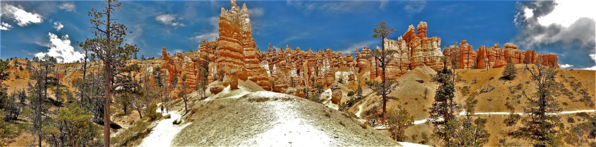
Bryce Canyon National Park
focusing,
Queen’s Garden, Bryce Canyon National Park
composing through a viewfinder,
Upheaval Dome, Canyonlands National Park
a feeling of liberation arises,
El Capitan and Cathedral Rock, Yosemite National Park
which can also deliver a moment of greater clarity of vision…
Waterfowl Lake, Jasper National Park
and kinetic connectedness to the photograph,
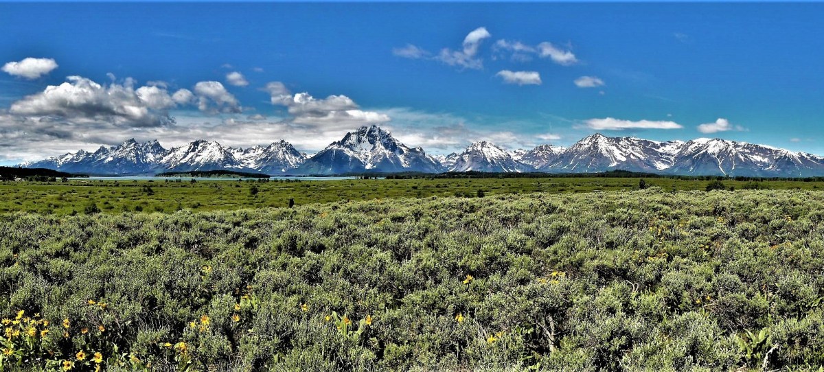
Grand Tetons National Park
as the body slowly rotates to encapsulate the scene.
Rainbow Curve, Rocky Mountain National Park
What follows is a retrospective of panoramic images of some of my favorite places,
Painted Desert, Petrified Forest National Park
in an attempt to convey the diversity,
Capitol Gorge, Capitol Reef National Park
and beauty of wide-open spaces across America,
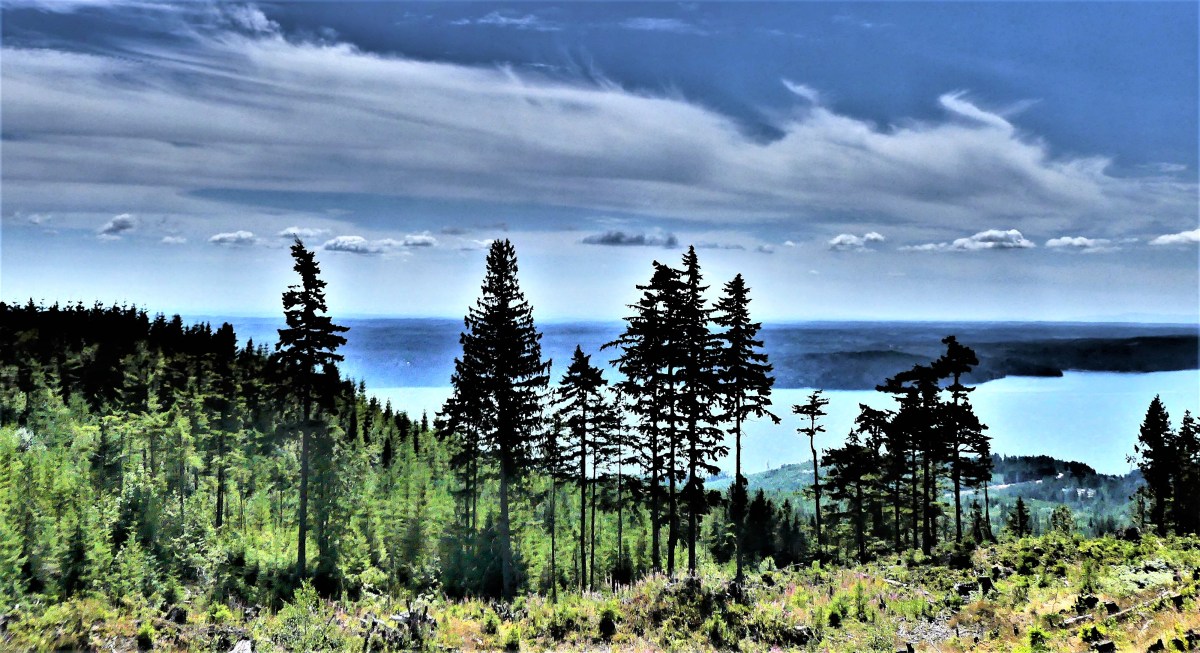
Hood Canal, Olympic National Park
albeit,
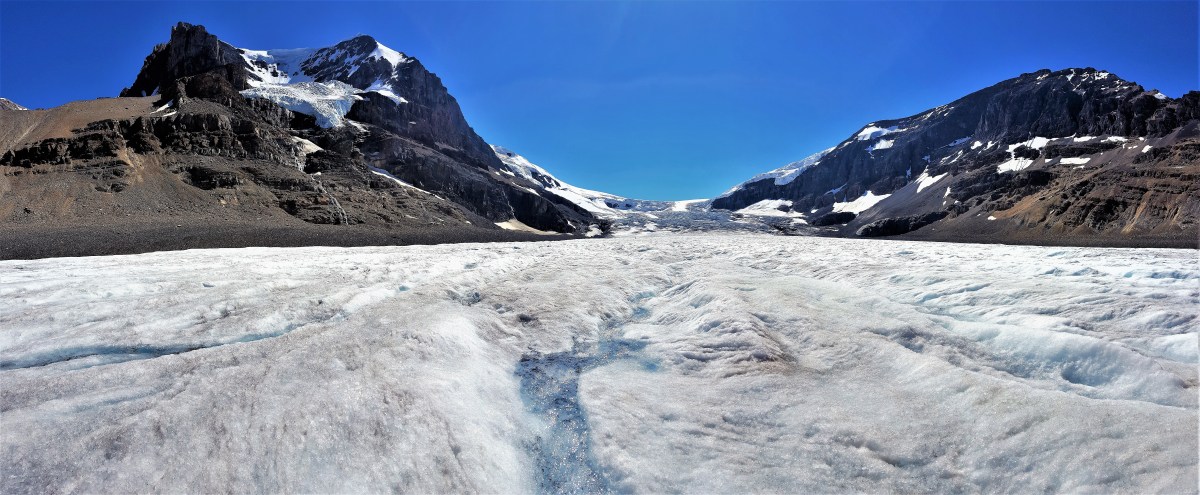
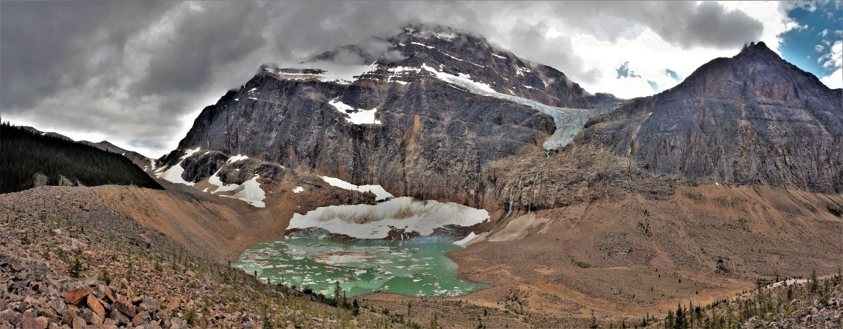
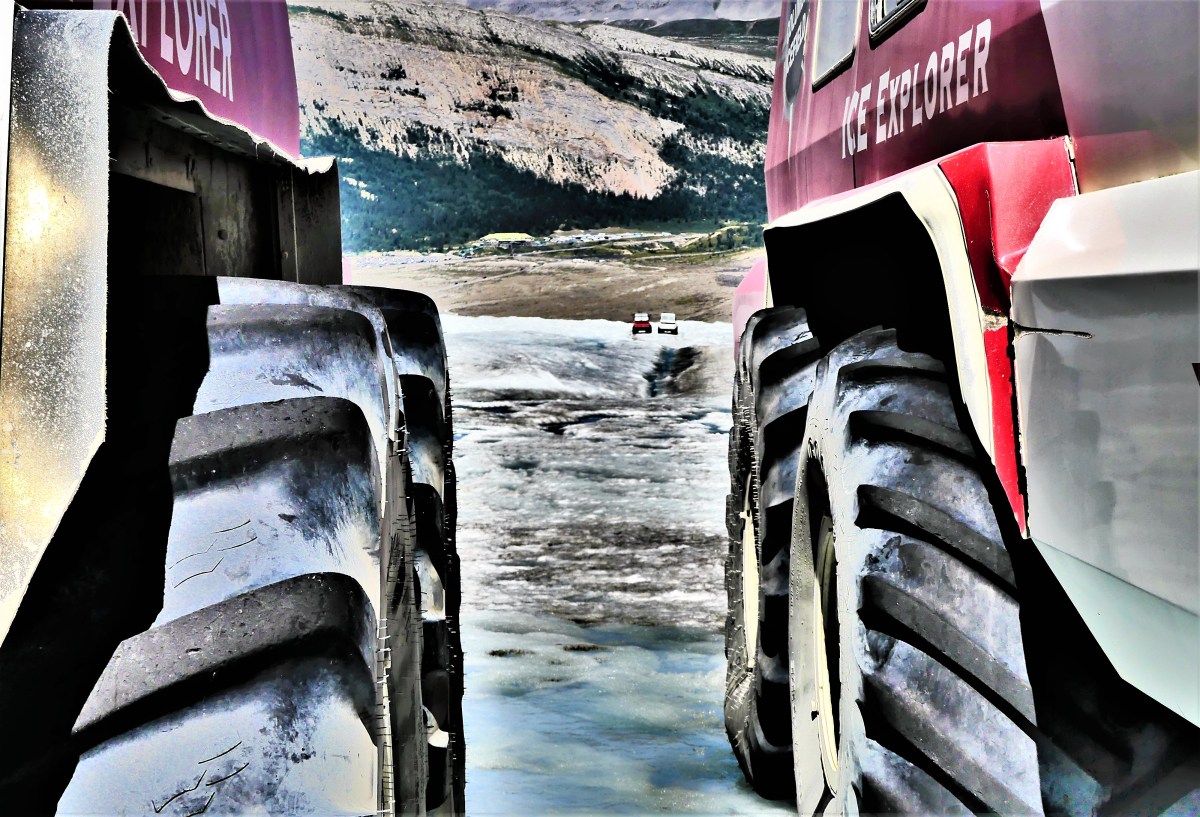
Athabasca Glacier, Columbia Icefield
with a word of advice:
Lake 4, Jasper National Park
Although this post can be enjoyed on a mobile device,
Painted Canyon, Theodore Roosevelt National Park
many of the images are rich in detail,
Olympic Peninsula, Olympic National Park
and are best viewed on a larger screen…
Navajo Knob, Capital Reef National Park
to better take advantage of the breadth,
Mt. Edith Cavell, Jasper National Park
the scope,
Moro Rock, Sequoia National Park
the scale,
Louise Lake, Mt. Ranier National Park
and enormity of the subjects.
Joshua Tree National Park
Also,
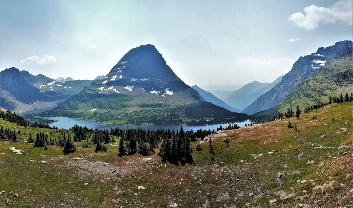
Bearhat Mountain & Hidden Lake, Glacier National Park
my apologies in advance to those who are downloading on slow networks,
Gooseneck Overlook, Canyonlands, National Park
for the generous number of photographs with large data files…
Forest Canyon, Rocky Mountain National Park
may make it seem like an eternity before everything eventually loads.
Garden Wall, Glacier National Park
But such is the case when shooting a photograph.
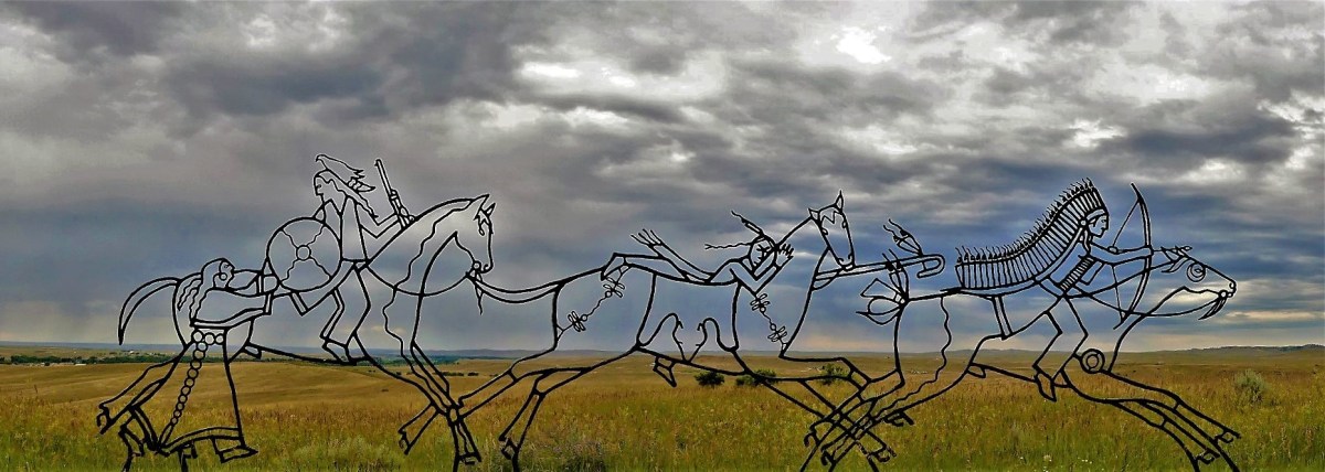
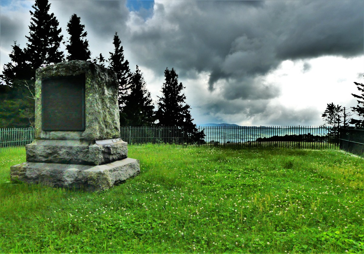
Custer Battlefield National Memorial
The virtue of patience…
Yav Point, Bryce Canyon National Park
is ultimately rewarded…
Blue Mesa, Petrified Forest National Park
by the satisfaction of knowing that the final image can finally be appreciated.
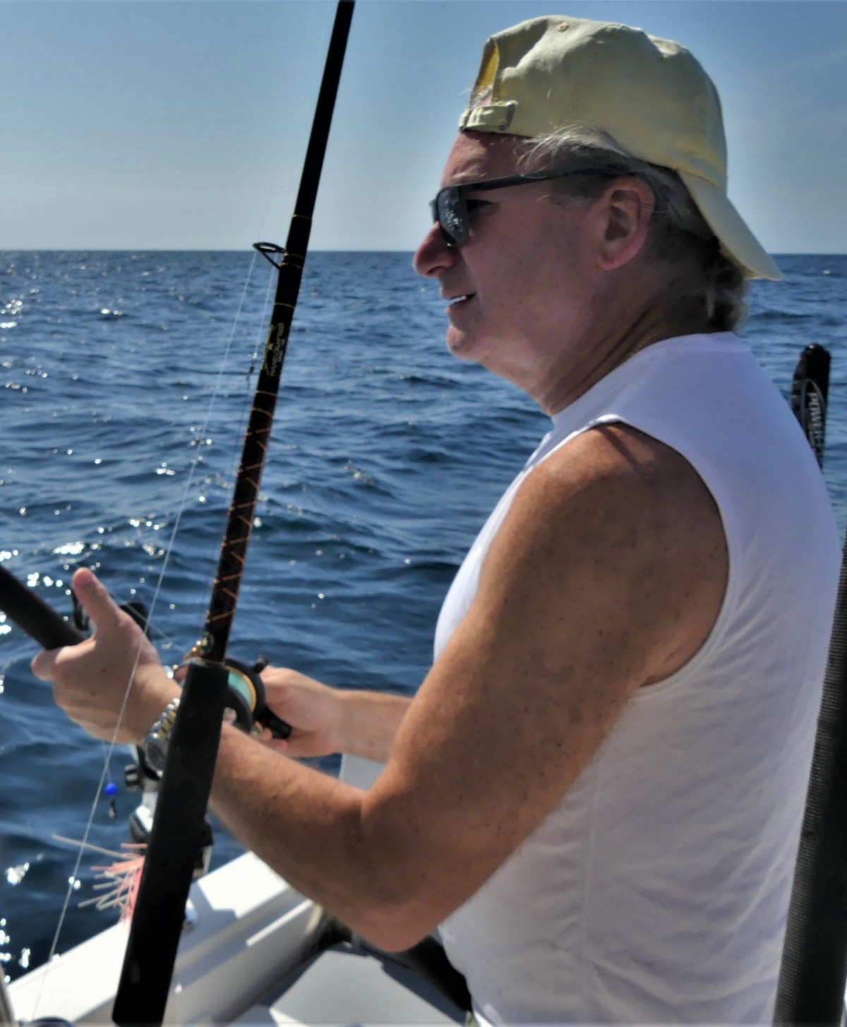
Leah and I travelled with fishing rods strapped to the Airstream’s interior for one-year, cross-country. The constant sight of them was a nagging reminder of the possibility of learning a new sport together, and the unrequited taste of something “fresh” to grill, for we never found an opportunity to cast a line. However, now that we’ve become middle-aged Floridians, we felt the timing was right to immerse ourselves–hook, line and sinker.
After closing on our St. Augustine house in February, our realtor presented us with a gift certificate for a half-day charter with Captain Robert, his son, but our date on the water would have to wait four additional months to fulfill until we returned as full-time residents, and eventually settled in.
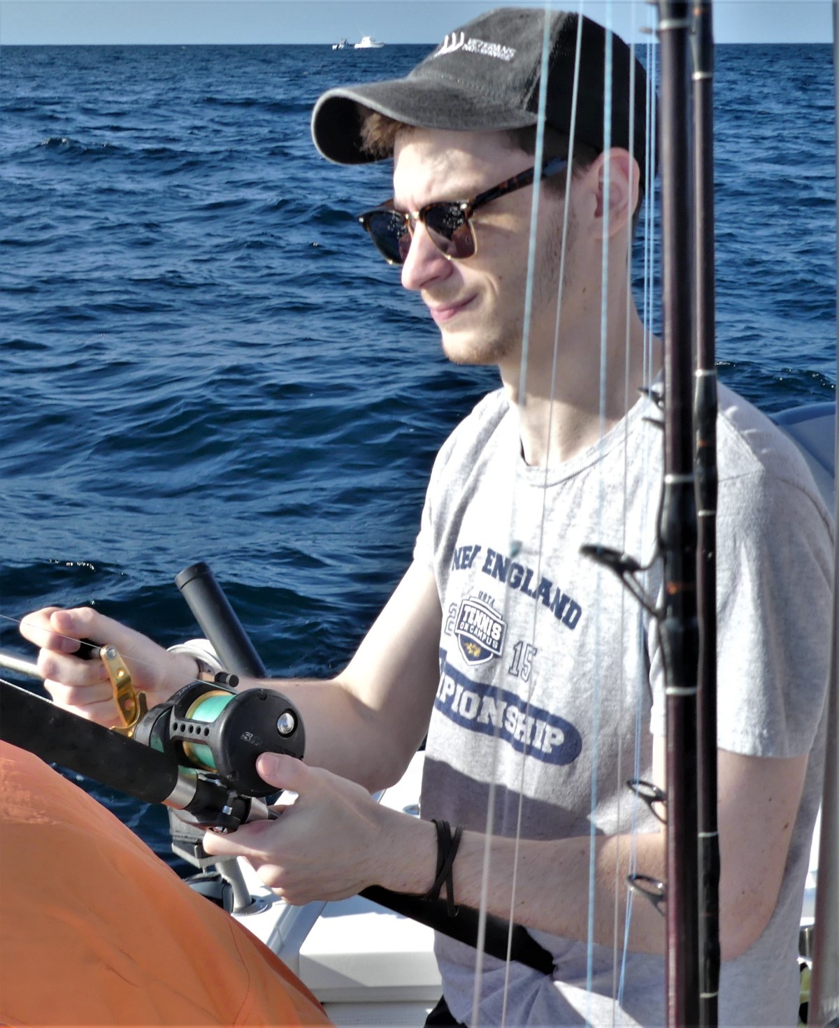
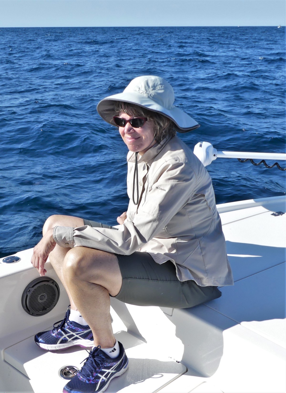
Leah had two immediate concerns with being out on the water: what to do for her new-founded sea sickness, and what kind of potty provisions would be provided. I, on the other hand just wanted reassurance that there would be space for my son Nate, who was temporarily residing with us in Florida after his apartment lease and job contract in suburban Albany, New York expired at the end of May.
A phone call to Captain Robert two weeks ago reserved our place, and addressed Leah’s anxieties: taking one tablet of Dramamine the night before and the day of the boat ride should allay her nausea; and a toilet seat placed atop a five-gallon Western Marine bucket should provide maximum comfort and embarrassment. And yes, bringing Nate along would be fine.
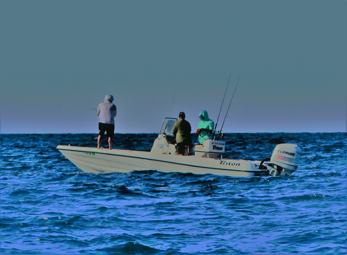
On the day of our trip, a newish Pathfinder 2500, a true fishing machine was waiting for us dockside…
at the Conch House Marina…
at daybreak.
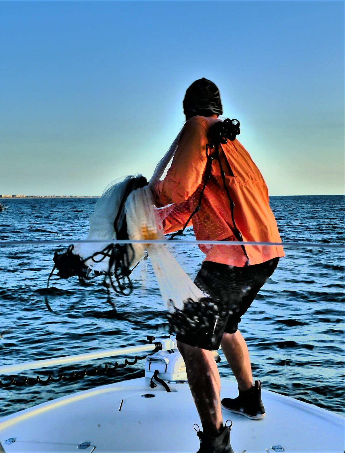
We headed out on a picture-perfect morning…
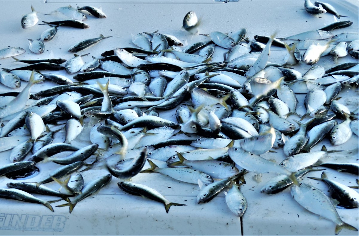
with sea swells gently lullaby-rocking us in our search for bait a couple of miles from shore. Robert pulled up near a flock of diving birds in search of breakfast, and cast a net.
Moments later, he emptied a bulging swarm of pogies…
a delicious snack for lurking king mackerel.
We cruised about nine miles out from shore to an area already brimming with half a dozen fishing boats.
I wondered about the wisdom of competing with the other boats, but Robert had a hunch. He set up three lines–two shallow, one deep, and we waited…
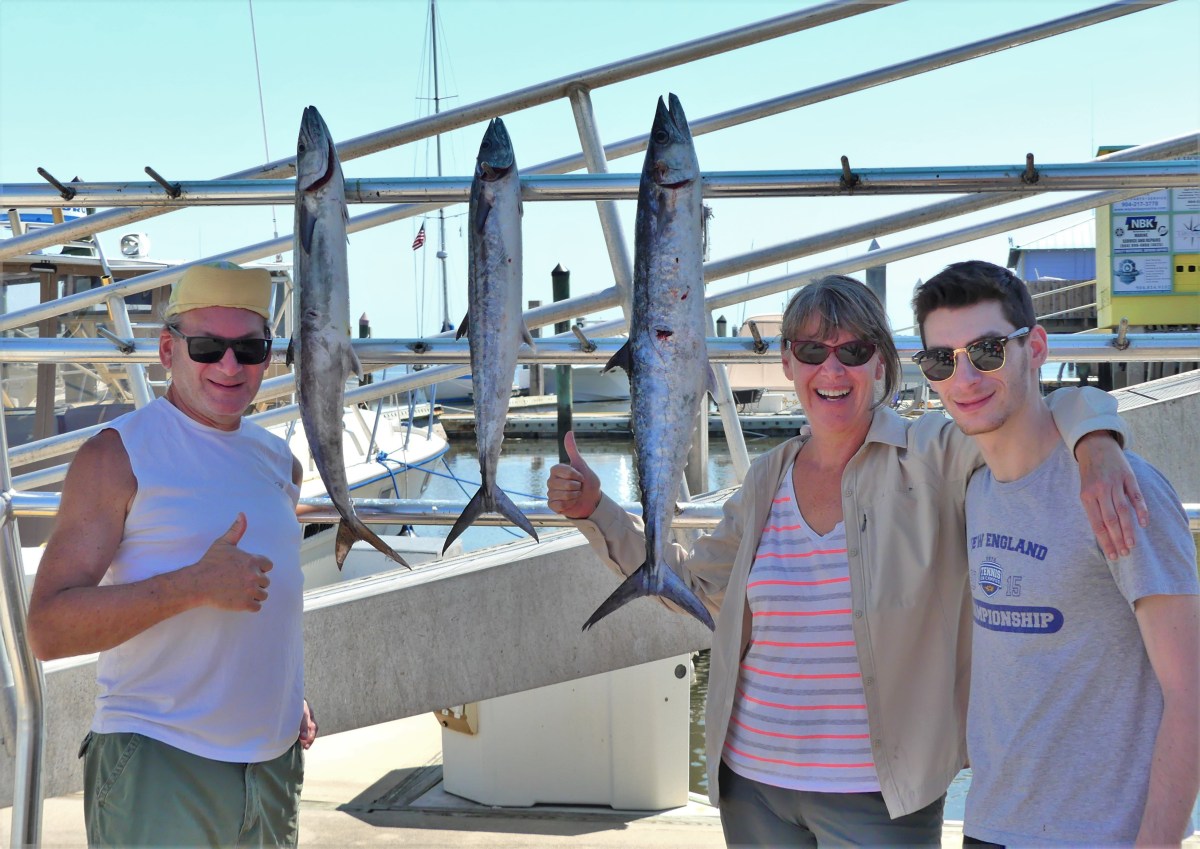
but not very long. In an hour’s time, we each took turns reeling in our target. First, Leah and me,
and then Nate,
bringing his trophy home.
We pushed out another three miles in hopes of landing a sailfish, or wrangling a redfish, but after a couple of fights, we came up short–minus the bait and hook. Robert postulated that it was probably a shark or a barracuda making a meal of what was already on the line, but we’ll never know.
We trolled around for another hour looking for activity, but the sonar was quiet,
and Leah was pensive…
perhaps wondering how awkward it might be if she needed to use the bucket.
“Do you need to go?” I wondered.
“I can hold it in,” she asserted.
It was decided that we should start back, but stop mid-way and resume our search. Again, the kings were biting, one for me,
and one for Leah,
but we had already agreed that we had enough meat for the day, so both were released. Nate was determined to even the score by catching his second fish of the day, but his time had run out, and we headed for shore.
Yet there was no need for disappointment, since Nate had reeled in the biggest catch of the day.
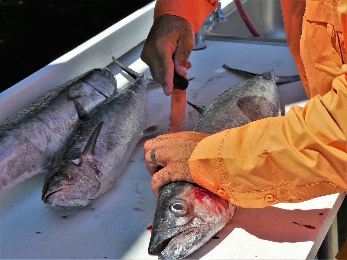
Robert was equally adept with a knife, making short time of filleting our king mackerels…
which generated about 20 pounds of steaks.
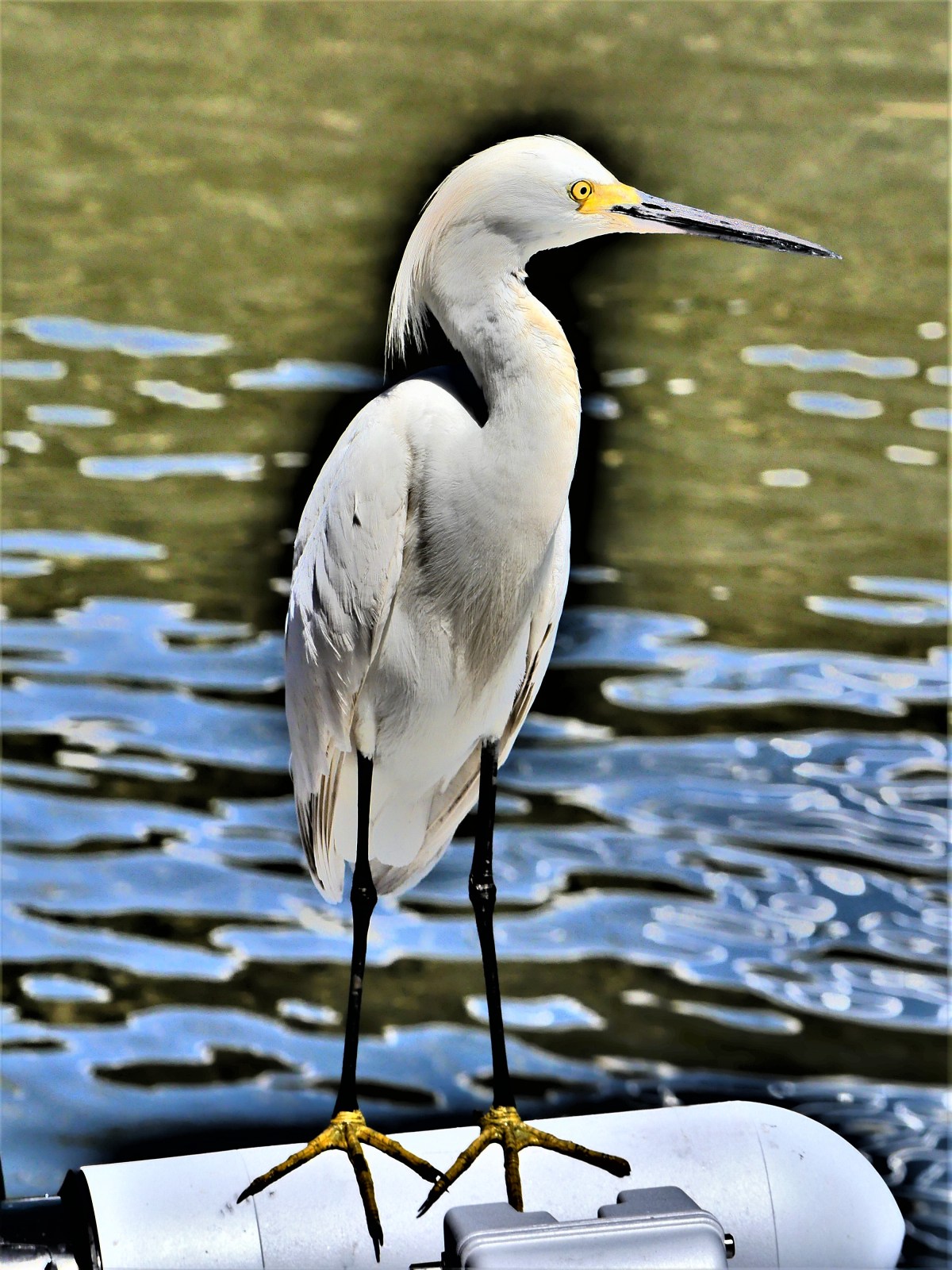
Egrets of all sizes were standing by, ready to take advantage of all scraps that might come their way.
On Robert’s advice, we ate grilled mackerel that night.
I prepared a marinade made of: ¼ cup orange juice, ¼ cup soy sauce, 2 tbsp. canola oil, 1 tbsp. lemon juice, 1 tbsp. ketchup, 1 clove of garlic, oregano, parsley, salt and pepper and soaked our fillets for 2 hours, which rendered a rich and smoky taste when cooked.
Kudos to our Skipper, and thanks for a meal fit for a king mackerel.
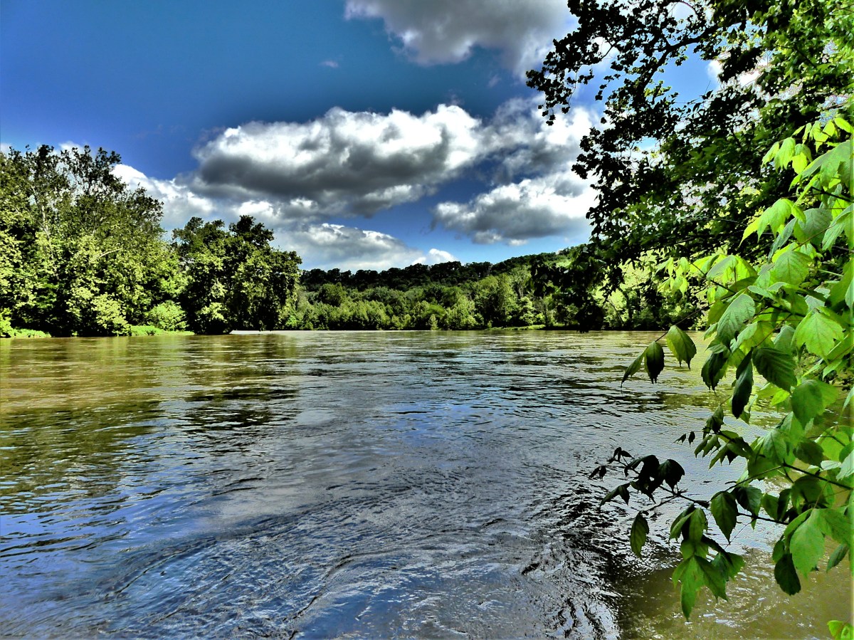
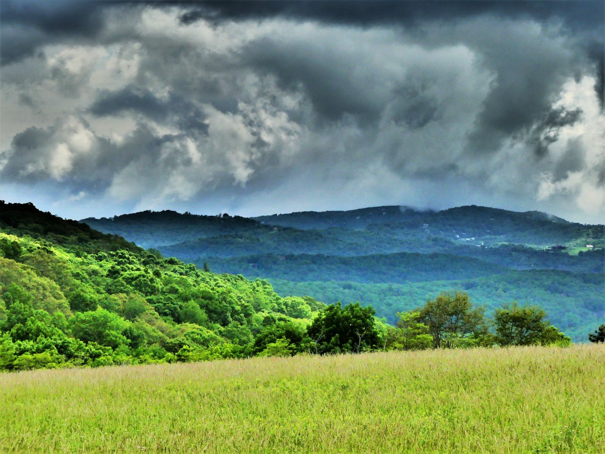
and completing the 105-mile drive through Shenandoah National Park’s Skyline Drive from Front Royal to its southern terminus…
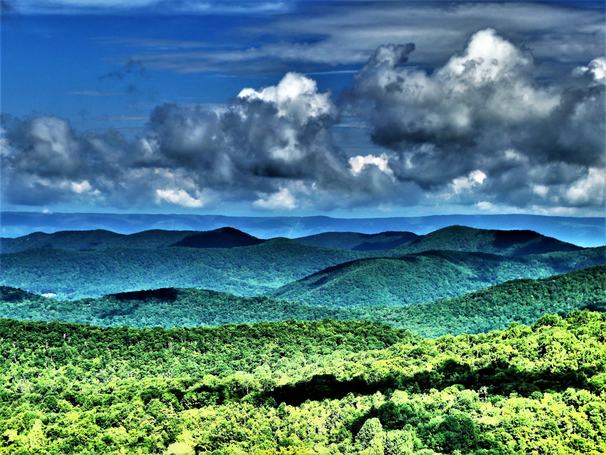
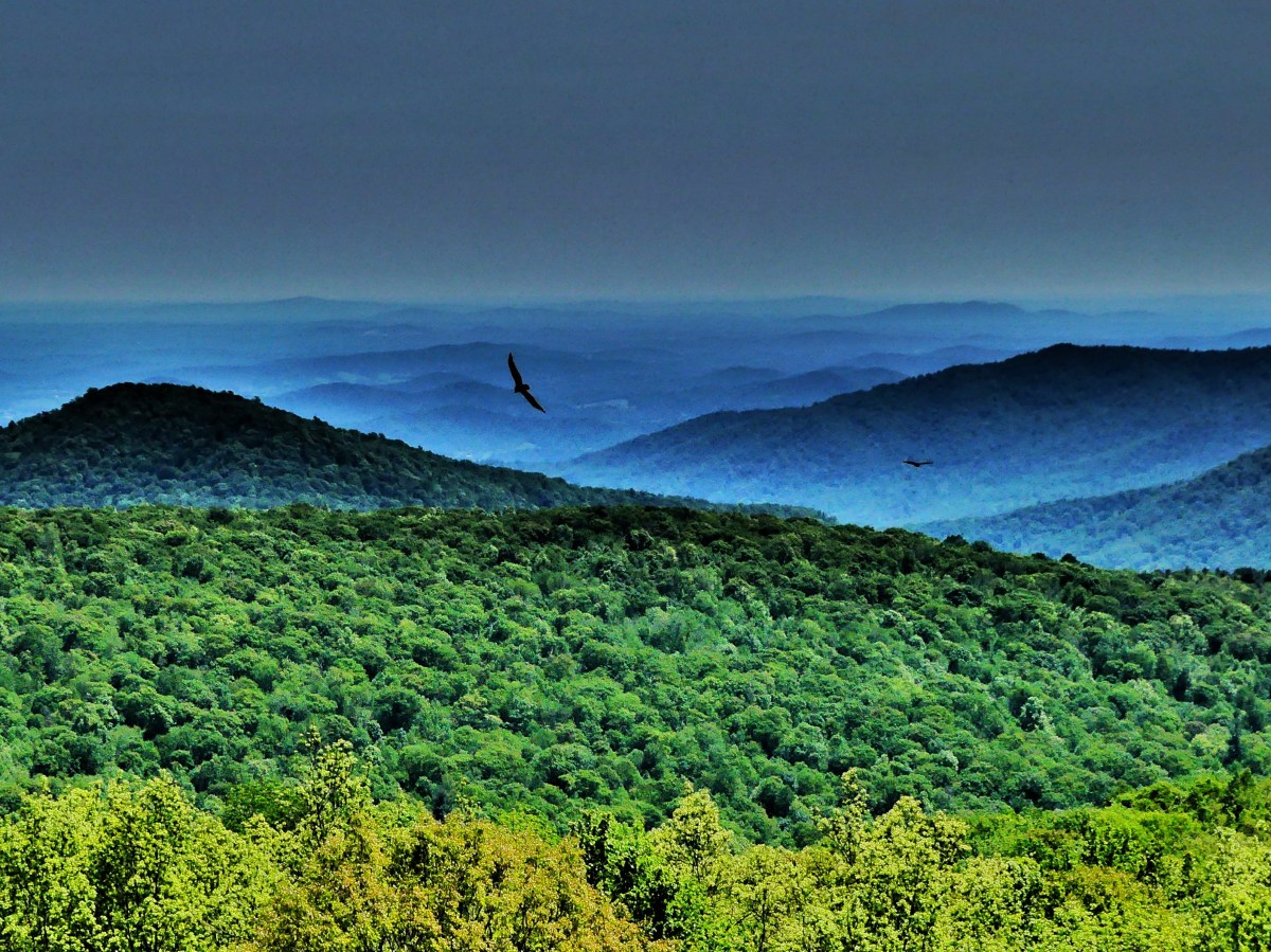
exposed us to more rain in 4 days than we had seen in all of one year on the road. There were moments when the deluge abated long enough to give us broken clouds and glimpses from some of the nearly seventy overlooks of the infinite Piedmont range to the east…
and the Shenandoah Valley to the west.
But mostly, we held our breath as we rolled along the two-lane ribbon of asphalt that wound around the mountains and climbed through a fog and cloud cover so dense at times that Leah and I asked ourselves if our summary road trip on the way to retiring the Airstream could literally be a watershed event.
Our travel plans were non-negotiable, as campgrounds had been prepaid along Skyline Drive and the first 300 miles of the connecting Blue Ridge Parkway before we’d exit eastbound toward Charlotte. We had given ourselves this time aboard the Airstream as a last hurrah–a chance to enjoy one more trip and indulge in driving one of America’s great “scenic” byways.
A moving van brimming with our belongings was awaiting departure from New Jersey to Florida, and slated for delivery by the first Monday in June while we slogged through foul weather on our way to Huntersville, North Carolina where our Airstream was destined for dry dock until the following year, giving us ample time to put our St. Augustine house in order and acclimate to Florida living.
Meanwhile, current weather stats revealed that remnants from Alberto (the first official storm of the 2018 hurricane season) had dumped over eight inches of rain along our travel route, punishing nearby dams and washing out essential bridge footings ahead of us, but we dutifully soldiered on, imagining the glorious views that would be to our left and our right.
Every so often, we’d take a break from our mountain miasma, and venture into the valley to escape the cloudburst and capture some of the local color (see A Touch of Blue and Mount Airy, NC), only to return to the Airstream and listen to the downpour pelting the roof like a torrent of bullets.
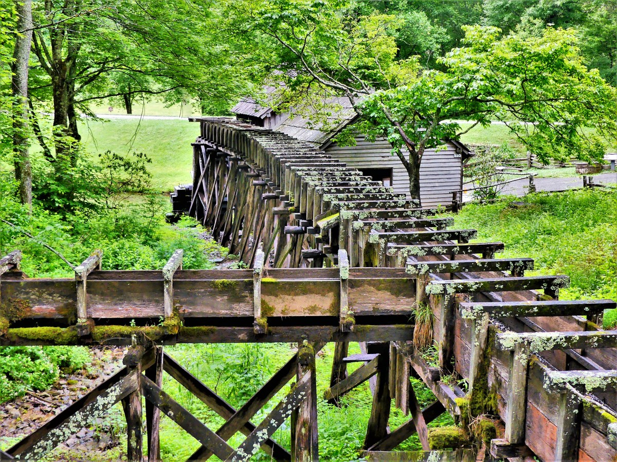
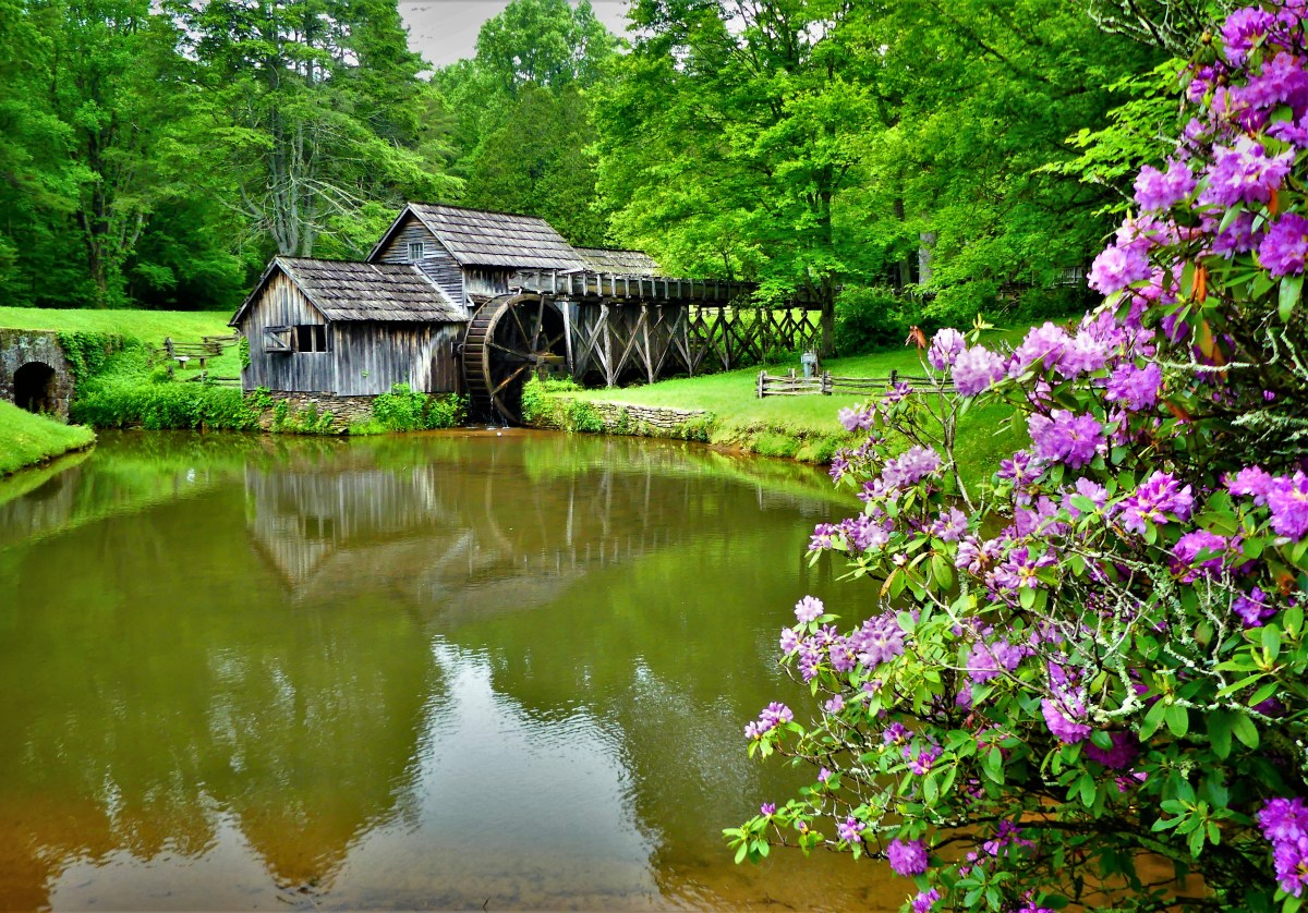
At times, we’d have a moment of clarity, like when we reached Mabry Mill at Milepost 176 (see Favoritism) and stopped to gawk at red-tailed hawks as they danced atop the thermals,
but it would be another hundred miles of slogging through doomsday rain before we’d catch another break from the storm.
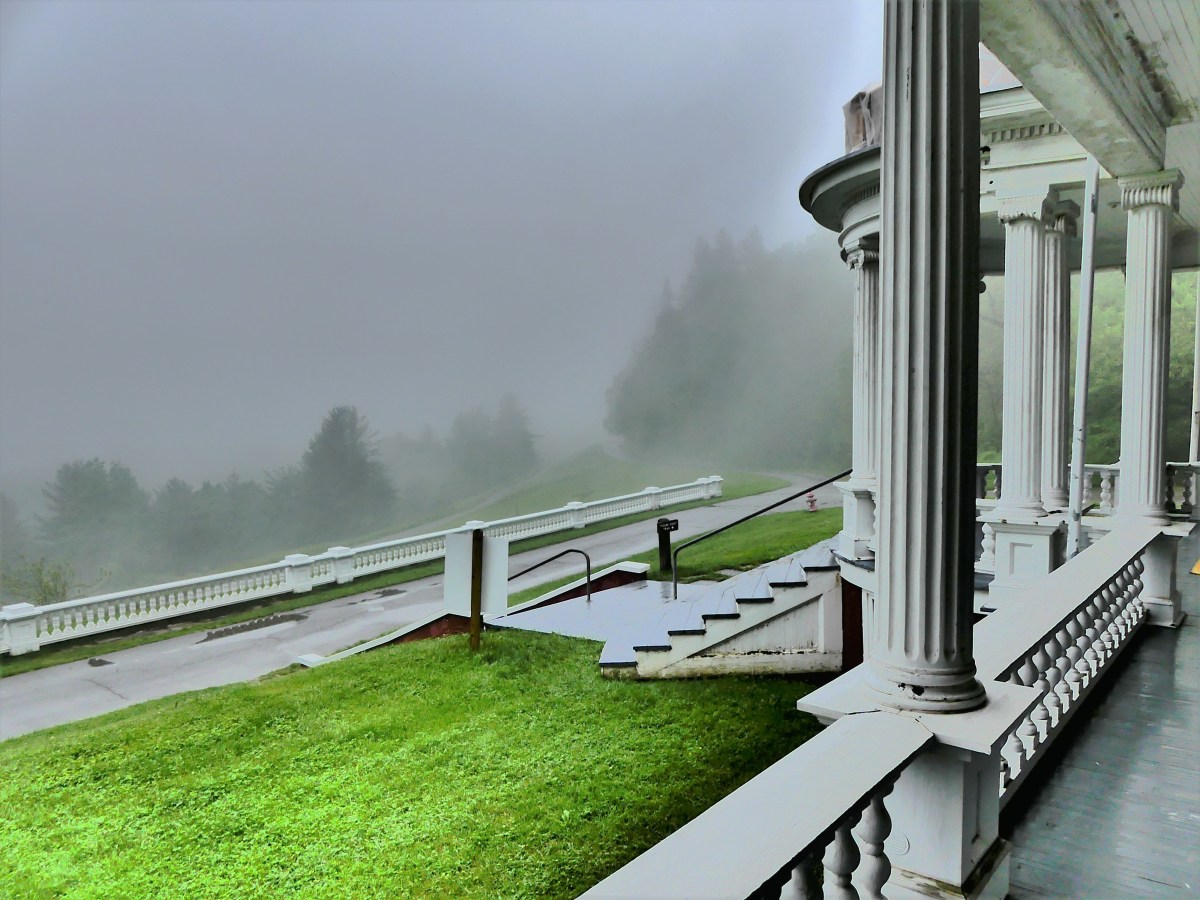
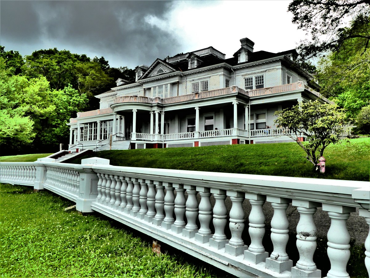
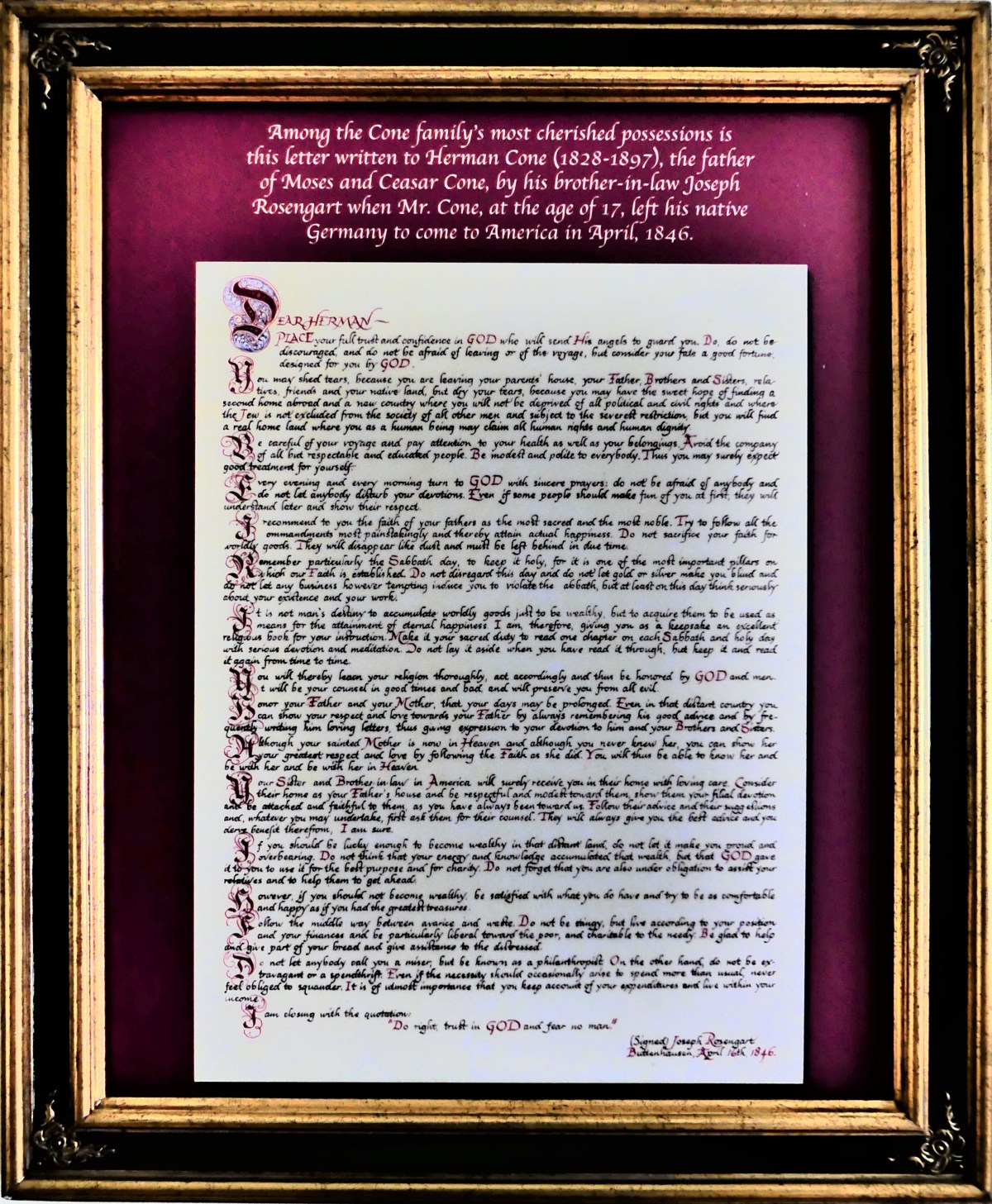
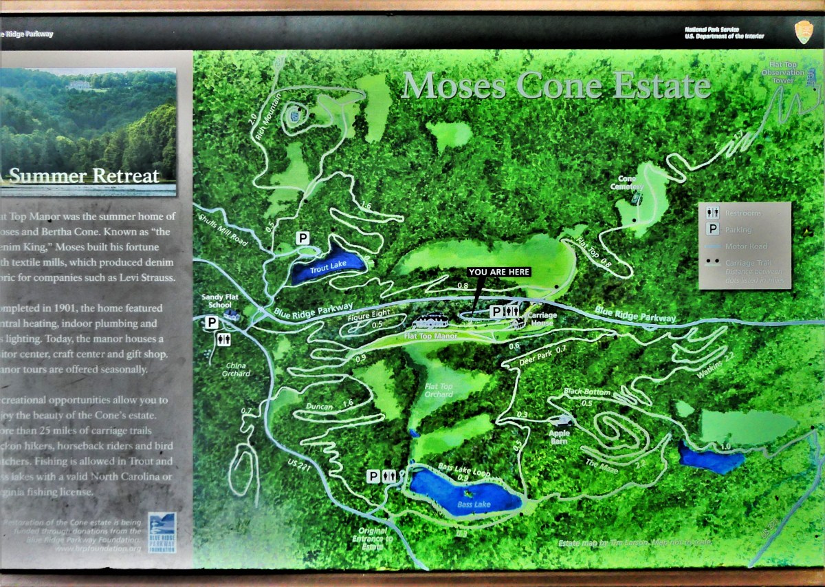
Eventually, we disengaged the Airstream at Price Park Campground near Blowing Rock, North Carolina, and backtracked to investigate Flat Top Manor, a 23-room, 13,000 square foot national historic landmark…
and once the summer home of Moses Cone, son of German Jewish immigrants originally named Kane,
and aptly nick-named the The Denim King, for Moses and his closest brother Ceasar dominated the textile industry by acquiring and building manufacturing mills throughout the deep South, becoming the world leader in denim, flannel, and corduroy fabric production, and the sole supplier to Levi Strauss for its “501” brand jeans. Moses Cone, entrepeneur, conservationist and philanthropist had led the South to the Promised Land.
Moses and Bertha built their mansion at the turn of the 20th-century for $25,000 with every modern convenience of the time, despite their 20-mile distance from the nearest railhead, and the remoteness of North Carolina’s Blue Ridge Mountains.
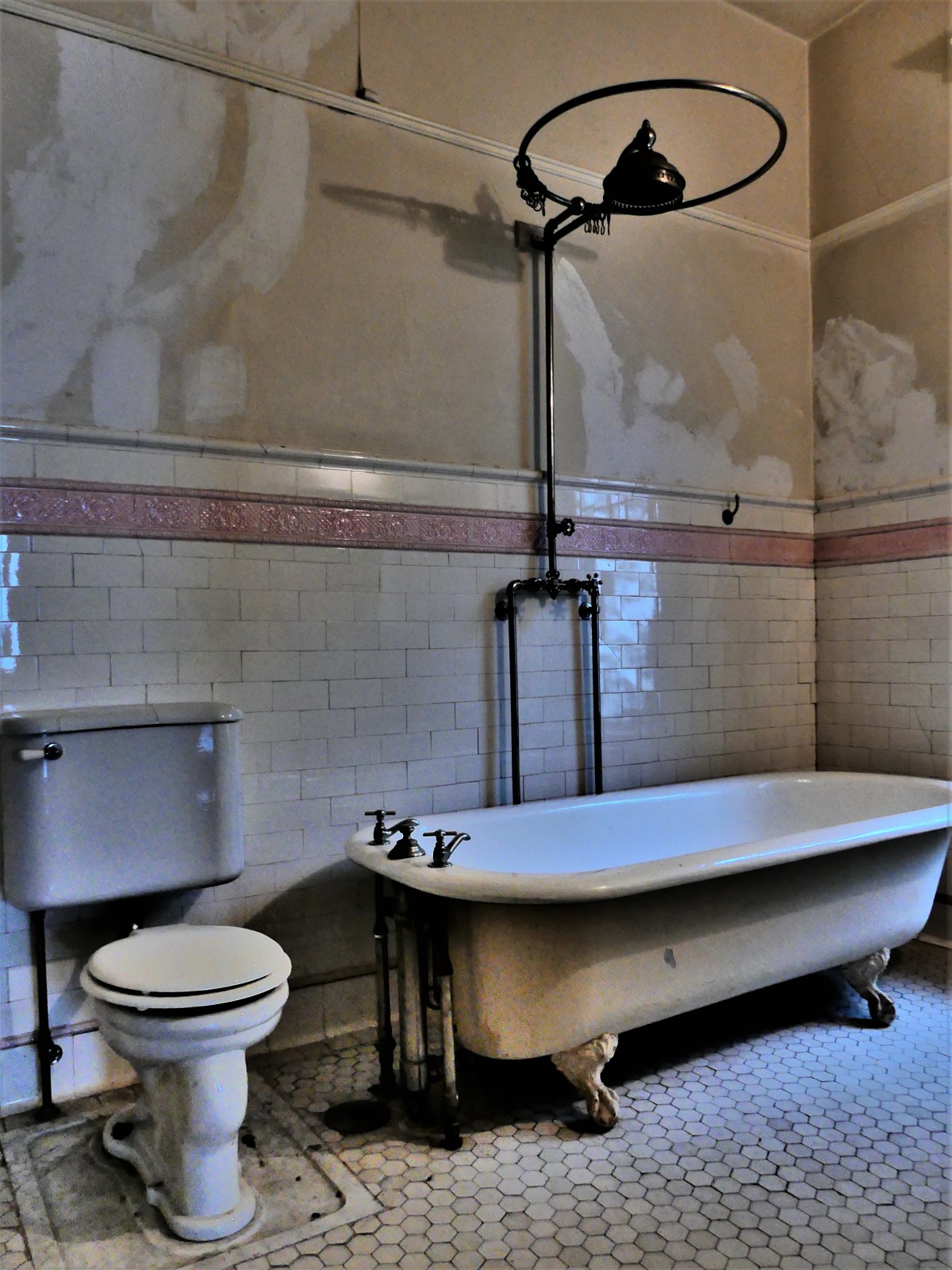
The couple (they never had children) enjoyed central heating, indoor plumbing, telephone, and gaslight–for Bertha eschewed electric light–disliking its unnatural glow and how it affected her skin tone. However, years later, after the death of Moses in 1908, she allowed electricity into the house, replacing the blocks of ice once cut and carried from Bass Lake with a food refrigeration system supplemented by one light bulb in the basement pantry.
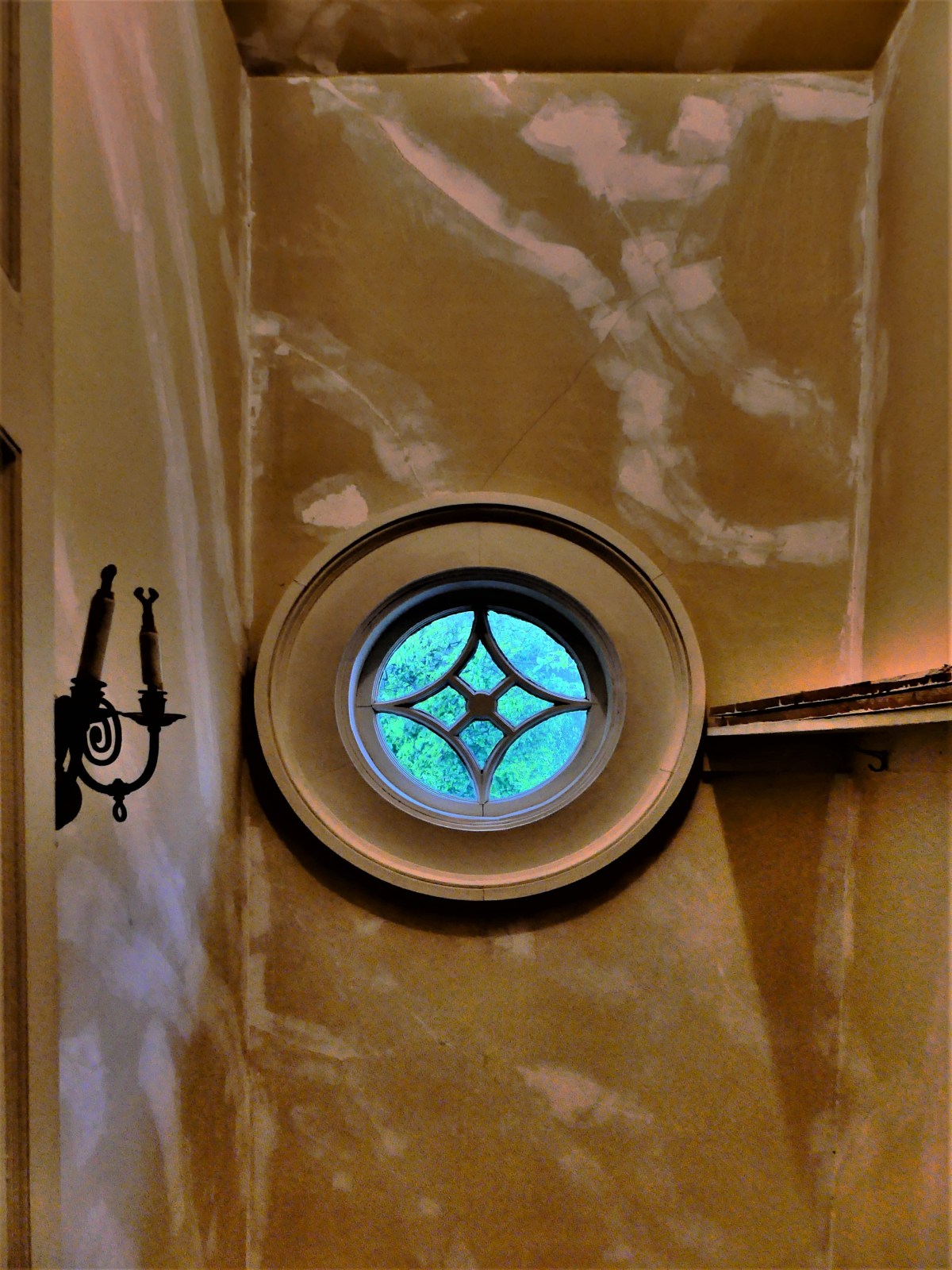
The house stands empty, and appears unfinished. No furniture accentuates its over-sized rooms, and cracks have ravaged once-smooth walls.
But there are notable wall decorations…
and at one time, a treasure trove of avant-garde art adorned the mansion thanks to lasting friendships and patronage between two unwed Cone sisters, Dr. Claribel and Etta,
Dr Claribel & Miss Etta (Cone Sisters) by Ronald Brooks Kitaj, c. 1997-2000
and Pablo Picasso and Henri Matisse. Their collection ultimately passed to the Baltimore Museum of Art, now recognized as the Cone Wing, and valued at over $1billion.
Today, the estate–managed by the National Park Service–services over 25 miles of carriage roads and trails.
Leah and I dared the rain, and hiked five miles to the Observation Tower at the southeastern edge of the property, where we were rewarded with pastoral guests,
intriguing butterflies feeding on unknown feces,
and a breathtaking panorama of nearby Boone–home of Appalachian State University, endowed by Moses Cone–and the neighboring wilderness.
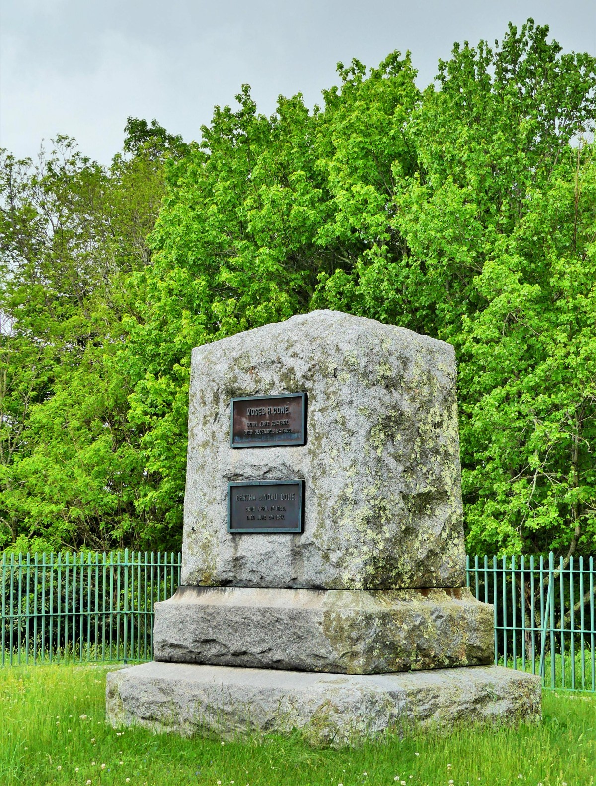
Upon our return, we stopped to pay respects to Moses and Bertha, buried together under Flat Top Mountain,
and overlooking 3,500 acres of his legacy, where an orchard of 35,000 apple trees once produced prized fruit for the gentleman farmer.
The rain returned during the brief drive back to Price Park, but abated just as quickly to capture a lasting moment of smoke wafting across Sim’s Pond.
The next morning–our travel day to Charlotte–we awoke to blue skies and sunshine beaming across Grandfather Mountain.
The run-off from Price Lake was fierce, barreling down Bee Tree Creek.
Rangers alerted us that the Parkway heading south had been temporarily closed. Flash floods and mudslides had forced a partial shutdown of Interstate 40, necessitating a detour through rural America before we could connect with I-77 S.
Putting our Airstream on blocks in Huntersville was bittersweet. It marked the formal ending of Streaming thru America, but our future holds new surprises.
Already, we’re pre-planning a trip to circumnavigate the Great Lakes during the summer of 2019. Until then, we’ll have to settle for a journey of a different sort, and I hope to keep the world posted.
When I was growing up, I often accused my mother of favoritism–feeling as if she was more devoted to one of my two sisters or other brother than me. Yet today, I can’t recollect a certain situation that gave me the chutzpah to suggest to her that one sibling got preferential treatment over another.
Of course, whenever I raised the indictment, my mother always answered the same way, “How could you say that? I love all my children the same.”
I don’t know. Maybe what she said was true for her. But I was always suspicious of her definition of equality. None of us was the same in our looks, our likes, our talents and abilities. Each of us had something that made us special. So I was never really certain how our individuality and distinctiveness measured against Mom’s distribution of love. To me, she adopted “separate but equal” as a legal family doctrine in order to avoid conflict, but conflict always had a way of showing up.
Later, as a parent, I wrestled with whether one son was better than another. I came to the conclusion that I didn’t love them equally–I loved them differently.
Many years and careers later, when I was in a classroom setting teaching emotionally and learning disabled students, the notion of picking a favorite became a source of reflection. Of course, I was more inclined to curry favor upon students who were better prepared, less of a discipline problem, and willing to try. These were my “go-to” kids who were eager to respond to open academic questions whether they knew the answer or not, and it was hard not to treat them differently.
And so, it’s much the same with determining which is a favorite of the tens of thousands of photographs I’ve snapped since becoming a “serious” photographer. After scanning through archives of images that still thrill me, I’ve decided that I cannot pick one over another, since each “favorite” has a different integrity, or power, or message.
So I’ve come to the conclusion that my favorite photograph is the one I’ve taken last, because it’s in that moment that I’ve given it the most attention, and therefore overshadowing all the other images that have preceded it.
Currently, as I travel south with Leah to meet my new destiny in St. Augustine, I am following a ribbon of asphalt that curls through the ridgeline of the Blue Ridge Mountains between Virginia and North Carolina. And while I’m certain that it’s picturesque, given the large number of overlooks that the 1930’s Conservation Corps has carved out on both sides of the Parkway, the ongoing fog and rain clouds have obscured all sitelines, making this a dissapointing journey.
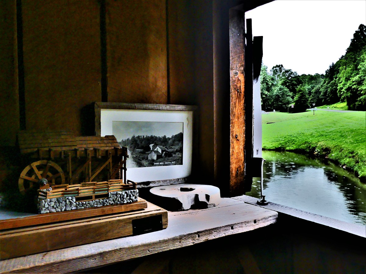
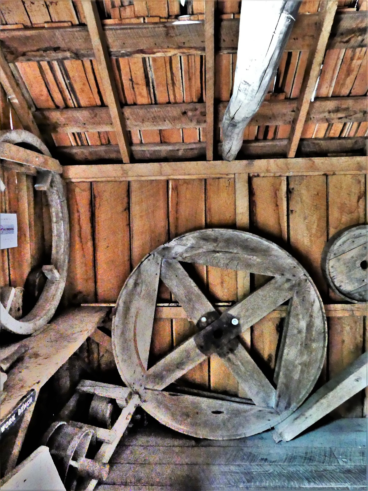
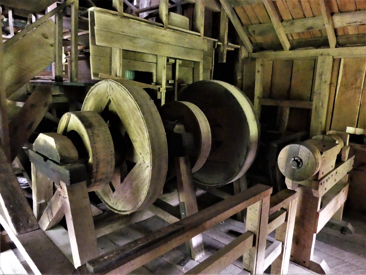
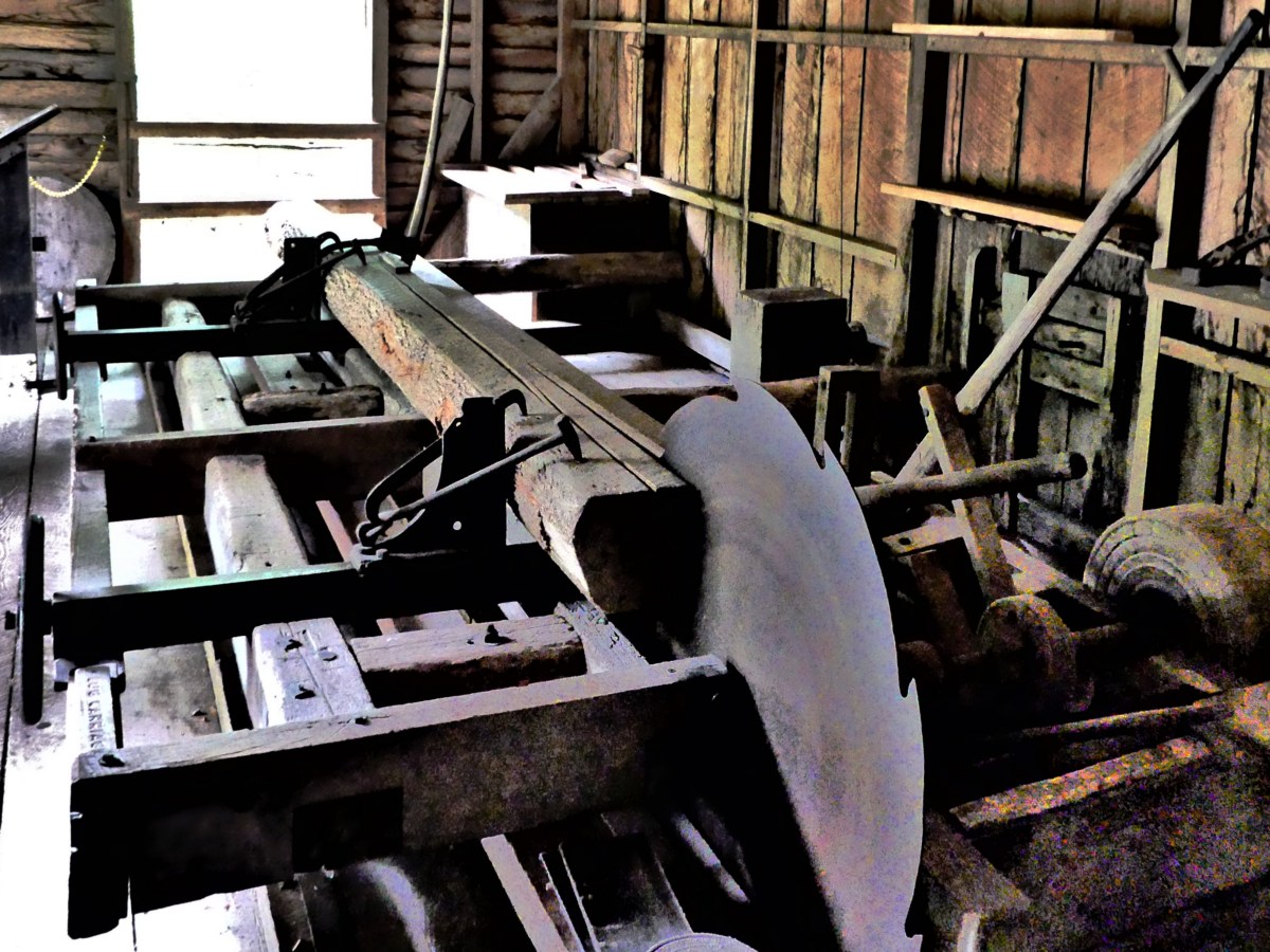
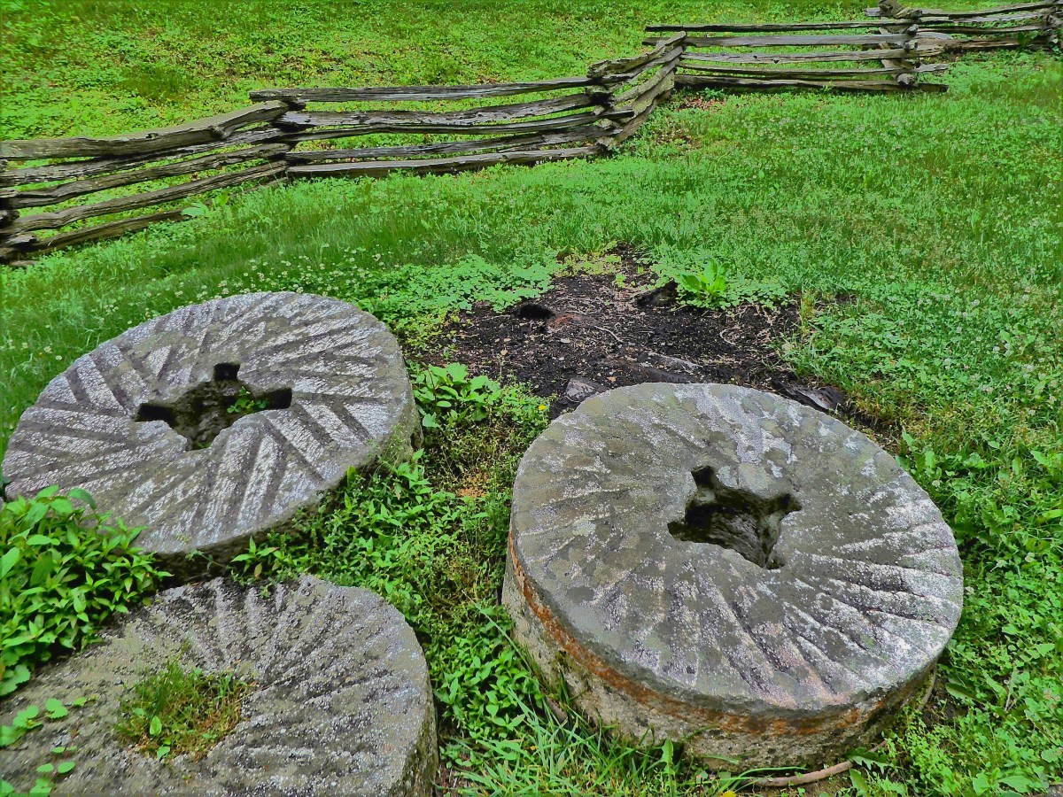
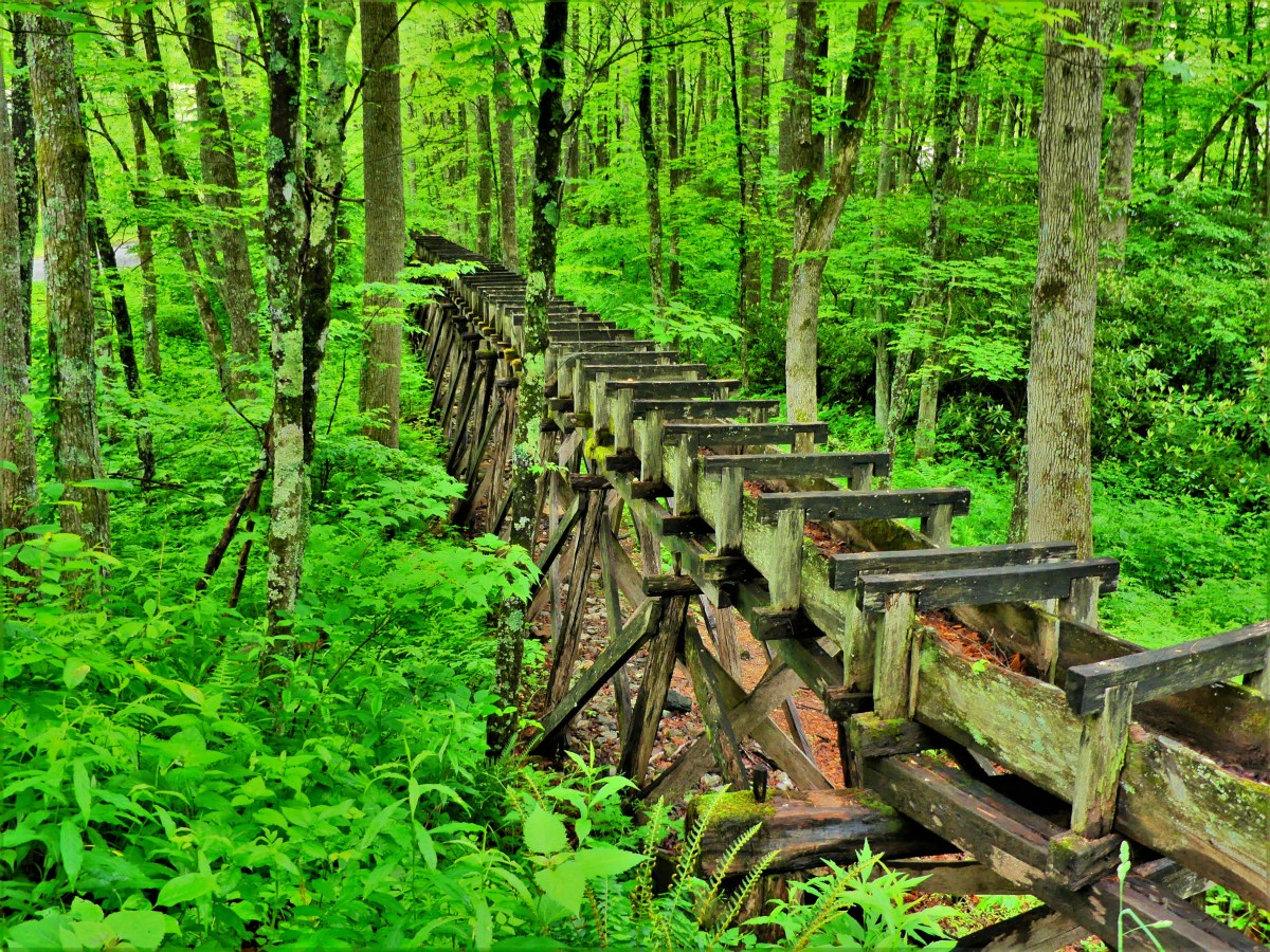
However, a short break in the weather while passing milepost 176 of Blue Ridge Parkway in Floyd County, Virginia gave us a chance to stretch our legs and take a self-guided tour of the mill by the water…
built by E.B. Mabry in 1903. Originally, a blacksmith and wheelwright operation,
Mabry later added a sawmill,
and seeing the need, added a gristmill as an additional service.
From all the rain, the scene was eerily green…
and serene.
And for one precious moment, it became my favorite place to photograph…
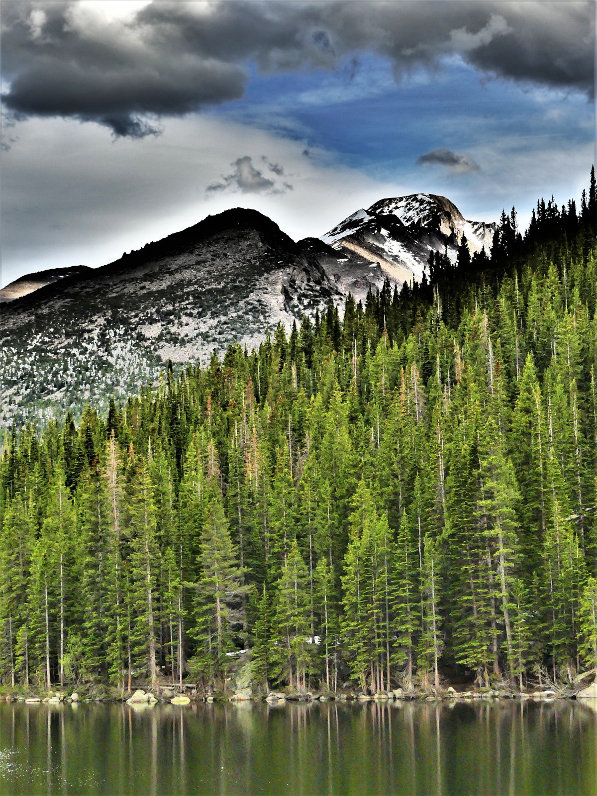
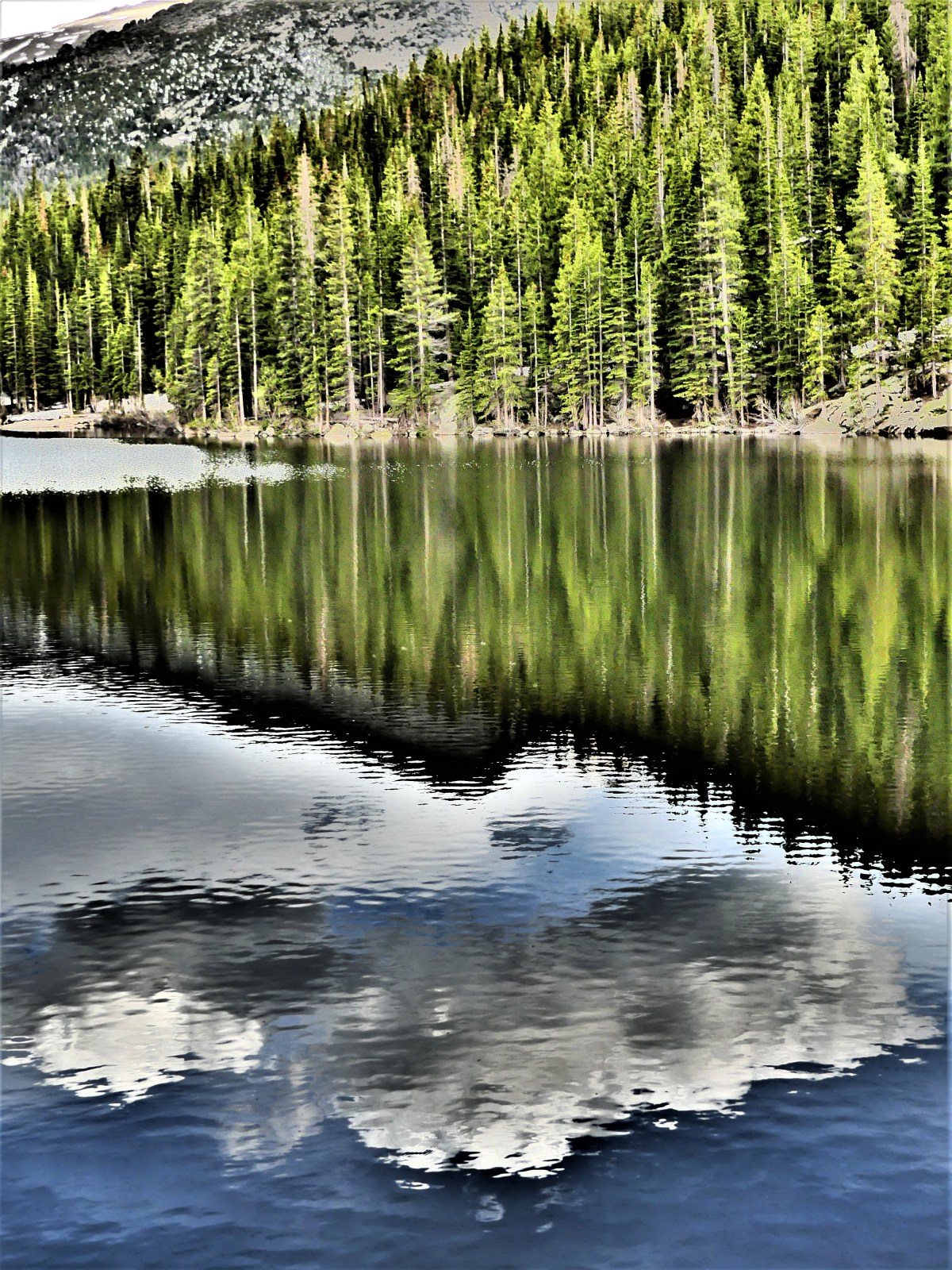
While hiking the Bear Lake Loop Trail at Rocky Mountain National Park, I was drawn to a cluster of lodgepole pines raked across the water, with Mt. Wuh peaking in the distance.
Subsequently, the wind picked up, disturbing the mirrored reflection–a quiver of ripples now transforming my quiet reality into a impressionistic interpretation of my Nirvana.
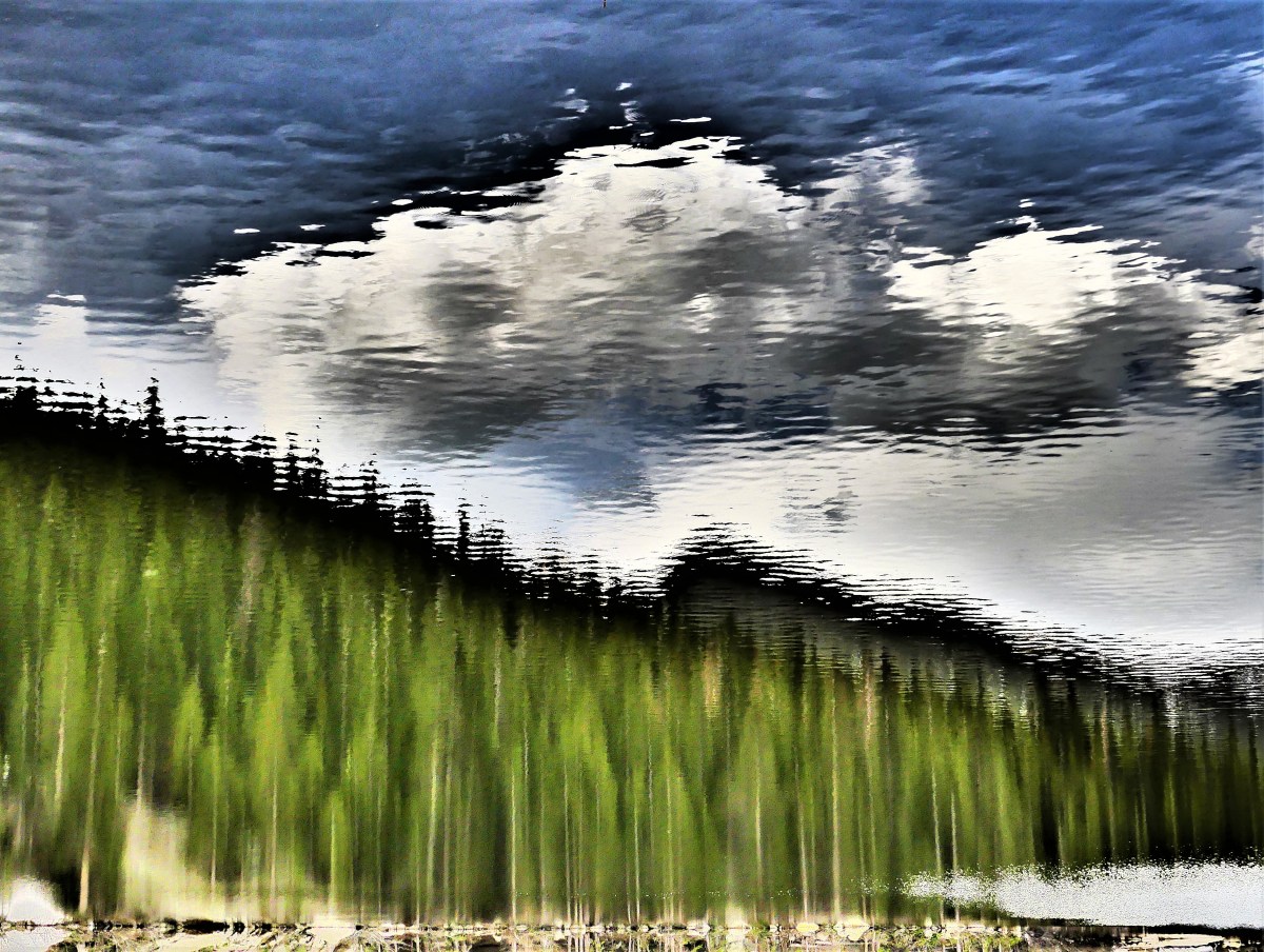
I was captivated by the shimmering shape of sky and treeline, and inclined to shift my focus to the water, with the notion of turning nature upside down…
…and anchoring the soft glow of a landscape into a liquidscape.
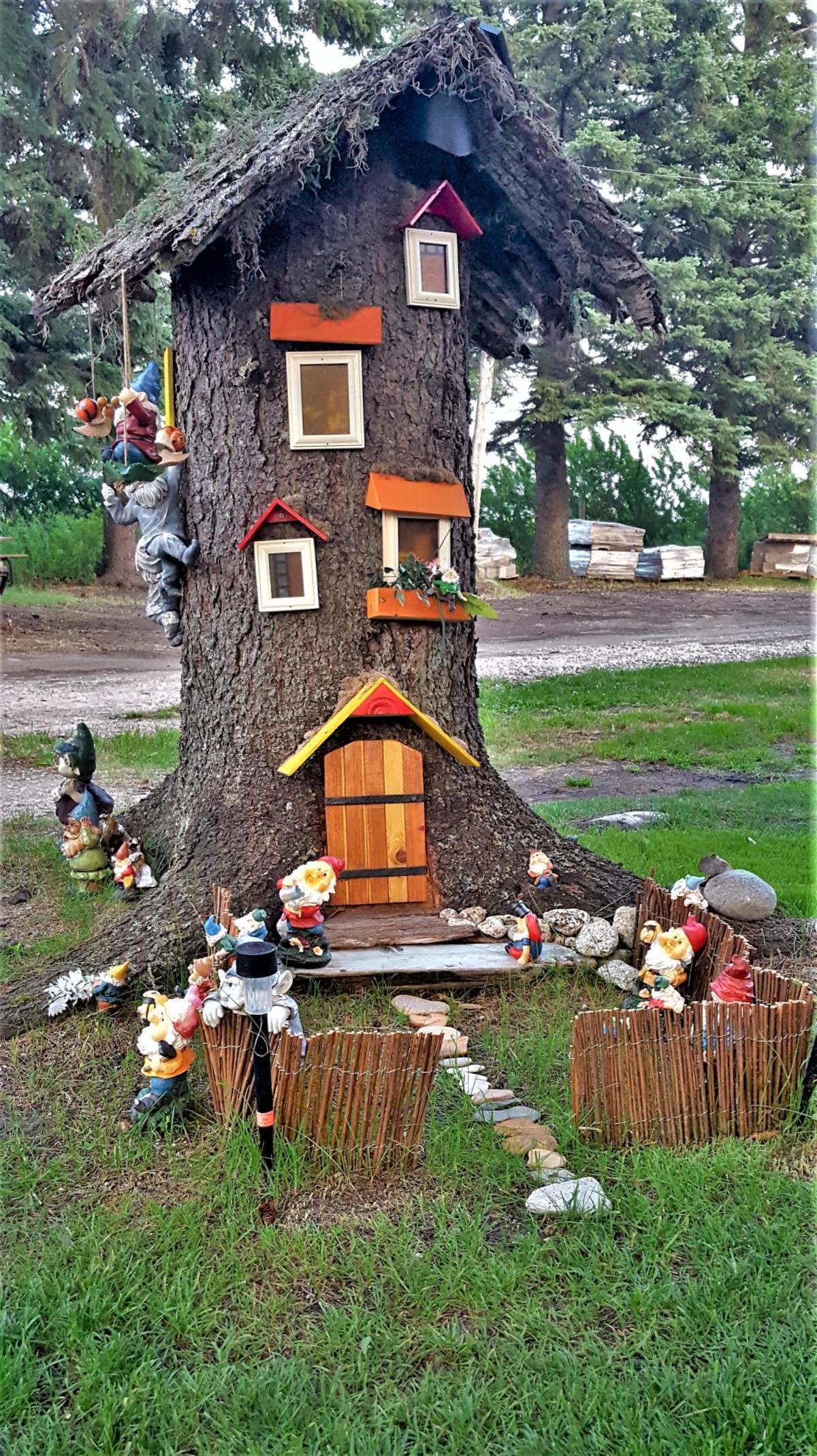
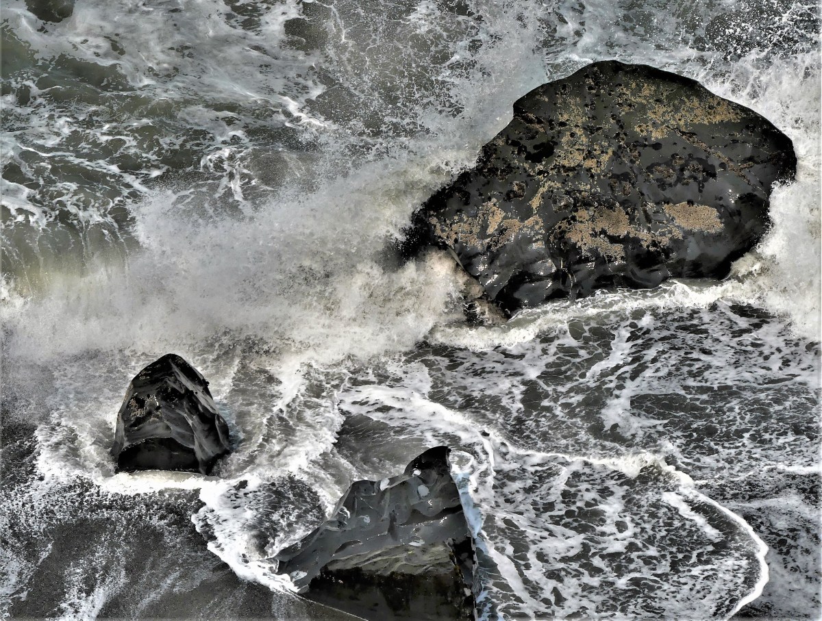
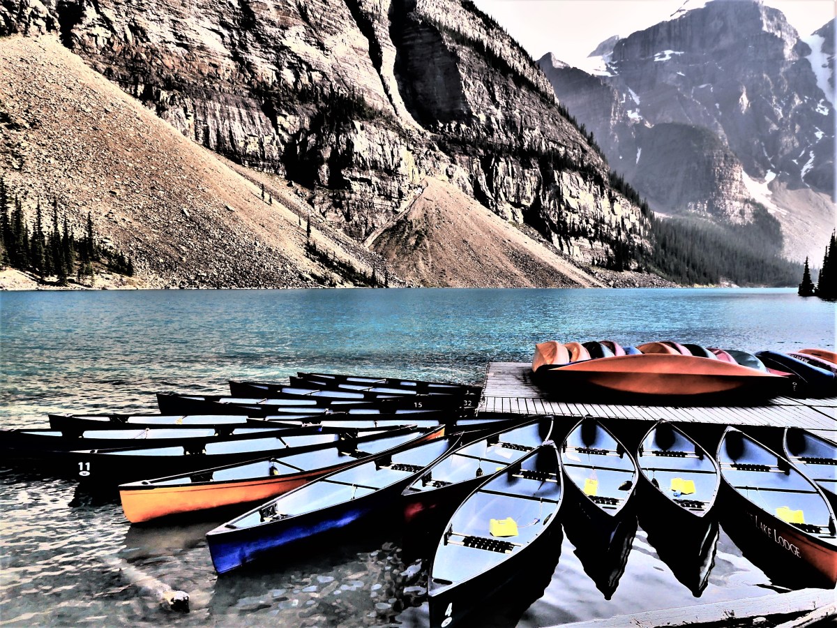
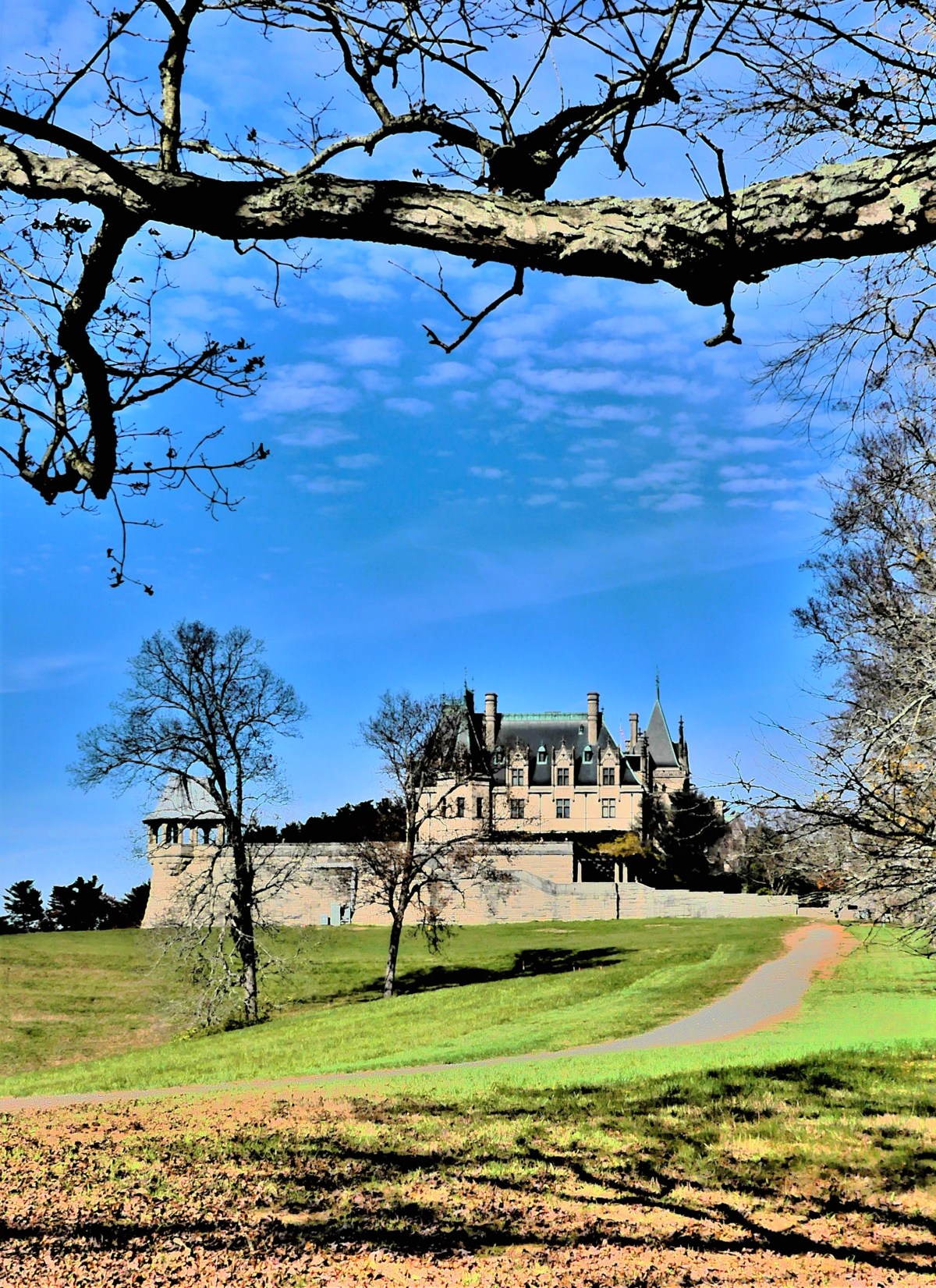
Is it deep in the forest where redwoods are burled?Or far in the garden protected by gnomes?Could it be by the ocean, where waves crash the rocks?Or how ’bout the notion of boats by the dock?And why not the castle that touches blue air?Or maybe the hassle of crowded Times Square?Could I hike to the mountains, reaching higher and farther?Or lounge by a fountain with views of the harbor?Might I stroll through a villa, grapes ready to prune?Or sip sasaparilla at a Western Saloon? Can I conquer the valley’s remote isolation?And weave through an alley of tombs and cremation?
Valley of Fire–White Dome TrailValley of Fire–Fire Wave TrailPalo Duro Canyon–Big Cave TrailBryce Canyon–Hoodoo Amphitheater TrailDeath Valley–Charcoal Hives–Wildrose Mountain TrailDeath Valley–Fall Canyon TrailDeath Valley–Golden Canyon Trail
and from tree bark…
Yosemite–Cedar Grove Trail
…to tree roots…
Athabasca Falls Trail
…to pavement.
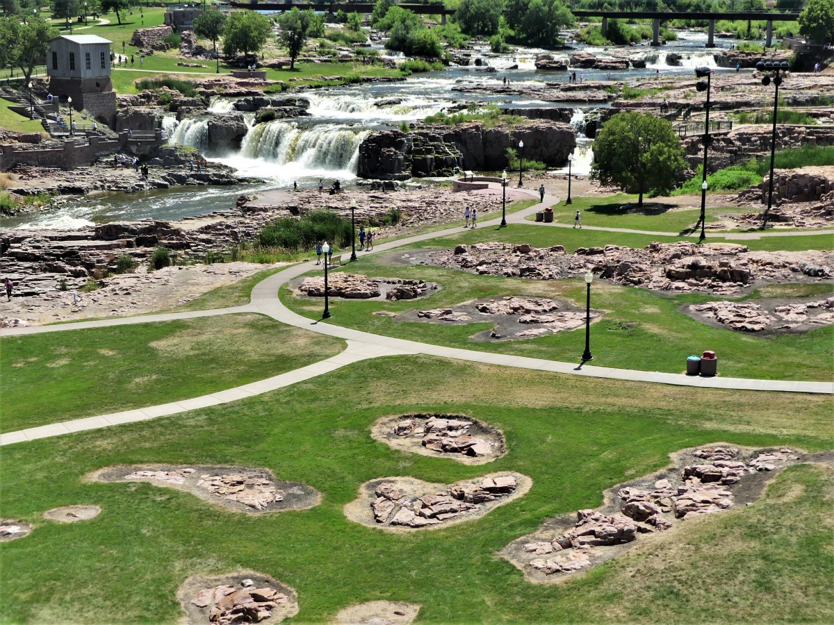
Sioux Falls–Falls Park TrailKill Devil Hill–Wright Brothers Memorial Trail
But in the end, regardless of the pot of gold at the end of the rainbow,
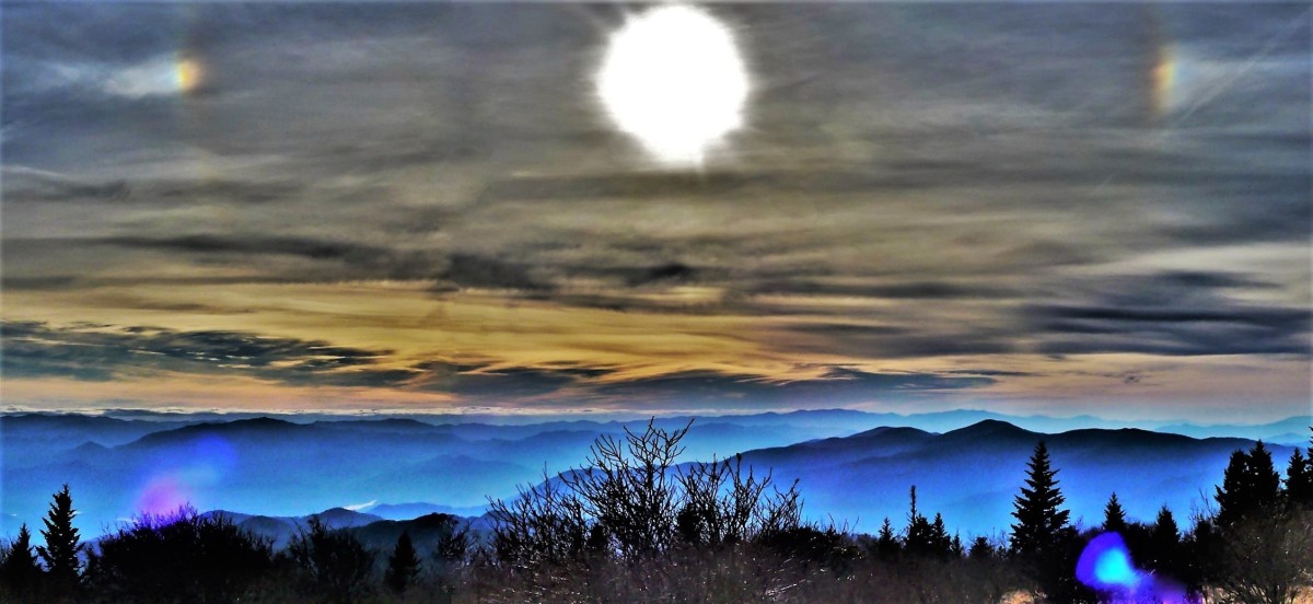
Great Smoky Mountains NP–Andrews Bald–Parhelic Circle with Sun Dogs
it’s the journey to get from here to there that matters most–because it’s the journey that builds character, and defines us like the lines on the palms of our hand.
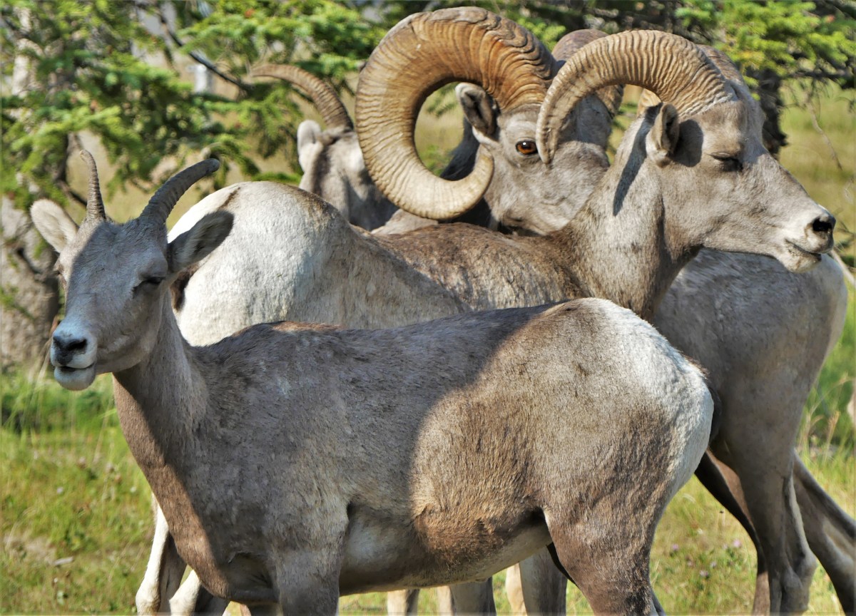
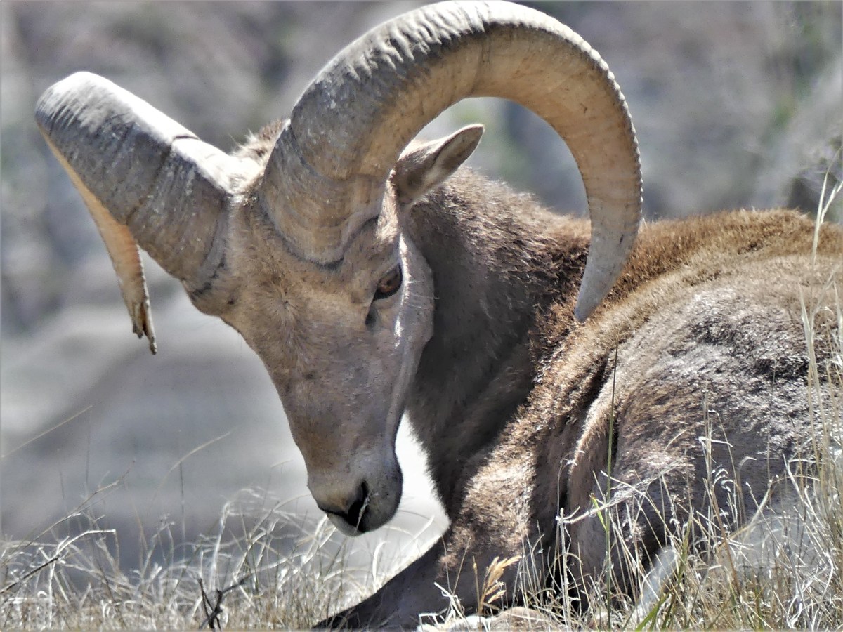
To be sure, one of our many objectives while streaming thru America was spotting and capturing photos of as much wildlife as serendipity would allow, for it’s rarely nature’s way for wildlife to wander into my camera frame and pose at will. So the game of being at the right place at the right time, and putting ourselves in position to witness the spectacle of earth’s mighty creatures became somewhat of an obsession.
Yet, seemingly, whenever Leah and I set out to search for a particular species, we invariably turned up empty. For instance, lying low at Yellowstone’s Lamar Valley for a chance encounter with bighorn sheep escorting their new babes down from Mt. Washburn at the beginning of summer season never happened, despite a solid hour of wait time, and occasional reassurances from park rangers that the prospect was highly likely since no wolves had been sighted in the meadow where the mares prefer to congregate to lick the salt from the rocks by a Yellowstone River runoff.
Instead, when we were least expecting them, we’d found them gathering by a trailhead parking lot in the Canadian Rockies,
and worshipping the moon on the cliffs of Muddy Mountain while returning from a hike through Nevada’s Valley of Fire.
and surveying the brutal Badlands while cruising the Loop Road in our air-conditioned F-150.
Related cliff dwellers included mountain goats from Glacier National Park…
and the Columbia Icefields of Alberta.
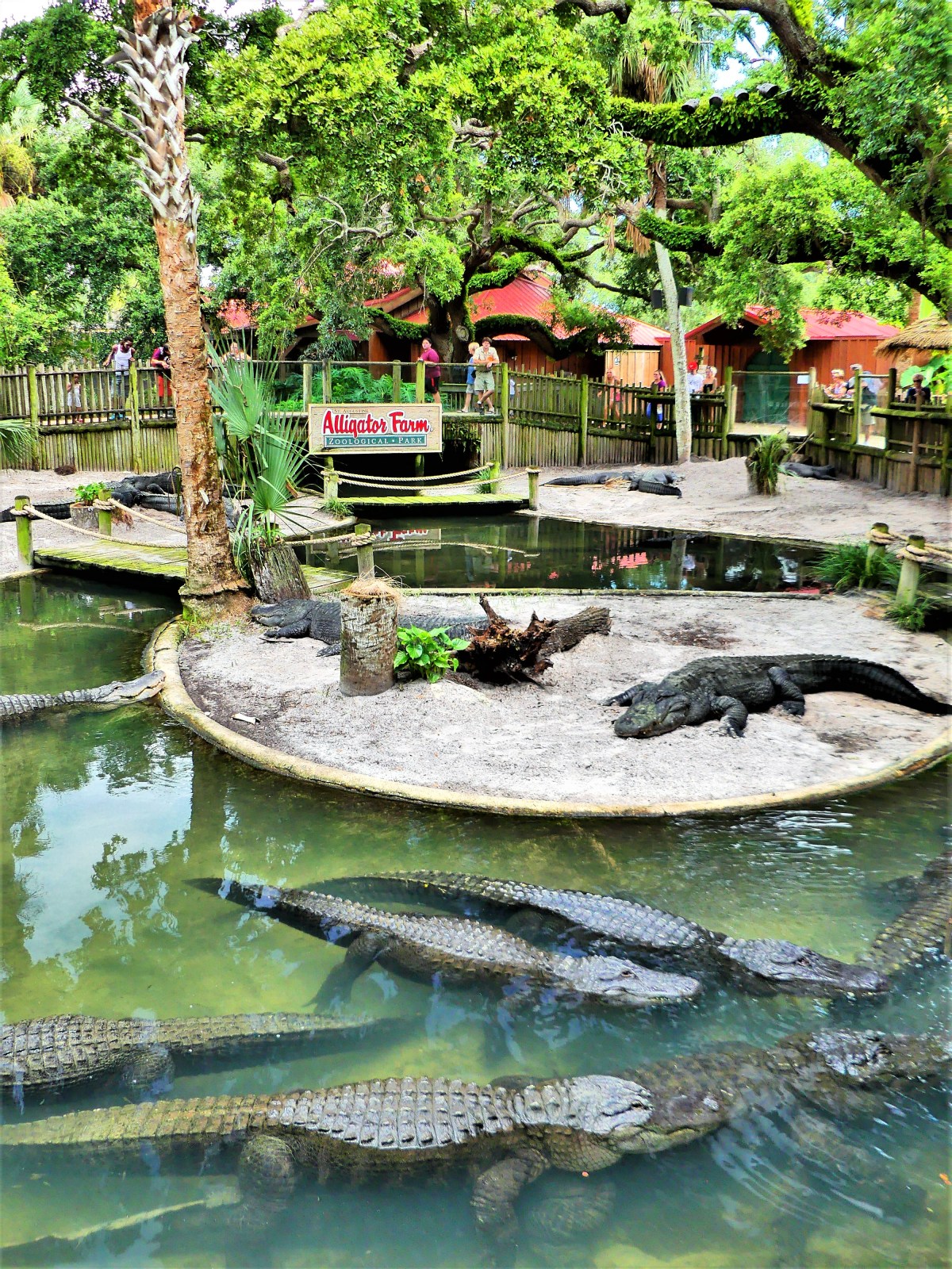
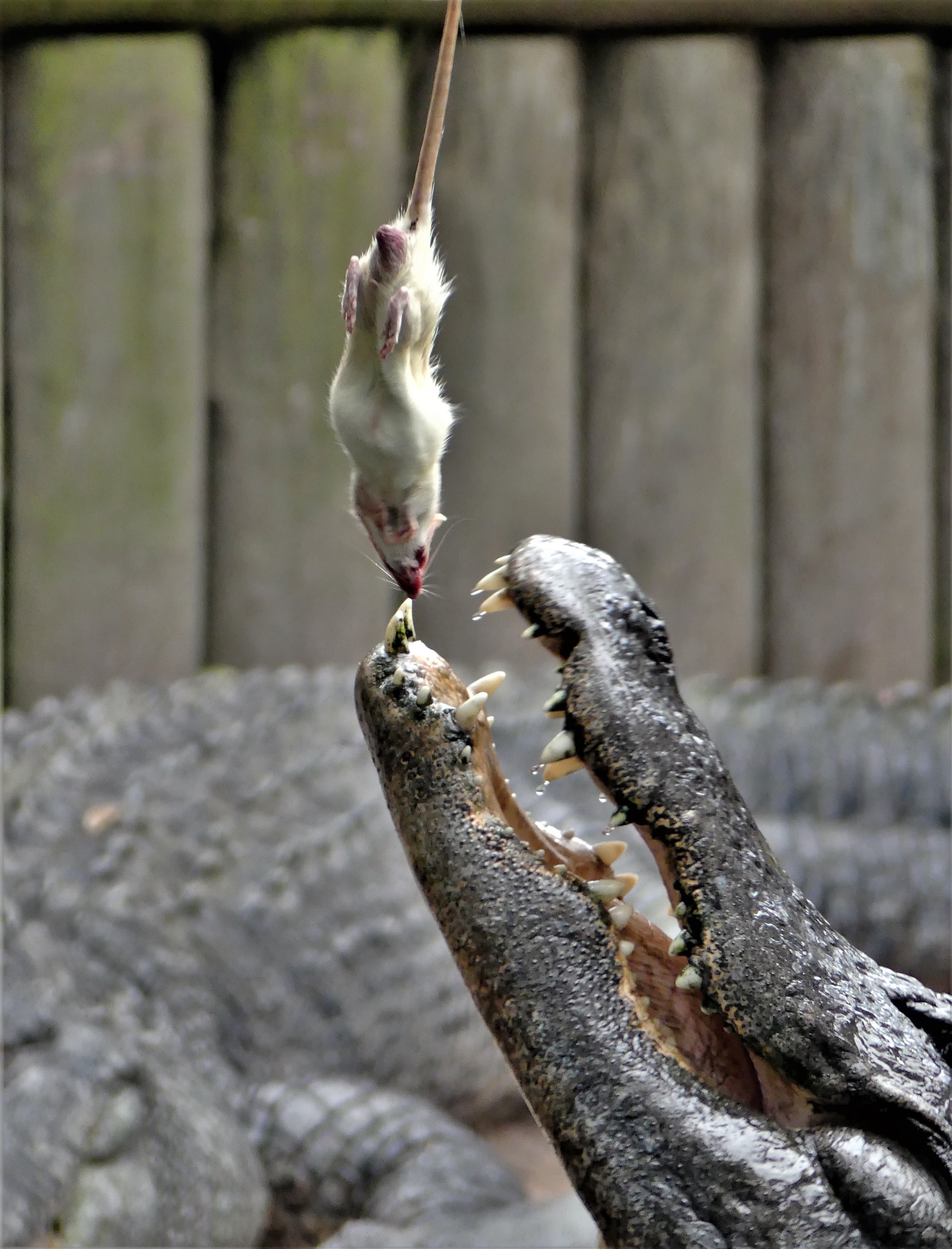
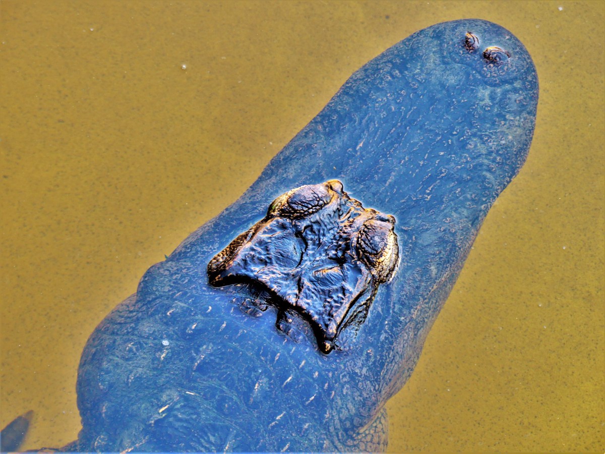
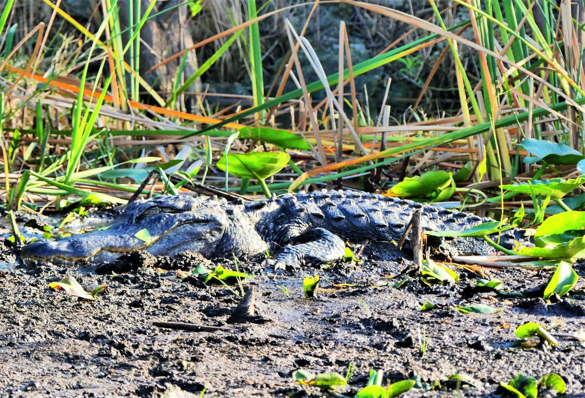
In the early months of our journey, our frustrating search for elusive alligators along the bayou and delta landscape led us to create a call that crocodilia were apt to ignore: “Here, gator, gator, gator!” (see Where Have all the Gators Gone?)
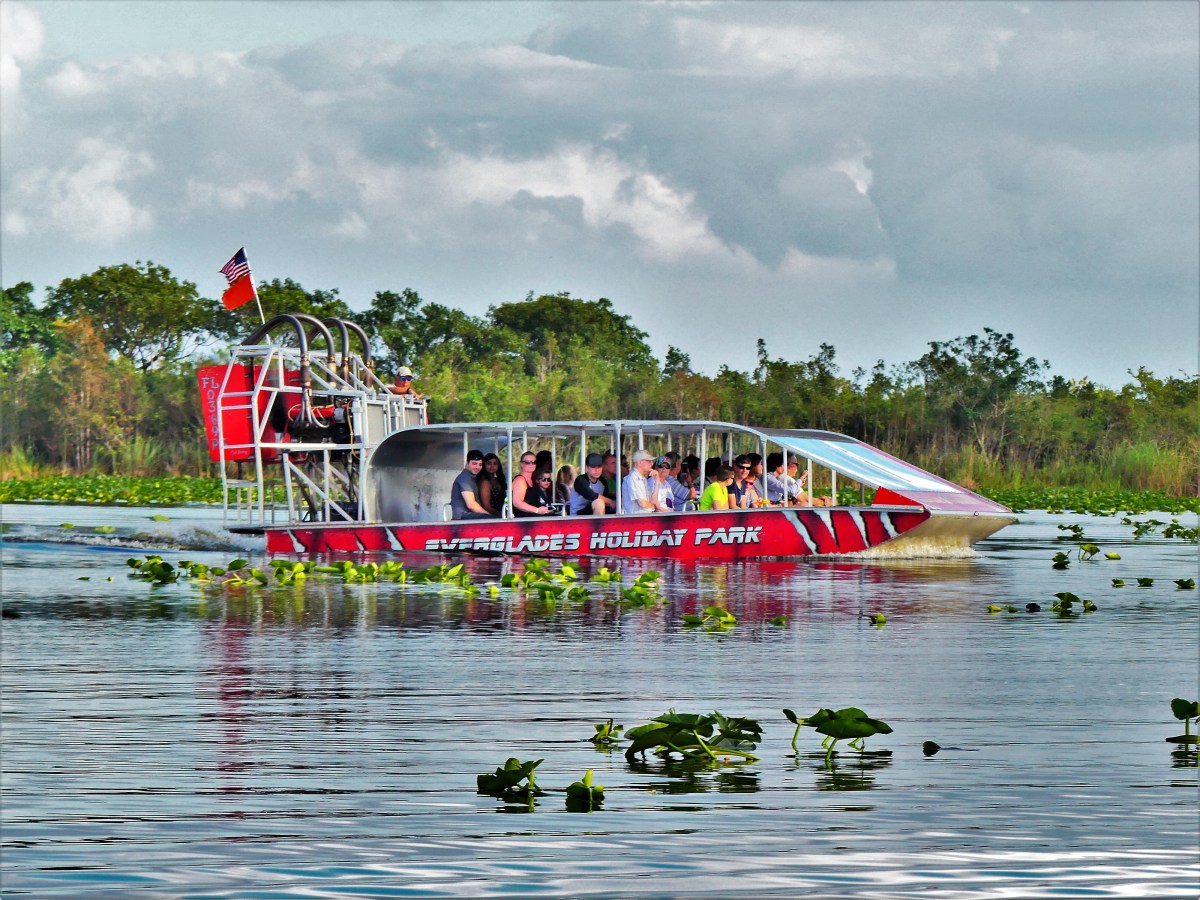
However, we would not be denied while airboating through the Florida Everglades…
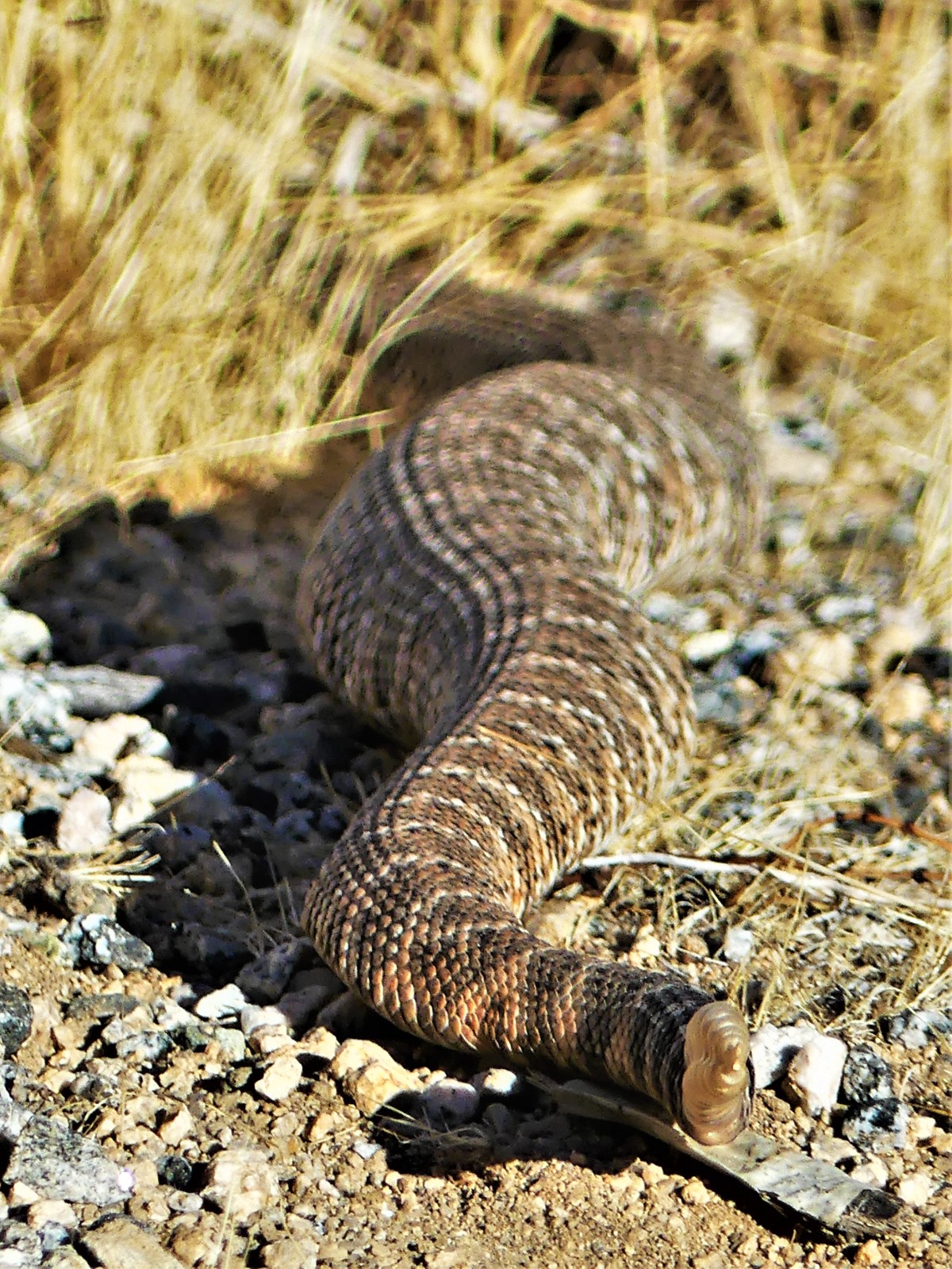
Lesser evasive reptiles encountered along the way ranged from a bloated rattler…
and a horned toad camouflaged against a terrain of cholla cacti within Joshua Tree…
to a greater earless lizard basking on a Big Bend boulder…
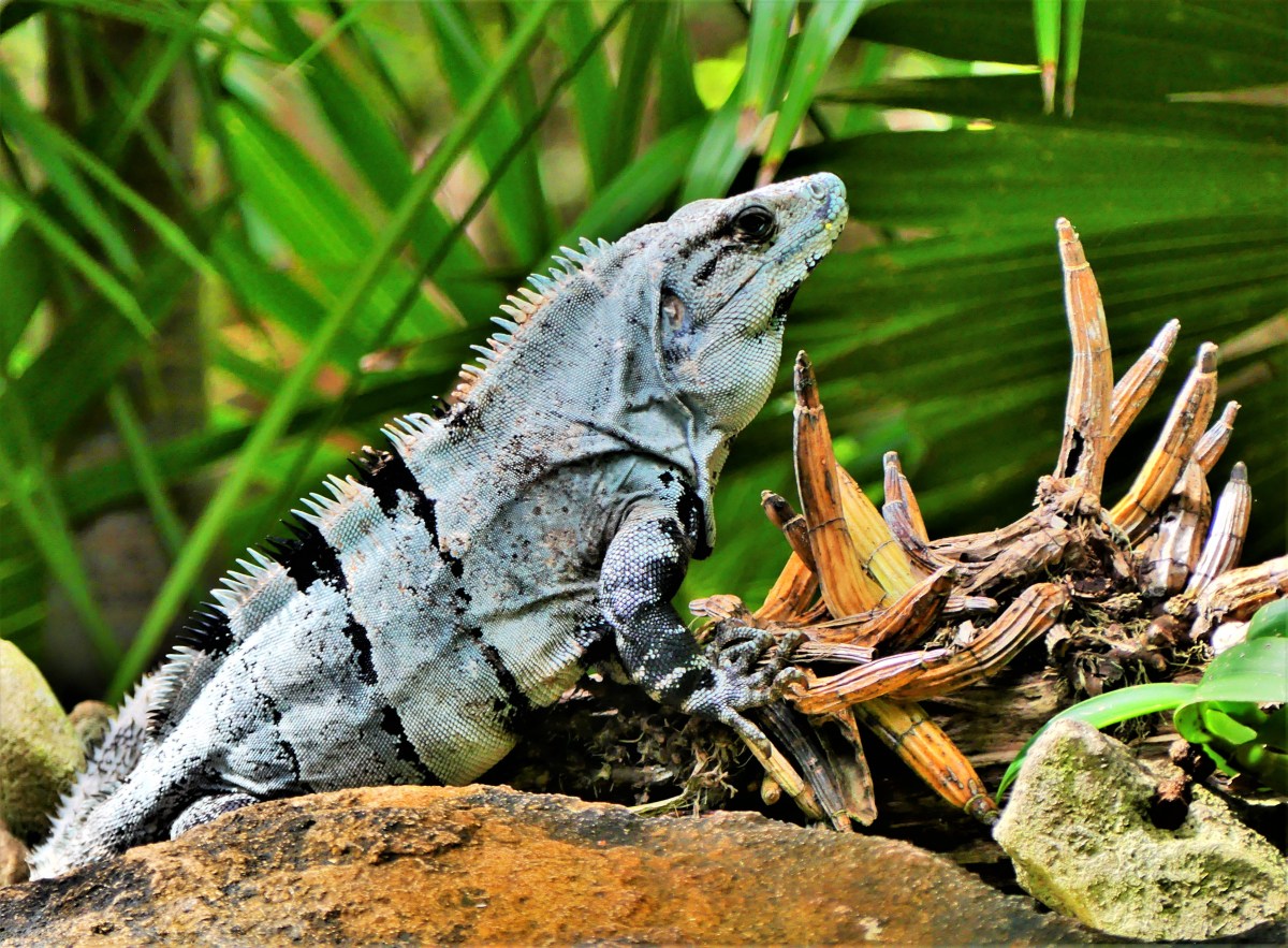
a lounging iguana from the tropics of Quintana Roo…
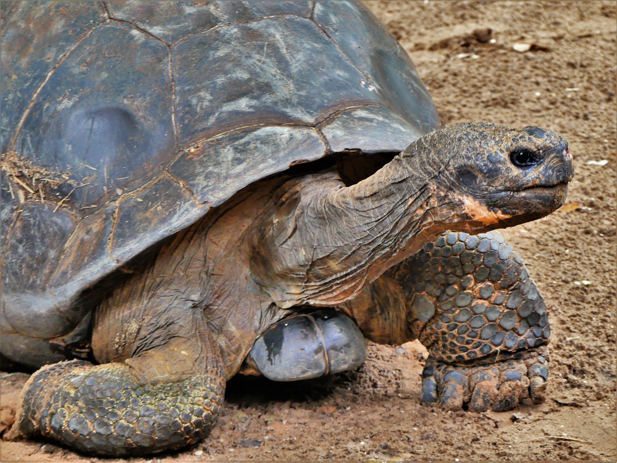
and an angry gopher tortoise from Hobe Sound.
On the other hand, squirrels and chipmunks were ubiquitous throughout the entirety of our trip…
and never shy, if there was the faintest chance they could scavenge a meal discarded by humans.
Although, their close cousin, the prairie dog was less apt to wander from the safety of its network of burrows at Prairie Dog Town in Theodore Roosevelt National Park.
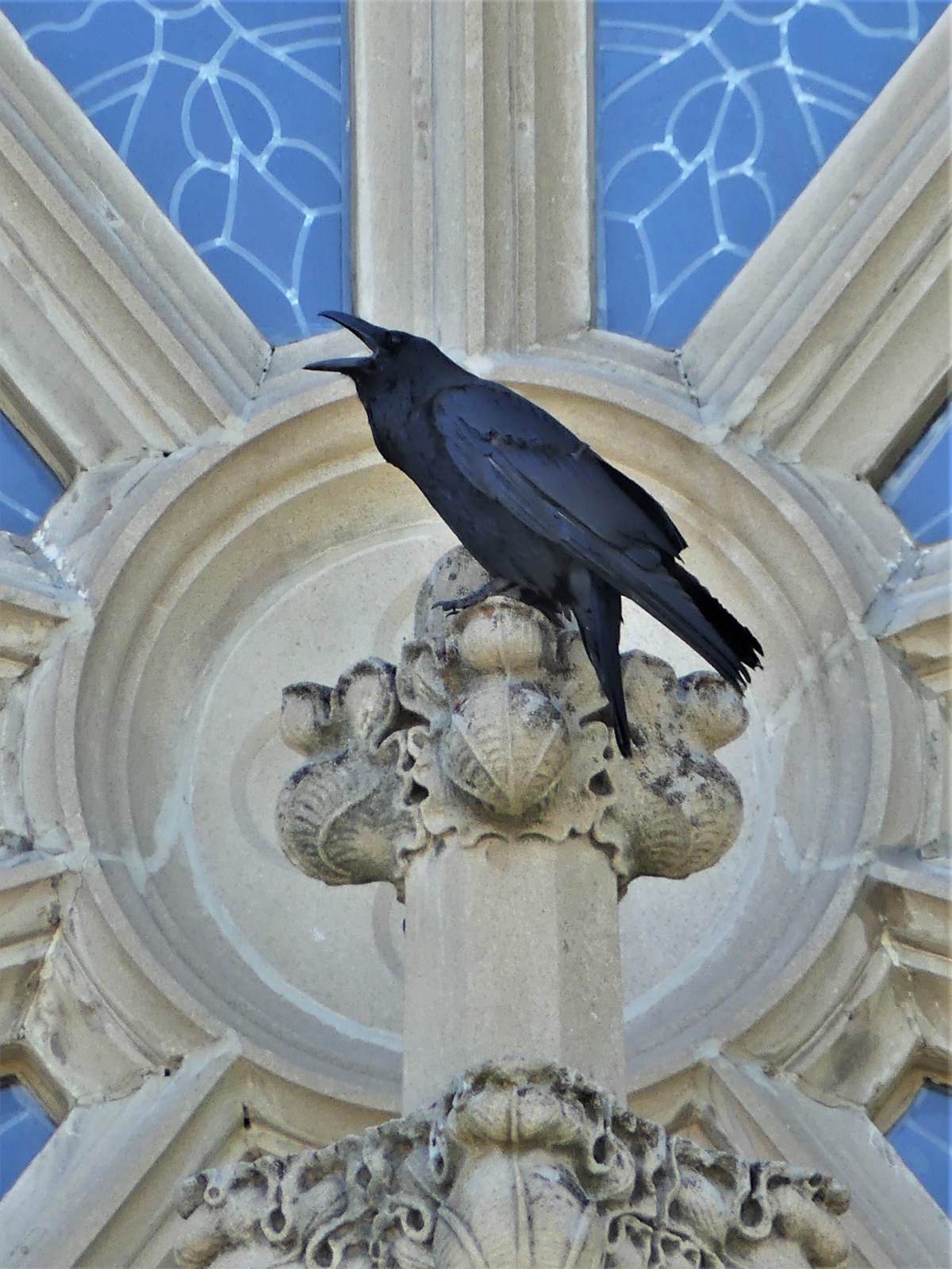
Equally as omnipresent, and just as opportunistic were the many ravens that crossed our paths: from Bryce Canyon;
to Arizona’s Painted Desert;
to the perch atop the Cathedral of St. Helena.
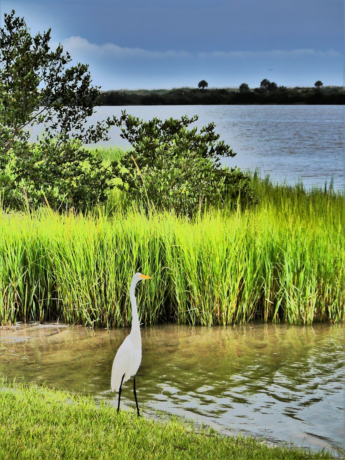
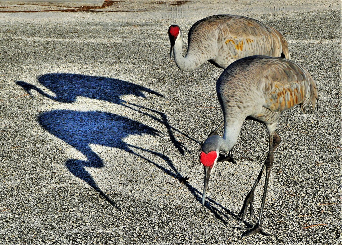
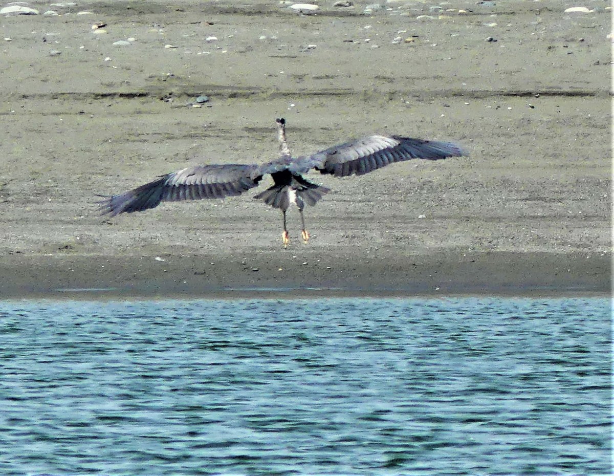
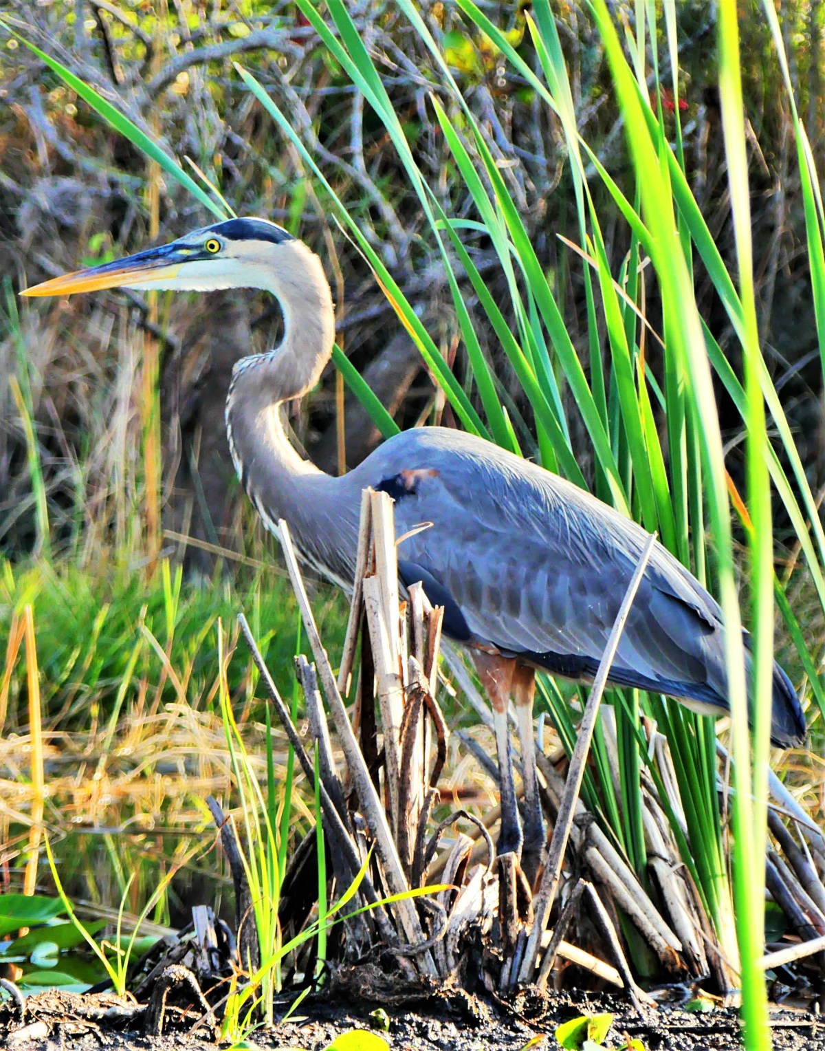
Other fowl that caught our attention included a variety of cranes and herons from multiple coastal habitats…
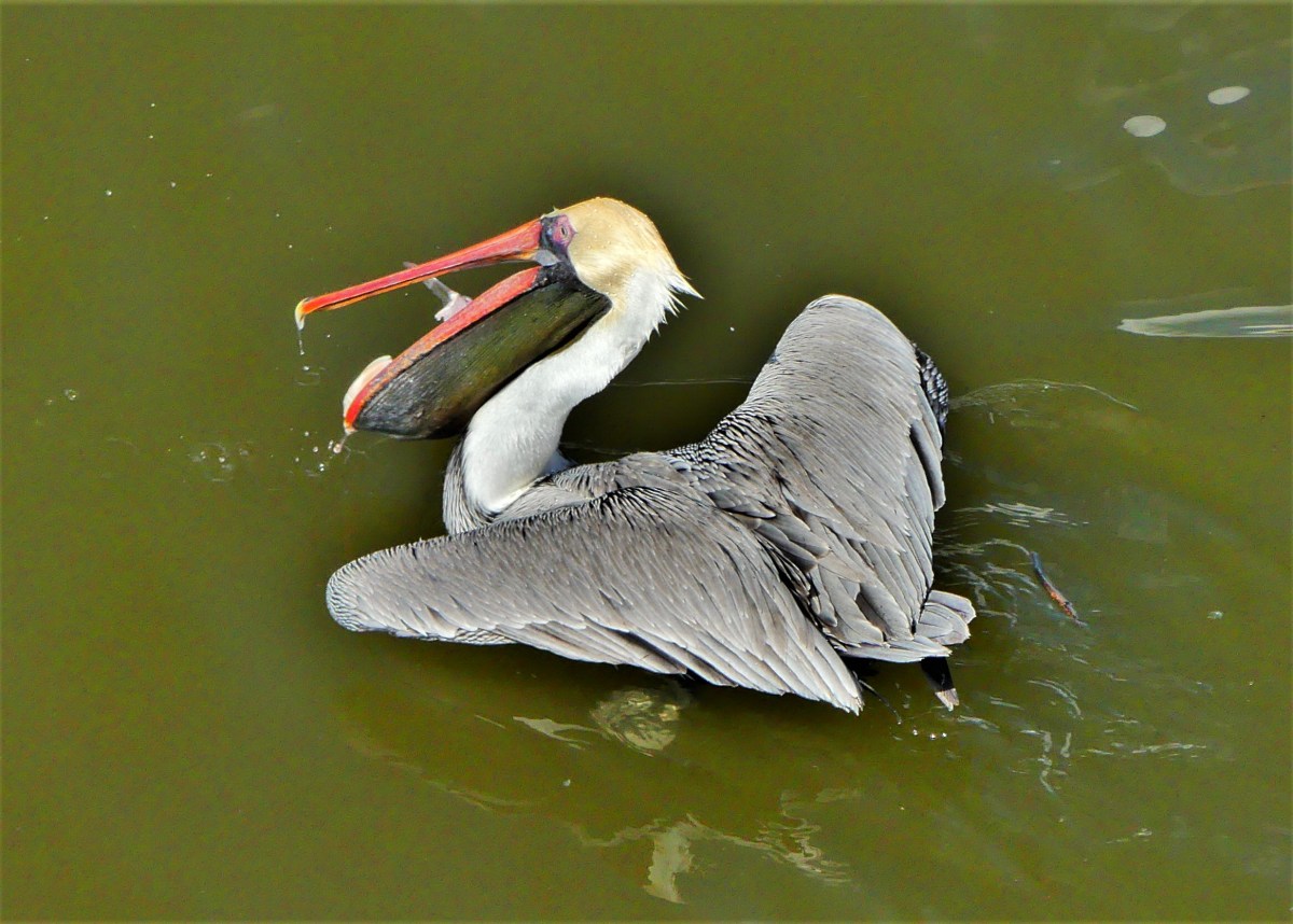
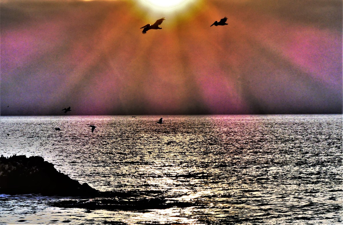
and pelicans fishing from the Gulf of Mexico…
to the Pacific Ocean.
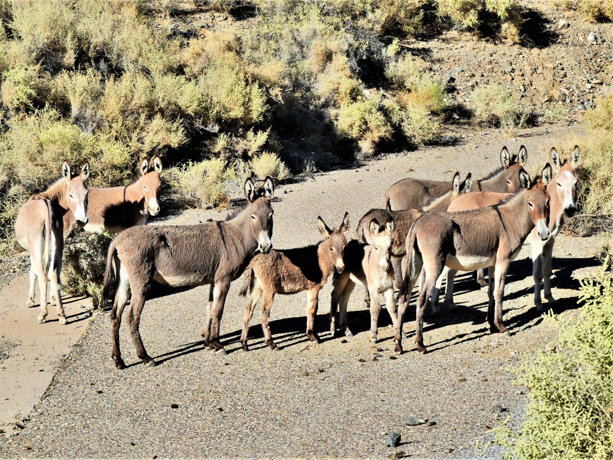
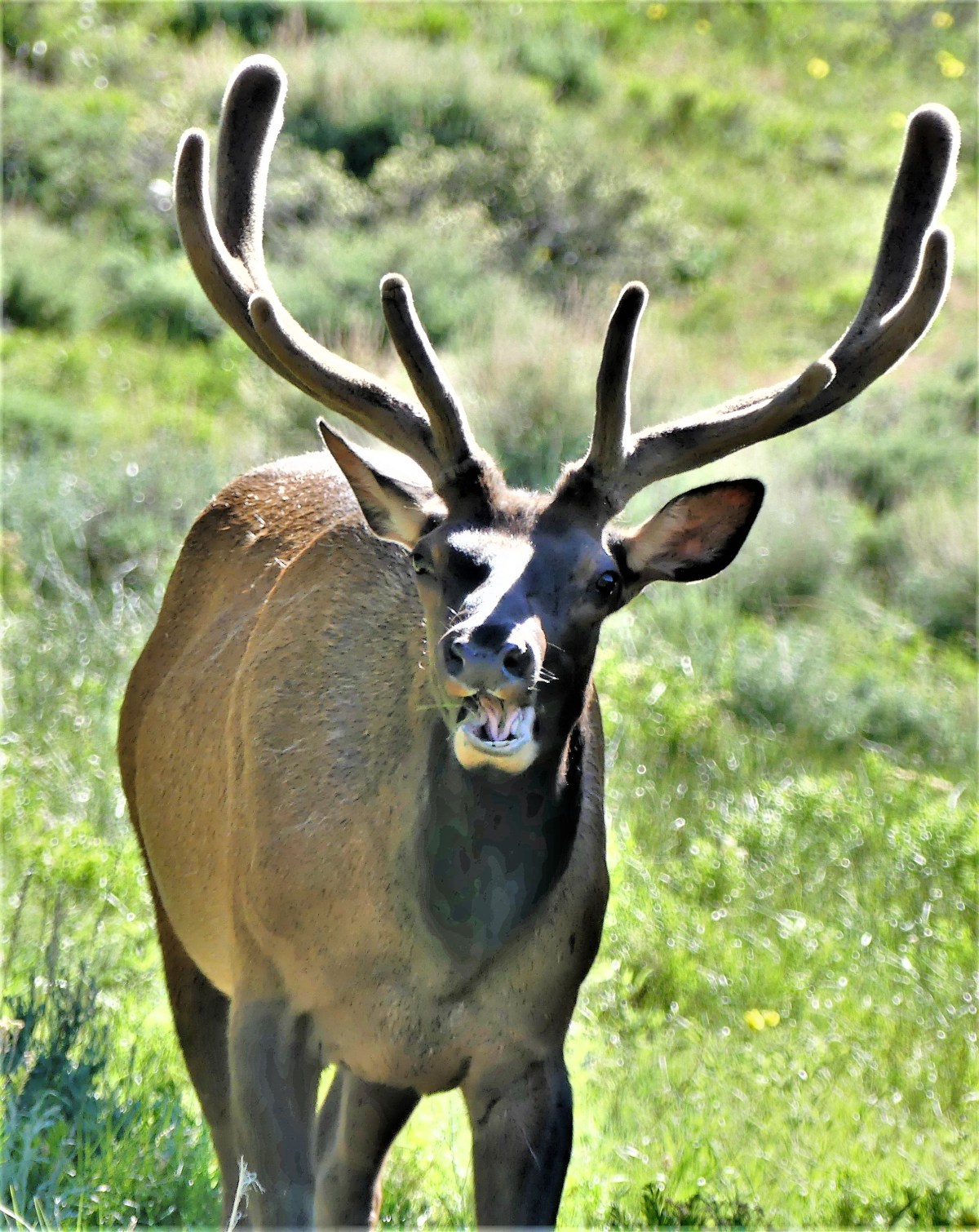
But what really captured our imagination were the wild horses that always stood out in a crowd;
the Yellowstone black bear that we’ve never grown tired of beholding;
and the beasts that have defined our heritage as a nation–whether it was the descendants of Death Valley’s Twenty Mule Team…
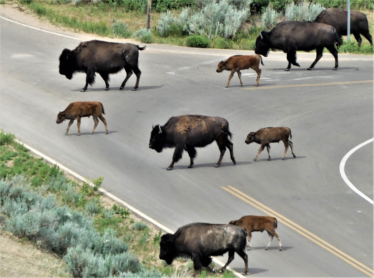
or the mighty bison on the open range.
Yes, the animal world is prolific; it’s divided between domestic…
and wild;
common…
and sublime.
But regardless of the patience required to collect this anthology of imagery, it pales in comparison to the understanding and energy that must be required to keep our environment intact. Of the approximately 2 million animal species identified on our planet, over 16,000 species are rapidly dwindling, due largely in part to habitat destruction and climate change.
According to Endangered Earth,
“There are now 41,415 species on the IUCN (International Union for Conservation of Nature) Red List, and 16,306 of them are endangered species threatened with extinction. This is up from 16,118 last year. This includes both endangered animals and endangered plants.
The species endangered include one in four mammals, one in eight birds, one third of all amphibians and 70% of the world’s assessed plants on the 2007 IUCN Red List that are in jeopardy of extinction. The total number of extinct species has reached 785 and a further 65 are only found in captivity or in cultivation. In the last 500 years, human activity has forced over 800 species into extinction.”
We must be resolute and vigilant as conservationists and global citizens to ensure that future generations share the same joy of experiencing wildlife in their lifetime, lest we only have these and other photographs to offer them by default.
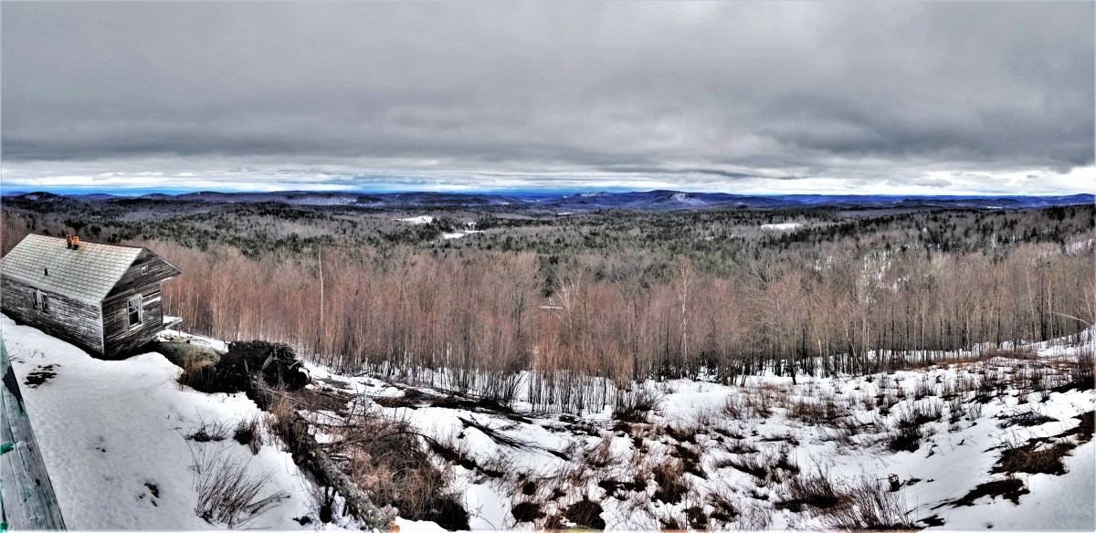
According to the calendar, Spring arrived three weeks ago, but the latent buds on the trees in Northern New Jersey have refused to blossom, somehow intimidated by temperatures straining to reach historical averages during the day, and defeated by freezing cold at night. Even the early birds have postponed their arrival until they can be certain that crocus sprouts and freesia flowers are here to stay.
Things were no different in Vermont, two weeks ago, where the ground had a firm grasp on winter’s snowy mantle…
resisting all attempts to turn over a new leaf.
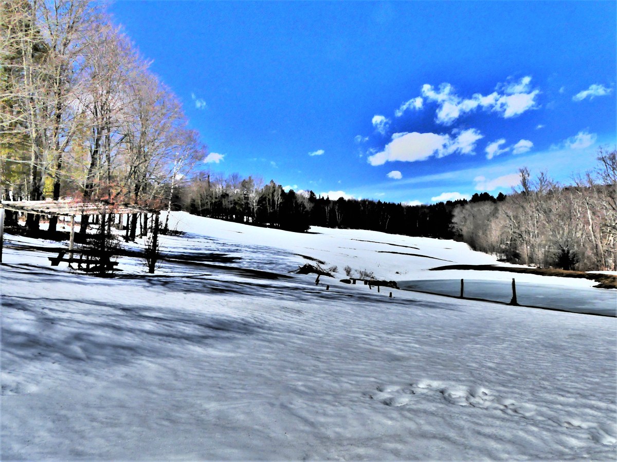
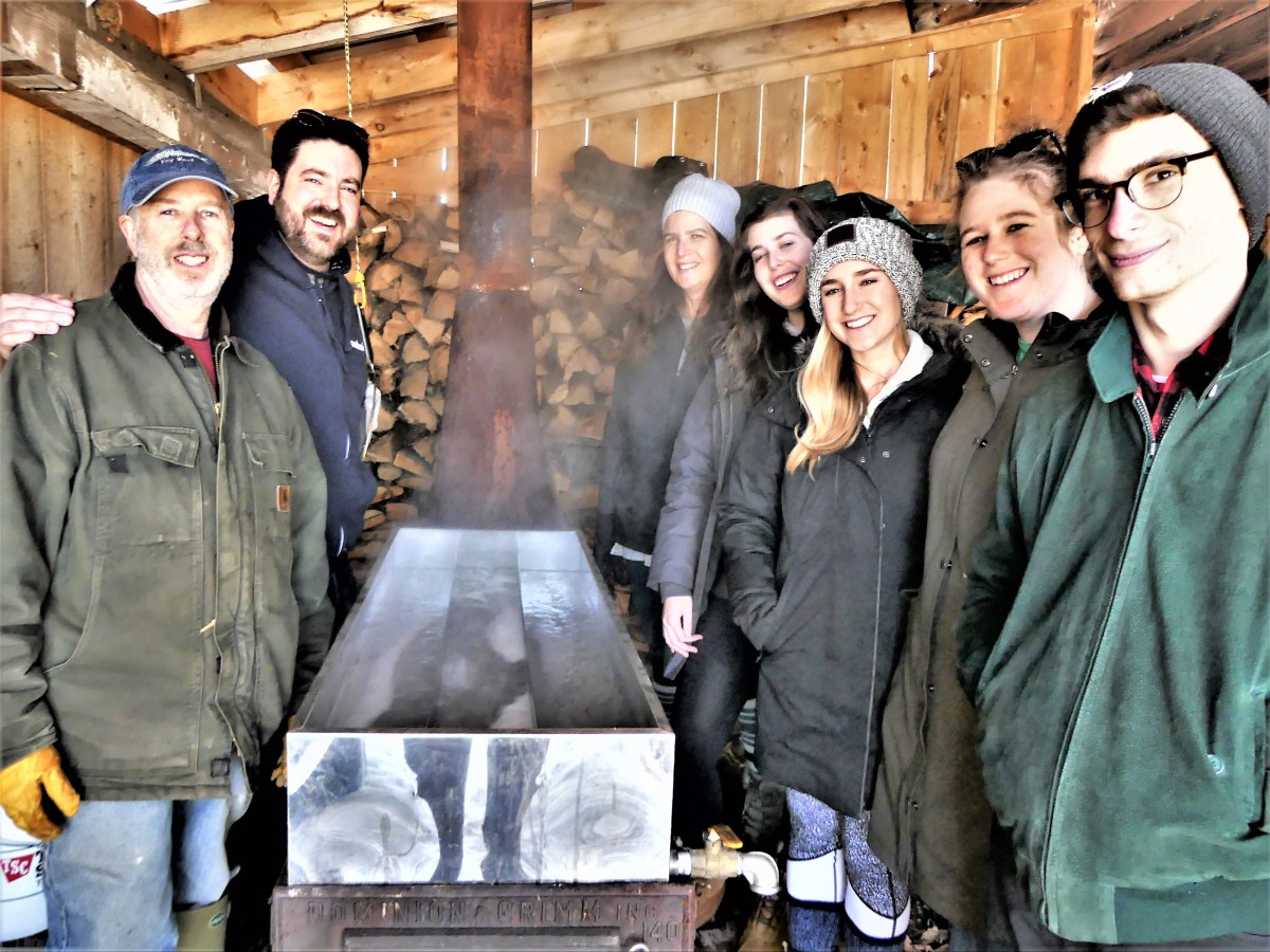
We joined my sister for Passover in Peacham, hoping for relief from Mother Nature’s less familiar plague of more wintery weather, but basked in the warmth of family around a beautifully presented seder table.
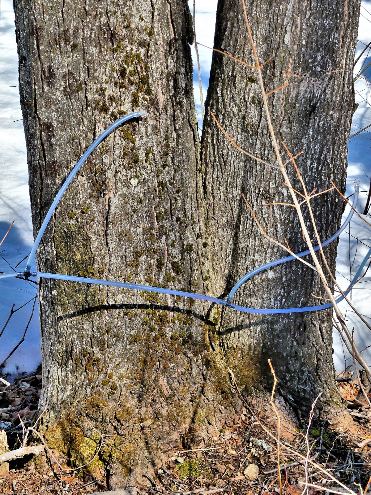
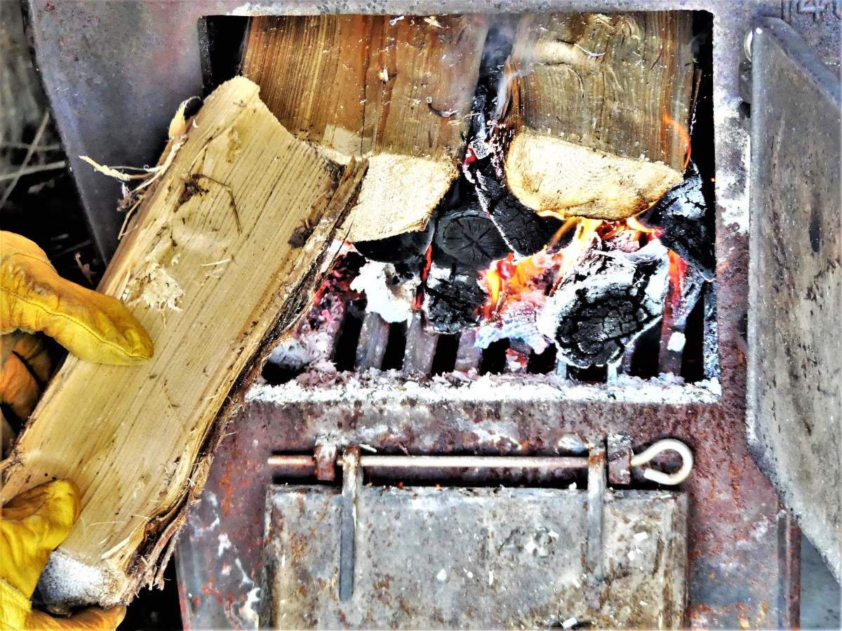
Nevertheless, the early promise of Spring is mostly evident in the thaw of the sugar maples surrounding the Peacham property…
as precious sap slowly drips from tapped spiles…
and collects…
in large barrels for an anticipated boil.
According to Cornell’s Sugar Maple Research and Extension Program,
“when temperatures rise above freezing, pressure (also called positive pressure) develops in the tree. This pressure causes the sap to flow out of the tree through a wound or tap hole. During cooler periods when temperatures fall below freezing, suction (also called negative pressure) develops, drawing water into the tree through the roots. This replenishes the sap in the tree, allowing it to flow again during the next warm period. Although sap generally flows during the day when temperatures are warm, it has been known to flow at night if temperatures remain above freezing.”
It takes 10 gallons of sap reducing in the sugar shack evaporator…
and hours upon hours of a hot stoked fire…
and plenty of wood…
to eventually produce one quart of local, golden ambrosia…
thus, fulfilling a family tradition, and tapping into a fitting Spring awakening.
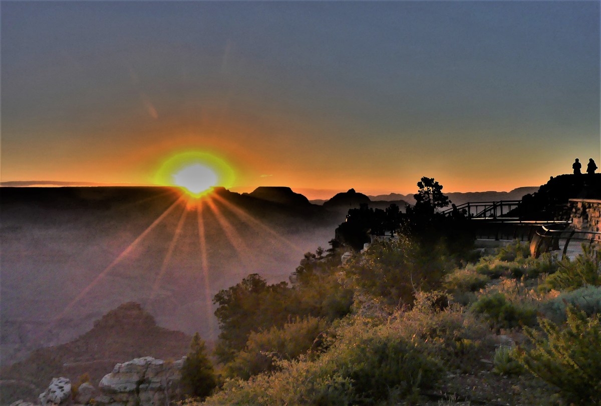
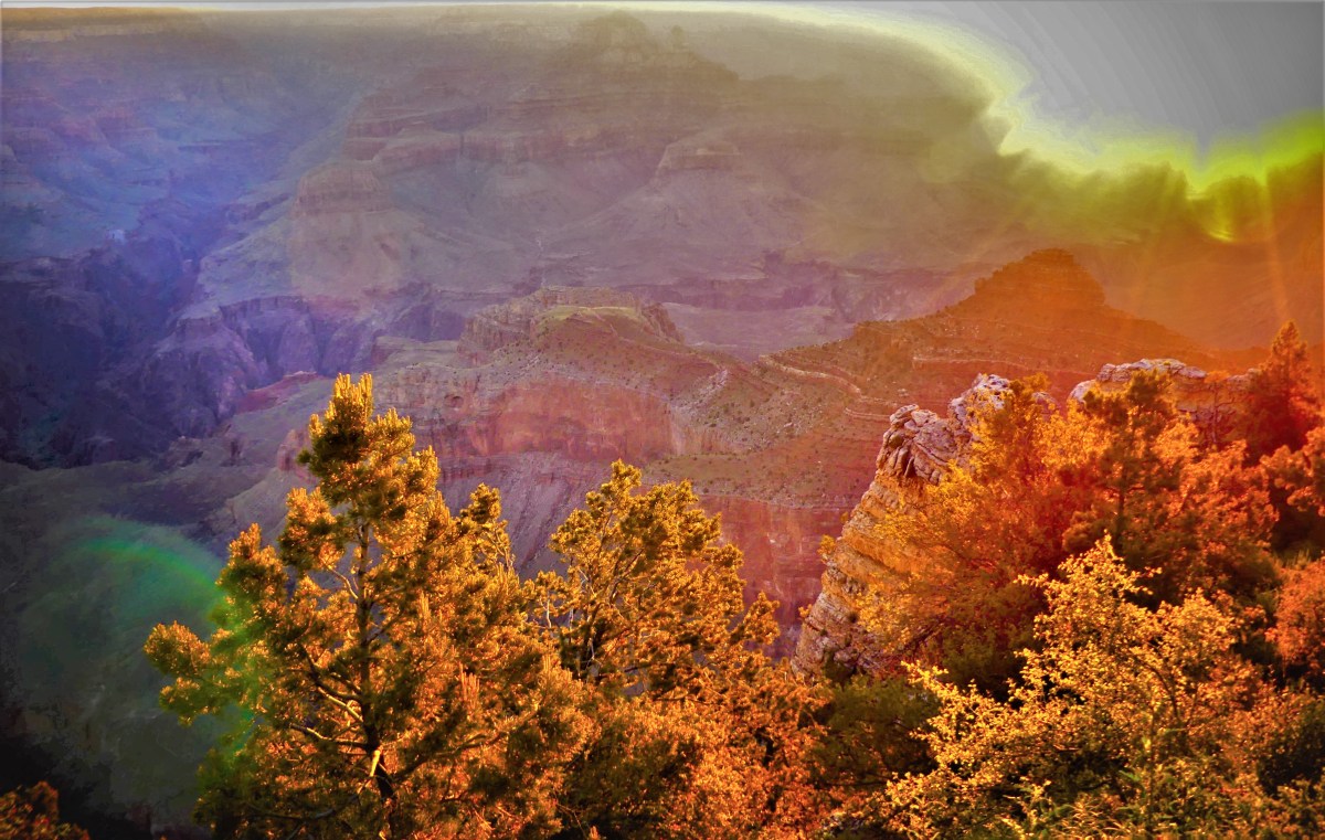
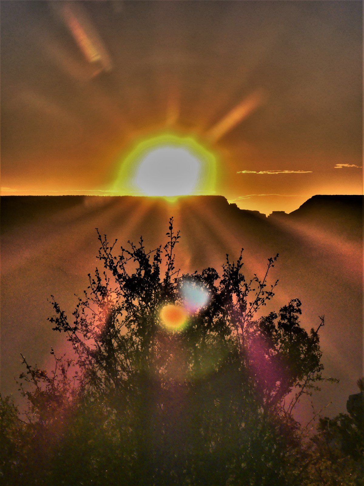
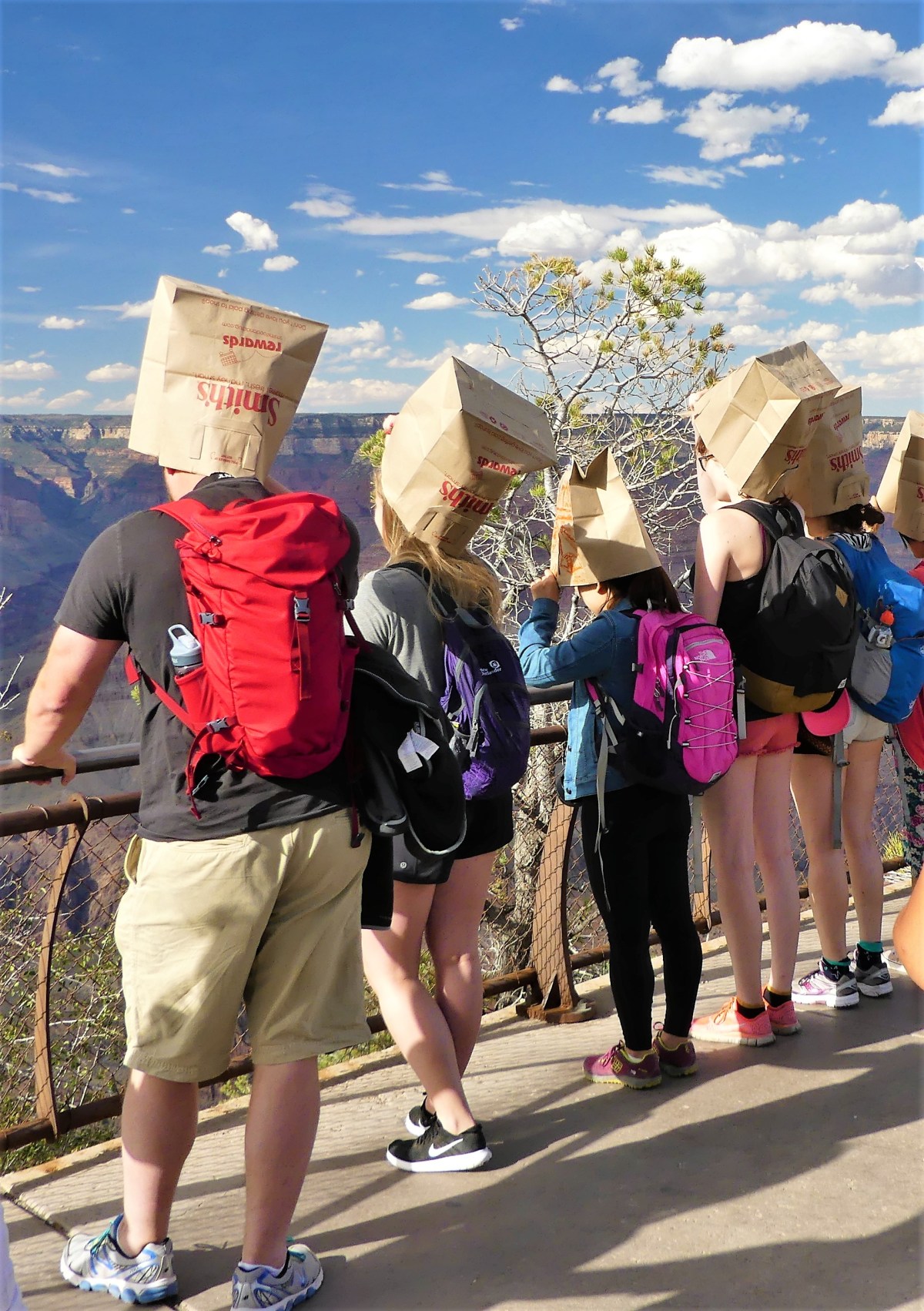
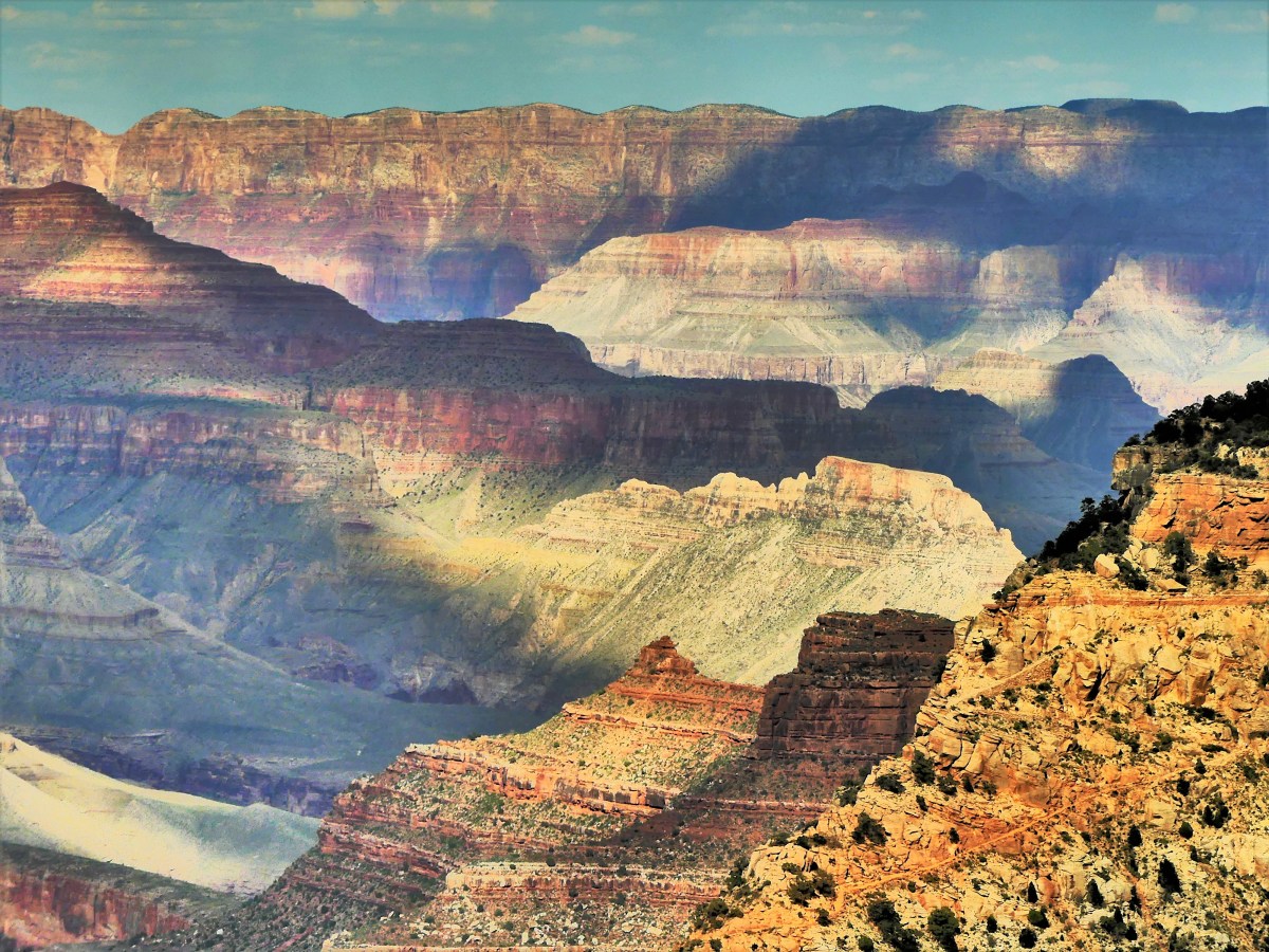
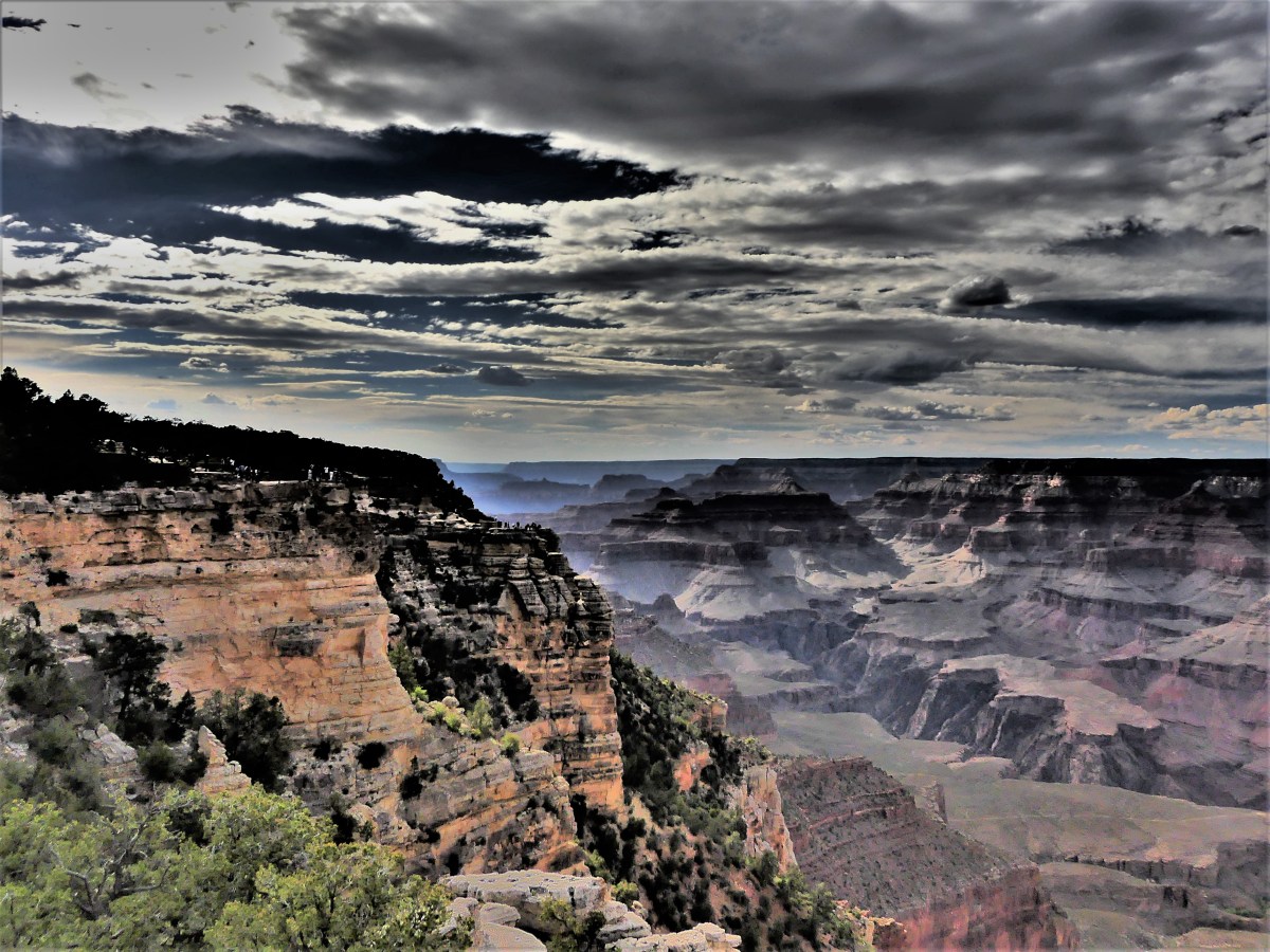
Six million visitors a year gravitate to Grand Canyon National Park, hoping for a visceral connection with one of the Seven Natural Wonders of the World. They come to contemplate the Canyon’s enormity and marvel at nature’s possibilities. They come to walk the rim; hike the trails; or ride a mule/bike/train. Others may be inclined to climb the observation tower; watch a tribal ceremony; or dine at El Tovar. But no matter what the activity, It seems that EVERYBODY has arrived with a camera to document every moment of their Canyon experience as if it was a sacred rite.
Long lens, zoom lens, tripod, mono-pod, selfie-stick, large format, DSLR, compact, bridge, Polaroid, point-and-shoot, GoPro, iPads and iPhones–irrespective of the expense or complexity of the equipment–somebody is taking a picture of something or someone, almost always.
While not the world’s grandest canyon by size (Kali Gandaki Gorge in Nepal is nearly four times deeper, and Capertee Valley in Australia is longer and wider), The Grand Canyon more than makes up the difference in its spectacular and overwhelming beauty–so much so, that on average, 12 people will lose their life every year while posing or composing a photograph.
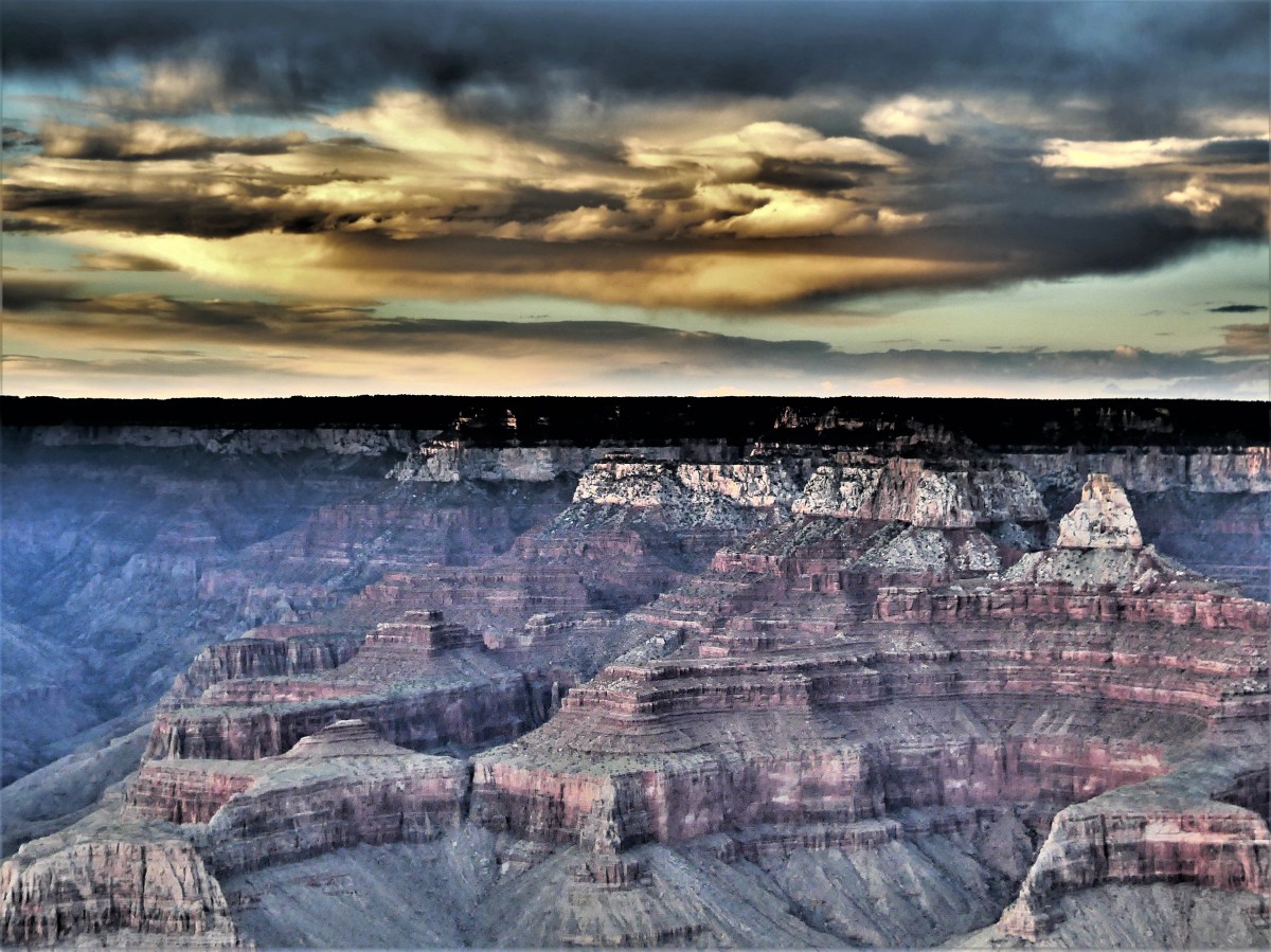
While the scenery is certainly breathtaking, I am more than satisfied to experience the canyon from a less risky perch, and push the photographic envelope in ways that are more within my control–like, capturing a sunrise/sunset sandwich–where different day-parts are recorded–from dawn (at approximately 5:15 am) to dusk (at approximately 7:45 pm).
5:15 am5:20 am5:22 am5:23 am5:24 am5:25 am5:27 am8:00 am Colorado River9:00 am10:00 am11:00 amNoon1st time seeing the Grand CanyonWaiting for the countdownThe big reveal at 2:00 pm5:00 pm7:00 pm7:10 pm7:20 pm7:25 pm7:30 pm7:35 pm7:40 pm (fire-haired face mid-frame)7:45 pm
It’s been 48 hours since arriving home after one year of steadily moving about the country. However, now that I’m physically situated in one place, it seems my mind continues to wander, yearning for places I’ve been or yet to experience. I fear I’m going through wanderlust withdrawal.
The feeling is eerily reminiscent of adjusting to the constant sway aboard a boat–to where I’ve finally gotten my sea legs–yet after docking, the motion of the ocean has robbed me of my equilibrium. Nothing seems normal to me. I still feel adrift, like a bobbing buoy.
Perhaps it’s some sort of jet lag (without the jet), or some kind of Post-Travel Stress Disorder, where my internal GPS continues to send rerouting instructions with every step taken, redirecting my brain and body back to the Airstream presently parked in Lakewood.
Acclimating to everyday life has been challenging, as I’ve yet to re-establish my new old routine, or shake off unsettling circadian rhythms of disorientation. Already, I’ve forgotten which cabinet holds the coffee mugs, or where to find the bottle opener, or what it was like to sleep on a king-sized mattress. Even after unpacking, I’m likely to open the wrong dresser drawer to find my socks.
Of course, it’s only been two days since landing, so I’m certain the confusion will abate and I will eventually adjust to a different way to fill my day without hesitation. But in the meantime, I will travel to my favorite places through my photographs, and dream about the possibilities.
One special destination–among more than a hundred visited in the past year–that still resonates to my core is reliving the beauty of Banff.


 .
.