Nature Under Glass

Exploring Tucson, AZ provided two very different opportunities to experience nature–Saguaro National Park and Biosphere 2–with one generating more interest than the other.

We reserved a site at Catalina State Park’s campground…

Catalina Mtns

to be equidistant between the two National Park districts: Rincon Mountain (RMD-east) and Tucson Mountain (TMD-west). Why two districts? In the 1960’s, concern over RMD’s cactus forest showing a decline in new growth, prompted conservationists to acquire a stand of ancient saguaros to the west of Tucson, separating the two districts by an hour’s drive.

Leah and I began our journey at TMD, at first, through a meandering exurban road that eventually led to an unpaved, rutted, and narrow scenic Bajada loop drive covering five miles of Tuscon Mountain foothills. A stop at the Desert Discovery Trail brought us within no touching distance of magnificent saguaro cacti measuring over thirty feet tall.

key light saguaro (2)

Each specimen appears unique, sprouting limbs in different places, and contorting in all directions,

desertscape (2)

giving relevance to Native American claims that these are people standing among the sand and rocks.

Desert Trail

Their petroglyphs across Signal Hill are a testament to their long-standing occupation of the territory more than one thousand years ago.

petroglyph and mountain1

signal hill petroglyphs

A memorable hike along the Valley View Trail slowly ascends a ridge, offering dramatic views of Avra Valley’s saguaro-sprawl, with Picachu Peak in the distance.

Avra Valley and Picacho Peak

With temperatures reaching into the high 90’s, we avoided all other trails–requiring a minimum of three to four hours of dedicated strain–in favor of cross-town traffic delays that minimized our allotted time to visit RMD.

Once at the eastern park gate, we roamed the paved eight-mile Cactus Forest Drive, switch-backing into higher elevations, with warm western sun casting a golden hue across the desert, turning a forbidding vista…


mtn garden and sky

into an inviting playground,

western sun across the desert

protected by a standing legion of cactus totems.

rincon mtns


The following day, we turned our attention to an experiment in the remote reaches of the Sonoran Desert,

setting

originally conceived in 1984 to “research and develop self-sustaining space-colonization technology,” and leading to two highly publicized missions between 1991 and 1994–where teams of eight were sealed into a self-sustaining environment for two-year terms and monitored for their “survivability”. Scientists named it Biosphere 2.

establishing

bioscape

rincon range

landscaping

Presently, the University of Arizona has assumed stewardship of the facility, turning its focus toward research on climate change–mimicking diverse ecosystems, such as the ocean,

ocean habitat

the rainforest,

rain forest

and coastal fog desert,

desert habitat

all managed under controlled conditions.

Beneath nature’s museum lies the technosphere, a myriad of pipes and wiring,

recycled air conditioning

channels and ducts, tubes and cables, and other facilities necessary for vital operation.

An ingenious dome-shaped lung…

lung

connected to the glass enclosure by tunnels…

tunnel

allows for air expansion caused by ever-changing pressures within the sealed structure.

The scope of the facility is a marvel, boasting double redundancy for all power and life support systems.

power supplies

A common question on the tour, “Why is it called Biosphere 2? Was there another Biosphere before this one?”

The docent is keen to respond, “Yes. Another Biosphere exists, where random, haphazard and uncontrolled experiments called living are carried out on a daily basis, but we commonly refer to it as Earth.”


Putting Leah in Perspective

Picasso painted Marie-Thérèse Walter and Dora Maar among others; Dali’s choice was Gala; and Stieglitz extensively photographed Georgia O’Keeffe. The results of these collaborations are legendary. Artists have always depended on models…for inspiration, as subjects, as lovers.

fallen tree (2)

And while I eschew classifying myself as an artist, my reliance on Leah in my landscape photographs is no different than the aforementioned masters…with one exception: scale!

burned out but alive (2)

Often times during picture editing, she will lament, “Why am I so small? You can hardly see me!”

Rainbow Trail panorama (2)

But being able to insert Leah into a panoramic scene or long shot helps me establish dimension and grandiosity.

Leah F150 formation (2)

And while there are times when I seemingly wait forever for someone to step outside the frame of my shot before pressing the shutter, there are also times when it becomes vital to locate Leah in my scene to anchor its meaningfulness, and increase its effectiveness.

Prairie grass and Leah (2)

Sometimes Leah can be an unwilling participant. She may object if she feels she’s not looking her best, or perhaps she becomes annoyed if she’s not the central focus of my photograph when she feels like posing.

Leah (2)

But either way, she has always been a good sport, and is usually compliant when taking my directions.

waders vertical (2)

But regardless of how many rocks she leans against per my request, it’s evident to me, photography aside, how much I lean on her.

canyon shade

She is my personal rock, who helps me put things in perspective.

balance rock and leah (2)

via Photo Challenge: Scale

Sleepless in Las Vegas

Seldom am I so amazed that I am speechless or at a loss for words…

After visiting twenty-nine U.S. National Parks, four Canadian National Parks, a dozen National Monuments, numerous State and Provincial Parks, and driving thousands of miles of scenic byways over the past twenty-nine weeks,

captured on:

Leah and I have yet to discover a place that is so captivating that we didn’t want to leave…until now.

Rainbow Trail panorama (2)
Leah and me

Valley of Fire State Park allowed us the chance to finally exhale, after America held its collective breath trying to make sense of yet another senseless killing spree, when a maniacal sniper opened fire on a crowd of 20,000 innocents a ¼-mile away.

We were 4½ miles out of harm’s way, staying at an RV resort off I-15 at the time, and wondered about the incessant sirens screaming past our open windows after 10 pm that fateful evening..

“I can’t believe how much crime they have here,” Leah exclaimed.

“Wouldn’t want to live here,” I offered.

Switching on the TV, all stations were locked on breaking news of an active shooter at the strip, but details were sketchy with the story developing by the minute. We quickly realized that we were listening to the soundtrack of a massacre: SWAT teams, police, EMT, and ambulances were sprinting past our Airstream–in and out of the danger zone.

Originally, we booked a couple of days in Vegas to decompress, and intended on exploring the strip in search of available show tickets once the Airstream was unhitched. But the prospects of casino crawling quickly faded after an afternoon of relaxation by the pool. Then again, we figured there would always be tomorrow.

Yet by morning, as the tragedy at Mandalay Bay unfolded, the thought of unthinkable loss left us gasping for air.

Leah summed it up: “It doesn’t feel right having fun when we’re surrounded by so much pain and suffering.”

We needed a getaway. We took off for Red Rock Canyon to escape the inhumanity, and clear our heads.

Callico 1

Keystone Notch Trail

Red Rock Canyon panorama

It was a small dose of nature for the day, and helped to heal our heavy hearts.

The following day, we moved our Airstream fifty miles east, to the Valley of Fire, where we found the perfect antidote to murder and madness. We found a place where we could breathe,

rainbow road (4)

and the only sound at night was silence.

The park has an abundance of features and formations.

Beehive2
Beehives
Arch Rock1
Arch Rock
Elephant Rock
Elephant Rock
Silica Rock
Silica Dome
Atlatl Rock
Atlatl Rock
Mouse's Tank
Mouse’s Tank

But the hiking trails off White Domes Road offer the biggest reward.

Rainbow Vista  gave us an opportunity to scramble over rocks with more colors than a box of Crayolas.

Roadside formations1 (2)

Roadside formations2 (2)

Roadside formations3 (2)

Roadside formations4 (2)

Roadside formations5 (2)

Roadside formations6

A loop through the deep red sands of White Domes transported us to the 23rd century set of Star Trek: Generations.

monolith (2)

White Dome Trail2

slot canyon2

Slot canyon4

canyon opening

keyhole (2)

A stroll through Fire Canyon during late afternoon gave us the impression that each rock radiated from within.

Fire Canyon (2)

rock foot

Magic light

Fire Canyon Arch

sundown

But I was unprepared for the exhilaration I felt after reaching the Fire Wave.

FW8

FW7

FW3

FW1

FW9

FW2

FW6

FW5 (2)

I’ve adopted Valley of Fire as my Muse. Even now, when I close my eyes, I believe I’m  living in Candyland–a magical world where the cliffs look like candy, and all the residents of the world are tolerant of each other. 

This post represents a milestone of sorts, as its #100 in my series of posts for Streaming Thru America–a blog intended to showcase and celebrate the diversity of beauty throughout the country. I dedicate #100 to all the victims, and their families, and I salute the first responders, the good Samaritans, and the medical personnel, who continue to fight for the living.

A Walk in the Park after Dark

2,500 years before Valley of Fire State Park came into being, the Basketmakers, an ancient American culture migrated across the Nevadan high desert valley to hunt and pray, leaving behind pictographic records of their lives throughout the park’s 42,000 acres.

But Atlatl Rock qualifies as the best preserved and most dynamic petroglyph attracting the greatest number of pedestrians.

Atlatl Rock

Easily reached by climbing eighty-four steps over fragile sandstone,

84 steps

the symbols etched into the black patina tell an uncertain story, but the symbology clearly features known images–notably an atlatl, which was the “bump stock” of its time. Intended as a spear accessory, the atlatl was a forerunner to the bow and arrow, and used to improve speed and throwing distance when reaching bighorn sheep atop the wildly sculpted cliffs.

animal petroglyph.jpg

In anticipation of Valley of Fire becoming Nevada’s first state park in 1935, the Civilian Conservation Corps built The Cabins for motorists and pedestrians passing from Salt Lake City to Los Angeles along the Arrowhead Trail.

cabins.jpg

While hiking past Fire Canyon Road in anticipation of a glorious sunset, Leah and I were surprised to encounter a herd of bighorn sheep, perhaps the original inhabitants of the area.

evening graze

We slowly followed at a safe distance as they’d periodically stop and graze across the hillside while heading for higher ground. Always wary and intently watching,

2 males

the leader of the pack stood vigilant.

leader of the pack

As the sun sank behind the Muddy Mountains,

Sunset over Rainbow trail.jpg

and yielded to a spectacular moonrise over the Valley of Fire,

moonrise over fire canyon (2).jpg

moonrise (2)

the celestial guardians of the park had found a place where no atlatl and spear could harm them.

sheep and moon (4)


When They Go Low, We Go High, Part 2

October’s arrival has ushered in cooler weather, granting a seasonal pardon from the intense summer heat. Today’s forecast for Death Valley is expected to peak at only 101° F, which is still good news for lizards, Steve Bannon, and cockroaches, but less ideal for humans.

We awoke to the sounds of early morning buzz around Stovepipe Wells.

A steady stream of early risers traditionally flood the park before the sun becomes too forbidding. Fortunately for us, they will likely swarm to the iconic hot spots, which only accounts as a pen stroke of Death Valley’s complex signature.

We started the day with an off-road expedition to Mosaic Canyon’s serpentine passage…

Mosaic Canyon mouth.jpg

Marble Mosaic Canyon

…and we hiked until we reached the foothills of the Panamint Range. It was a worthy addition to yesterday’s collection of geologic gems.

Marble Mosaic Canyon1

From there, we took the historic high road through Emigrant Pass, and back to a time of survival–when pioneers and prospectors competed against all that nature could muster. But nothing could dissuade or discourage the hardscrabble men and women with ardent dispositions, and the promise of a gold strike.

Today, the desert is littered with claims. In fact, there are more abandoned mines in Death Valley than any other national park. But one mine is special, and it belonged to Pete Aquereberry.

Eureka Mine (2)

He gained control of the claim after winning his 1907 lawsuit against Shorty Harris, an entrepreneur, a raconteur, and bona fide con-artist, who later built a castle at the top of the valley and filled it with museum-worthy art.

When all the other mines and miners faded away, Pete continued to pull gold from the ground for forty years,

busted rails

mine tunnel

and refined it through his cashier mill.

mine mill.jpg

Fortunes were made and lost in turn-of-the-century boomtowns like Skidoo, Ryolite, Leadfield, Ballarat, but Harrisburg was different. Pete continued to live in his ramshackle cabin until his death in 1945.

Aguereberry cabin.jpg

home exterior

kitchen

mine housing

Two-hundred yards up the hill, an overgrown path leads to a graveyard of rusted appliances, oil drums,

barrels on the desert floor

and a bullet-riddled 1948 Buick Roadmaster, an elite automobile at the time of post-war production…

Desert car

Buick front end.jpg

…that sits abandoned in the middle of Nowhere, Nevada…

car interior

and without a reason or a clue of ownership.

Roadmaster.jpg

However, beyond the mining camp, and up a primitive road at 6433 ft. above the valley floor lies Aguereberry’s everlasting “Great View”,

Aquereberry Point panorama

better known today as Aguereberry Point, where the air temperature soared to 70° F. Even better was having the mountaintop to ourselves,

Badwater Basin1.jpg

Aguereberry Point.jpg

until a team of law enforcement rangers unexpectedly crashed our party. After chatting awhile, we took our cue and continued in search of the Charcoal Kilns without really knowing what to look for.

Turning east on Wildrose Canyon Drive, we followed the road until pavement turned to gravel, and eventually narrowed to passable traffic. One moment we were driving through high desert, and when we turned the corner, we found ourselves inside a lush forest of piñon pines, as if we’d been transported to another part of the country.

The air was crisp and smelled of sage. Dead ahead was a string of ten identical bee hives–making for a very different kind of Rockettes chorus line.

Charcoal kilns.jpg

That’s when Leah and I realized that we’d found the kilns.

Charcoal kilns1

Quarried from the mountainside, these imposing structures built in 1877–and used for only three years–still have the stink of creosote permeated within their stone walls. The cones are perfectly symmetrical, and the inside acoustics sound amazing.

inside the kiln.jpg

Our trip continued past the kilns and up a high-clearance mogul run that was barely one-way-wide. Just then, an Accord barreled down and around a craggy corner faster than anyone should, and came to a skidding stop at the sight of me. It seems we were now engaged in a friendly game of chicken, so I made the first move and crept up the mountain in his direction. Perhaps he presumed that I was pulling off the road to give him a chance to pass, but there was less than no room for him to clear me. He was beaten, and he knew it, as he backed his Honda into a clearing, allowing me to pass. We exchanged fleeting glances, and I realized that winning right-of-way was more of a victory for the truck.

The road topped out at Mahogany Flat, where a lone camper was listening to Ruby Tuesday on his personal speaker, and a middle-aged couple had just completed their hike to Telescope Peak–a fourteen-mile round-trip to the highest peak in the park at 11049 ft.

While our hearts were willing, we were in no condition to start such a big hike so late in the day. But with assurances of great views from two senior hiking superstars, we walked for a mile until we reached the first clearing. While it was good enough for Leah, I wanted more. Leah stayed back while I continued to the second clearing, no more than another ¼-mile ahead.

And that’s when I finally understood the park.

Telescope Peak

Leah and I had visited Death Valley seven years ago, and had a completely different experience. For one, it was February, and it felt like we had the entire park to ourselves. The other oddity was when it rained; it brought a sudden eruption of wildflowers to the desert, and turned the Basin into briny ponds of unusual colors and strange lifeforms.

This time around, we elected to pass on the Twenty Mule Team Borax exhibit, having seen it years ago, but it came up again in a strange conversation on our way down from Telescope Peak. For several miles, we’d been passing scattered piles of shit along the road, and wondered about its origin.

Until we had to stop the truck.

dumb ass.jpg

And then we knew what had become of the Twenty Mule Team.

baby mule.jpg

herd.jpg

mule

How Low Can We Go, Part 1

Death Valley is known as a land of extremes. From atop Telescope Peak (the highest point in the park at 11,043′) it’s possible to see the highest point in America (Mt. Whitney at 14,505′) and the lowest point in North America (Badwater Basin at -282′)–all from the same spot. The Panamint towers on the west hold onto snow for three months of the year during winter, while the valley below is the driest place in North America, with annual rainfall under 2 inches. Temperatures have ranged from 134° F to 15° F at Furnace Creek’s weather station.

At 3.4 million acres, Death Valley is the largest National Park outside Alaska. The park is 140 miles long and demands reliable transportation due to its vast and unforgiving character. Nearly 1000 miles of pavement and dirt roads provide access to numerable sights, but the conditions are so punishing, that picking and choosing what to see and do requires reasonability.

With only two days to see the park, Leah and I split our tour around the park’s extremes: on day one, we’d drive the busy low elevation roads–where the weather reigns hotter than anywhere else in the western hemisphere–to explore highlights to the east; and on day two, we’d travel the remote off-road trails to the west, in search of cooler mountain air.

To make it easier on ourselves, we parked the Airstream on an expansive open gravel lot at Stovepipe Wells, where a dozen other trailers and coaches joined us as we listened to early morning howls from a pack of coyotes hunting the birds that frequent the septic pump at the far end of the campground.

A restless night gave way to a convenient start the following day, with a quick trip (almost unheard of in this National Park) around the bend to Mesquite Flat Sand Dunes.

dunes1

Wandering out to the highest ridge at 100 ft. can be arduous, as the shifting sand will swallow every step.

dunes

However, better traction is available in the dune valleys, where the hard crust anchors the creosote and mesquite shrubs.

Mesquite Sand Dunes

We continued past Furnace Creek…

CA-190.1 (2)

until we reached the Golden Canyon. With the sun arcing across the eastern sky, we wove our way through the passage,

canyon opening

always hugging the canyon walls where we could for a chance at shady salvation.

canyon shade

While the sun was relentless, it was the scenery that left us breathless.

Einstein rock

Golden Canyon spur

Cathedral Red Rock

Back in the truck with the air conditioning cranked to recovery mode, we took CA-190 past the Artists Drive detour, and turned onto a last ditch road that resembled the landscape. At the end of the quarter-mile was a large clearing smack in the middle of an alien landscape called Devils Golf Course*, an immense arena of jagged rock salt deposits turned into land mines that makes for hazardous hiking.

golfcourse panorama.jpg

Devils Golfcourse1.jpg

While no one can ever prepare for surviving in extreme heat for extended periods of time (by now it was now 103° F), we were ready to take our chances in Badwater Basin–the hottest and deepest place in America.

Walking onto salt flats that cover 200 sq miles sounds as overwhelming as it should,

Salt Flats (2).jpg

…yet the impression of watching people walk out so far they almost disappear, helps put the enormity of Badwater Basin into perspective.

Badwater

Leah and I u-turned from this point, and back-tracked to Artist Drive–nine miles of looping and dipping black-top that weaves through narrow rock channels until it opens onto a gargantuan portion of Neapolitan ice cream known as Artists Palette.

bowl of gelato

Five million years of eruptions altered by heat and shaped by wind and water has produced a spectrum of colors across the slopes. On closer inspection, the colors are surreal.

Artist's Palette

Palette detail

While the truck had enough fuel to carry us another two-hundred miles, Leah and I were running out of gas. As we’d ride from one spot to another, we’d repeat the same refrain throughout the day: “Oh, wow! Did you see that? That was amazing! How is that even possible?” We were living on fumes of inspiration.

We closed the day with a visit to Zabriskie Point,

Badlands

a magical setting that showcases the harsh beauty that makes Death Valley so unforgettable, and a place that can awaken the hibernating soul within us. Some go so far as to breach the safety of the overlook, and climb closer to the edge to symbolically feel closer to their personal truth.

One such group of chanting and meditating hippies was seated on plush mats near the cliff edge, their diaphanous silks of many colors flowing in the hot breeze. They were seemingly oblivious to the large number of amateur shutterbugs who were standing on the observation platform and complaining about their compromised view of the Badlands.

Since I believe that we all share the same view equally, I took a narrow path down to where they were sitting to set up my camera shot. I nodded politely as I crossed their viewing angle, and bid them hello.

“I’ll bet their grumbling up there about how we’re spoiling the view for them,” declared the Elder.

“Yeah, there’s a lot of that going on,” I indicated, “but the light won’t be like this forever, so ‘I’m not gonna waste my shot.’

Zabriskie Point

Elder stated, “Y’know, if they were that bummed out, they’d come down here the same as you”

Setting up my shot, with my back to Elder, I commented, “That’s true, but many aren’t as bold as you, and just as many can’t physically make the climb down here. Figure it out!… While you’re praying for world peace, you’re also ignoring the needs of people right behind you.”

“I guess that’s true,” noted the Eldress.

I took the shot…

Zabriskie panorama

and hiked back to where Leah was standing.

“Y’know that group of hippies below us? I think they’re leaving,” I announced.

“That’s gonna make a bunch of people happy,” predicted Leah.

When I saw them rolling up their mats, I figured that like me, they probably had enough heat for one day, or they finally came to their senses before the heat robbed them of their last strand of reasonability.

* Not a Trump® property yet, but the family is working on it!

Old Point Loma Lighthouse

Everyday for 36 years, Captain Robert Decatur Israel, the lightkeeper of Old Point Loma Lighthouse would ascend the narrow winding staircase to the glass tower at dusk. With an outstretched arm, he’d light the pilot and adjust the flame that lit the passage for sailors returning to San Diego Harbor. On a clear day, the coastal beacon could be seen from 25 miles out.

But there was fatal flaw in the design. On March 23, 1891, the flame went out forever in favor of another lighthouse built closer to the Pacific Ocean–below the frequent fog and cloud levels–and under the original elevation of 422 ft.

The National Park Service has restored the lighthouse to its original 1855 glory, under the purview of the Cabrillo National Monument,

Old Point Loma Lighthouse1

and protects its five foot French fresnel lens in a protective capsule on the ground floor.

window through the prismatic lens offers a window to the San Diego harbor in the distance, and a second window back in time, where a volunteer in vintage costume brings lighthouse history back to life.

Old Point Loma Lighthouse (2)


window

Joshua Tree–the Album and the National Park

It seemed fitting that scoring tickets to U2’s final U.S. performance of their Joshua Tree tour in San Diego would be the perfect segue to our visit to Joshua Tree National Park one day later. Their iconic album, filled with haunting melodies and provocative lyrics still resonates, even thirty years after its release. That the two events would collide seemed akin to kismet, providing inspiration for a mash-up of U2 music and National Park imagery.

The Joshua Tree concert and park were magical, and lingering memories of both events continue to sustain my creative drive.

Where the Streets Have No Name

main stage

pair of ocochilla
I’ll show you a place
High on a desert plain
Where the streets have no name


I Still Haven’t Found What I’m Looking For

Edge

P1090152
I have spoke with the tongue of angels
I have held the hand of a devil
It was warm in the night
I was cold as a stone


With or Without You

all together in the middle

cacti and rock
See the stone set in your eyes
See the thorn twist in your side


Bullet the Blue Sky

excited

fat rattler
In the locust wind
Comes a rattle and hum


Running to Stand Still

3 in the middle stage

7 towers
I see seven towers
But I only see one way out


Red Hill Mining Town

Turn off the lights

desert sunset
We scorch the earth
Set fire to the sky


In God’s Country

blue light

Barker Dam3
Desert sky, dream beneath the desert sky
The rivers run but soon run dry


Trip Through Your Wires

Edge and Bono

Desert Sky (2)
There’s a raincloud
In the desert sky
In the distance


One Tree Hill

Bono in a hat

blazing sunset
The moon is up and over One Tree Hill
We see the sun go down in your eyes


Exit

Backstage1

folded rocks
He felt the healing
Healing, healing, healing hands of love


Mother of the Disappeared

passing the sheet

White Tank
In the trees our sons stand naked
Through the walls our daughters cry

My thanks to Bono, The Edge, Adam, and Larry for decades of music artistry. And my apologies in advance for crossing the line with my literal and metaphoric interpretations.

Window to a Blue Sky

Ranger Pritchett has a lot to smile about. After twenty years as an enforcement officer at Joshua Tree National Park, he’s recently transitioned to a new position inside the visitor center as a naturalist and he couldn’t be happier. When asked about the park’s attractions and variety of activities, he gets very excited about all the prospects that Joshua Tree has to offer, especially during the off-season, when it’s not “crazy busy”.

He highly recommends a visit to Cottonwood Spring—located three miles behind the Cottonwood Spring Visitor Center—where, miraculously, an underground spring feeds a Babylonian-style garden of large growth trees that frame the azure sky.

twin palms

He draws a circle around Barker Dam on our trail map, and encourages us to hike the loop trail that passes Barker Dam, where the water offers a window to the sky;

Barker Dam (2)

and continues through a thick forest of Joshua trees created to frame the rocks and blue sky;

Joshua tree frame (2)

and finishes with an introspection of ancient Indian petroglyphs carved on a sacred rock that vandals thoughtlessly outlined in paint.

20170927_163002

But Pritchett was reticent about suggesting a visit to White Tank campground. When asked why, he allowed, “In my old job, I got called and cornered there all the time. There were just too many people for the area, and once I got in there to control traffic, it was almost impossible to get out.”

But what made it so crowded?” I continued.

That’s when Pritchett criticized the parkitects. “They should never have designated a trailhead through camp site #9.

“A trailhead to what?” I persisted.

“Oh, it’s just the only natural arch in the park,” he mentioned casually. “But I don’t like to tell a lot of people about it. In fact, it’s not even recorded on the park map.”

But he highlighted the area for us on our trail map.

Leah and I were as excited to discover the arch as a Republican repealing ObamaCare. But when we arrived at Site #9, we weren’t alone. A few other couples were also in on the secret, although the trail was not an easy one to follow; the rock path was too easily camouflaged by the desert terrain.

After some unauthorized trailblazing, we located the source of wonder, and scrambled through a crop of coarse granite for a closer look. Looking through a window of the last 80 million years, the endless erosion of wind and water has molded a mini mound of molten magma into a masterpiece.

20170925_143844

However, the biggest window was waiting for us at the top of Keys View. The small crowd began assembling at 6:15 pm. Everyone’s eyes were fixed on the hazy glow of San Gorgonio Mountain to the north,

the sinking sun

and a mirage of a distant Salton Sea to the south– the two connected by the San Andreas Fault…

Coachella Valley and Salton Sea at sunset

all in preparation for a salute to the sunset over Mount San Jacinto, and the promise of a better day tomorrow.

sunset

Close Calls

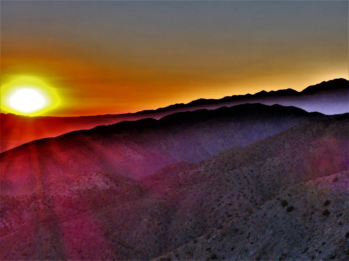
We arrived at Marine Corps Air Station Miramar for the Air Show, but couldn’t park any closer than one mile from the tarmac–where all the action was happening. I suppose if we wanted to upgrade from free to VIP status, we could have enjoyed preferred parking privileges closer to the airfield, but it was a beautiful day for a walk through a military base in sunny San Diego.

I was directed by Marine plebes to a general admission parking lot bordered by McDonalds and Chipotle. Leah and I opted to carry our own lawn chairs and snacks in lieu of paying for grandstand seating or any of the other enhanced options intended to pamper guests, including: a shaded lounge, gourmet food stations, a hosted bar, a commemorative coin, and less-frequented Porta Potties. But bringing our own chairs to the air show gave us more flexibility to move around the base. Besides, it was a beautiful day to schlep a heavy metal chair in a bag through a military base in sunny San Diego.

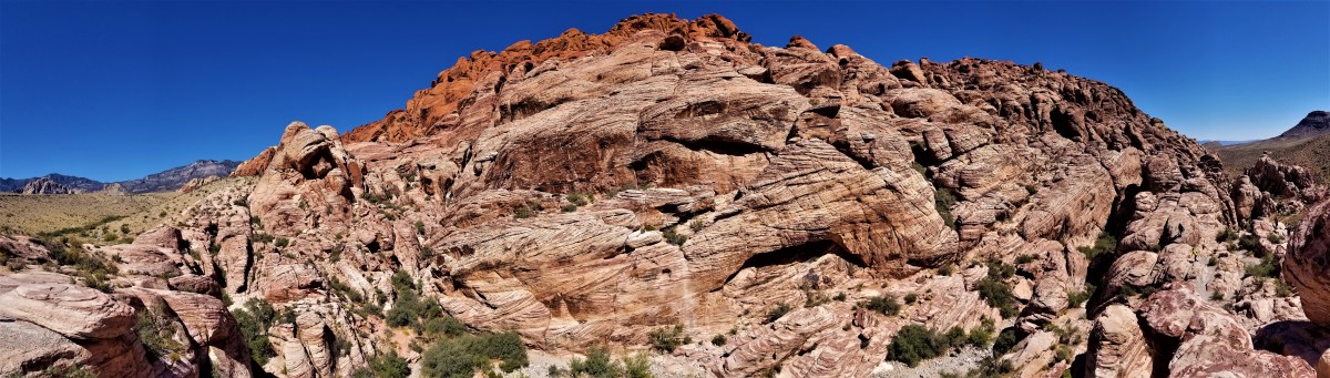
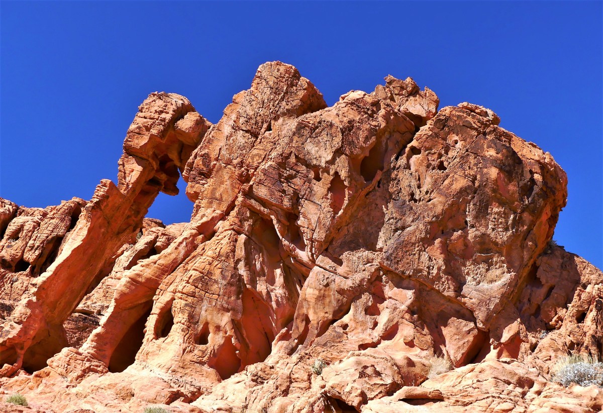
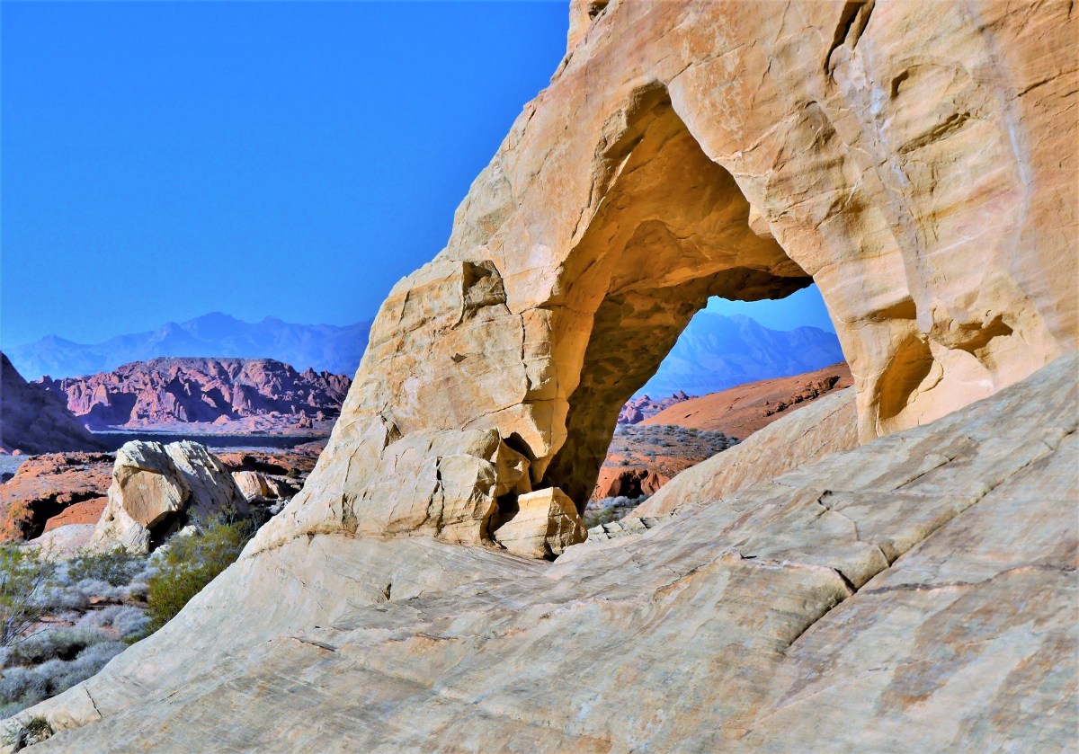
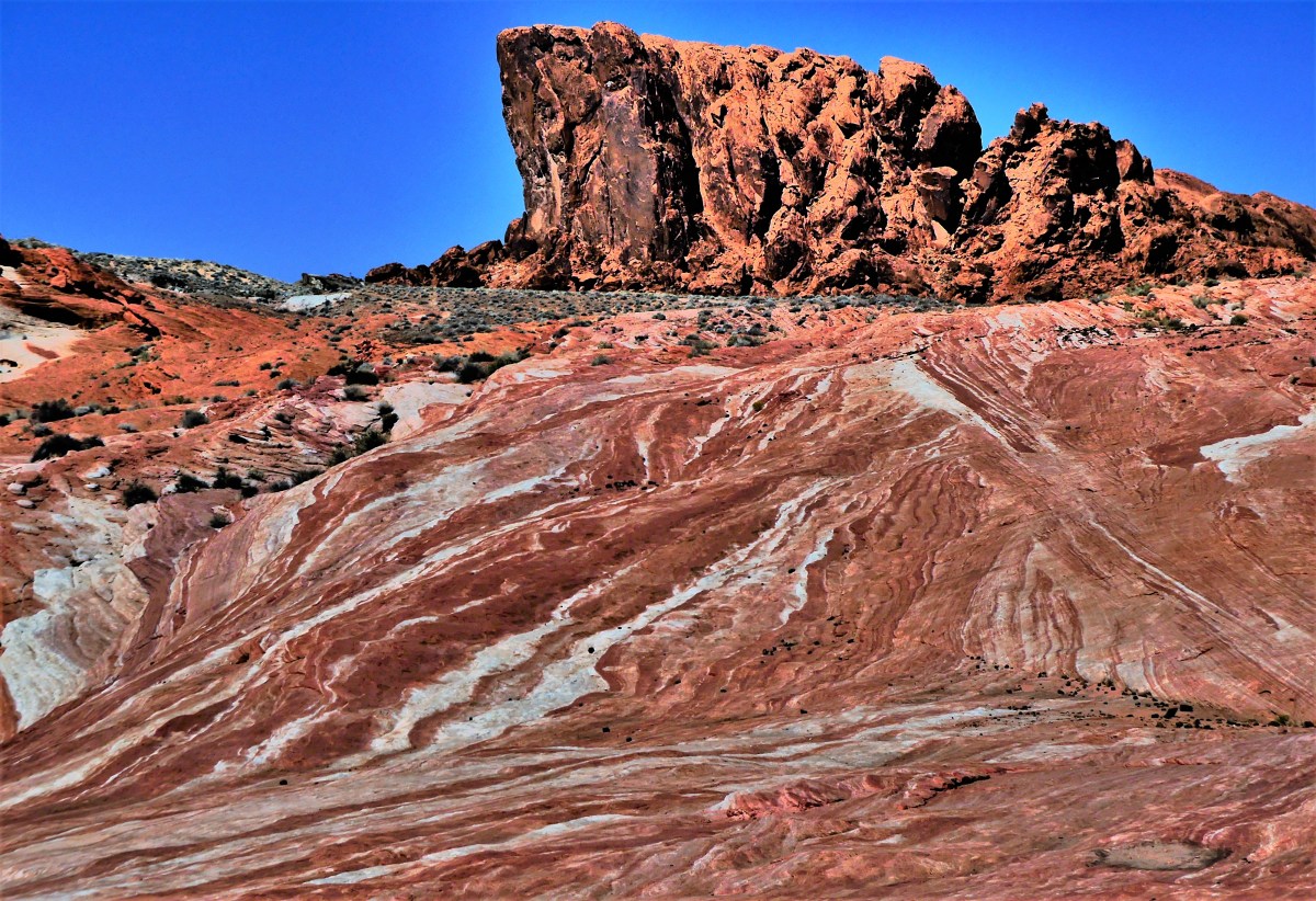
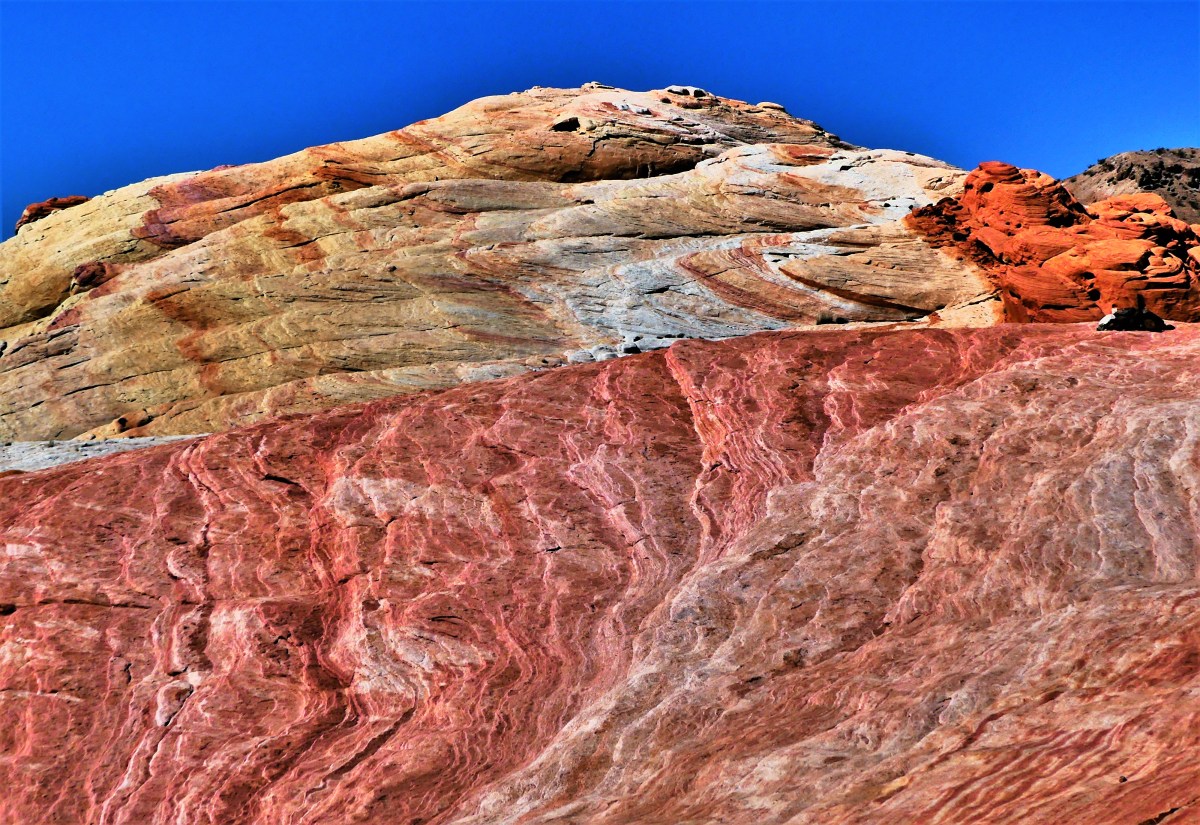
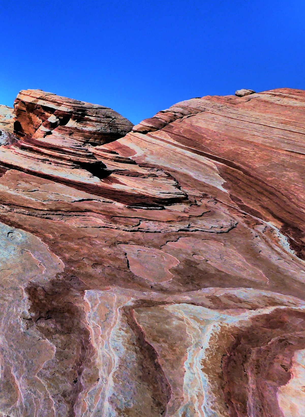
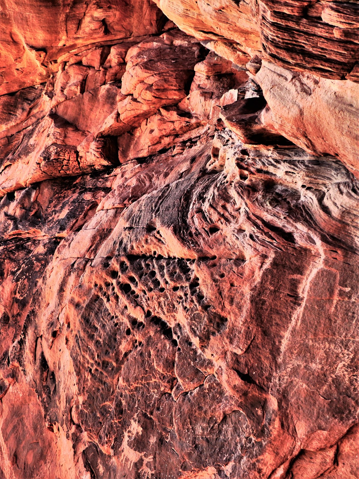
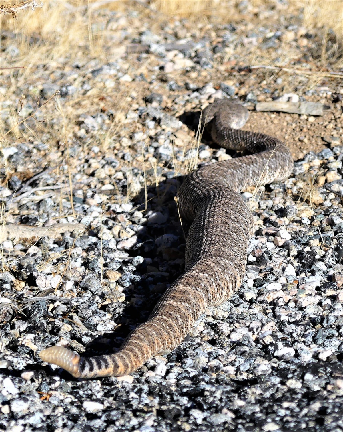
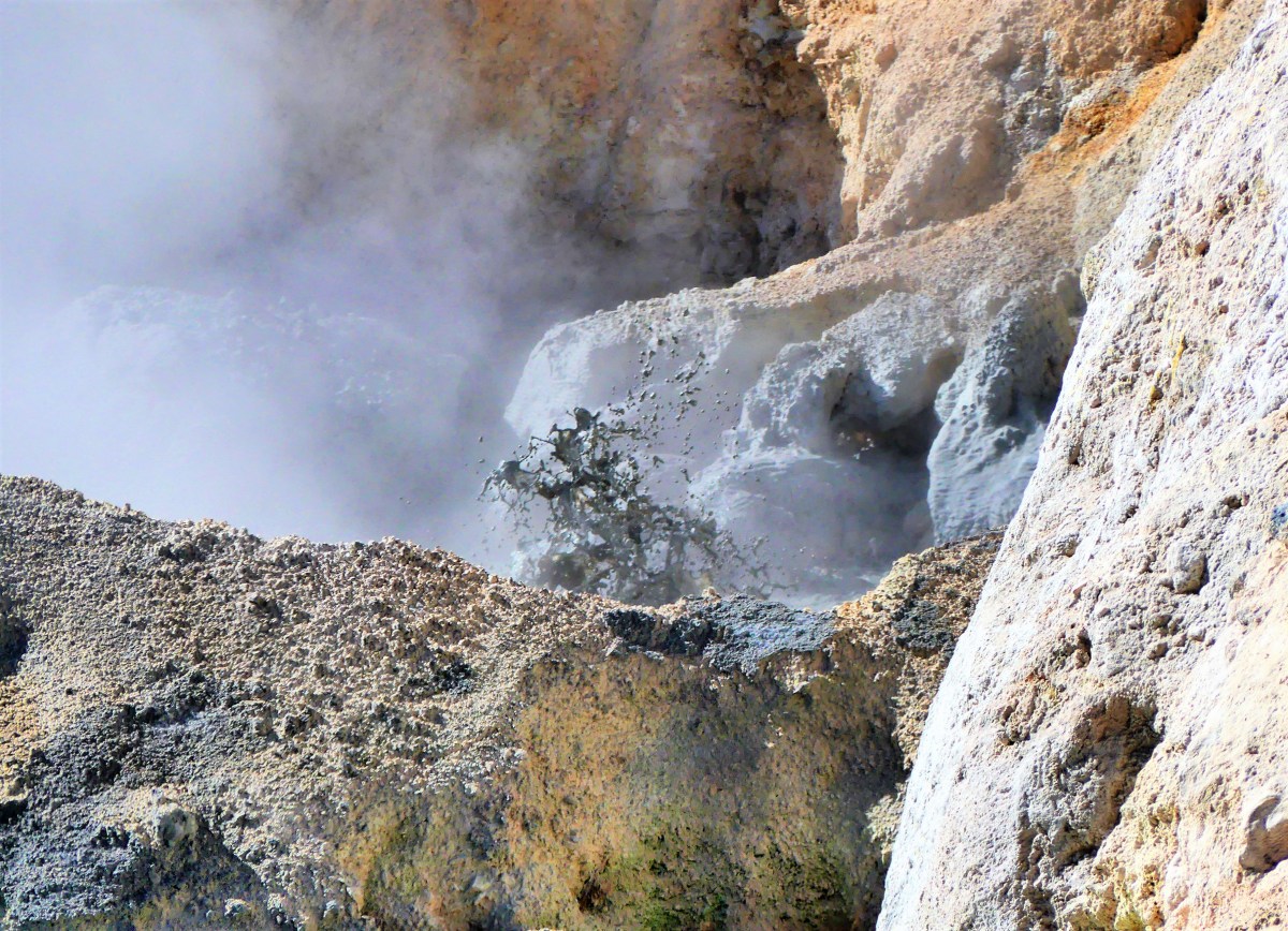
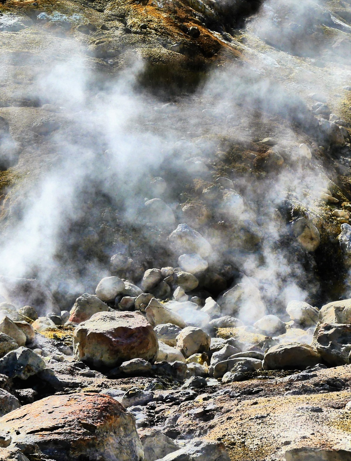
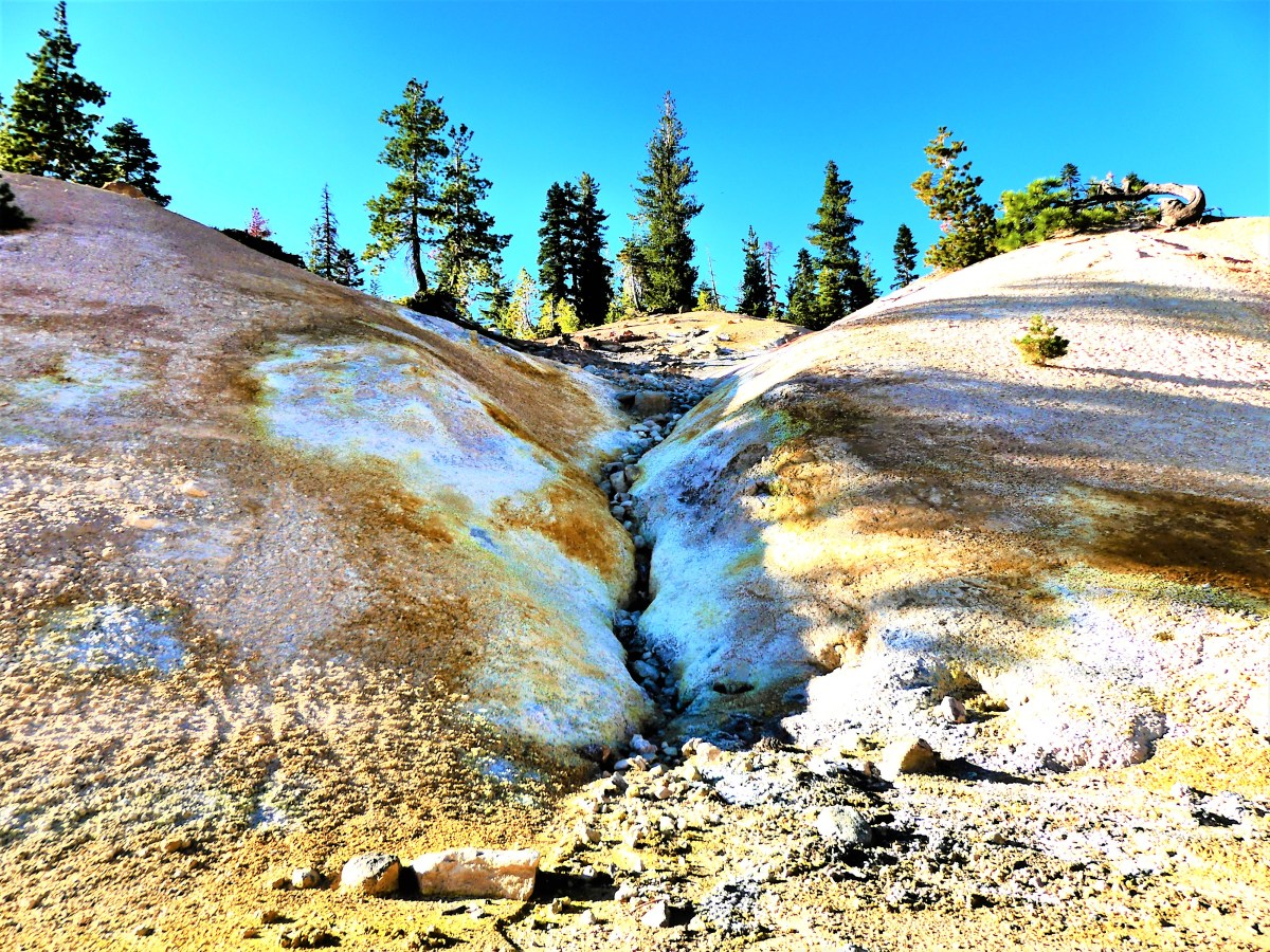
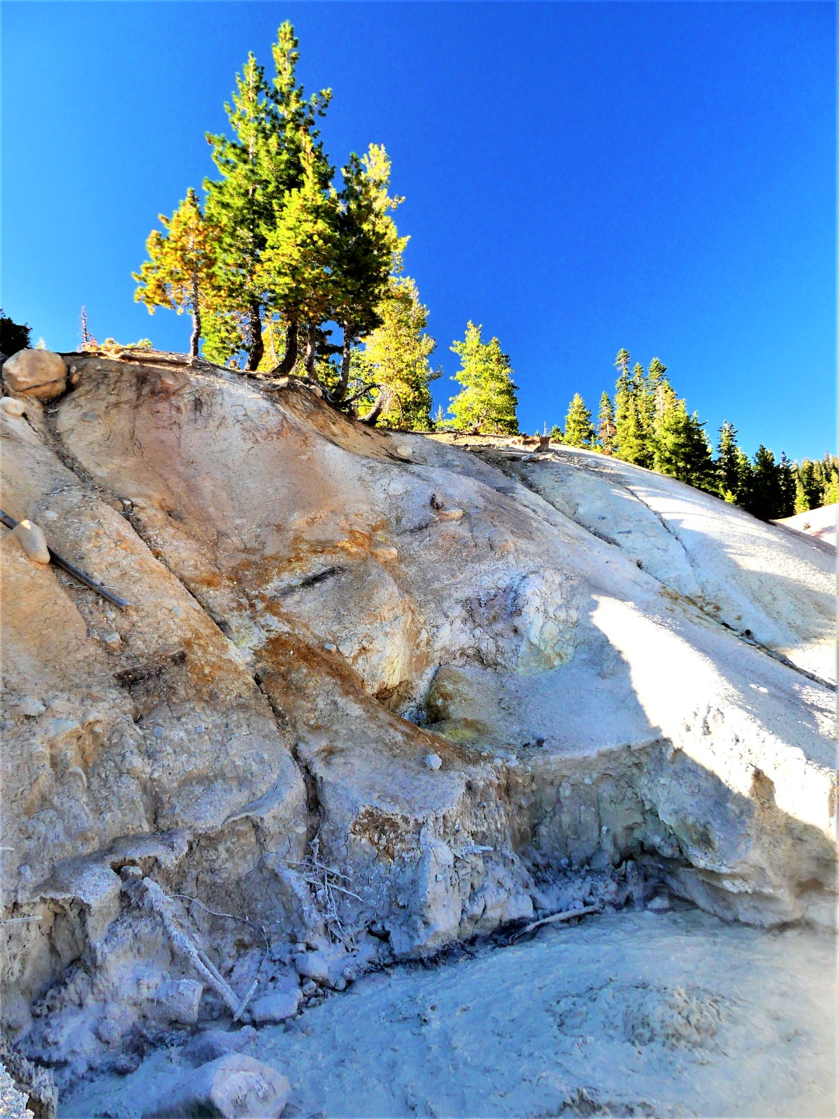
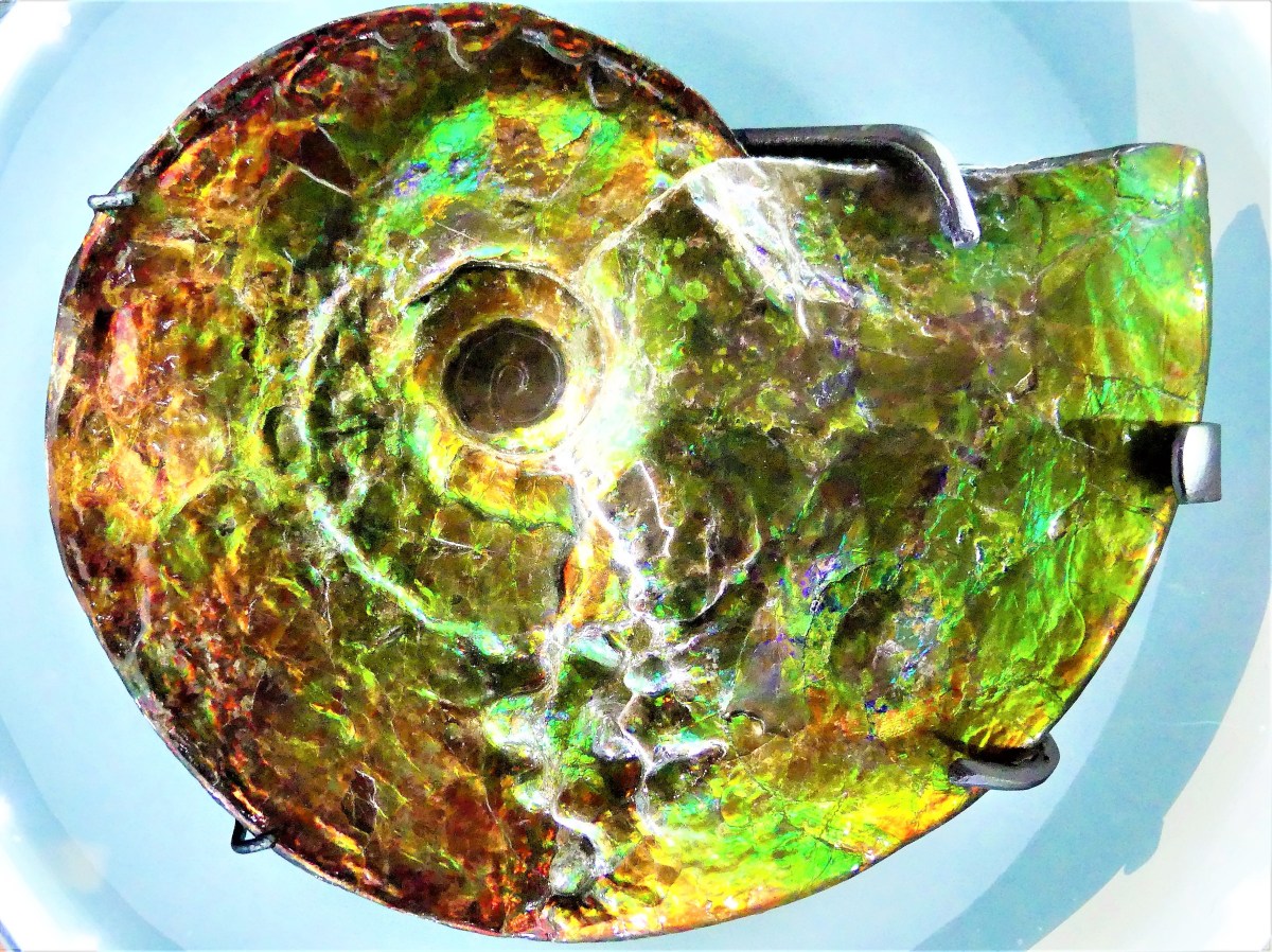
I think we were midway to the airfield, and steps away from the first security checkpoint when I saw something that deserved a second look through my camera. I peered through the viewfinder to discover the low-battery warning flashing in the frame before the screen went dark. Of course, it was my intention to exchange this battery with the battery charging inside the truck before we headed out, but I guess I was distracted by the notion of walking through a military base in sunny San Diego on such a beautiful day.

Leah found cover under a tree, while I dropped my chair and water bottle and hiked back to the truck to recover the freshly charged battery. Twenty minutes later, I rejoined her and we crossed the road where we were greeted by three security officers in camouflage fatigues.

The ranking officer addressed Leah first. “I’m sorry to tell you ma’am, but you can’t enter a secure facility with that fanny pack around your waist. For everyone’s security and protection, all bags…unless they’re clear…are prohibited.”

It was no use arguing with three people in uniforms on their own base, but Leah objected, “But I’m only carrying my water, my wallet and some snacks.”

The officer continued, “Your choices are to surrender it here and I can let you pass now, or return it to the safety of your vehicle if you still want to own it.”

And that’s when I remembered the graphic that caught my eye before my camera failed.

be-clear-header.jpg

“Do you have any idea how far it is to our car?” I interjected.

“I’m aware, sir, and there’s nothing I can do about that. Clear bags are the rule for everyone’s safety and protection,” he reiterated.

“I’ve just about had it with this air show!” Leah exclaimed, and stormed away. But she never got very far. She was delayed at the crosswalk by the marine directing traffic.

“I have an idea,” she said sotto voce, as I caught up with her.

We crossed back to the other side of the road, and turned into a nearby barracks parking lot away from view.

Leah removed her black waistpack and emptied the contents. Out came the water thermos, the wallet, and a baggie of pretzels. She loosened the chair bag drawstring, and stuffed the waistpack deep into the chair bag with the fragile pretzels sitting on top.

Cinching the drawstring, “I’ll be damned if I’m gonna give them my fucking bag!” she exhorted. With her water in hand and wallet in pocket, we crossed the road for the third time.

I proposed, “They’re never gonna believe that we ditched the pack in the truck and made it back this fast. So if they ask, we tell them that we handed it off to a friend to hold for us. Okay?”

Leah indifferently, “Whatever.”

When we approached the security team, Leah mimed that the pack was gone. “Are you gonna let us in now?” she mocked.

“I’m sorry for the inconvenience, ma’am. I hope you enjoy the show,” he stated sincerely.

“Isn’t there some kind of shuttle for senior citizens?” Leah intoned, playing the sympathy card.

“If you cross to the other side of the road, there’s a golf cart that will carry you and your things to the gate for 3 bucks a person,” he answered.

“How far’s the gate from here?” I asked.

“Straight up this road, ’bout half a mile,” security responded.

Leah outraged, “Are you kidding? Six bucks for half a mile? No way!”

“You’re right,” I reminded myself. “It’s such a beautiful day for a walk, lugging a heavy metal chair through a marine base in sunny San Diego.”

After arriving at the airfield gate, we were stopped by a second security detail dressed in pressed khakis and carrying guns.

“I apologize, but those chairs can’t enter this facility because they’re in bags,” an MP declared.

“You’ve got to be shitting me!” Leah unloaded. Emphatically, “Then why didn’t those boys down the road stop us at the time. They saw us carrying these bags over our shoulders,” she declared.

I covered my face to hide my grin. This was turning into a huge clusterfuck.

I took a breath. “What if we took the chairs out of the bags, and carried the chairs to the airstrip?” I suggested diplomatically. “Then it’s just a chair and a bag, instead of a chair in a bag.

They looked at each other and shrugged. “No problem, sir.” Followed by, “Please enjoy the show.”

We stripped the bags off our chairs, with Leah being especially careful to reposition and secure the waistpack into the folded seat.

“Thank you for that, now may I please see your IDs?” stated the second officer.

Leah dug her wallet out of her pocket, thumbed through her cards to locate her licence, and handed it to the third officer, who scanned it with his portable reader.

I was incredulous. “You’re not gonna believe this…” I started out.

Leah was glaring at me.

Continuing, “…but my wallet’s in my truck parked a mile down the road, and I’ve already had to go back once to get a fresh battery for my camera. So, there’s no way of showing my ID unless you guys wanna drive me back,” I lamented, “even though it’s a beautiful day for a walk through a military base in sunny San Diego.”

He looked the two of us over. I desperately communicated telepathically that he was putting my fate in Leah’s hands, and that he needed to show some sympathy and mercy.

Surprisingly, the marine announced, “Don’t worry about it. Just enjoy the show. Beyond this point, no one’s gonna hassle you for ID.”

Taken aback and winking, “Thank you. You may have just saved my life.”

After clearing checkpoint two, we advanced to the third and final security detail whose job it was to scan our bodies. We emptied our pockets onto the tarmac, and stood with arms and legs locked in a frozen jumping jack, while a soldier ran his wand up and down and around.

“All clear,” he announced.

We collected our belongings, and shuffled along with full arms.

“That was a close call,” I whispered.

“You’re telling me,” Leah laughed. “They would have found my camping knife in my pack.”

We weaved our way around small pockets of people–on the left side of a thinly populated grandstand,

Grandstands

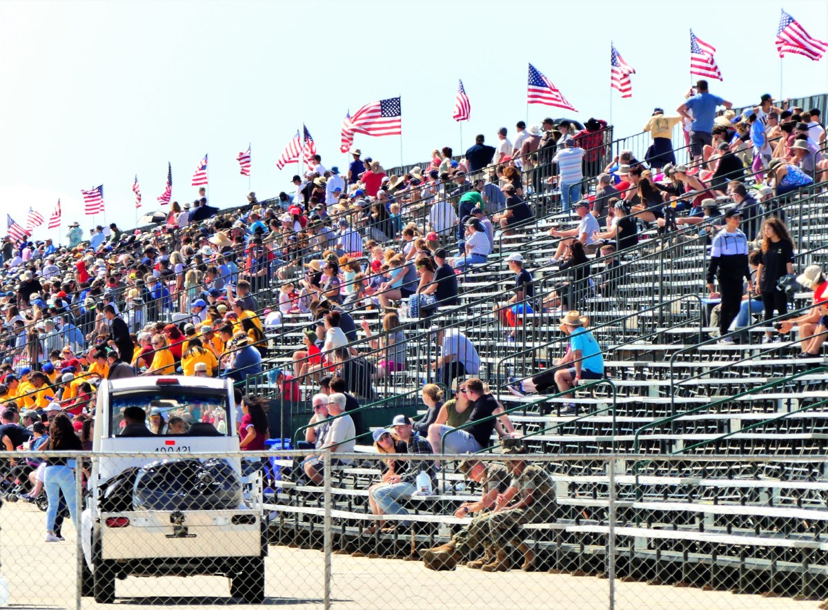
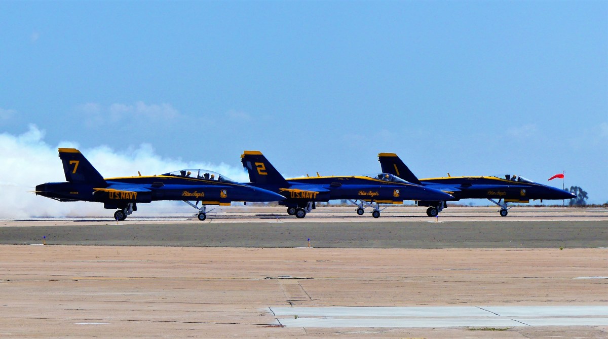
and settled three deep from the front fenceline to see what everyone else had come out to see–the elite precision flying squad known as the U.S. Navy’s Blue Angels.

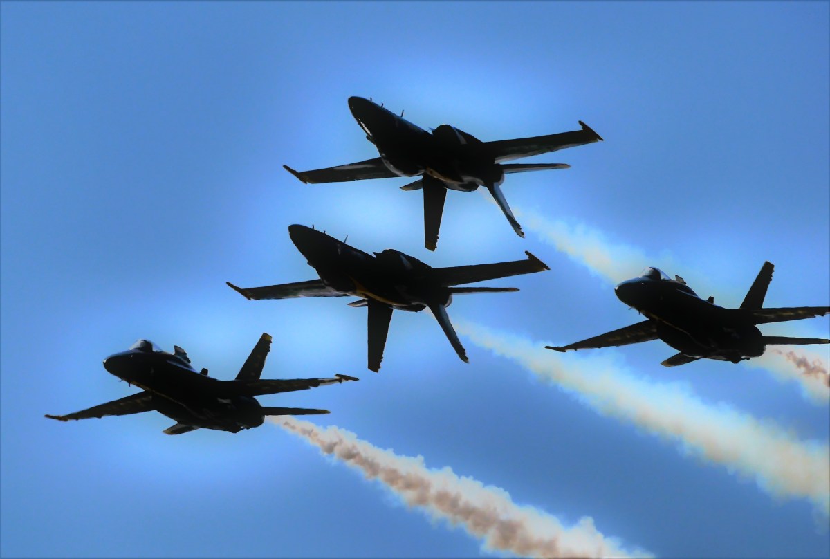
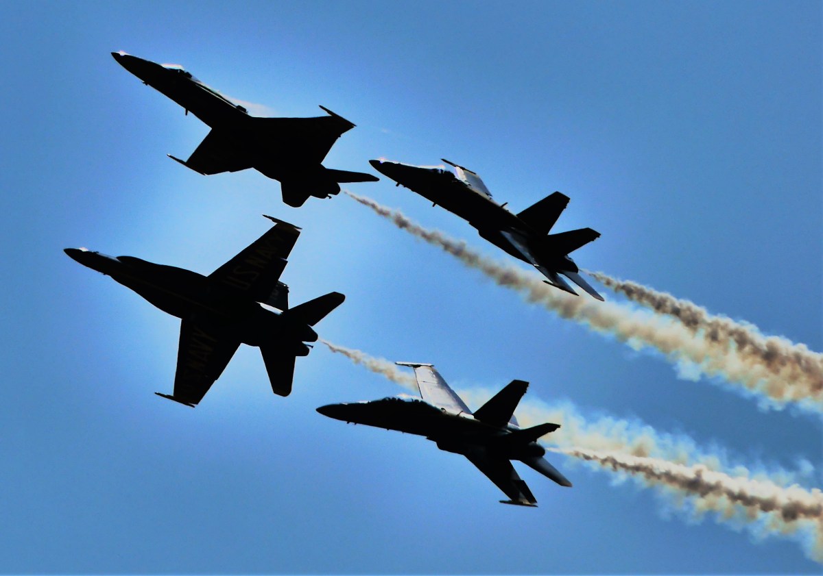
While clearance can be a serious issue when pulling a trailer–and I’ve had my share of close calls with our 28 ft. Airstream: like backing into a sleeve of an RV site with little to no front-end swinging-room; or negotiating a tight parking lot; or backing out into a busy road after inadvertently turning into a dead end–it still can’t compare to formation-flying in a $60 million aircraft with 22,000 lbs of thrust with only six inches separating the wingtips of two F/A-18 Hornets.

duet

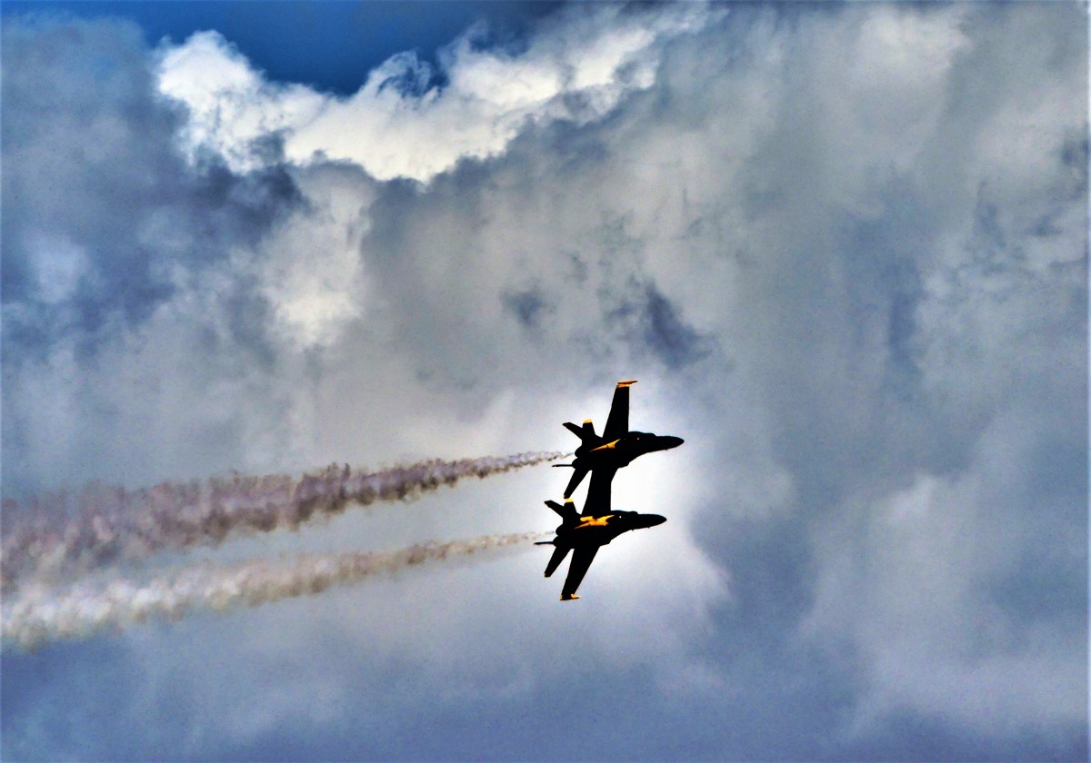
After fueling, the fighters lined up in take-off order,

Blue Angel lineup

and took to the sky in a burst of thunder.

delta formation

A variety of formations quickly consumed an hour of time…

2 up 2 down

2 up 2 down1

breaking off

and approximately 4250 lbs of fuel (or roughly 600 gallons) per plane.

4 abreast

banked formation

The Department of Navy estimates an average running cost of $11,000 per hour to fly each plane,

landing

with a yearly operating budget for the Blue Angels at $35,475,000.

side by side

While I’m far from militaristic, it’s impossible to ignore the skill set and nerves of steel of the U.S. Navy’s most accomplished pilots, and their ability to control a mighty military machine for the purpose of entertainment versus destruction.

And that’s what I call a beautiful day in sunny San Diego!

4 across


Channeling the Islands

We are sitting on the water, bobbing on small swells in our yellow kayak while waiting to explore some of the many sea cave options available to us on the southeast edge of Santa Cruz Island, the largest of four northern islands–Santa Rosa, Santa Miguel, and Anacapa being the others–that comprise Channel Islands National Park.

pace setter

With names like Limbo, the Green Room, Neptune’s Trident, Flatliners, and Boatwreck, these grottoes suggest something ominous and sinister to less-accomplished sailors like Leah and me.

The unconventional road to Channel Islands crosses the Santa Barbara Channel from Ventura Harbor via a dedicated ferry chartered by Island Packers.

Island Packers

After boarding the vessel with day trippers and overnight campers, we embarked at 9:00 am for a 1 to 1.5 hour cruise, depending on encounters with sea creatures,

hauling on a buoy
layers of hauled-up sea lions

pair of bottlenose dolphins

dolphin jump

and immense cargo ships entitled to “right of way”.

NYK with dolphin

NYK Argus
layers of containers

Unfortunately, there were no whale sightings, despite being a regular occurrence during summer months, since humpback and endangered blue whales enjoy feeding beneath these krill-rich waters.

After disembarking from Scorpion Anchorage, a short trek past Scorpion Ranch reminded us that this island was once privately owned and operated as a sheep ranch before the National Park Service acquired the eastern parcel during the 1990’s. Machine wrecks layered with rust bordered the road past the ranch house.

dead tractor

dead truck

After layering into our kayaking outfit,

what a couple

we eventually met up with forth-year guide Marc,

Marc the guide

who reviewed safety maneuvers and rowing tips by the launch point.

kayaks

We entered the water at Scorpion Beach,

Scorpion Beach.jpg

and paddled along the southeastern edge of the coastline toward San Pedro Point, where we visited a handful of caves, each one unique and posing a different challenge: whether it was leaning low while paddling to avoid low-hanging rocks from shrinking ceilings; coping in absolute darkness; guiding the kayak through keyhole passages; or timing our exit to avoid being pummeled by surging water.

entering a cave

approaching sea cave

into the cave

sea cave (2)

inside the sea cave

And of course, there were plenty of seascapes along the way.

mooring

rock crops

cove

After two hours in the water, we traded surf for turf, and hiked the canyon loop trail for commanding views of our surroundings. From the Anacapa Passage…

Santa Cruz Island

past a kelp forest…

Kelp forest

…from a wildflower patch…

Anacapa Island

to a chalky cliff at Cavern Point…

Cliff edge

…with a lookout to Prisoners Harbor…

Prisoners Harbor

…and crossing paths with an indigenous creature…the island fox.

fox in repose

Island fox

After meeting a multi-layered sea challenge of kayaking, we boarded the ferry and returned to Ventura–where terra firma meets the ocean, and it’s steady beneath our feet.

Ventura Pier


Big Things Come in Small Packages

“Size matters!” has long been considered a hard fact among those who measure the enormity of things, and eagerly justify the value of their preponderance. Yet all things big begin from most things small, and that’s the long and short of it. While this may come as a relief to many who seem challenged by the limited extension of their personality, it comes as no surprise to sequoias that have sensed this for millions of years.

Giant sequoia trees are native to the western slopes of the Sierra Nevadas, where they grow exclusively in protected groves. Every tree starts from a firm cone no larger than a chicken’s egg–

hand and cone

–each one releasing thousands of seeds resembling oat flakes, hoping to take advantage of a litter-free forest floor made fertile by fire.

Flash forward 2400 years, and if the then-seedling hasn’t been logged…

Mark Twain stump

…or besieged by fire (although its bark can be 3 ft. thick to ward off the effects)…

Chimney Tree

the result is the General Sherman Tree:

General Sherman

the largest living organism in the world! While not the tallest tree (Hyperion, a California redwood is 380 ft.), or the widest tree (an Oaxacan cypress tree has a 38 ft. diameter), or the oldest tree (Methuselah, a 5,000-year-old bristlecone pine tree exists in California’s White Mountains), General Sherman’s statistics make it the most massive tree:

Height above base

274.9 ft

83.8 m

Circumference at ground

102.6 ft

31.3 m

Maximum diameter at base

36.5 ft

11.1 m

Diameter 4.5 ft above height point on ground

25.1 ft

7.7 m

Girth Diameter 60 ft above base

17.5 ft

5.3 m

Diameter 180 ft above base

14.0 ft

4.3 m

Diameter of largest branch

8 ft

2.1 m

Height of first large branch above the base

130.0 ft

39.6 m

Average crown spread

106.5 ft

32.5 m

Estimated trunk volume

52,508 cu ft

1,487 m

Estimated mass (wet) (1938)

2,105 short tons

1,910 t

Estimated trunk mass (1938)

2,472,000 lb

1,121 t

Each year, General Sherman gains additional new wood equivalent to a typical 60 ft. tree.

General Sherman1 (4)

Putting things into perspective, the General Grant Tree, connected by Generals Highway and located only miles away in Kings Canyon National Park, is the second largest living organism in the world, at 268 ft. tall with a trunk that’s 1.5 ft. thicker.

General Grant1

Although Sequoia National Park shares billing and borders with Kings Canyon National Park–to its north and west–it’s easily the more accessible of the two, with 18 miles of corkscrews and whiplash hairpins, climbing 5000 ft. in elevation from the foothills, until the Giant Forest trails can be appreciated.

Along the way, a view of Moro Rock–a granite dome-shaped monolith–beckons the adventurous.

Moro Rock panorama (2)

Moro Rock

A steep 1/4 mile climb up four hundred rock-cut stairs…

Moro Rock approach

to the summit…

stairs to the top of Moro

offers a forever-hazy glimpse of the serpentine road and Ash Peaks to the west,

view from Moro Rock east

and amazing panoramic views of Kings Canyon’s dominant saw-toothed ridgeline to the east,

Sierra Nevada range

which unfortunately obstructs the 14,494 ft. peak of Mt. Whitney, the highest point of the lower forty-eight.

Crystal Cave is another large attraction wrapped up in a small package that’s deserving of attention. While not the largest cave–with a network of only three miles of which 1/2 mile can be toured–it is a jewel of marbleized and crystal formations that reaches back in time nearly two million years.

A scenic 1/2 mile hike along a cliff trail of potential obstacles and hazards (poison oak, rock falls, and rattlesnakes) down to the miniature falls that begets Yucca Creek…

water fall into Yucca creek

becomes the watering hole for fifty amateur spelunkers who gather before entering through the iron spider gate.

spider web erntrance

Immediately, the presence of water dominates the cavern. From the flume of rushing water over a bed of blue and white marble at the entrance,

flume

formation9c

to the drip, drip, drip of ever-growing stalactites,

formation7

and the ripple across the calcite-rich pools that spawn glistening pearls and terraced ridges.

calcite pool

The three major rooms of Crystal Cave offer a bounty of formations packed into tight spaces…

formation1

formation2

formation3

formation4

formation5

formation8

formation9b

formation6

…proving once more that bigger is not always better, and true value cannot be measured in increments of worth.

It’s easy to get lost in the details. It’s the basis of most disagreements. It’s the bellwether of how people are judged. It’s the downfall of many photographers. Taking the time to see the whole problem, the total person, the bigger picture gives us the confidence to believe that big things come in small packages.


Gallery

California Potpourri

After leaving Yosemite behind, Leah and I strategically home-based in Petaluma, and ventured along the California coast, from San Francisco to Point Lobos Natural Preserve and places in between.

Our collection of brief visits are best detailed through a series of images that more easily reveal the scope and variety of the scenery we enjoyed.

Sonoma Valley: Bezinger and Chateau St. Jean Vineyards

vineyards

terraced vineyards

rows of vines (2)

grove of grapes

fruit on the vine

Chateau St. Jean

John Muir Woods: a hike on the Canopy View Trail

Bohemian Grove

rotting bark

View from Panoramic Road

burl

squirel tail

a mouth of weeds

San Francisco: a ferry ride from Tiburon to the Ghiradelli Chocolate Festival

Golden Gate

Alcatraz

Coit Tower

who's watching whom

SF beaching

Ghiradelli

Carmel Beach: a stroll to Pebble Beach

Carmel Beach

tidal pool

where's my ball

10th green flag

Pebble Beach

Point Lobos State Natural Reserve: hiking from Whalers Cove to China Cove until sunset

heron

cliffs

China Beach

lonesome tree

Point Lobos rocks

Sunset coast

Sunset cove

pelican sunset

We’ll be back.


Knock, Knock

We are anchored at RV site #1 at Pine Mountain Lake Campground in Groveland, CA, the closest town (albeit 24 miles away) from Yosemite’s western gate. The sites at PML are terraced on a steep hilltop better suited for mountain goats, although there is 50 amp power and a water bib, should goats ever feel the need for air conditioning and a shower.

The pop-up caravan at site #2 has just packed up and pulled out, leaving us completely alone and feeling somewhat relieved. After being cramped for so long at so many “RV resorts”, it’s nice to enjoy the breathing room that comes from having space on both sides of our home, when more often than not, RV parks keep us closer to neighbors than a Grey Poupon commercial.

Yet, despite the constant flux of RV park populations, and the proximity of rigs from stall to stall, there is an unwritten code of ethics that’s very reassuring–where neighbors seem to respect the property of others that typically extends beyond the footprint of one’s camper. Unattended grills, bikes and lawn chairs are a large part of open-door living at campgrounds, and are seldom disturbed by others.

However, when left alone, the isolation can be disquieting and peculiar, leaving us to wonder what it’s like to be on our own.

After breaking camp by mid-morning, the enervating 100 miles of stop-and-go driving from June Lake, over the Tioga Pass, through a crowded Yosemite NP to our final destination at Pine Mountain Lake took up most of our day. Ordinarily, after setting up, a secluded mountain setting would invite us to open our windows for a crisp cross-breeze of fresh air, but Groveland had served up a helping of haze with a side a smoke, giving us little choice but to button-up the Airstream to protect us from the effects of fires in the forest.

Leah was first to bed, while I spent some time editing photos for the blog. I don’t know exactly what time I fell asleep in front of the computer, but I was startled awake at 11:30 pm by a knock on the door, followed by a weak plea for help.

Shaking off the groggy feeling, I turned up the lights and fumbled to unlock the door. Had I been more coherent, I probably would have ignored the distress call, and filed it under “too weird for worry”. But instead, I reacted otherwise.

“Are you in some kind of trouble?” I asked, cracking the door a few inches.

A disoriented rail of a woman with pulled-back hair and dressed in black spandex workout gear was standing by my door.

“I’m lost, and I need a ride home. Can you please drive me to my house?” she pleaded.

“What are you doing here?” I asked, growing increasingly suspicious of her request, and feeling angry that I may have put Leah and myself in jeopardy by answering the door.

“My husband and I had a disagreement and he dropped me here, and I have no way of getting home. I live on the mountain, but I don’t know where I am, so could you please drive me home?” she reiterated.

She didn’t appear upset–just confused, but so was I.

When Leah and I began preparations for our year-long adventure, a common question among friends and family was, “Are you taking a gun with you?”

My response was always the same: “Are you fucking crazy?” But now I’m not so sure.

“I’m not from around here, so I don’t know how to get you home,” I asserted. But what I was really thinking was: “You’ve got to be kidding if you think I’m leaving Leah behind, while you ambush me outside the Airstream or on the way to your home.”

“Then will you let me use your phone so I can call someone?” she suggested.

I anticipated the question. “I’ll be right back,” I announced, closing the door. I reached for the phone I recently replaced two weeks ago, switched on the exterior light, and re-opened the door to find her drinking from a large water bottle. I wondered what else she was hiding on the other side of my door.

“Since we don’t know each other,” I volunteered, “how ’bout I dial the police for you, and you can ask them directly for help?…”

She hesitated as I entered 9-1-1, “…Cause it sounds to me like this warrants a call to the police.”

“Sheriff’s office, what’s your emergency?” answered dispatch.

Switching the phone to speaker, I offered, “I’m calling from Pine Mountain Lake Campground in Groveland, CA. A woman has knocked on my camper door who claims that she’s lost and unable to find her way home. Are you able to help her?”

“Is she still there?” asked the dispatcher.

“She is, and she’s asked me to drive her to her house somewhere nearby,” I confessed.

The dispatcher took over. “Are you alright ma’am? Are you hurt in any way?”

The stranger responded, “I’m okay. I just don’t know where I am is all, and it’s dark, and I don’t know how I’m gonna get home.”

The dispatcher continued, “Can you tell me your name and where you live?”

“My name is Amber and I live at 20247 Longview St.,” claimed the knocker.

“Were you born in 1964?” asked the dispatcher.

“Yeah,” responded Amber.

“Well, this office is not a taxi service, Amber, but if you like, I can offer you the numbers of a few local cab companies who can get you home,” suggested the dispatcher. “Is that a good option for you?”

Amber, dazed, “Sure.”

To Amber, “Be right back.” I let the door slam behind me, and I scrambled for a pen. The dispatcher dictated phone numbers for three taxi services and signed off.

Getting back to Amber, “I’ve got three choices here. Which number would you like me to call?”

“I don’t have the money for a taxi. Can you just tell me the direction to the main road?” asked Amber.

“Ferretti Road is at the bottom of the hill. You can’t miss it,” I declared, and double-locked the door.

From the “bedroom” Leah called out, “What the hell was that all about?”

“I don’t even know where to start, but I hope she’s gone,” I asserted.

“Maybe we should bring in the bear spray from the truck as a precaution,” Leah recommended.

“Only if you get it,” I replied.

“Fuhgeddaboutit! I’m not stepping out there,” exclaimed Leah.

At Leah’s suggestion, I called Pine Mountain Lake Association security, who completed a sweep of the property, but came up empty. Their promise of an increased patrol through the night was reassuring, but the peculiar notion of ever enjoying peace and quiet as a solitary guest in a campground now seems highly overrated.

Gallery

Thank You for Not Smoking

Waiting…patiently.

Waiting…purposefully.

Waiting…painfully.

When will this smoke finally dissipate? I already know the answer…the question was rhetorical. As of today, 74 fires are burning out of control across the western part of America.

fire map of Western states
Current Wildfires

Extreme Smokey

Fires are currently active in nine states throughout the West, according to the National Interagency Fire Center. Here is a breakdown of the acreage burnt so far in active wildfires reported by the National Interagency Fire Center since Aug. 28:

  • Arizona, 1 wildfire, burning 48,443 acres
  • California, 22 wildfires, burning 354,316 acres
  • Colorado, 1 wildfire, burning 1,405 acres
  • Idaho, 19 wildfires, burning 248,141 acres
  • Montana, 26 wildfires, burning 544,583 acres
  • Nevada, 7 wildfires, burning 111,379 acres
  • Oregon, 9 wildfires, burning 146,418 acres
  • Utah, 1 wildfire, burning 5,097 acres
  • Wyoming, 2 wildfires, burning 4,766 acres

For those active fires reported on since Aug. 28 it amounts to 1,464,548 acres actively burnt or burning.

Leah and I have been in the fire zone for over a month–always one-step ahead of the next outbreak–but fire finally found us at Yosemite National Park. Today, the evacuation of Fish Town was lifted, but steps are still being taken to prevent fire from invading Yosemite’s sacred Mariposa Sequoia Grove. Fortunately, Merced and Tuolumne groves remain unaffected.

tunnel tree (2)

roots

fallen tree1

fallen tree

The air is filled with smoke. It’s impossible to ignore…it permeates everything. And nothing stays clean overnight after the ash quietly coats every surface by morning. With the winds blowing, mountains appear…

Tioga Peak (2)

twin peaks

Mt. Dana

Mt. Hoffman

and disappear under a gauze of gray in minutes.

El Capitan

Cathedral Rocks

Fairview Dome1

On a good day, the sun will sometimes break through,

smoky sun

if only to tease the highlights from the shadows.

Tenaya Lake

kairns

tree balanced on rock

Bridalveil Falls2 (2)

But the sky is fickle…

smoke clouds

It leaves us waiting …and wanting more, with no guarantee that the sun will return–until it means accepting the best of a bad situation.

ElCapitan

Perhaps waiting has value if it slows us down, and gives us a little more time to appreciate what’s in front of us.

El Capitan and Cathedral (3)

Fire in the Hole

I’m standing on the rim of the Cinder Cone volcano at the northern edge of Lassen Volcanic National Park, and steadying my camera against sustained winds whipping across the crater. My biggest fear at this moment is not for my safety, but being unable to properly memorialize my euphoria in a sharp photograph.

While there is no comparison to the energy of B.F. Loomis’s exposure of Lassen Peak’s 1914 eruption,

lassenerupt

the thrill of standing on the precipice of a monument created by the forces of nature…

cinder cone

should be testament to Lassen’s National Park worthiness.

But getting to Lassen Peak was a thrill of a different kind. If the shortest ground distance between two mountains is a crooked road, then 50 miles of US-299 through the Trinity-Shasta National Forest qualifies as a marathon winner of zigs and zags, and unlike any other road I’ve driven since our trip began more than five months ago.

It had to be the most rising-and-falling-and-winding-and-grinding-kind-of-road that went on and on for more than an hour. Rarely would 100 feet of straight road pass us by before we’d follow a familiar pattern of maneuvering to the right and then pulling the truck to the left and then turning the wheel hard to the right, and leaning around the bend into a corkscrew, only to continue all over again.

The drive was exhausting, but at least we left the smoke behind us. We were now basking in sunlit blue skies without a single cloud.

The park was uncrowded, and it didn’t matter why, but I suspect that families were now tackling teachers’ homework.

After an orientation at the Visitor Center, we strolled around Manzanita Lake for centerfold views of the mountain.

Lassen Peak and Manzanita Lake

Taking the highway deeper into the park, we passed Helene Lake,

Lake Helen and Lassen Peak1

offering a peek at Lassen’s desolate peak.

Lassen Peak and snow.jpg

Since the trail to the summit rises 2000 feet in 2.5 miles without shade–which is not my idea of fun–we continued to Bumpass Hell, named after an early 20th century guide who stepped through the crust of a fumarole while doing his job.

The namesake trail provided commanding views of Brokeoff Mountain and Diamond Peak.

overlook

We found it odd to be crossing snow in the middle of August under a searing sun,

summer melt

but the park receives snowfall averaging 40 feet per year at the higher elevations.

Once over the ridge, the sweet mountain air was replaced with the pungent scent of sulfur bleeding from a hellish valley of hydrothermal activity:

Bumpass Hell

complete with requisite spurting mudpots,

mud pop

hissing fumaroles venting from angry rocks,

P1070500

and brilliantly colored hot springs…

hot springs

Bumpass Hell2

mineral rocks

Bumpass Hell1

…collecting in a milky stream of hot minerals.

Sulphur Spring runoff

Absolutely gorgeous!

The road to the south entrance of the park took us past the defunct commercial Sulphur Works,

Sulphur works3

Sulphur works1

boiling mudpot

before we u-turned to catch the westerly light on the Chaos Crags,

Chaos Crags

and fawned over the stillness of Reflection Lake.

Reflection Lake

It would be hard to top this day, unless it was from atop the Cinder Cone, and that’s where we traveled the following day.

After a drive through dense forest and pastureland to the northeastern corner of the park, we turned onto a dusty hard-packed road terminating at Butte Lake, where a delta of trails branched out for a closer inspection of the Fantastic Lava Beds…

Fantastic Lava Beds

–a heap of sharp and shiny lava rocks rising to heights of 50 feet or more–forming an impenetrable barrier of blackness.

Lava beds and ash

We trudged through shifting black sand bordered by groves of Ponderosa pines for nearly two miles, until we reached a clearing with a view of the cone.

trail

“I don’t think I can make it,” Leah admitted. “It’s too steep for me, and it’s completely exposed, but you should go for it.”

The winding trail up the side of the cone was sloped at a 35% grade, the sharpest possible angle that cinders can stack before rolling downhill. It was going to be very challenging. The ascent over crushed cinders mixed with coarse sand was harder than I presumed. With every step, the gravel swallowed my boots to the ankle.

slow and steady climb

But I was undeterred. The power to continue came from the constant revelations brought by every foot gained along the way,

Lassen peak and lonesome tree

and the promise of something more spectacular by climbing even higher.

Lava beds and Butte Lake

I could follow Leah–becoming increasingly smaller–as she took the detour around the cone, just as she was watching me shrink in size from the base of the volcano.

from the base
glare from Leah’s iPhone

After scrambling most of the 750 feet to the trail’s vanishing point, a whirling wind confronted me from the blind side of the cone, stopping me in my tracks, but offering an amazing overview of the Painted Dunes and Lassen Peak in exchange.

Lassen peak and painted dunes panorama

I imagined a walk through the dunes, taking time to examine the explosion of color, while wondering if camera sensors were sensitive enough to record such an array of wonder.

painted desert1

And then I reached the top of the cone!!

cinder cone crater

The wind at the top was relentless, but so was my need to circle the cone. Nothing was more exhilarating than having the cone to myself (although I would have willingly shared the summit with Leah had she been able). The magical feeling of surveying the terrain from all sides was awe-inspiring.

the cone

cater and peak

And then I discovered that the Painted Dunes continued on the other side of the volcano.

painted desert4

painted desert5

painted dunes

I really didn’t want to leave. But after exploring the area, the only thing left to do was to take the long trail down to share the experience with Leah, and yield the cone to a new arrival.

the long climb


Redwoods and Blue Seas

California stopped us right in our tracks. We had just crossed the Oregon state-line, only to be unexpectedly diverted to a border patrol checkpoint.

“What could we have possibly smuggled into California from Oregon that would need further inspection? Maybe they’re looking for the coyote who’s been running Canadians into the States?” I posed.

“More likely, there’s a bounty or some kind of quota for captured Mexicans,” Leah contributed.

Ahead of us, the RV from Nevada was being questioned. He pulled away, and then it was our turn.

Waiving us forward, “Wow,” the California agent exclaimed. “You guys are all the way from New Jersey?”

I’m almost certain his eyes lit up behind his dark glasses. “Do you know anything about gypsy moths?” he asked.

“We are, and I do,” I responded to both questions.

“Well then, since you won’t be needing this brochure about gypsy moths, would you do me the favor of pulling up to those cones over there,” he indicated, “and I’ll have an officer come by to check things out in a jiffy. We won’t keep you very long.”

“Are we really getting checked for moths?” I asked rhetorically, as I crept to the cones.

“I don’t know,” Leah admitted, “but I can see two guys in my mirror, and they’re coming up to the Airstream, and one of them is carrying something big, but I can’t make it out.”

“I suppose it makes sense, considering the importance of protecting America’s timber land,” I stated. “In fact, what this country needs is a net. The United States government should cast a tremendous net over America’s airspace to protect us from immigrant leaf-eaters that only mean to do us harm. These are very bad bugs–the worst you’ll ever find anywhere–and these bugs have to be stopped before they threaten the security of this great country. Believe me. Thank you very much.” I campaigned.

“And this net…are you gonna get the bugs to pay for it?” Leah mused.

The inspector set the car dolly on the ground and crab-walked around the Airstream undercarriage while on his back, poking around with his fingers and a flashlight. He started on the left side of the Airstream, and I followed him as he scooted under the tail to the other side for more of the same.

After completing the circle, he stood and declared, “All clean. These campers are completely sealed. Those guys do a good job.”

“And made in America!” I chimed in.

He stamped my official Certificate of Inspection, and bid us safe travels.

certificate-of-inspection.jpg

Certified predator-free, we were now permitted to resume our journey throughout California, with Redwood National Park as our first stop.

Redwood National Park is a splinter of a park that hugs the rocky northern coast, and reaches across the Yurok Reservation and reciprocating California State Park affiliates.

Because Redwood is not a traditional National Park, it can easily get under your skin. Navigating through the blurred lines of park boundaries always had me wondering if we were “in” the park or not, as we rode Redwood Highway through forests and meadows to beaches and towns.

Unlike other parks, there is no entrance fee, but then again, there’s also no practical way of collecting a fee when the road is open to all traffic.

We set up camp on the bank of the Klamath River,

Klamath River sunset (2).jpg

and explored in earnest the following day when we followed the river to the estuary,

Klamath channel (2)

where a family of barking sea lions,


and humans…

ocean play

…frolicked in the sea spray and sea foam.

sea foam

We continued our hike along the Coastal Trail, with views north…

Bird Rock

…and south of High Bluff overlook.

coastline overlook

“I miss the ocean,” I confessed to Leah. “There’s something serene about staring into the surf.”

Although three months had passed since visiting the Jersey shore, I was immediately transported back to a familiar scene of waves rhythmically crashing against the rocks.

crashing waves

“Let’s go find some redwoods,” Leah advocated, pulling me out of my trance.

We branched out to a deeper part of the jigsawn park, and settled on a grove of giants dedicated to the beatification efforts of Lady Bird Johnson by Richard Nixon.

Lady Bird plaque

With ancient redwoods as old as 2500 years and reaching upwards of 380 feet, the notion of something bigger than oneself becomes more than a literal interpretation.

sunglow

skyscraper

treetops

redwood grove

How fortunate we felt to be bathed in streaming shafts of light–dancing between feathered limbs, and flickering in the balmy breeze.

shafts of light

There’s much to learn from trees that have survived the dinosaur. Redwoods are a family of trees that share root ancestry to keep them anchored. They propagate by seed or by sprout, and are known to sacrifice themselves for the benefit of the younger and stronger sibling.

twins

The redwood’s bark may grow to two feet in thickness to protect itself from fire damage. However, repeated fires can eventually penetrate through the bark, leaving the tree to rot out from the core,

burned out redwood

and yet…it may still survive.

burned out but alive

Even in death, there is a twisted beauty to be found in its decomposition.

rotting stump

At the dedication ceremony to honor Lady Bird Johnson, President Nixon intoned,

…to stand here in this grove of redwoods, to realize what a few moments of solitude in this magnificent place can mean, what it can mean to a man who is President, what it can mean to any man or any woman who needs time to get away from whatever may be the burdens of all of our tasks, and then that renewal that comes from it…

As I strolled through the grove surrounded by God’s fingers, oh, how I prayed that Donald Trump could take Nixon’s advice, and listen to the trees’ whispers for just “a few moments”.

Oxymorons

Delicately durable and delicately vibrant–two oxymorons that epitomize the characteristics of an ammonite fossil exhibited at the Royal Tyrrell Museum in Drumheller, Alberta.

ammonite (2)

Yet, it’s the simple complexity of the structure that best explains why after 200 million years, we can still appreciate its resilience and iridescence. The integrity of the ammonite’s spiral chambers are believed to have regulated buoyancy, and protected the crustacean from the tremendous force of oceanic pressure drops.

And while it may have taken an epoch of tectonic pressure, heat and mineralization to metamorphosize and fortify such a fragile fossil, the structure of time has enhanced our revelation of objects possessing rare and infinite beauty.

In Search of Crater Lake (OMG, SMOG)

“There’s a lot of smoke in the park today, so be careful,” warned the ranger, as we crossed the threshold of Crater Lake National Park for our second day of touring. Earlier in the day, I searched the National Park Service webcam aimed at Crater Lake from the Sinnott Memorial Overlook–with the intention of evaluating views of Wizard Island and Llao Rock–but there was no image…just a gray blob.

“Aw shit! Is this camera off-line, or could this really be smoke?” I wondered aloud.

While I craved the crisp cerulean air punctuated by wispy snippets of marshmallow clouds floating over a rippling realm, I knew from our 35-mile approach to the park that this was pie-in-the-sky thinking, since the valley was completely cloaked in smoke.

Yesterday, as we embarked on our ring around the 33-mile Rim Drive–with its multiple viewpoints along the caldera wall, overlooking magnificent cliffs that surround Crater Lake–our eyes could barely penetrate the haze that gave us gauzy views across a vast expanse of water.

Wizard Island

The fact that we could see anything at all, brought tears to our eyes, but that was probably caused by the irritants in the air.

Every vantage point brought a dazzling, yet indistinct impression of the landscape, elevating form over color and detail as the dominant design element.

Pinnacles
Pinnacles
Lookout over caldera
Grotto Cove
ice and water
Shell Channel

It was also an opportunity to reflect on objects closer to the lens.

a tree with an idea1

arms ans legs and limbs

unusual tree behavior

There were moments when the haze worked to my advantage, revealing a lake with a more mysterious and pastel personality.

Wizard Island ray
Wizard Island morphs into a giant ray
Phantom Ship ES
Phantom Ship sailing on Chaski Bay

Fortunately, the sun broke through at the right time, shining a spotlight on Pumice Castle,

Pumice Castle CU

Pumice Castle

illuminating the illusion of Phantom Ship,

Phantom Ship

and electrifying the Danger Bay coastline with lenticular textures.

Danger Bay


What a difference a day makes. Today’s scene had us wondering if Crater Lake was really down there at all, and maybe part of a bigger conspiracy.

where is the lake

Has Crater Lake been de-ported? Is Crater Lake being held hostage in exchange for Congressional funding of the “Wall”? Or is Crater Lake relying on a failing projection system that once led (b)earthers to believe that Neil Armstrong faked the lunar walk? Fake views. Sad.

I wondered if Park Rangers were doing enough to reassure the public that Crater Lake would reappear.  And had they considered putting out an A-P-B for a M-I-A lake that’s gone A-W-O-L?

“Be on the lookout for a large body of water that goes by the name of Crater Lake–measuring somewhere between five to six miles across, a quarter-mile deep with a deep blue complexion, sporting two enormous moles and a shaggy shoreline. Last seen yesterday, wearing a cloudy disposition.”

Poised at the Cloudcap Overlook and hoping for a miracle, it was the smoke, not the view, that took our breath away.

But being the intrepid explorers that we are, if the lake was invisible from above, then we would search for it beneath the shroud.

The Cleetwood Cove Trail drops 700 feet to the water’s edge through a series of sandy and steeply graded switchbacks.

trail switchbacks

It took us fifteen minutes to breeze down the the one-mile trail, until we reached the water’s edge with rewarding views of the penultimate infinity pool.

jump off point
Cleetwood Cove to Pumice Point

The cove is home to an outhouse-shaped instrument shed…

outhouse monitor

that monitors lake elevation levels for the US Geological Survey,

Crater-Lake-surface-water-elevations

and a dock for concession boat tours that circle the lake or visit Wizard Island.

boat launch

But reservations sell out quickly. Leah and I considered bringing a credit card along in the unlikely event that seats would become available, but decided against it.

Instead, our afternoon entertainment was provided by young thrill-seekers who dared themselves and each other to take the plunge off a 25-foot cliff…

jump1

jump9e

…into heart-stopping ice water.

Returning to the dock, we learned that seats had become available if we were willing, but without a method of payment, alas, we missed the boat.

aboard the Rogue

And so began the long plod up the mountain, and back to a sky that refused to yield.

We had gone in search of Crater Lake, and all the while it was right under our noses.

Beauty and the Beast

Some mountains should keep their distance or at least stay in the background, while other mountains always seem ready for prime time. And so it is with Mt. Ranier and Mt. St. Helens–two significant volcanoes within the Cascade Arc, and part of the Pacific Ring of Fire.

As the crow flies, both peaks are 50 miles from each other, yet on a sliding scale, they couldn’t be further apart.

For starters, Mt. Ranier is majestic,

view from a bridge

lush and verdant,

meadow

powerful and dominant,

Ranier glaciers

and picturesque;

Ranier reflection

while Mt. St. Helens appears wretched,

Staring into the crater

barren,

crispy trees

broken,

lohar

and grim!

southern valley

To be clear, none of the fault belongs to Mount St. Helens. Before May 18, 1980, this was a vital volcano with a perfectly shaped cone, rising 9600 feet over Spirit Lake. But when the explosion raised the mountaintop, she was stripped down to 8366 feet without her snow bonnet.

The results were catastrophic: 300 mph force shock waves tore ancient trees from their roots, and the largest landslide in recorded history combined with glacial meltwater to create raging lahars that deposited up to 600 feet of volcanic slurry as distant as 50 miles from the eruption. Fifty-seven lives were lost in the blast, which also caused over 1 billion dollars in damage.

Thirty-seven years later, the altered landscape remains daunting and unforgiving,

MSH panorama.jpg

By contrast, the continuing history of Mt. Ranier and the surrounding area can be told in the 8 ft. diameter cross-section of an ancient Douglas-fir beside the Longmire Museum.

history tree

Although Mt. Ranier has been sleeping since 1895, its volcanic volatility may pose a bigger risk to nearby population centers than Mt. St. Helens.

But until then, the love affair continues with visitors who pass through the gates…

entrance

motorcycle dog
Thanks, Leah

…on the road to Paradise, stopping at Narada Falls…

narada-falls.jpg

Narada Falls wide

in the hopes of finding the mountain clear of cloud cover.

below Paradise

If there was ever a beauty pageant for mountains, Mt. Rainer would be a contender for the glacial tiara. There are few mountains more photogenic.

wildflowers and Ranier (2)

While the obvious star of the park is the mountain, the bounty extends beyond the twenty-five glaciers clinging to its summit,

topography

as the park deceptively draws its visitors into the forest where the reward is equally as impressive, and no less stunning.

looking west of Ranier

Louise Lake

view from Paradise

Lest anyone think that Mt. St. Helens’s image can’t be salvaged, consider what a few accessories can accomplish to dress up an outfit.

While you can’t put lipstick on a mountain, there are artful techniques that offer instant gratification. For instance: point the camera a safe distance away from the subject, add a few clouds to soften the light, frame the composition with trees for a bit of mystery, then employ a spot of color for distraction, and voilà–Mt. St. Helens transformed!

view from the marsh

Or by photographing the beauty on the edge of the ugly, makes the ugly seem more attractive by association.

lily pads

Adams and Spirit

Although Wrangell–St. Elias, the Great Smokies, the Rockies, Shenandoah, and Grand Tetons are recognized as jewels in the National Park Service crown, none of them is a mountain unto itself. Only Mt. Ranier and Denali command the right to be a park that bears their names. (Mt. Rushmore doesn’t qualify; it’s a National Monument.)

While Mt. Ranier and Mt. St. Helens are very much a tale of two mountains, each one (despite their appearance) commands respect for different reasons: Mt. St. Helens for the power unleashed, and Mt. Ranier for the power restrained.