
I’m standing on the rim of the Cinder Cone volcano at the northern edge of Lassen Volcanic National Park, and steadying my camera against sustained winds whipping across the crater. My biggest fear at this moment is not for my safety, but being unable to properly memorialize my euphoria in a sharp photograph.
While there is no comparison to the energy of B.F. Loomis’s exposure of Lassen Peak’s 1914 eruption,

the thrill of standing on the precipice of a monument created by the forces of nature…
should be testament to Lassen’s National Park worthiness.
But getting to Lassen Peak was a thrill of a different kind. If the shortest ground distance between two mountains is a crooked road, then 50 miles of US-299 through the Trinity-Shasta National Forest qualifies as a marathon winner of zigs and zags, and unlike any other road I’ve driven since our trip began more than five months ago.
It had to be the most rising-and-falling-and-winding-and-grinding-kind-of-road that went on and on for more than an hour. Rarely would 100 feet of straight road pass us by before we’d follow a familiar pattern of maneuvering to the right and then pulling the truck to the left and then turning the wheel hard to the right, and leaning around the bend into a corkscrew, only to continue all over again.
The drive was exhausting, but at least we left the smoke behind us. We were now basking in sunlit blue skies without a single cloud.
The park was uncrowded, and it didn’t matter why, but I suspect that families were now tackling teachers’ homework.
After an orientation at the Visitor Center, we strolled around Manzanita Lake for centerfold views of the mountain.

Taking the highway deeper into the park, we passed Helene Lake,

offering a peek at Lassen’s desolate peak.

Since the trail to the summit rises 2000 feet in 2.5 miles without shade–which is not my idea of fun–we continued to Bumpass Hell, named after an early 20th century guide who stepped through the crust of a fumarole while doing his job.
The namesake trail provided commanding views of Brokeoff Mountain and Diamond Peak.

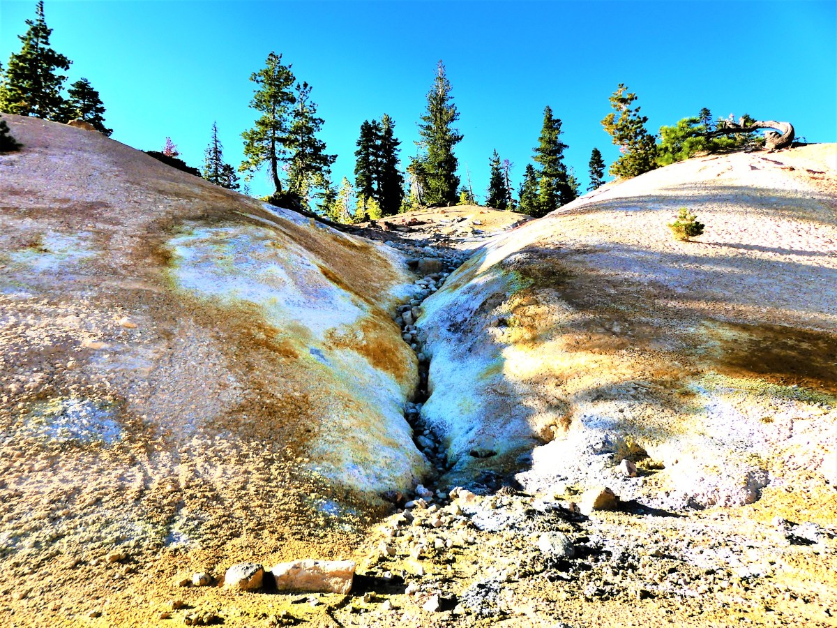
We found it odd to be crossing snow in the middle of August under a searing sun,
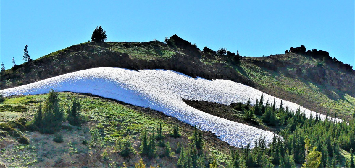
but the park receives snowfall averaging 40 feet per year at the higher elevations.
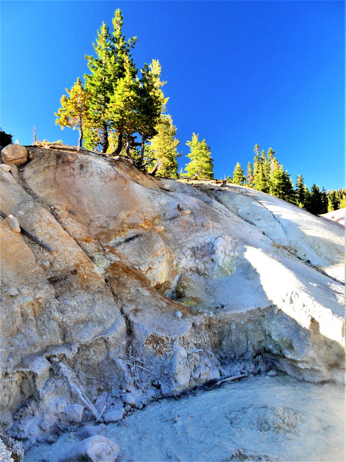
Once over the ridge, the sweet mountain air was replaced with the pungent scent of sulfur bleeding from a hellish valley of hydrothermal activity:

complete with requisite spurting mudpots,
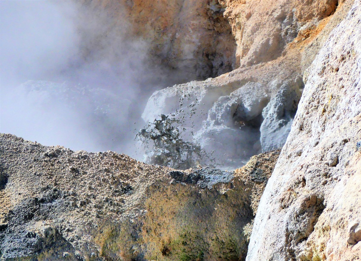
hissing fumaroles venting from angry rocks,
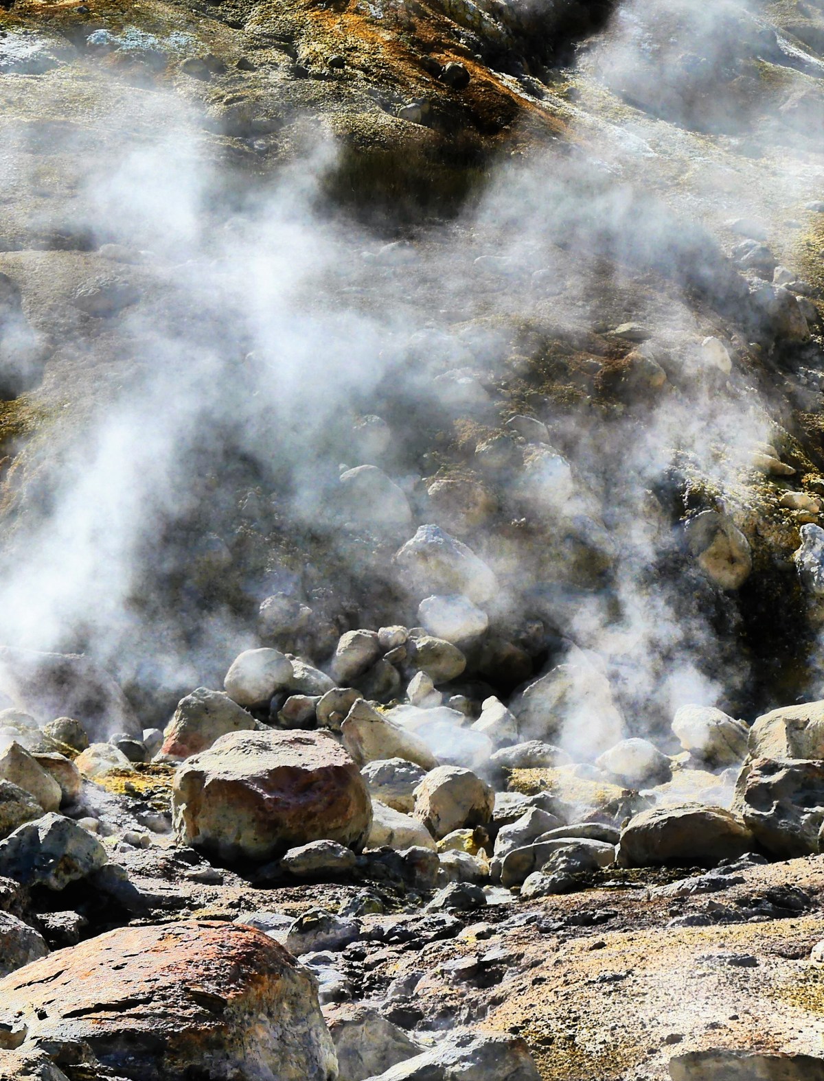
and brilliantly colored hot springs…


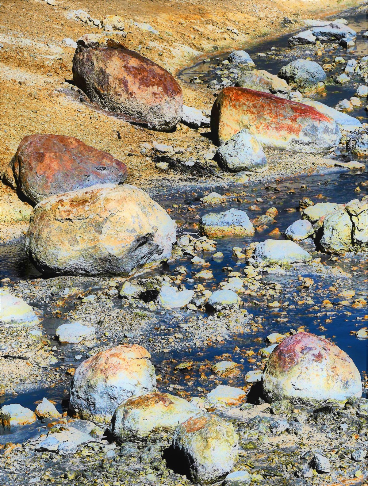

…collecting in a milky stream of hot minerals.

Absolutely gorgeous!
The road to the south entrance of the park took us past the defunct commercial Sulphur Works,

before we u-turned to catch the westerly light on the Chaos Crags,

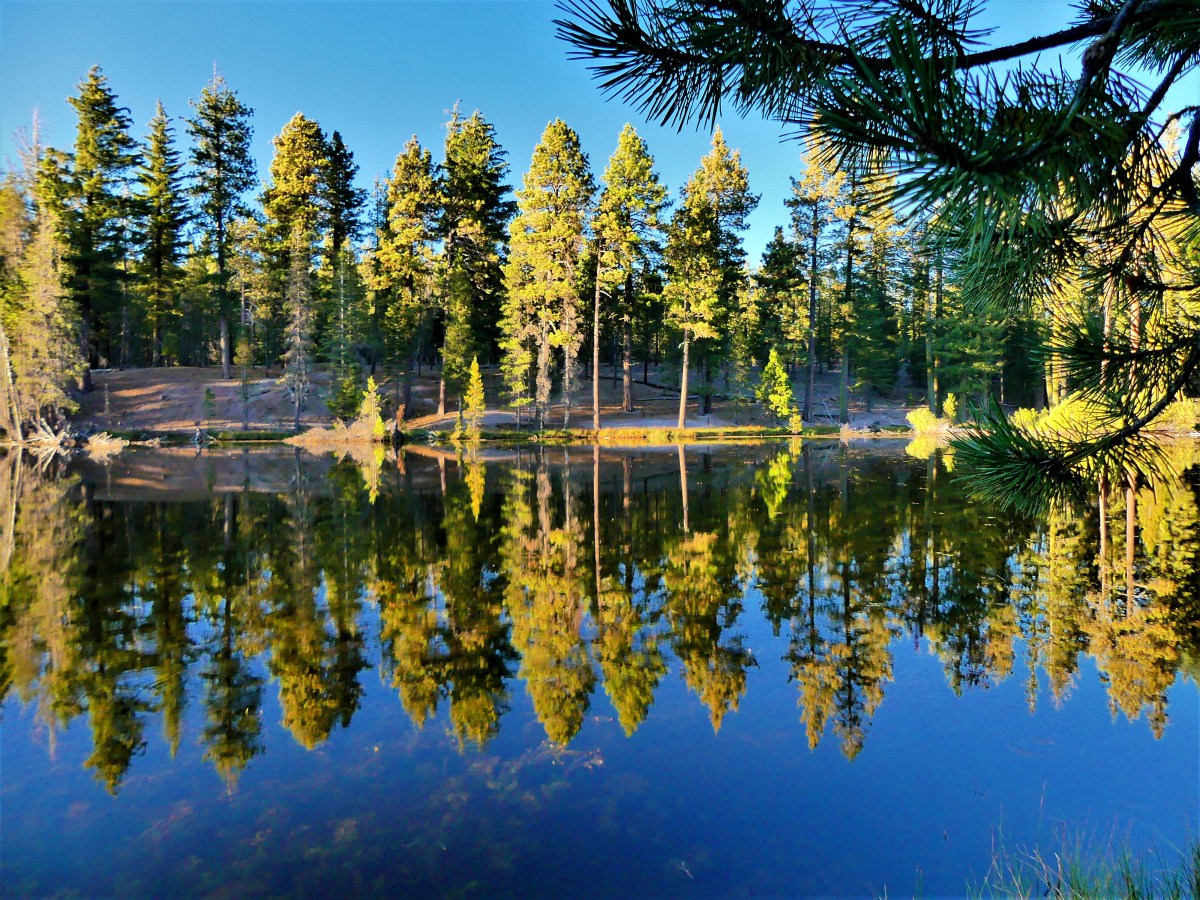
and fawned over the stillness of Reflection Lake.
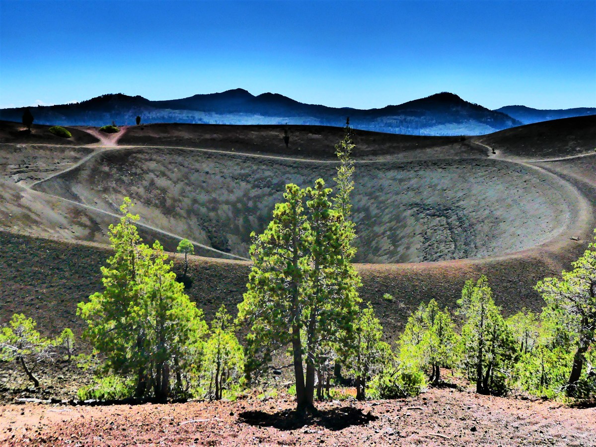
It would be hard to top this day, unless it was from atop the Cinder Cone, and that’s where we traveled the following day.
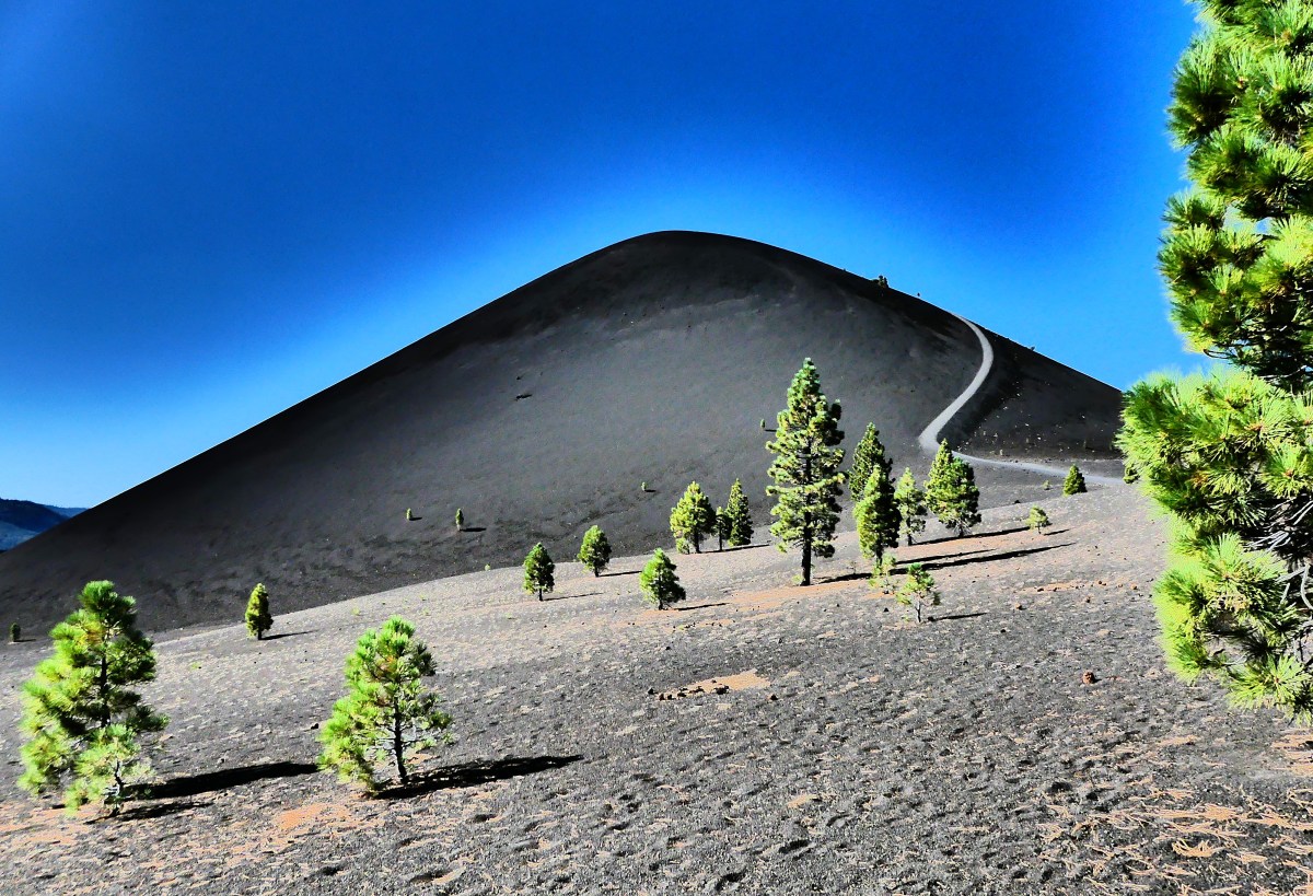
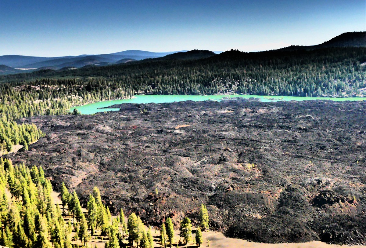
After a drive through dense forest and pastureland to the northeastern corner of the park, we turned onto a dusty hard-packed road terminating at Butte Lake, where a delta of trails branched out for a closer inspection of the Fantastic Lava Beds…
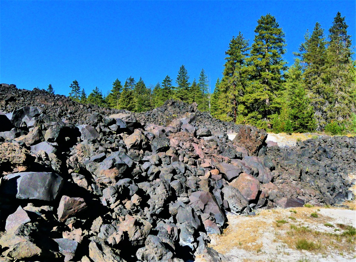
–a heap of sharp and shiny lava rocks rising to heights of 50 feet or more–forming an impenetrable barrier of blackness.

We trudged through shifting black sand bordered by groves of Ponderosa pines for nearly two miles, until we reached a clearing with a view of the cone.

“I don’t think I can make it,” Leah admitted. “It’s too steep for me, and it’s completely exposed, but you should go for it.”
The winding trail up the side of the cone was sloped at a 35% grade, the sharpest possible angle that cinders can stack before rolling downhill. It was going to be very challenging. The ascent over crushed cinders mixed with coarse sand was harder than I presumed. With every step, the gravel swallowed my boots to the ankle.

But I was undeterred. The power to continue came from the constant revelations brought by every foot gained along the way,

and the promise of something more spectacular by climbing even higher.
I could follow Leah–becoming increasingly smaller–as she took the detour around the cone, just as she was watching me shrink in size from the base of the volcano.
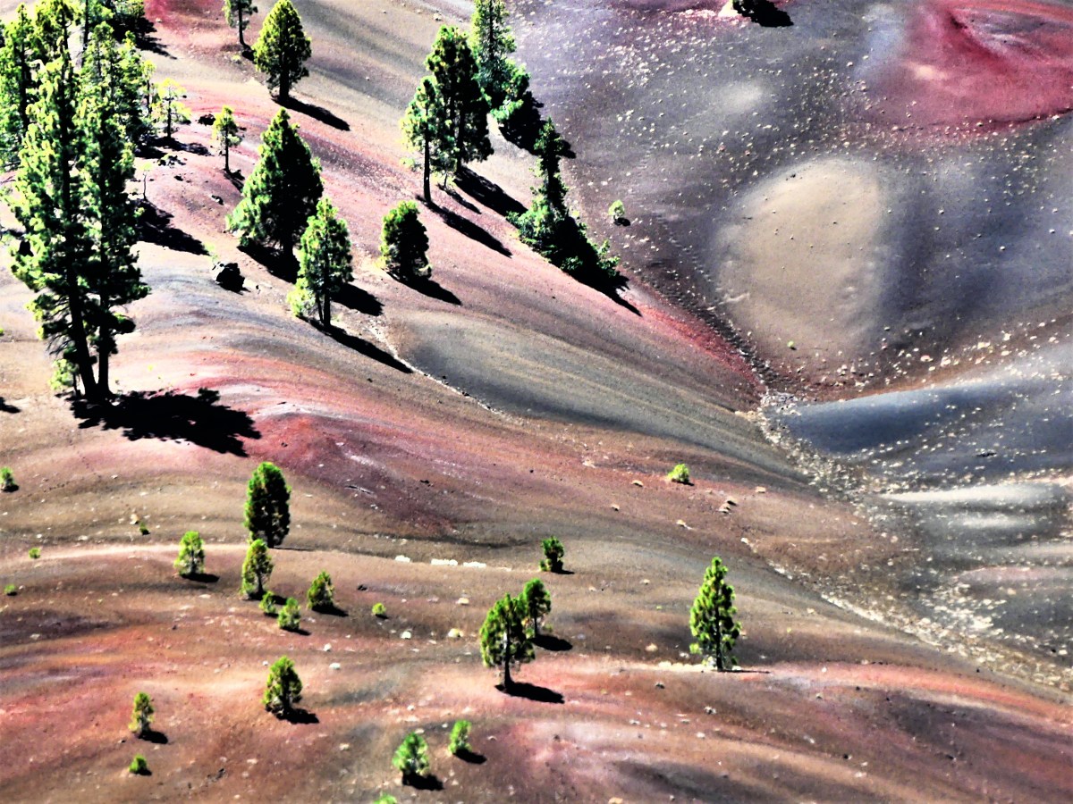
After scrambling most of the 750 feet to the trail’s vanishing point, a whirling wind confronted me from the blind side of the cone, stopping me in my tracks, but offering an amazing overview of the Painted Dunes and Lassen Peak in exchange.
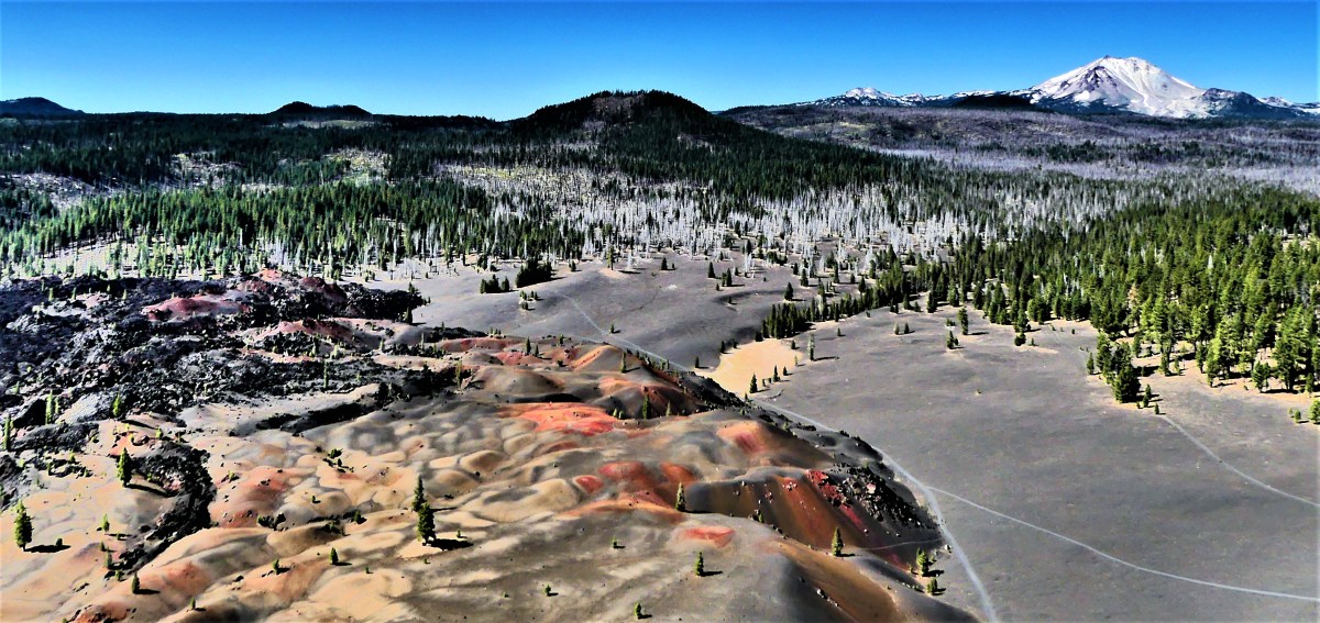
I imagined a walk through the dunes, taking time to examine the explosion of color, while wondering if camera sensors were sensitive enough to record such an array of wonder.

And then I reached the top of the cone!!

The wind at the top was relentless, but so was my need to circle the cone. Nothing was more exhilarating than having the cone to myself (although I would have willingly shared the summit with Leah had she been able). The magical feeling of surveying the terrain from all sides was awe-inspiring.
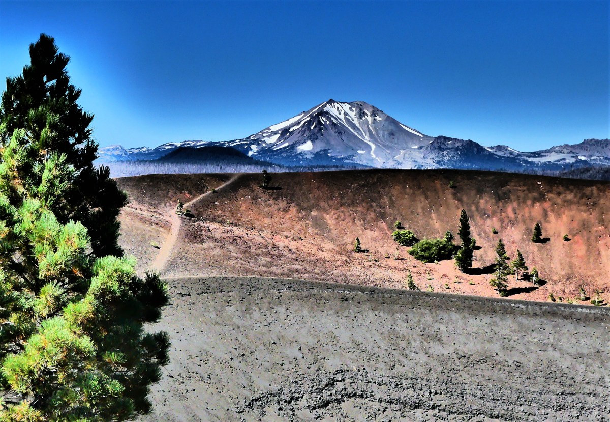
And then I discovered that the Painted Dunes continued on the other side of the volcano.


I really didn’t want to leave. But after exploring the area, the only thing left to do was to take the long trail down to share the experience with Leah, and yield the cone to a new arrival.


What a beautiful place and your photos are amazing!
LikeLiked by 1 person
Thanks. It’s well worth the visit.
LikeLike
These views are like science fiction! Awesome photos. Captivating writing, too! I’m so in love with our national parks ❤
LikeLiked by 1 person
Thanks for checking out the post. You’re welcome back at any time.
Truly, it’s like being on another planet.
LikeLiked by 1 person
These photos are breathtaking! Thank you for sharing!
LikeLiked by 1 person
Thanks, Kayla. I appreciate the visit.
LikeLiked by 1 person
Breathtaking!:)
LikeLiked by 1 person
Certainly took my breath away, slogging thru all that sand. Thanks for visiting.
LikeLiked by 1 person
Beautiful photos. Otherworldly….
LikeLiked by 1 person
Yep! Like another planet. Thanks, Leslie.
LikeLike