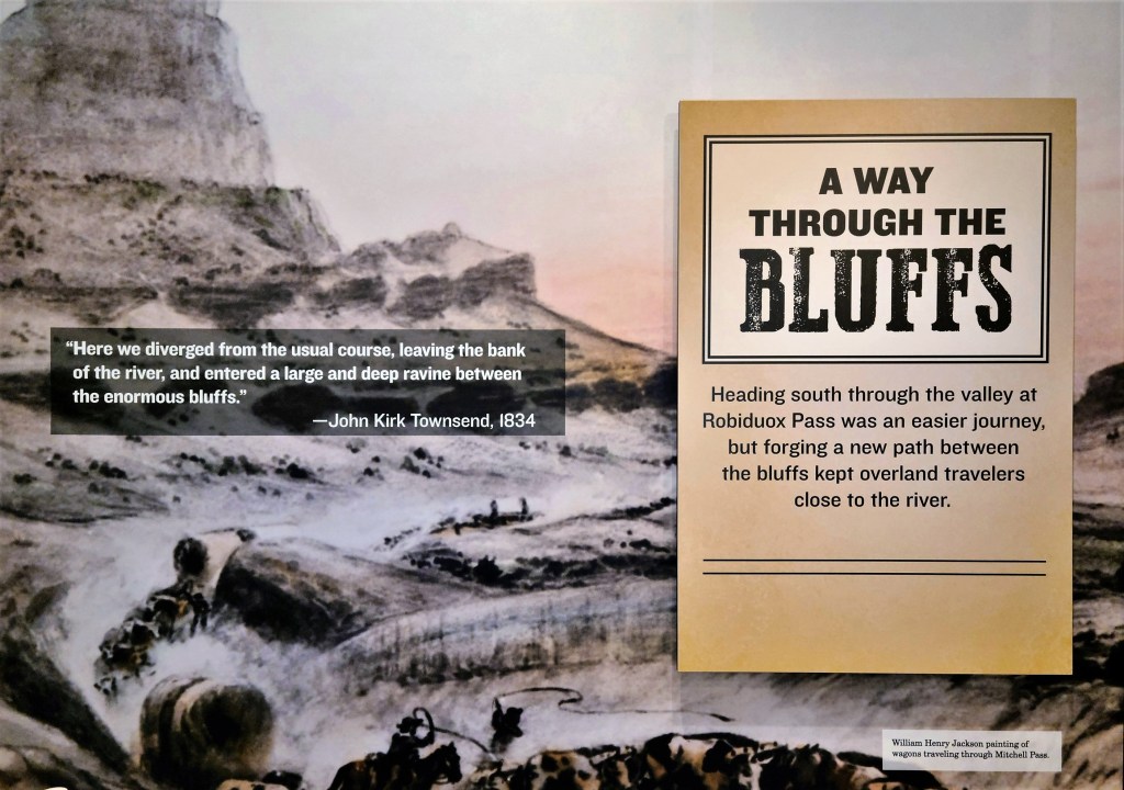
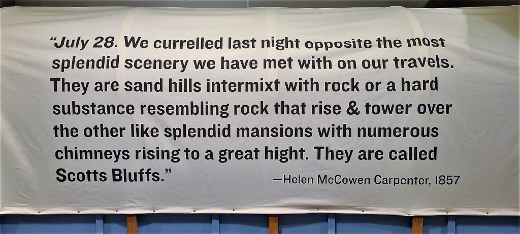
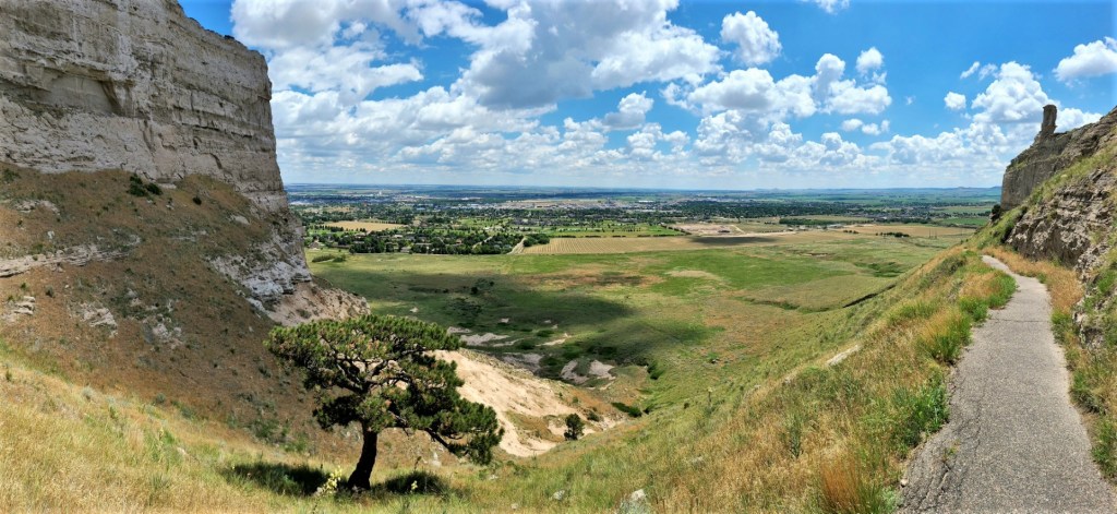
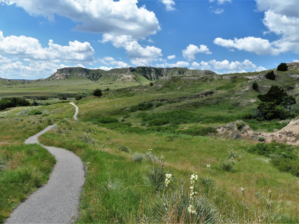
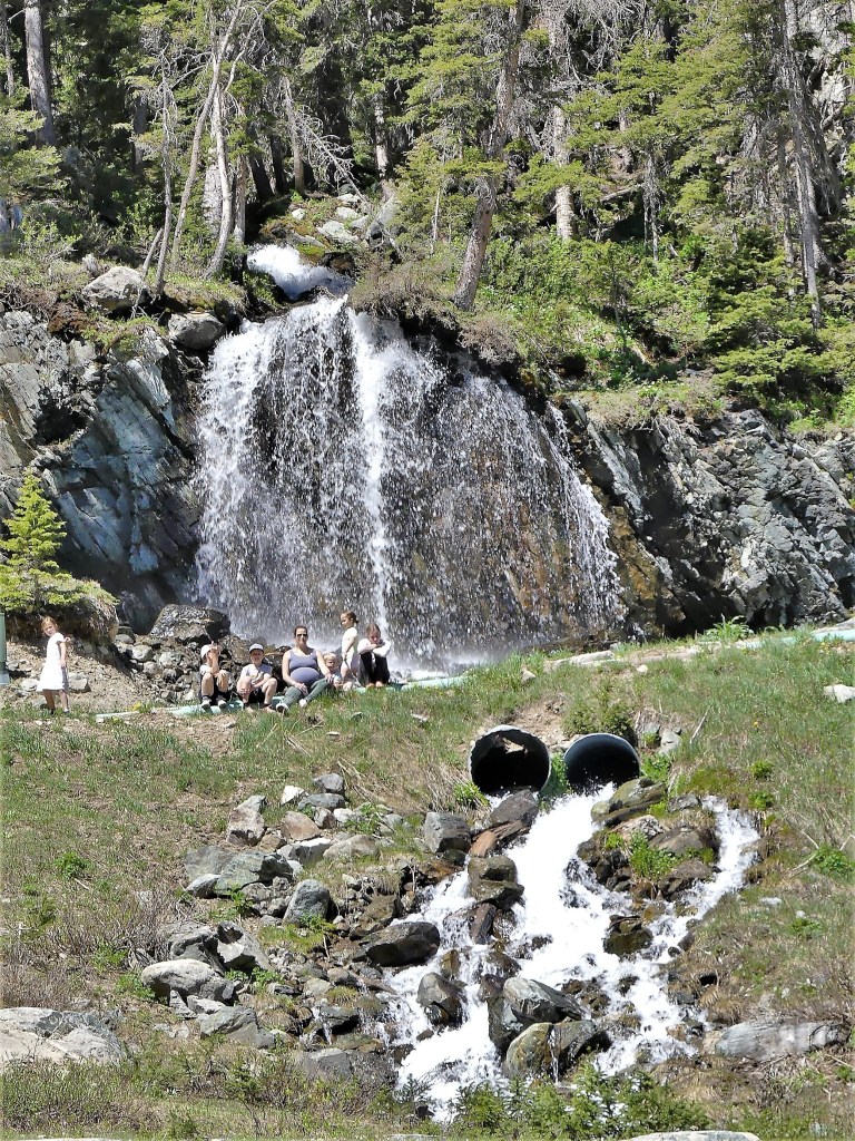
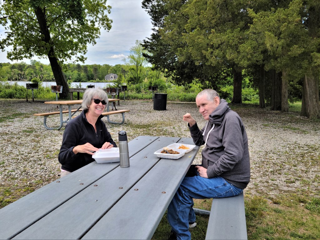
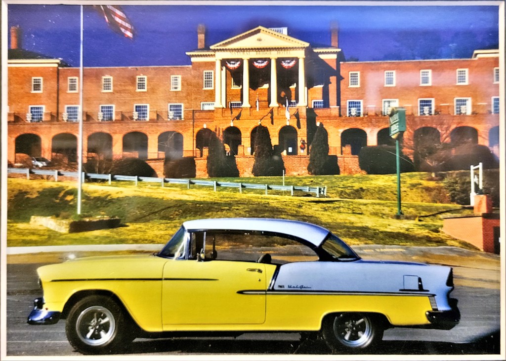
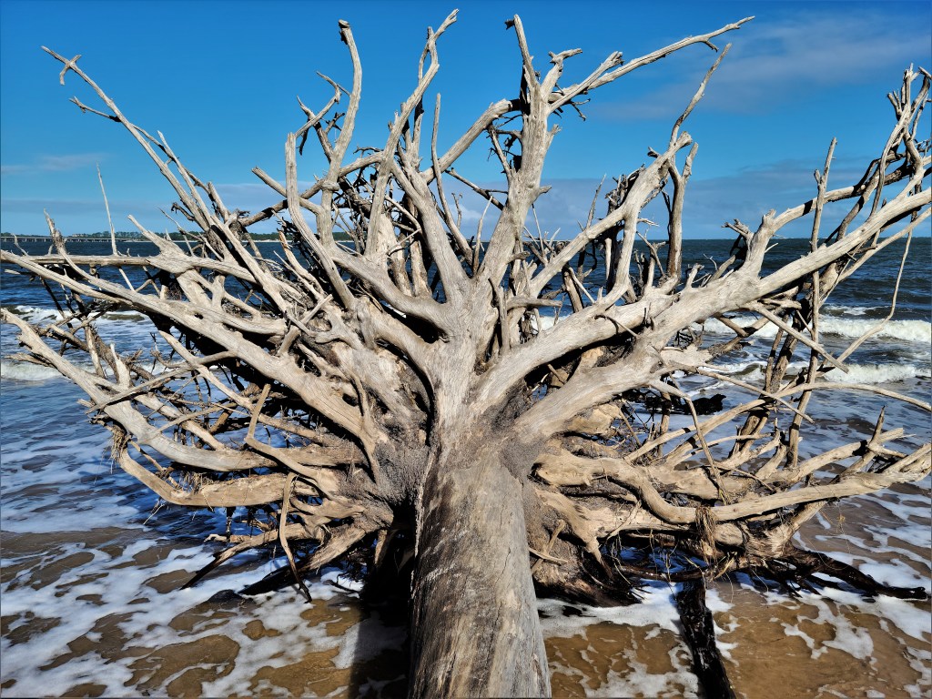
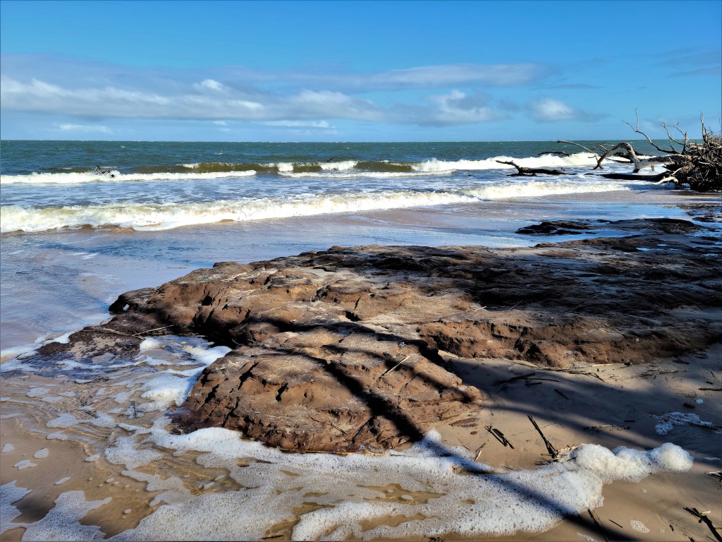
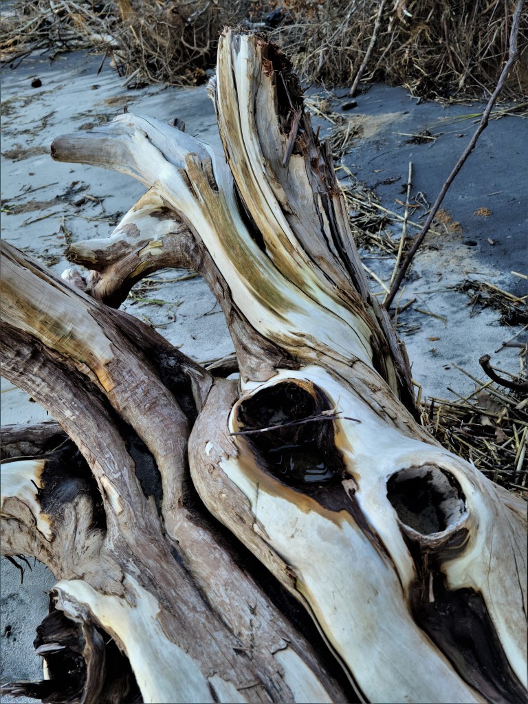
While spending time with friends in Cheyenne WY, Leah and I scheduled a side trip across the state line to visit Scotts Bluff in Gering, NE. Nebraska was not originally part of our travel plan, nor did we consider Nebraska when we set out to explore America four years ago, but we caved to public opinion and we are now happy to endorse Nebraska as a state with a meaningful attraction.
This Bluff is a Butte,
or this Butte is a Bluff?
It don't amount to a hill of beans.
A wide range of arrangements
are only future cliff-hangers
for cave-dwellers.
Making mountains out of molehills
or taking the high road,
We all plateau on the summit or the plain.
Monumental achievement
can only be measured at the
peak of a towering task.
Leah and I have been planning our current trip since January–looking at various routes, places of interest, and RV park availability. At times it seemed like a logistical nightmare–having to shift dates and locations to accommodate timing, anticipated weather and RV park amenities (service hook-ups).
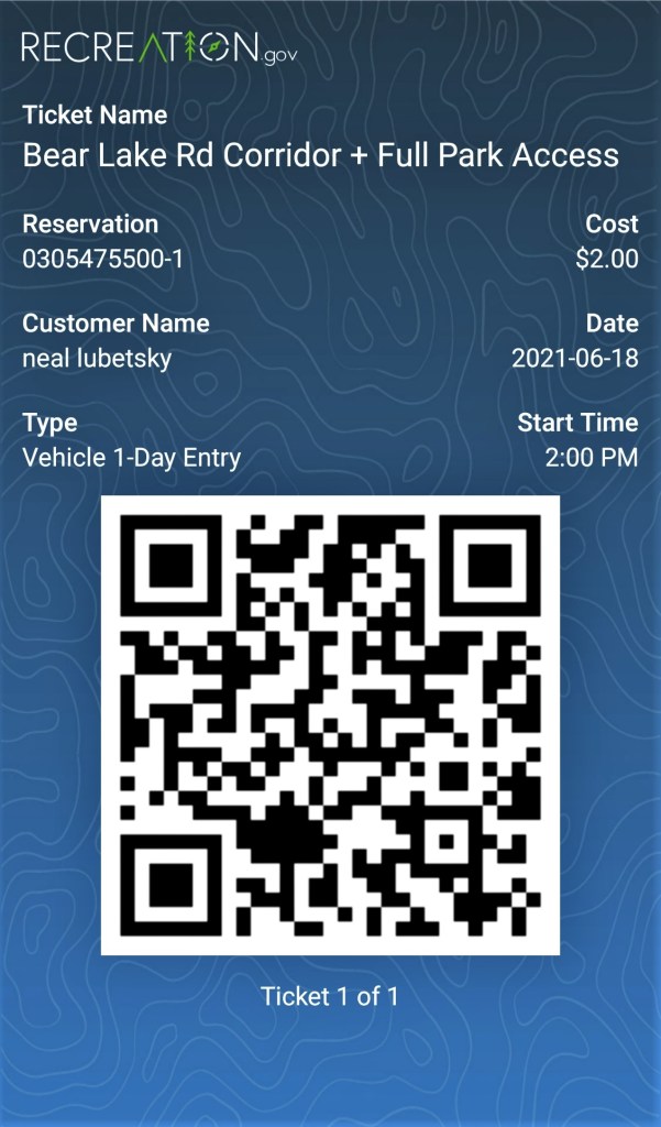
By April, most all of our mapped destinations (44 in all over 20 weeks) were booked. That’s about the same time the National Park Service (NPS) announced that two of our anticipated stops (Rocky Mountain and Glacier) now require timed-entry permits to be eligible to visit.
Because NPS is grappling with record attendance and overrun facilities at many locations, this additional measure is intended to relieve congestion at the park gates at best, and eliminate park closures due to limited parking and staffing woes.
At Rocky Mountain National Park, two reservation options were available for visitors between May 28 and October 11: Bear Lake Road Corridor plus full park access, which includes Wild Basin, Long’s Peak, Trail Ridge Road, and Fall River Area from 5:00 AM – 6:00 PM; and all park roads except Bear Lake Road Corridor, with a reservation period from 9:00 AM – 3:00 PM.
When the reservations window opened on May 1 at 8 AM (MDT), passes became available on a first-come basis—up to 60 days in advance–with approximately 25% of day passes held for guests planning to arrive within 2 days. I logged on torecreation.gov bright and early, and was eager to claim my permit, but apparently the rest of the world had the same idea.
When the online dust settled, I had my coveted entry pass, albeit with a 2:00 PM start time. While it wasn’t the most ideal situation–losing half the day–it was better than making the trip, only to be turned away. Yes, it’s happening.
On the day of our permit, Leah and I meandered through Estes Park for a few hours, breezing through art, jewelry, sporting goods, and general stores, where Leah found an eyeglass lanyard for a buck. We passed a dress-up cowboy spieling in front of Bob and Tony’s Pizza on Elkhorn Ave. and laughed it off, but we returned for some of the worst pizza we’ve ever tasted, although comparable to spreading Ketchup over a cardboard circle, which I did as a child.
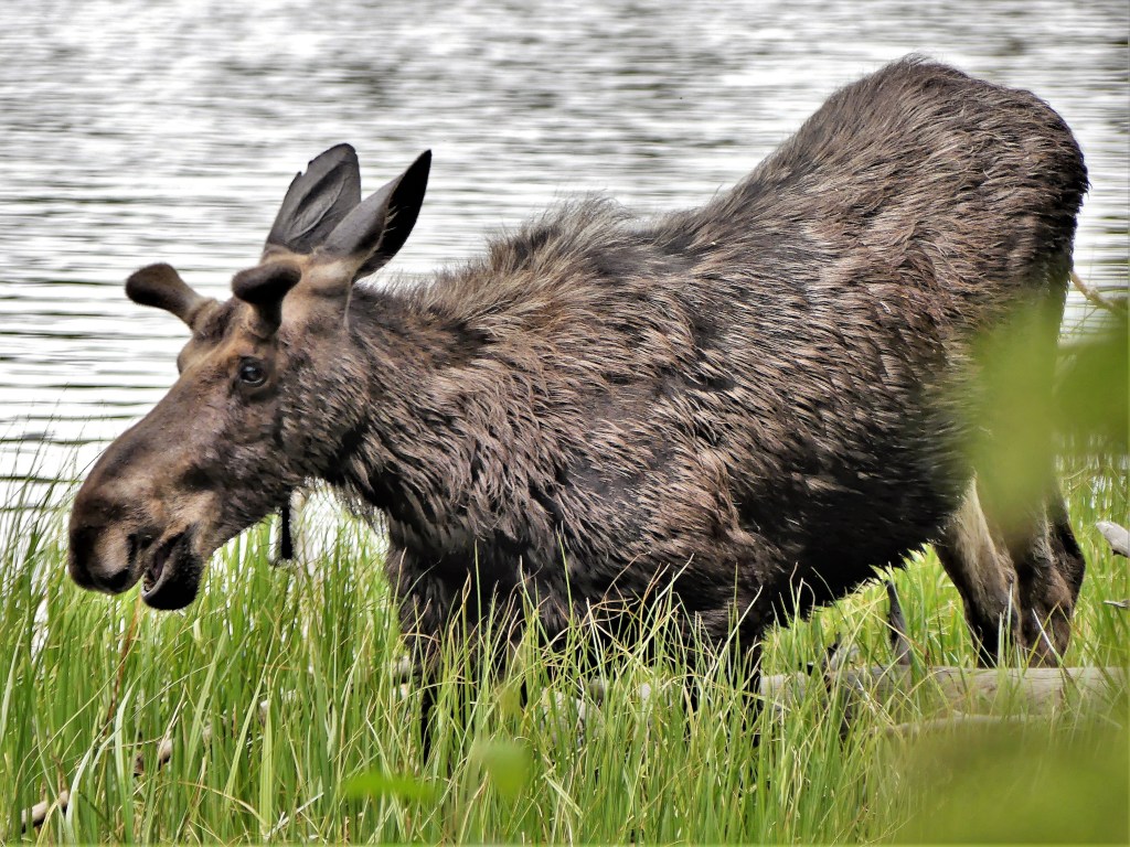
Once we passed through the Bear Lake ranger checkpoint, we stretched our legs with a walk around Sprague Lake, the site of a one-time mountain resort, and immediately, we were greeted by a curious teenager,
who looks as if he had a bad reaction from a slice of pizza from Bob and Tony’s…
and is returning to a healthier diet of tall grass.
Half way around Sprague Lake, we encountered his girlfriend romping through the water, courtesy of Leah’s iPhone…
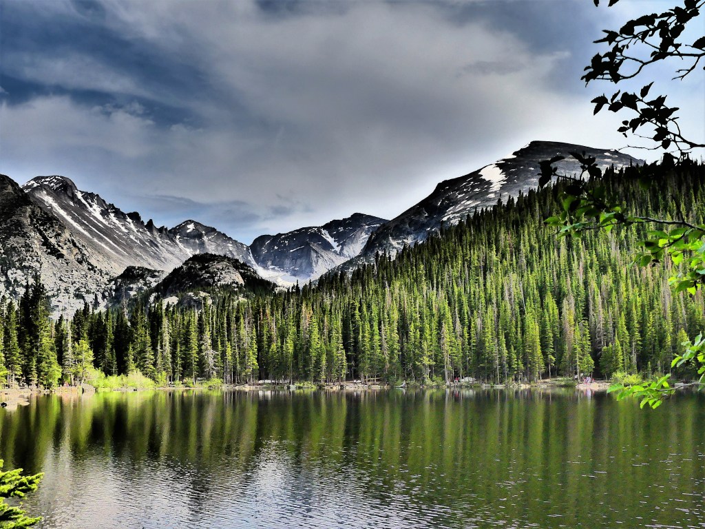
Completing the lake loop, we stood in awe at the doorstep of the Continental Divide and admired the view…but not for as long as I would have liked, since we only had a narrow window of time to explore our immense surroundings.
Naturally, being inside the Bear Lake Corridor gave us an opportunity to circle Bear Lake,
and its neighbor, Nymph Lake.
But running short on time, I abandoned my goal of hiking the rest of the trail to Emerald Lake,
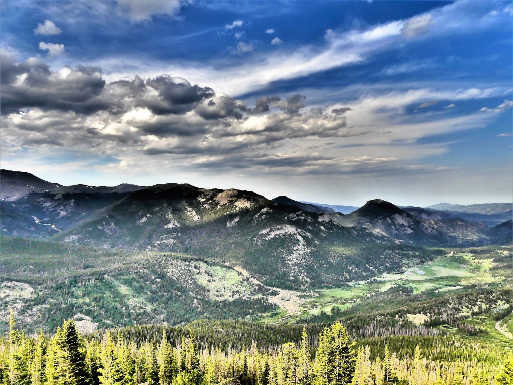
and opted for time in the higher elevations. Our drive took us through Moraine Park,
till we reached Horseshoe Park at the junction of Trail Ridge Road.
Once we rounded the bend from Hidden Valley…
it was one spectacular lookout…
after another…
and another…
and another…
until we reached the Gore Range, the highest elevation on the park road at 12,183 feet.
We drove as far as Medicine Bow Curve, when a herd of elk happened to wander across the tundra to graze, as if to remind us that we were approaching dinner-time. It was our cue to U-turn.
As we doubled back, our conversation turned to the timed-entry, reservation system. The time we were allotted was just a teaser, considering the 355 miles of hiking trails throughout the park.
While I would have preferred a whole day or two or three to satisfy my craving for mountains, I support more people having a chance to appreciate this country’s beauty without annoying crowds, and to capture a lasting memory…
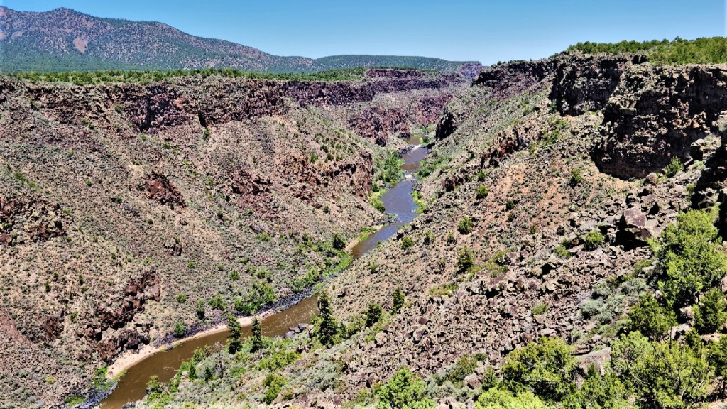
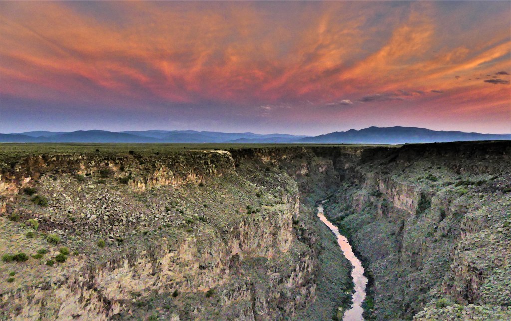
Just north of New Mexico, in the San Juan Range of the Colorado Rockies, Canby Mountain snowmelt and multiple mountain base streams join forces to form the Rio Grande. On its 1900-mile journey to the U.S. southern border, the Rio Grande passes through the Rio Grande Gorge near Taos, having carved out the 800 foot canyon over the past several million years.
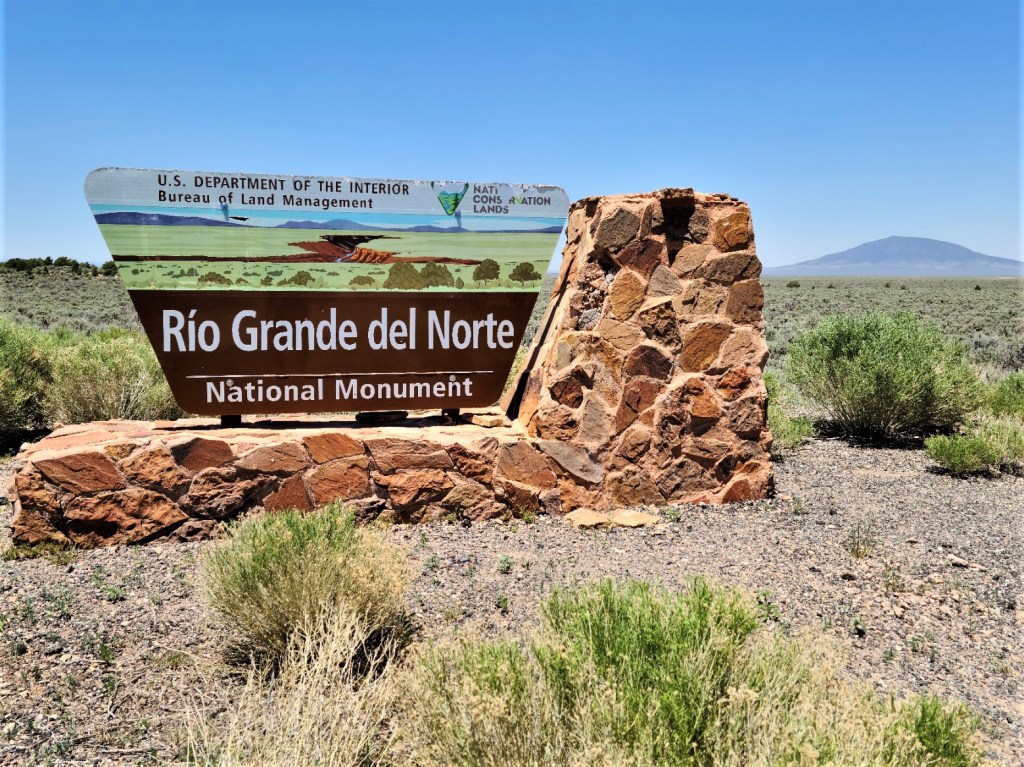
Beyond Questa, NM, a dirt road bordered by sagebrush scrub distinguishes the gateway to the National Park.
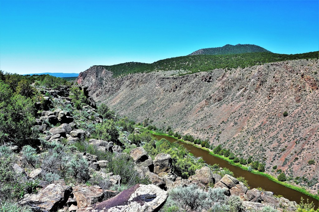
It’s high desert all the way, as the road winds through 10 miles of overlooks, campgrounds and trailheads…
until its terminus at La Junta Trail–currently closed for maintenance.
While hiking into the canyon wasn’t possible due to trail closure,
the overlook provided a closeup of native flora,
local fauna,
and a distant glimpse of the confluence of Red River and Rio Grande.
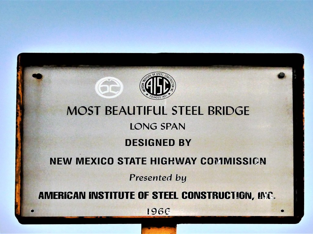
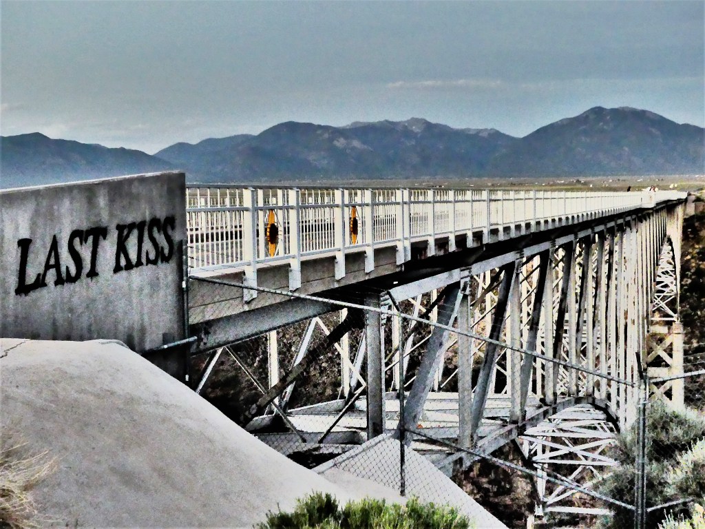
But like so many others, we were not settling for amazing…we were looking for spectacular. So we drove a few miles north of our campground on US-64, and waited patiently for sunset on the Rio Grande Gorge Bridge, an engineering masterpiece.
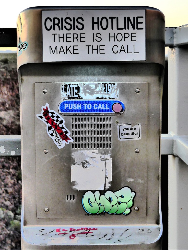
For the many who contemplate diving from the bridge,
there are strong warnings…yet sadly, two or three a year will never make the call.
With the sun fading, the sidewalks on the bridge begin to populate—
each of us patiently waiting for Mother Nature’s final curtain before we resume our sacred lives.
Our house in St. Augustine stands 11 feet above sea level. It may not seem like much, but it’s proven high enough to keep coastal flooding from our front door. But at what cost? Leah and I wondered if marinating at sea level throughout the pandemic may have also made the two of us soft.
While we routinely took beach walks, cycled marathon distances and paddled local creeks and lakes during a year-long quarantine, we had some doubts about whether we were fully prepared for our first alpine hiking challenge of the summer.
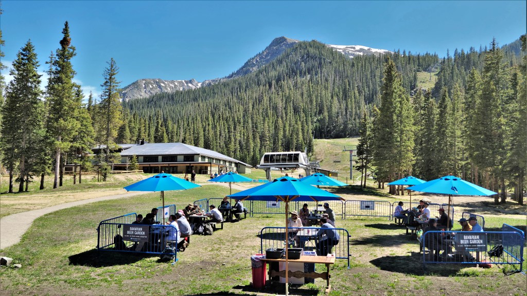
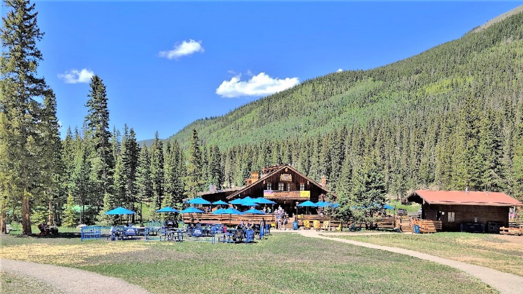
From Taos Ski Village, we drove up a winding dirt road past residences and restaurants to Kachina Village (elev. 10,350 ft.), and found overflow parking behind Bavarian Restaurant. We thought our arrival was timely, but there were so many other vehicles parked at 10 am that we wondered if we were late starting out.
It was a brief hike to the the trailhead,
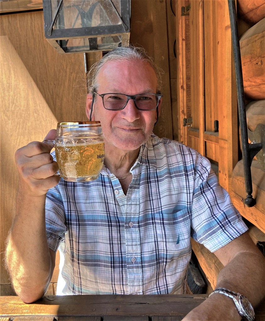
which we found just beyond the ski lift wheelhouse. I locked the scene in my mind for future reference. I believed this hike was clearly beer-credit worthy.
Already, a family had flocked to the snowmelt runoff to cool down from the heat.
Once we crossed the Bavarian bridge, we were on the trail.
It was a steady climb past rushing water…
until we reached the snowline, halfway through our trek.
We were mindful of taking plenty of breaks along the way to hydrate, catch our breaths, and snap some photos.
The second half of the hike was a bit steeper and more slippery, as snowmelt made the trail slushy and unavoidably muddy in places.
But we were almost there…
Finally, after climbing 700 feet over the course of 2 miles, we made it to our destination: Williams Lake (elev. 11,040 ft.)
“Any interest in hiking the rest of the way to Wheeler Peak?” I teased. “It’s only another 2 miles to the summit from here.”
“Not a chance!” Leah asserted. “Besides, it’s time for lunch and time to enjoy the view.”
We didn’t spot much wildlife at the lake–just a variety of unidentified birds and a hungry chipmunk who stole a Lance cracker when I was looking the other way.
A hiker told us of a hidden pond behind the lake, which piqued my interest, but it required a fair amount of rock scrambling to get there.
“Not for me,” sighed Leah, “but I think you should do it.”
That’s the only invitation I needed. Once outside the rock debris zone, I traipsed through knee deep snow, until I rounded the bend…
for a view of a crystal clear and frigid pond fed by distant peaks of the Sangre de Cristo. It was breathtaking, but this time it was not elevation-related.
Surprisingly, there were many hikers on their way up the mountain, as we were on our way out. When we emerged from the forest, I was hot and thirsty,
Leah and I were en route from Albuquerque to Taos when I noticed an early road sign for Bandelier National Monument. As we got closer to our destination and signs for Bandelier became more frequent, I proposed that we make it a stop–not for overnighting, but a daytrip to break up the travel monotony–considering it wasn’t more than an hour out of our way.
While there wasn’t hardcore support for the idea, there wasn’t serious objection either, which meant I still had a chance to sell the idea.
“I think it’s been 46 years since I was there–probably some side-trip while visiting Santa Fe during my first cross-country honeymoon trip,” I started.
“I think I was there sooner than that,” Leah commented, “like in the past 10 years.”
“Really? It couldn’t have been with me,” I asserted. “Do you not have an interest in going?”
“I don’t know,” she maintained. “I mean, is there anything there that we haven’t seen before?
I thought, “Are you kidding me?! Would you pass up Niagara Falls because you saw Victoria Falls?”
I said, “It’s the site of an ancient pueblo village. It’s similar to Mesa Verde, and I think you may be mistaking one for the other, because we last visited Mesa Verde when we flew to Santa Fe for Carrie’s wedding 12 years ago.”
“What do you propose we do with the Airstream, ’cause we certainly can’t pull it around the canyon,” Leah asked and answered.
“We can work that out when we get there,” I proposed.
Sometime that answer gets me in trouble…but not this day!
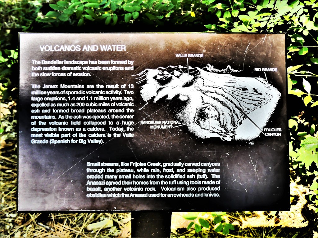
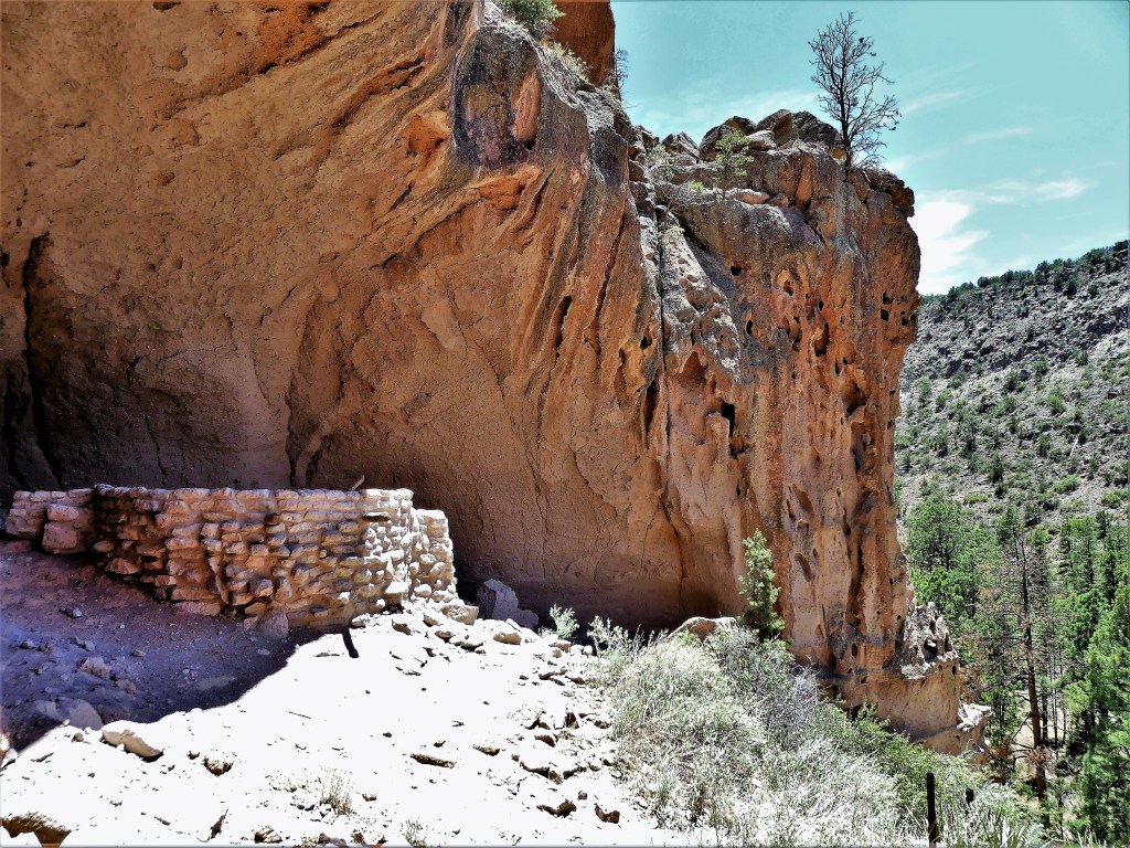
We first passed through Los Alamos (with maybe more nuclear physicists per square mile than anywhere else on earth), and climbed a ridgeline of the Jemez Mountains,
overlooking the Frijoles Canyon.
“Any of this look familiar,” I teased.
We followed a serpentine road that wound around the mountain, carrying us deeper into the canyon. A park ranger stopped us at the park entrance station.
“Sorry folks, but your trailer–nice as it is–doesn’t fit on our mountain roads. To get to our Visitor Center and trails, you’re gonna have to drive to the Juniper Campground parking lot and unhitch there,” he advised.
“Sounds reasonable,” I confirmed.
“You’re prepared to do all this work just to drive the park?” Leah asked.
“You’ll see. It’ll be worth it!” I said.
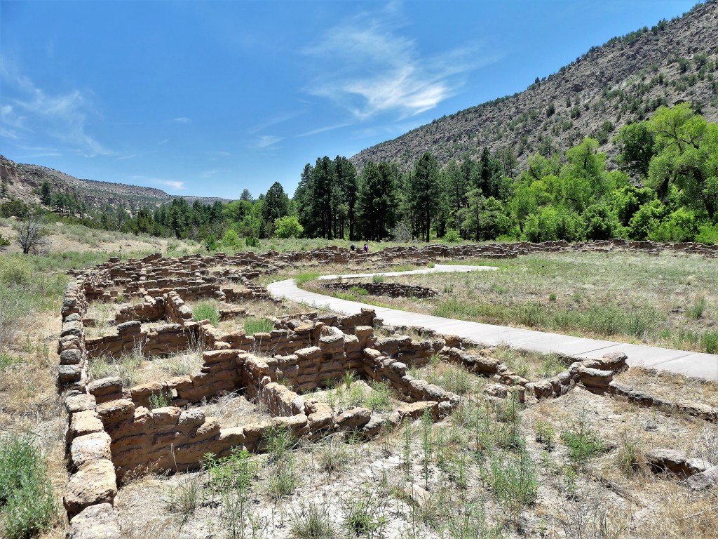
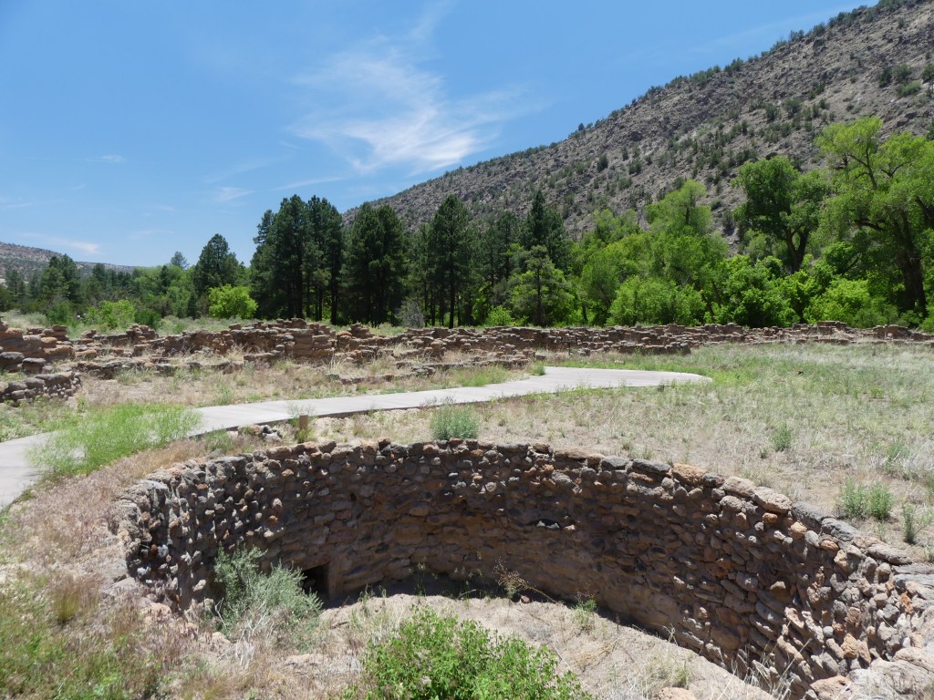
We walked the Pueblo Loop Trail, passing Big Kiva (a ceremonial underground chamber)…
and the 700-year ruins of Tyuonyi (QU-weh-nee) village—
originally a 3-story ring of sandstone rock debris exceeding 400 rooms.
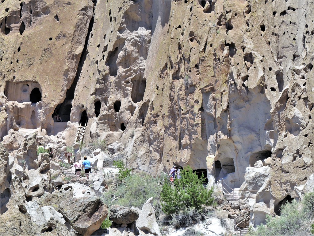
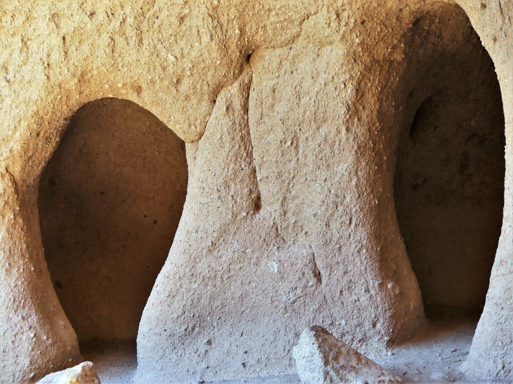
From a distance we saw several families poking through the cavates, chipped out of porous rock.
We soldiered on, beyond the remnants of the Long House…
lined with protected petroglyphs,
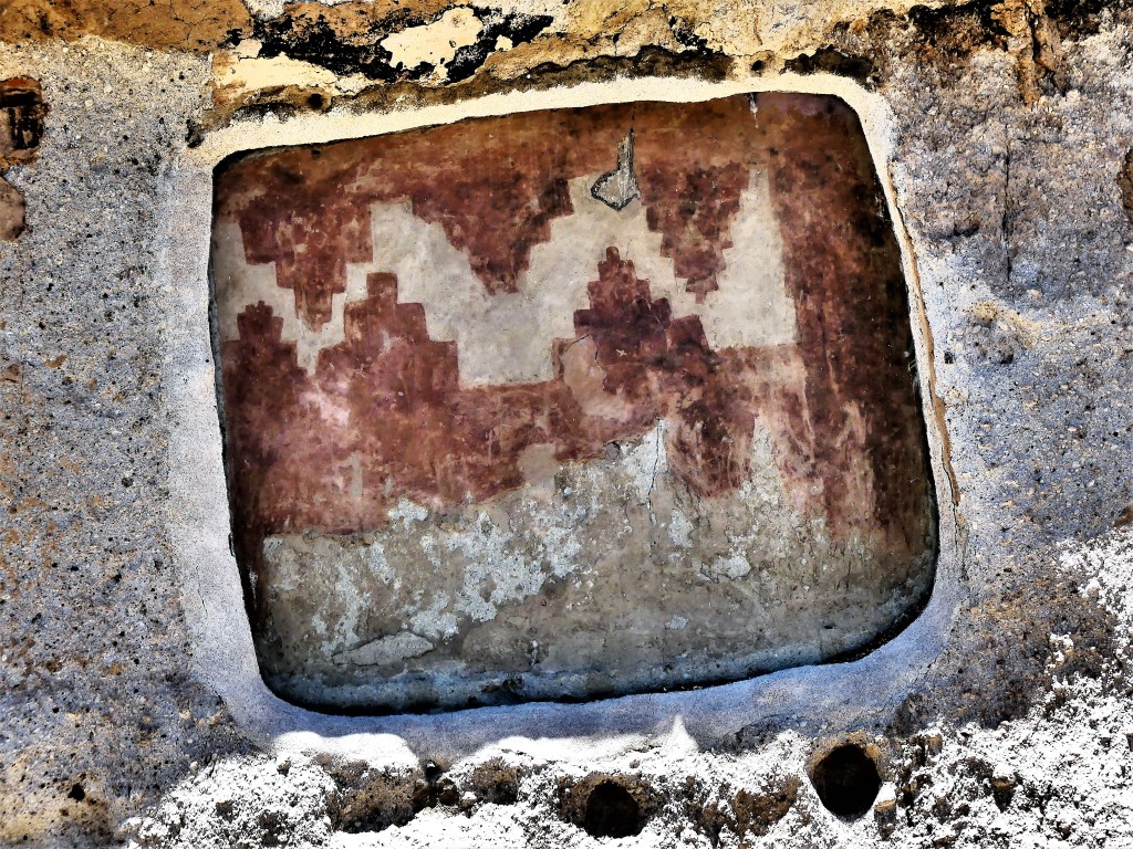
and imagined what it once looked like…
when all that remains are chiseled-out rooms,
once hidden behind adobe walls.
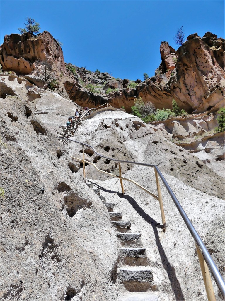
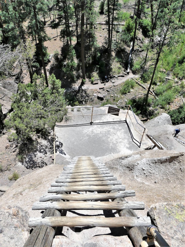
We took the trail extension in anticipation of climbing to the Alcove House…
but Leah chose to sit this one out.
The climb was steep and narrow, and the ladder rungs were on fire from baking in the sun all day.
While Leah enjoyed the shade beside Frijoles Creek, I had an aerie to myself with a nestled kiva,
and sculpted rooms for meditation.
Which may have prompted me to say a prayer or two before my looong climb down.
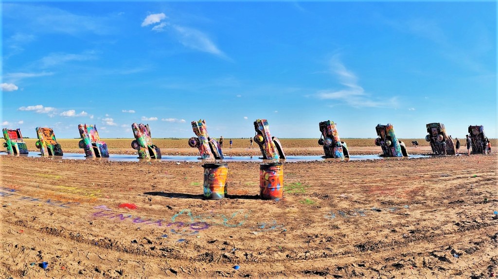
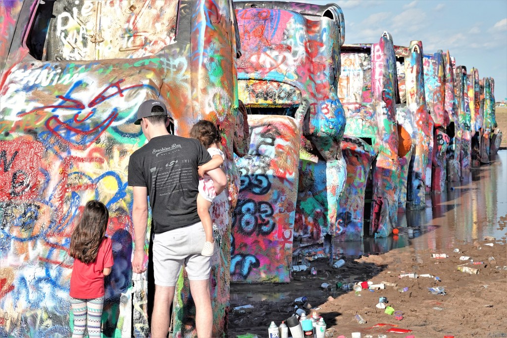
Few places on earth are more perfect for burying 10 aging Cadillacs nose first, than a hay field along I-40 East, just beyond the Amarillo, TX border.
Commissioned by Amarillo eccentric and millionaire, Stanley Marsh in 1974, Cadillac Ranch was the brainchild of Ant Farm, a San Francisco collective of architects whose counter-cultural take on consumerism inspired a Route 66 installation that’s still attracting tourists and future graffiti artists.
It was a carnival atmosphere when Leah and I arrived one late afternoon. Food trucks and vendors selling spray paint were parked inside the farm gates tending to families who had come to showcase their tagging talents…
albeit temporarily, since it never lasts for more than a moment when others are there for the same purpose.
Over time, the paint build-up has transformed the Cadillac shells into grotesque casualties of Rust-oleum polymers,
leaving behind a graveyard of cans…
atop freshly, blazed signatures.
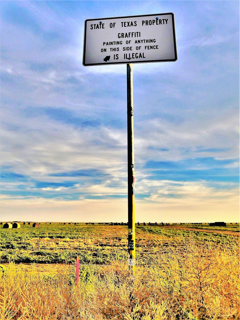
Fortunately, there are advisory signs directing people to act responsibly.
But signs are just a distraction from the real business at hand,
which is group participation in a colorful experiment of American culture and capitalism.
Humans have been taking baths for millennia. The practice of releasing toxins in hot springs dates back tens of thousands of years to the Neolithic Age, when nomadic tribes would soak in thermal waters they accidentally discovered when seeking relief from winter weather.
And there is archeological evidence from the 1900’s from Pakistan, where the earliest public bathhouses were discovered in the Indus River Valley around 2500 BC.
In, fact, every known culture around the world has demonstrated a special bathing ritual with roots in therapeutic cleansing of body, mind and soul.
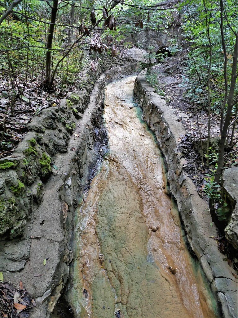
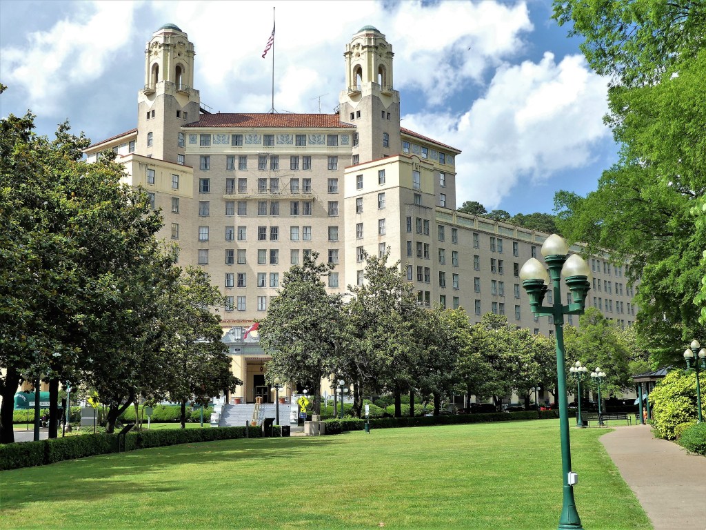
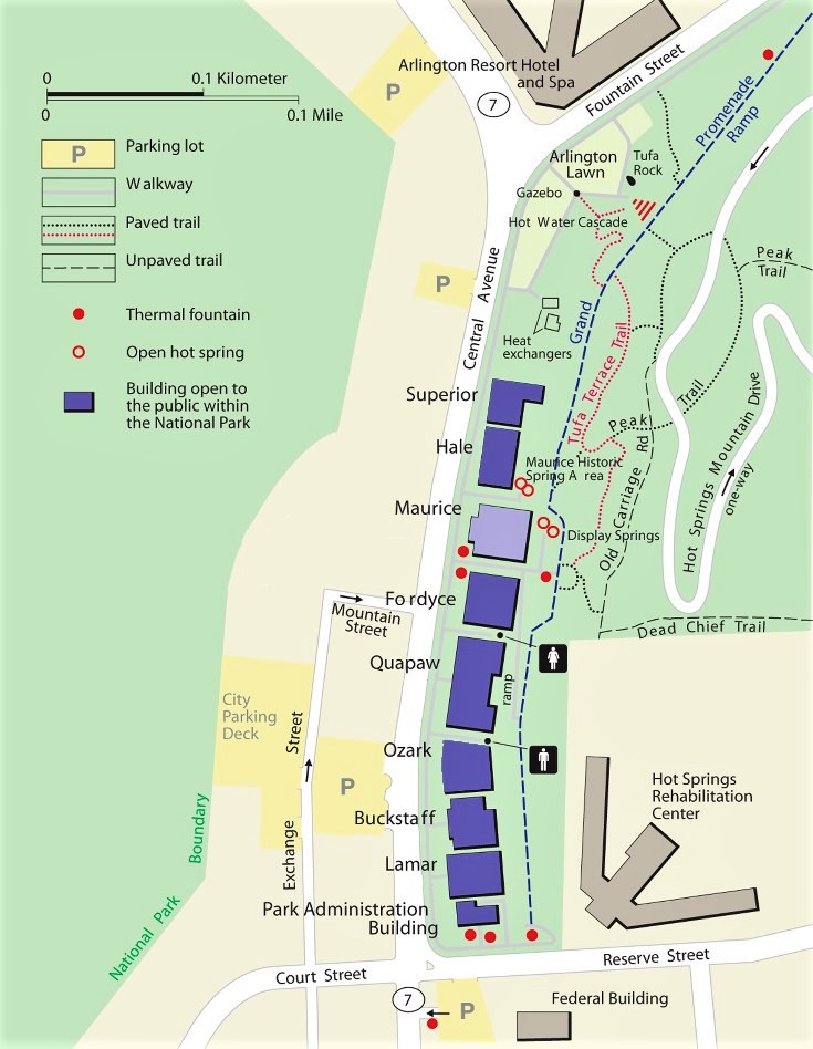
No doubt, Native Americans enjoyed the 147o F waters that flowed from the lower western slope of Hot Springs Mountain in Arkansas. This area was first occupied by the Caddo, and later the Quapaw, who eventually ceded this territory to the U.S. government in an 1818 treaty.
70 years before the National Park Service was established by Teddy Roosevelt, Andrew Jackson declared Hot Springs the first federal reservation in 1832, intending to protect this natural resource.
Scientists ran measurements and evaluated the springs’ mineral properties and flow rate. In journaling their finding, they numbered the springs and rated them according to temperature.
Immediately after, bathhouses began springing up around town to indulge the many guests who would travel to Hot Springs to avail themselves of the water’s restorative powers.
But trouble was brewing closer to the mountain. Ral City emerged as a community of indigents who had no use for fancy bathhouses, and subsequently dug pools beside the springs so they might enjoy the thermal water.
But not before the government put a stop to that and instituted policy that “preserved” and regulated the springs. Fearing contamination, the reservation superintendent ordered the pools filled in, and the transients relocated to a distant spring to appease the bathhouse owners in town.
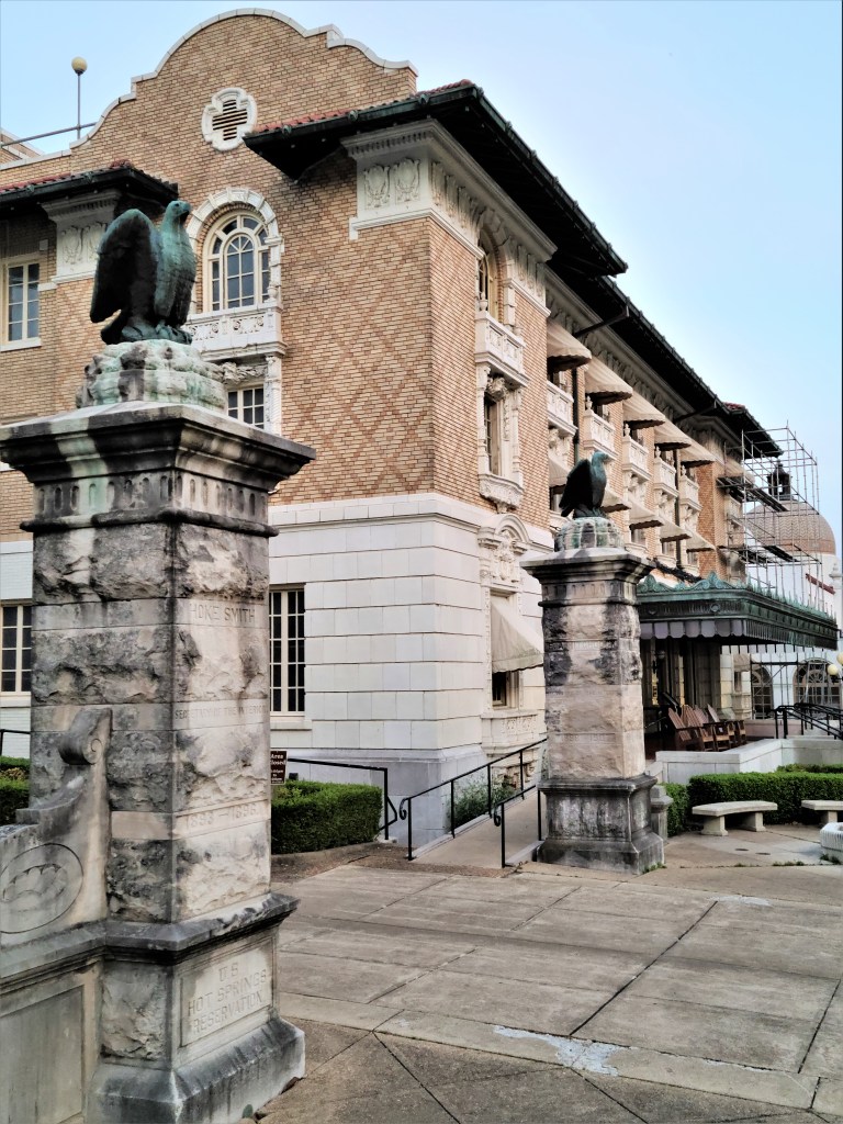
Enterprising businessmen like railroad magnate, Samuel Fordyce saw potential in Hot Springs, and invested heavily in the town’s infrastructure. He financed construction of the Arlington Hotel in 1875–the first luxury hotel in the area…
and vacation residence to every known celebrity, movie star and gangster of the era.
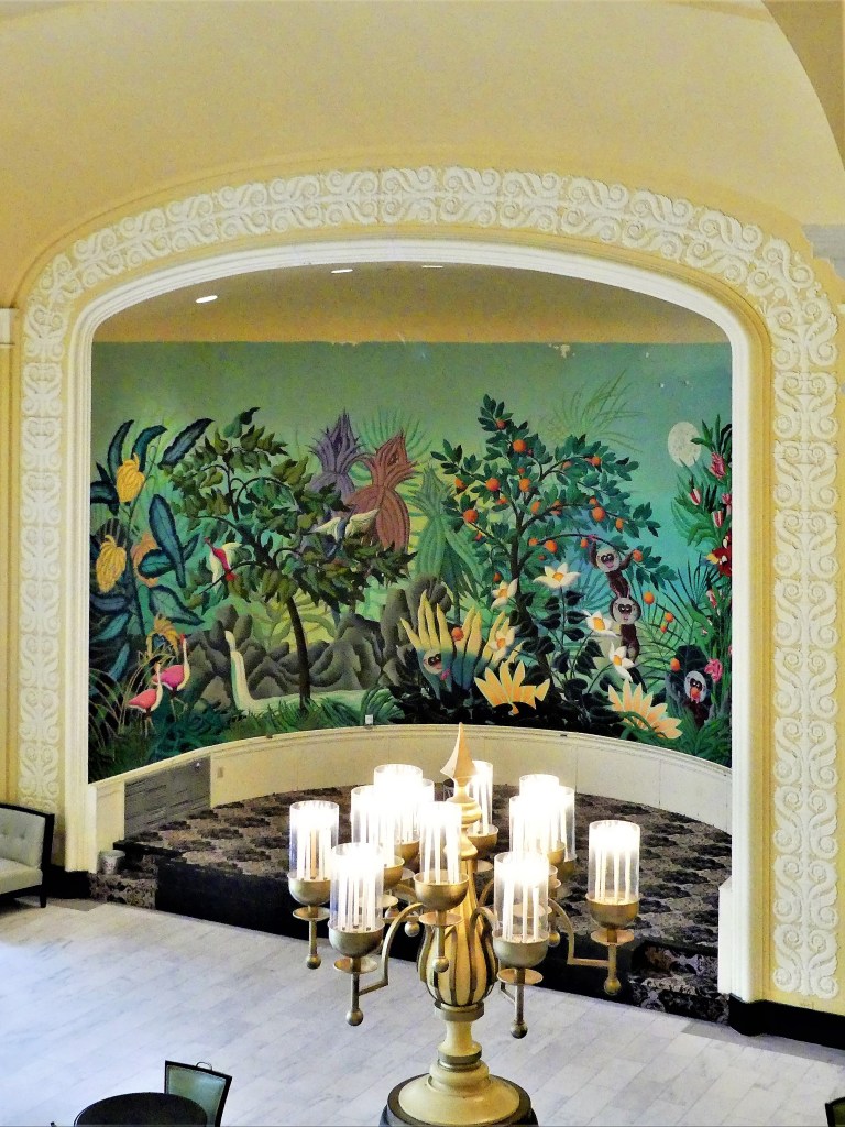
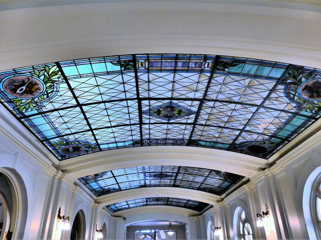
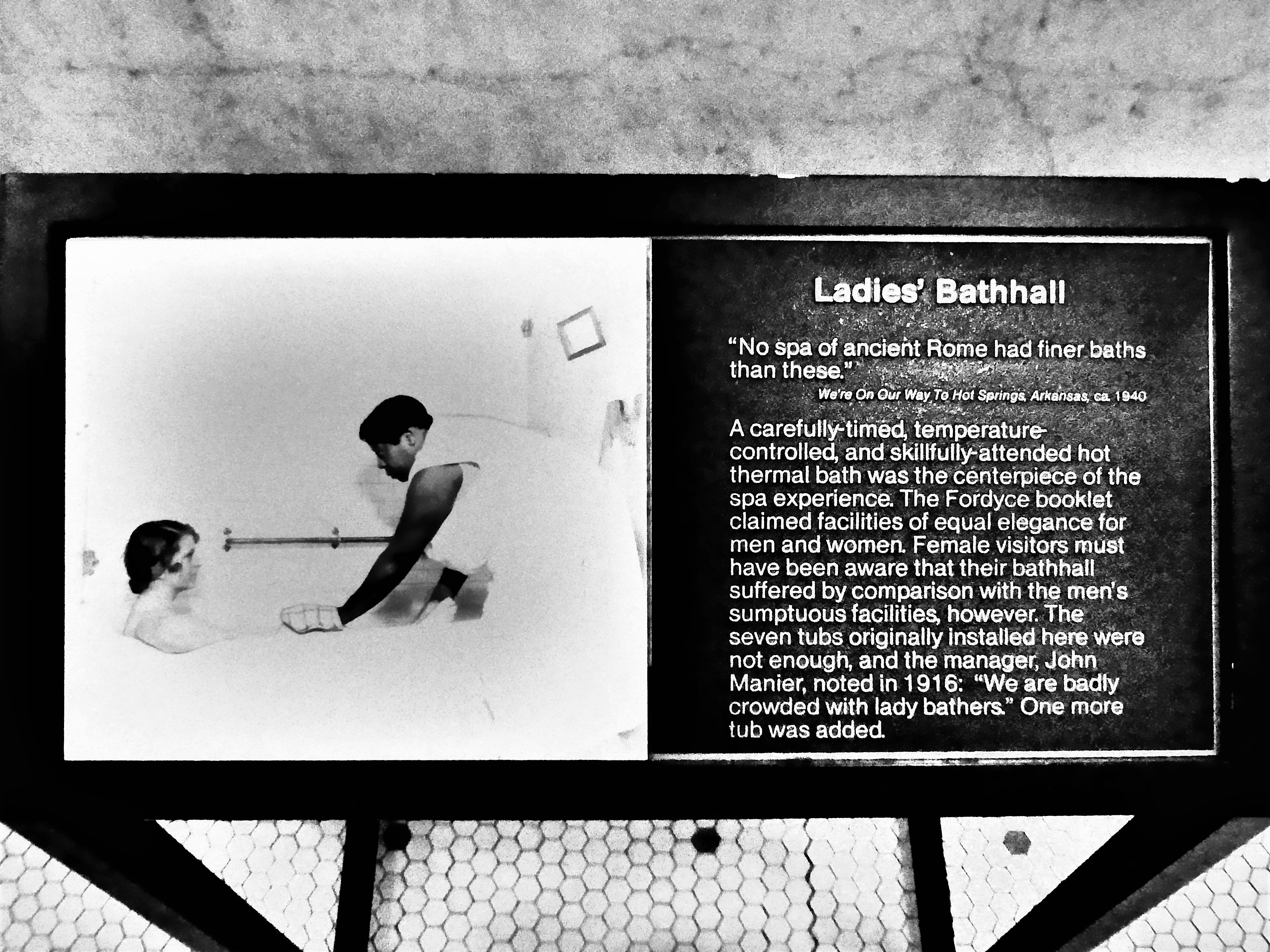
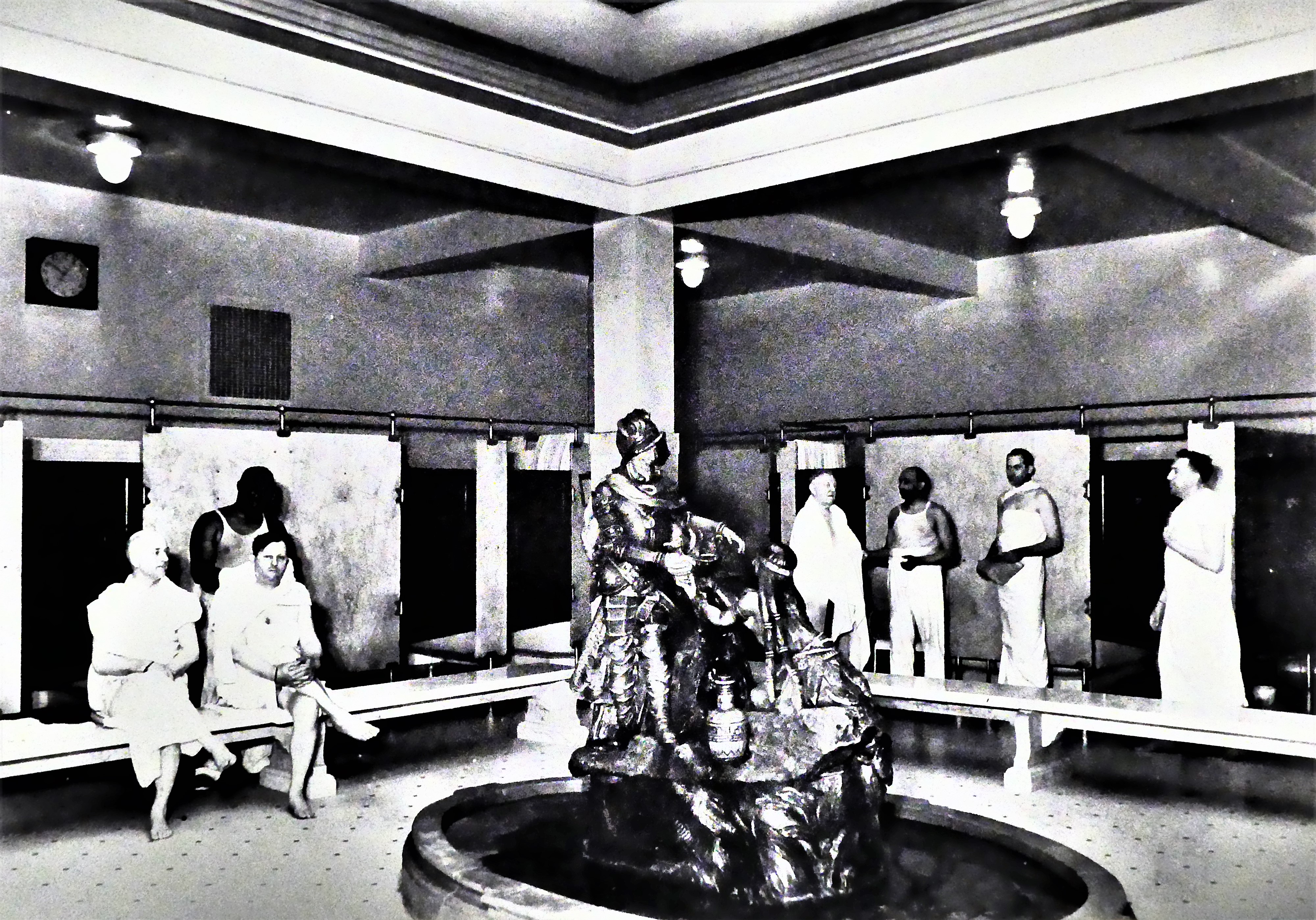
Fordyce also imagined an international spa resort that could rival Europe’s finest, and opened the opulent Fordyce Bathhouse in 1915.
The National Park Visitor Center now occupies this bathhouse–which has been painstakingly restored to reflect the gilded age of health spas, and how turn-of the-century America tapped into Hot Springs’ healing waters to bathe in luxury and style.
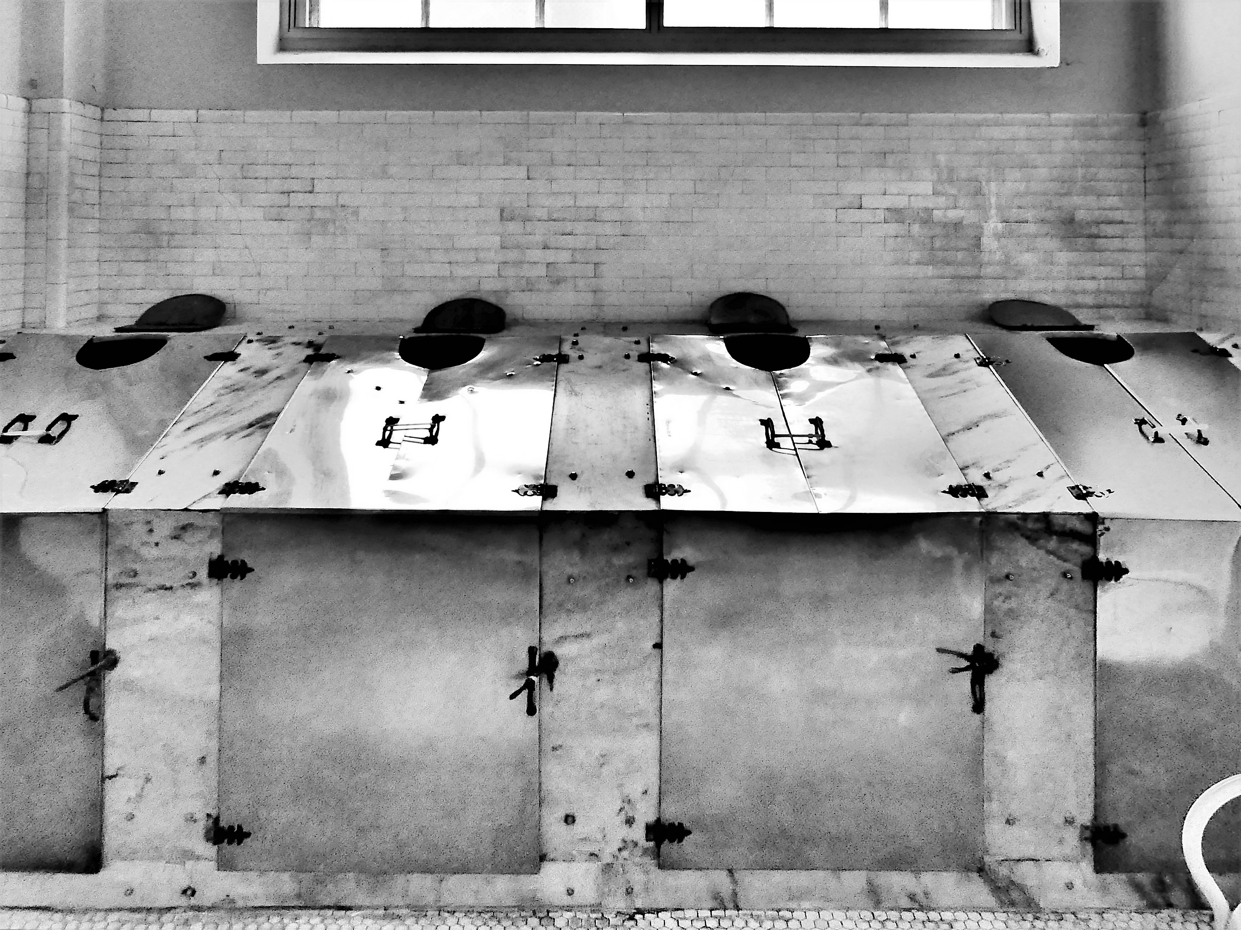
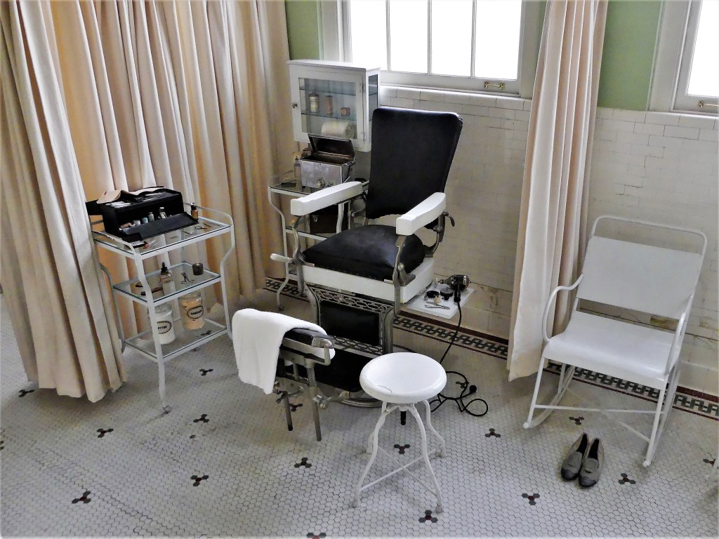
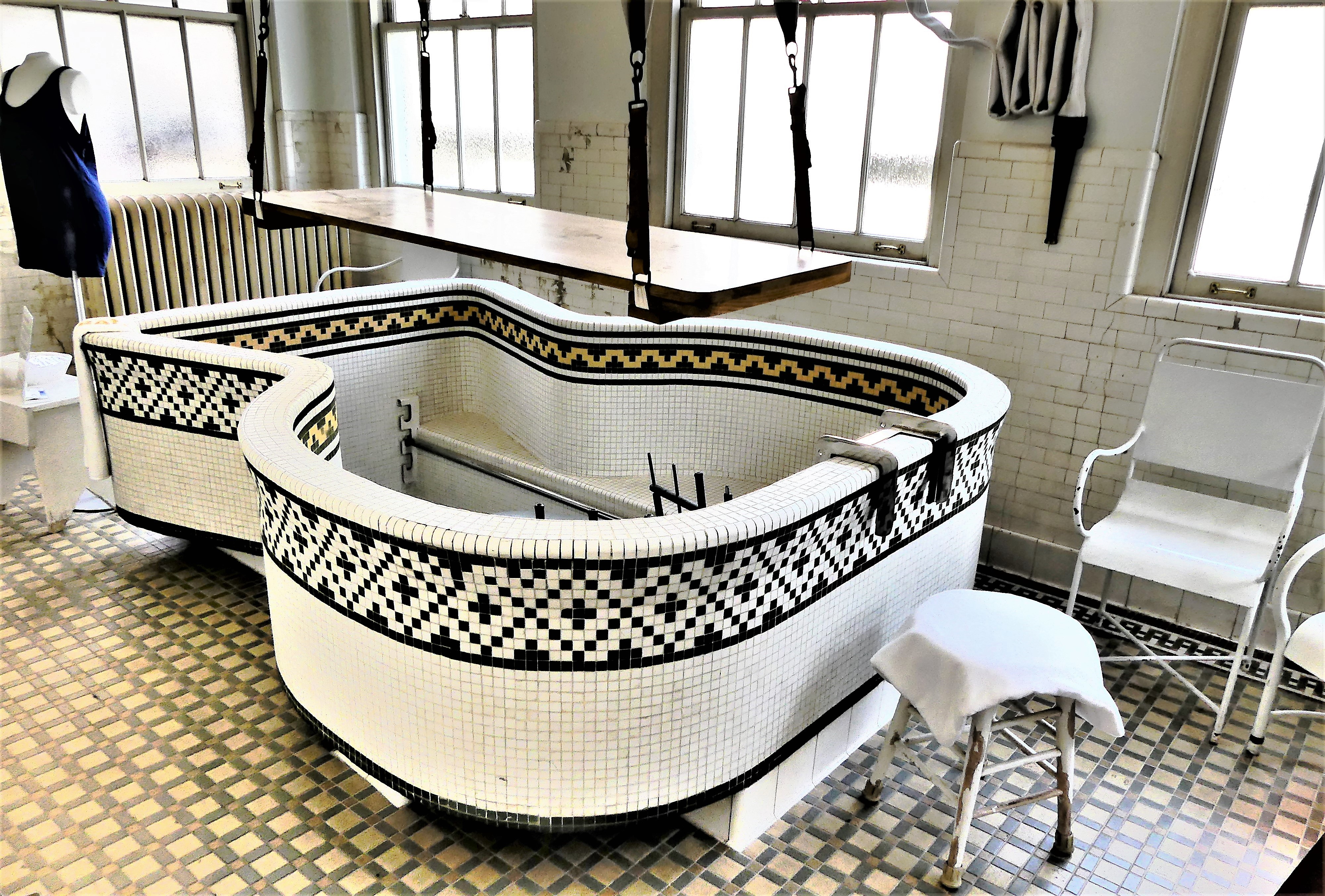
There were many different ways to indulge in water treatments…
But a menu of ancillary services was also available, such as: massage, chiropody, facials, manicure/pedicure, and exercise, etc…
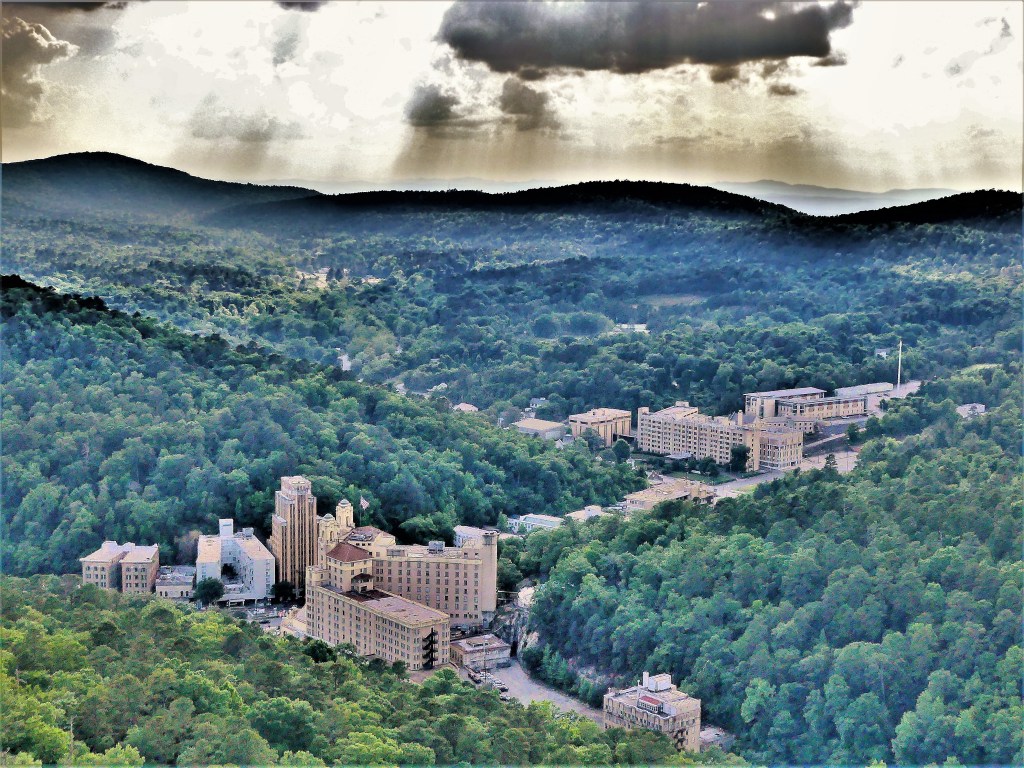
Bathhouse Row quickly filled with competition along Central Avenue,
each one designed with classic architectural details.
and anchored by Hot Springs Rehabilitation Center on the south end of the street.
Formally known as the Army-Navy Hospital, it was the site of the nation’s first general hospital for Army and Navy patients built after the Civil War–treating the sick and wounded through World War II. Subsequently, it became a residential resource center for training young adults with disabilities, but state of Arkansas shuttered the facility in 2019, and the building is now derelict and fallen into disrepair. Currently, it stands as the world’s largest raccoon hotel.
We visited Hot Springs during Memorial Day weekend, and the sidewalks were teeming with families and couples who were happy to return to the land of the living after a year of coronavirus hibernation. Businesses were enjoying record crowds, and the bath houses had finally reopened to the public.
Unfortunately, Leah and I were too late to the party; there were no spa reservations to be had. Water, water everywhere, and not a drop to drink.
So we took a hike up the mountain, spotted a turtle in the middle of the trail,
and continued to the Mountain Tower,
offering majestic, mouth-watering views of hidden springs beneath us, while we massaged each others’ neck and shoulders.
After motoring through half of America in our Airstream for the past 1 ½ months and reporting travel highlights along the way (http://streamingthruamerica.com),
I’m temporarily suspending the chronological order of my posts to confess that I’m not as young as I used to feel. I’m usually up for a reasonable physical challenge, but I have to admit that today’s climb did not go as easily as I wanted it to.
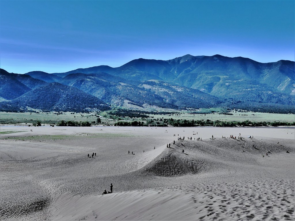
Yesterday, Leah and I crossed from Taos, New Mexico to Alamosa, Colorado, and settled in at Base Camp Family Campground by midday. After hiking in Taos the past 2 days, we thought we had acclimated nicely to the thinner air (more to be said on that later), but we were feeling our age after our arrival. We took an early siesta in air-conditioned comfort, followed by a 27-mile sprint to the Great Sand Dunes National Park Visitor Center just before it closed.
The park ranger suggested a climb to the top of High Dune (699 feet), but to keep in mind that tomorrow’s high will reach 92o F. He recommended a 9:00 am start time in order to reach the top of the dune by noon, and before the surface temperature exceeds 150o F. The ranger predicted the 2 ½-mile trek should average 2 hours, round trip.
Since we were already at the park, we decided to have a look around. We found it very refreshing to glide through three inches of snow melt, ebbing and flowing from the Sangre de Cristo Mountains.
Considering it was a Sunday afternoon, and peak traffic was winding down,
there was still plenty of activity around us;
far too many interesting vistas to ignore;
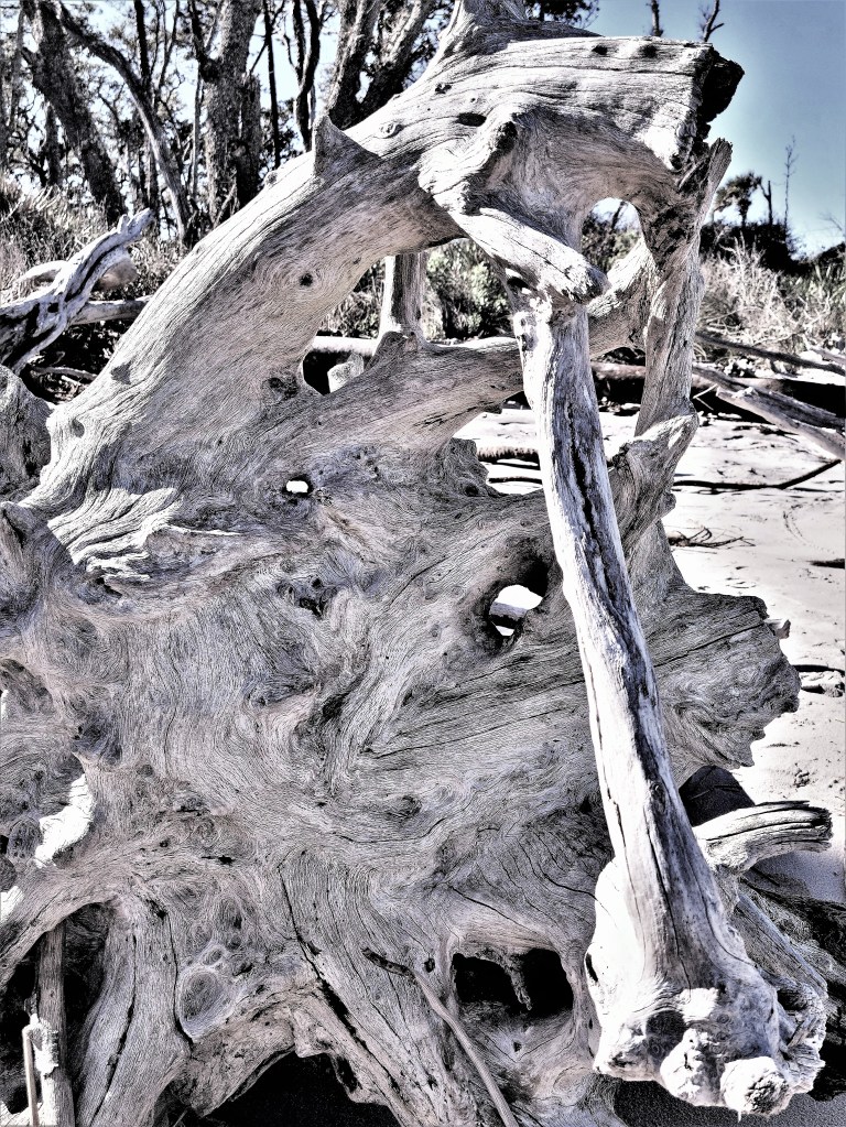
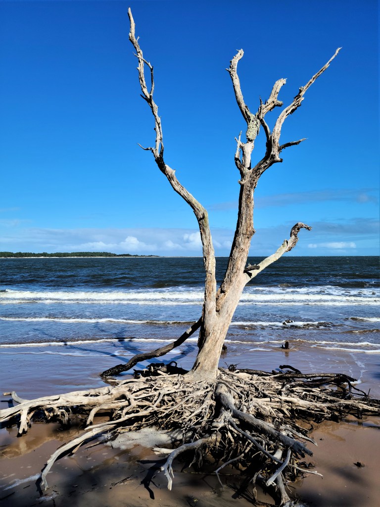
and surprising driftwood sculpture to admire.
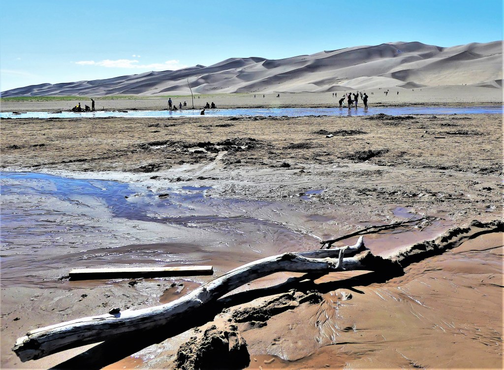
We arrived at the Dunes parking lot by 8:45 am the next day, and we were not alone. Many other families were already parked and trekking across the sand flats with sandboards in hand. Canopies and shelters were already sprouting up throughout and within Medano Creek, and kids were romping in the water and shaping wet sand castles.
We surveyed the 10,000 acres of dunes and plotted our course as there are no marked trails, but we followed along the ridgeline like most others.
Looking back gave us some satisfaction, because it reminded us of how far we trudged,
but looking ahead reminded us how much more we had to cover. The closer we crept to the top, the deeper our feet sunk into hot sand, slowing our progress.
We took a lot of breathers along the way,
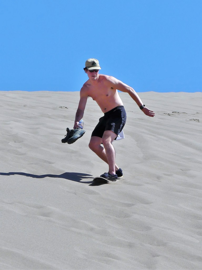
and rated the sand boarders as they attempted to carve out a run…
but mostly, it was uphill twenty steps, pausing to catch our breath, having a look around, sipping some water, and repeating the process. Slow and steady wins the race. Right?
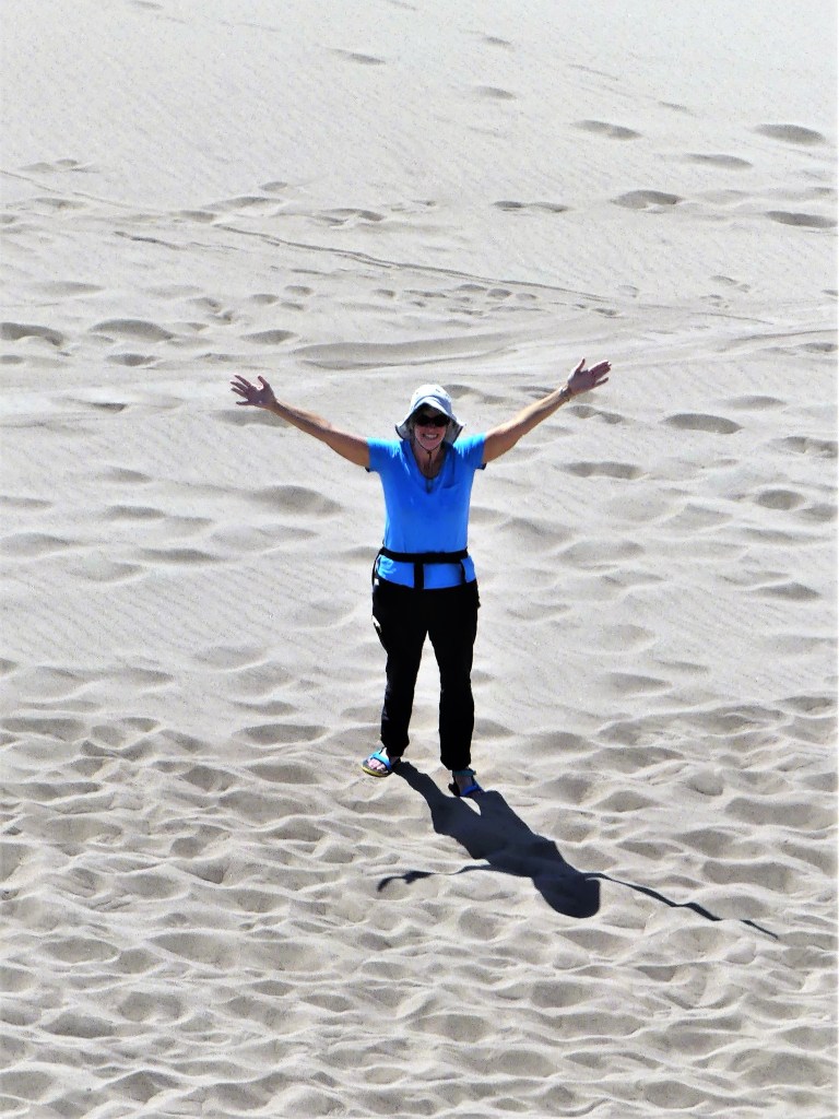
Many hikers passed us on the way down offering words of encouragement, but Leah–realizing her feet were about to catch fire–decided to mush down the sand slopes and soak her feet in the creek while I continued to the top.
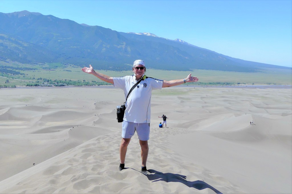
And so I pushed myself, and willed myself up the final ascent, foot by foot, grabbing air along the way, until I finally reached the summit with barely enough energy to greet the younger people who passed me on the way up, and wave my arms for Leah’s snap.
Perhaps it was self-gratification…
realizing that I can still push myself,
or maybe I needed to see the other side of the mountain.
Either way, it’s all good. Ironically, as I admit to myself that I’ve lost a step or two, to my surprise, I often find myself taking a victory lap. As I get older, I’ll eventually have to make do with being young at heart.
Leah and I have been eager to weave family and friends throughout our Great American Road Trip–Part IV. This summer tour is more than escaping Florida’s summer heat, or seeing the sights and exploring the great outdoors; it’s about personally reconnecting with the world after a year of COVID-19 constraints. For all the good that Zoom has given us to put us in touch with each other across the internet, there can be no substitute for face-to-face.
And in this moment of recalibrated norms, we are craving the sensation of normalcy.
From Virginia, we continued north to New Jersey, where it was previously arranged by Leah and her daughter Danielle, that we would occupy her driveway, and safely distance inside the trailer.
While Danielle and her husband Matt have been vaccinated for some time, Lucy, at age fourteen has not–although CDC officials are now in agreement that all teenagers will be eligible for the shot. So as an extra precaution, Leah and I agreed to a rapid test.
Honestly, I thought the PCR test was overkill, as Leah and I have been fully vaccinated since January, but half an hour later, all was forgotten after getting hugs from Lucy.
Other couples in New Jersey have been less fortunate. Phil and Cheryl both tested positive in November, but Phil required a hospital stay while Cheryl remained asymptomatic. To this day, Phil still suffers long-haul effects of COVID-19, so his reluctance to host our visit was understandable. Certainly, our negative test results must have eased his mind, and it was good to see him feeling more relaxed.
Whenever we return to New Jersey, we always turn to our hiking buddies, Doug and Arlene, who remained healthy throughout the pandemic. We reprised one of our favorite hikes at Pyramid Mountain during the height of pollen season,
sneezing our way to the ridge for electrifying views of New York City.
Next, we were on to Philadelphia with a lunch detour in Vineland to visit Leah’s brother, Harvey who’s lived in a group home with four other adult men for the past 20 years. It’s been three years since our last visit (considering our move to St. Augustine, and de facto quarantine protocols), and relaxed New Jersey state restrictions now gave us an opportunity to take Harvey out for the day.
Ordinarily, we’d plan lunch at a nearby diner, but group house rules precluded indoor dining, so a take-out meal, although less than ideal…
followed by a very brief walk through a minefield of goose poop, gave us some much needed time together.
Next day, while camping in Hatfield, PA, we coordinated a day trip to Lambertville, NJ…
to reunite with my oldest son Noah,
who most recently had been tasked with rolling out two dozen mobile testing labs for COVID-19 across metro Philadelphia–making Philly safe “one test at a time”–and ironically testing positive two days after his first vaccine shot. His recovery was rapid, no doubt because of the vaccine.
We cycled the Delaware & Raritan Canal Towpath together…
until we reached Washington Crossing State Park, 8 miles north.
Leah and I wrapped up our Philly reunion with a hike along Wissahickon Creek…
with long-time friends Alan and Andrea, who diligently practiced social distancing for the better part of a year.
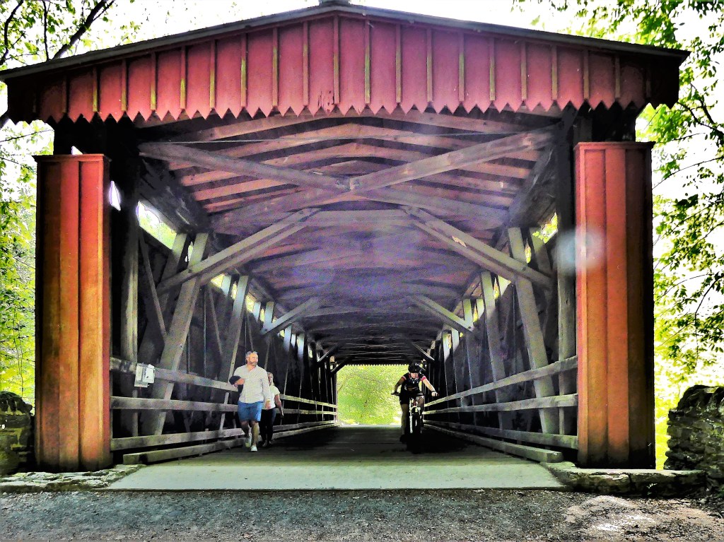
On our way to the Valley Green Inn for lunch, I spotted a garter snake enjoying a meal…
by the covered bridge.
Lastly, Leah and I made our way across the state to Pittsburgh, my hometown and my heartbeat.
Leah and I thoroughly enjoyed the hospitality of my first cousin, Sandy and his wife, Barbara, who allowed us to park our rig in front of their house. Our intention was to sleep inside the safety of our Airstream, but after learning that all of us were dosed by the Moderna vaccine, we were easily persuaded to accept Barbara’s invitation to chill at her 6,700 sq. ft., 100-yr. old resort with Sandy operating as executive chef.
To shed our extra calories, we pedal pushed through the hills of Pittsburgh on our manual bikes…
while our hosts cruised along on their e-bikes, assuring us that they were working just as hard as we were.
I don’t think so! From Point Breeze to Point State Park Fountain and back,
we reeled off 26 miles, and worked off some of the food and beer from the cousins’ reunion the day before.
Bottom Line: Leah and I have discovered that COVID-19 may have temporarily disrupted our families, but it’s also brought us closer together.
The Caverns of Natural Bridge can’t be more than a 15-minute walk from the Natural Bridge State Park parking lot. Along the way, it’s impossible to miss the Natural Bridge Hotel poised on it’s perch across the road…
where very little has changed as a popular destination for tourists since its rebuilding in 1964 after a doomsday fire.
Continuing up the road and around the corner, stands a rustic cabin set back from the parking lot that’s been open for business since 1977.
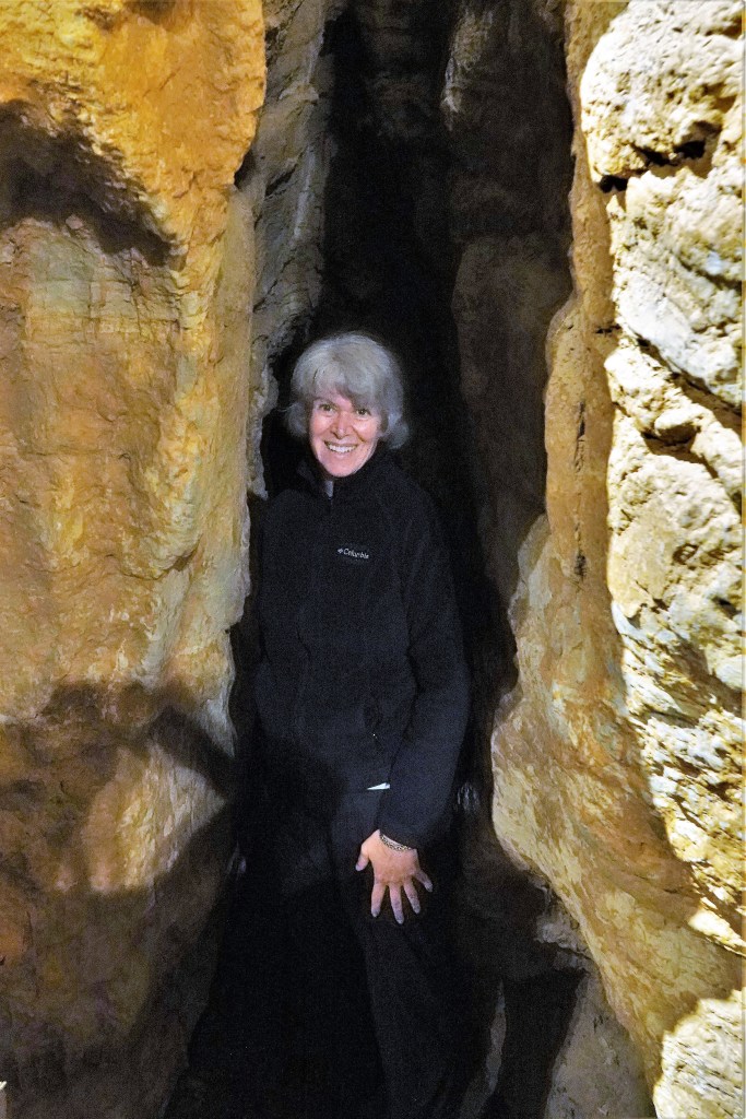
The attendant tells us that this is a quiet time for tourists–middle of the week, before Memorial Day–and that’s fine with us. In fact, so far, we are the only spelunkers to have signed up for the 2 o’clock tour. As the hour draws near, only two other women have joined us. But as a party of four, Brian, our guide assures us that we can linger longer at each attraction, since our group is so small.
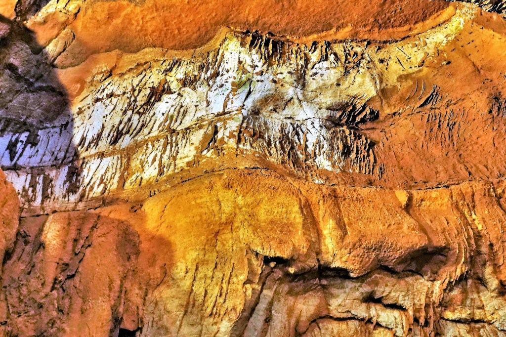
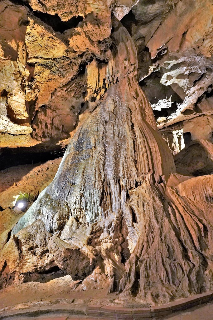
We are descending into a wet cave (as opposed to a dry cave),
34 stories below the earth’s surface…
where an underwater spring still feeds the formation of speleothems (e.g. stalactites and stalagmites).
The temperature is a humid 54o F, and with masks on…
my glasses can’t help but fog with each breath I take. It’s never been so frustrating looking through a viewfinder to frame a photograph.
But as we snake our way through low overheads…
we are surprised to see boxwork, an uncommon, venous formation of calcite residue…
which forms when calcium carbonate dissolves within the cracks, resulting in unusual honeycomb patterns.
While not the biggest cave system (that belongs to Mammoth Cave), or the most ornate (that belongs to Carlsbad Cavern), Natural Bridge has a pleasant complement of columns…
and detailed domes,
and no shortage of surprises between the cracks and crevices.
After driving hours upon hours of sameness along I-95 to I-26, Leah and I crossed the border into North Carolina, and rejoiced at our first sight at mountains in the past 9 months–the Blue Ridge. It was a sign that we were entering Pisgah National Forest and approaching Asheville, our first destination of the Great American Road Trip–Part 4.
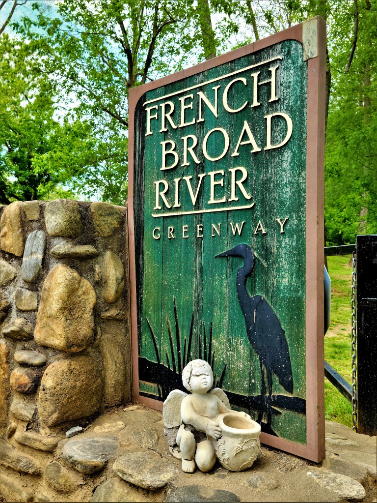
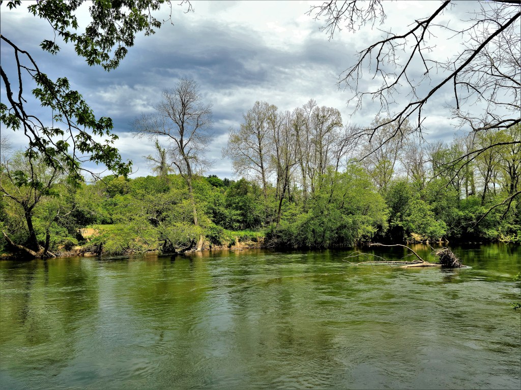
Although the weather could have been more welcoming, we managed an urban bike ride through Carrier Park and by the River Arts District…
before doubling back along the French Broad River Greenway.
to admire the serenity of the lazy river.
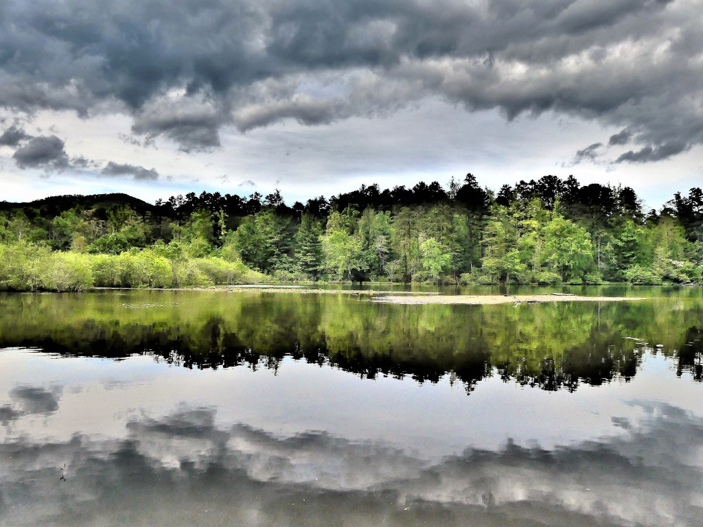
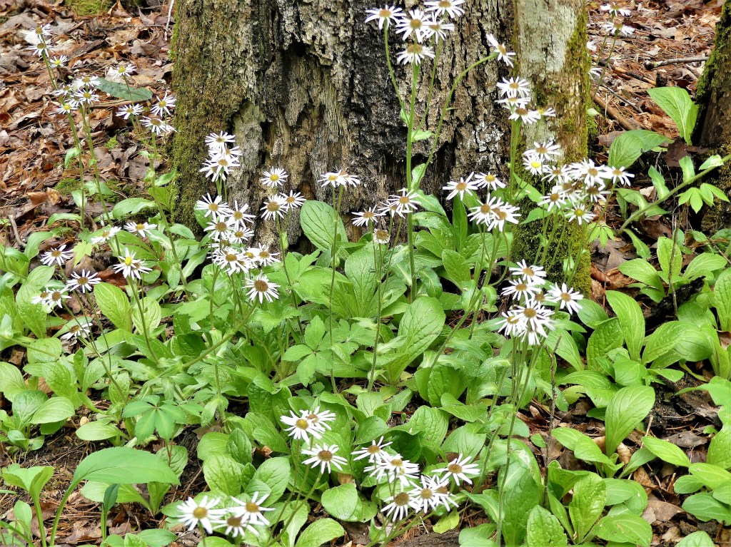
Thank goodness for video downloads, because the incessant rain throughout the evening and into the following day kept us indoors–giving Smokey a much needed fire-watch break–
but preventing us from exploring our Lake Powhatan campground surroundings. Fortunately, by mid-afternoon, a partial clearing at the lakefront…
gave us an opportunity to loop around the water through mountain laurel archways…
Leah and I are on the road again, continuing our Great American Road Trip–part 4, with some significant changes and improvements.
Last year, during the summer of Trumpandemic, we took an abbreviated trip to upstate New York in search of open outdoor vistas with blue skies and limited exposure to crowds, which we found at Letchworth State Park.
Soon after, we rounded the top of New England to enjoy a requisite Maine lobster dinner…
to dip a toe in the Atlantic on Hampton Beach…
and to gawk at the wealthy from Newport’s Cliff Walk.
We hugged the coastline until we reached Chincoteague, Virginia…
in search of precious ponies…
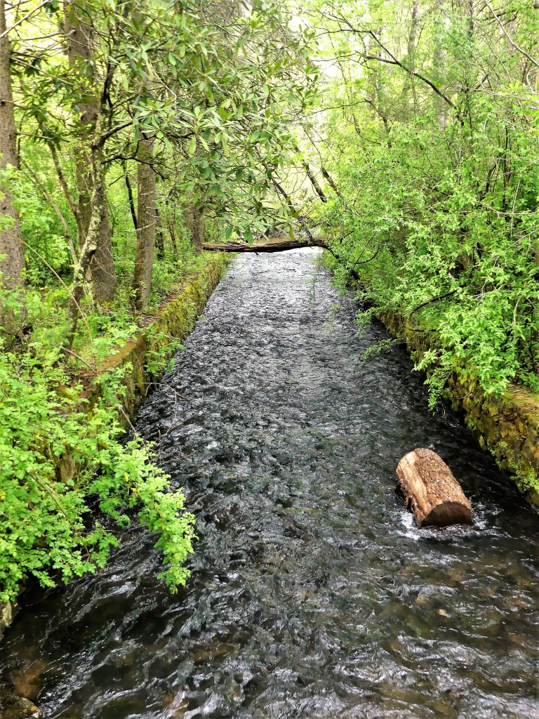
and to listen to the silence at the Great Dismal Swamp in Suffolk, VA.
The trip was short (only 5 weeks and far from our ambitious itineraries of past years) yet refreshing, and daring (for all the anticipated COVID closures) yet unremarkable with one notable exception…I wrecked the Airstream in Tarboro, North Carolina.
Halfway to Tignall, Georgia (our final destination) and needing a lunch break and a leg stretch, we stopped at a charming town boasting a historic district of 18th century and antebellum landmark homes recognized by the National Park Service. I parked the Airstream inches from the curb on a narrow residential road across from Blount-Bridgers House, an 1808 Federal-style mansion-cum-museum,
and returned an hour later to continue our journey.
I casually pulled out, unaware that a protruding power pole ID tag had snagged the rear awning support and ripped all the cleats out from the aluminum skin, taking down the entire awning assembly and crushing the end caps to the tune of $17,000.
Thankfully, our insurance completely covered the damage. As we drove our beloved, but bandaged 27FB Flying Cloud to the Tampa Airstream dealer for repair, we considered the possibility of an upgrade should one be available. As luck would have it, a Florida family was trading a 2018 Globetrotter 27FB at the time, pending delivery of their new Airstream by February 2021.
We felt as if we had won the lottery. A deposit was offered on the spot, considering a total lack of previously owned inventory throughout the country.
The deal was sealed in April, when Leah and I picked up our reconditioned summer rig and took it for a dry run in Ruskin, FL in preparation for our summer adventure. We enjoyed the whisper-quiet, ducted AC; the ease of deploying the power stabilizer jacks; the convenience of rolling out the power awning; and the notion that our roof-mounted solar panels could provide us with increased boondocking possibilities.
Join us on the road as we explore 44 destinations (mostly new, sprinkled with some favorites) for the next 20 weeks:
May 1: Lake Powhatan/ Asheville, NC
May 4: Natural Bridge, VA
May 7: Vineland, NJ/ Northern NJ
May 12: Philadelphia, PA
May 15: Pittsburgh, PA
May 18: Jackson Center Airstream Factory/ Dayton, OH
May 19: Indianapolis, IN
May 21: Nashville, TN
May 24: Memphis, TN
May 27: Hot Springs/Little Rock AR
May 29: Eureka Springs, AR
June 1: Oklahoma City, OK
June 4: Amarillo, TX
June 6: Albuquerque, NM
June 10: Taos, NM
.June 13: Great Sand Dunes NP, CO
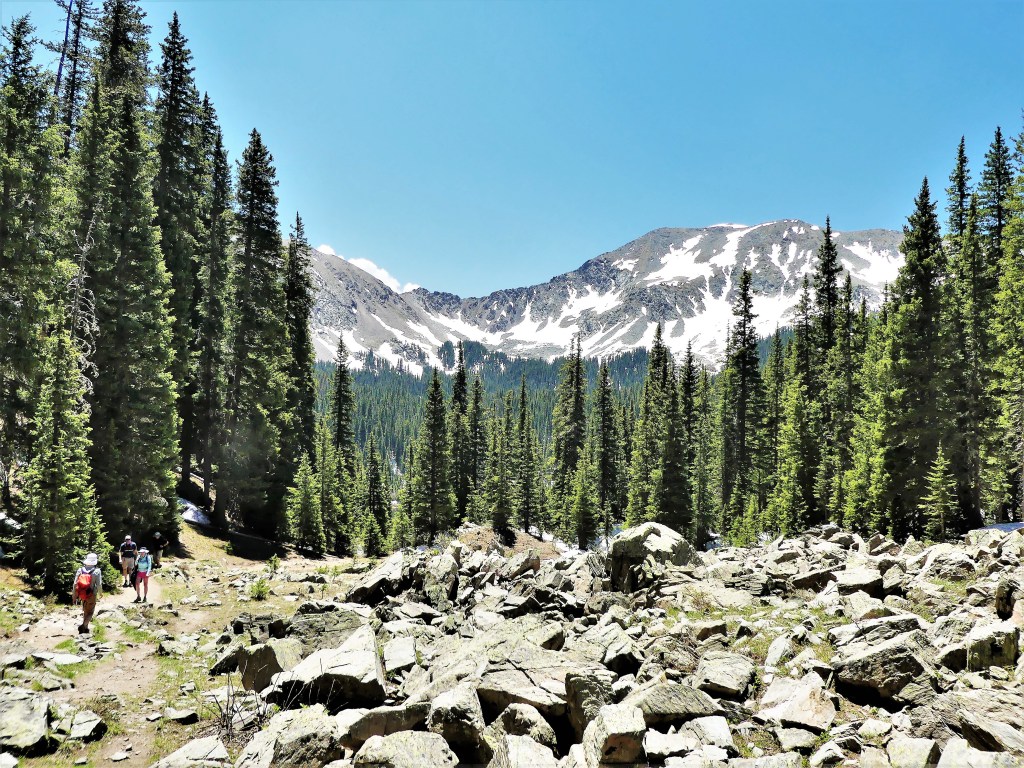
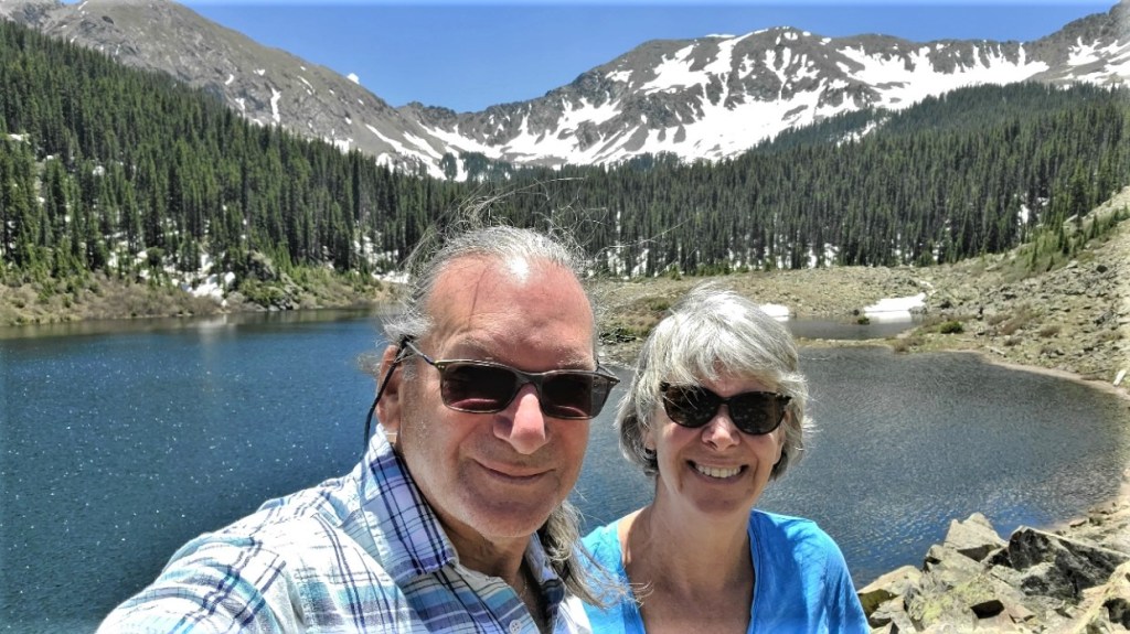
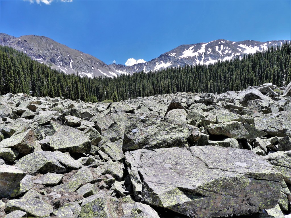
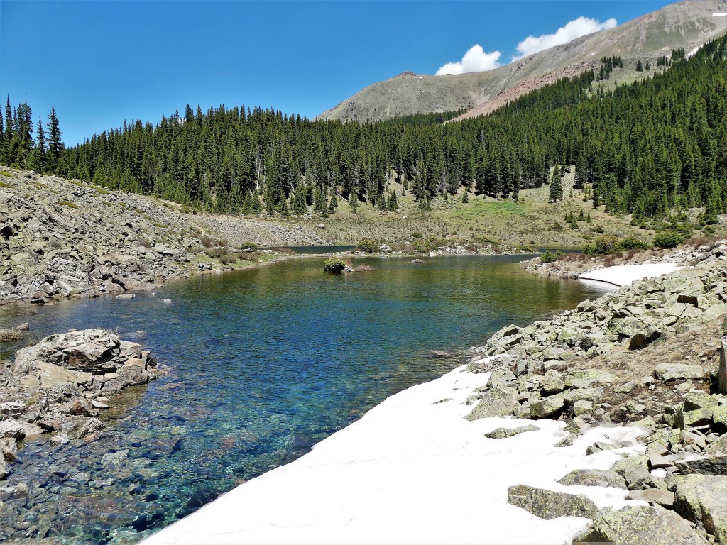
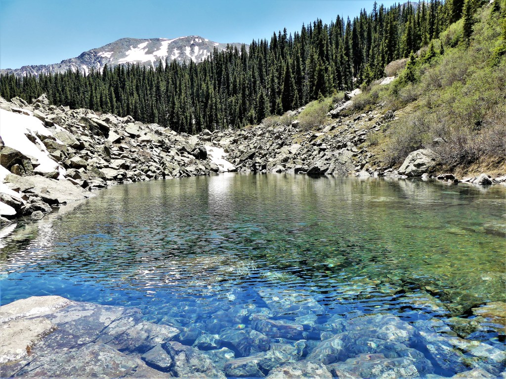
June 16: Rocky Mountain NP, CO
June 20: Cheyenne, WY
June 22: Flaming Gorge, UT
.June 25: Bear Lake State Park, UT
June 28: Craters of the Moon NP, ID
July 1: Morley Nelson Snake River Birds of Prey, UT
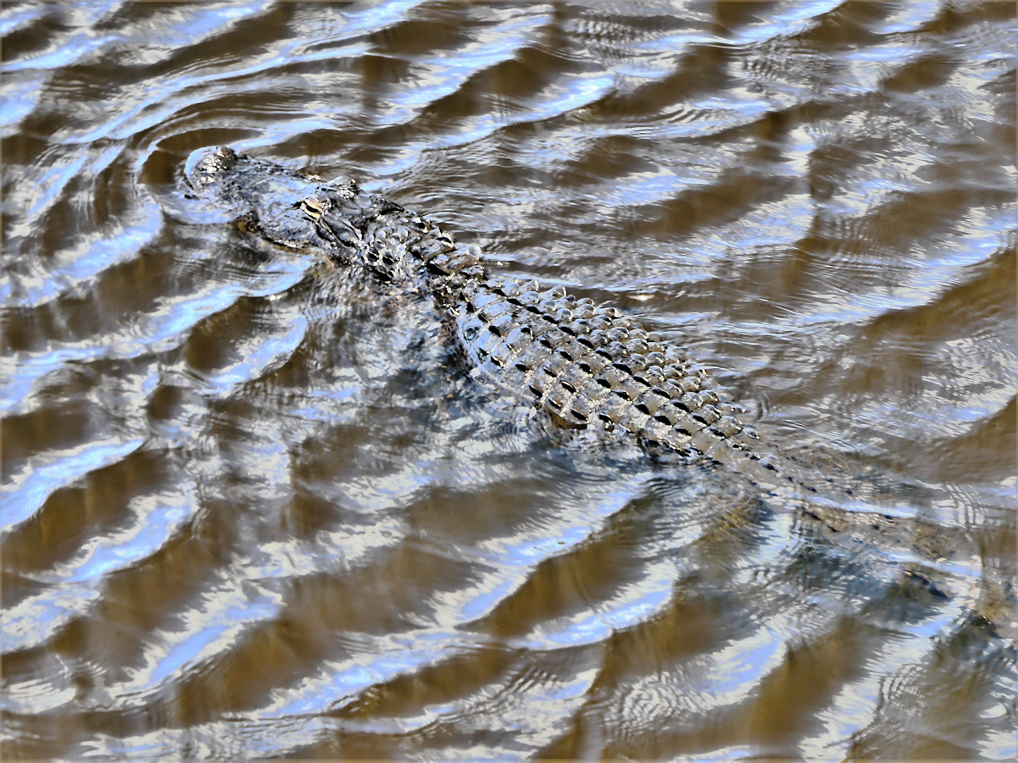
Florida manatees are in trouble and it’s troubling. Today, wildlife conservationists put their current census at around 6500 individuals–up from a few hundred in the 1970’s–
and have reclassified these docile creatures as “threatened.” However, the tide may be returning to “endangered,” given the increasing number of manatees at risk from boat strikes (averaging 100 every year), and the consensus that manatees are dying in unexpected numbers this year from extreme weather. Simply put, they are starving to death.
There’s a chill in the air, and the West Indian manatees of northern Florida have been scrambling to find warmer waters during winter months, where they usually huddle in large numbers, which assists in the yearly count.
Many coastal manatees migrate to Manatee Lagoon…
to bask in the warm-water discharges of FPL’s Next Generation Clean Energy Center at West Palm Beach,
while hundreds flee to Blue Springs State Park, in Orange City, Florida, where they find safe haven at a wellspring releasing 72° water year-round.
Others migrate to Silver Springs State Park,
where clear, calm, and temperate waters provide an abundance of sea grass for grazing.
But that’s not the case in many other places where manatees congregate. In recent years, massive toxic algae blooms accelerated by increased extreme weather have eliminated several hundred “sea cows” every year.
The Indian River Lagoon on the Atlantic side of the state accounts for the majority of manatee losses.
According to Indian River Lagoon guide Billy Rotne:
The raw truth of the matter is due to negligence of our storm water. We’ve had continual algal blooms over the past 10 years, which blocks out seagrass and kills it…so the manatees are starving to death.
And Patrick Rose, executive director of the Save the Manatee Club further connects the dots:
I believe that seagrass loss is making manatees travel farther to get food, often going into man-made canals where they are more exposed to boat traffic.
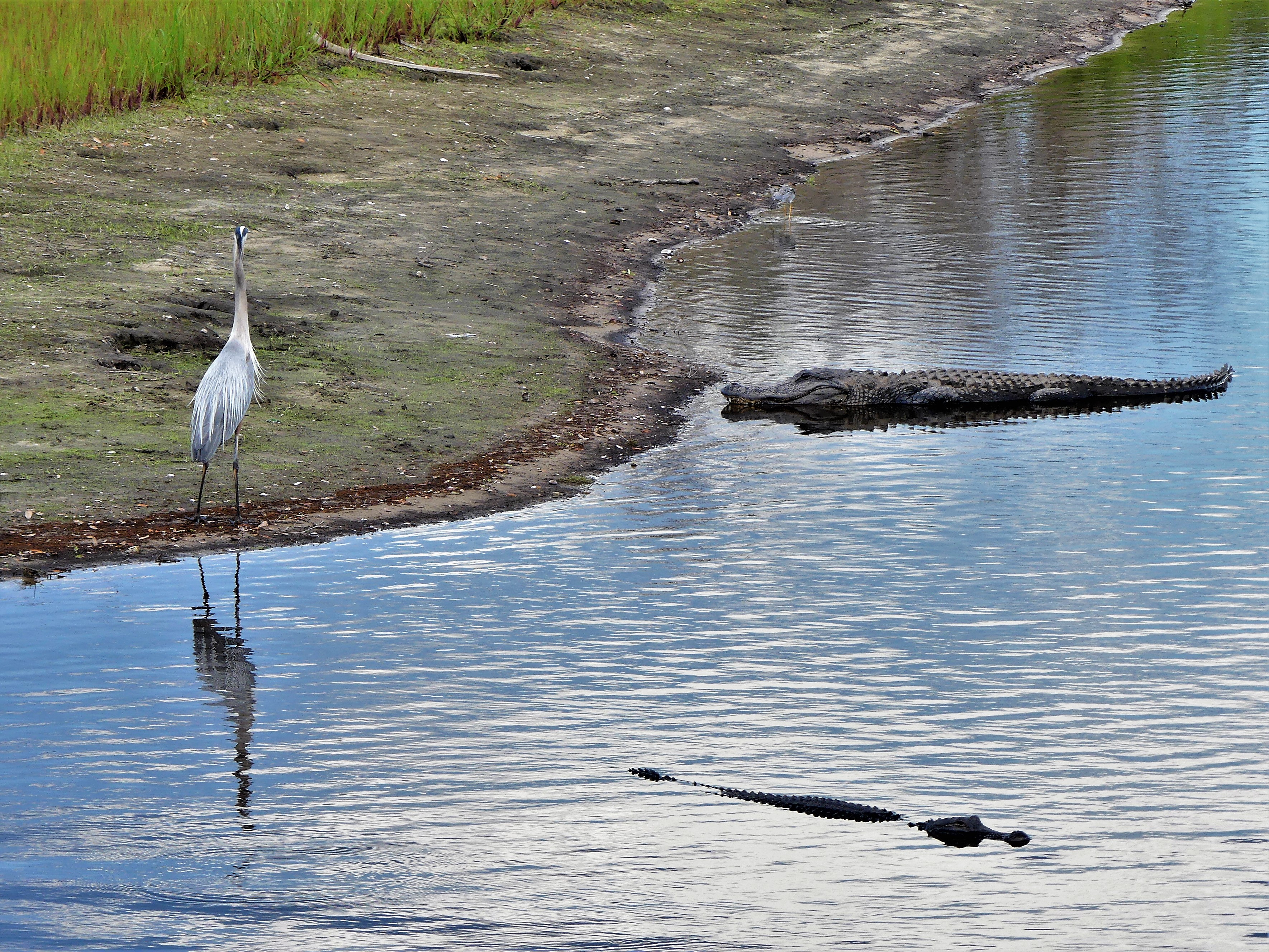
Manatees have no natural predators. Sharks, whales and alligators usually swim in different waters and pose no threat to them.
Only humans have the capacity to put manatees at risk, with at least 432 having already perished in the first two months of 2021, accounting for 5 times the number of deaths in recent years.
Even more disturbing, a boat charter captain trolling the Homosassa River in the western part of Florida observed a manatee with “TRUMP” etched along its back.
Perhaps we need to do a better job of protecting them, if they are going to survive our abuses.
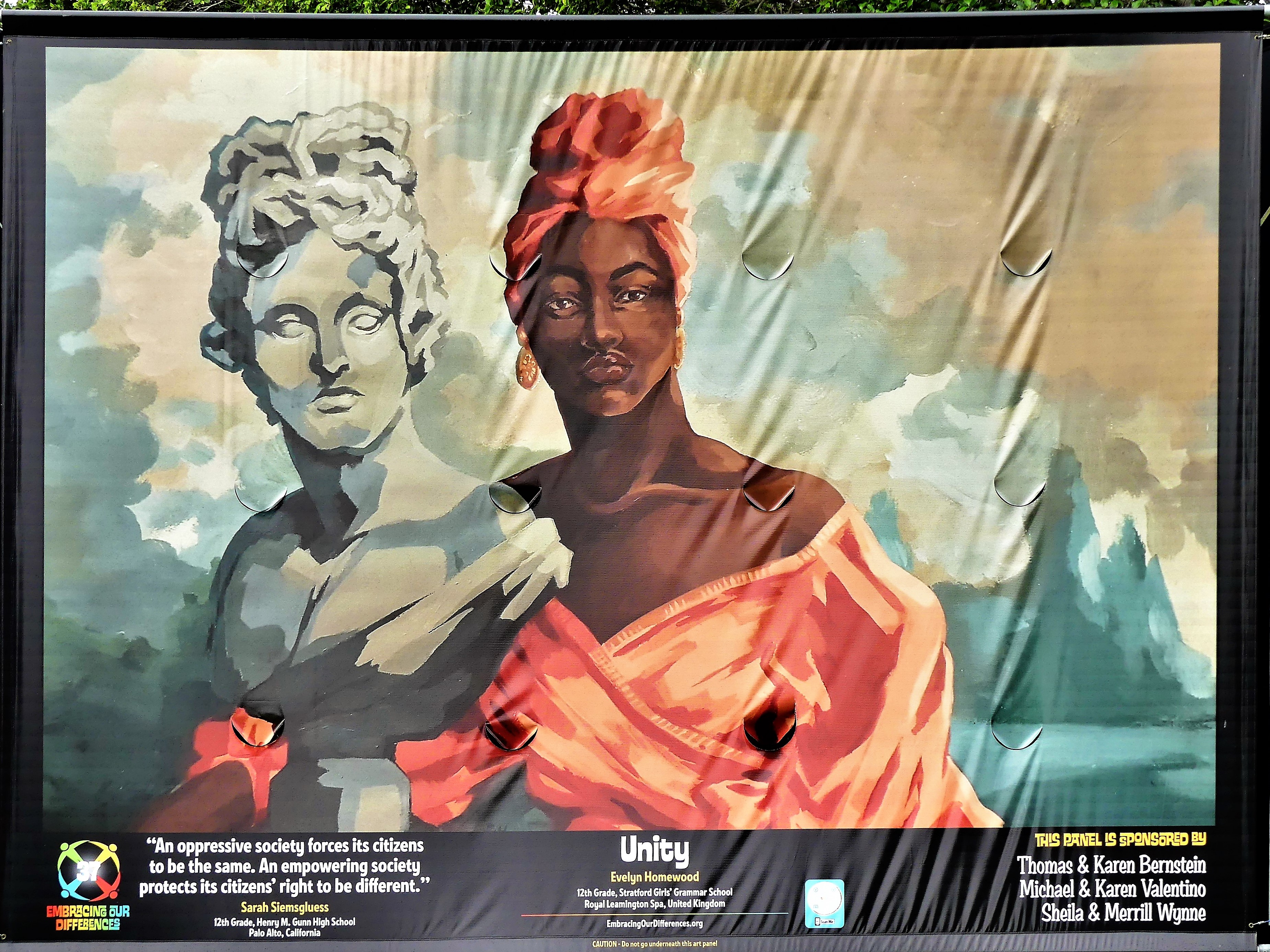
The above-mentioned poem and pics were motivated by a day-trip to Myakka River State Park, outside Sarasota, Florida.
Originally, my early inclination was to post this as a stand-alone, abstract reaction to all the hate that’s been circulating around the country of late, but as luck would have it–at Leah’s urging–I walked along Sarasota’s Bayfront…
and discovered the 18th Annual Art Exhibit Celebrating Diversity and Inclusion.
Almost immediately, after walking through the exhibition, I realized that showcasing birds and preying reptiles was too esoteric in getting my message across.
And I knew I had to include a sampling of the thoughtful, amazing talent from local and international students…
who have found a way to express themselves both poetically and graphically in ways that astound me, and give me hope for the future of our planet.
50 panels are spread throughout a marine park setting frequented by families, dog-walkers, tourists, and boaters, etc.,
interacting among billboard-sized art.
Indeed, a captive audience for a captivating display of enlightenment that’s too good to ignore.
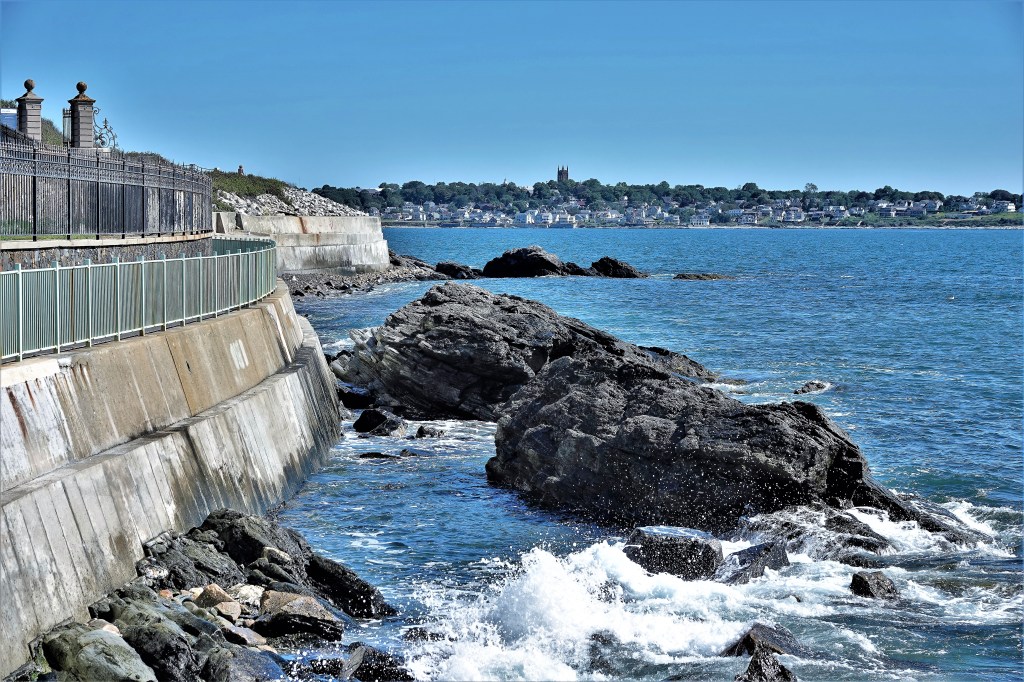
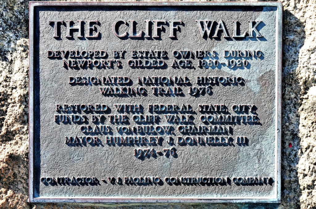
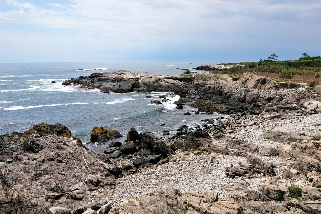
No tour of Newport, Rhode Island is complete without appreciating the summer “cottages” along the Cliff Walk. The walkway runs 3.5 miles along the Atlantic, offering panoramic views of crashing waves against a craggy seawall…
adorned with massive mansions belonging to America’s 19th-century titans of industry.
Leah and I parked at Easton’s Beach…
and followed clearly marked directions to the trail head,
for a walk through time to reflect on the splendor sponsored by owners during Newport’s Gilded Age.
Designed by a cadre of elite architects of the time, these summer homes represent the stylistic diversity of 200 years of architectural history in Newport, and offer a window into the world of its illustrious owners.
To date, many mansions like Rosecliff have been rescued by Newport Restoration Foundation after having been neglected for dozens of years, and threatened with demolition. Boasting the largest ballroom among its neighbors, Rosecliff has become a popular wedding venue.
The Cliff walk is essentially a pedestrian hike, but can be challenging in places,
with rocky outcroppings…
and unlikely obstacles that require reasonable footwear other than flip flops.
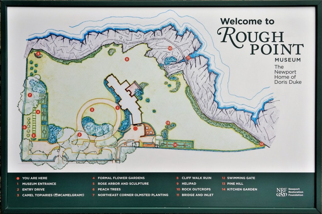
Of course, there are plenty of houses to ogle along 3.5 miles–some that have become museums, like Rough Point…
or repurposed as a Salve Regina University administration building, like Ochre Court…
or converted to condos, like The Waves…
while newer home owners along the walk eschew the notoriety.
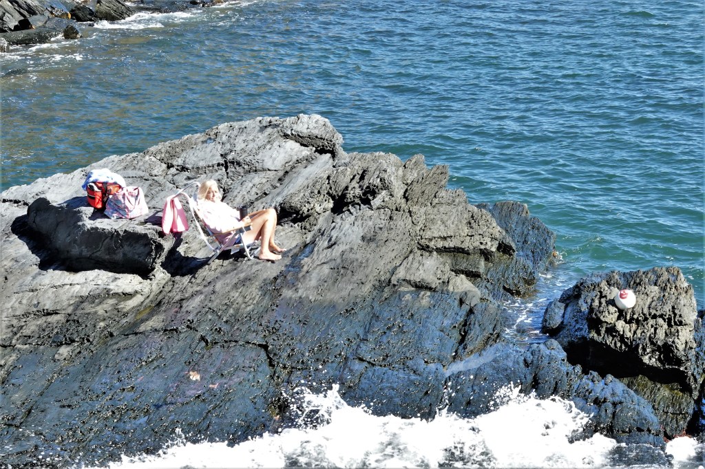
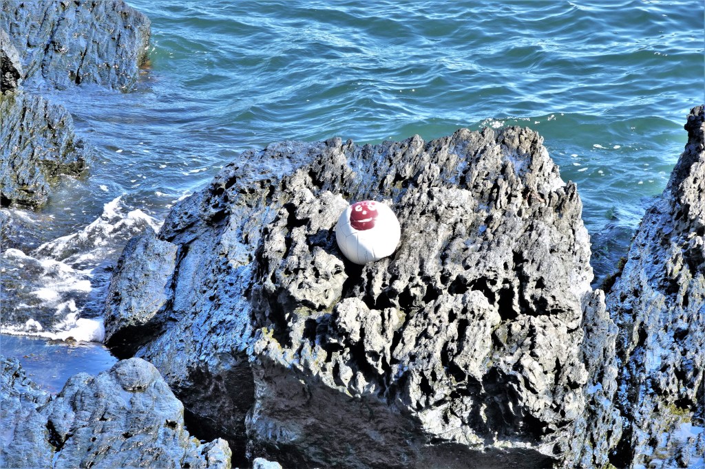
But the real entertainment comes from people met along the way–for instance, a sunbathing cliffhanger getting in touch with her inner mountain goat just beyond the 40 Steps marker.
But she was not alone, as Wilson was seen lounging nearby.
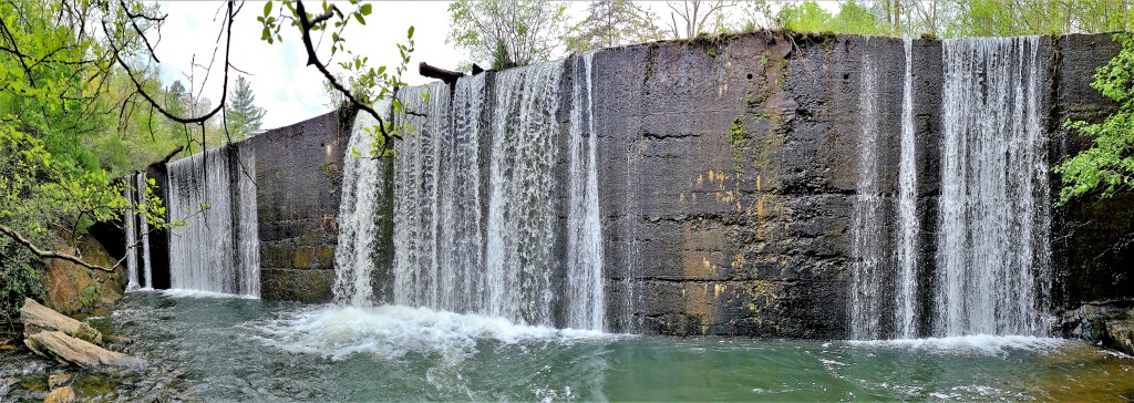
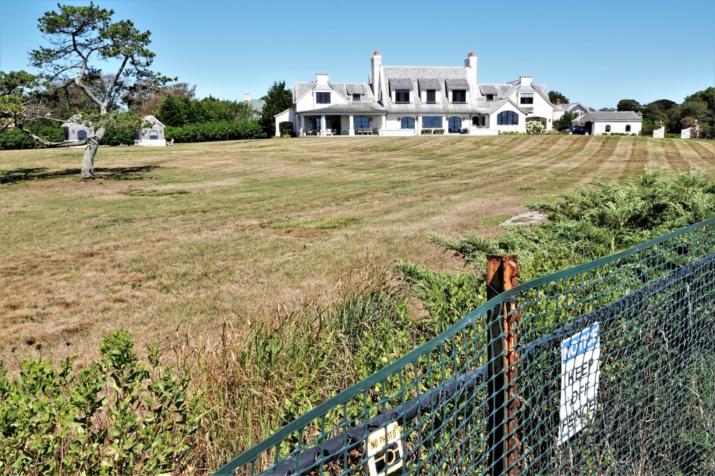
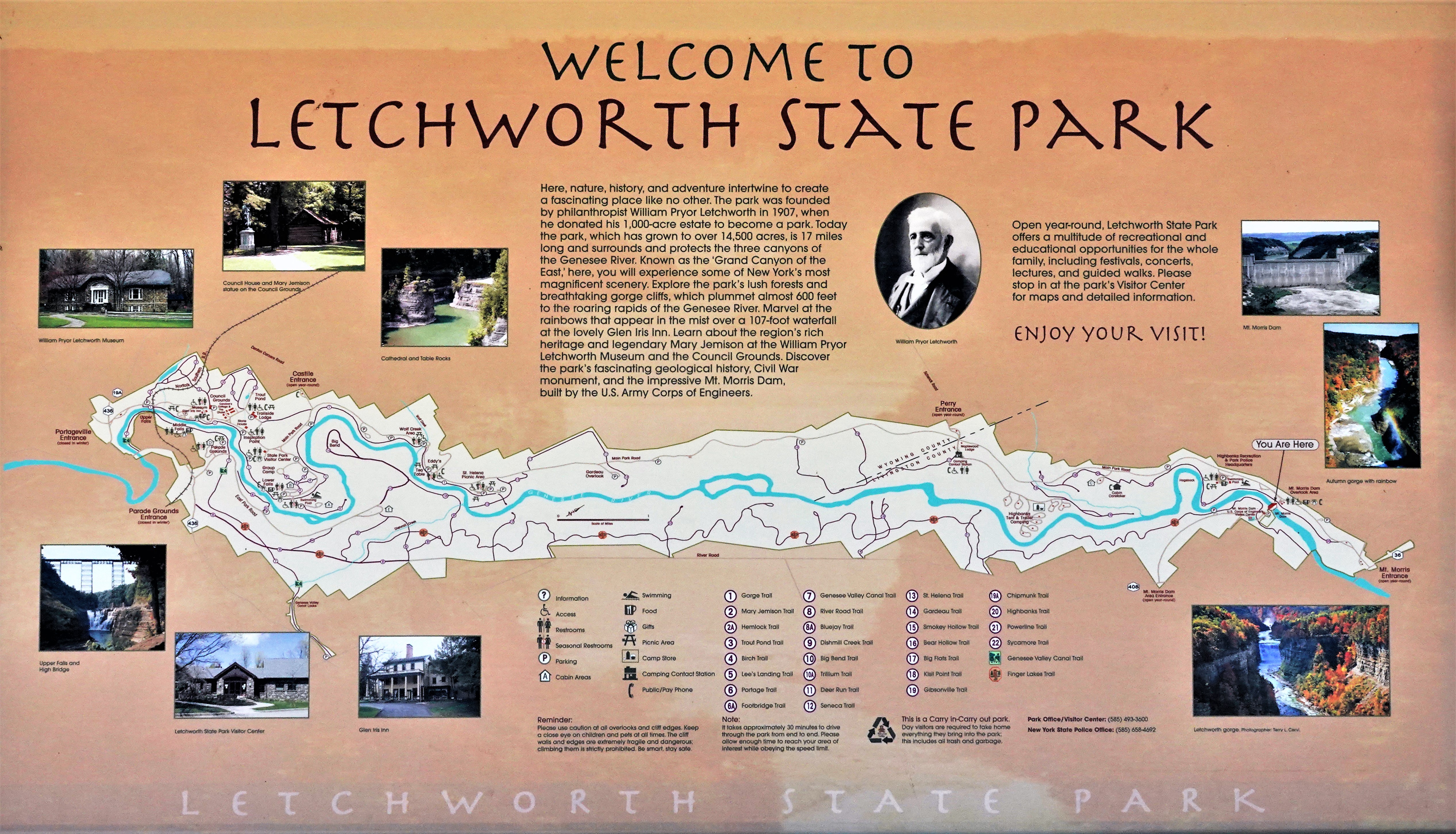
Without question, the feature attraction of Letchworth State Park…
has to be the trinity of waterfalls in the southern corridor of America’s favorite State Park (USA TODAY, 2015 Reader’s Choice), that stretches from the newly-replaced railroad trestle crossing the Portageville Entrance…
to the Mt. Morris Dam, 17 miles to the north.
And it’s the mighty Genesee River that flows between both boundaries–
continuing to carve out a bedrock gorge of mostly shale,
with exposed cliffs that rise 600 feet into the air,
earning Letchworth the distinction of being known as the “Grand Canyon of the East.”
But it’s the waterfalls that most visitors come to see…
Well almost, because there are as many as 50 smaller waterfalls throughout the park that flow into the Genesee. But none are as impressive as Middle Falls, which cascades over a 107 ft drop.
As the name suggests, Middle Falls falls directly in the middle,
between Upper Falls…
and Lower Falls.
While the names of the waterfalls seem conventional, it was an unconventional man, William Pryer Letchworth, who had the foresight to buy the property surrounding Upper and Middle Falls to thwart the installation of a hydro-electric turbine, and save the falls from ruin.
Letchworth also transformed an existing building atop the cliff overlooking Middle Falls into his estate, and named it Glen Iris.
Today, it operates as a shabby-chic Bed and Breakfast, offering meals in the garden on the lawn, on the porch under the veranda, or in any one of several indoor dining rooms.
Leah and I sat outside, dining on spicy pizza and Parmesan-garlic chicken wings. We kept our eye on the New York sky, and we were eager for dusk to arrive.
At the appointed time–when daylight surrenders–the floodlights flashed on and burned onto the water spill.
Bar tab and entrees came to $60 bucks, but the view of the falls from the top of the cliff was priceless.
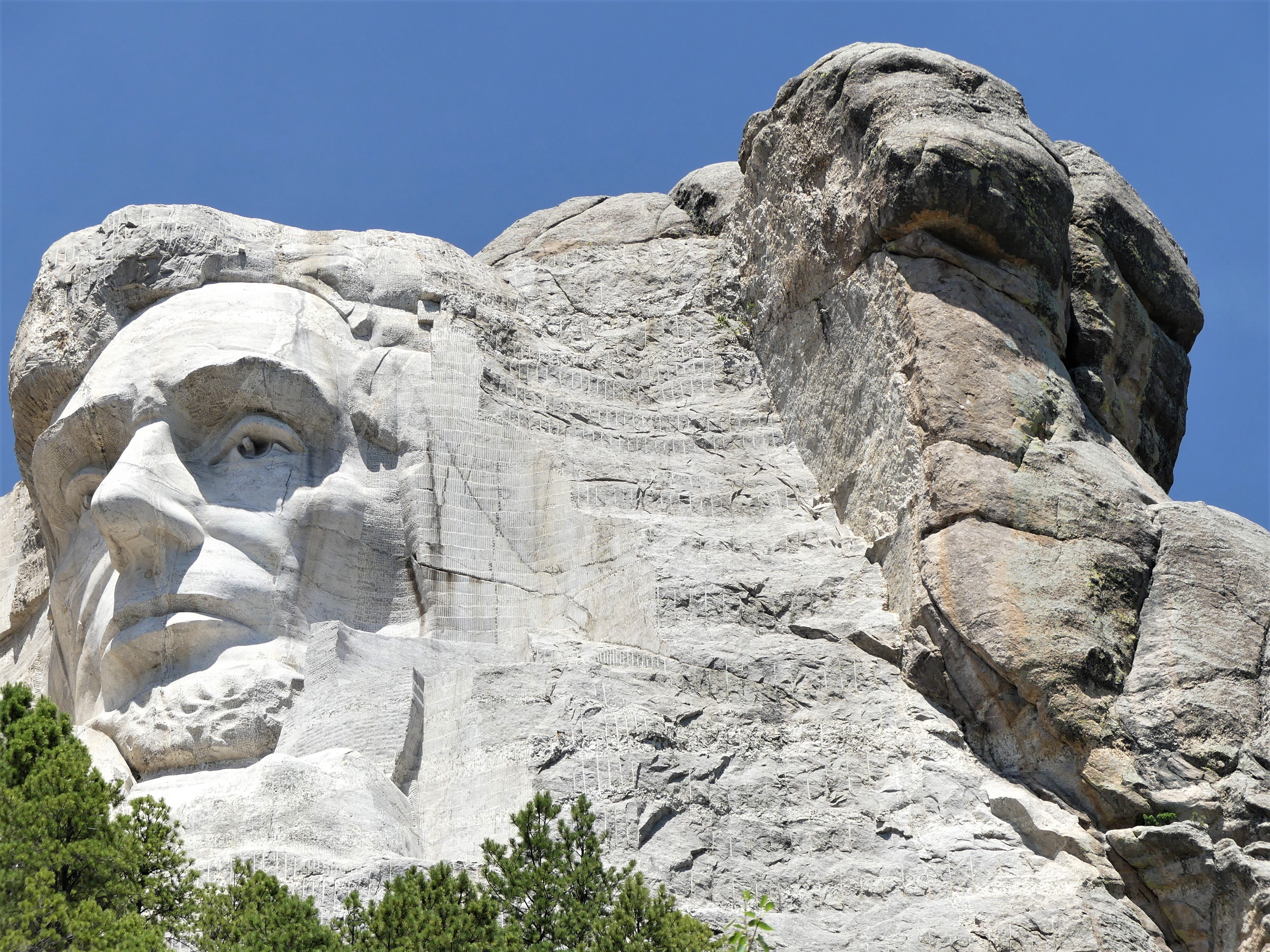
Despite the three years since Leah and I visited Mt. Rushmore, what could be more American than re-posting this visit on Independence Day? And still, there’s great turmoil within the country. A trip to Mt. Rushmore means many different things to different kinds of people. One person’s treasure is another’s abomination. To visit was once considered patriotic. Now it’s an act of partisan politics.
There’s no better way to celebrate the 4th of July, than a trip to Mount Rushmore and the Crazy Horse Memorial. Sure, the crowds were large; that was to be expected. But once the cars were garaged, the pedestrian traffic was easy to negotiate. And with everyone looking up at the mountain, the Presidents’ faces and intentions were never obstructed.
It was also a time to celebrate family. There were plenty of kids riding in strollers, hanging from moms in carriers, or balancing on dads’ shoulders. Generations of families–many of them immigrants–had gathered to pay homage to the principles of freedom that make our country a beacon for the oppressed and downtrodden.
Seniors were being escorted through the Avenue of Flags by their grandchildren. Extended families organized group pictures at the Grand View Terrace, unified by their love of democracy and their reunion T-shirts.
All expressed awe at Gutzon Borglum’s grand vision and remarkable achievement–the transformation of a mountain into a national symbol visited by approximately 3 million people every year.
The 14-year process of carving the rock began with dimensionalizing the Presidents’ portraits through Plaster of Paris masks, on view at the sculptor’s studio-turned-museum.
Additional exhibits detail the construction of the memorial, and the tools used by workers, like the original Rand & Waring compressor, which powered the jackhammers for all the finishing work.
An overlooked fact–Mt. Rushmore was once intended as a tribute to the “Five Faces of Freedom,” but funding ran short when Congressional appropriation for the monument approached $1 million during the Great Depression. Hence, the unfinished carving of the Great Ape to the right of Lincoln serves as a reminder that we are never far from our true ancestors.¹
No less ambitious, and equally as impressive, the Crazy Horse Memorial is a work-in-progress located 16 miles away in the heart of the Black Hills–considered sacred land by the Lakota people.
Conceived by Korczak Ziolkowski in early 1940s,
the memorial, when completed will stand 563 ft. by 641 ft. across, and is expected to be the largest sculpture in the world. Already, the completed head of Crazy Horse measures 60 feet tall…
…twice the size of any of the presidents at Mt. Rushmore. While the first blast was conducted on the mountain in 1947, the current prospects for the memorial are to complete the outstretched arm during the next twelve years. There is no completion date available for the finished carving, which has been financed entirely by private funding since its inception.
Mt. Rushmore was created by a Danish American. Crazy Horse was created by a Polish American. And visitors to both destinations manifest the melting pot that has brought us all together as Americans. It’s our diversity that makes us strong, our ambition and determination that makes us great, and our compassion and sacrifice that make us whole.
These are the values reflected from the faces we’ve immortalized in stone. Yet, we would honor them more by living according to these principles.
Happy Birthday, America!
¹ Just kidding, but the photograph is real and has not been retouched.
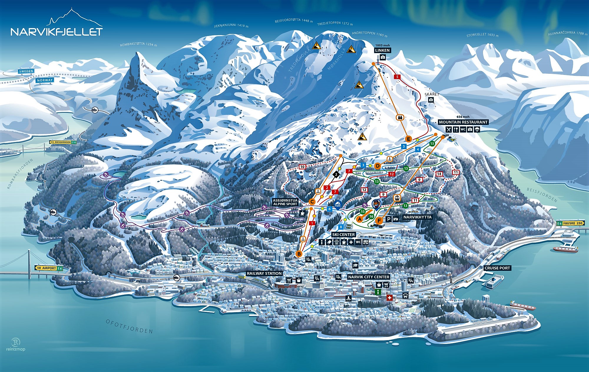
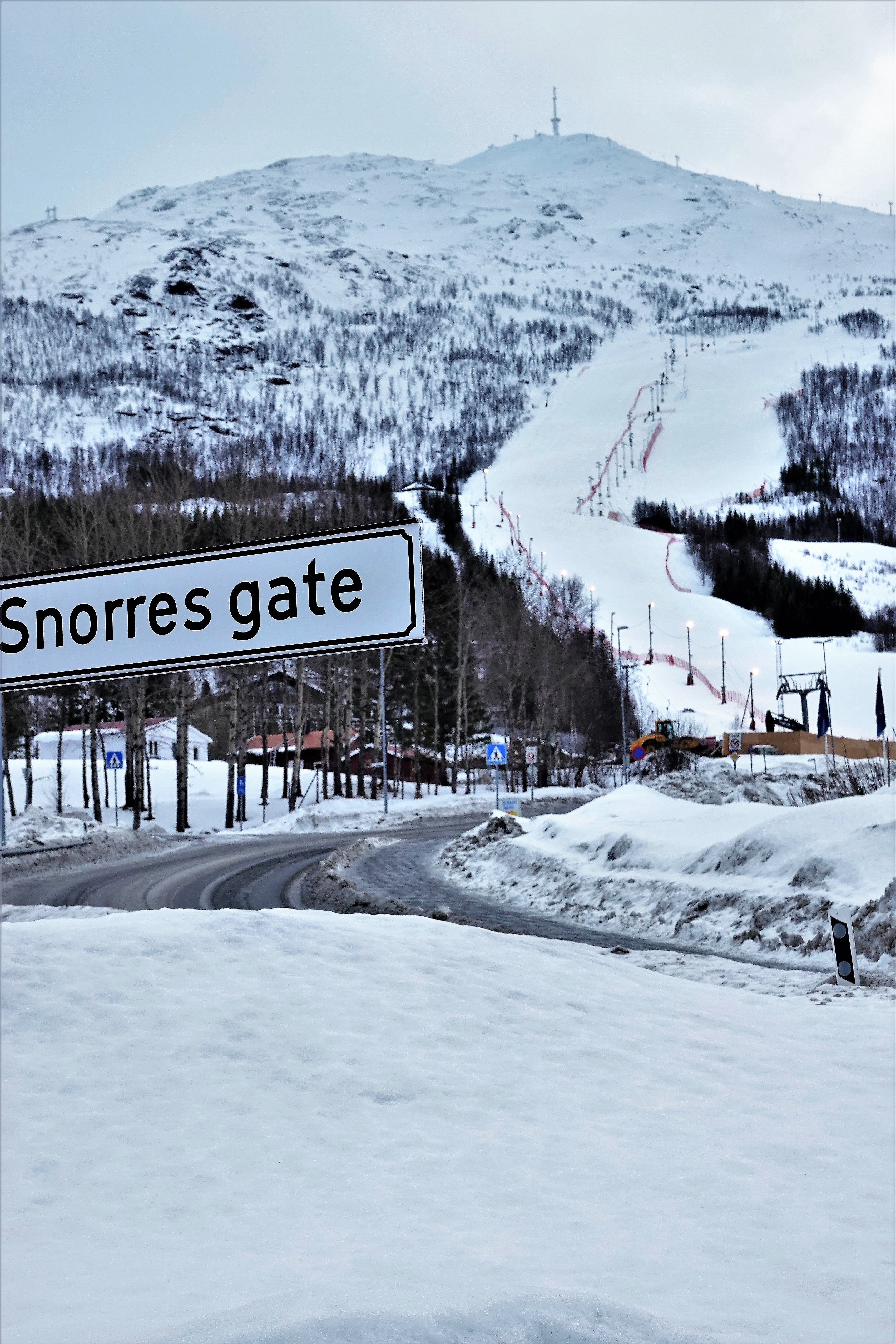
On our way to Bergen, Norway, the Viking Star docked at Narvik–a mountainside town reknown for its urban off-piste skiing,
and notable for its ice-free harbor,
which was of strategic importance during World War II…
for transporting iron ore that’s been mined from the world’s largest underground reserve in Kiruna, Sweden since 1898.
Leah and I had hoped to ride the cable car to the mountain restaurant to enjoy the view, but on this particular day, the mountain was closed because of nasty weather.
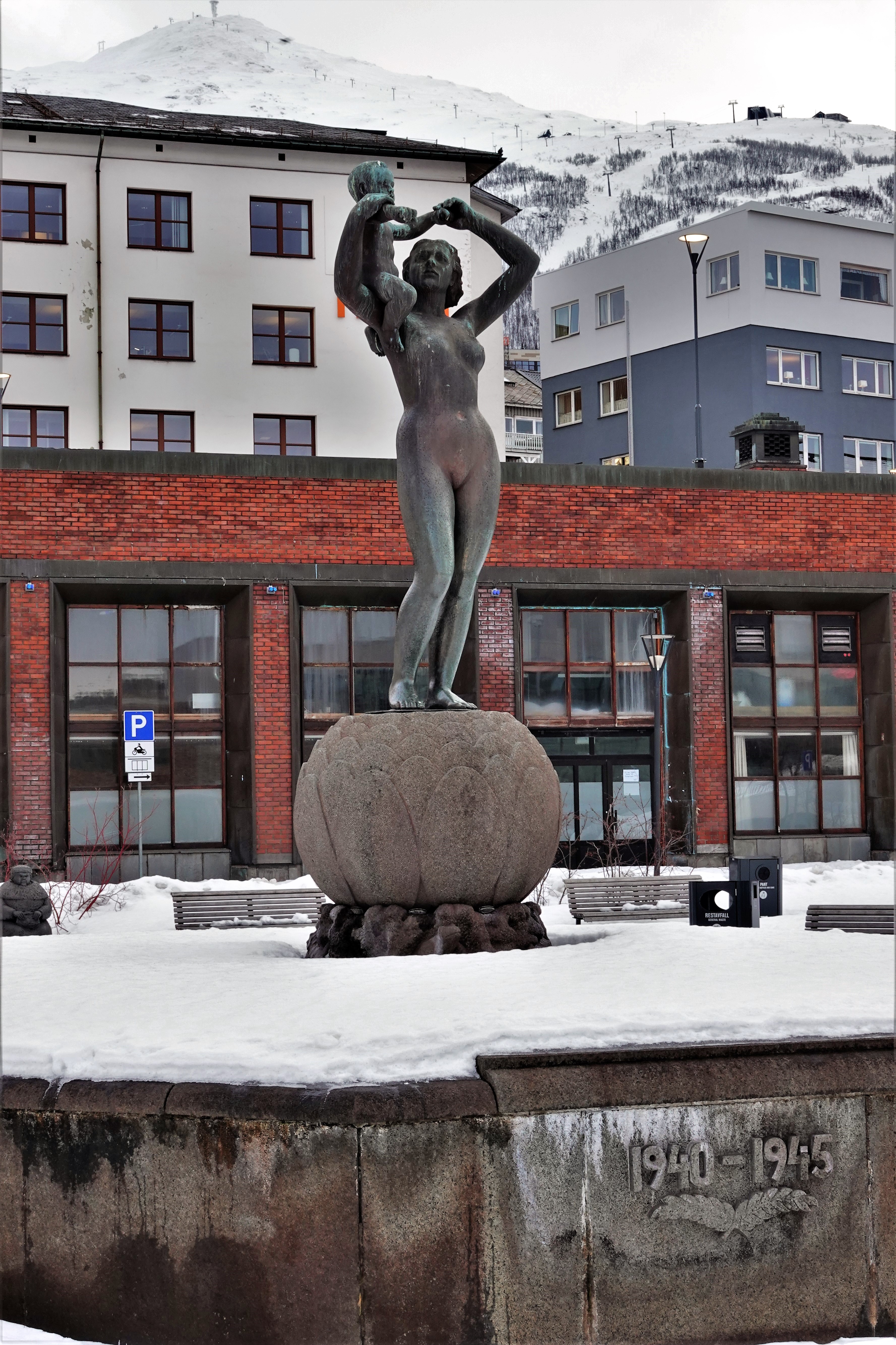
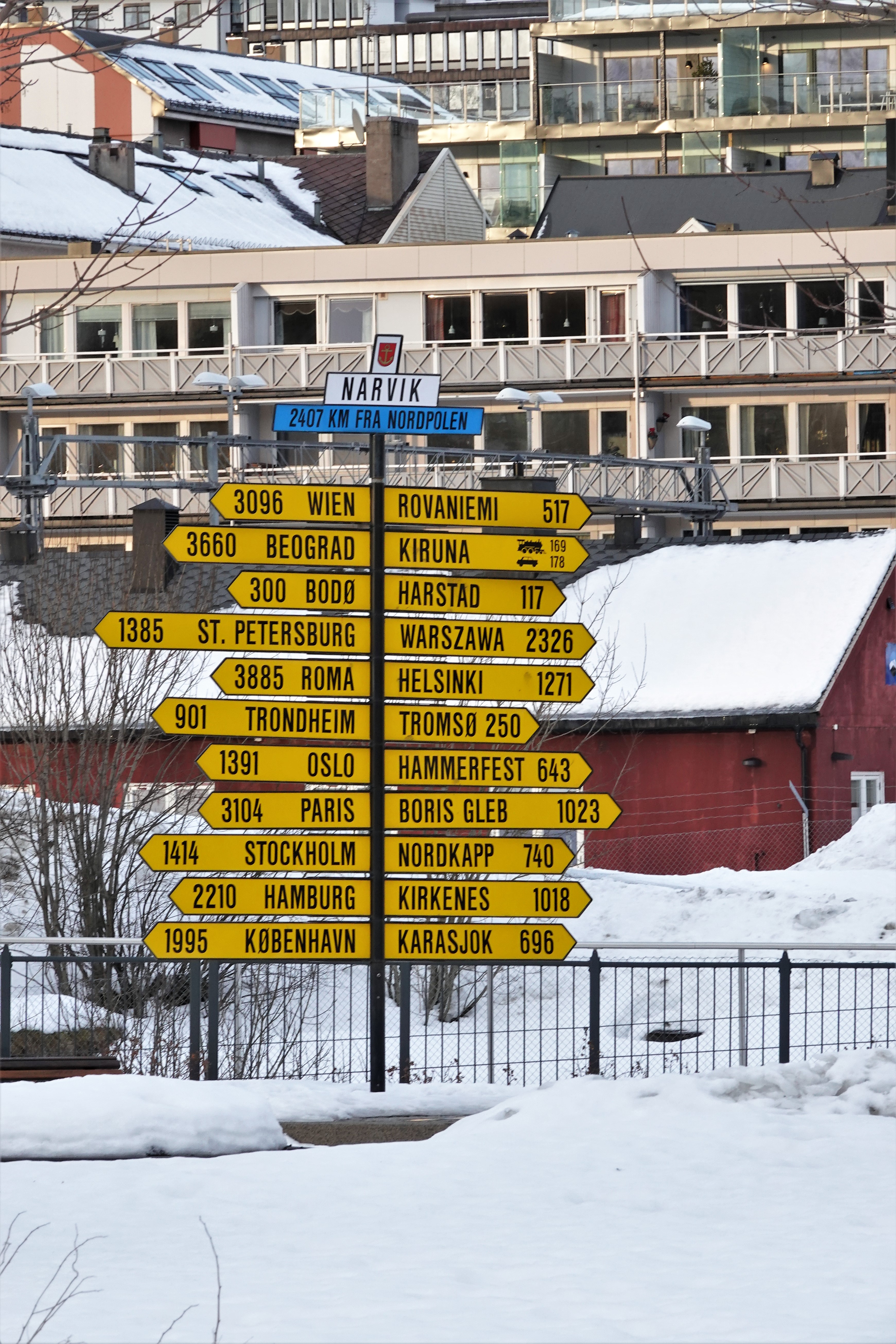
Instead, we braved the treacherous icy streets…
and climbed the hills for views of distant shores,
clusters of urban housing,
public art,
and commemorative sculpture, such as the National Monument of Freedom.
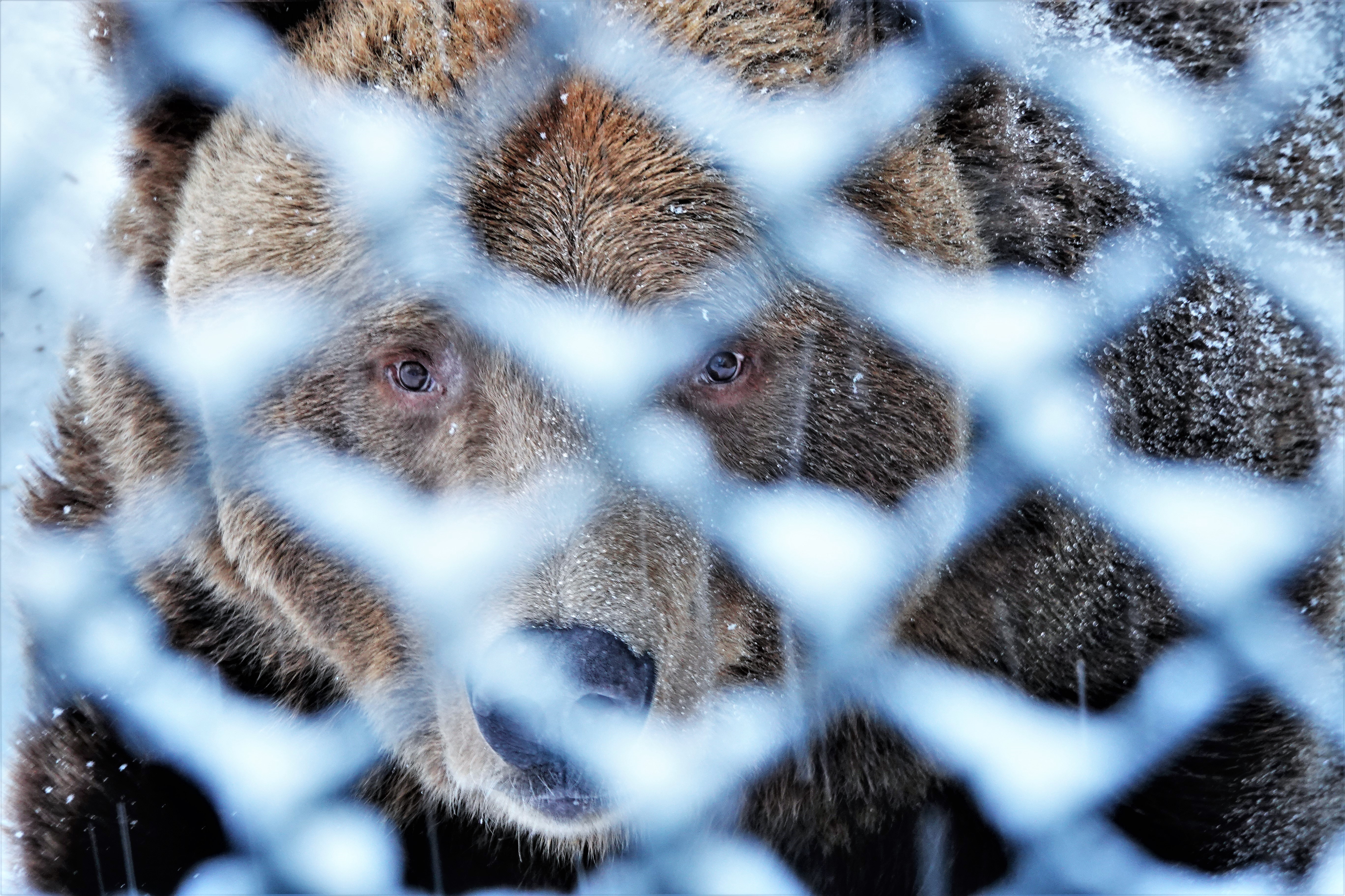
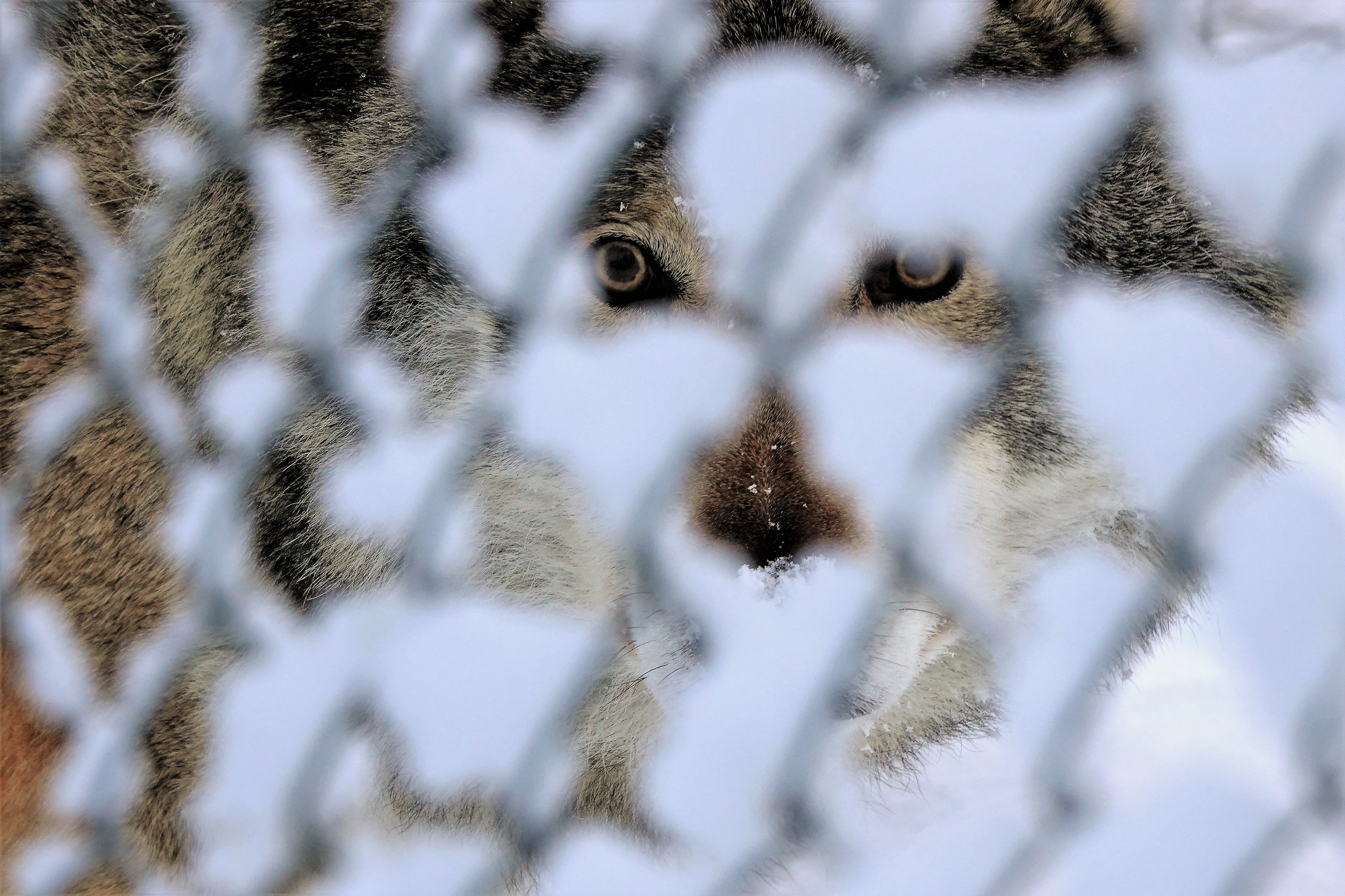
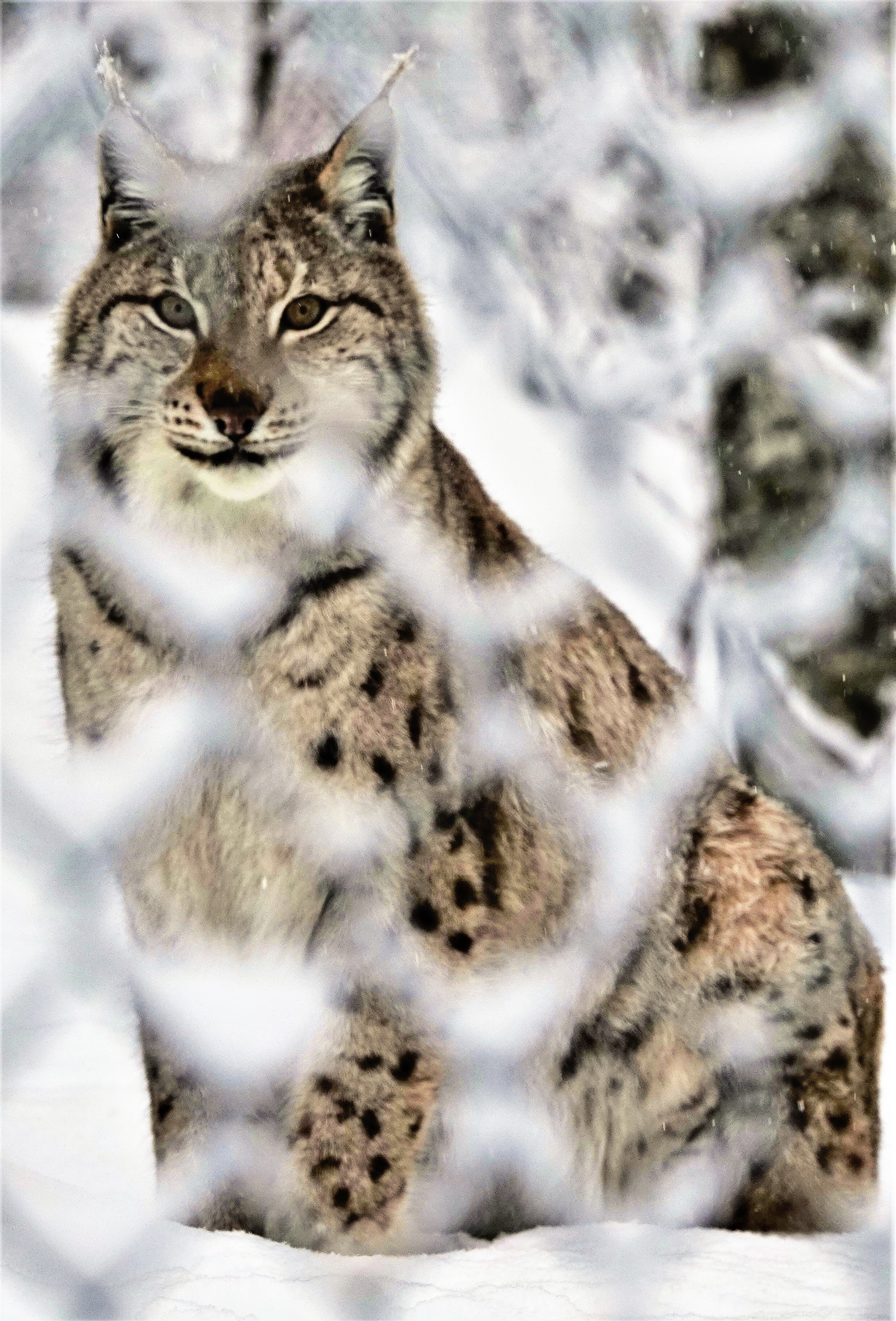
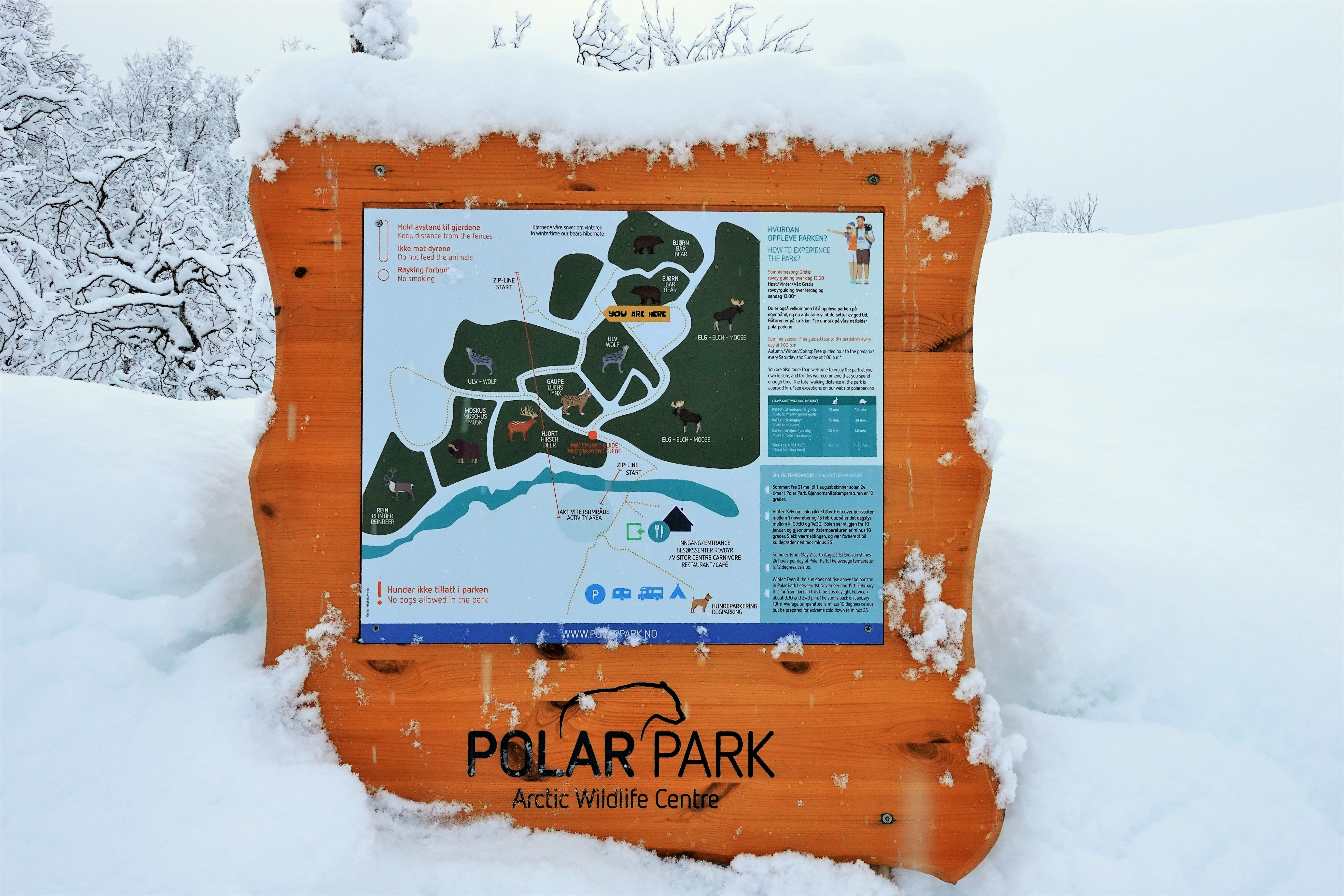
Expanding our horizons, we boarded a bus bound for Polar Park,
the world’s northernmost animal sanctuary,
and home to Norway’s large predators such as bears,
wolves,
and lynx.
Although the animal habitats are vast,
and the wildlife seem well-cared for, it’s impossible to look past the fencing and not think of Polar Park as a winter zoo.
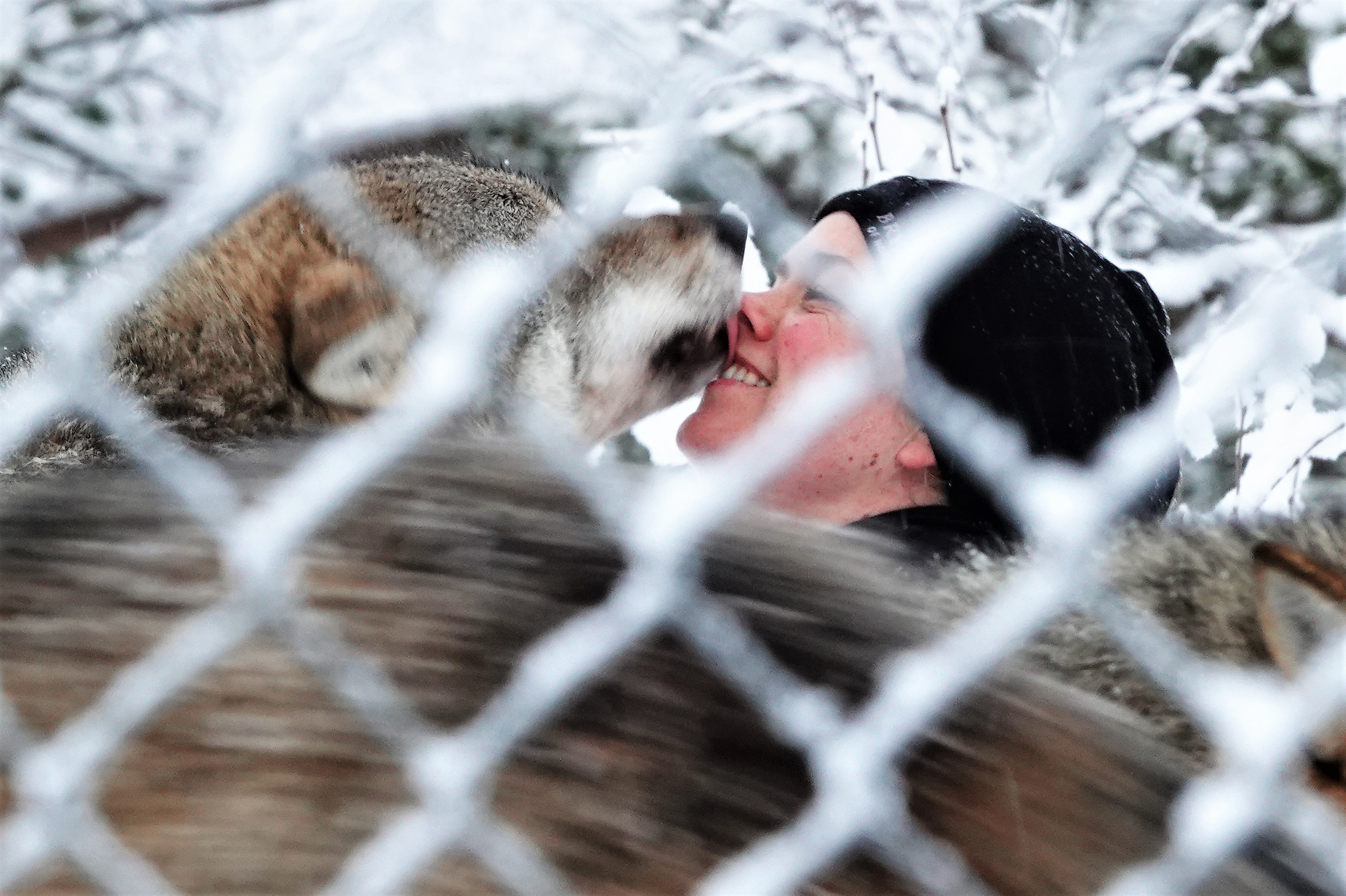
The wolves have been humanized since their arrival in 2006,
and available for kisses and snuggles, albeit for an extra fee.
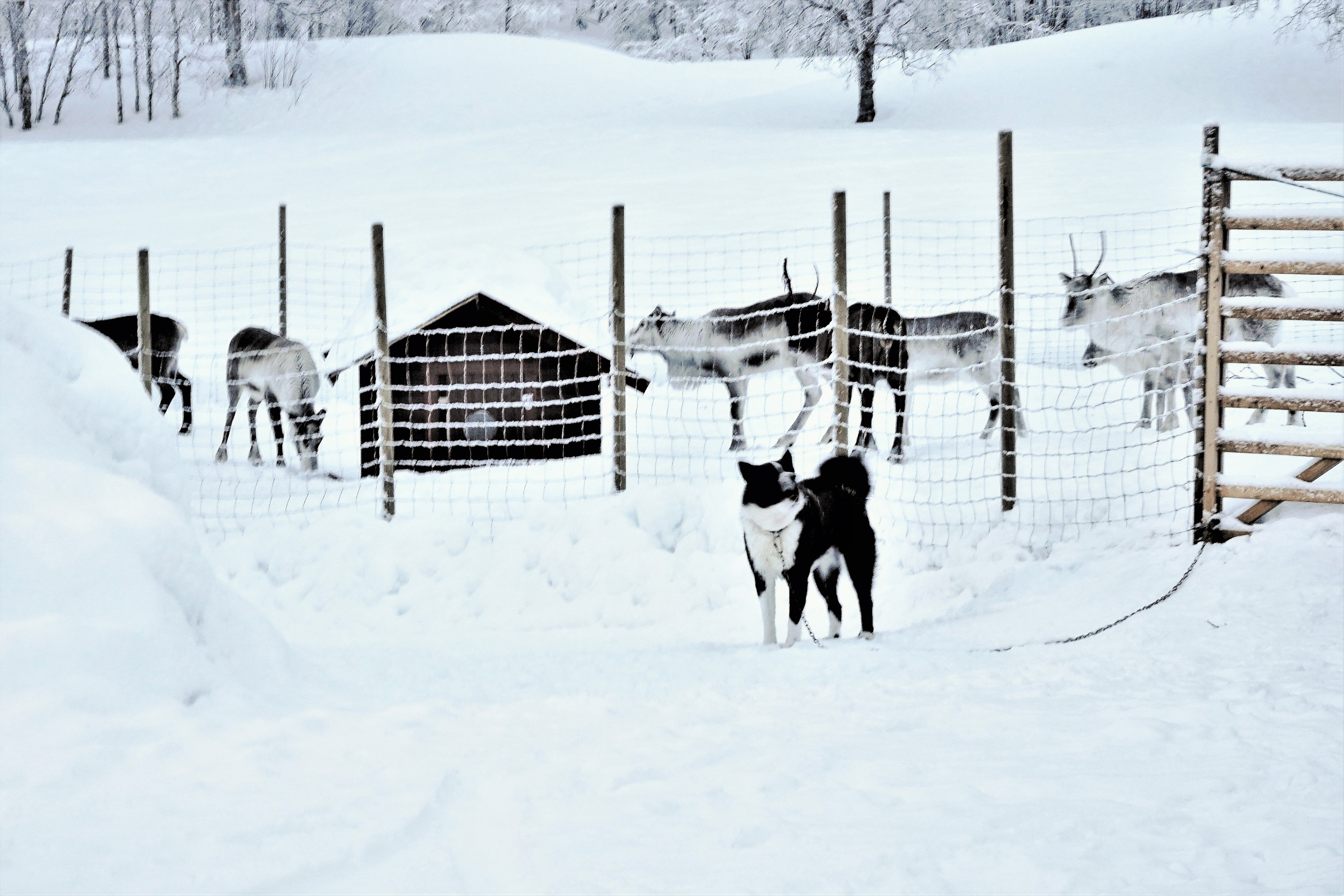
All things considered, I’d rather take my chances petting the barking dog that guards the reindeer down the road.