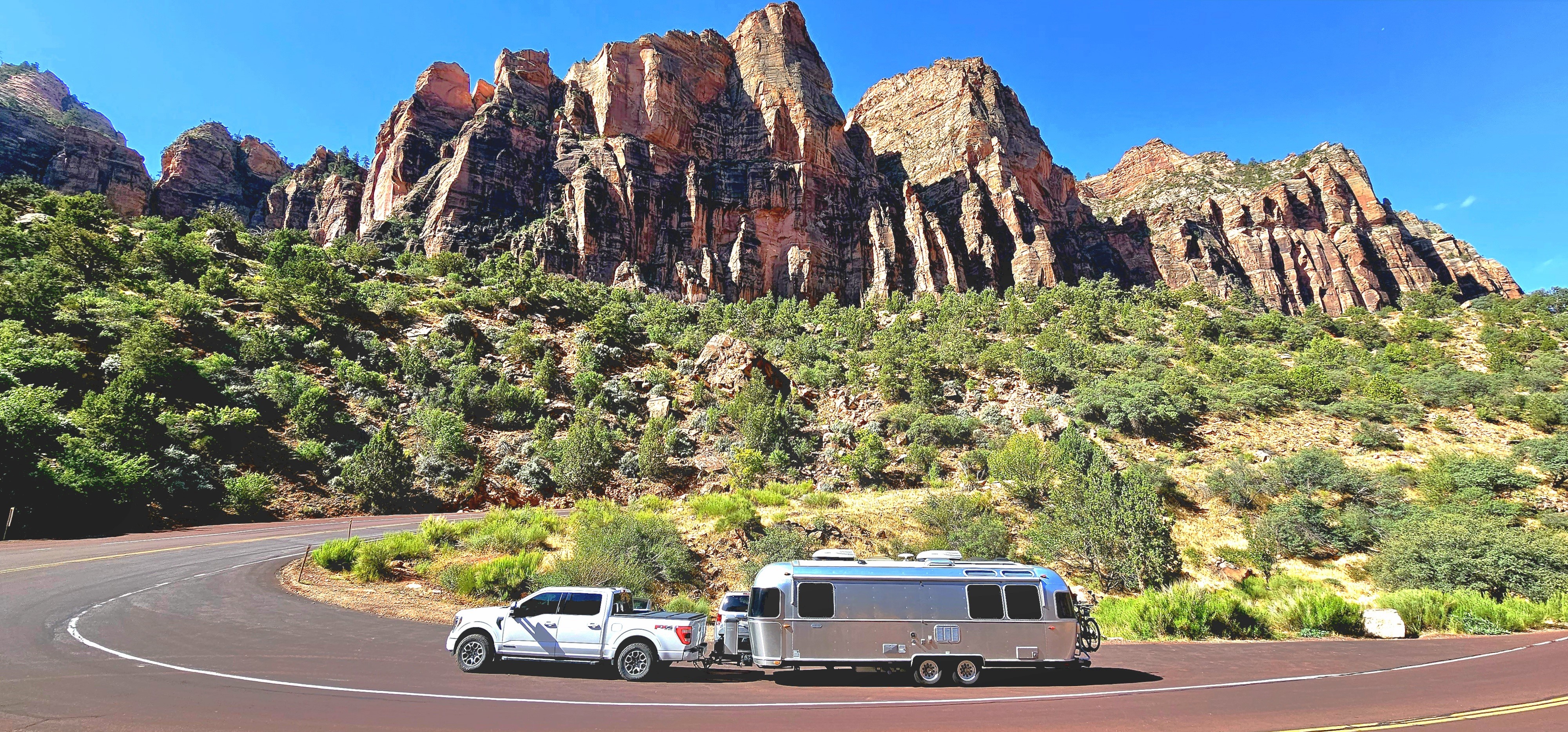
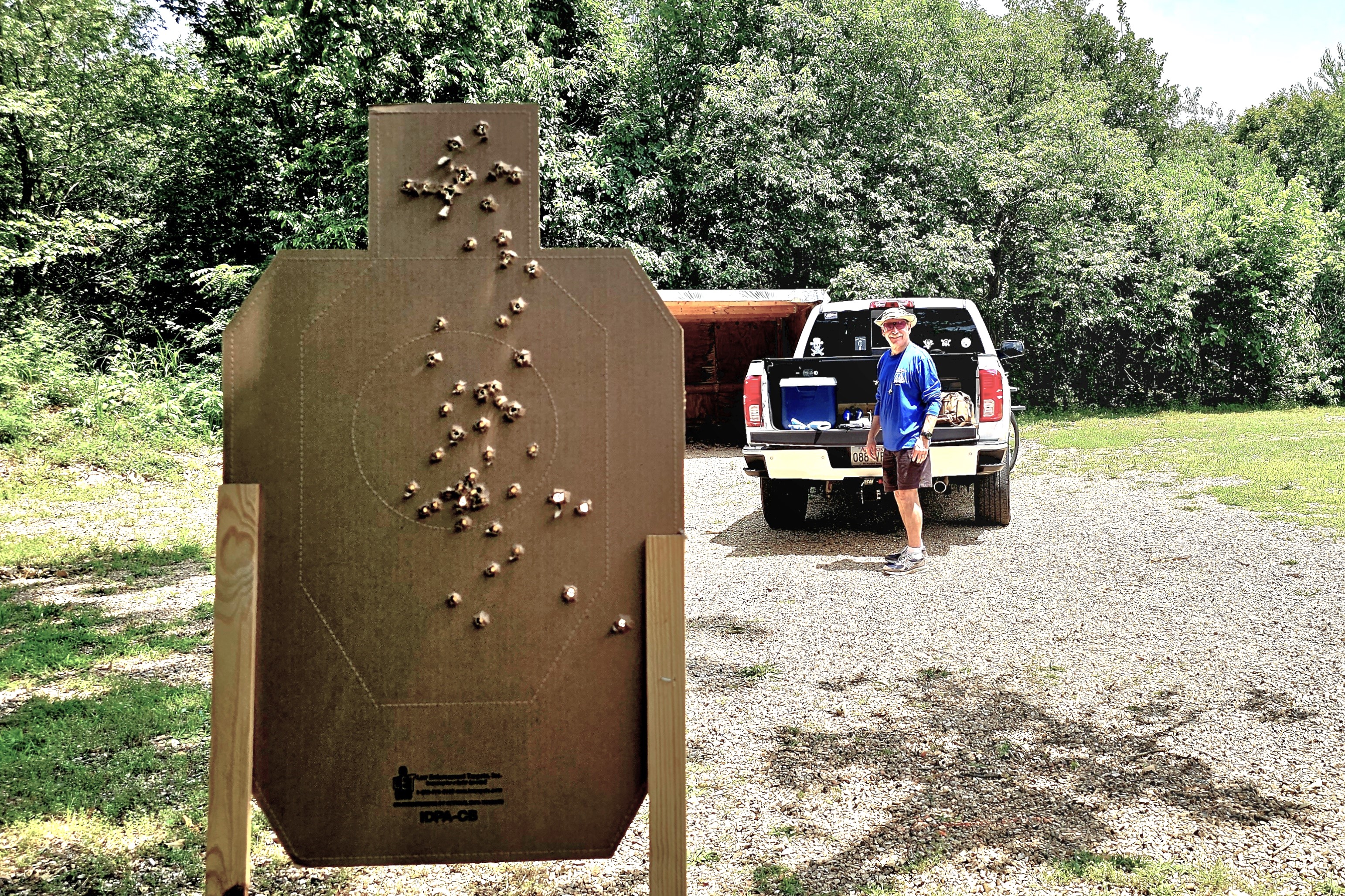
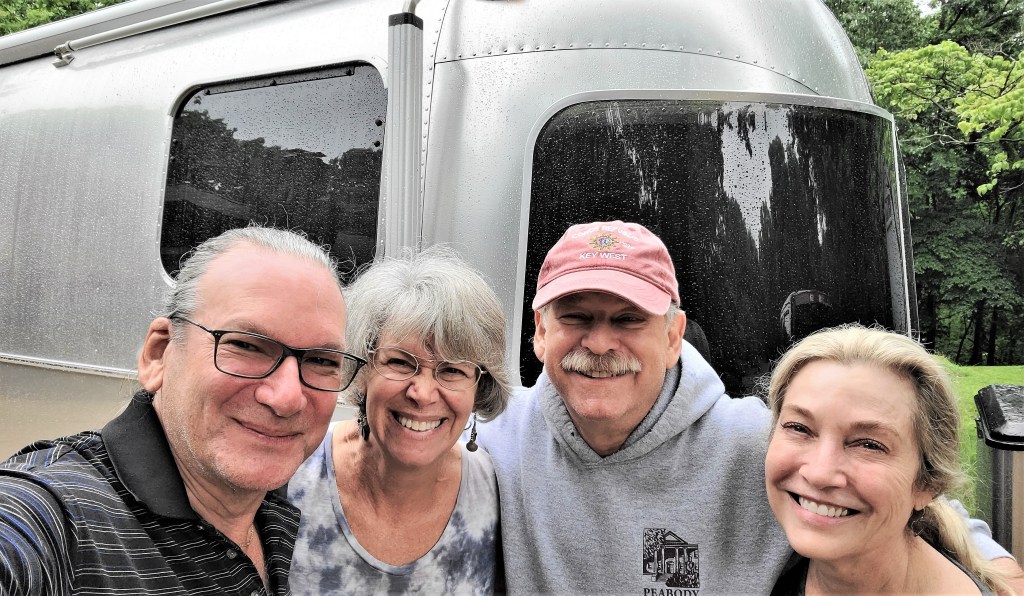
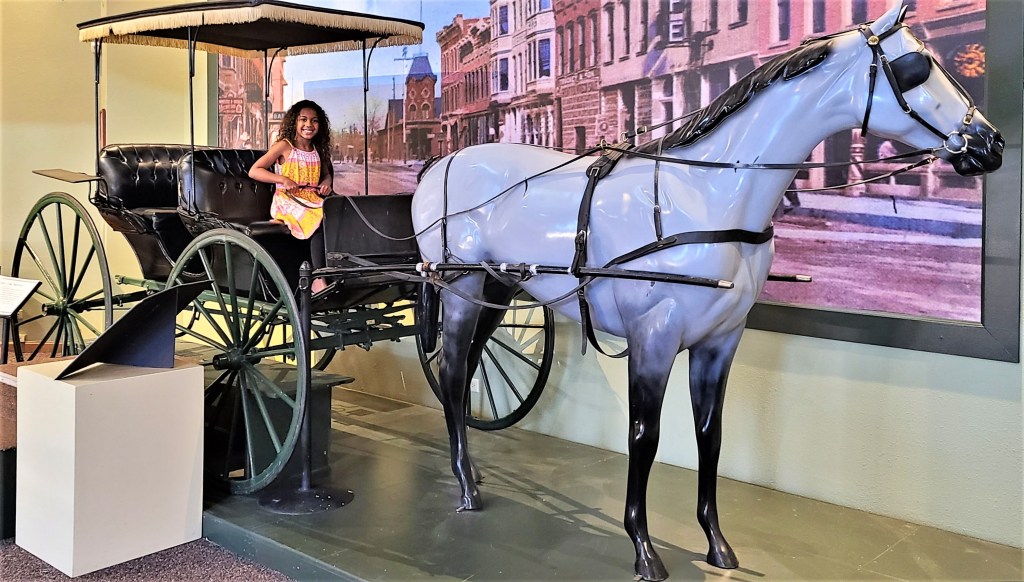
I've been here, there and everywhere;
Far and wide, across divides;
But none compare to a maiden voyage extraordinaire,
exploring America for one full year...
in my shiny Airstream!
I’m not usually nostalgic. However, it’s been 7 years since my last total eclipse, and it’s been 7 years since this blog was created. So, it’s fitting that these two anniversaries should align like heavenly bodies.
Unfortunately, I will not be in the pathway of “No Sun Day on Monday,” but I will virtually celebrate by dusting off the experience that Leah and I memorialized in Corvallis, Oregon.
Happy Eclipse Day, everyone!
Dateline August 21, 2017:
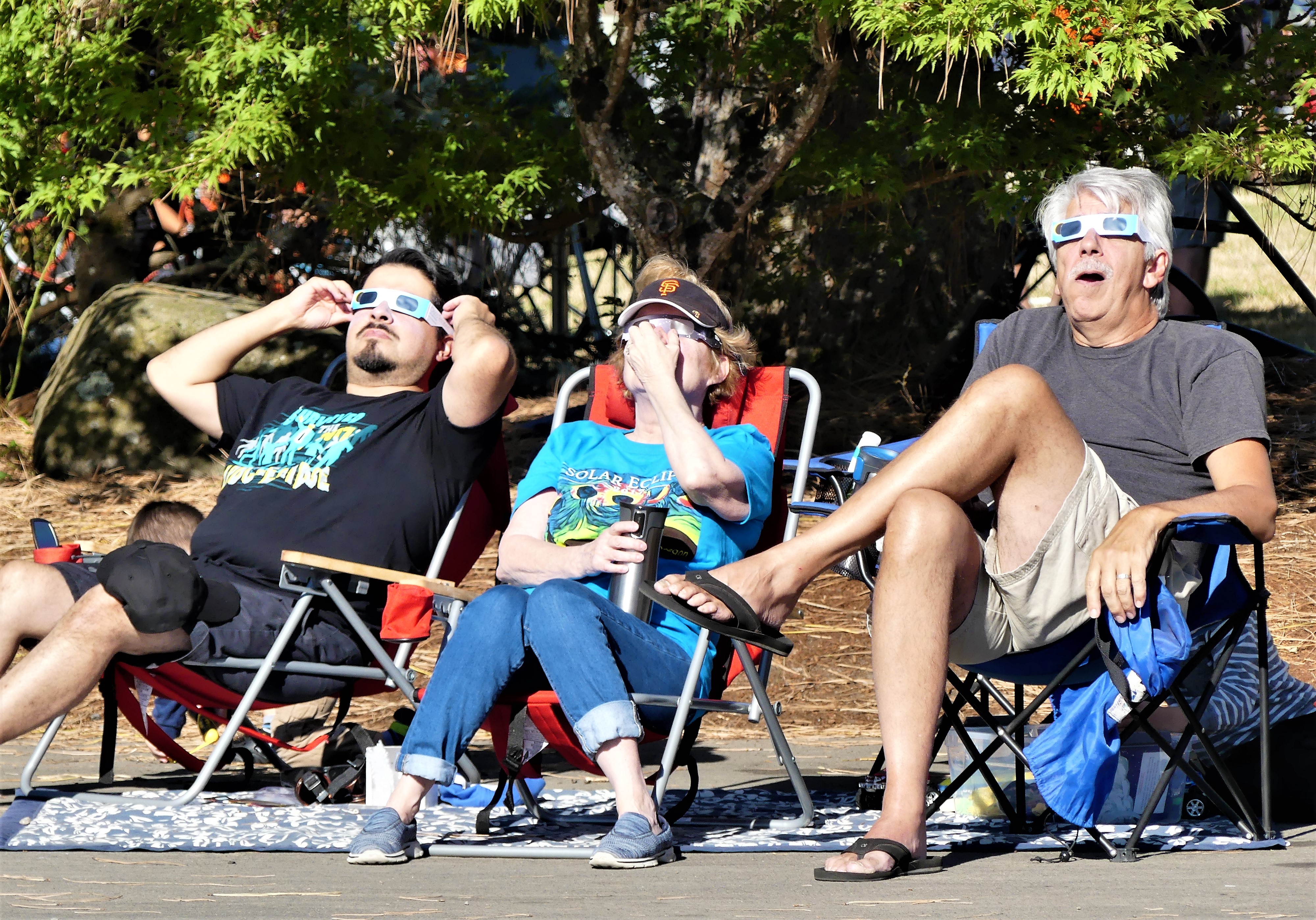
A small corner of the sky captured most of America’s attention and imagination on August 21, 2017. It was the celestial event of the millennia that brought a momentary pause to many people’s lives as they looked up and marveled at the source of our very existence. Leah and I had our own corner of the parking lot at Benton County Fairgrounds in Corvallis, OR.
A party atmosphere surrounded us. Some were expecting a spiritual awakening, and some were interested in the science of the occasion, but for most of us it was a social connection. We sat around with family, friends and strangers, looking goofy in our mylar glasses…
We all held our collective breath at the precise moment the moon cloaked the sun. And then there were cheers, with all of us sharing this moment in time as sun worshippers.
For one brief moment, we were all related. For one instant during totality, we had turned the corner to become the human race.
And just like that it was gone in a flash, and a tear passed the corner of my eye.
Sadly, it’s going to be a very long time until our next solar eclipse, or another shared moment of total community.
It’s a new year, and there has never been a better time for Leah and me to explore our world. We are always up for a challenge, so we’ve decided to begin 2024 with our most ambitious adventure yet. Not satisfied with returning to some of our favorite destinations–not that there’s anything wrong with familiar places—we booked a bucket list trip over a year ago that would literally take us out of our comfort zone.
We filled the waiting time by visiting friends and family across America (and a speck of Canada)–only some of which I memorialized during the past year in this blog. In fact, a large part of last year’s travels never made it past my unpublished thoughts and unprocessed SD cards, including: a trip to Israel (months before the October 7th massacre);
a Central American cruise to Costa Rica,
Panama City,
and Cartagena, Columbia;
as well as a relaxing siesta on the Riviera Maya in Mexico;
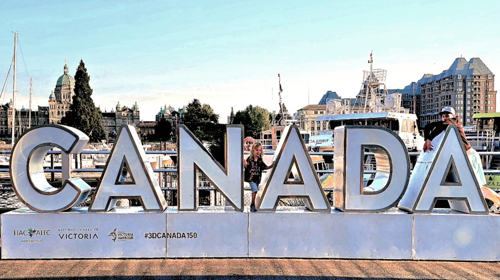
a flash visit to Victoria, BC;
and a southwestern tour of America in our silver bullet–
all worthy of sharing sooner than later.
But until then, I must fast forward to our most recent trip to Chile’s Atacama Desert before embarking aboard Viking’s Octantis to Patagonia and Antarctica–in search of whales, penguins and extraordinary landscapes.
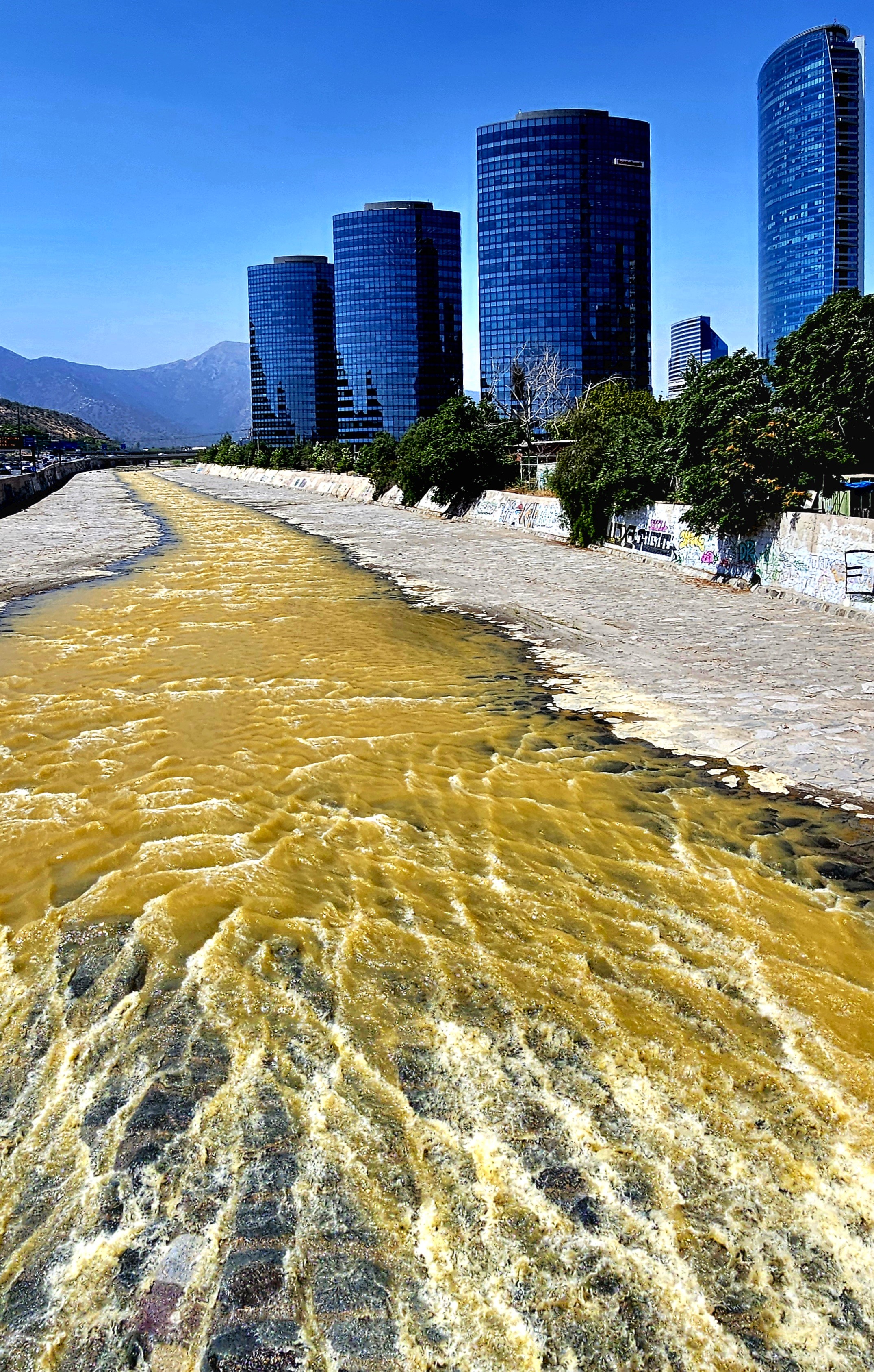
We overnighted in Santiago, Chile,
followed by a morning flight to Copiapó, the region’s capital incorporating San Pedro de Atacama.
And set out to explore the highest, driest ecosystem on planet Earth.
Forgive me; it’s been a while since my last confession.
Life happens and it’s been challenging at times to juggle travel with business affairs, personal affairs and blogging. And with the passage of each passing day, it’s become increasingly more difficult to return to summer events with the same vitality, and cobble a detailed timeline from 3 months ago. In fact, there are still stories from last year’s journey to Canada that have yet to be written and published.
While I could travel less to blog more often, or continue to travel without memorializing the occasion, neither option is an acceptable one. Perhaps, I’ll just have to find a better way to accomplish both without sacrificing one for the other. In the meantime, I’ll pick up where I left off, which is somewhere on the road between here and there.
First of all, a shout-out to our friends Dirk and Heather,
who allowed us to park the Airstream at their ranch in Fort Collins, assuring us peace of mind while we boarded a flight from Denver to Seattle to visit my son Nate.
Dollar for dollar and day for day, Leah and I figured that flying round-trip to Seattle probably saved us 2 weeks of driving 1,500 miles, at a proximate cost of $1300 in fuel.
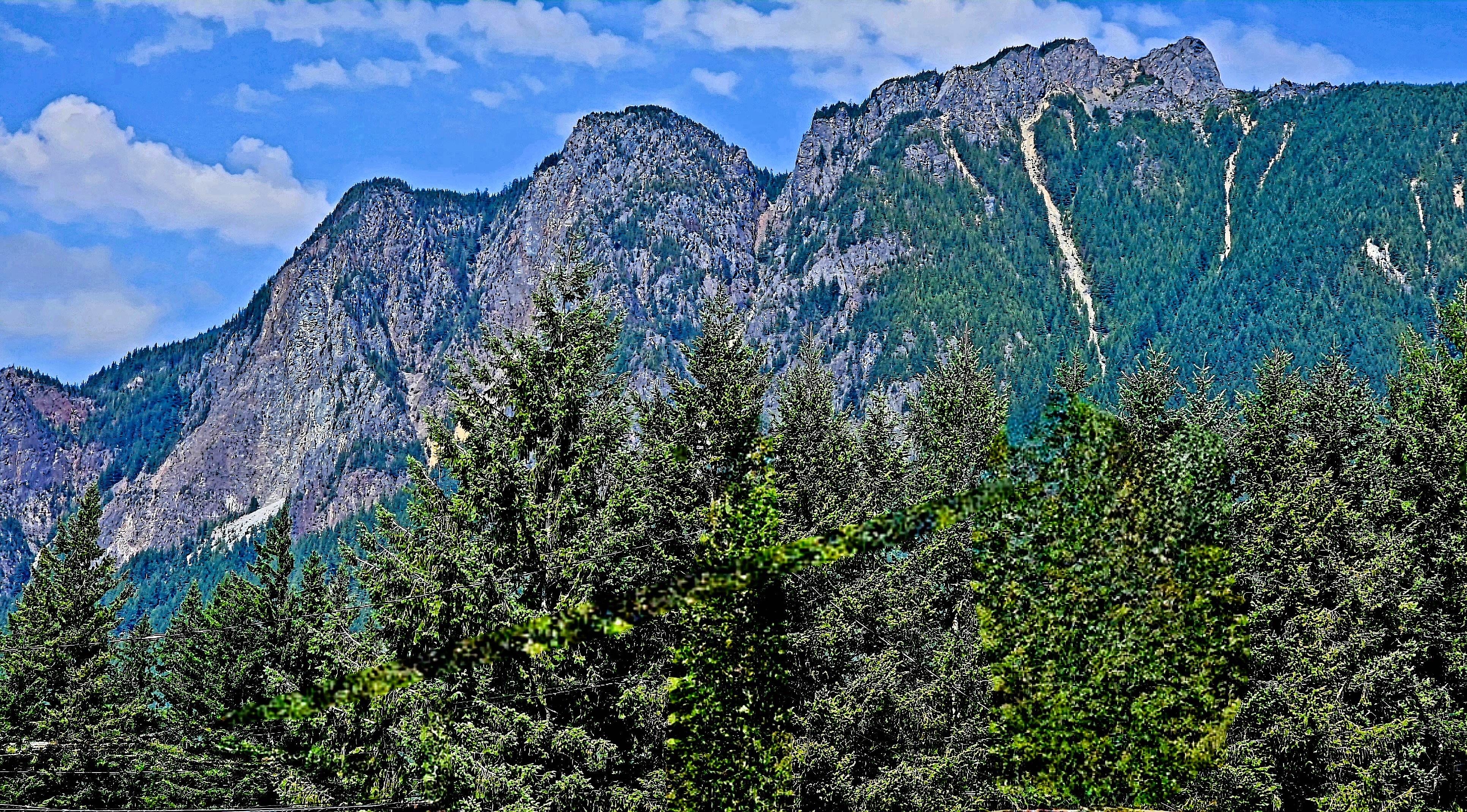
After our arrival to Issaquah (suburban Seattle and Nate’s hometown), we ventured southeast along the I-90 corridor to hike Rattlesnake Ledge on Rattlesnake Mountain–
a demanding 2-mile ascent…
that gave us sweeping views of Rattlesnake Lake,
and the Cascade Range beyond the clouds.
Seattle was also our gateway to north of the border…
After a 2 hour and 45-minute cruise aboard the Victoria Clipper, we arrived at Victoria’s Inner Harbor,
where we would spend the weekend at the historic Pendray Inn and Tea House…
in the very pink, Executive Suite.
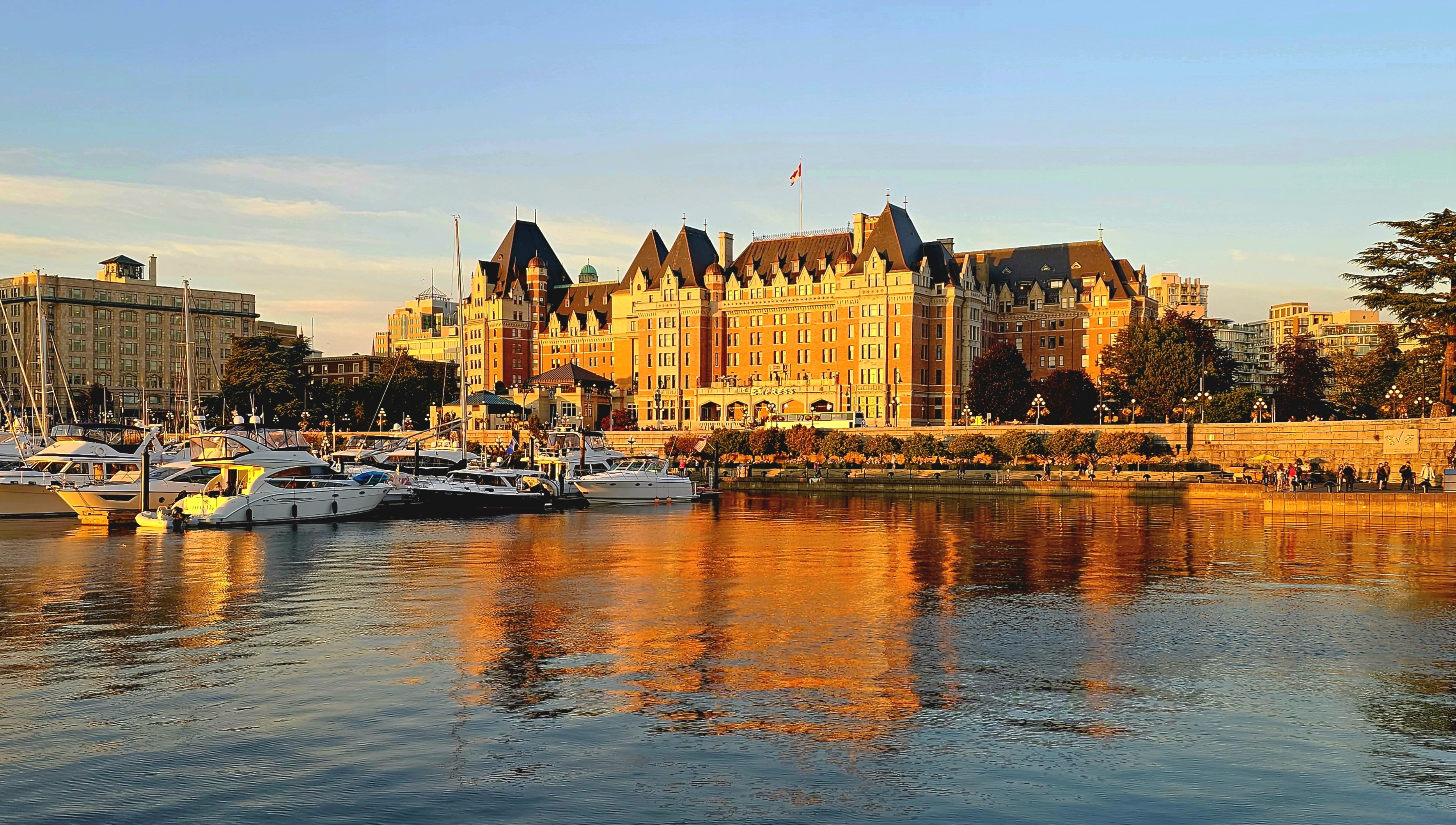
Victoria is well-known as a pedestrian town,
with a variety of landmarks and attractions within a few miles of our hotel. We were less than a half-mile from Parliament,
and Fairmont’s Empress Hotel,
and another half-mile further to Canada’s oldest Chinatown.
And strolling along the Lower Breakwater (adorned with First Nation symbols) with panoramic views to the south, afforded us a different perspective of the Cascade Range.
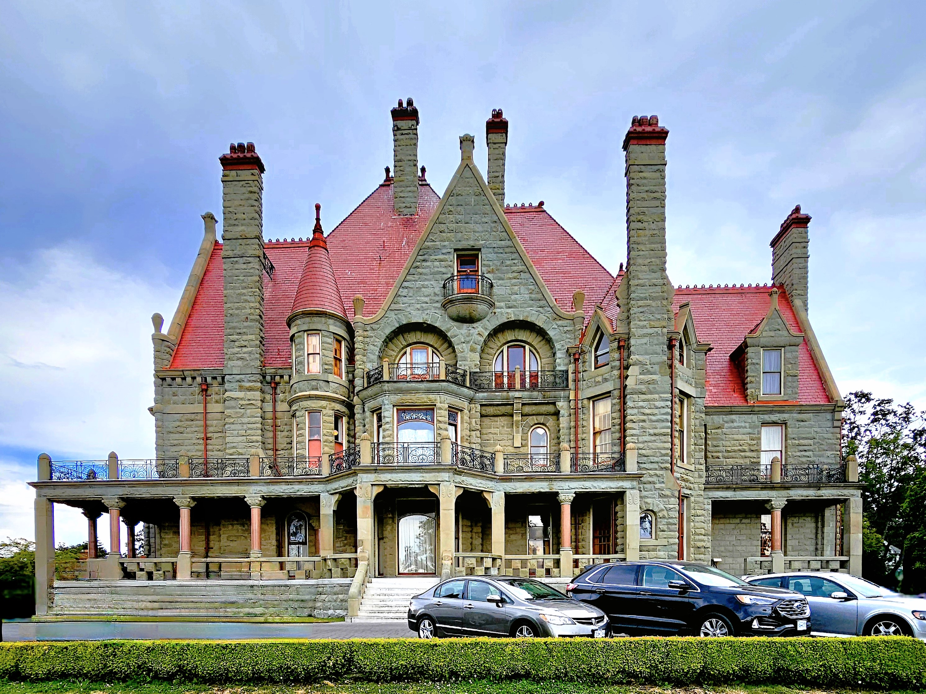
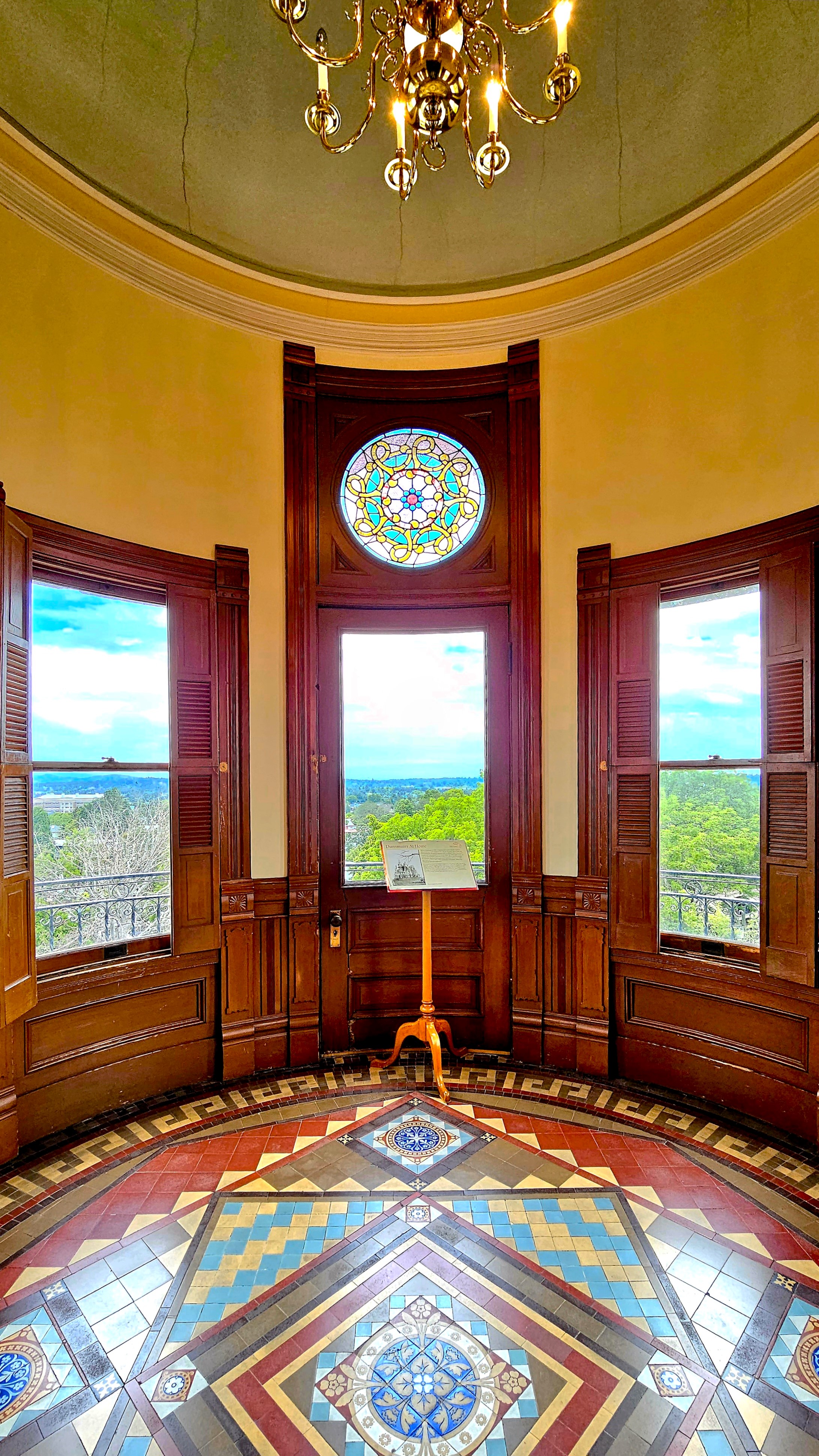
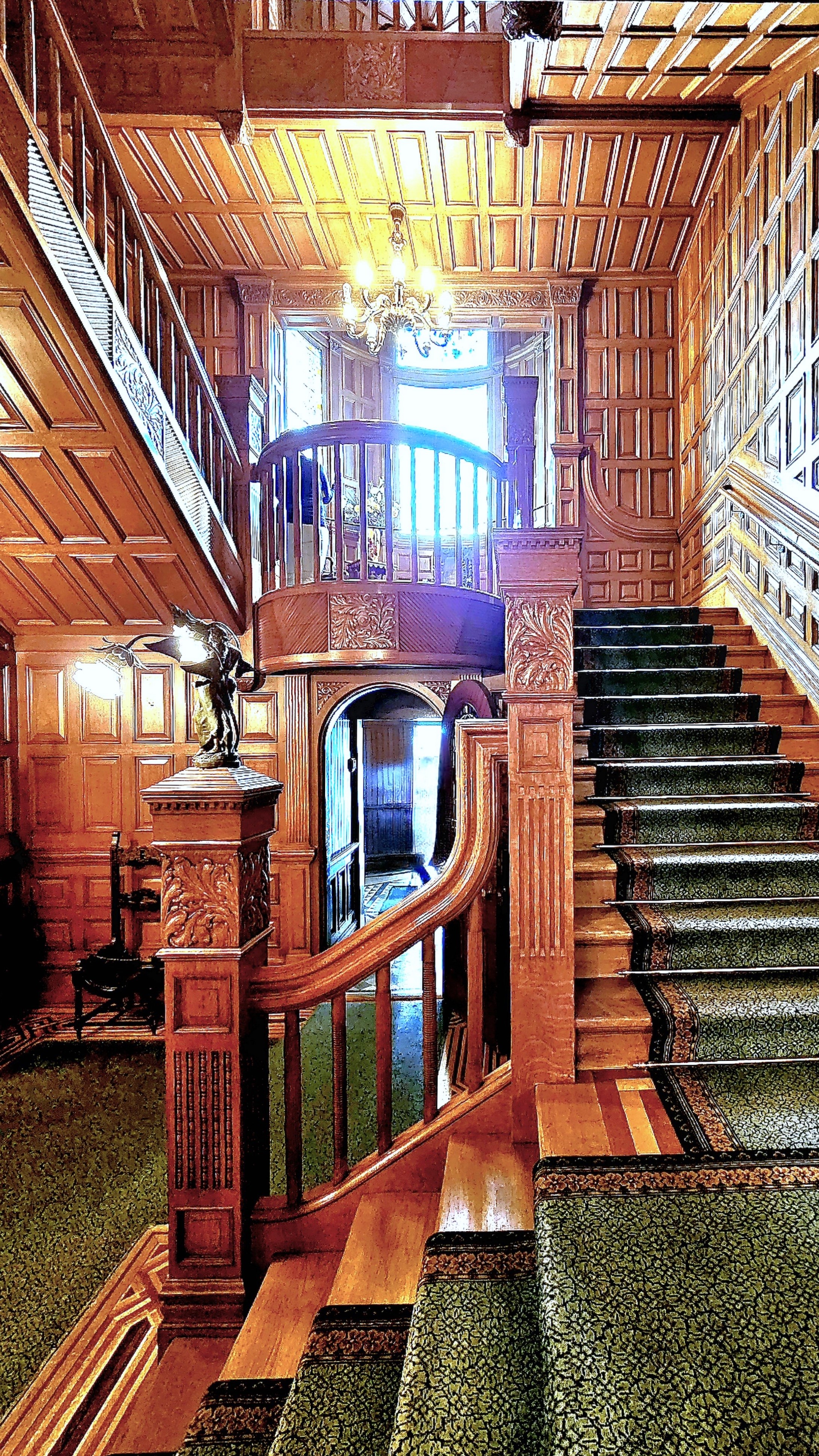
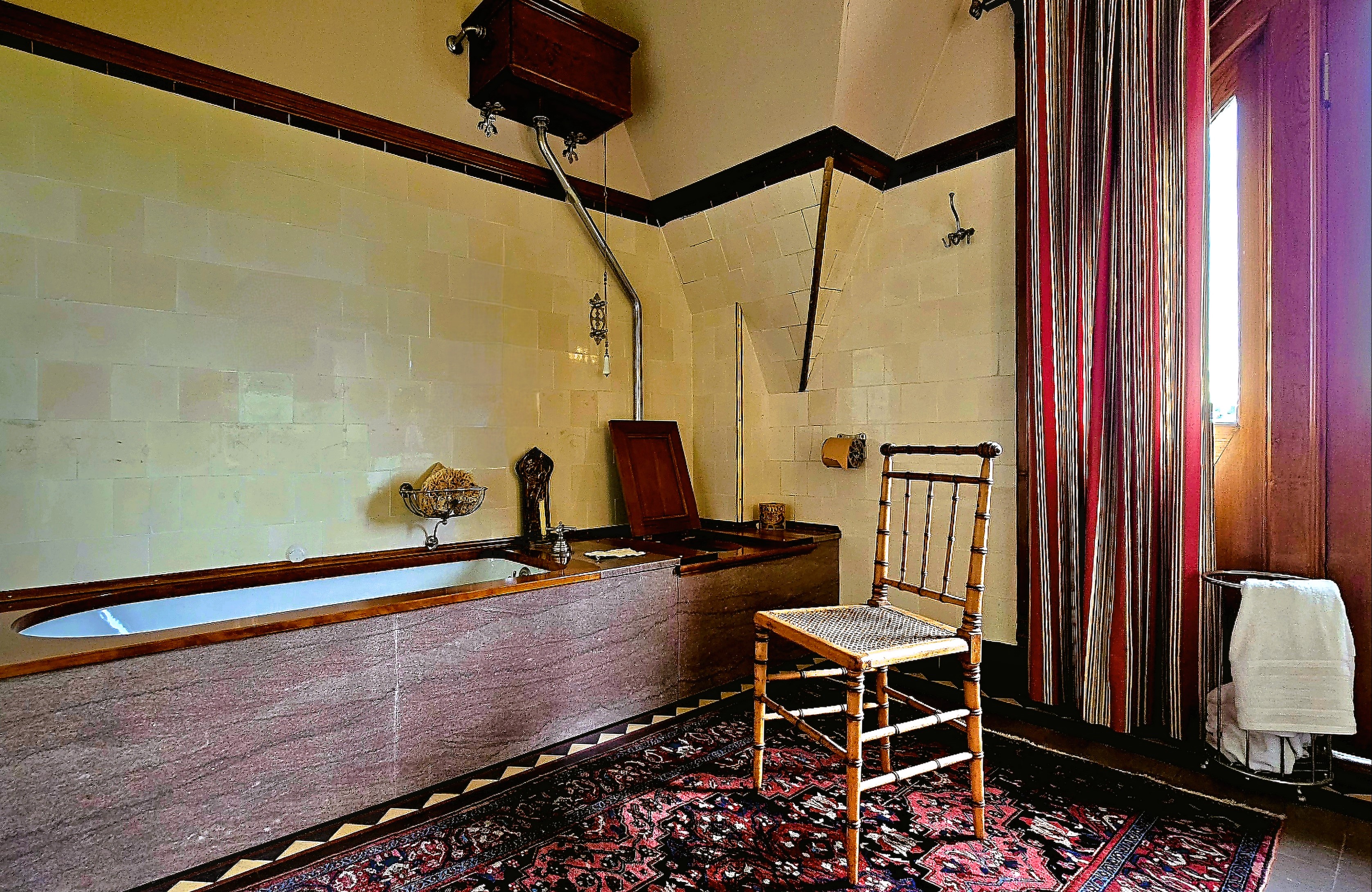
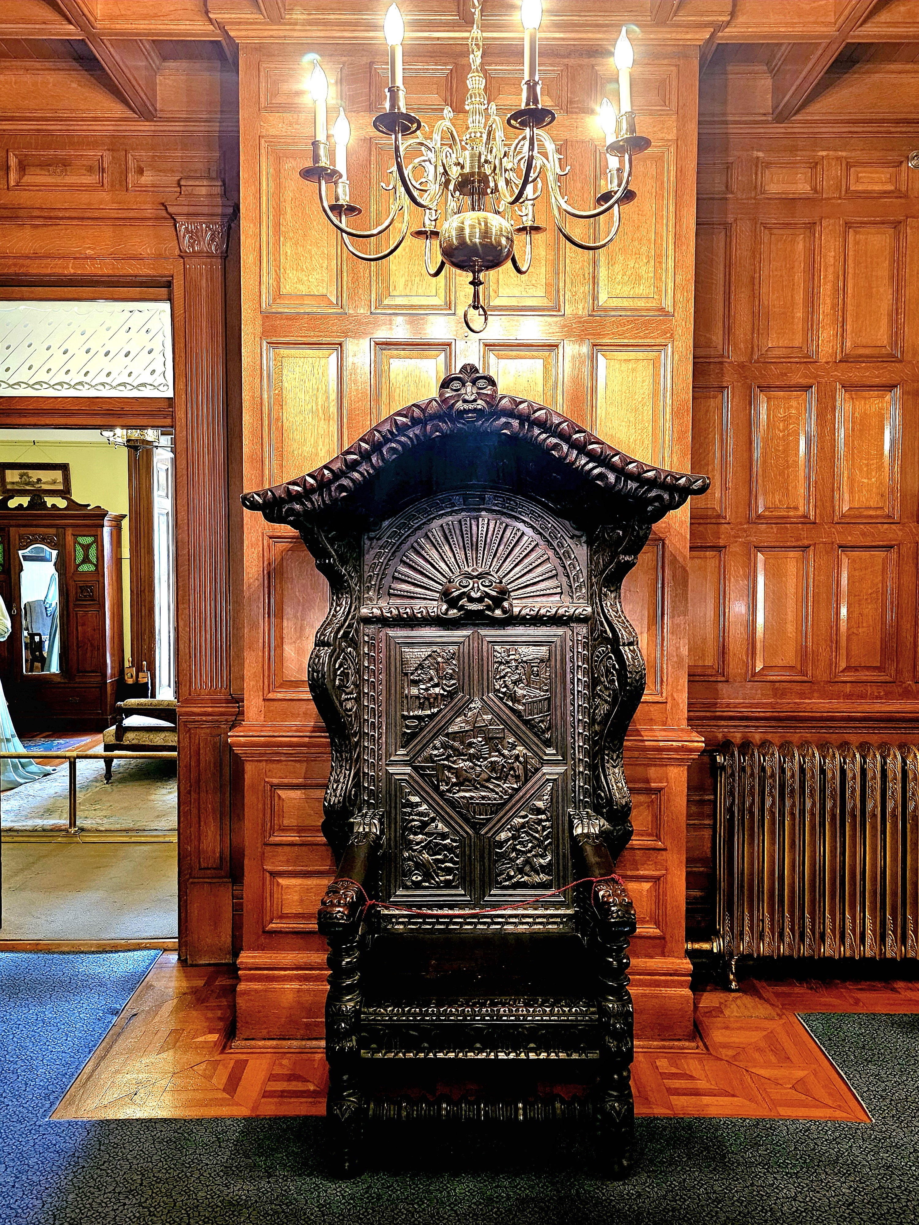
Also within walking distance, we discovered Craigdarroch Castle, a Victorian architectural marvel…
from front…
to back….
top to bottom,
and everywhere in between!
And exquisitely furnished throughout the residence.
Of course, no visit to Victoria is complete without a stroll through Butchart Gardens,
Leah and I arrived in Colorado Springs, where we liaised with Leah’s daughter, Carrie and her clan to enjoy a camping adventure together during the Independence Day holiday weekend, and it was action-packed.
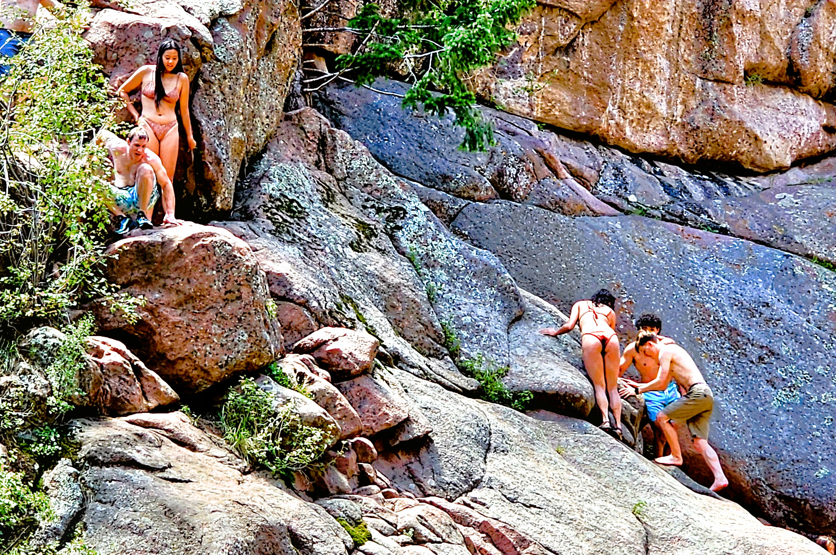
Hiking one mile into Guffey Gorge…
brought us to Paradise Cove, a swimming hole popular among local adolescents who come to cool off from the 100oF heat and flex their courage muscles by cliff jumping into deep water.
Risk-takers were scrambling up the terrain to pick their “launch” position on the rocks, and prove to themselves and others that they had “The Right Stuff.”
We were happy eating our lunch while watching the derring-do entertainment.
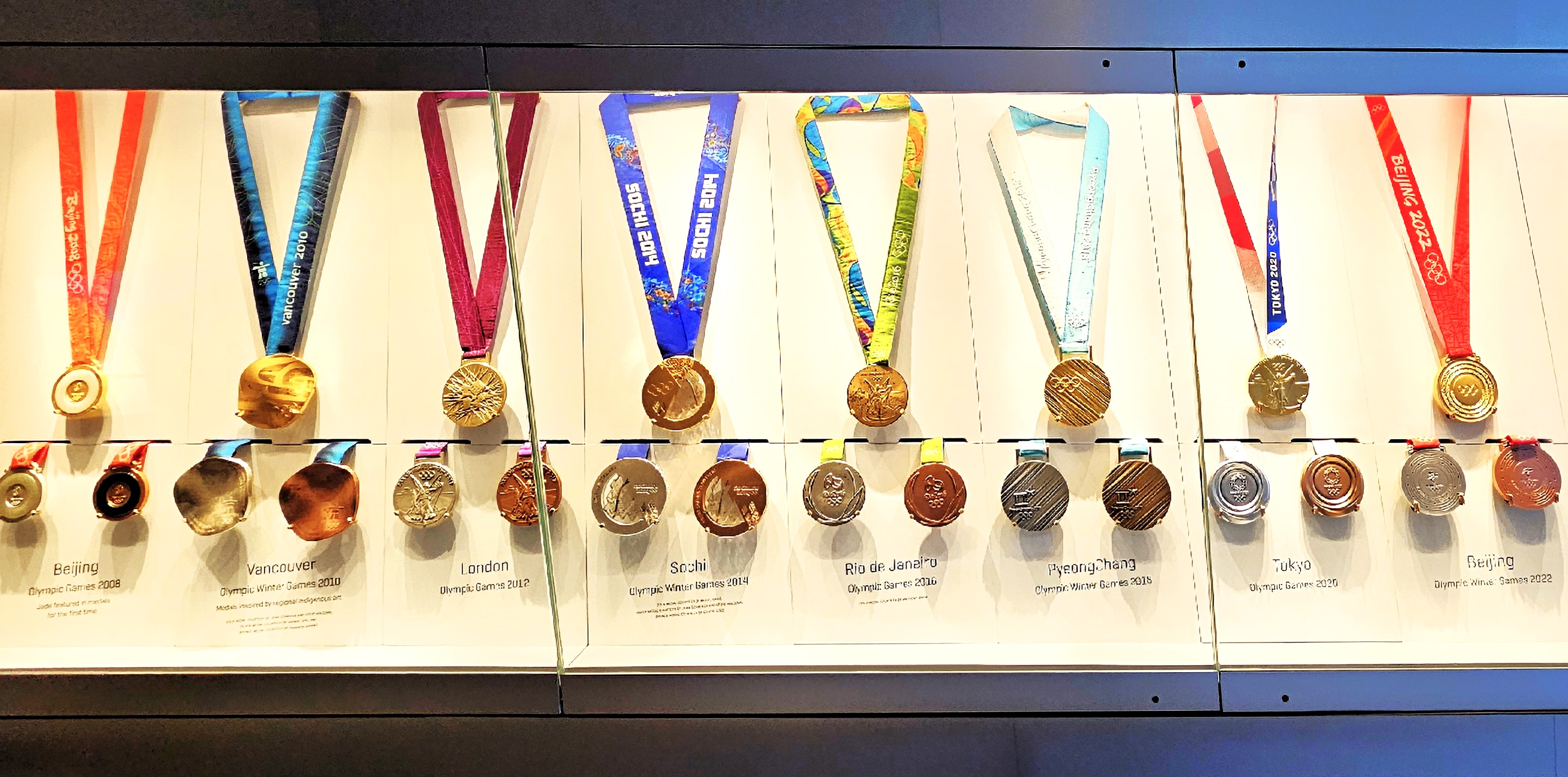
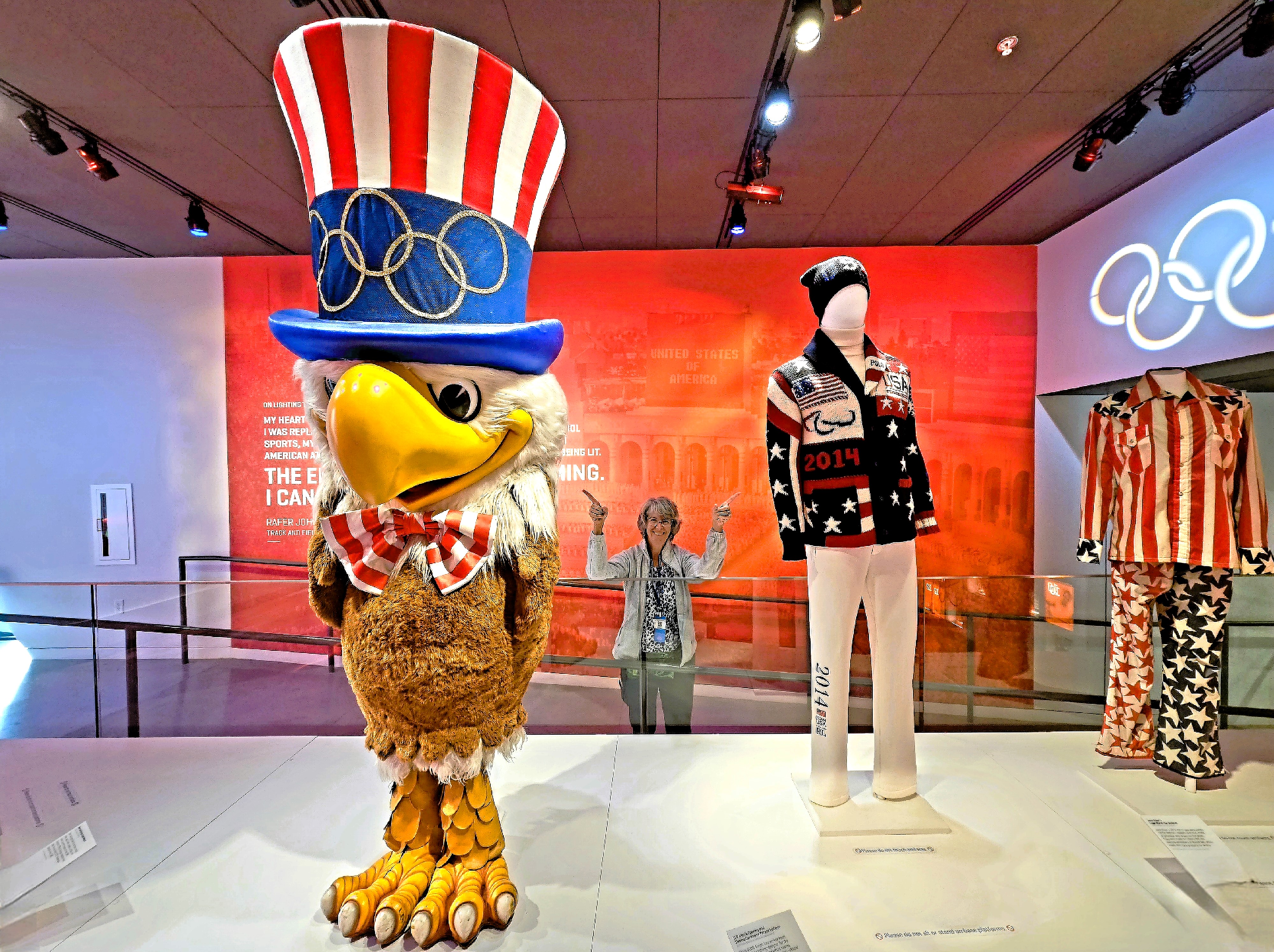
But Colorado Springs has so much more to offer. For starters, the interactive U.S. Olympic and Paralympic Museum offered the perfect opportunity to celebrate athletic excellence;
to mock-compete in several sports categories by testing memory, reflexes and endurance;
and provide exhibition space for thousands of Olympic artifacts collected over the years.
After capturing a clever montage from the digital mural in the building foyer,
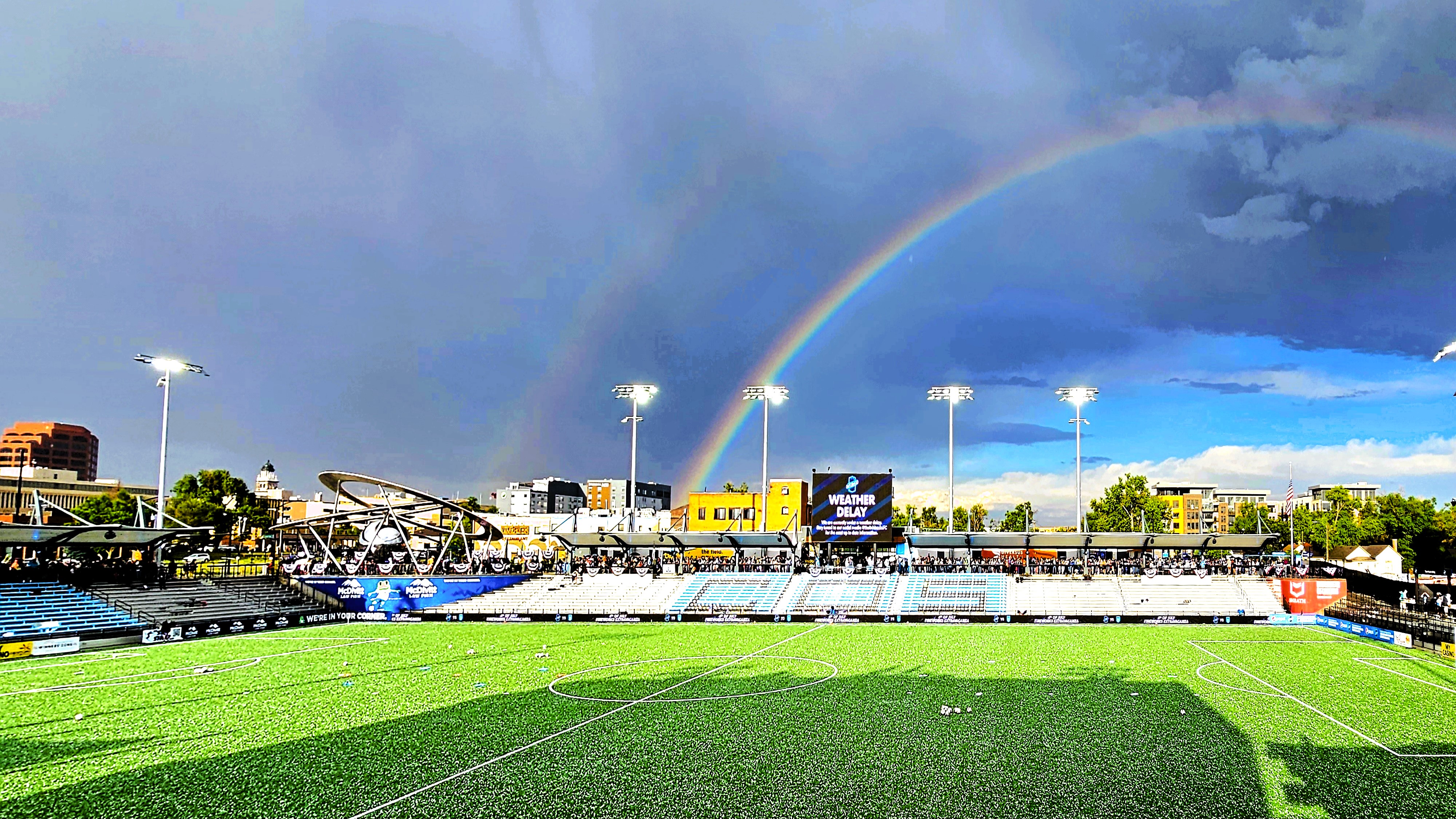
it was time to watch the Colorado Springs Switchbacks take the pitch at Weidner Field against Monterey Bay, but not until after the cloudburst,
when the unexpected hail finally had a chance to melt.
While Carrie and clan cruised to nearby Cañon City to view the Royal Gorge (our destination in 2 weeks,
Leah and I returned to Garden of the Gods,
before continuing to Manitou Springs to visit the urban fauna…
and flora.
Ironically, we’ve recently visited Carrie and clan at home in Cedar Crest, NM after 7 weeks of subsequent travel to dozens of different destinations…
which is a sore reminder of how far behind I am in chronicling this summer adventure, whether it’s because of inconsistent internet on the road or enjoying myself too much to stay current.
I never considered Kansas to be particularly picturesque (no offense, Kansas), and rarely in the running for Most Beautiful State title.
Driving westbound on I-70, my initial impression of Kansan landscape was a blur of high plains, pastureland and fields of fodder as far as the eye could see. The drive was basically a bore and staying alert was becoming a challenge. I glanced at Leah. She was slack-jawed with her head back and pretend-listening to an audiobook.
I activated the ALEXA app on the dash display.
“Hey Alexa,” I intonated and enunciated, “Name the flattest state in America.”
Alexa quickly responded with, “By any measure, Florida takes the prize for the flattest state in the nation [along with its flat-earth thinking, of late] because the highest point in the state is only 345 ft above sea level… Kansas merely ranks seventh in flatness.”
Nevertheless, Kansas does have an honorary mountain barely within its western border, making it the highest point in Kansas at 4039 ft.
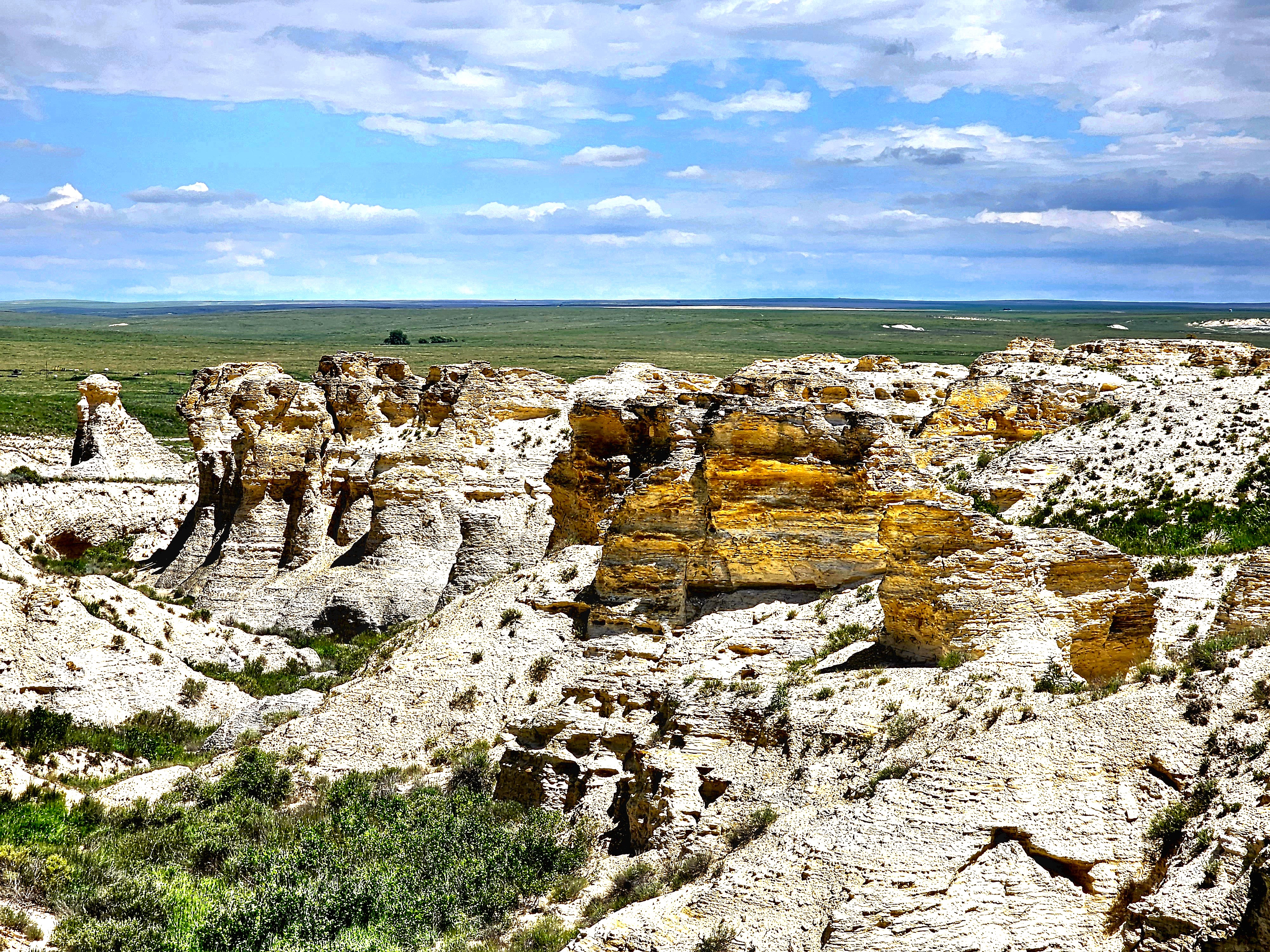
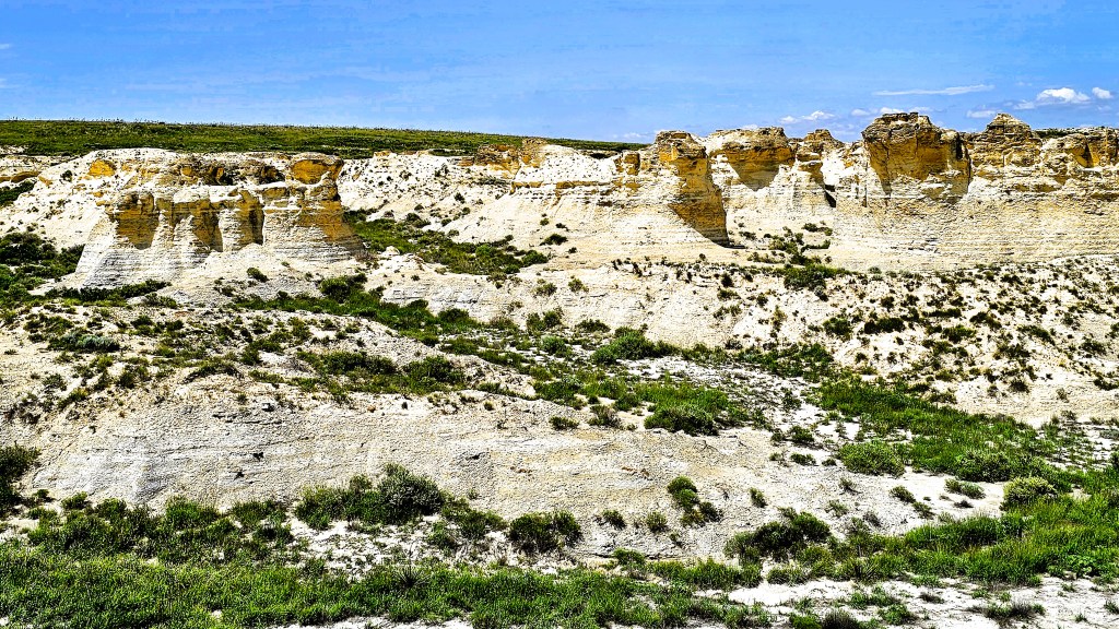
There was another notable elevation change that Leah and I explored before we reached the Rockies. We scheduled a stop at Lake Scott State Park (elev. 2979 ft) to break up the drive between Topeka and Colorado,
stretch our legs,
and discover the Badlands of Kansas.
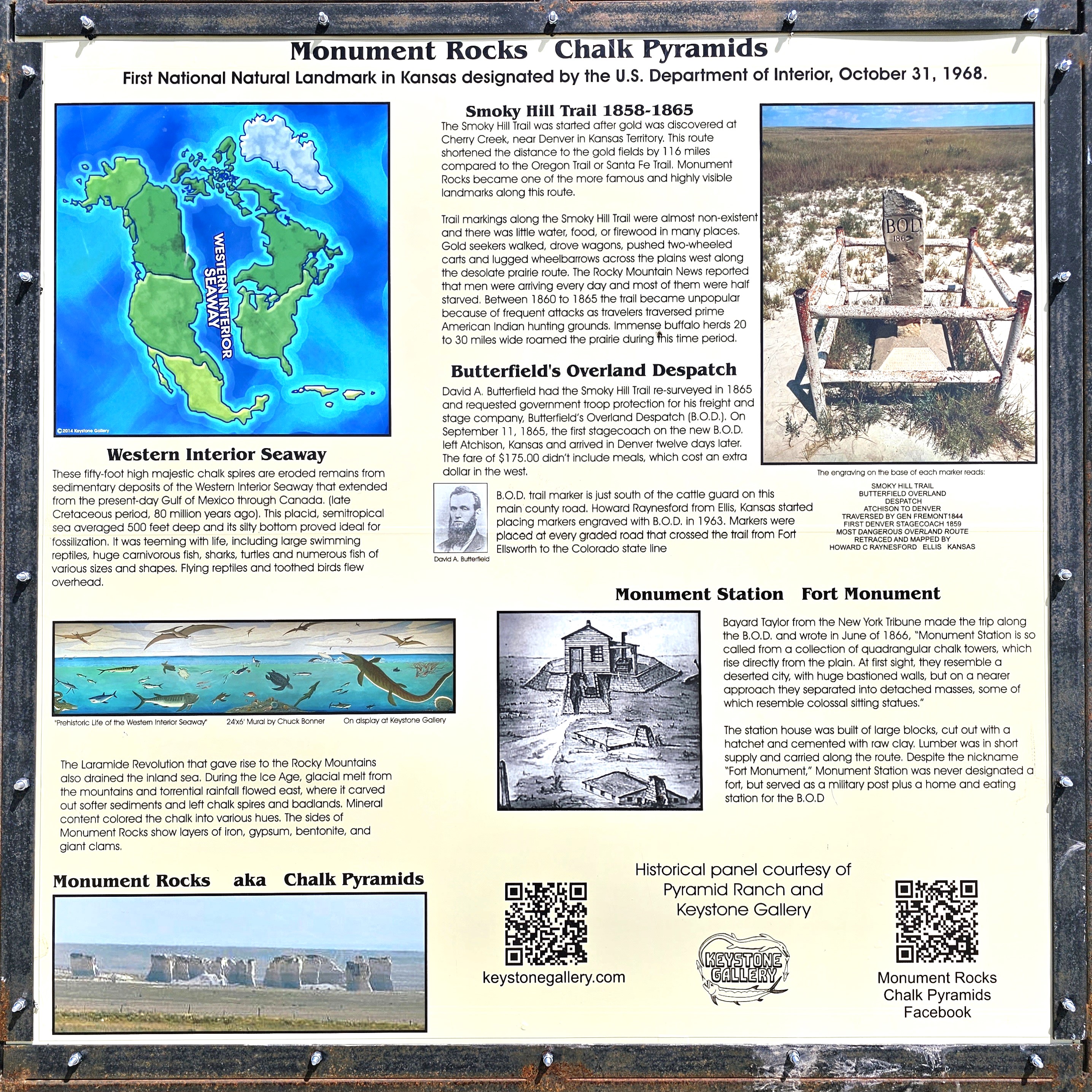
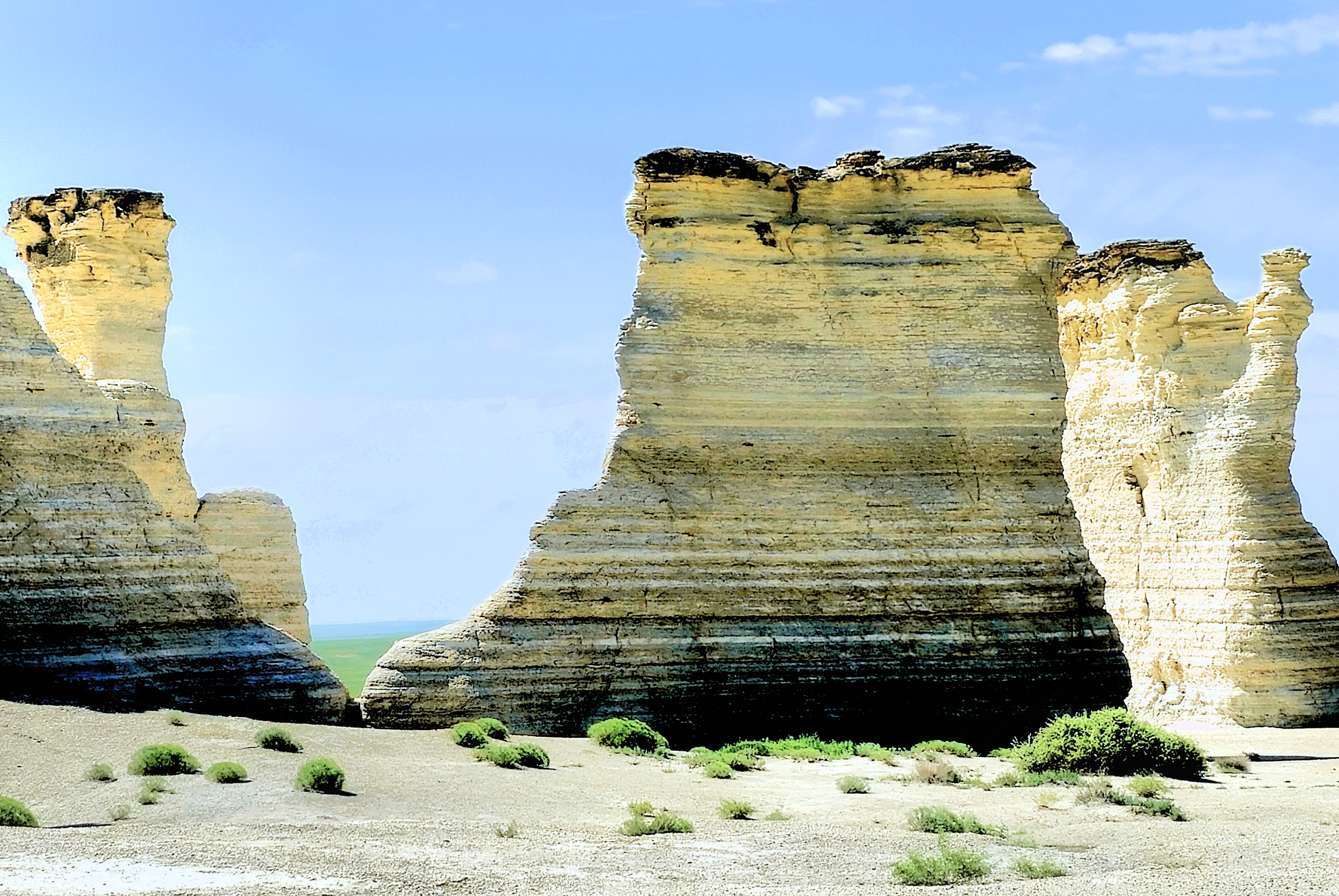
But first, we detoured 15 miles east to Monument Rocks.
As the first National Natural Landmark in Kansas designated by the Department of the Interior,
we thought we ought to pay our respects, and we were just shaking our heads at the many visitors who couldn’t wait to desecrate the brittle, 50 ft chalk towers.
Although the formations were small in stature and compact in scale,
they were a site to admire,
and fun to explore!
See ya, fella.
With this tasty morsel served and enjoyed, our appetites were whetted for the main course.
I really wanted to be awestruck by the vision and overwhelmed by the novelty of the geology, but what I saw was a craggy white cliff with spots of color in an unexpected location.
And while it was anything but ordinary…
it failed the goosebump test.
I really wanted this as a win for Kansas, but I got the impression that Kansas wasn’t as prepared as its closest competitor across the border.
Was I becoming, perhaps, jaded?
“Hey Alexa, what’s the longest, straight highway in America?
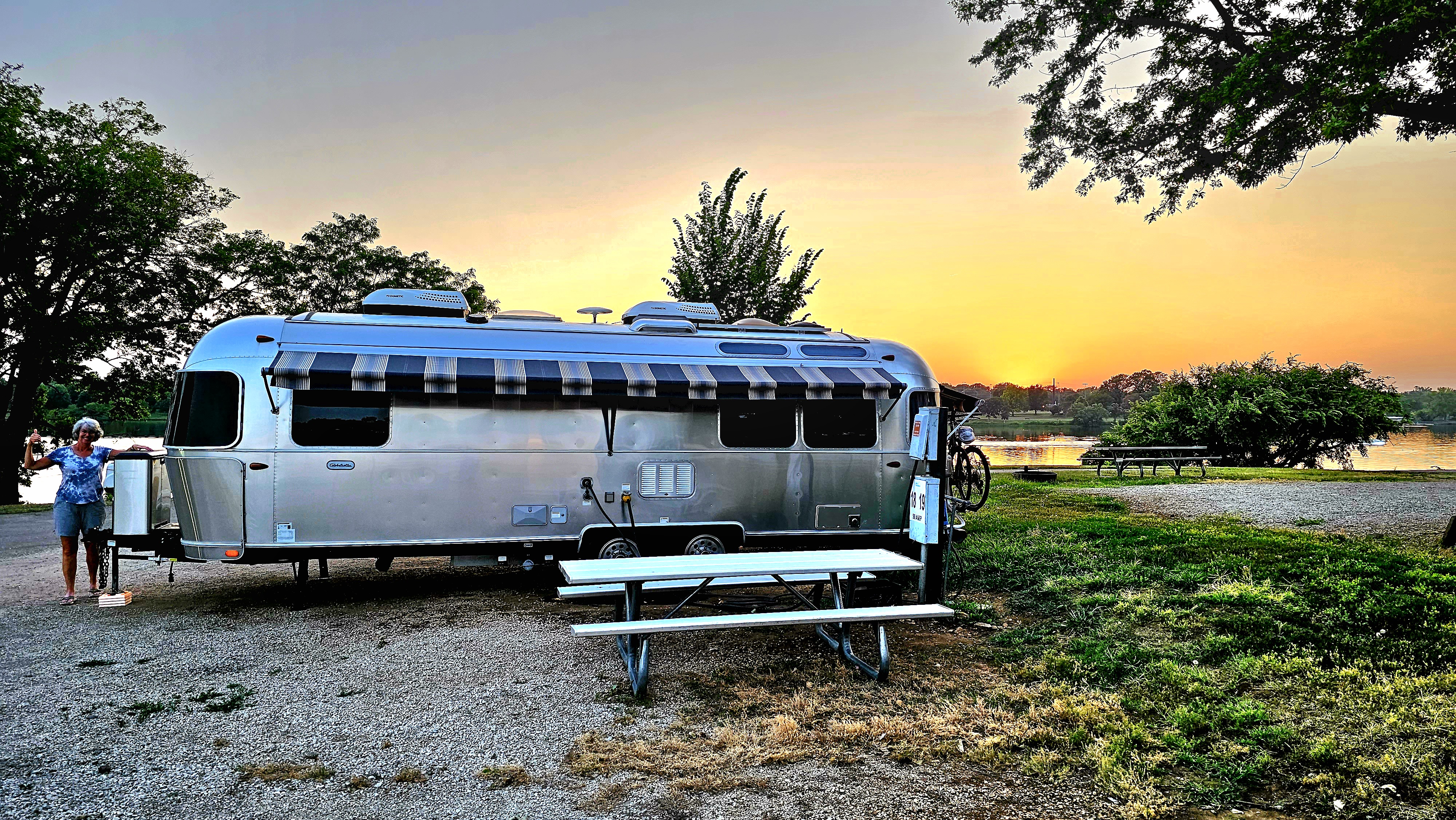
Rather than basecamp in Kansas City, Leah and I opted for something more pastoral, which we found at Lake Shawnee, the crown jewel of Shawnee County parks in Topeka, KS.
More than 1 million people visit Lake Shawnee each year for festivals, golf outings, ballfield tournaments, boating, fishing and camping or to hike/bike the Lake Shawnee Trail.
While circling the 6.5-mile lakeshore trail on our e-bikes,
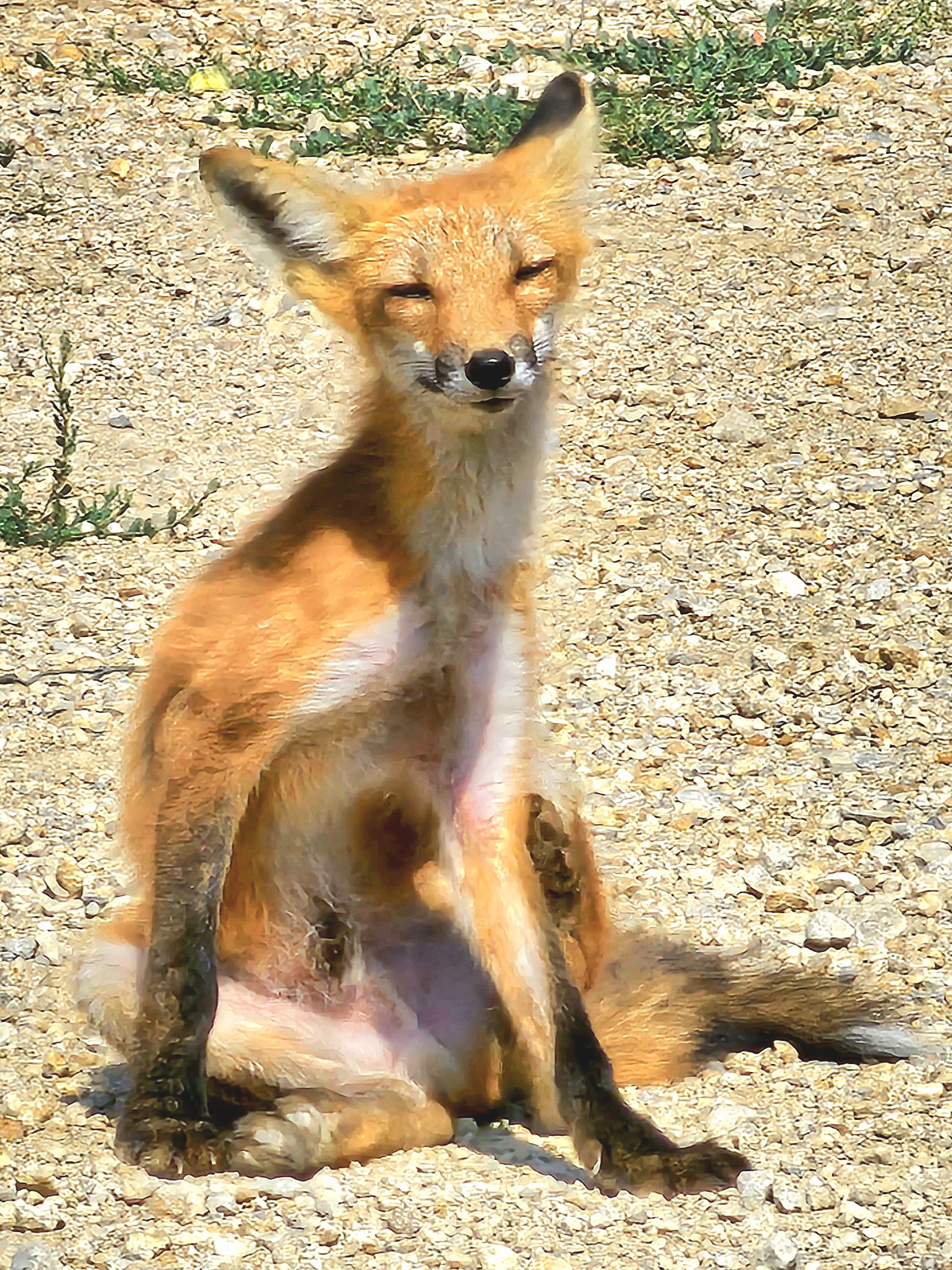
we discovered a resident friend of the park getting his tan on,
We took a detour through the Ted Endley Gardens, a 37-acre botanical garden in the northwest corner of the lake with spectacular blossoms, although I was drawn to a wildflower display reminiscent of Claude Monet.
Our only commitment while in the vicinity called for an excursion to Kansas City to claim tickets for the Dirty Heads, an American reggae band on national tour with my son, Noah acting as VIP concierge. In fact, this is the job he chose over working as the Jam Tram admin during the Bonnaroo Music and Arts Festival, from where we last left (see Bonnaroo–the Logistics).
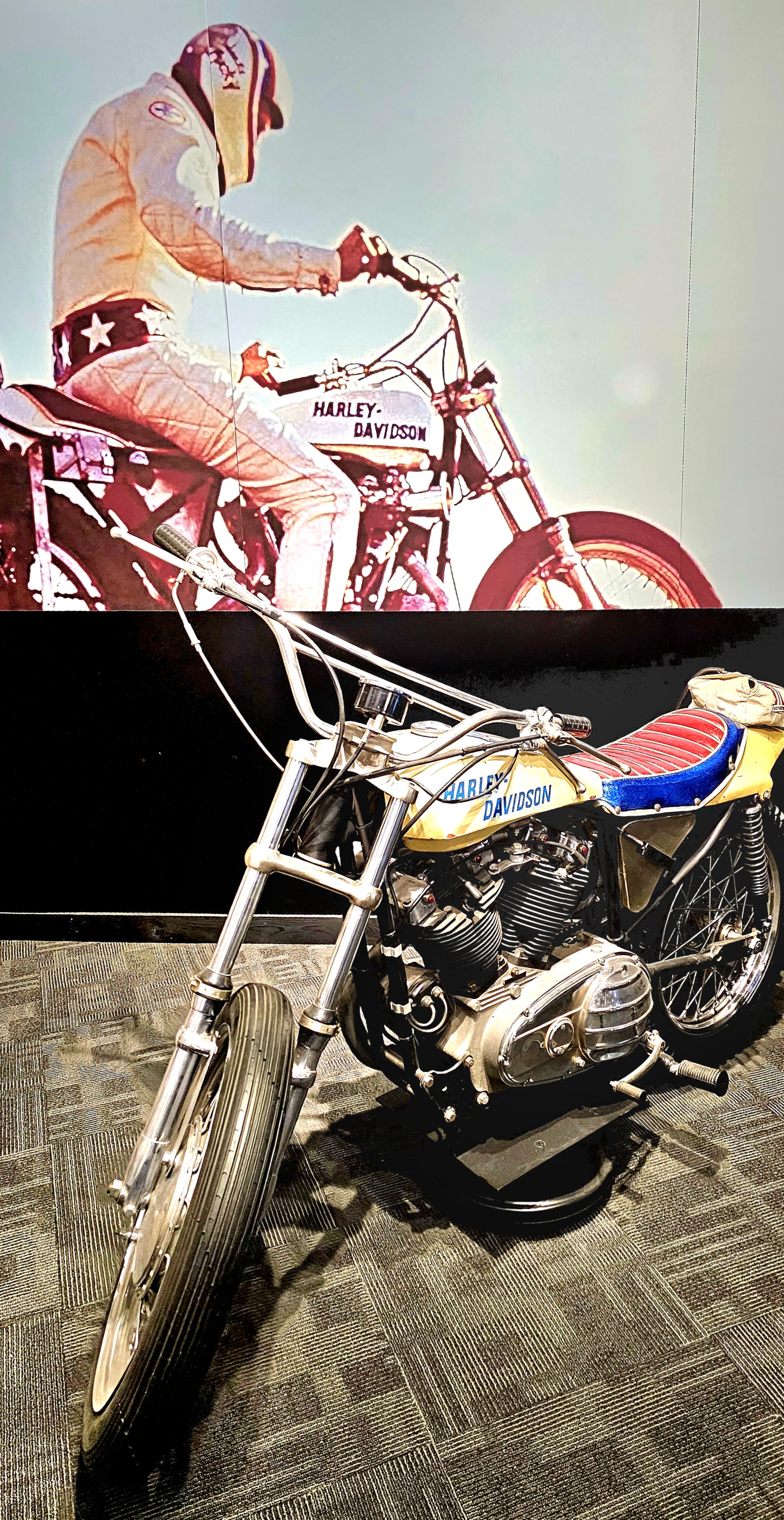
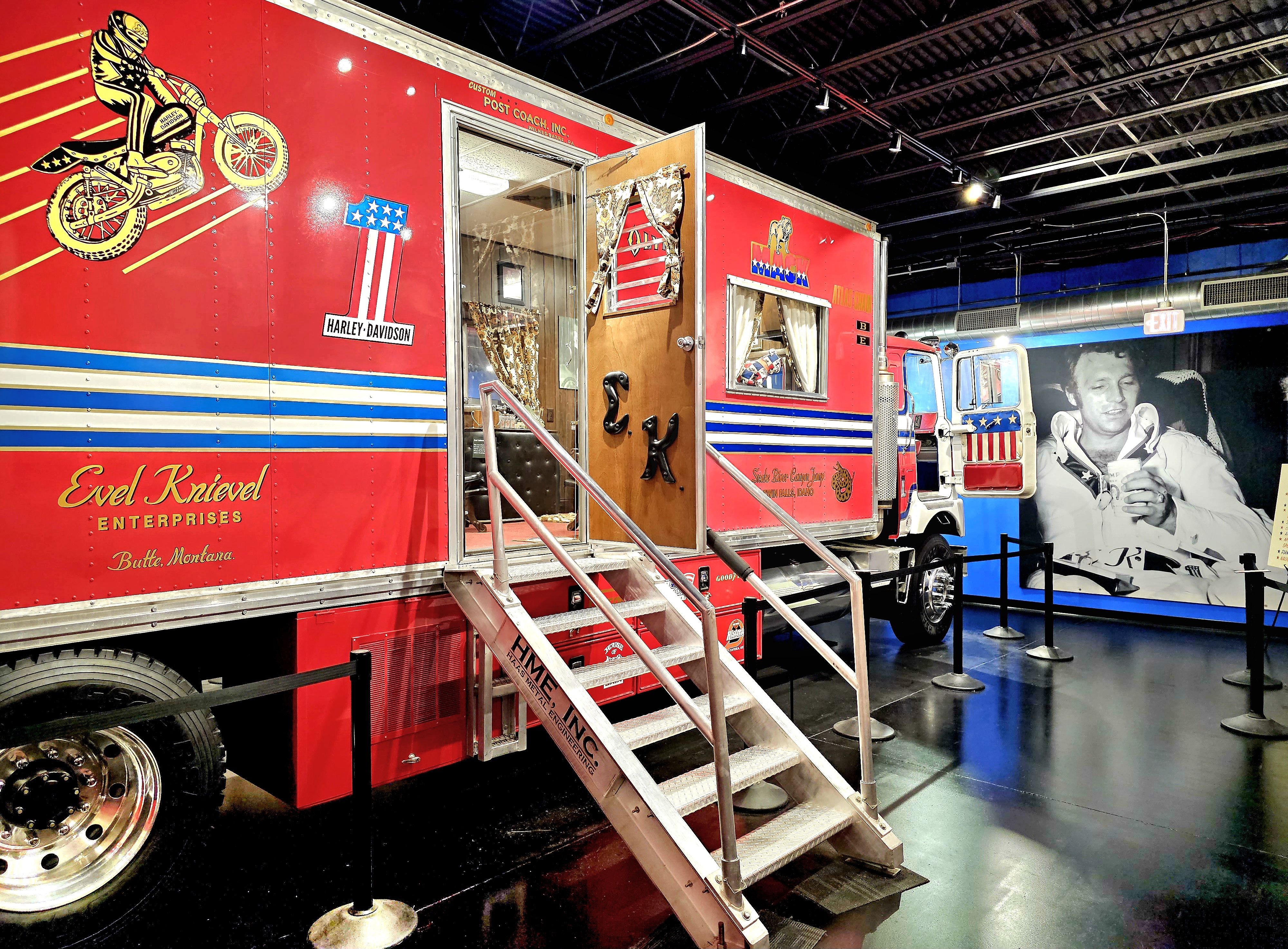
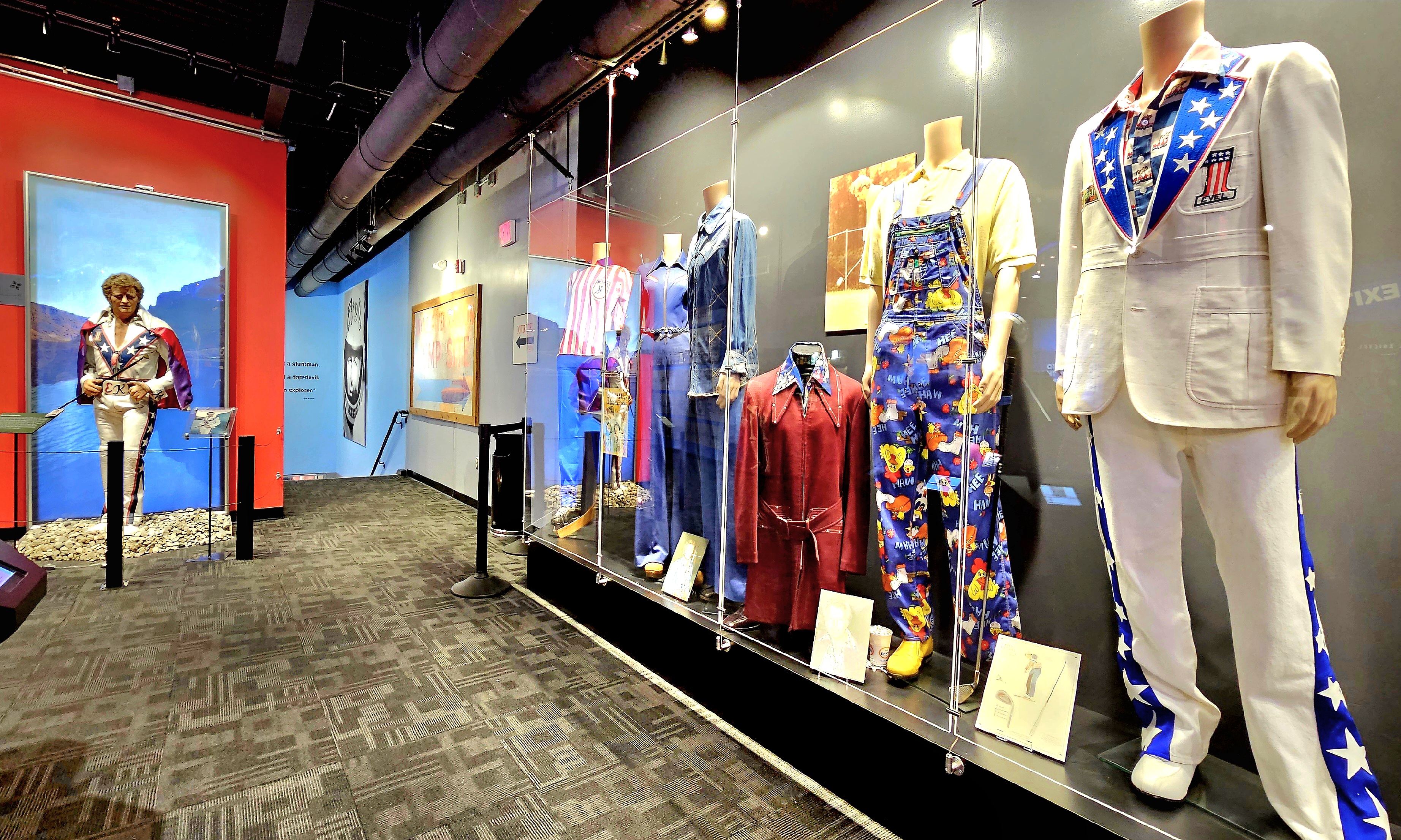
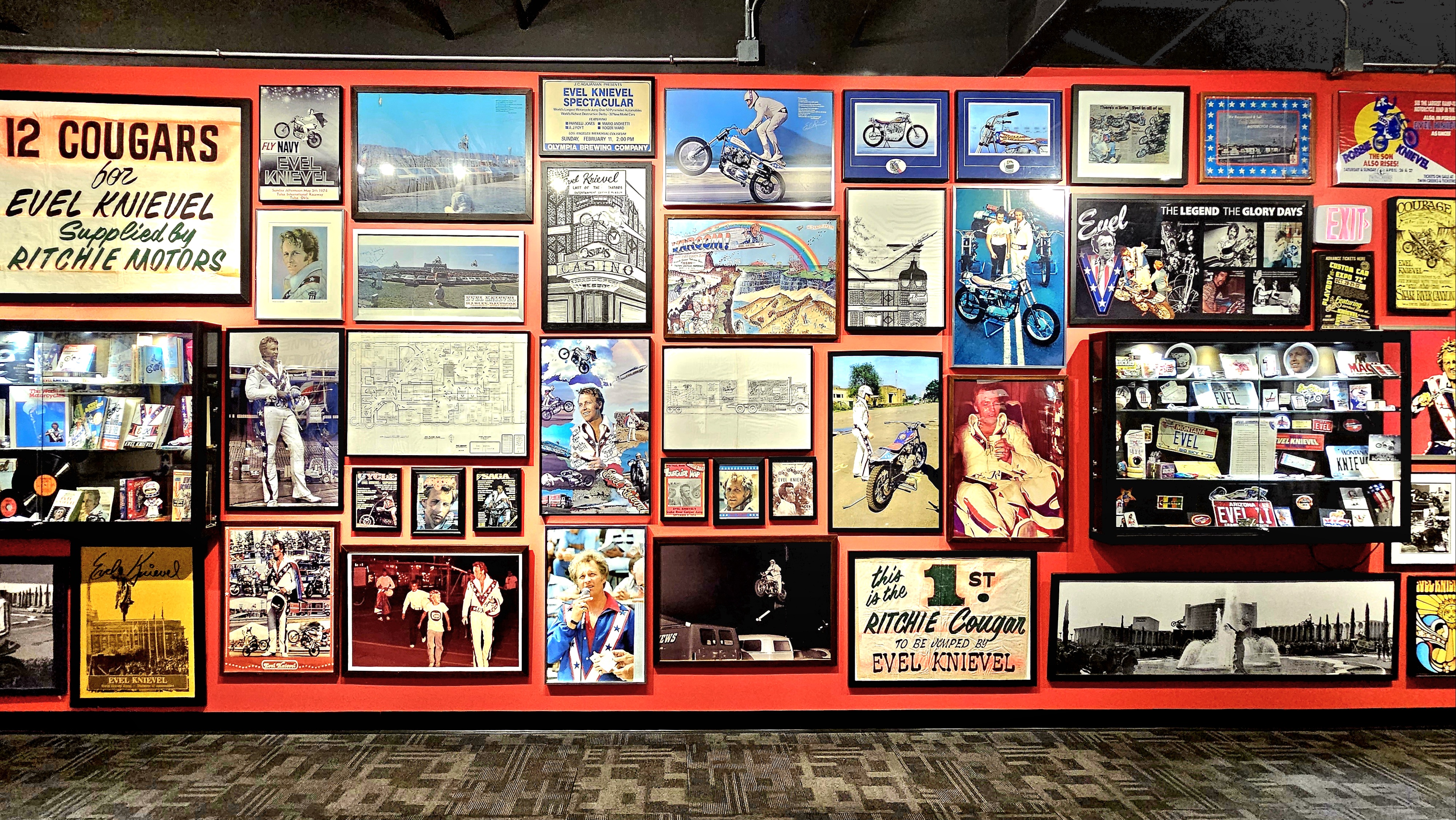
With doors at the concert venue opening at 6pm, Leah and I had an afternoon to kill, so we settled on an unlikely museum that was annexed to the local Harley-Davidson dealership celebrating the life and times of Evel Knievel–an unlikely choice for Topeka, considering that Evel’s hometown was Butte, Montana in 1938.
Evel was a showman and a stuntman without rival during the 70’s, amazing fans around the world with his push-the-envelope antics on his motorcycle.
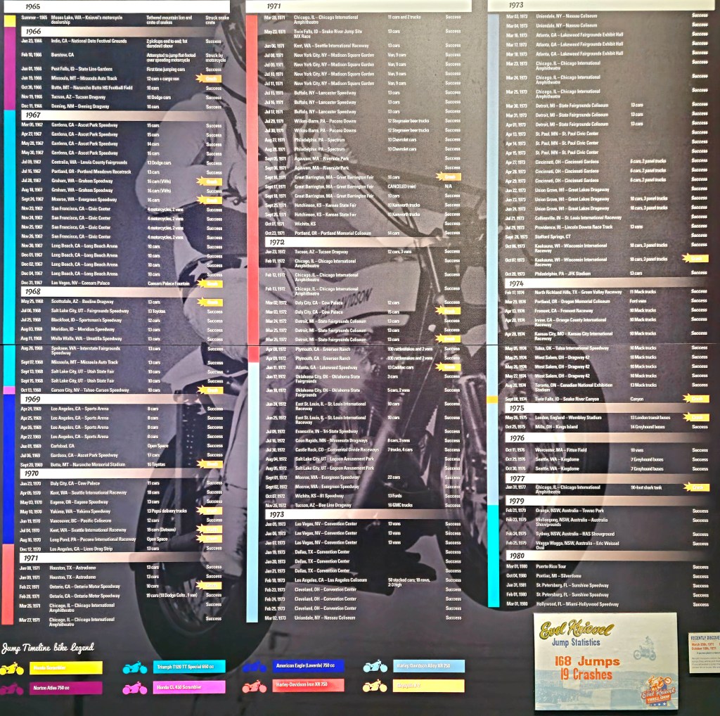
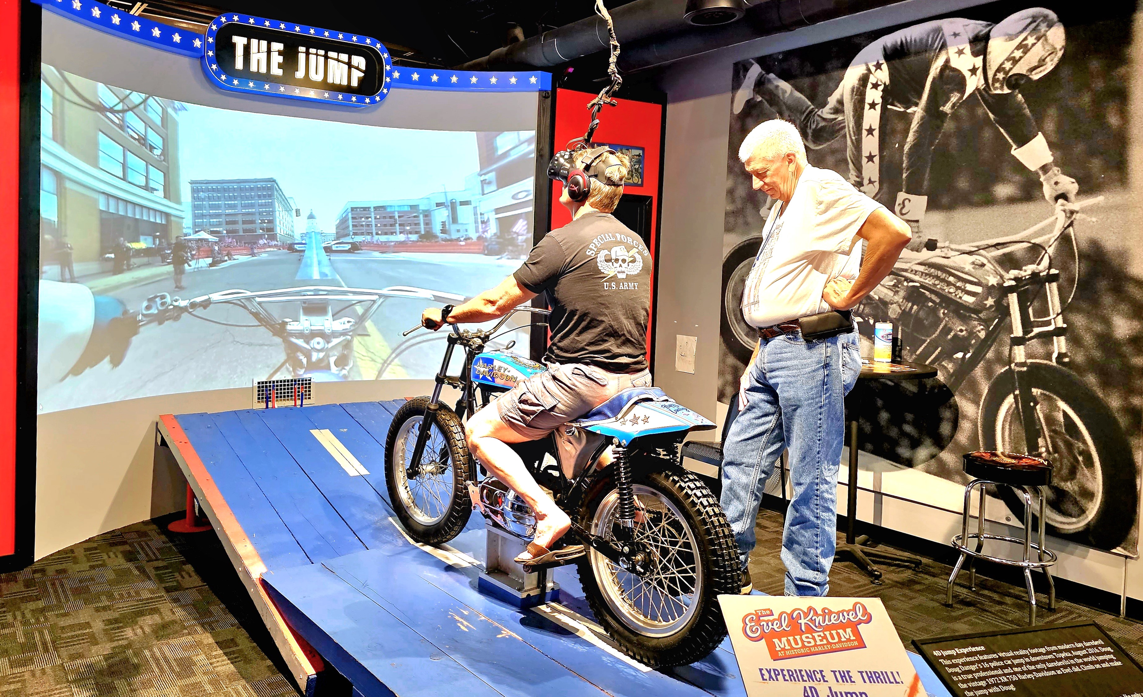
The museum has plenty of requisite motorcycle displays showcasing his many exploits.
Evel was very good at two things during his jumping career: breaking records and breaking bones (433 fractures, which is a Guinness world record).
There were many successes…
and epic fails as well…
Those who followed Evel’s career 75+ jumps will never forget the hoopla and disappointment surrounding his Snake River launch.
But the pride of the museum is Evel’s “Big Red,” which also answers the question of “Why Topeka?” of all places.
Simply put, Topeka’s Historic Harley-Davidson dealer, Mike Patterson put up the money for the 13,000 sq. ft. expansion, and funded the Mack truck restoration.
Visitors can delight over Lathan McKay’s world-largest collection of paraphernalia behind ropes and glass, from costumes…
to merchandise…
to memorabilia.
There’s even a VR-enabled activity for an extra $5.
Much has happened since leaving Bonnaroo for Denver. There’s been a long-distance get-together in Rogers, Arkansas with a nursery school buddy from Pittsburgh…
and a long-overdue reunion with family from Pittsburgh, who now reside in Overland Park, Kansas.
We’ve also kept a watchful eye on the weather–always tracking the extreme conditions that have been swirling around us, the likes of tornadoes, hail, flooding, land slides, and record-setting heat streaks–yet with each destination, we’ve mostly managed to dodge a bullet.
There was also a handful of visits to some iconic sites along the way, and some less familiar, but definitely photo worthy.
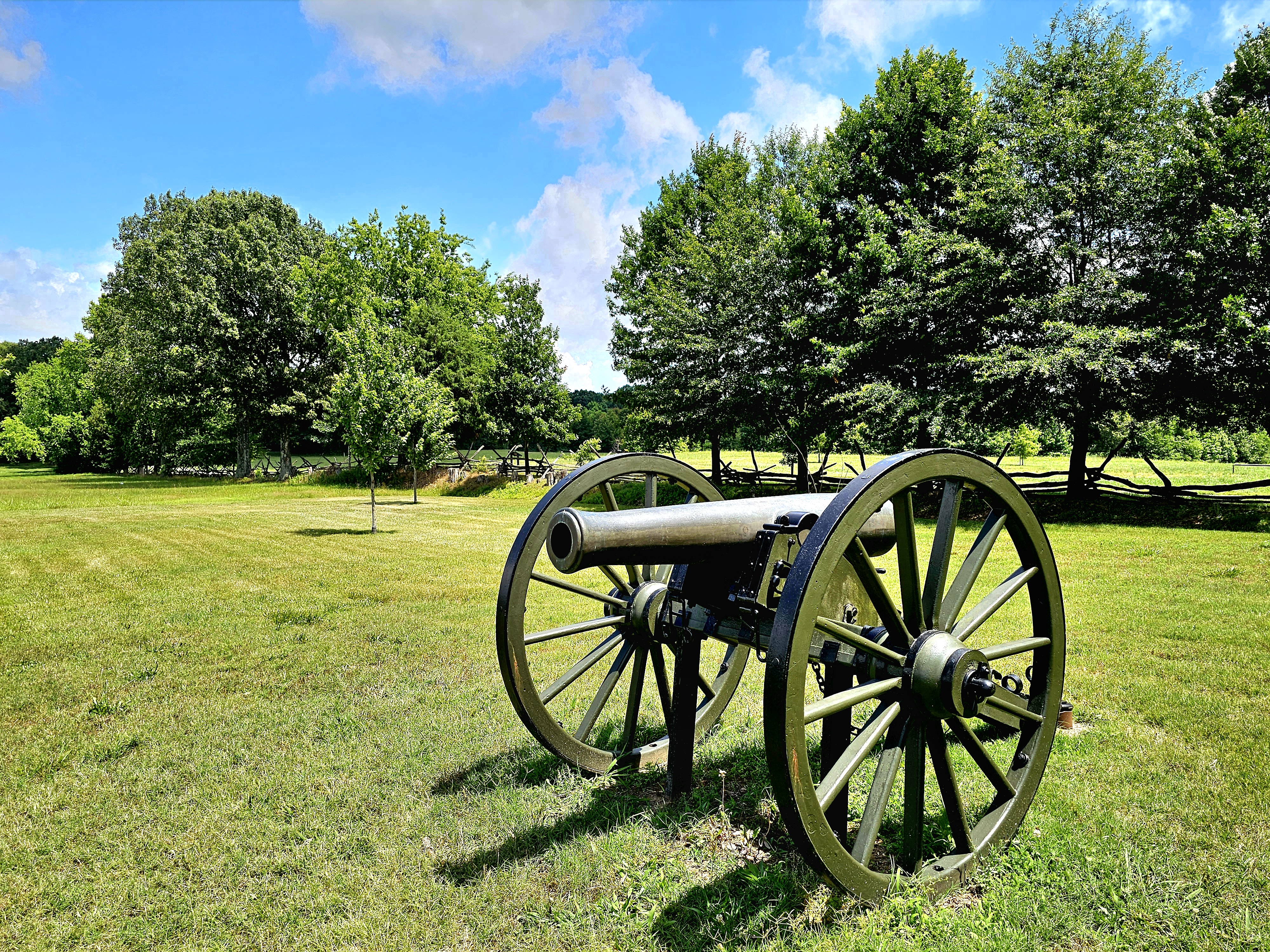
Our first stop took us to Parker’s Crossroads, halfway between Nashville and Memphis, and the site of a celebrated Civil War skirmish in West Tennessee.
It was the final battle for Confederate Brig. Gen. Nathan Bedford Forrest, who managed to outfox the Union brigades of Col. Cyrus L. Dunham and Col. John W. Fuller by escaping with his regiment across the Tennessee River and avoiding certain defeat in the face of an enemy nearly twice the size with two times the artillery.
Leah and I took the walking tour past interpretive markers depicting critical moments in the battle, and observed that Parker’s Crossroads battlefield, while a testament to the 737 fallen soldiers,
should also be appreciated for its serenity and pastoral scenes.
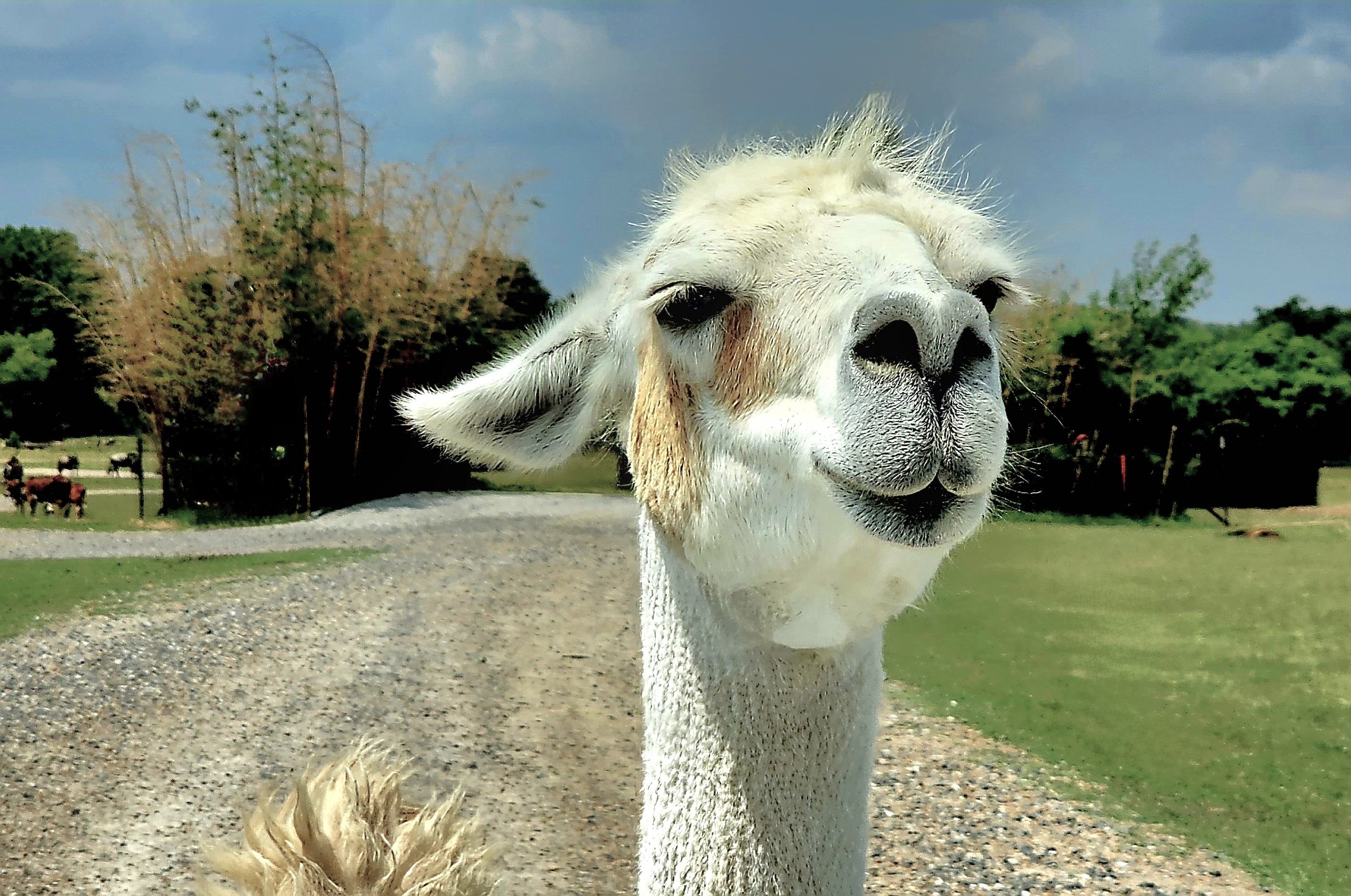
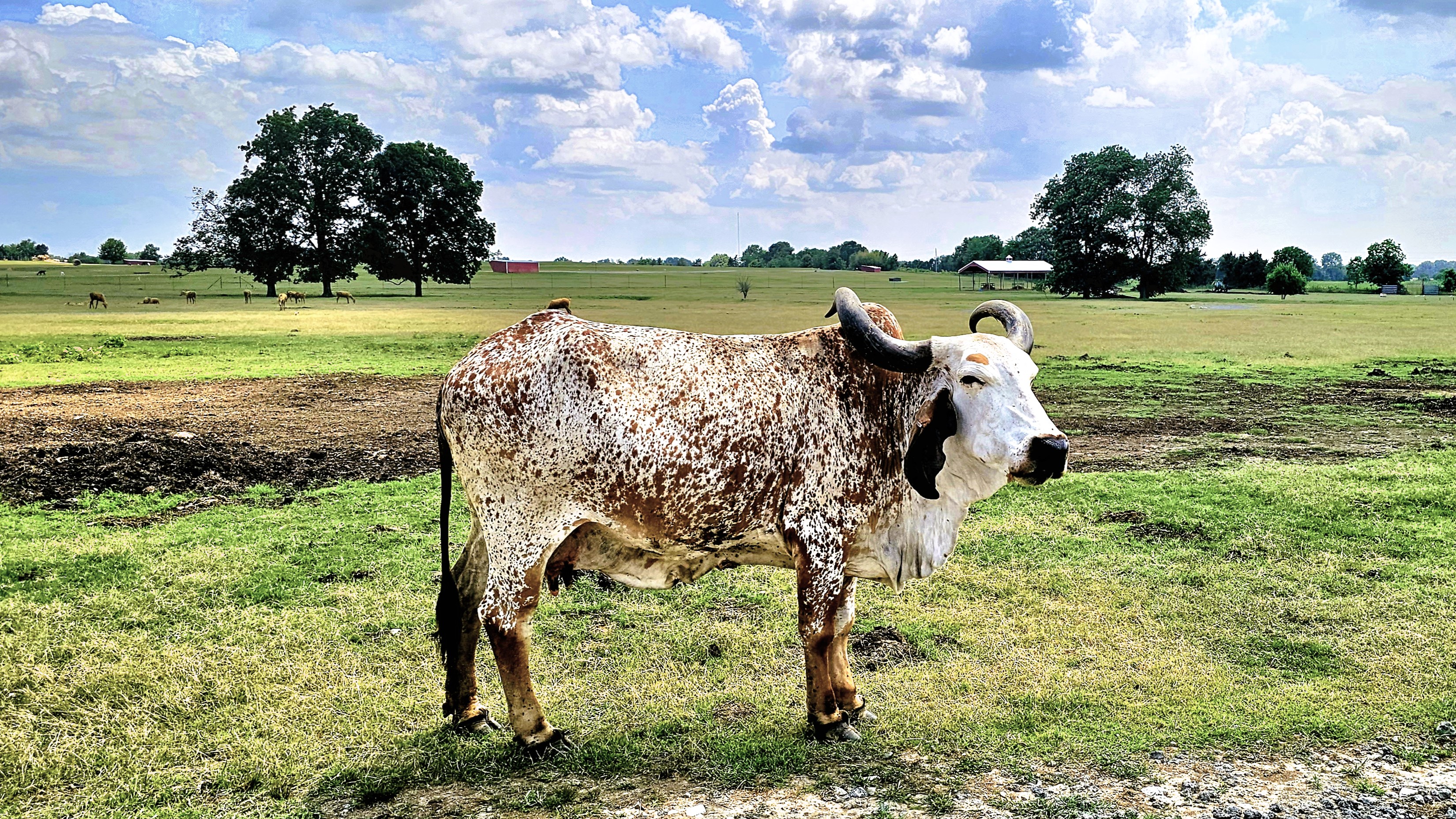
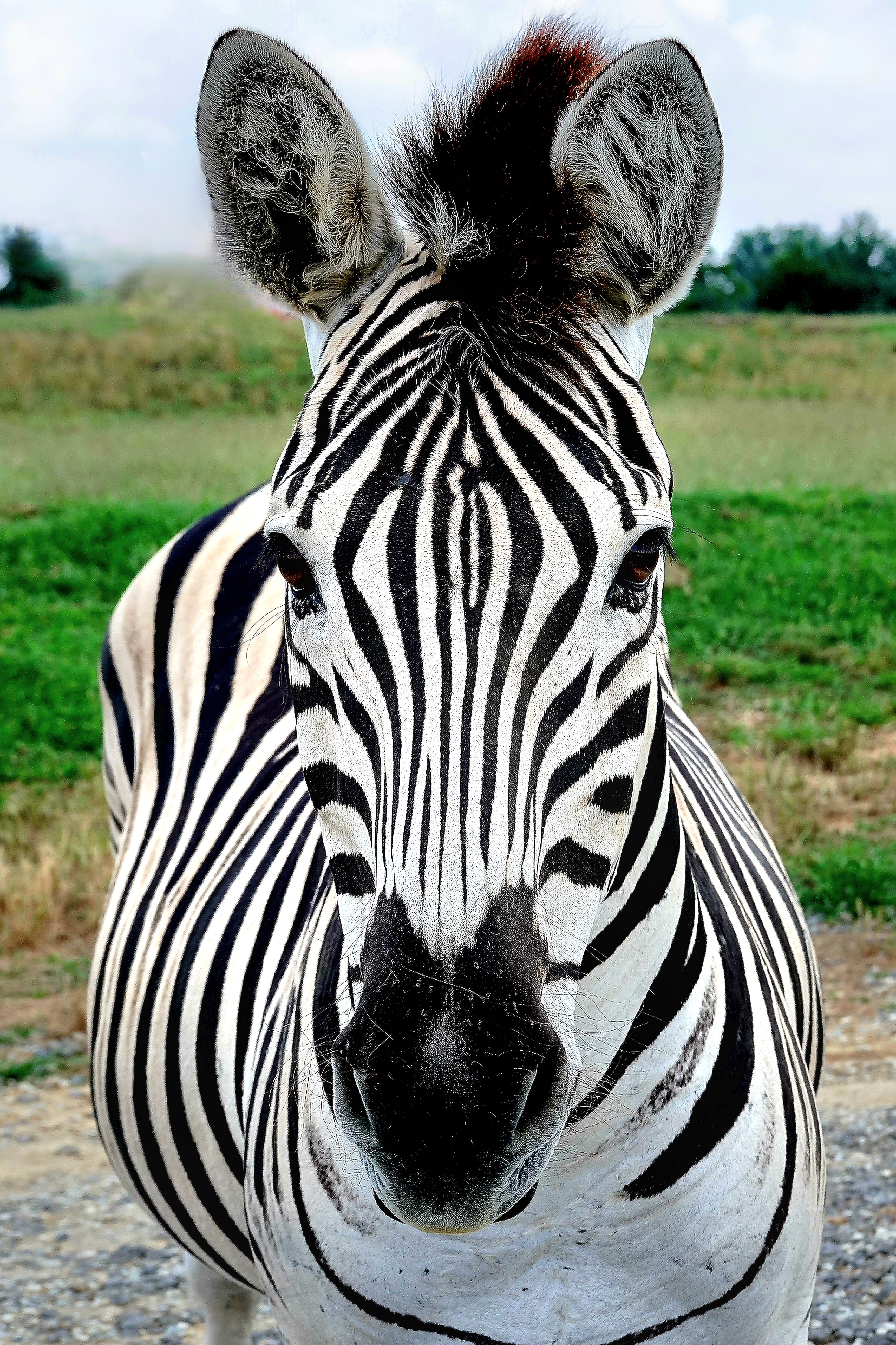
Only 45 miles west of us was Tennessee Safari Park in Alamo,
where we looped around a drive-thru zoo for an hour with 4 buckets of animal nachos for hungry wildlife roaming freely throughout the fenced prairie. We were immediately greeted by an aggressive mob of ostriches and camels that descended upon our truck sensing a meal was imminent.
With the passenger window down, Leah tentatively extended the bucket beyond the door, only to have the bucket ripped from her hand by a dromedary with no manners and fewer eating skills.
Kibble went flying everywhere–inside and outside the truck. Even today, I’m still fishing out morsels between the seats. Lesson learned.
However, the lure of food was a perfect ploy for pet portraits…
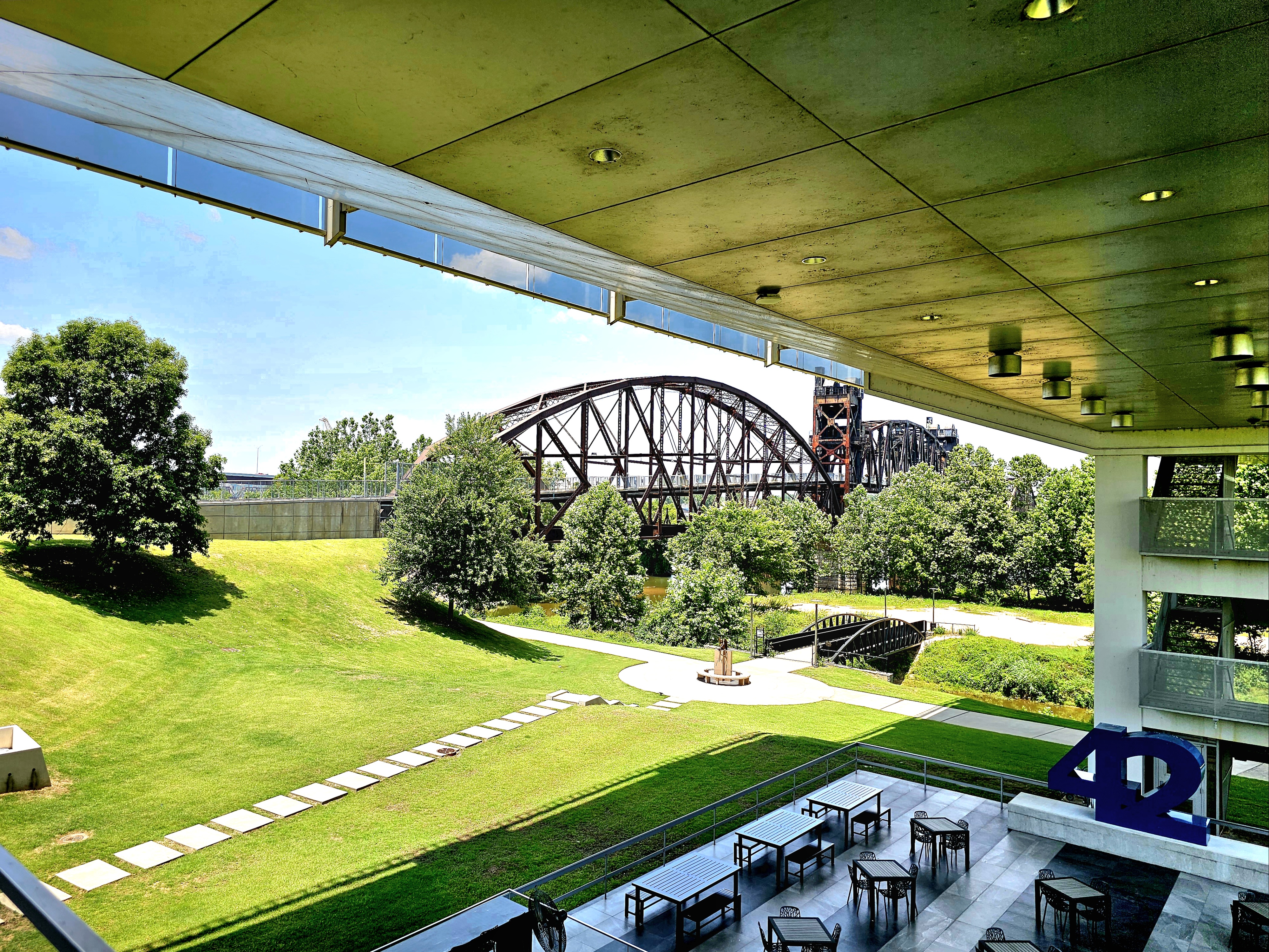
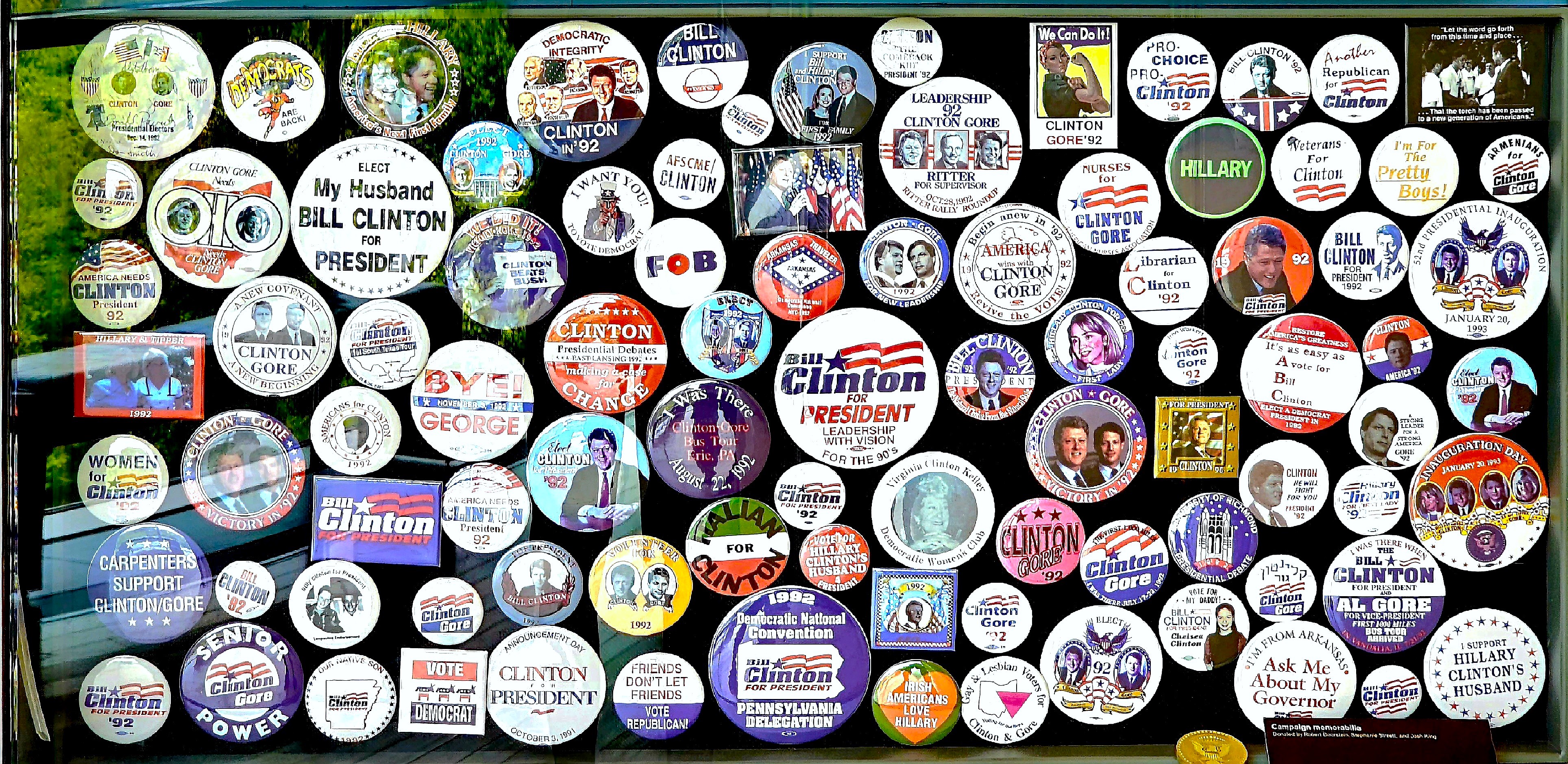
Continuing west, we traveled to Little Rock, home to the Clinton Presidential Center, dedicated on November 18, 2004.
We parked the Airstream directly across the Arkansas River in North Little Rock by a decommissioned WW II tug and sub…
and cycled the long way around the riverwalk trail (some of it kinda sketchy),
past the Big Dam Bridge…
until we circled back 8 mi. to Clinton’s library–a hulking structure clad in glass screens that cantilevers over the Arkansas River as a symbol of “building a bridge to the 21st century.” And it was air conditioned!
The building that houses Clinton’s legacy is enormous enough to collect and archive 2 million photos, 80 million document pages, 21 million e-mails, and 79,000 artifacts from the Clinton years (1993-2001).
Appealing graphics break down the headlines and the issues of the time: year by year, month by month, surrounded by wings dedicated to domestic policy, diplomacy, economy, education, civil rights, and scandal. It’s all on display throughout the Main Hall, modeled after the Long Room of Trinity College in Dublin.
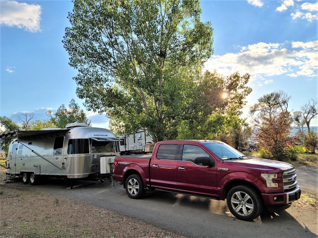
Leah and I have launched another summer trip around the country–our 6th, for those of you who are counting–and while we usually leave in May, when Florida weather and politics become most offensive, we delayed our adventure by a month because I had the mad idea of attending the Bonnaroo Music and Arts Festival at Great Stage Park in Manchester, Tennessee, scheduled from June 15 – June 18.
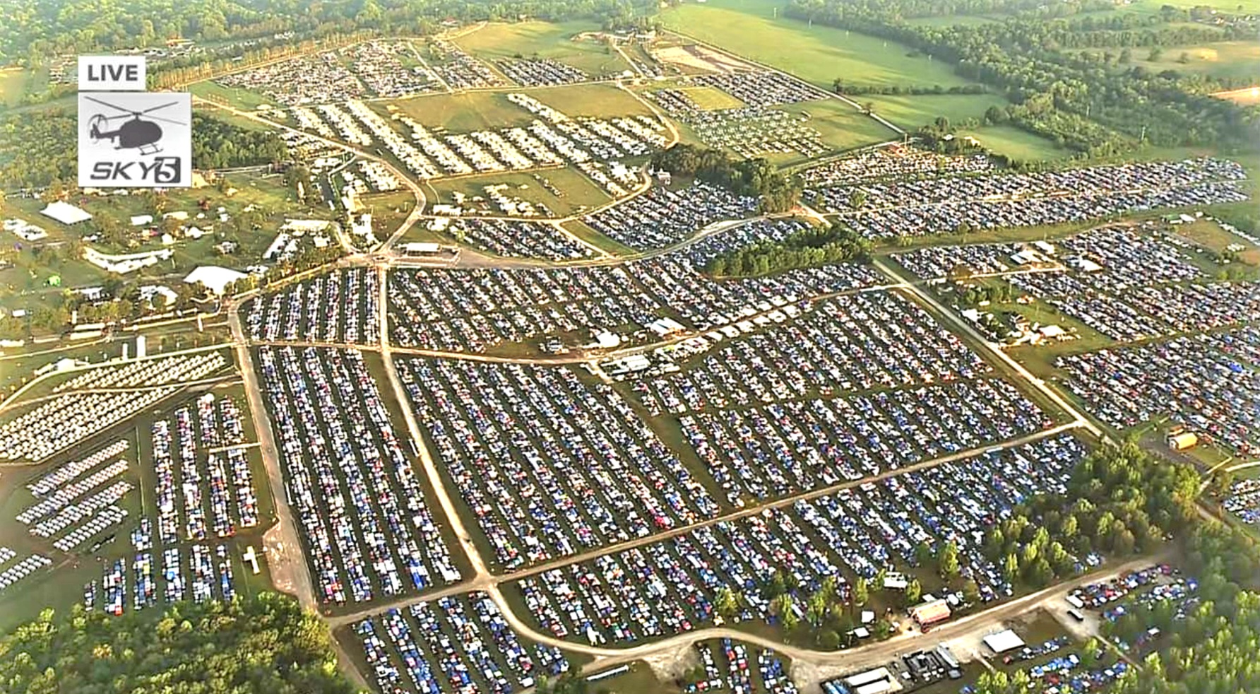
By opting for a primitive RV site and a 4-day General Admission pass, we were guaranteed a grassy rectangle measuring 20 x 50 ft. for up to 6 days, and ongoing music from over 100 artists across all genres at 6 stages scattered over a 700-acre farm known as Centeroo.
For the next 5 days, we’d be totally reliant on our 39 gal. freshwater tank, and all the power we could muster from a roof-top solar array assisted by my F-150’s 7.2kW on-board generator.
This would be a huge conservation experiment for us, considering our current record for dry camping was achieved by overnighting at a Wal-Mart parking lot.
But first, a stopover in Nashville was warranted to prep the Airstream for the forthcoming festival, followed by mingling with the hoi polloi on Broadway after dark.
Of course, Nashville never disappoints, whether it’s the people…
the shopping…
or the Broadway bustle!
With a 70-mile drive ahead of us, we headed out at 7am on Thursday, anticipating festival traffic and longish check-in times at Outeroo campgrounds due to compulsory rig inspections for contraband.
Leah had done early research on Bonnaroo dos and don’ts, and each day, she would bring me an update of a new annoyance or inconvenience that always threatened to be a festival deal breaker.
“Did y’know,” Leah mentioned sometime in February, “that bicycles are not allowed inside the festival grounds.”
“Well, that sucks,” I replied, “considering we’ll be using them throughout the rest of our trip, and we have no choice but to take them with us. So what are we supposed to do with them?”
Leah located a bike shop en route to Nashville in Mufreesboro that would update the firmware on our ebikes and allow us to store a big black storage tub filled with glassware, cooking knives, and power tools–all restricted items inside Bonnaroo.
We arrived by 9am to less traffic than expected and even less fanfare during our inspection.
“Got any weapons?” asked a worker bee in a safety vest.
“Nope,” I responded.
He glanced at an over-stuffed backseat and truckbed without regard, then asked to see the inside of our Airstream. He poked his head through the door and announced. “I seen enuf, you’re good to go.”
“That’s it?” I said, whispering to Leah. “Is this a shakedown, or Is he fishing for a tip? Do you realize we could have brought everything with us instead of driving ourselves crazy with these bogus rules?”
“We carry an umbrella so it doesn’t rain,” is all she said.
We were directed through the gate and around a winding gravel road before we settled onto our grassy site,
and soon enough, we were surrounded by a non-stop tailgate party defined by beer, wine, and weed. Canopies, tents, and rigs of all shapes and sizes helped form a kaleidoscopic quilt of shelters and good times.
Randy from Alabama, my RV camping neighbor and veteran of a dozen Bonnaroo summers regaled us with many interesting stories of past concerts, and offered valuable advice on how to survive the weekend. When Leah lamented about the prospects of standing in the heat for hours with the hoards, Randy had the perfect solution.
“There’s an accessibility tent before you get to the Bonnaroo arch, and the staff there can issue a permit for your chairs and provide access to all the viewing platforms near the stages,” he suggested.
“Well, that’s a gamechanger,” I exclaimed. So Leah and I did as Randy recommended. We donned our knee braces, wandered through the Plaza 7 village,
and the Grove…
before we limped into the accessibility tent, where an attendant with multi-colored hair and a tiger tattoo registered us with ADA bracelets. Mission accomplished.
On Thursday, we learned that the 4-day passes and all Outeroo camping had sold out.
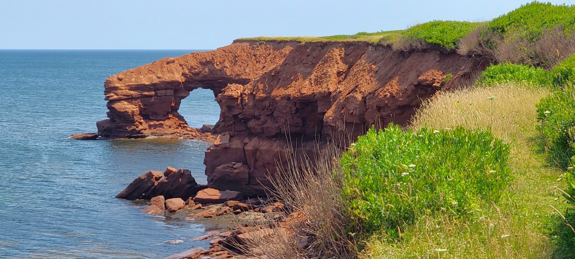
Île-Aux-Foins Park–Neguac, NBHopewell Rocks–Hopewell Cape, NB
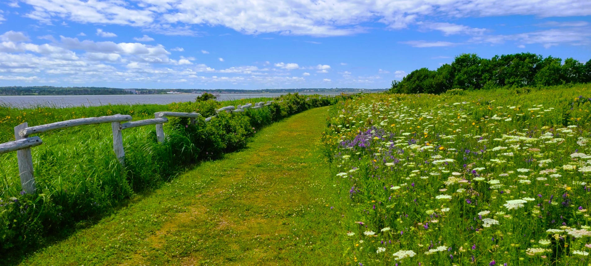
and Prince Edward Island…
MacKenzies Brook–Cavendish Beach, PEIGreenwich Trailhead–Saint Peters Bay, PEI
in our Airstream Globetrotter,
Beach Rose RV Park–Salisbury, MA
with a stopover in Grand Falls, NB…
Grand Falls Gorge–Grand Falls, NBGrand Falls Gorge Trail–Grand Falls, NB
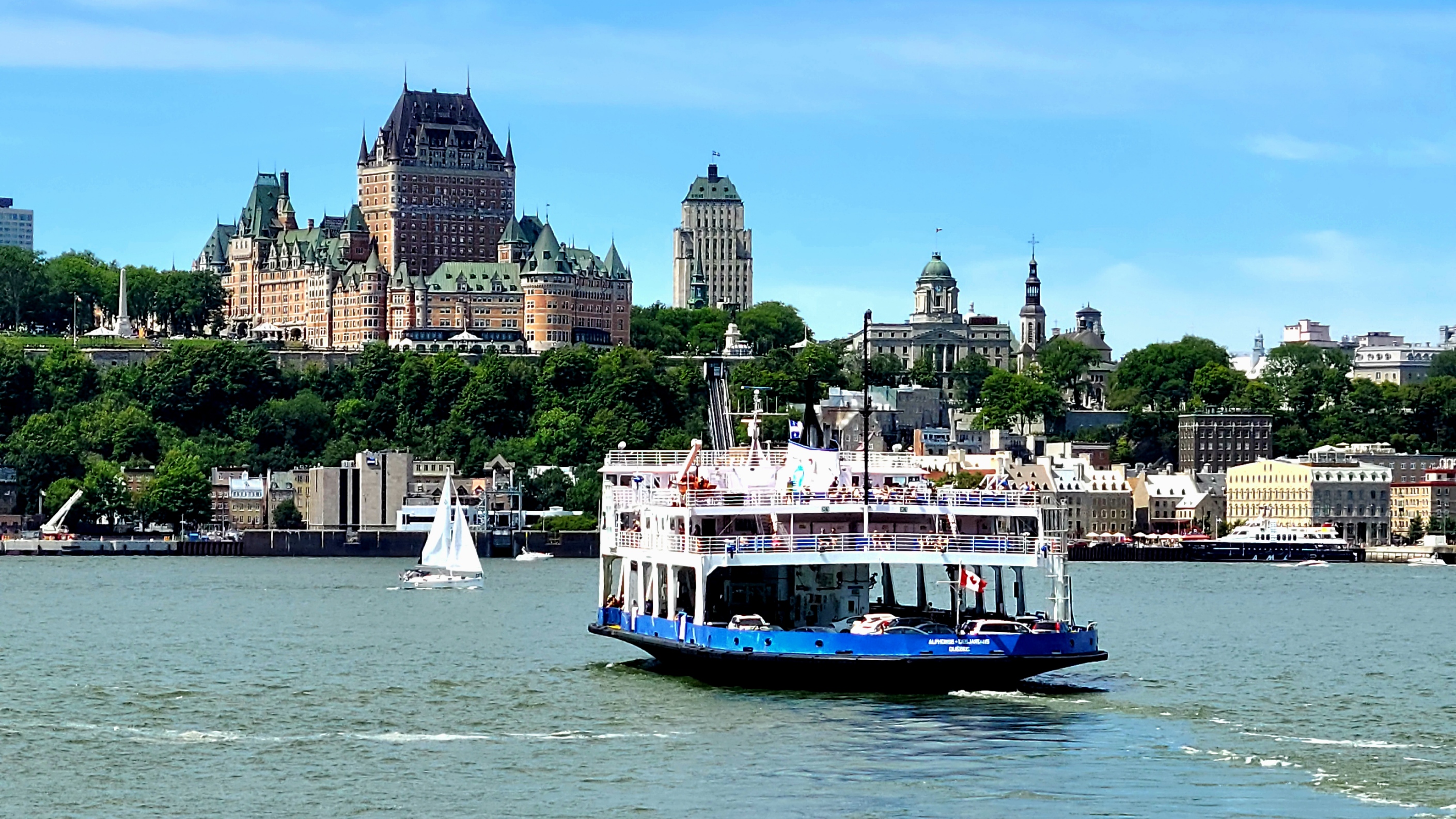
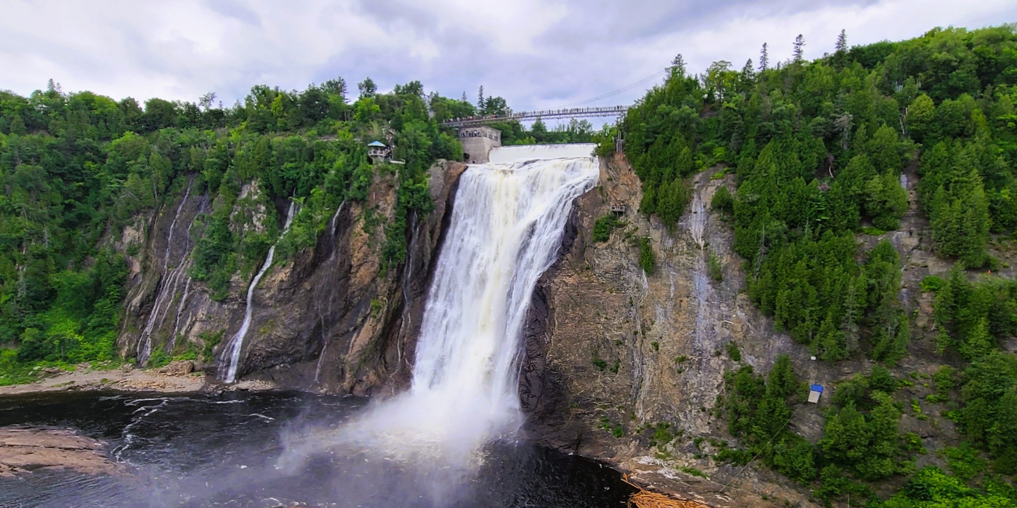
before following the St. Lawrence River from Quebec City…
Saint Lawrence River–Quebec City, QCMontmorency Falls–Quebec City, QC
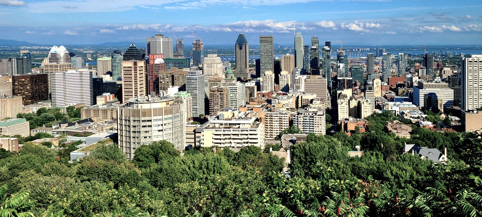
to Montreal.
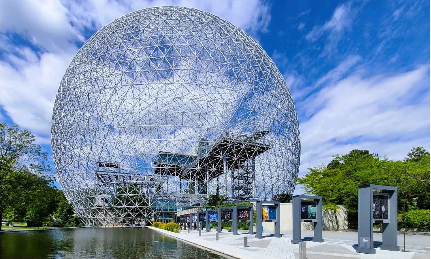
Mont Royal Park–Montreal, QCBiosphere, Parc Jean-Drapeau–Montreal, QC
Yet all the while, I’ve been reporting on our epic, 2-week adventure in Iceland. Needless to say, it’s been a bit disorienting with my body in Canada and my mind’s eye in Iceland.
Dynjandi–Arnarfjörður, Iceland
And to further complicate the blog timeline, Leah and I recently bid ‘adieu‘ to Canada, without posting from our Canadian exploits.
Currently, we are spending the week in Lake Placid,
Lake Placid from Whiteface Mountain summit,–Wilmington, NYAuSable Chasm–Wilmington, NY
where once again, I find myself struggling to regain my geographical balance within the space-time continuum.
Which presents a new dilemma: do I recreate my travel chronology (starting with Acadia National Park) and continue reliving the past, or do I write about where I am, here and now?
I’ve given it lots of thought, and have come to the conclusion that writing about faraway places is far easier when I’m not so far away–in space and time.
Of course, I reserve the right to blog about past Canadian adventures, but only from a distance.
*All photography taken with my Samsung GS20 Plus 5G smartphone.
It’s been a while… nearly 5 months since my last post…
I could blame coronavirus for the lapse, but that would be cheating,
Truth is…
I took a vacation from writing just as Covid-19 was rolling out a fresh variant.
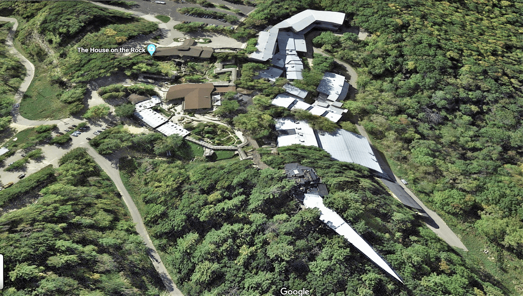
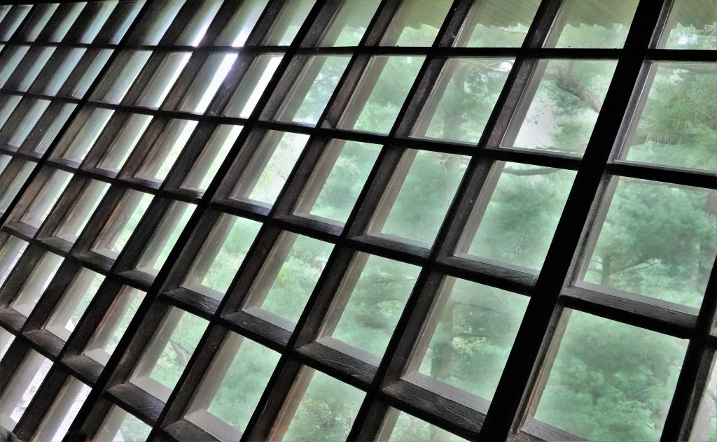
I was gathering details about Alex Jordan’s sprawling House on the Rock for a future photographic commentary on excessiveness,
when I folded my laptop and put my writing away… until it felt like less of a job.
I always intended on working my way back to it…
But then I got married…
to Leah, after 17 years of togetherness…
in front of friends and family!
We partied long into the night….
with historic St. Augustine as our magical backdrop.
And we’ve planned a super summer honeymoon. We’ve loaded up the Airstream and we’re heading for New River Gorge National Park in West Virginia. There’s a week stopover in NY/NJ, and then we’re off to Iceland for 2 weeks.
When we return, we’ll camp at Acadia National Park before crossing into Canada for a drive around the Bay of Fundy, the Cape Breton Highlands, Prince Edward Island, and down the St. Lawrence Seaway, with stops in Quebec City and Montreal.
Our southern route home includes time in Lake Placid, Lake Luzerne, the Jersey Shore, and northern Georgia.
I hope to share the highlights as soon as we make them.
Leah and I crossed the great Mississippi on our way from Memphis, TN to Hot Springs, AK by-way-of I-55 after Tennessee DOT inspectors closed the I-40 Hernando DeSoto Bridge 16 days earlier, blaming a crack in one-of-two 900-ft structural beams.
It was a major traffic snafu, but I also remember thinking at the time that this was a bad omen of sorts, yet so apropos, given our divided nation debating whether a critical investment in infrastructure is necessary for our survival.
Things had gone smoothly during our first month on the road, until we hit this speedbump traveling from the eastern states to the western states. Absent a few nagging issues on the shape of Lay-Dee! (our newest-used Globetrotter), this was a minor inconvenience.
But any concern about its impact on our Memorial Day holiday quickly vanished after a hug from a nursery school buddy I haven’t seen in 50 years. And it was great reunion.
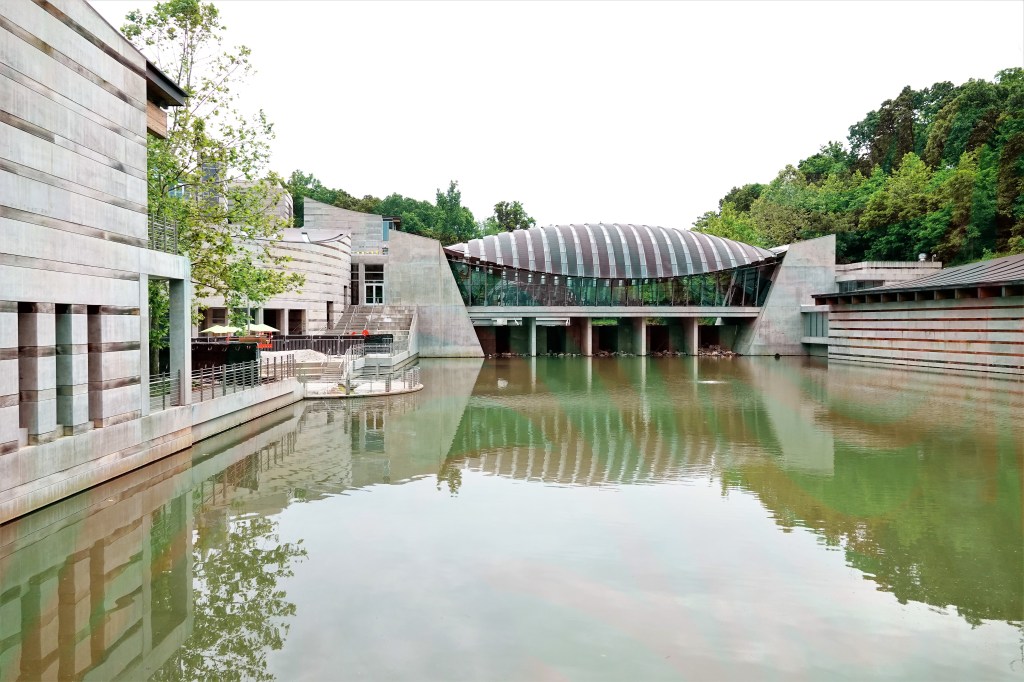
Lee and Debra’s hospitality extended to a tour of Crystal Bridges Art Museum,
and an overnight at their home near Wally World.
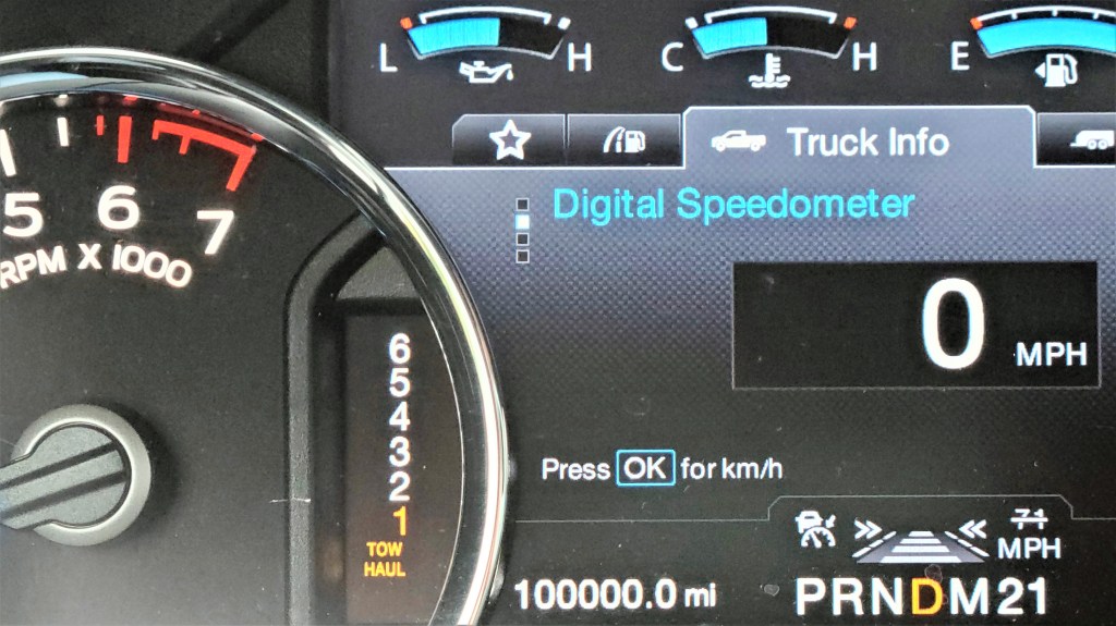
When we left our friends for OKC, our F-150 hit a new milestone which we mistook for a good omen.
However, the following family reunion with Carrie and grandchildren was temporarily delayed by an Airstream blowout the moment we crossed into New Mexico from Texas. Bad juju, right?
Once we were back on the road,
our visit with Carrie and the kids began in Santa Rosa, where we cooled off (62°F ) at the Blue Hole,
and continued at Dan’s house in Cedar Crest, where Lay-dee! dropped anchor.
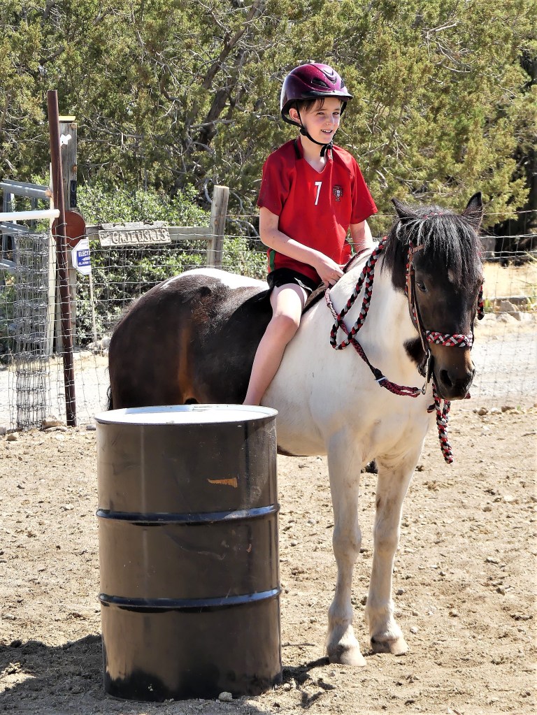
Soon after, Carrie surprised Gabe and Devon with Lucy–from erstwhile riding pony to Aiken family adoptee.
It was a brief and bittersweet visit…
but we had to move on to Loveland, Colorado, where our African safari mates, Linda and Heather were expecting us for dinner.
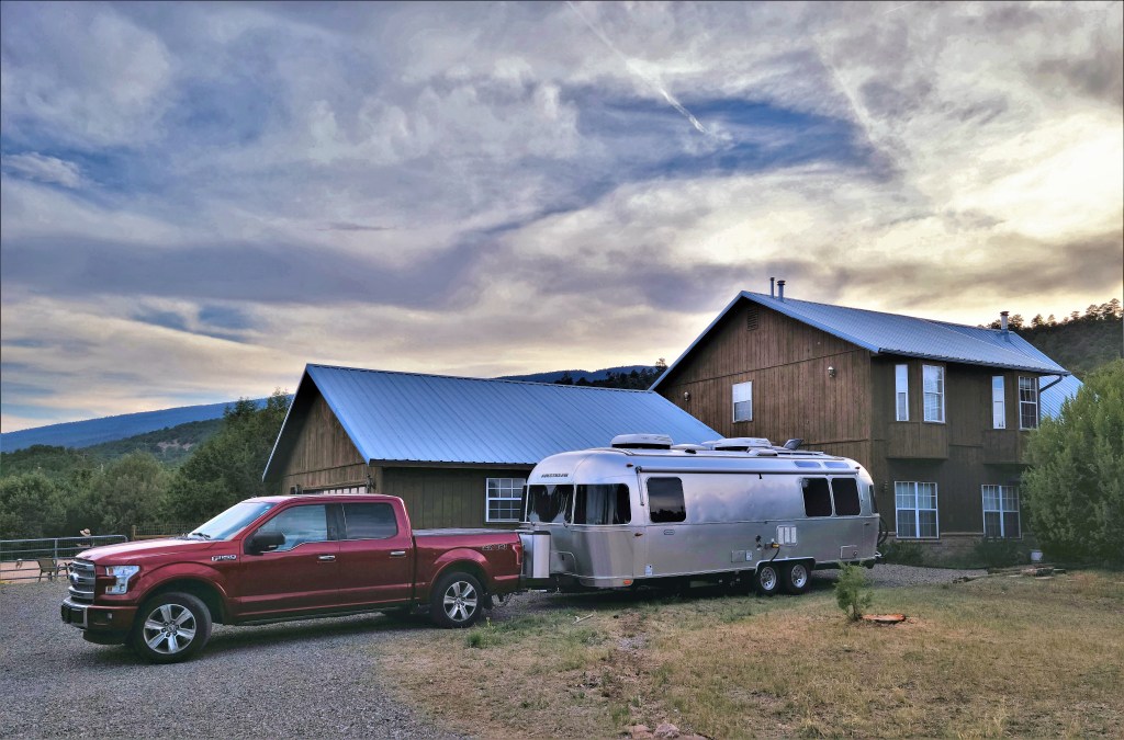
We left Lay-dee! behind in Dirk and Heather’s hayfield,
While keeping company at Linda’s house with her goofy Newfie, Angus…
and Forrest the gentle giant, who passed away 2 months after our visit.
From Loveland, it was short drive to Cheyenne, WY to reconnect with NJ hiking buddies George and Tere, and meet their uni-corny granddaughter, Val.
Leah and I boondocked behind their house at night…
and enjoyed the local parks…
and museums by day.
Eventually, Leah and I worked our way to the Pacific coast, where African safari mates Michael and Brenda were holding a table for us at a popular Newport, OR fish house…
on the historic wharf.
At last, Leah and I arrived in metropolitan Seattle, where my son Nate has settled for the past three years, and we were there to pop his National Park cherry.
Despite being only two hours away from Mt. Rainier, Nate has never had the opportunity to get any closer, and we were determined to fix that.
Finally, we arrived in Spokane, where cousin Lisa, her son David, and partner Bob hosted and fed us for three days…
preparing us for the long trip back home…with plenty of new adventures and miles along the way.
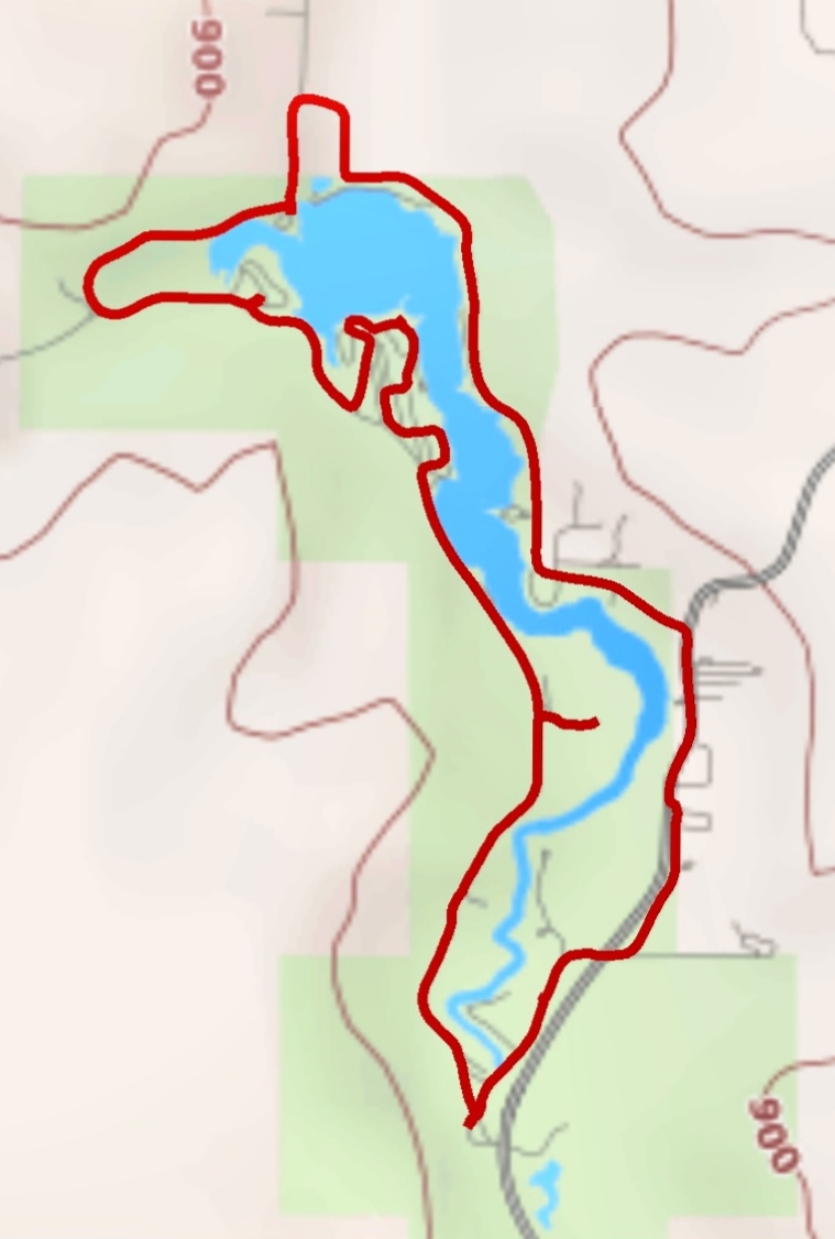
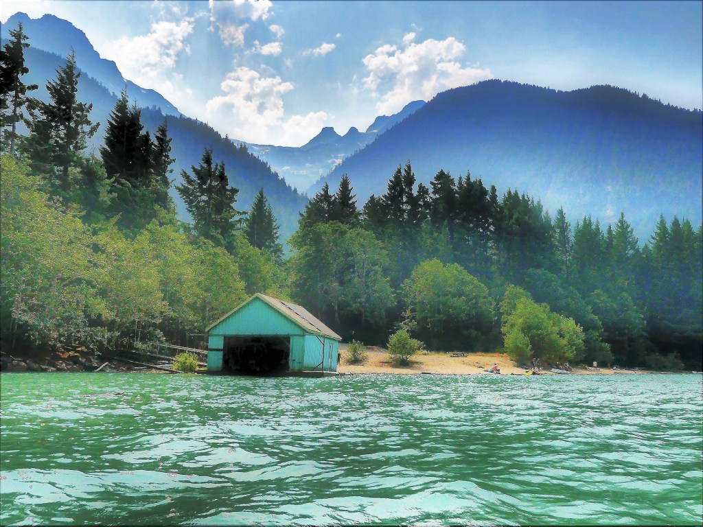
So much about North Cascades National Park reminds me that I’m at a very remote place in America. For starters, there’s limited phone service here which makes GPS plotting a nightmare, and probably explains the frequent mile markers that line North Cascades Highway (State Route 20). It’s the only road that winds its way through the park, and connects all the entities that encompass Stephen Mather Wilderness.
Of the 684,000 acres that Lyndon Johnson and Congress set aside in 1968, 94% of the land has been designated as wilderness. Of the remaining 6%, there is no formal camping and only a handful of designated trails, which may help to explain why the park hosts an average of 30,000 visitors per year compared to 2 million visitors per year at Mt. Rainier National Park.
By the time Leah and I reached the Pacific coast, we learned that the Cedar Creek Fire was burning out of control within the Okanogan-Wenatchee National Forest–threatening the eastern entrance to North Cascades NP, and compromising Winthrop’s air quality, nearby. To make matters worse, North Cascades Highway had been barricaded between mile marker 170 and 185, which meant that if we managed to visit the park–which was always part of our original itinerary–we had no way out.
SR-20 road closures are not breaking news to the people living east of the North Cascades. They’re used to it. In fact, every year from late fall to early spring, SR-20 is closed because of drifting snow across the road (measuring 12 feet) and the high risk of avalanches in areas of steep terrain. Anybody wishing to travel to Seattle must settle on traveling I-90 through the dreaded Snoqualmie Pass.
One week before our anticipated arrival, we phoned a park ranger to voice our concern about likely dangers, and help us determine if our plans were realistic. In return, she gave us a website address to track the daily conditions of the fire, and she reassured us that, “Every day in the park is unpredictable. It all depends on which way the wind blows.”
By the time we were scheduled to visit the park, the Cedar Creek Fire had merged with Cub Creek 2 Fire to become America’s largest forest fire with over 100,000 scorched acres and still burning wildly. Leah and I had an important decision to make: either we risk a visit, or we make alternate plans. There really wasn’t much debate. We were determined to stick to our plans, while well aware of the ranger’s mantra.
We camped outside the park in Rockport at an unusual location dotted with dated, theme cabins, a shuttered restaurant, a wine-tasting room, and a smattering of weedy RV sites overrun by rabbits.
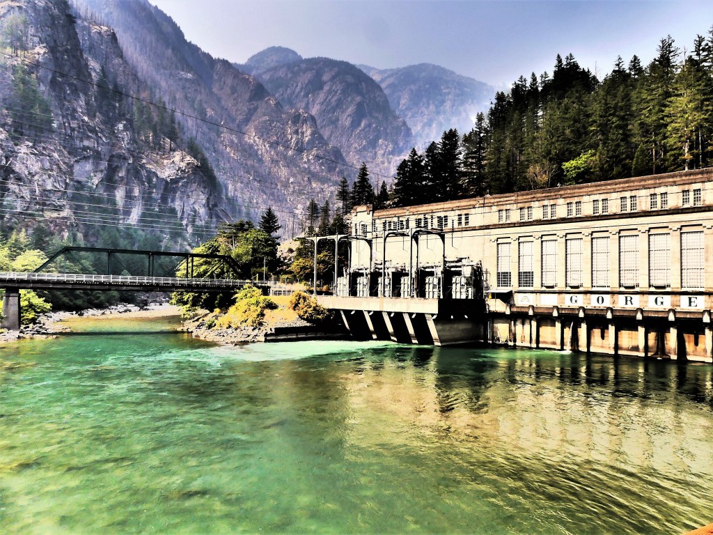
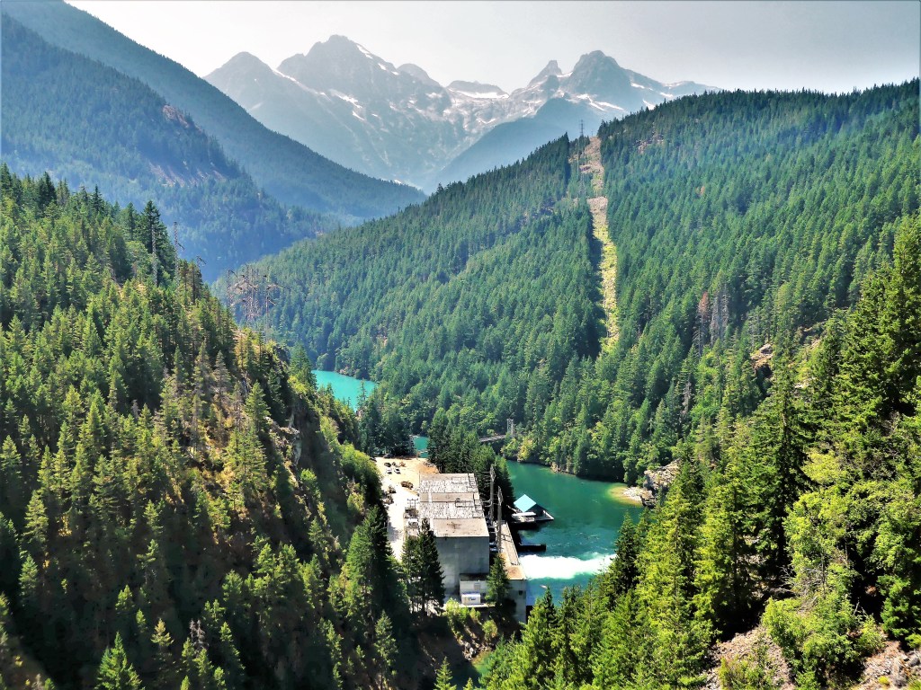
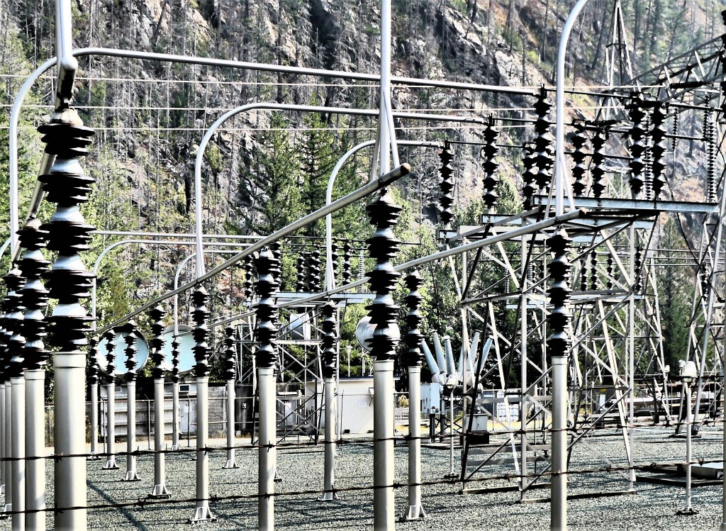
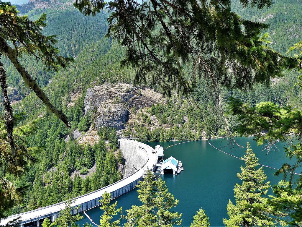
After unhitching, we drove a half-hour to Newhalem, the site of a company town owned by Seattle City Light and the residence of employees working on the Skagit River Hydroelectric Project–a series of three dams and power stations along the Skagit River–
Gorge Power Station
Diablo Dam
Ross Power Station
providing electricity to Seattle since Calvin Coolidge ceremoniously started the first generators in 1924.
As of this summer, the Upper Skagit Indian Tribe has petitioned Seattle City Light to remove the Gorge Dam in order to restore treaty-protected fishing rights to sacred grounds known as The Valley of the Spirits–a 3-mile stretch of the Skagit River area that has dewatered since the dam’s creation–causing the disappearance of bull trout, chinook salmon and steelhead, and consequently threatening the existence of killer whales in the Puget Sound that depend on the fish to survive.
If Seattle City Light hopes to win a new 50-year license to operate the dams, they must demonstrate that the dams cause no harm to the environment. However, regulatory agencies have noted that the dams limit fish passage, affect the water temperature, and prevent much-needed, mineral-rich sediment from reaching the river beds where salmon once spawned.
The following day, our excursion took us deeper into the park, where a faint scent of smoke was in the air. It wasn’t bad enough to impact a full day of activity, but it still managed to drop a smoke bomb on our vistas, turning the “American Alps” into an American disappointment.
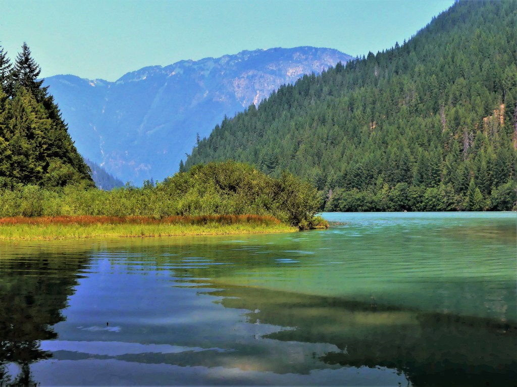
We started our exploration at Diablo Lake, created by the Diablo Dam finished in 1930. While the smoke offered an impressionistic vision of the mountain, water and sky,
I much preferred clearer conditions the following day.
Nevertheless, we took advantage of calm waters,
and beautiful scenery.
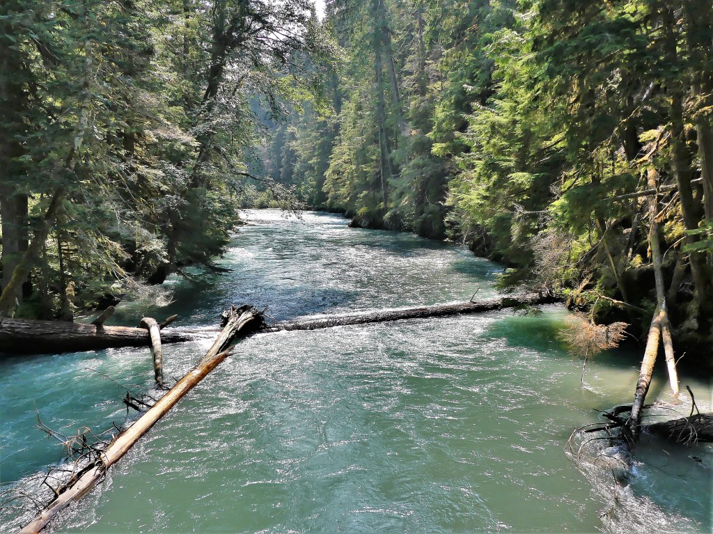
Feeling like a hike nearby, we followed a trail that followed Thunder Creek,
providing the following views:
until we reached our turn-around point at the suspension bridge…
and reflected on flowing riverscapes north,
and south of the span.
The latest news on the Cedar Creek Fire brought tears to my eyes. Officials proposed closing North Cascades Highway for the remainder of the year. I immediately recalled the time four years to this day when we crossed the Continental Divide at the Vermilion Pass–outrunning the BC wildfires on Kootenay Highway–with the mountains ablaze on both sides of us (see Smoke and Mirrors).
While I had no interest in repeating history, I wasn’t looking forward to the two-hour detour that would return us to I-5 in order to reach Spokane to the east. But if that was to be our only way out, I was determined to travel the North Cascades Highway the next day for as far as the law allowed.
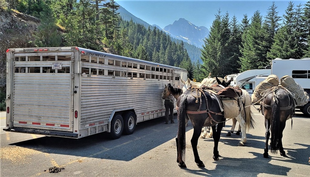
Of course there were stops to make along the way. When we reached Ross Lake at milepost 134, we took the opportunity to stretch our legs along the Ross Dam Trail. With so little traffic on the road, we were not expecting the parking lot at the trailhead to be a challenge. But then we weren’t anticipating a mule train either.
They were preparing to cross the dam to perform trail maintenance further up the Pacific Northwest Trail.
We crossed a dense forest…
to the edge of Ross Lake and across the dam road,
where we were soon joined by the pack leader and company…
for views of Snowfield Peak and distant glaciers.
Of course, we had to dance around the mule poo on our return to the parking lot before continuing our quest.
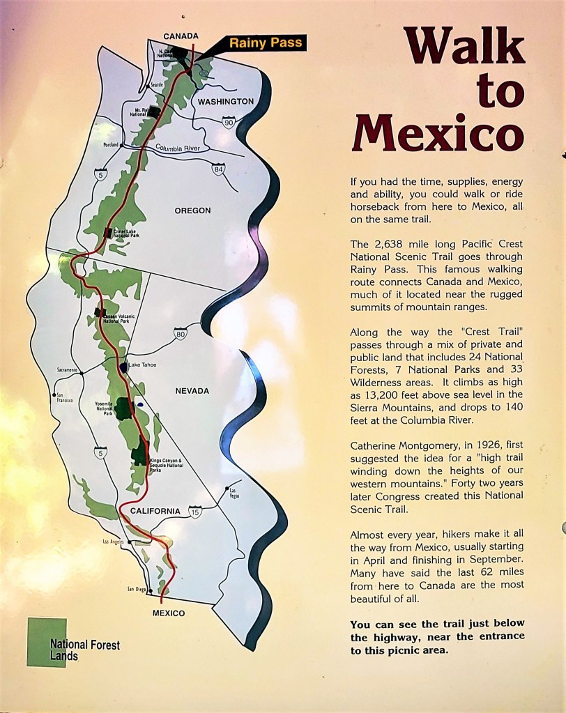
Our next destination took us to milepost 158, where we intersected the Pacific Crest National Scenic Trail at Rainy Pass on our way to Rainy Lake for an easy, 1-mile, wheelchair-accessible hike, until we encountered a tree across the trail within 500 yards of the trail’s end.
Unfortunately, physically disadvantaged people could not appreciate the crystal clear water of this alpine beauty,
or enjoy a distant look at Rainy Lake Falls cascading 850 feet into its namesake lake.
Shame on the NPS!
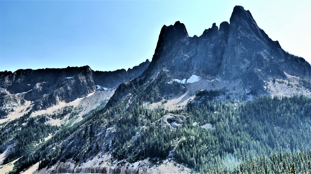
We reached Washington Pass Overlook–our final destination at milepost 162– to ogle the Liberty Bell Group,
and Kangaroo Ridge–
the defining point between Western Washington and Eastern Washington.
And that’s when I saw it! In the distance, midway along the stretch of highway, 8 miles away was the end of the road. I steadied myself for the shot.
We had completed our mission. There was nothing more for us to see before returning west to resume our journey east on August 5th.
By August 10th, the road closure was lifted, and low-speed, one-way traffic resumed in both directions. But I was unconcerned and didn’t mind. I had already arrived at Glacier National Park.
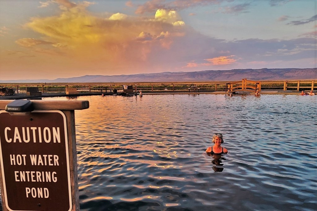
Leah and I needed a useful midpoint between Bruneau Dunes and Bend to divide the drive if we were heeding my tank-of-gas rule. And because I draw the line at driving no further than a full tank of gas will carry us, we were limited to a 350-mile range. In many ways, Crystal Crane Hot Springs offered the perfect locale: it was geographically convenient; it provided full hook-up; and it was also therapeutic.
We arrived at 1:30 PM and Leah entered the office to check-in.
“I’m afraid you’re too early,” said the clerk. “Check-in isn’t until 3:00.”
“But we reserved site #6 and it’s empty now. Why not allow us to pull into the space?” Leah asked.
The clerk was unmoved. “Our policy is that check-in is 3:00—no sooner—so, no, I can’t let you into your space at 1:30. However, you’re welcome to buy a guest pass for $10 if you want to use the facilities while you’re waiting.”
Leah returned to the truck with the news. “Are you kidding me!?” I exclaimed. “I’m cooking out here, already. Why in the world would I want to marinate in a 98° hot spring when it’s 102° outside? All I want to do is hook-up the electric to the Airstream and sit under the air-conditioning.”
“I tried,” said Leah, “but we need to wait another 90 minutes.”
“Ridiculous!” I remarked.
This stop was always intended as an overnighter, so there was never a need to unhitch—just plug and play. Meanwhile, the Airstream doors and windows were opened wide to circulate fresh hot air into a cabin that had already reached the outside temperature and cooling the space would take hours.
At 2:30 PM, I entered the climate-controlled office and approached the counter where a large, buxom woman with a mole inside her dimple was standing behind a plexiglass barricade. Rather than argue my case, I flattered her to the point where she conceded, and gave us access to the space a half-hour early.
With the sun setting and the day’s heat dissipating, the spring had become a hive of activity. It was finally time for us to ceremonially cleanse ourselves of all the dust and grime and sand that followed us through 5,000 miles of travel between New Mexico, Colorado, Utah, Wyoming, and Nebraska.
Extreme heat is baking the northwestern states in July, and historic highs are being set with every new day. Murphy, Idaho is no exception. Triple-digit heat has become the new normal, and we were about to cross that threshold, as we continued our journey across the Snake River Plains to Morley Nelson Snake River Birds of Prey, where temperatures reached 104° the other day with no foreseeable break in the heatwave.
Originally, the plan was a sound one–we would travel across Idaho, from Craters of the Moon to visit a raptor sanctuary. But at the time, we never considered that booking a Bureau of Land Management campsite (the only campground in the vicinity) would expose us to unbearable heat inside the Airstream, as most all BLM campsites are primitive–meaning NO services.
Leah and I needed to adjust our plans accordingly and without delay if we were to remain on course and on schedule, but we had to find a worthy substitute for the next couple of days. We thought about staying in Boise (it was nearby), but we had little interest in visiting Idaho’s largest city (pop. 230,000); we were looking for something more adventurous and outdoorsy.
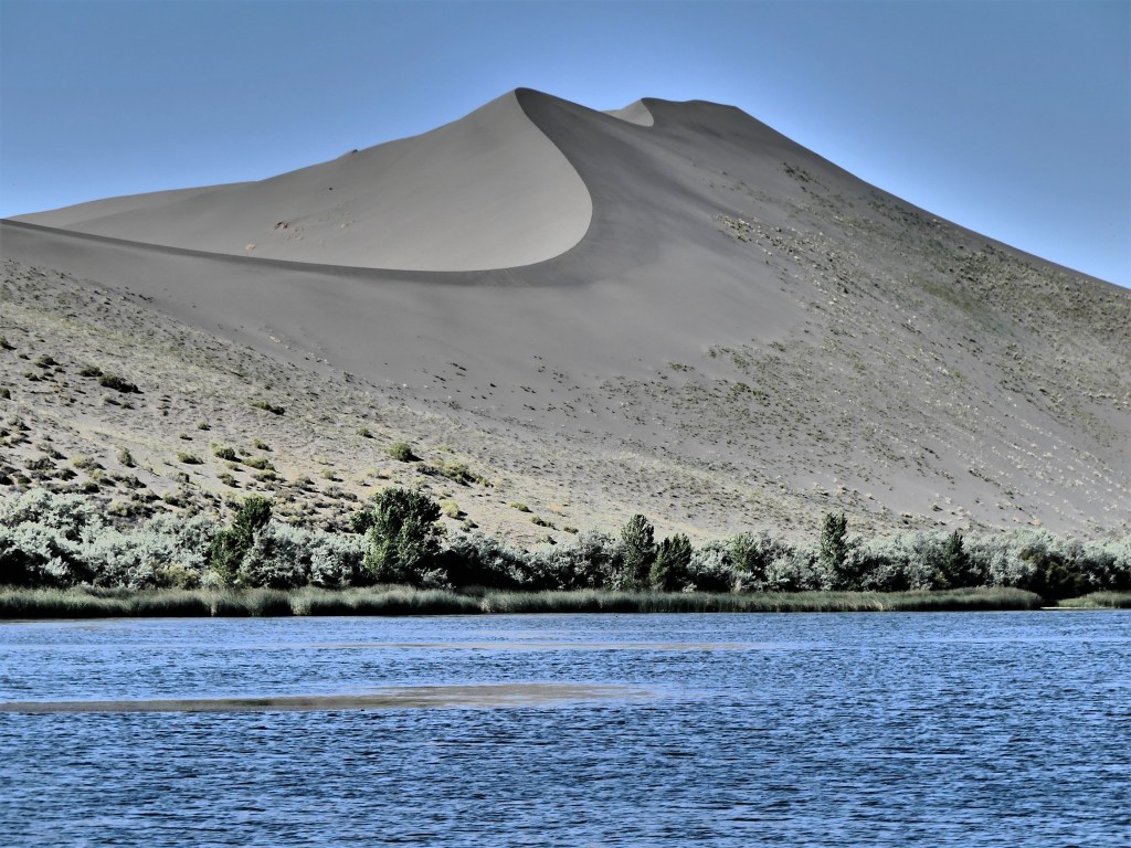
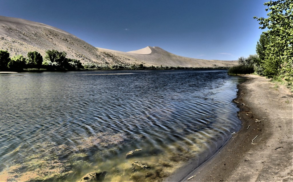
After checking area state parks, I discovered that Bruneau Sand Dunes State Park was close by (1.5 hours away) and available with water/electric hook-ups. There would be no sightings of prairie falcons or golden eagles at Bruneau Sand Dunes, but if we closed our eyes, we could imagine them in air-conditioned comfort. …and lots of sand…again (seeGreat Sand Dunes National Park).
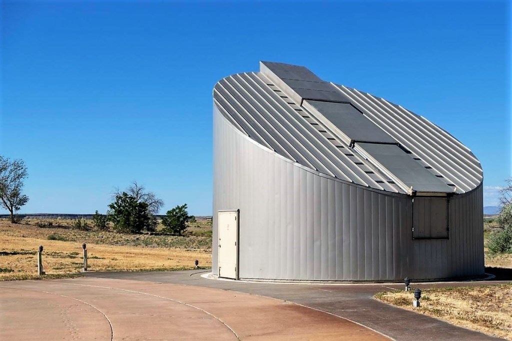
We arrived to a nearly empty campground on the edge of the “tallest ‘single-structured’ sand dune in North America,” with a peak rising 470 feet above the surrounding desert floor. The park also touts its own observatory within a Dark Sky Place, searching the sky with Idaho’s largest telescope (25 inch diameter) for public viewing.
My first inclination was to compare it to Great Sand Dunes National Park, but I was determined to curb my skepticism and see what surprises awaited us inside our new backyard/playground…for the meantime.
The following day, we went exploring. Unlike a couple of coeds and a dog, we immediately dismissed the notion of climbing the dunes in extreme heat.
We were looking for a more sedate hike that required less elevation. Rather than follow the 6-mile self-guided hiking trail step-by-step, we improvised, skipping the Big Dune ascent, and followed the trail around the dune base,
where we discovered water, and that made all the difference.
We circled the lake…
and dunes…
and crossed over a few of the lesser dunes,
until we reached the observatory.
I was eager to stargaze that evening, but the observatory was closed until further notice due to COVID-19. Unfortunately, the only celestial offering on-site was a human sundial created by Girl Scout Troop 140 in 2015.
I was curious about the design, but I required a human to test its accuracy.
Leah stood on the current month (July), for the sun to cast her shadow on the current time of day. Checking my watch, I recorded 10:24 AM, which from the looks of her shadow, validates her as human and punctual.
The rest of the day, we played by the water, and enjoyed the air-conditioned comfort of our Airstream, never giving Morley Nelson Snake River Birds of Prey a second thought.
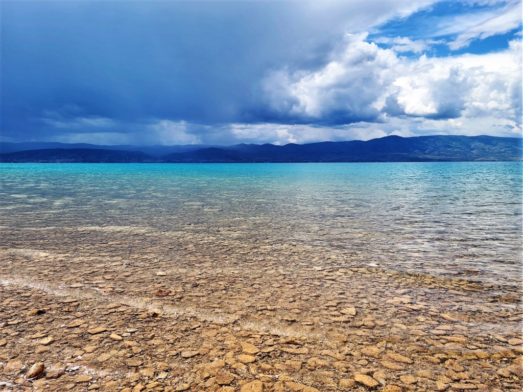
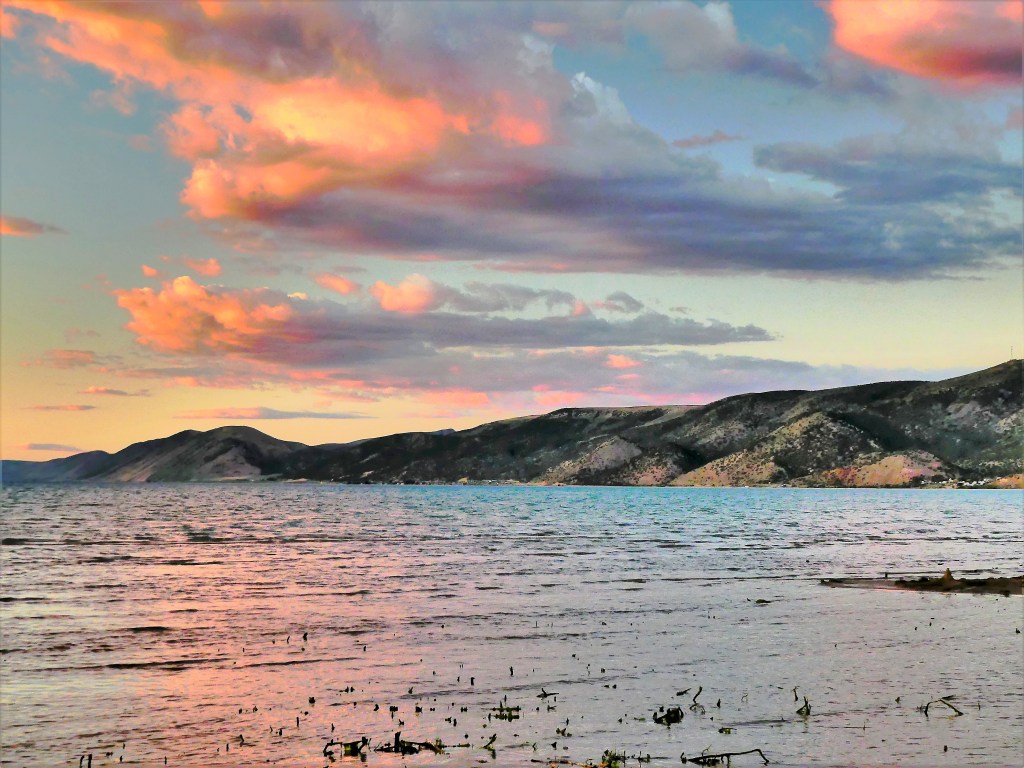
There’s a lake that straddles northern Utah and Idaho that boasts a turquoise-blue color that rivals any Caribbean beach, and it’s all due to the refraction of calcium carbonate (limestone) deposits suspended in the lake. The intensity of the color also shifts with the sun’s position, the wind direction and the current, to where it becomes dizzying, trying to frame and capture patterns of varying shades of blue through a camera viewfinder.
Leah and I camped in two of several neighboring Utah State Park campgrounds to round out our visit. When initially making reservations, the Rendezvous Campground only had openings for the last two of our three nights, so we took up residence at South Eden Campground on the east side for the first night, with an understanding that it was a primitive site.
To our surprise, the facility had been upgraded with water and electric service over the past year. Of course, we would have preferred to stay for the duration of our visit, but that’s not how reservations work at a busy summer resort.
Moving to a new site after one day was not a relaxing proposition, but with so much running around over the past two months, we owed ourselves some down time from traveling, and Bear Lake seemed like a good fit, despite the campground fuss.
Aside from the splendid color of the water, our beach was far from beach towel-friendly, with broken shards of shale, shell, and limestone liniing the shoreline…
and beyond, making hard-sole, water-shoes essential footwear.
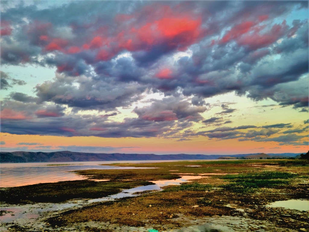
But what mattered most to me at the moment were the clouds that were moving in and out of view.
Would there be enough cloud cover to support a world class sunset?
Armed with a camera and a silent prayer, I waited anxiously on the beach as the sun kissed the sky goodbye.
And then came the explosion I’ve come to expect. I would have my sunset, after all!
The following day, we moved to Rendezvous Beach on the west side of the lake, where the accommodations were as advertised: modern facilities and tighter sites,
followed by uncrowded sandy beaches? Where were all the people?
I later learned that all the “missing” were running their boats up the lake from the Bear Lake State Park Marina. And I’d like to personally thank each of them for the onslaught of wake that made for an average time kayaking in open water.
The final evening of our stay, we drove into Laketown for ice cream and a sunset. We found a quiet side street that dead-ended at the waters edge, and we waited…
“Not as brilliant as the other night, but not terrible,” Leah assessed. “C’mon, we need to go before the town shuts down and we miss our chance at ice cream.”
“Don’t be in such a hurry. Wait for it. Otherwise, you’re gonna miss the best part. The sky is still developing,” I predicted.
I got the sunset I wanted, but not the ice cream, as most of the town had shut down by 9 PM. With only one late spot open, we opted for flavored milk shakes and called it a night.
The moral of the story: A Saturday Night Sunset beats an Ice Cream Sundae!
Leah and I were en route from Albuquerque to Taos when I noticed an early road sign for Bandelier National Monument. As we got closer to our destination and signs for Bandelier became more frequent, I proposed that we make it a stop–not for overnighting, but a daytrip to break up the travel monotony–considering it wasn’t more than an hour out of our way.
While there wasn’t hardcore support for the idea, there wasn’t serious objection either, which meant I still had a chance to sell the idea.
“I think it’s been 46 years since I was there–probably some side-trip while visiting Santa Fe during my first cross-country honeymoon trip,” I started.
“I think I was there sooner than that,” Leah commented, “like in the past 10 years.”
“Really? It couldn’t have been with me,” I asserted. “Do you not have an interest in going?”
“I don’t know,” she maintained. “I mean, is there anything there that we haven’t seen before?
I thought, “Are you kidding me?! Would you pass up Niagara Falls because you saw Victoria Falls?”
I said, “It’s the site of an ancient pueblo village. It’s similar to Mesa Verde, and I think you may be mistaking one for the other, because we last visited Mesa Verde when we flew to Santa Fe for Carrie’s wedding 12 years ago.”
“What do you propose we do with the Airstream, ’cause we certainly can’t pull it around the canyon,” Leah asked and answered.
“We can work that out when we get there,” I proposed.
Sometime that answer gets me in trouble…but not this day!
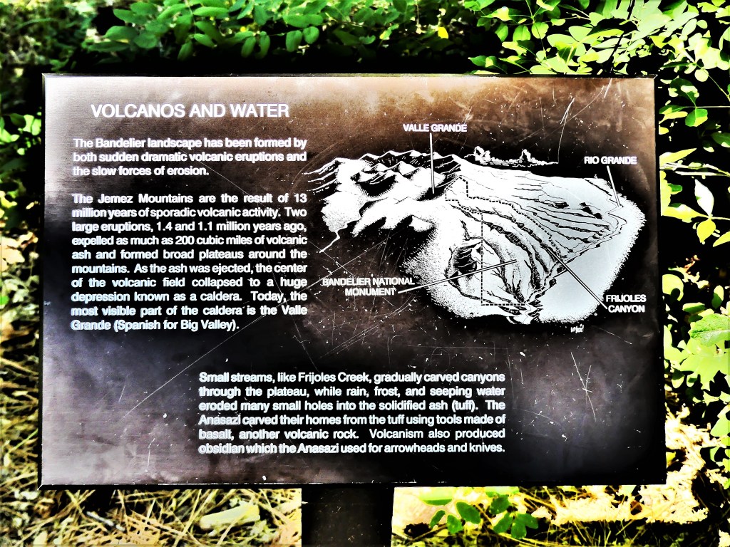
We first passed through Los Alamos (with maybe more nuclear physicists per square mile than anywhere else on earth), and climbed a ridgeline of the Jemez Mountains,
overlooking the Frijoles Canyon.
“Any of this look familiar,” I teased.
We followed a serpentine road that wound around the mountain, carrying us deeper into the canyon. A park ranger stopped us at the park entrance station.
“Sorry folks, but your trailer–nice as it is–doesn’t fit on our mountain roads. To get to our Visitor Center and trails, you’re gonna have to drive to the Juniper Campground parking lot and unhitch there,” he advised.
“Sounds reasonable,” I confirmed.
“You’re prepared to do all this work just to drive the park?” Leah asked.
“You’ll see. It’ll be worth it!” I said.
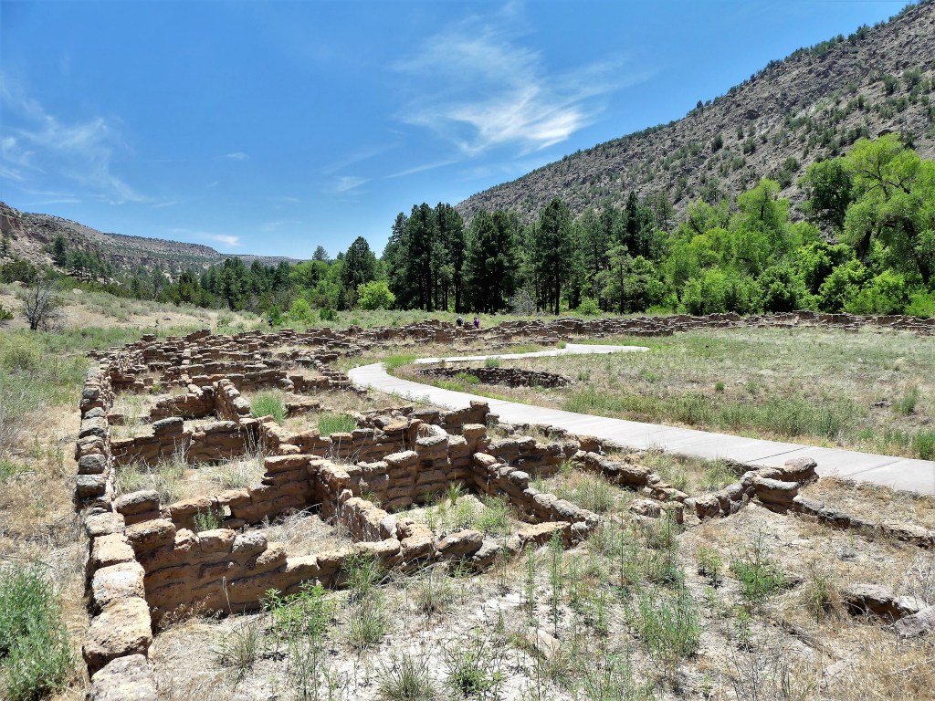
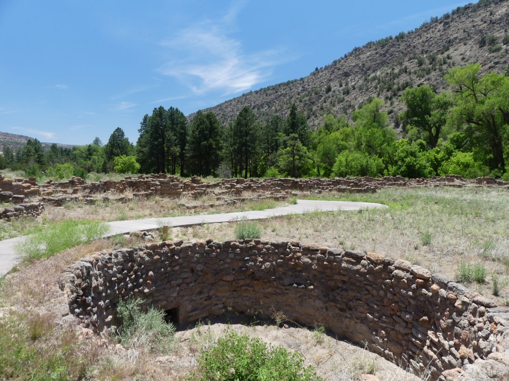
We walked the Pueblo Loop Trail, passing Big Kiva (a ceremonial underground chamber)…
and the 700-year ruins of Tyuonyi (QU-weh-nee) village—
originally a 3-story ring of sandstone rock debris exceeding 400 rooms.
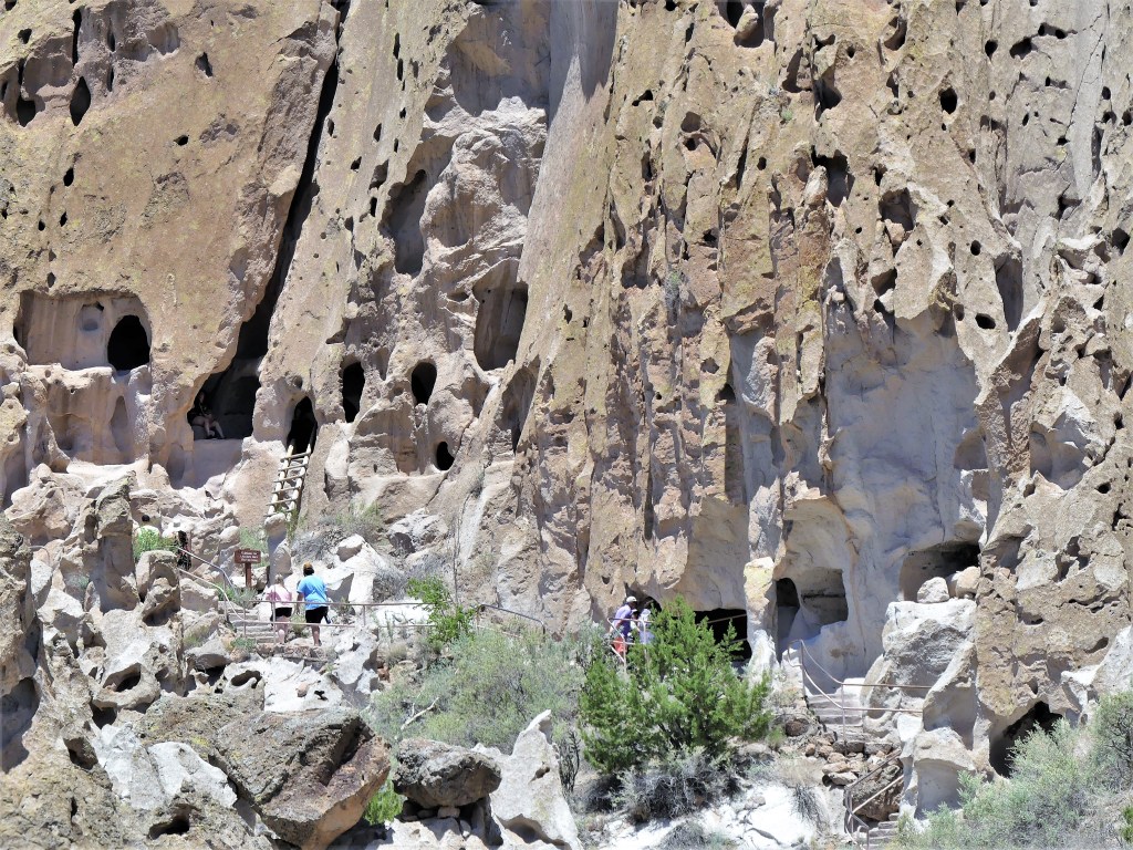
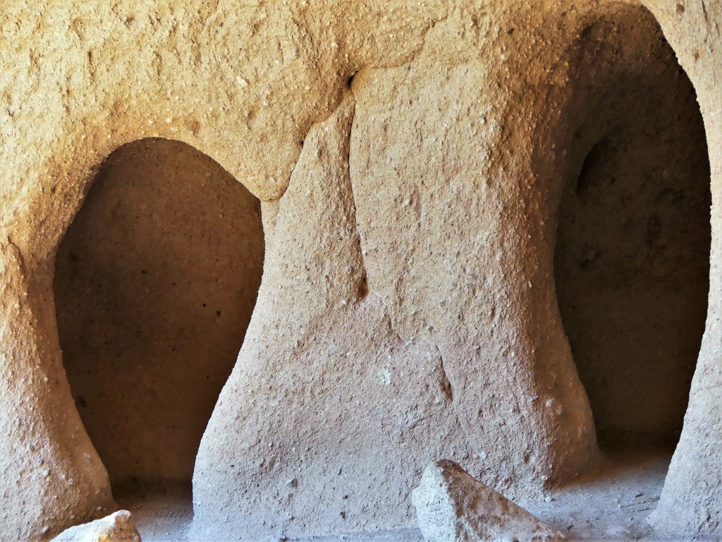
From a distance we saw several families poking through the cavates, chipped out of porous rock.
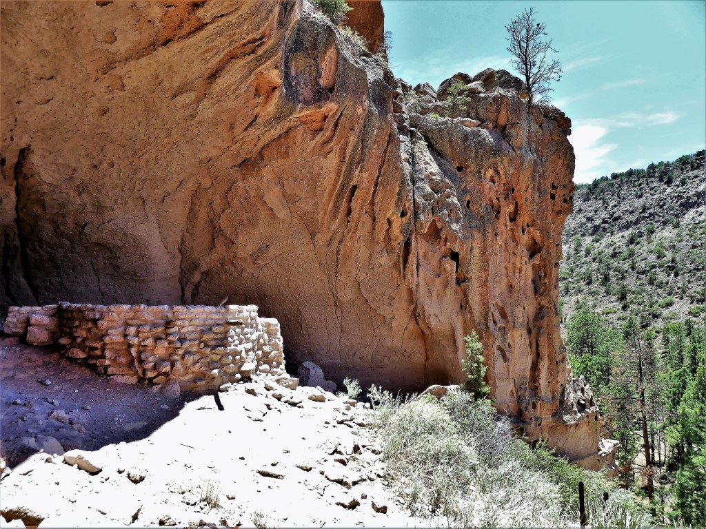
We soldiered on, beyond the remnants of the Long House…
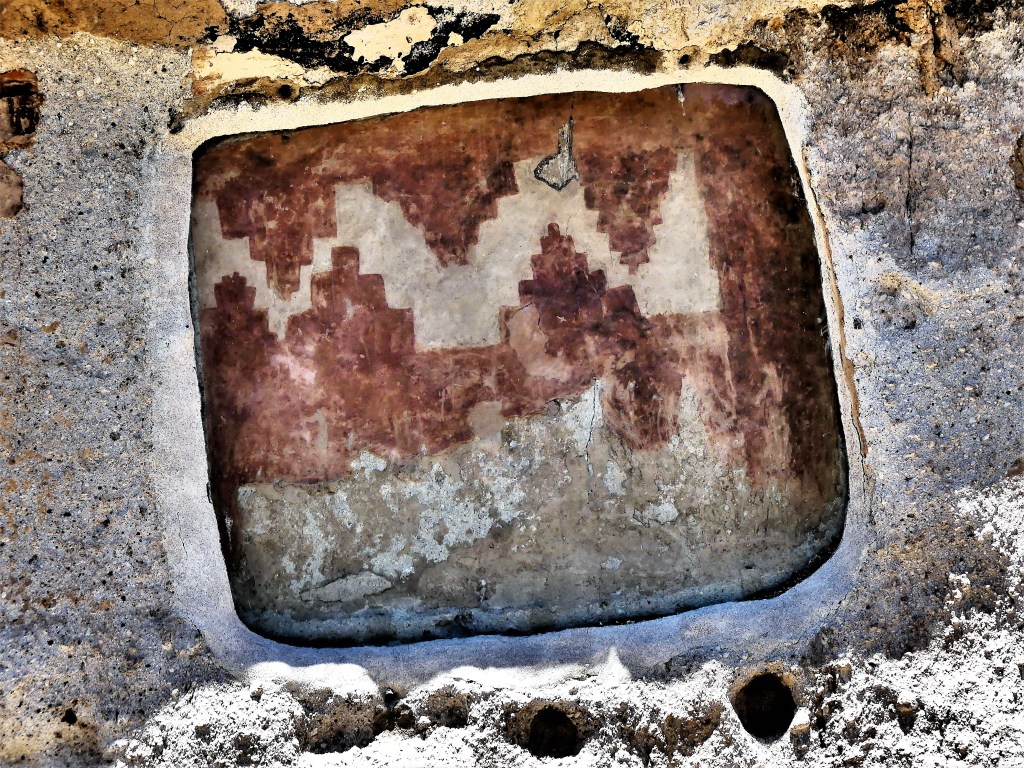
lined with protected petroglyphs,
and imagined what it once looked like…
when all that remains are chiseled-out rooms,
once hidden behind adobe walls.
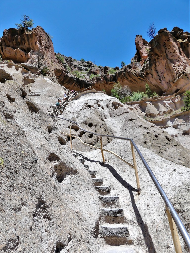
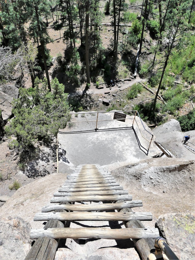
We took the trail extension in anticipation of climbing to the Alcove House…
but Leah chose to sit this one out.
The climb was steep and narrow, and the ladder rungs were on fire from baking in the sun all day.
While Leah enjoyed the shade beside Frijoles Creek, I had an aerie to myself with a nestled kiva,
and sculpted rooms for meditation.
Which may have prompted me to say a prayer or two before my looong climb down.
With Amarillo behind us, we were finally on our way to Albuquerque to visit Leah’s family. Earlier in the week, Leah had made preliminary plans with Carrie, her daughter to take the grandkids to Santa Rosa, NM to visit a popular water park the day after our arrival.
But not so fast!
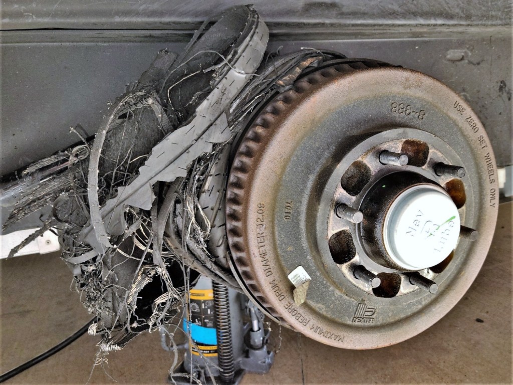
We were driving on I-40 West with very light traffic, and had just crossed the border into New Mexico when a couple in a pickup pulled along side me and grabbed my attention. The woman in the passenger seat looked concerned. She mimed a circle with her finger while shaking her head, and pointed in the general direction of our Airstream before the pickup sped away.
“Oh, shit!” I grumbled. “There’s trouble back there.”
“What do you mean, trouble?’ Leah asked.
“I don’t think she was playing Charades…hopefully nothing serious” I answered.
I slowed to a crawl–pulling off the road to inspect our rig.
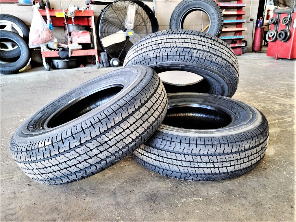
The original set of Goodyear Marathons looked nearly new upon general inspection, and I‘d only pulled the Airstream about 5,000 miles since starting out on our Great American Road Trip. Thank goodness for tandem axles. As for the blown tire, the tread was gone and the cord plies were shredded, but miraculously, the wheel and wheel well were still intact.
“We need a new tire,” I sighed. “The one that used to be there looks like spaghetti.”
“So now what? We’re in the middle of Bumfuck,” she panicked.
“Not exactly,” I tried to reassure.
“And on a Sunday to boot!” she continued.
“You’re not helping,” I advised.
Analyzing our location on GPS, I responded, “It’s showing that we passed a truck stop the moment we crossed the border.”
I called Russell’s Tire Center and learned that Cole was on-call. He agreed to meet us at the shop in half an hour. He also advised that he would be charging his travel time back to me at $95/hr. in addition to the emergency repair at $95/hr. It was a different kind of highway robbery, but I was out of options since I lacked the tools to lift a 7500 lb. trailer.
“There! It’s arranged,” I crowed. “We just need to get to the next exit and head back.”
“How are we gonna do that without a tire, genius?” she asked.
“Slowly and carefully,” I suggested.
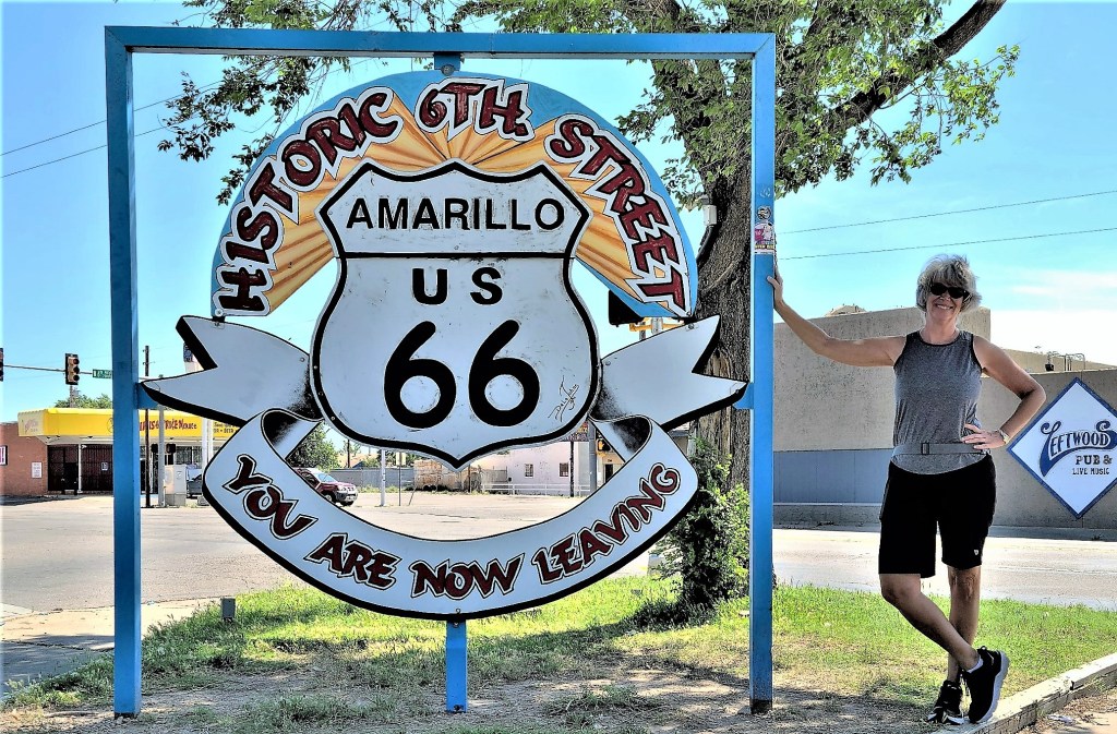
It seemed like forever, but we limped along at 20 mph with flashers flashing until we approached the next westbound exit. Ironically, Jennifer (our GPS voice) routed our return along Route 66–parallel to I-40 West–as if she knew that slow-going was ill-suited for Interstate travel.
We got to Russell’s first and waited for nearly an hour when Cole arrived. He got straight to work. With the wheel off, I discovered what became of the tread. Luckily, no harm was done to the shock or the brake system.
Feeling insecure about using the spare under the Airstream, I opted for a new tire. When all the dust had settled, we were finally on our way to Albuquerque after a 2-hour layover and $300 in expenses. But I was feeling weary from the incident and wary behind the wheel, knowing that the other tires needed to be replaced.
90 minutes of drivetime took us to Santa Rosa, NM.
“Wait a minute! Aren’t we scheduled to drive here tomorrow with Carrie and the kids?” I asked.
“That’s right,” confirmed Leah.
“But we’re already here. Why on earth should I drive another 90 minutes to Albuquerque, only to return here the next day with your family,” I reasoned. “Why can’t they meet us here instead? They could even camp with us tonight if they want. Besides, I’m exhausted from this expensive mini-adventure.”
“Not a bad idea, Einstein,” she quipped.
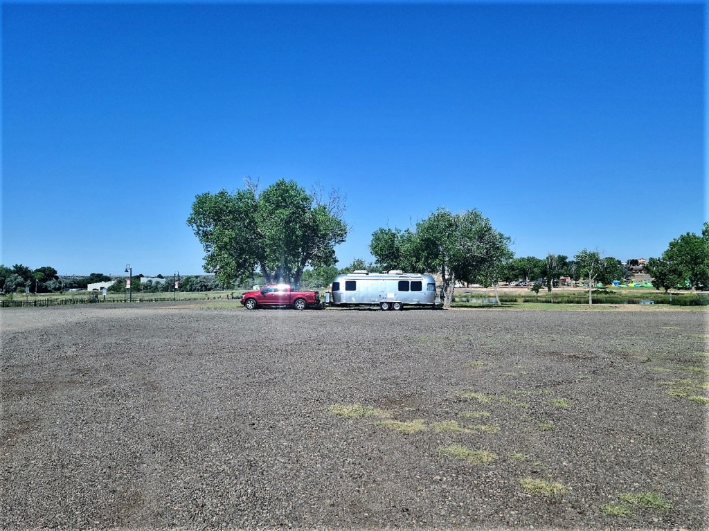
Good News! Google confirmed that 2 walk-in sites with services were still available at Santa Rosa Lake State Park. Jennifer navigated us to the park campground, where we looped around twice to locate the open sites as advertised. Turns out, one site was handicap reserved; the other site was reserved for camp host.
As with most self-help campgrounds, Leah put our payment in an envelope and dropped it into a paybox at the entrance kiosk. After plugging into the host site, it was a relief to finally kick back with a cold beer and a blast of A/C to melt my stress level.
But not so fast!
Two park rangers have approached Leah, and it didn’t go well. We have been evicted, unapologetically.
So we rolled back onto Route 66 and found an overnight spot at a local RV park. Leah made arrangements with Carrie, who eventually drove to meet us and spend the night car camping with Devin and Gabe outside our Airstream window.
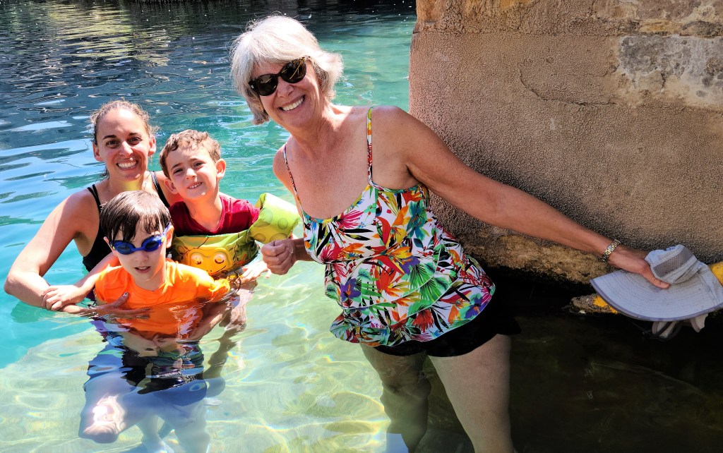
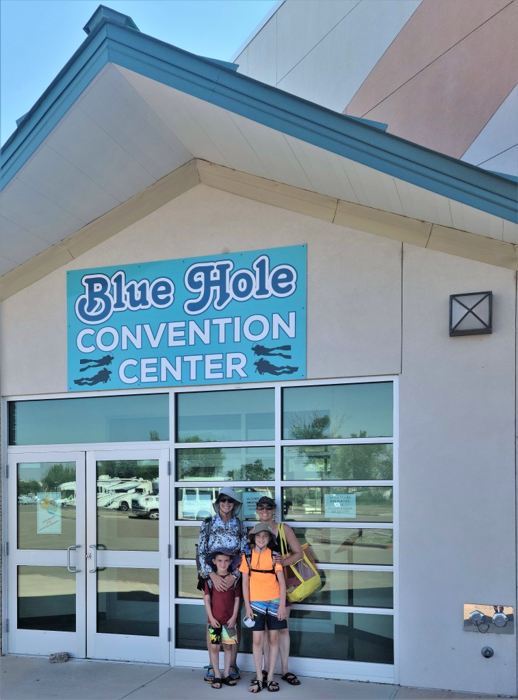
The next day, we drove to the Blue Hole—
–ready for excitement.
When we arrived, I had this nagging feeling of déjà vu.
“We’ve been here before,” I mentioned to Leah.
“I would have remembered this place,” she disagreed.
“I’m telling you, this place is very familiar to me,” I insisted.
“Maybe you were here with someone else,” she theorized.
“Nope! You were with me, and I can prove it,” I stated emphatically.
I scrolled through the picture gallery on my phone, as if by chance…until…
“There it is!” I insisted. “We were here on October 18, 2017! And here’s the picture to prove it!”
“Congratulations! You’re right again, as usual,” Leah said without conviction.
“We never went in the water,” I said, “But that’s about to change today.”
It took some coaxing, but eventually everyone braved the 61o F temperature…
except me. I was going for the whole enchilada.
I watched as several youngsters scrambled to the ledge 20 feet above the Blue Hole and jumped,
which was all the preparation I needed for my jump.
The water was freezing–enough to take my breath away. But at least I left with bragging rights.
P.S. After we reached Albuquerque, our Airstream got a new set of shoes…
After motoring through half of America in our Airstream for the past 1 ½ months and reporting travel highlights along the way (http://streamingthruamerica.com),
I’m temporarily suspending the chronological order of my posts to confess that I’m not as young as I used to feel. I’m usually up for a reasonable physical challenge, but I have to admit that today’s climb did not go as easily as I wanted it to.
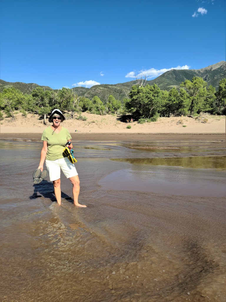
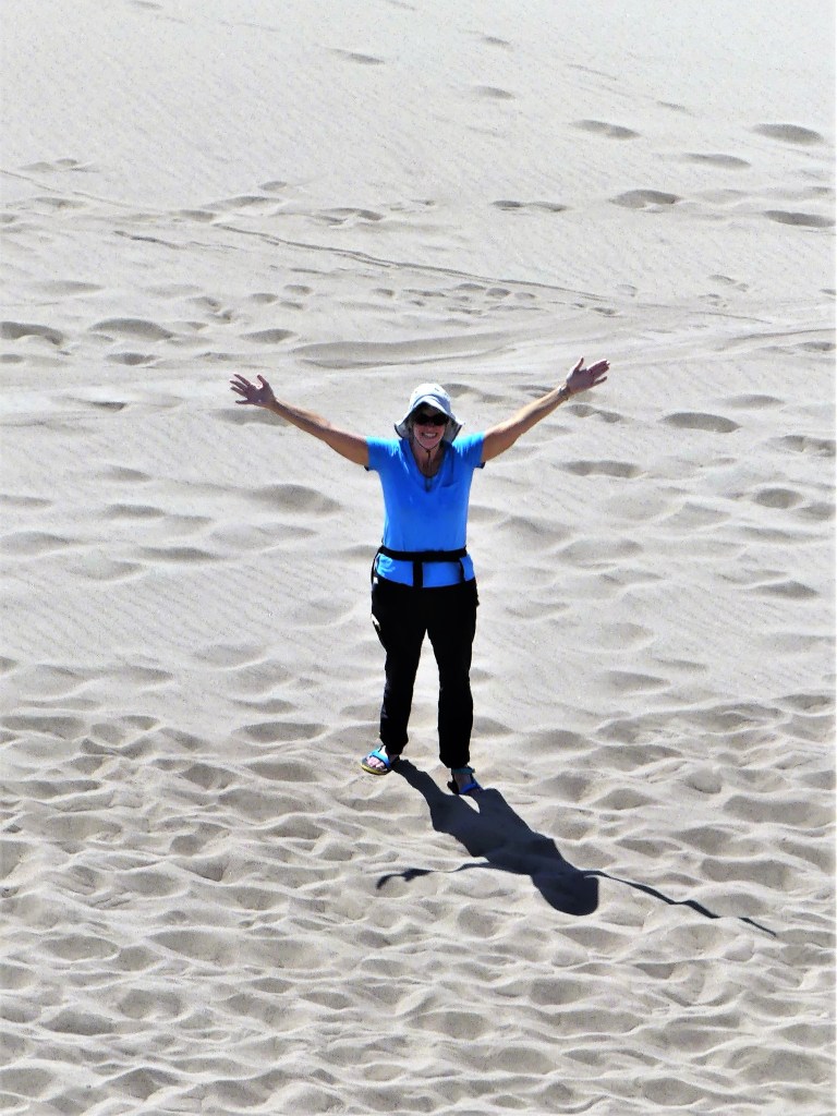
Yesterday, Leah and I crossed from Taos, New Mexico to Alamosa, Colorado, and settled in at Base Camp Family Campground by midday. After hiking in Taos the past 2 days, we thought we had acclimated nicely to the thinner air (more to be said on that later), but we were feeling our age after our arrival. We took an early siesta in air-conditioned comfort, followed by a 27-mile sprint to the Great Sand Dunes National Park Visitor Center just before it closed.
The park ranger suggested a climb to the top of High Dune (699 feet), but to keep in mind that tomorrow’s high will reach 92o F. He recommended a 9:00 am start time in order to reach the top of the dune by noon, and before the surface temperature exceeds 150o F. The ranger predicted the 2 ½-mile trek should average 2 hours, round trip.
Since we were already at the park, we decided to have a look around. We found it very refreshing to glide through three inches of snow melt, ebbing and flowing from the Sangre de Cristo Mountains.
Considering it was a Sunday afternoon, and peak traffic was winding down,
there was still plenty of activity around us;
far too many interesting vistas to ignore;
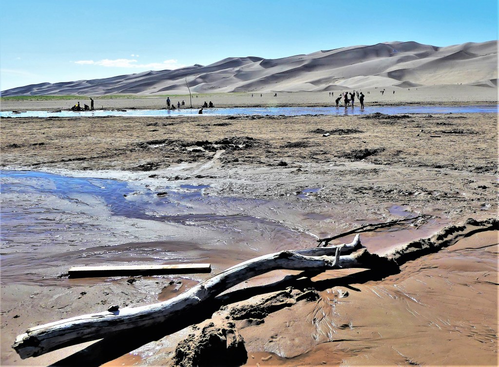
and surprising driftwood sculpture to admire.
We arrived at the Dunes parking lot by 8:45 am the next day, and we were not alone. Many other families were already parked and trekking across the sand flats with sandboards in hand. Canopies and shelters were already sprouting up throughout and within Medano Creek, and kids were romping in the water and shaping wet sand castles.
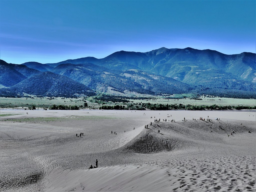
We surveyed the 10,000 acres of dunes and plotted our course as there are no marked trails, but we followed along the ridgeline like most others.
Looking back gave us some satisfaction, because it reminded us of how far we trudged,
but looking ahead reminded us how much more we had to cover. The closer we crept to the top, the deeper our feet sunk into hot sand, slowing our progress.
We took a lot of breathers along the way,
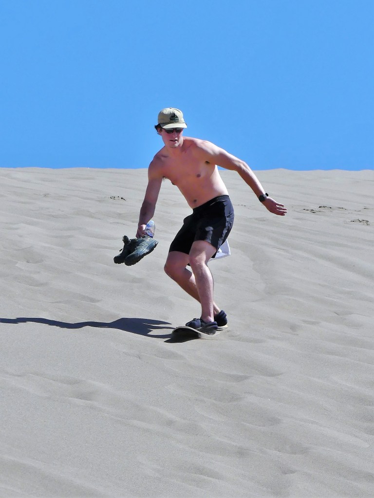
and rated the sand boarders as they attempted to carve out a run…
but mostly, it was uphill twenty steps, pausing to catch our breath, having a look around, sipping some water, and repeating the process. Slow and steady wins the race. Right?
Many hikers passed us on the way down offering words of encouragement, but Leah–realizing her feet were about to catch fire–decided to mush down the sand slopes and soak her feet in the creek while I continued to the top.
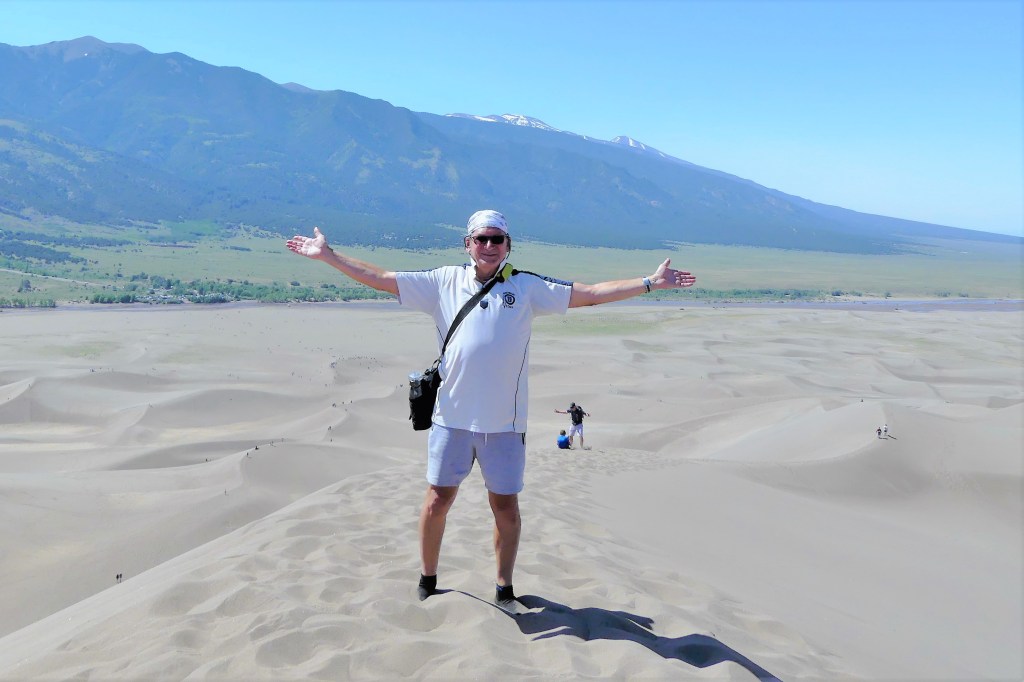
And so I pushed myself, and willed myself up the final ascent, foot by foot, grabbing air along the way, until I finally reached the summit with barely enough energy to greet the younger people who passed me on the way up, and wave my arms for Leah’s snap.
Perhaps it was self-gratification…
realizing that I can still push myself,
or maybe I needed to see the other side of the mountain.
Either way, it’s all good. Ironically, as I admit to myself that I’ve lost a step or two, to my surprise, I often find myself taking a victory lap. As I get older, I’ll eventually have to make do with being young at heart.
Living out of our newly acquired Airstream for the past few weeks has taught us a few things about durability and reliability when streaming through America across Eisenhower’s Interstate. Years of nasty weather and million-mile road wear (with subsequent band-aid repairs) have left our highways in tatters and our bridges at risk (more on this at a later date), which has a pronounced impact on any home on wheels, considering that bumps and ruts on the outside often translate to shakes and rattles on the inside.
It’s always surprising to see what’s on the cabin floor after a stint of driving between locations. Potholders frequently jump from their hooks, and occasionally, I’ll discover a rogue screw from who knows where, or an A/C vent that’s fallen. However, it’s more disconcerting to find a drawer on the floor or a cabinet door ajar because the locking mechanism has failed.
There was a time when a glass jar of spaghetti sauce was tossed out of the pantry during a rough ride and smashed to bits across the carpet runner that connects our living space to the sleeping space. Leah and I were finding spatter specks years later, stuck to walls, bedding, and curtains. We learned our lesson; today, we look for plastic containers.
One of our more notable challenges as we prepared for this trip was finding an appropriate bedspread that had gone missing since the last owner. Because the queen-size mattress is rounded and shorter than usual–to accommodate the bedroom dimensions—Airstream charges $534 through their design store to replace it. Fuhgeddaboudit! There is no way any bedspread is worth that much. Yet, an exhausting internet search found nothing close to what we needed.
After continued research, I discovered Top Stitch, an old Airstream supplier, who promised to customize our bedspread for $199. Their first effort was a flat cover and a total flop, completely discounting the unique mattress design. However, after checking and double-checking measurements, and eventually signing off on a scaled drawing…
the project was successfully completed for a fraction of the cost. Hats off to Top Stitch!
Additionally, a stack of drawers under the galley sink—that should have been better secured—needs to be realigned to fit better and roll more smoothly; the left channel of the Polk audio system needs to reconnected; and a missing freezer door lock needs to be located and installed.
We were hopeful that a one-day stopover at Airstream’s Factory Service Center in Jackson Center, OH would satisfy our fix-it list, but only if we were willing to stay through September for the next available appointment.
Airstreams waiting for service
Uh…no! But we did stay through the night with full-service hook-up for $10.
The next morning, we were off to Indianapolis with Painter Tape across the drawers and freezer door to limit the number of surprises at our next stop.