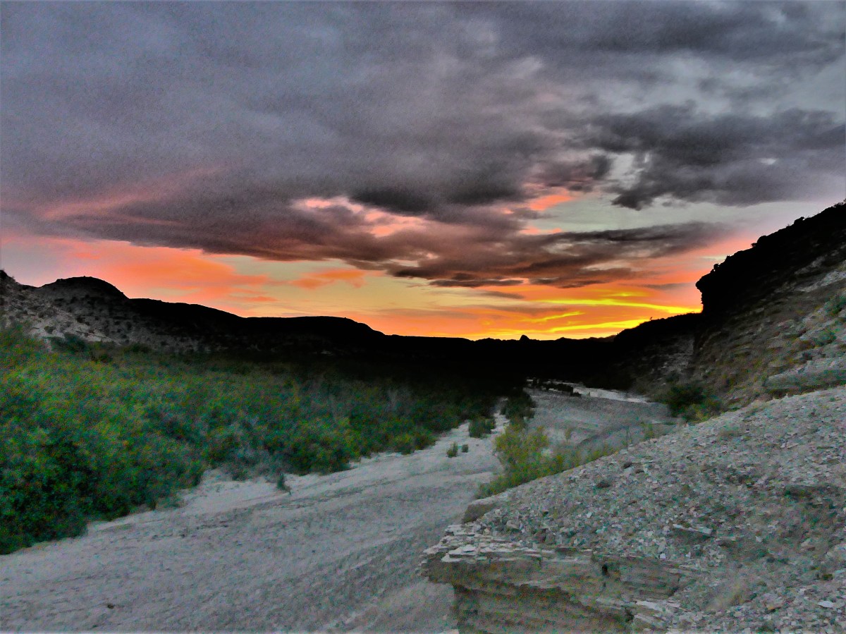
At the risk of becoming too comfortable with scheduling only two activities a day during our destination stay, our last full day before moving on from Big Bend presented an opportunity to squeeze in three. That’s right…we were going for the hiking hat-trick!
By rights, we were being overly ambitious—biting off far more than we should ever chew—but as we’ve found since starting out, time is not our friend. Not to be melodramatic, but we may never pass this way again…and if we do (whether in this life or as Shirley MacLaine), it may not be with the same get-up-and-go. So, while we still can, we will continue to fool our bodies into believing we are first-round draft picks.
Typically, before dropping anchor, we’ll have researched most meaningful possibilities in our area. Then we’ll cherry pick around our common interests based on associated cost (we’re on a budget!), reasonability (is it safe and sane?), and time (is there enough of it?). By adopting this strategy, we’ve managed to stay focused and in sync.
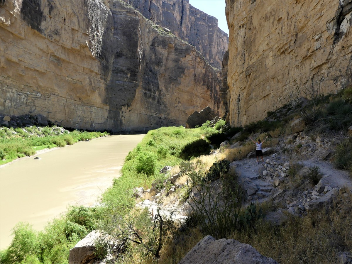
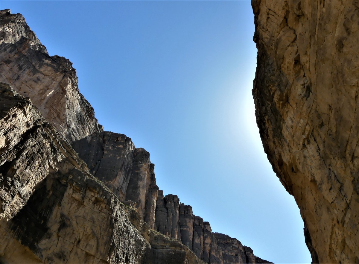
But on this particular day, we agreed, “Who cares what it costs! This is totally insane! We’ll never have enough time! So, let’s do it!” On this day, we would canoe down the Rio Grande and hike through Slot Canyon while at Big Bend Ranch State Park, then return next door to Big Bend National Park for a backcountry drive to Santa Elena Canyon, hike the Santa Elena Canyon Trail, and return through the Ross Maxwell Scenic Drive.
Two days earlier, we reserved with Angell Expeditions for a Sunday float. For many, the holy grail is to raft through Santa Elena Canyon in the shadow of its 1500 feet canyon walls while attacking Class IV rapids. However, local outfitters were eschewing the Santa Elena junction put-in due to historically low water levels.

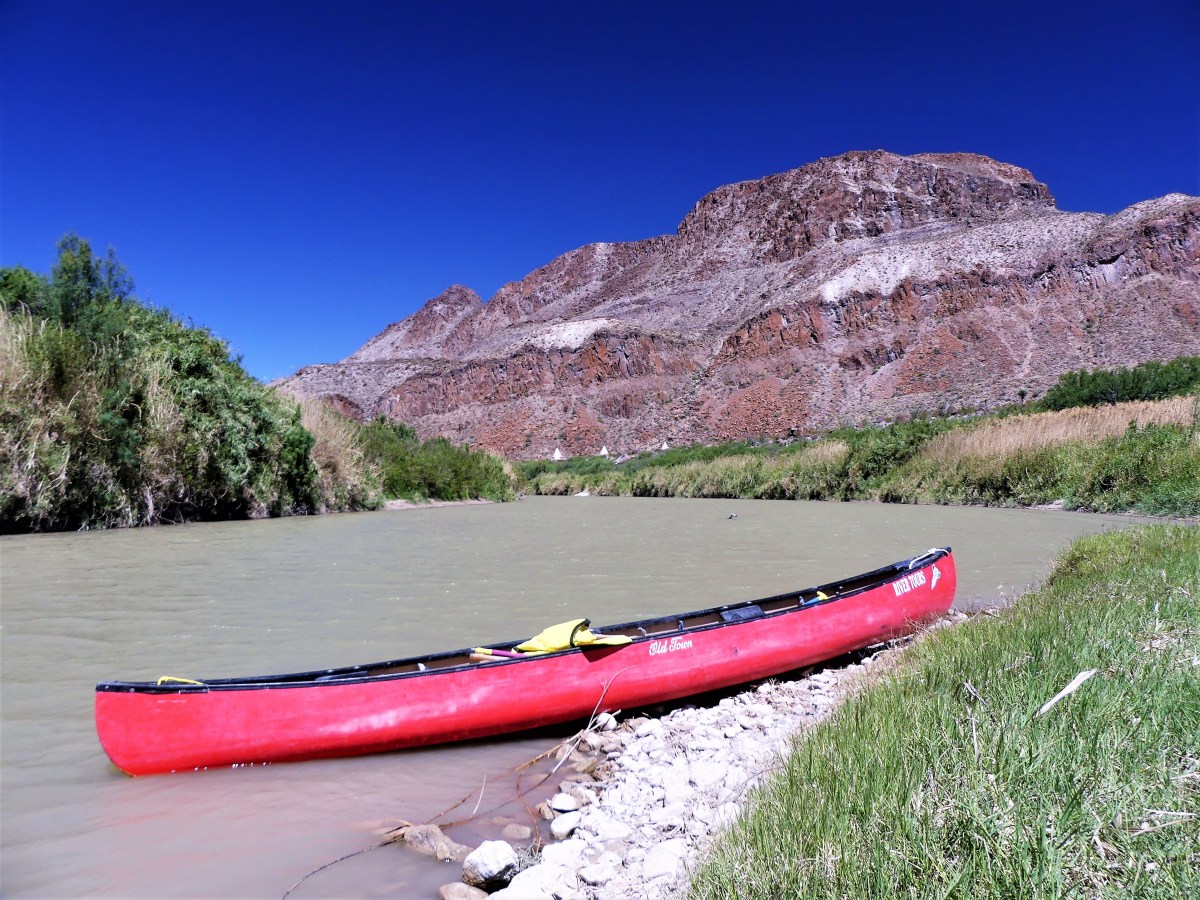
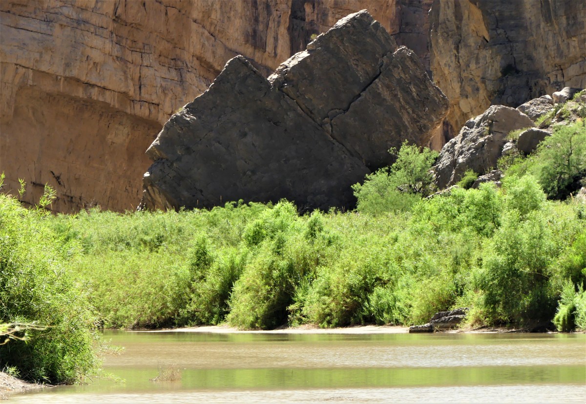
Instead, we agreed on a canoe trip through Dark Canyon in the State Park—not nearly as dramatic as the former—but at least we’d be floating on water, rather than pulling our boat across it.
We put in at Madera Canyon at 10:30 am.

 And found we had the whole river to ourselves.
 It was Mike, our river guide in one boat and us—with Leah at the bow and me at the helm—in the other.
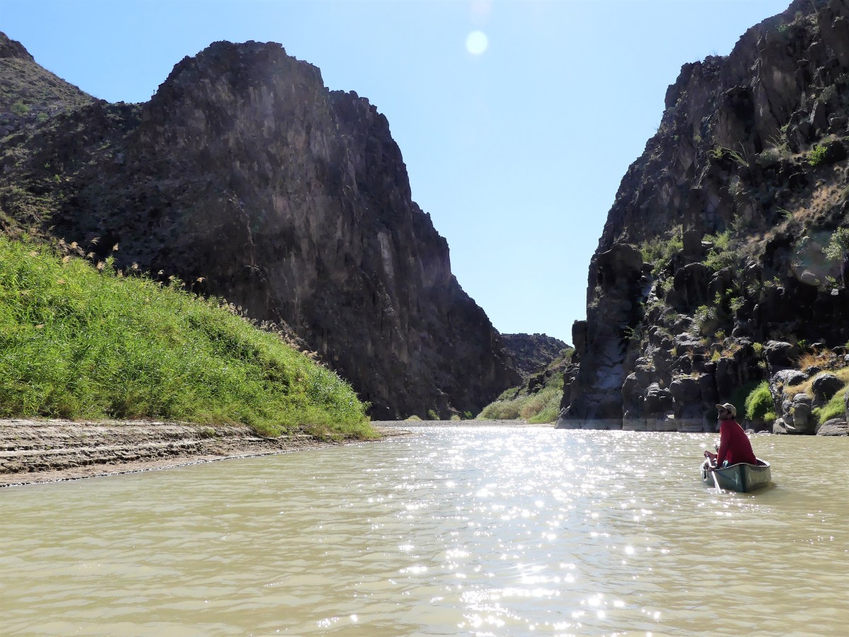 The air temperature was equal to the water temperature at about 75°, and the wind was at our backs. It could not get any better, or be any easier…until we reached the first of three technical skill zones.
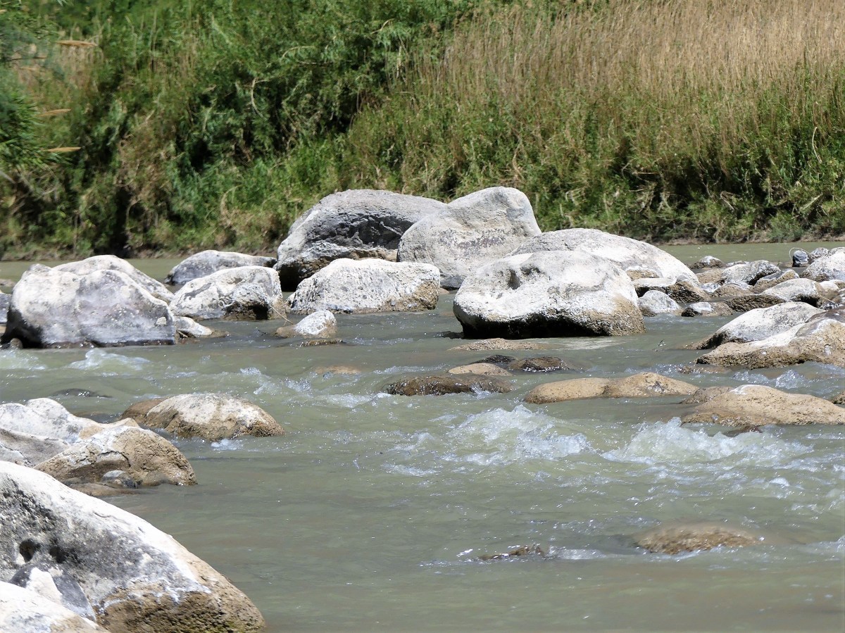
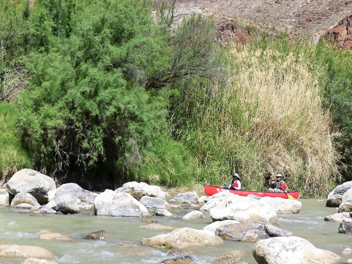
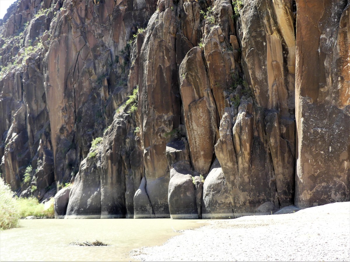
While not exactly Class IV water, the rocks and current still made the run challenging and fun. To avoid tipping the canoe, Mike had us stop each time to survey the water. We walked the shoreline, and watched how the fast-moving water was running in order to plan our route. After easily demonstrating the turns in his own canoe, Mike ceded the river to us to try for ourselves.
First time out, Leah panicked. “I’m not doing that. It’s too soon to go swimming. I’d rather walk it.”
“C’mon, Leah,” trying to encourage her. “It’ll be fun.”
“Not with you steering, it won’t!” she bellowed. “I’m not getting wet. Why don’t you do it with Mike.”
Mike agreed. With me in front, and Mike at the helm, we glided between the rocks, and sailed through the water effortlessly.
“See,” I crowed, “that wasn’t so bad.”
“Sure thing.” Leah was unimpressed. “I’ll do the next one,” she offered with uncertainty.
After 30 minutes of lazy floating, it was show-time yet again. We repeated the same set-up procedure as before, and Mike made it look just as easy as before, but these rapids were faster and rockier, and required more finesse.
 “With this one,” Mike warned, “it’s very easy to capsize, so if you feel the boat tipping, just step out onto the rocks.
“No problem,” I mustered.
“Yeah, right!” Leah mocked.
We valiantly headed into the white water, picking up momentum, and following all of Mike’s directions perfectly.
 “I don’t know about this,” Leah yelled.
“Just keep your paddle out of the water, and I’ll guide us through,” I yelled back.
 I zigged when and where I was meant to zig, and zagged at the appropriate time and place, until…
“LOOK OUT!” Leah screamed.
…a very large boulder suddenly jumped directly in the path of the canoe, spoiling my perfect run. The boat got caught up on the rocks, turning it sideways just as Mike predicted, and the rushing water was forcing the boat over.
“DO SOMETHING!” Leah screamed.
So, I stepped out as instructed—keeping the boat steady—and pushed it through the last turn, while Leah traveled like Cleopatra.
“I’ll have you know that I had nothing to do with that. You told me to keep my oar out of the water, so it’s not my fault.” she gloated.
“It must be nice to be blameless and dry,” I said to myself.
With the wind gusting at 20 mph, we were quickly approaching the take-out area, yet it was only 12:30 pm. The tailwind had cut our expected float time in half.

 “Is that it?” asked Leah.
“End of the line,” confirmed Mike. “This is where the truck is parked.”
Feeling badly, Mike added, “I know it seemed like a short trip, but if you’d like, we could head up to Slot Canyon and do a hike. It’s not like it’s out of my way.”
Leah and I exchanged glances. We had intended to hike the canyon on our own anyway.
“Absolutely,” said Leah.
So, we got in the truck and followed Mike over the mountain, on the way to our second goal.


 as we cross several dry river beds…
 along the arroyo to Pratt Cabin, a Depression-era structure built entirely of stone.
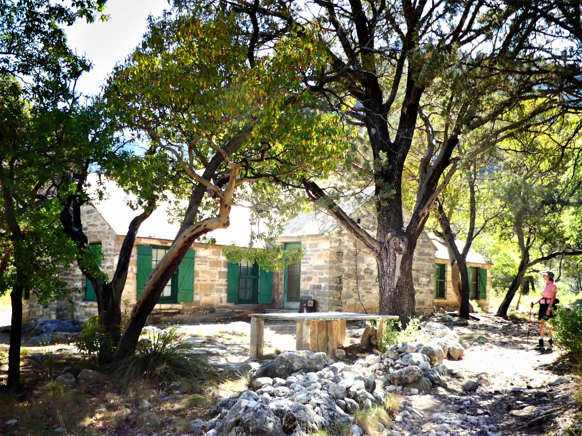 Rocking chairs under a cool porch provide perfect respite from the simmering sun.


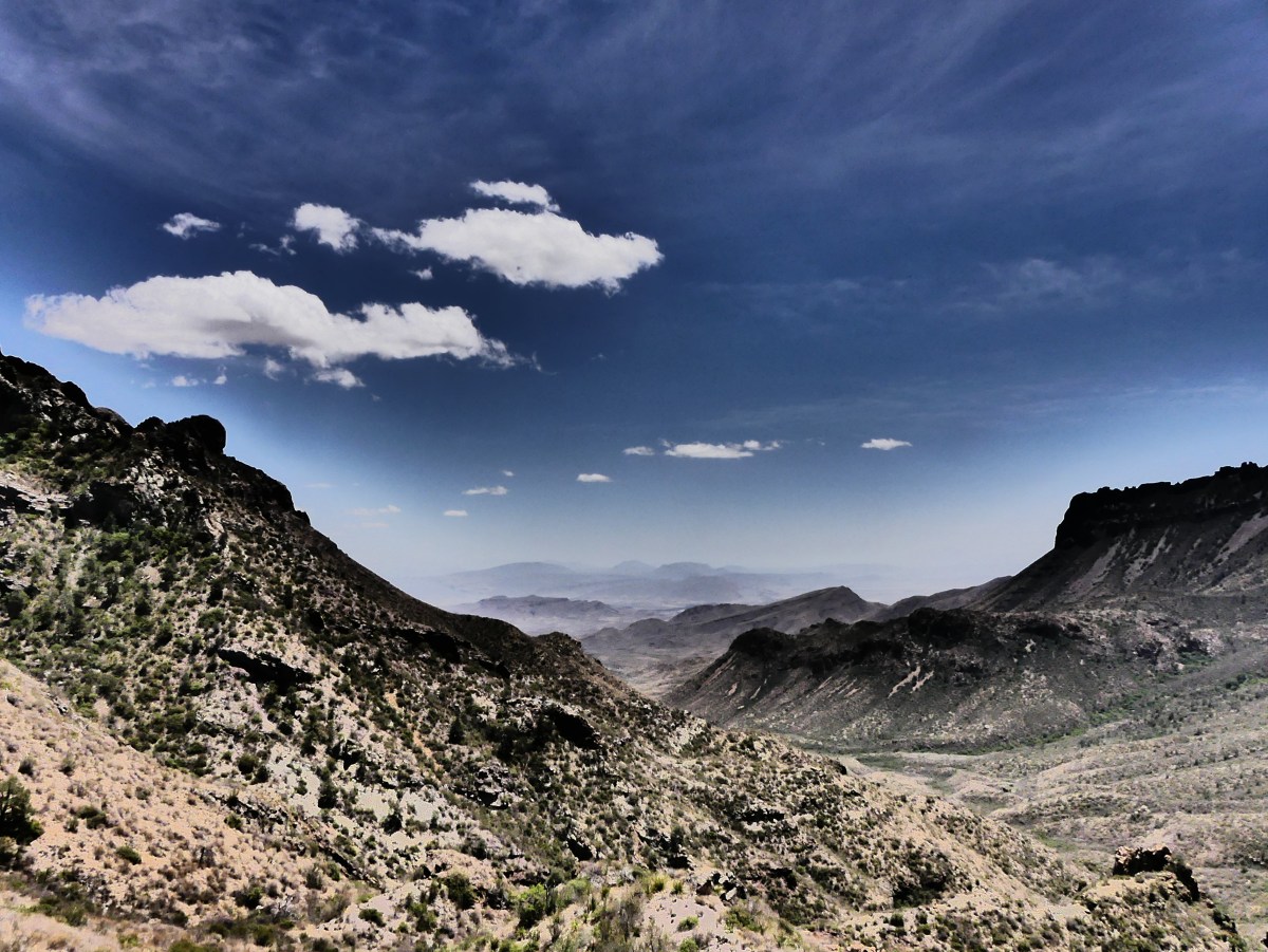


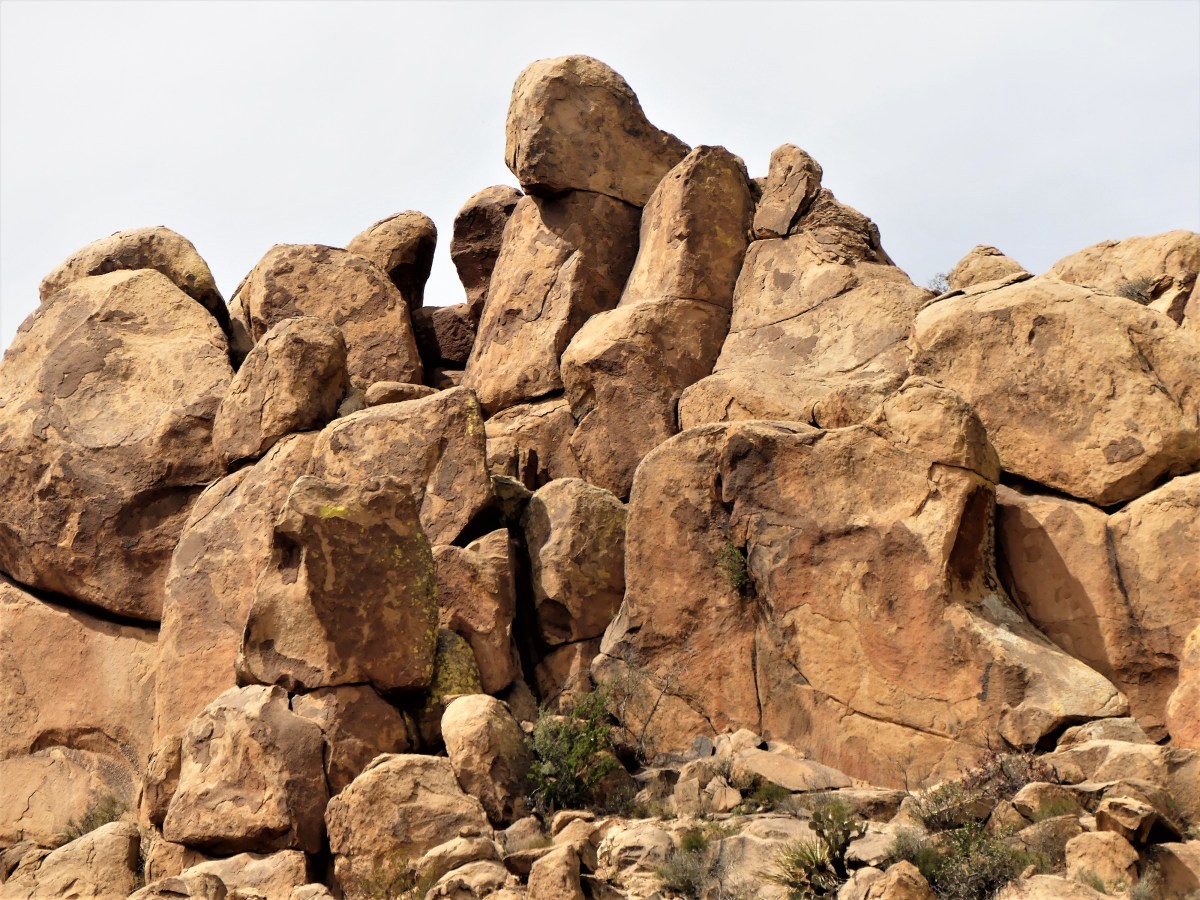
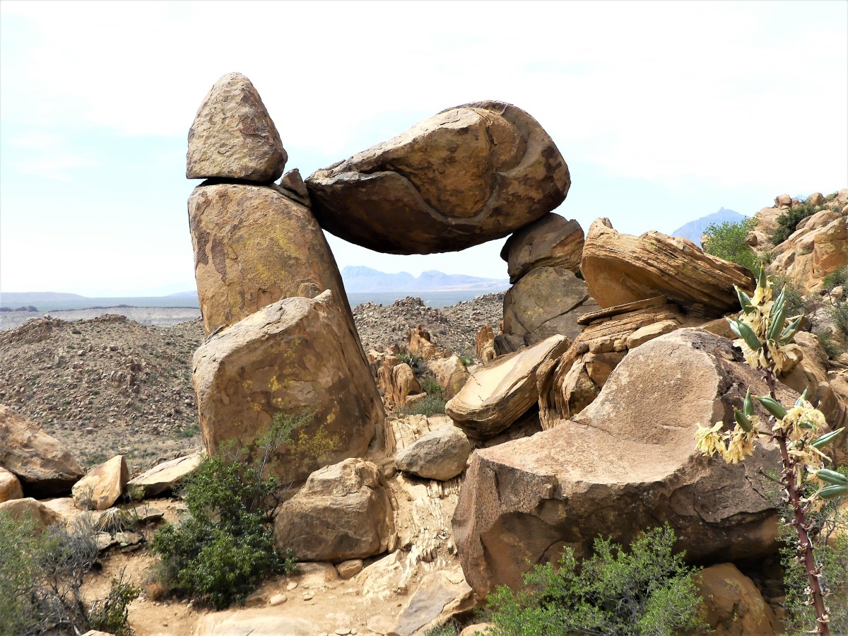
 The road continued another 7.5 miles up and down multiple grade changes, curling in and around exposed mountain walls, and mimicking the serpentine lines of the Rio Grande, making it a driver’s delight and a passenger’s revelation. It’s little wonder that El Camino del Rio has consistently ranked as a “ten-best” scenic drive in America.
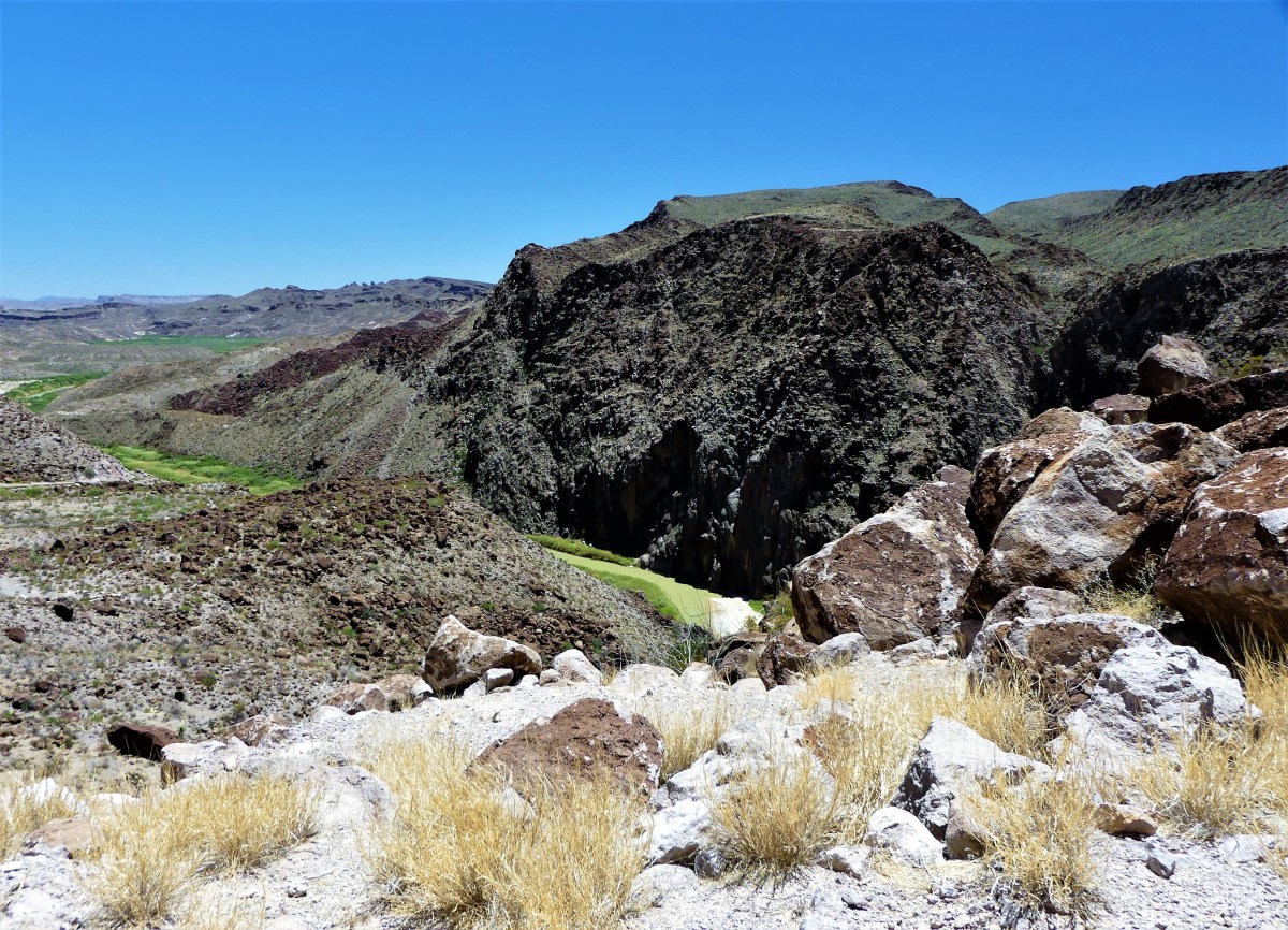 The signage throughout the State Park suffers because of its immensity (300,000 acres) and limited resources, so having Mike as lead proved advantageous, since it would have been so easy to overshoot the trail head in favor of the surrounding vistas and roadside scenery.
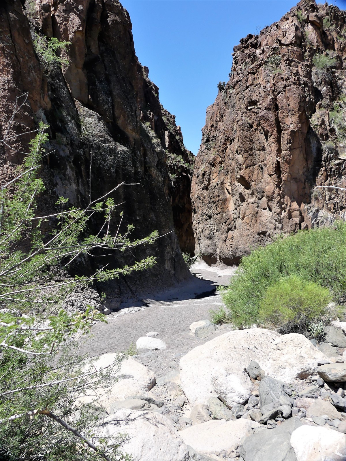 “Anything we should watch for?” I asked.
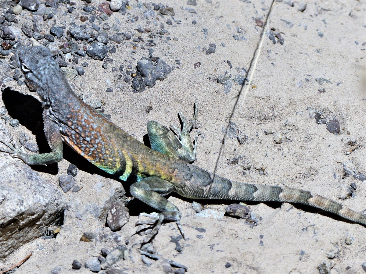 While the wildlife sighting reanimated us, Leah wasn’t sufficiently satisfied.
 Uncertain of Mike’s politics, I lobbed him an ICE-breaker. “Any chance,” I subtly inquired, “we’ll have a Mexican sighting?”
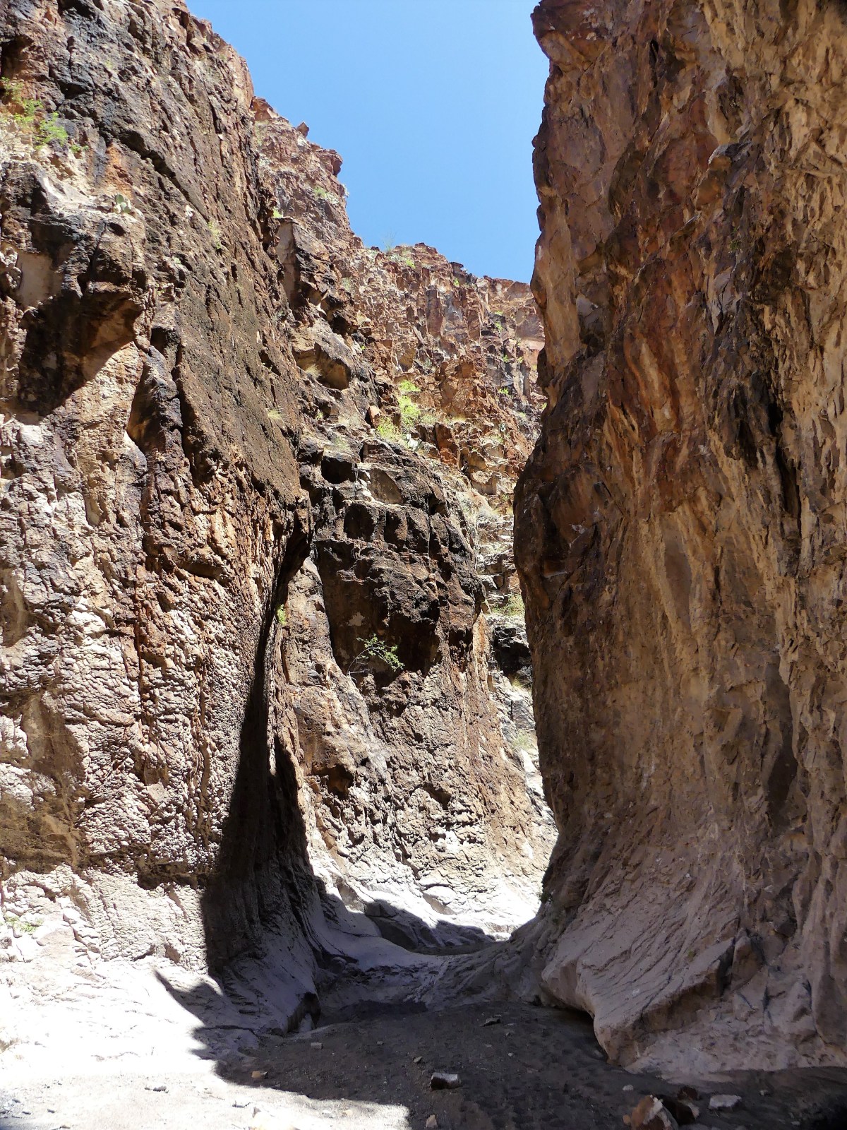 No argument from me. We worked our way further into the slot, scrambling over, around, and down water-polished rock, sometimes stopping to avoid the many tinajas–potholes of jaundiced water of undetermined depths scattered across the canyon bottom.
 After an hour on the trail we reached an impasse. At this point, the canyon walls were narrow enough to touch with both arms extended, but the tinaja before us was too deep to ford, and too wide to bypass. All we could do was turnaround and hike out.


 The trail ends at a sandbar where eager Mexicans negotiate with Gringos to ferry them across the river by rowboat. Five dollars is generally the agreed upon price.
 However, with the Rio Grande water levels so low, Leah and I found it cheaper to wade across fifty feet of knee-deep water to the other side.
 Land transportation comes from Uber burros, charging five dollar fares to cover the dusty and shit-laden ¾-mile trip…
 …to a white trailer check-point surrounded by cyclone fencing on the edge of the village. It was a treat to sit in Boquillas’s only air conditioning for a few minutes to escape the 100◦ heat, while our identities were checked against a drug cartel database.
 …with an overlook of the Boquillas Canyon.
 Mama Falcone was sitting on the patio in her kitchen apron working on a future needlepoint tapestry that would soon display in the family curio shop next door, while her nephew Renaldo brought us menus and took our order—chicken quesadilla for Leah, and beef burrito for me. Meanwhile, a family of three from South Carolina sat at a nearby table chatting it up with Mama’s daughter, Lillia.
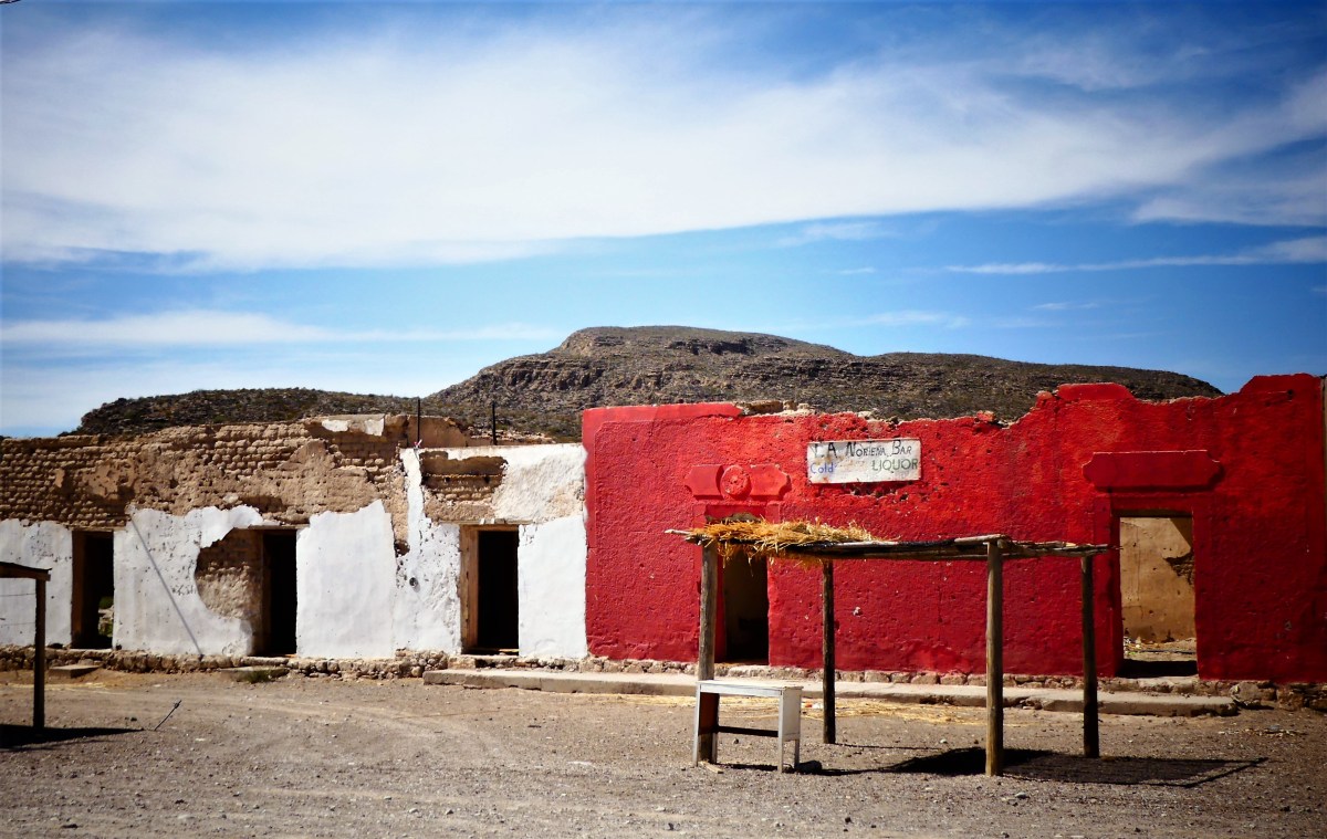 The town population shrank from three hundred to one hundred adults and children, with many leaving for Muzquiz—the nearest Mexican city, and a seven-hour bus ride away. Eventually, Mama and Lillia found work in the States, but returned home to the restaurant after the crossing officially reopened in April 2013.
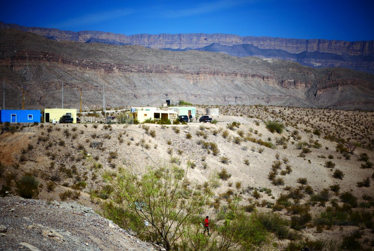 They are hopeful for an economic recovery, but the town is in shambles, and it will take many more Americans to salvage Boquillas’s economy.
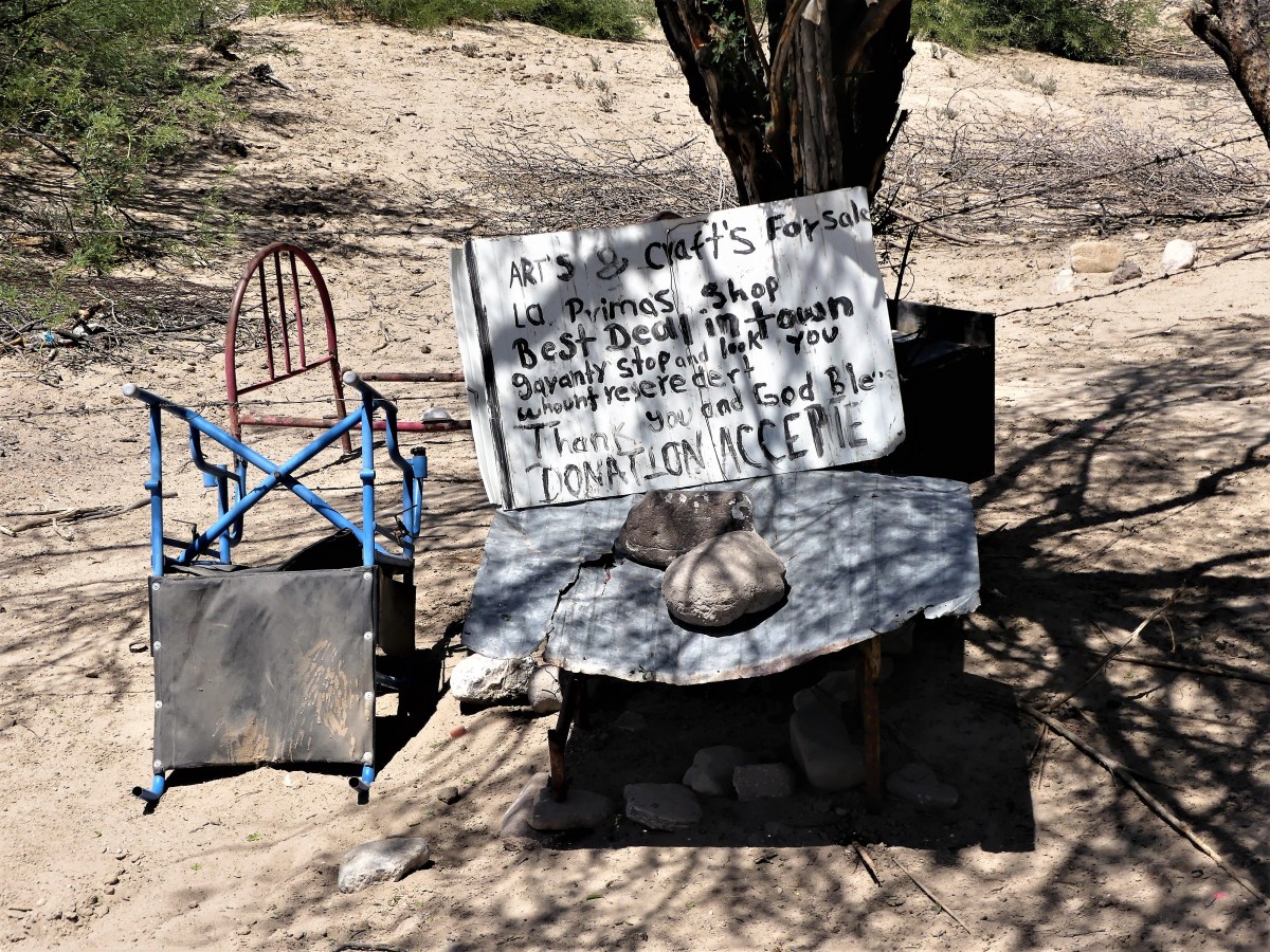
 I have met the enemy face to face and I do not fear them. Their rowboats and mules would be no match against our ships and tanks.

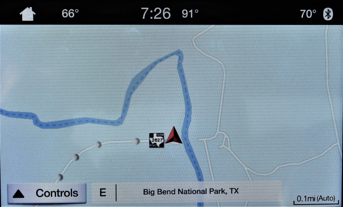 Earlier in the day, border patrol had sped past our campsite from the southern border, causing us to speculate whether an ICE officer had just interdicted an illegal border crosser. And so, with the sun at our backs, and our batteries recharged, I fired up the F-150, turned right on Texas FM (farm-to-market road) 2627, and headed due south in search of bad hombres. The radio god immediately synchronized his playlist with our mission, and delivered David Byrne belting out the lyrics to “We’re on the Road to Nowhere”.
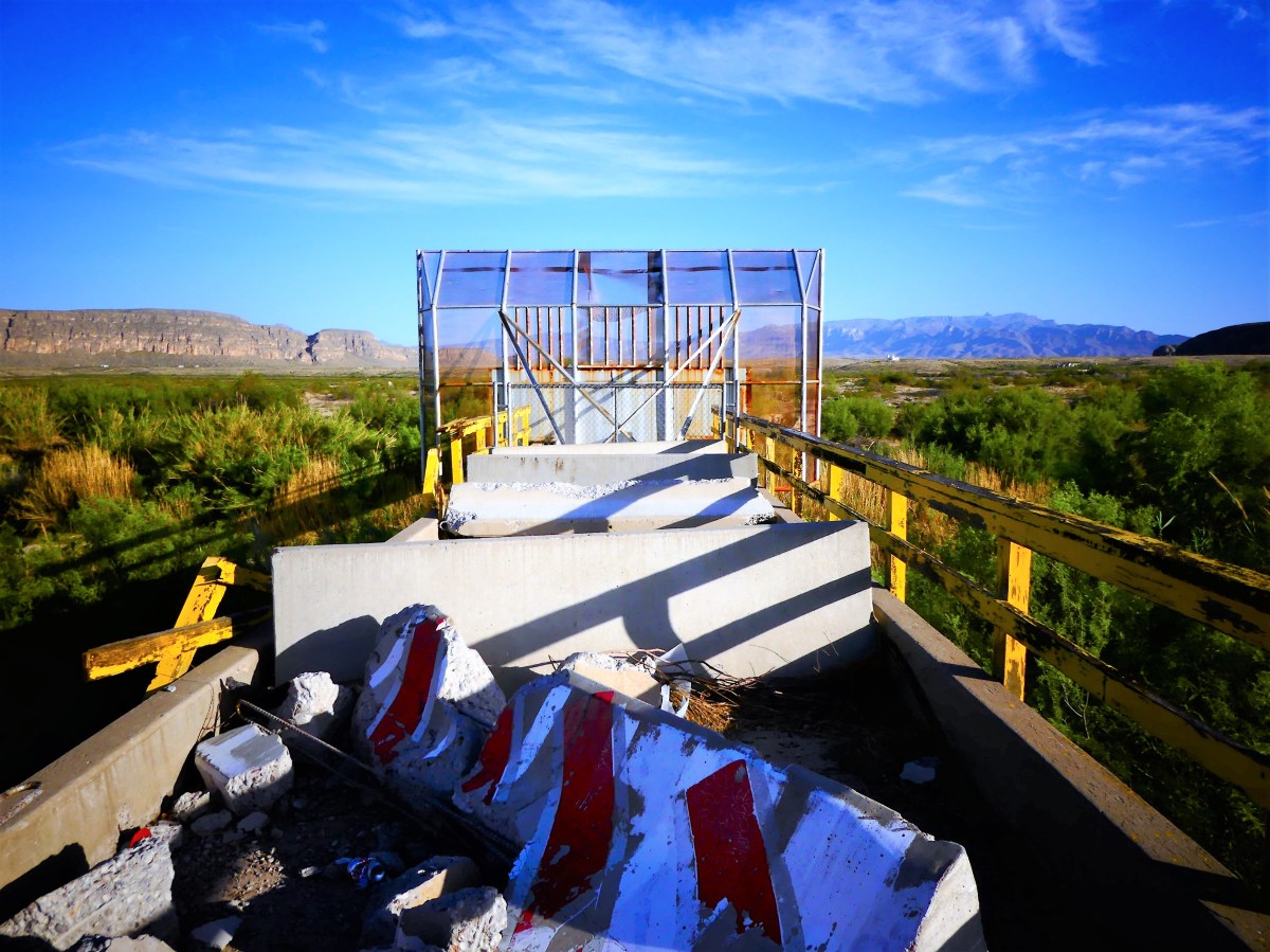 Historically, the bridge was constructed by Dow Chemical in 1964 to transport fluorite from Coahuilan mines across Heath Canyon to America. But U.S. and Mexican authorities shuttered the bridge in 1997, suspecting drug smuggling. Other reports cite the murder of a Mexican customs official as the reason behind the bridge closure.
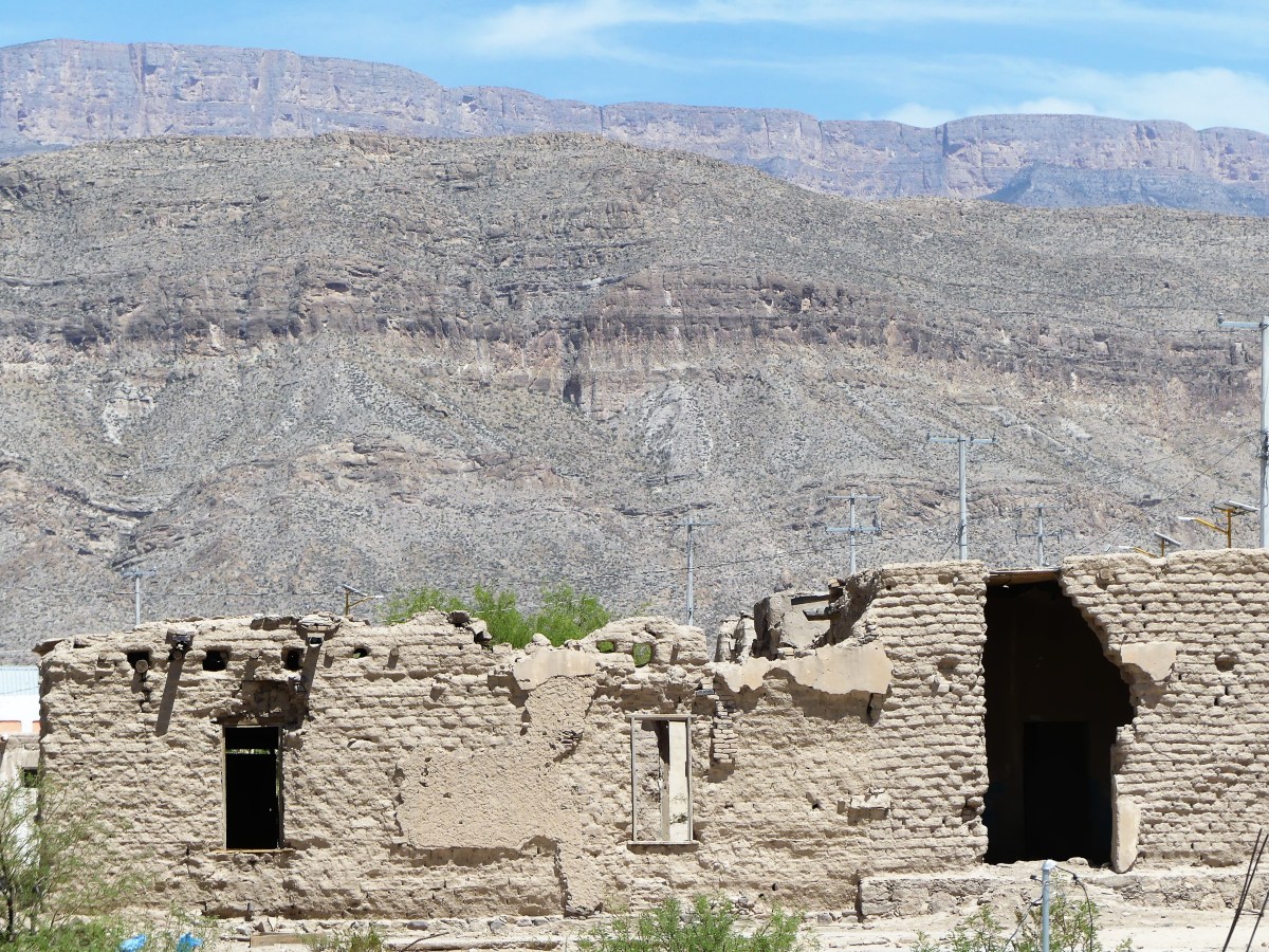
 Across the border stand the remnants of a faded factory.
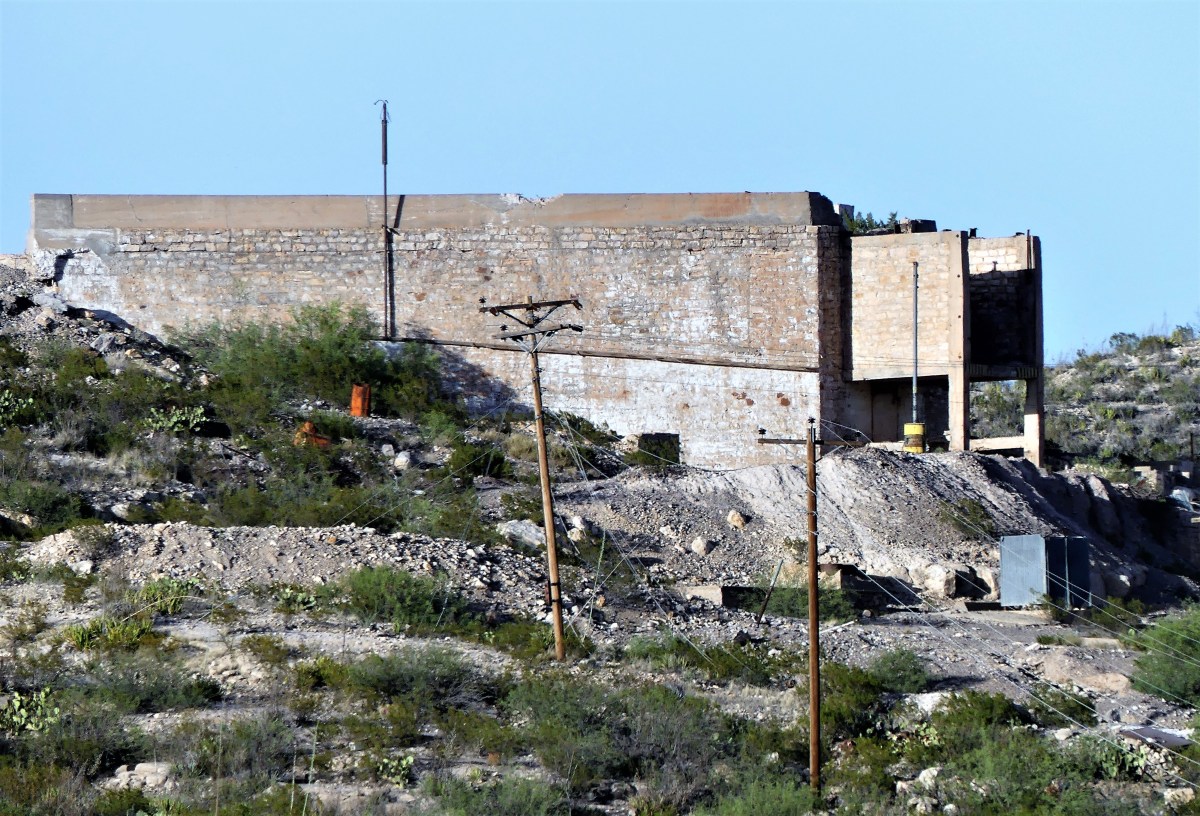 Broken buildings and slanted warehouses survive in silence against a brown mountain backdrop.
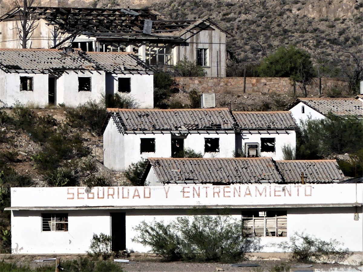 Yet in the distance to the right of the river, La Linda mission stands alone—its double towers dwarfed by nature’s majesty, and its church doors removed for a purpose higher than God.
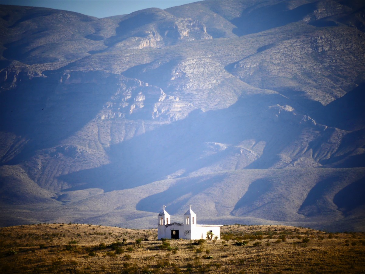 There are those who would welcome a return to the border crossing.
 Committee meetings and feasibility studies on both sides of the river argue the benefits of potential tourism and ease of crossing without traveling to either Del Rio or Presidio. Currently, a legal crossing to La Linda would take nearly 10 hours by car versus 10 minutes by illegal foot path. But there are no travelers today, or at any other times. It’s just too remote.
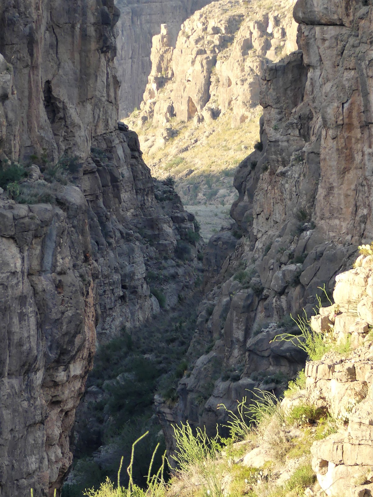


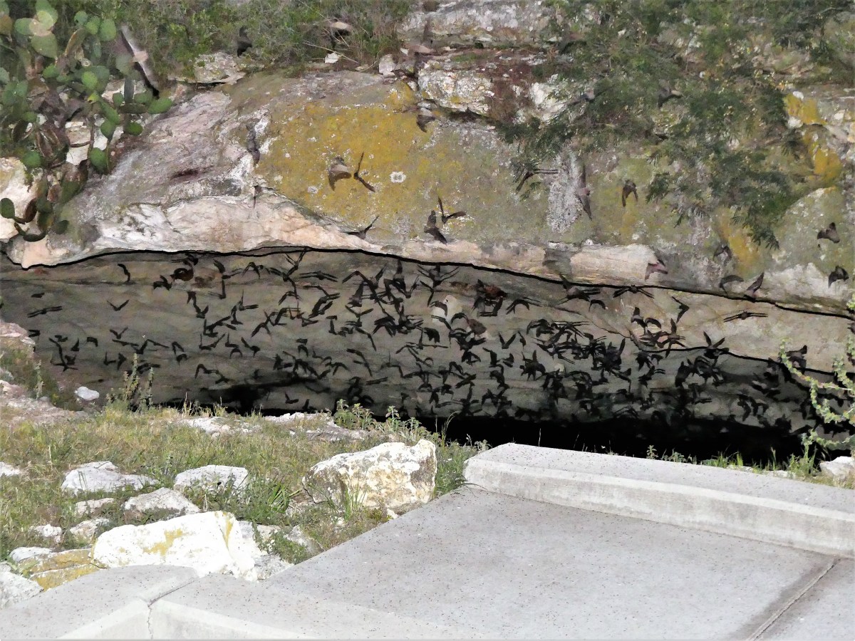

 and into the twilight, fluttering en masse, up and over the trees.
 A continuous and frenzied swarm pours from the cave in a procession that could last up to two hours.
 With the exception of some rogue bats that fly off in scattered directions, the mother lode hooks right and follows a path 50 miles due east to Uvalde in search of mosquitoes and corn earworms, a tasty moth that wreaks havoc on a number of Southern crops.
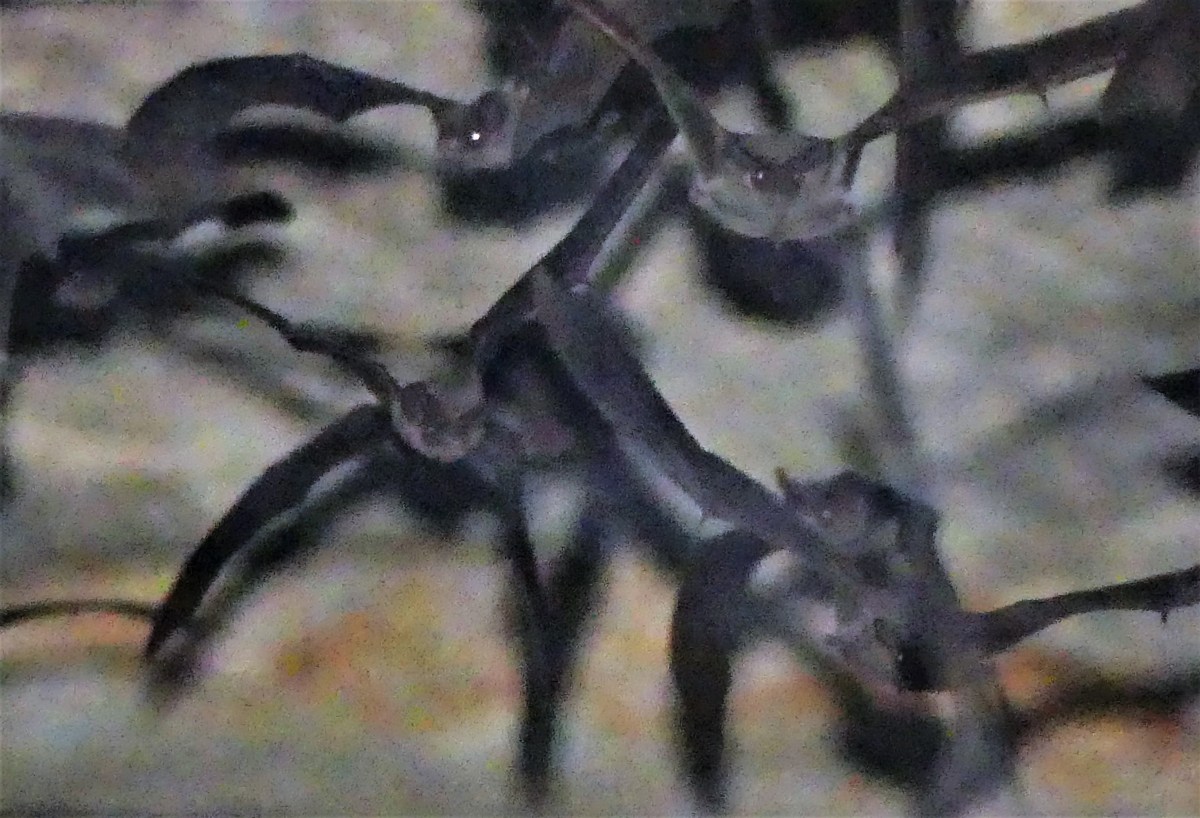 Historically, the Sergeant family, who farmed this property from the early 1900’s, protected the cave entrance with fencing in order to mine the accumulated guano, which provided important income to the ranchers until 1957 when sold as premium fertilizer and an explosive constituent.
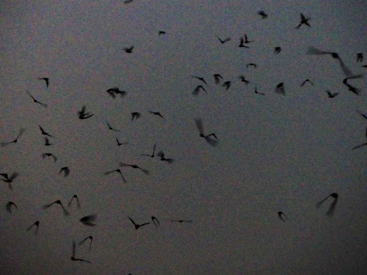 Having over-nighted for three days in the park, I can testify that there is no shortage of annoying bugs here. Not to be selfish, but I’d like to propose that some of the bats stay behind and clean up inside the park’s perimeter. If the bats only knew that they could dine closer to home–forsaking the 100-mile round-trip–then I could better enjoy my outdoor dinner plans as well.
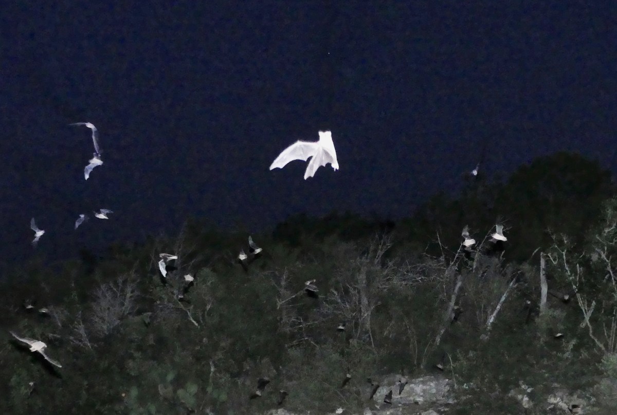


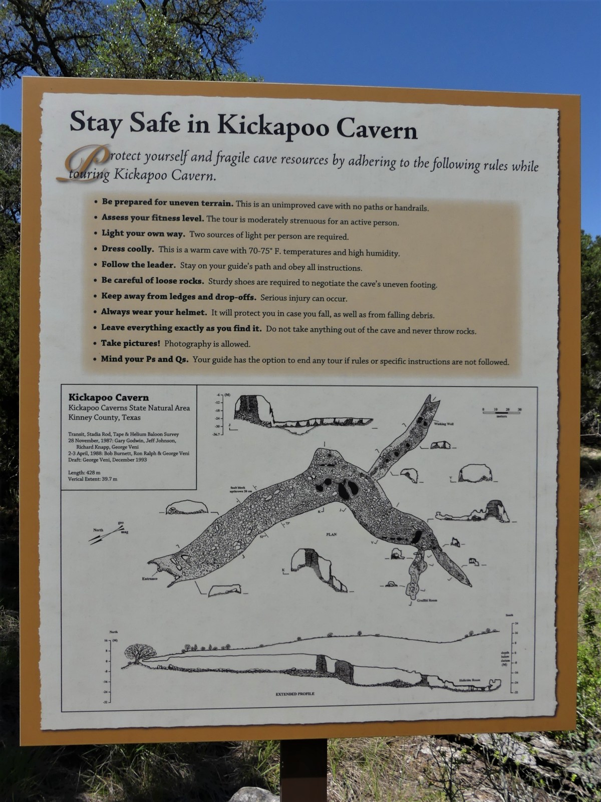 After listening to Ranger Matt’s presentation, I have a personal theory why natives might have avoided the cave. It seems that during the cold winter months, the cave acts as a warm weather haven for Indiana Jones’ worst nightmare. Only until the weather heats up outside, and all the good snakes wind their way out of their cozy cave den is it safe for humans to explore the inner depths, and that’s where master spelunker Ranger Matt was taking us.
 “That explains the bullet hole in the windshield,” I presumed.
 Bertha had been given a pardon, only to be reincarnated as a park bus. For some reason, I was reminded of a road sign I spied on the way to Kickapoo that read: DO NOT PICK UP HITCHHIKERS. THEY MAY BE PRISON ESCAPEES.
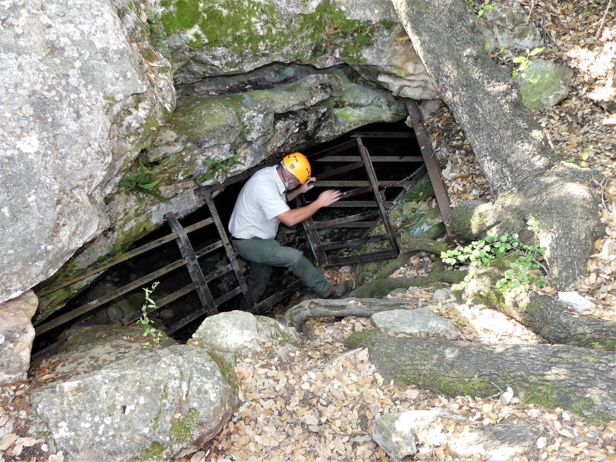 checking for varmints before allowing us to climb through a small crack in the ground,
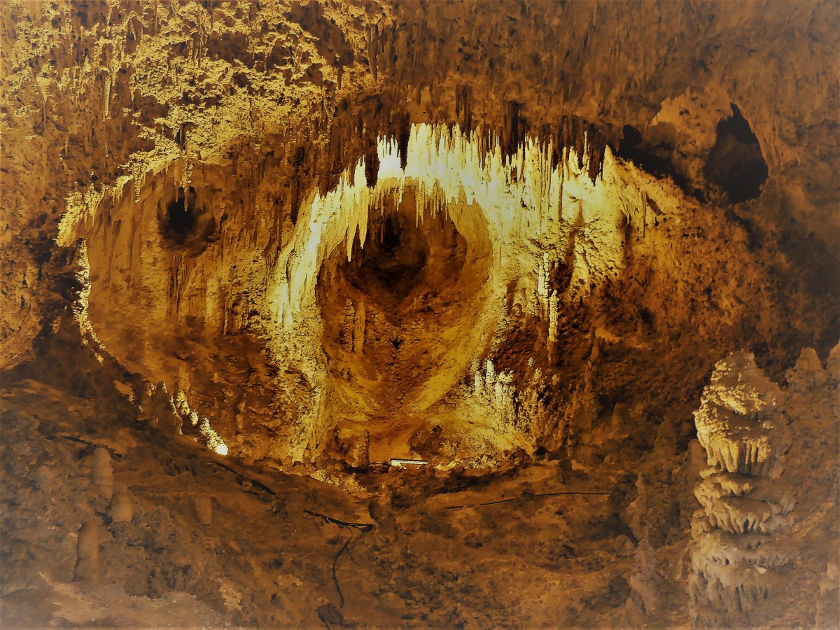
 where we found ourselves standing on the collapsed ceiling of a limestone rock pile measuring 130 feet thick. The mouth of the room was big enough to park a Cessna if you could figure a way to get it inside.
 and more recent remains of an unfortunate sheep or goat littering the floor
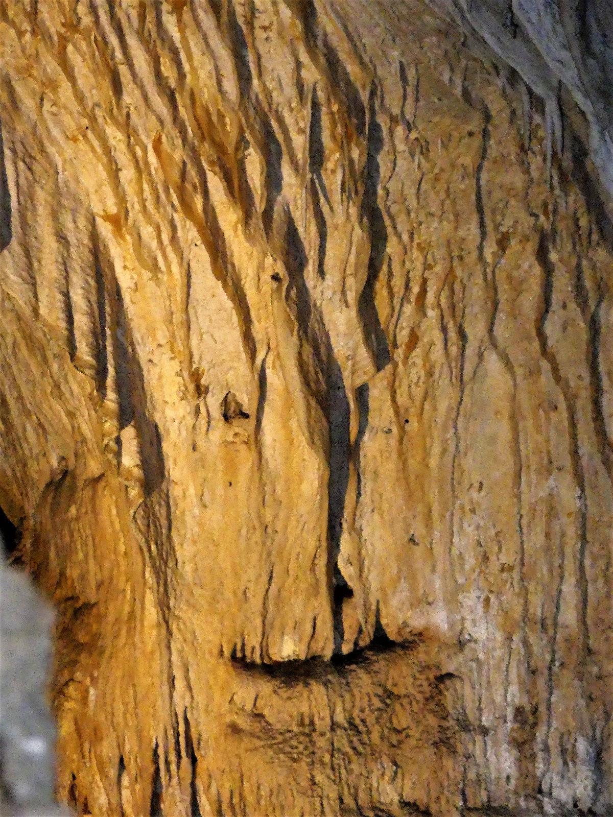
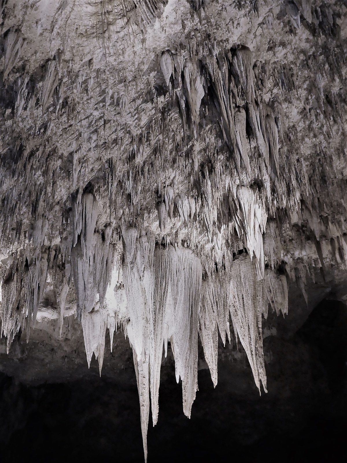
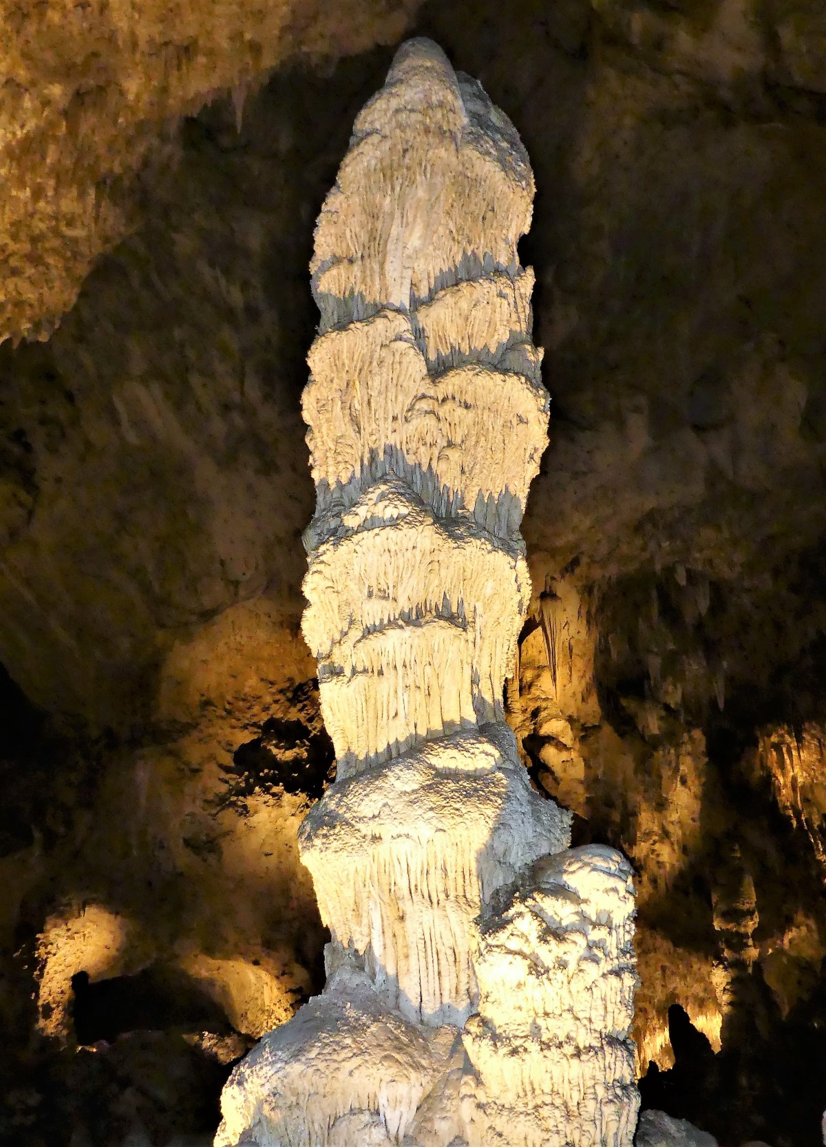
 From there we dropped approximately 40 feet, scrambling over ledges of flat rock and boulders, on our way to survey the three largest columns (when a stalactite meets a stalagmite) in Texas. How apropos that along the way, we would pass a formation of stalactites that managed to aggregate into the shape of the Lone Star state.
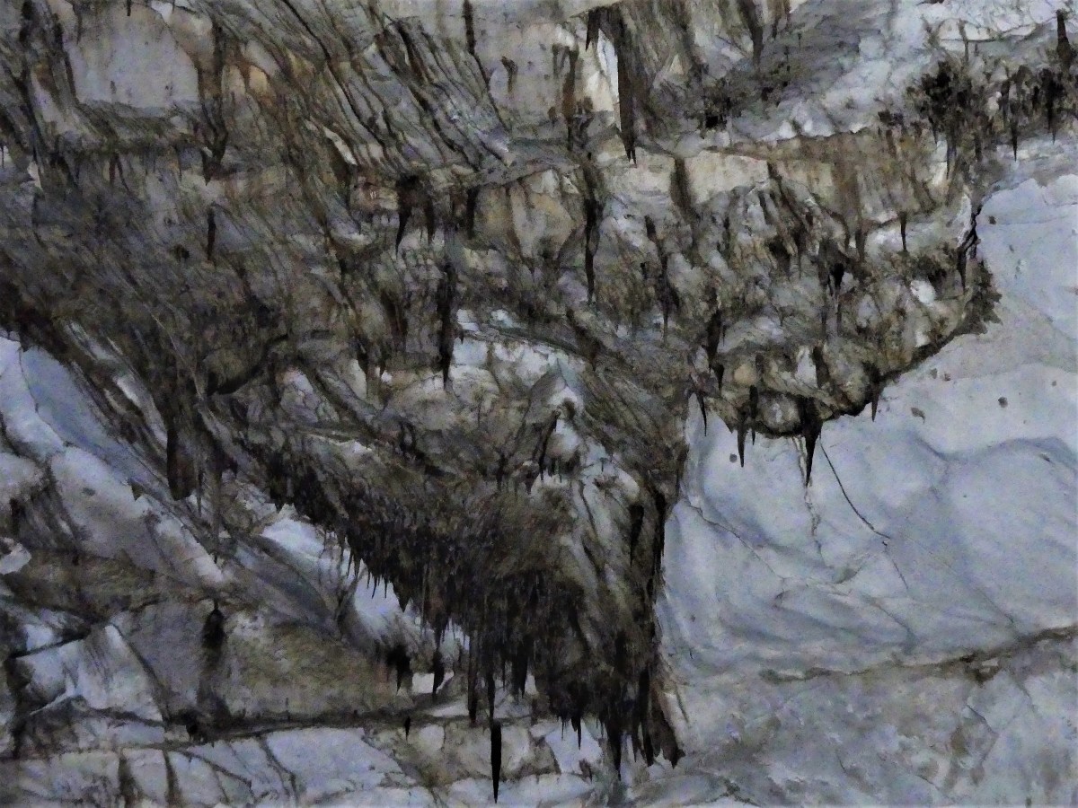 There was no meaningful trail. Every step was a floating rock, see-sawing under our weight. That’s when I heard Leah go down hard behind me. I swung around to see her flat on her back, saved by her fanny pack.
 And Matt was there in an instant.
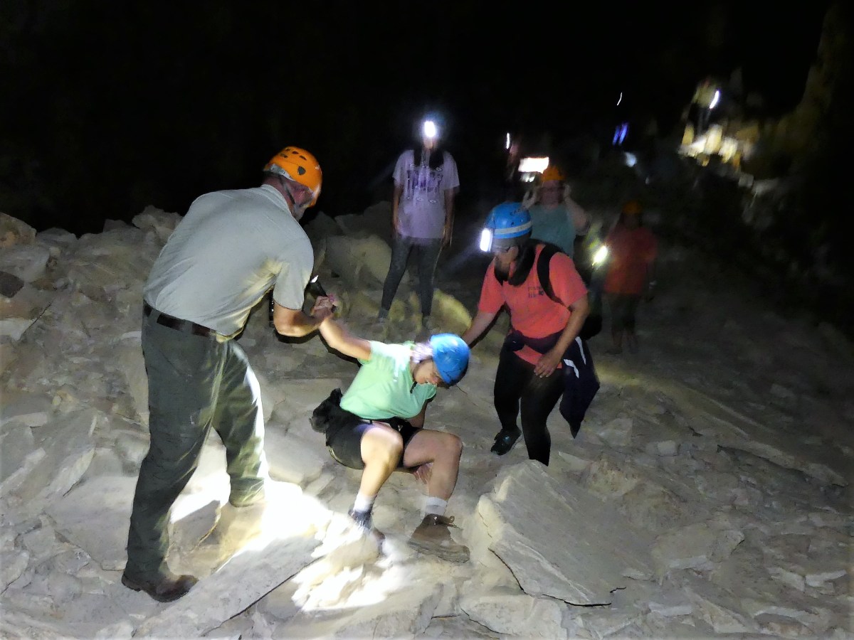 “I’m alright,” she declared. “I just lost my balance on the rocks.” It was good news to my ears. For some reason, Leah and caves are not on equal footing, and rarely without incident (see “A Hole in the Head” post),
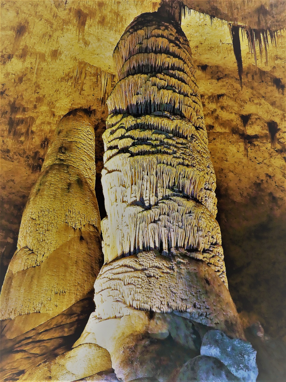
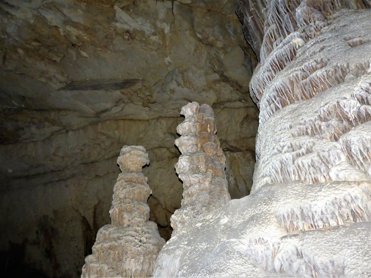 We turned the corner and the room opened up. The ceiling vaulted higher to accomodate the caves’s largest column.
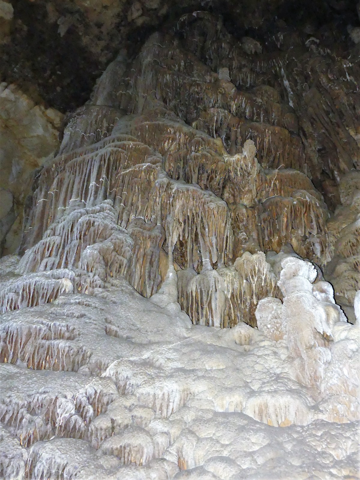 “Don’t be afraid to touch anything,” announced Ranger Matt. “We’re not like most of those other parks that have guard rails and ropes, and psychedelic lights with church music playing.” He was preaching to my choir.
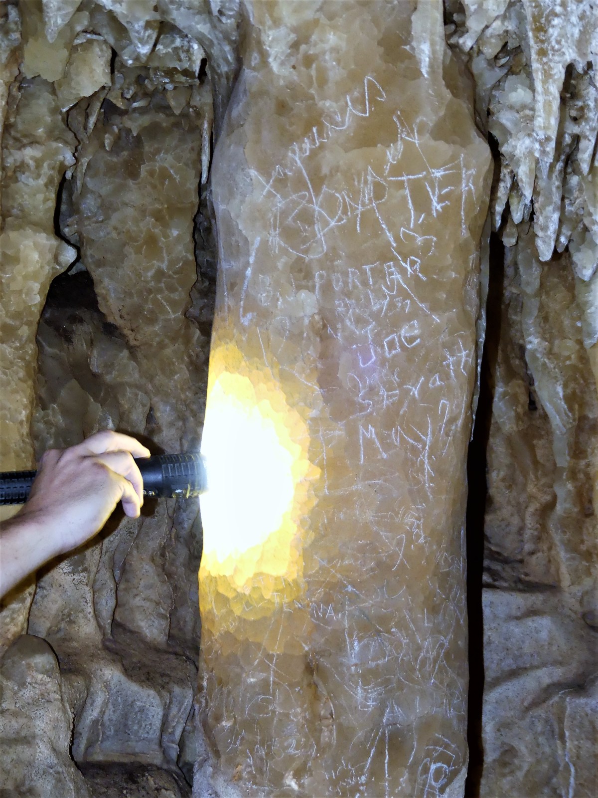 “Like this one over here?” suggested a blond coed, pointing to a name scratched into the calcite that dated back to 1887.
 “Ah, good ol’ C. Robinson,” Ranger Matt explained, “He was one of the early ones. But there’s older graffiti in this cave that predates Mr. Robinson–written with torch soot–but that’s in a room that’s off limits because it’s still developing.”
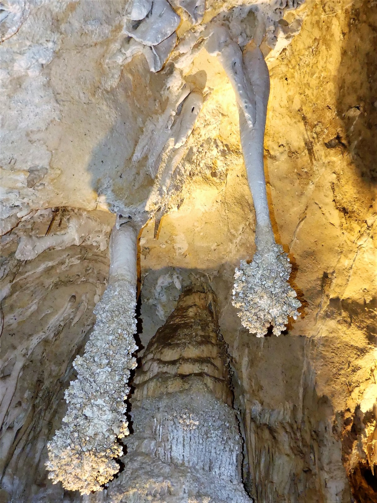
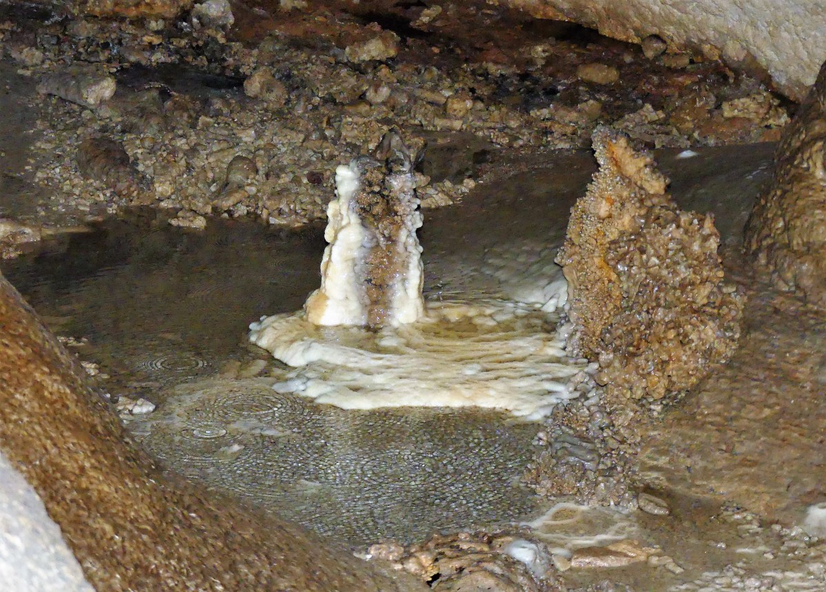 We solemnly wove our way around the space, beholding the nascent natural beauty that will one day become a future column.


 or find a blanket-sized parcel of grass to relax and watch the sun go down;
 or pull up in a boat to wait for showtime.
 One fellow standing behind me seems to be mystified by the whole experience. “Are they gonna fly outta that sewer hole over there?” he wonders out loud.
 His misconception is immediately corrected by a 10-year old standing nearby. “Hey mister, this isn’t Batman, y’know! They come out from under the bridge where they live,” says Einstein boy.
 I too am excited to catch the bats in flight, but I’m also interested in doing something different with my Lumix, which I’m still learning to use. I’m determined to capture the bats in motion!
 The moment arrives when the first bats emerge, and the crowd gets giddy.
 And moments later, the floodgates open, and the bats streak across the night sky by the thousands–
 a migration wave of epic proportions that approaches a feeding frenzy.
 I confess that the photos are experimental. However, I understand that there are traditionalists who need to see things as they are, versus my interpretation of the event. So, in fairness to those whose vision is less oblique than mine, I’ve increased the camera’s shutter speed to give a more accurate representation of the bats’ flight path…
 such that even Meat Loaf would be impressed.

 The other condition is a more common affliction commonly known as drifting-into-ditch-itis.
