Tölting to Reykjafoss

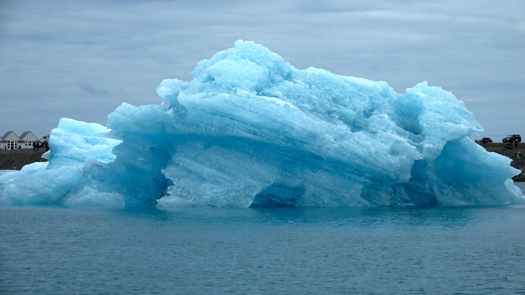
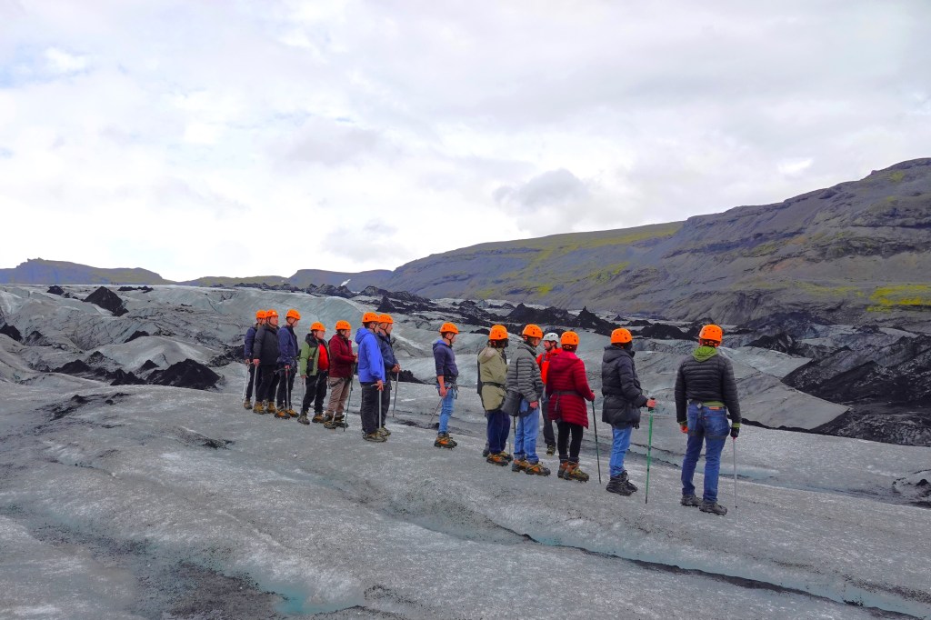
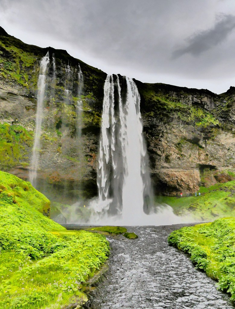
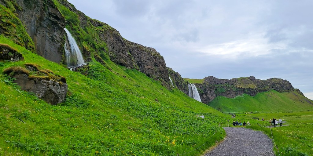
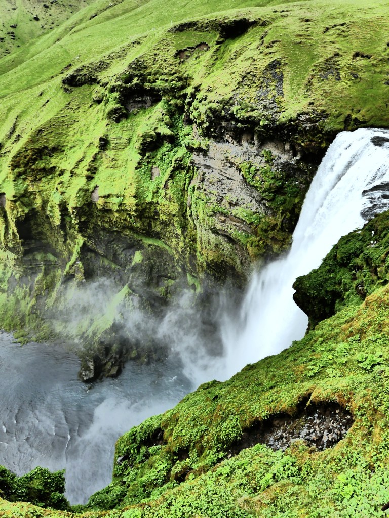
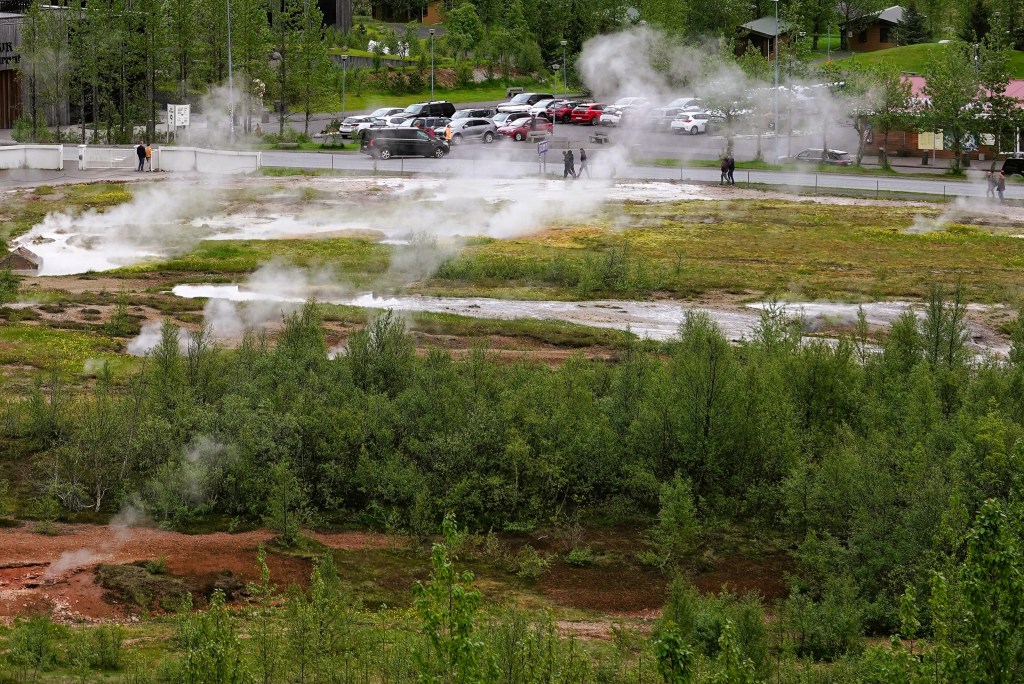
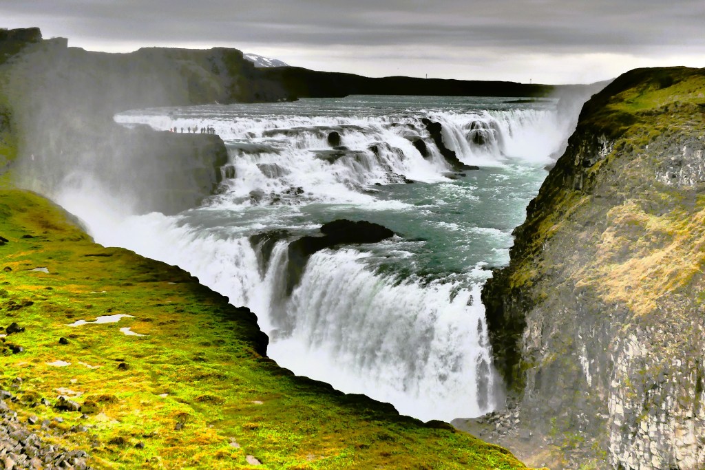
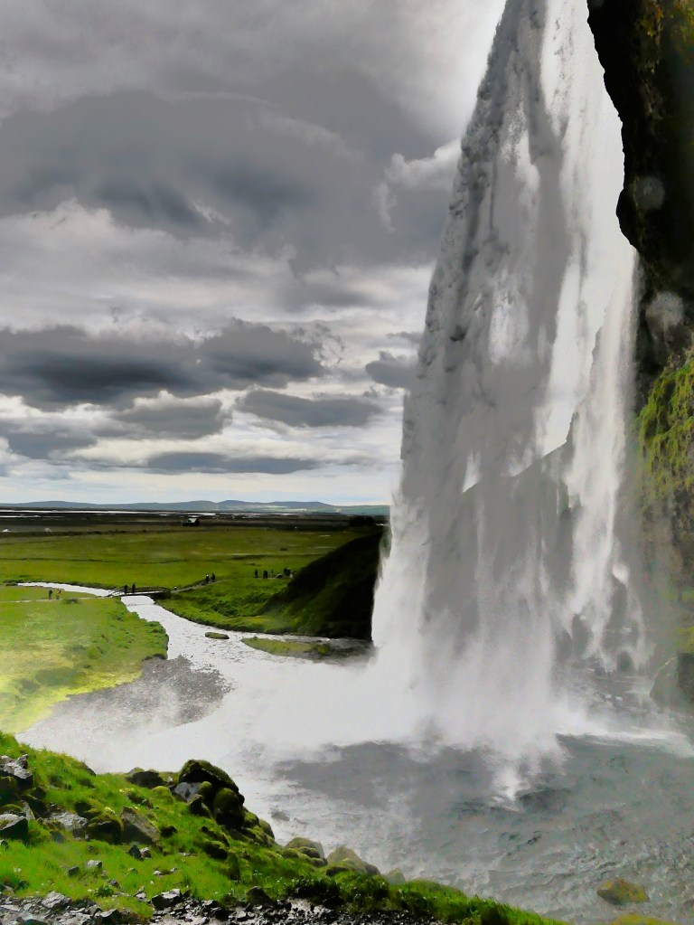
It’s always a good day when it starts with a waterfall and ends with a waterfall. Prior to today, all the designated waterfalls on our itinerary over the past eight days have been spectacular and very different from one another–given the geography, the weather conditions, the time of day, and the lighting–all of which has an impact on how the falls are viewed and captured.

Thankfully, today was no different!

After a restful overnight and an enjoyable breakfast buffet at Hofsstaðir Guesthouse in Skagafjörður,

Leah and I evaluated today’s weather, and sighed with relief knowing that overcast skies would fight off any imminent threat of rain. Maybe our prayers had been answered.

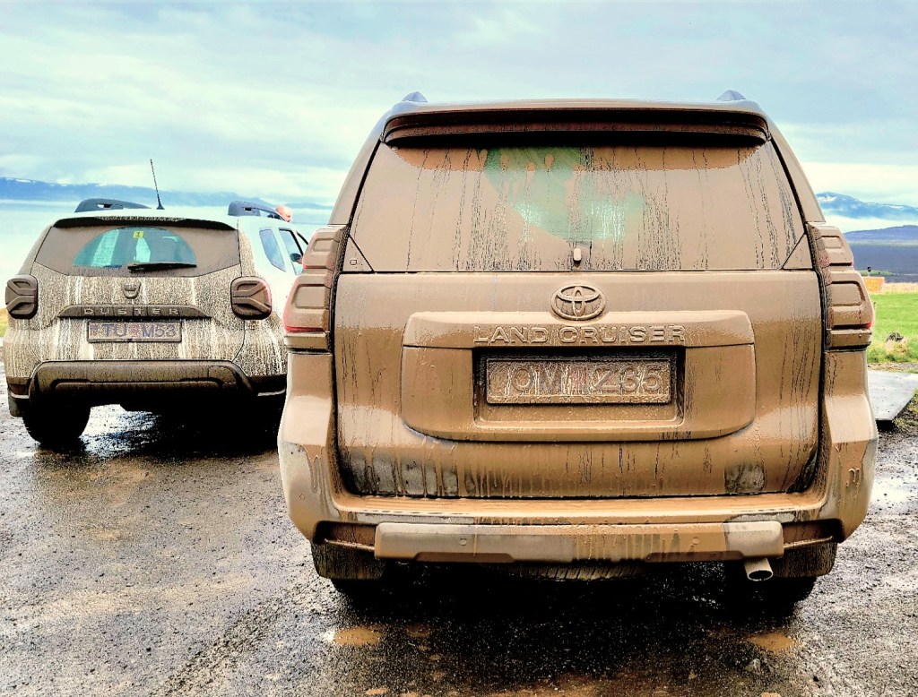
Of all our scheduled excursions, we were most excited about riding an Icelandic horse, and rain would certainly dampen the experience. We cautiously saddled up the Land Cruiser,

and patiently waited for our Hitachi Wi-Fi dongle (a very neat accessory) to find my phone. Eventually, we plotted a route to Hestasport, a tour company operating within the Skagafjörður valley–a place that’s been labeled the Mecca of Icelandic horsemanship, and the only county in Iceland where horses outnumber people.

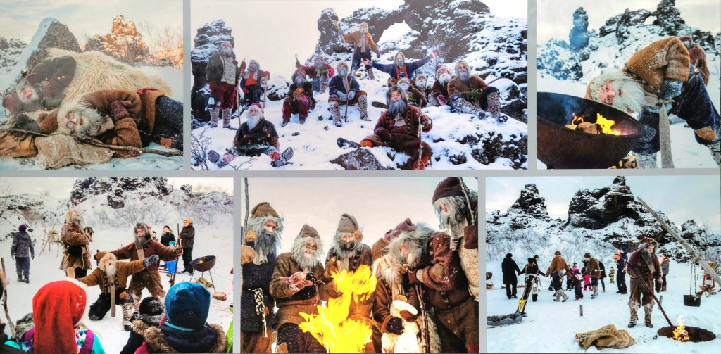
Our conversation to the horse ranch was predictable. Leah and I were still processing the irony of our hotel restaurant serving “horse” on last night’s dinner menu. Of course, its a cultural and culinary delicacy that Icelanders have enjoyed since purebred Nordic horses were first introduced during the 9th century. And horsemeat is one of the healthiest meats for human consumption–iron-rich, low-fat and abundant in vitamin B. But our American palates and sensibilities are biased. We find that butchering horses for human fodder is morally abhorrent, while still enjoying a rib eye beefsteak. So, guilty of hypocrisy, as charged.

After arriving at Hestasport for our 10 o’clock “Viking ride,”

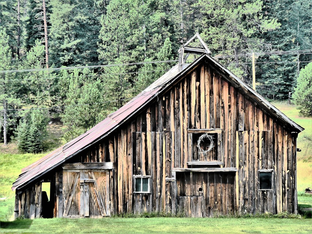
we gathered in the barn to dress for rain, then greeted our riding buddies in the paddock.

Icelandics have been strictly inbred for riding and working over a millennium, which makes them nearly disease-free and extremely resilient to Iceland’s harsh climate. They can easily live into their 50s. They have a friendly personality and a special affinity for people.

Leah was assigned Bjartur, while I would be riding Björn, an agreeable 23-year old, who was the only one of the herd who could fly–the fastest of five gaits (up to 30 mph) that Icelandics naturally possess.

My first impressions of Icelandics…they are small, but sturdy and capable. While their legs are short (they typically stand 13 hands on average), they are capable of carrying up to 35% of their body weight. When they walk, their head is down and neck relaxed, which gives them a straight line across their back to evenly support the carrying weight.

Their walk is smooth and sure-footed, which easily accommodates uneven landscape and shallow rivers.

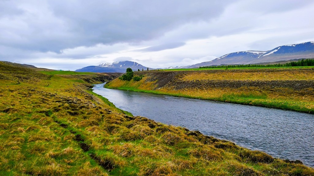
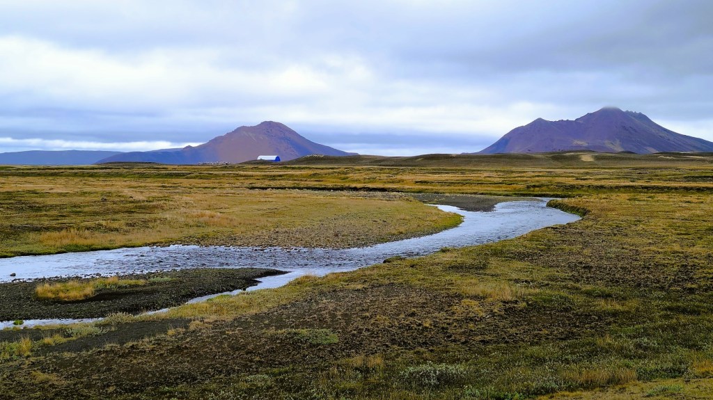
We closely followed the river Svartá at a steady pace, allowing us to soak in the scenery. Our guides were ingenues from Belgium and Holland, who were mostly shepherding a German family of four with little experience, but our Icelandics were very forgiving. They took to the trail they’ve known since foals, so the Germans were on solid footings.

But I was looking for something more. I was hoping to tölt, a oft-touted gait that’s exclusive to Icelanders, where the horse lifts its front leg up high, and only one foot touches the ground at any time. When we reached a level open field, Bridgette from Brussels shortened the reins of her horse, which immediately caused her horse to tölt, and immediately cued my horse to copy. I was tölting! Björn gave a smooth-paced ride with minimal bounce, as he glided over the gravelly terrain. It was exhilarating, but short-lived as we reached our destination much too soon to stop. But in exchange, we were humbled by a view of Reyjafoss.

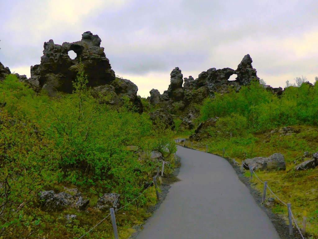
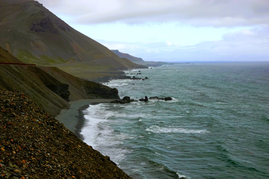
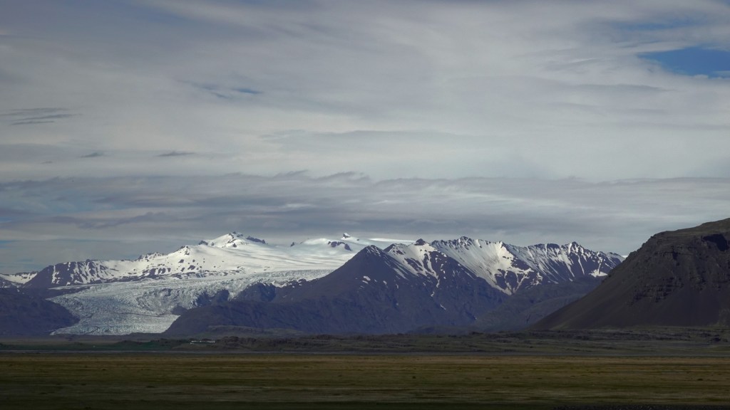
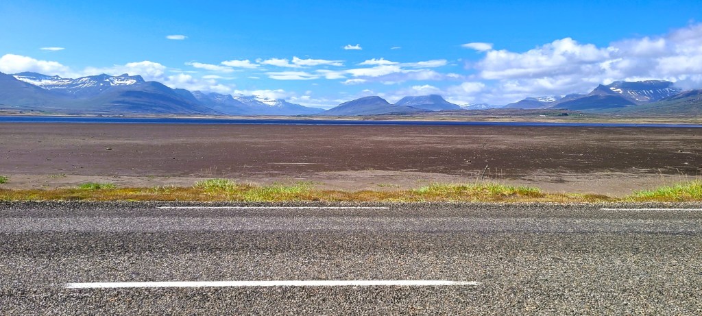
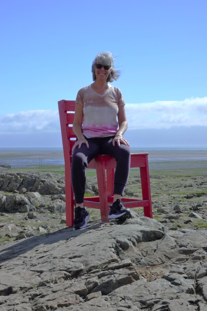
Leah and I returned to our Land Cruiser to explore our next major destination, the Westfjords. But first, we detoured to the Vatnsnes peninsula, where iconic basalt stacks line the shore,

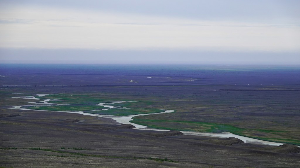
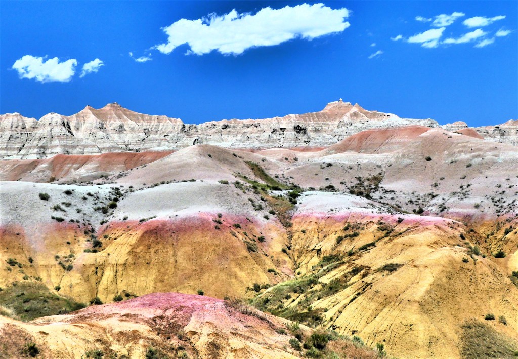
and volcanic sands sharply contrast against distant snow caps.

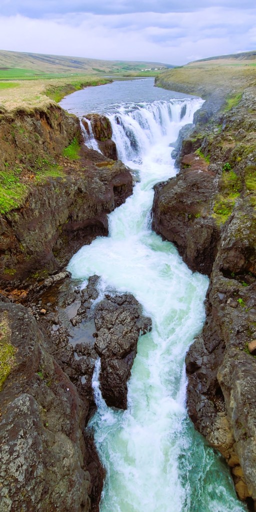
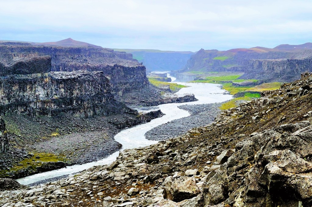
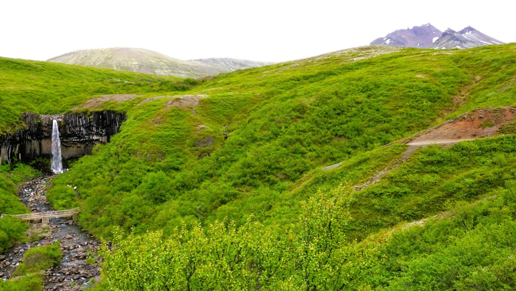
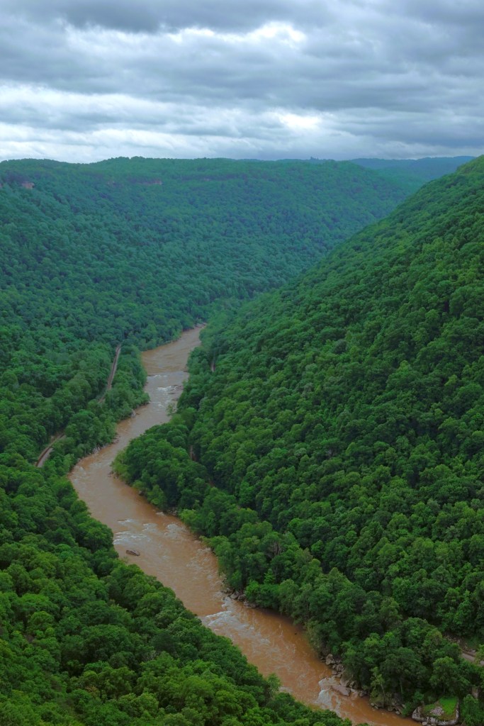
We bookended our day’s tour with a drive to Kolugljúfur Canyon, hoping to find Kola, a legendary giantess who dwelled in the canyon.

Her daily ritual of fishing and preparing salmon helped to shape the gorge.

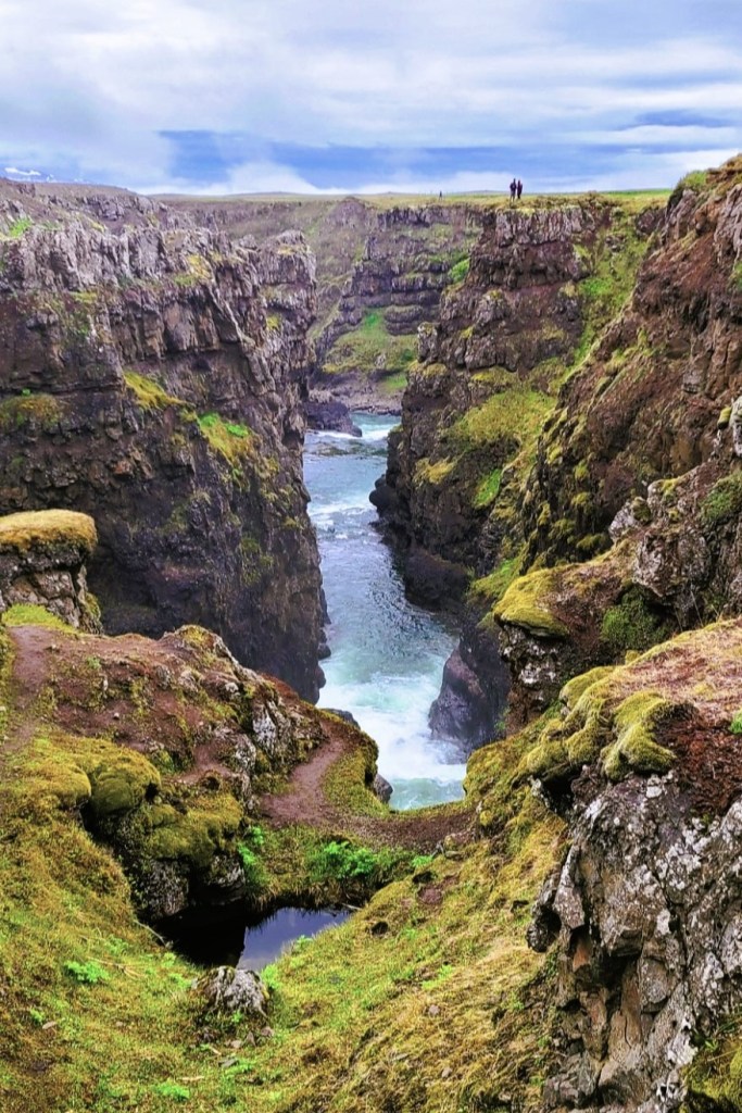
Alas, Kola was nowhere to be found, but we discovered her hiding place; it was Kolufoss.

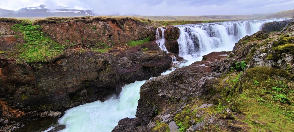
and it was too beautiful to disturb her.

A Tale of Two Towns in North Iceland

Widely considered the Capital of the North, Akureyri is only 100 km south of the Arctic Circle, but boasts the warmest climate in Iceland, with temperatures ranging from 75oF during summer months to 30oF during winter. However, Akureyri is also a very cloudy town, averaging just over 1000 hours of sunshine a year, with virtually no sunlight from November to February.

With a population of 19,000, Akureyri is the largest town beyond Iceland’s densely populated southwest corner, and enjoys many of the amenities of any vibrant urban center–with winding side streets and bustling plazas offering coffee shops, boutiques, gourmet dining, art galleries, and an active nightlife–all of which helps the locals get through the dark winter months.

There’s also a geothermal swimming complex that’s the envy of all of Iceland, and it’s conveniently located downtown behind the church.

If the identity and soul of Akureyri is best symbolized by the twin spires adorning the Church of Akureyri, or Akureyrarkirkja as designed by Guðjón Samúelsson (also known for Reykjavik’s Hallgrímskirkja)…

then the heart and soul of Akureyri is in full bloom at Akureyri Botanical Gardens, or Lystigarðurinn

established in 1912 by a society of women enthusiasts who were eager to provide a green space for locals to recreate or relax.

Not only is Lystigarðurinn the first planned park space in Iceland, it’s also one of the northernmost botanical gardens in the world, featuring over 7,000 species of plants, and making it a valuable resource for botany research.

An hour’s drive northbound brought us to Siglufjörður, a colorful and historic fishing village atop the mainland, and only 40 km from the Arctic Circle.

But the tale of Siglufjörður lies in stark contrast to Akureyri. In Akureyki, I had to hunt for a weekend parking space. Not so much in Siglufjörður, where its population has been in steady decline. Once a bustling seaport known as the herring fishing capital of the world, only 1200 residents now call Siglufjörður their home since the herring disappeared in 1968 from overfishing.

This cautionary tale is well-documented through the town’s award-winning Herring Era Museum.

Having grown up in a household that enjoyed sardines, kippers and herring, I felt compelled to explore the museum’s interactive exhibits: which illustrates how the fresh catch was hauled to port,

and subsequently processed by an army of “herring girls”…

who could gut and brine enough fish to fill three barrels an hour.

Iceland’s first processing plant was built in 1911, where oil and meal–for pet food–was extracted from the fish. As more fishermen from Scandinavia arrived to fish the fjord’s bounty, the industry prospered.

In 1925, disadvantaged “herring girls” successfully went on strike for equal pay, and formed one of Iceland’s first labor unions.

In its heyday, Siglufjörður had 5 processing factories, and 23 salting stations supported by a hearty population of 3,000.

Today, the town of Siglufjörður hopes to ensure its future and relevance by presenting their history, and Leah’s buddies hope that tourists are listening.

Tall Tales of Iceland

Iceland’s oral and written history is steeped in mythology and folklore, and rooted in the country’s natural wonders. From the time Garðar Svavarsson, a Swedish Viking first settled in Húsavík in 870 AD, Icelanders have imagined a world where phenomena is best interpreted through their sagas of mysticism.

Iceland’s first settlement succeeded in the second half of the ninth century because of adventurous Vikings from Denmark and Norway who were looking for a fresh start in a new world that offered opportunity, security, and stability. A parliamentary assembly of regional chieftains gathered in Thingvellir in 930 to form the Althing (assembly of free men), and ruled as the unifying body of this “free state” until 1264.

Originally, the Althing accepted Northern Germanic religion or Goðatrú (Truth of Gods) which resembled the religion of their homelands. Sacrifices were overseen by landowners/priests in temples and shrines to appease the gods and spirits, of which Thor and Odin were most popular.

By 1000, the Althing rejected paganism and enacted Christianity as the religion of the land under pressure from Norwegian king, Olaf Tryggvason, who embargoed all trade between Icelanders and Norway and held the sons of chieftains as hostages unless Icelanders accepted baptism.

Yet, despite the introduction of Christianity, pagan influence was not easily erased, and still informed how settlers reacted to their old surroundings, and their new spiritual allegiance.

For instance, when Leah and I discovered Dimmuborgir, a dramatic expanse of lava fields east of Myvatn,

we learned that the pillars were the creation of emptied lava lakes from an immense volcanic eruption about 2300 years ago.

But legend tells us that Dimmuborgir (or “Dark Castles”) was created by Satan after he was cast from heaven, and Dimmuborgir was the gateway to the devil’s “Catacombs of Hell.”

Also seeking refuge at Dimmborgir are the Yule Lads–13 offspring of Grýla and Leppalúði–who are regarded as trollish pranksters who eat misbehaving children before Christmas.

Jökulsárgljúfur National Park is another popular destination we visited that invoked the spirits and captured the imagination of pagan worshippers.

Jökulsárgljúfur, Iceland’s largest canyon, stretching 25 km long and 500 m across is the result of endless catastrophic flooding caused by an Ice Age eruption so fierce that its glacial ice cap exploded.

However, the Norsemen believed that Sleipnir, Odin’s eight-legged steed created this natural wonder by touching earth on a jaunt across the sky, leaving behind the impression of a massive hoofprint that became the canyon Ásbyrgi,

with a rock island spur named Eyjan.

To the west of Ásbyrgi, lie the cliffs of Hljóðaklettar and its inhabitants, the mythical Huldufólk (Hidden People), who cautiously avoid sunlight, or risk the same fate of the elves and trolls who have turned into stone pillars from sun exposure.

Another example of trolls behaving badly can be found along the black sand shoreline of Vatnsnes peninsula in northwest Iceland. From a geological perspective, Hvitserkur is a 15-meter tall basalt monolith that’s been shaped by severe North Atlantic storms and constant temperature changes.

Although Hvitsekur resembles a drinking dragon, Icelandic folklore refers to the stack as an evil troll who raided a local church to silence its bell tower, but turned to stone after being caught by the sun’s early rays. The petrified troll is home to hundreds of nesting birds who forever punish him with a thick layer of guano, and Icelanders who mock him with the name “White Shirt.”

Of all the stories, historians consider Goðafoss a landmark in North Iceland culture, for its here that regional chiefs met with pagan lawmaker, Thorgeir Ljósvetningagoði to determine whether to continue their old ways or embrace Christ as their spiritual guide.

The saga tells us that as a gesture of Iceland’s newly adopted religion, Thorgeir Ljósvetningagoði stood at the brink of the falls to cast a collection of Norse idols into the abyss, marking an end to paganism. Thus, the waterfall was christened Goðafoss, the “Waterfall of the Gods.”

It was the beginning of conversion, and Iceland eventually capitulated to convention. Nevertheless, the notion of magic and sorcery continued to flourish in Iceland, well into the 17th century. A museum located in Hólmavík is devoted to the subject.

It tells the story of 25 or so victims who were executed on charges of witchcraft between 1625 and 1685.

The museum also exhibits some unusual artifacts,

ranging from the sublime…

to the ridiculous.

Superstitions began to fade during the last decades of the 17th century, and the Reformation came as a shock to Icelanders. But consider a 2007 study by the University of Iceland that found an estimated 62% of the nation still believes in the existence of elves, and 40% of the population is irreligious.

Thank God for bogeymen!

Other Worlds of Iceland

Significant geothermal zones and volcanic landscapes throughout Iceland may give the impression of a primordial, preternatural planet. Yet, Icelanders have prevailed, despite the harsh and ever-challenging environment of their homeland.

Such is the case of Möðrudalur, a remote farm settlement in Eastern Iceland protected by Mount Herðubreið, the “Queen of Icelandic Mountains.”

Möðrudalur ranks as the highest inhabited farm in the country–at 469 m (1739 ft) above sea level, and supports a weather monitoring station, having recorded the lowest temperature in Iceland, -38.0 °C (-36.4 °F) on January 21, 1918.

The farm became inaccessible once Ring Road 1 was relocated northeast in 2001. However, a new F-road was eventually cut to continue servicing the curious folks who felt a connection to the old trails crisscrossing the wilderness, and a thousand-year history that made this a protected area.

A church was built in Möðrudalur in 1949 on once-sacred ground by farmer, Jón A. Stefánsson to honor his wife’s passing in 1944,

and decorated by revered folk artist, Stefán V. Jónsson.

A guesthouse, a small store and highly regarded restaurant serving locally sourced farm-to-table fare have been added over time to boost tourism in the area.

A more dramatic and inhospitable environment lies 90 km to the north. Jökulsárgljúfur Canyon was carved by fire and ice and a rushing river that over time laid bare the cores of spent volcanoes.

Following the Jökulsá á Fjöllum upriver (which flows from the Vatnajökull glacier) is an impressive triplet of waterfalls, of which Dettifoss is considered the most powerful in Europe, plummeting 45m (150 ft) into Jökulsárgljúfur Canyon at 400 cubic meters per second during the summer melt.

Returning to the Ring Road, it’s another 60 km west to the Myvatn Geothermal Area (Hverir), a volcanic swath that rivals the fumaroles, steam vents and mudpots of Yellowstone…

We cleared our lungs of rancid Sulphur fumes before checking into nearby Laxá Hótel, where the Krafla caldera looms over Myvatn Lake in the distance.

But Leah and I weren’t done for the day! After enjoying a meal at the hotel restaurant, we donned our hiking boots and enjoyed a solitary 10 pm stroll through Dimmuborgir,

a field of unusual lava formations caused by an eruption 2300 years ago and the subsequent collapse of a massive lava tube.

After a day of walking through location settings for Star Wars, Game of Thrones, and Alien, it’s little wonder that Iceland takes its landscape cues from a very powerful producer.

The East Fjords of Iceland

Continuing our counterclockwise circumnavigation of Iceland, today’s drive (Day 5) carried us through tranquil fishing villages,

along spectacular fjords,

and past so many sweeping landscapes…

that Leah wondered—given my many photo epiphanies–if we would ever reach Egilsstaðir, our evening destination.

Fortunately, in our favor, our summer days have 22 hours of daylight.

We started our journey with a brief stop in Djúpivogur, a 16th century Danish fishing port and trading post that attracted European merchants. By the mid-1800’s, there were four houses in Djúpivogur, and Langabúð was one of them.

Constructed in 1790 as the village storeroom and warehouse, it was considered the economic and social engine of the town up until the 1950s. Today it’s a museum and visitor center.

A walk around the Djúpivogur’s harbor offered little shelter from the frequent gusts of blustery wind coming off the water. Leah stayed behind in the Land Cruiser, but I found the 34 granite “Eggs of Merry Bay” atop their pedestals to be an interesting oddity,

as each egg had been named for a local bird.

Next stop was Petra’s Stone Collection,

beautifully curated throughout her house and garden in Stöðvarfjörður.

What started as a hobby during childhood, became an obsession throughout her adult life, until she acquired the world’s largest private collection of mineral rocks,

mostly unearthed in the vicinity of East Iceland.

We also stopped in Fáskrúðsfjörður, a small fishing village with French connections that dates to 1880. Originally developed as a French trading hub fortified by a chapel, a hospital and French consul, the town still retains its French flair.

Once we returned to the Land Cruiser, we vowed to limit our stops, but the road beckoned, and I couldn’t resist!

“One last time,” I pledged. And Leah relented.

We detoured to Teigarhorn, a natural monument and nature preserve most valued for its cache of zeolites, and most likely the source of so many of Petra’s discoveries.

Teigarhorn is also a protected nesting ground.

Ultimately, we made it to Egilsstaðir, had a meal, and found our way to Vok Baths, a geothermal spa,

tucked into the banks of Lagarfljót–a long and narrow lake–where Icelandic folklore (c. 1345) suggests a giant serpent dwells.

Three infinity pools of increasing temperature (105oF max) offered us the perfect opportunity to melt away the stress of a long travel day…without a serpent sighting.

Finally, the midnight sun had set on our day at midnight.

And hopefully, our hotel has decent blackout shades to protect us from a 2am sunrise.

Water and Ice, Part Two

Imagine an aquatic gallery of ephemeral ice sculptures in varying shapes, sizes and shades of blue, dancing around a glacial lagoon before floating out to sea or washing upon a black, sandy beach.

After our hike at Skaftafell, Leah and I were expected at Jökulsárlón for a late afternoon amphibian boat tour of the glacial lagoon, but not before a required stopover at Fjallsárlón for a dramatic view of an outlier glacier…

receding into a volcanic valley,

with chunks of ice fighting for a place to thaw.

I could have spent hours at the shoreline photographing the amorphous shapes, but our boat excursion across the road at Jökulsárlón was soon boarding.

We rolled off the moraine in fat tires, and effortlessly glided onto the lagoon for a chilly boat ride surrounded by orange vests and hulking ice.

Our captain cautiously piloted the amphibian as close to the bergs as allowed, to limit the wake of curious kayakers,

and knowing that hidden ice is usually more voluminous than exposed ice.

Also present in the lagoon was a resident colony of surreptitious seals,

anxiously awaiting high tide to feast on herring and cod swept into the icy inlet.

After disembarking, we crossed to the Atlantic, where jewels of ice wash ashore,

and decorate the beach,

a fitting terminus that would gain Banksy’s approval and mine.

Water and Ice, Part One

Imagine an amphitheater of “organ pipes” carved out of a grass-topped lava field with a 20-metre waterfall plunging down its center into a roiling pool of green water.

It sounds impressive, but seeing is believing, so Leah and I navigated to Skaftafell, a nature preserve in southeast Iceland that belongs to Vatnajökull National Park, Iceland’s largest park with 18% of the island’s land mass, where Svartifoss is one of the featured attractions.

We arrived at the Visitor Center parking, and cursed the ATMs for making paying for parking so difficult. We hiked through the campground before arriving at the Visitor’s Center.

I was literally speechless. Vatnajökulsþjóðgarður? Really!? How could there possibly be a word with a V, a K, two Js, and a letter that’s stuck between a b and a p? And how about the pronunciation? And what does it even mean?

But there was no time for questions. We were there to hike, and there was a waterfall to explore.

We caught the trailhead past the same campground and began our ascent. The trail was wide and steep at the start. So much so, that metal mats filled with crushed stone lined the path to keep erosion at a minimum. We caught our first view looking east when we cleared the trees.

We continued above Gomlutun, across Estragil gulley on a footbridge, past two waterfalls (Hundafoss and Magnusarfoss),

until we reached the approach to Svartifoss.

My pulse quickened. I sensed this waterfall was special. I zoomed in until the falls filled my frame, and I lingered before I pressed the shutter.

I raced around the side of the canyon for another perspective…from the bottom.

Svartifoss translates to “Black Falls” and it lives up to its name,

as it showcases a splendid backdrop of charred columns of basalt.

Svartifoss was the inspiration behind Gudjon Samuelsson’s design of Hallgrimskirkja, Iceland’s celebrated cathedral in Reykjavik.

We were down the mountain and at the Land Cruiser after 2.0 hrs. in Skaftafell, which included our lunch at the overlook and a potty break.

It was time for more sightseeing down the road, and we were on a schedule!

But first, some unanswered questions:

  1. Apparently, Vatnajökulsþjóðgarður is a real Icelandic word,
  2. pronounced: https://forvo.com/word/vatnaj%C3%B6kuls%C3%BEj%C3%B3%C3%B0gar%C3%B0ur/
  3. and meaning “Glacier of Lakes” National Park

Water and Ice, Part Two follows…

Hiking a Shrinking Glacier

There is a glacier lagoon at the tip of Sólheimajökull’s tongue that never existed a decade ago. Today, that lagoon is 80 meters deep, and its fed by glacial melt.

Sólheimajökull is an 11km outlet glacier of Mýrdalsjökull, Iceland’s 4th largest ice cap of 269 named glaciers, and easily accessible and suitable for ice adventuring.

Climatologists have been studying Sólheimajökull’s since 1930, documenting a loss of more than 2 sq.km. of its ablation area, and retreating a mile from its original marker.

During the summer Sólheimajökull loses 3 meters of ice every month with frequent ice calving.

With so much chatter about climate change and glacier volatility, I thought it best to have a look around the ice and judge for myself. So Leah and I drove to Sólheimajökull to join a guided glacier expedition,

where we were outfitted with a harness, helmet, crampons and ice pick. With some instruction, we learned how to dress ourselves and behave like mountaineers.

Then the conversation shifted to safety first, and how to avoid the treacherous crevasses on a melting ice mountain that’s constantly in motion.

After a brief hike, we arrived at the ice, but the approach to the top wasn’t a graduated trail; it was a wall.

Suddenly, I felt our training was insufficient, and I couldn’t imagine that all of us were prepared to dig in with our crampons and ice axes and climb over this wall, but that was unnecessary. We simply stepped around the mound on chiseled risers that were rapidly melting…

until we all reached flat ice.

I questioned why this ice had a different color and texture–more like ice coal–than blue crystal.

Valerio, our guide from northern Italy attributed it to the 1918 eruption of Katla, Iceland’s largest active volcano, and fragments of rock and debris–known as glacial till–that typically develop when a glacier passes over bedrock. We were walking on 100-year ice dated by the volcanic ash trapped inside the ice!

Except for occasional photo ops like a discovered ice cave,

we were always moving across the ice and up the throat, and discouraged from breaking the line or falling behind.

After 30 minutes on the ice, it was time to celebrate with a drink. Valerio grabbed his New Zealand ice ax to tap a vein under the ice, and the bar was open…

and it was cold and refreshing!

Since 1890, Iceland has lost approximately 18% of its ice mass to warming, and Sólheimajökull is melting faster than scientists originally speculated. They are sounding the alarm–telling us that Iceland’s glaciers are melting faster than they can recover.

And climate change, of course, plays a pivotal role in this process. Ironically, eco-tourists are rushing to Iceland to experience the glaciers before they disappear.

But Iceland is doing something to mitigate the damage by pledging carbon-neutrality before 2040. Already, the island’s geography and geology provide almost 100% renewable energy for generating heat and electricity.

But will it be enough for future generations?…

Seljalandfoss and Skógafoss

There is no shortage of waterfalls in Iceland, although some are more spectacular than others. Estimates of total waterfalls throughout range from 10,000 and up. But Icelanders have their favorites, and Seljalandfoss and Skógafoss are two of them. Located just off the Golden Circle and only 30K apart made it impossible to resist, so off we went, chasing waterfalls.

What makes Seljalandfoss special is its geological standing. It’s believed to be a part of Iceland’s receding coastline in Southern Iceland, where the Seljalandsá River once ran over the edge of a volcanic cliff and dropped into the Atlantic. 

Seljalandsfoss’ glacial water originates from the Eyjafjallajökull glacier, a smallish ice cap atop Eyjafjallajökull volcano that last erupted spontaneously in 2010, belching so much ash high into the atmosphere that day turned into night and European air traffic was grounded for 5 days.

Eyjafjallajökull towers above the waterfall,

and the Eyjafjöll mountains feed meltwater to the river Seljalandsá, which runs down the slopes before dropping off the Seljalandsheiði heath in the form of Seljalandsfoss waterfall.

Repeated eruptions over millennia have extended the coastline by 12K, while erosion has hollowed out an extraordinary hiking trail that circles behind Seljalandfoss, which literally translates to “selling the land of waterfalls.”

Leah and I could immediately tell upon approach that this was a popular destination, which was soon confirmed by a full parking lot. There was a kiosk for paying the 800 ISK parking fee ($6), but I didn’t realize it until we were leaving. Oh well, I guess I was too focused on the shower I was about to take.

But Leah had different plans. “I’m not doing that,” she insisted. “I can’t find my rain pants anywhere and there’s no way I’m getting soaked. Besides, it’s probably slick from all the mud and water, and I don’t feel like breaking my neck on the third day of vacation. But you should go, and I’ll just look at the pictures later….Tell me about your insurance, again.”

“Shouldn’t we at least take a selfie like everyone around us?” I asked.

Leah had decided that Seljalandfoss’ 60 meter (200 feet) cascade was best appreciated from a distance,

while I was too anxious to capture Seljalandfoss from every angle.

True, the trail was muddy and slippery, but that was only a minor inconvenience.

The challenge came from dodging the unrelenting spray, as if it was weaponized by the wind.

I instantly missed Leah as my assistant. She would have made the perfect rain shield.

After coming around the back side of Seljalandross, I rejoined Leah on a path which led to a small waterfall known as Gljufrabui,

hidden within a slotted canyon.

We hiked back to the Land Cruiser and headed in the direction of Holt. I was casually driving, enjoying the scenery at 90 kph (60 mph), Iceland’s top speed limit, when I hit the brakes….after noticing Iceland’s perfect farm.

We made one additional stop along the way to Skogafoss, when I slowed to catch a glimpse of what appeared to be a Hobbit house built into the mountain.

However, on closer examination, it appeared to be a shelter for sheep and goats.

The approach to Skogafoss had several imposing mountains in the vicinity, also part of the former coastline.

Ironically, Skógafoss translates into Forest Falls, but there’s not a tree to be found in the area. It seems the Vikings had a penchant for chopping all of them down to create their settlement a thousand years ago.

Skógafoss is one of the biggest waterfalls in Iceland. Game of Thrones fans may recognize the falls as the aerial backdrop for a romantic encounter between Daenerys Targaryen and Jon Snow when flying with her dragons.

With a width of 25 m (82 ft) and dropping 60 m (200 ft) with water fed by two glaciers, a rarity (Eyjafjallajökull and Mýrdalsjökull),

visitors can climb a rickety 430-step metal staircase anchored into the cliff, allowing visitors to reach the spillover and enjoy a view of the coastal lowlands while basking in the Highlands, or continue on a popular trail leading up to the pass between both glaciers.

Skógafoss is a place where magic happens…

Completing the Golden Circle

Feeling exhilarated after our Silfra snorkeling adventure, Leah and I said goodbye to Thingvellir, and set out to complete the remaining natural wonders of the Golden Circle trifecta.

We continued to Haukadalur, a geothermal valley in South Iceland that boasts a plethora of fumaroles and geysers,

including the powerful and predictable Strokkur, Iceland’s most active geyser that regularly erupts every 5 to 10 minutes like clockwork,

sending boiling water skyward, 20 to 40 metres beyond its mineral-stained crust.

Afterwards, we traveled to Hvítá river canyon to visit Iceland’s beloved falls, Gullfoss. The water in Hvítá river travels from the glacier Langjökull, Iceland’s second largest ice cap, before cascading 32 meters (105 feet) down Gullfoss’ double drops in dramatic display.

We arrived in time for one of Iceland’s typical daily weather changes as we hiked to the closest observation deck. The blustery gales had driven the cold drizzle and falls spray sideways. While we were dressed appropriately in warm parkas and rain pants, Leah was miserable and could only manage a walk to one of many overlooks of Gullfoss.

I tried to ignore the weather, but the poor visibility and annoying spritz was affecting my ability to keep the camera lens dry while trying to capture the “perfect shot.”

Leah retired to the comfort of the Land Cruiser, while I climbed above the canyon wall in search of a different perspective, thinking that if I distanced myself from the water, I could keep my camera dry.

The best that I could manage, given the circumstances was adequate…

However, to my chagrin, I found the perfect shot at the base of the foothills, but it belonged to a park graphic with information about Gullfoss…

However, looking southeast, I also discovered a telling view of Thingvellir’s distant topography just beyond the Visitor Center.

Of course, being a national park, certain rules apply; and understandably, drone photography is a no no. But Gullfoss is so expansive that it would surely benefit from an aerial approach, so the Park Service sanctioned a third party to capture the awe and splendor that only a drone can see.

We ended our day in Selfoss,

where more adventures await…

Touching North America from Eurasia

There is one place on earth–Silfra–where it’s possible to “touch” two different continents underwater and it’s located within the Golden Circle of Iceland. Leah and I were up for the challenge, but it required some preparation.

First, we traveled southeast of Reykjavik to Thingvellir National Park, the birthplace of parliamentary government (Althing, 930 AD), and the zone where volcanic activity has played a heavy hand in shaping our planet.

Not to get too bogged down in earth science, but a rift occurred through the middle of Iceland where two tectonic plates are pulling away from each other 2.5 centimeters every year as a result of volcanic activity in the region since the beginning of time,

and much of it vents under Lake Thingvallavatn, Iceland’s largest lake.

Above sea-level, lava fields at Thingvellir have been torn apart by tectonic forces, leaving gorges and fissures to admire between two continents.

However, inside the rift valley created by daily earthquakes throughout time, there is one ravine, Silfra that allows snorkelers and divers to experience the tectonic plates underwater, but it requires a dry suit to tolerate the water temperature (2o C) and a certified outfitter to guide thru the underwater fissure.

Leah and I had booked an excursion through Arctic Adventures, who supplied all of our underwater gear and a guide to assist with dressing, and underwater photography.

We dressed in a parking lot by the roadside where various outfitters have set up shop.

Over the thermals and wool socks we supplied, we stepped into fully insulated jumpsuits to wear under incredibly bulky dry suits with fixed booties, snug rubber sleeve guards around our wrists, lashed with rubber bands, and a snug rubber seal around our neck with a rubber band choker. An industrial zipper across our deltoids sealed us in.

Then came a rubberized neoprene hood over our heads. Imagine forcing your head through your neck. After accessorizing our fashionable outfits with neoprene lobster gloves, we were ready for the apocalypse.

We were a group of twelve…

under the supervision of Chris (from Hungary) and Marcelo (from Sao Paulo). We split into 2 groups of 6,

and waited our turn to enter the water.

Immediately, the suit constricted around my lower body as I stepped deeper and deeper into frigid water…but I stayed dry! Without hesitation, I glided in and immersed my face. Only the small area around my facemask was exposed and the sensation around my lips felt like a cold scalding until they turned numb after 10 seconds.

We flopped onto our backs, and let the current carry us slowly through the gorge while watching the arctic terns doing aerial maneuvers overhead.

As we floated past Grynningar Shallows, I was awed by the clarity of the water, with visibility beyond 100 meters (300 ft).

We were in the water approximately 40 minutes. Once we reached the Silfra Lagoon, the stiff current required strong frog kicks for us to reach the exit point.

As promised by Marcelo, each of us emerged from the lake with “Angelina Jolie lips.”

Overall, the experience was sublime. However, my biggest complaint had to be cold hands. Most of the time, my hands stayed clasped behind my back, out of water, but the weak stitching around the seals of the gloves made them porous. Marcelo quipped that the gloves leaked because they were made in Sweden.

Lest we be judged for our adventurous antics, consider this unassuming mother of three from Germany, who stripped down to her swimsuit, and took the polar plunge, albeit for only 30 seconds.

I don’t think she’ll be doing that again, anytime soon, but for me, it could become an addiction.

Iceland by Land Cruiser

By the time Leah and I were flying over Iceland, we were zombies.

Leah was outraged by the airline’s no-frills service. “Not even a tiny bag of pretzels,” she lamented, “Maybe I closed my eyes for one or two minutes.”

I was mostly pissed that my gummies were duds, but I thought the Icelandair pilot and jet did a commendable job of getting us to Iceland–crossing 4 time zones in 5 hours.

We arrived at Keflavik International Airport at 5:30am, found our bags, cleared customs, bought some duty free tequila, and got our bearings…

We have embarked on a 2-week road trip around Iceland, hopping from one hotel or guesthouse to another until we complete the circle, and we’re not too sure what to expect.

By the time we reached the reception atrium, half-a-dozen drivers were gathered by the airport entrance looking for a match. But none of the clients’ names on their iPads and iPhones matched with mine.

I approached one of the drivers and handed him my voucher. His English was perfect.

“I know this driver,” he said. “He’s the best! I think he’s running late on another trip, but I’ll call him for you.”

The phone call was brief. “He says he’s on his way.”

By 6:30am we were riding in an electric Audi SUV to Grandi by Center Hotel, discussing with our driver how Iceland’s road system is still too immature to support a fleet of EVs–plagued by insufficient charging stations and improper maintenance. The ride took 40 minutes.

“The hotel is full,” we learned from the on-duty desk clerk. “The earliest we may make a room ready for you is 2pm, and I will make it my first priority.”

Disappointed, we power-walked through a chilly spray under overcast skies from Grandi to Sandholt, a nearby bakery highly recommended by the desk clerk.

“What are we gonna do for 7 hours? I need sleep!” Leah groaned.

The streets were stone quiet this Sunday at 7am, except for a street cleaner and vacuum buggy attacking the trash along the alleys of a popular square filled with eateries.

However, one road along the way caught our attention…

We discovered that Iceland is regarded as one of the most LGBTQ-friendly countries in the world, having elected, Jóhanna Sigurðardóttir, an openly gay head of state in 2009, and Althing (Iceland’s Parliament–founded in 930 and one of the oldest surviving parliaments in the world) unanimously voting for same-sex marriages in 2010. Unsurprisingly, one-third of Iceland’s population turns out for the Reykjavik’s Gay Pride parade in August.

Leah was thrilled with her breakfast. She had an omelet and I had a waffle with fruit. It gave us the boost that we needed to explore the rainbow road to Hallgrímskirkja, Iceland’s National Church.

and Reykjavik’s iconic Lutheran landmark.

I would have liked to climb the tower for what is reputed to be the best lookout of the city, but we were too early.

View from the top of Hallgrímskirkja. Photo by Philippa via Flickr CC

And that’s true for most of the city, which doesn’t wake until 11am on Sunday, so shopping was also out of the question.

Begrudgingly, we returned to the hotel, admiring some of the charming homes,

and graffiti along the way…

and took possession of our room by 1pm.

After a 5-hour nap and an early dinner, we were ready for bed and ready for whatever new adventure awaits us in the coming days.

New River Gorge

The New River has been carving the Appalachian Valley for the past 10 to 360 million years–depending on who you ask–which makes it an ancient river–ranked behind the Finke and Meuse as the world’s third oldest river. Of course, there is the obvious non sequitur, given the river’s moniker and apparent age.

One story claims that its name comes from a translation from Indian dialect meaning “new waters.” Another explanation tells of Captain Byrd who had been employed to open a road from the James River to Abingdon in 1764. Byrd used the Jefferson-Fry Map published in 1755. However, this map did not show the river, so Byrd noted it as the “New River.”

Originating in North Carolina, the New River flows 360 miles north until it meets the Gauley River in southern West Virginia, providing some of the best whitewater (Class IV rapids and above) on the planet, and the main reason for our visit.

Our first look came from an overlook behind the Canyon Rim Visitor Center,

treating us to canopied canyon walls as far as we could see, soaring 876 feet above the water.

and a profile of the New River Gorge Bridge (the Rusted Rainbow).

When the New River Gorge Bridge opened in 1977, it was the world’s longest single-span arch bridge for 26 years. With an arch 1,700 feet (518 m) long, it is now relegated to the fifth longest.

While I appreciate the engineering feat of a half-mile span that saves travelers 45 minutes of detouring,

it’s the river I’ve come to conquer.

New and Gauley River Adventures shoved off from Stone Cliff at 10am–14 miles downriver from the bridge–with six eager adrenalin junkies and our guide, Costa Rica Scott in one raft, and a support raft to tag along. Leah refused to float with us, despite my gentle coaxing.

Once we were properly outfitted with life jackets and helmets…

off we went…

While the first half of the trip was relatively lazy, with fountains of 60oF spray coming from occasional haystacks and laterals, the spring run-off and torrents of rain before our arrival had turned the second half into a fast-moving, turbulent churn, filled with hydraulic traps, and 7 foot waves.

which had us threading our way through Keeneys, Dudleys Dip, Double Z, Greyhound, and Millers Folly Rapids with increased caution.

Miraculously, we never flipped and everyone remained in the boat throughout the ride. However, the soul behind me spent most of the time stretched across the raft with his head pinned over the gunwale, retching. Fortunately, whenever our pilot commanded us to “dig in” (paddle like our lives depended on it), I avoided smacking him across the face.

After 4 hours on the river, our take-out was just shy of the bridge, beyond Fayette Station.

What a blast! If only there was time to run back and do it again, but that would have left little time for hiking to Diamond Point;

visiting Cathedral Falls in Ansted;

investigating abandoned beehive coke ovens in Nuttallburg;

strolling through a mining ghost town (pop. 5) in Thurmond;

or just chilling at The Outpost, “Where Wild Meets Wonderful.”

Perhaps another visit is in order.

A New Adventure

It’s been a while… nearly 5 months since my last post…

I could blame coronavirus for the lapse, but that would be cheating,

Truth is…

I took a vacation from writing just as Covid-19 was rolling out a fresh variant.

I was gathering details about Alex Jordan’s sprawling House on the Rock for a future photographic commentary on excessiveness,

when I folded my laptop and put my writing away… until it felt like less of a job.

I always intended on working my way back to it…

But then I got married…

to Leah, after 17 years of togetherness…

in front of friends and family!

We partied long into the night….

with historic St. Augustine as our magical backdrop.

And we’ve planned a super summer honeymoon. We’ve loaded up the Airstream and we’re heading for New River Gorge National Park in West Virginia. There’s a week stopover in NY/NJ, and then we’re off to Iceland for 2 weeks.

When we return, we’ll camp at Acadia National Park before crossing into Canada for a drive around the Bay of Fundy, the Cape Breton Highlands, Prince Edward Island, and down the St. Lawrence Seaway, with stops in Quebec City and Montreal.

Our southern route home includes time in Lake Placid, Lake Luzerne, the Jersey Shore, and northern Georgia.

I hope to share the highlights as soon as we make them.

Circus World

Click the audio file, and read along…

1905 Gavioli Band Organ Wagon

As a young boy growing up in the ’50s, I was fascinated by the circus. Toby Tyler, written by James Otis was a bedtime favorite, and fueled my fantasy of running away to join the circus. Alas, over time, the circus has fallen out of favor as family entertainment.

After incessant criticism by animal rights activists and the advent of video gaming and media streaming, the 1905 Gavioli Band Organ Wagon (with 367 wooden and metal pipes, 2 drums, a cymbal, and a 17-bar glockenspiel) which once heralded the arrival of the circus train…

has now been relegated to a circus museum with fifty other antique circus wagons within the W.W. Deppe Wagon Pavilion

at Circus World in Baraboo, WI,

conceived on grounds known as the winter quarters of the Ringling Brothers,

who launched their first circus tour from Baraboo in 1884.

As we walked the grounds,

we realized that the circus is more than the sum of its parts.

It’s more than the costumes;

more than the animals;

more than the performers;

more than the sideshow attractions;

and more than the music;

It’s a longing for our youth,

and our feelings of wonder before we were forever trapped in our responsible, adult bodies.

Ballistic Badlands: Avoiding a Nuclear Winter

Long stretches of telephone totems tethered as far as the eye can see…

Free-ranging livestock sprinkled across the flatlands…

Barbed wire perimeters surrounded by pastureland and littered with cow pies…

From 1963 to 1993, one thousand Minuteman II missiles (ICBMs) capable of delivering a 1.2 megaton nuclear warhead to a Soviet target in 30 minutes were housed in underground silos like Delta-09 that stretched across the Great Plains,

(Library of Congress)

with 150 launch sites dispersed throughout South Dakota, transforming the serenity of the prairie into a hibernating military zone.

(Library of Congress)

The Minuteman Missile National Historic Site commemorates a period in America’s history when “Mutually Assured Destruction” (MAD) imperiled the world, and delves into the birth of the Cold War, the nuclear arms race, and development of ICBMs.

At the height of the Cold War between Soviet Union and United States there were more than enough nuclear missiles in both arsenals to destroy the planet 5 times over.

As I walked through a maze of interactive exhibits, childhood memories came flooding back.

While growing up in an era of “duck and cover” mindfulness, we were acutely aware of the danger outside our global window.

With the school claxon sounding in 3-clang intervals, my classmates and I responded by hunching under our desks in silence until the principal gave us the “all clear” over the PA. It was our way of showing the Commies that we were prepared and doing our part in the recurring struggle to keep ourselves safe from a political bogeyman.

Of course, as we got older (these drills lasted through middle school), we doubted that “duck and cover” would ever protect us from a nuclear firestorm or subsequent fall-out.

Because of the Cuban Missile Crisis, and the realization that Pittsburgh’s steel mills were a likely military target, my father’s master plan in the event of a nuclear attack was to convert our basement closet filled with dusty canvas awnings and rusted paint cans. We painted the concrete blocks a putrid shade of green under the glare of a single dangling light bulb swinging from the ceiling, and filled the 6 x 6 closet with mattress slabs, jugs of water, and a box of batteries for our flashlights. I always wondered how our family of four (at the time) would survive inside this moldy space.

After touring the Visitor Center, we rode 15 minutes on I-90 West to a decommissioned missile silo roughly the size of a football field, and the feeling was ominous.

Locked beneath a sliding 9-ton hatch…

was a vertical rocket in-waiting. I pressed against the tinted, transparent armor and peered into a hole 185 feet deep for a first look and a photograph.

Despite being disarmed,

it was no less unsettling to consider that humanity holds the power of mass destruction, and the Badlands backdrop–75 million years in the making–could vanish in an instant.

Babylon Badlands: True Religion

There was a time 10 years ago, when Scenic, South Dakota was for sale–yes, all 10 acres of the town and 36 acres of the not-so-scenic, surrounding property.

It was originally offered up for $3M by Twila Merrill, local rodeo legend who earned a tough-as-nails reputation for never being thrown from a bucking bronc from 1956 to 1963, but with her health fading, it was time to sell.

She eventually sold the whole kit and caboodle to a Filipino church group for just shy of $800,000 in August, 2011.

Ten years later, Scenic looks unchanged. There is scant evidence that parishioners of Iglesia ni Cristo (Church of Christ) are welcome at this ghost town, although the pastel-colored Adirondack chairs on the porch suggest that a resurrection of activity is possible.

Back in the day, Scenic was a thriving hive of entertainment, with a full-scale rodeo arena, a racetrack, a manicured baseball diamond, a theatre and a dancehall.

Main Street was home to a General Store,

and a requisite saloon which was thoughtfully annexed to the town hoosegow.

It should be noted that Indians were allowed inside Longhorn Saloon, but only after Twila bought the joint and painted over “NO” on the marquis.

Meanwhile, the culture crowd would gather at Sam 2 Bulls.

Off the main drag, there’s an assortment of incongruous buildings: a couple of standing churches, a few warehouses and barns, a defunct gas station, and a post office behind a dedicated monument featuring a pterodactyl that defies logic or explanation.

Leah and I rolled through Scenic, on our way to an outpost of Badlands National Park known as Sheep Mountain Table, located in the Stronghold Unit within the Pine Ridge Indian Reservation.

At 3,300 ft. elevation, Sheep Mountain Table is the highest point in the park.

The good news is that we could drive to the top.

The 6.5 mile road was hard-packed and serviceable all the way to the top of the table, albeit a single lane and a handful of hairpins. Once we arrived, there wasn’t much to see on the surface except tall grass, road tracks and traces of spent and unexploded ordinance scattered throughout this one-time gunnery range used by the USAF and South Dakota National Guard. The wind was blowing furiously,

which kept us anchored a careful distance from the ledge overlooking the Cheyenne River Valley.

But there was much more to explore on the other side of the table, which we could reach by hiking 2 miles or driving the rutted terrain…

so I drove…pitching and rolling along…

until we arrived at an open plateau with dramatic vistas to the west…

and the White River Valley to the east.

These Badlands were once considered sacred to young Sioux braves who would trek to the tables for prayer and self-reflection as they approached manhood.

That’s when it occurred to me that Scenic, South Dakota was rightfully named, not because of the town’s location, but because of the Badlands omnipresence and its omnificent landscape. And that may also explain why the Filipinos invested in Scenic.

Badass Badlands: a Surreal Landscape

Pillars and spires, pinnacles and hoodoos, canyons and gorges, ridges and ravines, bands of colors and beds of fossils, mixed-grass prairies and resilient wildlife…the Badlands of South Dakota are a scenic recipe so fantastic that I sometimes wondered if my camera could adequately capture the range of strangeness that surrounded me.

But I was up for the challenge!

What follows is a visual diary of Badlands National Park…told in 3 parts.

The Yellow Mounds of Dillon Pass

From a distance, this mustard-colored landscape qualifies as the perfect location for a film shoot on an alien planet.

Leah and I were casually driving along the Badlands Loop Road near Dillon Pass,

when the Yellow Mounds popped into view…

and I knew that I had to explore this phenomena more thoroughly.

I climbed atop one of the mounds…

which overlooked a network of foot paths…

to the Pinnacles on one side of the hill,

and offered an outstanding overlook of the Conata Basin to the southwest…

and beyond.

And as I surveyed the scene below,

I realized that the scope of South Dakota’s Badlands defies framing.

The Badlands cannot be contained, and the sheer beauty and colors transcend any exposure.

Biking the Black Hills

During our travels across America, Leah and I have cycled on several amazing rail trails–each one offering a variety of gorgeous scenery, interesting terrain, historical context, and wildlife features. The Black Hills of South Dakota boasts the George S. Mickelson Trail, which checks all the right boxes.

The trail follows 109 miles of Burlington Northern’s historic rail line from Deadwood to Edgemont–

crossing 100 converted railroad bridges…

and pedaling through 4 tunnels.

The result is breathtakingly beautiful.

Named after South Dakota’s governor following his untimely death in 1993, George S. Mickelson’s ardent support was instrumental in creating a non-motorized mixed-use trail,

from his dedication of the first 6 miles in 1991 to the trail’s completion in 1998.

Rather than limiting our linear miles, we rode the trail from Dumont (its highest elevation point at 6240 ft) to Hill City,

and hired a taxi service to transport our bikes back to Dumont.

The trail consisted of crushed limestone and gravel which was perfect for our road bikes clad with all-terrain tires.

While riding the trail was effortless (mostly a slow downhill roll), there were many reasons to stop:

whether to soak up the landscape;

or reflect on South Dakota’s cultural heritage–such as farmers using cyanide lids left over from Deadwood’s Gold Rush days to shingle and side their houses.

All of which made for a glorious outing,

which only adds to the allure of Black Hills lore.

What’s Mine is Mine

Leah and I were prospecting for wedding bands along downtown Deadwood’s famed historic Main Street when we ran into a local miner–a chip off the old block–who told us that touring the abandoned gold mine on the edge of town was a hoot and a value-added experience.

Broken Boot Gold Mine has been running tours and amateur gold panning since reopening as a visitor attraction in 1954–long after the last ounce of gold was discovered.

The 15,000 ounces of gold extracted from Sein’s Mine (1878 -1904) through pickaxe and candlelight was hardly the mother lode the Sein Brothers had hoped for, but a rich vein of iron pyrite (also known as fool’s gold) ran through the mine, and that was just enough to make the mine profitable…for a time.

The mine closed in 1904, but reopened in 1917 to extract iron pyrite for the war effort. After a year, all mining operations stopped and the mine went quiet…

until Olaf Seim’s daughter (and sole heir) was persuaded by promoters to segue Sein’s Mine into Broken Boot Gold Mine–thereby creating a new tourist experience and de facto location for shlock horror movies…

According to the operators of Broken Boot Gold Mine, “[it] has operated longer and more successfully as a visitor attraction than it did as a working mine.”

Leah and I made a $14.00 investment (seniors get a $1 discount), which got us a 40-minute walk-thru and Wild West mining advice. We donned our plastic pastel safety helmets and entered a tunnel that was dim and chilly.

We crept through reinforced passages with 10 other investors,

and imagined a 10-hour shift in relative darkness–about the time it took to burn through one candle–while searching for precious metal,

and valuable mineral deposits.

Our guide reinforced the feeling of claustrophobia by switching off the lights and allowing our eyes to adjust to total darkness before lighting a single candle, a miner’s only light source.

Despite the price of gold hovering near $1,800 per ounce, few amateur miners were willing to spend an extra 10 bucks for gold panning lessons after the tour…

while Leah was completely satisfied with her bogus stock certificate.