The journey continued beyond our early morning detour through Lemaire Channel. Viking Octantis set a course for nearby Cuverville Island, a protected rock lying between Arctowski Peninsula,
and the northern tip of Rongé Island, west of Graham Land.
Leah and I were keen to arrive at our first landing zone–originally scheduled days earlier by Pamela, Viking’s program director, who coordinated the excursions and edutainment events throughout our time at sea.
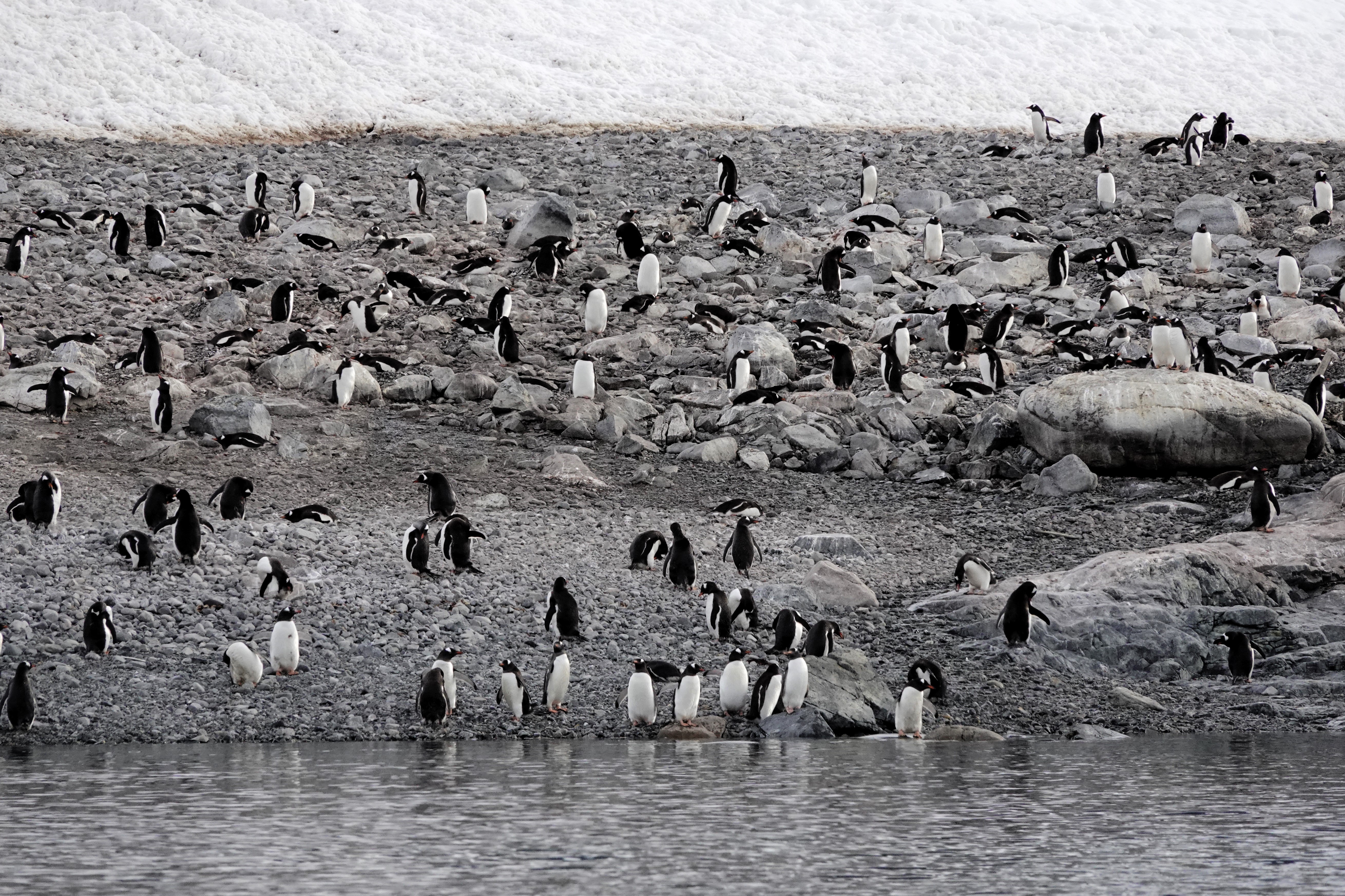
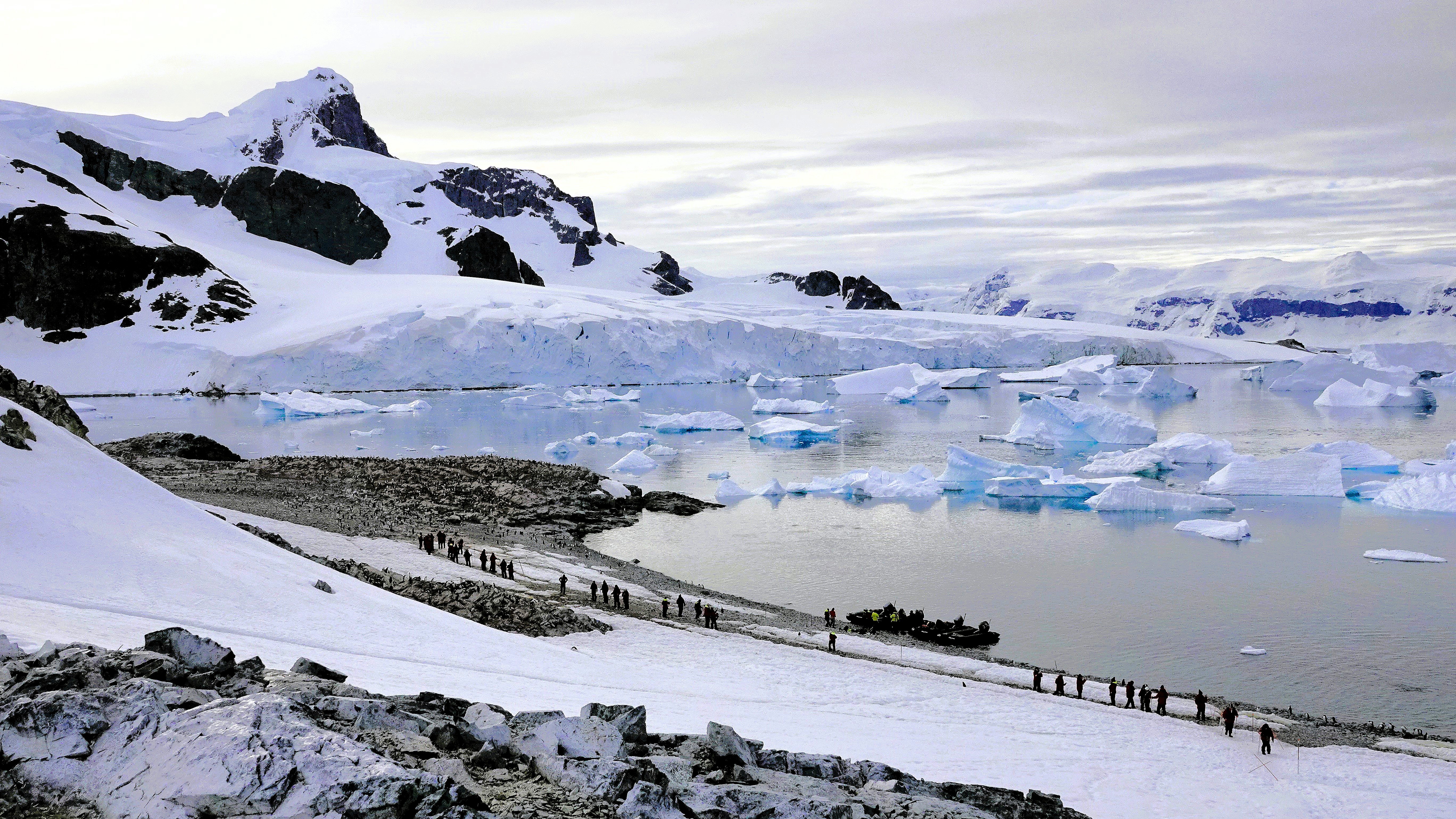
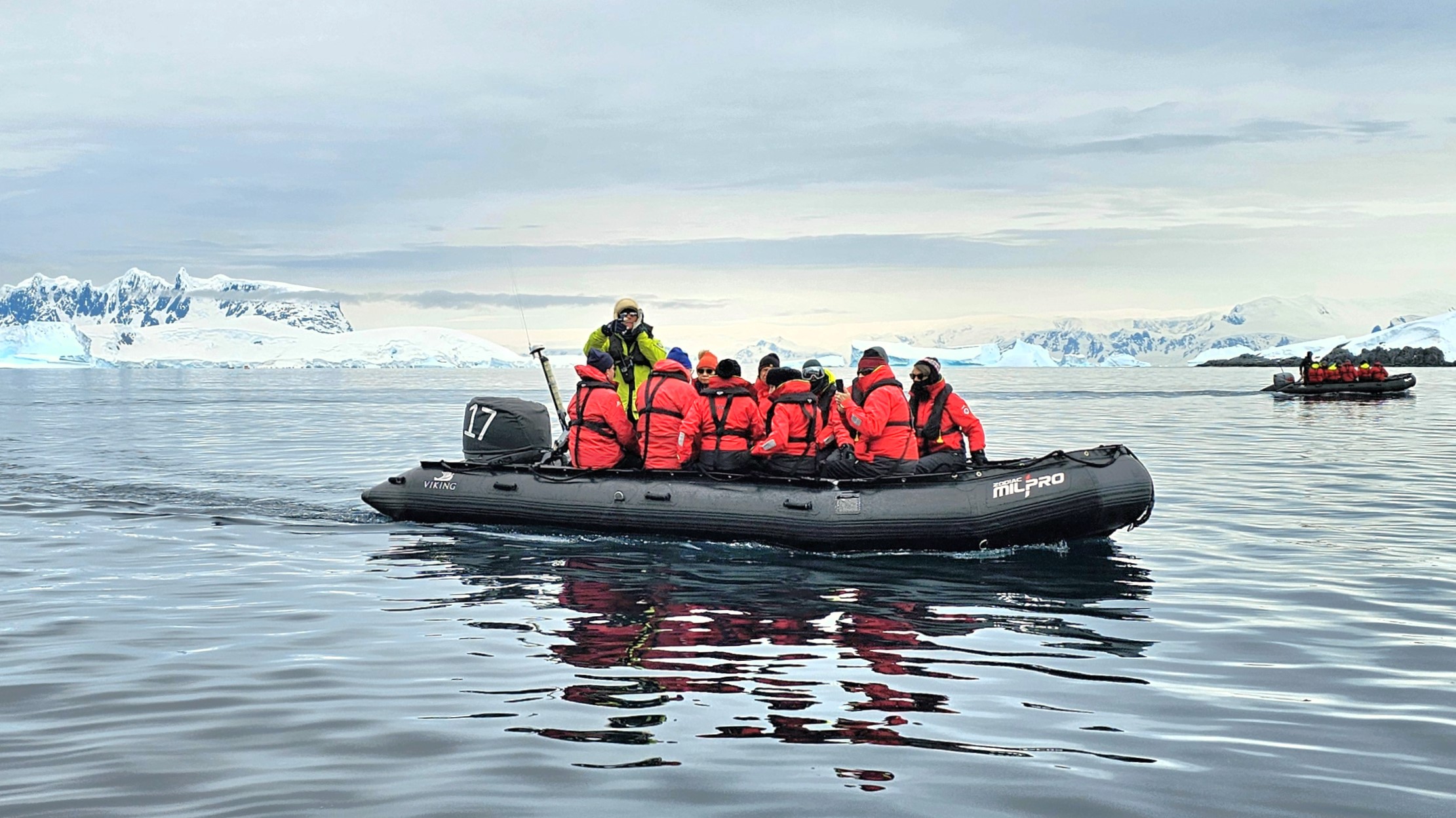
In accordance with Antarctic Treaty visitor site guidelines, Pam’s team launched a staggered fleet of Zodiacs to Cuverville Island capped at 100 visitors (excluding guides and scientists) for a closer look at the estimated 6,500–7,000 breeding pairs of Gentoo penguins–making this the largest colony of this species on the Antarctic Peninsula.
Despite the pristine vista, we were forewarned by our Zodiac pilot/naturalist to expect an unpleasant smell on our approach to the island.
No joke. As if on cue, the stench of penguin poo was so sudden and overwhelming that a couple of old-timers dared to let go of the gunwale lifeline to hold their noses.
In a matter of minutes, we reached the landing beach, distancing ourselves from the eastern edge of the cobble, where the colony accessed the sea. It was no surprise that the guano-stained beach proved to be ground zero for foul fowl.
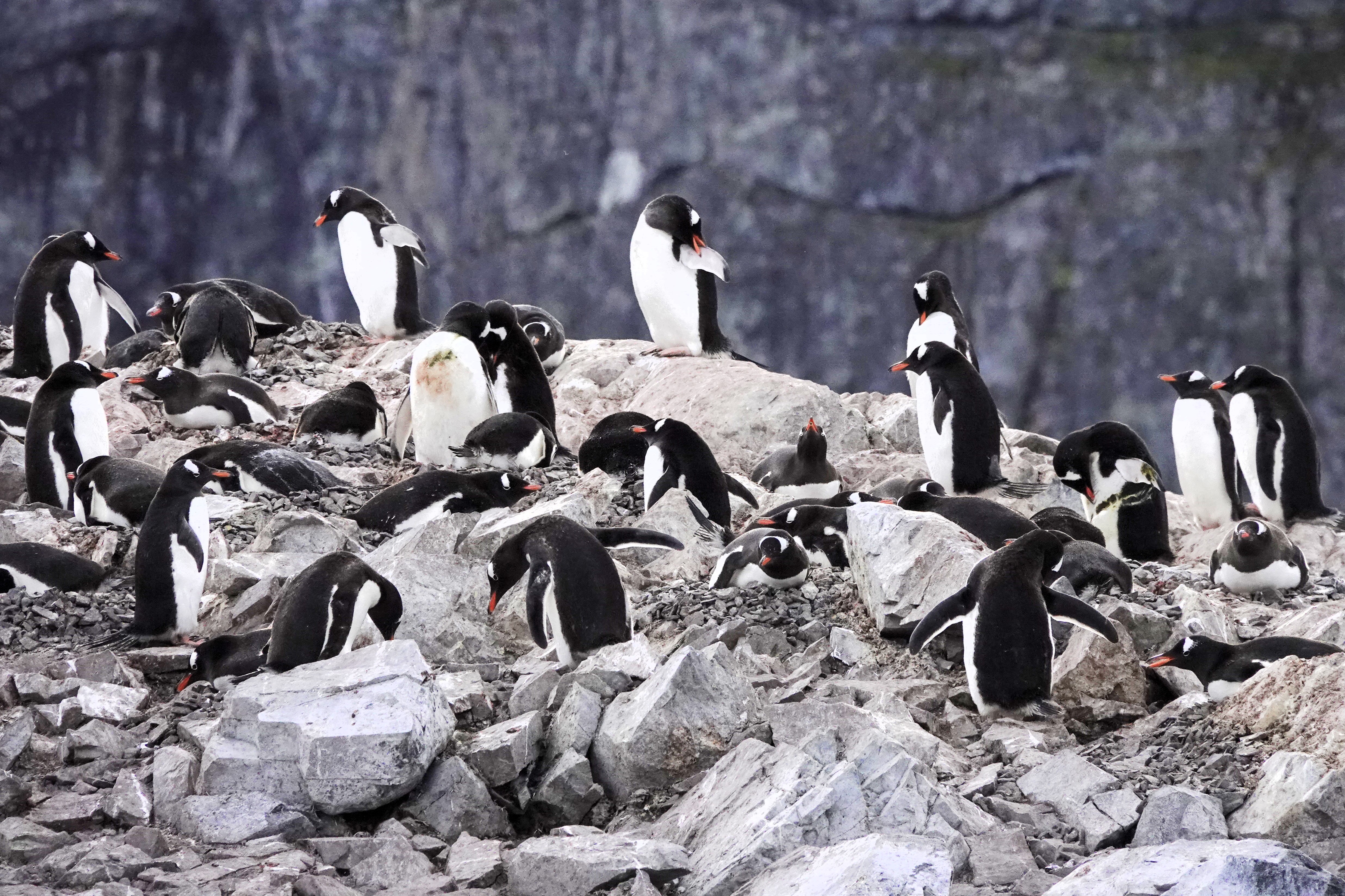
Eventually, we landed on the northern edge of the island. Before disembarking the Zodiac–a drill we perfected within the ship’s hangar–we were instructed to stay a minimum of 5m from wildlife whenever possible and avoid the penguins’ highway lanes.
Strolling the penguin highway
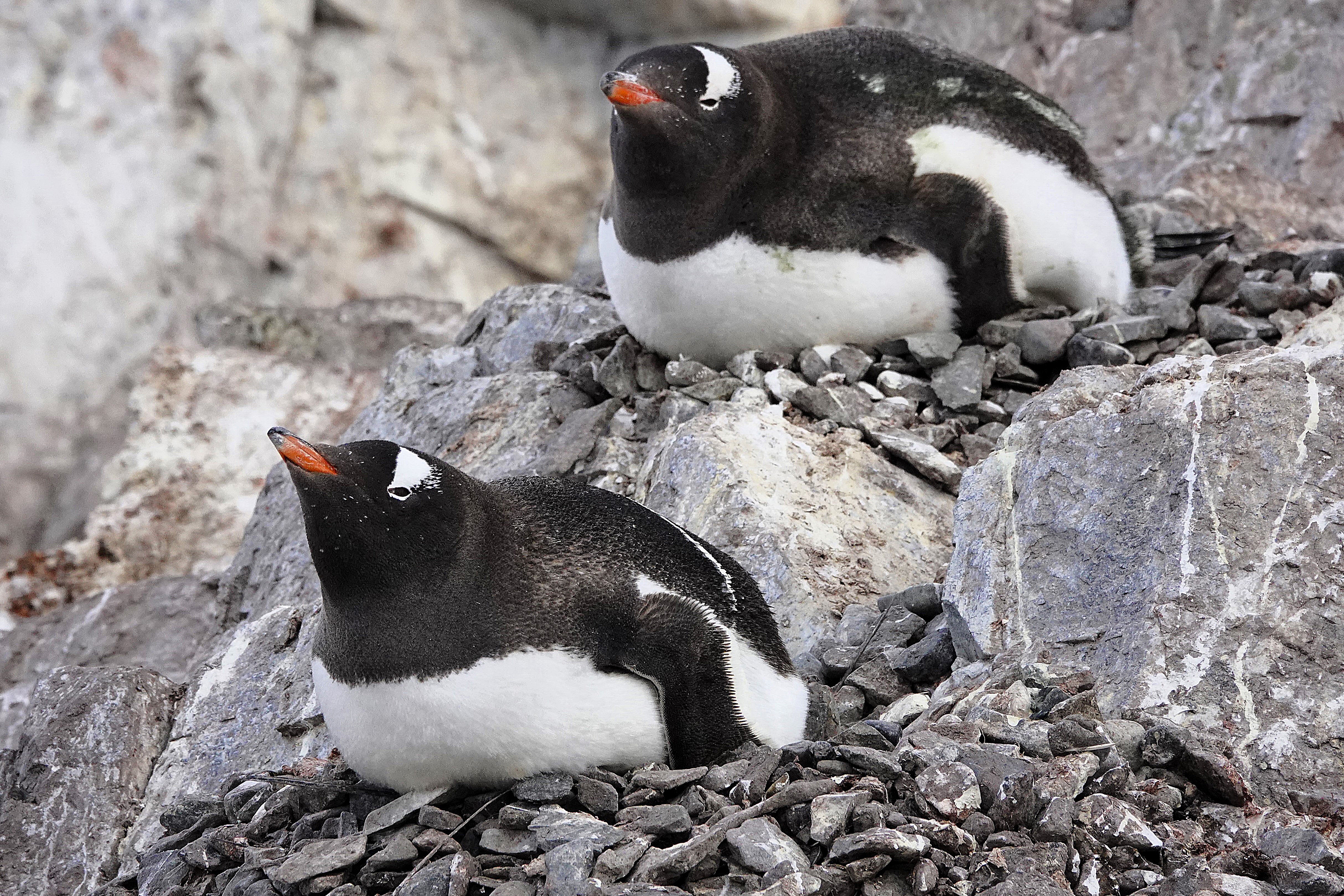
Easier said than done. These critters seemed especially curious of us when they weren’t preoccupied with preening,
impressing their future mates with the perfect selection of nesting stones,
or incubating on nests of captured stones.
Occasionally, an adult would sound the alarm for an invading skua,
whose interest in Gentoo eggs and chicks is always a threat to the rookery.
Leah and I hiked to the top of the promontory,
for an overview of Cuverville and the channel.
Sadly, we worked our way back to catch the next available Zodiac bound for Octantis, but the stories and adrenalin from the day carried us to sunset (11:25 PM) and into tomorrow.
Next stop: our kayaking adventure in Chiriguano Bay.
A familiar voice woke us from the public address speaker above our bed. I checked my watch; it was 6:45 AM:
“Good morning, everyone. This is your captain from the bridge. We are approaching a special spot along the Antarctic Peninsula known as Lemaire Channel, and after discussing with my officers, we will be cruising through this waterway because today it’s mostly free of large icebergs that can sometimes block the entrance or exit and bring us too close to the cliffs.”
I jumped out of bed, grabbed my camera, and ran to the Nordic balcony to power up the blackout blind. I didn’t want to miss a thing! Leah sat up in bed to supervise because she already knew what to expect.
“What are you doing? I hope you’re not going to open that window,” she growled as I was already lowering the window.
“Come see this! The light is perfect, and I’m trying to get a clear shot before it disappears,” I argued, talking over Captain Cardestig’s continuing announcement:
“But today, all of you are in for a treat because the sky is clearing, and the seas are calm.”
“And while there’s still some hazards to consider when sailing through this beautiful channel, much of the small ice has already broken up from the warmer weather,
and we can easily guide Octantis around the bigger ice.”
Leah clutched the blanket around her in surrender while I braced against the window in my birthday suit, capturing unimaginable views with little concern for the crisp Antarctic air.
Captain Cardestig continued, “But best of all, the kitchen staff is serving breakfast buffet at the bow of the ship. So please dress warmly, and join us outside for this remarkable voyage, and don’t forget to bring your cameras and binoculars.”
“I guess we’re getting dressed,” Leah lamented. “And could you shut that window! It’s fucking freezing in here!”
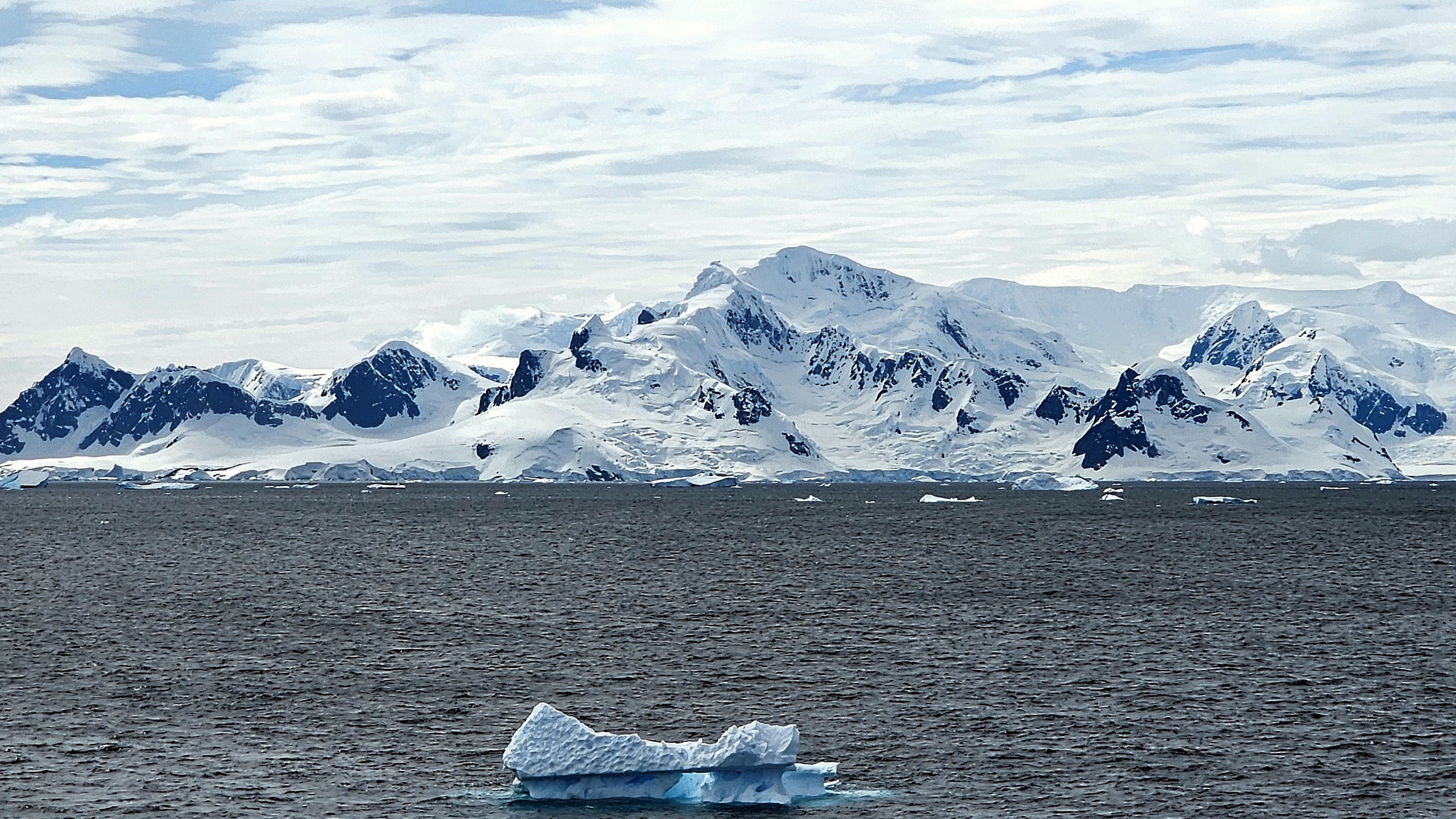
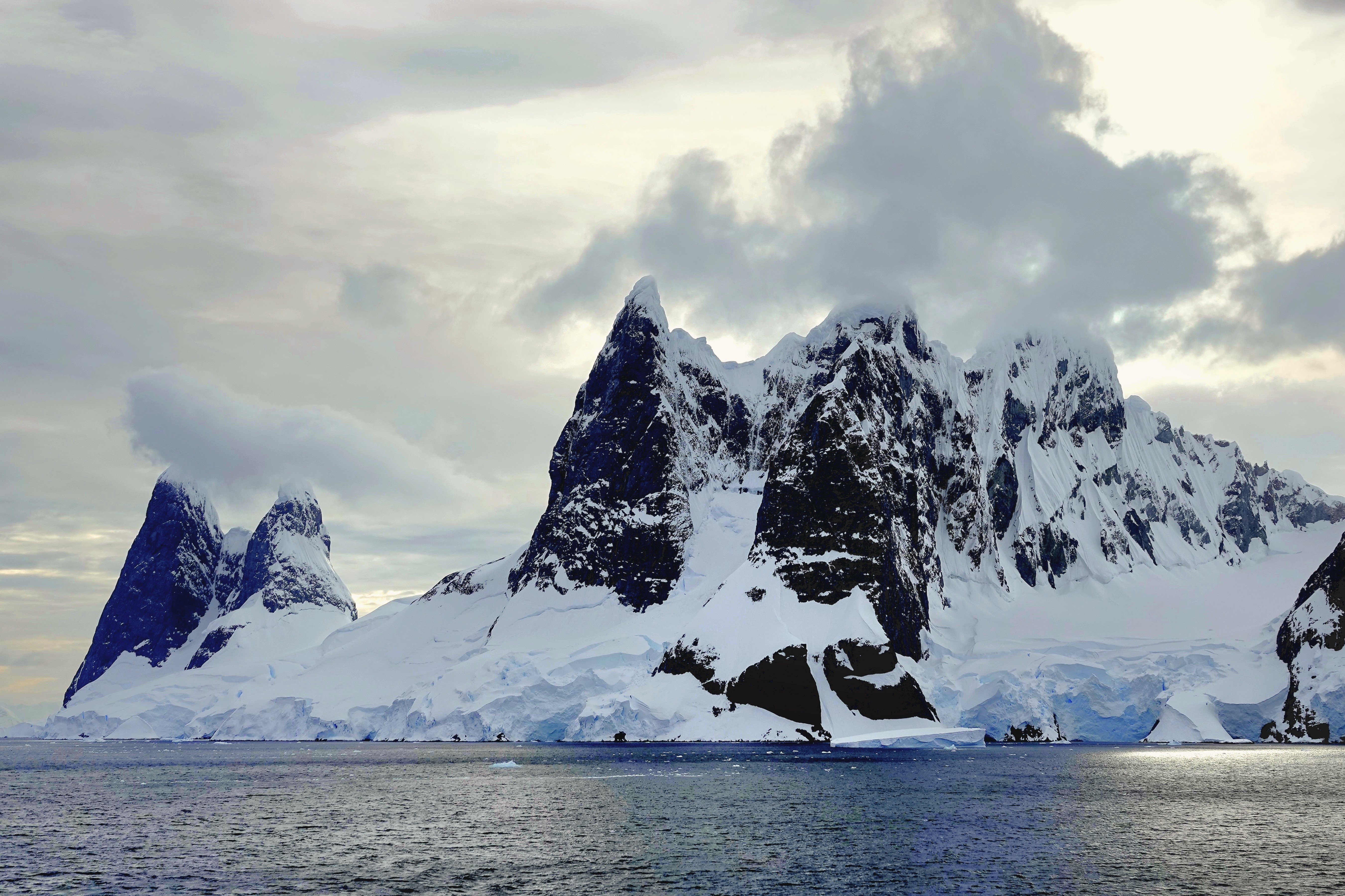
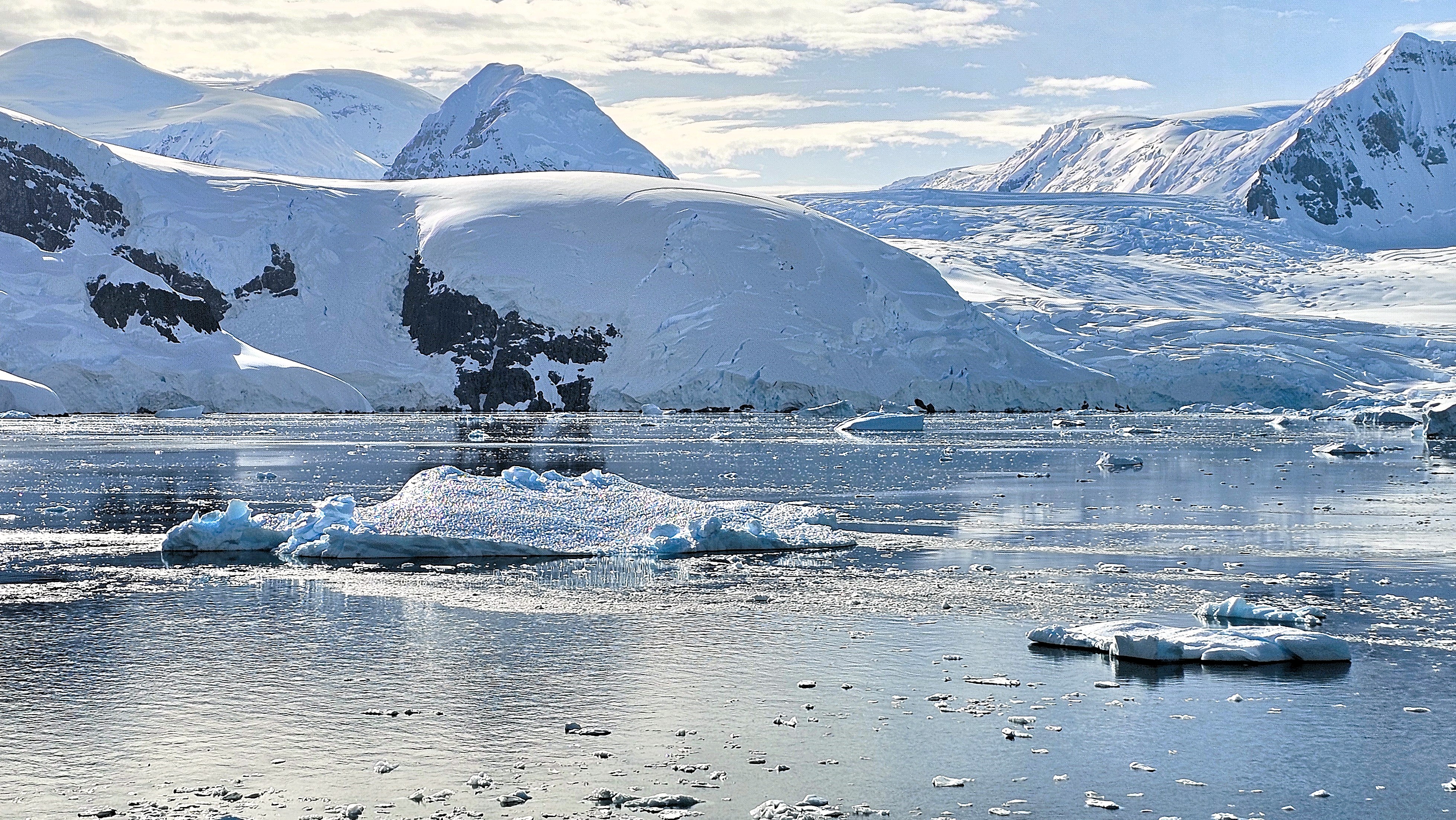
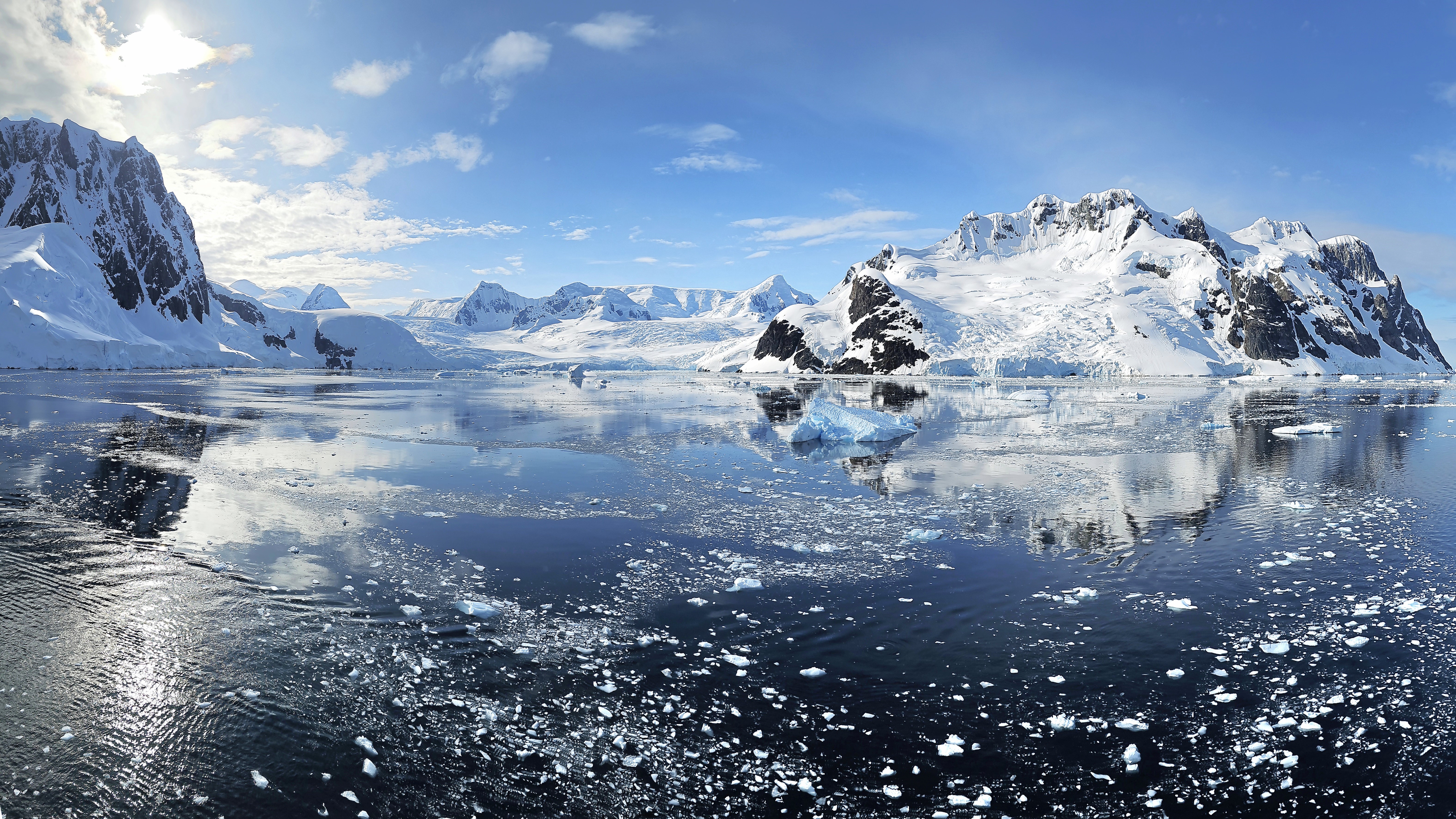
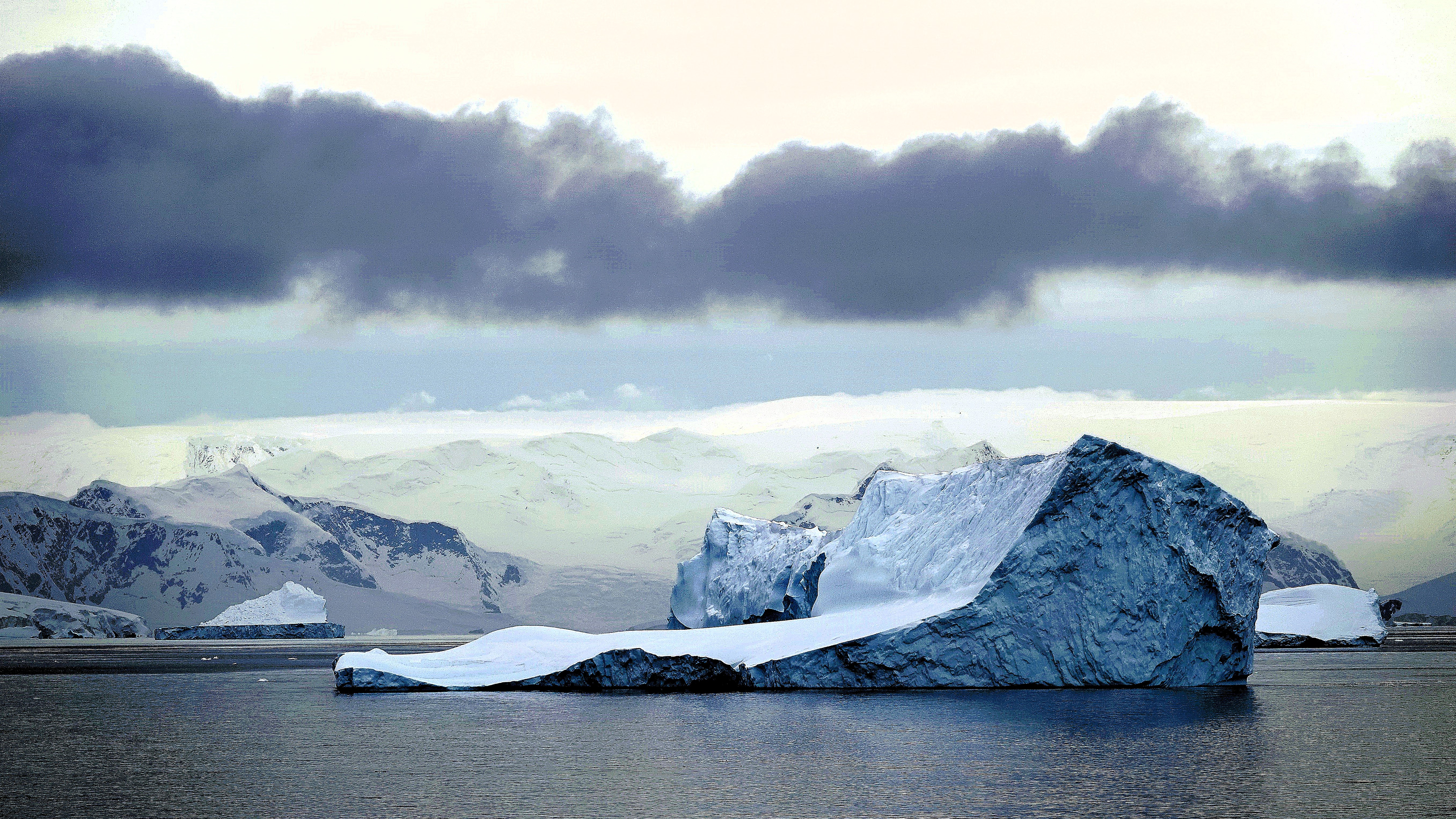
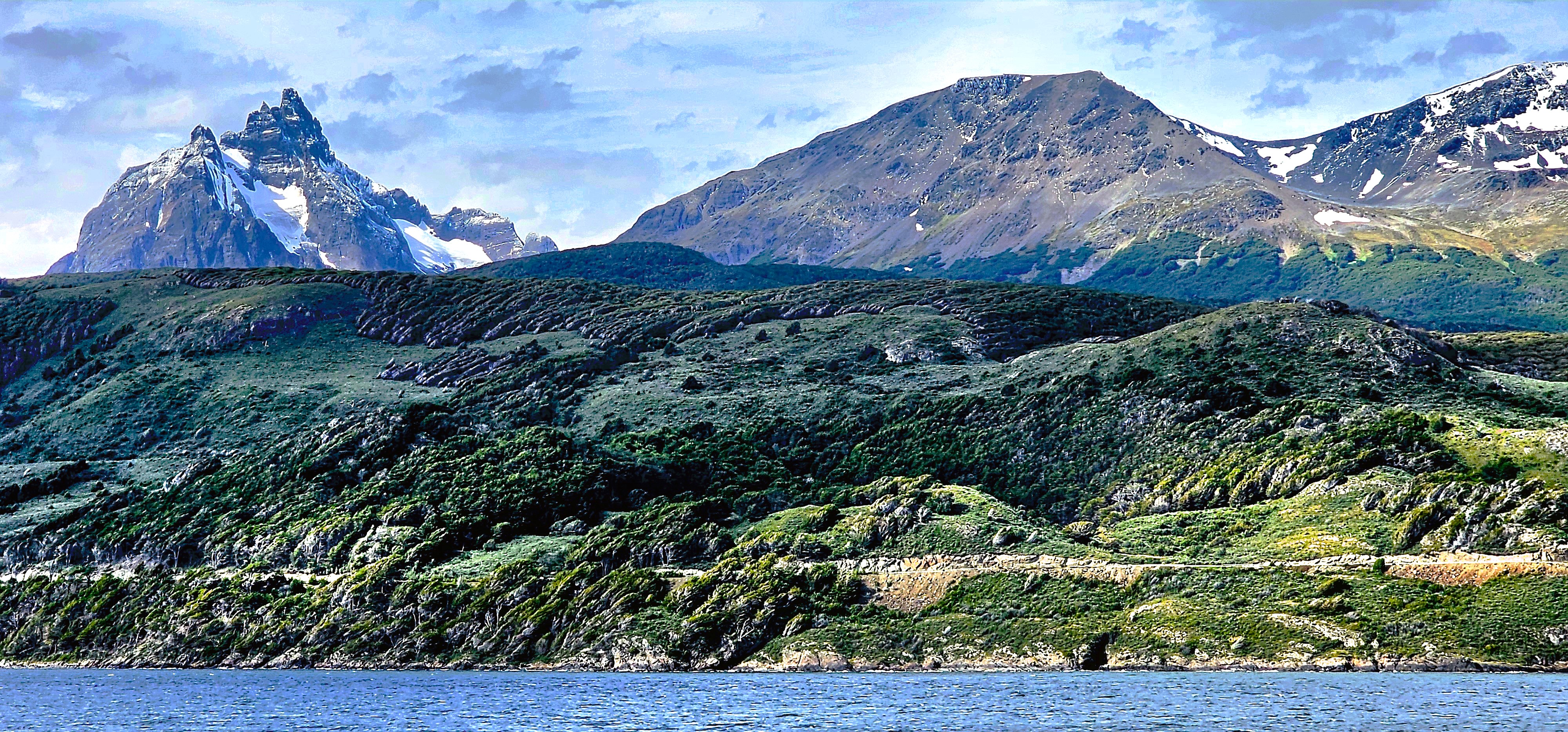
Lemaire Channel is a narrow strait of glossy water that traverses 11 km between Booth Island in the Wilhelm Archipelago and Graham Land–shrinking to 600 meters at its narrowest point. With views of stunning snowcaps atop dramatic cliffs, Lemaire Channel easily earns its moniker, “Kodak Gap.”
It was all hands around the bow deck. Leah and I joined the crowd, hopelessly jockeying for a position at the rail, until we found solace on the upper deck away from the fray,
where we were content to enjoy breathtaking vistas,
and watch the world float by.
There were penguin playgrounds …
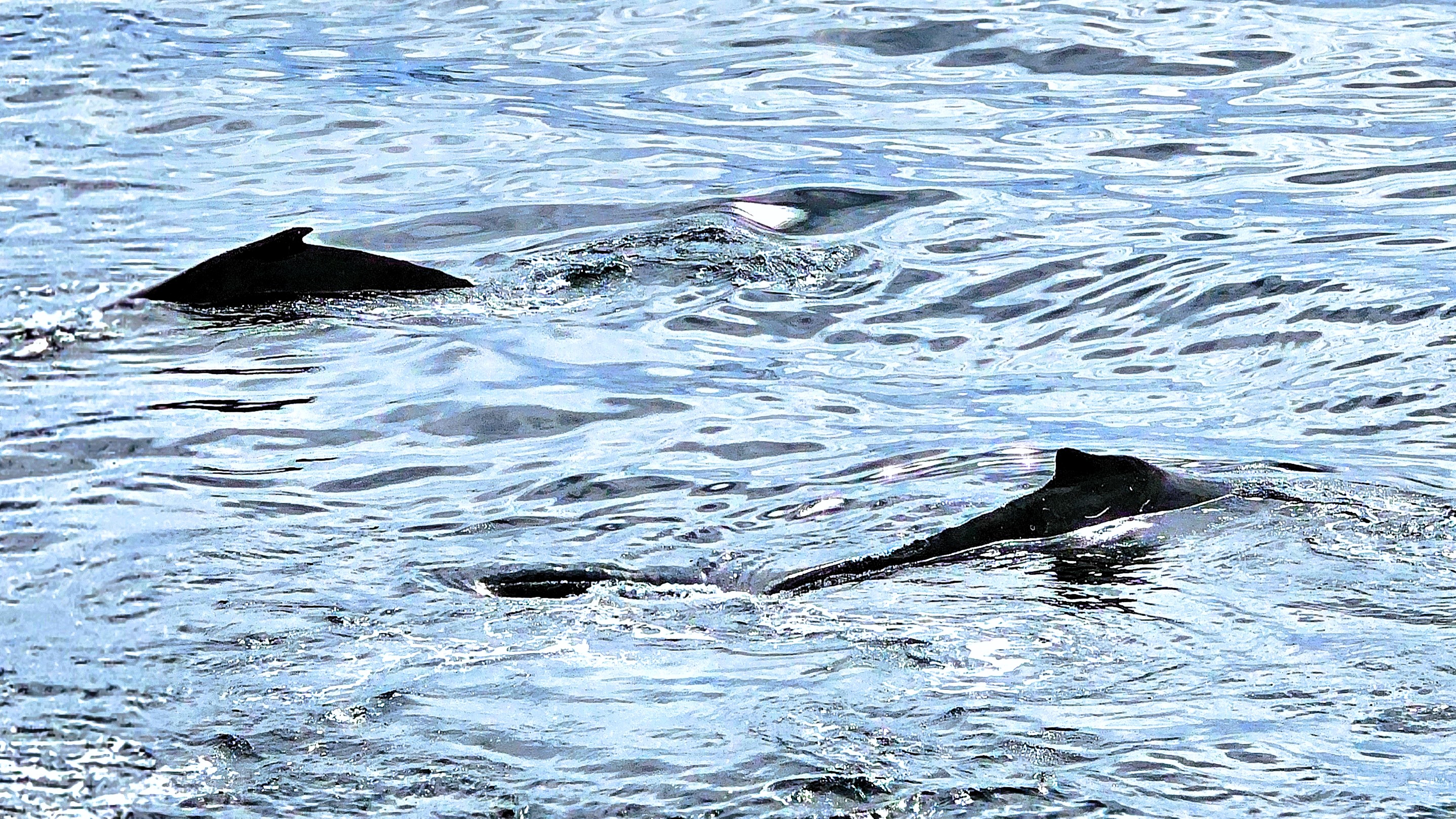
and a pod of Orcas along the way,
but for now, the real star of the show was the scenery.
When Octantis eventually reached open water…
with captivating views of the Argentine Islands,
Captain Cardestig turned the ship around, allowing us to enjoy the approach from the opposite direction.
It was a dramatic crossing from Ushuaia to the Antarctic Peninsula, and the reward was visceral.
When seas had finally calmed, relieved passengers emerged from their cloistered cabins, looking refreshed and revitalized, with a “what’s-for-breakfast” look on their faces. There was a literal pep in their step as they attacked the buffet on Deck 6.
I attended the 10 A.M. daily briefing in the Aula, a two-tiered, smartly equipped, and fashionable auditorium,
while Leah live-streamed the event on the wall-mounted, flat screen TV in the privacy of our well-appointed Nordic hive on Deck 4.
At the briefing, our Program Director confirmed that our first destination would be Fournier Bay, a picturesque sanctuary located in the Palmer Archipelago,and situated on the northeast coast of Anvers Island, a mountainous coastal enclave just above the Antarctic Circle.
Our flexible activity assignments were previously distributed in anticipation of our arrival, although none of us would be scheduled for a landing, as deep water and rocky surroundings were among deciding factors.
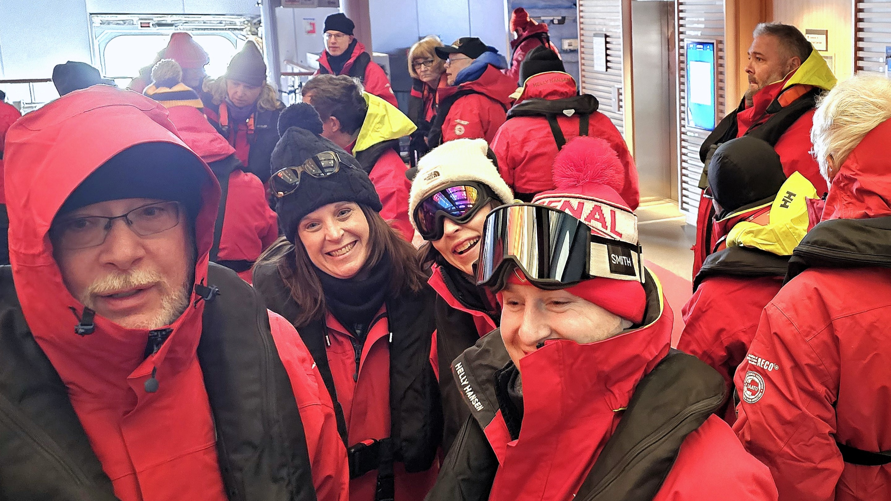
However, it was a perfect opportunity to board a Zodiac for a closer inspection of the coastline. According to our team schedules, we gathered in the hangar, all of us outfitted and overheated in our complimentary expedition jackets, and waited patiently …
until the next Zodiac became available.
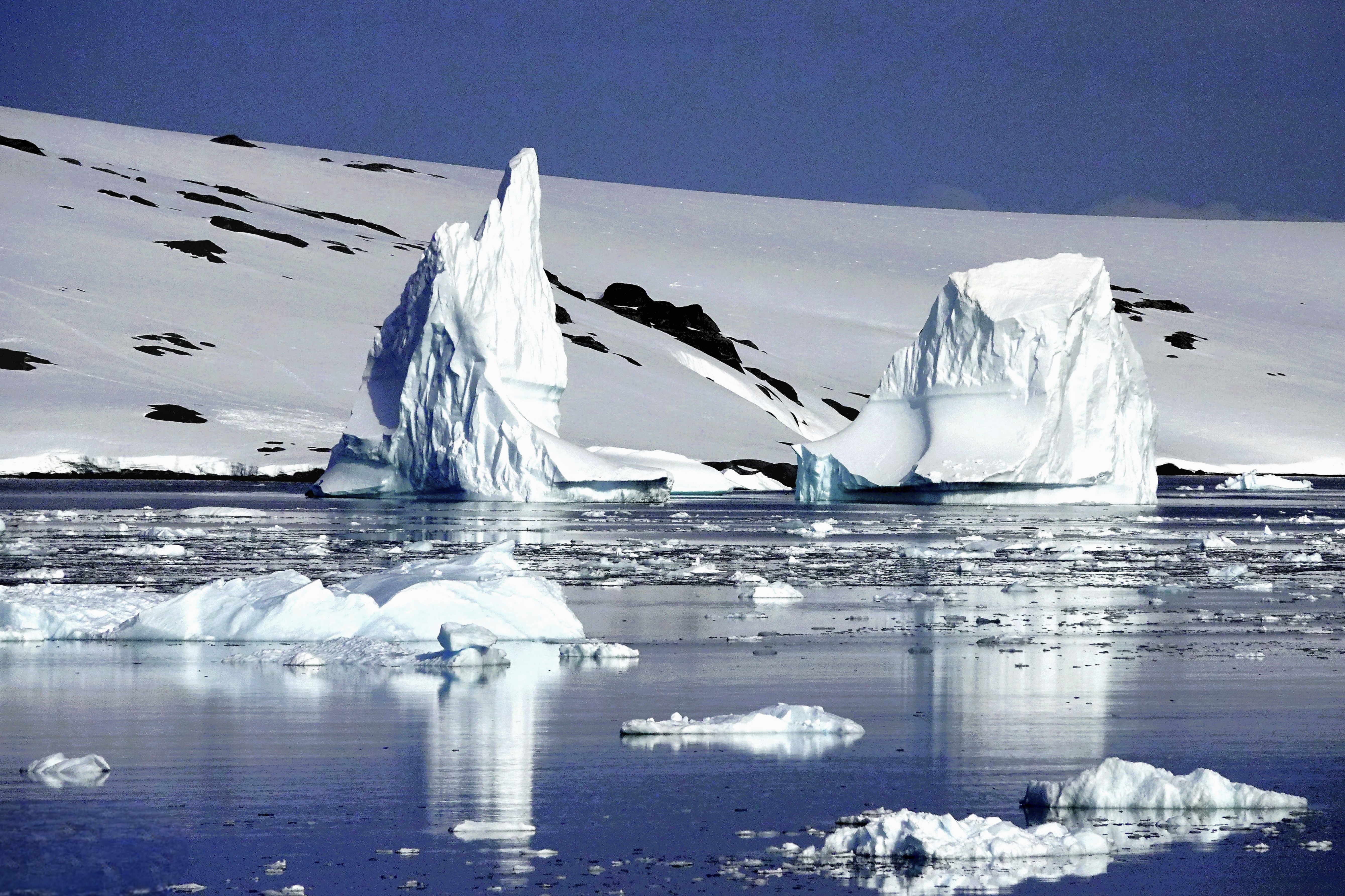
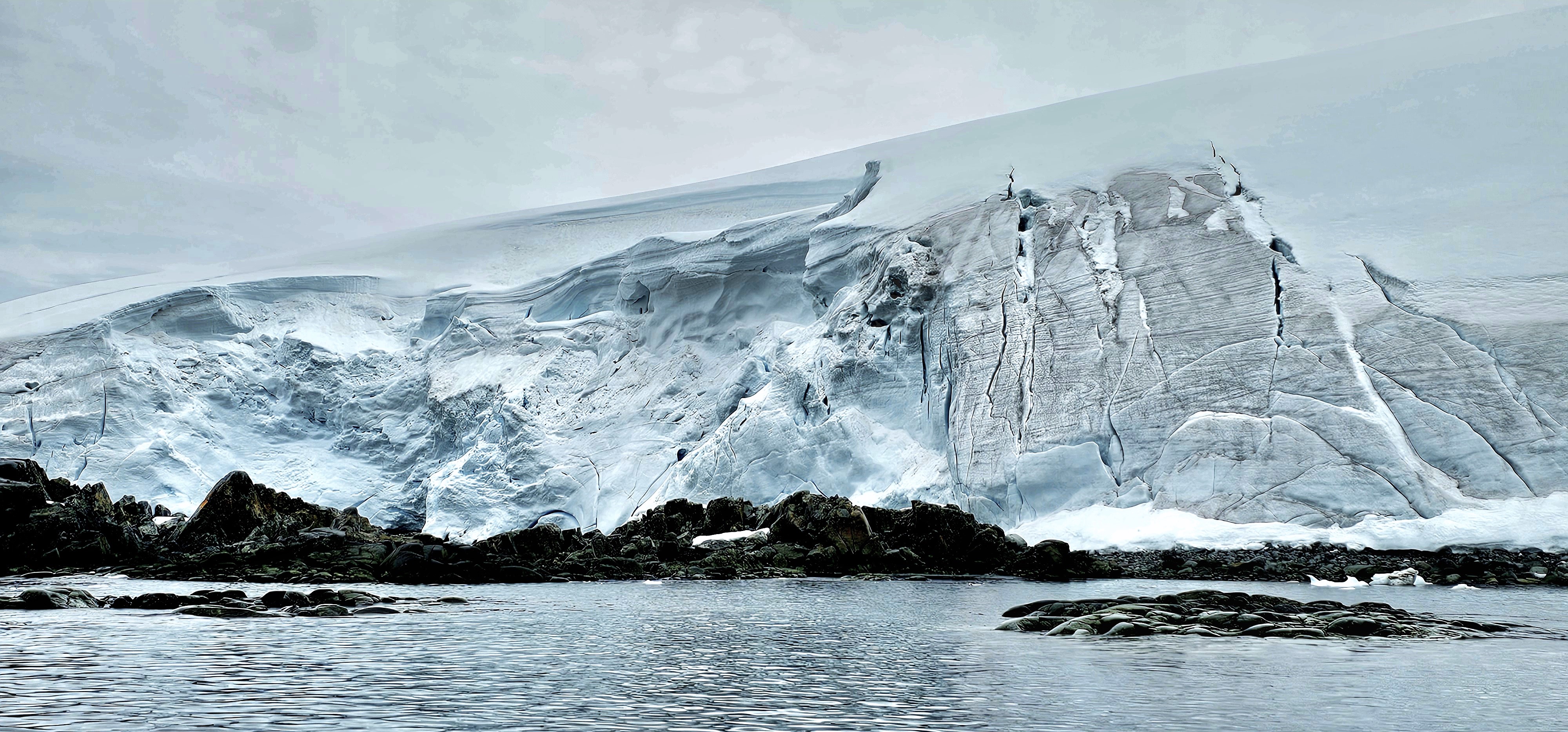
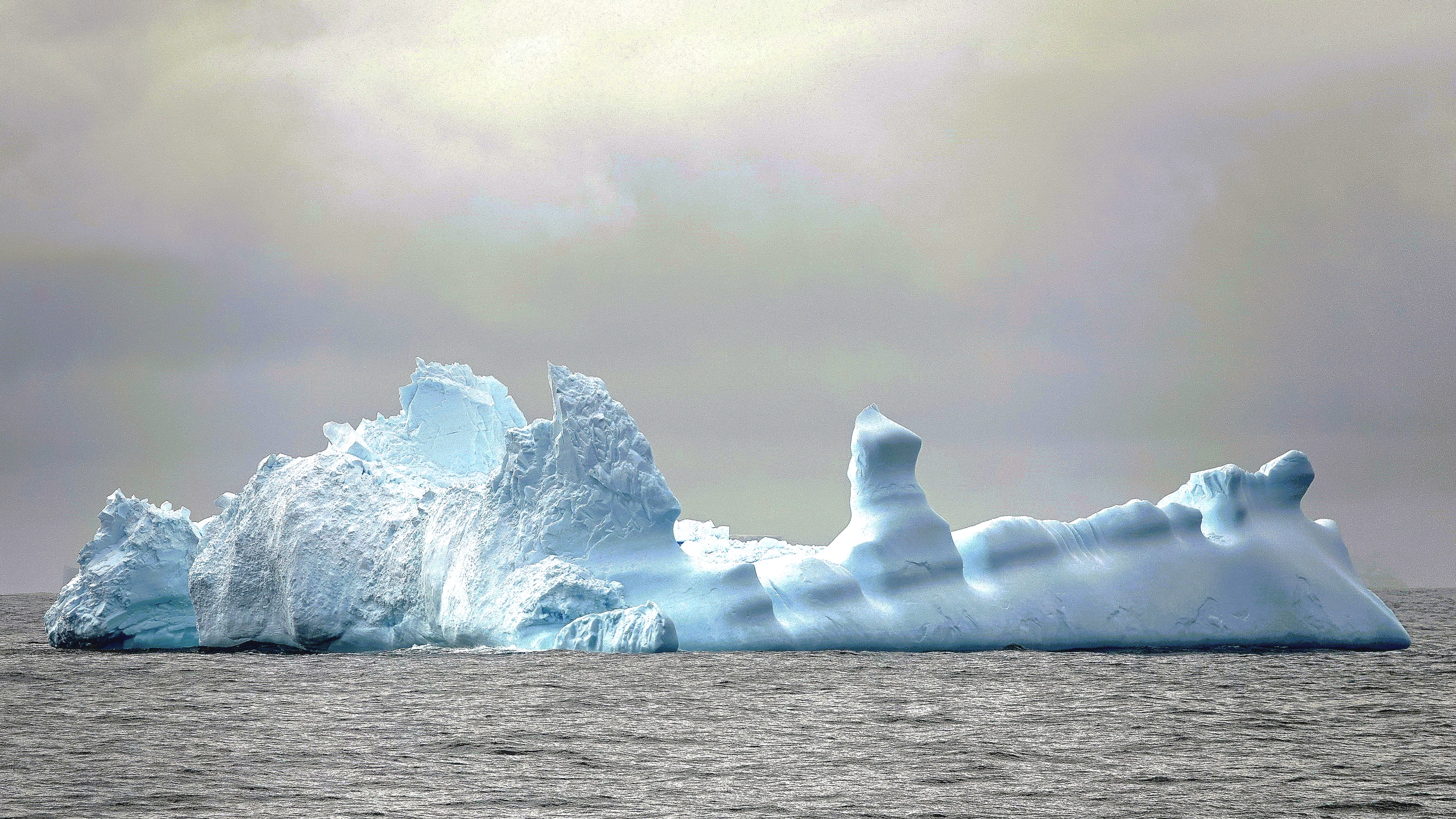
The water was calm as our pilot dodged floating chunks of ice,
and weaved through more formidable icebergs on our approach to the Anvers Island.
It was nearly impossible to contain our giddiness as we cruised closer to shore,
where we reached an outcropping of volcanic granite.
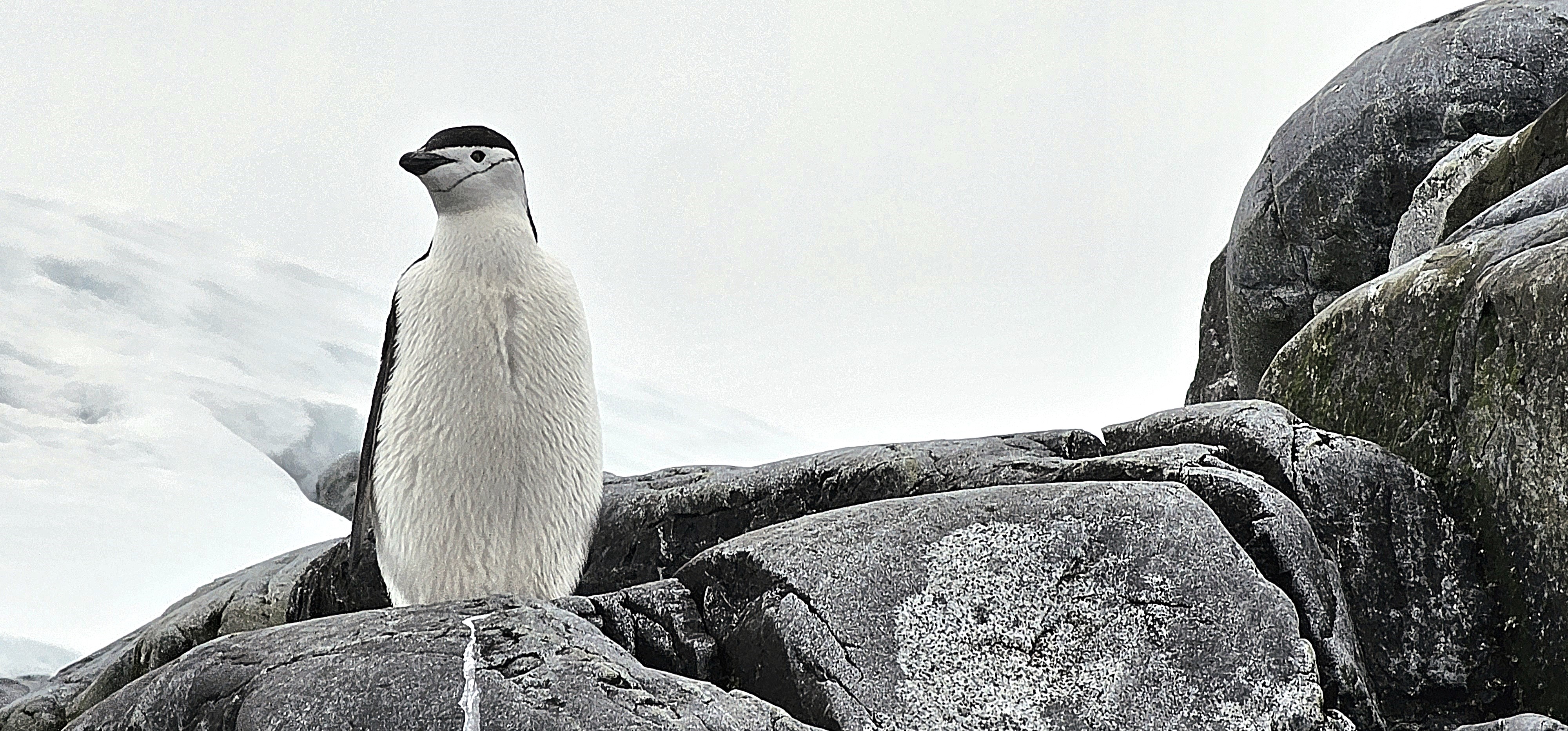
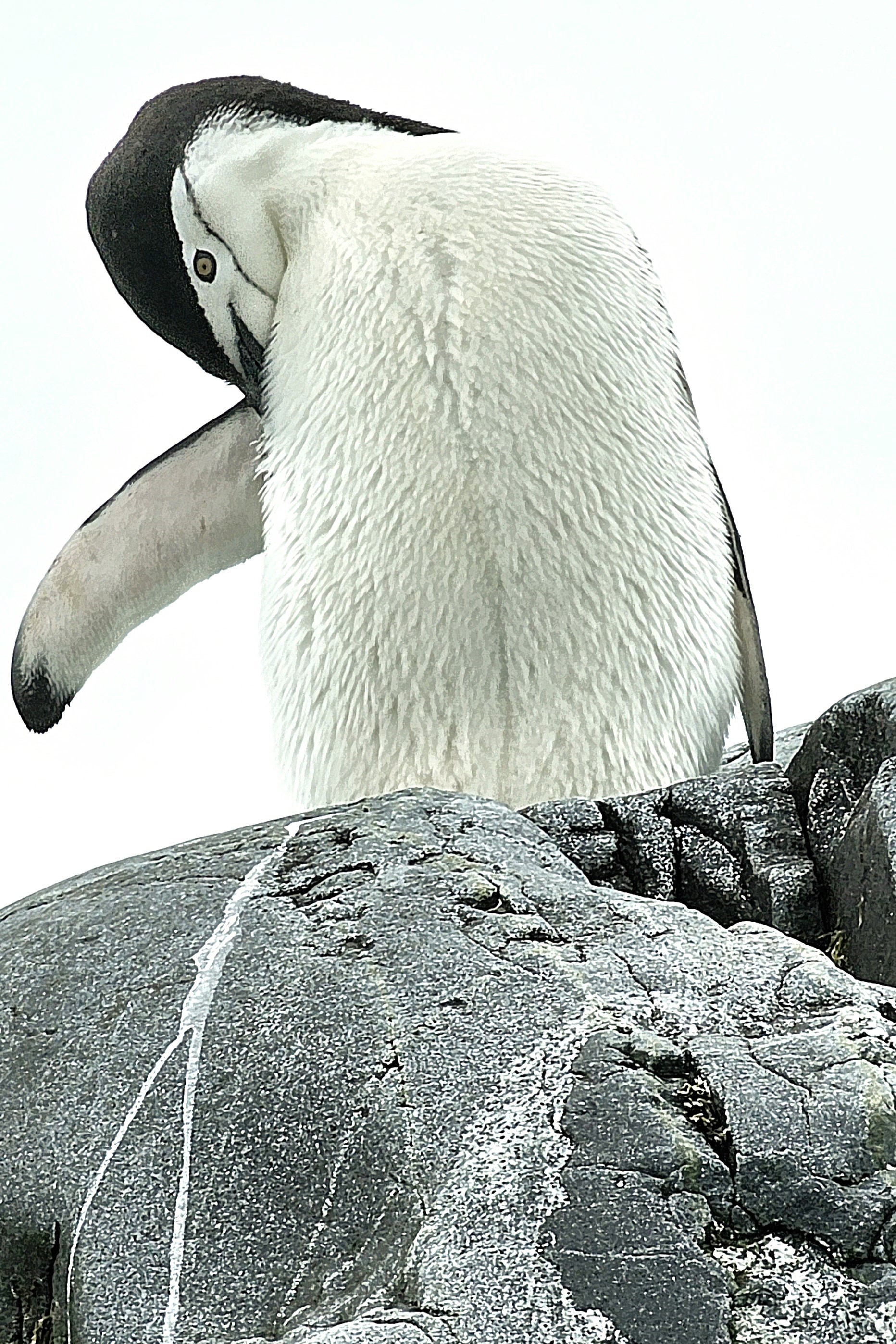
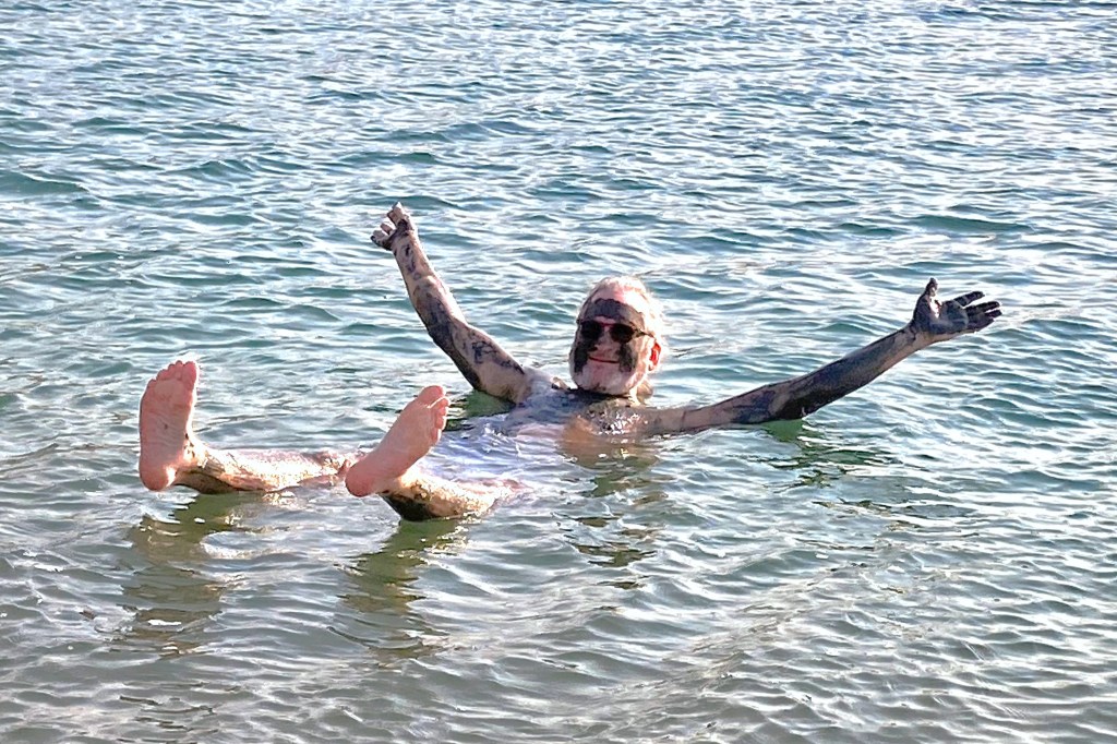
That’s where we spotted a solitary chinstrap penguin–identifiable by the telltale line that runs under his helmet–who was posing on a puddle of penguin poop for our benefit.
It was our first Antarctic wildlife encounter, but judging from the penguin’s apparent apathy, probably not his first photo shoot.
The excursion was brief and memorable, but easily topped the following day by an early morning sail through the Lemaire Channel, featuring breathtaking views of mirrored mountains standing against azure skies.
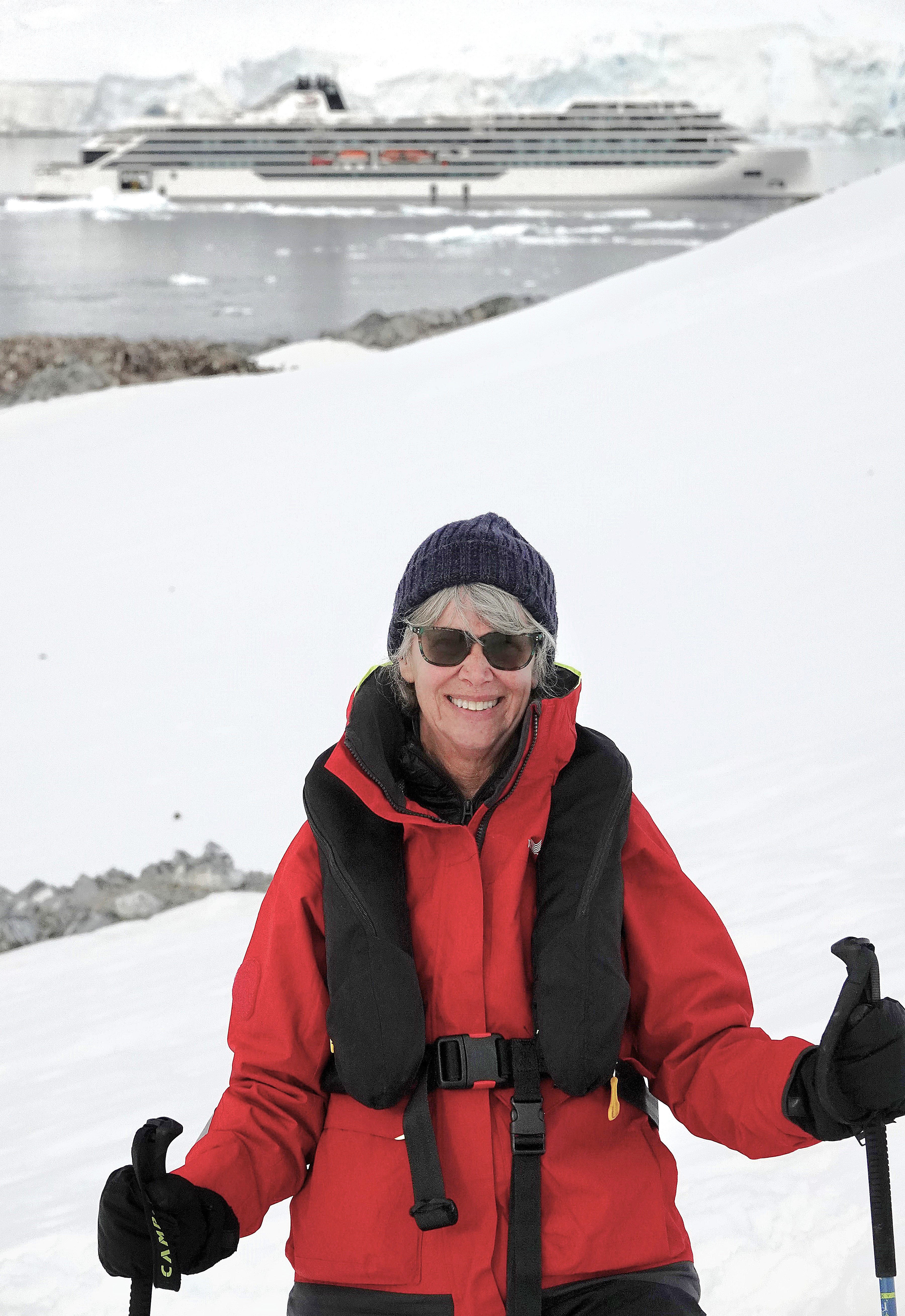
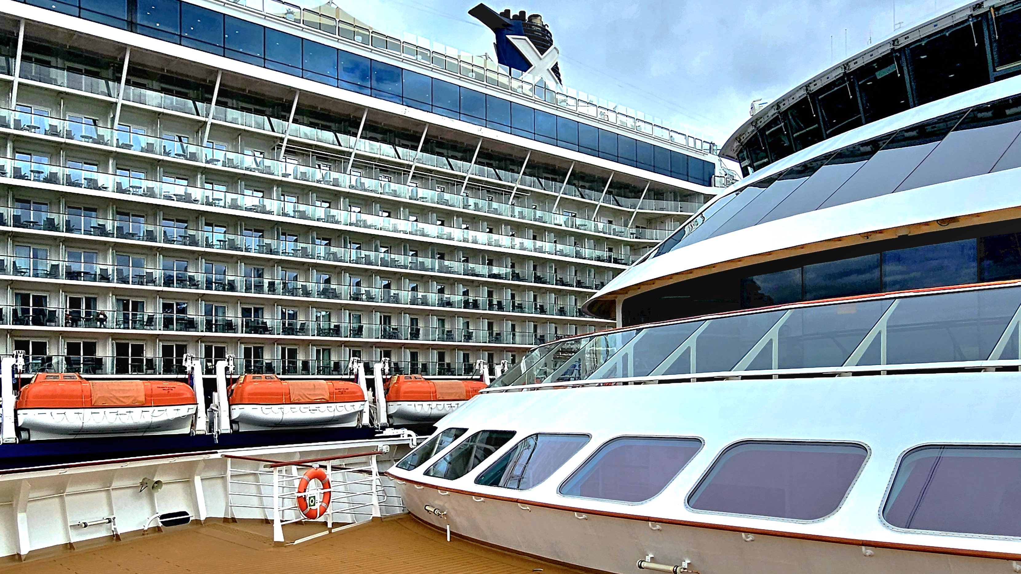
While Leah and I enjoyed a gourmet buffet lunch aboard Viking Octantis, Captain Bo Joergen Cardestig and crew readied our ship for departure. The gangway was pulled while we were docked across from Celebrity Eclipse with capacity for 5700 guests,
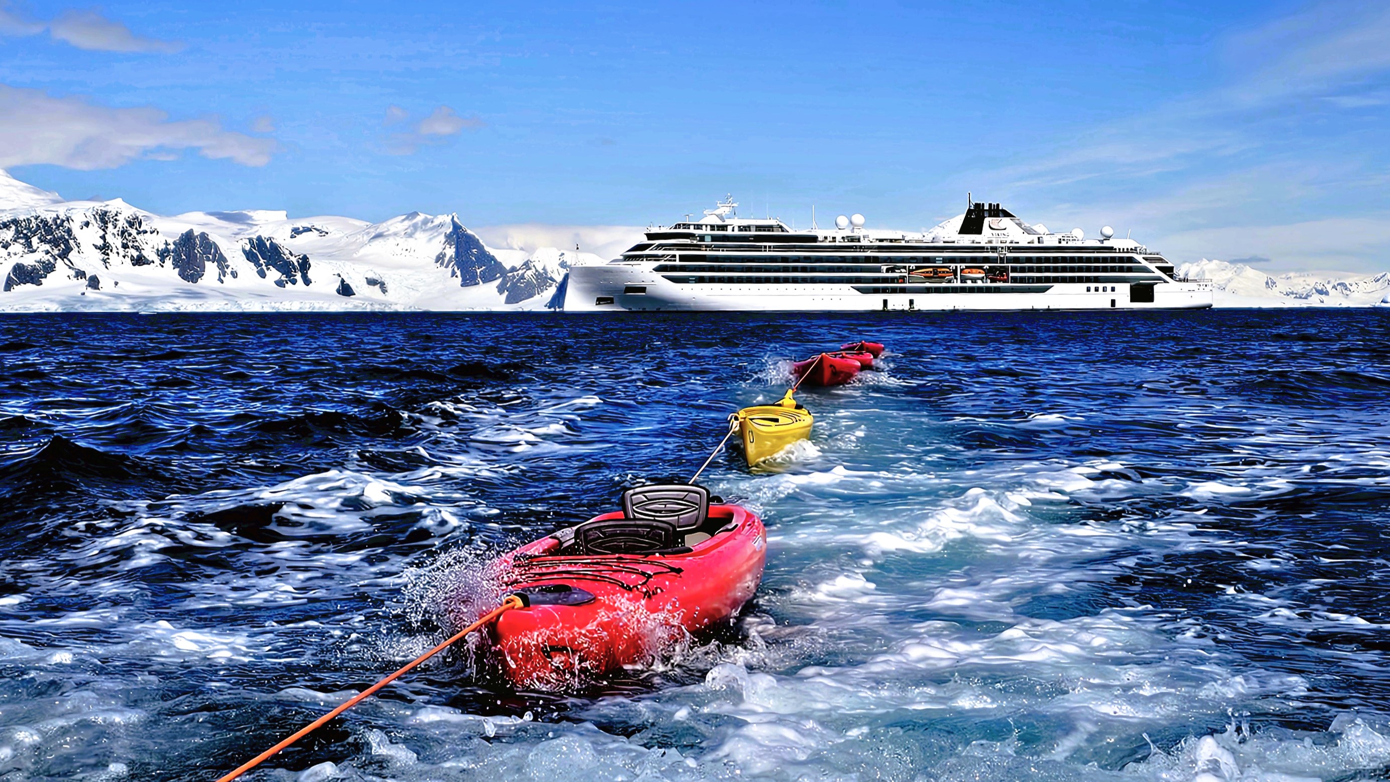
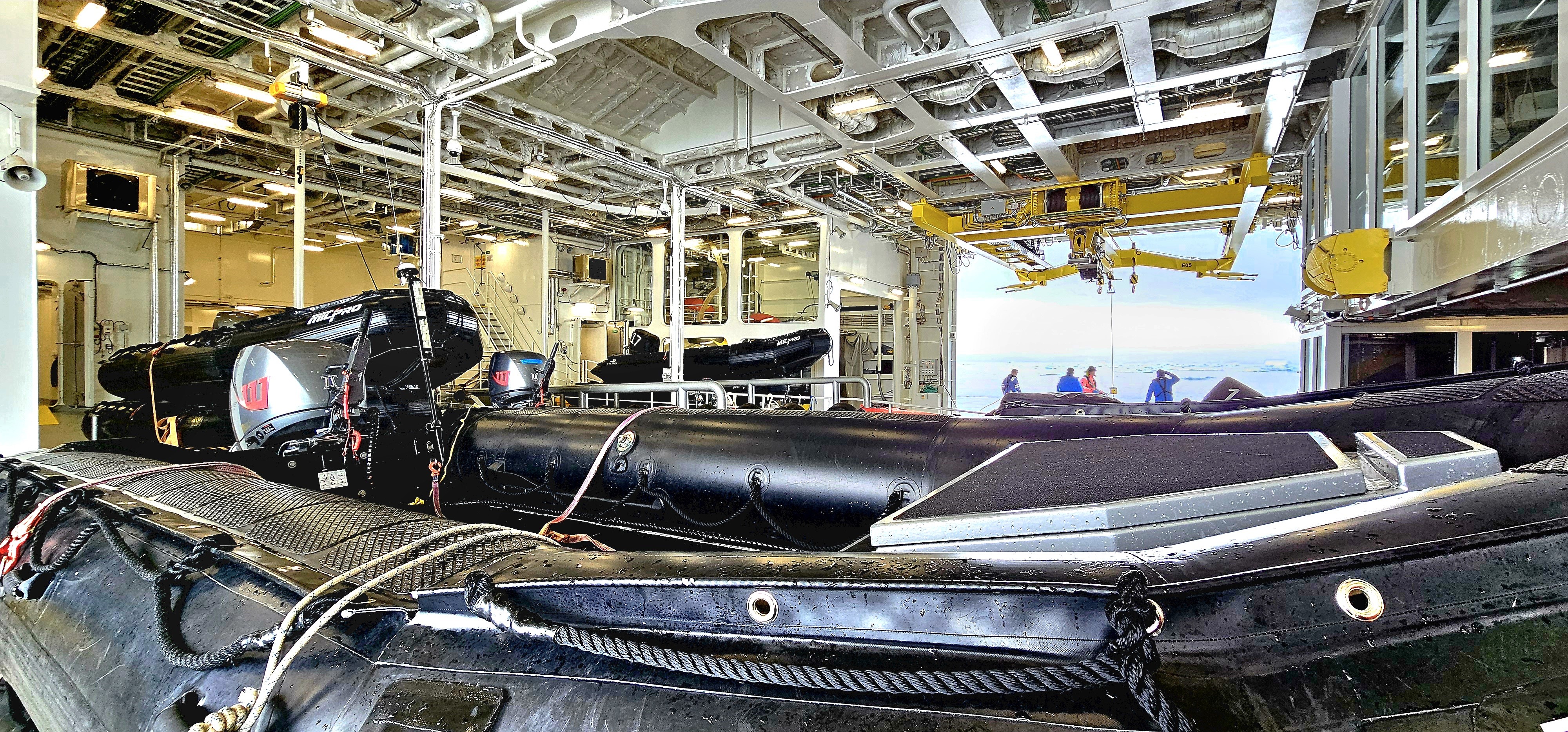
and I was instantly grateful that we’d be cruising with 350 like-minded wanderlusters aboard a Polar Class 6 vessel that was purposely engineered to cut through Antarctica’s summer ice …
replete with a hangar full of aquatic goodies, like a dozen kayaks,
a fleet of Zodiacs,
two 12-passenger, high speed special operation boats (SOB’s) with a 26-metre (85 ft) custom stern slipway,
and a dive boat supporting 2 Cruise Sub 7-300 yellow submarines named “John” and “George.”
The Octantis quietly slipped out of Ushuaia harbor and into open water, offering pristine views of Argentina from port side,
and Chile from the starboard side, as we glided through the Beagle Channel.
This was also a time for briefings–from safety instruction,
to practical training for many of the aforementioned expedition activities, especially when transferring between watercraft, and executing shore landings.
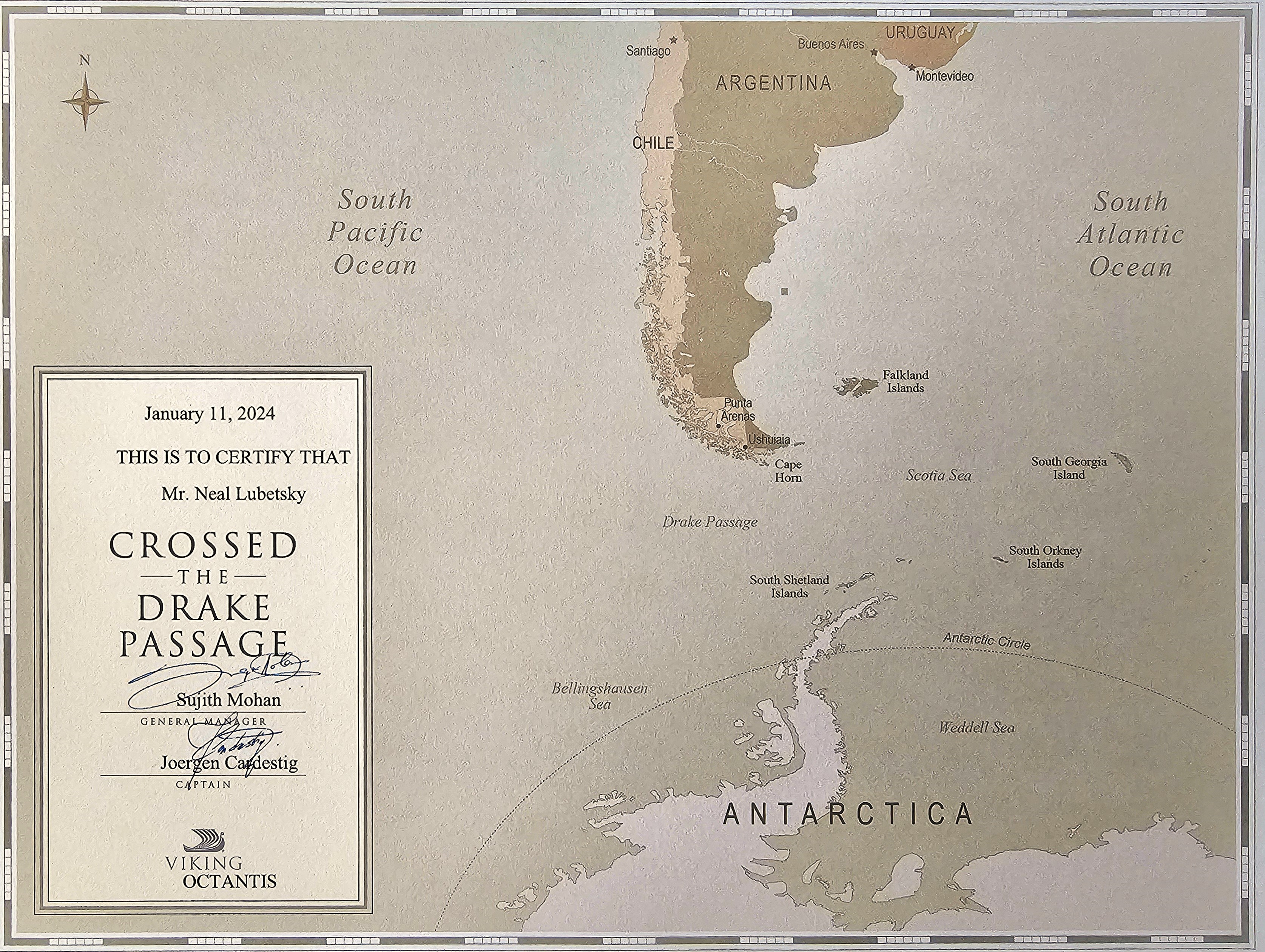
Once Octantis rounded Cape Horn, we had officially entered the Drake Passage, a dangerous waterway prone to strong ocean currents, huge rogue waves, and violent storms.
The 700-mile voyage to Fournier Bay–our next land mass–would take two sea days.
While we were protected by an expedition vessel intended to improve stability and mobility and lull us to sleep in Nordic luxury inside our 215 sq ft cocoon, it was hard to ignore outside conditions. Beyond our retractable blackout blinds, we were being whipped about by 45 knot winds accompanied by 30-foot swells. This was categorically the “Drake Shake” queasiness that many guests have dreaded but vowed to overcome.
Leah indulged in anti-nausea medication, while other guests relied on motion-sickness patches and pressure-point wristbands. I opted for none of the OTC remedies, and without consequence. Seasickness was not an option. Instead, we kept ourselves hydrated; we took naps; we ordered complimentary room service, and distracted ourselves by keeping busy with lectures, movies, conversation, and ship business.
A ready team of naturalists had assembled to micro-inspect all of our outerwear and camera gear before we’d be permitted to go ashore. A biosecurity check was warranted to rid our belongings of all foreign organic material (e.g. dirt, crumbs, seeds, insects) that might be secreted in our sleeves, seems, cuffs, pockets and hoods, which could potentially sully an Antarctic ecosystem. Our adventure team took their work very seriously, peering through magnifying glasses with high intensity lights. Tweezers, toothbrushes and hand vacuums made worn apparel fresh again.
Afterwards, all of us were outfitted with proper-sized rubber boots, waterproof pants, and a snake-shaped life jacket.
During the crossing, I had managed to overcome my sea legs by sprinting and pausing against the sway in a zigzag pattern as I’d make my way through the ship’s long corridors. It wasn’t pretty, but it was effective.
During our second day at sea, Captain Cardestig’s voice bellowed through the P.A. for all to hear, “Ladies and Gentlemen, we are approaching our first ice!” Rather than stagger through the common space with a hundred other camera jockeys, I powered down the Nordic balcony window in my cabin, and welcomed in the blustery snow showers that offered a prismatic backdrop to an ice mass resembling a sinking ship. Not exactly the best of omens!
Two hours later, the hangar toys were lowered into the icy bay and a scouting team was dispatched to assure a successful expedition.
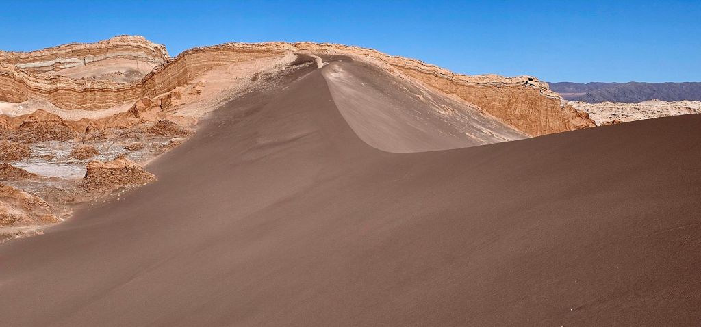
Despite the monochromatic omnipresence of shifting sand and salt across the Atacama Desert (observed from previous post, “Atacama Desert”)–
aside from the occasional splash of flamingo pink–
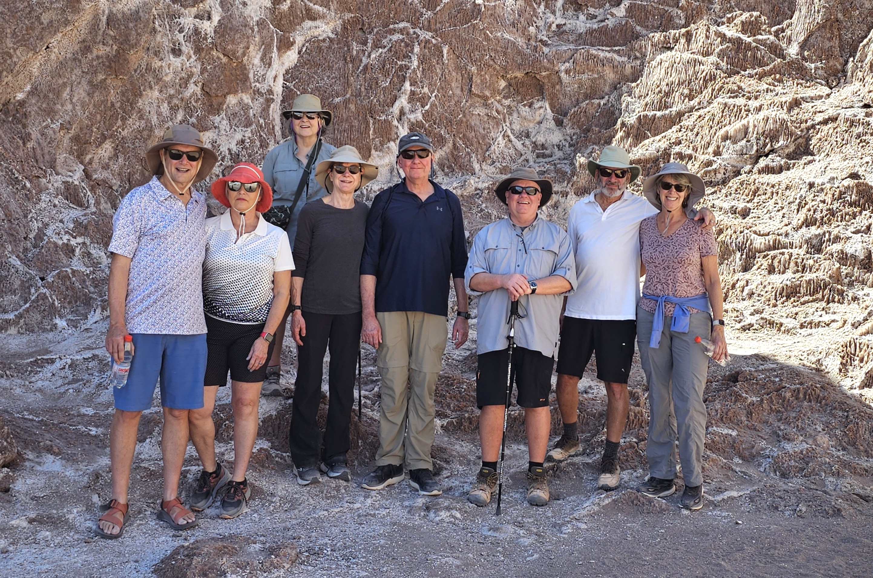
there is an abundance of color to behold in other regions of Antofagasta. Leah and I joined our expedition colleagues…
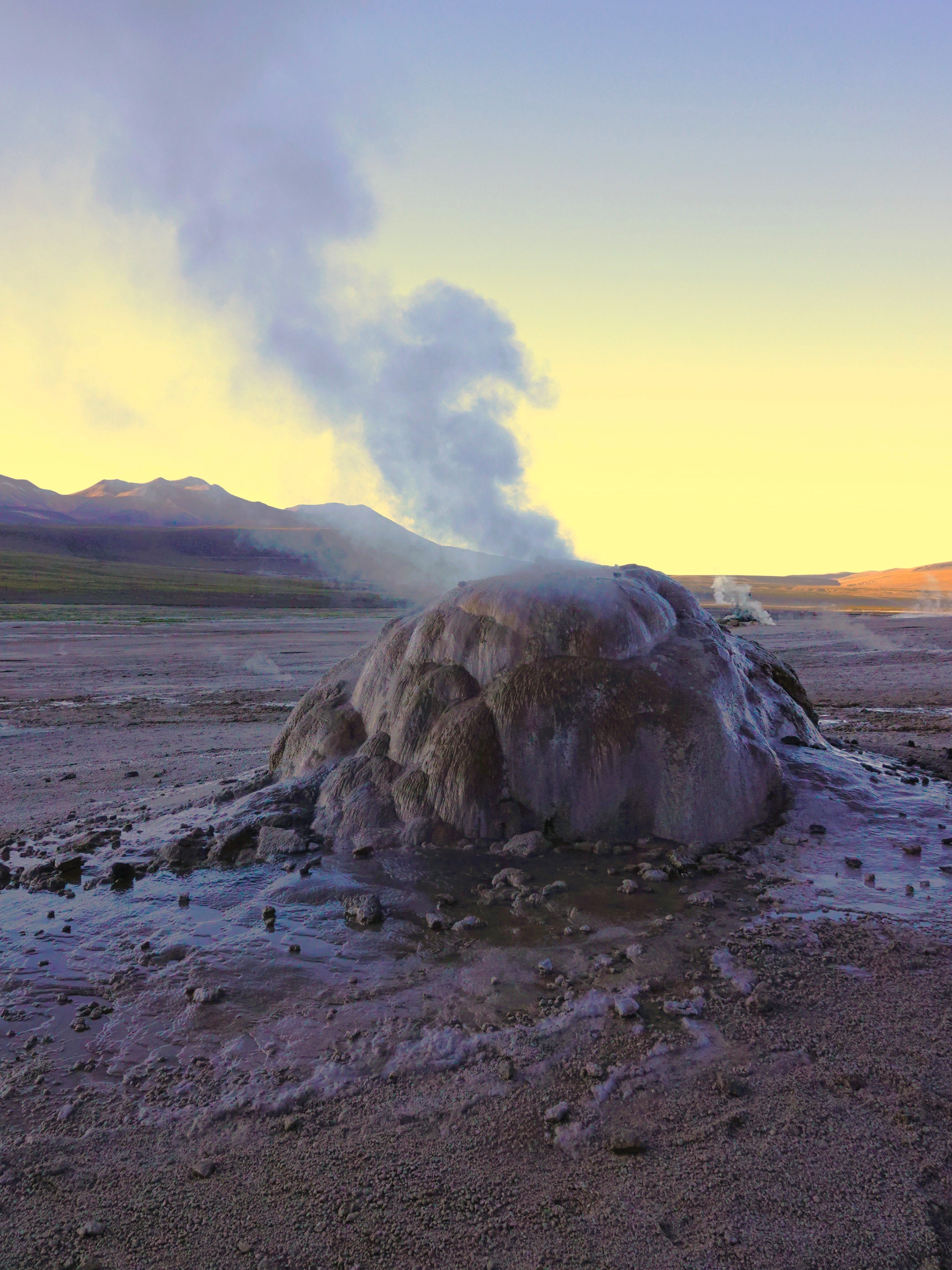
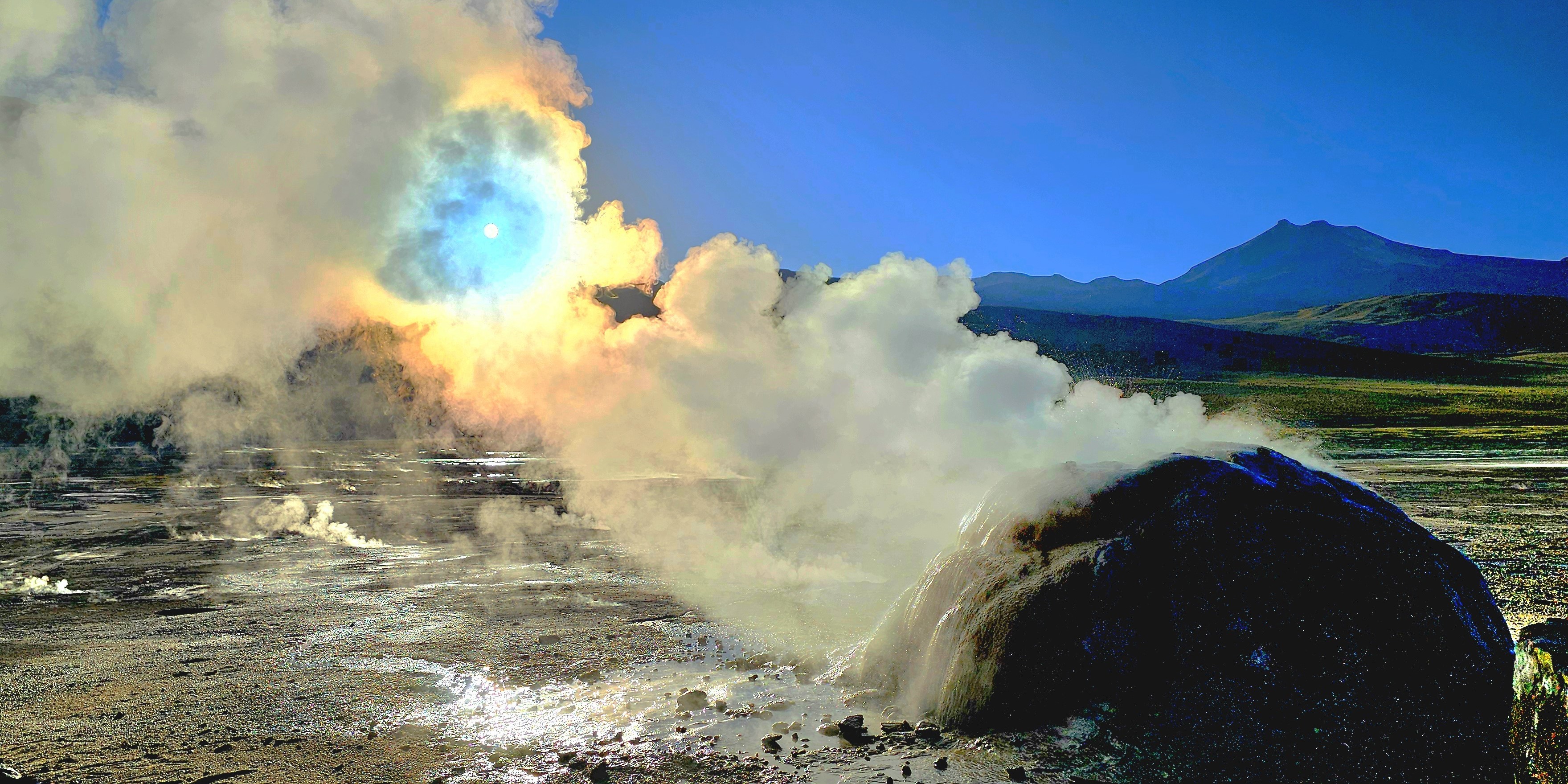
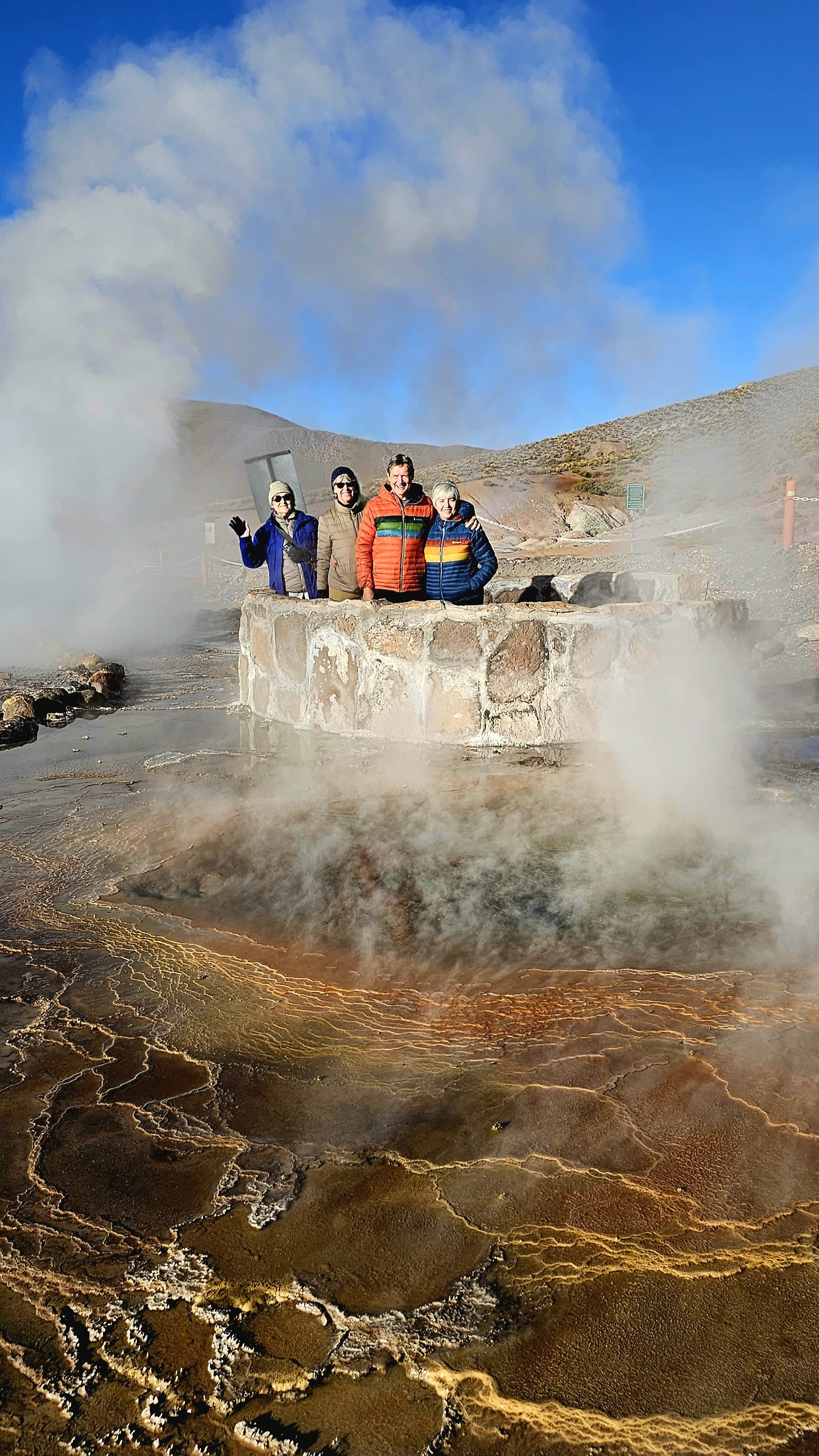
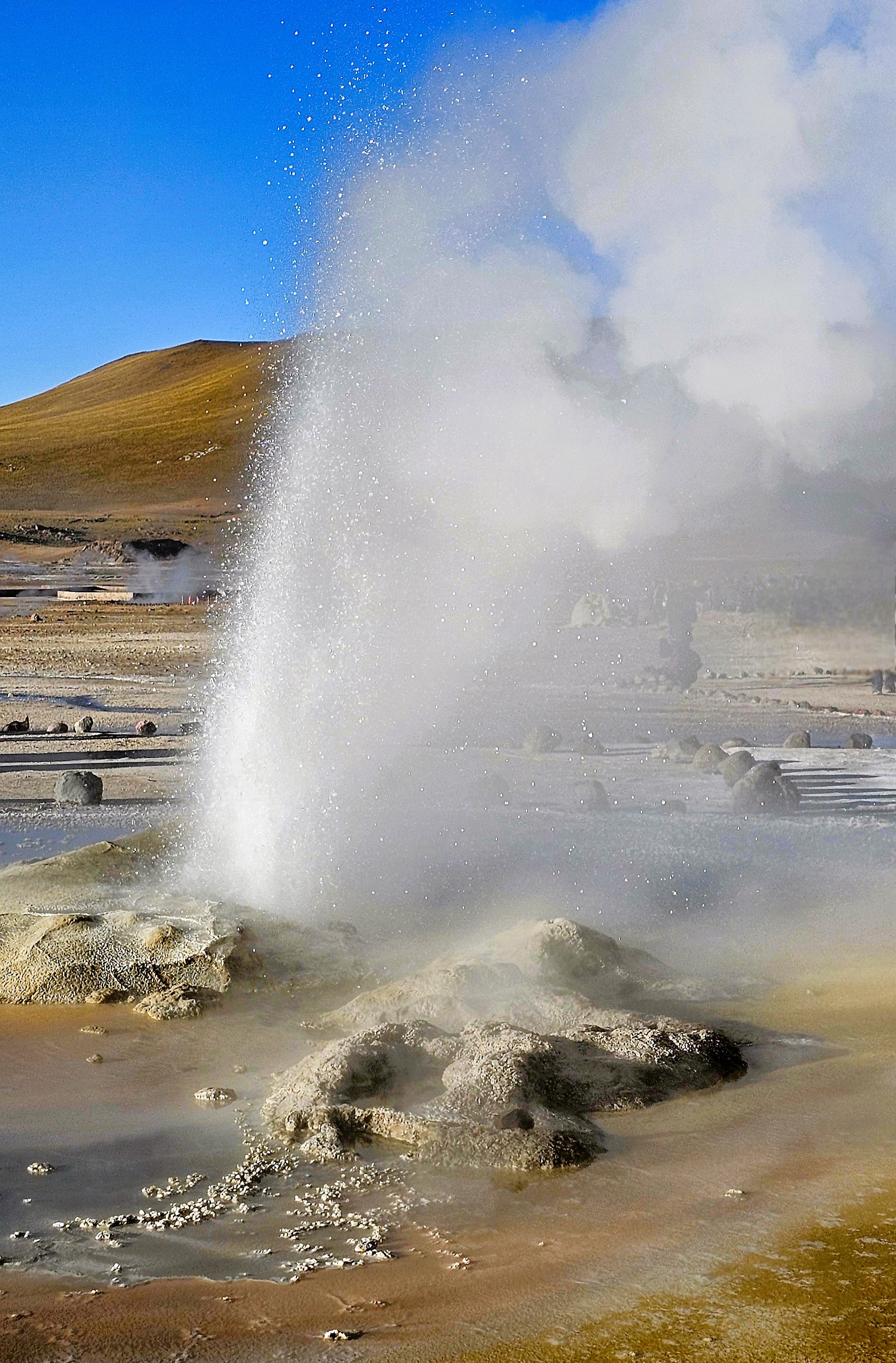
for a 90-minute drive north through remote, rugged terrain and narrow switchbacks, to catch a 7am sunrise over El Tatio Geysers, the highest, albeit 3rd largest geothermal field in the world, and certainly, the most active in the southern hemisphere.
At an altitude of 14,170 ft, the -6oC desert temperature was biting at our faces, but it was a temporary inconvenience. The backlit, pre-dawn sky and cold air benefitted the playful plumes that vented from 80 steaming geysers and fumaroles amid 12 sq miles of Andean volcanoes.
Like so many others, I was poised for the first sun to creep over the horizon,
not only to return the feeling to my fingers, but to reveal the chromatic clouds playing across the landscape.
Soon enough, the rising sun would turn the blackest of hot springs into a glorious reflecting pool.
It was worthy of a celebration.
Because El Tatio is community-owned and administered, there were several local rangers scattered throughout the vicinity to patrol, advise, and admonish any foolishness similar to Pierce Brosnan’s trespassing at Yellowstone National Park (although he entered a “not guilty” plea during his recent arraignment).
One can only hope that discretion and common sense would prevail in this fragile and volatile environment.
El Tatio Geyser
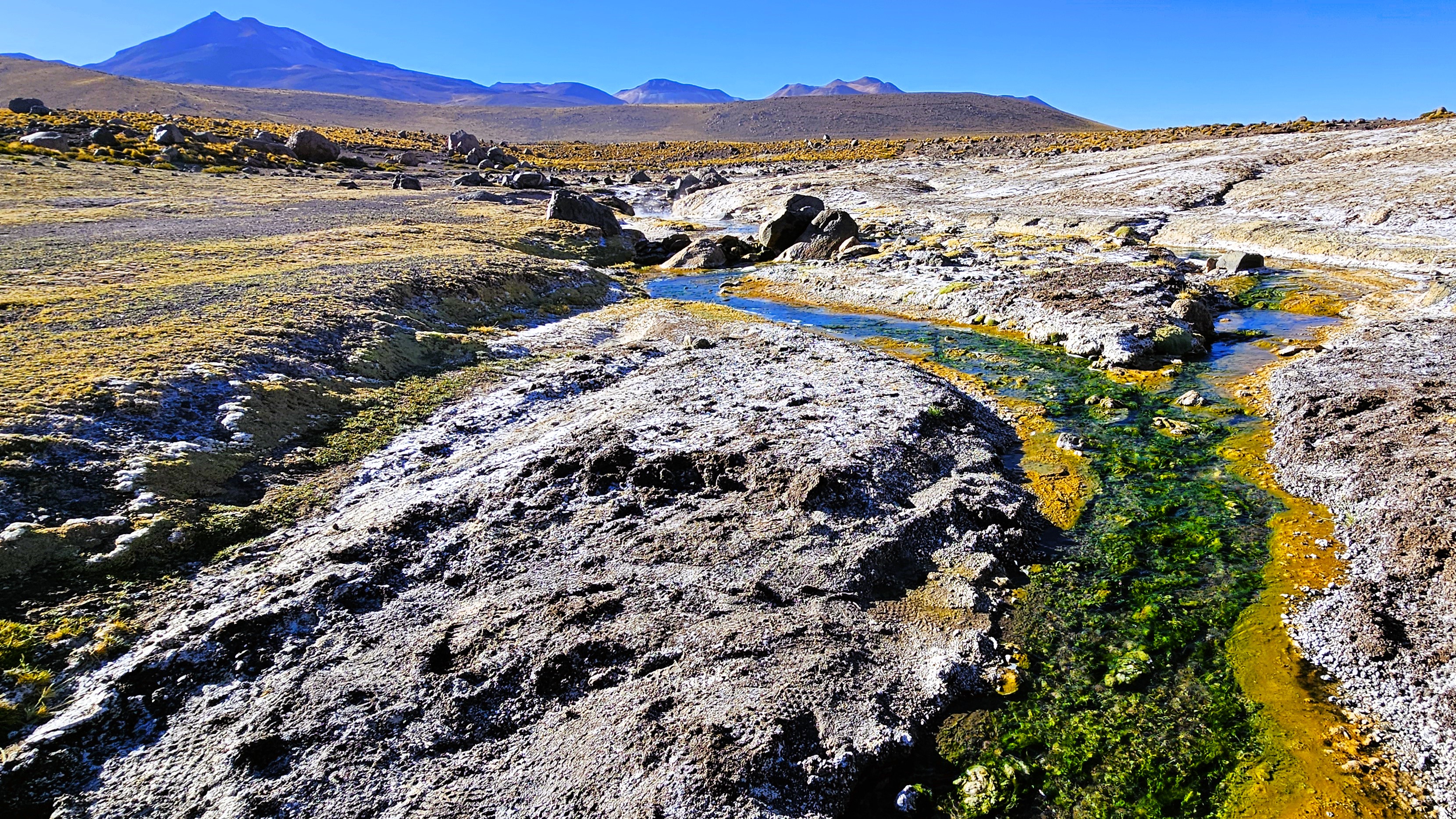
A stroll through the field revealed a kaleidoscope of algae-induced minerals and salts,
that stretched into the distance.
El Tatio didn’t appear as daunting as Old Faithful and its surroundings, but it was impressive, nonetheless, with nowhere near the number of onlookers!
From our position–only 100 miles to Ollagüe Volcano, bordering Chile and Bolivia–
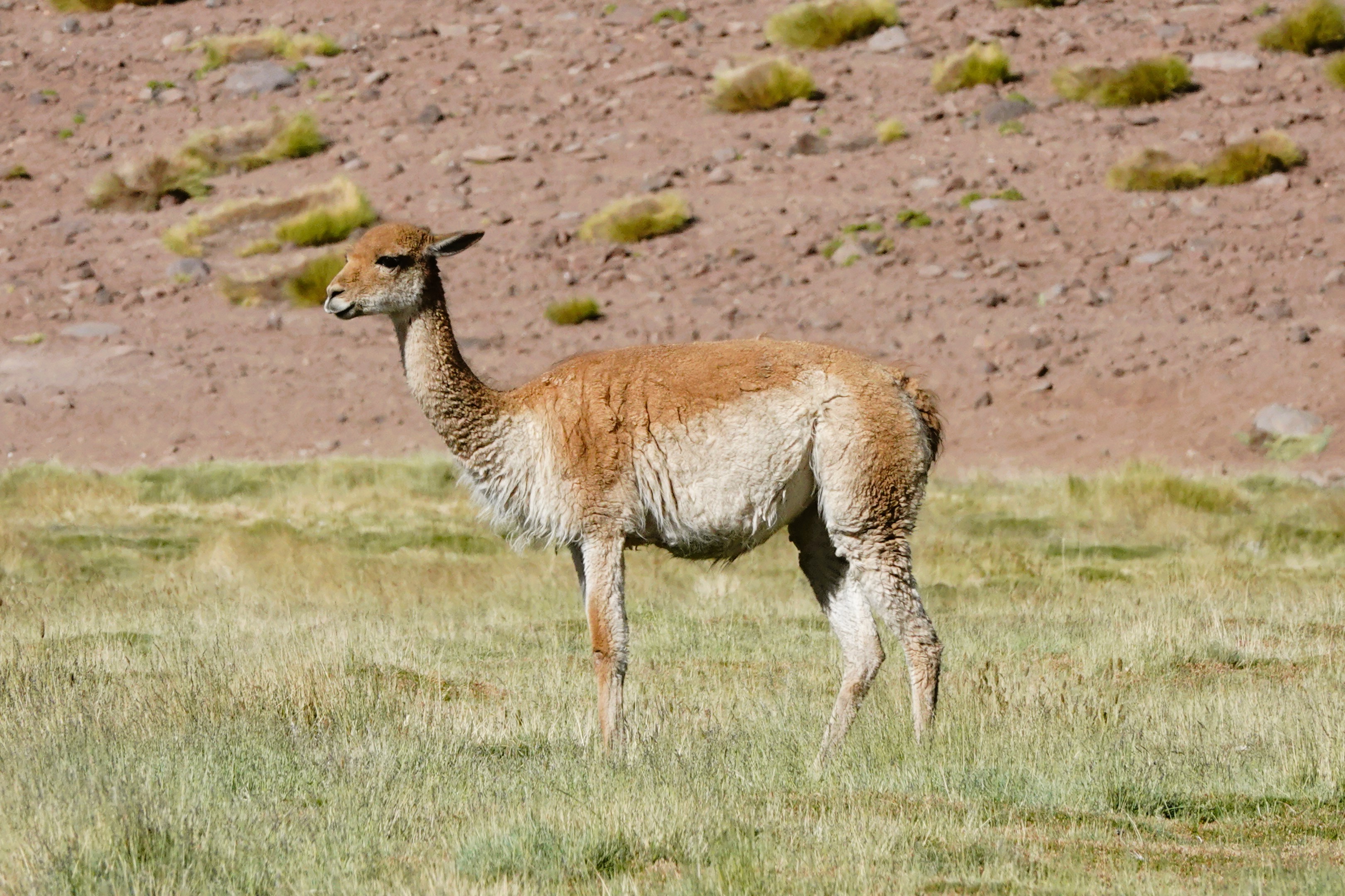
we continued to Valle del Arcoiris, another community-based natural wonder,
where “purple mountains majesty”…
become a befitting backdrop to roaming, grazing llamas.
The valley was as wide and rich with the scent of riki riki…
as it was awash with colors created by a primordial stew of Sulphur, gypsum, crushed shells, and clay.
When the Pliocene Epoch carved out the valley,
all traces of copper and lithium were swept away–
which is a silver-lining for a spectacular landscape that would otherwise have been ravaged by mining companies.
Rather than go thru the details of how we got here, suffice to say that 2 days of inconvenient travel brought us to the Chilean Andes…
to experience the highest and driest desert on earth (averaging 13,000 ft. elevation), where temperatures can fluctuate between 0oC and 25oC, and rainfall averages 2 mm of rain per year with a humidity factor of .02%.
The area is so vast, it spans Chile, Peru, Argentina, and Bolivia.
But despite the hostile environment, flora and fauna still manages to survive.
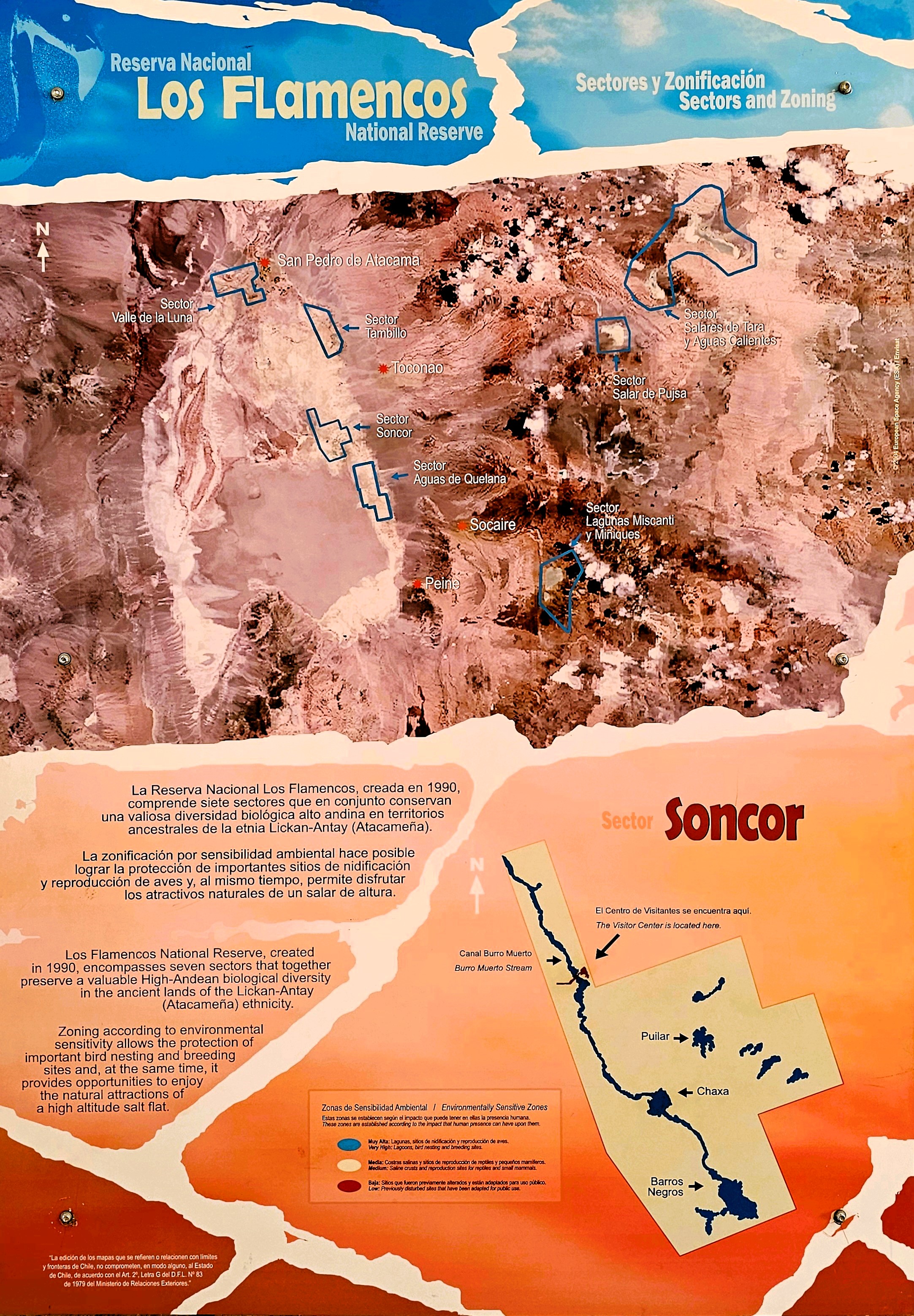
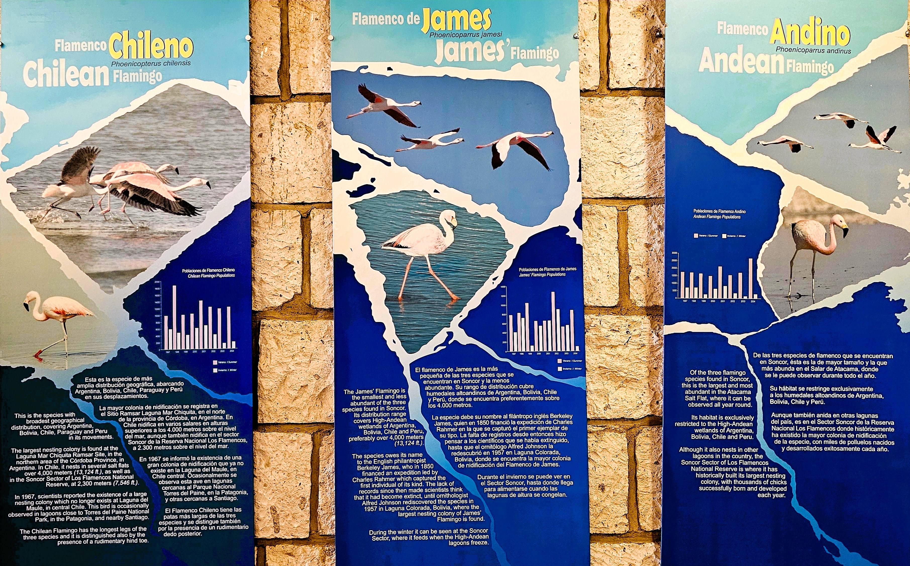
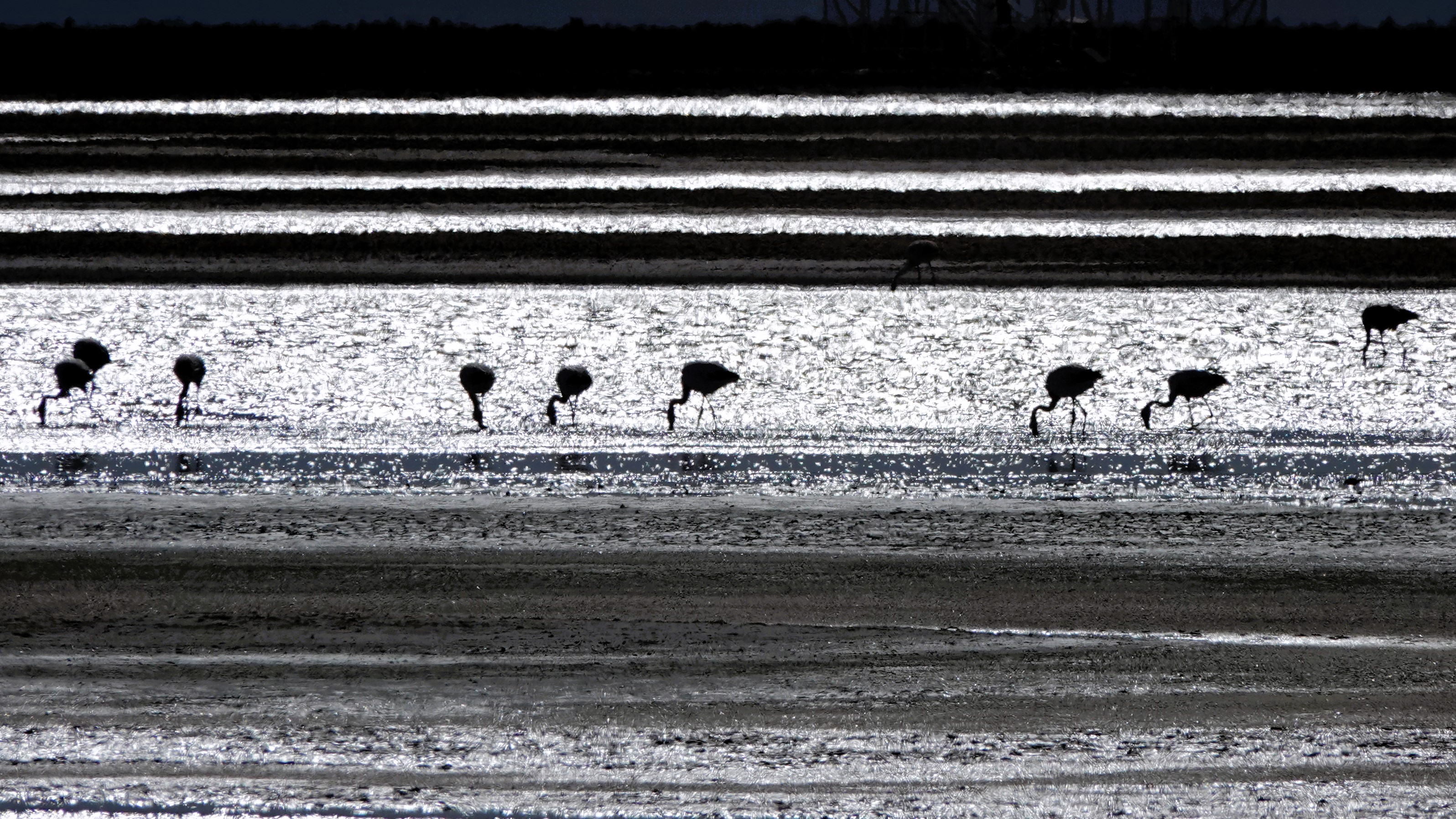
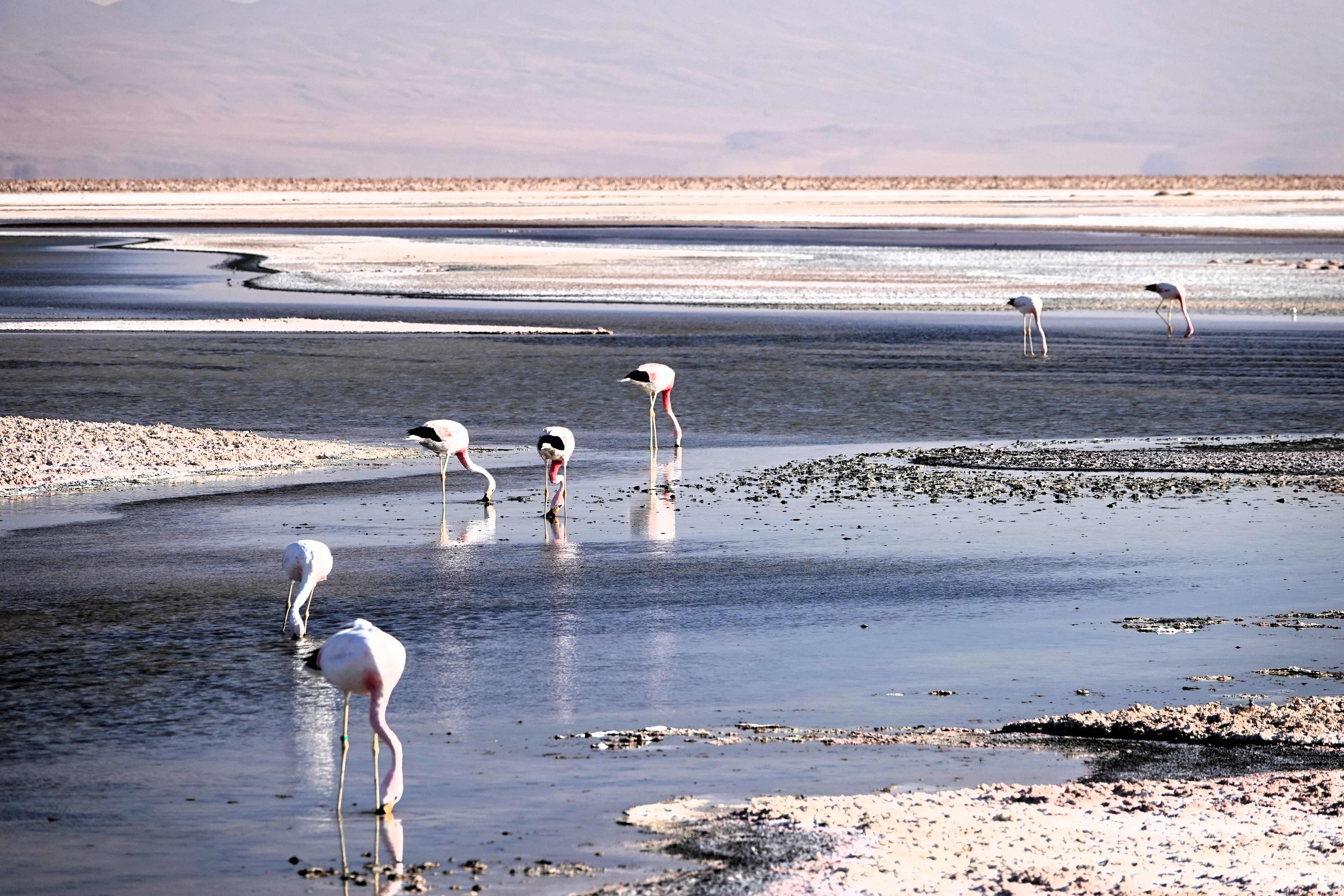
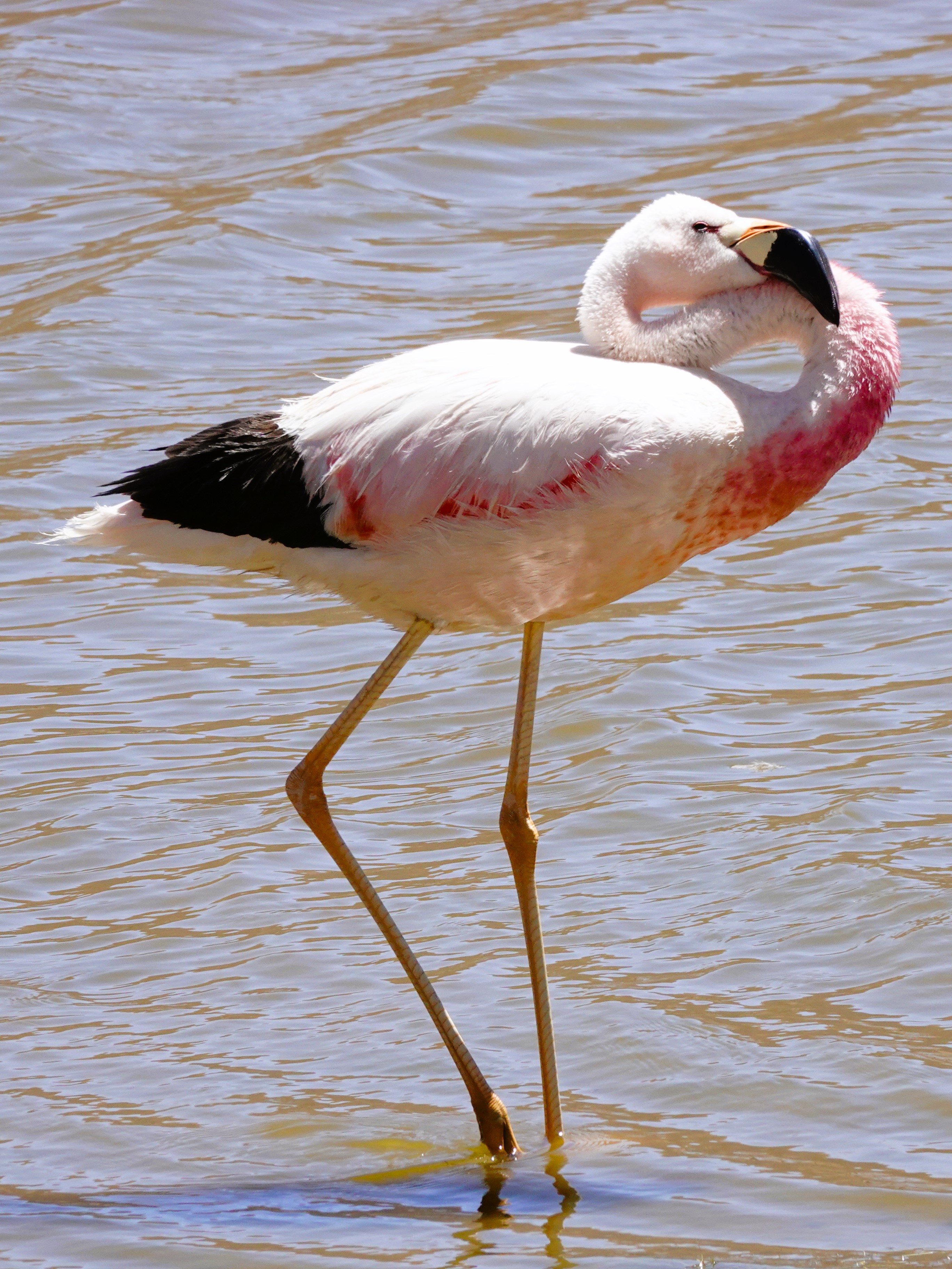
Our first destination was the Soncor Sector of Los Flamencos National Preserve,
where a variety of native flamingos congregate to feed on brine shrimp that flourish in pools along the salt flats.
Although the park flamingos were unidentifiable from a distance,
it became easier to identify their individual characteristics the closer we got to them,
distinguishing the flock as Andean flamingos.
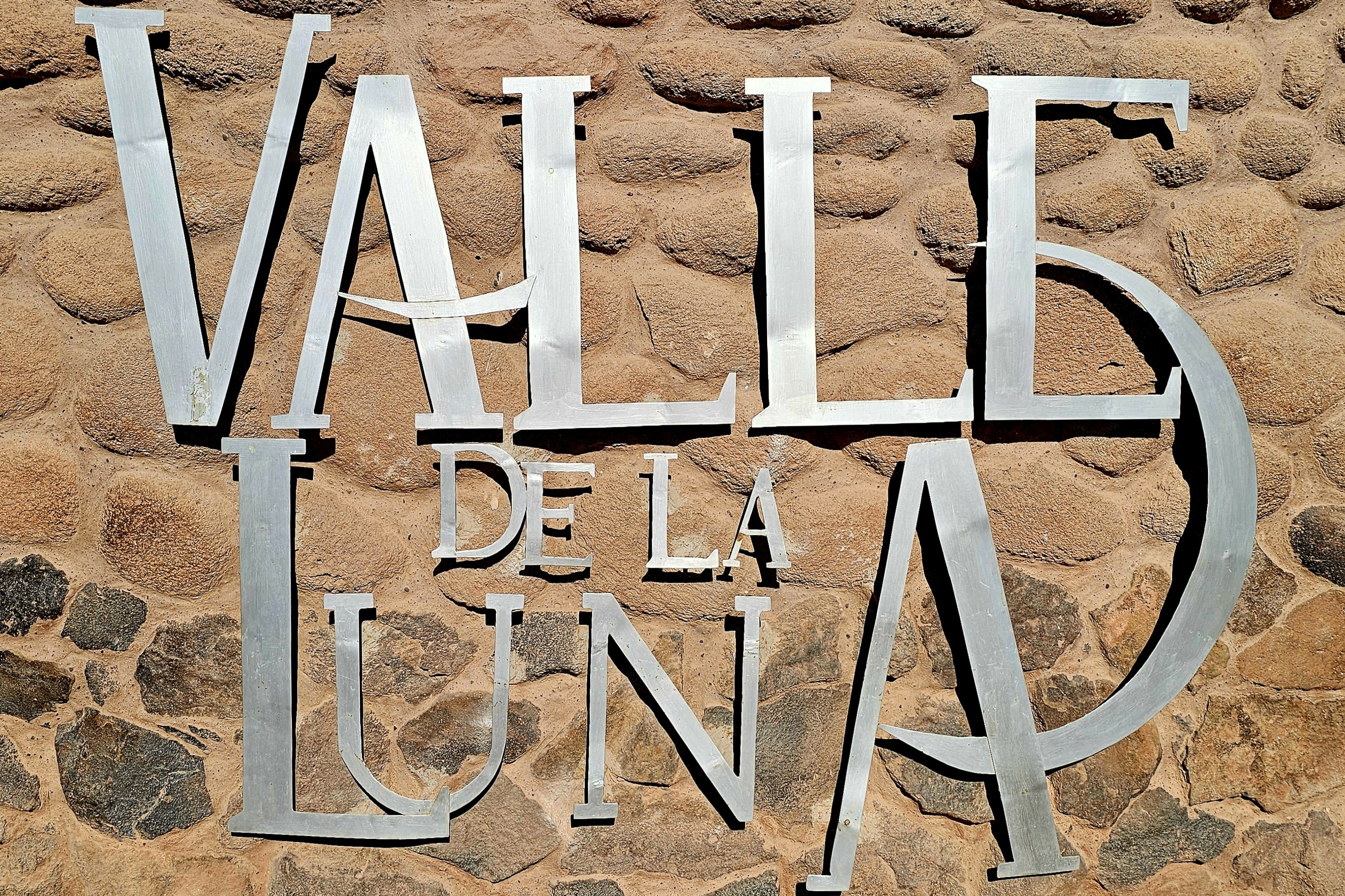
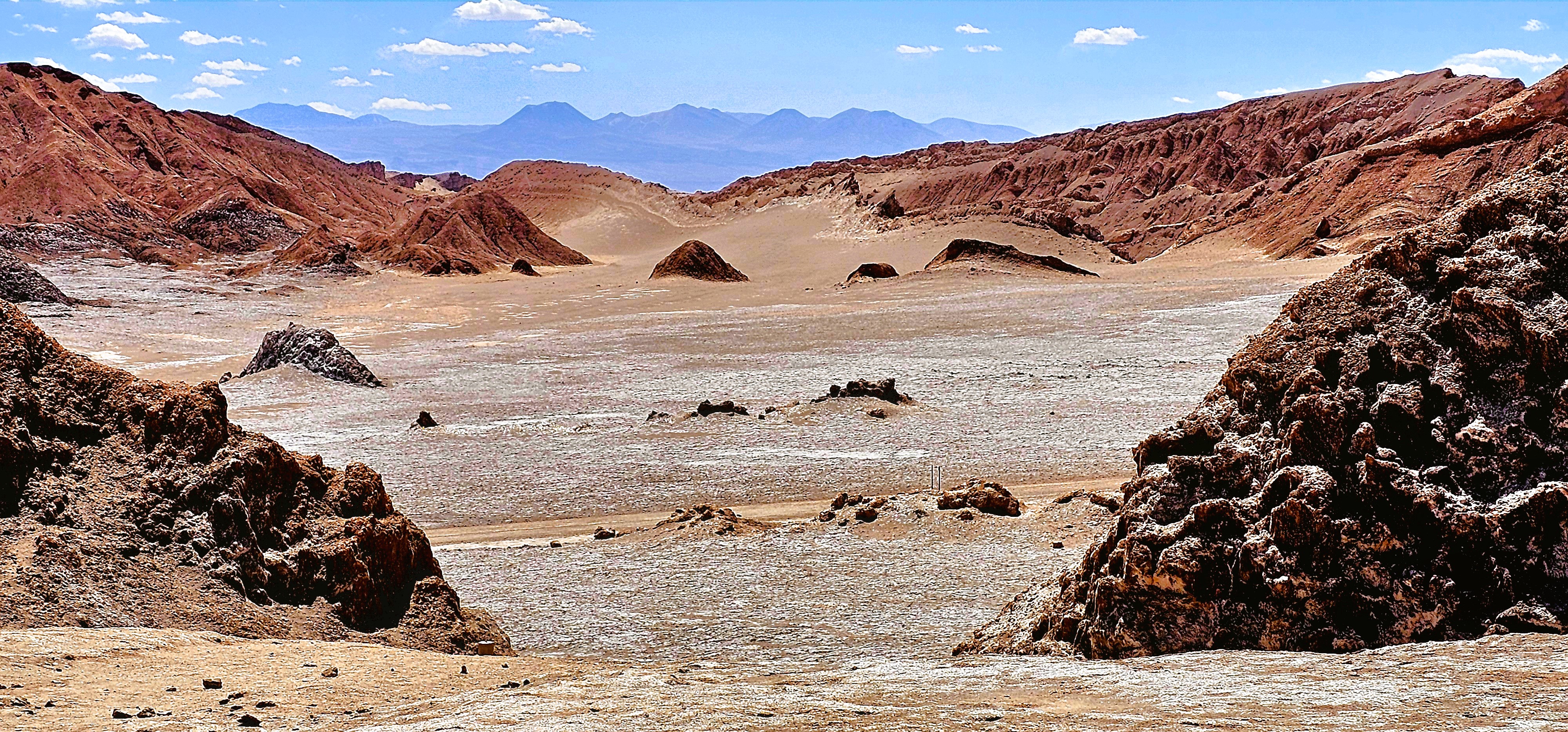
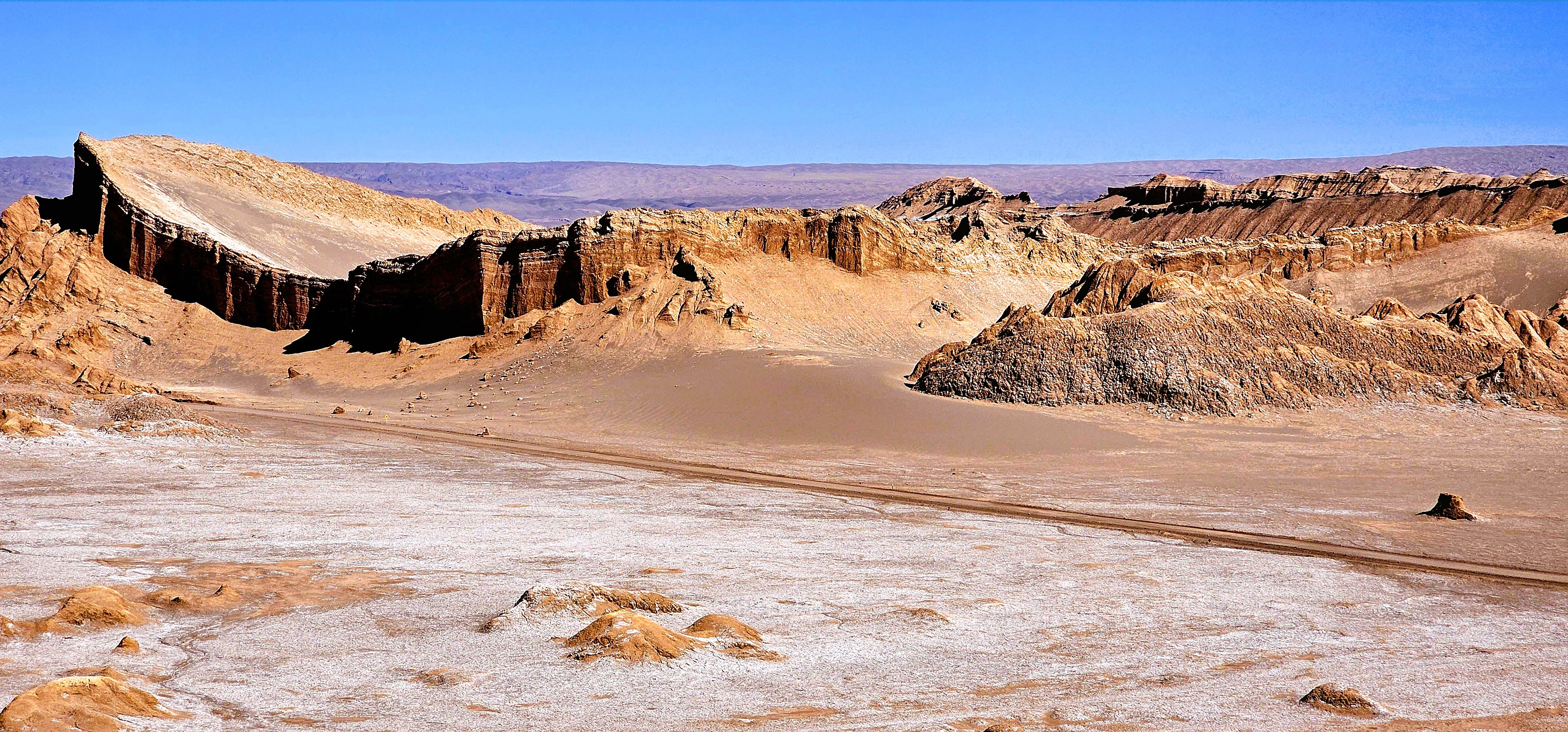
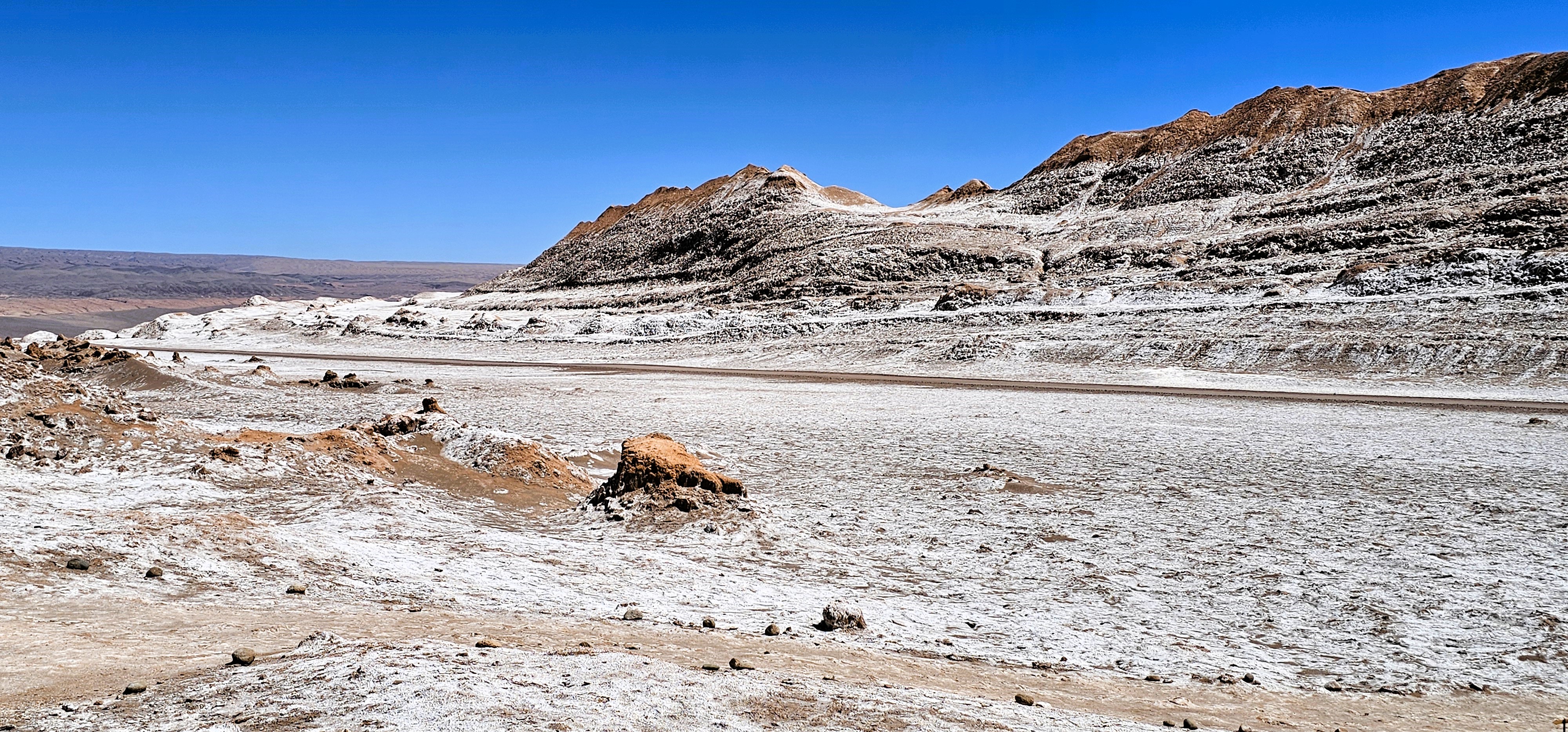
Our next destination was Valle de la Luna (Valley of the Moon), another sector of Los Flamencos–only 10 minutes from San Pedro, across a dusty road built for vehicles with dependable suspension.
The park was aptly named by Gustavo Le Paige, a Belgian missionary who pioneered much of the archeological research of San Pedro de Atacama in the 1950’s.
The sector captures the essence of the region’s vastness and aridity, so much so, that NASA tested its Mars rovers on the surface to simulate future planetary exploration.
Salt and sodium nitrate crystals are found throughout the Atacama Desert, as the dry air and lack of vegetation allows them to collect on the surface.
Although the region also contains precious metals including an abundance of copper, silver and gold, it was the large cache of potassium nitrate that brought the railroads and development to Atacama, turning the region into a hub for culture and commerce by the 2nd half of the nineteenth century.
Today, large reserves of precious metals such as lithium provide a significant source of revenue for private and state-owned mining companies.
In fact, as of January 14, Chile’s SQM, the world’s 2nd largest producer of lithium has suspended its operations in Atacama due to 500 protestors from indigenous communities in the Antofagasta region who’ve been blockading roads–immobilizing workers, supplies and lithium to and from the mines–demanding that they be included in negotiations between SQM and the Chilean government.
Let’s hope that this conflict can be resolved quickly, so we may continue to feed our global appetite for electric vehicles.
It’s a new year, and there has never been a better time for Leah and me to explore our world. We are always up for a challenge, so we’ve decided to begin 2024 with our most ambitious adventure yet. Not satisfied with returning to some of our favorite destinations–not that there’s anything wrong with familiar places—we booked a bucket list trip over a year ago that would literally take us out of our comfort zone.
We filled the waiting time by visiting friends and family across America (and a speck of Canada)–only some of which I memorialized during the past year in this blog. In fact, a large part of last year’s travels never made it past my unpublished thoughts and unprocessed SD cards, including: a trip to Israel (months before the October 7th massacre);
a Central American cruise to Costa Rica,
Panama City,
and Cartagena, Columbia;
as well as a relaxing siesta on the Riviera Maya in Mexico;
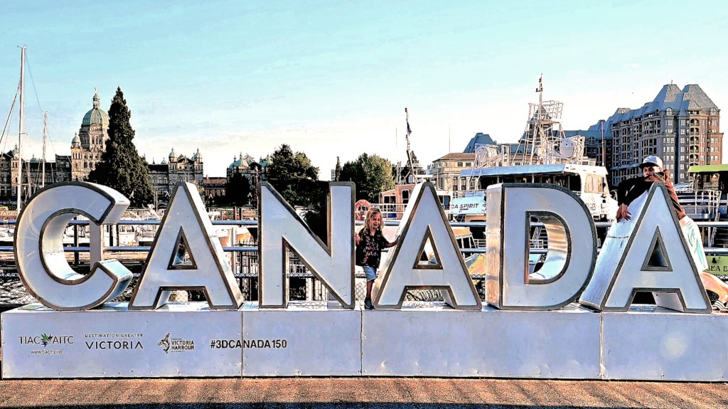
a flash visit to Victoria, BC;
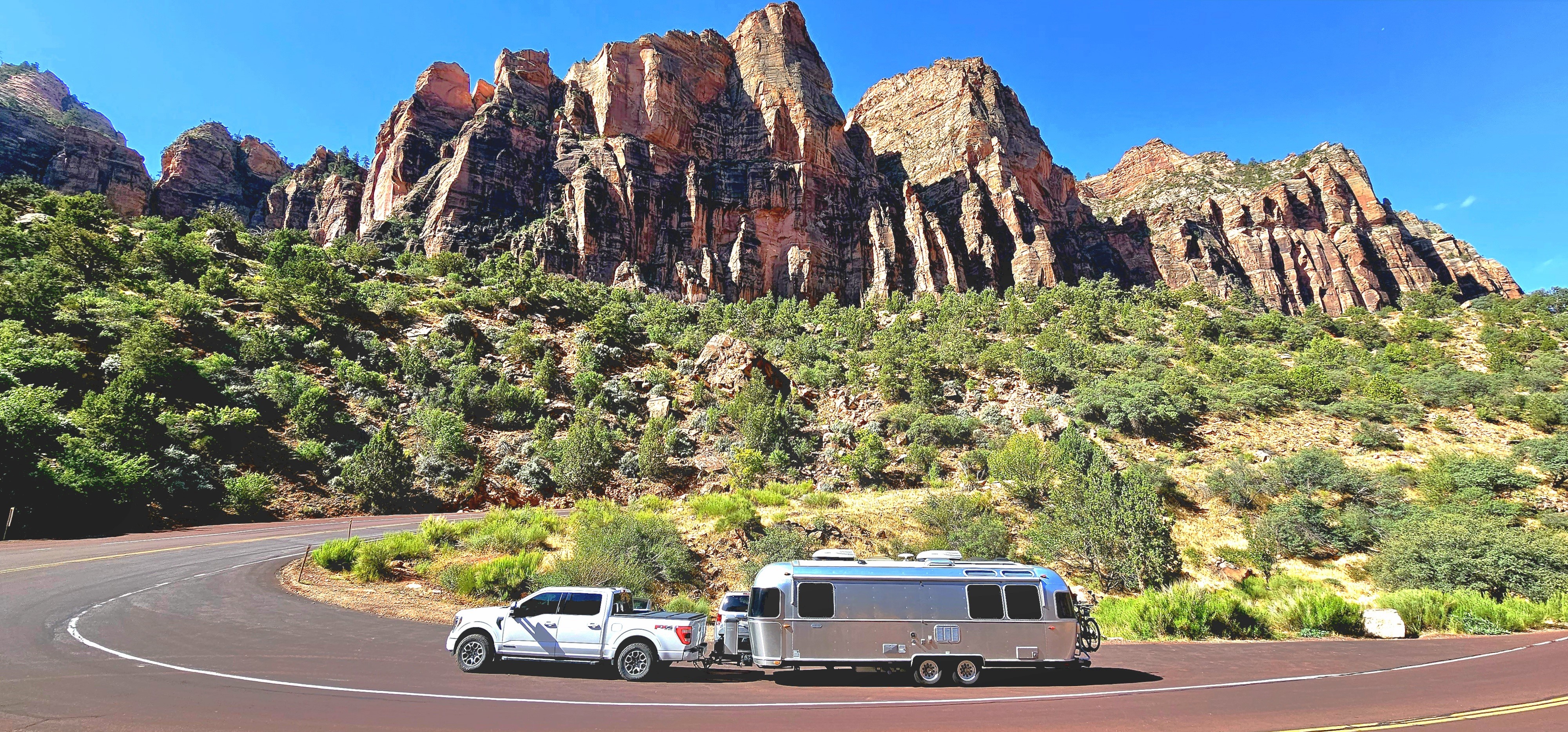
and a southwestern tour of America in our silver bullet–
all worthy of sharing sooner than later.
But until then, I must fast forward to our most recent trip to Chile’s Atacama Desert before embarking aboard Viking’s Octantis to Patagonia and Antarctica–in search of whales, penguins and extraordinary landscapes.
We overnighted in Santiago, Chile,
followed by a morning flight to Copiapó, the region’s capital incorporating San Pedro de Atacama.
And set out to explore the highest, driest ecosystem on planet Earth.
Forgive me; it’s been a while since my last confession.
Life happens and it’s been challenging at times to juggle travel with business affairs, personal affairs and blogging. And with the passage of each passing day, it’s become increasingly more difficult to return to summer events with the same vitality, and cobble a detailed timeline from 3 months ago. In fact, there are still stories from last year’s journey to Canada that have yet to be written and published.
While I could travel less to blog more often, or continue to travel without memorializing the occasion, neither option is an acceptable one. Perhaps, I’ll just have to find a better way to accomplish both without sacrificing one for the other. In the meantime, I’ll pick up where I left off, which is somewhere on the road between here and there.
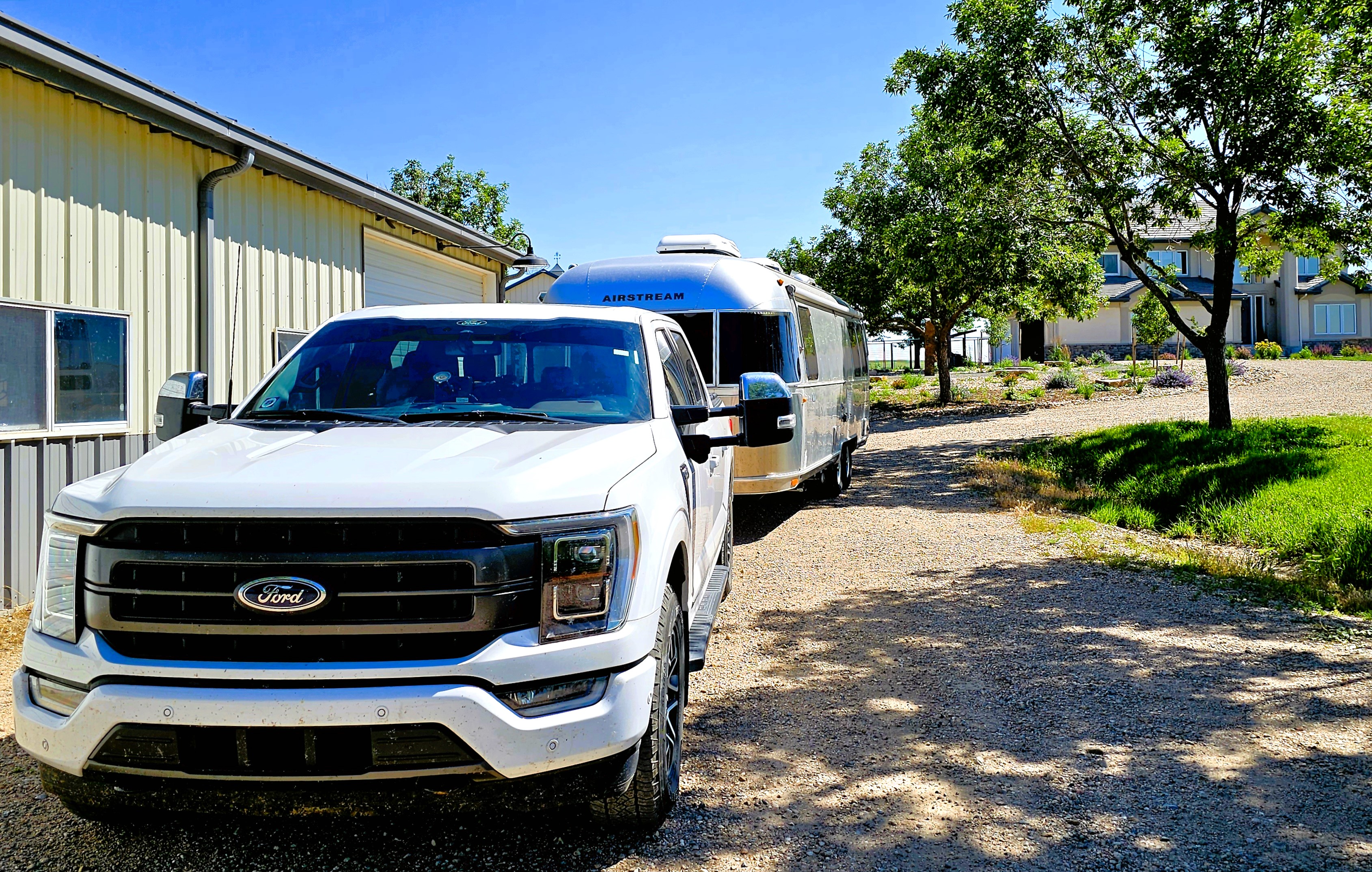
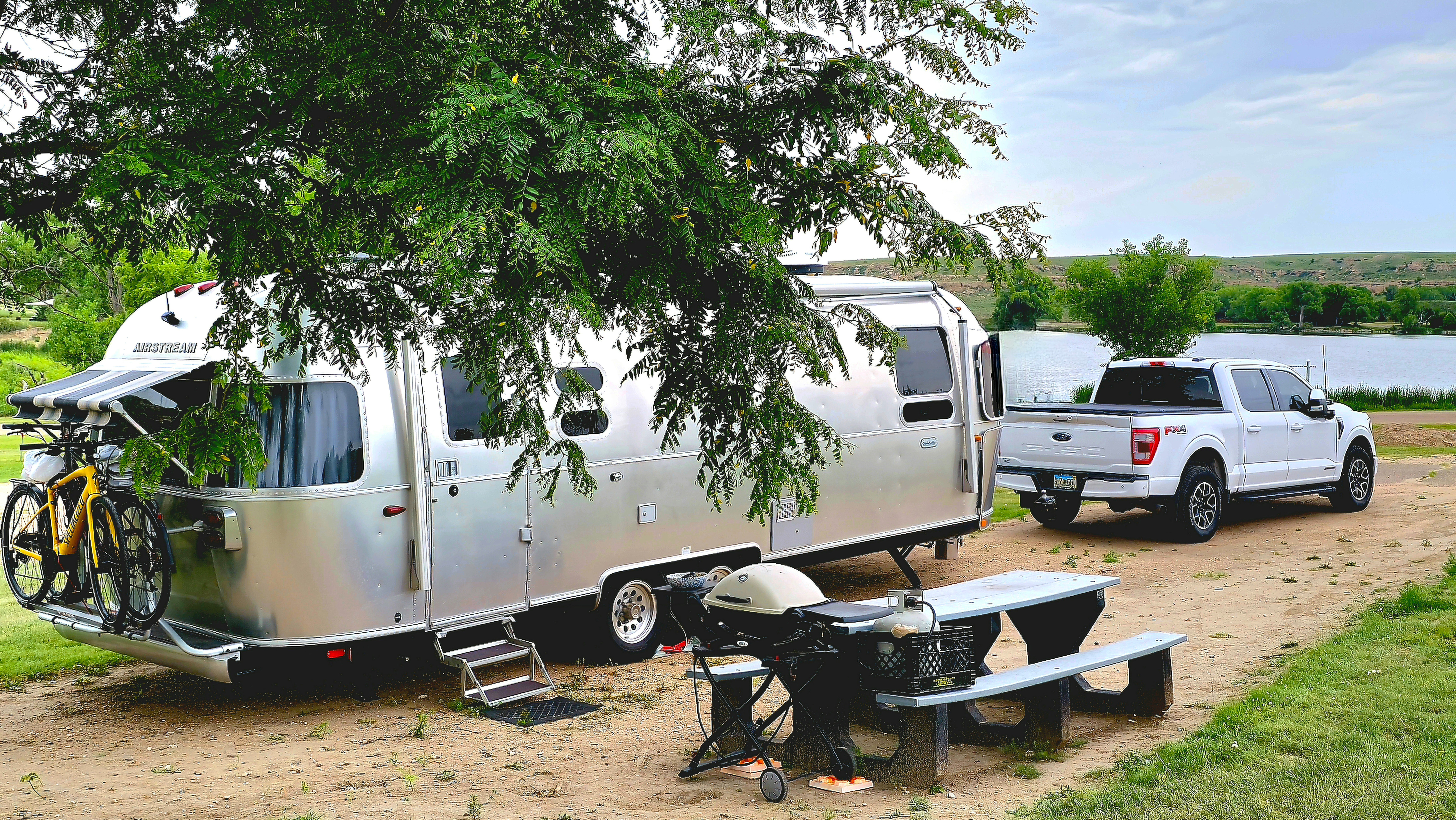
First of all, a shout-out to our friends Dirk and Heather,
who allowed us to park the Airstream at their ranch in Fort Collins, assuring us peace of mind while we boarded a flight from Denver to Seattle to visit my son Nate.
Dollar for dollar and day for day, Leah and I figured that flying round-trip to Seattle probably saved us 2 weeks of driving 1,500 miles, at a proximate cost of $1300 in fuel.
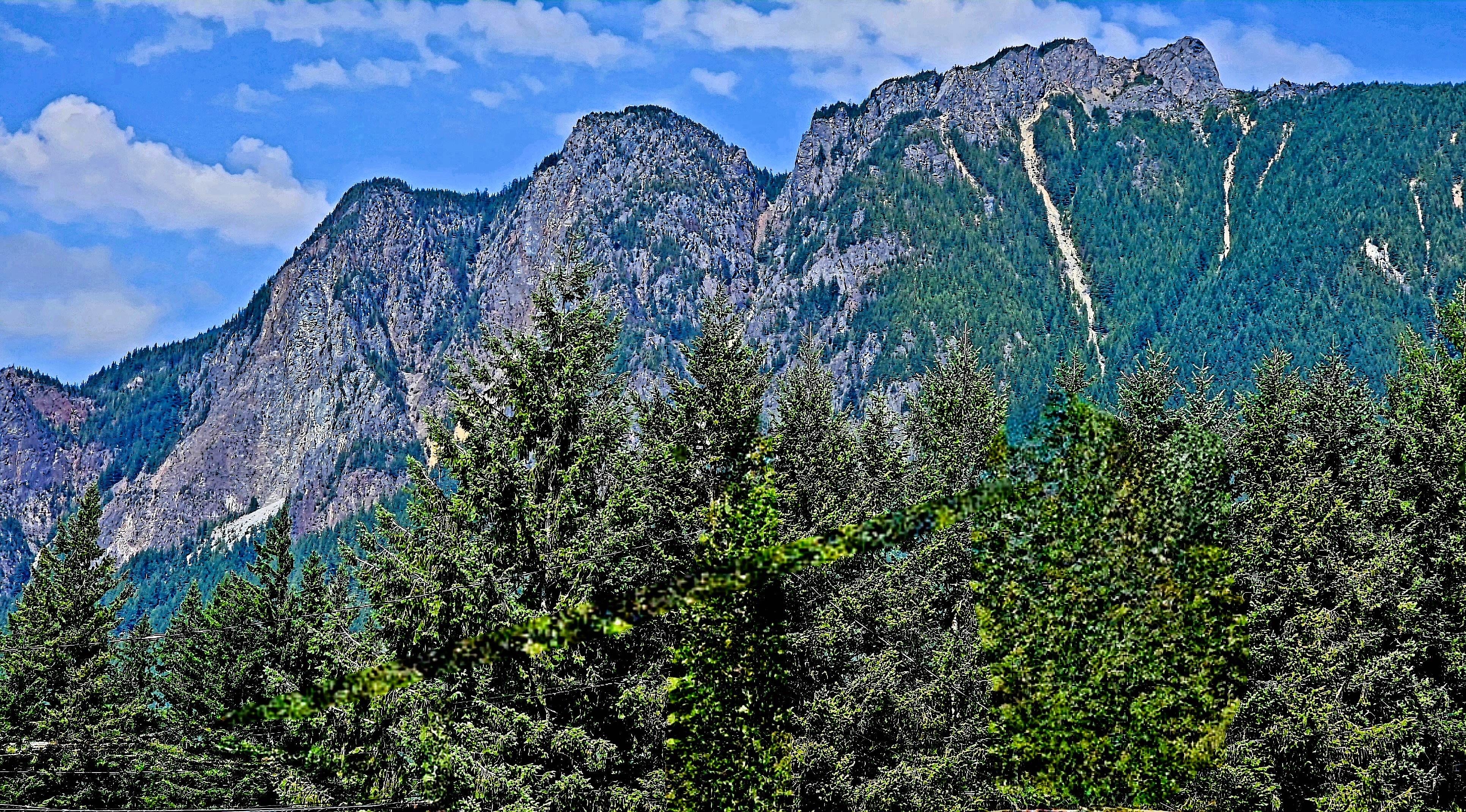
After our arrival to Issaquah (suburban Seattle and Nate’s hometown), we ventured southeast along the I-90 corridor to hike Rattlesnake Ledge on Rattlesnake Mountain–
a demanding 2-mile ascent…
that gave us sweeping views of Rattlesnake Lake,
and the Cascade Range beyond the clouds.
Seattle was also our gateway to north of the border…
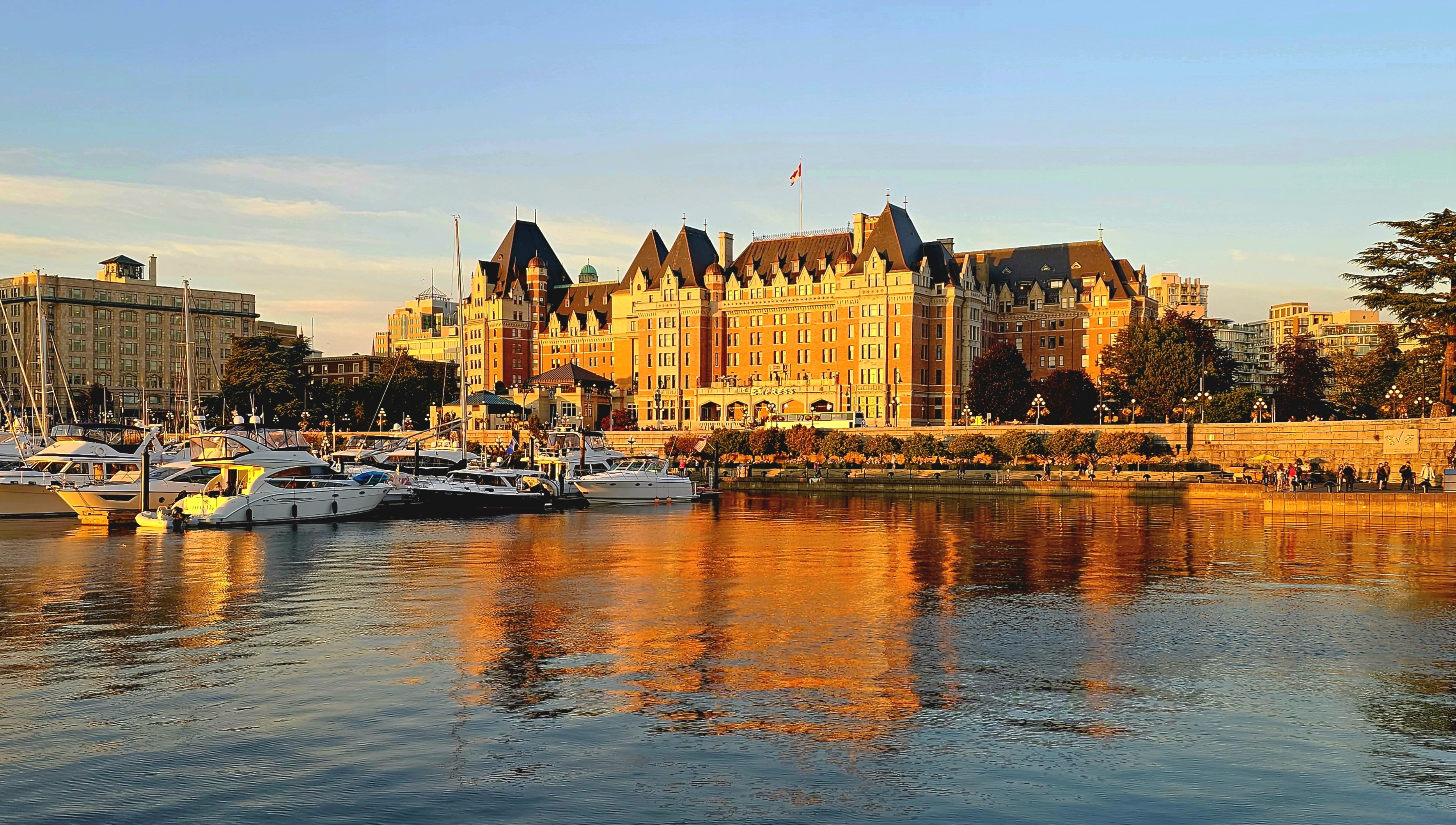
After a 2 hour and 45-minute cruise aboard the Victoria Clipper, we arrived at Victoria’s Inner Harbor,
where we would spend the weekend at the historic Pendray Inn and Tea House…
in the very pink, Executive Suite.
Victoria is well-known as a pedestrian town,
with a variety of landmarks and attractions within a few miles of our hotel. We were less than a half-mile from Parliament,
and Fairmont’s Empress Hotel,
and another half-mile further to Canada’s oldest Chinatown.
And strolling along the Lower Breakwater (adorned with First Nation symbols) with panoramic views to the south, afforded us a different perspective of the Cascade Range.
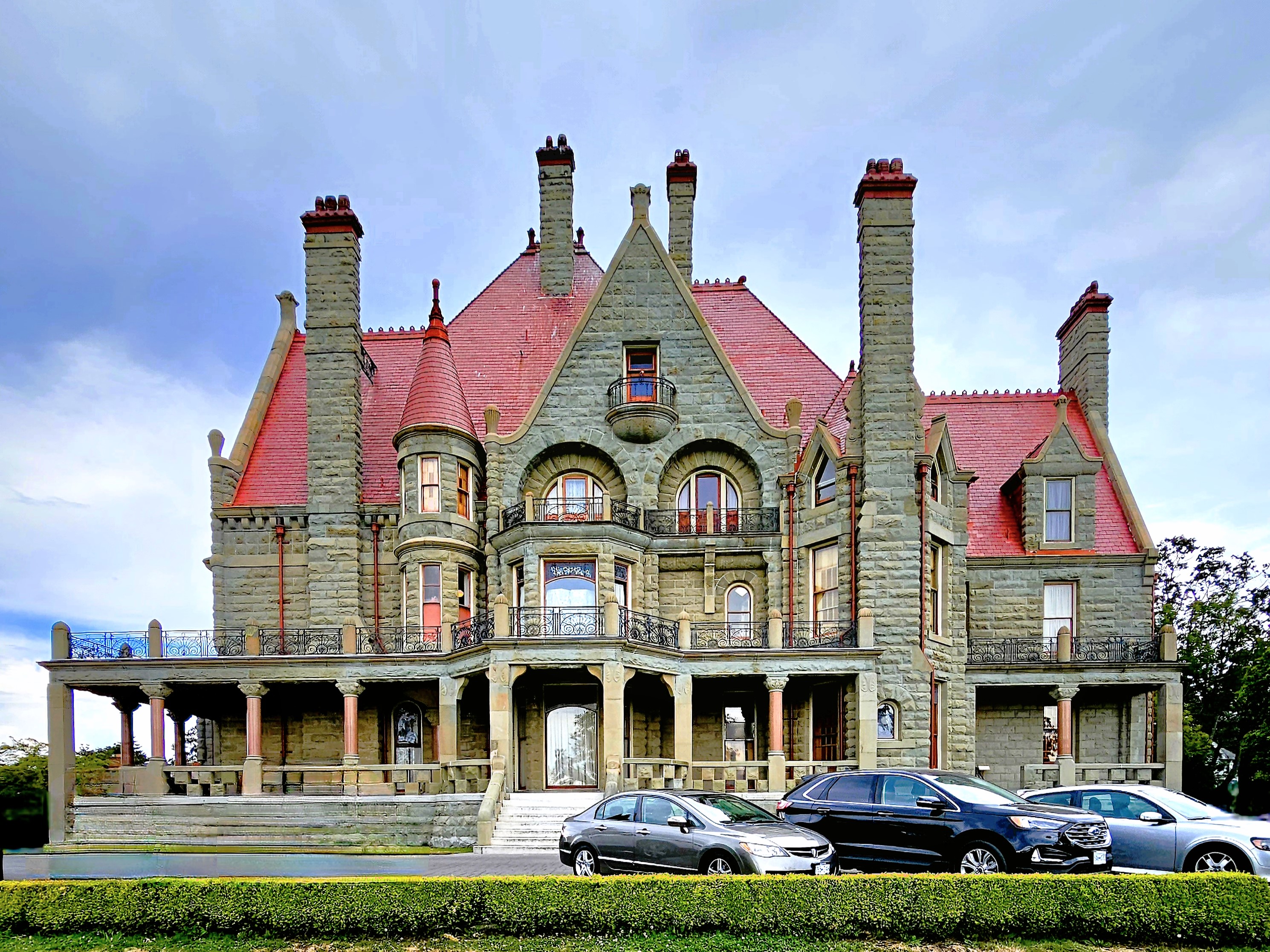
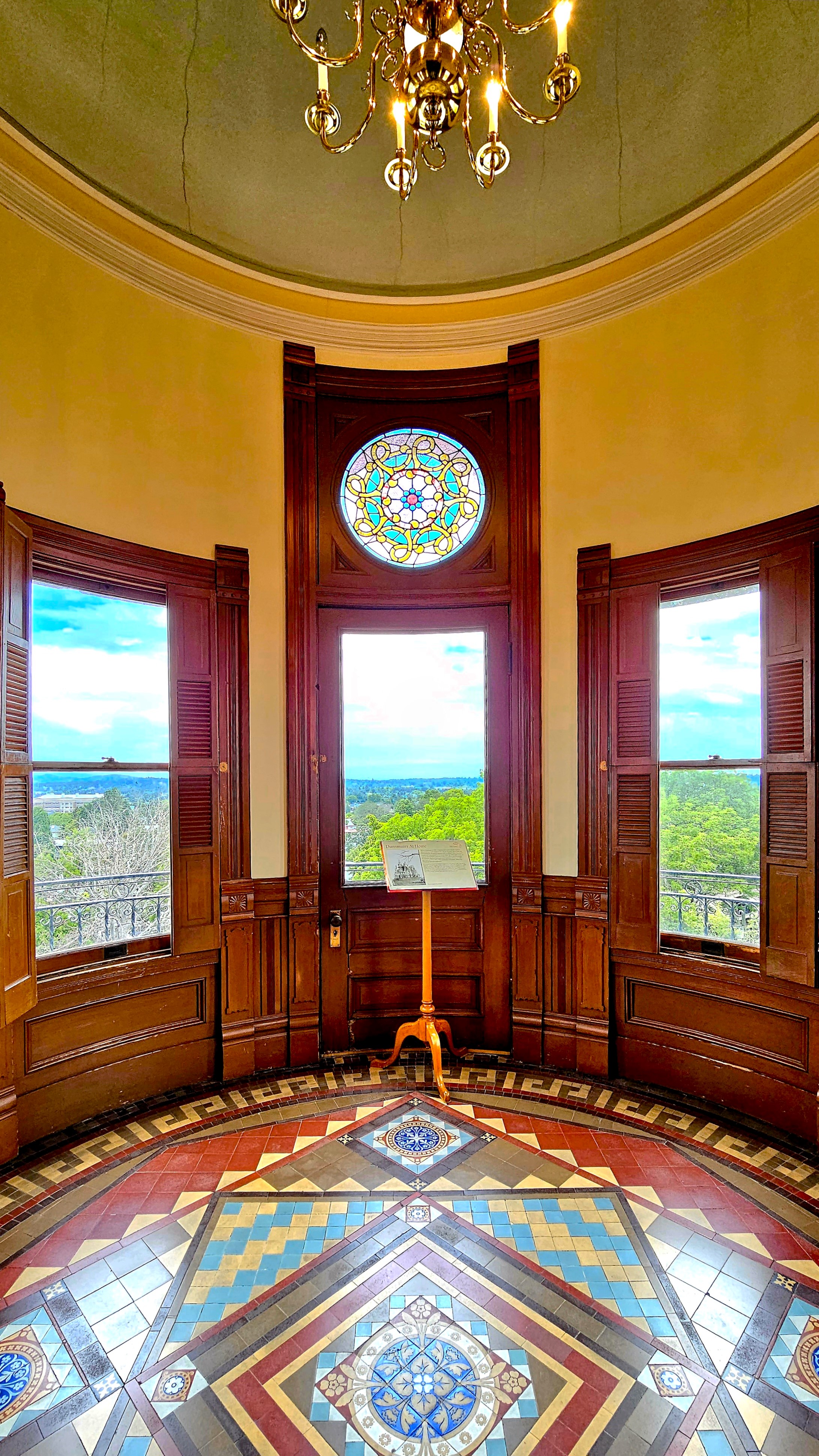
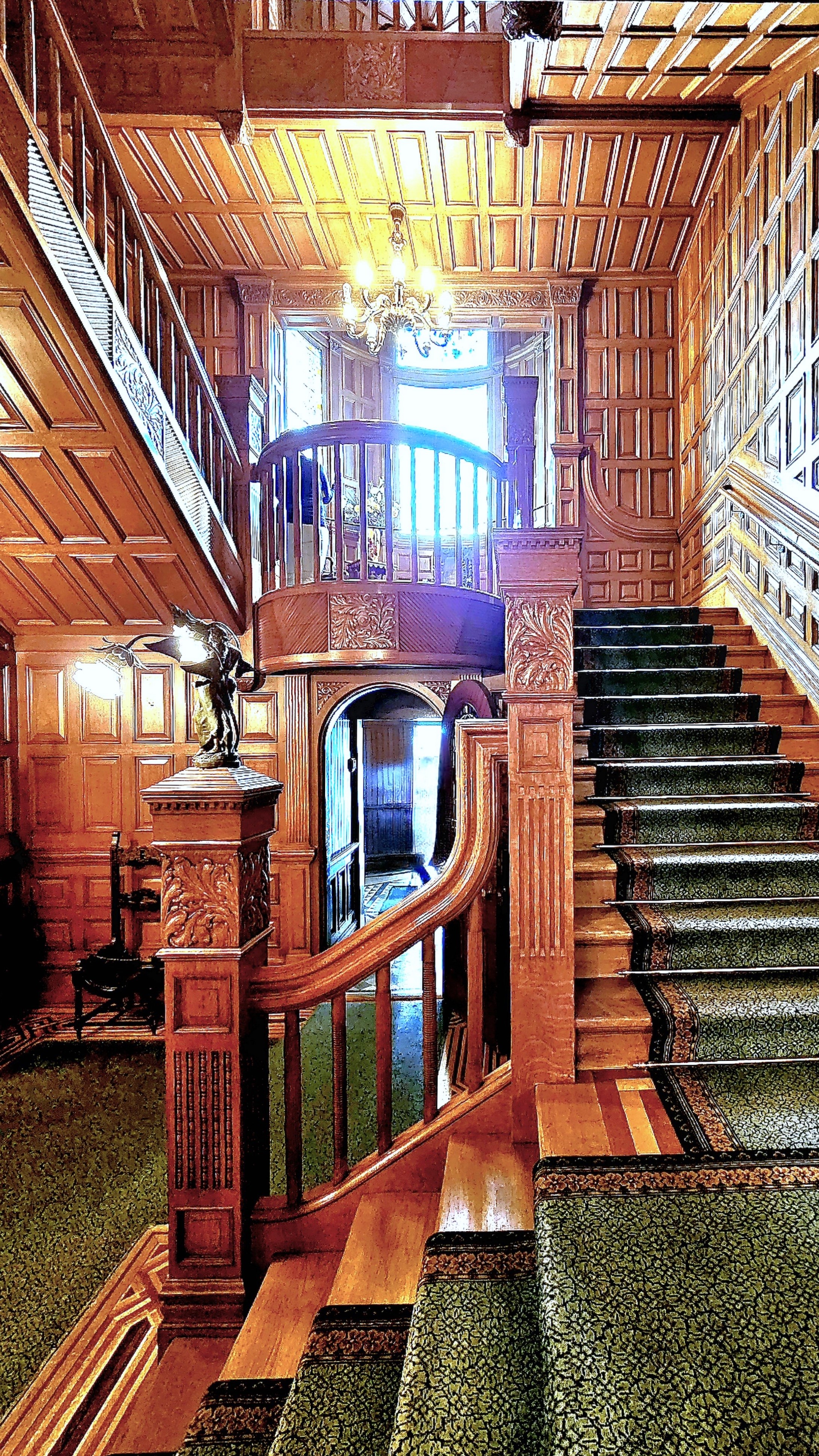
Also within walking distance, we discovered Craigdarroch Castle, a Victorian architectural marvel…
from front…
to back….
top to bottom,
and everywhere in between!
And exquisitely furnished throughout the residence.
Of course, no visit to Victoria is complete without a stroll through Butchart Gardens,
Leah and I arrived in Colorado Springs, where we liaised with Leah’s daughter, Carrie and her clan to enjoy a camping adventure together during the Independence Day holiday weekend, and it was action-packed.
Hiking one mile into Guffey Gorge…
brought us to Paradise Cove, a swimming hole popular among local adolescents who come to cool off from the 100oF heat and flex their courage muscles by cliff jumping into deep water.
Risk-takers were scrambling up the terrain to pick their “launch” position on the rocks, and prove to themselves and others that they had “The Right Stuff.”
We were happy eating our lunch while watching the derring-do entertainment.
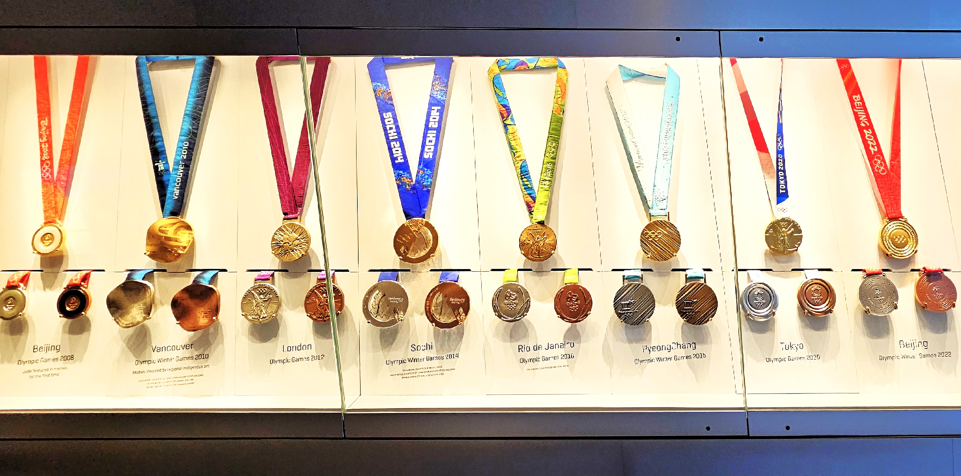
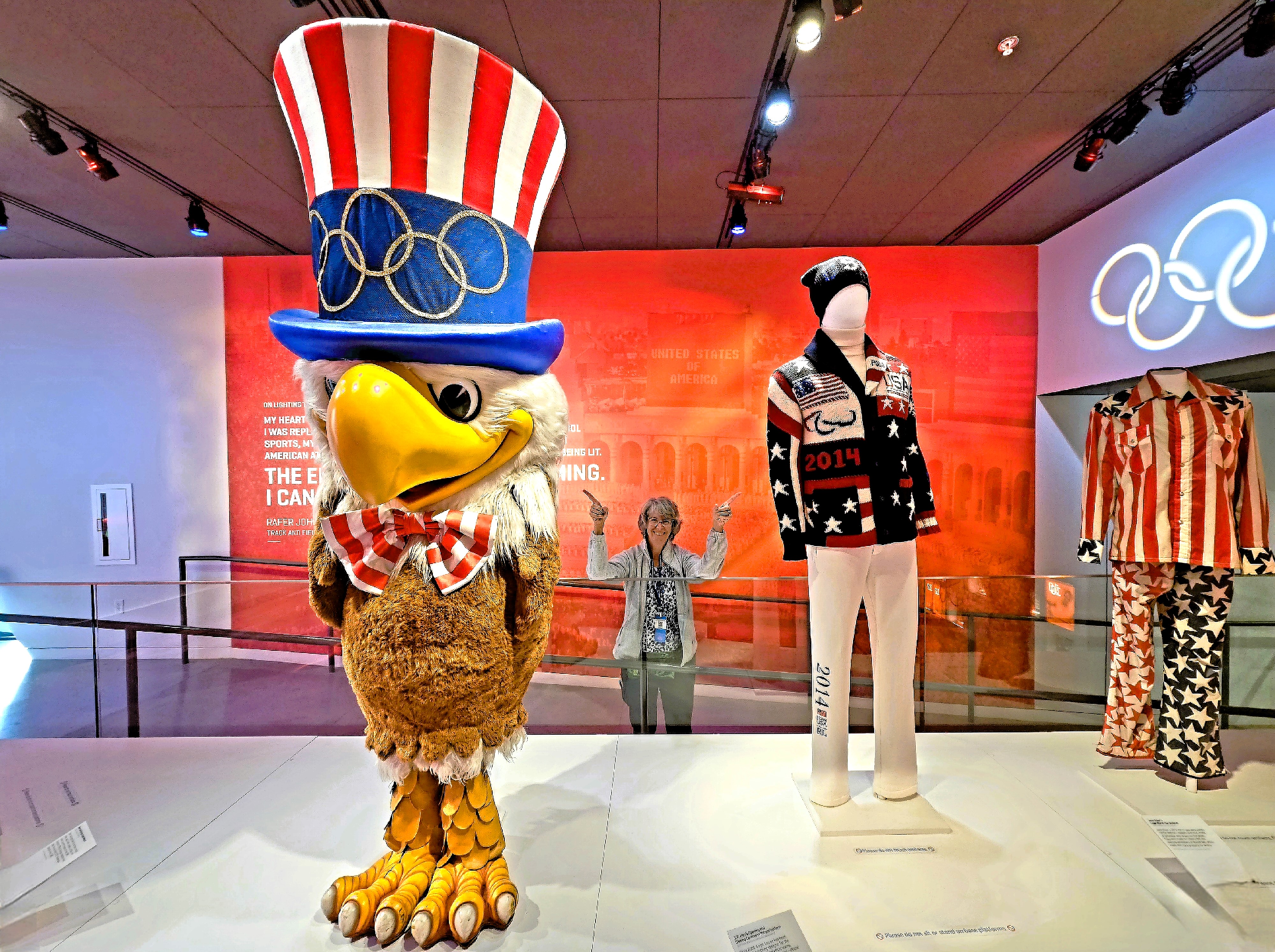
But Colorado Springs has so much more to offer. For starters, the interactive U.S. Olympic and Paralympic Museum offered the perfect opportunity to celebrate athletic excellence;
to mock-compete in several sports categories by testing memory, reflexes and endurance;
and provide exhibition space for thousands of Olympic artifacts collected over the years.
After capturing a clever montage from the digital mural in the building foyer,
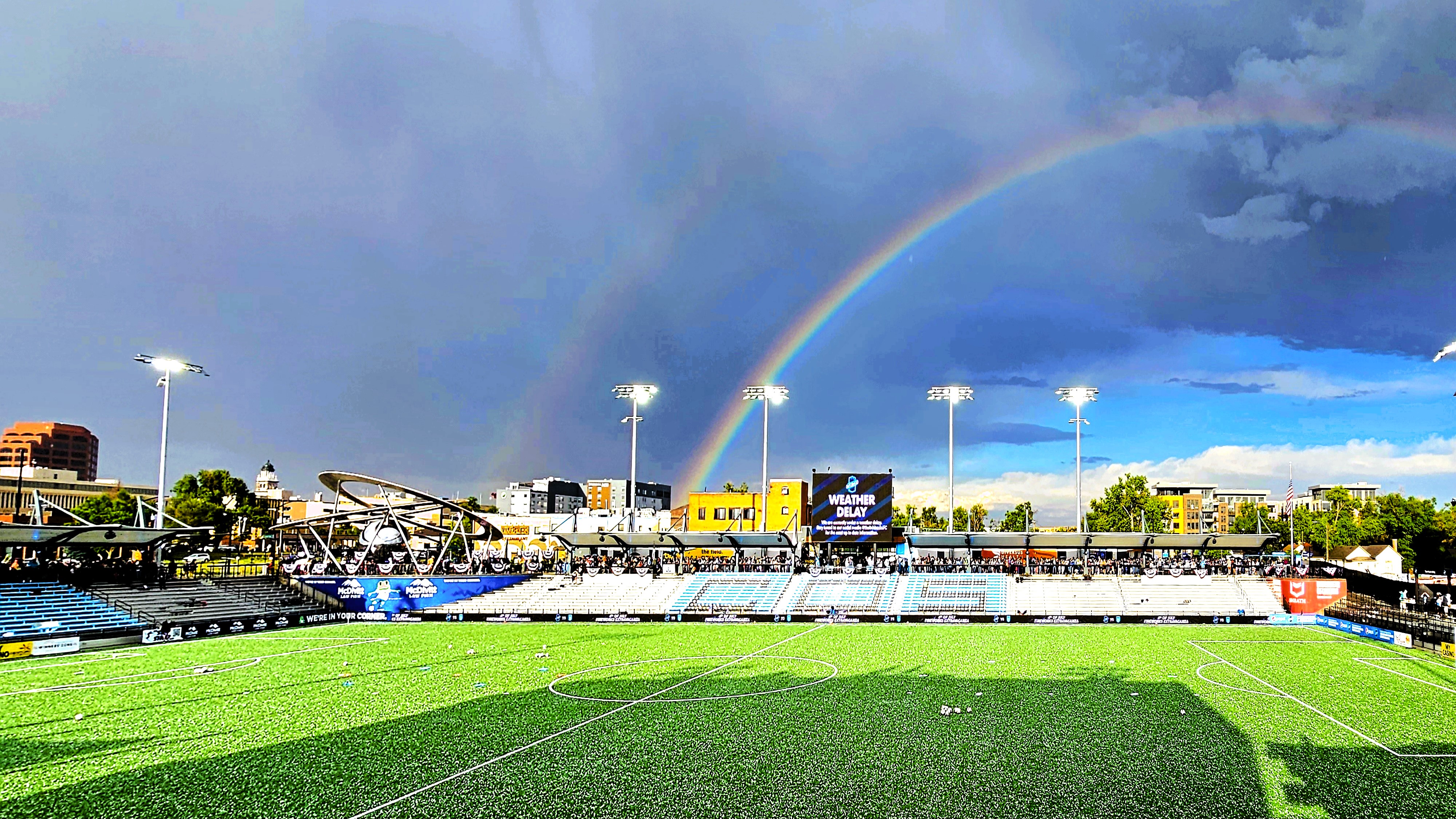
it was time to watch the Colorado Springs Switchbacks take the pitch at Weidner Field against Monterey Bay, but not until after the cloudburst,
when the unexpected hail finally had a chance to melt.
While Carrie and clan cruised to nearby Cañon City to view the Royal Gorge (our destination in 2 weeks,
Leah and I returned to Garden of the Gods,
before continuing to Manitou Springs to visit the urban fauna…
and flora.
Ironically, we’ve recently visited Carrie and clan at home in Cedar Crest, NM after 7 weeks of subsequent travel to dozens of different destinations…
which is a sore reminder of how far behind I am in chronicling this summer adventure, whether it’s because of inconsistent internet on the road or enjoying myself too much to stay current.
I never considered Kansas to be particularly picturesque (no offense, Kansas), and rarely in the running for Most Beautiful State title.
Driving westbound on I-70, my initial impression of Kansan landscape was a blur of high plains, pastureland and fields of fodder as far as the eye could see. The drive was basically a bore and staying alert was becoming a challenge. I glanced at Leah. She was slack-jawed with her head back and pretend-listening to an audiobook.
I activated the ALEXA app on the dash display.
“Hey Alexa,” I intonated and enunciated, “Name the flattest state in America.”
Alexa quickly responded with, “By any measure, Florida takes the prize for the flattest state in the nation [along with its flat-earth thinking, of late] because the highest point in the state is only 345 ft above sea level… Kansas merely ranks seventh in flatness.”
Nevertheless, Kansas does have an honorary mountain barely within its western border, making it the highest point in Kansas at 4039 ft.
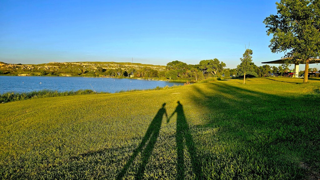
There was another notable elevation change that Leah and I explored before we reached the Rockies. We scheduled a stop at Lake Scott State Park (elev. 2979 ft) to break up the drive between Topeka and Colorado,
stretch our legs,
and discover the Badlands of Kansas.
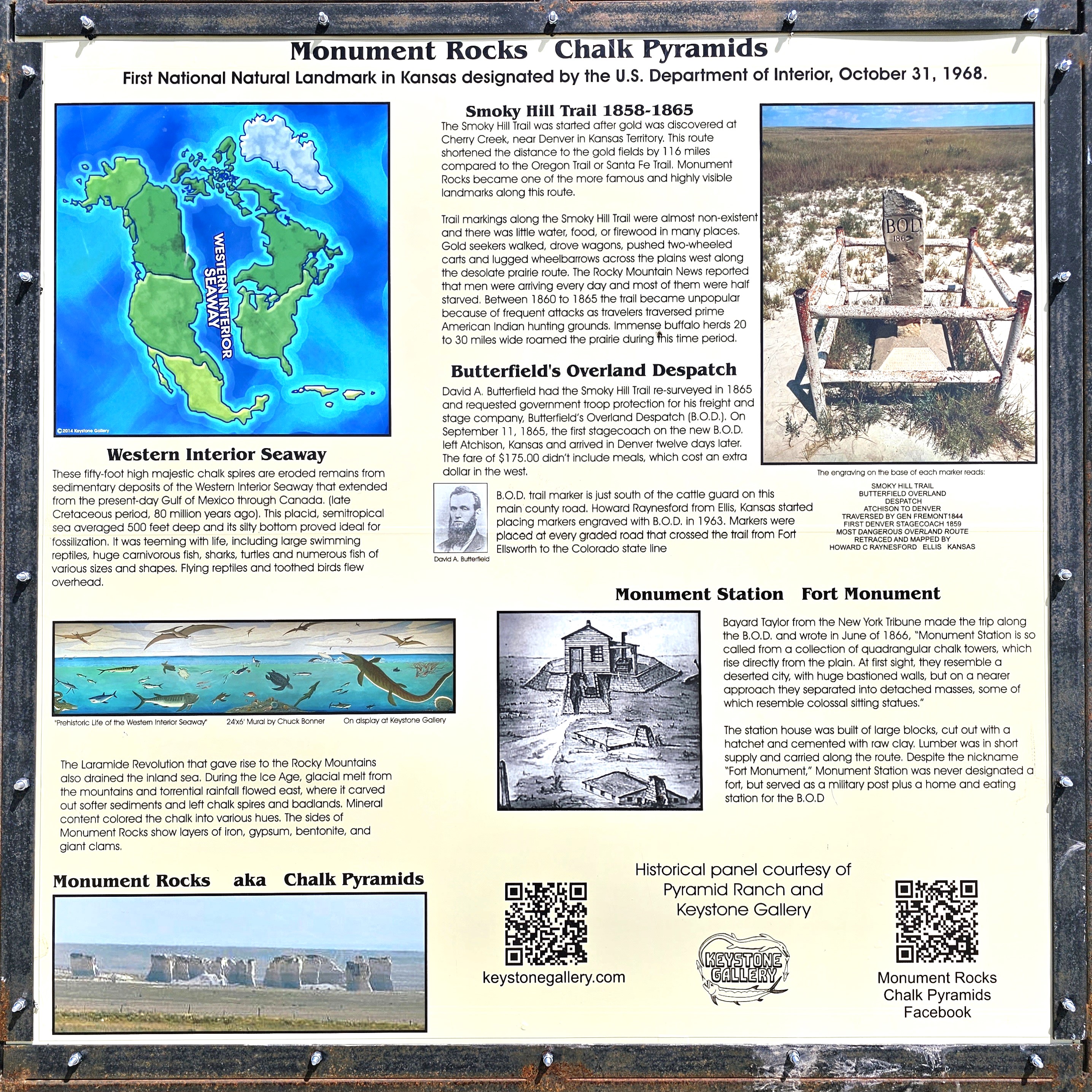
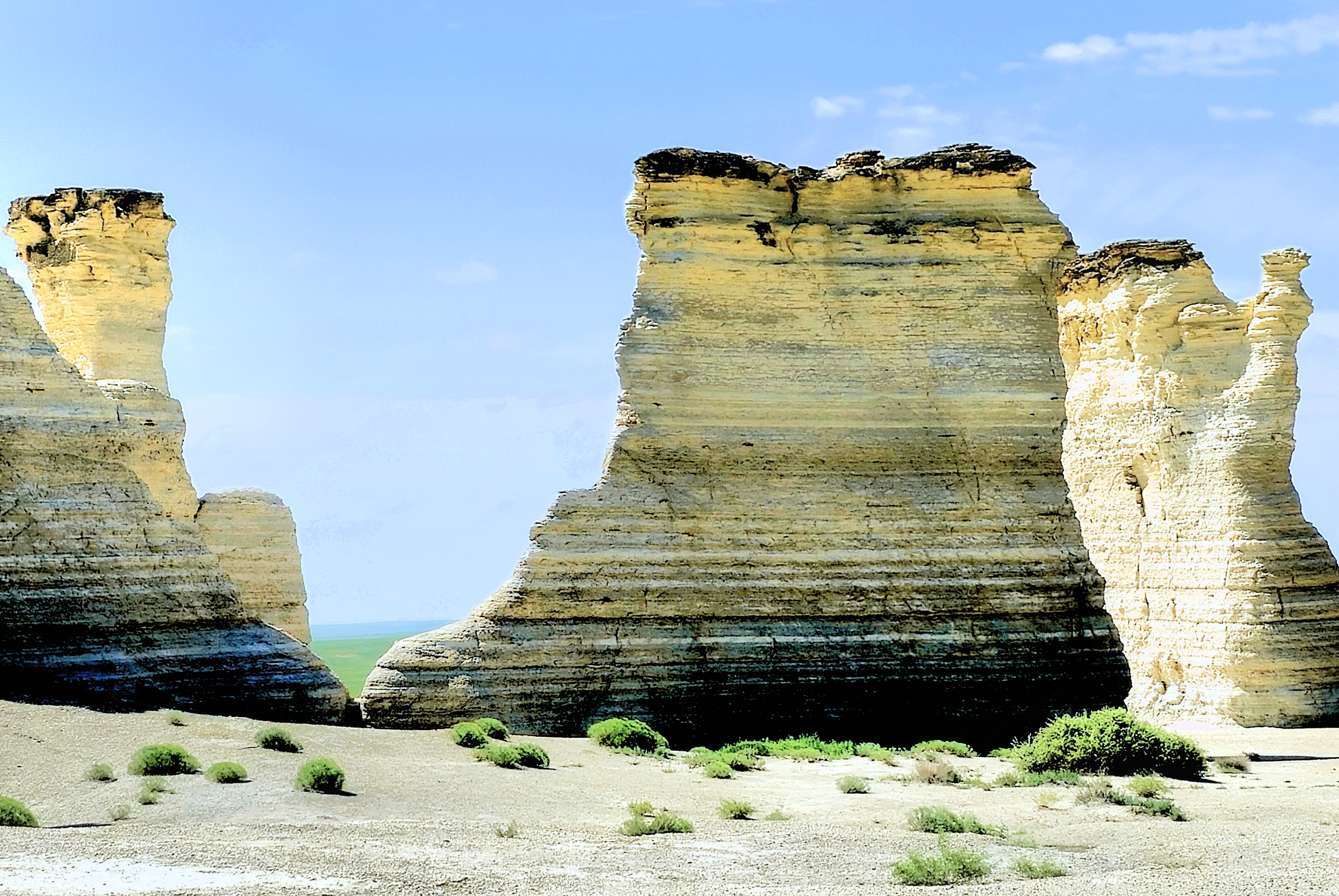
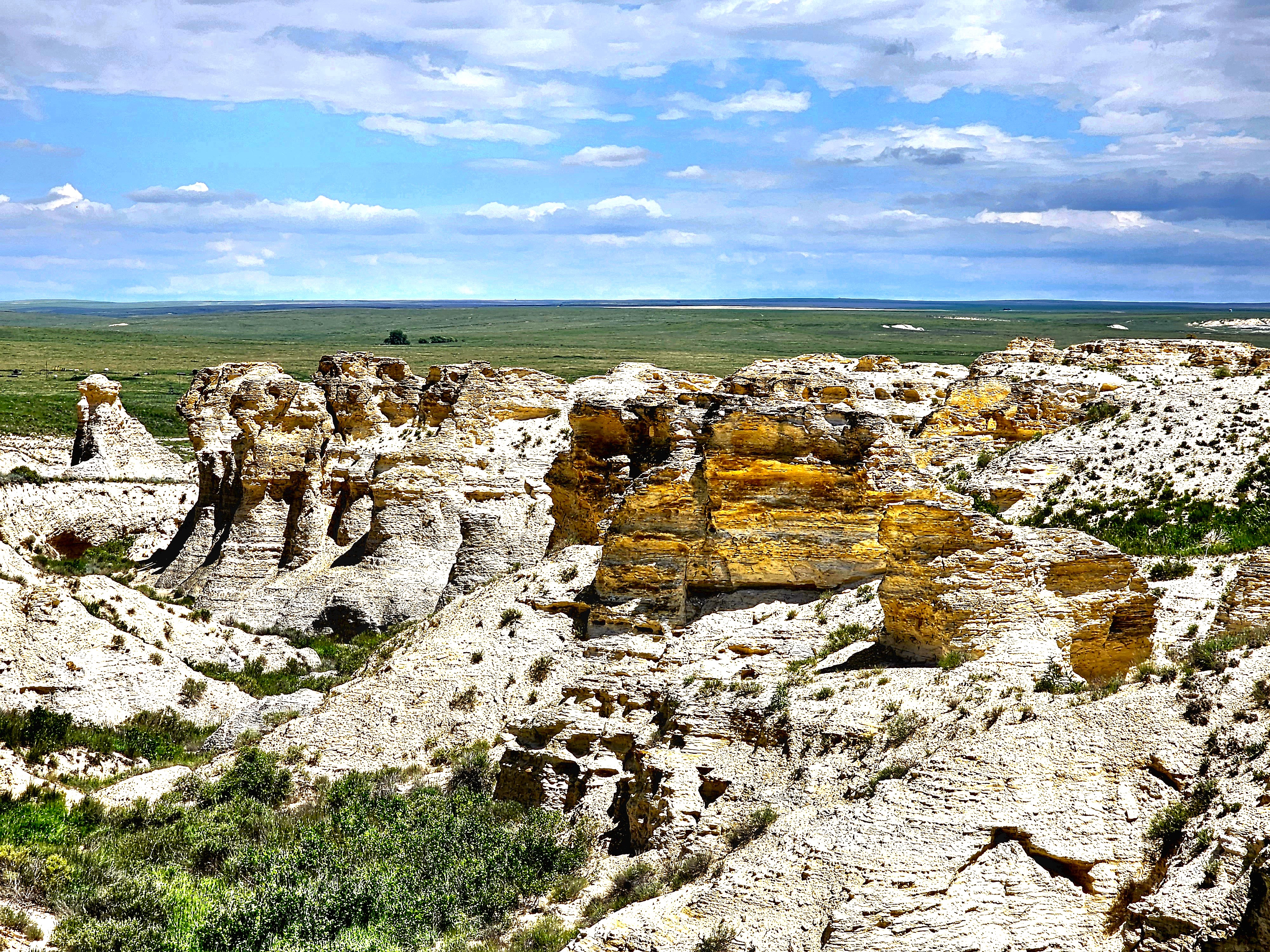
But first, we detoured 15 miles east to Monument Rocks.
As the first National Natural Landmark in Kansas designated by the Department of the Interior,
we thought we ought to pay our respects, and we were just shaking our heads at the many visitors who couldn’t wait to desecrate the brittle, 50 ft chalk towers.
Although the formations were small in stature and compact in scale,
they were a site to admire,
and fun to explore!
See ya, fella.
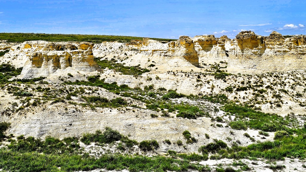
With this tasty morsel served and enjoyed, our appetites were whetted for the main course.
I really wanted to be awestruck by the vision and overwhelmed by the novelty of the geology, but what I saw was a craggy white cliff with spots of color in an unexpected location.
And while it was anything but ordinary…
it failed the goosebump test.
I really wanted this as a win for Kansas, but I got the impression that Kansas wasn’t as prepared as its closest competitor across the border.
Was I becoming, perhaps, jaded?
“Hey Alexa, what’s the longest, straight highway in America?
Much has happened since leaving Bonnaroo for Denver. There’s been a long-distance get-together in Rogers, Arkansas with a nursery school buddy from Pittsburgh…
and a long-overdue reunion with family from Pittsburgh, who now reside in Overland Park, Kansas.
We’ve also kept a watchful eye on the weather–always tracking the extreme conditions that have been swirling around us, the likes of tornadoes, hail, flooding, land slides, and record-setting heat streaks–yet with each destination, we’ve mostly managed to dodge a bullet.
There was also a handful of visits to some iconic sites along the way, and some less familiar, but definitely photo worthy.
Our first stop took us to Parker’s Crossroads, halfway between Nashville and Memphis, and the site of a celebrated Civil War skirmish in West Tennessee.
It was the final battle for Confederate Brig. Gen. Nathan Bedford Forrest, who managed to outfox the Union brigades of Col. Cyrus L. Dunham and Col. John W. Fuller by escaping with his regiment across the Tennessee River and avoiding certain defeat in the face of an enemy nearly twice the size with two times the artillery.
Leah and I took the walking tour past interpretive markers depicting critical moments in the battle, and observed that Parker’s Crossroads battlefield, while a testament to the 737 fallen soldiers,
should also be appreciated for its serenity and pastoral scenes.
Only 45 miles west of us was Tennessee Safari Park in Alamo,
where we looped around a drive-thru zoo for an hour with 4 buckets of animal nachos for hungry wildlife roaming freely throughout the fenced prairie. We were immediately greeted by an aggressive mob of ostriches and camels that descended upon our truck sensing a meal was imminent.
With the passenger window down, Leah tentatively extended the bucket beyond the door, only to have the bucket ripped from her hand by a dromedary with no manners and fewer eating skills.
Kibble went flying everywhere–inside and outside the truck. Even today, I’m still fishing out morsels between the seats. Lesson learned.
However, the lure of food was a perfect ploy for pet portraits…
Continuing west, we traveled to Little Rock, home to the Clinton Presidential Center, dedicated on November 18, 2004.
We parked the Airstream directly across the Arkansas River in North Little Rock by a decommissioned WW II tug and sub…
and cycled the long way around the riverwalk trail (some of it kinda sketchy),
past the Big Dam Bridge…
until we circled back 8 mi. to Clinton’s library–a hulking structure clad in glass screens that cantilevers over the Arkansas River as a symbol of “building a bridge to the 21st century.” And it was air conditioned!
The building that houses Clinton’s legacy is enormous enough to collect and archive 2 million photos, 80 million document pages, 21 million e-mails, and 79,000 artifacts from the Clinton years (1993-2001).
Appealing graphics break down the headlines and the issues of the time: year by year, month by month, surrounded by wings dedicated to domestic policy, diplomacy, economy, education, civil rights, and scandal. It’s all on display throughout the Main Hall, modeled after the Long Room of Trinity College in Dublin.
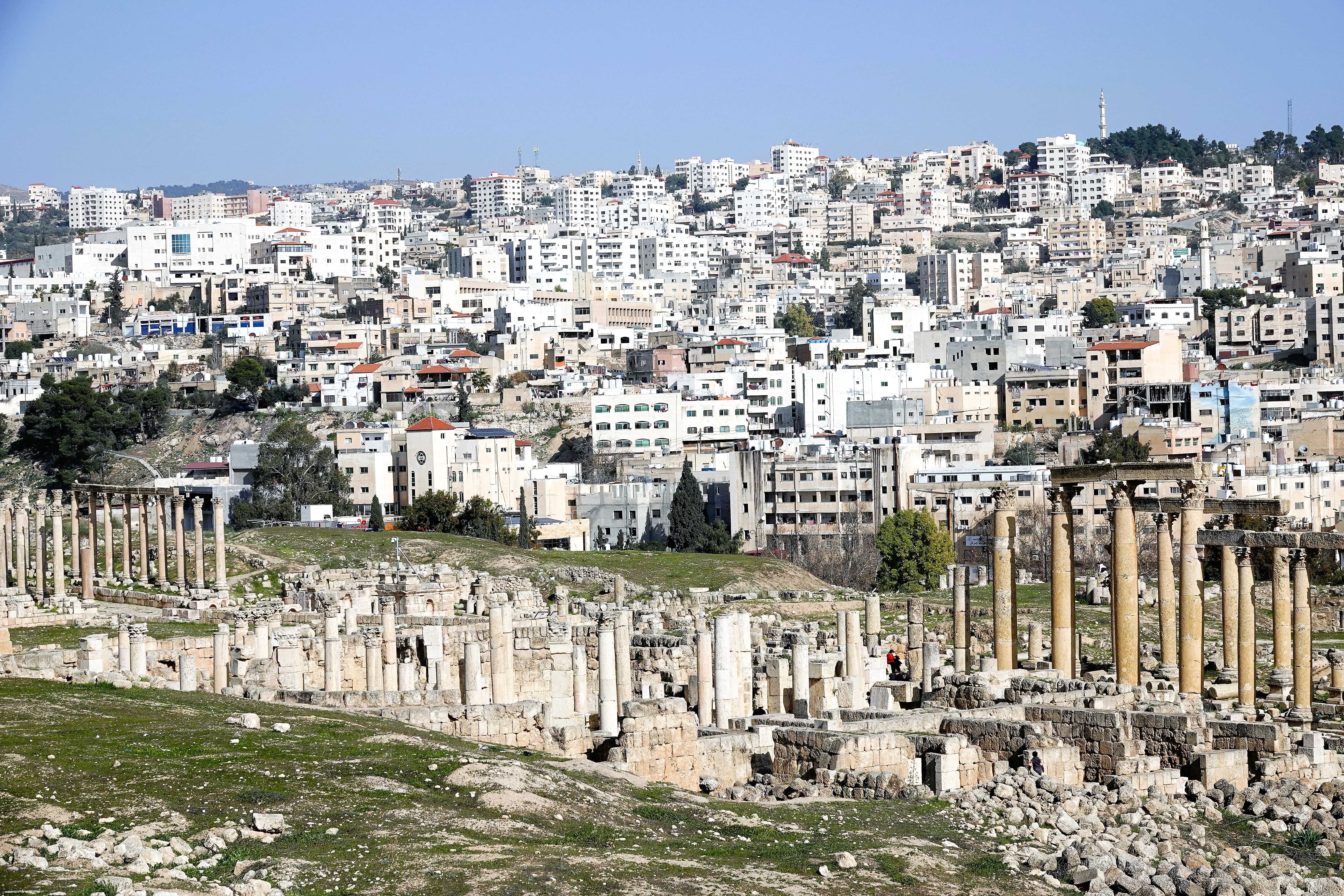
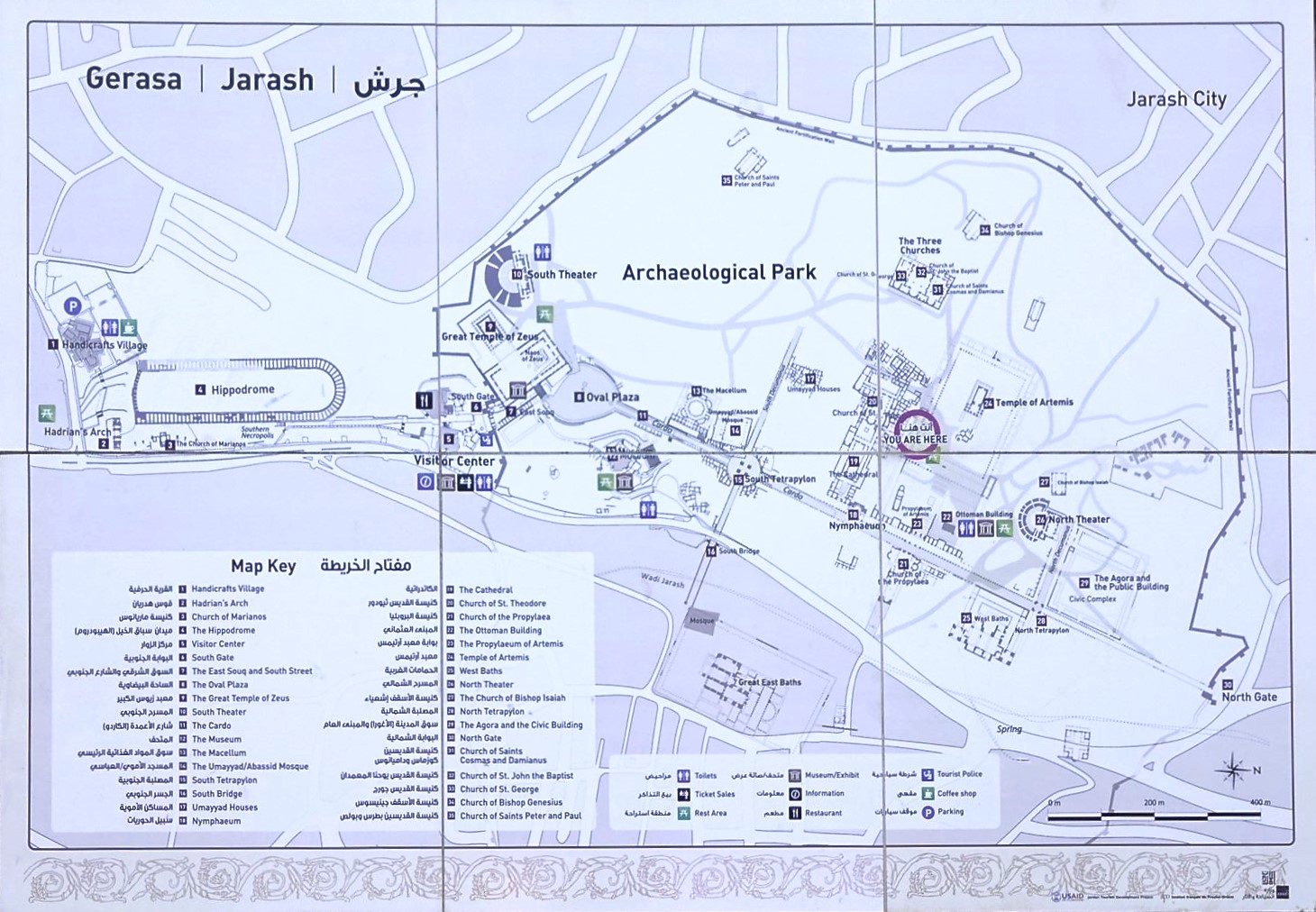
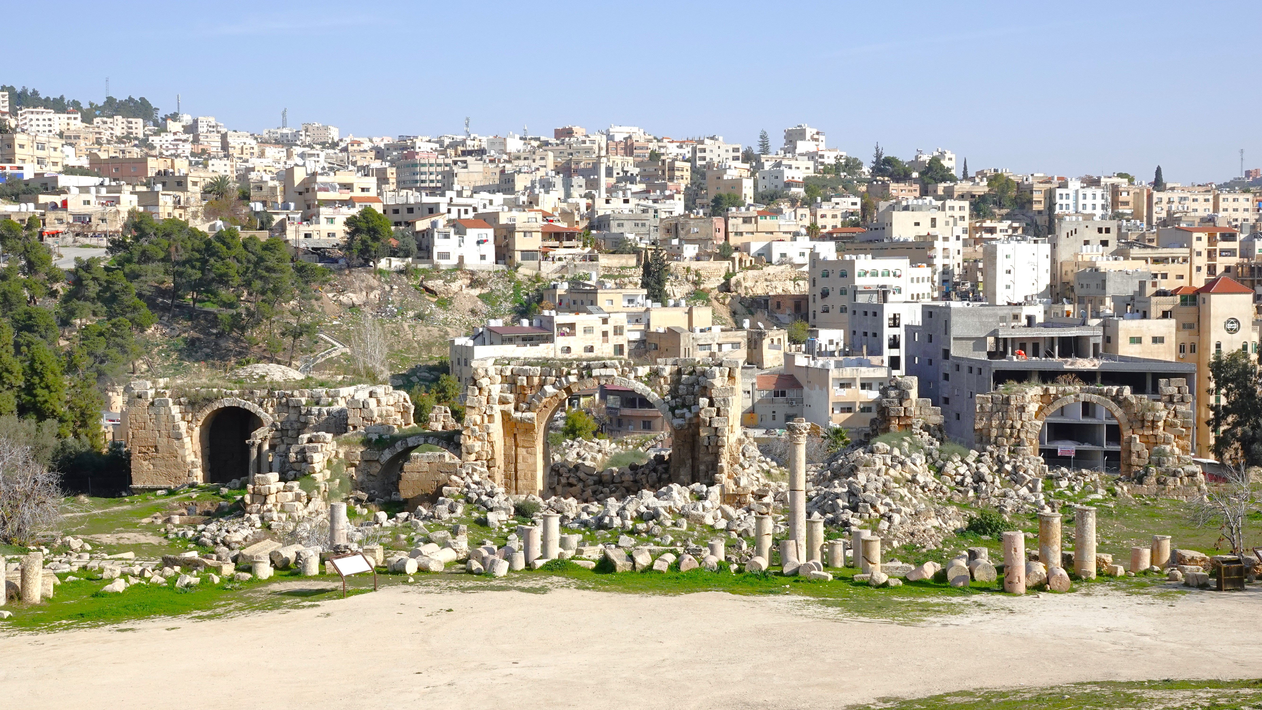
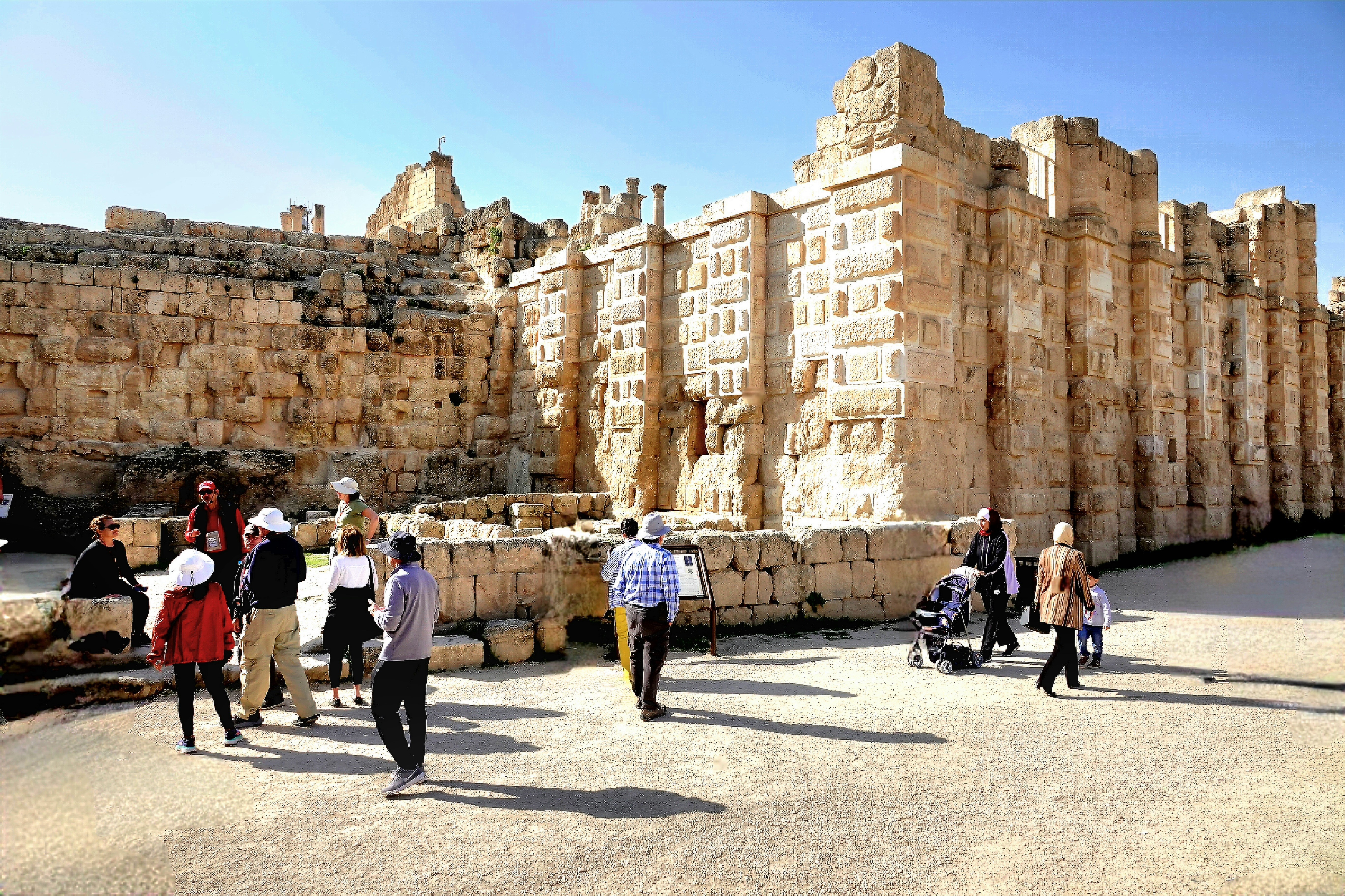
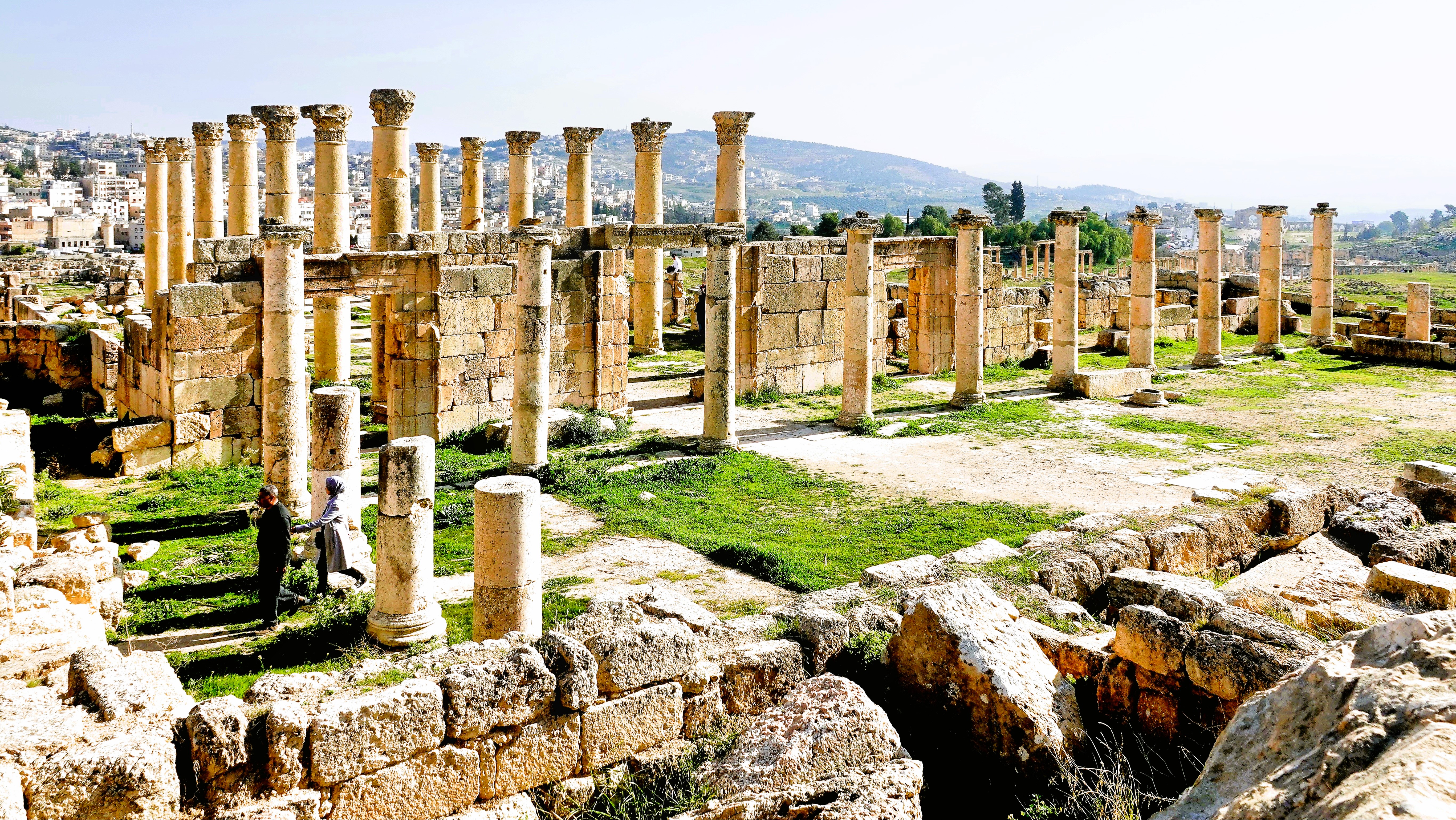
Jerash is a modern city 45 km (30 mi) north of Amman,
that surrounds an immense Archeological Park designed to protect the ruins of a walled Greco-Roman settlement,
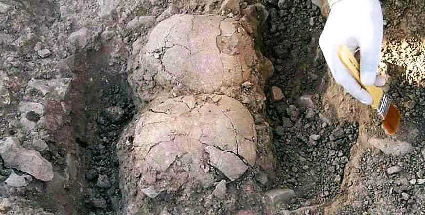
as well as human remains from Neolithic times.
Photo courtesy of UJ
Jerash evolved from an agrarian village on the banks of Wadi Jerash throughout the Iron Age and Bronze Age, to becoming a 4th century BC garrison founded by Alexander the Great on his way from Egypt to Mesopotamia.
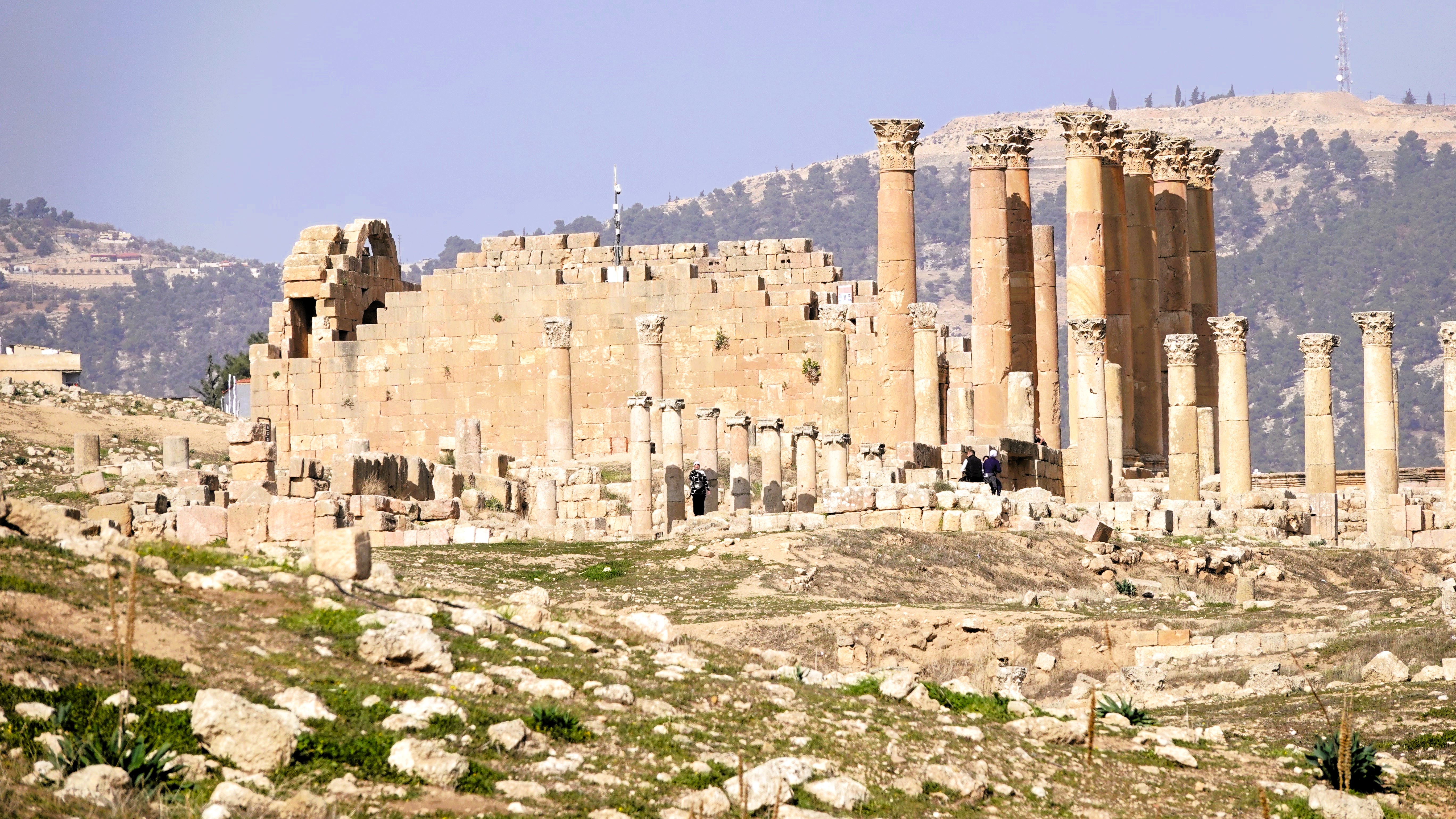
Subsequently, under the reign of Antiochus IV (175 – 164 BC), Jerash became a tax and trade capitol, with special thanks to Zeus for his guidance.
Great Temple of Zeus
As an aside, it deserves mentioning that King Antiochus is regarded as one of Judaism’s major villains for his iron-fisted repression of Jewish laws and customs. He is forever vilified as the ruler who desecrated Jerusalem’s Second Temple by turning it into a brothel and sacrificing a pig on its altar to honor Zeus. His continuing persecution of Jews ultimately prompted an uprising commanded by Judah Maccabee in 167 BC that eventually led to the recapture of Jerusalem and rededication of the Second Temple, spawning the Miracle of Hannukah.
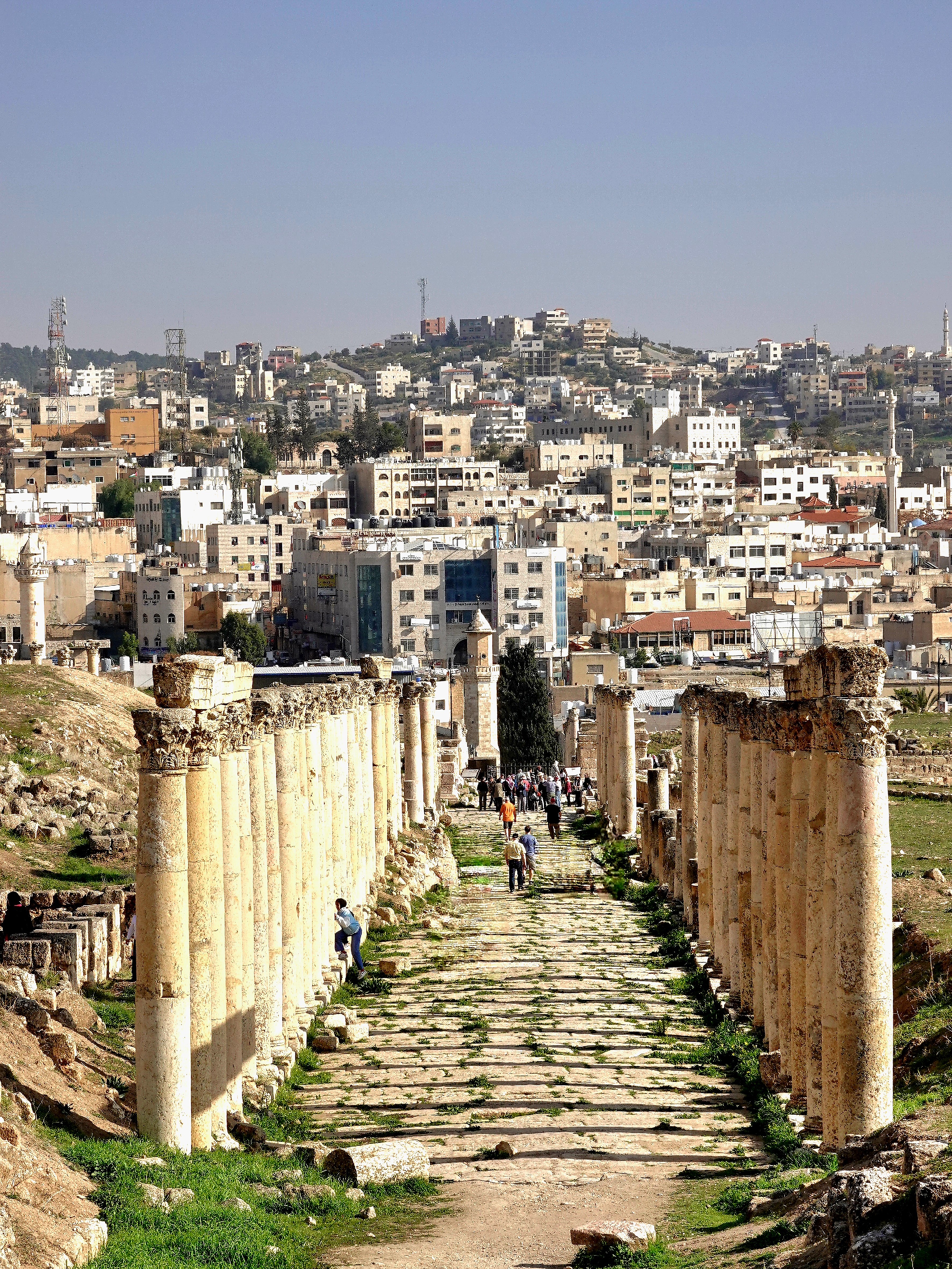
Only Greek inscriptions on city foundations remained after Jerash was sacked by Roman general Pompey in 63 BC. But under Roman rule, Jerash was rebuilt and thrived as an important trading center to Europe and Asia, as evidenced by the array of architectural riches that have been excavated and restored over the past century, making Jerash the most well-preserved, ancient, Roman city east of Italy.
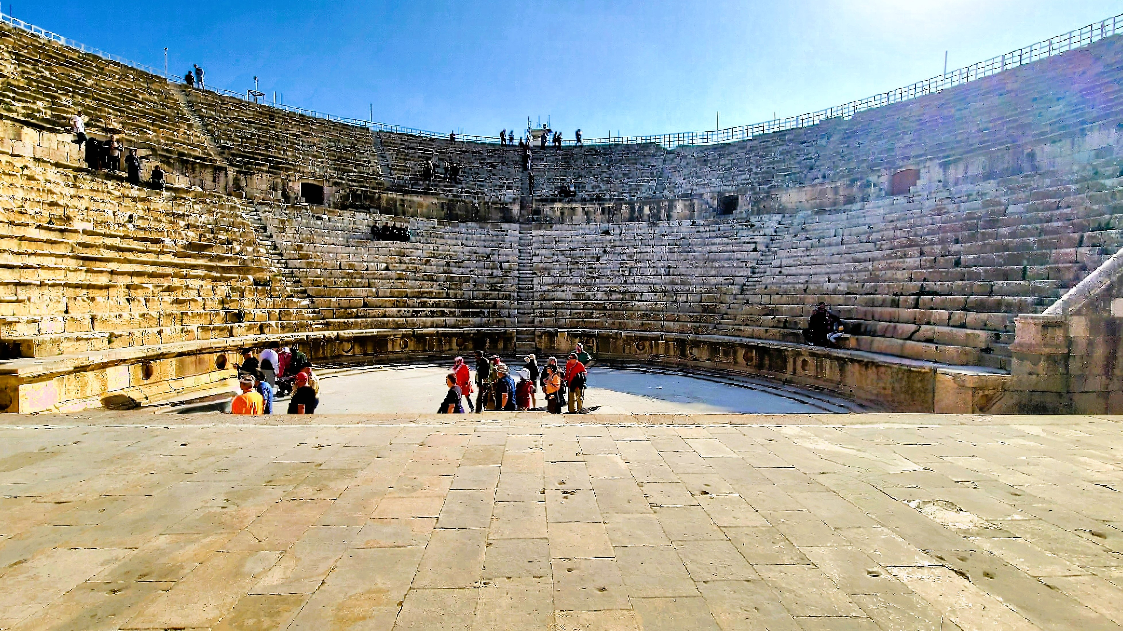
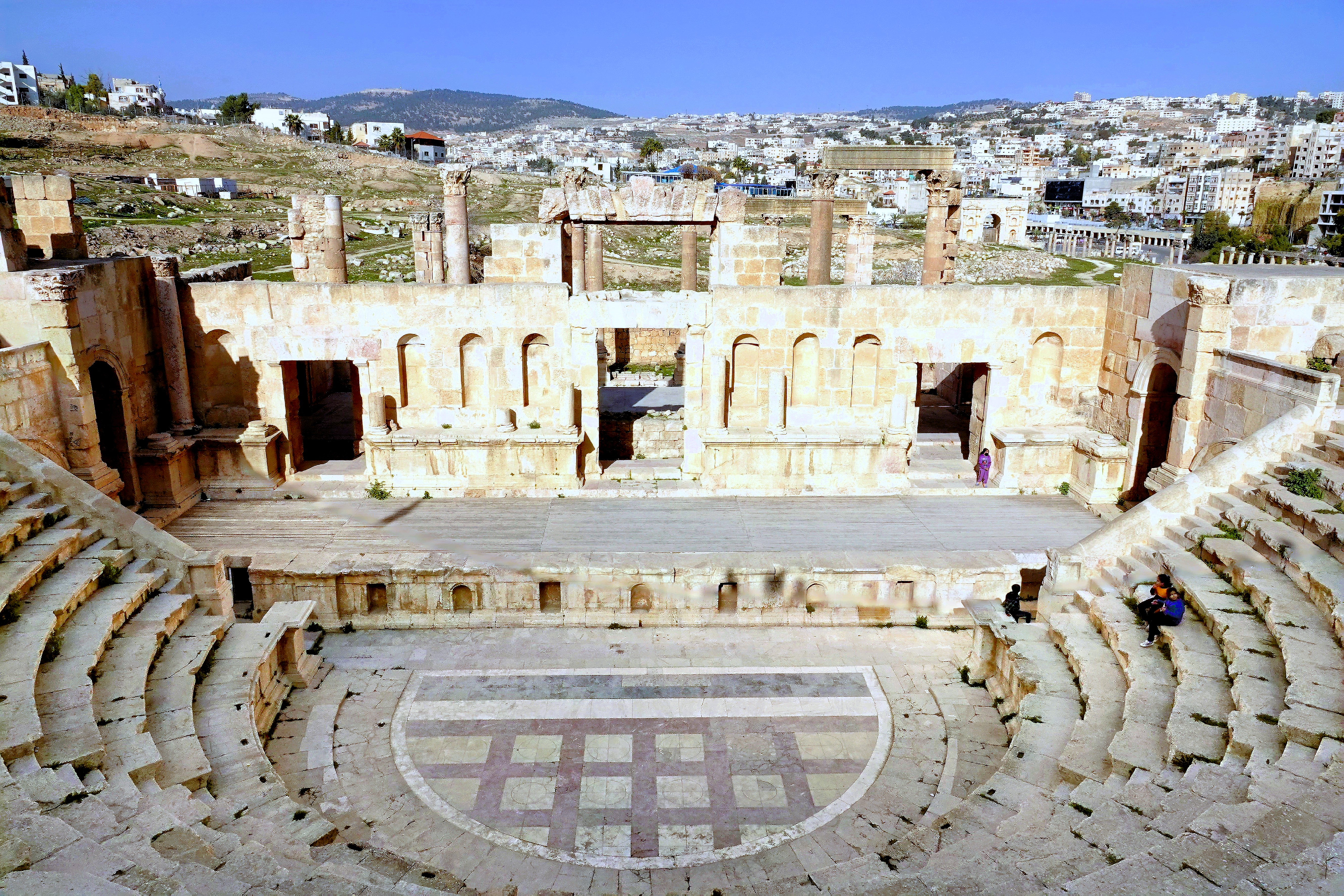
South Theater
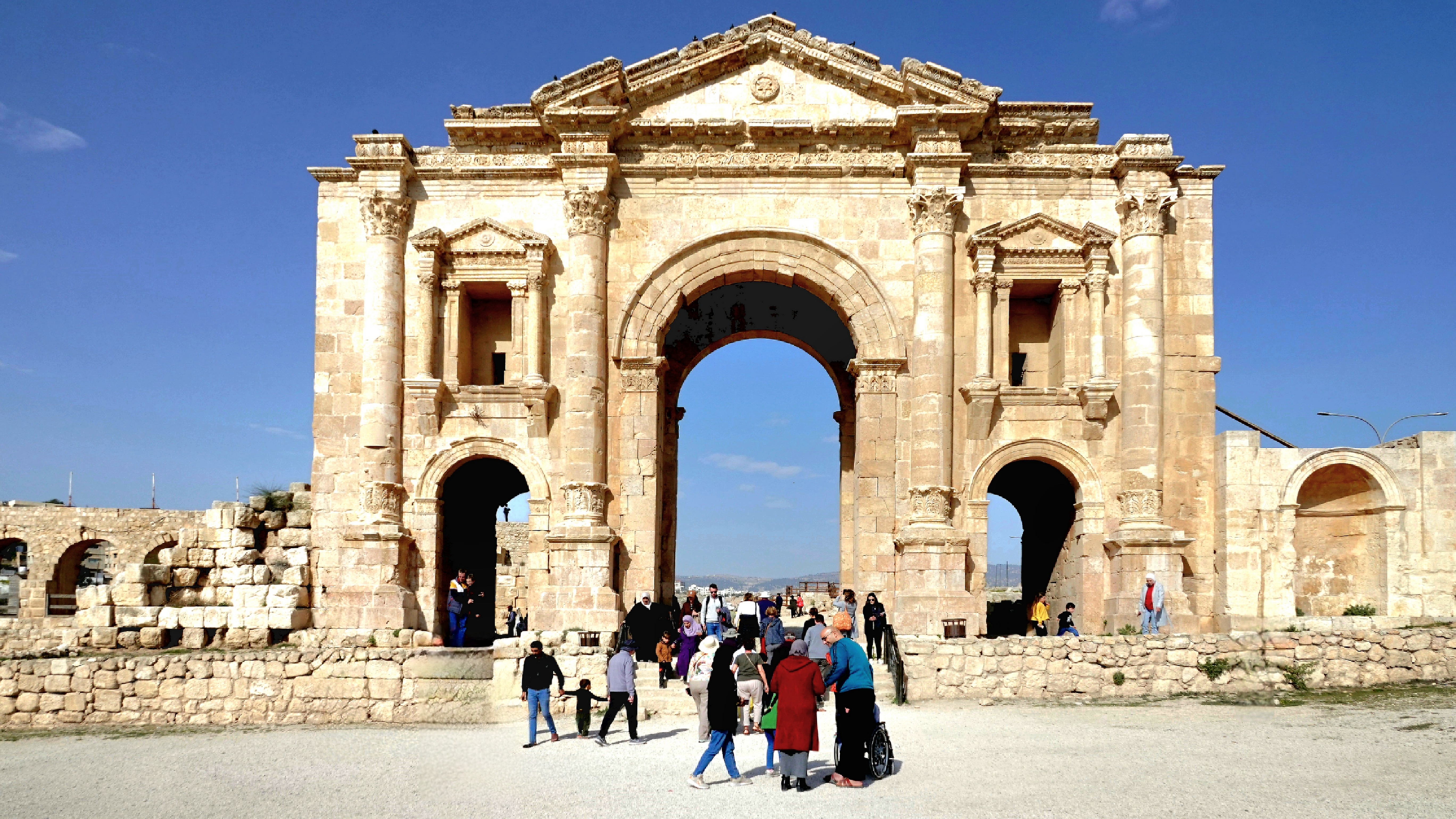
A walk through the Archaeological Park carried us back in time when the Roman Empire flourished, and Hadrian’s patronage (Emperor from 117 – 138 AD) benefitted the eastern provinces.
Hadrian’s Gate
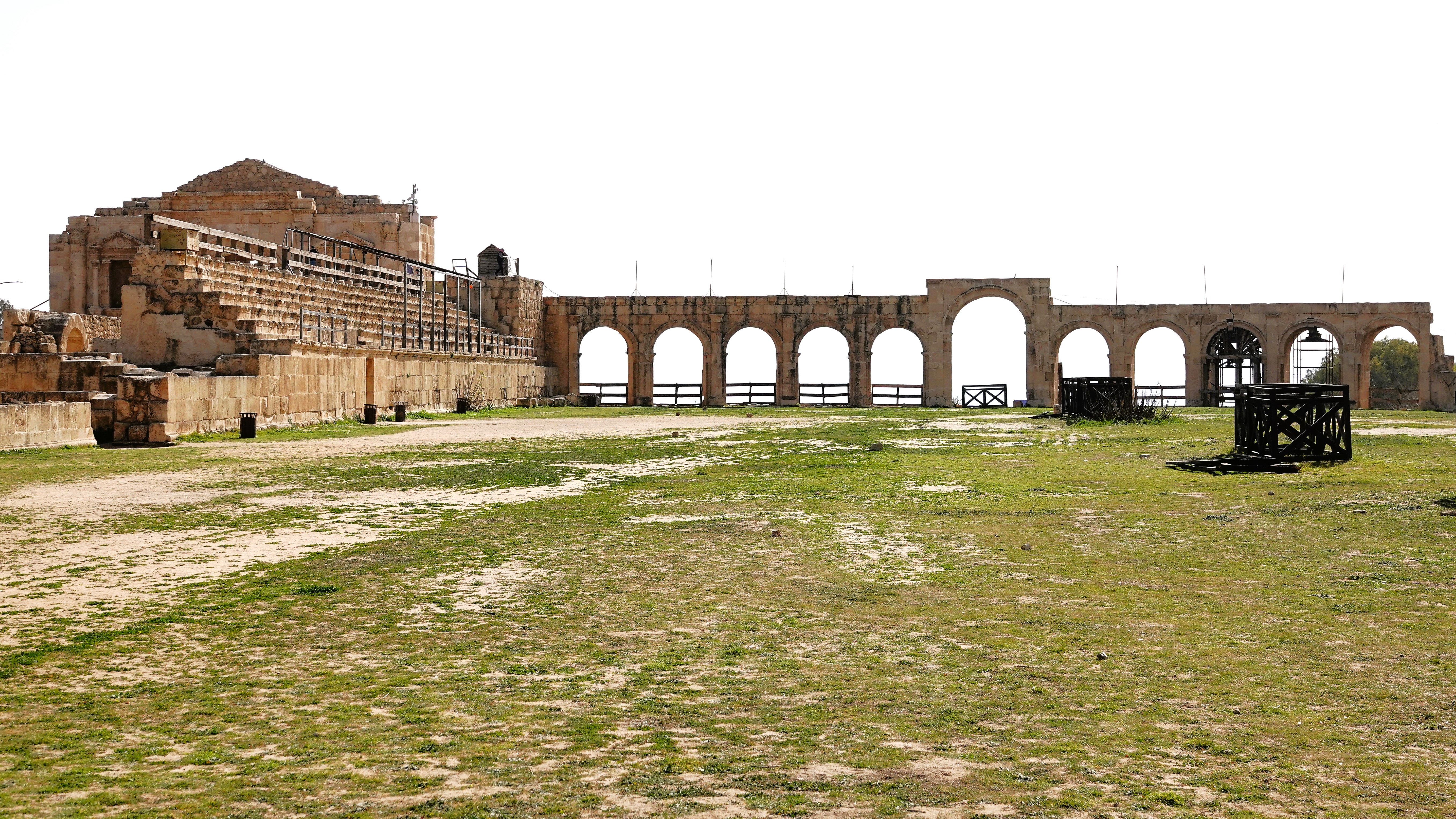
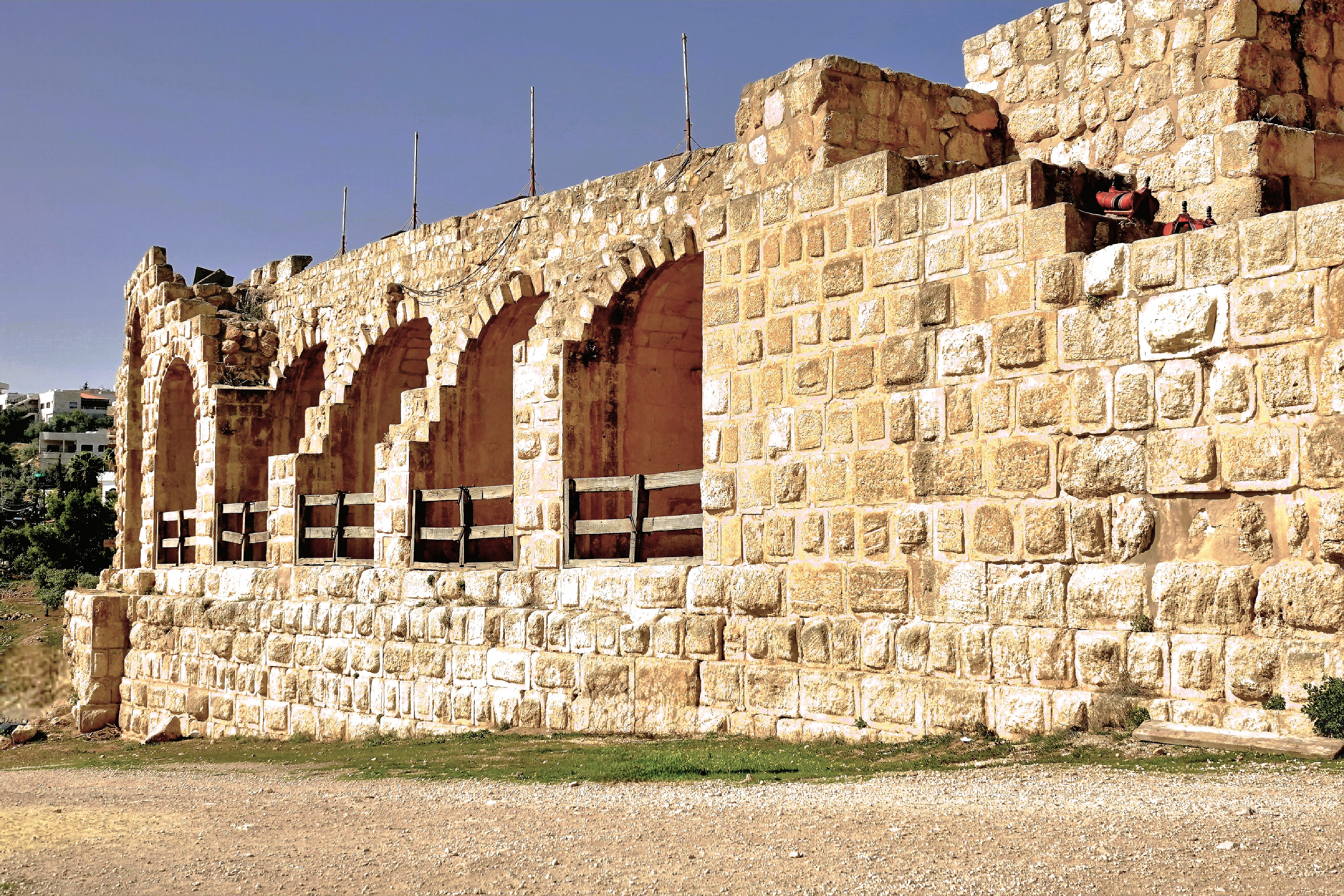
There’s the Hippodrome, originally built for chariot races, and later converted to gladiator fights with the addition of amphitheater seating;
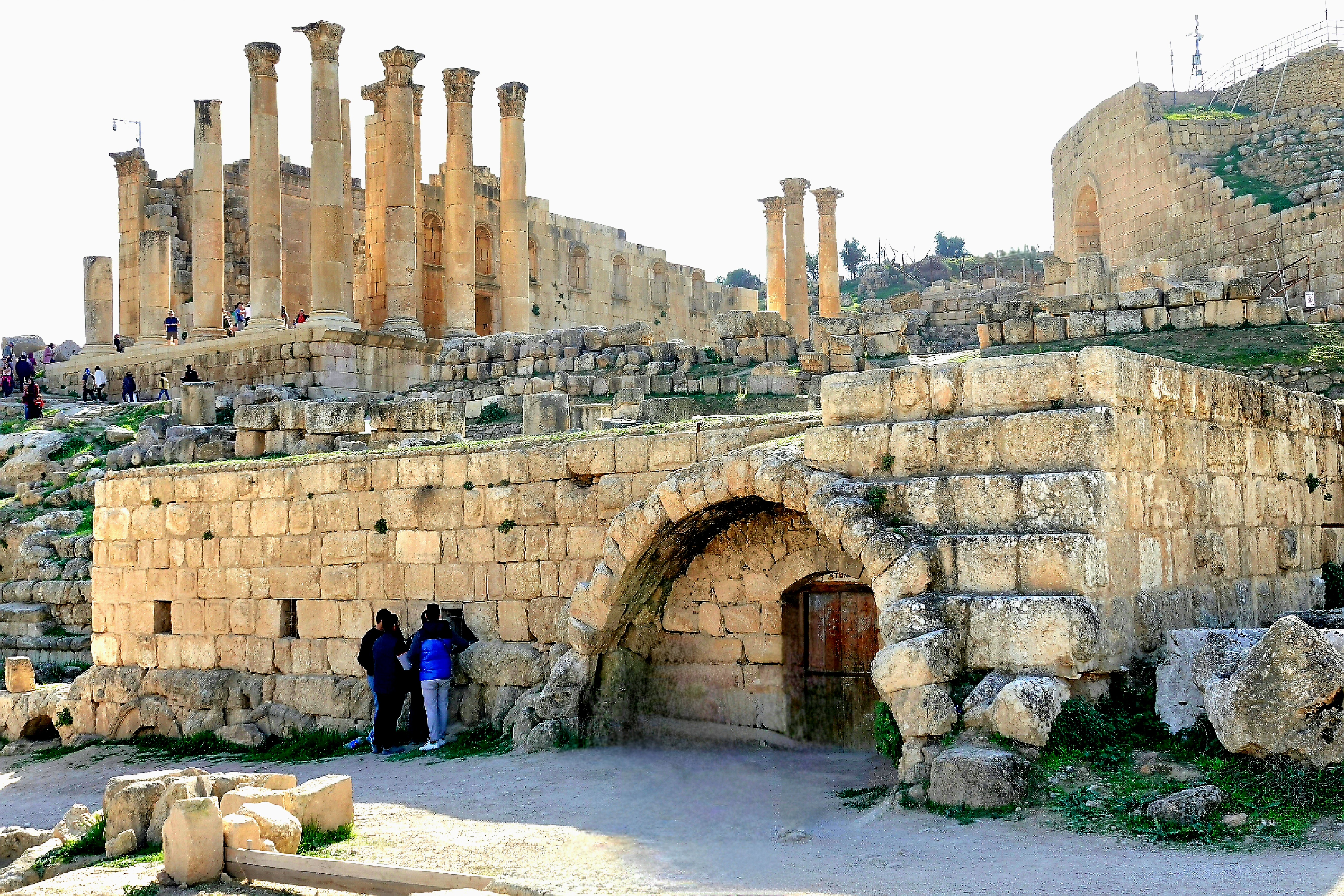
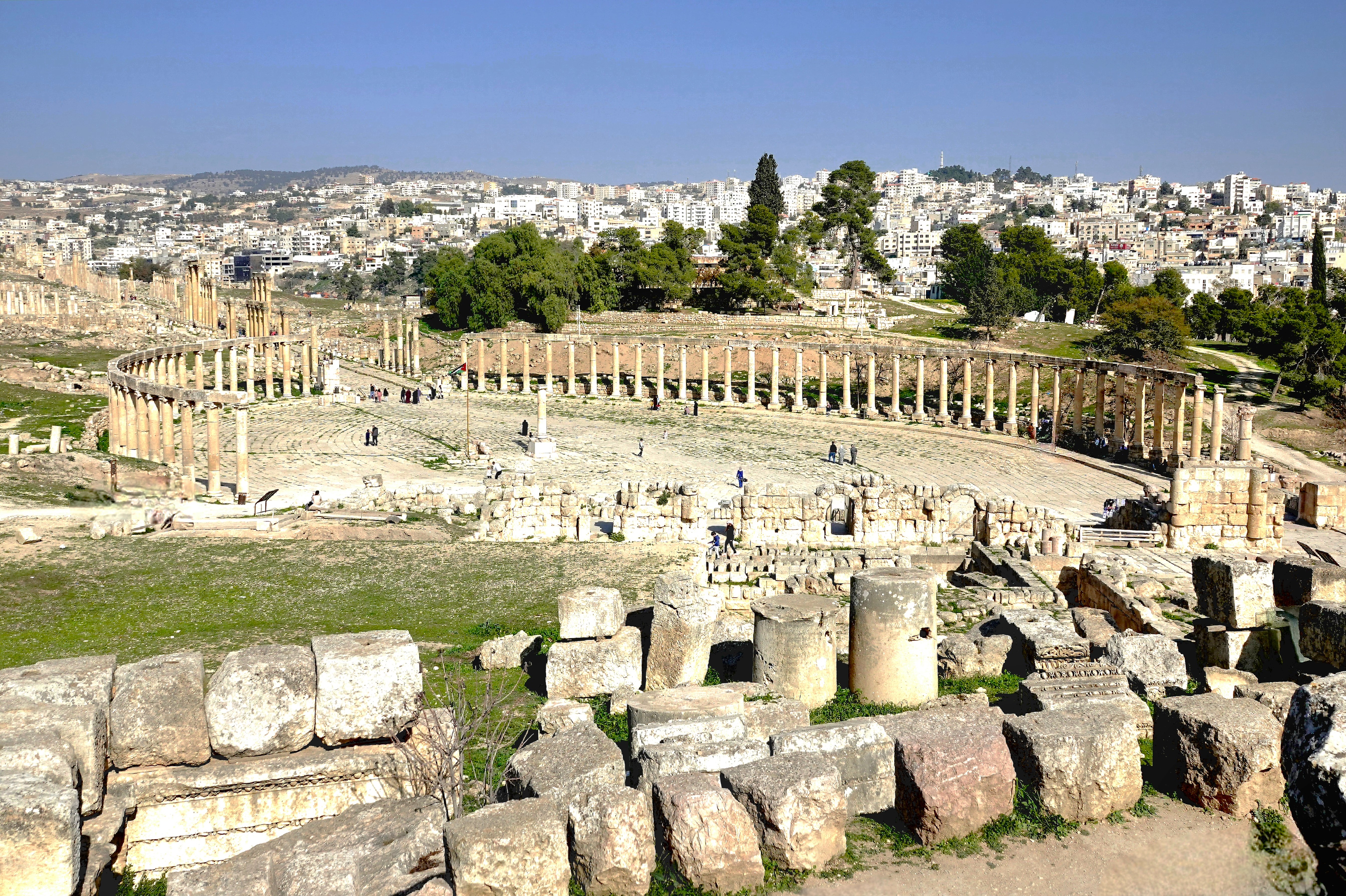
the Oval Plaza, with limestone pavers framed by 56 Ionic columns;
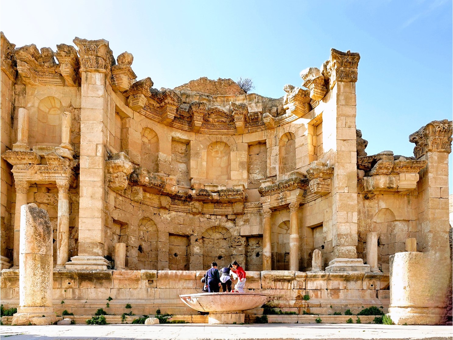
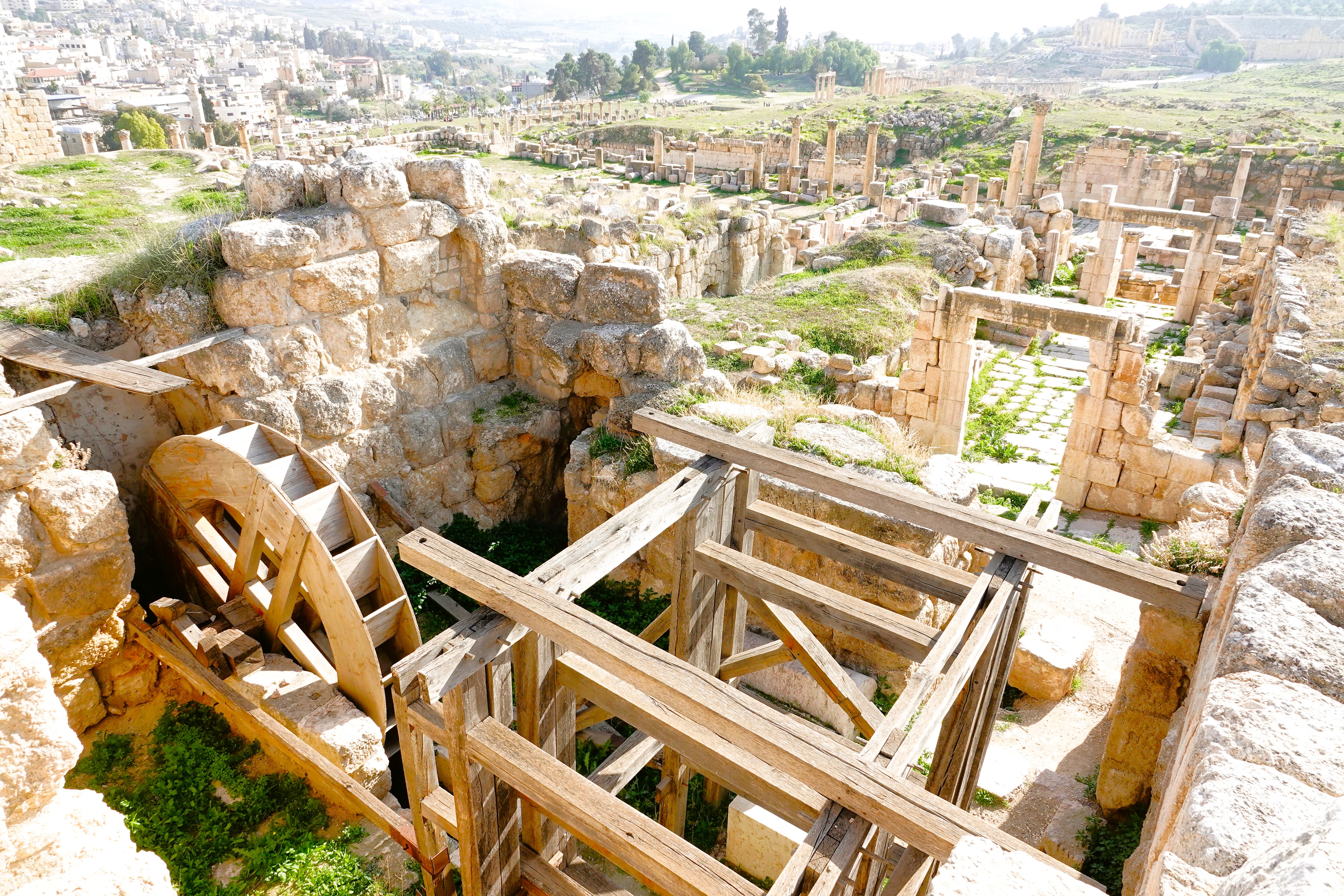
the Nymphaeum, the city’s primary water resource…
built to meet the demands of the Western Baths;
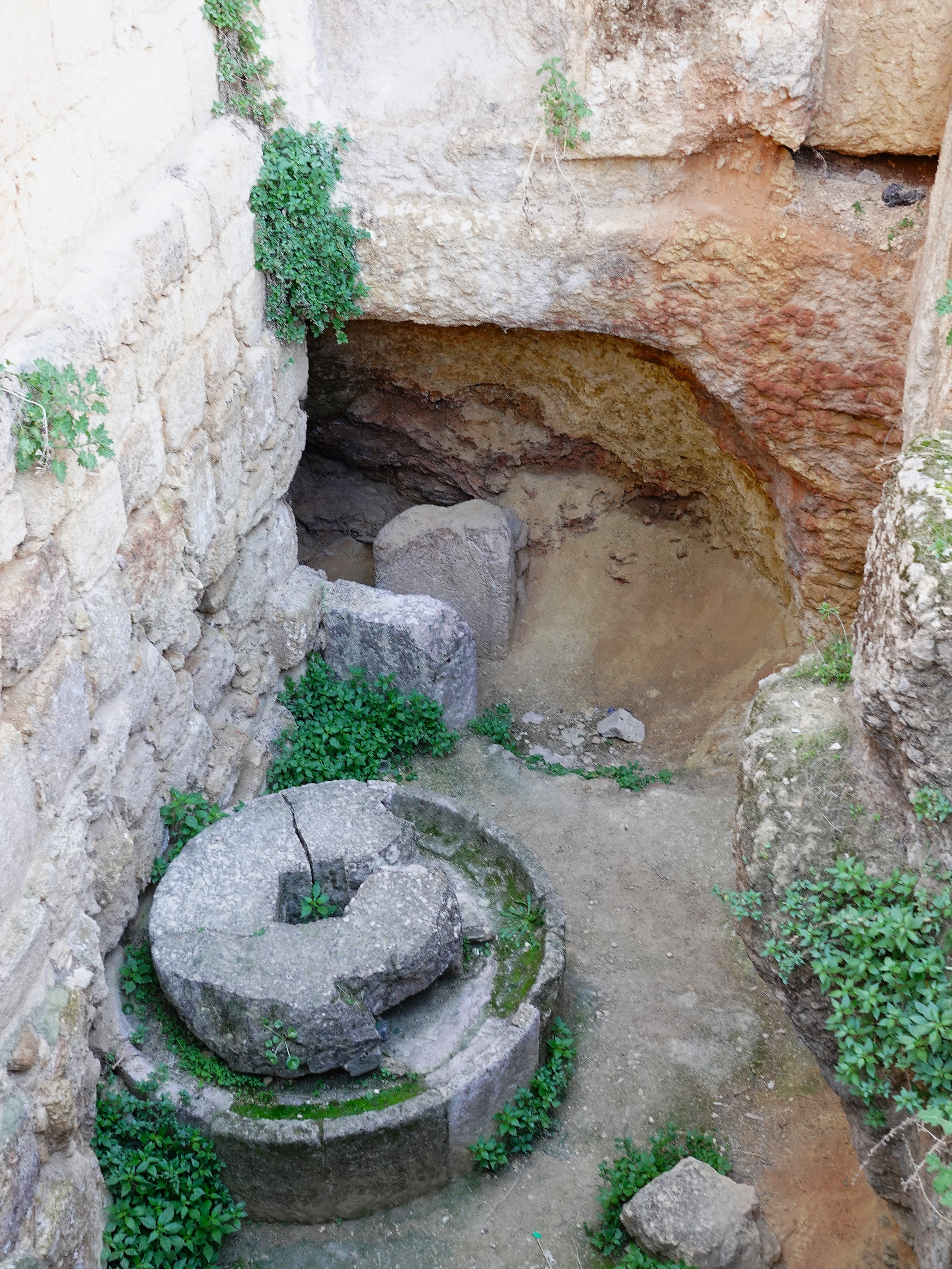
the olive oil press located below the floor of the Western Souk…
and a subterranean, water-powered saw mill;
divided spaces for artisan and trade shops lining South Street, outside city limits;
the North Theater, intended for political events;
the unfinished Temple of Artemis–built as a shrine to the patron goddess of Jerash, but utilized as a church during the Byzantine Period, and a fortress during the Crusades.
and other assorted churches built atop the foundations of earlier structures, like the Church of Mariano’s, assembled from stones of a pre-existing synagogue,
and the Church of St. Theodore, completed in 496 AD.
In 749 AD, a devastating earthquake flattened Jerash and turned this once great city of the Decapolis into rubble. It was soon abandoned and largely forgotten until the Crusaders seized the Temple of Artemis from the atabeg of Damascus.
Eventually, the sands of time buried the ruins. Jerash was discovered again in 1806 by German explorer, Ulrich Seezten, who recognized the ruins. But it was only after the British began colonizing the Jordan Valley in 1921 that Jerash became worthy of preserving.
Lucky for us, the British vibe was on full display at the South Theater…
Weather in Petra can be unpredictable in January. A year ago–on January 26–it was snowing, but today, the temperature would reach 60o and the sky would remain cloudless. What better time to take a hike through history, and walk amongst one of history’s most remarkable endeavors.
With overnight accommodations at Movenpick–directly across the street from the Petra Visitor Center–access to the Old City was most convenient. We assembled early in the town center. The square was quiet except for shops looking for early customers,
and a stray puppy gnawing on a breakfast bone.
Our group gathered around a large map in town center to plan our hike.
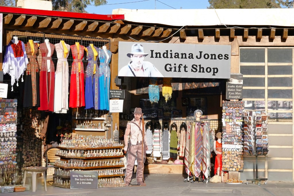
Ahmad explained the many ways to get to Petra’s ruins: by foot, golfcart, donkey, horse, or camel. But the only road that takes us there–courtesy of George Lucas, who paved the way for a dramatic scene from Steven Spielberg’s Indiana Jones and the Last Crusade–runs through a narrow gorge known as As Siq,
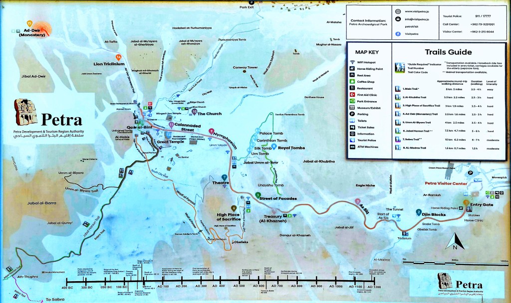
which is nearly a mile from Al-Khazneh, known as the Treasury.
Beyond the Treasury, it’s another mile past Temenos Gate to the end of the Colonnaded Street…
that leads to Qasr al-Bint–Petra’s most intact structure and Nabataean temple.
Ahmad suggested we take our time by foot, but after that, we’re on our own–for as long as we like–and we can return by any means of conveyance.
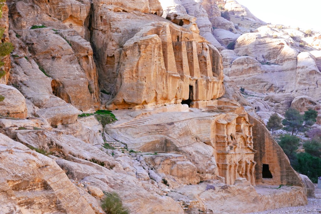
Once we understood the plan, we started out: past Djinn Blocks–a series of three imposing funerary monuments;
an iconic, two-story Obelisk Tomb;
and a Bedouin musician who may have been busking to buy an extra string for his DIY rababah.
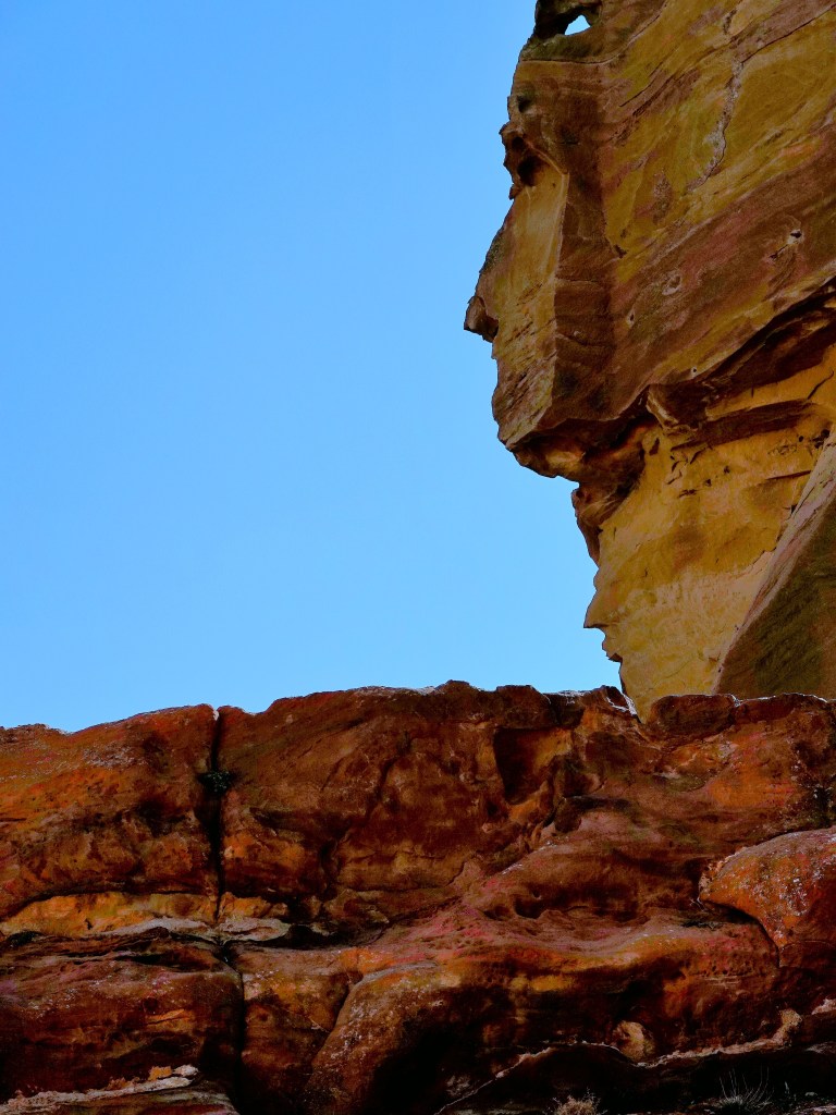
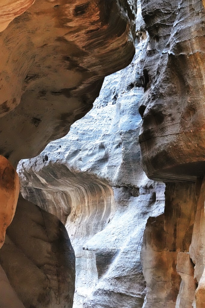
We followed the road through high walls of colorful sandstone, where rocks resembled elephant creations…
and human profiles,
with twisted stone rising upwards of 600 ft (183 m),
and narrow as 10 ft (3 m) across,
until we neared the end of the passage. Ahmad had us form a line and close our eyes as he guided us through the last bend in the gorge.
When the moment was right, we opened our eyes for the big reveal…
and it was a revelation! First light was streaming across the canyon walls,
and bathing the iconic façade with golden sunlight. It was truly a sight to behold! Ahamad declared, “I love my job!”
Petra has been written about to near exhaustion. There’s not much more I can add about the Nabataean Kingdom that UNESCO World Heritage Convention hasn’t already mentioned, so I will say it in pictures and leave the words to UNESCO:
Inhabited since prehistoric times, this Nabataean caravan-city, situated between the Red Sea and the Dead Sea, was an important crossroads between Arabia, Egypt and Syria-Phoenicia. Petra is half-built, half-carved into the rock, and is surrounded by mountains riddled with passages and gorges. It is one of the world’s most famous archaeological sites, where ancient Eastern traditions blend with Hellenistic architecture.
Situated between the Red Sea and the Dead Sea and inhabited since prehistoric times, the rock-cut capital city of the Nabateans, became during Hellenistic and Roman times a major caravan centre for the incense of Arabia, the silks of China and the spices of India, a crossroads between Arabia, Egypt and Syria-Phoenicia. Petra is half-built, half-carved into the rock, and is surrounded by mountains riddled with passages and gorges.
An ingenious water management system allowed extensive settlement of an essentially arid area during the Nabataean, Roman and Byzantine periods. It is one of the world’s richest and largest archaeological sites set in a dominating red sandstone landscape.
The Outstanding Universal Value of Petra resides in the vast extent of elaborate tomb and temple architecture; religious high places;
the remnant channels, tunnels and diversion dams that combined with a vast network of cisterns and reservoirs which controlled and conserved seasonal rains,
and the extensive archaeological remains including of copper mining, temples,
churches and other public buildings.
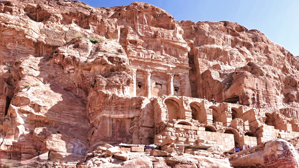
The fusion of Hellenistic architectural facades with traditional Nabataean rock-cut temple/tombs including Al-Khazneh, the Urn Tomb,
the Palace Tomb, the Corinthian Tomb,
and the Deir (“monastery”) represents a unique artistic achievement and an outstanding architectural ensemble of the first centuries BC to AD.
The varied archaeological remains and architectural monuments from prehistoric times to the medieval periods bear exceptional testimony to the now lost civilisations which succeeded each other at the site.
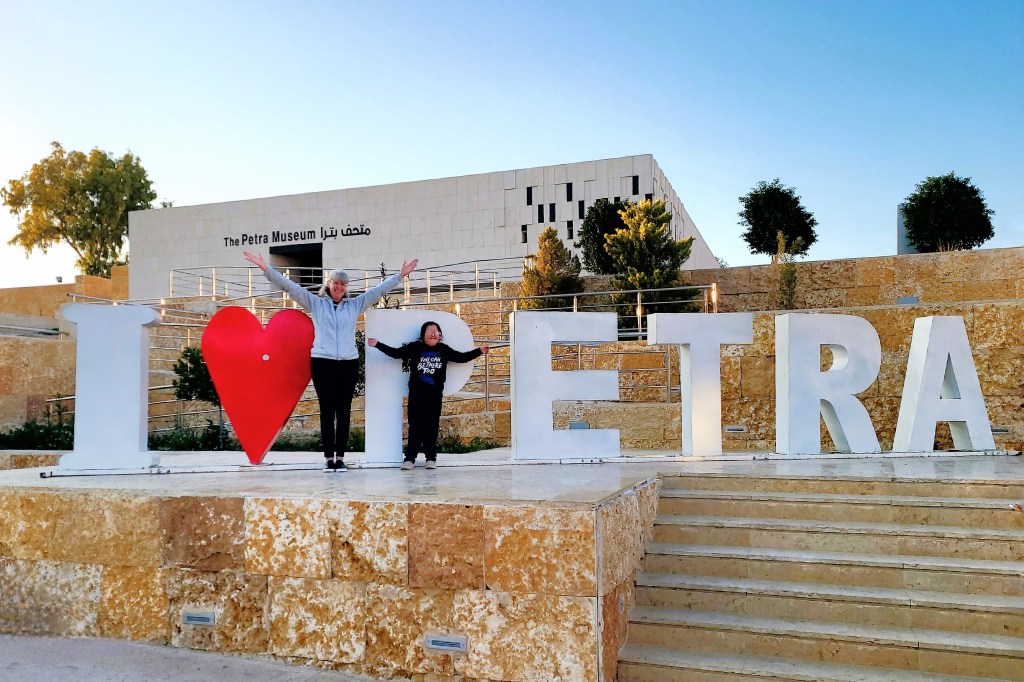
Petra was a marvel. And it may have been the overwhelming feeling of awesomeness that gave us the energy to return to the plaza by foot and express our satisfaction. So too thought the young girl with special needs, who spontaneously shared the moment with Leah.
There was so much cultural, historical and scientific significance to absorb in a day, which led me to conclude that the worst thing about Petra was not having another day to do it all over again.
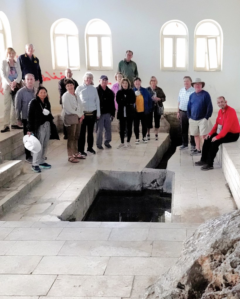
According to the Old Testament (Deuteronomy, 34:6), Moses–at 120 years–ascended the highest crest of Mount Nebo (800m) to view the Jordan Valley.
Although Moses led the sons and daughters of Israel out of bondage from Egypt, Moses was forbidden by God to escort them to the Promised Land.
With every step up the mountain, Moses would contemplate his sin of doubting God’s concern and commitment to The Chosen People. Was it anger or despair that provoked Moses into raising his staff and twice striking the Rock so his congregants and their cattle could drink from the wellspring that burst through the ground, and quell their complaining?
A shrine in Wadi Musa purports to be the perennial natural spring that arose from the rock struck by Moses. The site is most popular among Christian and Muslim pilgrims who travel from all parts to drink from the sacred well.
As for me, I took a hard pass; the water was running slow and low, and too risky to sample.
But the miracle performed by Moses sealed his fate. With Joshua assuming a new leadership role, Moses trekked to the highest point on the western ridge of the ancient Plains of Moab for a view of the Holy Land.
Perhaps God provided Moses with a befitting yet bittersweet panorama before he died, other than the hazy scene that I managed to capture.
All the churches atop Mount Nebo were erected over time to commemorate the death of Moses. The earliest known chapel dates to the 3rd century, followed by a 4th century monastery built to support Christian pilgrims.
20th century archaeologists excavated an intact mosaic floor within the baptistery of the chapel that depicts the cultural life of the Byzantine era–
surrounded by figurative motifs with geometric design flourishes…
that also adorn the walls.
and it’s all been preserved in a new church sanctified by the Franciscan Order in 2018.
The mountaintop is rich with artifacts sponsored by the Franciscans. The serpentine cross atop Mount Nebo was created by Italian artist Gian Paolo Fantoni to symbolize the miracle of the bronze serpent forged by Moses in the wilderness (Numbers 21:4–9) and the crucifixion of Jesus, whereas the stone Monolith was sculpted by Vincenzo Bianchi in honor of Pope John Paul II’s visit during the Great Jubilee of 2000.
As part of the Pope’s pilgrimage to Jordan, he planted an olive tree seedling that he dedicated to peace in the Holy Land.
Ironically, while the tree has prospered, peace has yet to bloom.
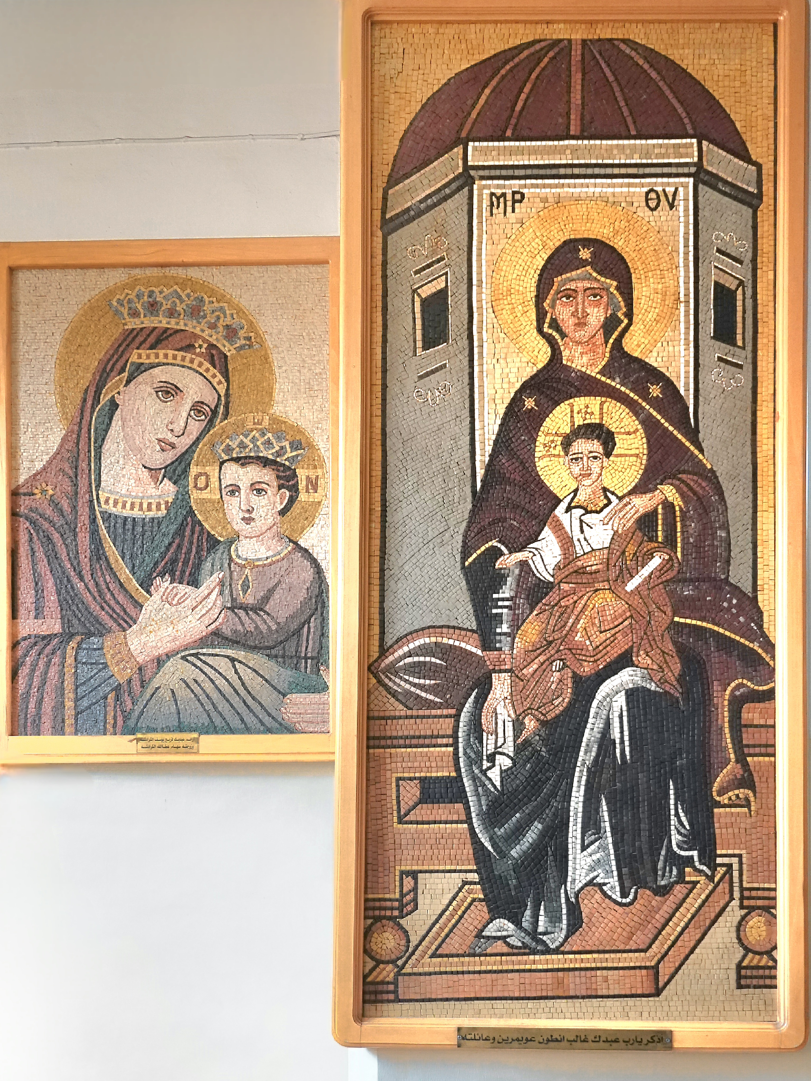
Having admired the mosaics of Madaba and Mount Nebo, our group got a personal look at the process at Jordan Jewel Art & Mosaic, which was created in 2008 through Jordan’s Queen Noor Foundation Community Development Initiative as a means of preserving an ancient artisanship introduced by the Greeks over two thousand years ago.
The project has also been a boon to tourism and employment within the governate, with over 100 mosaicists working at the studio or from home, creating historical souvenirs for tourists.
Depending on the pattern and the size, the mosaic can be extremely detailed, at times requiring tens of thousands of intricately-sized tiles and several weeks to complete.
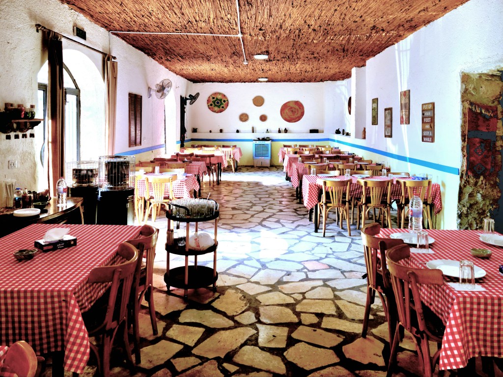
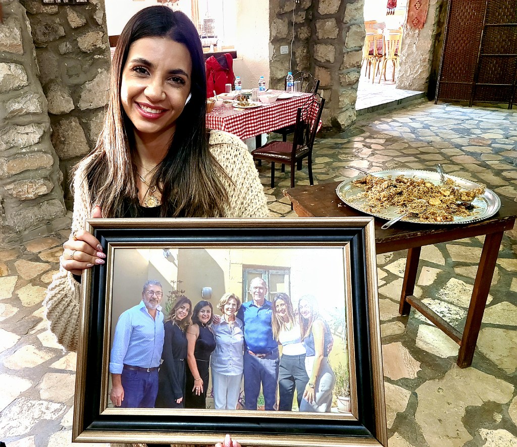
Our crew eventually returned to Madaba for a traditional lunch at Hikayet Sitti (“My Grandmother’s Story”)–a family-owned restaurant in an old home belonging to the Karadsheh family through many generations.
It now belongs to Feryal, the gracious owner/chef who prepared a tasty array of mezza (appetizers) to start,
and a kettle-sized helping of Maqluba–a traditional Middle Eastern dish of chicken, vegetables and rice that’s prepared in a pot and presented upside down.
Feryal distributed the recipe to the home chefs among us, but as I read through the prep and ingredients, I was certain the dish was more complicated:
MAQLUBA
• Fry pieces of eggplant, cauliflower, and potatoes • Boil pieces of chicken • Arrange at the bottom of the cooking pan pieces of tomatoes, carrots, onions, sweet pepper, and garlic • Then add the fried eggplant, cauliflower, and the potatoes • Add pieces of chicken • Cook them together with water • Add the rice to cook together • Add black pepper, cinnamon, nutmeg and cardamom, cumin, cloves, coriander • Cook until water is evaporated • Put it on low fire for 5 minutes • Let it rest for 5 minutes • Serve it as upside down
As we savored every bite, we were invited to put our tastebuds to the test by identifying all seven spices in our food. My mind immediately raced to episodes of Hell’s Kitchen, when contestants competed in blind tastings for Gordon Ramsey, and the winner received a hot air balloon ride with a champagne lunch.
But Feryal was offering something much better. The prize at Hikayet Sitti was a cold beer from her brother’s brewery… and it was delicious.
After lunch, the coach stopped briefly at Shobak Castle (12th century) enroute to Petra, just as the sun broke through the haze to shower the ruins in golden light.
The castle is a stark reminder of Crusader glory amidst the plunder and ruin of the times.
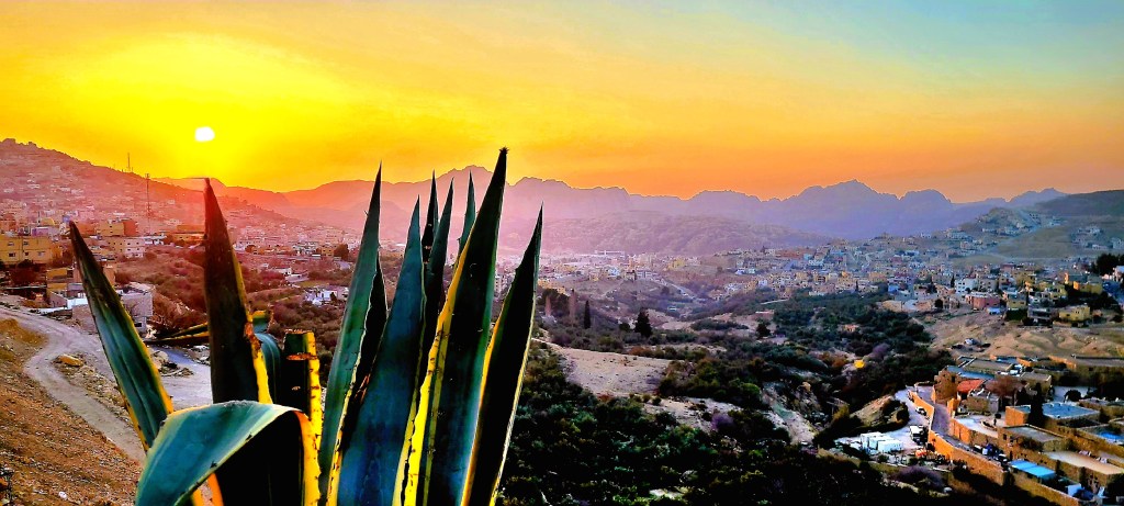
Our coach driver raced the last hour to Petra with the hope that we’d arrive in time for sunset, and we were duly rewarded with a perfect sky in Wadi Musa just as the sun was falling behind Mount Hor.
It was a good omen for our excursion to Petra the following day…
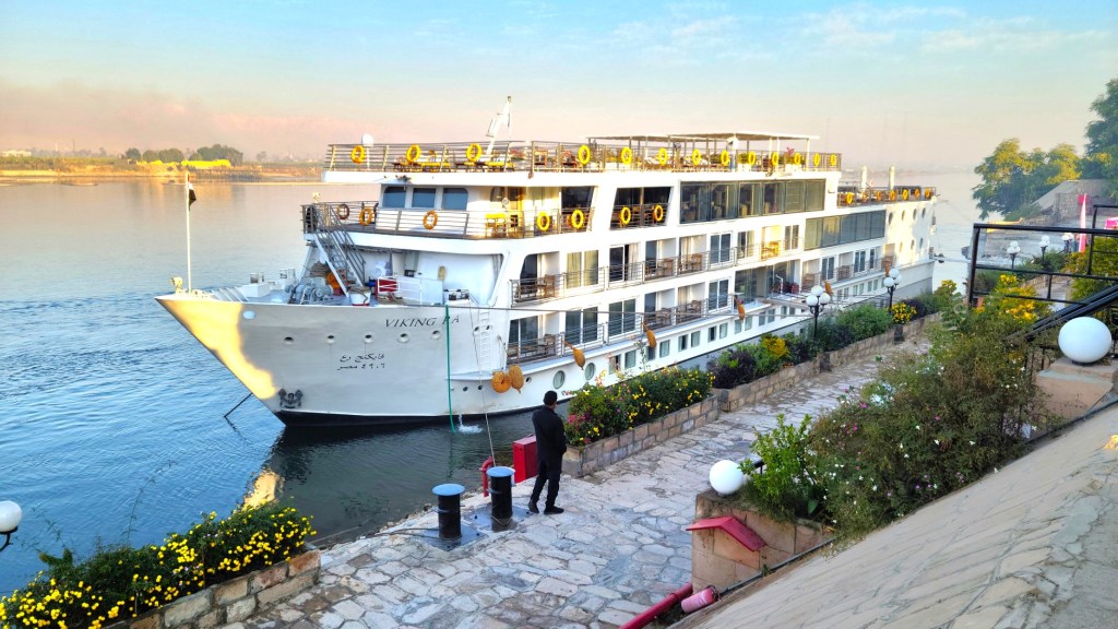
We were a crew of 48 aboard the Viking Ra, divided into 2 camps of 24 travelers who identified as Bus A or Bus B.
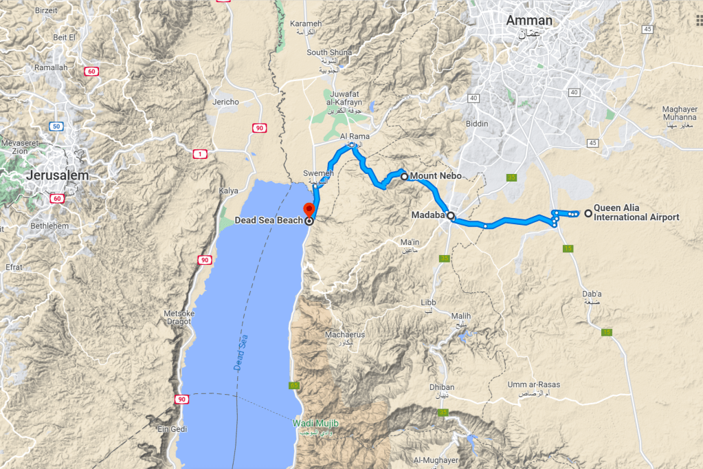
Most of the cruisers returned home at the end of our Nile excursion, but 18 intrepid globetrotters–a union of both buses–continued our journey to Jordan for four nights, where we were greeted at Queen Alia International Airport by Ahmad Al Khaldi, our tour director and self-proclaimed terrorist, who adopted the moniker after once guiding the brother of ventriloquist/comedian Jeff Dunham.
Upon arrival to Amman, we boarded a coach for a half-hour ride to Madaba. It was an ambitious itinerary with a lot of ground to cover before reaching the Dead Sea,
but we quickly knew–given the depth of Ahmad’s knowledge, wit, and organization skills–that we were in good hands.
During the half-hour ride to Madaba we absorbed some background about this ancient city that’s renowned for its skilled mosaic artisans,
and its deeply religious ties to Christianity and Islam.
After an orientation of one ofJordan’s holiest landmarks,
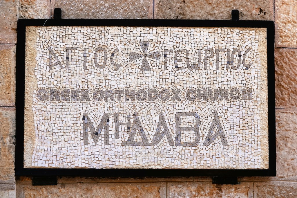
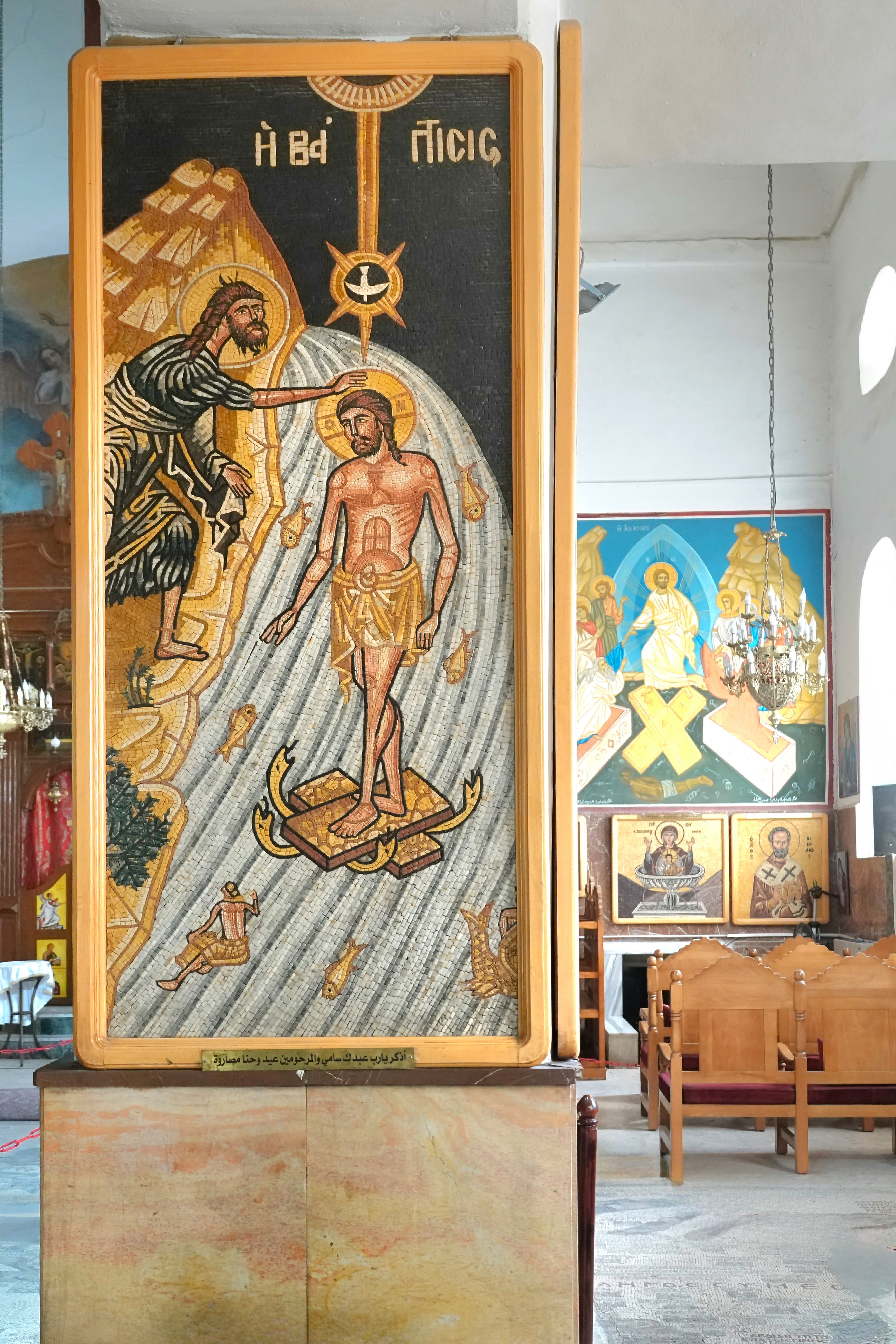
we headed to Madaba’s feature attraction… the Greek Orthodox Basilica of Saint George,
where the current structure, consecrated in 1896 is adorned by mosaic icons on every pillar…
but it’s the mosaic floor that’s the star of St. George and Madaba!
The partially restored mosaic map of the Holy Land originates from the 6th century, and was excavated in 1884 when the current church was built atop the ruins of the original Byzantine church. Over 2 million tiles comprise a detailed rendering of the Middle East with surprising detail and accuracy, making it both an artistic masterpiece, and the oldest surviving representation of familiar biblical sites.
We bypassed Mt. Nebo (to be explored the following day) and continued to the Dead Sea Museum,
where we enjoyed an aerial panarama of the Jordan Rift Valley with the lowest elevation on earth (-1410 ft).
and a closer examination of the area’s geological and cultural significance.
Developers see tremedous potential in promoting Dead Sea tourism, touting first-class accomodations and access to its briney beaches. And they’re wasting little time in hotel construction,
because at it’s current rate of evaportion, the Dead Sea will cease to exist by 2050.
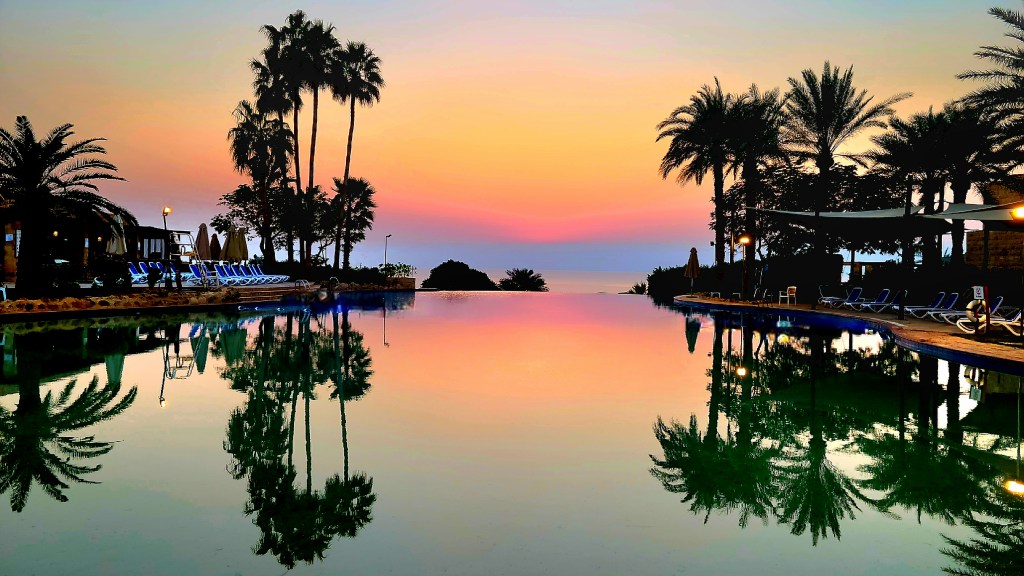
Shortly after checking into the sprawling Movenpick village…
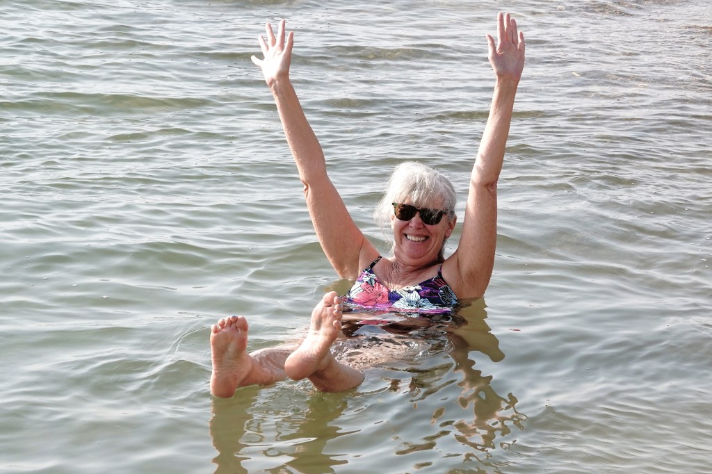
it was time to relax with a mud treatment,
and a bouyant soak. What a feeling!
There’s been lots of internet chatter about which country, Israel or Jordan, has the best beaches. The answer is easy: it’s whichever one you’re on!
However, the east coast scores extra points for hosting the sunset over Jerusalem most nights.
The Viking Ra was cruising steadily from Edfu to Luxor on the final leg of our Nile adventure… until we encountered the Esna lock with a 6-ship back up. With each passage through the lock requiring about 20 minutes, we were looking at a 2-hour layover before we’d be underway, so what better way to spend the time than to shop… again.
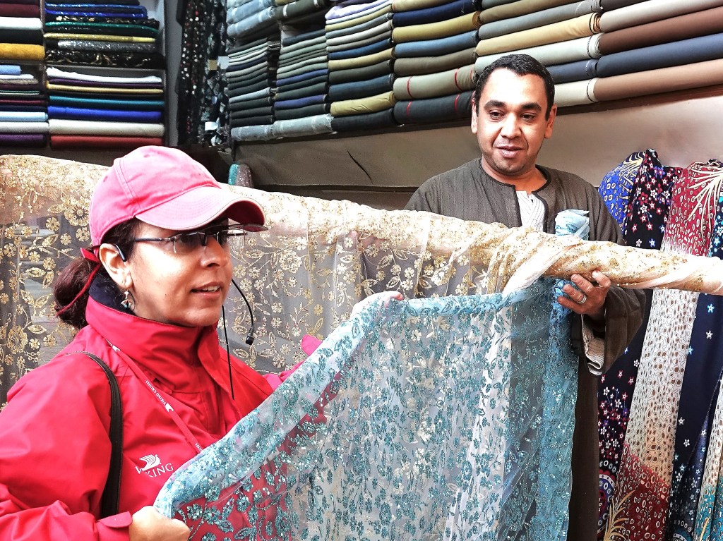
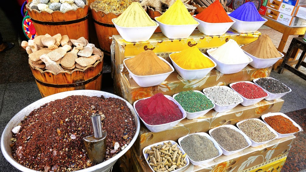
Viking and I have visited a variety of revered venues vital to vending, but the finest one was the first one–Khan El-Khalili in Old Cairo–one of the oldest and largest open-air souks for whatever you never need, but find it necessary to own.
But that was just the beginning of so many other shopping opportunities we discovered along the way, whether it was sourcing a simple souvenir at a temple souk;
or buying a bolt of fancy fabric at a textile shop;
or funding a furnishing from a village storefront;
or securing a special spice at the food bazaar;
or raising thousands for a hand-knotted rug at a weaving studio.
There was also a gift shop aboard the Ra, where an Armenian jeweler could craft 18K gold into personalized cartouche earrings and pendants for a pretty price.
In fact, there was nary a place we visited, where Ra passengers couldn’t “get their shopping on,” to the extent that a few passengers required an extra suitcase to transport their trinkets and treasures.
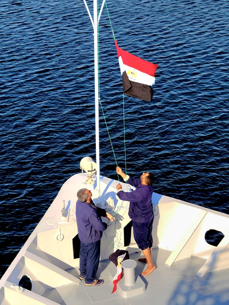
Deck hands used the extra time to swab the main deck and raise a clean flag,
while passengers on the sun deck flocked to the starboard side to find our riverboat nearly surrounded by a band of merchants in blue rowboats, reminiscent of how Somali pirates operate, but with a enterprising purpose.
It was an interesting phenomena, but rather than explain it, I believe this video best captures the merchandising protocol.
Shopping on the Nile at Esna Lock
Items for inspection usually arrived by air mail–rolled up and bagged. Unwanted items were returned the same way, but errant tosses to the boat got wet on occasion. Money was exchanged by sealing it in a tied bag with a returned item.
Eventually after two hours, it was our turn to pass through the lock. Surprisingly, the merchants who tied their vessels to the Ra were carried along–still haggling with their Habibis before finally disengaging on the downriver side of Esna lock.
Even more surprising… Leah and I didn’t purchase a single thing!
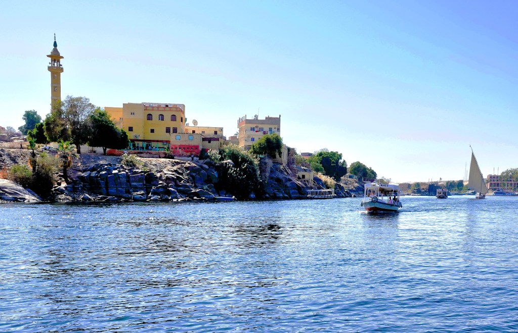
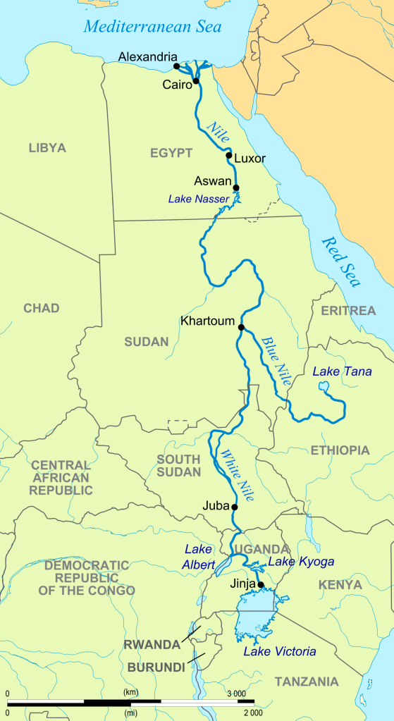
Egypt has relied on the Nile since the dawn of civilization. For over 5000 years, the Nile has pushed nutrient-rich silt through its 6600-km waterway from the wellsprings of Lake Tana in Ethiopia (Blue Nile) and Lake Victoria in Uganda (White Nile), on its way through Cairo, where it eventually runs across the delta and drains into the Mediterranean.
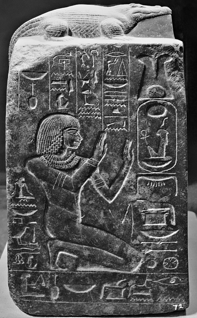
Just as the Nile shaped the landscape, it also shaped a society that believed in the Nile’s magical properties. Ancient Egyptians believed that gods controlled the Nile. They venerated Sobek, the crocodile god who created the Nile,
and prayed to Khnum–lord of the water–who fertilized the river banks, thus enabling Hapi, the goddess of ‘Annual Flooding’ to enrich and irrigate Egyptian crops.
Pharaohs used the Nile as a transit zone for long-hauling building supplies between coastal cities, and establishing monuments to the gods and themselves along the way, like the temple of Kalabsha in Nubia.
Even Aga Khan thought the bank of the Nile was a good idea for a Fatimid mausoleum.
Yet the river that once placed Egypt at the center of the civilized world for 3 millennia is now on life support, and poses a serious threat to the welfare of Egypt’s agriculture, aquaculture, and transportation sectors.
Unfortunately, the matter has been complicated by issues that stem from Egypt’s internal struggles, while the nation also battles other problems originating from south of the border.
For one, Egypt’s population already exceeds 110M, and is projected to swell to 121M in 2030, 160M in 2050, and 225M in 2100.
Egypt’s alarming growth rate over the past millennium has placed the country in economic jeopardy for the foreseeable future. Presently, nearly one-third of the country lives in poverty.
Additionally, with 97% of a dependent population living along the banks of the Nile and its delta, the existential threat to the river Nile has heightened significantly.
Intervention by Egypt over time has resulted in benefits and new challenges…
By partnering with the Soviets between 1960 and 1970,
Soviet-Egypt Friendship Monument
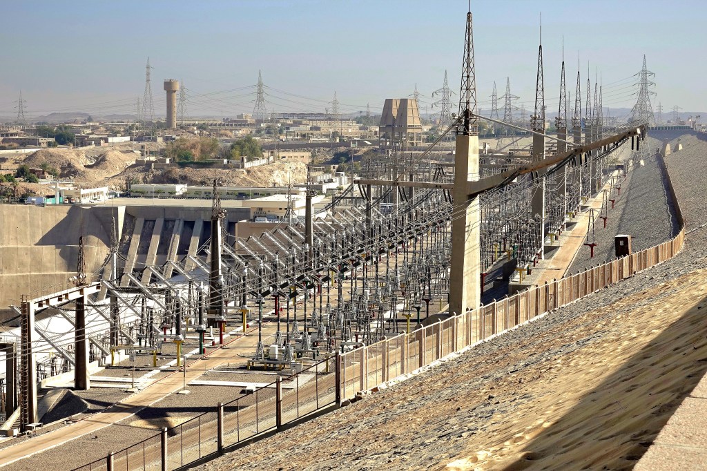
Egypt constructed the Aswan High Dam–an immense embankment dam–upriver from the original Aswan Dam completed by the British in 1902.
It’s purpose: to control flooding;
provide increased water storage for irrigation;
generate hydropower;
and encourage tourism–all seen as pivotal to Egypt’s industrialization.
Yet, there have been unintended environmental consequences to damming the Nile:
The dam restricts passage of rich volcanic sediment that once swept along the entire riverbed, but now struggles to reach the Mediterranean.
The Nile Delta has lost a substantial amount of arable land due to the Nile’s inability to provide an unabated flow rate to defeat a rising sea.
A 15 cm rise in the Mediterranean’s sea-level over the past century is expected to double over the next 30 years from climate change.
To compensate for the salination of the soil, farmers must pump more fresh water from the Nile onto their crops, causing additional pollution from synthetic fertilizer runoff.
According to the Intergovernmental Panel on Climate Change, the U.N.’s group of climate scientists predict the impact on the Nile will be catastrophic. They say it will lose 70% of its flow by the end of the century, with the water supply plummeting to a third of its present capacity.
Good for camels, but not for human survival.
Egyptian officials have also been wrangling over water rights and diplomacy with Ethiopian counterparts, arguing that their water security has been irreparably compromised.
However, more than half of Ethiopia’s 110 million people currently live in the dark. Their leadership is hopeful that the Grand Ethiopian Renaissance Dam on the Blue Nile (begun in 2011) will help to electrify the country and generate power for export.
Consequently, the Renaissance Reservoir will cause a 25% loss of hydropower generated by the Aswan High Dam, a reduction in Lake Nasser’s water retention, and a reduction to Egypt’s flow rate by as much as 25%.
With anticipated droughts in East Africa, a 2oC rise in temperature across the region, and a population crisis that begets increased poverty, it’s imperative that competing countries begin cooperating with each other to protect their citizens and their mutual interests.
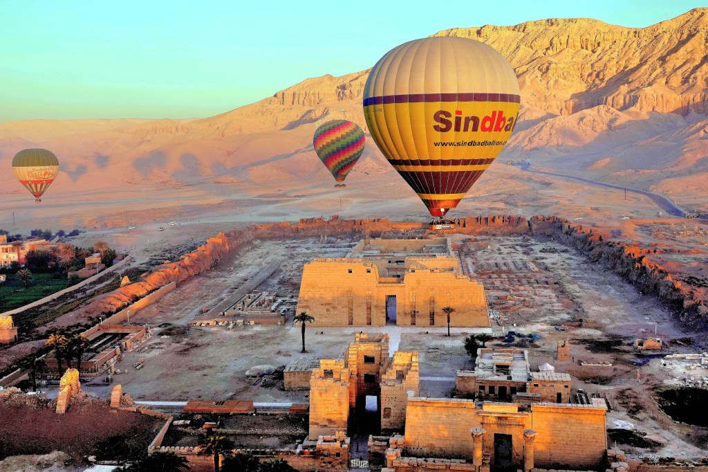
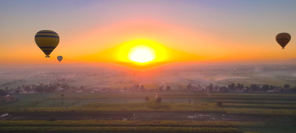
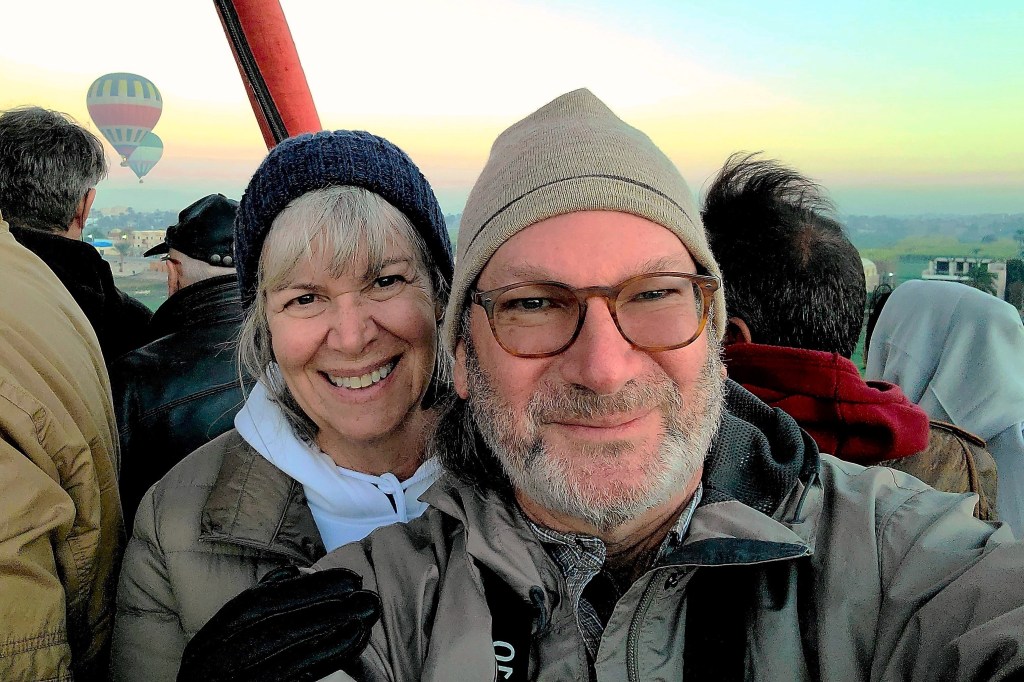
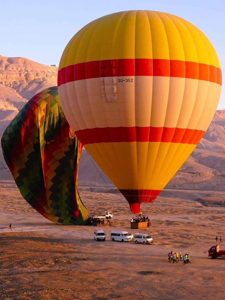
Our wake-up call was 4 AM, and the last thing on my mind was a boxed breakfast to go. I also decided to pass on coffee, thinking I couldn’t risk the chance of floating over the Valley of Kings in a wicker basket (invented by the Egyptians 5000 years ago) and needing to puke or pee.
Meanwhile, Leah had prepared for flight with Dramamine as her go-to prophylactic.
This was not our first ballooning adventure. A few years ago, Leah and I got to float over the Okavango Delta at sunrise with a pilot and 4 others (see Botswana by Balloon). But this time around, we’d be floating over the Valley of Kings, and it got my adrenalin pumping.
The desert air was cool, and the winds were calm–the perfect forecast. We arrived by boat to the east bank of the Nile,
and boarded a sprinter van that dropped us at a vast open field where teams of wranglers were already preparing for launch.
We were given our balloon assignment, and climbed aboard with 25 other “ballunatics.” After a safety drill of “hunker down and brace,” we were ready for lift off.
We felt so small standing under a canopy of hot air and rainbow-colored nylon fabric…
rising 60 feet above us–
not unlike the early morning visitors who had come to gaze at the gargantuan relics of Amenhotep III at his nearby necropolis.
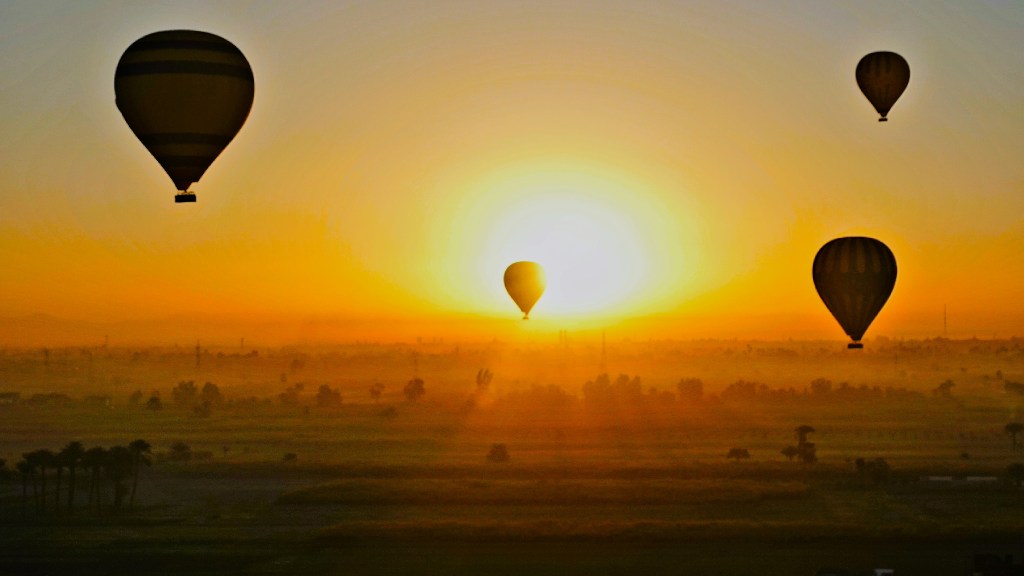
In time, we were joined by so many other aeronauts gliding along the thermals,
that it seemed like heavier traffic in the sky…
than on earth.
Our birds eye perspective brought us closer to the Theban Mountains,
with views of Medinet Habu,
the verdant fields of sugarcane,
and a volume of unfinished housing–a deliberate work-in-progress ploy by locals to avoid paying property tax on completed homes.
But mostly, flying high prepared us for the forthcoming sunrise…
that blossomed before our eyes.
A sight to behold!
Forty-five minutes of fly-time flew by, until it was time for our descent…
at which point the wranglers took over.
Just watching them wrestling with the deflated balloon and lines gave me an appetite.
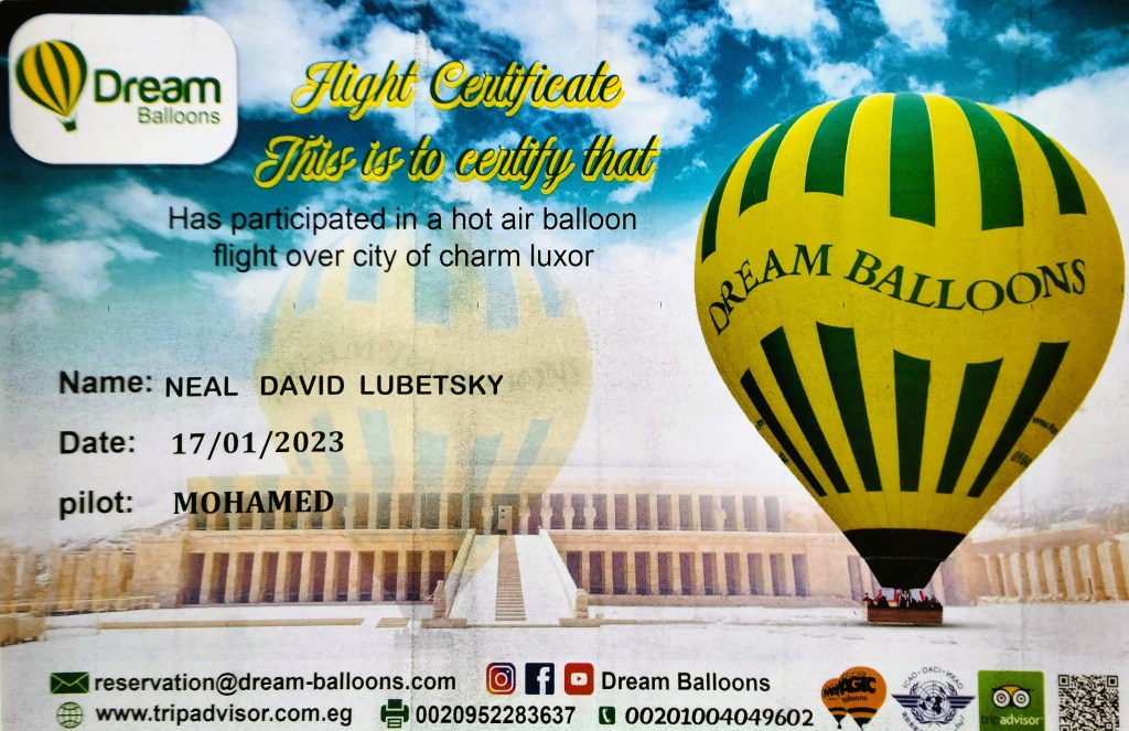
Breakfast never tasted so good, although the requisite champagne that usually accompanies one’s flight certificate was absent.
Perhaps, the authorities reasoned that our afternoon visit to Dendera Temple in Qena would be best experienced sober.
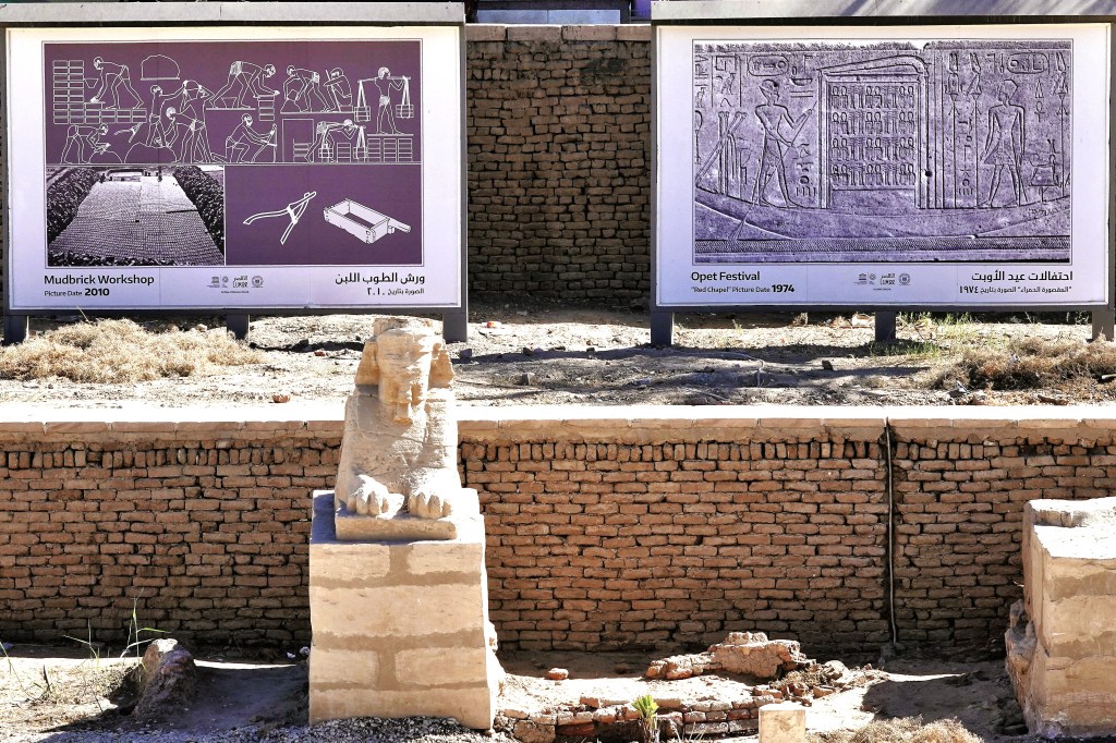
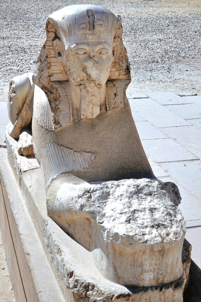
November, 2021 was a cause for celebration in Luxor, as the Ministry of Tourism and Antiquities marked the formal reopening of the Avenue of Sphinxes with a parade attended by Abdel Fattah Al-Sisi, president of Egypt.
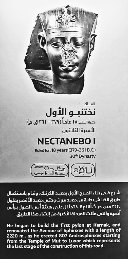
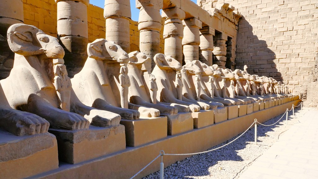
The 1.7 mile boulevard connecting the temples between Karnak and Luxor once boasted 1200 sphinxes. They were buried for centuries under several meters of sand, but are now revealed after 70 years of intermittent excavation and restoration.
Initiated by Amenhotep III and completed during the reign of Nectanebo I around 2,400 years ago, the impressive series of unearthed statues can be categorized into two shapes:
the first being a body of a lion with a ram’s head;
and the second and most reoccurring shape portrays a lion’s body supporting a human’s head.
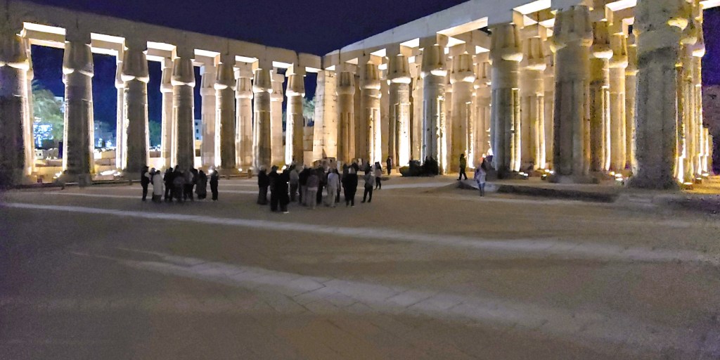
Our daytime excursion to Karnak Temple was followed by an evening tour of Luxor Temple.
Although the entrance to the gate was originally flanked by twin obelisks, the right obelisk was gifted to France by Muhammad Ali Pasha, Ottoman ruler of Egypt in the early 19th century (see Walking Like an Egyptian), and now adorns the Place de la Concorde in Paris.
Several rulers contributed to the Temple of Luxor over the ages.
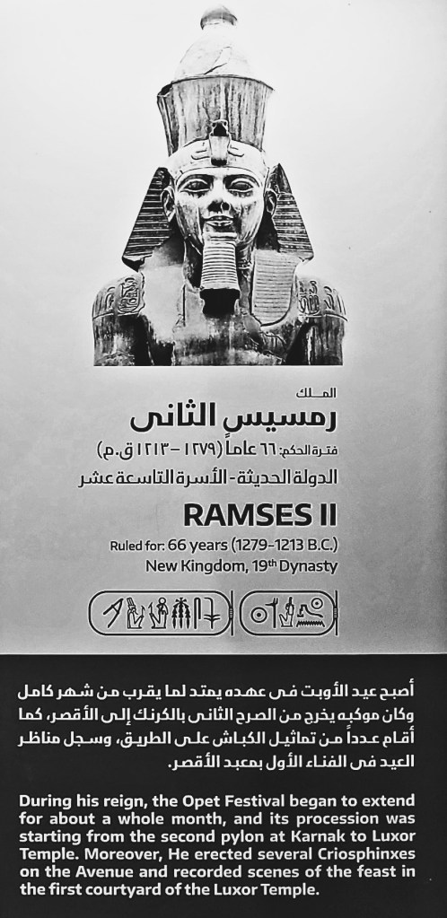
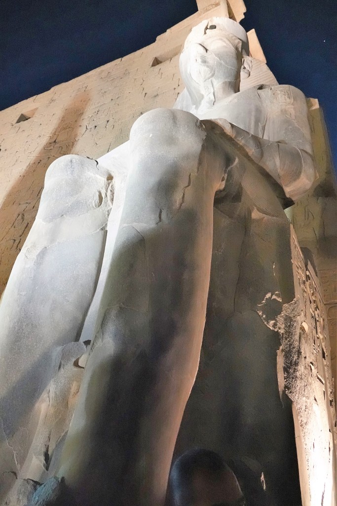
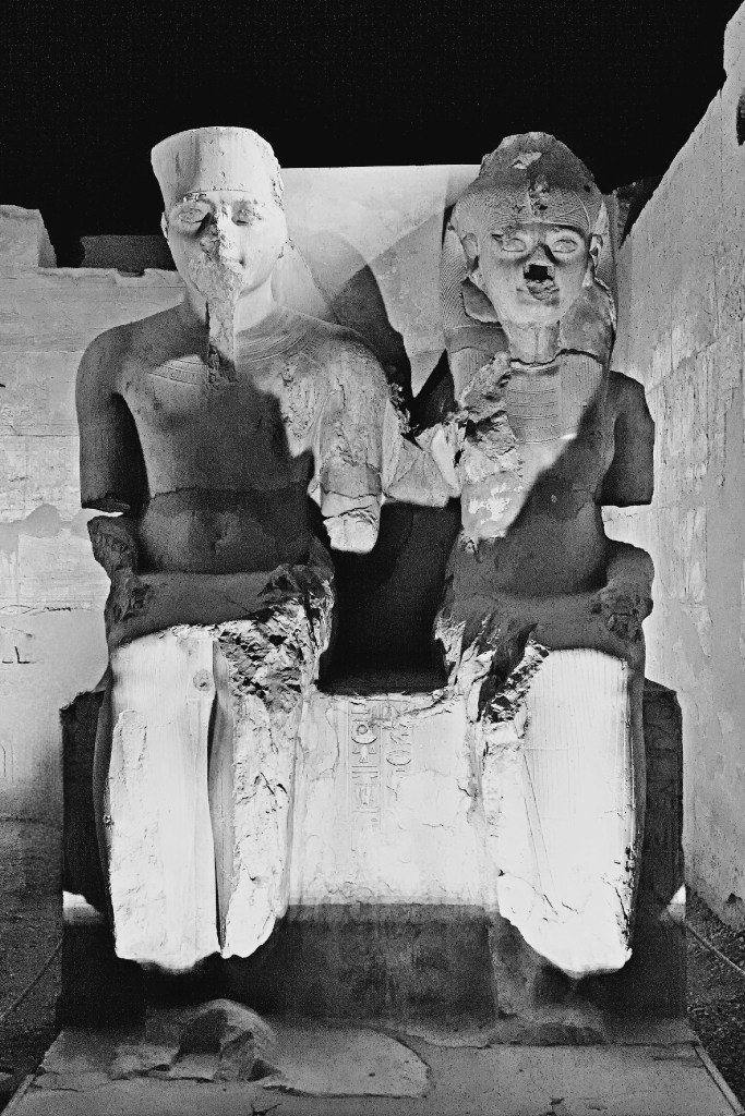
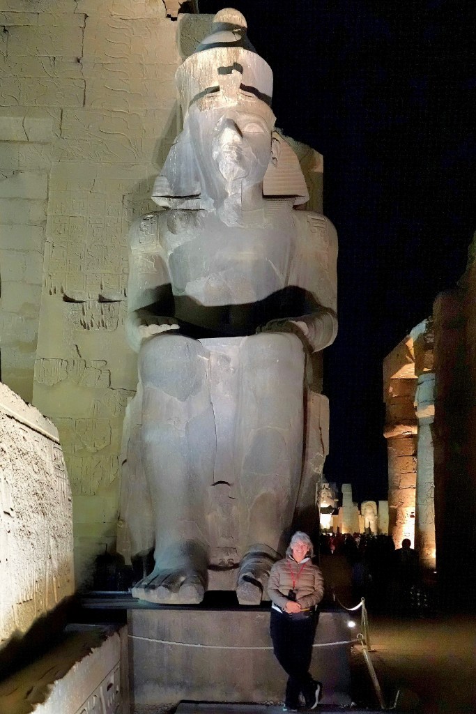
Although the temple was started by Amenhotep II in 1400 BC, Ramses II appropriated the first pylon with placement of a pair of black granite colossi of his likeness seated on a throne…
that depicted the unification of Upper and Lower Egypt.
Beyond the pylon, Ramses II also chose to enshrine 17 of his sons within a courtyard surrounded by double rows of columns capped with lotus-bud capitals. He fathered a minimum of 111 sons and 67 daughters.
The Courtyard of Ramses II flows into the Colonnade of Amenhotep III, dominated by seven pairs of 52 foot (16m) open-flower papyrus columns, which still support their huge architrave blocks.
The decoration of the Colonnade of Amenhotep III was largely undertaken by Tutankhamun, who is featured beside his Great Royal Wife, Queen Ankhesenamun, daughter of King Akhenaten and Queen Nefertiti.
Beyond the Colonnade, the Great Sun Court of Amenhotep III showcases the remains of a peristyle court with a double row of sixty columns with papyrus bundle capitals on three sides. They represent the best preserved and most elegant columns in the temple.
While Luxor Temple was conceived to celebrate the Theban trinity of Amun-Ra, married to God Mut, and son, God Khonsu, the religious focus of the adjacent chapels evolved over time from polytheism to Coptic Christianity during Roman rule, until the Muslim conquest of Egypt in the 7th century.
Thus, the Fatimid Caliphate inaugurated the Mosque of Abu El Hagag in 1286 atop the temple ruins and rubble, repurposing columns and stones to create a strange amalgam of Islamic civilization and ancient Egyptian civilization.
Ironically, the Opet Festival–originating during the 18th dynasty of the New Kingdom, and celebrated to promote the fertility of Amun-Ra and the Pharaoh–has now become an annual event.
Following a 3400-year old ritual, a royal procession parades from Karnak Temple to Luxor Temple along the Avenue of Sphinxes accompanying a statue of Amun-Ra within a barque of gold that rests on the shoulders of priests.
The news is enough to make Ramses II stand up and take notice.
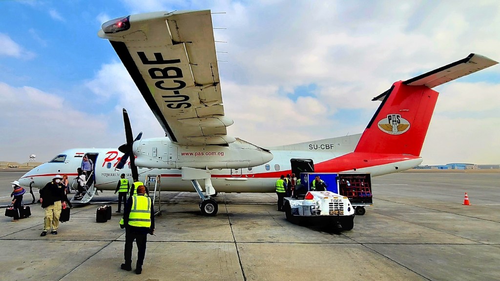
After 3 days in Cairo, Leah and I were on the move!
We boarded a chartered prop jet with our fellow river cruisers and flew to Luxor,
to greet the Viking Ra–currently tied up alongside the Nile’s east bank. Ra was to be our floating hotel through the following week.
After attending an obligatory safety briefing aboard Ra,
we were soon exploring Luxor and it’s ancient counterpart, Thebes–home to kings and queens from the Middle Kingdom (c. 2000–1700 BC) through the Ptolemaic Kingdom (305–30 BC)–spanning 15 centuries of rule, until Egypt surrendered to the Romans.
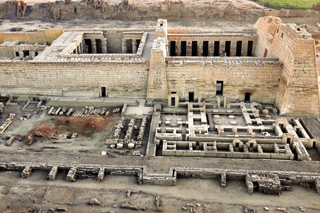
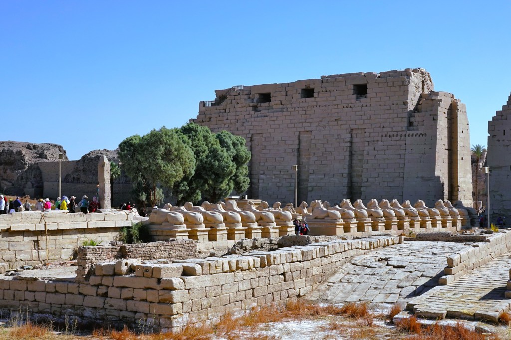
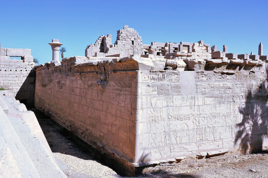
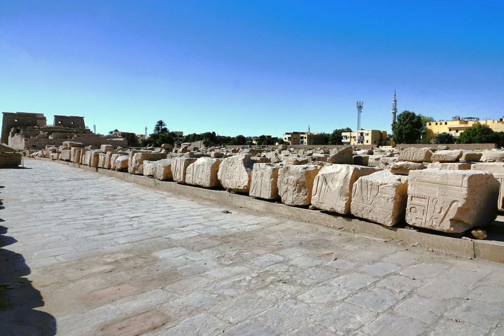
Our tour of Luxor began with a visit to the Karnak Temple Complex, encompassing 247 acres, and considered the largest religious structure ever built.
Ram-headed sphinxes (called criosphinx) adorn both sides of the avenue leading to the unfinished, first pylon to honor Amun-Ra, Egypt’s most powerful god and Thebe’s patron deity of the Great Temple of Karnak.
The criosphinxes continue inside the Ethiopian Courtyard (IX Dynasty)–each one cradling an erect statue of Ramses II (c. 1279-1213 BC) between its forelegs.
It flanks the entrance to the temple of Ramses III.
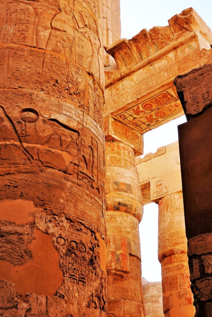
The most impressive feature of the temple of Amun-Ra is the Great Hypostyle Hall, a forest of 134 sandstone columns centered by 12 colossal columns soaring 69 feet,
which supports the remains of a stone roof enclosed by massive walls,
and features intricately carved relief sculptures and hieroglyphs of religious and historical significance…
to honor each of the 30 kings who once ruled the imperial city.
After 3300 years, the site remains substantially intact, yet benefits from painstaking restoration.
After listening to commentary from our onboard Egyptologist, Leah and I strolled the grounds of the ancient temple trying to imagine the enormity of its scope:
while realizing that 3 other sections–the Precinct of Mut, the Precinct of Montu, and the Temple of Amenhotep IV–are also part of Karnak, and still under excavation and reconstruction.