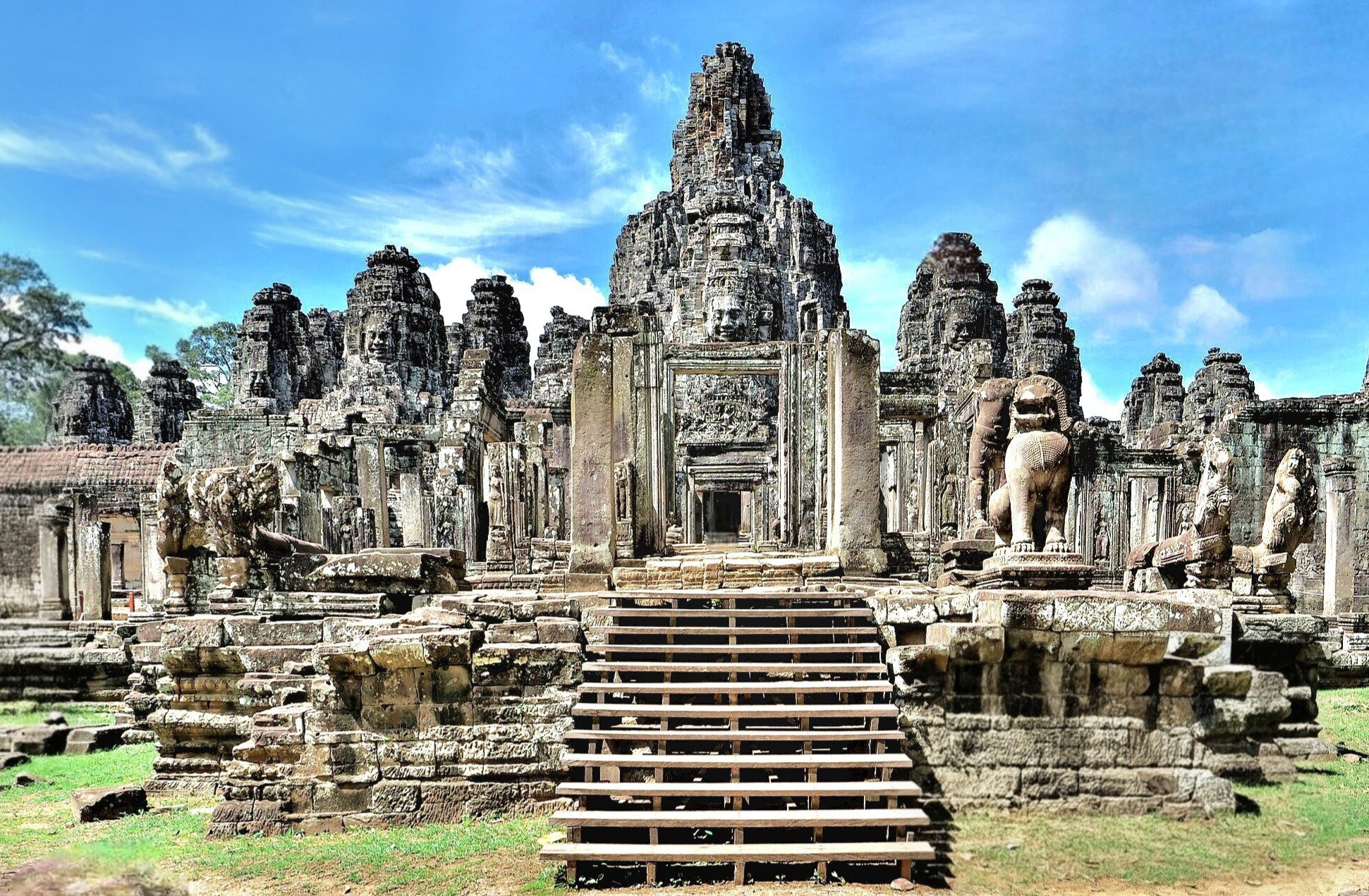
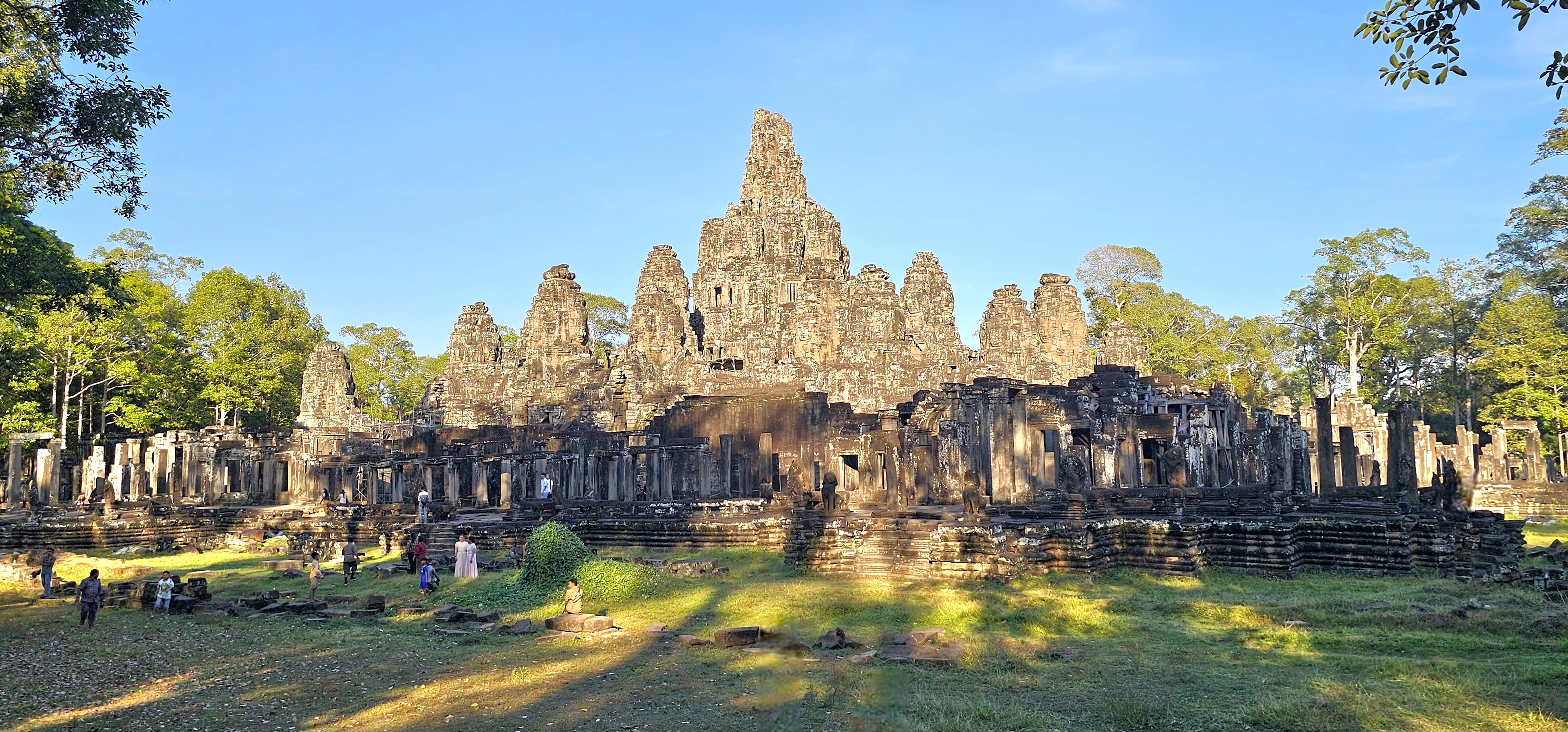
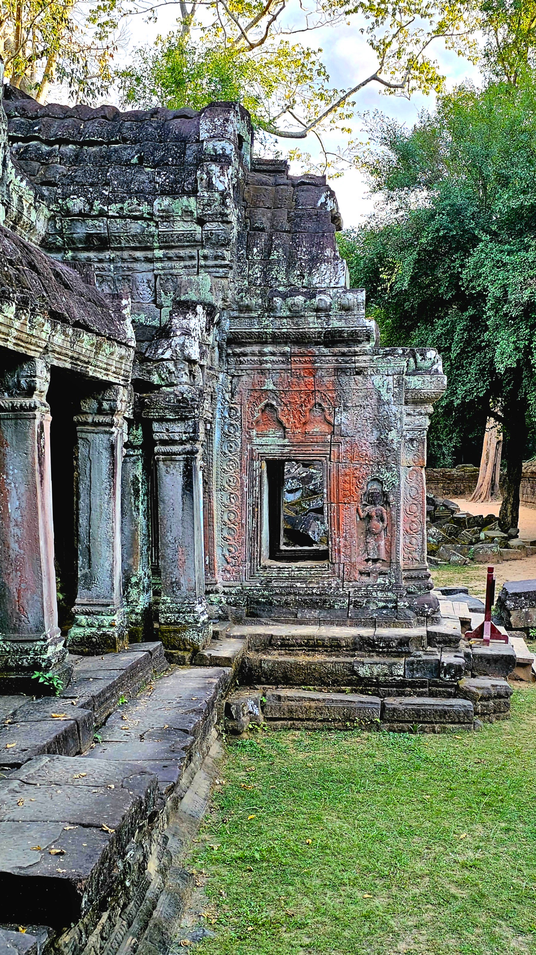
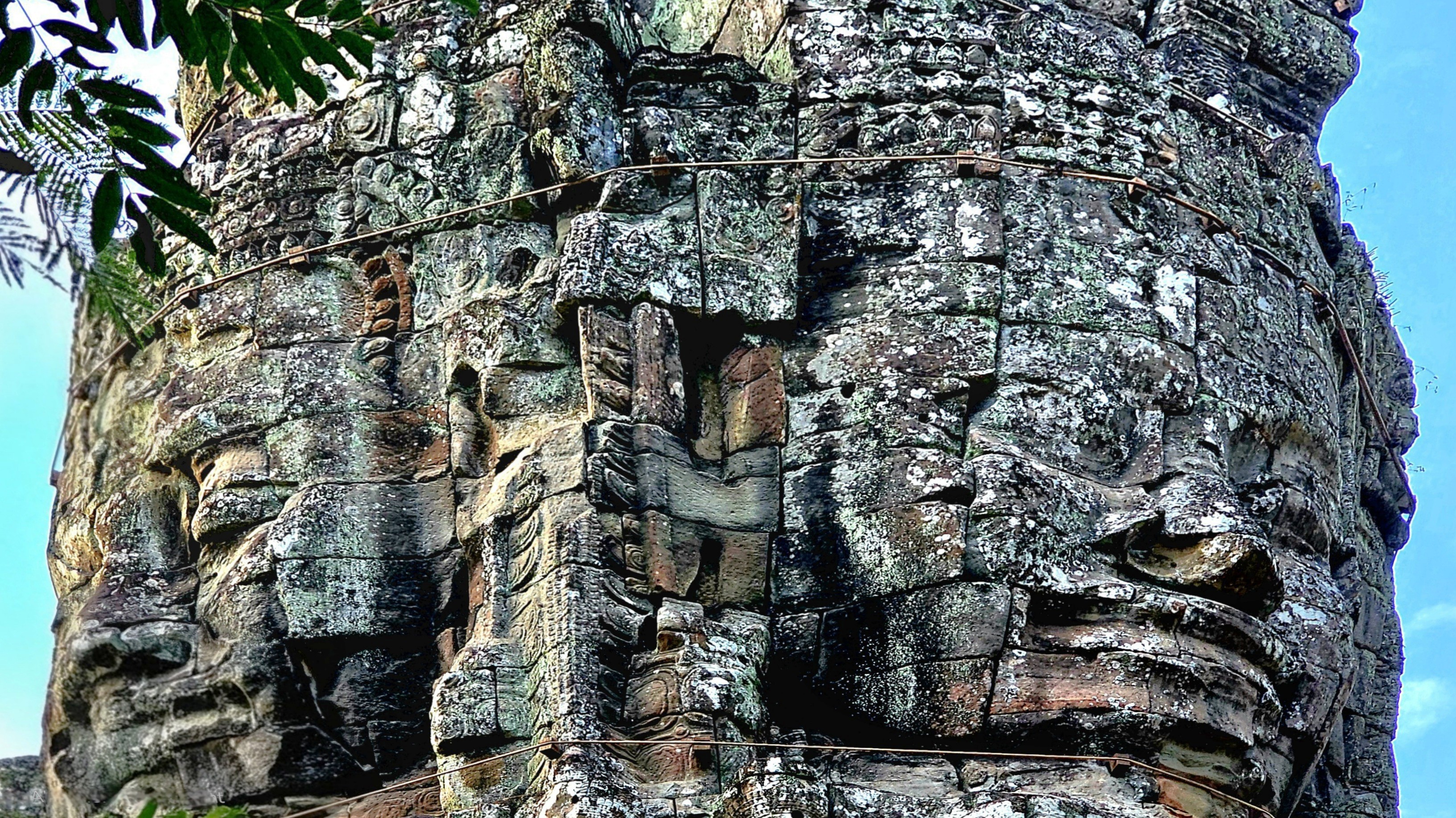
Of the 70 plus major temples within Angkor Archaeological Park, and hundreds more smaller shrines, ceremonial buildings, and symbolic ruins scattered throughout the broader Angkor region, none is more enigmatic than Bayon Temple.
It stands at the center of Angkor Thom, the Khmer capital, as Khmer Empire’s only Buddhist state temple, and last temple constructed during the reign of King Jayavarman VII.
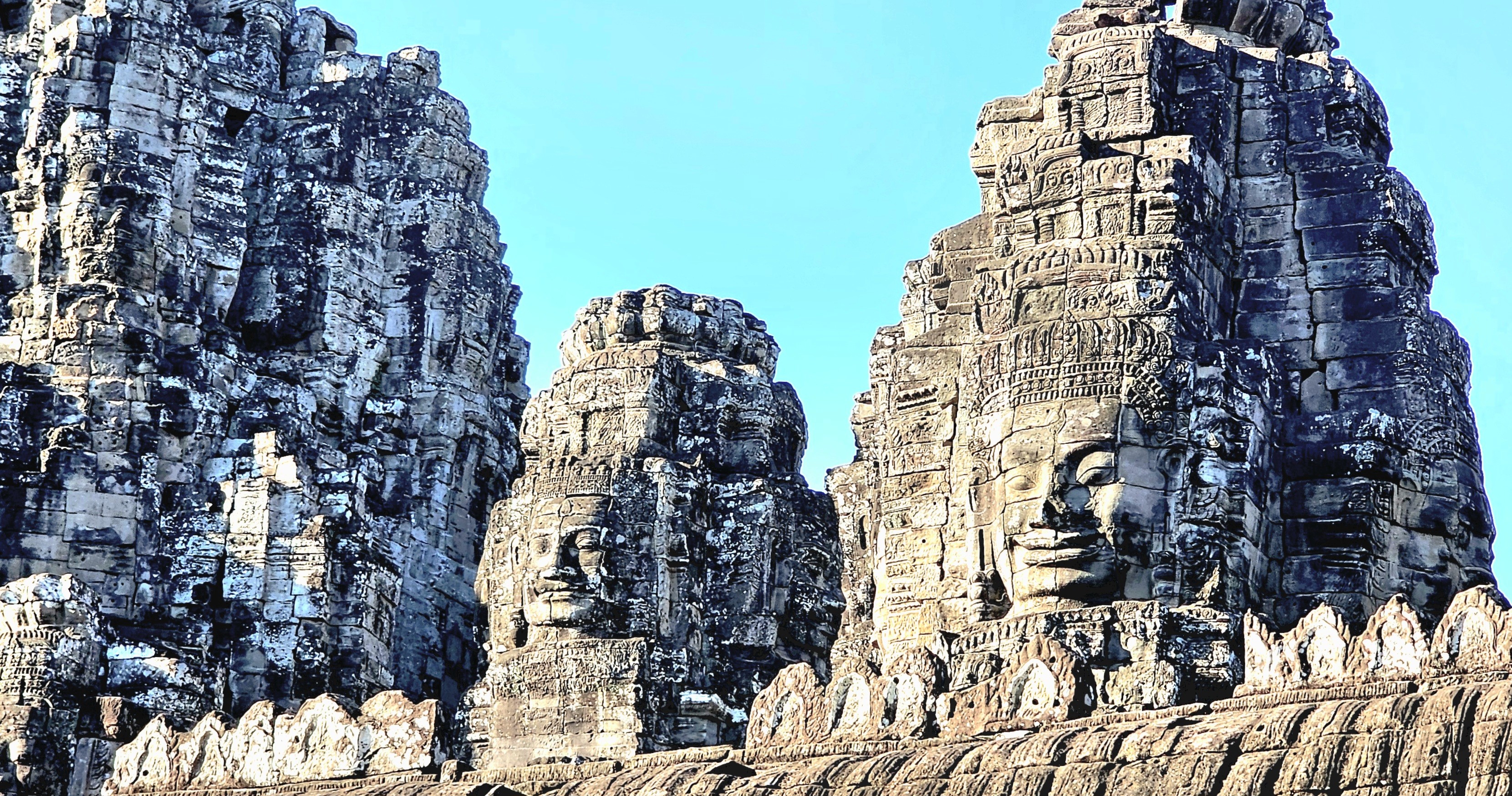
While hiking among the remaining 37 towers (originally 54) preserved throughout the temple’s 5.5 acres,
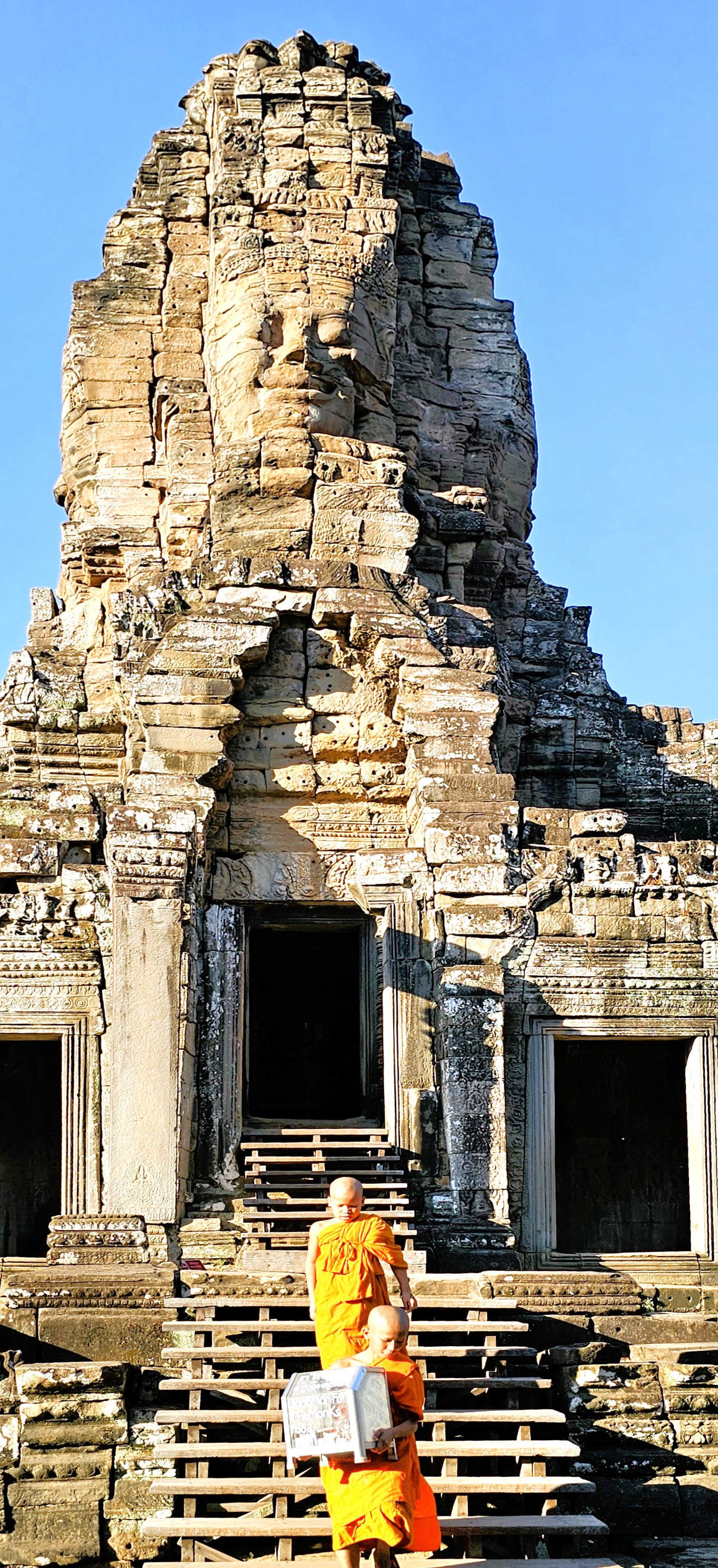
it becomes increasingly apparent that only the most talented artisans were chosen to sculpt Jayavarman’s likeness to resemble Buddha.
Or perhaps Buddha’s representation was intended to commemorate Jayavarman.
Either way, I found the serene and smiling faces profoundly impactful–creating an encouraging atmosphere to contemplate the spiritual energy infused in our surroundings,
and making us feel a part of something greater.
The enlightened expressions also served as a gentle reminder of the beauty unlocked from local sandstone and laterite stone–
inspiring us to embrace positivity and carry it with us beyond our stay.
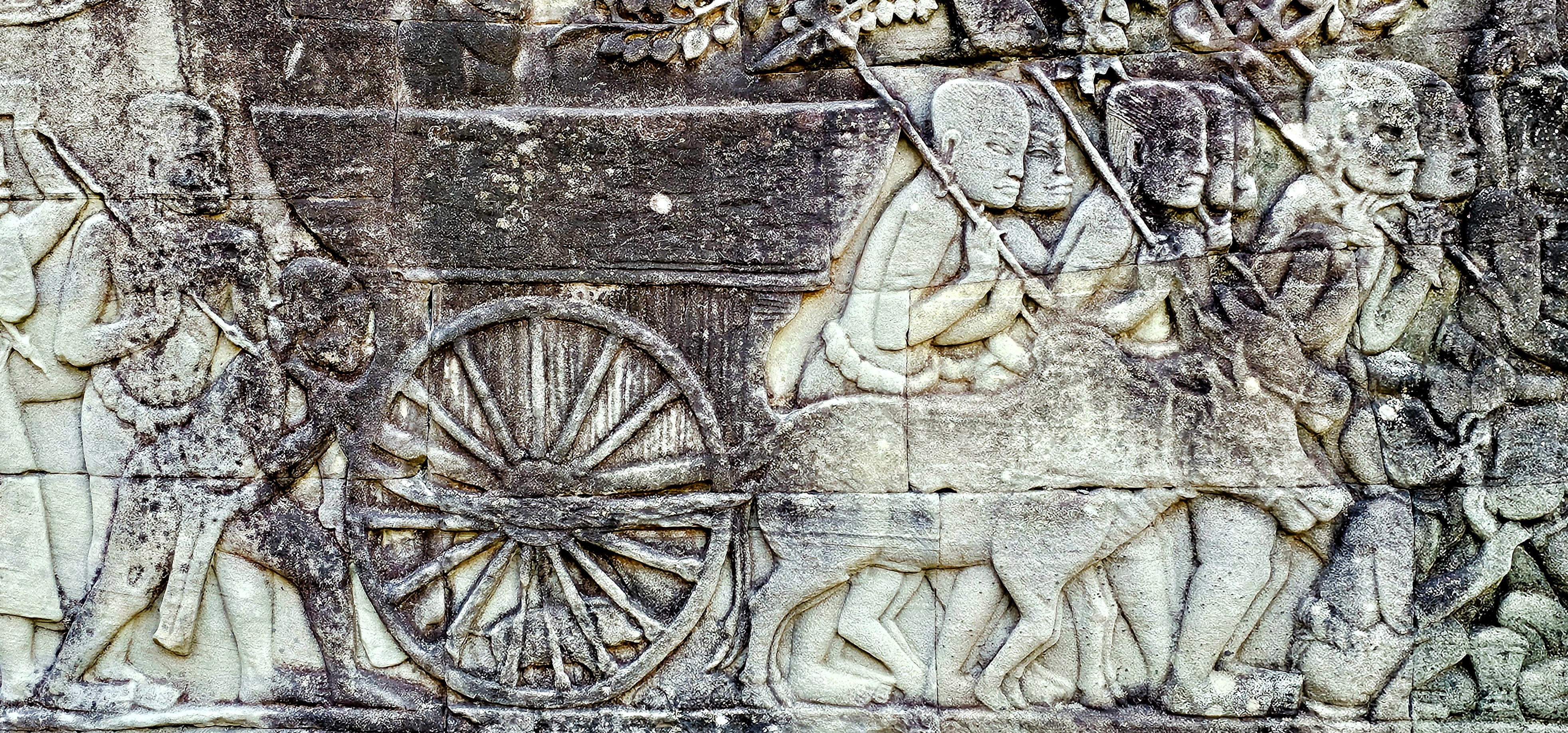
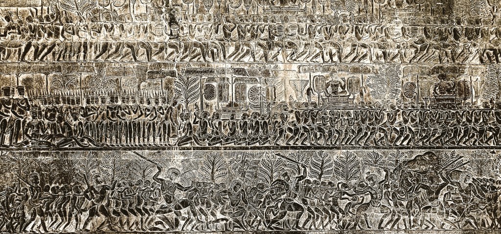
Khmer sculptors have also created a remarkable tableau of battle history, religious mythology, and random scenes from everyday life recorded on gallery walls throughout the complex.
Aside from its historical significance and its testament to architectual genius, Bayon Temple continues to serve as a vibrant center of spiritual life. Local communities gather regularly to participate in rituals and ceremonies, reflecting their enduring faith and cultural heritage.
The presence of monks who play a vital role in guiding the spiritual practices of the community reinforces the temple’s significance beyond just a tourist attraction.
Their ongoing devotion helps preserve the temple’s sanctity, making it a living testament to the blend of history and contemporary spirituality in Cambodia.
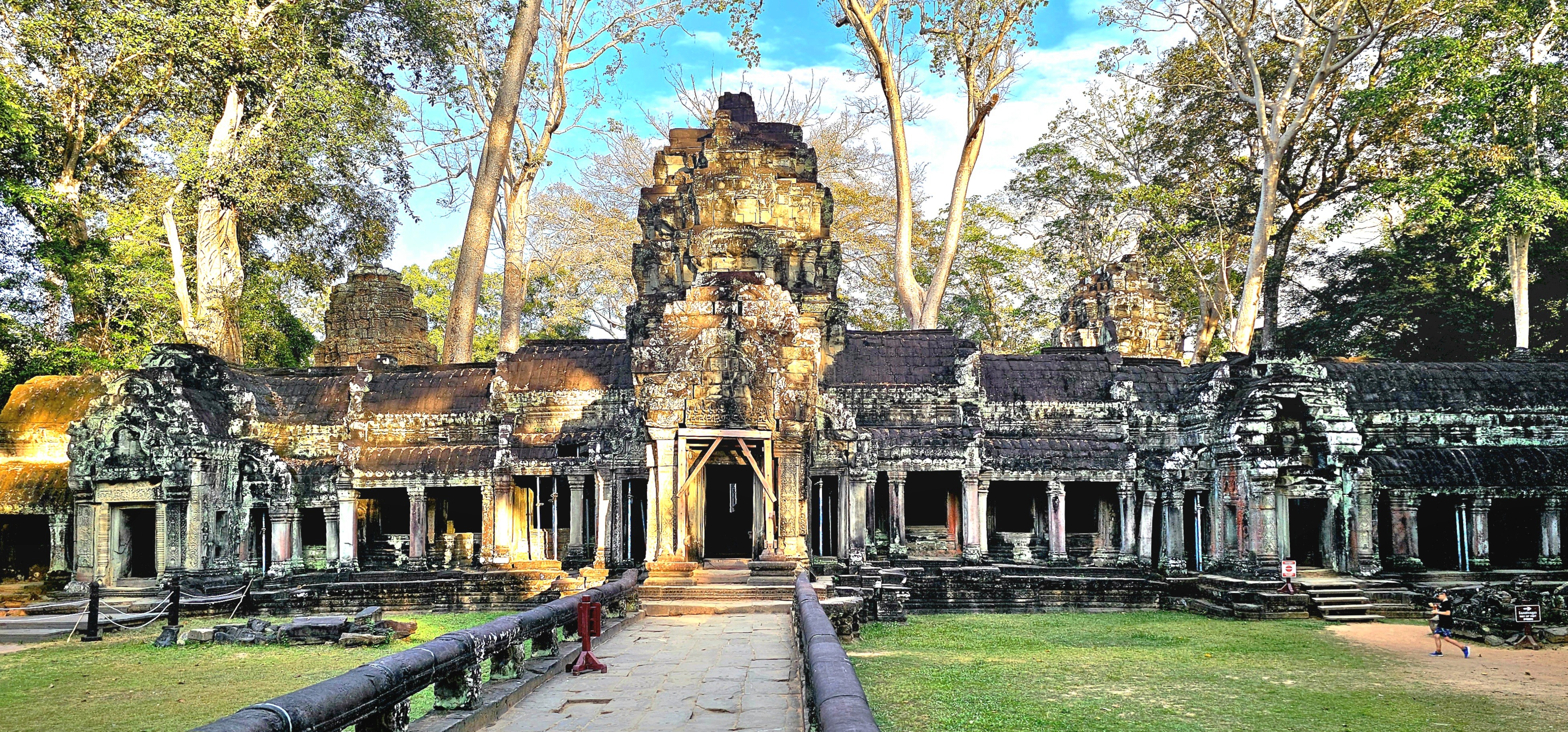
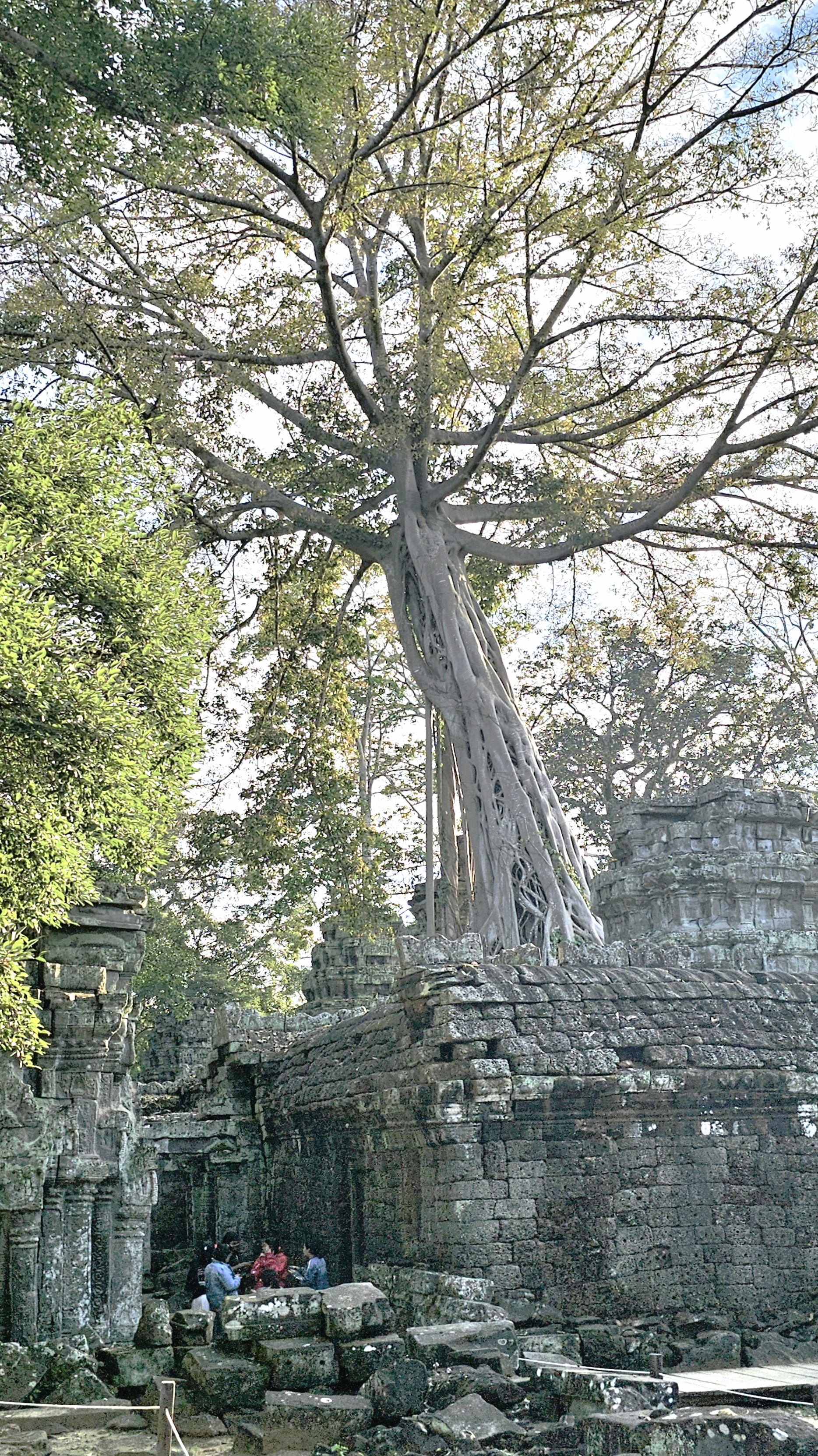
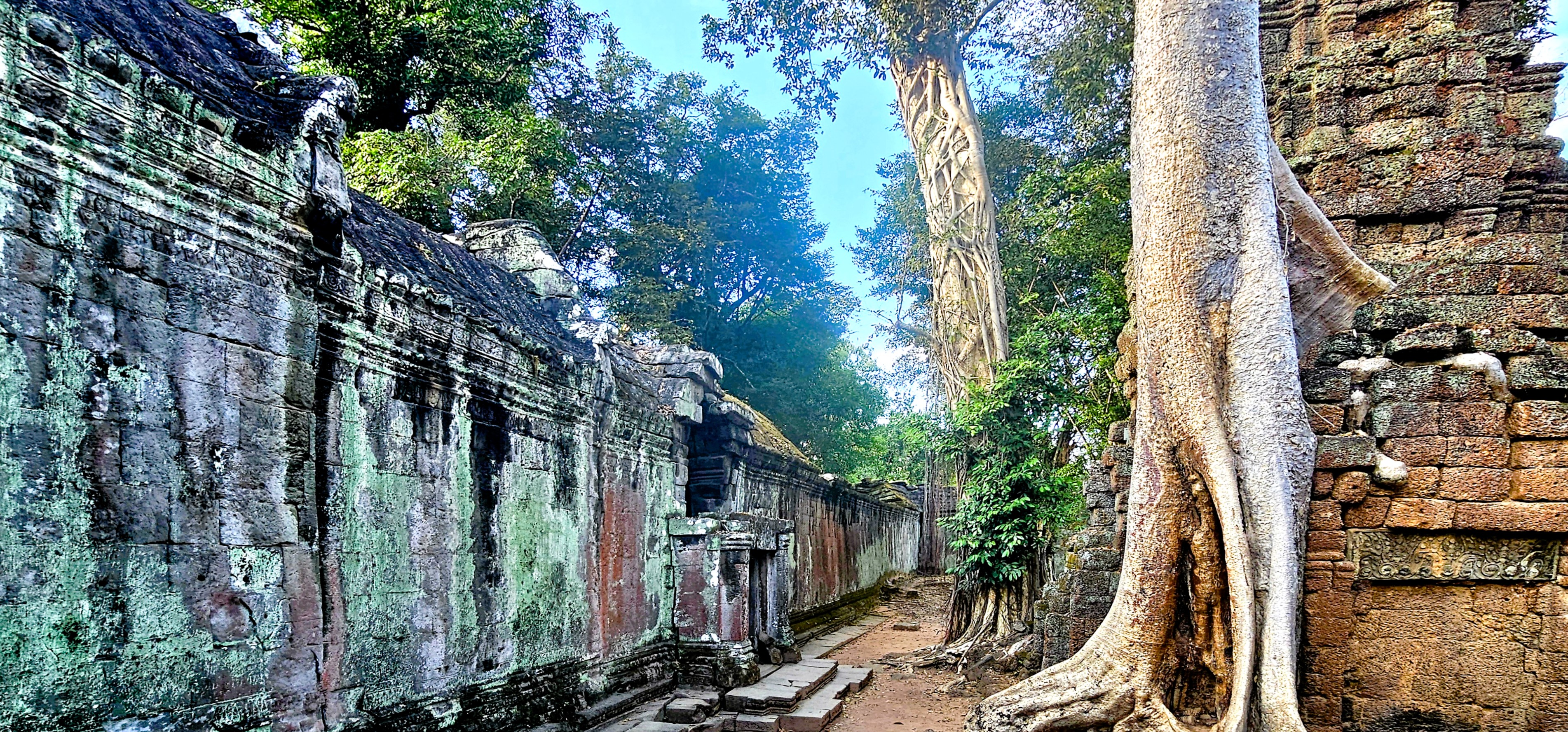
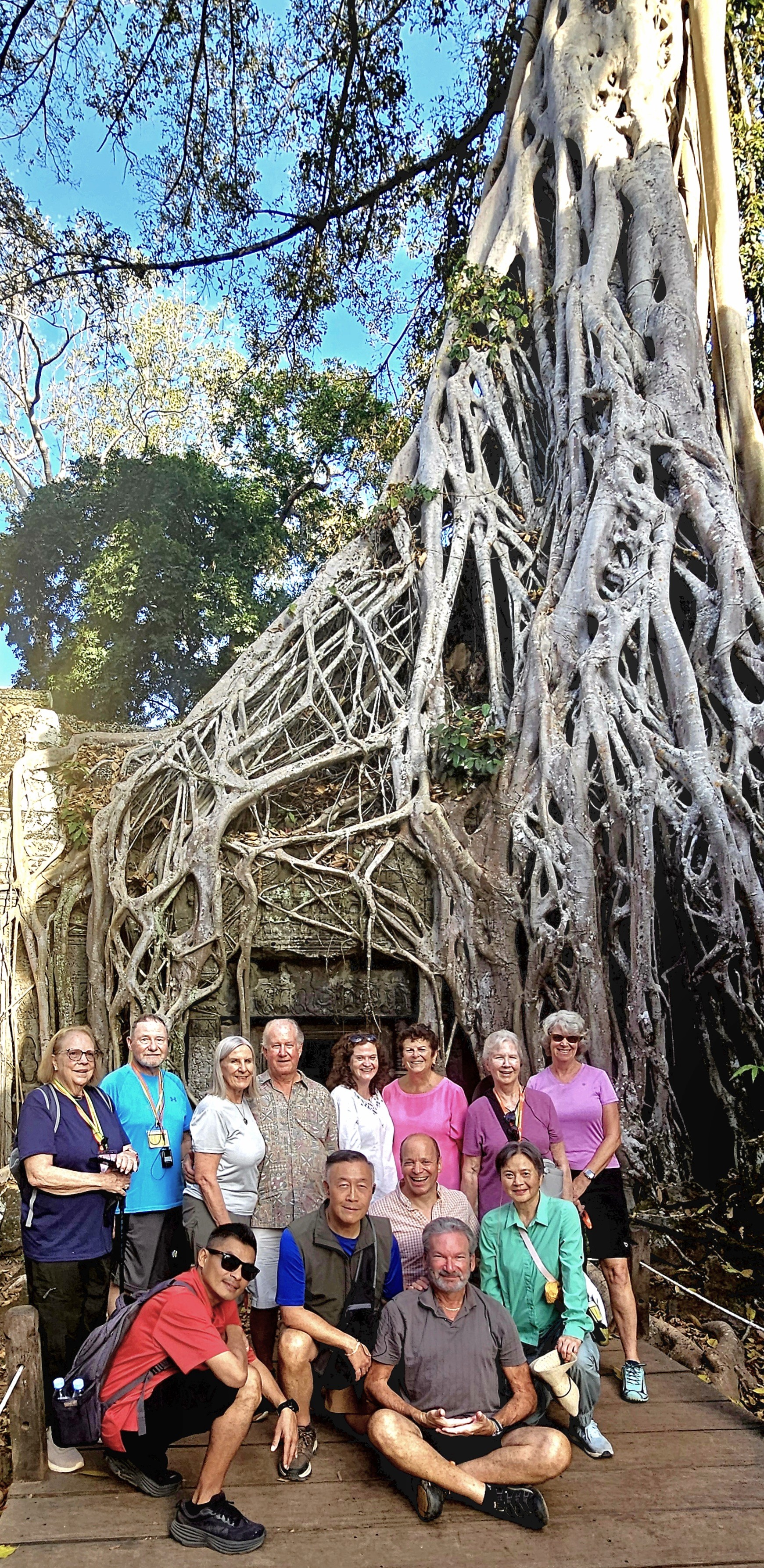
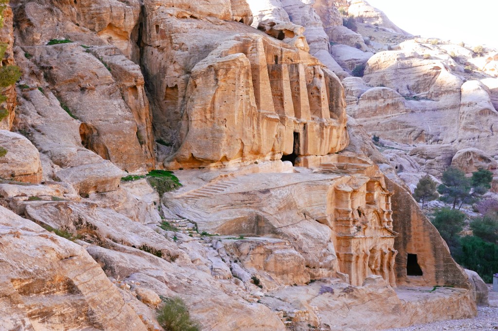
Of all the temples in Cambodia—somewhere between 4,000 and 6,600, depending on the cultural authority—Ta Prohm, located within Angkor Archaeological Park, remains a must-see because of its striking temple remains and captivating narrative.
At the ruinous site of Ta Prohm,
I encountered an otherworldly standoff between human ingenuity and nature’s relentless advance. It’s not merely a structure; it’s a testament to history, where the surrounding jungle advances, progressively reclaiming the landscape.
Here, a vast root system appears to strangle the West Gopura–a vivid illustration of nature’s power interwoven with human craftsmanship.
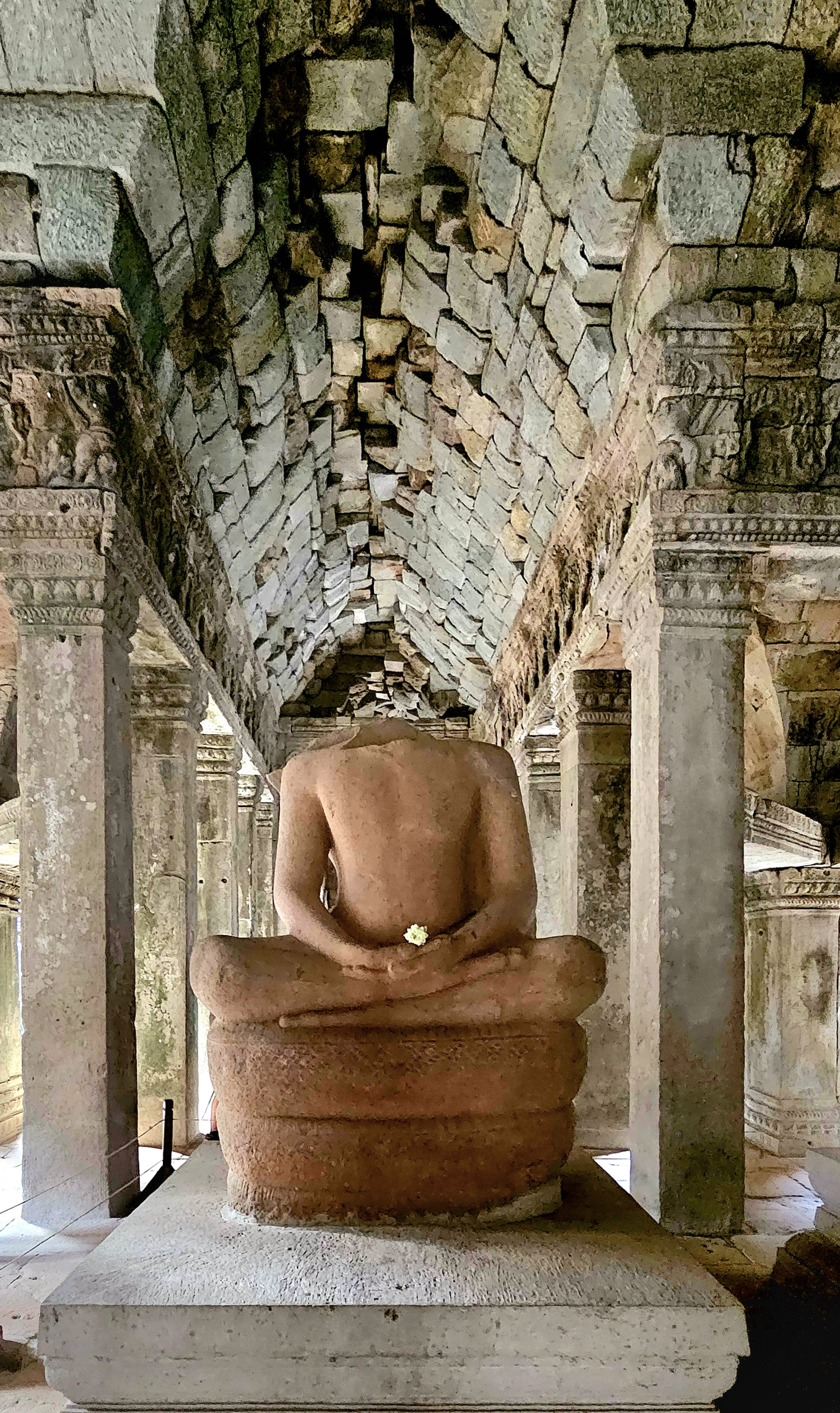
Myth and stone intertwine, as a patina of multi-colored lichen cloaks the bas-relief stonework depicting meditating monks and temple guardians in serene poses.
The gigantic roots of the silk-cotton, gold apple, and strangler fig trees invade the ancient walls and terraces to create a visually stunning tableau.
The trees seemingly communicate with the stone, highlighting both the beauty and fragility of the monument’s existence.
Constructed during the late 12th and early 13th centuries in the local Bayon style—an intricately decorated form of Khmer architecture—Ta Prohm served as a monastery and university for Mahayana Buddhists, offering spiritual guidance and education in a time where knowledge was deeply intertwined with faith.
Following the fall of the Khmer Empire in the 15th century, the complex fell into neglect and was eventually abandoned, allowing the encroaching jungle to seize control, transforming the area into a site of haunting beauty.
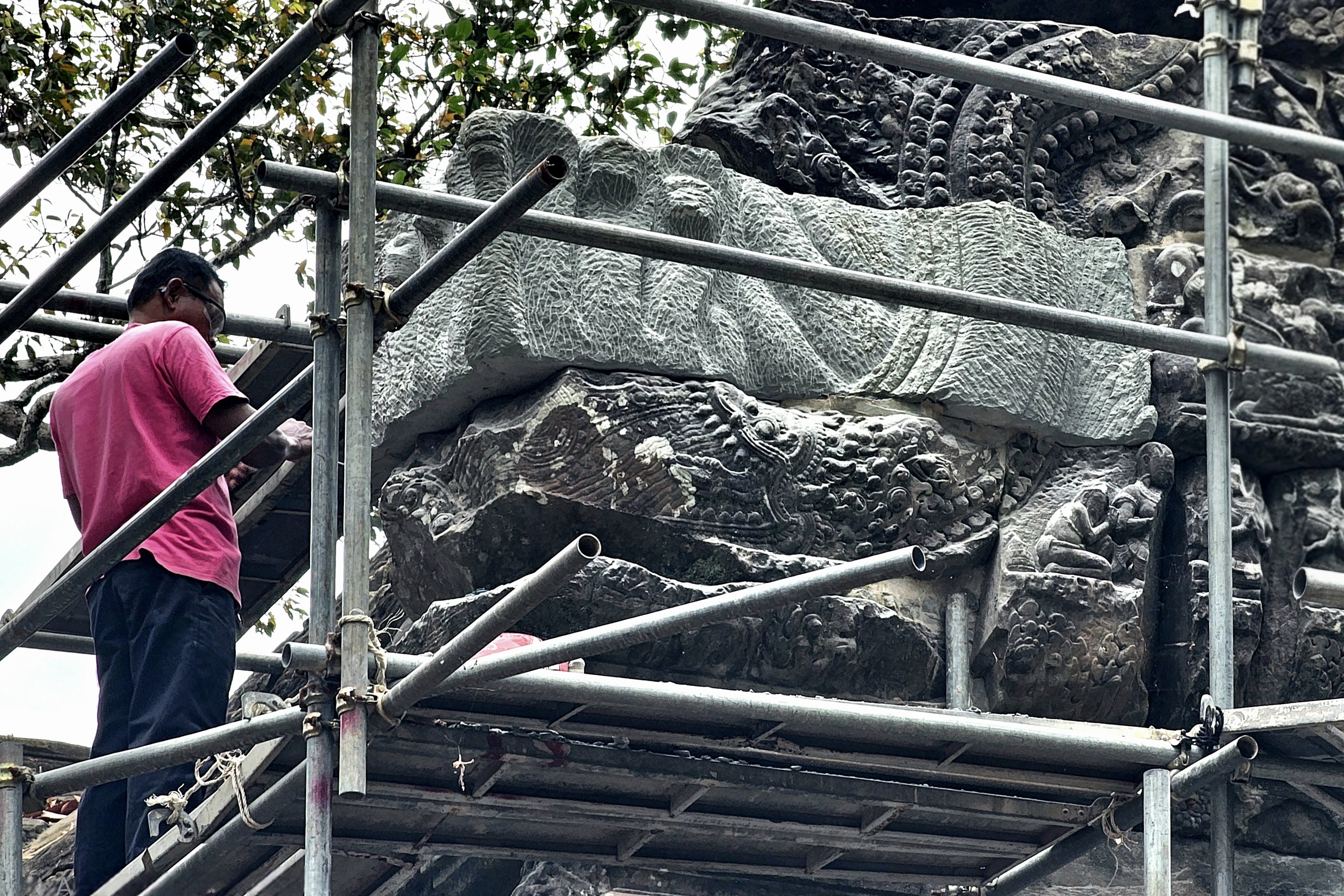
Today, various restoration attempts have stabilized the environment, courtesy of the Archaeological Survey of India (ASI),
which has been collaborating on the temple’s restoration with Cambodia’s APSARA National Authority since 2003.
Restoration efforts to preserve the temple’s original structure include replacing damaged stones, supporting entries, and strengthening foundations to withstand natural elements like heavy rains.
While archaeologists and craftsmen work to protect the temple from potential damages, they are also aware that Ta Prohm’s‘condition of apparent neglect’contributes to its global reputation, as evidenced in the action film, Laura Croft: Tomb Raider.
This balance creates an enchanting duality: the remarkable presence of both human history and the natural world,
coexisting in a state of beautiful decay.
Ta Prohm stands as a poignant reminder of the passage of time, notwithstanding the scrollwork of a stegosaurus carving on a terrace wall that has confounded scholars for centuries.
Together with Angkor Wat, Ta Prohm represents an enduring symbol of the Khmer Empire’s remarkable cultural and architectural grandeur. The site is among Cambodia’s most visited destinations, preserved for tourists who come to witness and contemplate the relentless power of nature in its interplay with human achievement.
Siem Reap Province, located in northwestern Cambodia, possesses significant cultural, religious, and symbolic value, and is also renowned for its architectural, archaeological, and artistic importance. Furthermore, Siem Reap is home to Angkor Archaeological Park, the world’s largest religious monument complex and the cornerstone of Cambodia’s tourism sector.
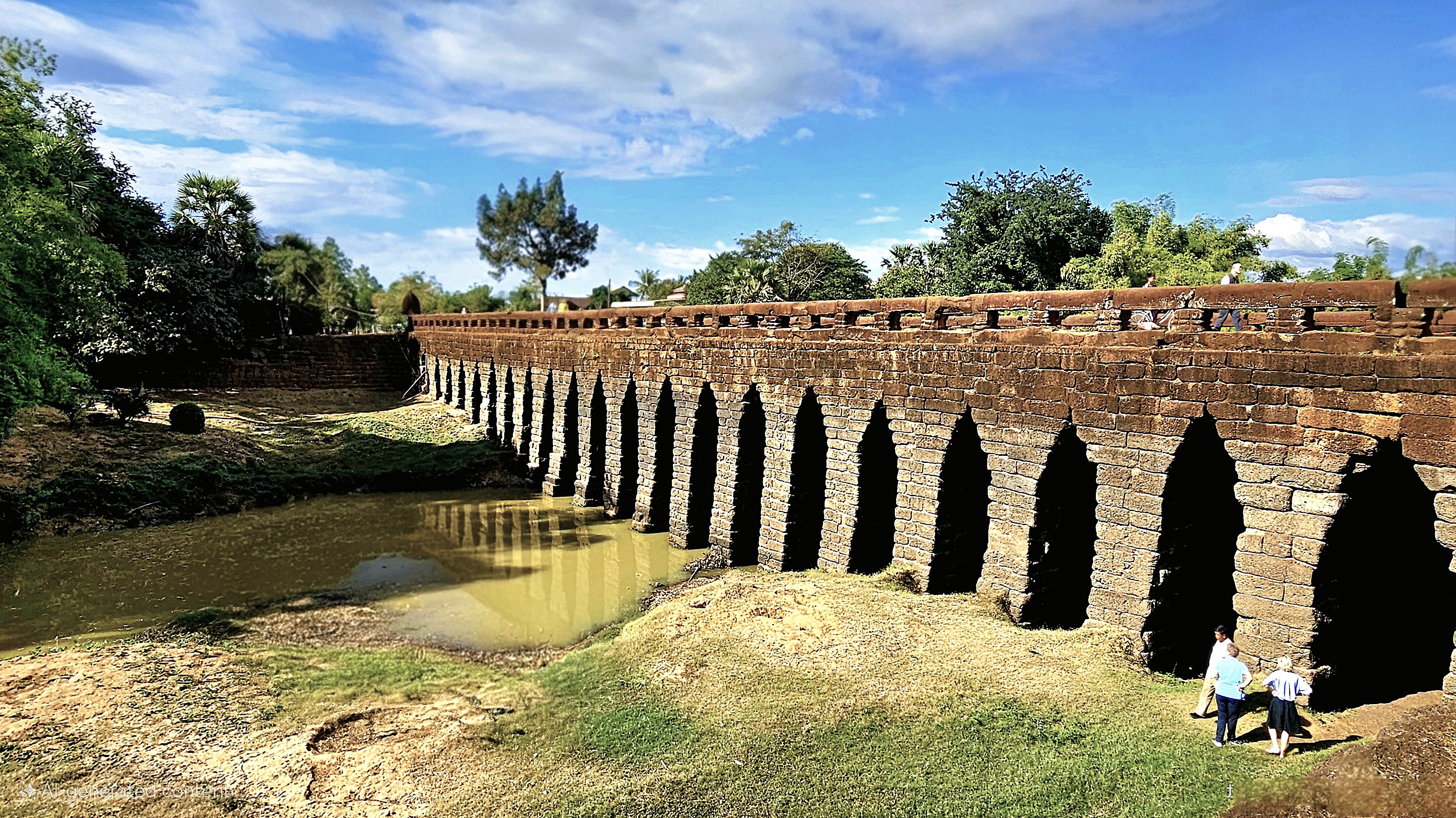
Our O.A.T. group overlanded from Phnom Penh to Siem Reap with a stopover at the ancient Kampong Kdei Bridge, constructed in the 12th century during the reign of King Jayavarman VII.
The bridge is a testament to the engineers who designed the 87m river span with 21 corbelled arches of laterite, making it the longest structure of its kind in the world.
Nine-headed nagas–whose bodies form a continuous balustrade alongside the roadbed–welcome only pedestrians and cycles on the bridge because of weight restrictions.
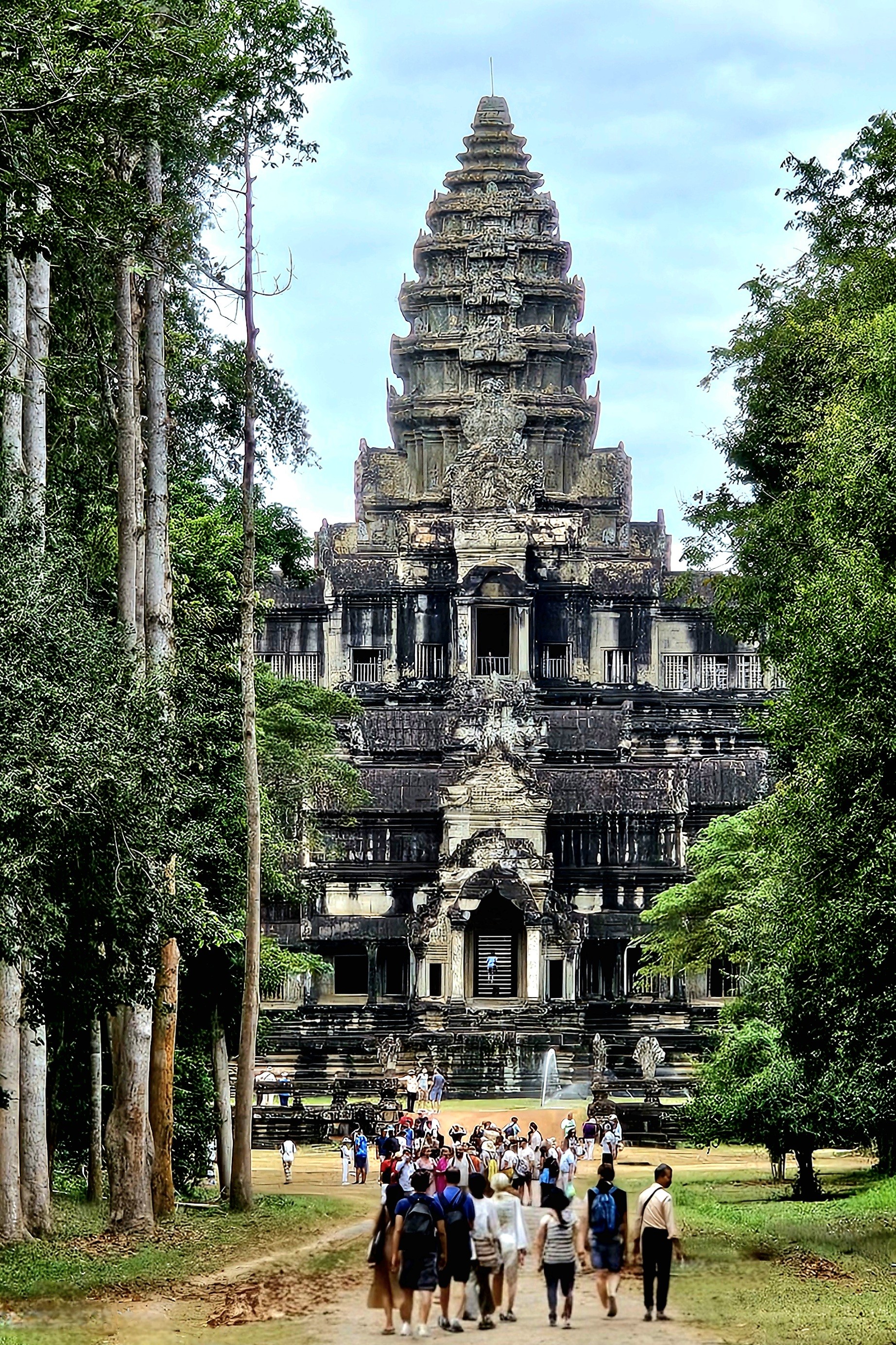
While admiring the scenery, I paused a moment to consider that Leah and I were walking the same trail as the Chinese merchants who traded along the Maritime Silk Road nearly a millennium ago. Back then, it was a 2-day trek through the lowlands to reach Angkor Wat.
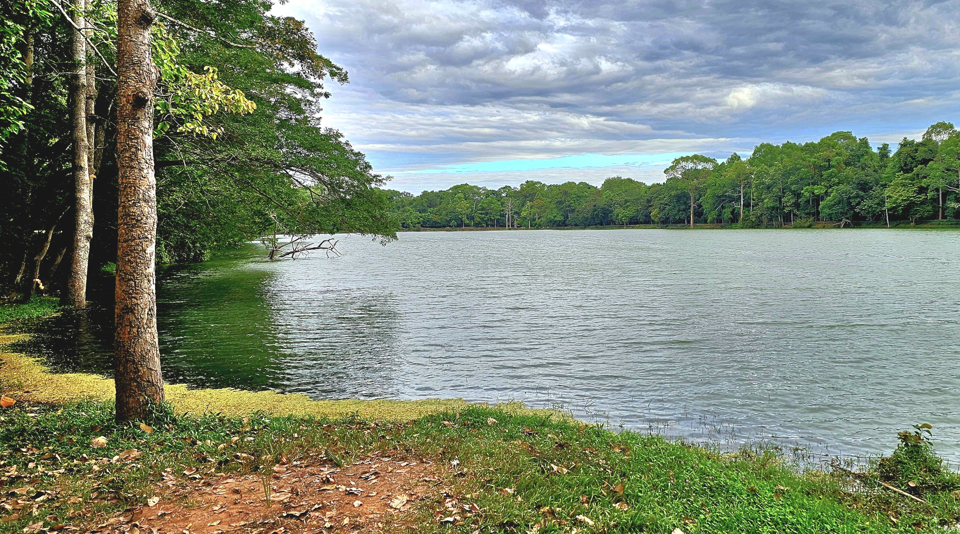
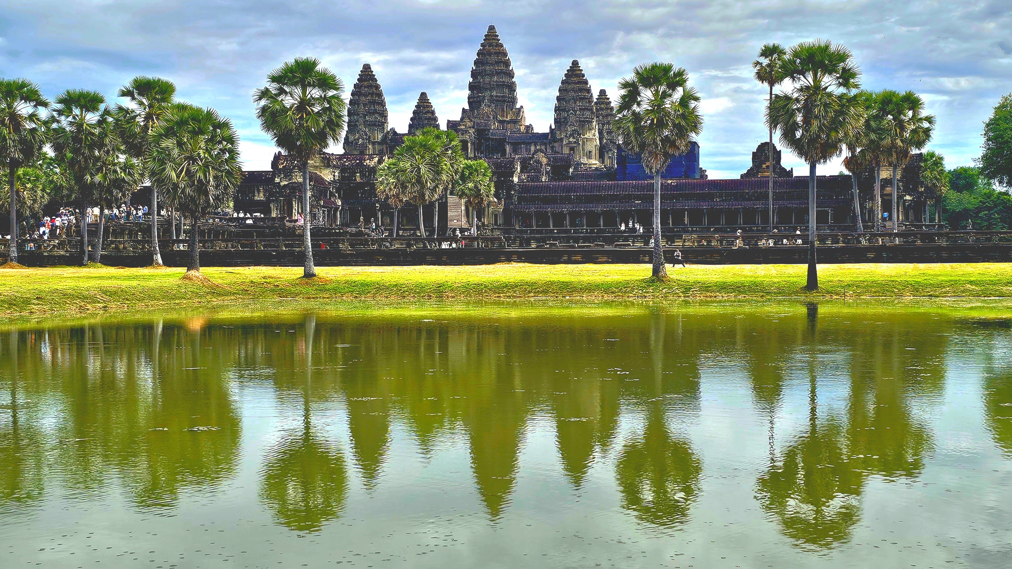
But not for us; we stepped out of our air-conditioned coach the following morning, well before the crowds, to cross a moat symbolizing the cosmic ocean in Hindu cosmology.
While getting our bearings, our guide Seong, a native of Siem Reap revealed Cambodia’s worst kept secret: by arriving at Angkor Wat’s Death Gopura (East Gate), we were avoiding the popular western gateway with five times the tourists.
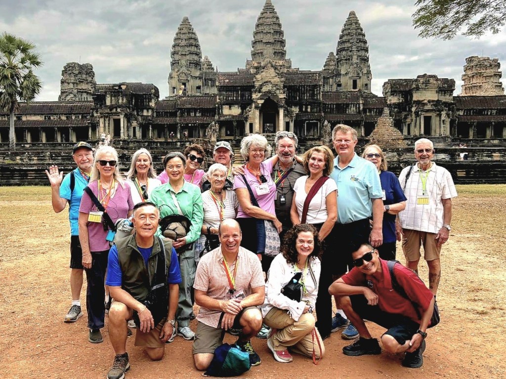
The cloud cover flattened the morning light on our approach down the expansive causeway. It was the best time for photographing Angkor. Eventually, we reached a break in the trees, perfectly framing the famed lotus tower of this Khmer masterpiece. It was reminiscent of the thrill I felt after emerging from the slot canyon in Jordan and peeking at Petra for the first time at first light.
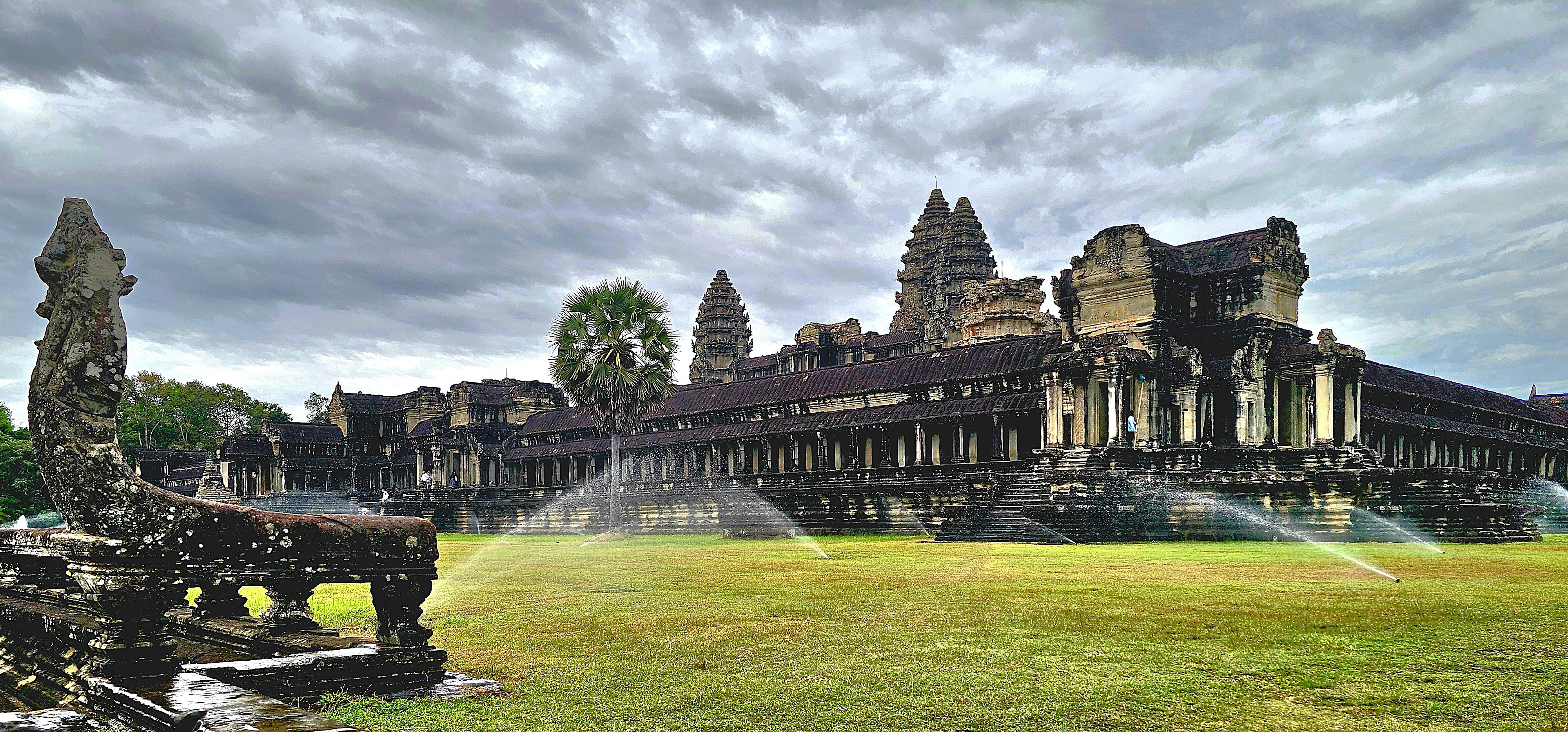
Much has been written about Angkor Wat:
About its monumental size,
spanning 402 acres,
or 4 times the size of Vatican City;
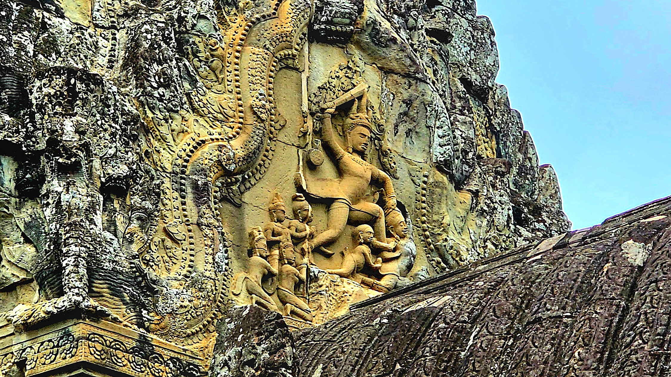
It’s intricate bas-relief carvings throughout the temples and galleries;
Its historical significance, showcasing Khmer mythology and history etched into laterite stone;
Churning of the Sea of Milk
Heaven and Hell
Military Parade of Kink Suryavarman II
Its religious significance–originally constructed in the 12th century as a Hindu temple dedicated to Vishnu but converted to a Theravadin Buddhist temple during the 15tth century to reflect the shift in Cambodia’s spiritual landscape;
Hindu GoddessBuddha seated on Mucilinda, King of the Serpents
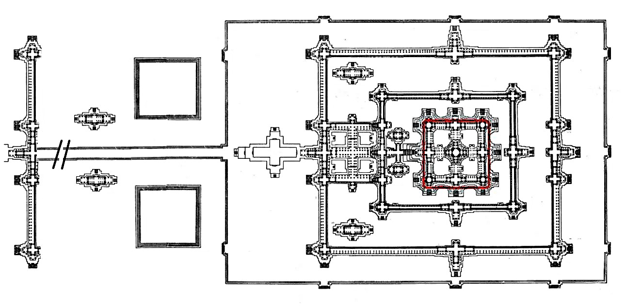
And its architectural accomplishment–a profound reflection of Hindu cosmology, particularly the concept of Mount Meru, regarded as the mythical abode of the deities. The central tower of Angkor Wat epitomizes the summit of Mount Meru, while the adjacent smaller towers signify the mountain’s subordinate peaks. The moat and the rectangular outer wall delineate the oceans and the boundaries of the world, respectively.
Restoration and maintenance have become routine endeavors in Angkor, which fell into neglect following the capital’s relocation to Phnom Penh in 1434. The site garnered renewed attention after being rediscovered by French naturalist Henri Mouhot in 1858.
An international task force supported by Japan, India, France, South Korea, and other contributing nations have collaborated with APSARA National Authority, the Cambodian government agency responsible for Angkor’s ongoing preservation and management, to address the extensive neglect and restore the temple to World Heritage status.
Ceiling before repairCeiling after repair
Recently, new risers have been completed by the Korea Heritage Agency…
giving access to the Bakan (central sanctuary),
which supports the amazing quincunx of towers,
offering amazing views,
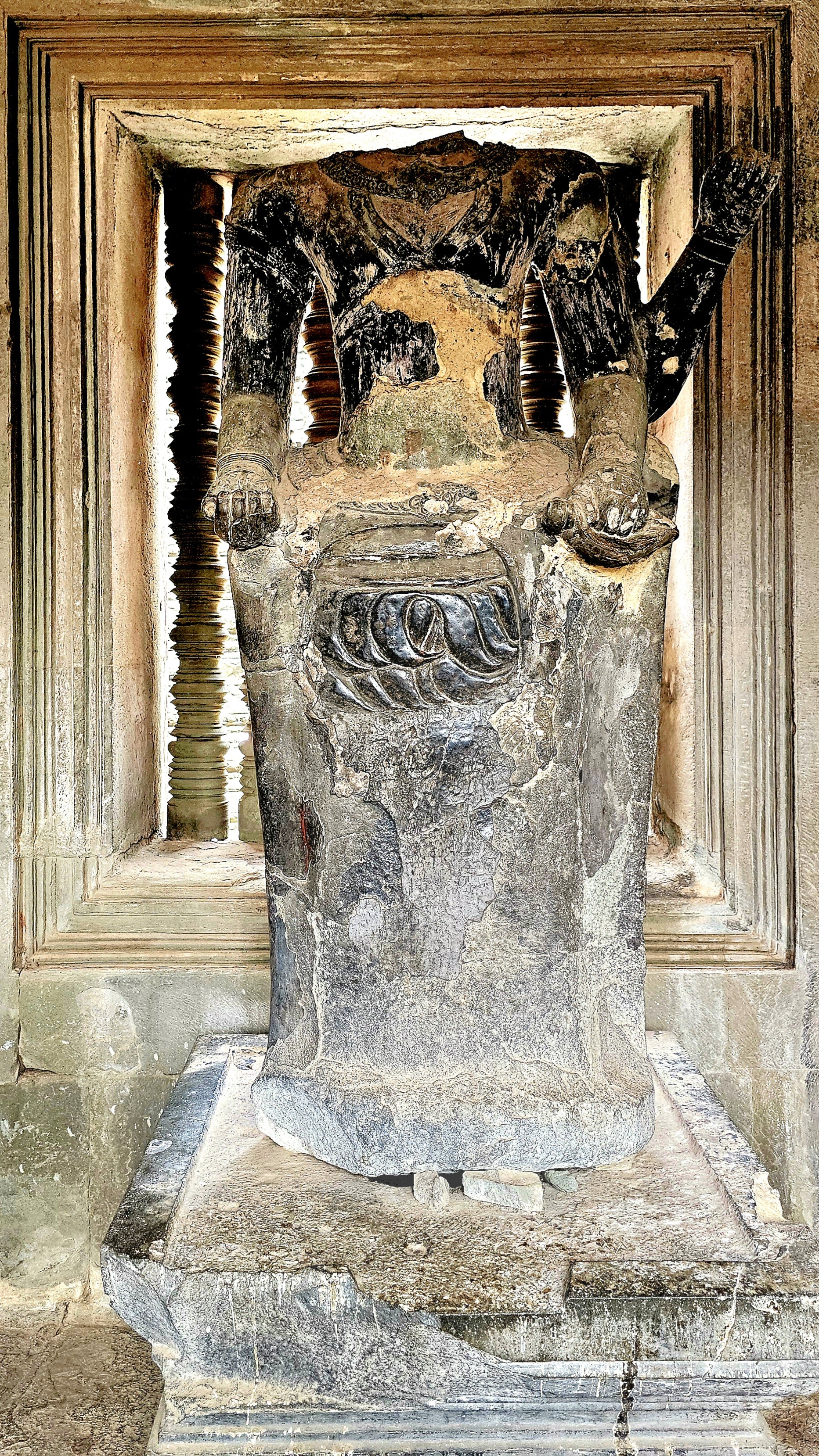
and providing sanctuary for a rare wooden Buddha sculpture whose head remains intact,
unlike most of the other Buddhas who fell victim to so many marauders over the centuries.
But amidst the vastness and splendor surrounding us, it was the people donning their Sunday best who truly captured my attention with their warmth and spirit.
often posing by the Reflecting Pool for the quintessential photograph, or so I thought.
Unfortunately, the wind kicked up, causing the pool to ripple ever so slightly and affect my mirrored imagery.
However, by returning the following day for a sunset farewell to Angkor, I believe I captured the iconic shot that characterizes Cambodia’s cultural landscape.
The experience not only fulfilled a bucket-listed destination but deepened my appreciation for the rich heritage of Cambodia, reminding me that some locations leave an indelible mark on our souls.
Rivalry serves as a profound motivator, compelling individuals to elevate their performance. It fuels our ambition and stimulates our creative capacities. Additionally, it sharpens our concentration and tests our boundaries.
At its most constructive, rivalry fosters a form of competition that can lead to significant achievements.
For example, had it not been for Gutzom Borglum’s monumental conversion of Tunkasila Sakpe Paha into Mt. Rushmore(1927-1941), there might never have been a Crazy Horse Memorial located 16 miles from Borglum’s masterpiece.
Afterall, it was Korczak Ziolkowski, Borglum’s assistant at Mt. Rushmore who imagined the Lakota mountainside transformed into the world’s largest sculpture of a 19th century Sioux chief on a horse.
As a work-in-progress since 1948, the completed head of Crazy Horse stands at 60 feet, matching the measure of George Washington’s image.
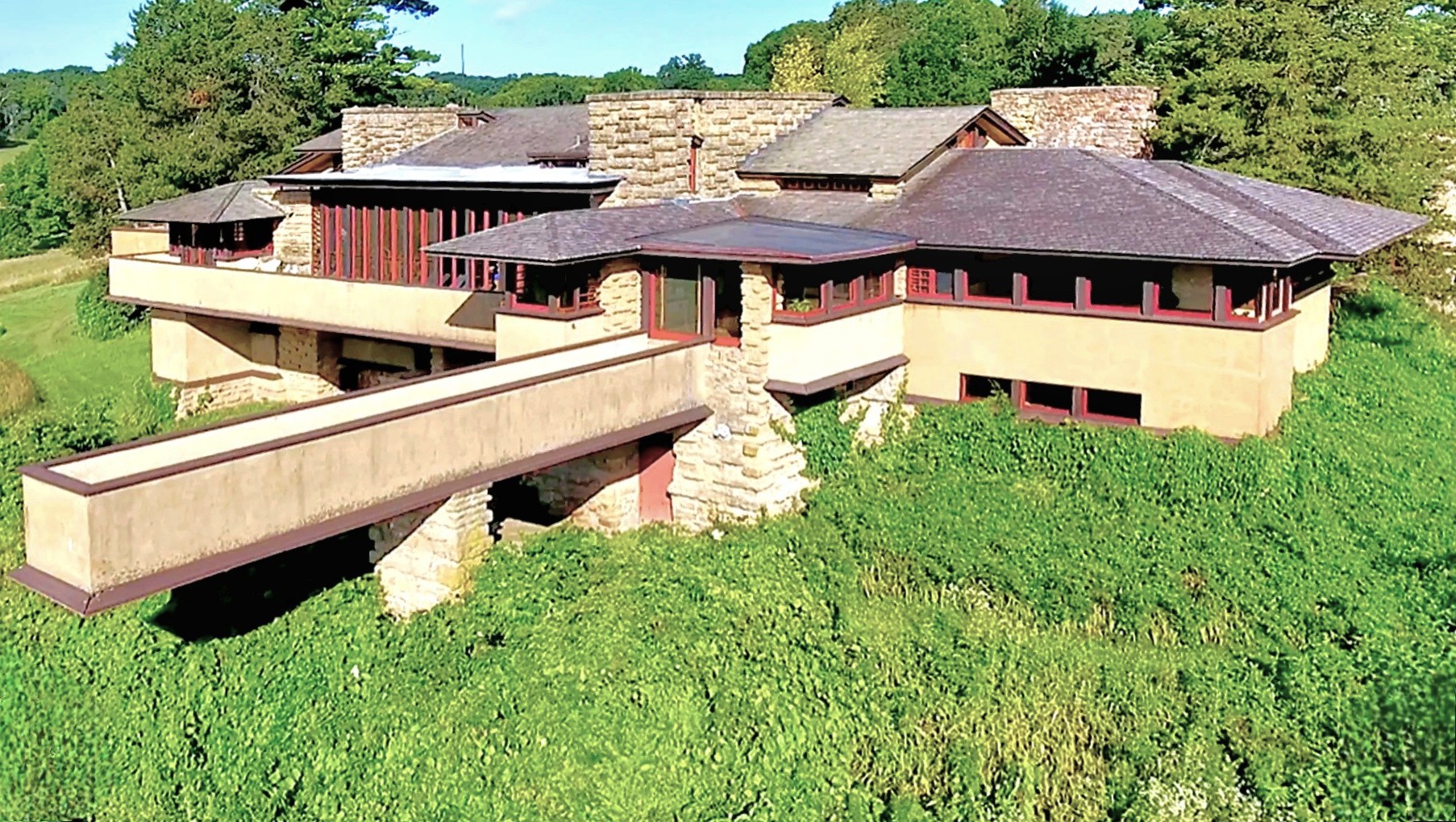
Similarly, visionary architect Frank Lloyd Wright designed Taliesin as his estate-studio outside Spring Green, Wisconsin. Wright’s organic design followed his affinity for infusing natural elements into his habitats (Prairie Stylings).
Forty-eight years later, Alex Jordan–although not professionally trained as an architect–drew inspiration from Wright’s Taliesin, and began construction on his own homestead, the iconic and certainly eccentric House on a Rock–only 6 miles down the same road, on WI-23.
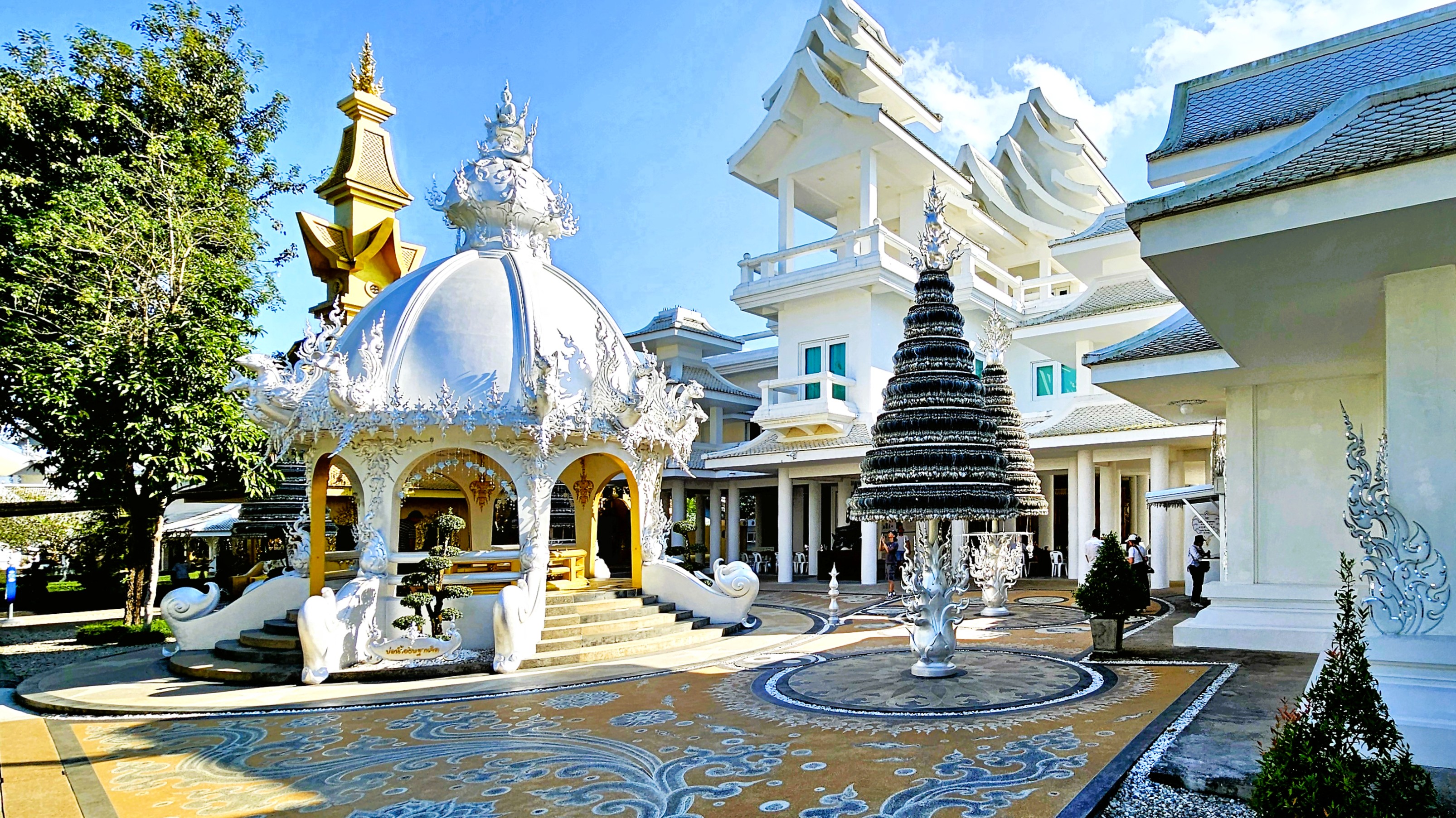
In the hills of Chiang Rai, Thailand a similar rivalry exists between teacher and student, with their competing visions of divinity and righteousness expressed through different, symbolic colors: Chalermchai Kositpipat’s gleaming, ornate White Temple…
versus Puttha Kabkaew’s psychedelic Blue Temple, which borrowed heavily from his mentor’s neo-traditional style of Buddhist art. And we got to explore both of them!
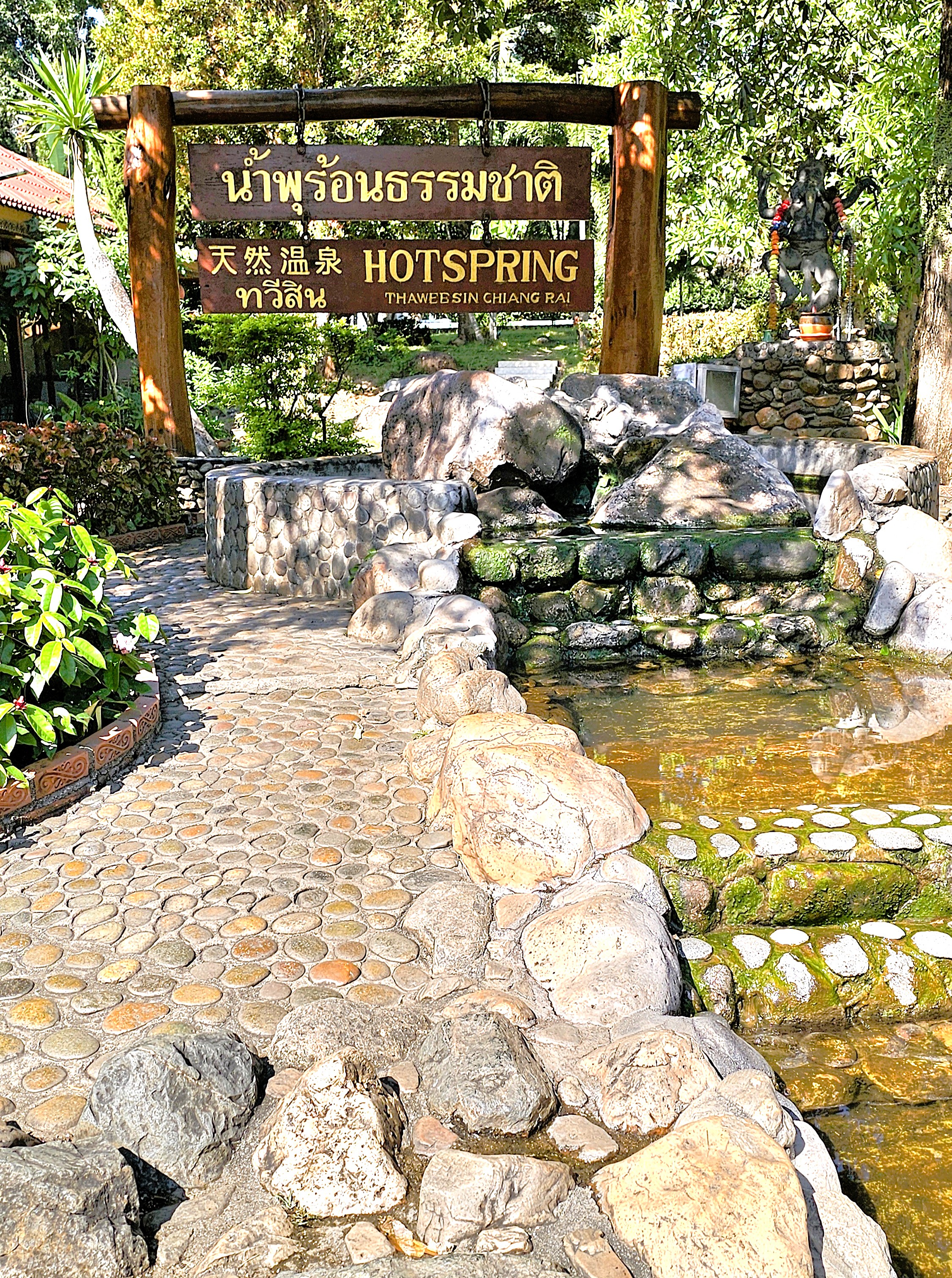
We departed Chiang Mai for Chaing Rai, first passing through Thaweesin Hot Springs, our timely rest stop, and Thailand’s highest elevation thermal waters–where we stretched our legs, soaked our feet,
and where a Happy Room attendant eagerly pointed us in the right direction.
After arriving at the White Temple (Wat Rong Khun), we were greeted by a Transformer,
who seemed to reflect the otherworldly characteristics of the temple grounds.
The details behind Chalermchai’s bid to rebuild the crumbling temple in the village of Rong Khun are legendary.
In 1997, Chalermchai committed to self-fund the project as an offering to Buddha after a national economic downturn threatened its reconstruction. He did so for love of country, love of Buddha, and his love for the King.
He cast the chapel, the Sukavadee Bridge, the crematorium, and other prayer halls in white as a symbol of purity and spiritual enlightenment.
The mirrored tiles represent Buddha’s wisdom, which shines across the mortal world and the universe.
Silver Bodhi trees in public squares and walkways hold the wishes of thousands of visitors who pray for guidance and enlightenment.
Other buildings have been designed in gold–deliberately chosen to represent attachment to material wealth, and worldly distractions. The ornate Happy Room building is one such preoccupation,
while the golden bridge, ironically carries visitors to the golden gallery and gift shop.
At the White Temple, nothing is truly as it seems. Even the monk who adorns the chapel alter has been cast in wax.
The striking artistry and rich cultural symbolism elevate the experience and compel introspection at every moment. Within the Ubosot—where photography is prohibited—captivating murals that blend contemporary references and historical motifs vividly portray the eternal struggle between good and evil. Colorful representations of political figures, Star Wars characters, and Disney icons convey a compelling truth: rebirth, karma, and the cosmic balance of the universe stand as the ultimate rewards.
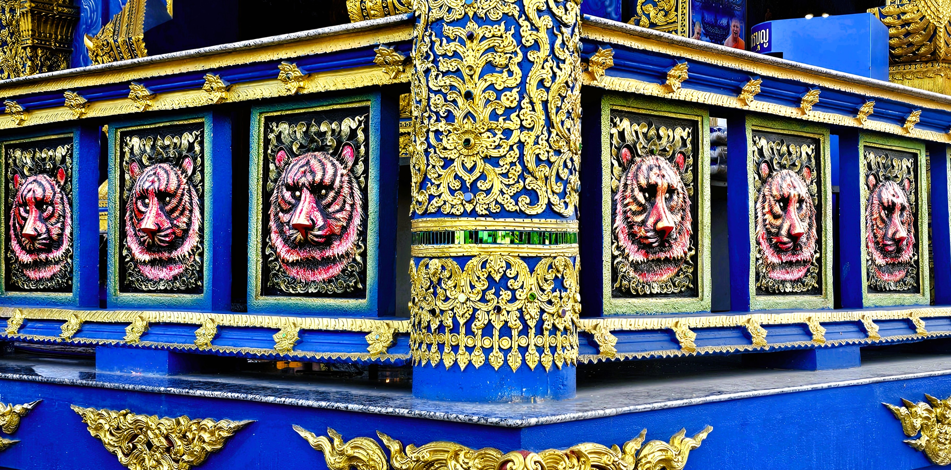
Puttha Kabkaew’s philosophical and spiritual manifesto clearly aligns with his mentor’s, Chalermchai Kositpipat, and it’s on full display–less than 10 miles away–at the Blue Temple (Wat Rong Suea Ten).
The temple’s name translates to House of the Dancing Tiger as a testament to the wildlife that once roamed freely over temple grounds a century ago.
Puttha’s cerulean-blue facade symbolizes the importance of meditation and inner peace, while gold accents represent enlightenment and emphasize the architecture.
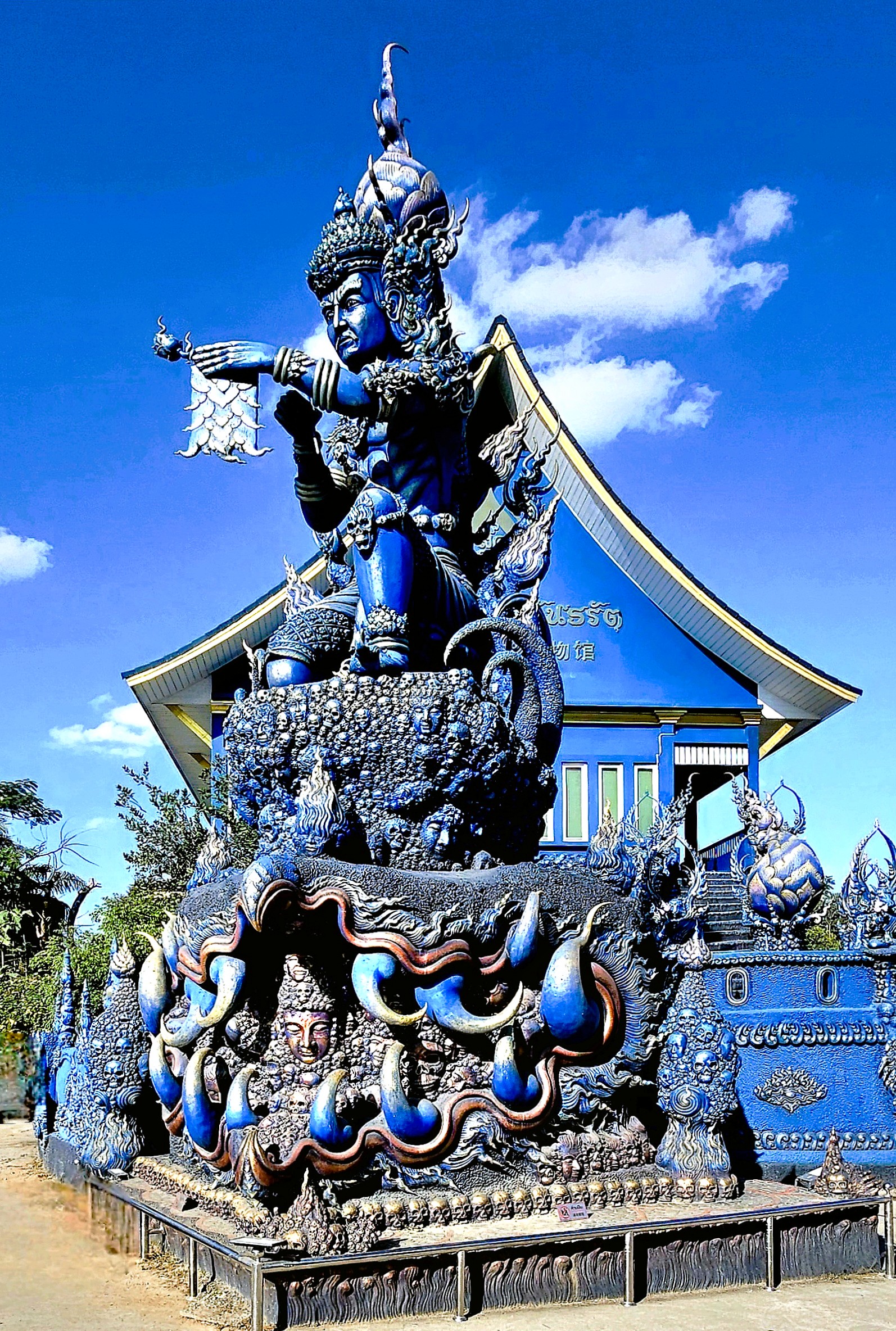
The temple’s interior features a large statue of a white porcelin Buddha…
surrounded by surreal, contemporary Buddhist art.
The Blue Temple is protected by fantastical, celestial creatures: like imposing Nagas,
fountain-loving Garudas.
and an Erawan.
Since 2016, the Guardian of Wat Rong Suea Ten has been intent on heralding the word of Buddhism…
But the road to enlightenment is a bit like trying to assemble IKEA furniture—it’s an eternal struggle! Buddhist imagery often showcases the bewildered faces of those in misery, serving as a nagging reminder of the struggles one must overcome to achieve enlightenment.
And one day, with the help of my fellow mortals, I hope to get there!
With writing this sentence, my 6-month blogging hiatus is officially history.
All the while, I continued taking pictures, and I never stopped writing. I just got off the blogging merry-go-round for a time.
Instead, I took stock of nearly 25,000 images and analyzed 500 stories that I’ve shared with the WordPress community over the past eight years.
I soon realized after 3 years of blogging that I had already accomplished my mission of streaming through America!
That’s not to say that there’s nothing more to experience. But I can honestly say that since retiring, I’ve chronicled hundreds of visits to national and state parks and various landmarks and curiosities across the country, which amounts to the very best that America has to offer.
I’ve also begun to travel more internationally, and I’ve included many of those destinations in this blog. How could I not? Naturally, it wasn’t in an Airstream, and it wasn’t America. Although, in fairness, some of those destinations within Canada, Mexico, Central America, and South America should count as “American” by nature.
I also realized that many of the stories I wanted to tell were not always supported by the photographs I had taken. And often times, the photographs I was most pleased with didn’t always match the story I was writing.
I found myself making arbitrary rules that impeded my writing, like thinking that my posts should be a linear account of my travels rather than a reflection of an arbitrary moment in time.
Managing StreamingThruAmerica.com has been a blessing, albeit it’s been challenging yet exhausting; nourishing while enervating; fulfilling but frustrating, and rewarding yet fickle.
Nevertheless, it’s also garnered over 100,000 views–for which I received a silly badge from WordPress, which makes me smile;
and it’s earned an Editors’ Discovery pick soon after launching this blog.
I don’t know if all of that is worthy of celebration or not, but I’m certainly grateful for the recognition and all the support from the blogosphere.
What started as a personal journal of sorts and a means of checking in with family and friends has morphed beyond its original intent, and I’m okay with that.
I’ve toyed with refreshing the style and revising the content to fit the times (and maybe that may happen on a rainy day), but for now, it’s status quo.
The journey continues…in Bangkok–the first stop of a 5-week adventure to Southeast Asia–where ancient kingdoms still shine as bright as the Buddhas that adorn his temples.
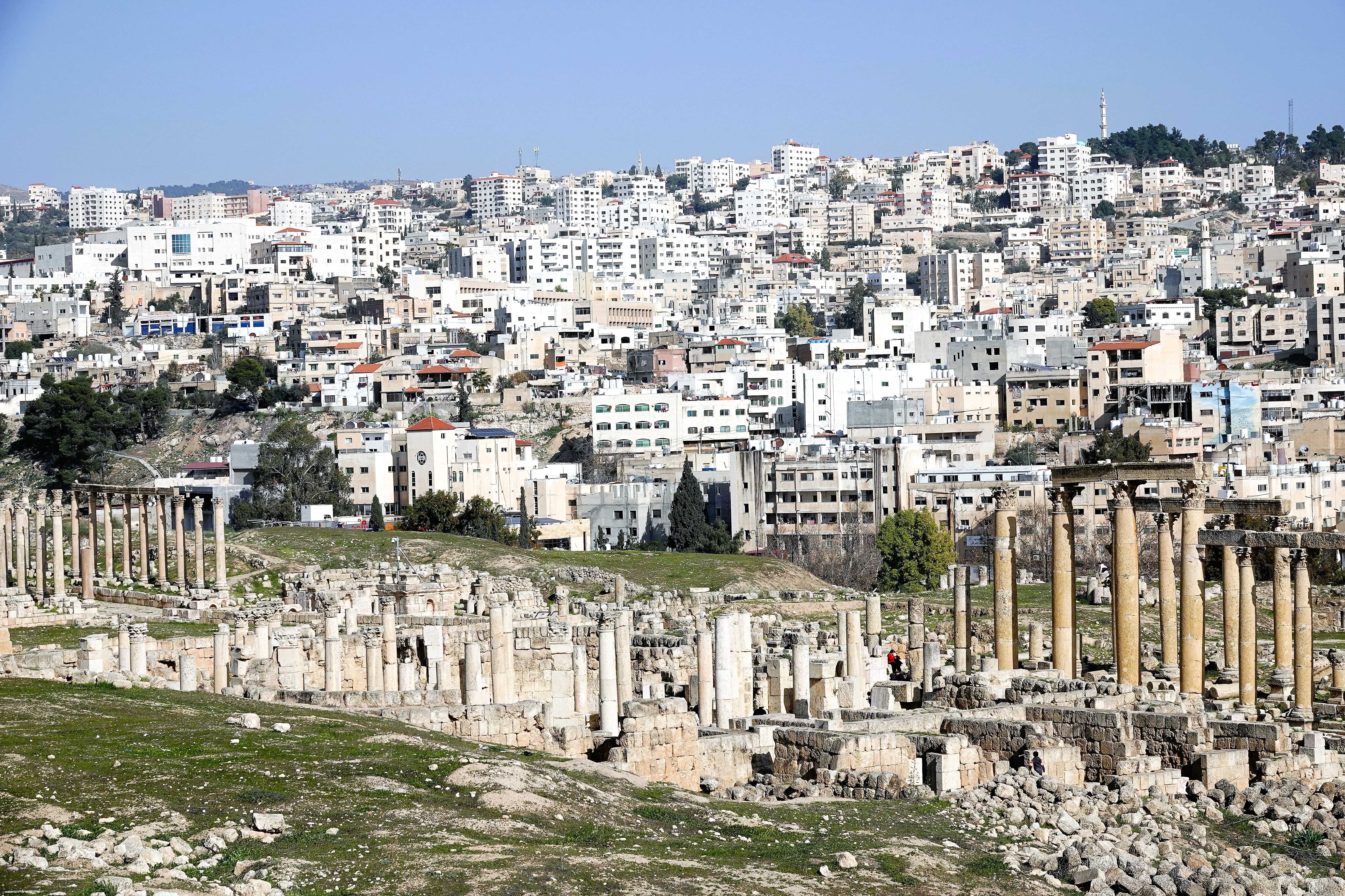
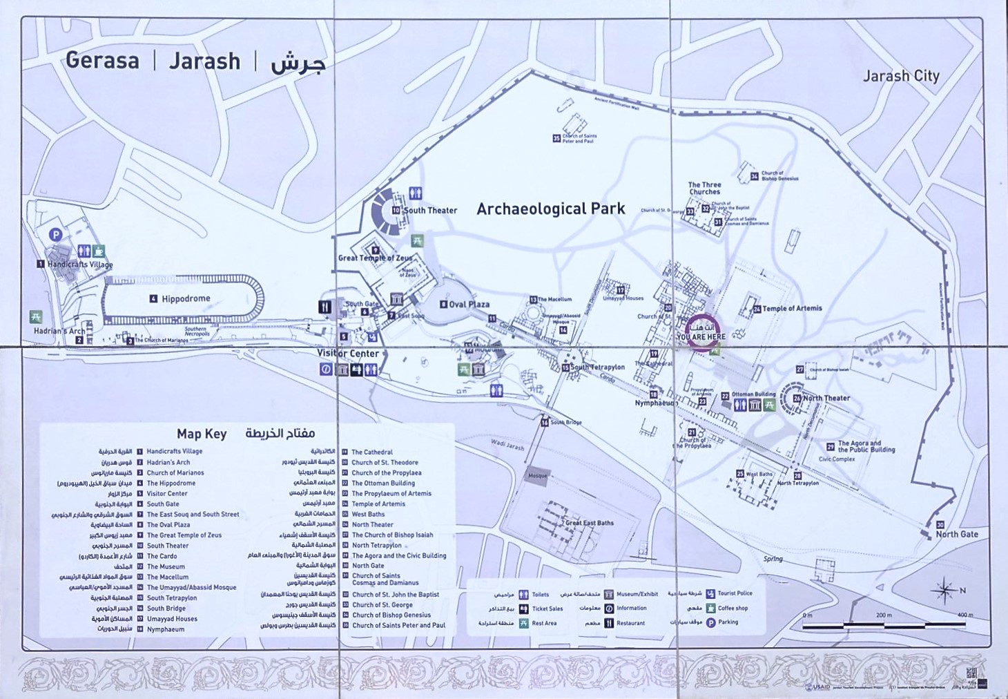
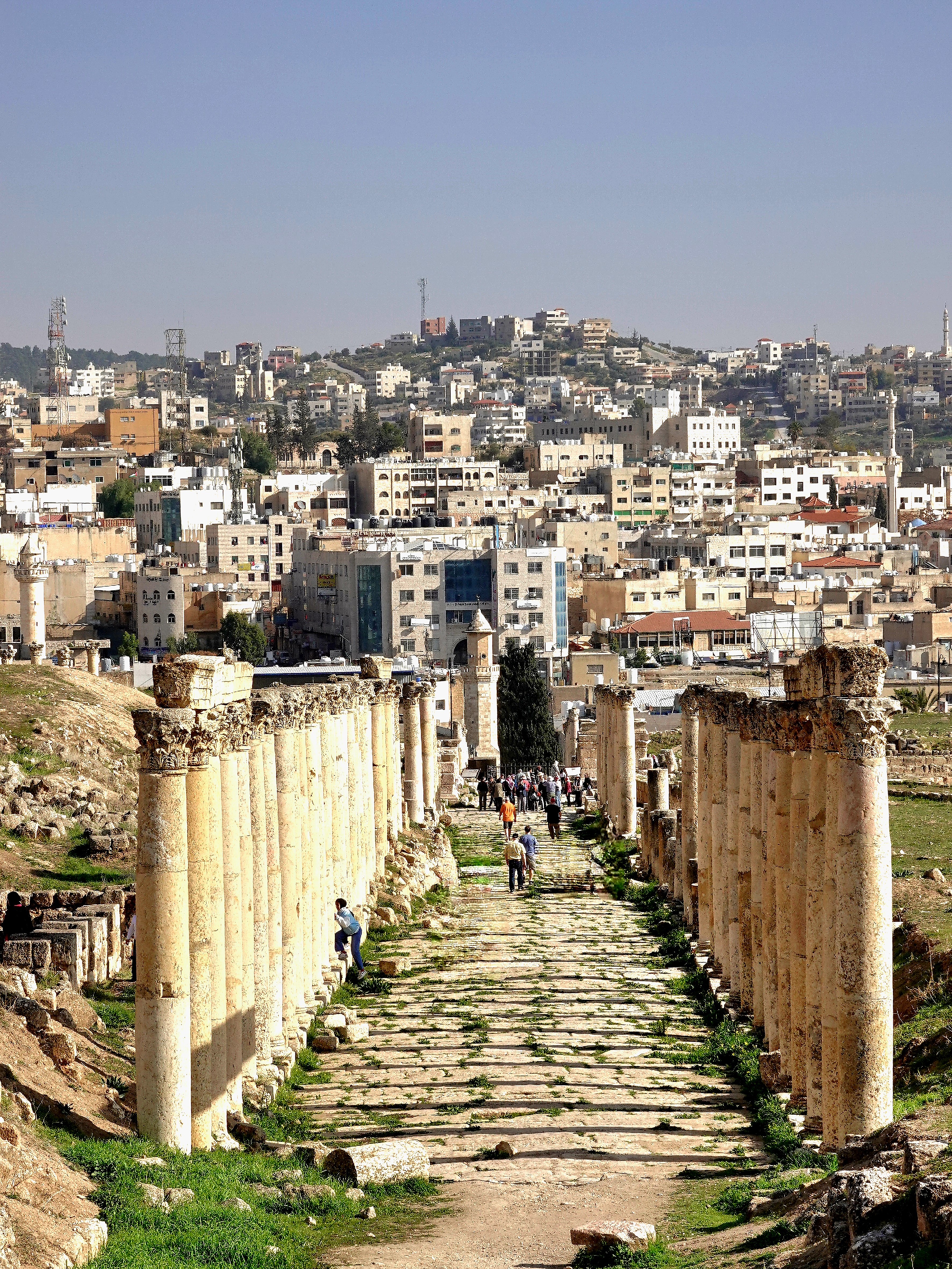
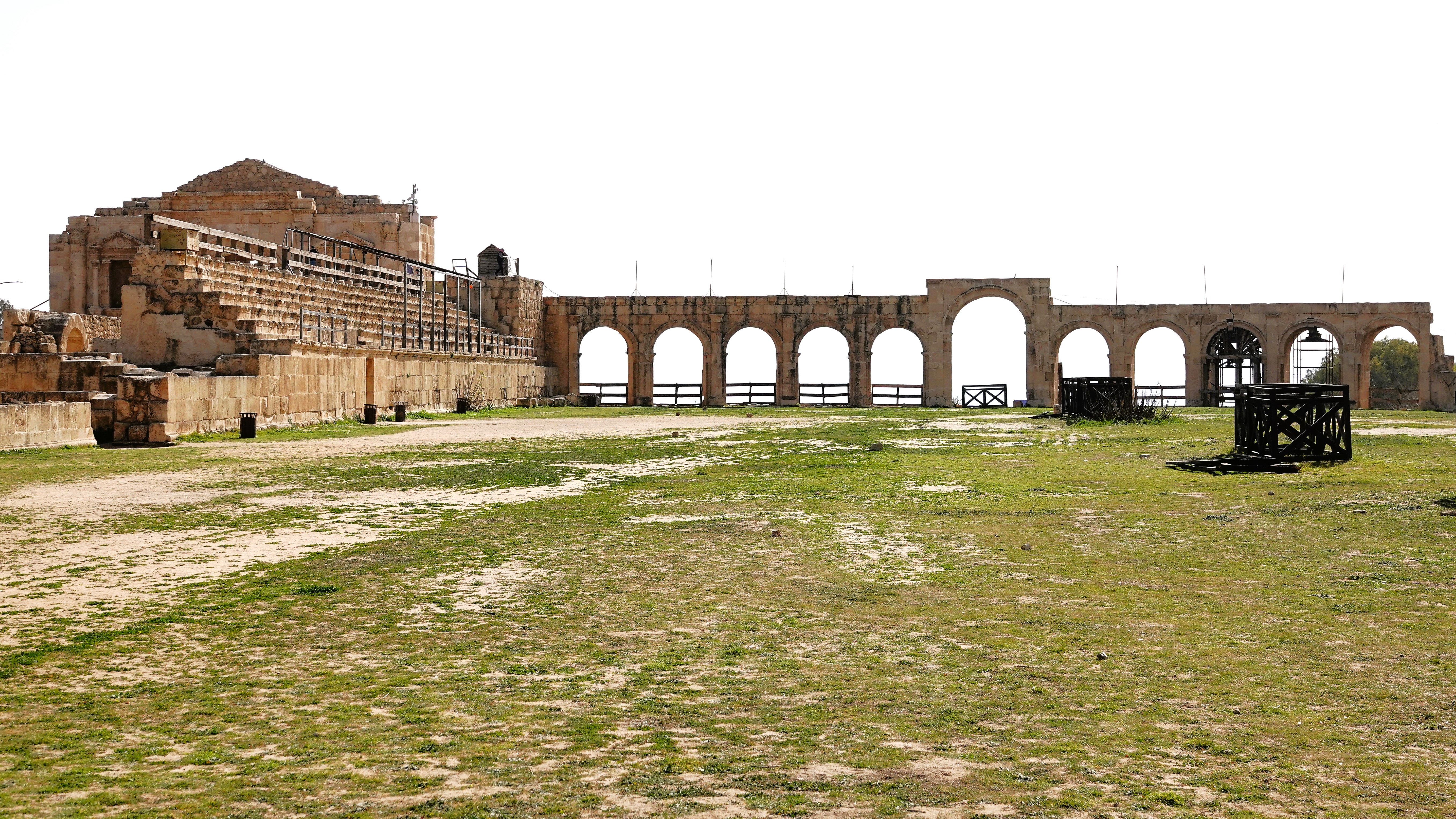
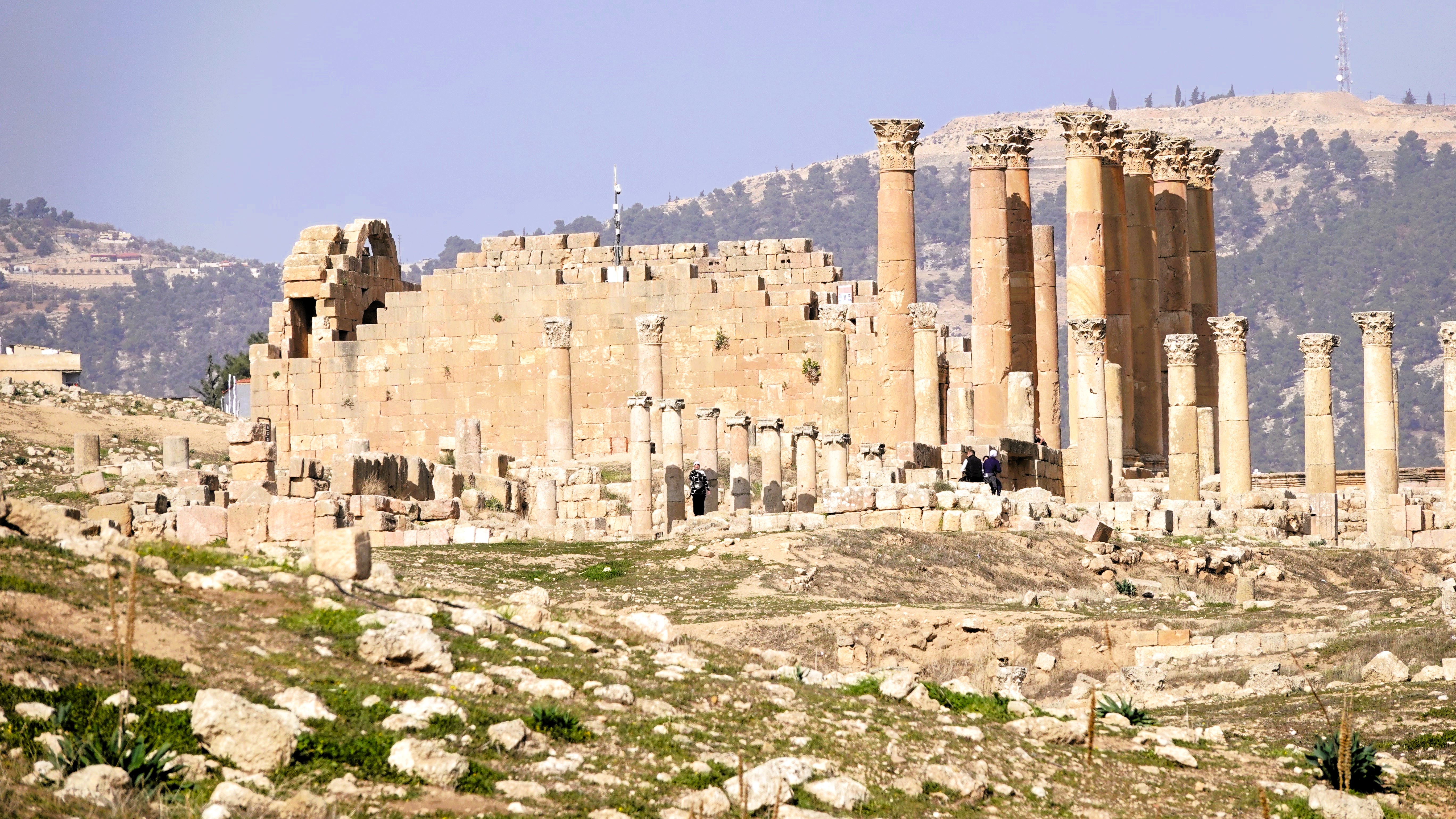
Jerash is a modern city 45 km (30 mi) north of Amman,
that surrounds an immense Archeological Park designed to protect the ruins of a walled Greco-Roman settlement,
as well as human remains from Neolithic times.
Photo courtesy of UJ
Jerash evolved from an agrarian village on the banks of Wadi Jerash throughout the Iron Age and Bronze Age, to becoming a 4th century BC garrison founded by Alexander the Great on his way from Egypt to Mesopotamia.
Subsequently, under the reign of Antiochus IV (175 – 164 BC), Jerash became a tax and trade capitol, with special thanks to Zeus for his guidance.
Great Temple of Zeus
As an aside, it deserves mentioning that King Antiochus is regarded as one of Judaism’s major villains for his iron-fisted repression of Jewish laws and customs. He is forever vilified as the ruler who desecrated Jerusalem’s Second Temple by turning it into a brothel and sacrificing a pig on its altar to honor Zeus. His continuing persecution of Jews ultimately prompted an uprising commanded by Judah Maccabee in 167 BC that eventually led to the recapture of Jerusalem and rededication of the Second Temple, spawning the Miracle of Hannukah.
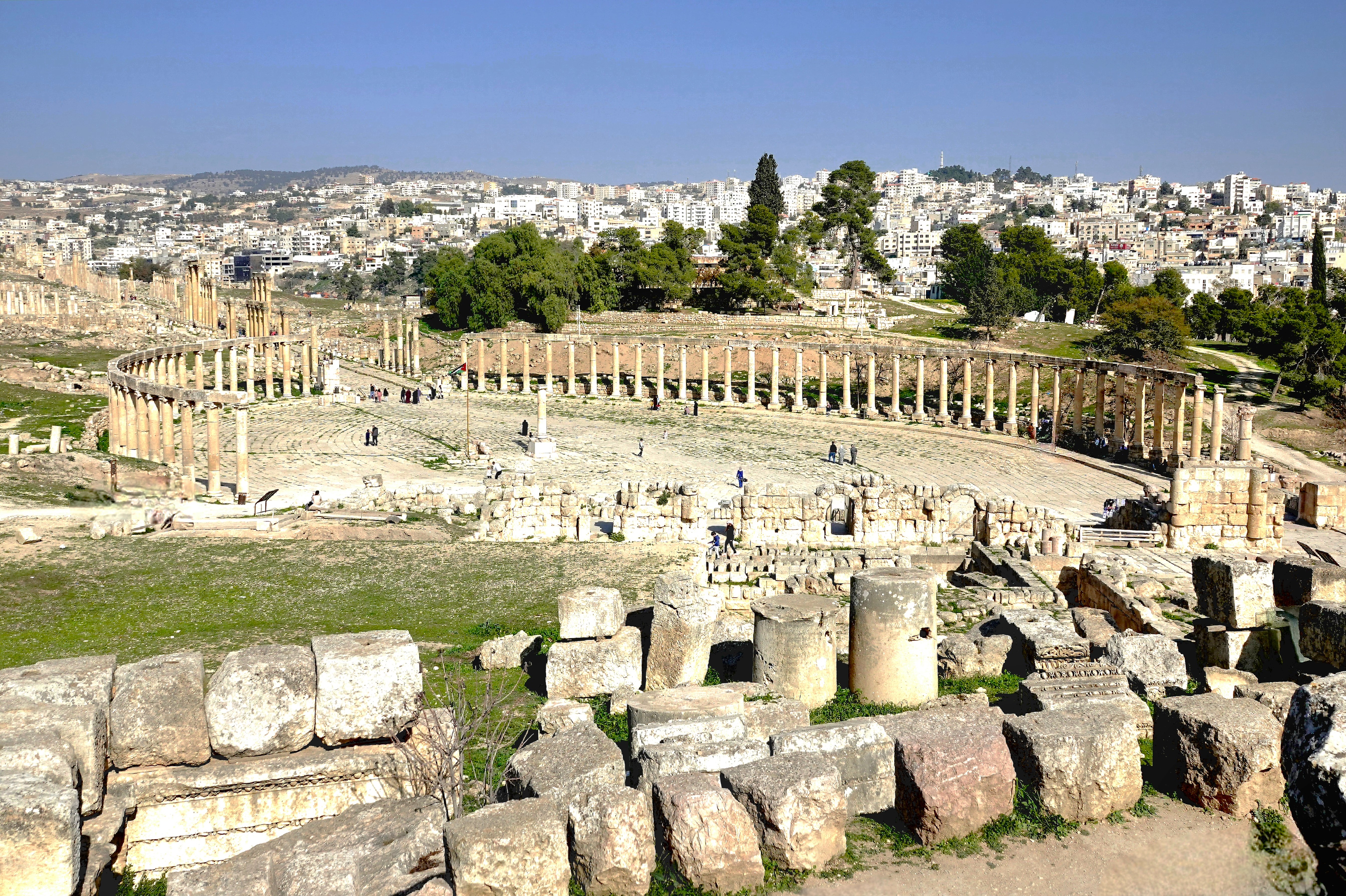
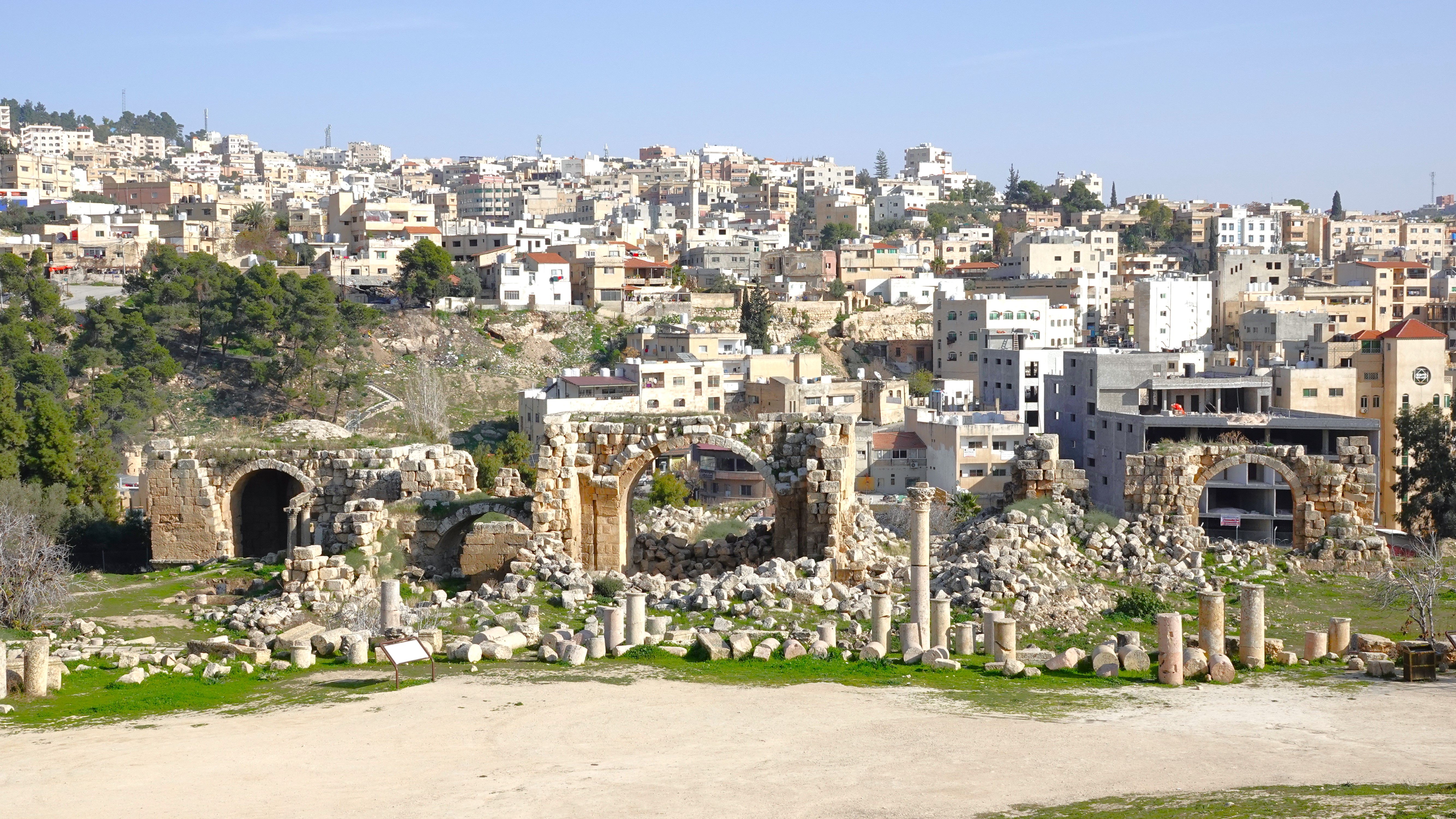
Only Greek inscriptions on city foundations remained after Jerash was sacked by Roman general Pompey in 63 BC. But under Roman rule, Jerash was rebuilt and thrived as an important trading center to Europe and Asia, as evidenced by the array of architectural riches that have been excavated and restored over the past century, making Jerash the most well-preserved, ancient, Roman city east of Italy.
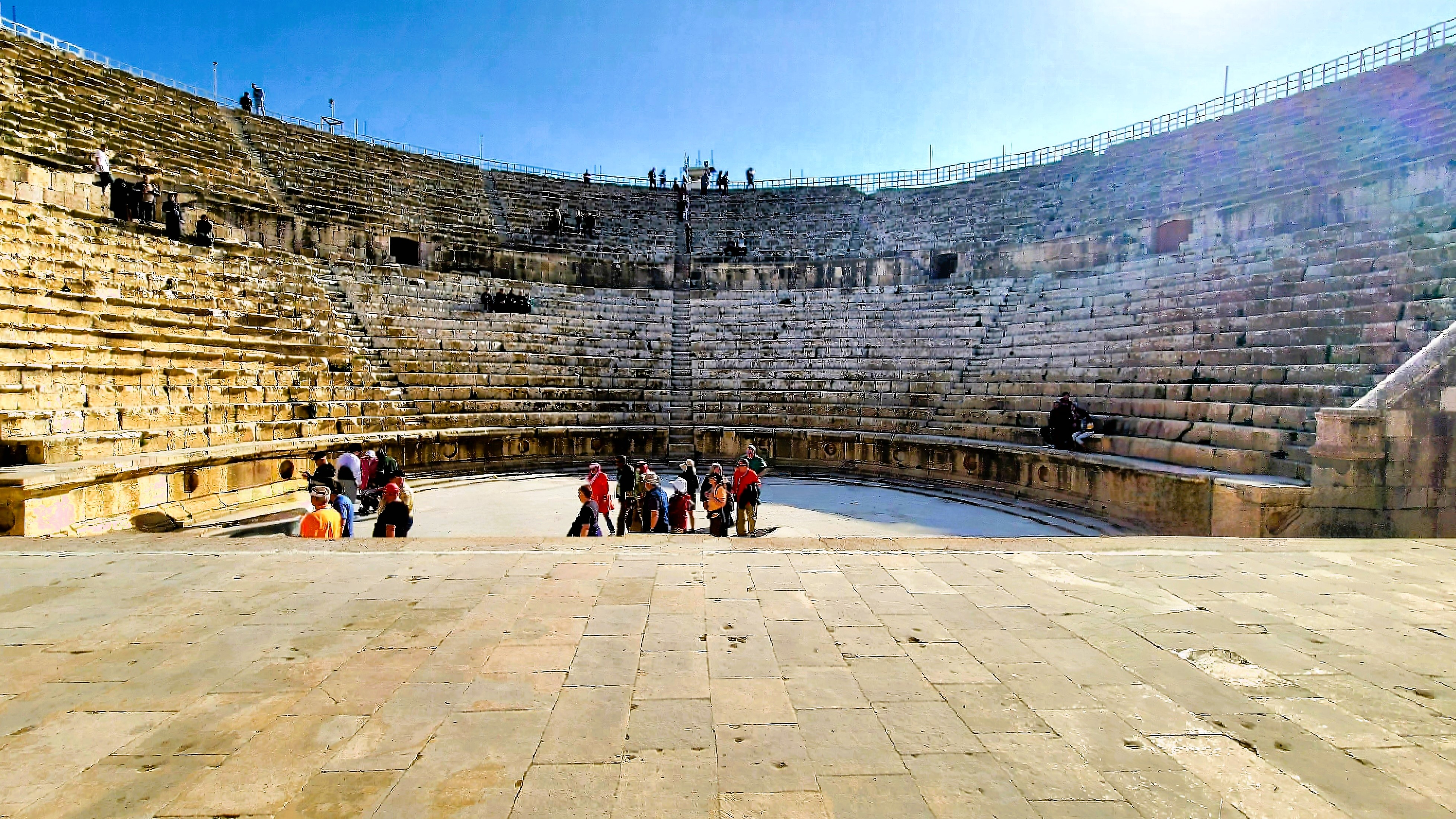
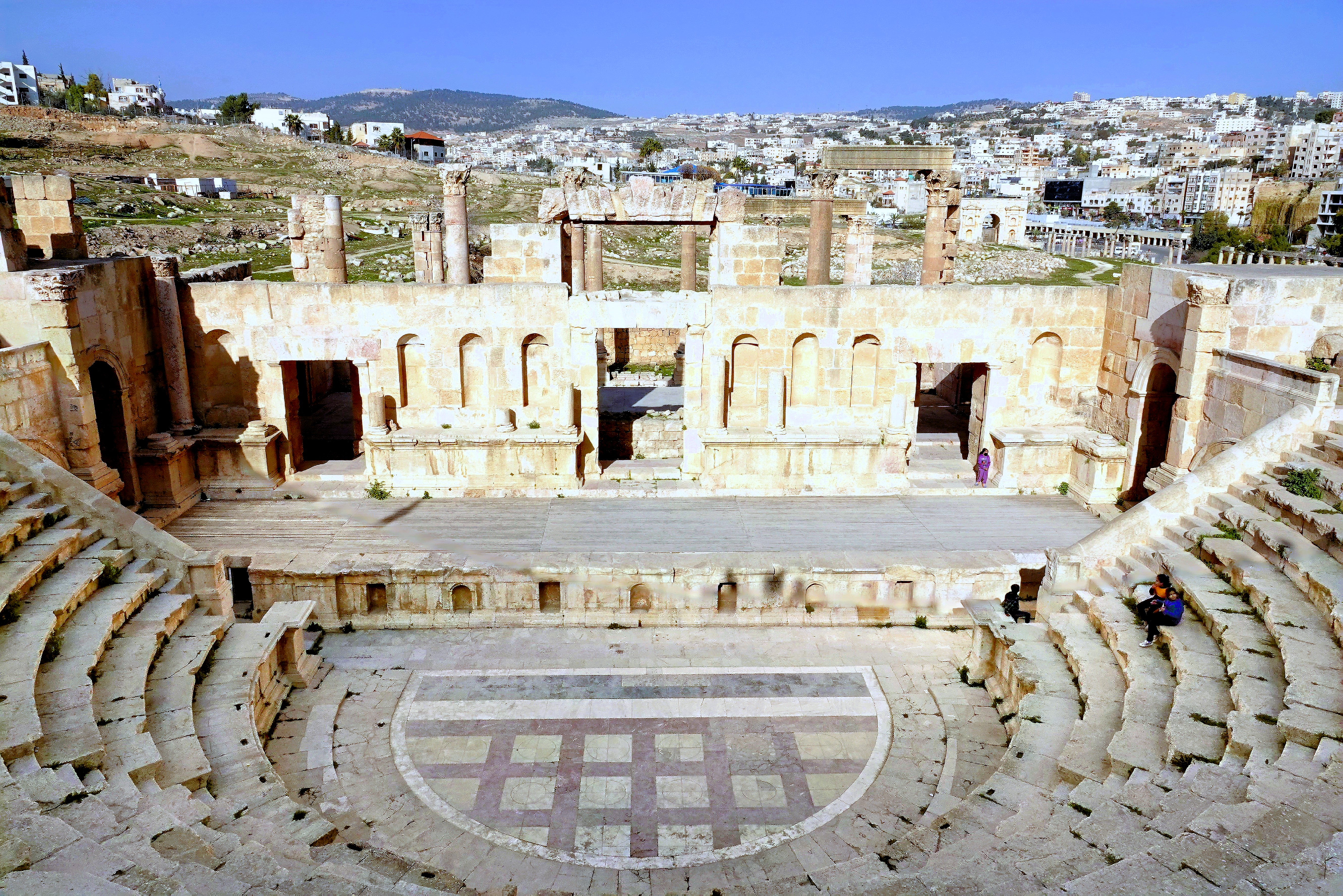
South Theater
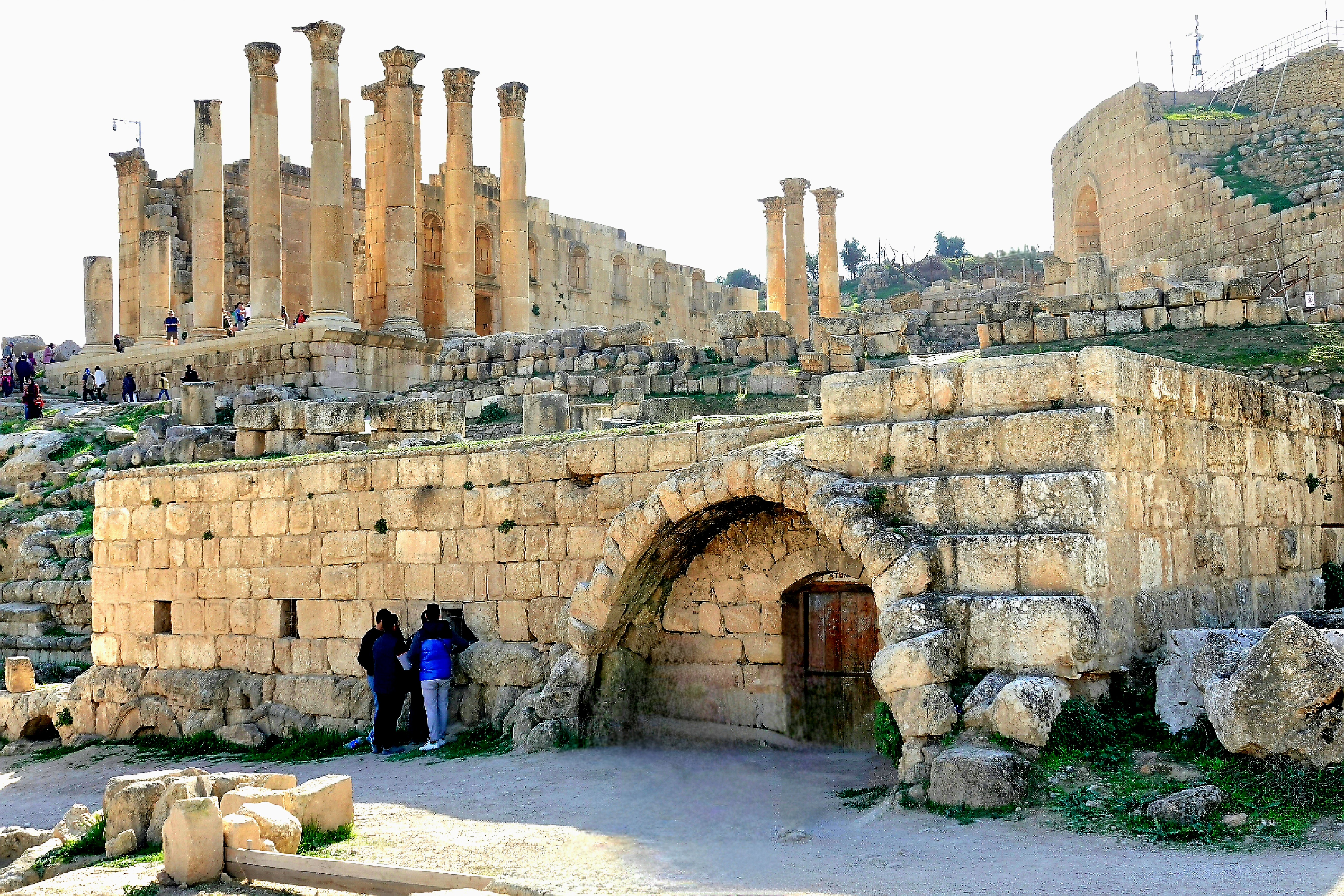
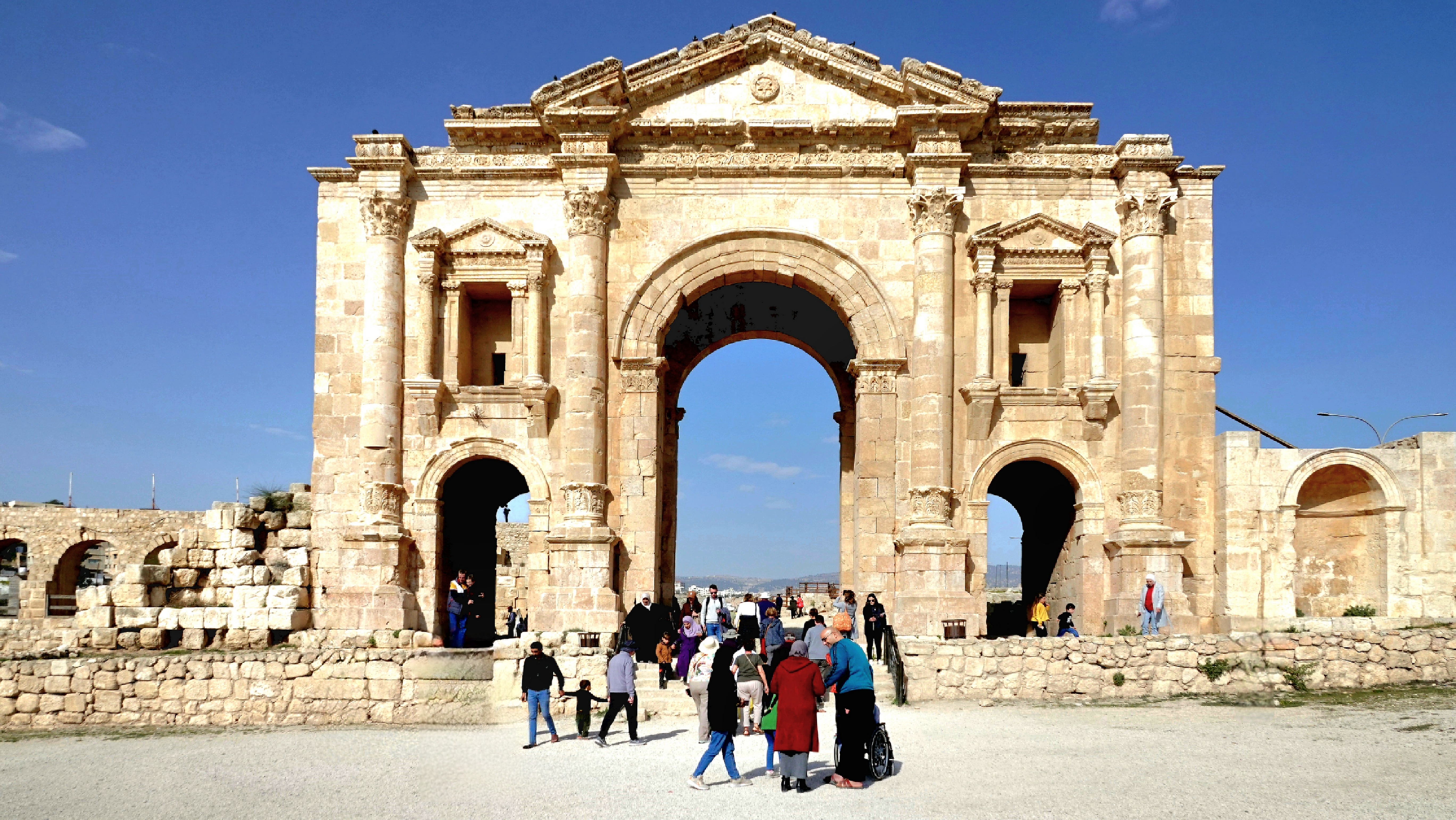
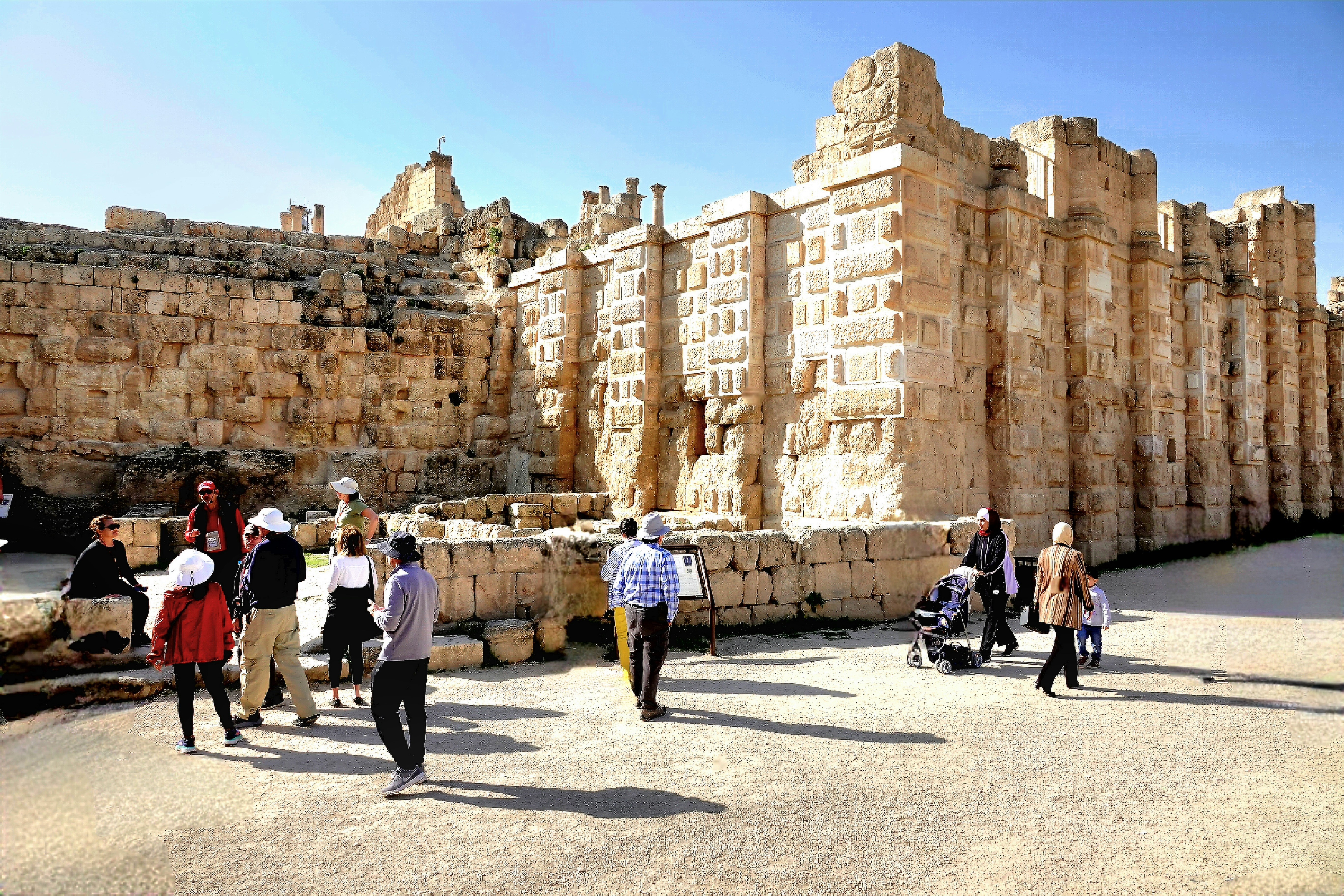
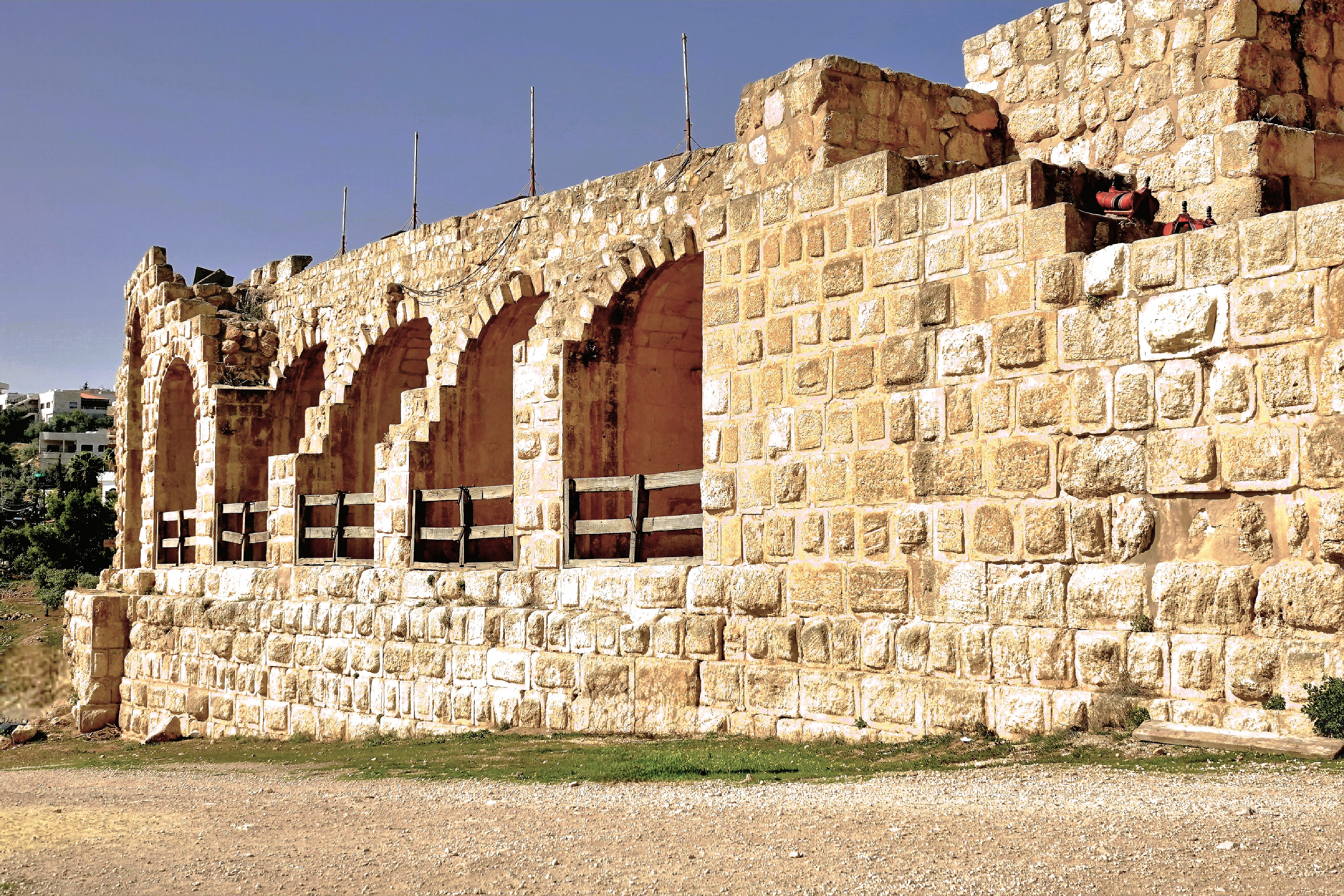
A walk through the Archaeological Park carried us back in time when the Roman Empire flourished, and Hadrian’s patronage (Emperor from 117 – 138 AD) benefitted the eastern provinces.
Hadrian’s Gate
There’s the Hippodrome, originally built for chariot races, and later converted to gladiator fights with the addition of amphitheater seating;
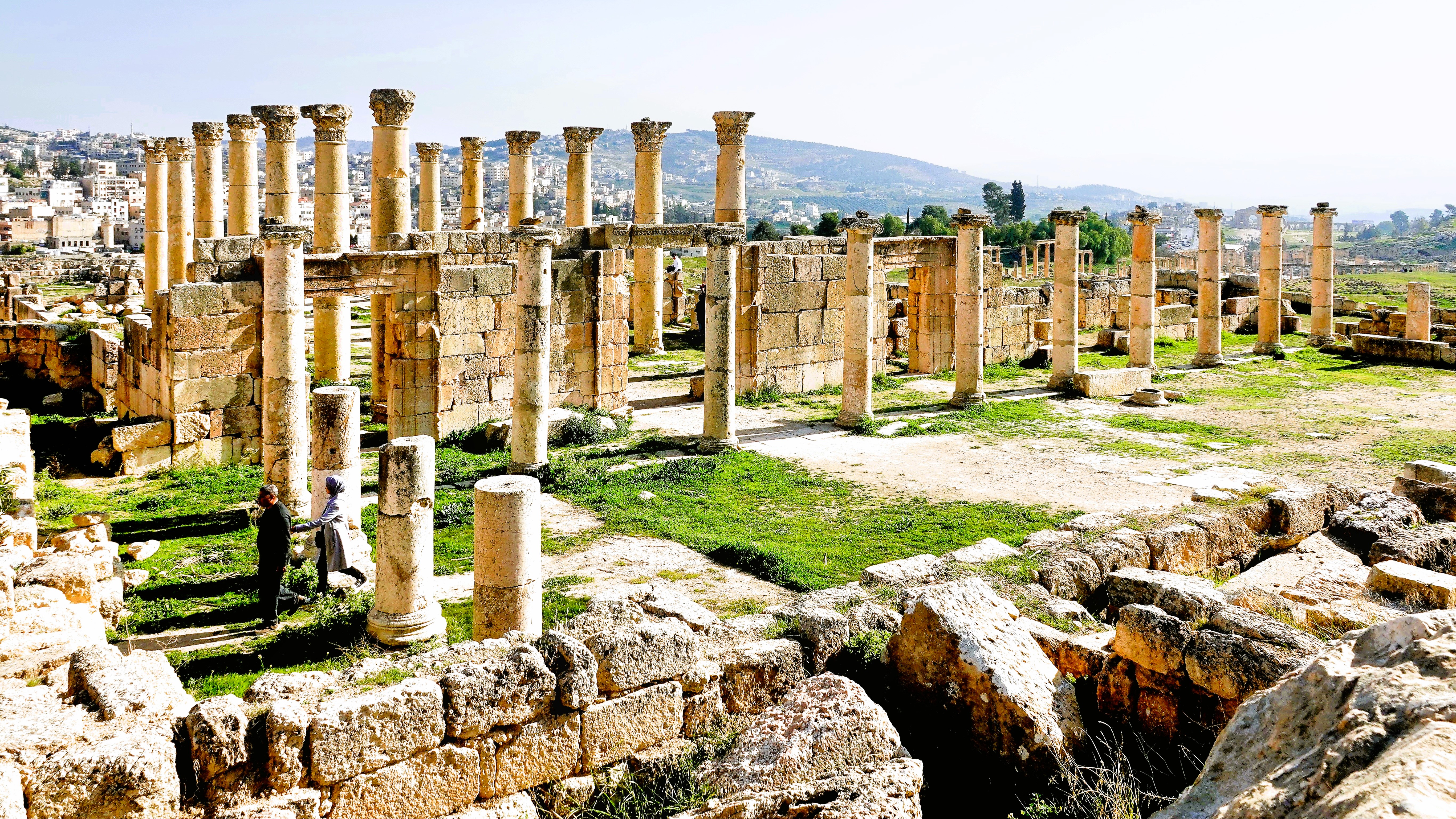
the Oval Plaza, with limestone pavers framed by 56 Ionic columns;
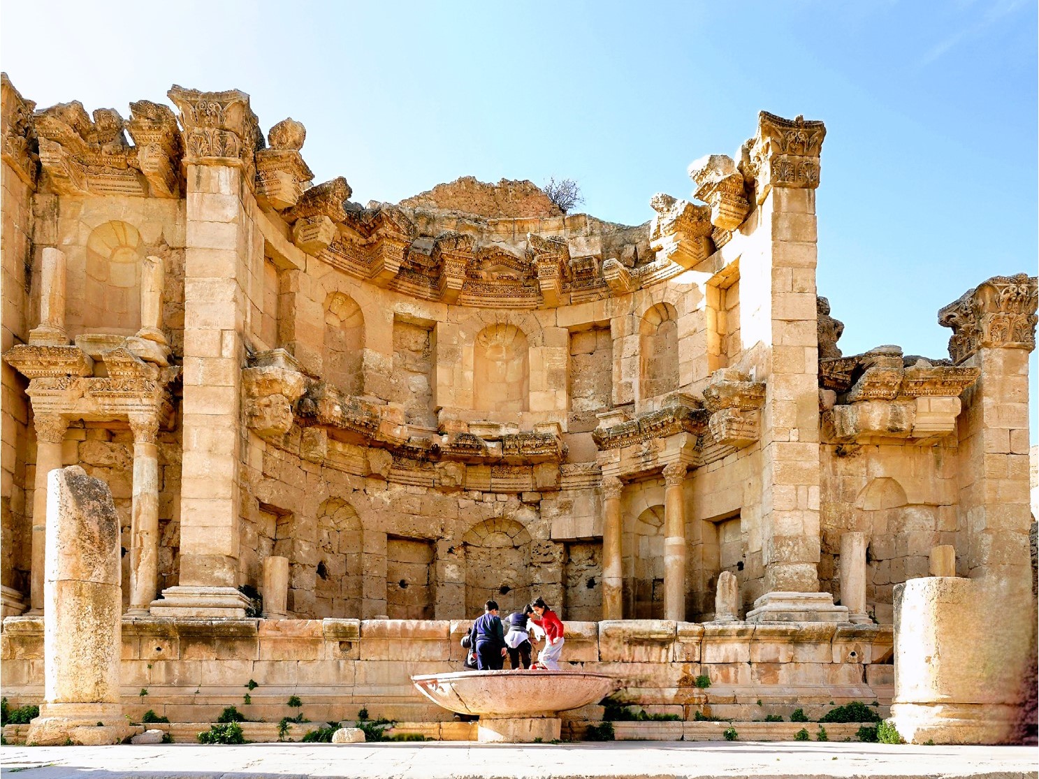
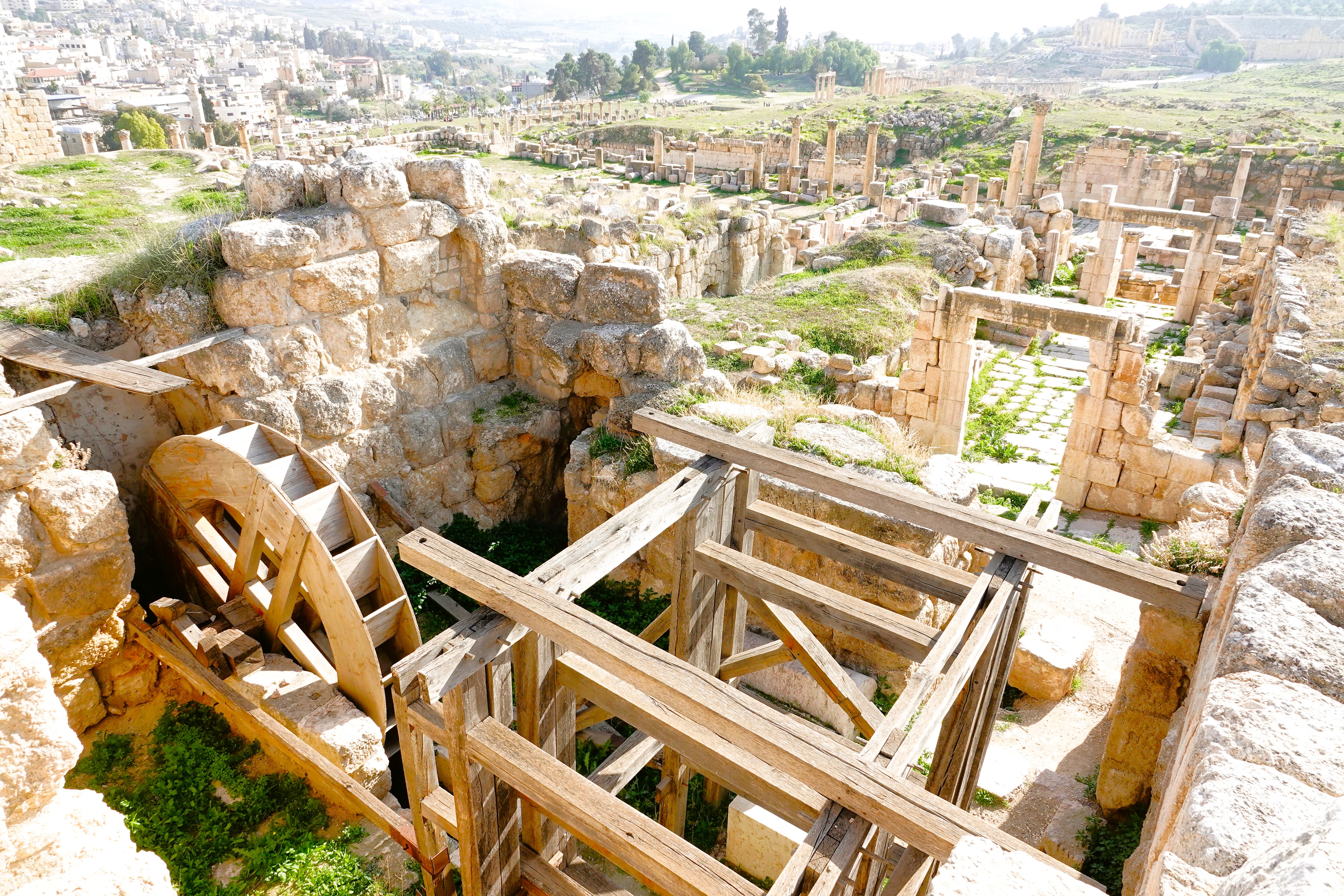
the Nymphaeum, the city’s primary water resource…
built to meet the demands of the Western Baths;
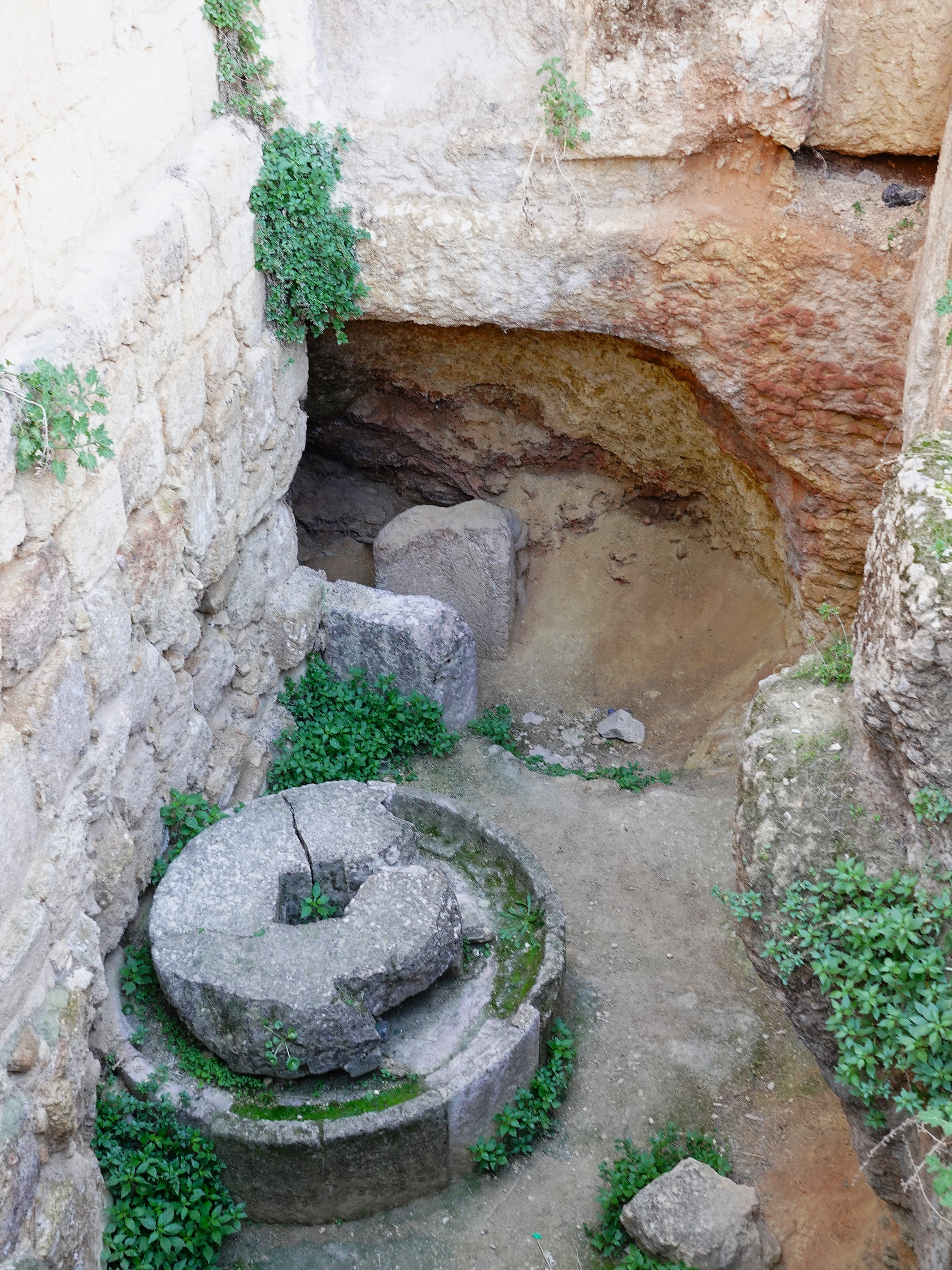
the olive oil press located below the floor of the Western Souk…
and a subterranean, water-powered saw mill;
divided spaces for artisan and trade shops lining South Street, outside city limits;
the North Theater, intended for political events;
the unfinished Temple of Artemis–built as a shrine to the patron goddess of Jerash, but utilized as a church during the Byzantine Period, and a fortress during the Crusades.
and other assorted churches built atop the foundations of earlier structures, like the Church of Mariano’s, assembled from stones of a pre-existing synagogue,
and the Church of St. Theodore, completed in 496 AD.
In 749 AD, a devastating earthquake flattened Jerash and turned this once great city of the Decapolis into rubble. It was soon abandoned and largely forgotten until the Crusaders seized the Temple of Artemis from the atabeg of Damascus.
Eventually, the sands of time buried the ruins. Jerash was discovered again in 1806 by German explorer, Ulrich Seezten, who recognized the ruins. But it was only after the British began colonizing the Jordan Valley in 1921 that Jerash became worthy of preserving.
Lucky for us, the British vibe was on full display at the South Theater…
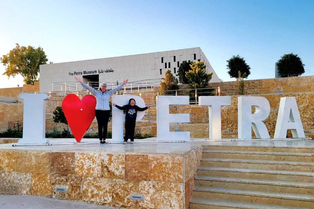
Weather in Petra can be unpredictable in January. A year ago–on January 26–it was snowing, but today, the temperature would reach 60o and the sky would remain cloudless. What better time to take a hike through history, and walk amongst one of history’s most remarkable endeavors.
With overnight accommodations at Movenpick–directly across the street from the Petra Visitor Center–access to the Old City was most convenient. We assembled early in the town center. The square was quiet except for shops looking for early customers,
and a stray puppy gnawing on a breakfast bone.
Our group gathered around a large map in town center to plan our hike.
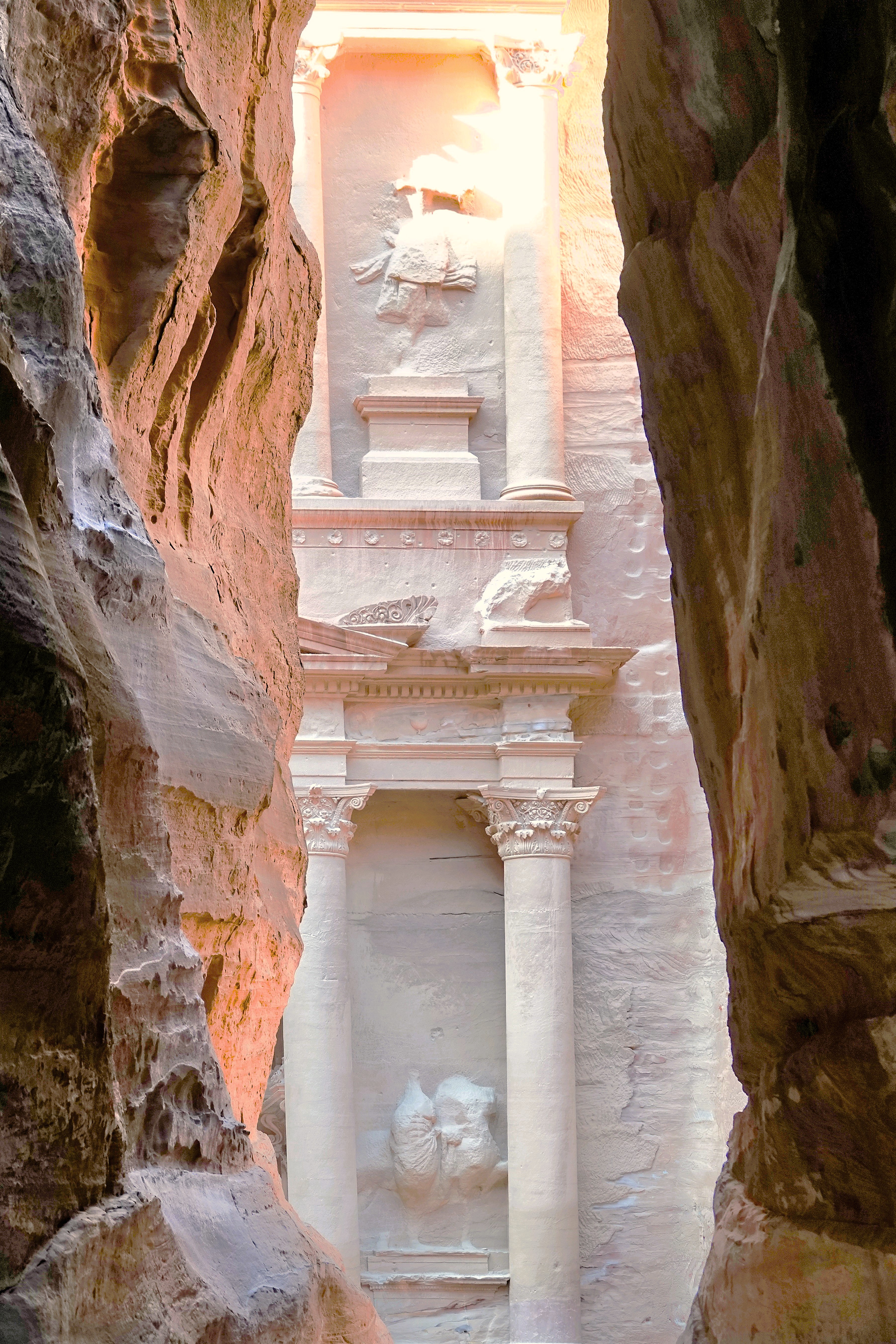
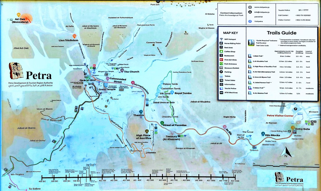
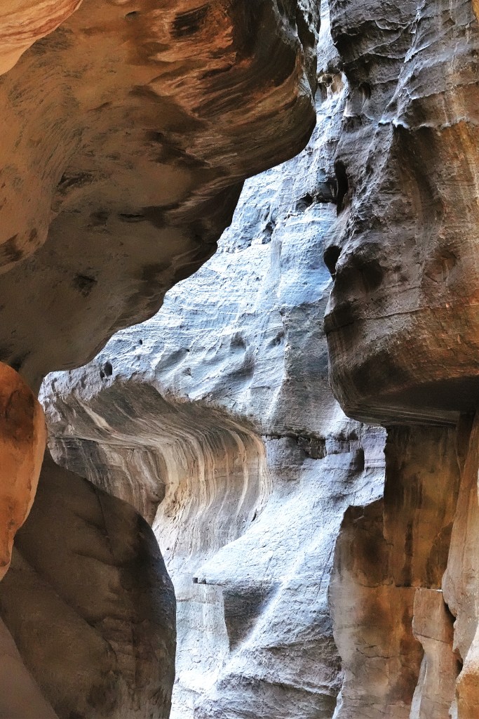
Ahmad explained the many ways to get to Petra’s ruins: by foot, golfcart, donkey, horse, or camel. But the only road that takes us there–courtesy of George Lucas, who paved the way for a dramatic scene from Steven Spielberg’s Indiana Jones and the Last Crusade–runs through a narrow gorge known as As Siq,
which is nearly a mile from Al-Khazneh, known as the Treasury.
Beyond the Treasury, it’s another mile past Temenos Gate to the end of the Colonnaded Street…
that leads to Qasr al-Bint–Petra’s most intact structure and Nabataean temple.
Ahmad suggested we take our time by foot, but after that, we’re on our own–for as long as we like–and we can return by any means of conveyance.
Once we understood the plan, we started out: past Djinn Blocks–a series of three imposing funerary monuments;
an iconic, two-story Obelisk Tomb;
and a Bedouin musician who may have been busking to buy an extra string for his DIY rababah.
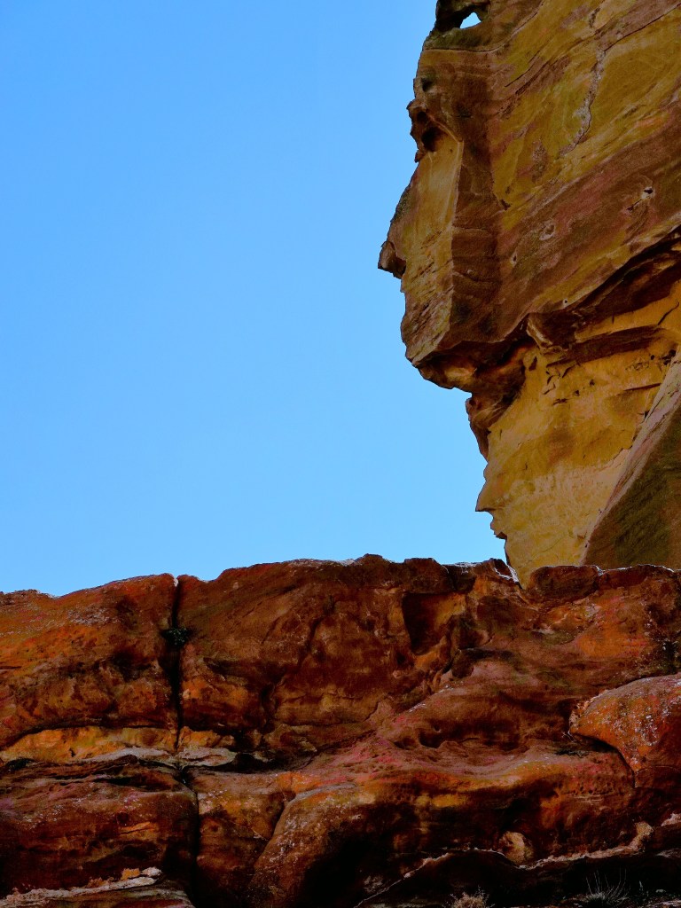
We followed the road through high walls of colorful sandstone, where rocks resembled elephant creations…
and human profiles,
with twisted stone rising upwards of 600 ft (183 m),
and narrow as 10 ft (3 m) across,
until we neared the end of the passage. Ahmad had us form a line and close our eyes as he guided us through the last bend in the gorge.
When the moment was right, we opened our eyes for the big reveal…
and it was a revelation! First light was streaming across the canyon walls,
and bathing the iconic façade with golden sunlight. It was truly a sight to behold! Ahamad declared, “I love my job!”
Petra has been written about to near exhaustion. There’s not much more I can add about the Nabataean Kingdom that UNESCO World Heritage Convention hasn’t already mentioned, so I will say it in pictures and leave the words to UNESCO:
Inhabited since prehistoric times, this Nabataean caravan-city, situated between the Red Sea and the Dead Sea, was an important crossroads between Arabia, Egypt and Syria-Phoenicia. Petra is half-built, half-carved into the rock, and is surrounded by mountains riddled with passages and gorges. It is one of the world’s most famous archaeological sites, where ancient Eastern traditions blend with Hellenistic architecture.
Situated between the Red Sea and the Dead Sea and inhabited since prehistoric times, the rock-cut capital city of the Nabateans, became during Hellenistic and Roman times a major caravan centre for the incense of Arabia, the silks of China and the spices of India, a crossroads between Arabia, Egypt and Syria-Phoenicia. Petra is half-built, half-carved into the rock, and is surrounded by mountains riddled with passages and gorges.
An ingenious water management system allowed extensive settlement of an essentially arid area during the Nabataean, Roman and Byzantine periods. It is one of the world’s richest and largest archaeological sites set in a dominating red sandstone landscape.
The Outstanding Universal Value of Petra resides in the vast extent of elaborate tomb and temple architecture; religious high places;
the remnant channels, tunnels and diversion dams that combined with a vast network of cisterns and reservoirs which controlled and conserved seasonal rains,
and the extensive archaeological remains including of copper mining, temples,
churches and other public buildings.
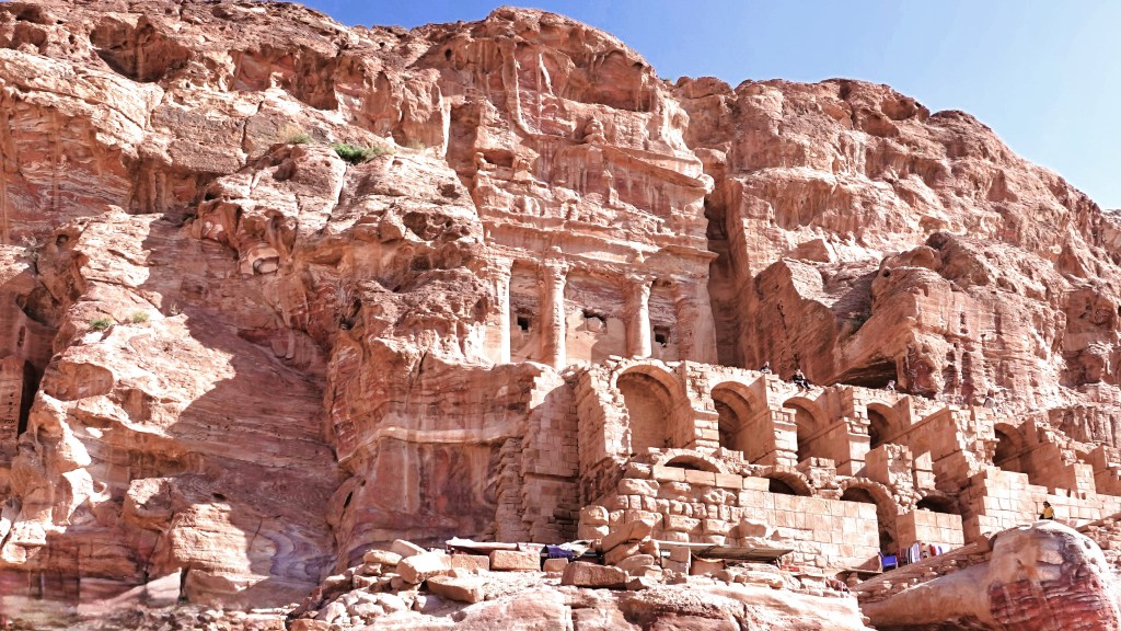
The fusion of Hellenistic architectural facades with traditional Nabataean rock-cut temple/tombs including Al-Khazneh, the Urn Tomb,
the Palace Tomb, the Corinthian Tomb,
and the Deir (“monastery”) represents a unique artistic achievement and an outstanding architectural ensemble of the first centuries BC to AD.
The varied archaeological remains and architectural monuments from prehistoric times to the medieval periods bear exceptional testimony to the now lost civilisations which succeeded each other at the site.
Petra was a marvel. And it may have been the overwhelming feeling of awesomeness that gave us the energy to return to the plaza by foot and express our satisfaction. So too thought the young girl with special needs, who spontaneously shared the moment with Leah.
There was so much cultural, historical and scientific significance to absorb in a day, which led me to conclude that the worst thing about Petra was not having another day to do it all over again.
According to the Old Testament (Deuteronomy, 34:6), Moses–at 120 years–ascended the highest crest of Mount Nebo (800m) to view the Jordan Valley.
Although Moses led the sons and daughters of Israel out of bondage from Egypt, Moses was forbidden by God to escort them to the Promised Land.
With every step up the mountain, Moses would contemplate his sin of doubting God’s concern and commitment to The Chosen People. Was it anger or despair that provoked Moses into raising his staff and twice striking the Rock so his congregants and their cattle could drink from the wellspring that burst through the ground, and quell their complaining?
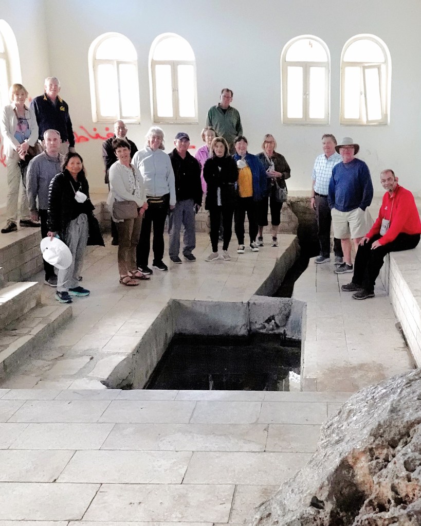
A shrine in Wadi Musa purports to be the perennial natural spring that arose from the rock struck by Moses. The site is most popular among Christian and Muslim pilgrims who travel from all parts to drink from the sacred well.
As for me, I took a hard pass; the water was running slow and low, and too risky to sample.
But the miracle performed by Moses sealed his fate. With Joshua assuming a new leadership role, Moses trekked to the highest point on the western ridge of the ancient Plains of Moab for a view of the Holy Land.
Perhaps God provided Moses with a befitting yet bittersweet panorama before he died, other than the hazy scene that I managed to capture.
All the churches atop Mount Nebo were erected over time to commemorate the death of Moses. The earliest known chapel dates to the 3rd century, followed by a 4th century monastery built to support Christian pilgrims.
20th century archaeologists excavated an intact mosaic floor within the baptistery of the chapel that depicts the cultural life of the Byzantine era–
surrounded by figurative motifs with geometric design flourishes…
that also adorn the walls.
and it’s all been preserved in a new church sanctified by the Franciscan Order in 2018.
The mountaintop is rich with artifacts sponsored by the Franciscans. The serpentine cross atop Mount Nebo was created by Italian artist Gian Paolo Fantoni to symbolize the miracle of the bronze serpent forged by Moses in the wilderness (Numbers 21:4–9) and the crucifixion of Jesus, whereas the stone Monolith was sculpted by Vincenzo Bianchi in honor of Pope John Paul II’s visit during the Great Jubilee of 2000.
As part of the Pope’s pilgrimage to Jordan, he planted an olive tree seedling that he dedicated to peace in the Holy Land.
Ironically, while the tree has prospered, peace has yet to bloom.
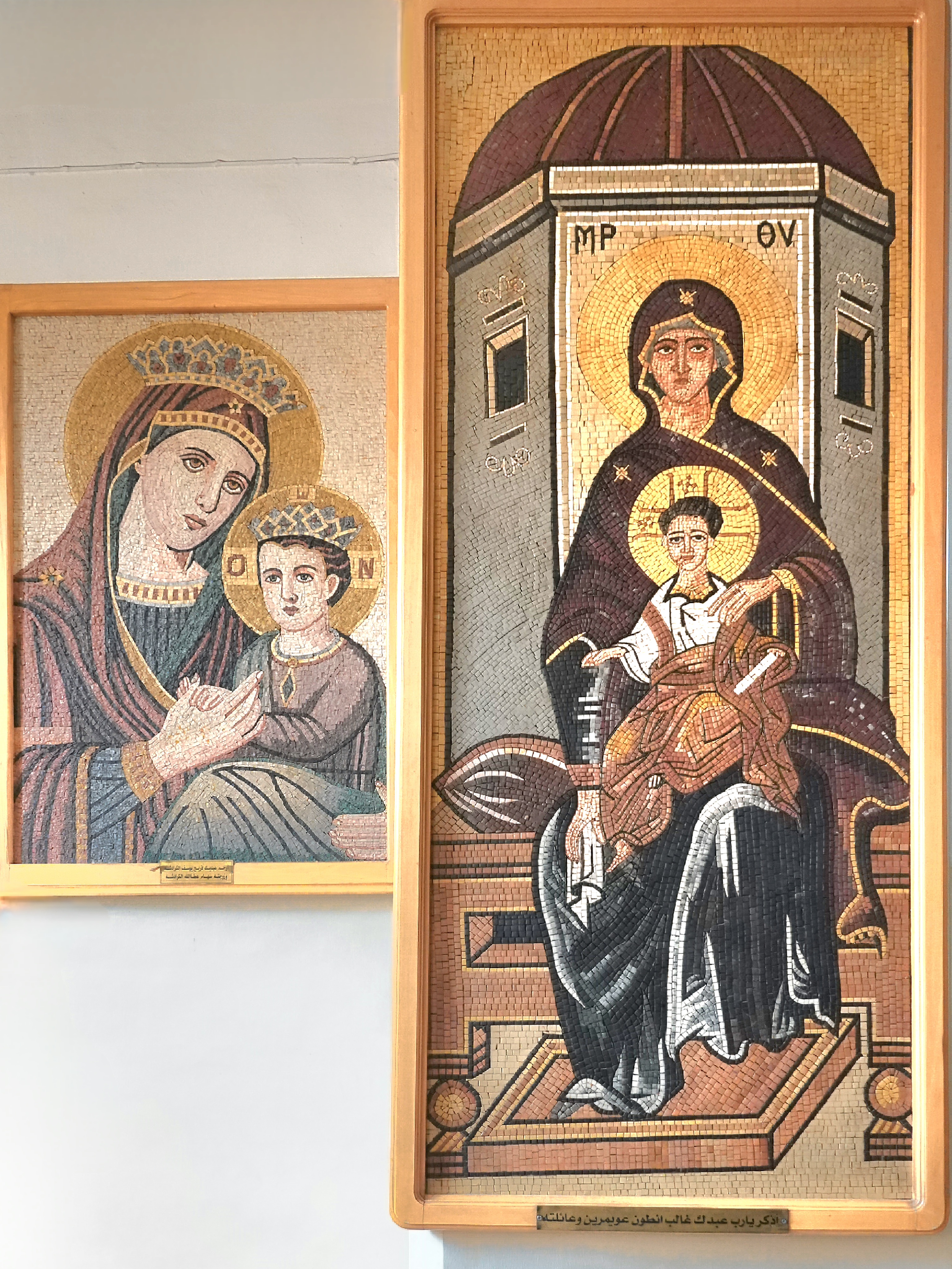
Having admired the mosaics of Madaba and Mount Nebo, our group got a personal look at the process at Jordan Jewel Art & Mosaic, which was created in 2008 through Jordan’s Queen Noor Foundation Community Development Initiative as a means of preserving an ancient artisanship introduced by the Greeks over two thousand years ago.
The project has also been a boon to tourism and employment within the governate, with over 100 mosaicists working at the studio or from home, creating historical souvenirs for tourists.
Depending on the pattern and the size, the mosaic can be extremely detailed, at times requiring tens of thousands of intricately-sized tiles and several weeks to complete.
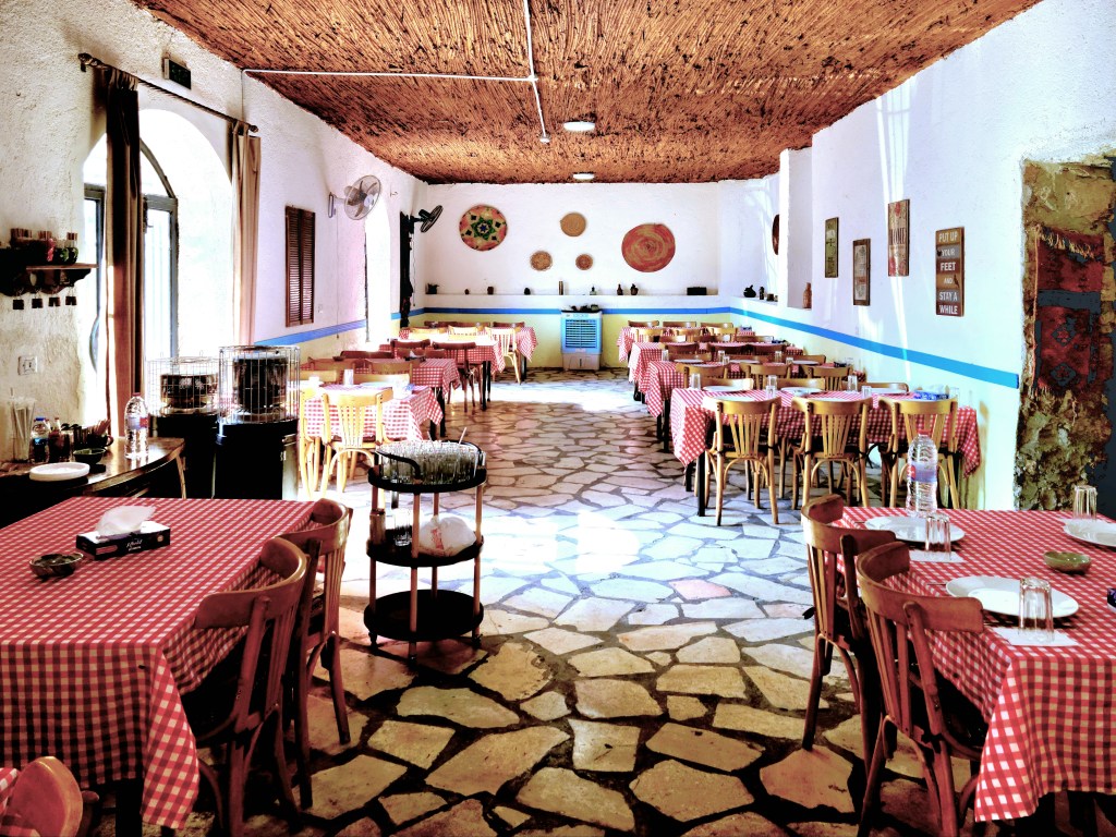
Our crew eventually returned to Madaba for a traditional lunch at Hikayet Sitti (“My Grandmother’s Story”)–a family-owned restaurant in an old home belonging to the Karadsheh family through many generations.
It now belongs to Feryal, the gracious owner/chef who prepared a tasty array of mezza (appetizers) to start,
and a kettle-sized helping of Maqluba–a traditional Middle Eastern dish of chicken, vegetables and rice that’s prepared in a pot and presented upside down.
Feryal distributed the recipe to the home chefs among us, but as I read through the prep and ingredients, I was certain the dish was more complicated:
MAQLUBA
• Fry pieces of eggplant, cauliflower, and potatoes • Boil pieces of chicken • Arrange at the bottom of the cooking pan pieces of tomatoes, carrots, onions, sweet pepper, and garlic • Then add the fried eggplant, cauliflower, and the potatoes • Add pieces of chicken • Cook them together with water • Add the rice to cook together • Add black pepper, cinnamon, nutmeg and cardamom, cumin, cloves, coriander • Cook until water is evaporated • Put it on low fire for 5 minutes • Let it rest for 5 minutes • Serve it as upside down
As we savored every bite, we were invited to put our tastebuds to the test by identifying all seven spices in our food. My mind immediately raced to episodes of Hell’s Kitchen, when contestants competed in blind tastings for Gordon Ramsey, and the winner received a hot air balloon ride with a champagne lunch.
But Feryal was offering something much better. The prize at Hikayet Sitti was a cold beer from her brother’s brewery… and it was delicious.
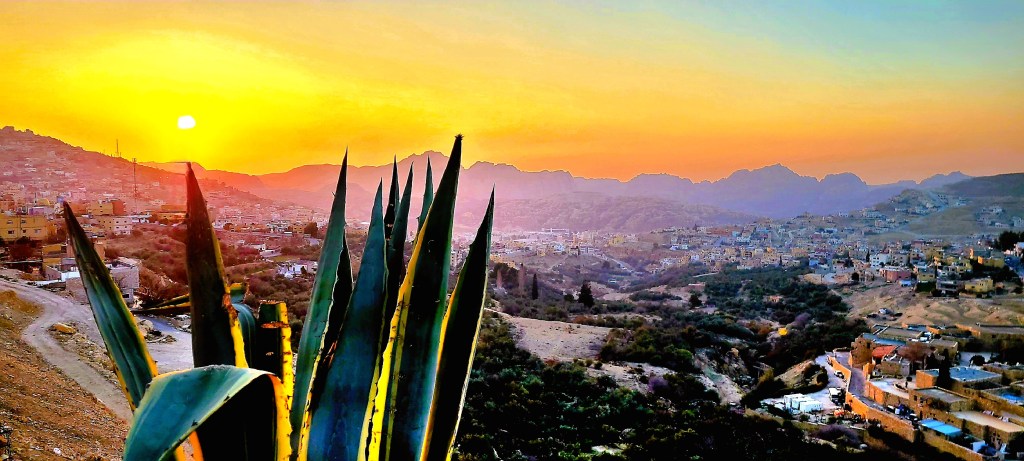
After lunch, the coach stopped briefly at Shobak Castle (12th century) enroute to Petra, just as the sun broke through the haze to shower the ruins in golden light.
The castle is a stark reminder of Crusader glory amidst the plunder and ruin of the times.
Our coach driver raced the last hour to Petra with the hope that we’d arrive in time for sunset, and we were duly rewarded with a perfect sky in Wadi Musa just as the sun was falling behind Mount Hor.
It was a good omen for our excursion to Petra the following day…
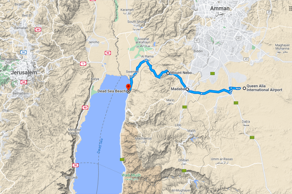
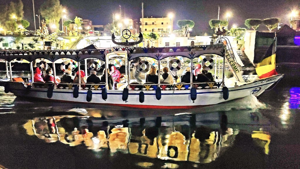
We were a crew of 48 aboard the Viking Ra, divided into 2 camps of 24 travelers who identified as Bus A or Bus B.
Most of the cruisers returned home at the end of our Nile excursion, but 18 intrepid globetrotters–a union of both buses–continued our journey to Jordan for four nights, where we were greeted at Queen Alia International Airport by Ahmad Al Khaldi, our tour director and self-proclaimed terrorist, who adopted the moniker after once guiding the brother of ventriloquist/comedian Jeff Dunham.
Upon arrival to Amman, we boarded a coach for a half-hour ride to Madaba. It was an ambitious itinerary with a lot of ground to cover before reaching the Dead Sea,
but we quickly knew–given the depth of Ahmad’s knowledge, wit, and organization skills–that we were in good hands.
During the half-hour ride to Madaba we absorbed some background about this ancient city that’s renowned for its skilled mosaic artisans,
and its deeply religious ties to Christianity and Islam.
After an orientation of one ofJordan’s holiest landmarks,
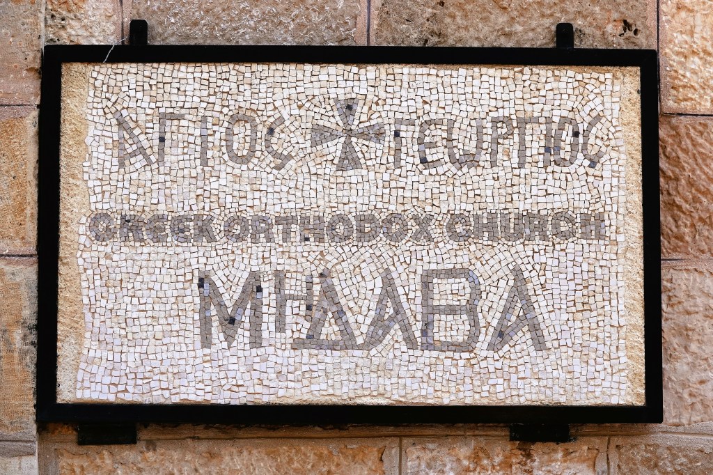
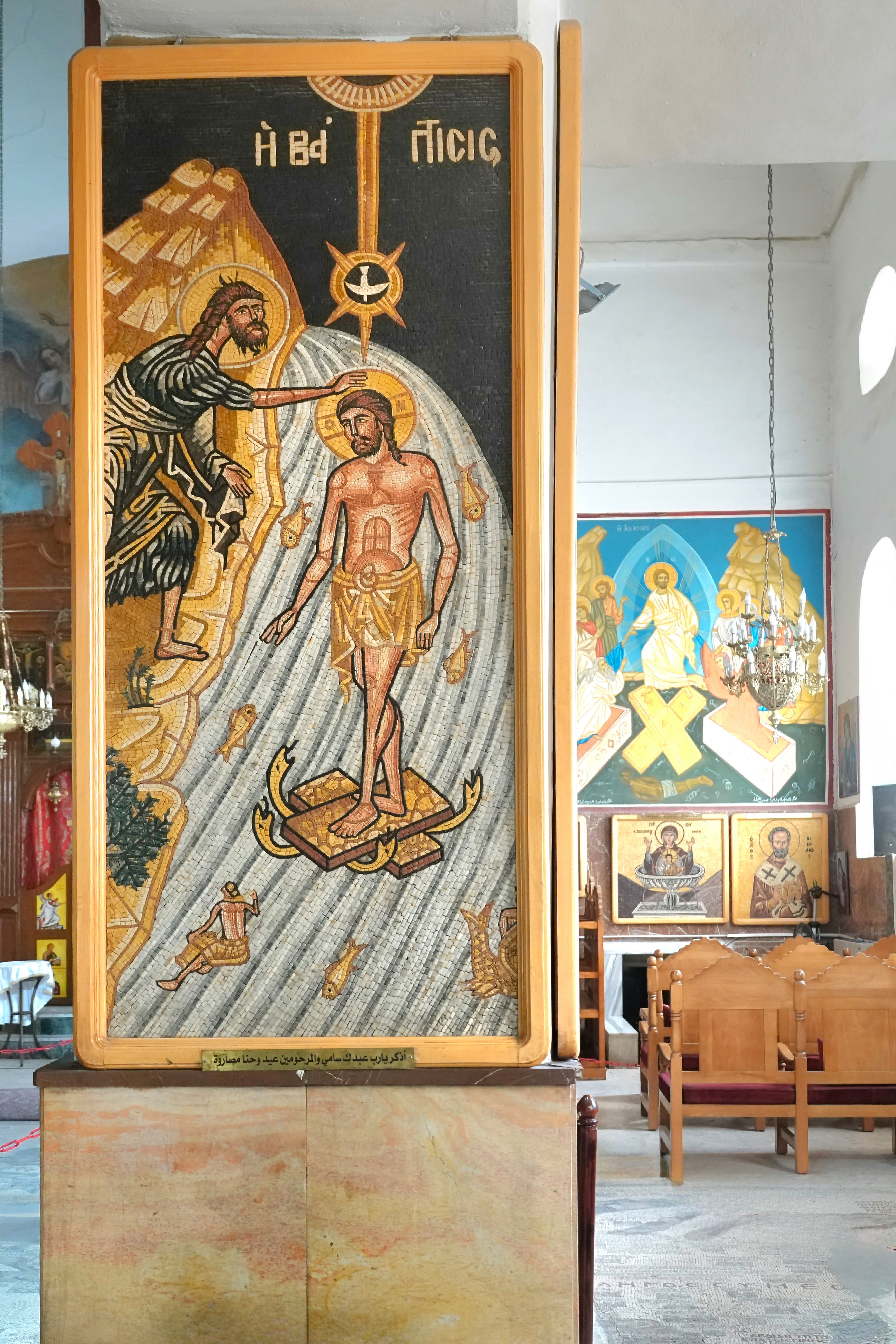
we headed to Madaba’s feature attraction… the Greek Orthodox Basilica of Saint George,
where the current structure, consecrated in 1896 is adorned by mosaic icons on every pillar…
but it’s the mosaic floor that’s the star of St. George and Madaba!
The partially restored mosaic map of the Holy Land originates from the 6th century, and was excavated in 1884 when the current church was built atop the ruins of the original Byzantine church. Over 2 million tiles comprise a detailed rendering of the Middle East with surprising detail and accuracy, making it both an artistic masterpiece, and the oldest surviving representation of familiar biblical sites.
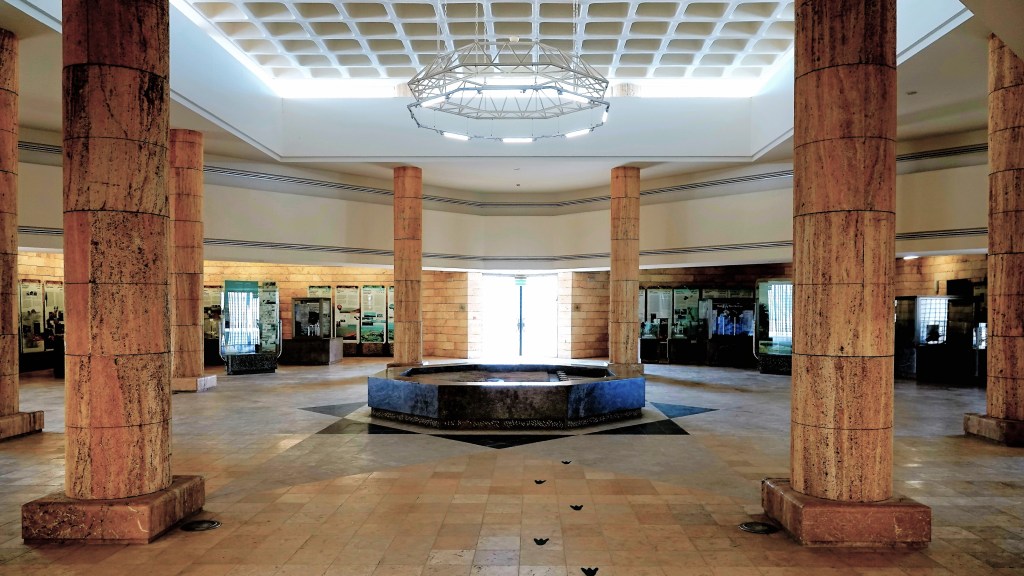
We bypassed Mt. Nebo (to be explored the following day) and continued to the Dead Sea Museum,
where we enjoyed an aerial panarama of the Jordan Rift Valley with the lowest elevation on earth (-1410 ft).
and a closer examination of the area’s geological and cultural significance.
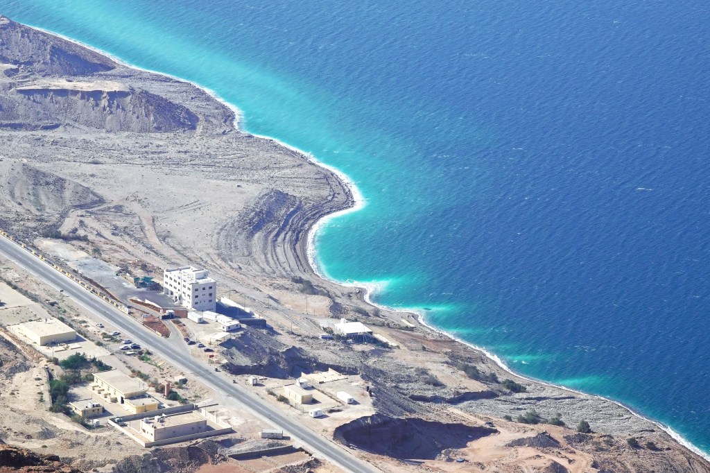
Developers see tremedous potential in promoting Dead Sea tourism, touting first-class accomodations and access to its briney beaches. And they’re wasting little time in hotel construction,
because at it’s current rate of evaportion, the Dead Sea will cease to exist by 2050.
Shortly after checking into the sprawling Movenpick village…
it was time to relax with a mud treatment,
and a bouyant soak. What a feeling!
There’s been lots of internet chatter about which country, Israel or Jordan, has the best beaches. The answer is easy: it’s whichever one you’re on!
However, the east coast scores extra points for hosting the sunset over Jerusalem most nights.
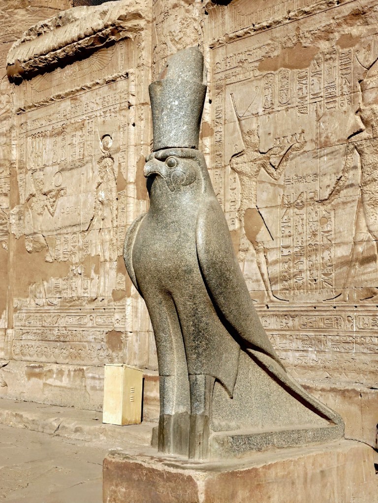
Like many ancient civilizations, Egyptians were obsessed with religion and mythology. They pledged their love and devotion to more than 700 distinct deities entrusted to protect the natural order of all things (wind, water, sun, sky, etc.) from creation to afterlife. In exchange, the devout would be rewarded with an everlasting life of prosperity, good fortune, and happiness… once they reached their final destination–the Underworld.
Gods and goddesses were personified as powerful creatures,
and hybridized animals,
and amalgams of animals and humans.
Egyptian paganism lasted long into the 5th century. However, with Egypt situated at the intersection of Europe, North Africa, and the Middle East, Egypt was also at the crossroads of influence when monotheism gained a foothold in the Middle East and spread throughout the continents.
When synchronizing Egyptian chronology and Old Testament timelines, the earliest record of monotheistic worship in Ancient Egypt occurred during a time of remarkable prosperity when Joseph–in his role as Grand Vizier of Egypt–governed and fed its people, while surrounding neighbors faced famine and hardship.
This informed Jacob’s decision to relocate his clan from Canaan to Egypt in search of provisions and an unforeseen reunion with his son. Biblical scholars have speculated the date to be 1875 BC.
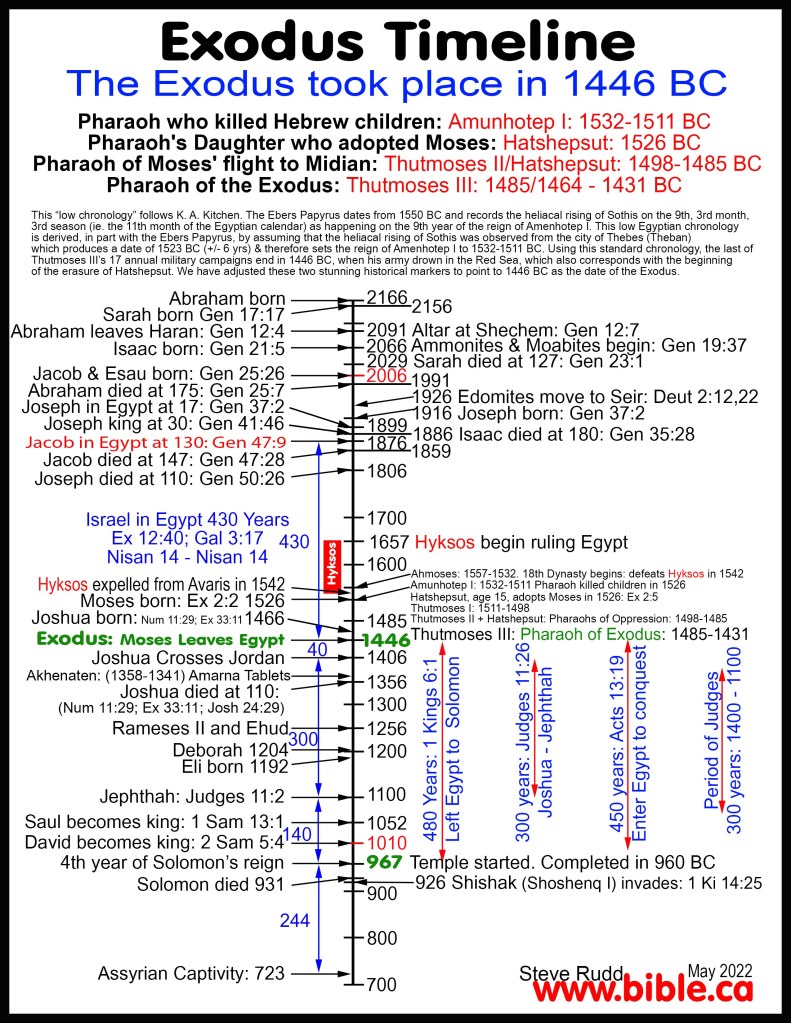
This led to the eventual settlement of the Israelites, whose numbers may have grown to 2,000,000 over the next 430 years, until the storied Exodus–which would have occurred in Year 18 of Thutmose III’s reign–in 1446 BC.
Interestingly, Amenemhat, Thutmose III’s first-born and heir apparent, mysteriously predeceased his father, and was inscribed on a column at the Temple of Amun at Karnak shortly after the death of Hatshepsut and the subsequent accession of his father to Pharaoh.
Religious reform from polytheism to pagan monotheism was momentarily embraced by Amenhotep IV during the his reign (c. 1358–1341 BC).
For some unknown reason, he changed his name to Akhenaten and elevated the cult of Aten (the sun disc) as the one and only true God.
Akhenaten went so far as to scrub all references of Amun-Ra from Karnak and build a new worship center and capital in Amarna, 170 km south of Thebes. But Atenism was short-lived; it never survived Akhenaten death, as he was so reviled by the priests that critics would often refer to Akhenaten as the Heretic King.
Subsequently, Tutankhamen–upon his ascension to the throne–reverted to worshipping Amun-Ra with his wife/half-sister, Ankhesenamun. He was 8 and she was 13 when they wed, albeit she was previously married to her father for a short time.
They had two daughters together; both were stillborn. Tut died suddenly at 18 from a fall or malaria or both, leaving Ankhe without an heir. She remarried Ay (presumedly her maternal grandfather), the next pharaoh, and soon disappeared from history.
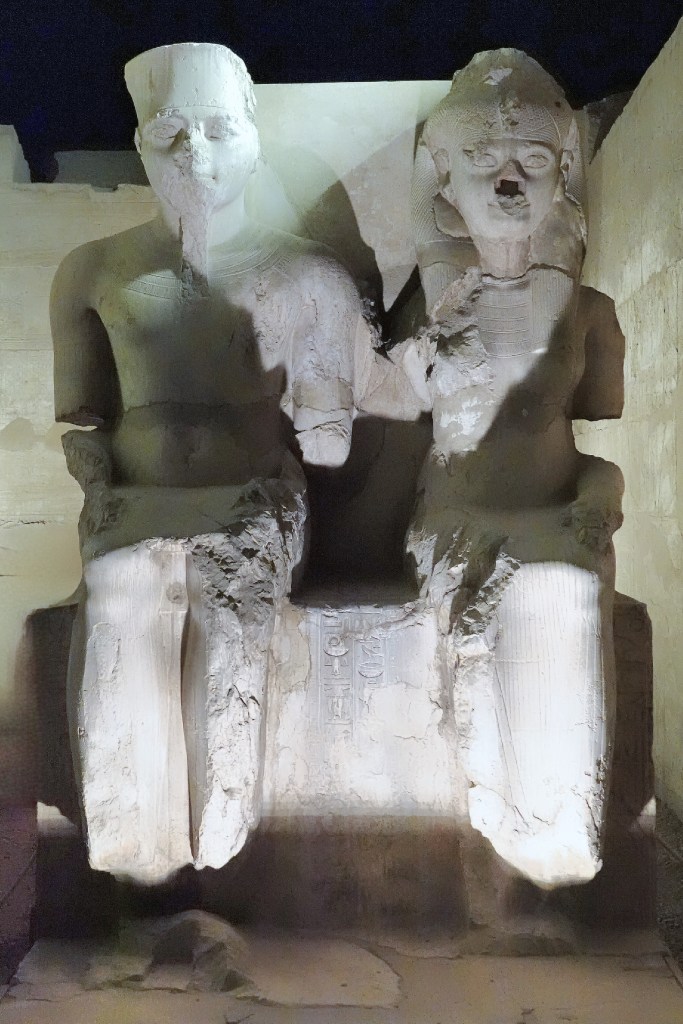
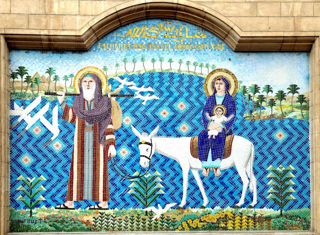
Polytheism remained the cultural norm for the following 1,400 years, until Egypt bore witness to the seeds of a new cultural revolution when the Holy Family escaped the wrath of Herod the Great’s infanticide decree c. 7 BC, and sought refuge in Egypt for the next three-and-a-half years.
Their journey through the Sinai dessert and across the Nile to Heliopolis…
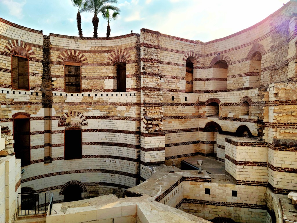
brought them to the Roman fort of Babylon in Old Cairo,
where they found shelter in a cave for the next three months,
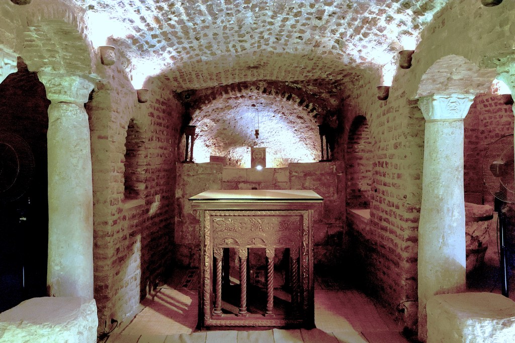
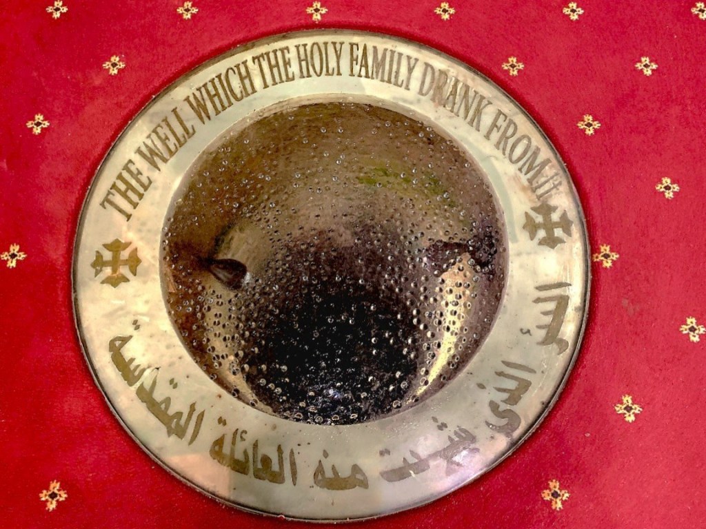
which would later become the foundation for the Church of Martyrs Sergius and Bacchus in The Cave (aka Abu Serga) built in the 4th century,
and the site of a water well which nourished Joseph, Mary and baby Jesus during their stay.
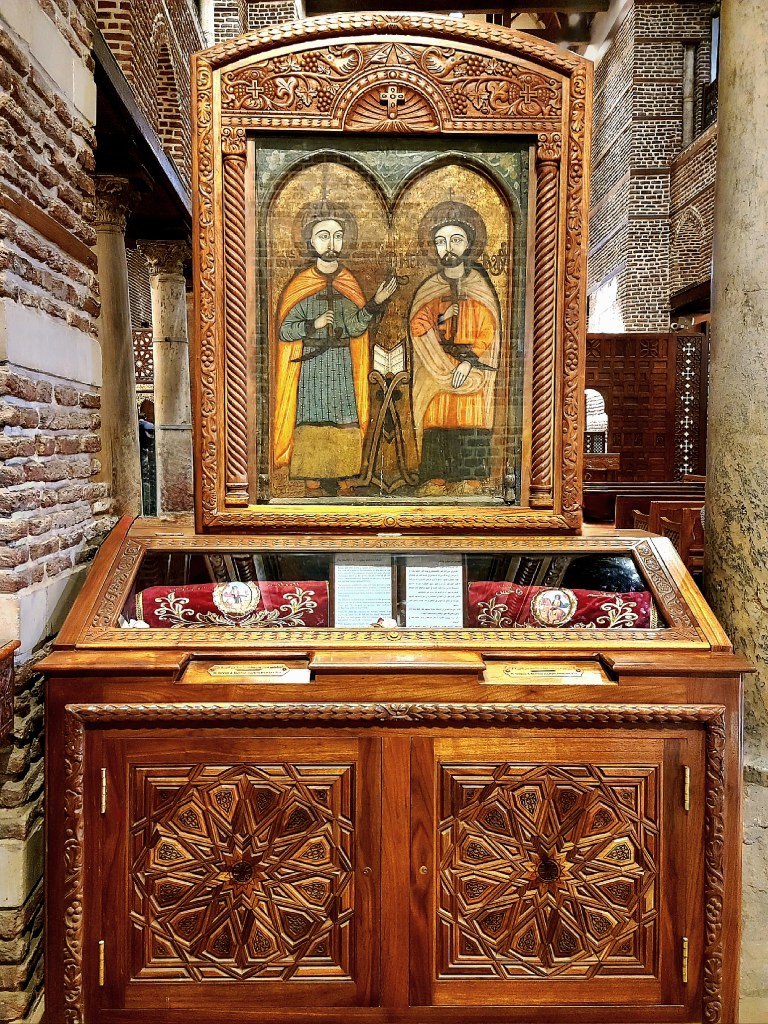
Other distinguishing features of the church include: the wall of painted icons;
and the precious relics of Saints Sergius and Baccus.
Worship of pagan deities began to wane around the late 4th and early 5th Centuries as Christianity became popular, and was finally outlawed in the 6th Century by Christian Roman Emperors. Consequently, Old Cairo became an important center of Christianity in the world, with Monasticism begetting Coptic Christianity, and extending throughout the Arab tribes.
With Coptic Christianity taking root, church worship proliferated in Byzantine Egypt, as did the number of churches in Old Cairo.
As Leah and I walked through Old Cairo, we were transported through history.
We took time to explore the Church of the Virgin (aka Hanging Church), which dates to the 3rd century.
Egypt was conquered by the Rashidun Caliphate in 646 AD, ending 7 centuries of Roman rule, but Christianity survived the war. The Arab invaders carried the Quran with them, and slowly converted the Copt population to Islam. By the end of the 12th century–which coincided with the end of the Crusades–the Christians lost their majority status thanks to intermittent persecution, destruction of Christian churches, and forced conversions by the Muslim brigade.
Today, Coptic Christianity accounts for 10% of Egypt’s population. And while they are mindful of their slim minority and occasional, bigoted backlash, the Copts are not shy about their zeal.
Nubian Coptic Church, Esna
The survival of Judaism in Egypt has been less fortunate. Only 100 Jews remain in Egypt, mostly concentrated in Alexandria. To date, only three Jews live in Cairo, and all are women. The youngest of the bunch is Magda Haroun, age 70, and the elected representative of Cairo’s Jewish community.
Ben Ezra Synagogue, 9th century AD
But Magda is living proof that all three religions can co-exist under the same roof. After all, her ex-husband is Muslim, as are their two daughters, and her current husband is Catholic.
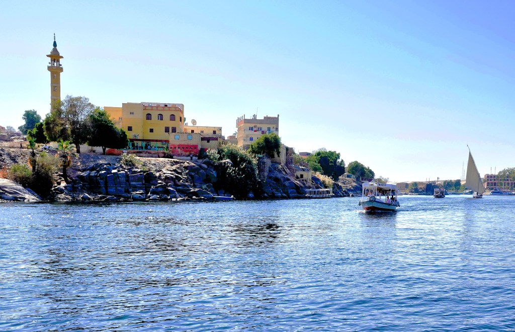
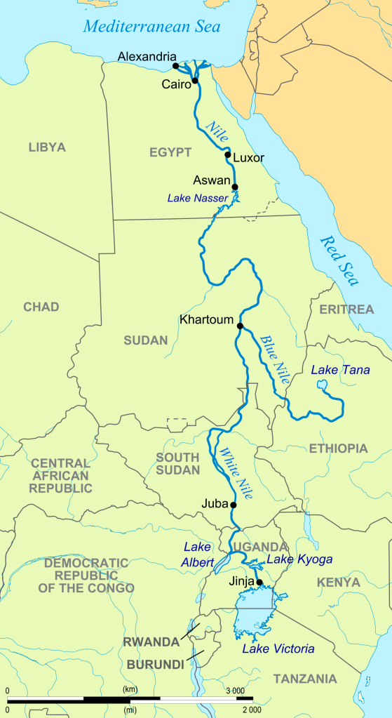
Egypt has relied on the Nile since the dawn of civilization. For over 5000 years, the Nile has pushed nutrient-rich silt through its 6600-km waterway from the wellsprings of Lake Tana in Ethiopia (Blue Nile) and Lake Victoria in Uganda (White Nile), on its way through Cairo, where it eventually runs across the delta and drains into the Mediterranean.
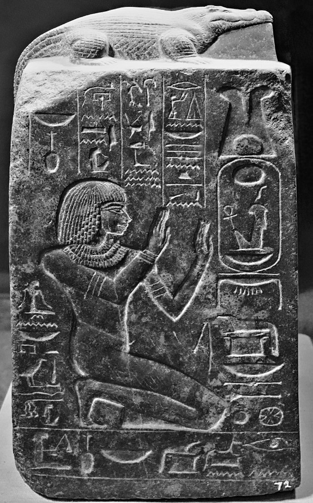
Just as the Nile shaped the landscape, it also shaped a society that believed in the Nile’s magical properties. Ancient Egyptians believed that gods controlled the Nile. They venerated Sobek, the crocodile god who created the Nile,
and prayed to Khnum–lord of the water–who fertilized the river banks, thus enabling Hapi, the goddess of ‘Annual Flooding’ to enrich and irrigate Egyptian crops.
Pharaohs used the Nile as a transit zone for long-hauling building supplies between coastal cities, and establishing monuments to the gods and themselves along the way, like the temple of Kalabsha in Nubia.
Even Aga Khan thought the bank of the Nile was a good idea for a Fatimid mausoleum.
Yet the river that once placed Egypt at the center of the civilized world for 3 millennia is now on life support, and poses a serious threat to the welfare of Egypt’s agriculture, aquaculture, and transportation sectors.
Unfortunately, the matter has been complicated by issues that stem from Egypt’s internal struggles, while the nation also battles other problems originating from south of the border.
For one, Egypt’s population already exceeds 110M, and is projected to swell to 121M in 2030, 160M in 2050, and 225M in 2100.
Egypt’s alarming growth rate over the past millennium has placed the country in economic jeopardy for the foreseeable future. Presently, nearly one-third of the country lives in poverty.
Additionally, with 97% of a dependent population living along the banks of the Nile and its delta, the existential threat to the river Nile has heightened significantly.
Intervention by Egypt over time has resulted in benefits and new challenges…
By partnering with the Soviets between 1960 and 1970,
Soviet-Egypt Friendship Monument
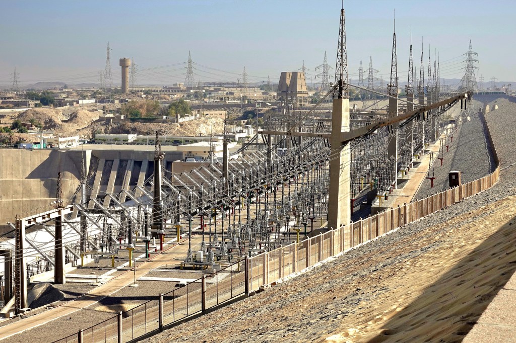
Egypt constructed the Aswan High Dam–an immense embankment dam–upriver from the original Aswan Dam completed by the British in 1902.
It’s purpose: to control flooding;
provide increased water storage for irrigation;
generate hydropower;
and encourage tourism–all seen as pivotal to Egypt’s industrialization.
Yet, there have been unintended environmental consequences to damming the Nile:
The dam restricts passage of rich volcanic sediment that once swept along the entire riverbed, but now struggles to reach the Mediterranean.
The Nile Delta has lost a substantial amount of arable land due to the Nile’s inability to provide an unabated flow rate to defeat a rising sea.
A 15 cm rise in the Mediterranean’s sea-level over the past century is expected to double over the next 30 years from climate change.
To compensate for the salination of the soil, farmers must pump more fresh water from the Nile onto their crops, causing additional pollution from synthetic fertilizer runoff.
According to the Intergovernmental Panel on Climate Change, the U.N.’s group of climate scientists predict the impact on the Nile will be catastrophic. They say it will lose 70% of its flow by the end of the century, with the water supply plummeting to a third of its present capacity.
Good for camels, but not for human survival.
Egyptian officials have also been wrangling over water rights and diplomacy with Ethiopian counterparts, arguing that their water security has been irreparably compromised.
However, more than half of Ethiopia’s 110 million people currently live in the dark. Their leadership is hopeful that the Grand Ethiopian Renaissance Dam on the Blue Nile (begun in 2011) will help to electrify the country and generate power for export.
Consequently, the Renaissance Reservoir will cause a 25% loss of hydropower generated by the Aswan High Dam, a reduction in Lake Nasser’s water retention, and a reduction to Egypt’s flow rate by as much as 25%.
With anticipated droughts in East Africa, a 2oC rise in temperature across the region, and a population crisis that begets increased poverty, it’s imperative that competing countries begin cooperating with each other to protect their citizens and their mutual interests.
In ancient times, the Nile split the imperial city of Thebes in two parts:
On the east bank, a fertile garden where 80,000 Egyptians lived and worked, called “City of the Living;”
and along the west bank, Egyptian royalty huddled with their architects and priests to select the best nest for rest in “City of the Dead.”
Occasionally, it was a family affair, with namesake mummies networking in the same vicinity–no doubt, making it easier to pay respects on Pharaohs Day.
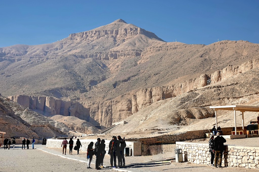
Unlike Giza, the only thing resembling a pyramid in the Valley of the Kings is Al Qurn, the highest peak in the Theban Hills at 420 meters.
Perhaps this gave the pharaohs some ancestral comfort, knowing their final journey to eternity had topographical similarities.
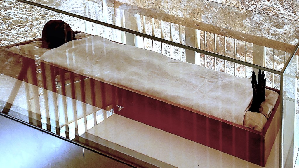
At last count, international expeditions have excavated 65 crypts concentrated within the Valley of the Kings and Queens, with only 11 tombs available for viewing.
But the most remarkable thing about this vast necropolis is what’s waiting to be discovered. Hardly a day goes by without hearing of a new discovery from the dozens of white “dig” tents that dot Luxor and Giza.
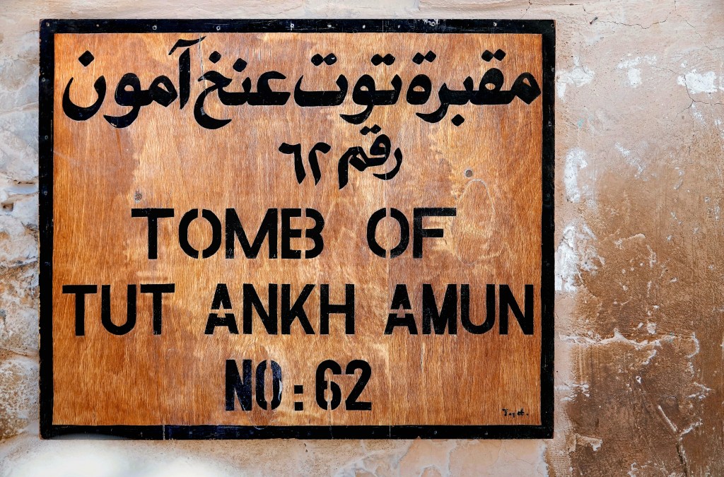
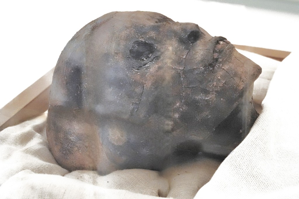
Easily, the most famous discovery came from British archaeologist, Howard Carter,
whose remarkable discovery of King Tutankhamen’s tomb in 1922 created a global sensation.
But seeing is believing.
Viewing the tomb requires a special ticket, and admission is limited.
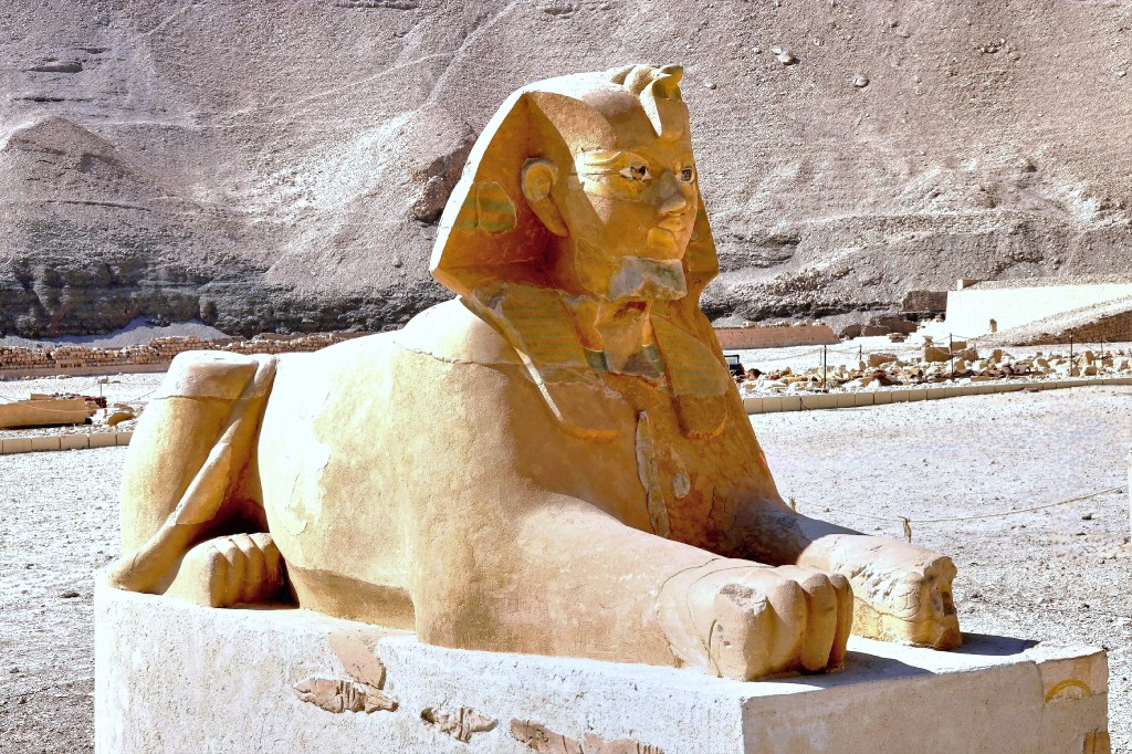
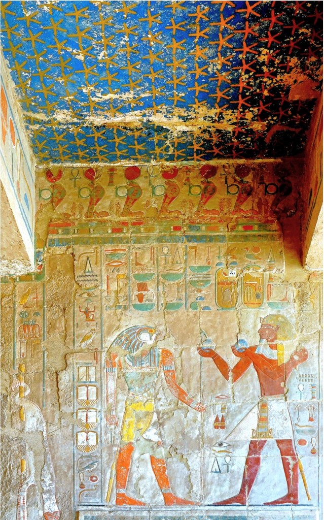
Equally impressive is the remote Temple of Deir el-Bahri (KV22), anchored to the rockface below Al Qurn.
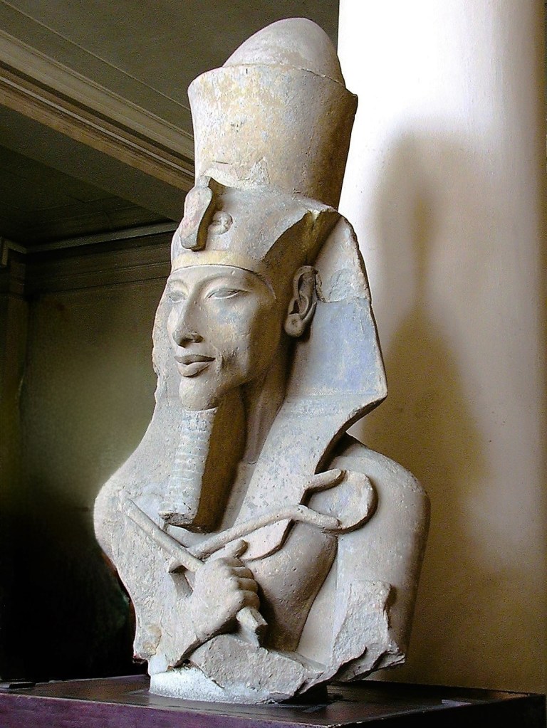
It was commissioned by Hatshepsut, who broke the aristocratic glass ceiling in 1480 BC by becoming Egypt’s first female pharaoh. Throughout her 22-year reign as king, she cross-dressed as a male, wearing a fake beard, a traditional headdress (nemes) with cobra, and a short kilt like her male predecessors.
While controversial as a female pharaoh, and all but erased by her successors, Hatshepsut’s place in history was secured as the only female interred in the Valley of Kings.
Nearby, the Valley of the Queens is only 2 km away by club cart conveyance,
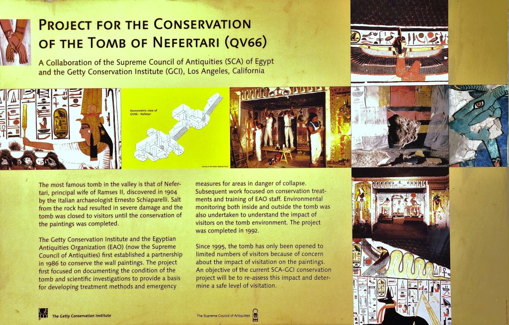
where the shining star of the valley is Nefertari’s tomb.
Officials require a special admission ticket–that only allows 10 visitors at a time to roam through the chambers for only 10 minutes–upon theorizing that reduced traffic likely reduces environmental impact.
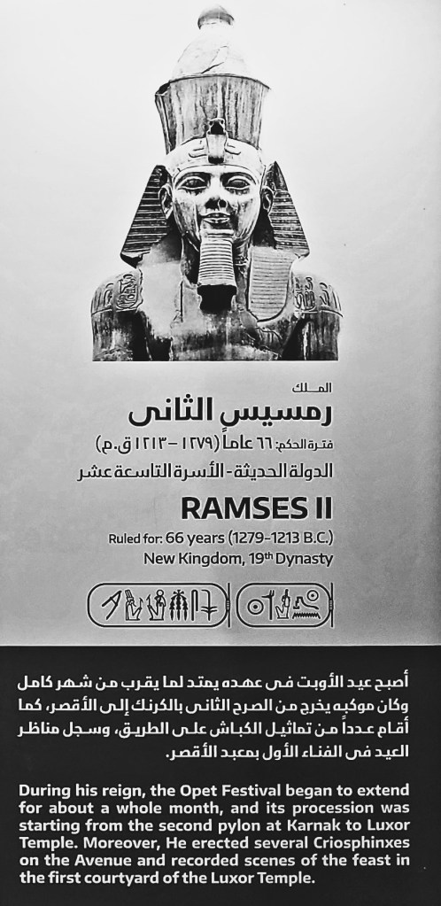
Nefertari was the first of Ramses’ II Great Royal Wives (6 in total). In fact, he was so smitten by Nefertari’s beauty, that he built her the grandest tomb on the block, and shared his glory side-by-side at Abu Simbal.
Besides her good looks, Nefertari earned her place at the palace table as the king’s court communicator. She was a writer, a strategist, and a skilled diplomat in support of her husband.
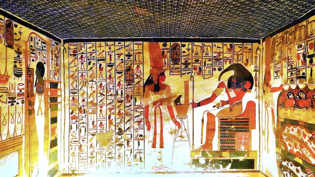
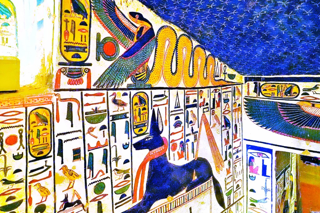
A long tunnel empties into an antechamber…
followed by a second staircase,
that leads to a burial chamber…
supported by elaborately painted columns,
with finely decorated funerary rooms at the wings,
featuring the sacred bull and seven celestial cows, who collectively represent the Goddess Hathor.
Given today’s global issues of gender identity, glass ceiling theory, propaganda, and branding, it might be wise to take a papyrus out of ancient Egypt’s playbook for the benefit of clarity.
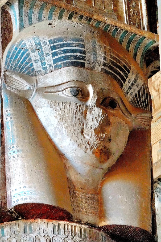
If temples had beauty pageants, then Dendera’s Temple of Hathor would surely win. Only an hour’s float downriver from Luxor, Dendera Temple shines like a polished gemstone on the Nile for all of Hathor’s devotees.
Regarded as the “Mistress of the Vagina,” Hathor exemplified ancient Egyptian femininity as the goddess of love, beauty, music, dancing, fertility, and pleasure…and its all on display at her temple.
From a distance, it’s an unassuming temple,
obscured by a surrounding wall of mudbrick rubble with a golden glow.
However, it stands wonderfully intact for a structure built 2000 years ago, albeit atop the remains of another sanctuary that predates its commission by 2250 years.
While Temples of Karnak and Luxor were built to worship Amun-Ra–the alpha-male of all New Kingdom deities, who brought sun, light, and daily creation to the world–their energy is very androcentric.
Whereas, the Temple of Dendera exudes a powerful yet feminine charm,
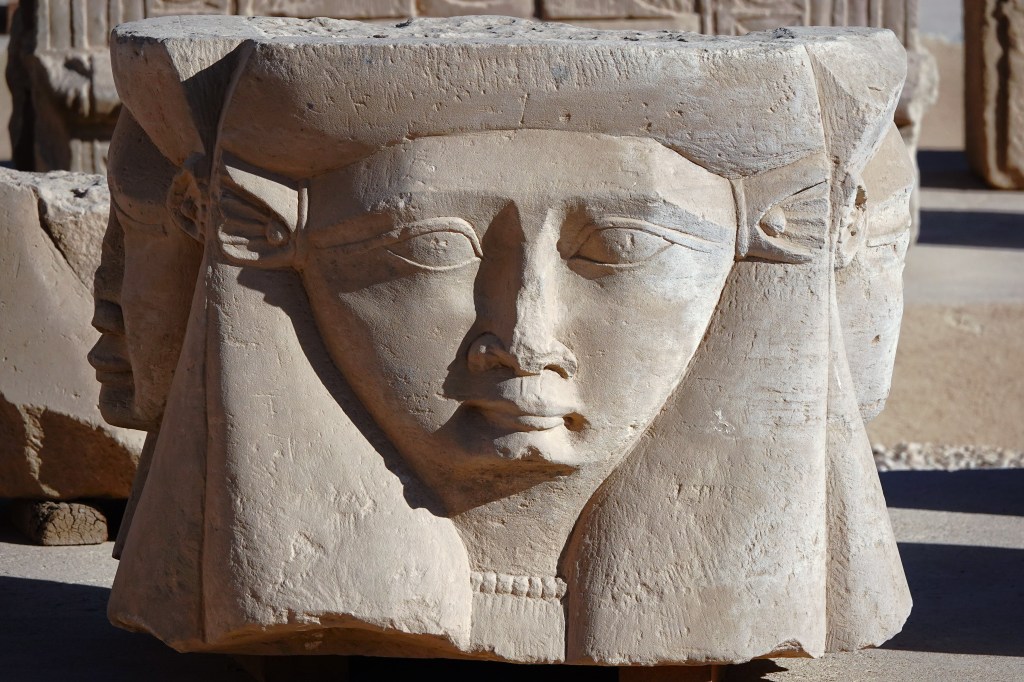
evidenced by the 18 four-sided capitals of Hathor–with her cow-eared likeness–supporting the Hypostyle Hall.
Unfortunately, all carvings of Hathor were deliberately defaced by Christian iconoclasts who sheltered within its walls.
Their open fires lined the chamber surfaces with centuries of soot–obscuring the bas-relief paintings–
until a delegation of French archaeologists recently restored the artwork to its original colors.
Hathor’s temple was most likely commissioned during the second rule of Ptolemy XII in 54 BC until his death in 51 BC, and overseen by his successor daughter, Queen Cleopatra VII and her son King Caesarion until her suicide in 30 BC. They are both enshrined on the temple’s outer rear wall.
Romans embellished the temple compound by constructing the Gate of Domitian and Trajan in lieu of a traditional Egyptian pylon,
but stayed true to the Greco-Egyptian design by invoking Nekhbet (vulture goddess and protector of Upper Egypt and its rulers) beneath the lintel.
and beyond the temple columns.
Emperor Trajan also completed a Roman Kiosk in the forecourt.
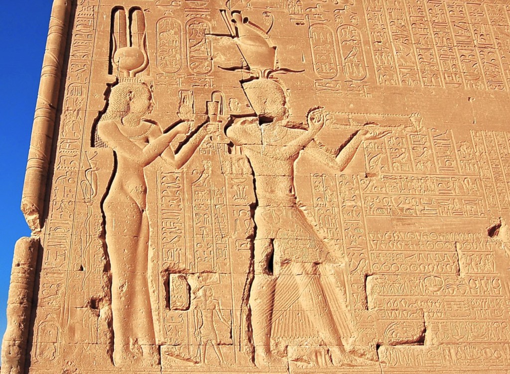
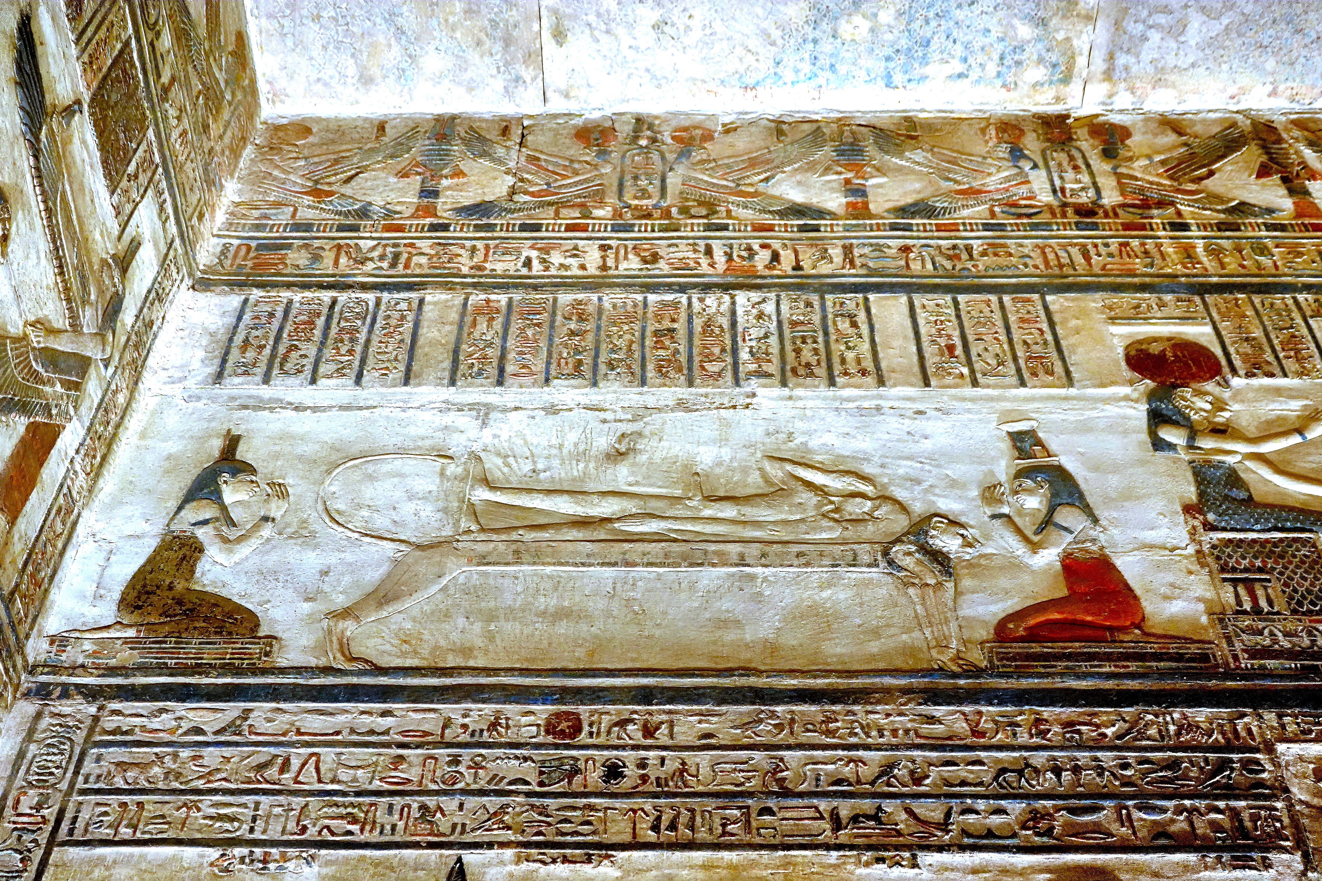
There’s a wealth of illustrations and hieroglyphic stories throughout Hathor’s temple…
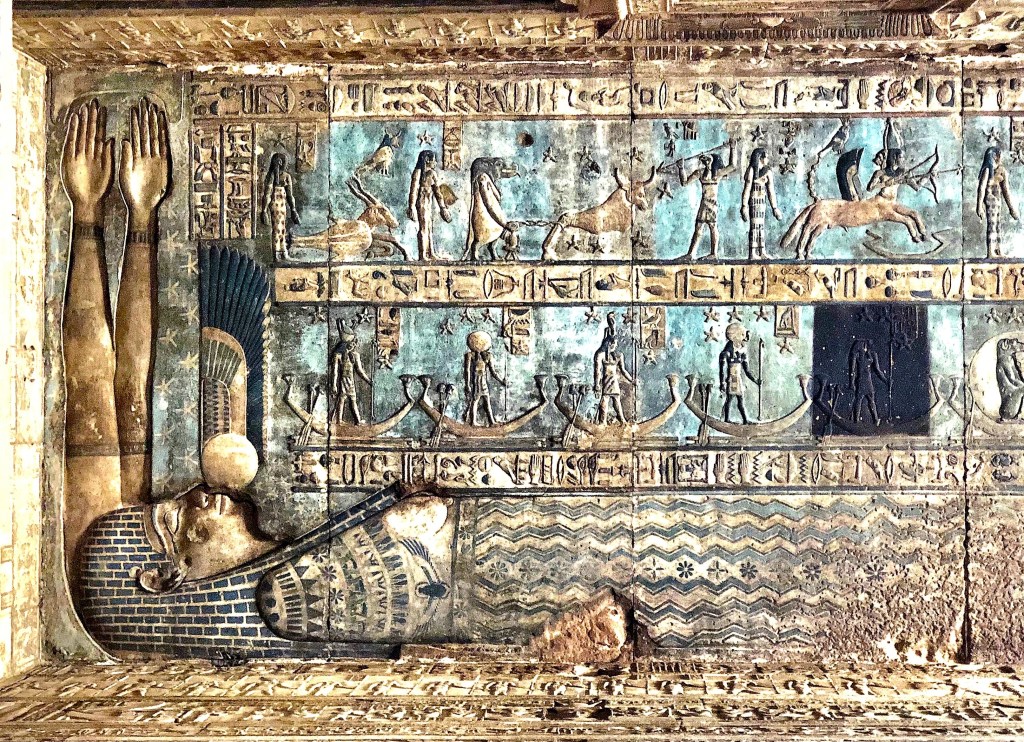
However, the real beauty can be found in the artistic renderings of astrological symbols painted across the Hypostyle Hall, where Goddess Nut ordains the passage of time in a celestial barge.
The masterpiece of the temple is surely the circular zodiac chart of the ancient sky that’s located on the ceiling at the entrance to the Chapel of Osiris–
accessed via a processional staircase that leads to the temple’s rooftop.
Amid controversy, the original engraving was blasted from the ceiling in 1821, and stolen away to France, where it currently hangs in the Louvre Museum in Paris.
Alas, a replica hangs in the chapel.
Which begs the question: Was it guilt and reparations that brought the French back to Dendera to supervise the restoration?
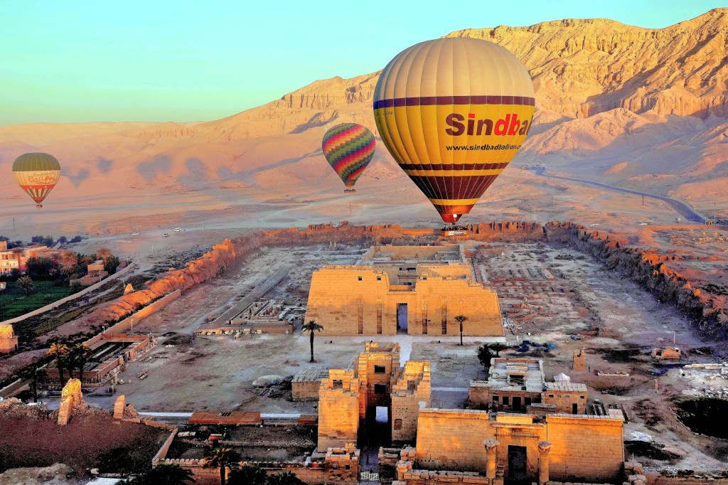
Our wake-up call was 4 AM, and the last thing on my mind was a boxed breakfast to go. I also decided to pass on coffee, thinking I couldn’t risk the chance of floating over the Valley of Kings in a wicker basket (invented by the Egyptians 5000 years ago) and needing to puke or pee.
Meanwhile, Leah had prepared for flight with Dramamine as her go-to prophylactic.
This was not our first ballooning adventure. A few years ago, Leah and I got to float over the Okavango Delta at sunrise with a pilot and 4 others (see Botswana by Balloon). But this time around, we’d be floating over the Valley of Kings, and it got my adrenalin pumping.
The desert air was cool, and the winds were calm–the perfect forecast. We arrived by boat to the east bank of the Nile,
and boarded a sprinter van that dropped us at a vast open field where teams of wranglers were already preparing for launch.
We were given our balloon assignment, and climbed aboard with 25 other “ballunatics.” After a safety drill of “hunker down and brace,” we were ready for lift off.
We felt so small standing under a canopy of hot air and rainbow-colored nylon fabric…
rising 60 feet above us–
not unlike the early morning visitors who had come to gaze at the gargantuan relics of Amenhotep III at his nearby necropolis.
In time, we were joined by so many other aeronauts gliding along the thermals,
that it seemed like heavier traffic in the sky…
than on earth.
Our birds eye perspective brought us closer to the Theban Mountains,
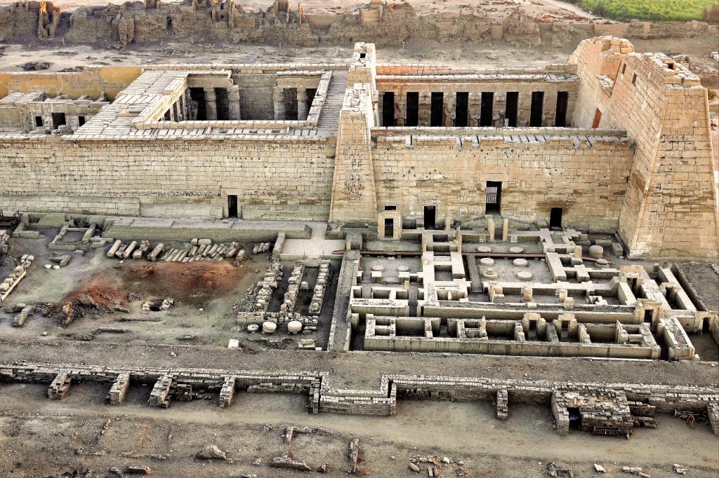
with views of Medinet Habu,
the verdant fields of sugarcane,
and a volume of unfinished housing–a deliberate work-in-progress ploy by locals to avoid paying property tax on completed homes.
But mostly, flying high prepared us for the forthcoming sunrise…
that blossomed before our eyes.
A sight to behold!
Forty-five minutes of fly-time flew by, until it was time for our descent…
at which point the wranglers took over.
Just watching them wrestling with the deflated balloon and lines gave me an appetite.
Breakfast never tasted so good, although the requisite champagne that usually accompanies one’s flight certificate was absent.
Perhaps, the authorities reasoned that our afternoon visit to Dendera Temple in Qena would be best experienced sober.
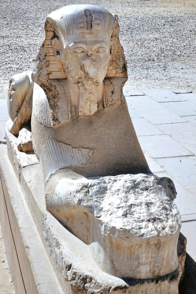
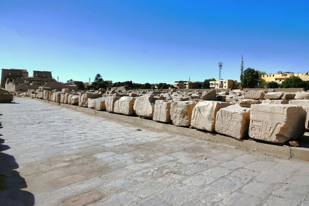
November, 2021 was a cause for celebration in Luxor, as the Ministry of Tourism and Antiquities marked the formal reopening of the Avenue of Sphinxes with a parade attended by Abdel Fattah Al-Sisi, president of Egypt.
The 1.7 mile boulevard connecting the temples between Karnak and Luxor once boasted 1200 sphinxes. They were buried for centuries under several meters of sand, but are now revealed after 70 years of intermittent excavation and restoration.
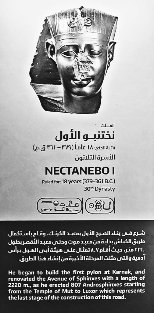
Initiated by Amenhotep III and completed during the reign of Nectanebo I around 2,400 years ago, the impressive series of unearthed statues can be categorized into two shapes:
the first being a body of a lion with a ram’s head;
and the second and most reoccurring shape portrays a lion’s body supporting a human’s head.
Our daytime excursion to Karnak Temple was followed by an evening tour of Luxor Temple.
Although the entrance to the gate was originally flanked by twin obelisks, the right obelisk was gifted to France by Muhammad Ali Pasha, Ottoman ruler of Egypt in the early 19th century (see Walking Like an Egyptian), and now adorns the Place de la Concorde in Paris.
Several rulers contributed to the Temple of Luxor over the ages.
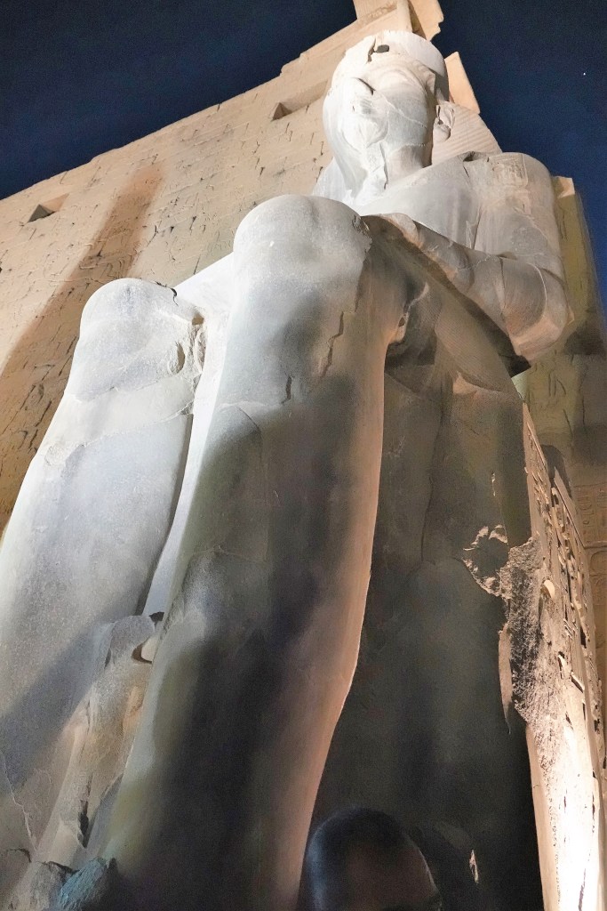
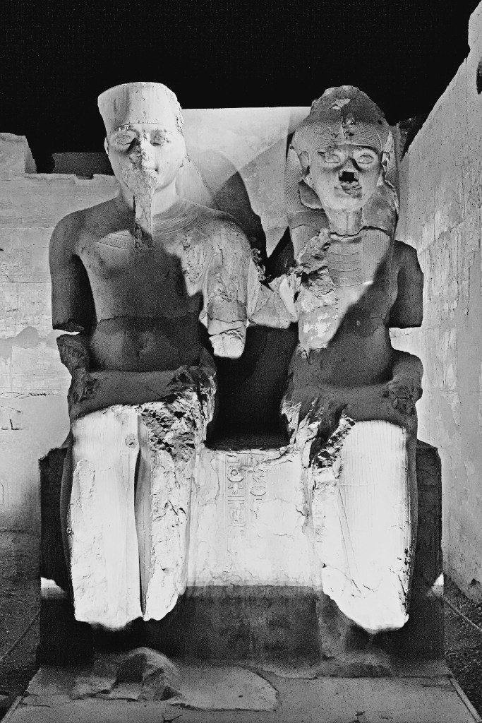
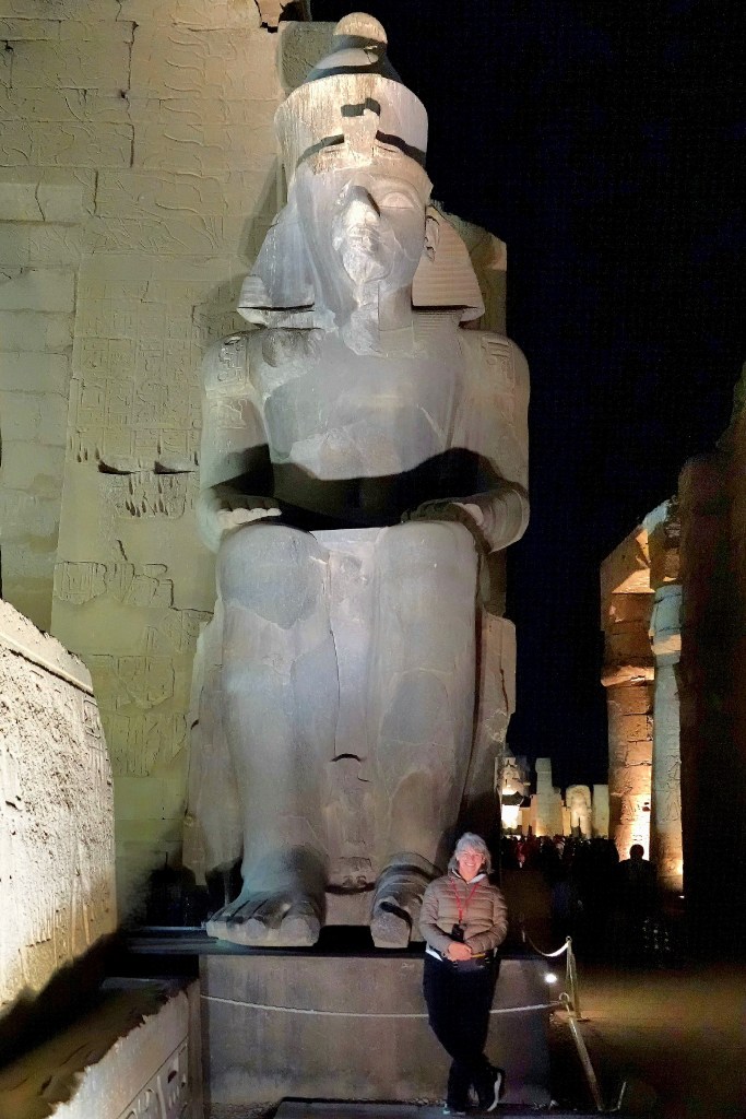
Although the temple was started by Amenhotep II in 1400 BC, Ramses II appropriated the first pylon with placement of a pair of black granite colossi of his likeness seated on a throne…
that depicted the unification of Upper and Lower Egypt.
Beyond the pylon, Ramses II also chose to enshrine 17 of his sons within a courtyard surrounded by double rows of columns capped with lotus-bud capitals. He fathered a minimum of 111 sons and 67 daughters.
The Courtyard of Ramses II flows into the Colonnade of Amenhotep III, dominated by seven pairs of 52 foot (16m) open-flower papyrus columns, which still support their huge architrave blocks.
The decoration of the Colonnade of Amenhotep III was largely undertaken by Tutankhamun, who is featured beside his Great Royal Wife, Queen Ankhesenamun, daughter of King Akhenaten and Queen Nefertiti.
Beyond the Colonnade, the Great Sun Court of Amenhotep III showcases the remains of a peristyle court with a double row of sixty columns with papyrus bundle capitals on three sides. They represent the best preserved and most elegant columns in the temple.
While Luxor Temple was conceived to celebrate the Theban trinity of Amun-Ra, married to God Mut, and son, God Khonsu, the religious focus of the adjacent chapels evolved over time from polytheism to Coptic Christianity during Roman rule, until the Muslim conquest of Egypt in the 7th century.
Thus, the Fatimid Caliphate inaugurated the Mosque of Abu El Hagag in 1286 atop the temple ruins and rubble, repurposing columns and stones to create a strange amalgam of Islamic civilization and ancient Egyptian civilization.
Ironically, the Opet Festival–originating during the 18th dynasty of the New Kingdom, and celebrated to promote the fertility of Amun-Ra and the Pharaoh–has now become an annual event.
Following a 3400-year old ritual, a royal procession parades from Karnak Temple to Luxor Temple along the Avenue of Sphinxes accompanying a statue of Amun-Ra within a barque of gold that rests on the shoulders of priests.
The news is enough to make Ramses II stand up and take notice.
After 3 days in Cairo, Leah and I were on the move!
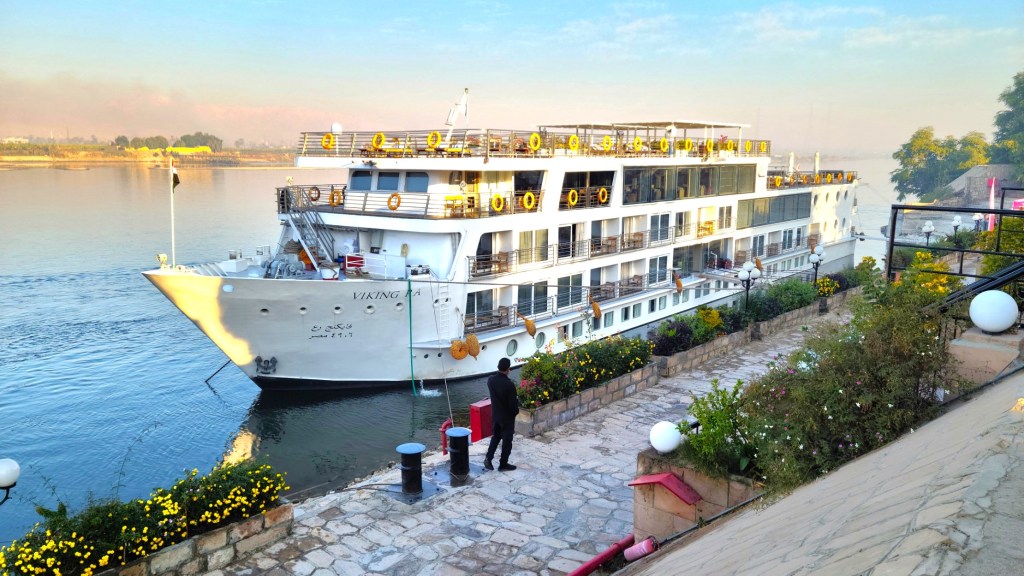
We boarded a chartered prop jet with our fellow river cruisers and flew to Luxor,
to greet the Viking Ra–currently tied up alongside the Nile’s east bank. Ra was to be our floating hotel through the following week.
After attending an obligatory safety briefing aboard Ra,
we were soon exploring Luxor and it’s ancient counterpart, Thebes–home to kings and queens from the Middle Kingdom (c. 2000–1700 BC) through the Ptolemaic Kingdom (305–30 BC)–spanning 15 centuries of rule, until Egypt surrendered to the Romans.
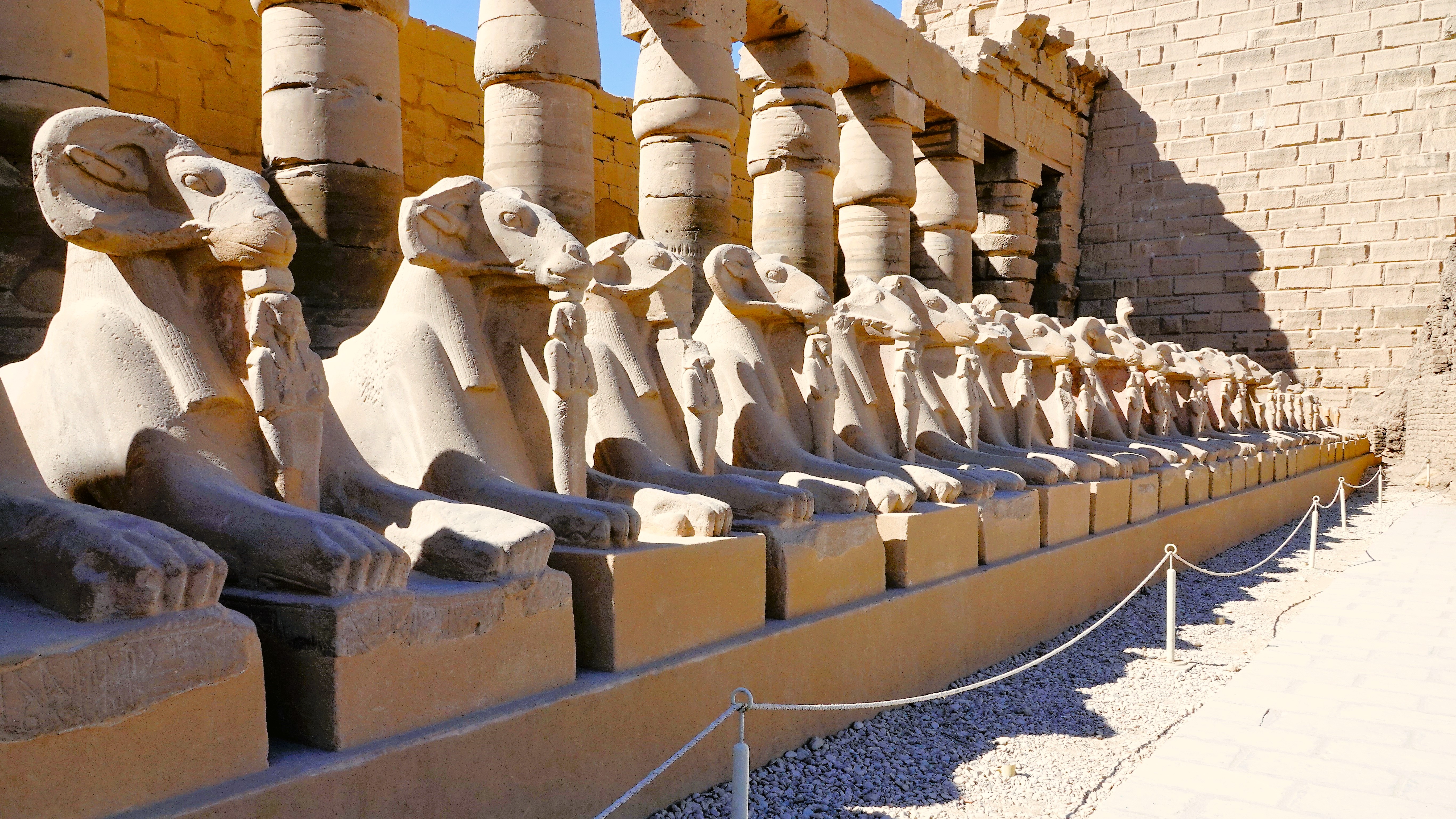
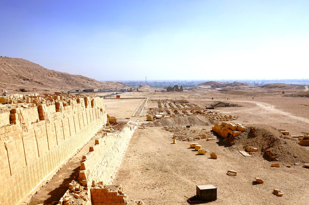
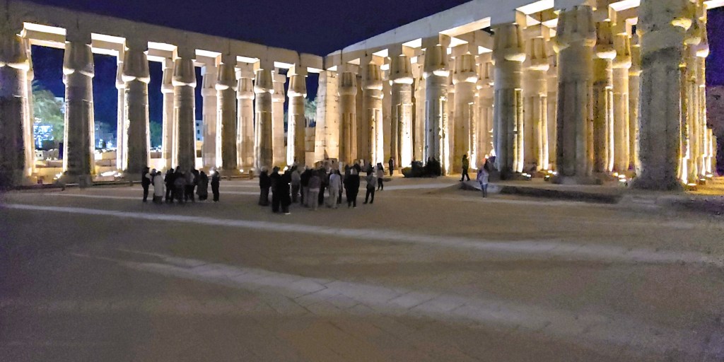
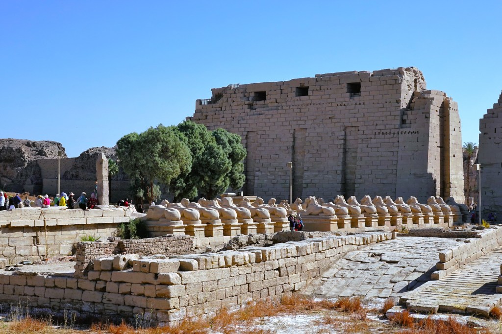
Our tour of Luxor began with a visit to the Karnak Temple Complex, encompassing 247 acres, and considered the largest religious structure ever built.
Ram-headed sphinxes (called criosphinx) adorn both sides of the avenue leading to the unfinished, first pylon to honor Amun-Ra, Egypt’s most powerful god and Thebe’s patron deity of the Great Temple of Karnak.
The criosphinxes continue inside the Ethiopian Courtyard (IX Dynasty)–each one cradling an erect statue of Ramses II (c. 1279-1213 BC) between its forelegs.
It flanks the entrance to the temple of Ramses III.
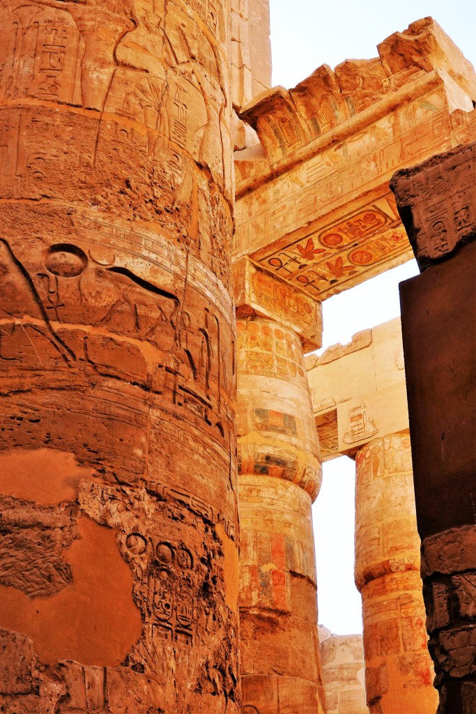
The most impressive feature of the temple of Amun-Ra is the Great Hypostyle Hall, a forest of 134 sandstone columns centered by 12 colossal columns soaring 69 feet,
which supports the remains of a stone roof enclosed by massive walls,
and features intricately carved relief sculptures and hieroglyphs of religious and historical significance…
to honor each of the 30 kings who once ruled the imperial city.
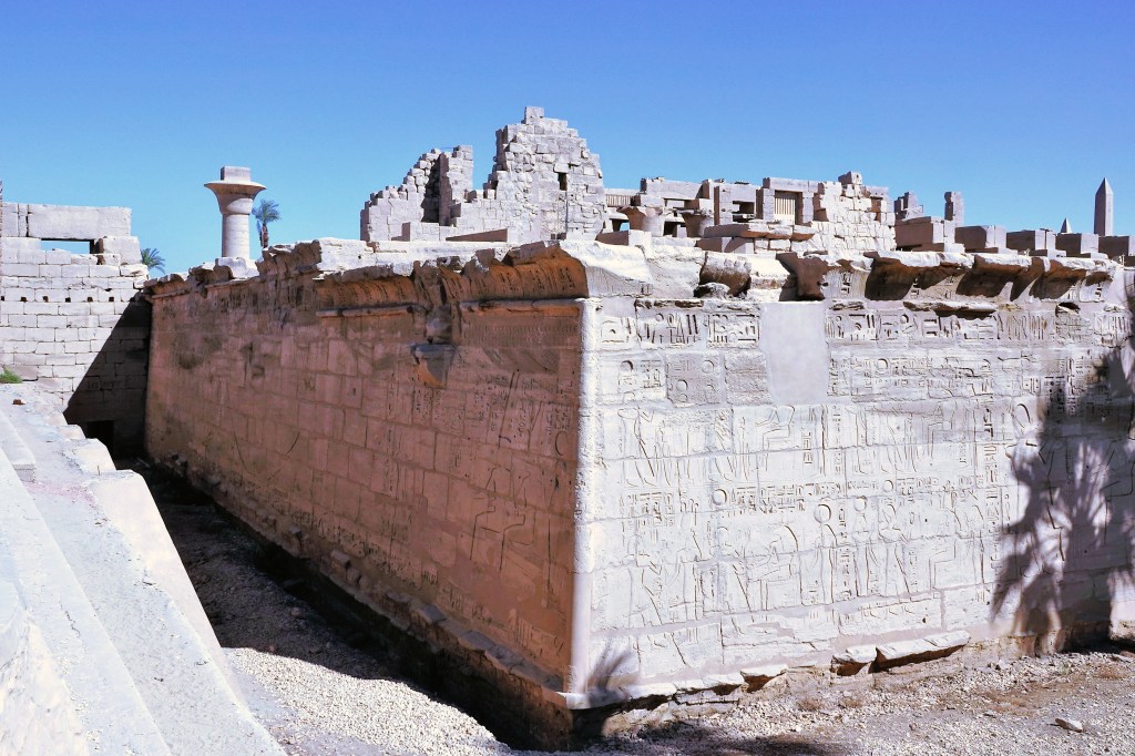
After 3300 years, the site remains substantially intact, yet benefits from painstaking restoration.
After listening to commentary from our onboard Egyptologist, Leah and I strolled the grounds of the ancient temple trying to imagine the enormity of its scope:
while realizing that 3 other sections–the Precinct of Mut, the Precinct of Montu, and the Temple of Amenhotep IV–are also part of Karnak, and still under excavation and reconstruction.