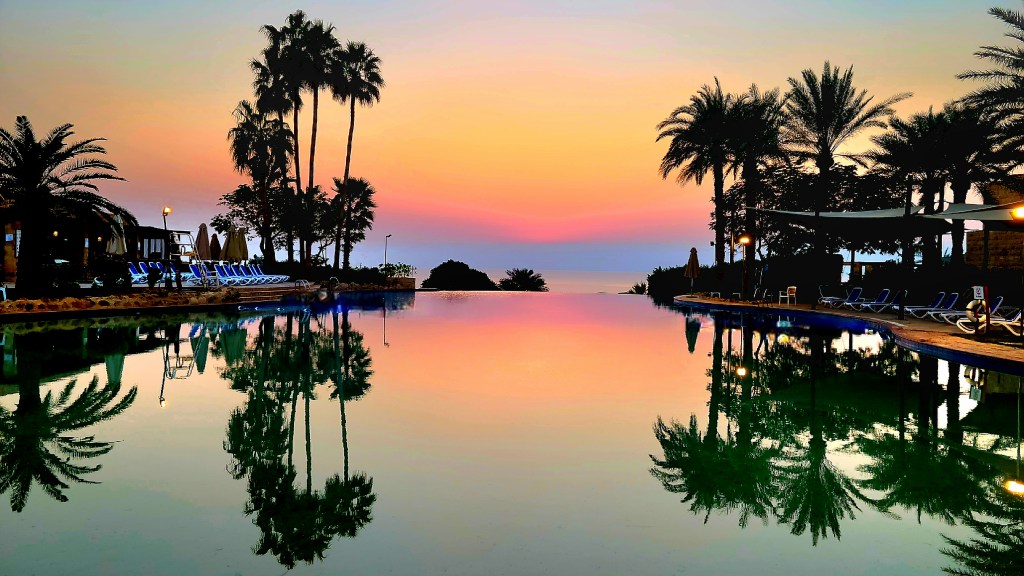
Two of South America’s great urban centers–Santiago, Chile and Buenos Aires, Argentina served as designated transfers on our journey to the bottom of the world, but time would not allow Leah and me to explore our interim surroundings to the fullest. Nevertheless, we hit the ground running,
utilizing the long summer days to our advantage and netting a few memorable moments and postcard pearls to satisfy our wanderlust.
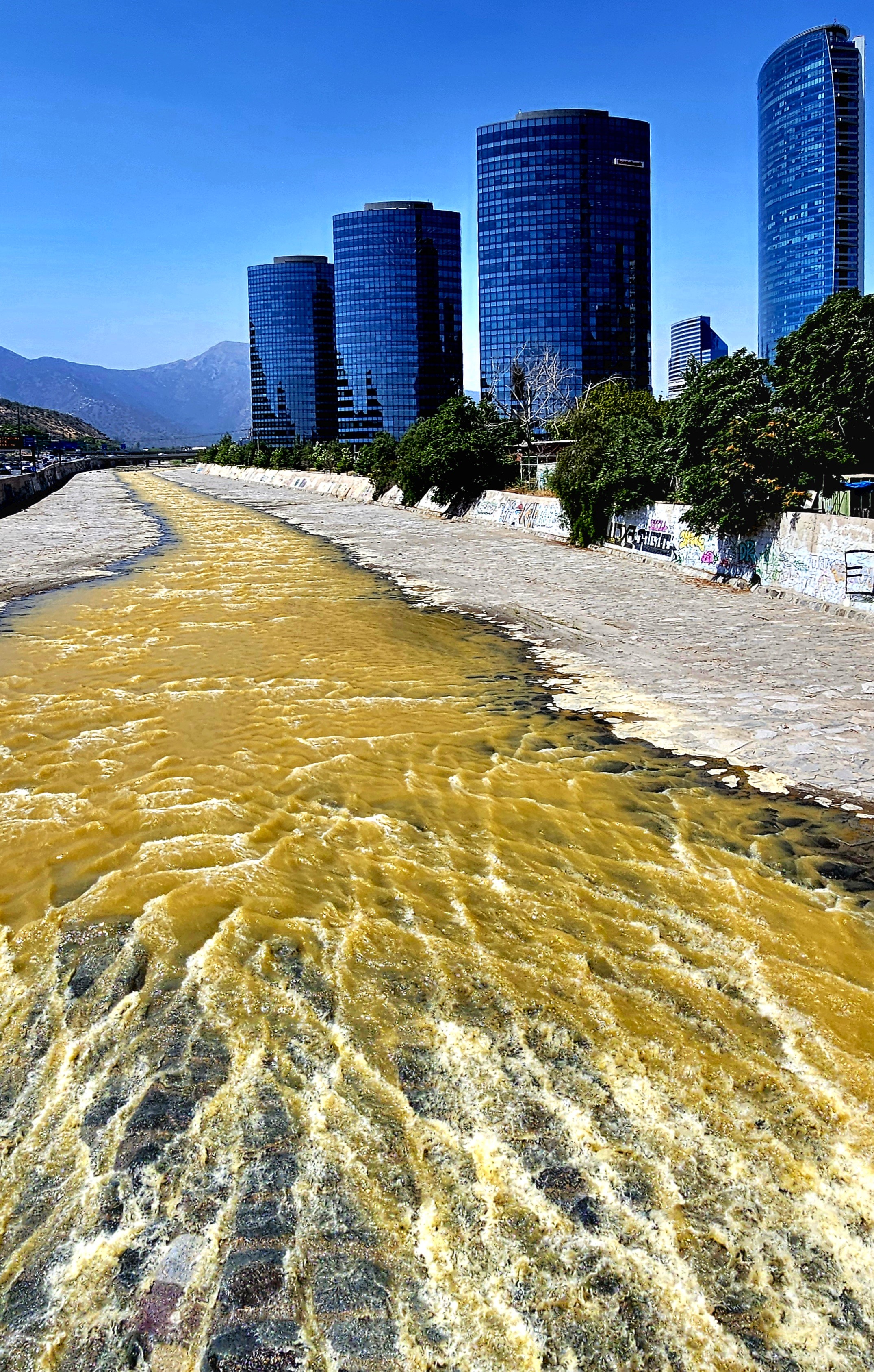
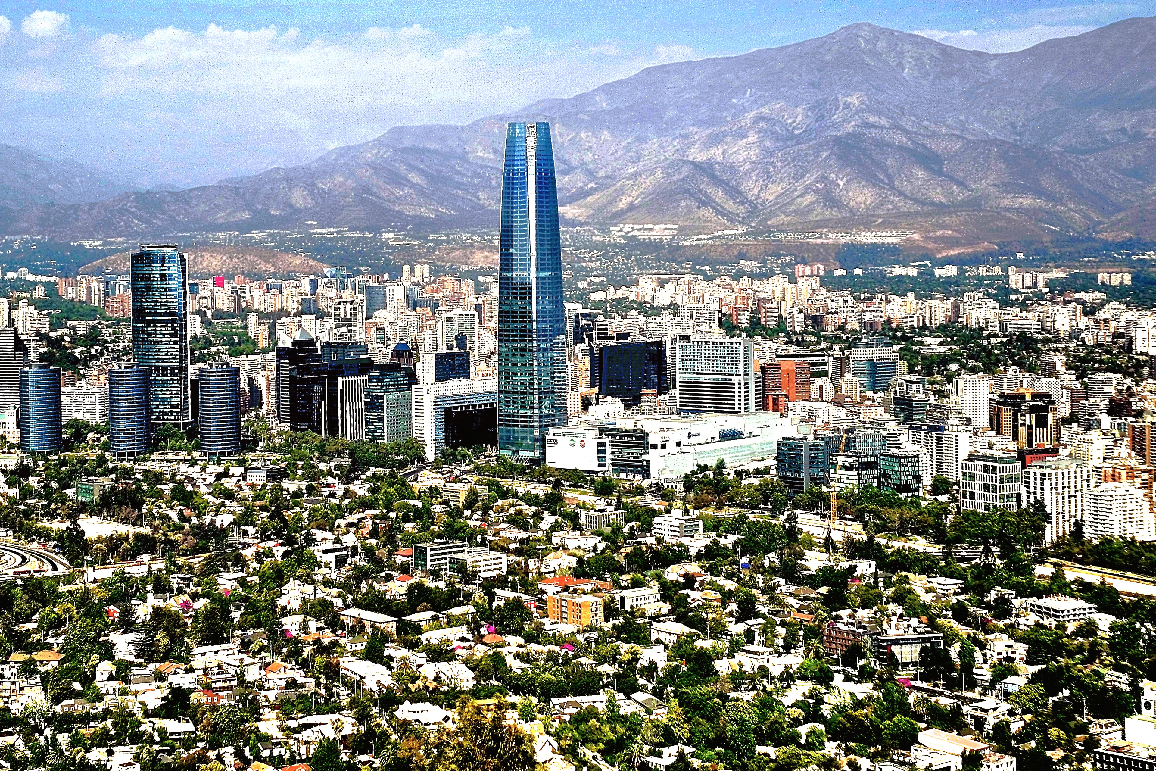
Santiago is a vibrant capital sandwiched between the Coastal Range and the Andean Mountains, and best experienced from the summit of San Cristobal Hill–
accessible by cable car from the east,
or by funicular from the west.
For many Catholics, the pilgrimage to the top of Cerro San Cristobal is incomplete without hiking to the Sanctuary of the Immaculate Conception,
where a statue of the Virgin Mary rises 14 meters from her pedestal.
The Catholic Archdiocese is based at the neoclassical Metropolitan Cathedral at the Plaza de Armas,
where it stands as the centerpiece of the square.
The opulence of the sky-blue frescos and the cathedral’s gilded columns are a testament to the hundreds of artisans who toiled for decades to evoke the aesthetics of Tuscany and Rome.
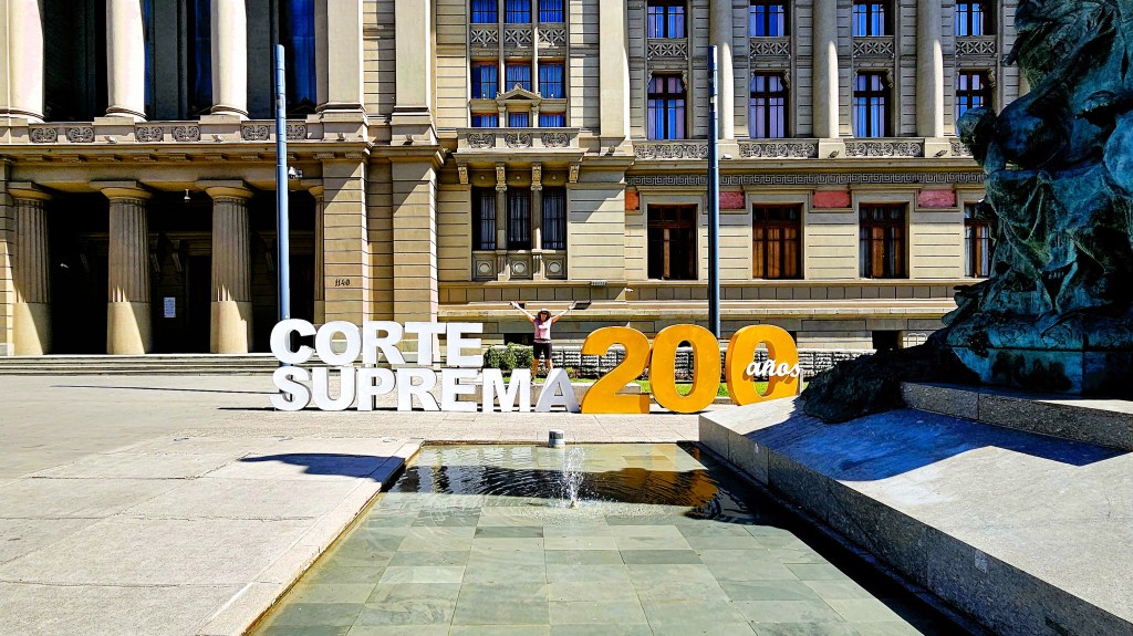
On the civics side of the peso chileno, there is also a wealth of Beaux-Arts architecture that dominates the cityscape, from the Supreme Court building…
to Constitution Square.
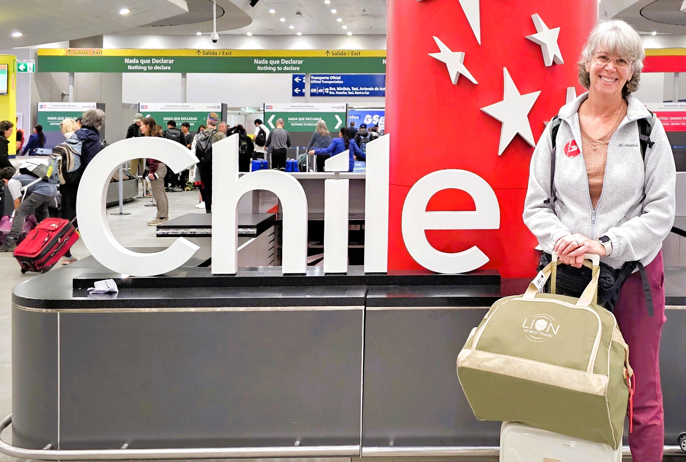
Leah and I initially arrived in Santiago, Chile, only to fly out the following day to the Antofagasta region, where the Atacama Desert figured large in our itinerary (see Atacama Desert). Then it was back to Santiago, for an overnight, before an early departure to Buenos Aires, where our time was sorely limited to an amazing rib-eye dinner in the midst of Monserrat,
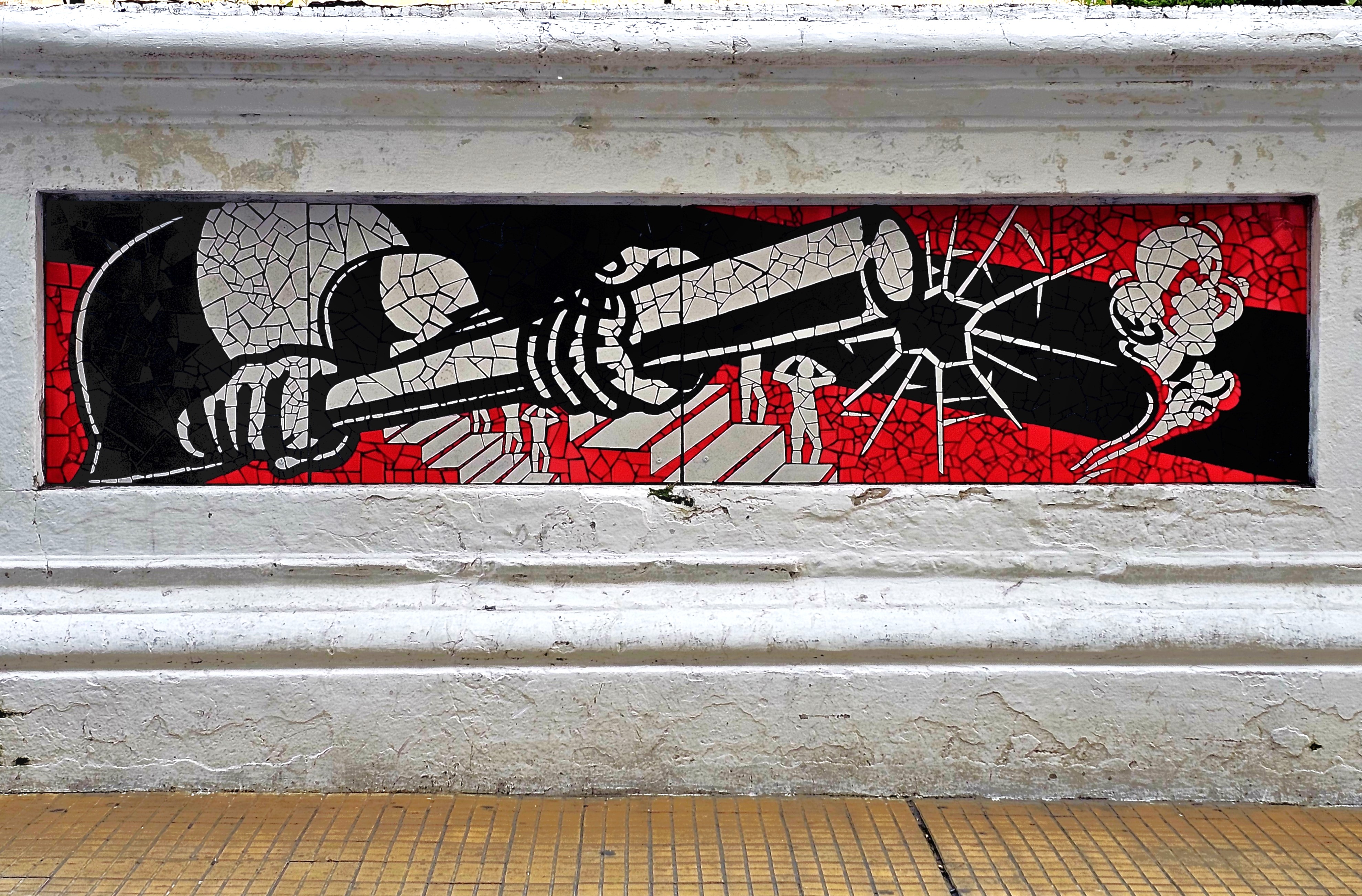
followed by a necessary “walk-off-our-meal” stroll through the city’s oldest district, replete with sidewalk bistros,
political art,
and public buildings defended by commemorative art,
and protected by full-figured gargoyles.
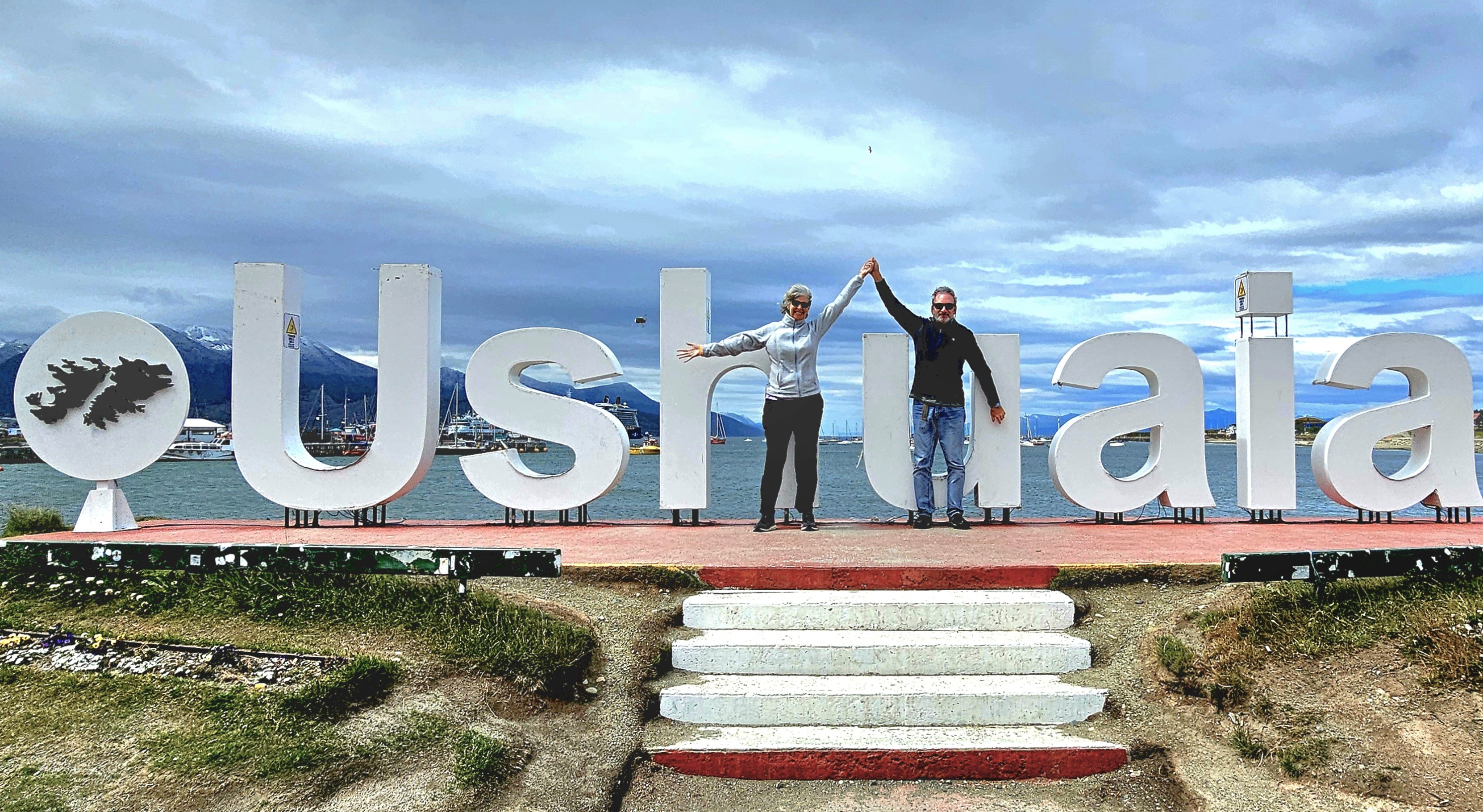
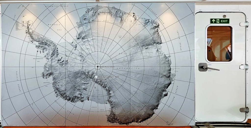
The following afternoon, we arrived in Ushuaia, acclaimed as the southernmost city on the planet.
Although our ship Viking Octantis awaited us at the harbor (just kidding),
Leah and I still managed to appreciate the Patagonian panorama surrounding the waterfront,
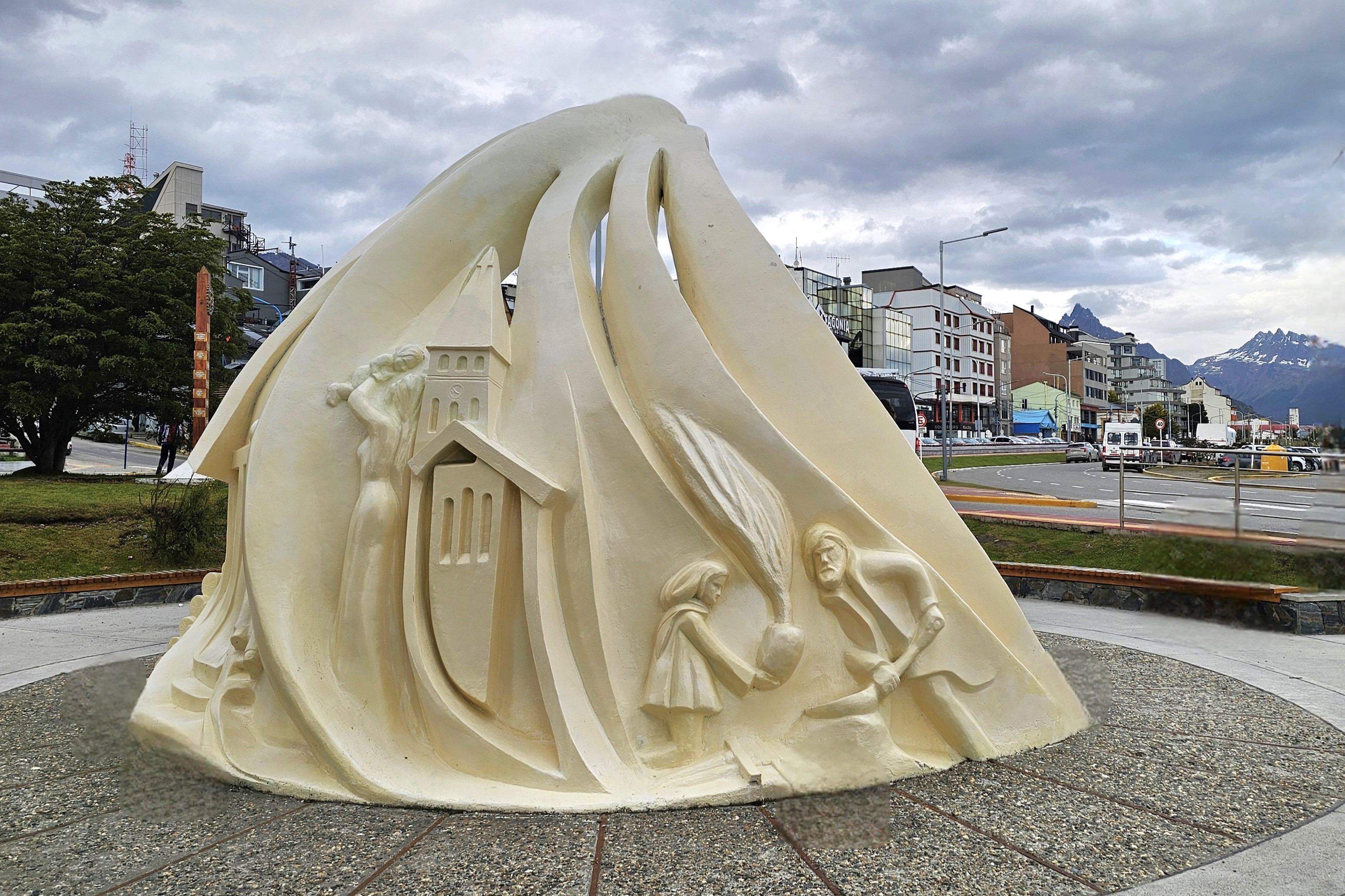
the inland tributes and monuments,
and the resplendent gardens scattered throughout the town.
Ushuaia surprised me. I anticipated a sleepy town, but discovered a hive of trendy shops, boutique hotels, and pricey outfitters. The scenery was unparalleled, and the weather was ideal. It seemed the perfect segue to an exciting Viking expedition.
And so, the time had come to embark on our adventure to the White Continent by first surrendering to the dreaded Drake Passage…
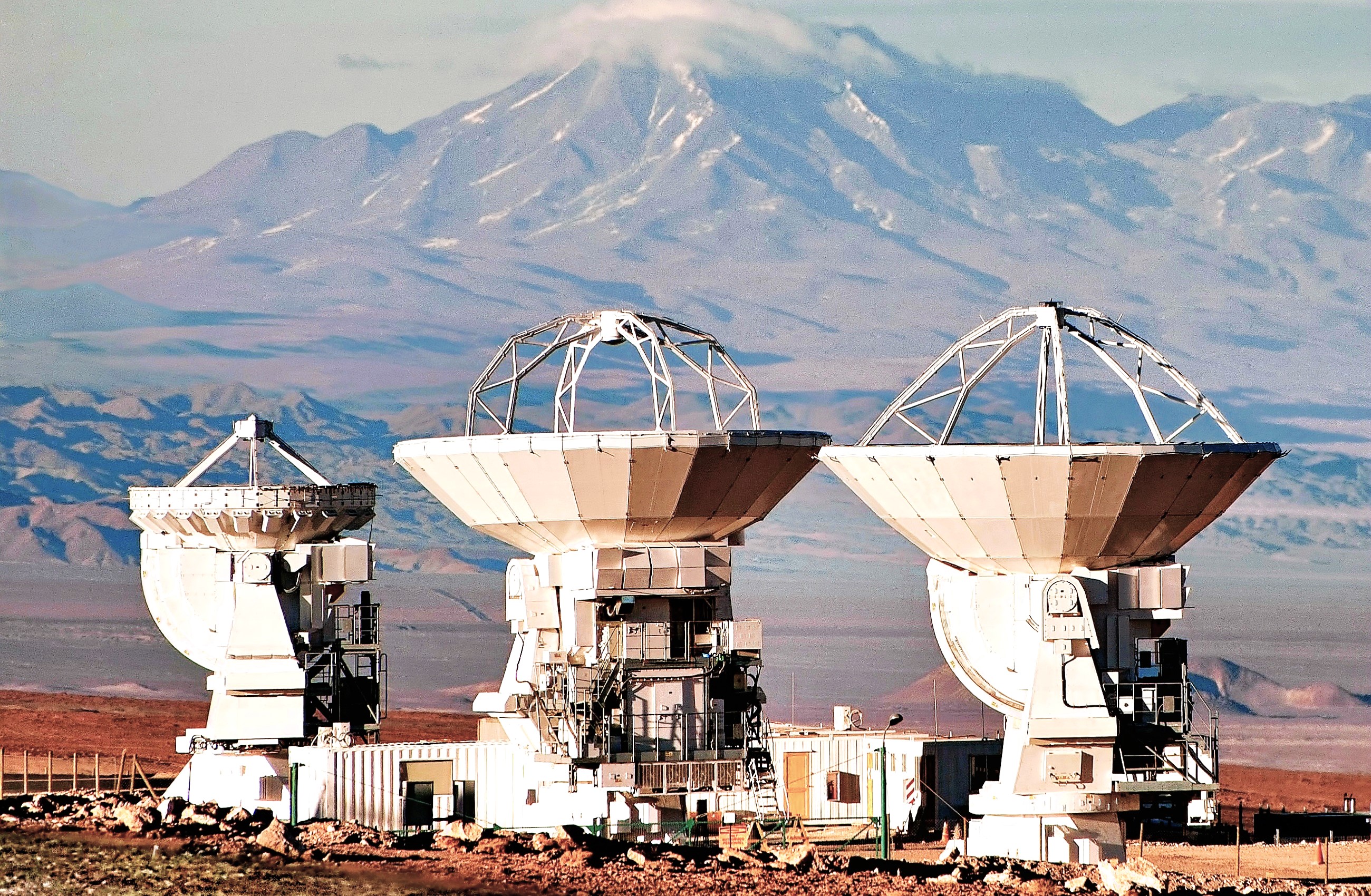
Heaven forbids, I should neglect to mention that San Pedro de Atacama–given its high altitude, and being as dry and remote as it is–also has the darkest sky on the planet, making it ideal for stargazing. And astronomers from across the globe are betting that ALMA’s array of 66 dishes–comprising the world’s largest ground-based telescope–can provide answers about our cosmic origins and our search for life within and beyond our universe.
Photo credit: José Francisco Salgado
Already, the ALMA (Atacama Large Millimeter/submillimeter Array) Observatory has made many significant discoveries, including:
In 2018, astronomers detected the presence of the most distant oxygen molecules ever observed, located a staggering 13.28 billion light-years away. This remarkable finding significantly contributed to our understanding of cosmic evolution, shedding light on the emergence of star formation in this distant galaxy a mere 250 million years after the Big Bang.
Additionally, ALMA made a stunning revelation by identifying billions of tons of table salt in orbit around a young star, offering a mesmerizing glimpse into the presence of familiar compounds in the cosmos.
Furthermore, ALMA has played a pivotal role in unraveling the mysteries of the universe. For instance, it detected branched organic molecules in a star-forming region of our Milky Way, providing valuable insights into the chemical composition of celestial bodies.
Moreover, ALMA’s observations have extended to other galaxies, such as the groundbreaking discovery of a disc around a star in a distant galaxy–a first-of-its-kind observation that advanced our understanding of stellar systems beyond our own. Furthermore, by studying a newly dormant galaxy, ALMA uncovered evidence of significant celestial events, identifying the ejection of star-forming fuel during a galactic merger and the formation of gas-rich tidal tails, providing a window into the cosmic processes that shape our universe.
ALMA has also helped researchers determine the types and locations of systems that could support habitable planets. ALMA has also provided information about worlds closer to home, including Saturn’s moon Titan.
Sadly, there was no time in our itinerary to visit the ALMA facility, which welcomes all visitors during Saturday and Sunday. However, I attempted some astrophotography discoveries of my own during a celestial presentation at the edge of our resort, Hotel Cumbres San Pedro de Atacama, in my hope of capturing a vivid photograph of the night sky.
Armed with my Sony RX10 iv and tripod, our expedition troop marched in total darkness to the final plank of the resort’s boardwalk, bringing us to open desert, where two mounted telescopes were pointed at a black sky illuminated by a million points of light. The view was breathtaking! While most of the guests stretched out on pillows and blankets, I set up a camp chair and set my coordinates.
Regrettably, I failed. In order to reduce the digital noise during a long exposure, I adjusted the ISO to 400, which gave me a 30-sec. time exposure with an open aperture. The result was a tangle of small streaks, not stars. Apparently, the long exposure captured the path of the moving sky, albeit 3 shooting stars were framed in the effort.
Unwilling to admit defeat–the night before our return to Santiago–I leveled the tripod within the confines of my private garden and turned my camera toward the sky with newfound hope and a higher ISO to reduce my exposure. This time, the results were more satisfying.
While I had hoped for a glimpse of the Milky Way, I’ll settle for a Mars Bar from Valle de la Luna!
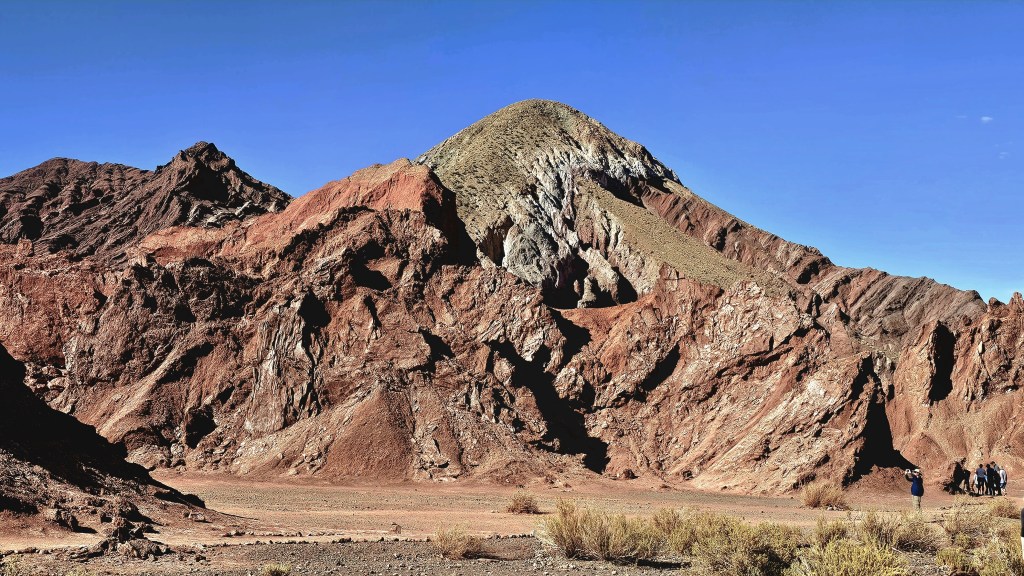
Despite the monochromatic omnipresence of shifting sand and salt across the Atacama Desert (observed from previous post, “Atacama Desert”)–
aside from the occasional splash of flamingo pink–
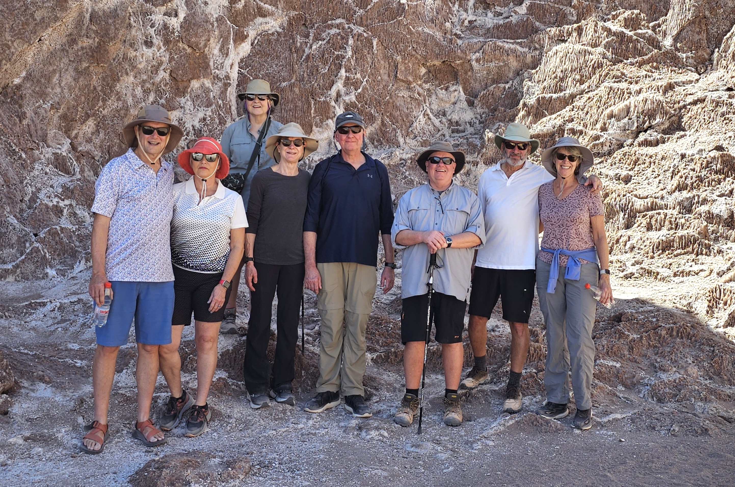
there is an abundance of color to behold in other regions of Antofagasta. Leah and I joined our expedition colleagues…
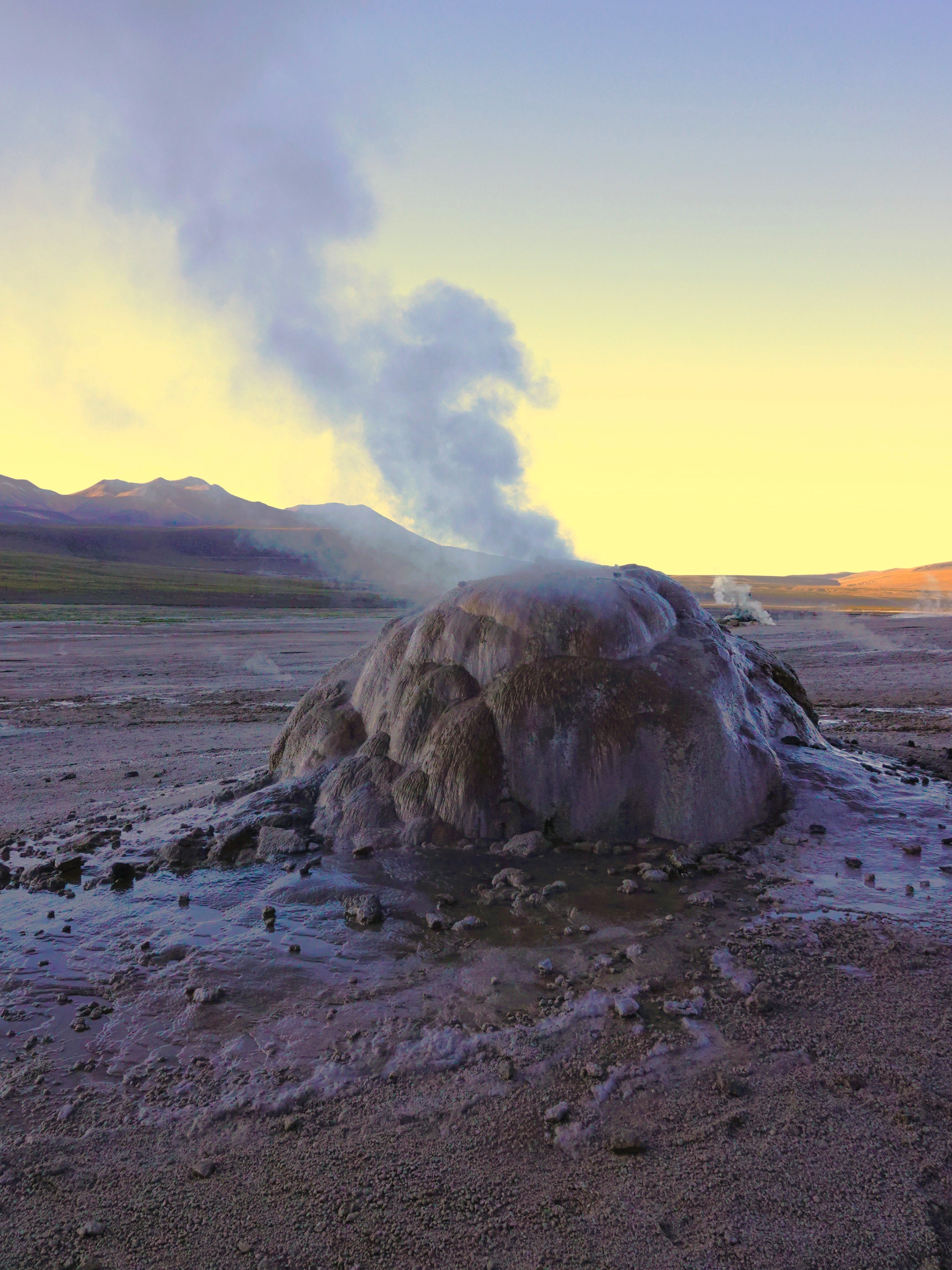
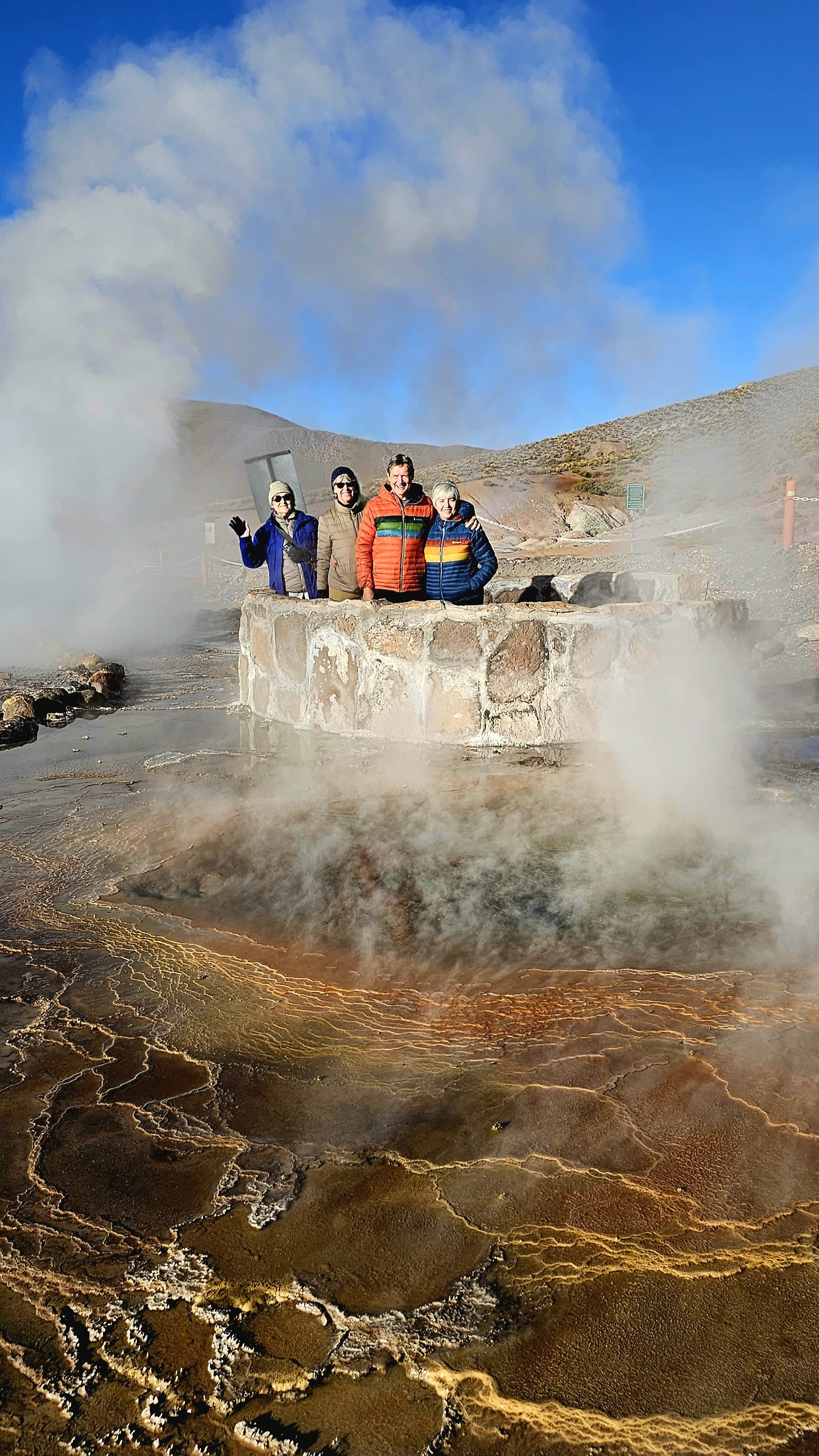
for a 90-minute drive north through remote, rugged terrain and narrow switchbacks, to catch a 7am sunrise over El Tatio Geysers, the highest, albeit 3rd largest geothermal field in the world, and certainly, the most active in the southern hemisphere.
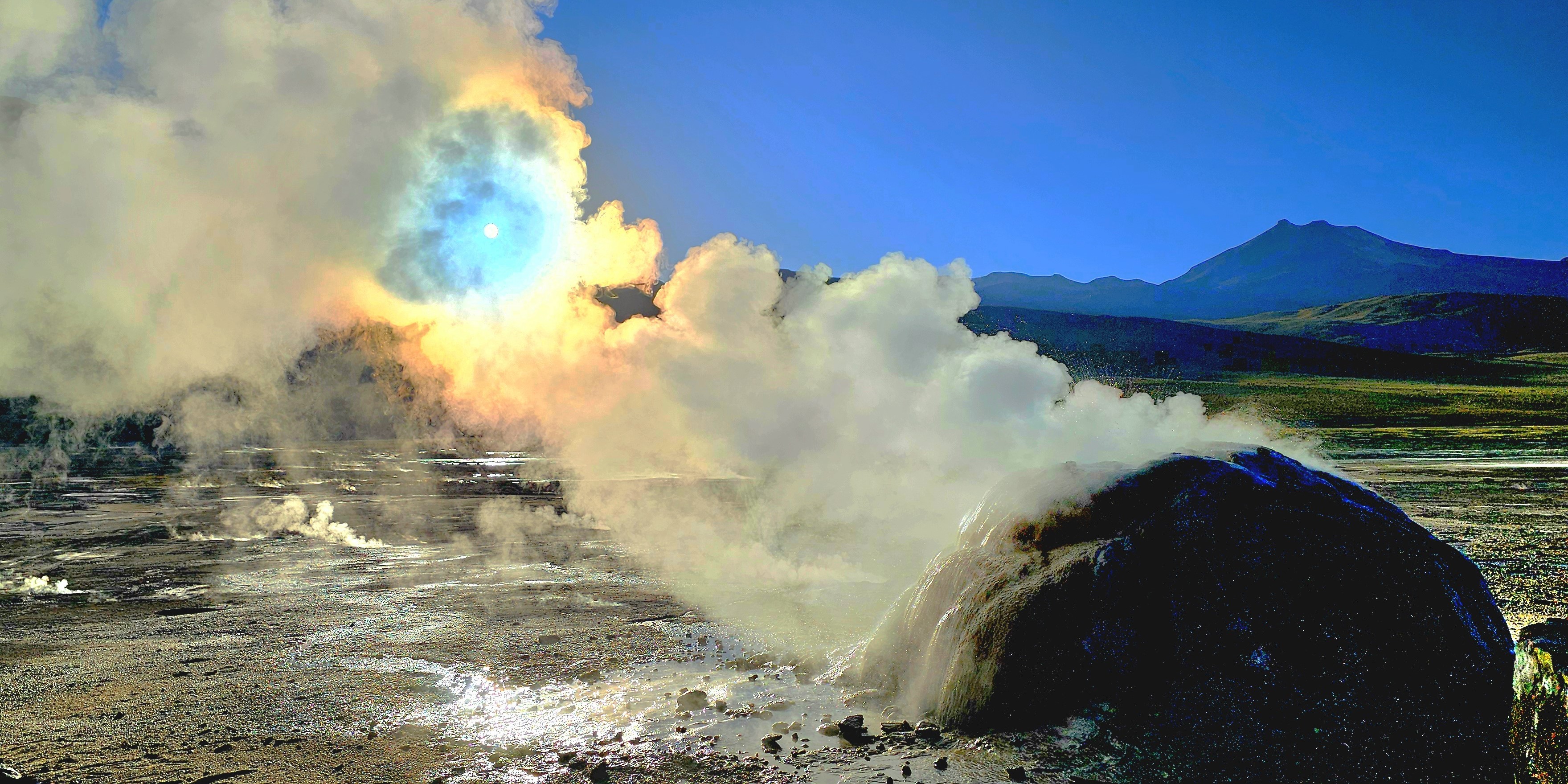
At an altitude of 14,170 ft, the -6oC desert temperature was biting at our faces, but it was a temporary inconvenience. The backlit, pre-dawn sky and cold air benefitted the playful plumes that vented from 80 steaming geysers and fumaroles amid 12 sq miles of Andean volcanoes.
Like so many others, I was poised for the first sun to creep over the horizon,
not only to return the feeling to my fingers, but to reveal the chromatic clouds playing across the landscape.
Soon enough, the rising sun would turn the blackest of hot springs into a glorious reflecting pool.
It was worthy of a celebration.
Because El Tatio is community-owned and administered, there were several local rangers scattered throughout the vicinity to patrol, advise, and admonish any foolishness similar to Pierce Brosnan’s trespassing at Yellowstone National Park (although he entered a “not guilty” plea during his recent arraignment).
One can only hope that discretion and common sense would prevail in this fragile and volatile environment.
El Tatio Geyser
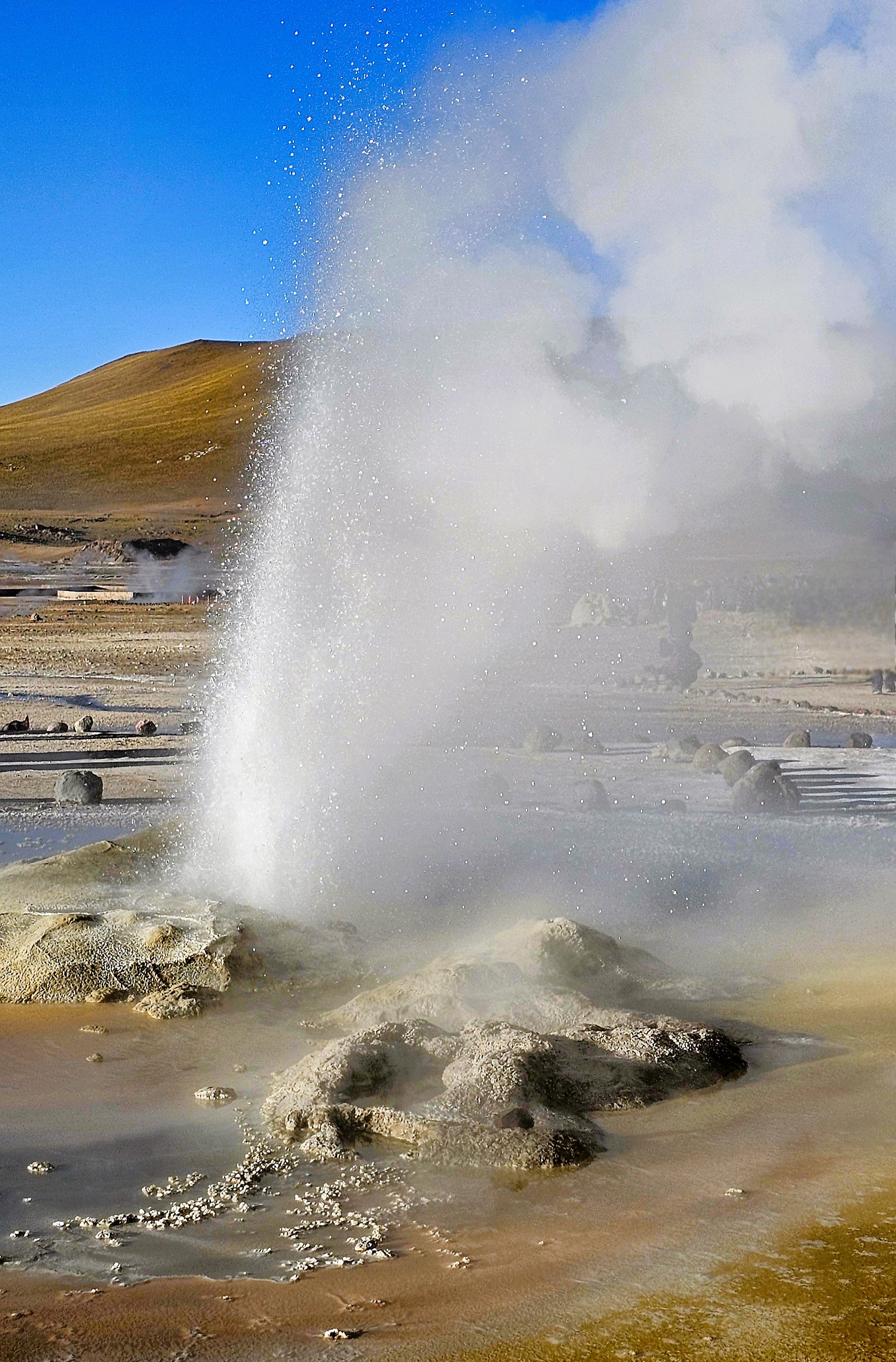
A stroll through the field revealed a kaleidoscope of algae-induced minerals and salts,
that stretched into the distance.
El Tatio didn’t appear as daunting as Old Faithful and its surroundings, but it was impressive, nonetheless, with nowhere near the number of onlookers!
From our position–only 100 miles to Ollagüe Volcano, bordering Chile and Bolivia–
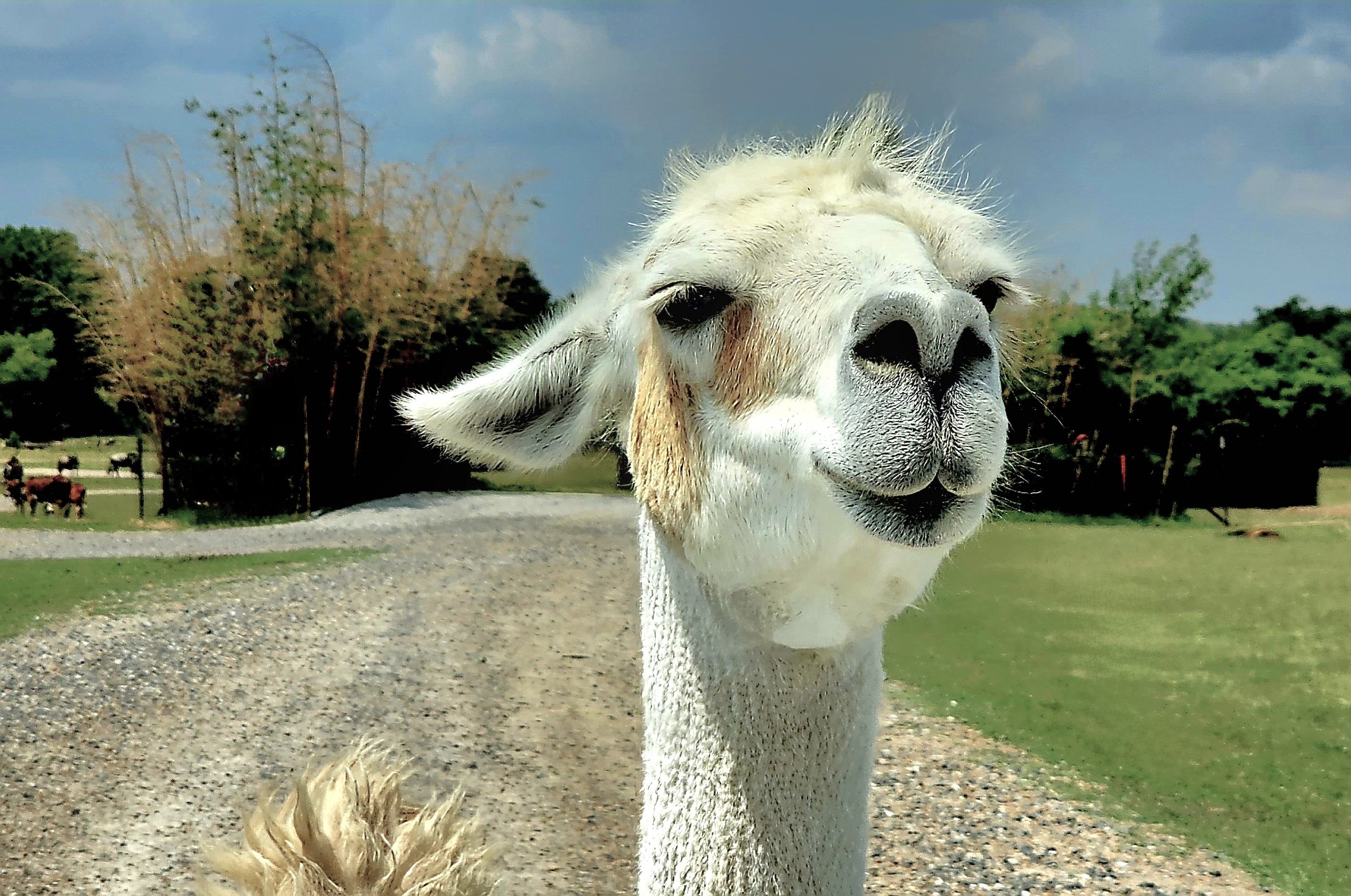
we continued to Valle del Arcoiris, another community-based natural wonder,
where “purple mountains majesty”…
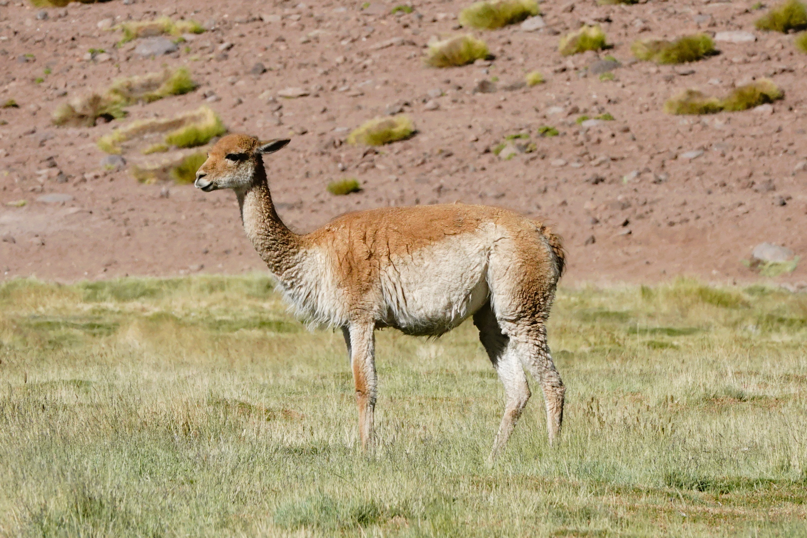
become a befitting backdrop to roaming, grazing llamas.
The valley was as wide and rich with the scent of riki riki…
as it was awash with colors created by a primordial stew of Sulphur, gypsum, crushed shells, and clay.
When the Pliocene Epoch carved out the valley,
all traces of copper and lithium were swept away–
which is a silver-lining for a spectacular landscape that would otherwise have been ravaged by mining companies.
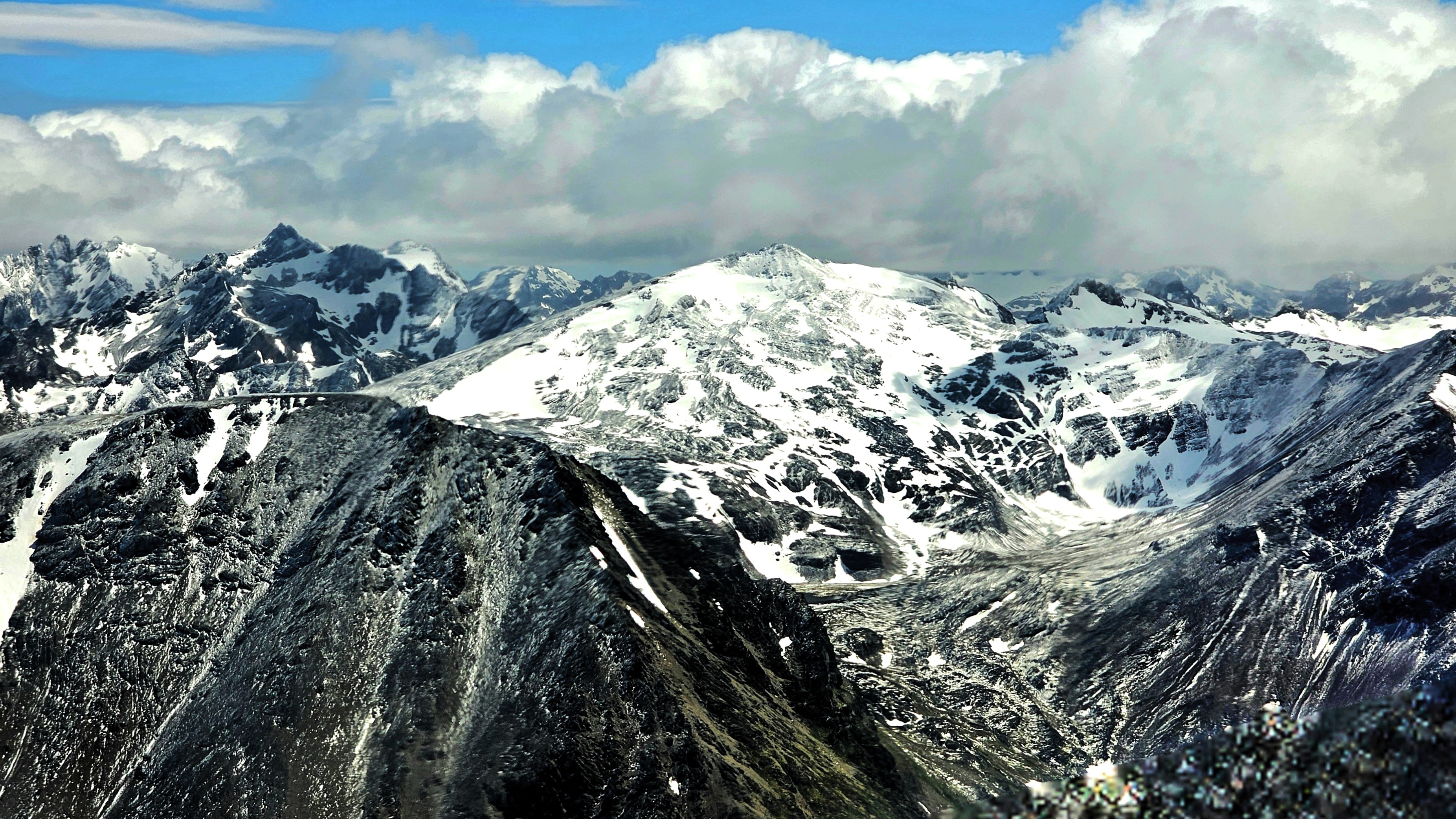
Rather than go thru the details of how we got here, suffice to say that 2 days of inconvenient travel brought us to the Chilean Andes…
to experience the highest and driest desert on earth (averaging 13,000 ft. elevation), where temperatures can fluctuate between 0oC and 25oC, and rainfall averages 2 mm of rain per year with a humidity factor of .02%.
The area is so vast, it spans Chile, Peru, Argentina, and Bolivia.
But despite the hostile environment, flora and fauna still manages to survive.
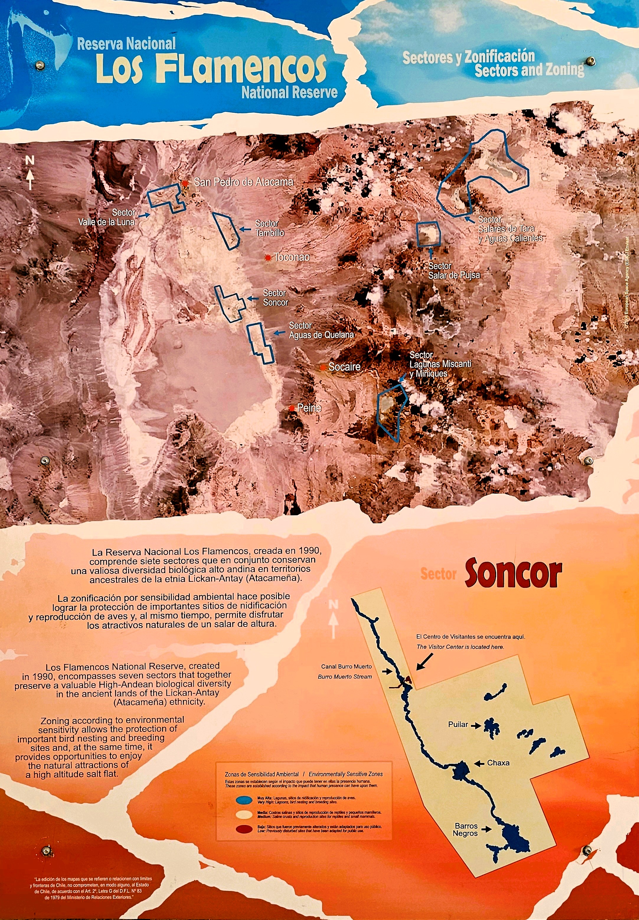
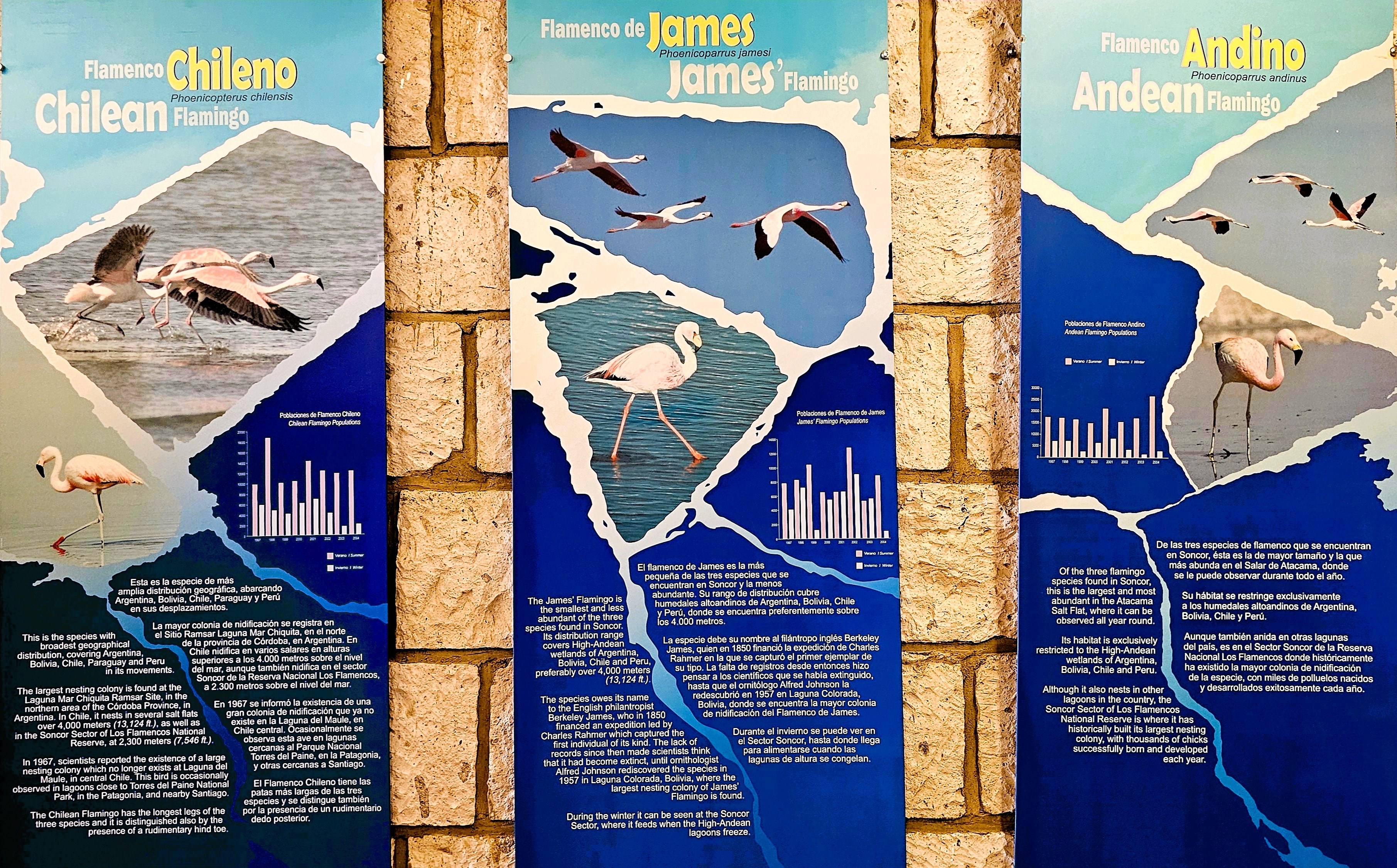
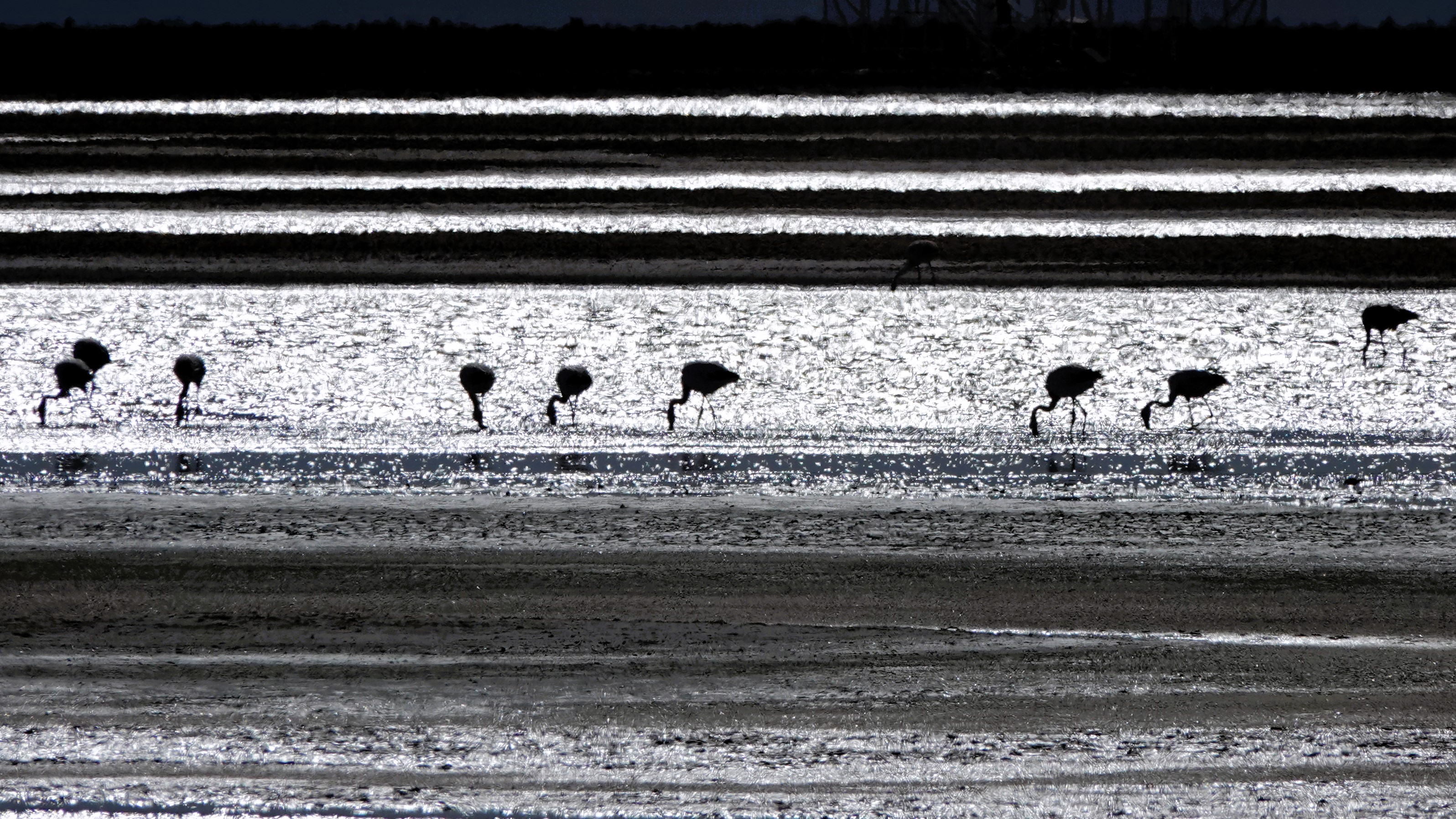
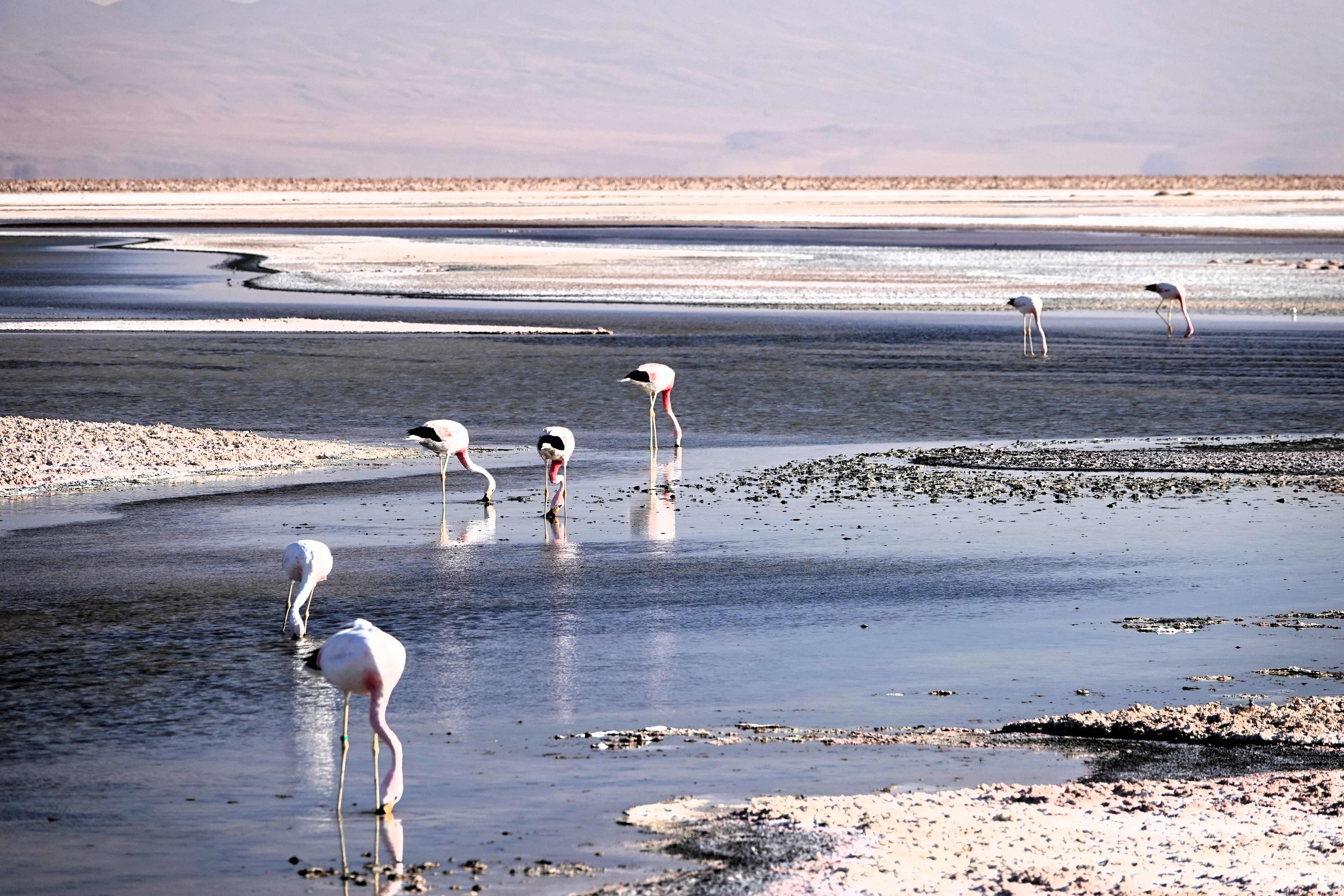
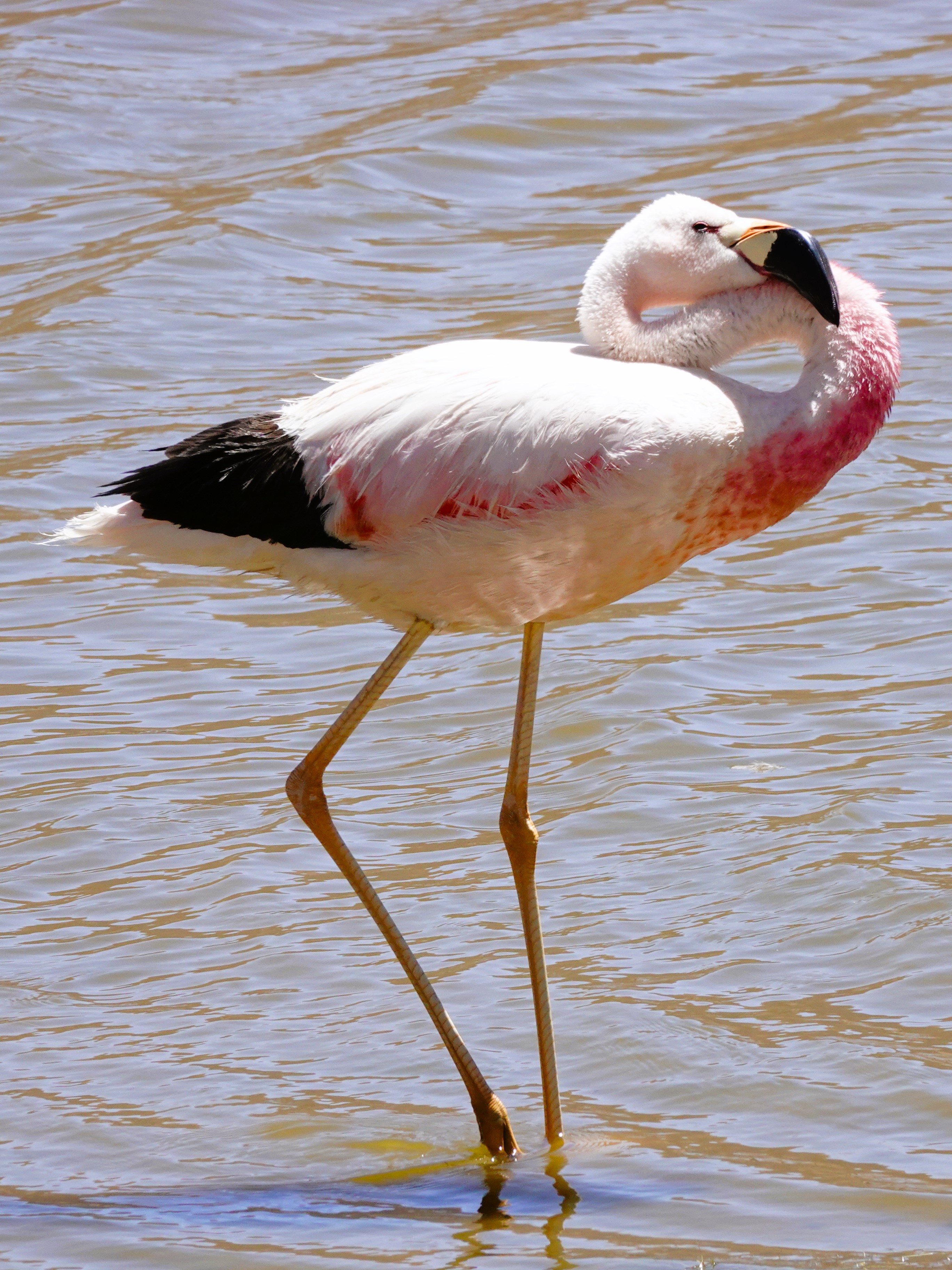
Our first destination was the Soncor Sector of Los Flamencos National Preserve,
where a variety of native flamingos congregate to feed on brine shrimp that flourish in pools along the salt flats.
Although the park flamingos were unidentifiable from a distance,
it became easier to identify their individual characteristics the closer we got to them,
distinguishing the flock as Andean flamingos.
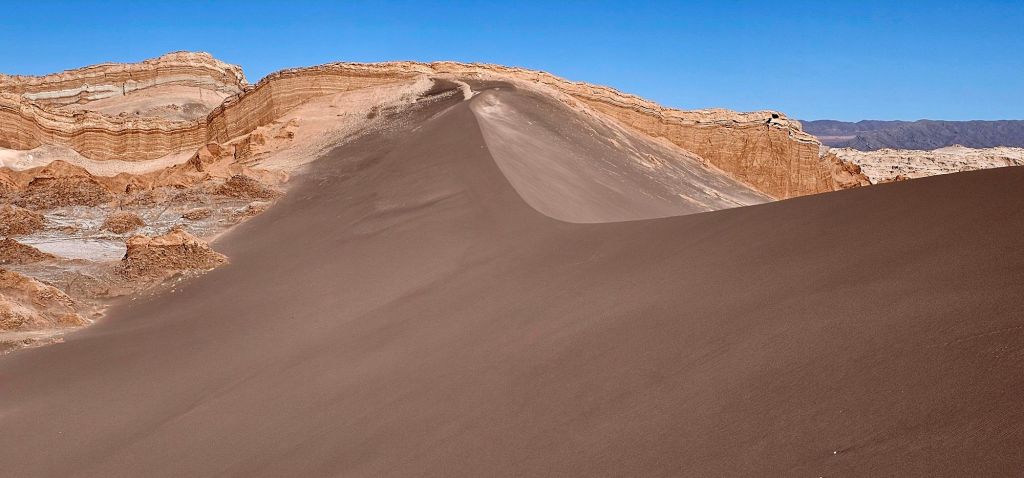
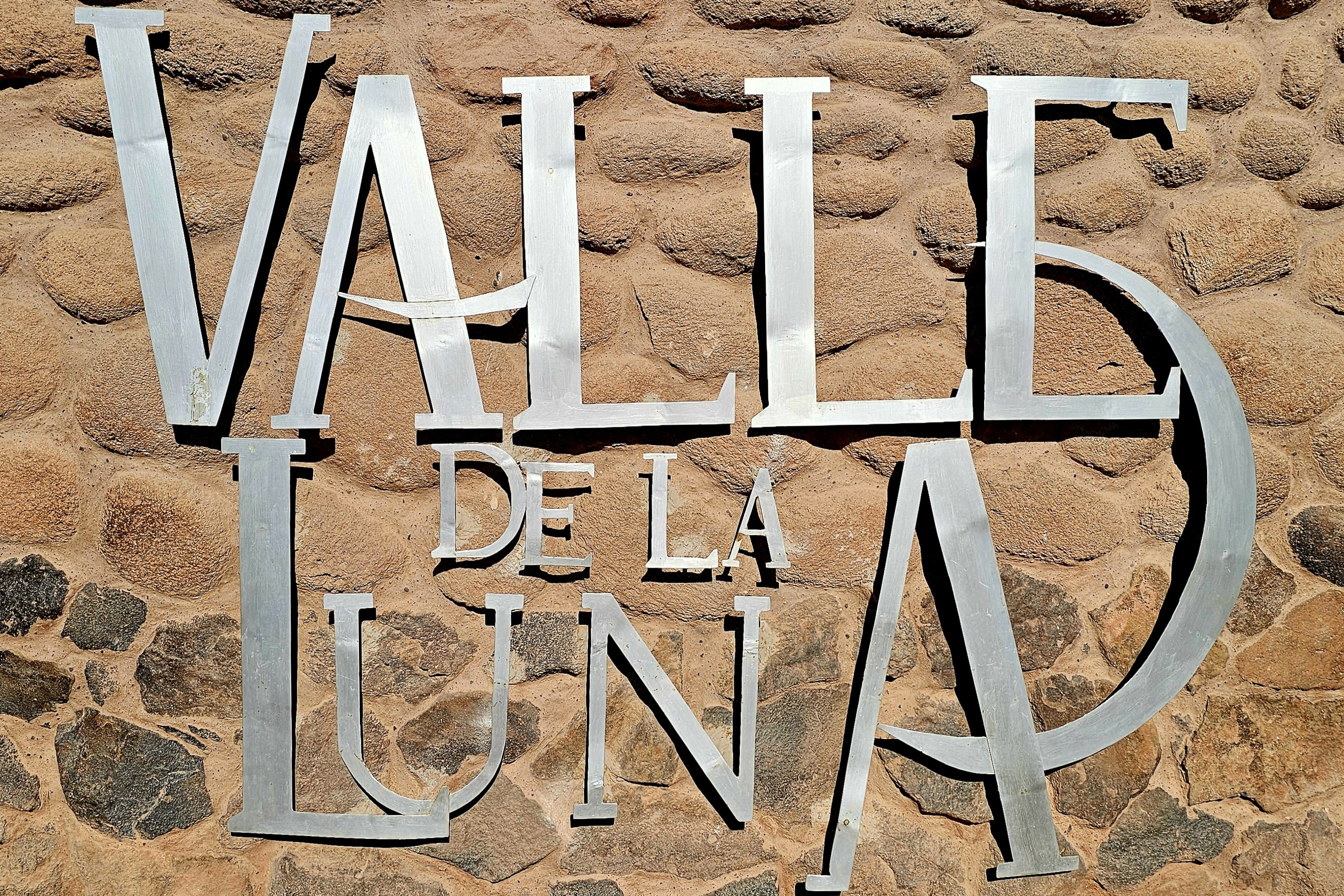
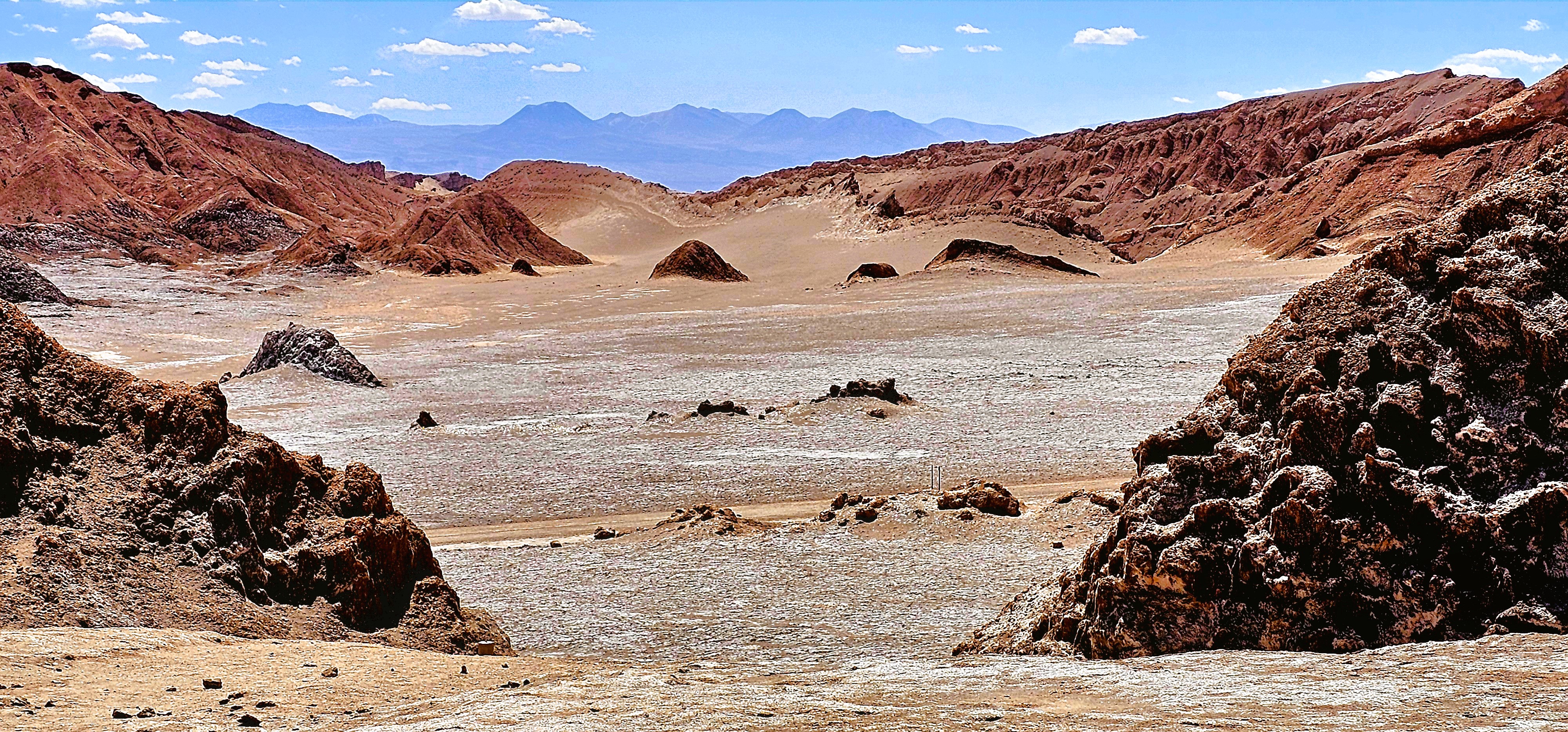
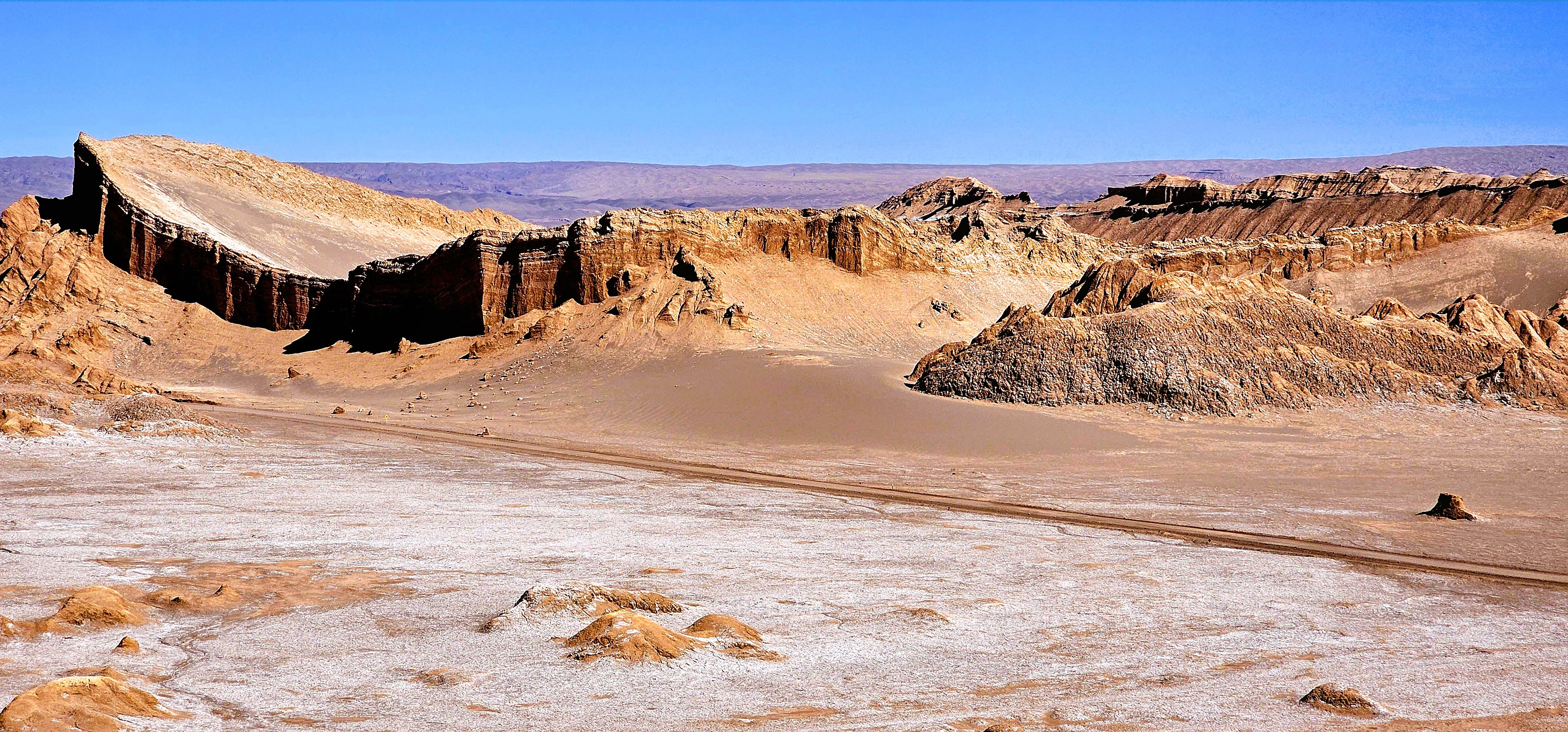
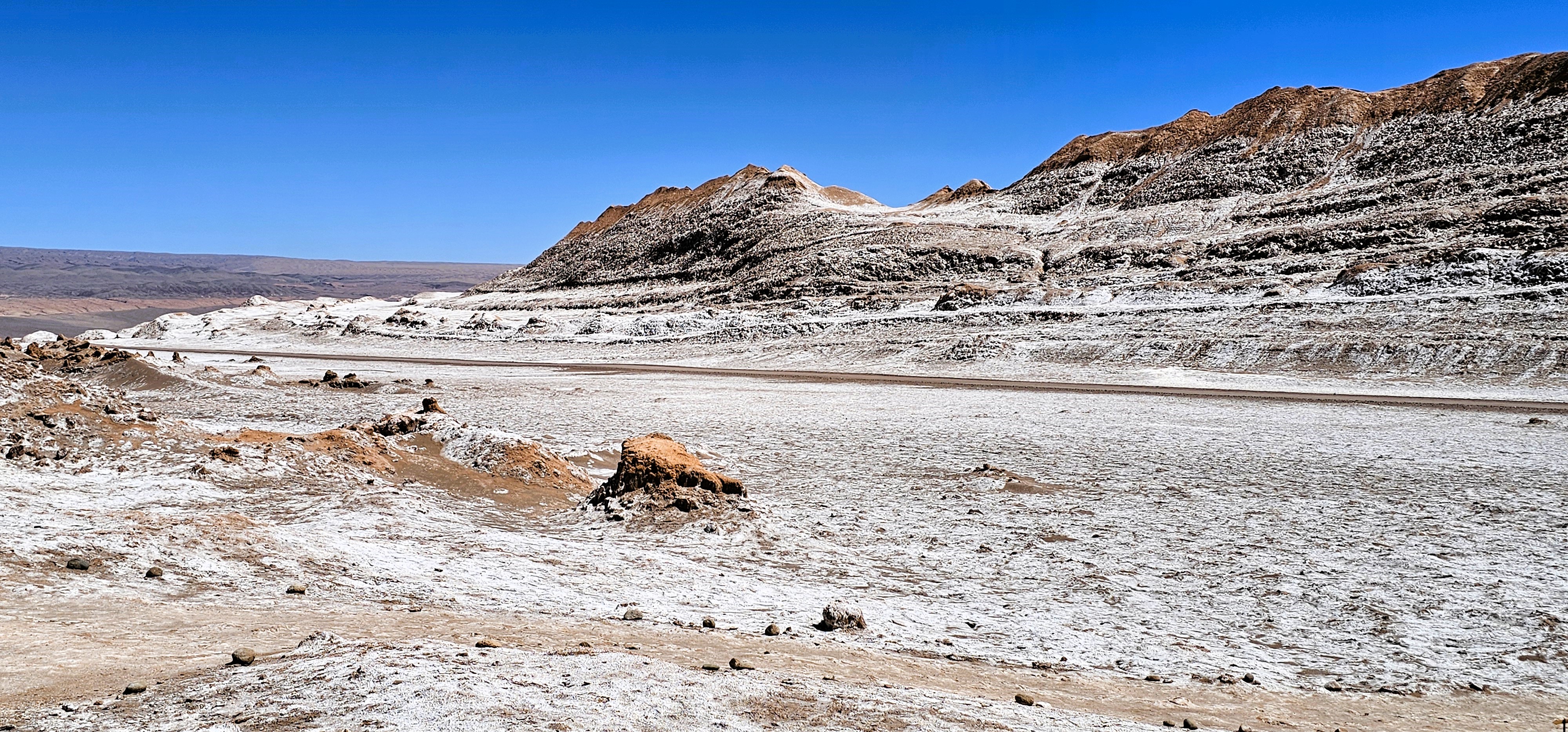
Our next destination was Valle de la Luna (Valley of the Moon), another sector of Los Flamencos–only 10 minutes from San Pedro, across a dusty road built for vehicles with dependable suspension.
The park was aptly named by Gustavo Le Paige, a Belgian missionary who pioneered much of the archeological research of San Pedro de Atacama in the 1950’s.
The sector captures the essence of the region’s vastness and aridity, so much so, that NASA tested its Mars rovers on the surface to simulate future planetary exploration.
Salt and sodium nitrate crystals are found throughout the Atacama Desert, as the dry air and lack of vegetation allows them to collect on the surface.
Although the region also contains precious metals including an abundance of copper, silver and gold, it was the large cache of potassium nitrate that brought the railroads and development to Atacama, turning the region into a hub for culture and commerce by the 2nd half of the nineteenth century.
Today, large reserves of precious metals such as lithium provide a significant source of revenue for private and state-owned mining companies.
In fact, as of January 14, Chile’s SQM, the world’s 2nd largest producer of lithium has suspended its operations in Atacama due to 500 protestors from indigenous communities in the Antofagasta region who’ve been blockading roads–immobilizing workers, supplies and lithium to and from the mines–demanding that they be included in negotiations between SQM and the Chilean government.
Let’s hope that this conflict can be resolved quickly, so we may continue to feed our global appetite for electric vehicles.
It’s a new year, and there has never been a better time for Leah and me to explore our world. We are always up for a challenge, so we’ve decided to begin 2024 with our most ambitious adventure yet. Not satisfied with returning to some of our favorite destinations–not that there’s anything wrong with familiar places—we booked a bucket list trip over a year ago that would literally take us out of our comfort zone.
We filled the waiting time by visiting friends and family across America (and a speck of Canada)–only some of which I memorialized during the past year in this blog. In fact, a large part of last year’s travels never made it past my unpublished thoughts and unprocessed SD cards, including: a trip to Israel (months before the October 7th massacre);
a Central American cruise to Costa Rica,
Panama City,
and Cartagena, Columbia;
as well as a relaxing siesta on the Riviera Maya in Mexico;
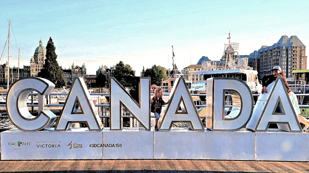
a flash visit to Victoria, BC;
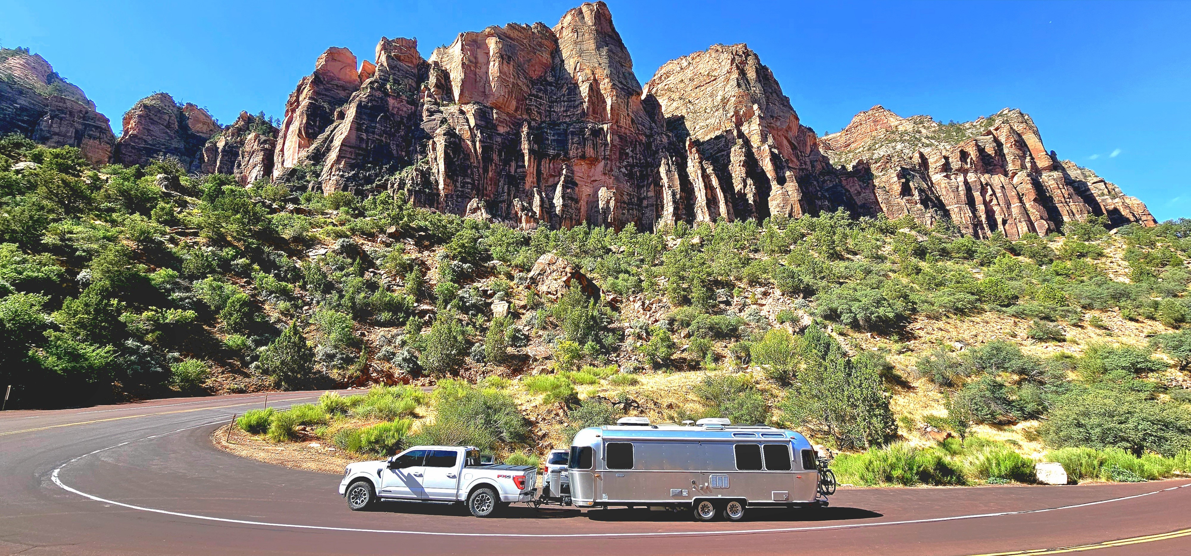
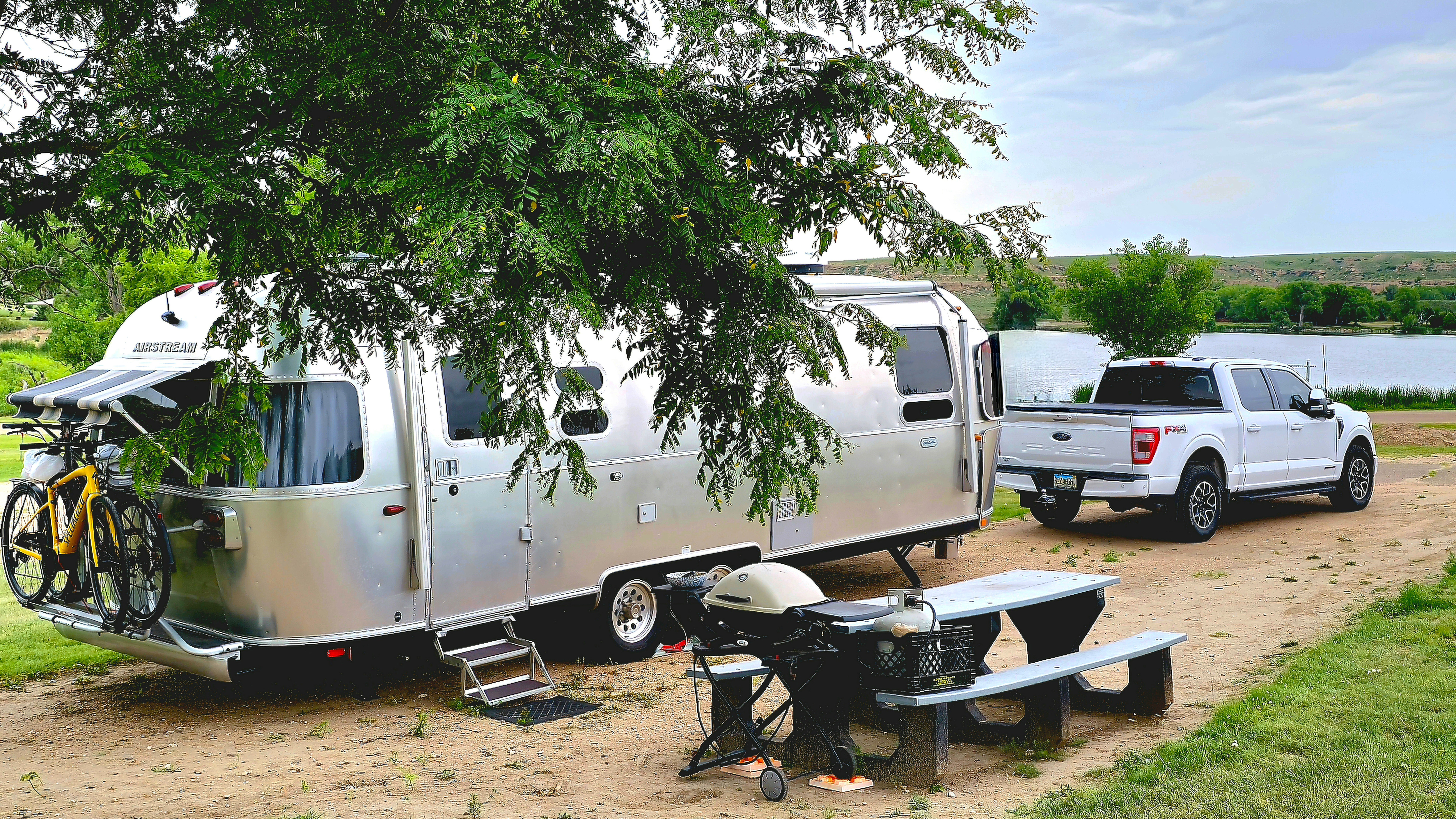
and a southwestern tour of America in our silver bullet–
all worthy of sharing sooner than later.
But until then, I must fast forward to our most recent trip to Chile’s Atacama Desert before embarking aboard Viking’s Octantis to Patagonia and Antarctica–in search of whales, penguins and extraordinary landscapes.
We overnighted in Santiago, Chile,
followed by a morning flight to Copiapó, the region’s capital incorporating San Pedro de Atacama.
And set out to explore the highest, driest ecosystem on planet Earth.
Forgive me; it’s been a while since my last confession.
Life happens and it’s been challenging at times to juggle travel with business affairs, personal affairs and blogging. And with the passage of each passing day, it’s become increasingly more difficult to return to summer events with the same vitality, and cobble a detailed timeline from 3 months ago. In fact, there are still stories from last year’s journey to Canada that have yet to be written and published.
While I could travel less to blog more often, or continue to travel without memorializing the occasion, neither option is an acceptable one. Perhaps, I’ll just have to find a better way to accomplish both without sacrificing one for the other. In the meantime, I’ll pick up where I left off, which is somewhere on the road between here and there.
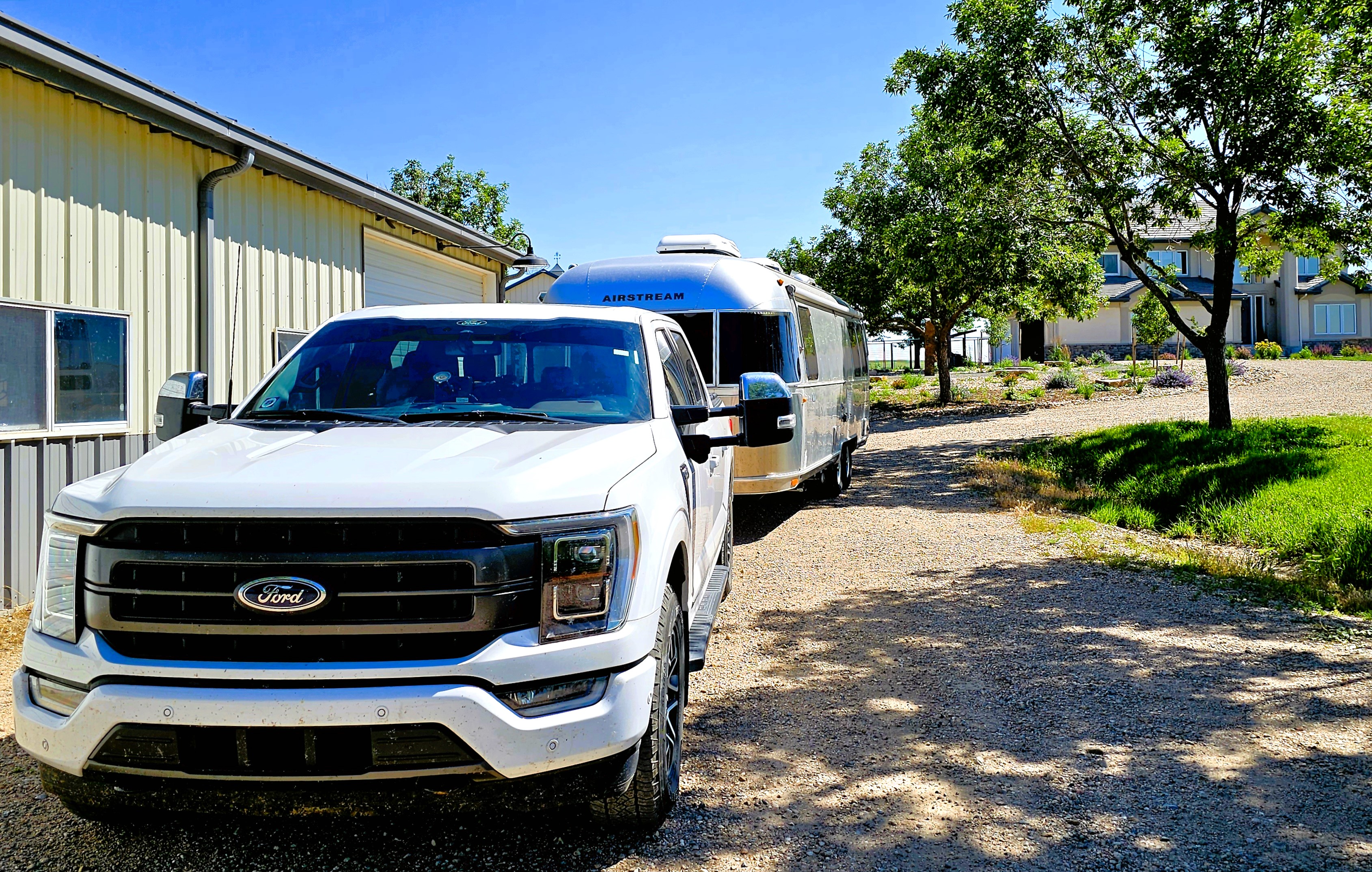
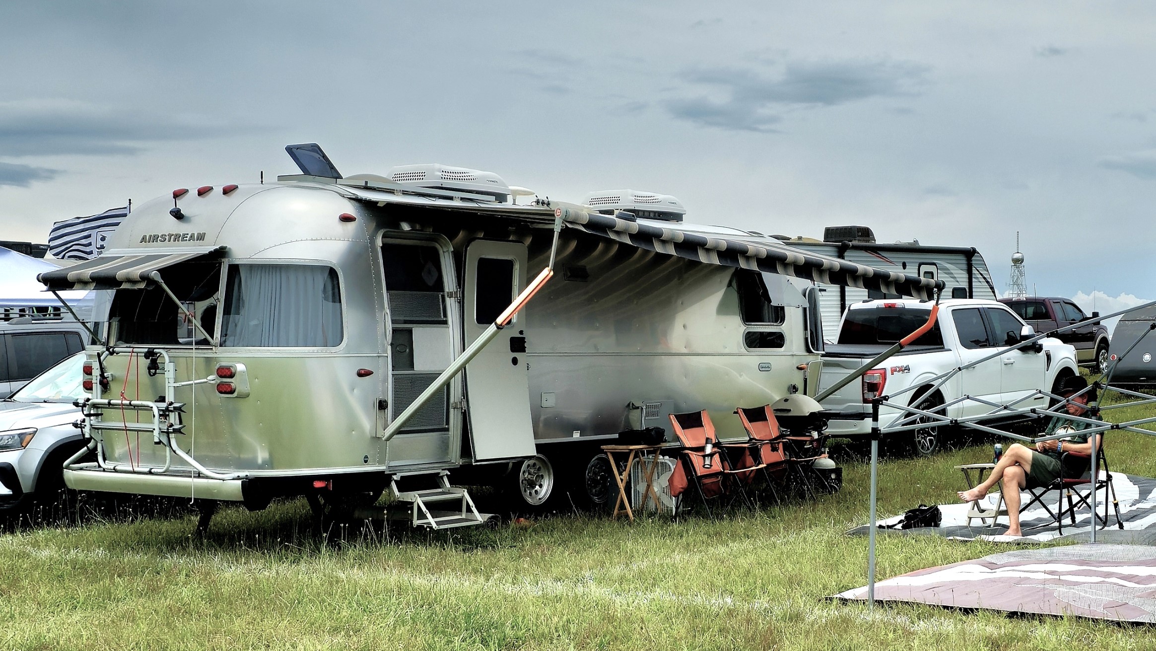
First of all, a shout-out to our friends Dirk and Heather,
who allowed us to park the Airstream at their ranch in Fort Collins, assuring us peace of mind while we boarded a flight from Denver to Seattle to visit my son Nate.
Dollar for dollar and day for day, Leah and I figured that flying round-trip to Seattle probably saved us 2 weeks of driving 1,500 miles, at a proximate cost of $1300 in fuel.
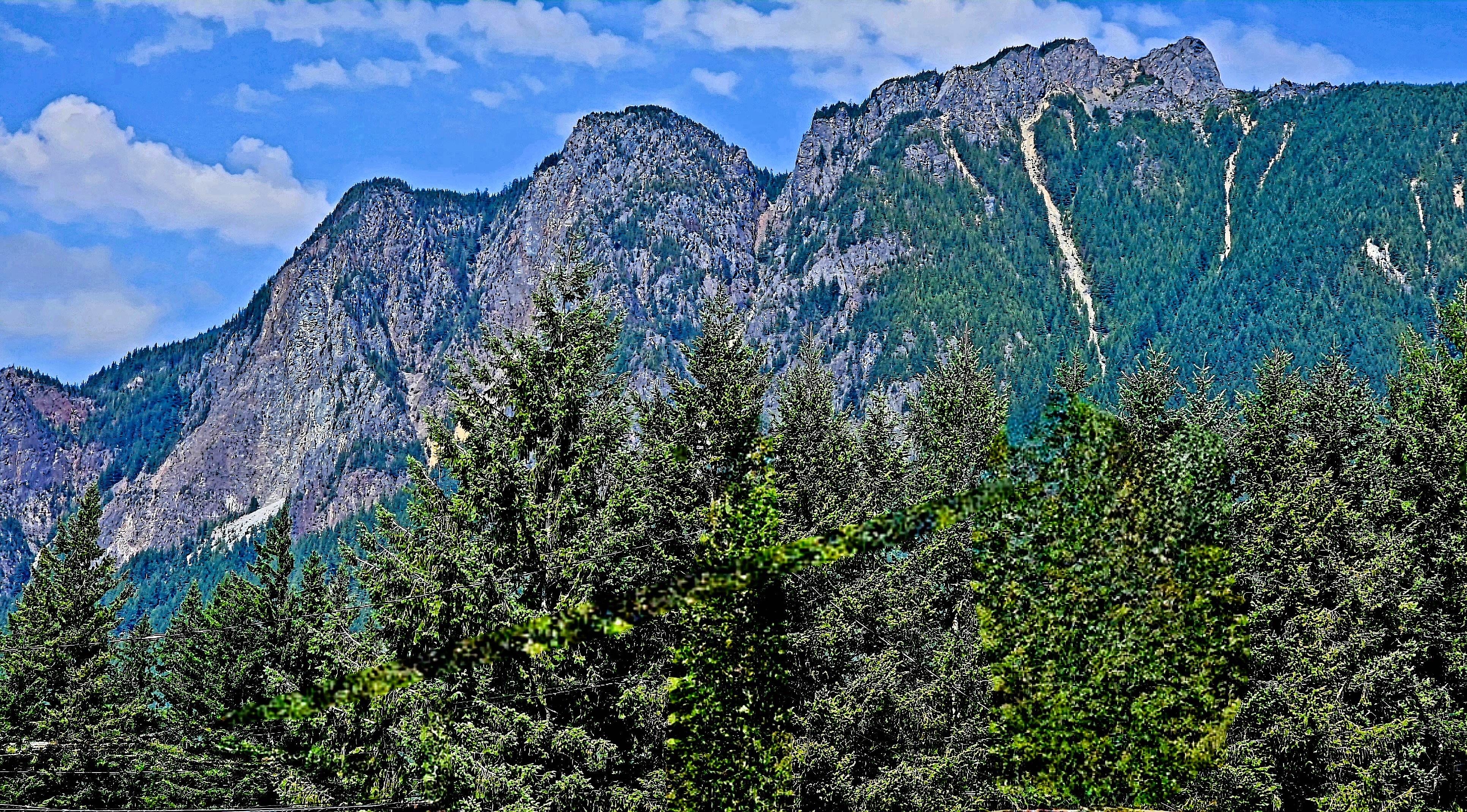
After our arrival to Issaquah (suburban Seattle and Nate’s hometown), we ventured southeast along the I-90 corridor to hike Rattlesnake Ledge on Rattlesnake Mountain–
a demanding 2-mile ascent…
that gave us sweeping views of Rattlesnake Lake,
and the Cascade Range beyond the clouds.
Seattle was also our gateway to north of the border…
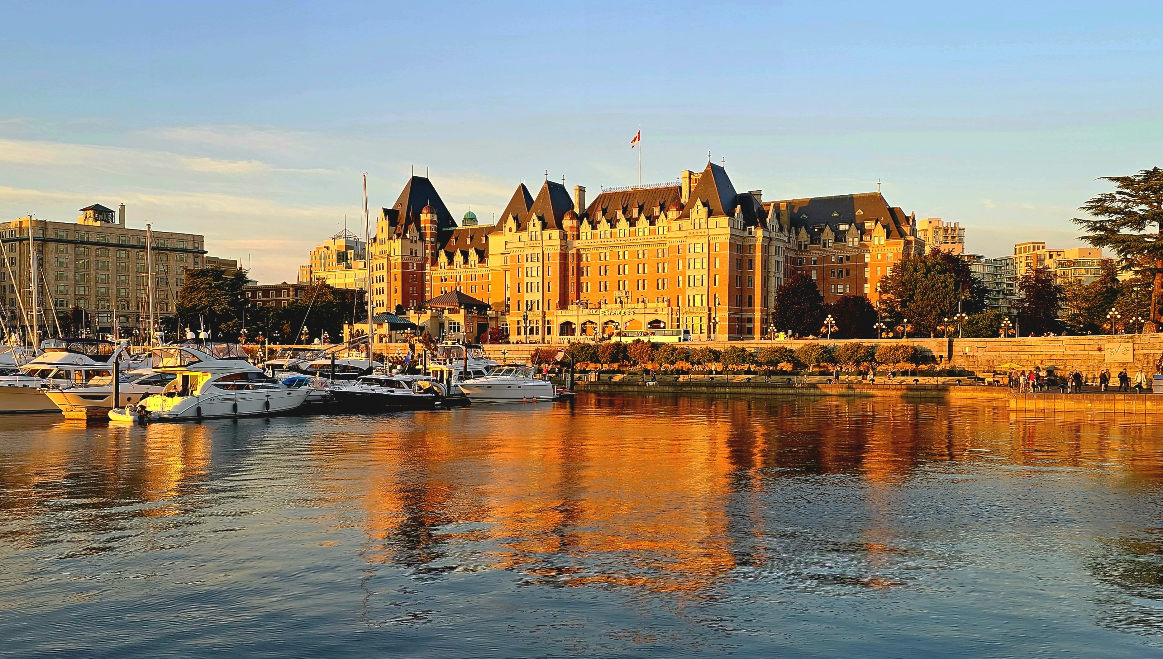
After a 2 hour and 45-minute cruise aboard the Victoria Clipper, we arrived at Victoria’s Inner Harbor,
where we would spend the weekend at the historic Pendray Inn and Tea House…
in the very pink, Executive Suite.
Victoria is well-known as a pedestrian town,
with a variety of landmarks and attractions within a few miles of our hotel. We were less than a half-mile from Parliament,
and Fairmont’s Empress Hotel,
and another half-mile further to Canada’s oldest Chinatown.
And strolling along the Lower Breakwater (adorned with First Nation symbols) with panoramic views to the south, afforded us a different perspective of the Cascade Range.
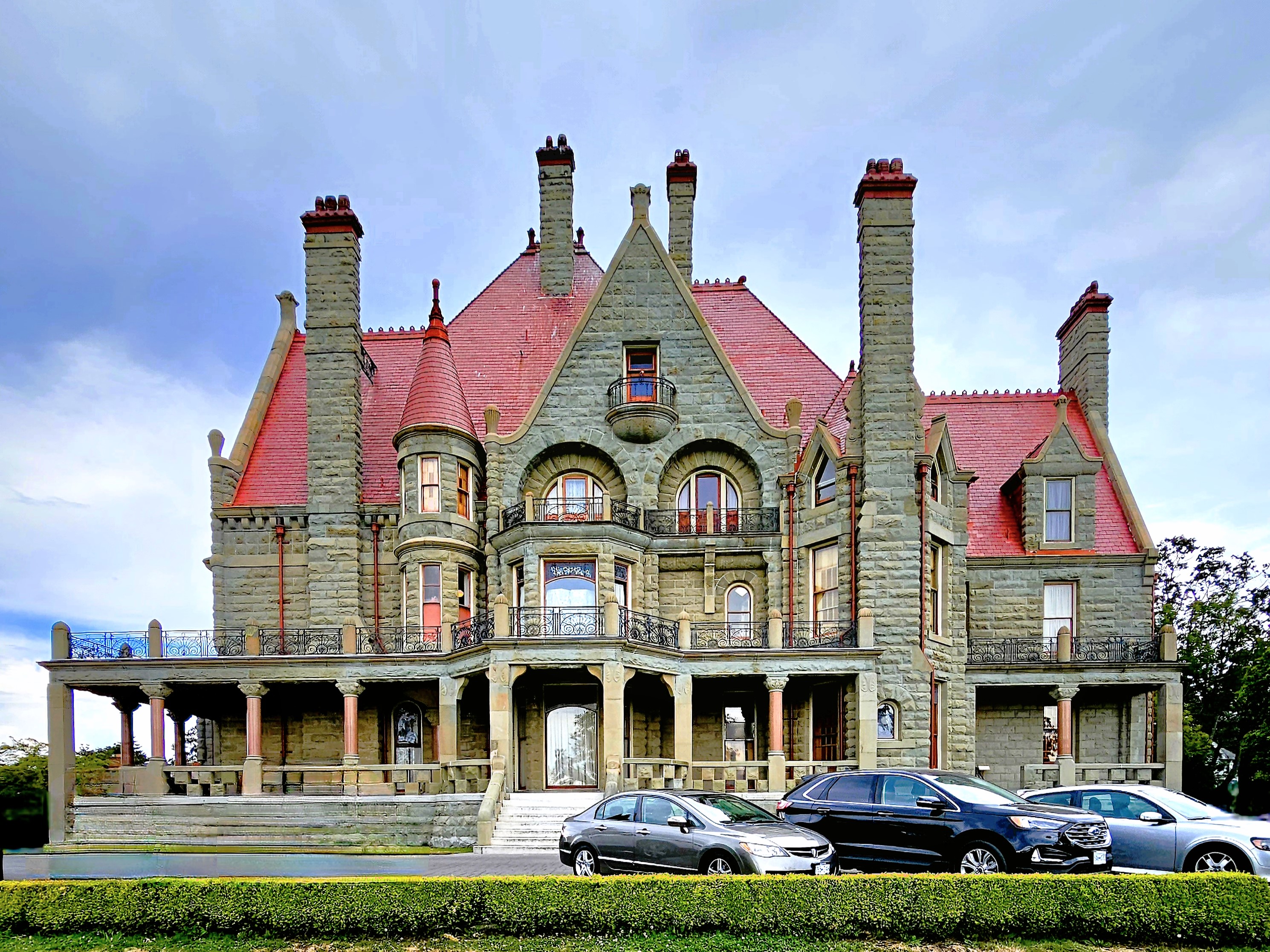
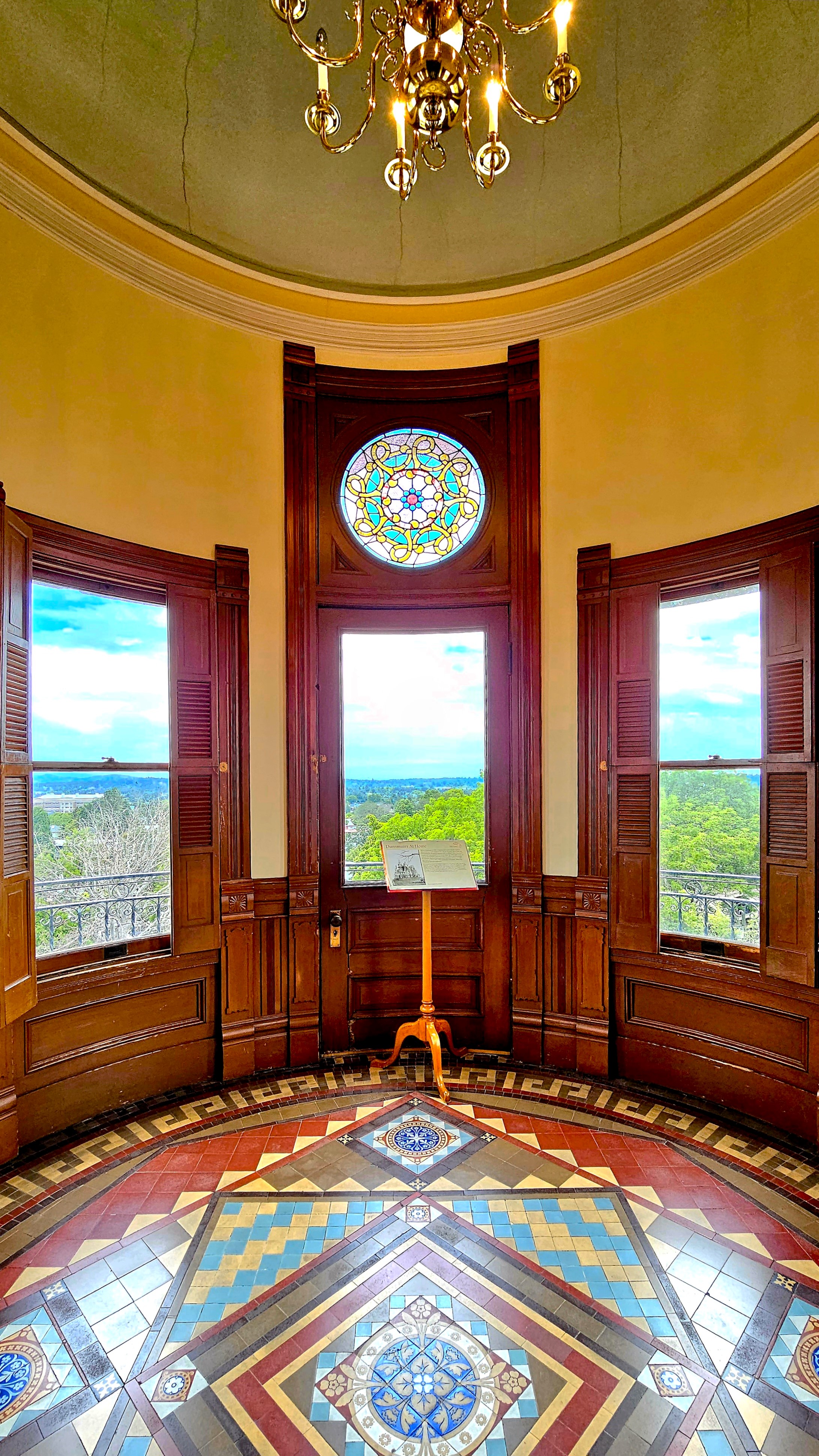
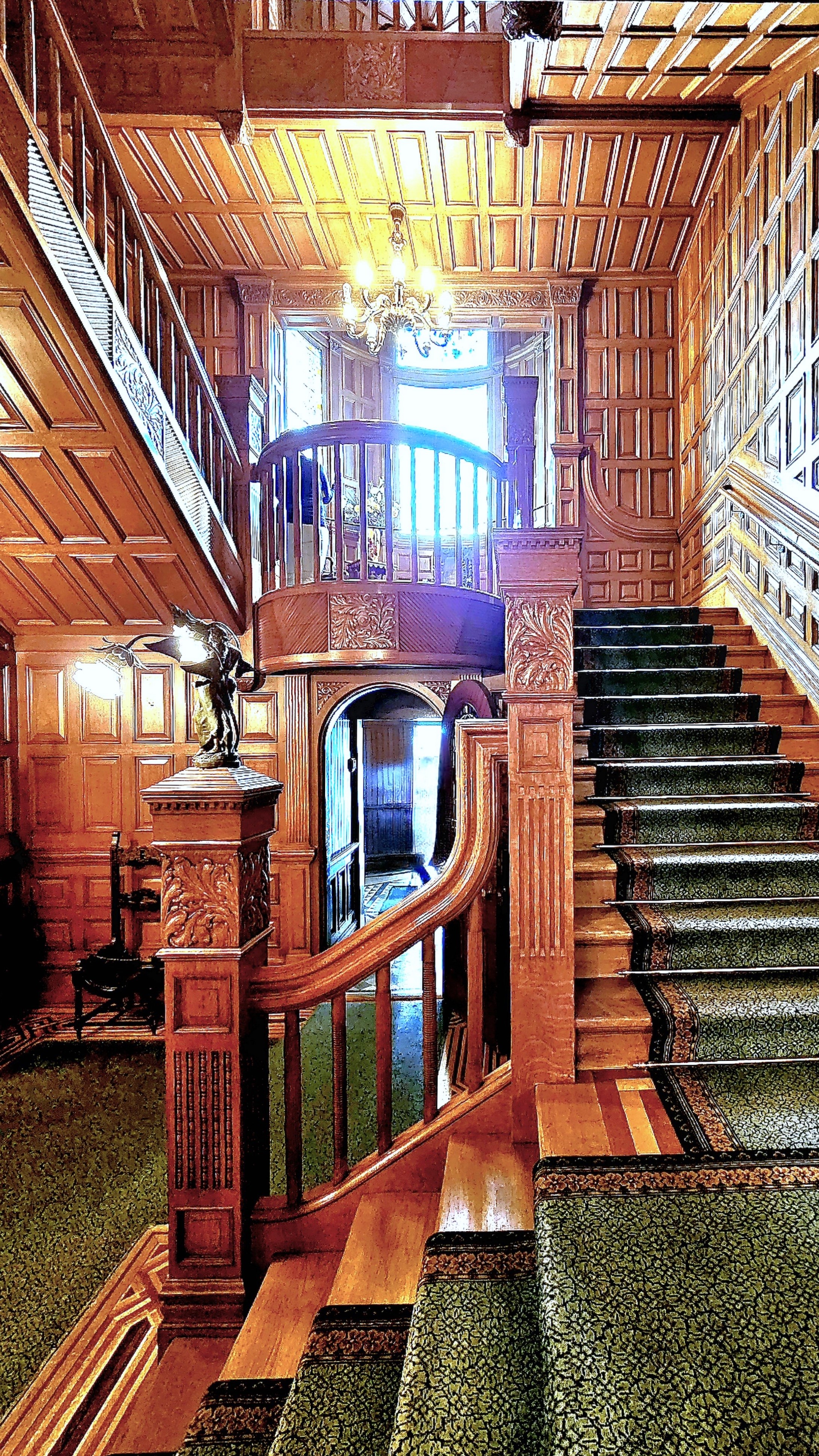
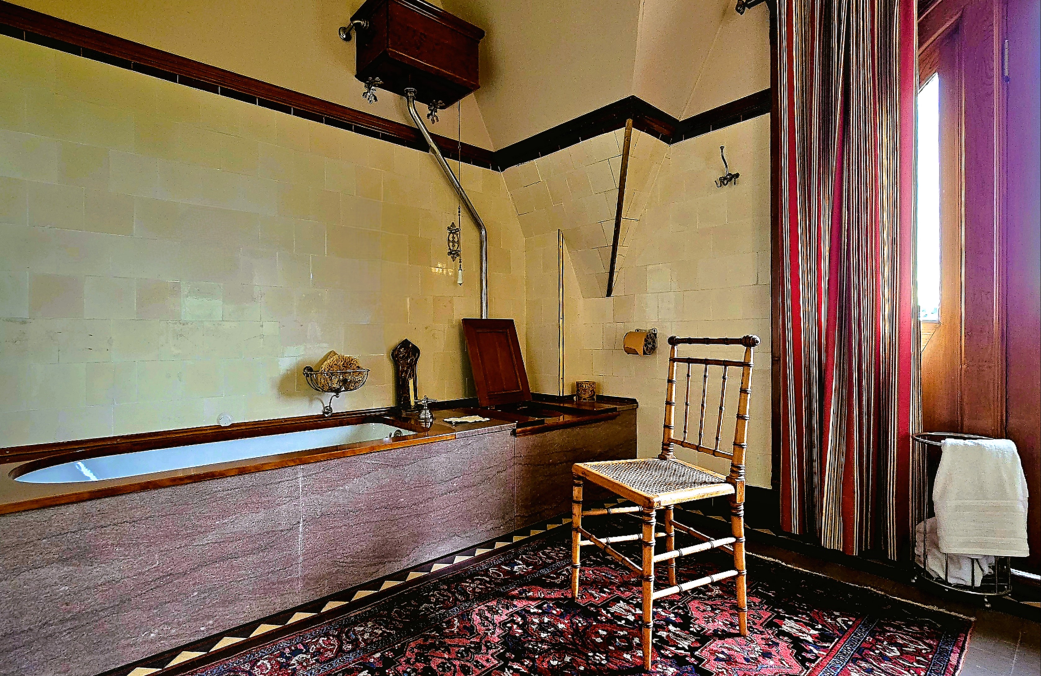
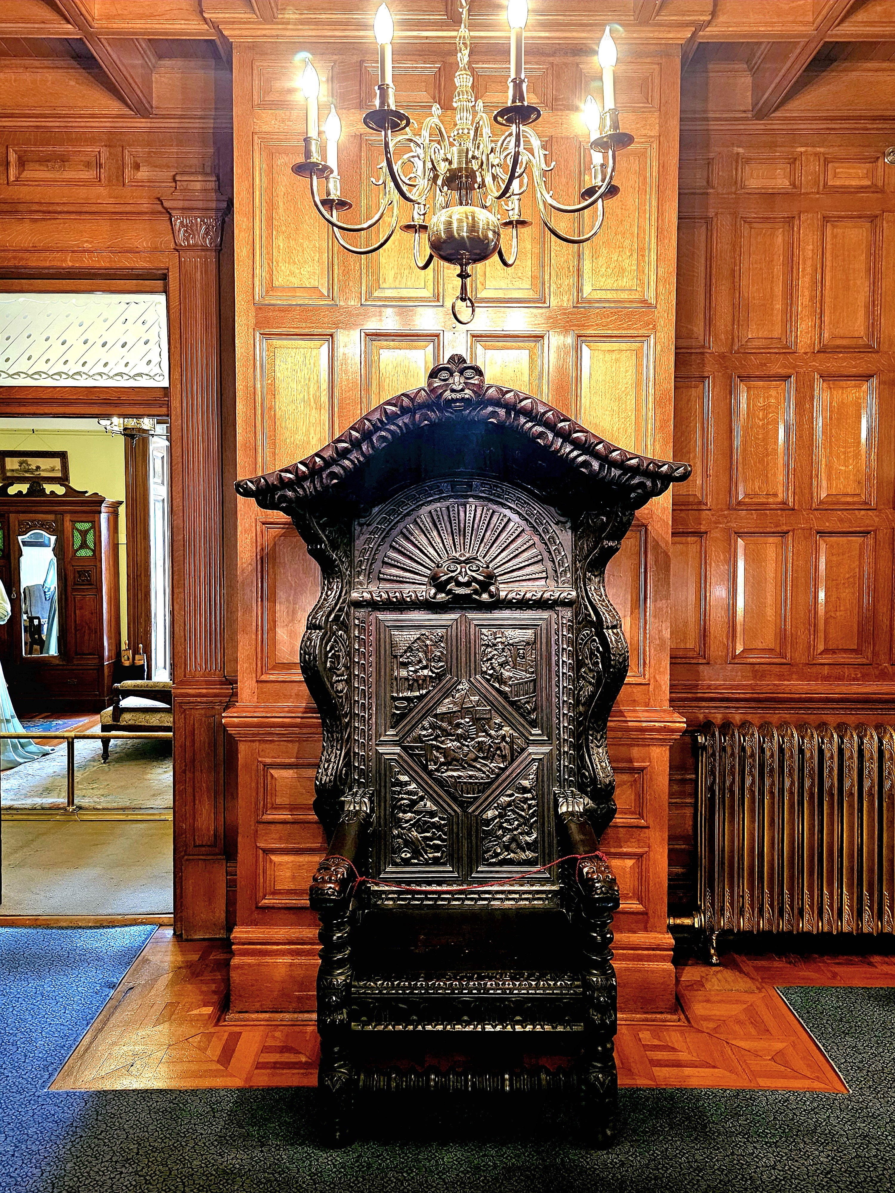
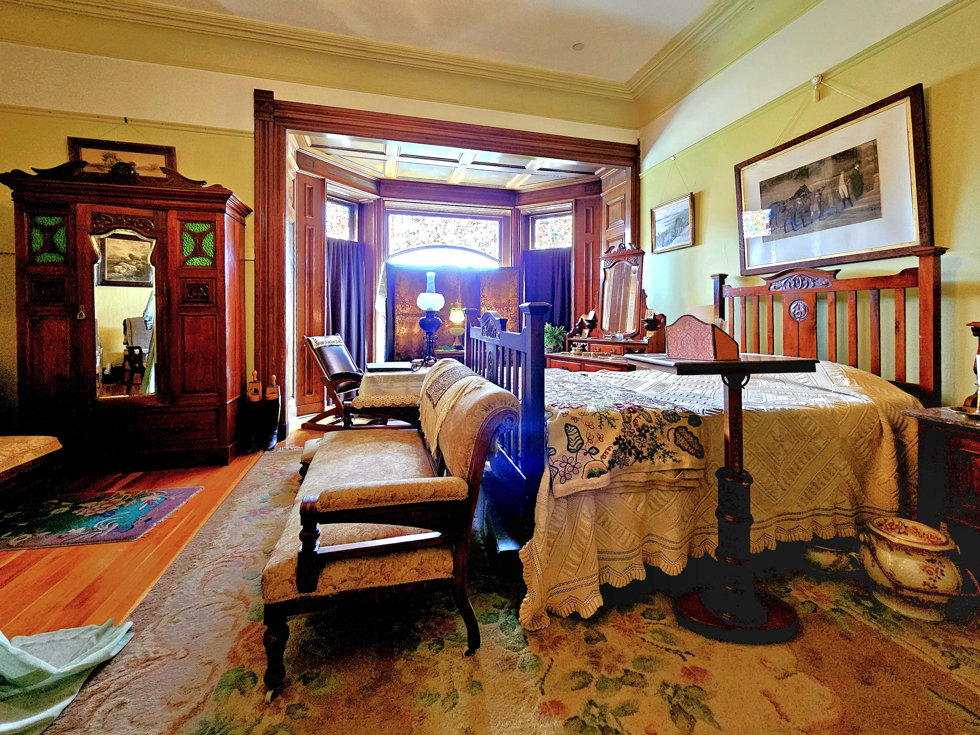
Also within walking distance, we discovered Craigdarroch Castle, a Victorian architectural marvel…
from front…
to back….
top to bottom,
and everywhere in between!
And exquisitely furnished throughout the residence.
Of course, no visit to Victoria is complete without a stroll through Butchart Gardens,
Leah and I arrived in Colorado Springs, where we liaised with Leah’s daughter, Carrie and her clan to enjoy a camping adventure together during the Independence Day holiday weekend, and it was action-packed.
Hiking one mile into Guffey Gorge…
brought us to Paradise Cove, a swimming hole popular among local adolescents who come to cool off from the 100oF heat and flex their courage muscles by cliff jumping into deep water.
Risk-takers were scrambling up the terrain to pick their “launch” position on the rocks, and prove to themselves and others that they had “The Right Stuff.”
We were happy eating our lunch while watching the derring-do entertainment.
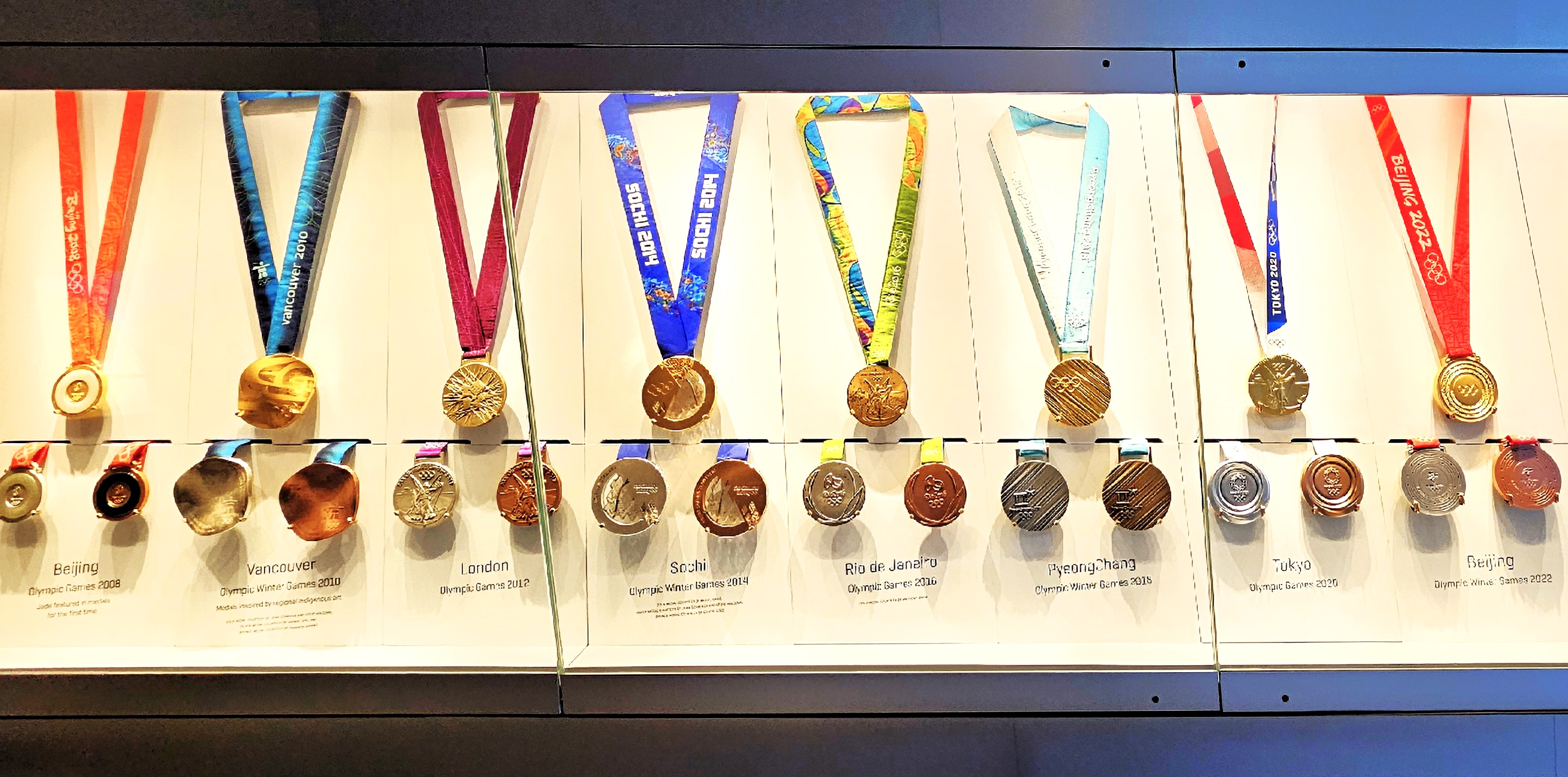
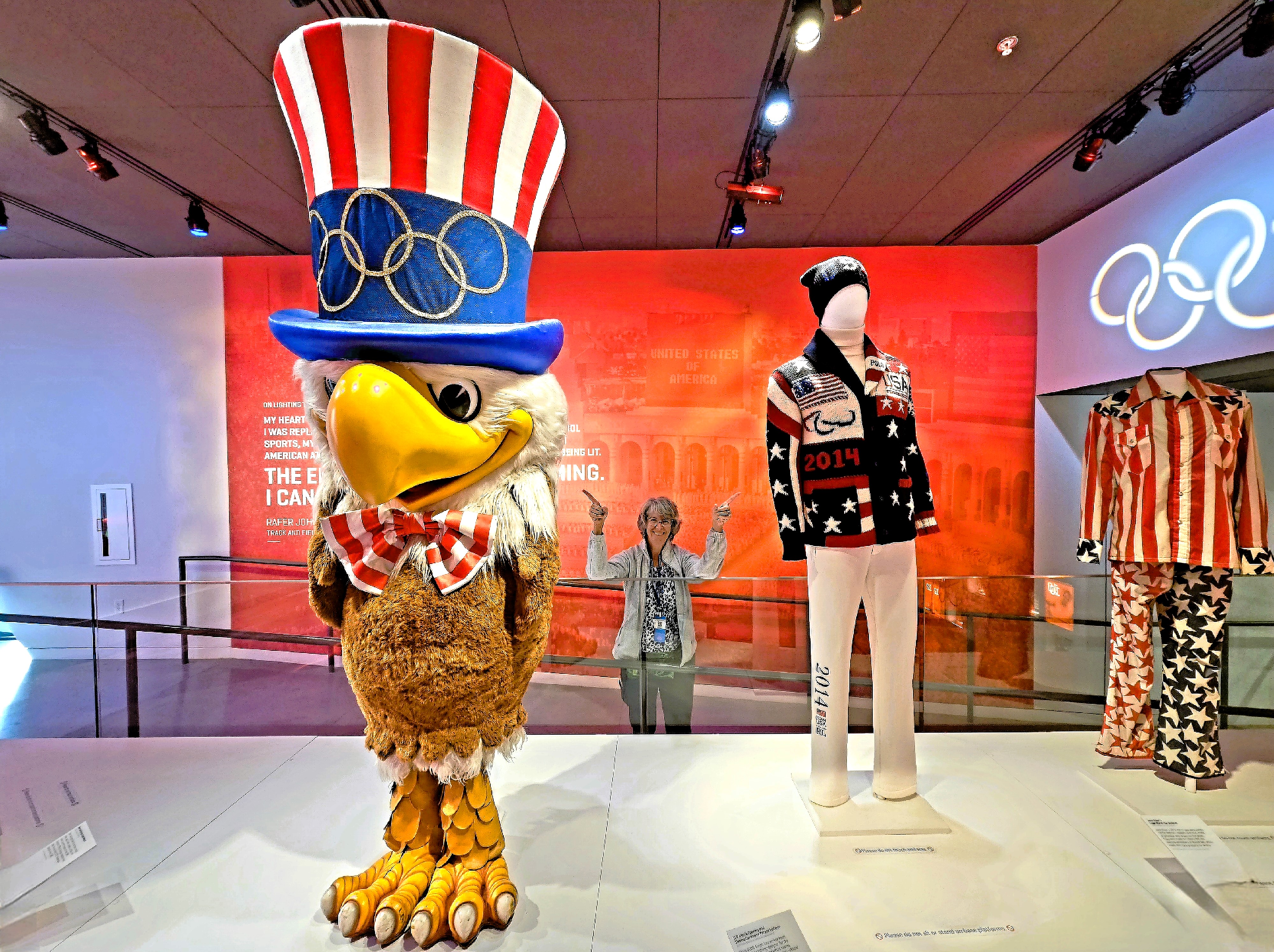
But Colorado Springs has so much more to offer. For starters, the interactive U.S. Olympic and Paralympic Museum offered the perfect opportunity to celebrate athletic excellence;
to mock-compete in several sports categories by testing memory, reflexes and endurance;
and provide exhibition space for thousands of Olympic artifacts collected over the years.
After capturing a clever montage from the digital mural in the building foyer,
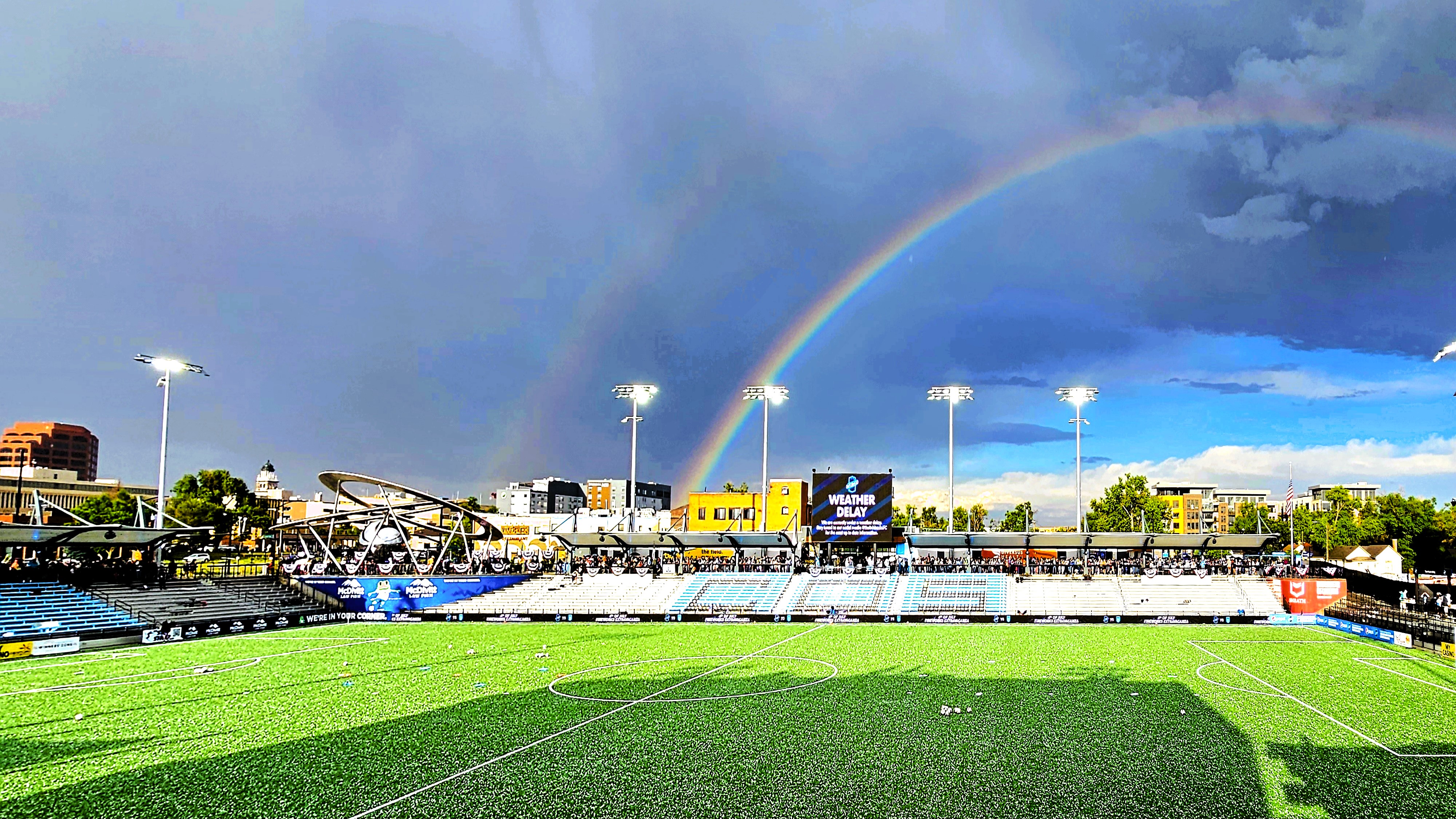
it was time to watch the Colorado Springs Switchbacks take the pitch at Weidner Field against Monterey Bay, but not until after the cloudburst,
when the unexpected hail finally had a chance to melt.
While Carrie and clan cruised to nearby Cañon City to view the Royal Gorge (our destination in 2 weeks,
Leah and I returned to Garden of the Gods,
before continuing to Manitou Springs to visit the urban fauna…
and flora.
Ironically, we’ve recently visited Carrie and clan at home in Cedar Crest, NM after 7 weeks of subsequent travel to dozens of different destinations…
which is a sore reminder of how far behind I am in chronicling this summer adventure, whether it’s because of inconsistent internet on the road or enjoying myself too much to stay current.
I never considered Kansas to be particularly picturesque (no offense, Kansas), and rarely in the running for Most Beautiful State title.
Driving westbound on I-70, my initial impression of Kansan landscape was a blur of high plains, pastureland and fields of fodder as far as the eye could see. The drive was basically a bore and staying alert was becoming a challenge. I glanced at Leah. She was slack-jawed with her head back and pretend-listening to an audiobook.
I activated the ALEXA app on the dash display.
“Hey Alexa,” I intonated and enunciated, “Name the flattest state in America.”
Alexa quickly responded with, “By any measure, Florida takes the prize for the flattest state in the nation [along with its flat-earth thinking, of late] because the highest point in the state is only 345 ft above sea level… Kansas merely ranks seventh in flatness.”
Nevertheless, Kansas does have an honorary mountain barely within its western border, making it the highest point in Kansas at 4039 ft.
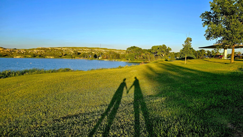
There was another notable elevation change that Leah and I explored before we reached the Rockies. We scheduled a stop at Lake Scott State Park (elev. 2979 ft) to break up the drive between Topeka and Colorado,
stretch our legs,
and discover the Badlands of Kansas.
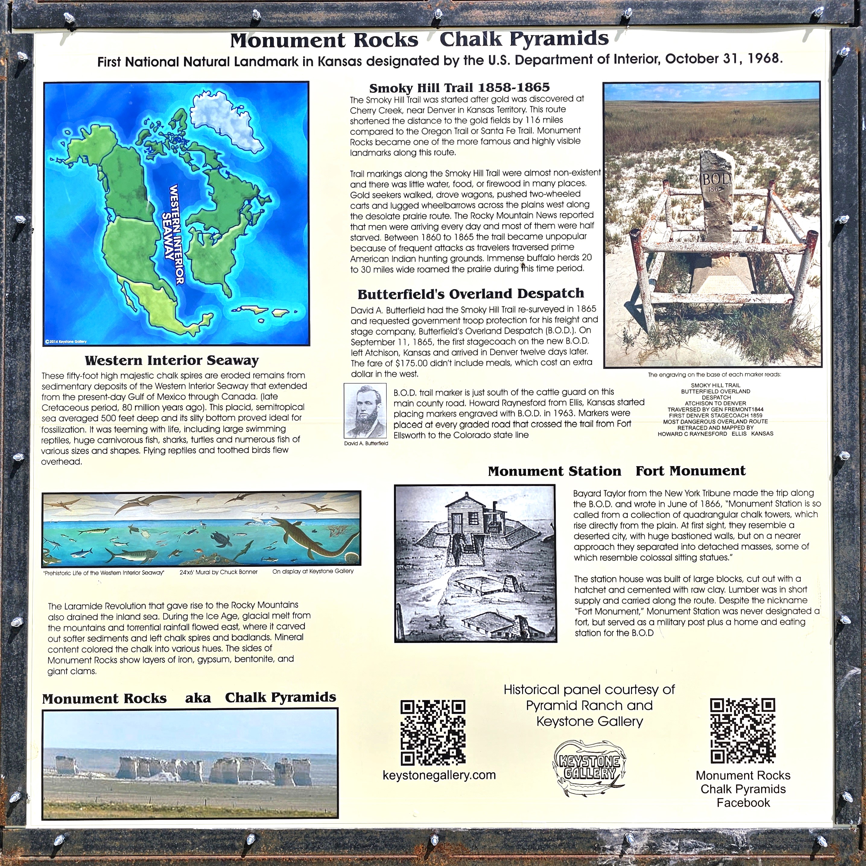
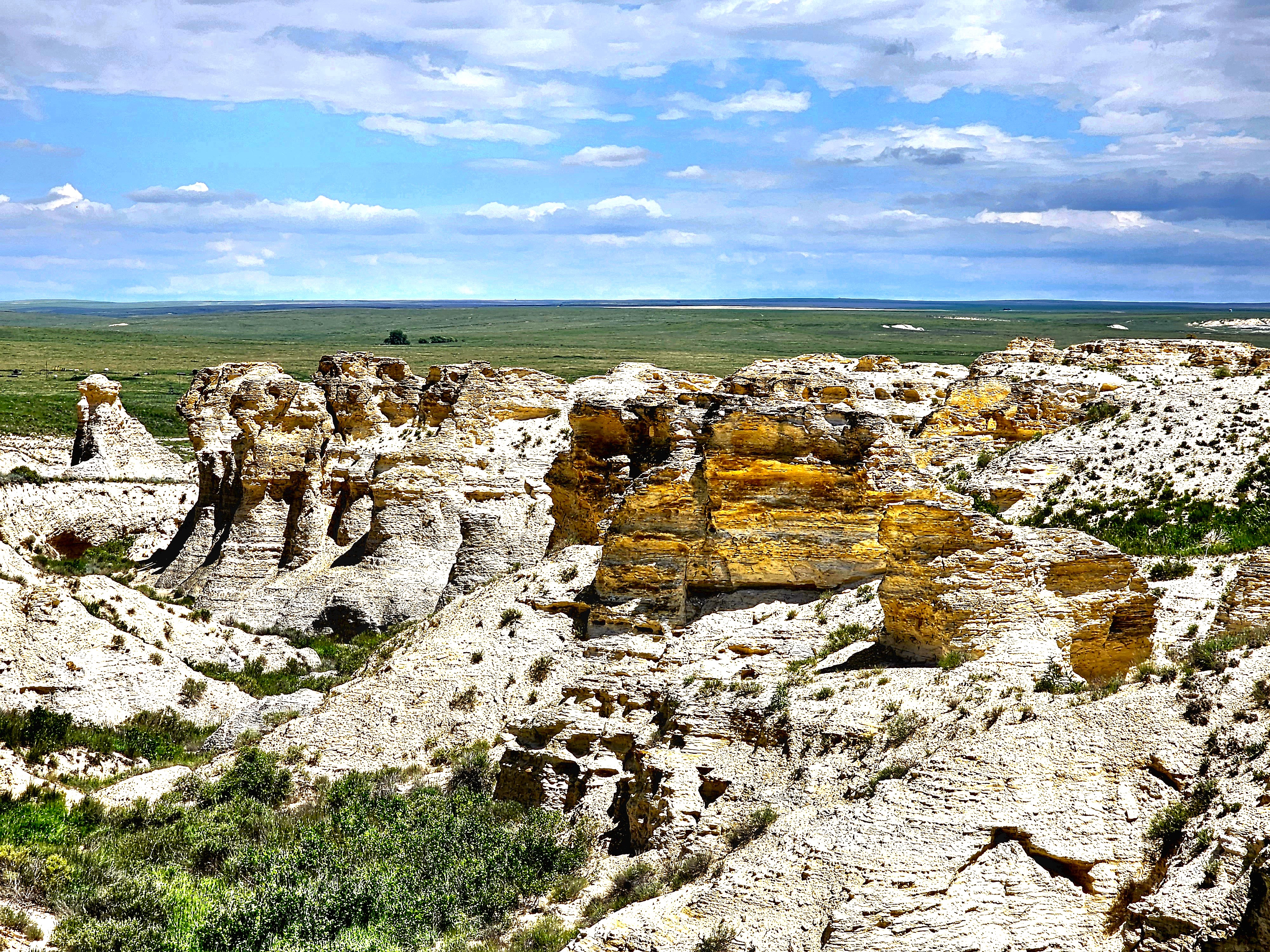
But first, we detoured 15 miles east to Monument Rocks.
As the first National Natural Landmark in Kansas designated by the Department of the Interior,
we thought we ought to pay our respects, and we were just shaking our heads at the many visitors who couldn’t wait to desecrate the brittle, 50 ft chalk towers.
Although the formations were small in stature and compact in scale,
they were a site to admire,
and fun to explore!
See ya, fella.
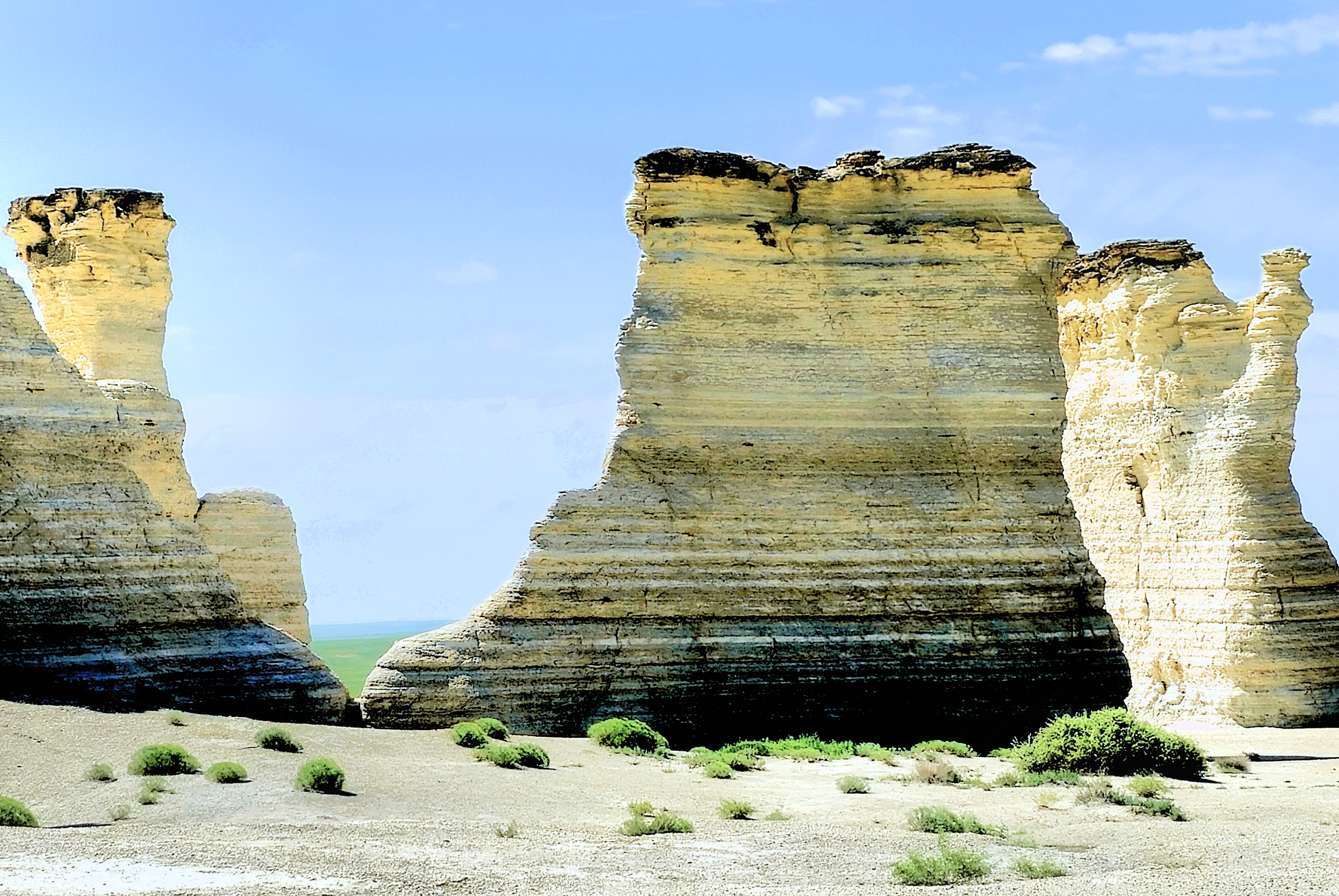
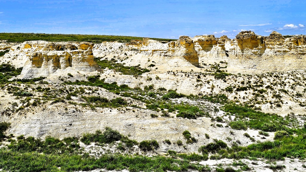
With this tasty morsel served and enjoyed, our appetites were whetted for the main course.
I really wanted to be awestruck by the vision and overwhelmed by the novelty of the geology, but what I saw was a craggy white cliff with spots of color in an unexpected location.
And while it was anything but ordinary…
it failed the goosebump test.
I really wanted this as a win for Kansas, but I got the impression that Kansas wasn’t as prepared as its closest competitor across the border.
Was I becoming, perhaps, jaded?
“Hey Alexa, what’s the longest, straight highway in America?
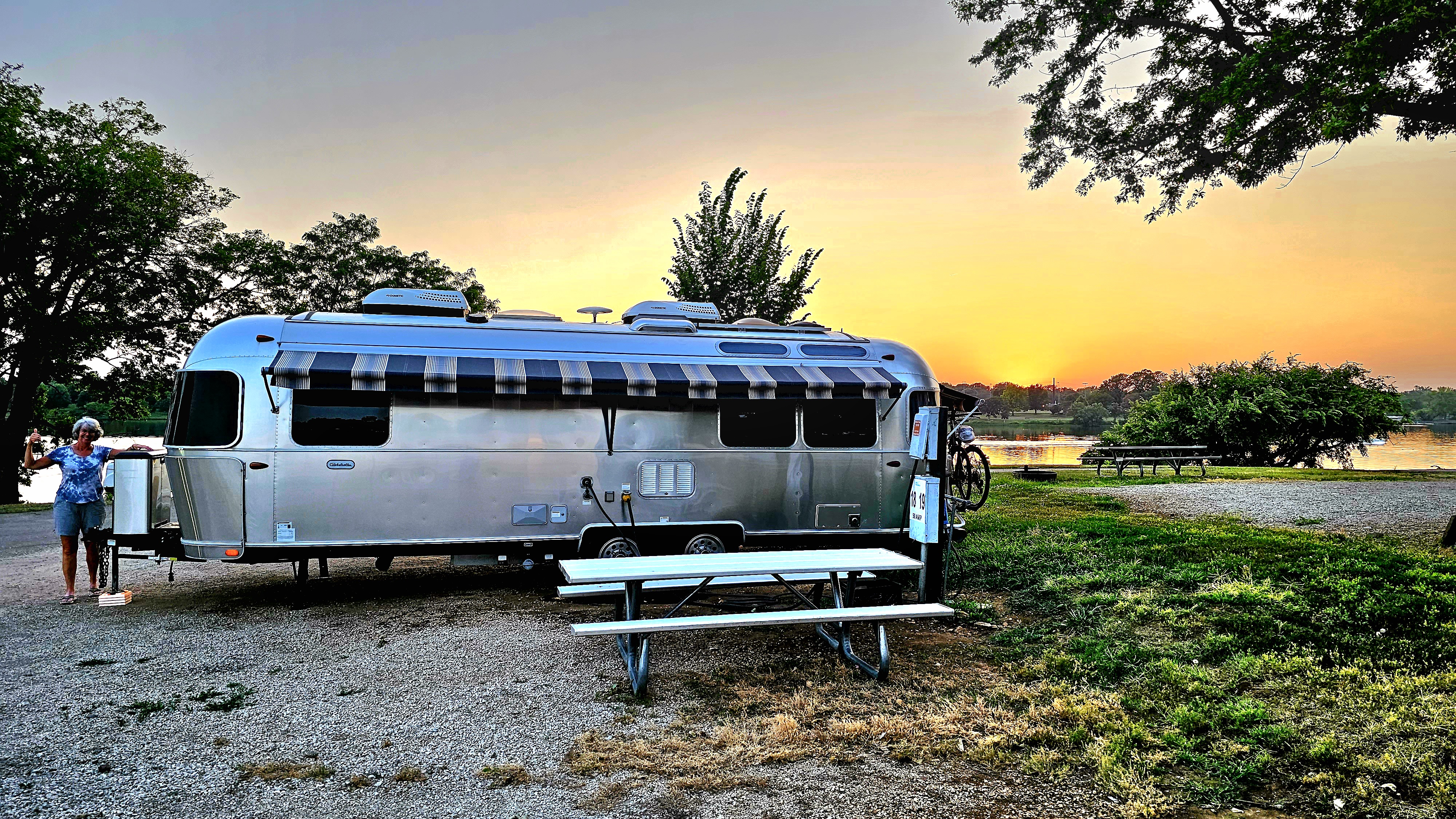
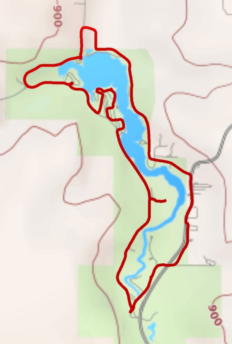
Rather than basecamp in Kansas City, Leah and I opted for something more pastoral, which we found at Lake Shawnee, the crown jewel of Shawnee County parks in Topeka, KS.
More than 1 million people visit Lake Shawnee each year for festivals, golf outings, ballfield tournaments, boating, fishing and camping or to hike/bike the Lake Shawnee Trail.
While circling the 6.5-mile lakeshore trail on our e-bikes,
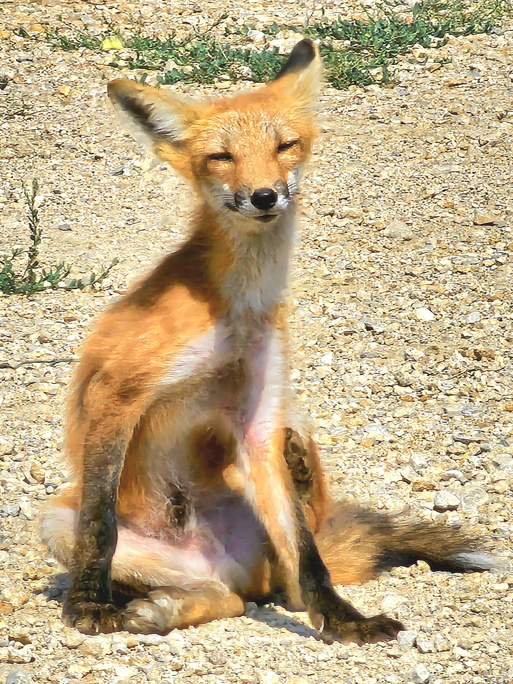
we discovered a resident friend of the park getting his tan on,
We took a detour through the Ted Endley Gardens, a 37-acre botanical garden in the northwest corner of the lake with spectacular blossoms, although I was drawn to a wildflower display reminiscent of Claude Monet.
Our only commitment while in the vicinity called for an excursion to Kansas City to claim tickets for the Dirty Heads, an American reggae band on national tour with my son, Noah acting as VIP concierge. In fact, this is the job he chose over working as the Jam Tram admin during the Bonnaroo Music and Arts Festival, from where we last left (see Bonnaroo–the Logistics).
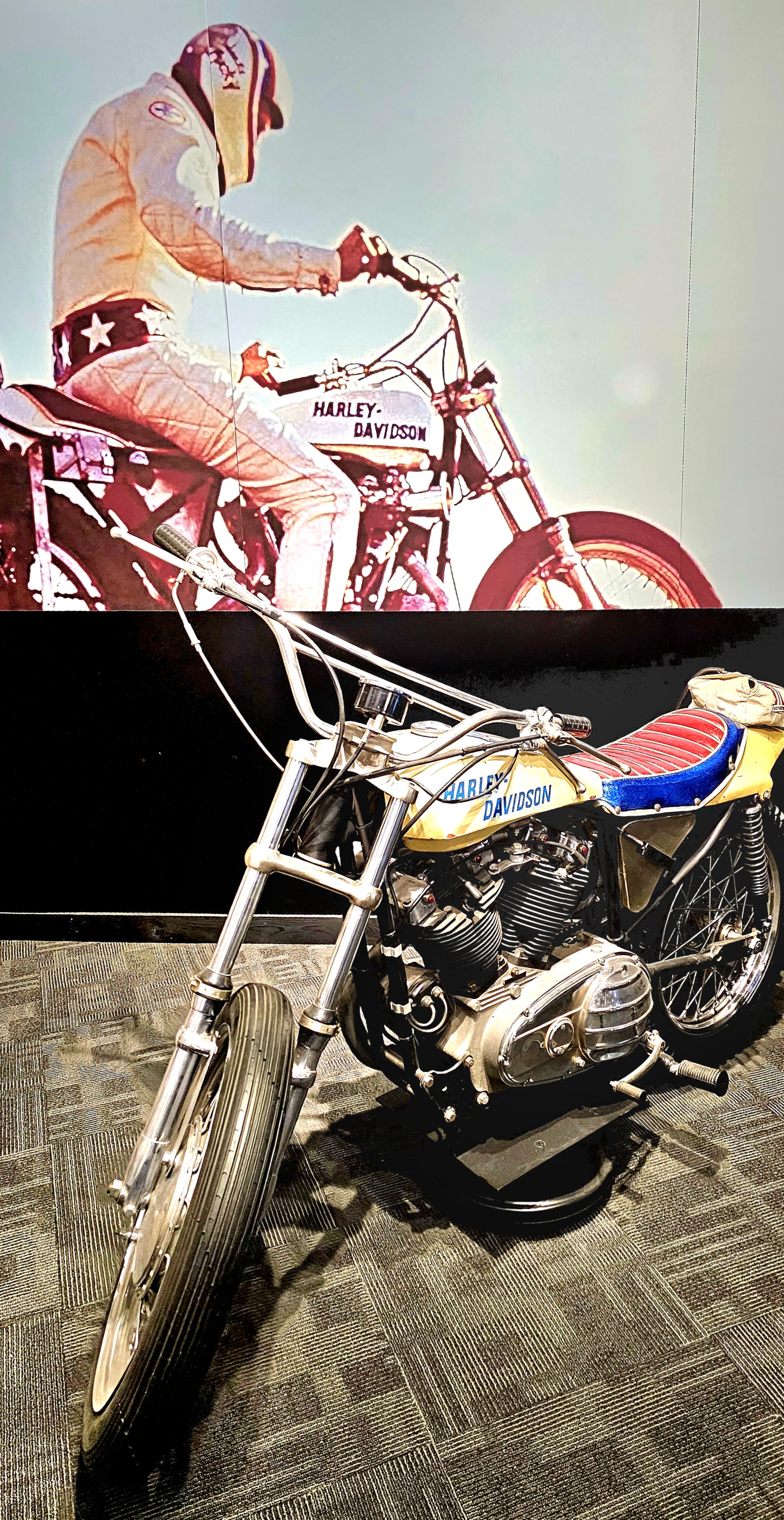
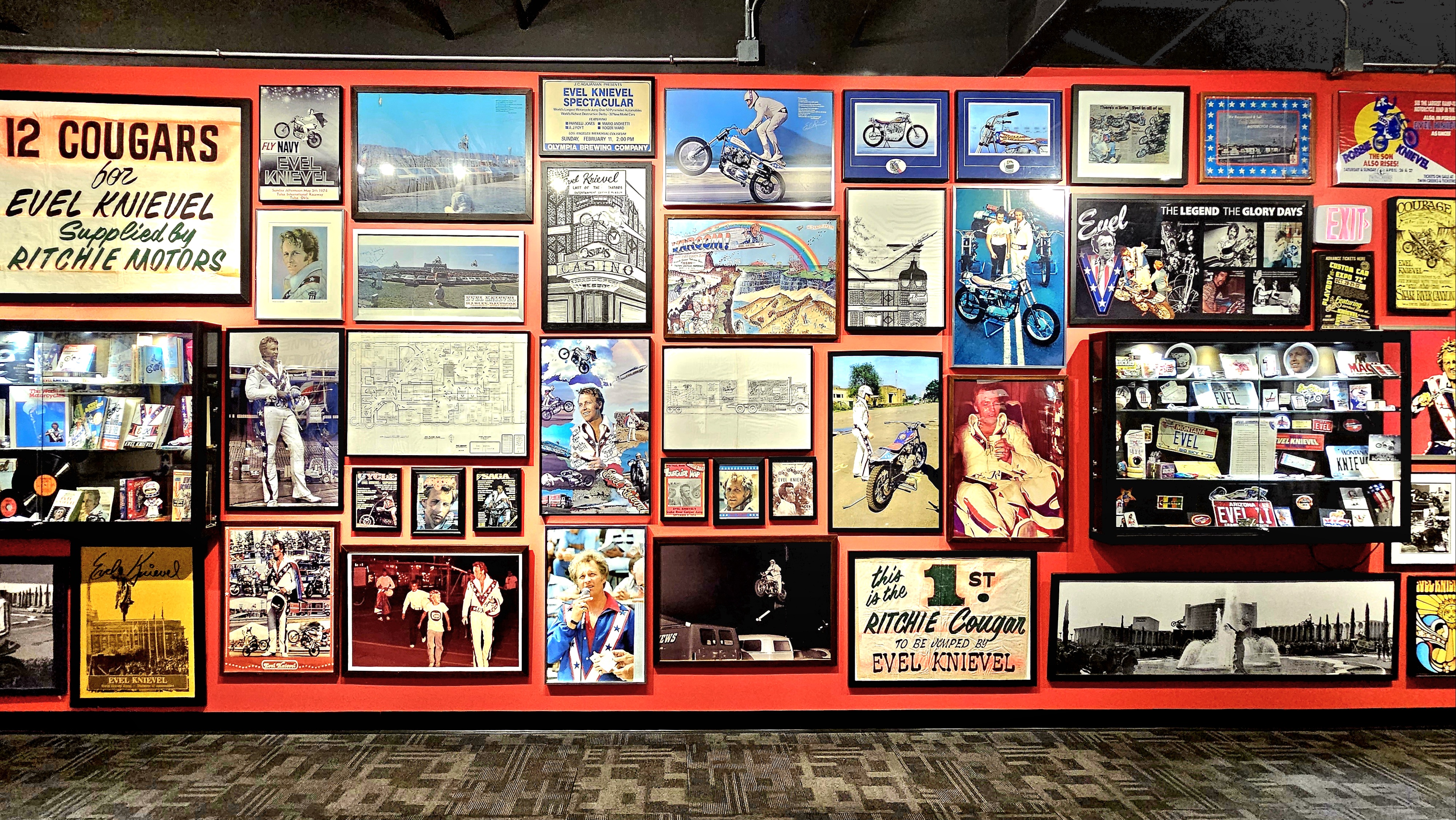
With doors at the concert venue opening at 6pm, Leah and I had an afternoon to kill, so we settled on an unlikely museum that was annexed to the local Harley-Davidson dealership celebrating the life and times of Evel Knievel–an unlikely choice for Topeka, considering that Evel’s hometown was Butte, Montana in 1938.
Evel was a showman and a stuntman without rival during the 70’s, amazing fans around the world with his push-the-envelope antics on his motorcycle.
The museum has plenty of requisite motorcycle displays showcasing his many exploits.
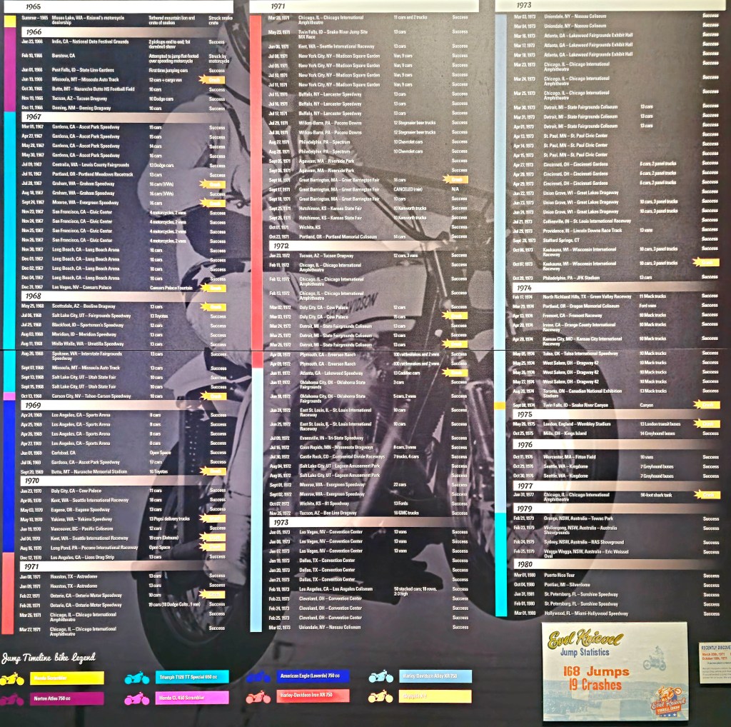
Evel was very good at two things during his jumping career: breaking records and breaking bones (433 fractures, which is a Guinness world record).
There were many successes…
and epic fails as well…
Those who followed Evel’s career 75+ jumps will never forget the hoopla and disappointment surrounding his Snake River launch.
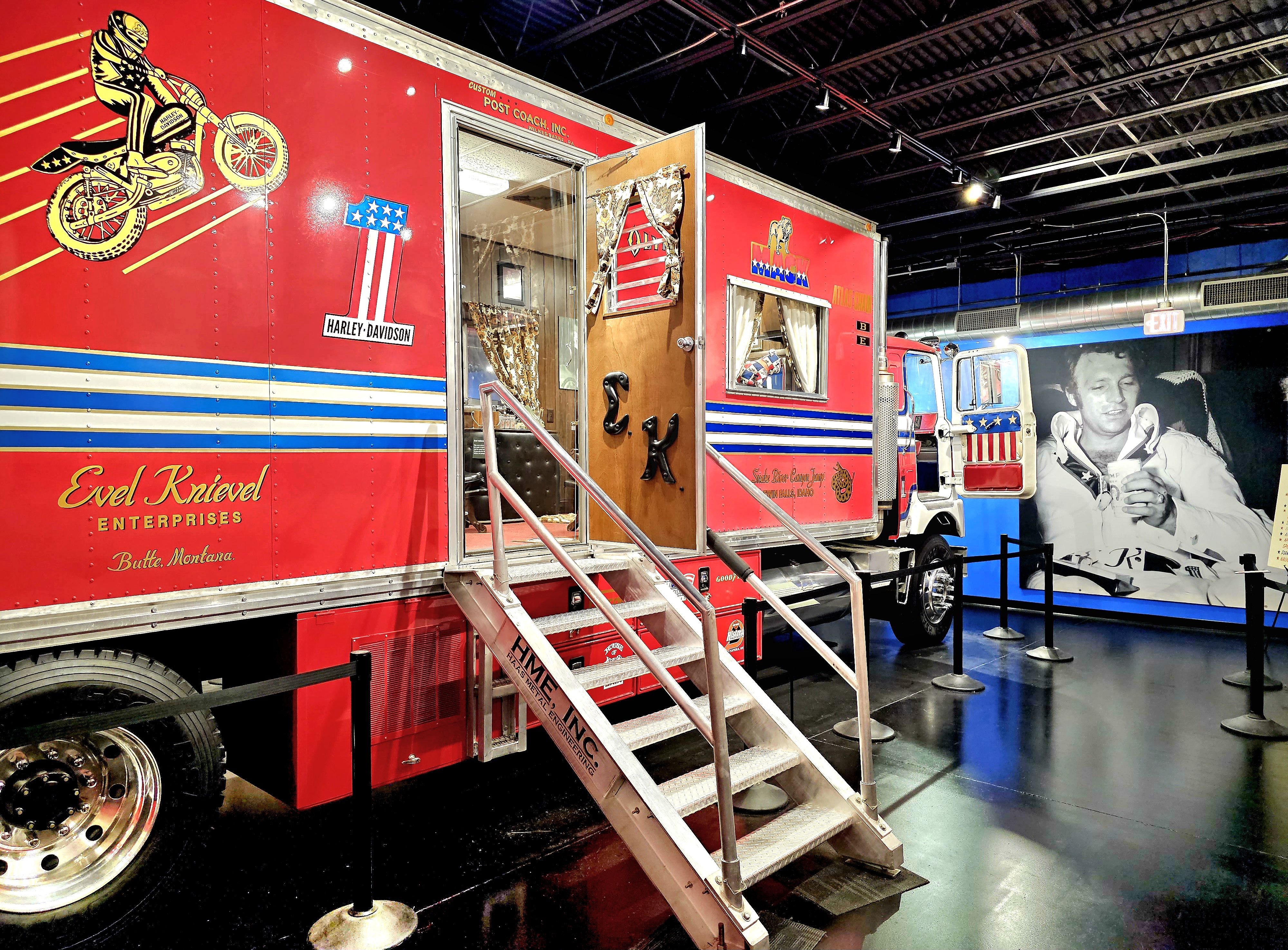
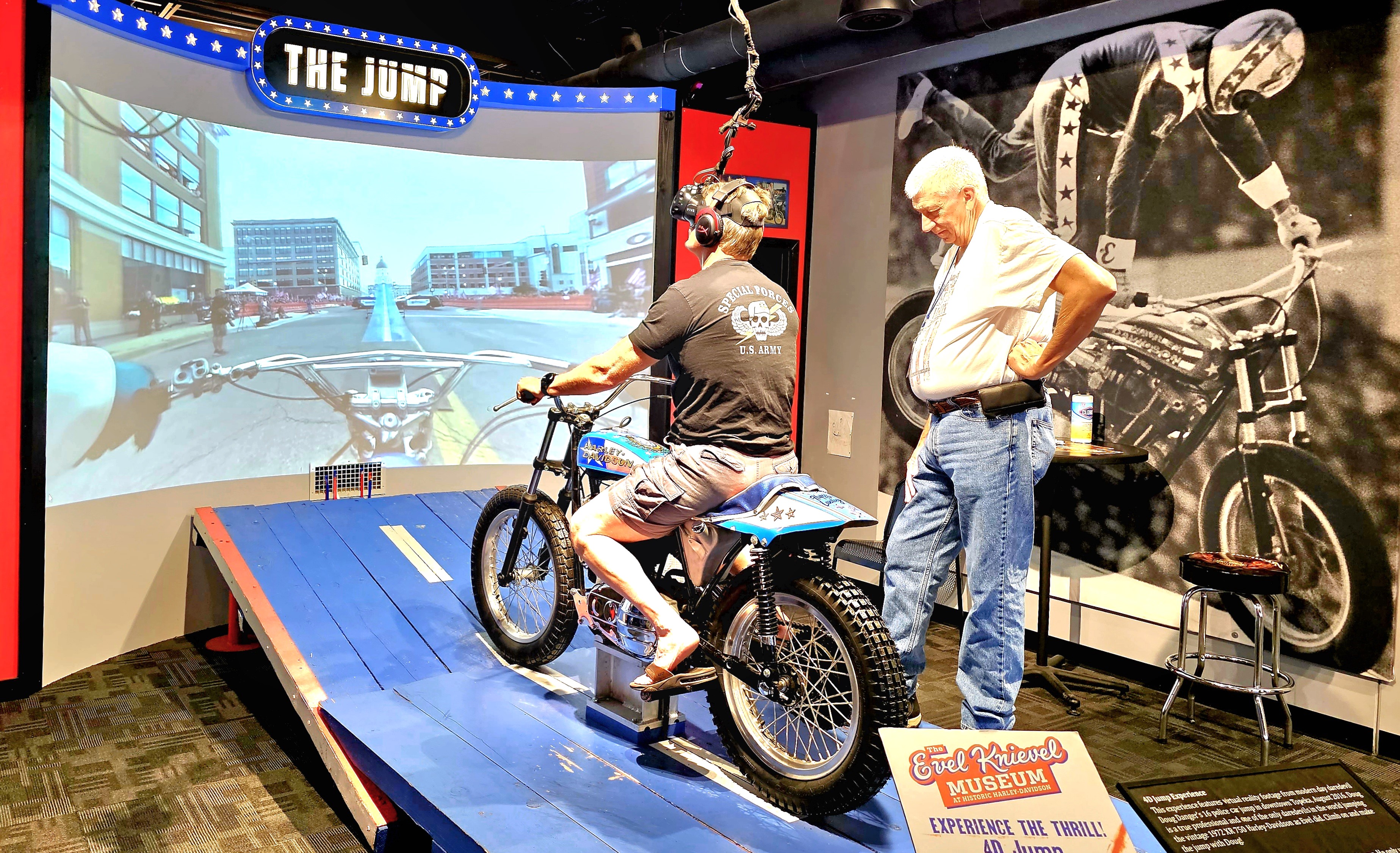
But the pride of the museum is Evel’s “Big Red,” which also answers the question of “Why Topeka?” of all places.
Simply put, Topeka’s Historic Harley-Davidson dealer, Mike Patterson put up the money for the 13,000 sq. ft. expansion, and funded the Mack truck restoration.
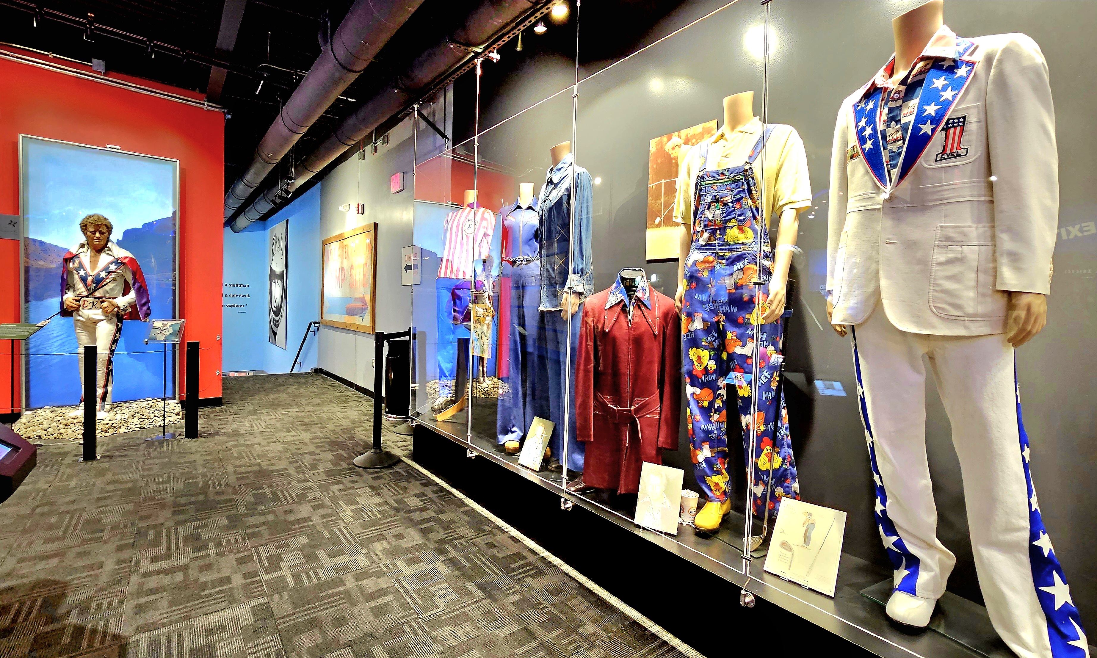
Visitors can delight over Lathan McKay’s world-largest collection of paraphernalia behind ropes and glass, from costumes…
to merchandise…
to memorabilia.
There’s even a VR-enabled activity for an extra $5.
Much has happened since leaving Bonnaroo for Denver. There’s been a long-distance get-together in Rogers, Arkansas with a nursery school buddy from Pittsburgh…
and a long-overdue reunion with family from Pittsburgh, who now reside in Overland Park, Kansas.
We’ve also kept a watchful eye on the weather–always tracking the extreme conditions that have been swirling around us, the likes of tornadoes, hail, flooding, land slides, and record-setting heat streaks–yet with each destination, we’ve mostly managed to dodge a bullet.
There was also a handful of visits to some iconic sites along the way, and some less familiar, but definitely photo worthy.
Our first stop took us to Parker’s Crossroads, halfway between Nashville and Memphis, and the site of a celebrated Civil War skirmish in West Tennessee.
It was the final battle for Confederate Brig. Gen. Nathan Bedford Forrest, who managed to outfox the Union brigades of Col. Cyrus L. Dunham and Col. John W. Fuller by escaping with his regiment across the Tennessee River and avoiding certain defeat in the face of an enemy nearly twice the size with two times the artillery.
Leah and I took the walking tour past interpretive markers depicting critical moments in the battle, and observed that Parker’s Crossroads battlefield, while a testament to the 737 fallen soldiers,
should also be appreciated for its serenity and pastoral scenes.
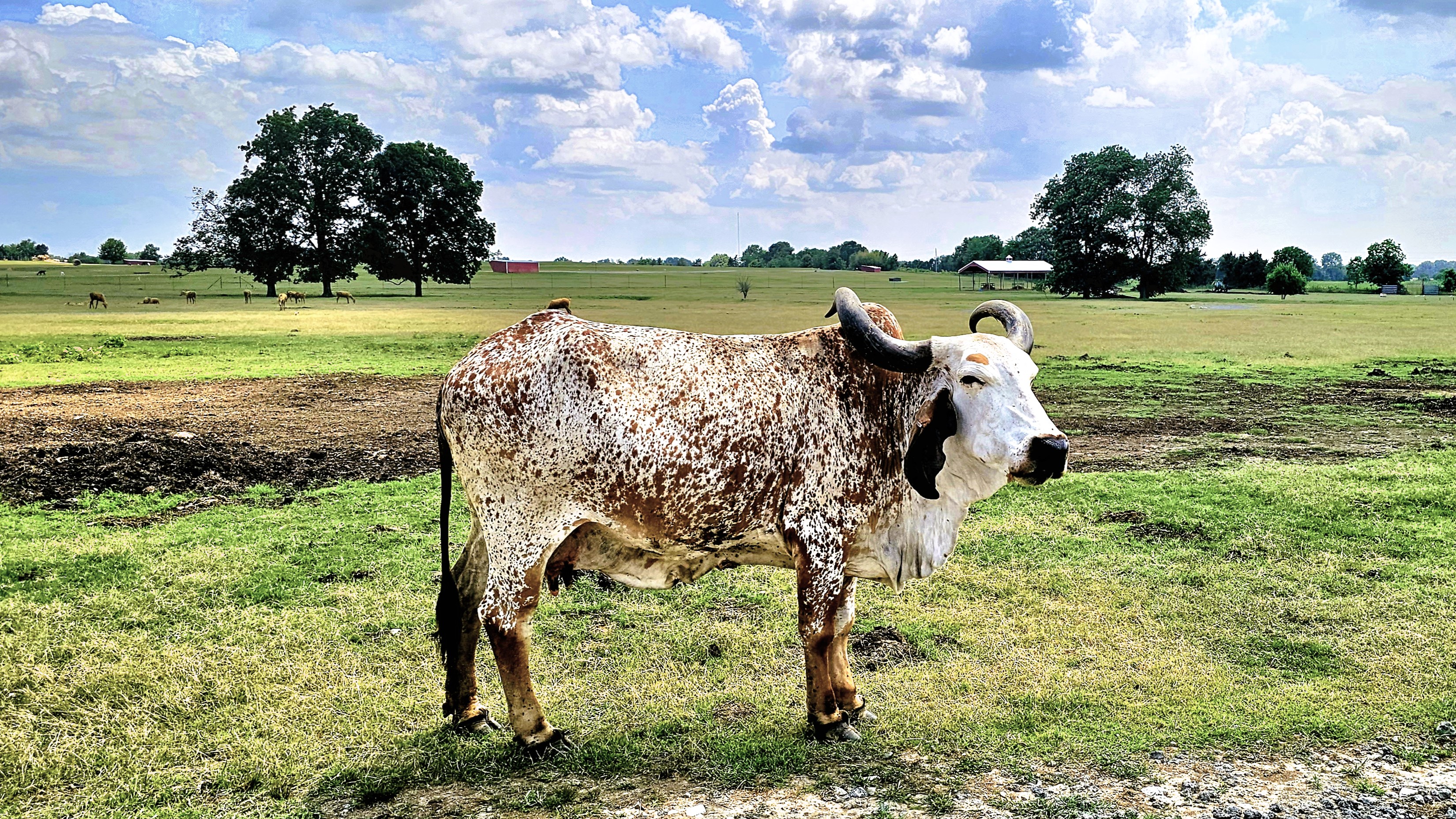
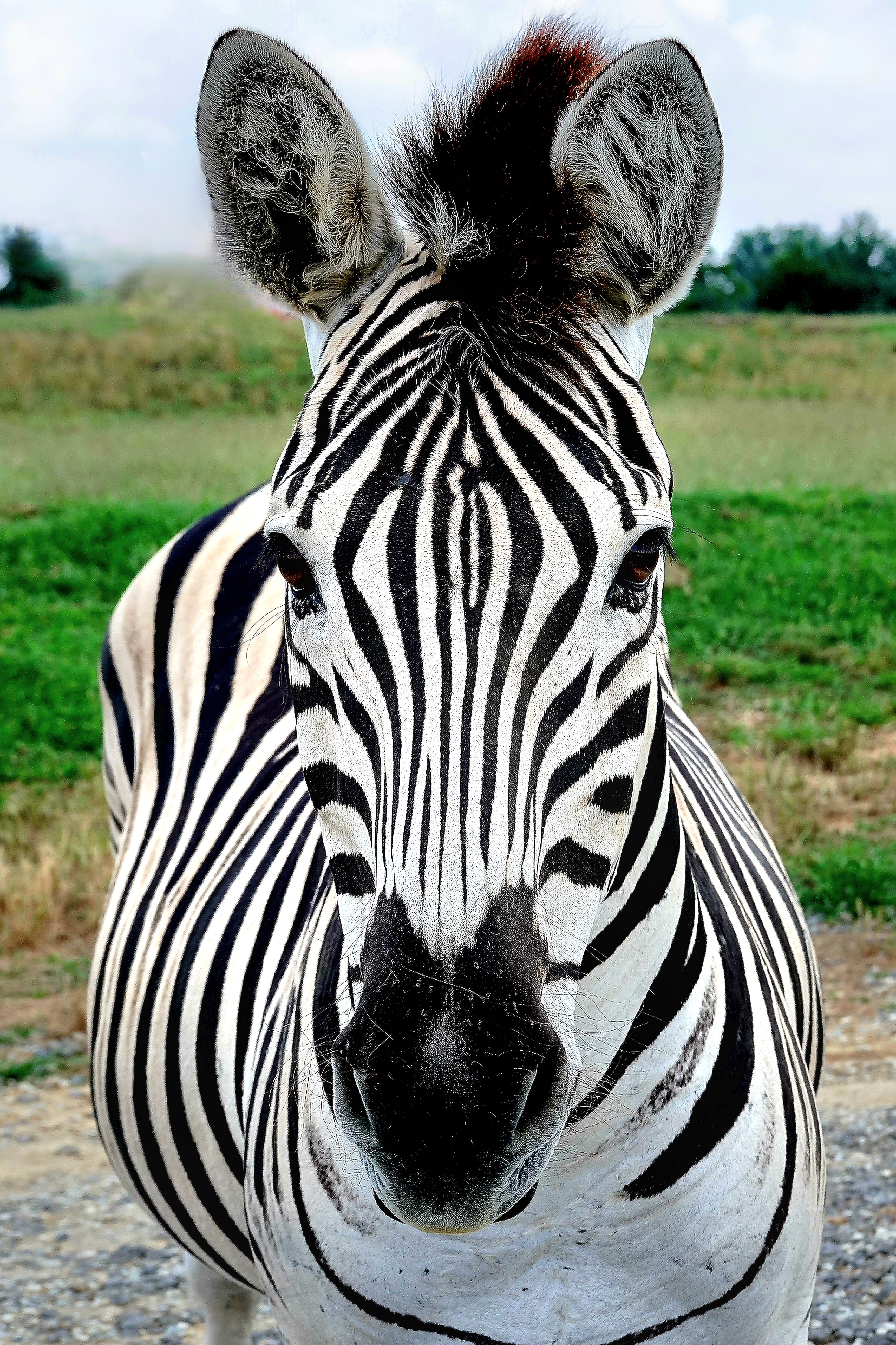
Only 45 miles west of us was Tennessee Safari Park in Alamo,
where we looped around a drive-thru zoo for an hour with 4 buckets of animal nachos for hungry wildlife roaming freely throughout the fenced prairie. We were immediately greeted by an aggressive mob of ostriches and camels that descended upon our truck sensing a meal was imminent.
With the passenger window down, Leah tentatively extended the bucket beyond the door, only to have the bucket ripped from her hand by a dromedary with no manners and fewer eating skills.
Kibble went flying everywhere–inside and outside the truck. Even today, I’m still fishing out morsels between the seats. Lesson learned.
However, the lure of food was a perfect ploy for pet portraits…
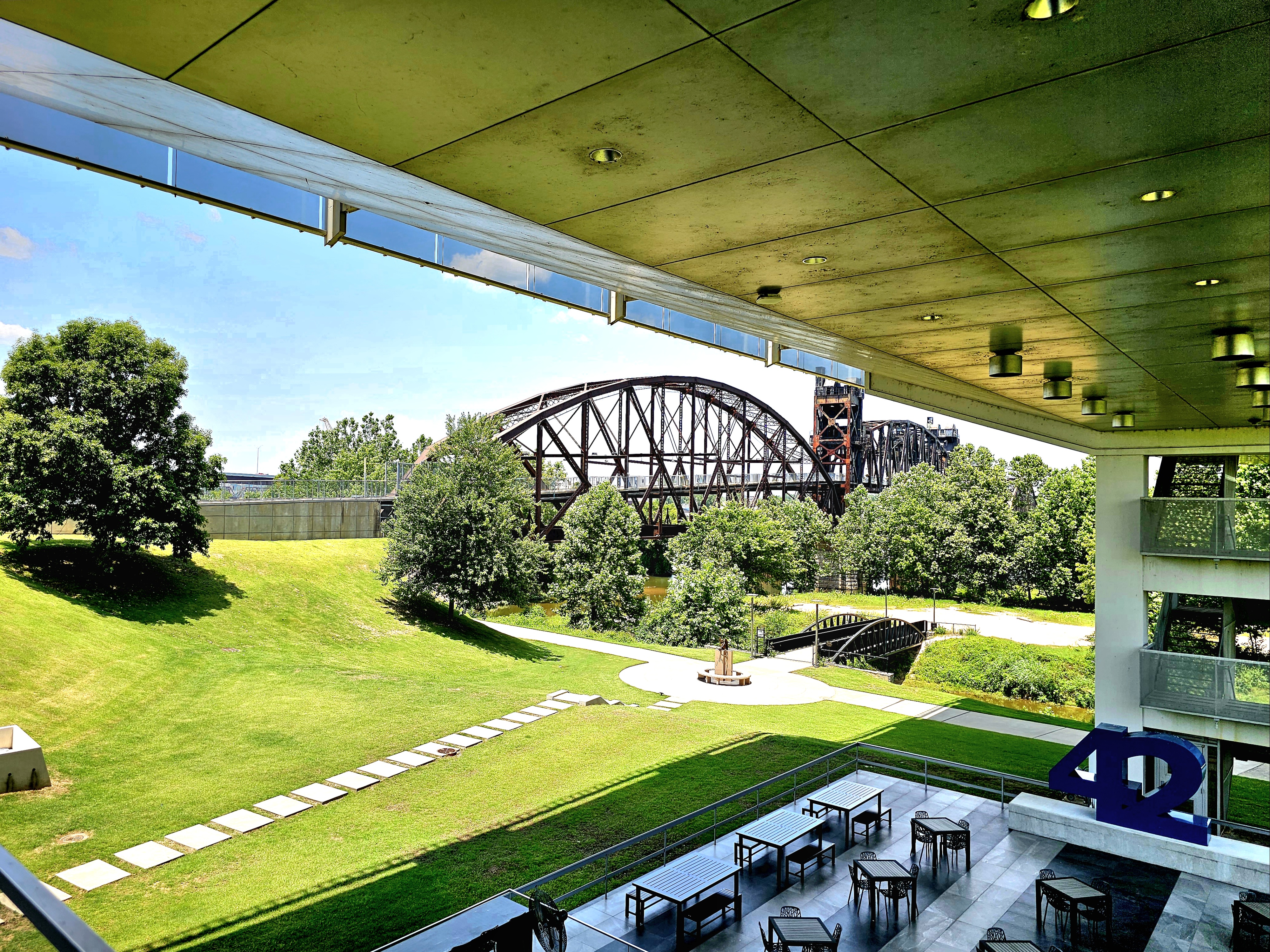
Continuing west, we traveled to Little Rock, home to the Clinton Presidential Center, dedicated on November 18, 2004.
We parked the Airstream directly across the Arkansas River in North Little Rock by a decommissioned WW II tug and sub…
and cycled the long way around the riverwalk trail (some of it kinda sketchy),
past the Big Dam Bridge…
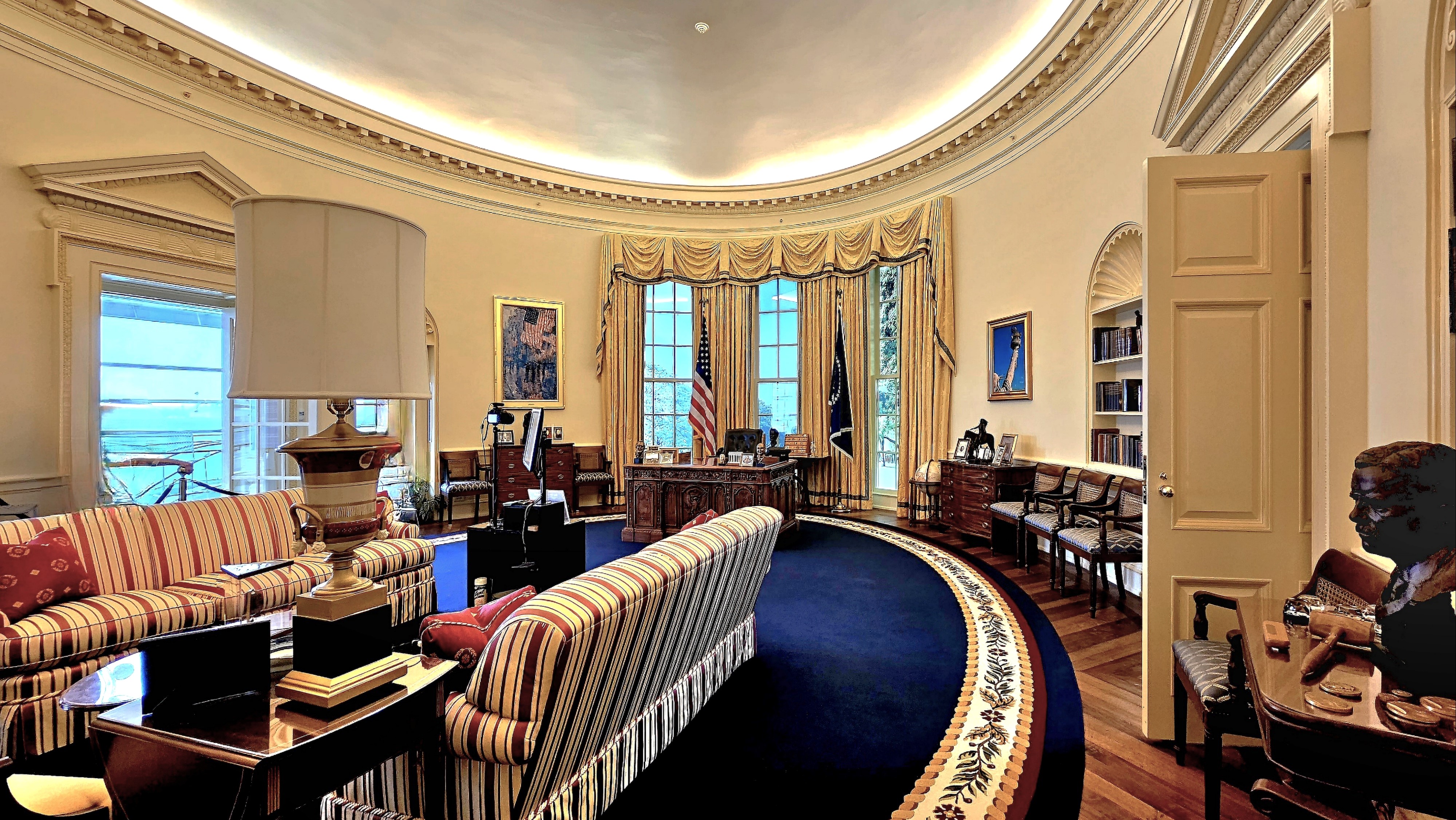
until we circled back 8 mi. to Clinton’s library–a hulking structure clad in glass screens that cantilevers over the Arkansas River as a symbol of “building a bridge to the 21st century.” And it was air conditioned!
The building that houses Clinton’s legacy is enormous enough to collect and archive 2 million photos, 80 million document pages, 21 million e-mails, and 79,000 artifacts from the Clinton years (1993-2001).
Appealing graphics break down the headlines and the issues of the time: year by year, month by month, surrounded by wings dedicated to domestic policy, diplomacy, economy, education, civil rights, and scandal. It’s all on display throughout the Main Hall, modeled after the Long Room of Trinity College in Dublin.
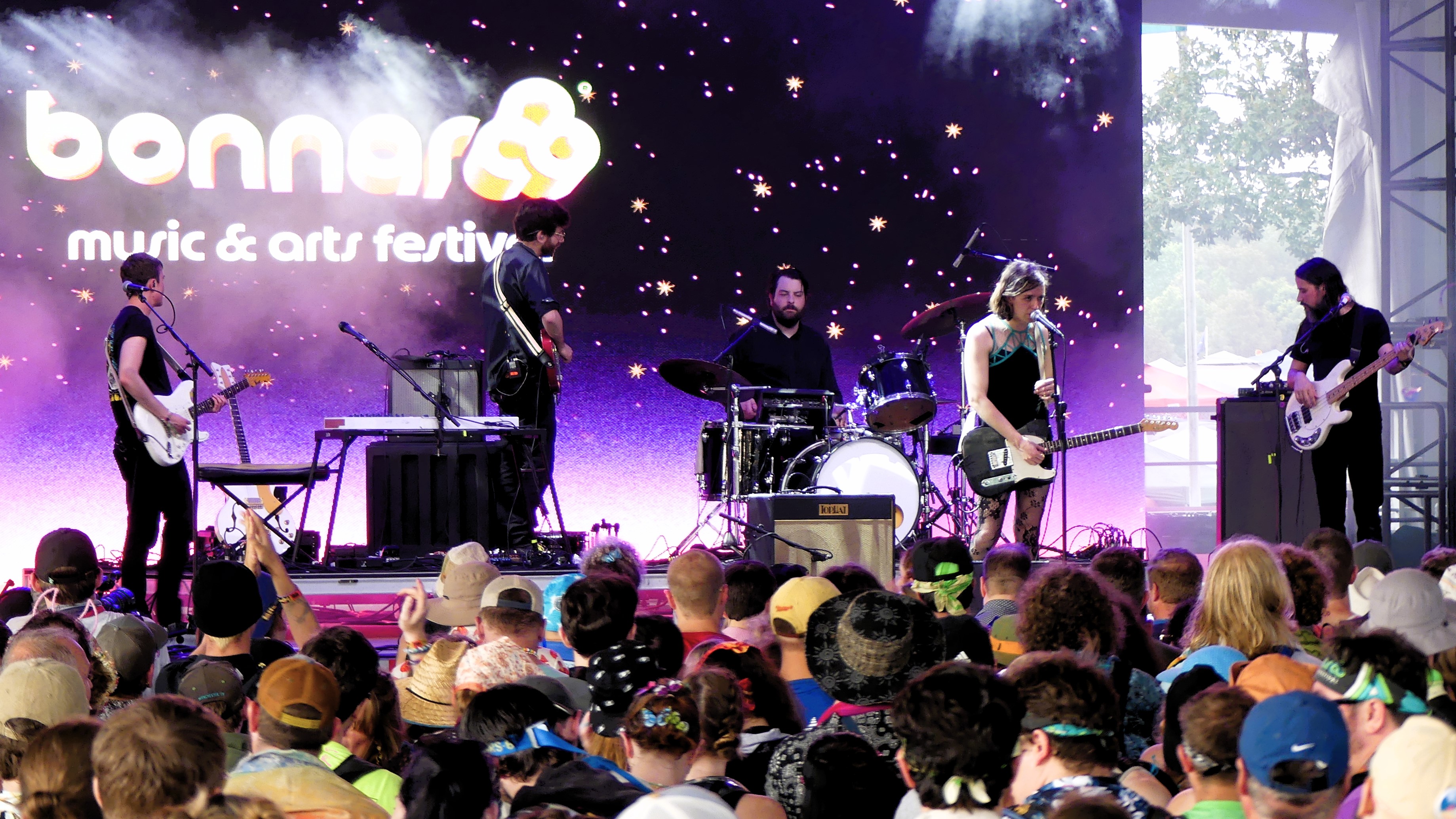
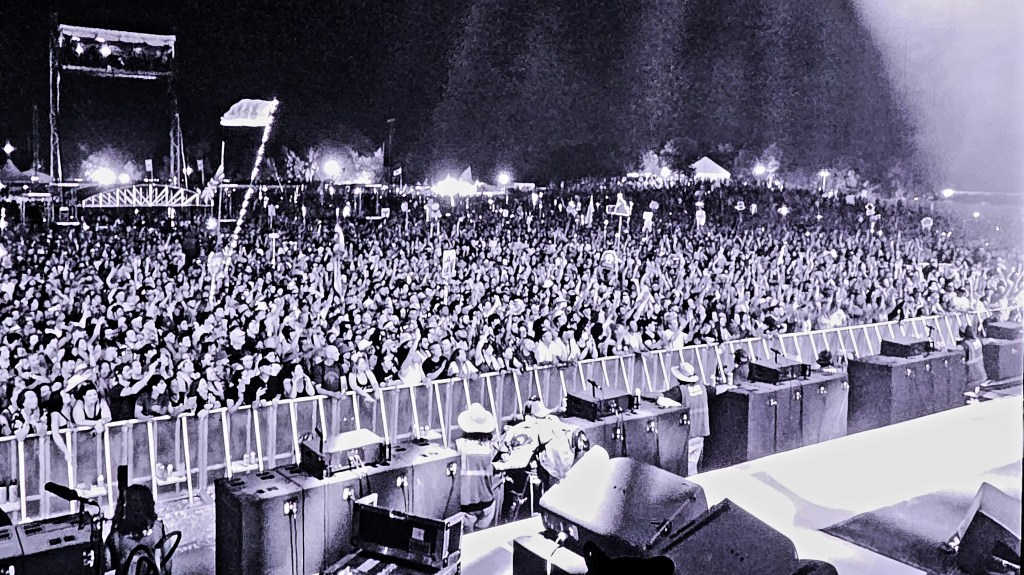
Imagine being in a newish band from a sleepy town in Wales, and you’ve just released an album of 60’s-styled psychedelic rock. A promoter plays the record and calls you to offer up the biggest opportunity in your music career–opening Bonnaroo 2023.
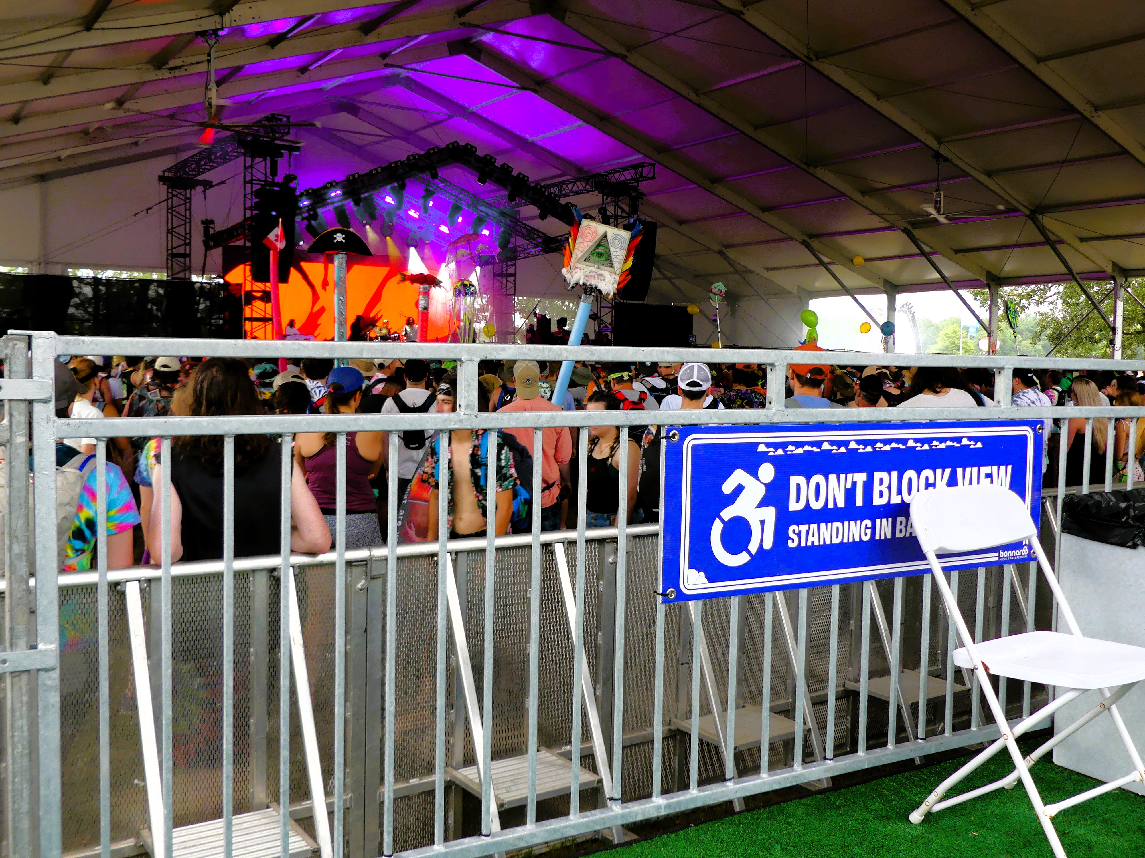
CVC (Church Village Collective) took the stage under That Tent on Thursday afternoon at 2:30pm to plenty of fanfare. They kicked off a 45-minute set with a rousing edition of their new single, Good Morning Vietnam, setting the crowd of thousands into a frenzy. As much as I would have enjoyed partying with them, I was more thankful for a seat on the raised ADA deck.
Early into their second number, Woman of Mine, CVC was interrupted by a PA announcement: “All visitors are required to evacuate Centeroo at once due to a serious weather alert half-an-hour away.”
The band unplugged and left the stage. Everything seemed so uncertain.
Up until showtime, Leah and I had kept a close eye on the weather, and lamented about the possibility of this event turning into a giant mud bash.
Naturally, we packed all the appropriate raingear in the event of a storm, but now it seemed likely that our weather anxiety may have been justified by this recent threat of wind and lightening.
As we headed back to the Airstream under a gloomy sky, all we could do was speculate how this would screw up the scheduling and how the promoters would respond.
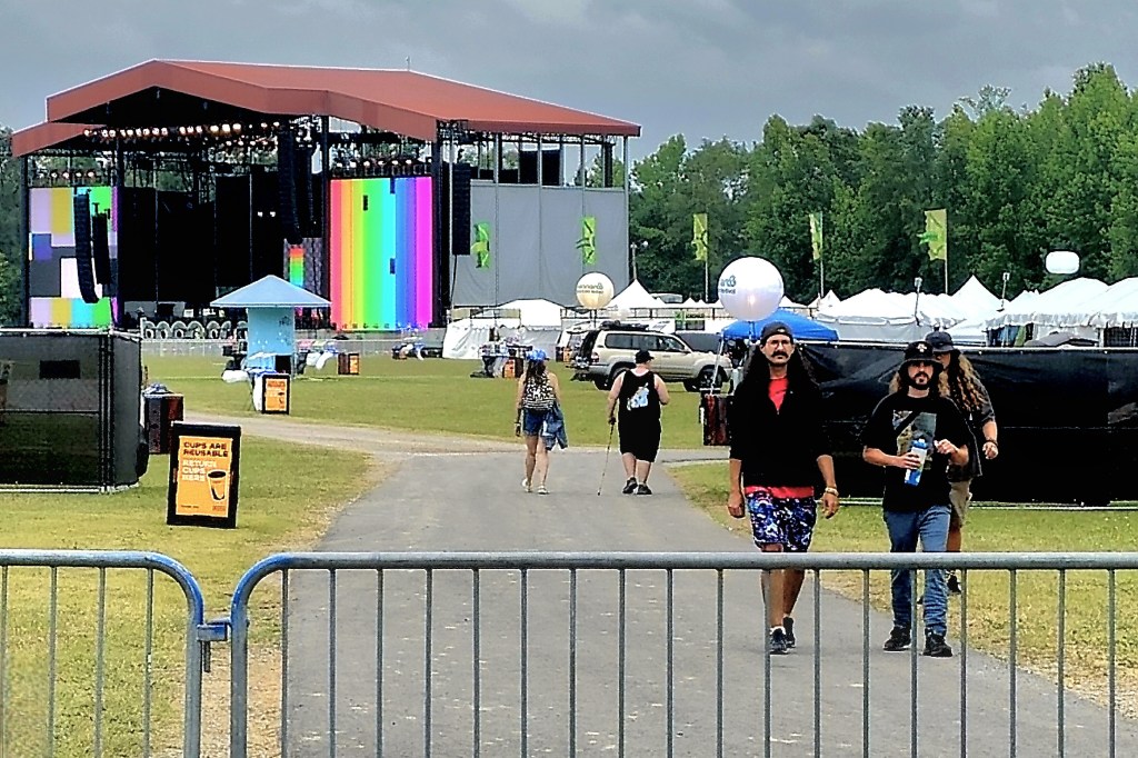
As I reported in Bonnaroo–the Logistics, over 100 acts across all genres were signed to perform at the 2023 festival.
With the exception of the evenings’ headliners: Kendrick Lamar, Odesza, and Foo Fighters, and a handful of notable acts scattered throughout the lineup, most of the performers were new to me. But that didn’t matter; I was at Bonnaroo for the experience and to discover talent new to me.
But that doesn’t mean I was evaluating all of the talent on my own. I got some much needed advice from my son, Noah–an aficionado of nearly every music festival under the sun (except Bonnaroo)–who was helpful in handicapping the lineup in order to maximize my listening pleasure.
Sure, there would be some missed opportunities given overlapping scheduling conflicts and 6 distant stages, but I was intent on attending as many bands as possible.
Centeroo re-opened at 4 pm without so much as one fallen raindrop. Gray skies had been chased by clear skies, and weather prospects were improving for the remainder of the weekend. By 4:30 pm, music had resumed at all the tents, and CVC was back on stage performing a compressed set.
The balance of my Thursday was spent hobbling between This Tent and That Tent, where the ADA attendants were some of the cheeriest people on the planet, as well as the best resource for canned ice water, courtesy of Liquid Death. “Happy Roo! Would you like some cold water?”
After CVC came transgender rager/rocker, Ezra Furman…
followed by bluegrass maestro, Molly Tuttle.
Celisse lit up This Tent with her powerhouse vocals…
and guitar shredding, the likes of Prince and Hendrix,
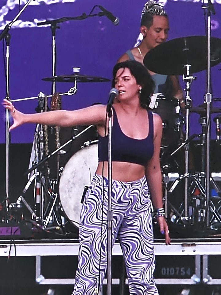
while Suki Waterhouse’s chic pop stylings…
brought back memories of her star-turn in Daisy Jones & the Six.
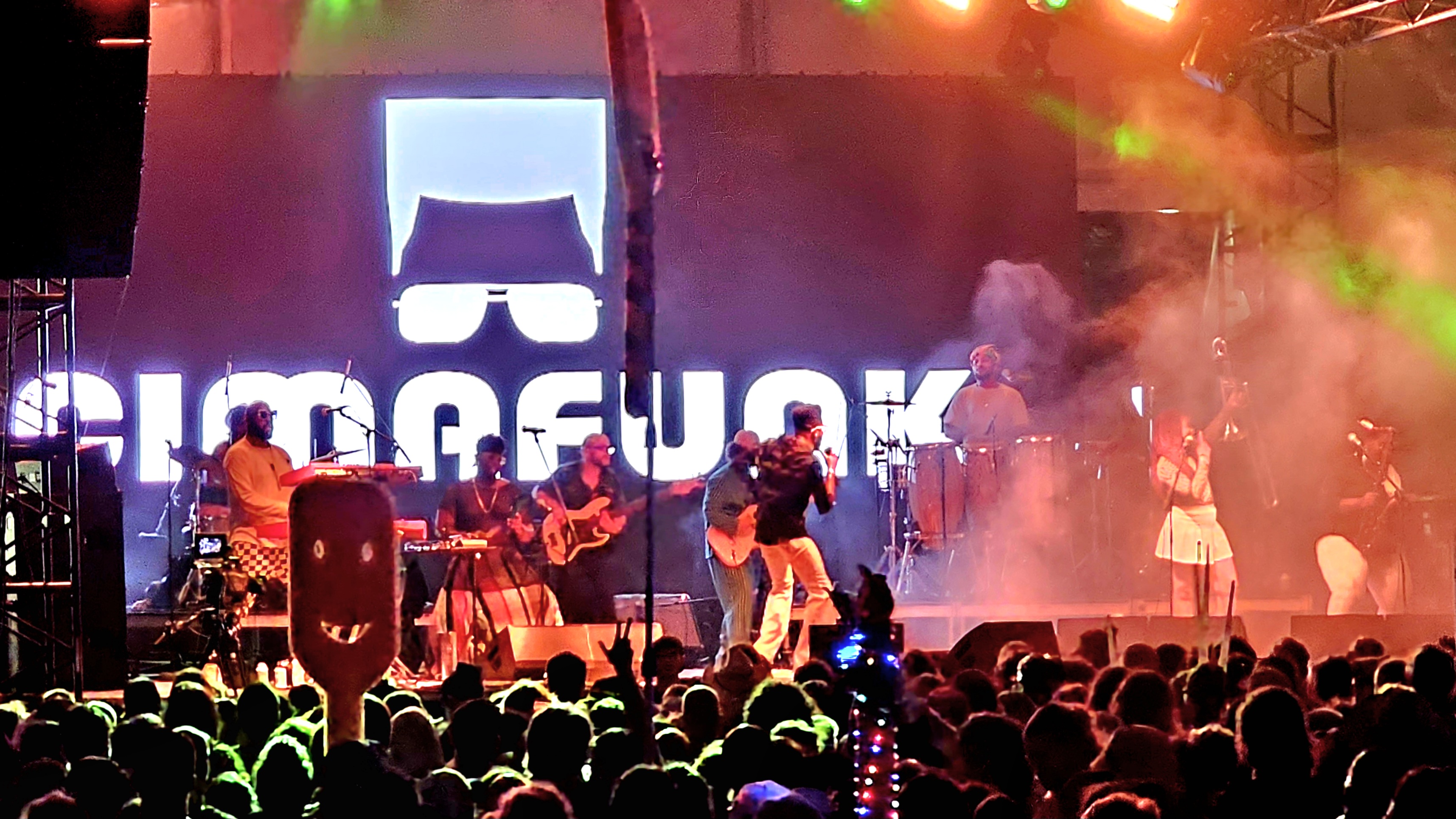
Leah and I called it a night after a non-stop, 1-hour power set of Latin funk from Cimafunk.
Stellar music performances continued unabated throughout the weekend with few production hiccups. We must have crisscrossed the Centeroo acreage dozens of times to find music we enjoyed. Leah’s Apple watch calculated 7 to 8 miles of daily trekking between shows and stages, turning large swatches of grass into a giant dust bowl when crowds would scatter at the conclusion of each concert.
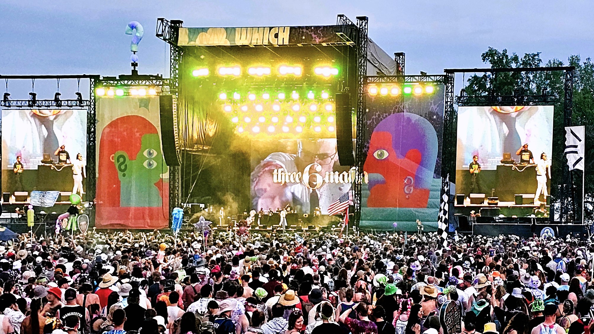
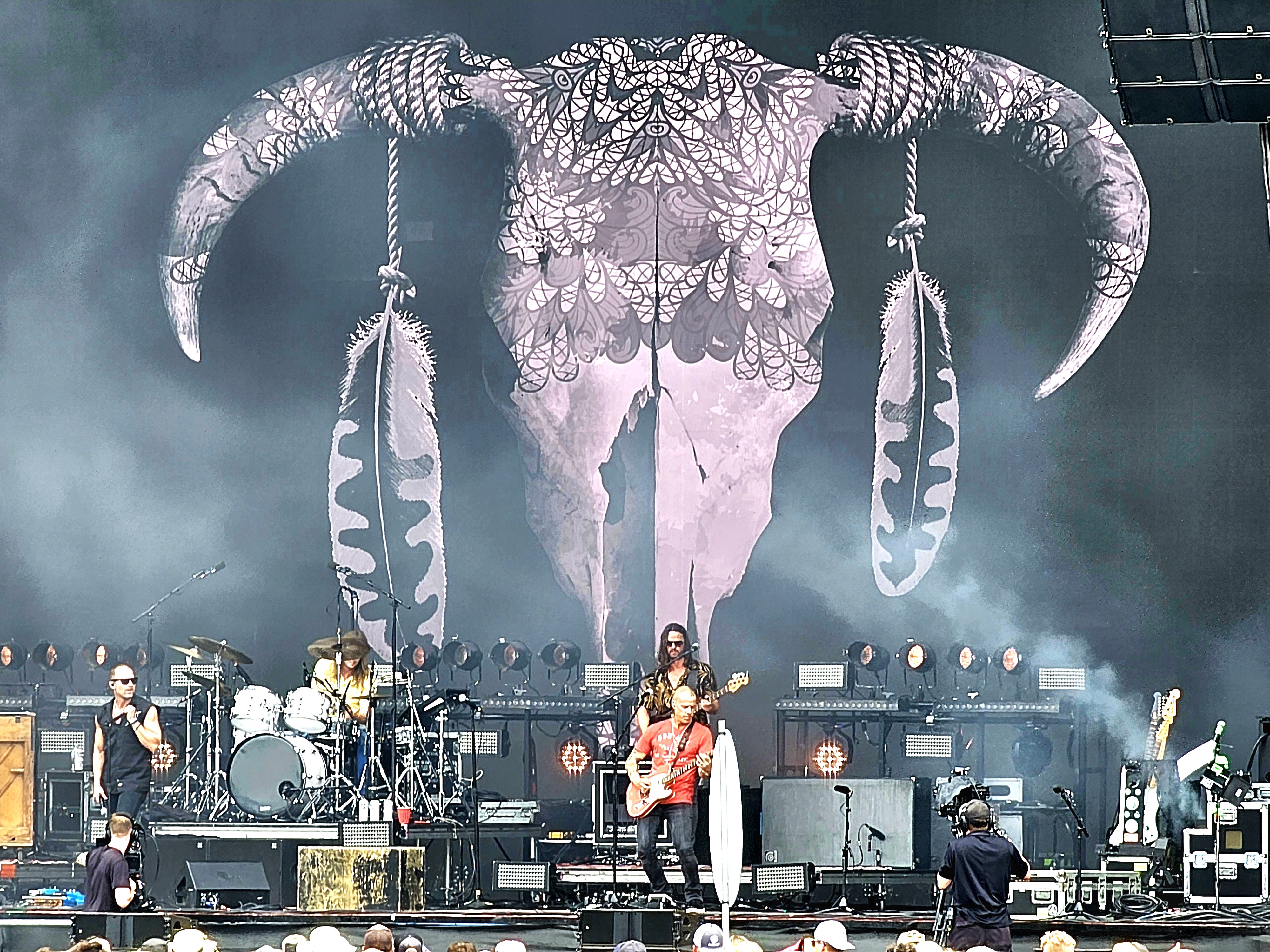
Rather than critique every artist’s performance I attended, I offer a slideshow gallery of photo highlights from several notable performers: Danielle Ponder, Sheryl Crow, Leni Wolf, Three 6 Mafia, David Grohl (Foo Fighters), Hailey Williams (Paramore), Sammie Rae, Umphrey’s McGee, Franz Ferdinand, Hippocampus, Kip Moore, Paris Jackson, and Andrew McMahon
And when we weren’t watching the performers, we were watching people:
After Josh Freese’s last drumbeat (replacing Foo Fighters’ Taylor Hawkins) on Sunday night, Bonnaroo 2023 was in the history books…
Leah and I were up at dawn, waiting for the car that would shuttle us from Amman W Hotel to Allenby Bridge, while the balance of our Viking posse was flying from Queen Alia International Airport to various destinations across America. We were excited about 9 extra days of travel throughout Israel, but we were having a last-minute case of shpilkes (anxiety) about our decision to cross the border by bus on Shabbos (Jewish sabbath).
Long before the start of our Middle Eastern adventure, Leah and I had vacillated between flying into Tel Aviv from Amman or completing a land crossing–so we did a time analysis of the two. By flying into Ben Gurion Airport, wading through long security lines before reaching Customs and Immigration, waiting at the luggage carousel, finding an airport taxi during Sabbath, and driving to Arthur Hotel in Jerusalem, we figured it would be a five-to-six-hour ordeal… for about $700.
Or we could taxi to Allenby Bridge, cross between countries, and hire an Arab on the Israeli side to drive us to Jerusalem–all for a hundred bucks and half the time! It seemed like a no-brainer to me.
In addition to our driver, we were accompanied by a handler (packing a pistol) whose job it was to massage the bureaucracy… and he made all the difference.
The ride from Amman was unremarkable–only half-an-hour to the Jordanian border. The immigration terminal was just awakening at 8 AM, with handfuls of early arrivals already waiting for officials to begin processing visas. The handler approached an open window on our behalf with our passports and $30 in hand for departure tax. After that, it was a waiting game.
Another half-hour passed before we were ushered to an open square where transfer busses were boarding for another $10 per person and $2 per bag–all for a 10-minute drive across no man’s land.
Once underway, I lost count of the number of checkpoints we crossed until we finally arrived at the first Israeli immigration building. No one told us what to do or where to go, so I watched what the others were doing and mimicked their behavior.
I grabbed our bags from the cargo hold. They were scanned against our passports, and joined an avalanche of luggage being fed into an x-ray conveyor disguised as a black rubber flap, where they disappeared inside the terminal.
Leah and I joined a chaotic queue outside the terminal that inched toward the entrance and eventually merged with a rowdy, serpentine line inside the terminal that crept toward a block of AIT scanners flanked by Israeli security. Today, being Shabbos, only one scanner was operational, which only exacerbated the crowd’s irritation and frustration, especially when VIPs were intermittently ushered past us in their special lane.
It took an hour to reach the scanner, which led to another half-hour wait in a subsequent line before we were interrogated by an immigration officer who finally issued our tourist cards, and directed us through a makeshift wall that revealed a warehouse of suitcases and packages waiting to be collected.
Picking through piles of Samsonite, Tumi, and American Tourister might have taken hours had it not been for our electronic tags. After reuniting with our suitcases, we had one final queue to master, staffed by a baby-faced security agent who double-checked our IDs against the luggage registry created outside. We were now free to travel about Israel for the next 9 days.
Once we were officially on Israeli soil, we were introduced to Abdul, the taxi driver who reeked of smoke and spoke limited English. Nevertheless, we negotiated a 200 NIS fee ($55) to our hotel in Jerusalem… or so we thought. Forty minutes later, we were standing outside Damascus Gate, where Abdul mimed that he could drive no further due to a military high-alert.
We learned from a passer-by that a 13-year-old Palestinian boy had shot and wounded an Israeli father and son near the entrance to the City of David National Park, while in a separate event the night before, 7 worshippers were killed and 3 were wounded outside a synagogue in East Jerusalem by a West Bank militant, making this the deadliest attack on Israelis in recent years.
In response to the attacks, authorities countered the violence by positioning officers from a counter-terrorism unit “permanently” in the Old City to “promptly respond to exceptional events whenever necessary.” Troops seemed to be omnipresent around the perimeter of the gate.
“Just our luck,” said Leah. Her voice was filled with resignation. “This was my biggest fear! Now what!?”
“I think we’re actually safer than before,” I answered. “The threat of violence is always a real possibility, but Israel knows how to respond to situations like this, especially with the arrival of Secretary of State Blinken.”
“That may be true,” Leah offered, “but many of these soldiers don’t even look old enough to shave!”
Once we got our bearings, we drudged down deserted Jaffa Street–our roller bags bumpety-bumping behind us–until we reached Arthur Hotel.
Since we were far too early to check in, we parked our bags at the hotel and set out on foot to get lost in the Old City and trust our instincts to get back. We discovered the Armenian Quarter, one of the four quarters of real estate within the ancient walls,
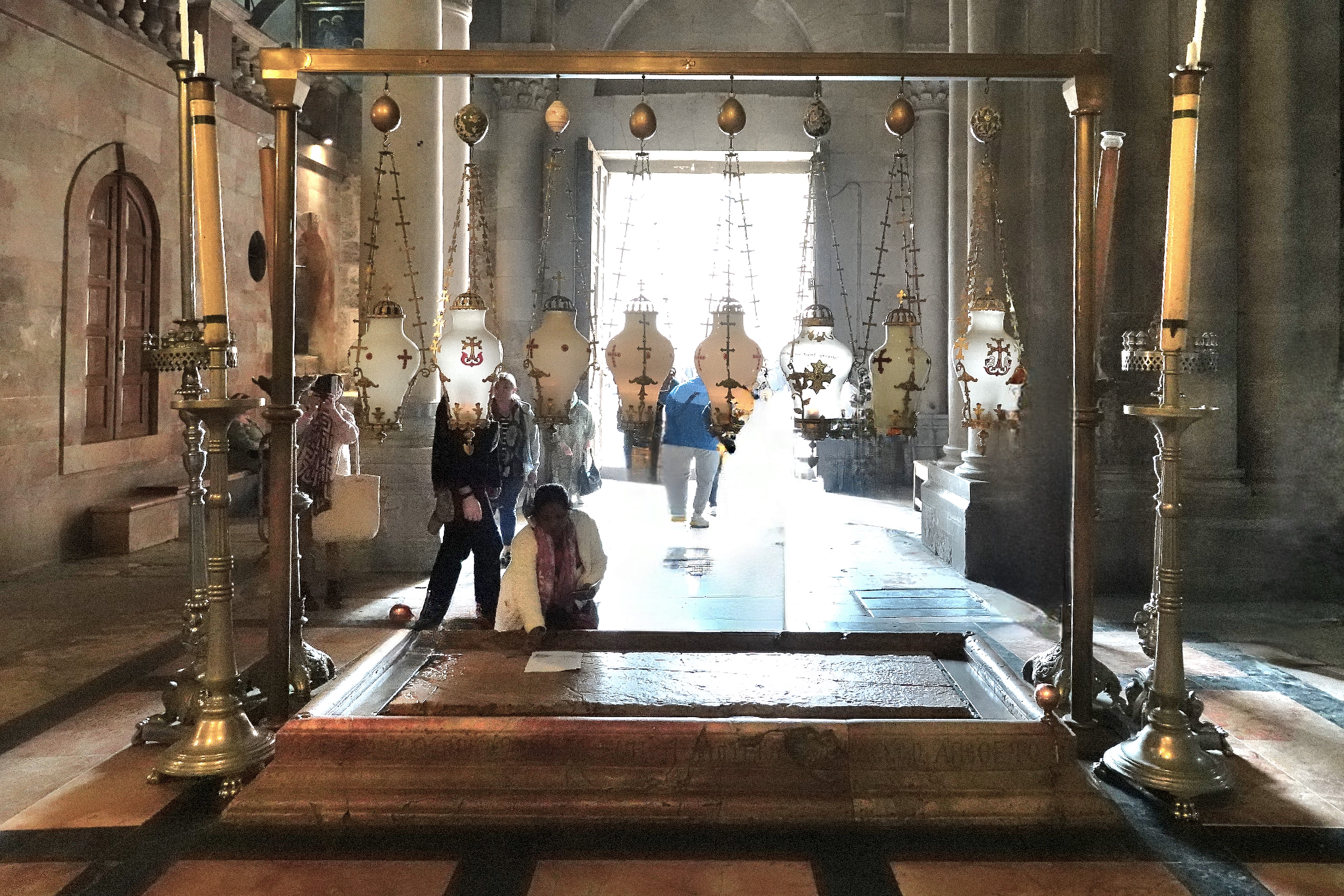
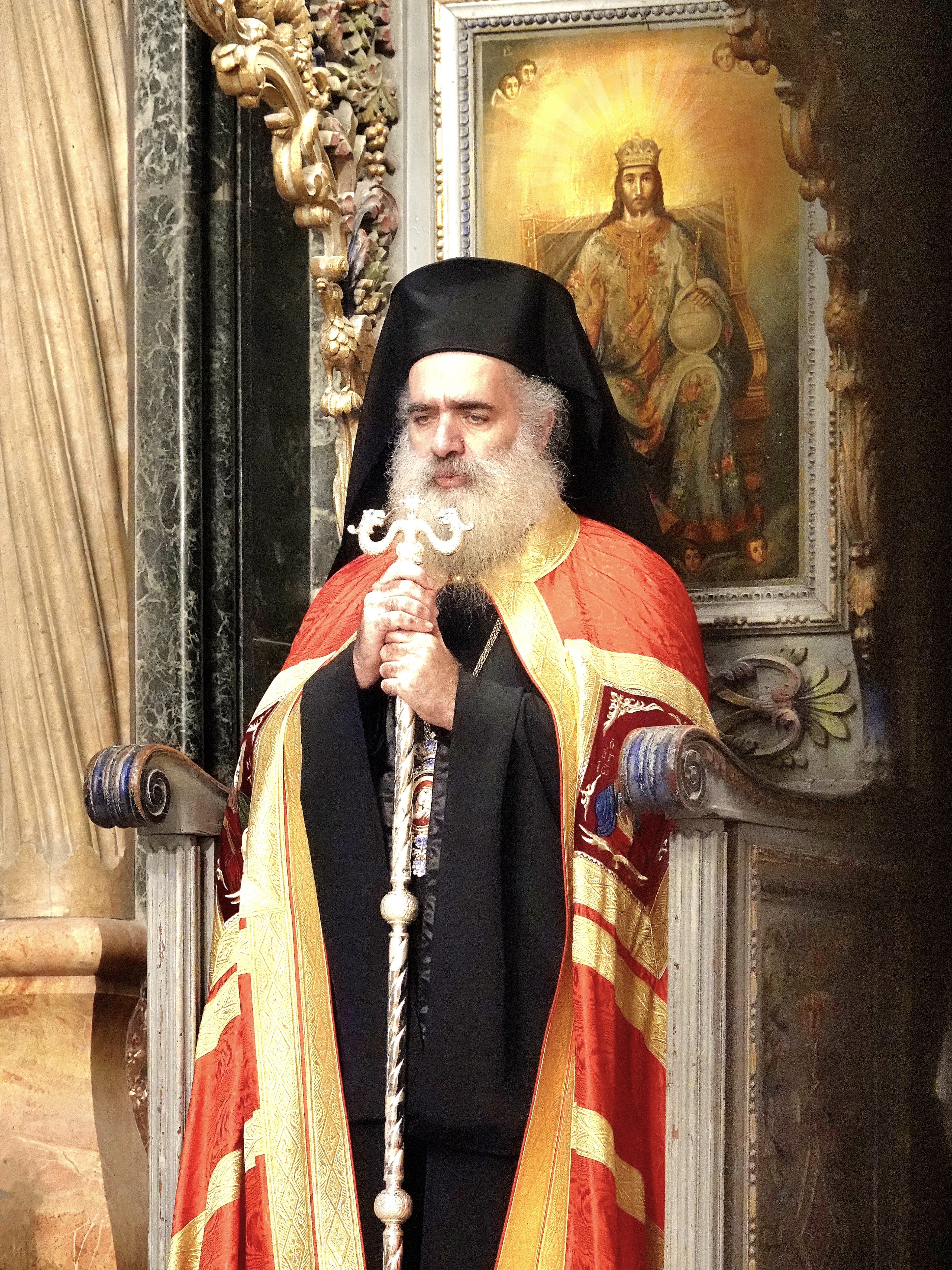
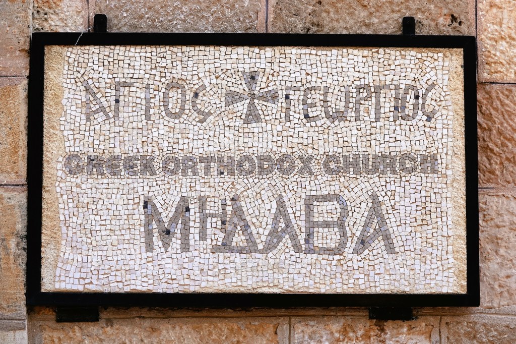
which somehow led us to the Christian Quarter, where we stumbled upon the Church of the Holy Sepulchre, Christianity’s most revered site, and home to six Christian denominations–Greek Orthodox, Catholic, Armenian, Coptic, Syrian Orthodox, and Ethiopian Orthodox–
Photo by Gerd Eichmann
that have accepted from religious scholars that this church consecrates the ground where Jesus was crucified, buried, and resurrected, as seen in a mosaic interpretation of Jesus’s journey that hangs in the church vestibule.
We were unsurprised to find the Church of the Holy Sepulchre crowded with pilgrims and worshippers from around the world who were here to light a candle and prostrate on the Stone of Anointing;
or worship at the uber-ornate Calgary, under the Altar of the Crucifixion, where the alleged Rock of Calvary is encased in glass;
or hug the Aedicule, a shrine protecting the tomb of Jesus,
under the dome of the Catholicon.
We even came across some Crusader graffiti…
on our way to the lower level to admire the Chapel of St. Helena.
We exited the church with a profound respect for the millions of devotees who have made this their purpose.
And we were captured by the solemnity of the moment, as we sauntered down Via Dolorosa, now aware that this was the fateful route taken by Jesus as he dragged the cross to his final destination.
It was enough to process for one day. We were weary from walking, and it was time to find our way back to Jaffa Street.
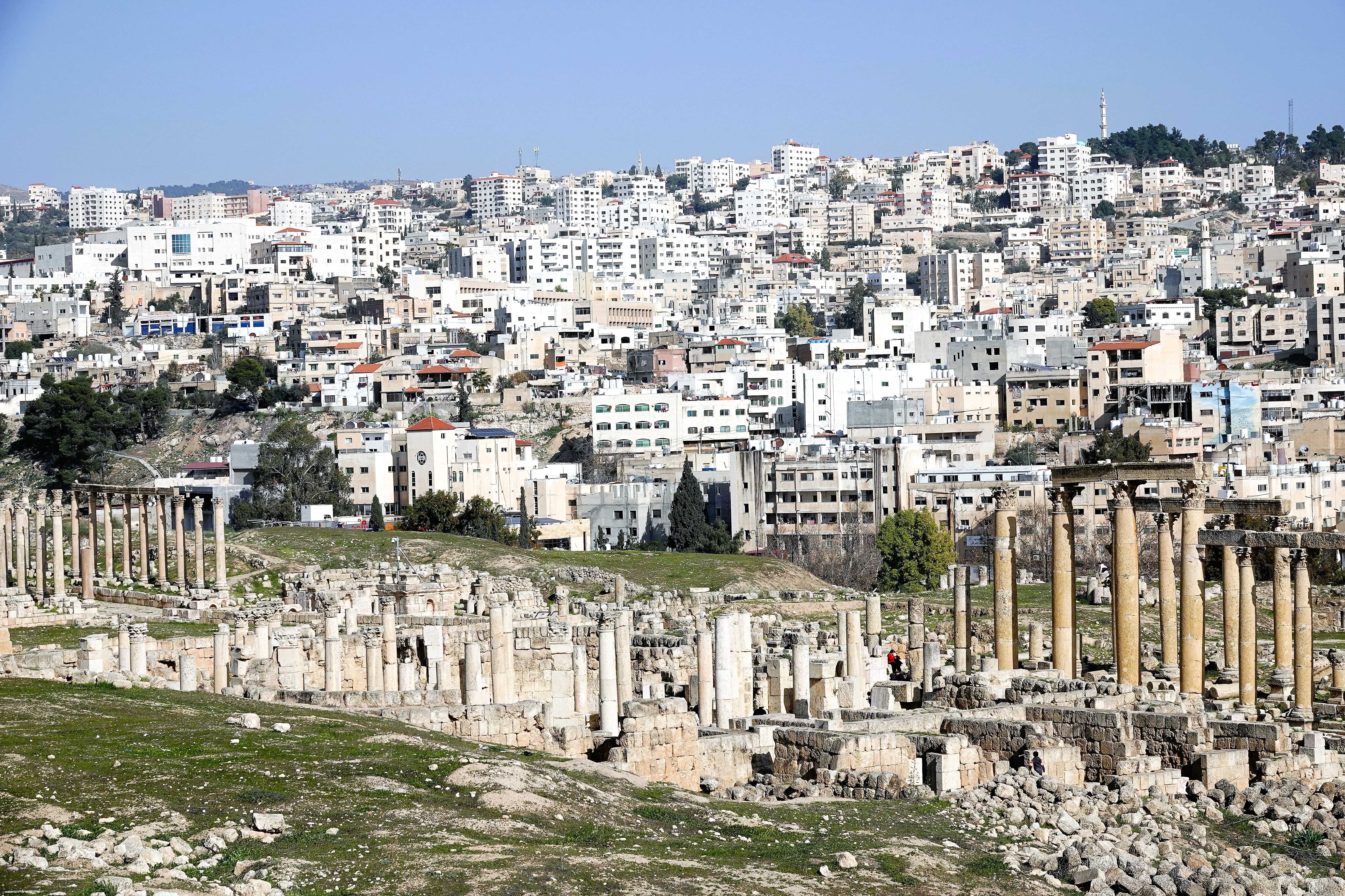
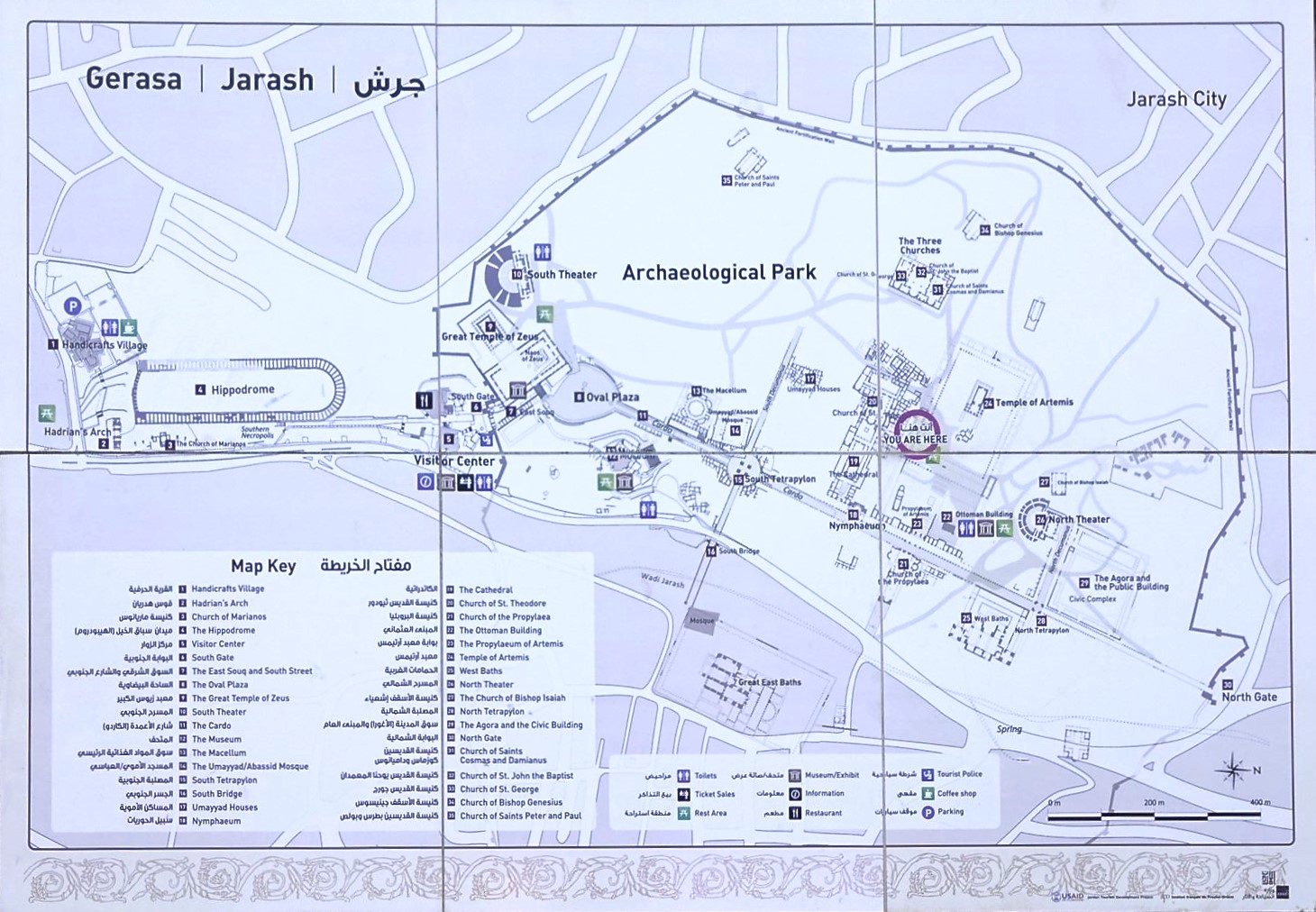
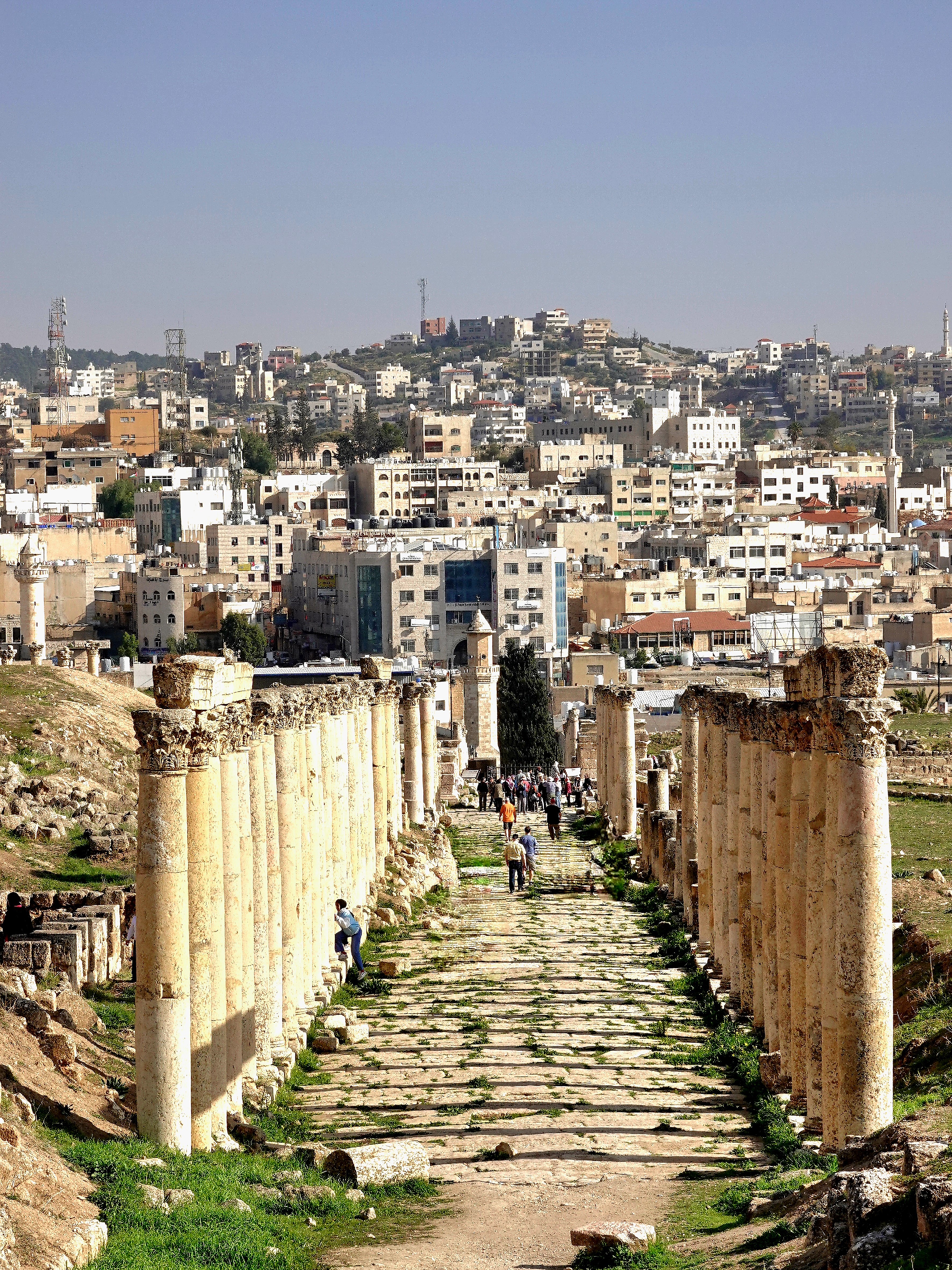
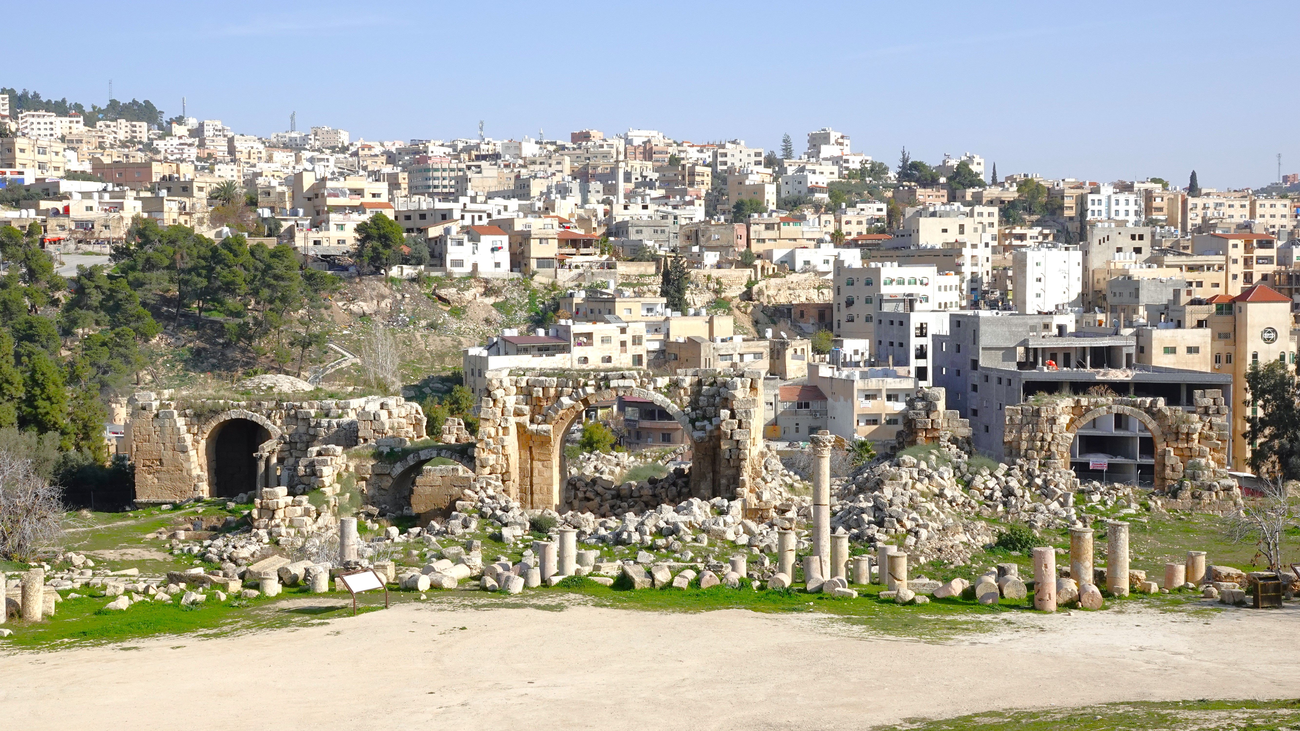
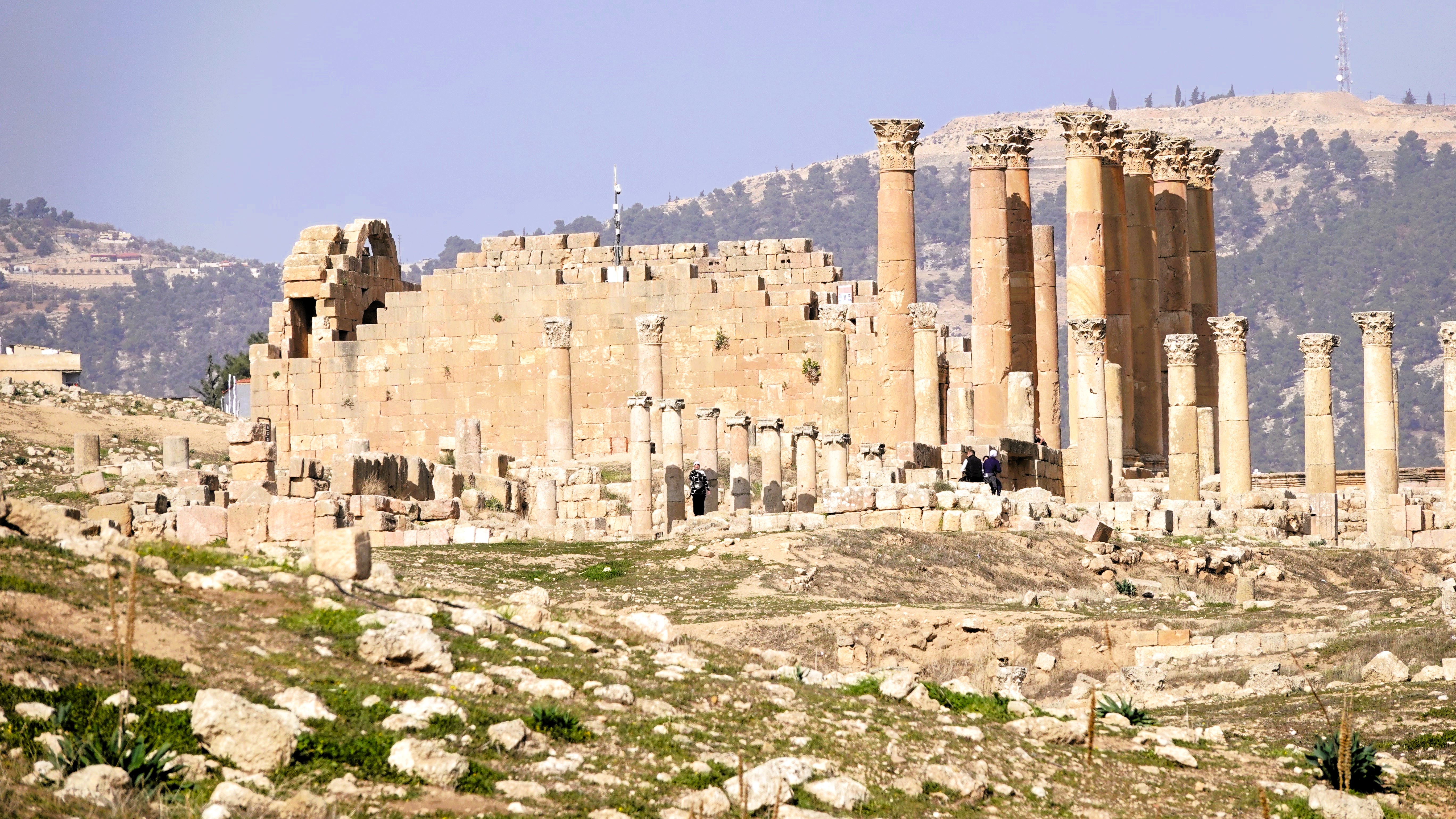
Jerash is a modern city 45 km (30 mi) north of Amman,
that surrounds an immense Archeological Park designed to protect the ruins of a walled Greco-Roman settlement,
as well as human remains from Neolithic times.
Photo courtesy of UJ
Jerash evolved from an agrarian village on the banks of Wadi Jerash throughout the Iron Age and Bronze Age, to becoming a 4th century BC garrison founded by Alexander the Great on his way from Egypt to Mesopotamia.
Subsequently, under the reign of Antiochus IV (175 – 164 BC), Jerash became a tax and trade capitol, with special thanks to Zeus for his guidance.
Great Temple of Zeus
As an aside, it deserves mentioning that King Antiochus is regarded as one of Judaism’s major villains for his iron-fisted repression of Jewish laws and customs. He is forever vilified as the ruler who desecrated Jerusalem’s Second Temple by turning it into a brothel and sacrificing a pig on its altar to honor Zeus. His continuing persecution of Jews ultimately prompted an uprising commanded by Judah Maccabee in 167 BC that eventually led to the recapture of Jerusalem and rededication of the Second Temple, spawning the Miracle of Hannukah.
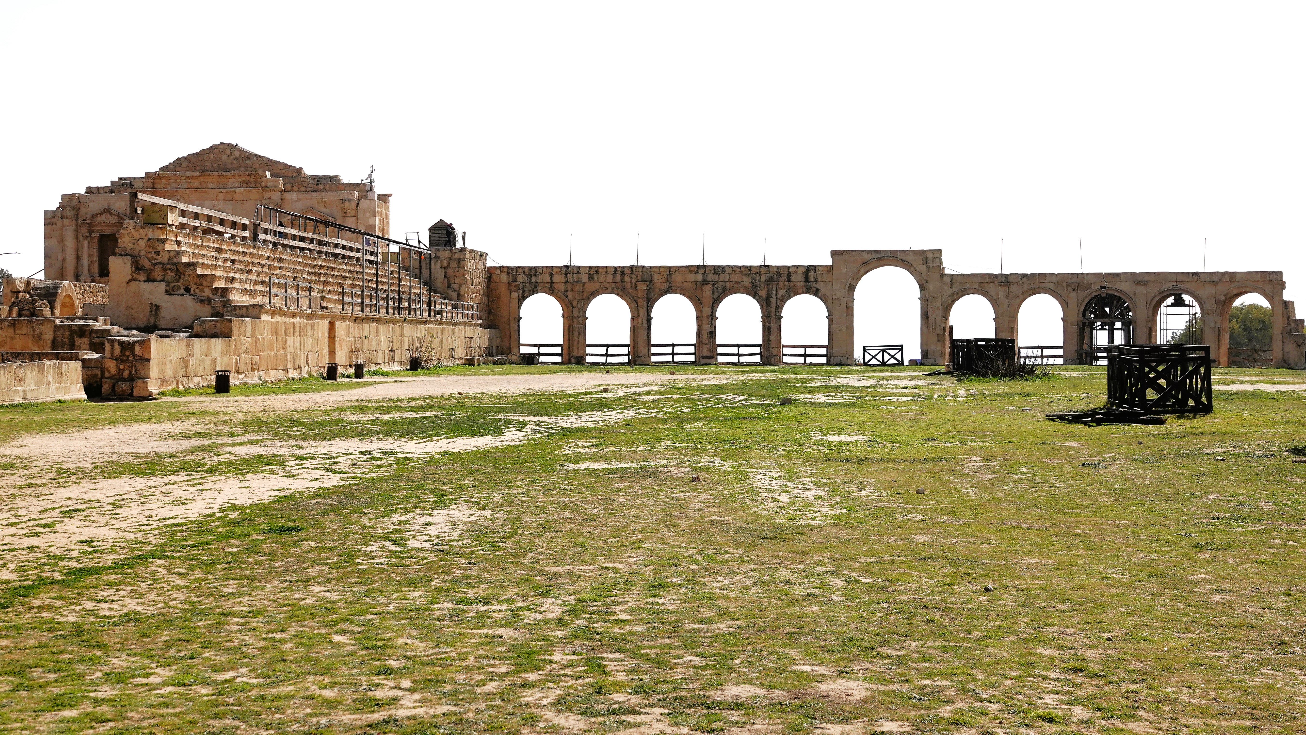
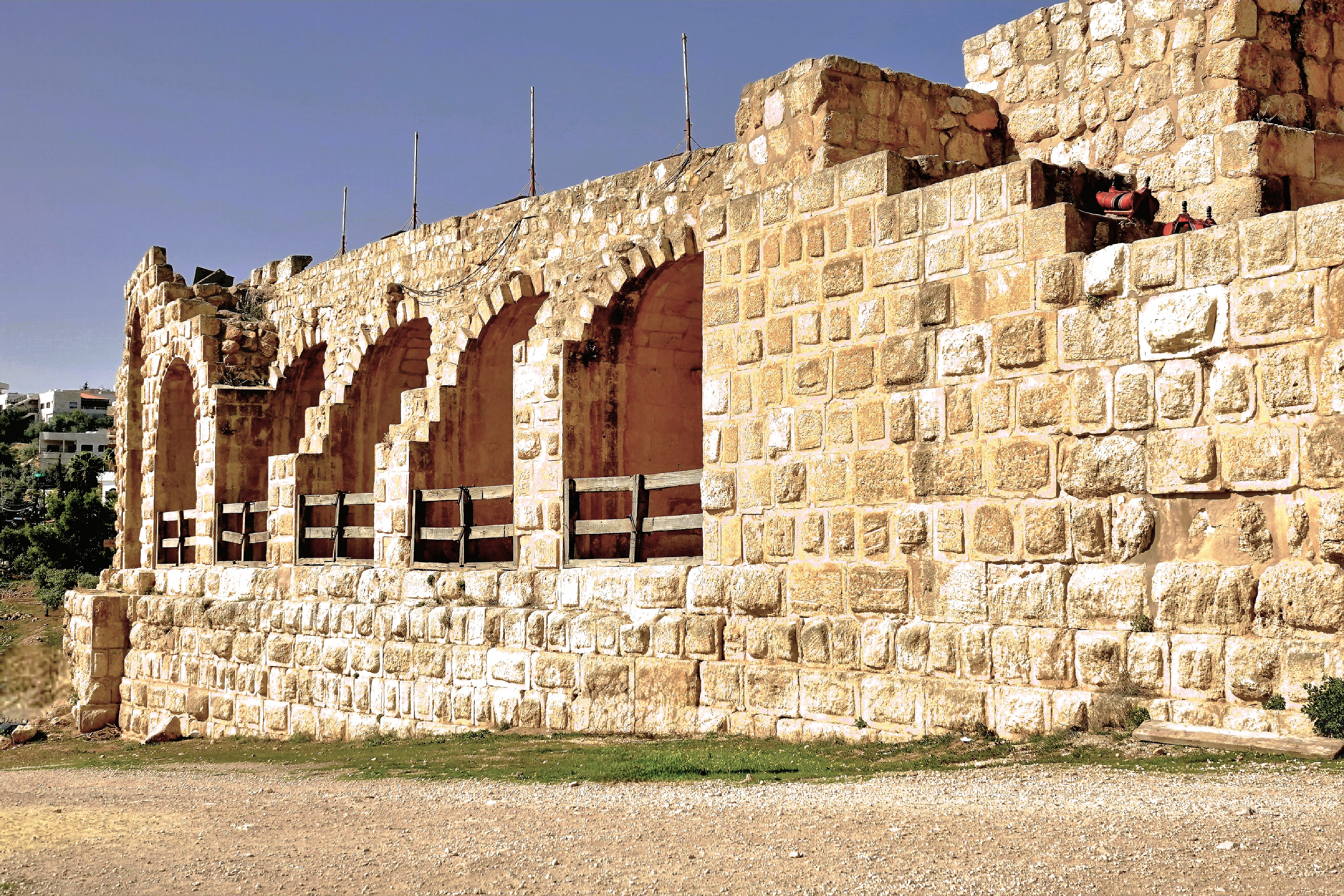
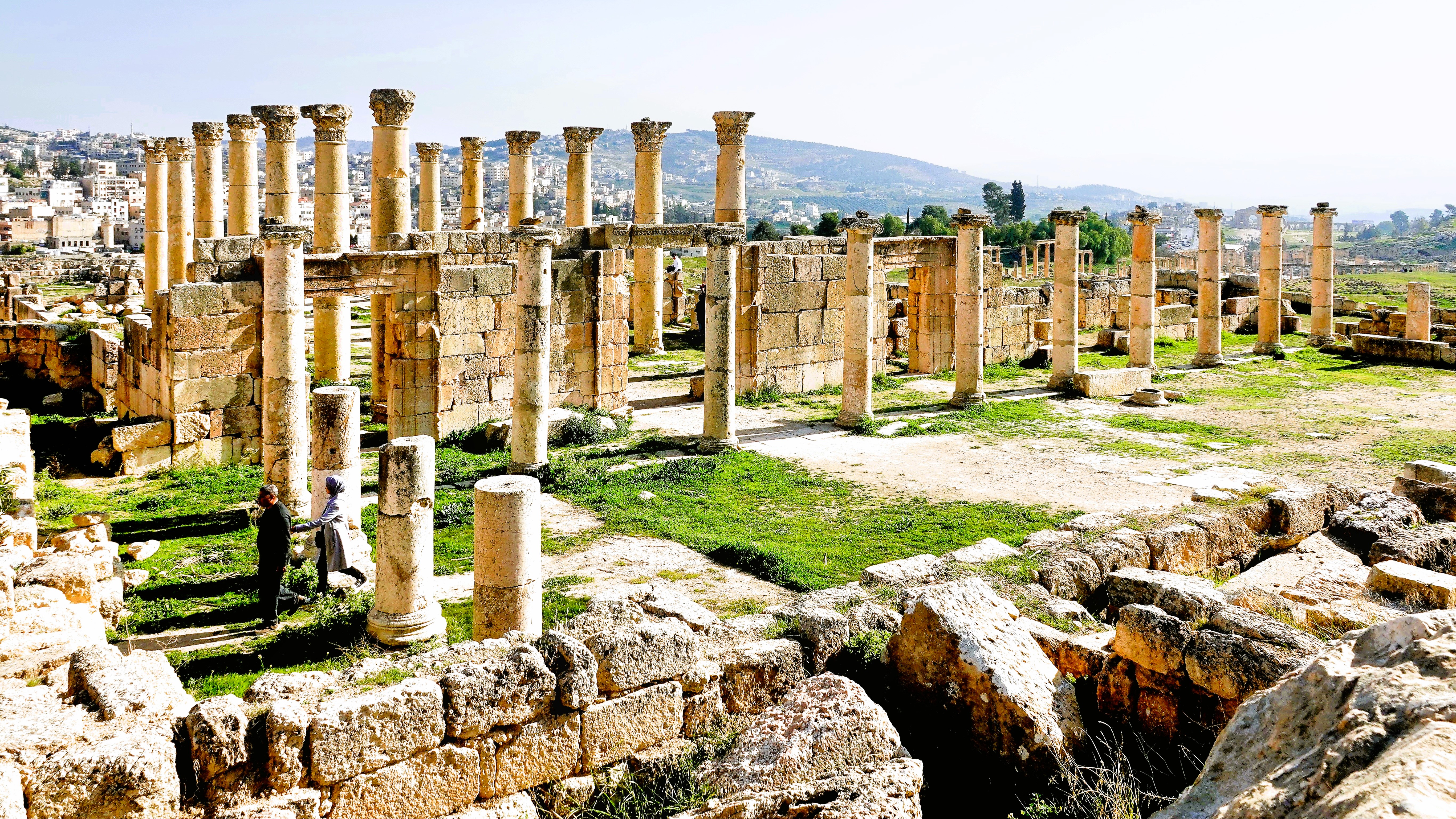
Only Greek inscriptions on city foundations remained after Jerash was sacked by Roman general Pompey in 63 BC. But under Roman rule, Jerash was rebuilt and thrived as an important trading center to Europe and Asia, as evidenced by the array of architectural riches that have been excavated and restored over the past century, making Jerash the most well-preserved, ancient, Roman city east of Italy.
South Theater
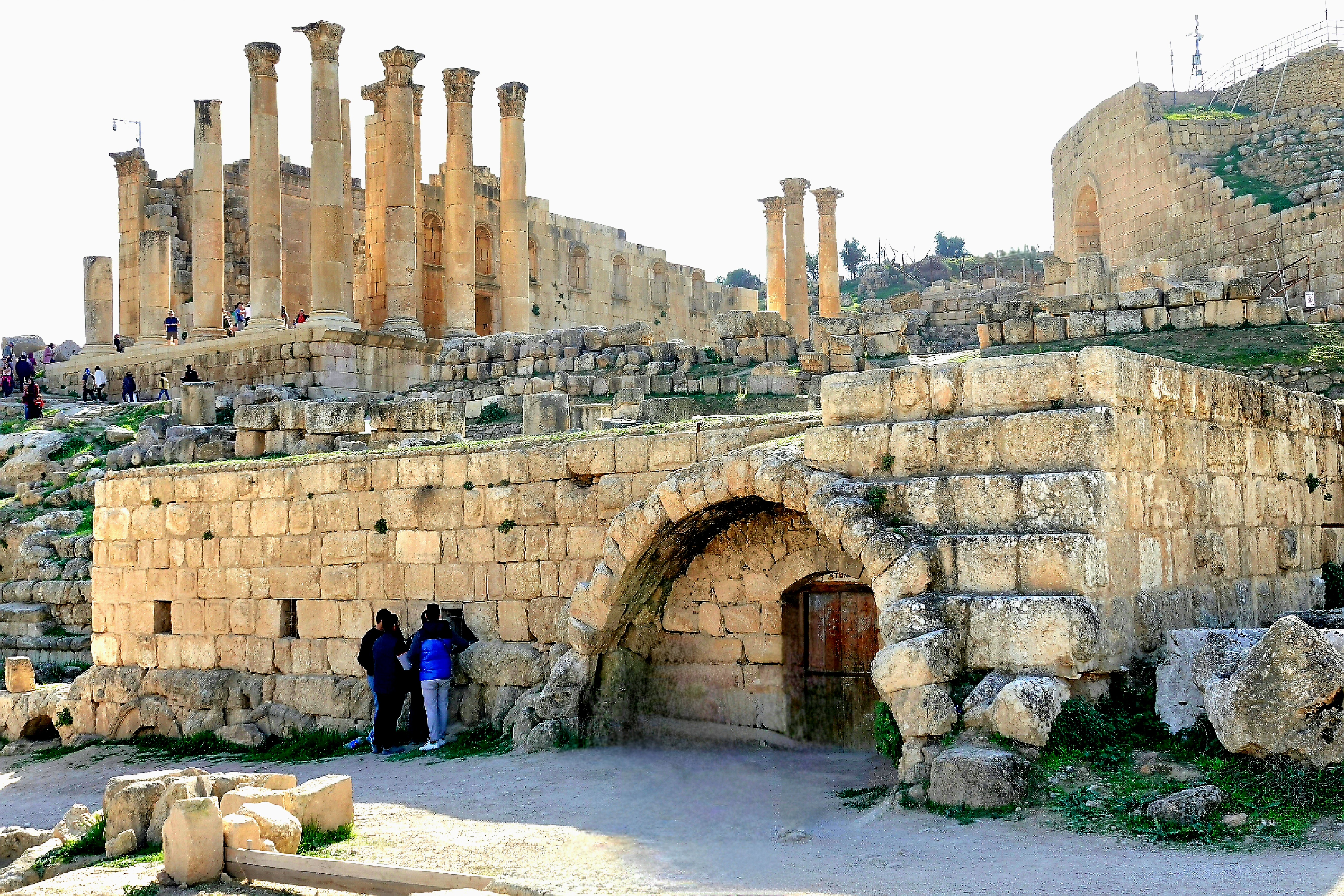
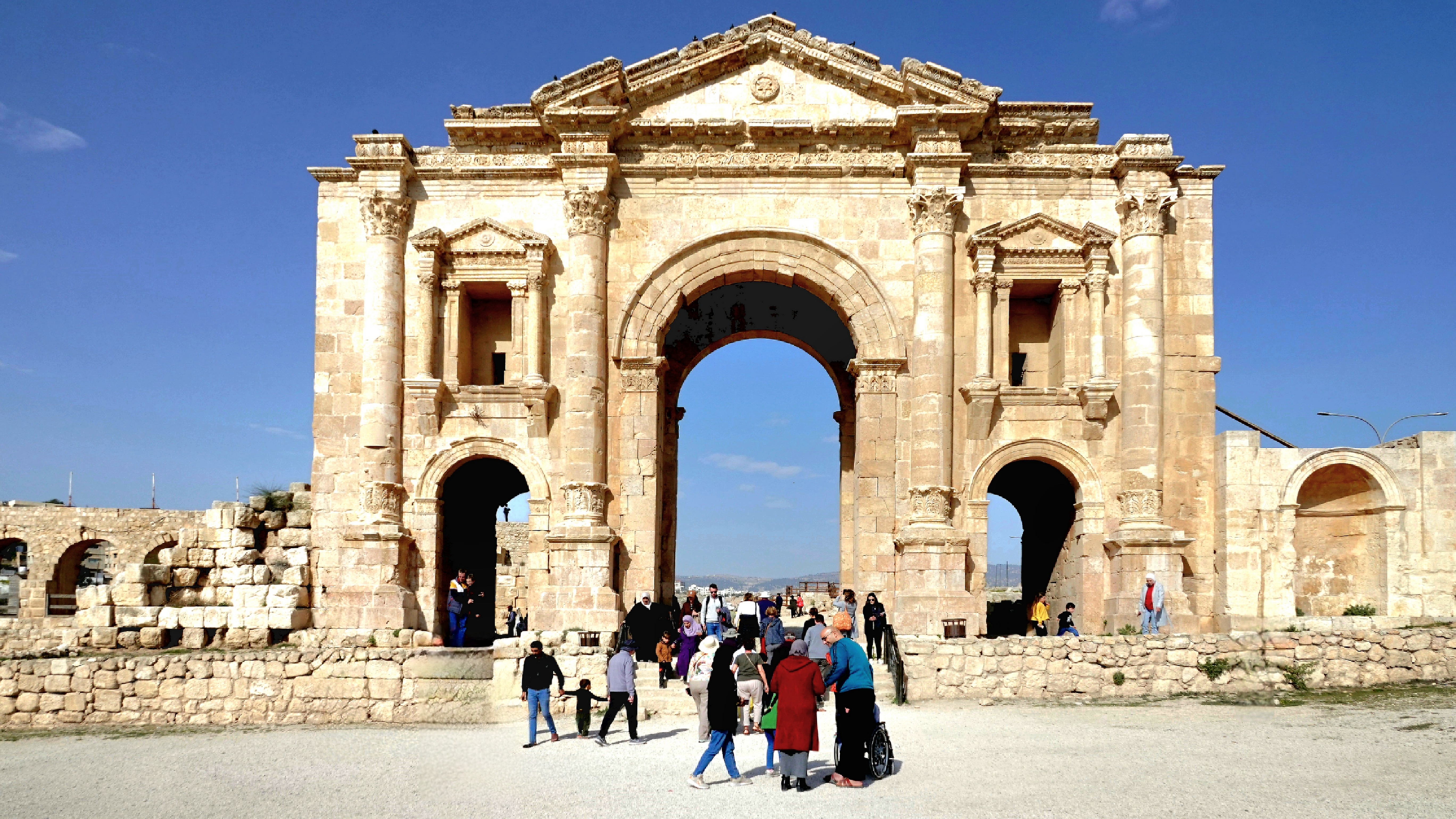
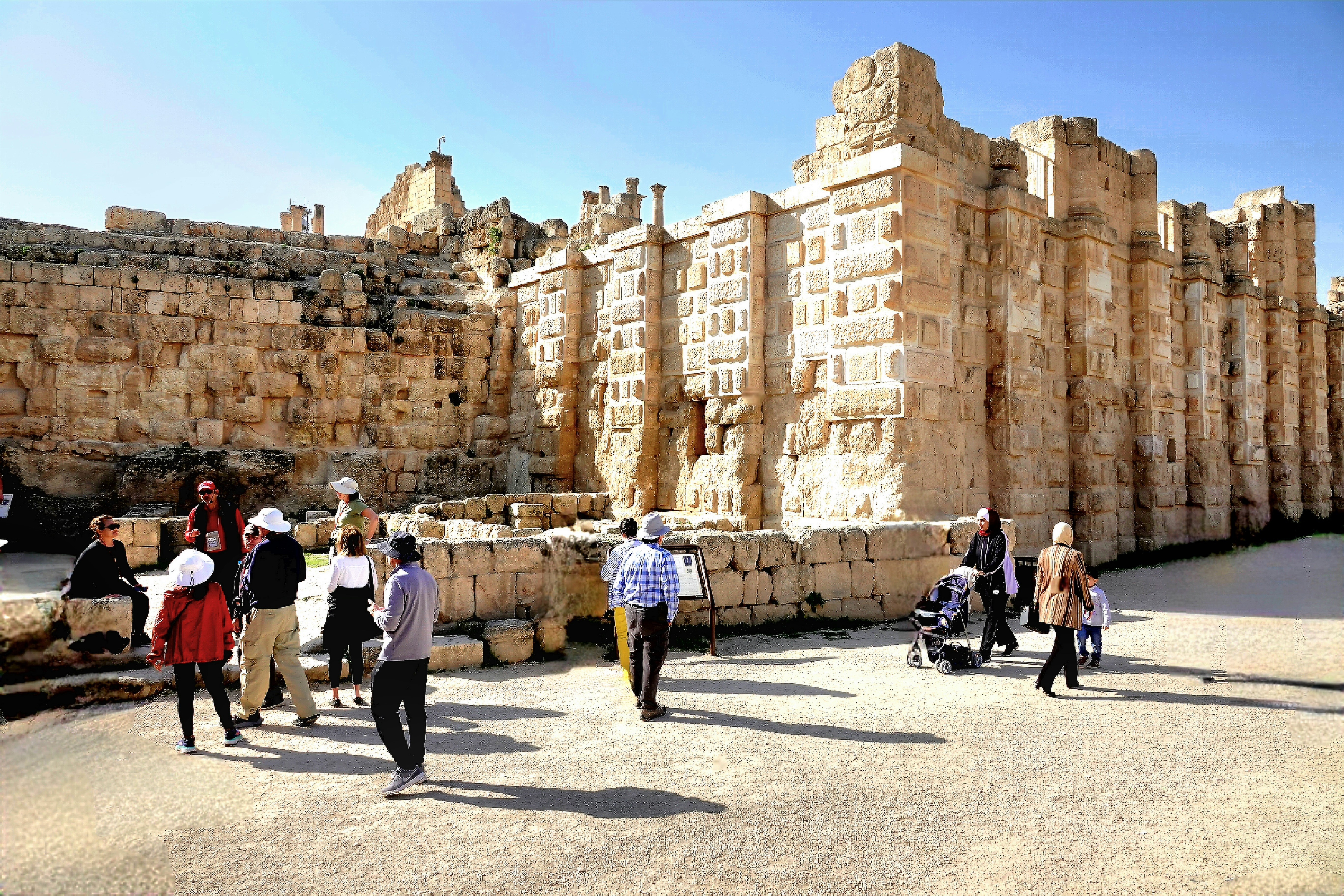
A walk through the Archaeological Park carried us back in time when the Roman Empire flourished, and Hadrian’s patronage (Emperor from 117 – 138 AD) benefitted the eastern provinces.
Hadrian’s Gate
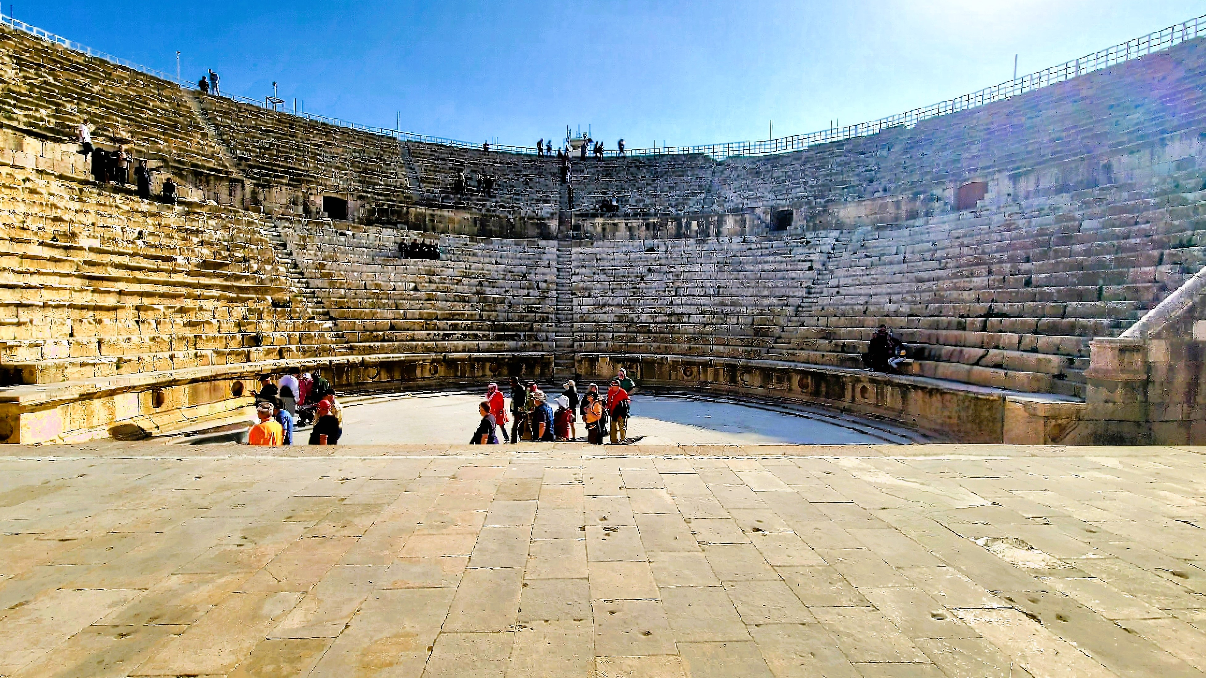
There’s the Hippodrome, originally built for chariot races, and later converted to gladiator fights with the addition of amphitheater seating;
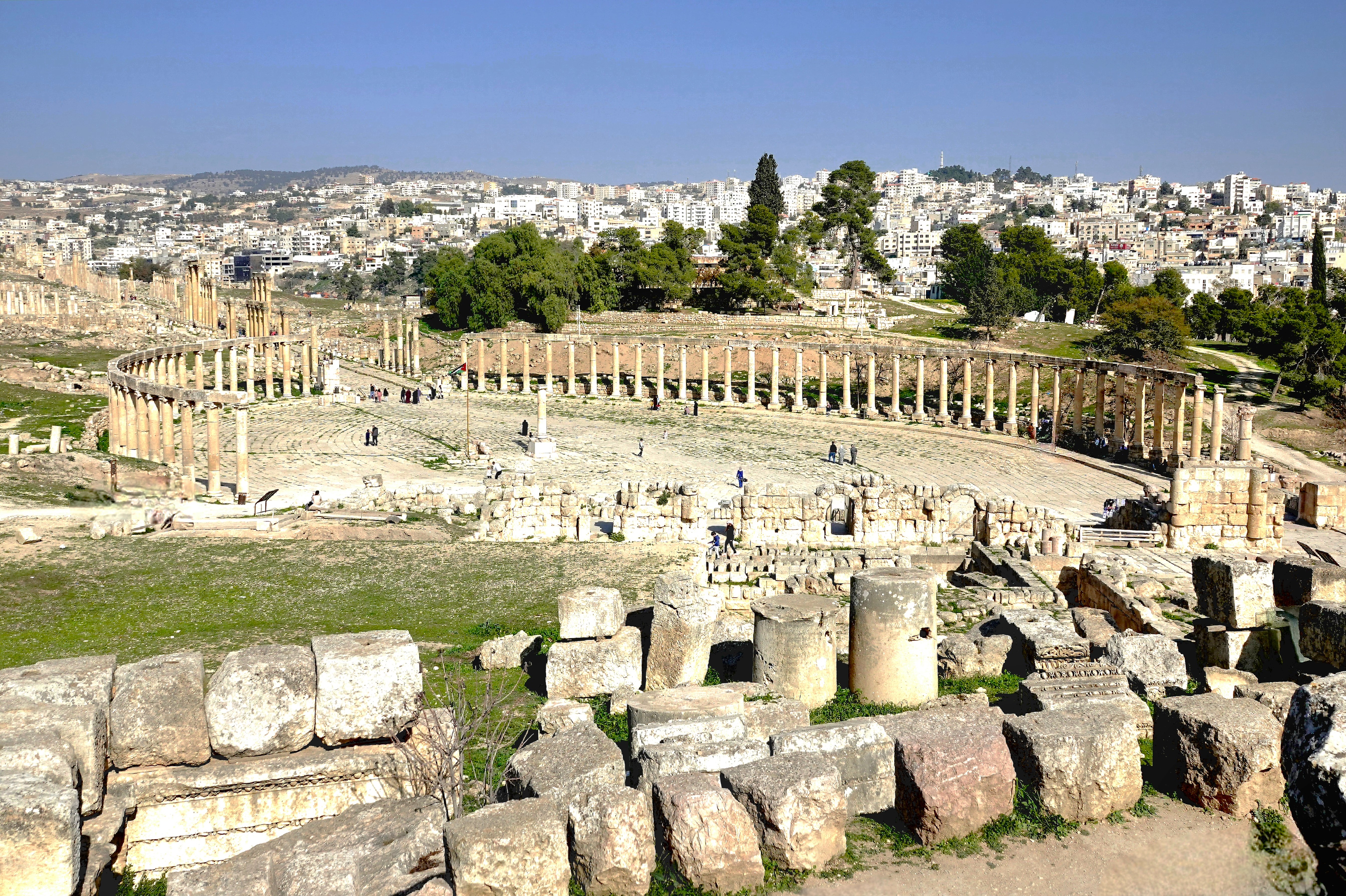
the Oval Plaza, with limestone pavers framed by 56 Ionic columns;
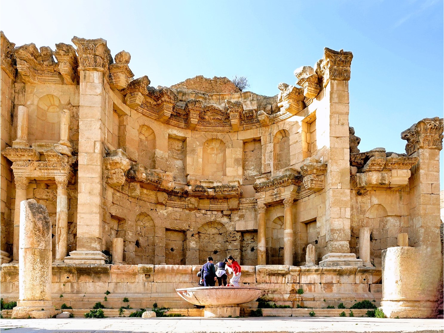
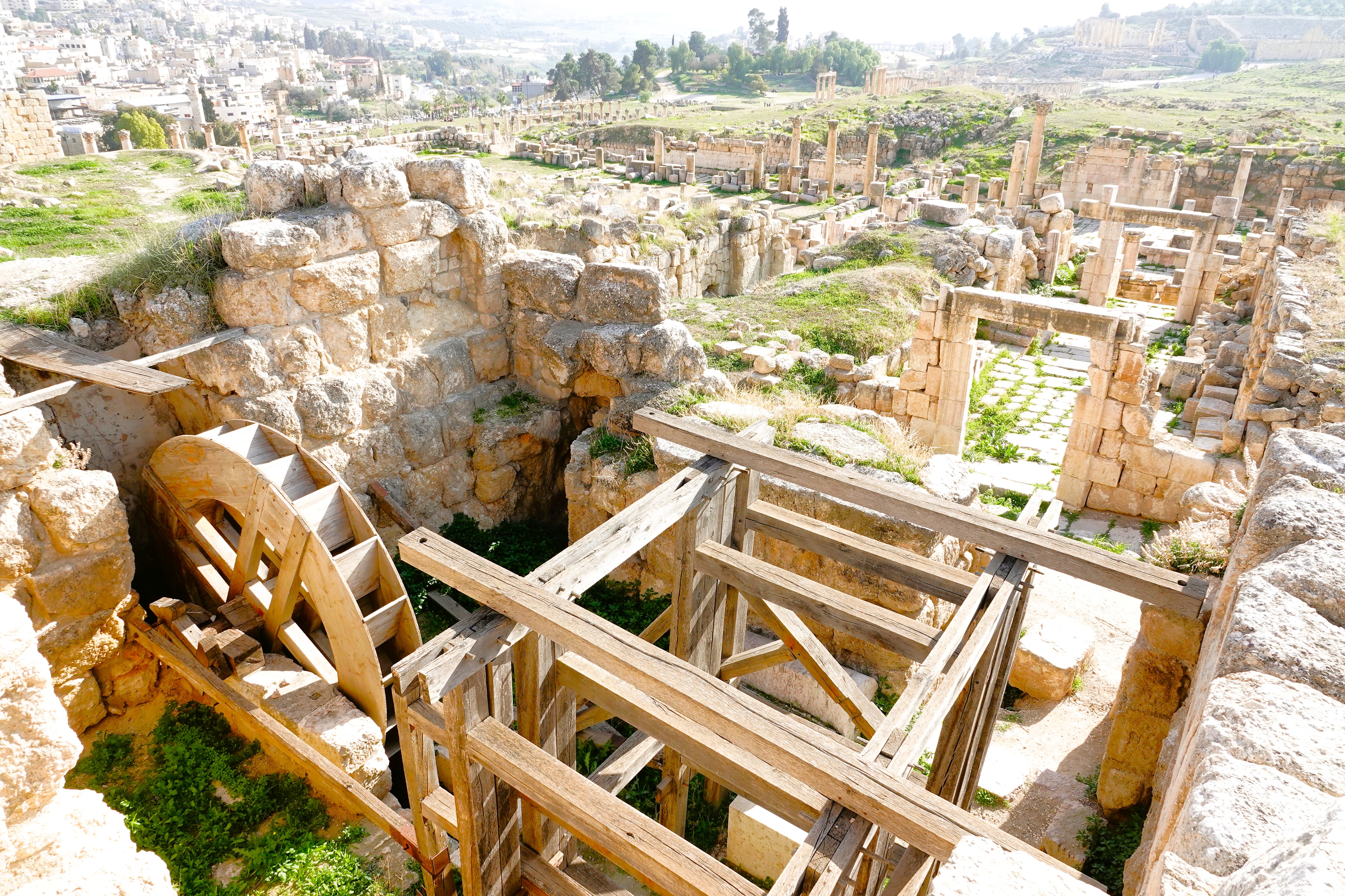
the Nymphaeum, the city’s primary water resource…
built to meet the demands of the Western Baths;
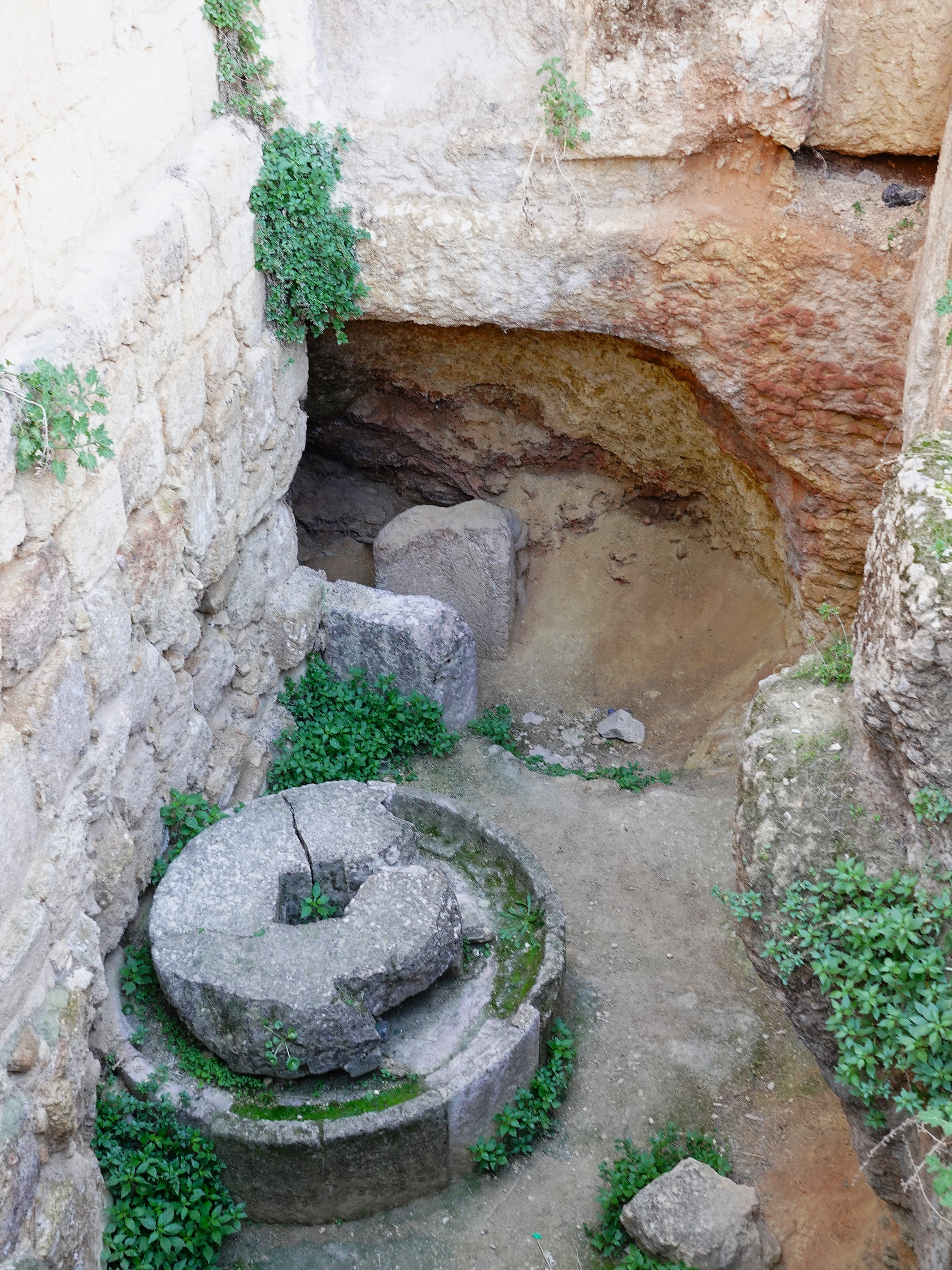
the olive oil press located below the floor of the Western Souk…
and a subterranean, water-powered saw mill;
divided spaces for artisan and trade shops lining South Street, outside city limits;
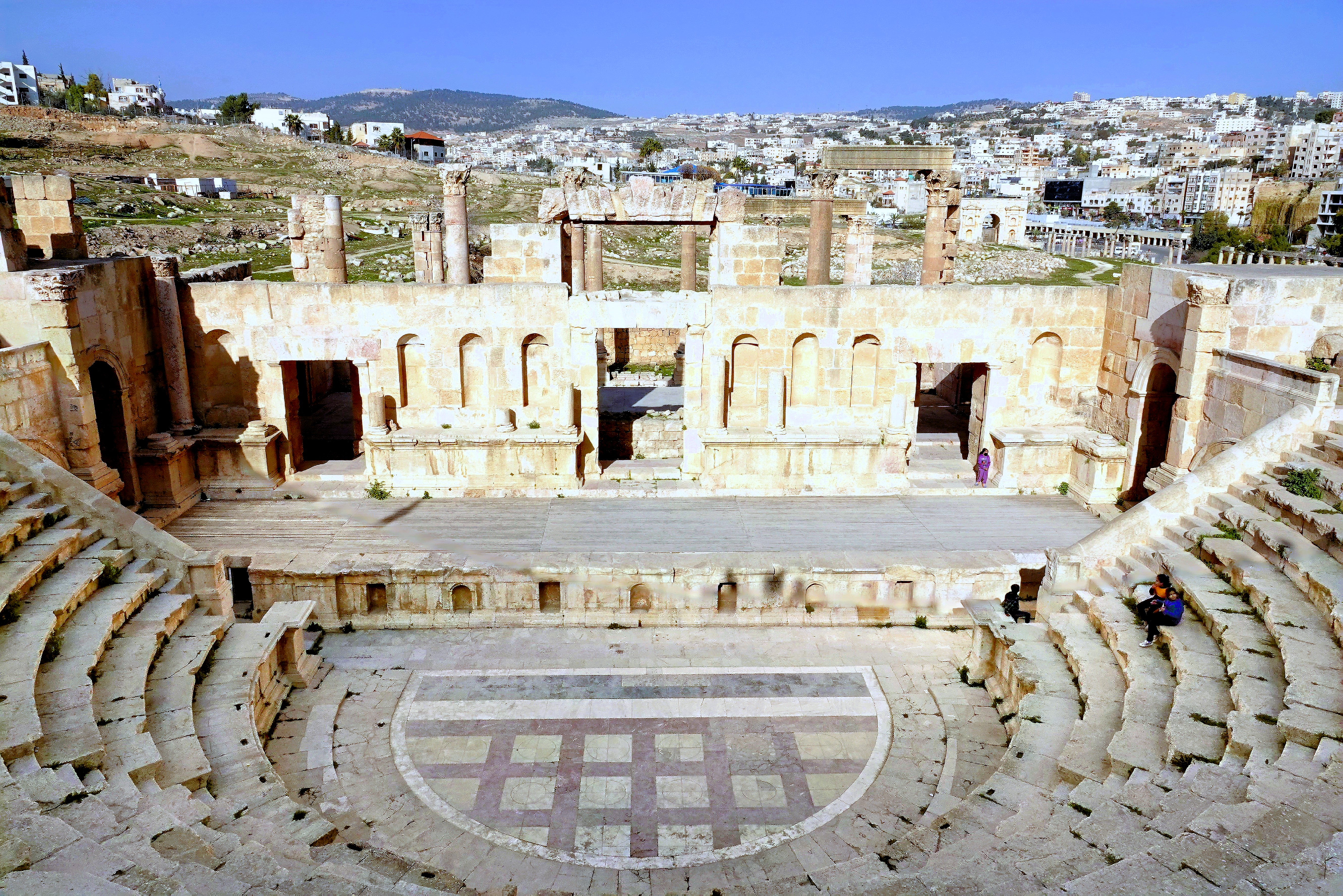
the North Theater, intended for political events;
the unfinished Temple of Artemis–built as a shrine to the patron goddess of Jerash, but utilized as a church during the Byzantine Period, and a fortress during the Crusades.
and other assorted churches built atop the foundations of earlier structures, like the Church of Mariano’s, assembled from stones of a pre-existing synagogue,
and the Church of St. Theodore, completed in 496 AD.
In 749 AD, a devastating earthquake flattened Jerash and turned this once great city of the Decapolis into rubble. It was soon abandoned and largely forgotten until the Crusaders seized the Temple of Artemis from the atabeg of Damascus.
Eventually, the sands of time buried the ruins. Jerash was discovered again in 1806 by German explorer, Ulrich Seezten, who recognized the ruins. But it was only after the British began colonizing the Jordan Valley in 1921 that Jerash became worthy of preserving.
Lucky for us, the British vibe was on full display at the South Theater…
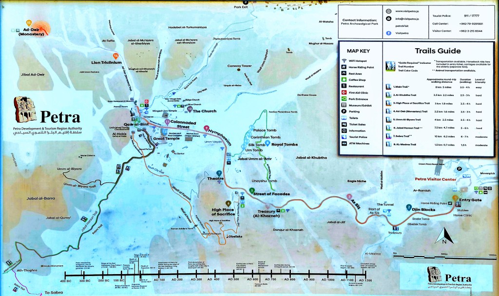
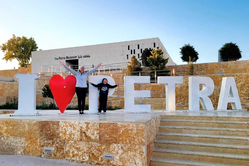
Weather in Petra can be unpredictable in January. A year ago–on January 26–it was snowing, but today, the temperature would reach 60o and the sky would remain cloudless. What better time to take a hike through history, and walk amongst one of history’s most remarkable endeavors.
With overnight accommodations at Movenpick–directly across the street from the Petra Visitor Center–access to the Old City was most convenient. We assembled early in the town center. The square was quiet except for shops looking for early customers,
and a stray puppy gnawing on a breakfast bone.
Our group gathered around a large map in town center to plan our hike.
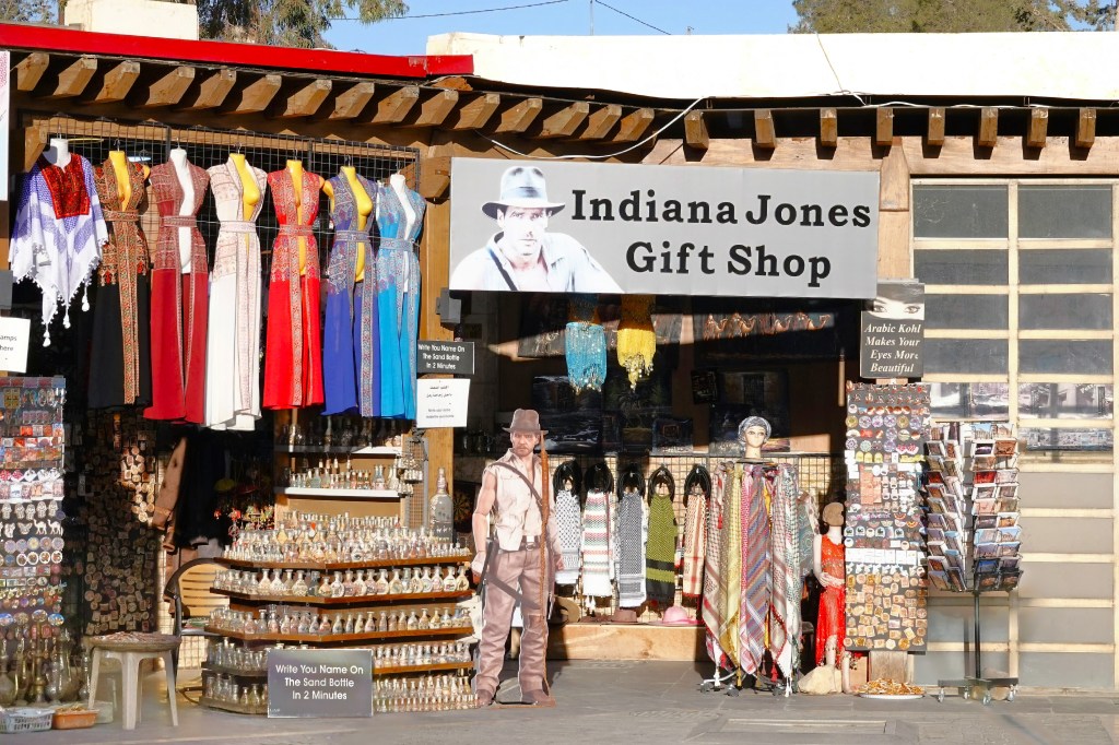
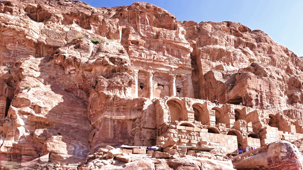
Ahmad explained the many ways to get to Petra’s ruins: by foot, golfcart, donkey, horse, or camel. But the only road that takes us there–courtesy of George Lucas, who paved the way for a dramatic scene from Steven Spielberg’s Indiana Jones and the Last Crusade–runs through a narrow gorge known as As Siq,
which is nearly a mile from Al-Khazneh, known as the Treasury.
Beyond the Treasury, it’s another mile past Temenos Gate to the end of the Colonnaded Street…
that leads to Qasr al-Bint–Petra’s most intact structure and Nabataean temple.
Ahmad suggested we take our time by foot, but after that, we’re on our own–for as long as we like–and we can return by any means of conveyance.
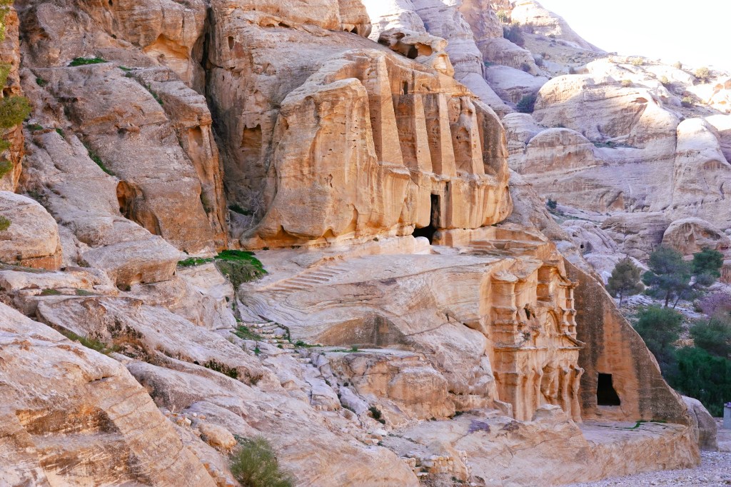
Once we understood the plan, we started out: past Djinn Blocks–a series of three imposing funerary monuments;
an iconic, two-story Obelisk Tomb;
and a Bedouin musician who may have been busking to buy an extra string for his DIY rababah.
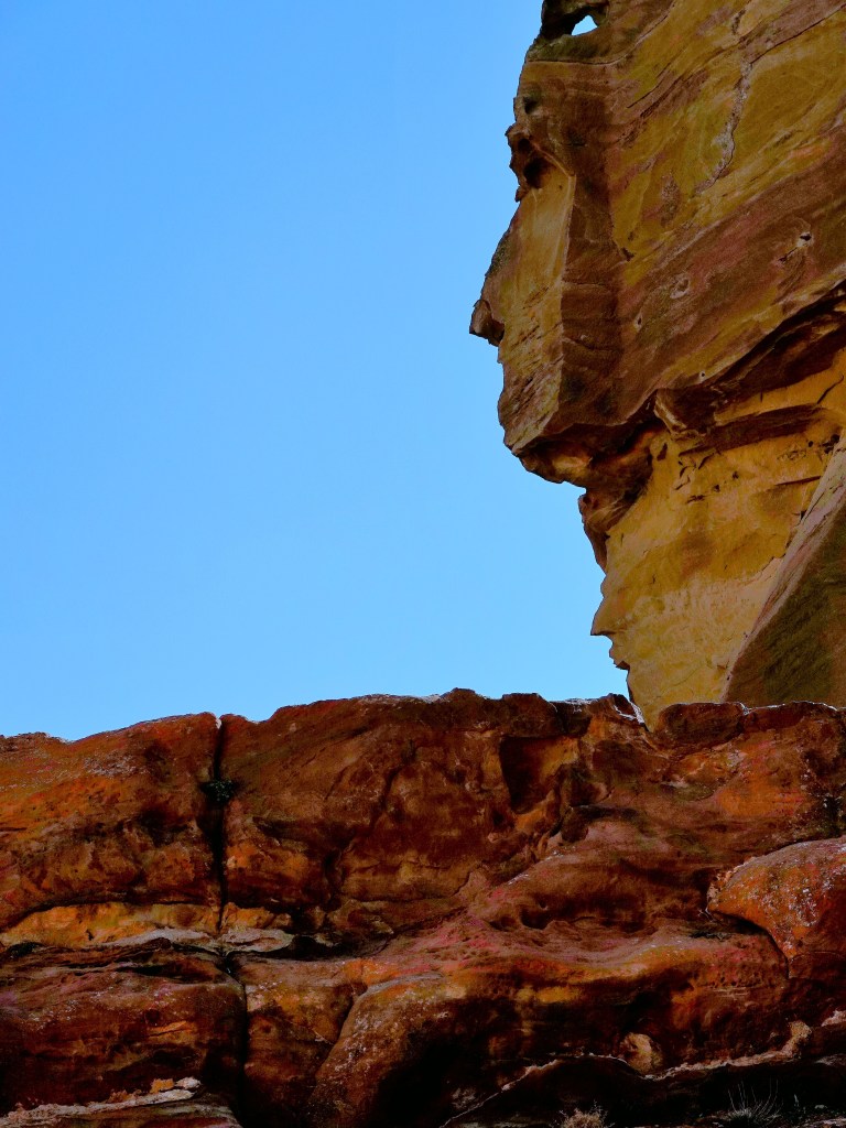
We followed the road through high walls of colorful sandstone, where rocks resembled elephant creations…
and human profiles,
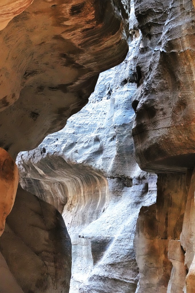
with twisted stone rising upwards of 600 ft (183 m),
and narrow as 10 ft (3 m) across,
until we neared the end of the passage. Ahmad had us form a line and close our eyes as he guided us through the last bend in the gorge.
When the moment was right, we opened our eyes for the big reveal…
and it was a revelation! First light was streaming across the canyon walls,
and bathing the iconic façade with golden sunlight. It was truly a sight to behold! Ahamad declared, “I love my job!”
Petra has been written about to near exhaustion. There’s not much more I can add about the Nabataean Kingdom that UNESCO World Heritage Convention hasn’t already mentioned, so I will say it in pictures and leave the words to UNESCO:
Inhabited since prehistoric times, this Nabataean caravan-city, situated between the Red Sea and the Dead Sea, was an important crossroads between Arabia, Egypt and Syria-Phoenicia. Petra is half-built, half-carved into the rock, and is surrounded by mountains riddled with passages and gorges. It is one of the world’s most famous archaeological sites, where ancient Eastern traditions blend with Hellenistic architecture.
Situated between the Red Sea and the Dead Sea and inhabited since prehistoric times, the rock-cut capital city of the Nabateans, became during Hellenistic and Roman times a major caravan centre for the incense of Arabia, the silks of China and the spices of India, a crossroads between Arabia, Egypt and Syria-Phoenicia. Petra is half-built, half-carved into the rock, and is surrounded by mountains riddled with passages and gorges.
An ingenious water management system allowed extensive settlement of an essentially arid area during the Nabataean, Roman and Byzantine periods. It is one of the world’s richest and largest archaeological sites set in a dominating red sandstone landscape.
The Outstanding Universal Value of Petra resides in the vast extent of elaborate tomb and temple architecture; religious high places;
the remnant channels, tunnels and diversion dams that combined with a vast network of cisterns and reservoirs which controlled and conserved seasonal rains,
and the extensive archaeological remains including of copper mining, temples,
churches and other public buildings.
The fusion of Hellenistic architectural facades with traditional Nabataean rock-cut temple/tombs including Al-Khazneh, the Urn Tomb,
the Palace Tomb, the Corinthian Tomb,
and the Deir (“monastery”) represents a unique artistic achievement and an outstanding architectural ensemble of the first centuries BC to AD.
The varied archaeological remains and architectural monuments from prehistoric times to the medieval periods bear exceptional testimony to the now lost civilisations which succeeded each other at the site.
Petra was a marvel. And it may have been the overwhelming feeling of awesomeness that gave us the energy to return to the plaza by foot and express our satisfaction. So too thought the young girl with special needs, who spontaneously shared the moment with Leah.
There was so much cultural, historical and scientific significance to absorb in a day, which led me to conclude that the worst thing about Petra was not having another day to do it all over again.
According to the Old Testament (Deuteronomy, 34:6), Moses–at 120 years–ascended the highest crest of Mount Nebo (800m) to view the Jordan Valley.
Although Moses led the sons and daughters of Israel out of bondage from Egypt, Moses was forbidden by God to escort them to the Promised Land.
With every step up the mountain, Moses would contemplate his sin of doubting God’s concern and commitment to The Chosen People. Was it anger or despair that provoked Moses into raising his staff and twice striking the Rock so his congregants and their cattle could drink from the wellspring that burst through the ground, and quell their complaining?
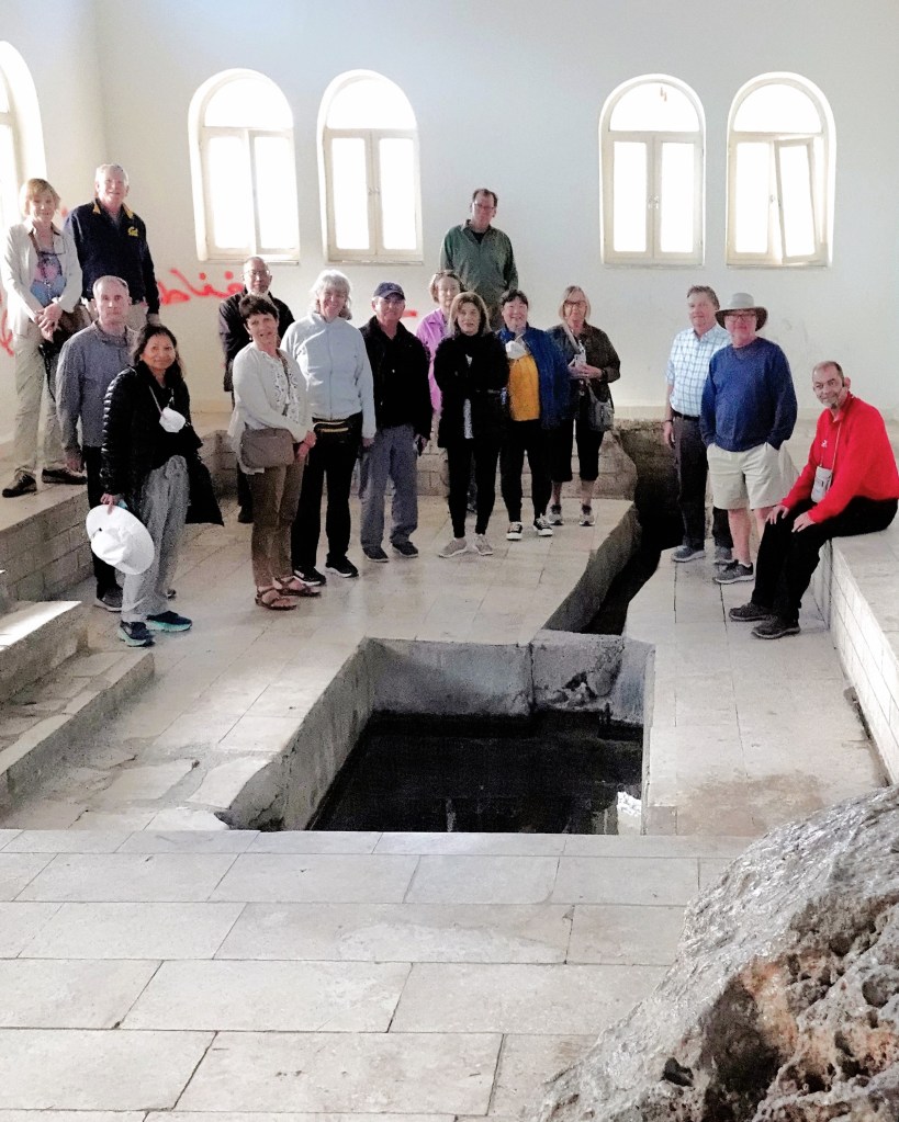
A shrine in Wadi Musa purports to be the perennial natural spring that arose from the rock struck by Moses. The site is most popular among Christian and Muslim pilgrims who travel from all parts to drink from the sacred well.
As for me, I took a hard pass; the water was running slow and low, and too risky to sample.
But the miracle performed by Moses sealed his fate. With Joshua assuming a new leadership role, Moses trekked to the highest point on the western ridge of the ancient Plains of Moab for a view of the Holy Land.
Perhaps God provided Moses with a befitting yet bittersweet panorama before he died, other than the hazy scene that I managed to capture.
All the churches atop Mount Nebo were erected over time to commemorate the death of Moses. The earliest known chapel dates to the 3rd century, followed by a 4th century monastery built to support Christian pilgrims.
20th century archaeologists excavated an intact mosaic floor within the baptistery of the chapel that depicts the cultural life of the Byzantine era–
surrounded by figurative motifs with geometric design flourishes…
that also adorn the walls.
and it’s all been preserved in a new church sanctified by the Franciscan Order in 2018.
The mountaintop is rich with artifacts sponsored by the Franciscans. The serpentine cross atop Mount Nebo was created by Italian artist Gian Paolo Fantoni to symbolize the miracle of the bronze serpent forged by Moses in the wilderness (Numbers 21:4–9) and the crucifixion of Jesus, whereas the stone Monolith was sculpted by Vincenzo Bianchi in honor of Pope John Paul II’s visit during the Great Jubilee of 2000.
As part of the Pope’s pilgrimage to Jordan, he planted an olive tree seedling that he dedicated to peace in the Holy Land.
Ironically, while the tree has prospered, peace has yet to bloom.
Having admired the mosaics of Madaba and Mount Nebo, our group got a personal look at the process at Jordan Jewel Art & Mosaic, which was created in 2008 through Jordan’s Queen Noor Foundation Community Development Initiative as a means of preserving an ancient artisanship introduced by the Greeks over two thousand years ago.
The project has also been a boon to tourism and employment within the governate, with over 100 mosaicists working at the studio or from home, creating historical souvenirs for tourists.
Depending on the pattern and the size, the mosaic can be extremely detailed, at times requiring tens of thousands of intricately-sized tiles and several weeks to complete.
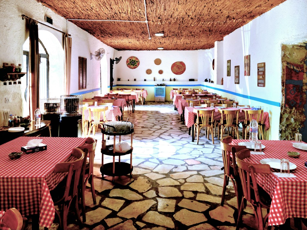
Our crew eventually returned to Madaba for a traditional lunch at Hikayet Sitti (“My Grandmother’s Story”)–a family-owned restaurant in an old home belonging to the Karadsheh family through many generations.
It now belongs to Feryal, the gracious owner/chef who prepared a tasty array of mezza (appetizers) to start,
and a kettle-sized helping of Maqluba–a traditional Middle Eastern dish of chicken, vegetables and rice that’s prepared in a pot and presented upside down.
Feryal distributed the recipe to the home chefs among us, but as I read through the prep and ingredients, I was certain the dish was more complicated:
MAQLUBA
• Fry pieces of eggplant, cauliflower, and potatoes • Boil pieces of chicken • Arrange at the bottom of the cooking pan pieces of tomatoes, carrots, onions, sweet pepper, and garlic • Then add the fried eggplant, cauliflower, and the potatoes • Add pieces of chicken • Cook them together with water • Add the rice to cook together • Add black pepper, cinnamon, nutmeg and cardamom, cumin, cloves, coriander • Cook until water is evaporated • Put it on low fire for 5 minutes • Let it rest for 5 minutes • Serve it as upside down
As we savored every bite, we were invited to put our tastebuds to the test by identifying all seven spices in our food. My mind immediately raced to episodes of Hell’s Kitchen, when contestants competed in blind tastings for Gordon Ramsey, and the winner received a hot air balloon ride with a champagne lunch.
But Feryal was offering something much better. The prize at Hikayet Sitti was a cold beer from her brother’s brewery… and it was delicious.
After lunch, the coach stopped briefly at Shobak Castle (12th century) enroute to Petra, just as the sun broke through the haze to shower the ruins in golden light.
The castle is a stark reminder of Crusader glory amidst the plunder and ruin of the times.
Our coach driver raced the last hour to Petra with the hope that we’d arrive in time for sunset, and we were duly rewarded with a perfect sky in Wadi Musa just as the sun was falling behind Mount Hor.
It was a good omen for our excursion to Petra the following day…
We were a crew of 48 aboard the Viking Ra, divided into 2 camps of 24 travelers who identified as Bus A or Bus B.
Most of the cruisers returned home at the end of our Nile excursion, but 18 intrepid globetrotters–a union of both buses–continued our journey to Jordan for four nights, where we were greeted at Queen Alia International Airport by Ahmad Al Khaldi, our tour director and self-proclaimed terrorist, who adopted the moniker after once guiding the brother of ventriloquist/comedian Jeff Dunham.
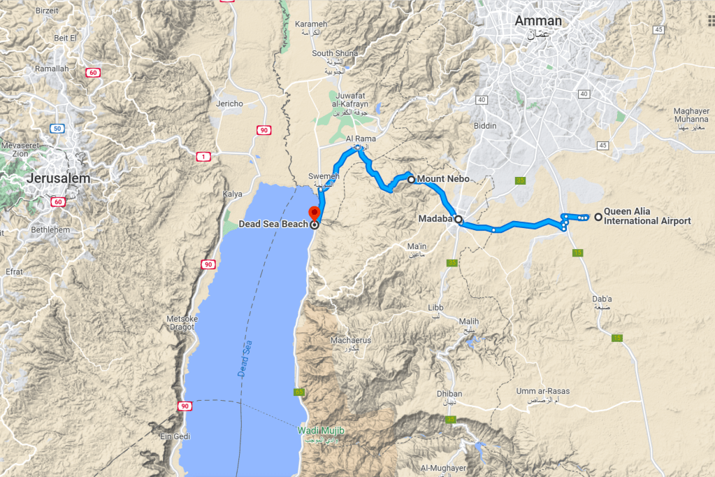
Upon arrival to Amman, we boarded a coach for a half-hour ride to Madaba. It was an ambitious itinerary with a lot of ground to cover before reaching the Dead Sea,
but we quickly knew–given the depth of Ahmad’s knowledge, wit, and organization skills–that we were in good hands.
During the half-hour ride to Madaba we absorbed some background about this ancient city that’s renowned for its skilled mosaic artisans,
and its deeply religious ties to Christianity and Islam.
After an orientation of one ofJordan’s holiest landmarks,
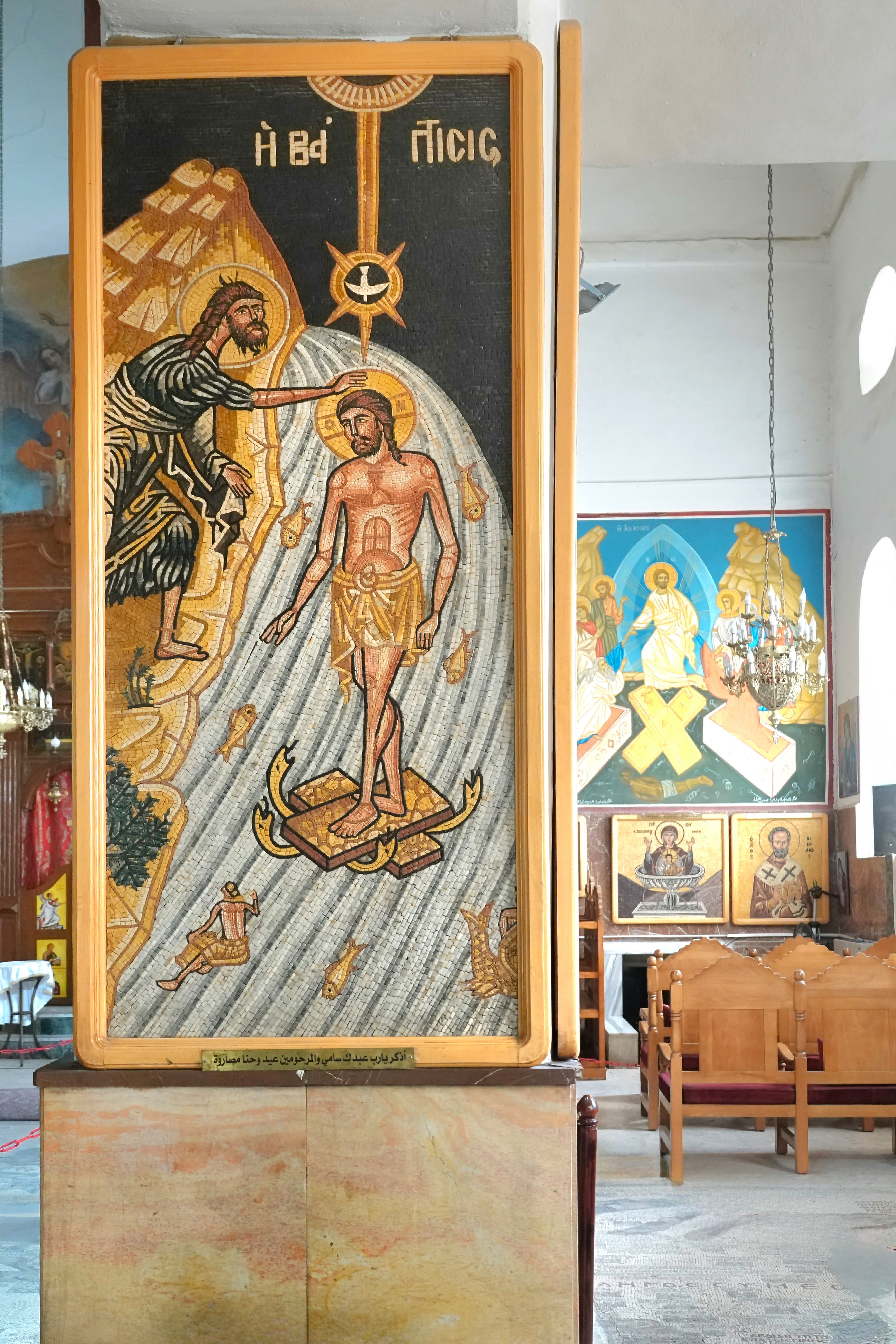
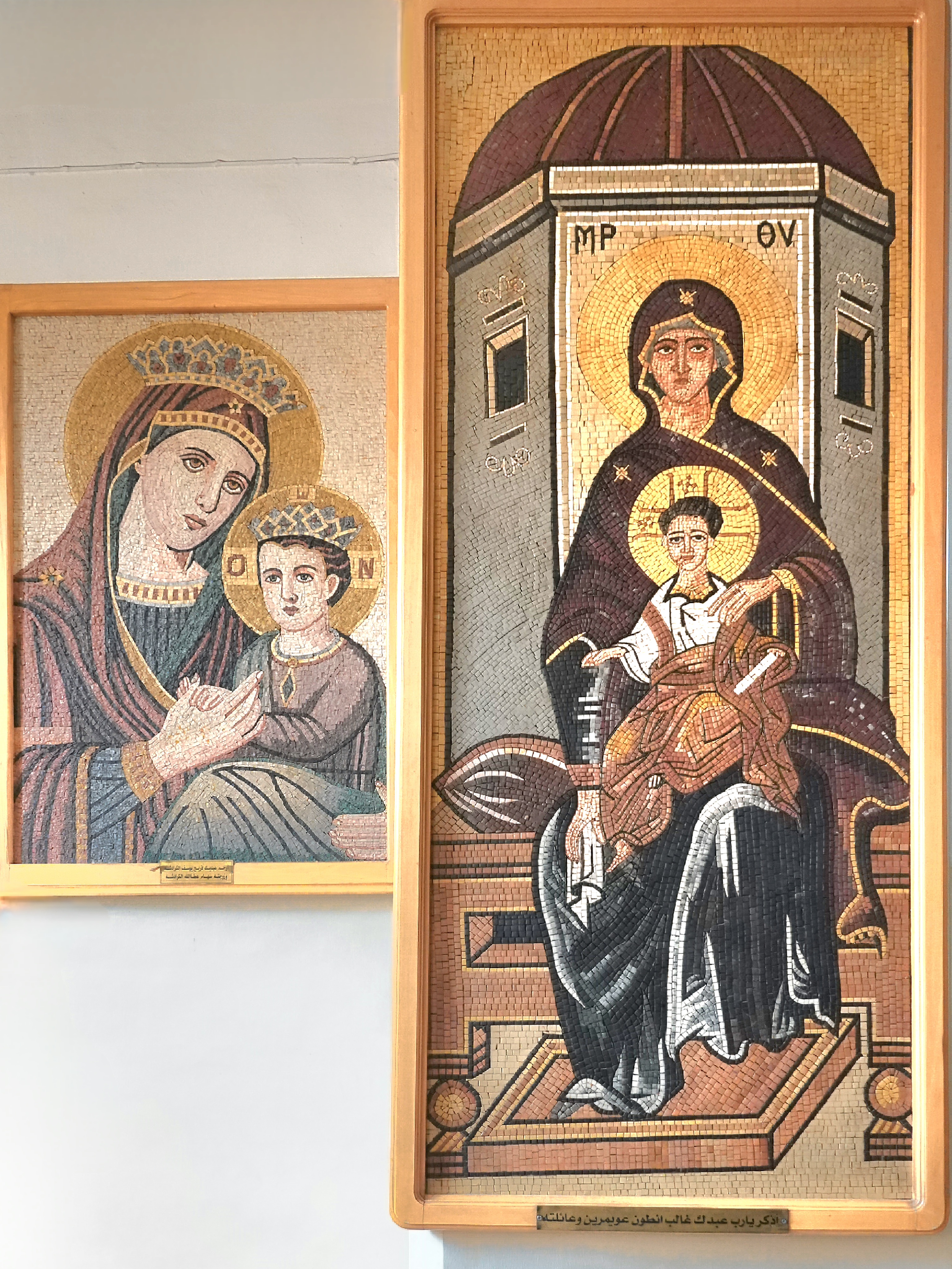
we headed to Madaba’s feature attraction… the Greek Orthodox Basilica of Saint George,
where the current structure, consecrated in 1896 is adorned by mosaic icons on every pillar…
but it’s the mosaic floor that’s the star of St. George and Madaba!
The partially restored mosaic map of the Holy Land originates from the 6th century, and was excavated in 1884 when the current church was built atop the ruins of the original Byzantine church. Over 2 million tiles comprise a detailed rendering of the Middle East with surprising detail and accuracy, making it both an artistic masterpiece, and the oldest surviving representation of familiar biblical sites.
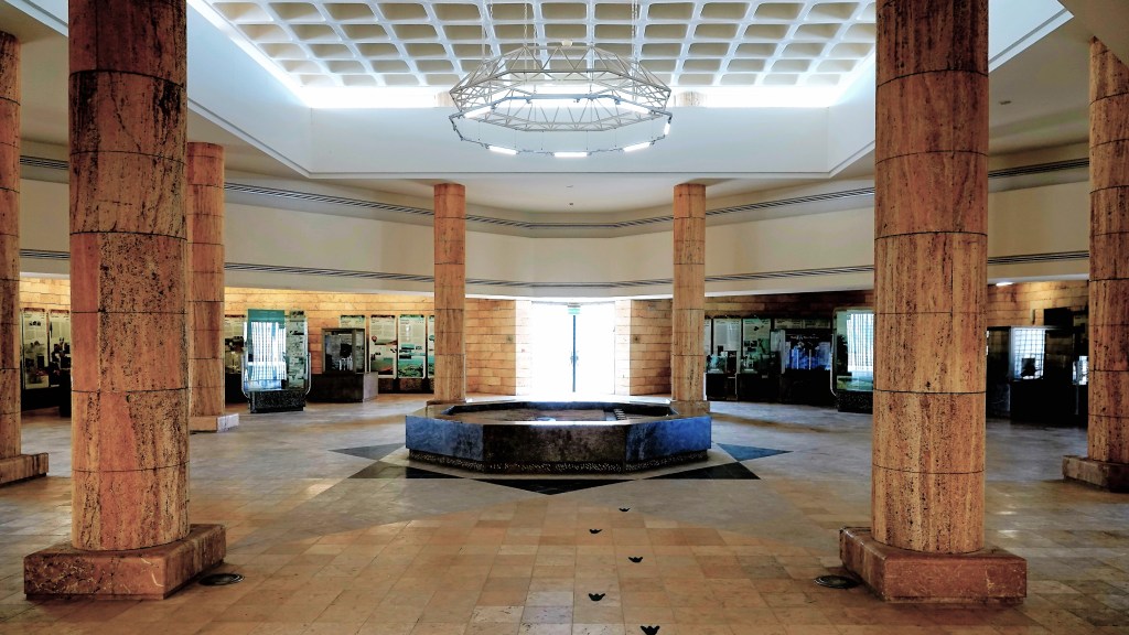
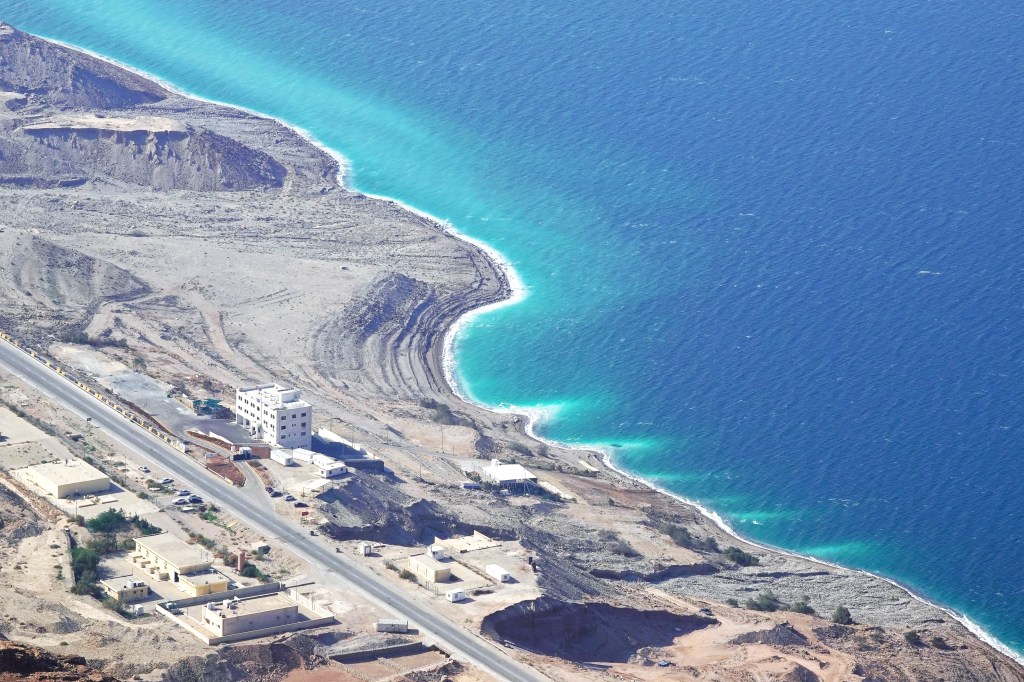
We bypassed Mt. Nebo (to be explored the following day) and continued to the Dead Sea Museum,
where we enjoyed an aerial panarama of the Jordan Rift Valley with the lowest elevation on earth (-1410 ft).
and a closer examination of the area’s geological and cultural significance.
Developers see tremedous potential in promoting Dead Sea tourism, touting first-class accomodations and access to its briney beaches. And they’re wasting little time in hotel construction,
because at it’s current rate of evaportion, the Dead Sea will cease to exist by 2050.
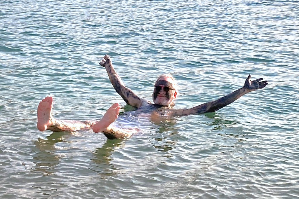
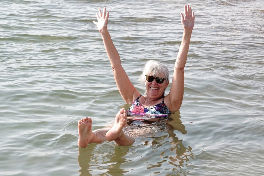
Shortly after checking into the sprawling Movenpick village…
it was time to relax with a mud treatment,
and a bouyant soak. What a feeling!
There’s been lots of internet chatter about which country, Israel or Jordan, has the best beaches. The answer is easy: it’s whichever one you’re on!
However, the east coast scores extra points for hosting the sunset over Jerusalem most nights.
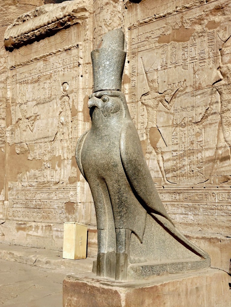
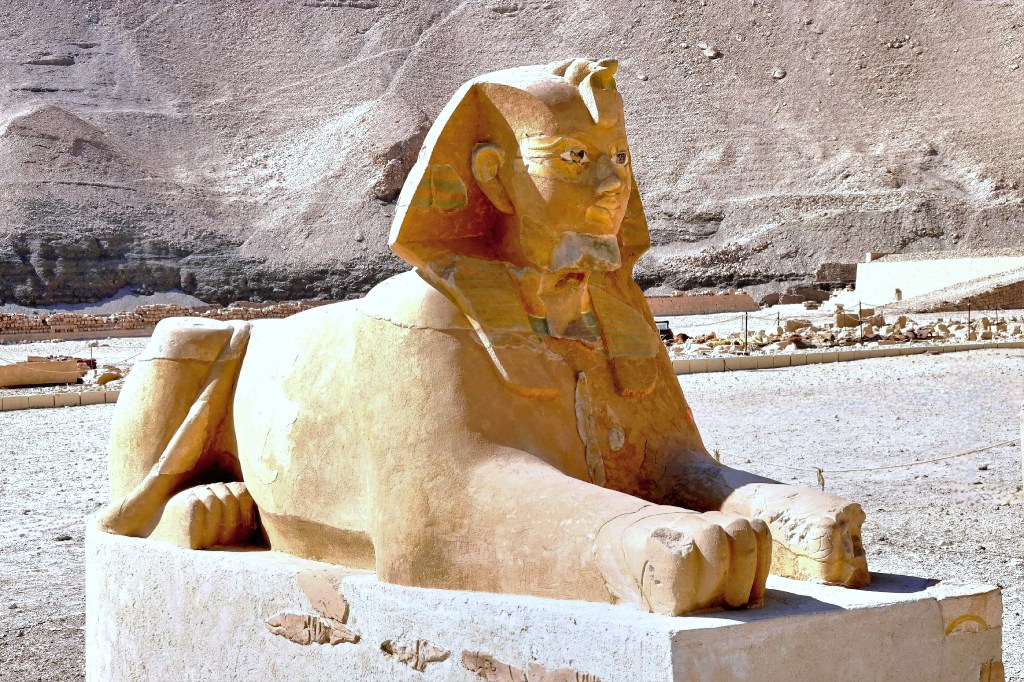
Like many ancient civilizations, Egyptians were obsessed with religion and mythology. They pledged their love and devotion to more than 700 distinct deities entrusted to protect the natural order of all things (wind, water, sun, sky, etc.) from creation to afterlife. In exchange, the devout would be rewarded with an everlasting life of prosperity, good fortune, and happiness… once they reached their final destination–the Underworld.
Gods and goddesses were personified as powerful creatures,
and hybridized animals,
and amalgams of animals and humans.
Egyptian paganism lasted long into the 5th century. However, with Egypt situated at the intersection of Europe, North Africa, and the Middle East, Egypt was also at the crossroads of influence when monotheism gained a foothold in the Middle East and spread throughout the continents.
When synchronizing Egyptian chronology and Old Testament timelines, the earliest record of monotheistic worship in Ancient Egypt occurred during a time of remarkable prosperity when Joseph–in his role as Grand Vizier of Egypt–governed and fed its people, while surrounding neighbors faced famine and hardship.
This informed Jacob’s decision to relocate his clan from Canaan to Egypt in search of provisions and an unforeseen reunion with his son. Biblical scholars have speculated the date to be 1875 BC.
This led to the eventual settlement of the Israelites, whose numbers may have grown to 2,000,000 over the next 430 years, until the storied Exodus–which would have occurred in Year 18 of Thutmose III’s reign–in 1446 BC.
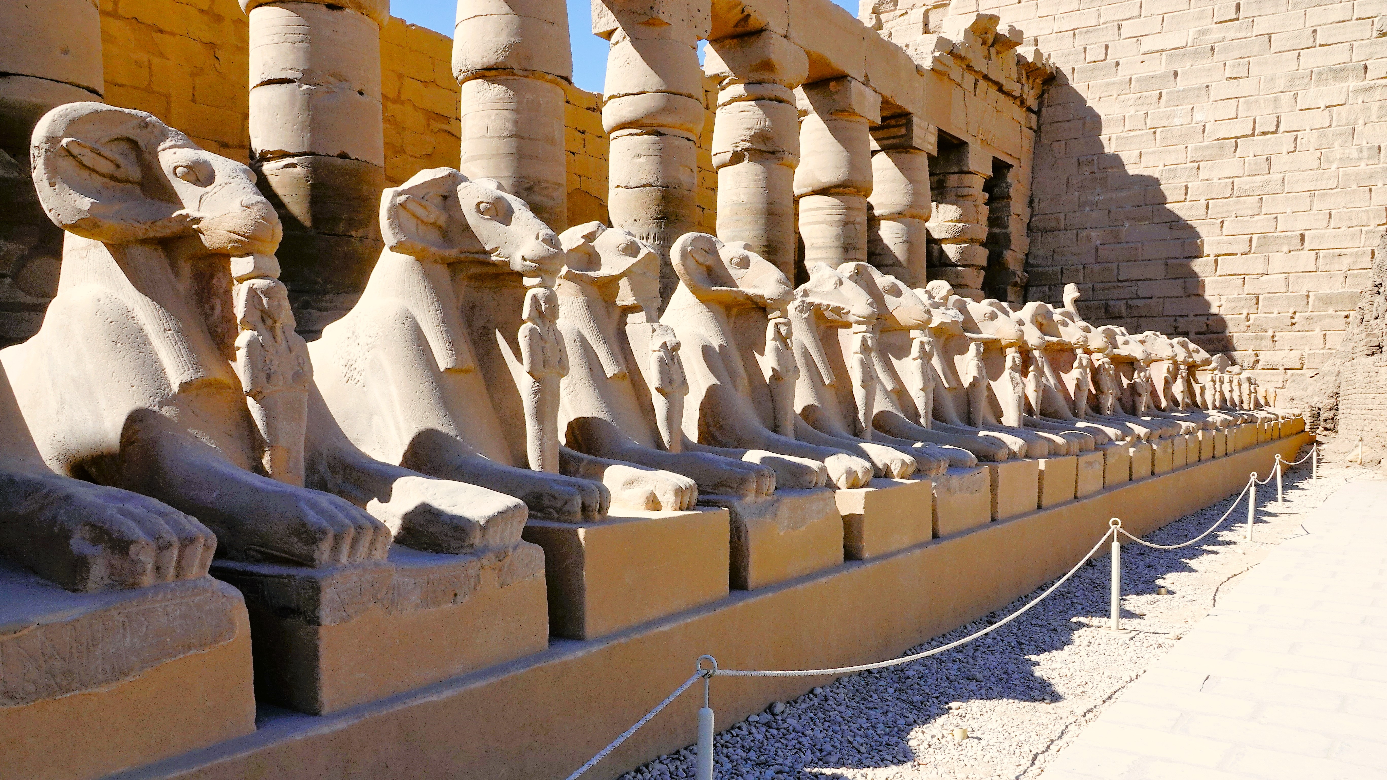
Interestingly, Amenemhat, Thutmose III’s first-born and heir apparent, mysteriously predeceased his father, and was inscribed on a column at the Temple of Amun at Karnak shortly after the death of Hatshepsut and the subsequent accession of his father to Pharaoh.
Religious reform from polytheism to pagan monotheism was momentarily embraced by Amenhotep IV during the his reign (c. 1358–1341 BC).
For some unknown reason, he changed his name to Akhenaten and elevated the cult of Aten (the sun disc) as the one and only true God.
Akhenaten went so far as to scrub all references of Amun-Ra from Karnak and build a new worship center and capital in Amarna, 170 km south of Thebes. But Atenism was short-lived; it never survived Akhenaten death, as he was so reviled by the priests that critics would often refer to Akhenaten as the Heretic King.
Subsequently, Tutankhamen–upon his ascension to the throne–reverted to worshipping Amun-Ra with his wife/half-sister, Ankhesenamun. He was 8 and she was 13 when they wed, albeit she was previously married to her father for a short time.
They had two daughters together; both were stillborn. Tut died suddenly at 18 from a fall or malaria or both, leaving Ankhe without an heir. She remarried Ay (presumedly her maternal grandfather), the next pharaoh, and soon disappeared from history.
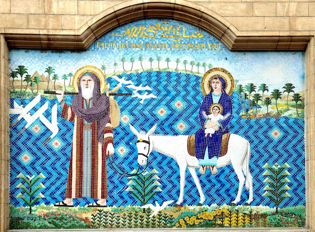
Polytheism remained the cultural norm for the following 1,400 years, until Egypt bore witness to the seeds of a new cultural revolution when the Holy Family escaped the wrath of Herod the Great’s infanticide decree c. 7 BC, and sought refuge in Egypt for the next three-and-a-half years.
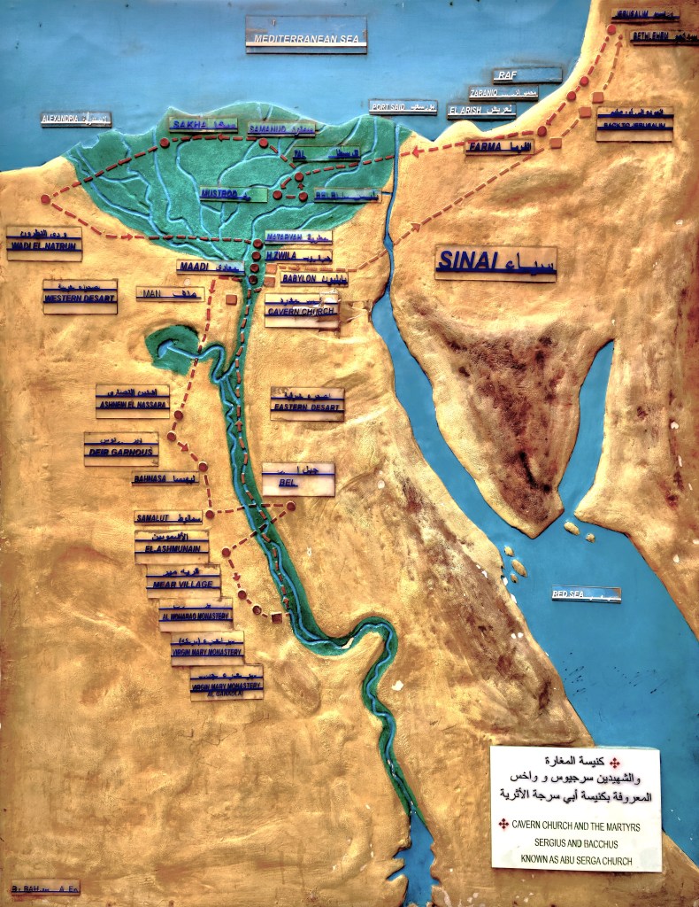
Their journey through the Sinai dessert and across the Nile to Heliopolis…
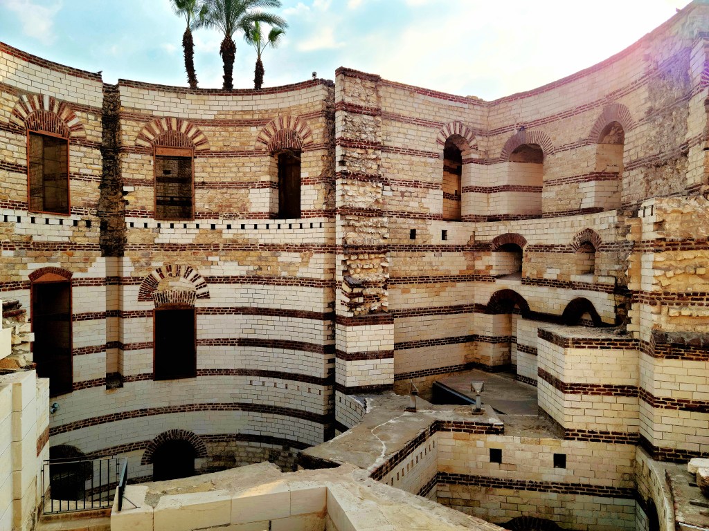
brought them to the Roman fort of Babylon in Old Cairo,
where they found shelter in a cave for the next three months,
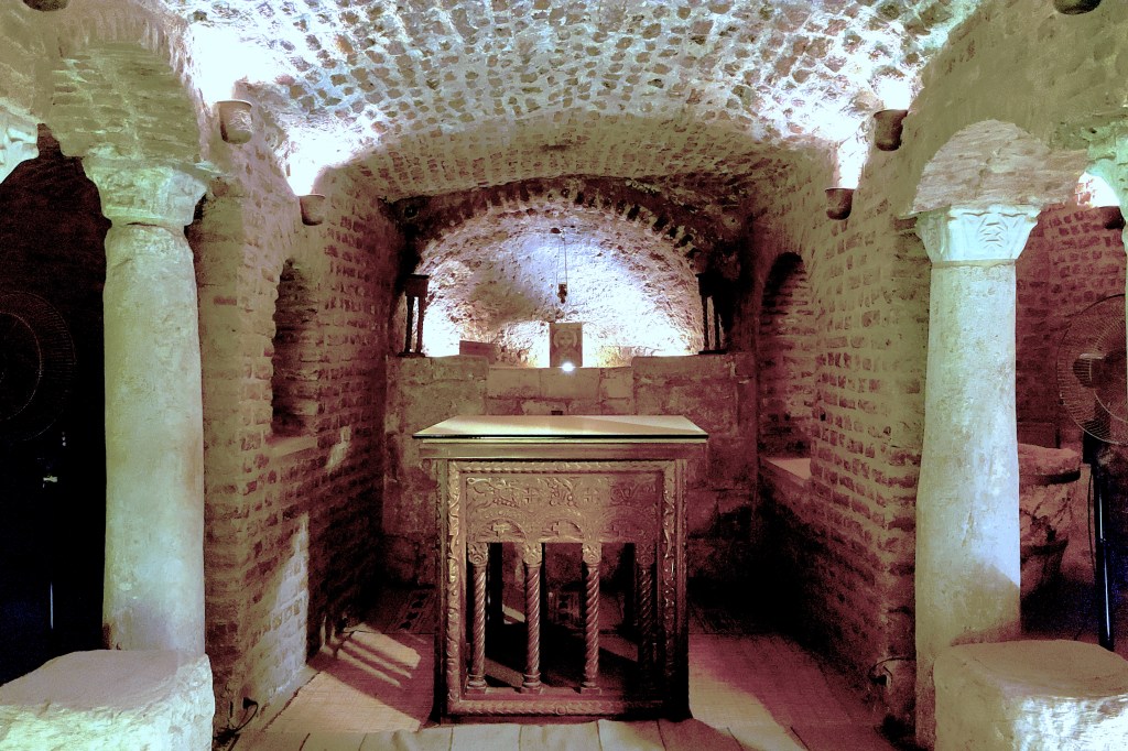
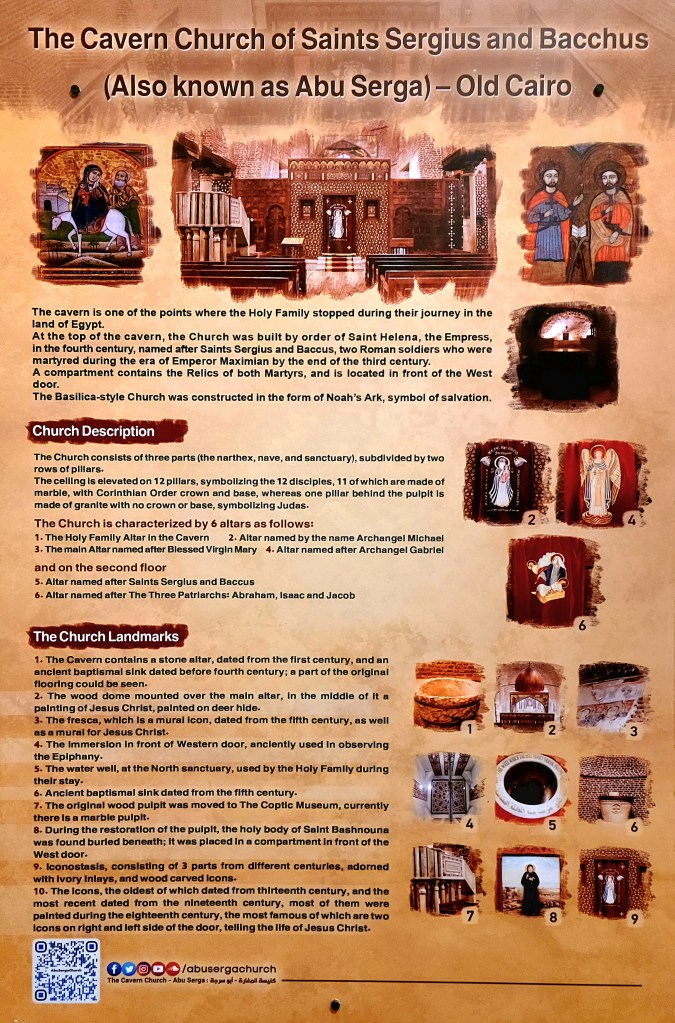
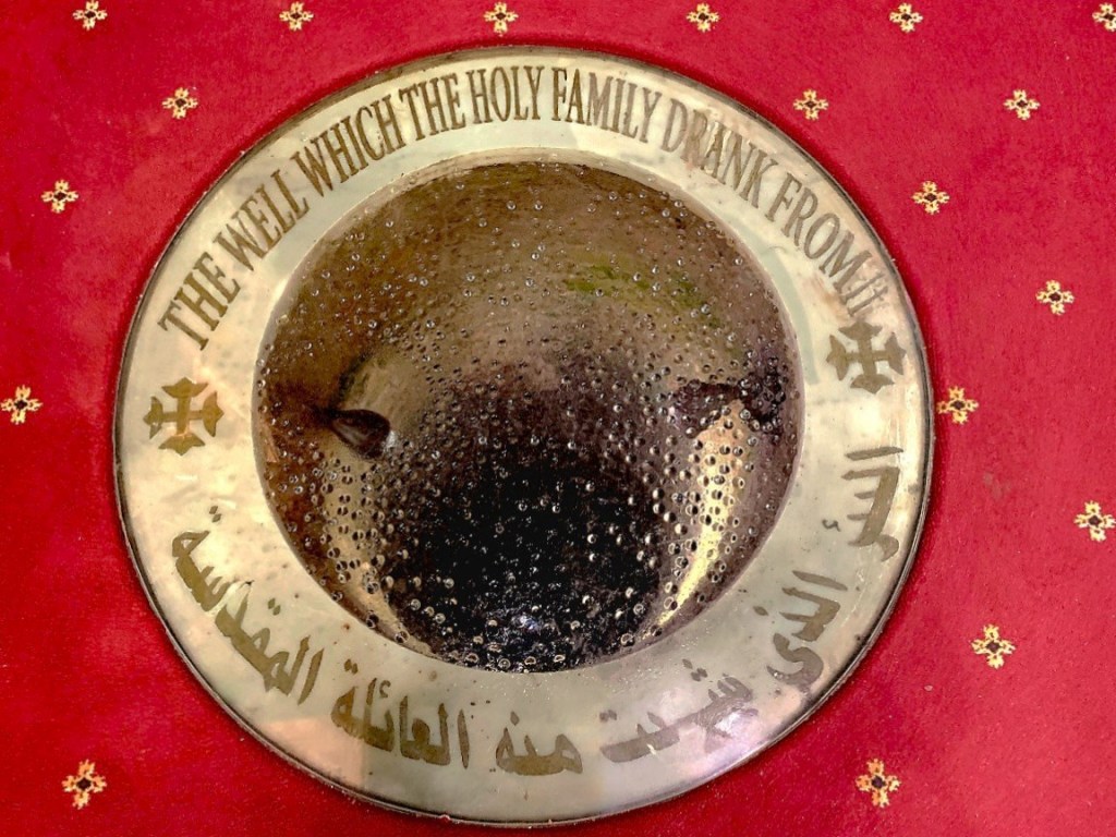
which would later become the foundation for the Church of Martyrs Sergius and Bacchus in The Cave (aka Abu Serga) built in the 4th century,
and the site of a water well which nourished Joseph, Mary and baby Jesus during their stay.
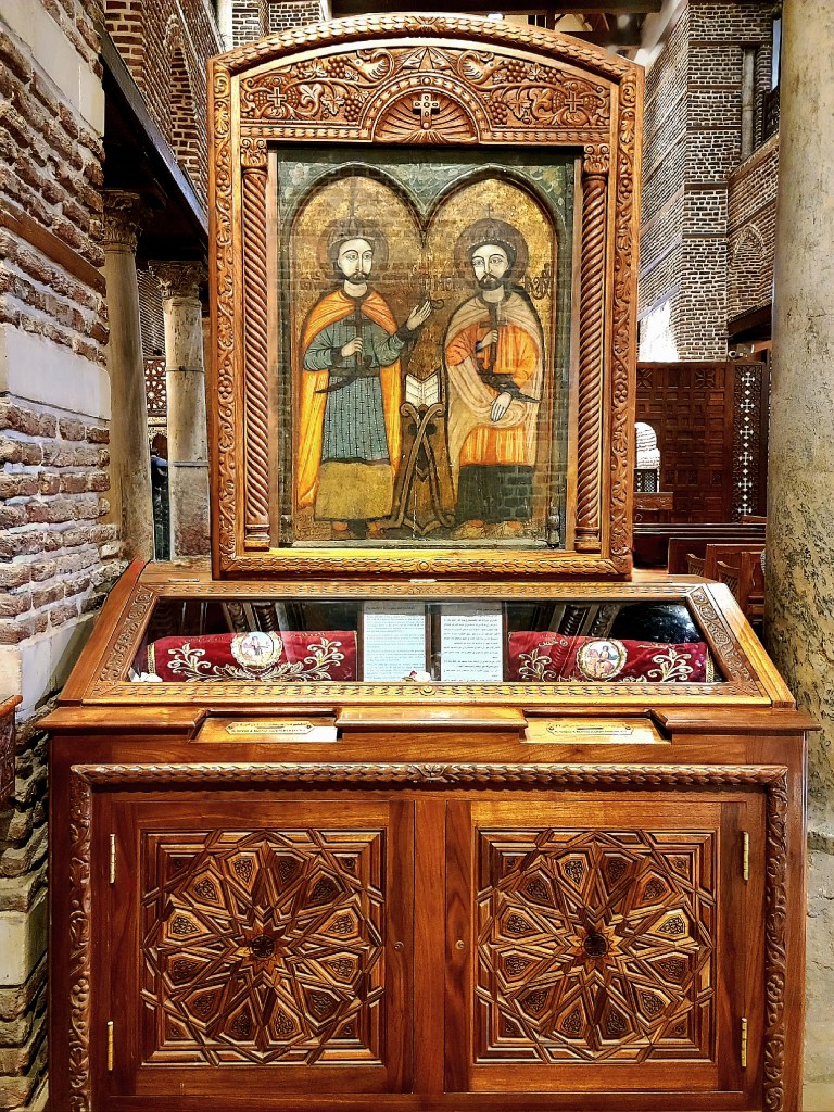
Other distinguishing features of the church include: the wall of painted icons;
and the precious relics of Saints Sergius and Baccus.
Worship of pagan deities began to wane around the late 4th and early 5th Centuries as Christianity became popular, and was finally outlawed in the 6th Century by Christian Roman Emperors. Consequently, Old Cairo became an important center of Christianity in the world, with Monasticism begetting Coptic Christianity, and extending throughout the Arab tribes.
With Coptic Christianity taking root, church worship proliferated in Byzantine Egypt, as did the number of churches in Old Cairo.
As Leah and I walked through Old Cairo, we were transported through history.
We took time to explore the Church of the Virgin (aka Hanging Church), which dates to the 3rd century.
Egypt was conquered by the Rashidun Caliphate in 646 AD, ending 7 centuries of Roman rule, but Christianity survived the war. The Arab invaders carried the Quran with them, and slowly converted the Copt population to Islam. By the end of the 12th century–which coincided with the end of the Crusades–the Christians lost their majority status thanks to intermittent persecution, destruction of Christian churches, and forced conversions by the Muslim brigade.
Today, Coptic Christianity accounts for 10% of Egypt’s population. And while they are mindful of their slim minority and occasional, bigoted backlash, the Copts are not shy about their zeal.
Nubian Coptic Church, Esna
The survival of Judaism in Egypt has been less fortunate. Only 100 Jews remain in Egypt, mostly concentrated in Alexandria. To date, only three Jews live in Cairo, and all are women. The youngest of the bunch is Magda Haroun, age 70, and the elected representative of Cairo’s Jewish community.
Ben Ezra Synagogue, 9th century AD
But Magda is living proof that all three religions can co-exist under the same roof. After all, her ex-husband is Muslim, as are their two daughters, and her current husband is Catholic.
The Viking Ra was cruising steadily from Edfu to Luxor on the final leg of our Nile adventure… until we encountered the Esna lock with a 6-ship back up. With each passage through the lock requiring about 20 minutes, we were looking at a 2-hour layover before we’d be underway, so what better way to spend the time than to shop… again.
Viking and I have visited a variety of revered venues vital to vending, but the finest one was the first one–Khan El-Khalili in Old Cairo–one of the oldest and largest open-air souks for whatever you never need, but find it necessary to own.
But that was just the beginning of so many other shopping opportunities we discovered along the way, whether it was sourcing a simple souvenir at a temple souk;
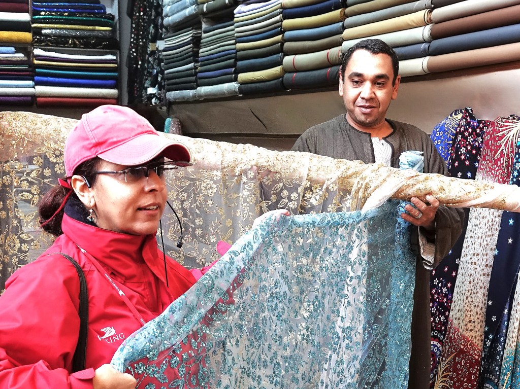
or buying a bolt of fancy fabric at a textile shop;
or funding a furnishing from a village storefront;
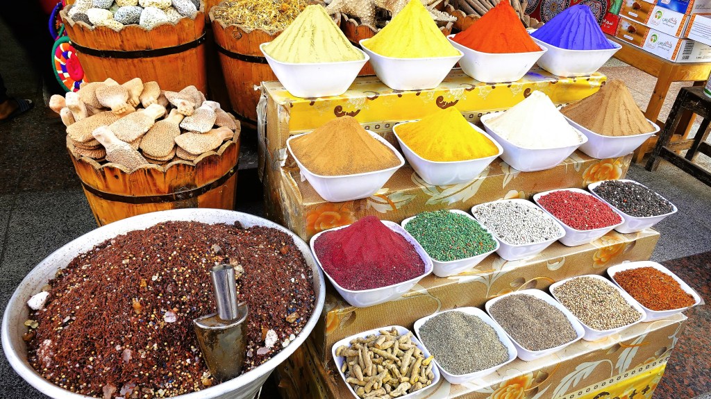
or securing a special spice at the food bazaar;
or raising thousands for a hand-knotted rug at a weaving studio.
There was also a gift shop aboard the Ra, where an Armenian jeweler could craft 18K gold into personalized cartouche earrings and pendants for a pretty price.
In fact, there was nary a place we visited, where Ra passengers couldn’t “get their shopping on,” to the extent that a few passengers required an extra suitcase to transport their trinkets and treasures.
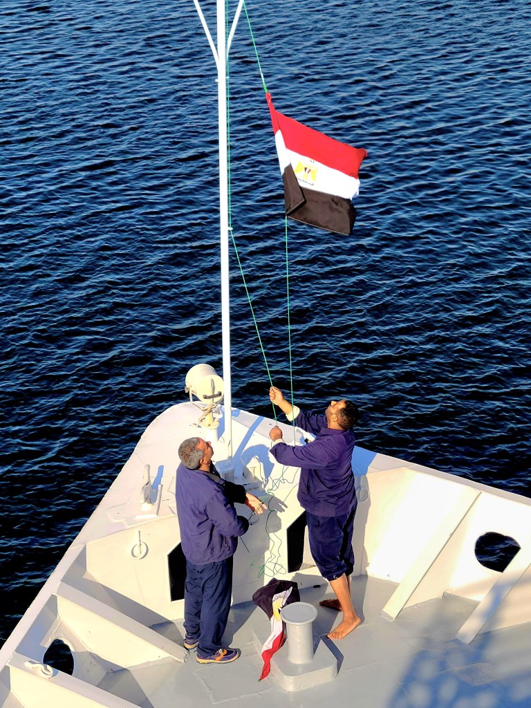
Deck hands used the extra time to swab the main deck and raise a clean flag,
while passengers on the sun deck flocked to the starboard side to find our riverboat nearly surrounded by a band of merchants in blue rowboats, reminiscent of how Somali pirates operate, but with a enterprising purpose.
It was an interesting phenomena, but rather than explain it, I believe this video best captures the merchandising protocol.
Shopping on the Nile at Esna Lock
Items for inspection usually arrived by air mail–rolled up and bagged. Unwanted items were returned the same way, but errant tosses to the boat got wet on occasion. Money was exchanged by sealing it in a tied bag with a returned item.
Eventually after two hours, it was our turn to pass through the lock. Surprisingly, the merchants who tied their vessels to the Ra were carried along–still haggling with their Habibis before finally disengaging on the downriver side of Esna lock.
Even more surprising… Leah and I didn’t purchase a single thing!
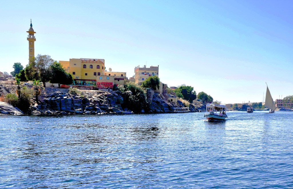
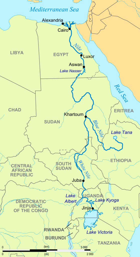
Egypt has relied on the Nile since the dawn of civilization. For over 5000 years, the Nile has pushed nutrient-rich silt through its 6600-km waterway from the wellsprings of Lake Tana in Ethiopia (Blue Nile) and Lake Victoria in Uganda (White Nile), on its way through Cairo, where it eventually runs across the delta and drains into the Mediterranean.
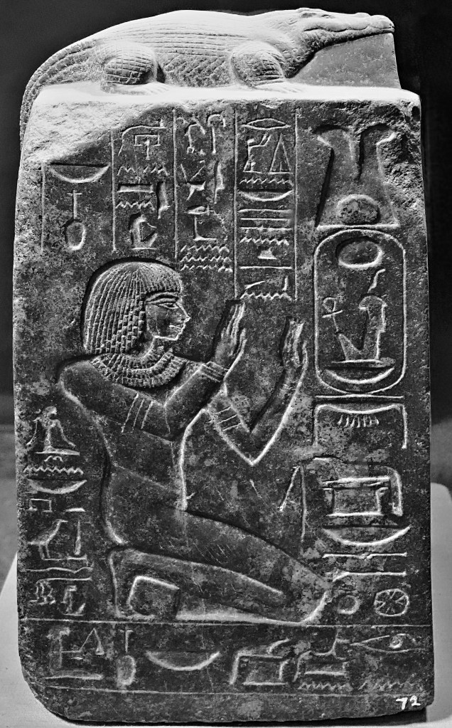
Just as the Nile shaped the landscape, it also shaped a society that believed in the Nile’s magical properties. Ancient Egyptians believed that gods controlled the Nile. They venerated Sobek, the crocodile god who created the Nile,
and prayed to Khnum–lord of the water–who fertilized the river banks, thus enabling Hapi, the goddess of ‘Annual Flooding’ to enrich and irrigate Egyptian crops.
Pharaohs used the Nile as a transit zone for long-hauling building supplies between coastal cities, and establishing monuments to the gods and themselves along the way, like the temple of Kalabsha in Nubia.
Even Aga Khan thought the bank of the Nile was a good idea for a Fatimid mausoleum.
Yet the river that once placed Egypt at the center of the civilized world for 3 millennia is now on life support, and poses a serious threat to the welfare of Egypt’s agriculture, aquaculture, and transportation sectors.
Unfortunately, the matter has been complicated by issues that stem from Egypt’s internal struggles, while the nation also battles other problems originating from south of the border.
For one, Egypt’s population already exceeds 110M, and is projected to swell to 121M in 2030, 160M in 2050, and 225M in 2100.
Egypt’s alarming growth rate over the past millennium has placed the country in economic jeopardy for the foreseeable future. Presently, nearly one-third of the country lives in poverty.
Additionally, with 97% of a dependent population living along the banks of the Nile and its delta, the existential threat to the river Nile has heightened significantly.
Intervention by Egypt over time has resulted in benefits and new challenges…
By partnering with the Soviets between 1960 and 1970,
Soviet-Egypt Friendship Monument
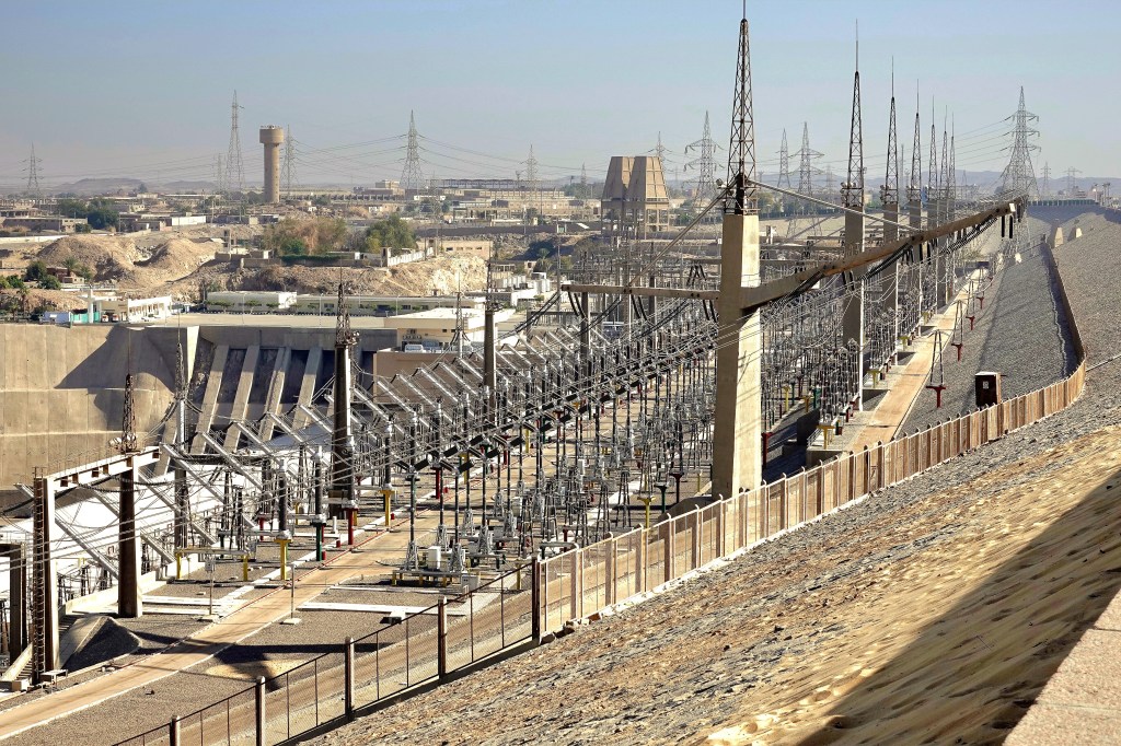
Egypt constructed the Aswan High Dam–an immense embankment dam–upriver from the original Aswan Dam completed by the British in 1902.
It’s purpose: to control flooding;
provide increased water storage for irrigation;
generate hydropower;
and encourage tourism–all seen as pivotal to Egypt’s industrialization.
Yet, there have been unintended environmental consequences to damming the Nile:
The dam restricts passage of rich volcanic sediment that once swept along the entire riverbed, but now struggles to reach the Mediterranean.
The Nile Delta has lost a substantial amount of arable land due to the Nile’s inability to provide an unabated flow rate to defeat a rising sea.
A 15 cm rise in the Mediterranean’s sea-level over the past century is expected to double over the next 30 years from climate change.
To compensate for the salination of the soil, farmers must pump more fresh water from the Nile onto their crops, causing additional pollution from synthetic fertilizer runoff.
According to the Intergovernmental Panel on Climate Change, the U.N.’s group of climate scientists predict the impact on the Nile will be catastrophic. They say it will lose 70% of its flow by the end of the century, with the water supply plummeting to a third of its present capacity.
Good for camels, but not for human survival.
Egyptian officials have also been wrangling over water rights and diplomacy with Ethiopian counterparts, arguing that their water security has been irreparably compromised.
However, more than half of Ethiopia’s 110 million people currently live in the dark. Their leadership is hopeful that the Grand Ethiopian Renaissance Dam on the Blue Nile (begun in 2011) will help to electrify the country and generate power for export.
Consequently, the Renaissance Reservoir will cause a 25% loss of hydropower generated by the Aswan High Dam, a reduction in Lake Nasser’s water retention, and a reduction to Egypt’s flow rate by as much as 25%.
With anticipated droughts in East Africa, a 2oC rise in temperature across the region, and a population crisis that begets increased poverty, it’s imperative that competing countries begin cooperating with each other to protect their citizens and their mutual interests.
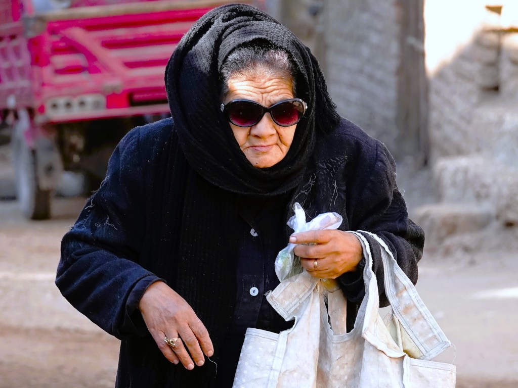
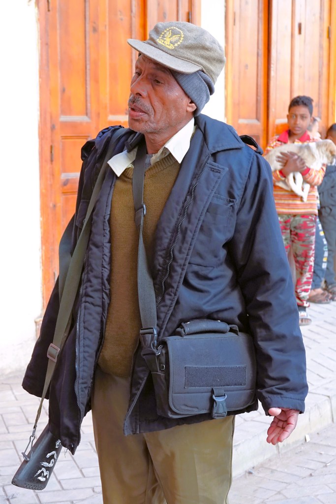
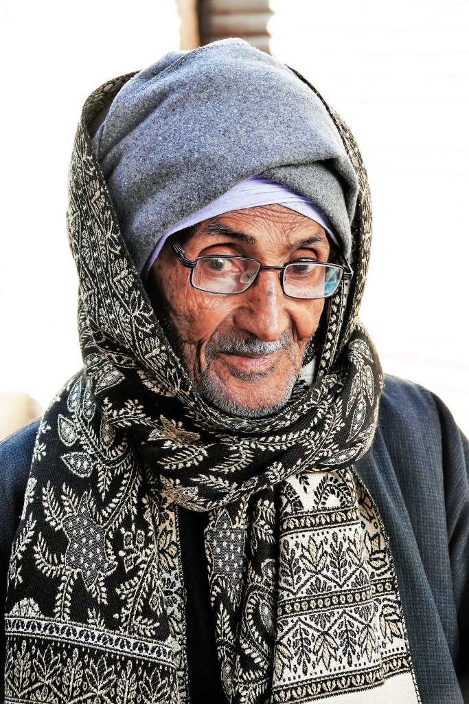
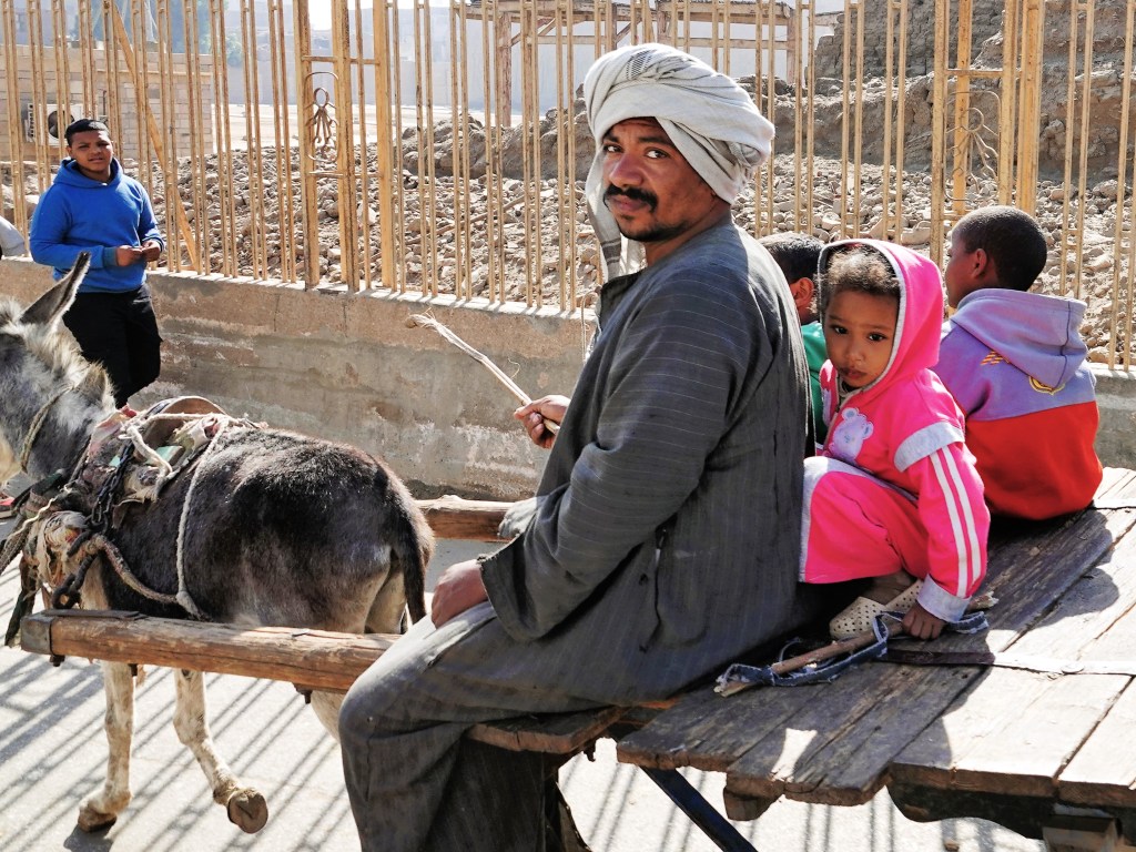
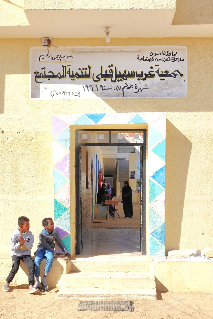
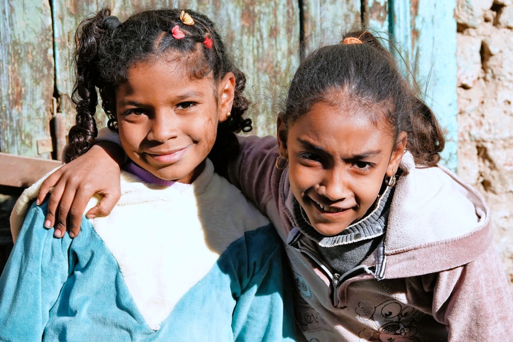
Getting to know the people of Egypt is equally as magical as the ancient architecture and history. Wandering around the Nubian neighborhoods was a great way to observe the locals at work and at play. What follows is a portrait gallery of faces in their familiar places:
This man is paid to remove wrinkles. His cheeks are filled with water, which he sprays across a bolt of cotton fabric. Now he’s ready to run his foot across it with a scorching hot iron.
Finished products are then delivered to the fabric merchants, who specialize in either female or male colors.
The town tailor likely receives an order to design a proper galabeya…
or a pile of pillows and textile merchandise.
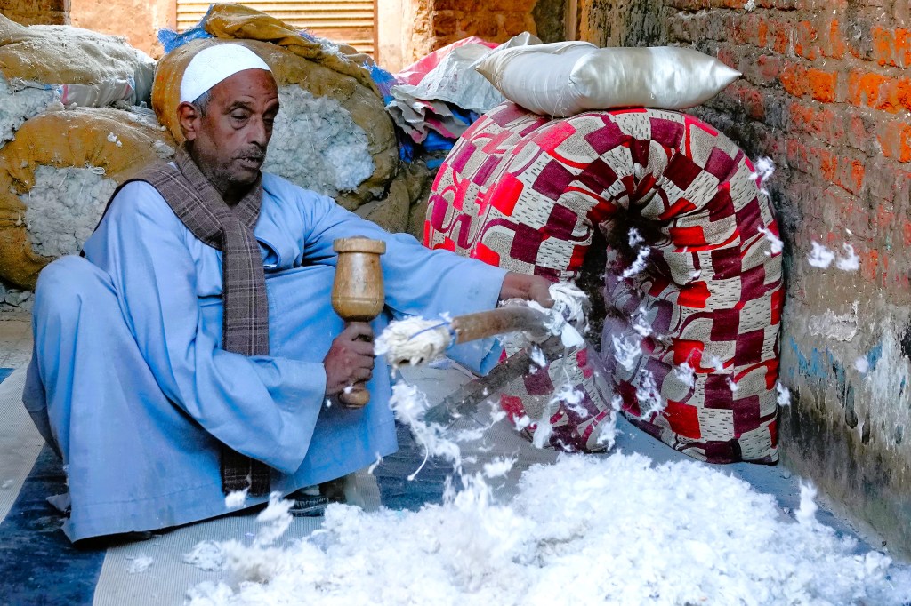
For pillows and mattresses that flatten or sag over time, it’s time to visit the wool fluffer, who will beat the filling until it’s been rejuvenated.
Busy mornings are usually followed by a bite to eat.
some shopping…
or a smoke.
It’s safe to say that locals feel more secure, when they’re protected by the guard on patrol,
or washed by the man who prepares your body for burial.
The school bus may not be yellow,
but it gets the kids to school on time…
where they are very receptive to strangers with cameras,
which is more than I can say when the tables are turned.