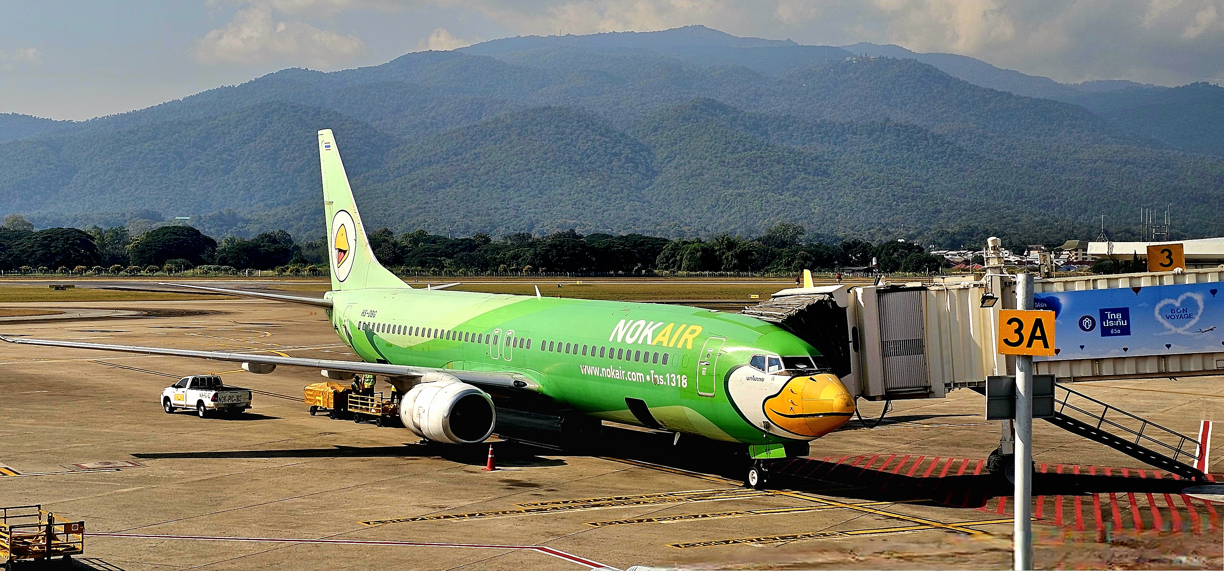
After touching down at Chiang Mai International Airport, the stark contrast to Bangkok was immediately apparent. The air was cooler, humidity was dryer, and the AQI was no longer borderline, breathtaking.
We were at the gateway to the Thai highlands, in sight of Doi Suthep (elev. 5500 ft), and we were trading skylines for landscapes.
Exploring Chiang Mai’s heritage–rich with unique Lanna-style architecture, art, sculptures, handicrafts, and ancient temples–gave us the cultural opium we were all craving, with insightful opportunities to:
dive deeper into Buddhism (at Wat Phan On, inside the ancient city wall);
experience the folklore (of traditional Lanna Thai dancing);
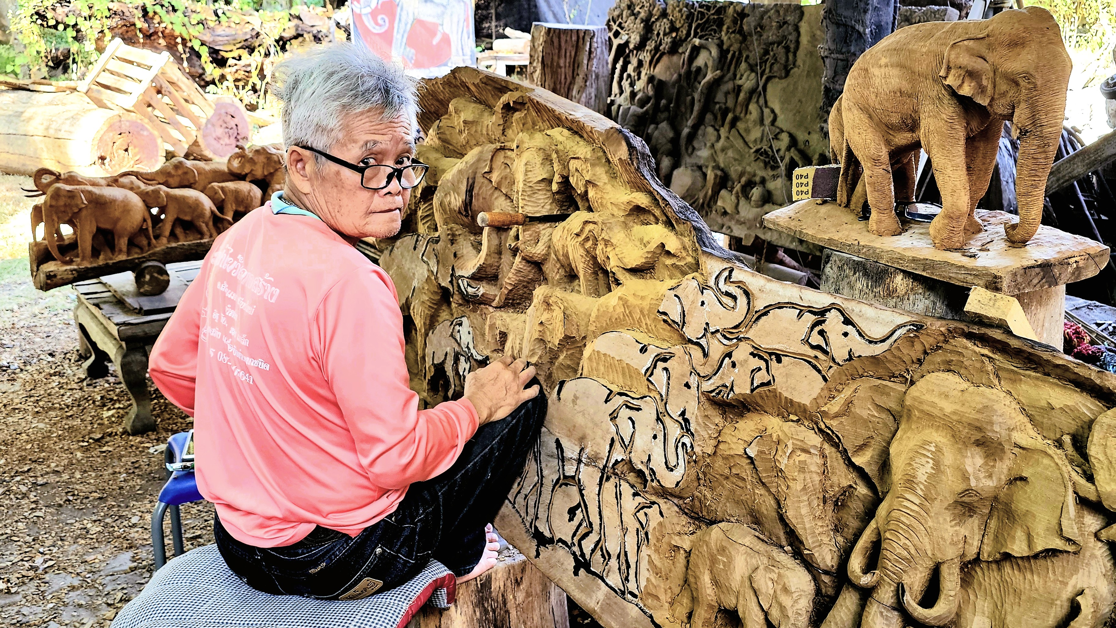
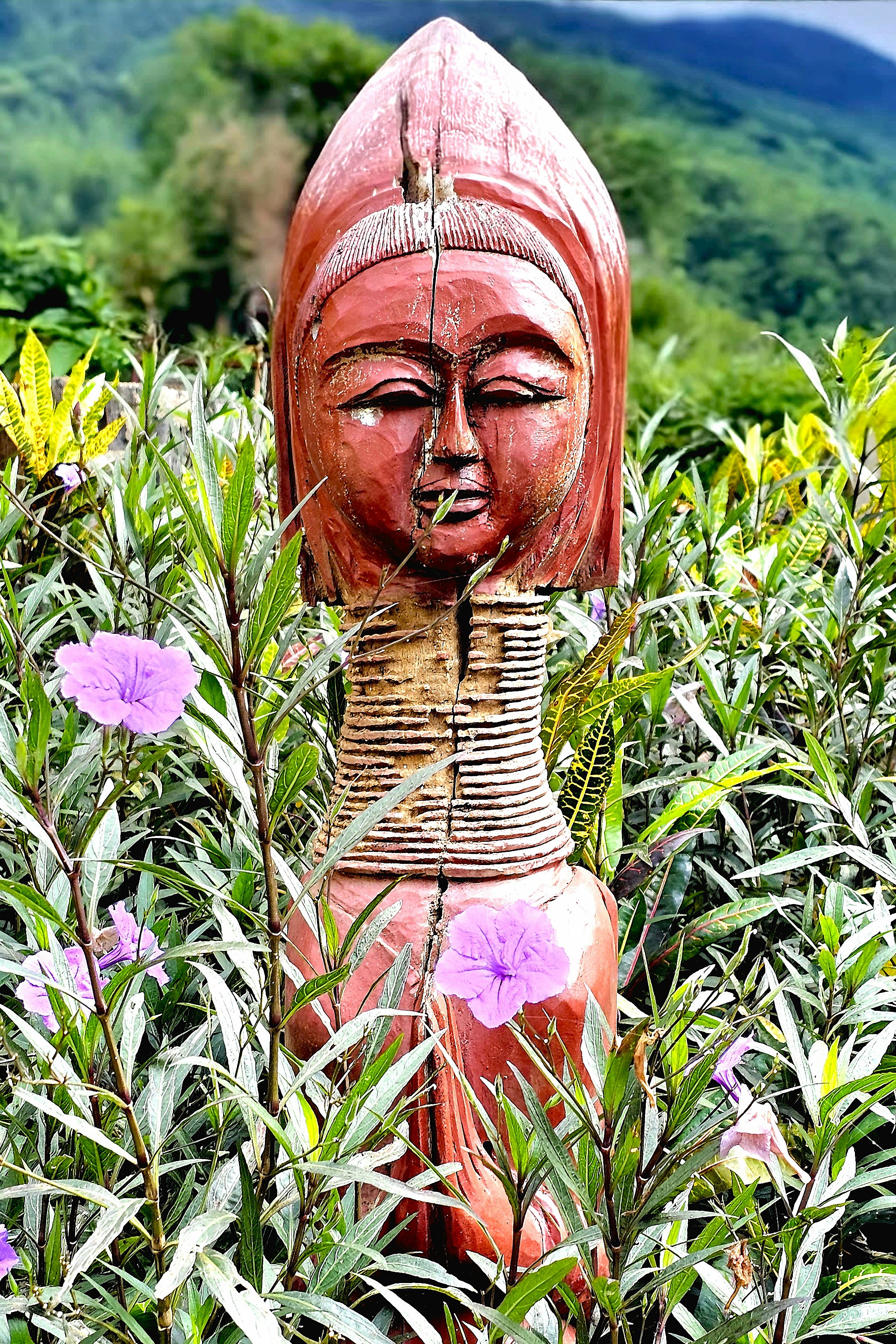
admire the folk art (of a master carver from Baan Jang Nak);
appreciate the artisanship (of a reformed Karen Tribe villager);
savor the Lanna cuisine (of a traditional Khantoke dinner);
and relish the view (from atop an artisanal coffee farm).
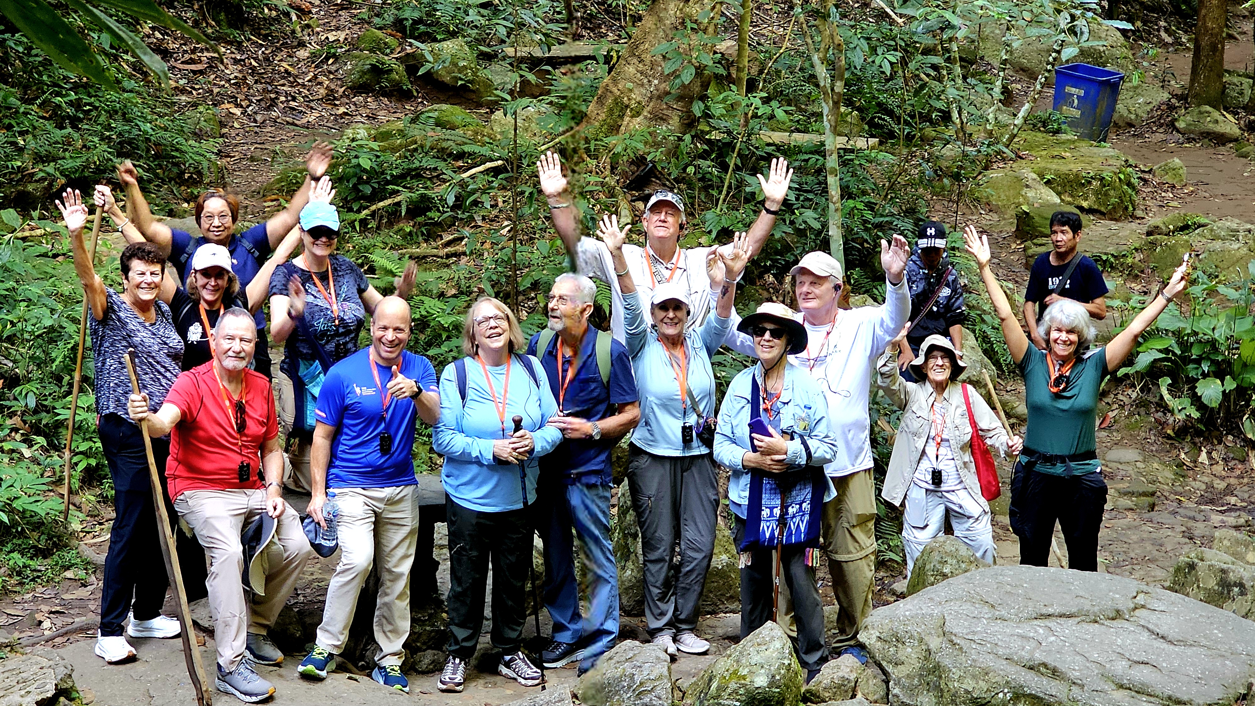
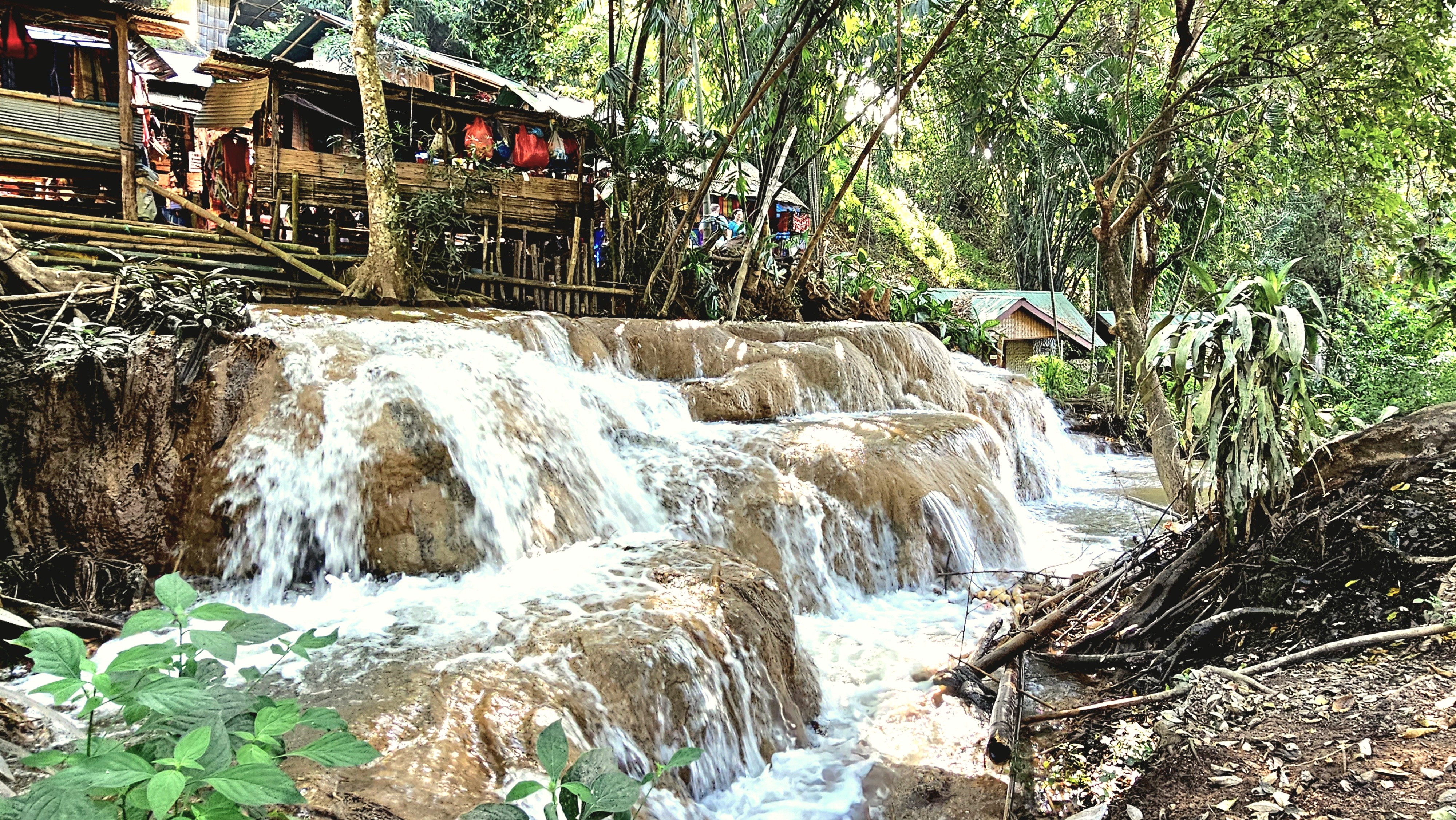
Tour highlights while visiting Chiang Mai included a nature walk through Mae Kampong Village…
which culminated in a hike up Mae Kampong Waterfall’s flume gorge.
Our journey continued to the remote village of Ban Buak Khang, where master carver, Phet Wiriya combined his childhood passion for wood carving with his deep affection for elephants…
culminating in “Baan Jang Nak” (a house full of elephants), a renowned studio that offers Lanna wood carvers an outlet to hone their prodigious fabricating skills.
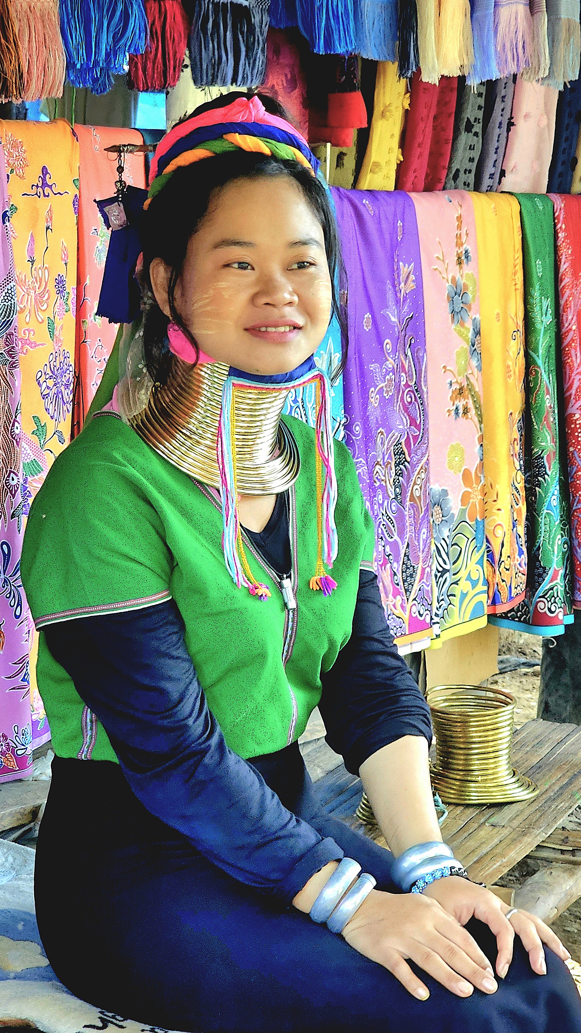
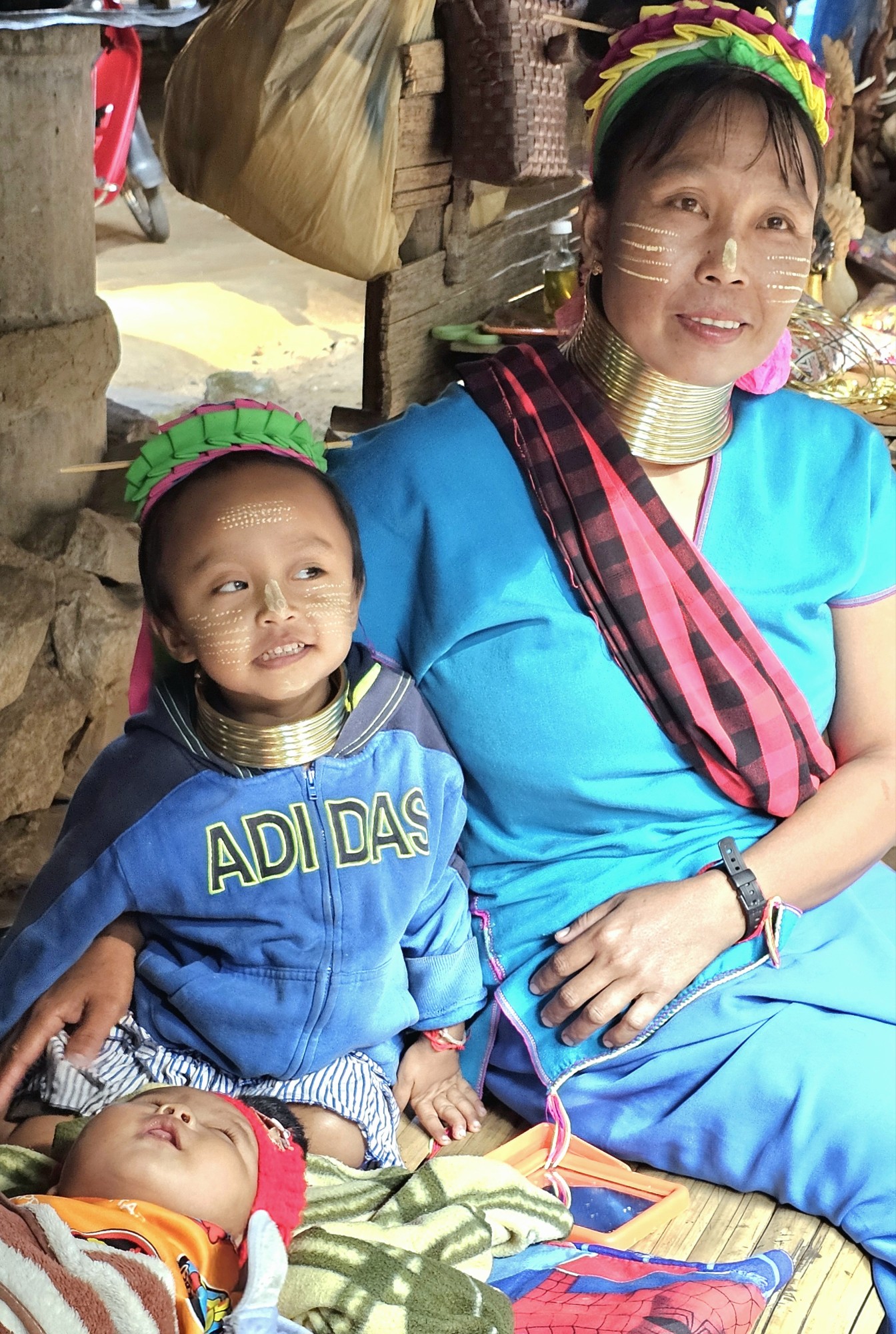
At Baan Nai Soi village, we visited a community of Burmese refugees known as Karen, whose tribe crossed miles of Burmese jungle into Mae Hong Son province during 1985 to avoid Myanmar’s political persecution.
Consequently, Thai authorities designated 3 relocation camps within the Highlands,
which over time and not without controversy have evolved into tourist destinations, where “longneck” women generate income by putting themselves on display–not unlike a “human zoo”–for a $10 admission ticket.
Mothers invite their girls at the age of 5 to begin the process by winding a brass coil across their shoulders, beginning with about 3 1/2 pounds of metal and adding inches until they’ve accrued more than 11 pounds.
Periodically, women will exchange the coil for a longer one, calling for more turns–ultimately reaching 22 pounds of down pressure. But longer necks are actually more of an illusion. The weight of the brass bears down on the clavicle, compressing the rib cage, and pulling up 3 to 4 thoracic vertebrae into the neck. While the neck itself is not lengthened, the appearance of a stretched neck is created by the deformation of the clavicle.
While beauty is indeed in the eye of the beholder, it’s essential to recognize the complex and competing narratives surrounding the beauty of longneck Karen women. Anthropologists have suggested that long necks may have served as a form of protection, perhaps making these women less appealing to other tribes and thus safeguarding them from a future of slavery. Conversely, it’s believed that the coils would embellish a Karenni’s beauty by highlighting the sex appeal of her elongated neck.
Another perspective is that these coils create a striking resemblance to dragons, a significant symbol in Kayan folklore, which adds a layer of cultural richness to their appearance. Additionally, the idea that the coils might offer protection against biting tigers–whether in a literal or symbolic sense–reflects a deep understanding of the challenges these women might face, blending beauty with resilience.
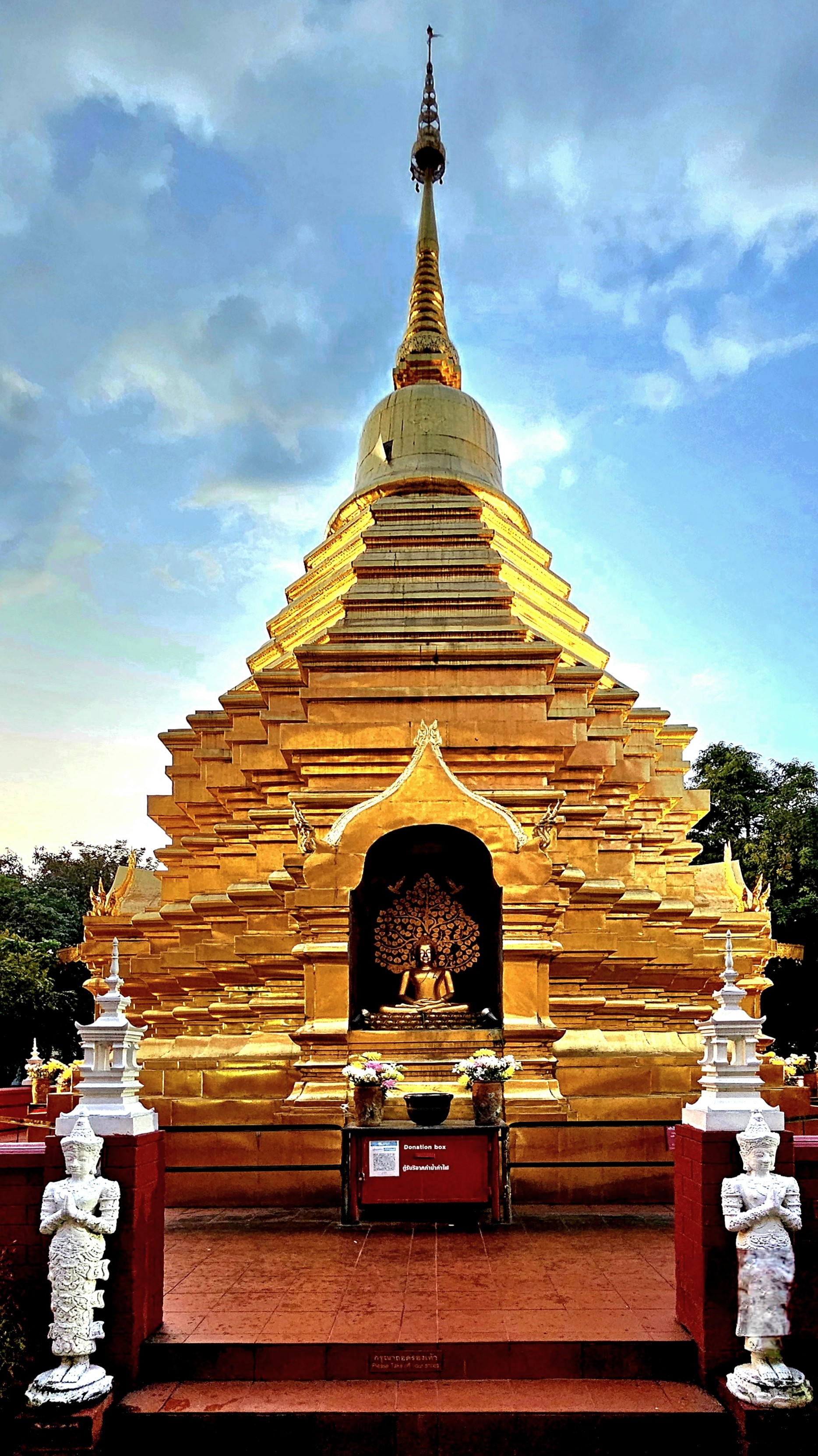
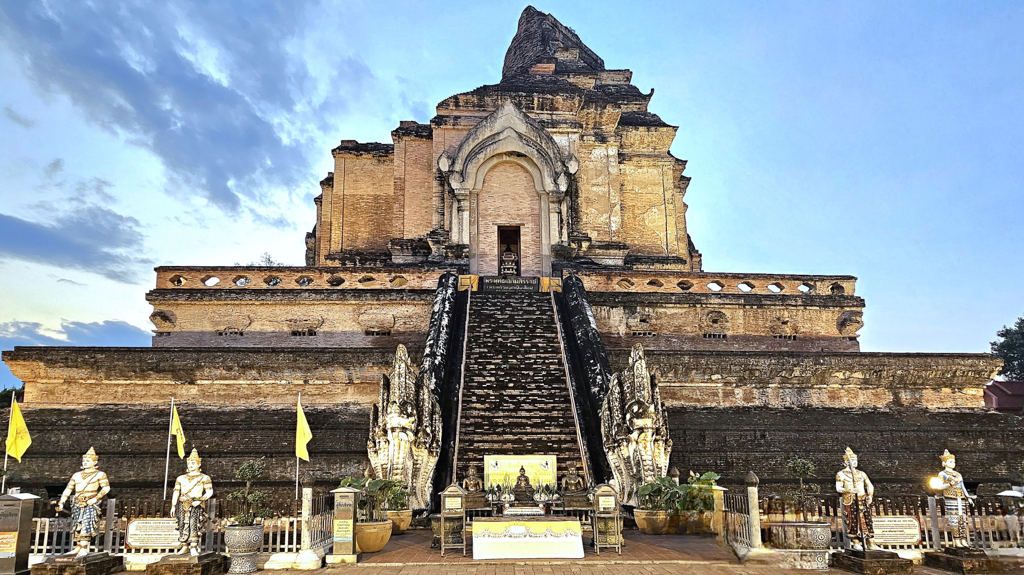
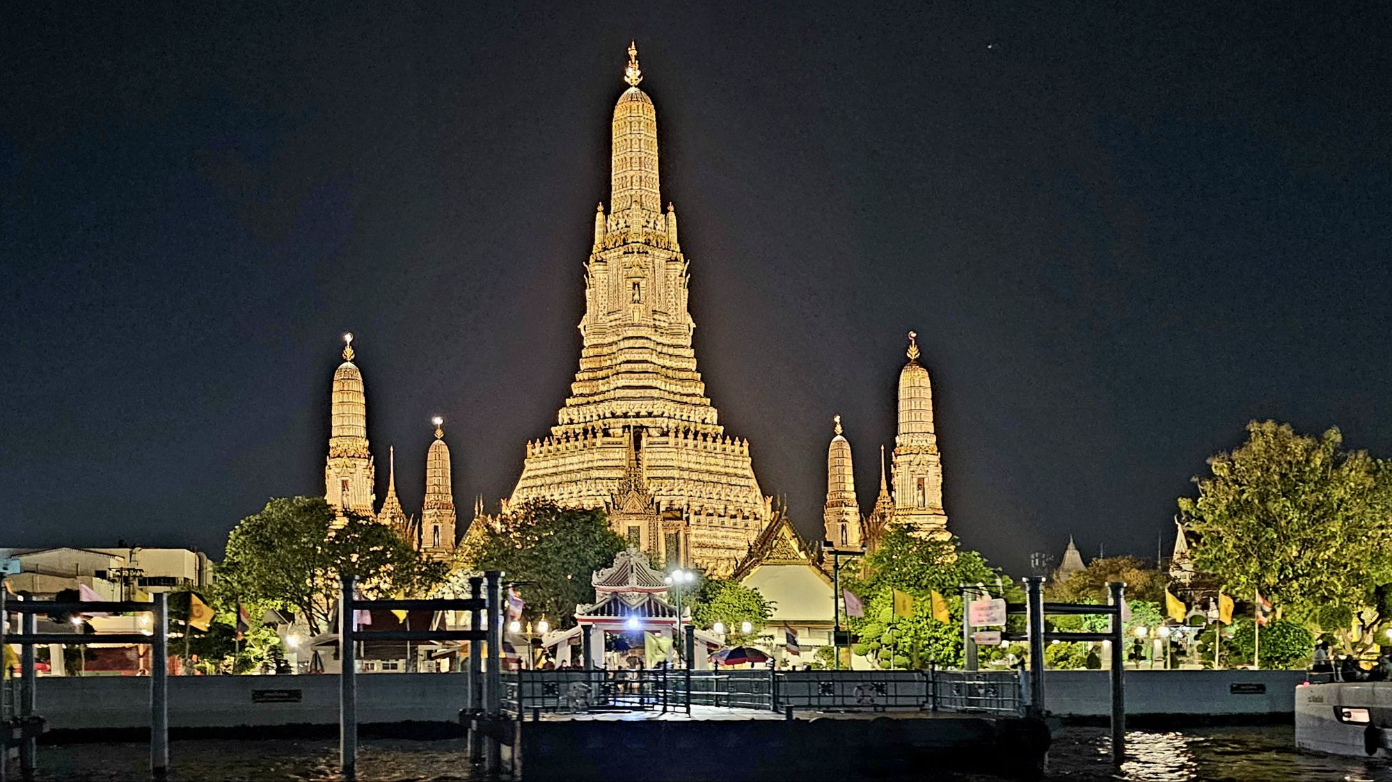
In another instance of culture shock, we visited Wat Chedi Luang, a 600-year-old cultural landmark located in the historic center of Chiang Mai, and once home to the venerated Emerald Buddha (subsequently, relocated to Wat Phra Kaew in Bangkok in 1551).
It’s also home to the Inthakhin city pillar–protected within a nearby shrine,
and accessible for most to view, but with a major caveat!
Women should take note: that Thailand’s guarantee of gender equality comes with red strings attached.
A peaceful area in the Phra Pradaeng district of Bangkok has captured the attention of eco-tourists who are eager for respite from the maddening tumult of city life, and local residents who are concerned about losing their connection to the land.
Bang Krachao’s origin as a forest reserve never fully took root when introduced in 1985. Unfortunately, conservationists and villagers were never given proper authority to dredge the canals or manage the orchard forests they once called home. With villagers locked out, garbage gathered along the orchards, and the canals choked on excessive sediment and debris.
Thankfully, Suan Pa Ket Nom Klao Urban Community Forest project was established by the Royal Forestry Department in 2007…
allowing the villagers to assist in the clean-up of 25 acres of forest and waterways, followed by planting local tree species. Thus, turning the wasteland into a watershed of trees aptly named Bangkok’s “Green Lung.”
Today, the rehabilitation has borne new fruit. The community forest currently doubles as a nature classroom and an organic kitchen for sustainable ingredients.
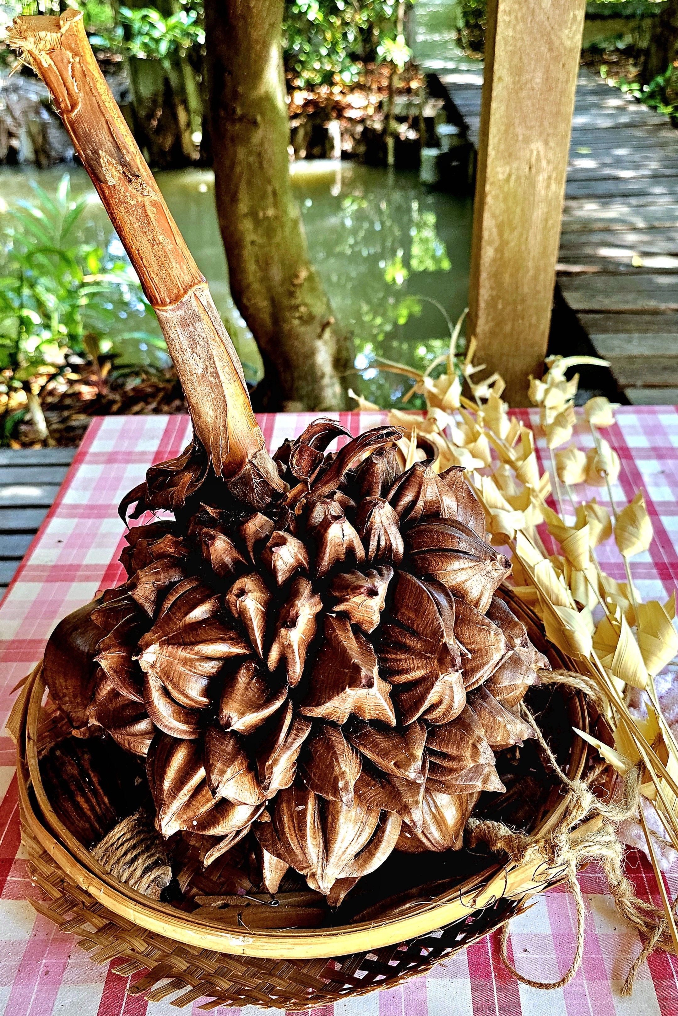
By conserving natural resources and avoiding growth by limiting permanent construction, the community forest is flourishing with local edible plants intended for cooking local dishes for my tour group and me.
Our hostess, Prempree Trairat received us at the camp with a refreshing, home-brewed, ardisia blossom tea upon our arrival.
The homeopathic properties of the ardisia plant are mind-bending:
Anti-inflammatory properties: Ardisia is traditionally used to reduce inflammation and can help relieve pain and swelling from rheumatism and injuries.
Analgesic effects: The plant has been used to relieve pain, making it a valuable resource in traditional medicine. Whether it’s a headache, toothache, or general body pain, Ardisia is believed to have analgesic properties that can provide relief.
Anti-cancer potential: Some studies suggest that Ardisia may possess anti-cancer properties, particularly in liver cancer. Although more research is needed to fully understand its potential in cancer treatment, this finding is promising.
Respiratory health: Ardisia has long been used to treat respiratory tract infections and coughs. Its expectorant properties can help loosen mucus and relieve congestion, providing relief for common colds and respiratory ailments.
Digestive benefits: Traditional medicine practitioners have used Ardisia to treat digestive issues like diarrhea. Its astringent properties may help reduce excessive bowel movements and provide relief from gastrointestinal discomfort.
Wound healing: Ardisia’s traditional use in treating snake and insect bites suggests its potential in wound healing. The plant’s antimicrobial properties may help prevent infection, while its anti-inflammatory effects can reduce swelling and promote faster healing.
Female health support: Ardisia has been used to alleviate dysmenorrhea (painful menstruation) and other menstrual issues. Its traditional use suggests that it may help regulate menstrual cycles and reduce pain associated with cramps.
General blood circulation: Traditional medicine attributes Ardisia with the ability to improve overall blood circulation. This could potentially benefit individuals with circulatory issues or those looking to enhance their cardiovascular health.
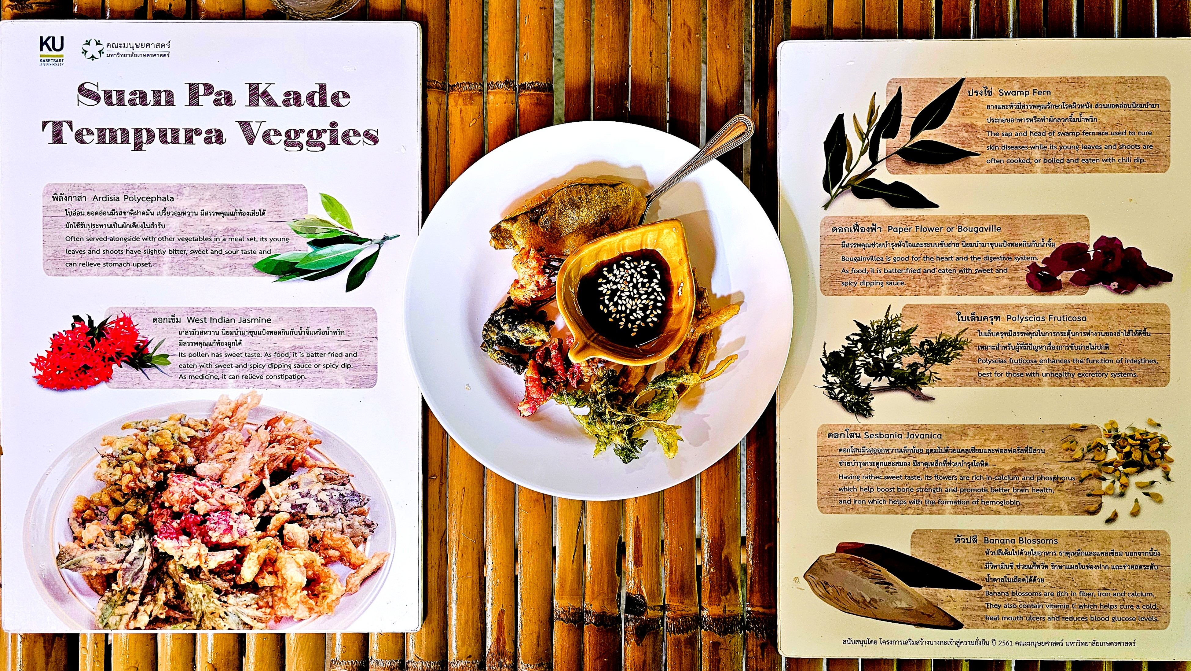
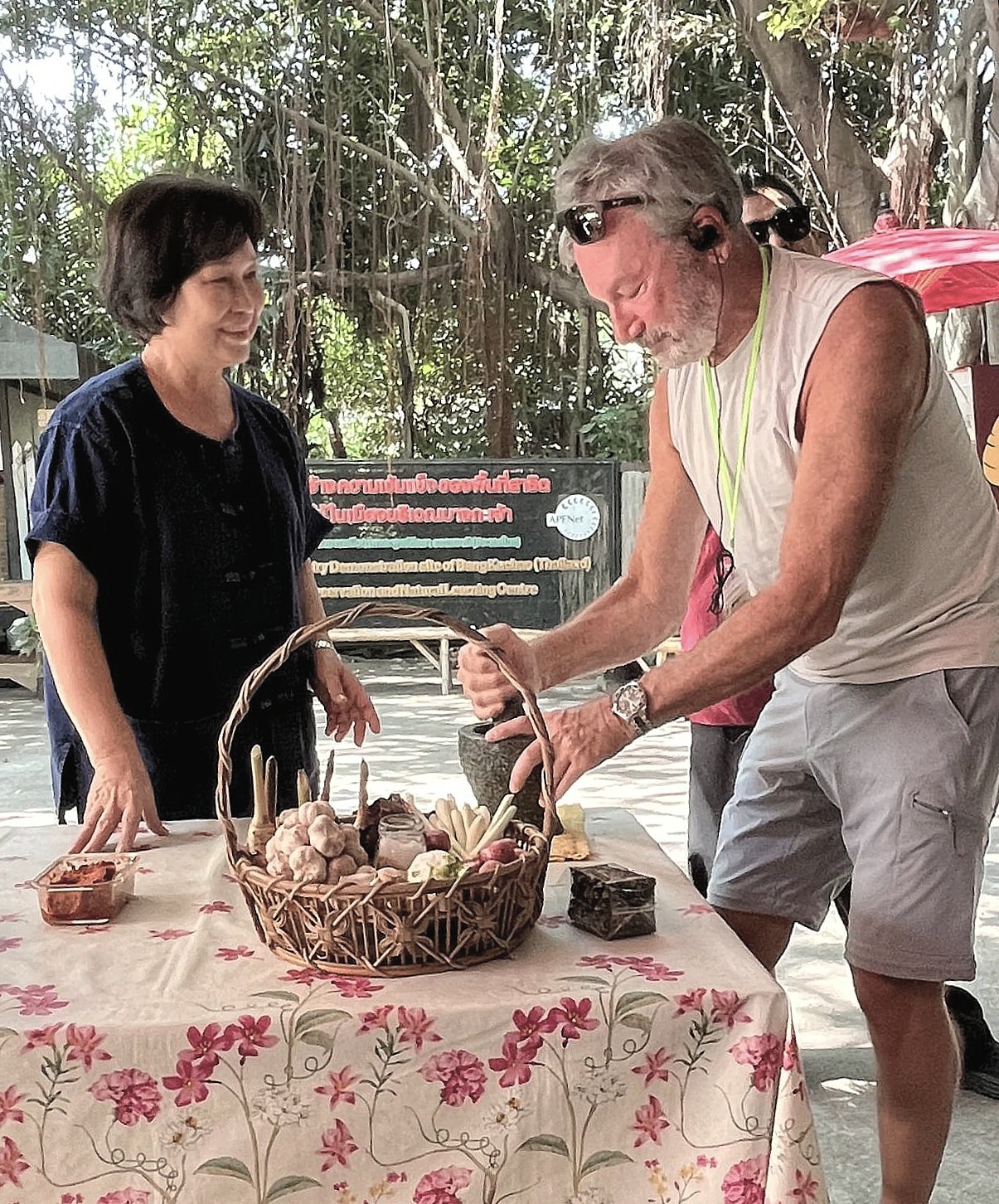
While our group snacked on crispy tempura from locally harvested flora…
I assisted in crushing a basketful of prepared ingredients (turmeric, lemongrass, garlic, coriander, cumin, chilis, etc.) into a golden curry paste…
to flavor our yellow curry chicken dish…
nobly and ironically prepared by Stephanie, our ardent vegetarian.
Soon, all the elements had come together for an exceptionally, healthy and tasty meal!
Afterwards, some of us took a leisurely nature walk across a slatted boardwalk…
which gave us a personal perspective of our farm to table experience;
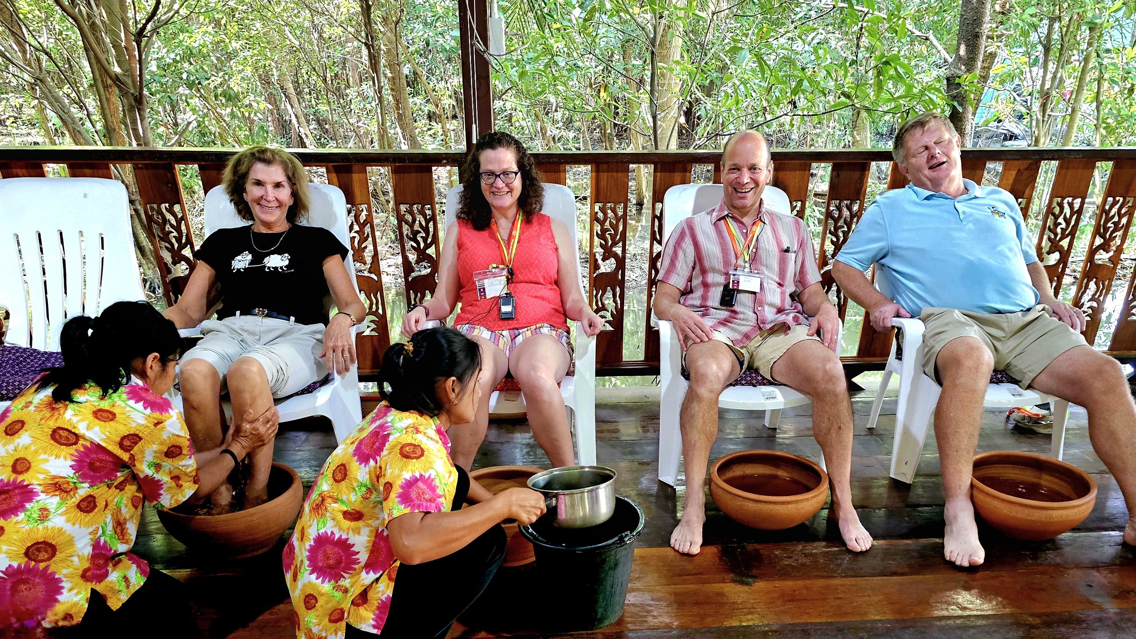
while others indulged in a traditional Thai leg massage–
taking some of us to a blissful state of nirvana.
Needless to say, by the end of our meal and massage, none of us was feeling any pain!
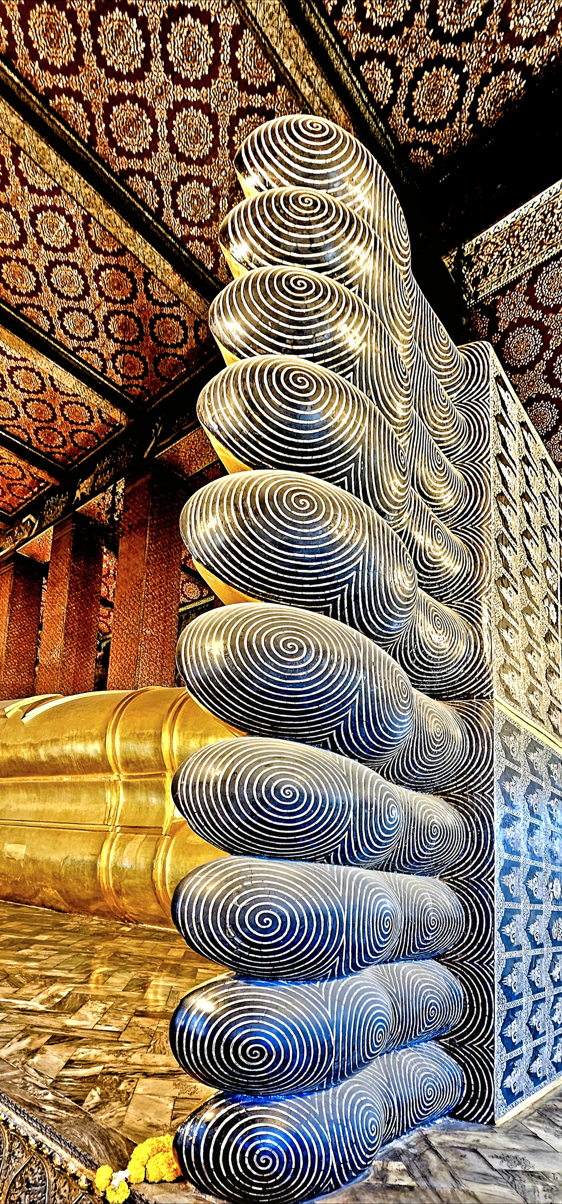
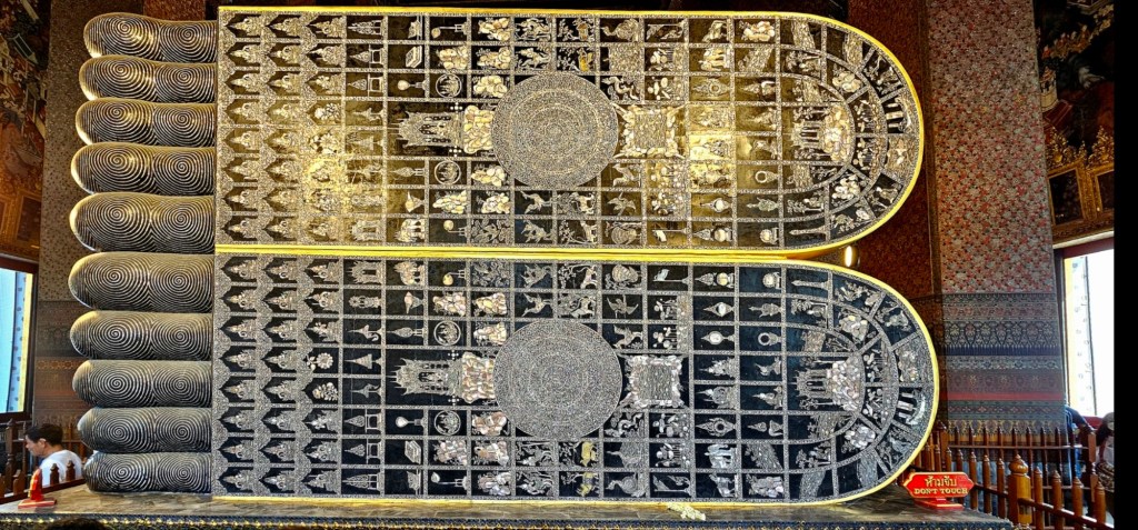
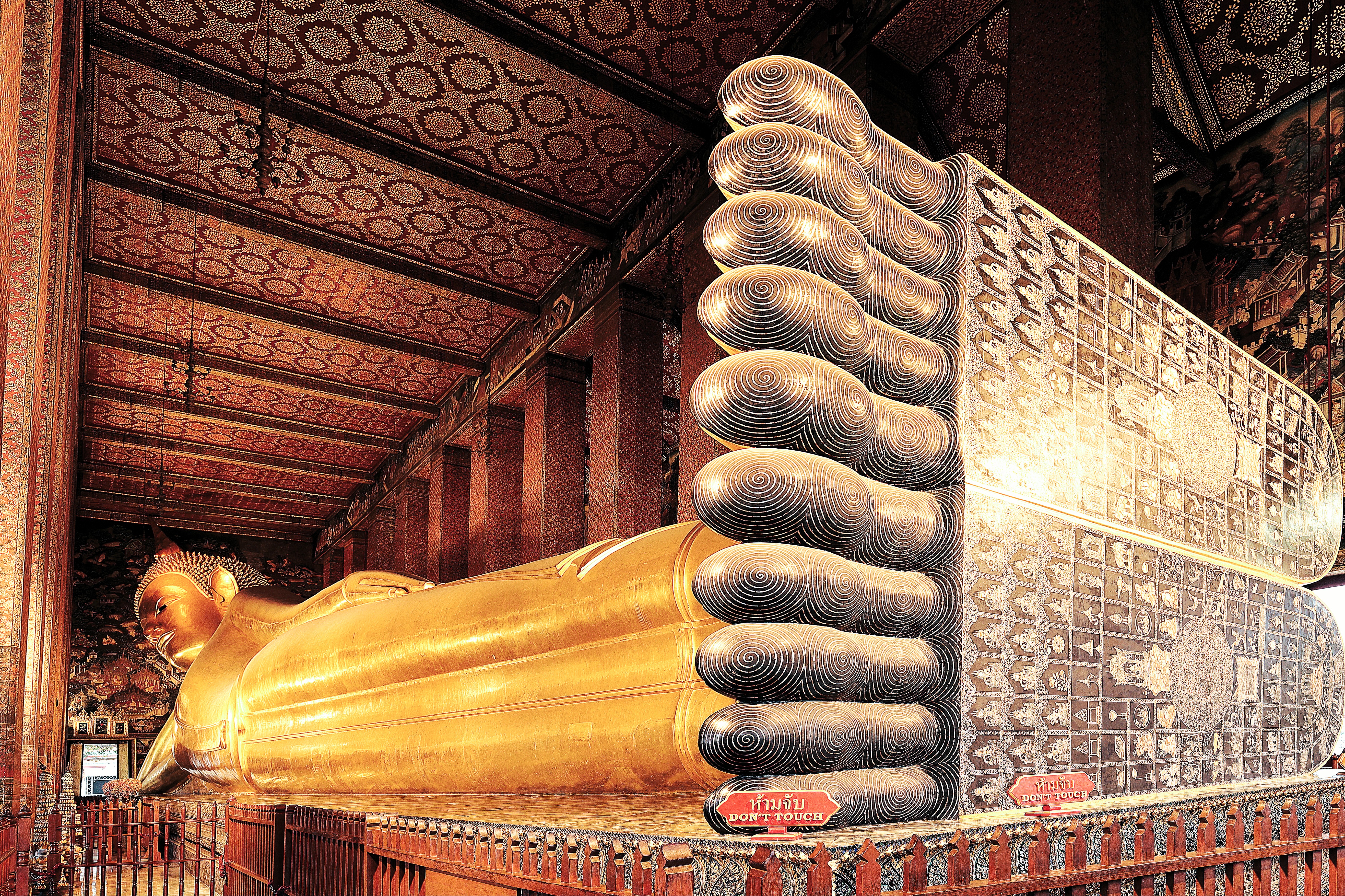
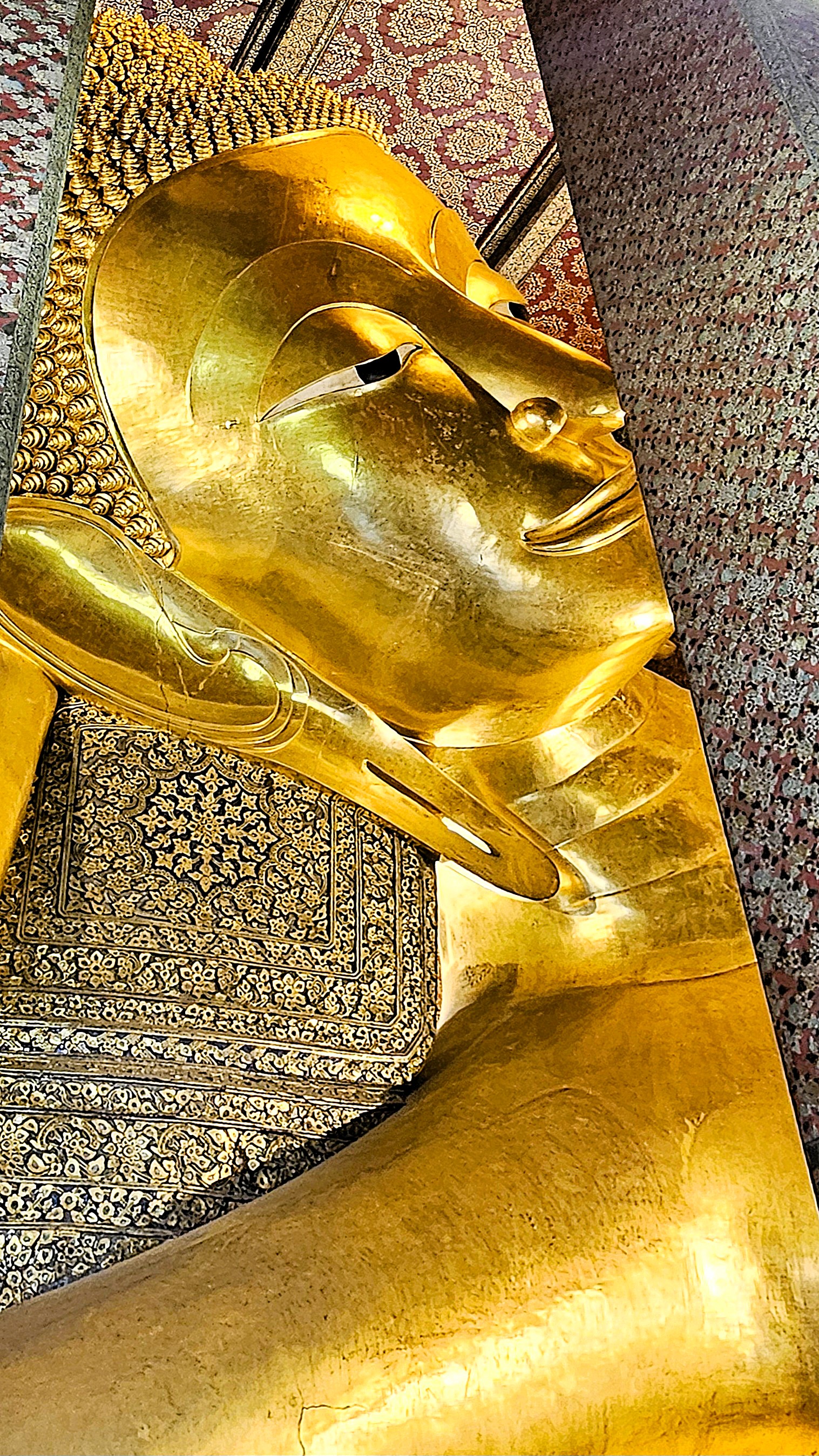
Photographing the entirety of the Reclining Buddha at Wat Pho is no small feat!
The soles of Buddha’s feet measure 3 meters high and 4.5 meters long. While Paul Simon was singing about “Diamonds on the Soles of her Shoes,” Buddha was “kickin’ it” with mother-of-pearl inlays. Each foot is distinguished by 108 panels featuring icons of flowers, dancers, white elephants, tigers, and altar symbols. A chakra (energy point) has been planted in the middle.
But back to Wat Pho for some historical perspective:
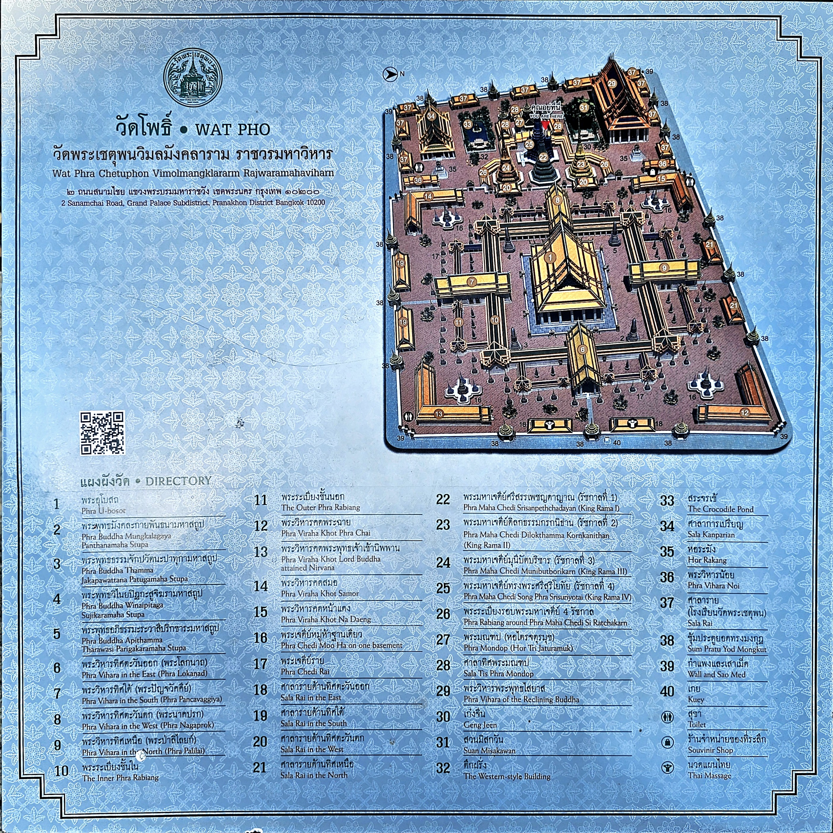
Wat Pho is a temple complex of 40 structures spanning 80,000 sq ft,
It’s rich history dates back to the reign of King Phetracha (1688–1703), who is credited for constructing the first temple of Wat Pho, prior to the collapse of the ancient city of Ayutthaya (1351-1767).
However, it’s King Rama I (1737-1809), who moved the capital city to Bangkok after Ayutthaya fell to the Burmese in 1767, thus assuring the revival and rehabilitation of Wat Pho, and its designation as Bangkok’s most important monastic enclave. His ashes are housed within Phra Ubosot–Wat Pho’s most sacred building–beneath the Buddha, also rescued from Ayutthaya.
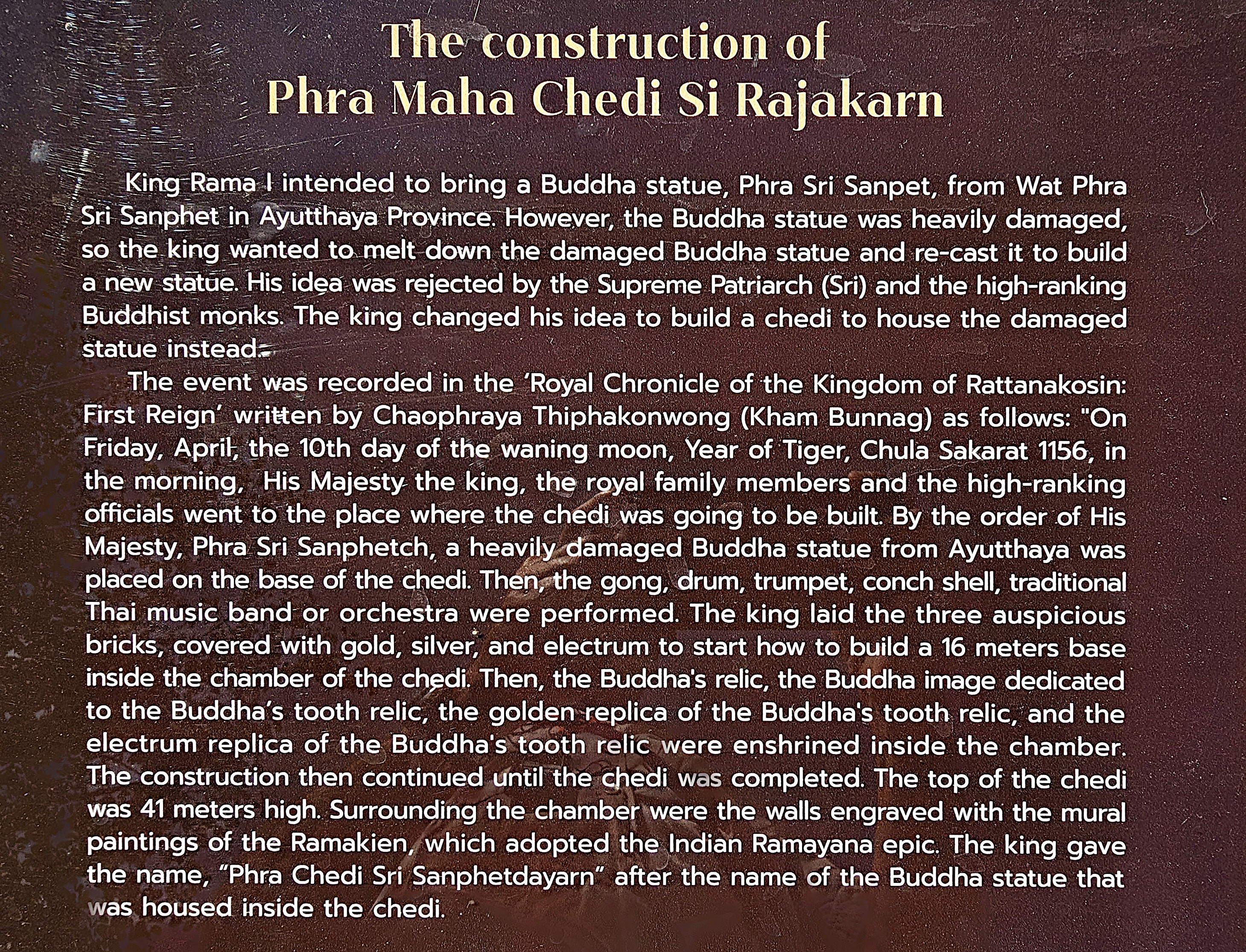
Of the 95 chedis scattered throughout the complex, the four tallest rise 42m and contain the ashes of Rama’s 3 successors. Chinese guardians offer protection.
The first chedi to be built by Rama I holds the remnants of the once great Buddha recovered from Ayutthaya, after the Burmese stripped it of its gold. The story goes:
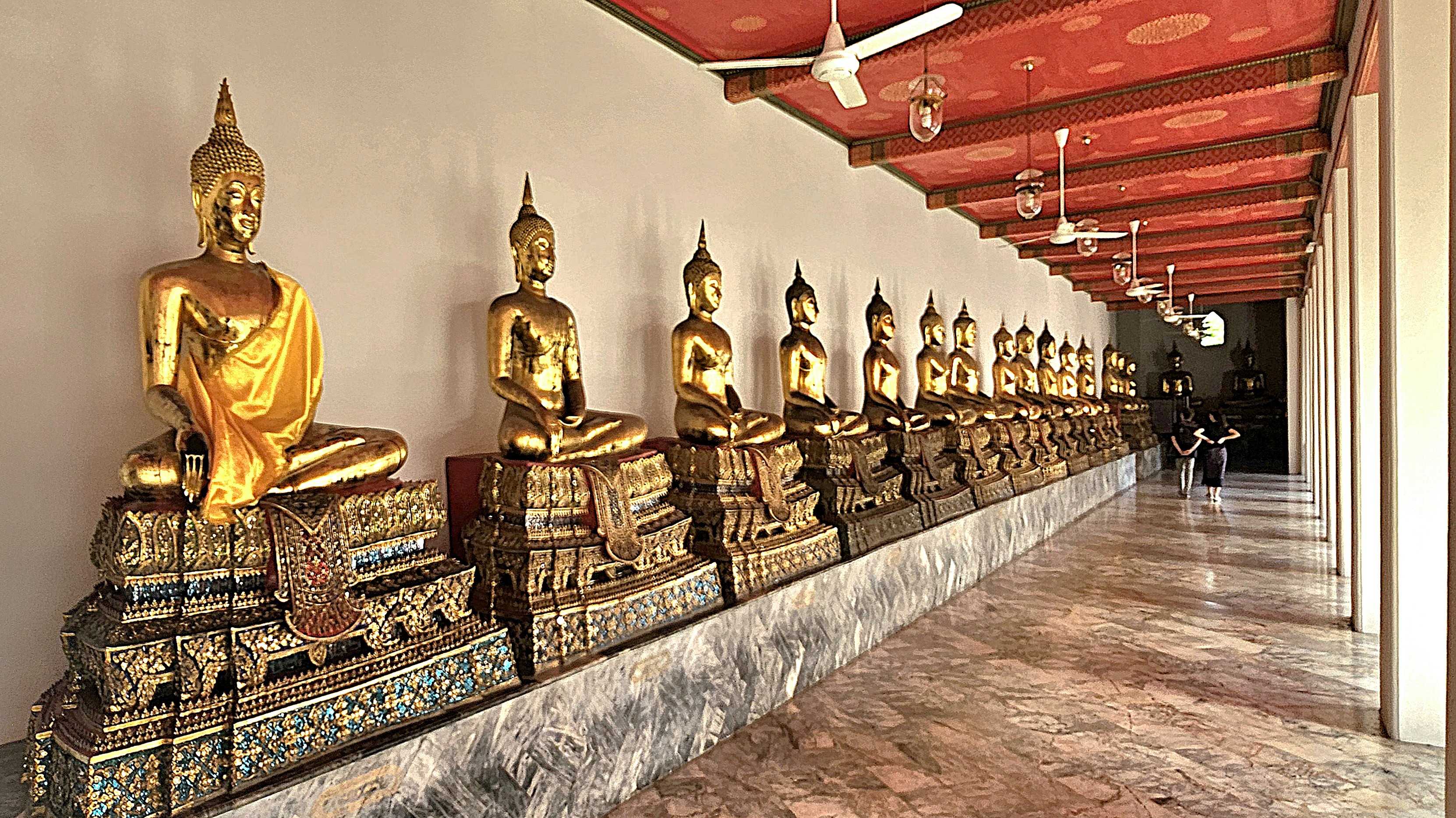
Additionally, 400 Buddha’s were salvaged from northern Thailand and aligned along the cloister walls.
and courtyards–
while 4 other groups of 5 chedis were erected for the ashes of royal family members.
Wat Pho has long been considered a great center for higher education. Phra Mondop contains the Buddhist library, and houses preserved palm leaves inscribed with Buddha’s teaching.
Wat Pho is regarded Thailand’s first public university, training students in religion, science, and literature through its many murals and sculptures. In fact, medical scholars during the reign of Rama III (1824-1851) introduced 60 inscribed plaques to adorn its pavilions–30 each for the front and back of the human form–illustrating therapeutic points and energy pathways used in traditional Thai massage.
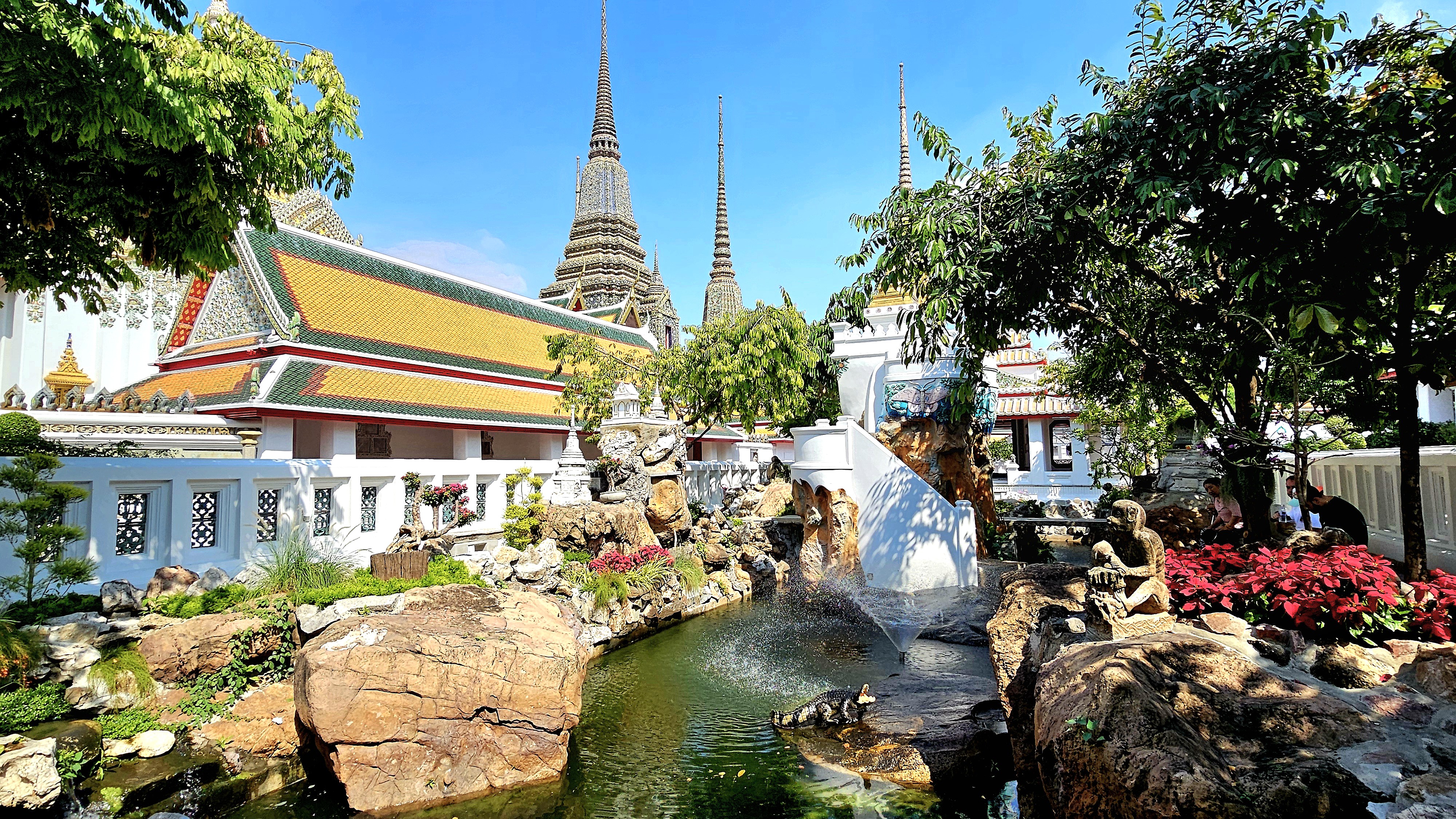
Several gardens and ponds also populate the grounds…
making it ideal as a backdrop for posing.
But the star of the show is the Reclining Buddha–not because it reclines (which is a familiar representation of his penultimate hours on Earth before his ascension)
–but because of its stature.
The Reclining Buddha extends 46 meters and stands/reclines 15 meters tall.
The statue and its subsequent enclosure (Building 29) were commissioned by Rama III in 1832.
Buddha’s right arm supports a head embellished with hundreds of chedi tresses, which rests upon two box-pillows encrusted with multi-colored, glass mosaics.
We would have meditated on this marvel forever, until Marc, a fellow traveler on our journey sounded the gong…
signaling our time to move on to our next adventure!
I've been here, there and everywhere;
Far and wide, across divides;
But none compare to a maiden voyage extraordinaire,
exploring America for one full year...
in my shiny Airstream!
Walking through Bangkok can be challenging. The traffic is relentless; the pedestrians can be pushy; and the “sidewalks” are compromised. But none of this should deter the intrepid tourist.
Our excursion began at the hotel’s spirit house (within the Thanon Phaya Thai district), where we paid our respects…
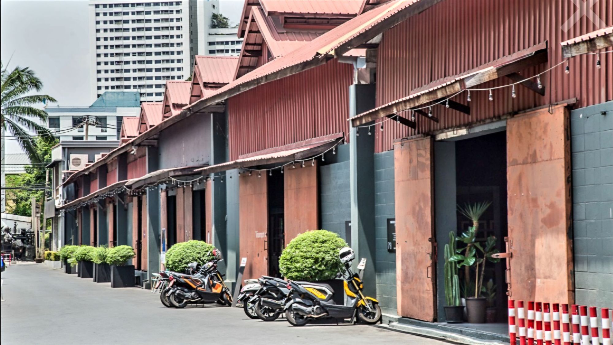
before continuing to Warehouse 30,
an art and design complex just east of the Chao Phraya riverfront,
where we found delightful exhibits and installations, intriguing antiques, and boutique apparel.
Nearby, we discovered Talat Noi–
a resurrected warehousing slum with meandering alleys filled with repurposed auto parts, shabby temples,
and wall art.
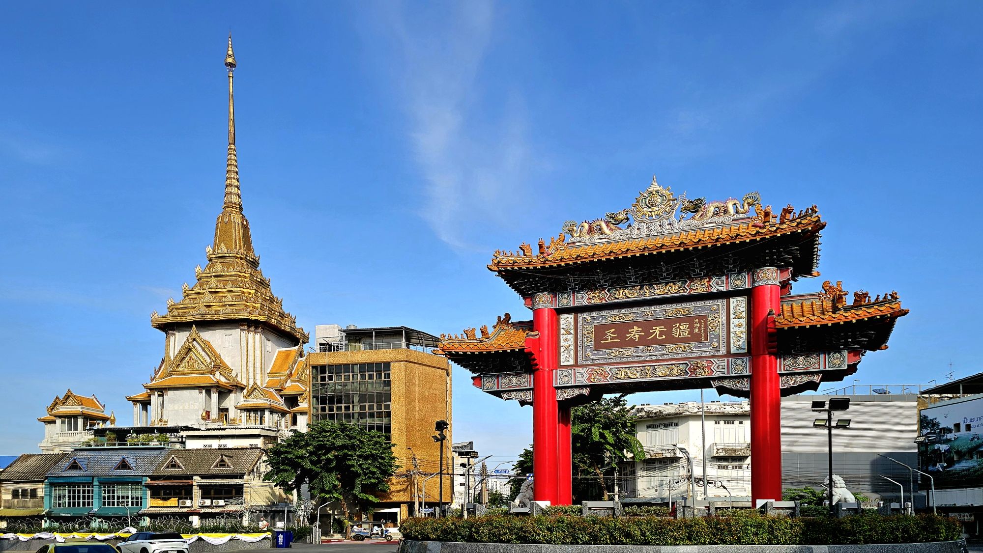
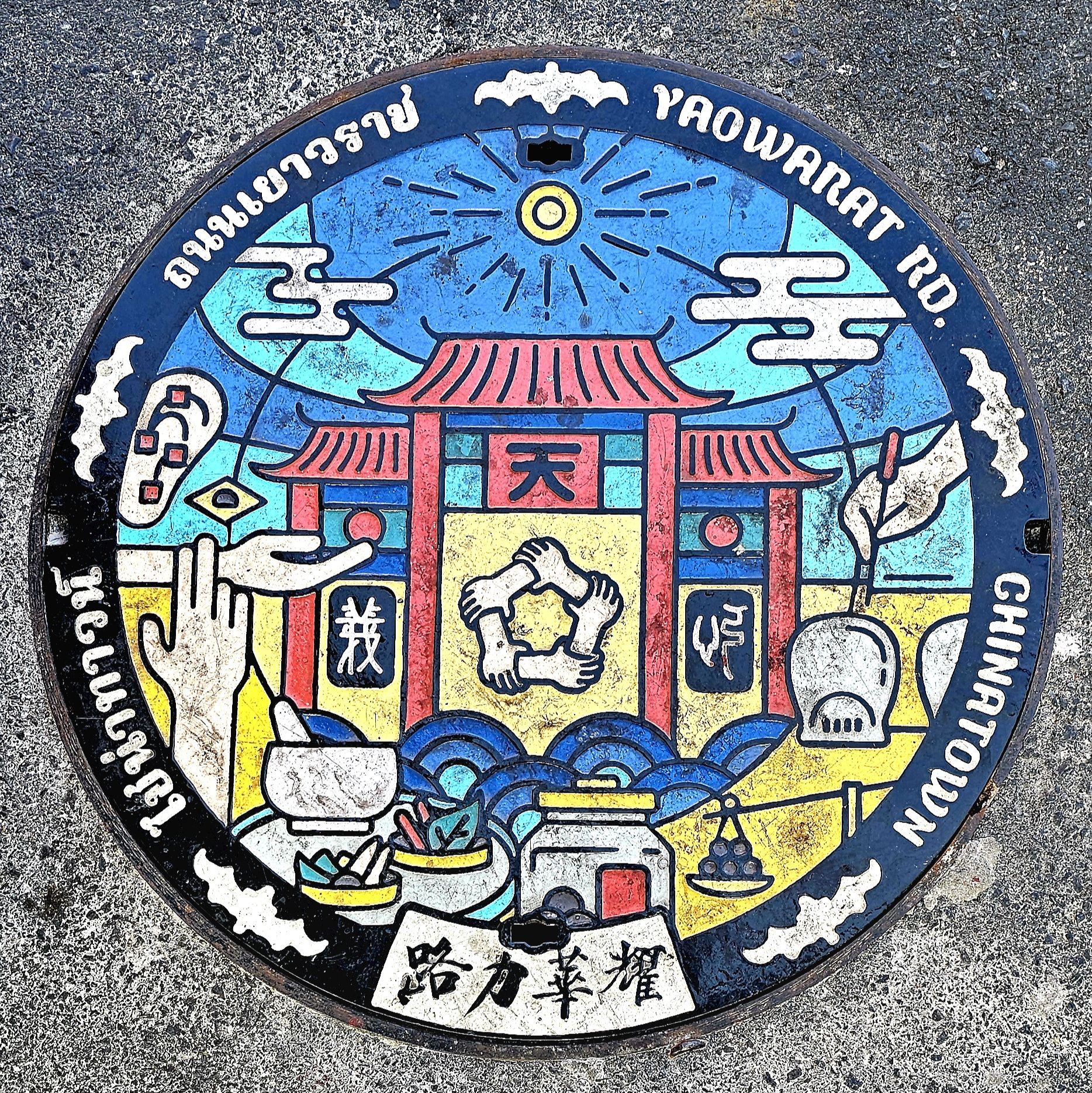
After another 15 minutes of sidestepping aggressive scooters along congested cobbled alleyways, we arrived at the Chinatown Gate, planted in the middle of an enormous traffic circle.
Chinese locals by the scores were making offerings at a local Buddhist Temple.
Chinatown Night Market was to our north,
but we were saving that for an evening stroll, when the street would close for Monday’s celebration of street food–filled with curious selections for adventurous eaters.
Our last stop included a visit to Wat Mangkon Kamalawat just before closing. It’s the largest and most significant Chinese Buddhist Temple in Bangkok. The temple is surrounded by shrines dedicated to a variety of Buddhist, Taoist and Confucian deities and religious figures worshipped by the local Chinese.
Worn out and wrung out, we took a taxi back to the hotel. We had walked nearly 10 km. in 90o heat. It was time to freshen up and consider a new adventure with an eye toward dinner.
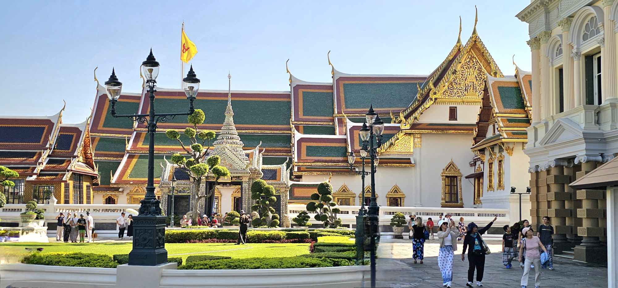
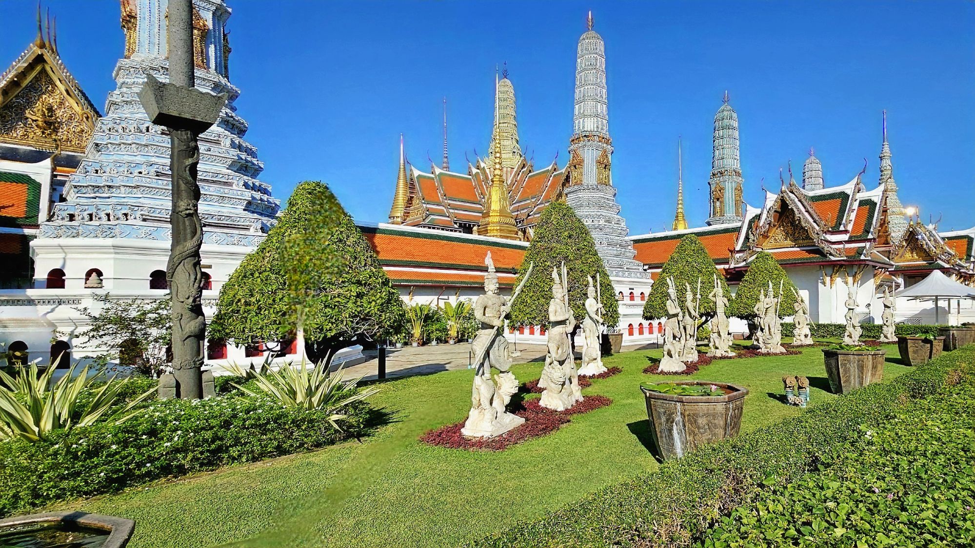
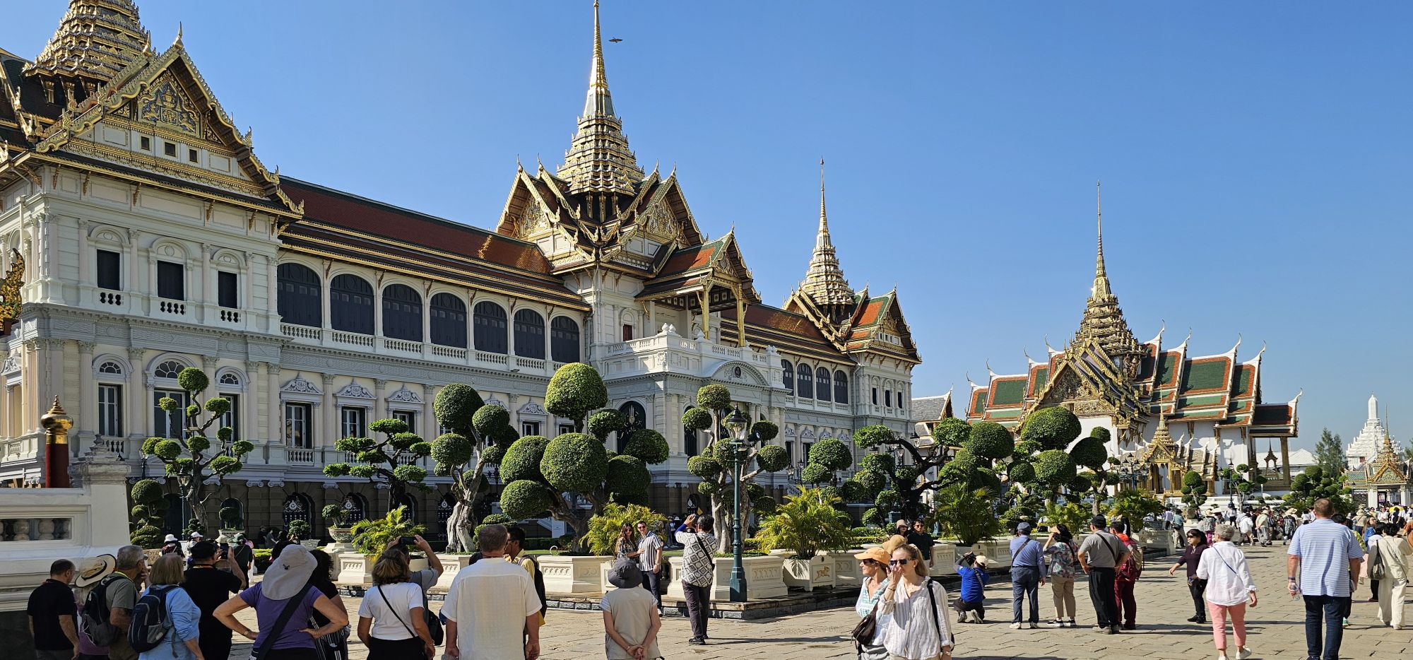
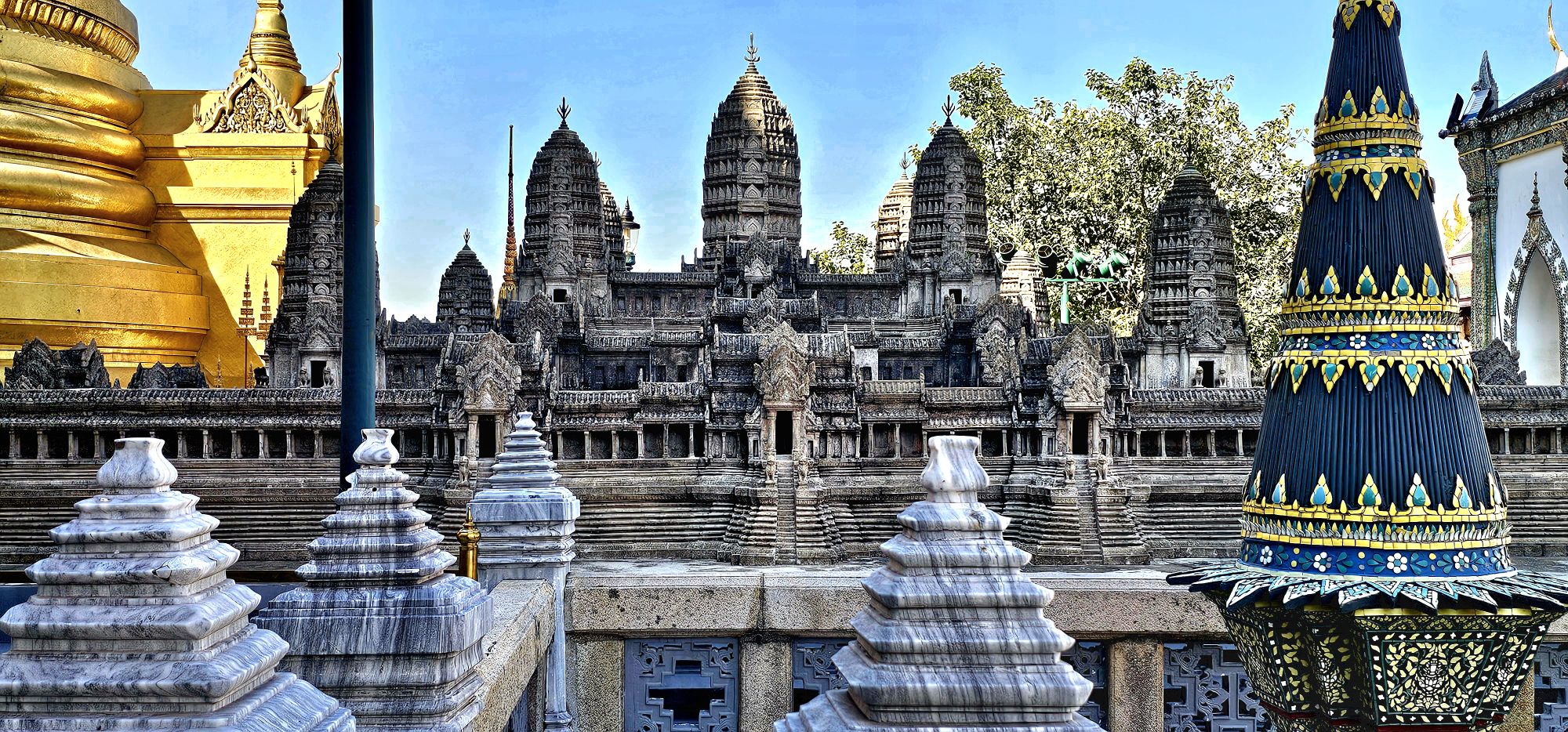
No visit to Bangkok is complete without a tour of The Grand Palace, simply because it’s beyond comparison.
Consider the enormity and scale of the site.
Covering over 2.3 million sq ft, its walled, rectangular space has evolved over the course of 200 years…
into a myriad of ornamental buildings,
grand halls,
and gilded pavilions…
surrounded by manicured lawns,
lavish gardens,
and decorative courtyards.
Much more than a royal residence that has housed generations of the Chaki dynasty, it was also the seat of power and governance until the abolition of Thailand’s monarchy in 1932.
Currently, it’s Bangkok’s largest tourist attraction (8 million visitors a year),
although it continues as an important backdrop for ceremonies and state functions, with royal offices still intact.
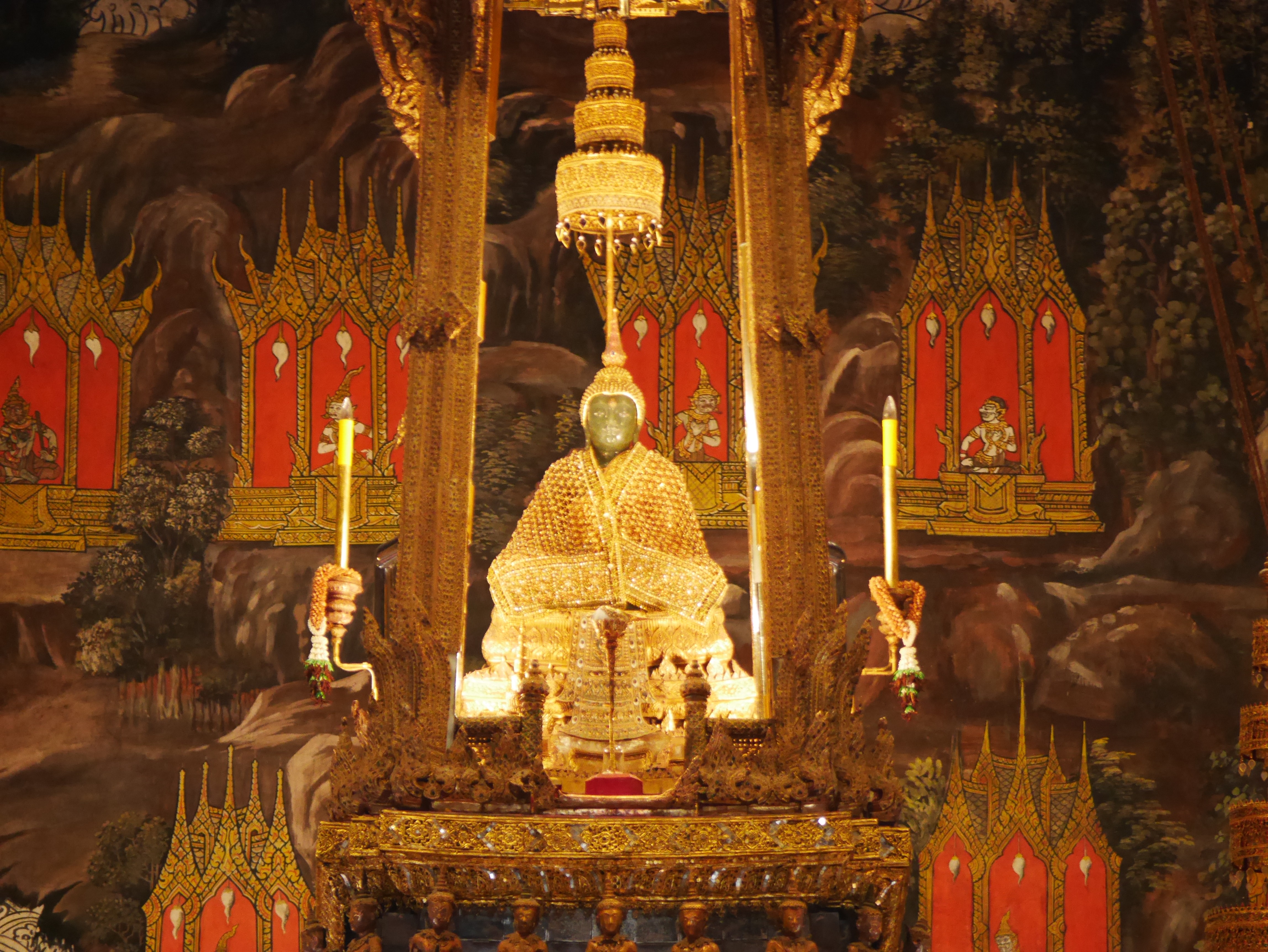
The Grand Palace is also the site of the Royal Chapel–known as Wat Phra Kaew–
which houses the Emerald Buddha–a 26-inch jade statue cloaked in solid gold and diamonds–which is considered Thailand’s most sacred icon and key to its good fortune and prosperity.
Photography within Wat Phra Kaew is absolutely forbidden,
but then, a photograph exists online with attribution.
กสิณธร ราชโอรสt
Only the King of Thailand is permitted to touch the Emerald Buddha (three times a year in order to change its shroud according to the season).
However, Leah was able to pet the nose of the bronze guardian lion protecting the temple.
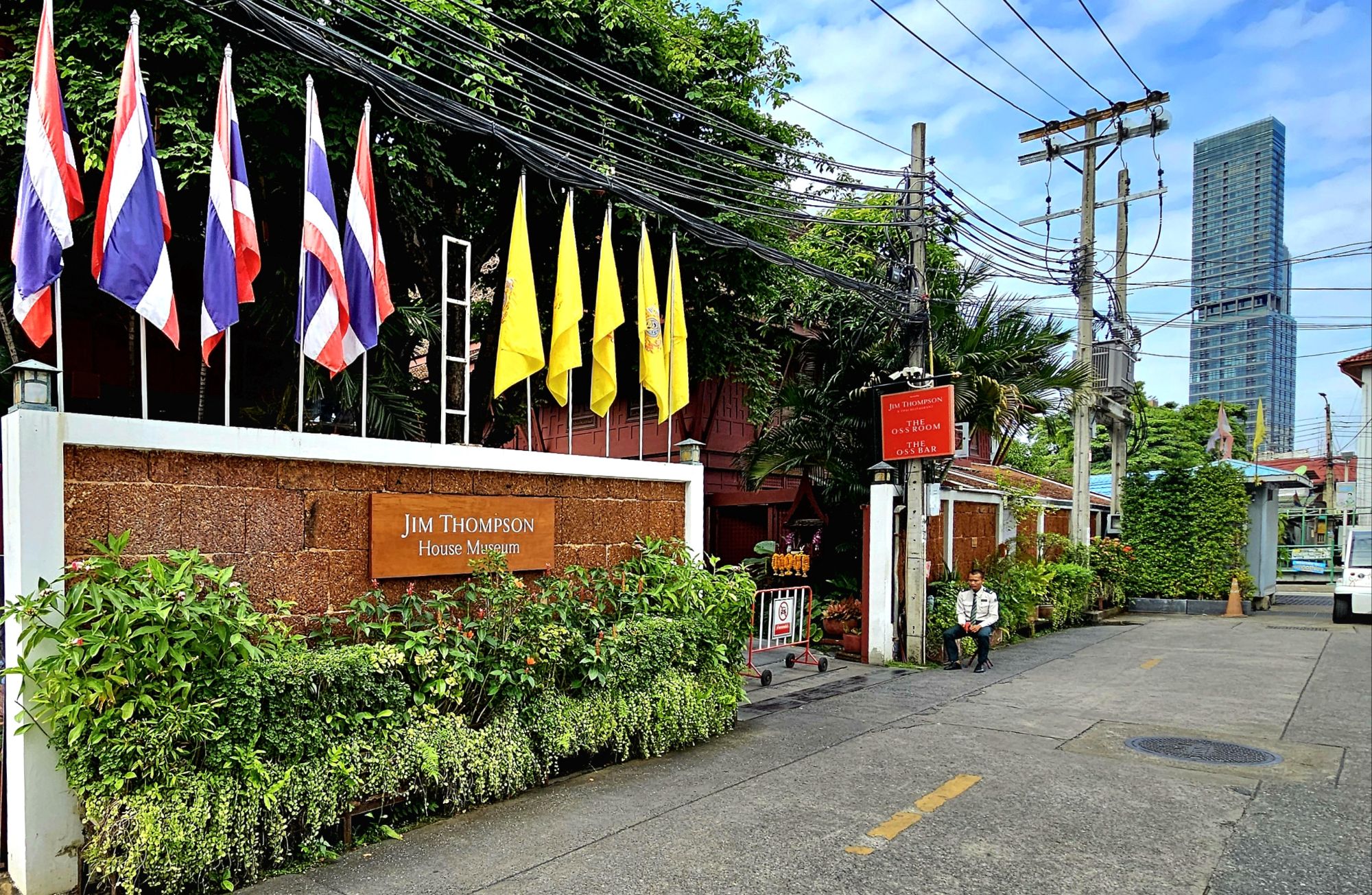
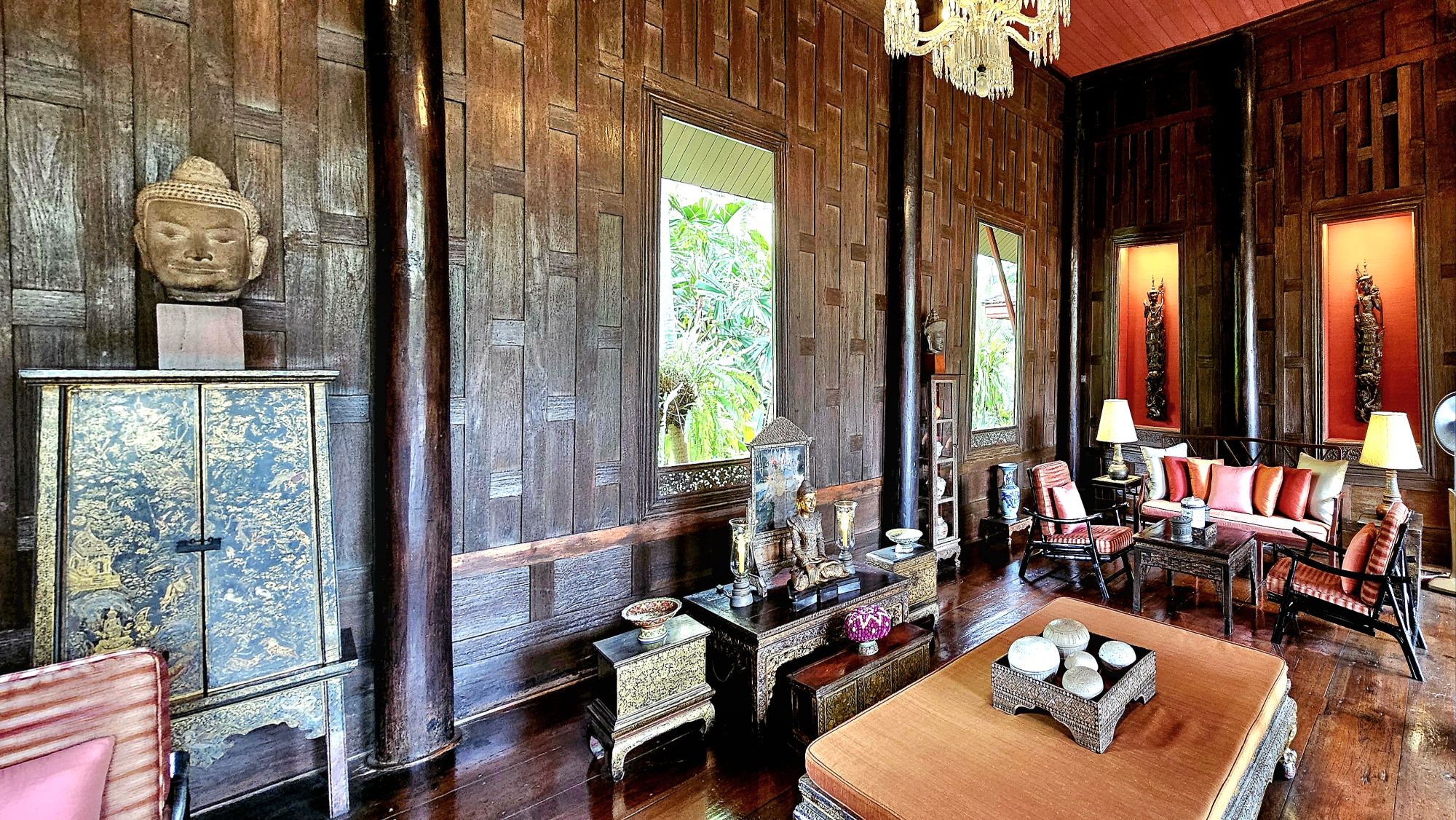
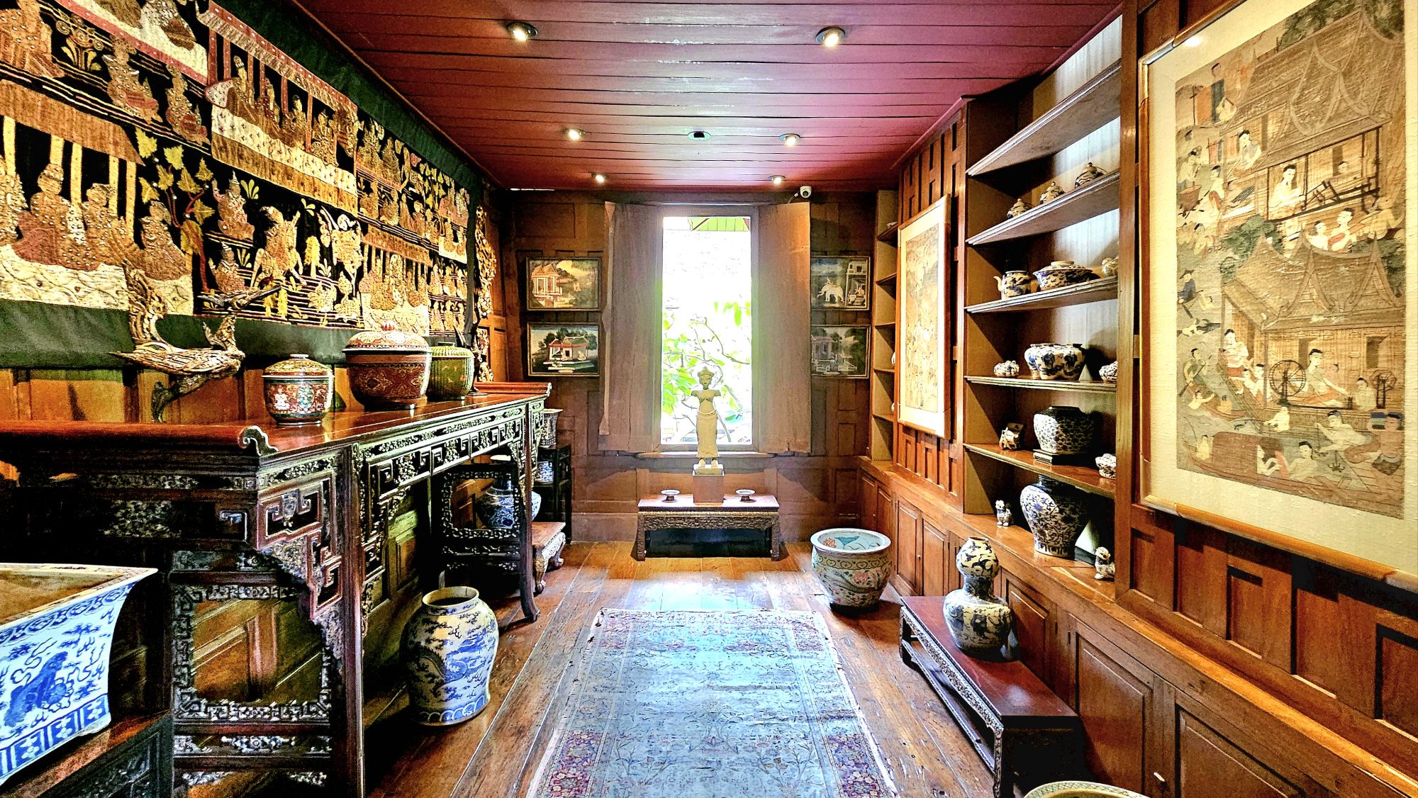
his private residence-turned-heritage museum, replete with a gallery, restaurant, and boutique–
all dedicated to Jim Thompson’s love of ancient Siam.
The compulsory spirit house surrounded by lush gardens–situated according to Feng Shui principles–informed us that we were protected from the steel and glass towers that enveloped us.
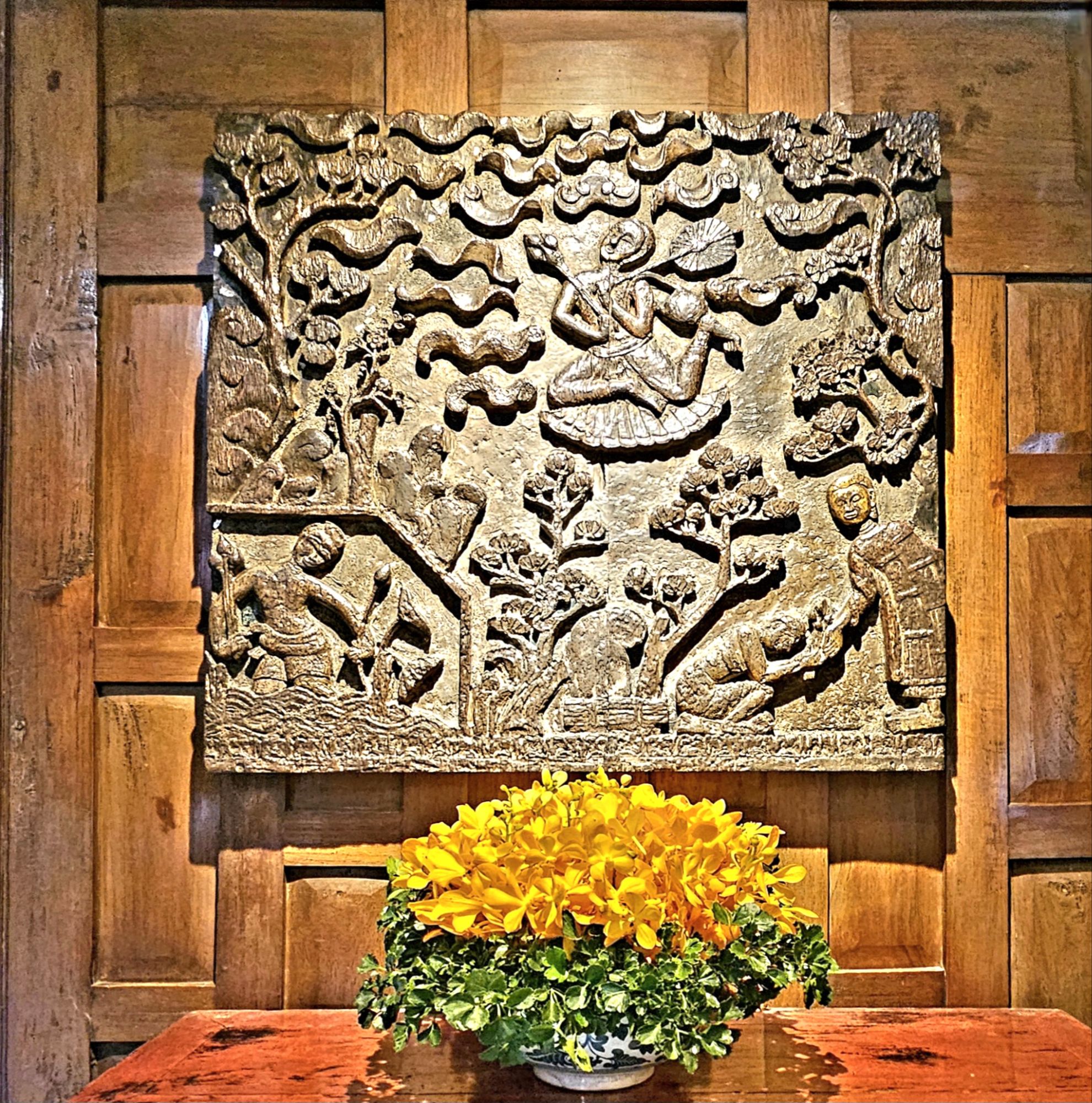
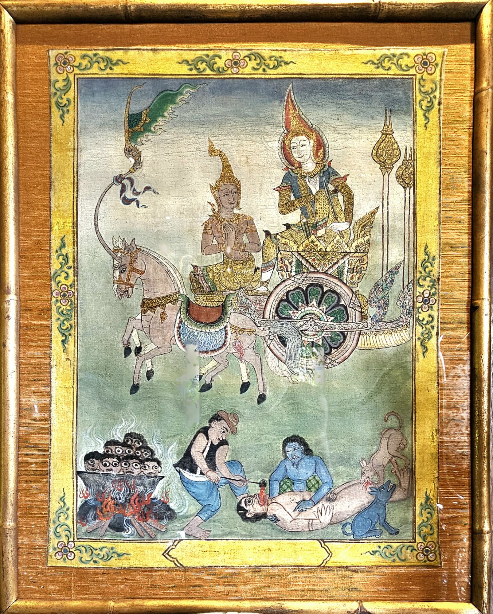
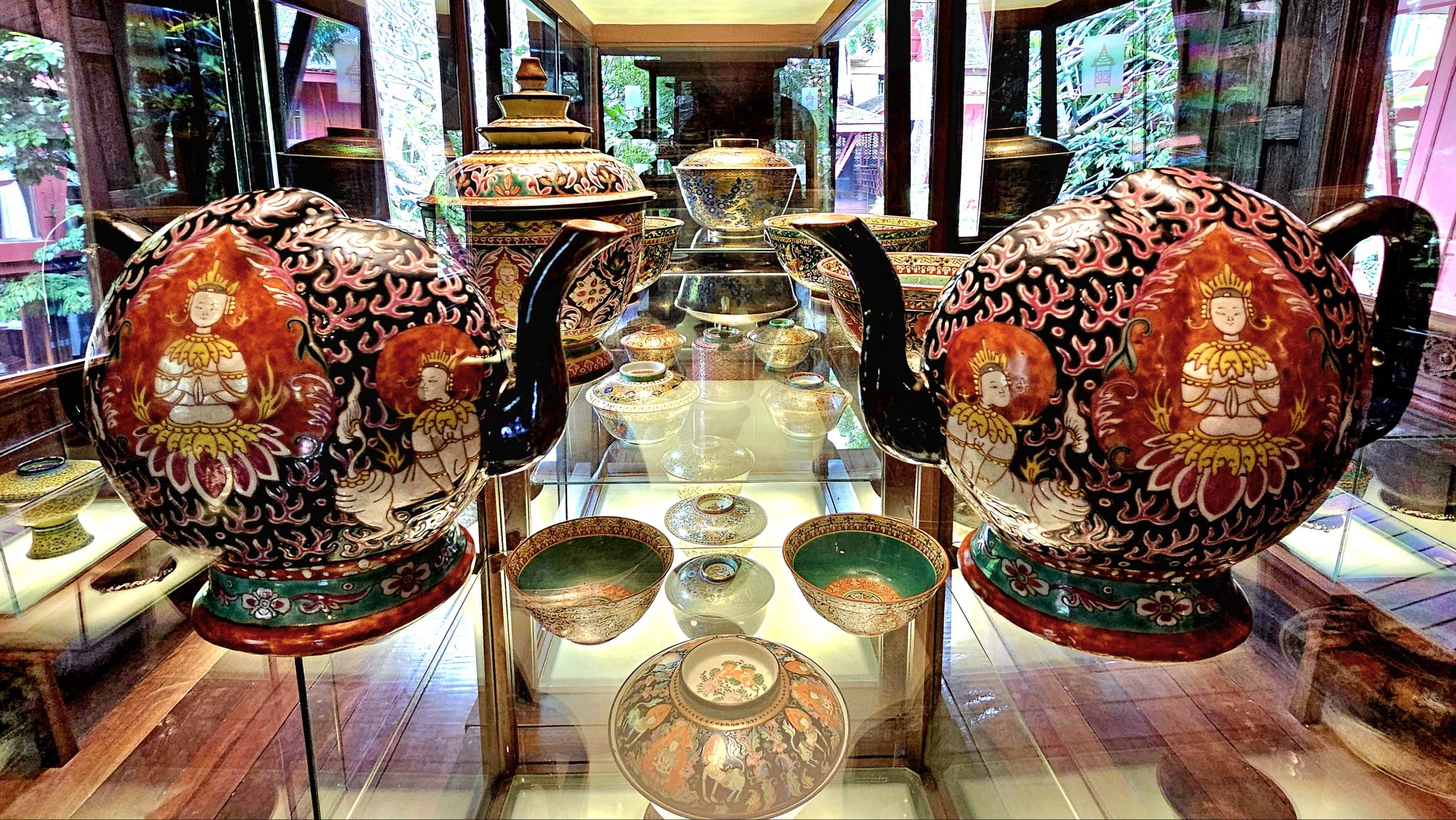
An English-speaking docent guided us through gardens and living quarters, which showcased archetypal Thai tapestries,
ancient wood carvings,
Buddhist watercolors…
and fanciful porcelain tea sets, among a dazzling array of other riches…
which inspired Thompson’s line of patterned silk fabrics used in clothing, furnishing, and accessories,
such that he single-handedly revolutionized Thailand’s handicraft industry during the 1950s and 1960s, earning him the moniker of the “Silk King of Thailand.”
His home has become an amalgam of Southeast Asian cultures…
and museum-worthy artifacts that he collected throughout the years,
sprinkled with practical flourishes, while serving as de facto US Ambassador to Thailand and founding the Thai silk company that still bears his name.
His status as a raconteur and entertainer of celebrities and royalty was legendary, but abruptly came to an end on Easter Sunday, March 1967. He had visited a friend’s house in the Cameron Highlands of central Malaysia, and took an afternoon walk through the jungle that day, never to be seen again.
Despite a land and air search effort involving hundreds of full-time trackers across multiple agencies and governments, it seems Jim Thompson disappeared without a trace.
There are many who have traveled down the rabbit hole of theories and conspiracies, determined to unravel the truth and possible whereabouts of his remains.
Yet the legacy Jim Thompson left behind continues to this day, and Thailand’s prosperous silk industry remains his greatest contribution.
With writing this sentence, my 6-month blogging hiatus is officially history.
All the while, I continued taking pictures, and I never stopped writing. I just got off the blogging merry-go-round for a time.
Instead, I took stock of nearly 25,000 images and analyzed 500 stories that I’ve shared with the WordPress community over the past eight years.
I soon realized after 3 years of blogging that I had already accomplished my mission of streaming through America!
That’s not to say that there’s nothing more to experience. But I can honestly say that since retiring, I’ve chronicled hundreds of visits to national and state parks and various landmarks and curiosities across the country, which amounts to the very best that America has to offer.
I’ve also begun to travel more internationally, and I’ve included many of those destinations in this blog. How could I not? Naturally, it wasn’t in an Airstream, and it wasn’t America. Although, in fairness, some of those destinations within Canada, Mexico, Central America, and South America should count as “American” by nature.
I also realized that many of the stories I wanted to tell were not always supported by the photographs I had taken. And often times, the photographs I was most pleased with didn’t always match the story I was writing.
I found myself making arbitrary rules that impeded my writing, like thinking that my posts should be a linear account of my travels rather than a reflection of an arbitrary moment in time.
Managing StreamingThruAmerica.com has been a blessing, albeit it’s been challenging yet exhausting; nourishing while enervating; fulfilling but frustrating, and rewarding yet fickle.
Nevertheless, it’s also garnered over 100,000 views–for which I received a silly badge from WordPress, which makes me smile;
and it’s earned an Editors’ Discovery pick soon after launching this blog.
I don’t know if all of that is worthy of celebration or not, but I’m certainly grateful for the recognition and all the support from the blogosphere.
What started as a personal journal of sorts and a means of checking in with family and friends has morphed beyond its original intent, and I’m okay with that.
I’ve toyed with refreshing the style and revising the content to fit the times (and maybe that may happen on a rainy day), but for now, it’s status quo.
The journey continues…in Bangkok–the first stop of a 5-week adventure to Southeast Asia–where ancient kingdoms still shine as bright as the Buddhas that adorn his temples.
Resetting the Wayback Machine to Dateline: August 3, 2023
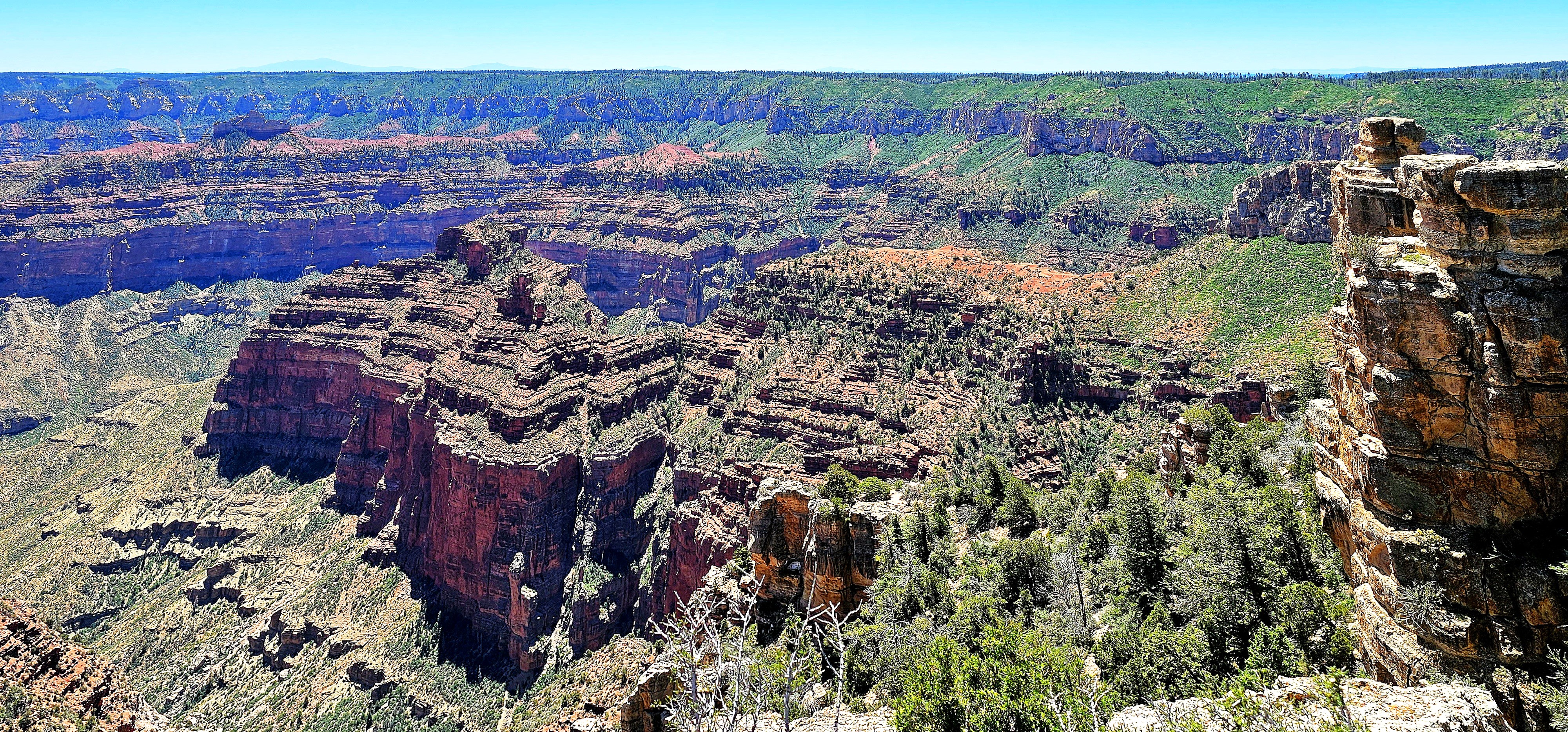
After three days of admiring Grand Canyon’s North Rim–from Point Sublime…
to Point Imperial…
to Angel’s Window,
Leah and I were already anticipating our next physical and photographic challenge–hiking through the Coyote Buttes North in search of The Wave.
But we were at the mercy of Bureau of Land Management, who awards permits to no more than 64 visitors per day through a complicated online lottery process.
We scored dinner reservations at the Grand Canyon Lodge Dining Room…
during sunset to discuss our future travel plans.
Regrettably, our meal was more consolation than celebration. Despite our application for permits months in advance, and again, the day before our departure, our high hopes were dashed by impossible odds.
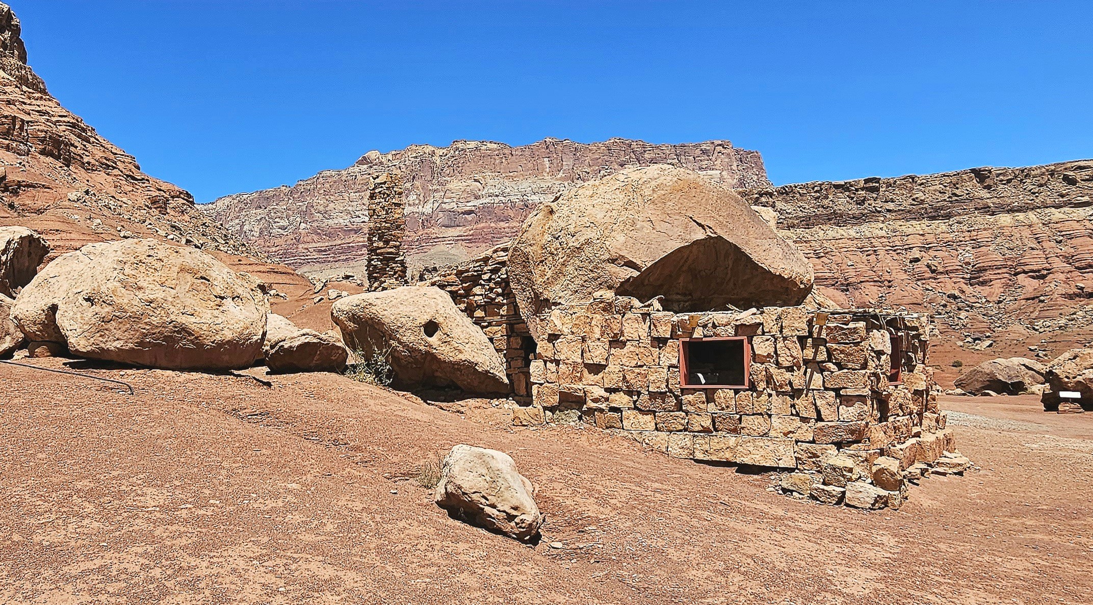
Ultimately, we followed our contingency plan, which, like an old friend, was familiar yet still full of surprises. The following day, we drove through Marble Canyon–flanked by Vermillion Cliffs–with a brief stop along Highway 89A to marvel at a Cliff Dwellers Stone House,
a crumbling roadside curiosity that was constructed from rock debris and local timber by Ziegfeld Follies dancer Blanche Russell and her husband Bill, whose car had broken down at this location in 1927.
According to the tale, the beauty of their surroundings was so captivating that they established a homestead on the site during the Great Depression, extending hospitality to Mormon travelers journeying along the adjacent Honeymoon Trail to the temple in St. George, Utah, for the sanctification of their marriages.
Meanwhile, we continued north on a pilgrimage of our own to Page, Arizona for a few days of essential sightseeing.
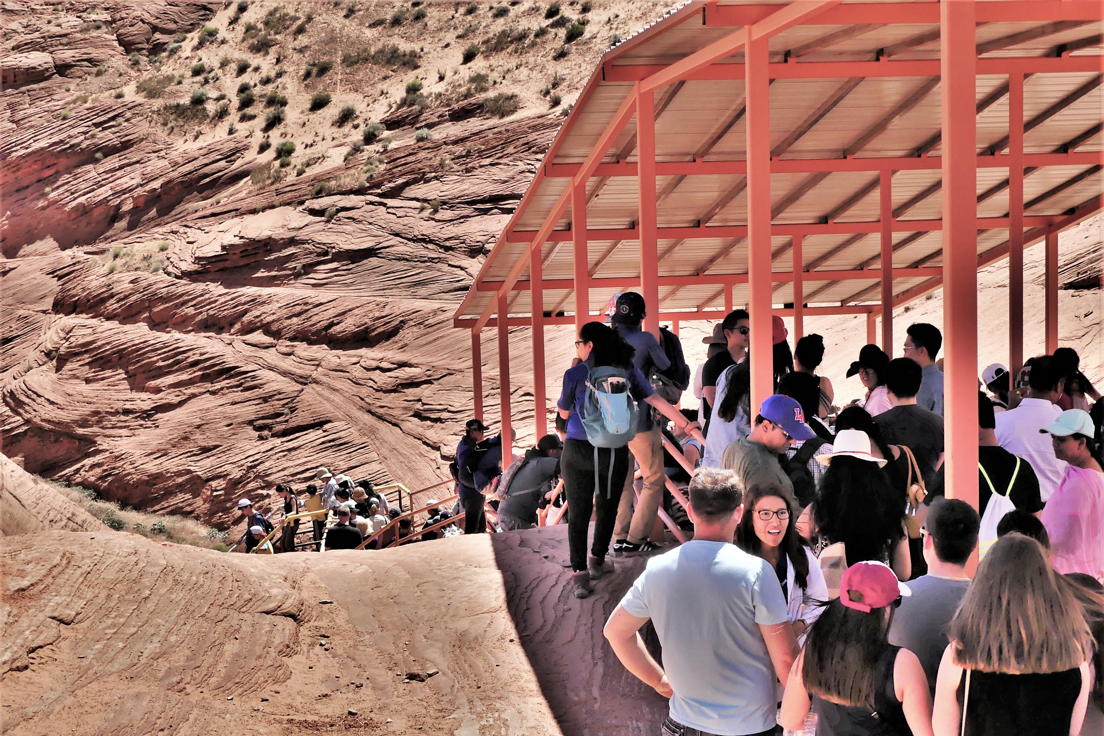
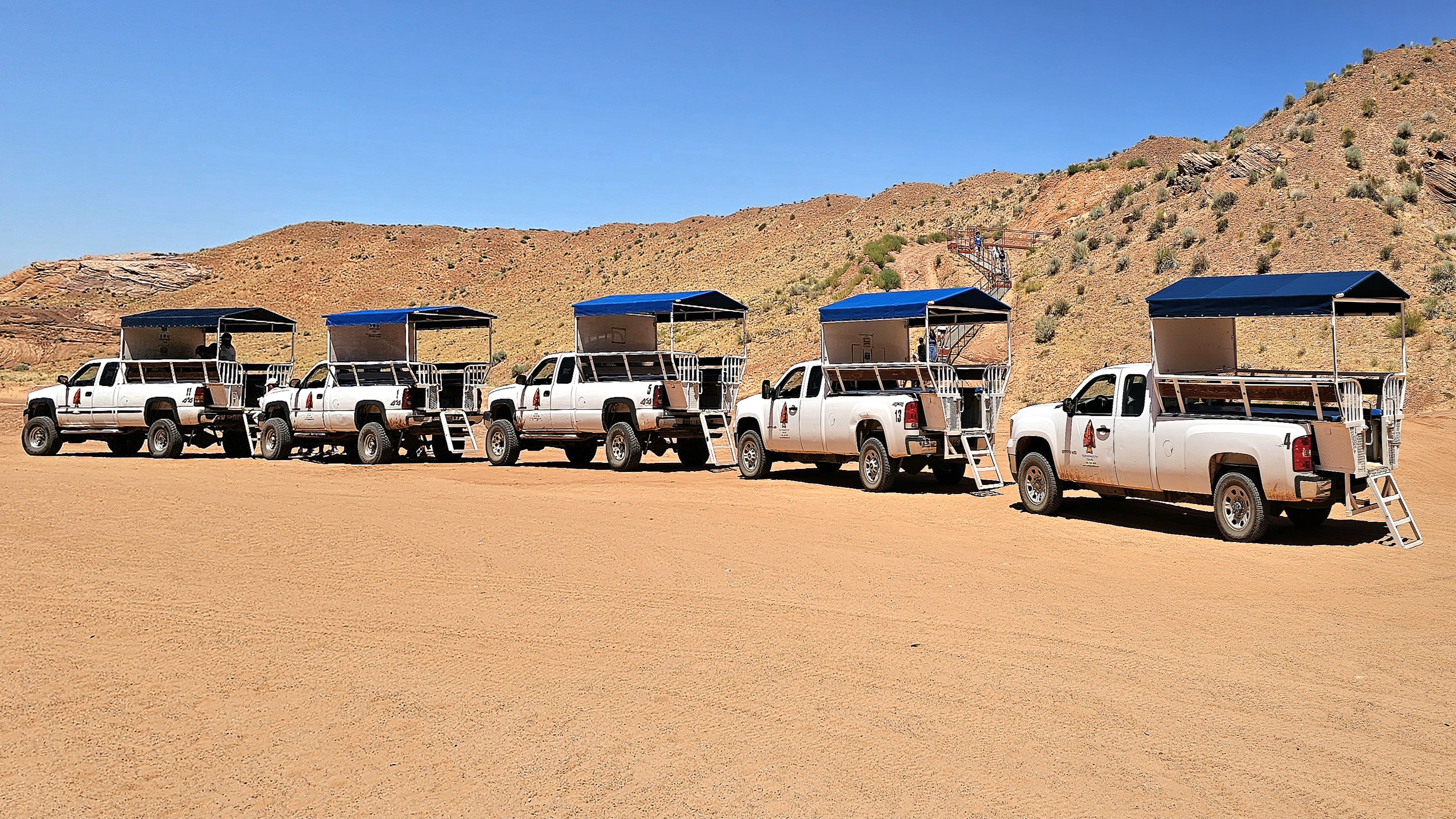
The following day, we arrived at a strip mall to claim a coveted noon reservation for a guided tour of Upper Antelope Canyon tour with an accredited Navajo tour operator. Having toured Lower Antelope Canyon 6 years ago (see Can’t Elope Canyon), we elected to hike the upper canyon this time around.
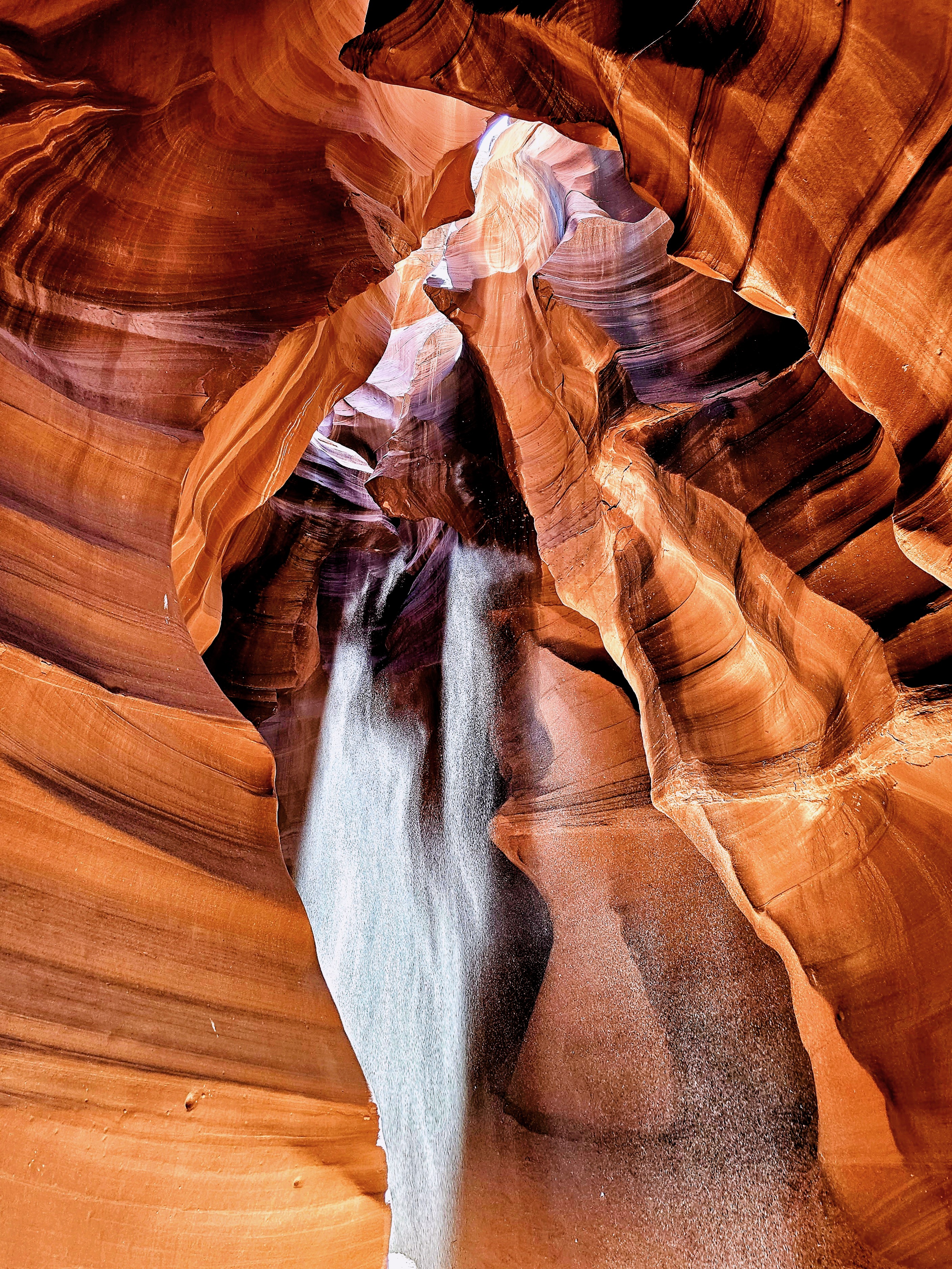
Upper Antelope Canyon, often referred to as “The Crack,” features a flat entrance and a level path throughout, offering a seamless stroll with no elevation shifts. This easy access, devoid of any stairs, renders it more welcoming than its counterpart, Lower Antelope Canyon, where stairs and ladders are part of the experience.
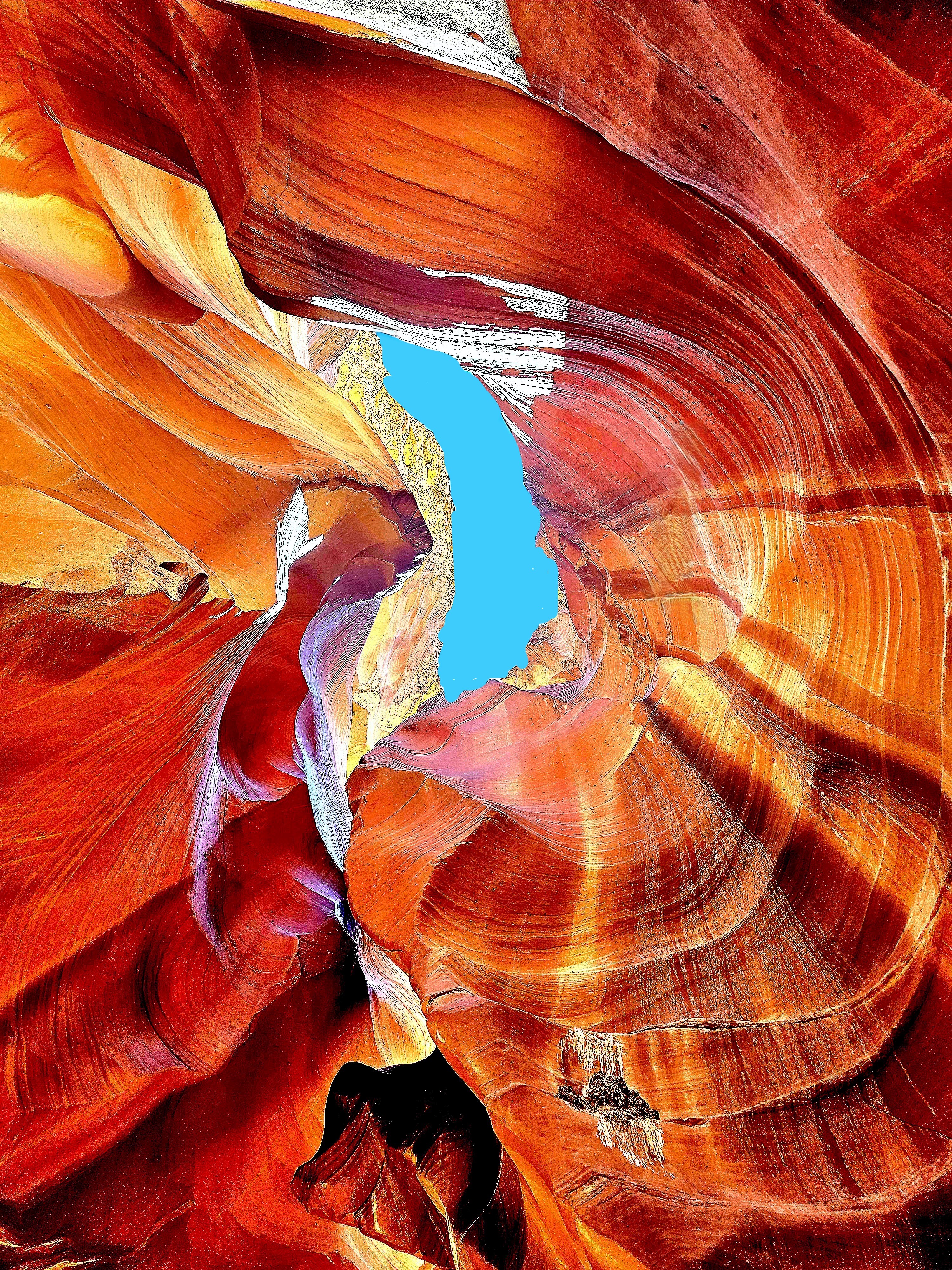
In my quest for photographic redemption, I was determined to infuse some mystery into the majesty of these sculpted canyon walls by focusing on the details of the form, while framing an energy of twists, curves and color.
We jostled and bounced across a dusty desert plain from the back of a dusty pickup truck, enduring temperatures of 100°F. The grab bars were so hot, I could only handle them through my hat. After arriving at the canyon’s entrance, our guide offered us a brief geology lecture and valuable photography tips.
Rather than lug around my SLRs, I relied on my Samsung Galaxy 23S Ultra phone for its reputed low-light sensitivity and high-resolution capabilities.
From the onset, our guide pointed out shapes created by negative space, such as the “Lady of the Canyon,” which seemed intriguing to many, but irrelevant to my mission.
Additionally, there was plenty of highlight and shadow play in the formations that was easily personified, such as the “Open-Mouth Man.”
Many photographers were there to capture the “sunbeam effect” that appears from April 1st to September 30th with a helping handful of tossed sand.
There was also equal opportunity to document the canyon wall formations as realistically as possible.
or using the undulating walls as an interesting backdrop.
But I was there to capture the abstract potential!
The canyon’s walls rise up to 660 feet above the streambed, and the trailhead sits at an elevation of 4,377 feet.
Geologists say the walls are shrinking and the elevation is increasing, as sand continues to rise from continuing erosion from wind and water.
The 0.3-mile one-way trail is mostly hard-packed with red sand and silt.
The Navajo Nation calls Upper Antelope Canyon “Tsé’bighanilini,” meaning “the place where water runs through rocks.” I call it amazing!
One hour later, we emerged from “The Crack.”
Antelope Canyon’s allure was so magnetic that I felt myself being drawn into repeating our adventure. However, time would not allow, and no slots were available!
Certainly, its beauty would have revealed itself in a new light, with a new twist!
It was 5 p.m., and the last of us was being checked in at the Aula foyer on Deck 2. As I waited, it gave me an opportunity to photograph the creepy albatross dangling from the ceiling.
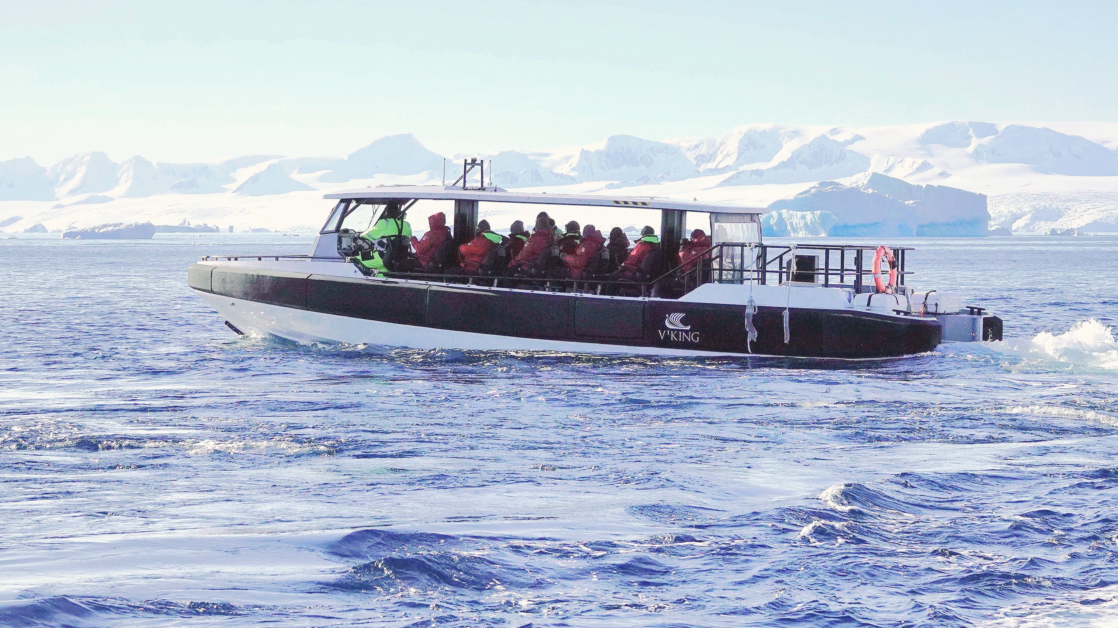
Leah and I were among the lucky dozen chosen for Octantis’s last outing—a Special Ops Boat (SOB) trip—prior to our return to Ushuaia.
Our guide was informed by the science support team that recent drone surveillance revealed significant wildlife activity near Jonassen Island. This discovery prompted our pilot to alter our planned route, with the understanding that Octantis would forgive our tardy return in the interest of scientific discovery.
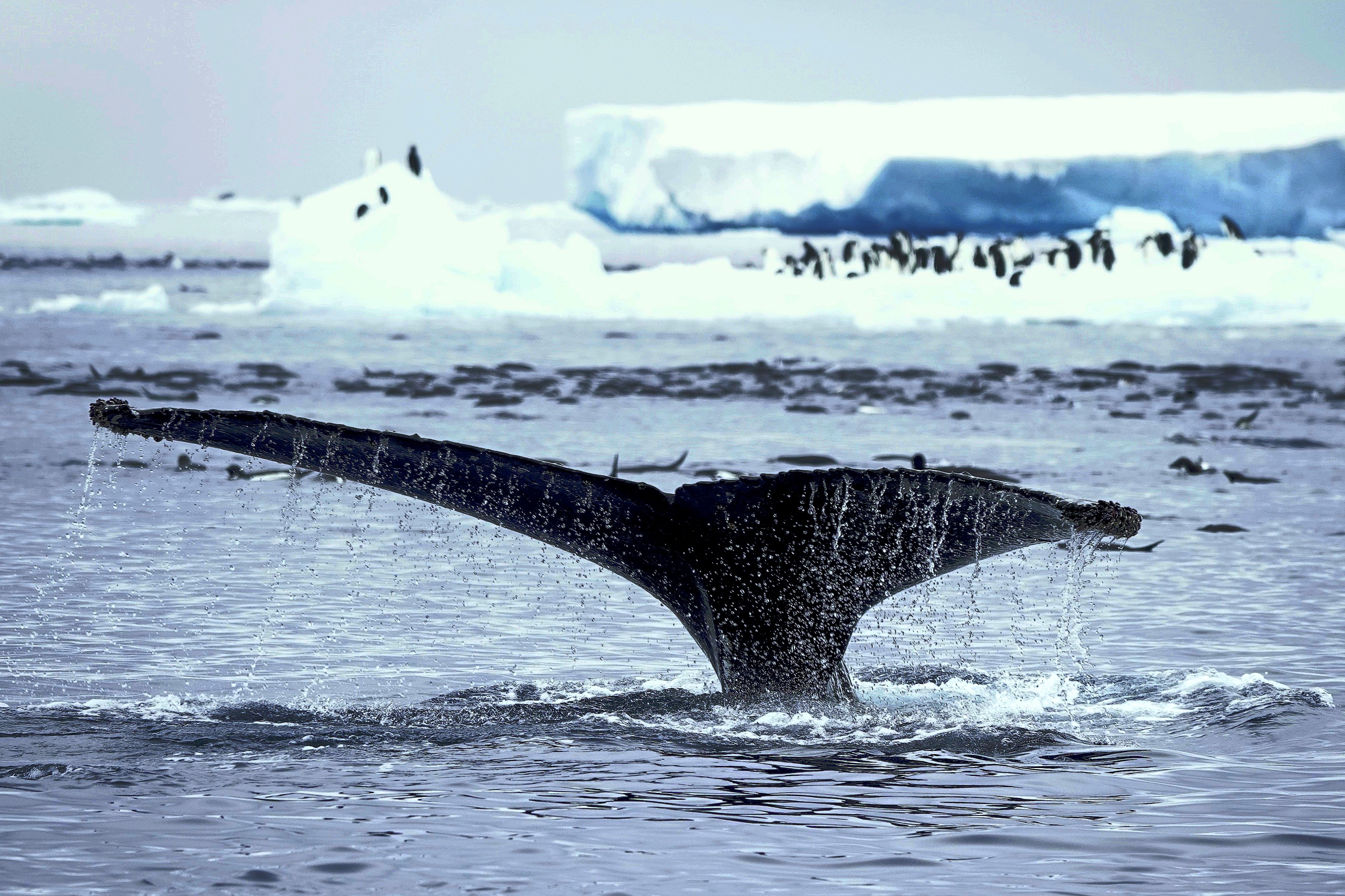
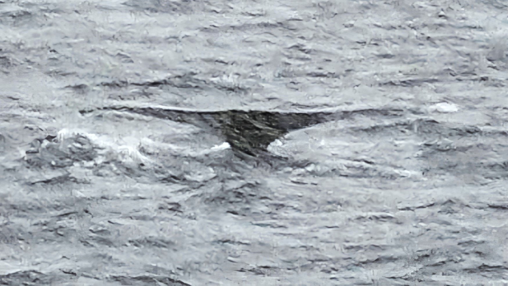
We jetted into open water toward Jonassen Island for 15 minutes or so, until our pilot suddenly killed the throttle. Our guide had spotted a couple of humpbacks in the distance, worthy of a closer look.
Passengers were abuzz with excitement at the possibilities as we maneuvered into position. And then a voice rang out, “Did you see that at 3 o’clock?”
The pilot responded quickly, steering starboard toward the sighting. I spun to orient myself, when it became apparent that we were not alone; there was company on our portside,
and on our starboard side!
We were in the midst of a feeding frenzy.
In fact, we were surrounded by a pod of a dozen humpbacks…
swimming around us and under us!
I didn’t know which way to turn. Whales were breaching…
and diving all around us.
Penguins were unphased by the playful display.
They were content to share the water and krill, filling their bellies without concern,
while humpbacks continued their elaborate feast.
We idled in place for nearly an hour, witnessing the spectacle around us. But a radio transmission from Octantis woke us from our enchanted trance and indicated that we had overstayed our welcome.
We returned to Octantis for dinner plans of our own, and bragging rights to a whale of a tale that was the icing on the wake.
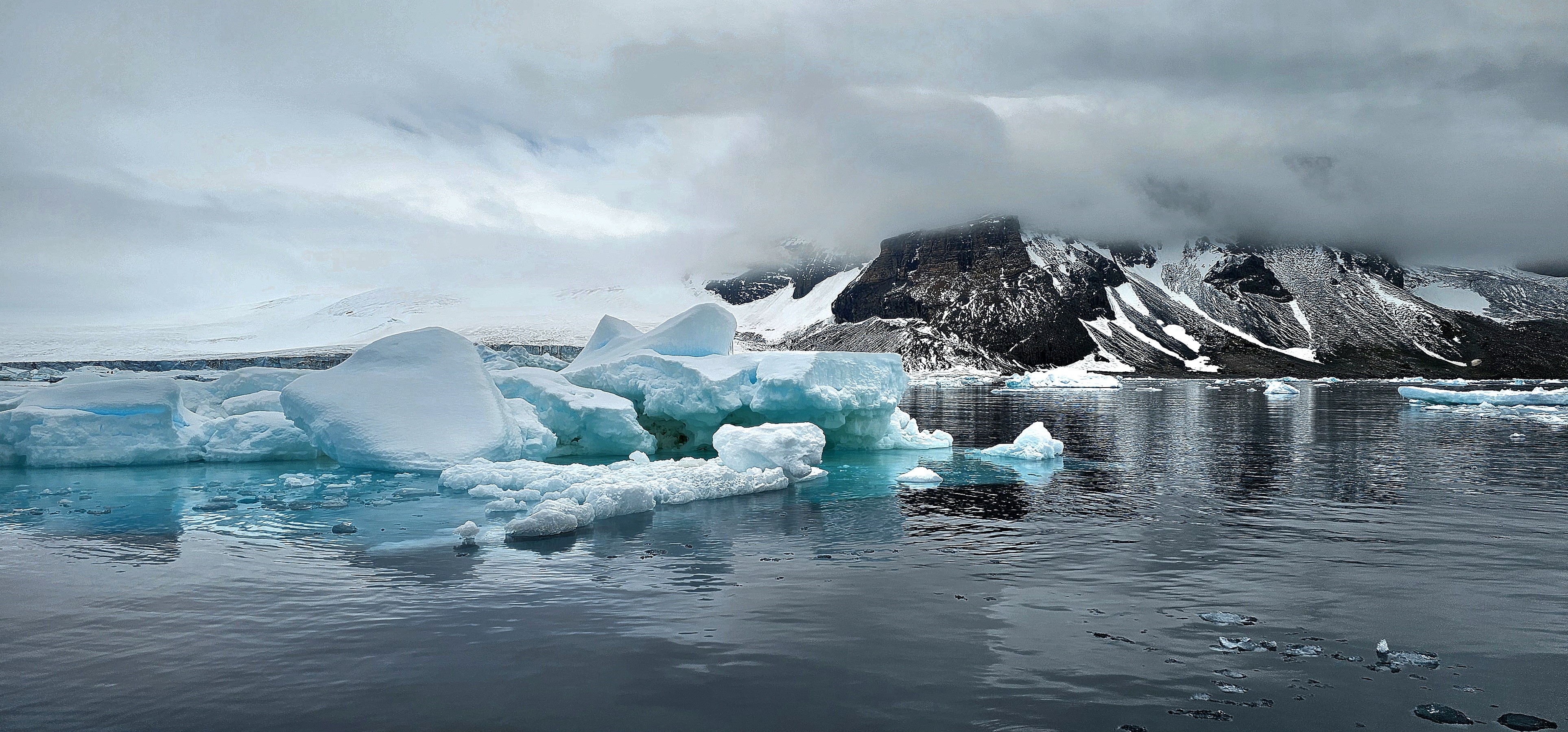
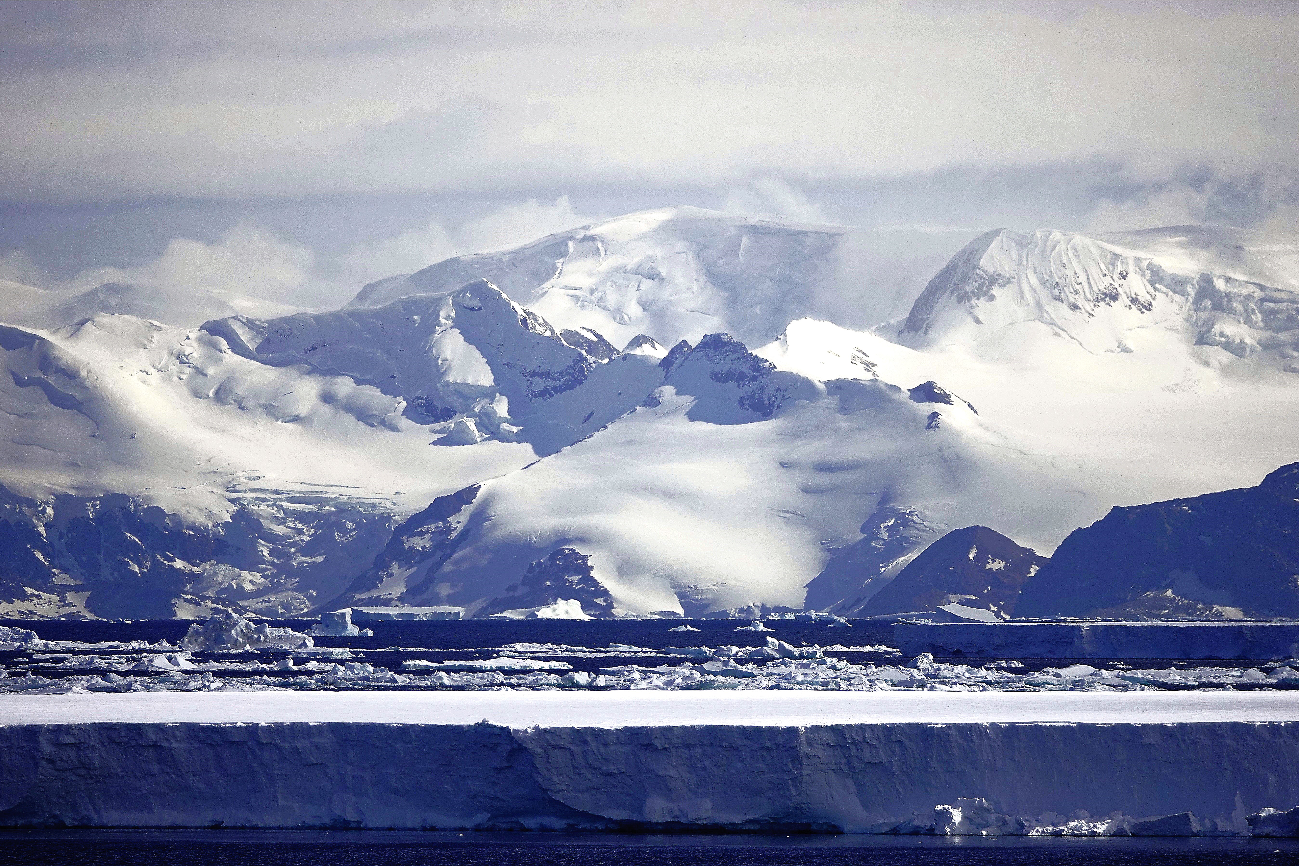
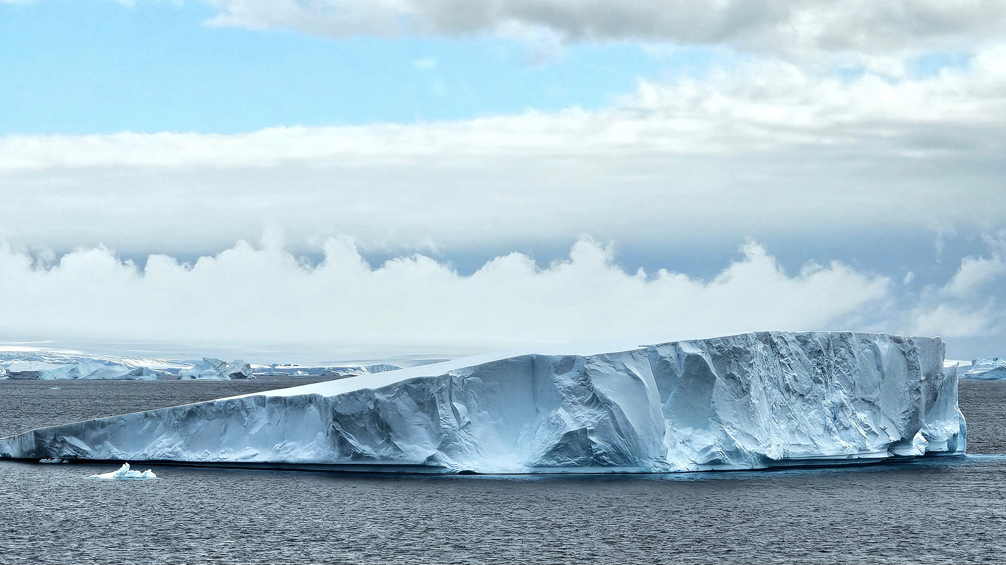
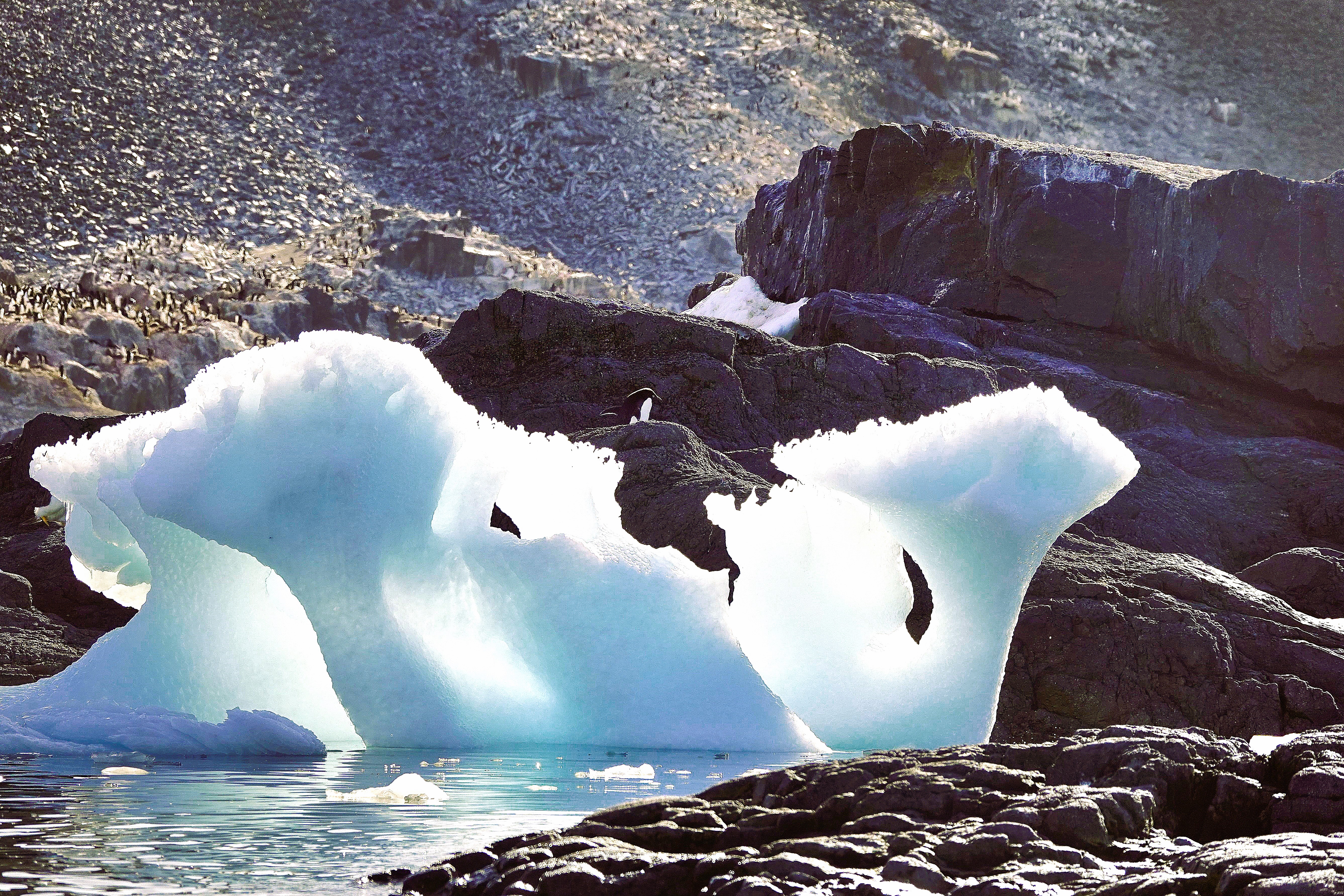
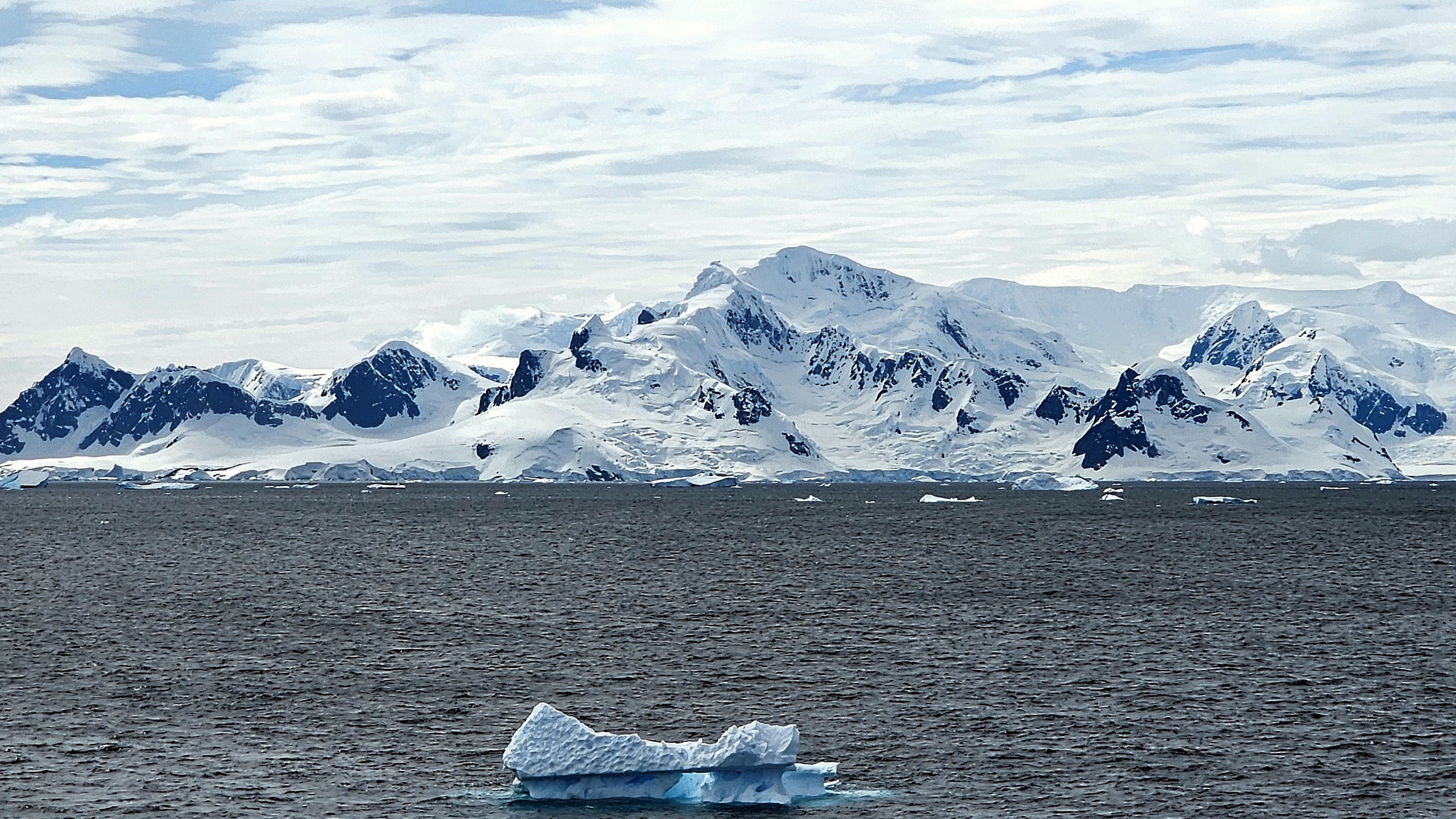
After a week of island-hopping along the Antarctic Peninsula, Leah and I finally set foot on the continent of Antarctica.
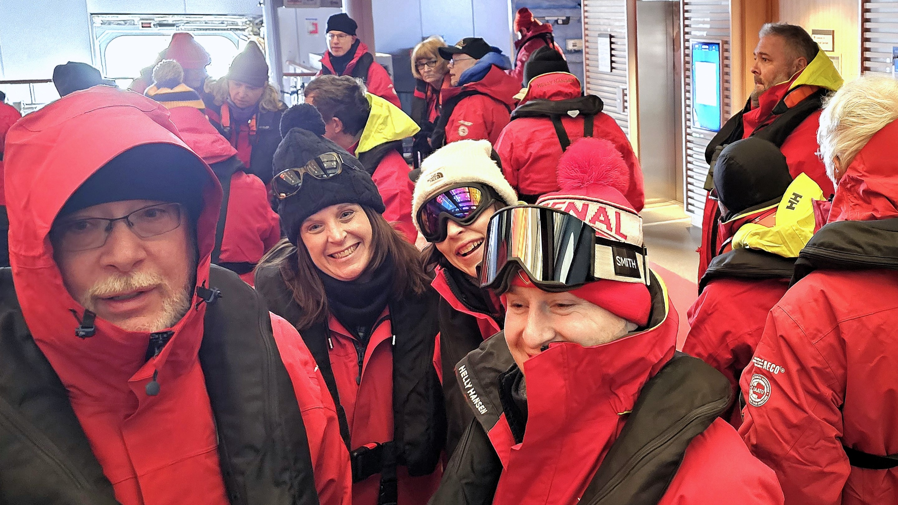
And because this was Viking’s sole continental visit, the expedition team was particularly busy transporting the remaining 352 passengers to Brown Bluff while overseeing a range of other outdoor activities throughout the day.
Our group was instructed to report to Deck 2 during a celebratory luncheon on Deck 10 that was briefly interrupted by a cloudburst of sleet and snow. Leah managed to cross the slippery deck with aplomb while balancing her surf and turf, but we had other fish to fry.
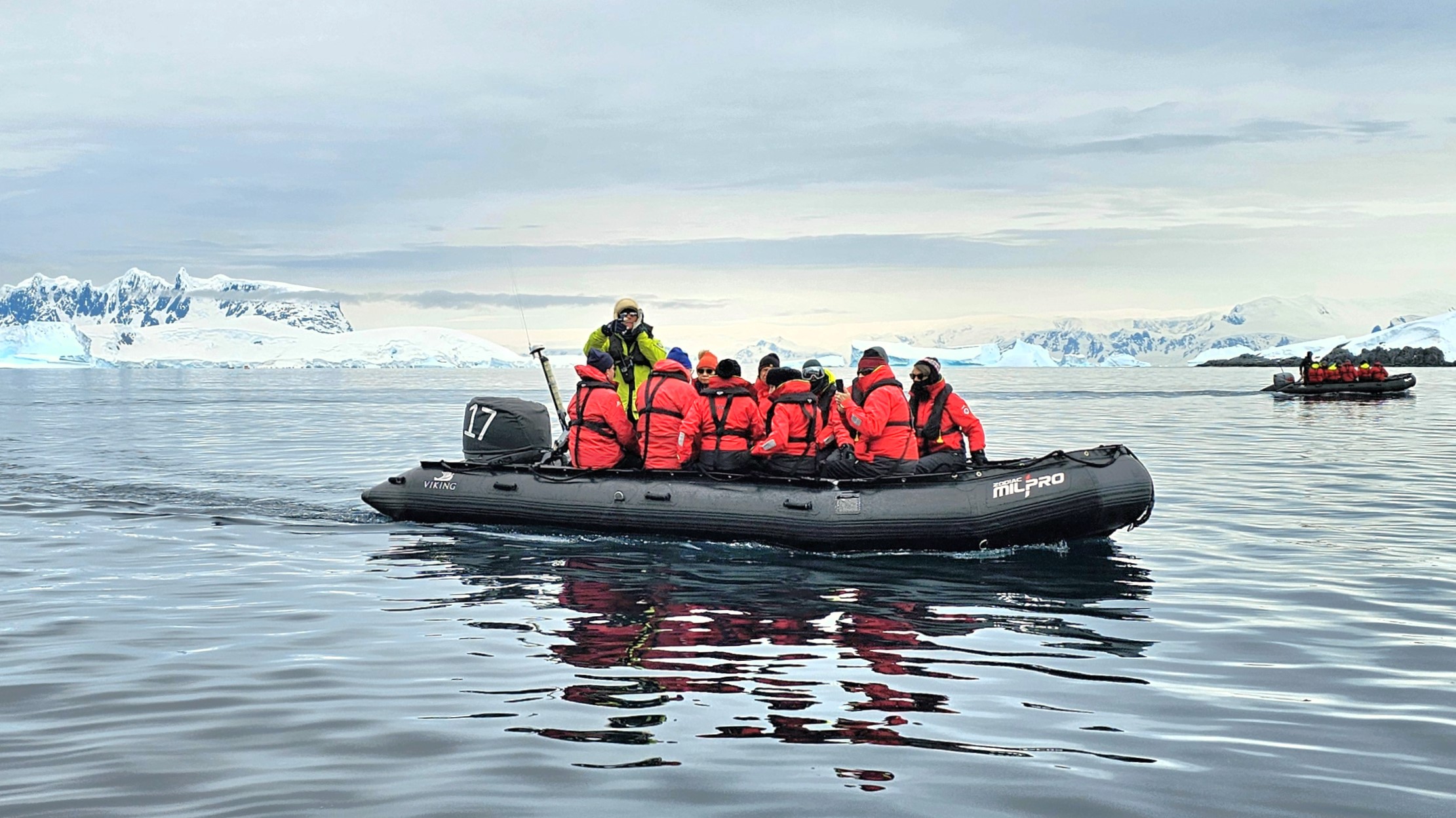
Once we were appropriately outfitted, our Zodiac pilot whisked us from our Trepassey Bay anchorage…
avoiding packs of drifting ice while also keeping an eye on an evolving sky,
which transformed a distant glacier into an enchanted wonderland of swirling smoke and mirrors.
And then, as if on cue, the veil magically lifted as we approached the coast, revealing its rich, red brown, tuya characteristics.
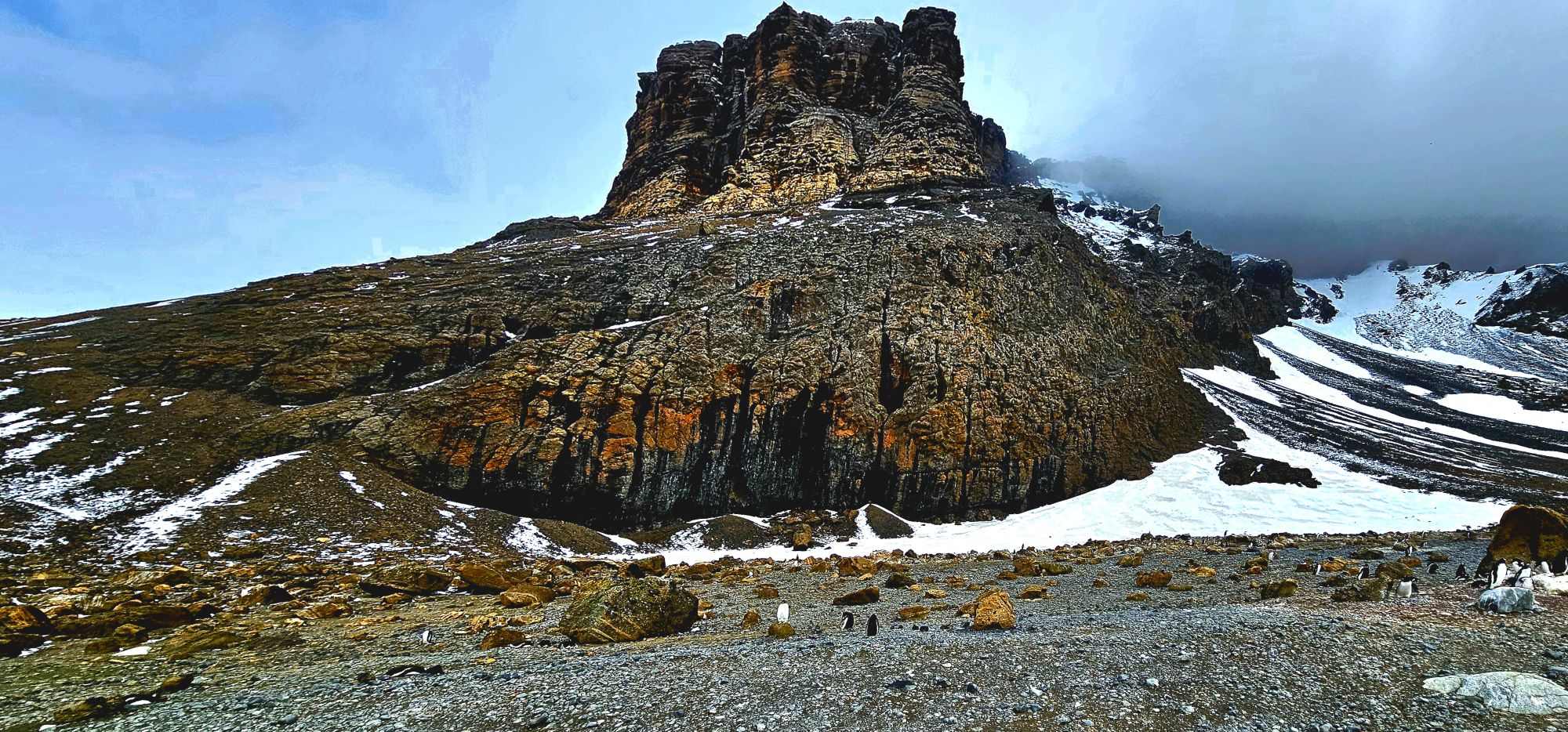
We ambled onto shore, across the moraine…
where three impressive, moss-covered boulders at the western edge of the snow slope…
reminded us of Brown Bluff’s subglacial eruption one million years ago.
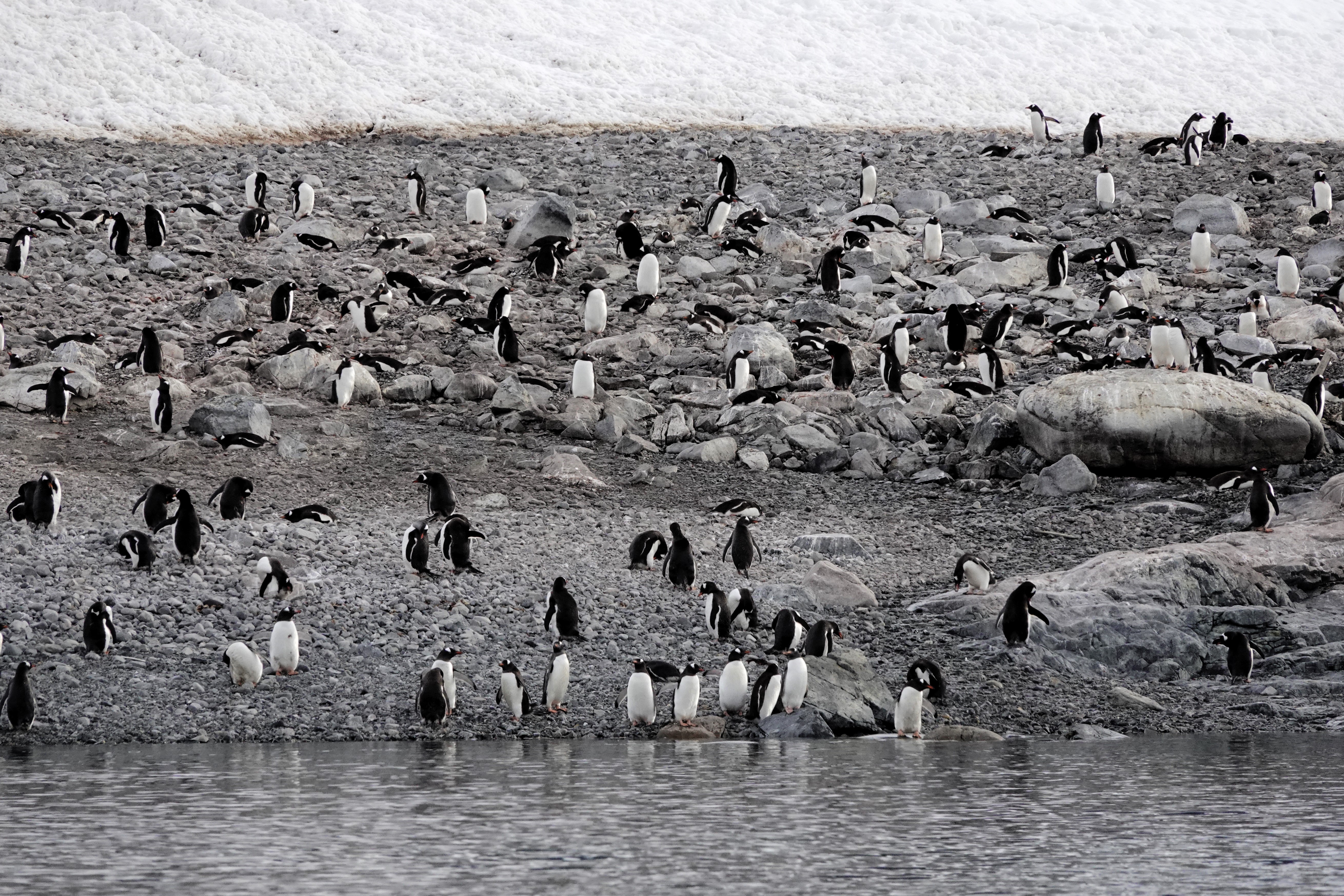
A majority of the landing groups headed east towards the rookery.
However, it proved quite difficult to maintain a 5-meter distance from the gentoo penguins–perpetually parading along the beach.
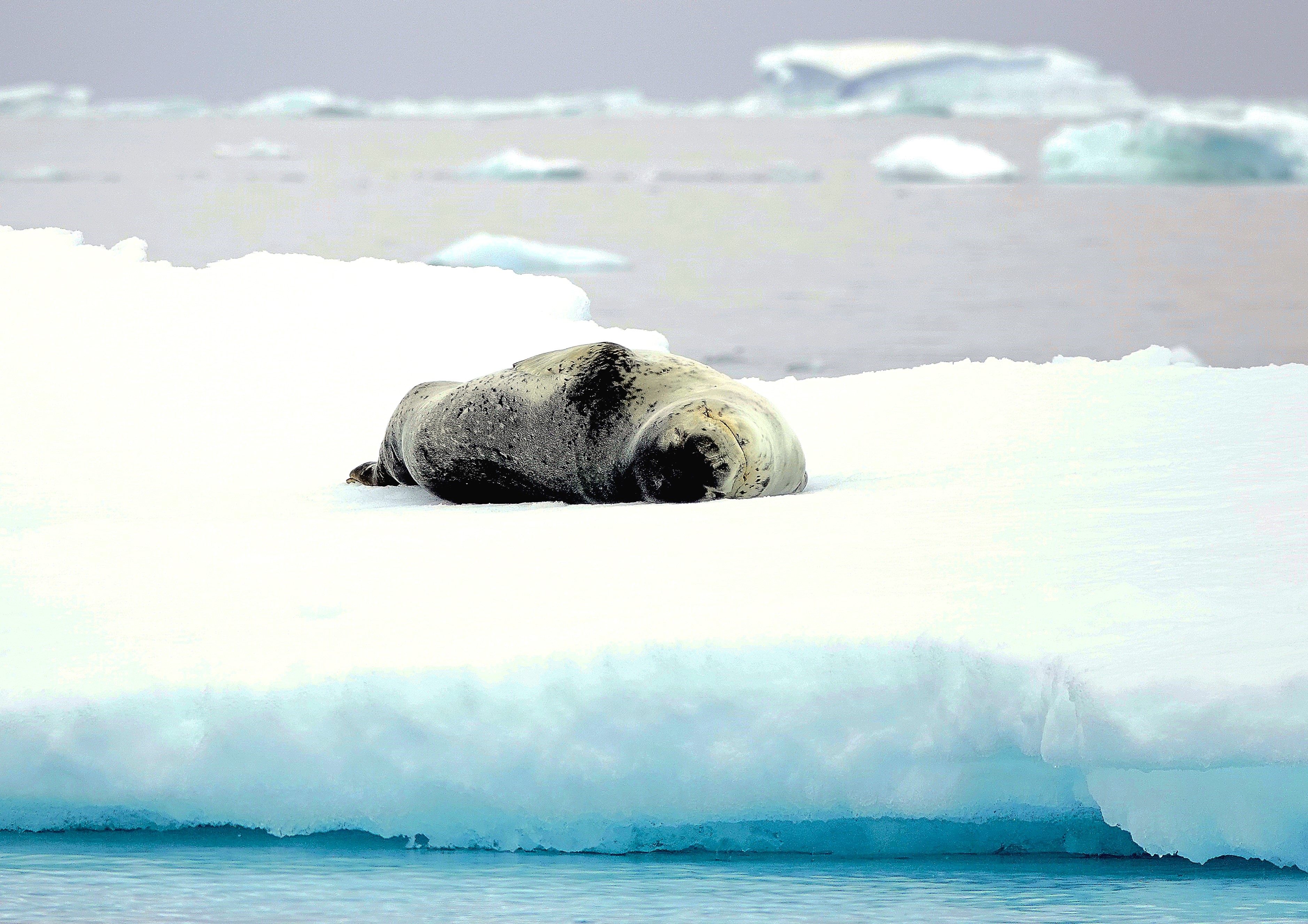
So, I ventured westward, over an icy reef, beyond nesting kelp gulls…
where I spotted an opportunistic leopard seal lying in wait…
for unsuspecting dinner guests,
yet every penguin on Brown Bluff had reservations elsewhere.
Had our continental landing marked the end of our dramatic voyage, I would have been wholly satisfied with our Antarctic experience. However, following the decontamination of our outerwear aboard Octantis, Leah and I learned that we would be among the final twelve returning to Brown Bluff via Special Operations Boat.
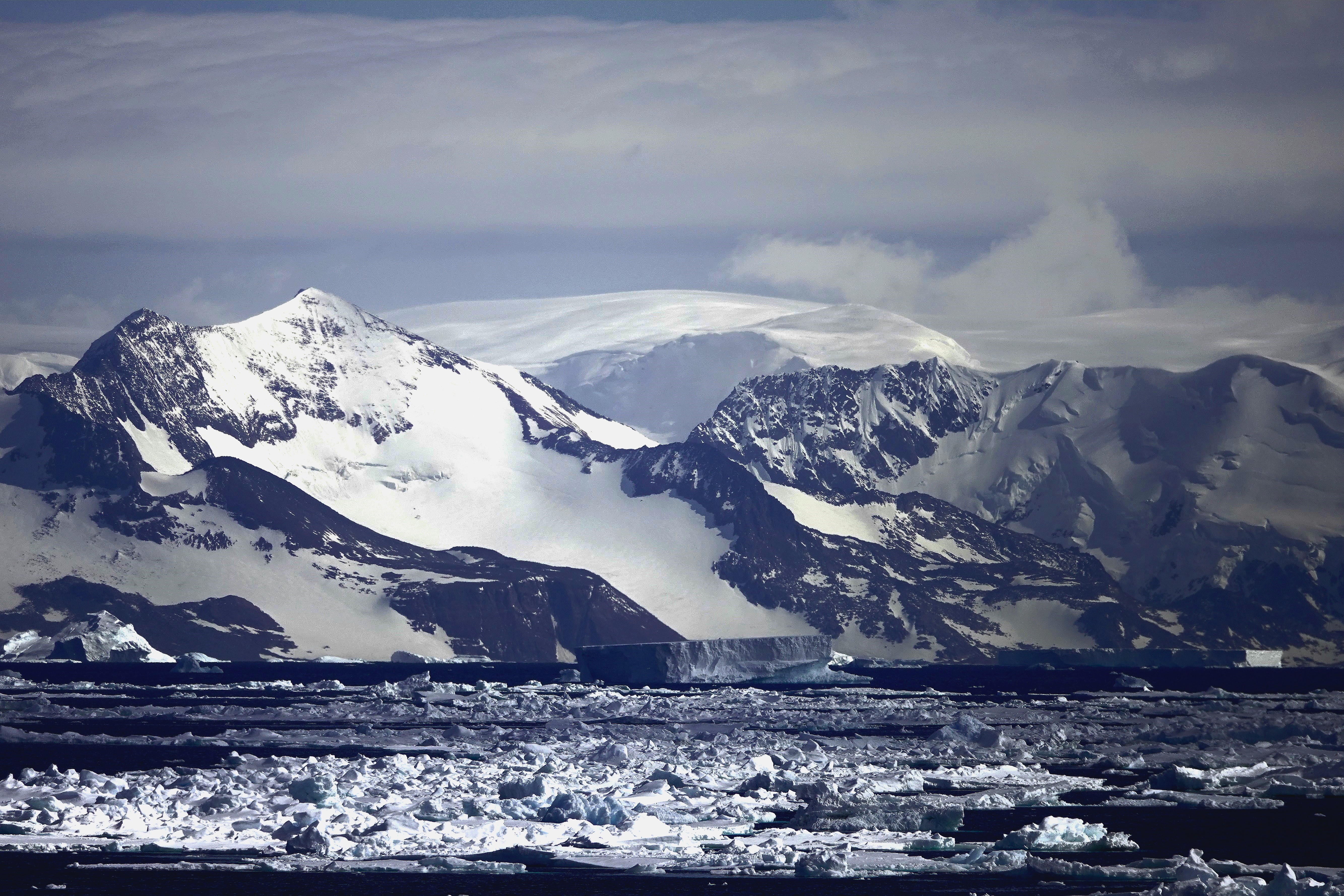
On our penultimate day at sea, Captain Cardestig skillfully navigated the Viking Octantis around the peninsula’s northeastern tip for an early morning view of Joinville Island’s glacial headlands and ice-capped peaks.
We anchored outside a dense track of pack ice that can make it challenging to approach landfall at Tay Head.
Those fortunate enough to be scheduled for daily excursions experienced a thrill ride from the 10u Zodiacs piloted through floating ice blocks momentarily stranded on rocky shallows.
I, however, was stranded aboard Octantis with my camera at the ready. The closest I could get to the Adélie penguin colony this day managed to swim across my viewfinder as they indulged in a krill feast.
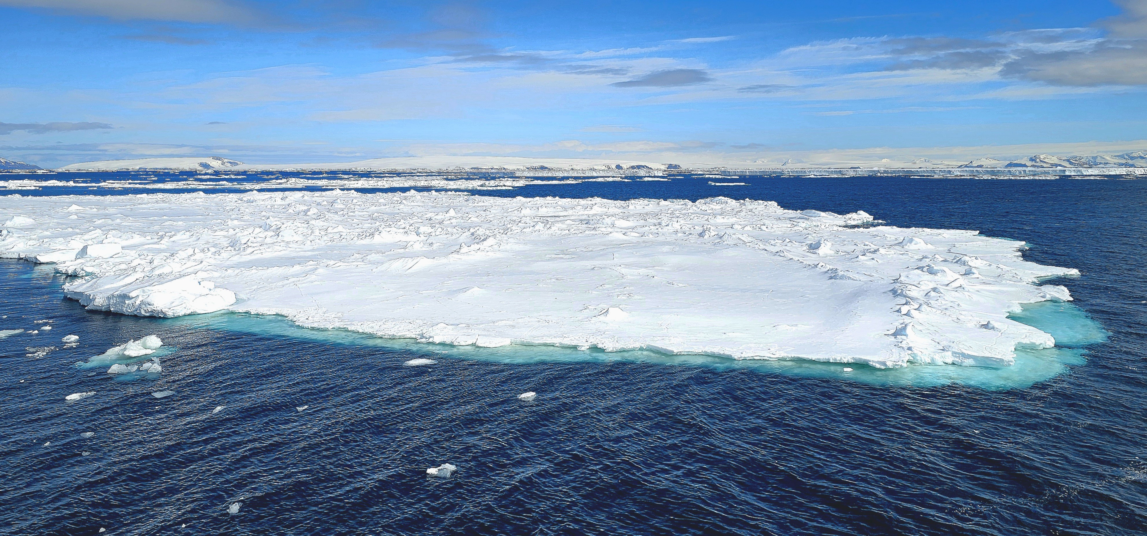
Travel resumed at noon, dodging islands of sea ice across the Antarctic Sound,
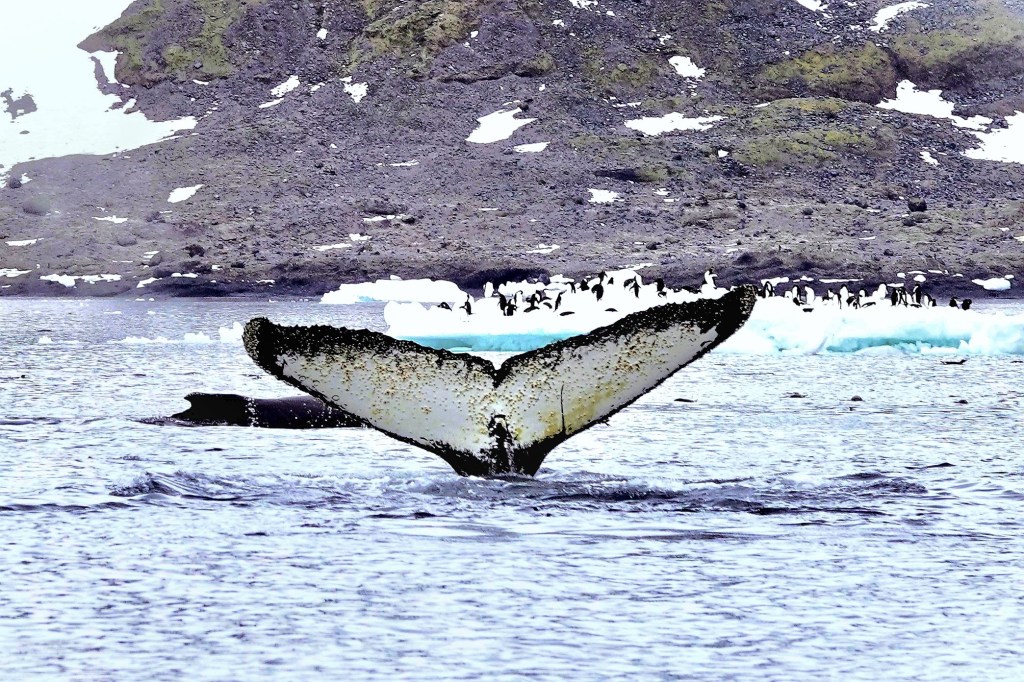
when a call came across the P.A. system, “There’s a humpback sighting, portside, and it’s following the ship.”
It was as if the paparazzi had stumbled upon Taylor Swift adrift in the Southern Ocean. Passengers leapt to their feet, fervently capturing the moment (predominantly with cell phones) from every deck, eager to commemorate our initial humpback whale sighting,
albeit from a distance beyond any reasonable recognition or resolution …
Nevertheless, there were cheers all around, as if to encourage an encore performance. And to our surprise, it circled back for a curtain call with crisper results!
Although my pixelated version offered its own reward.
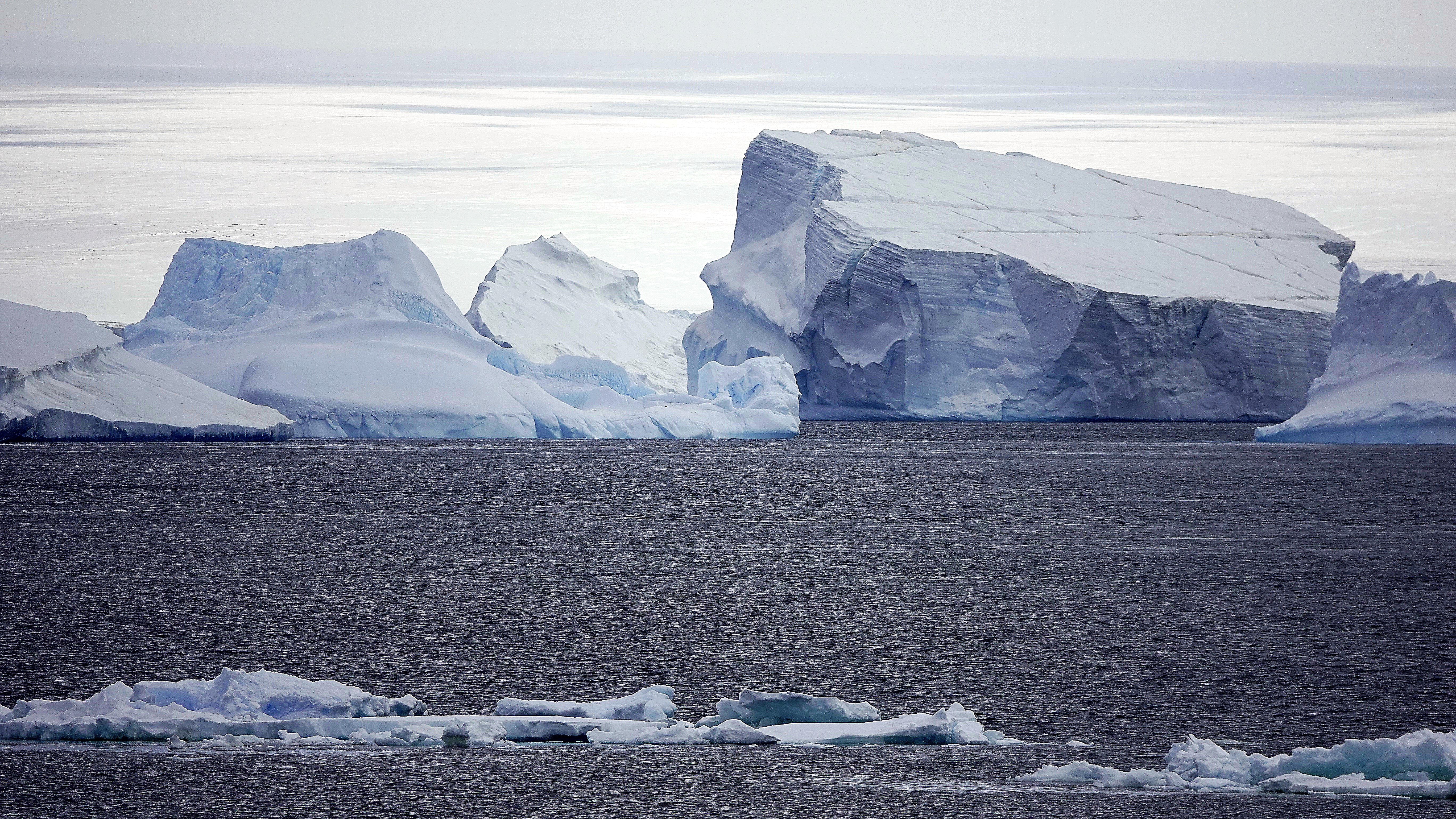
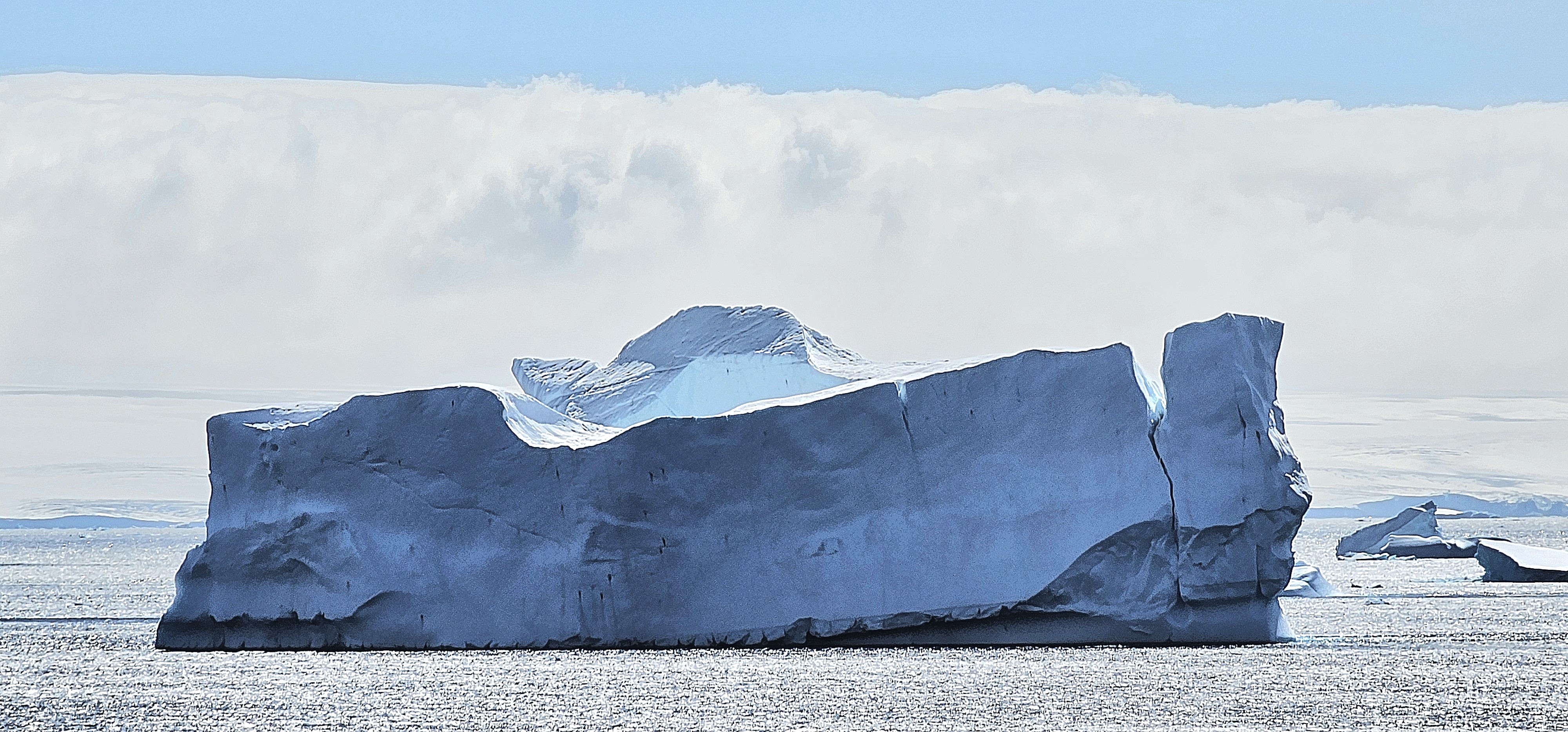
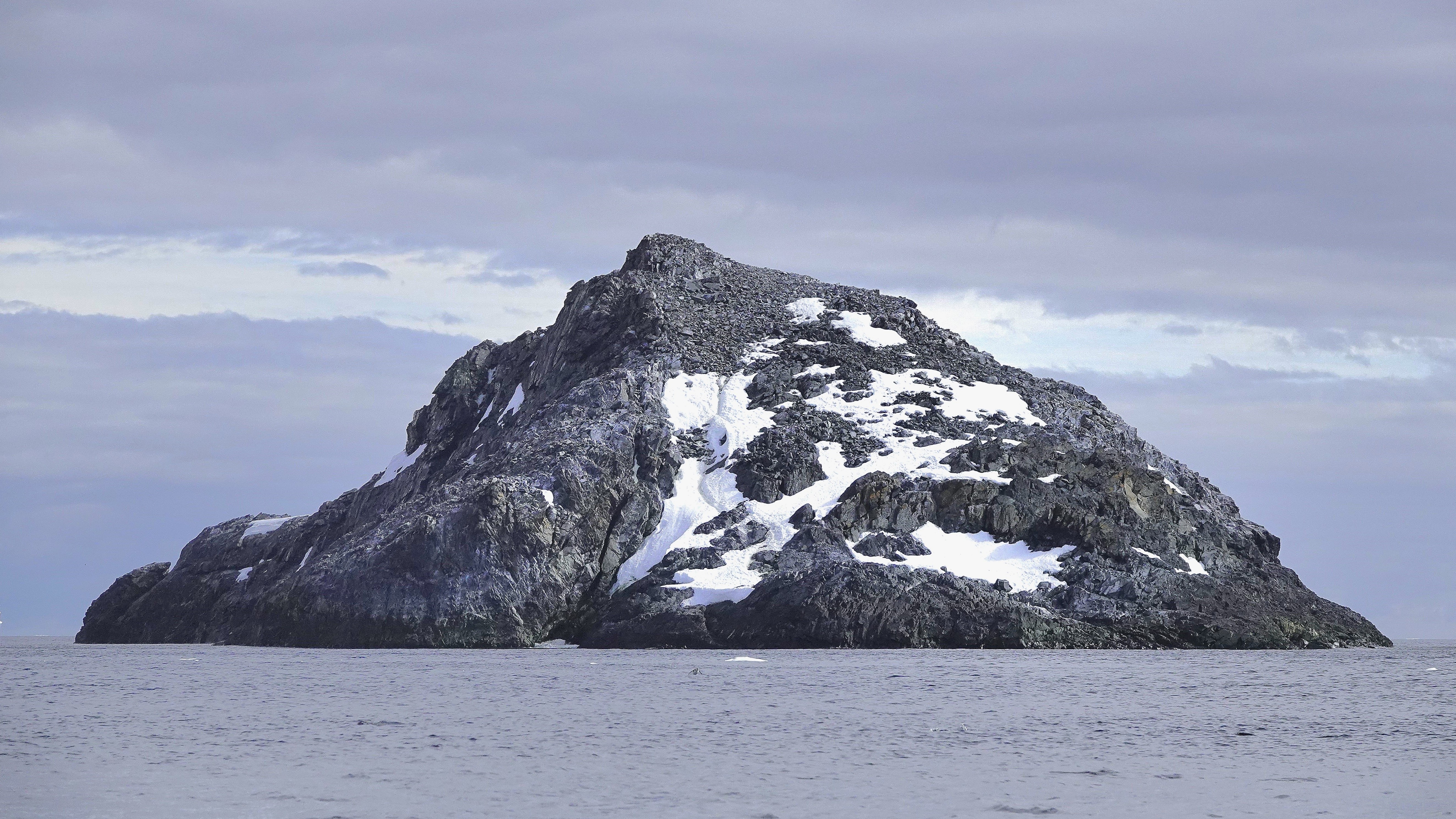
By late afternoon, we arrived at Paulet Island, a round volcanic rock characterized by its prominent cinder cone and almost complete absence of ice due to geothermal activity.
Once again, the requisite transport toys were hauled from the hangar for the fortunate 182 passengers who walked among the tens of thousands of Adélies on the island’s congested shore.
But alas, not with me. I, for my part, was chasing an opportunistic snowy sheathbill that had fled Paulet Island, seeking the solitude of Deck 10.
By 8:00 PM, the majority of passengers were savoring their dinner as Octantis sailed southwest towards Brown Bluff, in anticipation of our singular continental landing—a prospect that held high expectations for everyone and ultimately left no one disappointed!
Leah and I bid adieu to Admiralty Bay, with “John and George” (our yellow submarines) safely stowed in the ship’s hangar. We also wished a speedy recovery to our medevacked shipmate.
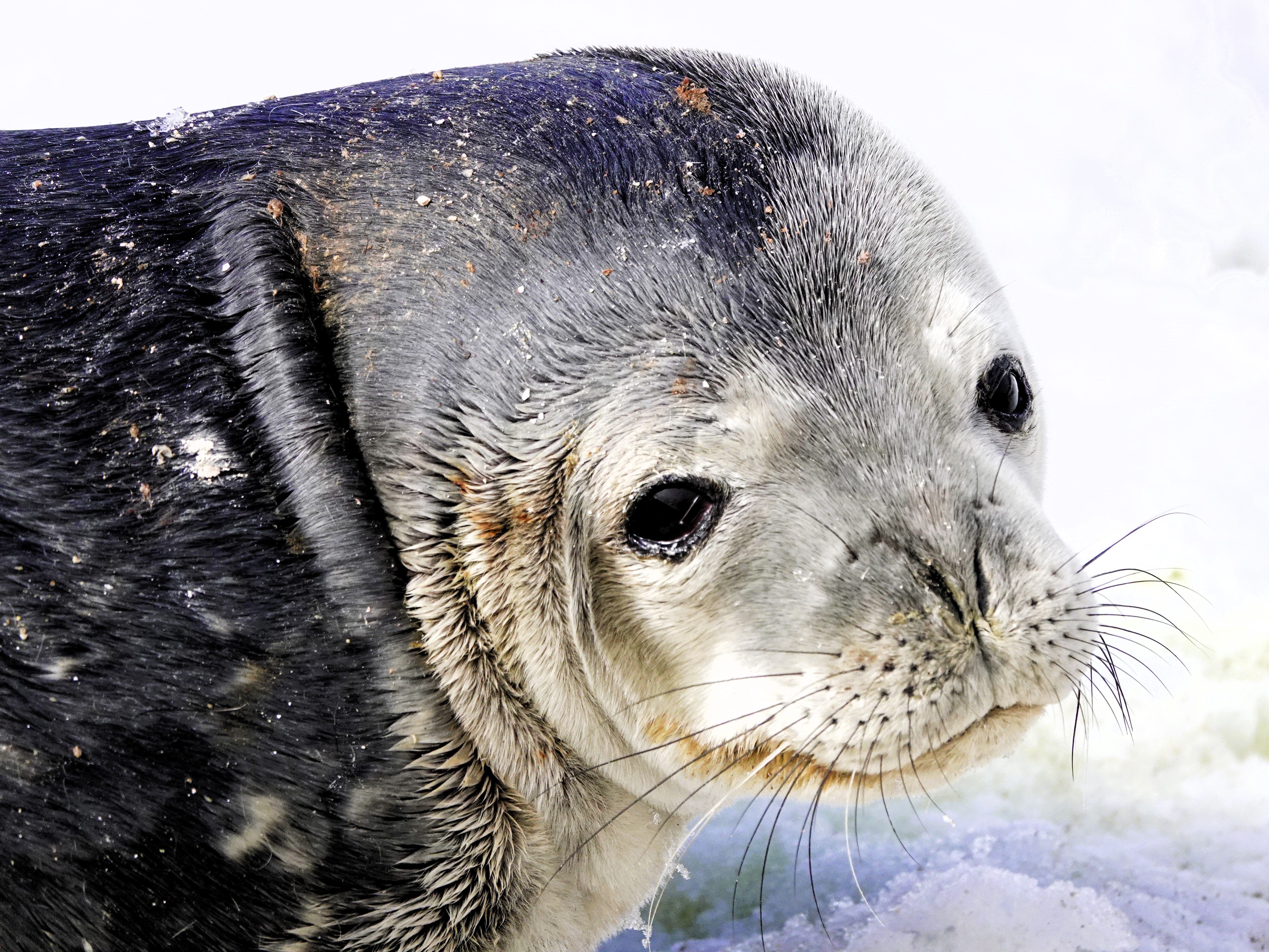
Our journey continued past a leopard seal lounging on an ice floe designed for one, but our heading was uncertain.
Viking Octantis was now operating in uncharted, metaphorical waters. With our predetermined itinerary cast into the Bay of Serendipity, we now had a rare opportunity to explore the tip of Antarctica’s peninsula!
The wheelhouse brass decided that Octantis would complete its Antarctic voyage with a continental landing at Brown Bluff.
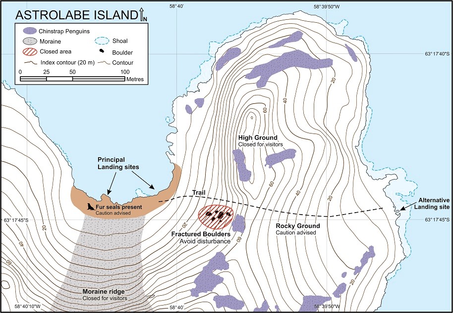
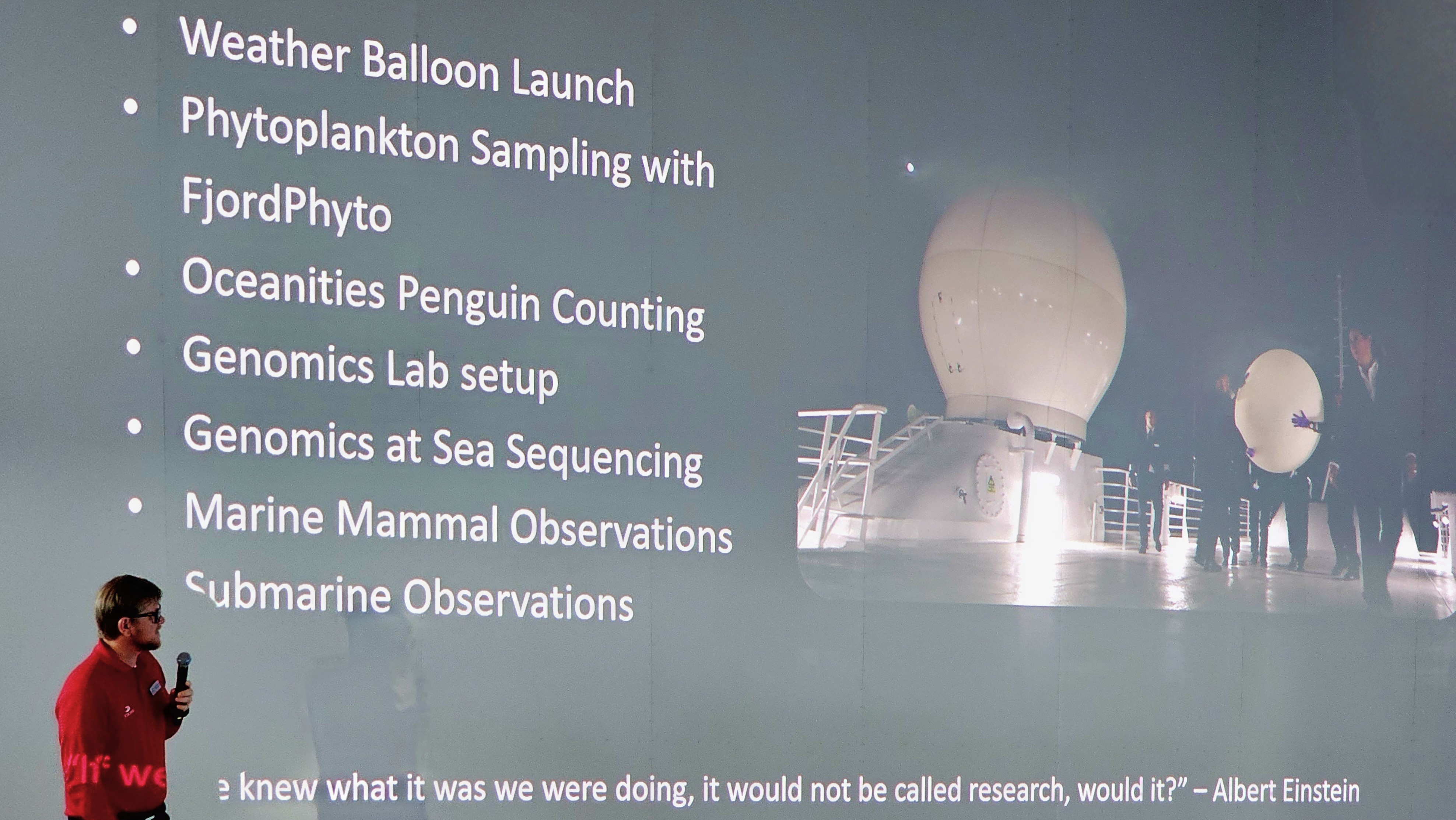
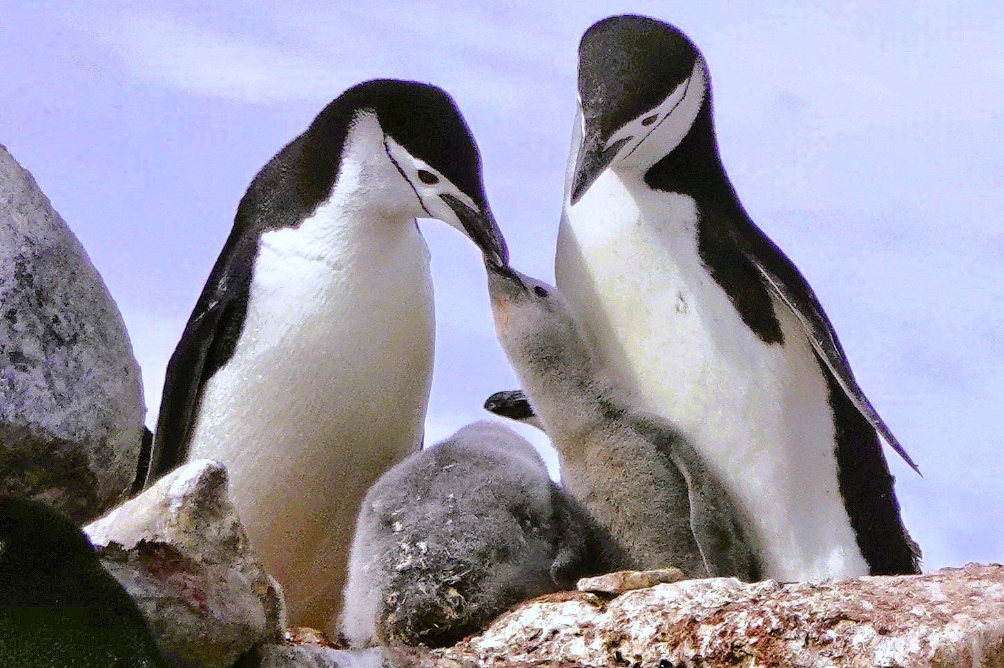
Additionally, resident scientists–supported by Viking’s mission to collaborate with global research networks–lobbied for an interim landing on Astrolabe Island, where penguin monitors from Oceanites were enthusiastic about counting a colony of chinstrap nests that hadn’t been surveyed since 1987.
Science certainly set the tone for our Antarctic expedition. Passengers were enlightened and enriched with daily lectures and participation opportunities to complement Viking’s pursuit of marine science.
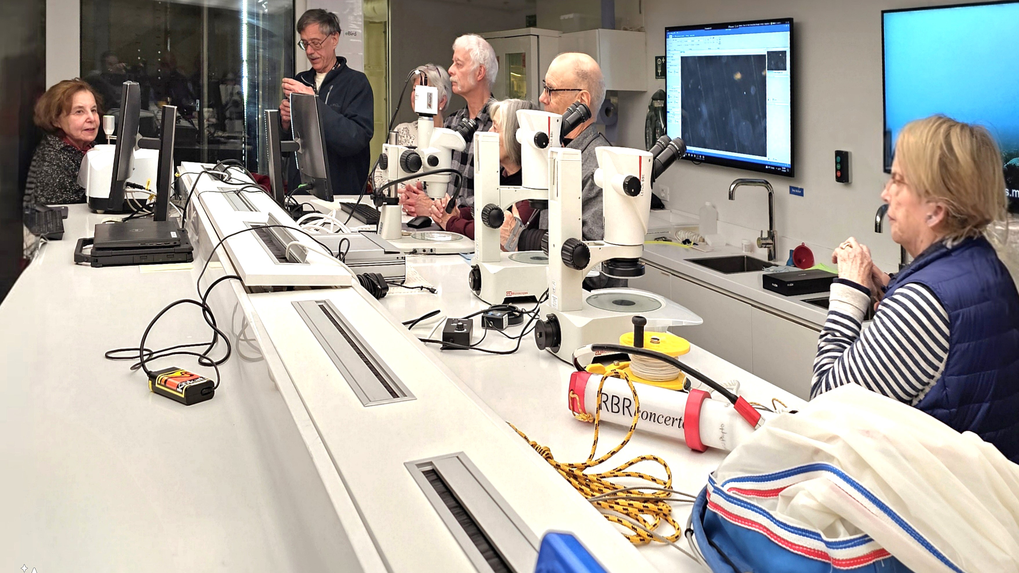
In the name of “Citizen Science,” Leah and I facilitated in collecting phytoplankton, and sampling the water for microplastics,
which was later analyzed in a fully equipped science lab.
Better yet, the entire ship was invited to celebrate the release of a weather balloon…
and monitor the data stream from its high-altitude instruments.
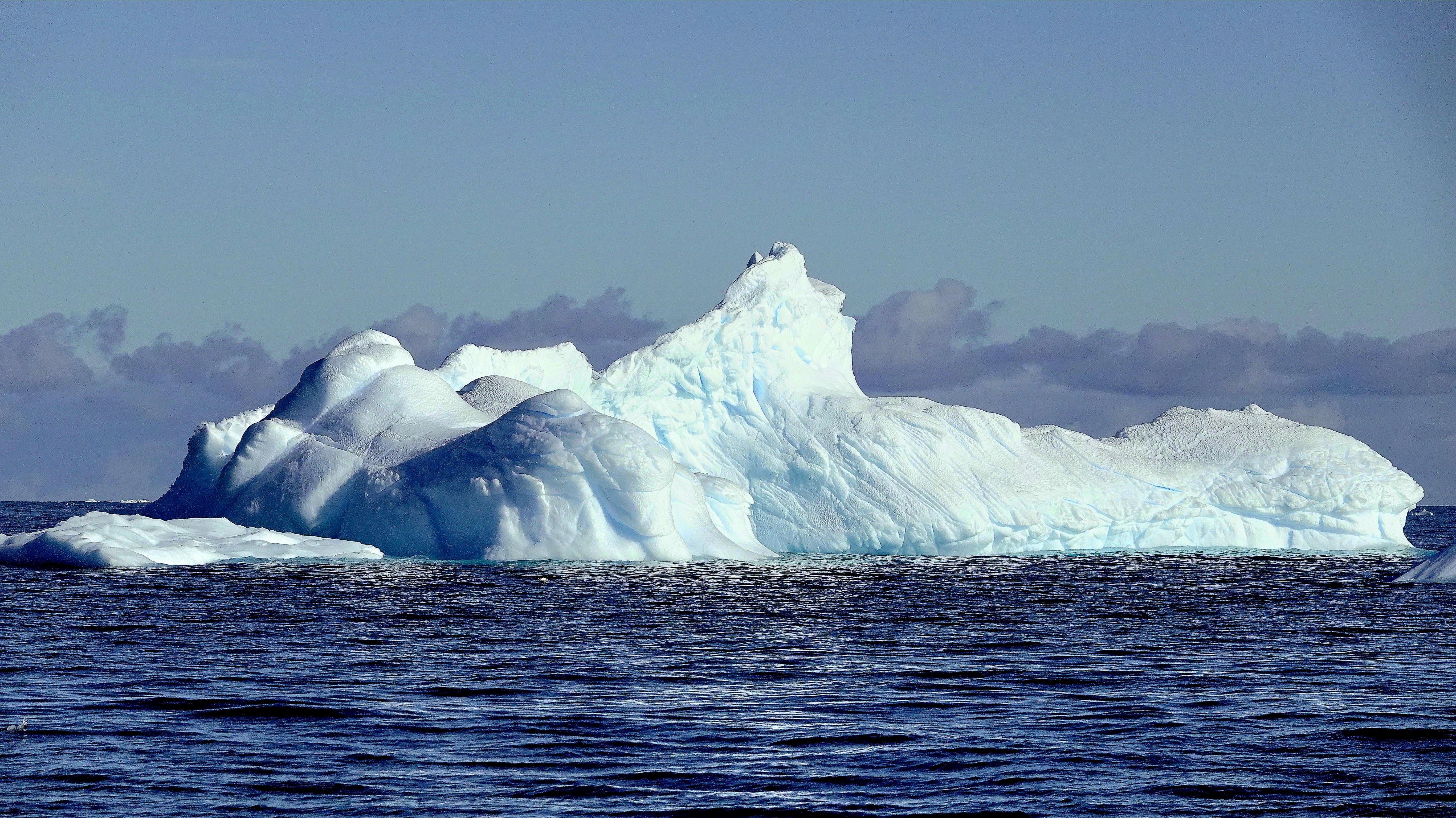
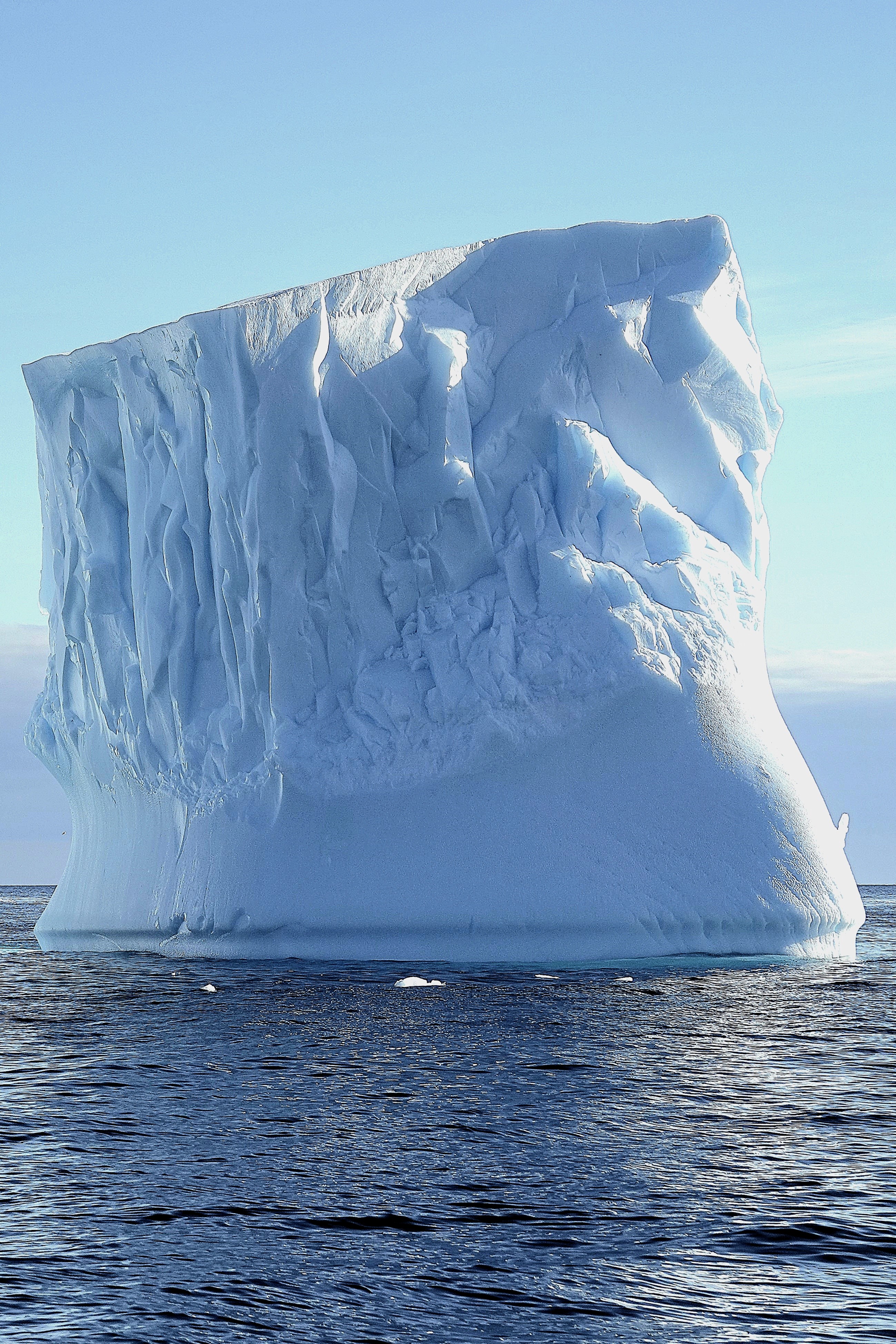
On January 16, we awoke to calm seas and blue skies over Bransfield Strait, with Trinity Peninsula dominating our horizon. The panorama gave the illusion of an expansive sculpture park installation.
Leah and I were scheduled to board a Special Ops Boat (S.O.B.) for a closer look–
that had us oohing and aahing as we darted through one-of-a-kind carvings.
“That one resembles the Statue of Liberty… and there’s an ice cream cone… and that one could be a mushroom…” were common overheard comparisons.
I marveled at the colossal size of these formations shaped by wind and sun and imagined the volume of ice beneath the surface!
Later that day, we swapped our high-speed vessel for an assigned Zodiac…
to ferry us to Astrolabe Island.
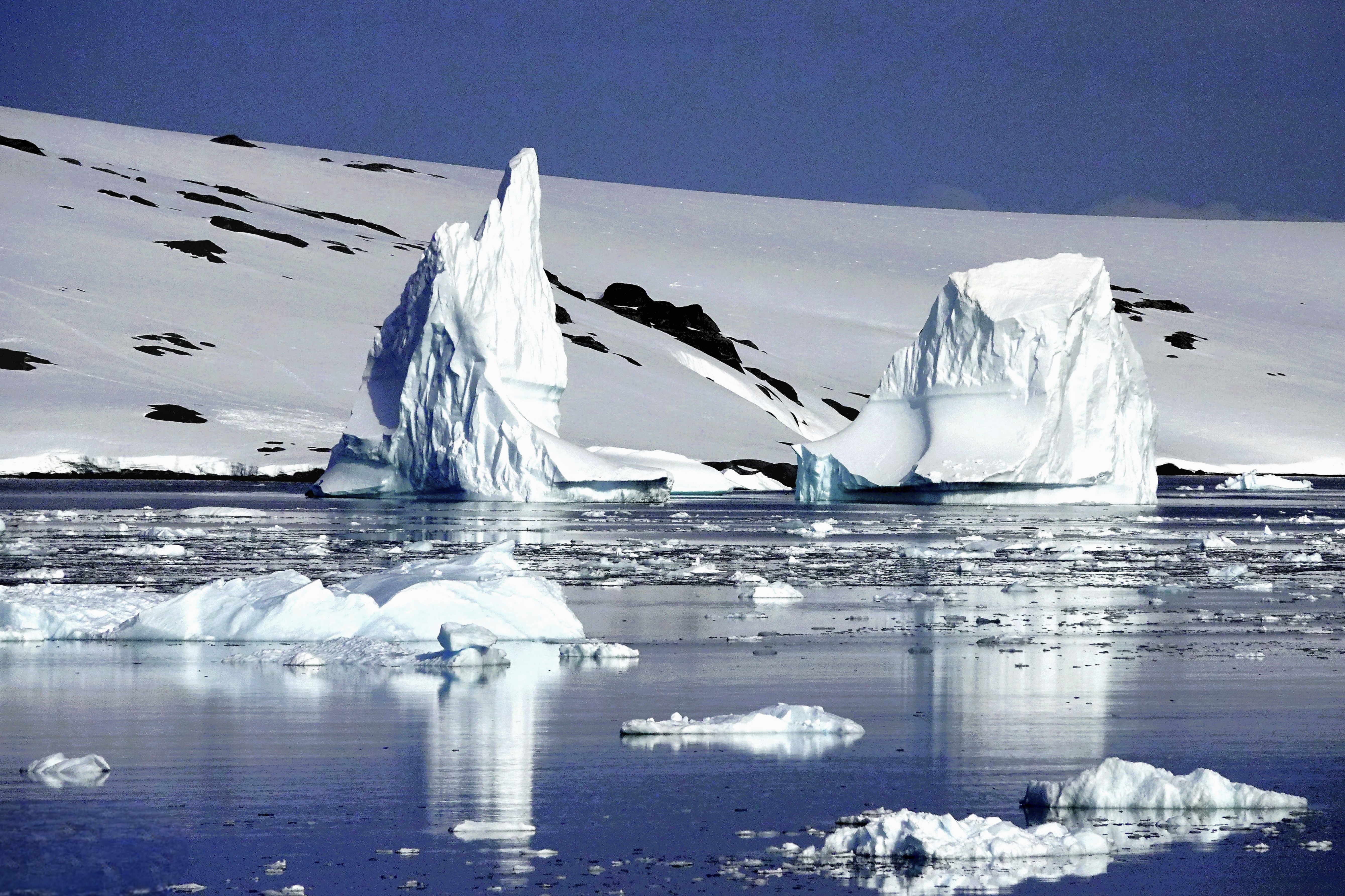
Our pilot cruised past Dragons Teeth–a collection of 100m peaks cutting through the gumline of frigid waters.
We zigzagged through towers of blue ice,
until we beached at a guano-stained snowfield ruled by Antarctic fur seals–
inherently cute but unpredictable predators–
while a rookery of chinstrap penguins preferred the protection of High Ground,
where eggs…
and hatchlings were well-protected.
Nevertheless, their paths inevitably intersected en route to the sea.
We closed our day with one last excursion along Hut Cove,
where a thriving colony of gentoo penguins were filling their bellies with krill.
After returning to Octantis, it was announced that the Oceanites team identified an unknown colony of chinstrap penguins on Diaz Rock, using drones equipped with thermal imaging to detect distant splashes of pink poop.
Overall, it was a good day for science, but it was a great day for scenery and seabirds.
I’m not usually nostalgic. However, it’s been 7 years since my last total eclipse, and it’s been 7 years since this blog was created. So, it’s fitting that these two anniversaries should align like heavenly bodies.
Unfortunately, I will not be in the pathway of “No Sun Day on Monday,” but I will virtually celebrate by dusting off the experience that Leah and I memorialized in Corvallis, Oregon.
Happy Eclipse Day, everyone!
Dateline August 21, 2017:
A small corner of the sky captured most of America’s attention and imagination on August 21, 2017. It was the celestial event of the millennia that brought a momentary pause to many people’s lives as they looked up and marveled at the source of our very existence. Leah and I had our own corner of the parking lot at Benton County Fairgrounds in Corvallis, OR.
A party atmosphere surrounded us. Some were expecting a spiritual awakening, and some were interested in the science of the occasion, but for most of us it was a social connection. We sat around with family, friends and strangers, looking goofy in our mylar glasses…
We all held our collective breath at the precise moment the moon cloaked the sun. And then there were cheers, with all of us sharing this moment in time as sun worshippers.
For one brief moment, we were all related. For one instant during totality, we had turned the corner to become the human race.
And just like that it was gone in a flash, and a tear passed the corner of my eye.
Sadly, it’s going to be a very long time until our next solar eclipse, or another shared moment of total community.
An unexpected medical emergency aboard Viking Octantis dramatically changed our travel plans. Rather than repositioning overnight to Damoy Point to explore historic British and Argentine huts, Captain Cardestig rerouted the ship and raced north to King George Island in the South Shetland Islands to facilitate a medical evacuation for a sick passenger.
Consequently, all future excursions were rescheduled to align with our revised four-day itinerary. Although the majority of passengers calmly accepted the changes, I sensed some disappointment, especially among those whose submarine excursion was delayed indefinitely.
Of the 350 passengers aboard Octantis, nearly 75% expressed interest in a submarine dive. And who wouldn’t, given the allure and bragging rights among friends. In fact, several passengers were offered a complimentary submarine ride as a bonus for early booking, amounting to a $499 savings.
But submarining was never intended for everyone. Given the demographics of the passengers (average age of 70 years), there were many aboard Octantis who lacked the general physical characteristics or requirements to take advantage of the opportunity. To determine eligibility–after boarding the Octantis in Ushuaia–we were immediately sorted into two groups: those who would dive and those who would not. Leah was always less than interested. However, as a self-identified adrenaline junkie, my choice was obvious, but I still had to pass the two physical challenges to qualify.
After I was weighed, I was instructed to step onto a chair seat, alternating legs while maintaining my balance. Subsequently, I had to squat between two tables set 18 inches apart and stand. I completed the test with ease, but others found it challenging.
One delicate woman, possibly in her 80s, approached the chair with a cane. The officer was kind but firm; canes were not allowed. With dignified resolve, she handed over her cane, declaring, “I don’t need it. I can walk without it!” I was amused when she bent over, grabbed her right thigh and hoisted her foot onto the seat. She repeated the task with her left leg in the same manner. She was most pleased with herself, as if she had won gold in a power-lifting competition. She tackled the final challenge by sidling between the tables, grabbing the edge for support, and lowering herself into a half-kneeling position. I sensed that her strength was sapped, but she struggled mightily to pull herself upright.
The officer was hardly impressed. “If it was my call, I would disqualify you. However, since you mostly completed the task as asked, I will allow you to pass. However, I recommend that you reconsider your decision.”
During our second day at sea, I sat through a compulsory briefing for prospective submariners in the Aula on Deck 2. Understandably, the memory of Titan’s implosion seven months ago at a depth of 3,500 meters was still fresh in the minds of many of the attendees in the auditorium, not to mention a familiar, frail woman who seated herself beside me. Oh, the irony!
The briefing was indispensable. The crew gave a detailed rundown of essential safety measures which provided the worriers and skeptics with much-needed reassurance. For example, in case of an emergency:
The submarine is stocked with a four-day supply of food, water, and oxygen for the pilot and six passengers.
There is no toilet on board.
Passengers are required to bring a four-day supply of any essential medications, which they will need to administer themselves.
Passengers will be coached to operate the sub by communicating with the support vessel on the surface should the pilot become incapacitated.
We also learned about some of the features of our submarine:
The Cruise Sub 7 by U-Boat Worx is capable of descending to 900 meters.
It’s air-conditioned.
It features two back-to-back acrylic spheres, accommodating three passengers facing forward and three facing backward–offering undistorted 270o views.
The seats, situated on rotating platforms, allow everyone to reposition for shared views of the marine environment.
It’s equipped with eight thrusters: four vectored horizontal, two dedicated horizontal, and two dedicated vertical, providing the Sub 7 with exceptional maneuverability and the power to contend with strong underwater currents.
A handheld joystick control device enables easy maneuverability.
It can operate for up to 16 hours submerged.
Each one costs $4 million.
We finished up with Q’s & A’s. So, I got to wondering out loud, “If the pilot should pass out, and it falls on me to operate the sub, and I wreck it in the process, am I on the hook for $4 million, or will my travel insurance cover the damage?”
It was good for a laugh and a good way to end the meeting.
Following the briefing, my neighbor turned to me and confessed, “You know, my doctor gave me medical clearance to participate in this activity, but I never told him about the vertigo that I started experiencing a couple of weeks before the trip. Do you think I should still go?”
It baffled me that she would even contemplate this, considering her latest complication. “I’m sure you’ll make the right decision,” I said to appease her, “but maybe you wouldn’t want to risk compromising someone else’s experience.”
We arrived at the South Shetland Islands by late morning with a modified schedule in place,
and the hangar toys were immediately deployed.
When Leah and I checked our daily agenda, I discovered that my time had come; I would explore the ocean floor off King George Island. The feeling was akin to winning the lottery… which cost me only $499 to play!
After arriving at the hangar–eager and ready with my Sony RX-10 around my neck–our group of six received lanyards with numbered pendants corresponding to seat assignments and the order in which we would board the sub. Mine was #1.
The Zodiac ferried us to the submarine platform, where #6 stepped aboard with a firm sailor’s grip. He wriggled down the 18-inch hatch opening and took his designated seat on the starboard side. #5 repeated the transfer drill and took his seat on the port side to manage weight distribution.
I was the last passenger to come aboard, and while I don’t suffer from claustrophobia, it was hard to ignore how cramped the cabin felt, especially squeezing into my seat with our bulky parkas taking up so much space.
Excitement quickly turned to disappointment when I realized that my camera’s auto-focus function was compromised by the window. How could I ever get any cool shots in these extreme conditions?
With Kat in command, she rotated our trio of seats into the acrylic bubble for optimal viewing and completed a readiness checklist with the dive support vessel.
After receiving clearance, she managed our descent through a 300 ft. wall of krill, until we finally emerged with a view of the bottom. There was a collective “Wow!” from the cabin.
Kat proclaimed, “I believe we are the first people to have ever explored this part of the Southern Ocean. So, let’s see what we can discover.” One of our initial discoveries was a change in the visible light spectrum, where longer wavelength colors, such as red, nearly vanished as we ventured further into the depths of the unknown.
Kat hit the thrusters to slow our decent, as we gently settled atop the sandy bottom. I was surprised to learn that we had reached a depth of 409 feet.
Far from being mere novelties for tourists, Viking’s submersibles have become a vital tool for marine biologists once constrained by resources, to carry out research missions in remote regions. Consider, in early 2022, when Octantis submersibles documented three sightings of the rarely encountered scyphozoan Stygiomedusa gigantea, commonly known as the giant phantom jellyfish, measuring 30 feet in length. A white paper was subsequently published in Polar Research, the scientific journal of the Norwegian Polar Institute. (The full research paper is available at: http://dx.doi.org/10.33265/polar.v42.8873)
Although our dive didn’t make news, we still encountered a variety of sea life that I managed to capture on my Samsung Galaxy 23 Ultra… such as a lonesome a brittle star,
and multiple snake-armed, Labidiaster annulatus, commonly known as wolftrap starfish,
including a rare look at a hunter, ready to snatch fast-moving, swimming prey as it passed by.
I was also delighted to capture a potpourri of sea life, featuring a couple of sea spiders hugging a sea worm tethered to a feather star.
After 45 minutes, we surfaced!
Indeed, it was a unique experience shaped by our environment and the adventure; however, I had anticipated more. I imagined leopard seals hunting penguins and orcas pursuing seals. Perhaps, my expectations were set too high. Yet reflecting on the event, it remained a highlight of our voyage, and another item checked off my bucket list.
As for the lady with a cane, our paths crossed again on our last day at sea. She was sitting with her older sister sipping tea over dropped surgical masks at Mamsen’s, a Norwegian-styled cafe dedicated to the mother of Viking’s founder, Torstein Hagan. I asked if she had enjoyed diving in the submersible. “Unfortunately, not. I ended up caring for my sister, who fighting a cold at the moment. But there’s always a next time!”
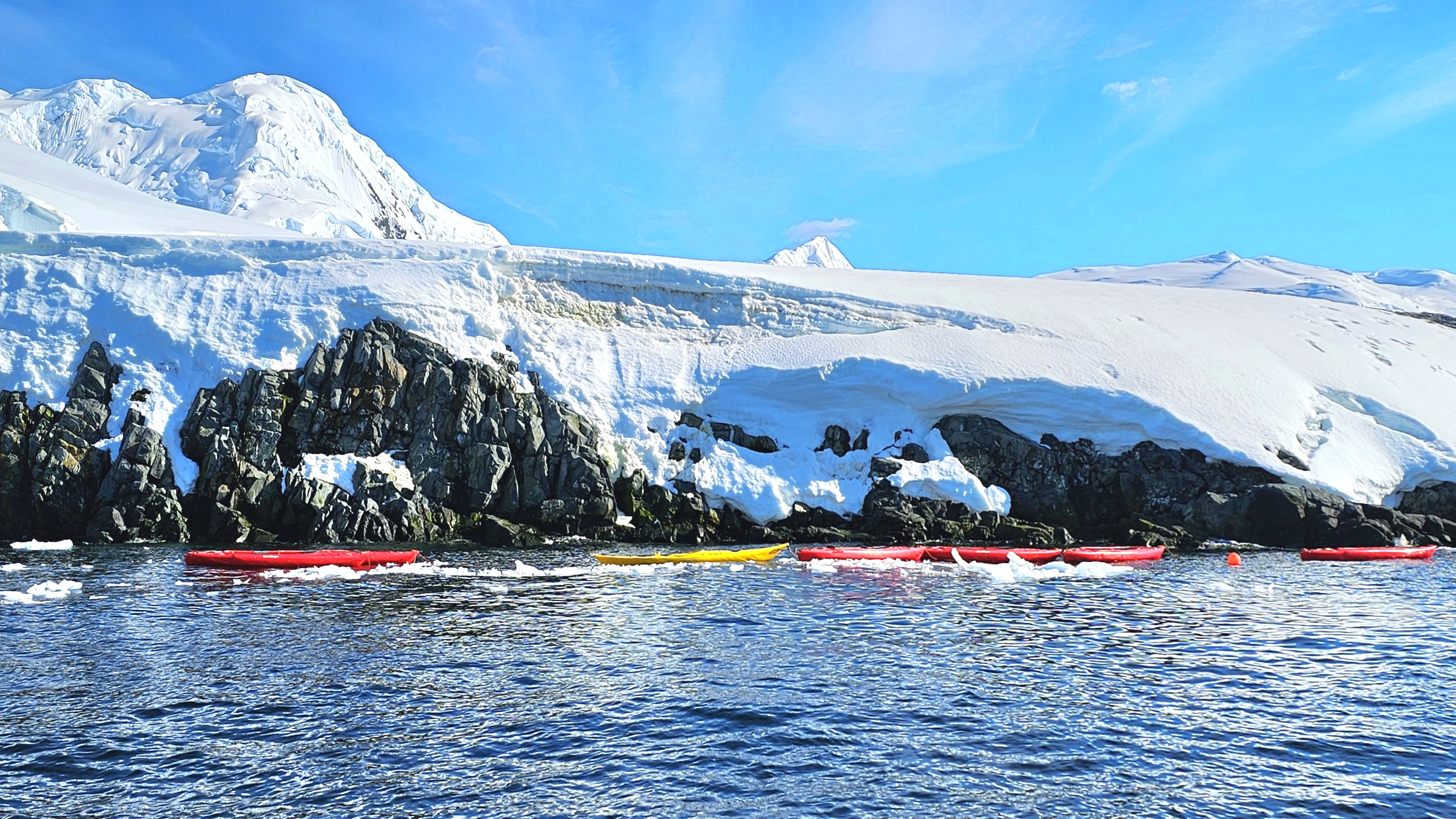
Leah and I wrestled our way into pricey polar drysuits in preparation for kayaking in Chiriguana Bay, a protected inlet on the southern end of Brabant Island in the Palmer Archipelago.
We strained to pull our heads and hands through unforgiving latex gaskets that promised to seal in our body heat while preventing icy water from infiltrating our suits, effectively turning us into human buoys in the event of a capsize.
We boarded our Zodiac, and raced around a steady stream of bergy bits,
before reaching a string of tandem kayaks already moored in the bay.
Each of us performed a precarious “shoehorn” transfer into our kayak seats without incident. At once, Leah and I fiddled about–making adjustments to our outfits and gear–until we reached a level of comfort to maximize our paddling efficiency. Surprisingly, at 32o F / 0o C with clear skies and sunshine, it felt warm enough to remove my gloves.
After safety instruction from Stephanie, our kayaking guide, we glided through the bay in unison for a closer look at our surroundings,
all the while following Stephanie’s lead.
The stretch of blue ice,
and white serenity–occasionally interrupted by the distant thunder of calving ice–left us breathless.
Before we realized, our 45 minutes of paddling had come to an end. Drifting on the Southern Ocean, time seemed to stand still, as if the rhythmic waves that rocked us held the secret to eternity.
Coming up: a journey to the depths of the ocean floor…
The journey continued beyond our early morning detour through Lemaire Channel. Viking Octantis set a course for nearby Cuverville Island, a protected rock lying between Arctowski Peninsula,
and the northern tip of Rongé Island, west of Graham Land.
Leah and I were keen to arrive at our first landing zone–originally scheduled days earlier by Pamela, Viking’s program director, who coordinated the excursions and edutainment events throughout our time at sea.
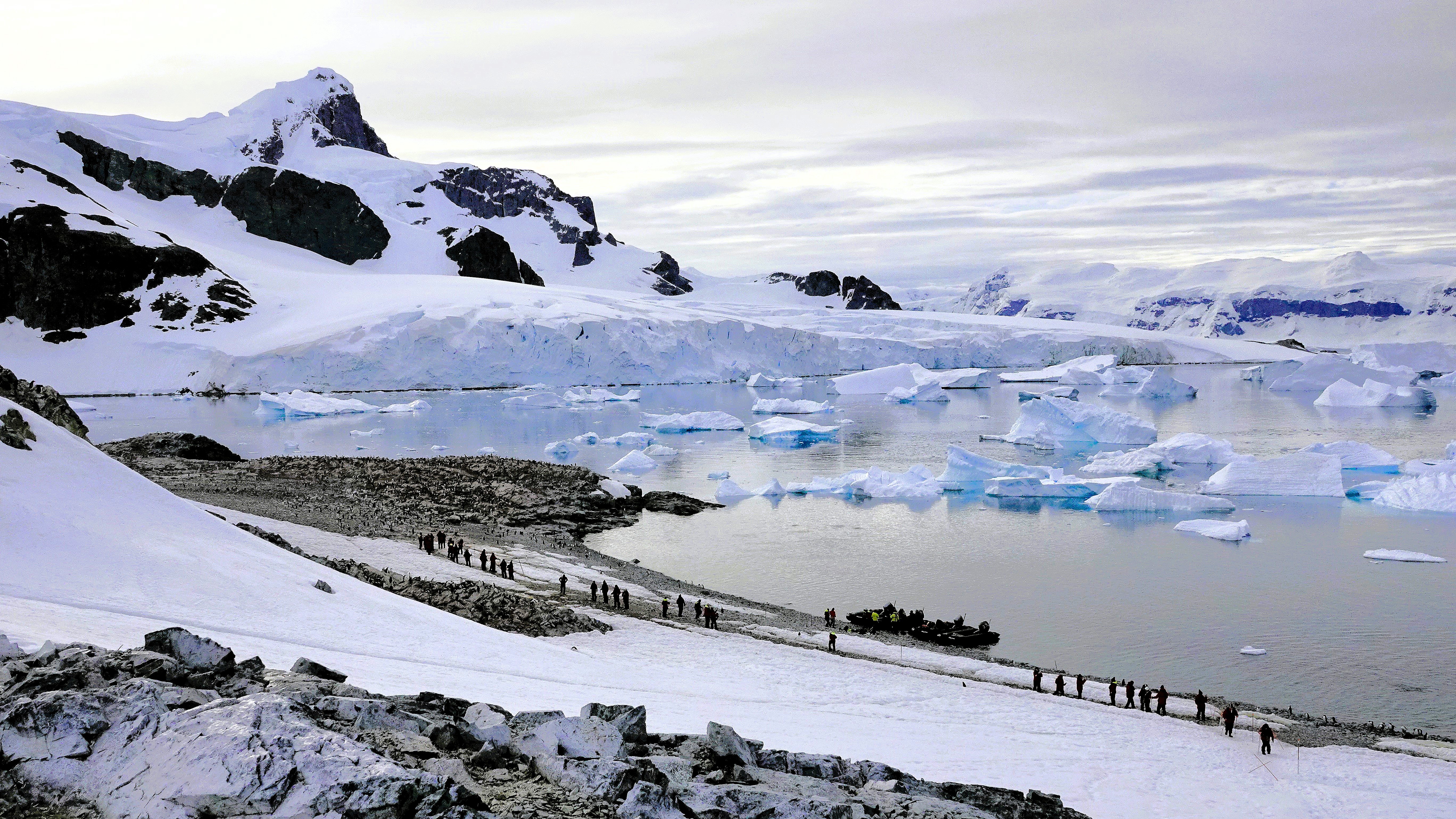
In accordance with Antarctic Treaty visitor site guidelines, Pam’s team launched a staggered fleet of Zodiacs to Cuverville Island capped at 100 visitors (excluding guides and scientists) for a closer look at the estimated 6,500–7,000 breeding pairs of Gentoo penguins–making this the largest colony of this species on the Antarctic Peninsula.
Despite the pristine vista, we were forewarned by our Zodiac pilot/naturalist to expect an unpleasant smell on our approach to the island.
No joke. As if on cue, the stench of penguin poo was so sudden and overwhelming that a couple of old-timers dared to let go of the gunwale lifeline to hold their noses.
In a matter of minutes, we reached the landing beach, distancing ourselves from the eastern edge of the cobble, where the colony accessed the sea. It was no surprise that the guano-stained beach proved to be ground zero for foul fowl.
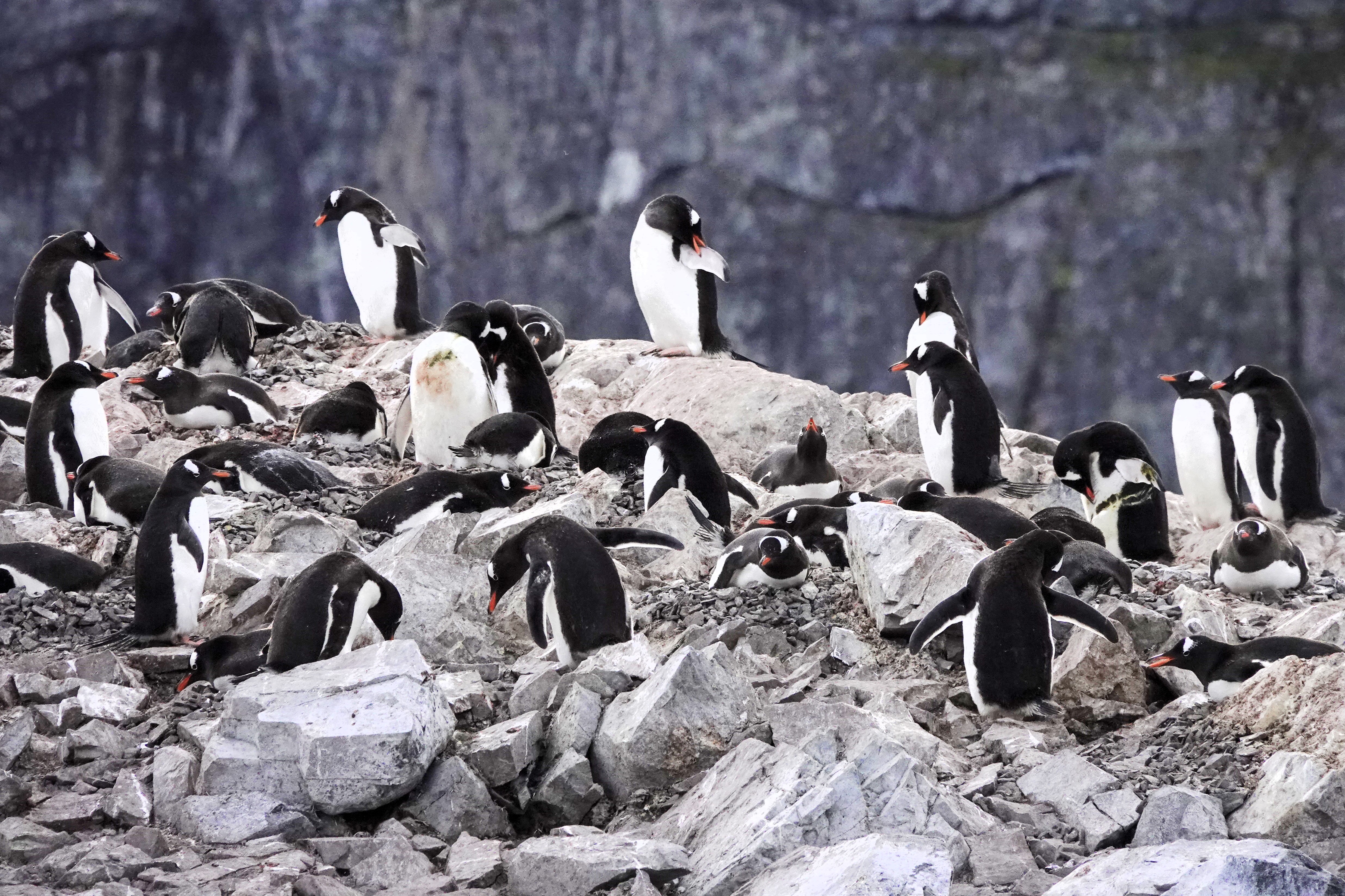
Eventually, we landed on the northern edge of the island. Before disembarking the Zodiac–a drill we perfected within the ship’s hangar–we were instructed to stay a minimum of 5m from wildlife whenever possible and avoid the penguins’ highway lanes.
Strolling the penguin highway
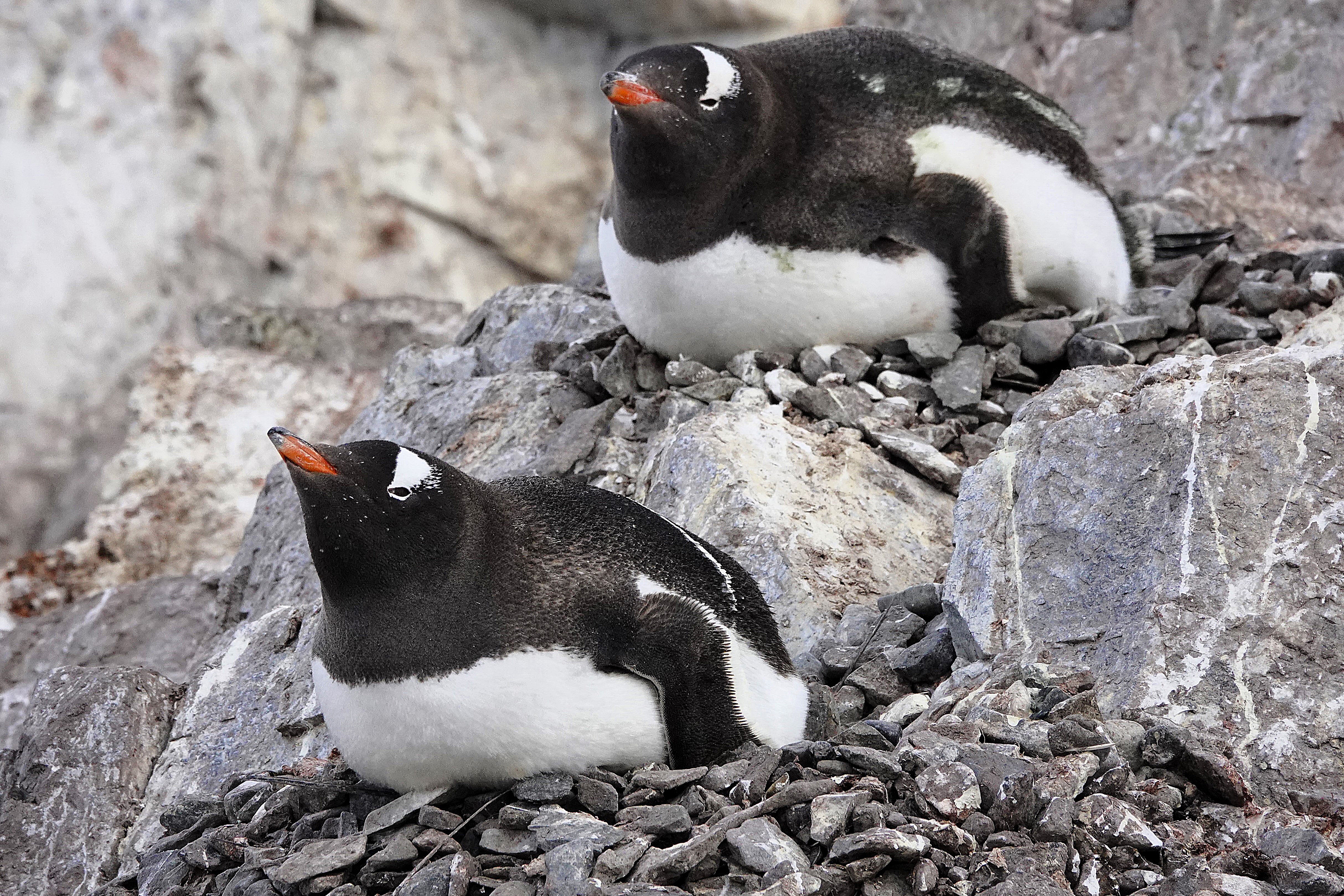
Easier said than done. These critters seemed especially curious of us when they weren’t preoccupied with preening,
impressing their future mates with the perfect selection of nesting stones,
or incubating on nests of captured stones.
Occasionally, an adult would sound the alarm for an invading skua,
whose interest in Gentoo eggs and chicks is always a threat to the rookery.
Leah and I hiked to the top of the promontory,
for an overview of Cuverville and the channel.
Sadly, we worked our way back to catch the next available Zodiac bound for Octantis, but the stories and adrenalin from the day carried us to sunset (11:25 PM) and into tomorrow.
Next stop: our kayaking adventure in Chiriguano Bay.
A familiar voice woke us from the public address speaker above our bed. I checked my watch; it was 6:45 AM:
“Good morning, everyone. This is your captain from the bridge. We are approaching a special spot along the Antarctic Peninsula known as Lemaire Channel, and after discussing with my officers, we will be cruising through this waterway because today it’s mostly free of large icebergs that can sometimes block the entrance or exit and bring us too close to the cliffs.”
I jumped out of bed, grabbed my camera, and ran to the Nordic balcony to power up the blackout blind. I didn’t want to miss a thing! Leah sat up in bed to supervise because she already knew what to expect.
“What are you doing? I hope you’re not going to open that window,” she growled as I was already lowering the window.
“Come see this! The light is perfect, and I’m trying to get a clear shot before it disappears,” I argued, talking over Captain Cardestig’s continuing announcement:
“But today, all of you are in for a treat because the sky is clearing, and the seas are calm.”
“And while there’s still some hazards to consider when sailing through this beautiful channel, much of the small ice has already broken up from the warmer weather,
and we can easily guide Octantis around the bigger ice.”
Leah clutched the blanket around her in surrender while I braced against the window in my birthday suit, capturing unimaginable views with little concern for the crisp Antarctic air.
Captain Cardestig continued, “But best of all, the kitchen staff is serving breakfast buffet at the bow of the ship. So please dress warmly, and join us outside for this remarkable voyage, and don’t forget to bring your cameras and binoculars.”
“I guess we’re getting dressed,” Leah lamented. “And could you shut that window! It’s fucking freezing in here!”
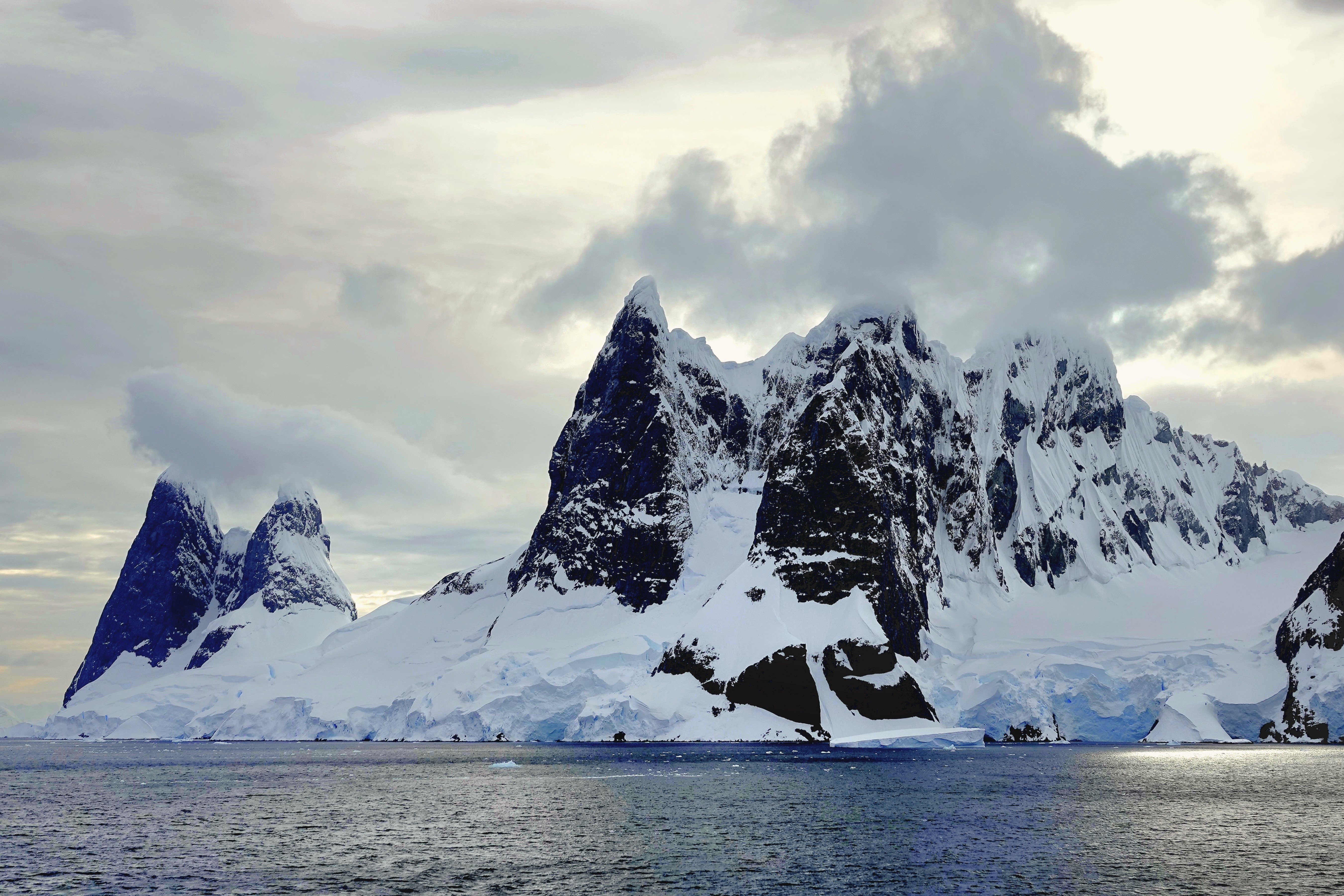
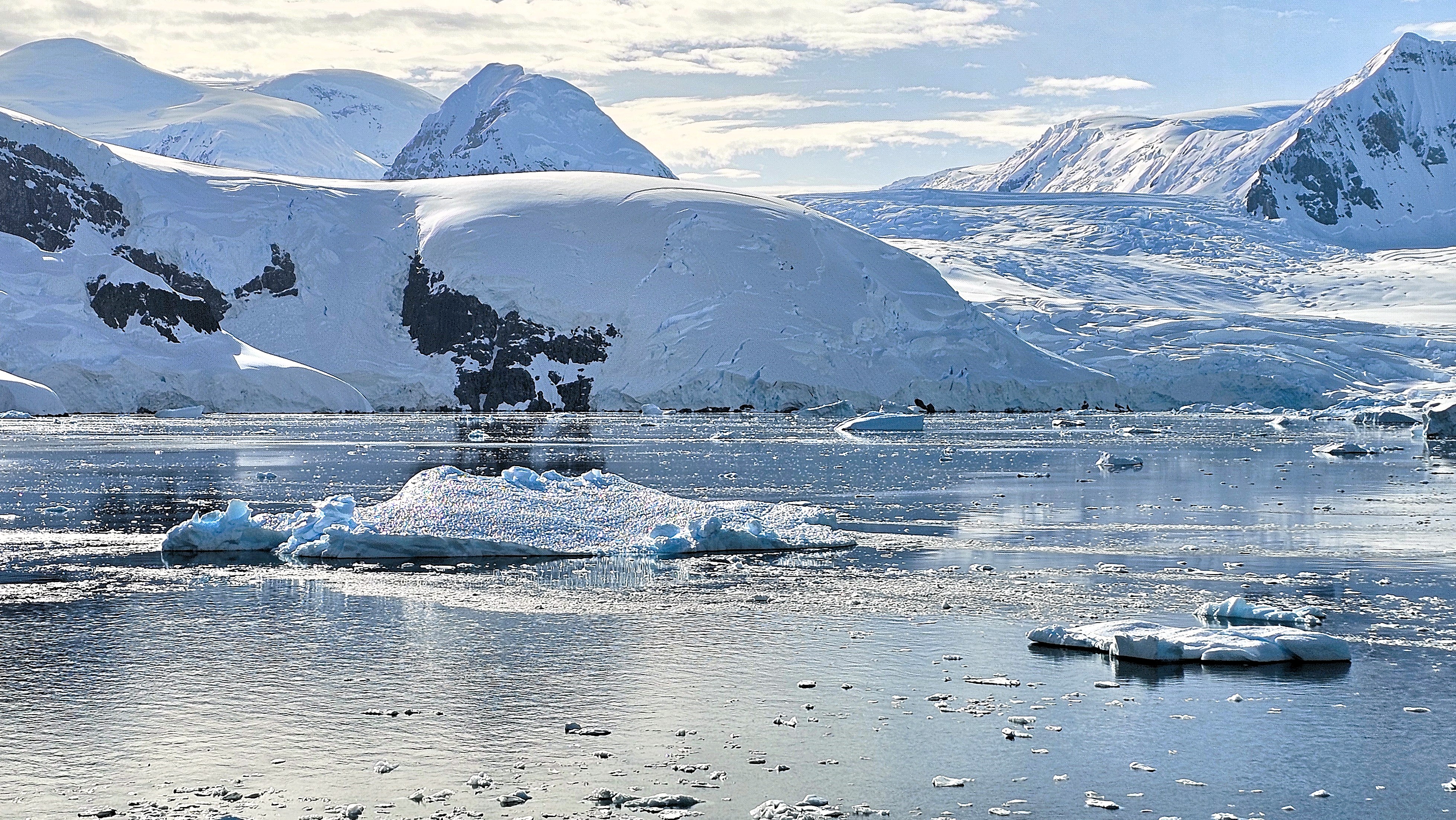
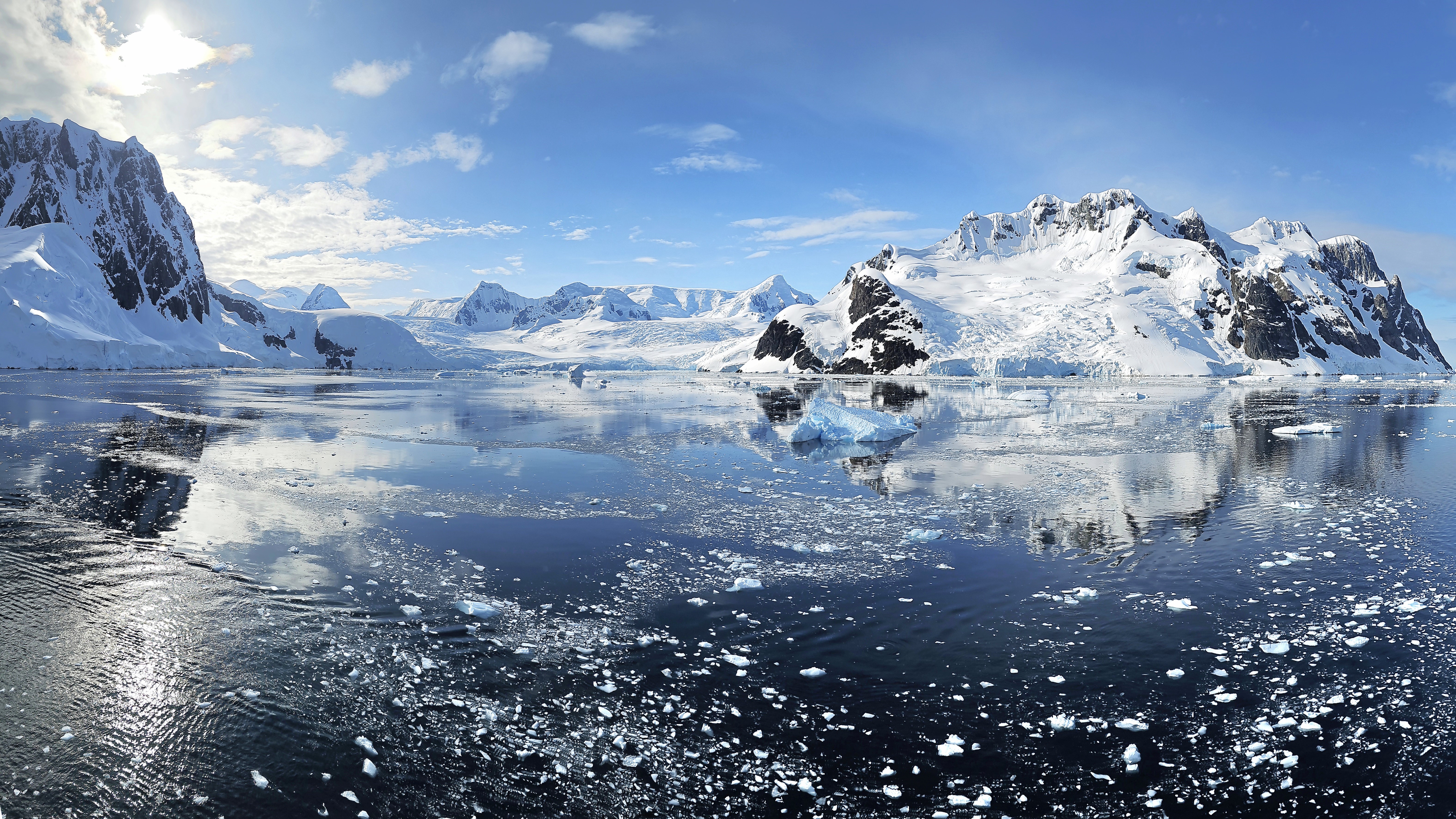
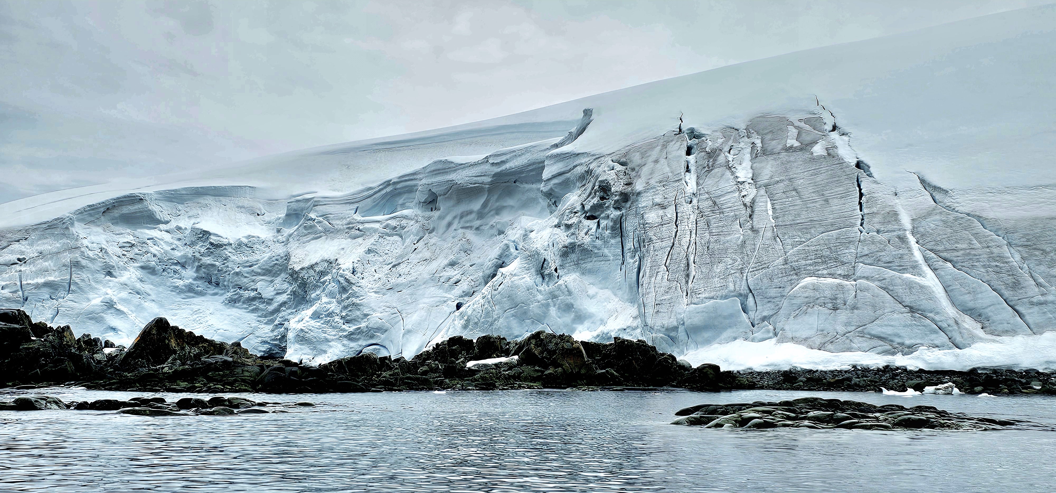
Lemaire Channel is a narrow strait of glossy water that traverses 11 km between Booth Island in the Wilhelm Archipelago and Graham Land–shrinking to 600 meters at its narrowest point. With views of stunning snowcaps atop dramatic cliffs, Lemaire Channel easily earns its moniker, “Kodak Gap.”
It was all hands around the bow deck. Leah and I joined the crowd, hopelessly jockeying for a position at the rail, until we found solace on the upper deck away from the fray,
where we were content to enjoy breathtaking vistas,
and watch the world float by.
There were penguin playgrounds …
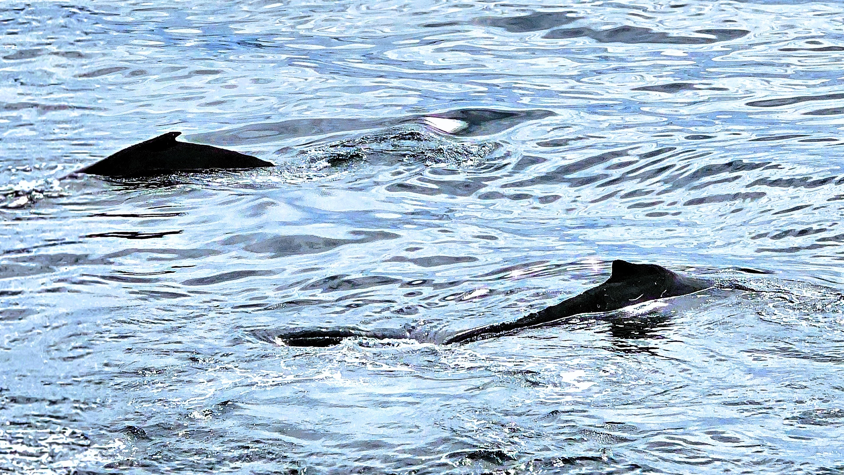
and a pod of Orcas along the way,
but for now, the real star of the show was the scenery.
When Octantis eventually reached open water…
with captivating views of the Argentine Islands,
Captain Cardestig turned the ship around, allowing us to enjoy the approach from the opposite direction.
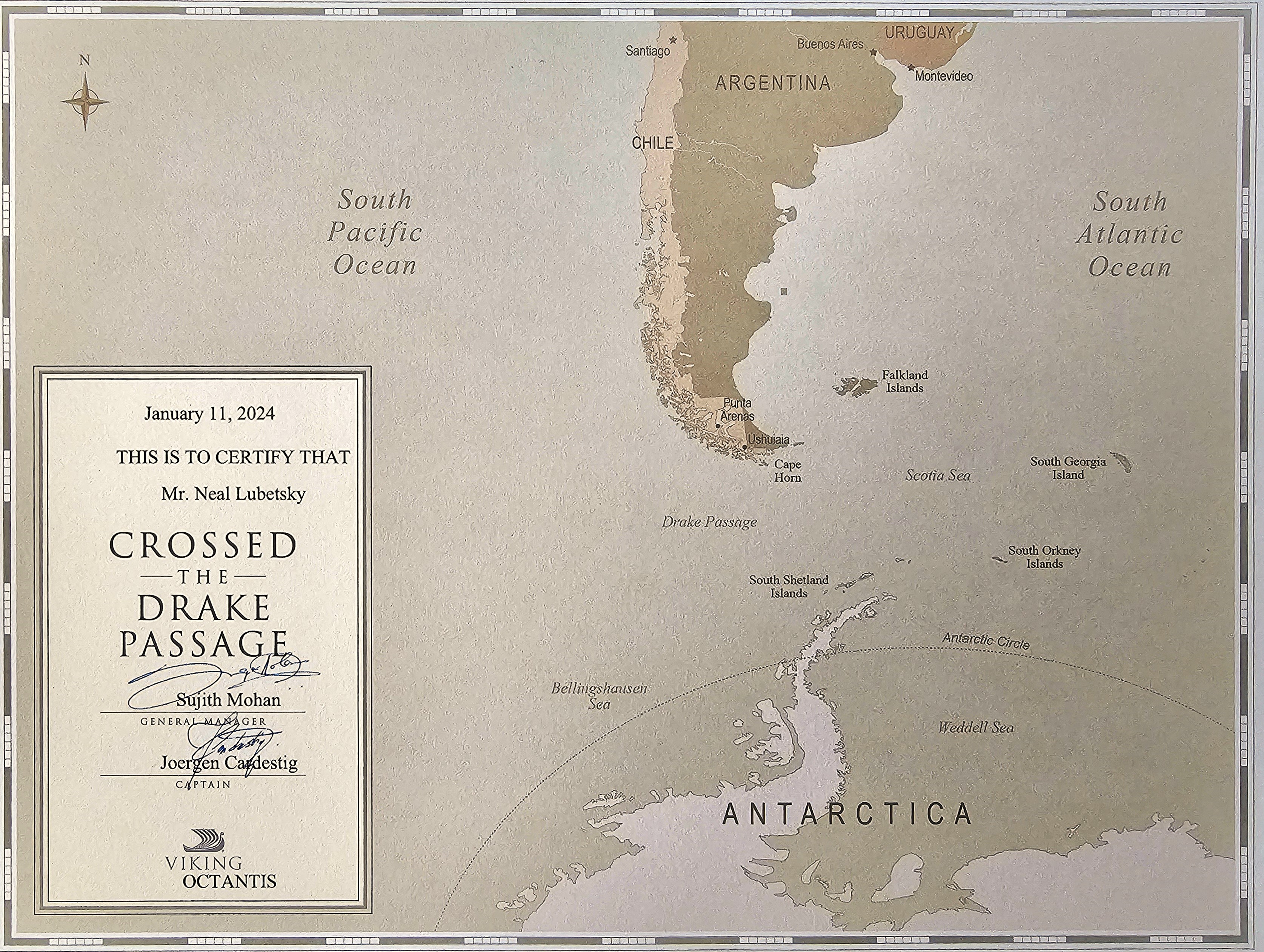
It was a dramatic crossing from Ushuaia to the Antarctic Peninsula, and the reward was visceral.
When seas had finally calmed, relieved passengers emerged from their cloistered cabins, looking refreshed and revitalized, with a “what’s-for-breakfast” look on their faces. There was a literal pep in their step as they attacked the buffet on Deck 6.
I attended the 10 A.M. daily briefing in the Aula, a two-tiered, smartly equipped, and fashionable auditorium,
while Leah live-streamed the event on the wall-mounted, flat screen TV in the privacy of our well-appointed Nordic hive on Deck 4.
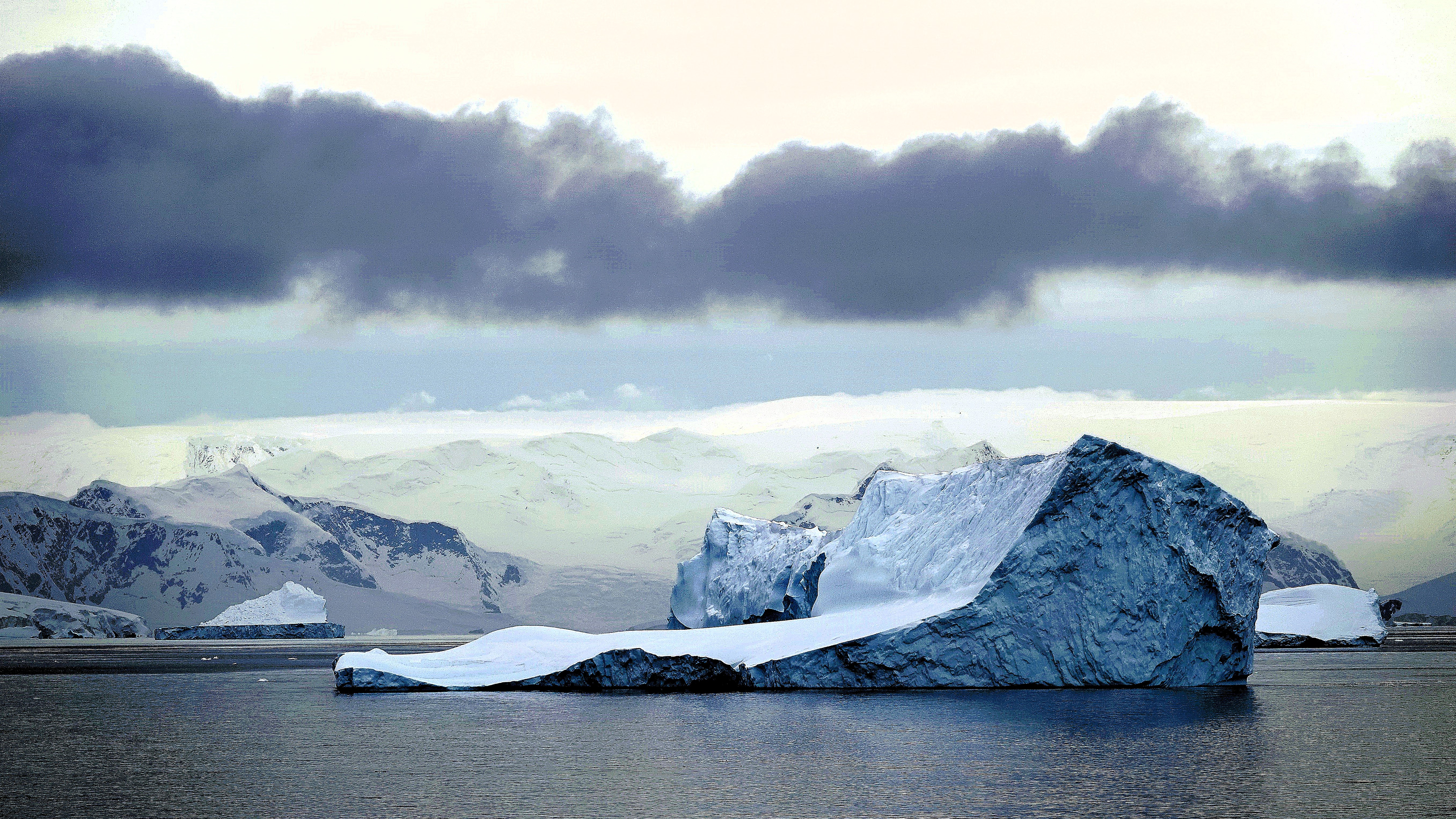
At the briefing, our Program Director confirmed that our first destination would be Fournier Bay, a picturesque sanctuary located in the Palmer Archipelago,and situated on the northeast coast of Anvers Island, a mountainous coastal enclave just above the Antarctic Circle.
Our flexible activity assignments were previously distributed in anticipation of our arrival, although none of us would be scheduled for a landing, as deep water and rocky surroundings were among deciding factors.
However, it was a perfect opportunity to board a Zodiac for a closer inspection of the coastline. According to our team schedules, we gathered in the hangar, all of us outfitted and overheated in our complimentary expedition jackets, and waited patiently …
until the next Zodiac became available.
The water was calm as our pilot dodged floating chunks of ice,
and weaved through more formidable icebergs on our approach to the Anvers Island.
It was nearly impossible to contain our giddiness as we cruised closer to shore,
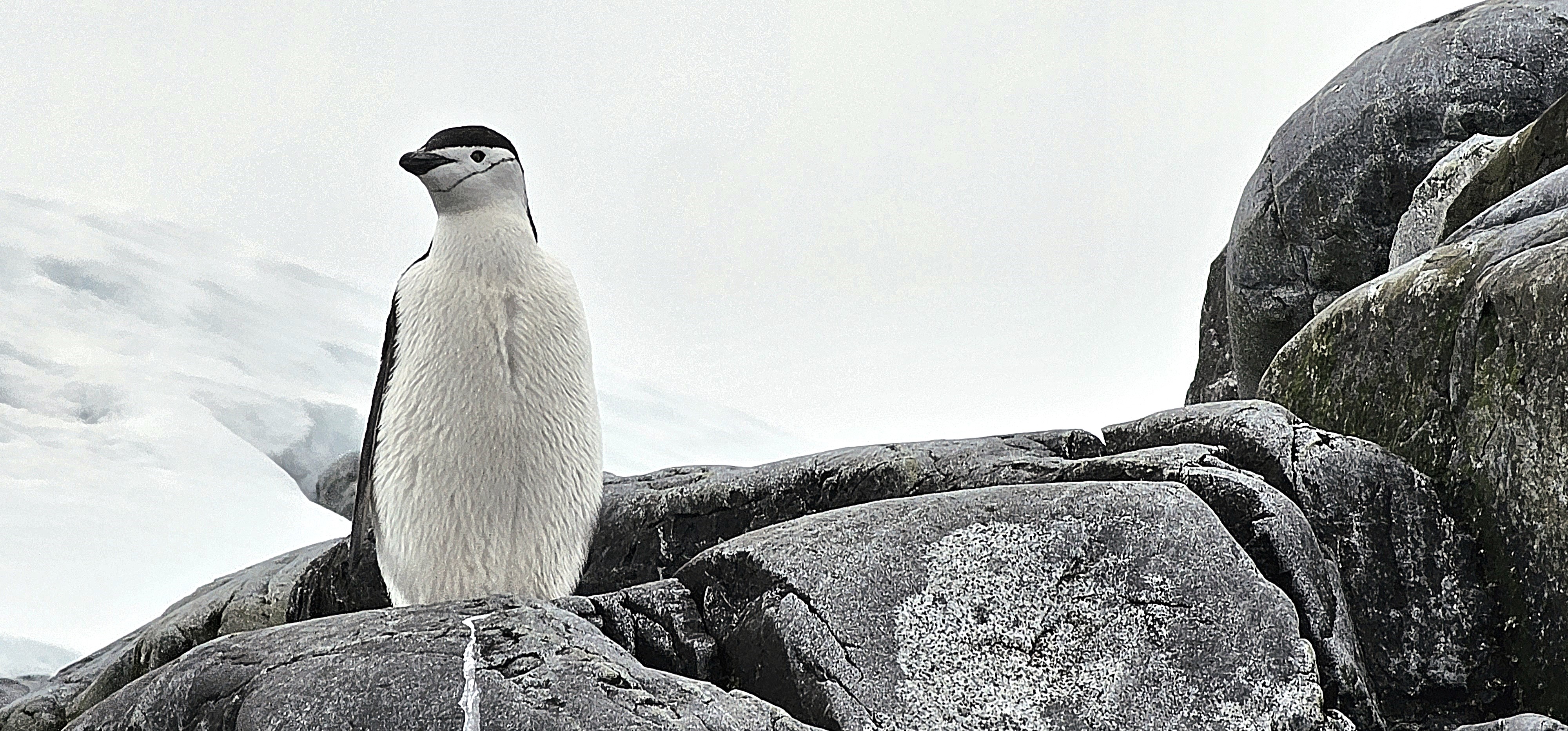
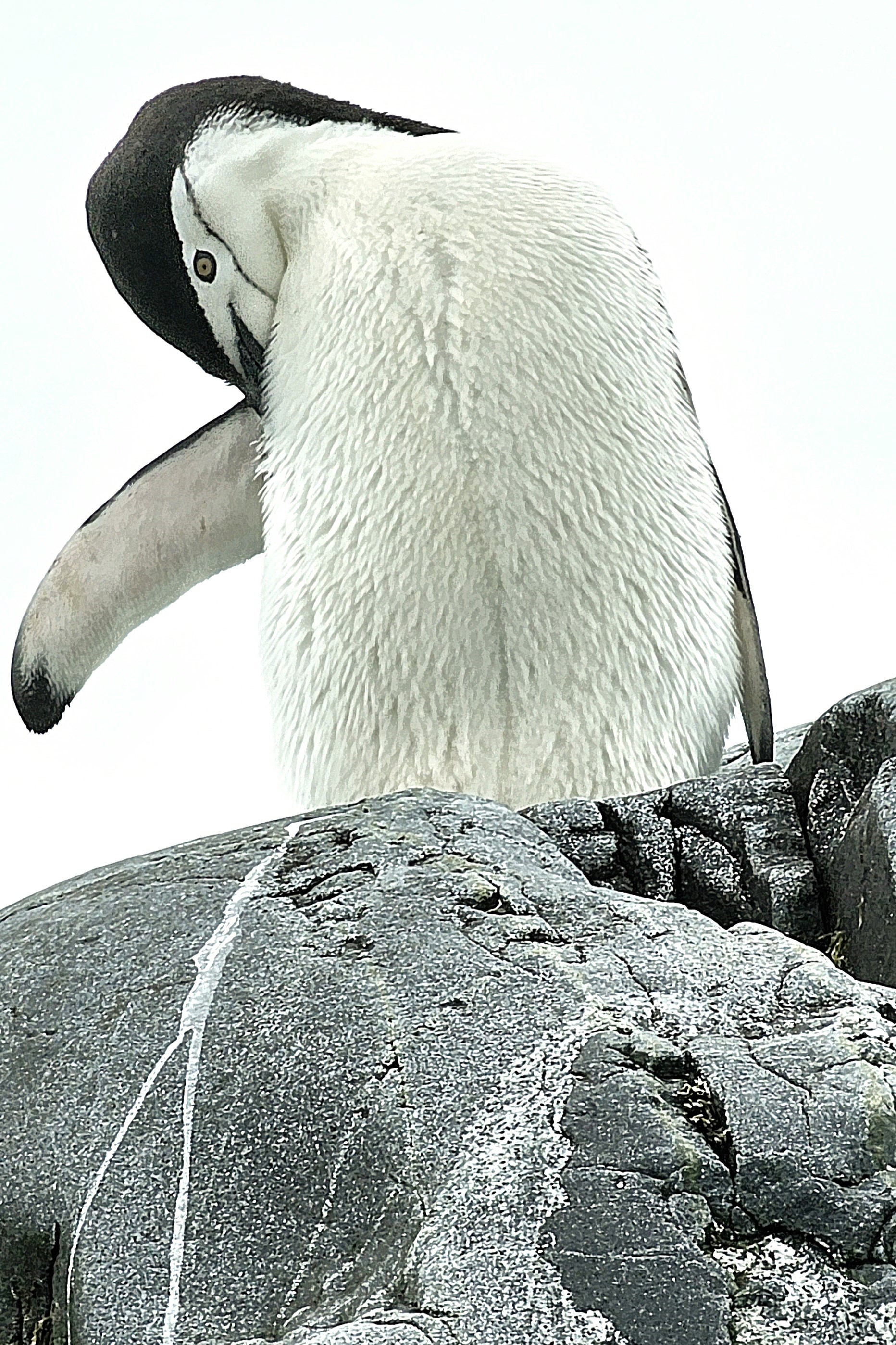
where we reached an outcropping of volcanic granite.
That’s where we spotted a solitary chinstrap penguin–identifiable by the telltale line that runs under his helmet–who was posing on a puddle of penguin poop for our benefit.
It was our first Antarctic wildlife encounter, but judging from the penguin’s apparent apathy, probably not his first photo shoot.
The excursion was brief and memorable, but easily topped the following day by an early morning sail through the Lemaire Channel, featuring breathtaking views of mirrored mountains standing against azure skies.