Gallery

California Potpourri

After leaving Yosemite behind, Leah and I strategically home-based in Petaluma, and ventured along the California coast, from San Francisco to Point Lobos Natural Preserve and places in between.

Our collection of brief visits are best detailed through a series of images that more easily reveal the scope and variety of the scenery we enjoyed.

Sonoma Valley: Bezinger and Chateau St. Jean Vineyards

vineyards

terraced vineyards

rows of vines (2)

grove of grapes

fruit on the vine

Chateau St. Jean

John Muir Woods: a hike on the Canopy View Trail

Bohemian Grove

rotting bark

View from Panoramic Road

burl

squirel tail

a mouth of weeds

San Francisco: a ferry ride from Tiburon to the Ghiradelli Chocolate Festival

Golden Gate

Alcatraz

Coit Tower

who's watching whom

SF beaching

Ghiradelli

Carmel Beach: a stroll to Pebble Beach

Carmel Beach

tidal pool

where's my ball

10th green flag

Pebble Beach

Point Lobos State Natural Reserve: hiking from Whalers Cove to China Cove until sunset

heron

cliffs

China Beach

lonesome tree

Point Lobos rocks

Sunset coast

Sunset cove

pelican sunset

We’ll be back.


Knock, Knock

We are anchored at RV site #1 at Pine Mountain Lake Campground in Groveland, CA, the closest town (albeit 24 miles away) from Yosemite’s western gate. The sites at PML are terraced on a steep hilltop better suited for mountain goats, although there is 50 amp power and a water bib, should goats ever feel the need for air conditioning and a shower.

The pop-up caravan at site #2 has just packed up and pulled out, leaving us completely alone and feeling somewhat relieved. After being cramped for so long at so many “RV resorts”, it’s nice to enjoy the breathing room that comes from having space on both sides of our home, when more often than not, RV parks keep us closer to neighbors than a Grey Poupon commercial.

Yet, despite the constant flux of RV park populations, and the proximity of rigs from stall to stall, there is an unwritten code of ethics that’s very reassuring–where neighbors seem to respect the property of others that typically extends beyond the footprint of one’s camper. Unattended grills, bikes and lawn chairs are a large part of open-door living at campgrounds, and are seldom disturbed by others.

However, when left alone, the isolation can be disquieting and peculiar, leaving us to wonder what it’s like to be on our own.

After breaking camp by mid-morning, the enervating 100 miles of stop-and-go driving from June Lake, over the Tioga Pass, through a crowded Yosemite NP to our final destination at Pine Mountain Lake took up most of our day. Ordinarily, after setting up, a secluded mountain setting would invite us to open our windows for a crisp cross-breeze of fresh air, but Groveland had served up a helping of haze with a side a smoke, giving us little choice but to button-up the Airstream to protect us from the effects of fires in the forest.

Leah was first to bed, while I spent some time editing photos for the blog. I don’t know exactly what time I fell asleep in front of the computer, but I was startled awake at 11:30 pm by a knock on the door, followed by a weak plea for help.

Shaking off the groggy feeling, I turned up the lights and fumbled to unlock the door. Had I been more coherent, I probably would have ignored the distress call, and filed it under “too weird for worry”. But instead, I reacted otherwise.

“Are you in some kind of trouble?” I asked, cracking the door a few inches.

A disoriented rail of a woman with pulled-back hair and dressed in black spandex workout gear was standing by my door.

“I’m lost, and I need a ride home. Can you please drive me to my house?” she pleaded.

“What are you doing here?” I asked, growing increasingly suspicious of her request, and feeling angry that I may have put Leah and myself in jeopardy by answering the door.

“My husband and I had a disagreement and he dropped me here, and I have no way of getting home. I live on the mountain, but I don’t know where I am, so could you please drive me home?” she reiterated.

She didn’t appear upset–just confused, but so was I.

When Leah and I began preparations for our year-long adventure, a common question among friends and family was, “Are you taking a gun with you?”

My response was always the same: “Are you fucking crazy?” But now I’m not so sure.

“I’m not from around here, so I don’t know how to get you home,” I asserted. But what I was really thinking was: “You’ve got to be kidding if you think I’m leaving Leah behind, while you ambush me outside the Airstream or on the way to your home.”

“Then will you let me use your phone so I can call someone?” she suggested.

I anticipated the question. “I’ll be right back,” I announced, closing the door. I reached for the phone I recently replaced two weeks ago, switched on the exterior light, and re-opened the door to find her drinking from a large water bottle. I wondered what else she was hiding on the other side of my door.

“Since we don’t know each other,” I volunteered, “how ’bout I dial the police for you, and you can ask them directly for help?…”

She hesitated as I entered 9-1-1, “…Cause it sounds to me like this warrants a call to the police.”

“Sheriff’s office, what’s your emergency?” answered dispatch.

Switching the phone to speaker, I offered, “I’m calling from Pine Mountain Lake Campground in Groveland, CA. A woman has knocked on my camper door who claims that she’s lost and unable to find her way home. Are you able to help her?”

“Is she still there?” asked the dispatcher.

“She is, and she’s asked me to drive her to her house somewhere nearby,” I confessed.

The dispatcher took over. “Are you alright ma’am? Are you hurt in any way?”

The stranger responded, “I’m okay. I just don’t know where I am is all, and it’s dark, and I don’t know how I’m gonna get home.”

The dispatcher continued, “Can you tell me your name and where you live?”

“My name is Amber and I live at 20247 Longview St.,” claimed the knocker.

“Were you born in 1964?” asked the dispatcher.

“Yeah,” responded Amber.

“Well, this office is not a taxi service, Amber, but if you like, I can offer you the numbers of a few local cab companies who can get you home,” suggested the dispatcher. “Is that a good option for you?”

Amber, dazed, “Sure.”

To Amber, “Be right back.” I let the door slam behind me, and I scrambled for a pen. The dispatcher dictated phone numbers for three taxi services and signed off.

Getting back to Amber, “I’ve got three choices here. Which number would you like me to call?”

“I don’t have the money for a taxi. Can you just tell me the direction to the main road?” asked Amber.

“Ferretti Road is at the bottom of the hill. You can’t miss it,” I declared, and double-locked the door.

From the “bedroom” Leah called out, “What the hell was that all about?”

“I don’t even know where to start, but I hope she’s gone,” I asserted.

“Maybe we should bring in the bear spray from the truck as a precaution,” Leah recommended.

“Only if you get it,” I replied.

“Fuhgeddaboutit! I’m not stepping out there,” exclaimed Leah.

At Leah’s suggestion, I called Pine Mountain Lake Association security, who completed a sweep of the property, but came up empty. Their promise of an increased patrol through the night was reassuring, but the peculiar notion of ever enjoying peace and quiet as a solitary guest in a campground now seems highly overrated.

Gallery

Thank You for Not Smoking

Waiting…patiently.

Waiting…purposefully.

Waiting…painfully.

When will this smoke finally dissipate? I already know the answer…the question was rhetorical. As of today, 74 fires are burning out of control across the western part of America.

fire map of Western states
Current Wildfires

Extreme Smokey

Fires are currently active in nine states throughout the West, according to the National Interagency Fire Center. Here is a breakdown of the acreage burnt so far in active wildfires reported by the National Interagency Fire Center since Aug. 28:

  • Arizona, 1 wildfire, burning 48,443 acres
  • California, 22 wildfires, burning 354,316 acres
  • Colorado, 1 wildfire, burning 1,405 acres
  • Idaho, 19 wildfires, burning 248,141 acres
  • Montana, 26 wildfires, burning 544,583 acres
  • Nevada, 7 wildfires, burning 111,379 acres
  • Oregon, 9 wildfires, burning 146,418 acres
  • Utah, 1 wildfire, burning 5,097 acres
  • Wyoming, 2 wildfires, burning 4,766 acres

For those active fires reported on since Aug. 28 it amounts to 1,464,548 acres actively burnt or burning.

Leah and I have been in the fire zone for over a month–always one-step ahead of the next outbreak–but fire finally found us at Yosemite National Park. Today, the evacuation of Fish Town was lifted, but steps are still being taken to prevent fire from invading Yosemite’s sacred Mariposa Sequoia Grove. Fortunately, Merced and Tuolumne groves remain unaffected.

tunnel tree (2)

roots

fallen tree1

fallen tree

The air is filled with smoke. It’s impossible to ignore…it permeates everything. And nothing stays clean overnight after the ash quietly coats every surface by morning. With the winds blowing, mountains appear…

Tioga Peak (2)

twin peaks

Mt. Dana

Mt. Hoffman

and disappear under a gauze of gray in minutes.

El Capitan

Cathedral Rocks

Fairview Dome1

On a good day, the sun will sometimes break through,

smoky sun

if only to tease the highlights from the shadows.

Tenaya Lake

kairns

tree balanced on rock

Bridalveil Falls2 (2)

But the sky is fickle…

smoke clouds

It leaves us waiting …and wanting more, with no guarantee that the sun will return–until it means accepting the best of a bad situation.

ElCapitan

Perhaps waiting has value if it slows us down, and gives us a little more time to appreciate what’s in front of us.

El Capitan and Cathedral (3)

Fire in the Hole

I’m standing on the rim of the Cinder Cone volcano at the northern edge of Lassen Volcanic National Park, and steadying my camera against sustained winds whipping across the crater. My biggest fear at this moment is not for my safety, but being unable to properly memorialize my euphoria in a sharp photograph.

While there is no comparison to the energy of B.F. Loomis’s exposure of Lassen Peak’s 1914 eruption,

lassenerupt

the thrill of standing on the precipice of a monument created by the forces of nature…

cinder cone

should be testament to Lassen’s National Park worthiness.

But getting to Lassen Peak was a thrill of a different kind. If the shortest ground distance between two mountains is a crooked road, then 50 miles of US-299 through the Trinity-Shasta National Forest qualifies as a marathon winner of zigs and zags, and unlike any other road I’ve driven since our trip began more than five months ago.

It had to be the most rising-and-falling-and-winding-and-grinding-kind-of-road that went on and on for more than an hour. Rarely would 100 feet of straight road pass us by before we’d follow a familiar pattern of maneuvering to the right and then pulling the truck to the left and then turning the wheel hard to the right, and leaning around the bend into a corkscrew, only to continue all over again.

The drive was exhausting, but at least we left the smoke behind us. We were now basking in sunlit blue skies without a single cloud.

The park was uncrowded, and it didn’t matter why, but I suspect that families were now tackling teachers’ homework.

After an orientation at the Visitor Center, we strolled around Manzanita Lake for centerfold views of the mountain.

Lassen Peak and Manzanita Lake

Taking the highway deeper into the park, we passed Helene Lake,

Lake Helen and Lassen Peak1

offering a peek at Lassen’s desolate peak.

Lassen Peak and snow.jpg

Since the trail to the summit rises 2000 feet in 2.5 miles without shade–which is not my idea of fun–we continued to Bumpass Hell, named after an early 20th century guide who stepped through the crust of a fumarole while doing his job.

The namesake trail provided commanding views of Brokeoff Mountain and Diamond Peak.

overlook

We found it odd to be crossing snow in the middle of August under a searing sun,

summer melt

but the park receives snowfall averaging 40 feet per year at the higher elevations.

Once over the ridge, the sweet mountain air was replaced with the pungent scent of sulfur bleeding from a hellish valley of hydrothermal activity:

Bumpass Hell

complete with requisite spurting mudpots,

mud pop

hissing fumaroles venting from angry rocks,

P1070500

and brilliantly colored hot springs…

hot springs

Bumpass Hell2

mineral rocks

Bumpass Hell1

…collecting in a milky stream of hot minerals.

Sulphur Spring runoff

Absolutely gorgeous!

The road to the south entrance of the park took us past the defunct commercial Sulphur Works,

Sulphur works3

Sulphur works1

boiling mudpot

before we u-turned to catch the westerly light on the Chaos Crags,

Chaos Crags

and fawned over the stillness of Reflection Lake.

Reflection Lake

It would be hard to top this day, unless it was from atop the Cinder Cone, and that’s where we traveled the following day.

After a drive through dense forest and pastureland to the northeastern corner of the park, we turned onto a dusty hard-packed road terminating at Butte Lake, where a delta of trails branched out for a closer inspection of the Fantastic Lava Beds…

Fantastic Lava Beds

–a heap of sharp and shiny lava rocks rising to heights of 50 feet or more–forming an impenetrable barrier of blackness.

Lava beds and ash

We trudged through shifting black sand bordered by groves of Ponderosa pines for nearly two miles, until we reached a clearing with a view of the cone.

trail

“I don’t think I can make it,” Leah admitted. “It’s too steep for me, and it’s completely exposed, but you should go for it.”

The winding trail up the side of the cone was sloped at a 35% grade, the sharpest possible angle that cinders can stack before rolling downhill. It was going to be very challenging. The ascent over crushed cinders mixed with coarse sand was harder than I presumed. With every step, the gravel swallowed my boots to the ankle.

slow and steady climb

But I was undeterred. The power to continue came from the constant revelations brought by every foot gained along the way,

Lassen peak and lonesome tree

and the promise of something more spectacular by climbing even higher.

Lava beds and Butte Lake

I could follow Leah–becoming increasingly smaller–as she took the detour around the cone, just as she was watching me shrink in size from the base of the volcano.

from the base
glare from Leah’s iPhone

After scrambling most of the 750 feet to the trail’s vanishing point, a whirling wind confronted me from the blind side of the cone, stopping me in my tracks, but offering an amazing overview of the Painted Dunes and Lassen Peak in exchange.

Lassen peak and painted dunes panorama

I imagined a walk through the dunes, taking time to examine the explosion of color, while wondering if camera sensors were sensitive enough to record such an array of wonder.

painted desert1

And then I reached the top of the cone!!

cinder cone crater

The wind at the top was relentless, but so was my need to circle the cone. Nothing was more exhilarating than having the cone to myself (although I would have willingly shared the summit with Leah had she been able). The magical feeling of surveying the terrain from all sides was awe-inspiring.

the cone

cater and peak

And then I discovered that the Painted Dunes continued on the other side of the volcano.

painted desert4

painted desert5

painted dunes

I really didn’t want to leave. But after exploring the area, the only thing left to do was to take the long trail down to share the experience with Leah, and yield the cone to a new arrival.

the long climb


Redwoods and Blue Seas

California stopped us right in our tracks. We had just crossed the Oregon state-line, only to be unexpectedly diverted to a border patrol checkpoint.

“What could we have possibly smuggled into California from Oregon that would need further inspection? Maybe they’re looking for the coyote who’s been running Canadians into the States?” I posed.

“More likely, there’s a bounty or some kind of quota for captured Mexicans,” Leah contributed.

Ahead of us, the RV from Nevada was being questioned. He pulled away, and then it was our turn.

Waiving us forward, “Wow,” the California agent exclaimed. “You guys are all the way from New Jersey?”

I’m almost certain his eyes lit up behind his dark glasses. “Do you know anything about gypsy moths?” he asked.

“We are, and I do,” I responded to both questions.

“Well then, since you won’t be needing this brochure about gypsy moths, would you do me the favor of pulling up to those cones over there,” he indicated, “and I’ll have an officer come by to check things out in a jiffy. We won’t keep you very long.”

“Are we really getting checked for moths?” I asked rhetorically, as I crept to the cones.

“I don’t know,” Leah admitted, “but I can see two guys in my mirror, and they’re coming up to the Airstream, and one of them is carrying something big, but I can’t make it out.”

“I suppose it makes sense, considering the importance of protecting America’s timber land,” I stated. “In fact, what this country needs is a net. The United States government should cast a tremendous net over America’s airspace to protect us from immigrant leaf-eaters that only mean to do us harm. These are very bad bugs–the worst you’ll ever find anywhere–and these bugs have to be stopped before they threaten the security of this great country. Believe me. Thank you very much.” I campaigned.

“And this net…are you gonna get the bugs to pay for it?” Leah mused.

The inspector set the car dolly on the ground and crab-walked around the Airstream undercarriage while on his back, poking around with his fingers and a flashlight. He started on the left side of the Airstream, and I followed him as he scooted under the tail to the other side for more of the same.

After completing the circle, he stood and declared, “All clean. These campers are completely sealed. Those guys do a good job.”

“And made in America!” I chimed in.

He stamped my official Certificate of Inspection, and bid us safe travels.

certificate-of-inspection.jpg

Certified predator-free, we were now permitted to resume our journey throughout California, with Redwood National Park as our first stop.

Redwood National Park is a splinter of a park that hugs the rocky northern coast, and reaches across the Yurok Reservation and reciprocating California State Park affiliates.

Because Redwood is not a traditional National Park, it can easily get under your skin. Navigating through the blurred lines of park boundaries always had me wondering if we were “in” the park or not, as we rode Redwood Highway through forests and meadows to beaches and towns.

Unlike other parks, there is no entrance fee, but then again, there’s also no practical way of collecting a fee when the road is open to all traffic.

We set up camp on the bank of the Klamath River,

Klamath River sunset (2).jpg

and explored in earnest the following day when we followed the river to the estuary,

Klamath channel (2)

where a family of barking sea lions,


and humans…

ocean play

…frolicked in the sea spray and sea foam.

sea foam

We continued our hike along the Coastal Trail, with views north…

Bird Rock

…and south of High Bluff overlook.

coastline overlook

“I miss the ocean,” I confessed to Leah. “There’s something serene about staring into the surf.”

Although three months had passed since visiting the Jersey shore, I was immediately transported back to a familiar scene of waves rhythmically crashing against the rocks.

crashing waves

“Let’s go find some redwoods,” Leah advocated, pulling me out of my trance.

We branched out to a deeper part of the jigsawn park, and settled on a grove of giants dedicated to the beatification efforts of Lady Bird Johnson by Richard Nixon.

Lady Bird plaque

With ancient redwoods as old as 2500 years and reaching upwards of 380 feet, the notion of something bigger than oneself becomes more than a literal interpretation.

sunglow

skyscraper

treetops

redwood grove

How fortunate we felt to be bathed in streaming shafts of light–dancing between feathered limbs, and flickering in the balmy breeze.

shafts of light

There’s much to learn from trees that have survived the dinosaur. Redwoods are a family of trees that share root ancestry to keep them anchored. They propagate by seed or by sprout, and are known to sacrifice themselves for the benefit of the younger and stronger sibling.

twins

The redwood’s bark may grow to two feet in thickness to protect itself from fire damage. However, repeated fires can eventually penetrate through the bark, leaving the tree to rot out from the core,

burned out redwood

and yet…it may still survive.

burned out but alive

Even in death, there is a twisted beauty to be found in its decomposition.

rotting stump

At the dedication ceremony to honor Lady Bird Johnson, President Nixon intoned,

…to stand here in this grove of redwoods, to realize what a few moments of solitude in this magnificent place can mean, what it can mean to a man who is President, what it can mean to any man or any woman who needs time to get away from whatever may be the burdens of all of our tasks, and then that renewal that comes from it…

As I strolled through the grove surrounded by God’s fingers, oh, how I prayed that Donald Trump could take Nixon’s advice, and listen to the trees’ whispers for just “a few moments”.

Oxymorons

Delicately durable and delicately vibrant–two oxymorons that epitomize the characteristics of an ammonite fossil exhibited at the Royal Tyrrell Museum in Drumheller, Alberta.

ammonite (2)

Yet, it’s the simple complexity of the structure that best explains why after 200 million years, we can still appreciate its resilience and iridescence. The integrity of the ammonite’s spiral chambers are believed to have regulated buoyancy, and protected the crustacean from the tremendous force of oceanic pressure drops.

And while it may have taken an epoch of tectonic pressure, heat and mineralization to metamorphosize and fortify such a fragile fossil, the structure of time has enhanced our revelation of objects possessing rare and infinite beauty.

In Search of Crater Lake (OMG, SMOG)

“There’s a lot of smoke in the park today, so be careful,” warned the ranger, as we crossed the threshold of Crater Lake National Park for our second day of touring. Earlier in the day, I searched the National Park Service webcam aimed at Crater Lake from the Sinnott Memorial Overlook–with the intention of evaluating views of Wizard Island and Llao Rock–but there was no image…just a gray blob.

“Aw shit! Is this camera off-line, or could this really be smoke?” I wondered aloud.

While I craved the crisp cerulean air punctuated by wispy snippets of marshmallow clouds floating over a rippling realm, I knew from our 35-mile approach to the park that this was pie-in-the-sky thinking, since the valley was completely cloaked in smoke.

Yesterday, as we embarked on our ring around the 33-mile Rim Drive–with its multiple viewpoints along the caldera wall, overlooking magnificent cliffs that surround Crater Lake–our eyes could barely penetrate the haze that gave us gauzy views across a vast expanse of water.

Wizard Island

The fact that we could see anything at all, brought tears to our eyes, but that was probably caused by the irritants in the air.

Every vantage point brought a dazzling, yet indistinct impression of the landscape, elevating form over color and detail as the dominant design element.

Pinnacles
Pinnacles
Lookout over caldera
Grotto Cove
ice and water
Shell Channel

It was also an opportunity to reflect on objects closer to the lens.

a tree with an idea1

arms ans legs and limbs

unusual tree behavior

There were moments when the haze worked to my advantage, revealing a lake with a more mysterious and pastel personality.

Wizard Island ray
Wizard Island morphs into a giant ray
Phantom Ship ES
Phantom Ship sailing on Chaski Bay

Fortunately, the sun broke through at the right time, shining a spotlight on Pumice Castle,

Pumice Castle CU

Pumice Castle

illuminating the illusion of Phantom Ship,

Phantom Ship

and electrifying the Danger Bay coastline with lenticular textures.

Danger Bay


What a difference a day makes. Today’s scene had us wondering if Crater Lake was really down there at all, and maybe part of a bigger conspiracy.

where is the lake

Has Crater Lake been de-ported? Is Crater Lake being held hostage in exchange for Congressional funding of the “Wall”? Or is Crater Lake relying on a failing projection system that once led (b)earthers to believe that Neil Armstrong faked the lunar walk? Fake views. Sad.

I wondered if Park Rangers were doing enough to reassure the public that Crater Lake would reappear.  And had they considered putting out an A-P-B for a M-I-A lake that’s gone A-W-O-L?

“Be on the lookout for a large body of water that goes by the name of Crater Lake–measuring somewhere between five to six miles across, a quarter-mile deep with a deep blue complexion, sporting two enormous moles and a shaggy shoreline. Last seen yesterday, wearing a cloudy disposition.”

Poised at the Cloudcap Overlook and hoping for a miracle, it was the smoke, not the view, that took our breath away.

But being the intrepid explorers that we are, if the lake was invisible from above, then we would search for it beneath the shroud.

The Cleetwood Cove Trail drops 700 feet to the water’s edge through a series of sandy and steeply graded switchbacks.

trail switchbacks

It took us fifteen minutes to breeze down the the one-mile trail, until we reached the water’s edge with rewarding views of the penultimate infinity pool.

jump off point
Cleetwood Cove to Pumice Point

The cove is home to an outhouse-shaped instrument shed…

outhouse monitor

that monitors lake elevation levels for the US Geological Survey,

Crater-Lake-surface-water-elevations

and a dock for concession boat tours that circle the lake or visit Wizard Island.

boat launch

But reservations sell out quickly. Leah and I considered bringing a credit card along in the unlikely event that seats would become available, but decided against it.

Instead, our afternoon entertainment was provided by young thrill-seekers who dared themselves and each other to take the plunge off a 25-foot cliff…

jump1

jump9e

…into heart-stopping ice water.

Returning to the dock, we learned that seats had become available if we were willing, but without a method of payment, alas, we missed the boat.

aboard the Rogue

And so began the long plod up the mountain, and back to a sky that refused to yield.

We had gone in search of Crater Lake, and all the while it was right under our noses.

Beauty and the Beast

Some mountains should keep their distance or at least stay in the background, while other mountains always seem ready for prime time. And so it is with Mt. Ranier and Mt. St. Helens–two significant volcanoes within the Cascade Arc, and part of the Pacific Ring of Fire.

As the crow flies, both peaks are 50 miles from each other, yet on a sliding scale, they couldn’t be further apart.

For starters, Mt. Ranier is majestic,

view from a bridge

lush and verdant,

meadow

powerful and dominant,

Ranier glaciers

and picturesque;

Ranier reflection

while Mt. St. Helens appears wretched,

Staring into the crater

barren,

crispy trees

broken,

lohar

and grim!

southern valley

To be clear, none of the fault belongs to Mount St. Helens. Before May 18, 1980, this was a vital volcano with a perfectly shaped cone, rising 9600 feet over Spirit Lake. But when the explosion raised the mountaintop, she was stripped down to 8366 feet without her snow bonnet.

The results were catastrophic: 300 mph force shock waves tore ancient trees from their roots, and the largest landslide in recorded history combined with glacial meltwater to create raging lahars that deposited up to 600 feet of volcanic slurry as distant as 50 miles from the eruption. Fifty-seven lives were lost in the blast, which also caused over 1 billion dollars in damage.

Thirty-seven years later, the altered landscape remains daunting and unforgiving,

MSH panorama.jpg

By contrast, the continuing history of Mt. Ranier and the surrounding area can be told in the 8 ft. diameter cross-section of an ancient Douglas-fir beside the Longmire Museum.

history tree

Although Mt. Ranier has been sleeping since 1895, its volcanic volatility may pose a bigger risk to nearby population centers than Mt. St. Helens.

But until then, the love affair continues with visitors who pass through the gates…

entrance

motorcycle dog
Thanks, Leah

…on the road to Paradise, stopping at Narada Falls…

narada-falls.jpg

Narada Falls wide

in the hopes of finding the mountain clear of cloud cover.

below Paradise

If there was ever a beauty pageant for mountains, Mt. Rainer would be a contender for the glacial tiara. There are few mountains more photogenic.

wildflowers and Ranier (2)

While the obvious star of the park is the mountain, the bounty extends beyond the twenty-five glaciers clinging to its summit,

topography

as the park deceptively draws its visitors into the forest where the reward is equally as impressive, and no less stunning.

looking west of Ranier

Louise Lake

view from Paradise

Lest anyone think that Mt. St. Helens’s image can’t be salvaged, consider what a few accessories can accomplish to dress up an outfit.

While you can’t put lipstick on a mountain, there are artful techniques that offer instant gratification. For instance: point the camera a safe distance away from the subject, add a few clouds to soften the light, frame the composition with trees for a bit of mystery, then employ a spot of color for distraction, and voilà–Mt. St. Helens transformed!

view from the marsh

Or by photographing the beauty on the edge of the ugly, makes the ugly seem more attractive by association.

lily pads

Adams and Spirit

Although Wrangell–St. Elias, the Great Smokies, the Rockies, Shenandoah, and Grand Tetons are recognized as jewels in the National Park Service crown, none of them is a mountain unto itself. Only Mt. Ranier and Denali command the right to be a park that bears their names. (Mt. Rushmore doesn’t qualify; it’s a National Monument.)

While Mt. Ranier and Mt. St. Helens are very much a tale of two mountains, each one (despite their appearance) commands respect for different reasons: Mt. St. Helens for the power unleashed, and Mt. Ranier for the power restrained.


An Olympian Apology

Dear Olympic National Park,

It’s not you, it’s me.

Usually, I like knowing something about my destination before I get there, especially when I’m planning to visit a National Park. I’ll make a point of scanning the internet or paging through some travel books, gathering information about your geography and your attractions before my arrival.

For starters, it gives me a better sense of how close we can get to you, which is important to me, considering I have little interest in a long-distance relationship.

But this time around, I didn’t do my homework. I suppose I could blame it on solar eclipse fever— my frantically searching for totality-zone accommodations in Oregon—such that I skipped an Olympic step and planned without thinking clearly.

Instead of settling by Port Angeles—at the north gate of your park—we arranged to camp by Lake Cushman on Skokomish tribal land near your Staircase entrance. At the time we made our reservations, it looked like a good fit. But in hindsight, it turns out we were too far from many of the features that make your park so formidable and special.

I realize now how different things could have been between us. Given another chance, I would gladly coast across the coarse black sands of your rugged Pacific shore to admire your infinite tidepools, or marvel at the sea stacks and arches stretching across a sunset-lit horizon. I would have loved to stroll through your lush forests by the Hoh rain forest just to gape at the massive cedar and spruce trees that serve in the company of Mt. Olympus (your highest peak) and the many glaciers that ring her summit. Ahh, what could have been!

But things being as they are, the powers of Mt. Olympus had a different plan for us. It wasn’t terrible… it was just different.

We approached you from Olympic National Forest, with views across the east bank of Lake Cushman.

Lake Cushman

You probably don’t remember me—since you’re the seventh most popular park in the nation, with nearly 3 million visitors a year—but we first met after I passed your tiny isolated gatehouse powered by a whirring 1500 watt Honda generator.

I know I shouldn’t have sworn at you when I realized my mistake. Please consider it more of an over-reaction to a situation that I couldn’t correct after your ranger informed me that Staircase was a remote access point without roads to any other part of you.

However, she graciously told us of a nifty loop hike through an old growth forest that followed Skokomish River. And so, with few other options on the table, we set out to hike the Rapids Loop Trail as a way of discovering something about your ecosystems.

The bridge to the trailhead was a fitting place for lunch, providing river views north…

view from the bridge

… and south of us.

Copper Creek

Walking upriver, we encountered the remains of an ancient cedar,

elephant trunk

and an active cedar that pierced the sky.

giant cedar

Along the river, the pace quickened…

Rapids Loop Trail

… but had little impact on the chunky boulders crowned in moss,

yellow moss

or a fallen giant we passed on our return.

Stairhouse cedar logs

We completed our afternoon at the Visitors Center in Hoodsport, grateful for an internet connection and the advice of a local outdoorsman who persuaded us to explore the Hood Canal from a higher perspective the following day.

The park map offered few details of our route, but the turnoff to Duckabush Road was clearly marked. Seven miles in and we were surrounded by Olympic National Forest. The further we penetrated the backcountry, the more isolated we felt.

“At least there’s no crowd where we’re going,” I reminded Leah.

NF-2510 split just past Collins campground, providing us with a fresh choice. According to the map, the fork to the left ran into the Duckabush River. But the right fork—a one-lane rutted road disappearing into the Brothers Wilderness—was precisely the challenge I needed to shake off my mistake.

At first, the road meandered through a dense forest, until we began our ascent. As the F-150 climbed higher and higher, I was inclined to drift closer to the mountain wall in defense of the unstable cliffside that had given way in places from repeated flood damage. It felt so risky, and we were giddy with fear. Seeing a huge fallen tree stump ahead in the road initially caused concern. Would the road be wide enough to pass it?

“This was a huge mistake! What if we’re stuck here?” Leah panicked. “There’s no room to turn around, and there’s no way fucking way you’re backing out of here!”

Creeping towards the barricade, I engaged the 360° camera view on the dashboard monitor while Leah coached from the right side. Holding my breath, we cleared the obstacle by inches on the right, as the left side of the truck kicked gravel over the open side of the road.

But it was too soon to celebrate. There was more road in front of us, and we were still climbing. As the elevation rose, the trees eventually gave way to a valley view of Hood Canal.

Hood Canal

Leah was emphatic. “I think we’ve gone far enough,” she expressed. “And you finally have a place to turn around.”

“What’s the fun in that,” I overruled, “when we’re so close to the top.”

After fifty minutes of driving six nail-biting miles, I needed a bigger reward than the view at hand. I was hoping for wide open spaces at the end of the road.

It was only another mile of switchbacks to the top, and perhaps the easiest mile traveled—most likely the result of a recent forest fire that groomed the hillside of old growth pines.

atop Mt. Jupiter1 (2)

lodgepole silhouette

We arrived to a field of maturing fireweed, firing off thick bursts of puffy seeds that floated through the air like a bubble cloud over our heads.

Mt. Constance

We roamed around the damaged summit, finding crushed beer cans, campfire rings filled with debris, and shell casings one-hundred paces away from target practice paper. It must have been a wild and crazy party that we missed.

The ride down the mountain (what I believe was Mt. Jupiter) was uneventful, although this time the tree stump was on my side, and Leah got a chance for a glance down the cliff.

An hour later, we were driving up a paved road to the lookout atop Mt. Walker, with views from the north face…

North view from Walker

…and views to the south, and the contrast couldn’t have been more startling.

Ranier levitating

And so, Olympic National Park, I think we got off on the wrong foot. It might have been the right time, but it must have been the wrong place. Still, I hope it’s possible for us to hang out together in the near future, now that I’ve been to the mountaintop and seen the light.

Lake Cushman sunset

Yours truly,

Neal and Leah

Glacier Assurance

Glacier National Park had some big shoes to fill considering we were still riding a Canadian Rocky Mountain high from our past visit to Banff and Jasper National Parks. It’s as if Banff and Jasper were the opening act and killed it, and just as Glacier, the headliner took the stage, the power went out. While I anticipated the beauty that over 4 million park visitors per year have heralded, I was preparing to be disappointed.

If there were gorgeous mountain views present, they belonged to those with x-ray vision. An impenetrable veil of smoke from prevailing wildfires in western Montana and British Columbia had settled on the peaks and deep in the valleys like a “cloak of choke”, elevating the air quality to alert status.

The sun appears

shadow peaks (2)

But there was still a park to discover, so undeterred, we took the high road in search of beauty where we could find it.

In the case of Glacier National Park, the high road is named Going-to the-Sun Road, a marvel of civil engineering completed in 1932. The 50-mile stretch traverses the park from Lake McDonald…

Lake MacDonald Runoff.jpg

to the western point of St. Mary Lake.

view from the hike

The road crosses the Continental Divide through Logan Pass at an elevation of 6,646 feet, providing a series of white-knuckle hairpin turns that only a vintage fleet of Red Jammer drivers can negotiate with ease.

red jammer (2)

We drove around The Loop, where a carpet of late-blooming wildflowers painted a swatch of pink across the foothills of Flattop Mountain,

valley of pink1

and beyond the Weeping Wall, where embedded glacial remnants…

Snow on the Mountain

offered an aerial microcosm of the landscape beneath us.

ice sculpture

leftover ice

Yet, excitement was as fleeting as a burst of blue sky…

lost in the clouds

Our plan called for a stop atop Logan Pass, but 30 minutes of switch-backing through rows of parked cars with no possibility of finding a space left us with few options; either we turn back, or we finish the road.

With the gas gauge nearing empty, it seemed a safe bet to continue to the village of St. Mary, so down the mountain we rode, until the glacial green of St. Mary Lake–winking between the trees–became the itch we had to scratch. A turn-out with parking space (yay!) at the trail head of several waterfalls gave us more of a reason to stretch our legs.

We hiked above a shoreline of densely packed trees, giving us picket-fence glimpses of the lake, until we came to a clearing.

Arrow into St. Mary Lake

And in the distance, Mt. Siyeh had shed its shroud and come to life.

Clouds Across the Peaks

Baring Falls was the Hail Mary pass we caught to save our day. While it wasn’t a view of monumental mountains in mirrored waters, it was still a place where pretty happened.

Baring Falls

river rocks


The overnight rain was enough to cleanse the sky, and random patches of morning blue gave us enough faith to run to the Sun for a second chance. This time around, our carma delivered us to a parking space at Logan Pass.

From there, our hike across the alpine slopes to Hidden Lake was enough to erase my doubts about Glacier National Park.

Logan Pass panorama

falls

grazing by a glacier

glacial pond

Bearhat Mountain Hidden Lake (2)

Certainly, while I would have preferred the postcard vistas that leave me slack-jawed and breathless, Glacier proved to be a worthy contender to the Canadian twins, and deserving of a rematch.

Smoke and Mirrors

Sadly, we were nearly out of time. Our visit to Banff and Jasper had taken our breath away, and now becomes the benchmark by which all future destinations will be judged.

Fortunately, our farewell tour followed the Icefields Parkway from Jasper to Banff, and continued down the Banff-Windermere Parkway to Radium Hot Springs–our last Canadian hurrah before reentering the States.

But this road trip promised to be different, because now we would be the tourists we intended to be a week ago–when we rushed to attend our Glacier Adventure, and missed the Icefields Parkway party.

“Why does it seem like we’re always in a hurry?” I asked rhetorically.

But this time we vowed to linger longer, and savor the flavor of the Canadian Rockies.

3 peaks

mountain-glow1.jpg

The skies were overcast at the start of the day, but a favorable forecast seemed promising, with the winds working to defeat the fog.

a ray of light

Upon returning from Maligne Canyon…

canyon bend.jpg

we were breezing down the Parkway, when suddenly I felt compelled to pull over.

“Wait a minute!” I declared. “That’s wild! How is that even possible?”

People and pets were crossing the spiritual sea–each one having a “Jesus moment”.

people and dog

As it turns out, during the summer, Edith Lake fills with inches of crystalline water, making it possible to wade through the sand flat with nary a risk of getting wet… unless you’re young at heart.

walking on water

There were several unforgettable stops along the way to Banff:

Iconic views of Endless Chain Ridge…

Endless Chain Ridge.jpg

Sunwapta Pass, the dividing point between Jasper and Banff National Parks…

Big Bend Parker's Ridge

The Athabasca Glacier, clinging to the sides of Mt. Athabasca and Mt. Andromeda…

Columbia Glacier

and Peyto Lake, a band of shimmering turquise reflecting nature’s magic act.

Peyto paddler

As we neared the Castle Junction, we crossed our fingers that we could cross to Kootenay National Park. Recent wildfires had kept the road closed for days, while firefighters worked around the clock to control the blaze. To miss the turn would add four hours to a seven-hour trip.

To our delight, the Castle Junction roadblock had just been lifted, and travel over the Continental Divide at Vermilion Pass had resumed…at least for the moment. We rolled along a vacant highway that we claimed as our own–as if we had the only key to this part of heaven’s gate. But then the scene turned hellish.

We could smell it before we saw it. The smoke that surrounded us was infiltrating the truck cab, and I struggled to close the vent while I looked for the source along the road. And then we were upon it. As we drove deeper into the vanishing skyline, our thoughts turned to the scorched earth and charred pikes that smoldered across the barren fields.

Kootenay on fire

The hills were ablaze, with billows of acrid smoke surging up the slopes and penetrating the highest peaks.

smolder

Aerial firefighters were making frequent passes in a Sisyphean effort to control the damage,

while the distant sound of gunning chainsaws drowned out the occasional birdsong.

fire gear

But as we pressed on, the light at the broad end of the funnel gave us renewed hope that we had passed through the darkest part of our day,

beauty thru the haze

as we fled the fiery furnace to the boiling cauldron of Radium Hot Springs.

Radium Hot Springs valley

Blue Icing on the Cake

Hiking six miles around five lakes left us energized and ready to explore more of Jasper, but we had to arrive at the Edith Cavell check-in point before 4:00 pm, or we’d be turned away. And that would be a shame, since we awoke at dawn to secure a coveted permit up Cavell Rd. to admire Angel Glacier clinging to the north face of Mt. Edith Cavell.

But in our haste, we turned left from the Valley of the Five Lakes parking lot, instead of turning right, and continued south on the Icefields Parkway till we reached Athabasca Falls.

“This isn’t right,” I announced, turning into the Athabasca Falls parking lot. “There’s no way, we’re going the right way. I need to see the map,” I declared.

Ordinarily, this attraction would have been a worthy succession to our last hike, except it was in the wrong direction. We should have caught our mistake sooner, but the soaring mountain peaks on both sides of the road can be hypnotic and easily rob a sensible person of their better judgement.

And so we inadvertently drove 12 miles out of our way, wasting precious time against our impending deadline. What now?

But then again, there are few better places in the world to u-turn.

“Look,” I suggested to Leah. “We may as well walk around. We’re already here.”

“So you’re okay about missing the glacier trail at Edith Cavell?” Leah countered.

“No, I’m not,” I insisted. “But if I’m going to leave here to drive there, and we’re too late for there, then we blew for here and there. So why not at least do something while we’re still here?” I thought my logic was impeccable, but then Leah played the absolution card.

“You’re gonna do whatever you want anyway, so why are you even asking me? Just don’t blame me if can’t get to Edith Cavell in time,” Leah asserted.

“We wouldn’t even be here if you hadn’t told me to turn left in the first place,” I said in my head.

“He’s so smug,” Leah thought to herself, “and it was his idea to extend the Five Lakes hike in the first place, so none of this is my fault if we don’t get there in time.”

Grabbing my camera, “Well then, I’m going to shoot the falls. What are your plans?”

Leah paused, then announced, “There’s way too many people here. I’ll just hang out in the truck. Besides, it’s just another waterfall.”

But that wasn’t the case. While the Athabasca Falls isn’t the longest and the widest in the Canadian Rockies, it surely ranks as the most powerful.

establishing falls

The fury of the water as it drops over the lip and plummets into the abyss is nothing short of spectacular…and the sound is deafening.

cascading water

On the other side of the viewing bridge, the turbulent water collects itself,

falls chute

as it runs though a canyon of its own making.

Athabasca Falls exit

The back road to Edith Cavell was winding, narrow and pitted, and 12 miles away. Arriving before our 4:00 pm cut-off would require some steering finesse, a good suspension, and a heavy foot. I was up for the task, and hoped that my F-150 was up to the challenge. It was us against the road.

I could feel my body absorbing the vibration as I firmly gripped the wheel. Leah was mostly quiet as I swayed around potholes without leaving the road.

“I should have worn a sports bra,” she lamented.

“Not to worry,” I assuaged, “We’re making good time.”

Even the road surface began to cooperate–going from rough to smooth. However, a time check showed 10 minutes left on the clock with a 10 minute ETA. It was going to be a very close call.

A road detour diverted us to a turn-off where we offered our credentials to a ranger sitting under a portable canopy, and we held our breath. He scanned a print-out before returning our permit.

“You’ll need to display this on the dashboard. Enjoy the park, guys,” he proclaimed, and waived us through.

“I can’t believe we made it!” Leah blurted, followed by a high-five.

“Piece of cake,” I replied.

Like a runner taking a celebration lap, we took our time on the road to the summit, advancing through a steady combination of hairpin switchbacks followed by long runs that kept me guessing how high we were climbing.

Finally, we pulled off the road at a clearing that gave me some answers.

overlook1

mountain valley

first look from trail

Soon after, we reached a parking area occupied by no more than twenty vehicles, and we instantly realized how lucky we were.

A trail head shrine dedicated to Edith Cavell gave us some insight into the person and this special habitat.

Cavell sign.jpg

The uphill climb along along the sub-alpine ridge revealed our first full look of the Angel’s blue tongue receding into the pass,

Angel Glacier upper

ice cliff.jpg

where glacial melt spilled between deep channels of rock…

glacier falls

…and collected into Cavell Pond,

lower angel glacier.jpg

guarded by Cavell Glacier–a 150 foot wall of ice…

Cavell Glacier.jpg

that occasionally calves into bobbing icebergs the size of school buses.

icefloes.jpg

The one mile trail terminates at a railed platform with a skewed view of the pond, albeit a safe distance away from potential avalanches.

But better views are there to those who are willing to scramble to greater heights over loose rock piles and between boulders as big as buildings…

ice pass

to a place where playful hoary marmots dart…

marmot

marmot CU.jpg

around the many imaginative cairns that punctuate the landscape.

kairn.jpg

This is a solemn place that memorializes the service and duty of Edith Cavell.

Cavell Glacier overlook

This is a place where angels fly…

Cavell Lake.jpg


River Rock Falls–Elemental

I came across a kaleidoscope of submerged river rocks at the base of Baring Falls in Glacier National Park while on a hike yesterday afternoon. The air was smokey from area wildfires, and the haze was holding the blue sky hostage.

Surprisingly, the temperature was crisp on the trail, and the spray from the falls efficiently air-conditioned the scene to scrub the smoke from our senses. I was reminded of fall leaves, but knew that these rocks would still be around for all seasons. It was elemental.

River Rocks of Baring Falls

Valley of the Five Lakes

Clouds to the right of us…

overcast sky1

…and clouds to the left of us…

overcast sky 2

…left us completely surrounded by clouds. Now we had to figure out what to do on such an overcast day.

Park cognoscenti suggested a popular destination showcasing five distinctly different alpine lakes–each with its own signature green hue. I was hooked.

With temperatures dropping overnight to comfortable levels, an extended hike to the lakes became the likely candidate for the first half of our day, provided we could balance the second half of the day with a visit to Edith Cavell Mountain, located within the vicinity. However, the access road to the mountain was now restricted to limited traffic while the trail head parking lot has been undergoing needed repairs from a flash flood months ago. So, park headquarters–when it opens at 8:00 am– has been issuing a controlled number of passes to Edith Cavell at staggered times on a first-come first-serve basis.

We arrived at the requisite hour to encounter the line for passes winding around the building. 15 minutes later, Leah emerged with a 2:00 pm call time along with a two hour buffer. Our itinerary was set.

Surprisingly, when we arrived at the Valley of Five Lakes parking location, only a few cars occupied the lot. Maybe it was the threat of rain, or maybe it was our lucky day. Either way, we were not apologizing for feeling lucky.

Scanning the trail map gave us perspective for our hike,

park map

but we weren’t prepared for a sophisticated signpost at the start of the trail,

signpost

or an amber graphic touting the trail in greater detail, which made the impending hike seem more foreboding.

amber sign

According to the legend, we were being directed to the Fifth Lake first. I thought it odd to begin the first leg of the Valley of the Five Lakes hike at Fifth Lake, but then no one sought my counsel about the matter.

5th lake sign

The long and narrow lake was shallow, but a raft of ducks glided across the water effortlessly. Two rowboats were chained around a tree stump by a slumping dock with a rental notice painted across the bow, but both boats were taking on water.

Lake 5.jpg

Lake 5.1

We rounded the tip of Fifth Lake, to discover the Fourth Lake,

4th lake sign

which had been shrouded by the trees as we walked alongside it on our way to the first lake, Fifth Lake.

Fourth Lake was like a kidney-shaped pool filled with the illusion of a primordial incubus submerged across the diameter, but in an inviting way, drawing us closer.

Lake 4

It too was shallow like Fifth Lake, but Fifth Lake reflected a paler tone. And while Fifth Lake appeared serene, Fourth Lake’s personality rivaled the Sirens.

Lake 4.2

Hiking to Third Lake turned out to be only steps away from Fourth Lake, but I didn’t know it at the time. A footbridge crossed over a running stream from Fourth Lake that fed into Third Lake, so it appeared that Third Lake really belonged to Fourth Lake.

Yet the map showed a distinctive break between the two Lakes. I had my doubts about the legitimacy of Lake Three, but no one was asking my opinion on the matter.

And then Leah called out to me from around the bend, “I found the sign for the Third Lake.”

3rd lake sign

Gaining some elevation on the trail made all the difference, revealing an eerie luminescent halo hugging the shoreline of Third Lake.

Lake 3.1

Lake 3

which differed from Fourth Lake’s lack of uniformity, and the shape of Fifth Lake.

And it was on to Second Lake,

2nd lake sign

the smallest of the Five Lakes, which by comparison probably deserved to be called a pond and not a lake, but no one bothered to ask my opinion on the matter.

Lake 2

Nevertheless, the shimmering green soup of the Second Lake was haunting and other-worldly under gray skies, where the light seemed to emanate from under the water.

Lake 2.1

With only the First Lake left to see, we approached a crossroads in the trail. Either we finish the hike by passing the First Lake on our right, or we extend the hike another 2.5 miles by circling the final lake.

1st lake sign

After a quick look at the long ribbon of turquoise water disappearing around the bend, I knew I needed to see First Lake from the other side.

Lake 1.2

Yet it seemed like First Lake was playing hard to get. Along the way, thick tree cover offered only teasing views,

Lake 1 tease

until we reached an opening that finally offered a sweeping vista of First Lake.

Lake 1

A path of braided tree roots

braid of roots

led us to the top of First Lake,

Lake 1.1

where rock rubble challenged the overflow that fed the lush marsh grass downstream.

marsh grass

The hike was satisfying, but we emerged from the forest later than expected at 3:00 pm, giving us one hour to make the trip to Edith Cavell check-in. It was going to be a race against the clock.

Stay tuned…

H2O-2-GO

The Icefields Parkway represents the spine of Banff and Jasper National Parks. It runs a crooked line astride the Continental Divide for 140 miles between Lake Louise and the town of Jasper–rising and falling, twisting and turning–as it follows rugged mountain vertebrae, verdant river veins, alpine organs of opalescent waters, and at the heart of it all, the highest concentration of ancient glaciers in the Rocky Mountains.

Athabasca River (2)

While it can take 3.5 hours to complete the journey without stopping, most travelers will take their time, stopping along the way to inhale the majestic beauty. Unfortunately, we were in no position to stop and gawk. We were holding our breath, hoping to arrive in time for a prepaid tour of Athabasca Glacier.

It drove me crazy, passing up scene after scene, my shutter finger convulsing around the steering wheel as we pressed on toward our destination. And even if we had all the time in the world, nearly all the turn-offs were on the opposite side of the road, making it a logistical nightmare for the Airstream behind us.

“All I can say,” lamenting to Leah, “it’s a good thing we’re coming back the same way, so we can stop as much as we want to take it all in.”

Leah had no objections.

Having started from Banff Village, we were among the last of 56 ticket-holders to be scanned for the 2:30 tour, only to stand by for another half hour…

waiting in line

…until a bus could drive us to the Ice Explorer depot…

ice explorer depot

…where we waited another 15 minutes for an available Brewster behemoth of our own. I was excited to take the ride onto the glacier in this buggy, although the boarding sign caused Leah some anxiety.

warning

We learned from Ryan, our twenty-something driver, that the tires are 5 feet in diameter, rated at 15 pounds pressure (half that of an auto tire) so they don’t harm the ice, and cost $3000 a piece.

tires

Once we got rolling, we paused at the crest until Ryan got radio clearance to continue…

Athabasca Glacier crossroads.

…down a 33% grade that pressed us against the front of our seats,

on the road of ice

yet delivered exhilarating views of the glacial ridge,

glacier

and an ice tour in progress to the tongue of the glacier.

ice tour

Before disembarking, Ryan delivered strict instructions: “I want to be clear about this. You walk onto the glacier at your own peril. You have 20 minutes on the ice, that’s it! This bus leaves at exactly 3:45 pm, no exceptions! Any questions?… Good! And don’t forget to fill up your water bottles. This is the purest water you’ll ever drink.

With that said, we climbed down the ladder stairs, and joined approximately 300 sightseers already on the ice.

explorers on the ice

Almost immediately, there was a surge to the rope line 200 ft. ahead, where a Battle Royale ensued for unobstructed “selfies” of the glacial mouth. We stood in awe of the competitive scramble,

portrait

which was a huge distraction from the awe of the terrain.

glacial ridge

Of course, with the clock running down, we turned our attention to the glacial spring running through the middle of the pedestrian corral.

flower and ice

ice water

so Leah could fill her bottle with 200 thousand year-old vintage water.

glacial water

After returning to the depot with all passengers accounted for, we boarded another bus that continued to Brewster’s Glacier Skywalk,–a glass-plated arch nearly two inches thick, suspended 800 feet above the valley floor–

glacier skywalk

glacier bridge

steel supports

giving us commanding views of Athabasca Mountain,

Athabasca Mountain

the corresponding run-off,

waterfalls

stormy river

…and a local grazer, precariously gripping the mountainside.


Even now, I’m uncertain how the mountain goat turned itself around.

Not that l’m complaining, but one year ago, Leah and I had an opportunity to visit the Juneau Icefields by helicopter…

flying over Herbert Glacier

and step onto Herbert Glacier where nobody was waiting.

landing on Herbert Glacier

Herbert detail

The remoteness gave us a completely different perspective and appreciation of nature that Brewster was unable to deliver.

But at the very least, we left with a bottle of chilled glacial water.

Cheers.

Ahhh!


Banff Is My New Bff

I really missed being in the mountains, and eagerly anticipated the rush of crossing into the Canadian Rockies. After a month of wandering through American and Canadian prairies, Leah and I were more than ready for a change in scenery, but it came with a dose of anxiety.

British Columbia was on fire at several National Park locations, and much of the smoke and ash that was rising into the high air was now drifting toward us, acting as a blue sky spoiler.

Cloud over Kootaney

A gauzy gray veil had settled over the mountains surrounding Banff, cloaking the distant peaks like a cruel magic vanishing act.

overcast sky

There was little to be done about many of the fires that were burning out of control, so essentially, we were at the mercy of the winds to give us back our views.

We secured reservations months ago for a coveted trailer court site inside the park, but could only manage to snag two overnights, as this was the park’s busiest time of the year. Our biggest concern: salvaging two precious days in a park so vast, with so many highlights to choose from, while wildfires loomed over the horizon.

As luck would have it, we overshot the turnoff to our campground on Tunnel Mountain Drive with no chance of u-turning with a twenty-eight foot Airstream in tow. I drove on until a turn-in appeared a short distance up the road featuring Banff’s only hoodoos– overwhelmed by the grandeur of Mount Rundle and the beauty of Bow Valley.

hoodoos-and-bow-river.jpg

Once we settled into site 818, we drove to town in search of recommendations from the Visitor’s Center staff, and came away with an avalanche of maps and brochures, along with a strong warning about bear activity in the park. Apparently, August is known for offering the best berries for bears in Banff.

With the haze blowing west and sky beginning to brighten by 5:00 pm, we headed out to Johnson Lake–a favorite for paddlers, and the warmest alpine lake in the park for swimming at 50º F.

Johnson Lake

But we were content to hike the loop around the lake and gaze at Cascade Mountain in the distance before calling it a day.

Johnson Lake with inflatable

On our return ride to the Airstream, we were surprised to find a small herd of bighorns grazing by the side of the road…

bighorn herd

…while an elder patrolled the perimeter.

one-eyed sheep

The following day–with fires raging to the southwest of us–we planned a trip to the north country in search of clear skies. A leisurely ride along the Bow Valley Parkway (from the Village of Banff to its terminus at the Village of Lake Louise) gave us plenty to see, with several stops along the way—most of them intentional…

Castle Mountain1

snowcaps

rail bed

Ranger Creek

Mount Ishbel

and one of them unexpected.

black bear

We eventually arrived at Lake Louise via park shuttle on the advice of a park official who claimed that the parking lot by the lake was bulging with traffic chaos, which turned out to be an understatement. Even the road to Moraine Lake, an off-shoot of our shuttle route was barricaded to all traffic.

The short trail to the Lake revealed a sea of people on the boardwalk jockeying for position with selfie sticks–each one vying for the iconic pose with Mount Victoria in the background. As if in a trance, I stood in awe of the scene, my focus rapidly shifting between the splendor of Victoria Glacier and the vivid turquoise water, and wondering if any photograph could ever capture the beauty I felt honored to witness.

Victoria Mountain

It was only after somebody tapped me to snap their picture that I came to my senses. Of course, they gladly returned the favor.

portrait

Leah and I elected to hike the Fairview Trail, a one-mile ascent through a spruce forest offering commanding views of Chateau Lake Louise. There was no vacancy at the hotel that day, despite room rates ranging from $450 to $1100 per night.

Lake Louise Lodge from Fairview overlook

Equally shocking was the rate for canoe rentals at the boathouse.

canoe pricing

But avid seafarers were undeterred, as reservations were unavailable for the next two days.

Canoes for rent

At 5:00 pm the barricades to Moraine Lake were lifted, once again making it acceptable to drive the distance to an overflowing parking lot. We passed car after car haphazardly leaning into a drainage ditch along the roadbed in lieu of a formal parking space half a mile ahead. Consequently, we were road-sharing with fearless pedestrians who were determined to make a pilgrimage to the lake, come hell or high traffic.

For many, it was equivalent to a religious experience…

Lake Moraine1

Lake Moraine canoe rental

Lake Moraine

glacier on the mountain

While some bridesmaids found it titillating.

swimmers

wedding

The next day we awoke to a hazy sky. The fires in Kootenay National Park were spreading south of us, causing thousands in BC to evacuate. We were scheduled to pack up and leave by 11:00 am, but on a whim, I challenged the campground attendant to search for cancellations and find me an extra day.

And she did!

While I would have preferred to stay put at #818, the site was promised to another. The best she could do was to place me next door in #816. It meant having to unhook all the utilities, and hitch up the Airstream only to pull it 50 feet, but I wasn’t complaining. I can’t imagine a faster move!

With our bonus day, we cruised the Vermillion Lakes Trail, stopping to admire Mount Rundle, considered the most photographed, painted, and climbed mountain in Banff.

Mt. Rundle behind Vermillion Lakes

After debating our next objective, we elected to drive a short distance into BC to inspect a waterfall from above at Marble Canyon in Kootenay–as long as it wasn’t on fire! However, as if by providence, an attendant was lifting the parking barricade to Johnson Canyon as we were approaching the turn-in, and we quickly detoured to one of Banff’s signature trails.

We followed a paved trail bordered by arrow-straight pines…

Leah and bow tree

bow tree Johnson Canyon

as it transitioned into a cantilevered walkway, steadily climbing along a fast and meandering stream, where it culminated in a bridge across a torrent of cascading water…

JC lower falls

…that lead through a narrow low-clearance tunnel.

“I’d make sure to protect my head if I was you,” I advised Leah.

We battled through the claustrophobia and B.O. until the passage opened out to an onslaught of gushing water.

Johnson falls spray

By this time, Leah’s arches were giving out, and we would have called it a day, but we pledged to make good on our original plan, so it was off to Kootenay we went.

Marble Canyon was a slow assent along a canyon of rock, where the water was steadily dropping lower into the gorge beneath our feet, and every step brought us closer to the source of the roar.

Marble Canyon

marble-canyon-falls.jpg

falling water Marble canyon

The only thing left to do was to hike downhill to the stream, and feel the alpine water rush over my feet, as I watched the clouds race across a clear sky.

We borrowed from Bow Valley Provincial Park, next door to score an extra day in Banff and it paid off–the weather cooperated, the smoke dissipated, and the scenery elevated our mood and our feet.


A Park Where Nothing Happens

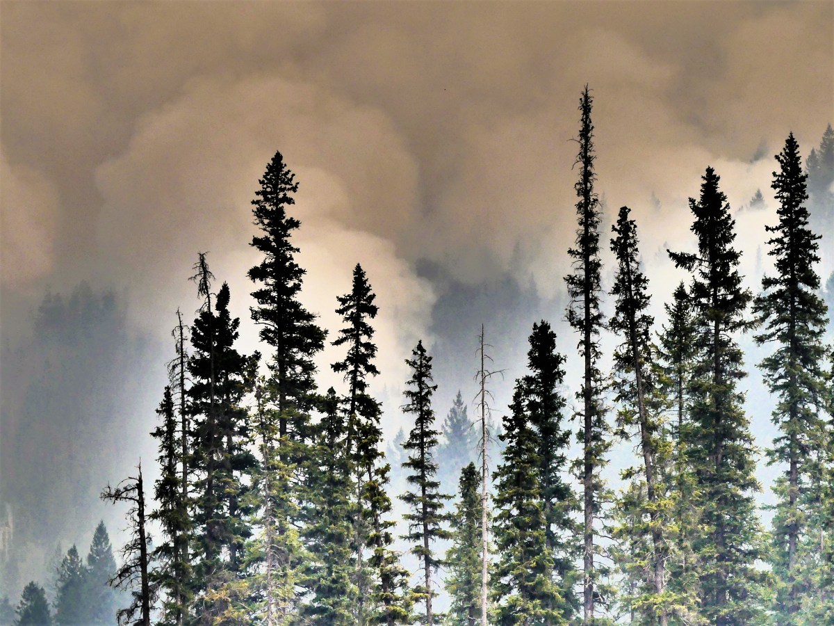
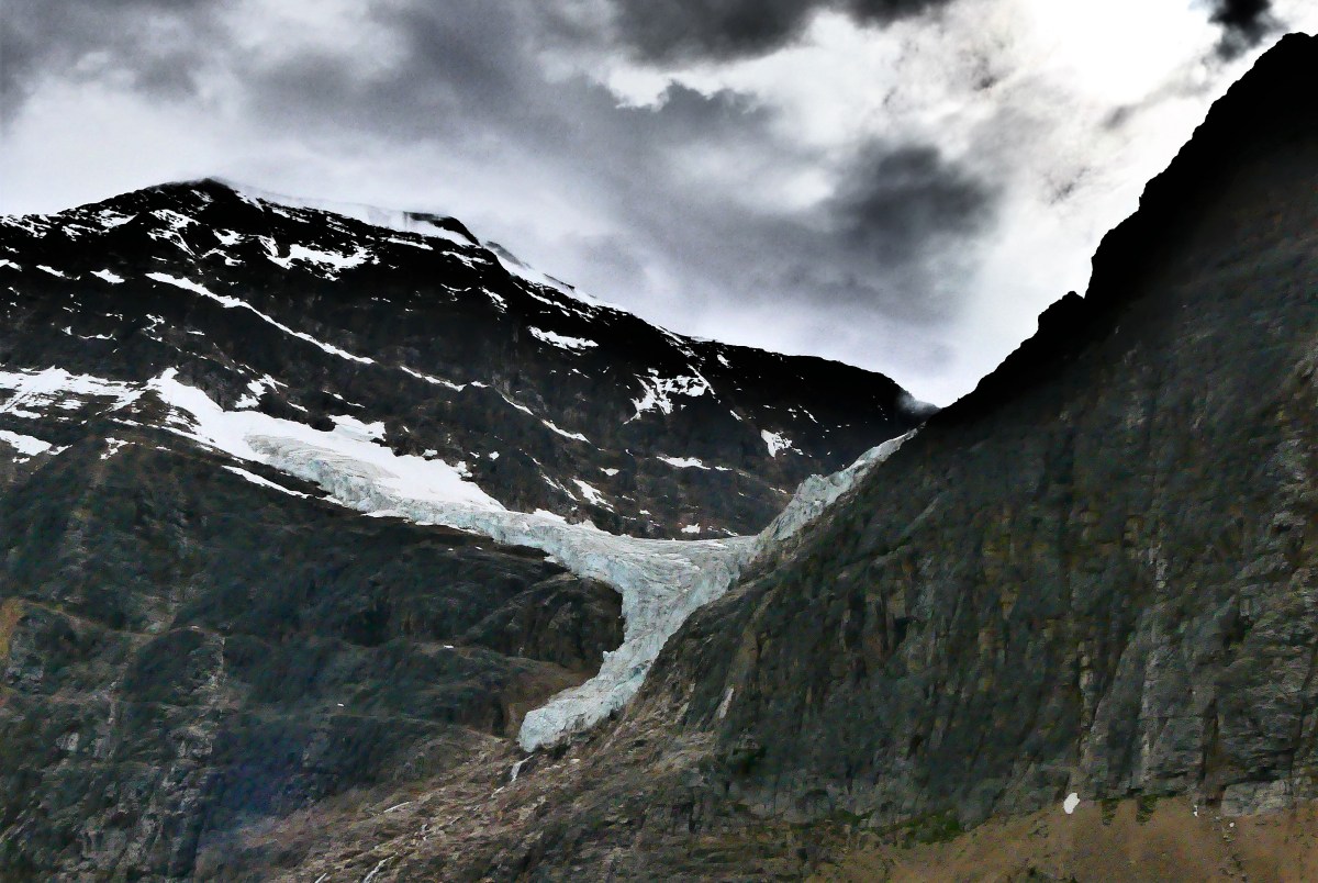
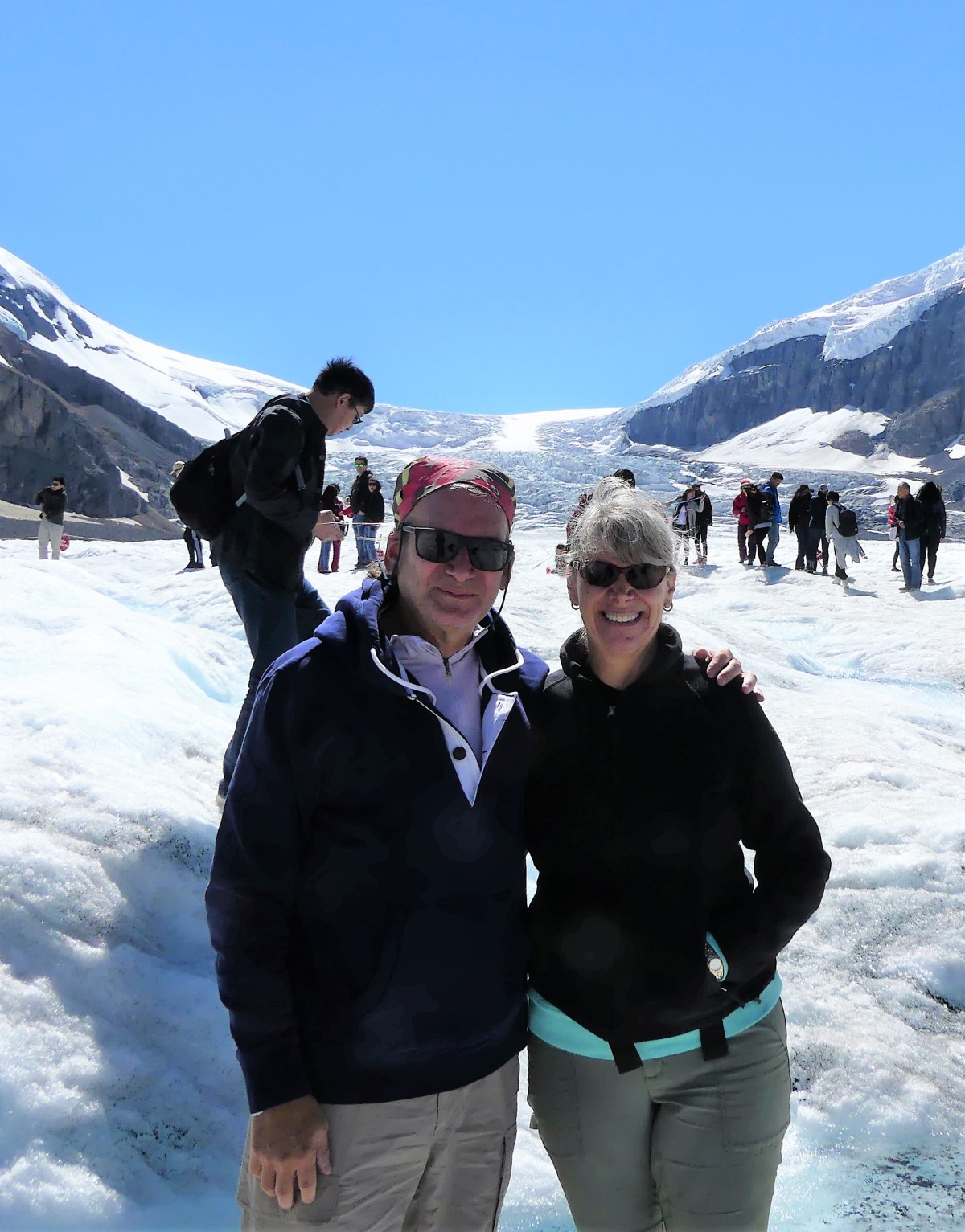
Riding Mountain threw us off our game from the very start. We were eager to visit our first Canadian National Park–as the whole country and its visitors from outside are celebrating Canada 150 with free admission to Parks Canada–but we really didn’t know what to expect. Our experience with National Parks in America allows us to anticipate the awe inspired by iconic landmarks. For instance: Arches has Delicate Arch; Bryce has the Amphitheater; Yellowstone has Prismatic Lake and Old Faithful; and Grand Canyon has, well, a grand canyon. How would Canada’s parks hold up by comparison?

I knew we were in trouble the moment we arrived at Sportsman Park in Onanole, Manitoba, a self-proclaimed RV Park located minutes from the Riding Mountain entrance. We were looking for a spacious and grassy pull-through to match the website picture that lured me into making a reservation. What we found was a cramped and worn neighborhood of crusty campers settled onto dirt patches where a blade of grass struggles to be green. It reminded me of an internment camp for refugee trailers.

A misfit on a motorcross cycle guided us to a site that challenged the laws of physics. To start with, making a wide turn onto the designated lane required a full-timer to deconstruct a portable basketball hoop struggling to stand on the corner lot. Once clear, we continued to Row B/Site 14, where our ambassador coached me around a parked car and a sprawling tree, through a raised curb, and beyond a floating wood deck that prevented the Airstream door steps from fully extending. Somehow, I managed to inch between two trailers with extended slide-outs.

Ian, my new next-door-neighbor, commented, “Didn’t think you were gonna make it, eh?”

“How do people usually manage to get into this spot?” I wondered.

“Nobody ever does,” Ian responded. “This spot’s gone vacant for more than a year.”

“You been here that long?” I doubted.

“Goin’ on five years, now that I have a son an’ all,” Ian beamed.

Ian was gracious and full of information. “Be careful at night, eh” he warned. “There’s a bear been pokin’ around here last couple nights, ever since the guy across the way spilled some grease. So it’s a good idea to always have a flashlight handy, eh.”

Note to self, “Stay inside the Airstream after dark.”

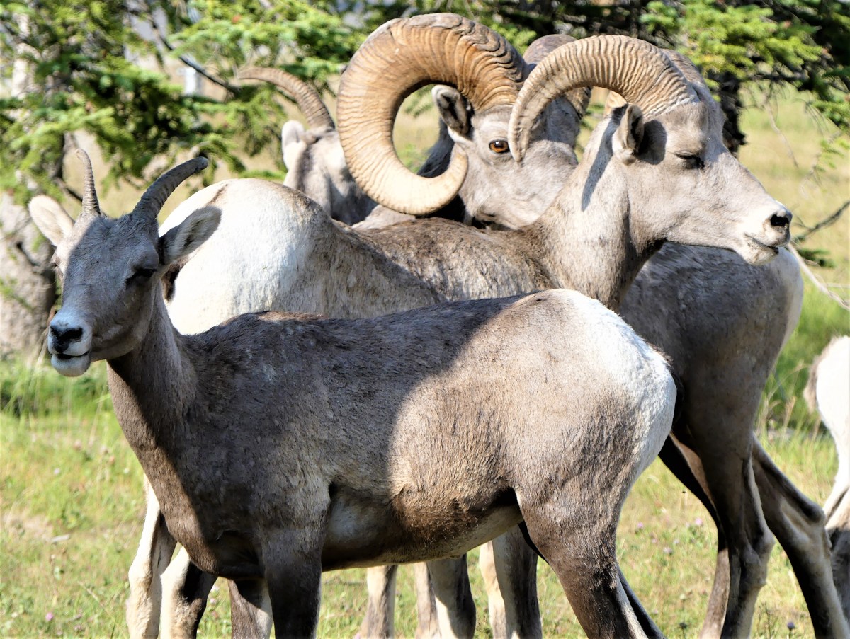
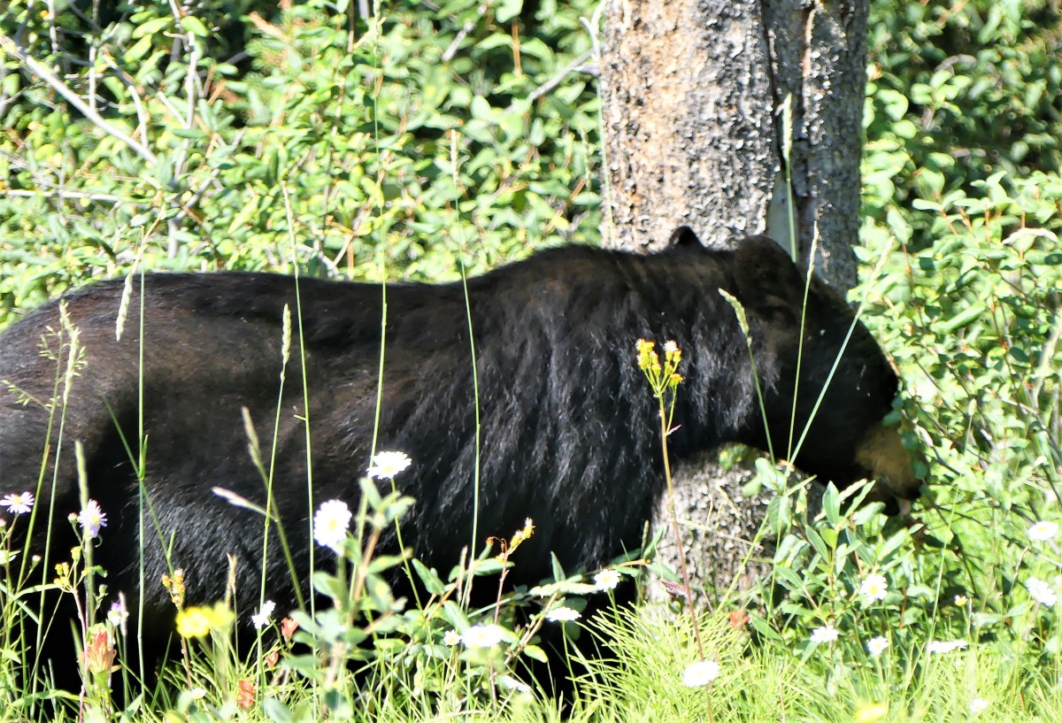
The following day, we headed for the Interpretive Center for a customary face-to-face with a ranger. He explained that Riding Mountain is at the confluence of three distinct ecosystems: prairie, boreal forest and hardwood forest. It’s divided into Front Country and Back Country with over 400 km of trails, and home to elk, moose, coyotes, wolves, lynx, beaver, bison, and the largest black bear population in North America.

“You know what to do if you encounter a bear, don’t-cha?” asked Ranger Scott.

“What do you recommend?” Leah asked.

Ranger Scott explained, “When you go into the woods, you need to smell like a human. That means you skip deodorant for the day! And make sure your clothes don’t smell like what you had for dinner. Don’t carry unwrapped food with you, and don’t forget to make some noise on the trail while you’re moving. Should you meet a bear, DON’T RUN! Just step back, never looking directly at the bear.

“What about bear spray?” I was curious.

“Never use the stuff,” Scott boasted. “But I always wear an extra shirt when I’m hiking, no matter how hot it is. So if necessary, I spread open the shirt with my arms out like this [demonstrating], and right away that bear is now lookin’ at someone who’s doubled in size. Saved my bacon on a couple occasions using that technique.”

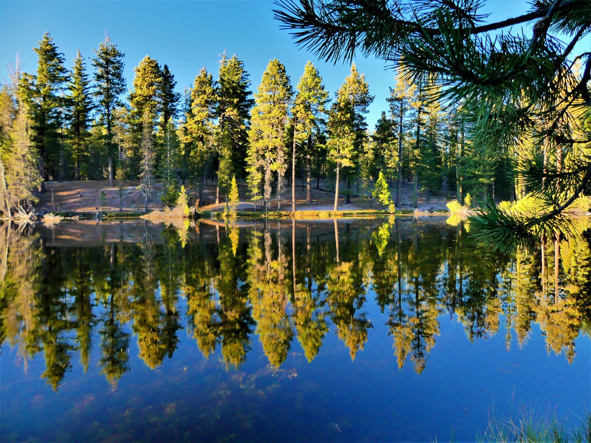
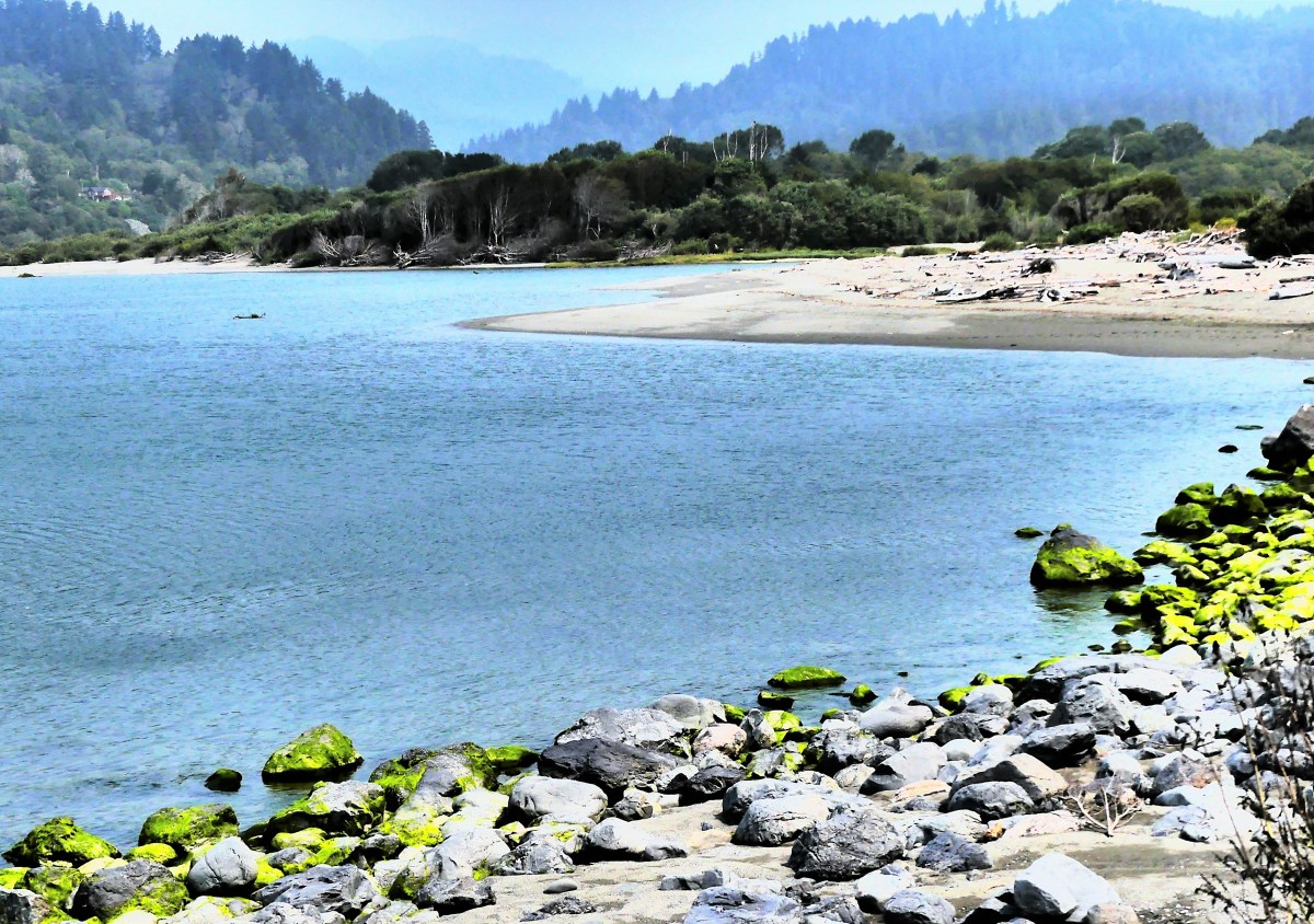
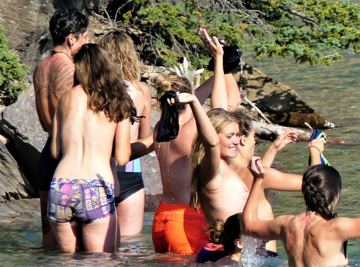
We left Scott with a decent idea of how we’d spend the next couple of days. For starters, we took a perimeter trail around Clear Lake in the village of Wasagaming, with the lake to our left,

Clear Lake

and an array of charming cottages and cabins on our right. In a unique arrangement with Park Canada, home owners lease their property in perpetuity from the government. When title to a home is transferred to another family member, or is sold outright to a buyer, the lease always becomes a part of the deal. But if government regulations are ever broken, the tenant can be evicted and dispossessed.

Curious about the value of  Wasagaming lakefront property, we did a little digging…

and found a newly remodeled 3 bedroom/2 bath 1700 sq. ft. bungalow listed for $800,000 CAD, but we weren’t ready to move to Canada just yet.

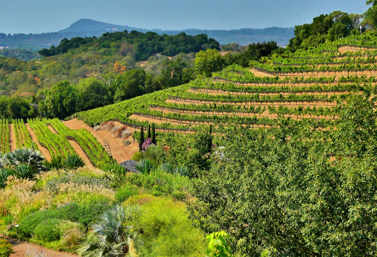
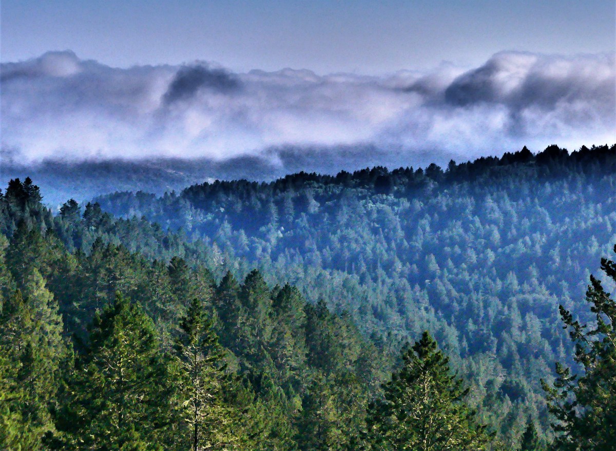
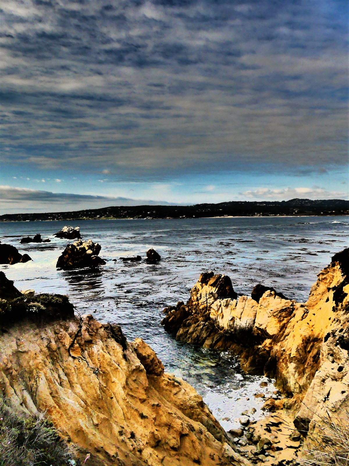
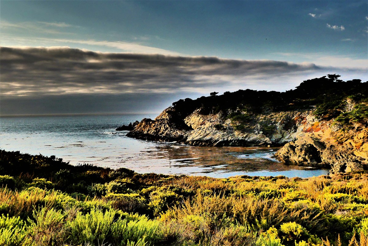
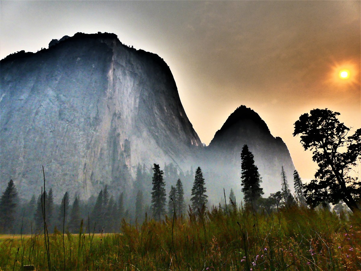
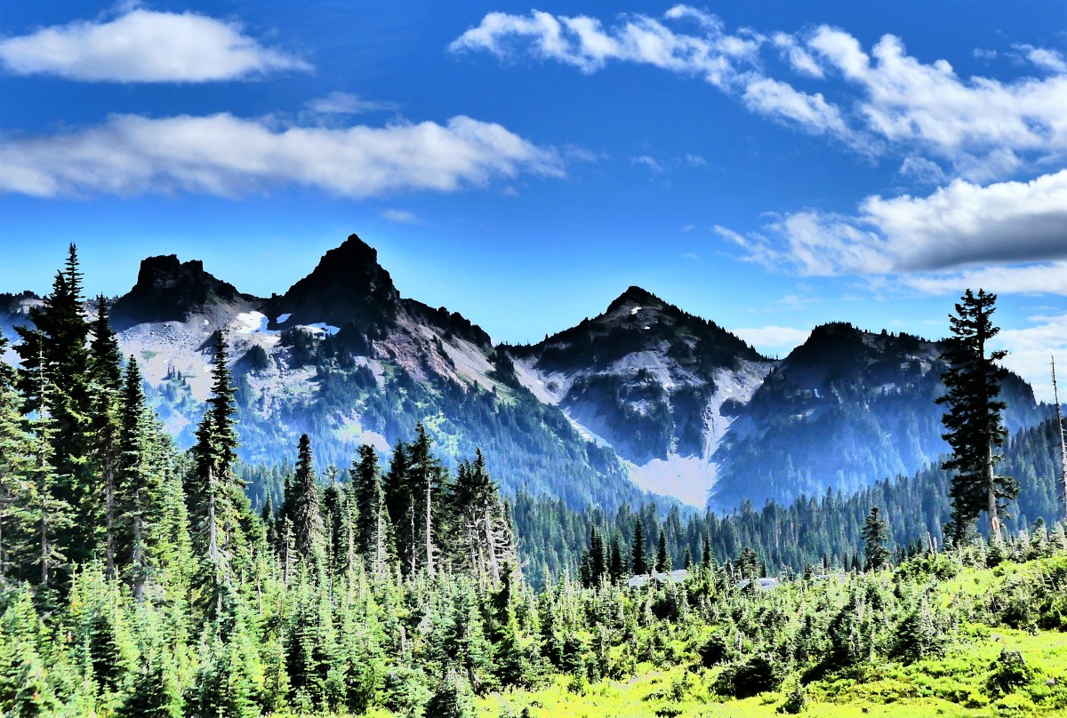
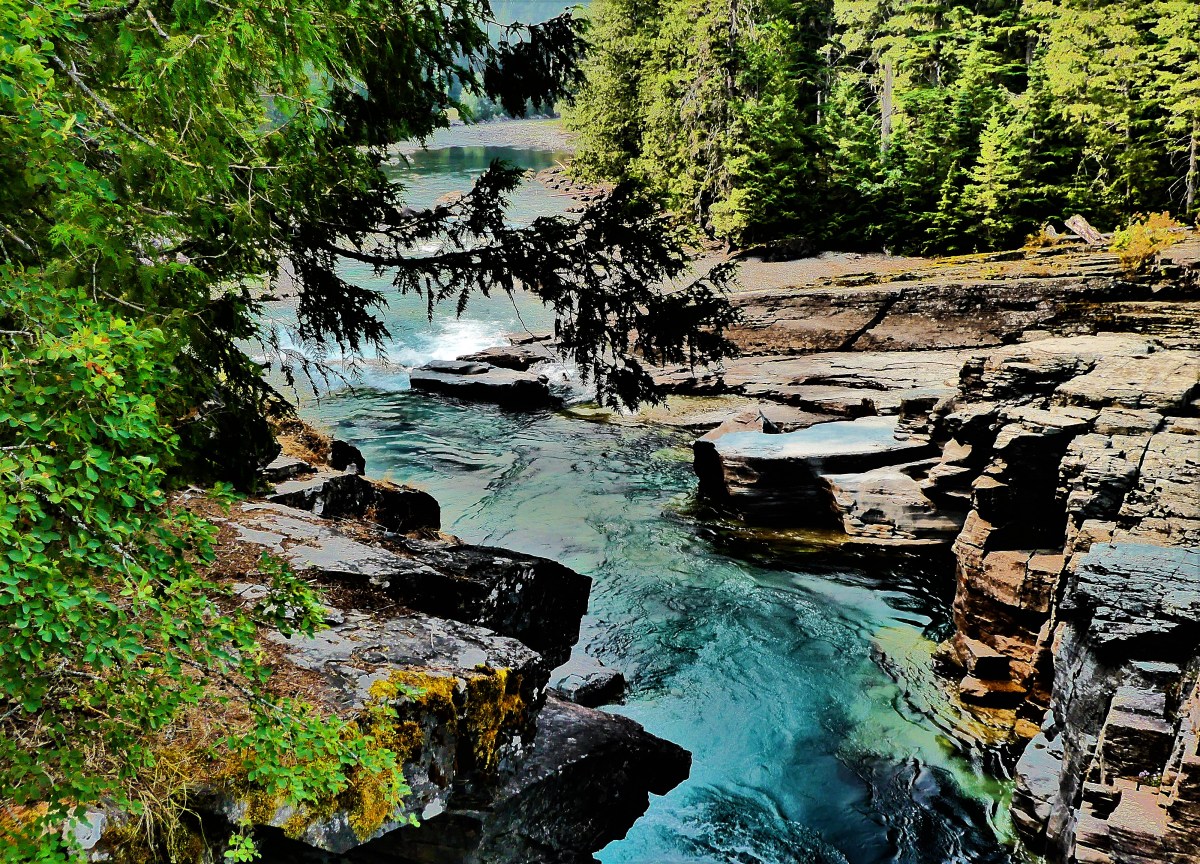
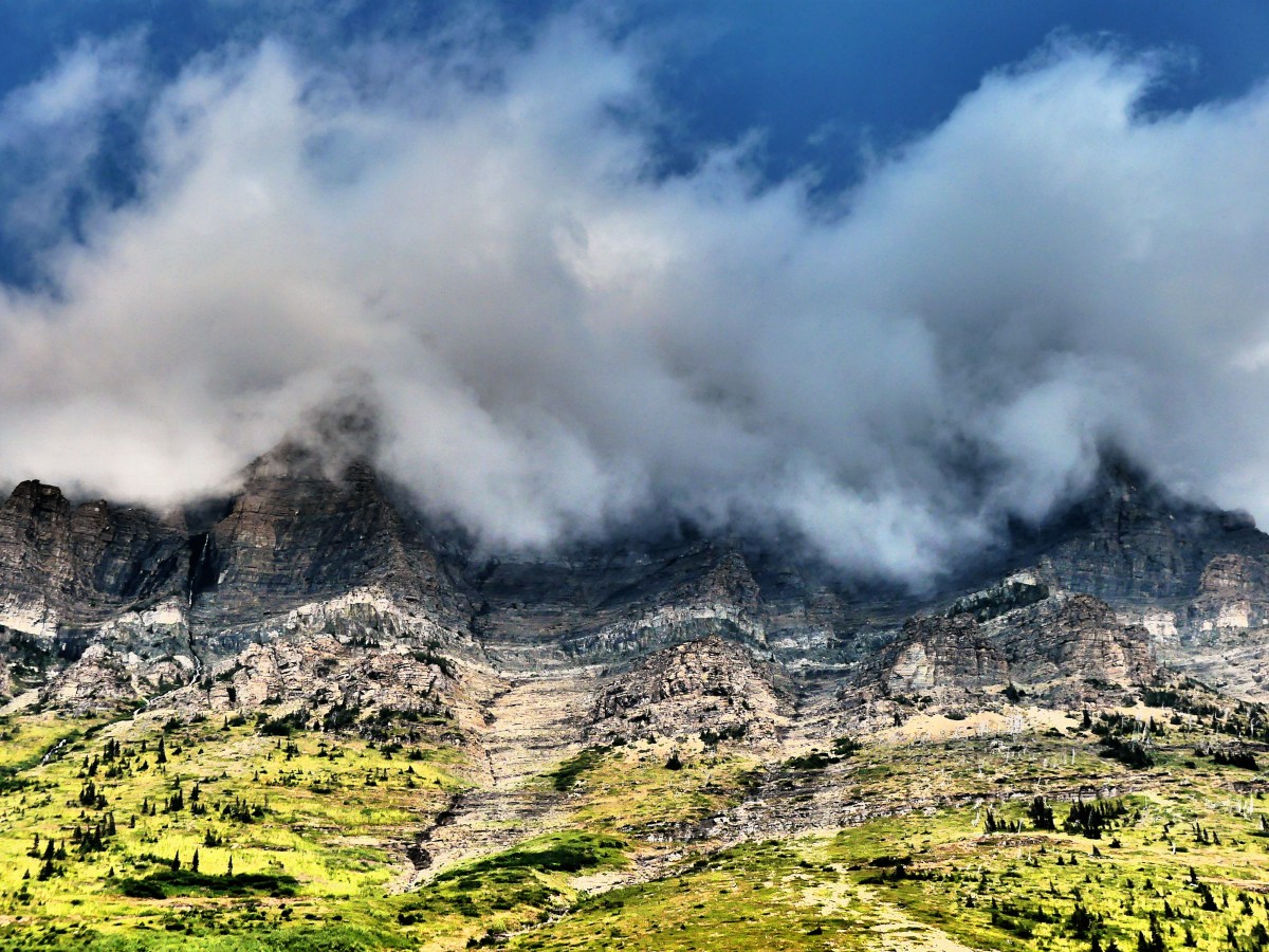
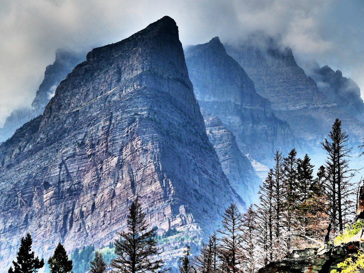
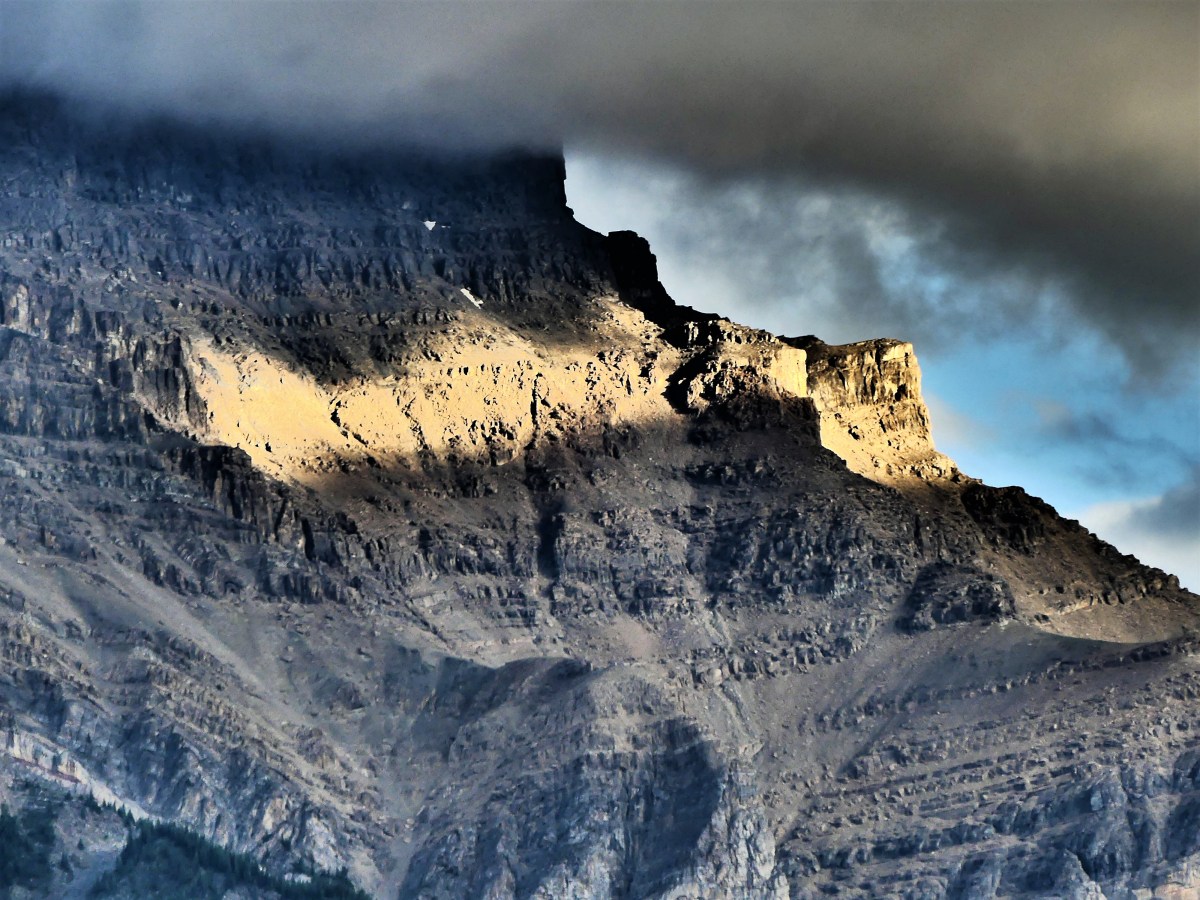
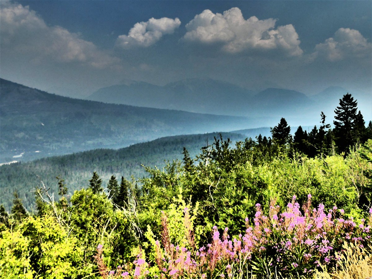
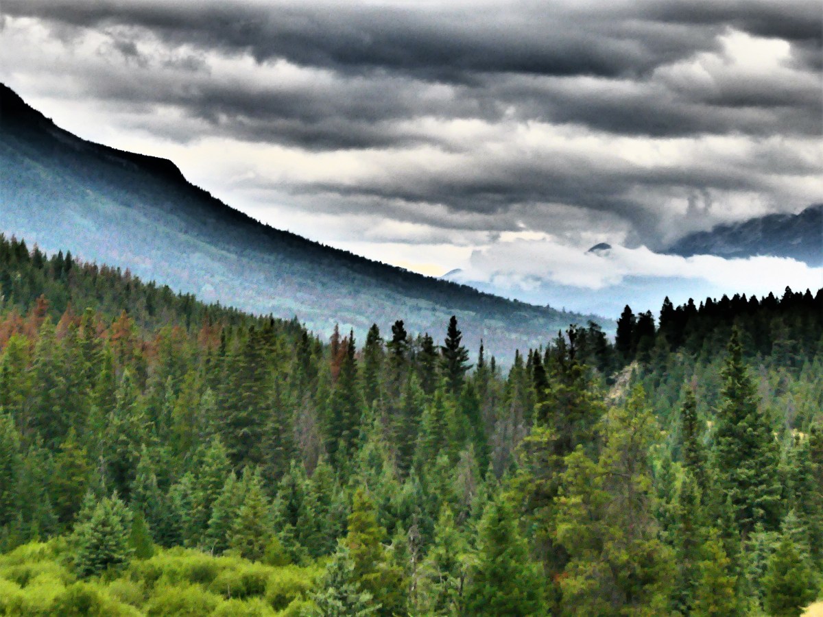
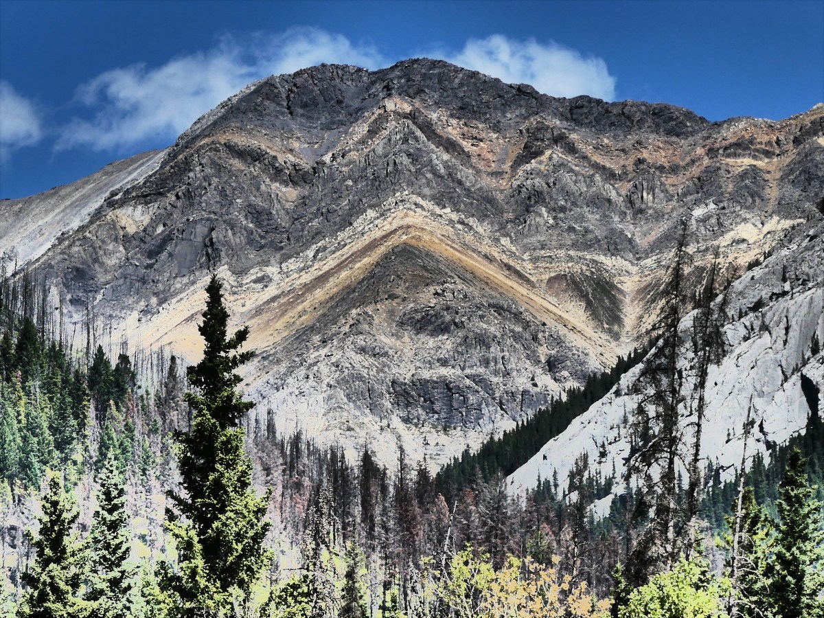
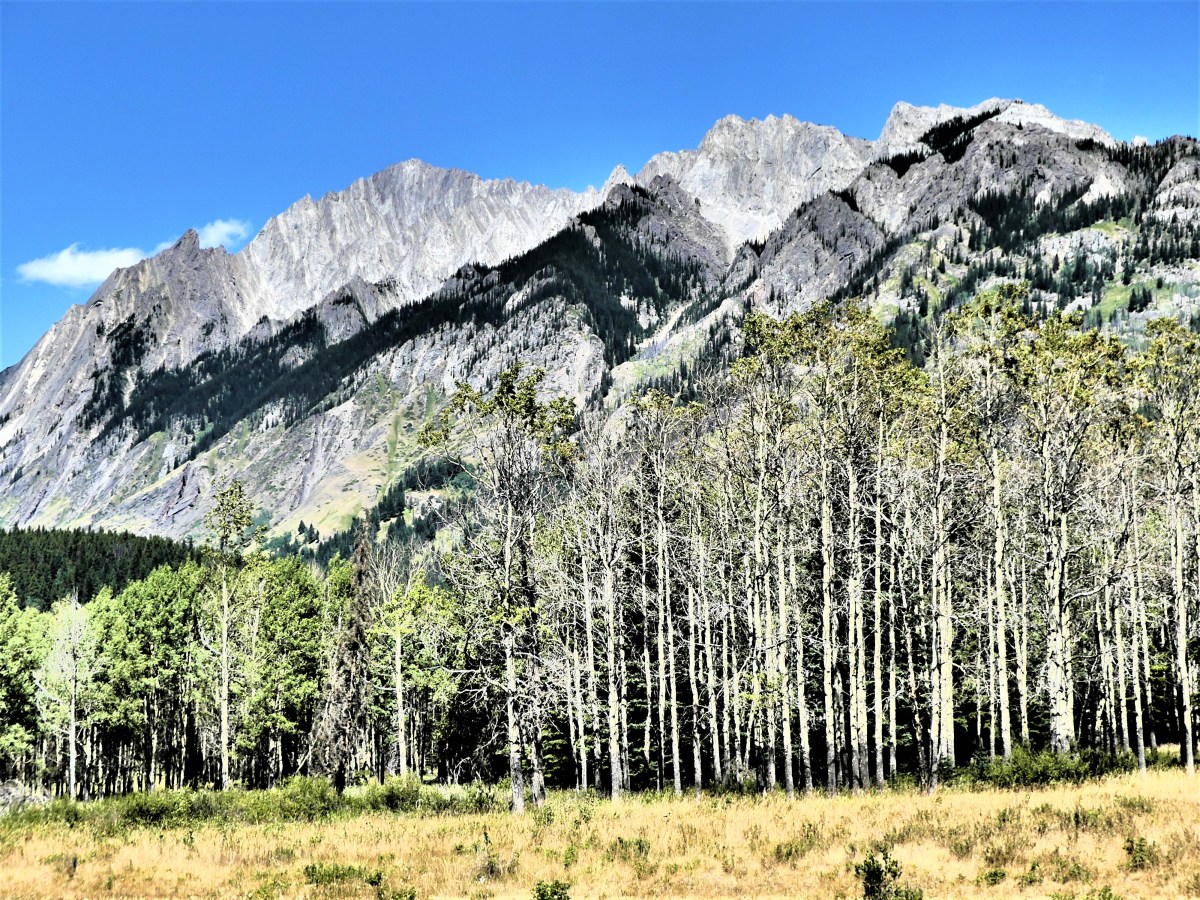
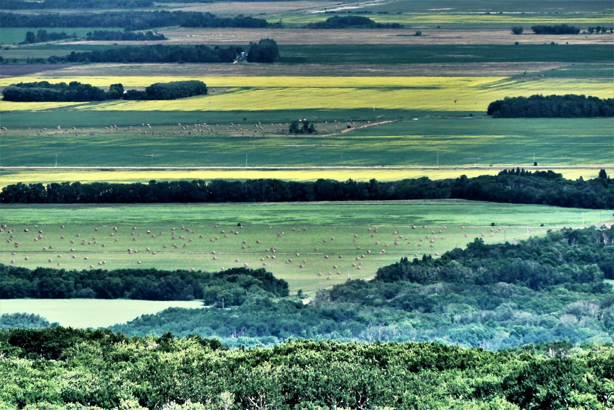
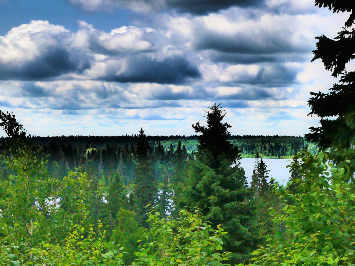
We continued our day with an off-road ride to the top of the Manitoba Escarpment, with hazy views from the overlook,

Manitoba Escarpment view

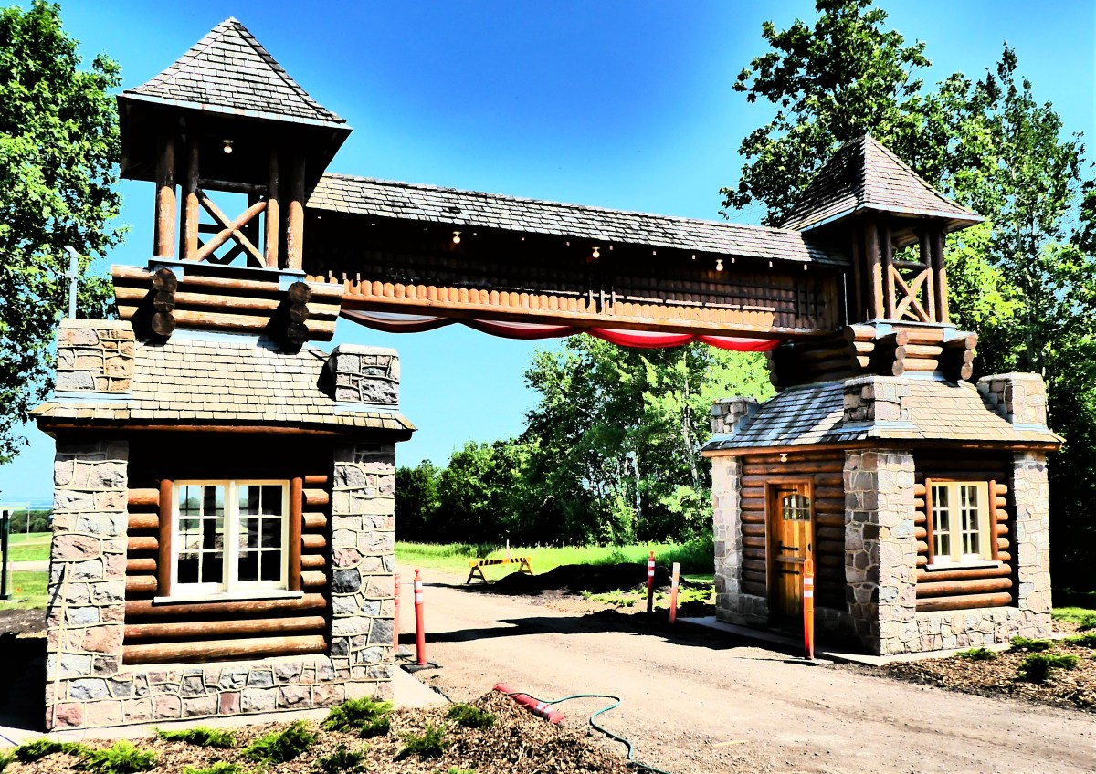
and followed the road to the park’s east boundary, where the distinctive East Gate Entrance Building (the only surviving gate structure at Riding Mountain) gave us a glimpse of traditional 1930’s “parchitecture”, and reminded us of a time when motorcars were first gaining in popularity.

East Gate West Sun

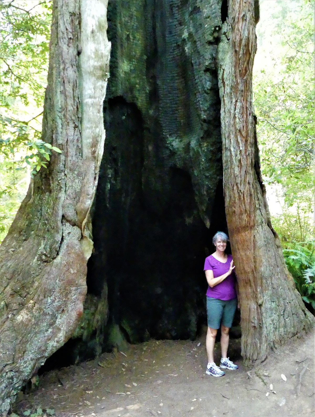
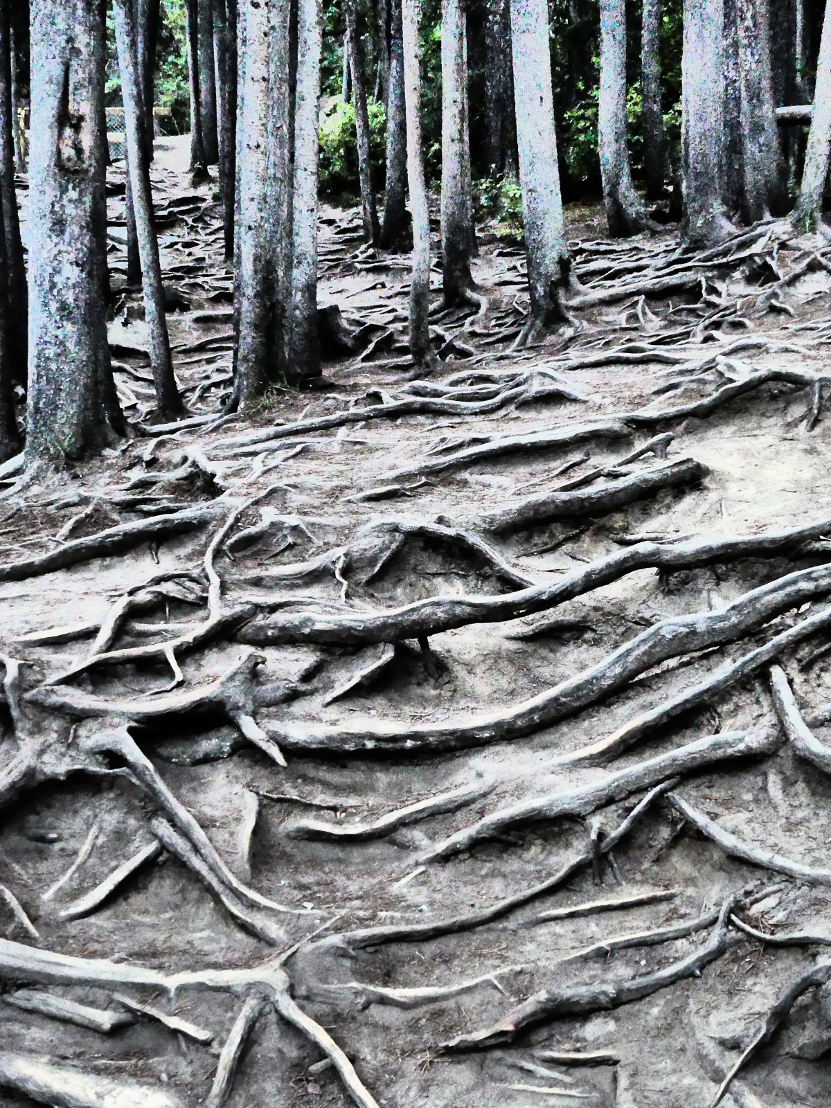
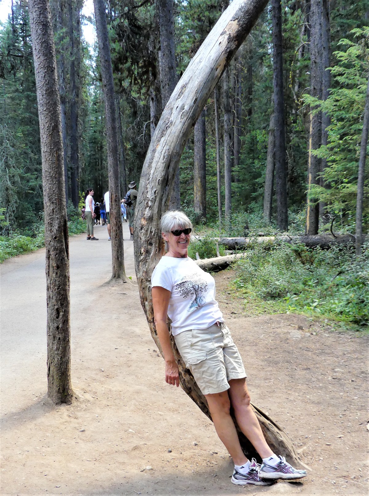
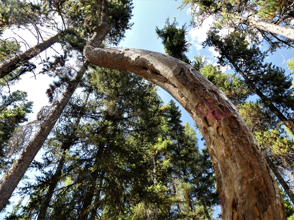
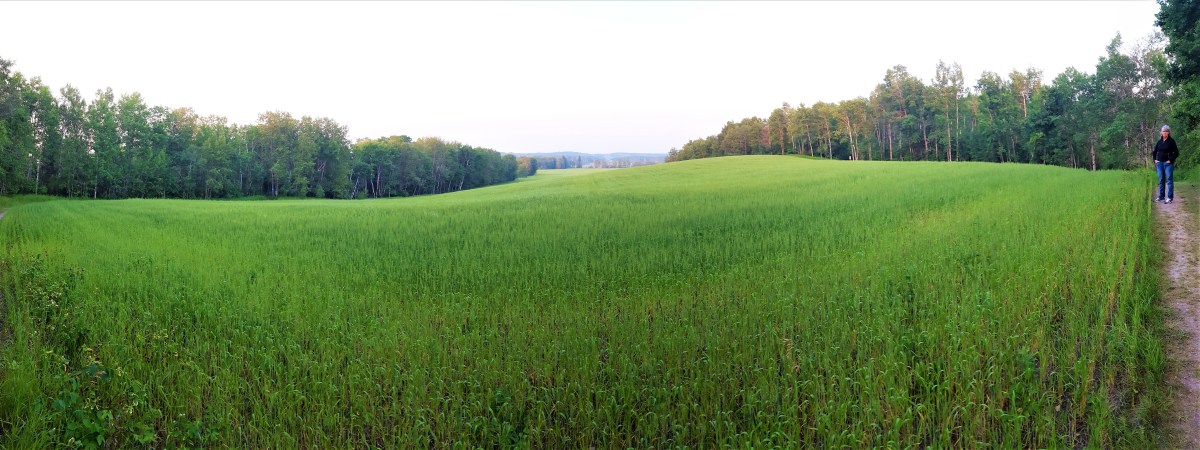
That evening we took a sunset walk on the Onanole Trail beside the RV Park. The trail began at the gnomes’ house…

Troll House

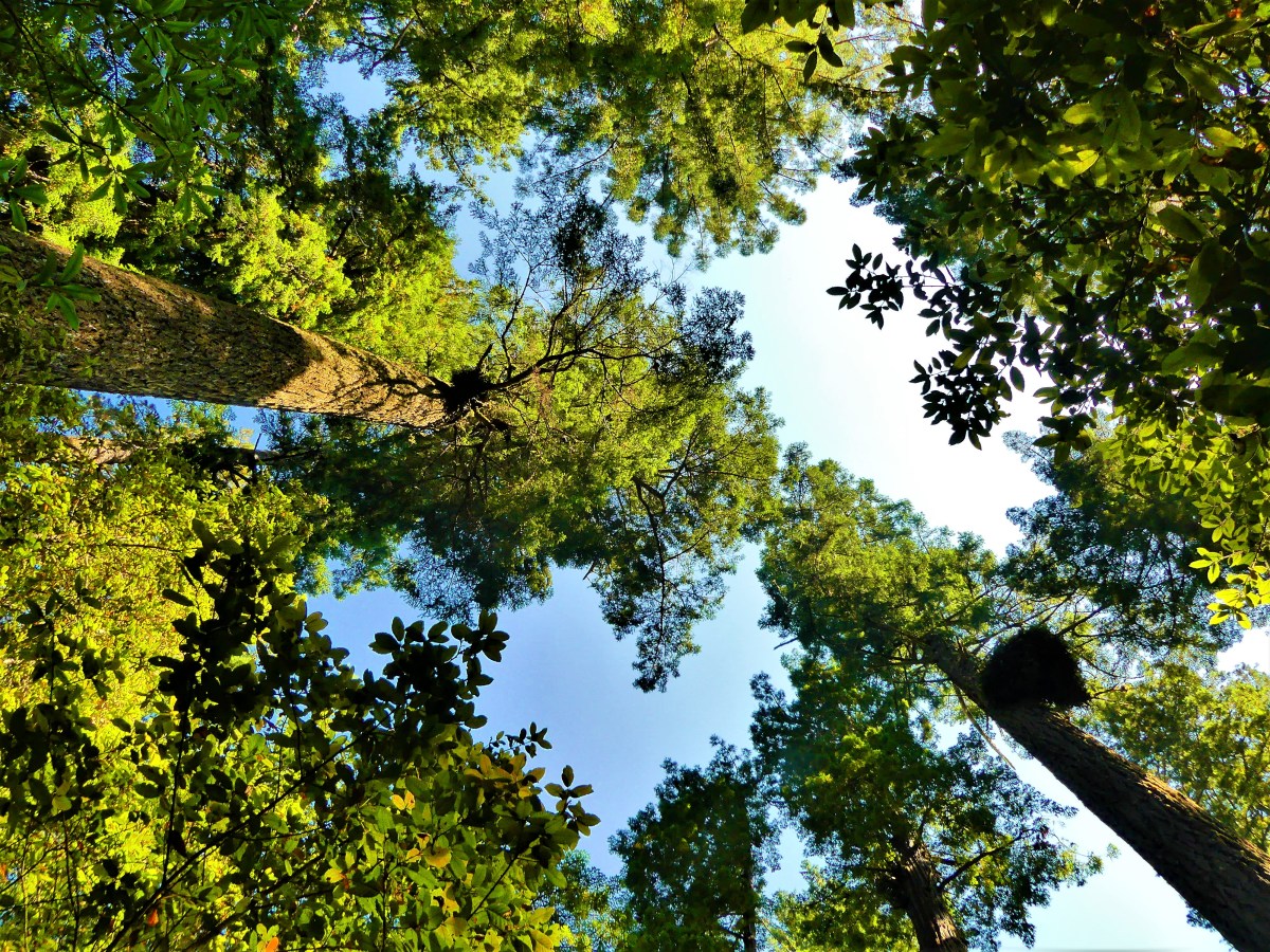
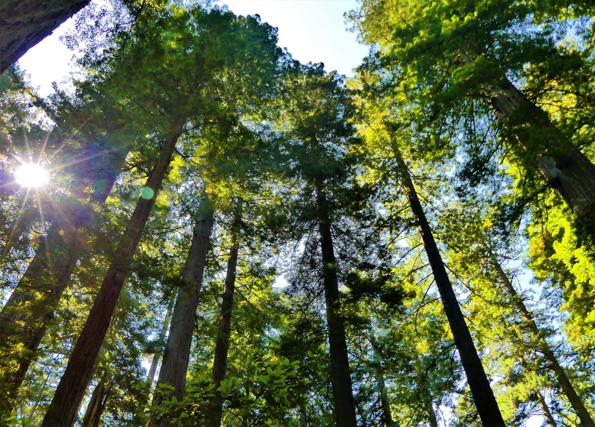
continued through a pine forest, and opened onto an expansive field of prairie grass, taking us around to a wooded opening on the other side of the field.

Prairie grass and Leah

We would have continued along had it not been for the volume of bear scat littering the trail.

That night, Ian’s campfire went well beyond the midnight quiet-time curfew, causing Leah to lose sleep while I stayed up to write.

“Isn’t there something you can do?” she complained.

But before I could offer my ugly American alibi, one of the party people yelled out, “BEAR!”

The commotion was over in a flash and so was the party. “Well, that was effective,” I mused.

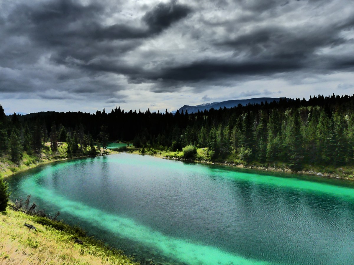
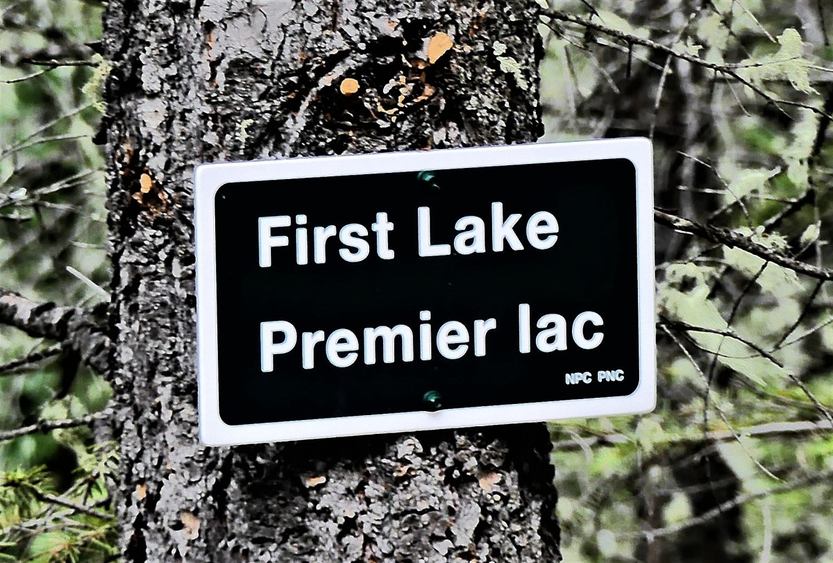
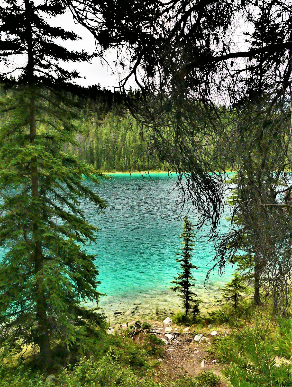
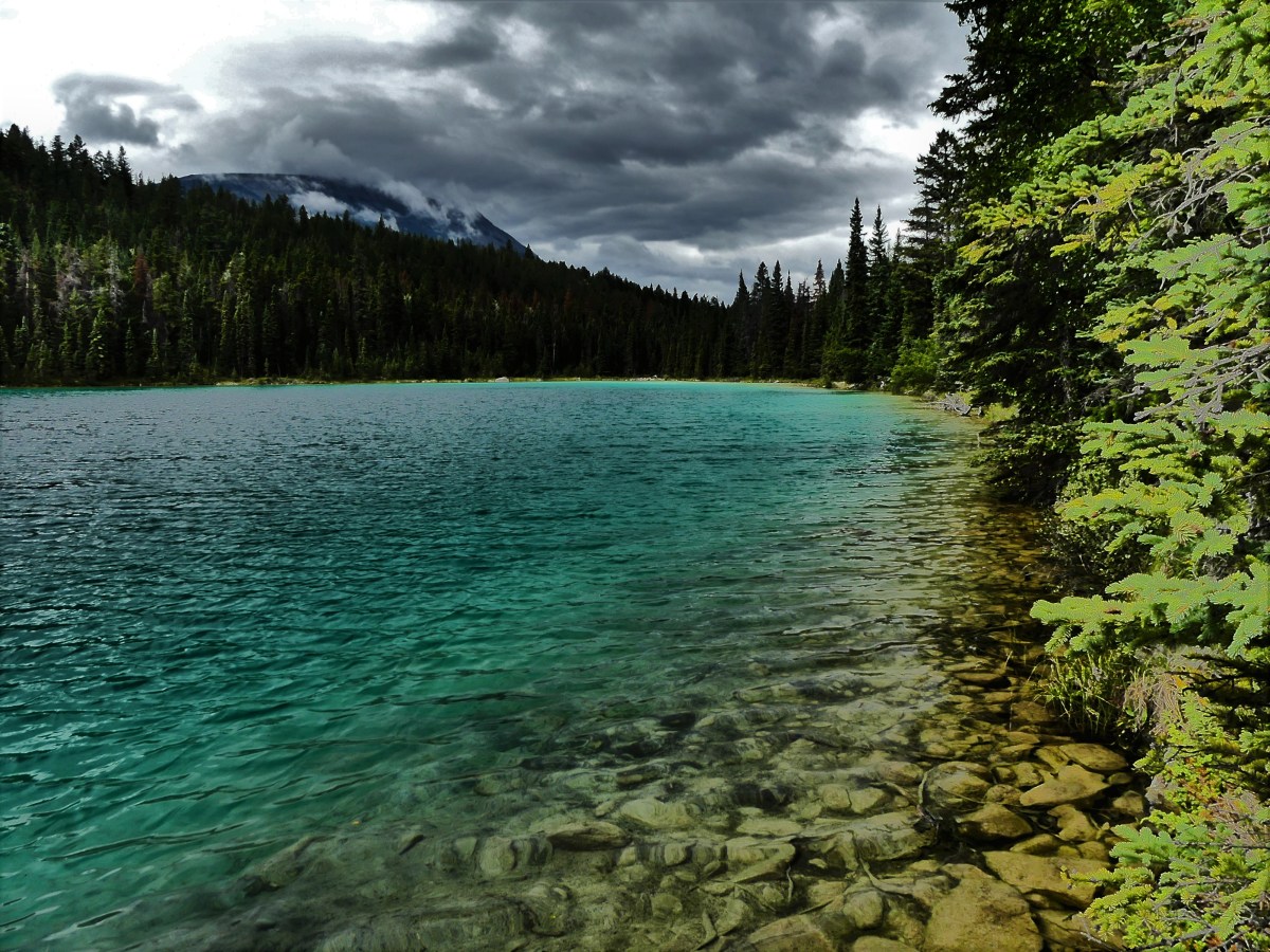
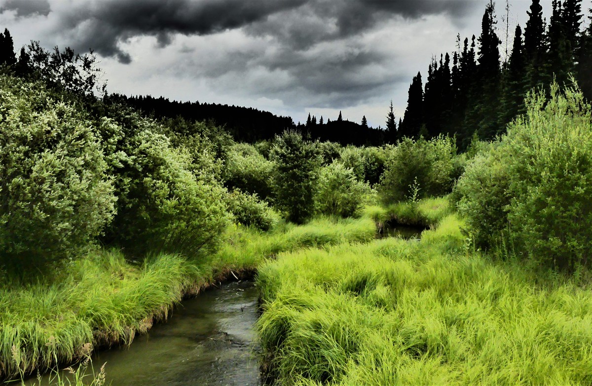
The next day, we elected to hike around Moon Lake,

Moon Lake

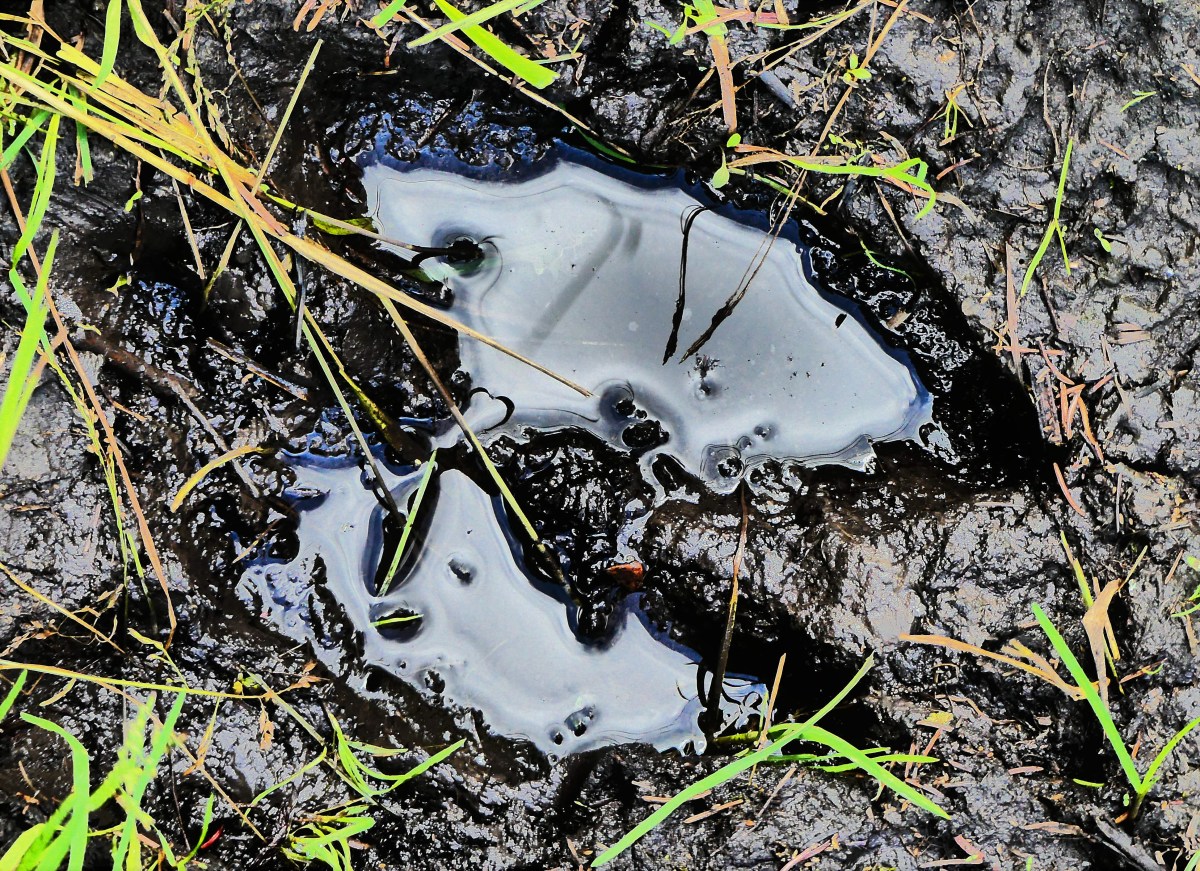
taking a 9 km loop trail through high, hearty shrubs and poison ivy. It was not what we expected; the lake had disappeared from view. The trail was heavily overgrown and still wet from a flash thunderstorm the night before, making the moose prints more imposing.

moose track

With Leah in front, calling off bears and moose, and me in the rear, swatting away voracious mosquitoes, we wondered if this hike would ever end. Midway through the hike we encountered another couple taking the loop from the other direction.

“See any bears or moose?” Leah questioned.

“Lots of tracks, but no animals,” he answered. “Yet I sense we’re being watched.” she volunteered. “Anyway,” she continued, “there’s a lovely clearing ahead. Enjoy.” And they were gone.

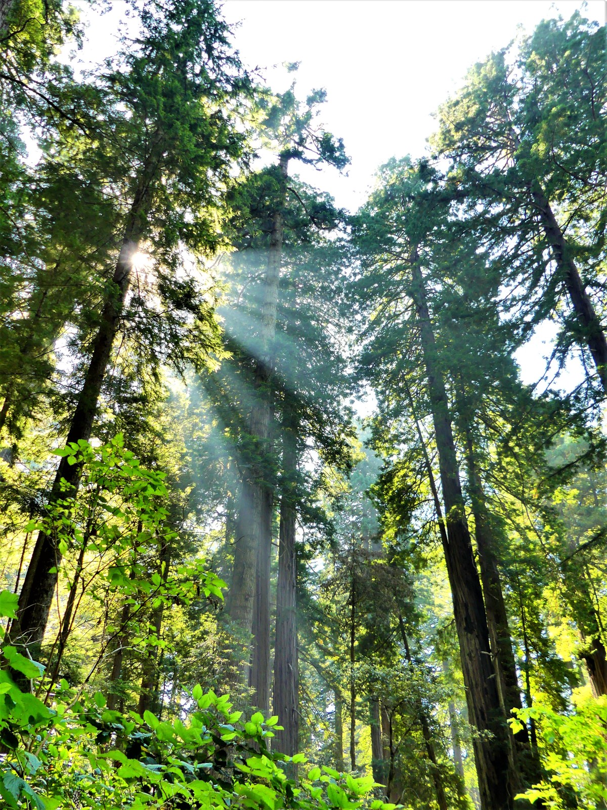
The flat trail turned steep as we climbed into a grove of firs, and we caught our first glimpse of the lake we were circling.

Moon Lake Overlook

Soon we were bordering the banks, stepping over freshly broken plant stalks that only a moose could manage. Suddenly, Leah stepped into an uncertain spot that swallowed her boot whole, and caused her to lose balance, plunging the other foot into even deeper mud. I might have taken her picture, if I wasn’t so busy pulling her free, and I was certain that she’d forgive me later.

We emerged tired, muddy and grateful to have put this hike behind us, but still curious about the bison enclosure at Lake Audy one hour away. We’d made it our mission to see at least one wild animal in this park–even if it meant watching a small herd of bison roaming through the prairie…again.

But there were no bison grazing, or roaming, or rolling in the dust, anywhere. The viewing deck that overlooks the grasslands held no surprises, and was devoid of beasts of any kind.

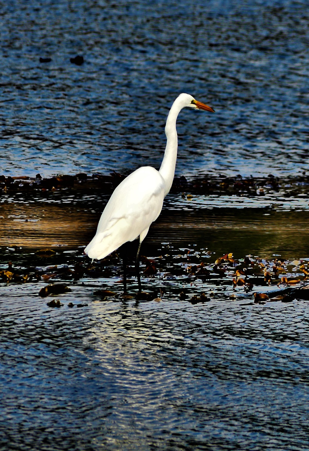
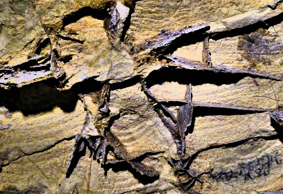
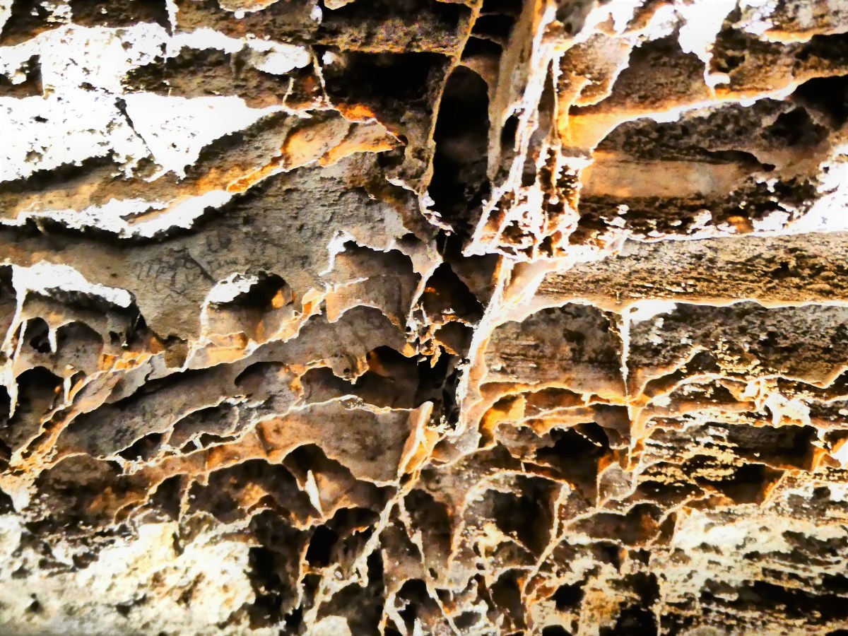
Yet, it was hard to ignore the swooping passes of several starlings that darted in and out of the gallery. A closer look around the rafters, gave us the gratification we were searching for.

Heads and tail

Feed me (2)

Yum

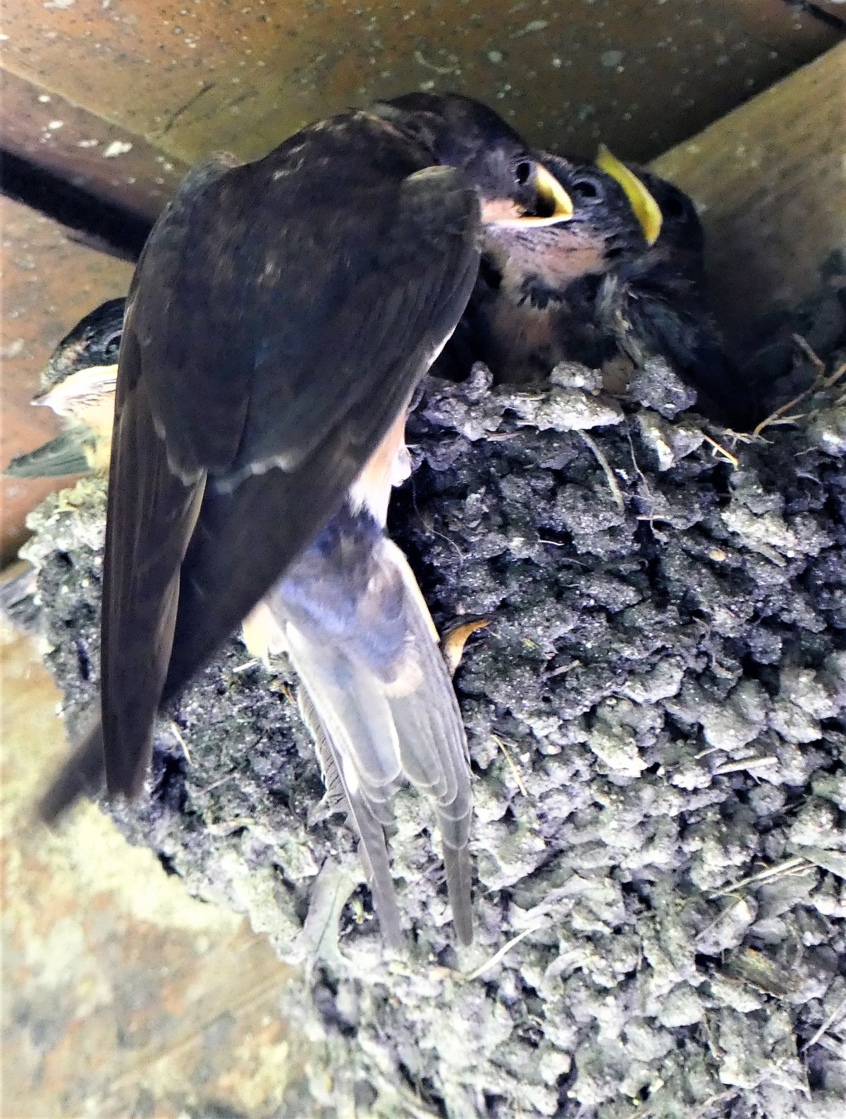
Half a million visitors arrive each year to Riding Mountain to enjoy the crystalline water of Clear Lake, or stroll through the charming town of Wasagaming, or angle for trout and walleye in the streams and lakes, or hike and bike through biodiverse ecosystems, but mostly people come to witness the wide assortment of wildlife.

Unfortunately, Leah and I found no animals present, although we’re certain they were around us–which is why we believe that Riding Mountain National Park is for the birds.

Cavfefe

What better way to escape the summer heatwave than to explore a cave. But Leah and I were literally at a subterranean crossroad of epic proportions. South Dakota’s Black Hills boasts two of the most highly respected holes in the ground anywhere in the world, and we only had time to explore one of them. Would it be Jewel Cave National Monument or Wind Cave National Park? Which cave deserved our business?

The driving distance didn’t matter since only 30 miles separated both locations. But there were other factors to consider when evaluating which cave is the better cave. When it comes to status, Wind Cave wins hands down, since it’s a National Park, and everyone knows that a National Park can’t be Trumped. On the other hand, Jewel Cave is only a National Monument, and monuments can be Zinked at any time.

We had to consider how Jewel Cave’s grand viewing rooms are endowed with a stunning collection of traditional stalactites and stalagmites, while Wind Cave holds 95% of the world’s rare boxwork formations.

As for whether size matters, Jewel Cave ranks third worldwide–four places ahead of Wind Cave at number seven in the world. However, Wind Cave has the most complicated and concentrated matrix of any cave system in the world, with new veins still being tapped.

And then there’s temperature. Jewel’s thermostat is set at 47°F, whereas Wind turns up the dial to 53°F, registering “six degrees of separation”.

And both caves offer an extremely popular assortment of tours that always sell out early on a first come first serve basis.  Such a dilemma!

What’s an amateur spelunker to do?

Social media was consulted in deciding the matter, but there was no clear winner. While Jewel seemed to win the popular vote, Wind was preferred by the experts for its unique characteristics and wall structure. Yet, neither side could come together to form a coalition of consensus or compromise. And whose to say if there was voter tampering, or how many were fake views?

If travel maven and cave cognoscenti couldn’t figure it out, then how were Leah and I going to manage.  We gave consideration to caves previously visited since starting out on our trip: Mammoth Cave in KY, Kickapoo Cave in TX, and Carlsbad Cavern in NM. But in the end, we settled it by tossing a buffalo head nickel. We figured, either way, we couldn’t go wrong, as long as we got there early!

And the winner was tails…

tails

no passing zone

We were on our way to Wind Cave, and time was of the essence, but try explaining that to the road hogs (bison) blocking the road.

As expected, the Visitor Center parking lot was filled to capacity. I dropped Leah at the entrance crosswalk where she made a beeline for the ticket counter–beating out a Medicare couple, an escort pushing a wheelchair, and a busload of boy scouts.

And it paid off. We scooped up the 11:20 am Natural Entrance Tour (shown in red),

map

which officially started at a marked clearing, featuring a hole in the ground the size of a ranger hat. Ranger Lisa demonstrated the barometric possibilities with a yellow ribbon: if pressure rose inside the cave, the ribbon would blow outward from the hole; but if cave pressure was low, the ribbon would be sucked inward–making this a cave that “breathes”.

Ranger Lisa punched her secret code into the keypad, and the steel door buzzed open, like a scene from “Get Smart”. We followed a dimly lit channel of steep stairs that snaked through a claustrophobic passage of popcorn-coated walls,

popcorn.jpg

until we reached the Post Office. I can only surmise that its name comes from the butterfly of boxes stretched across the ceiling…

Room 2 ceiling

with the names of past generations of visitors posted inside the boxes

artifact

ceiling graffiti

wall

We followed Ranger Lisa down another set of meandering stairs along a poured concrete walkway that took Civilian Conservation Corpsmen eight years to complete, hauling inner tubes filled with sixty pounds of wet cement around their necks. We reassembled as a group at Devil’s Lookout to examine a ceiling dominated by intricate boxwork and delicate needle-like growths of calcite called frostwork.

looking up

That’s when Lisa cut power to the lights and the cave went dark. We were instructed in advance to turn off all phones and shutter all cameras. Children with glow shoes were warned to stand still or risk an extra minute of darkness away from mom or dad.

The darkness brought giggles and Halloween howls from some of the kids, but for many it was a minute to imagine what it was like to be led by Alvin McDonald on a candlelight tour during the 1890’s, when it only cost a $1.00 to crawl through the dirt.

The tour concluded in the assembly room with a brief discussion about the geologic timeline–when the cave was born between 40 to 50 million years ago as determined by sedimentary layers of rock pressurized in the cave walls.

collapse

Finally, the fastest elevator in all of South Dakota whisked us to the surface, and the tour was history.

elevator

Dear Trip Adviser, I believe that going to Wind Cave National Park was a good call, ’cause there was lots of really neat stuff on the walls and ceiling, and especially ’cause I got to pinch Leah’s ass when the lights went out.

Battle Lands

It was 103 degrees outside and we were melting. “Where are the trees? There aren’t any trees here,” moaned Leah. There were no shadows to hide from the relentless sun. Even the clouds had forsaken us. Fortunately, they had drifted into the distance, providing the coveted contrast that landscape photography almost always requires.

Cedar Pass peaks

With the mercury steadily rising over the Black Hills of South Dakota the past few days, and the forecast not cutting us any slack from the heat, we bit the bullet we dodged in Belle Fourche, and decided to leave early the next day for Badlands National Park.

Except it was almost noon by the time we got underway. We really did try to get leave on time, but life got in the way, and in a small way it was a small blessing. We mapped a route to our destination with a way-point to Walmart, since we needed an assortment of groceries and dry goods, and I needed a new camera chip, having filled the last chip with nearly 4000 shots–half of them from StreamingThruAmerica locations.

“Make sure when you format this chip, that it’s compatible with your camera,” the associate advised. “Otherwise, you have three days to return it.”

“When are you planning on doing that?” Leah asked.

“As soon as we get back to the truck,” I answered, “I’ll insert it into the memory card slot, and I’ll know right away if it’s working.”

That’s when I discovered that I left the camera battery charging in the Airstream.

So we rode back to Rapid City to retrieve the battery and stow the groceries. “But if I hadn’t bought the chip in the first place,” I rationalized, “then we would have driven all the way to Badlands, and realized that the camera was useless. No battery, no camera; no camera, no photos; no photos, no blog.”

“Right! Meanwhile, it’s cooking outside! And we’re going to get there, and not be able to do anything. Why don’t you put that in your blog?” Leah announced with a healthy dose of sarcasm. The heat had definitely taken a toll on human relations. From that moment, neither one of us felt like making the trip, but we also couldn’t imagine missing a National Park, so we d(r)ove into the fire, hoping to adapt to our inhospitable surroundings, much like Badland’s earliest pioneers.

We drove across a 45-mile stretch of I-90 East, counting 60 Wall Drug billboards and road signs along the way.

“We should go there,” Leah informed.

“It looks like another South of the Border,” I hedged.

“But it looks like fun,” she tempted.

“We’ll see,” I relented.

We arrived at Badlands National Park during the hottest part of the day. Even the bugs were in hiding. Crossing into the park at the Pinnacle Entrance, we took an early side-road to Sage Creek Basin Overlook in the hopes of spotting wildlife along the prairie. But the animals had better ideas other than baking in the blistering sun.

Instead, we admired the scarred lunar landscape of Pinnacles Overlook,

Hay Butte Overlook

and claws of vulcan mounds crawling across the Hay Butte Overlook. It resembled a box of burnt streudel.

fields on fire

We backtracked through Roberts Prairie Dog Town–mindful not to pet a varmint potentially infected with bubonic plaque–and continued along Badlands Loop Road to Ancient Hunters Overlook, trying to imagine early tribes scouting the lowlands for buffalo,

Ancient Hunters Overlook

much the way I was location-scouting for worthy photographs of black Pierre Shale.

rock brittle

We continued our air-conditioned trek to Yellow Mounds Overlook, where the surrealism was so profound, we had to leave the comfort of the cab to explore by foot…

yellow mounds

receding yellow mounds

leaving us to wonder how 35 million-year-old fossilized soil could weather into something so beautiful, yet other-worldly.

Burns Basin Overlook, while stunning in its desolate vastness, was beginning to look like every other overlook. I feared we were becoming “geo-jaded”.

Burns Basin Overlook

But that feeling quickly faded after we sighted a bighorn sheep lounging on a breezy slope, surveying the best way to Wall Drug.

bighorn sheep look out

I stealthily walked around the cliff edge as far as I could to score the best possible angle without falling into the abyss.

bighorn profile

It was a standoff–both of us locked into position. She remained frozen as a statue, but I held my crouch under the blazing sun until my subject finally cooperated.

Bighorn CU

Leah was waiting in the truck with the air conditioner running. “I can’t take much more of this,” she vented. “It’s just too hot out there, and I can’t even bother to get excited about any of this. You’re out there taking pictures while I’m stuck in the truck, and it’s not fun for me.”

“Tell you what,” I negotiated, “We’re at the point of no return, so we have to finish the park drive. But I’ll make it quick, and I’ll buy you an ice cream at Wall Drug on the way home.”

Fortunately, the road opened up to grasslands on both sides, and a 45 MPH speed limit. We made good time until we arrived at Panorama Point, and the light was perfect.

“Go ahead,” she conceded, “we’re already here.” I tight-roped across a knife-edge ridge as far as I dared…

striped-cliffs.jpg

to capture the enormity of the jagged peaks.

Panorama Point

Just around the bend, I discovered the Big Foot Pass Overlook, on the right side of us,

Big Foot Pass Overlook

followed by the White River Pass Overlook on the left side of us.

White River Valley Overlook

Cedar Pass Fossil Area (2)

It was overwhelming.

We ended our tour at the Ben Reifel Visitors Center, where Leah enjoyed the film presentation, while I strode across the prairie grass for a closer look at The Wall.

The Wall detail

I kept my promise to Leah, driving to Wall just as the weather was quickly changing.

Wall Drug silos

The silos at the end of town re-created an ironic juxtaposition to the Badlands scenery.

Rain clouds gathered against gray skies, and the temperature dropped enough to cool rising tempers. But after a diet of Badlands drama under theatrical settings, I found it nearly impossible to buy into the Wall Drug über-kitsch experience.

Wall Drug Frontier Town

Occupying 76,000 sq. ft. of retail space in downtown Wall, it’s a fascinating rags-to-riches story from the Great Depression, and it stands as a titanic testament to American consumerism.

But it’s really a shit show, with “wall-to-wall” tourists.

Still…the donuts were fresh, and the 5⊄ coffee was hot,

…and most importantly, it brought a smile to Leah’s face.

Wise Guys

What better way to celebrate the 4th of July, than a trip to Mt. Rushmore and the Crazy Horse Memorial. Sure, the crowds were large; that was to be expected. But once the cars were garaged, the pedestrian traffic was easy to negotiate. And with everyone looking up at the mountain, the president’s faces and intentions were never obstructed.

GW

Jefferson

Roosevelt

Lincoln

It was also a time to celebrate family. There were plenty of kids riding in strollers, hanging from moms in carriers, or balancing on dads’ shoulders. Generations of families had gathered to pay homage to the principles of freedom. Seniors were being escorted through the Avenue of Flags by their grandchildren. Extended families organized group pictures at the Grand View Terrace, unified by their love of democracy and their reunion T-shirts.

All expressed awe at Gutzon Borglum’s grand vision and remarkable achievement–the transformation of a mountain into a national symbol visited by approximately 3 million people every year.

long shot

The 14-year process of carving the rock began with dimensionalizing the Presidents’ portraits through Plaster of Paris masks, on view at the sculptor’s studio-turned-museum.

Sculptor's Studio

Additional exhibits detail the construction of the memorial, and the tools used by workers, like the original Rand & Waring compressor, which powered the jackhammers for all the finishing work.

compressor

A little known fact is that Mt. Rushmore was once intended to be a tribute to “Five Faces of Freedom”, but the funds ran out when the original budget approached $1 million during the Great Depression. Hence, the unfinished carving of the Great Ape to the right of Lincoln serves as a reminder that we are never far from our true ancestors.¹

Planet of the Apes

No less ambitious, and equally as impressive, the Crazy Horse Memorial is a work-in-progress located 16 miles away in the heart of the Black Hills–considered sacred land by the Lakota people.

Crazy Horse LS

Conceived by Korczak Ziolkowski in early 1940s,

crazy horse model (2)

the memorial, when completed will stand 563 ft. by 641 ft. across, and is expected to be the largest sculpture in the world. Already, the completed head of Crazy Horse measures 60 feet tall…

Crazy Horse CU

…twice the size of any of the Presidents at Mt. Rushmore. While the first blast was conducted on the mountain in 1947, the current prospects for the memorial are to complete the outstretched arm during the next twelve years. There is no completion date available for the finished carving, which has been financed entirely by private funding since its inception.

Mt. Rushmore was created by a Danish American. Crazy Horse was created by a Polish American. And visitors to both destinations manifest the melting pot that has brought us all together as Americans. It’s our diversity that makes us strong, our ambition and determination that makes us great, and our compassion and sacrifice that make us whole.

These are the values reflected from the faces we’ve immortalized in stone. Yet, we would honor them more by living according to these principles.

Happy Birthday, America!

¹ Just kidding, but the photograph is real and has not been retouched.