Eureka!

A stopover in Eureka Springs, AR along the way to Branson, MO produced some Eureka! moments and other assorted revelations.

For one, there are seventeen registered churches in Eureka Springs, ministering to two thousand healing hearts and souls around town, plus a Tibetan Buddhist temple and an integrated monastery of celibate brothers and sisters.

Religious overtones are also pervasive throughout town. Our Airstream was parked along Passion Play Rd., above the hallowed hollow where The Great Passion Play’s dramatic reenactment of the last week of Jesus Christ is the #1 tourist attraction in the area, and The Christ of the Ozarks rises nearby, hovering above the dense woods of Magnetic Mountain.

Jesus of the Ozarks

Christ sign

Big Jesus side view

Also looking down from town, the Crescent Hotel–recently added to the National Register of Historic Places–delivers luxurious living and salon services, in what’s billed as America’s Most Haunted Hotel.

Historic Crescent Hotel

Crescent Hotel

A fourth-floor lookout…

P1100279

provides familiar views in the distance,

Jesus over sunset

and an overlook of St. Elizabeth Catholic Church of Hungary–listed in Ripley’s Believe It or Not as the only church in America with entry through the bell tower.

St. Elizabeth Church1 (2)

Stunning religious “art-chitecture” can also be found at the Thorncrown Chapel, a jewel of glass and wood tucked into the hillside atop a ledge of flagstone.

Thorncrown Chapel1 (2)

Inside Eureka Springs’ Victorian historical district, the Byzantine-styled First Baptist Church stands at the corner of three intersecting streets with entrances at each of its four levels, giving it four distinct addresses and cause for another Ripley’s entry.

First Baptist Church

The charm of downtown carries through its narrow winding streets, acute corners, and graded roads of 30% or greater, routinely decorated with accents of fine art…

down the street

Steps to Spring St.

…and frivolity.

Humpty Dumpty gnome

horn orchestra (2)

Eureka Springs came by its name naturally, manifesting no less than sixty-two springs that gushed from the mountainside with so-called healing properties. Its establishment as a resort community during the 1870’s prompted visitors from near and far to “take the waters” by drinking up and soaking in its therapeutic juices.

civil war healing

90% cure rate

Today, over a dozen springs have been restored to former glory.

Magnetic Spring plaque

Magnetic Spring

And while the water is no longer potable, the park habitats have given the springs a new lease on life,

Harding Spring

Basin Spring

and have renewed the town’s reputation as a popular healing destination,

Eureka Healing (2)

with an emphasis on preserved charm.

County Courthouse

top floor (2)

ball and house

facade

facades.png

Palace Hotel gazebo

Perhaps the biggest paradox of Eureka Springs would have to be the town’s united commitment to all things ghosts and Halloween, given its adherence and roots in Christiandom, while billing itself as “the place” for the best Halloween party in America…

Grand Central Hotel

Chile Lily

…breathing spiritual relevance into Euripides’ quote: Money is the wise man’s religion.

Sanctuary

Sanctuary comes in many different forms: as a retreat–a place one goes for guidance and inspiration; as a house of worship–a place to seek spiritual healing and nourishment; and as a refuge–a place to escape misuse or abuse. Within 24 hours, Leah and I managed to come across all three in a small corner of mid-western America.

For those searching for faith-based education, Oral Roberts University in Tulsa, OK has a campus fingerprint: Make No Little Plans Here

Make No Little Plans Here

The university’s holistic approach feeds the spirit, mind, and body.

hands1

The university’s futuristic and mid-century modern architecture attributed to Frank Wallace is best appreciated from the flying saucer,

prayer tower

that also passes for an observation deck,

ORU observation deck

and reflection gallery.

OR advice

It’s gold-tinted, anti-glare windows colorize the outward views in a peculiar warm bath of Genesis green.

classroom tower

classroom building

auditorium

campus green

And while folded hands may symbolize a deep connection between God and Christianity,

hands of God

…any university coed would easily characterize the statue as a student praying to pass.


Architecture on a higher plane/plain can be found nearby, in the hills of the Ozarks. While no less spiritual in nature, the Thorncrown Chapel is rooted in nature.

entry

An elaborate composition of wooden trusses embracing 425 windows gives an ethereal nod to a scripture and proverb mash-up of not casting the first stone in glass houses.

From the hillside, the chapel seemingly disappears among the flora,

camouflage

and when juxtaposed to the outdoors, the chapel’s transparency is flaunted by its six thousand square feet of glass.

looking outside in

However, the chapel’s connection to nature shines brighter from within the polished maplewood doors,

interior

where an arboretum of beams reaching forty-eight feet to the clouds…

inside out1

can be contemplated and photographed from a distant pew. (Photography is allowed, but only from a sitting position.)

pews and lights

But Thorncrown Chapel is more than a beautiful building. It’s a celebration of Jim Reed’s spirit and vision, and a noble tribute to the glory of his resignation to a higher power.


Lastly, eleven miles south, on the edge of Eureka Springs, AK, Turpentine Creek Wildlife Refuge provides shelter and care to abandoned, abused, and neglected wildcats, whose owners have miscalculated the cost and trouble of raising and breeding them in captivity.

entrance1

Currently, Turpentine Creek has become a haven to 100 lions, tigers, ligers, and cougars like Nala and Brody.

Natural habitats built with benefactor dollars provide asylum to big cats,

2 tiger habitat

who are now free to live out their lives in a protected environment,

2 tigers

while being offered preventative and emergency medical treatment.

tiger repose

These cats cannot be released into the wild,

tiger habitat

as they’ve lost their ability to fend and defend after being declawed by their owners,

cougar gnawing on cardboard tubing

who in their ignorance and arrogance wished to make them less dangerous to handle as one-time pets.

white tiger

Nevertheless, a cadre of volunteers assists a small staff in feeding, cleaning, examining, and behavior-modifying these beasts. Thus, providing each big cat with a humane existence.

Day-to-day operations are assisted through visitor admissions, gift shop sales, and donations by large corporations like Tyson, who feeds the herd 300,000 lbs. of chicken every year.


Sanctuaries of thought, redemption, and protection offer safe places to learn, to reflect, and retire to. Remove anyone of them, and society faces a danger of turning in on itself, further sewing the sleeves of divisiveness.

Better still, offering asylum to the millions of struggling homeless across the country, and persecuted refugees around the world would improve their safety and dignity, and allow more of humanity to participate in their own recovery.

Western Decivilization

It was late afternoon, golden hour, and the town was aglow. We rolled into Tombstone, AZ with the tumbleweeds, and got out of town by morning, but not before taking a sun-soaked stroll down Allen Street past the O.K. Corral, tracing the footsteps of a by-gone time.

wagon (3).jpg

The Old West town was unusually quiet this day,

boardwalk

as if its residents were hiding out, bracing for yet another round of random violence, when claim jumpers, cattle rustlers, horse thieves, prostitutes, and gamblers challenged the moral fiber of a nascent society teetering between greatness and greed.

Despite the fear, there were some who dared to venture out…

Allen Street

and walk the dusty planks of a fragile peace, with their trusty sidearms at the ready.

local color (2).jpg

Yet it was business as usual at the Bird Cage Theatre,

birdcage theatre

where wanton women plied their trade at twenty-three bucks a pop,

27-01.jpg

in their boudoir quarters…

dressing room

boudoir

…beyond the catwalk over the saloon,

catwalk

while high-stakes poker flourished under the stage,

stage curtain

with a $1000 minimum buy-in.

poker table.jpg

But outside on the street, trouble was brewing.

Slide 1.jpg
The Earps had heard that “The Cowboys” were gathering at the O.K. Corral making threats and spoiling for a fight.
Slide 2.jpg
Rounding the corner of 4th and Freemont, the Earps headed west to the rear entrance of the O.K. Corral for a date with destiny.
Slide 3.jpg
When the fight begins, Town Marshal Virgil Earp (with cane) says “Hold on, we don’t want that,” as Frank McLowery and Billy Clanton take the first bullets from Doc and Morgan.
Slide 4.jpg
Billy Clanton (2nd from right) draws his gun and begins to fire back as his brother Ike begs Wyatt Earp not to shoot him. Morgan and Doc are concentrating on Frank McLowery and the game Billy Clanton who, though mortally wounded, continues to shoot. Frank and Tom maneuver their horses as shields.
Slide 5.jpg
As Ike Clanton flees, Virgil Earp and Tom McLowery bring their guns into action. Doc Holiday turns to fire at the fleeing Ike, while Morgan continues to fire at the wounded Frank McLowery.
Slide 6.jpg
Frank McLowery maneuvers his horse into the street and fires back under the horse’s neck as Holliday pulls a sawed-off shotgun from under his coat. An anonymous shot, possibly from Billy Claiborne is fired from within the O.K. Corral, diverting the Earps’ attention.
Slide 7.jpg
Frank McLowery still manages to hang onto his horse for cover as his brother Tom, shooting over his saddle, hits Morgan Earp. Billy Clayton (nearing death) returns fire at Virgil and Wyatt. A shot from Frank hits Marshal Virgil Earp in the right leg.
103742_0.jpg
Thirty bullets are fired in a thirty second outburst. When the smoke clears, Billy Clanton and both McLaury brothers lay dead in the street. Ike Clanton, claiming that he was unarmed has run from the fight, along with Billy Claiborne. Virgil, Morgan, and Doc Holliday are wounded, but Wyatt Earp is unharmed.

Certainly, death was big business for the Tombstone Undertakers.

coffin ad (2).jpg

funeral carriage

And on occasion, death was high entertainment for the townsfolk.

invitation to a hanging

Cochise County Court House

courthouse gallows

hanging noose

standing coffin

mission bell

And as the sun sets on Tombstone…

sunset over tombstone (2)

we remember the lawlessness of the Wild, Wild West,

City Hall

but we celebrate the triumph of a Town Too Tough to Die…

old town set

…a worthy consideration while we soaked away the stress in a hot spring along the Rio Grande the following day in Truth or Consequences, NM.

morning soak by the rio grande .jpg


When They Go Low, We Go High, Part 2

October’s arrival has ushered in cooler weather, granting a seasonal pardon from the intense summer heat. Today’s forecast for Death Valley is expected to peak at only 101° F, which is still good news for lizards, Steve Bannon, and cockroaches, but less ideal for humans.

We awoke to the sounds of early morning buzz around Stovepipe Wells.

A steady stream of early risers traditionally flood the park before the sun becomes too forbidding. Fortunately for us, they will likely swarm to the iconic hot spots, which only accounts as a pen stroke of Death Valley’s complex signature.

We started the day with an off-road expedition to Mosaic Canyon’s serpentine passage…

Mosaic Canyon mouth.jpg

Marble Mosaic Canyon

…and we hiked until we reached the foothills of the Panamint Range. It was a worthy addition to yesterday’s collection of geologic gems.

Marble Mosaic Canyon1

From there, we took the historic high road through Emigrant Pass, and back to a time of survival–when pioneers and prospectors competed against all that nature could muster. But nothing could dissuade or discourage the hardscrabble men and women with ardent dispositions, and the promise of a gold strike.

Today, the desert is littered with claims. In fact, there are more abandoned mines in Death Valley than any other national park. But one mine is special, and it belonged to Pete Aquereberry.

Eureka Mine (2)

He gained control of the claim after winning his 1907 lawsuit against Shorty Harris, an entrepreneur, a raconteur, and bona fide con-artist, who later built a castle at the top of the valley and filled it with museum-worthy art.

When all the other mines and miners faded away, Pete continued to pull gold from the ground for forty years,

busted rails

mine tunnel

and refined it through his cashier mill.

mine mill.jpg

Fortunes were made and lost in turn-of-the-century boomtowns like Skidoo, Ryolite, Leadfield, Ballarat, but Harrisburg was different. Pete continued to live in his ramshackle cabin until his death in 1945.

Aguereberry cabin.jpg

home exterior

kitchen

mine housing

Two-hundred yards up the hill, an overgrown path leads to a graveyard of rusted appliances, oil drums,

barrels on the desert floor

and a bullet-riddled 1948 Buick Roadmaster, an elite automobile at the time of post-war production…

Desert car

Buick front end.jpg

…that sits abandoned in the middle of Nowhere, Nevada…

car interior

and without a reason or a clue of ownership.

Roadmaster.jpg

However, beyond the mining camp, and up a primitive road at 6433 ft. above the valley floor lies Aguereberry’s everlasting “Great View”,

Aquereberry Point panorama

better known today as Aguereberry Point, where the air temperature soared to 70° F. Even better was having the mountaintop to ourselves,

Badwater Basin1.jpg

Aguereberry Point.jpg

until a team of law enforcement rangers unexpectedly crashed our party. After chatting awhile, we took our cue and continued in search of the Charcoal Kilns without really knowing what to look for.

Turning east on Wildrose Canyon Drive, we followed the road until pavement turned to gravel, and eventually narrowed to passable traffic. One moment we were driving through high desert, and when we turned the corner, we found ourselves inside a lush forest of piñon pines, as if we’d been transported to another part of the country.

The air was crisp and smelled of sage. Dead ahead was a string of ten identical bee hives–making for a very different kind of Rockettes chorus line.

Charcoal kilns.jpg

That’s when Leah and I realized that we’d found the kilns.

Charcoal kilns1

Quarried from the mountainside, these imposing structures built in 1877–and used for only three years–still have the stink of creosote permeated within their stone walls. The cones are perfectly symmetrical, and the inside acoustics sound amazing.

inside the kiln.jpg

Our trip continued past the kilns and up a high-clearance mogul run that was barely one-way-wide. Just then, an Accord barreled down and around a craggy corner faster than anyone should, and came to a skidding stop at the sight of me. It seems we were now engaged in a friendly game of chicken, so I made the first move and crept up the mountain in his direction. Perhaps he presumed that I was pulling off the road to give him a chance to pass, but there was less than no room for him to clear me. He was beaten, and he knew it, as he backed his Honda into a clearing, allowing me to pass. We exchanged fleeting glances, and I realized that winning right-of-way was more of a victory for the truck.

The road topped out at Mahogany Flat, where a lone camper was listening to Ruby Tuesday on his personal speaker, and a middle-aged couple had just completed their hike to Telescope Peak–a fourteen-mile round-trip to the highest peak in the park at 11049 ft.

While our hearts were willing, we were in no condition to start such a big hike so late in the day. But with assurances of great views from two senior hiking superstars, we walked for a mile until we reached the first clearing. While it was good enough for Leah, I wanted more. Leah stayed back while I continued to the second clearing, no more than another ¼-mile ahead.

And that’s when I finally understood the park.

Telescope Peak

Leah and I had visited Death Valley seven years ago, and had a completely different experience. For one, it was February, and it felt like we had the entire park to ourselves. The other oddity was when it rained; it brought a sudden eruption of wildflowers to the desert, and turned the Basin into briny ponds of unusual colors and strange lifeforms.

This time around, we elected to pass on the Twenty Mule Team Borax exhibit, having seen it years ago, but it came up again in a strange conversation on our way down from Telescope Peak. For several miles, we’d been passing scattered piles of shit along the road, and wondered about its origin.

Until we had to stop the truck.

dumb ass.jpg

And then we knew what had become of the Twenty Mule Team.

baby mule.jpg

herd.jpg

mule

How Low Can We Go, Part 1

Death Valley is known as a land of extremes. From atop Telescope Peak (the highest point in the park at 11,043′) it’s possible to see the highest point in America (Mt. Whitney at 14,505′) and the lowest point in North America (Badwater Basin at -282′)–all from the same spot. The Panamint towers on the west hold onto snow for three months of the year during winter, while the valley below is the driest place in North America, with annual rainfall under 2 inches. Temperatures have ranged from 134° F to 15° F at Furnace Creek’s weather station.

At 3.4 million acres, Death Valley is the largest National Park outside Alaska. The park is 140 miles long and demands reliable transportation due to its vast and unforgiving character. Nearly 1000 miles of pavement and dirt roads provide access to numerable sights, but the conditions are so punishing, that picking and choosing what to see and do requires reasonability.

With only two days to see the park, Leah and I split our tour around the park’s extremes: on day one, we’d drive the busy low elevation roads–where the weather reigns hotter than anywhere else in the western hemisphere–to explore highlights to the east; and on day two, we’d travel the remote off-road trails to the west, in search of cooler mountain air.

To make it easier on ourselves, we parked the Airstream on an expansive open gravel lot at Stovepipe Wells, where a dozen other trailers and coaches joined us as we listened to early morning howls from a pack of coyotes hunting the birds that frequent the septic pump at the far end of the campground.

A restless night gave way to a convenient start the following day, with a quick trip (almost unheard of in this National Park) around the bend to Mesquite Flat Sand Dunes.

dunes1

Wandering out to the highest ridge at 100 ft. can be arduous, as the shifting sand will swallow every step.

dunes

However, better traction is available in the dune valleys, where the hard crust anchors the creosote and mesquite shrubs.

Mesquite Sand Dunes

We continued past Furnace Creek…

CA-190.1 (2)

until we reached the Golden Canyon. With the sun arcing across the eastern sky, we wove our way through the passage,

canyon opening

always hugging the canyon walls where we could for a chance at shady salvation.

canyon shade

While the sun was relentless, it was the scenery that left us breathless.

Einstein rock

Golden Canyon spur

Cathedral Red Rock

Back in the truck with the air conditioning cranked to recovery mode, we took CA-190 past the Artists Drive detour, and turned onto a last ditch road that resembled the landscape. At the end of the quarter-mile was a large clearing smack in the middle of an alien landscape called Devils Golf Course*, an immense arena of jagged rock salt deposits turned into land mines that makes for hazardous hiking.

golfcourse panorama.jpg

Devils Golfcourse1.jpg

While no one can ever prepare for surviving in extreme heat for extended periods of time (by now it was now 103° F), we were ready to take our chances in Badwater Basin–the hottest and deepest place in America.

Walking onto salt flats that cover 200 sq miles sounds as overwhelming as it should,

Salt Flats (2).jpg

…yet the impression of watching people walk out so far they almost disappear, helps put the enormity of Badwater Basin into perspective.

Badwater

Leah and I u-turned from this point, and back-tracked to Artist Drive–nine miles of looping and dipping black-top that weaves through narrow rock channels until it opens onto a gargantuan portion of Neapolitan ice cream known as Artists Palette.

bowl of gelato

Five million years of eruptions altered by heat and shaped by wind and water has produced a spectrum of colors across the slopes. On closer inspection, the colors are surreal.

Artist's Palette

Palette detail

While the truck had enough fuel to carry us another two-hundred miles, Leah and I were running out of gas. As we’d ride from one spot to another, we’d repeat the same refrain throughout the day: “Oh, wow! Did you see that? That was amazing! How is that even possible?” We were living on fumes of inspiration.

We closed the day with a visit to Zabriskie Point,

Badlands

a magical setting that showcases the harsh beauty that makes Death Valley so unforgettable, and a place that can awaken the hibernating soul within us. Some go so far as to breach the safety of the overlook, and climb closer to the edge to symbolically feel closer to their personal truth.

One such group of chanting and meditating hippies was seated on plush mats near the cliff edge, their diaphanous silks of many colors flowing in the hot breeze. They were seemingly oblivious to the large number of amateur shutterbugs who were standing on the observation platform and complaining about their compromised view of the Badlands.

Since I believe that we all share the same view equally, I took a narrow path down to where they were sitting to set up my camera shot. I nodded politely as I crossed their viewing angle, and bid them hello.

“I’ll bet their grumbling up there about how we’re spoiling the view for them,” declared the Elder.

“Yeah, there’s a lot of that going on,” I indicated, “but the light won’t be like this forever, so ‘I’m not gonna waste my shot.’

Zabriskie Point

Elder stated, “Y’know, if they were that bummed out, they’d come down here the same as you”

Setting up my shot, with my back to Elder, I commented, “That’s true, but many aren’t as bold as you, and just as many can’t physically make the climb down here. Figure it out!… While you’re praying for world peace, you’re also ignoring the needs of people right behind you.”

“I guess that’s true,” noted the Eldress.

I took the shot…

Zabriskie panorama

and hiked back to where Leah was standing.

“Y’know that group of hippies below us? I think they’re leaving,” I announced.

“That’s gonna make a bunch of people happy,” predicted Leah.

When I saw them rolling up their mats, I figured that like me, they probably had enough heat for one day, or they finally came to their senses before the heat robbed them of their last strand of reasonability.

* Not a Trump® property yet, but the family is working on it!

Old Point Loma Lighthouse

Everyday for 36 years, Captain Robert Decatur Israel, the lightkeeper of Old Point Loma Lighthouse would ascend the narrow winding staircase to the glass tower at dusk. With an outstretched arm, he’d light the pilot and adjust the flame that lit the passage for sailors returning to San Diego Harbor. On a clear day, the coastal beacon could be seen from 25 miles out.

But there was fatal flaw in the design. On March 23, 1891, the flame went out forever in favor of another lighthouse built closer to the Pacific Ocean–below the frequent fog and cloud levels–and under the original elevation of 422 ft.

The National Park Service has restored the lighthouse to its original 1855 glory, under the purview of the Cabrillo National Monument,

Old Point Loma Lighthouse1

and protects its five foot French fresnel lens in a protective capsule on the ground floor.

window through the prismatic lens offers a window to the San Diego harbor in the distance, and a second window back in time, where a volunteer in vintage costume brings lighthouse history back to life.

Old Point Loma Lighthouse (2)


window

Corners

A small corner of the sky captured most of America’s attention and imagination on August 21, 2017. It was the celestial event of the millennia that brought a momentary pause to many people’s lives as they looked up and marveled at the source of our very existence.

Leah and I had our own corner of the parking lot at Benton County Fairgrounds in Corvallis, OR.

Leah lounging

A party atmosphere surrounded us. Some were expecting a spiritual awakening, and some were interested in the science of the occasion, but for most of us it was a social connection. We sat around with family, friends and strangers, looking goofy in our mylar glasses…

3 loungers1

…as we shared a brief moment together as sun worshippers.

We all held our collective breath at the precise moment the moon completely eclipsed the sun. And then there were cheers.

totality

For one brief moment, we were all related. For that one instant during totality, we had turned the corner, and became the human race.

And just like that…

partial eclipse (3)

…it was gone in a flash, and a tear passed the corner of my eye.

Sadly, it’s going to be a long time before our next solar eclipse.

Way Back in the Day

On the recommendation of a film school buddy who’s been Canadian all his life, we doubled back east of Calgary to tour the Red Deer River Valley, hitting many of the Badlands hot-spots before immersing ourselves in Drumheller dino-madness.

We drove for nearly two hours along prairie roads, wondering when the landscape would eventually change from grasslands and rolling hills of yellow flax to familiar slopes of striated colors separated by narrow gullies and ravines.

It wasn’t long before we descended into Drumheller Valley and celebrated a welcome change of scenery.

horseshoe canyon

Badlands mounds

Badlands swirl

“I’m guessing that this would seem amazing if you’ve never seen the Badlands of North and South Dakota,” opined Leah. It’s true that while it didn’t quite measure up to our recent experiences at Theodore Roosevelt National Park (see Oddities—North Unit) or Badlands National Park (see Battle Lands), it was still an improvement over miles upon miles of farms and ranches.

All of which brings up an interesting question about Badlands semantics: When comparing two Badlands, is the substandard Badlands better or worse than it’s counterpart, or are we just spiraling down an oxymoronic rabbit hole?

Anyway, we picked up the Hoodoo Trail toward East Coulee and pulled into a busy parking lot across the road from a “protected area” where interpretive signs and steel railing surrounded what was left of a few limestone columns.

hoodoo group

hoodoos

A forty-something mom was telling her pre-teen son and adolescent daughter that this site was one of her favorites to visit when she was their age, but it was her recollection that there were many more hoodoos at the time.

“What happened to them?” asked Sonny Boy.

“Well,” Mom began, “the weather wore them away, and I guess people vandalized them by too much climbing around, so don’t wander off.” With that, the kids broke free and ambled up the steep slopes with the finesse of bighorn sheep. “Don’t go too far up,” Mom yelled after them, but the kids would not be denied.

Most of the visitors were content to stand on the viewing platform looking up, but I was keen on a closer look.

hoodoo

And while the hoodoos appeared drab in color, the possibility of getting close enough to feel the flaking texture was enough of a reward.

Hoodoo texture

It was while I was working my way back to the viewing deck that I heard a distant cry from the top of the mesa.

mesa top

“MY KNEE LOCKED UP, AND BARRY SAYS HE’S GONNA BE SICK,” yelled the daughter to her mom, “AND I DON’T THINK I’M ABLE TO GET DOWN!”

Mom wondered aloud to herself, “Now what am I supposed to do?”

“Maybe you should call 9-1-1,” Leah offered.

Not wanting to stick around to watch the drama unfold, we headed to a nearby historic site just pass East Coulee on the other side of the Red Deer River.

Atlas Coal Mine

Atlas Coal Mine now serves as a stark reminder of the energy heyday of the early 1900’s, up until the last lump of coal was quarried in 1979. Atlas is also home to the last wooden tipple in Canada,

tipple profile

Atlas Mine tippet

Mine chute

and the source of several recorded unexplained occurrences that have led visitors and paranormalists to conclude that apparitions and voices are as much a part of the physical space as the graveyard of discarded machines that line the entrance to the museum.

On our way back, we passed the hoodoos in time to see an ambulance pull away with who we suspect were the stranded kids on the mesa.

After enjoying lunch nearby at Star Mine Suspension Bridge,

bridge sign

suspension

bridge cable

we stepped into the F-150 way-back machine, set the controls for the Cretaceous Period, and transported 67 million years back in time when being a vegetarian got you killed if you were a dinosaur.

carnivores

We were overwhelmed at the rich assortment of skeletons…

attack

and fossils…

raptor

on display at the world reknown Royal Tyrrell Museum of Paleontology.

Apparently, Southern Alberta boasts some of the richest bone-beds in the world for which experts give two simple reasons: it was a good place to live and a better place to die!

The museum goes on to explain that large herbivorous dinosaurs thrived on the abundance of lush vegetation available to them,

triceratops

which in turn supported the carnivorous dinosaurs’ huge appetite.

T-Rex

And so many dinosaurs during the Cretaceous Period were preserved intact, since the region’s floodplains provided the perfect burial grounds, only to be revealed by Ice Age erosion, and later exhumed by the hard-working staff at the museum.

prep lab

At times, taking five years to prepare an exhibit of a prehistoric crocodile.

ancient crocodile

But despite all the serious science to be found at the Royal Tyrrell, dinosaurs can also support the town economy of Drumheller, and dinosaurs can be fun!

world's biggest dinosaur

Back in the Day

Taming the Canadian Wild West required spirit, courage and resolve. Throw in the railroad, the missionaries, and the Mounted Police, and Calgary soon took shape along the banks of the Bow River.

A visit to Heritage Park in Calgary…

heritage park signage (2)

retells the history through a fully recreated settlement of restored buildings occupied by staff members dressed in period costumes,

day is done

with each attendant recounting a personal story of a life ruled by harsh weather and frontier justice, but a life that nonetheless fueled the promise of freedom for so many.

Locomotive 2024 chugged around the park, pulling cars of passengers toward a variety of thematic destinations throughout the village.

train ride

We passed the grain elevator,

pass the grain elevator

where we disembarked for a “taste” of ranch living.

hay is for horses

mom and twins

pink pig

dairy and boxes

Next stop…

skytrain

engineers

…Main Street,

Main Street

for a game of snooker, and a shave…

barbershop

…so I could look my best for Leah and the ladies who lived over Drew’s Saloon.

Drew's Saloon

Another station away…

steam engine

and we were reminded how fragile society was, with the First Nations’ Encampment looming outside the walls of the Hudson Bay Trading Fort,

encampment

while the decision-makers enjoyed the creature comforts of luxury living in what seemed to be another world away.

luxury living

moose dining

bedroom comfort

white sidewalls

Famous Five

It was easy to “escape” to another time, but not-so-subtle clues kept pulling us back to the present,

general store

where a modern city beckoned in the distance,

downtown

and pulled us closer to familiar ground…

Calgary Tower

tower top

until the ground gave way beneath our feet.

bottom

and we were floating!

don't look down

Pioneers of Alberta had to be equally uncertain of their footing after colonizing in a hostile and (at times) unforgiving land. Yet they were ambitious with lofty goals, which paid off handsomely, when Calgary, Alberta hosted the 1988 Winter Olympics, and brought the distant mountains within reach.

mountains (2)

Facing the Future of Awareness

The van in front finally pulled away, making it my turn to methodically approach the gatehouse window with the Airstream in tow. But nobody was home. Leah noticed an outstretched arm extended from a raised window a dozen feet forward, and it was waving me closer. I inched parallel to the higher window, and awkwardly offered our documents.

“You realize you’re in the wrong line?” he criticized.

“There was no sign,” I responded sheepishly.

“Take off your sunglasses,” he ordered. “Where are you going and what’s your purpose?”

“We’re on our way to Winnipeg to celebrate Bastille Day,” I announced.

“Bastille Day, huh! So you’re up for a couple of days?” he barked.

“Actually longer, about four weeks,” I offered. “We’re here to tour your beautiful country… drive across to Calgary and visit Banff and Jasper before returning to the States.”

“You carrying any drugs, alcohol, guns, ammunition?”

“No.”

“You ever visit Canada before?”

“Yes.”

“When last?”

“We were in Alaska last summer and crossed over to Yukon.”

“How much money you carrying?”

“About a thousand dollars.”

“Enjoy your stay,” he stated dryly, handing back our passports.

We were immediately reminded of driving in a foreign country when the road signs posted maximum speed limits in km, and the bi-lingual billboards promoted it products in French.

“How do you know how fast you’re going,” Leah posed?

“I have a button on the steering wheel,” I bragged, pushing the button. “And it automatically makes the adjustment on the display. Voila!”

“So cool,” Leah deadpanned.

The Bastille Day ritual was being held au petit jardin de sculptures beside the old City Hall-turned tourism center/art gallery in the Franco-friendly Winnipeg ward of St. Boniface. Children with painted faces played with balloons, while parents drank wine and ate smelly cheese poured over stale-crusted bread. A trio played behind a chanteuse doing an Edith Piaf impression, and the mood was festive. We left early, thinking the celebration was anti-climactic.

The ride home took us across the Red River, where we previewed a hulking structure that is Canada’s newest national museum, and Winnipeg’s newest tourist attraction and controversy.

bdlg rear

The Canadian Museum for Human Rights, completed in 2014, sits atop the Forks–long considered sacred ancestral soil by the Aboriginals, and part of Treaty One Territory. Instantly, the site selection sparked passionate criticism from Aboriginal elders, who argued for more time after 400,000-plus artifacts were discovered during initial ground-breaking and subsequent archaeological excavation.

Protests continued throughout construction by advocacy groups who perceived that inadequate exhibition space would never address the scope of one group’s suffering, while other advocates claimed that another group whose misery was elevated to a higher status was granted more square footage than deserved.

And to complete the spectrum, there were activists who were bitter that some atrocities were being ignored, and consequently delegitimized. One group felt disrespected after learning that their group’s exhibition space was adjacent to the rest rooms.

Then there were critics who had ideologically opposed the architecture design, likening it to a modern Tower of Babel. But veteran planner Antoine Predock defended the symbolism behind his vision:

The Canadian Museum for Human Rights is rooted in humanity, making visible in the architecture the fundamental commonality of humankind-a symbolic apparition of ice, clouds and stone set in a field of sweet grass. Carved into the earth and dissolving into the sky on the Winnipeg horizon, the abstract ephemeral wings of a white dove embrace a mythic stone mountain of 450 million year old Tyndall limestone in the creation of a unifying and timeless landmark for all nations and cultures of the world.

museum entrance

A dozen galleries stretch between alabaster ramps acting as spears of light connecting the void of black-washed canyon walls.

ramps and roads

The alabaster bridges provide needed tranquility time to survive the intensity of the previous gallery and avoid potential human-condition overload.

The galleries are immense shadow boxes for interpretive technology…

1st nation basket

meaningful art installations…

ceramic tapestry Bistro sculpture

red dresses

animated graphics…

queer wedding cake

Human rights time line

and traditional prose…

Quotes from Weisel and Frank

Primo Levi

All human beings are...

In hindsight, I would start the “trek of travesty” at the top, and wind my way down the “ramps of reflection”–much like the Guggenheim Museum in NYC…

ramp

until reaching the Garden of Contemplation on level 3, where hexagonal rocks of basalt buttress placid pools of water,

Garden

catching surreal reflections,

Garden of Contemplation

under a towering canopy of limestone, steel, and glass.

roof structure

elevator towers

On the other hand, by cruising the museum “upside down”, visitors may lose sight of the painful journey endured by the many who struggled for acceptance and equality. And skipping the Tower of Hope is a missed opportunity to circle the observation deck, with its expansive view of Riel Esplanade and more.

Riel Esplanade

Winnipeg is a city in transition seeking to compete on a national stage, while coming to terms with disaffected Aboriginal people who represent 10% of the local population. Fortunately, the Canadian Museum for Human Rights can be called upon to remind us of the importance of awareness, critical thinking, and reconciliation.

Turning Points for Humanity


The Saga of Sinbad

  • There once was a mammoth named Sinbad
  • who was widely known as a windbag.
  • He was long in the tusk
  • and considered quite brusque
  • when teased ’bout his grandiose chin sag.

model

  • So, he kept to himself on the prairie
  • to guess why his jaw was so hairy.
  • “Was it something I ate
  • that led to my fate?
  • ‘Cause it seems I’m allergic to dairy.”

tusks

  • A doctor along with his daughter
  • advised him to drink lots of water.
  • But Sinbad resisted.
  • His logic was twisted.
  • He thought that it wasn’t their matter.

Napoleon

  • Yet, he’d heard of a new place to drink.
  • T’was a cave that had started to sink.
  • The stone from the ceiling
  • gave way, soon revealing
  • a wellspring laid out at the brink.

Mary Antoinette

  • The water’s not easily reached.
  • A gap in the rock caused a breach.
  • With footing uneven,
  • it stands to good reason
  • why Sinbad dove onto the beach.

head

  • His body got stuck in the sand.
  • How he struggled to gain back command.
  • But the water was rising,
  • And not unsurprising
  • why Sinbad could no longer stand.

femor

  • Then 26,000 years pass,
  • making way for some homes with green grass.
  • But the fossil-rich soil
  • caused business to spoil,
  • when bones were discovered en masse.

Mary Antoinette

  • A paleontologist named Wade,
  • was using the tools of the trade.
  • He dug at the spot
  • that time had forgot,
  • unearthing where Sinbad had laid.

archeologist at worktool box

  • Wade carefully brushed away dirt.
  • so brittle bones wouldn’t get hurt.
  • For lo and behold,
  • he found something old.
  • And now Sinbad lives on a T-shirt.

tshirt (2)

Feature photograph is a fossilized mammoth footprint.


Battle Lands

It was 103 degrees outside and we were melting. “Where are the trees? There aren’t any trees here,” moaned Leah. There were no shadows to hide from the relentless sun. Even the clouds had forsaken us. Fortunately, they had drifted into the distance, providing the coveted contrast that landscape photography almost always requires.

Cedar Pass peaks

With the mercury steadily rising over the Black Hills of South Dakota the past few days, and the forecast not cutting us any slack from the heat, we bit the bullet we dodged in Belle Fourche, and decided to leave early the next day for Badlands National Park.

Except it was almost noon by the time we got underway. We really did try to get leave on time, but life got in the way, and in a small way it was a small blessing. We mapped a route to our destination with a way-point to Walmart, since we needed an assortment of groceries and dry goods, and I needed a new camera chip, having filled the last chip with nearly 4000 shots–half of them from StreamingThruAmerica locations.

“Make sure when you format this chip, that it’s compatible with your camera,” the associate advised. “Otherwise, you have three days to return it.”

“When are you planning on doing that?” Leah asked.

“As soon as we get back to the truck,” I answered, “I’ll insert it into the memory card slot, and I’ll know right away if it’s working.”

That’s when I discovered that I left the camera battery charging in the Airstream.

So we rode back to Rapid City to retrieve the battery and stow the groceries. “But if I hadn’t bought the chip in the first place,” I rationalized, “then we would have driven all the way to Badlands, and realized that the camera was useless. No battery, no camera; no camera, no photos; no photos, no blog.”

“Right! Meanwhile, it’s cooking outside! And we’re going to get there, and not be able to do anything. Why don’t you put that in your blog?” Leah announced with a healthy dose of sarcasm. The heat had definitely taken a toll on human relations. From that moment, neither one of us felt like making the trip, but we also couldn’t imagine missing a National Park, so we d(r)ove into the fire, hoping to adapt to our inhospitable surroundings, much like Badland’s earliest pioneers.

We drove across a 45-mile stretch of I-90 East, counting 60 Wall Drug billboards and road signs along the way.

“We should go there,” Leah informed.

“It looks like another South of the Border,” I hedged.

“But it looks like fun,” she tempted.

“We’ll see,” I relented.

We arrived at Badlands National Park during the hottest part of the day. Even the bugs were in hiding. Crossing into the park at the Pinnacle Entrance, we took an early side-road to Sage Creek Basin Overlook in the hopes of spotting wildlife along the prairie. But the animals had better ideas other than baking in the blistering sun.

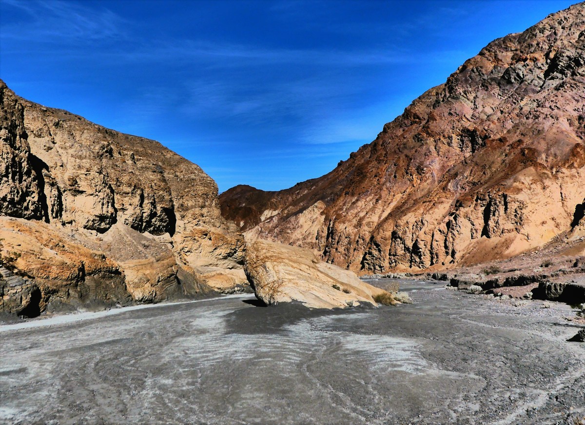
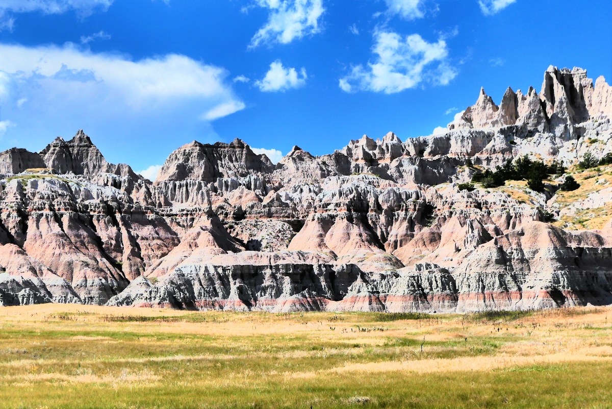
Instead, we admired the scarred lunar landscape of Pinnacles Overlook,

Hay Butte Overlook

and claws of vulcan mounds crawling across the Hay Butte Overlook. It resembled a box of burnt streudel.

fields on fire

We backtracked through Roberts Prairie Dog Town–mindful not to pet a varmint potentially infected with bubonic plaque–and continued along Badlands Loop Road to Ancient Hunters Overlook, trying to imagine early tribes scouting the lowlands for buffalo,

Ancient Hunters Overlook

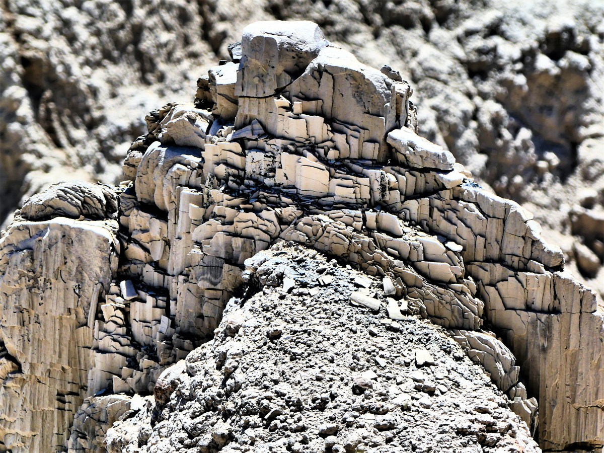
much the way I was location-scouting for worthy photographs of black Pierre Shale.

rock brittle

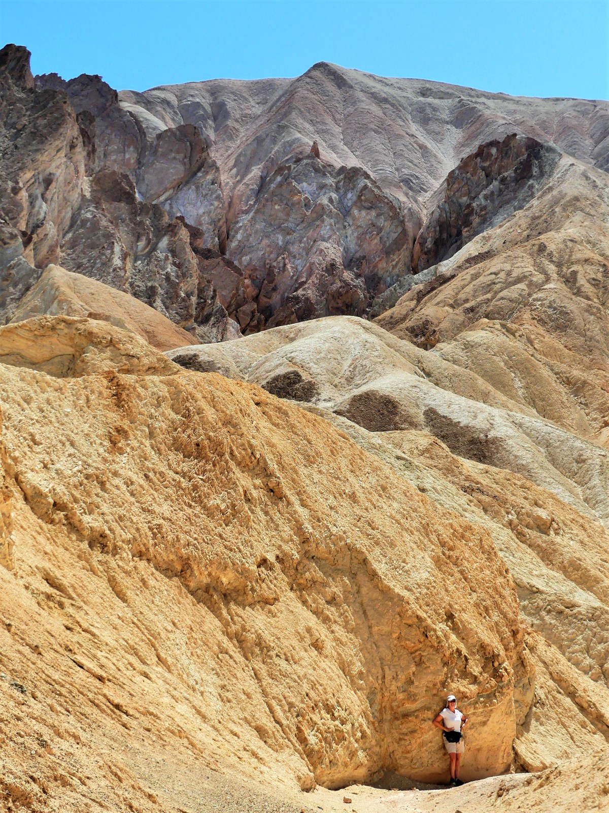
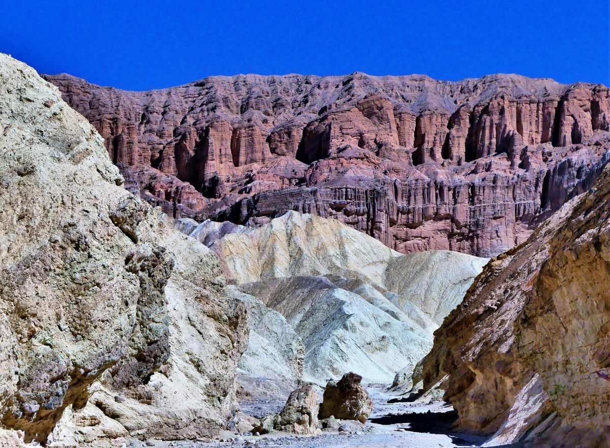
We continued our air-conditioned trek to Yellow Mounds Overlook, where the surrealism was so profound, we had to leave the comfort of the cab to explore by foot…

yellow mounds

receding yellow mounds

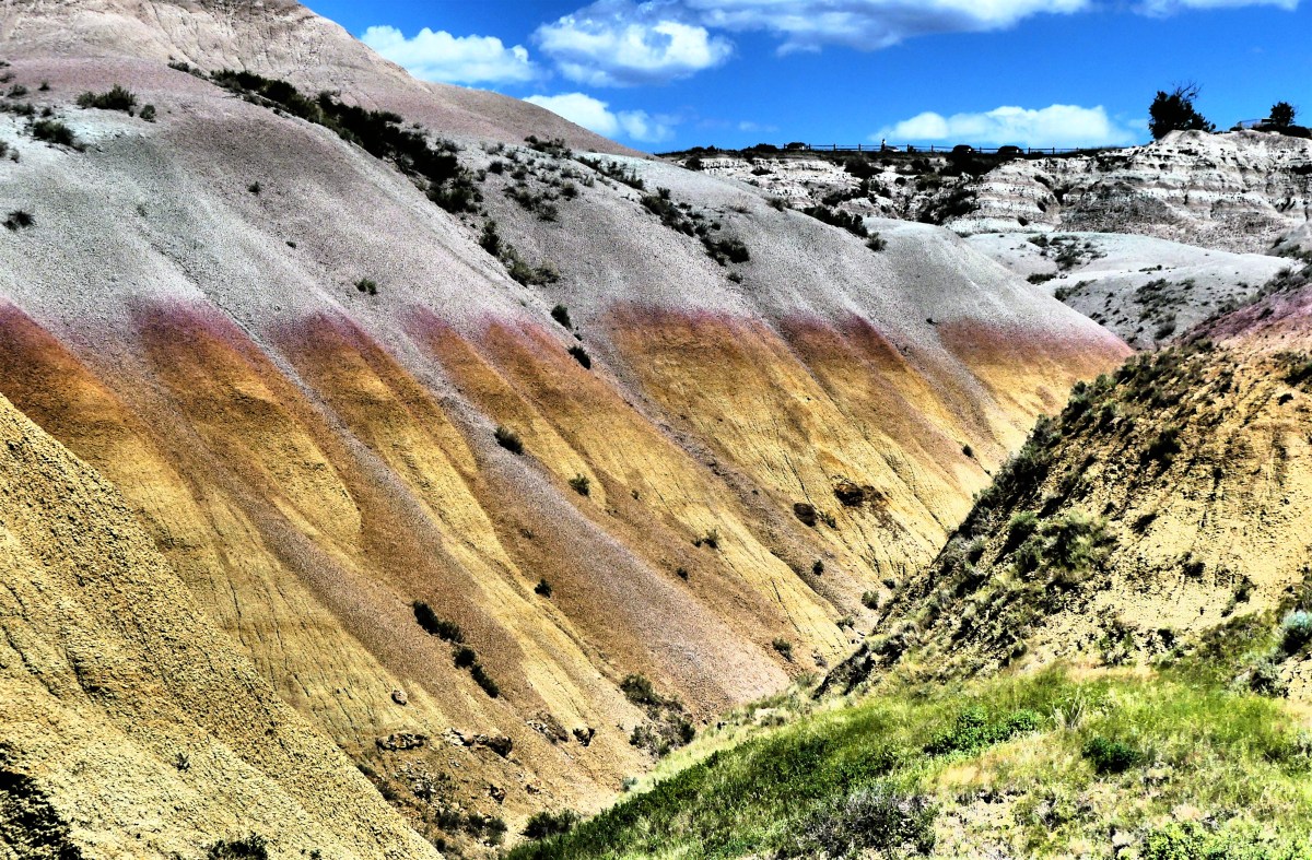
leaving us to wonder how 35 million-year-old fossilized soil could weather into something so beautiful, yet other-worldly.

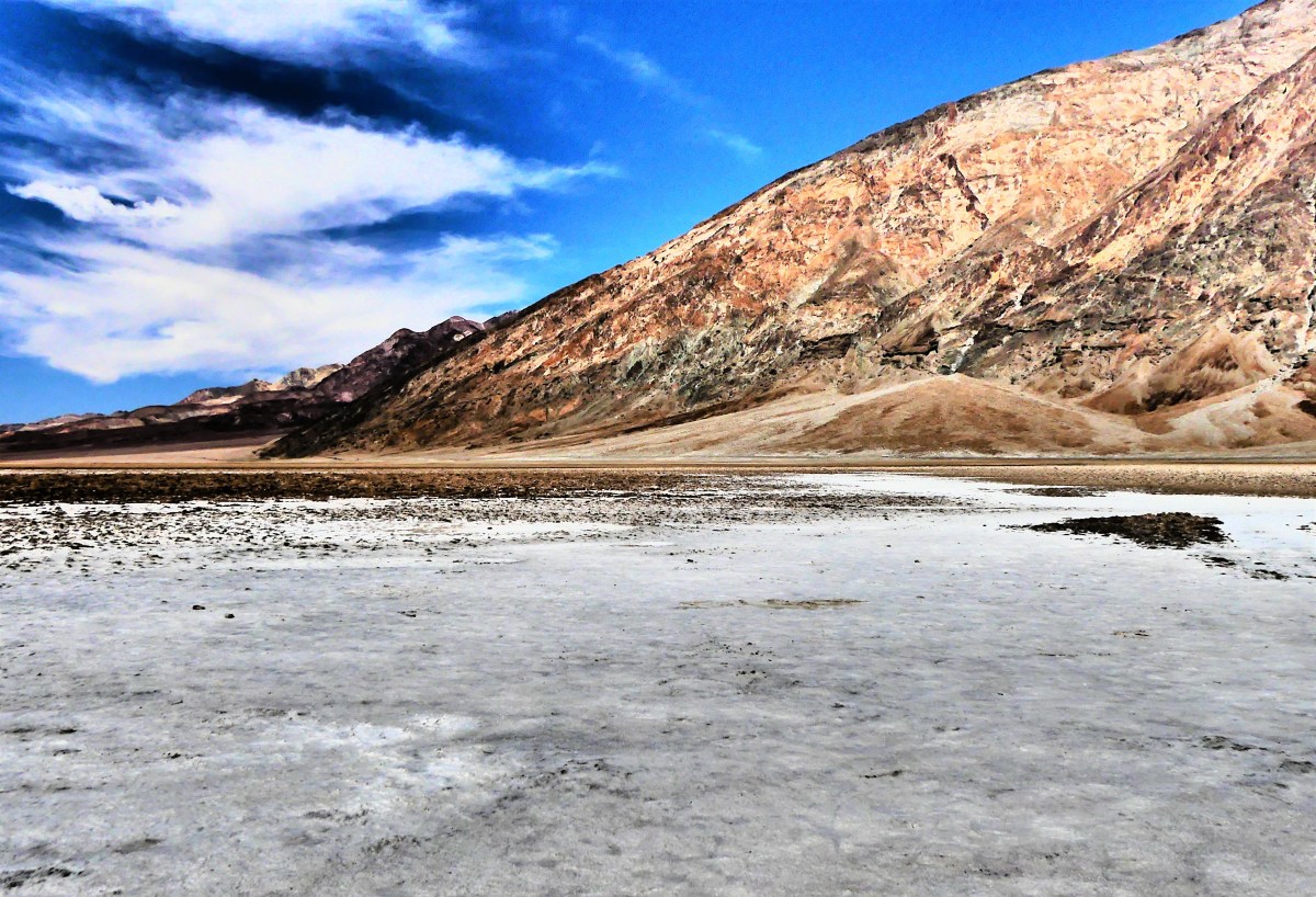
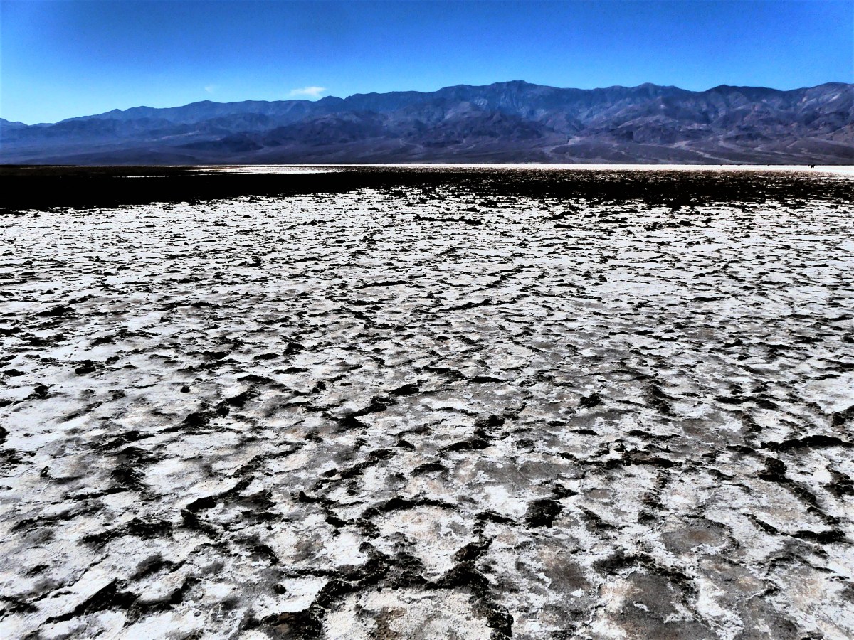
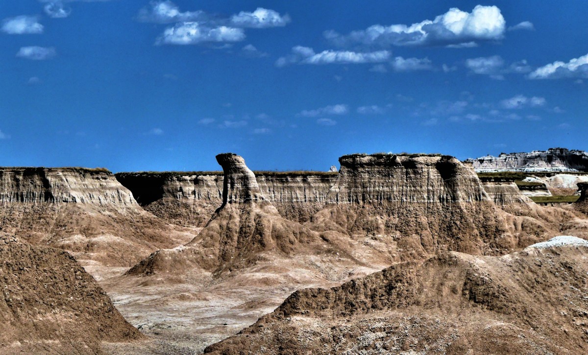
Burns Basin Overlook, while stunning in its desolate vastness, was beginning to look like every other overlook. I feared we were becoming “geo-jaded”.

Burns Basin Overlook

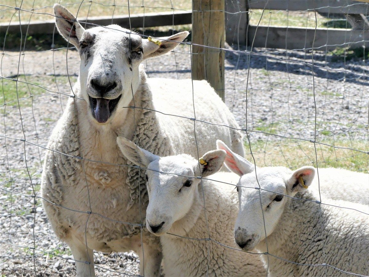
But that feeling quickly faded after we sighted a bighorn sheep lounging on a breezy slope, surveying the best way to Wall Drug.

bighorn sheep look out

I stealthily walked around the cliff edge as far as I could to score the best possible angle without falling into the abyss.

bighorn profile

It was a standoff–both of us locked into position. She remained frozen as a statue, but I held my crouch under the blazing sun until my subject finally cooperated.

Bighorn CU

Leah was waiting in the truck with the air conditioner running. “I can’t take much more of this,” she vented. “It’s just too hot out there, and I can’t even bother to get excited about any of this. You’re out there taking pictures while I’m stuck in the truck, and it’s not fun for me.”

“Tell you what,” I negotiated, “We’re at the point of no return, so we have to finish the park drive. But I’ll make it quick, and I’ll buy you an ice cream at Wall Drug on the way home.”

Fortunately, the road opened up to grasslands on both sides, and a 45 MPH speed limit. We made good time until we arrived at Panorama Point, and the light was perfect.

“Go ahead,” she conceded, “we’re already here.” I tight-roped across a knife-edge ridge as far as I dared…

striped-cliffs.jpg

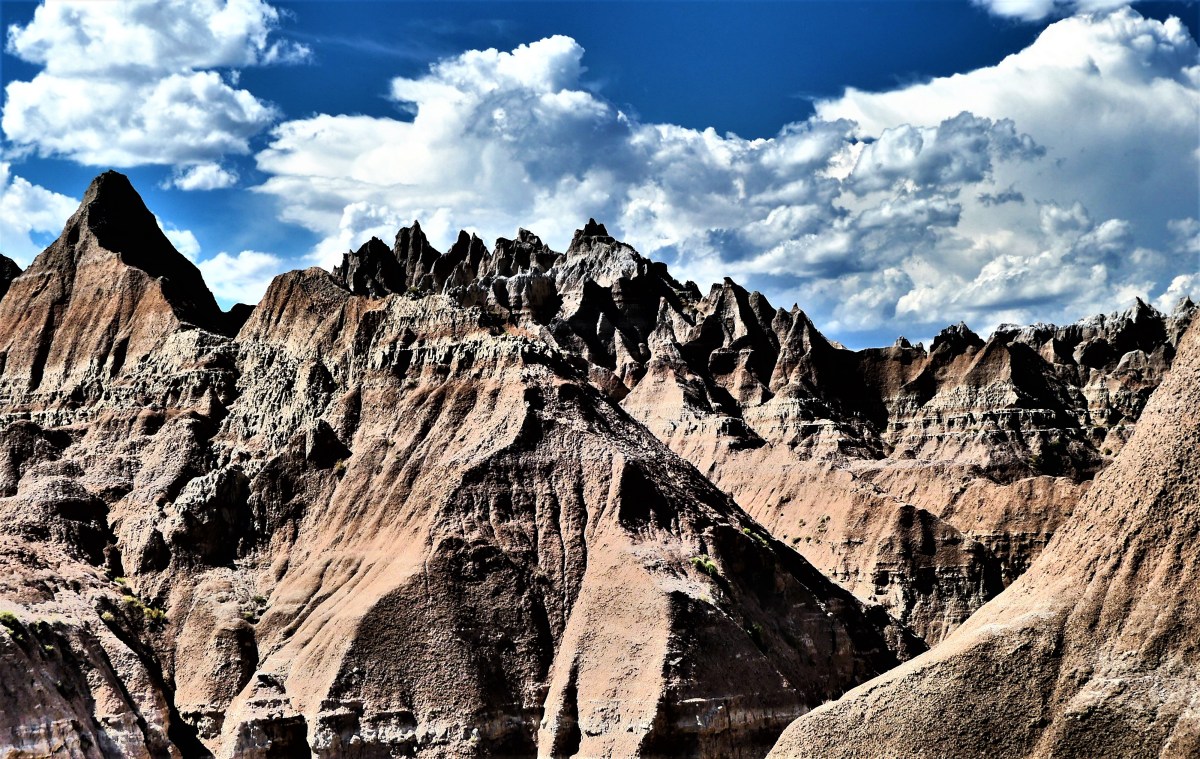
to capture the enormity of the jagged peaks.

Panorama Point

Just around the bend, I discovered the Big Foot Pass Overlook, on the right side of us,

Big Foot Pass Overlook

followed by the White River Pass Overlook on the left side of us.

White River Valley Overlook

Cedar Pass Fossil Area (2)

It was overwhelming.

We ended our tour at the Ben Reifel Visitors Center, where Leah enjoyed the film presentation, while I strode across the prairie grass for a closer look at The Wall.

The Wall detail

I kept my promise to Leah, driving to Wall just as the weather was quickly changing.

Wall Drug silos

The silos at the end of town re-created an ironic juxtaposition to the Badlands scenery.

Rain clouds gathered against gray skies, and the temperature dropped enough to cool rising tempers. But after a diet of Badlands drama under theatrical settings, I found it nearly impossible to buy into the Wall Drug über-kitsch experience.

Wall Drug Frontier Town

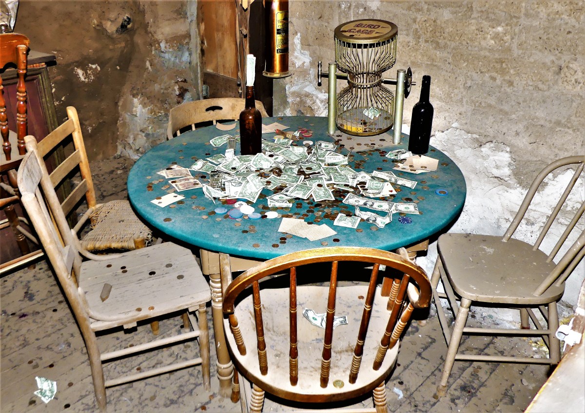
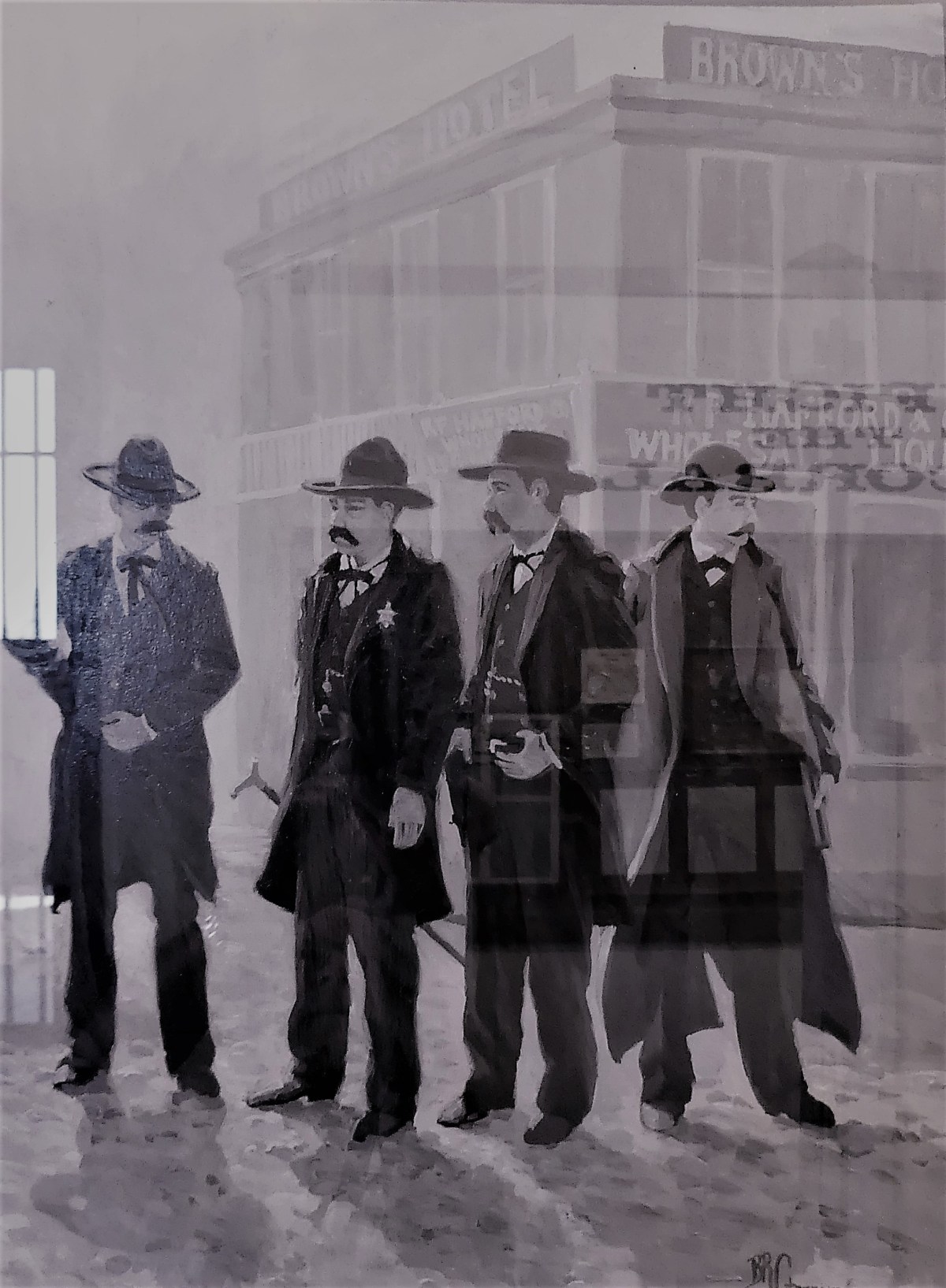
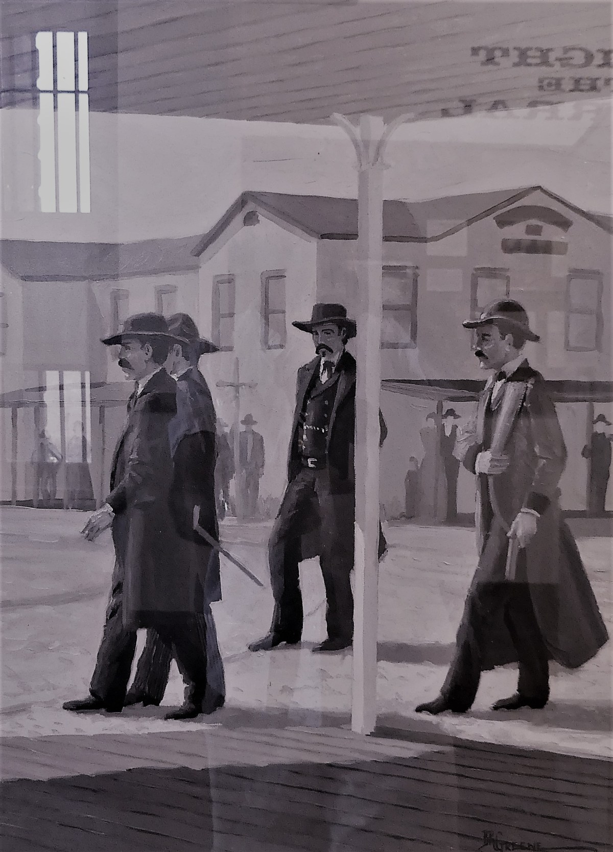
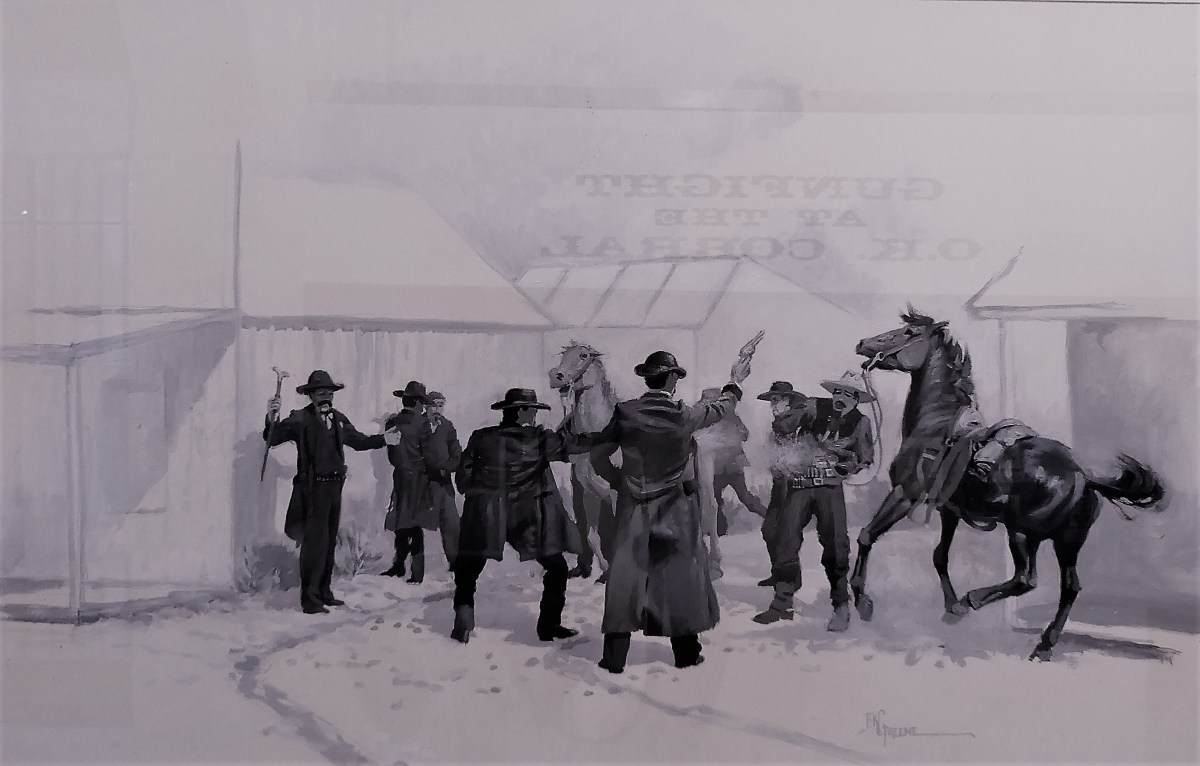
Occupying 76,000 sq. ft. of retail space in downtown Wall, it’s a fascinating rags-to-riches story from the Great Depression, and it stands as a titanic testament to American consumerism.

But it’s really a shit show, with “wall-to-wall” tourists.

Still…the donuts were fresh, and the 5⊄ coffee was hot,

…and most importantly, it brought a smile to Leah’s face.

Wise Guys

What better way to celebrate the 4th of July, than a trip to Mt. Rushmore and the Crazy Horse Memorial. Sure, the crowds were large; that was to be expected. But once the cars were garaged, the pedestrian traffic was easy to negotiate. And with everyone looking up at the mountain, the president’s faces and intentions were never obstructed.

GW

Jefferson

Roosevelt

Lincoln

It was also a time to celebrate family. There were plenty of kids riding in strollers, hanging from moms in carriers, or balancing on dads’ shoulders. Generations of families had gathered to pay homage to the principles of freedom. Seniors were being escorted through the Avenue of Flags by their grandchildren. Extended families organized group pictures at the Grand View Terrace, unified by their love of democracy and their reunion T-shirts.

All expressed awe at Gutzon Borglum’s grand vision and remarkable achievement–the transformation of a mountain into a national symbol visited by approximately 3 million people every year.

long shot

The 14-year process of carving the rock began with dimensionalizing the Presidents’ portraits through Plaster of Paris masks, on view at the sculptor’s studio-turned-museum.

Sculptor's Studio

Additional exhibits detail the construction of the memorial, and the tools used by workers, like the original Rand & Waring compressor, which powered the jackhammers for all the finishing work.

compressor

A little known fact is that Mt. Rushmore was once intended to be a tribute to “Five Faces of Freedom”, but the funds ran out when the original budget approached $1 million during the Great Depression. Hence, the unfinished carving of the Great Ape to the right of Lincoln serves as a reminder that we are never far from our true ancestors.¹

Planet of the Apes

No less ambitious, and equally as impressive, the Crazy Horse Memorial is a work-in-progress located 16 miles away in the heart of the Black Hills–considered sacred land by the Lakota people.

Crazy Horse LS

Conceived by Korczak Ziolkowski in early 1940s,

crazy horse model (2)

the memorial, when completed will stand 563 ft. by 641 ft. across, and is expected to be the largest sculpture in the world. Already, the completed head of Crazy Horse measures 60 feet tall…

Crazy Horse CU

…twice the size of any of the Presidents at Mt. Rushmore. While the first blast was conducted on the mountain in 1947, the current prospects for the memorial are to complete the outstretched arm during the next twelve years. There is no completion date available for the finished carving, which has been financed entirely by private funding since its inception.

Mt. Rushmore was created by a Danish American. Crazy Horse was created by a Polish American. And visitors to both destinations manifest the melting pot that has brought us all together as Americans. It’s our diversity that makes us strong, our ambition and determination that makes us great, and our compassion and sacrifice that make us whole.

These are the values reflected from the faces we’ve immortalized in stone. Yet, we would honor them more by living according to these principles.

Happy Birthday, America!

¹ Just kidding, but the photograph is real and has not been retouched.

Eating Crow

We missed it by one day. The Battle of Little Bighorn lasted for two days, from June 25 to June 26, 1876, but the reenactment only lasted for one day, June 25, 2017. Unfortunately, we arrived in Hardin, MT on June 26. Our neighbors–a retired couple from Illinois living aboard a 2004 Classic Airstream–witnessed the battle scene reenacted with the cooperation and support of Montana’s seven Nation Tribes and a team of 7th Calvary portrayers. Marty and Lil were overwhelmed by the presentation and all the dust. Of course, we would visit the National Monument, but it would seem anti-climatic compared to warplay.

The sky was dark, and rain was in the forecast. It had been two weeks since this area had seen rain, but for us, it’s been dry for five weeks through seven states, so the threat of rain was a welcome way to tame the dust.

The drive to Little Bighorn Battlefield National Monument through Crow Reservation was brief, but insightful. Scores of train cars topped with coal sat idly on the easterly tracks parallel to the the road, while the west side of the road revealed worn trailers and abandoned buildings littered with rusted car chassis. The metaphor was so apropos.

The Crow Nation sits atop one of the largest coal reserves in the country–an estimated 9 billion tons. Yet, according to a report written by PERC  (Property and Environment Research Center),

The tribe’s 13,000 members have little to show for their massive energy reserves. Although half of the tribe’s revenue comes from coal, most of it remains underground. Where development does occur, the process is slow and cumbersome. Unemployment approaches 50 percent on the reservation, and tribal members suffer from high rates of homelessness, crime, and inadequate housing.

Nevertheless, a modern medical center and a requisite casino border the National Monument.

holy rollers

Once inside the Visitor Center’s auditorium, adorned by a 40-foot mural across the entrance,

battle mural

a sobering 20-minute orientation film of the battle was introduced by a 65 year-old retired teacher-turned-ranger who asked a provocative question. “This is a very typical crowd who has come to pay their respects to the fallen on this battlefield–both warrior and soldier alike who had risked everything to preserve their way of life. This was a pivotal moment in our nation’s history, that teaches us so much about our values and ourselves, but when I scan the crowd as I do today, I always ask myself, ‘Where are the young people, and how will we manage to archive this remembrance without them?'”

As we walked through the national cemetery,

cemetary

and along the interpretive trail to Last Stand Hill,

LS Hill

the heavy sky befitted the solemness of the scenery.


sculpture CU

The 5-mile drive between Custer Battlefield and Reno-Benteen Battlefield was a time for reflection about triumph and tragedy, victory and defeat, heroism and humiliation. Yet, lighter moments came from a herd of horses who openly grazed by the road,

horses at restgrazing3 horses

at times defying traffic by staring down cars from the pavement. And when the skies could no longer hold on, it started to rain.

We found shelter at a nearby Crow trading post where Leah and I enjoyed a Crow taco made of frybread. Delicious!

taco

The rain abated by the time we finished our meal. Looking west, we saw blue sunny skies which gave us a green light to further explore our surroundings.

Less than one hour away via Fly Creek Road–a gravel pass connecting I-90 and I-94–we passed rolling ranches of grazing cattle and hay field harvests…

hay field

on our way to Pompeys Pillar National Monument,

Pompey Pillar

a massive sandstone butte on the banks of the Yellowstone River. Regarded as holy ground by the Crow people, the rock also represents the only physical evidence of the Lewis and Clark Expedition. William Clark engraved the wall amidst Indian pictographs on his return trip to St. Louis, and chronicled his 150-foot ascent to the top in his expedition journals.

Clark signature

Clark originally named the rock Pomp’s Tower, after a nickname he had given to Sacajawea’s infant son, whom she carried as she guided the famed expedition to the Pacific. It was later renamed Pompey’s Pillar, and dedicated as a National Monument by Bill Clinton in 2001.

pillar plaque

The hungry and persistent mosquitoes we experienced on the trails were worthy descendants of the “misquitor” that so bothered Clark that he couldn’t see to aim his rifle straight.

Our day of American history ended with another downpour on the drive back to Hardin. But we celebrated the brief moment the windshield was free of bugs, and the chassis was free of dust.

via Daily Prompt: Sunny