November, 2021 was a cause for celebration in Luxor, as the Ministry of Tourism and Antiquities marked the formal reopening of the Avenue of Sphinxes with a parade attended by Abdel Fattah Al-Sisi, president of Egypt.
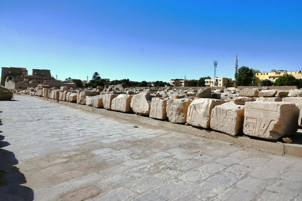
The 1.7 mile boulevard connecting the temples between Karnak and Luxor once boasted 1200 sphinxes. They were buried for centuries under several meters of sand, but are now revealed after 70 years of intermittent excavation and restoration.
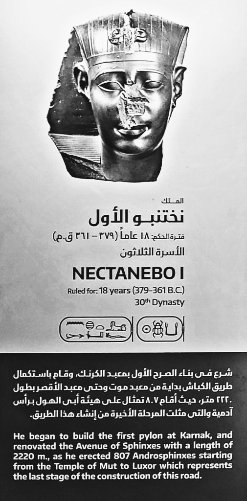
Initiated by Amenhotep III and completed during the reign of Nectanebo I around 2,400 years ago, the impressive series of unearthed statues can be categorized into two shapes:
the first being a body of a lion with a ram’s head;
and the second and most reoccurring shape portrays a lion’s body supporting a human’s head.
Our daytime excursion to Karnak Temple was followed by an evening tour of Luxor Temple.
Although the entrance to the gate was originally flanked by twin obelisks, the right obelisk was gifted to France by Muhammad Ali Pasha, Ottoman ruler of Egypt in the early 19th century (see Walking Like an Egyptian), and now adorns the Place de la Concorde in Paris.
Several rulers contributed to the Temple of Luxor over the ages.
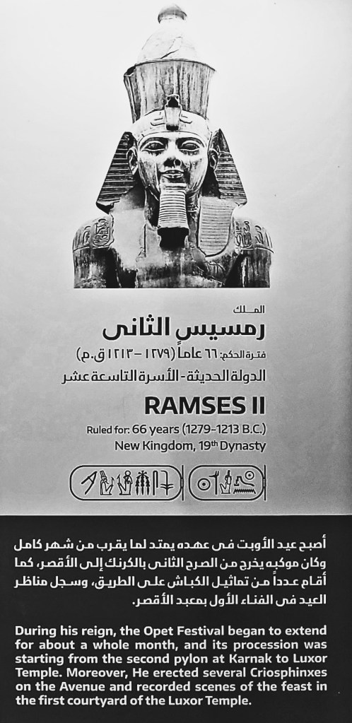
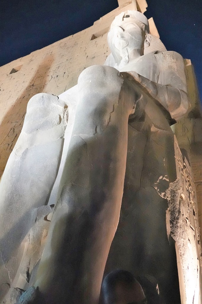
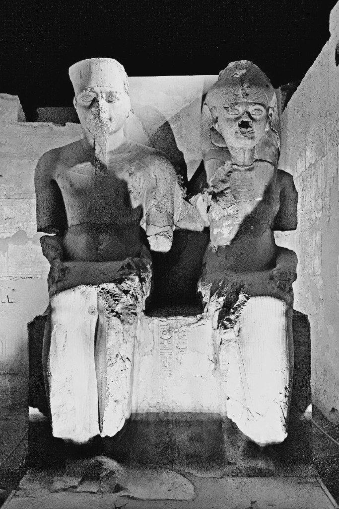
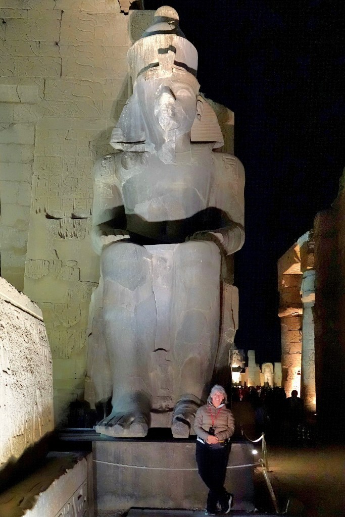
Although the temple was started by Amenhotep II in 1400 BC, Ramses II appropriated the first pylon with placement of a pair of black granite colossi of his likeness seated on a throne…
that depicted the unification of Upper and Lower Egypt.
Beyond the pylon, Ramses II also chose to enshrine 17 of his sons within a courtyard surrounded by double rows of columns capped with lotus-bud capitals. He fathered a minimum of 111 sons and 67 daughters.
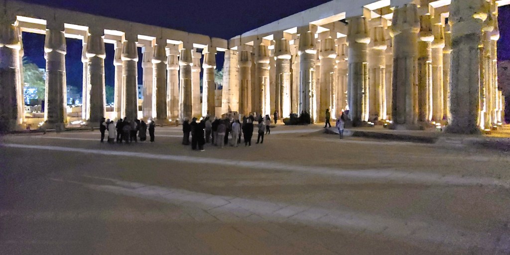
The Courtyard of Ramses II flows into the Colonnade of Amenhotep III, dominated by seven pairs of 52 foot (16m) open-flower papyrus columns, which still support their huge architrave blocks.
The decoration of the Colonnade of Amenhotep III was largely undertaken by Tutankhamun, who is featured beside his Great Royal Wife, Queen Ankhesenamun, daughter of King Akhenaten and Queen Nefertiti.
Beyond the Colonnade, the Great Sun Court of Amenhotep III showcases the remains of a peristyle court with a double row of sixty columns with papyrus bundle capitals on three sides. They represent the best preserved and most elegant columns in the temple.
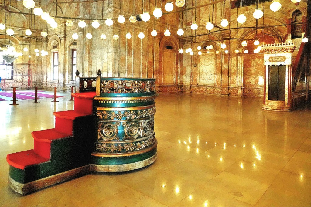
While Luxor Temple was conceived to celebrate the Theban trinity of Amun-Ra, married to God Mut, and son, God Khonsu, the religious focus of the adjacent chapels evolved over time from polytheism to Coptic Christianity during Roman rule, until the Muslim conquest of Egypt in the 7th century.
Thus, the Fatimid Caliphate inaugurated the Mosque of Abu El Hagag in 1286 atop the temple ruins and rubble, repurposing columns and stones to create a strange amalgam of Islamic civilization and ancient Egyptian civilization.
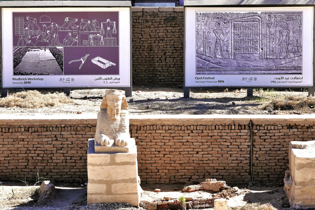
Ironically, the Opet Festival–originating during the 18th dynasty of the New Kingdom, and celebrated to promote the fertility of Amun-Ra and the Pharaoh–has now become an annual event.
Following a 3400-year old ritual, a royal procession parades from Karnak Temple to Luxor Temple along the Avenue of Sphinxes accompanying a statue of Amun-Ra within a barque of gold that rests on the shoulders of priests.
The news is enough to make Ramses II stand up and take notice.
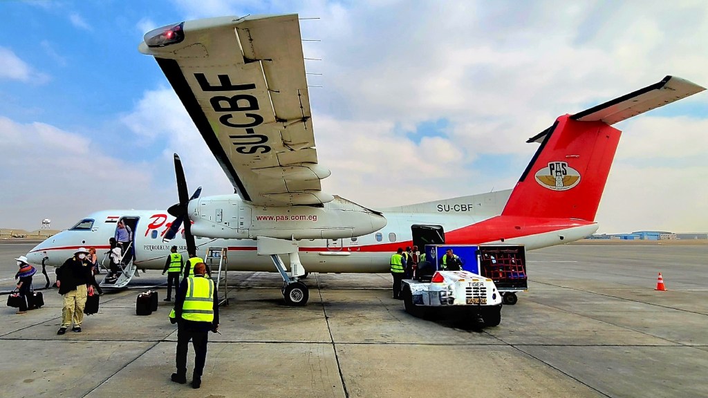
After 3 days in Cairo, Leah and I were on the move!
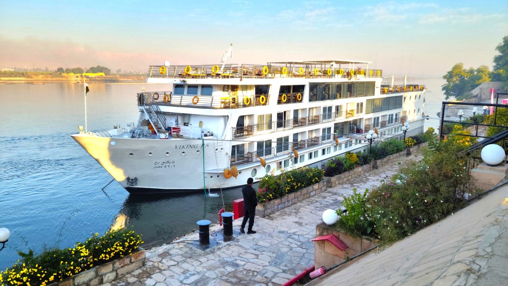
We boarded a chartered prop jet with our fellow river cruisers and flew to Luxor,
to greet the Viking Ra–currently tied up alongside the Nile’s east bank. Ra was to be our floating hotel through the following week.
After attending an obligatory safety briefing aboard Ra,
we were soon exploring Luxor and it’s ancient counterpart, Thebes–home to kings and queens from the Middle Kingdom (c. 2000–1700 BC) through the Ptolemaic Kingdom (305–30 BC)–spanning 15 centuries of rule, until Egypt surrendered to the Romans.
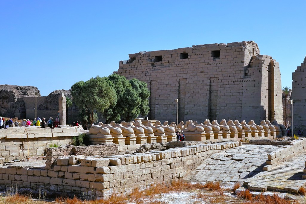
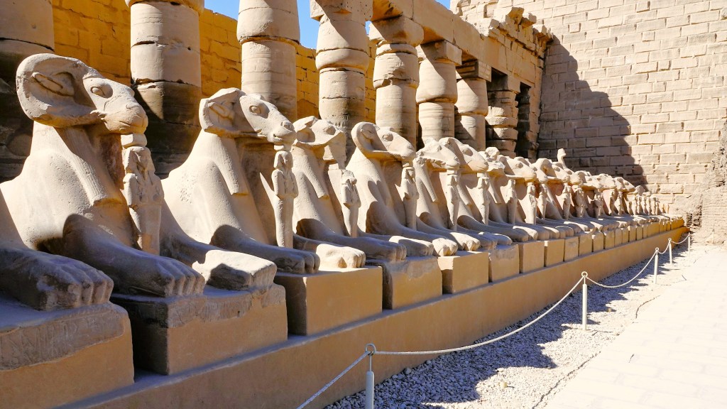
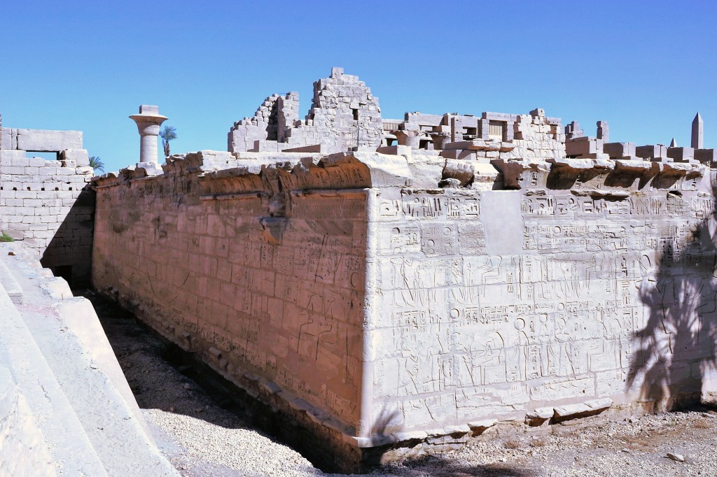
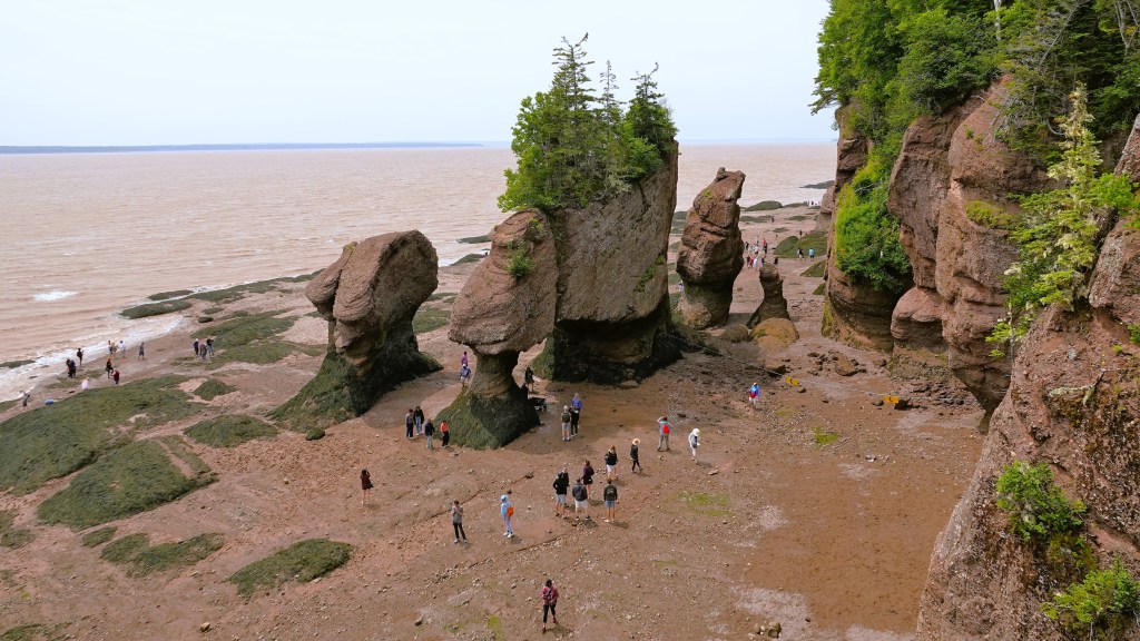
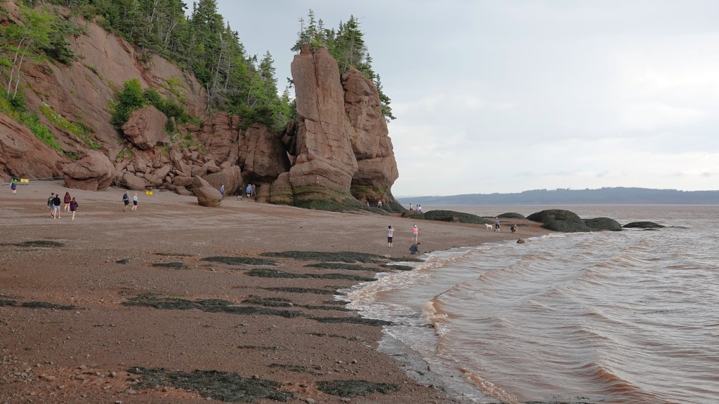
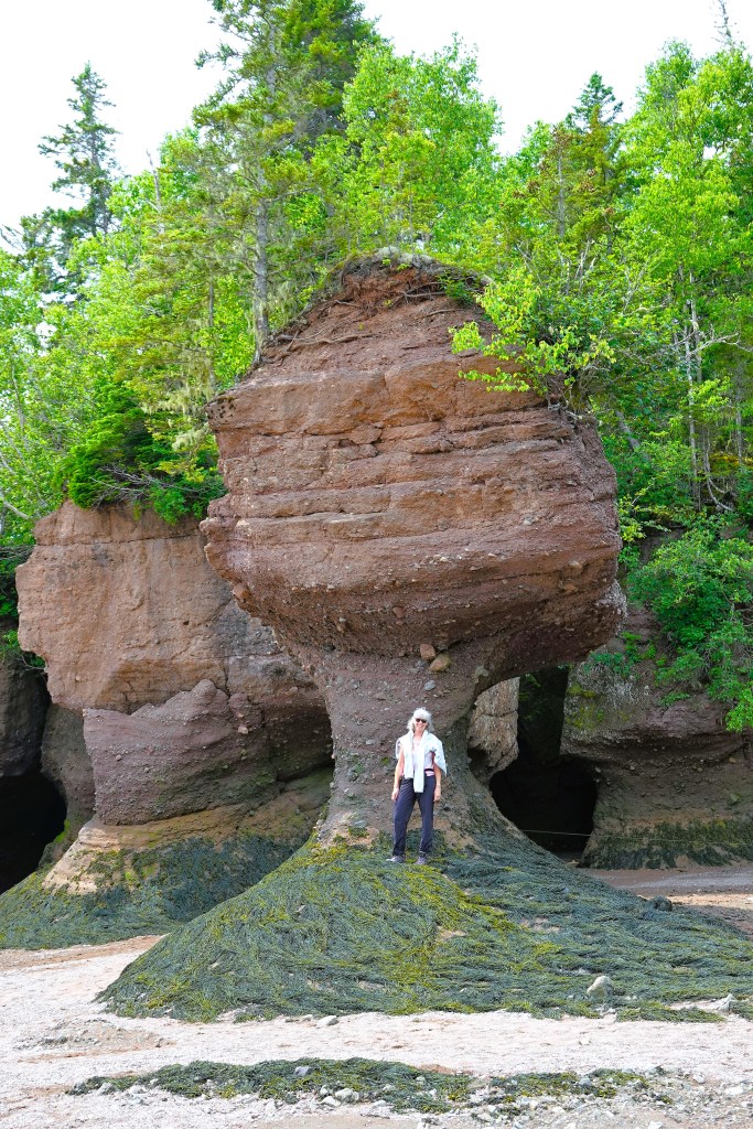
Our tour of Luxor began with a visit to the Karnak Temple Complex, encompassing 247 acres, and considered the largest religious structure ever built.
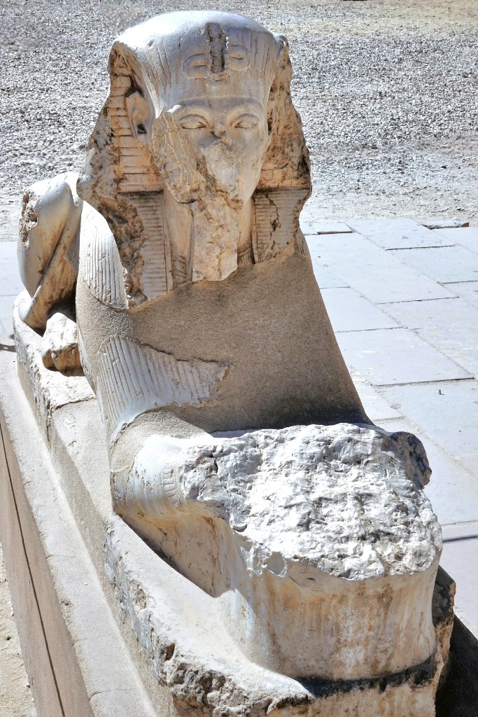
Ram-headed sphinxes (called criosphinx) adorn both sides of the avenue leading to the unfinished, first pylon to honor Amun-Ra, Egypt’s most powerful god and Thebe’s patron deity of the Great Temple of Karnak.
The criosphinxes continue inside the Ethiopian Courtyard (IX Dynasty)–each one cradling an erect statue of Ramses II (c. 1279-1213 BC) between its forelegs.
It flanks the entrance to the temple of Ramses III.
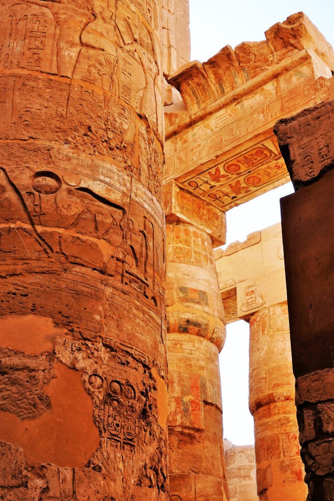
The most impressive feature of the temple of Amun-Ra is the Great Hypostyle Hall, a forest of 134 sandstone columns centered by 12 colossal columns soaring 69 feet,
which supports the remains of a stone roof enclosed by massive walls,
and features intricately carved relief sculptures and hieroglyphs of religious and historical significance…
to honor each of the 30 kings who once ruled the imperial city.
After 3300 years, the site remains substantially intact, yet benefits from painstaking restoration.
After listening to commentary from our onboard Egyptologist, Leah and I strolled the grounds of the ancient temple trying to imagine the enormity of its scope:
while realizing that 3 other sections–the Precinct of Mut, the Precinct of Montu, and the Temple of Amenhotep IV–are also part of Karnak, and still under excavation and reconstruction.
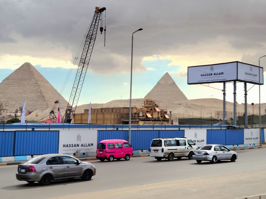
I’ve dreamt of visiting the Great Pyramids nearly all of my adult life, and now, as I gaze through the window of our Viking coach, I catch my first glimpse of these ancient wonders rising beyond a construction zone. Somehow, I can’t escape the notion that these ancient Wonders of the World are part of a half-baked theme park, given their scale and juxtaposition.
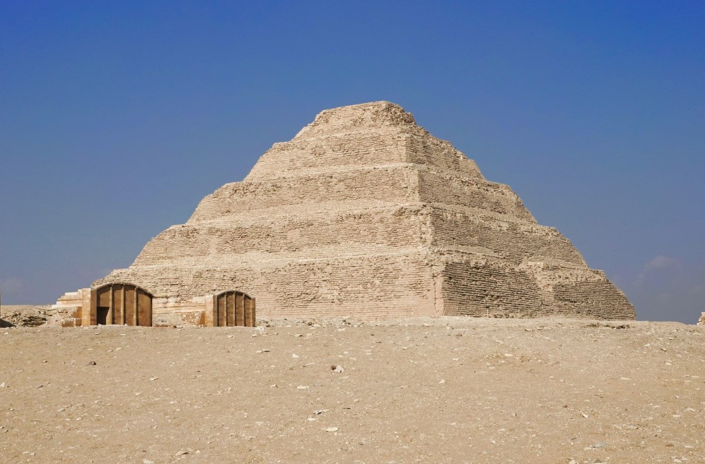
We entered the vast necropolis of Saqqara, which served as the ancient cemetery of Memphis,
featuring the Pyramid of Djoser (frequently called the Step Pyramid), considered the world’s oldest known stone structure, constructed c. 2670–2650 BC. This 6-tier, 4-sided edifice rises 205 ft (62.5m).
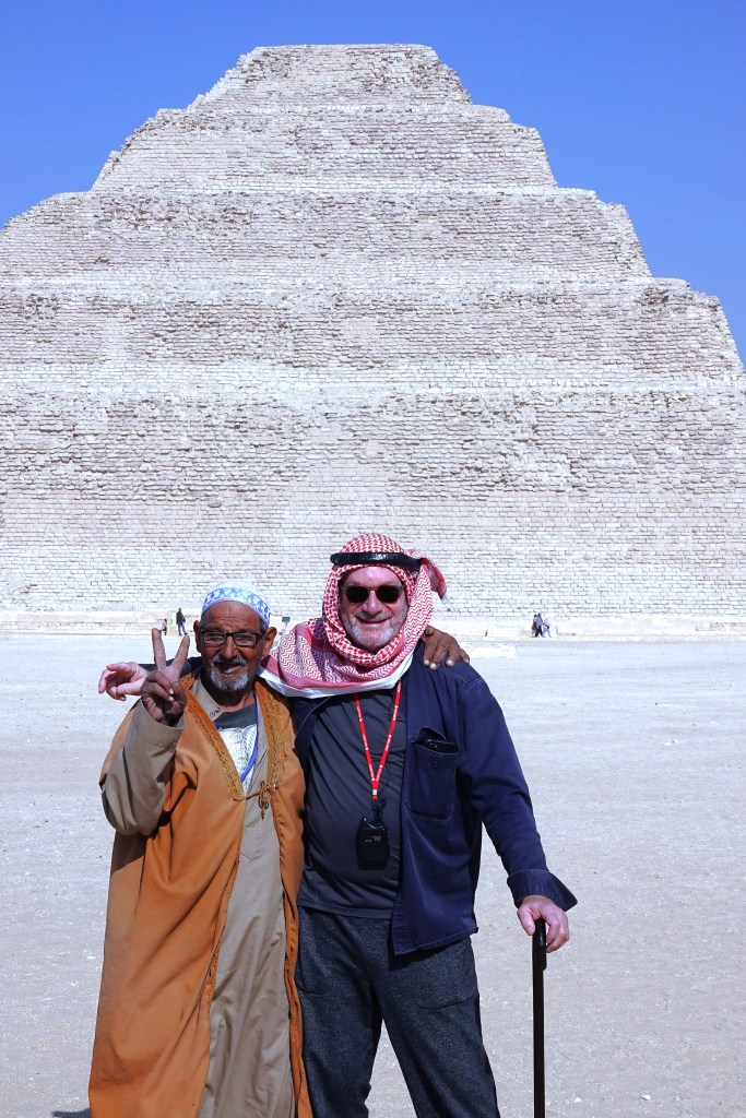
That’s where I met Abdul the Bedouin, regarded by locals as the honorary mayor of Saqqara.
What luck! Seeing Abdul broadly smiling against this epic backdrop, I knew this was an irresistible photo op… and he knew it too–for he was adding instant authenticity to my visual narrative.
Not long after pressing the shutter release, Abdul eagerly approached me and offered to have Leah take our picture together, but not until I was properly costumed.
But don’t be fooled! Despite his diminutive stature, this mild-mannered goat herder with Clark Kent glasses had a secret power. Abdul the Bedouin could hypnotize me into giving him money in exchange for wearing his shemagh.
He wrapped his arm across my shoulder. “Habibi, you’re going to make me very happy,” he whispered as Leah was composing the shot of us. “After all, I have five children to feed.”
Egypt is a poor country. Wages in Giza average between $500 and $750 per month.
Yet, as a Saqqara personality, Abdul was very good at his job–equal parts ham and shmaltz. And he managed to squeeze me for 5 bucks.
Leah and I resumed our tour of the Saqqara necropolis,
at the site of King Teti’s pyramid.
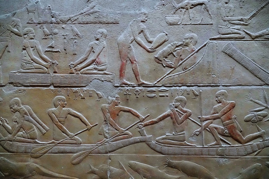
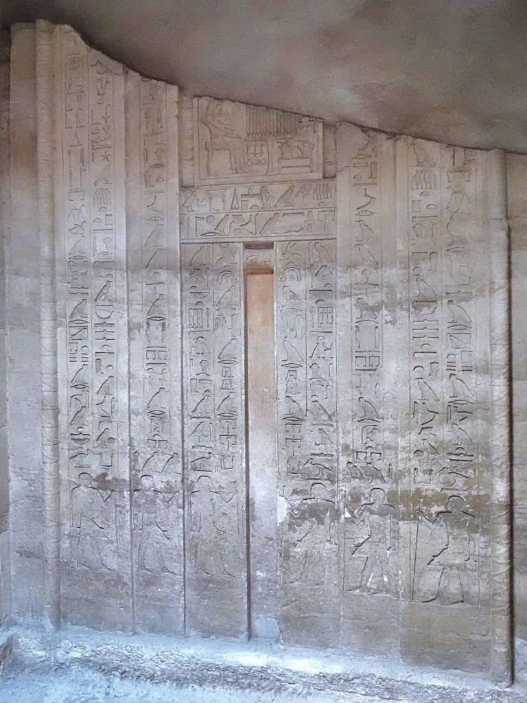
We followed a dark shaft down a narrow passage…
into the belly of his burial chamber, replete with impressive and very rare pyramid texts traced to c. 2300 BC.
This led to an antechamber lined with relief engravings that showcased the preparations made by Teti’s royal staff in anticipation of his journey to eternity,
after having traveled beyond the alabaster alter to the kingdom of the dead.
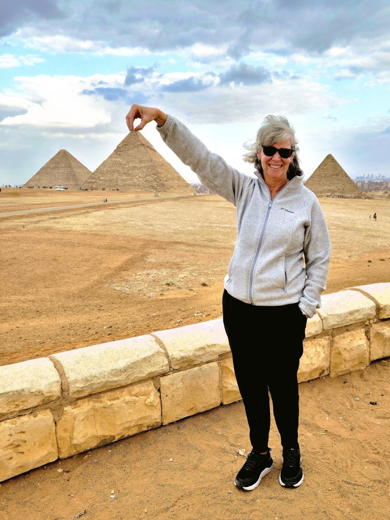
Our next stop was the Great Pyramid of Khufu, the largest of the “big three,” standing 481 ft. and constructed c. 2570 BC. And what a site to behold!
Venders were omnipresent, with pop-up stalls surrounding the pyramid’s perimeter.
That’s where we met Mohammed and his camel. While chatting us up, he snatched my cellphone and insisted on taking our picture.
I paid Mohammed a $5 ransom for my cellphone ($1 for each of his 5 children), however, he expressed his disappointment knowing there’d be no camel ride, but only because another vendor was promised Viking’s business:
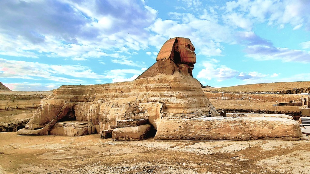
We ended our visit to Giza with a brief jaunt to the Sphinx…
with still enough time for one last parlor trick before boarding the bus.
In a document dating back to 1434, traces of Dresden’s StriezelmarktChristmas Market’s existence were found. Additionally, the Turks tell us that the Grand Bazaar of Istanbul has been around since 1455.
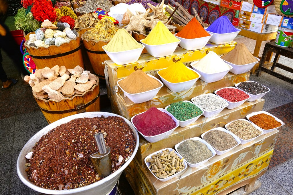
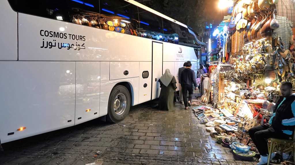
Although proponents of both regions claim title to the oldest market (souk) in the world, 100 million Egyptians would beg to differ, because deep in the midst of historic, Islamic Cairo, stands the beating heart of city commerce–a pulsing and twisting labyrinth of passages that is Khan el Khalili–the world’s oldest continuously operating market since 1382.
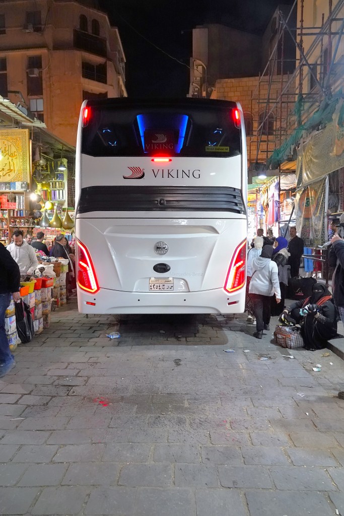
Passengers of Viking Ra who elected to crowd surf through the Khan el Khalili, got a glimpse of life as it once was during the Mamluk dynasty (from 1250 until 1517), when self-pronounced sultans occupied Egypt after driving out the Crusaders. The souk was built atop the mausoleum of the Fatimid Caliphate, which founded Cairo as its imperial city in the 10th century.
Once divided into distinct districts serving merchants trading copperware, gold accessories, and spices, the souk now balances its variety with every imaginable trinket and souvenir sold among competing vendors standing just a breath away from each other, forming an almost impenetrable wall of sounds, sights and smells…
across alleyways that could barely accommodate our bus.
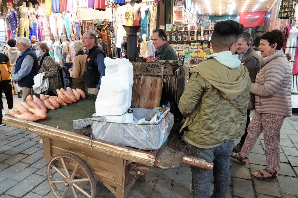
We disembarked from the bus and melted into a crowd of families strolling past aggressive venders hawking endless supplies of camel pants, pashminas, and pyramid paper weights to tourists,
with a variety of daily-living goods for locals.
For the informed collector, haggling generally starts at 40% off the suggested price, and somehow balances out in the negotiation.
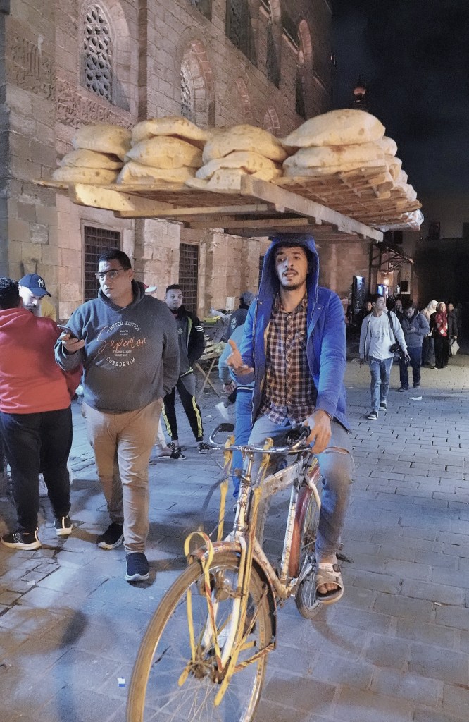
Hungry? No problem! How about a sweet potato…
or fresh baked pita?
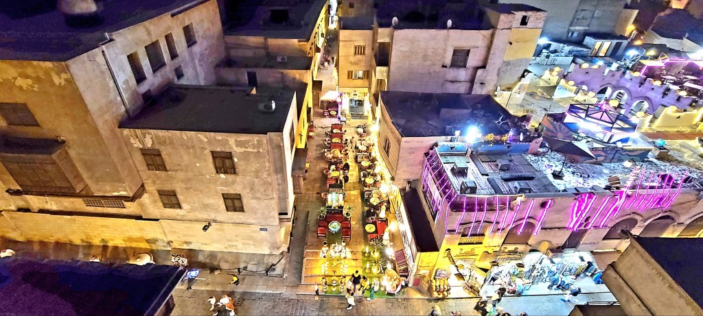
Our group enjoyed restaurant dining above the fray,
which was a pleasant respite from the tumult below us.
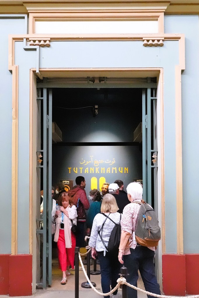
Leah and I arrived at the Egyptian Museum to dig a little deeper into some of the earliest and most significant discoveries of ancient Egypt.
Of course, we would have preferred touring the Great Egyptian Museum (G.E.M.), but the many delays since construction began (2012)–complicated by supply chain dynamics and coronavirus has pushed the official opening to sometime in 2023, optimistically.
However, when the museum eventually opens, it will be the world’s largest archaeological museum, housing 100,000 artifacts from hundreds of tombs and temples, and the entirety of the Tutankhamun collection.
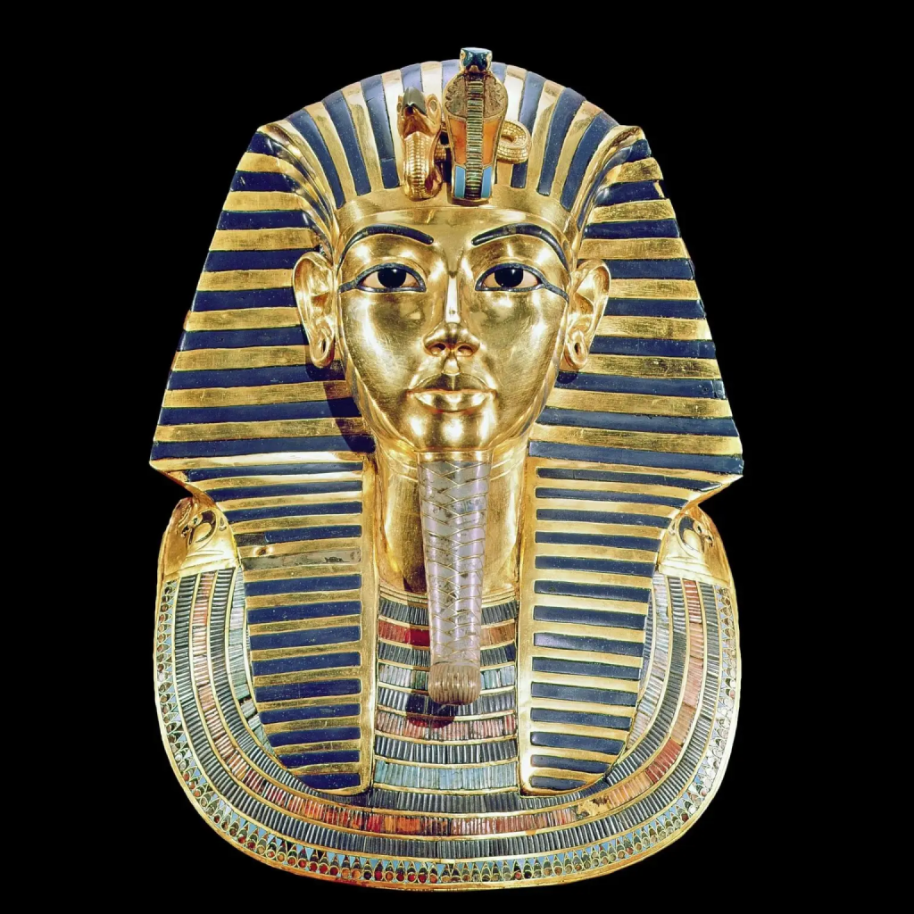
But for now, we must adjust our expectations by visiting the fabulous Egyptian Museum instead, where a smattering of the riches belonging to Tutankhamun’s tomb have been on view:
including his incomparable solid gold mask,
Photo credit, Egypt Museum
and triple coffins staged within his sarcophagus–yet unfortunately, all without the possibility of photography once we entered the special exhibition room.
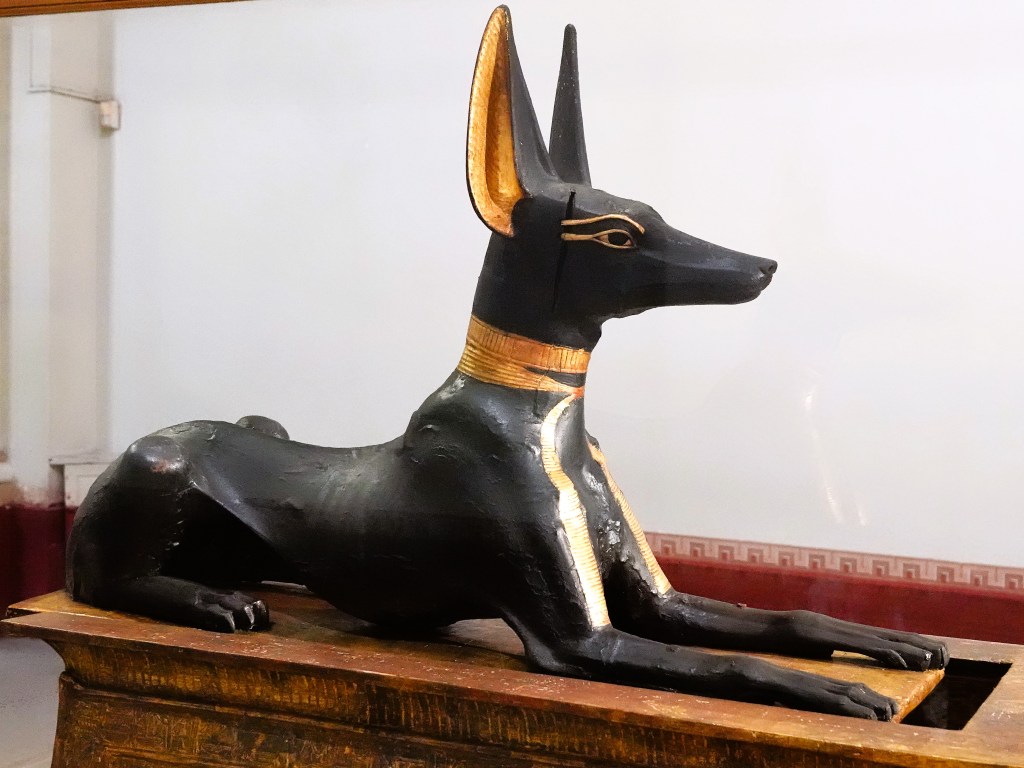
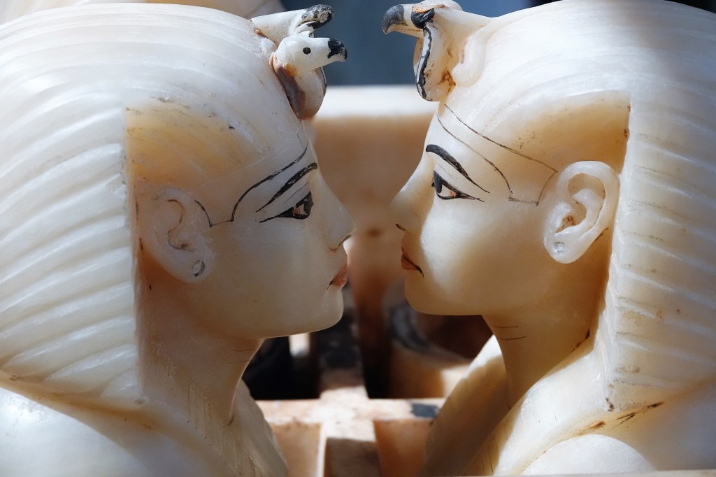
There were, however a few items from Tutankhamun’s tomb displayed in the general exhibition hall that were equally as impressive, including:
Anubis the jackal, who guards the cryptAlabaster canopic jars which held vital organs
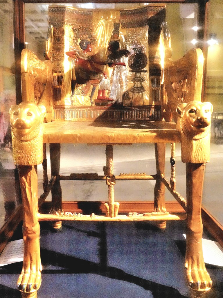
A gilded throne beside an inlaid and painted ceremonial chair.
There were so many more treasures to appreciate beyond the towering entrance and throughout the wings of the cavernous exhibition hall.
From the moment we entered the building, we were confronted by a stone Colossus of King Merneptah, successor to Ramses the Great.
Along our stroll, we stopped to appreciate a 2-foot palette of some of the earliest hieroglyphics ever found.
This palette, with reliefs on both sides, commemorates the victories of King Narmer, who came from the south of Egypt to invade the Delta in about 3000 BC. It represents the most important evidence that the first political unification in the history of mankind occurred in Egypt. The two faces of the artifact are topped by the name of Narmer inscribed inside the Serekh, or rectangular frame. In hieroglyphic signs, the chisel reads mr and the catfish reads naar.
The upper section of the back side shows the king wearing the Red Crown of Lower Egypt, followed by his sandals bearer and preceded by his vizier and four standard bearers. Next comes a scene depicting the corpses of 10 beheaded men. In the middle section, two men are holding two felines with extremely long necks representing the people of the North and South under the control of the king and his men. The lower section shows a bull, representing the king attacking the walls of a northern city.
The Serekh is flanked by two female heads having the ears and horns of a cow, which could be the first representation of the goddess Hathor. The scene on the front shows the king, followed by his sandals bearer and wearing the White Crown of Upper Egypt, smiting a helpless foe from the North. The falcon Horus of Upper Egypt stands upon a bunch of papyrus plants holding a northern prisoner. The lower register, or scene, depicts two other northern enemies running away from the king. Inscribed upon their heads are hieroglyphic signs indicating their names or those of their localities.
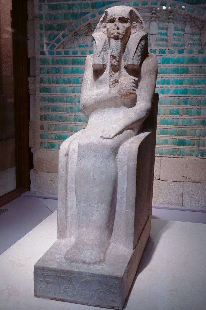
We stood in awe of the oldest known life-size statue found in Egypt.
It depicts King Djoser of the Third Dynasty seated on his throne and enveloped in a jubilee cloak. The statue was entirely coated with white plaster and painted. The deep-set eyes were once inlaid. The king has a ceremonial false beard and wears a black wig topped by the royal Nemes headdress. The front side of the pedestal is inscribed with hieroglyphic text, indicating the name and epitaphs of King Nethery-khet of Upper and Lower Egypt.
Next, we got acquainted with an exquisite 4600-year old polished, gneiss statue of King Khafra, builder of the second largest pyramid in Giza.
It was found in a pit in the antechamber of his Valley Temple in Giza. The king is seated on a throne flanked by lion heads. The two sides of the throne are decorated with the Sema-Tawy, symbol of the unity of Upper and Lower Egypt. Khafra wears the nemes headdress, surmounted by the uraeus, or royal cobra. He wears the royal pleated kilt. Attached to his chin is an artificial ceremonial sacred beard. He is protected by the god Horus, represented as a falcon, perched at the back of his neck.
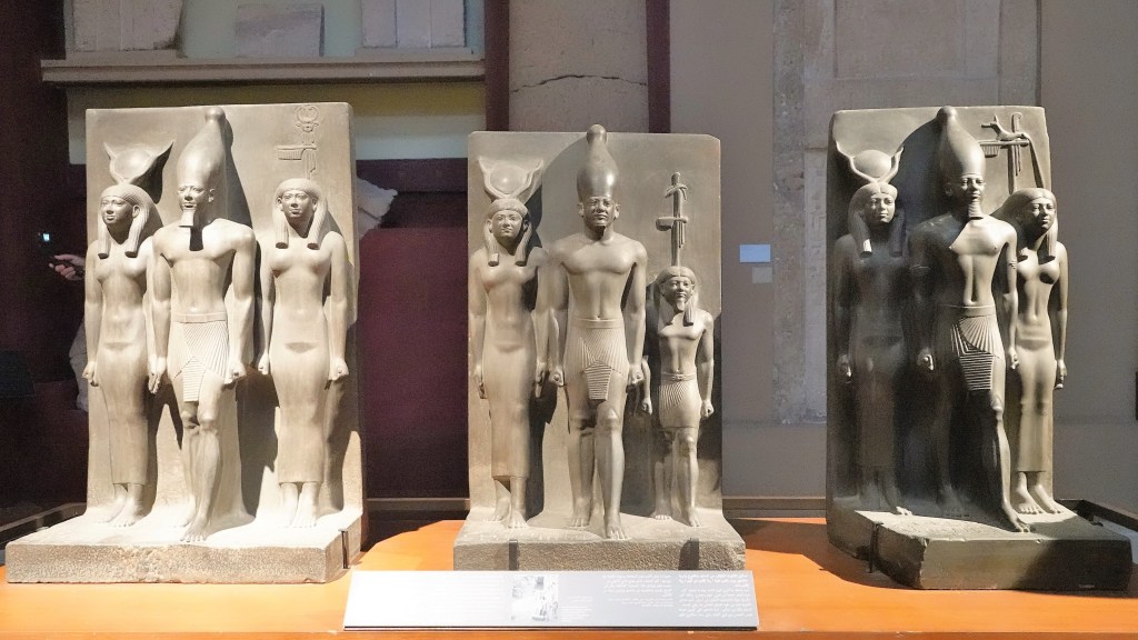
Nearby was a triptych of King Khafra’s neighbor, King Menkaure.
King Menkaure built the third and smallest of the Great Pyramids of Giza. The triad of Menkaure was intended to represent him with the personification of the nomes, in the presence of gods, especially Hathor. The king wished to enjoy resurrection and fertility from Hathor and endless offerings from the nomes. He is represented here in an idealistic form between Hathor, with her horned sun disk crown, and a figure of the personification of the nome of Diospolis Parva.
Sheikh el-Balad, Arabic title for the chief of the village, was the name given to this remarkable wooden statue discovered by the workmen of Auguste Mariette, the French archaeologist, because it resembled their own village chief.
The statue depicts Ka-aper, the chief lector priest, in charge of reciting prayers for the deceased in temples and funerary chapels. It is one of the masterpieces of the private statuary of the Old Kingdom.
The arms were separately modeled and attached to the body, a technique frequently used in wooden statuary. A wooden cane supported the left arm, made out of two pieces of wood joined together. The eyes are inlaid; the rim is made out of copper and the white is of opaque quartz, while the cornea is made out of rock crystal.
Also of interest is a small stone carving of Seneb, an Egyptian dwarf who was the chief of all the palace dwarfs, and charged with the care of the royal wardrobe.
He is seated on a rectangular seat together with his wife, Senetites, and his children stand before him. He has short black hair and wears a short white kilt. His wife rests her right hand on her husband’s shoulder and her left hand on his left arm in an affectionate pose.
Senetites, who held the titles of Priestess of Hathor and Neith, wears a black wig that reaches down to her shoulders and a long white tunic. The artist rendered her face with a smile to show the woman’s satisfaction at being depicted with her husband and children.
The son and daughter are shown standing in front of their father in the place where the legs should be. Here, the Egyptian artist succeeded in creating a balanced composition for the figures of the family.
Protected in a nearby glass box was another painted couple. Rahotep might have been a son of King Senefru and thus, a brother of King Khufu. He held the titles of High Priest of Ra at Heliopolis, General of the Army, and Chief of Constructions.
He is seen here wearing a short kilt, short hair, a fine mustache, a heart-shaped amulet around his neck, and inlaid eyes. Rahotep’s wife, Nofret, is described as “the one acquainted to the king.” She is seen wearing a shoulder-length wig, decorated with a floral diadem and a broad collar. Her natural hair can be seen under the wig.
We recognize the distinction in the skin coloring of the two statues: reddish brown for the man and cream wash for the woman. This was an artistic convention followed throughout ancient Egyptian history. The colors are well preserved and the faces have realistic expressions.
However, Queen Hatshepsut was a rare exception. She’s regarded as the most successful woman ever to rule Egypt as Pharaoh (18th Dynasty), and considered an equal among all kings. Hence, her skin color is always portrayed as reddish brown.
Advancing to the mummy exhibition, we were treated to the gilded plaster, funerary masks of Thuya and Yuya.
Yuya was the father of Queen Tiye, wife of King Amenhotep III, and husband of Thuya. Yuya came from the town of Akhmim, where he probably held estates, and where he was a priest of the Egyptian god Min, the chief god of the area, while Thuya held important religious titles, in addition to the title of the Royal Mother of the Great Wife of the King.
As part of the royal family, they were attributed royal burial rites and mummified, guaranteeing them an extraordinary eternity as museum masterpieces.
Leah and I later visited Yuya’s son-in-law, King Amenhotep III, and his daughter, Queen Tiye to share a moment of eternity inside his sarcophagus, under their protective gaze.
But remembering our plan for a night out at the market, we had to put our hereafter on hold.
When Leah and I disembarked from our Northern Lights cruise aboard the Viking Star on February 4, 2020, the entire cruise industry was sinking from the spread of COVID-19. And the travel industry was unable to forecast with any assurance whether or when it would be safe to cruise again. Nonetheless, Leah and I reserved passage on Viking’s Nile River cruise (risk free) 2 years ago, and patiently waited for the coronavirus tide to wane.
Fortunately, Egypt had been less affected than many surrounding North African countries, so we waived our cancellation guarantee 3 months ago, and finally embarked on our eagerly-anticipated journey.
After 2 airport layovers–with extended delays between 2 sunsets–we touched down in Cairo to experience what we hoped would be a trip of a lifetime. We also elected to tack on a 4-day extension to Jordan to experience the “Rose City” built into the pink sandstone cliffs of Petra. And we would finish our Middle Eastern adventure with 9 days in Israel on our own.
We also chose to travel with Viking for their immersive programming, delivered by two resident Egyptologists, Khadiga and Youmna, who offered comprehensive commentary every step of the way.
After a night of well-deserved sleep at the Sheraton Cairo Hotel and Casino, we awoke at 6 AM to the muezzin’s prerecorded call to morning prayer,
and began our tour with an excursion to Cairo’s Citadel of Saladin, the largest citadel in the Islamic world opened in 1176,
for magnificent views of the entire city–a massive sprawl sheltering nearly 22 million people within its metro borders, with what also seems as many stray cats and dogs–
and access to the Mosque of Mohammed Ali Pasha, also known as the “Alabaster Mosque” built in 1848, with twin minarets reaching a height of 84 meters, the highest in all of Egypt.
The prayer hall inside can accommodate 10,000 worshippers under a large central dome surrounded by four semi-domes,
supporting a massive crystal chandelier that has recently been repaired after a 3-year restoration project by Egypt’s Supreme Council of Antiquities.
Across the marble tiles to the east is an adorned, gilded pulpit of carved wood for the chief Iman.
Within the center of the mosque’s massive courtyard of 47 arched doorways finished with 45 domes stands an elaborate alabaster fountain for requisite ablutions.
The copper-clad clock tower rising above the courtyard in the center of the south façade was a gift from Louis Philippe, the King of France in exchange for one of two ancient obelisks discovered at the Temple of Luxor that still stands in the Places de la Concorde in Paris.
Unfortunately, it was a bad trade for the Egyptians, as the mechanical clock is only accurate twice a day since never working properly after installation.
After roaming the courtyard,
it was time for our next excursion to the Egyptian Museum, where we motored by bus through the busy streets and circles of Cairo, while managing to avoid hundreds of pedestrians who habitually cross the roads in all directions, without any regard for traffic or life itself.
To date, my blog has been about chronicling my travel adventures, with occasional lapses into cultural insight and political satire…from my perspective, of course.
Equally as important, this blog has been a repository for thousands of photos I’ve taken along the way, helping me identify and memorialize hundreds of destinations I’ve visited during the past six years, and perhaps, transcending the ubiquitous and banal:
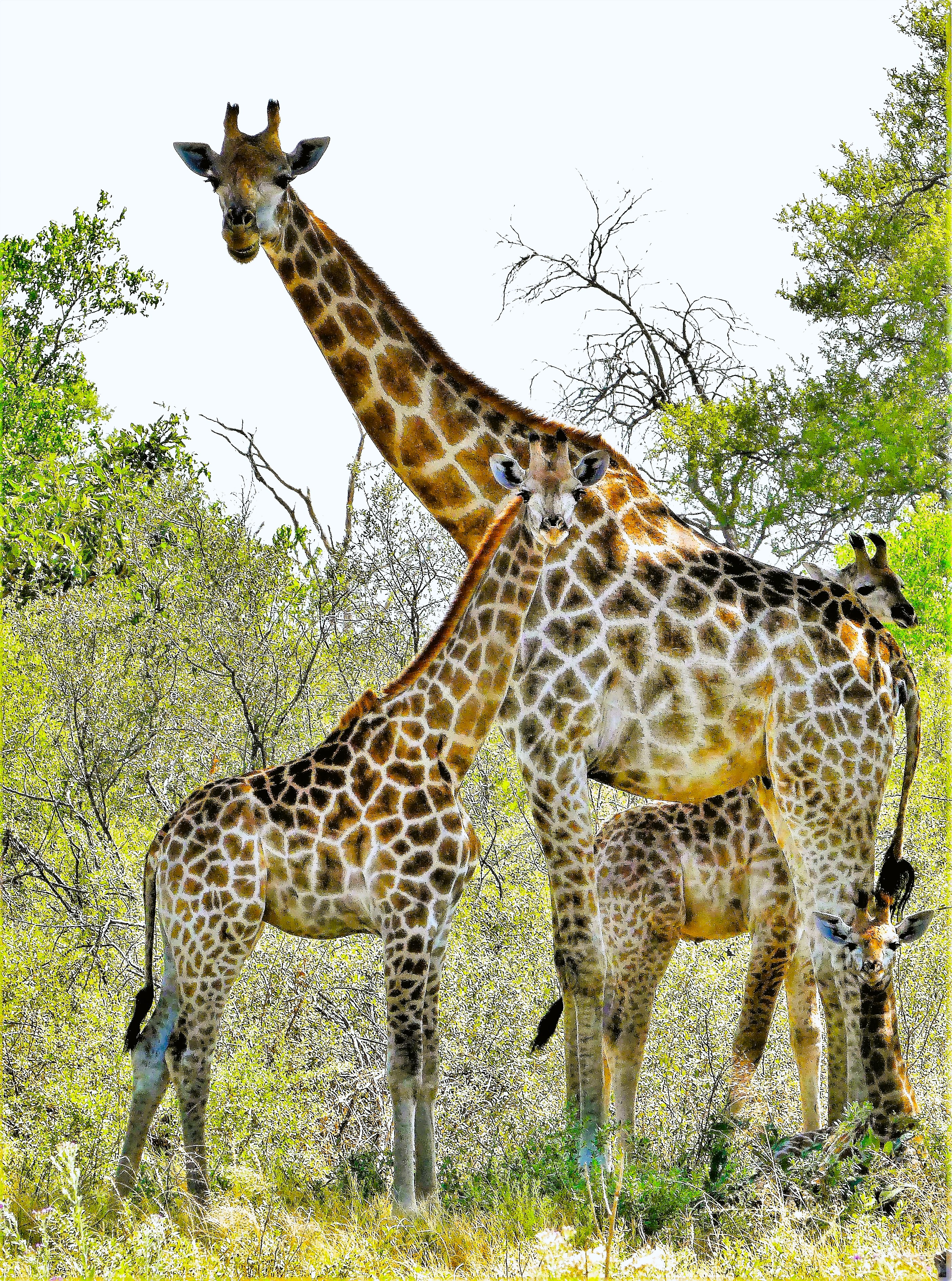
whether animal;
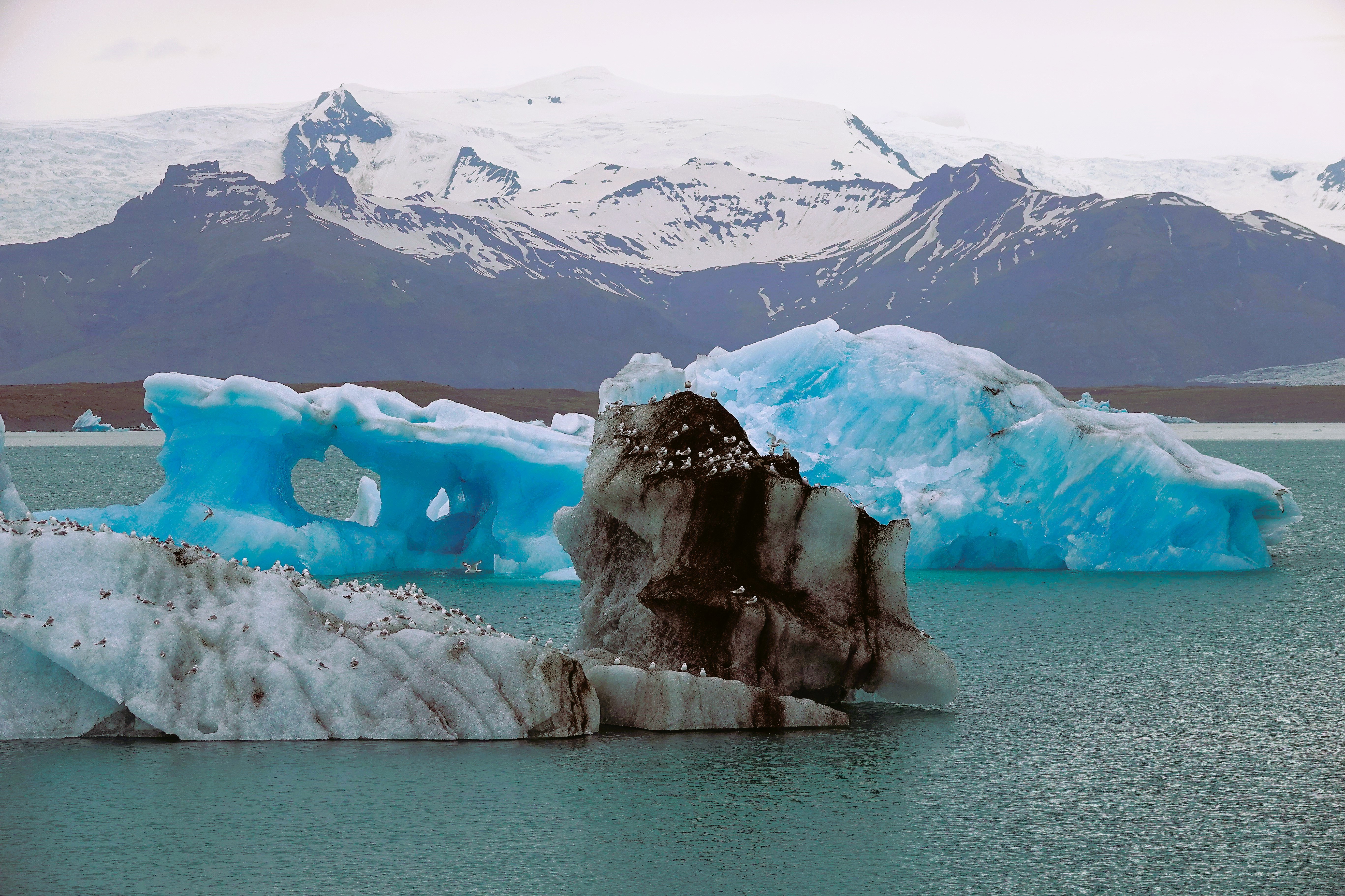
mineral;
or vegetable snapshot!
I admit to taking my fair share of goofy personal photos, and occasionally posting them from time to time (see “Looking Back in Pictures”). But for the most part, Streaming Thru America has been my “show and tell” outlet for timestamping my wanderlust…
until now!
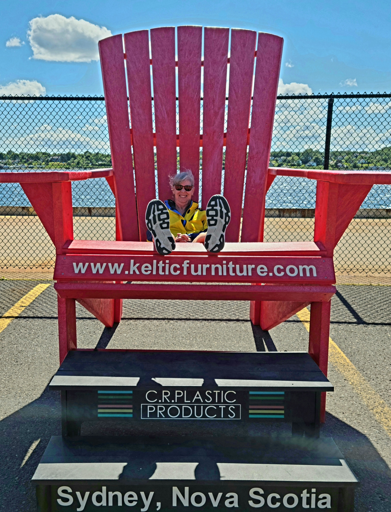
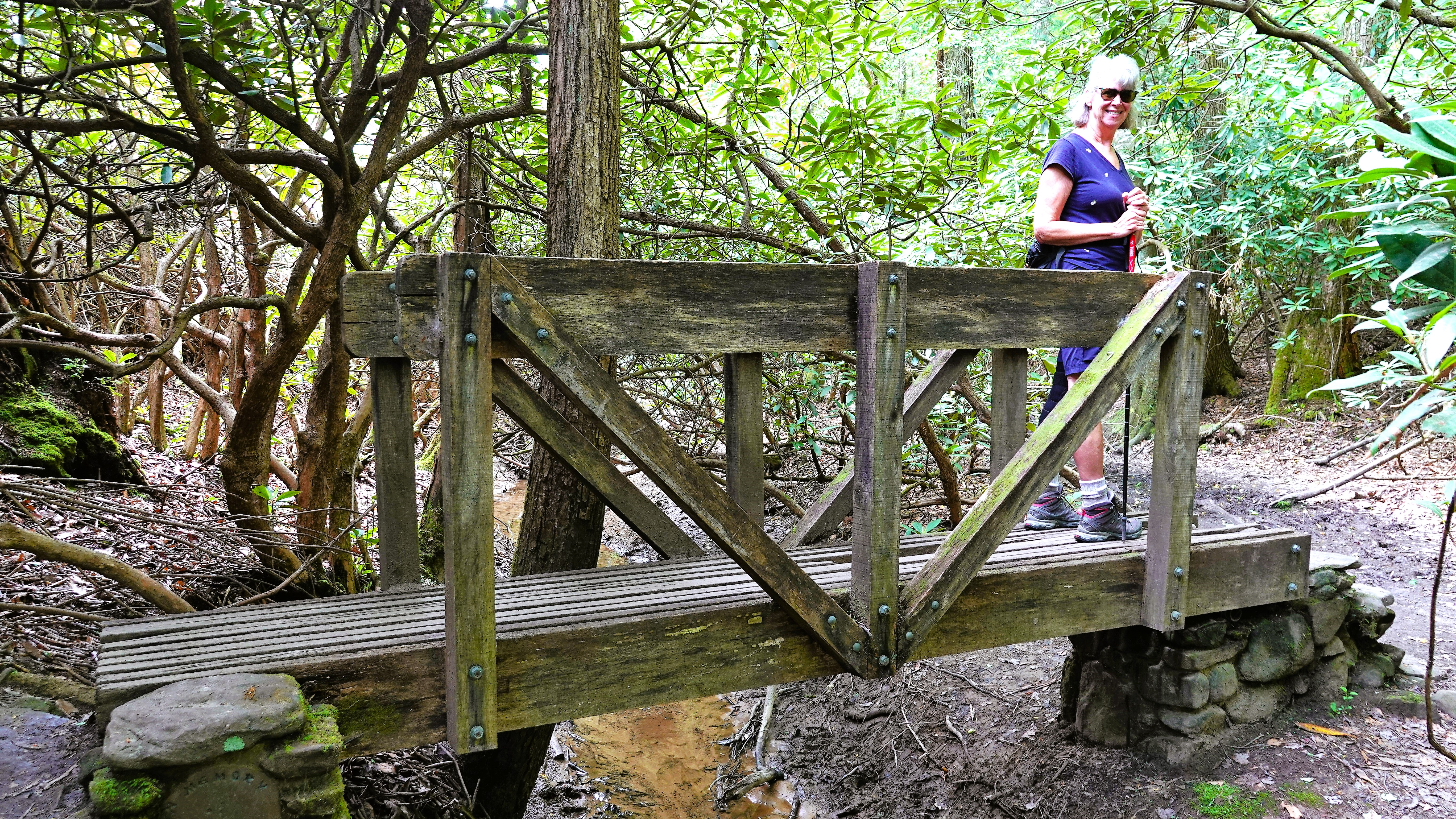
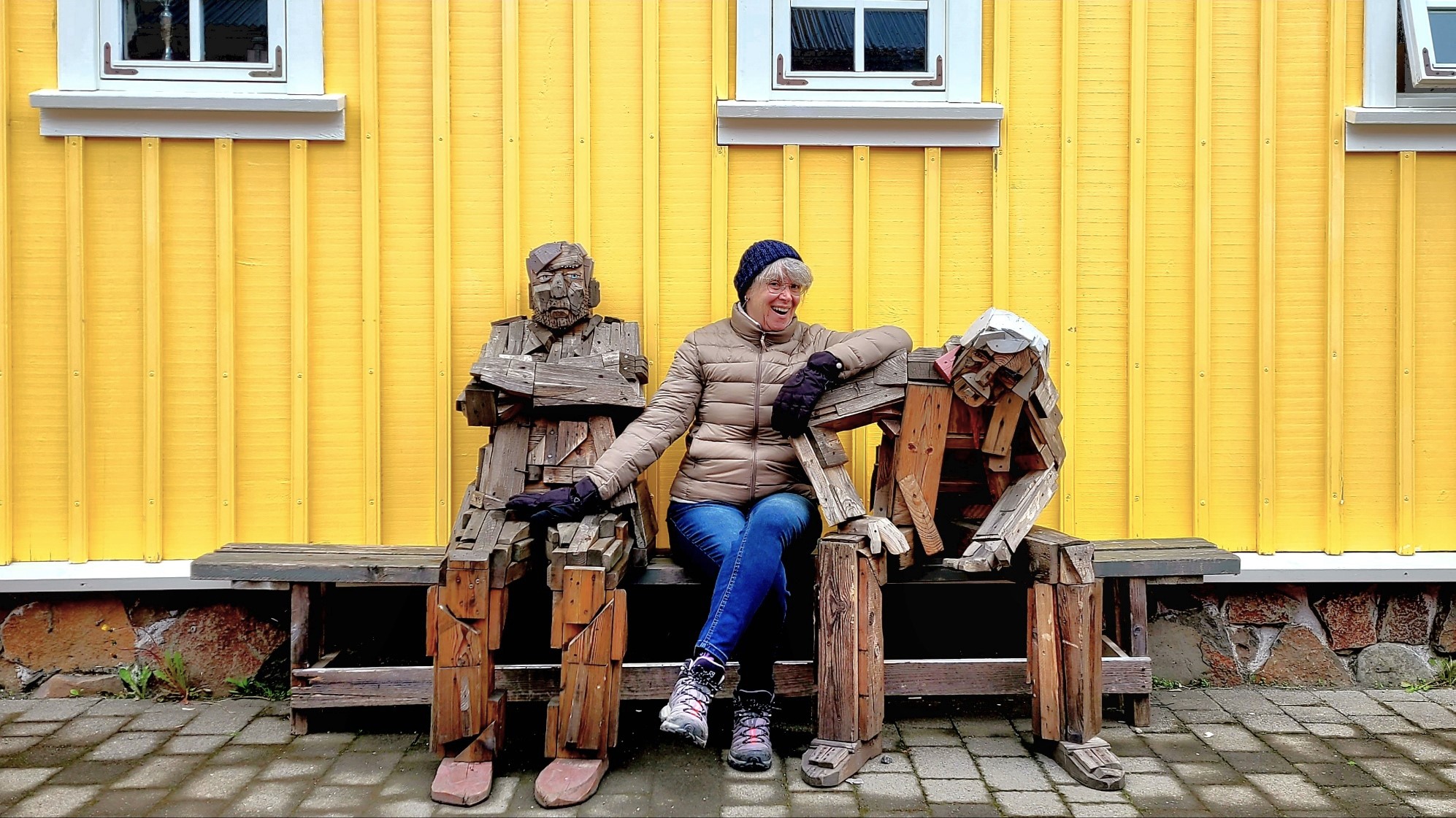
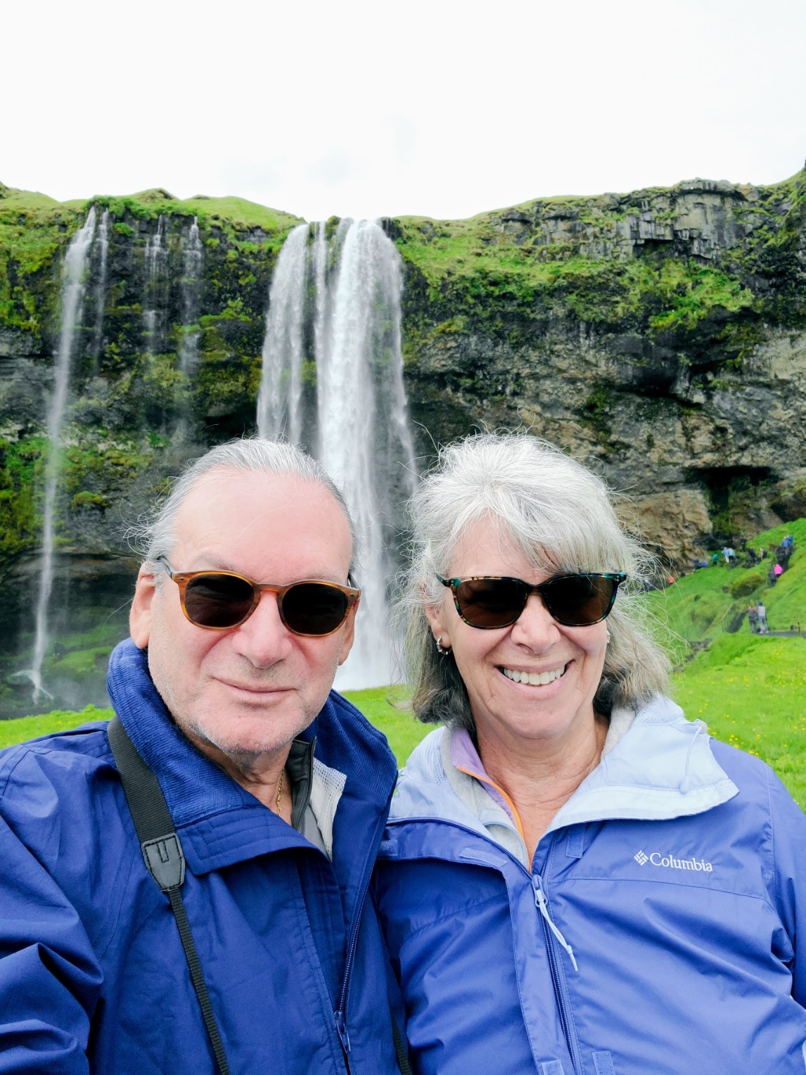
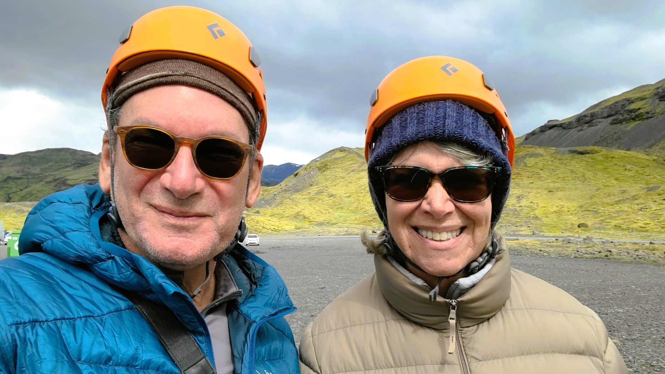
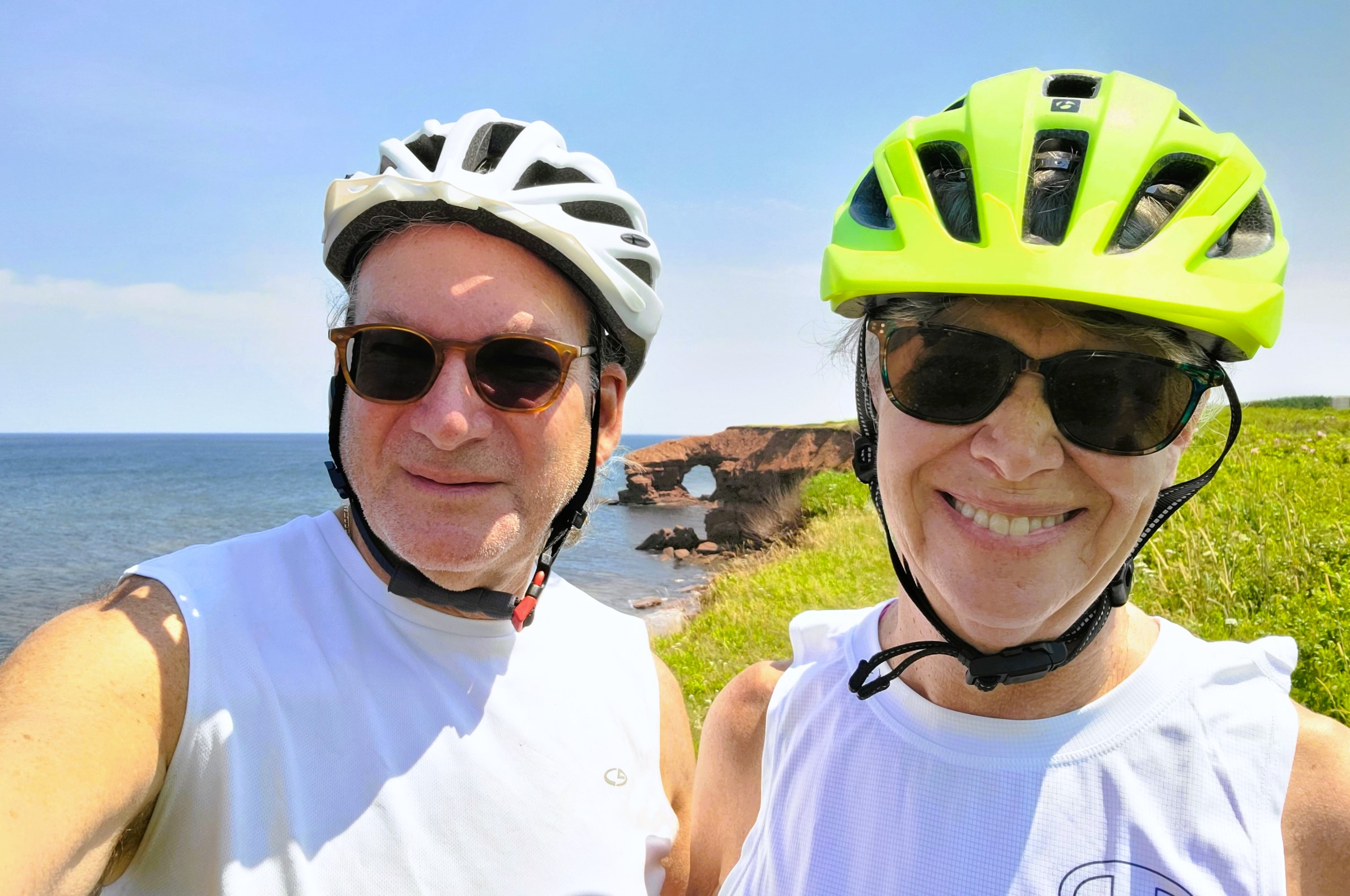
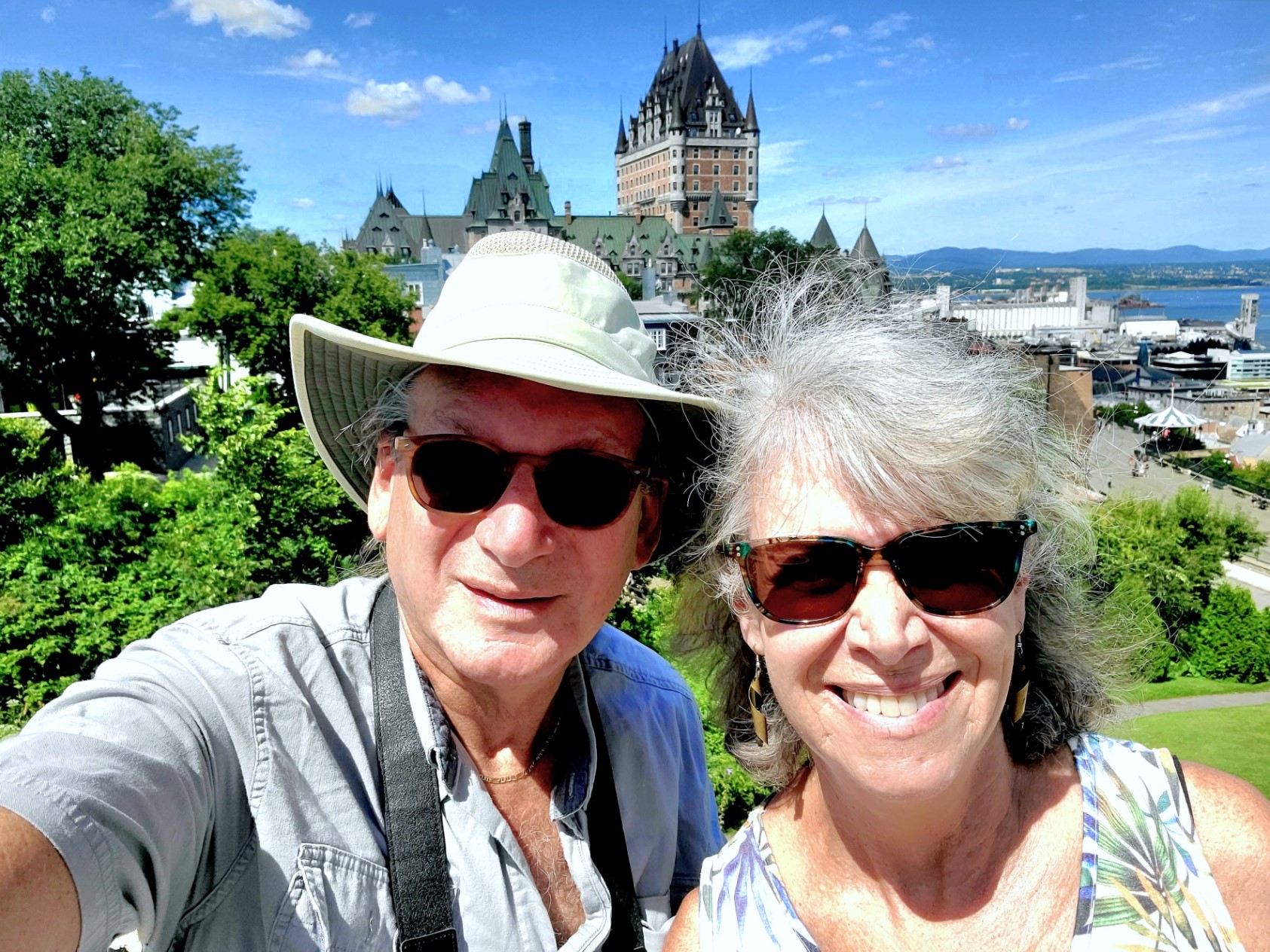
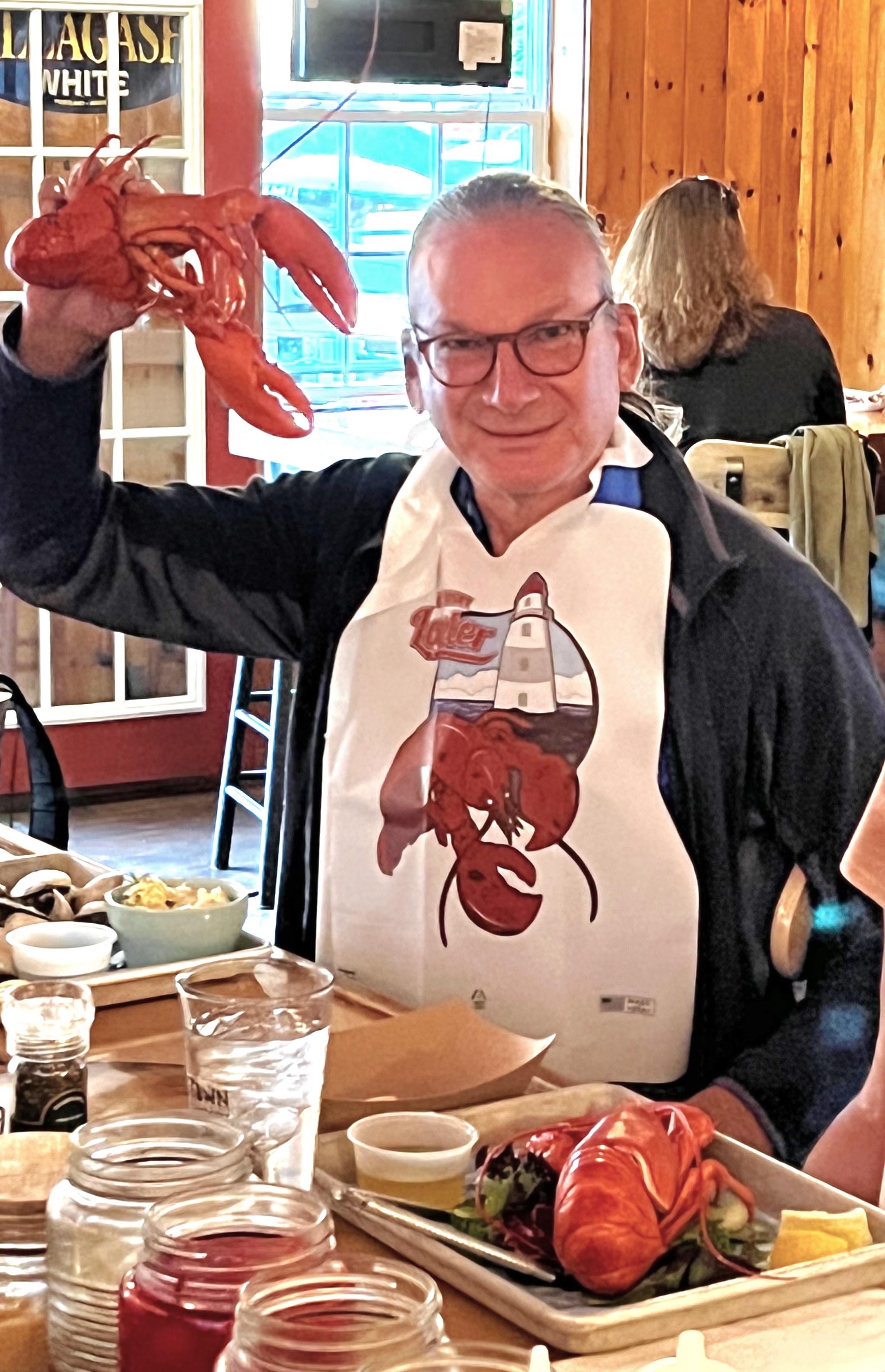
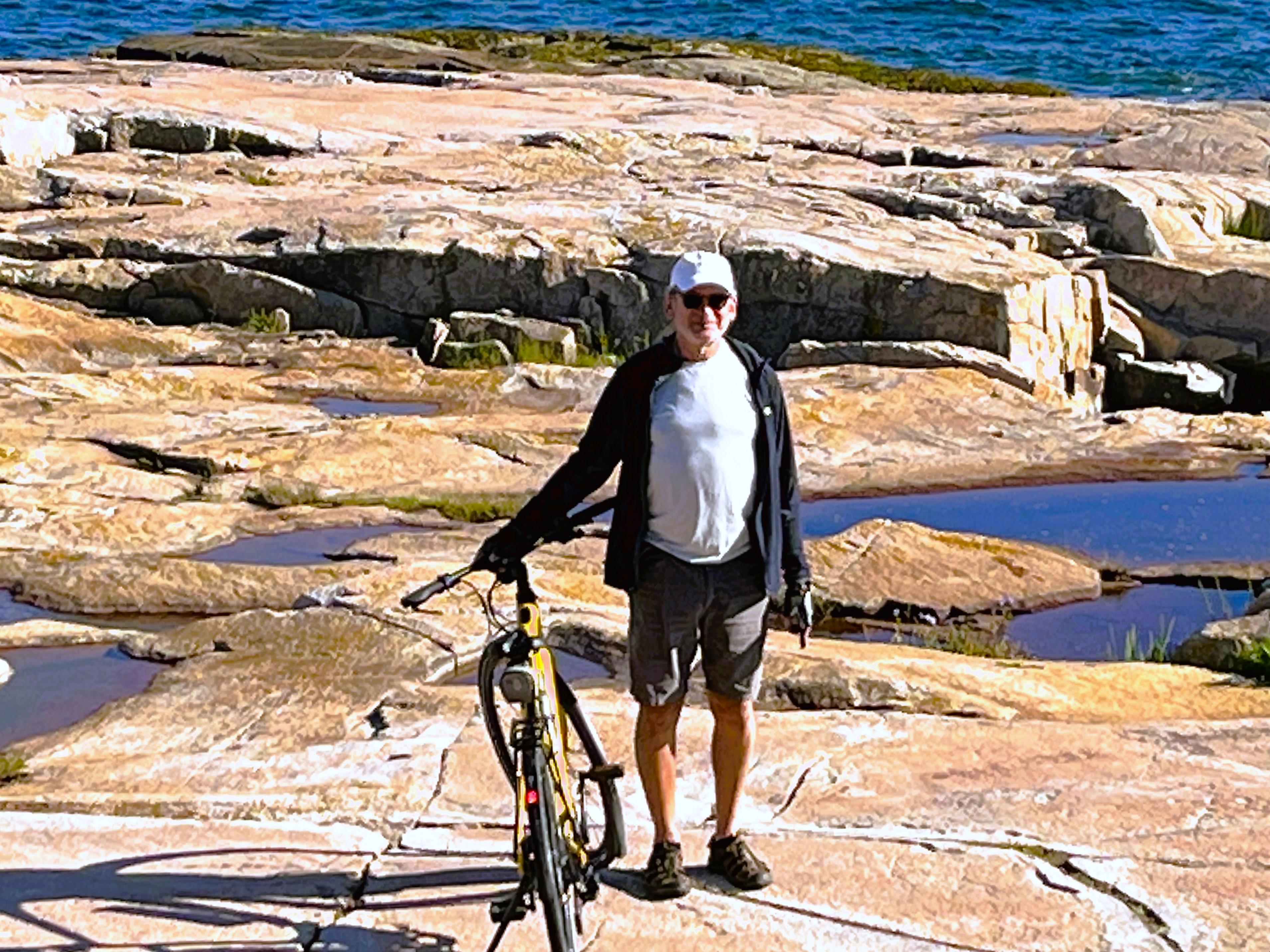
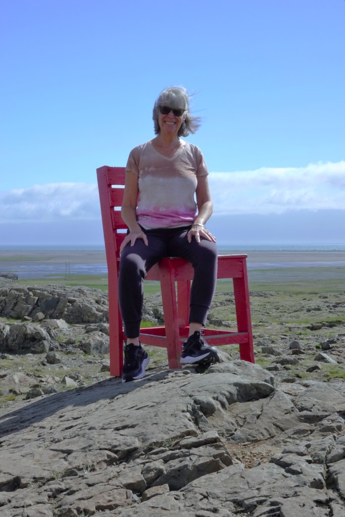
What follows is this summer’s shameful display of selfies and portraits of familiar faces from faraway places.
And there are instances and circumstances when the background becomes the most important element in the picture:
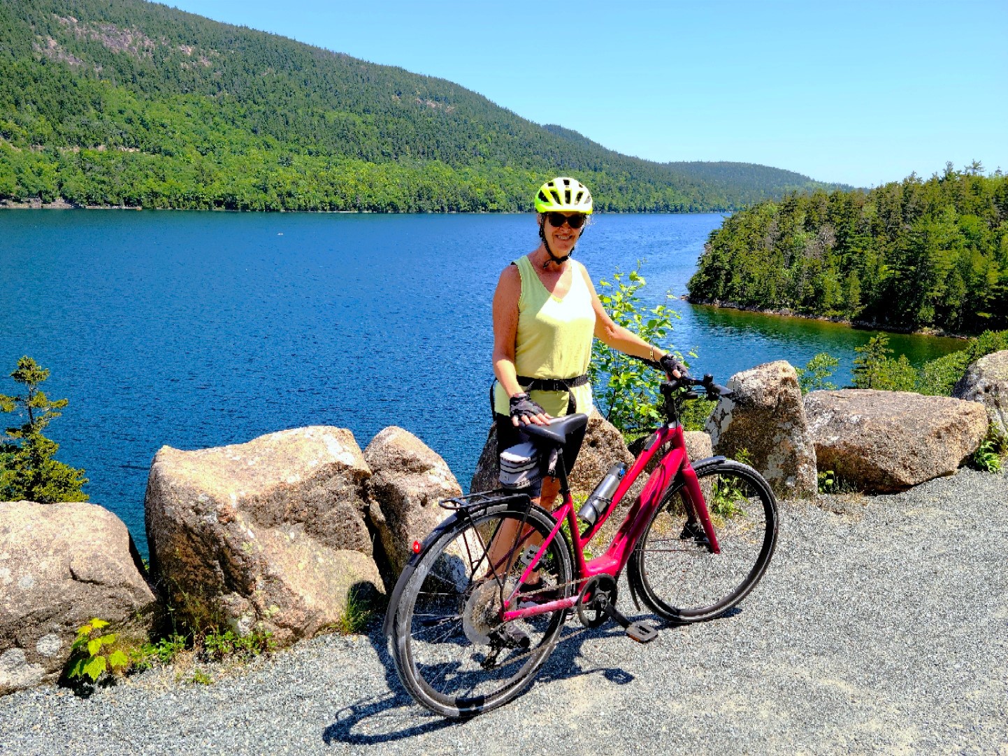
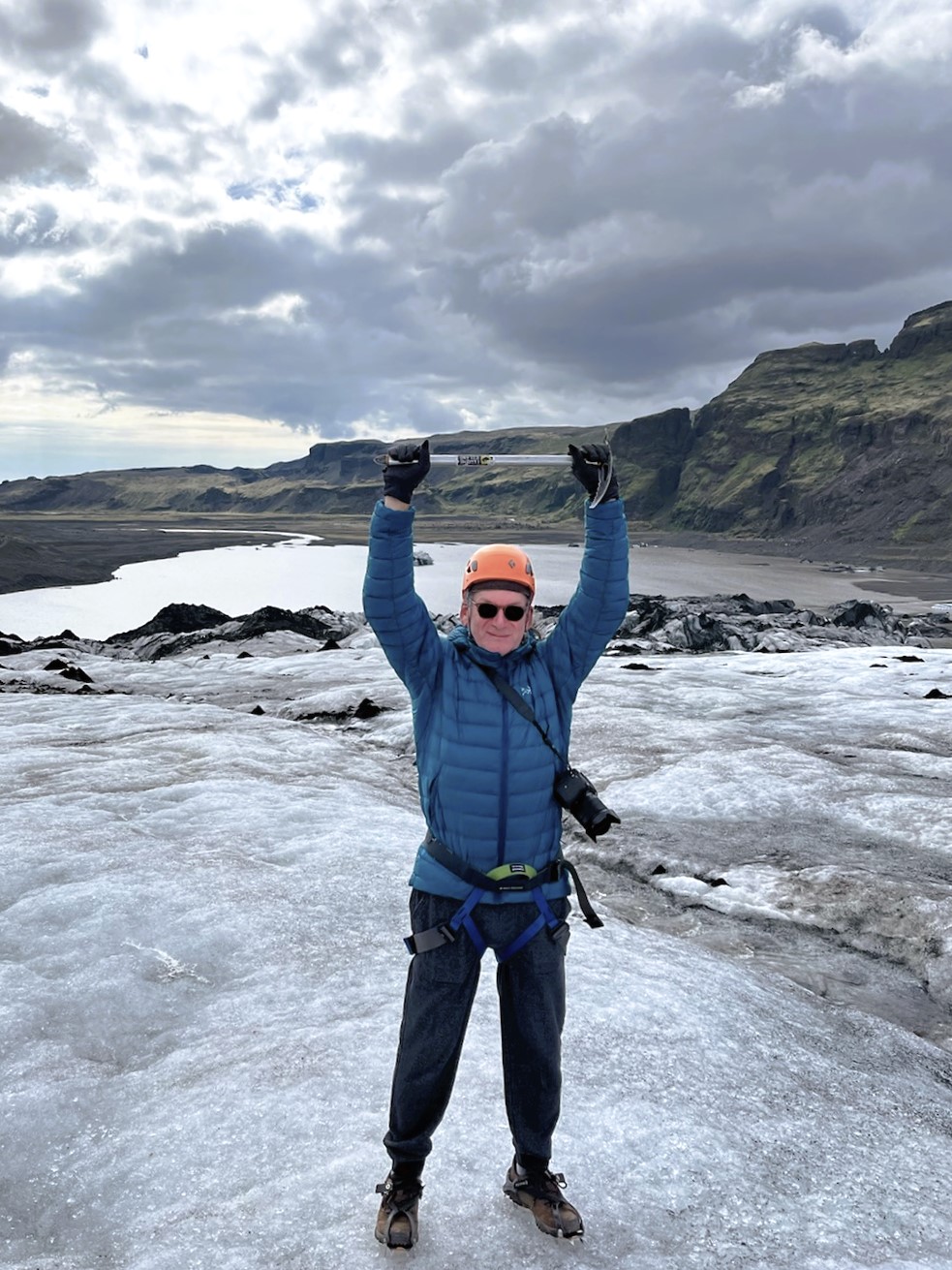
Finally, there are occasions when I get to strut across nature’s catwalk, and Leah is mostly there to capture the moment:
This blog was never intended as a vanity project, and I was never under any illusion that posting my travel adventures would ever turn me into a world-wide influencer. But at the very least, there are precious moments when I get to star in my own production.
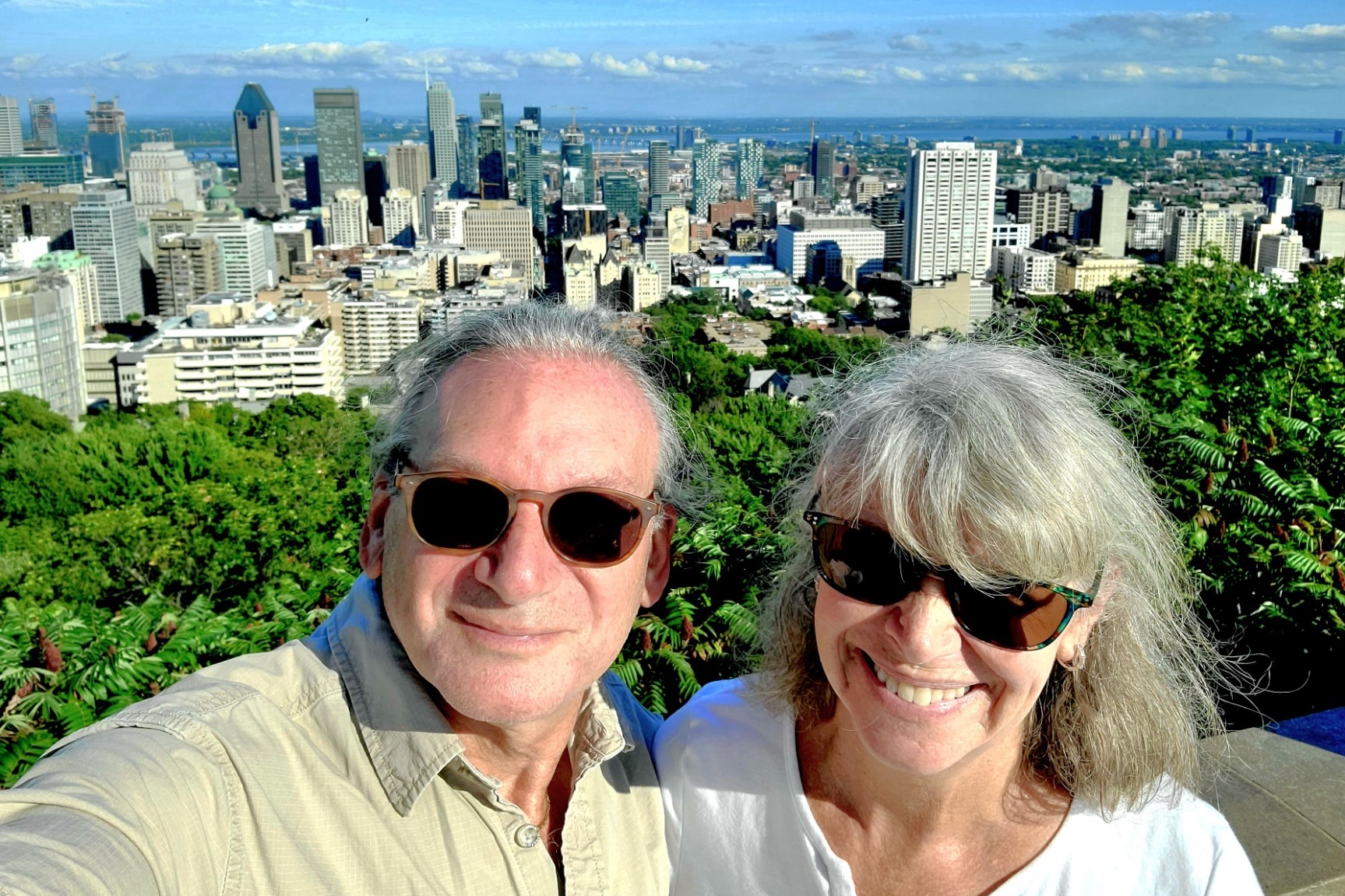
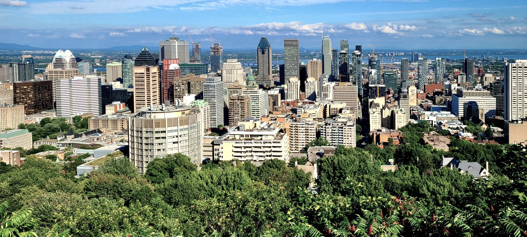
It took a few days of walking, cycling, and driving around Montréal before Leah and I found our bearings from atop Mont Royal.
We roamed the rues and parcs of the city in search of historic, cultural, and architectural significance–with an emphasis on good food…and we found it in many of the neighborhoods we visited.
Nouilles de Lan Zhou – Noodle Shop
We followed in the steps of 6 million annual tourists who stroll, bike, blade and run between Notre-Dame-de-Bon-Secours Chapel (1771),
and the Sailors’ Memorial Clock (1922) at the Vieux-Port de Montréal (Old Port).
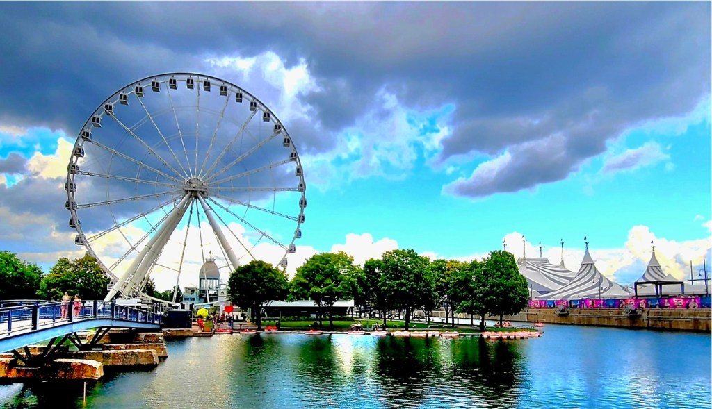
We shared a laugh after spotting yet another monster-sized Ferris wheel on the pier, but La Grande Roue de Montréal, erected in 2017 to celebrate Montréal’s 350th anniversary is one of several family attractions that appeal to tourists near and far.
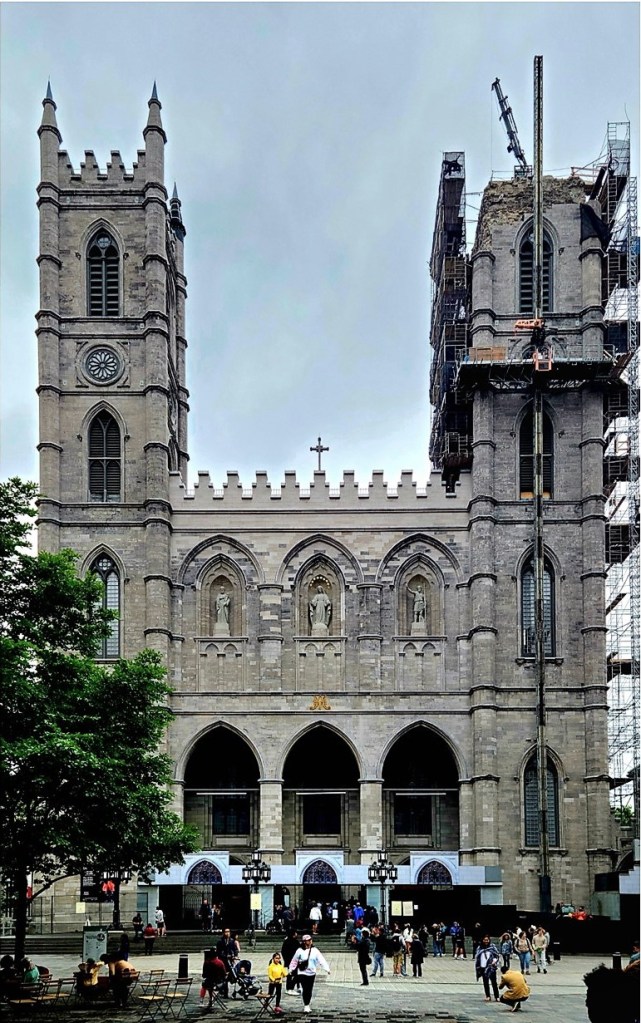
In 1642, New France took root on the banks of the Saint Lawrence River, where French traders and the Crown established a fort (Ville-Marie) in support of a flourishing fur trade. Roman Catholic missionaries followed, intending to establish a North American parish that could convert the Iroquois to Christianity, and build a cathedral that was worthy of a New World capital.
Notre-Dame Basilica was designed by James O’Donnell in a Gothic Revival style, and built behind the original parish church.
Robert Auchmuty Sproule (1799-1845)
The sanctuary was completed in 1830,
and the towers followed in 1841 and 1843.
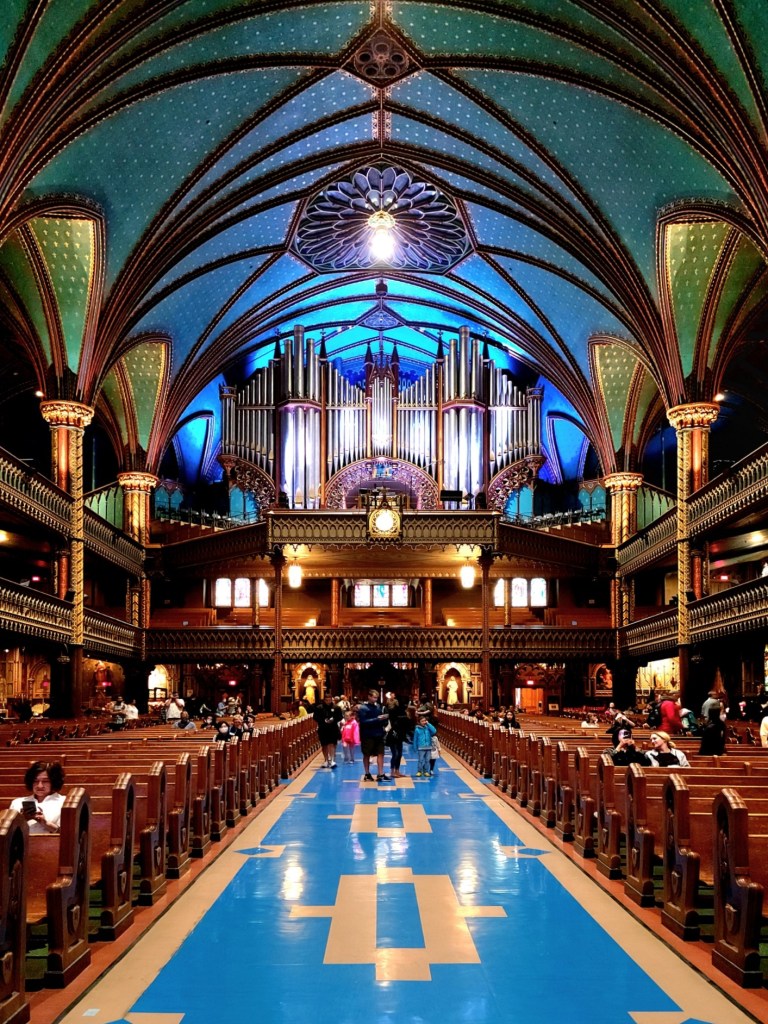
The interior’s intricate stone and wood carvings were completed in 1879.
The pipe organ dates to 1891. It comprises four keyboards, 92 stops, 7000 individual pipes and a pedal board.
Arson destroyed the more intimate Sacre-Coeur Chapel in 1978, but it was rebuilt from original drawings, and finished with an immense bronze altarpiece by Quebec sculptor Charles Daudelin.
It’s a 5-minute Metro ride from downtown to Parc Jean-Drapeau, an island park surrounded by the Saint Lawrence River. Half the park is natural (Saint Helen’s Island) and the other half is artificial (Ile de Notre Dame), conceived with rock excavated from Montréal’s Metro tunnels.
The park is a fitting tribute and memorial for its namesake, Jean Drapeau. As mayor of Montréal (1954-1957, 1960-1986), he was instrumental in bringing Expo67 to his city. Drapeau is also remembered for securing the 1976 Summer Olympics for Montréal, as well as successfully lobbying Major League Baseball for a major league franchise during its 1969 expansion (Kansas City Royals, Montreal Expos, San Diego Padres, and Seattle Pilots).
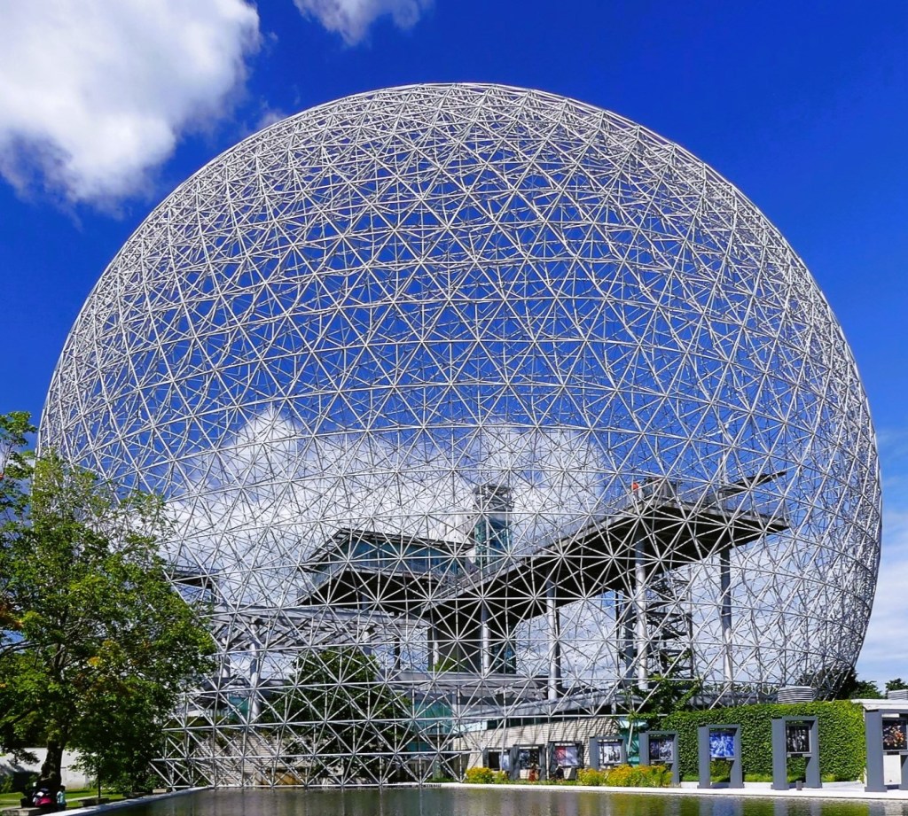
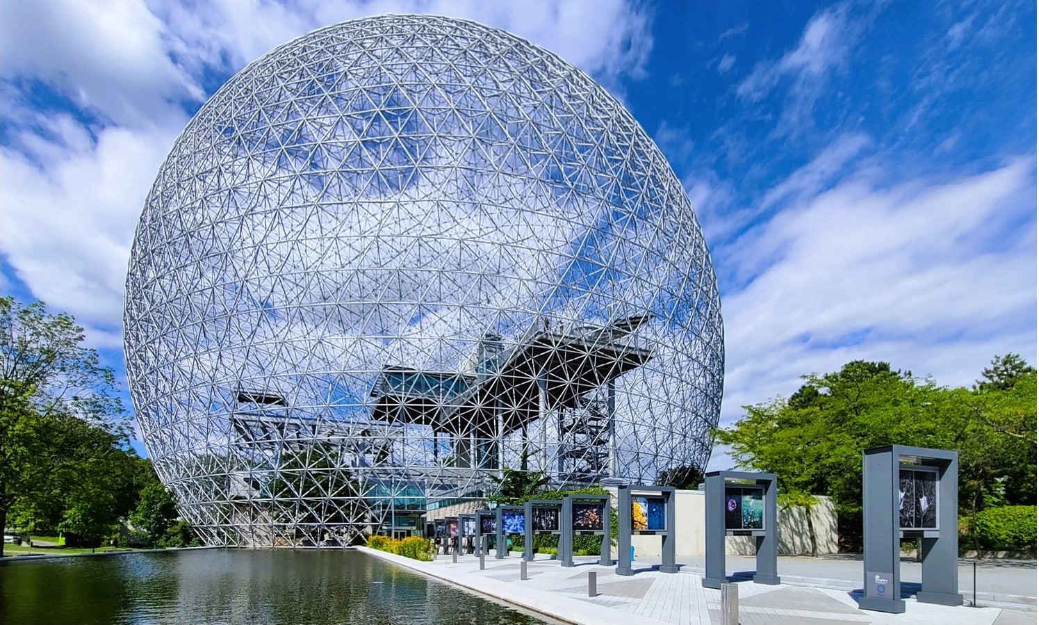
Few pavilions from Expo67 remain on the island. Notably, the French pavilion has been repurposed as Canada’s largest casino.
And the United States pavilion, featuring Buckminster Fuller’s geodesic dome has also been preserved, despite a fire in1976 that burned through the structure’s acrylic bubble, leaving only the steel trusses.
Fortunately, the exhibition space within the dome was spared, and has been transformed into an interactive museum named Biosphere, that tells the story of our environment through several rooms of multimedia presentations,
and a wraparound theater space.
But its the iconic geodesic dome that most visitors have come to experience. The New York Times picked the dome as one of “the 25 Most Significant Works of Postwar Architecture.”
Geometry majors may discover 32 triangles from the center of each vertex to the next vertex.
Montréal is also a culinary haven for foodies. We sampled wood-oven-baked bagels from St-Viateur, and smoked meat from Chez Schwartz in the Jewish Quarter. For dinner, Leah and I migrated to Chinatown to sample the fare with Jennifer, a dear friend in town for business.
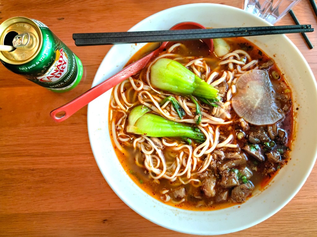
We settled on a tasty meal of soup dumplings at Mai Xiang Yuan Dumpling, but wondered out loud about the long queue out the the door for Gol’s Lanzhou Noodle Shop.
We made a mental note and returned to Gol’s the following evening, only to find another long line of future diners waiting patiently. I spent my wait time studying the noodle maker through the window…
and tasted his skillset in my meal when we were finally seated and served a tureen-sized portion of steaming heaven.
Authentic Lanzhou braised beef and noodles
These were beef noodles to stand in line for, whenever I’m back in Montréal.
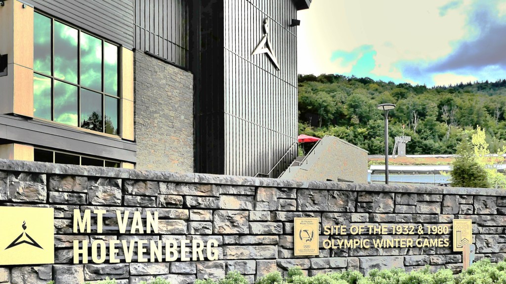
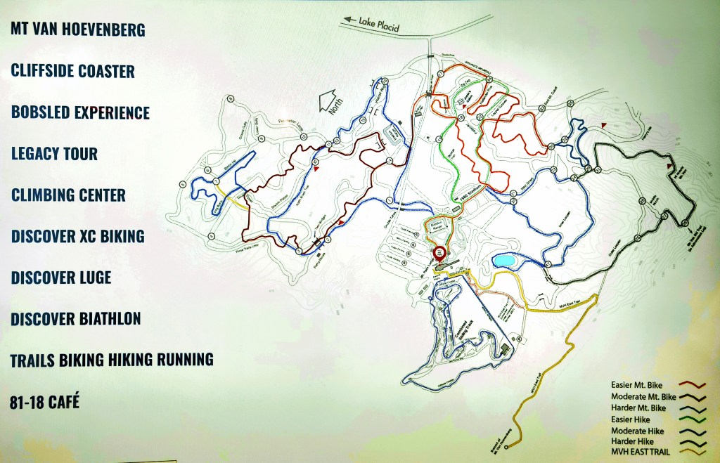
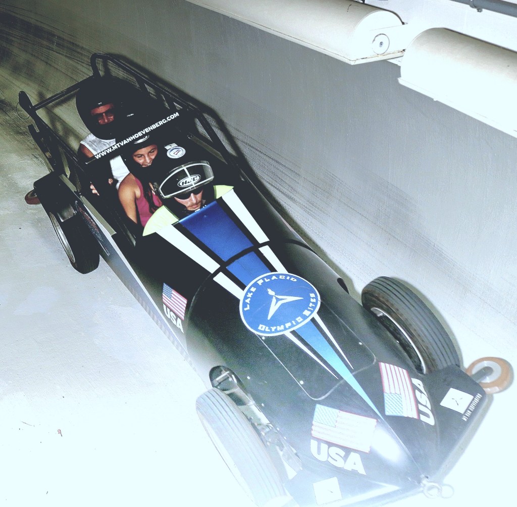
I treated myself to a bobsled ride at the Nordic and Sliding Center in Lake Placid for no particular reason, and it was amazing.
Yet the notion of barreling down Mt. Van Hoevenberg in a pocket rocket was never part of my original bucket list…although it should have been. So I added it, just so I could cross it off my list.
True, there’s another bobsled run in Park City, but I’m not schlepping to Utah for another sliding track if I’m already here. Besides, Olympic history was made at Lake Placid, when the Americans defeated the Soviets in the men’s hockey finale.
Leah had less than zero interest in joining me, so I was on my own. Unfortunately, she was nursing a bad lower back the past few days, and missing out on a world of world-class activities–
while I was anticipating the thrill of winding through a dozen curves in a rumbling sled, and wondering how I would capture it all without dropping my phone. Carpe diem, all the way!
I filled out a “hold harmless” waiver online; showed the attendant my drivers license (although I wasn’t driving); and booked a 1pm run-time for $125. I thought it a bit pricey for a 55 second experience, compared to the “value” of free-falling from an airplane (Free Fallin’ Off My Bucket List),
or riding Class 4 and 5 rapids on the New River (New River Gorge), but at least I’d have bragging rights among friends.
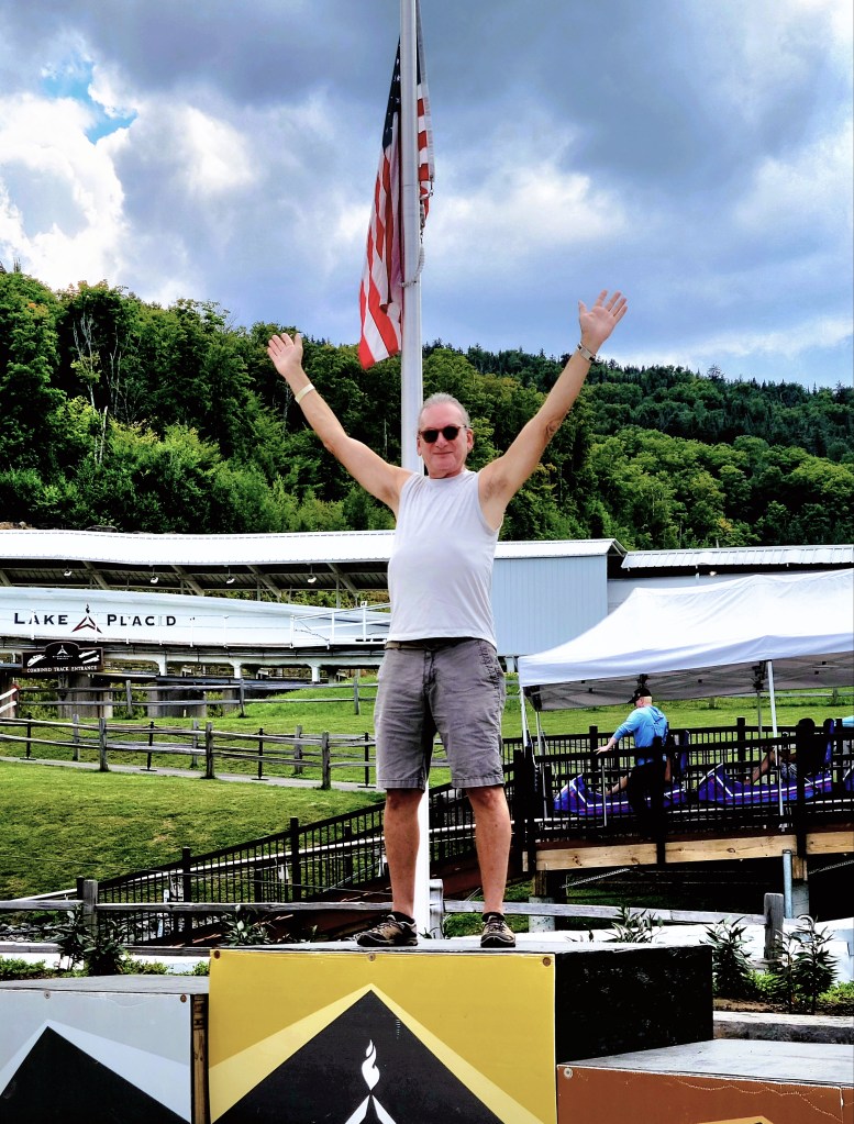
Leah was willing and able to join me on the Legacy Tour, where we previewed the Olympic Center’s newest facility–the first of its kind, indoor push-track for bobsled and skeleton in the United States–
where athletes can practice start gate techniques for skeletons, and bobsleds. But they’ll need to dress for winter, because it was like a mammoth refrigerator inside!
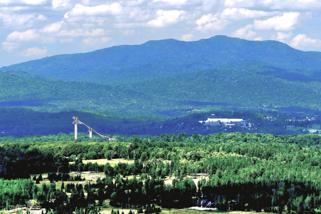
We warmed up while examining the 1980 track, which is built atop the 1932 track, which runs parallel to the Cliffside Coaster, North America’s longest coaster.
Next, we boarded a bus that drove us to the 1st of 4 start gates of the Combined Track, completed in 2000…
for a look at what $50K to $100K will buy these days.
Then we walked the upper course…
past Curve 1…
to Start Gate 3…
with a distant view of the Ski Jump Center.
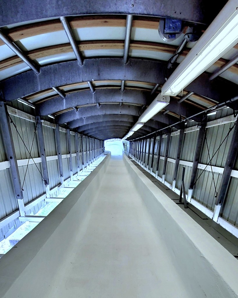
I shared my downhill ride with an anonymous coed, who took the first position behind the driver. I squeezed in behind her, with my butt planted on a quilted foam pad. Definitely, not the best position for a bad back, so Leah was right to sit this one out. Instructions were simple: hold onto the inside bars with both hands.
“But how will I video this?” I asked.
The attendant picked his words carefully: “You didn’t hear this from me, but if you hold your phone near the edge of the sled and brace your arm against the roll bar, your phone should fall into the sled if it slips out-ta your hand.”
We got a push and we were ready to roll…
Mt Van Hoevenberg, Lake Placid–Aug 20 ’22
We posted a respectable 52.25 seconds over the 1500 meter run. Olympian athletes can reach speeds of 90mph barreling down the same course.
While not the fastest run at 48mph, it was quick enough to earn me a moment on the gold medal podium.
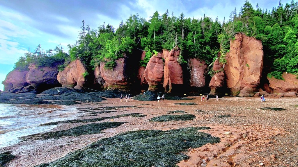
Île-Aux-Foins Park–Neguac, NBHopewell Rocks–Hopewell Cape, NB
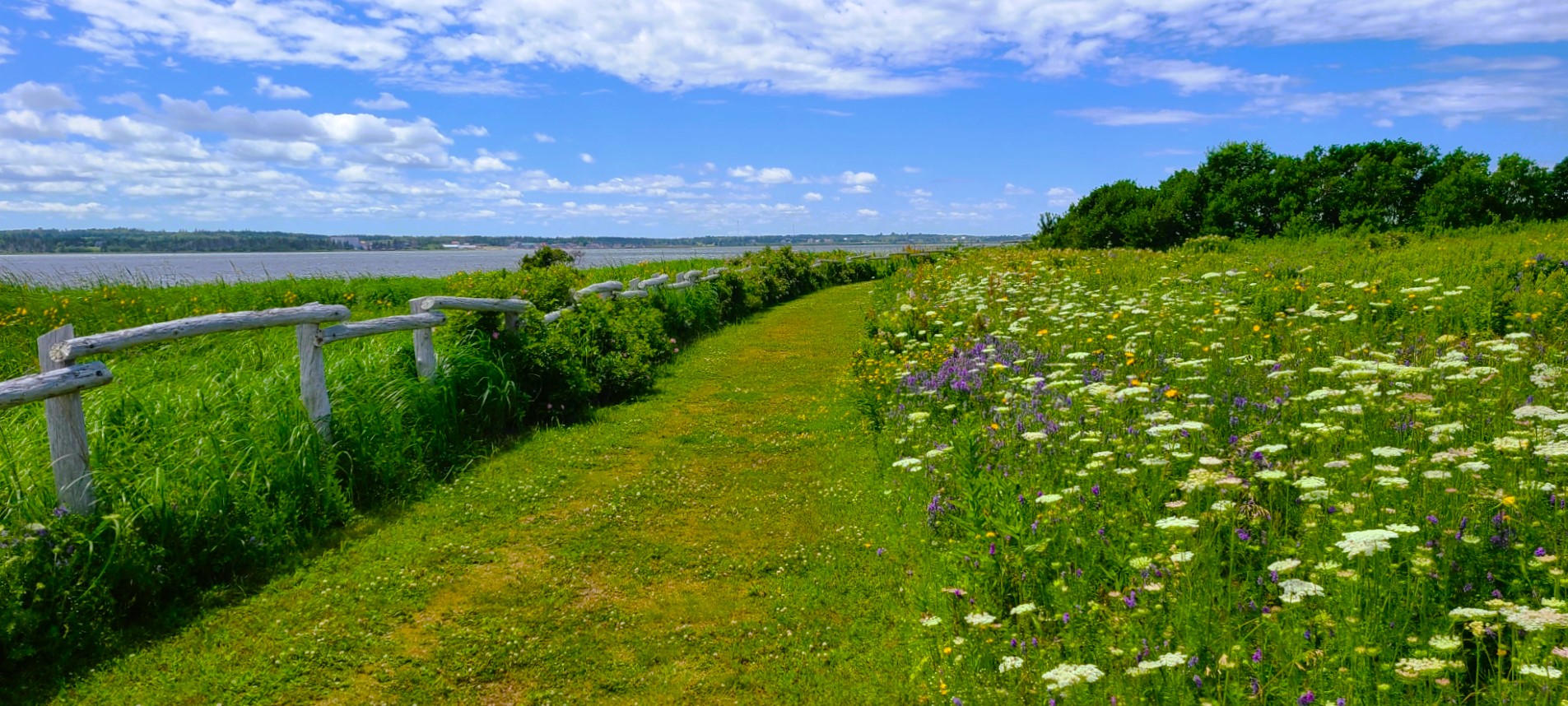
and Prince Edward Island…
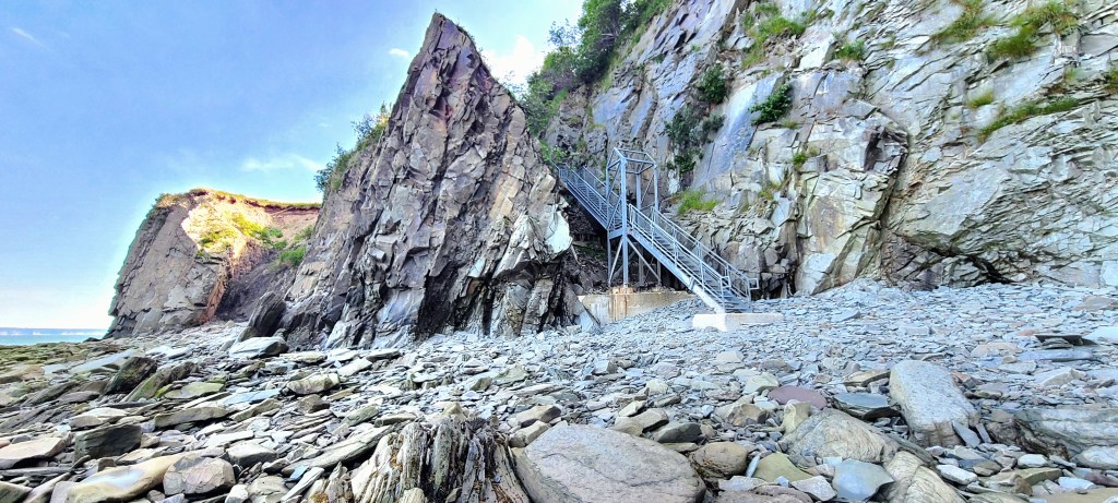
MacKenzies Brook–Cavendish Beach, PEIGreenwich Trailhead–Saint Peters Bay, PEI
in our Airstream Globetrotter,
Beach Rose RV Park–Salisbury, MA
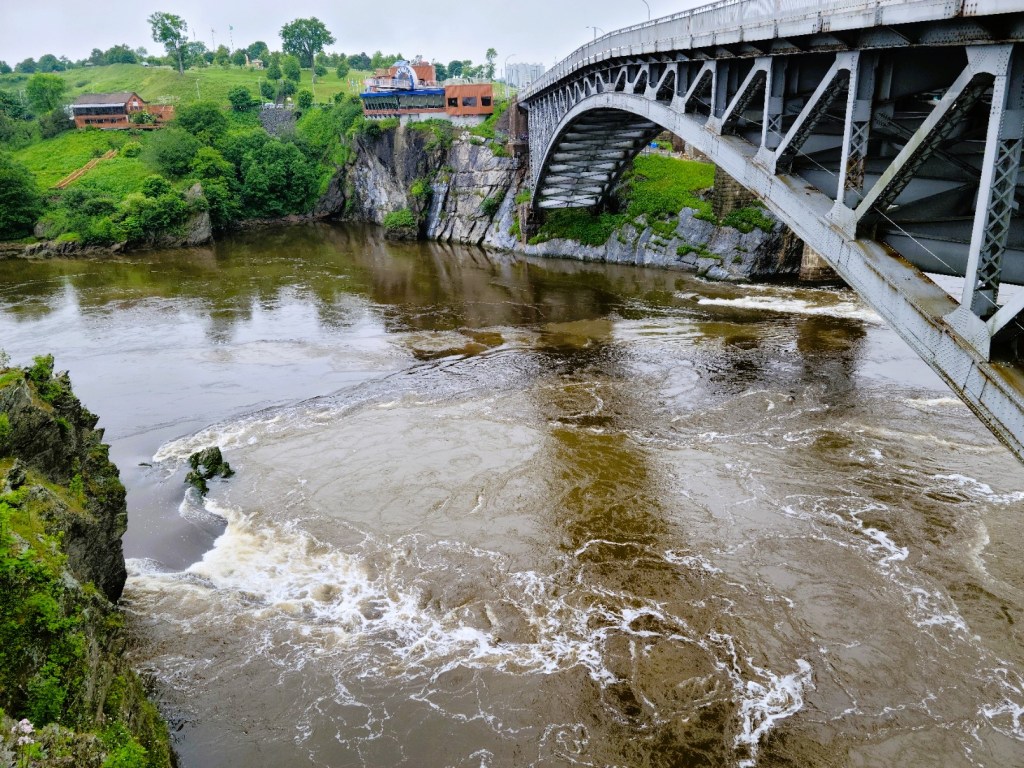
with a stopover in Grand Falls, NB…
Grand Falls Gorge–Grand Falls, NBGrand Falls Gorge Trail–Grand Falls, NB
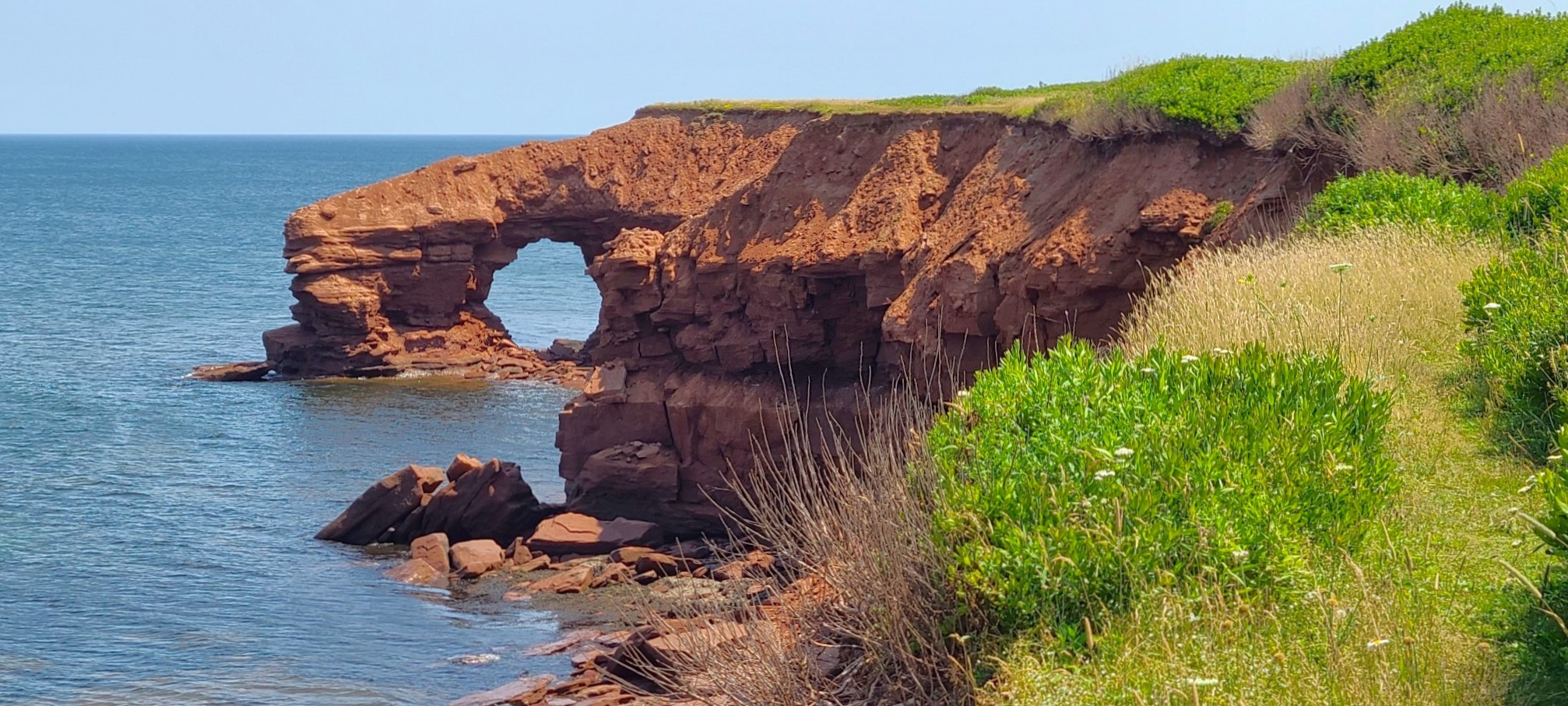
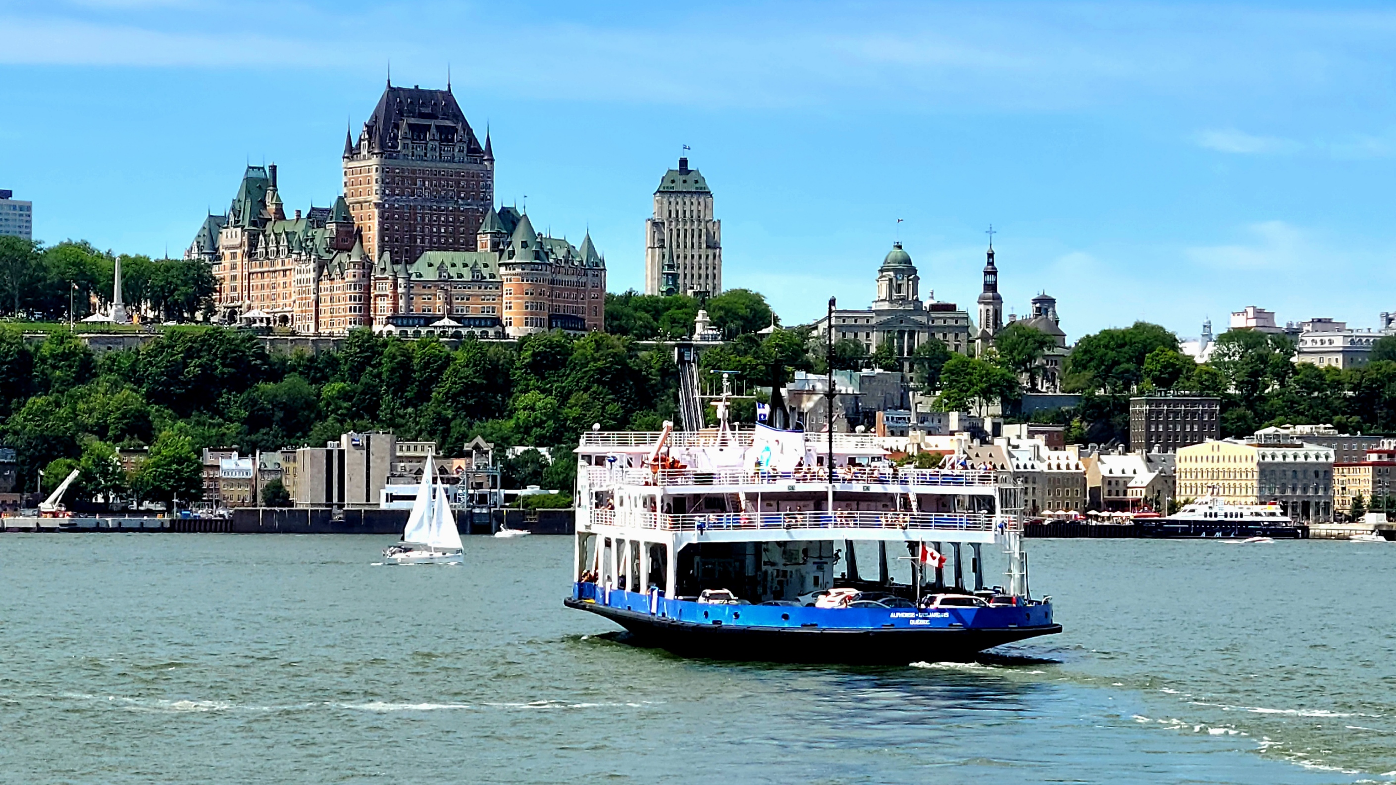
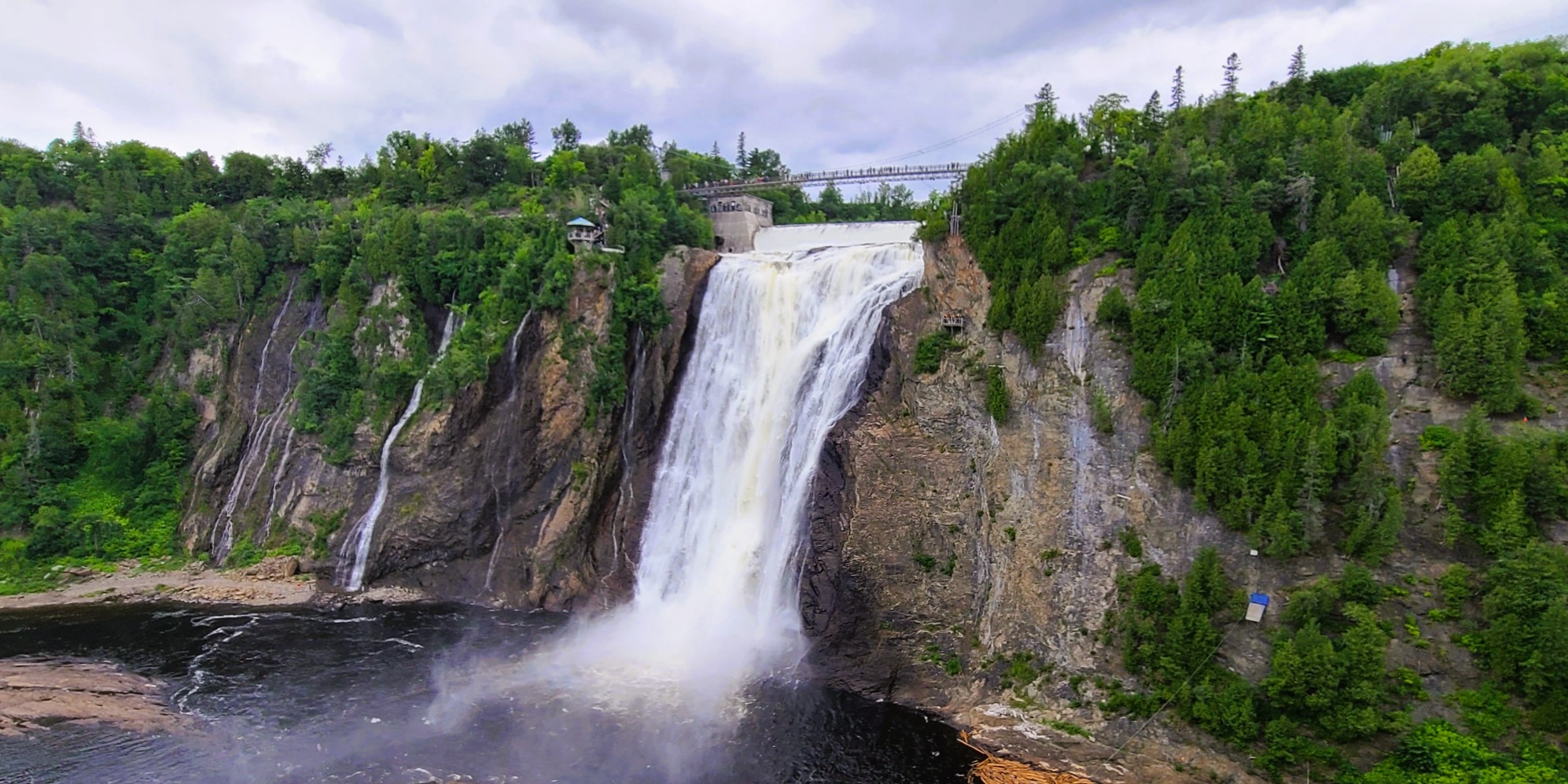
before following the St. Lawrence River from Quebec City…
Saint Lawrence River–Quebec City, QCMontmorency Falls–Quebec City, QC
to Montreal.
Mont Royal Park–Montreal, QCBiosphere, Parc Jean-Drapeau–Montreal, QC
Yet all the while, I’ve been reporting on our epic, 2-week adventure in Iceland. Needless to say, it’s been a bit disorienting with my body in Canada and my mind’s eye in Iceland.
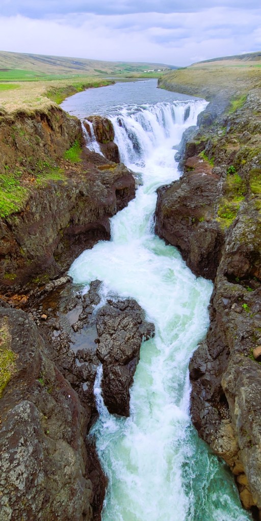
Dynjandi–Arnarfjörður, Iceland
And to further complicate the blog timeline, Leah and I recently bid ‘adieu‘ to Canada, without posting from our Canadian exploits.
Currently, we are spending the week in Lake Placid,
Lake Placid from Whiteface Mountain summit,–Wilmington, NYAuSable Chasm–Wilmington, NY
where once again, I find myself struggling to regain my geographical balance within the space-time continuum.
Which presents a new dilemma: do I recreate my travel chronology (starting with Acadia National Park) and continue reliving the past, or do I write about where I am, here and now?
I’ve given it lots of thought, and have come to the conclusion that writing about faraway places is far easier when I’m not so far away–in space and time.
Of course, I reserve the right to blog about past Canadian adventures, but only from a distance.
*All photography taken with my Samsung GS20 Plus 5G smartphone.
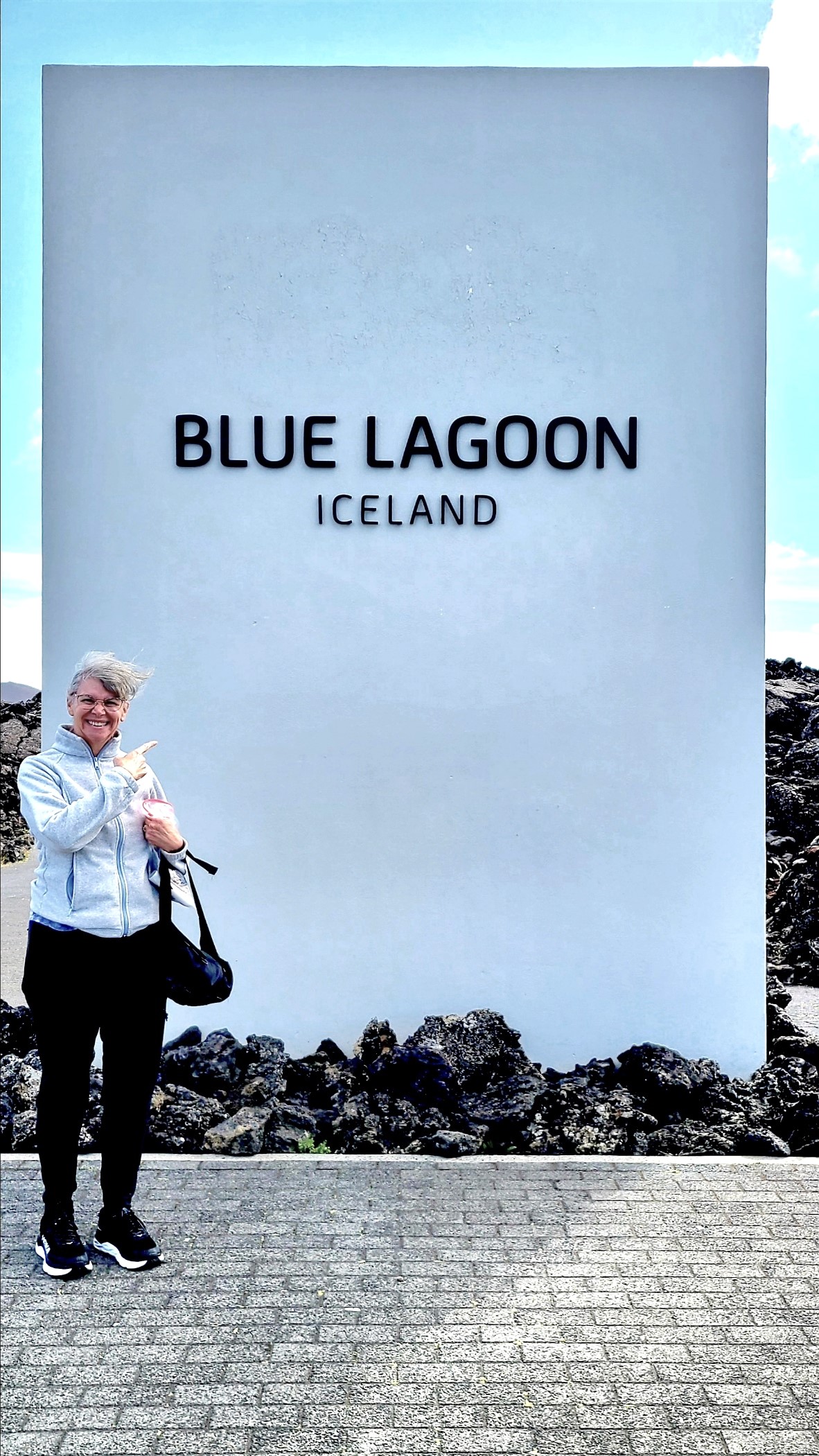
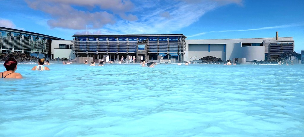
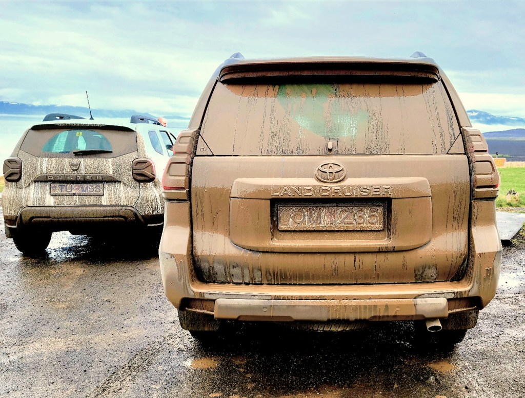
Today was departure day. While other travelers were hastily checking out of Grandi to meet their airport connections, Leah and I had other plans. We had purposely booked an evening flight to give us another day of touring, but nothing too rigorous. We jumped on the option of keeping the Land Cruiser, and driving ourselves to the airport, coupled with a visit to Blue Lagoon.
Photo Credit: Ragnar Th Sigurðsson/Arctic Images
After two weeks of circumnavigating the country/island for a total of 2020 miles, we were more than ready for a few hours of rest and relaxation before battling the airport madness.
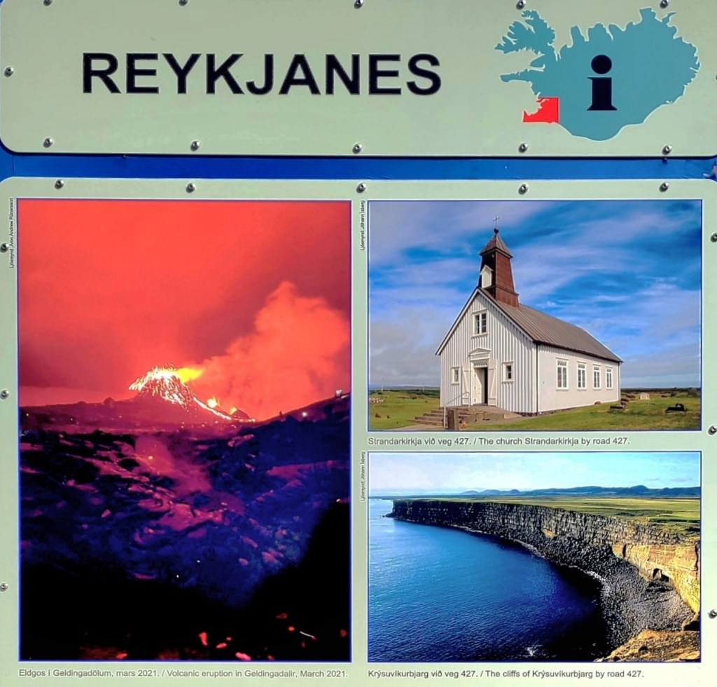
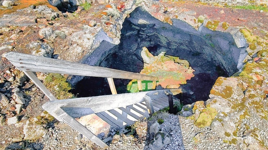
We stopped briefly at a roadside turnoff in Reykjanes to explore our surroundings,
and spelunk a small crater from last year’s eruption.
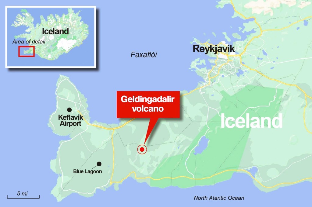
However, as I write this, I regret missing the spectacle of Iceland’s August 3rd eruption and lava flow of Fagradalsfjall’s Geldingadalir volcano.
Nevertheless, because of the fissure’s volatility, the landscape is scarred and uninhabitable, yet eerily beautiful.
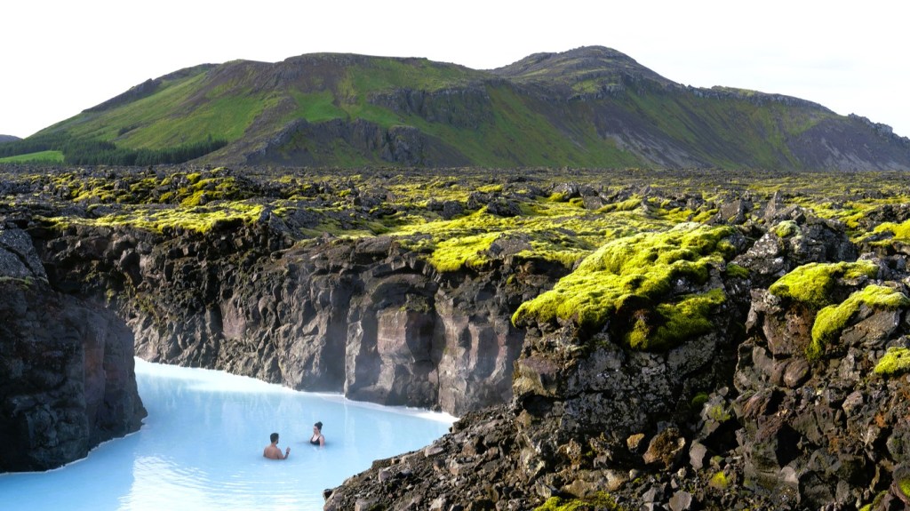
And because of Reykjanes’ geothermal properties, the Blue Lagoon has become legendary for the healing properties of its milky, mineral-rich waters.
Digression…
The social and political landscape of Iceland is an unusual paradox–progressive in some matters, while also Puritanical at times. For instance, currently 67% of women no longer consider marriage a precursor to children.
Nor is organized religion very popular these days. Although Iceland has adopted Lutheranism as its state religion, the majority of Icelanders identify as eitheratheist or non-religious.
Iceland is also a global leader in promoting and protecting gender rights and equality.
Which begs the question: How can a Penis Museum exist in the center of Reykjavik when Icelanders prohibit nudity at any and all pools, spas and beaches?
After arriving at Blue Lagoon registration,
we claimed our color-coded, “Comfort” bracelet, which entitled us to:
Entrance to the Blue Lagoon
Private locker
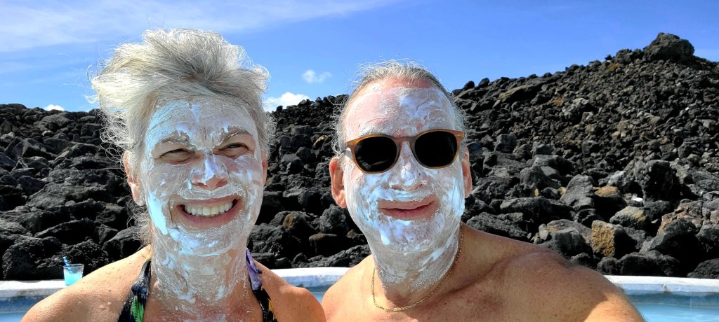
Silica mud mask
Use of towel
1st drink of our choice
We grabbed a towel on the way to our respective locker rooms–offering both public and private spaces for changing and showering. Once we located an available locker, we were directed to shower before entering the pool. Same-sex monitors were everywhere to assure compliance.
I met Leah outside the bathhouse with my towel and phone. The air temperature was 54oF and we were both shivering.
“What are you doing with your phone?” she asked.
“I need it to take pictures,” I answered.
“Don’t ya think you’re taking a big chance out there?” she continued.
“Probably,” I admitted, “but the water’s no deeper than 4.5 ft, so I’m not too worried. And NO splashing!”
“Okay, but just so you know–if you drop your phone, it’s gone forever. You’ll never find it in this,” she warned.
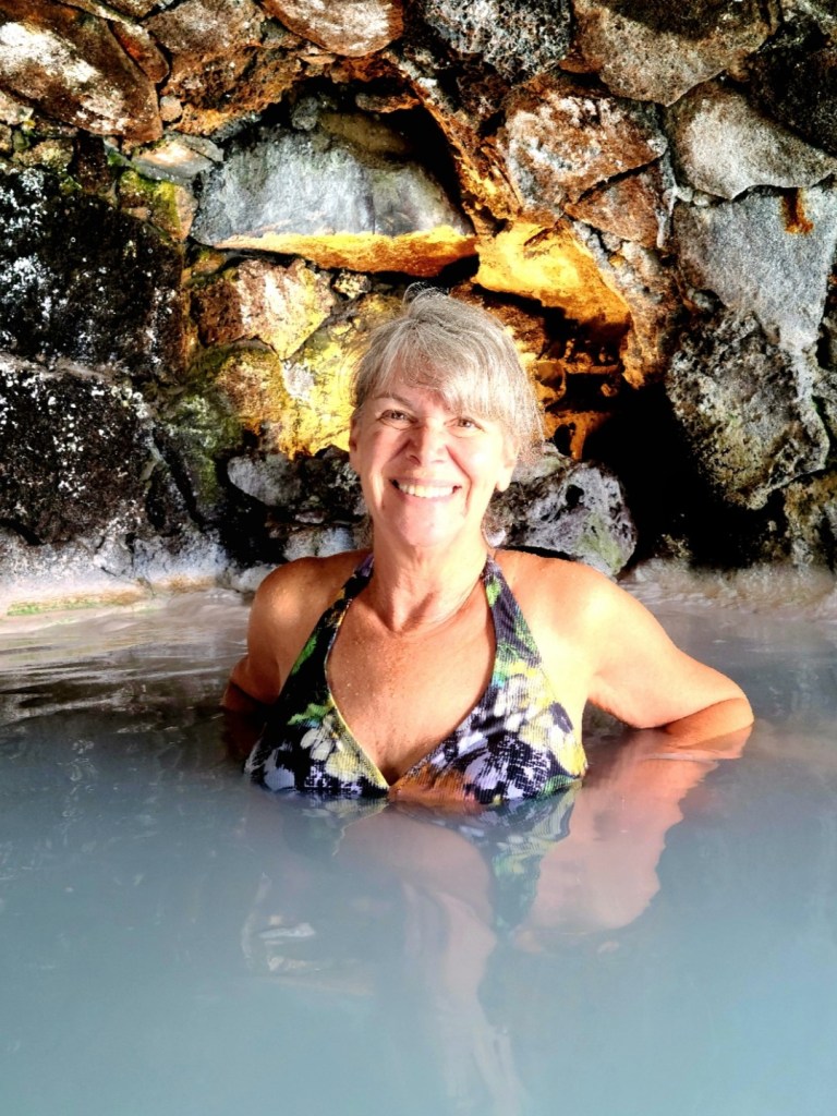
I gripped my phone with one hand and grabbed Leah’s hand with the other, and together we slipped into the warm, milky waters.
Ahhh!!
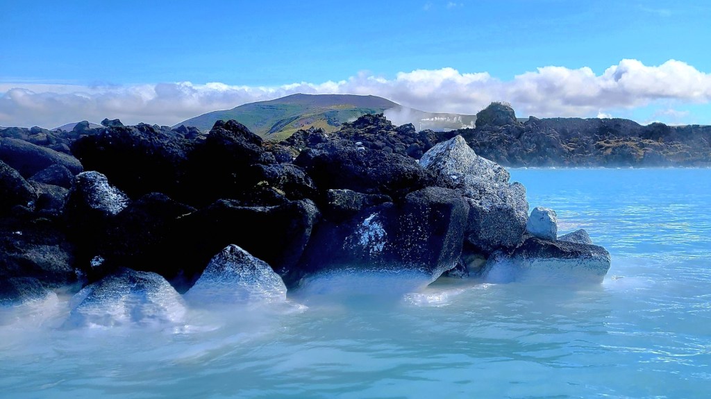
The water temperature felt like 90oF, but as we approached the bridge, rushes of hot water circulated around us with a thin mist hovering over the surface.
It’s hard to believe that Blue Lagoon was created by accident when engineers discharged geothermal plant condensate into a nearby lava field and expected the water to permeate the porous rock. But they didn’t consider that sedimentation would eventually clog the pores, and turn the fields into expansive reservoirs.
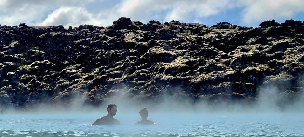
The lagoon didn’t seem overly crowded, but a lifeguard assured me that today was the busiest day since the pandemic recovery.
Although, the further we ventured, the fewer people we encountered.
until we reached the outer limits of the lagoon to enjoy a quiet moment by ourselves.
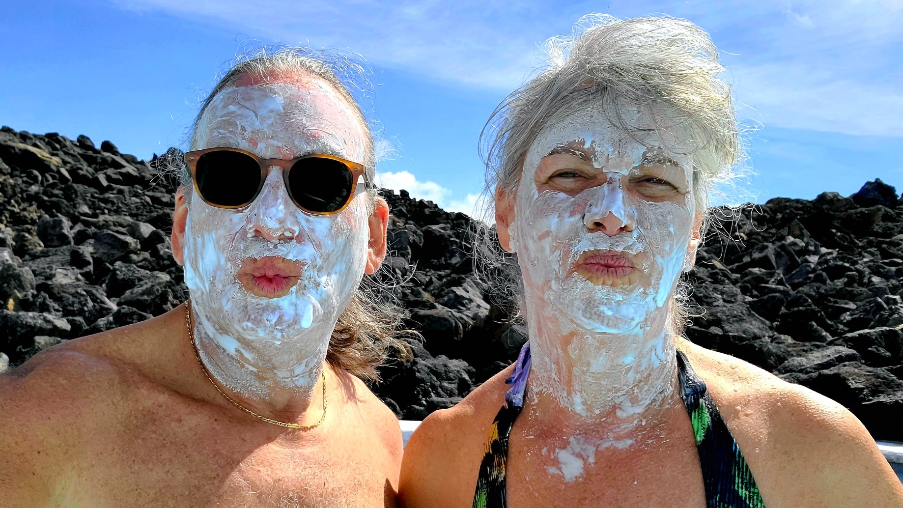
That’s when we realized that most of the crowd was either drinking around the bar,
or applying a silica mask doled out from the treatment kiosk. So we did both!
Unfortunately, our time in Iceland has come to a close.
We’ll resume our summer travels in Maine and Canada.
Till then, Kveðja Ísland! (Farewell Iceland!)
P.S. I didn’t sacrifice my phone to the Blue Lagoon.
Thanks to an earlier tour of The Cave Víðgelmir, Leah and I rolled into Reykjavik @ 4pm–an hour ahead of schedule–and it made all the difference. I immediately found a legit parking spot by the side of Grandi Center Hotel, and we quickly settled into our suite long enough to unzip and freshen up. Before long, we were out the door and heading for the harbor by foot.
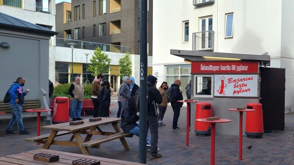
As we were in a hurry to walk the 1 km, there was no time for snacks…although, passing by Bæjarins Beztu Pylsur was tempting…
This little stand has been serving “the best hot dogs in town” since 1937, hence the name translated; although, some fast-foodies claim they’re the best in the world. In fact, hot dogs are so pervasive throughout Iceland, they are jokingly referred to as Iceland’s national dish.
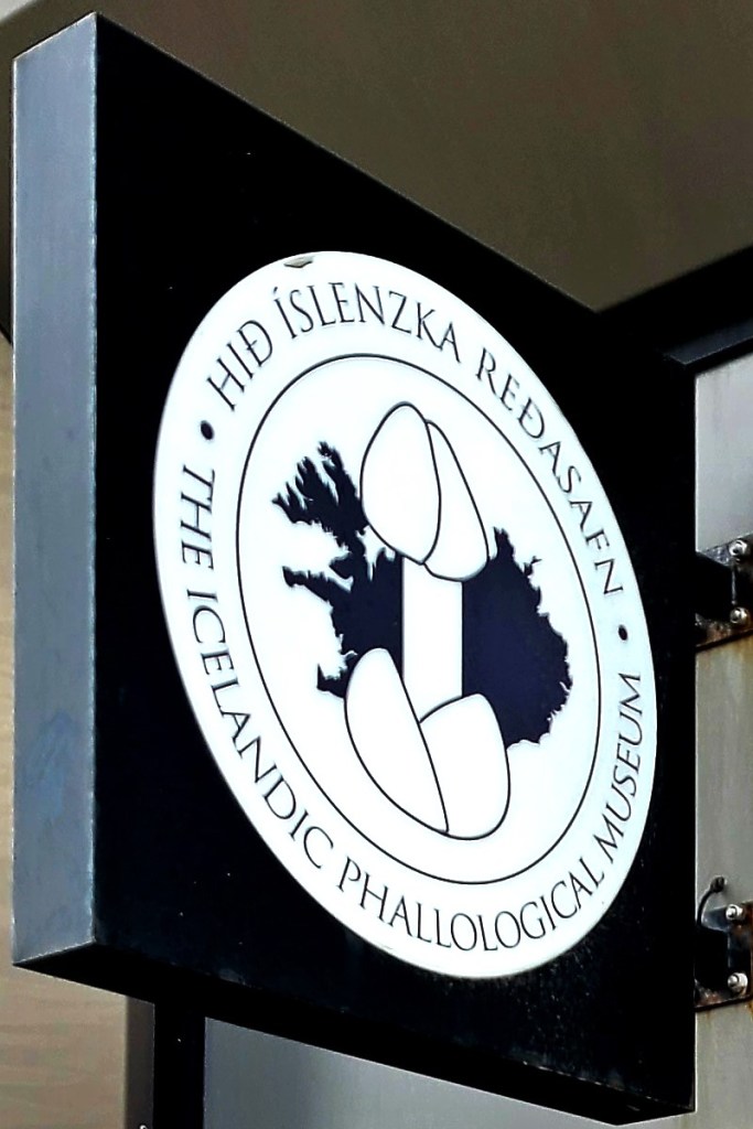
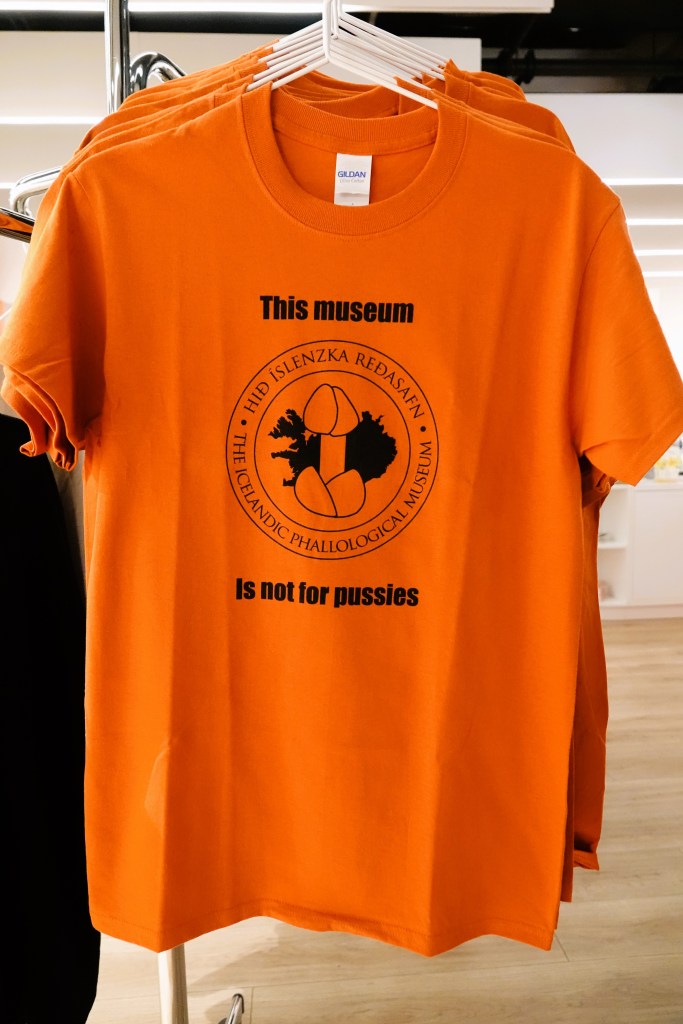
As much as I wanted a wiener, my mission to conduct hard research on “pizzles,” at the Icelandic Phallological Museum was time-sensitive; we only had an hour before closing.
The phallo-logic behind this museum is best expressed by Sigurður Hjartarson, the museum’s founder, who recently sat down with Felix Bazalgette, contributing writer for The Guardian.
In Sigurður’s words…
For most of my life I’ve been a teacher in Iceland, where I was born. In the 60s, I did a postgraduate degree in Edinburgh, but in the 70s I settled into life as a history and Spanish teacher in Akranes, a town north of Reykjavík.
One night in 1974, I was having a drink with my fellow teachers after school and playing bridge. The conversation turned to farming in Iceland – we were discussing how the industry finds a use for every part of the animal. Take lamb, for instance: the meat is eaten, the skin used for clothes, the intestines for sausages and the bones turned into toys for kids. Someone asked if there was a use for the penis, which made me recall how, as a child, I had been given a dried bull’s penis as a whip, to drive the animals out to pasture every day.
I was telling my fellow teachers about this and said that I would be interested in finding a whip like that again. “Well,” said one of my friends, “you might be lucky.” He was returning to his family’s farm that weekend and offered to find me some “pizzles” (a very old word for penis). I agreed, and the next week my friend came back with four bulls’ penises in a plastic bag. I took them to a local tannery and had them preserved. I gave three away as Christmas presents and kept the fourth. That was the start of my collection.
At first, it was a bit of a joke. It was very common then for teachers to have other jobs in the farming and animal industries, such as whaling. So to tease me, other teachers began to bring me penises from their second jobs – whale penises, sheep penises. I started learning how to preserve them. Then, gradually, the collection took on a life of its own. I thought: what if I collect the penises of all the species of Iceland? So that is what I tried to do.
I kept an eye on the news; if an interesting whale was found beached on the coast, I would try to get the penis as a specimen, or if an outlying island was infested with black rats that had escaped from a ship, I’d ask the pest control technician to send me one. (I’ve always had a rule that no animal would be killed for my collection.)
By 1997, I had amassed 63 specimens and the story of my collection had become more well known. I was invited to display it in a small space in the centre of Reykjavík, and my penis museum, or the Phallological Museum, to give it its proper name, was born. There are a lot of different ways to preserve a penis and I have tried all of them, so the collection varies between dried, stuffed and mounted penises, and also those floating in alcohol or formaldehyde.
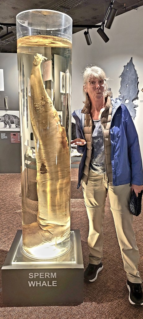
The collection is very large today, as people have sent in specimens. The largest, from a sperm whale, is about 6ft long, while the smallest, from a European mouse, is less than a millimetre and must be looked at through a magnifying glass. We have one human penis on display, from a 95-year-old man who left it to us in his will in 2011. A few well-endowed humans, one from America and one from Germany, have promised to donate theirs when they die. They are young, though, so we will have to wait a while for those.
You might call me a bit eccentric. At first people thought there was something wrong with me, but over time they saw I was a serious collector who was precise and accurate with the information I kept, and that there was nothing pornographic about the collection. I’m happy that people don’t think I’m a pervert any more.
I’m now 80 and have retired to a small town in the north. I’ve had great fun building the collection over the years and starting the world’s first penis museum; before me, there had been some small collections of penis bones – which many animals have – but not a more comprehensive collection of all these different types. Some people collect stamps or rare coins; I chose instead to collect the phallus. Someone had to do it.
In the words of Sigurður Hjartarson, Fri 22, Apr 2022–as told to Felix Bazalgette
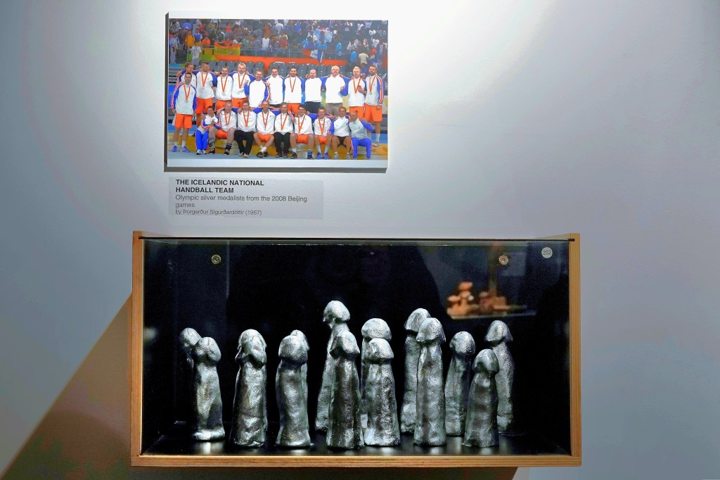
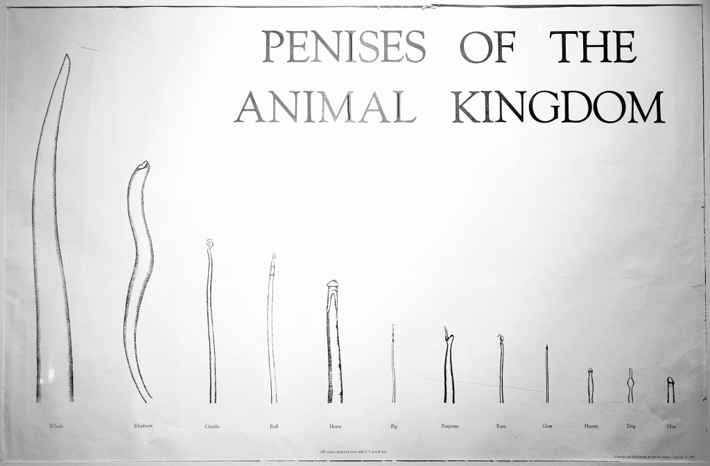
I don’t think I’ve ever been to a museum where the patrons have been so animated. Women easily outnumbered men by 2:1, and everyone seemed to be engaged. I saw no evidence of embarrassment, and selfies dominated most picture-taking opportunities.
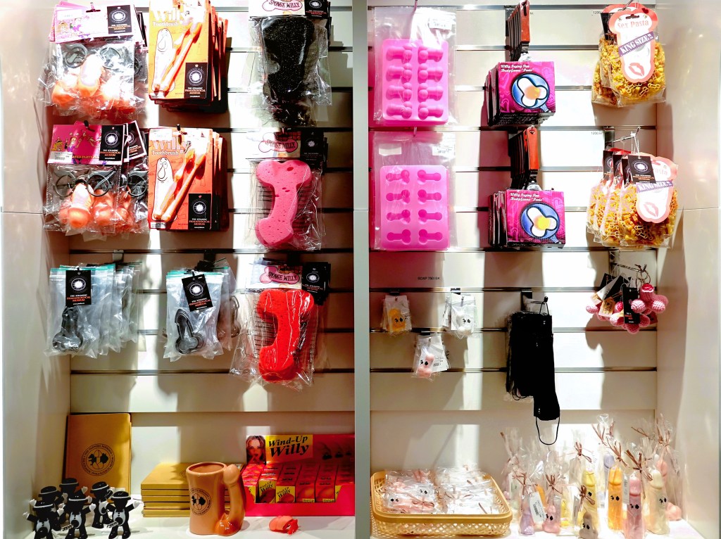
But what surprised me most were all the children running through the exhibits like they were at a petting zoo. And their small hands were very busy at the gift shop,
where I found a great souvenir,
and many more items…
for more sophisticated palates.
All in all, it was an uplifting hour, yet extremely humbling for human egos.
Leah and I overnighted in Arnarstapi, a tiny fishing village perched on a lava cliff in West Iceland, where Mt. Snapafell looms large across the horizon.
Icelanders believe the village still pulses with a healing energy that emanates from chieftain, Bárður Snæfellsás, half ogre/ half human and sorcerer from the first settlement.
as imagined by sculptor Ragnar Kjartansson in 1985
Legend suggests that Bárður was swallowed by Snæfellsjökull glacier. Perhaps it was his penance for killing his nephews, who admitted to pushing his daughter out to sea on an ice floe.
Consequently, Bárður was forever frozen in time and eternally committed to protecting the people of SnæfellsnesPeninsula,
and preserving its unspoiled natural beauty…
Another storm was brewing the day of our drive to Snæfellsjökull National Park. We mapped a route in search of the mysterious Snæfellsjökull Volcano, and took the high road as directed by GPS…
until we ran out of road and visibility halfway up the pass.
It was snowing on the other side of the mountain, and road crews had already conceded to Mother Nature.
So back down the mountain we went, where the weather was more predictable, and the roads were more reliable.
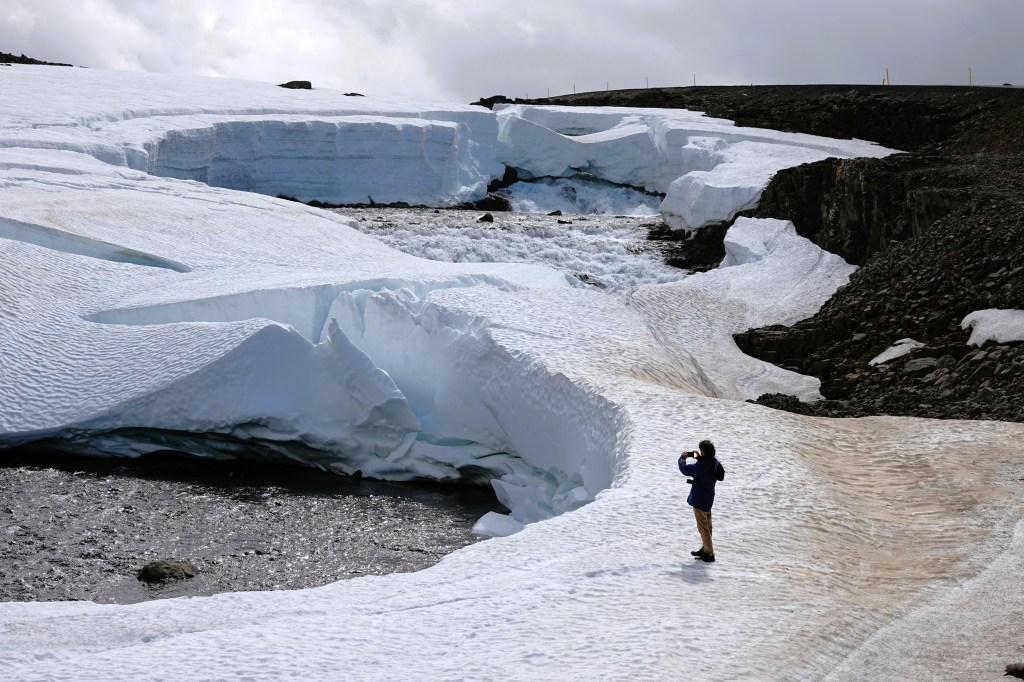
Unfortunately, we sacrificed a critical hour to correct our course, which translated into less time exploring Snæfellsjökull glacier at Snæfellsjökull National Park.
Instead, we continued to our next destination and penultimate excursion–
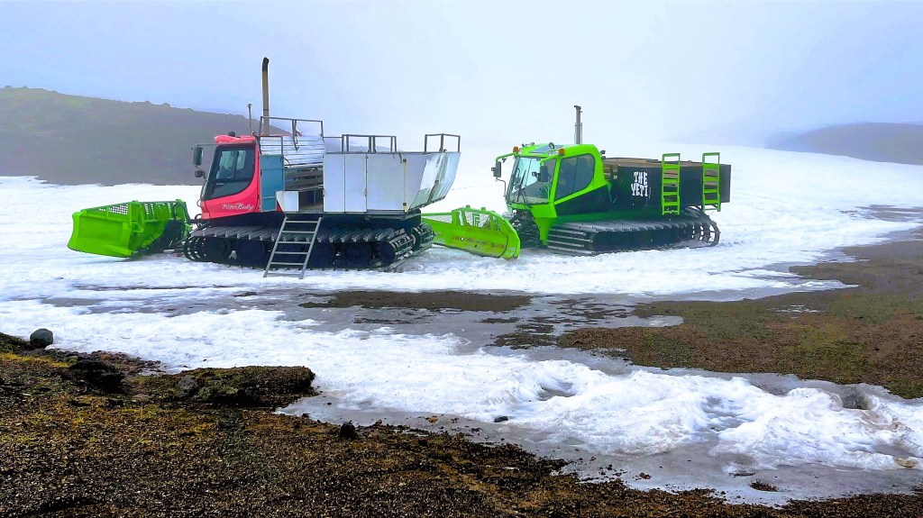
Our pre-paid guided tour of Iceland’s largest cave was originally scheduled for 1pm, but with rain clouds rolling in and a cold drizzle spoiling any chance of sightseeing or picture-taking, we expedited our drive to Borgarfjörður, with prospects of joining the noon tour if allowed.
We arrived at 12:05pm, but Sigurður (Siggy) agreed to include us, since he was already waiting for another late arrival with reservations. Hallelujah!
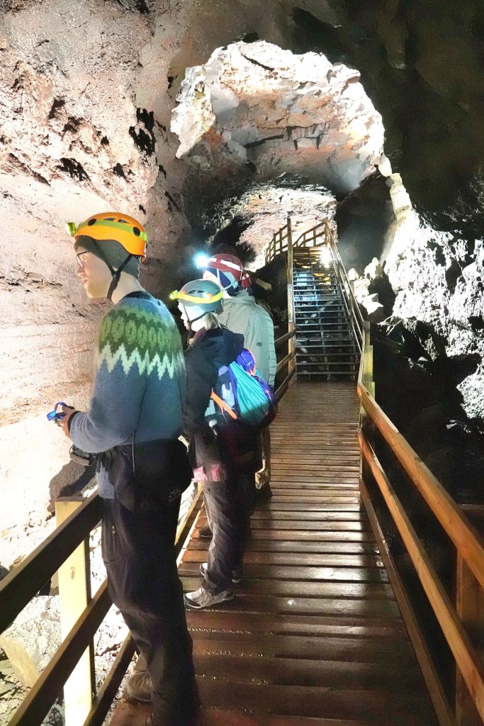
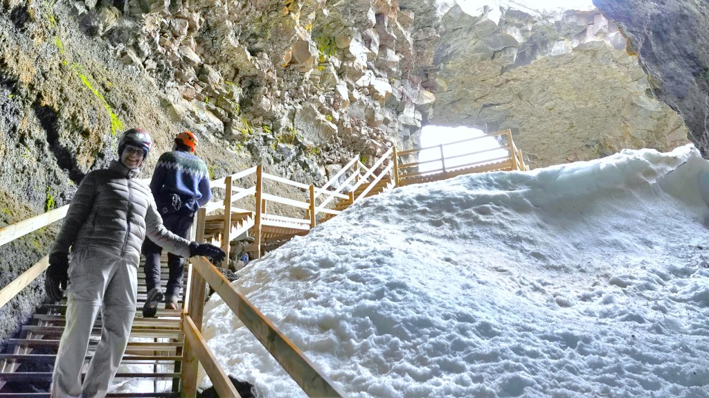
With our tour party now complete, each of us received a hardhat and headlamp, and Siggy (our only true-born Icelandic guide during our trip) led us 100m across a lava field called Hallmundarhraun to a twin opening in the earth where the roof of Víðgelmir had collapsed, revealing the cave’s only entrance.
We were dressed for winter inside the cave, where temperatures usually rise to 4oC, but Siggy was comfortable in a traditional Icelandic wool sweater knitted by his mom that he wore this day to celebrate Iceland’s Independence Day.
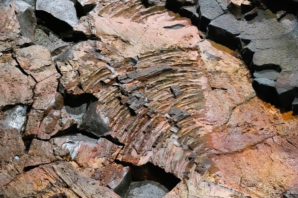
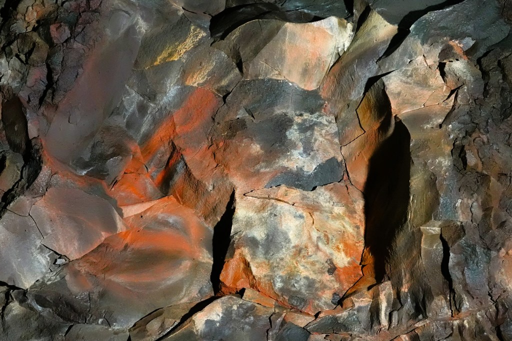
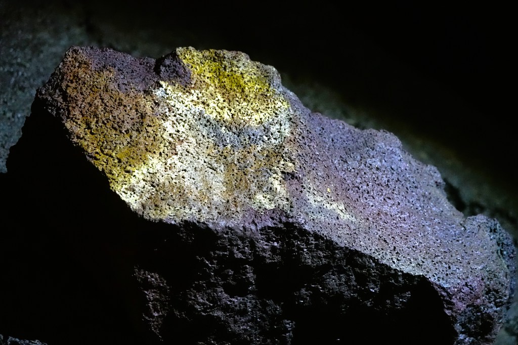
While traditional wet caves boast an array of stalactites and stalagmites, Víðgelmir cave gave us icicle formations,
and colorful mineral deposits imbedded in the walls,
and ceiling.
After an hour, we reached the end of the boardwalk where the tube narrowed,
and it was time to resurface.
With a 2-hour drive to Reykjavik ahead of us, we may yet reach the Penis Museum before closing time.
Warning: Be advised that the photographs presented here must be properly viewed on a big screen. Failure to comply will result in diminished satisfaction and an acute craving for Taco Bell and The Kardashians.
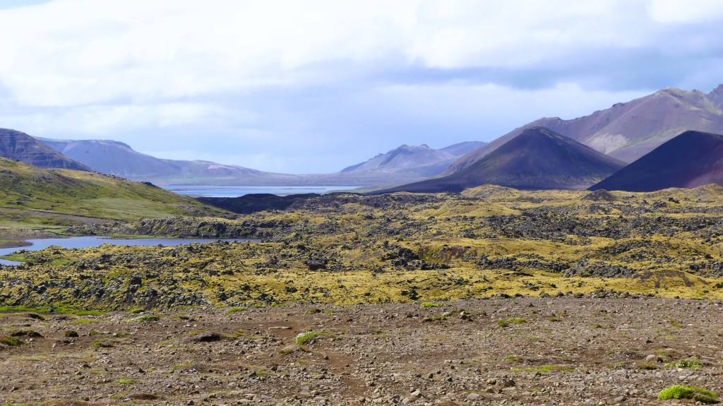
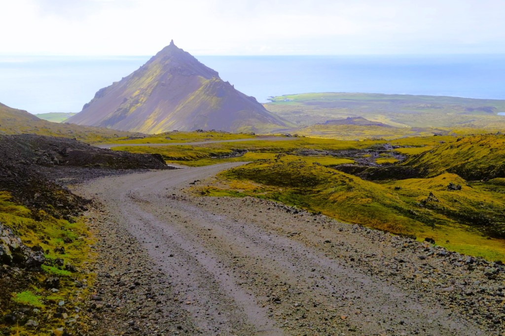
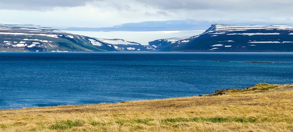
Leah and I approached Westfjords with three scheduled days to weave through as many of the fjords before reaching the Brjánslækur ferry crossing. Total driving distance added up to nearly nine hours, but with so many photo opportunities and sightseeing possibilities to consider, I wondered if three days was enough to adequately explore the oldest part of Iceland–where its raw, rugged beauty continued to surprise us around every hairpin turn of every rutted ridge road.
Sadly, the answer was “no,” given the scary condition of so many summer-only roads, not to mention our pending midday ferry reservations on Day 3. Regardless, our time retracing the “dragon’s head” was eye-opening, head-turning, and breathtaking. With so much landscape candy still to process, I’ve momentarily selected the following collection of picture postcards for review:
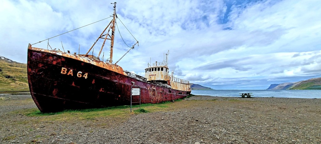
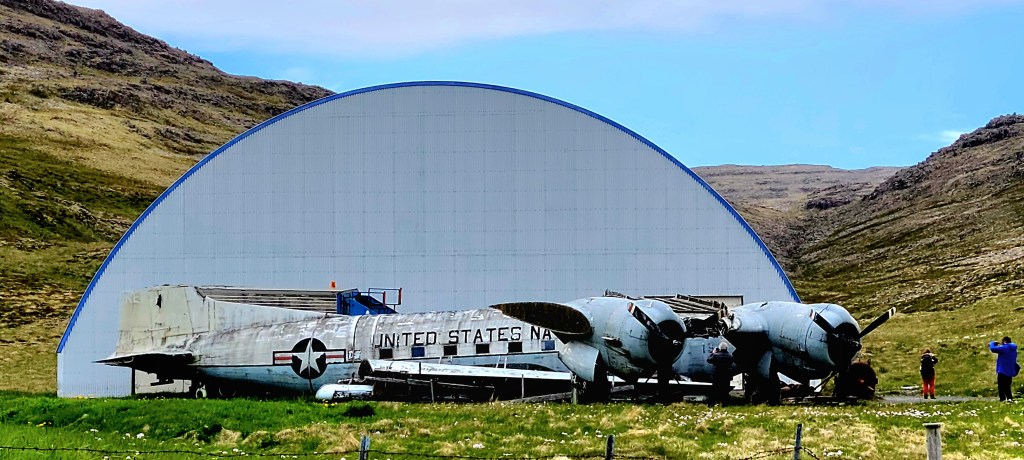
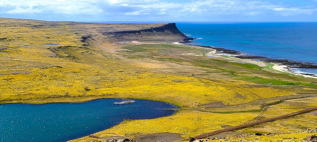
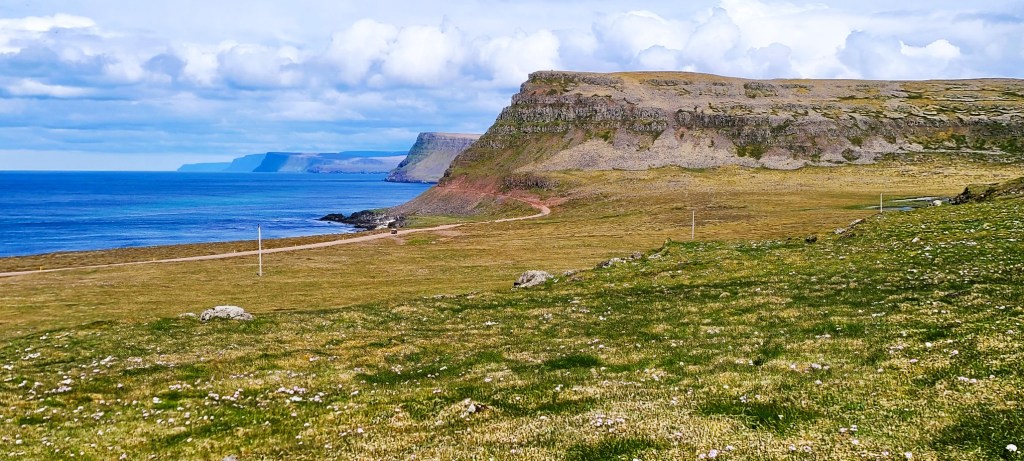
Hólmavíkurkirkja, Lutheran church in HólmavíkReykjanes @ ReykjarfjordurLitlibær farm in Skötufjorður BayLitlibær farm in Skötufjorður BaySúðavík @ Álftafjörður BayDýrafjörðurDynjandi waterfall in ArnarfjörðurGadar BA 64, 1912 @ PatreksfjörðurUS Navy Douglas DC-3 @ Hnjótur Museum in PatreksfjörðurHnjótur Museum @ PatreksfjörðurBreiðavík BeachHvallátur, Rte. 612Látrabjarg cliffHvallátur, Rte. 612
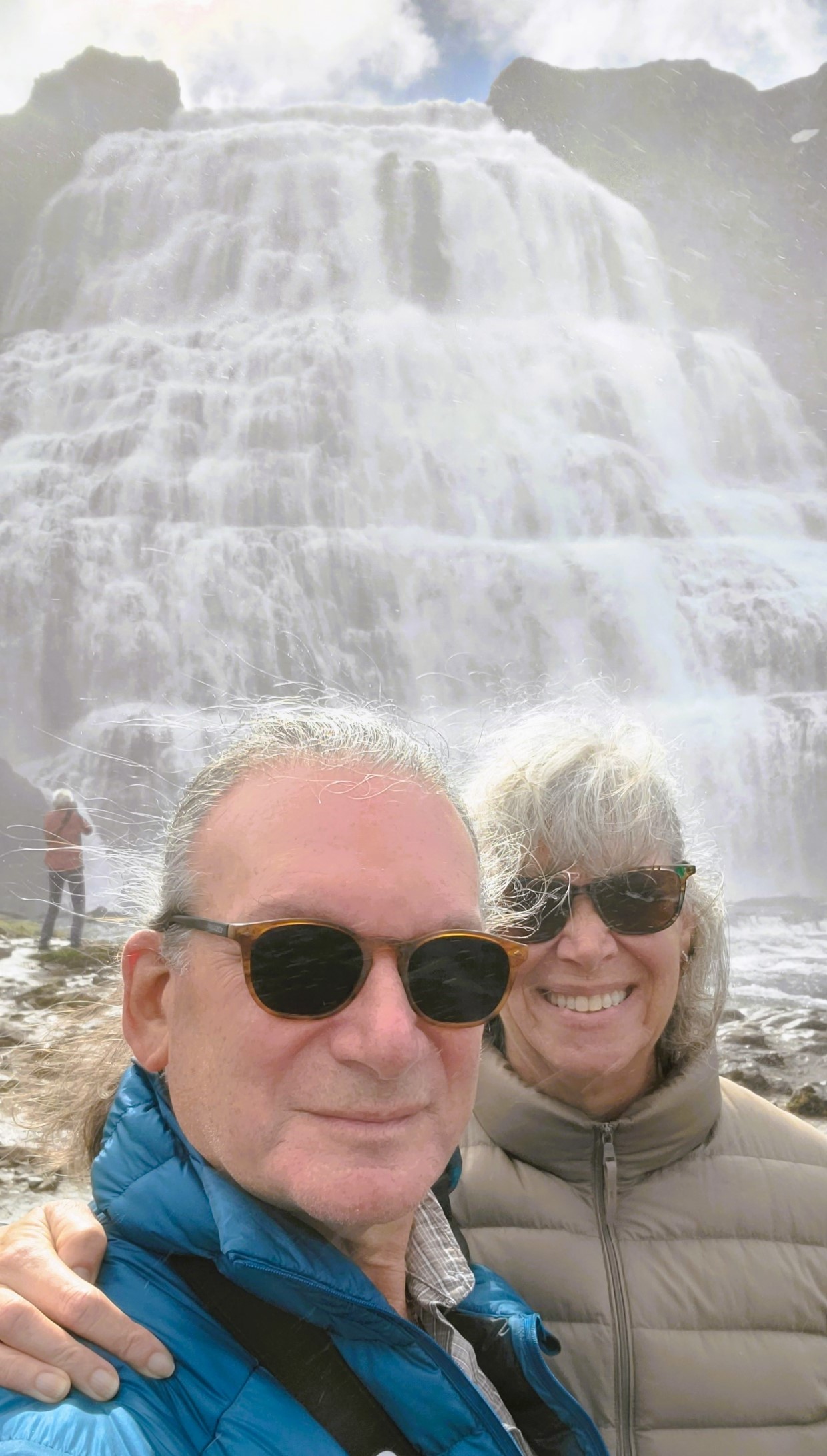
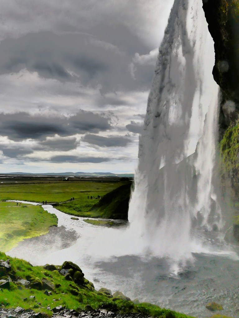
It’s always a good day when it starts with a waterfall and ends with a waterfall. Prior to today, all the designated waterfalls on our itinerary over the past eight days have been spectacular and very different from one another–given the geography, the weather conditions, the time of day, and the lighting–all of which has an impact on how the falls are viewed and captured.
Thankfully, today was no different!
After a restful overnight and an enjoyable breakfast buffet at Hofsstaðir Guesthouse in Skagafjörður,
Leah and I evaluated today’s weather, and sighed with relief knowing that overcast skies would fight off any imminent threat of rain. Maybe our prayers had been answered.
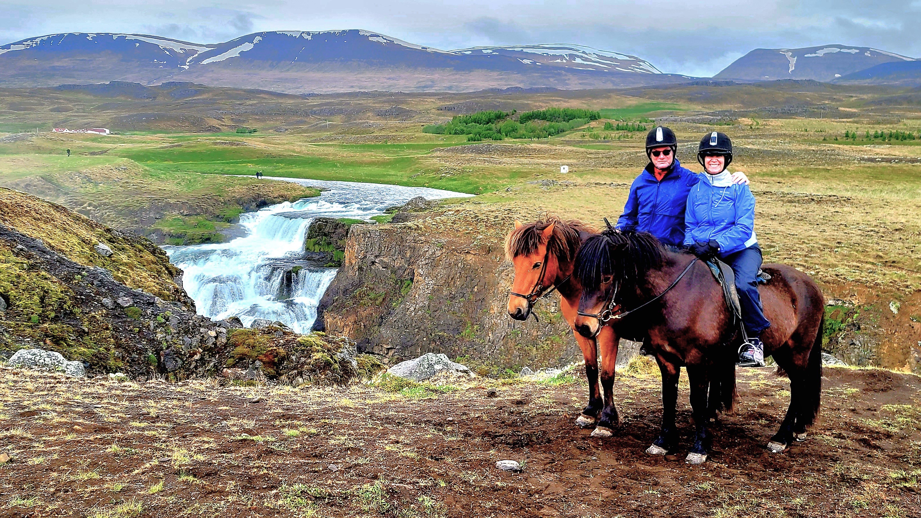
Of all our scheduled excursions, we were most excited about riding an Icelandic horse, and rain would certainly dampen the experience. We cautiously saddled up the Land Cruiser,
and patiently waited for our Hitachi Wi-Fi dongle (a very neat accessory) to find my phone. Eventually, we plotted a route to Hestasport, a tour company operating within the Skagafjörður valley–a place that’s been labeled the Mecca of Icelandic horsemanship, and the only county in Iceland where horses outnumber people.
Our conversation to the horse ranch was predictable. Leah and I were still processing the irony of our hotel restaurant serving “horse” on last night’s dinner menu. Of course, its a cultural and culinary delicacy that Icelanders have enjoyed since purebred Nordic horses were first introduced during the 9th century. And horsemeat is one of the healthiest meats for human consumption–iron-rich, low-fat and abundant in vitamin B. But our American palates and sensibilities are biased. We find that butchering horses for human fodder is morally abhorrent, while still enjoying a rib eye beefsteak. So, guilty of hypocrisy, as charged.
After arriving at Hestasport for our 10 o’clock “Viking ride,”
we gathered in the barn to dress for rain, then greeted our riding buddies in the paddock.
Icelandics have been strictly inbred for riding and working over a millennium, which makes them nearly disease-free and extremely resilient to Iceland’s harsh climate. They can easily live into their 50s. They have a friendly personality and a special affinity for people.
Leah was assigned Bjartur, while I would be riding Björn, an agreeable 23-year old, who was the only one of the herd who could fly–the fastest of five gaits (up to 30 mph) that Icelandics naturally possess.
My first impressions of Icelandics…they are small, but sturdy and capable. While their legs are short (they typically stand 13 hands on average), they are capable of carrying up to 35% of their body weight. When they walk, their head is down and neck relaxed, which gives them a straight line across their back to evenly support the carrying weight.
Their walk is smooth and sure-footed, which easily accommodates uneven landscape and shallow rivers.
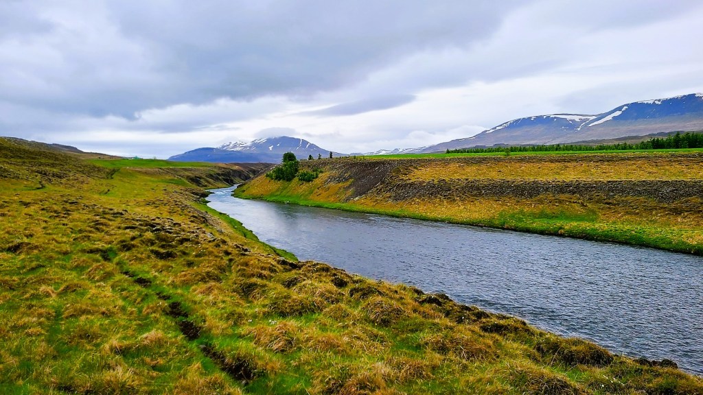
We closely followed the river Svartá at a steady pace, allowing us to soak in the scenery. Our guides were ingenues from Belgium and Holland, who were mostly shepherding a German family of four with little experience, but our Icelandics were very forgiving. They took to the trail they’ve known since foals, so the Germans were on solid footings.
But I was looking for something more. I was hoping to tölt, a oft-touted gait that’s exclusive to Icelanders, where the horse lifts its front leg up high, and only one foot touches the ground at any time. When we reached a level open field, Bridgette from Brussels shortened the reins of her horse, which immediately caused her horse to tölt, and immediately cued my horse to copy. I was tölting! Björn gave a smooth-paced ride with minimal bounce, as he glided over the gravelly terrain. It was exhilarating, but short-lived as we reached our destination much too soon to stop. But in exchange, we were humbled by a view of Reyjafoss.
Leah and I returned to our Land Cruiser to explore our next major destination, the Westfjords. But first, we detoured to the Vatnsnes peninsula, where iconic basalt stacks line the shore,
and volcanic sands sharply contrast against distant snow caps.
We bookended our day’s tour with a drive to Kolugljúfur Canyon, hoping to find Kola, a legendary giantess who dwelled in the canyon.
Her daily ritual of fishing and preparing salmon helped to shape the gorge.
Alas, Kola was nowhere to be found, but we discovered her hiding place; it was Kolufoss.
Widely considered the Capital of the North, Akureyri is only 100 km south of the Arctic Circle, but boasts the warmest climate in Iceland, with temperatures ranging from 75oF during summer months to 30oF during winter. However, Akureyri is also a very cloudy town, averaging just over 1000 hours of sunshine a year, with virtually no sunlight from November to February.
With a population of 19,000, Akureyri is the largest town beyond Iceland’s densely populated southwest corner, and enjoys many of the amenities of any vibrant urban center–with winding side streets and bustling plazas offering coffee shops, boutiques, gourmet dining, art galleries, and an active nightlife–all of which helps the locals get through the dark winter months.
There’s also a geothermal swimming complex that’s the envy of all of Iceland, and it’s conveniently located downtown behind the church.
If the identity and soul of Akureyri is best symbolized by the twin spires adorning the Church of Akureyri, or Akureyrarkirkja as designed by Guðjón Samúelsson (also known for Reykjavik’sHallgrímskirkja)…
then the heart and soul of Akureyri is in full bloom at Akureyri Botanical Gardens, or Lystigarðurinn—
established in 1912 by a society of women enthusiasts who were eager to provide a green space for locals to recreate or relax.
Not only is Lystigarðurinn the first planned park space in Iceland, it’s also one of the northernmost botanical gardens in the world, featuring over 7,000 species of plants, and making it a valuable resource for botany research.
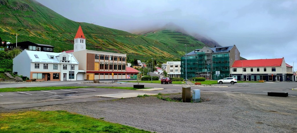
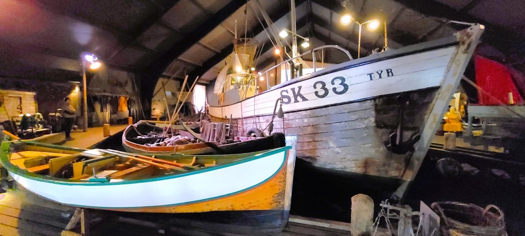
An hour’s drive northbound brought us to Siglufjörður, a colorful and historic fishing village atop the mainland, and only 40 km from the Arctic Circle.
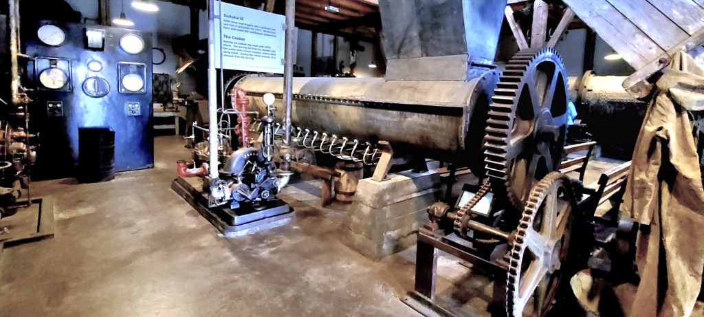
But the tale of Siglufjörður lies in stark contrast to Akureyri. In Akureyki, I had to hunt for a weekend parking space. Not so much in Siglufjörður, where its population has been in steady decline. Once a bustling seaport known as the herring fishing capital of the world, only 1200 residents now call Siglufjörður their home since the herring disappeared in 1968 from overfishing.
This cautionary tale is well-documented through the town’s award-winning Herring Era Museum.
Having grown up in a household that enjoyed sardines, kippers and herring, I felt compelled to explore the museum’s interactive exhibits: which illustrates how the fresh catch was hauled to port,
and subsequently processed by an army of “herring girls”…
who could gut and brine enough fish to fill three barrels an hour.
Iceland’s first processing plant was built in 1911, where oil and meal–for pet food–was extracted from the fish. As more fishermen from Scandinavia arrived to fish the fjord’s bounty, the industry prospered.
In 1925, disadvantaged “herring girls” successfully went on strike for equal pay, and formed one of Iceland’s first labor unions.
In its heyday, Siglufjörður had 5 processing factories, and 23 salting stations supported by a hearty population of 3,000.
Today, the town of Siglufjörður hopes to ensure its future and relevance by presenting their history, and Leah’s buddies hope that tourists are listening.
Iceland’s oral and written history is steeped in mythology and folklore, and rooted in the country’s natural wonders. From the time Garðar Svavarsson, a Swedish Viking first settled in Húsavík in 870 AD, Icelanders have imagined a world where phenomena is best interpreted through their sagas of mysticism.
Iceland’s first settlement succeeded in the second half of the ninth century because of adventurous Vikings from Denmark and Norway who were looking for a fresh start in a new world that offered opportunity, security, and stability. A parliamentary assembly of regional chieftains gathered in Thingvellir in 930 to form the Althing (assembly of free men), and ruled as the unifying body of this “free state” until 1264.
Originally, the Althing accepted Northern Germanic religion or Goðatrú (Truth of Gods) which resembled the religion of their homelands. Sacrifices were overseen by landowners/priests in temples and shrines to appease the gods and spirits, of which Thor and Odin were most popular.
By 1000, the Althing rejected paganism and enacted Christianity as the religion of the land under pressure from Norwegian king, Olaf Tryggvason, who embargoed all trade between Icelanders and Norway and held the sons of chieftains as hostages unless Icelanders accepted baptism.
Yet, despite the introduction of Christianity, pagan influence was not easily erased, and still informed how settlers reacted to their old surroundings, and their new spiritual allegiance.
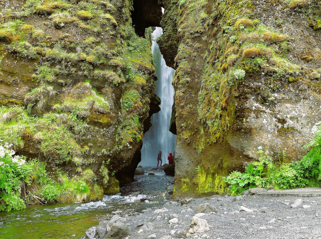
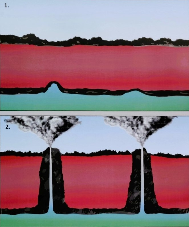
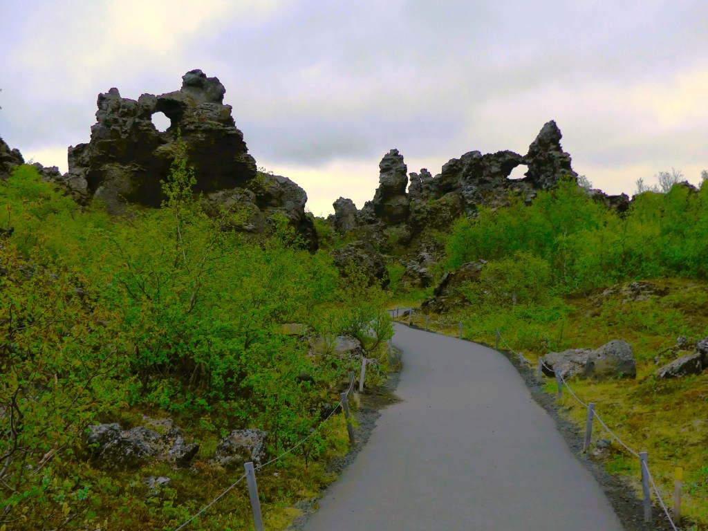
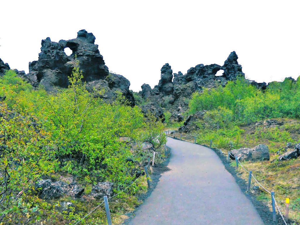
For instance, when Leah and I discovered Dimmuborgir, a dramatic expanse of lava fields east of Myvatn,
we learned that the pillars were the creation of emptied lava lakes from an immense volcanic eruption about 2300 years ago.
But legend tells us that Dimmuborgir (or “Dark Castles”) was created by Satan after he was cast from heaven, and Dimmuborgir was the gateway to the devil’s “Catacombs of Hell.”
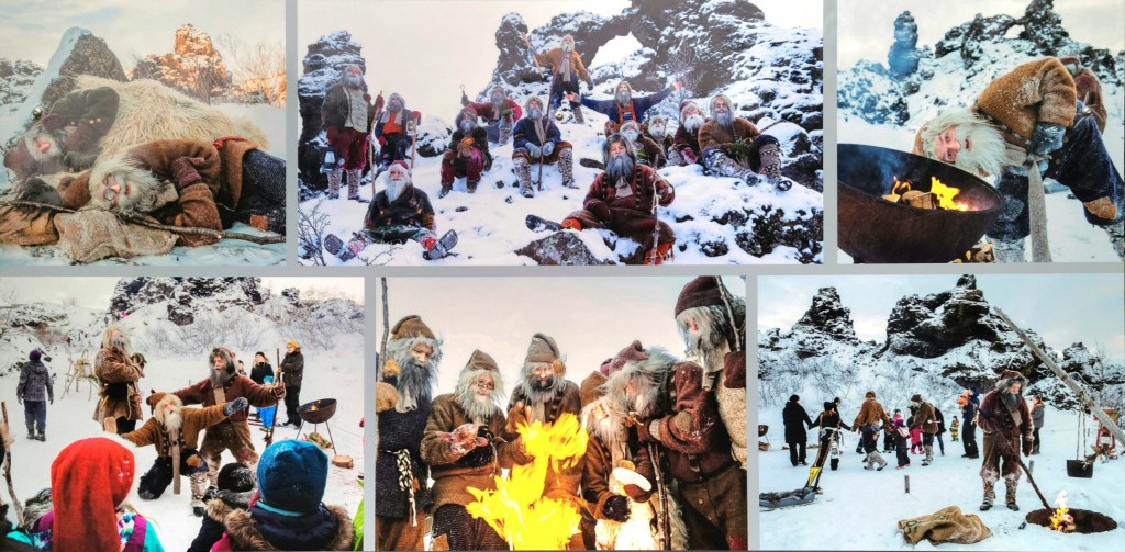
Also seeking refuge at Dimmborgir are the Yule Lads–13 offspring of Grýla and Leppalúði–who are regarded as trollish pranksters who eat misbehaving children before Christmas.
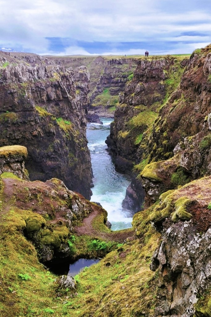
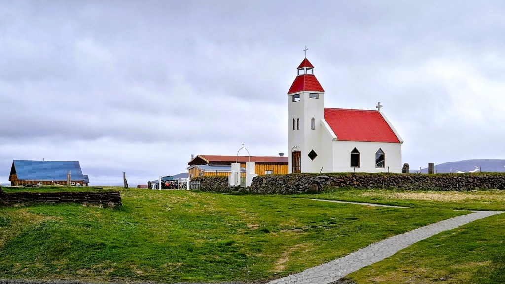
Jökulsárgljúfur National Park is another popular destination we visited that invoked the spirits and captured the imagination of pagan worshippers.
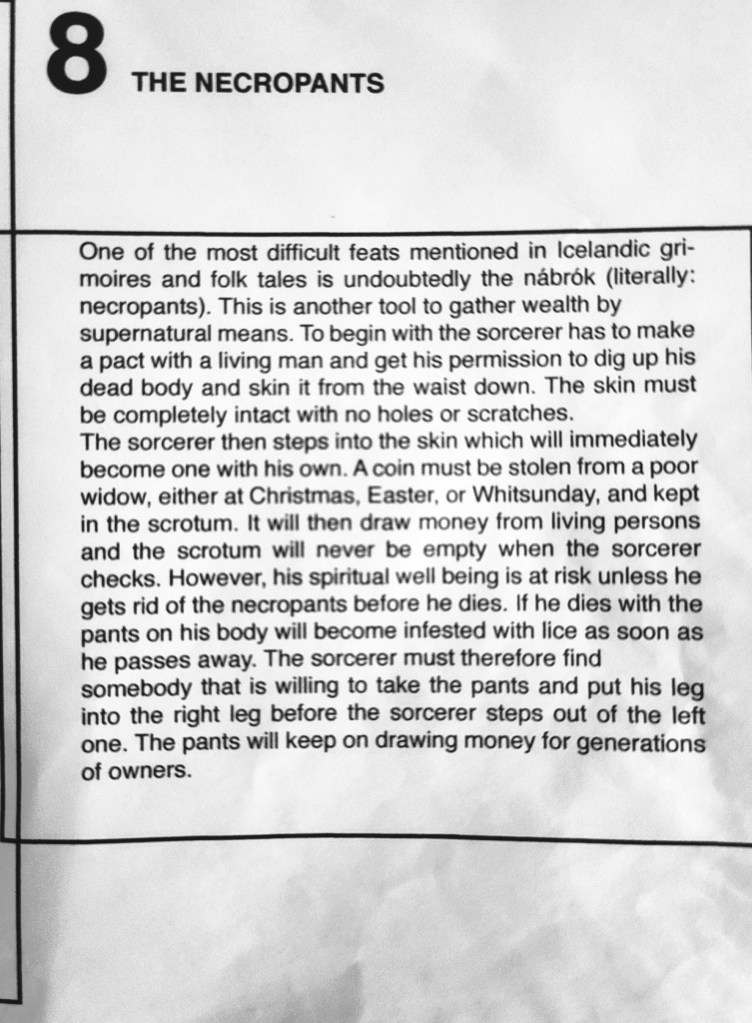
Jökulsárgljúfur, Iceland’s largest canyon, stretching 25 km long and 500 m across is the result of endless catastrophic flooding caused by an Ice Age eruption so fierce that its glacial ice cap exploded.
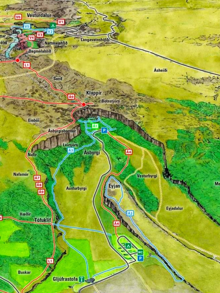
However, the Norsemen believed that Sleipnir, Odin’s eight-legged steed created this natural wonder by touching earth on a jaunt across the sky, leaving behind the impression of a massive hoofprint that became the canyon Ásbyrgi,
with a rock island spur named Eyjan.
To the west of Ásbyrgi, lie the cliffs of Hljóðaklettar and its inhabitants, the mythical Huldufólk (Hidden People), who cautiously avoid sunlight, or risk the same fate of the elves and trolls who have turned into stone pillars from sun exposure.
Another example of trolls behaving badly can be found along the black sand shoreline of Vatnsnes peninsula in northwest Iceland. From a geological perspective, Hvitserkur is a 15-meter tall basalt monolith that’s been shaped by severe North Atlantic storms and constant temperature changes.
Although Hvitsekur resembles a drinking dragon, Icelandic folklore refers to the stack as an evil troll who raided a local church to silence its bell tower, but turned to stone after being caught by the sun’s early rays. The petrified troll is home to hundreds of nesting birds who forever punish him with a thick layer of guano, and Icelanders who mock him with the name “White Shirt.”
Of all the stories, historians consider Goðafoss a landmark in North Iceland culture, for its here that regional chiefs met with pagan lawmaker, Thorgeir Ljósvetningagoði to determine whether to continue their old ways or embrace Christ as their spiritual guide.
The saga tells us that as a gesture of Iceland’s newly adopted religion, Thorgeir Ljósvetningagoði stood at the brink of the falls to cast a collection of Norse idols into the abyss, marking an end to paganism. Thus, the waterfall was christened Goðafoss, the “Waterfall of the Gods.”
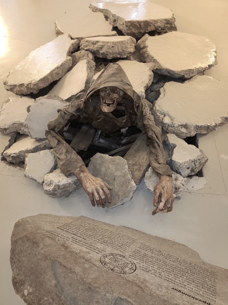
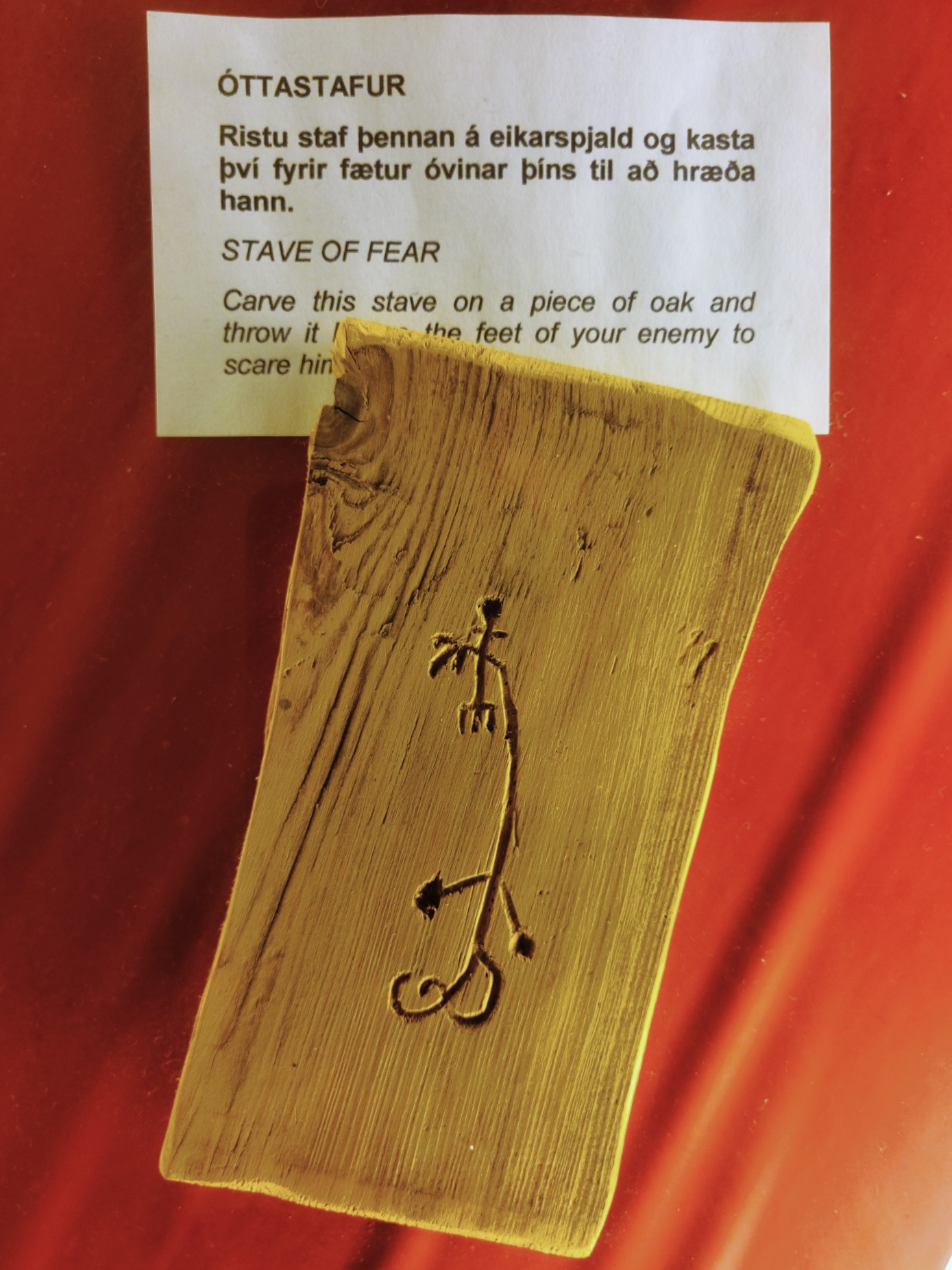
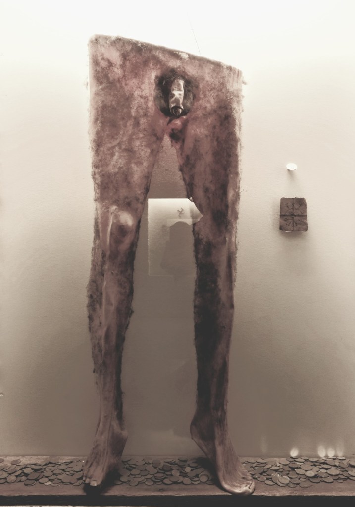
It was the beginning of conversion, and Iceland eventually capitulated to convention. Nevertheless, the notion of magic and sorcery continued to flourish in Iceland, well into the 17th century. A museum located in Hólmavík is devoted to the subject.
It tells the story of 25 or so victims who were executed on charges of witchcraft between 1625 and 1685.
The museum also exhibits some unusual artifacts,
ranging from the sublime…
to the ridiculous.
Superstitions began to fade during the last decades of the 17th century, and the Reformation came as a shock to Icelanders. But consider a 2007 study by the University of Iceland that found an estimated 62% of the nation still believes in the existence of elves, and 40% of the population is irreligious.
Significant geothermal zones and volcanic landscapes throughout Iceland may give the impression of a primordial, preternatural planet. Yet, Icelanders have prevailed, despite the harsh and ever-challenging environment of their homeland.
Such is the case of Möðrudalur, a remote farm settlement in Eastern Iceland protected by Mount Herðubreið, the “Queen of Icelandic Mountains.”
Möðrudalur ranks as the highest inhabited farm in the country–at 469 m (1739 ft) above sea level, and supports a weather monitoring station, having recorded the lowest temperature in Iceland, -38.0 °C (-36.4 °F) on January 21, 1918.
The farm became inaccessible once Ring Road 1 was relocated northeast in 2001. However, a new F-road was eventually cut to continue servicing the curious folks who felt a connection to the old trails crisscrossing the wilderness, and a thousand-year history that made this a protected area.
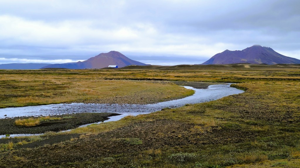
A church was built in Möðrudalur in 1949 on once-sacred ground by farmer, Jón A. Stefánsson to honor his wife’s passing in 1944,
and decorated by revered folk artist, Stefán V. Jónsson.
A guesthouse, a small store and highly regarded restaurant serving locally sourced farm-to-table fare have been added over time to boost tourism in the area.
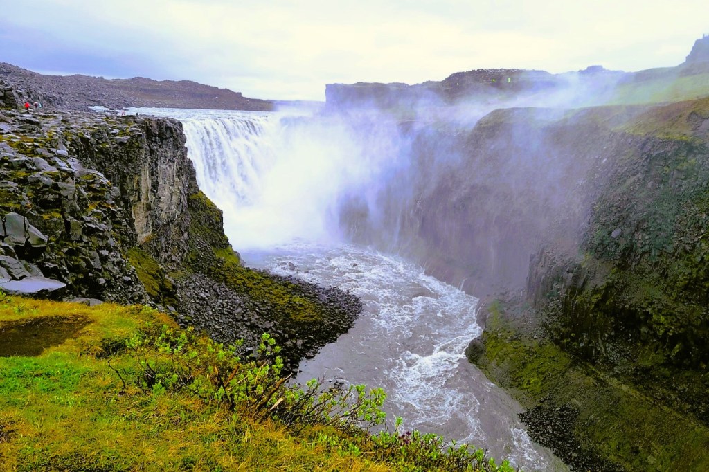
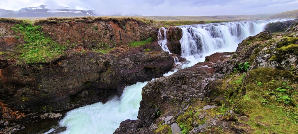
A more dramatic and inhospitable environment lies 90 km to the north. Jökulsárgljúfur Canyon was carved by fire and ice and a rushing river that over time laid bare the cores of spent volcanoes.
Following the Jökulsá á Fjöllum upriver (which flows from the Vatnajökull glacier) is an impressive triplet of waterfalls, of which Dettifoss is considered the most powerful in Europe, plummeting 45m (150 ft) into Jökulsárgljúfur Canyon at 400 cubic meters per second during the summer melt.
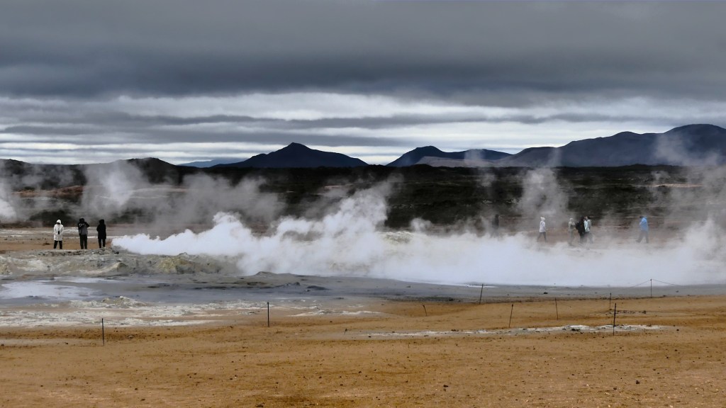
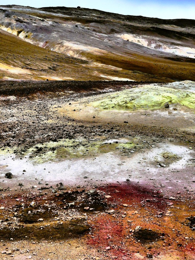
Returning to the Ring Road, it’s another 60 km west to the Myvatn Geothermal Area (Hverir), a volcanic swath that rivals the fumaroles, steam vents and mudpots of Yellowstone…
We cleared our lungs of rancid Sulphur fumes before checking into nearby Laxá Hótel, where the Krafla caldera looms over Myvatn Lake in the distance.
But Leah and I weren’t done for the day! After enjoying a meal at the hotel restaurant, we donned our hiking boots and enjoyed a solitary 10 pm stroll through Dimmuborgir,
a field of unusual lava formations caused by an eruption 2300 years ago and the subsequent collapse of a massive lava tube.
After a day of walking through location settings for Star Wars, Game of Thrones, and Alien, it’s little wonder that Iceland takes its landscape cues from a very powerful producer.
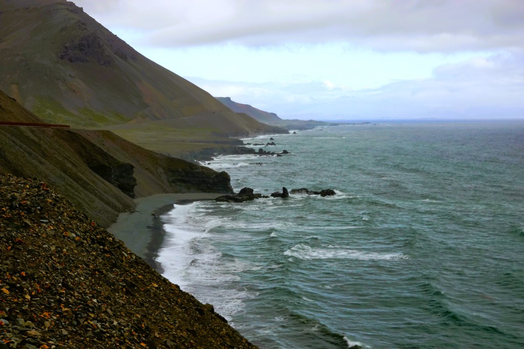
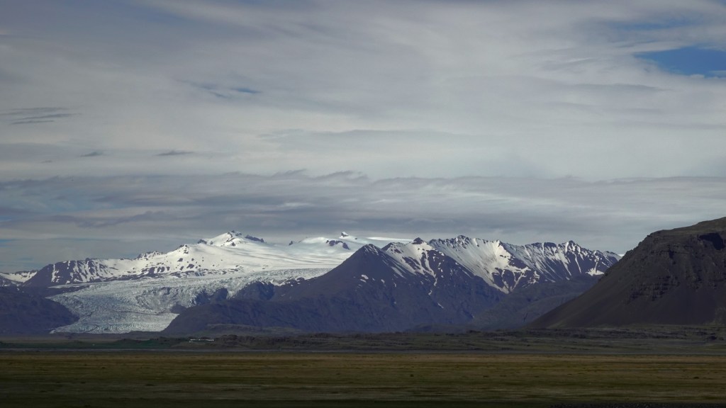
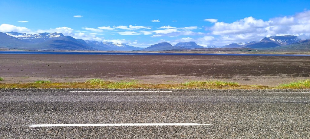
Continuing our counterclockwise circumnavigation of Iceland, today’s drive (Day 5) carried us through tranquil fishing villages,
along spectacular fjords,
and past so many sweeping landscapes…
that Leah wondered—given my many photo epiphanies–if we would ever reach Egilsstaðir, our evening destination.
Fortunately, in our favor, our summer days have 22 hours of daylight.
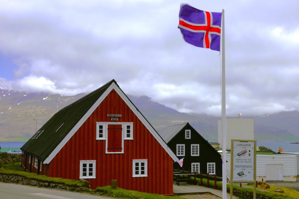
We started our journey with a brief stop in Djúpivogur, a 16th century Danish fishing port and trading post that attracted European merchants. By the mid-1800’s, there were four houses in Djúpivogur, and Langabúð was one of them.
Constructed in 1790 as the village storeroom and warehouse, it was considered the economic and social engine of the town up until the 1950s. Today it’s a museum and visitor center.
A walk around the Djúpivogur’s harbor offered little shelter from the frequent gusts of blustery wind coming off the water. Leah stayed behind in the Land Cruiser, but I found the 34 granite “Eggs of Merry Bay” atop their pedestals to be an interesting oddity,
as each egg had been named for a local bird.
Next stop was Petra’s Stone Collection,
beautifully curated throughout her house and garden in Stöðvarfjörður.
What started as a hobby during childhood, became an obsession throughout her adult life, until she acquired the world’s largest private collection of mineral rocks,
mostly unearthed in the vicinity of East Iceland.
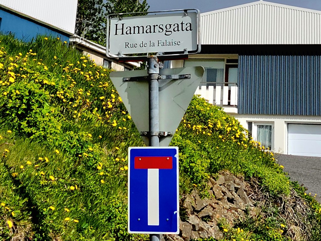
We also stopped in Fáskrúðsfjörður, a small fishing village with French connections that dates to 1880. Originally developed as a French trading hub fortified by a chapel, a hospital and French consul, the town still retains its French flair.
Once we returned to the Land Cruiser, we vowed to limit our stops, but the road beckoned, and I couldn’t resist!
“One last time,” I pledged. And Leah relented.
We detoured to Teigarhorn, a natural monument and nature preserve most valued for its cache of zeolites, and most likely the source of so many of Petra’s discoveries.
Teigarhorn is also a protected nesting ground.
Ultimately, we made it to Egilsstaðir, had a meal, and found our way to Vok Baths, a geothermal spa,
tucked into the banks of Lagarfljót–a long and narrow lake–where Icelandic folklore (c. 1345) suggests a giant serpent dwells.
Three infinity pools of increasing temperature (105oF max) offered us the perfect opportunity to melt away the stress of a long travel day…without a serpent sighting.
Finally, the midnight sun had set on our day at midnight.
And hopefully, our hotel has decent blackout shades to protect us from a 2am sunrise.