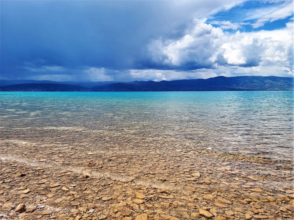
There’s a lake that straddles northern Utah and Idaho that boasts a turquoise-blue color that rivals any Caribbean beach, and it’s all due to the refraction of calcium carbonate (limestone) deposits suspended in the lake. The intensity of the color also shifts with the sun’s position, the wind direction and the current, to where it becomes dizzying, trying to frame and capture patterns of varying shades of blue through a camera viewfinder.

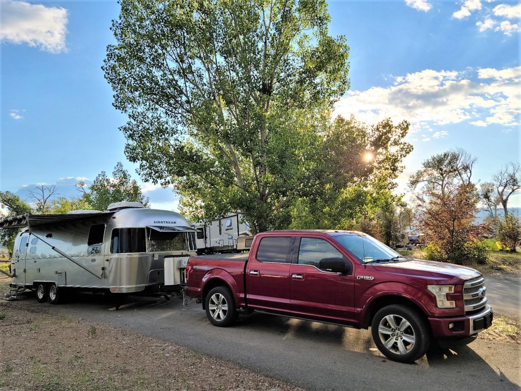
Leah and I camped in two of several neighboring Utah State Park campgrounds to round out our visit. When initially making reservations, the Rendezvous Campground only had openings for the last two of our three nights, so we took up residence at South Eden Campground on the east side for the first night, with an understanding that it was a primitive site.

To our surprise, the facility had been upgraded with water and electric service over the past year. Of course, we would have preferred to stay for the duration of our visit, but that’s not how reservations work at a busy summer resort.
Moving to a new site after one day was not a relaxing proposition, but with so much running around over the past two months, we owed ourselves some down time from traveling, and Bear Lake seemed like a good fit, despite the campground fuss.
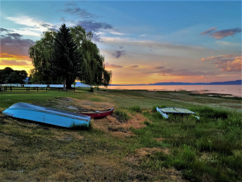
Aside from the splendid color of the water, our beach was far from beach towel-friendly, with broken shards of shale, shell, and limestone liniing the shoreline…

and beyond, making hard-sole, water-shoes essential footwear.
But what mattered most to me at the moment were the clouds that were moving in and out of view.

Would there be enough cloud cover to support a world class sunset?
Armed with a camera and a silent prayer, I waited anxiously on the beach as the sun kissed the sky goodbye.
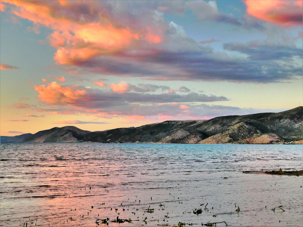
And then came the explosion I’ve come to expect. I would have my sunset, after all!

The following day, we moved to Rendezvous Beach on the west side of the lake, where the accommodations were as advertised: modern facilities and tighter sites,
followed by uncrowded sandy beaches? Where were all the people?

I later learned that all the “missing” were running their boats up the lake from the Bear Lake State Park Marina. And I’d like to personally thank each of them for the onslaught of wake that made for an average time kayaking in open water.
The final evening of our stay, we drove into Laketown for ice cream and a sunset. We found a quiet side street that dead-ended at the waters edge, and we waited…

“Not as brilliant as the other night, but not terrible,” Leah assessed. “C’mon, we need to go before the town shuts down and we miss our chance at ice cream.”
“Don’t be in such a hurry. Wait for it. Otherwise, you’re gonna miss the best part. The sky is still developing,” I predicted.
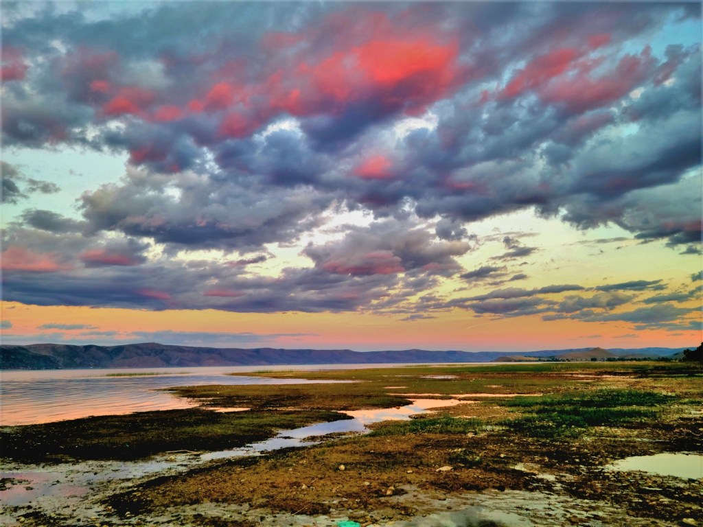
I got the sunset I wanted, but not the ice cream, as most of the town had shut down by 9 PM. With only one late spot open, we opted for flavored milk shakes and called it a night.
The moral of the story: A Saturday Night Sunset beats an Ice Cream Sundae!