I've been here, there and everywhere;
Far and wide, across divides;
But none compare to a maiden voyage extraordinaire,
exploring America for one full year...
in my shiny Airstream!
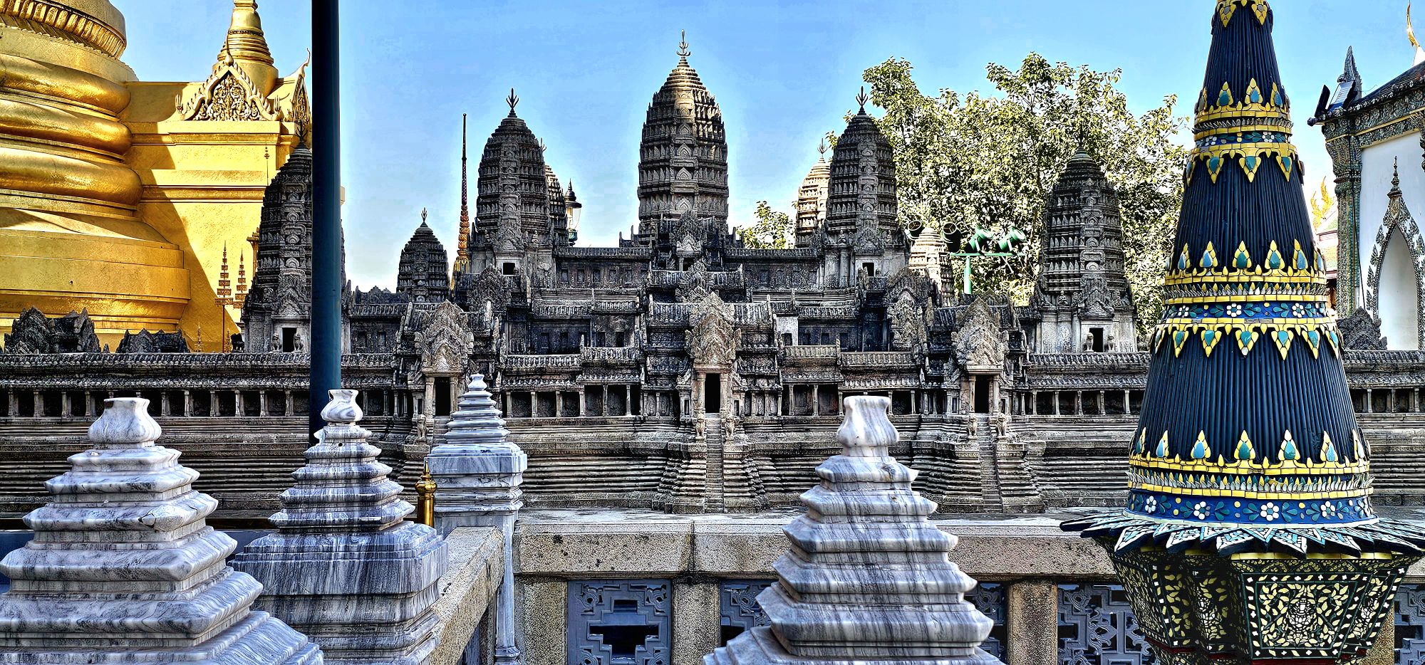
Walking through Bangkok can be challenging. The traffic is relentless; the pedestrians can be pushy; and the “sidewalks” are compromised. But none of this should deter the intrepid tourist.
Our excursion began at the hotel’s spirit house (within the Thanon Phaya Thai district), where we paid our respects…
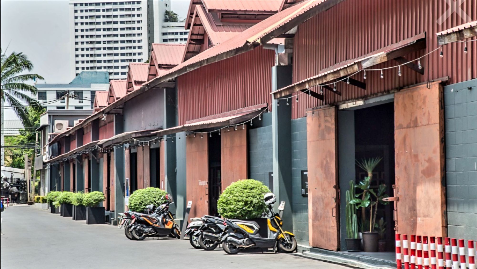
before continuing to Warehouse 30,
an art and design complex just east of the Chao Phraya riverfront,
where we found delightful exhibits and installations, intriguing antiques, and boutique apparel.
Nearby, we discovered Talat Noi–
a resurrected warehousing slum with meandering alleys filled with repurposed auto parts, shabby temples,
and wall art.
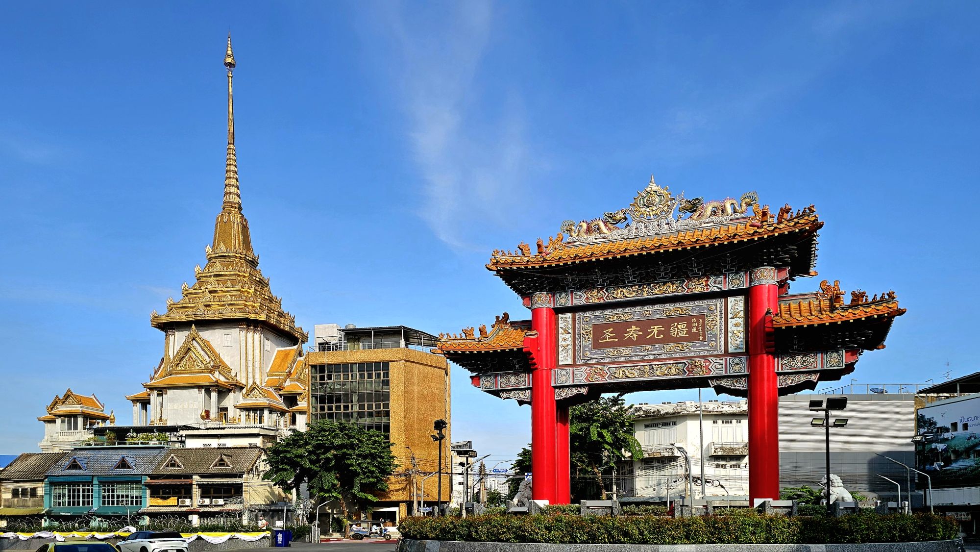
After another 15 minutes of sidestepping aggressive scooters along congested cobbled alleyways, we arrived at the Chinatown Gate, planted in the middle of an enormous traffic circle.
Chinese locals by the scores were making offerings at a local Buddhist Temple.
Chinatown Night Market was to our north,
but we were saving that for an evening stroll, when the street would close for Monday’s celebration of street food–filled with curious selections for adventurous eaters.
Our last stop included a visit to Wat Mangkon Kamalawat just before closing. It’s the largest and most significant Chinese Buddhist Temple in Bangkok. The temple is surrounded by shrines dedicated to a variety of Buddhist, Taoist and Confucian deities and religious figures worshipped by the local Chinese.
Worn out and wrung out, we took a taxi back to the hotel. We had walked nearly 10 km. in 90o heat. It was time to freshen up and consider a new adventure with an eye toward dinner.
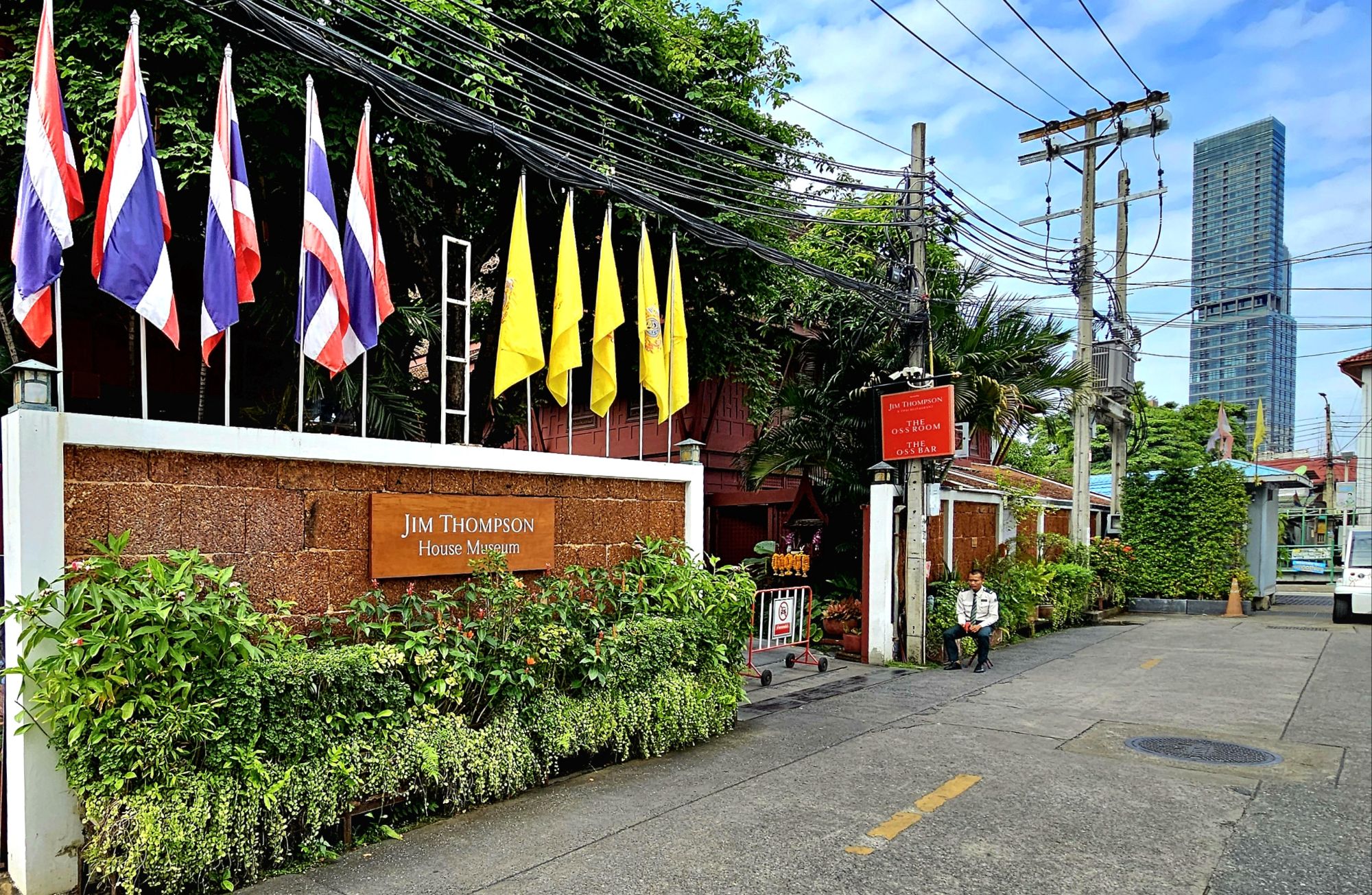
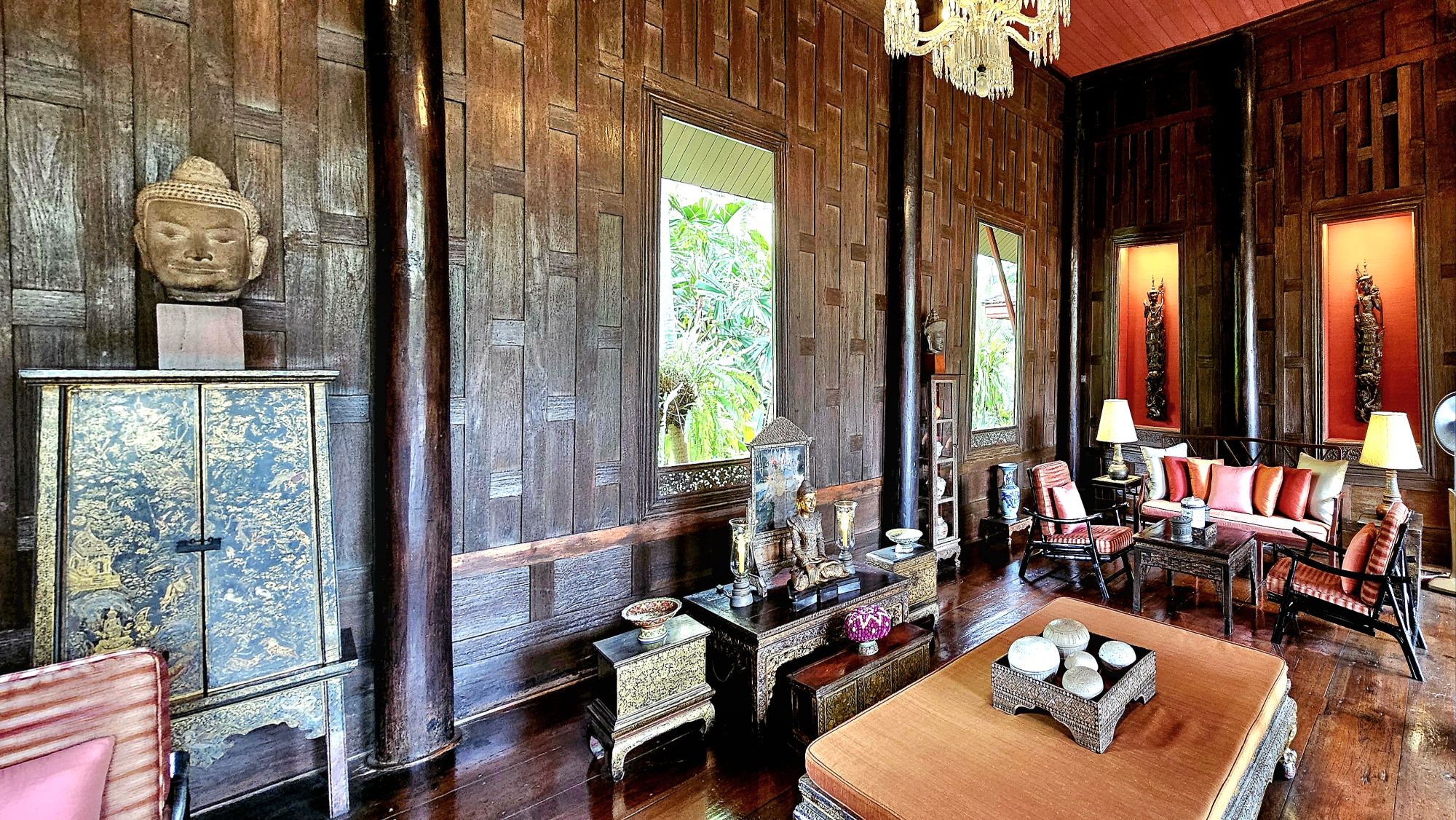
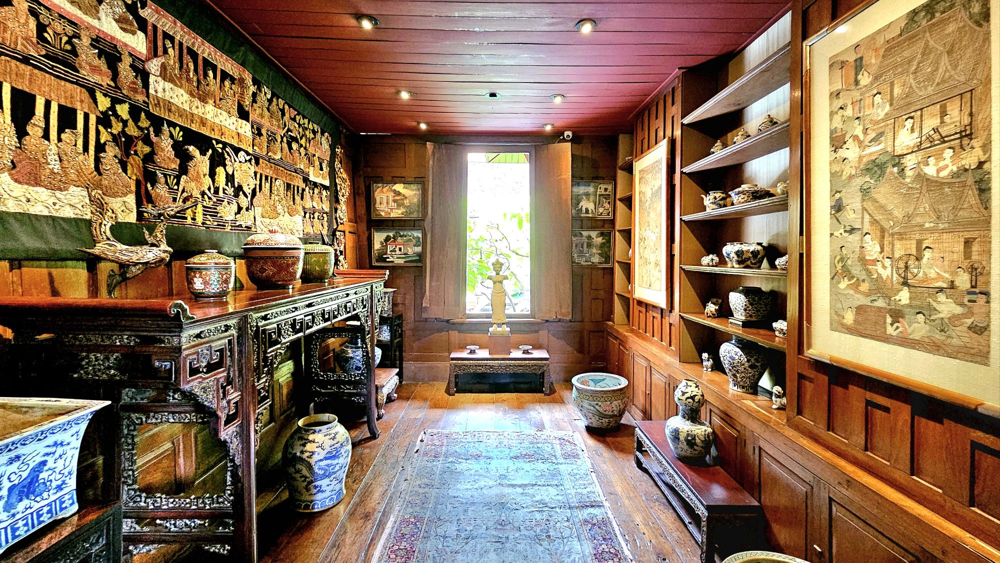
his private residence-turned-heritage museum, replete with a gallery, restaurant, and boutique–
all dedicated to Jim Thompson’s love of ancient Siam.
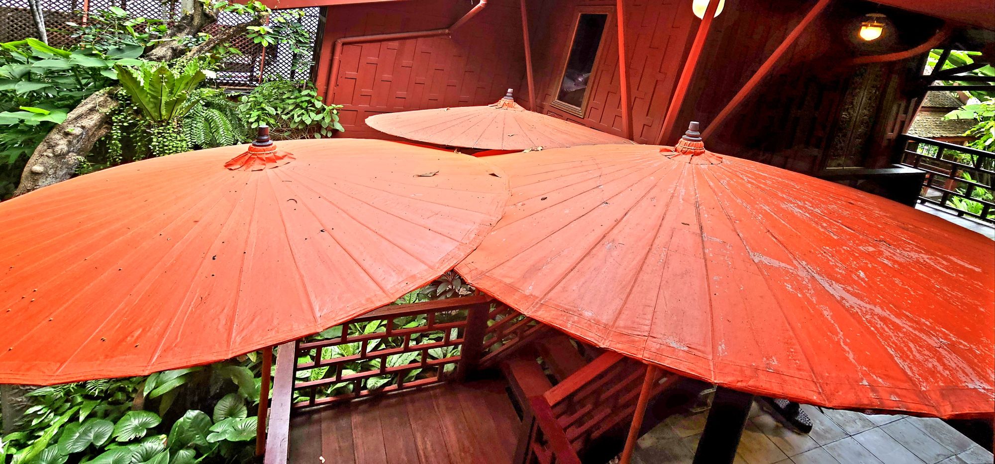
The compulsory spirit house surrounded by lush gardens–situated according to Feng Shui principles–informed us that we were protected from the steel and glass towers that enveloped us.
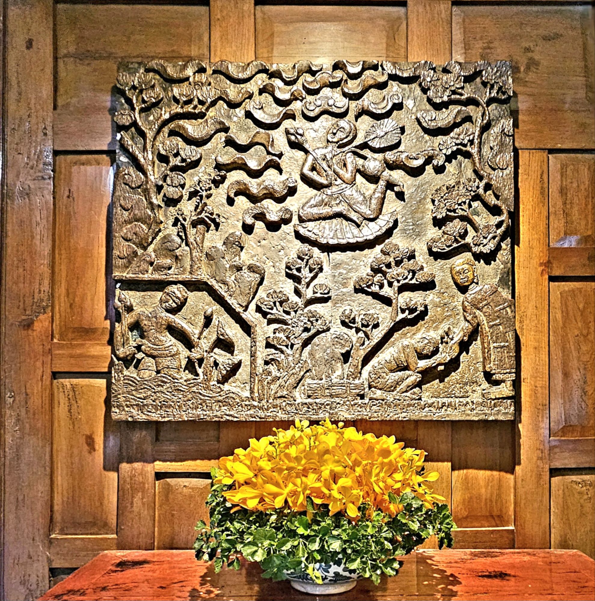
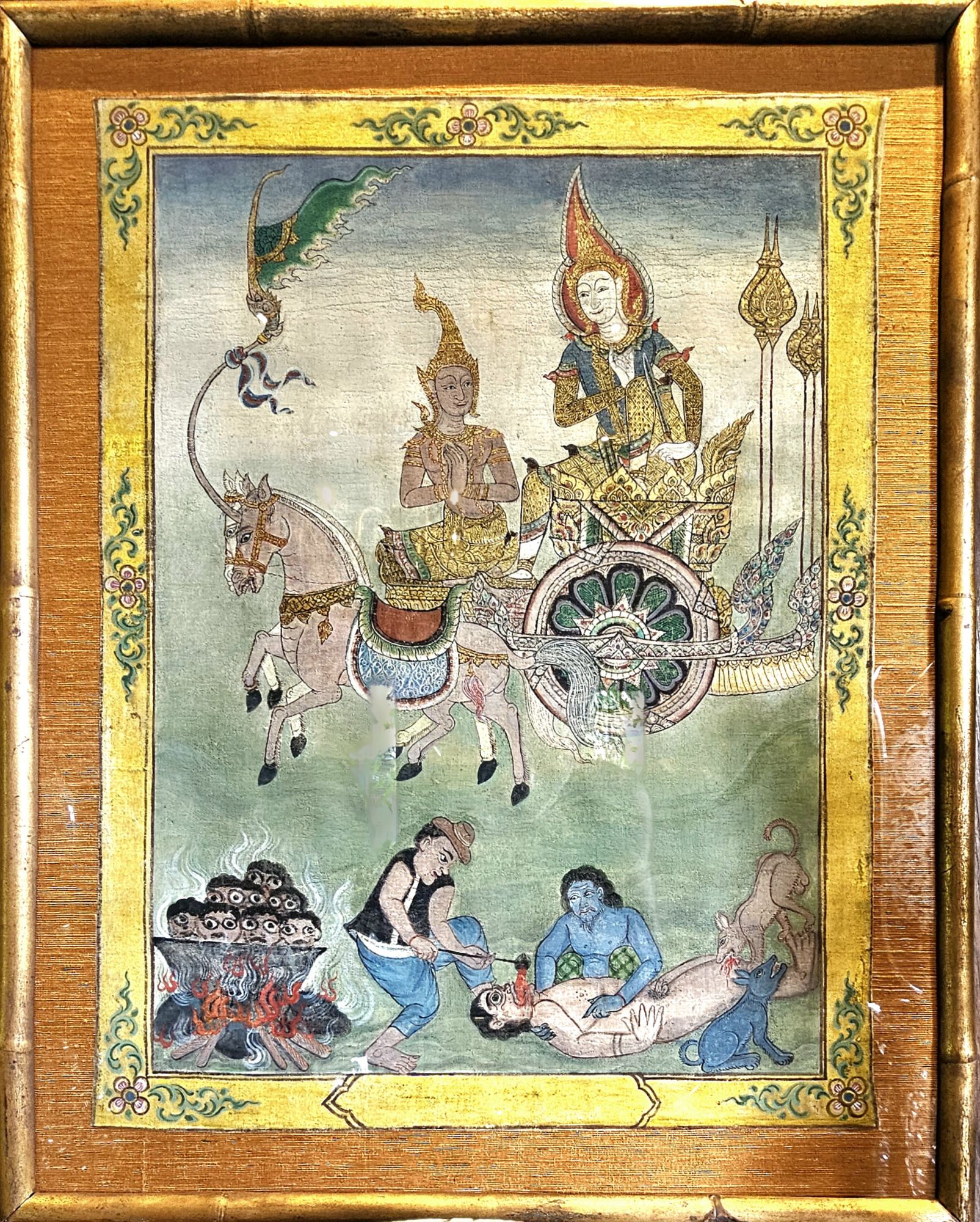
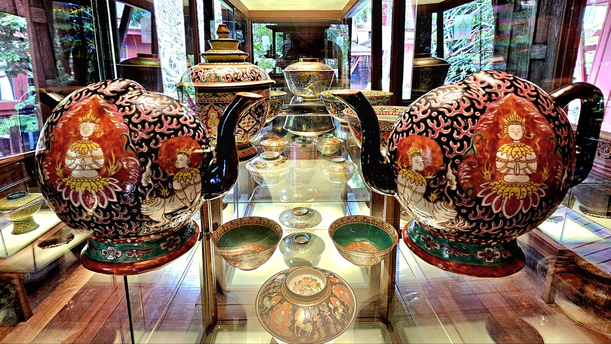
An English-speaking docent guided us through gardens and living quarters, which showcased archetypal Thai tapestries,
ancient wood carvings,
Buddhist watercolors…
and fanciful porcelain tea sets, among a dazzling array of other riches…
which inspired Thompson’s line of patterned silk fabrics used in clothing, furnishing, and accessories,
such that he single-handedly revolutionized Thailand’s handicraft industry during the 1950s and 1960s, earning him the moniker of the “Silk King of Thailand.”
His home has become an amalgam of Southeast Asian cultures…
and museum-worthy artifacts that he collected throughout the years,
sprinkled with practical flourishes, while serving as de facto US Ambassador to Thailand and founding the Thai silk company that still bears his name.
His status as a raconteur and entertainer of celebrities and royalty was legendary, but abruptly came to an end on Easter Sunday, March 1967. He had visited a friend’s house in the Cameron Highlands of central Malaysia, and took an afternoon walk through the jungle that day, never to be seen again.
Despite a land and air search effort involving hundreds of full-time trackers across multiple agencies and governments, it seems Jim Thompson disappeared without a trace.
There are many who have traveled down the rabbit hole of theories and conspiracies, determined to unravel the truth and possible whereabouts of his remains.
Yet the legacy Jim Thompson left behind continues to this day, and Thailand’s prosperous silk industry remains his greatest contribution.
With writing this sentence, my 6-month blogging hiatus is officially history.
All the while, I continued taking pictures, and I never stopped writing. I just got off the blogging merry-go-round for a time.
Instead, I took stock of nearly 25,000 images and analyzed 500 stories that I’ve shared with the WordPress community over the past eight years.
I soon realized after 3 years of blogging that I had already accomplished my mission of streaming through America!
That’s not to say that there’s nothing more to experience. But I can honestly say that since retiring, I’ve chronicled hundreds of visits to national and state parks and various landmarks and curiosities across the country, which amounts to the very best that America has to offer.
I’ve also begun to travel more internationally, and I’ve included many of those destinations in this blog. How could I not? Naturally, it wasn’t in an Airstream, and it wasn’t America. Although, in fairness, some of those destinations within Canada, Mexico, Central America, and South America should count as “American” by nature.
I also realized that many of the stories I wanted to tell were not always supported by the photographs I had taken. And often times, the photographs I was most pleased with didn’t always match the story I was writing.
I found myself making arbitrary rules that impeded my writing, like thinking that my posts should be a linear account of my travels rather than a reflection of an arbitrary moment in time.
Managing StreamingThruAmerica.com has been a blessing, albeit it’s been challenging yet exhausting; nourishing while enervating; fulfilling but frustrating, and rewarding yet fickle.
Nevertheless, it’s also garnered over 100,000 views–for which I received a silly badge from WordPress, which makes me smile;
and it’s earned an Editors’ Discovery pick soon after launching this blog.
I don’t know if all of that is worthy of celebration or not, but I’m certainly grateful for the recognition and all the support from the blogosphere.
What started as a personal journal of sorts and a means of checking in with family and friends has morphed beyond its original intent, and I’m okay with that.
I’ve toyed with refreshing the style and revising the content to fit the times (and maybe that may happen on a rainy day), but for now, it’s status quo.
The journey continues…in Bangkok–the first stop of a 5-week adventure to Southeast Asia–where ancient kingdoms still shine as bright as the Buddhas that adorn his temples.
Resetting the Wayback Machine to Dateline: August 3, 2023
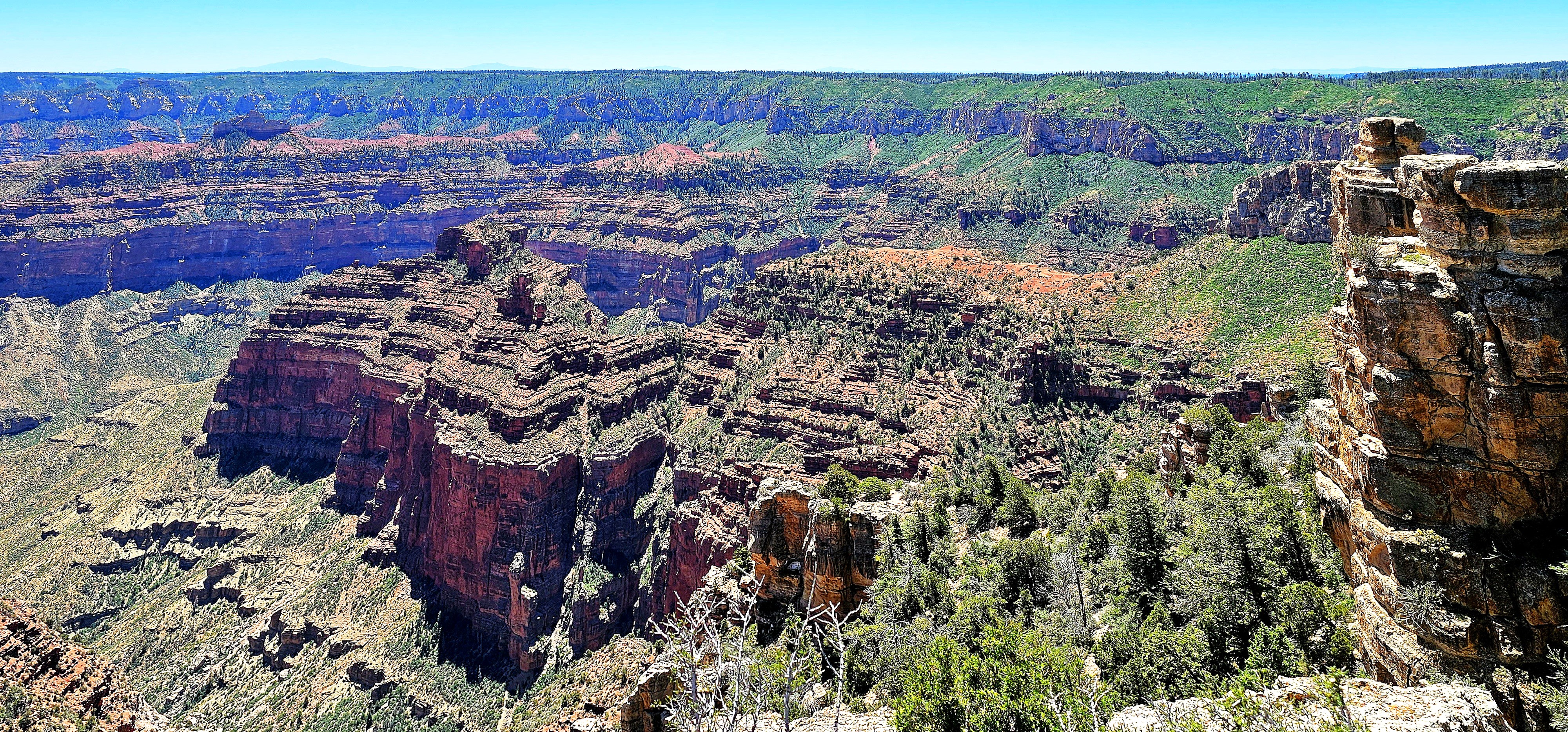
After three days of admiring Grand Canyon’s North Rim–from Point Sublime…
to Point Imperial…
to Angel’s Window,
Leah and I were already anticipating our next physical and photographic challenge–hiking through the Coyote Buttes North in search of The Wave.
But we were at the mercy of Bureau of Land Management, who awards permits to no more than 64 visitors per day through a complicated online lottery process.
We scored dinner reservations at the Grand Canyon Lodge Dining Room…
during sunset to discuss our future travel plans.
Regrettably, our meal was more consolation than celebration. Despite our application for permits months in advance, and again, the day before our departure, our high hopes were dashed by impossible odds.
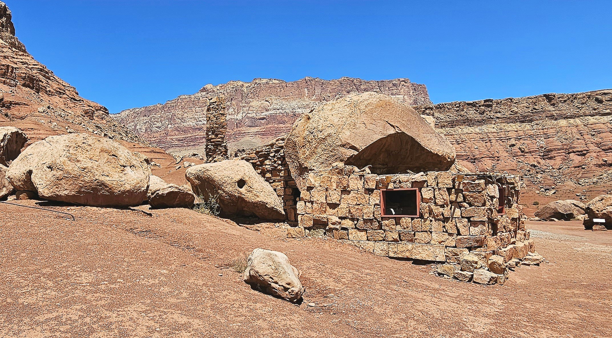
Ultimately, we followed our contingency plan, which, like an old friend, was familiar yet still full of surprises. The following day, we drove through Marble Canyon–flanked by Vermillion Cliffs–with a brief stop along Highway 89A to marvel at a Cliff Dwellers Stone House,
a crumbling roadside curiosity that was constructed from rock debris and local timber by Ziegfeld Follies dancer Blanche Russell and her husband Bill, whose car had broken down at this location in 1927.
According to the tale, the beauty of their surroundings was so captivating that they established a homestead on the site during the Great Depression, extending hospitality to Mormon travelers journeying along the adjacent Honeymoon Trail to the temple in St. George, Utah, for the sanctification of their marriages.
Meanwhile, we continued north on a pilgrimage of our own to Page, Arizona for a few days of essential sightseeing.
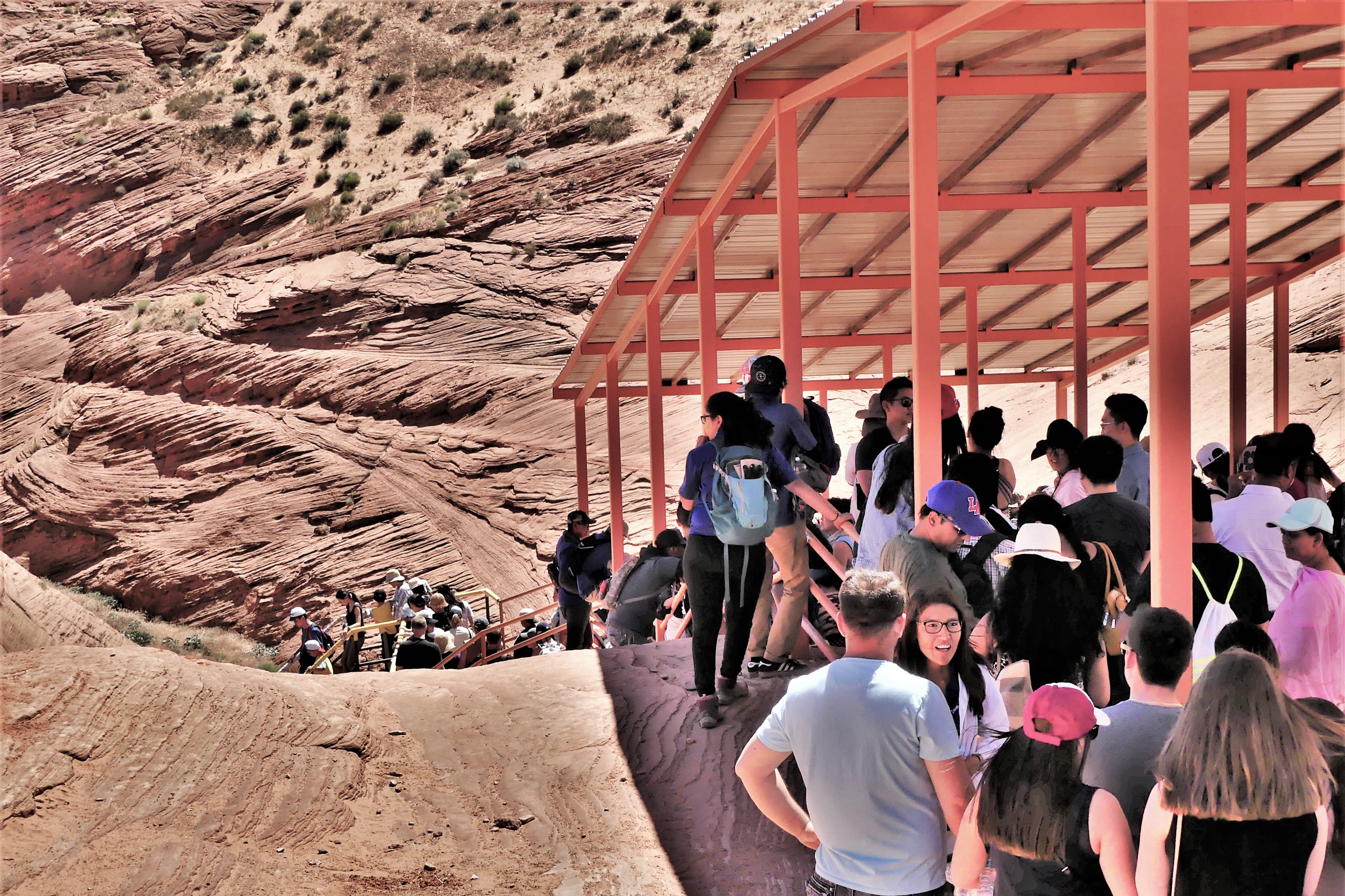
The following day, we arrived at a strip mall to claim a coveted noon reservation for a guided tour of Upper Antelope Canyon tour with an accredited Navajo tour operator. Having toured Lower Antelope Canyon 6 years ago (see Can’t Elope Canyon), we elected to hike the upper canyon this time around.
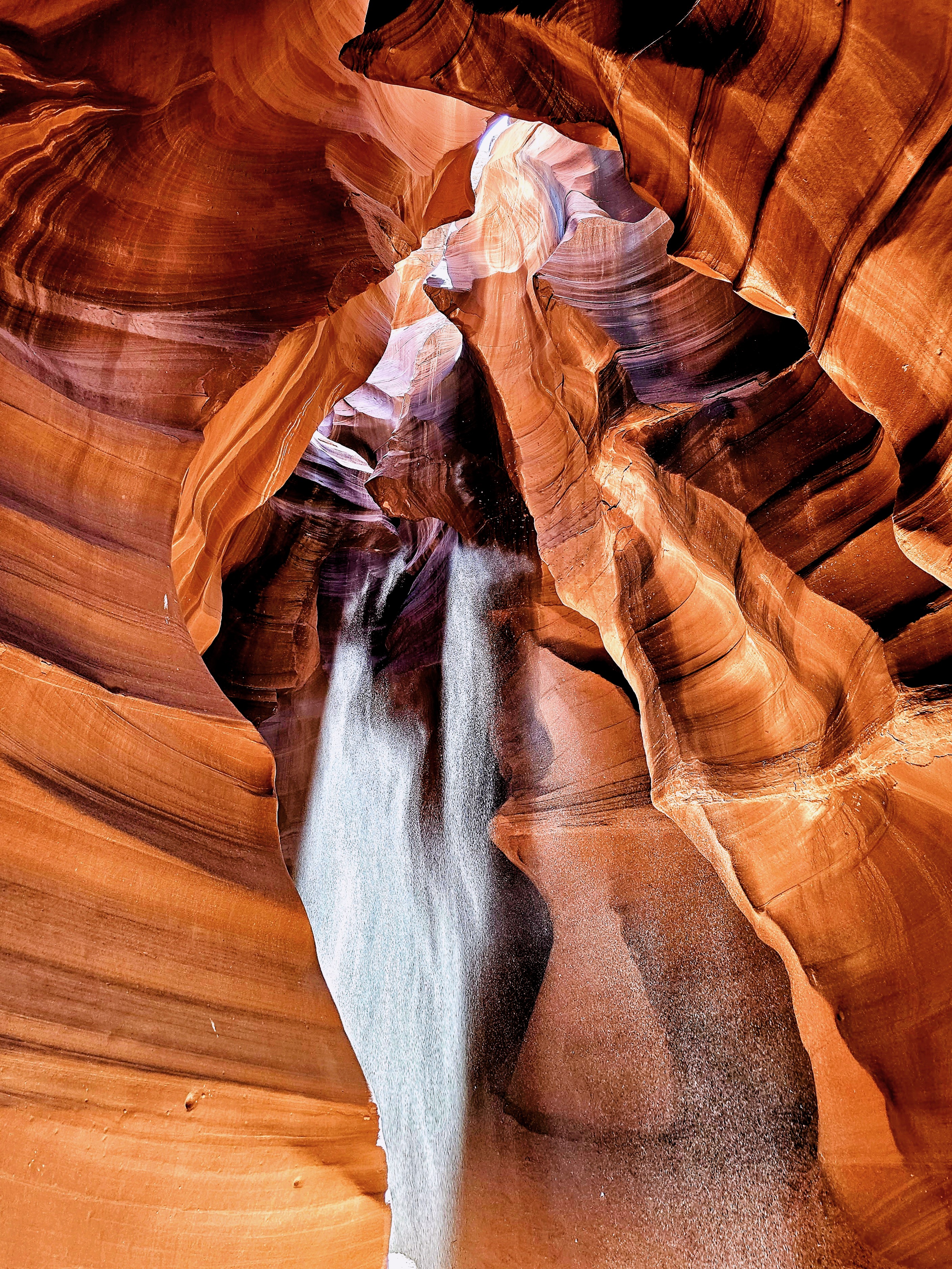
Upper Antelope Canyon, often referred to as “The Crack,” features a flat entrance and a level path throughout, offering a seamless stroll with no elevation shifts. This easy access, devoid of any stairs, renders it more welcoming than its counterpart, Lower Antelope Canyon, where stairs and ladders are part of the experience.
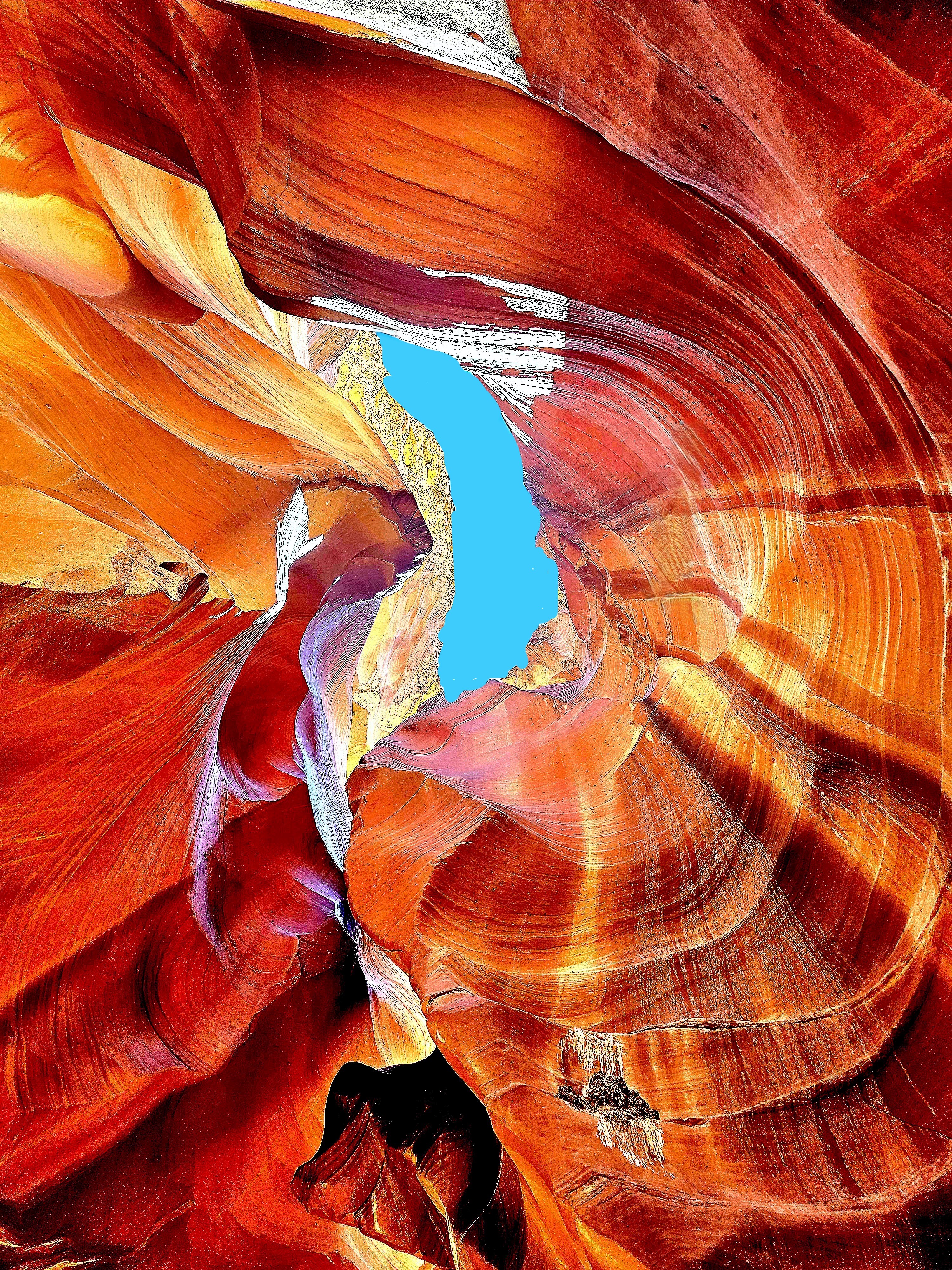
In my quest for photographic redemption, I was determined to infuse some mystery into the majesty of these sculpted canyon walls by focusing on the details of the form, while framing an energy of twists, curves and color.
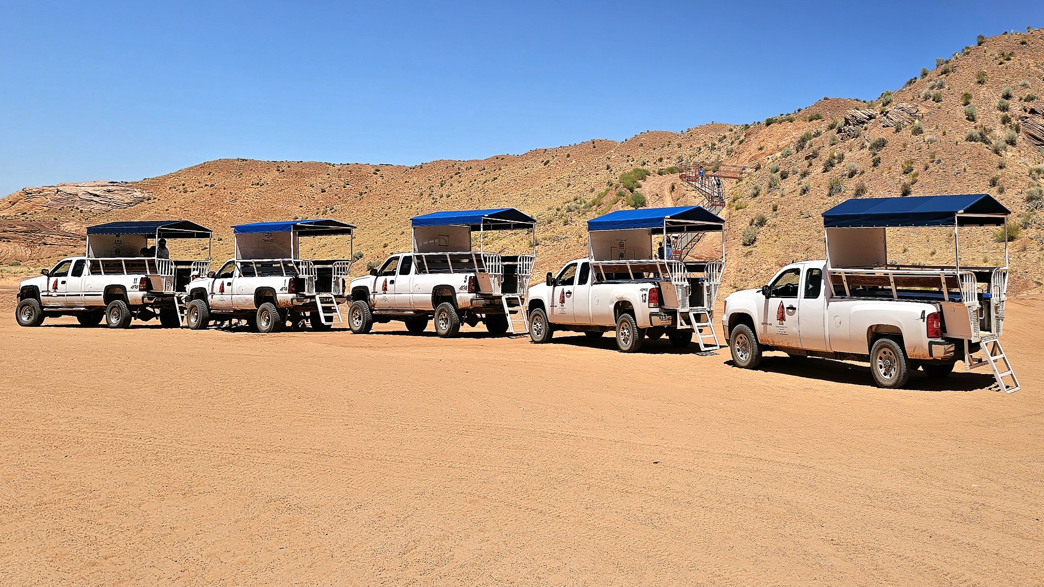
We jostled and bounced across a dusty desert plain from the back of a dusty pickup truck, enduring temperatures of 100°F. The grab bars were so hot, I could only handle them through my hat. After arriving at the canyon’s entrance, our guide offered us a brief geology lecture and valuable photography tips.
Rather than lug around my SLRs, I relied on my Samsung Galaxy 23S Ultra phone for its reputed low-light sensitivity and high-resolution capabilities.
From the onset, our guide pointed out shapes created by negative space, such as the “Lady of the Canyon,” which seemed intriguing to many, but irrelevant to my mission.
Additionally, there was plenty of highlight and shadow play in the formations that was easily personified, such as the “Open-Mouth Man.”
Many photographers were there to capture the “sunbeam effect” that appears from April 1st to September 30th with a helping handful of tossed sand.
There was also equal opportunity to document the canyon wall formations as realistically as possible.
or using the undulating walls as an interesting backdrop.
But I was there to capture the abstract potential!
The canyon’s walls rise up to 660 feet above the streambed, and the trailhead sits at an elevation of 4,377 feet.
Geologists say the walls are shrinking and the elevation is increasing, as sand continues to rise from continuing erosion from wind and water.
The 0.3-mile one-way trail is mostly hard-packed with red sand and silt.
The Navajo Nation calls Upper Antelope Canyon “Tsé’bighanilini,” meaning “the place where water runs through rocks.” I call it amazing!
One hour later, we emerged from “The Crack.”
Antelope Canyon’s allure was so magnetic that I felt myself being drawn into repeating our adventure. However, time would not allow, and no slots were available!
Certainly, its beauty would have revealed itself in a new light, with a new twist!
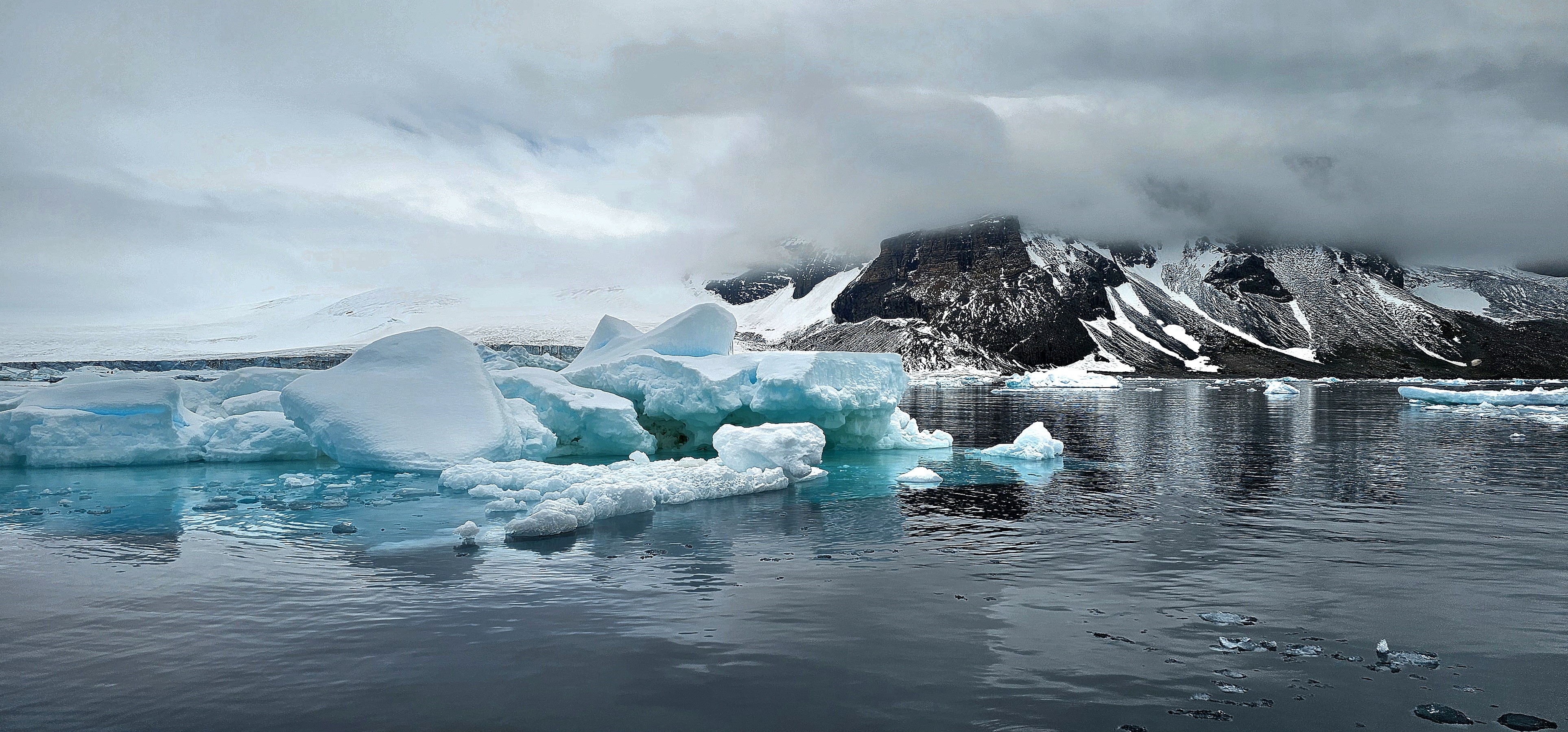
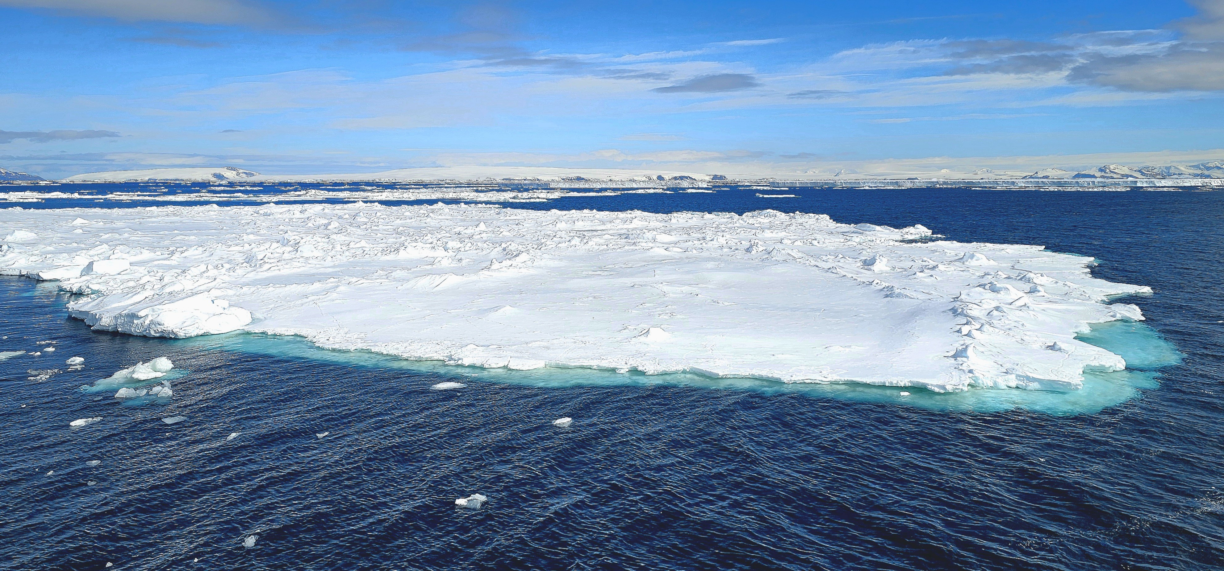
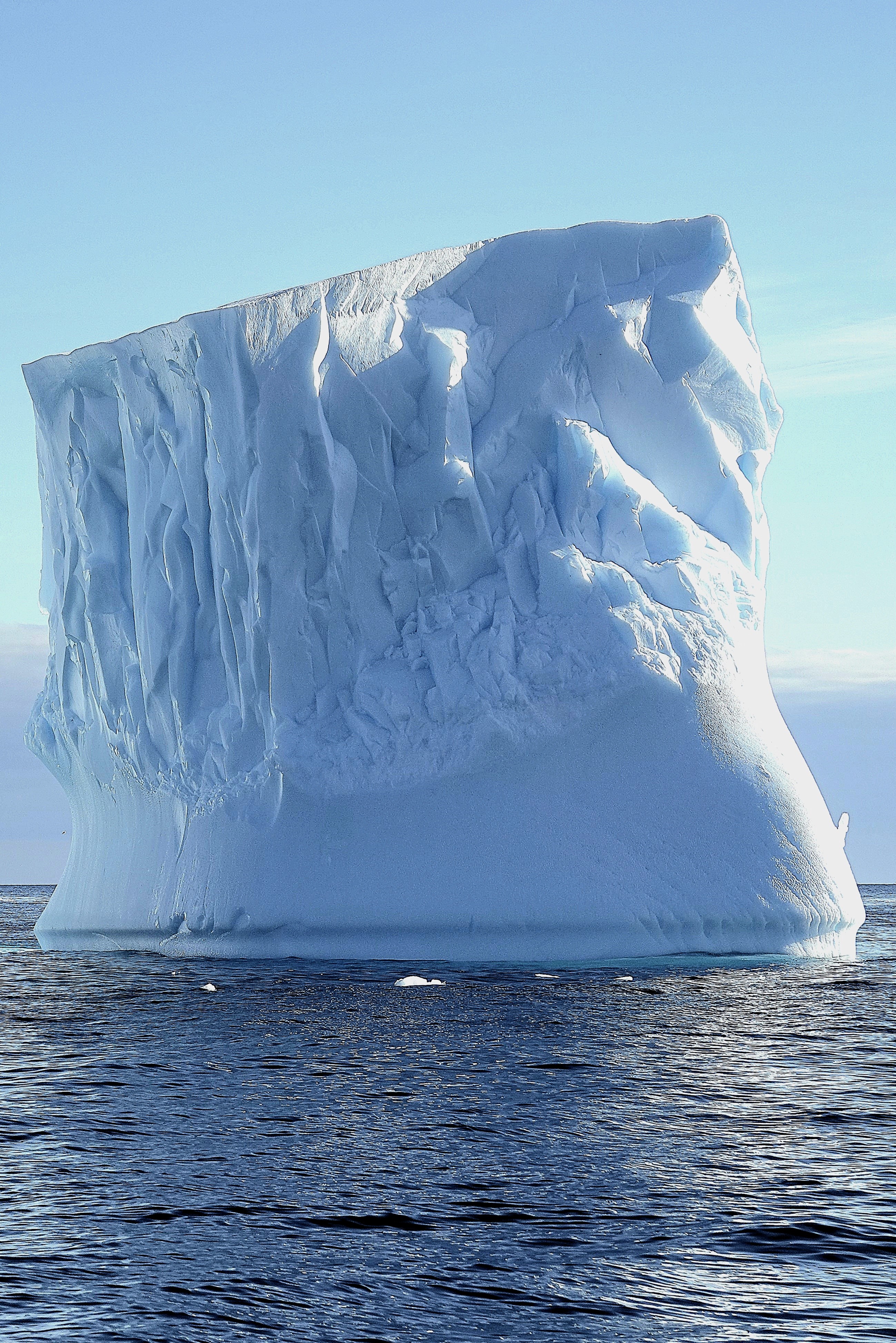
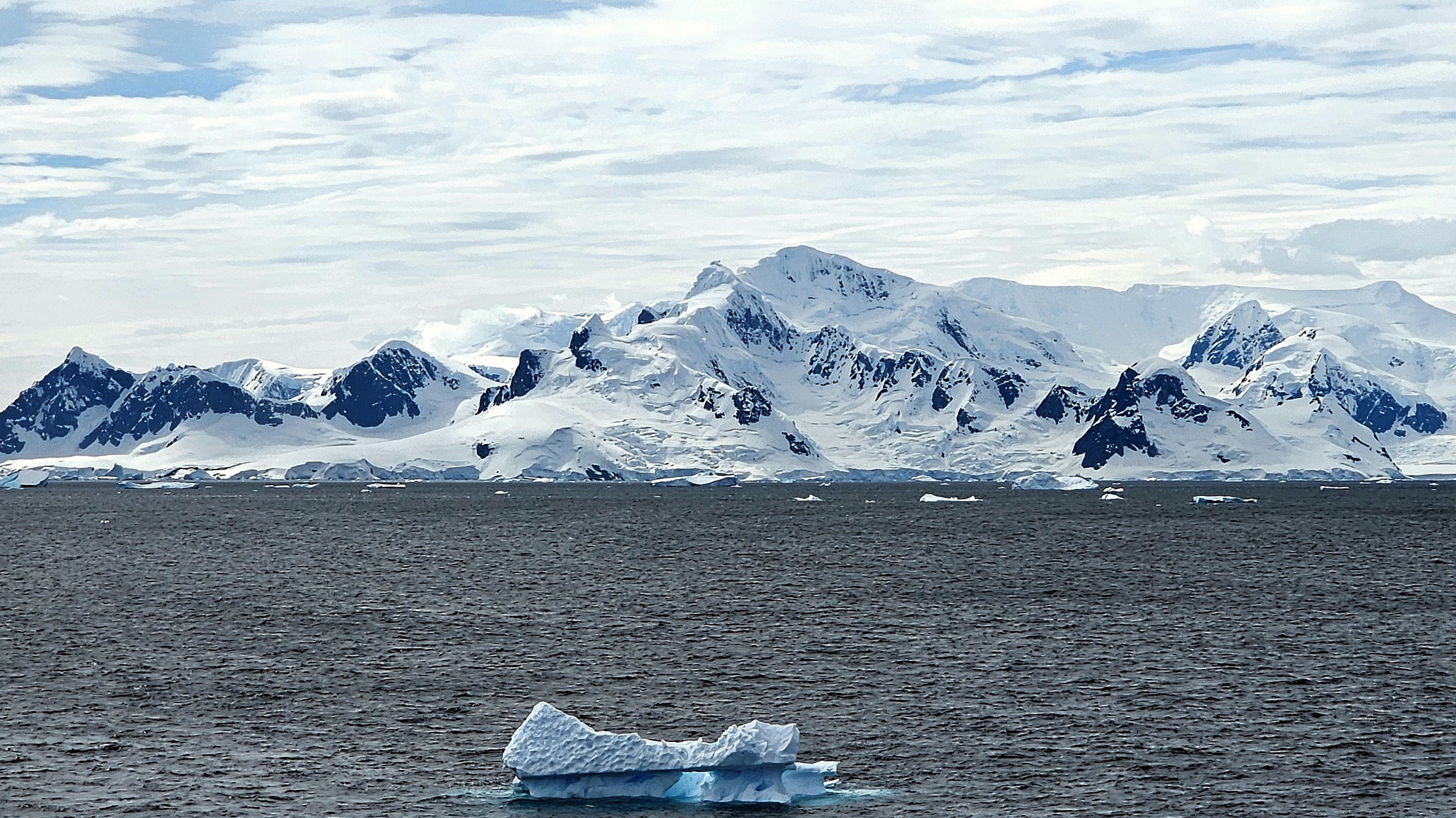
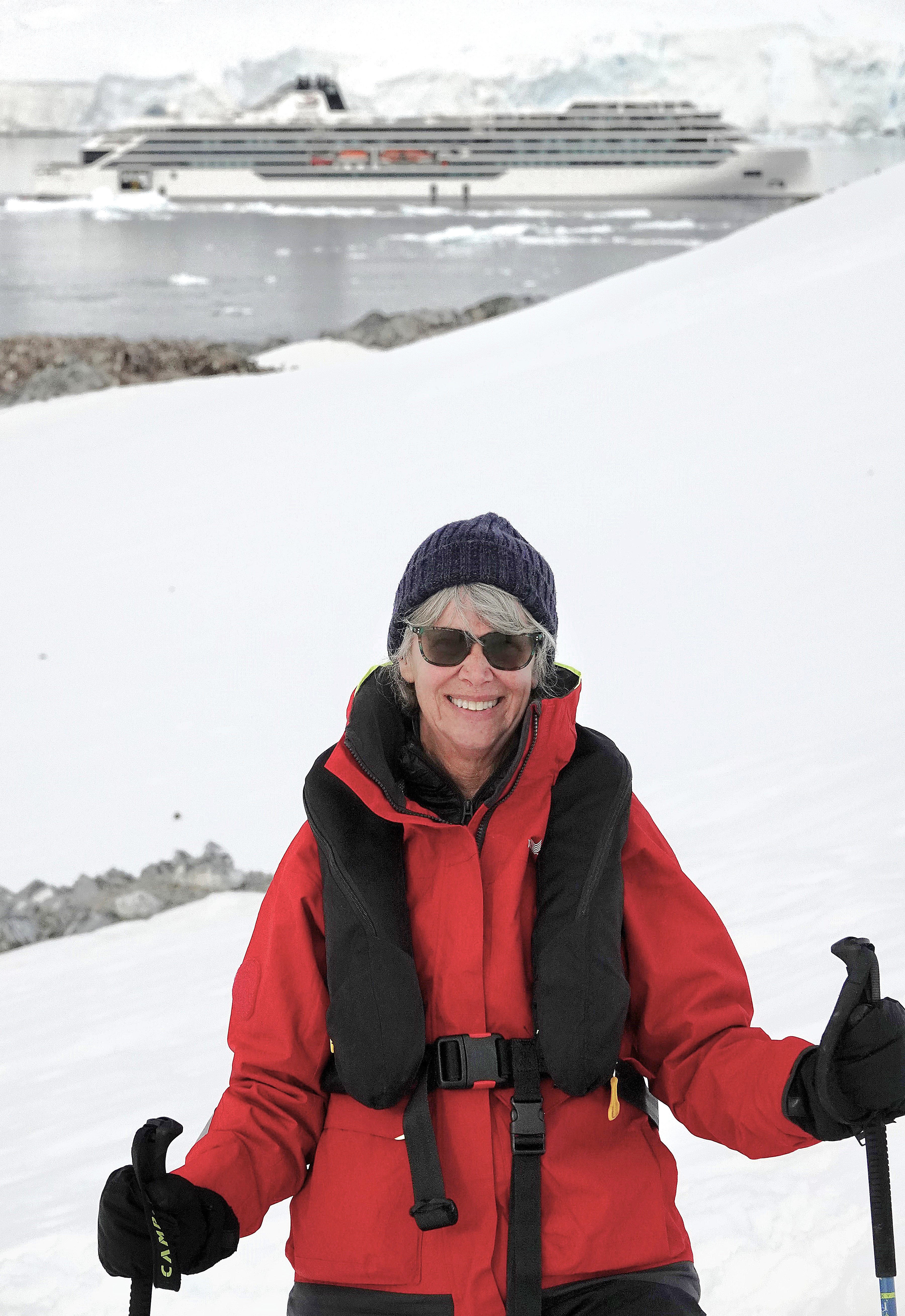
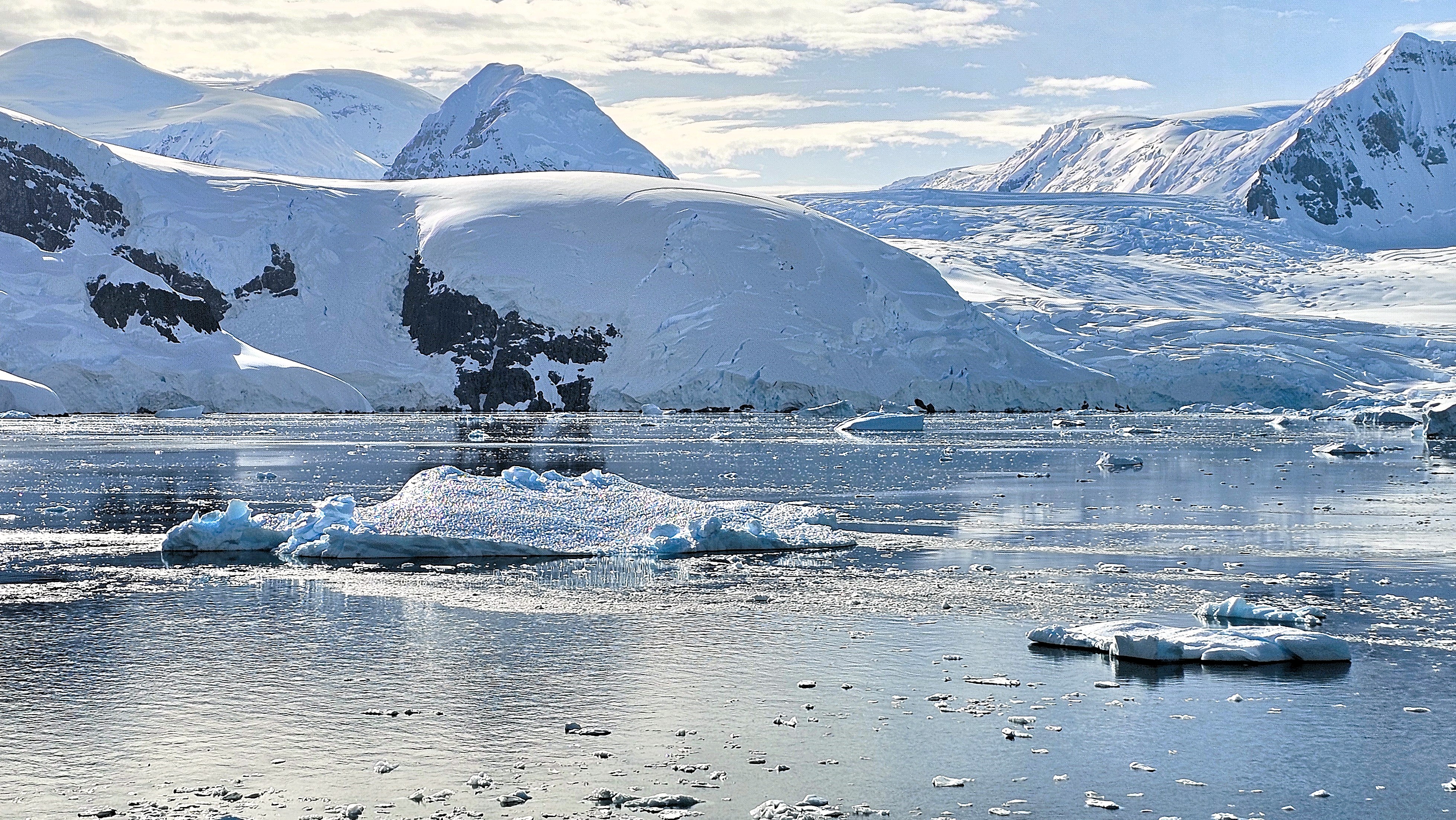
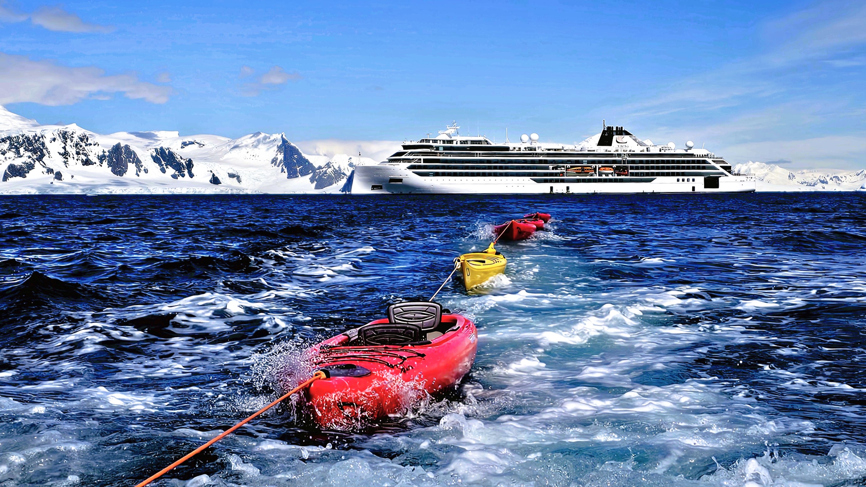
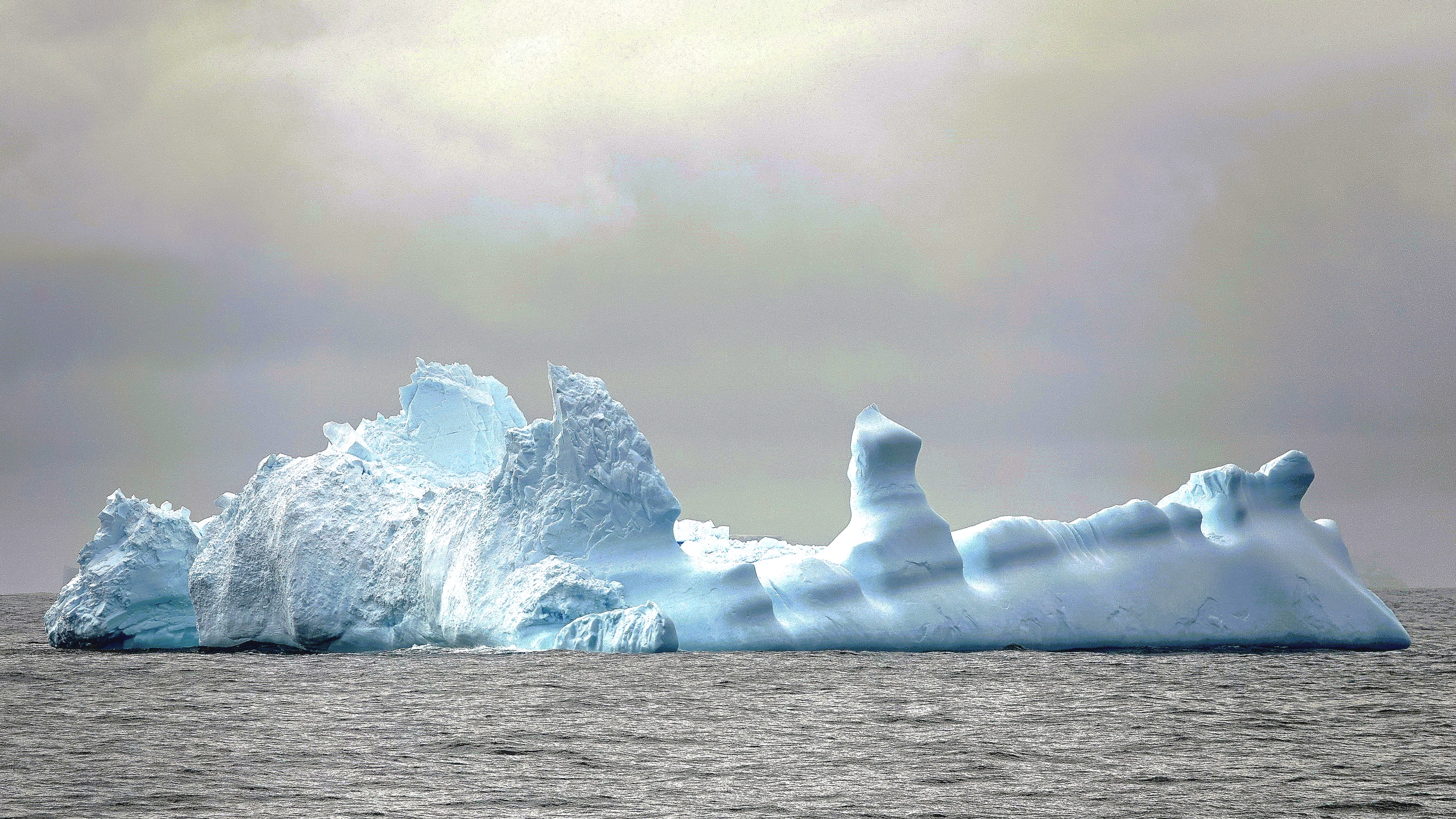
After a week of island-hopping along the Antarctic Peninsula, Leah and I finally set foot on the continent of Antarctica.
And because this was Viking’s sole continental visit, the expedition team was particularly busy transporting the remaining 352 passengers to Brown Bluff while overseeing a range of other outdoor activities throughout the day.
Our group was instructed to report to Deck 2 during a celebratory luncheon on Deck 10 that was briefly interrupted by a cloudburst of sleet and snow. Leah managed to cross the slippery deck with aplomb while balancing her surf and turf, but we had other fish to fry.
Once we were appropriately outfitted, our Zodiac pilot whisked us from our Trepassey Bay anchorage…
avoiding packs of drifting ice while also keeping an eye on an evolving sky,
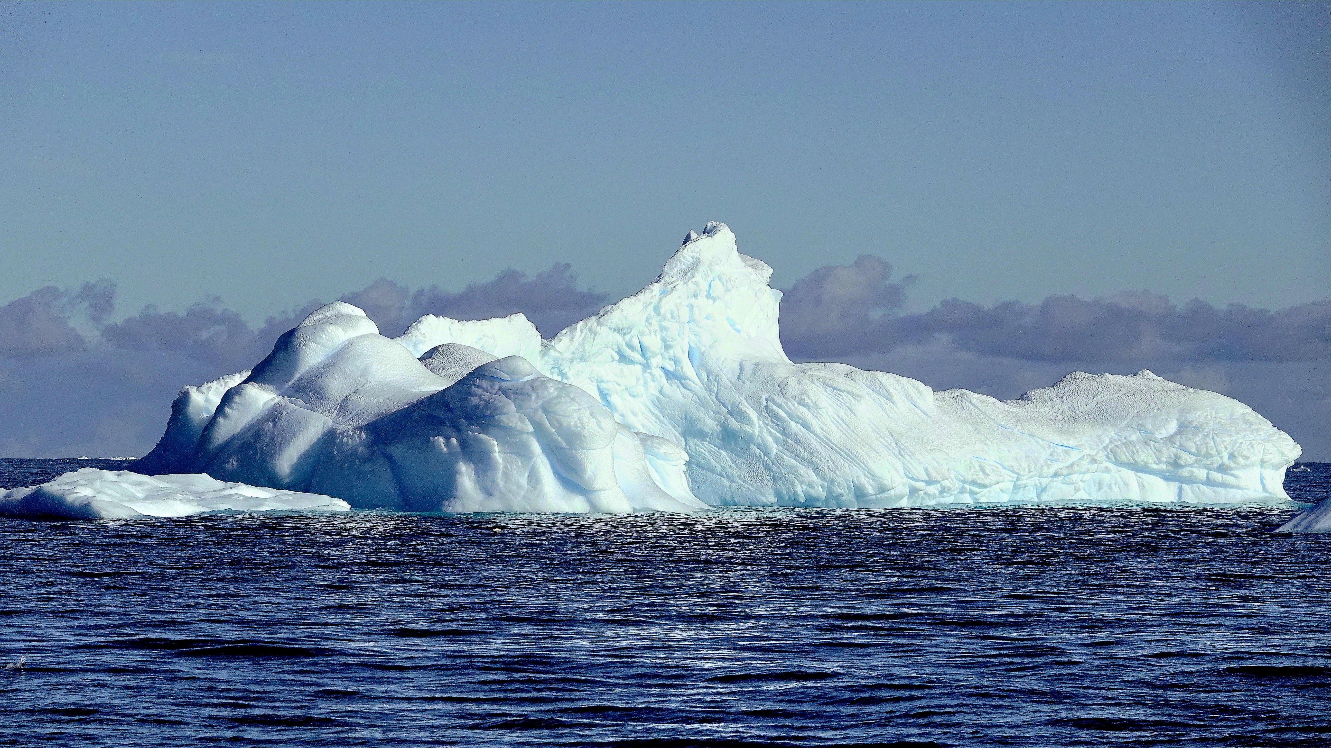
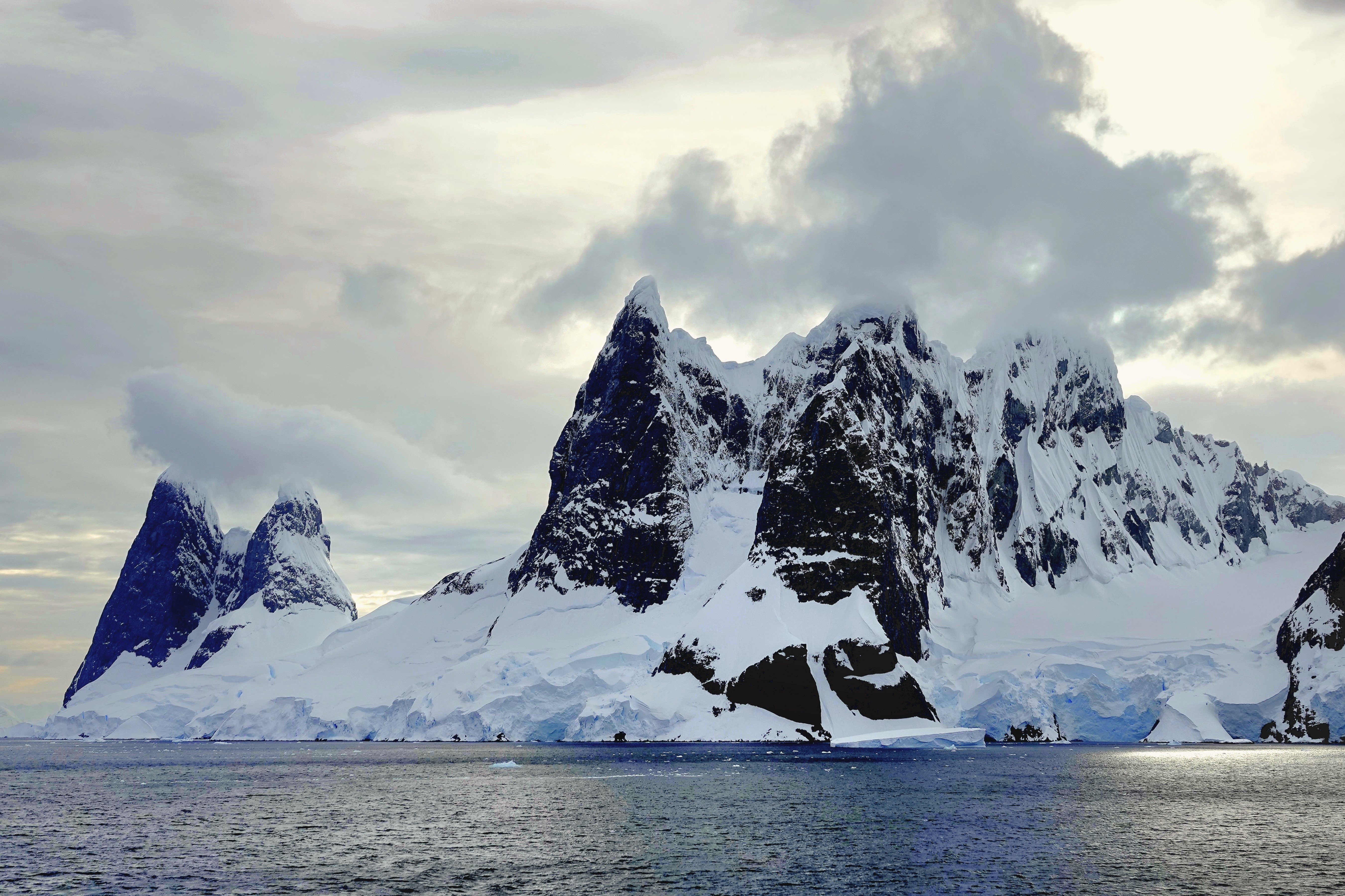
which transformed a distant glacier into an enchanted wonderland of swirling smoke and mirrors.
And then, as if on cue, the veil magically lifted as we approached the coast, revealing its rich, red brown, tuya characteristics.
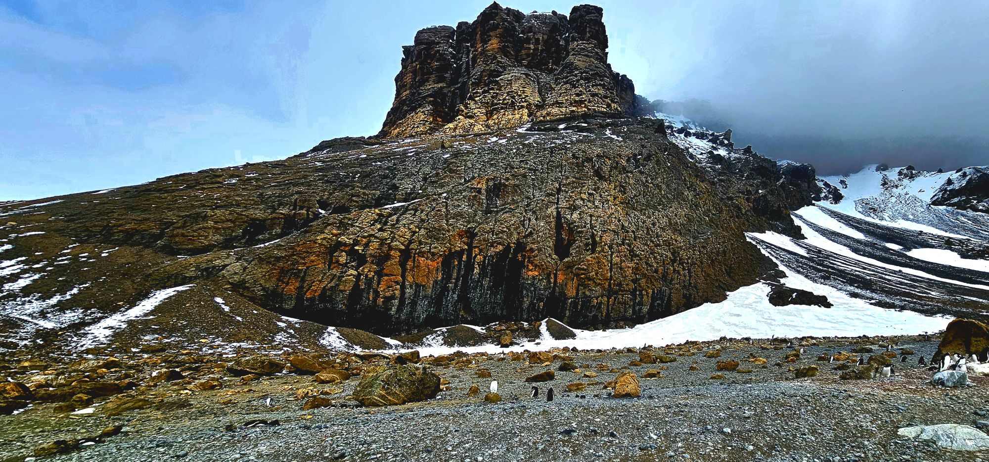
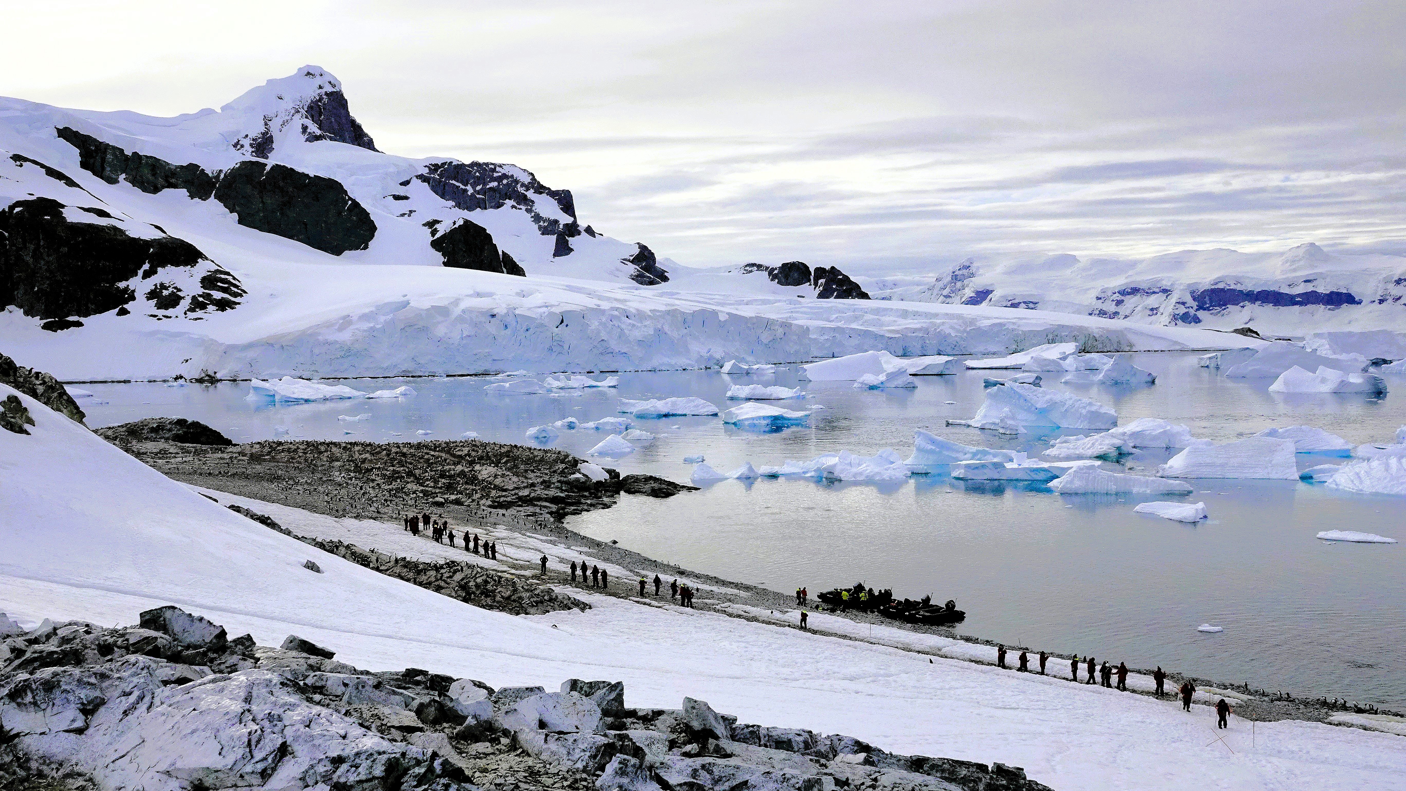
We ambled onto shore, across the moraine…
where three impressive, moss-covered boulders at the western edge of the snow slope…
reminded us of Brown Bluff’s subglacial eruption one million years ago.
A majority of the landing groups headed east towards the rookery.
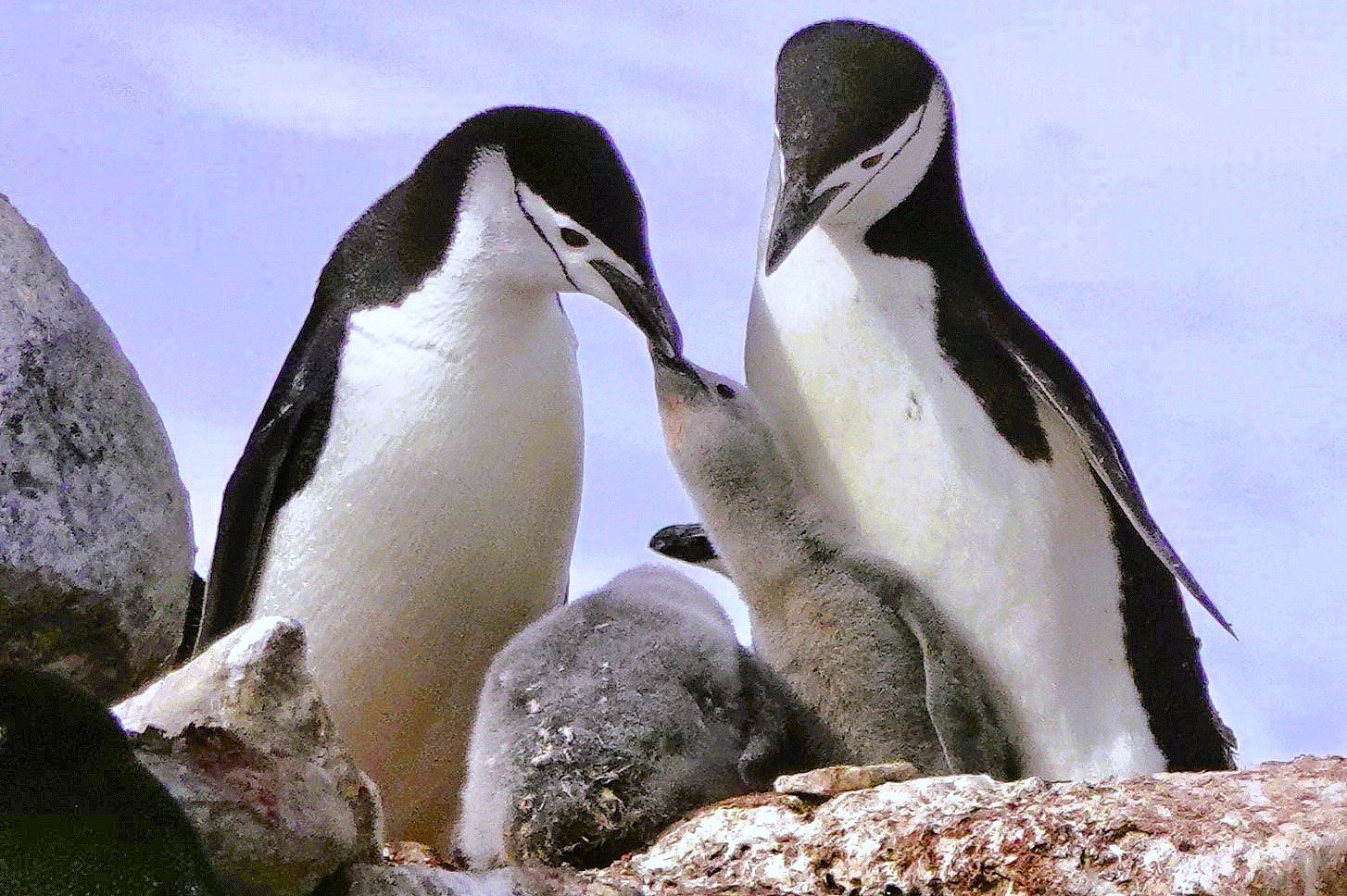
However, it proved quite difficult to maintain a 5-meter distance from the gentoo penguins–perpetually parading along the beach.
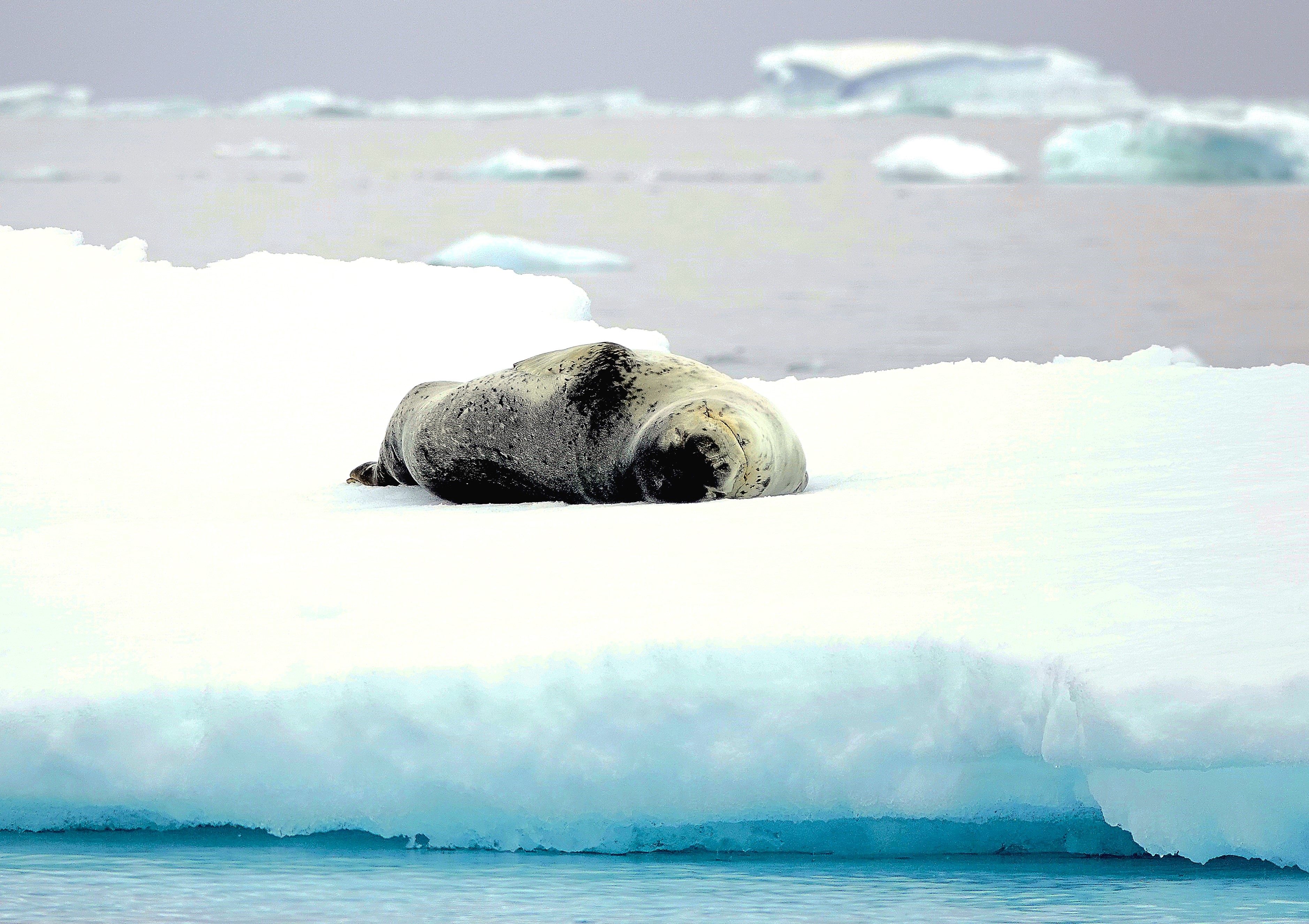
So, I ventured westward, over an icy reef, beyond nesting kelp gulls…
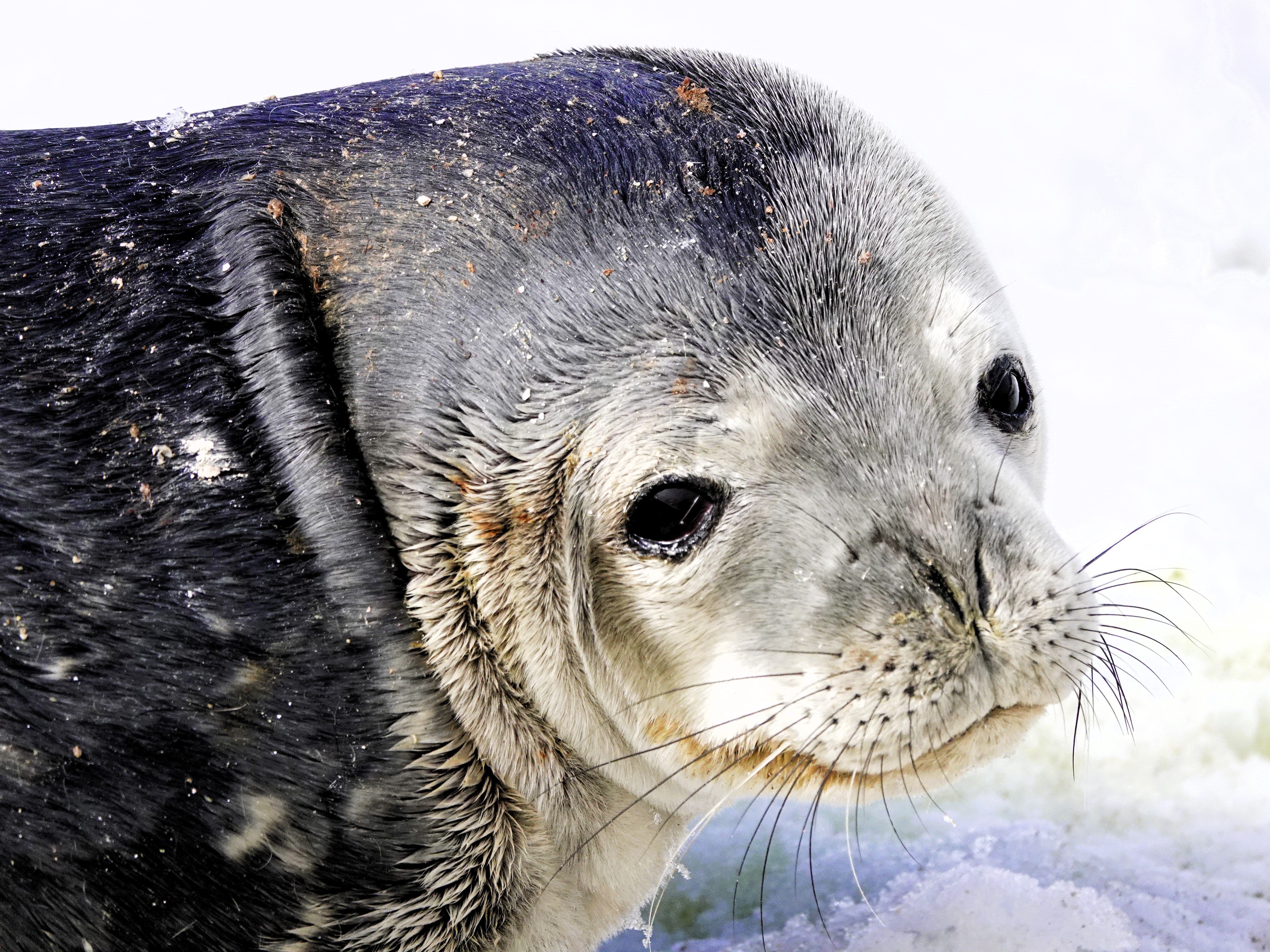
where I spotted an opportunistic leopard seal lying in wait…
for unsuspecting dinner guests,
yet every penguin on Brown Bluff had reservations elsewhere.
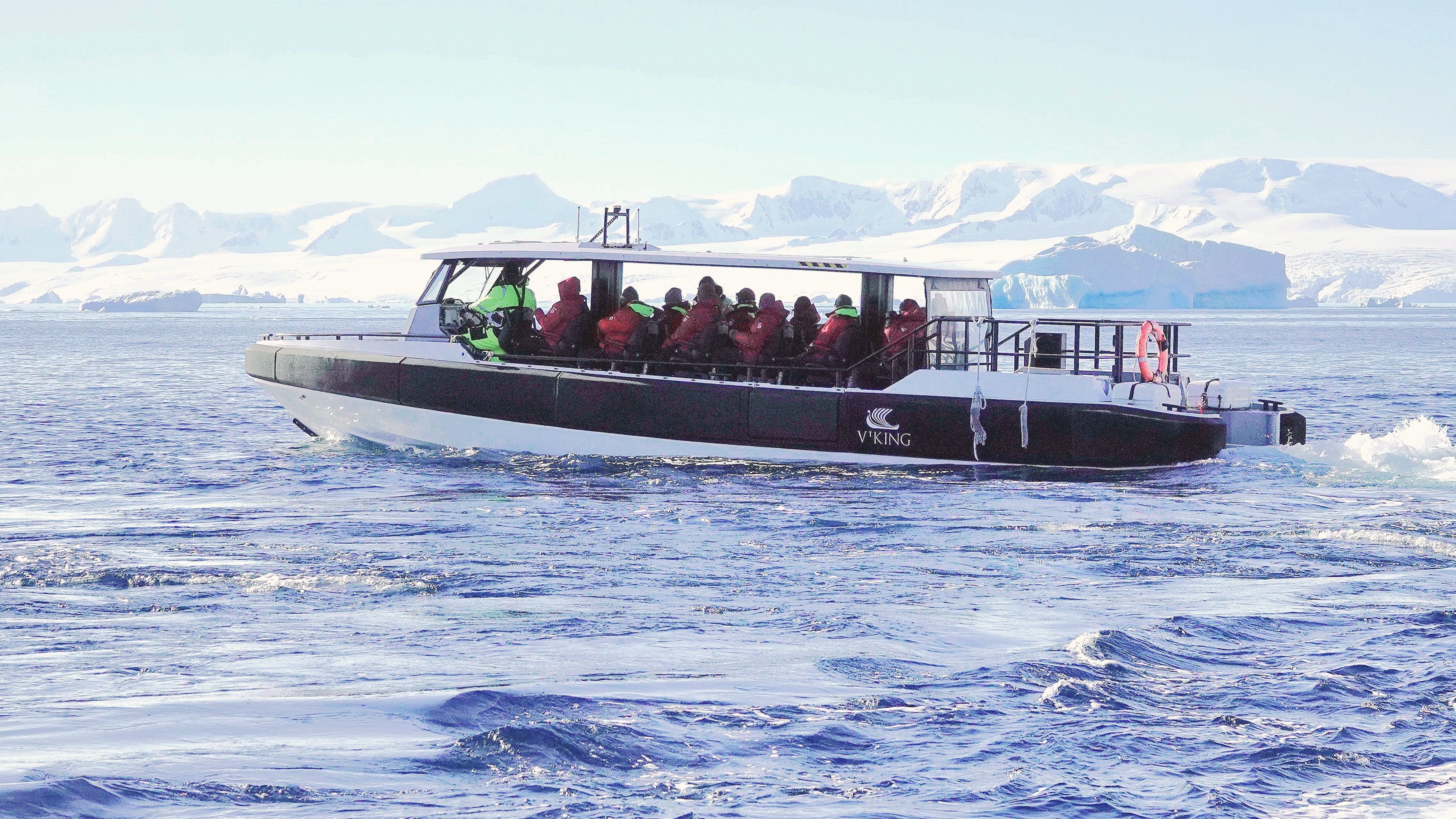
Had our continental landing marked the end of our dramatic voyage, I would have been wholly satisfied with our Antarctic experience. However, following the decontamination of our outerwear aboard Octantis, Leah and I learned that we would be among the final twelve returning to Brown Bluff via Special Operations Boat.
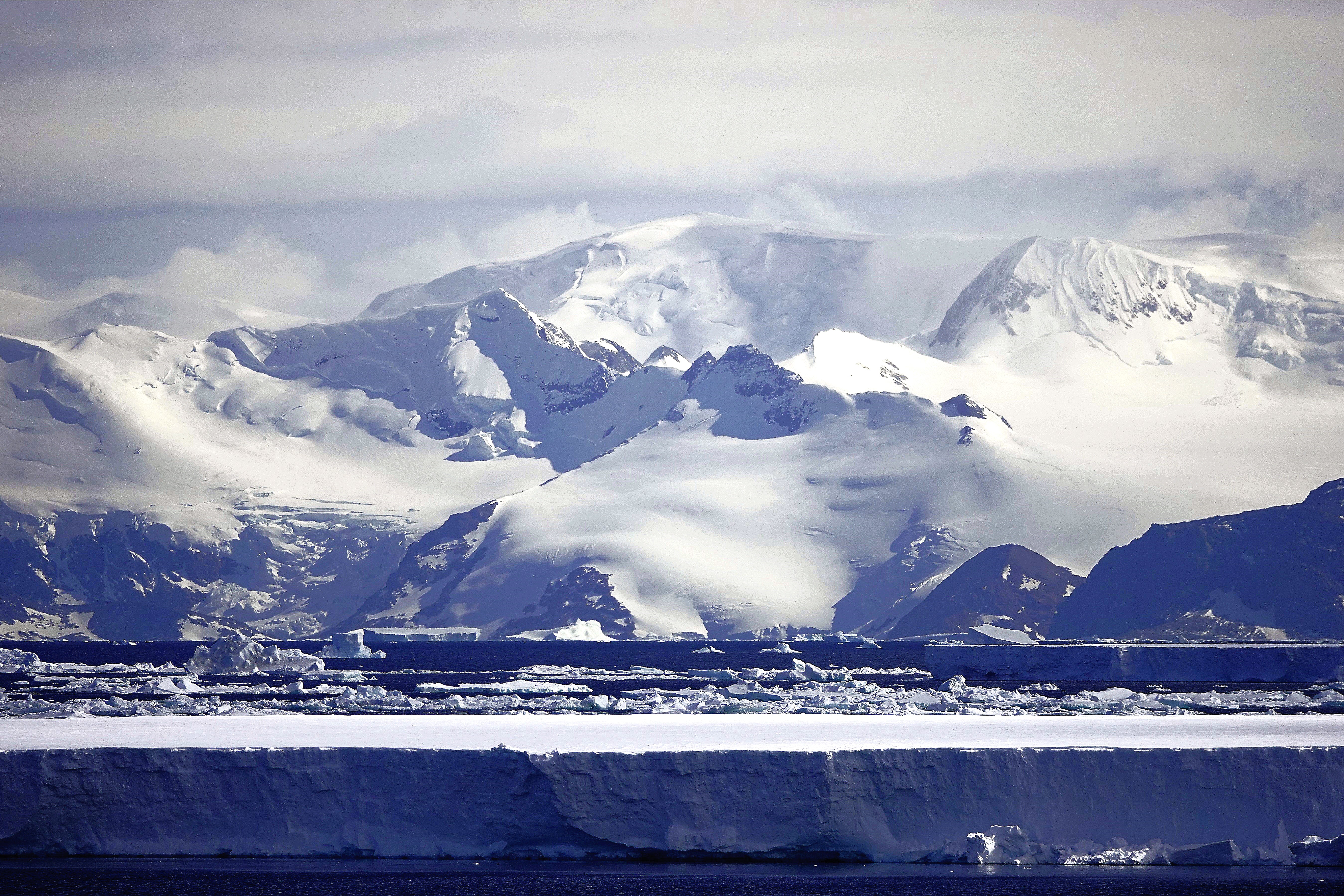
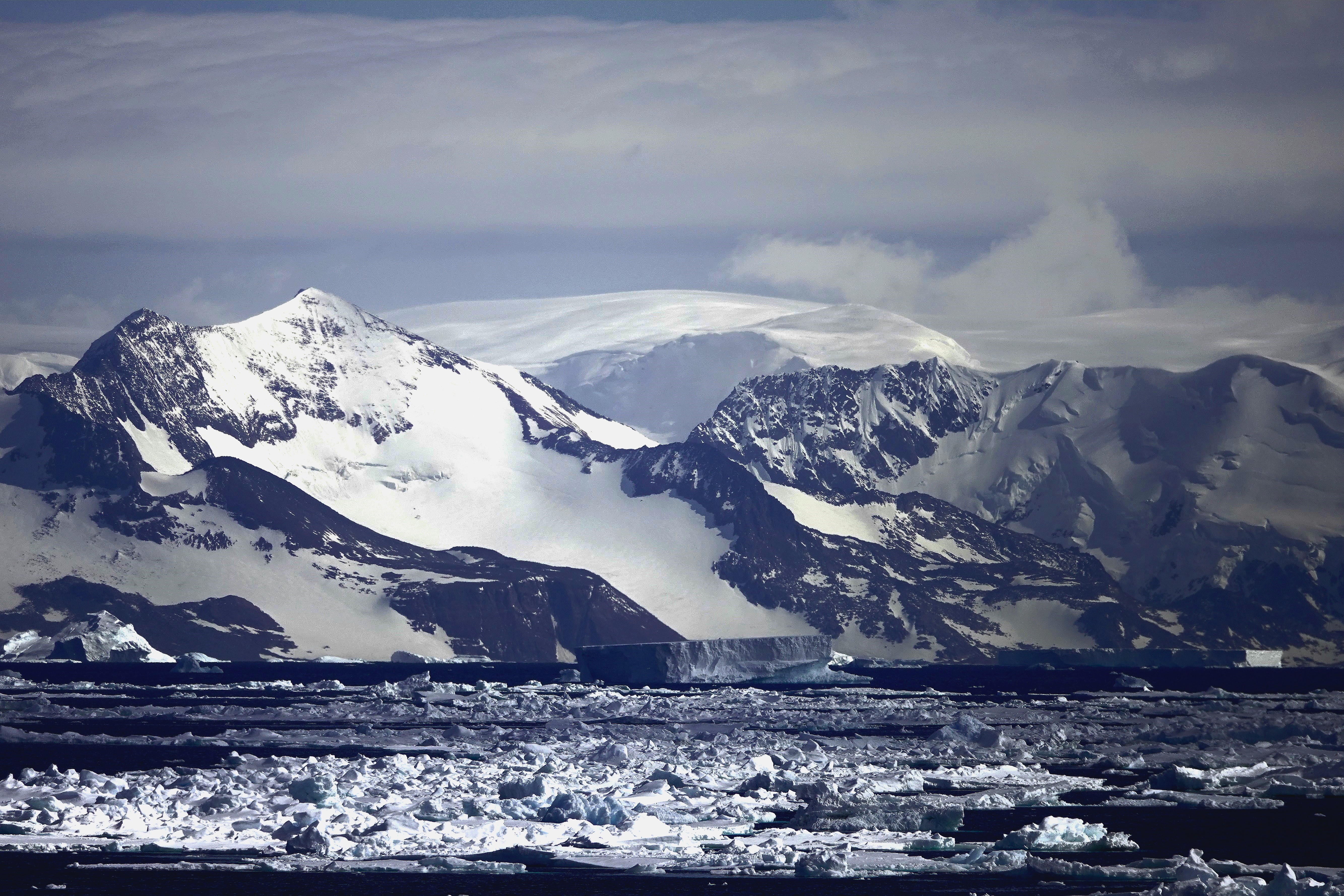
On our penultimate day at sea, Captain Cardestig skillfully navigated the Viking Octantis around the peninsula’s northeastern tip for an early morning view of Joinville Island’s glacial headlands and ice-capped peaks.
We anchored outside a dense track of pack ice that can make it challenging to approach landfall at Tay Head.
Those fortunate enough to be scheduled for daily excursions experienced a thrill ride from the 10u Zodiacs piloted through floating ice blocks momentarily stranded on rocky shallows.
I, however, was stranded aboard Octantis with my camera at the ready. The closest I could get to the Adélie penguin colony this day managed to swim across my viewfinder as they indulged in a krill feast.
Travel resumed at noon, dodging islands of sea ice across the Antarctic Sound,
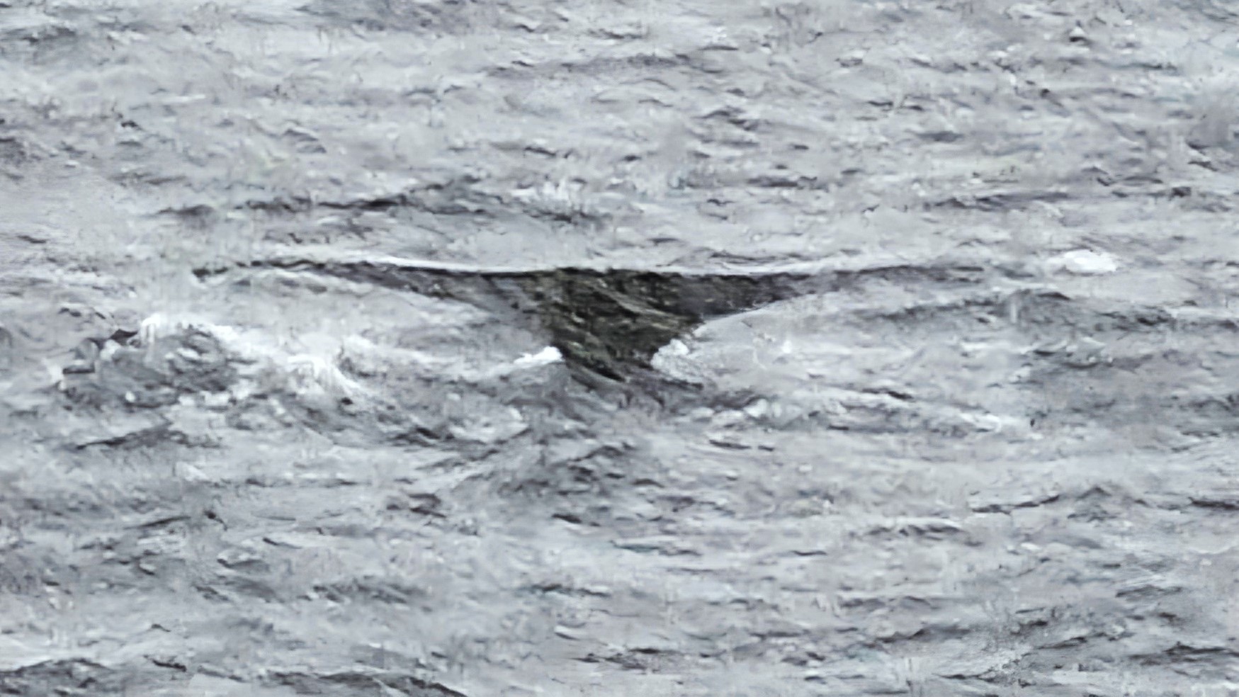
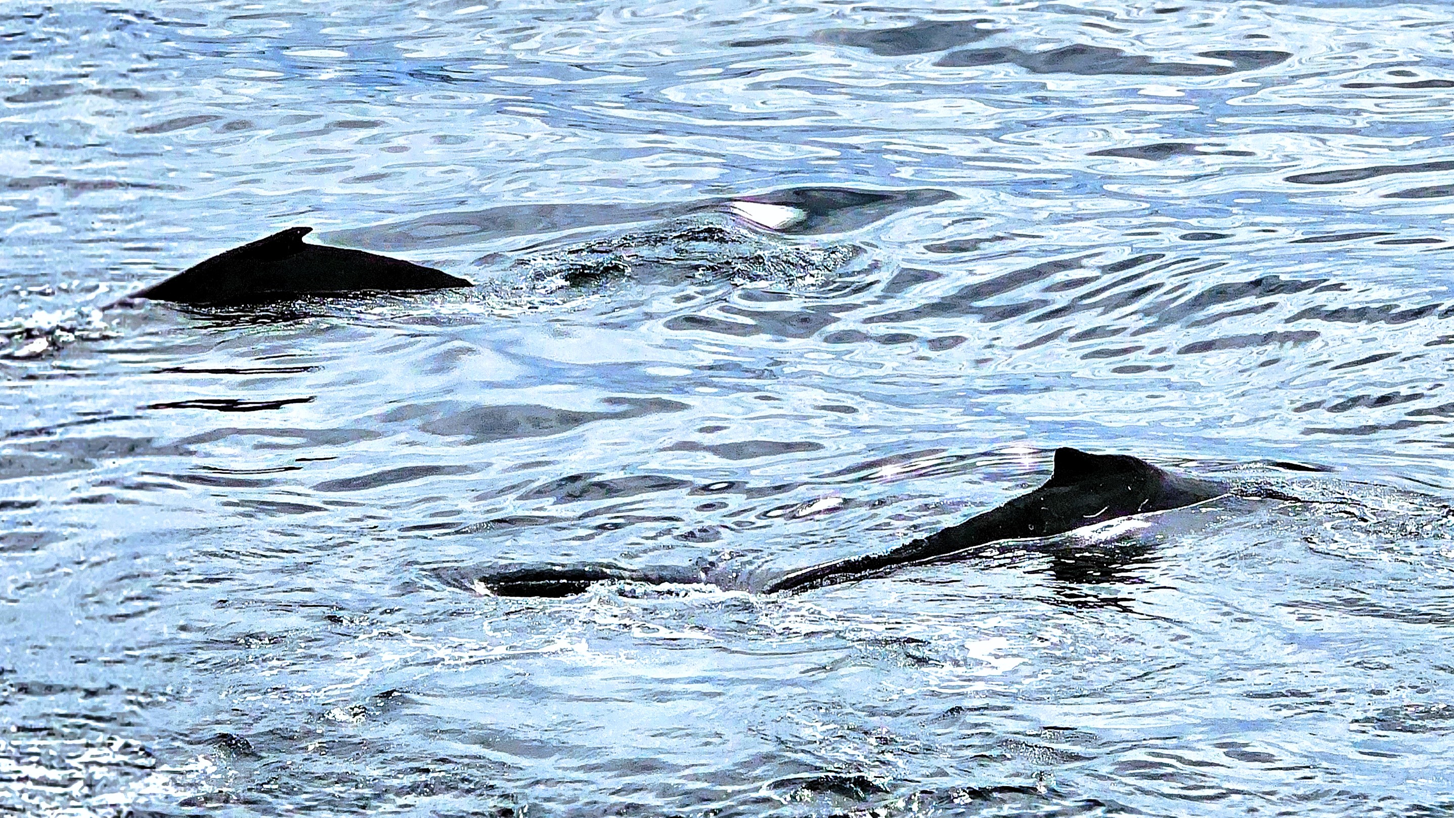
when a call came across the P.A. system, “There’s a humpback sighting, portside, and it’s following the ship.”
It was as if the paparazzi had stumbled upon Taylor Swift adrift in the Southern Ocean. Passengers leapt to their feet, fervently capturing the moment (predominantly with cell phones) from every deck, eager to commemorate our initial humpback whale sighting,
albeit from a distance beyond any reasonable recognition or resolution …
Nevertheless, there were cheers all around, as if to encourage an encore performance. And to our surprise, it circled back for a curtain call with crisper results!
Although my pixelated version offered its own reward.
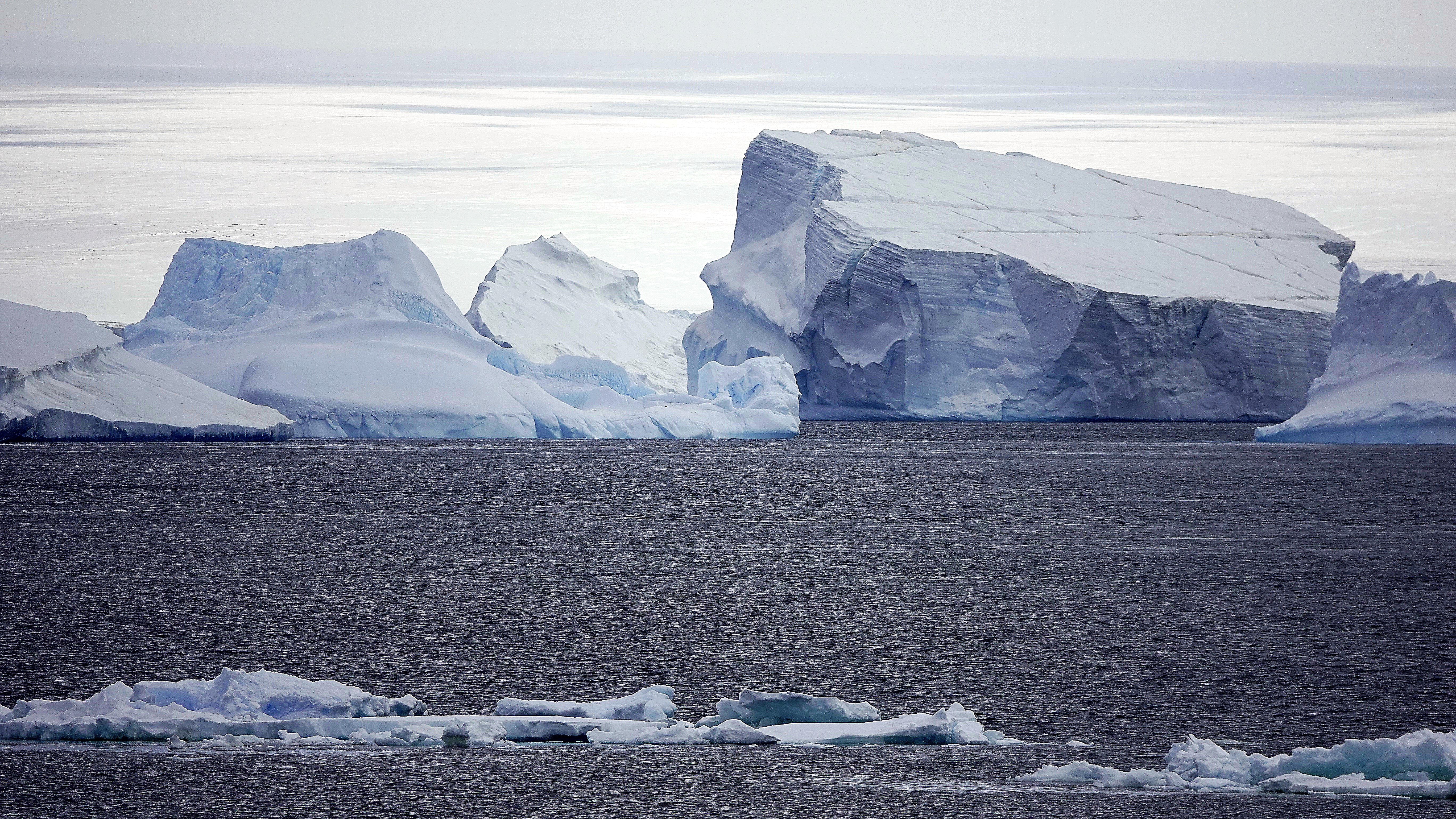
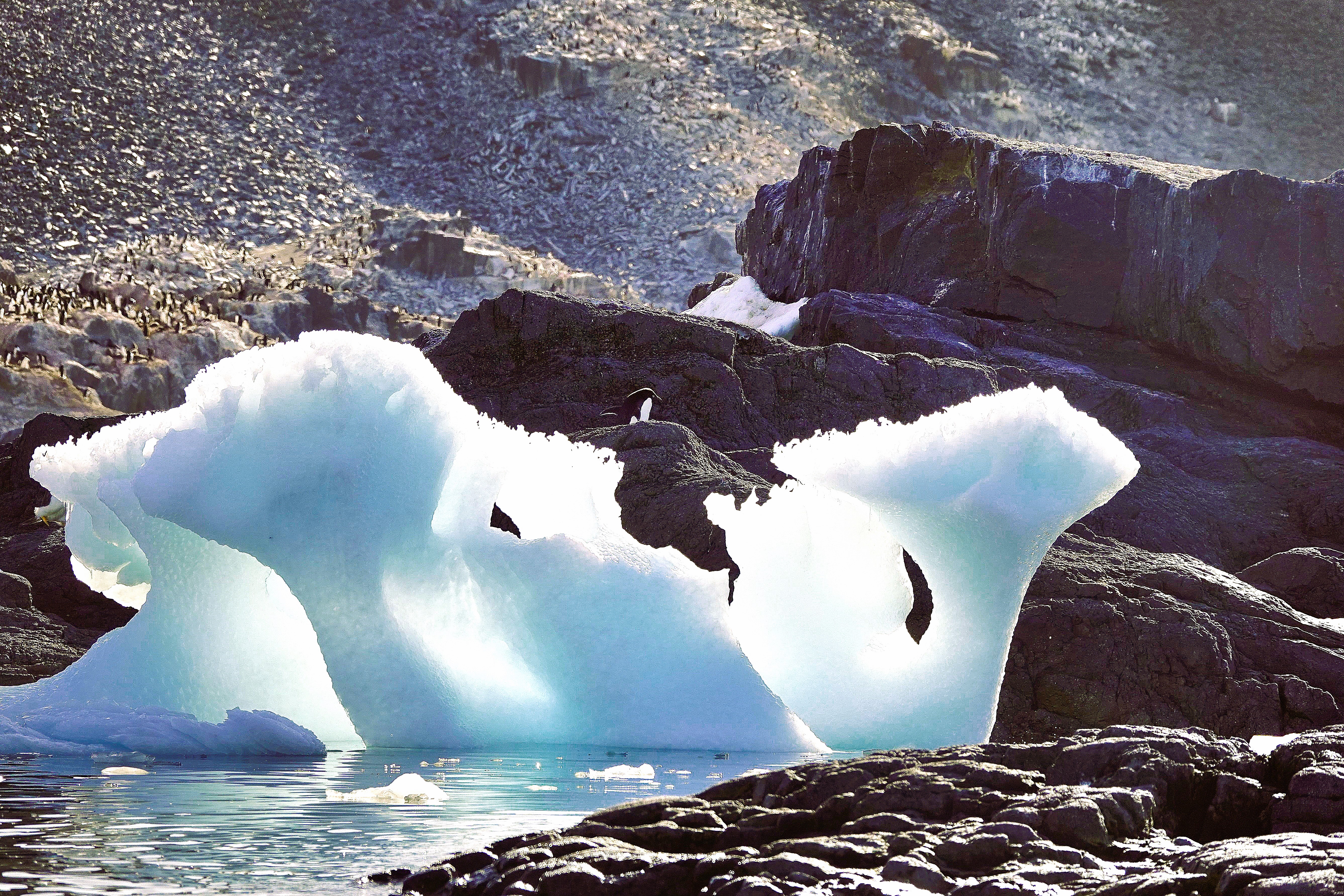
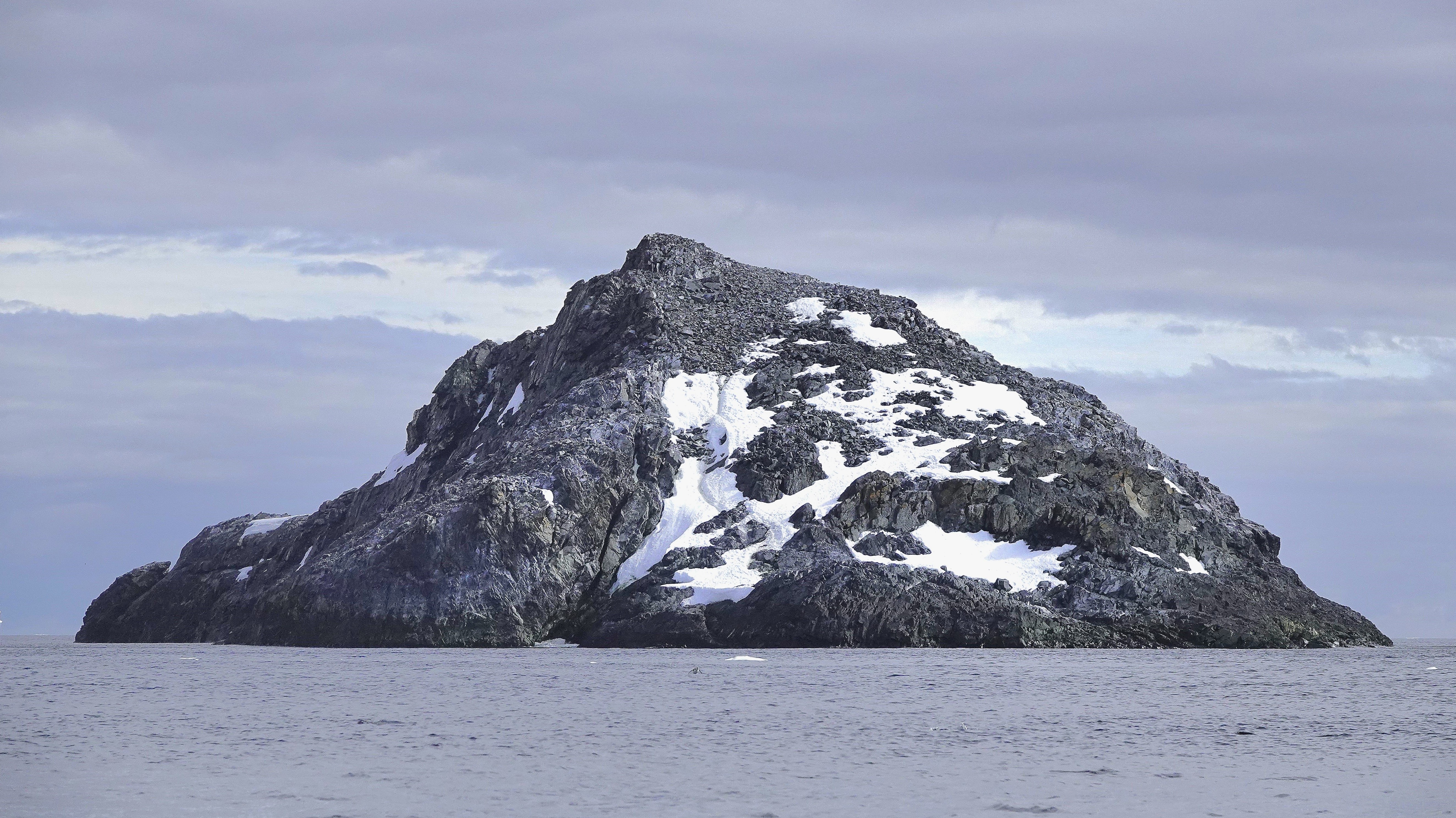
By late afternoon, we arrived at Paulet Island, a round volcanic rock characterized by its prominent cinder cone and almost complete absence of ice due to geothermal activity.
Once again, the requisite transport toys were hauled from the hangar for the fortunate 182 passengers who walked among the tens of thousands of Adélies on the island’s congested shore.
But alas, not with me. I, for my part, was chasing an opportunistic snowy sheathbill that had fled Paulet Island, seeking the solitude of Deck 10.
By 8:00 PM, the majority of passengers were savoring their dinner as Octantis sailed southwest towards Brown Bluff, in anticipation of our singular continental landing—a prospect that held high expectations for everyone and ultimately left no one disappointed!
Leah and I bid adieu to Admiralty Bay, with “John and George” (our yellow submarines) safely stowed in the ship’s hangar. We also wished a speedy recovery to our medevacked shipmate.
Our journey continued past a leopard seal lounging on an ice floe designed for one, but our heading was uncertain.
Viking Octantis was now operating in uncharted, metaphorical waters. With our predetermined itinerary cast into the Bay of Serendipity, we now had a rare opportunity to explore the tip of Antarctica’s peninsula!
The wheelhouse brass decided that Octantis would complete its Antarctic voyage with a continental landing at Brown Bluff.
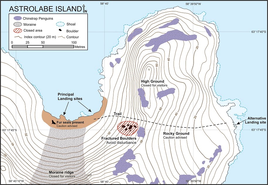
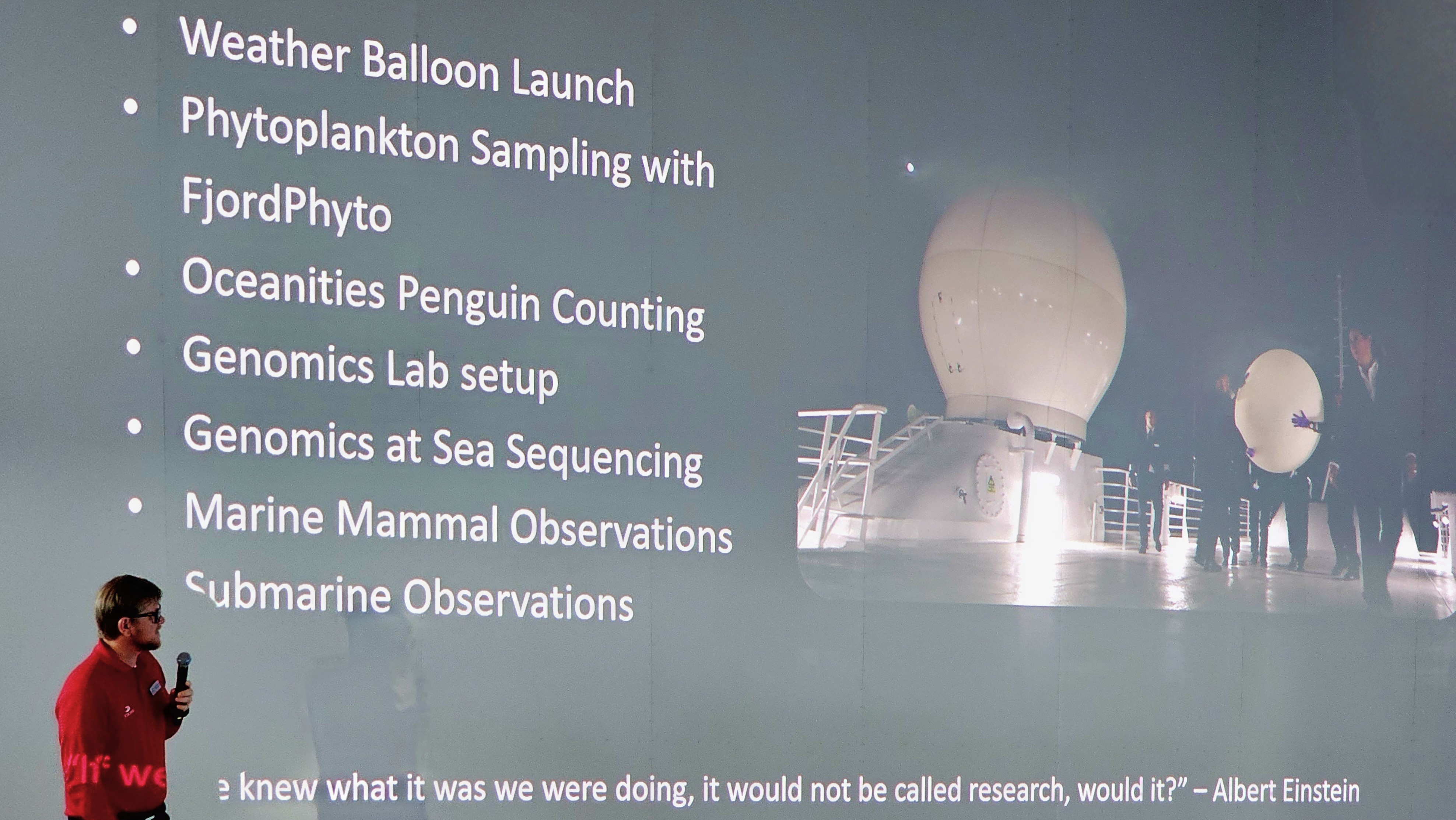
Additionally, resident scientists–supported by Viking’s mission to collaborate with global research networks–lobbied for an interim landing on Astrolabe Island, where penguin monitors from Oceanites were enthusiastic about counting a colony of chinstrap nests that hadn’t been surveyed since 1987.
Science certainly set the tone for our Antarctic expedition. Passengers were enlightened and enriched with daily lectures and participation opportunities to complement Viking’s pursuit of marine science.
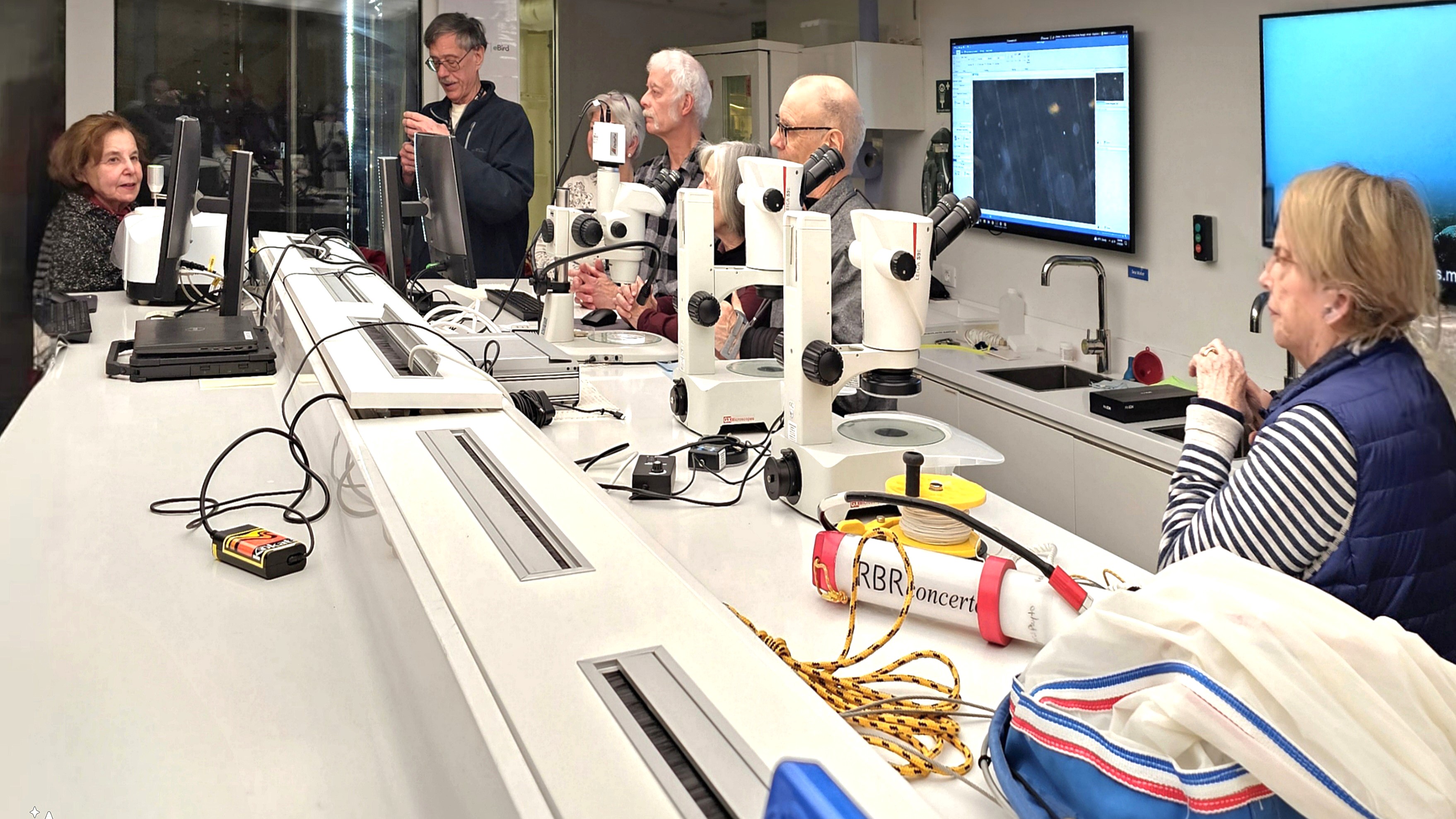
In the name of “Citizen Science,” Leah and I facilitated in collecting phytoplankton, and sampling the water for microplastics,
which was later analyzed in a fully equipped science lab.
Better yet, the entire ship was invited to celebrate the release of a weather balloon…
and monitor the data stream from its high-altitude instruments.
On January 16, we awoke to calm seas and blue skies over Bransfield Strait, with Trinity Peninsula dominating our horizon. The panorama gave the illusion of an expansive sculpture park installation.
Leah and I were scheduled to board a Special Ops Boat (S.O.B.) for a closer look–
that had us oohing and aahing as we darted through one-of-a-kind carvings.
“That one resembles the Statue of Liberty… and there’s an ice cream cone… and that one could be a mushroom…” were common overheard comparisons.
I marveled at the colossal size of these formations shaped by wind and sun and imagined the volume of ice beneath the surface!
Later that day, we swapped our high-speed vessel for an assigned Zodiac…
to ferry us to Astrolabe Island.
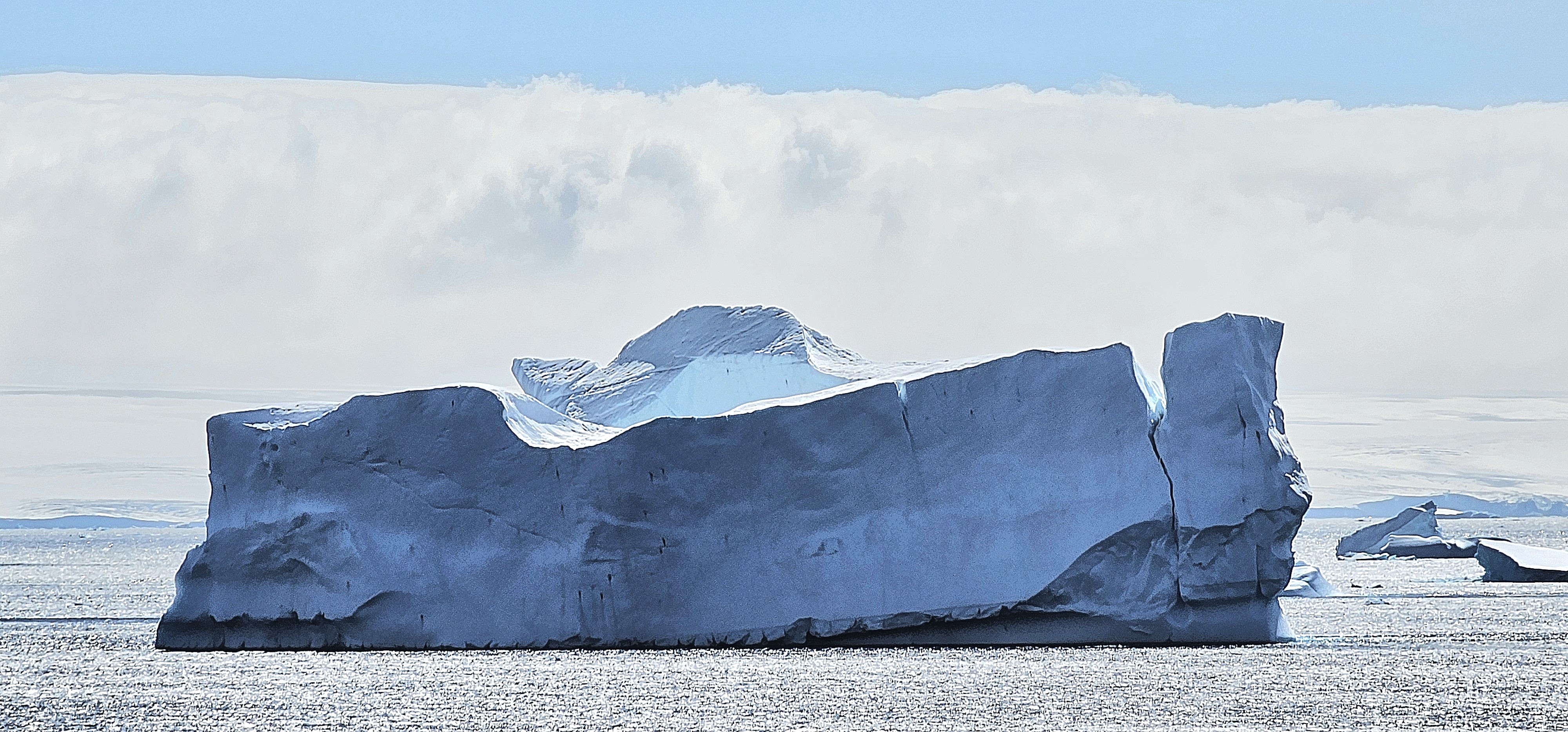
Our pilot cruised past Dragons Teeth–a collection of 100m peaks cutting through the gumline of frigid waters.
We zigzagged through towers of blue ice,
until we beached at a guano-stained snowfield ruled by Antarctic fur seals–
inherently cute but unpredictable predators–
while a rookery of chinstrap penguins preferred the protection of High Ground,
where eggs…
and hatchlings were well-protected.
Nevertheless, their paths inevitably intersected en route to the sea.
We closed our day with one last excursion along Hut Cove,
where a thriving colony of gentoo penguins were filling their bellies with krill.
After returning to Octantis, it was announced that the Oceanites team identified an unknown colony of chinstrap penguins on Diaz Rock, using drones equipped with thermal imaging to detect distant splashes of pink poop.
Overall, it was a good day for science, but it was a great day for scenery and seabirds.
An unexpected medical emergency aboard Viking Octantis dramatically changed our travel plans. Rather than repositioning overnight to Damoy Point to explore historic British and Argentine huts, Captain Cardestig rerouted the ship and raced north to King George Island in the South Shetland Islands to facilitate a medical evacuation for a sick passenger.
Consequently, all future excursions were rescheduled to align with our revised four-day itinerary. Although the majority of passengers calmly accepted the changes, I sensed some disappointment, especially among those whose submarine excursion was delayed indefinitely.
Of the 350 passengers aboard Octantis, nearly 75% expressed interest in a submarine dive. And who wouldn’t, given the allure and bragging rights among friends. In fact, several passengers were offered a complimentary submarine ride as a bonus for early booking, amounting to a $499 savings.
But submarining was never intended for everyone. Given the demographics of the passengers (average age of 70 years), there were many aboard Octantis who lacked the general physical characteristics or requirements to take advantage of the opportunity. To determine eligibility–after boarding the Octantis in Ushuaia–we were immediately sorted into two groups: those who would dive and those who would not. Leah was always less than interested. However, as a self-identified adrenaline junkie, my choice was obvious, but I still had to pass the two physical challenges to qualify.
After I was weighed, I was instructed to step onto a chair seat, alternating legs while maintaining my balance. Subsequently, I had to squat between two tables set 18 inches apart and stand. I completed the test with ease, but others found it challenging.
One delicate woman, possibly in her 80s, approached the chair with a cane. The officer was kind but firm; canes were not allowed. With dignified resolve, she handed over her cane, declaring, “I don’t need it. I can walk without it!” I was amused when she bent over, grabbed her right thigh and hoisted her foot onto the seat. She repeated the task with her left leg in the same manner. She was most pleased with herself, as if she had won gold in a power-lifting competition. She tackled the final challenge by sidling between the tables, grabbing the edge for support, and lowering herself into a half-kneeling position. I sensed that her strength was sapped, but she struggled mightily to pull herself upright.
The officer was hardly impressed. “If it was my call, I would disqualify you. However, since you mostly completed the task as asked, I will allow you to pass. However, I recommend that you reconsider your decision.”
During our second day at sea, I sat through a compulsory briefing for prospective submariners in the Aula on Deck 2. Understandably, the memory of Titan’s implosion seven months ago at a depth of 3,500 meters was still fresh in the minds of many of the attendees in the auditorium, not to mention a familiar, frail woman who seated herself beside me. Oh, the irony!
The briefing was indispensable. The crew gave a detailed rundown of essential safety measures which provided the worriers and skeptics with much-needed reassurance. For example, in case of an emergency:
The submarine is stocked with a four-day supply of food, water, and oxygen for the pilot and six passengers.
There is no toilet on board.
Passengers are required to bring a four-day supply of any essential medications, which they will need to administer themselves.
Passengers will be coached to operate the sub by communicating with the support vessel on the surface should the pilot become incapacitated.
We also learned about some of the features of our submarine:
The Cruise Sub 7 by U-Boat Worx is capable of descending to 900 meters.
It’s air-conditioned.
It features two back-to-back acrylic spheres, accommodating three passengers facing forward and three facing backward–offering undistorted 270o views.
The seats, situated on rotating platforms, allow everyone to reposition for shared views of the marine environment.
It’s equipped with eight thrusters: four vectored horizontal, two dedicated horizontal, and two dedicated vertical, providing the Sub 7 with exceptional maneuverability and the power to contend with strong underwater currents.
A handheld joystick control device enables easy maneuverability.
It can operate for up to 16 hours submerged.
Each one costs $4 million.
We finished up with Q’s & A’s. So, I got to wondering out loud, “If the pilot should pass out, and it falls on me to operate the sub, and I wreck it in the process, am I on the hook for $4 million, or will my travel insurance cover the damage?”
It was good for a laugh and a good way to end the meeting.
Following the briefing, my neighbor turned to me and confessed, “You know, my doctor gave me medical clearance to participate in this activity, but I never told him about the vertigo that I started experiencing a couple of weeks before the trip. Do you think I should still go?”
It baffled me that she would even contemplate this, considering her latest complication. “I’m sure you’ll make the right decision,” I said to appease her, “but maybe you wouldn’t want to risk compromising someone else’s experience.”
We arrived at the South Shetland Islands by late morning with a modified schedule in place,
and the hangar toys were immediately deployed.
When Leah and I checked our daily agenda, I discovered that my time had come; I would explore the ocean floor off King George Island. The feeling was akin to winning the lottery… which cost me only $499 to play!
After arriving at the hangar–eager and ready with my Sony RX-10 around my neck–our group of six received lanyards with numbered pendants corresponding to seat assignments and the order in which we would board the sub. Mine was #1.
The Zodiac ferried us to the submarine platform, where #6 stepped aboard with a firm sailor’s grip. He wriggled down the 18-inch hatch opening and took his designated seat on the starboard side. #5 repeated the transfer drill and took his seat on the port side to manage weight distribution.
I was the last passenger to come aboard, and while I don’t suffer from claustrophobia, it was hard to ignore how cramped the cabin felt, especially squeezing into my seat with our bulky parkas taking up so much space.
Excitement quickly turned to disappointment when I realized that my camera’s auto-focus function was compromised by the window. How could I ever get any cool shots in these extreme conditions?
With Kat in command, she rotated our trio of seats into the acrylic bubble for optimal viewing and completed a readiness checklist with the dive support vessel.
After receiving clearance, she managed our descent through a 300 ft. wall of krill, until we finally emerged with a view of the bottom. There was a collective “Wow!” from the cabin.
Kat proclaimed, “I believe we are the first people to have ever explored this part of the Southern Ocean. So, let’s see what we can discover.” One of our initial discoveries was a change in the visible light spectrum, where longer wavelength colors, such as red, nearly vanished as we ventured further into the depths of the unknown.
Kat hit the thrusters to slow our decent, as we gently settled atop the sandy bottom. I was surprised to learn that we had reached a depth of 409 feet.
Far from being mere novelties for tourists, Viking’s submersibles have become a vital tool for marine biologists once constrained by resources, to carry out research missions in remote regions. Consider, in early 2022, when Octantis submersibles documented three sightings of the rarely encountered scyphozoan Stygiomedusa gigantea, commonly known as the giant phantom jellyfish, measuring 30 feet in length. A white paper was subsequently published in Polar Research, the scientific journal of the Norwegian Polar Institute. (The full research paper is available at: http://dx.doi.org/10.33265/polar.v42.8873)
Although our dive didn’t make news, we still encountered a variety of sea life that I managed to capture on my Samsung Galaxy 23 Ultra… such as a lonesome a brittle star,
and multiple snake-armed, Labidiaster annulatus, commonly known as wolftrap starfish,
including a rare look at a hunter, ready to snatch fast-moving, swimming prey as it passed by.
I was also delighted to capture a potpourri of sea life, featuring a couple of sea spiders hugging a sea worm tethered to a feather star.
After 45 minutes, we surfaced!
Indeed, it was a unique experience shaped by our environment and the adventure; however, I had anticipated more. I imagined leopard seals hunting penguins and orcas pursuing seals. Perhaps, my expectations were set too high. Yet reflecting on the event, it remained a highlight of our voyage, and another item checked off my bucket list.
As for the lady with a cane, our paths crossed again on our last day at sea. She was sitting with her older sister sipping tea over dropped surgical masks at Mamsen’s, a Norwegian-styled cafe dedicated to the mother of Viking’s founder, Torstein Hagan. I asked if she had enjoyed diving in the submersible. “Unfortunately, not. I ended up caring for my sister, who fighting a cold at the moment. But there’s always a next time!”
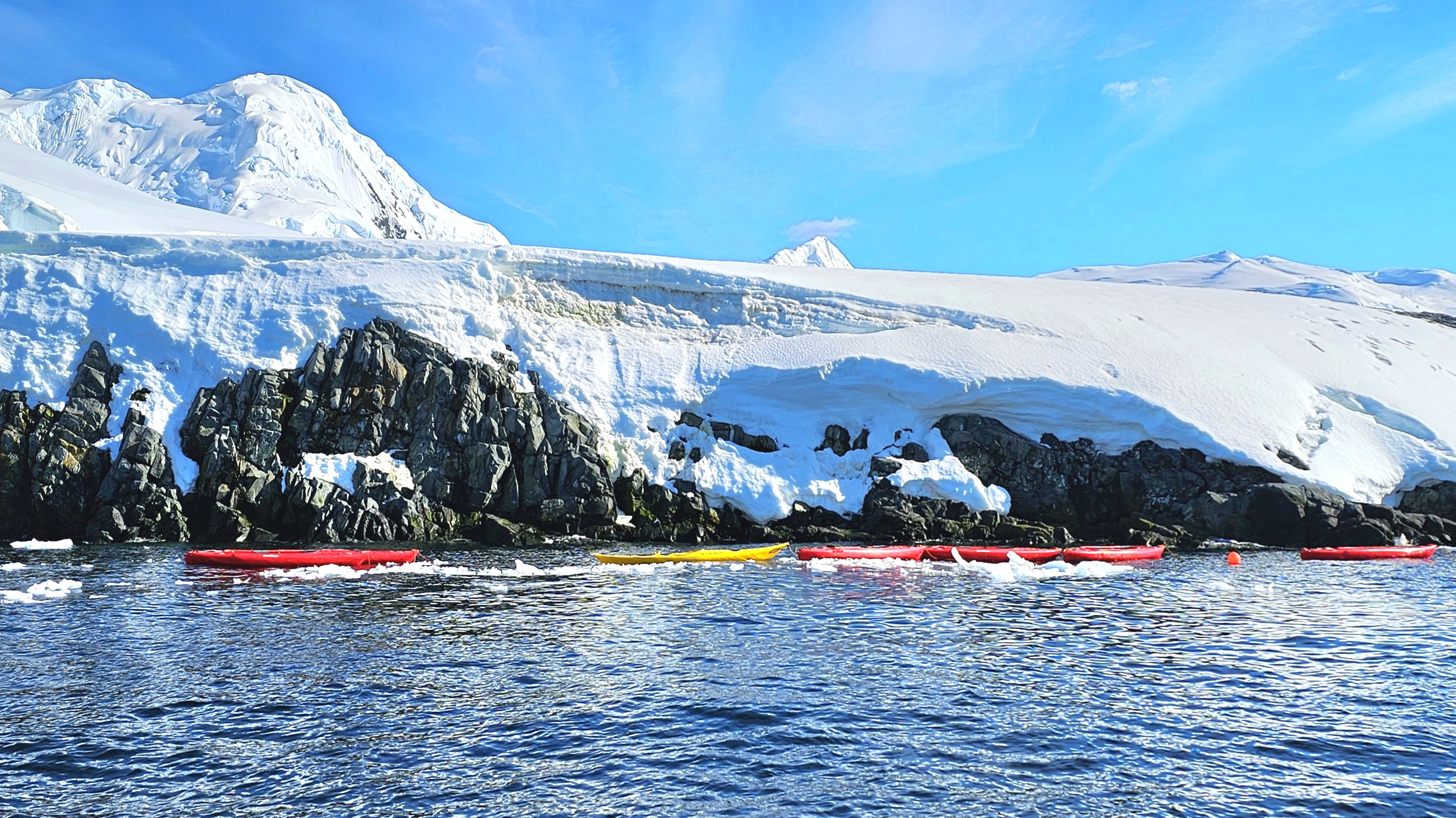
Leah and I wrestled our way into pricey polar drysuits in preparation for kayaking in Chiriguana Bay, a protected inlet on the southern end of Brabant Island in the Palmer Archipelago.
We strained to pull our heads and hands through unforgiving latex gaskets that promised to seal in our body heat while preventing icy water from infiltrating our suits, effectively turning us into human buoys in the event of a capsize.
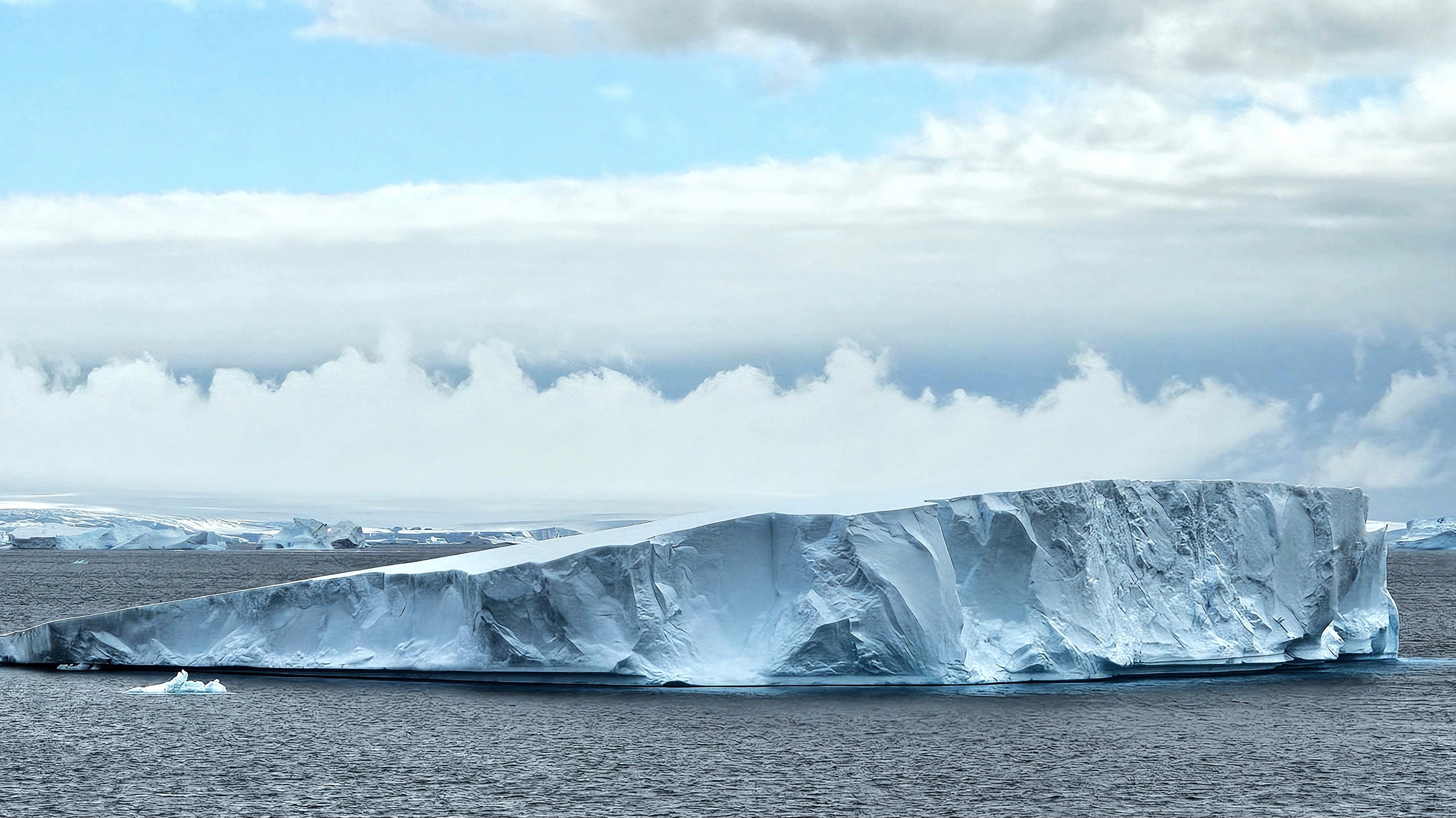
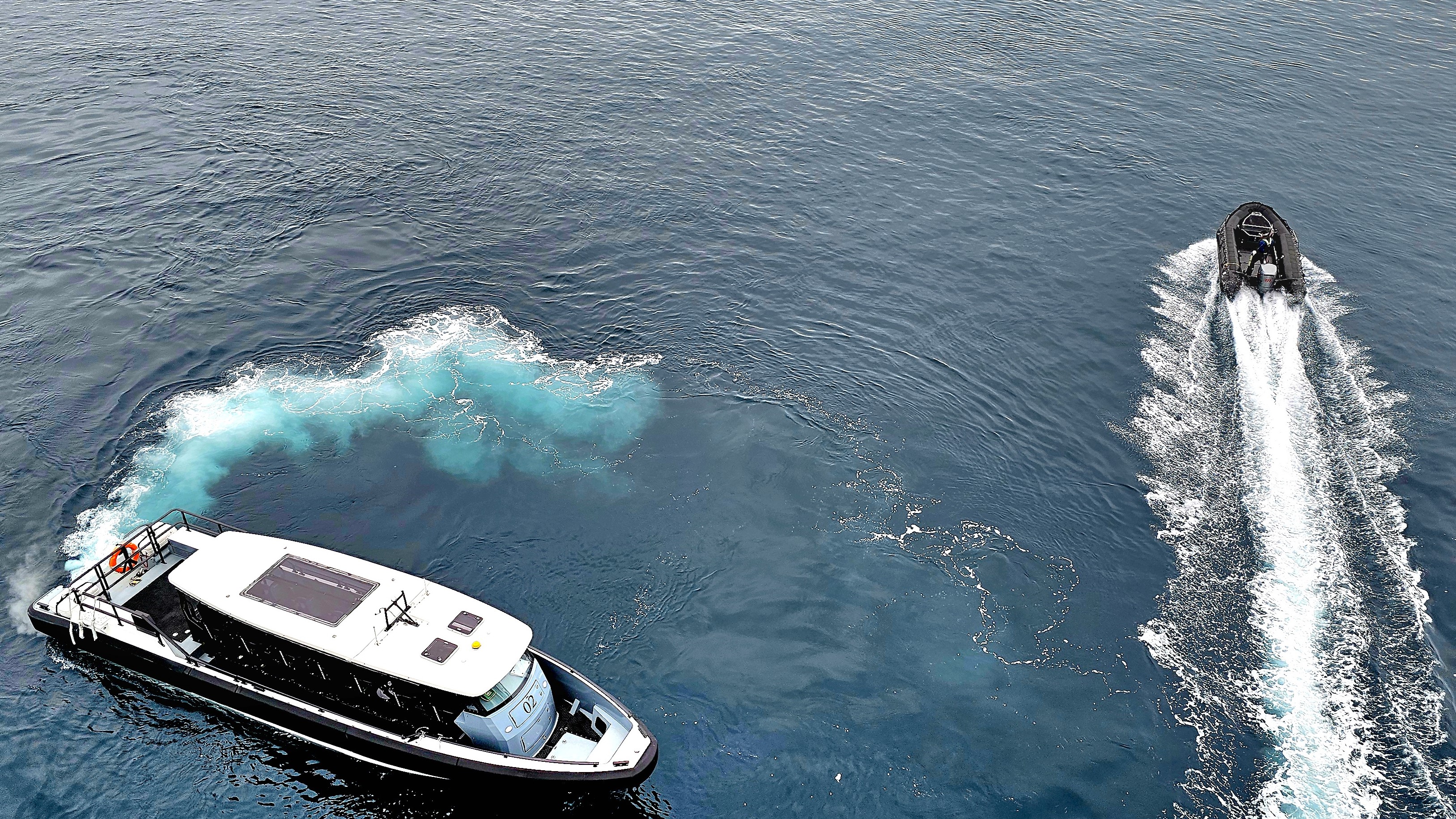
We boarded our Zodiac, and raced around a steady stream of bergy bits,
before reaching a string of tandem kayaks already moored in the bay.
Each of us performed a precarious “shoehorn” transfer into our kayak seats without incident. At once, Leah and I fiddled about–making adjustments to our outfits and gear–until we reached a level of comfort to maximize our paddling efficiency. Surprisingly, at 32o F / 0o C with clear skies and sunshine, it felt warm enough to remove my gloves.
After safety instruction from Stephanie, our kayaking guide, we glided through the bay in unison for a closer look at our surroundings,
all the while following Stephanie’s lead.
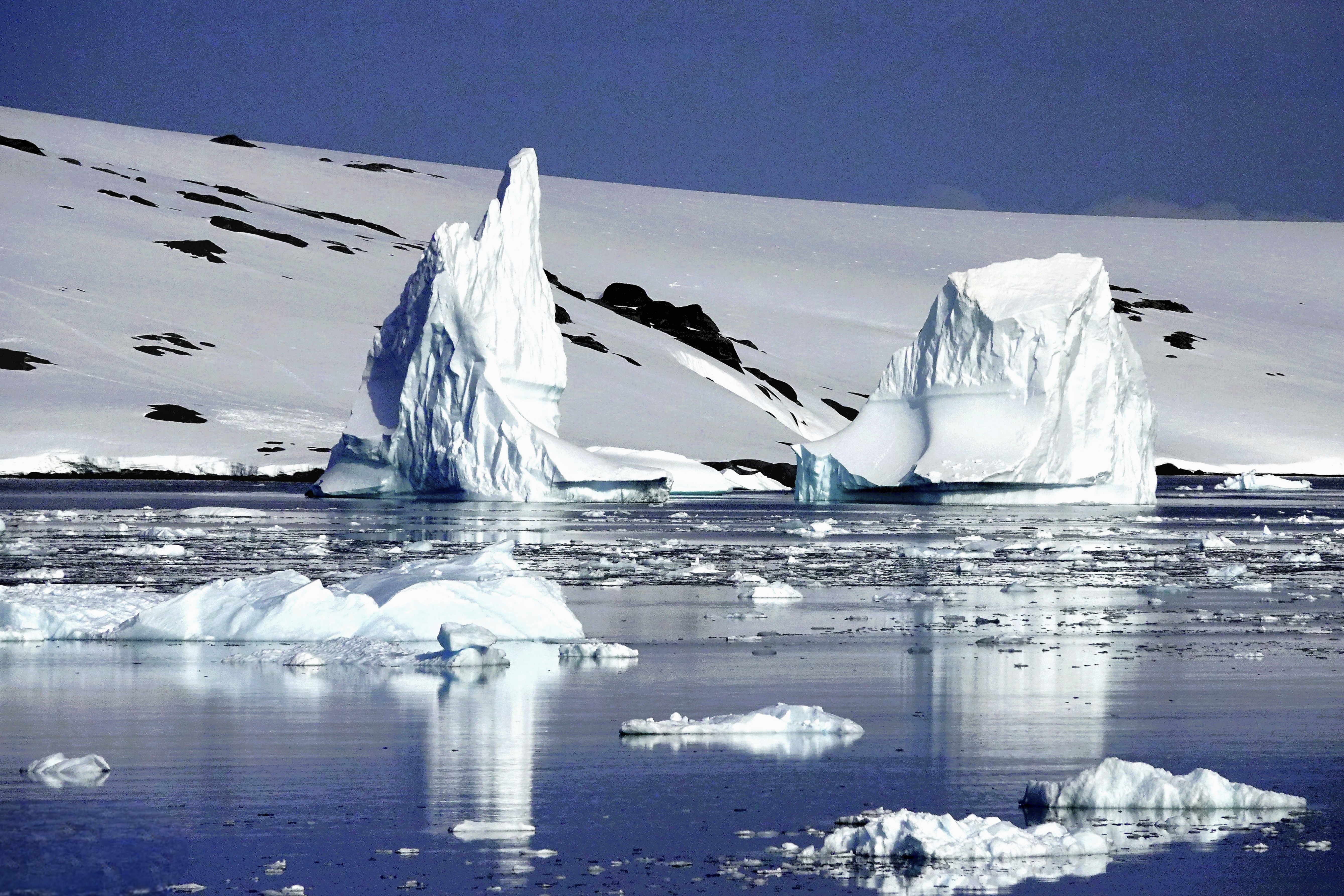
The stretch of blue ice,
and white serenity–occasionally interrupted by the distant thunder of calving ice–left us breathless.
Before we realized, our 45 minutes of paddling had come to an end. Drifting on the Southern Ocean, time seemed to stand still, as if the rhythmic waves that rocked us held the secret to eternity.
Coming up: a journey to the depths of the ocean floor…
The journey continued beyond our early morning detour through Lemaire Channel. Viking Octantis set a course for nearby Cuverville Island, a protected rock lying between Arctowski Peninsula,
and the northern tip of Rongé Island, west of Graham Land.
Leah and I were keen to arrive at our first landing zone–originally scheduled days earlier by Pamela, Viking’s program director, who coordinated the excursions and edutainment events throughout our time at sea.
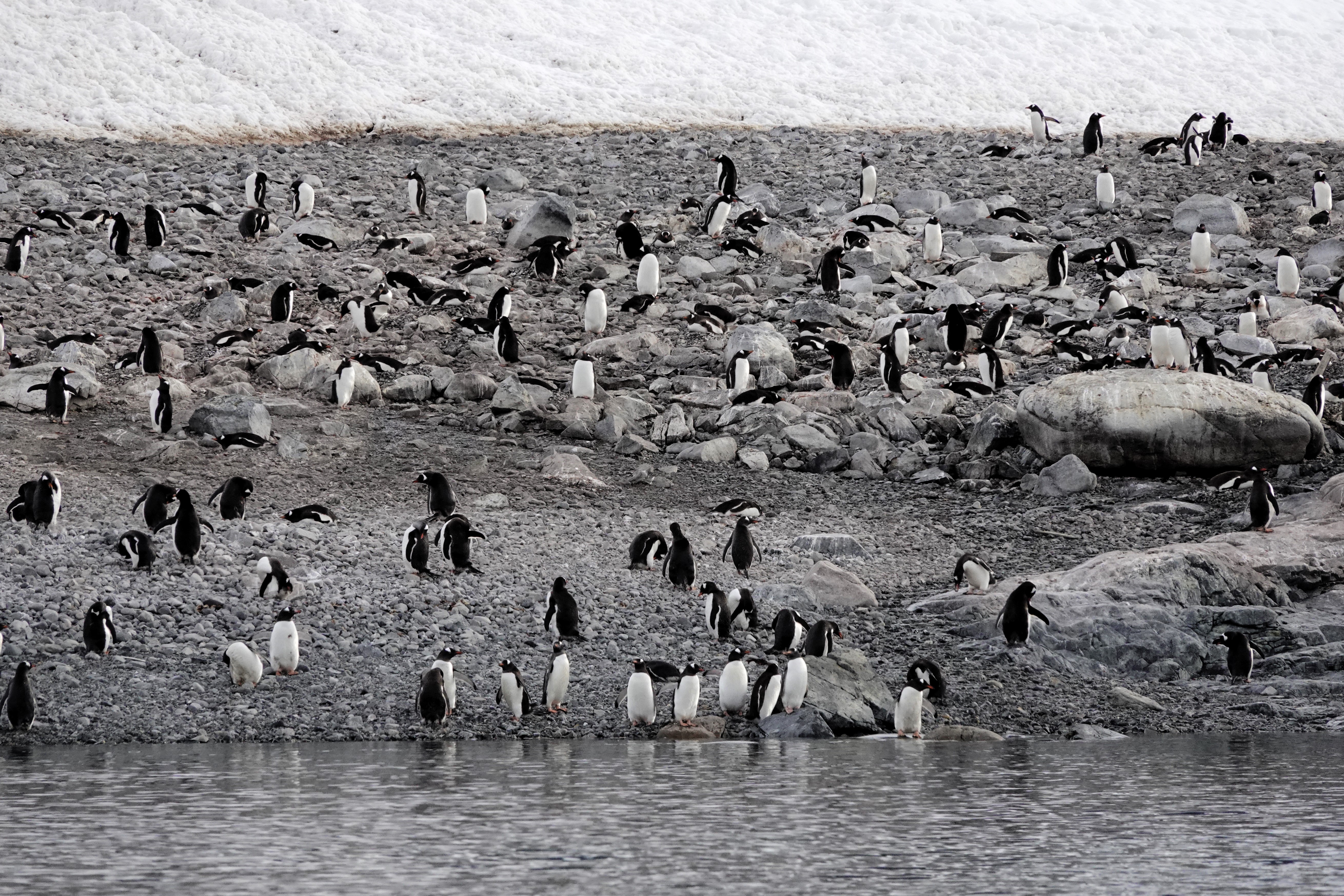
In accordance with Antarctic Treaty visitor site guidelines, Pam’s team launched a staggered fleet of Zodiacs to Cuverville Island capped at 100 visitors (excluding guides and scientists) for a closer look at the estimated 6,500–7,000 breeding pairs of Gentoo penguins–making this the largest colony of this species on the Antarctic Peninsula.
Despite the pristine vista, we were forewarned by our Zodiac pilot/naturalist to expect an unpleasant smell on our approach to the island.
No joke. As if on cue, the stench of penguin poo was so sudden and overwhelming that a couple of old-timers dared to let go of the gunwale lifeline to hold their noses.
In a matter of minutes, we reached the landing beach, distancing ourselves from the eastern edge of the cobble, where the colony accessed the sea. It was no surprise that the guano-stained beach proved to be ground zero for foul fowl.
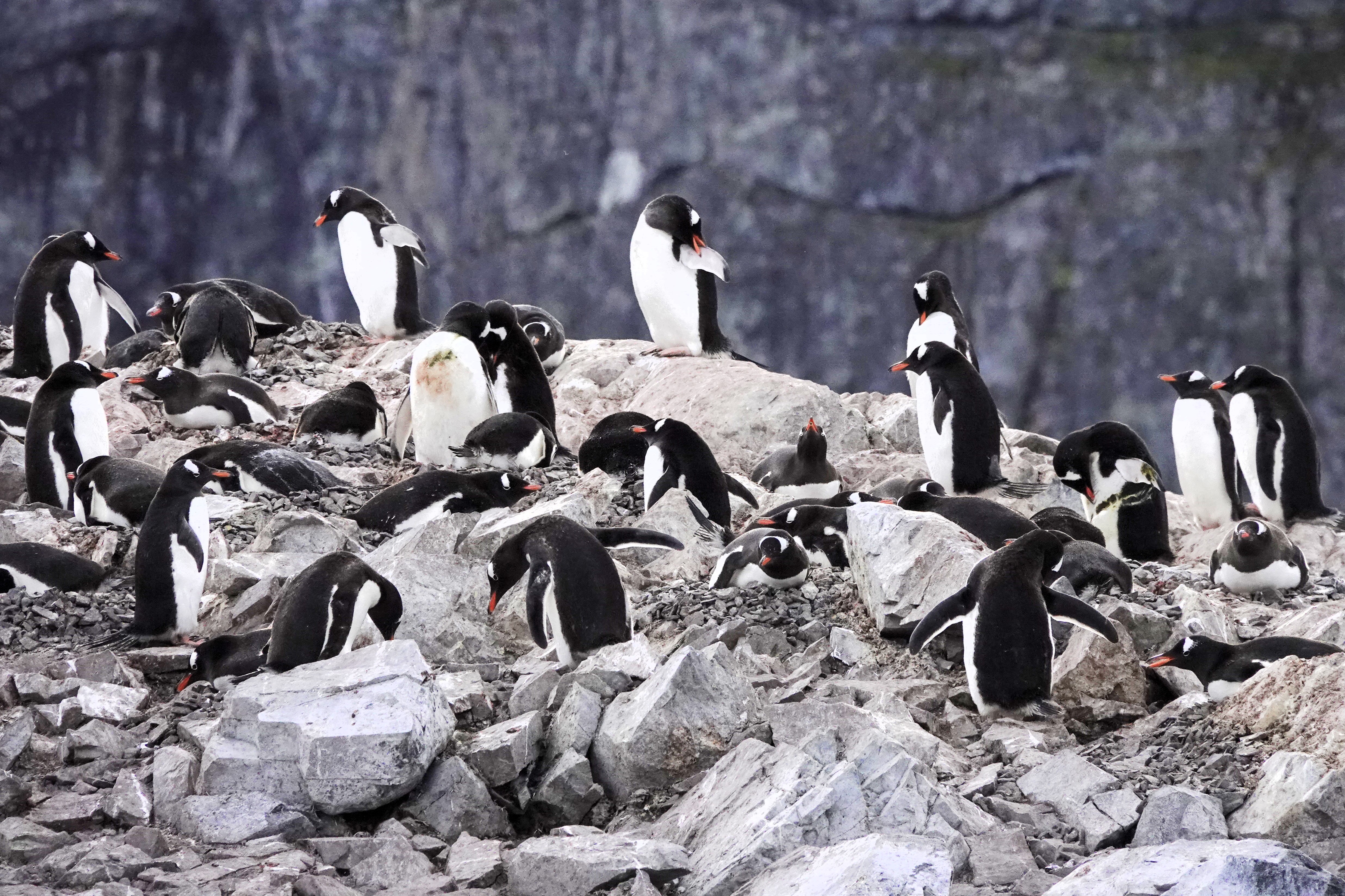
Eventually, we landed on the northern edge of the island. Before disembarking the Zodiac–a drill we perfected within the ship’s hangar–we were instructed to stay a minimum of 5m from wildlife whenever possible and avoid the penguins’ highway lanes.
Strolling the penguin highway
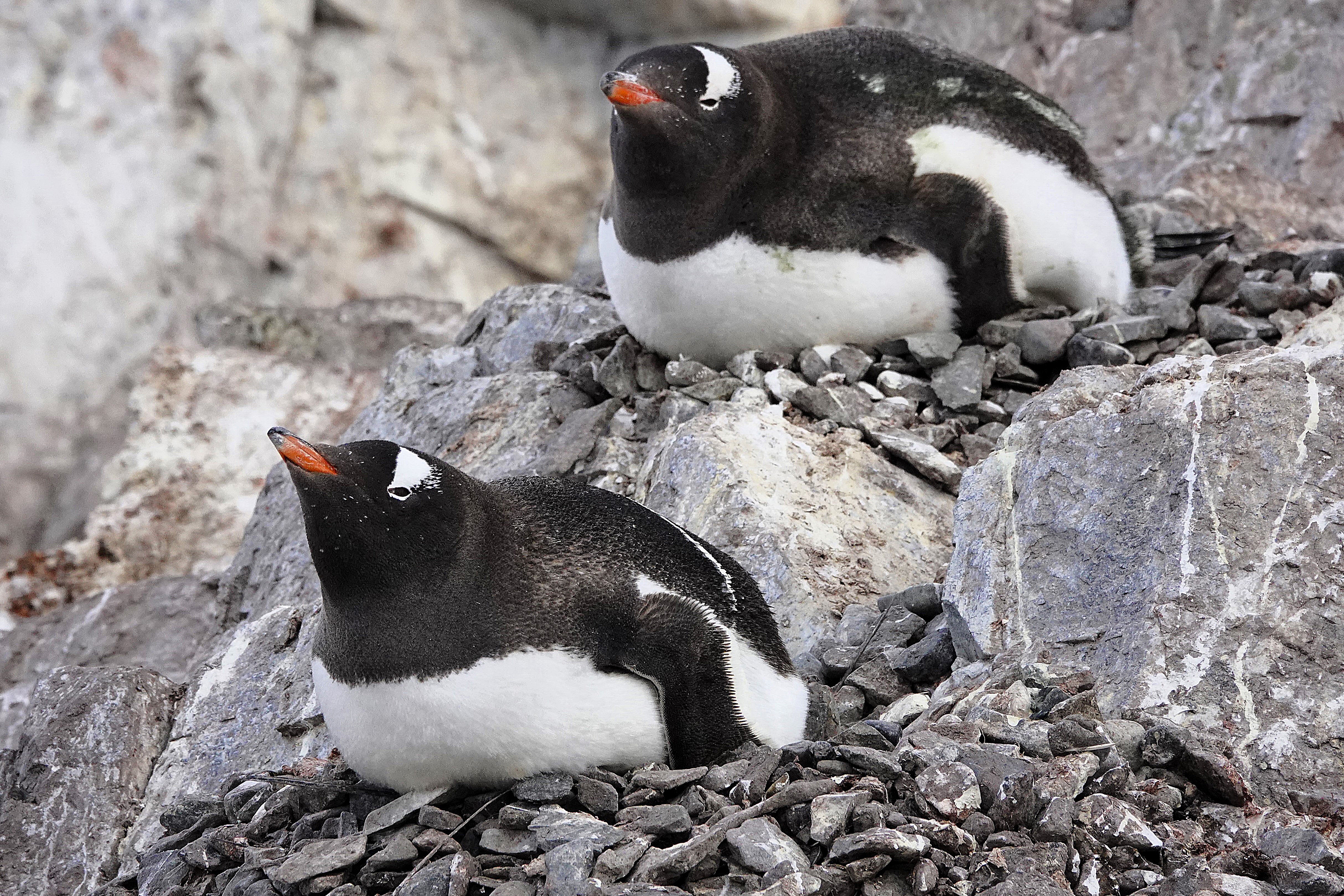
Easier said than done. These critters seemed especially curious of us when they weren’t preoccupied with preening,
impressing their future mates with the perfect selection of nesting stones,
or incubating on nests of captured stones.
Occasionally, an adult would sound the alarm for an invading skua,
whose interest in Gentoo eggs and chicks is always a threat to the rookery.
Leah and I hiked to the top of the promontory,
for an overview of Cuverville and the channel.
Sadly, we worked our way back to catch the next available Zodiac bound for Octantis, but the stories and adrenalin from the day carried us to sunset (11:25 PM) and into tomorrow.
Next stop: our kayaking adventure in Chiriguano Bay.
A familiar voice woke us from the public address speaker above our bed. I checked my watch; it was 6:45 AM:
“Good morning, everyone. This is your captain from the bridge. We are approaching a special spot along the Antarctic Peninsula known as Lemaire Channel, and after discussing with my officers, we will be cruising through this waterway because today it’s mostly free of large icebergs that can sometimes block the entrance or exit and bring us too close to the cliffs.”
I jumped out of bed, grabbed my camera, and ran to the Nordic balcony to power up the blackout blind. I didn’t want to miss a thing! Leah sat up in bed to supervise because she already knew what to expect.
“What are you doing? I hope you’re not going to open that window,” she growled as I was already lowering the window.
“Come see this! The light is perfect, and I’m trying to get a clear shot before it disappears,” I argued, talking over Captain Cardestig’s continuing announcement:
“But today, all of you are in for a treat because the sky is clearing, and the seas are calm.”
“And while there’s still some hazards to consider when sailing through this beautiful channel, much of the small ice has already broken up from the warmer weather,
and we can easily guide Octantis around the bigger ice.”
Leah clutched the blanket around her in surrender while I braced against the window in my birthday suit, capturing unimaginable views with little concern for the crisp Antarctic air.
Captain Cardestig continued, “But best of all, the kitchen staff is serving breakfast buffet at the bow of the ship. So please dress warmly, and join us outside for this remarkable voyage, and don’t forget to bring your cameras and binoculars.”
“I guess we’re getting dressed,” Leah lamented. “And could you shut that window! It’s fucking freezing in here!”
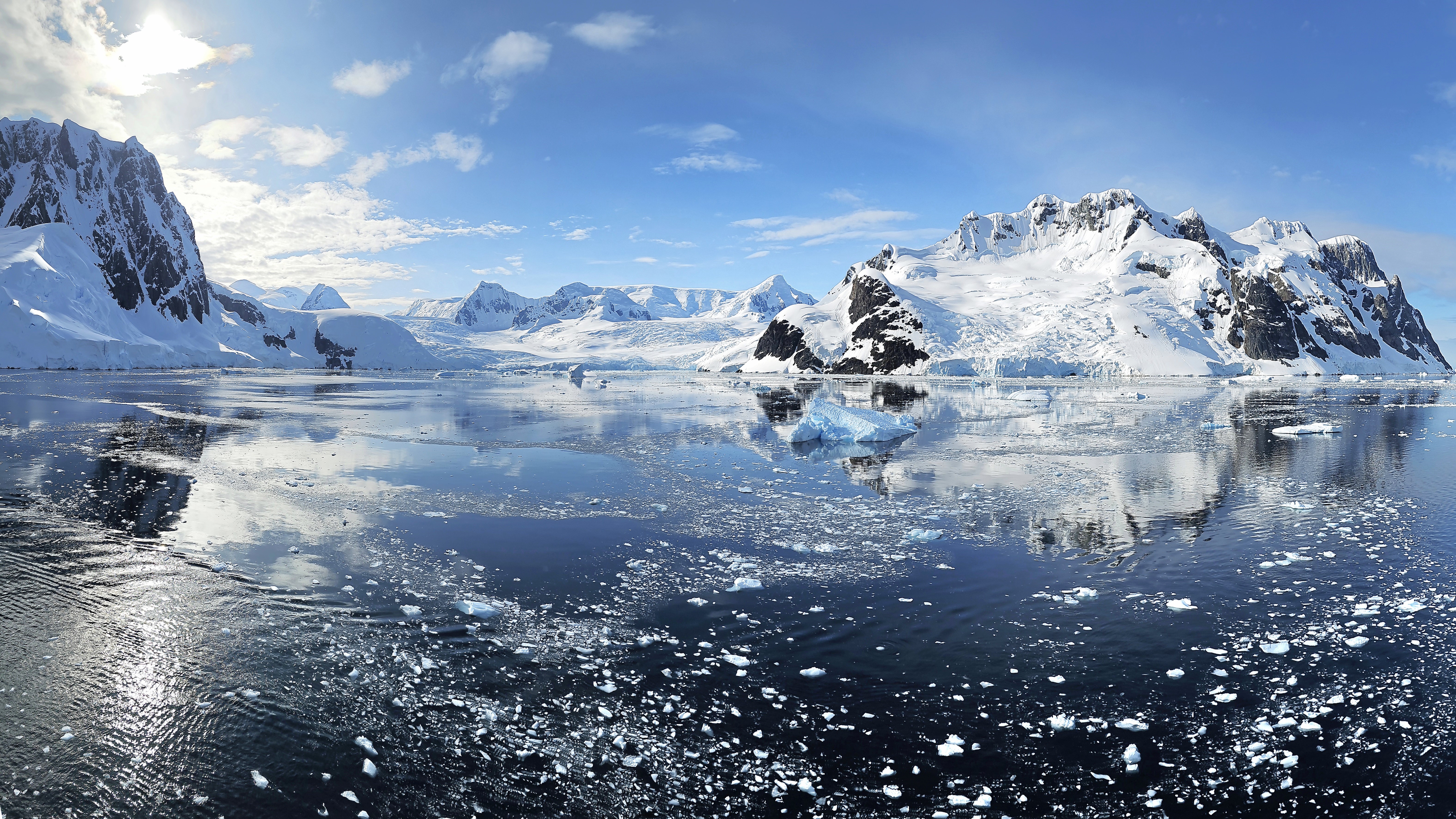
Lemaire Channel is a narrow strait of glossy water that traverses 11 km between Booth Island in the Wilhelm Archipelago and Graham Land–shrinking to 600 meters at its narrowest point. With views of stunning snowcaps atop dramatic cliffs, Lemaire Channel easily earns its moniker, “Kodak Gap.”
It was all hands around the bow deck. Leah and I joined the crowd, hopelessly jockeying for a position at the rail, until we found solace on the upper deck away from the fray,
where we were content to enjoy breathtaking vistas,
and watch the world float by.
There were penguin playgrounds …
and a pod of Orcas along the way,
but for now, the real star of the show was the scenery.
When Octantis eventually reached open water…
with captivating views of the Argentine Islands,
Captain Cardestig turned the ship around, allowing us to enjoy the approach from the opposite direction.
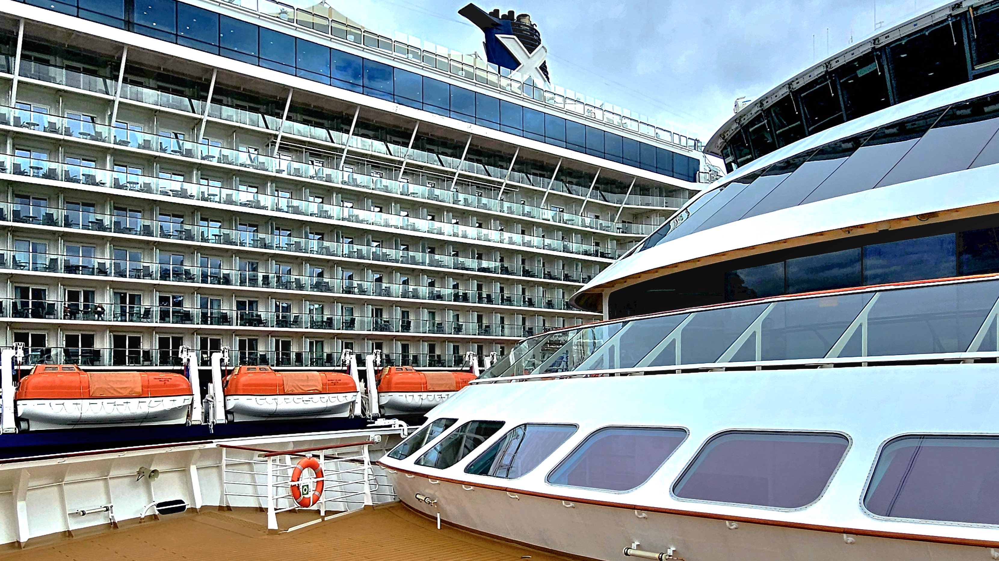
While Leah and I enjoyed a gourmet buffet lunch aboard Viking Octantis, Captain Bo Joergen Cardestig and crew readied our ship for departure. The gangway was pulled while we were docked across from Celebrity Eclipse with capacity for 5700 guests,
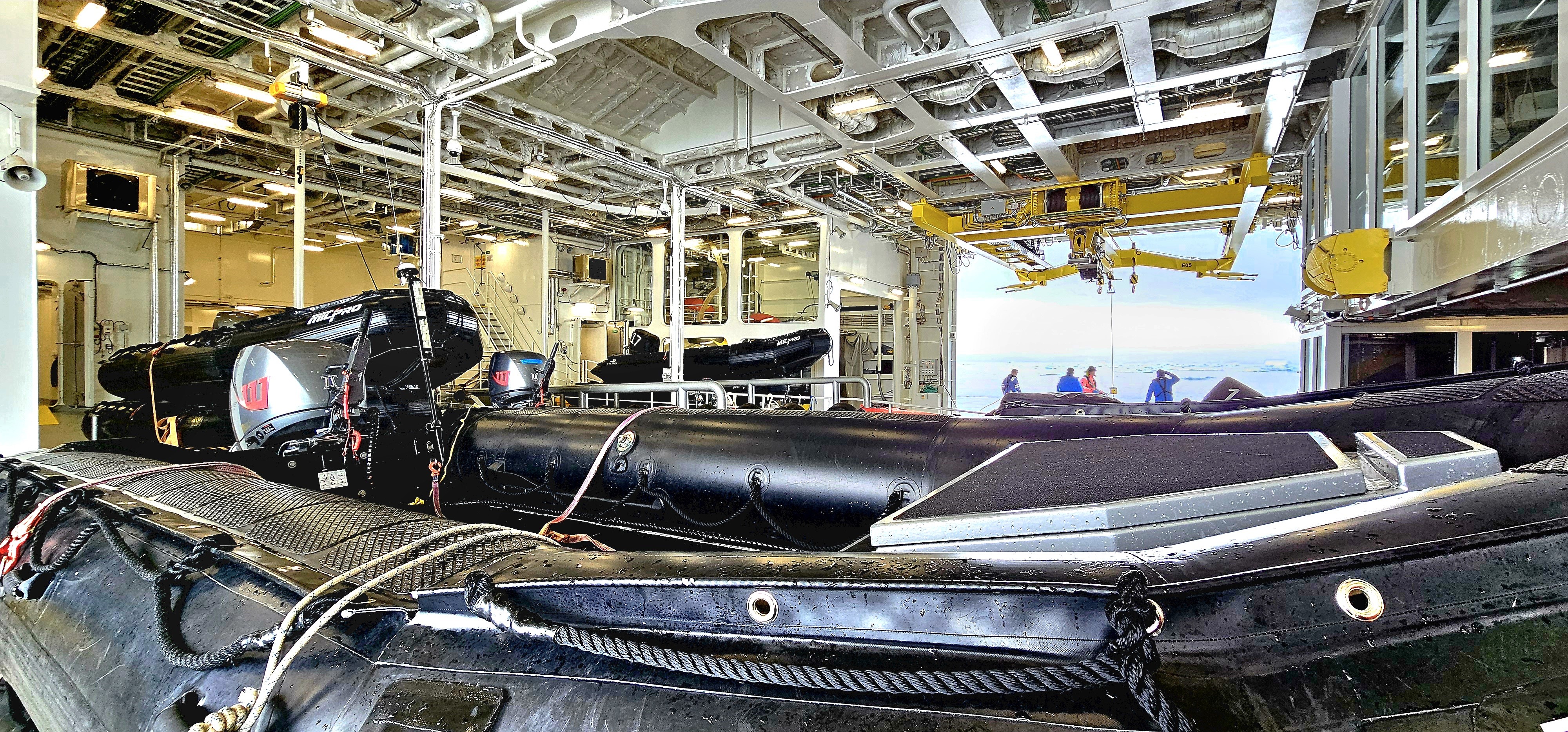
and I was instantly grateful that we’d be cruising with 350 like-minded wanderlusters aboard a Polar Class 6 vessel that was purposely engineered to cut through Antarctica’s summer ice …
replete with a hangar full of aquatic goodies, like a dozen kayaks,
a fleet of Zodiacs,
two 12-passenger, high speed special operation boats (SOB’s) with a 26-metre (85 ft) custom stern slipway,
and a dive boat supporting 2 Cruise Sub 7-300 yellow submarines named “John” and “George.”
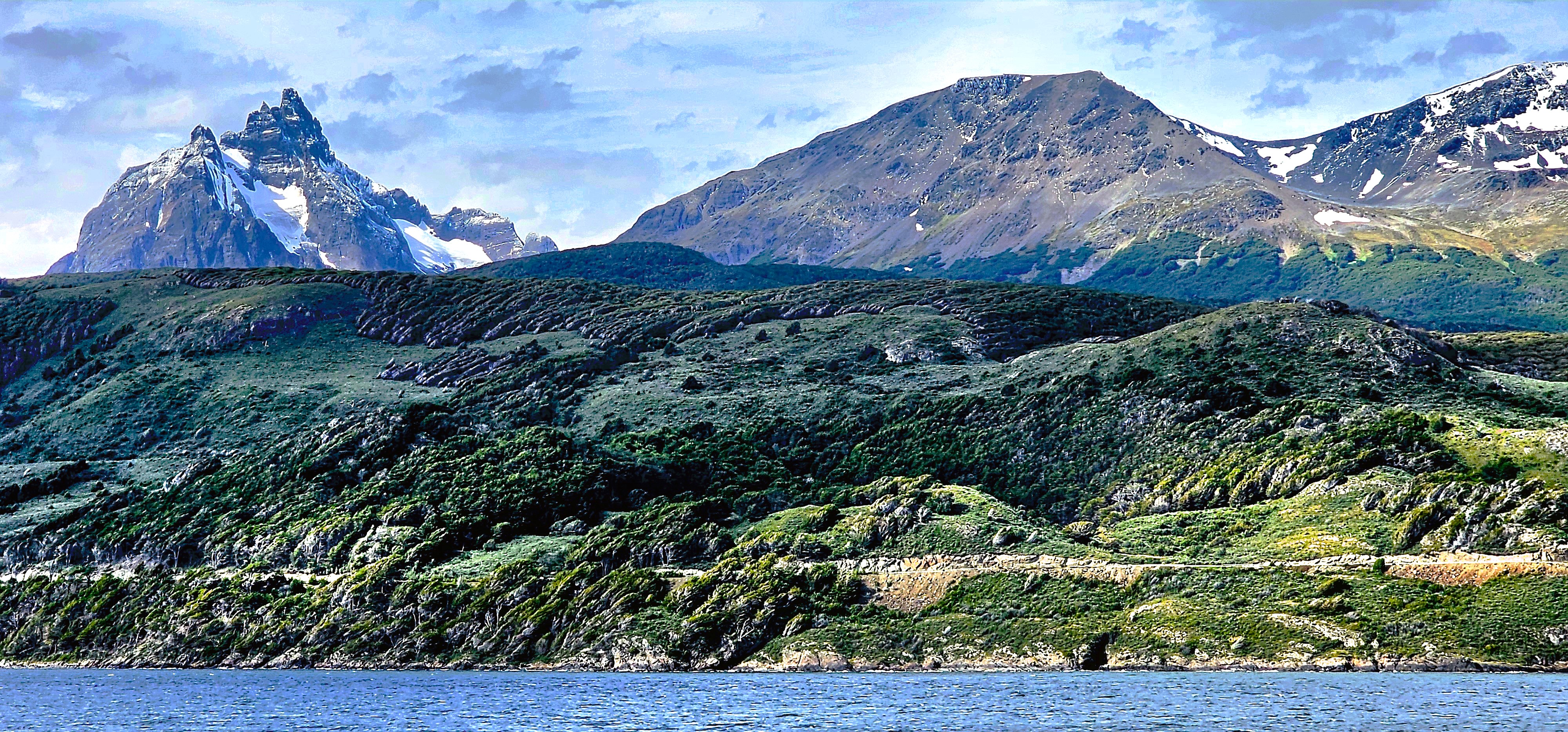
The Octantis quietly slipped out of Ushuaia harbor and into open water, offering pristine views of Argentina from port side,
and Chile from the starboard side, as we glided through the Beagle Channel.
This was also a time for briefings–from safety instruction,
to practical training for many of the aforementioned expedition activities, especially when transferring between watercraft, and executing shore landings.
Once Octantis rounded Cape Horn, we had officially entered the Drake Passage, a dangerous waterway prone to strong ocean currents, huge rogue waves, and violent storms.
The 700-mile voyage to Fournier Bay–our next land mass–would take two sea days.
While we were protected by an expedition vessel intended to improve stability and mobility and lull us to sleep in Nordic luxury inside our 215 sq ft cocoon, it was hard to ignore outside conditions. Beyond our retractable blackout blinds, we were being whipped about by 45 knot winds accompanied by 30-foot swells. This was categorically the “Drake Shake” queasiness that many guests have dreaded but vowed to overcome.
Leah indulged in anti-nausea medication, while other guests relied on motion-sickness patches and pressure-point wristbands. I opted for none of the OTC remedies, and without consequence. Seasickness was not an option. Instead, we kept ourselves hydrated; we took naps; we ordered complimentary room service, and distracted ourselves by keeping busy with lectures, movies, conversation, and ship business.
A ready team of naturalists had assembled to micro-inspect all of our outerwear and camera gear before we’d be permitted to go ashore. A biosecurity check was warranted to rid our belongings of all foreign organic material (e.g. dirt, crumbs, seeds, insects) that might be secreted in our sleeves, seems, cuffs, pockets and hoods, which could potentially sully an Antarctic ecosystem. Our adventure team took their work very seriously, peering through magnifying glasses with high intensity lights. Tweezers, toothbrushes and hand vacuums made worn apparel fresh again.
Afterwards, all of us were outfitted with proper-sized rubber boots, waterproof pants, and a snake-shaped life jacket.
During the crossing, I had managed to overcome my sea legs by sprinting and pausing against the sway in a zigzag pattern as I’d make my way through the ship’s long corridors. It wasn’t pretty, but it was effective.
During our second day at sea, Captain Cardestig’s voice bellowed through the P.A. for all to hear, “Ladies and Gentlemen, we are approaching our first ice!” Rather than stagger through the common space with a hundred other camera jockeys, I powered down the Nordic balcony window in my cabin, and welcomed in the blustery snow showers that offered a prismatic backdrop to an ice mass resembling a sinking ship. Not exactly the best of omens!
Two hours later, the hangar toys were lowered into the icy bay and a scouting team was dispatched to assure a successful expedition.
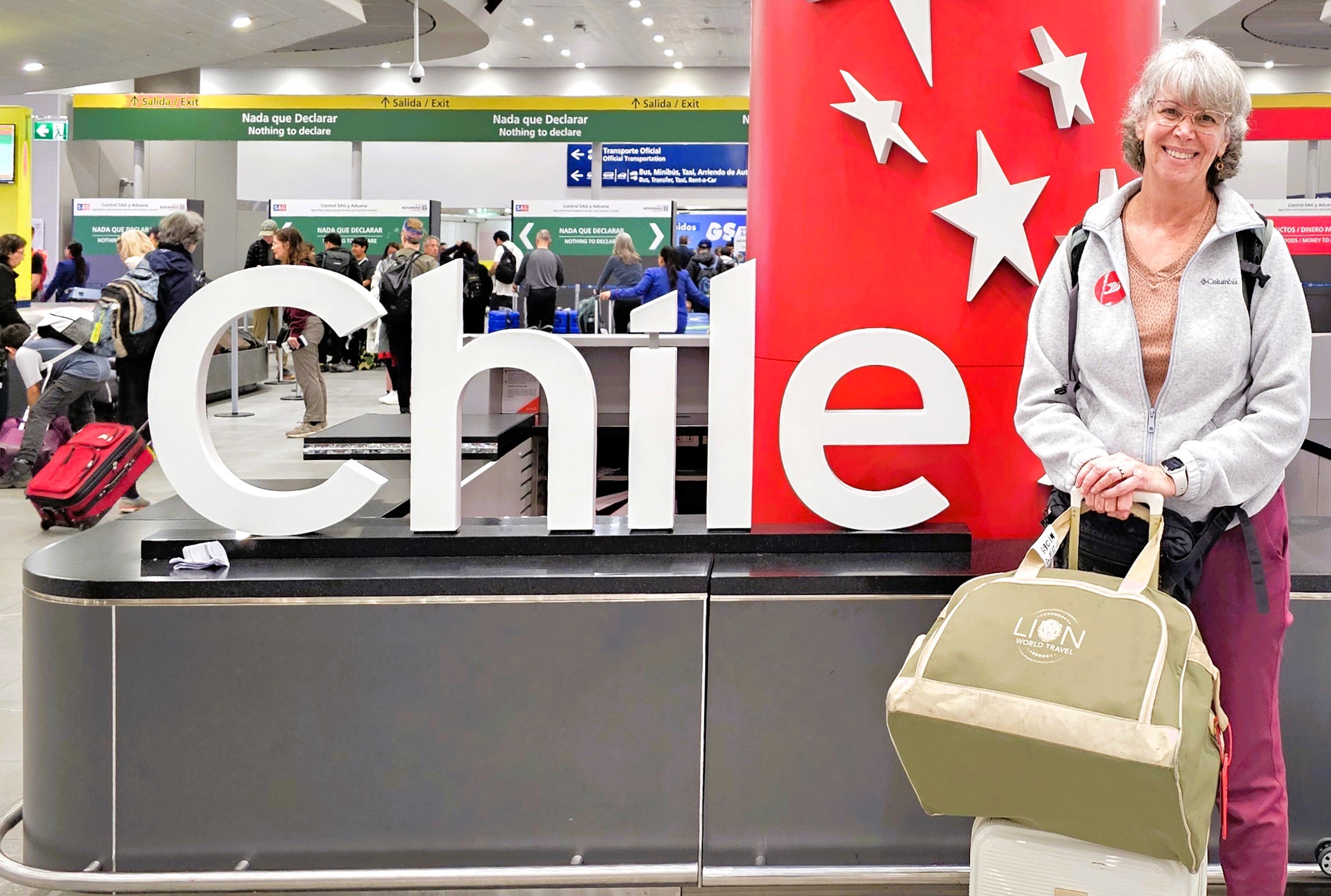
Two of South America’s great urban centers–Santiago, Chile and Buenos Aires, Argentina served as designated transfers on our journey to the bottom of the world, but time would not allow Leah and me to explore our interim surroundings to the fullest. Nevertheless, we hit the ground running,
utilizing the long summer days to our advantage and netting a few memorable moments and postcard pearls to satisfy our wanderlust.
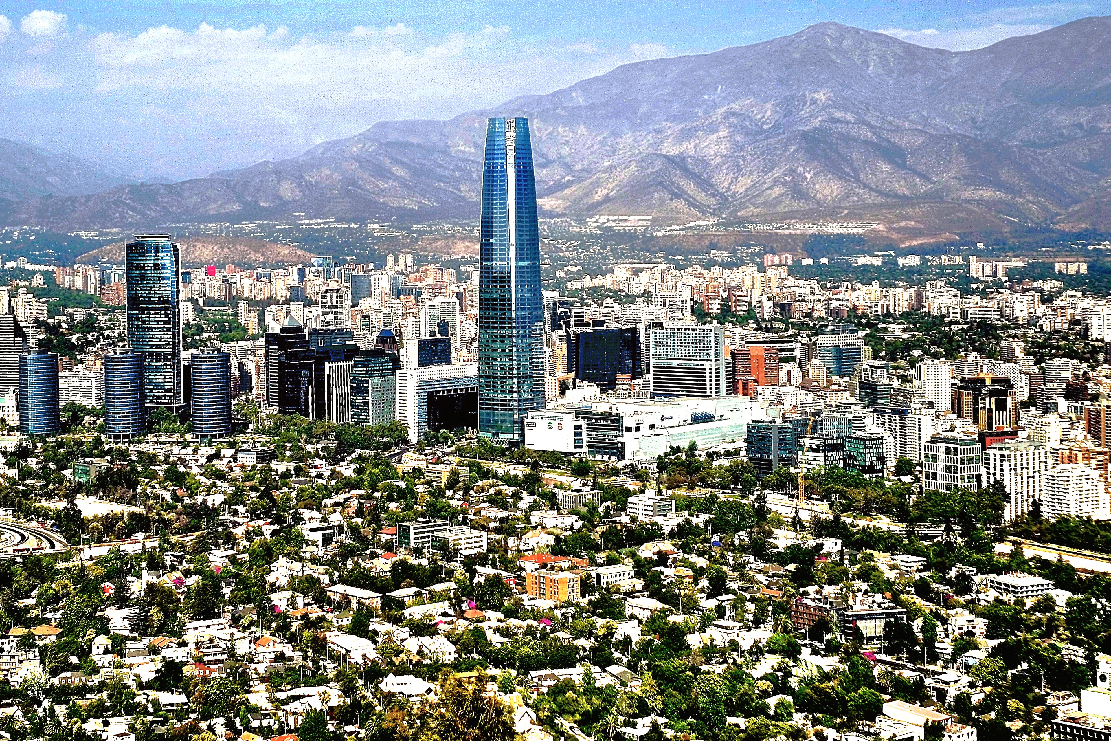
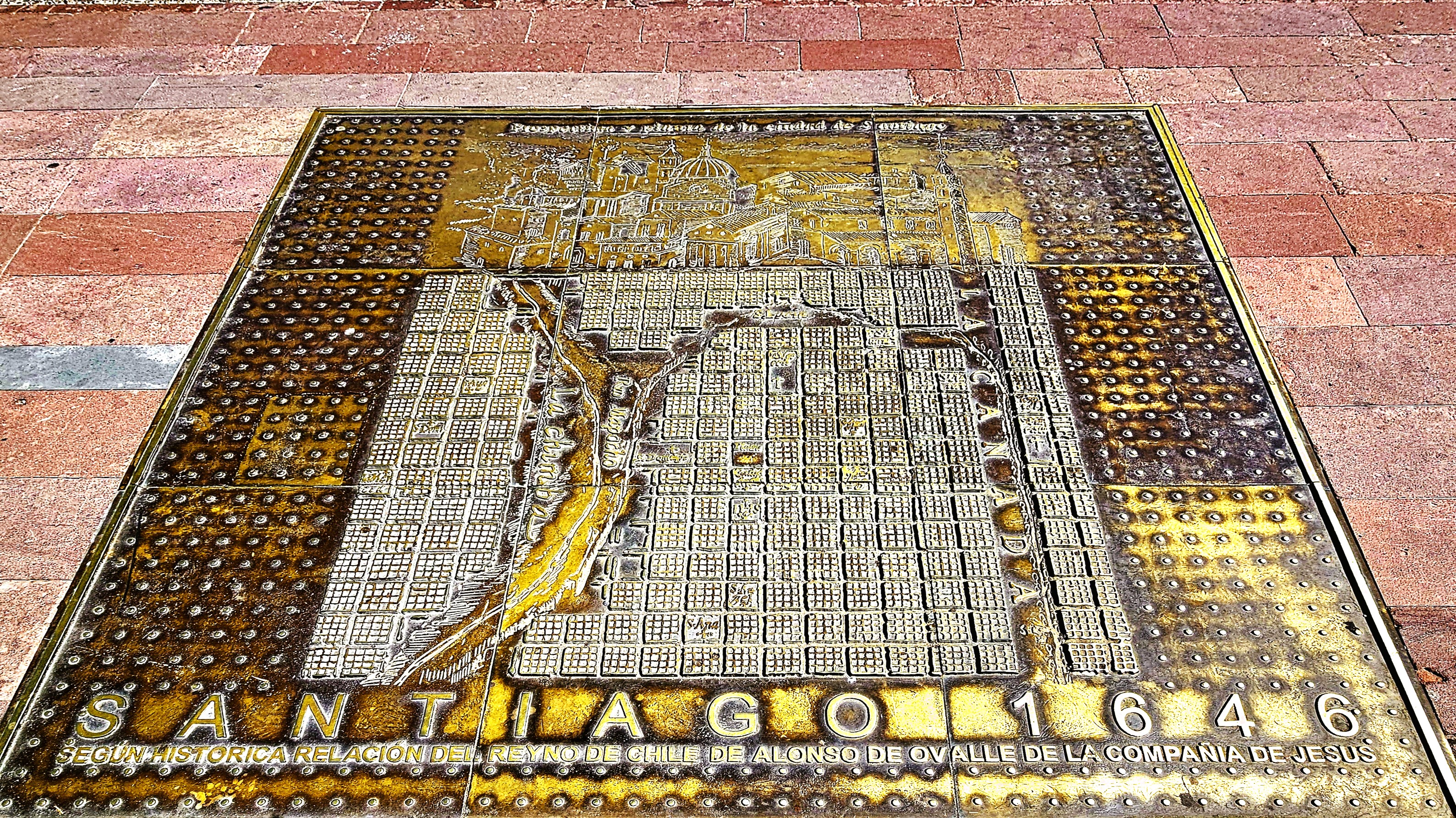
Santiago is a vibrant capital sandwiched between the Coastal Range and the Andean Mountains, and best experienced from the summit of San Cristobal Hill–
accessible by cable car from the east,
or by funicular from the west.
For many Catholics, the pilgrimage to the top of Cerro San Cristobal is incomplete without hiking to the Sanctuary of the Immaculate Conception,
where a statue of the Virgin Mary rises 14 meters from her pedestal.
The Catholic Archdiocese is based at the neoclassical Metropolitan Cathedral at the Plaza de Armas,
where it stands as the centerpiece of the square.
The opulence of the sky-blue frescos and the cathedral’s gilded columns are a testament to the hundreds of artisans who toiled for decades to evoke the aesthetics of Tuscany and Rome.
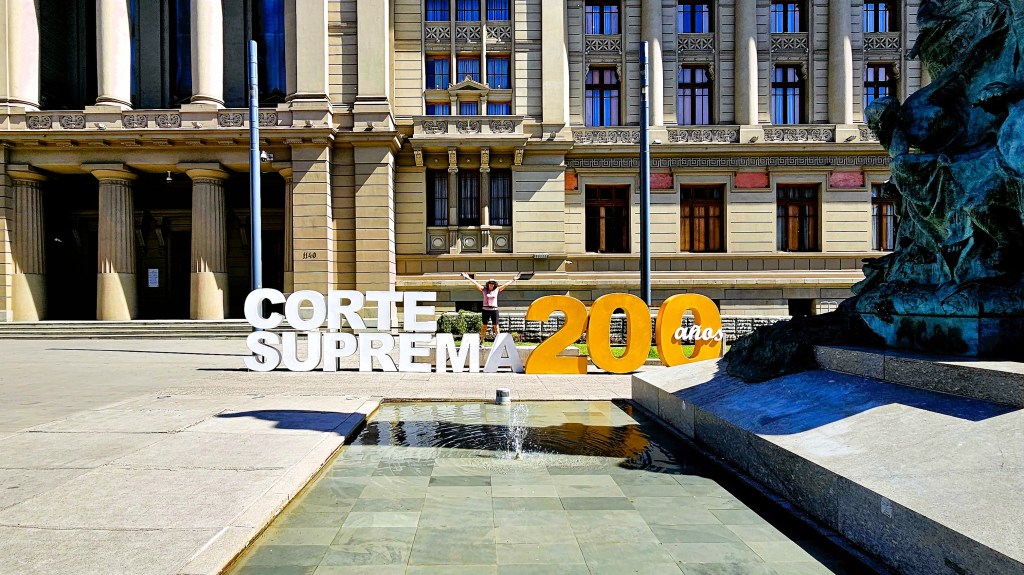
On the civics side of the peso chileno, there is also a wealth of Beaux-Arts architecture that dominates the cityscape, from the Supreme Court building…
to Constitution Square.
Leah and I initially arrived in Santiago, Chile, only to fly out the following day to the Antofagasta region, where the Atacama Desert figured large in our itinerary (see Atacama Desert). Then it was back to Santiago, for an overnight, before an early departure to Buenos Aires, where our time was sorely limited to an amazing rib-eye dinner in the midst of Monserrat,
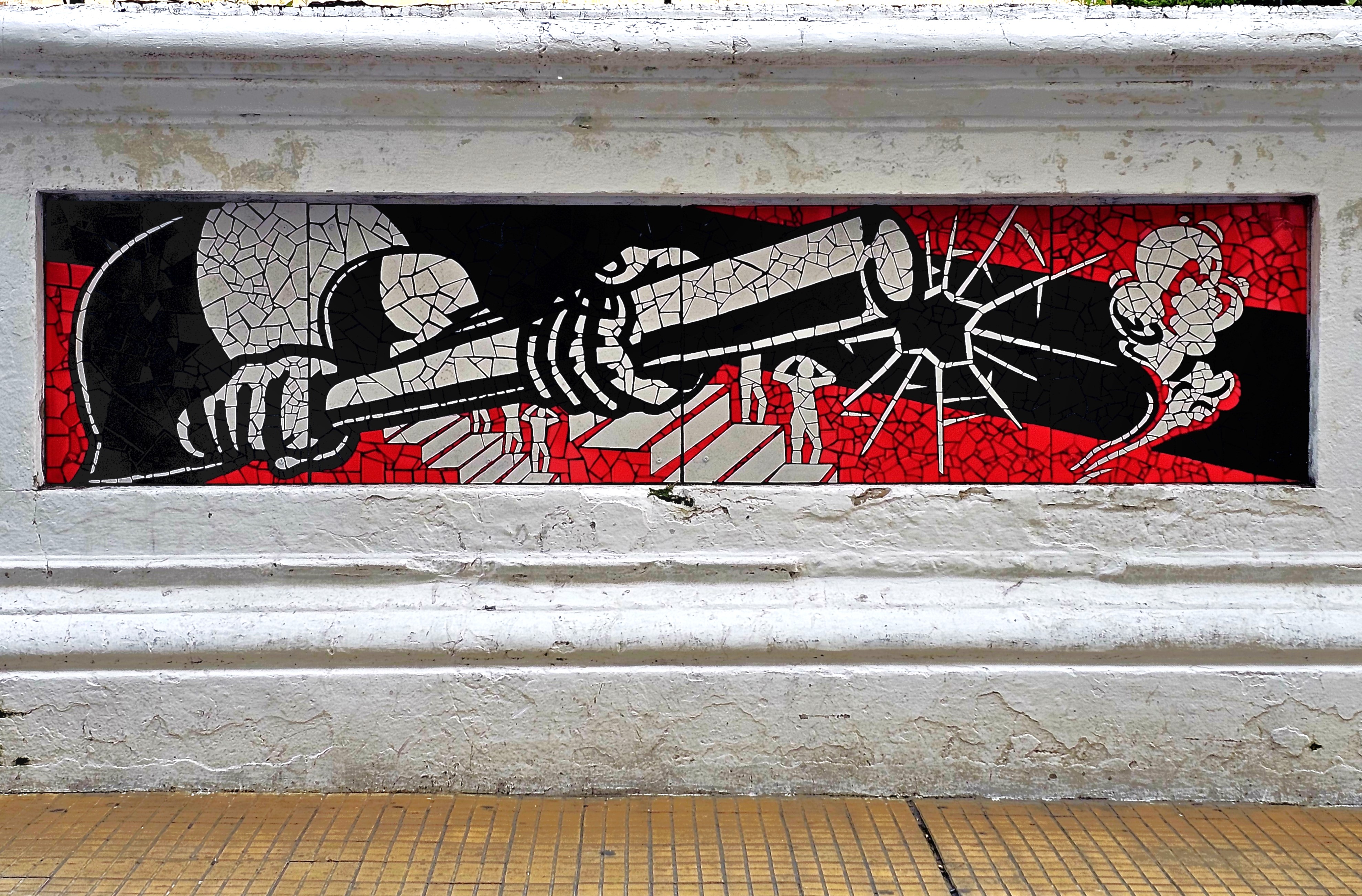
followed by a necessary “walk-off-our-meal” stroll through the city’s oldest district, replete with sidewalk bistros,
political art,
and public buildings defended by commemorative art,
and protected by full-figured gargoyles.
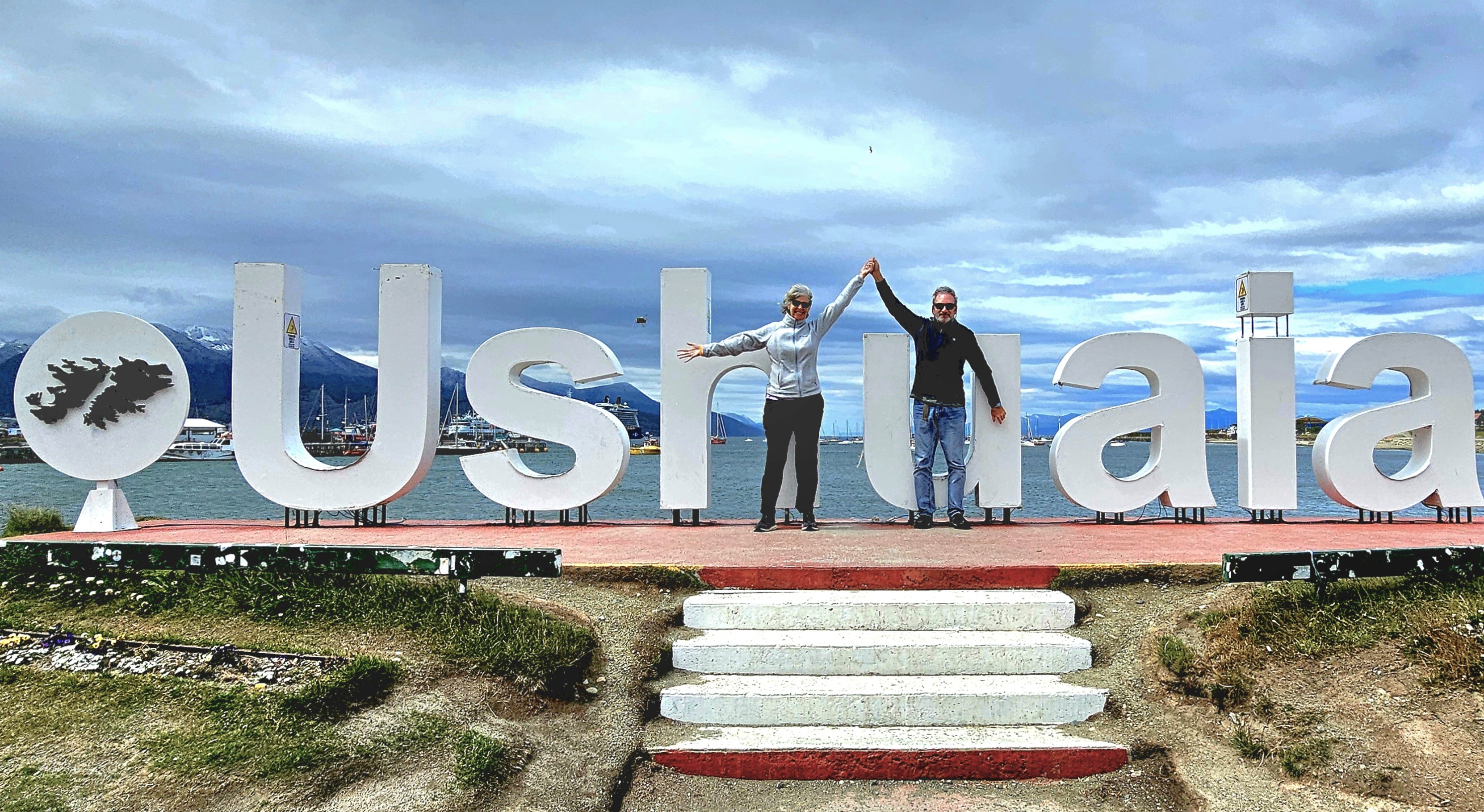
The following afternoon, we arrived in Ushuaia, acclaimed as the southernmost city on the planet.
Although our ship Viking Octantis awaited us at the harbor (just kidding),
Leah and I still managed to appreciate the Patagonian panorama surrounding the waterfront,
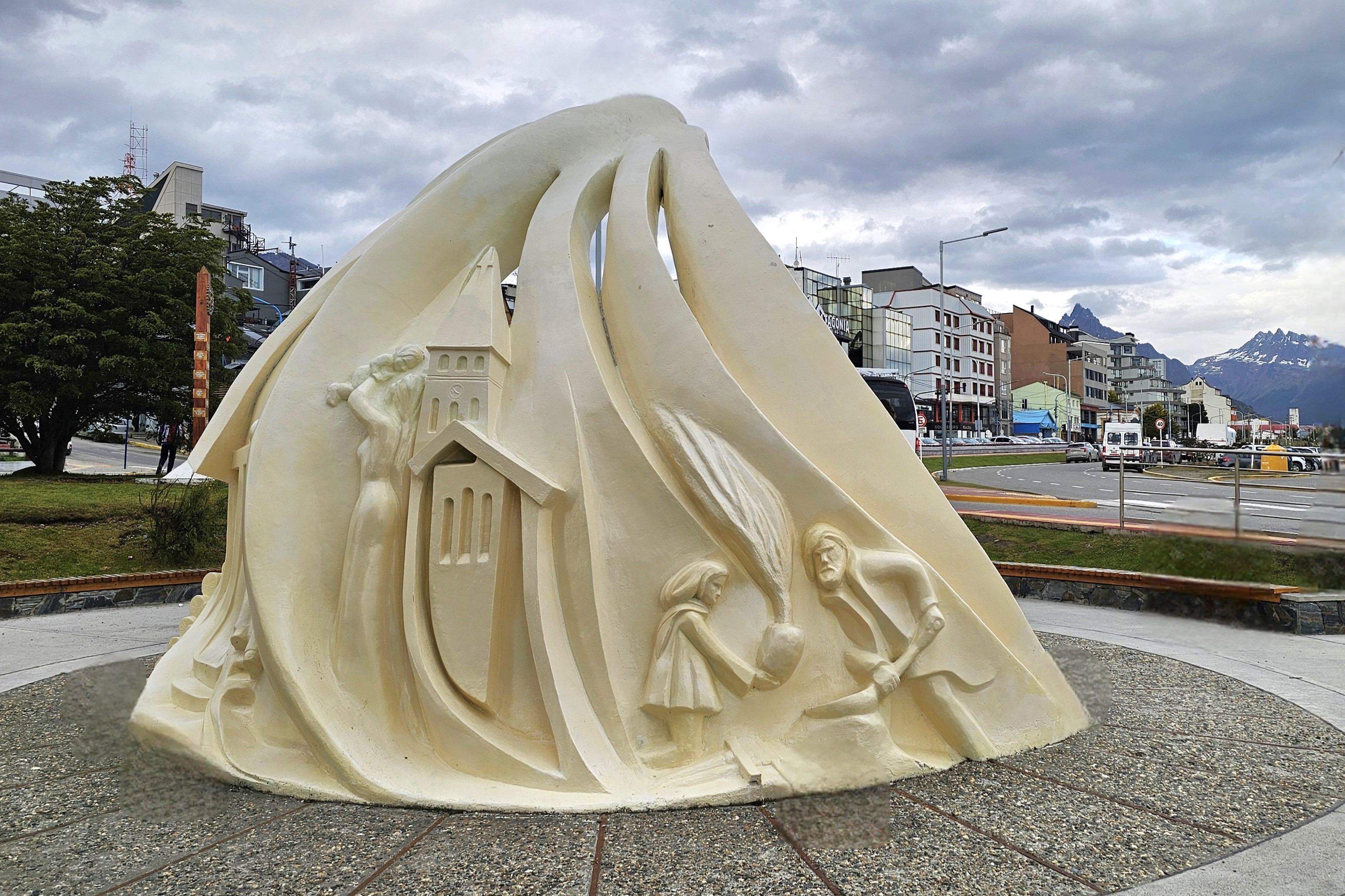
the inland tributes and monuments,
and the resplendent gardens scattered throughout the town.
Ushuaia surprised me. I anticipated a sleepy town, but discovered a hive of trendy shops, boutique hotels, and pricey outfitters. The scenery was unparalleled, and the weather was ideal. It seemed the perfect segue to an exciting Viking expedition.
And so, the time had come to embark on our adventure to the White Continent by first surrendering to the dreaded Drake Passage…
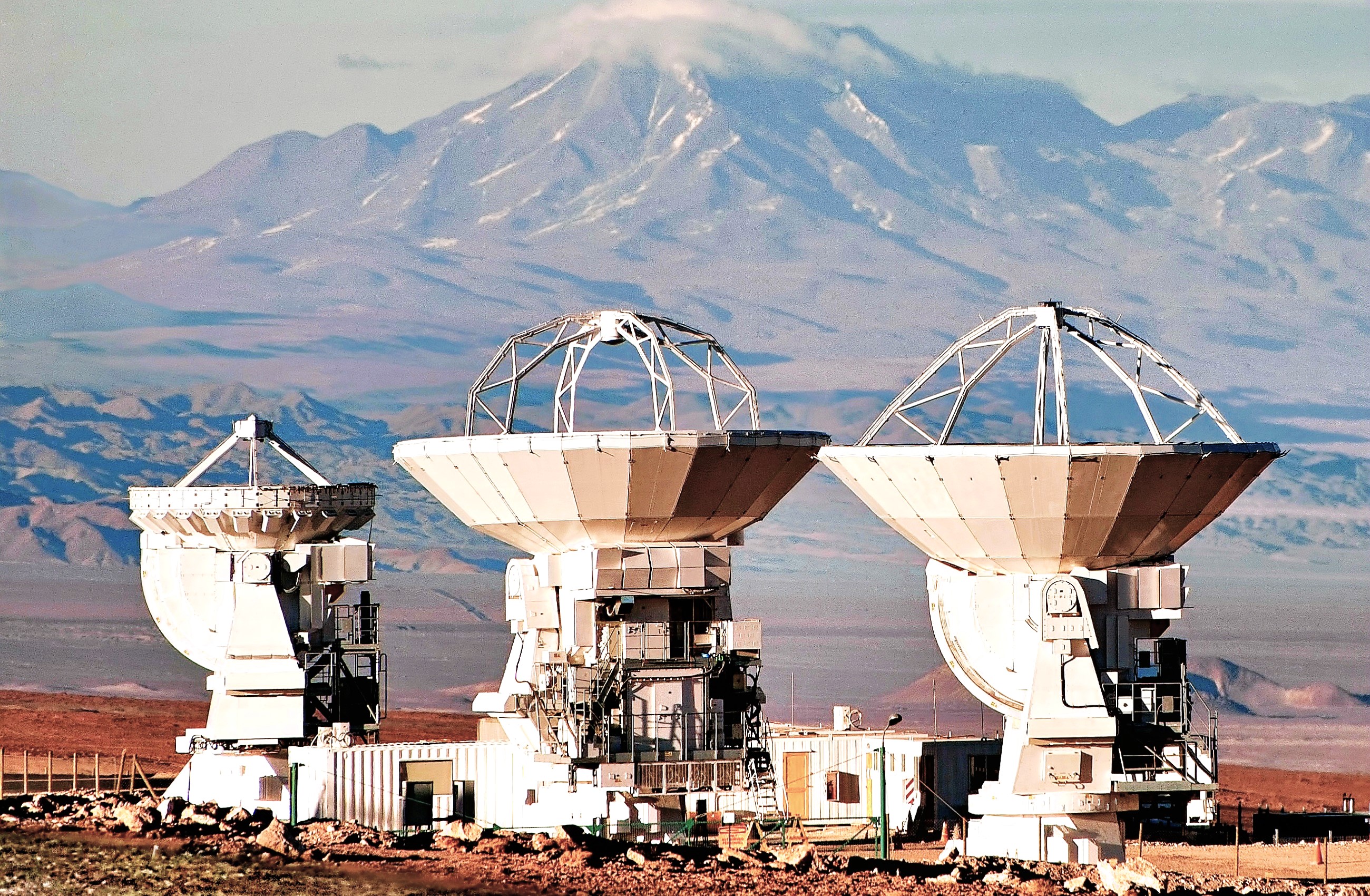
Heaven forbids, I should neglect to mention that San Pedro de Atacama–given its high altitude, and being as dry and remote as it is–also has the darkest sky on the planet, making it ideal for stargazing. And astronomers from across the globe are betting that ALMA’s array of 66 dishes–comprising the world’s largest ground-based telescope–can provide answers about our cosmic origins and our search for life within and beyond our universe.
Photo credit: José Francisco Salgado
Already, the ALMA (Atacama Large Millimeter/submillimeter Array) Observatory has made many significant discoveries, including:
In 2018, astronomers detected the presence of the most distant oxygen molecules ever observed, located a staggering 13.28 billion light-years away. This remarkable finding significantly contributed to our understanding of cosmic evolution, shedding light on the emergence of star formation in this distant galaxy a mere 250 million years after the Big Bang.
Additionally, ALMA made a stunning revelation by identifying billions of tons of table salt in orbit around a young star, offering a mesmerizing glimpse into the presence of familiar compounds in the cosmos.
Furthermore, ALMA has played a pivotal role in unraveling the mysteries of the universe. For instance, it detected branched organic molecules in a star-forming region of our Milky Way, providing valuable insights into the chemical composition of celestial bodies.
Moreover, ALMA’s observations have extended to other galaxies, such as the groundbreaking discovery of a disc around a star in a distant galaxy–a first-of-its-kind observation that advanced our understanding of stellar systems beyond our own. Furthermore, by studying a newly dormant galaxy, ALMA uncovered evidence of significant celestial events, identifying the ejection of star-forming fuel during a galactic merger and the formation of gas-rich tidal tails, providing a window into the cosmic processes that shape our universe.
ALMA has also helped researchers determine the types and locations of systems that could support habitable planets. ALMA has also provided information about worlds closer to home, including Saturn’s moon Titan.
Sadly, there was no time in our itinerary to visit the ALMA facility, which welcomes all visitors during Saturday and Sunday. However, I attempted some astrophotography discoveries of my own during a celestial presentation at the edge of our resort, Hotel Cumbres San Pedro de Atacama, in my hope of capturing a vivid photograph of the night sky.
Armed with my Sony RX10 iv and tripod, our expedition troop marched in total darkness to the final plank of the resort’s boardwalk, bringing us to open desert, where two mounted telescopes were pointed at a black sky illuminated by a million points of light. The view was breathtaking! While most of the guests stretched out on pillows and blankets, I set up a camp chair and set my coordinates.
Regrettably, I failed. In order to reduce the digital noise during a long exposure, I adjusted the ISO to 400, which gave me a 30-sec. time exposure with an open aperture. The result was a tangle of small streaks, not stars. Apparently, the long exposure captured the path of the moving sky, albeit 3 shooting stars were framed in the effort.
Unwilling to admit defeat–the night before our return to Santiago–I leveled the tripod within the confines of my private garden and turned my camera toward the sky with newfound hope and a higher ISO to reduce my exposure. This time, the results were more satisfying.
While I had hoped for a glimpse of the Milky Way, I’ll settle for a Mars Bar from Valle de la Luna!
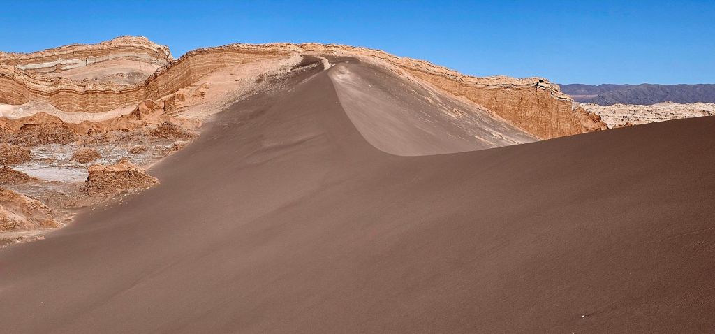
Despite the monochromatic omnipresence of shifting sand and salt across the Atacama Desert (observed from previous post, “Atacama Desert”)–
aside from the occasional splash of flamingo pink–
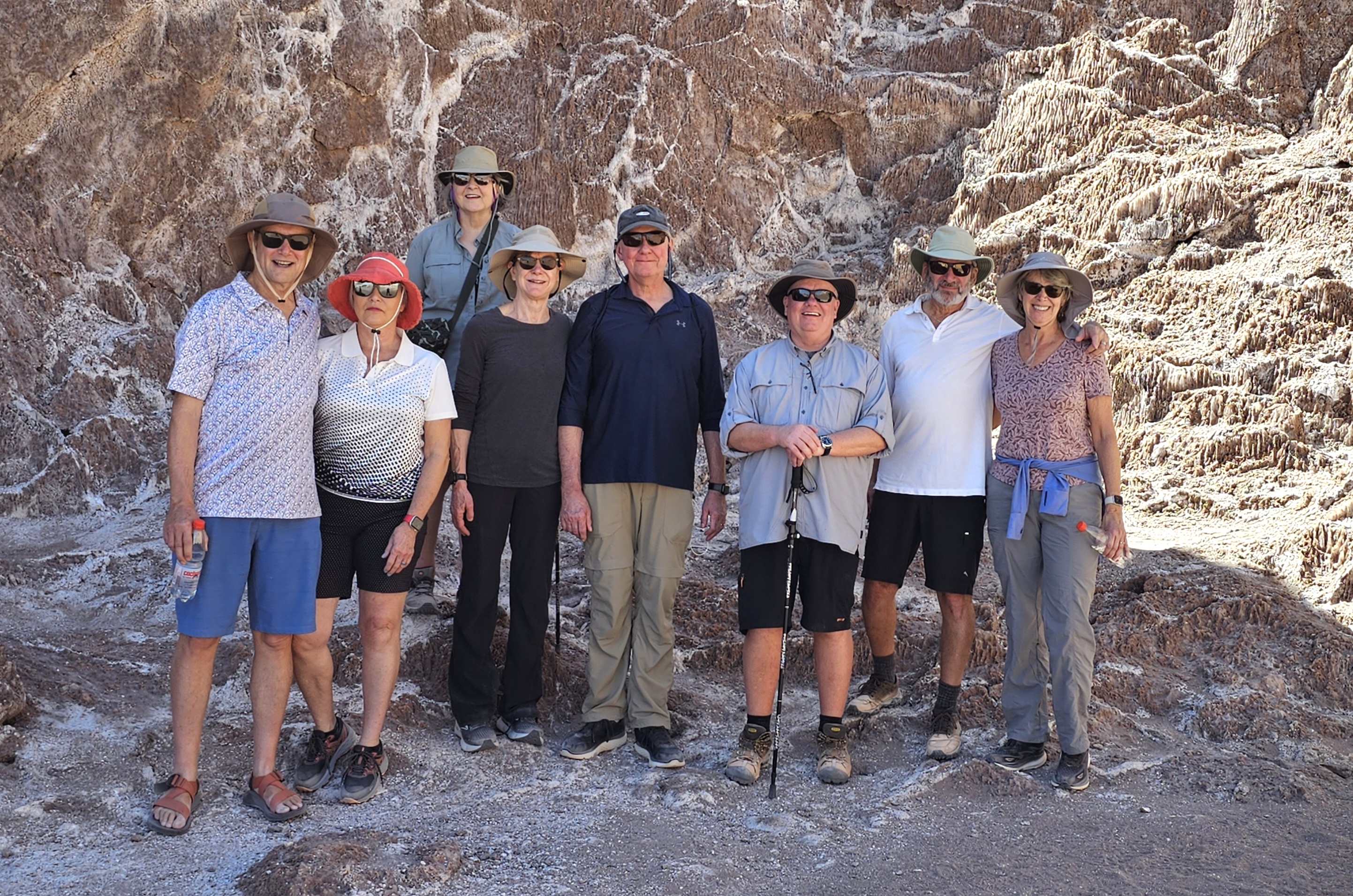
there is an abundance of color to behold in other regions of Antofagasta. Leah and I joined our expedition colleagues…
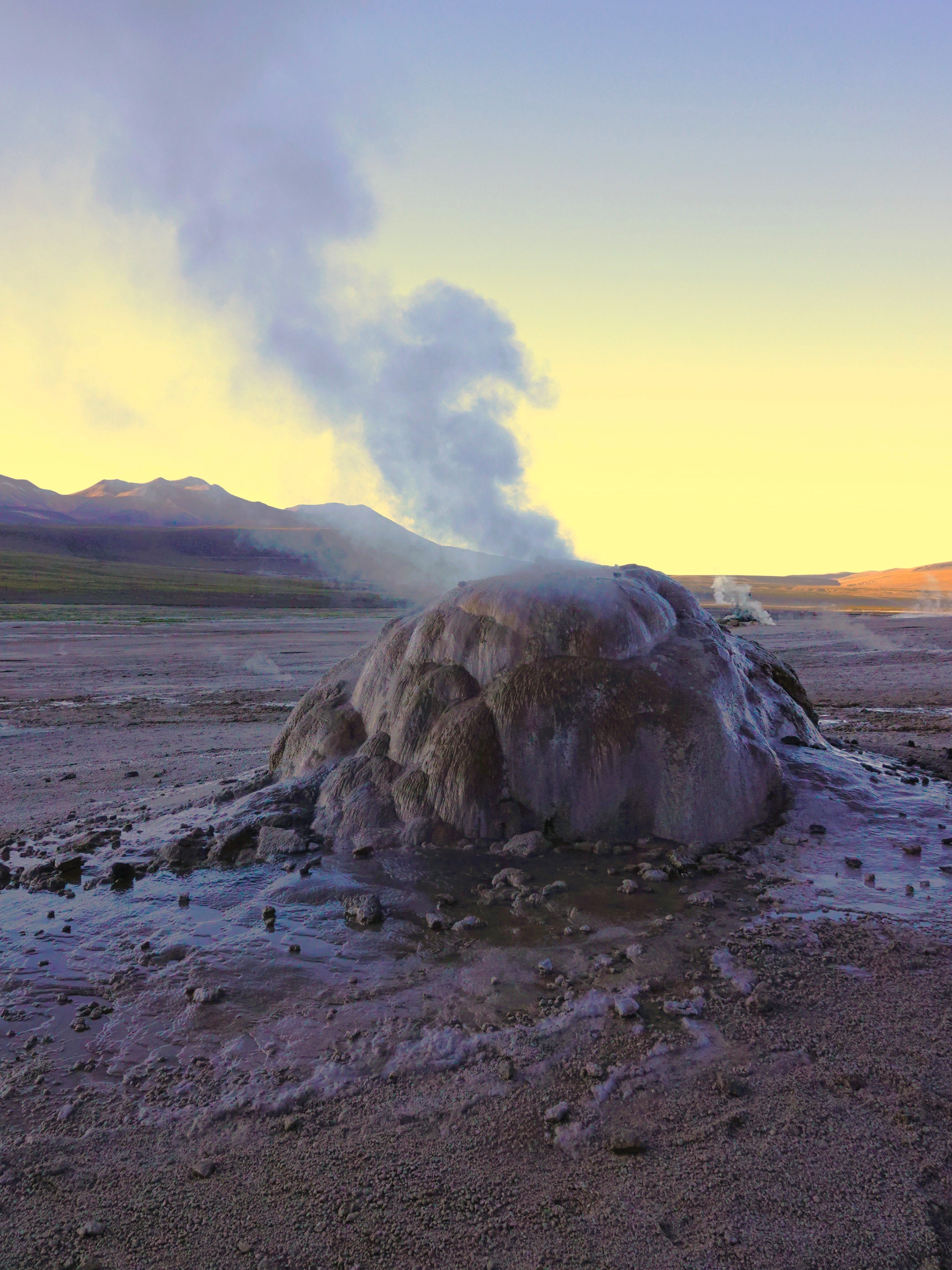
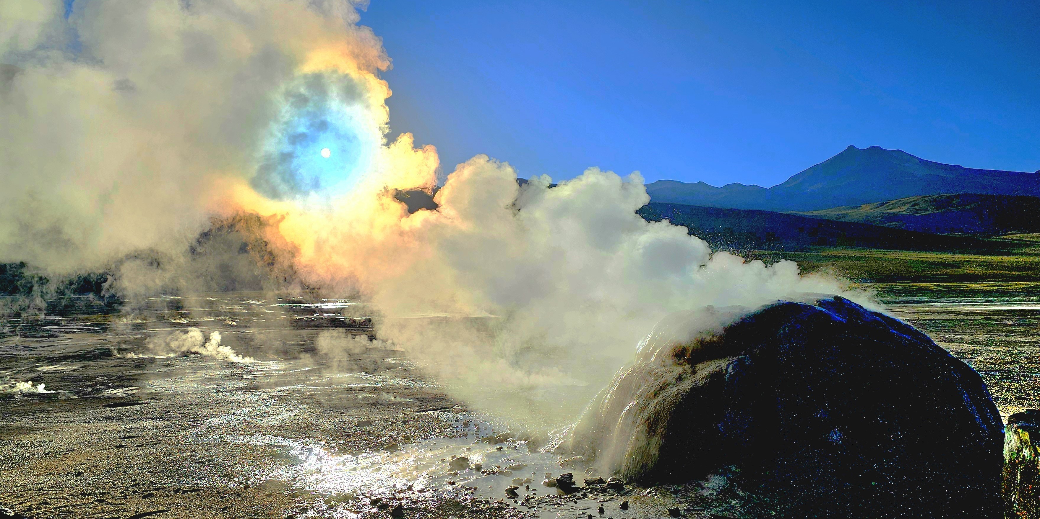
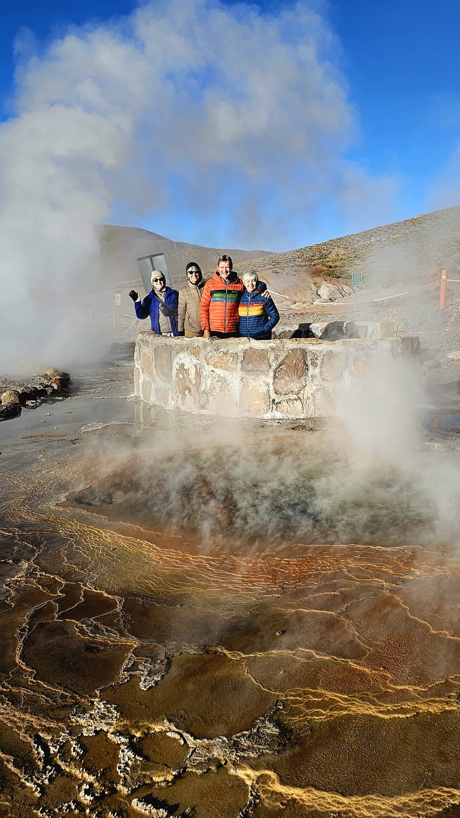
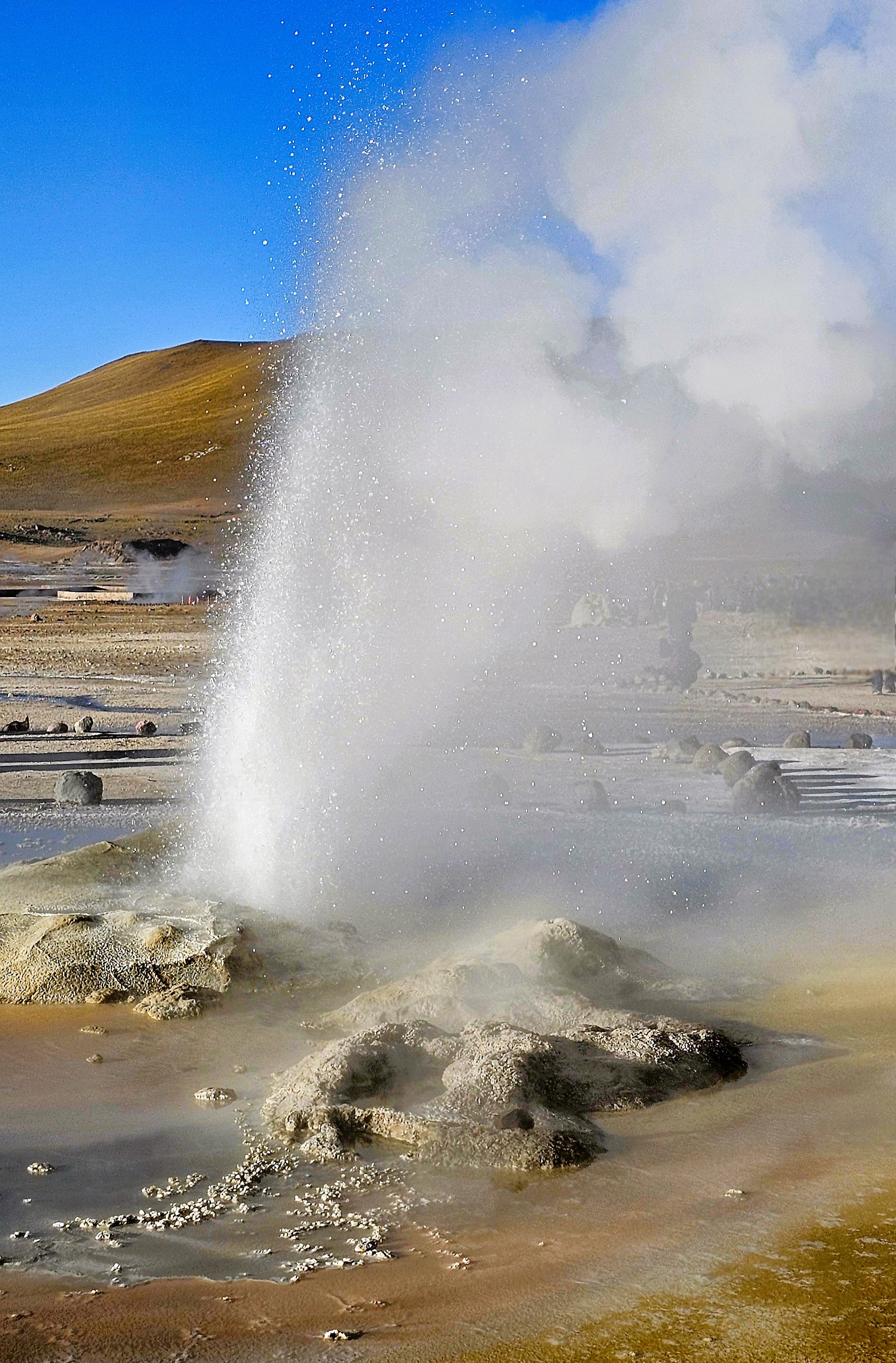
for a 90-minute drive north through remote, rugged terrain and narrow switchbacks, to catch a 7am sunrise over El Tatio Geysers, the highest, albeit 3rd largest geothermal field in the world, and certainly, the most active in the southern hemisphere.
At an altitude of 14,170 ft, the -6oC desert temperature was biting at our faces, but it was a temporary inconvenience. The backlit, pre-dawn sky and cold air benefitted the playful plumes that vented from 80 steaming geysers and fumaroles amid 12 sq miles of Andean volcanoes.
Like so many others, I was poised for the first sun to creep over the horizon,
not only to return the feeling to my fingers, but to reveal the chromatic clouds playing across the landscape.
Soon enough, the rising sun would turn the blackest of hot springs into a glorious reflecting pool.
It was worthy of a celebration.
Because El Tatio is community-owned and administered, there were several local rangers scattered throughout the vicinity to patrol, advise, and admonish any foolishness similar to Pierce Brosnan’s trespassing at Yellowstone National Park (although he entered a “not guilty” plea during his recent arraignment).
One can only hope that discretion and common sense would prevail in this fragile and volatile environment.
El Tatio Geyser
A stroll through the field revealed a kaleidoscope of algae-induced minerals and salts,
that stretched into the distance.
El Tatio didn’t appear as daunting as Old Faithful and its surroundings, but it was impressive, nonetheless, with nowhere near the number of onlookers!
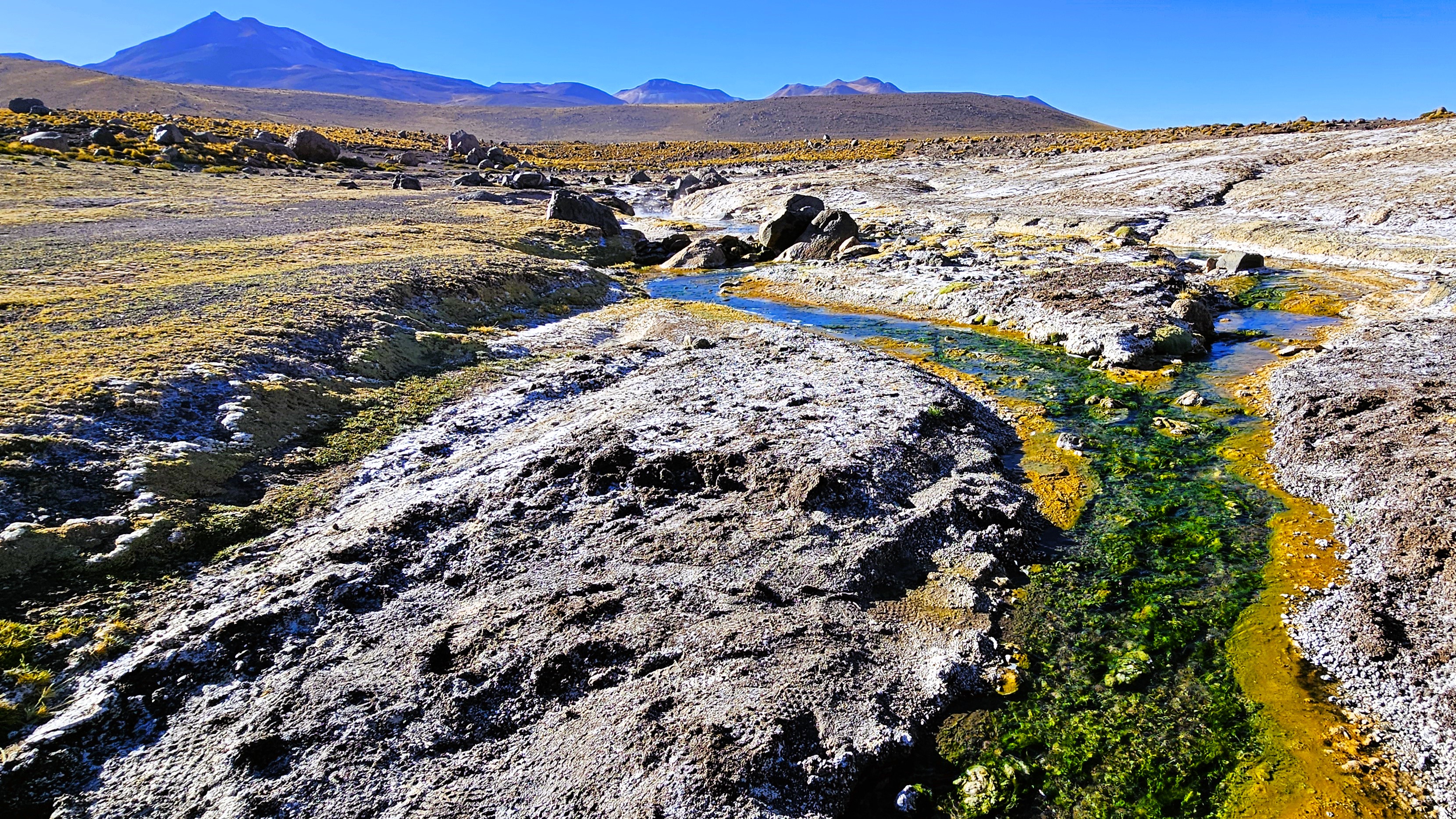
From our position–only 100 miles to Ollagüe Volcano, bordering Chile and Bolivia–
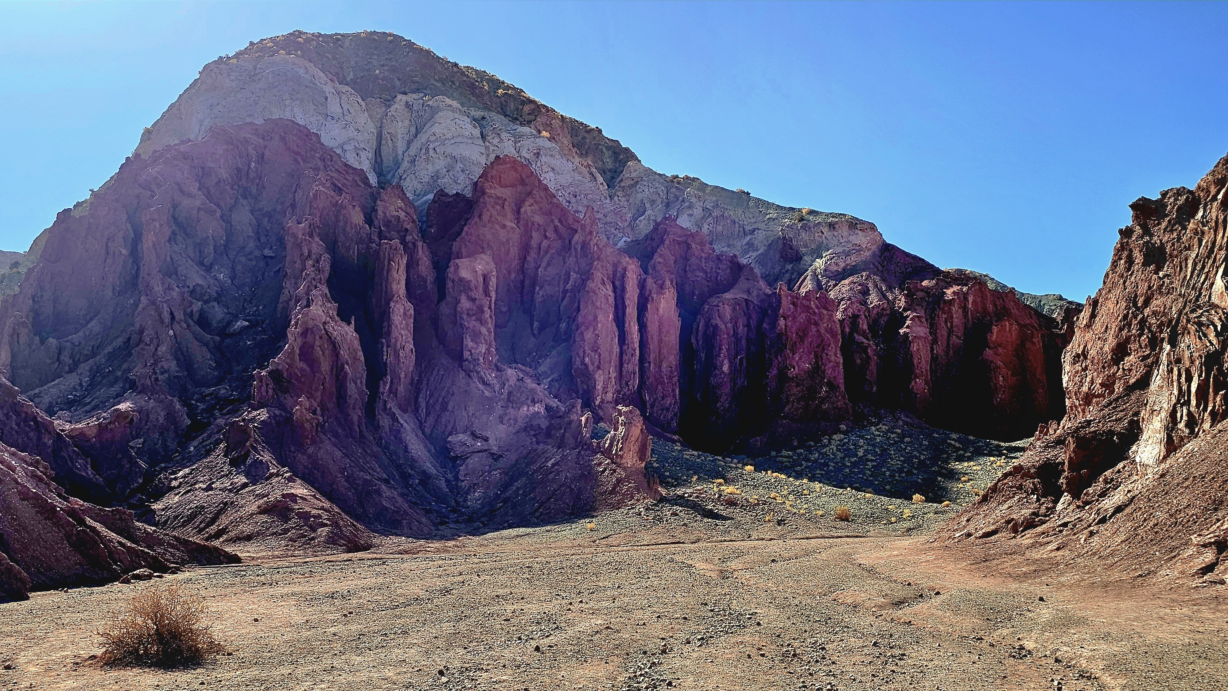
we continued to Valle del Arcoiris, another community-based natural wonder,
where “purple mountains majesty”…
become a befitting backdrop to roaming, grazing llamas.
The valley was as wide and rich with the scent of riki riki…
as it was awash with colors created by a primordial stew of Sulphur, gypsum, crushed shells, and clay.
When the Pliocene Epoch carved out the valley,
all traces of copper and lithium were swept away–
which is a silver-lining for a spectacular landscape that would otherwise have been ravaged by mining companies.
It’s a new year, and there has never been a better time for Leah and me to explore our world. We are always up for a challenge, so we’ve decided to begin 2024 with our most ambitious adventure yet. Not satisfied with returning to some of our favorite destinations–not that there’s anything wrong with familiar places—we booked a bucket list trip over a year ago that would literally take us out of our comfort zone.
We filled the waiting time by visiting friends and family across America (and a speck of Canada)–only some of which I memorialized during the past year in this blog. In fact, a large part of last year’s travels never made it past my unpublished thoughts and unprocessed SD cards, including: a trip to Israel (months before the October 7th massacre);
a Central American cruise to Costa Rica,
Panama City,
and Cartagena, Columbia;
as well as a relaxing siesta on the Riviera Maya in Mexico;
a flash visit to Victoria, BC;
and a southwestern tour of America in our silver bullet–
all worthy of sharing sooner than later.
But until then, I must fast forward to our most recent trip to Chile’s Atacama Desert before embarking aboard Viking’s Octantis to Patagonia and Antarctica–in search of whales, penguins and extraordinary landscapes.
We overnighted in Santiago, Chile,
followed by a morning flight to Copiapó, the region’s capital incorporating San Pedro de Atacama.
And set out to explore the highest, driest ecosystem on planet Earth.
Forgive me; it’s been a while since my last confession.
Life happens and it’s been challenging at times to juggle travel with business affairs, personal affairs and blogging. And with the passage of each passing day, it’s become increasingly more difficult to return to summer events with the same vitality, and cobble a detailed timeline from 3 months ago. In fact, there are still stories from last year’s journey to Canada that have yet to be written and published.
While I could travel less to blog more often, or continue to travel without memorializing the occasion, neither option is an acceptable one. Perhaps, I’ll just have to find a better way to accomplish both without sacrificing one for the other. In the meantime, I’ll pick up where I left off, which is somewhere on the road between here and there.
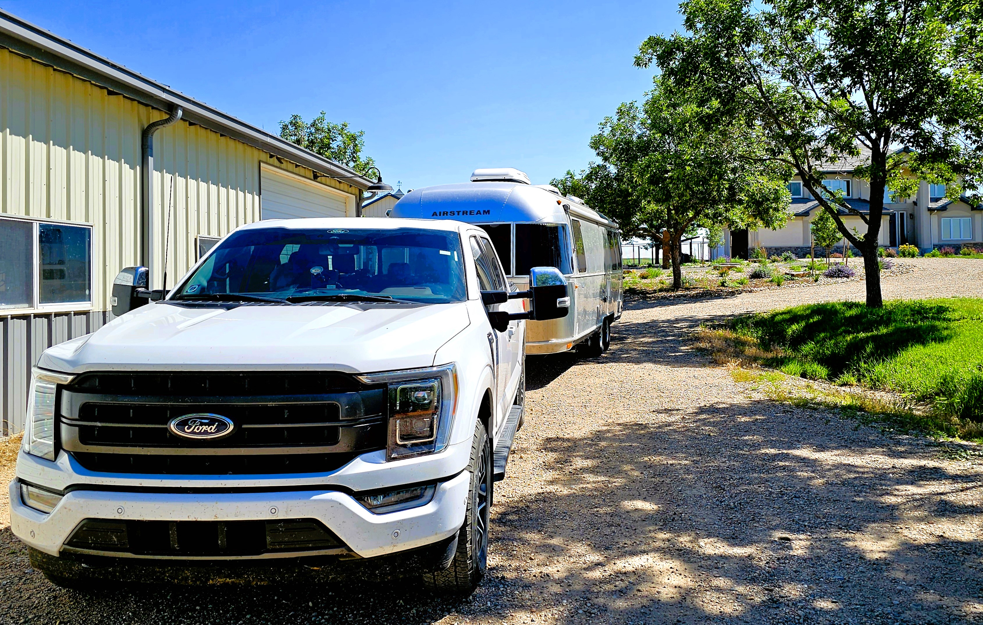
First of all, a shout-out to our friends Dirk and Heather,
who allowed us to park the Airstream at their ranch in Fort Collins, assuring us peace of mind while we boarded a flight from Denver to Seattle to visit my son Nate.
Dollar for dollar and day for day, Leah and I figured that flying round-trip to Seattle probably saved us 2 weeks of driving 1,500 miles, at a proximate cost of $1300 in fuel.
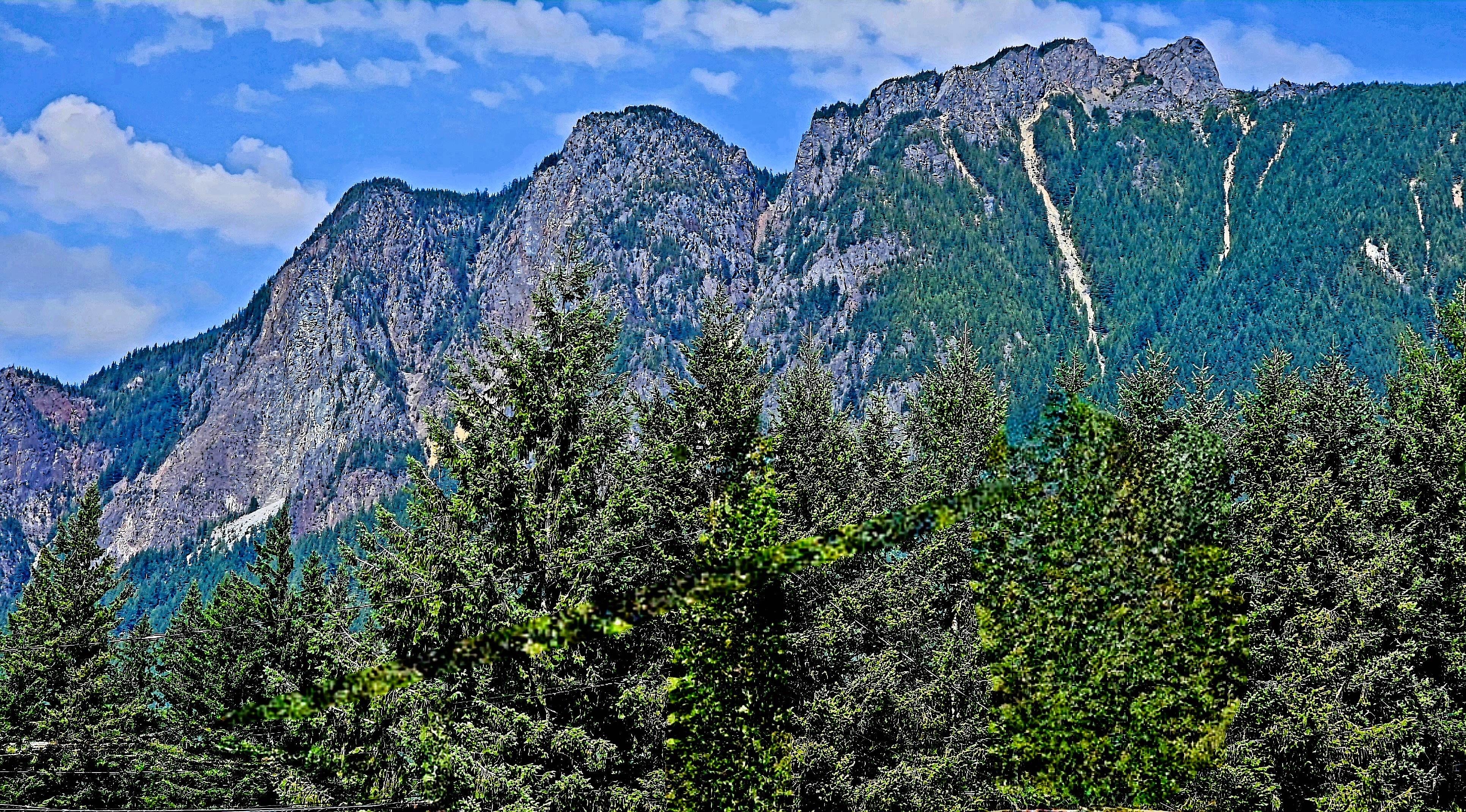
After our arrival to Issaquah (suburban Seattle and Nate’s hometown), we ventured southeast along the I-90 corridor to hike Rattlesnake Ledge on Rattlesnake Mountain–
a demanding 2-mile ascent…
that gave us sweeping views of Rattlesnake Lake,
and the Cascade Range beyond the clouds.
Seattle was also our gateway to north of the border…
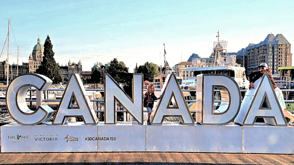
After a 2 hour and 45-minute cruise aboard the Victoria Clipper, we arrived at Victoria’s Inner Harbor,
where we would spend the weekend at the historic Pendray Inn and Tea House…
in the very pink, Executive Suite.
Victoria is well-known as a pedestrian town,
with a variety of landmarks and attractions within a few miles of our hotel. We were less than a half-mile from Parliament,
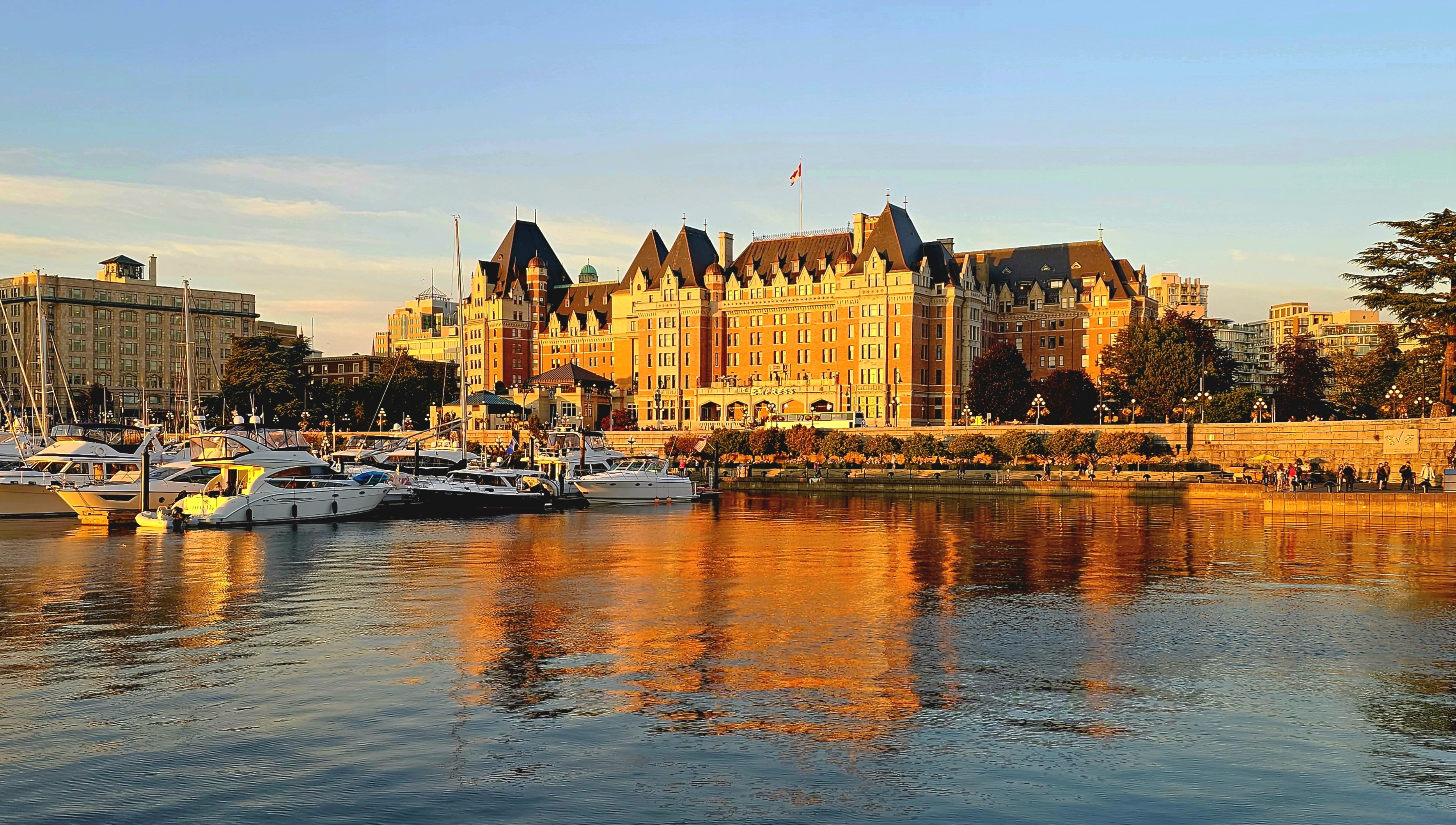
and Fairmont’s Empress Hotel,
and another half-mile further to Canada’s oldest Chinatown.
And strolling along the Lower Breakwater (adorned with First Nation symbols) with panoramic views to the south, afforded us a different perspective of the Cascade Range.
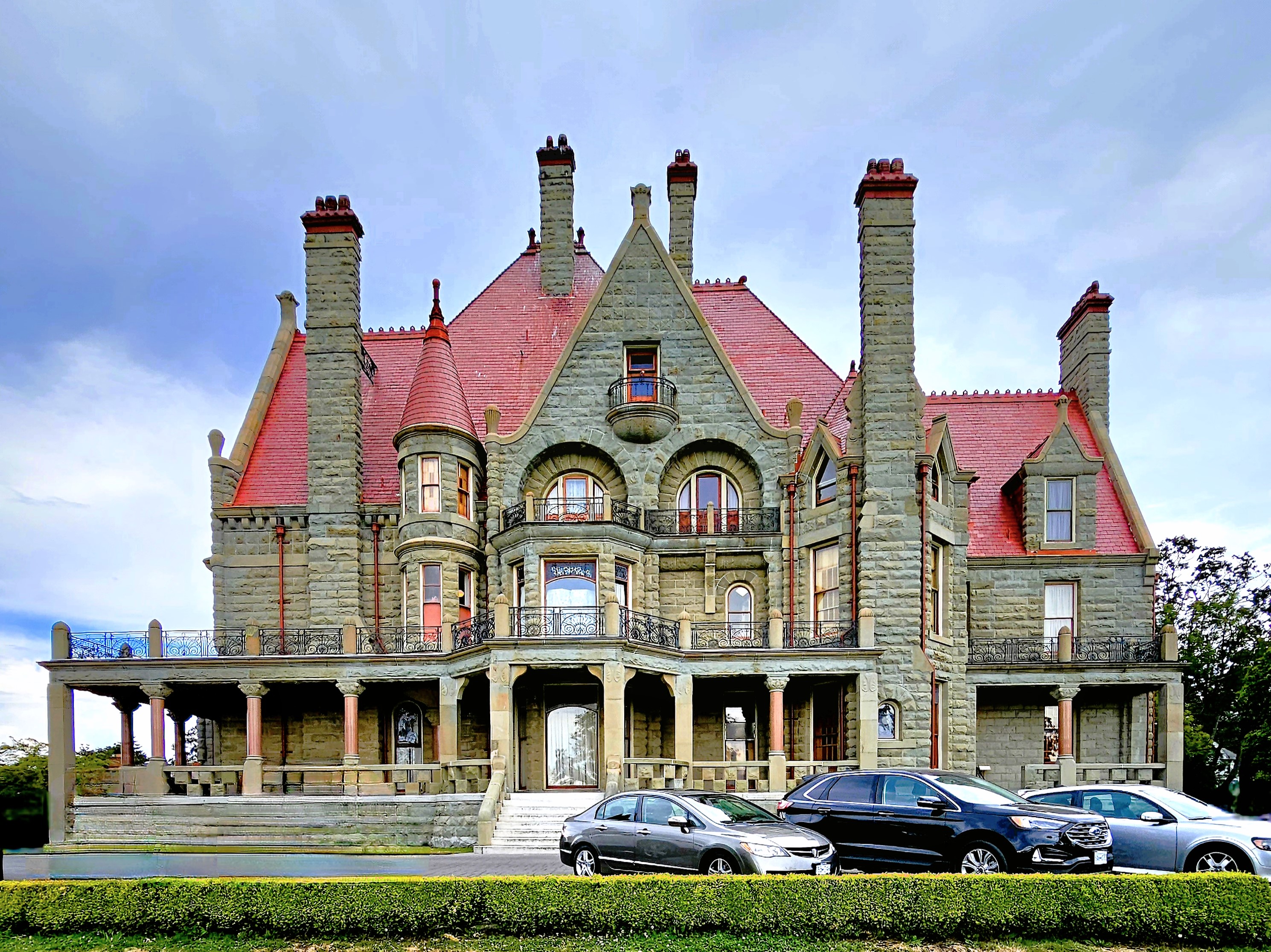
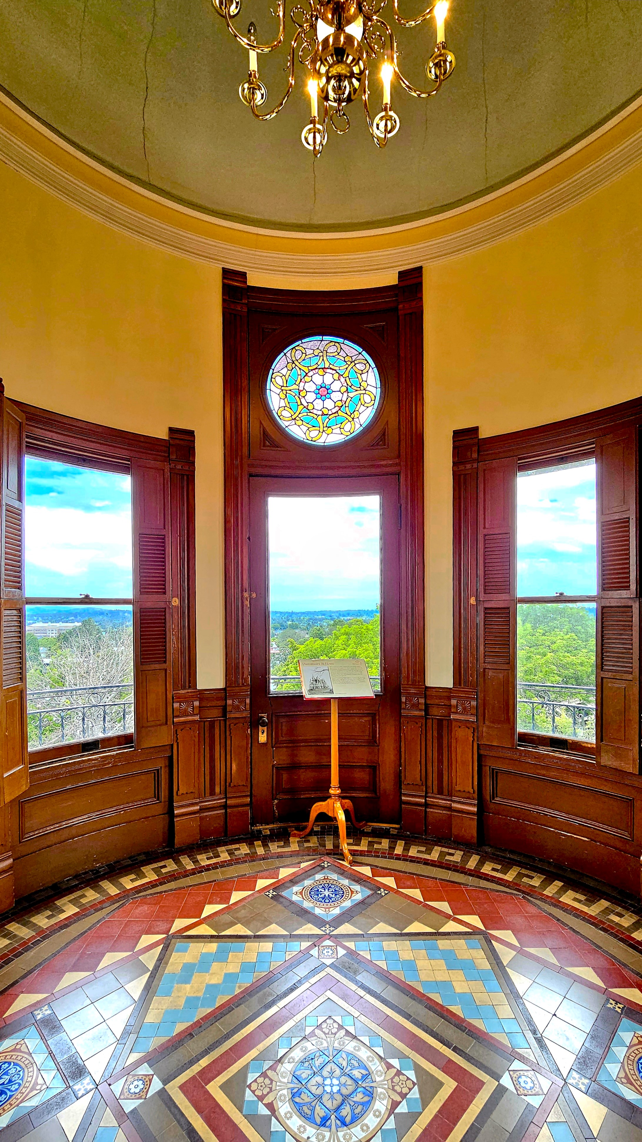
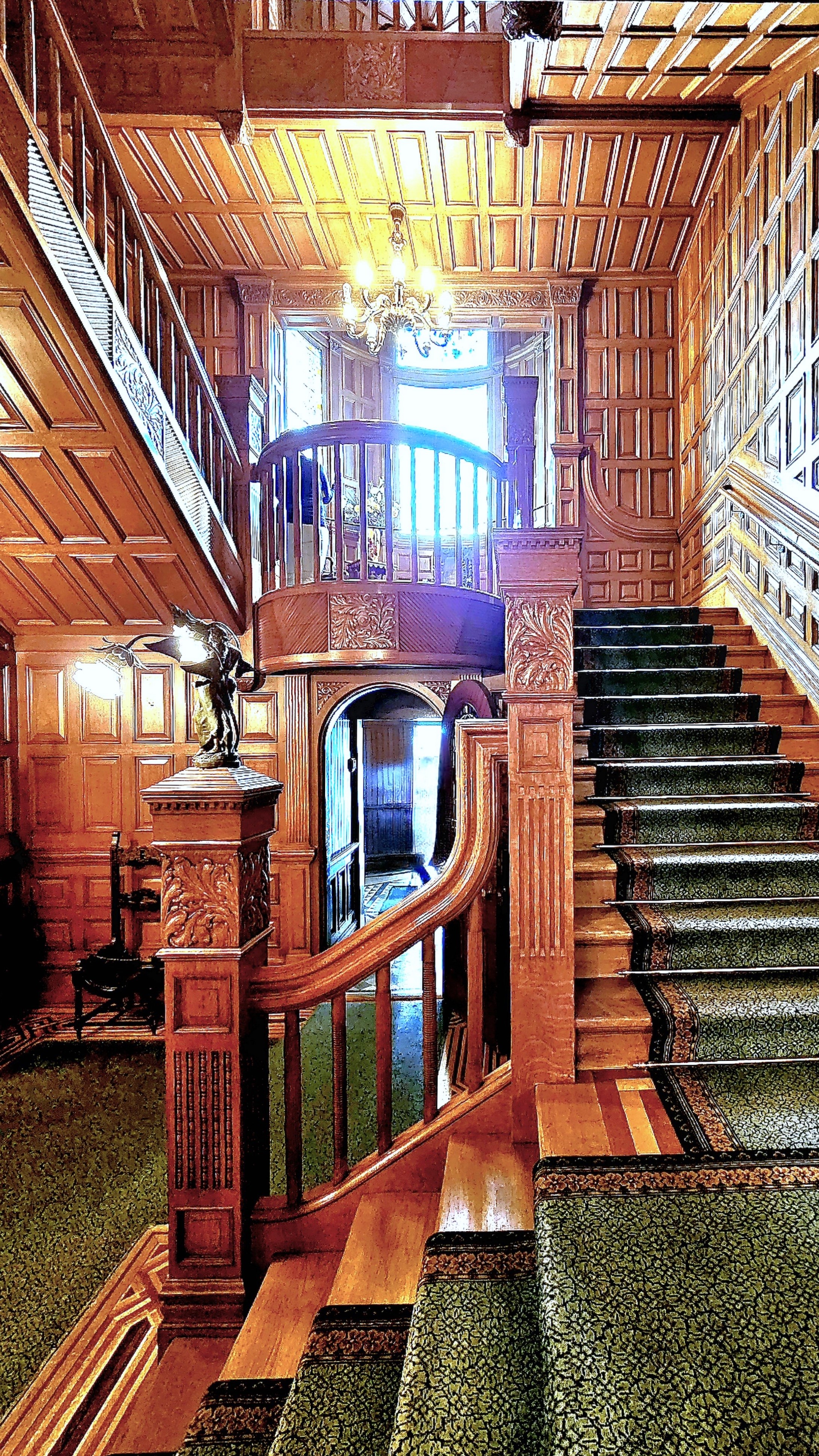
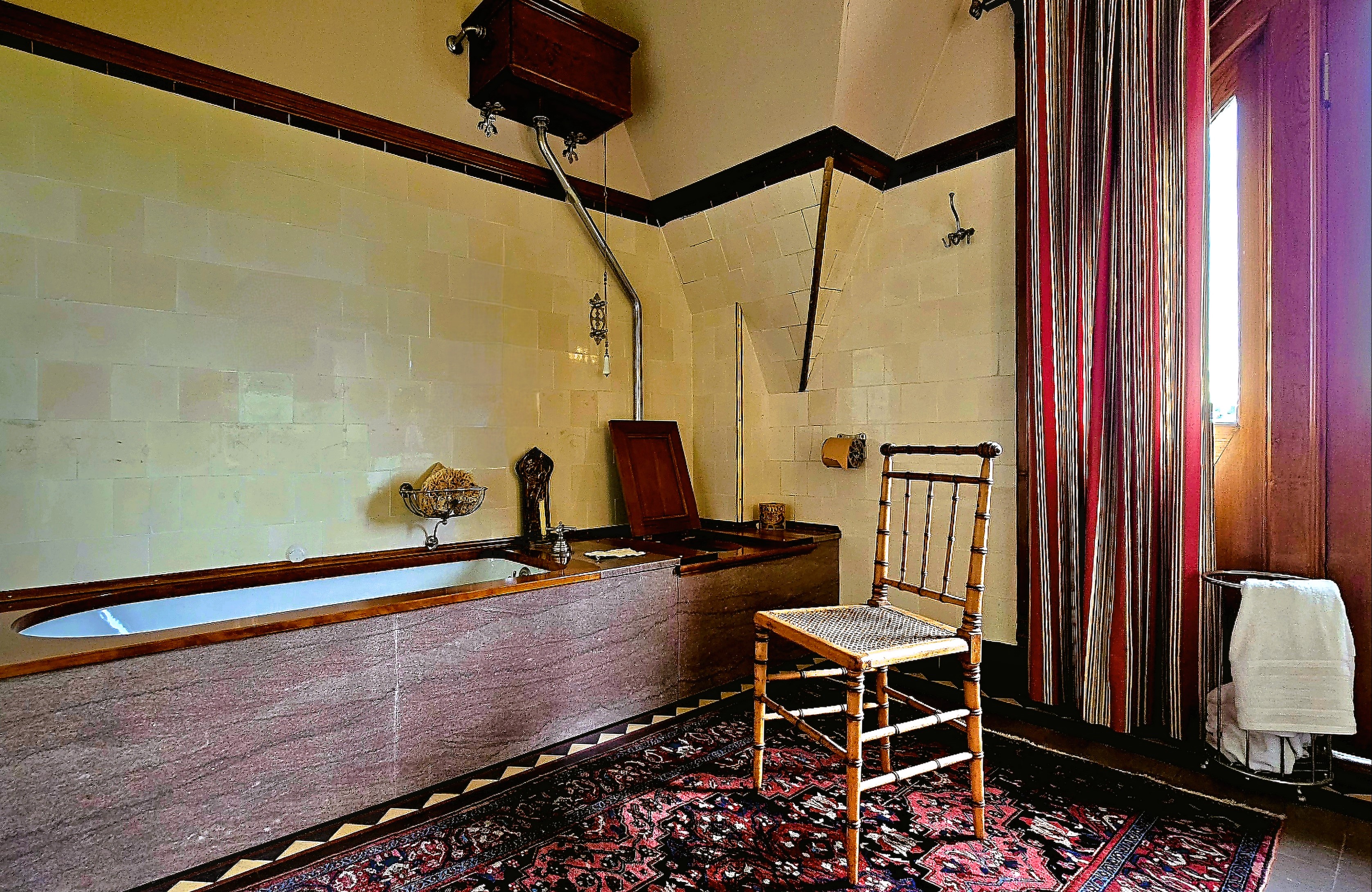
Also within walking distance, we discovered Craigdarroch Castle, a Victorian architectural marvel…
from front…
to back….
top to bottom,
and everywhere in between!
And exquisitely furnished throughout the residence.
Of course, no visit to Victoria is complete without a stroll through Butchart Gardens,
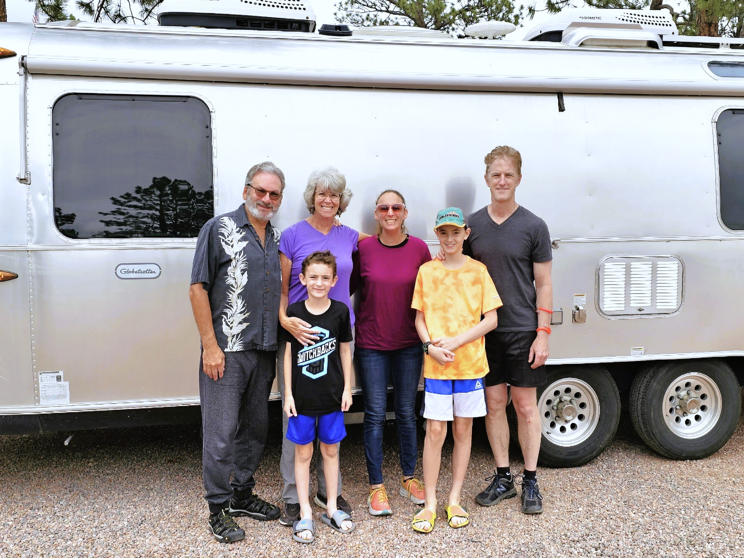
Leah and I arrived in Colorado Springs, where we liaised with Leah’s daughter, Carrie and her clan to enjoy a camping adventure together during the Independence Day holiday weekend, and it was action-packed.
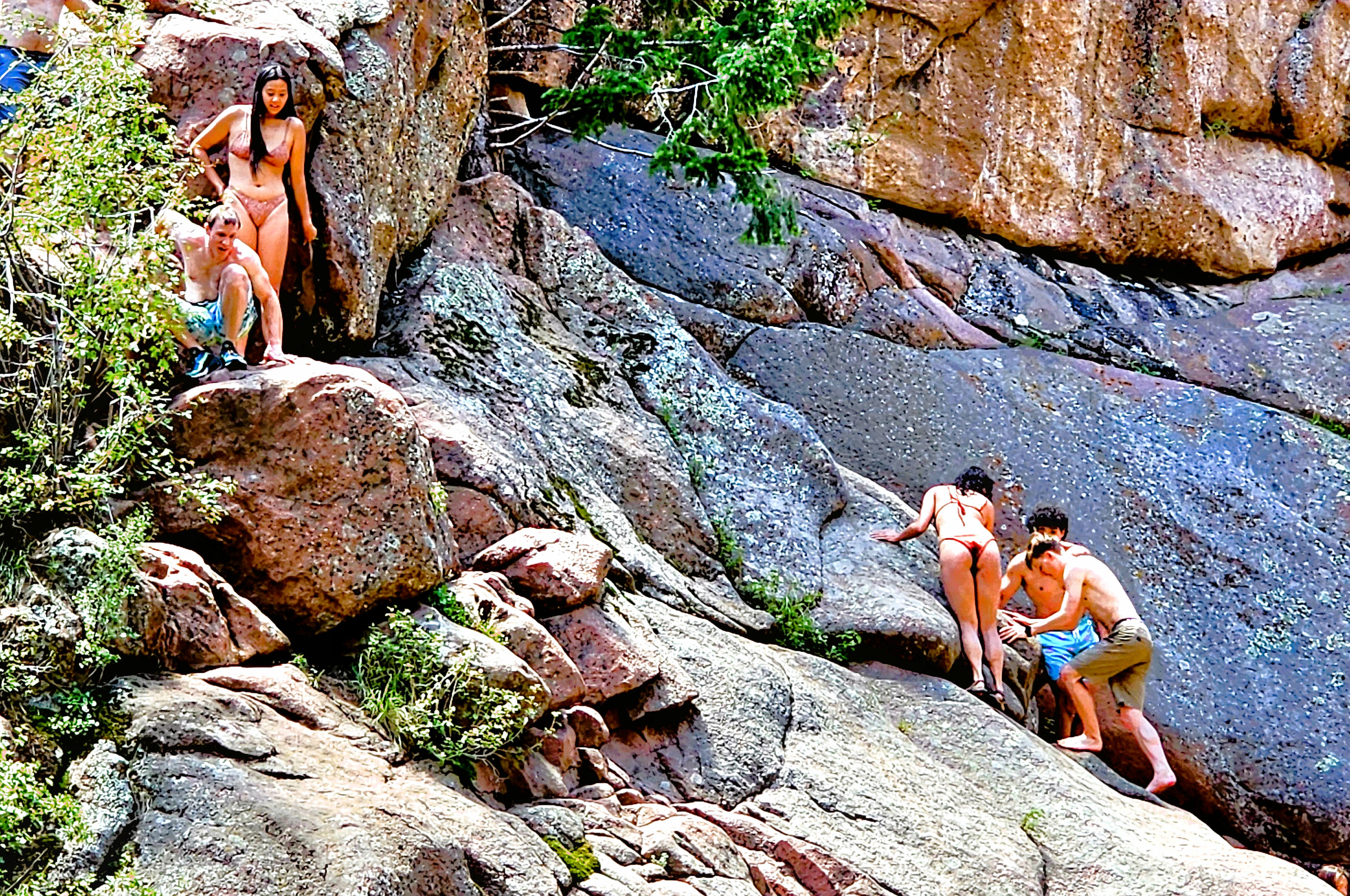
Hiking one mile into Guffey Gorge…
brought us to Paradise Cove, a swimming hole popular among local adolescents who come to cool off from the 100oF heat and flex their courage muscles by cliff jumping into deep water.
Risk-takers were scrambling up the terrain to pick their “launch” position on the rocks, and prove to themselves and others that they had “The Right Stuff.”
We were happy eating our lunch while watching the derring-do entertainment.
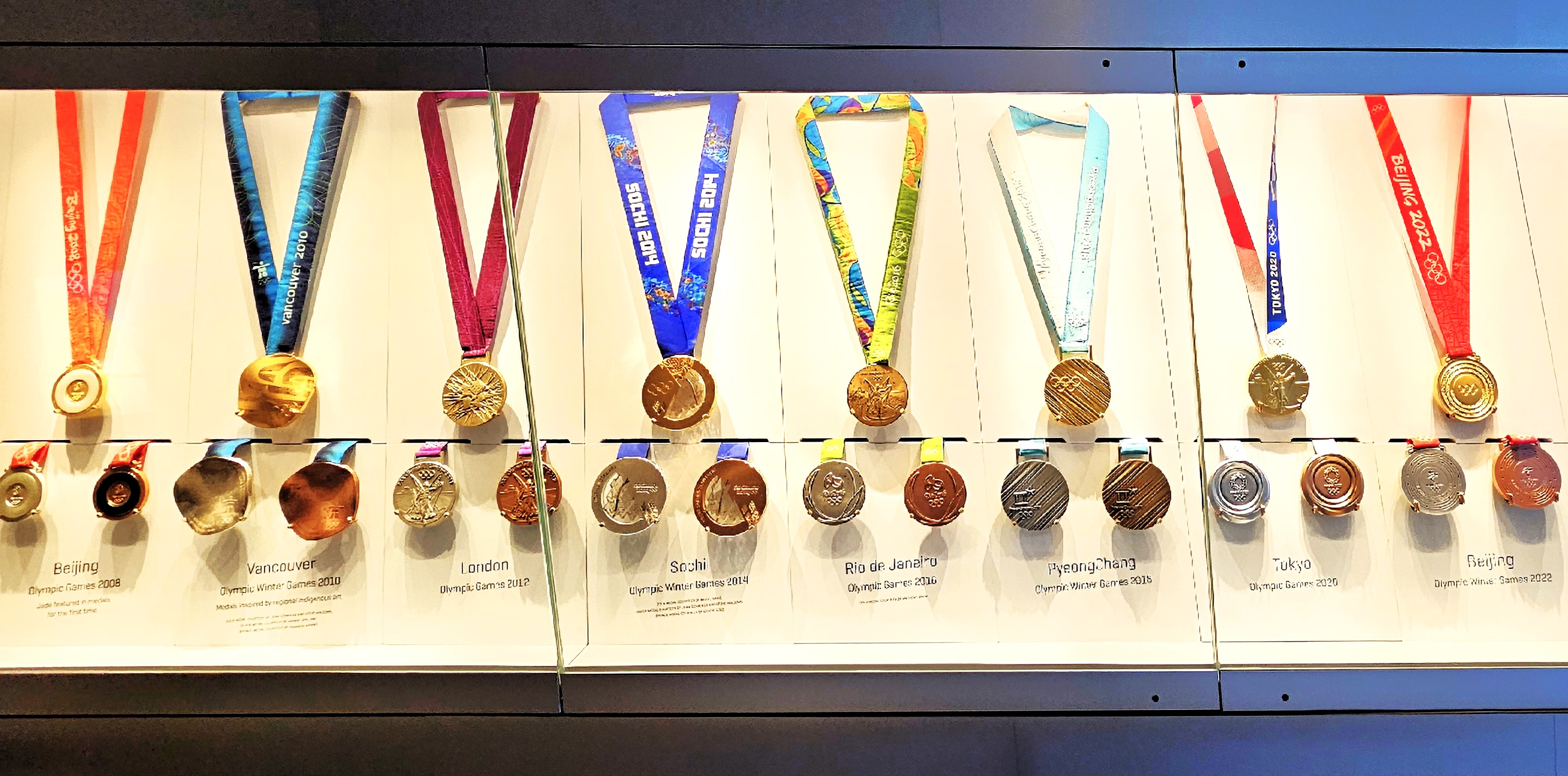
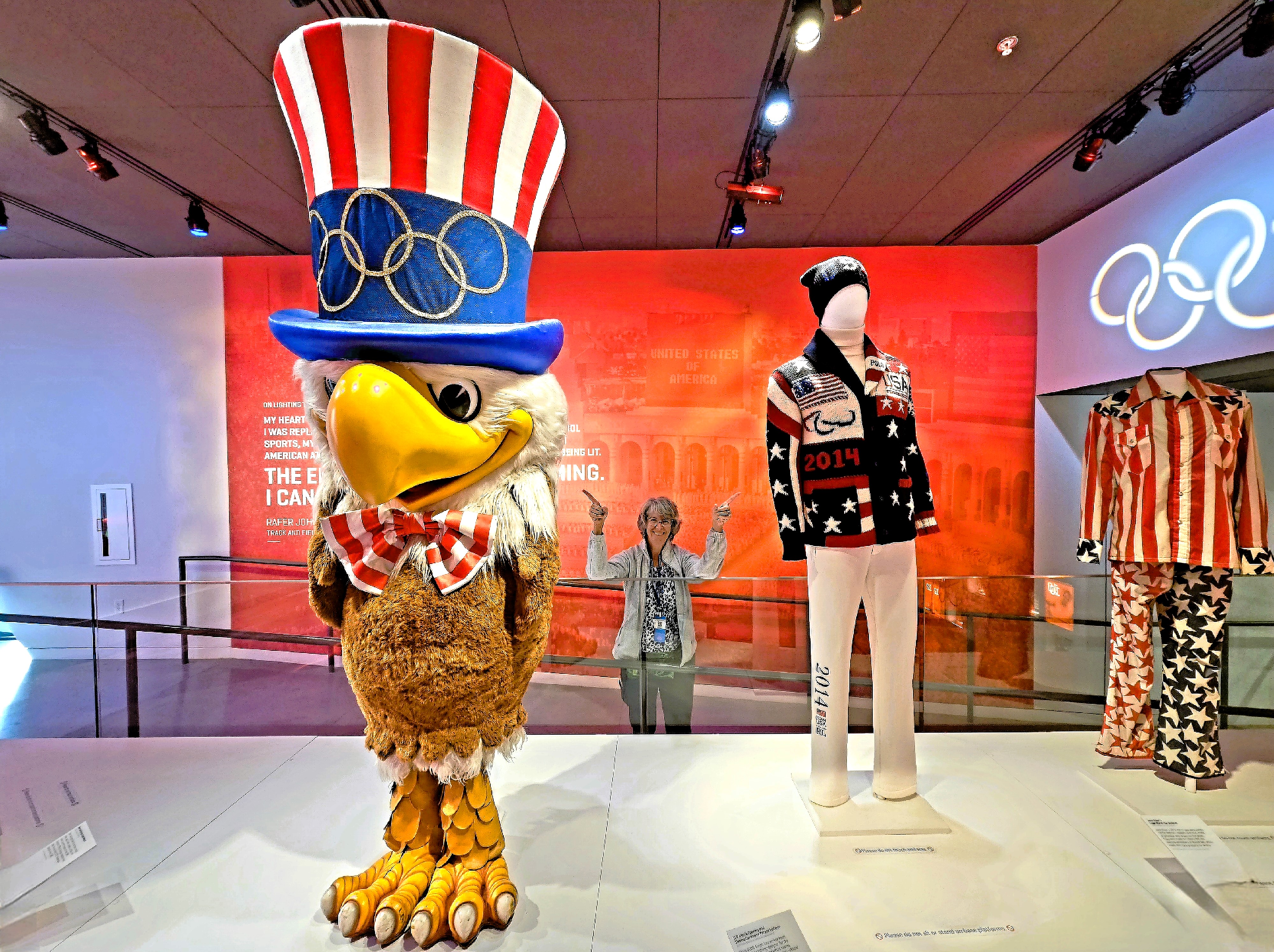
But Colorado Springs has so much more to offer. For starters, the interactive U.S. Olympic and Paralympic Museum offered the perfect opportunity to celebrate athletic excellence;
to mock-compete in several sports categories by testing memory, reflexes and endurance;
and provide exhibition space for thousands of Olympic artifacts collected over the years.
After capturing a clever montage from the digital mural in the building foyer,
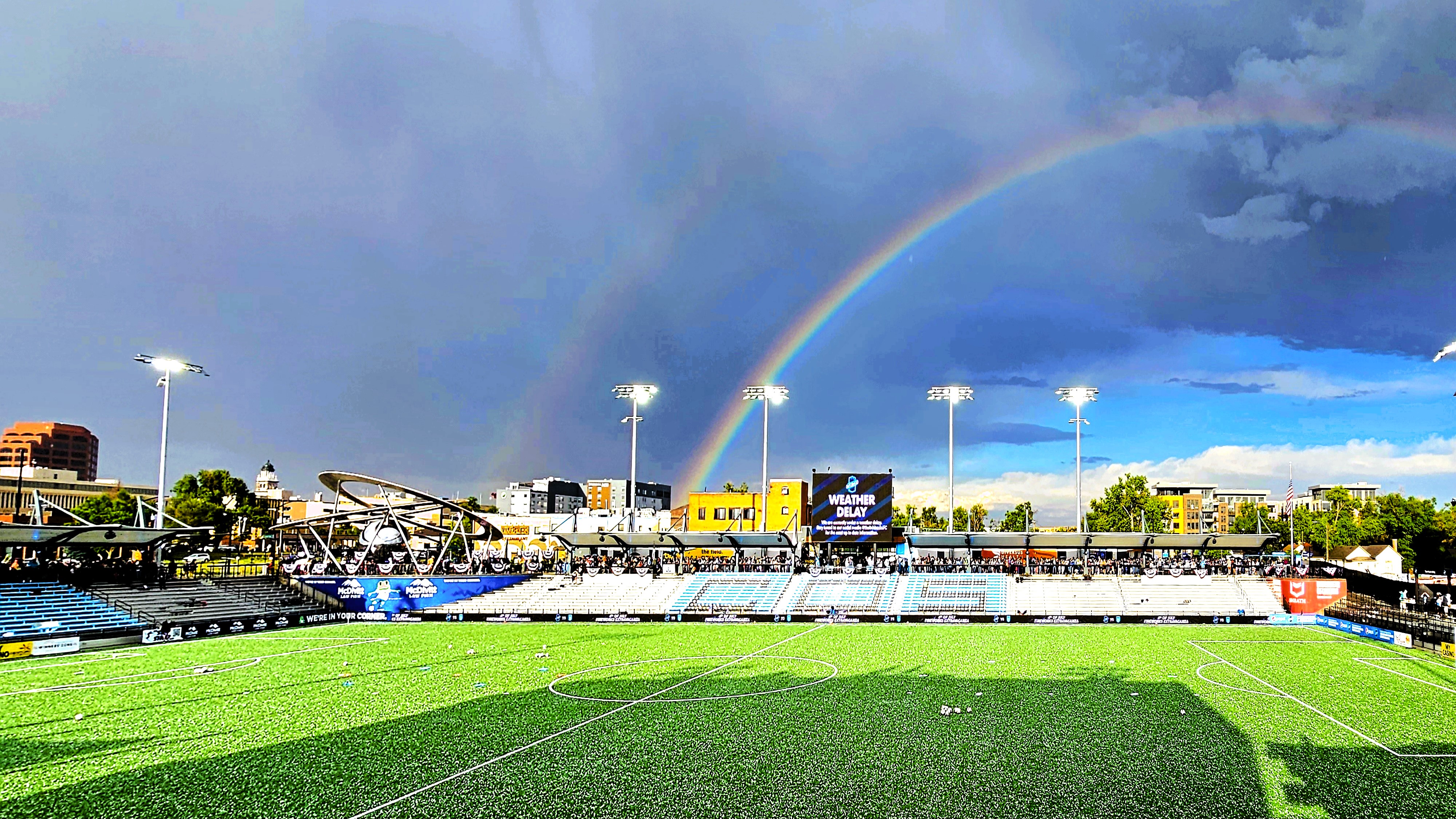
it was time to watch the Colorado Springs Switchbacks take the pitch at Weidner Field against Monterey Bay, but not until after the cloudburst,
when the unexpected hail finally had a chance to melt.
While Carrie and clan cruised to nearby Cañon City to view the Royal Gorge (our destination in 2 weeks,
Leah and I returned to Garden of the Gods,
before continuing to Manitou Springs to visit the urban fauna…
and flora.
Ironically, we’ve recently visited Carrie and clan at home in Cedar Crest, NM after 7 weeks of subsequent travel to dozens of different destinations…
which is a sore reminder of how far behind I am in chronicling this summer adventure, whether it’s because of inconsistent internet on the road or enjoying myself too much to stay current.