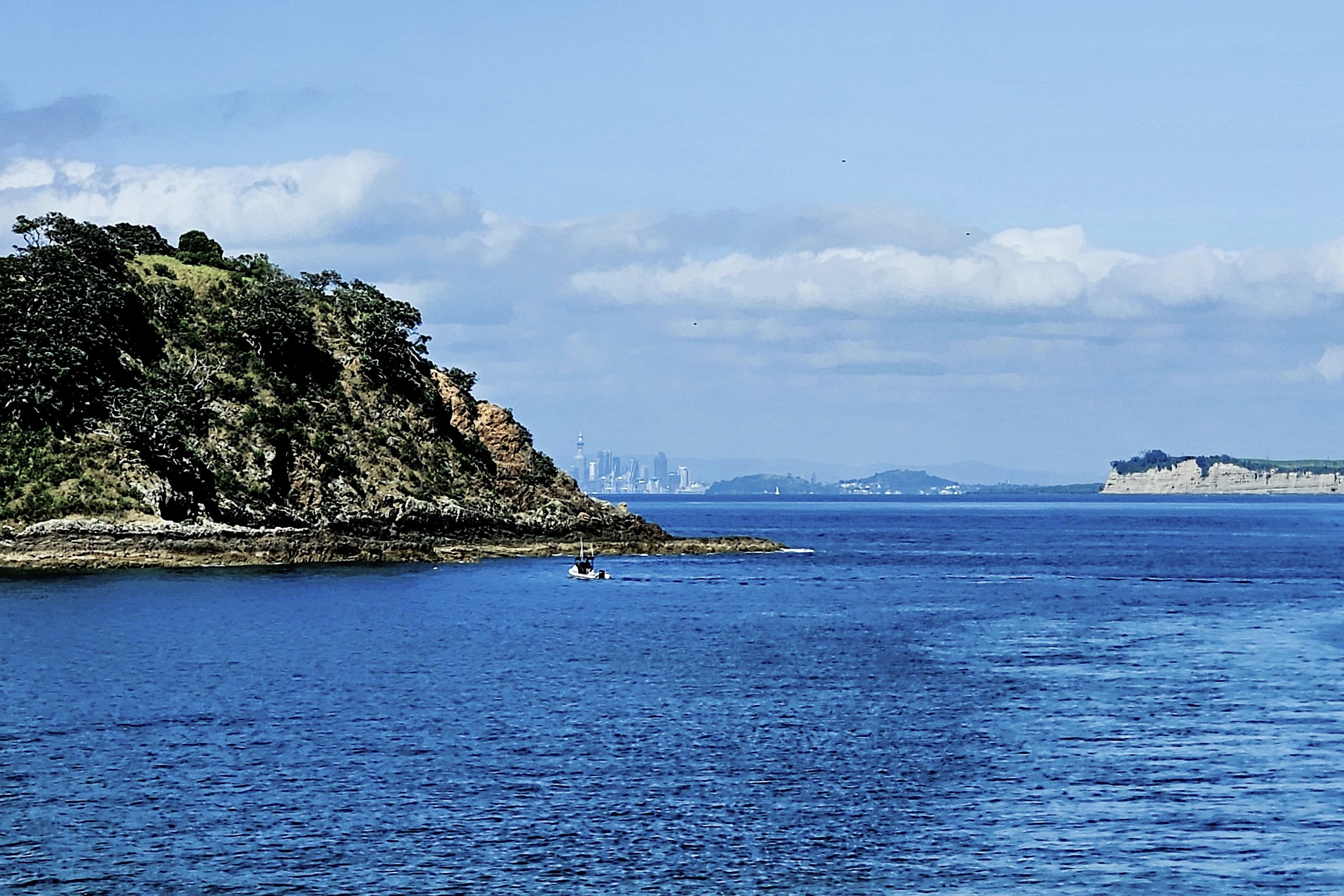
For the curious and familiar with deep pockets who yearn for the Hamptons of New Zealand, a 40-minute ferry ride from Auckland across Hauraki Bay will whisk them to Waiheke Island, where weekend cottages with water views easily appraise at $3 million and more.
Waiheke Island’s wedding rituals are commonplace, as there is no shortage of scenic vineyards, lush gardens, beautiful beaches, sunset cruises, spas and luxurious accommodations to make every wish come true.
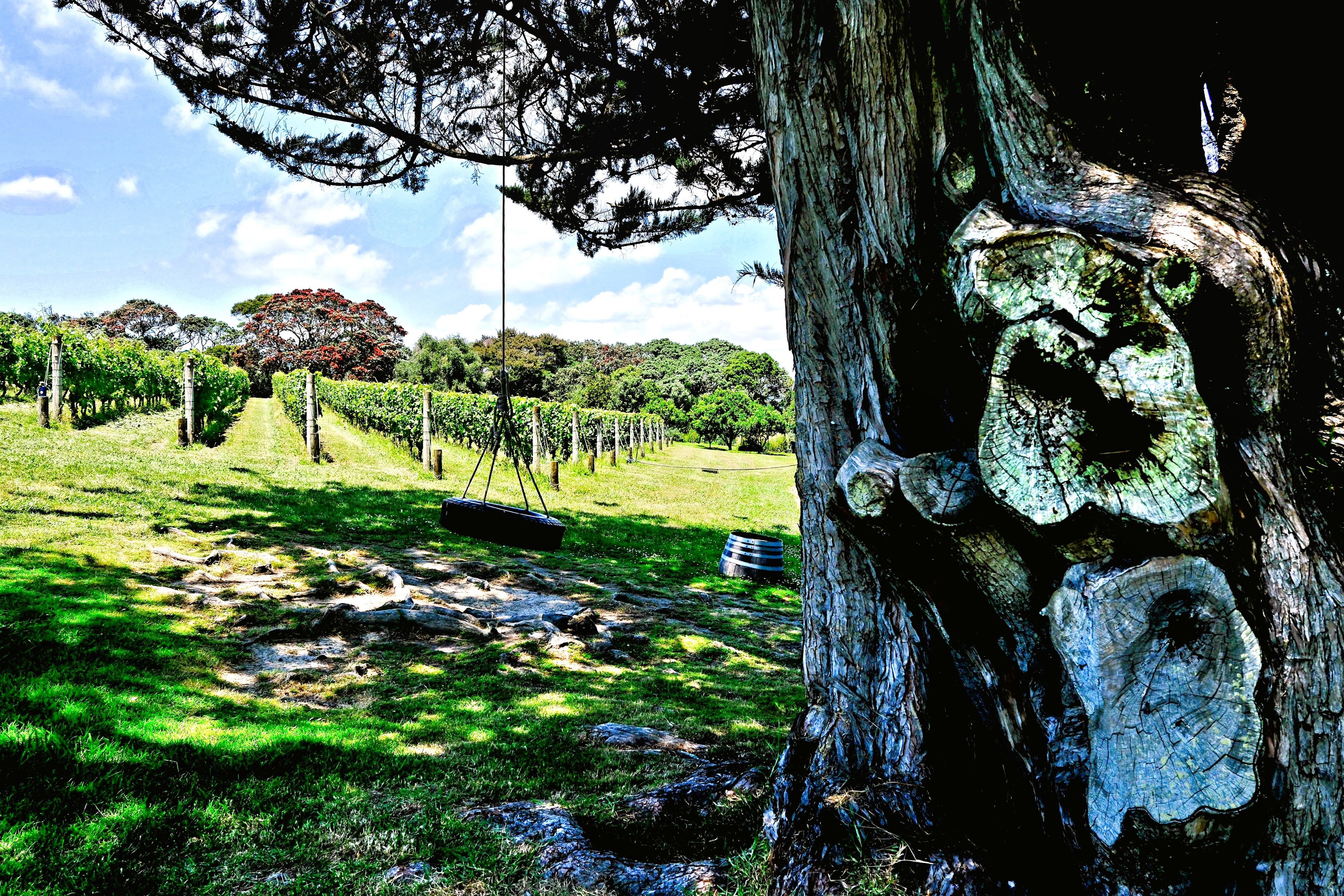
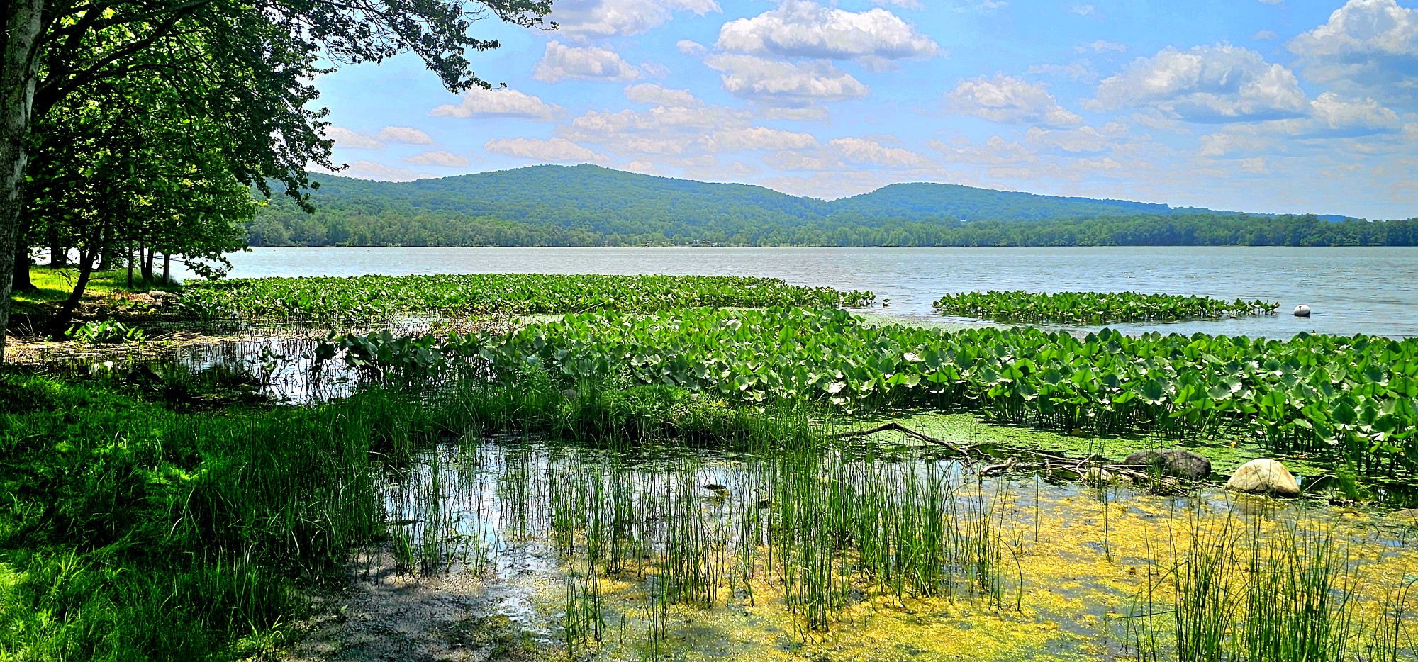
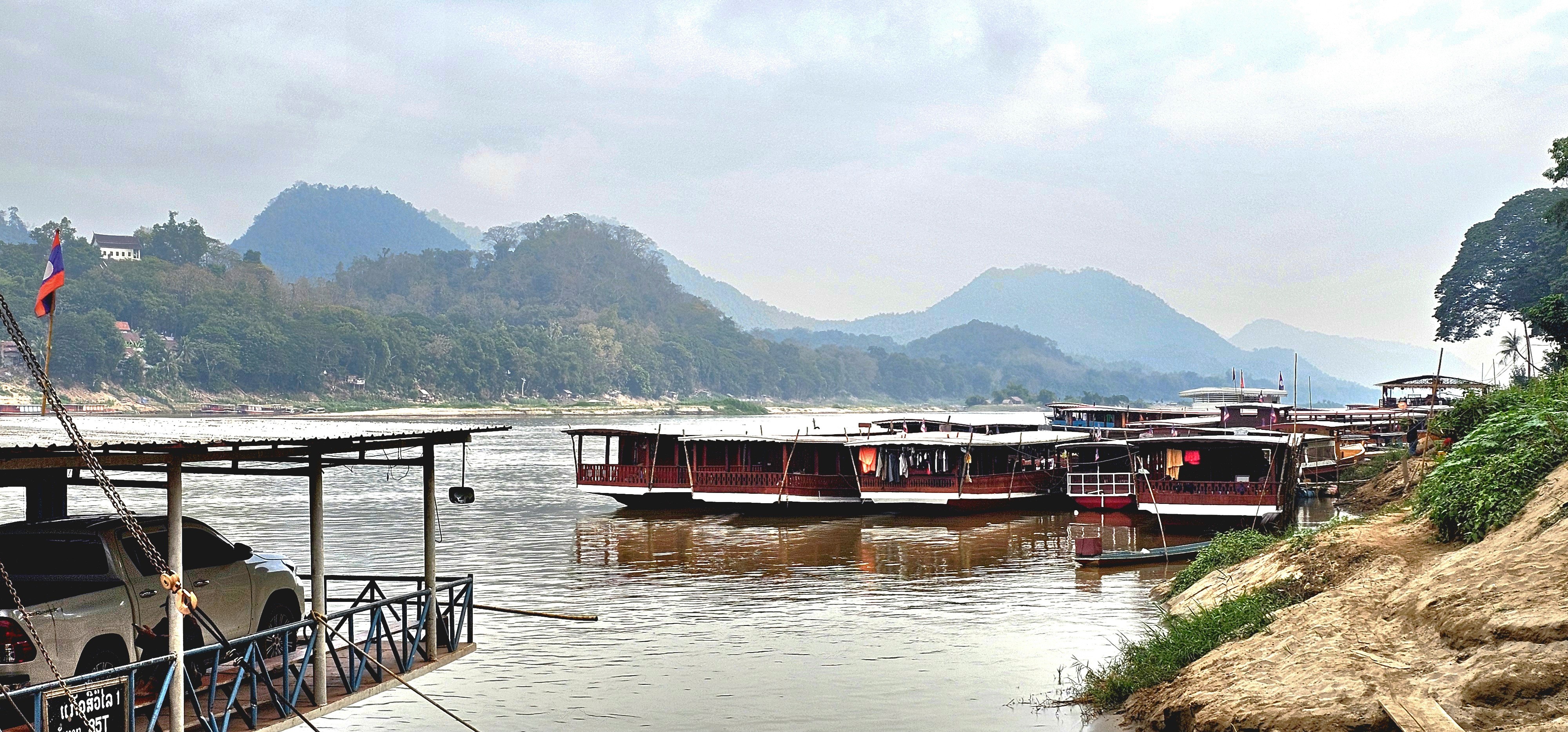
But Leah and I were not there for real estate or romance. We docked at Matiatia Wharf in pursuit of New Zealand’s epicurian trifecta: wine-tasting, olive-pressing and honey-making.
A stroll through Oneroa Village yielded no sightings of A-listers, although the likes of Madonna, Lady Gaga, Beyonce and Taylor Swift with their entourage are sure to turn heads from time to time.
We window-shopped at an appealing array of boutiques, bistros, and galleries, where I found the perfect pair of Ray-bans at the local chemist’s shop in the hopes of improving my detection skills.
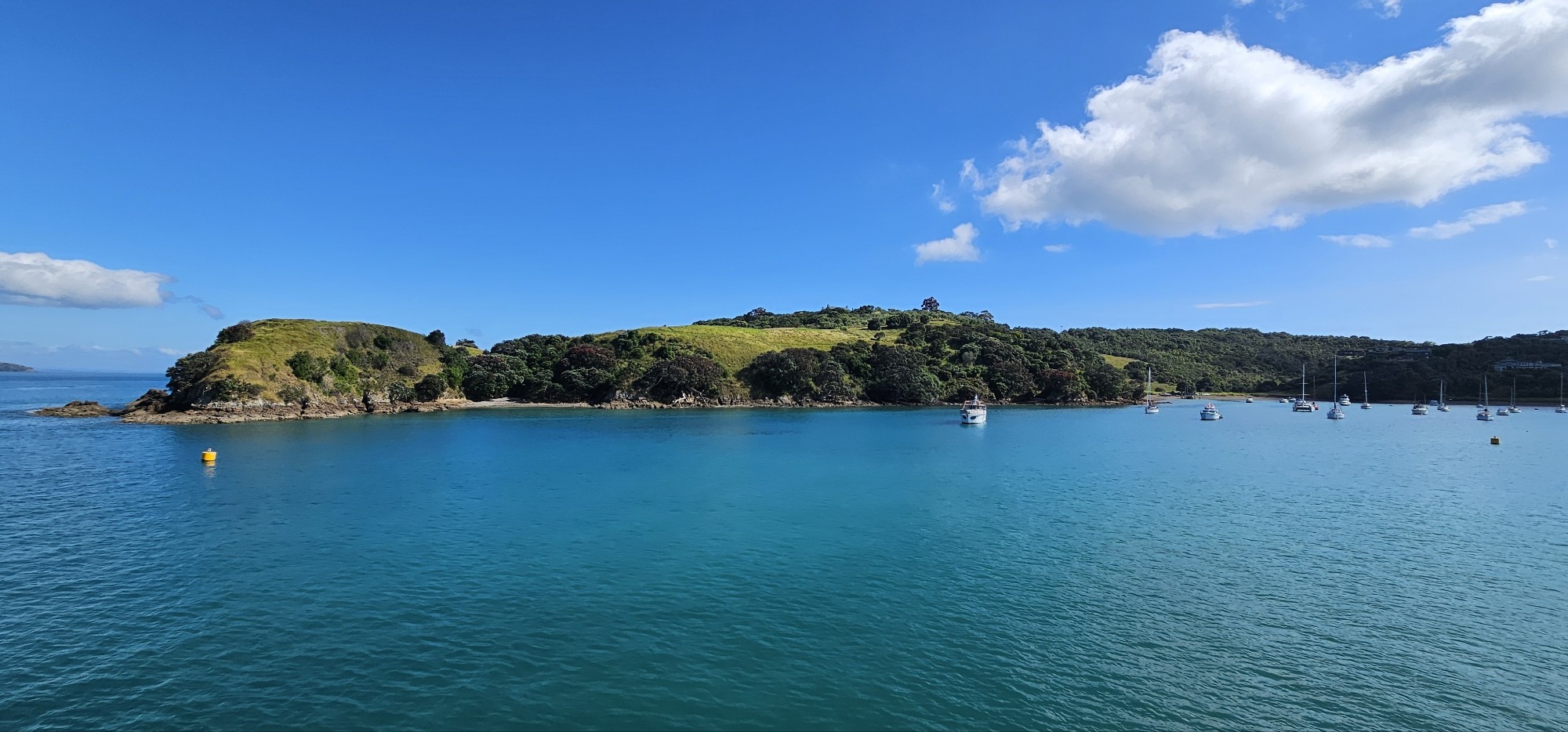
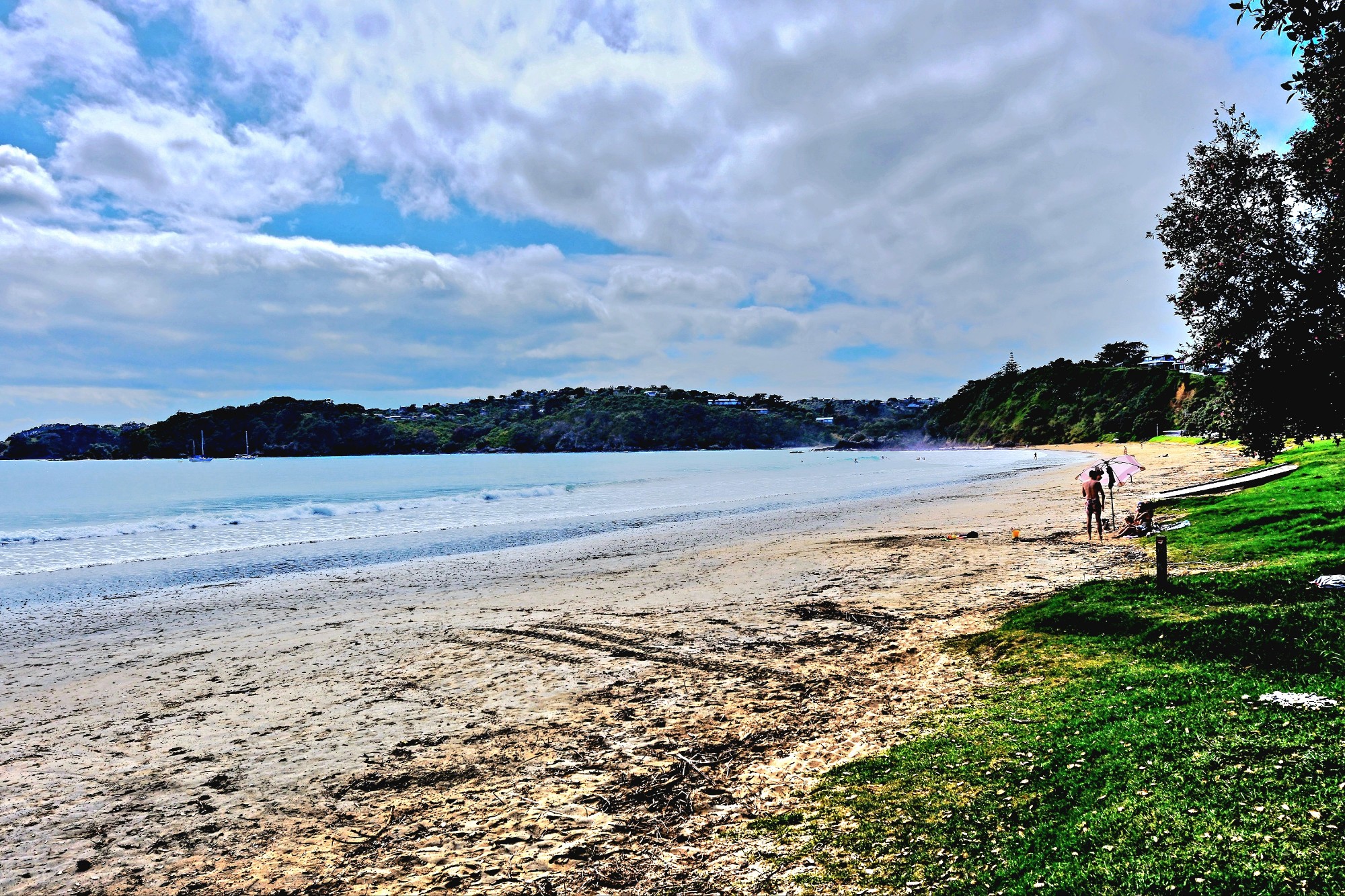
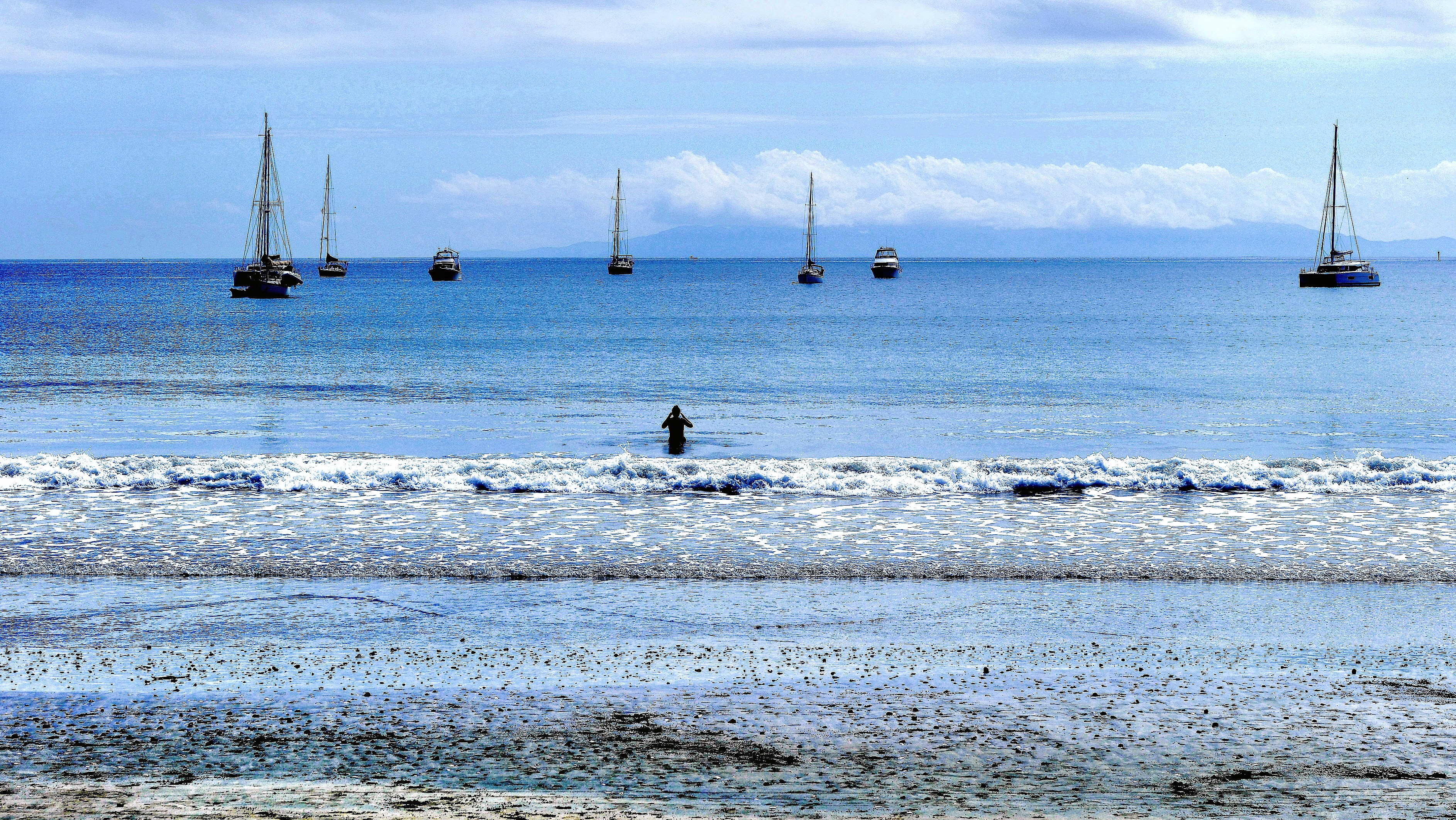
We discovered the town trail that curled through a densely forested dune, leading us to the panoramic cove of Oneroa Bay.
Although the water looked calm and inviting,
we were pressed for time, as it was time for olive pressing.
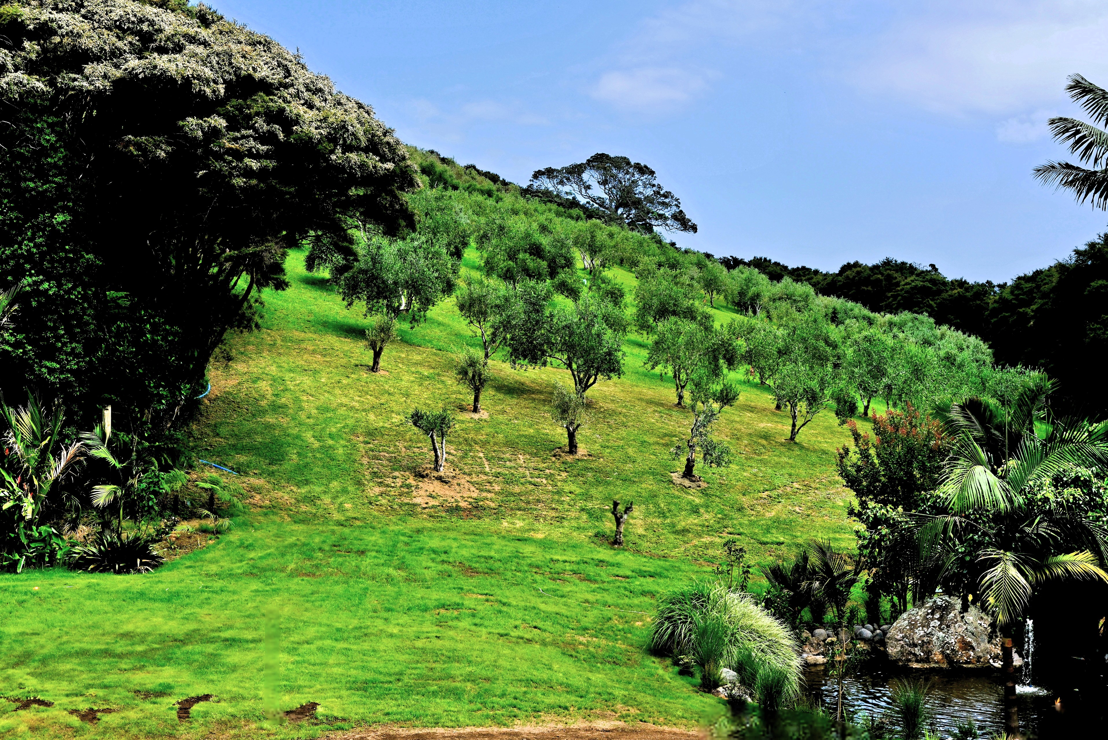
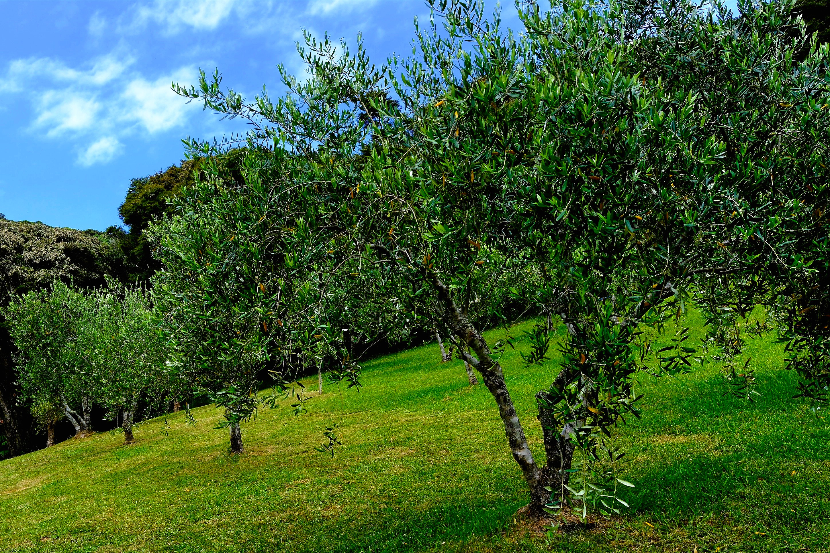
Our stop at Allpress Olive Oil Groves offered tastings of extra virgin olive oil varietals (frantoio, verdale, ascolano, picual and koroneiki) and blends, with herbaceous, grassy and peppery flavor notes. Superb!
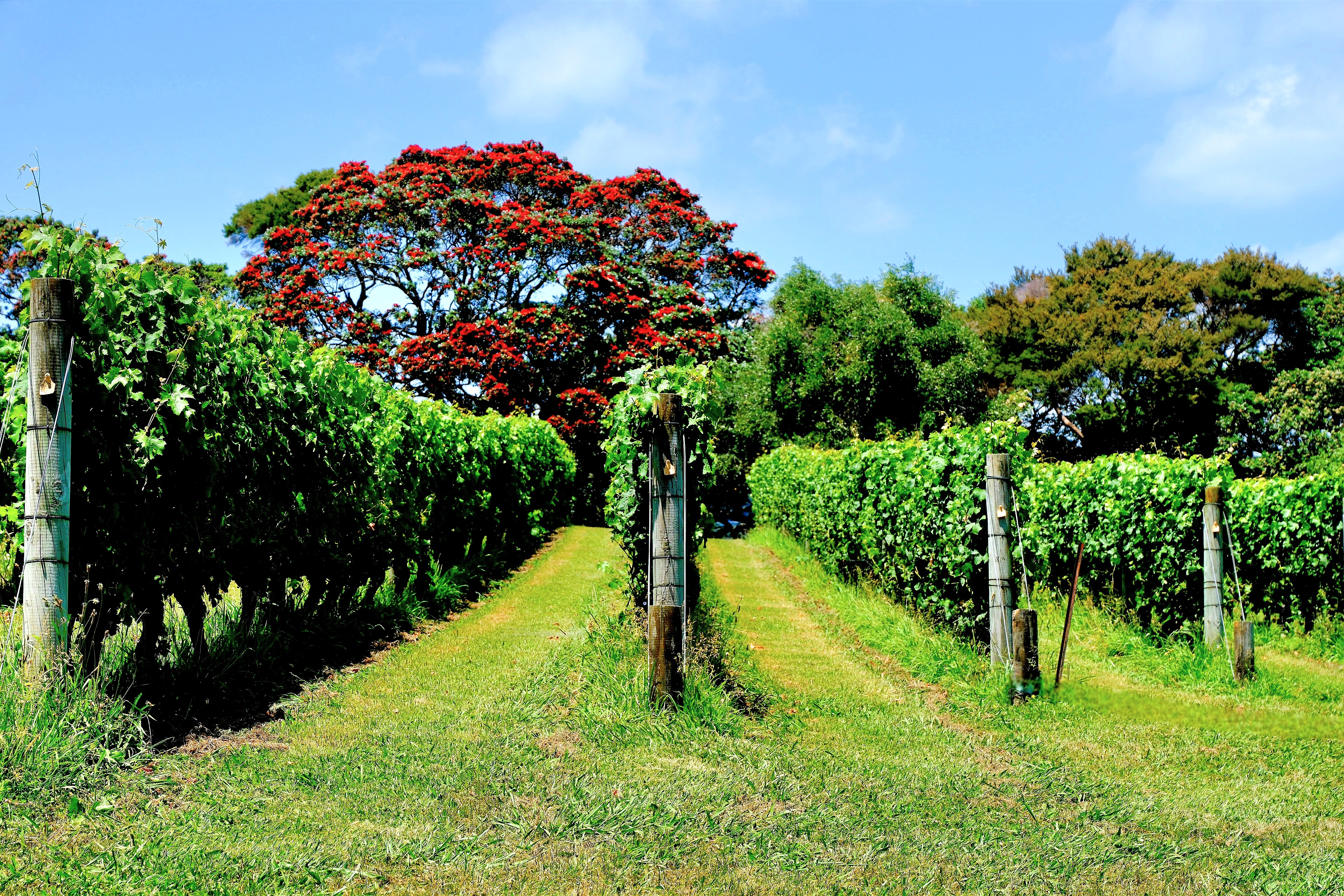
From the terrain, and weather–a mild maritime climate with sunny days and salty breeze–Waiheke’s rolling hills could easily pass for Italy, Spain, or Greece, with its volcanic soil and microclimate making it ideal for growing olives.
Waiheke’s first olive trees were planted in 1997 by Michael Allpress, who pivoted from coffee roasting to pressing olives for oil–quickly achieving world-class recognition with award-winning results.
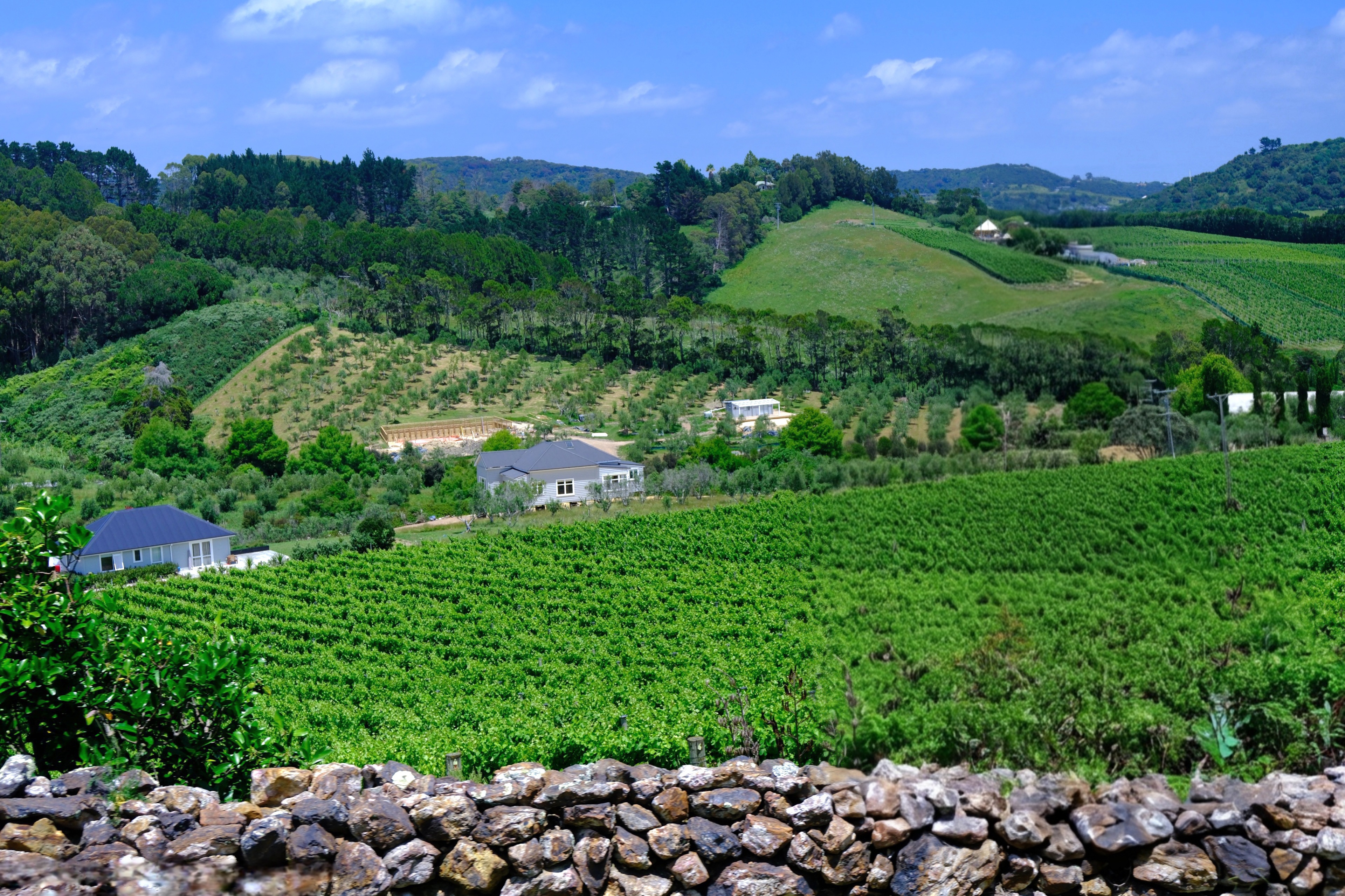
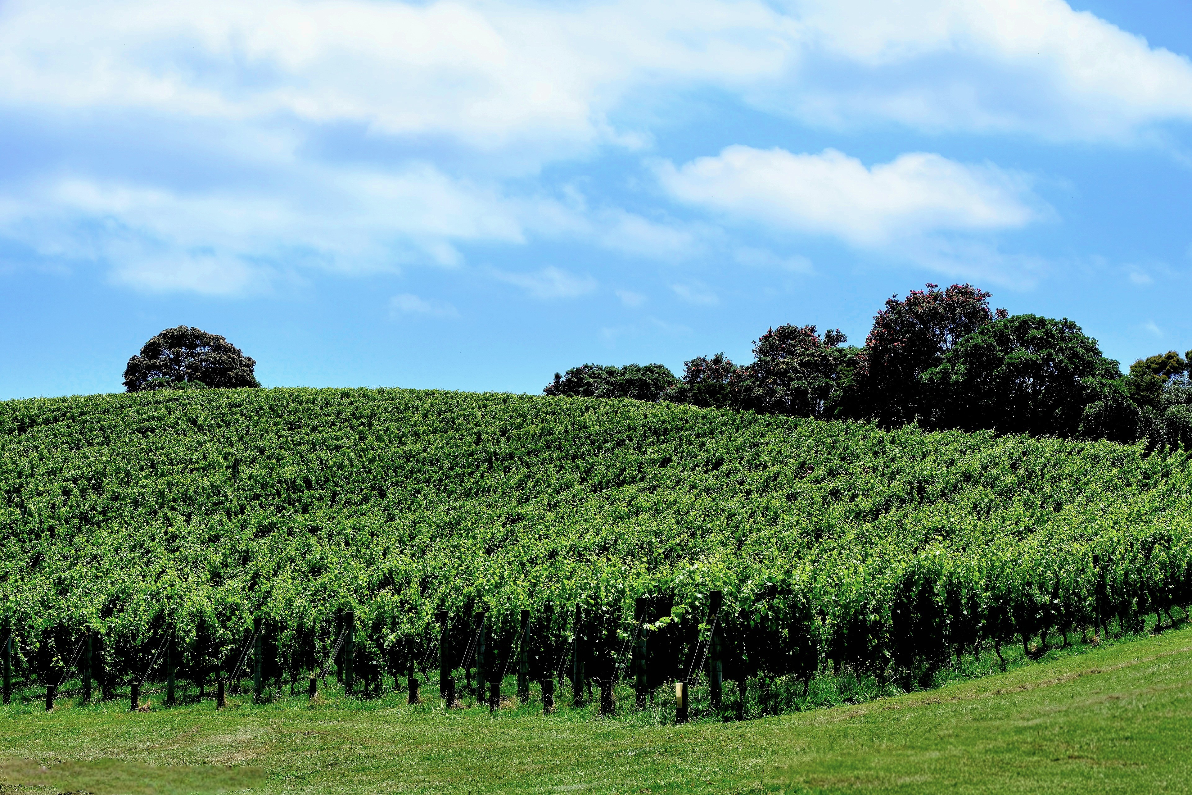
Next, we ventured to Goldie Estate, overlooking Putiki Bay for a tasting at Waiheke’s first commercial winery dedicated to premium reds.
The Goldwaters pioneered winegrowing on Waiheke in 1978, and became successful producers of Cabernet Sauvignon, Merlot, Cabernet Franc, Syrah, Chardonnay and Viognier varieties.
Goldie Estate is also home to University of Auckland’s Wine Science Centre, where students live, study, and work towards a graduate degree in oenology.
Shortly after, we crossed to the eastern side of the island where a buffet lunch was waiting for us at Passage Rock–the most awarded winery in Waiheke–
with reserve-level wines taking international gold medals, including a critically acclaimed 2021 Reserve Syrah that improved with every sip.
Waiheke Island is also home to Mānuka honey, an elixir so rich in levels of antibacterial methylglyoxal (MGO) that it benefits the body inside and out. Therapeutic properties support a balanced immune system, regular gut health, and topical applications for wounds and burns.
The unprocessed flavor is earthy and bittersweet with caramel notes.
But it doesn’t come cheap. A 250g jar of highest-potency (2150+ MGO) creamy, silky honey from Manuka South can cost over $1500!
How can ANY honey justify this exorbitant cost?
While this is the most extreme example, consider that Mānuka flowering season lasts a few weeks per year, with trees often blooming in remote locations. Beekeepers have only five days to transport their hives around the tree’s open blossoms to capture the nectar.
Ultimately, bees will tap thousands of blossoms, with each pollinator producing 1/12th of a teaspoon of honey in its lifetime. That’s equivalent to 11,500 bee visits per 250g jar, and a testament to their work ethic.
It was a tasty day on Waiheke. While we left the island with fuller bellies than expected…
Three months of rigorous physical therapy during a summer of exhausting humidity, sweltering heat, and heavy downpours was a poor substitute for the summer adventure that Leah and I originally plotted together at the kitchen counter one year ago.
We imagined Airstreaming up to Quebec to play in Saguenay Fjord National Park and be entertained by French Canadians for a month or so.
Of course, nothing went as planned. My shoulder surgery and subsequent physical therapy replaced our summer trip to the North Country.
But putting in the hard work also guaranteed us a summer redo Down Under, with a chance to celebrate Hanukkah in New Zealand and Christmas Day in Melbourne.
It was also a good excuse for a new camera… system, unlike last year’s trip to Southeast Asia, where I relied exclusively on my Samsung Galaxy S23 Ultra for images and video.
But for a trip to my 7th recorded continent, I yearned to compose through a viewfinder again. Ultimately, I thought a mirrorless compact camera’s flexibility and versatility could empower me to take bigger chances and create better photographs.
So, I bought a Fujifilm X-E5.
It may have been a bit impulsive, buying before trying, but Fuji’s model was brand new, very popular and not widely available. Camera exchanges were quickly selling out limited inventory across the globe, despite the high price, plus the tariff surcharge. (Yes, the tariff/tax is passed on to consumers!) I was betting on the buzz and positive reviews, and went all-in.
Outfitted with Fuji XF 16-50mm f/2.8-4.8 and Fuji XF 70-300mm f/4-5.6., I now had a wide and long zoom for a variety of coverage.
It was also a light-weight travel kit designed to reduce the camera strap impression across my newly, reassembled rotator cuff.
It would be a glorious second-chance summer.
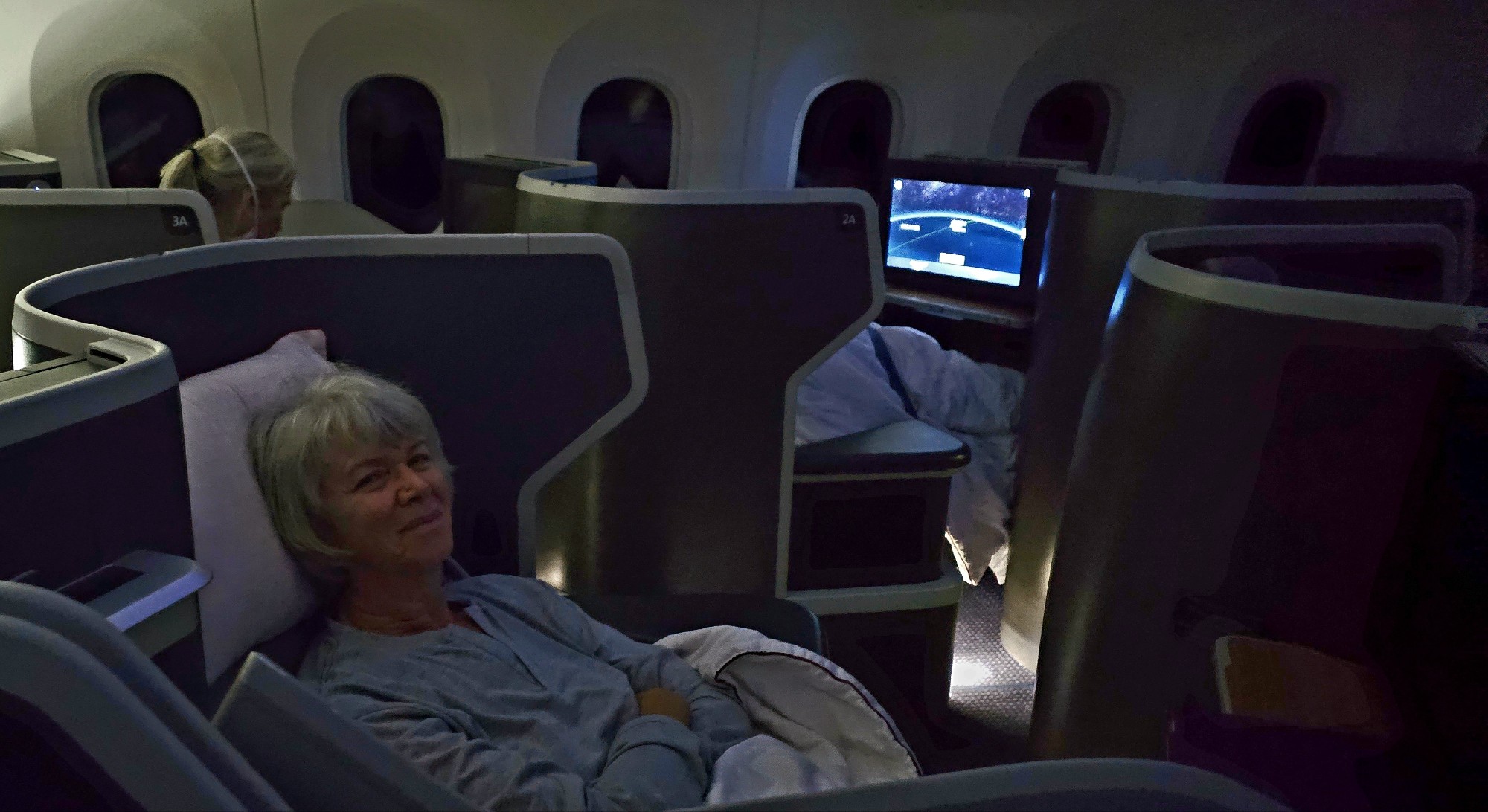
Leah and I figured on an extra day in Aukland to cover our cancellation-du-jour asses from airline exposure, and to bolster our recovery from a lost day and a 20-hour trip…
Although our business class cocoons…
offered legitimate restorative properties.
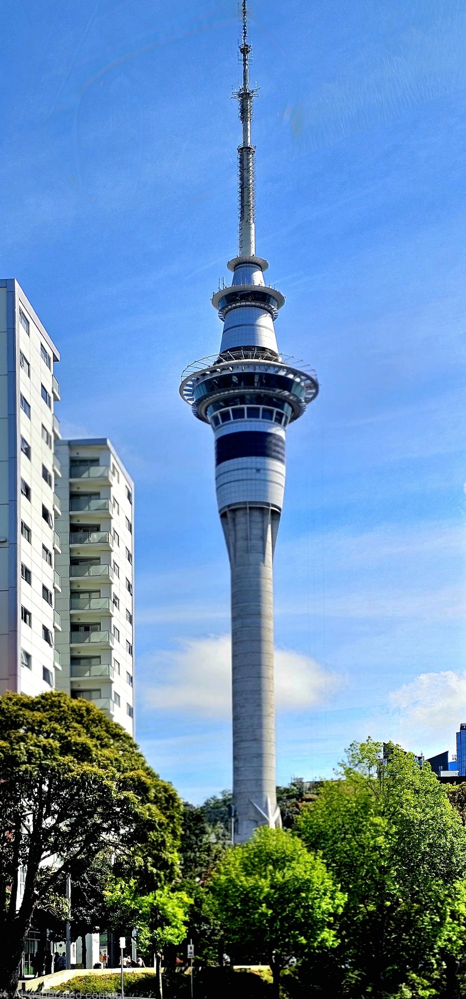
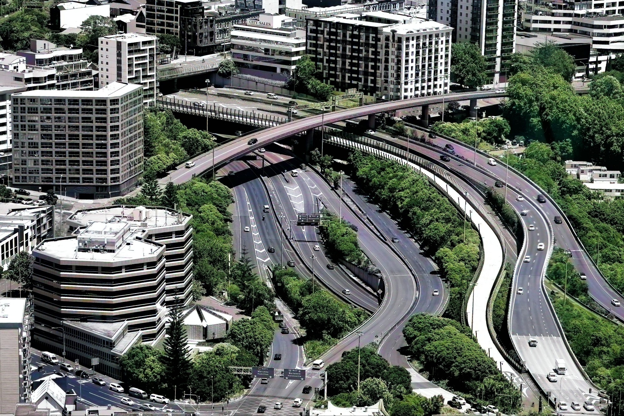
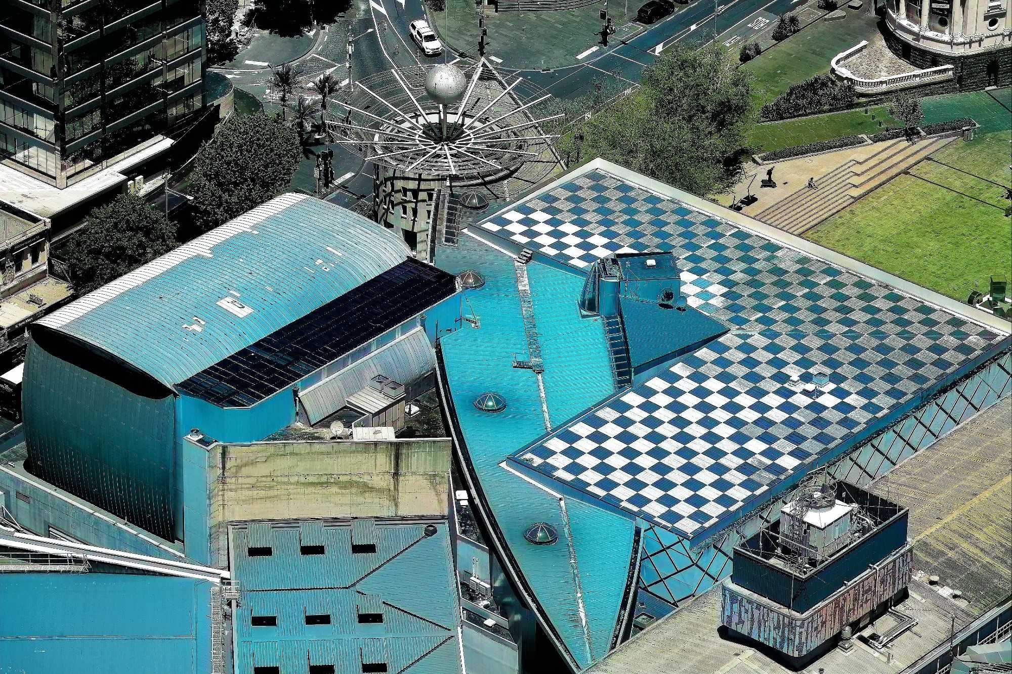
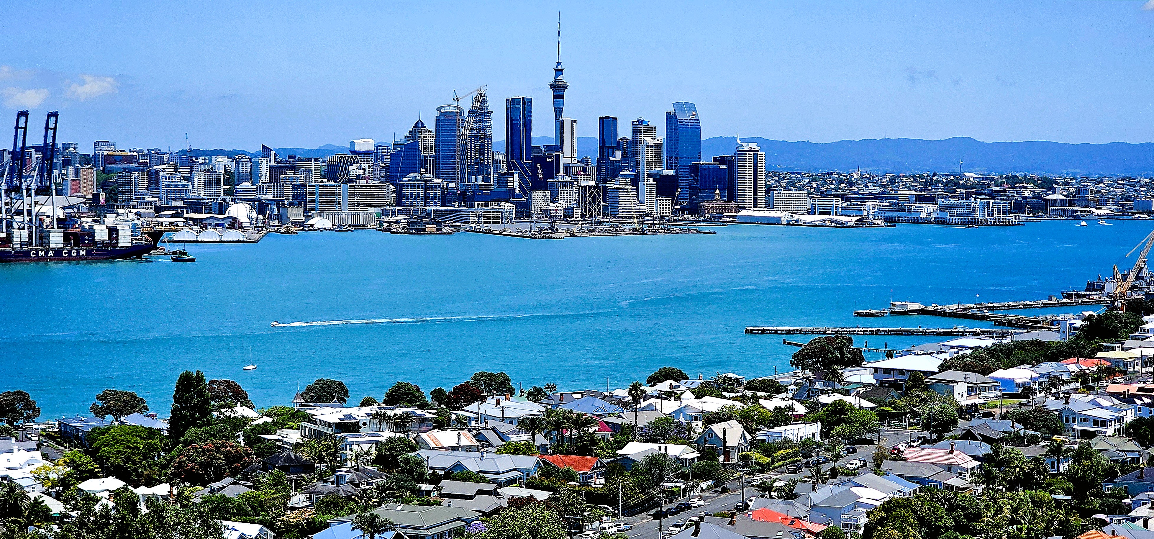
Checking into the Grand by SkyCity put us smack dab in the center of Auckland’s bustling entertainment and casino complex, where the Sky Tower’s the limit.
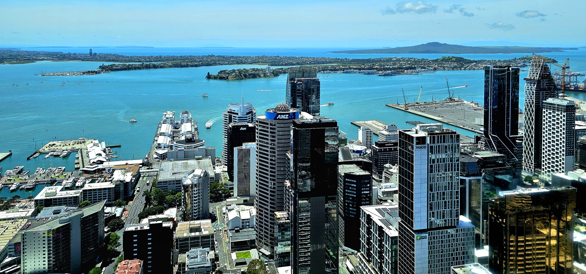
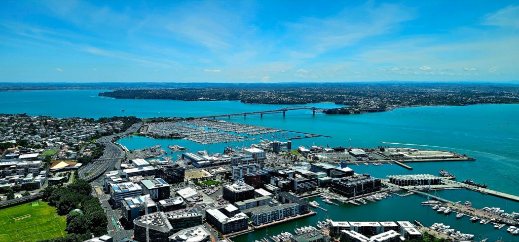
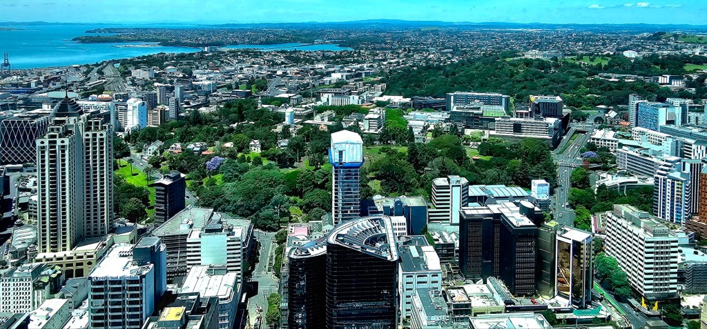
Our 220-meter ascent to the 60th floor observation deck gave us distant perspective…
and telephoto detail with my new Fuji kit…
With time to burn, we set our sights on the quaint town of Devonport, one of 53 dormant volcanic centers surrounding Auckland.
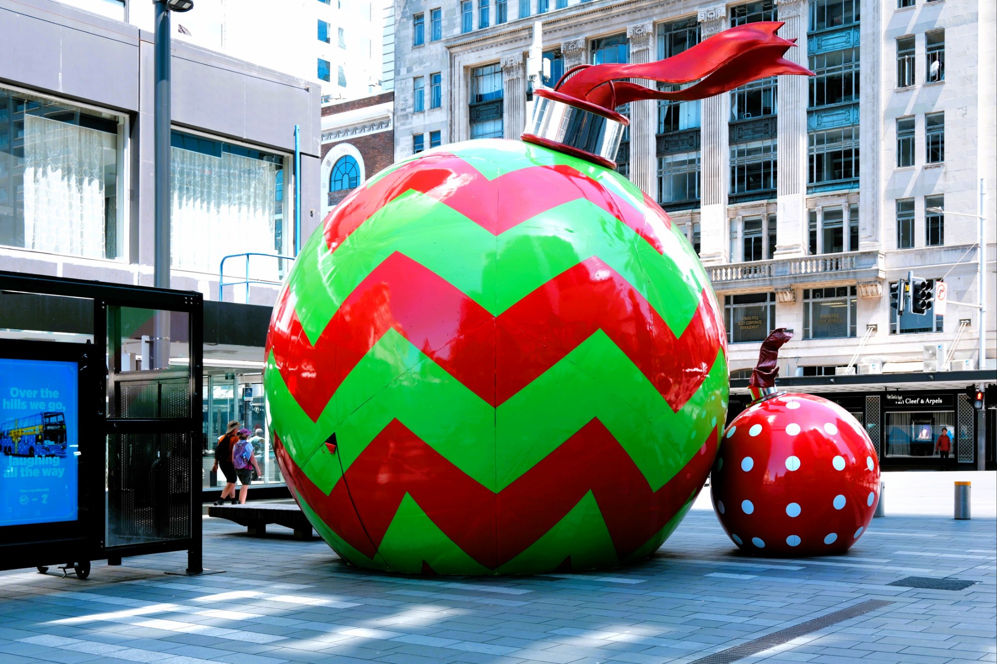
Christmas was on full display in the city plazas…
as we strolled to Queens Wharf to catch our ferry across Stanley Bay.
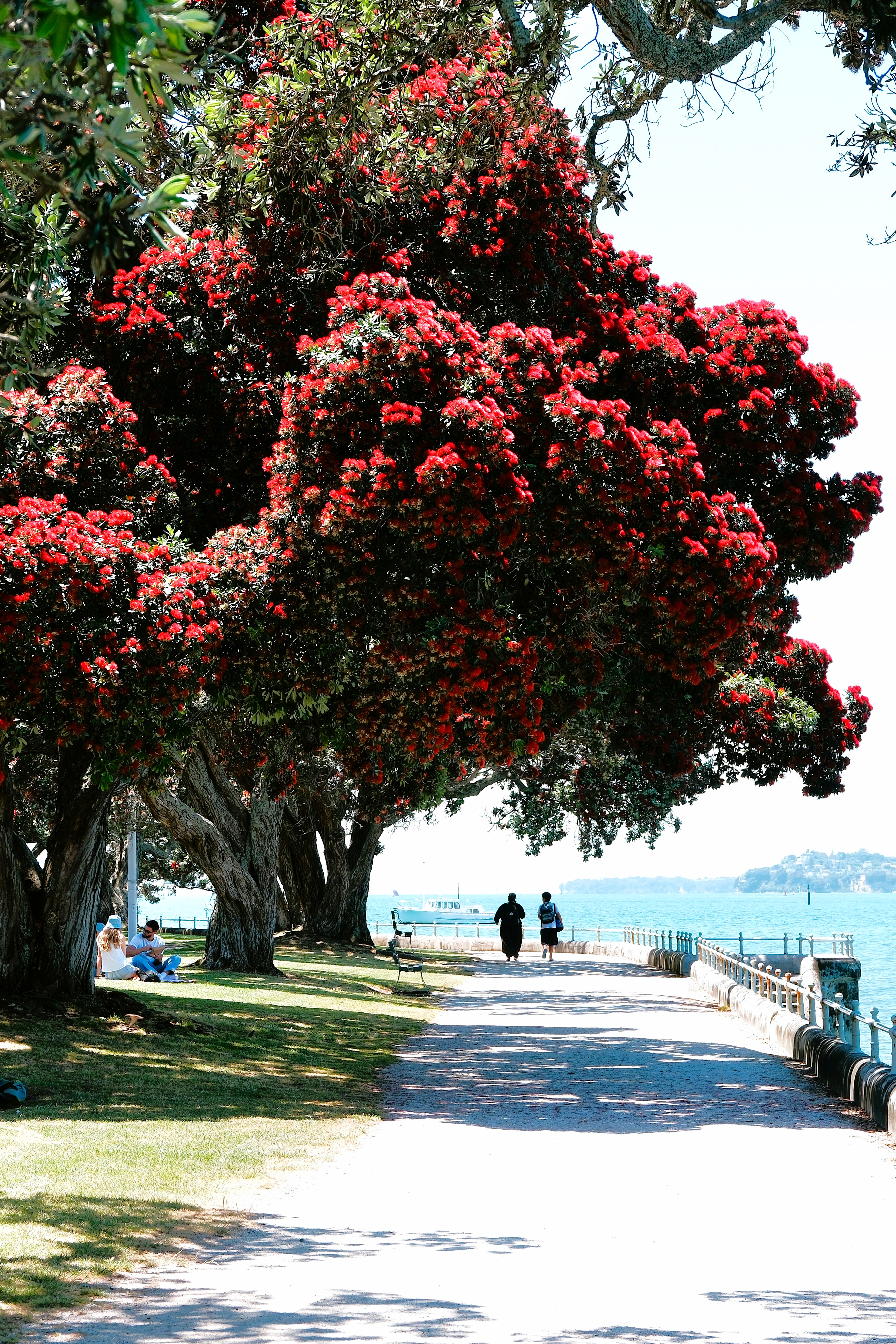
However, the crimson blossoms from the Pōhutukawa trees (aka New Zealand Christmas tree) along Devonport’s park path easily enhanced the holiday vibe.
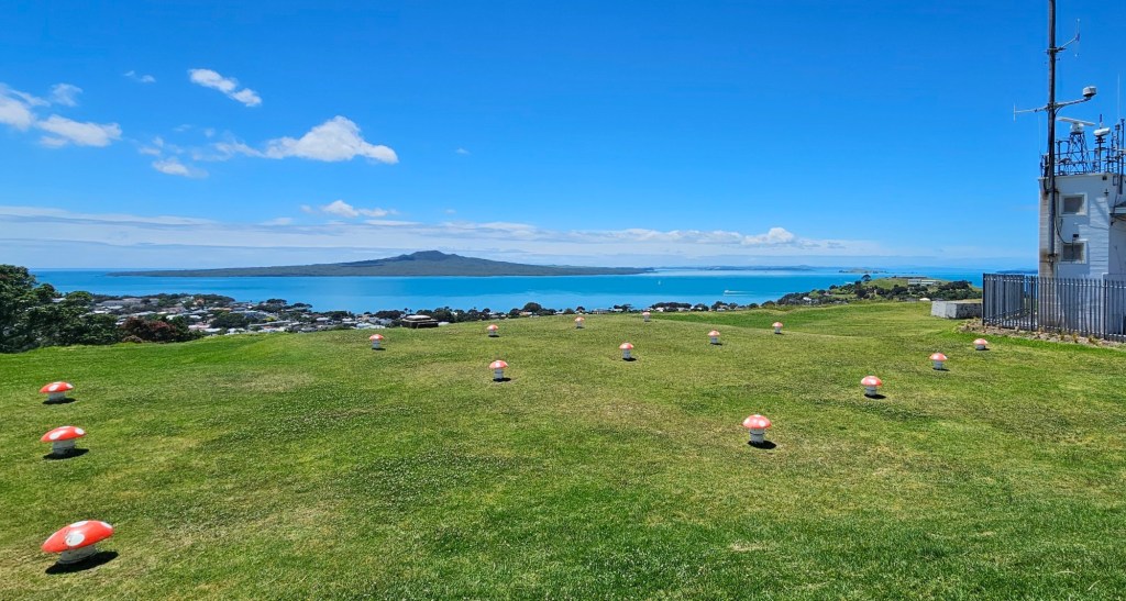
We hiked to Mount Victoria (Takarunga), Devonport’s highest point atop a WWII bunker–currently the local folk music center–that breathes through its field of mushroom ventilation caps,
where our climb was rewarded with an exquisite view of the city.
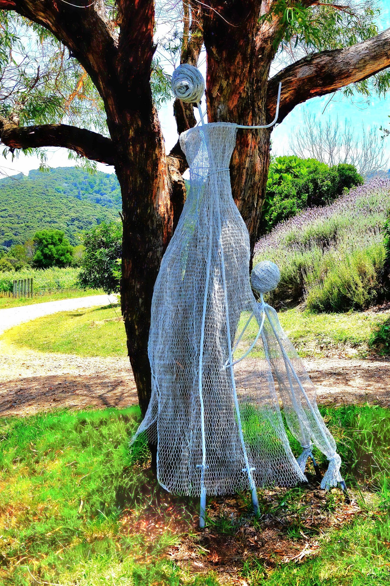
Tomorrow, our Viking cruise extension starts in earnest, with a trip to Waiheke Island.
Ordinarily, I’d be blogging about my summer road trip to Quebec’s National Parks, with occasional lookbacks to our winter adventures in Vietnam. But circumstances have changed, and future long-distance travel has been placed on hold until October.
Instead, I’ll be introducing a new cycle of posts reflecting my road to recovery after emergency rotator cuff surgery on my right shoulder. And, I’m using a photo of a famous location in Door County taken 6 summers ago, which may seem like a metaphorical cliche, but it still rings true in consideration of my latest debacle.
Let me explain.
About 35 years ago, I joined a neighborhood softball league as a catcher. During a particularly fateful game near the end of our schedule, a batter hit a routine flyball to shallow left field with a runner on third and one out. The outfielder made the routine catch, setting up the showdown at home plate.
The runner on third sprinted home with “Pete Rose” intentions. The throw came in hard and accurate. I covered the plate in anticipation of the play–waiting for the ball while preparing for impact–and ready for the tag.
But the runner arrived just before the ball. He came in fast and hard, battering the right side of my body.
Safe!
But not for me!
My shoulder ached for the next few months and eventually healed itself without medical intervention… or so, I thought.
What I didn’t know was that the torn labrum and the eventual arthritis in my right shoulder would become my personal weather barometer for the next three decades.
But I lived with it. I found that my old injury rarely interfered with daily life or staying active. Cycling, hiking, and paddling had little effect… until I took up pickleball.
Yes, Leah and I got caught up in the sensation–3 times a week. Because we both played tennis in a past life, we quickly improved our self-assessed ranking from 2.5 to 3.0 during our first year of play.
Over time, increased ability and better competition provided a better workout, but also contributed to greater wear and tear on my right arm. It began aching and now required a visit to an orthopod.
After an x-ray, the doc’s preliminary diagnosis of bursitis warranted a steroid injection which provided relief for only a couple of days. That’s when I knew it was time for an MRI and a follow-up with the orthopod.
But not before another Monday of morning matches… which was my ultimate undoing. While playing a doubles match, I reached for an overhead slam. Upon contact, I immediately felt and heard a pop in my shoulder accompanied by a stabbing pain. I shook it off and resumed play for the next hour.
Big mistake!
The following day, I was incapacitated and in constant pain, requiring another trip to the orthopod and a second MRI.
My radiology report revealed a much more serious injury than earlier: a torn rotator cuff, bone spurs, and extreme inflammation surrounding the joint and capsule. Only arthroscopic surgery could save me now!
But not before a brief visit to northern New Jersey to witness Lucy, Leah’s granddaughter,
accept her diploma from Pascack Valley High School.
In addition to celebrating with family,
there was also a hike around Rockland Lake,
and a visit to the Intrepid Museum…
in NYC.
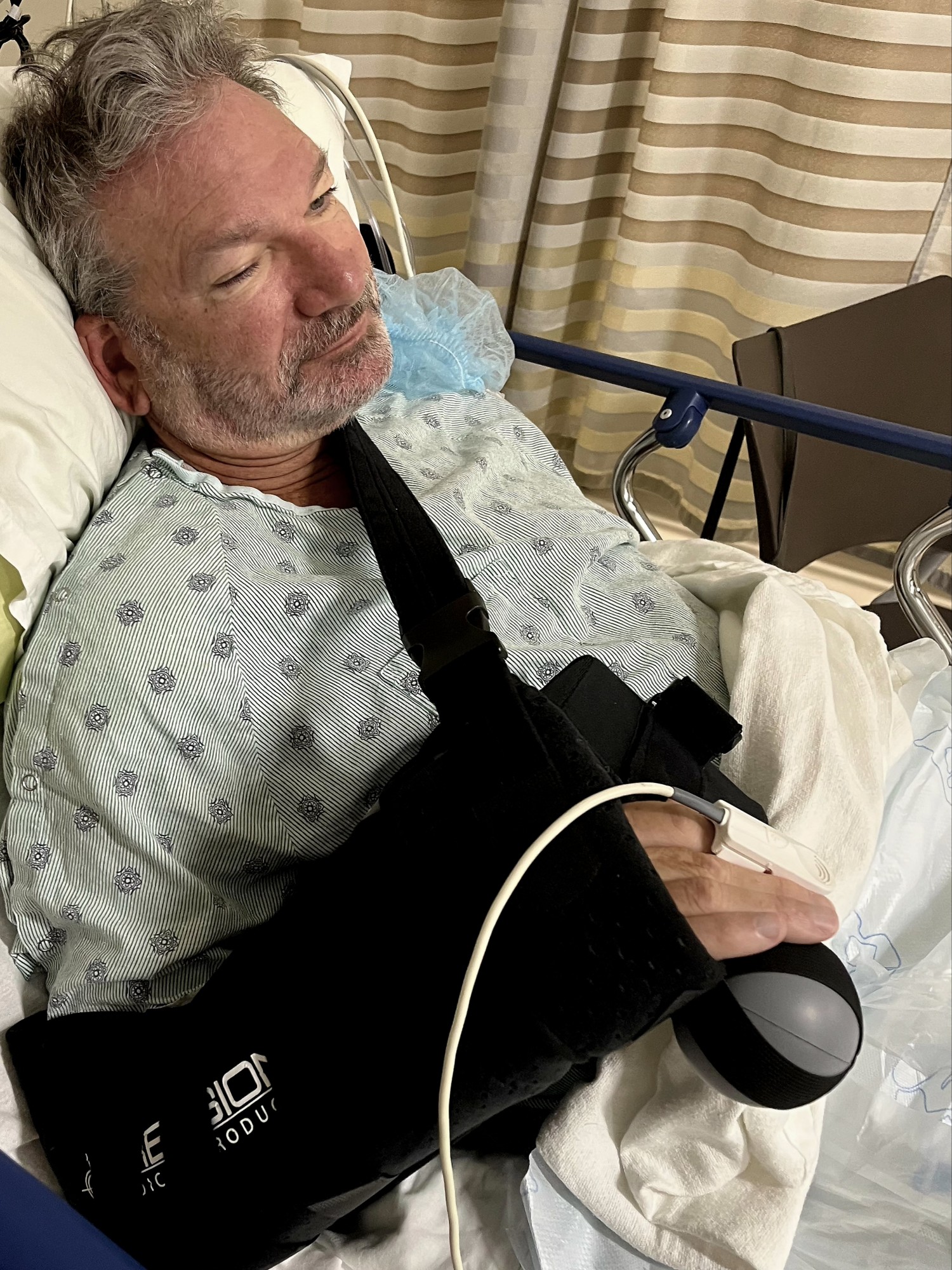
After a disastrous flight home on United (a 5-hr delay AND lost luggage), surgery was performed early next morning.
According to the surgical center, the procedure was unremarkable. My doctor repaired the rotator cuff and addressed the biceps tendinosis; he shaved the outer end of my collarbone and vacuumed the bone spurs from the AC joint; and finally, he eased the impingement by performing a subacromial decompression with acromioplasty.
After an hour in recovery, I was released to Leah, wearing a shoulder immobilizer that would soon become my arch nemesis.
Interestingly, Leah insists that despite my stupor, I was largely responsible for composing this photo.
The first couple of days were a blur–existing in and out of a drugged sleep–thanks to an oxy-cocktail and a nerve block that slowly wore off after 36 hours.
However, Hour-37 became a painful reminder that my road to recovery would be a litmus test for controlling my anxiety, because at this moment, my life feels like I’m trying to get comfortable in an economy airline seat for a 6-week flight to Normaltown.
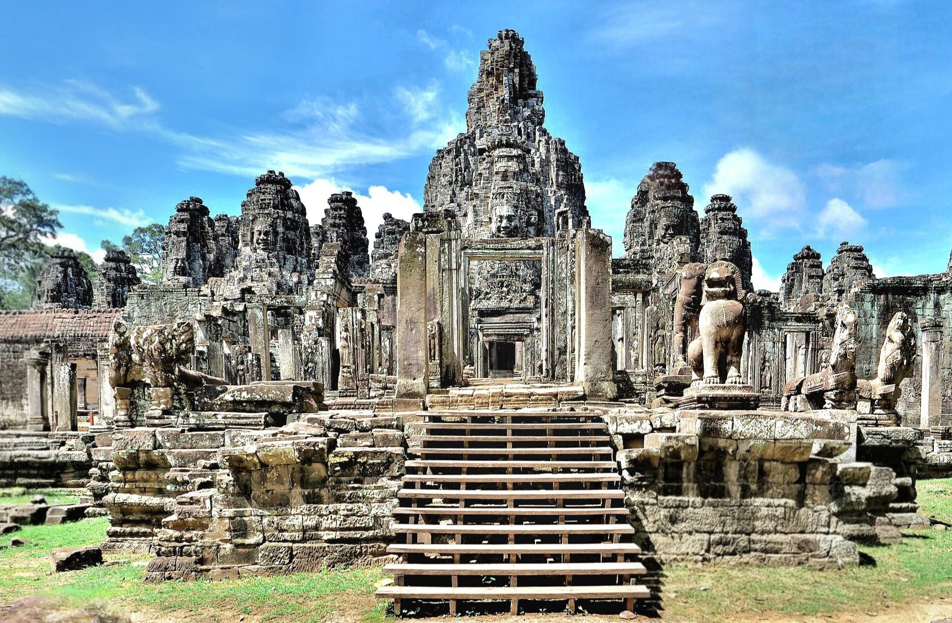
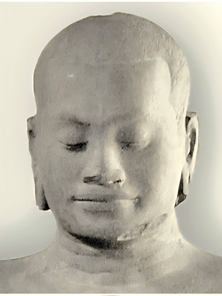
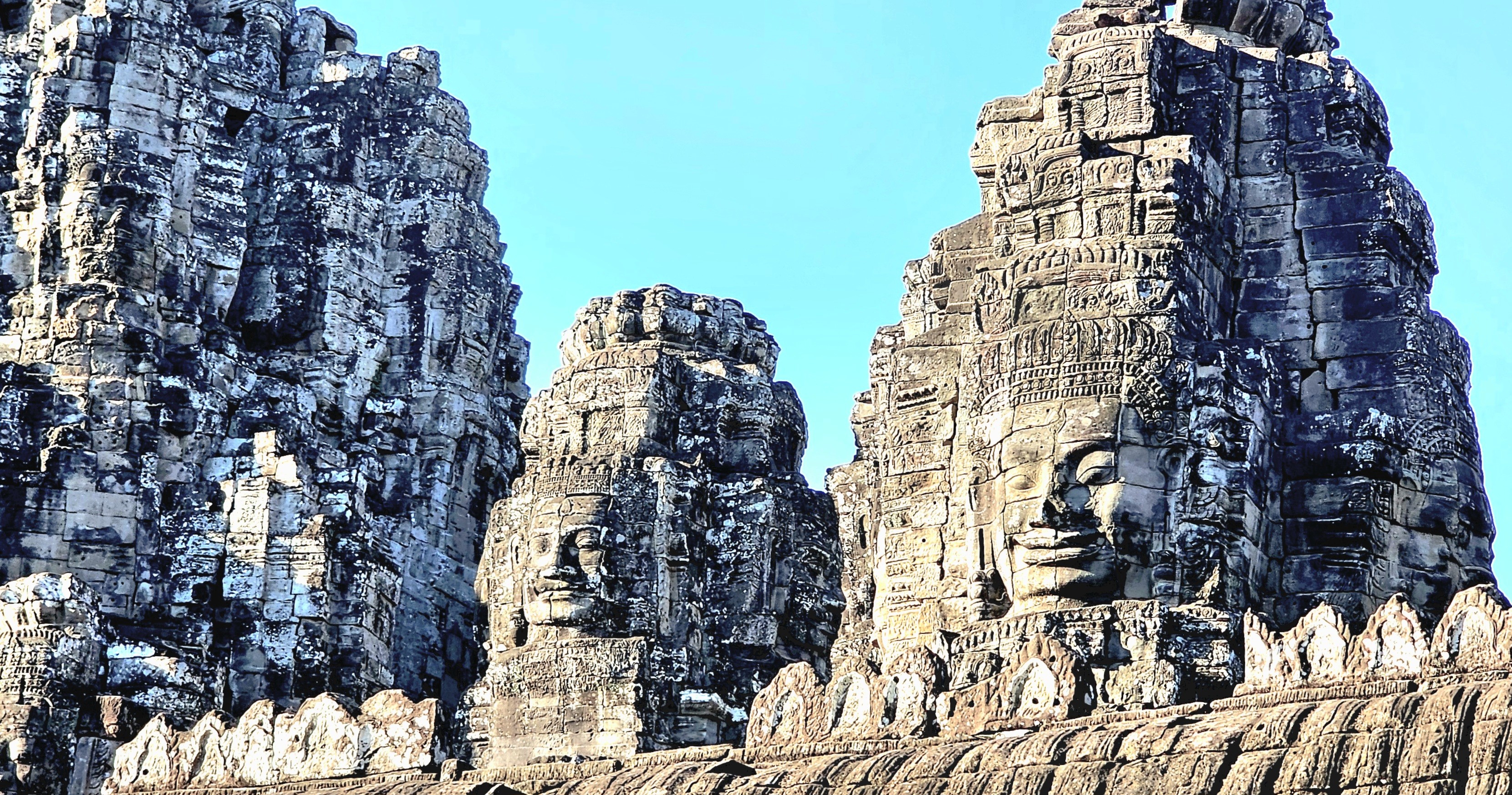
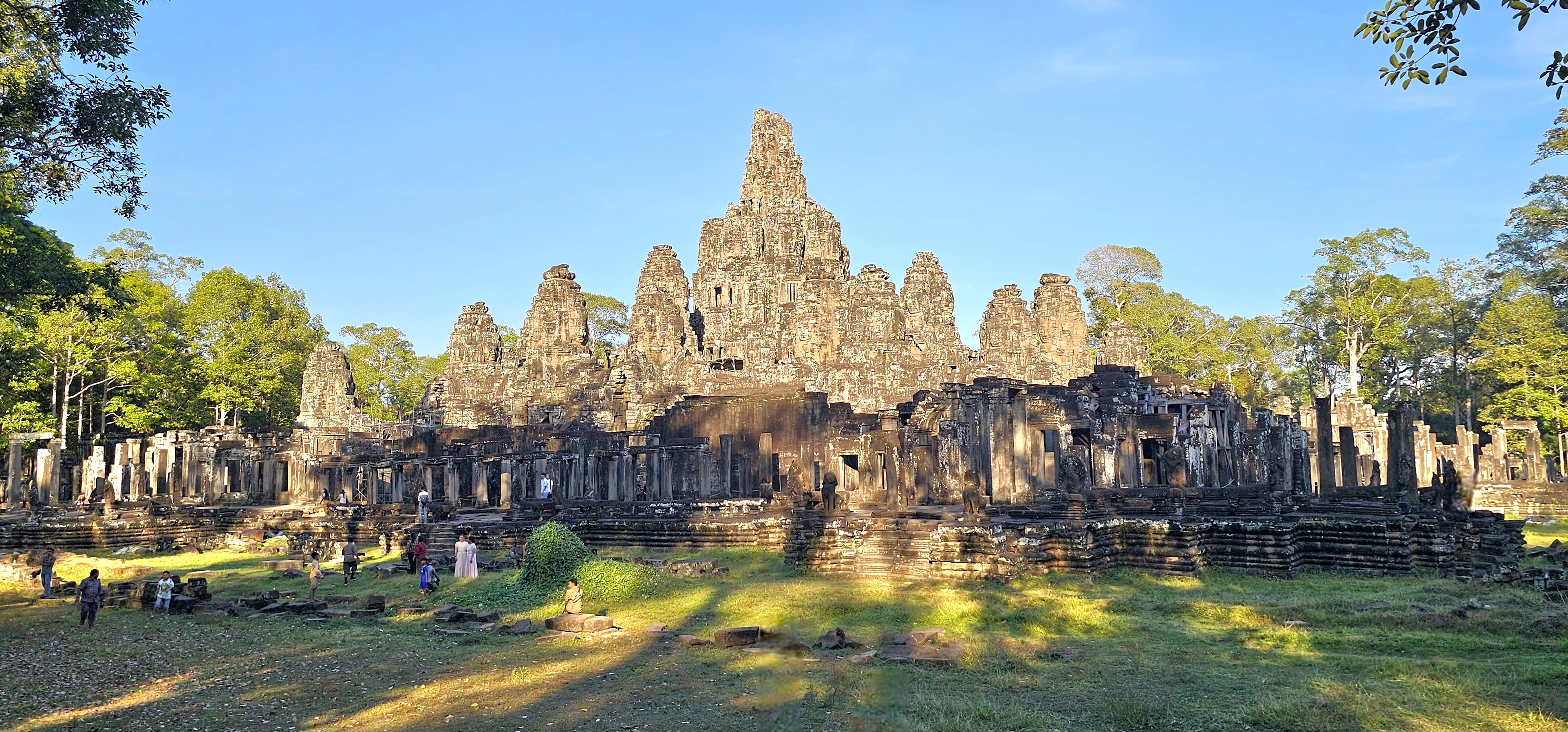
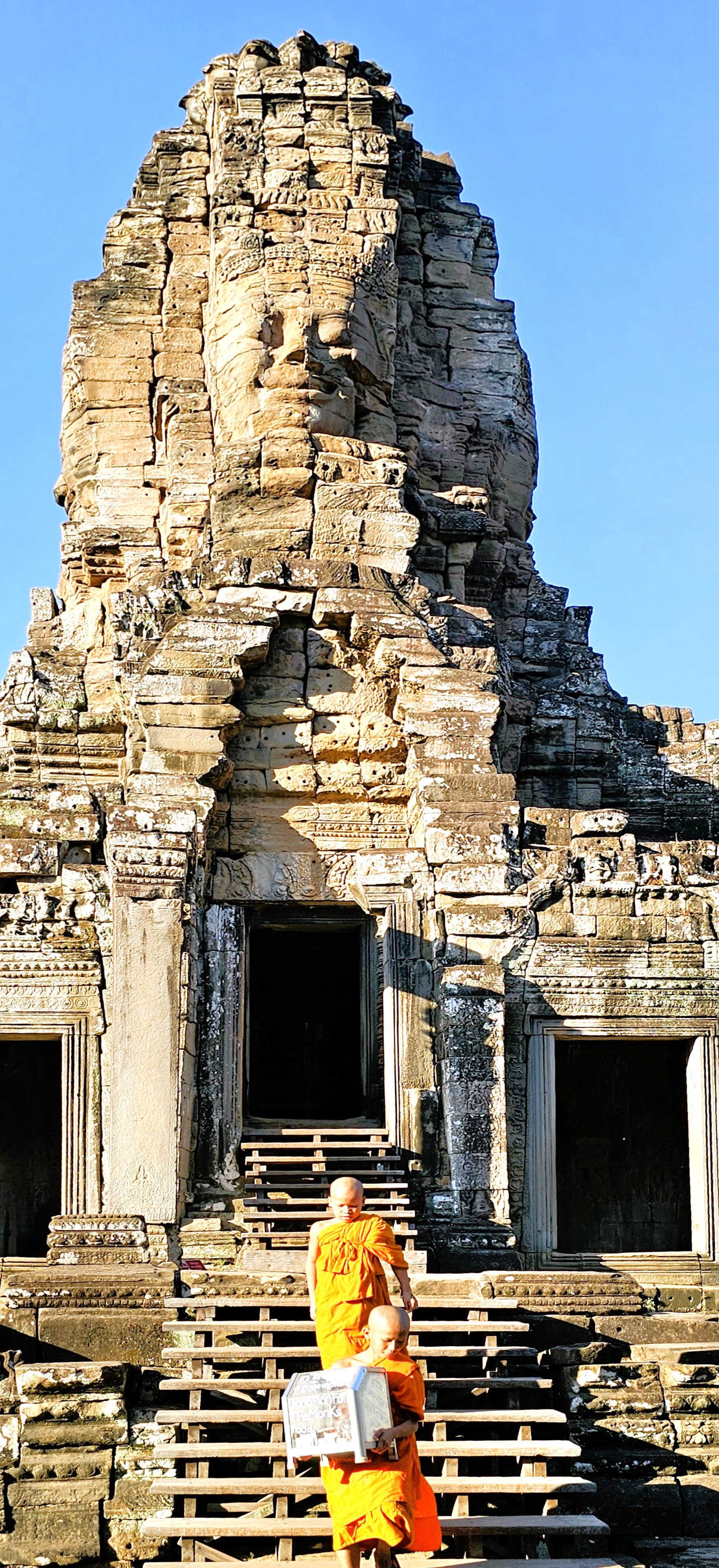
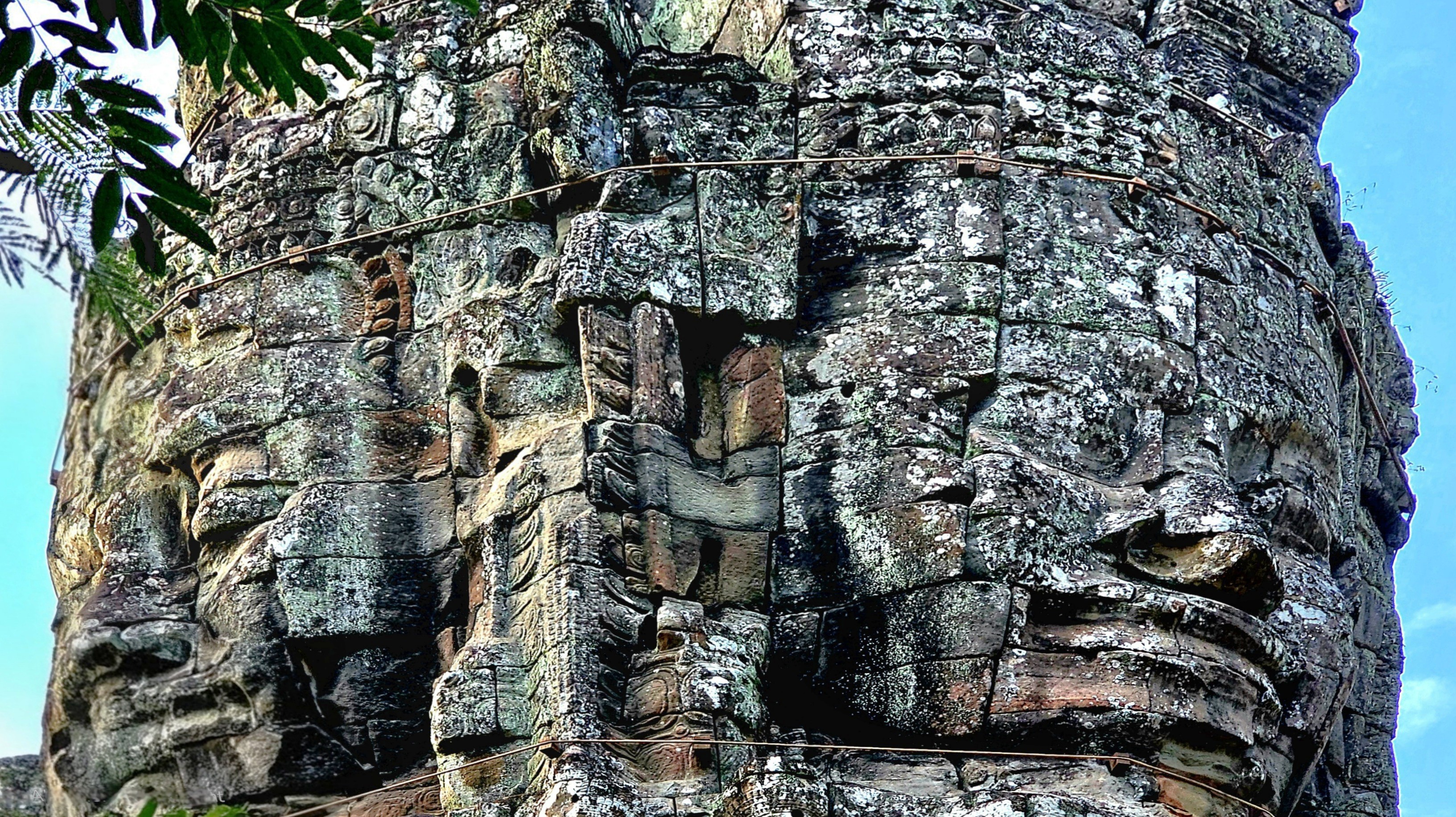
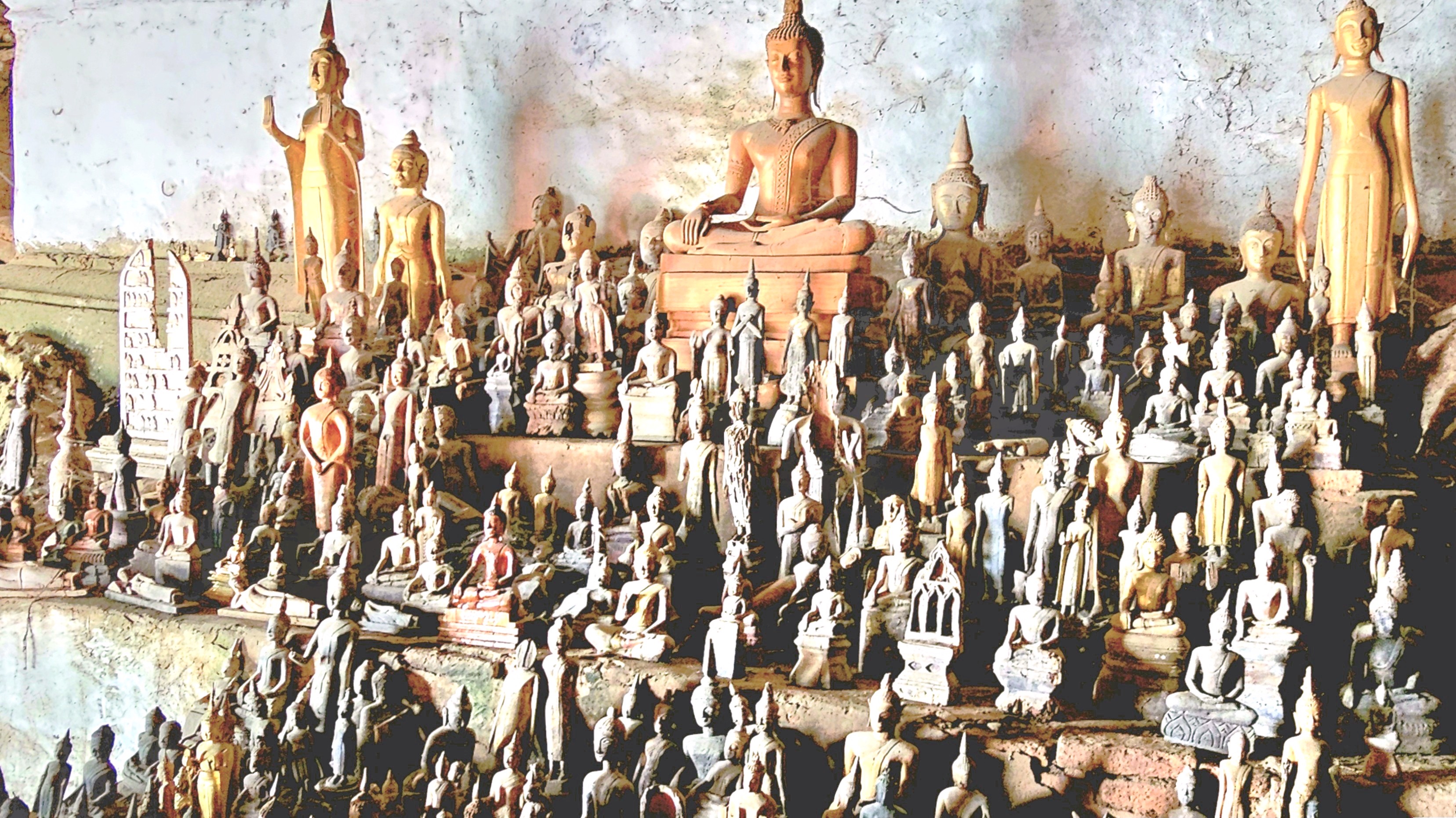
Of the 70 plus major temples within Angkor Archaeological Park, and hundreds more smaller shrines, ceremonial buildings, and symbolic ruins scattered throughout the broader Angkor region, none is more enigmatic than Bayon Temple.
It stands at the center of Angkor Thom, the Khmer capital, as Khmer Empire’s only Buddhist state temple, and last temple constructed during the reign of King Jayavarman VII.
While hiking among the remaining 37 towers (originally 54) preserved throughout the temple’s 5.5 acres,
it becomes increasingly apparent that only the most talented artisans were chosen to sculpt Jayavarman’s likeness to resemble Buddha.
Or perhaps Buddha’s representation was intended to commemorate Jayavarman.
Either way, I found the serene and smiling faces profoundly impactful–creating an encouraging atmosphere to contemplate the spiritual energy infused in our surroundings,
and making us feel a part of something greater.
The enlightened expressions also served as a gentle reminder of the beauty unlocked from local sandstone and laterite stone–
inspiring us to embrace positivity and carry it with us beyond our stay.
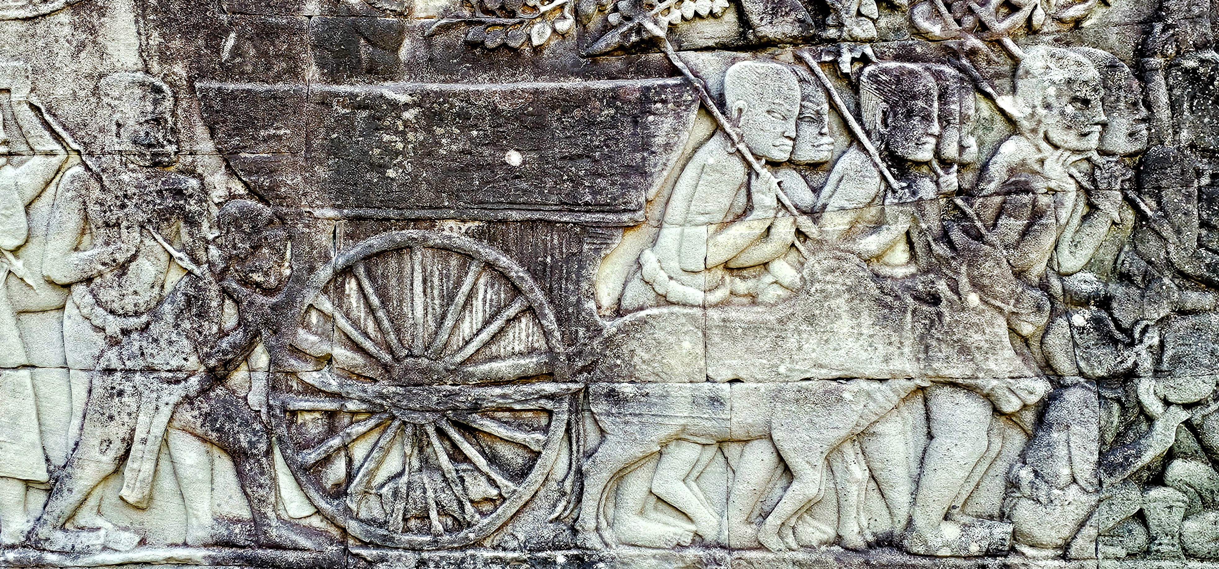
Khmer sculptors have also created a remarkable tableau of battle history, religious mythology, and random scenes from everyday life recorded on gallery walls throughout the complex.
Aside from its historical significance and its testament to architectual genius, Bayon Temple continues to serve as a vibrant center of spiritual life. Local communities gather regularly to participate in rituals and ceremonies, reflecting their enduring faith and cultural heritage.
The presence of monks who play a vital role in guiding the spiritual practices of the community reinforces the temple’s significance beyond just a tourist attraction.
Their ongoing devotion helps preserve the temple’s sanctity, making it a living testament to the blend of history and contemporary spirituality in Cambodia.
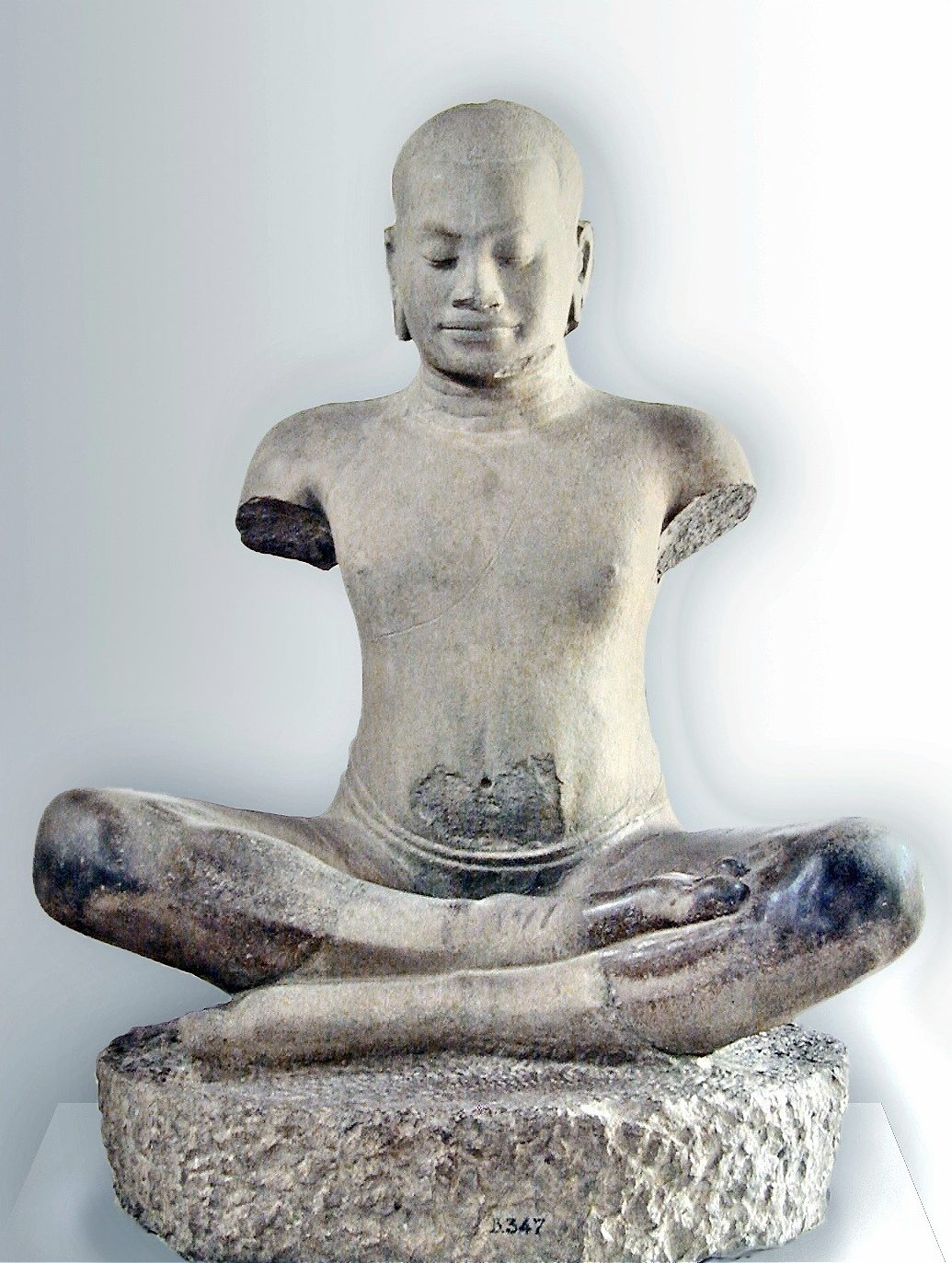
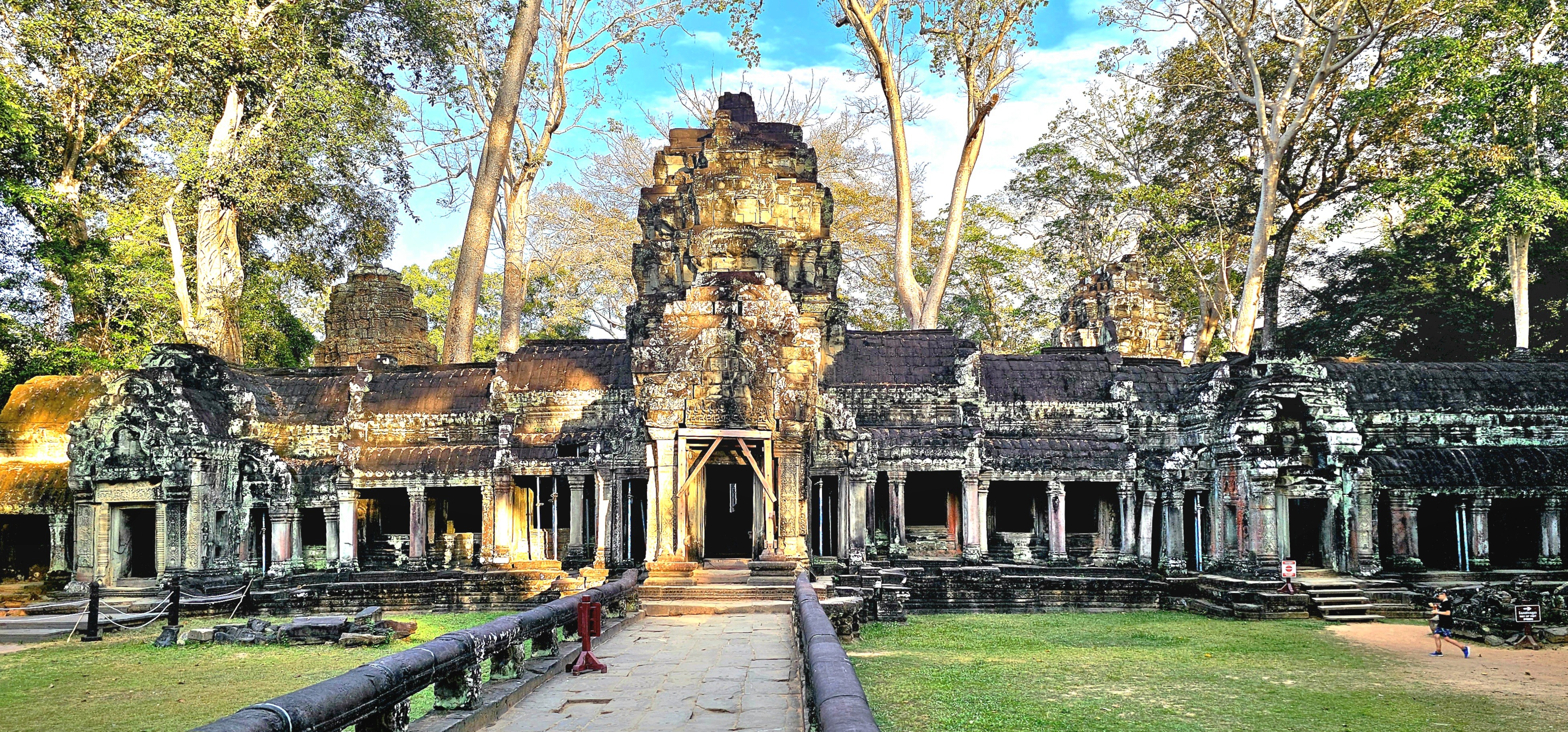
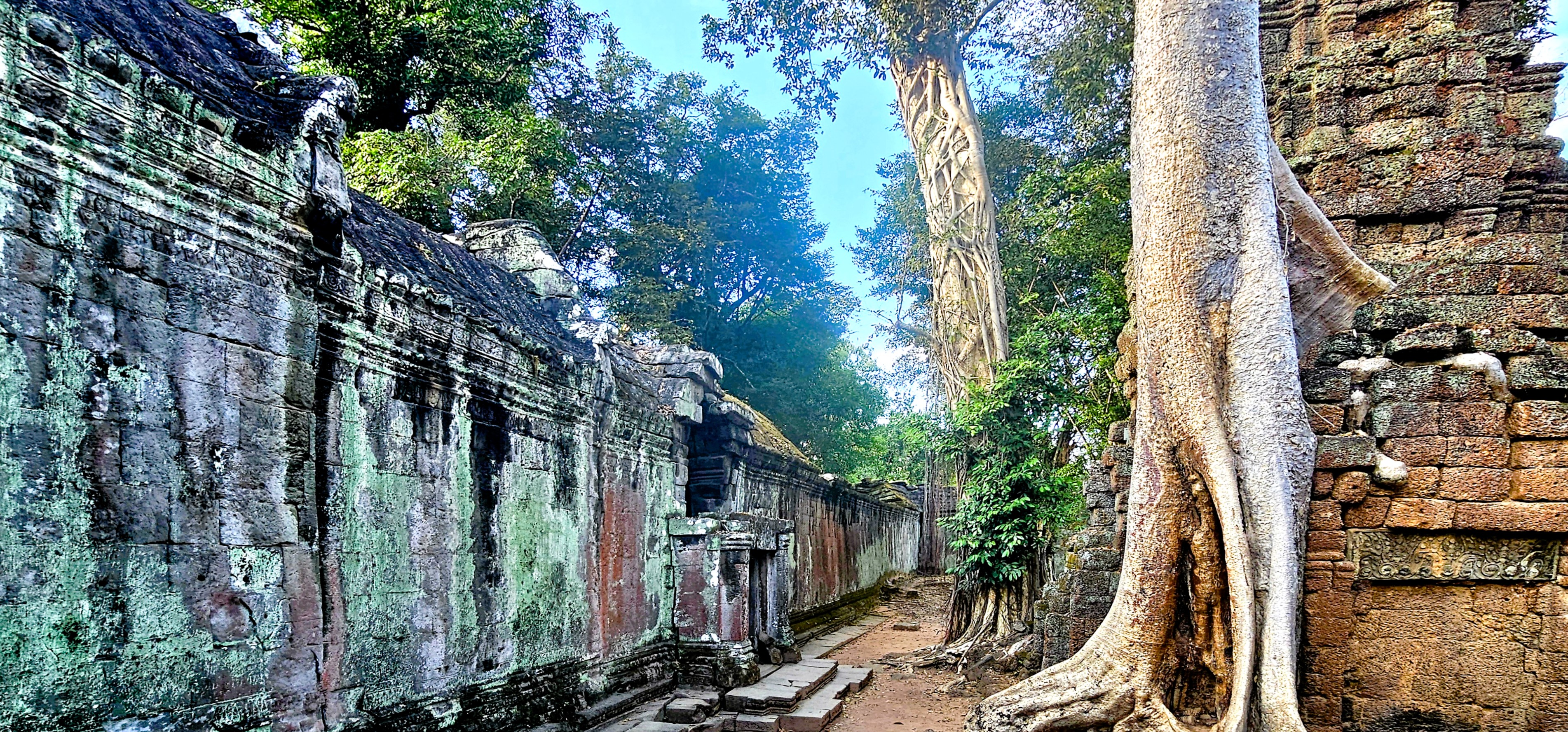
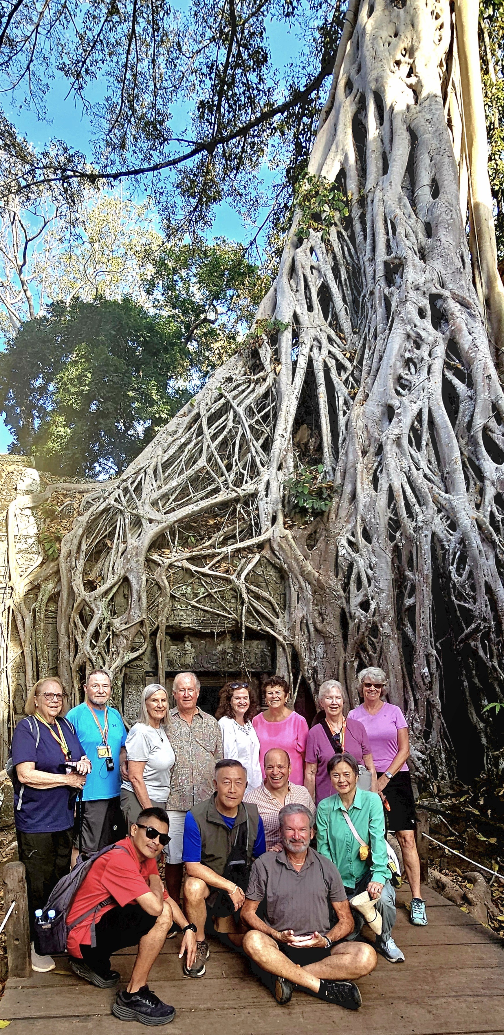
Of all the temples in Cambodia—somewhere between 4,000 and 6,600, depending on the cultural authority—Ta Prohm, located within Angkor Archaeological Park, remains a must-see because of its striking temple remains and captivating narrative.
At the ruinous site of Ta Prohm,
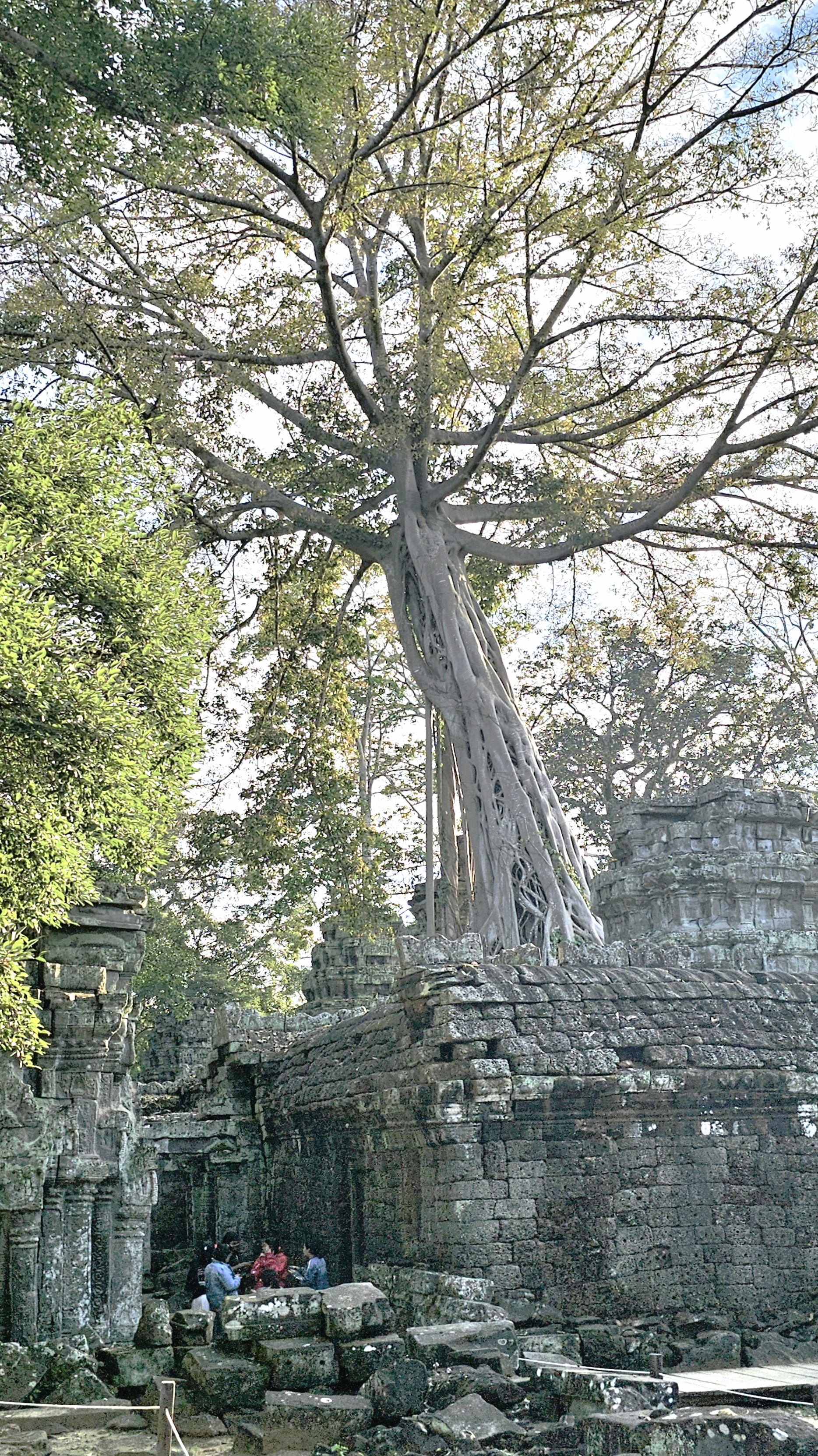
I encountered an otherworldly standoff between human ingenuity and nature’s relentless advance. It’s not merely a structure; it’s a testament to history, where the surrounding jungle advances, progressively reclaiming the landscape.
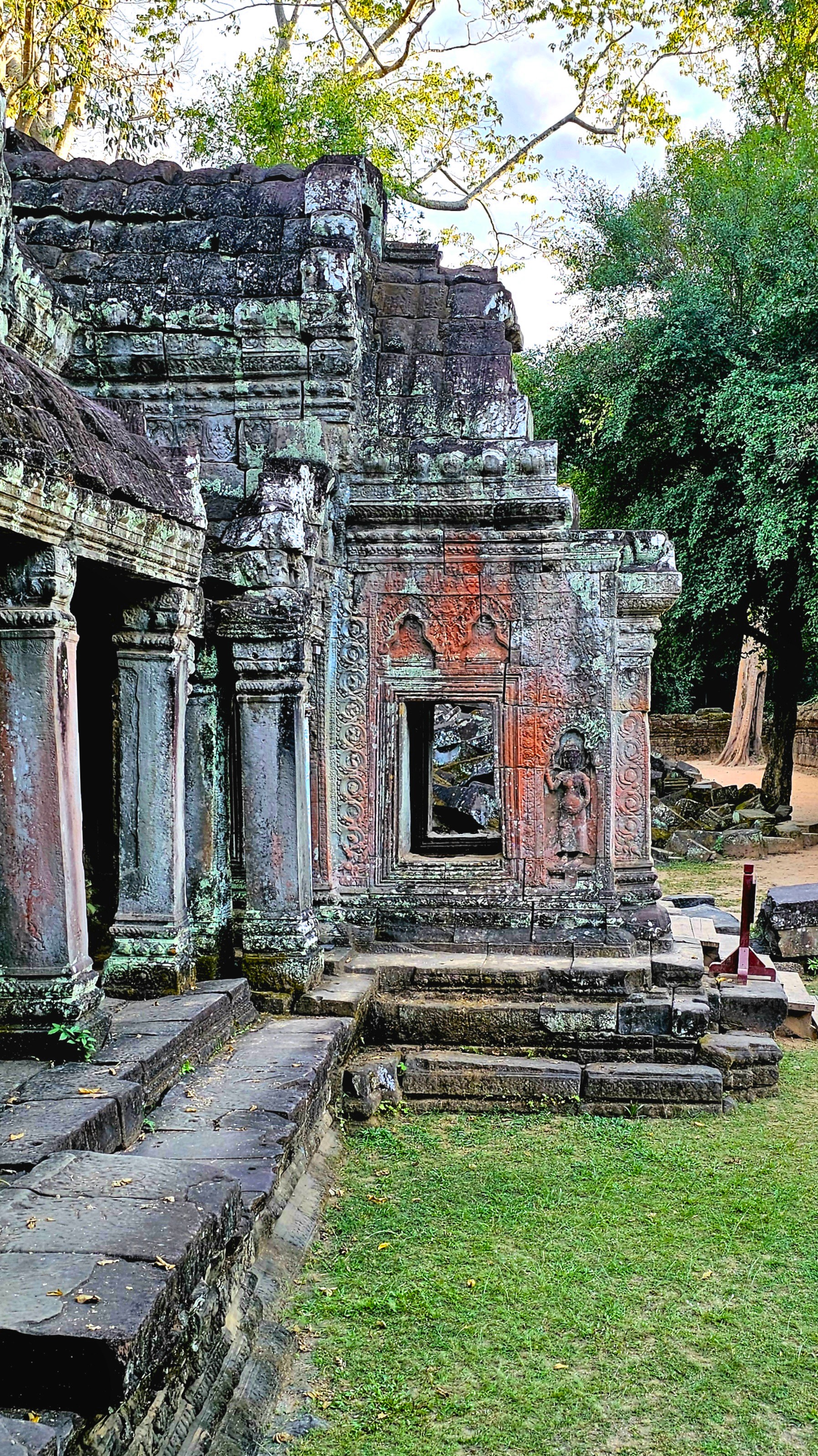
Here, a vast root system appears to strangle the West Gopura–a vivid illustration of nature’s power interwoven with human craftsmanship.
Myth and stone intertwine, as a patina of multi-colored lichen cloaks the bas-relief stonework depicting meditating monks and temple guardians in serene poses.
The gigantic roots of the silk-cotton, gold apple, and strangler fig trees invade the ancient walls and terraces to create a visually stunning tableau.
The trees seemingly communicate with the stone, highlighting both the beauty and fragility of the monument’s existence.
Constructed during the late 12th and early 13th centuries in the local Bayon style—an intricately decorated form of Khmer architecture—Ta Prohm served as a monastery and university for Mahayana Buddhists, offering spiritual guidance and education in a time where knowledge was deeply intertwined with faith.
Following the fall of the Khmer Empire in the 15th century, the complex fell into neglect and was eventually abandoned, allowing the encroaching jungle to seize control, transforming the area into a site of haunting beauty.
Today, various restoration attempts have stabilized the environment, courtesy of the Archaeological Survey of India (ASI),
which has been collaborating on the temple’s restoration with Cambodia’s APSARA National Authority since 2003.
Restoration efforts to preserve the temple’s original structure include replacing damaged stones, supporting entries, and strengthening foundations to withstand natural elements like heavy rains.
While archaeologists and craftsmen work to protect the temple from potential damages, they are also aware that Ta Prohm’s‘condition of apparent neglect’contributes to its global reputation, as evidenced in the action film, Laura Croft: Tomb Raider.
This balance creates an enchanting duality: the remarkable presence of both human history and the natural world,
coexisting in a state of beautiful decay.
Ta Prohm stands as a poignant reminder of the passage of time, notwithstanding the scrollwork of a stegosaurus carving on a terrace wall that has confounded scholars for centuries.
Together with Angkor Wat, Ta Prohm represents an enduring symbol of the Khmer Empire’s remarkable cultural and architectural grandeur. The site is among Cambodia’s most visited destinations, preserved for tourists who come to witness and contemplate the relentless power of nature in its interplay with human achievement.
Siem Reap Province, located in northwestern Cambodia, possesses significant cultural, religious, and symbolic value, and is also renowned for its architectural, archaeological, and artistic importance. Furthermore, Siem Reap is home to Angkor Archaeological Park, the world’s largest religious monument complex and the cornerstone of Cambodia’s tourism sector.
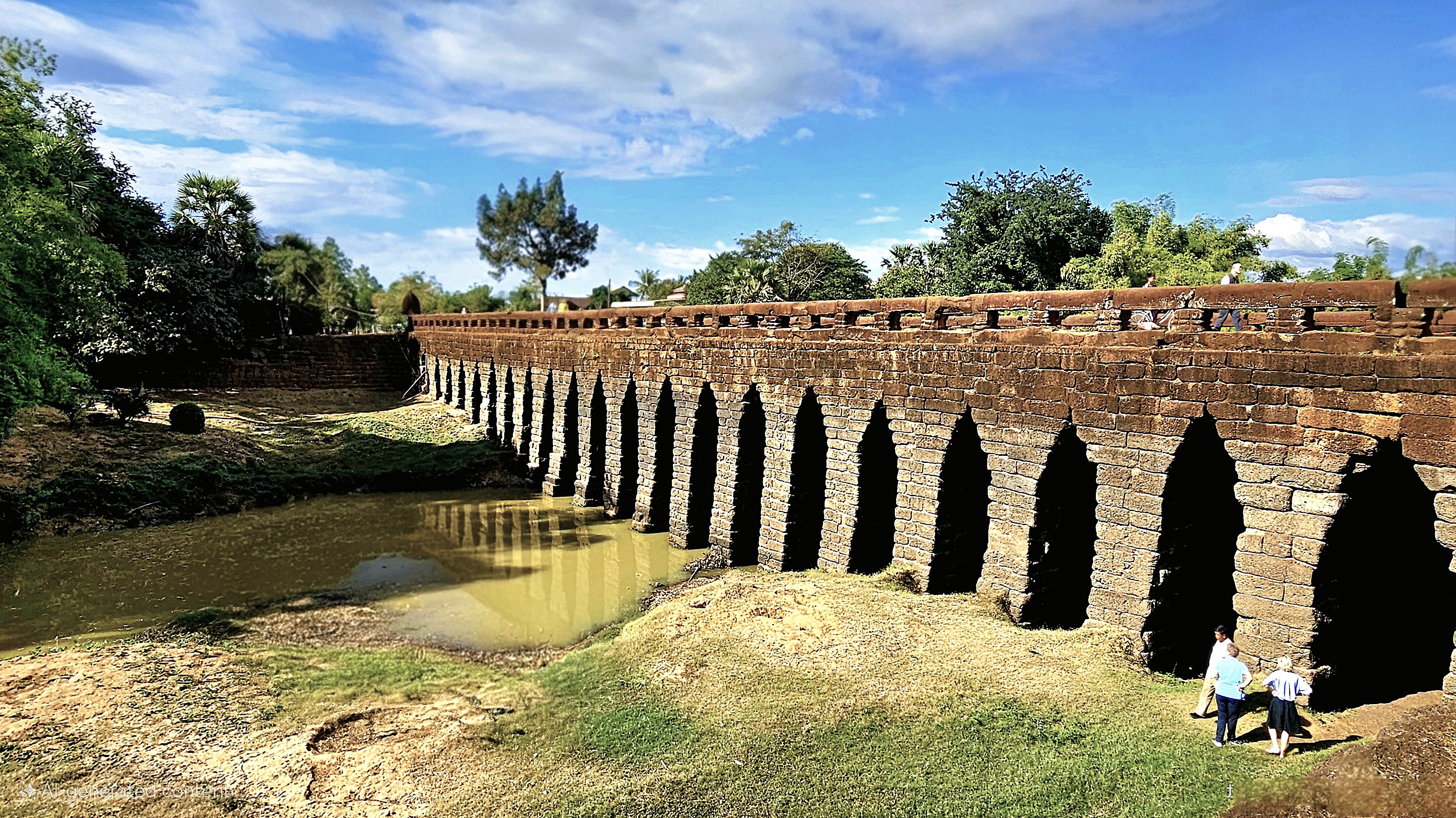
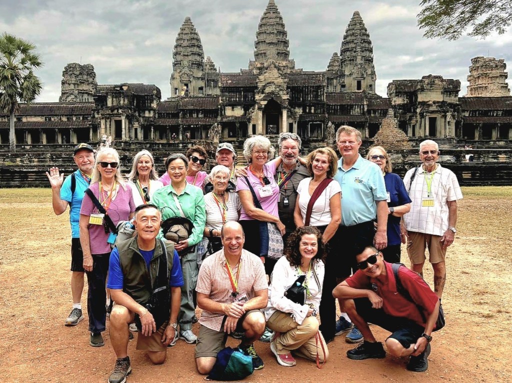
Our O.A.T. group overlanded from Phnom Penh to Siem Reap with a stopover at the ancient Kampong Kdei Bridge, constructed in the 12th century during the reign of King Jayavarman VII.
The bridge is a testament to the engineers who designed the 87m river span with 21 corbelled arches of laterite, making it the longest structure of its kind in the world.
Nine-headed nagas–whose bodies form a continuous balustrade alongside the roadbed–welcome only pedestrians and cycles on the bridge because of weight restrictions.
While admiring the scenery, I paused a moment to consider that Leah and I were walking the same trail as the Chinese merchants who traded along the Maritime Silk Road nearly a millennium ago. Back then, it was a 2-day trek through the lowlands to reach Angkor Wat.
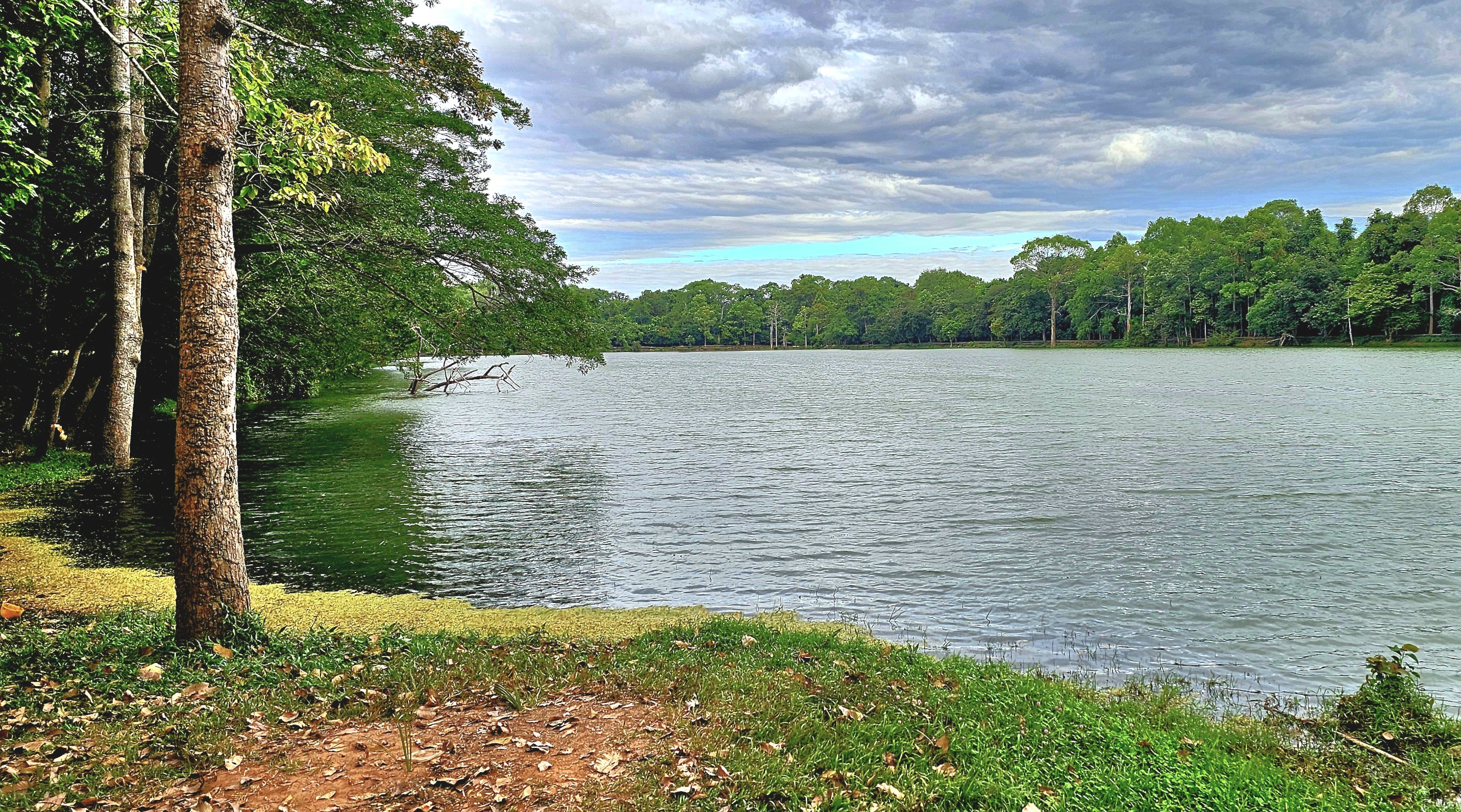
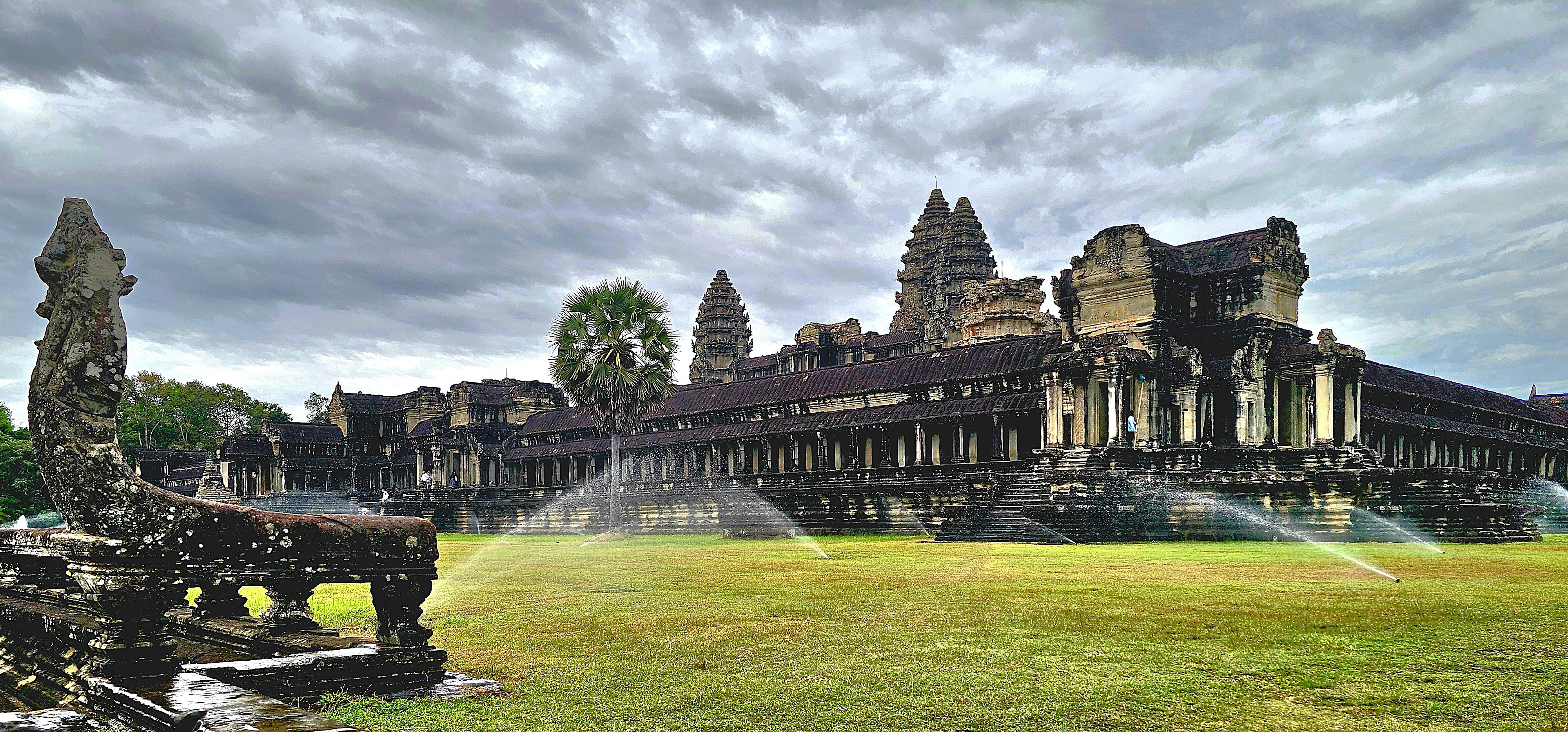
But not for us; we stepped out of our air-conditioned coach the following morning, well before the crowds, to cross a moat symbolizing the cosmic ocean in Hindu cosmology.
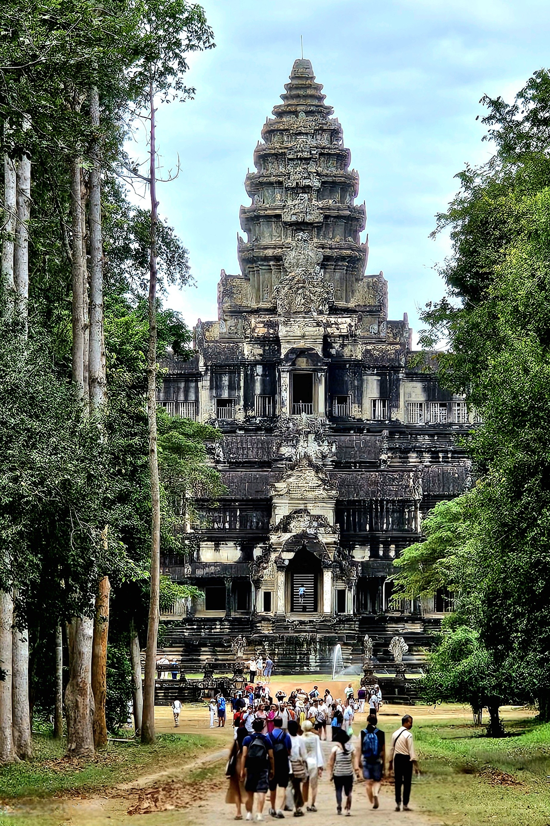
While getting our bearings, our guide Seong, a native of Siem Reap revealed Cambodia’s worst kept secret: by arriving at Angkor Wat’s Death Gopura (East Gate), we were avoiding the popular western gateway with five times the tourists.
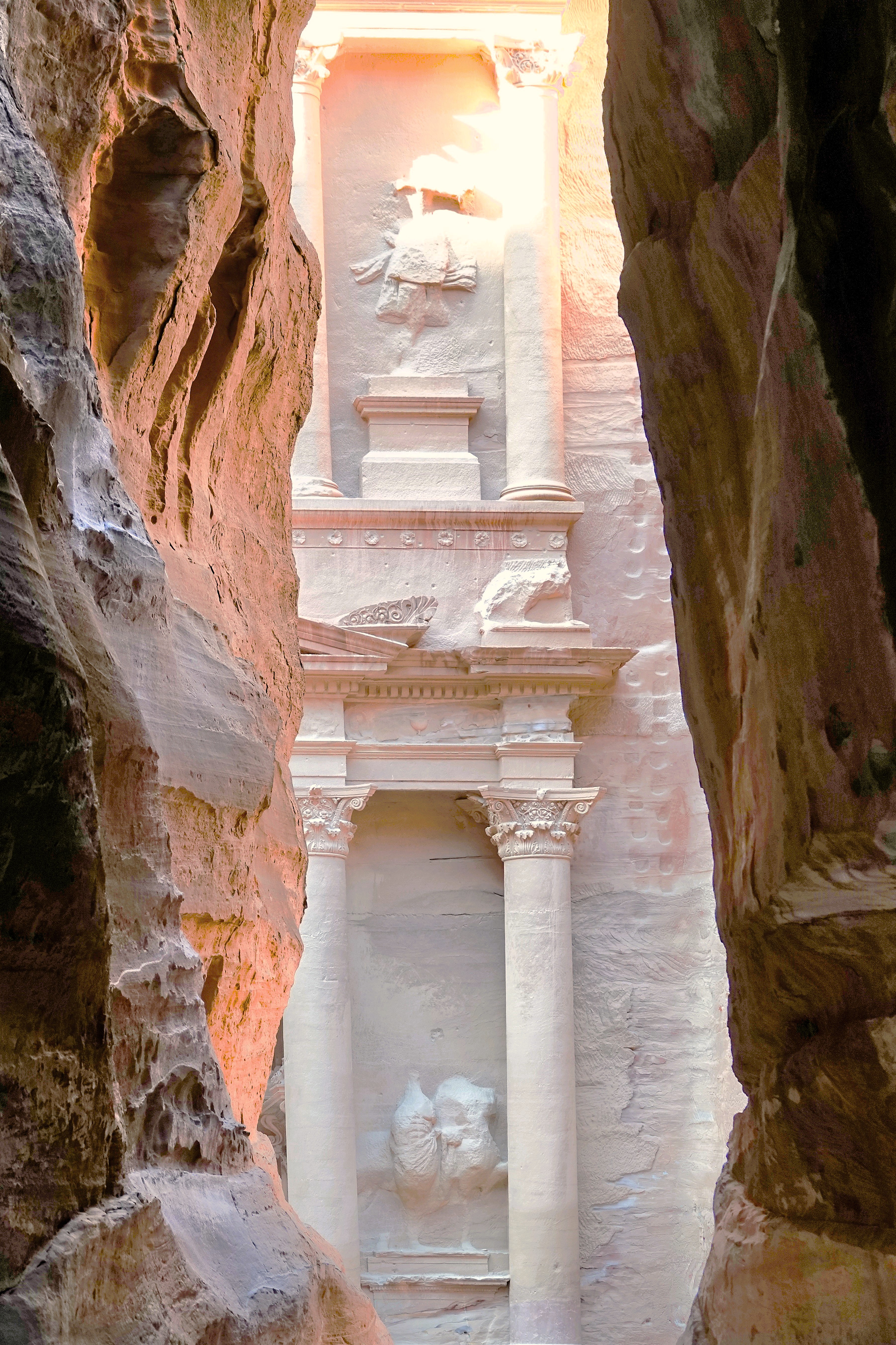
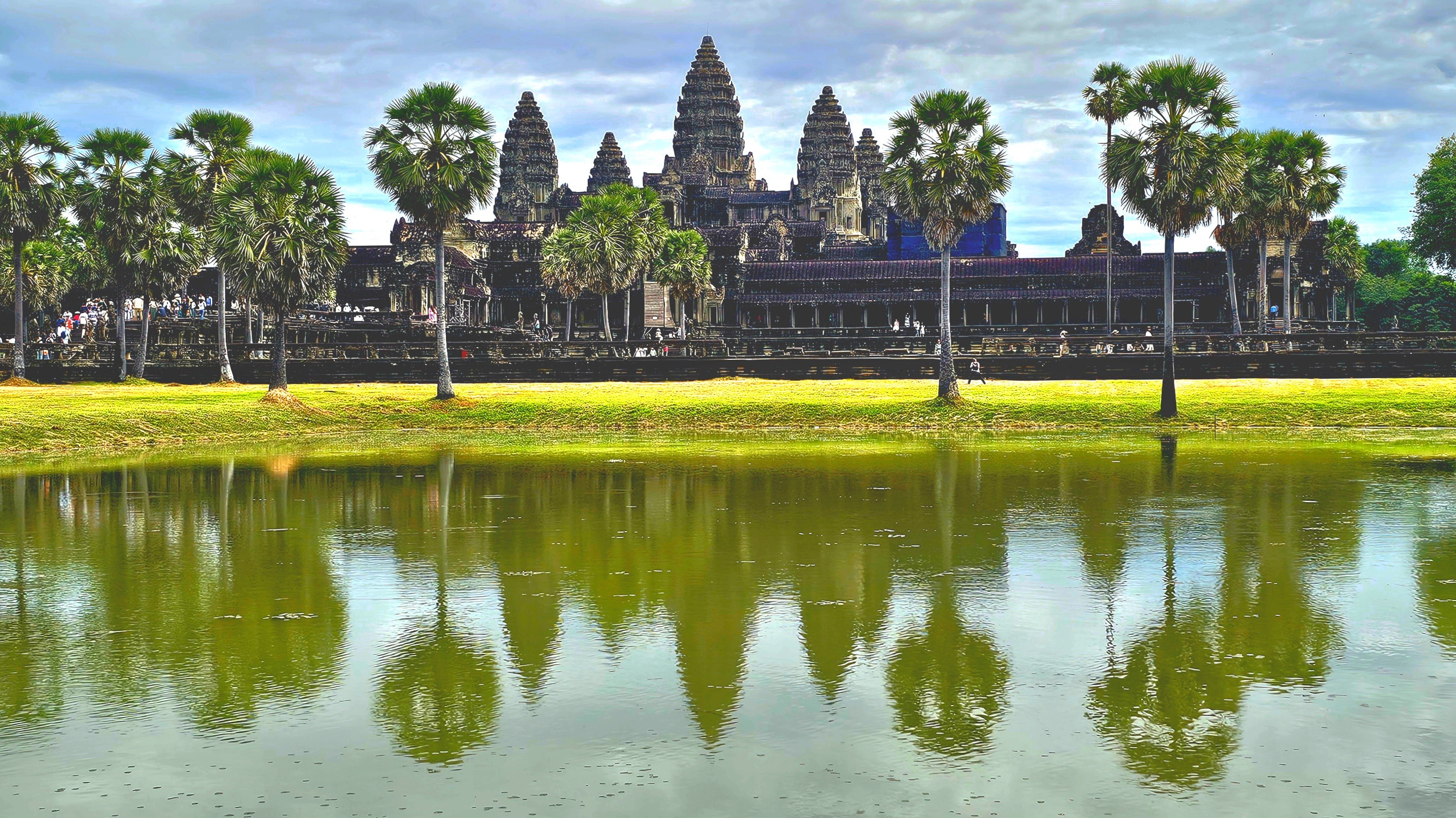
The cloud cover flattened the morning light on our approach down the expansive causeway. It was the best time for photographing Angkor. Eventually, we reached a break in the trees, perfectly framing the famed lotus tower of this Khmer masterpiece. It was reminiscent of the thrill I felt after emerging from the slot canyon in Jordan and peeking at Petra for the first time at first light.
Much has been written about Angkor Wat:
About its monumental size,
spanning 402 acres,
or 4 times the size of Vatican City;
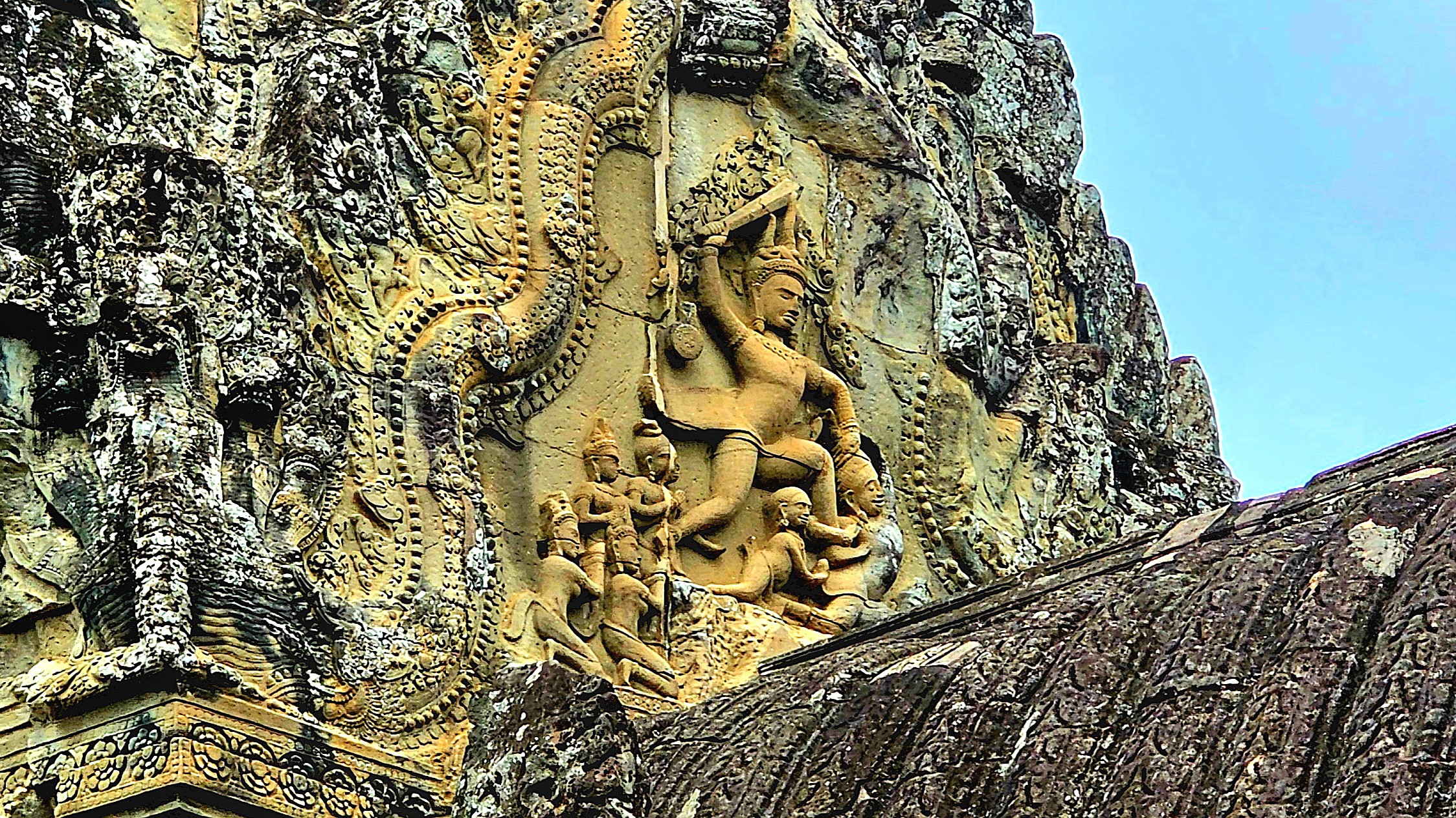
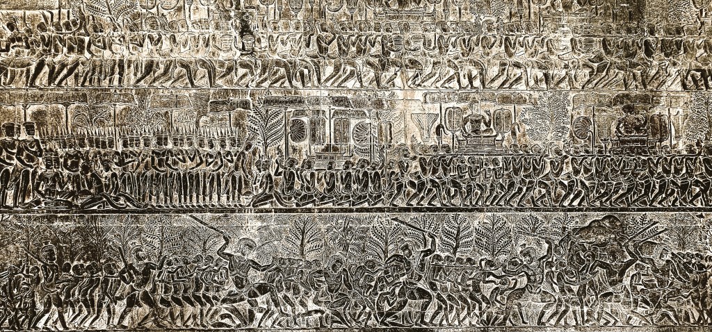
It’s intricate bas-relief carvings throughout the temples and galleries;
Its historical significance, showcasing Khmer mythology and history etched into laterite stone;
Churning of the Sea of Milk
Heaven and Hell
Military Parade of Kink Suryavarman II
Its religious significance–originally constructed in the 12th century as a Hindu temple dedicated to Vishnu but converted to a Theravadin Buddhist temple during the 15tth century to reflect the shift in Cambodia’s spiritual landscape;
Hindu GoddessBuddha seated on Mucilinda, King of the Serpents
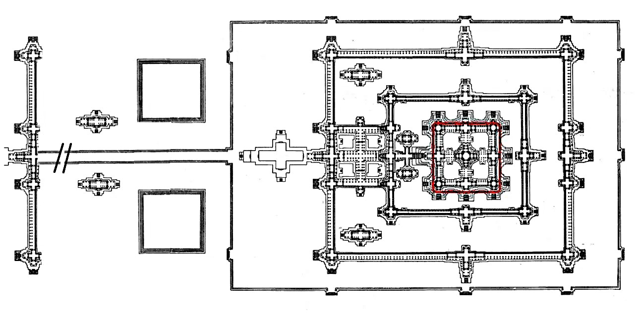
And its architectural accomplishment–a profound reflection of Hindu cosmology, particularly the concept of Mount Meru, regarded as the mythical abode of the deities. The central tower of Angkor Wat epitomizes the summit of Mount Meru, while the adjacent smaller towers signify the mountain’s subordinate peaks. The moat and the rectangular outer wall delineate the oceans and the boundaries of the world, respectively.
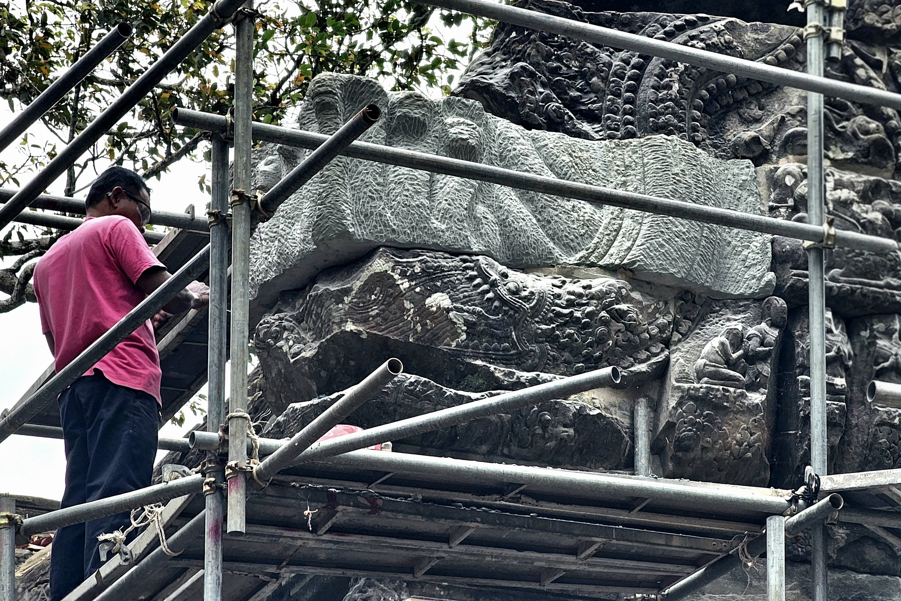
Restoration and maintenance have become routine endeavors in Angkor, which fell into neglect following the capital’s relocation to Phnom Penh in 1434. The site garnered renewed attention after being rediscovered by French naturalist Henri Mouhot in 1858.
An international task force supported by Japan, India, France, South Korea, and other contributing nations have collaborated with APSARA National Authority, the Cambodian government agency responsible for Angkor’s ongoing preservation and management, to address the extensive neglect and restore the temple to World Heritage status.
Ceiling before repairCeiling after repair
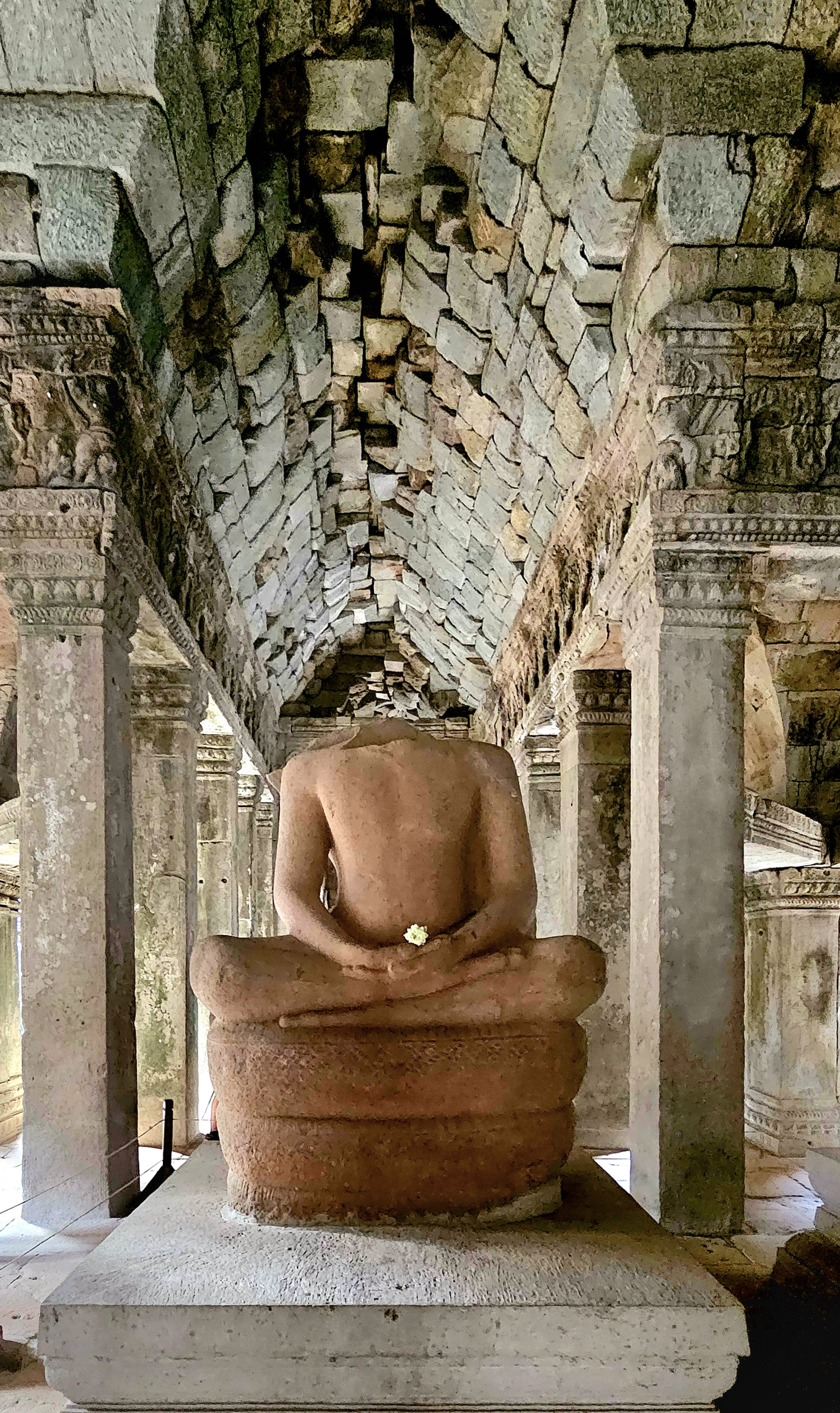
Recently, new risers have been completed by the Korea Heritage Agency…
giving access to the Bakan (central sanctuary),
which supports the amazing quincunx of towers,
offering amazing views,
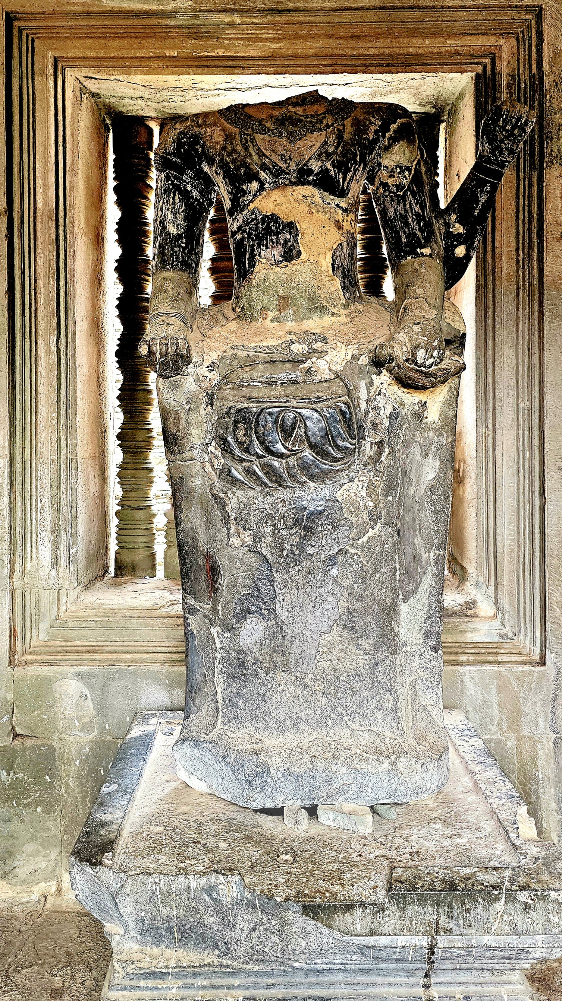
and providing sanctuary for a rare wooden Buddha sculpture whose head remains intact,
unlike most of the other Buddhas who fell victim to so many marauders over the centuries.
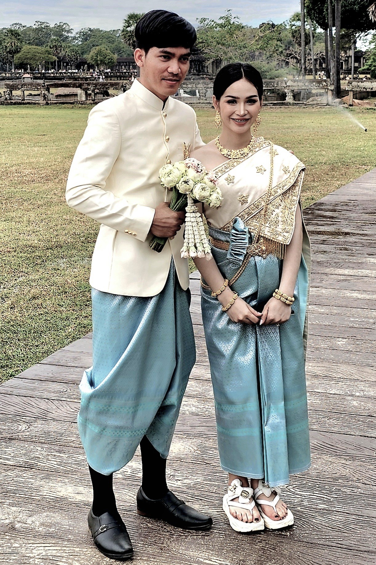
But amidst the vastness and splendor surrounding us, it was the people donning their Sunday best who truly captured my attention with their warmth and spirit.
often posing by the Reflecting Pool for the quintessential photograph, or so I thought.
Unfortunately, the wind kicked up, causing the pool to ripple ever so slightly and affect my mirrored imagery.
However, by returning the following day for a sunset farewell to Angkor, I believe I captured the iconic shot that characterizes Cambodia’s cultural landscape.
The experience not only fulfilled a bucket-listed destination but deepened my appreciation for the rich heritage of Cambodia, reminding me that some locations leave an indelible mark on our souls.
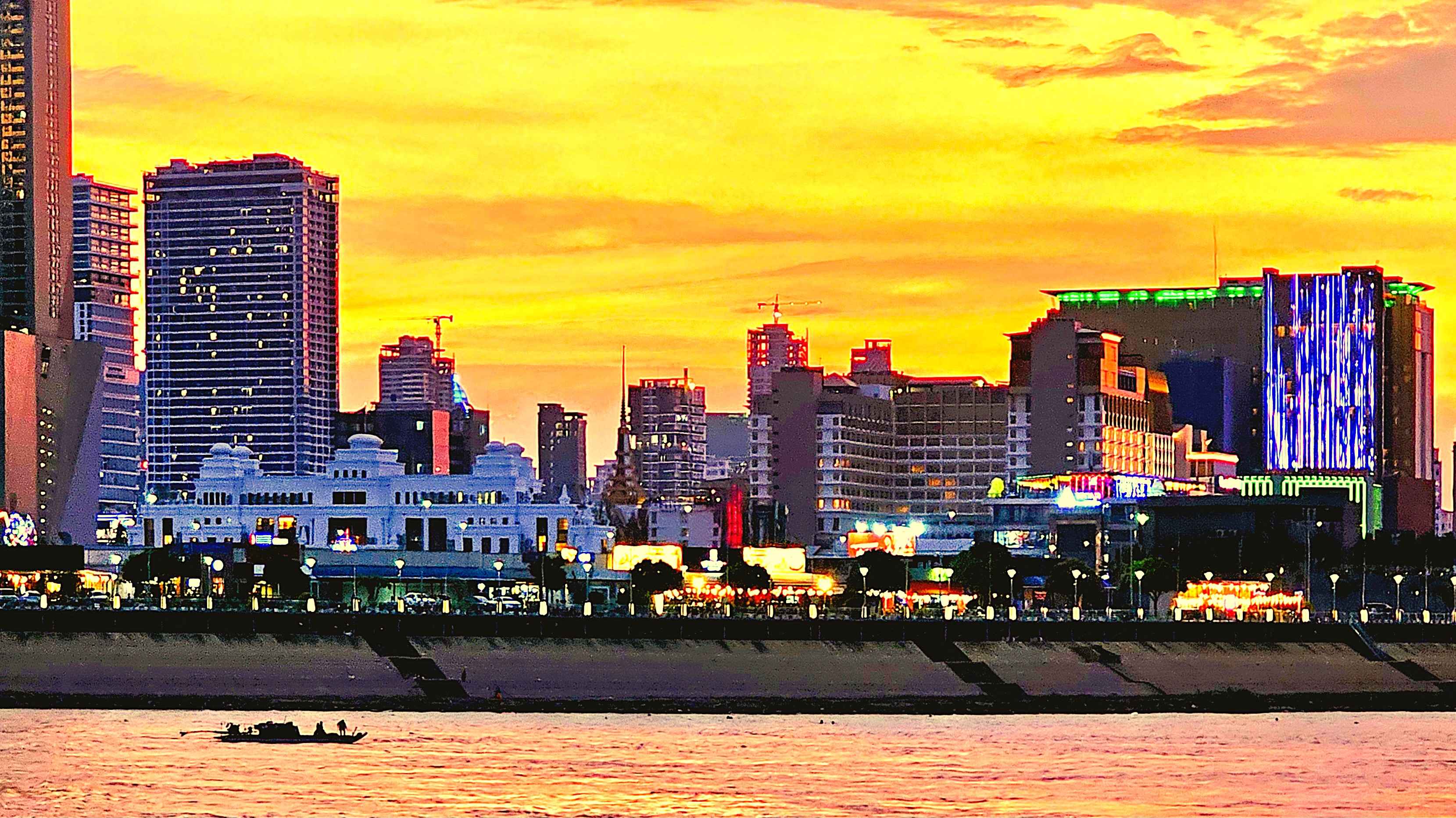
Random snaps of landmarks, skylines, and curiosities captured while cruising around town. There is no particular theme or connection, but these images caught my eye, nonetheless!
Flyer beware!
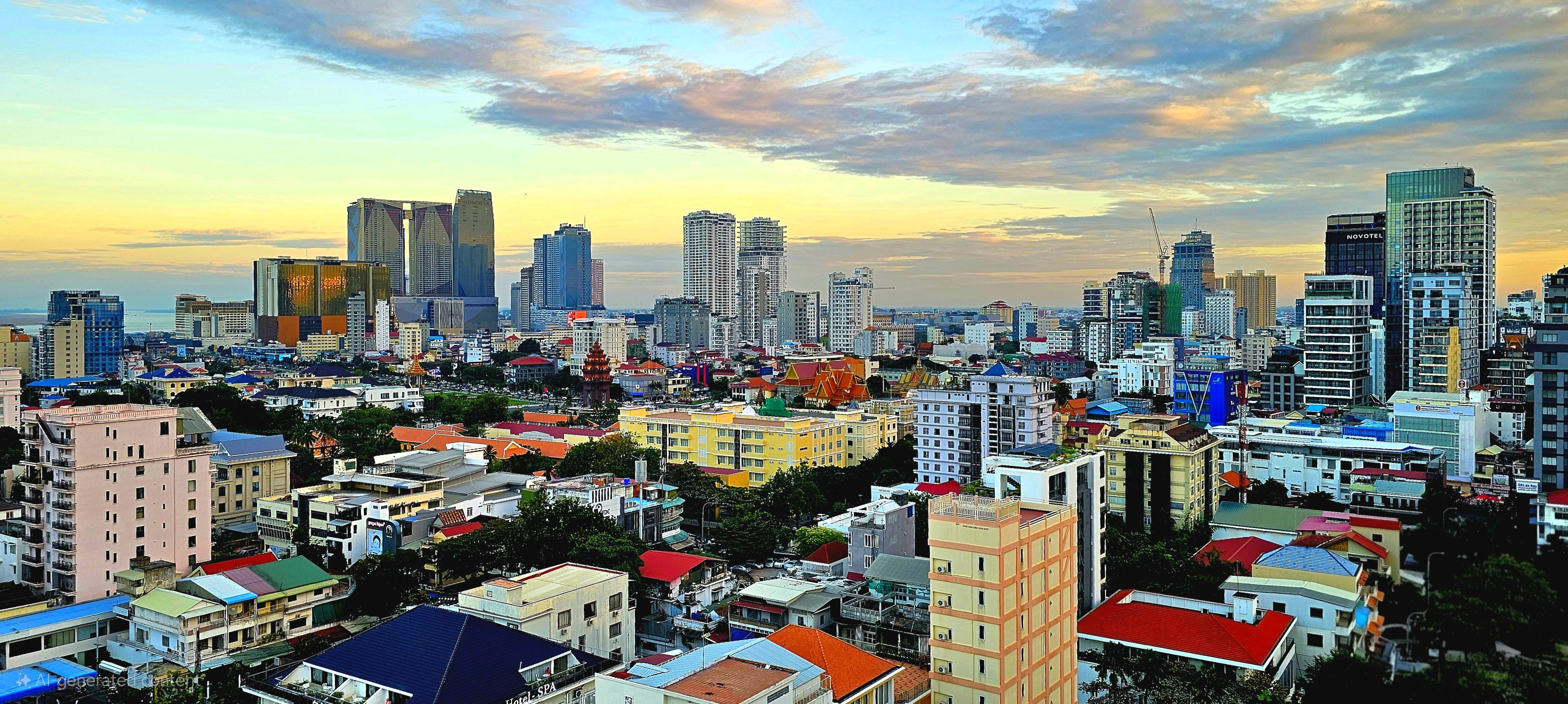
A modern skyline reshapes Center City
Areiksart Ferry Port
Krong Ta Khmau–Phnom Penh suburbia
Anatomical door handles
Independence Monument
King Norodom Sihanouk Memorial
King Norodom Sihamoni portrait from Sisowath Riverside Park
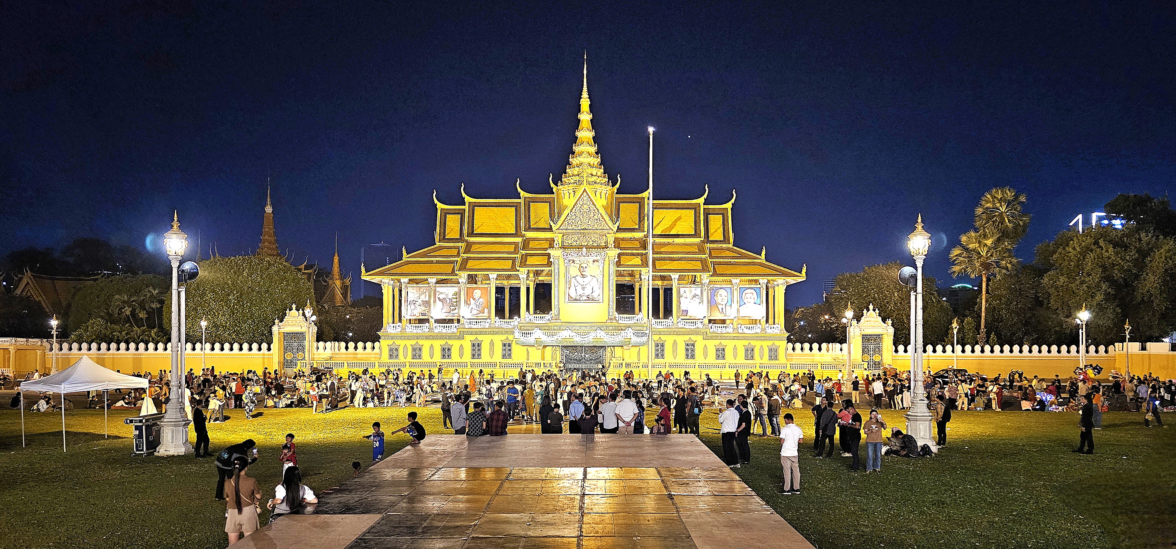
Royal Palace of Cambodia
Meat market beef parts
Protecting lives by improving sanitation–one flush at a time
Toilet protocol
Street art
Sangkat Chakto Mukh–upscale community
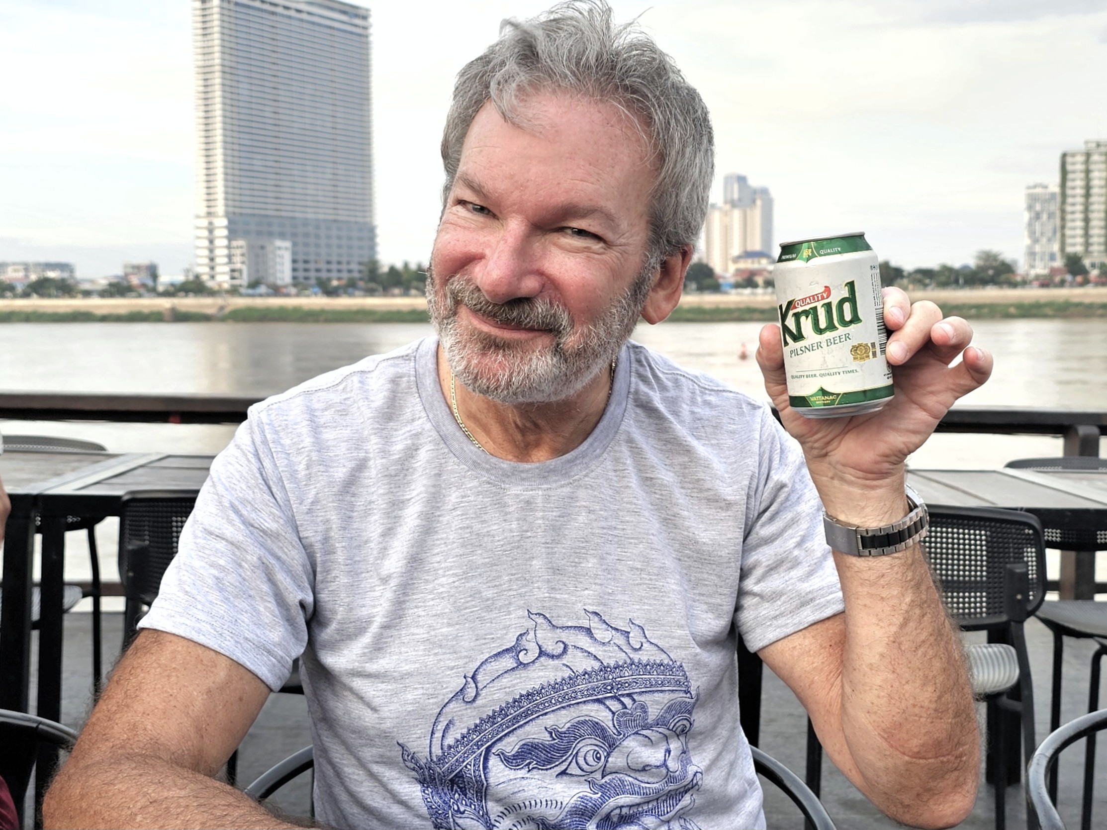
“Good time for a Krud,” 2023 World Beer Gold medal winner
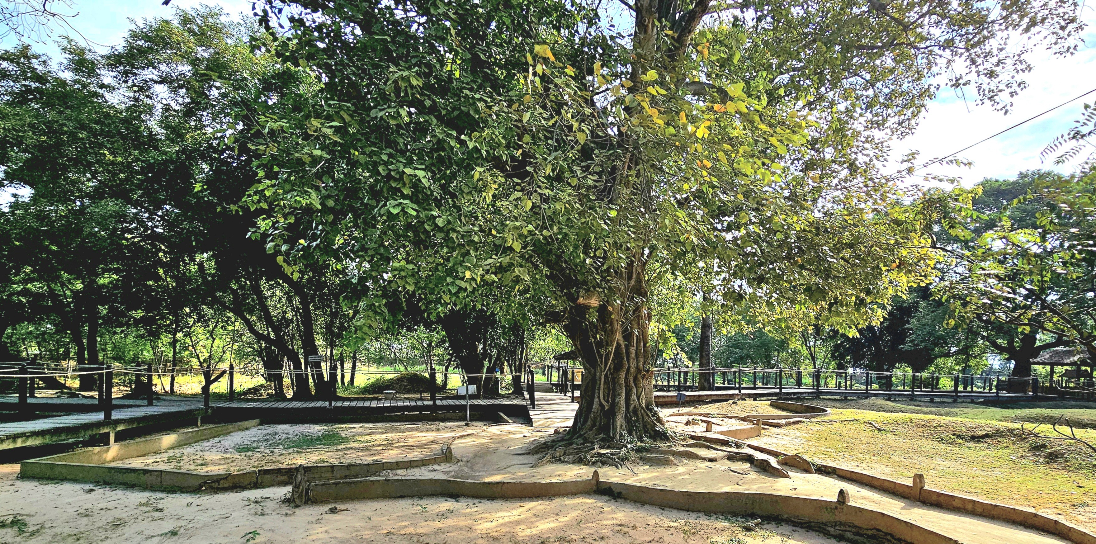
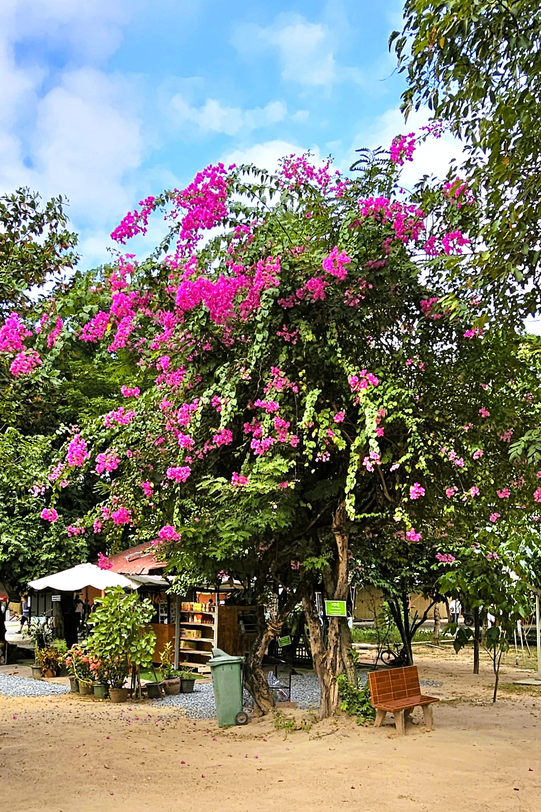
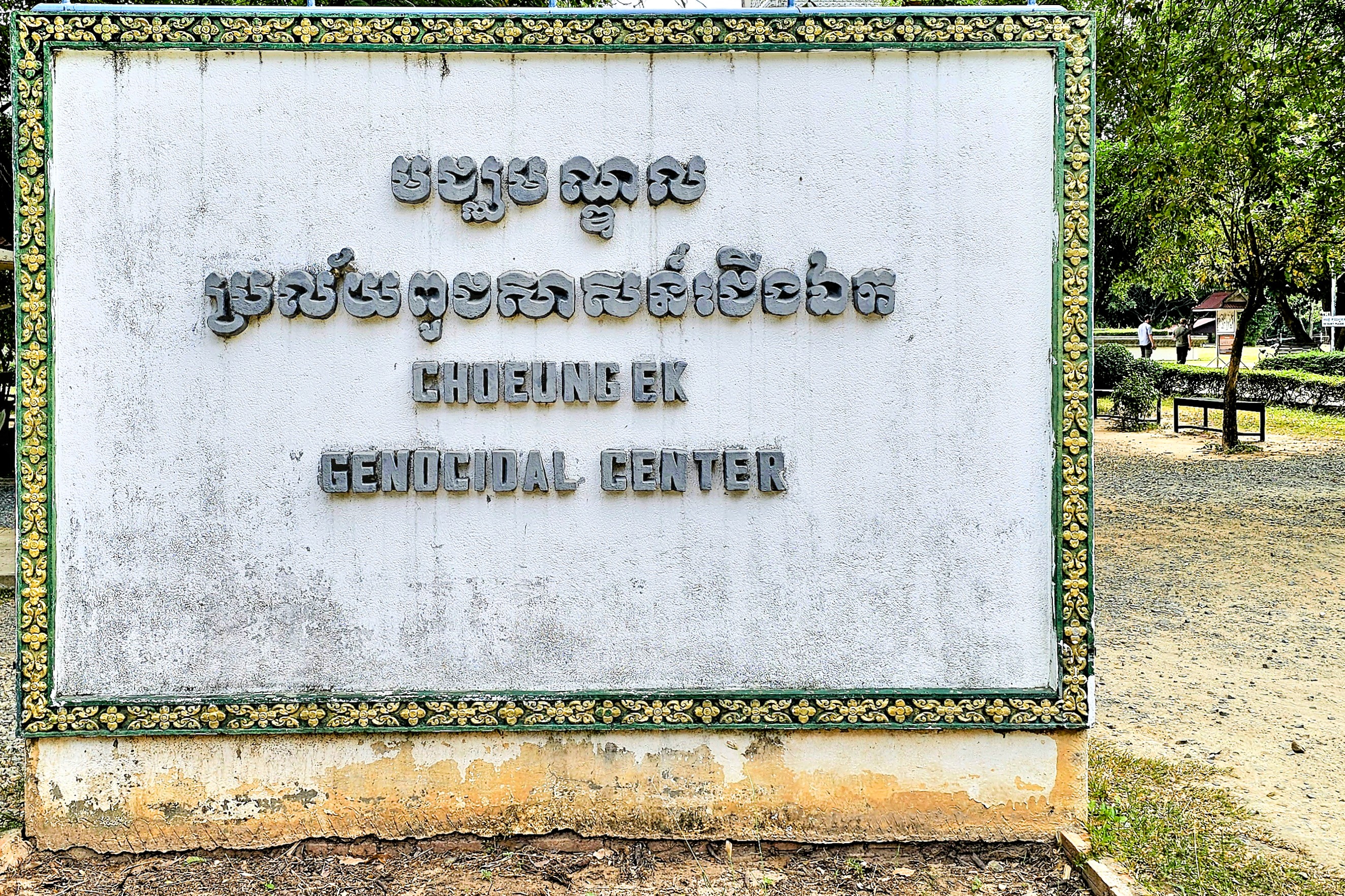
At first glance, Choeung EK is an inviting greenspace on the edge of Phnom Penh,
with flowering trees,
and a peaceful lotus pond stocked with ancient koi.
Located 12 km from City Center, it’s conveniently adjacent to AEON Mean Chey, the city’s trendiest and largest all-purpose shopping center and fashion mall targeting Cambodia’s rising middle class.
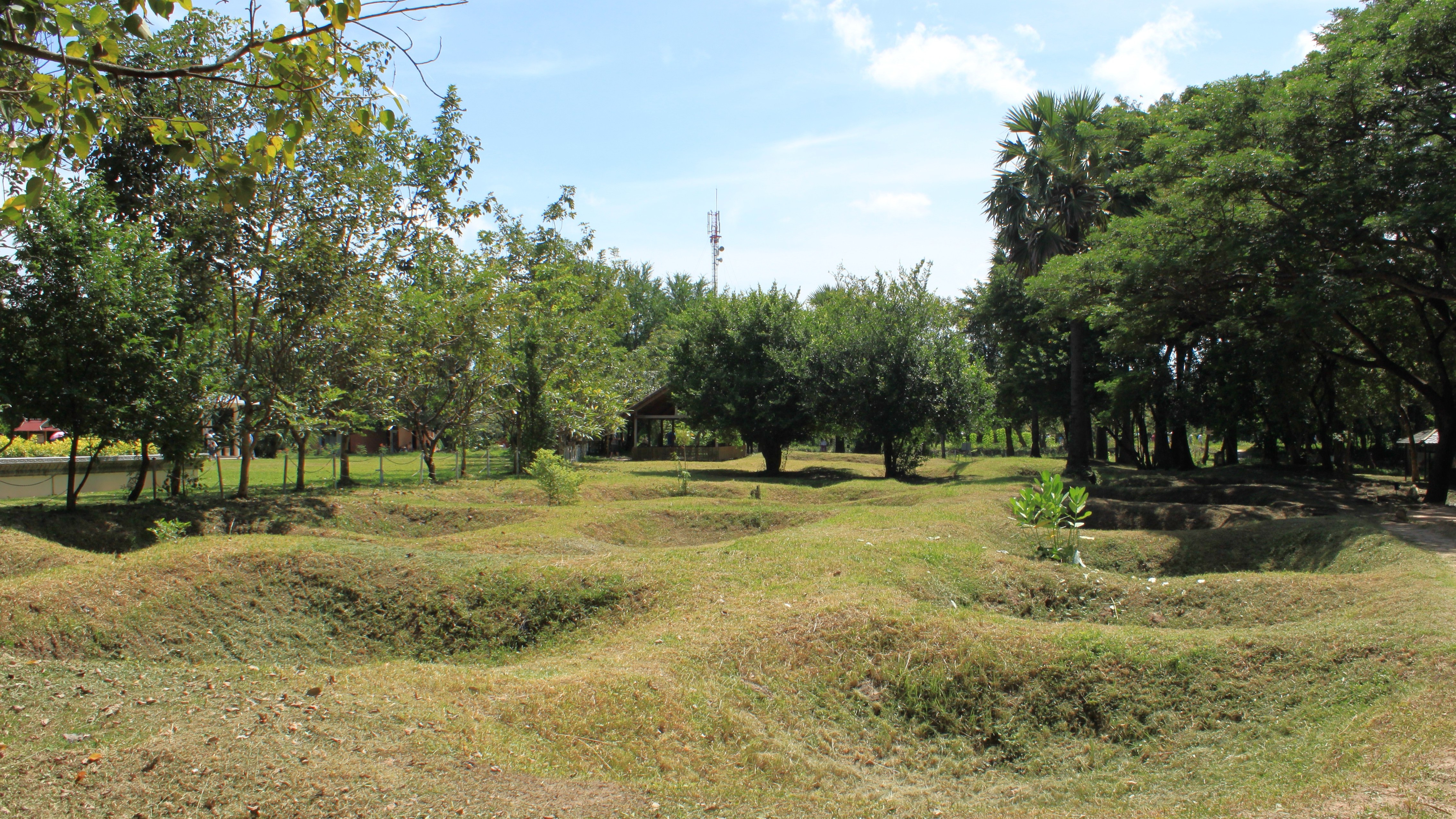
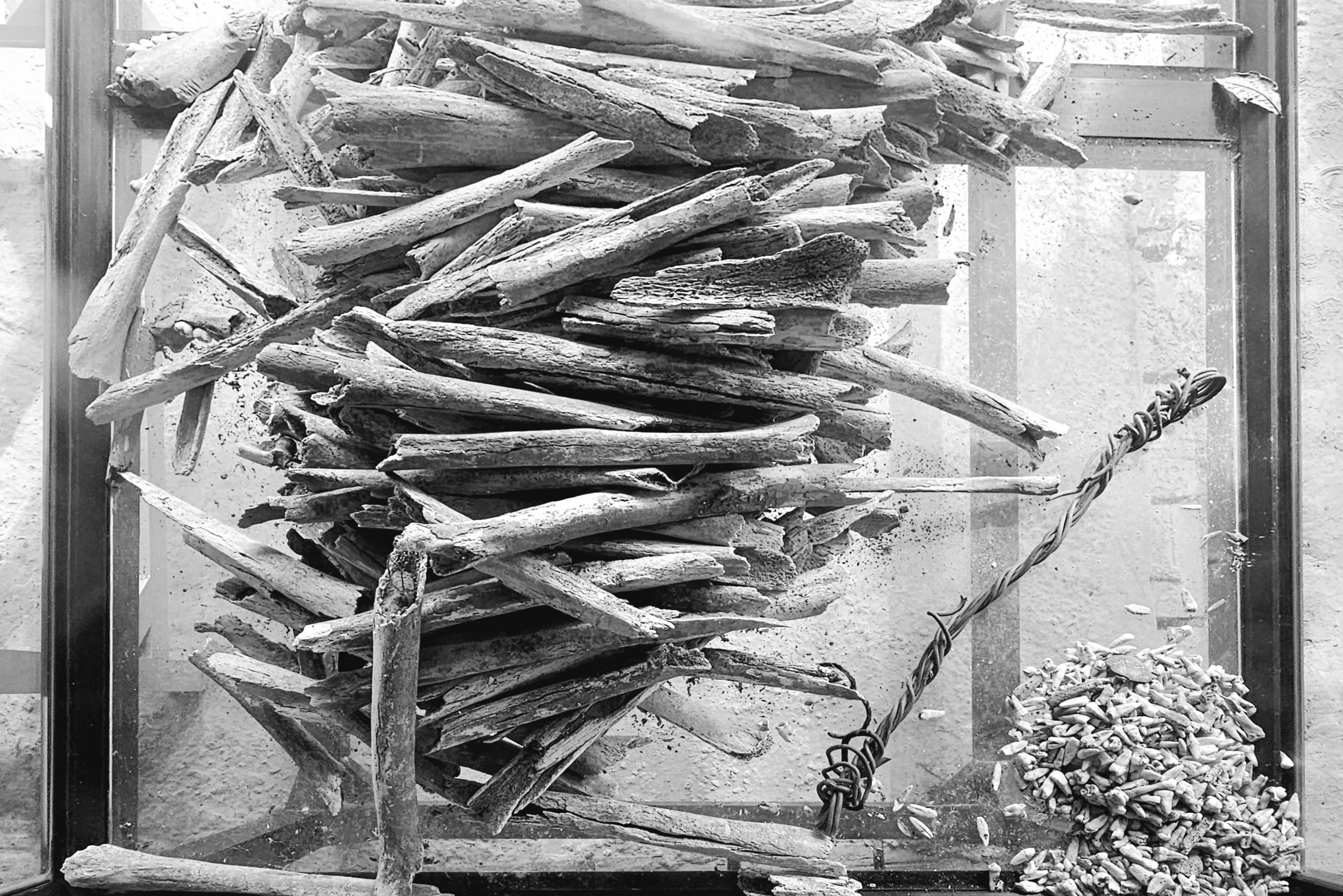
Although, from my perspective, the only fashion that’s display-worthy is a collection of fabric remnants protected in a glass box…
once worn by 20,000 prisoners whose remains continue to float to the surface during every rainy season.
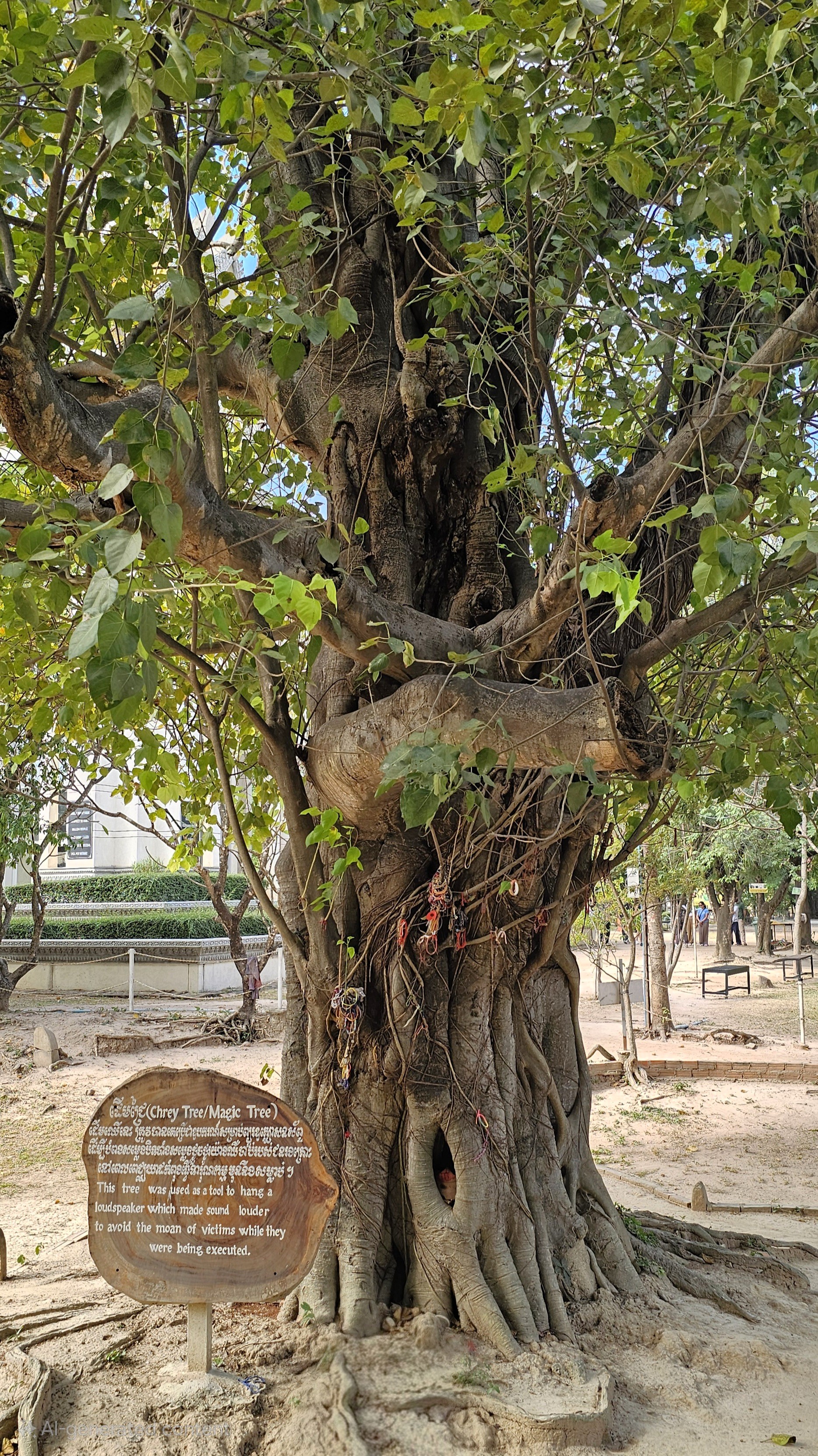
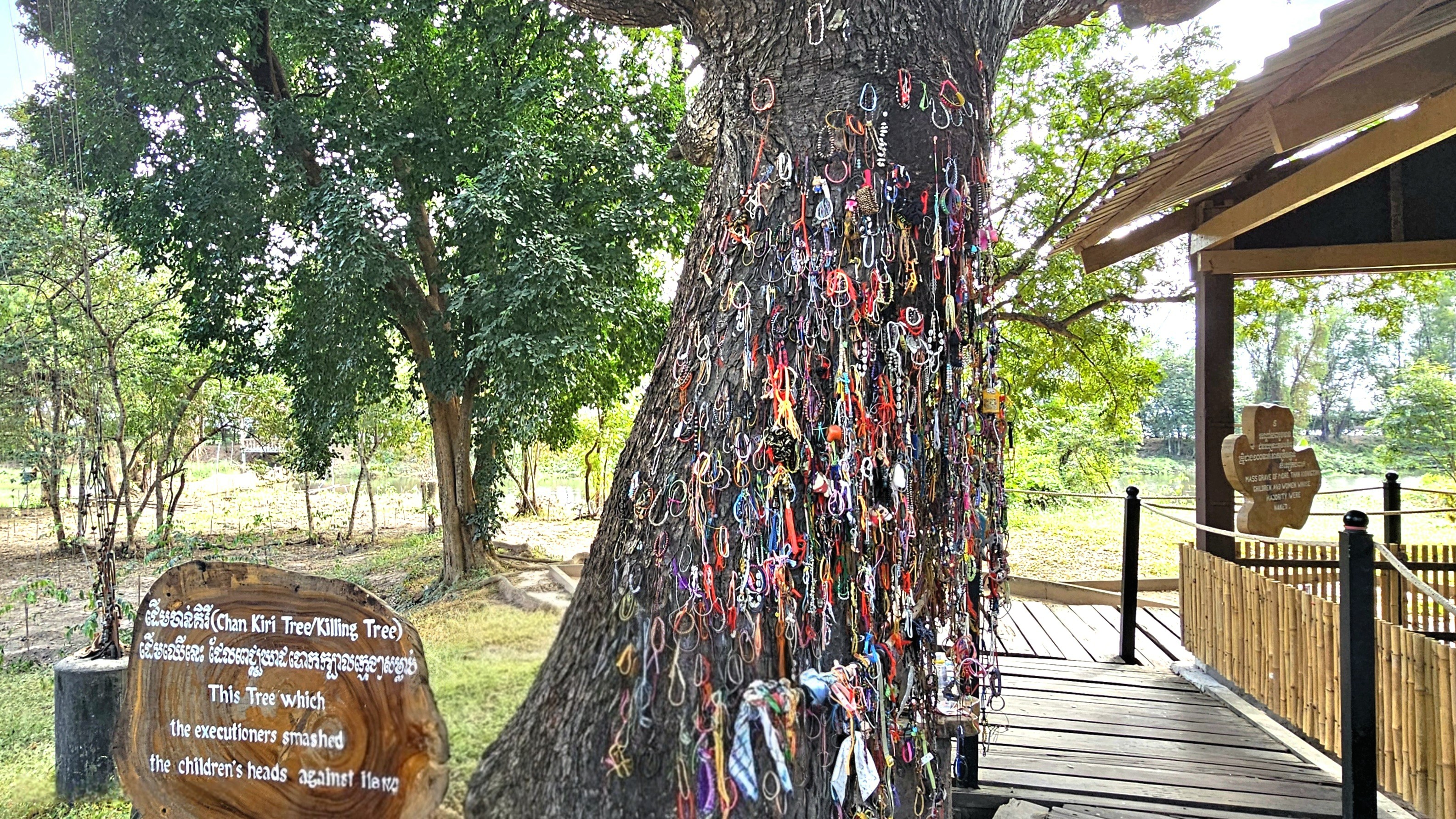
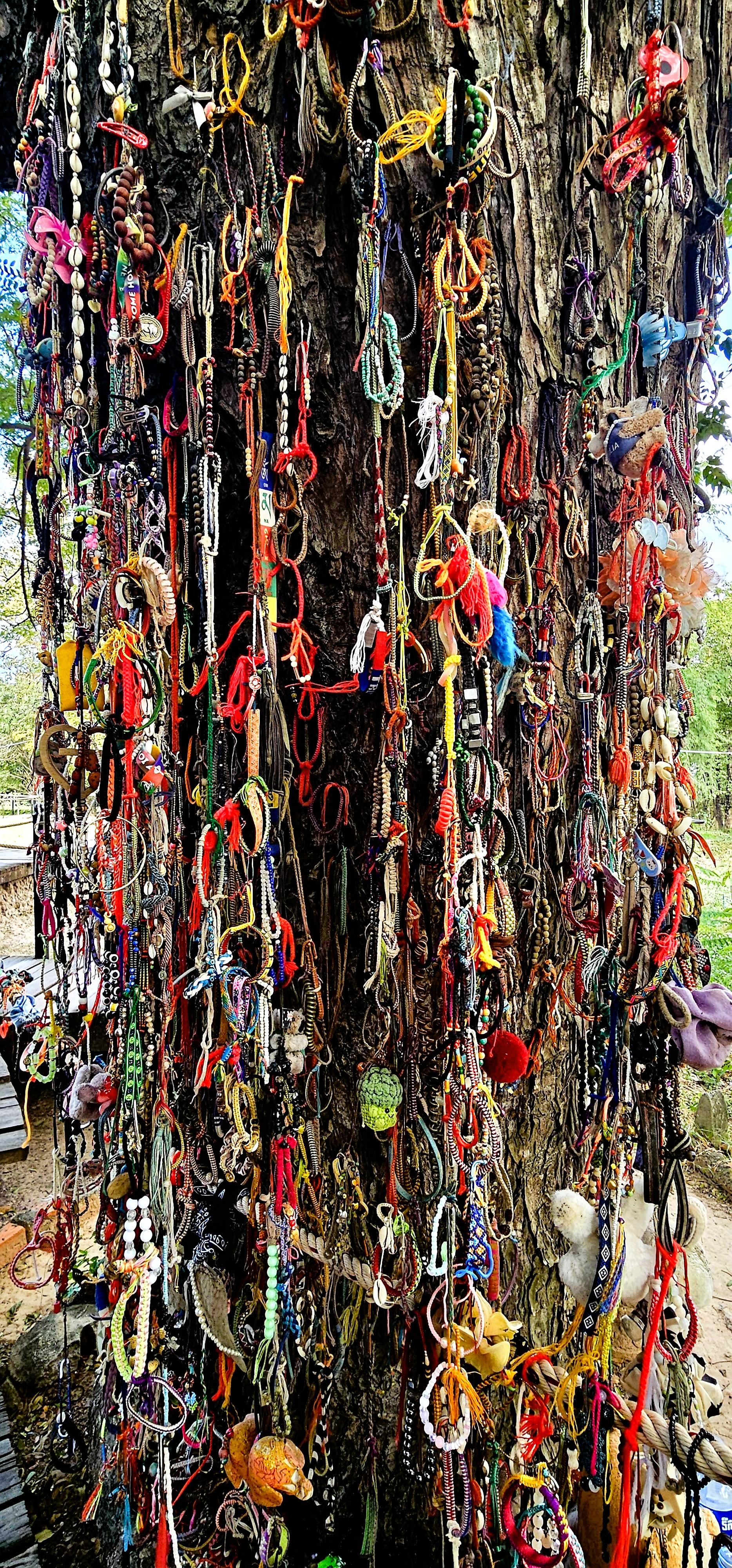
On closer inspection, the heritage trees throughout the grounds were once used as tools of brutality by agents of Khmer Rouge: from towers of dissonance,
to hardwood battering pillars.
Over the years, visitors to Choeung EK Genocidal Center have rebranded this tree as an ad hoc totem to memorialize the fate of thousands of children whose skulls were bashed against it.
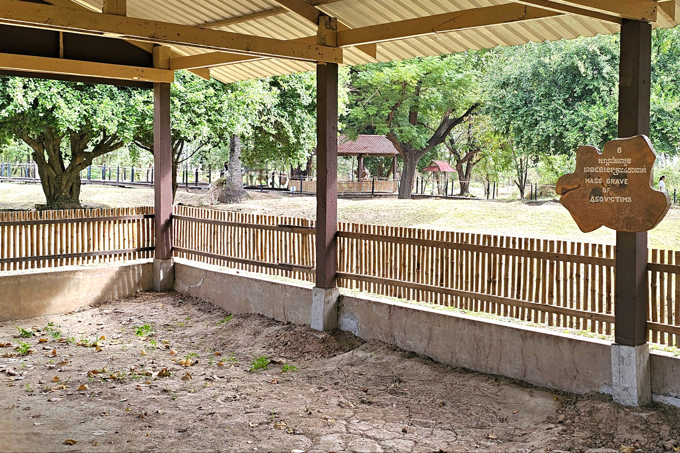
Nearby, a stunning Buddhist stupa rises from the epicenter of the killing field…
housing thousands of adult skulls recovered during a site excavation in the 1980’s.
Between 1995 and 2007, the Documentation Center of Cambodia undertook the most challenging and disheartening task of mapping and documenting Cambodia’s killing fields. Through thousands of interviews and field investigations, DC-Cam identified 19,733 mass graves and 196 prisons that operated during the Democratic Kampuchea (DK) regime.
Choeung EK’s conversion from orchard to reeducation center…
served as a lethal gateway for every soul imprisoned at the notorious Tuol Sleng Detention Center.
All day long, trucks rolled into S-21, herding political enemies into primitive barracks,
where they ultimately met their untimely fate through horrific violence.
In 5 years, an estimated 2 million Cambodians (men, women, children, and infants) were murdered by Khmer Rouge,
accounting for 25% of the nation’s population.
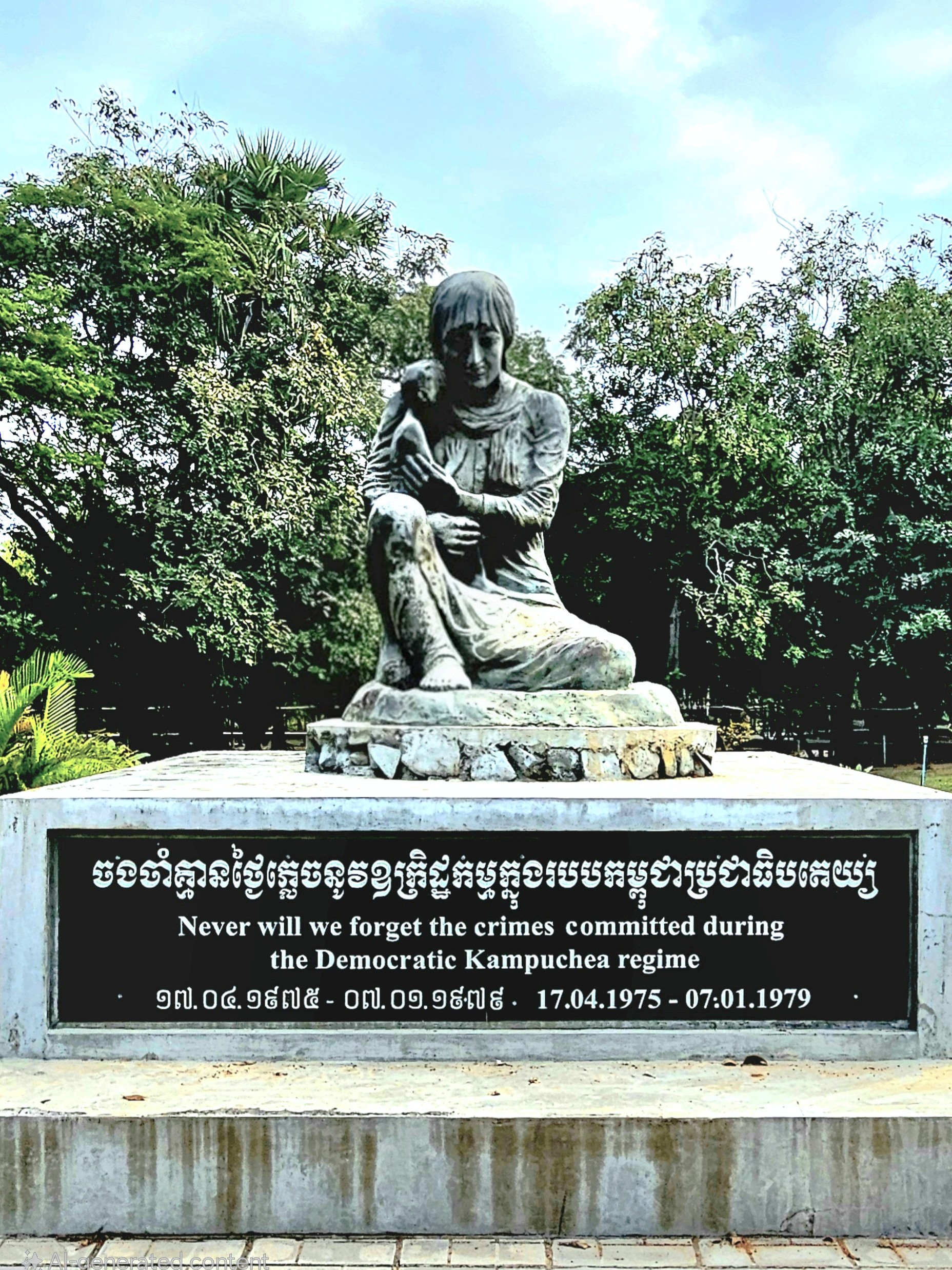
Choeung EK reopened as a historical museum and learning center on January 7, 1989, with a mission to acknowledge the historical atrocities that occurred, and to remind us that violence against each other can have devastating consequences.
Its exhibits, memorials, and curated educational programs engage visitors in meaningful conversations about human rights and reconciliation.
Cambodians will soon commemorate their loss with a National Day of Remembrance. Every May 20th, students take part in an annual ritual–reenacting the crimes of Khmer Rouge guerillas–that still haunt Cambodian people deep to the bone.
On that day and every day, we pray for healing and understanding, and the realization that confronting past acts of inhumanity will inform and guide the well-being of future generations.
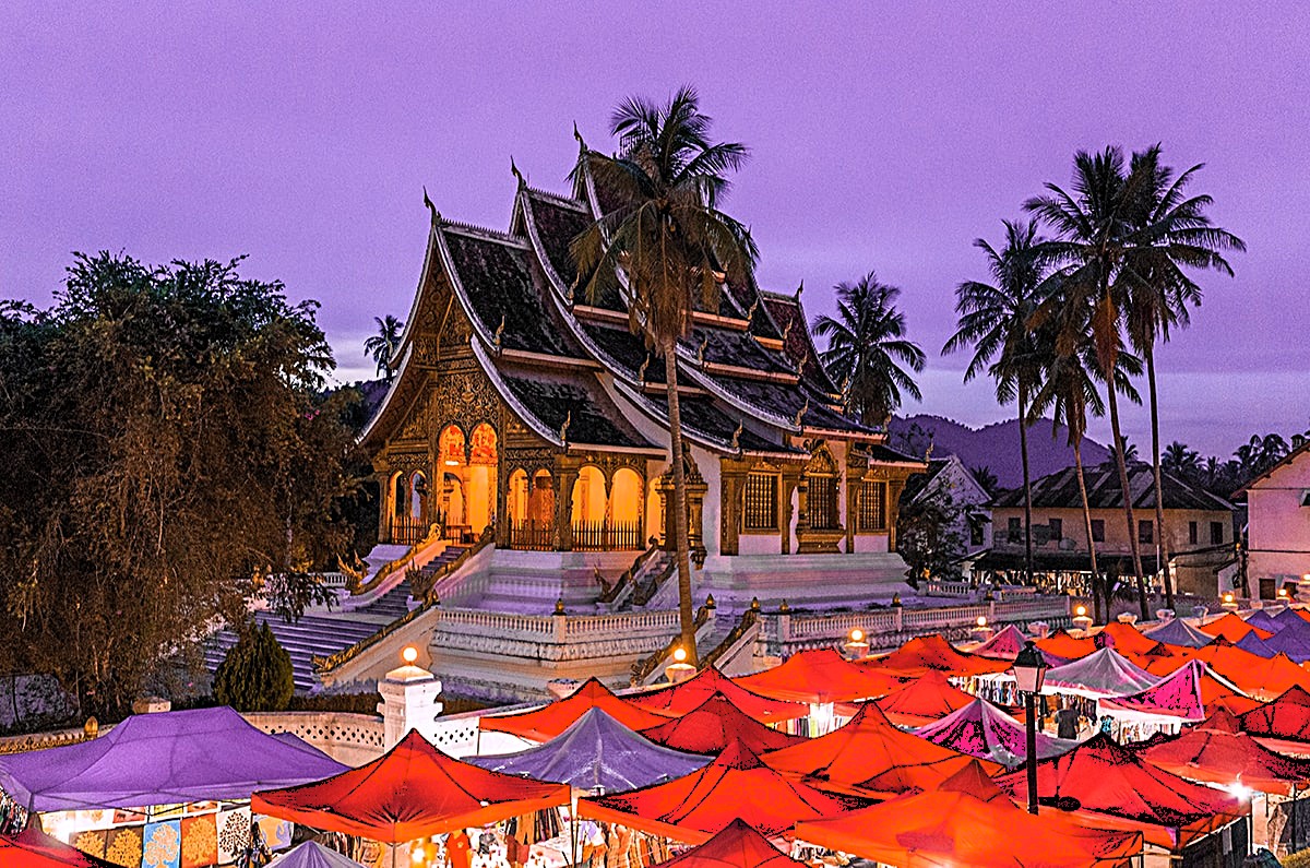
Visiting the World Heritage city of Luang Prabang was an enlightening adventure, given its rich history, its cultural gems, and its natural wonders that draw travelers from around the globe. The vibrant blend of ancient temples and French colonial architecture creates a stunning backdrop for exploration, inviting visitors to wander through its charming streets. With so much to explore, from the serene banks of the Mekong River to the bustling local markets filled with handmade crafts, it’s little wonder why our three days went by so quickly, while only scratching the surface of so many not-to-be-missed activities.
We toured the ancient capital’s Royal Palace-turned-museum …
with its purpose-built shrine housing the golden Phra Bang (translates to “delicate Buddha”), created in Sri Lanka between the 1st and 9th century, and worshipped in Luang Prabang since 1359 as the nation’s most sacred symbol.
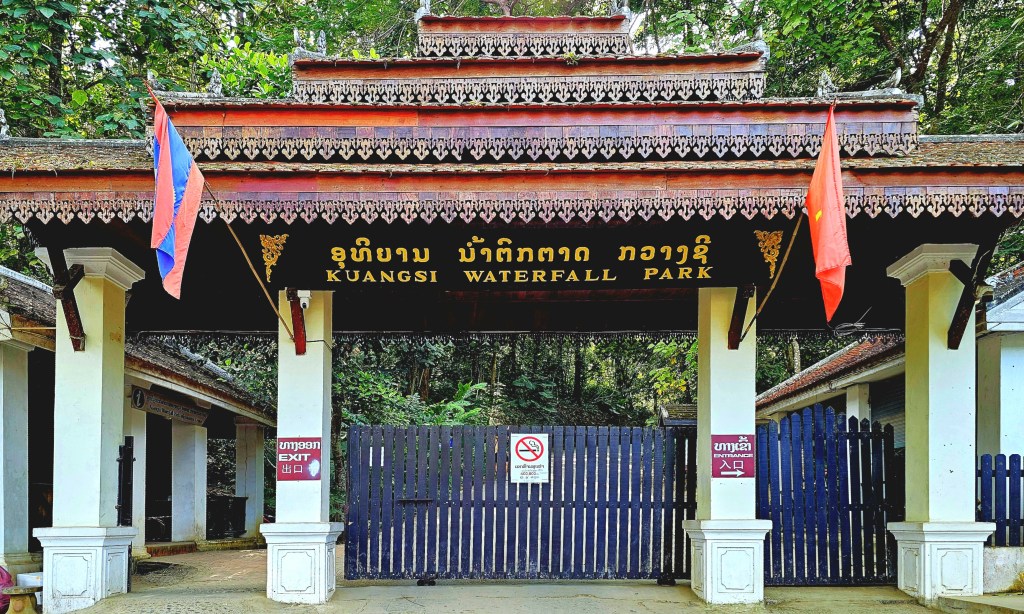
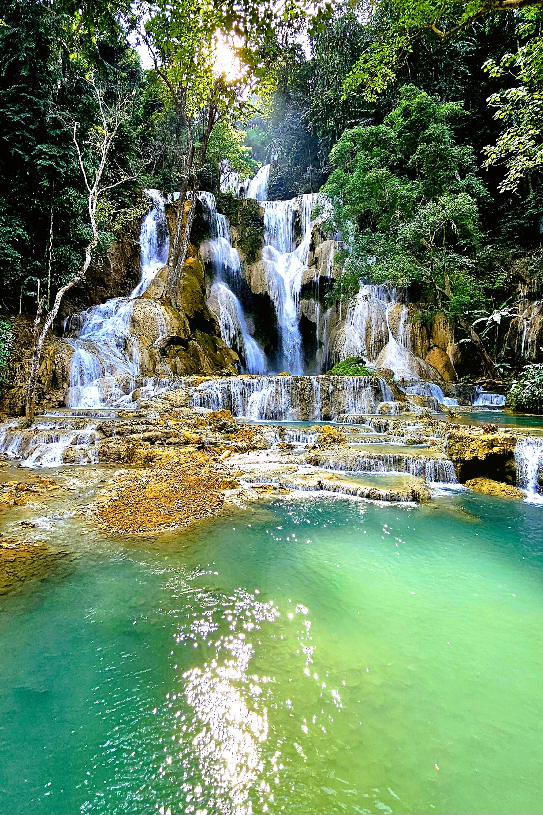
We trekked through Kuang Si Waterfall Park,
featuring a 165 ft drop …
feeding terraced plunge pools of milky green water,
and a rescue sanctuary for black Moon bears and Malayan Sun bears.
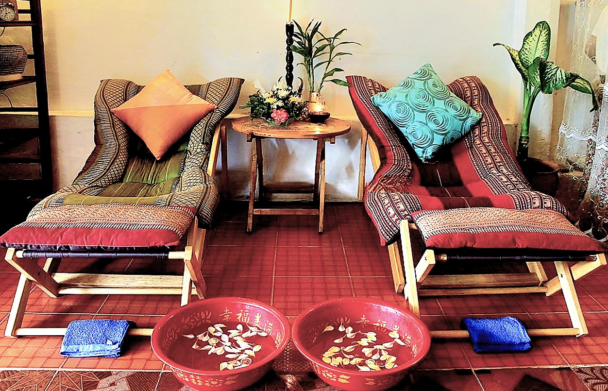
After a full day of sightseeing, many in our tour group sought respite at our hotel, the Muang Thong.
However, Leah and I enjoyed a 60-minute, aromatherapeutic couples massage for $34 at M.K. Wellness Centre only steps from our hotel,
followed by a stroll to a nearby hotel …
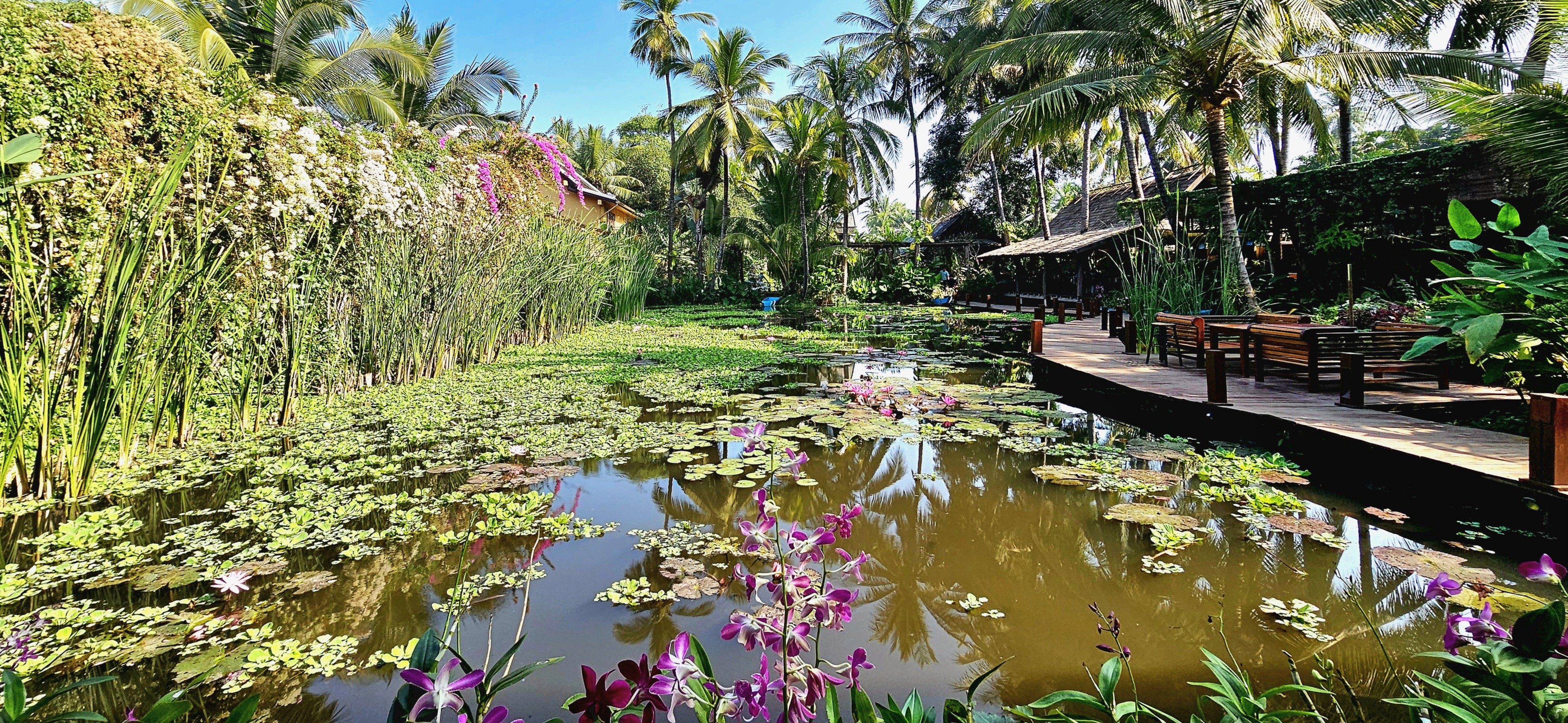
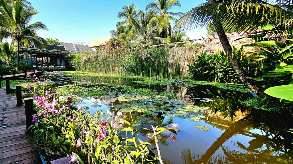
where an acre of tropical gardens is thoroughly hidden from the street,
protecting three UNESCO-classified lily ponds …
amid an oasis of orchids …
along a mahogany-clad boardwalk.
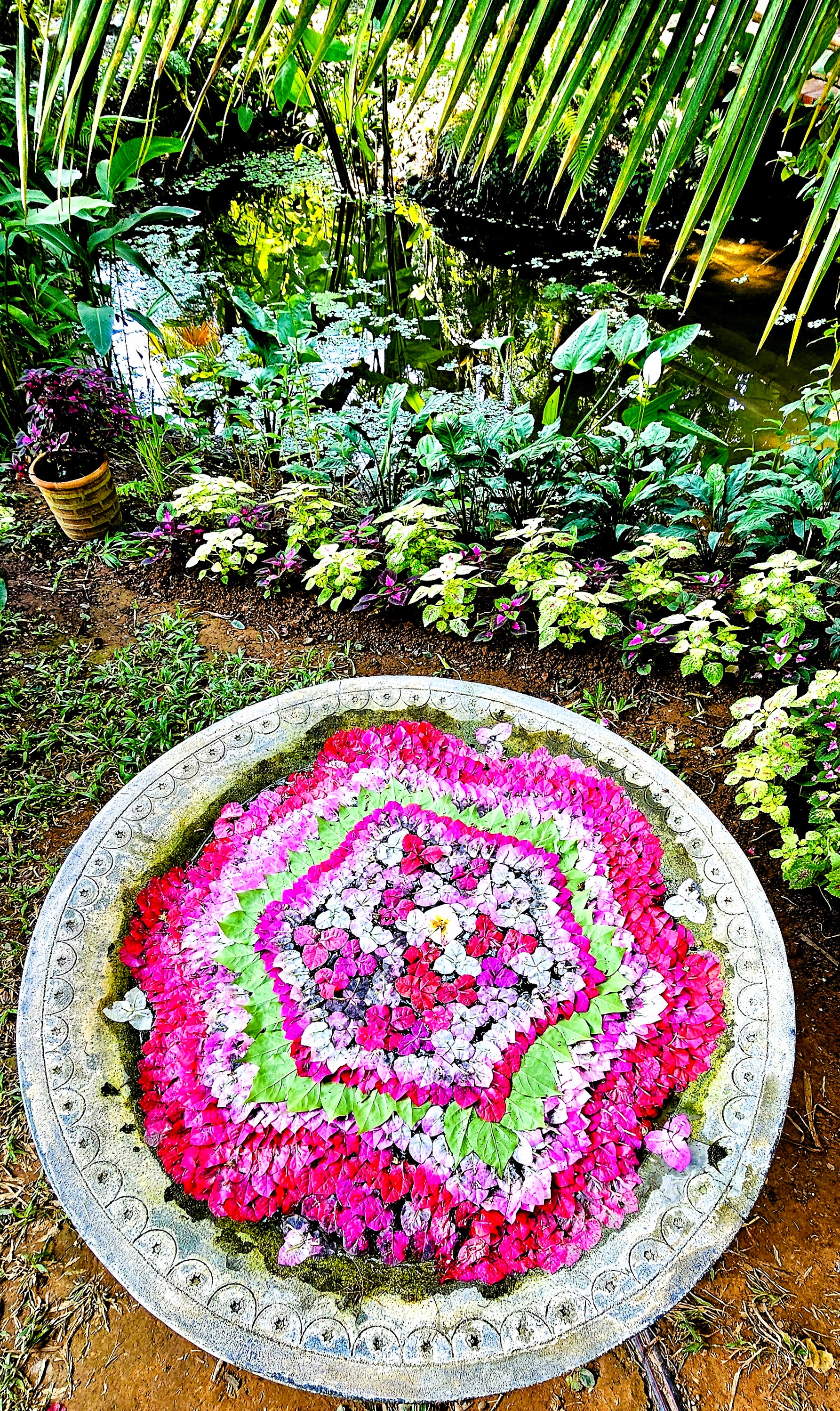
Lush flora surrounds the property and covers nearly every surface,
including the living walls.
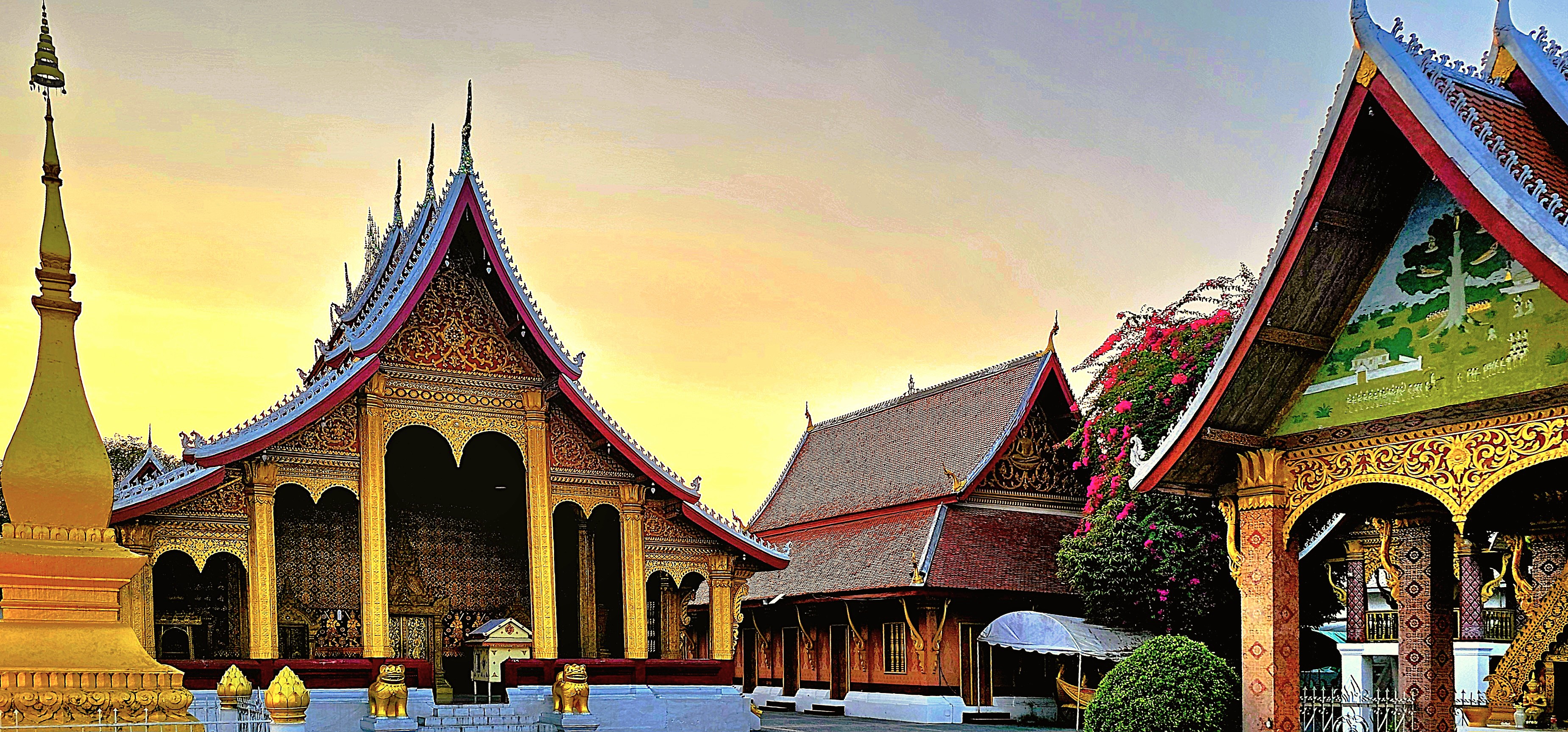
It was the perfect location to share a special dinner with fellow OATers at the hotel’s on-site restaurant, Manda de Laos,
featuring traditional Lao flavors that had us grinning ear to ear,
and energized to continue our journey to Vientiane the following day.
Overseas Adventure Travel, a familiar name in international group tourism, has a recognized history of offering an array of immersive tours that not only prioritize cultural engagement but also emphasize sustainability while remaining affordable for travelers. Their unique approach allows adventurers to connect deeply with diverse populations and local traditions, fostering genuine interactions.
In alignment with this mission, their charitable partner, Grand Circle Foundation has made a profound commitment to uplift and support the communities they visit around the world. This includes providing essential services in areas such as education, access to clean water, and leadership training, ensuring that the benefits of tourism extend far beyond the travelers themselves.
Since 1992, O.A.T.’s active participation in conservation initiatives aimed at protecting natural ecosystems and preserving cultural traditions has created a positive and lasting impact in every location they’ve ventured into, thereby enriching visitors and communities alike.
We were about to experience this, first-hand.
Our Ancient Kingdom itinerary carved out a few days to explore the ancient capital and UNESCO World Heritage site of Luang Prabang and its ethnic surroundings.
Leah and I got our bearings during our group’s late-day orientation walk through the historic district, where we admired Wat Sensoukharam,
built in 1718 during the reign of King Kitsarath, and restored to its current state in 1957.
Also known as Wat Sen, the temple is believed to have been built using 100,000 stones from the Mekong River, giving the temple its name, roughly translating to Temple of 100,000 Treasures.
With the sun setting on the Mekong,
and commuter traffic saturating Sakkaline Street,
the sidewalk eateries busily prepped for dinnertime crowds.
Down the road, merchants appointed their stalls with purses, pottery and paintings before the weekend procession to the night market, where family and friends flocked for a social evening.
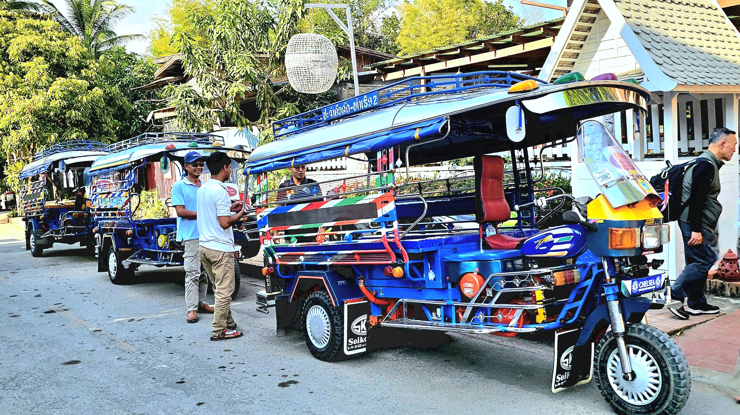
The following morning, we scrambled into jumbos,
and rode to the Royal Pier,
where we boarded a traditional wooden boat that transported us upriver to a nearby Buddhist temple on the western bank.
We roamed the modest temple grounds, surrounded by ramshackle monastery dorms,
and temple buildings that had long forsaken its gold leaf …
for peeling paint.
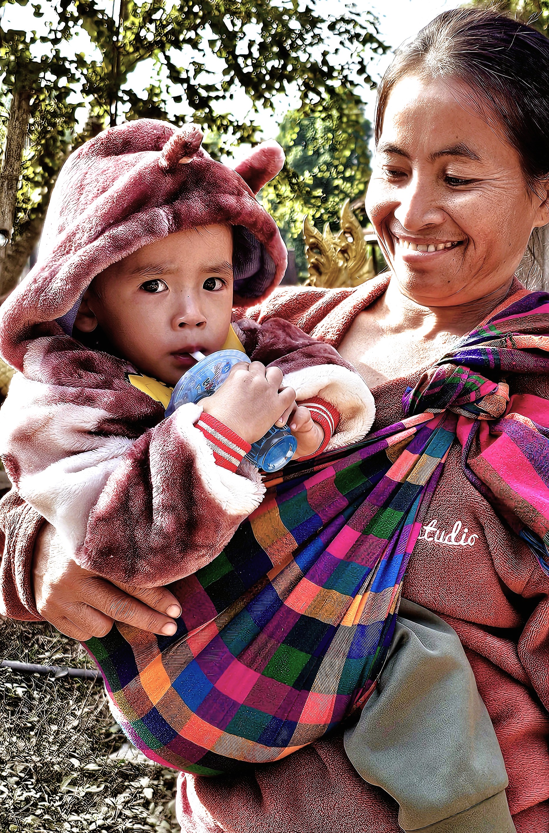
Just beyond the temple walls, a steady show of curious children received us,
acting as welcome ambassadors to Mouangkham Village,
an O.A.T.-supported community that was eager to share its hospitality.
The villagers have banded together to literally sustain themselves in a grass roots business by producing khai paen, a dried, river weed delicacy for wholesale food markets.
We observed a demonstration: from washing and rinsing,
to beating the weed into submission, until it’s been reduced to a fine green veneer of fiber.
It didn’t look overly complicated, requiring just enough finesse to master the battering. Only a scattering of thinly sliced tomatoes, shredded garlic and a sprinkle of sesame seeds was needed to complete the process.
My best effort was donated to the local economy.
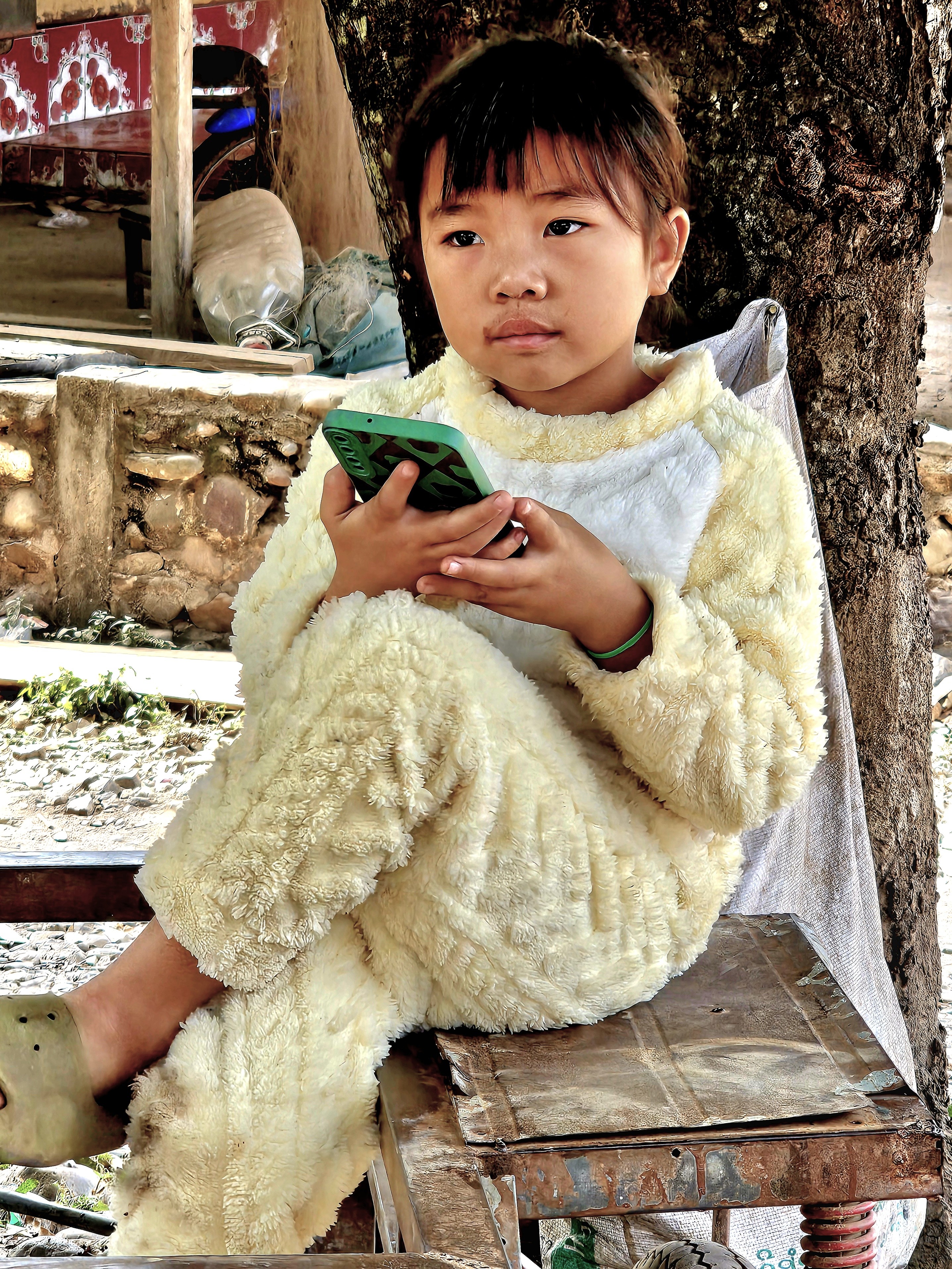
As a cottage industry, it may not seem like much, but it’s enough to provide for toddler high-tech.
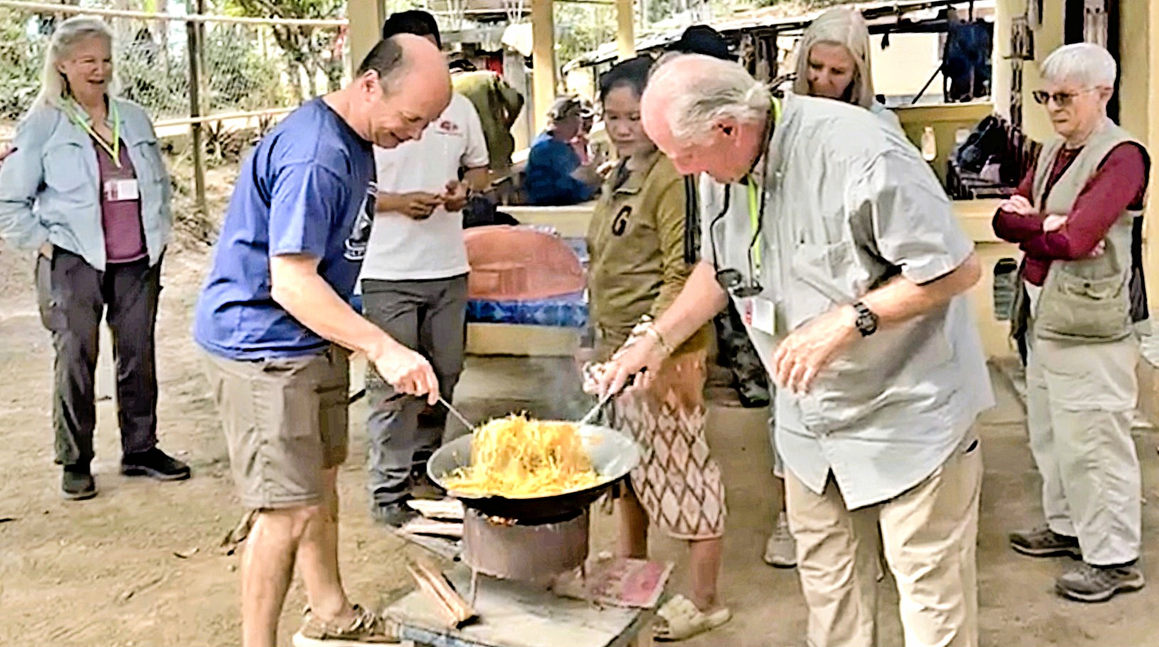
The following day, we boarded a bus to Mouang Khai Village for A Day in the Life experience among Lao, Khmu and Hmong people, who share humble homesteads,
but celebrate a rich cultural heritage, like playing the qeej (a reeded bamboo instrument) during a teenage courtship dance.
The village chief hosted a traditional Lao lunch, cooked by us with appropriate guidance…
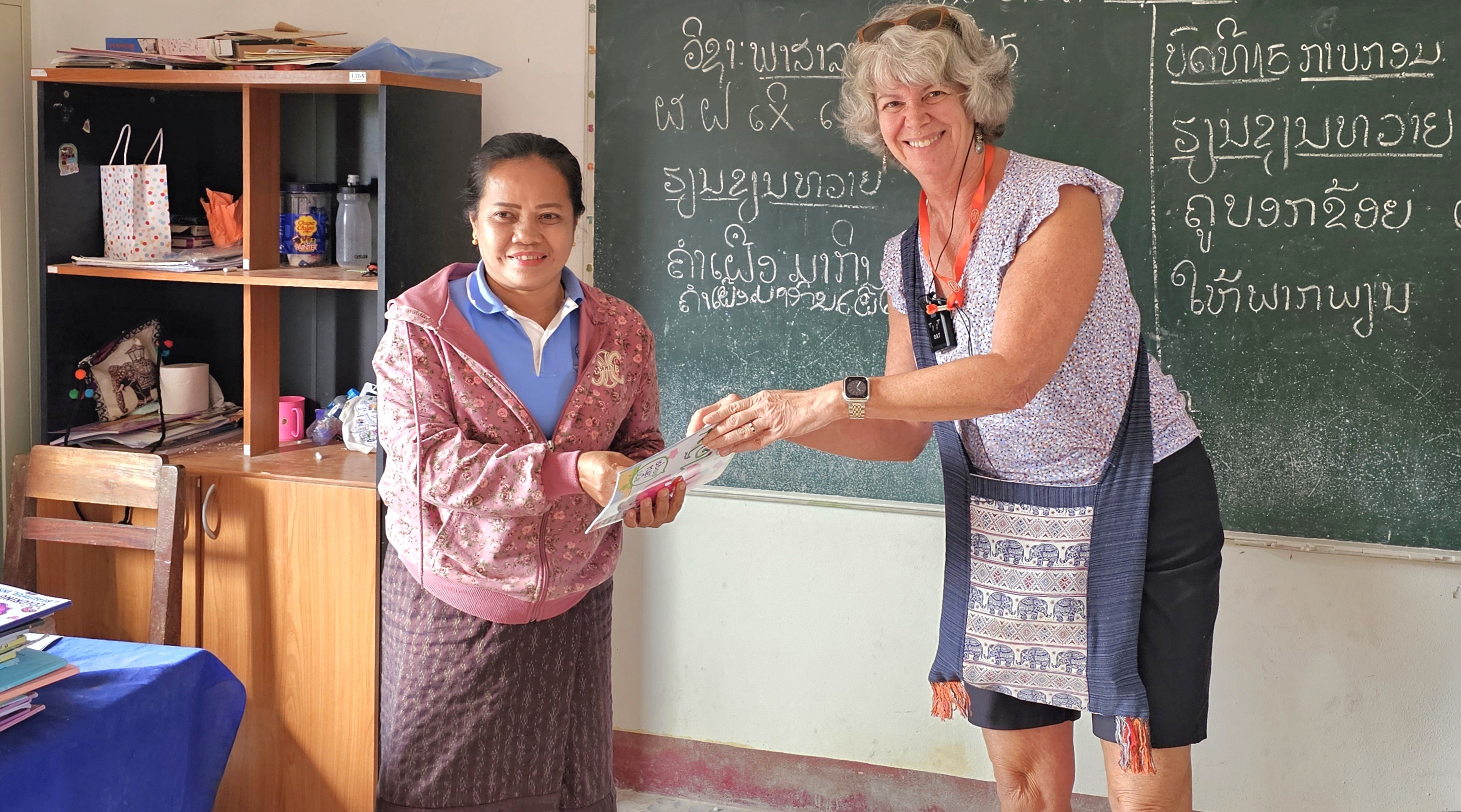
but the highlight of the day was attending primary school with a dozen youngsters at their Grand Circle Foundation-funded, one-room schoolhouse, where we were exuberantly serenaded,
while the older children…
looked after the younger children.
After a special presentation to the village teacher of 15 years,
we were escorted back to our bus.
It was a special day-in-the-life.
By reaching out and connecting with communities around the world, we learn to appreciate firsthand, not only our diversity, but our commonality — and the understanding we gain can be life-changing.
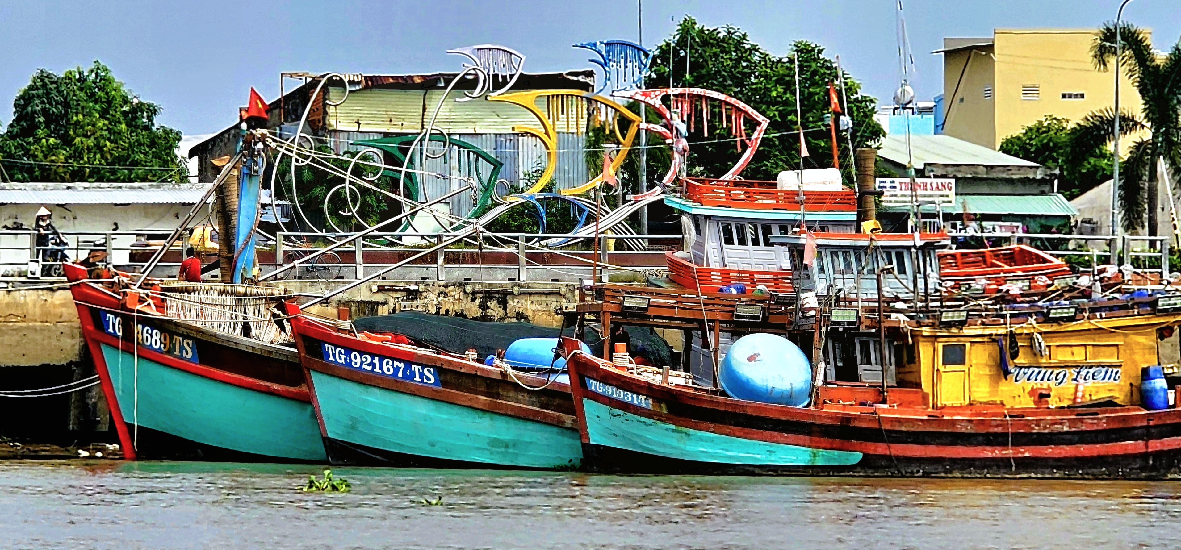
While sifting through hundreds of photographs taken during a recent tour of Southeast Asia (see past posts), I weeded out a wave of watercraft shots, and thought a maritime montage of nautical notions would make the perfect post.
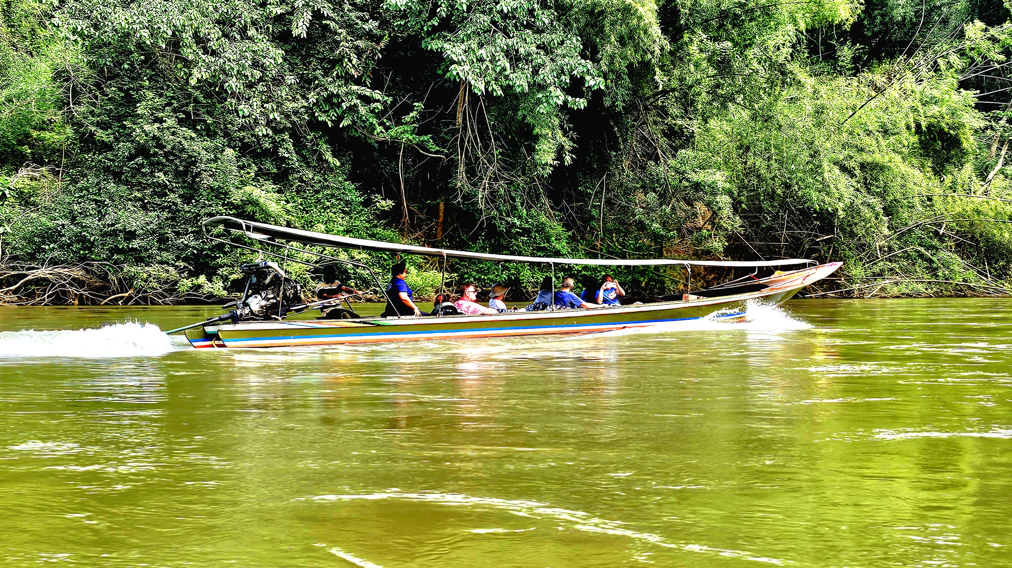
During our visit to Kanchanaburi, Leah and I enjoyed time on the River Kwai in a traditional long-boat…
giving us splendid views along the water,
and a glimpse of river-lounging for well-heeled tourists:
But it wasn’t until we returned to Bangkok’s Chao Phraya that we gained a greater appreciation of the river’s transportation network:
of river buses, cross-river ferries, water taxis, and sunset party boats.
On another occasion, we boarded a long tail to cruise upriver on the Chao Phraya,
taking in the sites of the ancient capital of Ayutthaya…
along the waterfront.
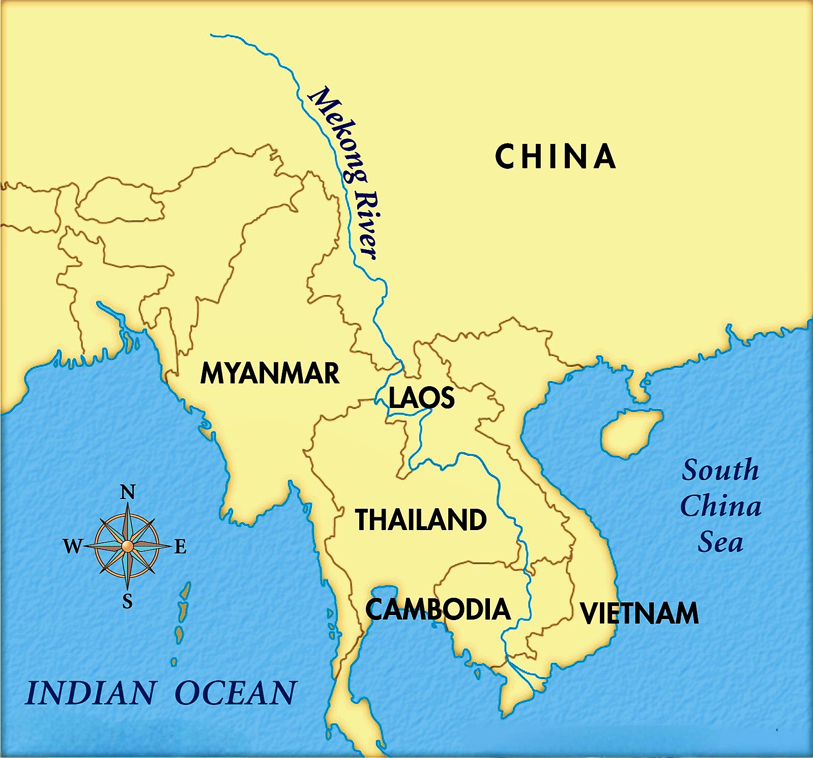
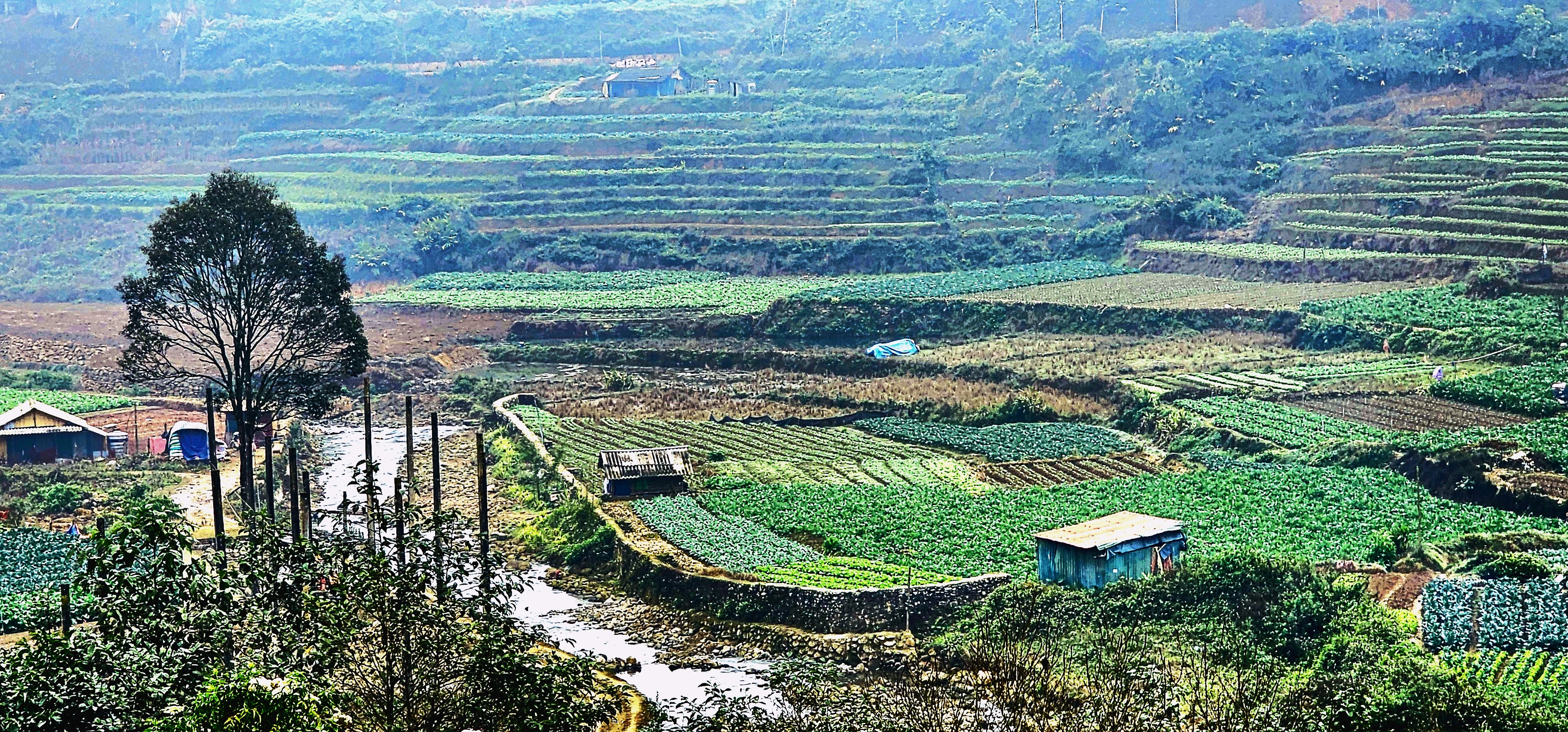
But the mighty Mekong is Southeast Asia’s “Mother of all Rivers” and most significant waterway. It winds its way from the Tibetan Plains to the South China Sea, running through Myanmar, Laos, Thailand, Cambodia, and Vietnam, making it the region’s longest river at nearly 3,000 miles.
The Mekong is also the most productive river on the planet–boasting the world’s largest inland fishery–
which accounts for up to 25% of the global freshwater catch while providing livelihoods for 90 million people,
and supporting 54,000 sq mi of rice crops.
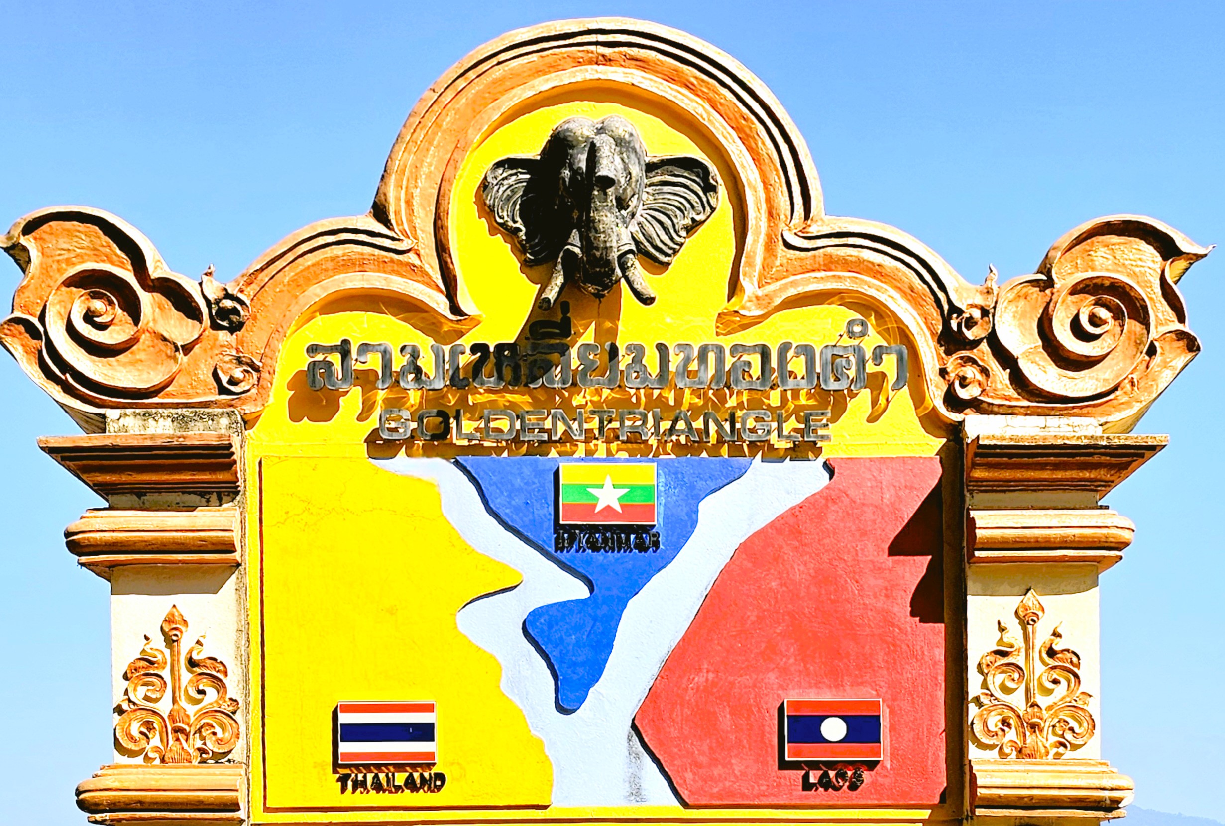
While touring upper Chiang Rai, Leah and I were hypnotized watching the confluence of Myanmar’s Roak River flowing into the Mekong–
separating Thailand and Laos to form the Golden Triangle.
But it wasn’t until our visit to Luang Prabang, Laos that we caught a second look at the Mekong–this time during golden hour–
which set the stage for our cruise the following day on a traditional wooden boat.
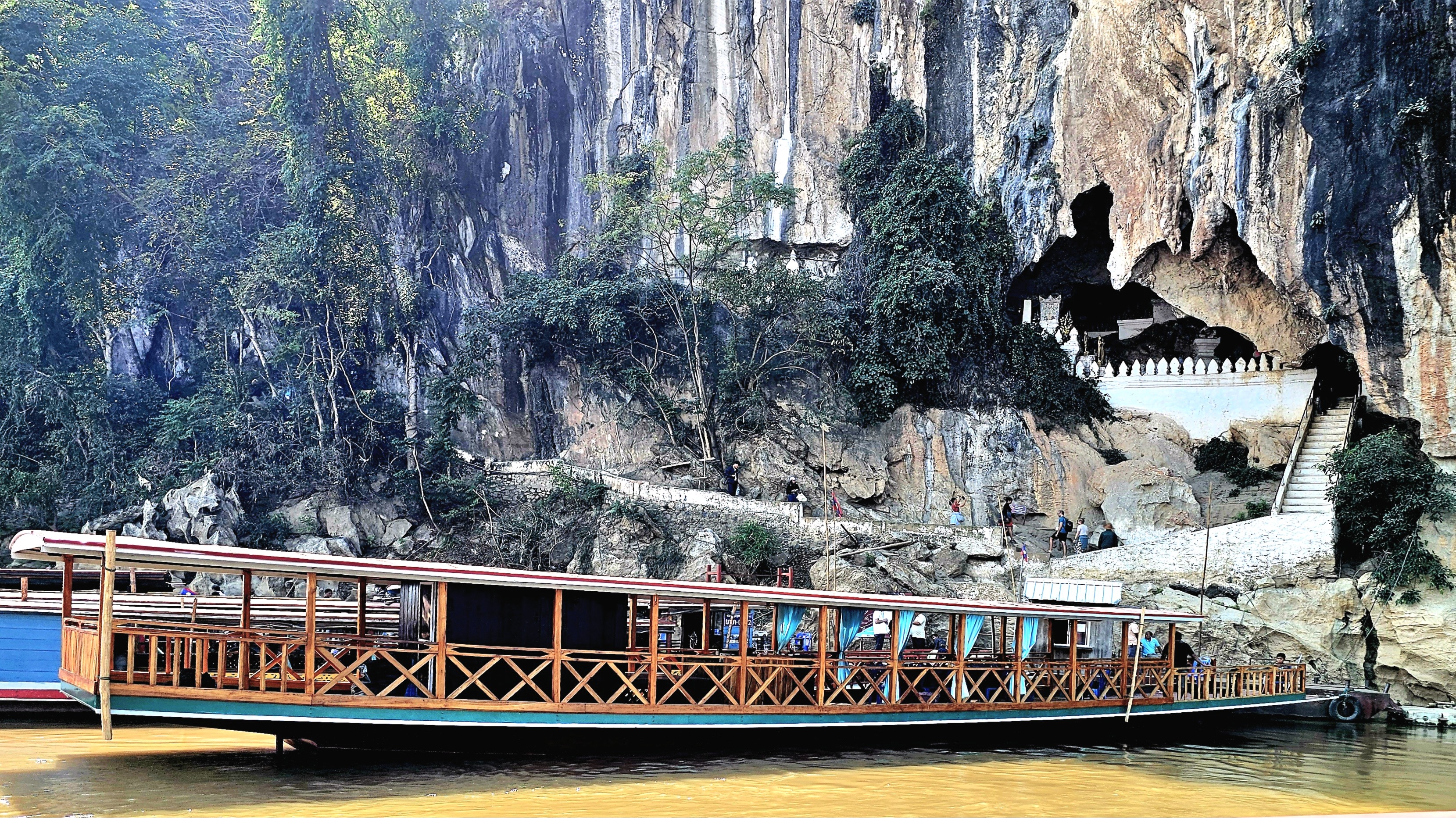
We motored slowly upriver to where the Mekong meets the Nam Ou River at Ban Pak Ou,
and disembarked directly across from the village…
to explore the Pak Ou Caves–Tham Ting and Tham Theung–located on the west bank of the Mekong River.
The first Lao people arrived at Ban Pak Ou from South China during the 8th century. They brought a strong belief in spirits and a profound respect for all things nature. It was an animistic religion known as Ban Phi.
The villagers believed that the caves were enchanted with river spirits, and they performed periodic blood sacrifices for prosperity and protection, but by the 16th century, Buddhism had been adopted by the royal families of Lao, who offered their patronage until the last days of the monarchy in 1975.
While Buddhism remains a unifying feature of Lao culture, animistic rituals continue to thrive and have been seamlessly integrated into Buddhist ceremonies, allowing Shamans and monks to symbiotically tend to the spiritual needs of their worshippers.
These days, the caves are a well-known repository for over 4,000 miniature Buddha sculptures, mostly old or disfigured impressions dating from the 18th century.
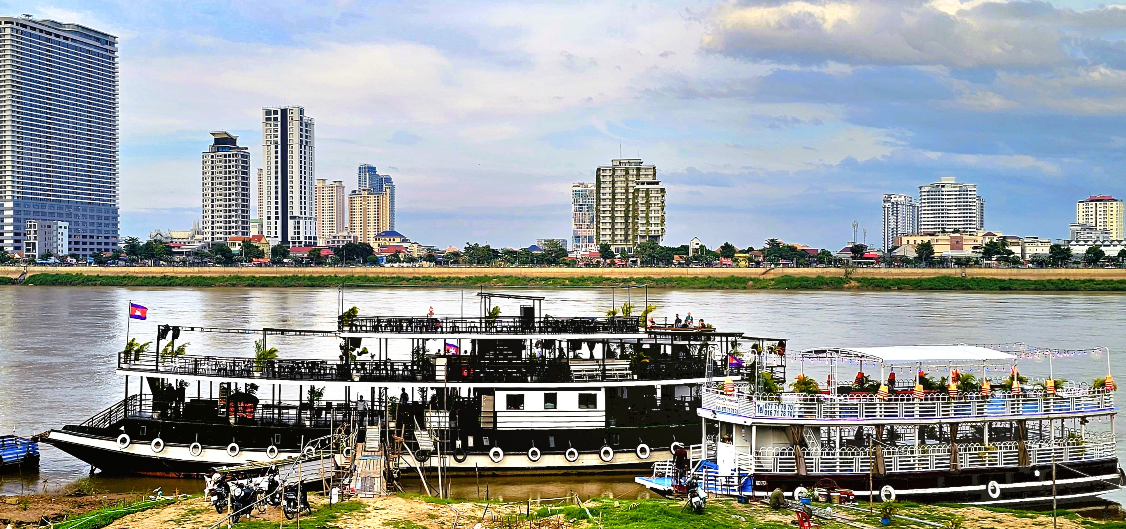
We were reacquainted with the Mekong during our stay in Phnom Penh, where we enjoyed a delightful sunset cruise on the river,
with all the beer we wanted!
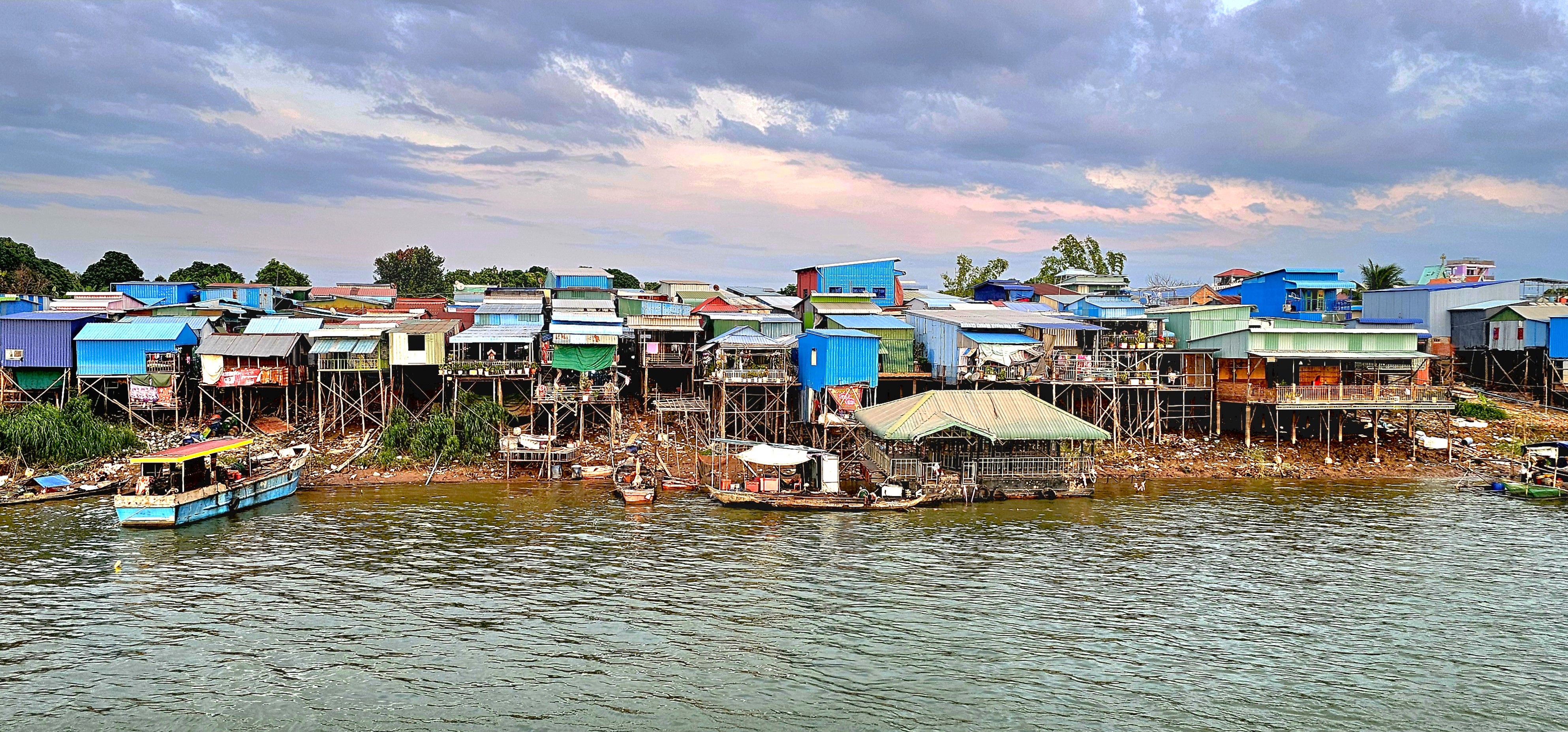
The ever-shifting city skyline…
stands in stark contrast with Akreiy Ksatr Village on the opposite bank.
But a new ferry station supports continued growth along the river in every sector,
making Cambodia an emerging economic engine among ASEAN nations.
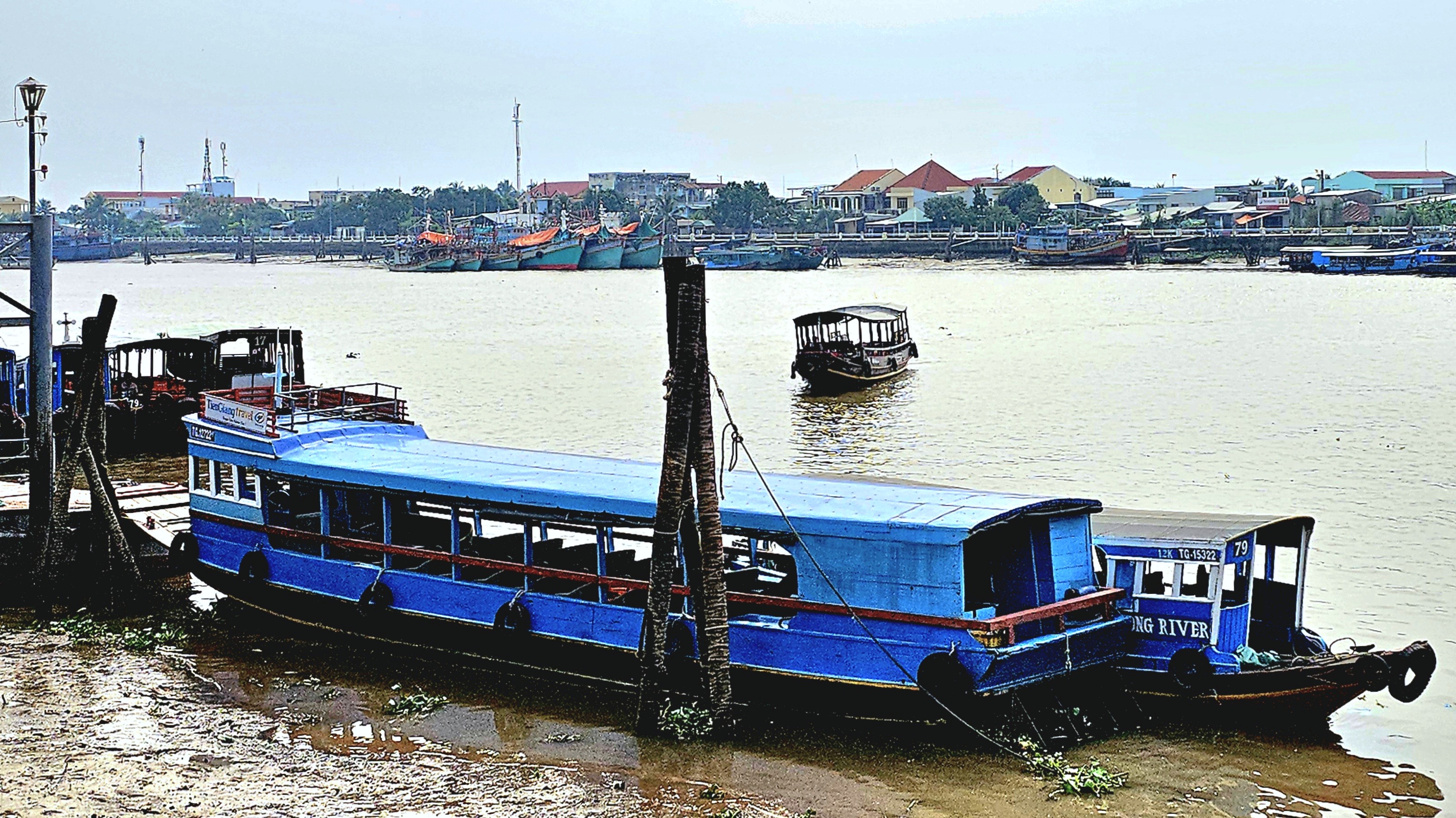
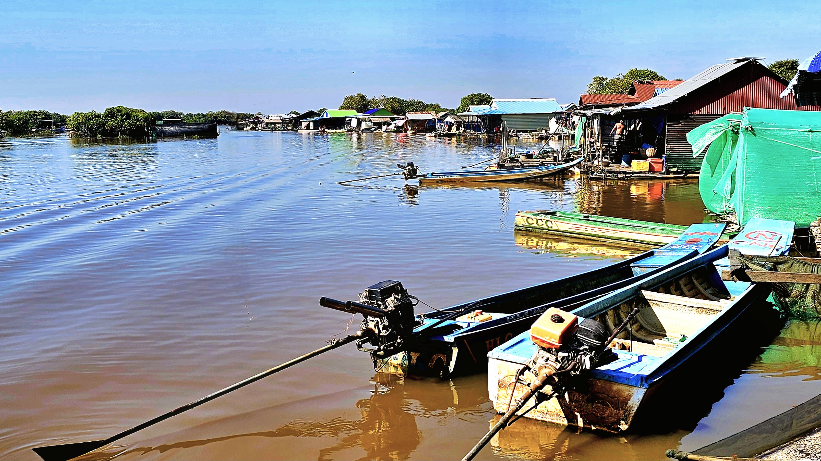
Lastly, during our visit to Vietnam, Leah and I traversed the Mekong Delta on a chartered riverboat.
As we navigated inside a shallow tributary, my mind quickly turned to Conrad’s “Heart of Darkness,” with haunting visions of Marlow’s journey on the Congo River.
Initially, our captain wondered if the incoming tide would lift our boat over the mud, unlike other sidelined sailors,
as we managed to crawl through the middle of the passage at low tide.
Eventually, we exchanged our boat for an excursion by sampan,
until we reached our next location,
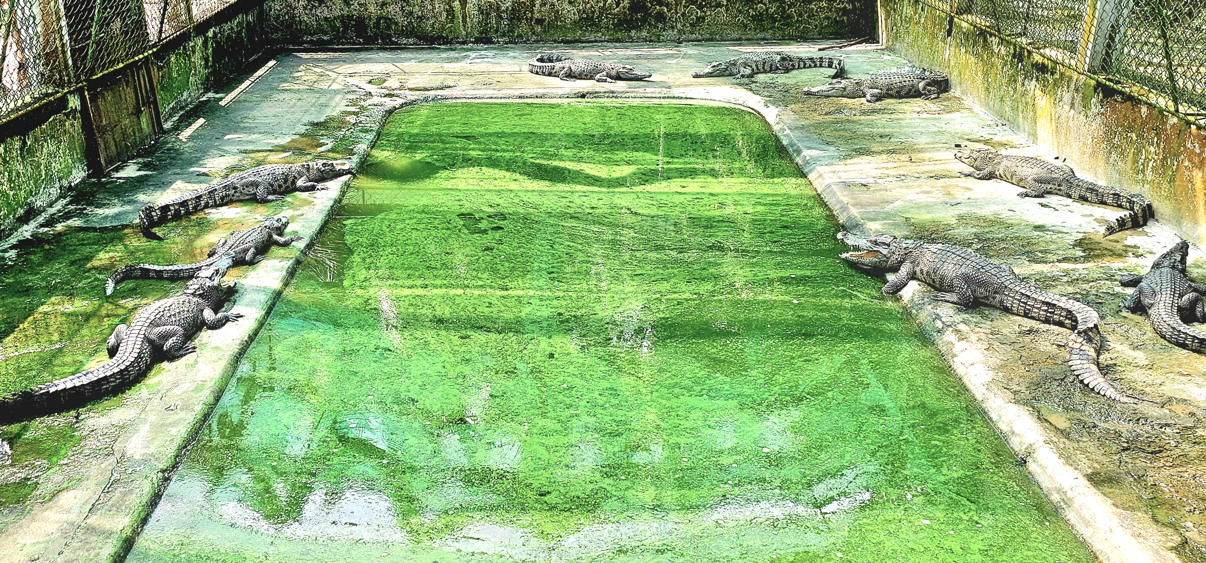
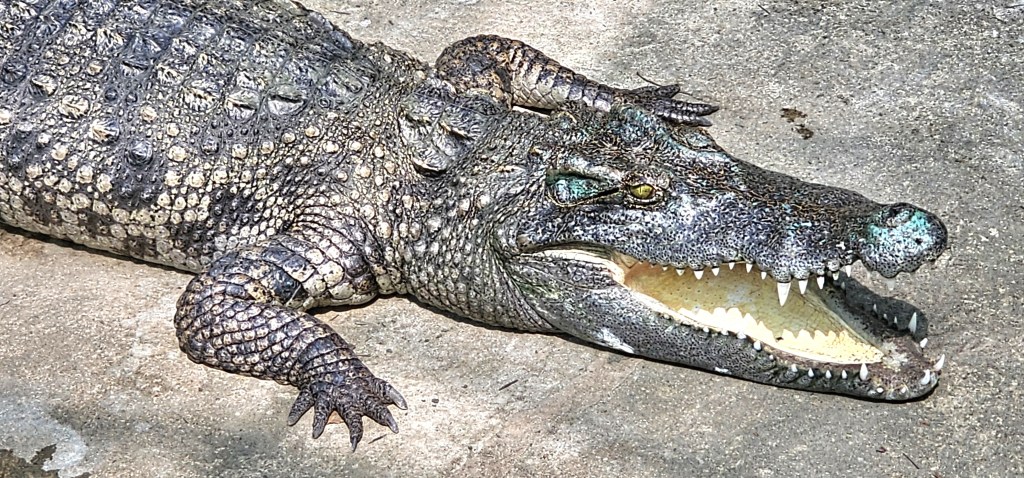
where Siamese crocodiles are on the menu and not on the Mekong, thankfully!
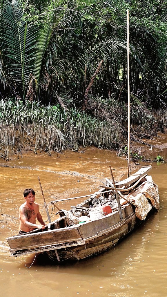
There were many other water activities throughout our tour, yet nothing prepared us for a day on Tonlé Sap, where we observed Cambodians living on the water, full-time.
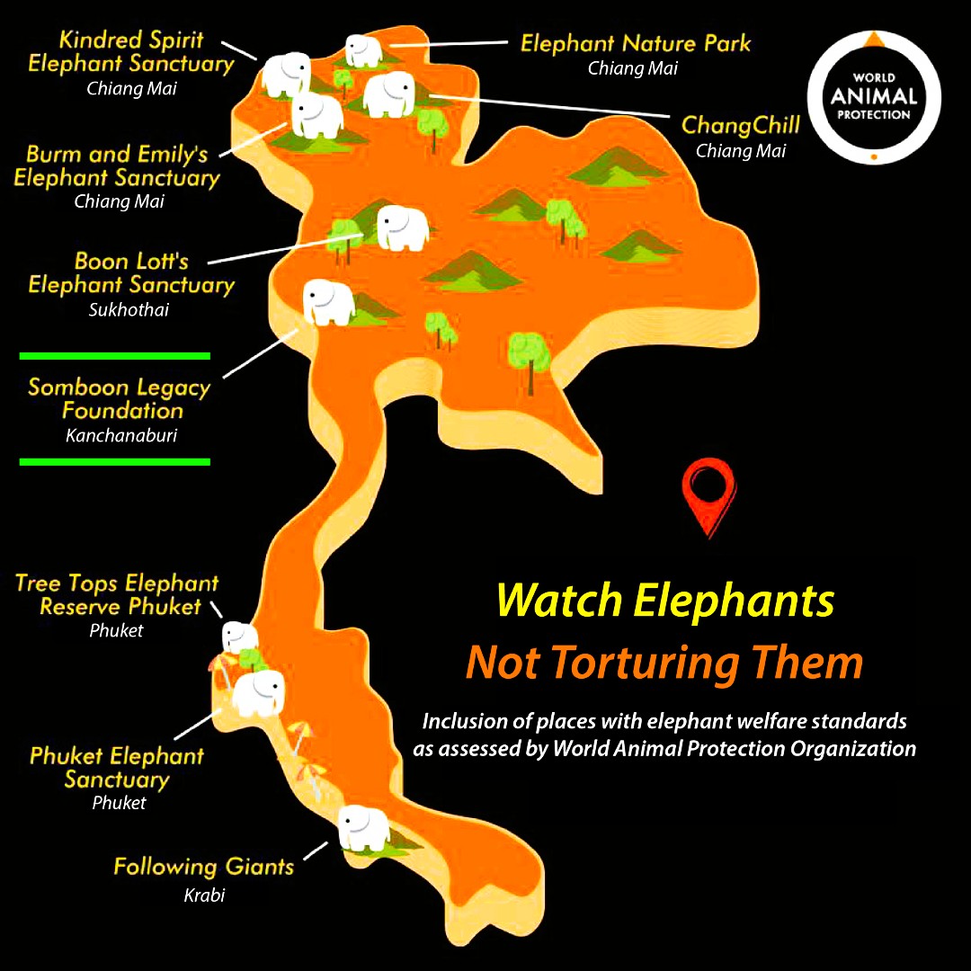
On January 3, 2025, Blanca Ojanguren Garcia, a 22-year-old Spanish tourist and law student, sustained a life-ending head injury after being shoved by an elephant during a bathing ritual at Koh Yao Elephant Care in Thailand. The mahout (keeper, trainer, companion) in charge of the elephant was charged with “negligence causing death.” Authorities suggested the elephant may have been stressed. (https://www.bbc.com/news/articles/c9wlzz9179do).
Ms. Garcia’s tragedy marked the first fatality of a new year that saw 39 deaths in 2024. In fact, last December 11, a 49-year-old Thai woman was killed by a wild elephant that charged her at Phu Kradueng National Park. (https://www.nationthailand.com/news/general/40044052). She was one of 240 victims of elephant violence over the past 12 years. Consequently, animal rights advocates have renewed efforts to re-examine the ethics behind elephant management in Thailand.
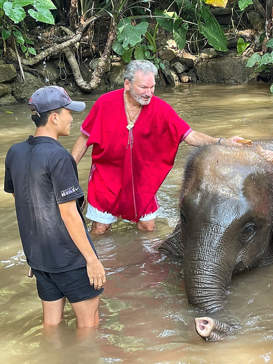
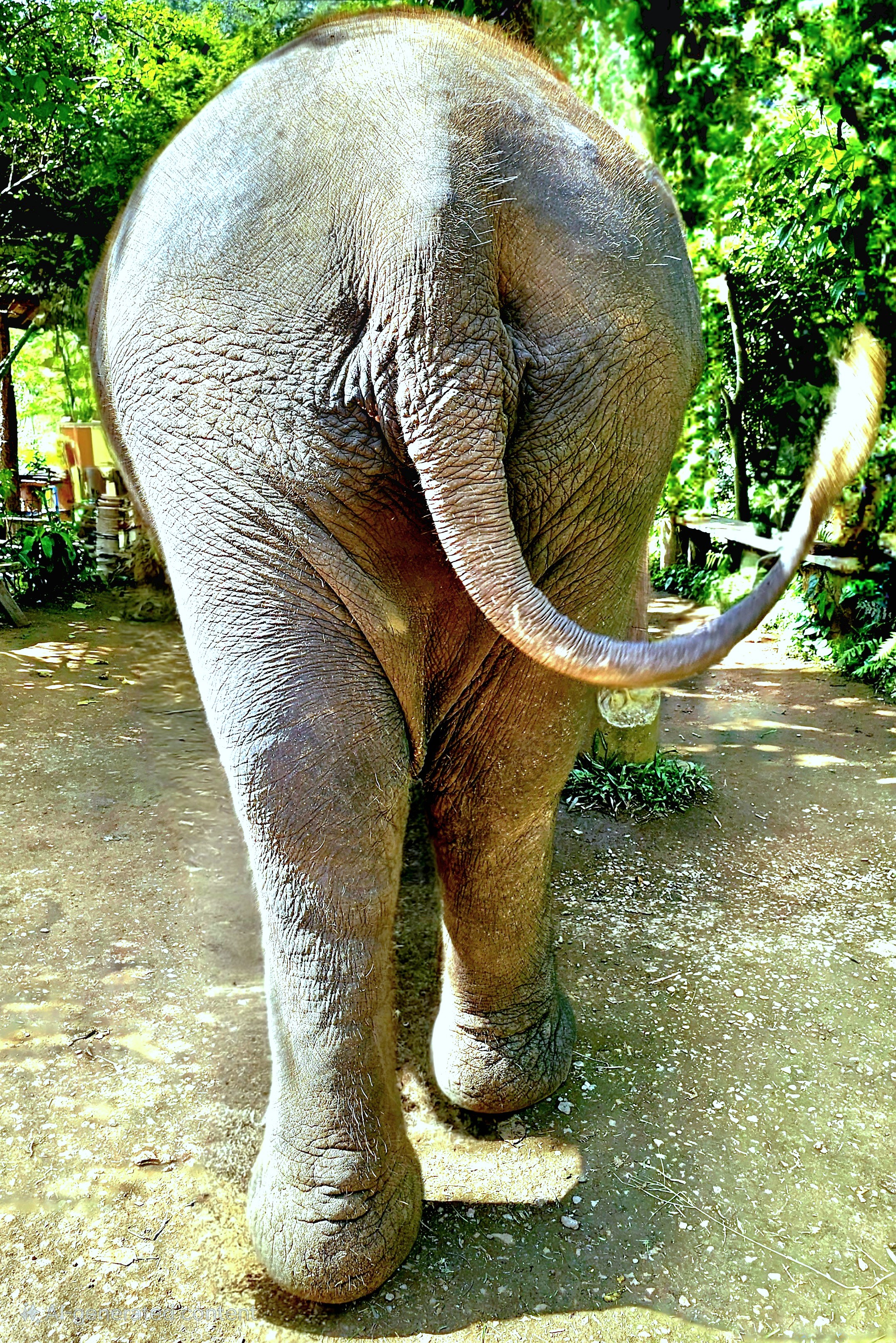
Leah and I were in Hanoi at the time when I first read the headlines, and it immediately carried me back 3 weeks earlier when we were bathing elephants at Elephant EcoVillage–a prearranged activity at an elephant spa selected by Overseas Adventure Travel (OAT)–and it was a glorious time.
We were totally unaware of any danger during our interaction. Our menagerie was docile and compliant.
Nevertheless, humans have a troublesome history with elephants…
The first evidence of elephant domestication was discovered along the Indus River Valley in 2000 BCE–at a time when as many as 20 million elephants roamed the forests of Africa and Asia.
By 700 BCE, Indian elephants were instruments of warfare and combat.
Two centuries later, elephants were dying for sport and entertainment in Roman amphitheaters.
After 1600, warrior elephants lost their advantage on the battlefield as the Gunpowder Revolution gave rise to new military weapons and tactics. Elephants transitioned to beasts of burden.
The 1800s saw the first elephants exploited in circuses.
In 1989, the Convention on International Trade in Endangered Species (CITES) banned international trade on elephant ivory, citing poaching as the biggest threat to their very existence.
A 2024 census identified that elephant populations had dwindled to around 450,000 globally, of which only 10% were counted as Asian elephants.
As of 2020, Thailand has tracked 7,300 elephants within its borders,
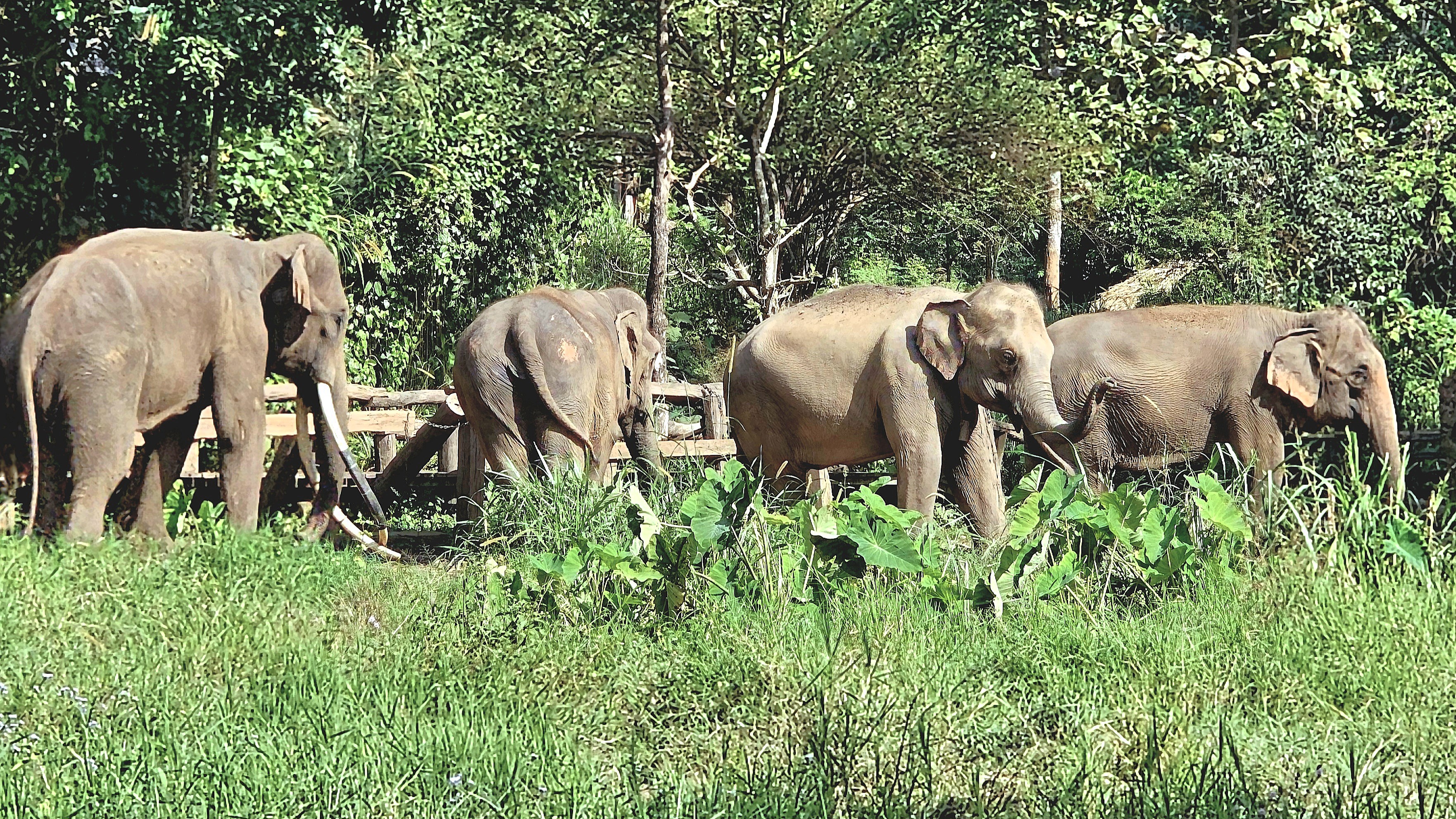
with up to 3,500 wild elephants occupying 69 forested sanctuaries.
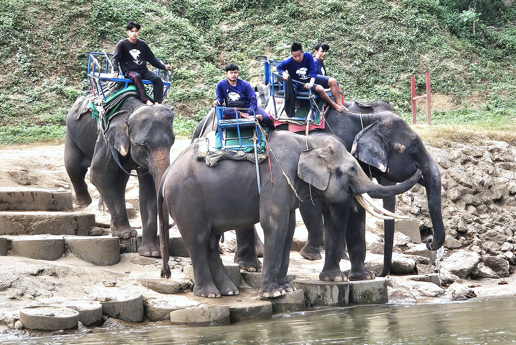
That leaves 3,800 captive elephants who rely on tourism to pay for their continuing support and welfare. Conservation organizations range anywhere from “observation-only” shelters…
to “rescue centers” that promote elephant riding as a VIP amenity.
Asian Captive Elephant Working Group (ACEWG), a group of regional elephant specialists, veterinarians, researchers, and conservationists acknowledge that:
Closing all elephant tourism venues is unrealistic if there are no alternative livelihoods for mahouts with elephants.
Suitable habitats for reintroducing elephants to the wild have been marginalized by a loss of forest from over-logging.
Elephants are intelligent and mobile animals with a highly developed social structure. Their complex needs require professional management and care protocols.
Elephants–captive or wild–pose a safety risk to humans and must be managed accordingly.
While there are no easy explanations surrounding Human-Elephant Conflict, our half-day experience at Elephant EcoValley was designed to: “…share the elephants’ history, their culture, their current environment, and their relationship with the human species—compassionately and scientifically. “
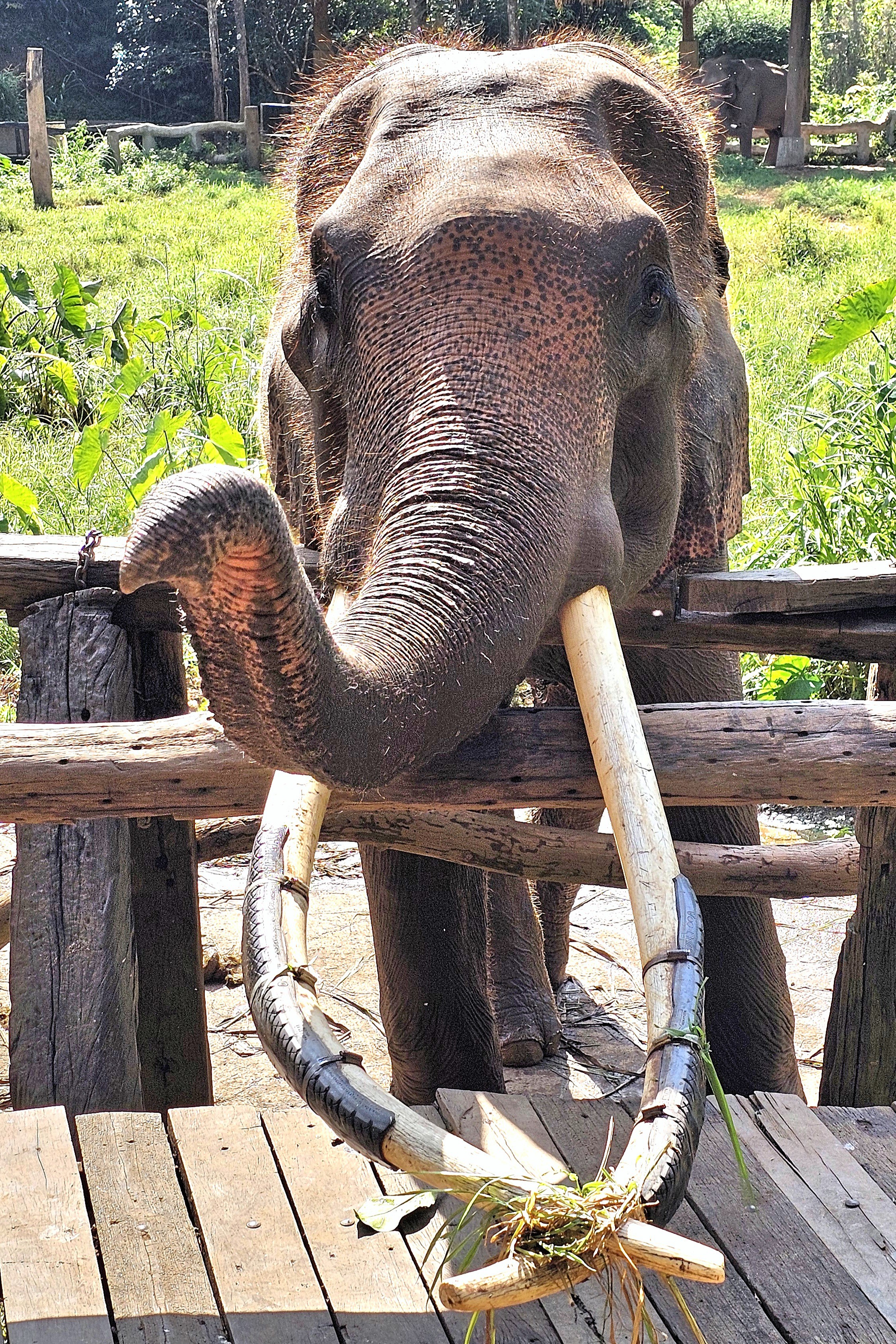
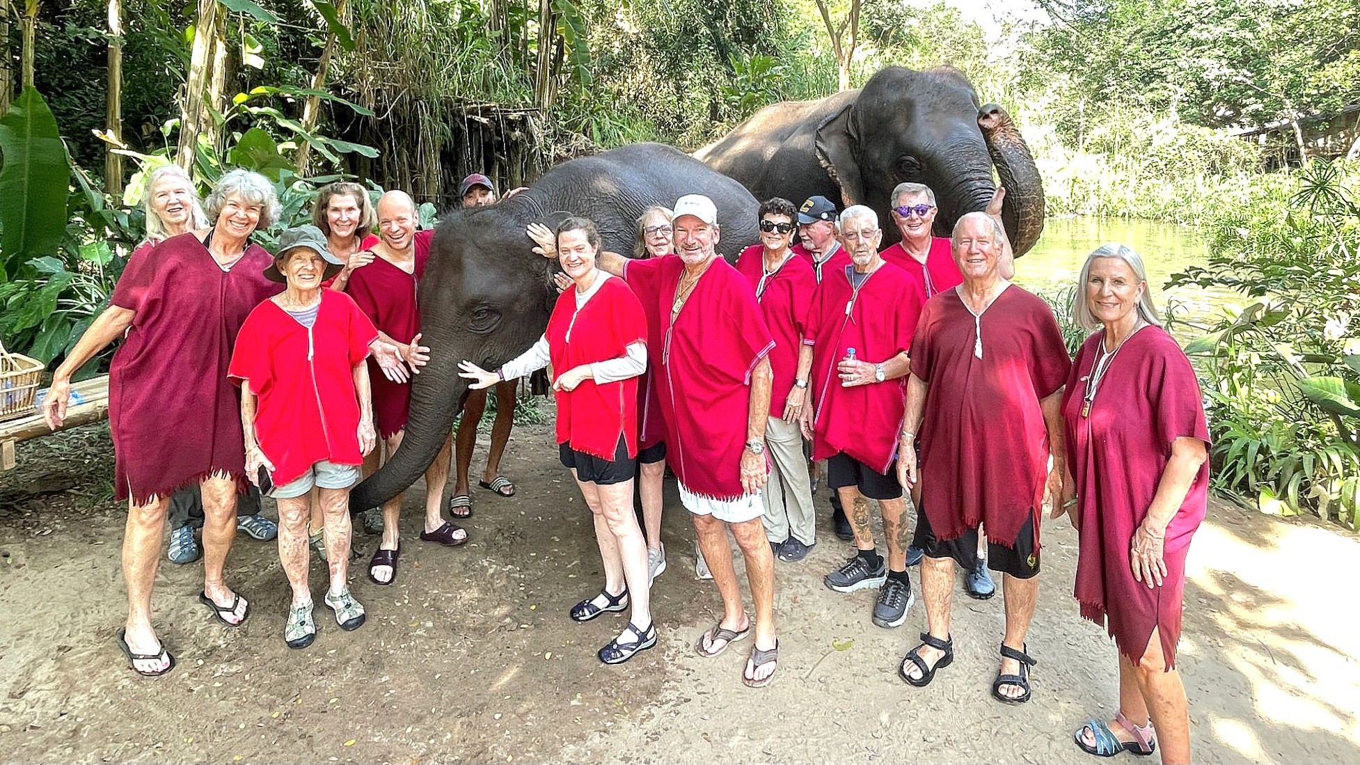
Ben, our guide, introduced us to Tata, a 40-year-old female, and her mahout for the past 12 years, who has tirelessly devoted himself to Tata’s daily care, as a parent would care for a child.
Leah and I became fast friends with Tata,
but so did everyone else in our group, as she obediently posed with each of us.
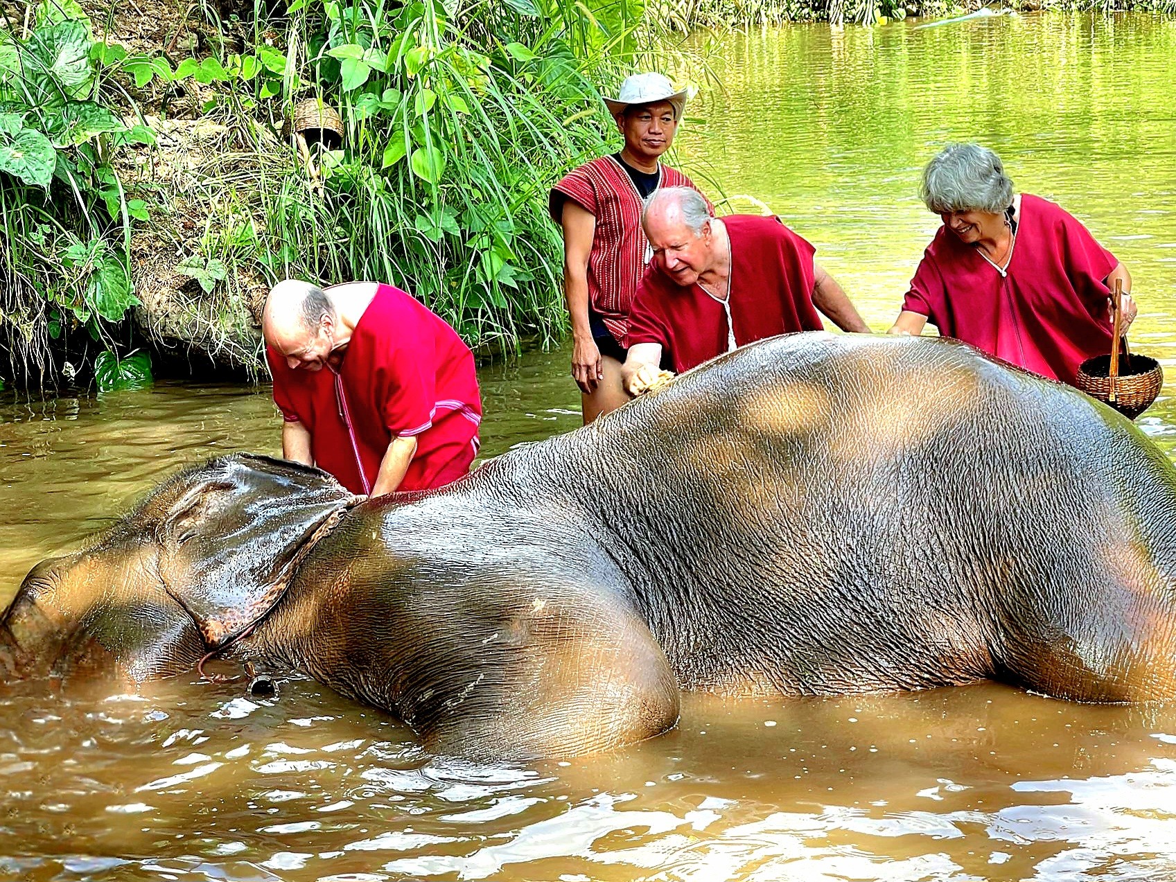
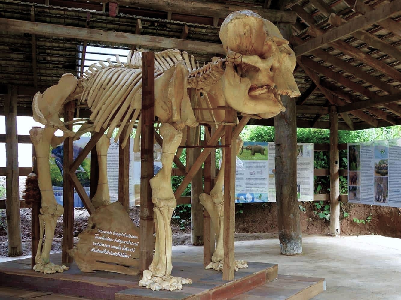
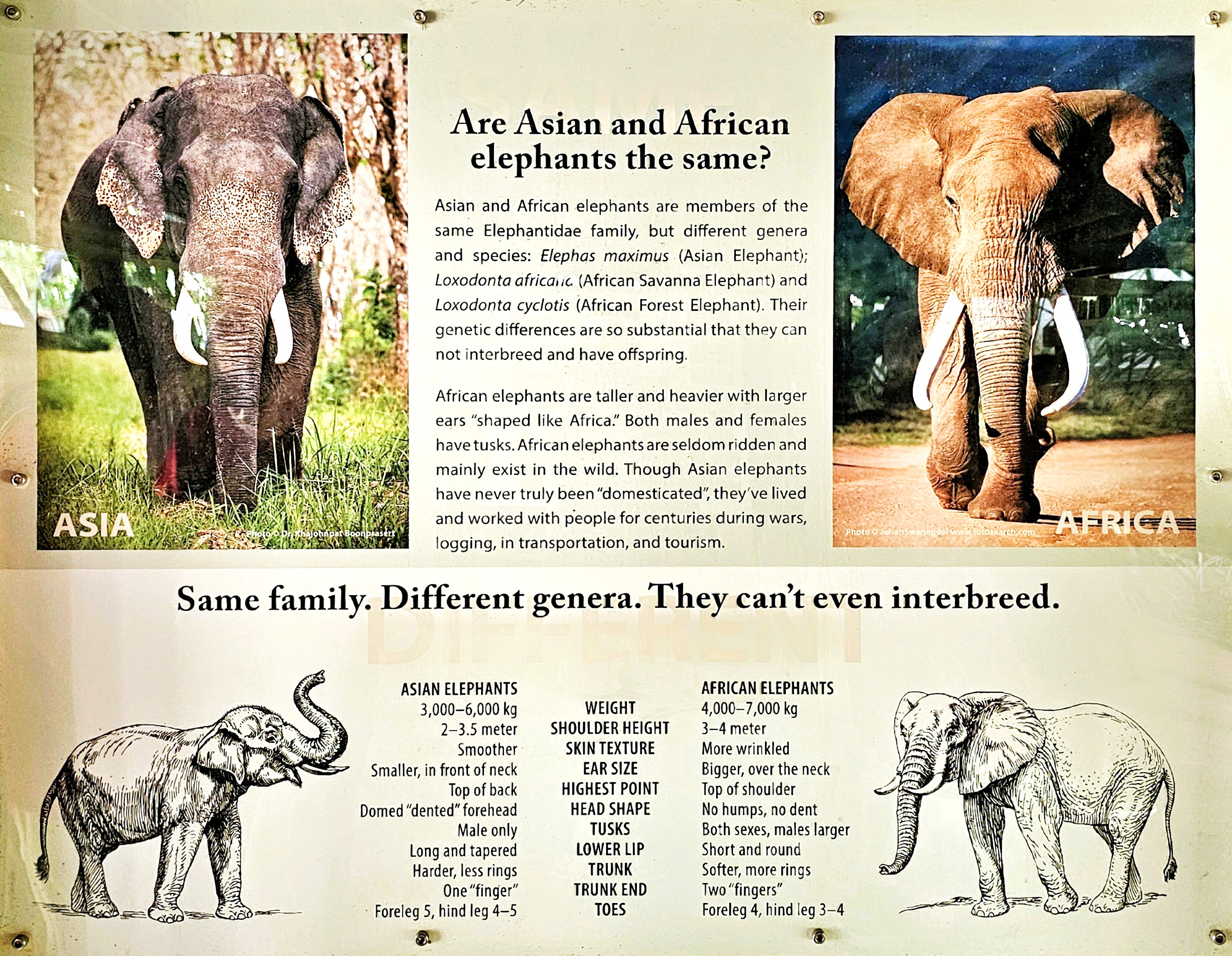
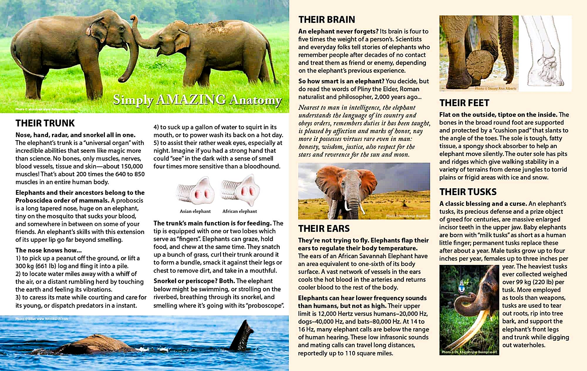
There was also an educational component to our visit. We spent some time in their museum loading up on facts and understanding about elephant evolution, anatomy, behavior and welfare.
After a satisfying lunch of regional specialties,
we focused our attention on the prodigious appetite and eating habits of these magnificent beasts who typically spend 16 to 18 hours a day foraging for an array of grass, plants, bushes, fruit, twigs, leaves, roots, and tree bark–each vital for providing a mix of essential minerals and nutrients.
But captive elephants don’t always get the nutrition they need that’s necessary for good health. They also require a multi-vitamin to supplement their daily nutritional intake, and it was our job to produce them from a variety of ingredients.
The recipe called for crushing salt and aloe vera together in a mortar. Then cooked rice, tamarind, and bananas were added to the stump. Finally, we combined moonseed, Lasia, sugarcane, sedge, schefflera, Bermuda grass, and fresh pineapple to the mix and mashed it all until gooey and sticky enough to form pills the size of baseballs.
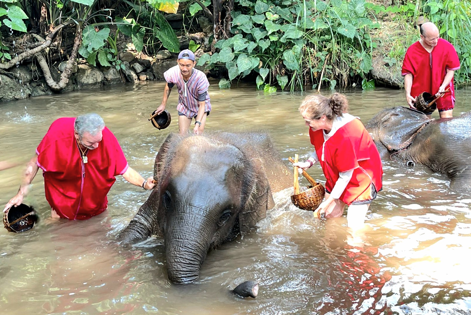
At last, it was time to feed our new friends,
and they couldn’t get enough!
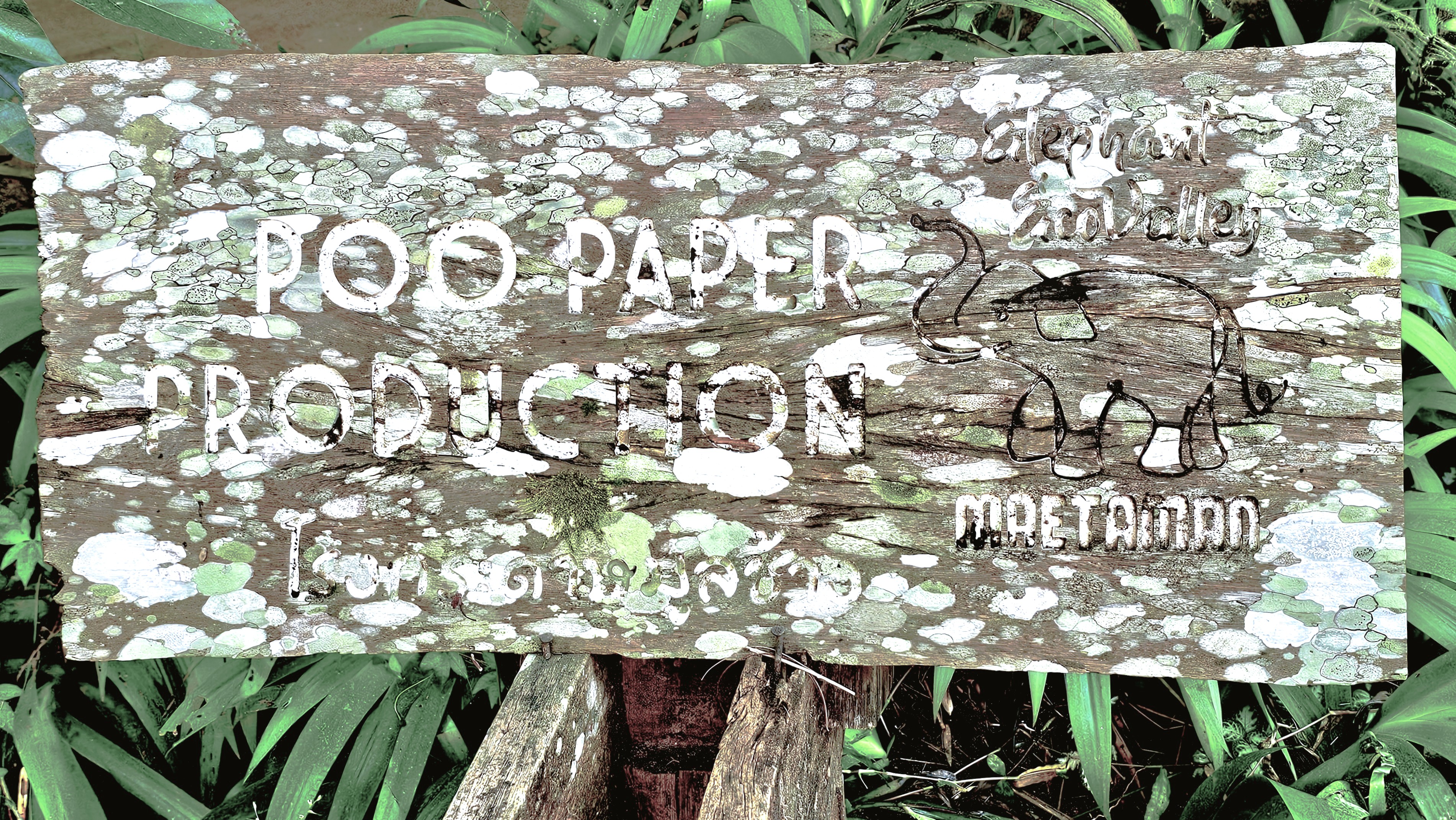
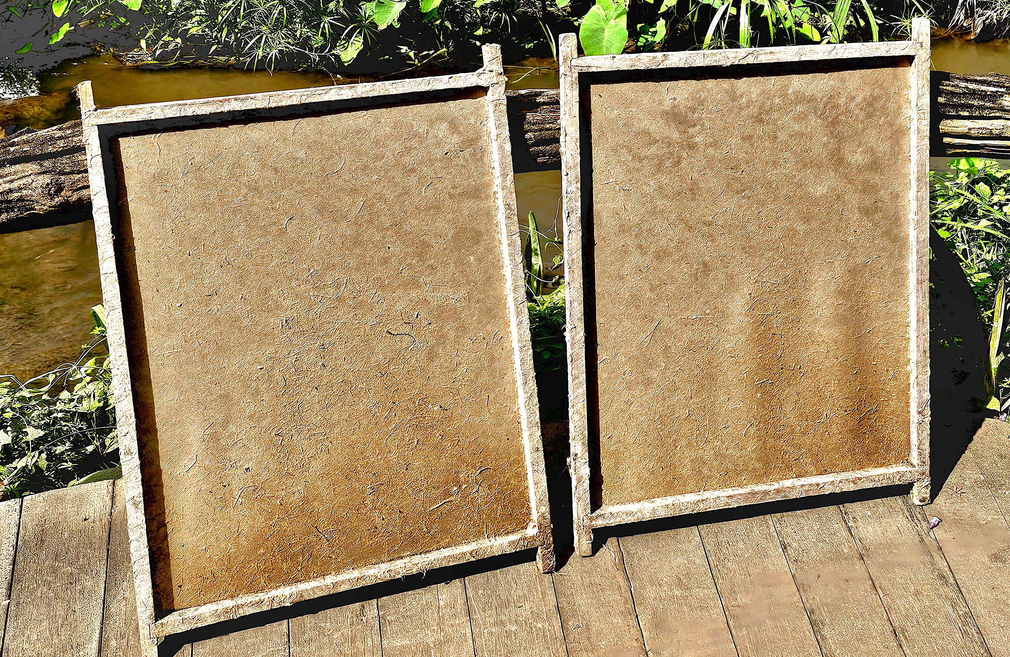
Depending on their size, an Asian elephant can consume up to 300 kilos per day (660 lbs.) or about 18% of their body weight. And that creates a lot of poo. Elephants can defecate between 10-20 times a day, producing 100-150 kilos (220-330 lbs.) of dung per day. But the people at Elephant EcoValley have an answer for that:
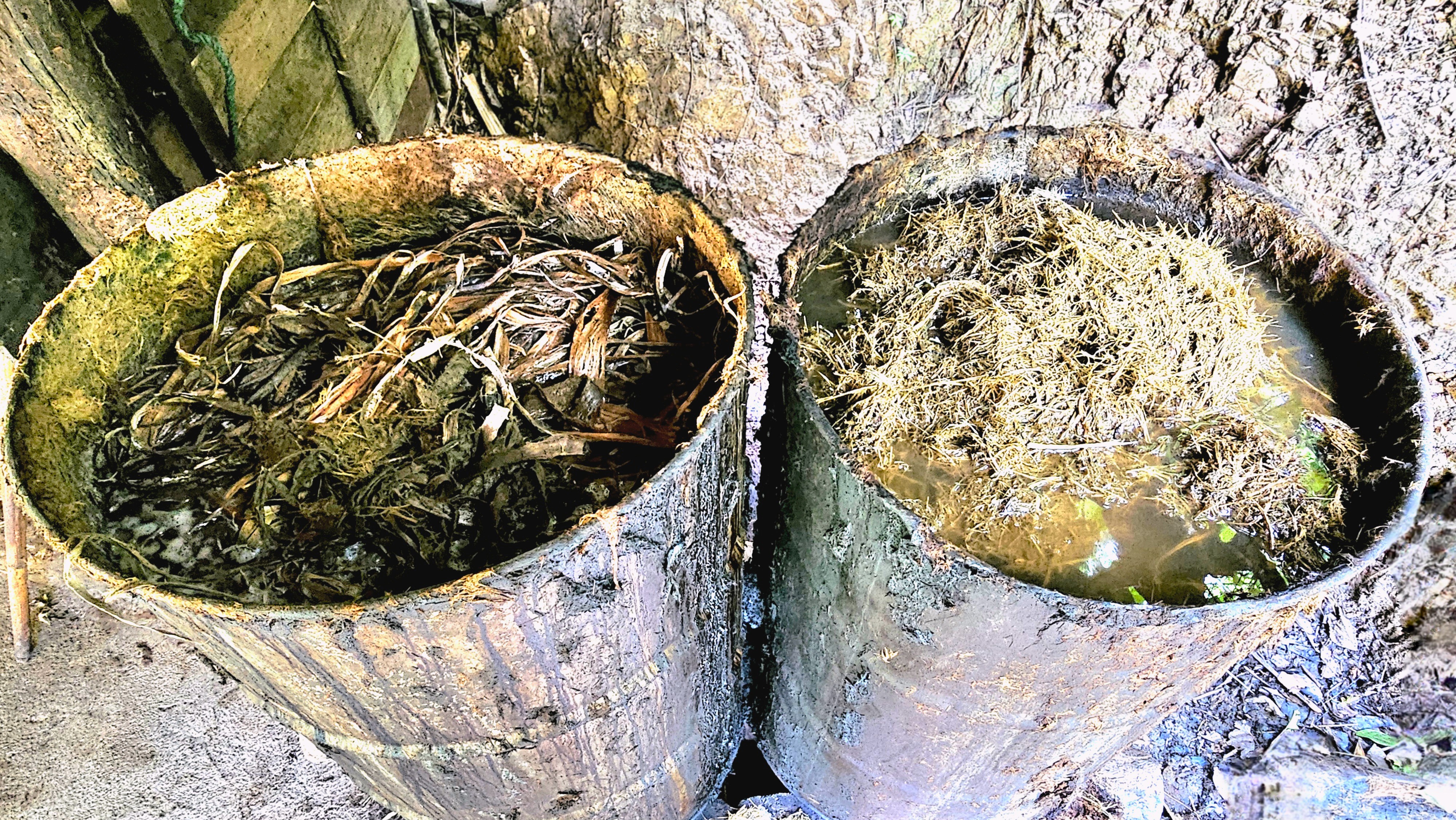
Much of the dung is collected every day;
washed to remove the debris;
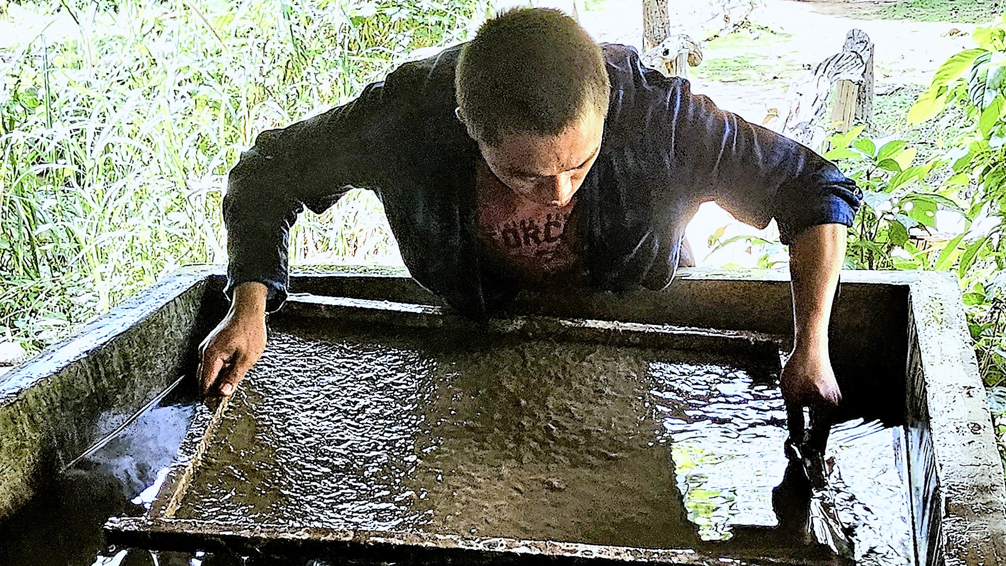
sent through a thrasher to separate the fibers from the pulp;
and screened through the slurry…
until finally drying into a sheet of poo paper that doesn’t stink!
Our time at Elephant EcoVillage was a delight, and none of us ever felt threatened or considered that we were exploiting the elephants. On the contrary, these were pampered pachyderms.
It’s uncertain if authorities and activists can agree on balancing eco-tourism with elephant protection, but with education and resources, ethical and sustainable practices can be achieved to benefit both elephants and the community in the End.
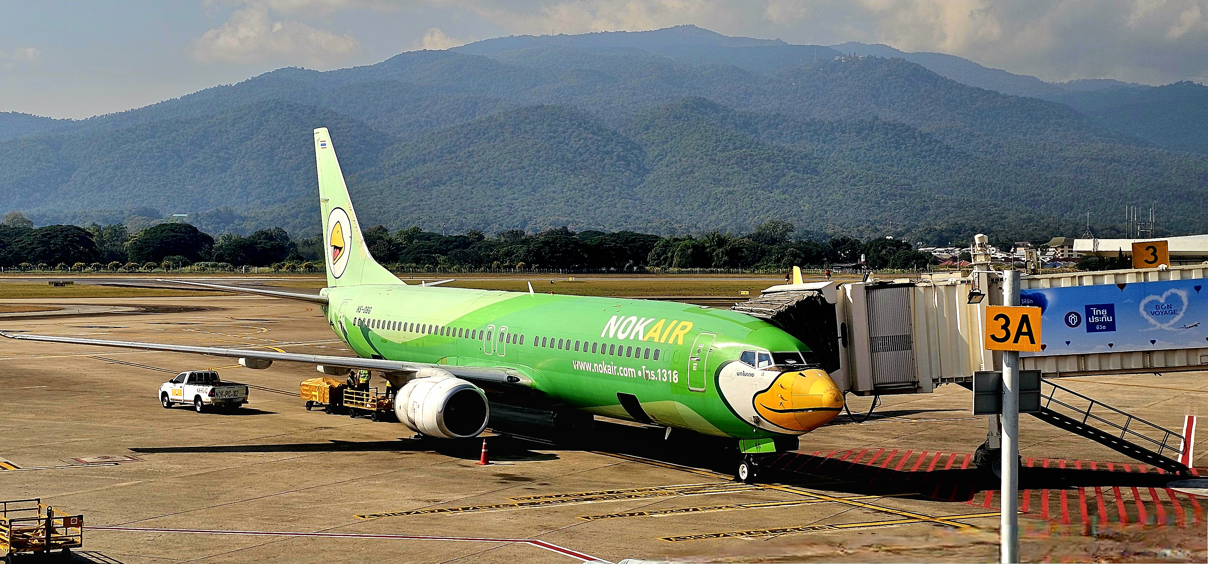
After touching down at Chiang Mai International Airport, the stark contrast to Bangkok was immediately apparent. The air was cooler, humidity was dryer, and the AQI was no longer borderline, breathtaking.
We were at the gateway to the Thai highlands, in sight of Doi Suthep (elev. 5500 ft), and we were trading skylines for landscapes.
Exploring Chiang Mai’s heritage–rich with unique Lanna-style architecture, art, sculptures, handicrafts, and ancient temples–gave us the cultural opium we were all craving, with insightful opportunities to:
dive deeper into Buddhism (at Wat Phan On, inside the ancient city wall);
experience the folklore (of traditional Lanna Thai dancing);
admire the folk art (of a master carver from Baan Jang Nak);
appreciate the artisanship (of a reformed Karen Tribe villager);
savor the Lanna cuisine (of a traditional Khantoke dinner);
and relish the view (from atop an artisanal coffee farm).
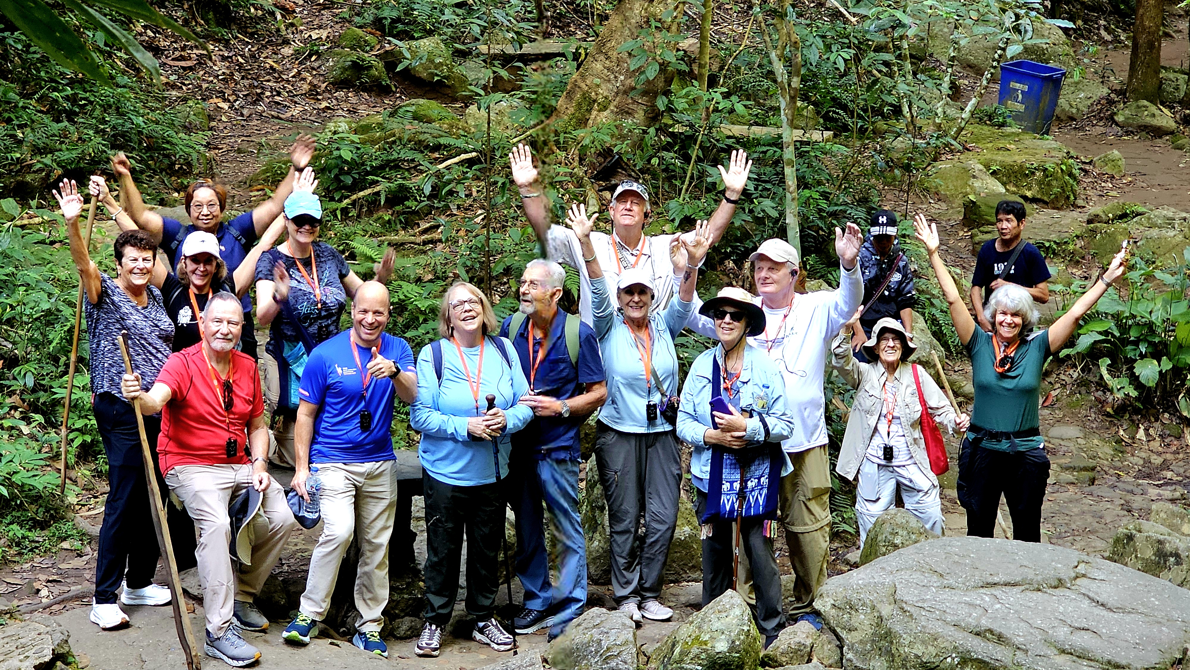
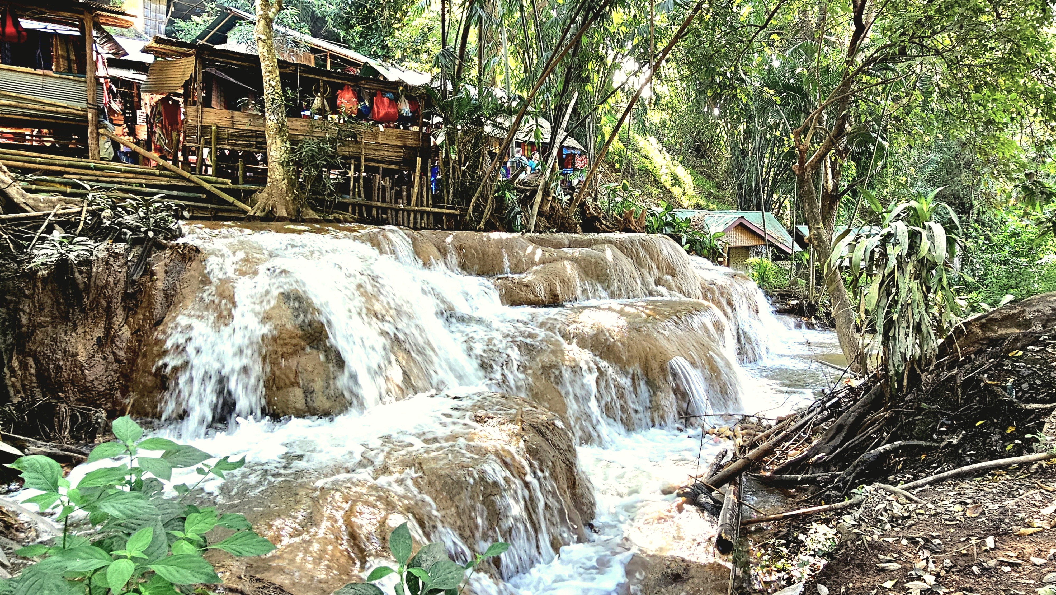
Tour highlights while visiting Chiang Mai included a nature walk through Mae Kampong Village…
which culminated in a hike up Mae Kampong Waterfall’s flume gorge.
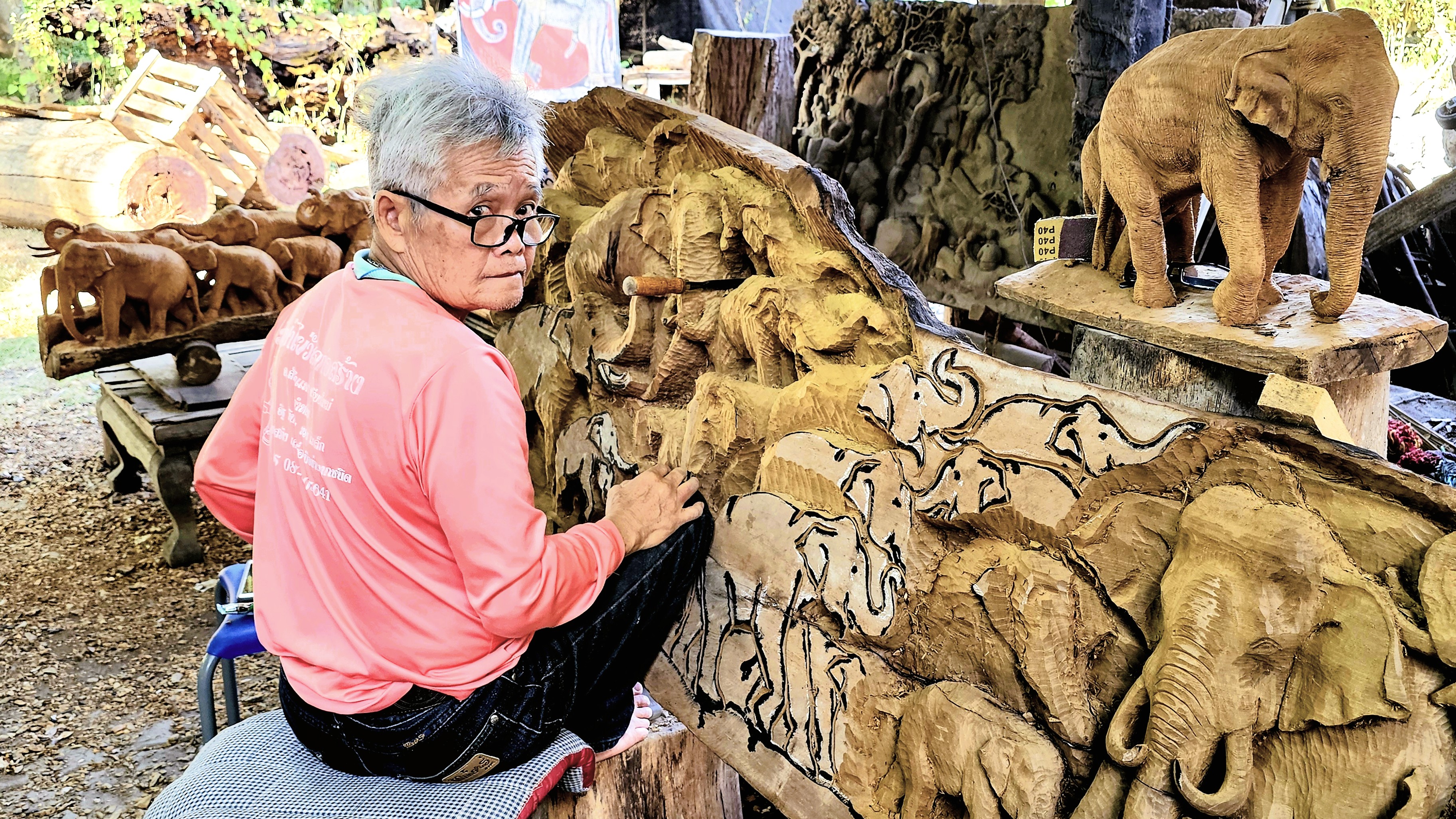
Our journey continued to the remote village of Ban Buak Khang, where master carver, Phet Wiriya combined his childhood passion for wood carving with his deep affection for elephants…
culminating in “Baan Jang Nak” (a house full of elephants), a renowned studio that offers Lanna wood carvers an outlet to hone their prodigious fabricating skills.
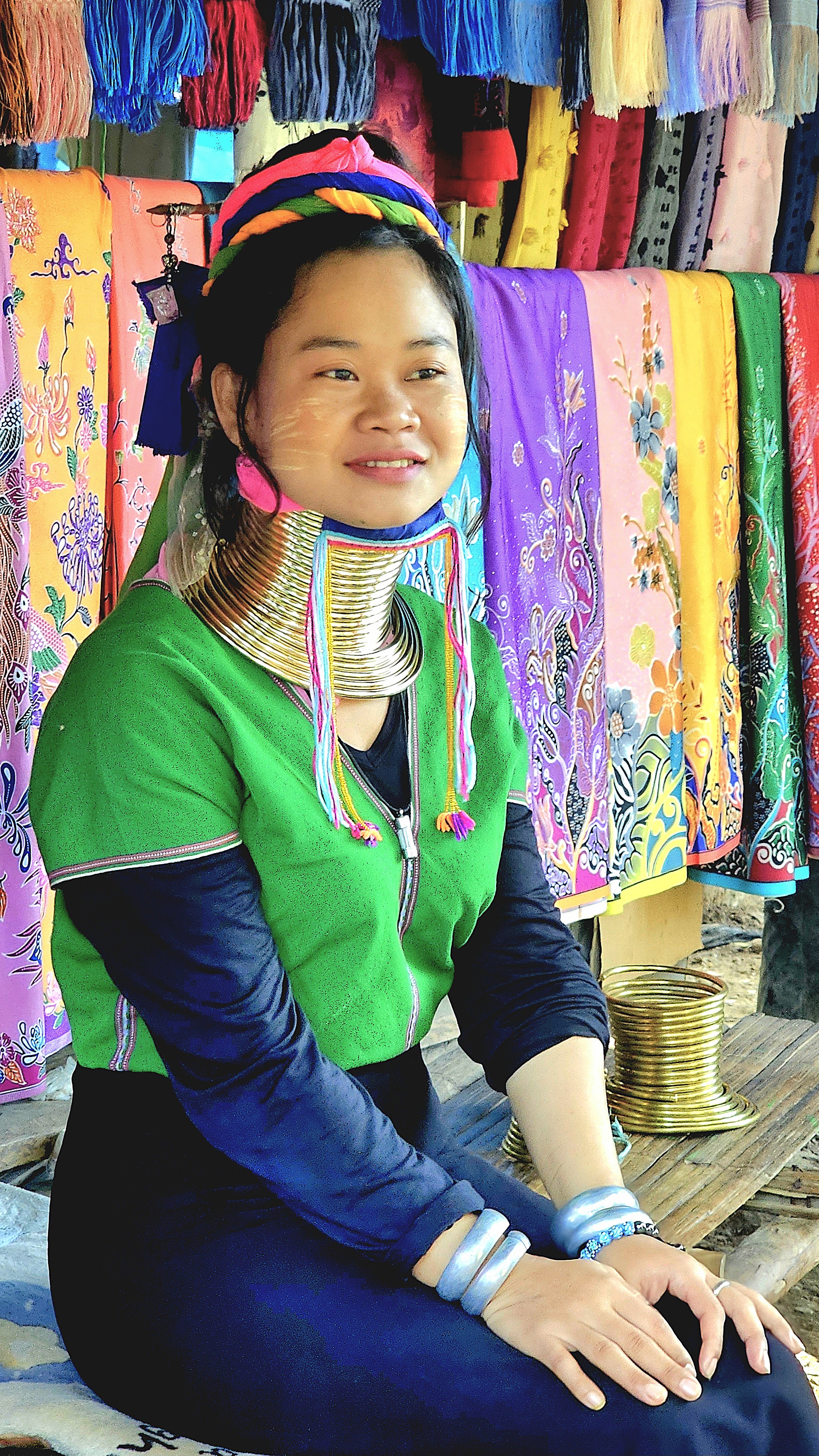
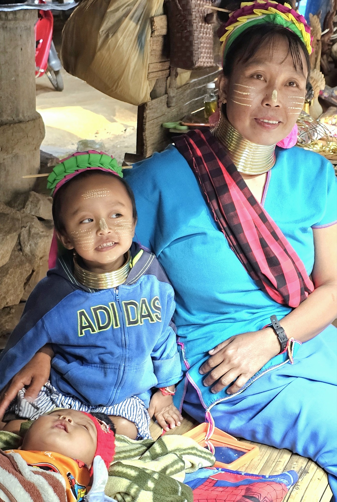
At Baan Nai Soi village, we visited a community of Burmese refugees known as Karen, whose tribe crossed miles of Burmese jungle into Mae Hong Son province during 1985 to avoid Myanmar’s political persecution.
Consequently, Thai authorities designated 3 relocation camps within the Highlands,
which over time and not without controversy have evolved into tourist destinations, where “longneck” women generate income by putting themselves on display–not unlike a “human zoo”–for a $10 admission ticket.
Mothers invite their girls at the age of 5 to begin the process by winding a brass coil across their shoulders, beginning with about 3 1/2 pounds of metal and adding inches until they’ve accrued more than 11 pounds.
Periodically, women will exchange the coil for a longer one, calling for more turns–ultimately reaching 22 pounds of down pressure. But longer necks are actually more of an illusion. The weight of the brass bears down on the clavicle, compressing the rib cage, and pulling up 3 to 4 thoracic vertebrae into the neck. While the neck itself is not lengthened, the appearance of a stretched neck is created by the deformation of the clavicle.
While beauty is indeed in the eye of the beholder, it’s essential to recognize the complex and competing narratives surrounding the beauty of longneck Karen women. Anthropologists have suggested that long necks may have served as a form of protection, perhaps making these women less appealing to other tribes and thus safeguarding them from a future of slavery. Conversely, it’s believed that the coils would embellish a Karenni’s beauty by highlighting the sex appeal of her elongated neck.
Another perspective is that these coils create a striking resemblance to dragons, a significant symbol in Kayan folklore, which adds a layer of cultural richness to their appearance. Additionally, the idea that the coils might offer protection against biting tigers–whether in a literal or symbolic sense–reflects a deep understanding of the challenges these women might face, blending beauty with resilience.
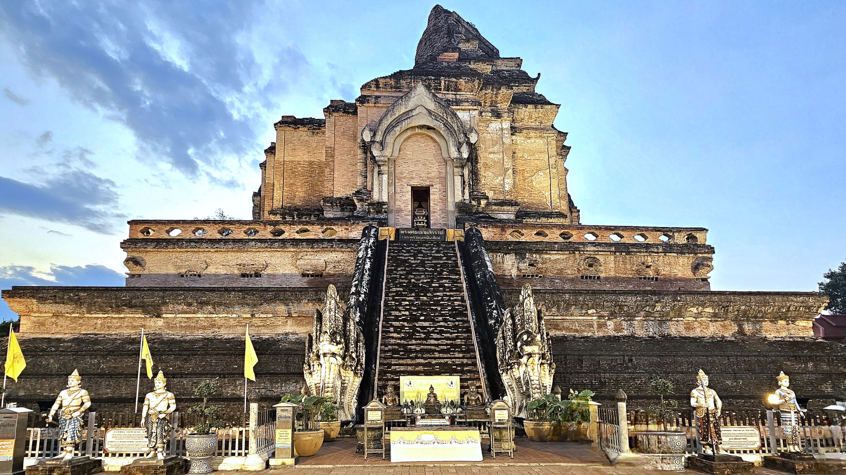
In another instance of culture shock, we visited Wat Chedi Luang, a 600-year-old cultural landmark located in the historic center of Chiang Mai, and once home to the venerated Emerald Buddha (subsequently, relocated to Wat Phra Kaew in Bangkok in 1551).
It’s also home to the Inthakhin city pillar–protected within a nearby shrine,
and accessible for most to view, but with a major caveat!
Women should take note: that Thailand’s guarantee of gender equality comes with red strings attached.
Resetting the Wayback Machine to Dateline: August 3, 2023
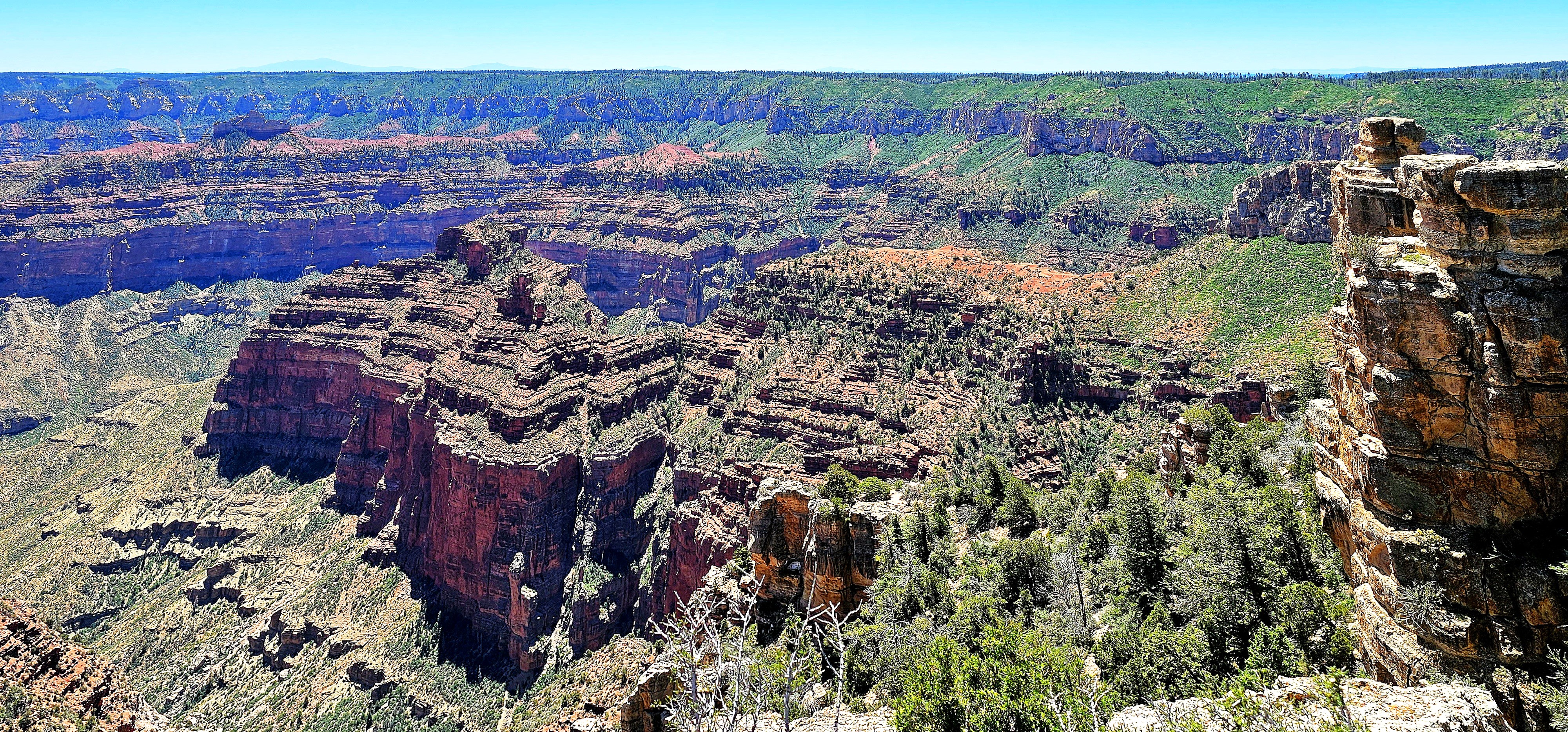
After three days of admiring Grand Canyon’s North Rim–from Point Sublime…
to Point Imperial…
to Angel’s Window,
Leah and I were already anticipating our next physical and photographic challenge–hiking through the Coyote Buttes North in search of The Wave.
But we were at the mercy of Bureau of Land Management, who awards permits to no more than 64 visitors per day through a complicated online lottery process.
We scored dinner reservations at the Grand Canyon Lodge Dining Room…
during sunset to discuss our future travel plans.
Regrettably, our meal was more consolation than celebration. Despite our application for permits months in advance, and again, the day before our departure, our high hopes were dashed by impossible odds.
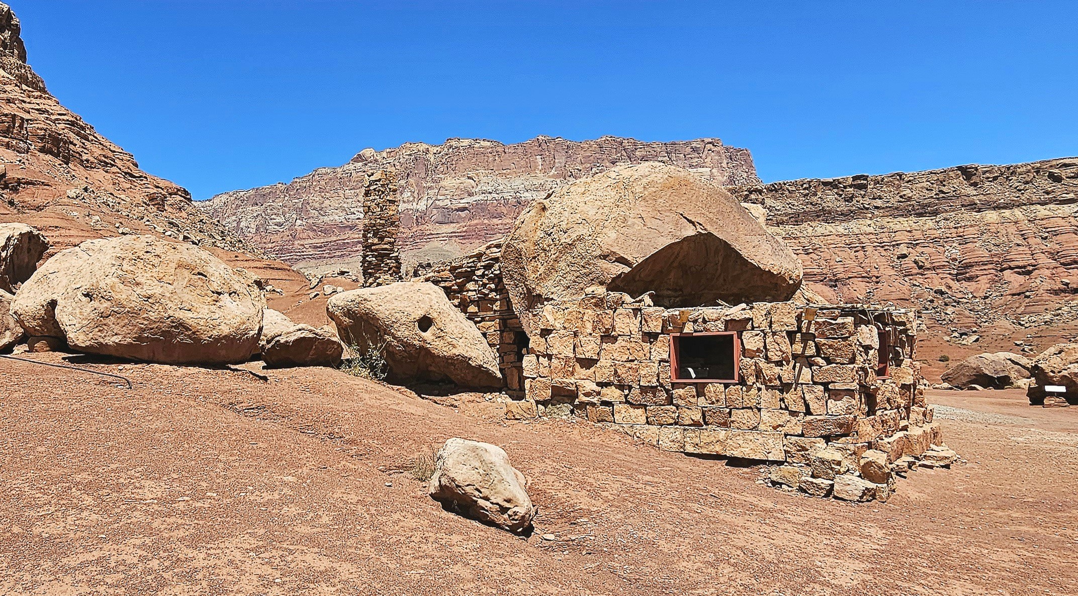
Ultimately, we followed our contingency plan, which, like an old friend, was familiar yet still full of surprises. The following day, we drove through Marble Canyon–flanked by Vermillion Cliffs–with a brief stop along Highway 89A to marvel at a Cliff Dwellers Stone House,
a crumbling roadside curiosity that was constructed from rock debris and local timber by Ziegfeld Follies dancer Blanche Russell and her husband Bill, whose car had broken down at this location in 1927.
According to the tale, the beauty of their surroundings was so captivating that they established a homestead on the site during the Great Depression, extending hospitality to Mormon travelers journeying along the adjacent Honeymoon Trail to the temple in St. George, Utah, for the sanctification of their marriages.
Meanwhile, we continued north on a pilgrimage of our own to Page, Arizona for a few days of essential sightseeing.
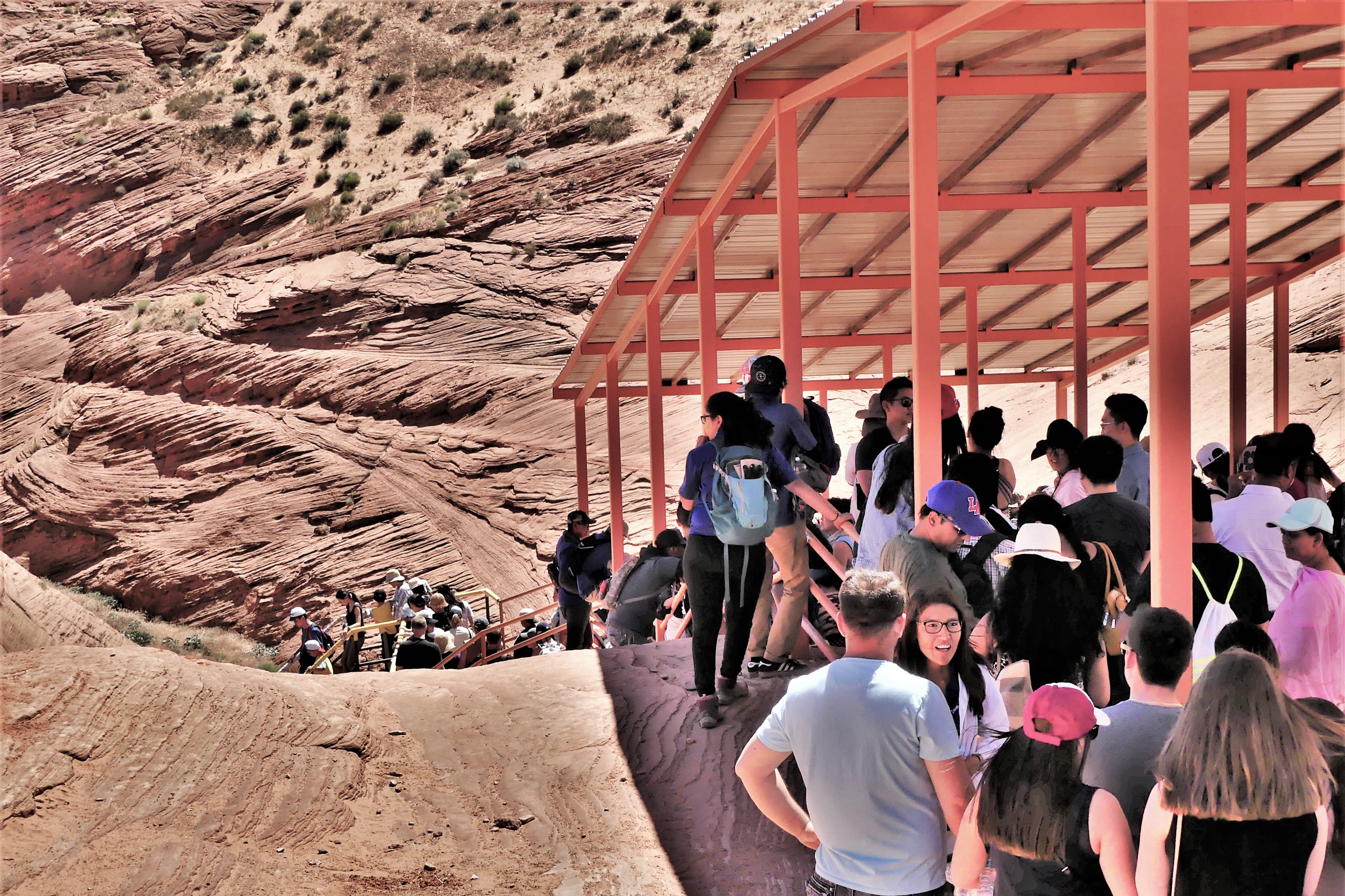
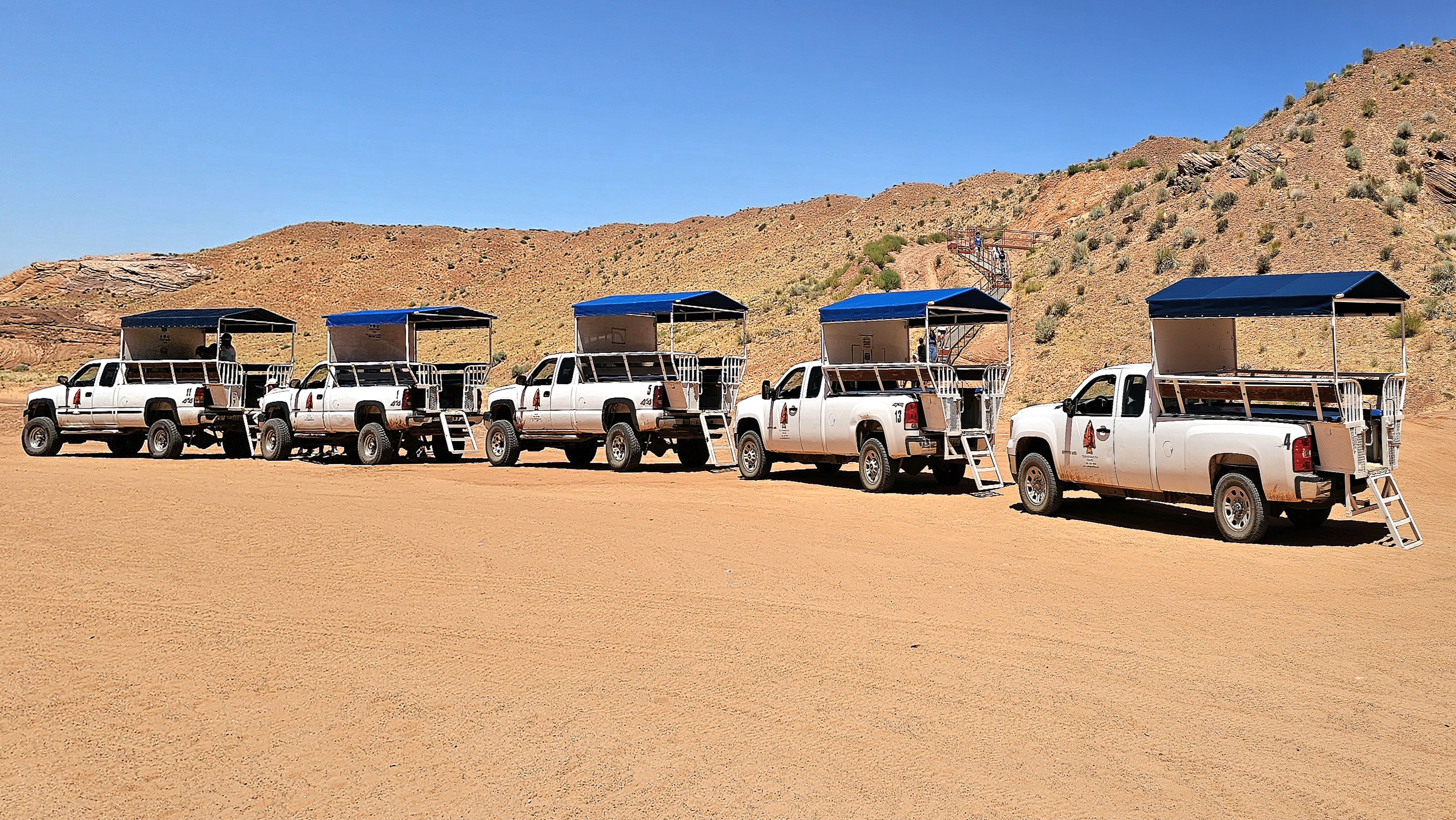
The following day, we arrived at a strip mall to claim a coveted noon reservation for a guided tour of Upper Antelope Canyon tour with an accredited Navajo tour operator. Having toured Lower Antelope Canyon 6 years ago (see Can’t Elope Canyon), we elected to hike the upper canyon this time around.
Upper Antelope Canyon, often referred to as “The Crack,” features a flat entrance and a level path throughout, offering a seamless stroll with no elevation shifts. This easy access, devoid of any stairs, renders it more welcoming than its counterpart, Lower Antelope Canyon, where stairs and ladders are part of the experience.
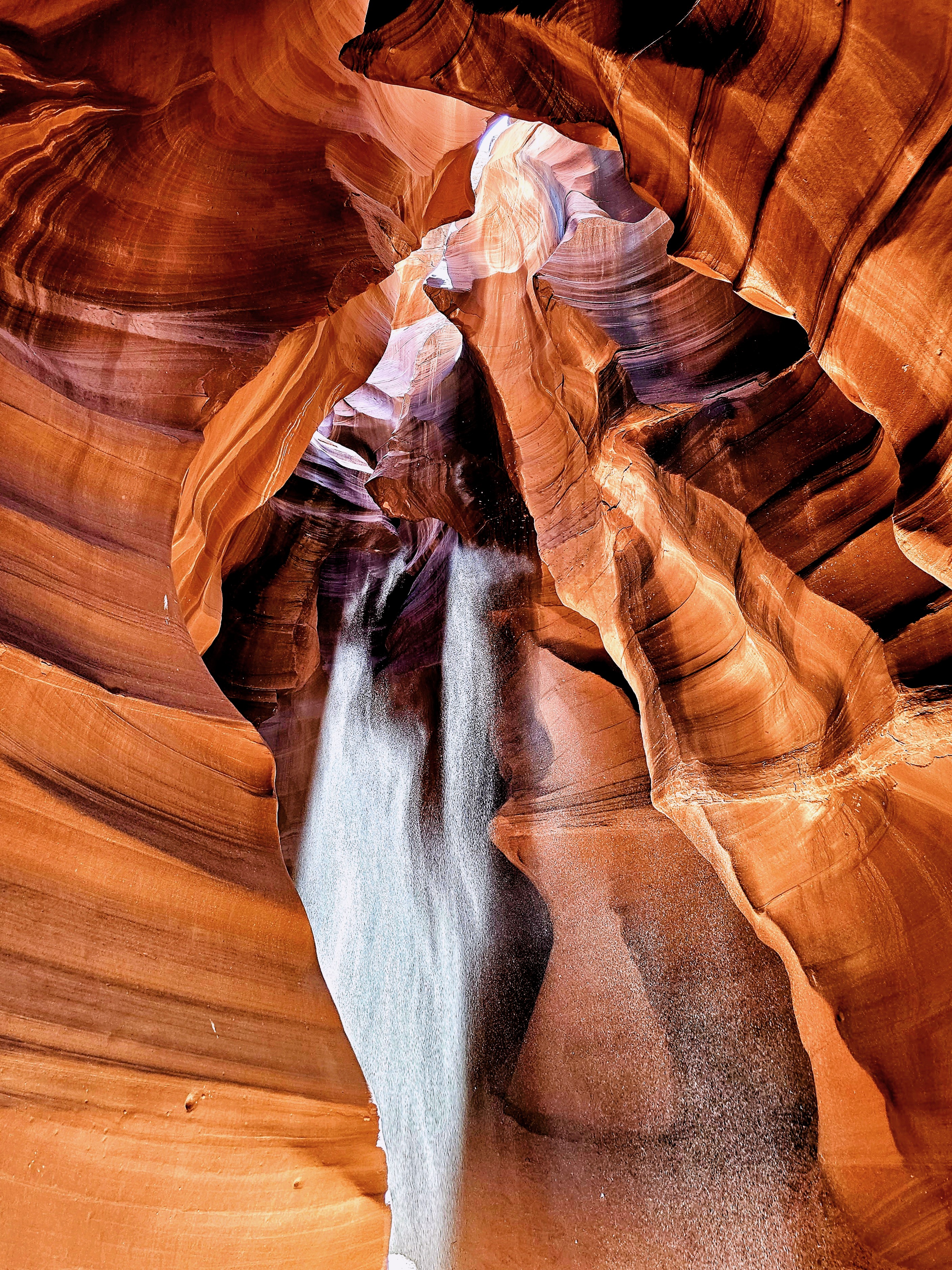
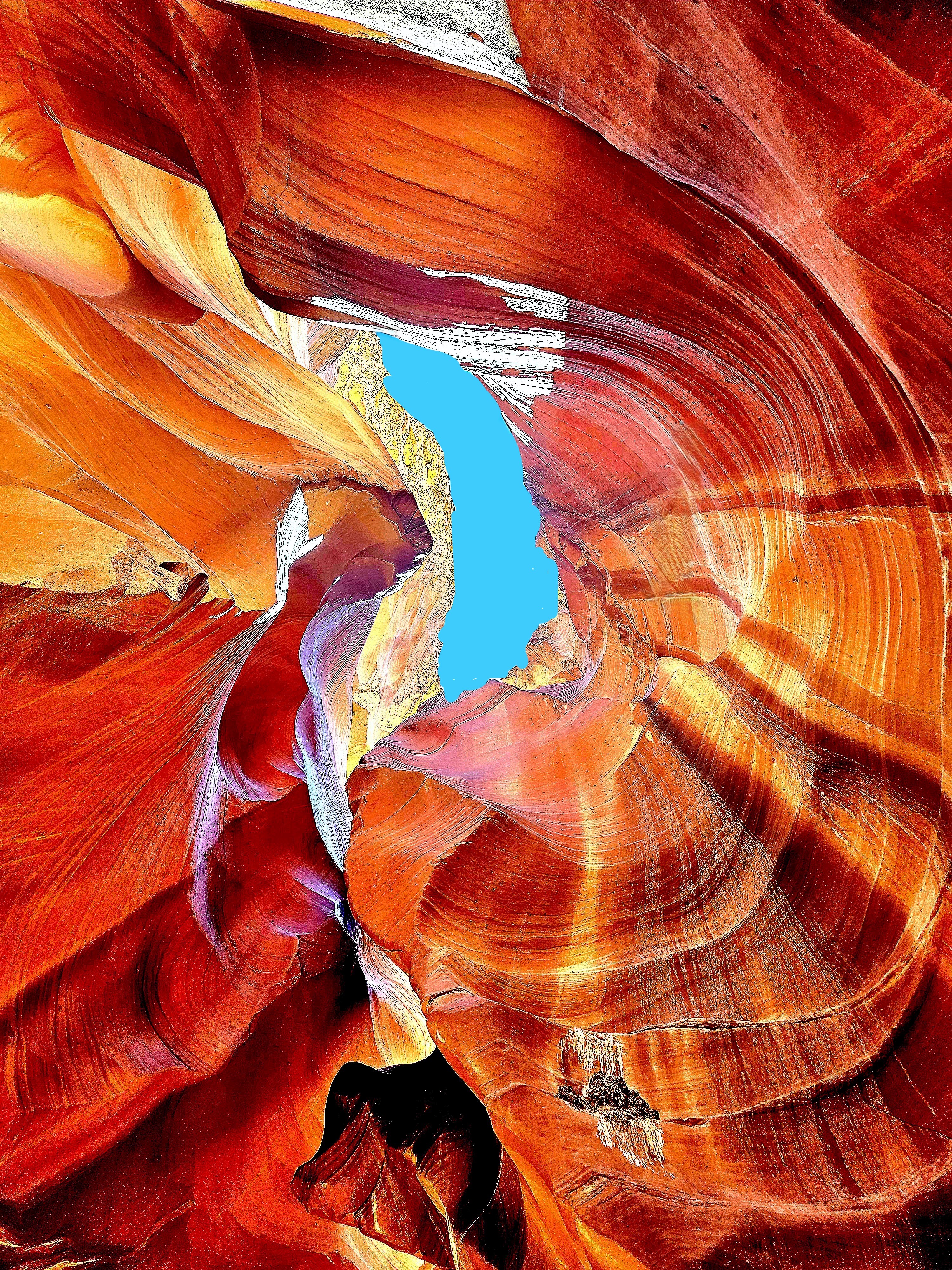
In my quest for photographic redemption, I was determined to infuse some mystery into the majesty of these sculpted canyon walls by focusing on the details of the form, while framing an energy of twists, curves and color.
We jostled and bounced across a dusty desert plain from the back of a dusty pickup truck, enduring temperatures of 100°F. The grab bars were so hot, I could only handle them through my hat. After arriving at the canyon’s entrance, our guide offered us a brief geology lecture and valuable photography tips.
Rather than lug around my SLRs, I relied on my Samsung Galaxy 23S Ultra phone for its reputed low-light sensitivity and high-resolution capabilities.
From the onset, our guide pointed out shapes created by negative space, such as the “Lady of the Canyon,” which seemed intriguing to many, but irrelevant to my mission.
Additionally, there was plenty of highlight and shadow play in the formations that was easily personified, such as the “Open-Mouth Man.”
Many photographers were there to capture the “sunbeam effect” that appears from April 1st to September 30th with a helping handful of tossed sand.
There was also equal opportunity to document the canyon wall formations as realistically as possible.
or using the undulating walls as an interesting backdrop.
But I was there to capture the abstract potential!
The canyon’s walls rise up to 660 feet above the streambed, and the trailhead sits at an elevation of 4,377 feet.
Geologists say the walls are shrinking and the elevation is increasing, as sand continues to rise from continuing erosion from wind and water.
The 0.3-mile one-way trail is mostly hard-packed with red sand and silt.
The Navajo Nation calls Upper Antelope Canyon “Tsé’bighanilini,” meaning “the place where water runs through rocks.” I call it amazing!
One hour later, we emerged from “The Crack.”
Antelope Canyon’s allure was so magnetic that I felt myself being drawn into repeating our adventure. However, time would not allow, and no slots were available!
Certainly, its beauty would have revealed itself in a new light, with a new twist!
It was 5 p.m., and the last of us was being checked in at the Aula foyer on Deck 2. As I waited, it gave me an opportunity to photograph the creepy albatross dangling from the ceiling.
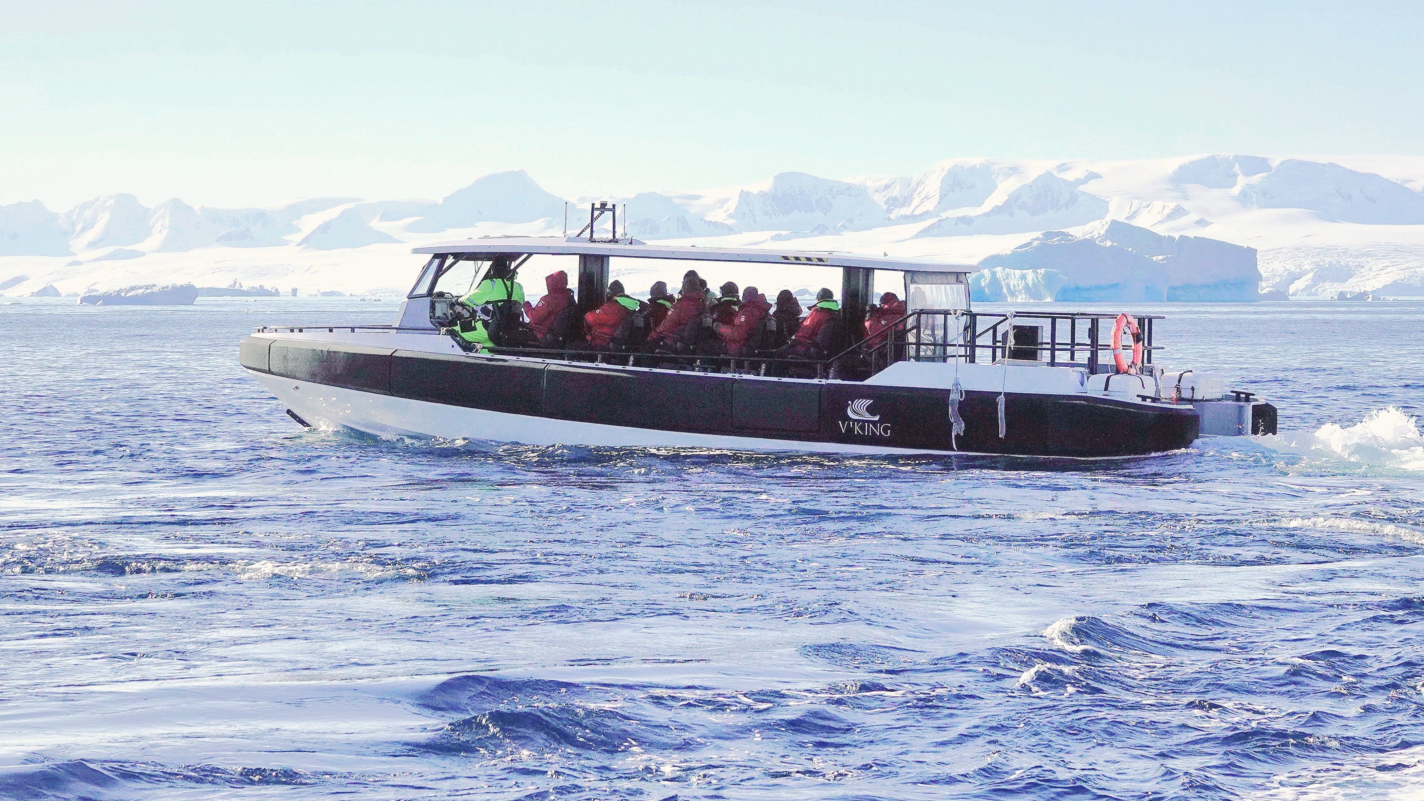
Leah and I were among the lucky dozen chosen for Octantis’s last outing—a Special Ops Boat (SOB) trip—prior to our return to Ushuaia.
Our guide was informed by the science support team that recent drone surveillance revealed significant wildlife activity near Jonassen Island. This discovery prompted our pilot to alter our planned route, with the understanding that Octantis would forgive our tardy return in the interest of scientific discovery.
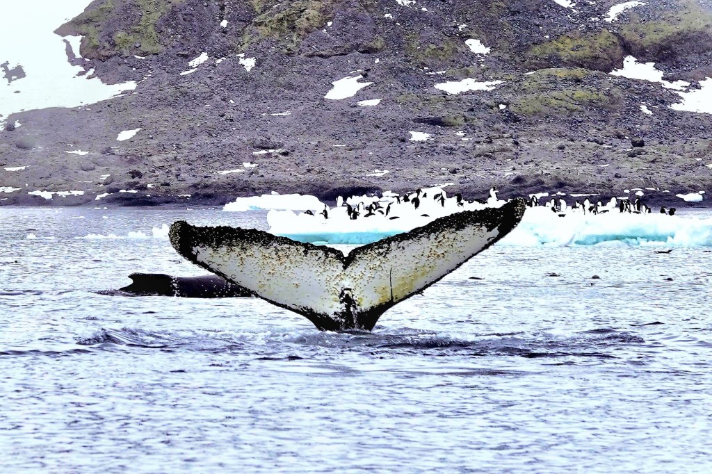
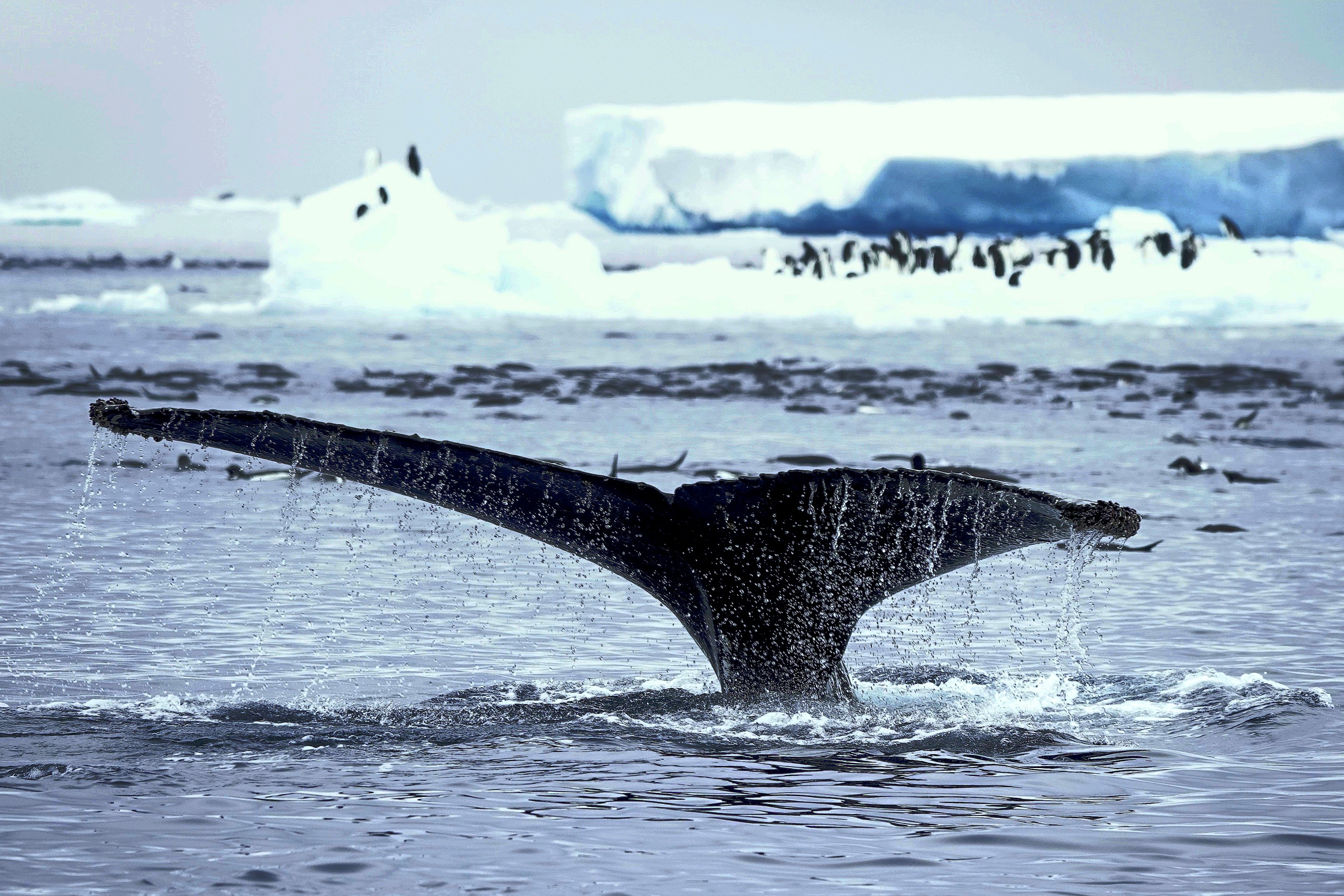
We jetted into open water toward Jonassen Island for 15 minutes or so, until our pilot suddenly killed the throttle. Our guide had spotted a couple of humpbacks in the distance, worthy of a closer look.
Passengers were abuzz with excitement at the possibilities as we maneuvered into position. And then a voice rang out, “Did you see that at 3 o’clock?”
The pilot responded quickly, steering starboard toward the sighting. I spun to orient myself, when it became apparent that we were not alone; there was company on our portside,
and on our starboard side!
We were in the midst of a feeding frenzy.
In fact, we were surrounded by a pod of a dozen humpbacks…
swimming around us and under us!
I didn’t know which way to turn. Whales were breaching…
and diving all around us.
Penguins were unphased by the playful display.
They were content to share the water and krill, filling their bellies without concern,
while humpbacks continued their elaborate feast.
We idled in place for nearly an hour, witnessing the spectacle around us. But a radio transmission from Octantis woke us from our enchanted trance and indicated that we had overstayed our welcome.
We returned to Octantis for dinner plans of our own, and bragging rights to a whale of a tale that was the icing on the wake.
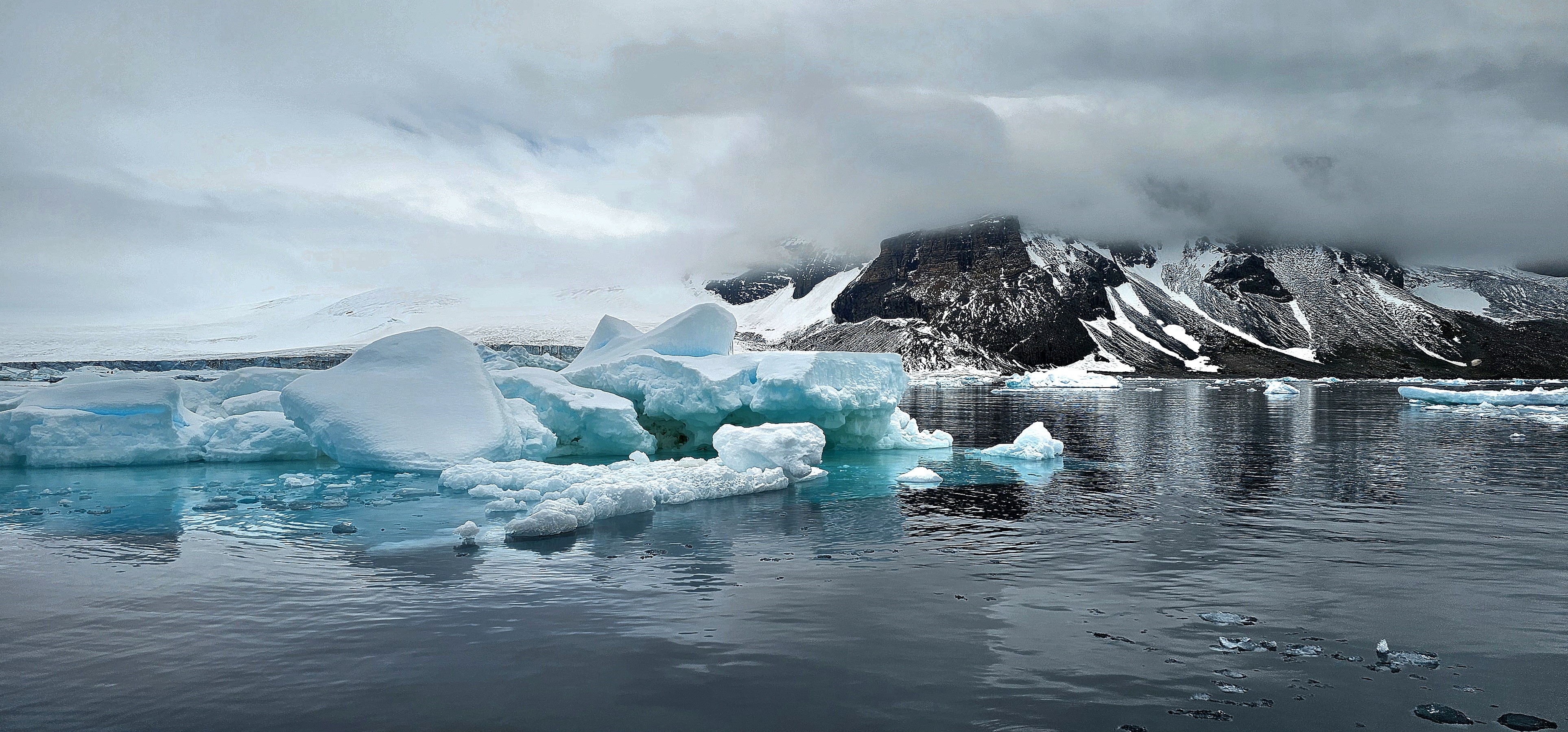
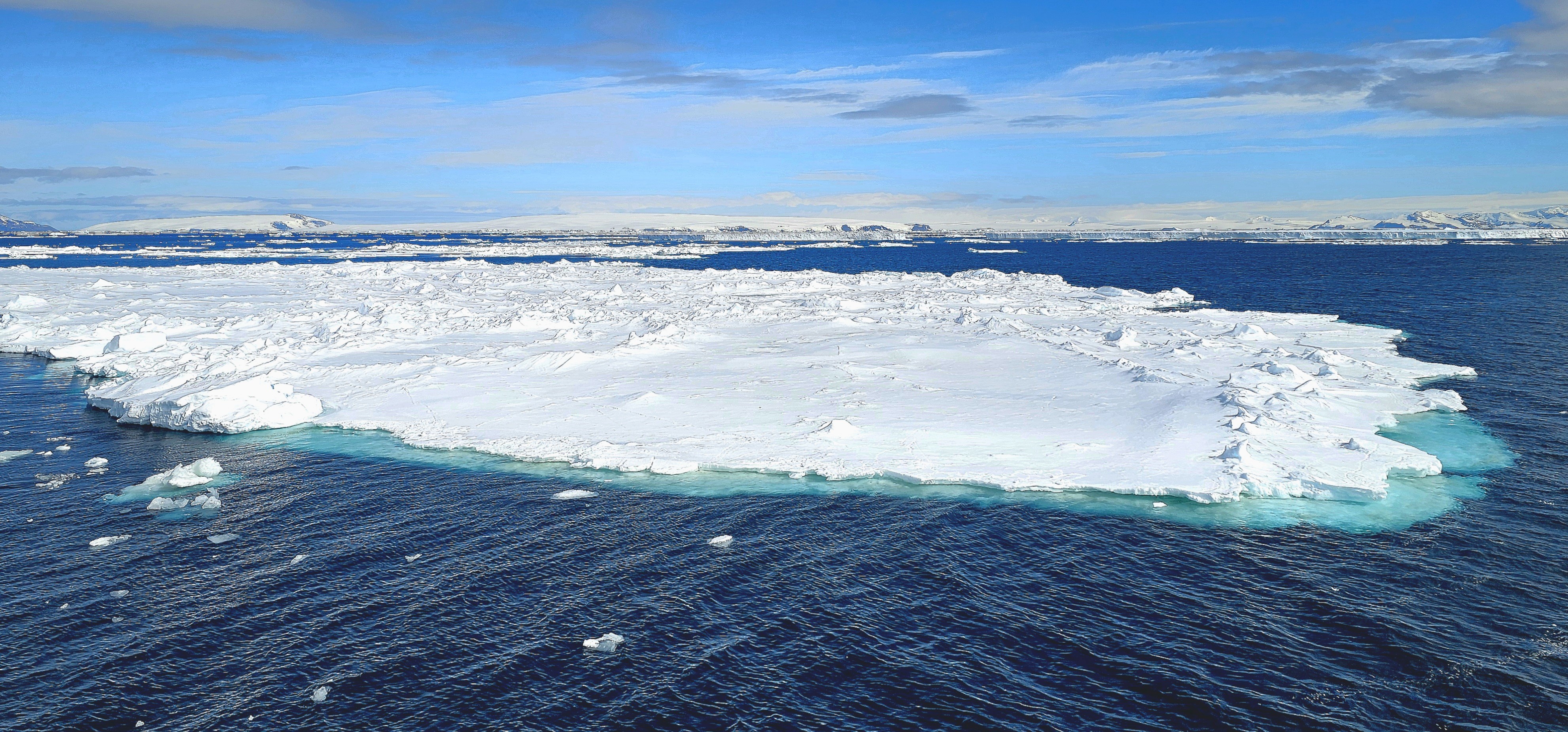
After a week of island-hopping along the Antarctic Peninsula, Leah and I finally set foot on the continent of Antarctica.
And because this was Viking’s sole continental visit, the expedition team was particularly busy transporting the remaining 352 passengers to Brown Bluff while overseeing a range of other outdoor activities throughout the day.
Our group was instructed to report to Deck 2 during a celebratory luncheon on Deck 10 that was briefly interrupted by a cloudburst of sleet and snow. Leah managed to cross the slippery deck with aplomb while balancing her surf and turf, but we had other fish to fry.
Once we were appropriately outfitted, our Zodiac pilot whisked us from our Trepassey Bay anchorage…
avoiding packs of drifting ice while also keeping an eye on an evolving sky,
which transformed a distant glacier into an enchanted wonderland of swirling smoke and mirrors.
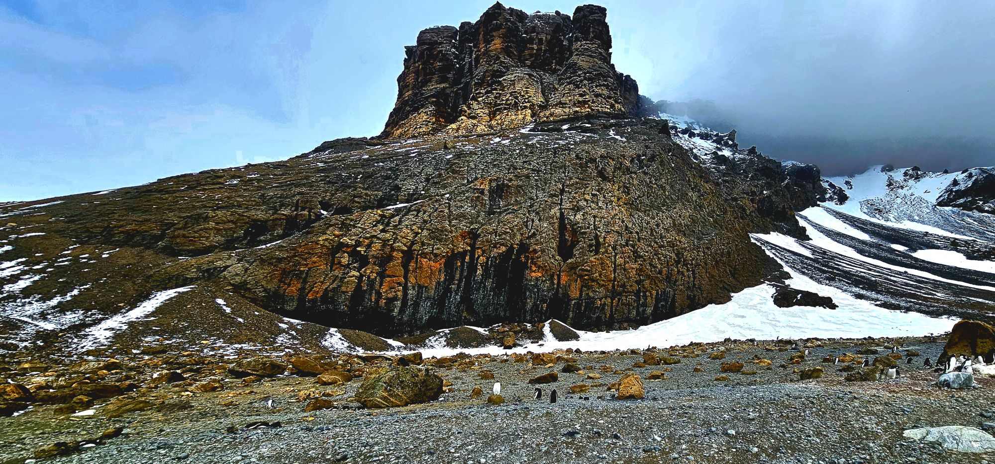
And then, as if on cue, the veil magically lifted as we approached the coast, revealing its rich, red brown, tuya characteristics.
We ambled onto shore, across the moraine…
where three impressive, moss-covered boulders at the western edge of the snow slope…
reminded us of Brown Bluff’s subglacial eruption one million years ago.
A majority of the landing groups headed east towards the rookery.
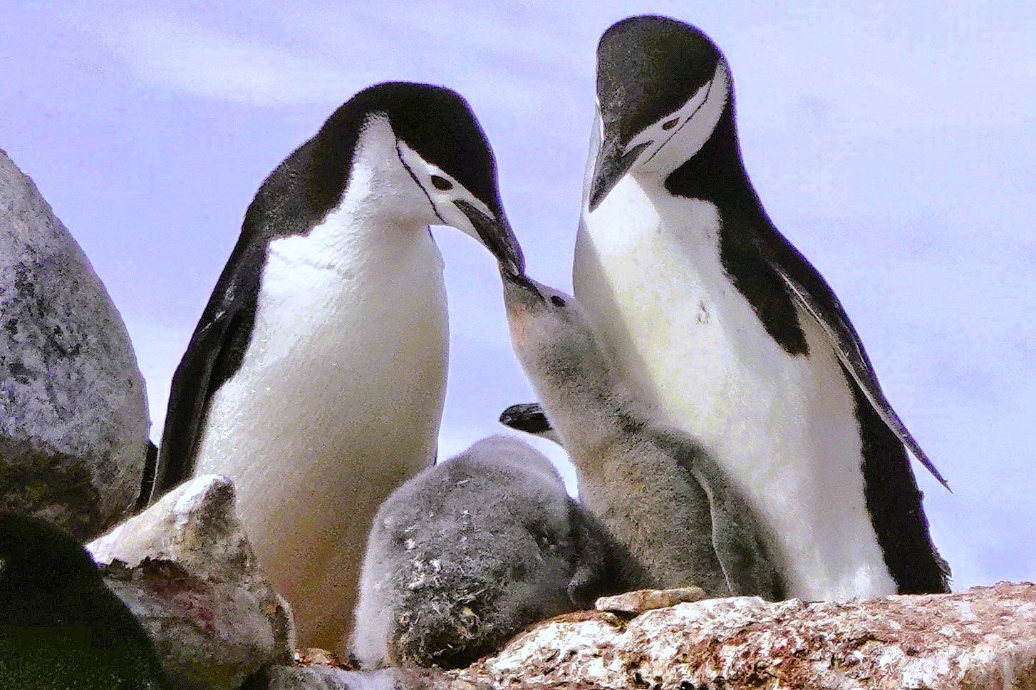
However, it proved quite difficult to maintain a 5-meter distance from the gentoo penguins–perpetually parading along the beach.
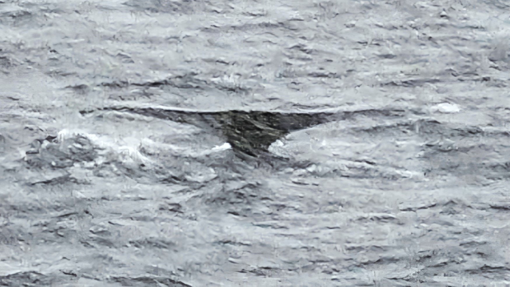
So, I ventured westward, over an icy reef, beyond nesting kelp gulls…
where I spotted an opportunistic leopard seal lying in wait…
for unsuspecting dinner guests,
yet every penguin on Brown Bluff had reservations elsewhere.
Had our continental landing marked the end of our dramatic voyage, I would have been wholly satisfied with our Antarctic experience. However, following the decontamination of our outerwear aboard Octantis, Leah and I learned that we would be among the final twelve returning to Brown Bluff via Special Operations Boat.
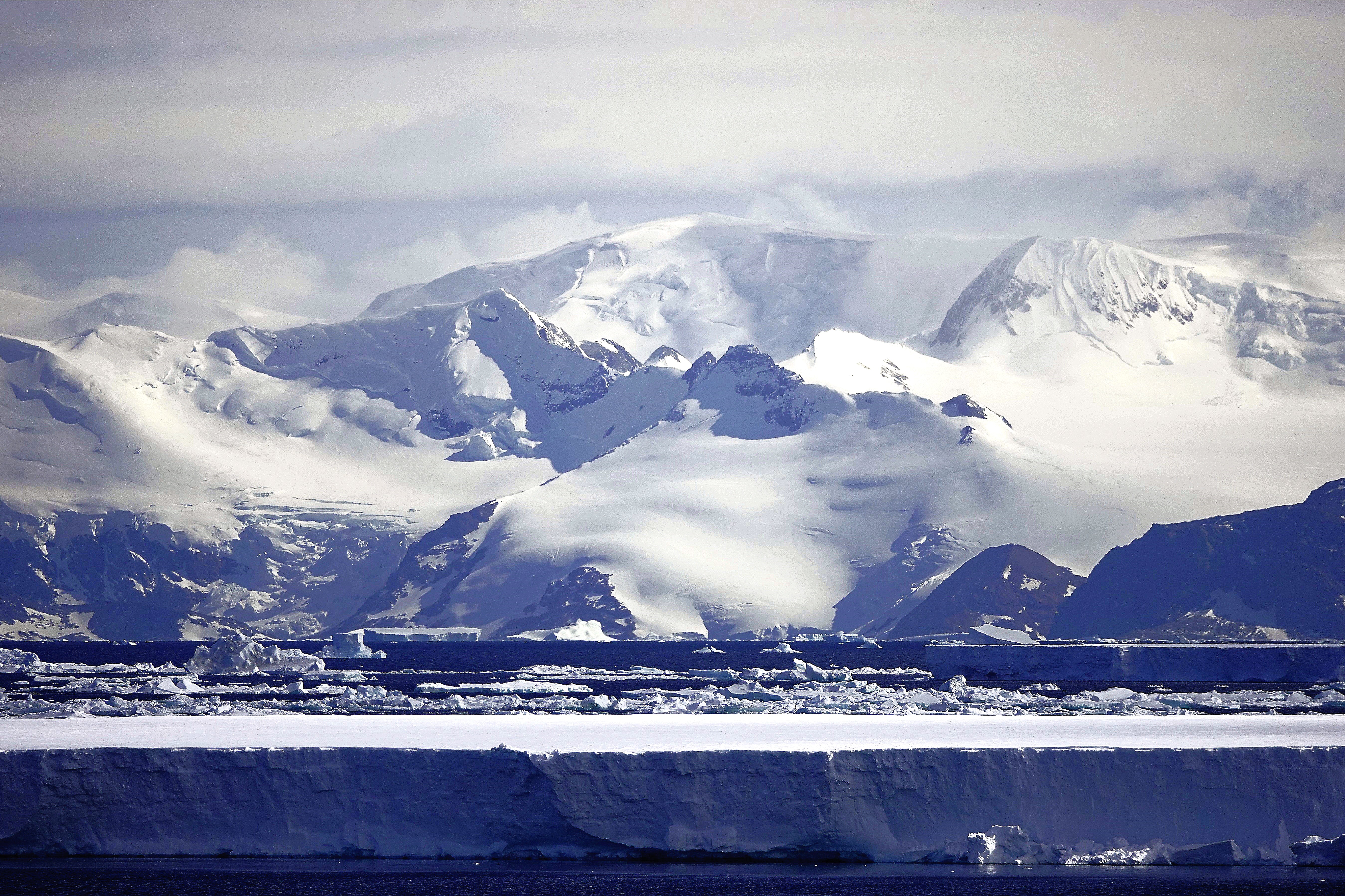
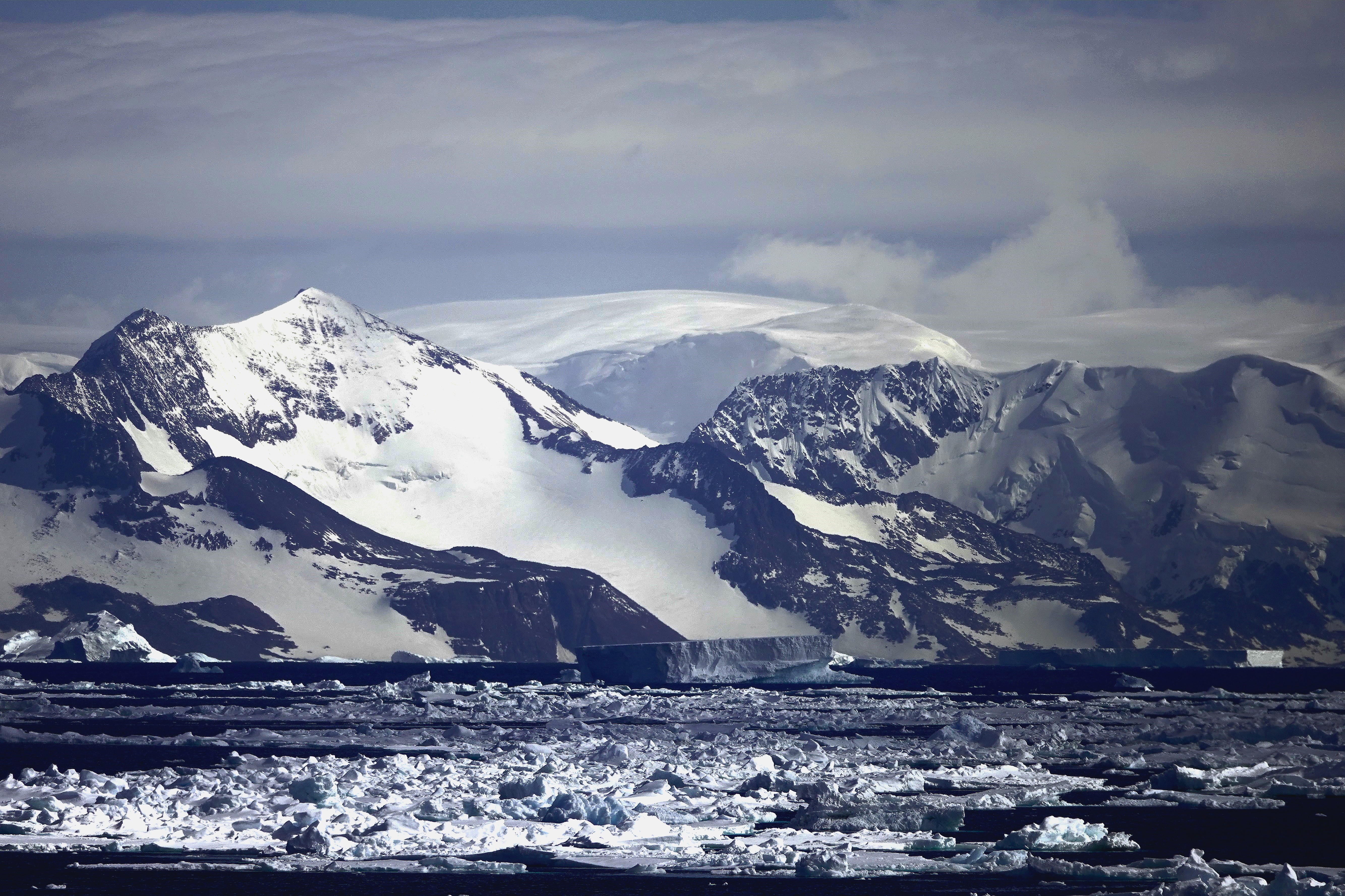
On our penultimate day at sea, Captain Cardestig skillfully navigated the Viking Octantis around the peninsula’s northeastern tip for an early morning view of Joinville Island’s glacial headlands and ice-capped peaks.
We anchored outside a dense track of pack ice that can make it challenging to approach landfall at Tay Head.
Those fortunate enough to be scheduled for daily excursions experienced a thrill ride from the 10u Zodiacs piloted through floating ice blocks momentarily stranded on rocky shallows.
I, however, was stranded aboard Octantis with my camera at the ready. The closest I could get to the Adélie penguin colony this day managed to swim across my viewfinder as they indulged in a krill feast.
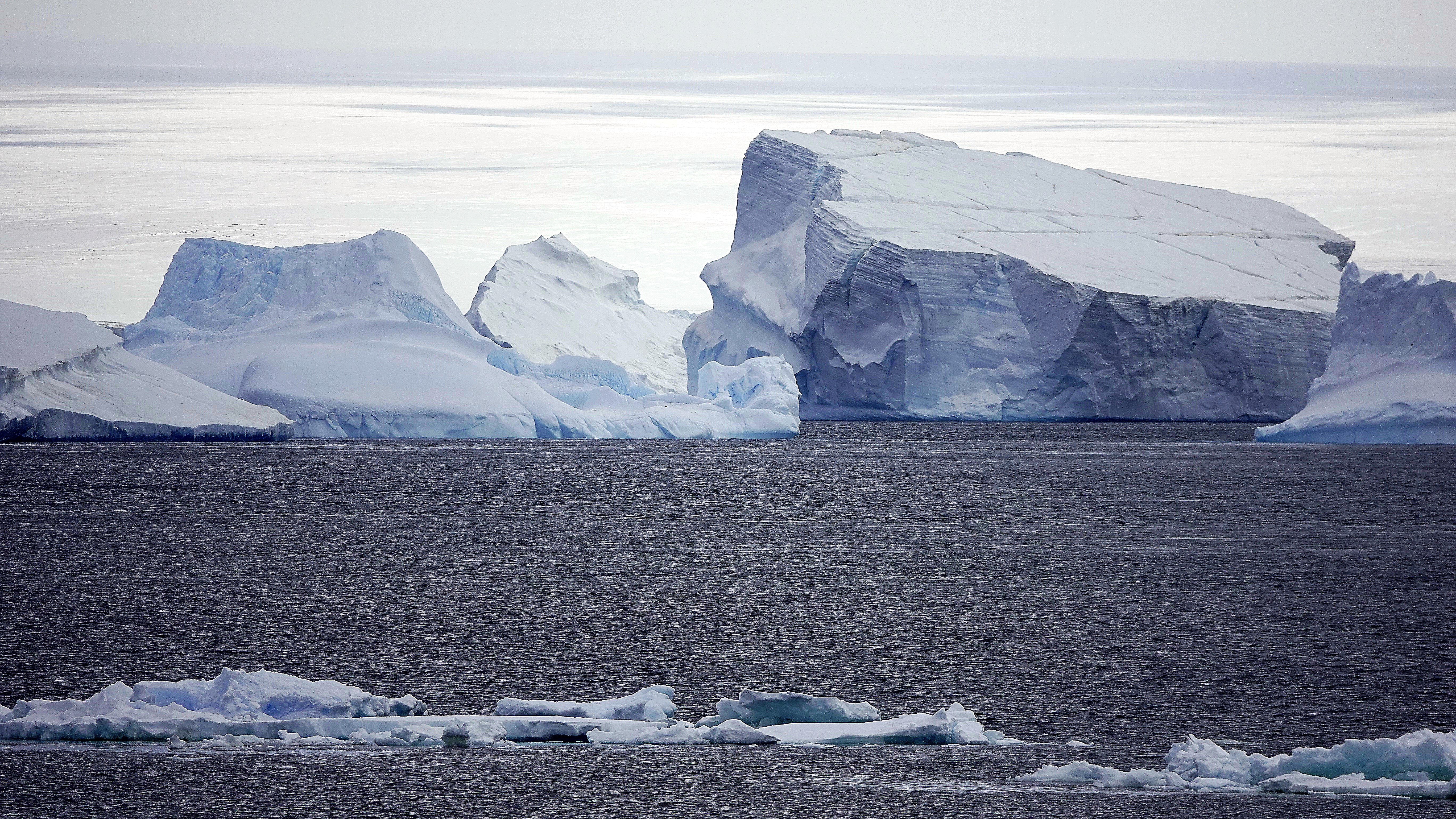
Travel resumed at noon, dodging islands of sea ice across the Antarctic Sound,
when a call came across the P.A. system, “There’s a humpback sighting, portside, and it’s following the ship.”
It was as if the paparazzi had stumbled upon Taylor Swift adrift in the Southern Ocean. Passengers leapt to their feet, fervently capturing the moment (predominantly with cell phones) from every deck, eager to commemorate our initial humpback whale sighting,
albeit from a distance beyond any reasonable recognition or resolution …
Nevertheless, there were cheers all around, as if to encourage an encore performance. And to our surprise, it circled back for a curtain call with crisper results!
Although my pixelated version offered its own reward.
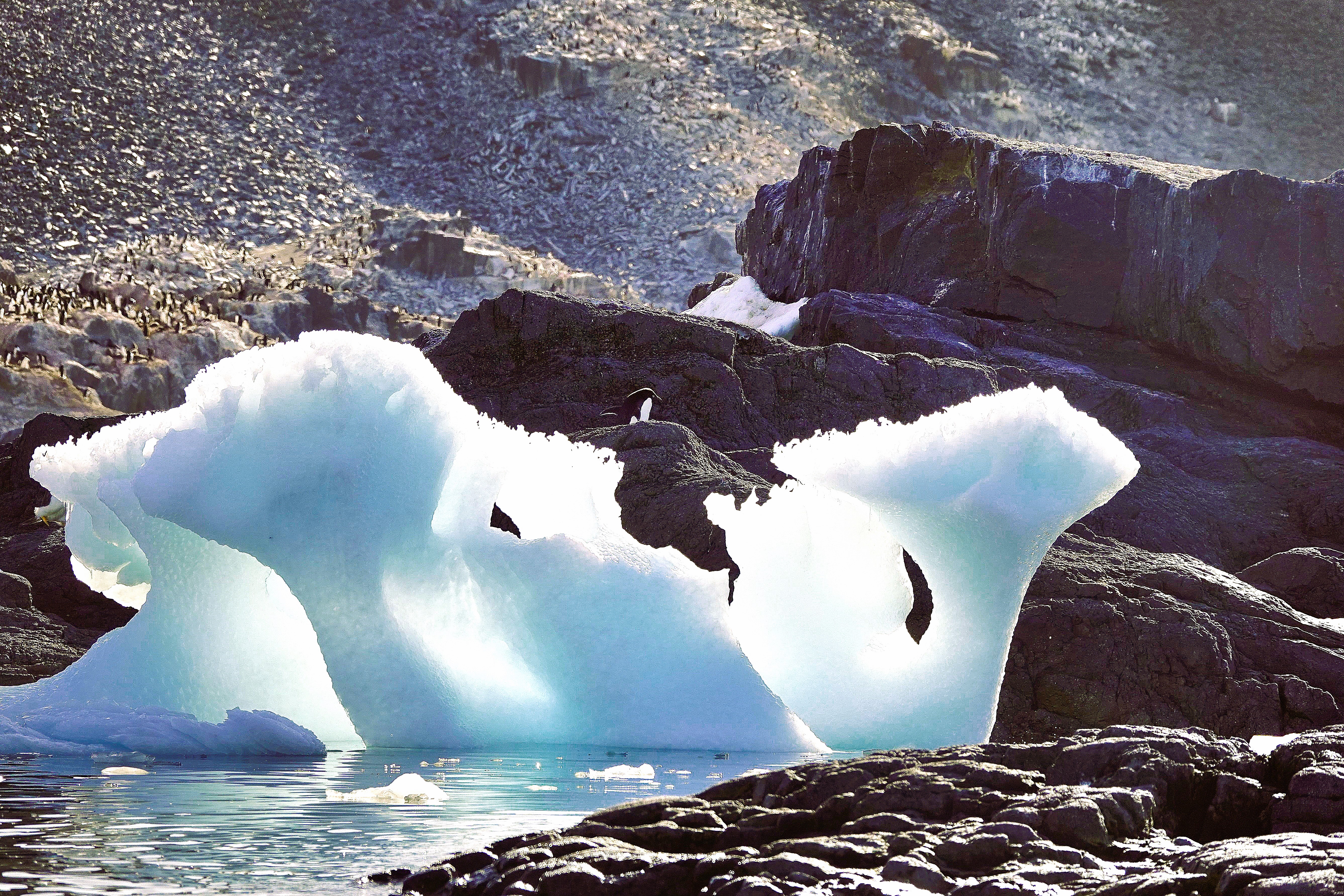
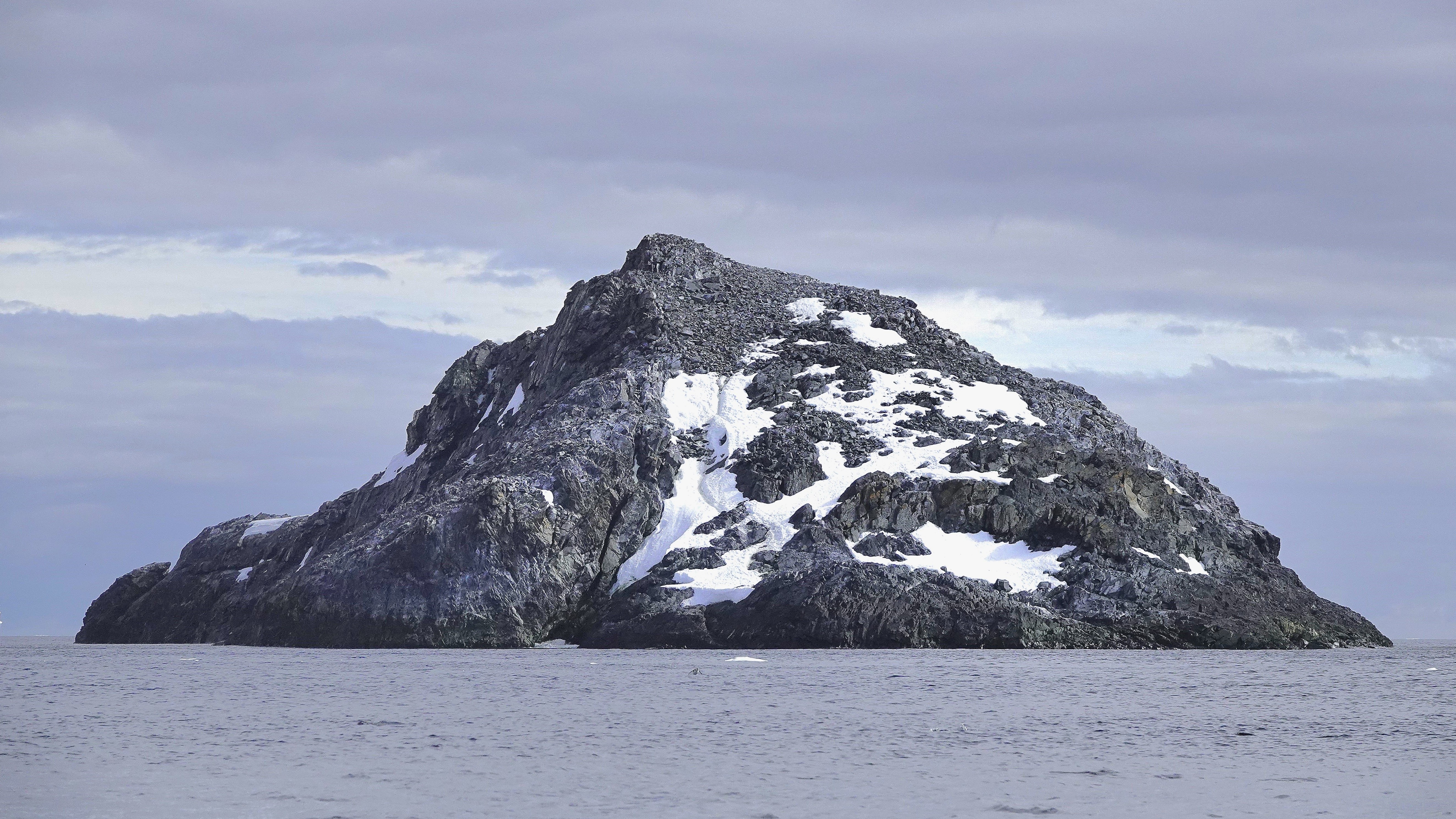
By late afternoon, we arrived at Paulet Island, a round volcanic rock characterized by its prominent cinder cone and almost complete absence of ice due to geothermal activity.
Once again, the requisite transport toys were hauled from the hangar for the fortunate 182 passengers who walked among the tens of thousands of Adélies on the island’s congested shore.
But alas, not with me. I, for my part, was chasing an opportunistic snowy sheathbill that had fled Paulet Island, seeking the solitude of Deck 10.
By 8:00 PM, the majority of passengers were savoring their dinner as Octantis sailed southwest towards Brown Bluff, in anticipation of our singular continental landing—a prospect that held high expectations for everyone and ultimately left no one disappointed!
Leah and I bid adieu to Admiralty Bay, with “John and George” (our yellow submarines) safely stowed in the ship’s hangar. We also wished a speedy recovery to our medevacked shipmate.
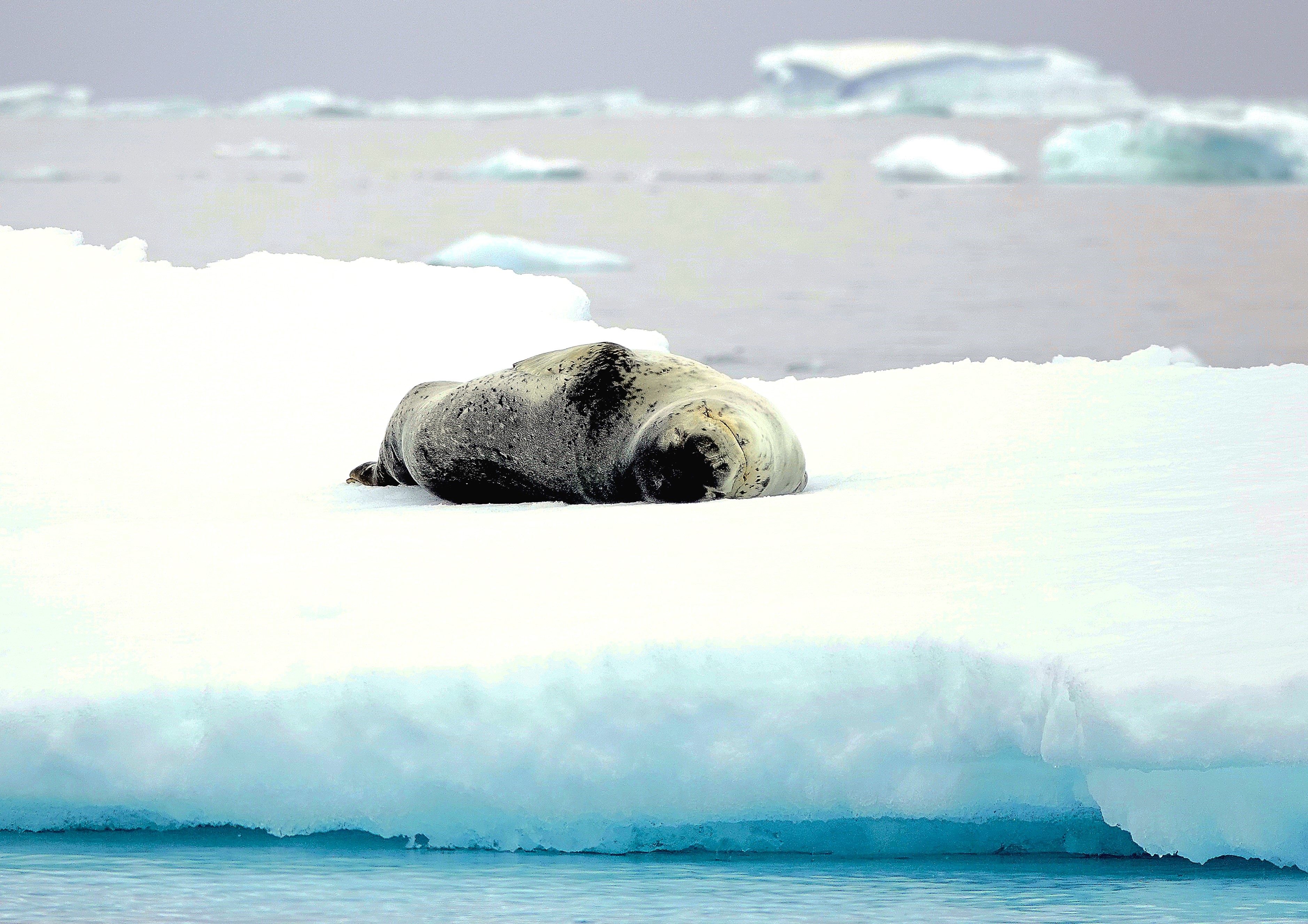
Our journey continued past a leopard seal lounging on an ice floe designed for one, but our heading was uncertain.
Viking Octantis was now operating in uncharted, metaphorical waters. With our predetermined itinerary cast into the Bay of Serendipity, we now had a rare opportunity to explore the tip of Antarctica’s peninsula!
The wheelhouse brass decided that Octantis would complete its Antarctic voyage with a continental landing at Brown Bluff.
Additionally, resident scientists–supported by Viking’s mission to collaborate with global research networks–lobbied for an interim landing on Astrolabe Island, where penguin monitors from Oceanites were enthusiastic about counting a colony of chinstrap nests that hadn’t been surveyed since 1987.
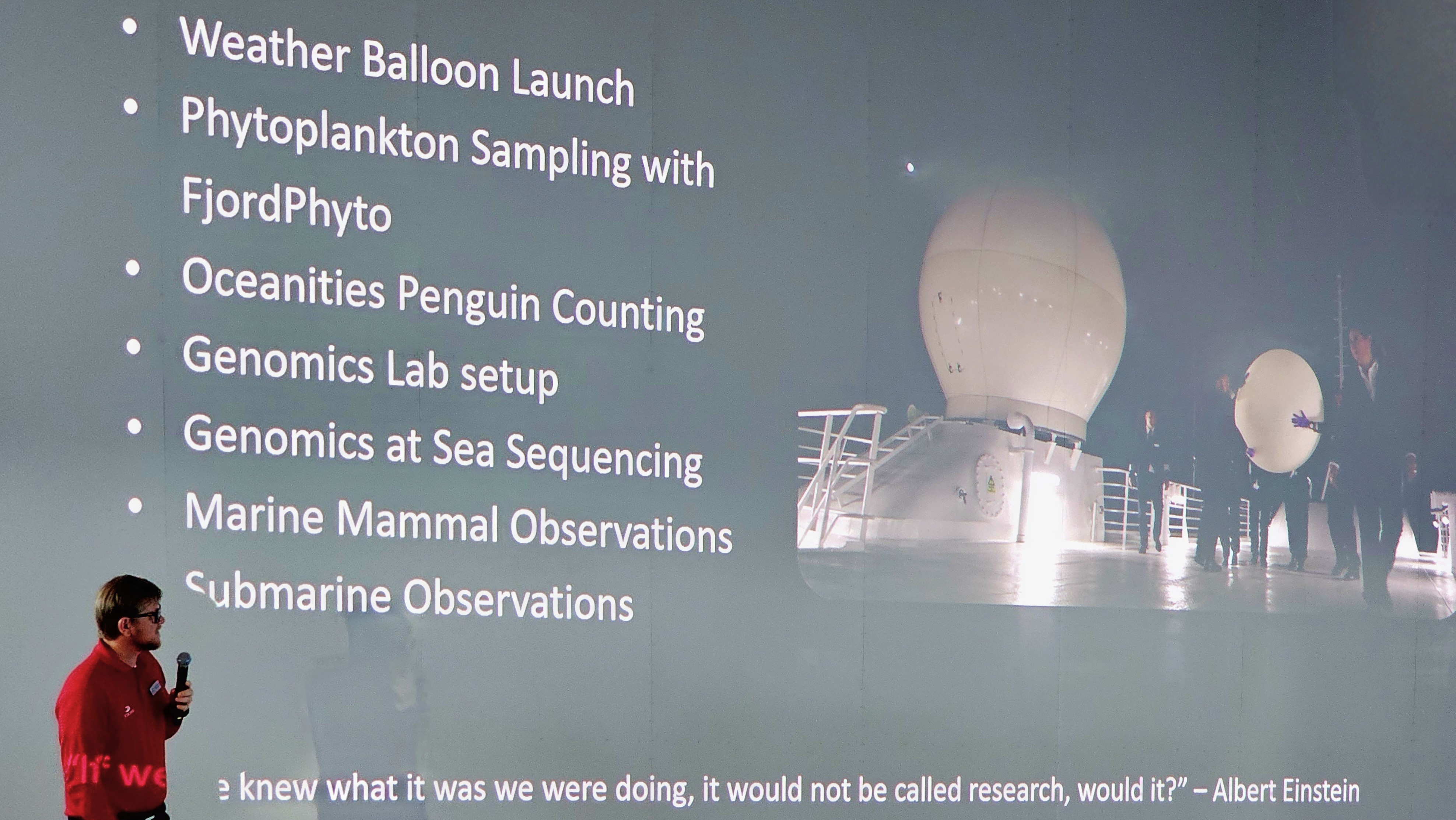
Science certainly set the tone for our Antarctic expedition. Passengers were enlightened and enriched with daily lectures and participation opportunities to complement Viking’s pursuit of marine science.
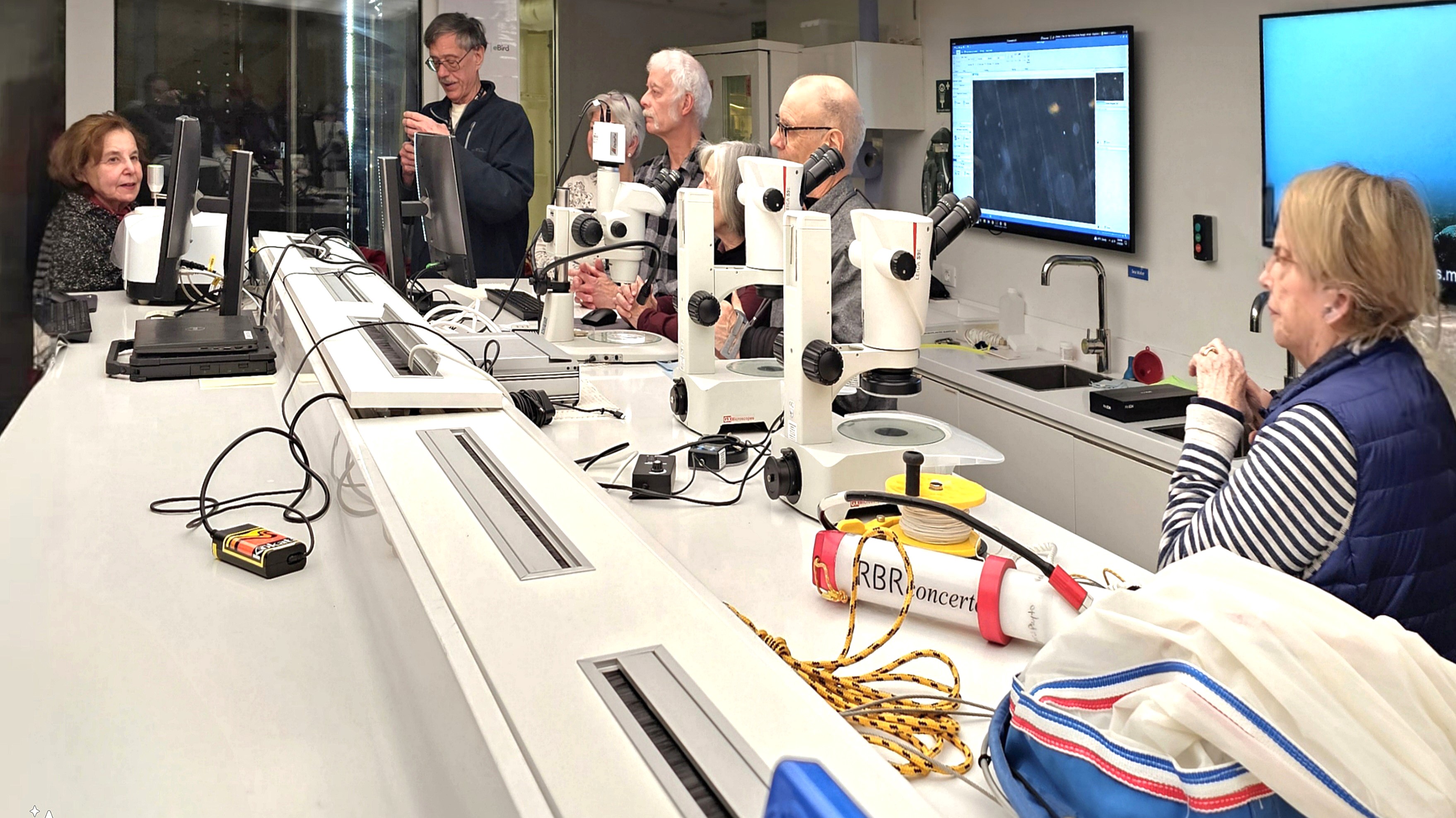
In the name of “Citizen Science,” Leah and I facilitated in collecting phytoplankton, and sampling the water for microplastics,
which was later analyzed in a fully equipped science lab.
Better yet, the entire ship was invited to celebrate the release of a weather balloon…
and monitor the data stream from its high-altitude instruments.
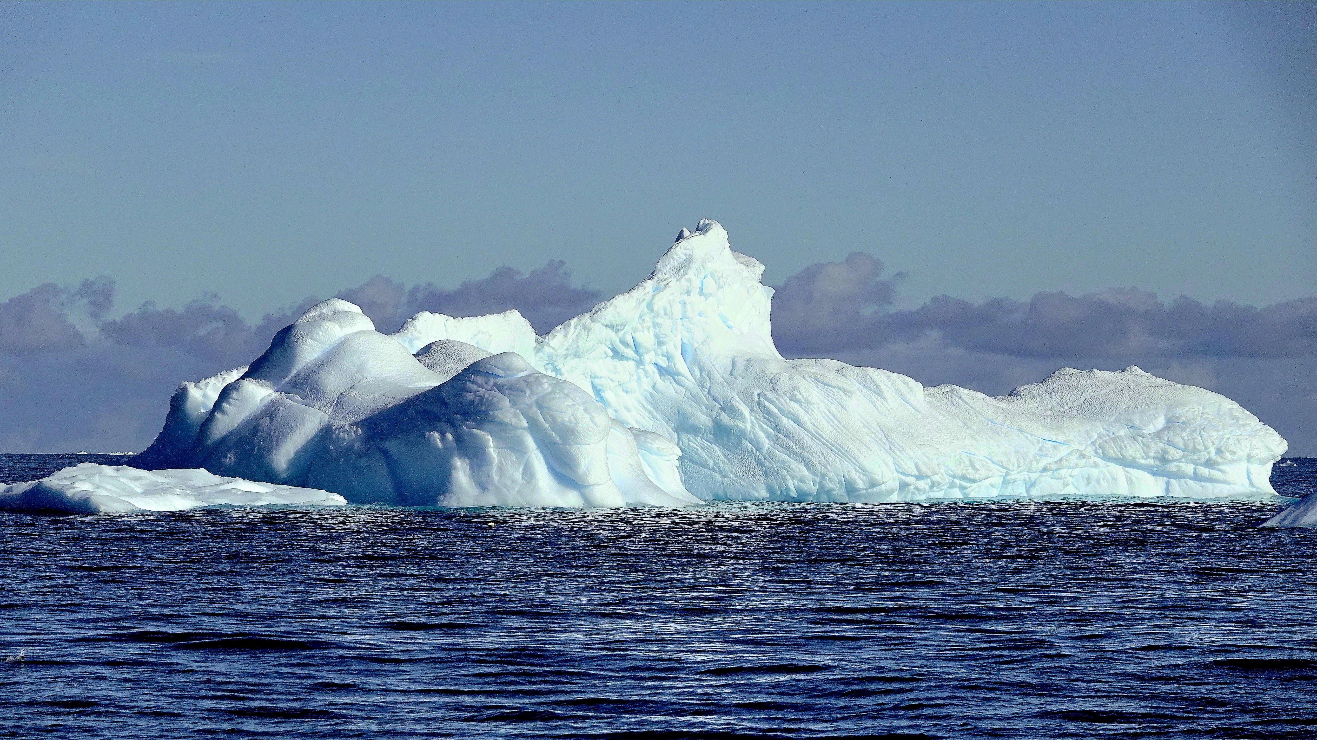
On January 16, we awoke to calm seas and blue skies over Bransfield Strait, with Trinity Peninsula dominating our horizon. The panorama gave the illusion of an expansive sculpture park installation.
Leah and I were scheduled to board a Special Ops Boat (S.O.B.) for a closer look–
that had us oohing and aahing as we darted through one-of-a-kind carvings.
“That one resembles the Statue of Liberty… and there’s an ice cream cone… and that one could be a mushroom…” were common overheard comparisons.
I marveled at the colossal size of these formations shaped by wind and sun and imagined the volume of ice beneath the surface!
Later that day, we swapped our high-speed vessel for an assigned Zodiac…
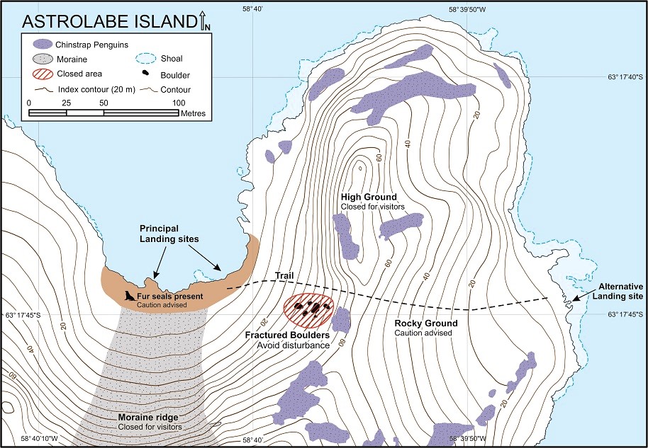
to ferry us to Astrolabe Island.
Our pilot cruised past Dragons Teeth–a collection of 100m peaks cutting through the gumline of frigid waters.
We zigzagged through towers of blue ice,
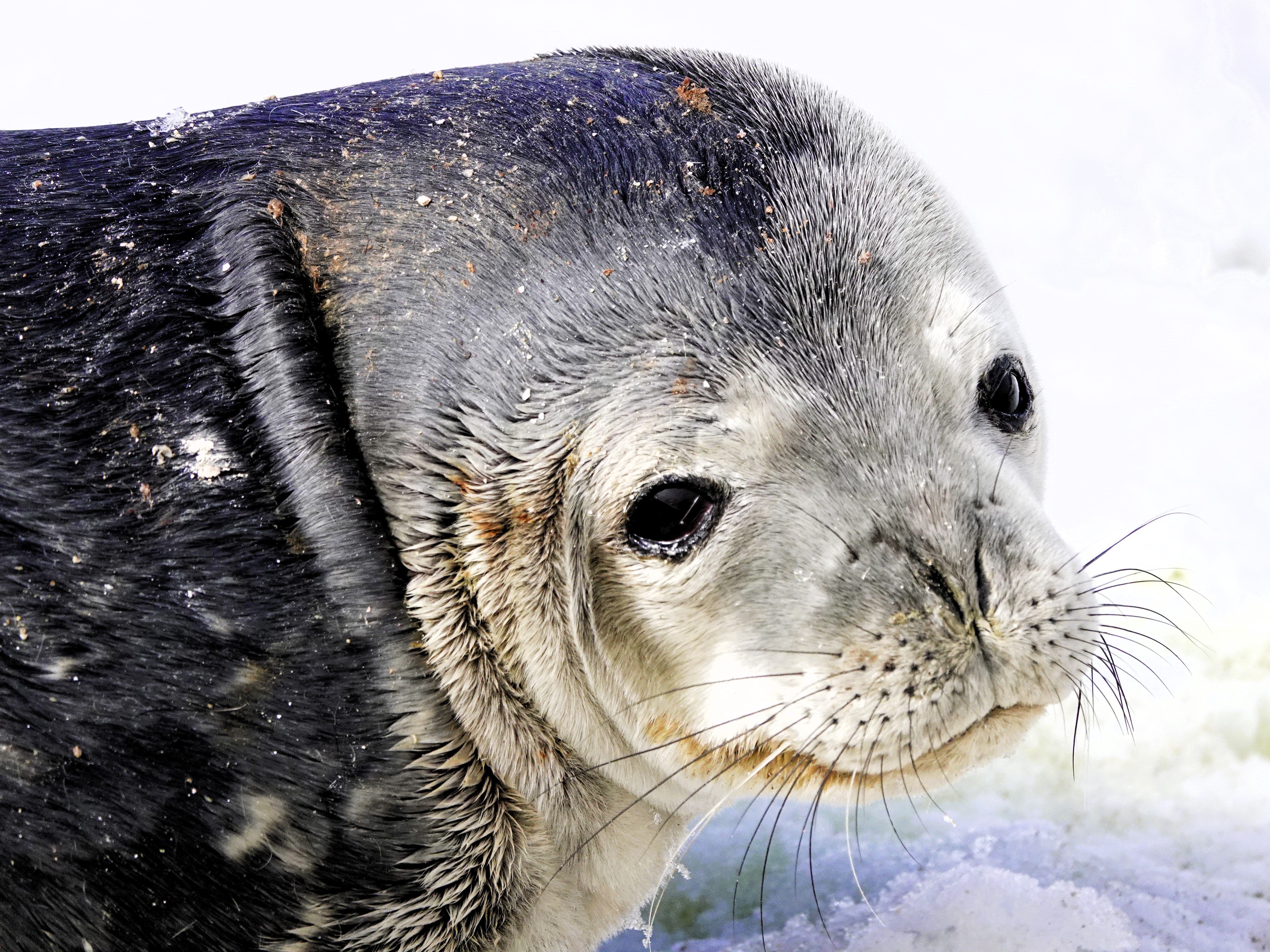
until we beached at a guano-stained snowfield ruled by Antarctic fur seals–
inherently cute but unpredictable predators–
while a rookery of chinstrap penguins preferred the protection of High Ground,
where eggs…
and hatchlings were well-protected.
Nevertheless, their paths inevitably intersected en route to the sea.
We closed our day with one last excursion along Hut Cove,
where a thriving colony of gentoo penguins were filling their bellies with krill.
After returning to Octantis, it was announced that the Oceanites team identified an unknown colony of chinstrap penguins on Diaz Rock, using drones equipped with thermal imaging to detect distant splashes of pink poop.
Overall, it was a good day for science, but it was a great day for scenery and seabirds.
An unexpected medical emergency aboard Viking Octantis dramatically changed our travel plans. Rather than repositioning overnight to Damoy Point to explore historic British and Argentine huts, Captain Cardestig rerouted the ship and raced north to King George Island in the South Shetland Islands to facilitate a medical evacuation for a sick passenger.
Consequently, all future excursions were rescheduled to align with our revised four-day itinerary. Although the majority of passengers calmly accepted the changes, I sensed some disappointment, especially among those whose submarine excursion was delayed indefinitely.
Of the 350 passengers aboard Octantis, nearly 75% expressed interest in a submarine dive. And who wouldn’t, given the allure and bragging rights among friends. In fact, several passengers were offered a complimentary submarine ride as a bonus for early booking, amounting to a $499 savings.
But submarining was never intended for everyone. Given the demographics of the passengers (average age of 70 years), there were many aboard Octantis who lacked the general physical characteristics or requirements to take advantage of the opportunity. To determine eligibility–after boarding the Octantis in Ushuaia–we were immediately sorted into two groups: those who would dive and those who would not. Leah was always less than interested. However, as a self-identified adrenaline junkie, my choice was obvious, but I still had to pass the two physical challenges to qualify.
After I was weighed, I was instructed to step onto a chair seat, alternating legs while maintaining my balance. Subsequently, I had to squat between two tables set 18 inches apart and stand. I completed the test with ease, but others found it challenging.
One delicate woman, possibly in her 80s, approached the chair with a cane. The officer was kind but firm; canes were not allowed. With dignified resolve, she handed over her cane, declaring, “I don’t need it. I can walk without it!” I was amused when she bent over, grabbed her right thigh and hoisted her foot onto the seat. She repeated the task with her left leg in the same manner. She was most pleased with herself, as if she had won gold in a power-lifting competition. She tackled the final challenge by sidling between the tables, grabbing the edge for support, and lowering herself into a half-kneeling position. I sensed that her strength was sapped, but she struggled mightily to pull herself upright.
The officer was hardly impressed. “If it was my call, I would disqualify you. However, since you mostly completed the task as asked, I will allow you to pass. However, I recommend that you reconsider your decision.”
During our second day at sea, I sat through a compulsory briefing for prospective submariners in the Aula on Deck 2. Understandably, the memory of Titan’s implosion seven months ago at a depth of 3,500 meters was still fresh in the minds of many of the attendees in the auditorium, not to mention a familiar, frail woman who seated herself beside me. Oh, the irony!
The briefing was indispensable. The crew gave a detailed rundown of essential safety measures which provided the worriers and skeptics with much-needed reassurance. For example, in case of an emergency:
The submarine is stocked with a four-day supply of food, water, and oxygen for the pilot and six passengers.
There is no toilet on board.
Passengers are required to bring a four-day supply of any essential medications, which they will need to administer themselves.
Passengers will be coached to operate the sub by communicating with the support vessel on the surface should the pilot become incapacitated.
We also learned about some of the features of our submarine:
The Cruise Sub 7 by U-Boat Worx is capable of descending to 900 meters.
It’s air-conditioned.
It features two back-to-back acrylic spheres, accommodating three passengers facing forward and three facing backward–offering undistorted 270o views.
The seats, situated on rotating platforms, allow everyone to reposition for shared views of the marine environment.
It’s equipped with eight thrusters: four vectored horizontal, two dedicated horizontal, and two dedicated vertical, providing the Sub 7 with exceptional maneuverability and the power to contend with strong underwater currents.
A handheld joystick control device enables easy maneuverability.
It can operate for up to 16 hours submerged.
Each one costs $4 million.
We finished up with Q’s & A’s. So, I got to wondering out loud, “If the pilot should pass out, and it falls on me to operate the sub, and I wreck it in the process, am I on the hook for $4 million, or will my travel insurance cover the damage?”
It was good for a laugh and a good way to end the meeting.
Following the briefing, my neighbor turned to me and confessed, “You know, my doctor gave me medical clearance to participate in this activity, but I never told him about the vertigo that I started experiencing a couple of weeks before the trip. Do you think I should still go?”
It baffled me that she would even contemplate this, considering her latest complication. “I’m sure you’ll make the right decision,” I said to appease her, “but maybe you wouldn’t want to risk compromising someone else’s experience.”
We arrived at the South Shetland Islands by late morning with a modified schedule in place,
and the hangar toys were immediately deployed.
When Leah and I checked our daily agenda, I discovered that my time had come; I would explore the ocean floor off King George Island. The feeling was akin to winning the lottery… which cost me only $499 to play!
After arriving at the hangar–eager and ready with my Sony RX-10 around my neck–our group of six received lanyards with numbered pendants corresponding to seat assignments and the order in which we would board the sub. Mine was #1.
The Zodiac ferried us to the submarine platform, where #6 stepped aboard with a firm sailor’s grip. He wriggled down the 18-inch hatch opening and took his designated seat on the starboard side. #5 repeated the transfer drill and took his seat on the port side to manage weight distribution.
I was the last passenger to come aboard, and while I don’t suffer from claustrophobia, it was hard to ignore how cramped the cabin felt, especially squeezing into my seat with our bulky parkas taking up so much space.
Excitement quickly turned to disappointment when I realized that my camera’s auto-focus function was compromised by the window. How could I ever get any cool shots in these extreme conditions?
With Kat in command, she rotated our trio of seats into the acrylic bubble for optimal viewing and completed a readiness checklist with the dive support vessel.
After receiving clearance, she managed our descent through a 300 ft. wall of krill, until we finally emerged with a view of the bottom. There was a collective “Wow!” from the cabin.
Kat proclaimed, “I believe we are the first people to have ever explored this part of the Southern Ocean. So, let’s see what we can discover.” One of our initial discoveries was a change in the visible light spectrum, where longer wavelength colors, such as red, nearly vanished as we ventured further into the depths of the unknown.
Kat hit the thrusters to slow our decent, as we gently settled atop the sandy bottom. I was surprised to learn that we had reached a depth of 409 feet.
Far from being mere novelties for tourists, Viking’s submersibles have become a vital tool for marine biologists once constrained by resources, to carry out research missions in remote regions. Consider, in early 2022, when Octantis submersibles documented three sightings of the rarely encountered scyphozoan Stygiomedusa gigantea, commonly known as the giant phantom jellyfish, measuring 30 feet in length. A white paper was subsequently published in Polar Research, the scientific journal of the Norwegian Polar Institute. (The full research paper is available at: http://dx.doi.org/10.33265/polar.v42.8873)
Although our dive didn’t make news, we still encountered a variety of sea life that I managed to capture on my Samsung Galaxy 23 Ultra… such as a lonesome a brittle star,
and multiple snake-armed, Labidiaster annulatus, commonly known as wolftrap starfish,
including a rare look at a hunter, ready to snatch fast-moving, swimming prey as it passed by.
I was also delighted to capture a potpourri of sea life, featuring a couple of sea spiders hugging a sea worm tethered to a feather star.
After 45 minutes, we surfaced!
Indeed, it was a unique experience shaped by our environment and the adventure; however, I had anticipated more. I imagined leopard seals hunting penguins and orcas pursuing seals. Perhaps, my expectations were set too high. Yet reflecting on the event, it remained a highlight of our voyage, and another item checked off my bucket list.
As for the lady with a cane, our paths crossed again on our last day at sea. She was sitting with her older sister sipping tea over dropped surgical masks at Mamsen’s, a Norwegian-styled cafe dedicated to the mother of Viking’s founder, Torstein Hagan. I asked if she had enjoyed diving in the submersible. “Unfortunately, not. I ended up caring for my sister, who fighting a cold at the moment. But there’s always a next time!”
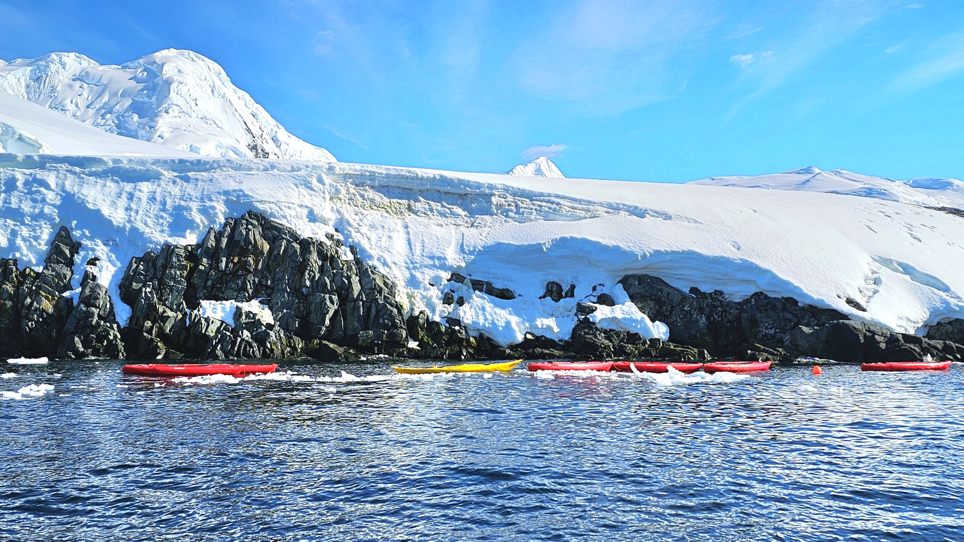
Leah and I wrestled our way into pricey polar drysuits in preparation for kayaking in Chiriguana Bay, a protected inlet on the southern end of Brabant Island in the Palmer Archipelago.
We strained to pull our heads and hands through unforgiving latex gaskets that promised to seal in our body heat while preventing icy water from infiltrating our suits, effectively turning us into human buoys in the event of a capsize.
We boarded our Zodiac, and raced around a steady stream of bergy bits,
before reaching a string of tandem kayaks already moored in the bay.
Each of us performed a precarious “shoehorn” transfer into our kayak seats without incident. At once, Leah and I fiddled about–making adjustments to our outfits and gear–until we reached a level of comfort to maximize our paddling efficiency. Surprisingly, at 32o F / 0o C with clear skies and sunshine, it felt warm enough to remove my gloves.
After safety instruction from Stephanie, our kayaking guide, we glided through the bay in unison for a closer look at our surroundings,
all the while following Stephanie’s lead.
The stretch of blue ice,
and white serenity–occasionally interrupted by the distant thunder of calving ice–left us breathless.
Before we realized, our 45 minutes of paddling had come to an end. Drifting on the Southern Ocean, time seemed to stand still, as if the rhythmic waves that rocked us held the secret to eternity.
Coming up: a journey to the depths of the ocean floor…