
A side trip to Great Smoky Mountains National Park from Asheville takes only an hour, but the payoff is timeless. Admission is free, but the views are priceless.
The National Park straddles North Carolina and Tennessee, with Clingmans Dome, the highest peak in Tennessee, and a natural boundary between both states. The park is situated within a day’s drive for 60% of the nation’s population, making it the most popular of all National Parks, with over 9 million visitors per year.
The park can be accessed through a dozen different gateways, with Sugarlands Visitors Center being the prevailing entry point from the north side through Gatlinburg, TN. But Leah and I approached the Great Smokys from the south, and entered via Oconaluftee Visitors Center, the heart of Cherokee Nation.
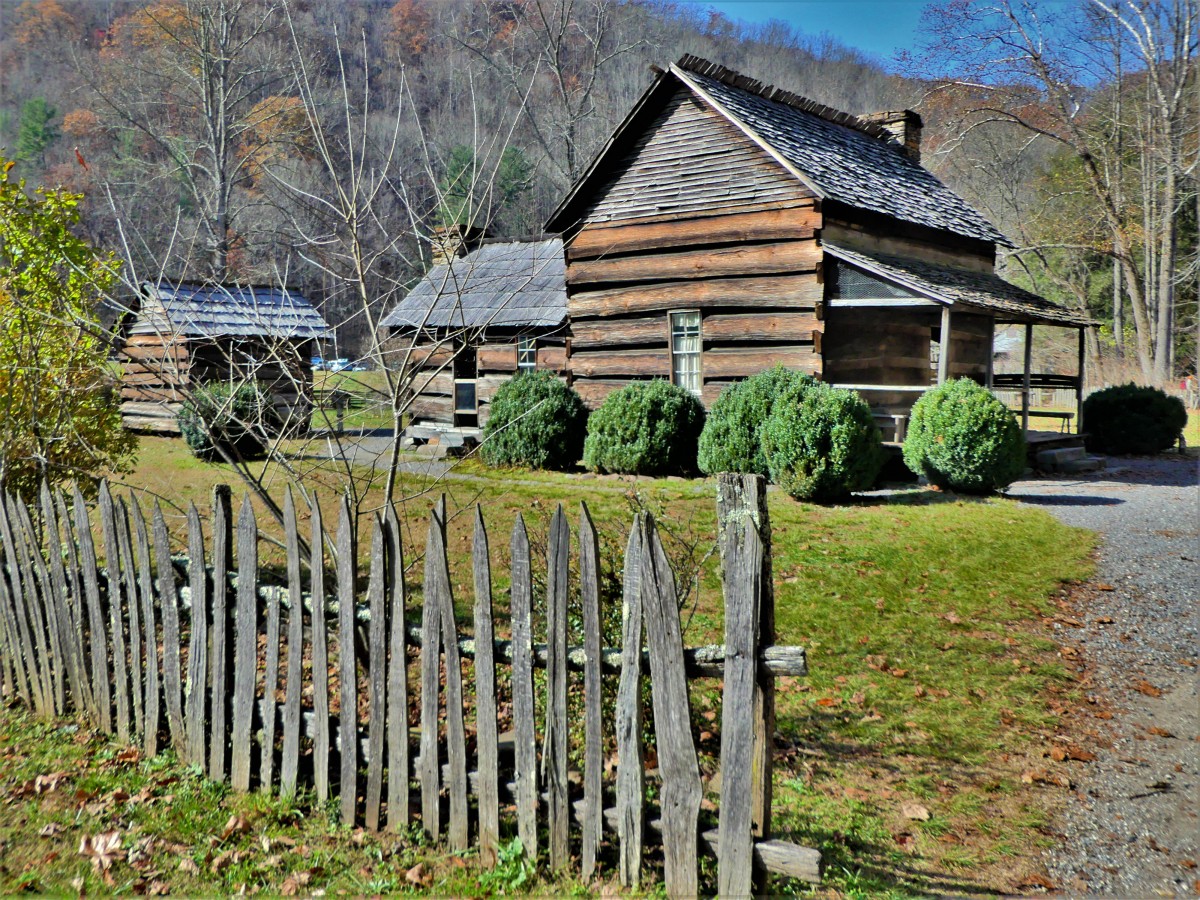
Once there, we took our time strolling through the Mountain Farm Museum on the banks of the Oconaluftee River…


…before driving north on Newfound Gap Road–stopping frequently at the many overlooks–to gaze across Carolina’s side of the Blue Ridge Mountains,


and preview our next destination, Clingmans Dome, at 6,643 feet elevation.

A dogleg turn onto Clingmans Mountain Road took us through short winding turns as we climbed the Appalachian Trail ridgeline, eventually leveling off at an over-sized parking area with trails radiating from the top of the bald, and views extending a hundred miles.

Thinking that views might be even better at the very top–allowing us to see over Mount LeConte–we trekked half a mile up a very steep asphalt path to Clingmans Observation Tower, albeit knowing it was closed for repair until next year.
To our surprise, families were scaling the spiraling ramp to the tower.

Looking around, there were no views to be had at the base. We were surrounded by a dense growth of evergreens without breaks. Sacks of concrete were stacked under the column with flimsy, yellow, KEEP OUT tape tied across the tower entrance.
Scores of visitors-turned-violators stood around the column base, determining their next move. Should they make the ascent or not? Yes, the tower was officially closed to the public while undergoing repair. But was it too risky to breach the ribbon barricade? There weren’t any park rangers present, but maybe there were cameras? What a moral dilemma!
“I’m not going up there,” exclaimed Leah. “There’s a reason that tower is closed.”
“But look around us! Where are the views?! We hiked up here expecting to see something, yet there’s nothing to look at, unless you want a closer look at this fir stump,” I argued. “And what about everyone already up there? If they really wanted to keep us out, then why didn’t they secure the entrance better? Why didn’t they use fencing instead of tape?”
Leah was adamant. “I’m still not going up there, and I don’t care about everybody else! It’s not the right thing to do.”
I offered Leah my Roy Moore rationale: “But it ain’t illegal if ya don’t get caught!”
I deliberated carefully…
…and ducked under the tape. I couldn’t help myself. I wouldn’t deny myself the views I had come all this way to capture.
The 45-foot tower was completed in 1959 to give unobstructed 360° views of the surrounding mountains and valleys, and it was showing its age. The concrete pathway was separating from the wall in places, and patches of rebar were visible along the way. But did it warrant closing while in the midst of being repaired?

Probably, but not until I had the chance to document the landscape. I scurried up the ramp with the intention of quickly getting my shots, and hurrying back down, just in case I should be noticed.


On our way back down the trail, several families on their way up the trail, paused to catch their breath and ask, “Is it worth it? Is there anything to see up there?”
“It all depends on how good you are at following orders,” I’d answer cryptically.
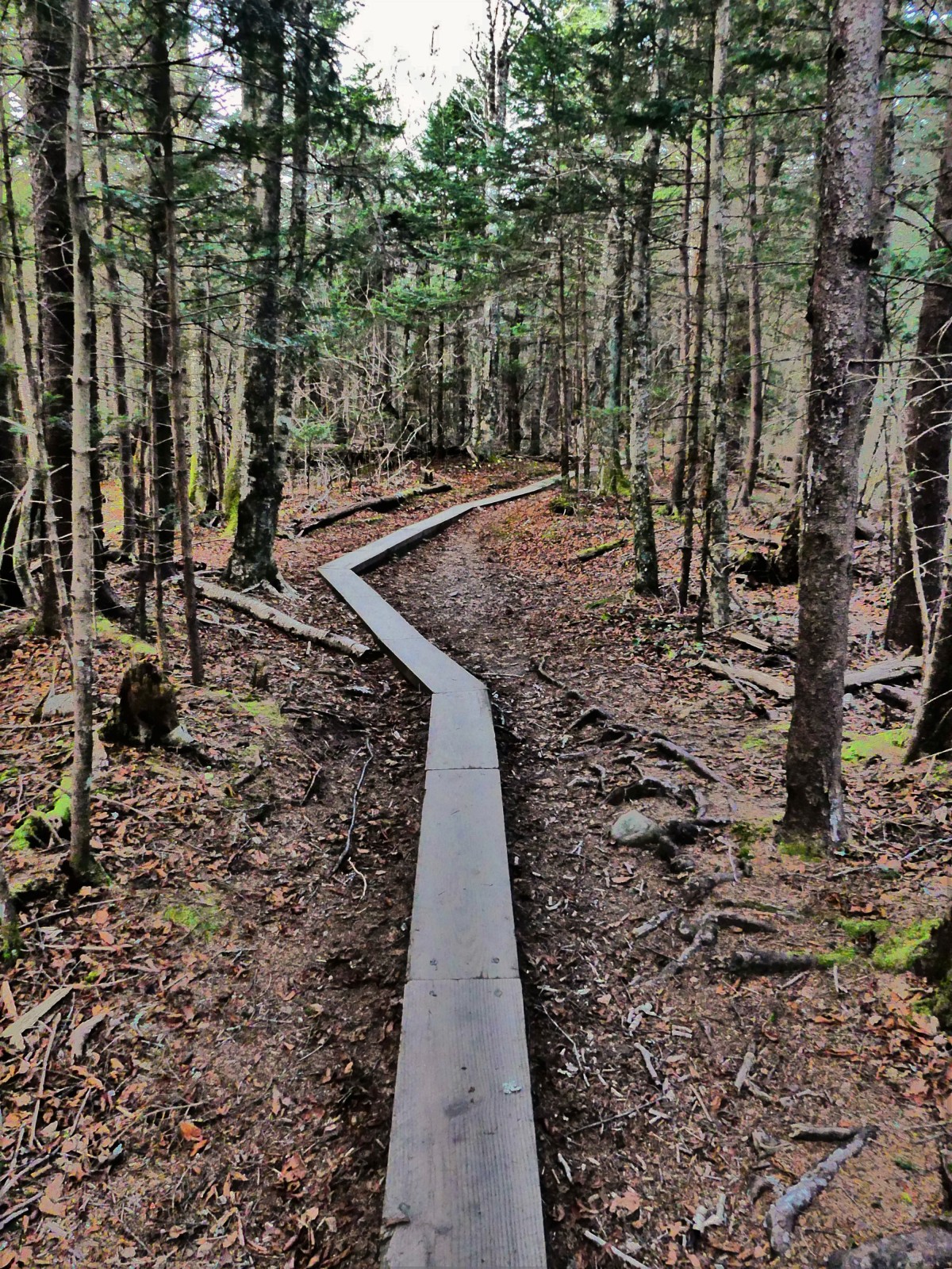
But our day wasn’t done yet. It was only three o’clock, and we hadn’t hiked more than an easy mile. We’d been told by a park volunteer at the Visitor Center that the two-mile trail to Andrews Bald–which intersects with the Appalachian Trail–was a worthwhile hike with amazing views at the end.

So, we took her advice, and set out down a narrow, terraced ridge capped by embedded logs as steps–to keep the erosion to a minimum–until it turned to saw-toothed rocks and twisted roots, and occasional mud in low lying places.
“You realize that it’s now getting dark around five, so we’re not gonna have much time before we have to turn around,” Leah warned. “And climbing back up this hill is gonna be a bear!”
“Sunset’s at 5:30, but as long as we’re out by five, we should be fine,” I replied. “Besides, there’s no way I’m gonna miss the sun going down from up top!”
We made excellent time down the mountainside, and crossed onto Andrew Bald, a grassy clearing with breathtaking views. While Leah was making new friends, and photobombing their picture,

I was focused on the sky, and that’s when I realized that the sun had created something remarkable.

That slivered arch of a rainbow crisscrossed by contrails was an elusive sundog, a small portion of an optical phenomenon caused by sunlight refracting off tiny ice crystals in the atmosphere, and creating a larger halo around the sun.

The excitement of capturing this meteorological moment was enough to propel me up the mountain and back to the parking lot with plenty of time to prepare for sunset. But the look on Leah’s face after emerging from the hike told a different story; her feet were achy and her knee was throbbing.
Going…

going…

gone.

Almost immediately, all the visitors who stood shoulder to shoulder, drifted back to their cars and trucks to wind their way down to the bottom of the mountain road in the faint tinted light of dusk.
If only they had stuck around long enough for nature’s curtain call…


WOW!!! This park looks incredible! Your pictures are amazing!
LikeLiked by 1 person
Thanks for the feedback and compliment.
LikeLike
Thanks. Well worth a visit.
LikeLike
I think I’ve been to all those spots, but your photos are spectacular. Once in Cade’s Cove, near a settler’s cabin, a bear ran across the trail about 20′ in front of me. All I recall is how big his paws were. I was frozen for a few seconds.
LikeLiked by 1 person
Thanks, Molly’s dad. Glad to know you made it out alive and with your pride intact.
LikeLike
An amazing view and worth the pain! And since the next day was rainy we felt fortunate to have beautiful sunny skies.
LikeLiked by 2 people
Amen!
LikeLike
Once again your photos are stunning. I have to say I’ve enjoyed your blog so much and particularly loved the Vanderbildt mansion – lovely. Hi Leah.
LikeLiked by 1 person
Thanks, Carol. And shouldn’t you be at the gym instead of reading my blog?
LikeLike
I added to my mental list of places to visit…..
LikeLiked by 1 person
You’re good! My list is too long not to write things down.
LikeLike